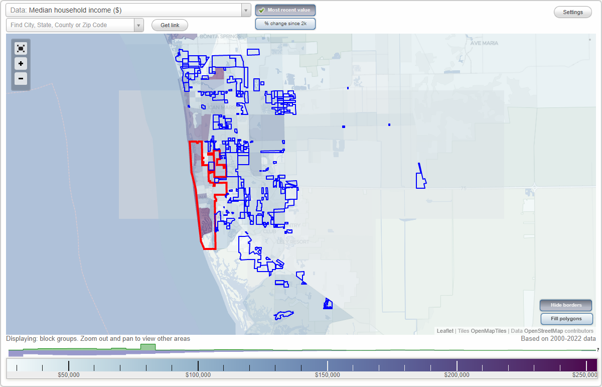
Naples, Florida Neighborhood Map - Income, House Prices, Occupations, Boundaries
Settings
X

- City boundary
- Neighborhood boundaries
Business Search - 14 Million verified businesses
Neighborhoods:
Airport Plaza, April Circle, Arbor Trace, Arbour Lake Club, Arlington Lakes, Artesa Pointe, Astron Plaza, Audubon Country Club, Bailey Lane, Baldridge, Balmoral, Bay Forest, Bear Creek, Big Bear Plaza, Botanical Place, Boyne South, Bradford Square, Breezewood, Briarwood, Brighton Gardens, Bristol Pines, Brittany Bay, Brooks Village, Brynwood Preserve, Bucks Run, Buttonwood Preserve, Cambridge Square, Carillon, Carlisle Regency, Carlton Lakes, Carolina Village, Castlewood at Imperial, Cay Lagoon, Charlee Estates, Cheshire Arms Apartments, Cirrus Pointe, Citrus Gardens, Cocohatchee Bay, Coconilla, College Park, Collegewood, Colonades at Santa Barbara, Copper Cove Preserve, Courthouse Shadows, Coventry Square, Creekside Commerce Center, Crescent Lake Estates, Cricket Lake, Crown Pointe, Crystal Lake, Cypress Glen, Cypress Woods, Da Vinci Estates - Olde Cypress, Donovan Center, Eagle Creek, East Gateway, East Naples Community Park, Edison Village, Falling Waters, Falling Waters Beach Resort, Falls of Naples, Ford Test Center, Forest Lake Homes, Forrest Glenn of Naples, Founder's Plaza, Fountain Park, Foxfire, Gasper Station, Glen Eden on the Bay, Golden Gate Commerce Park, Golden Gate Villas, Goodlette Corners, Granada Shoppes, Green Boulevard, Green Tree Center, Grey Oaks, Hamilton Greens, Hamilton Harbor, Hammock Park Commerce Centre, Hawk's Ridge, Heritage Greens, Heron Lakes, Homes of Islandia, Huntington Woods, I-75/Collier Boulevard Commercial Center, Ibis Cove, Immokalee Road Center, Imperial Lakes, Imperial West, Indigo Lakes, Jacaranda Center, Jaeger, Kensington Park, Keystone Place, Lago Verde, Lake Avalon, Lands End Preserve, Laurelwood, Lawmetka Plaza, Leawood Lakes, Lely Palms of Naples, Lely Square, Livingston Lakes, Livingston Village, Loch Ridge, Lone Oak, Longshore Lake, Longview Center, Madiera, Magnolia Pond, Malibu Lake, Manchester Square, Mandalay, Maplewood, Marco Shores Country Club, Marker Lake Villas, Meadow Brook Estates, Meadowbrook, Mediterra, Mercato, Meridian Village, Miller Square, Mir-Mar, Miralia, Mission Hills, Mission Square, Monterey, Moon Lake, Moorings Park, Quail West PH II, Richland, River Reach, Riverbend, Riviera Golf Estates, Rockedge, Royal Woods, Sabal Lakes, Saddlebrook Village, San Marino, Sandalwood, Santa Barbara Landings, Saxon Manor Isles, Shadowwood, Sherwood Park, Shoppes at Santa Barbara, Sierra Meadows, Silver Lakes, Sleepy Hollow, Snowy Egret Plaza, Sonoma Oaks, South Hampton, Southpointe Yacht Club, Springwood, Sterling Oaks, Summerwind, Summerwood, Summit Lakes, Summit Place in Naples, Sungate Center, Sunshine Village, Sutherland, Tamiami Professional Center, Tarpon Cove, TheDunes, Timberwood, Toll Gate, Toll Plaza RV Park, Tree Tops, Tuscany Cove, Tuscany Reserve, Two Lakes Plaza, Vanderbilt Country Club, Vanderbilt Villas, Venetian Plaza, Veterans Park Center, Veterans Park Commons, Victoria Falls, Village Place, Vincentian, Vornado, Walnut Lakes, Warm Springs, Waterford Estates, Waterglades, Wentworth Estates, West Crown Pointe, Westport Commerce Center, Westview Plaza, Whippoorwill, Whistlers Cove, Whitelake Industrial Park, Whittenberg Estates, Wiggins Bay, Wiggins Lake, Wilderness, Wildwood Estates, Willoughby Gardens, Willow Park, Wilshire Lakes, Wilson Boulevard Center, Wilson Professional Center, Windsong, Windstar, Winter Park, Wolf Creek, Woodside Lanes, World Tennis Center, Wyndemere, Youth HavenAirport Plaza neighborhood in Naples statistics: (Find on map)
Area: 0.018 square miles
Population: 96
Population density:
Median household income in 2021:
Median rent in in 2021:
Male vs Females
Median age
Most popular occupations of males: service occupations (27.4%); construction, extraction, and maintenance occupations (22.9%); transportation occupations (21.0%); management occupations (except farmers) (19.5%); sales and office occupations (4.6%); architecture and engineering occupations (2.6%); legal occupations (2.6%)
Most popular occupations of females: service occupations (62.9%); sales and office occupations (35.3%); education, training, and library occupations (2.3%); business and financial operations occupations (1.8%)
Other features: Rock Crk.
Airport Plaza neighborhood detailed profile
Area: 0.018 square miles
Population: 96
Population density:
| Airport Plaza: | 5,430 people per square mile |
| Naples: | 1,596 people per square mile |
Median household income in 2021:
| Airport Plaza: | $38,984 |
| Naples: | $125,306 |
Median rent in in 2021:
| Airport Plaza: | $1,102 |
| Naples: | $1,333 |
Male vs Females
| Males: | 43 |
| Females: | 52 |
Median age
| Males: | 42.2 years |
| Females: | 45.1 years |
Most popular occupations of males: service occupations (27.4%); construction, extraction, and maintenance occupations (22.9%); transportation occupations (21.0%); management occupations (except farmers) (19.5%); sales and office occupations (4.6%); architecture and engineering occupations (2.6%); legal occupations (2.6%)
Most popular occupations of females: service occupations (62.9%); sales and office occupations (35.3%); education, training, and library occupations (2.3%); business and financial operations occupations (1.8%)
Other features: Rock Crk.
Airport Plaza neighborhood detailed profile
April Circle neighborhood in Naples statistics: (Find on map)
Area: 0.015 square miles
Roads and streets: Windsong Cir (Livinston Cir).
April Circle neighborhood detailed profile
Area: 0.015 square miles
Roads and streets: Windsong Cir (Livinston Cir).
April Circle neighborhood detailed profile
Arbor Trace neighborhood in Naples statistics: (Find on map)
Area: 0.065 square miles
Roads and streets: Arbor Lake Dr.
Arbor Trace neighborhood detailed profile
Area: 0.065 square miles
Roads and streets: Arbor Lake Dr.
Arbor Trace neighborhood detailed profile
Arbour Lake Club neighborhood in Naples statistics: (Find on map)
Area: 0.035 square miles
Roads and streets: Arbor View Blvd.
Arbour Lake Club neighborhood detailed profile
Area: 0.035 square miles
Roads and streets: Arbor View Blvd.
Arbour Lake Club neighborhood detailed profile
Arlington Lakes neighborhood in Naples statistics: (Find on map)
Area: 0.152 square miles
Roads and streets: Nighthawk Dr (Night Hawk Dr).
Arlington Lakes neighborhood detailed profile
Area: 0.152 square miles
Roads and streets: Nighthawk Dr (Night Hawk Dr).
Arlington Lakes neighborhood detailed profile
Artesa Pointe neighborhood in Naples statistics: (Find on map)
Area: 0.128 square miles
Artesa Pointe neighborhood detailed profile
Area: 0.128 square miles
Artesa Pointe neighborhood detailed profile
Astron Plaza neighborhood in Naples statistics: (Find on map)
Area: 0.016 square miles
Population: 14
Population density:
Median household income in 2021:
Median rent in in 2021:
Male vs Females
Median age
Most popular occupations of males: construction, extraction, and maintenance occupations (47.1%); sales and office occupations (19.9%); management occupations (except farmers) (10.4%); transportation occupations (5.8%); service occupations (3.5%); business and financial operations occupations (2.9%); education, training, and library occupations (2.3%)
Most popular occupations of females: service occupations (27.9%); sales and office occupations (23.9%); management occupations (except farmers) (21.8%); business and financial operations occupations (7.8%); healthcare practitioners and technical occupations (6.9%); education, training, and library occupations (5.2%); legal occupations (5.0%)
Astron Plaza neighborhood detailed profile
Area: 0.016 square miles
Population: 14
Population density:
| Astron Plaza: | 891 people per square mile |
| Naples: | 1,596 people per square mile |
Median household income in 2021:
| Astron Plaza: | $101,389 |
| Naples: | $125,306 |
Median rent in in 2021:
| Astron Plaza: | $1,729 |
| Naples: | $1,333 |
Male vs Females
| Males: | 7 |
| Females: | 7 |
Median age
| Males: | 47.4 years |
| Females: | 32.1 years |
Most popular occupations of males: construction, extraction, and maintenance occupations (47.1%); sales and office occupations (19.9%); management occupations (except farmers) (10.4%); transportation occupations (5.8%); service occupations (3.5%); business and financial operations occupations (2.9%); education, training, and library occupations (2.3%)
Most popular occupations of females: service occupations (27.9%); sales and office occupations (23.9%); management occupations (except farmers) (21.8%); business and financial operations occupations (7.8%); healthcare practitioners and technical occupations (6.9%); education, training, and library occupations (5.2%); legal occupations (5.0%)
Astron Plaza neighborhood detailed profile
Audubon Country Club neighborhood in Naples statistics: (Find on map)
Area: 1.173 square miles
Roads and streets: Audubon Blvd; Cheshire Way; Burnaby Dr; Ashburton Dr; Chancery Cir; Charleston Ct; Saint Georges Ct; Whitney Ln; Brentwood Pt; Devon Green Ln; Portsmouth Ct; Warwick Way; Greenfield Ct; Pembroke Pt; Haydon Cir.
Audubon Country Club neighborhood detailed profile
Bailey Lane neighborhood in Naples statistics: (Find on map)
Area: 0.040 square miles
Roads and streets: Coco Lakes Dr; Coco Lakes Pl.
Bailey Lane neighborhood detailed profile
Area: 0.040 square miles
Roads and streets: Coco Lakes Dr; Coco Lakes Pl.
Bailey Lane neighborhood detailed profile
Baldridge neighborhood in Naples statistics: (Find on map)
Area: 0.027 square miles
Baldridge neighborhood detailed profile
Area: 0.027 square miles
Baldridge neighborhood detailed profile
Balmoral neighborhood in Naples statistics: (Find on map)
Area: 0.092 square miles
Other features: Green Cnl.
Balmoral neighborhood detailed profile
Area: 0.092 square miles
Other features: Green Cnl.
Balmoral neighborhood detailed profile
Bay Forest neighborhood in Naples statistics: (Find on map)
Area: 0.191 square miles
Roads and streets: Royal Fern Ln N; Cedarwood Ln; Bay Forest Dr; Royal Fern Ln S; Royal Fern Ct; Storrington Pl; Wimborne Ln; Majorca Bay Dr; Naples Cove Dr; Carinosa Ct; Storington Pl; Majorca Bay Dr (Cedarwood Dr).
Bay Forest neighborhood detailed profile
Area: 0.191 square miles
Roads and streets: Royal Fern Ln N; Cedarwood Ln; Bay Forest Dr; Royal Fern Ln S; Royal Fern Ct; Storrington Pl; Wimborne Ln; Majorca Bay Dr; Naples Cove Dr; Carinosa Ct; Storington Pl; Majorca Bay Dr (Cedarwood Dr).
Bay Forest neighborhood detailed profile
Bear Creek neighborhood in Naples statistics: (Find on map)
Area: 0.013 square miles
Roads and streets: Bear Creek Dr.
Bear Creek neighborhood detailed profile
Area: 0.013 square miles
Roads and streets: Bear Creek Dr.
Bear Creek neighborhood detailed profile
Big Bear Plaza neighborhood in Naples statistics: (Find on map)
Area: 0.009 square miles
Big Bear Plaza neighborhood detailed profile
Area: 0.009 square miles
Big Bear Plaza neighborhood detailed profile
Botanical Place neighborhood in Naples statistics: (Find on map)
Area: 0.031 square miles
Population: 106
Population density:
Median household income in 2021:
Median rent in in 2021:
Male vs Females
Median age
Most popular occupations of males: construction, extraction, and maintenance occupations (44.4%); service occupations (42.8%); transportation occupations (24.6%); education, training, and library occupations (17.8%); management occupations (except farmers) (6.0%); sales and office occupations (5.1%); architecture and engineering occupations (3.3%)
Most popular occupations of females: service occupations (47.1%); education, training, and library occupations (16.0%); healthcare practitioners and technical occupations (16.0%); sales and office occupations (7.1%); business and financial operations occupations (5.9%); material moving occupations (4.2%); production occupations (4.1%)
Botanical Place neighborhood detailed profile
Area: 0.031 square miles
Population: 106
Population density:
| Botanical Place: | 3,399 people per square mile |
| Naples: | 1,596 people per square mile |
Median household income in 2021:
| Botanical Place: | $47,635 |
| Naples: | $125,306 |
Median rent in in 2021:
| Botanical Place: | $1,166 |
| Naples: | $1,333 |
Male vs Females
| Males: | 56 |
| Females: | 49 |
Median age
| Males: | 21.9 years |
| Females: | 37.9 years |
Most popular occupations of males: construction, extraction, and maintenance occupations (44.4%); service occupations (42.8%); transportation occupations (24.6%); education, training, and library occupations (17.8%); management occupations (except farmers) (6.0%); sales and office occupations (5.1%); architecture and engineering occupations (3.3%)
Most popular occupations of females: service occupations (47.1%); education, training, and library occupations (16.0%); healthcare practitioners and technical occupations (16.0%); sales and office occupations (7.1%); business and financial operations occupations (5.9%); material moving occupations (4.2%); production occupations (4.1%)
Botanical Place neighborhood detailed profile
Boyne South neighborhood in Naples statistics: (Find on map)
Area: 0.378 square miles
Roads and streets: Royal Hammock Blvd; Lake Hammock Dr.
Boyne South neighborhood detailed profile
Area: 0.378 square miles
Roads and streets: Royal Hammock Blvd; Lake Hammock Dr.
Boyne South neighborhood detailed profile
Bradford Square neighborhood in Naples statistics: (Find on map)
Area: 0.014 square miles
Bradford Square neighborhood detailed profile
Area: 0.014 square miles
Bradford Square neighborhood detailed profile
Breezewood neighborhood in Naples statistics: (Find on map)
Area: 0.013 square miles
Breezewood neighborhood detailed profile
Area: 0.013 square miles
Breezewood neighborhood detailed profile
Briarwood neighborhood in Naples statistics: (Find on map)
Area: 0.309 square miles
Population: 421
Population density:
Median household income in 2021:
Median rent in in 2021:
Male vs Females
Median age
Housing prices:
Average estimated value of detached houses in 2021 (56.3% of all units):
Average estimated value of mobile home in 2021 (21.4% of all units):
Most popular occupations of males: construction, extraction, and maintenance occupations (20.5%); transportation occupations (20.1%); sales and office occupations (14.9%); production occupations (12.4%); service occupations (10.5%); arts, design, entertainment, sports, and media occupations (8.7%); management occupations (except farmers) (4.3%)
Most popular occupations of females: sales and office occupations (30.3%); service occupations (25.1%); management occupations (except farmers) (15.4%); education, training, and library occupations (11.7%); healthcare practitioners and technical occupations (7.6%); transportation occupations (3.1%); computer and mathematical occupations (2.4%)
Roads and streets: Briarwood Blvd; Tivoli Ln (Terrazzo Ln); Dover Pl; Vintage Ct; Terrazzo Ln; Tivoli Dr; Marble Dr; Skelly Rd; Dundee Ct; Coldstream Ct; Vintage Ln; Brixton Ct; Tivoli Ct; Briarwood Ct; Teton Ct; Coldstream Ln; Mt Hood Ct; Sunbury Ct.
Briarwood neighborhood detailed profile
Area: 0.309 square miles
Population: 421
Population density:
| Briarwood: | 1,361 people per square mile |
| Naples: | 1,596 people per square mile |
Median household income in 2021:
| Briarwood: | $54,358 |
| Naples: | $125,306 |
Median rent in in 2021:
| Briarwood: | $956 |
| Naples: | $1,333 |
Male vs Females
| Males: | 228 |
| Females: | 192 |
Median age
| Males: | 40.2 years |
| Females: | 56.0 years |
Housing prices:
Average estimated value of detached houses in 2021 (56.3% of all units):
| Briarwood: | $155,781 |
| Naples: | $2,627,440 |
Average estimated value of mobile home in 2021 (21.4% of all units):
| Briarwood: | $76,375 |
| Naples: | $85,000 |
Most popular occupations of males: construction, extraction, and maintenance occupations (20.5%); transportation occupations (20.1%); sales and office occupations (14.9%); production occupations (12.4%); service occupations (10.5%); arts, design, entertainment, sports, and media occupations (8.7%); management occupations (except farmers) (4.3%)
Most popular occupations of females: sales and office occupations (30.3%); service occupations (25.1%); management occupations (except farmers) (15.4%); education, training, and library occupations (11.7%); healthcare practitioners and technical occupations (7.6%); transportation occupations (3.1%); computer and mathematical occupations (2.4%)
Roads and streets: Briarwood Blvd; Tivoli Ln (Terrazzo Ln); Dover Pl; Vintage Ct; Terrazzo Ln; Tivoli Dr; Marble Dr; Skelly Rd; Dundee Ct; Coldstream Ct; Vintage Ln; Brixton Ct; Tivoli Ct; Briarwood Ct; Teton Ct; Coldstream Ln; Mt Hood Ct; Sunbury Ct.
Briarwood neighborhood detailed profile
Brighton Gardens neighborhood in Naples statistics: (Find on map)
Area: 0.008 square miles
Brighton Gardens neighborhood detailed profile
Area: 0.008 square miles
Brighton Gardens neighborhood detailed profile
Bristol Pines neighborhood in Naples statistics: (Find on map)
Area: 0.067 square miles
Bristol Pines neighborhood detailed profile
Area: 0.067 square miles
Bristol Pines neighborhood detailed profile
Brittany Bay neighborhood in Naples statistics: (Find on map)
Area: 0.092 square miles
Roads and streets: Mystic Lake Cir.
Brittany Bay neighborhood detailed profile
Area: 0.092 square miles
Roads and streets: Mystic Lake Cir.
Brittany Bay neighborhood detailed profile
Brooks Village neighborhood in Naples statistics: (Find on map)
Area: 0.036 square miles
Population: 32
Population density:
Median household income in 2021:
Median rent in in 2021:
Male vs Females
Median age
Most popular occupations of males: construction, extraction, and maintenance occupations (47.1%); sales and office occupations (19.9%); management occupations (except farmers) (10.4%); transportation occupations (5.8%); service occupations (3.5%); business and financial operations occupations (2.9%); education, training, and library occupations (2.3%)
Most popular occupations of females: service occupations (27.9%); sales and office occupations (23.9%); management occupations (except farmers) (21.8%); business and financial operations occupations (7.8%); healthcare practitioners and technical occupations (6.9%); education, training, and library occupations (5.2%); computer and mathematical occupations (5.0%)
Roads and streets: Lambs Way.
Brooks Village neighborhood detailed profile
Area: 0.036 square miles
Population: 32
Population density:
| Brooks Village: | 899 people per square mile |
| Naples: | 1,596 people per square mile |
Median household income in 2021:
| Brooks Village: | $101,389 |
| Naples: | $125,306 |
Median rent in in 2021:
| Brooks Village: | $1,729 |
| Naples: | $1,333 |
Male vs Females
| Males: | 15 |
| Females: | 16 |
Median age
| Males: | 47.4 years |
| Females: | 32.1 years |
Most popular occupations of males: construction, extraction, and maintenance occupations (47.1%); sales and office occupations (19.9%); management occupations (except farmers) (10.4%); transportation occupations (5.8%); service occupations (3.5%); business and financial operations occupations (2.9%); education, training, and library occupations (2.3%)
Most popular occupations of females: service occupations (27.9%); sales and office occupations (23.9%); management occupations (except farmers) (21.8%); business and financial operations occupations (7.8%); healthcare practitioners and technical occupations (6.9%); education, training, and library occupations (5.2%); computer and mathematical occupations (5.0%)
Roads and streets: Lambs Way.
Brooks Village neighborhood detailed profile
Brynwood Preserve neighborhood in Naples statistics: (Find on map)
Area: 0.045 square miles
Brynwood Preserve neighborhood detailed profile
Area: 0.045 square miles
Brynwood Preserve neighborhood detailed profile
Bucks Run neighborhood in Naples statistics: (Find on map)
Area: 0.061 square miles
Bucks Run neighborhood detailed profile
Area: 0.061 square miles
Bucks Run neighborhood detailed profile
Buttonwood Preserve neighborhood in Naples statistics: (Find on map)
Area: 0.100 square miles
Buttonwood Preserve neighborhood detailed profile
Area: 0.100 square miles
Buttonwood Preserve neighborhood detailed profile
Cambridge Square neighborhood in Naples statistics: (Find on map)
Area: 0.026 square miles
Roads and streets: Livingston Rd (Livingston Rd S); Pine Ridge Rd Exn.
Cambridge Square neighborhood detailed profile
Area: 0.026 square miles
Roads and streets: Livingston Rd (Livingston Rd S); Pine Ridge Rd Exn.
Cambridge Square neighborhood detailed profile
Carillon neighborhood in Naples statistics: (Find on map)
Area: 0.070 square miles
Carillon neighborhood detailed profile
Area: 0.070 square miles
Carillon neighborhood detailed profile
Carlisle Regency neighborhood in Naples statistics: (Find on map)
Area: 0.019 square miles
Carlisle Regency neighborhood detailed profile
Area: 0.019 square miles
Carlisle Regency neighborhood detailed profile
Carlton Lakes neighborhood in Naples statistics: (Find on map)
Area: 0.384 square miles
Roads and streets: Carlton Lakes Blvd; Cedar Springs Dr; Highwood Park Ln; Ashwood Ln (Ashwood Ln E); Northridge Dr; Waverly Green Way; Deerfield Way; Andover Dr; Cobble Creek Ct; Birmingham Dr; Worthington Ln; Manchester Pl; Northridge Dr S; Northridge Dr N; Northboro Dr; Highwood Park Ct; Lexington Ct.
Carlton Lakes neighborhood detailed profile
Carolina Village neighborhood in Naples statistics: (Find on map)
Area: 0.024 square miles
Carolina Village neighborhood detailed profile
Area: 0.024 square miles
Carolina Village neighborhood detailed profile
Castlewood at Imperial neighborhood in Naples statistics: (Find on map)
Area: 0.033 square miles
Population: 10
Population density:
Median household income in 2021:
Median rent in in 2021:
Male vs Females
Median age
Housing prices:
Average estimated value of detached houses in 2021 (57.1% of all units):
Most popular occupations of males: business and financial operations occupations (34.6%); healthcare practitioners and technical occupations (33.3%); sales and office occupations (31.7%); management occupations (except farmers) (19.2%); transportation occupations (18.5%); material moving occupations (16.9%); education, training, and library occupations (14.6%)
Most popular occupations of females: sales and office occupations (37.8%); healthcare practitioners and technical occupations (25.9%); legal occupations (24.6%); business and financial operations occupations (16.0%); service occupations (14.8%); arts, design, entertainment, sports, and media occupations (14.2%); material moving occupations (12.6%)
Castlewood at Imperial neighborhood detailed profile
Area: 0.033 square miles
Population: 10
Population density:
| Castlewood at Imperial: | 302 people per square mile |
| Naples: | 1,596 people per square mile |
Median household income in 2021:
| Castlewood at Imperial: | $59,104 |
| Naples: | $125,306 |
Median rent in in 2021:
| Castlewood at Imperial: | $1,691 |
| Naples: | $1,333 |
Male vs Females
| Males: | 5 |
| Females: | 5 |
Median age
| Males: | 71.3 years |
| Females: | 67.6 years |
Housing prices:
Average estimated value of detached houses in 2021 (57.1% of all units):
| Castlewood at Imperial: | $581,984 |
| Naples: | $2,627,440 |
Most popular occupations of males: business and financial operations occupations (34.6%); healthcare practitioners and technical occupations (33.3%); sales and office occupations (31.7%); management occupations (except farmers) (19.2%); transportation occupations (18.5%); material moving occupations (16.9%); education, training, and library occupations (14.6%)
Most popular occupations of females: sales and office occupations (37.8%); healthcare practitioners and technical occupations (25.9%); legal occupations (24.6%); business and financial operations occupations (16.0%); service occupations (14.8%); arts, design, entertainment, sports, and media occupations (14.2%); material moving occupations (12.6%)
Castlewood at Imperial neighborhood detailed profile
Cay Lagoon neighborhood in Naples statistics: (Find on map)
Area: 0.010 square miles
Roads and streets: Cay Lagoon Dr.
Cay Lagoon neighborhood detailed profile
Area: 0.010 square miles
Roads and streets: Cay Lagoon Dr.
Cay Lagoon neighborhood detailed profile
Charlee Estates neighborhood in Naples statistics: (Find on map)
Area: 0.044 square miles
Charlee Estates neighborhood detailed profile
Area: 0.044 square miles
Charlee Estates neighborhood detailed profile
Cheshire Arms Apartments neighborhood in Naples statistics: (Find on map)
Area: 0.008 square miles
Cheshire Arms Apartments neighborhood detailed profile
Area: 0.008 square miles
Cheshire Arms Apartments neighborhood detailed profile
Cirrus Pointe neighborhood in Naples statistics: (Find on map)
Area: 0.016 square miles
Population: 52
Population density:
Median household income in 2021:
Median rent in in 2021:
Male vs Females
Median age
Most popular occupations of males: construction, extraction, and maintenance occupations (44.5%); service occupations (42.8%); transportation occupations (24.6%); education, training, and library occupations (17.8%); management occupations (except farmers) (6.0%); sales and office occupations (5.1%); architecture and engineering occupations (3.3%)
Most popular occupations of females: service occupations (47.1%); education, training, and library occupations (16.0%); healthcare practitioners and technical occupations (16.0%); sales and office occupations (7.1%); business and financial operations occupations (5.9%); material moving occupations (4.2%); production occupations (4.1%)
Cirrus Pointe neighborhood detailed profile
Area: 0.016 square miles
Population: 52
Population density:
| Cirrus Pointe: | 3,336 people per square mile |
| Naples: | 1,596 people per square mile |
Median household income in 2021:
| Cirrus Pointe: | $47,635 |
| Naples: | $125,306 |
Median rent in in 2021:
| Cirrus Pointe: | $1,166 |
| Naples: | $1,333 |
Male vs Females
| Males: | 28 |
| Females: | 24 |
Median age
| Males: | 21.9 years |
| Females: | 37.9 years |
Most popular occupations of males: construction, extraction, and maintenance occupations (44.5%); service occupations (42.8%); transportation occupations (24.6%); education, training, and library occupations (17.8%); management occupations (except farmers) (6.0%); sales and office occupations (5.1%); architecture and engineering occupations (3.3%)
Most popular occupations of females: service occupations (47.1%); education, training, and library occupations (16.0%); healthcare practitioners and technical occupations (16.0%); sales and office occupations (7.1%); business and financial operations occupations (5.9%); material moving occupations (4.2%); production occupations (4.1%)
Cirrus Pointe neighborhood detailed profile
Citrus Gardens neighborhood in Naples statistics: (Find on map)
Area: 0.154 square miles
Population: 407
Population density:
Median household income in 2021:
Median rent in in 2021:
Male vs Females
Median age
Most popular occupations of males: sales and office occupations (22.7%); management occupations (except farmers) (19.5%); service occupations (10.8%); construction, extraction, and maintenance occupations (10.1%); healthcare practitioners and technical occupations (9.5%); computer and mathematical occupations (7.6%); arts, design, entertainment, sports, and media occupations (3.8%)
Most popular occupations of females: sales and office occupations (49.9%); healthcare practitioners and technical occupations (15.9%); service occupations (9.4%); management occupations (except farmers) (5.0%); community and social services occupations (4.9%); business and financial operations occupations (4.3%); production occupations (3.8%)
Roads and streets: Citrus Lake Dr; Sailors Way; Mizzen Way; Aft Ave; Ahoy Ave; Nautical Dr; Cracker Cove Ln; Jib Ln.
Citrus Gardens neighborhood detailed profile
Area: 0.154 square miles
Population: 407
Population density:
| Citrus Gardens: | 2,635 people per square mile |
| Naples: | 1,596 people per square mile |
Median household income in 2021:
| Citrus Gardens: | $82,473 |
| Naples: | $125,306 |
Median rent in in 2021:
| Citrus Gardens: | $1,123 |
| Naples: | $1,333 |
Male vs Females
| Males: | 194 |
| Females: | 213 |
Median age
| Males: | 57.4 years |
| Females: | 68.3 years |
Most popular occupations of males: sales and office occupations (22.7%); management occupations (except farmers) (19.5%); service occupations (10.8%); construction, extraction, and maintenance occupations (10.1%); healthcare practitioners and technical occupations (9.5%); computer and mathematical occupations (7.6%); arts, design, entertainment, sports, and media occupations (3.8%)
Most popular occupations of females: sales and office occupations (49.9%); healthcare practitioners and technical occupations (15.9%); service occupations (9.4%); management occupations (except farmers) (5.0%); community and social services occupations (4.9%); business and financial operations occupations (4.3%); production occupations (3.8%)
Roads and streets: Citrus Lake Dr; Sailors Way; Mizzen Way; Aft Ave; Ahoy Ave; Nautical Dr; Cracker Cove Ln; Jib Ln.
Citrus Gardens neighborhood detailed profile
Cocohatchee Bay neighborhood in Naples statistics: (Find on map)
Area: 0.843 square miles
Roads and streets: Wiggins Pass Rd (Co Rd 888); Catamaran Ct.
Other features: Atlantic Ocean.
Cocohatchee Bay neighborhood detailed profile
Area: 0.843 square miles
Roads and streets: Wiggins Pass Rd (Co Rd 888); Catamaran Ct.
Other features: Atlantic Ocean.
Cocohatchee Bay neighborhood detailed profile
Coconilla neighborhood in Naples statistics: (Find on map)
Area: 0.017 square miles
Roads and streets: Vanderbilt Dr (Co Rd 901).
Coconilla neighborhood detailed profile
Area: 0.017 square miles
Roads and streets: Vanderbilt Dr (Co Rd 901).
Coconilla neighborhood detailed profile
College Park neighborhood in Naples statistics: (Find on map)
Area: 0.027 square miles
Roads and streets: College Park Cir.
College Park neighborhood detailed profile
Area: 0.027 square miles
Roads and streets: College Park Cir.
College Park neighborhood detailed profile
Collegewood neighborhood in Naples statistics: (Find on map)
Area: 0.014 square miles
Collegewood neighborhood detailed profile
Area: 0.014 square miles
Collegewood neighborhood detailed profile
Colonades at Santa Barbara neighborhood in Naples statistics: (Find on map)
Area: 0.011 square miles
Population: 7
Population density:
Median household income in 2021:
Median rent in in 2021:
Male vs Females
Median age
Most popular occupations of males: service occupations (34.3%); sales and office occupations (21.5%); construction, extraction, and maintenance occupations (12.4%); management occupations (except farmers) (11.3%); education, training, and library occupations (8.6%); transportation occupations (5.2%); production occupations (3.6%)
Most popular occupations of females: sales and office occupations (27.5%); service occupations (21.6%); computer and mathematical occupations (16.4%); education, training, and library occupations (10.8%); management occupations (except farmers) (10.0%); business and financial operations occupations (9.3%); legal occupations (2.2%)
Colonades at Santa Barbara neighborhood detailed profile
Area: 0.011 square miles
Population: 7
Population density:
| Colonades at Santa Barbara: | 655 people per square mile |
| Naples: | 1,596 people per square mile |
Median household income in 2021:
| Colonades at Santa Barbara: | $90,625 |
| Naples: | $125,306 |
Median rent in in 2021:
| Colonades at Santa Barbara: | $1,729 |
| Naples: | $1,333 |
Male vs Females
| Males: | 3 |
| Females: | 3 |
Median age
| Males: | 41.8 years |
| Females: | 38.4 years |
Most popular occupations of males: service occupations (34.3%); sales and office occupations (21.5%); construction, extraction, and maintenance occupations (12.4%); management occupations (except farmers) (11.3%); education, training, and library occupations (8.6%); transportation occupations (5.2%); production occupations (3.6%)
Most popular occupations of females: sales and office occupations (27.5%); service occupations (21.6%); computer and mathematical occupations (16.4%); education, training, and library occupations (10.8%); management occupations (except farmers) (10.0%); business and financial operations occupations (9.3%); legal occupations (2.2%)
Colonades at Santa Barbara neighborhood detailed profile
Copper Cove Preserve neighborhood in Naples statistics: (Find on map)
Area: 0.160 square miles
Copper Cove Preserve neighborhood detailed profile
Area: 0.160 square miles
Copper Cove Preserve neighborhood detailed profile
Courthouse Shadows neighborhood in Naples statistics: (Find on map)
Area: 0.031 square miles
Population: 24
Population density:
Median household income in 2021:
Median rent in in 2021:
Male vs Females
Median age
Most popular occupations of males: construction, extraction, and maintenance occupations (39.5%); transportation occupations (21.8%); sales and office occupations (17.4%); management occupations (except farmers) (15.1%); service occupations (11.8%); material moving occupations (8.4%); education, training, and library occupations (4.3%)
Most popular occupations of females: sales and office occupations (52.0%); education, training, and library occupations (22.0%); management occupations (except farmers) (10.0%); business and financial operations occupations (8.0%); service occupations (8.0%); healthcare practitioners and technical occupations (5.9%); production occupations (4.3%)
Courthouse Shadows neighborhood detailed profile
Area: 0.031 square miles
Population: 24
Population density:
| Courthouse Shadows: | 773 people per square mile |
| Naples: | 1,596 people per square mile |
Median household income in 2021:
| Courthouse Shadows: | $63,875 |
| Naples: | $125,306 |
Median rent in in 2021:
| Courthouse Shadows: | $959 |
| Naples: | $1,333 |
Male vs Females
| Males: | 12 |
| Females: | 12 |
Median age
| Males: | 55.4 years |
| Females: | 73.3 years |
Most popular occupations of males: construction, extraction, and maintenance occupations (39.5%); transportation occupations (21.8%); sales and office occupations (17.4%); management occupations (except farmers) (15.1%); service occupations (11.8%); material moving occupations (8.4%); education, training, and library occupations (4.3%)
Most popular occupations of females: sales and office occupations (52.0%); education, training, and library occupations (22.0%); management occupations (except farmers) (10.0%); business and financial operations occupations (8.0%); service occupations (8.0%); healthcare practitioners and technical occupations (5.9%); production occupations (4.3%)
Courthouse Shadows neighborhood detailed profile
Coventry Square neighborhood in Naples statistics: (Find on map)
Area: 0.009 square miles
Coventry Square neighborhood detailed profile
Area: 0.009 square miles
Coventry Square neighborhood detailed profile
Creekside Commerce Center neighborhood in Naples statistics: (Find on map)
Area: 0.166 square miles
Population: 38
Population density:
Median household income in 2021:
Median rent in in 2021:
Male vs Females
Median age
Most popular occupations of males: management occupations (except farmers) (30.9%); healthcare practitioners and technical occupations (17.7%); business and financial operations occupations (16.8%); education, training, and library occupations (13.3%); life, physical, and social science occupations (12.1%); construction, extraction, and maintenance occupations (8.4%); sales and office occupations (8.1%)
Most popular occupations of females: healthcare practitioners and technical occupations (36.2%); sales and office occupations (24.3%); legal occupations (19.9%); community and social services occupations (14.1%); management occupations (except farmers) (13.0%); education, training, and library occupations (10.2%); service occupations (8.5%)
Roads and streets: Creekside Pkwy; Creekside St; Creekside Trl.
Creekside Commerce Center neighborhood detailed profile
Area: 0.166 square miles
Population: 38
Population density:
| Creekside Commerce Center: | 229 people per square mile |
| Naples: | 1,596 people per square mile |
Median household income in 2021:
| Creekside Commerce Center: | $285,225 |
| Naples: | $125,306 |
Median rent in in 2021:
| Creekside Commerce Center: | $2,969 |
| Naples: | $1,333 |
Male vs Females
| Males: | 24 |
| Females: | 13 |
Median age
| Males: | 42.5 years |
| Females: | 55.7 years |
Most popular occupations of males: management occupations (except farmers) (30.9%); healthcare practitioners and technical occupations (17.7%); business and financial operations occupations (16.8%); education, training, and library occupations (13.3%); life, physical, and social science occupations (12.1%); construction, extraction, and maintenance occupations (8.4%); sales and office occupations (8.1%)
Most popular occupations of females: healthcare practitioners and technical occupations (36.2%); sales and office occupations (24.3%); legal occupations (19.9%); community and social services occupations (14.1%); management occupations (except farmers) (13.0%); education, training, and library occupations (10.2%); service occupations (8.5%)
Roads and streets: Creekside Pkwy; Creekside St; Creekside Trl.
Creekside Commerce Center neighborhood detailed profile
Crescent Lake Estates neighborhood in Naples statistics: (Find on map)
Area: 0.059 square miles
Roads and streets: Campbell Cir; Luna Cir; Moonlit Ct; Crescent Lake Dr; Crescent Garden Dr.
Crescent Lake Estates neighborhood detailed profile
Area: 0.059 square miles
Roads and streets: Campbell Cir; Luna Cir; Moonlit Ct; Crescent Lake Dr; Crescent Garden Dr.
Crescent Lake Estates neighborhood detailed profile
Cricket Lake neighborhood in Naples statistics: (Find on map)
Area: 0.018 square miles
Population: 14
Population density:
Median household income in 2021:
Median rent in in 2021:
Male vs Females
Median age
Most popular occupations of males: construction, extraction, and maintenance occupations (39.5%); transportation occupations (21.8%); sales and office occupations (17.4%); management occupations (except farmers) (15.1%); service occupations (11.8%); material moving occupations (8.4%); education, training, and library occupations (4.3%)
Most popular occupations of females: sales and office occupations (52.0%); education, training, and library occupations (22.0%); management occupations (except farmers) (10.0%); business and financial operations occupations (8.0%); service occupations (8.0%); healthcare practitioners and technical occupations (5.9%); production occupations (4.3%)
Cricket Lake neighborhood detailed profile
Area: 0.018 square miles
Population: 14
Population density:
| Cricket Lake: | 771 people per square mile |
| Naples: | 1,596 people per square mile |
Median household income in 2021:
| Cricket Lake: | $63,875 |
| Naples: | $125,306 |
Median rent in in 2021:
| Cricket Lake: | $959 |
| Naples: | $1,333 |
Male vs Females
| Males: | 7 |
| Females: | 7 |
Median age
| Males: | 55.4 years |
| Females: | 73.3 years |
Most popular occupations of males: construction, extraction, and maintenance occupations (39.5%); transportation occupations (21.8%); sales and office occupations (17.4%); management occupations (except farmers) (15.1%); service occupations (11.8%); material moving occupations (8.4%); education, training, and library occupations (4.3%)
Most popular occupations of females: sales and office occupations (52.0%); education, training, and library occupations (22.0%); management occupations (except farmers) (10.0%); business and financial operations occupations (8.0%); service occupations (8.0%); healthcare practitioners and technical occupations (5.9%); production occupations (4.3%)
Cricket Lake neighborhood detailed profile
Crown Pointe neighborhood in Naples statistics: (Find on map)
Area: 0.125 square miles
Roads and streets: E Crown Pointe Blvd; Piccadilly Circus; Mabry Dr; Royal Cir; Harrogate Ct; Lochwood Ct; Traynor Ct; Reuven Cir; Downing Ct; Piccadilly Ct.
Crown Pointe neighborhood detailed profile
Area: 0.125 square miles
Roads and streets: E Crown Pointe Blvd; Piccadilly Circus; Mabry Dr; Royal Cir; Harrogate Ct; Lochwood Ct; Traynor Ct; Reuven Cir; Downing Ct; Piccadilly Ct.
Crown Pointe neighborhood detailed profile
Crystal Lake neighborhood in Naples statistics: (Find on map)
Area: 0.256 square miles
Roads and streets: Crystal Lake Dr; Weathervane Dr; Waterview Pt; Flycatcher Pt; Skippers Pt; Canoe Pt.
Crystal Lake neighborhood detailed profile
Area: 0.256 square miles
Roads and streets: Crystal Lake Dr; Weathervane Dr; Waterview Pt; Flycatcher Pt; Skippers Pt; Canoe Pt.
Crystal Lake neighborhood detailed profile
Cypress Glen neighborhood in Naples statistics: (Find on map)
Area: 0.045 square miles
Cypress Glen neighborhood detailed profile
Area: 0.045 square miles
Cypress Glen neighborhood detailed profile
Cypress Woods neighborhood in Naples statistics: (Find on map)
Area: 0.485 square miles
Roads and streets: Northbrooke Dr; Cypress Trace Cir; Grand Cypress Dr; Laurelgreens Ln S; Jasmine Lake Cir; Laurelgreens Ln N; Grand Cypress Way; Laurel Greens Ln N.
Cypress Woods neighborhood detailed profile
Area: 0.485 square miles
Roads and streets: Northbrooke Dr; Cypress Trace Cir; Grand Cypress Dr; Laurelgreens Ln S; Jasmine Lake Cir; Laurelgreens Ln N; Grand Cypress Way; Laurel Greens Ln N.
Cypress Woods neighborhood detailed profile
Da Vinci Estates - Olde Cypress neighborhood in Naples statistics: (Find on map)
Area: 0.063 square miles
Roads and streets: Mona Lisa Blvd; Renaissance Ct; Florentine Ct.
Da Vinci Estates - Olde Cypress neighborhood detailed profile
Area: 0.063 square miles
Roads and streets: Mona Lisa Blvd; Renaissance Ct; Florentine Ct.
Da Vinci Estates - Olde Cypress neighborhood detailed profile
Donovan Center neighborhood in Naples statistics: (Find on map)
Area: 0.074 square miles
Donovan Center neighborhood detailed profile
Area: 0.074 square miles
Donovan Center neighborhood detailed profile
Eagle Creek neighborhood in Naples statistics: (Find on map)
Area: 0.462 square miles
Population: 900
Population density:
Median household income in 2021:
Median rent in in 2021:
Male vs Females
Median age
Most popular occupations of males: sales and office occupations (31.5%); management occupations (except farmers) (14.0%); service occupations (11.3%); production occupations (10.3%); architecture and engineering occupations (9.5%); construction, extraction, and maintenance occupations (6.8%); computer and mathematical occupations (4.1%)
Most popular occupations of females: sales and office occupations (55.3%); service occupations (15.7%); healthcare practitioners and technical occupations (8.0%); production occupations (6.9%); business and financial operations occupations (3.8%); material moving occupations (2.6%); legal occupations (2.2%)
Roads and streets: Eagle Creek Dr; Cypress View Dr; Tower Rd; Waterford Dr; Grey Wing Pt; Cormorant Cove; Crestwood Rd (Crestwood Ln); Creek Bed Dr; Grey Winding Rd.
Eagle Creek neighborhood detailed profile
Area: 0.462 square miles
Population: 900
Population density:
| Eagle Creek: | 1,946 people per square mile |
| Naples: | 1,596 people per square mile |
Median household income in 2021:
| Eagle Creek: | $64,852 |
| Naples: | $125,306 |
Median rent in in 2021:
| Eagle Creek: | $1,351 |
| Naples: | $1,333 |
Male vs Females
| Males: | 395 |
| Females: | 504 |
Median age
| Males: | 45.3 years |
| Females: | 42.2 years |
Most popular occupations of males: sales and office occupations (31.5%); management occupations (except farmers) (14.0%); service occupations (11.3%); production occupations (10.3%); architecture and engineering occupations (9.5%); construction, extraction, and maintenance occupations (6.8%); computer and mathematical occupations (4.1%)
Most popular occupations of females: sales and office occupations (55.3%); service occupations (15.7%); healthcare practitioners and technical occupations (8.0%); production occupations (6.9%); business and financial operations occupations (3.8%); material moving occupations (2.6%); legal occupations (2.2%)
Roads and streets: Eagle Creek Dr; Cypress View Dr; Tower Rd; Waterford Dr; Grey Wing Pt; Cormorant Cove; Crestwood Rd (Crestwood Ln); Creek Bed Dr; Grey Winding Rd.
Eagle Creek neighborhood detailed profile
East Gateway neighborhood in Naples statistics: (Find on map)
Area: 0.058 square miles
East Gateway neighborhood detailed profile
Area: 0.058 square miles
East Gateway neighborhood detailed profile
East Naples Community Park neighborhood in Naples statistics: (Find on map)
Area: 0.065 square miles
Population: 45
Population density:
Median household income in 2021:
Median rent in in 2021:
Male vs Females
Median age
Housing prices:
Average estimated value of detached houses in 2021 (54.8% of all units):
Average estimated value of townhouses or other attached units in 2021 (6.5% of all units):
Average estimated value of housing units in 2-unit structures in 2021 (6.5% of all units):
Average estimated '21 value of housing units in 3-to-4-unit structures (9.7% of all units):
Average estimated value of mobile home in 2021 (6.5% of all units):
Most popular occupations of males: service occupations (28.5%); construction, extraction, and maintenance occupations (17.4%); sales and office occupations (16.5%); transportation occupations (13.3%); management occupations (except farmers) (9.7%); computer and mathematical occupations (3.6%); healthcare practitioners and technical occupations (2.6%)
Most popular occupations of females: service occupations (29.2%); management occupations (except farmers) (23.5%); sales and office occupations (20.8%); healthcare practitioners and technical occupations (7.8%); business and financial operations occupations (4.4%); computer and mathematical occupations (4.4%); education, training, and library occupations (3.8%)
East Naples Community Park neighborhood detailed profile
Area: 0.065 square miles
Population: 45
Population density:
| East Naples Community Park: | 697 people per square mile |
| Naples: | 1,596 people per square mile |
Median household income in 2021:
| East Naples Community Park: | $85,848 |
| Naples: | $125,306 |
Median rent in in 2021:
| East Naples Community Park: | $1,175 |
| Naples: | $1,333 |
Male vs Females
| Males: | 22 |
| Females: | 22 |
Median age
| Males: | 59.1 years |
| Females: | 49.4 years |
Housing prices:
Average estimated value of detached houses in 2021 (54.8% of all units):
| East Naples Community Park: | $592,721 |
| Naples: | $2,627,440 |
Average estimated value of townhouses or other attached units in 2021 (6.5% of all units):
| This neighborhood: | $553,512 |
| city: | $1,417,408 |
Average estimated value of housing units in 2-unit structures in 2021 (6.5% of all units):
| This neighborhood: | $289,756 |
| Naples: | $935,333 |
Average estimated '21 value of housing units in 3-to-4-unit structures (9.7% of all units):
| East Naples Community Park: | $915,526 |
| city: | $666,526 |
Average estimated value of mobile home in 2021 (6.5% of all units):
| East Naples Community Park: | $65,758 |
| Naples: | $85,000 |
Most popular occupations of males: service occupations (28.5%); construction, extraction, and maintenance occupations (17.4%); sales and office occupations (16.5%); transportation occupations (13.3%); management occupations (except farmers) (9.7%); computer and mathematical occupations (3.6%); healthcare practitioners and technical occupations (2.6%)
Most popular occupations of females: service occupations (29.2%); management occupations (except farmers) (23.5%); sales and office occupations (20.8%); healthcare practitioners and technical occupations (7.8%); business and financial operations occupations (4.4%); computer and mathematical occupations (4.4%); education, training, and library occupations (3.8%)
East Naples Community Park neighborhood detailed profile
Edison Village neighborhood in Naples statistics: (Find on map)
Area: 0.012 square miles
Edison Village neighborhood detailed profile
Area: 0.012 square miles
Edison Village neighborhood detailed profile
Falling Waters neighborhood in Naples statistics: (Find on map)
Area: 0.321 square miles
Roads and streets: Hidden Lake Dr; Windy Pines Dr; Cascades Dr; Falling Waters Blvd; Magnolia Ln; Hidden Lake Ct; Magnolia Ave (Magnolia Ln); Magnolia Loop.
Falling Waters neighborhood detailed profile
Area: 0.321 square miles
Roads and streets: Hidden Lake Dr; Windy Pines Dr; Cascades Dr; Falling Waters Blvd; Magnolia Ln; Hidden Lake Ct; Magnolia Ave (Magnolia Ln); Magnolia Loop.
Falling Waters neighborhood detailed profile
Falling Waters Beach Resort neighborhood in Naples statistics: (Find on map)
Area: 0.119 square miles
Roads and streets: Beach Resort Dr; Mondago Ln; Beach Resort Blvd.
Falling Waters Beach Resort neighborhood detailed profile
Area: 0.119 square miles
Roads and streets: Beach Resort Dr; Mondago Ln; Beach Resort Blvd.
Falling Waters Beach Resort neighborhood detailed profile
Falls of Naples neighborhood in Naples statistics: (Find on map)
Area: 0.055 square miles
Falls of Naples neighborhood detailed profile
Area: 0.055 square miles
Falls of Naples neighborhood detailed profile
Ford Test Center neighborhood in Naples statistics: (Find on map)
Area: 0.867 square miles
Ford Test Center neighborhood detailed profile
Area: 0.867 square miles
Ford Test Center neighborhood detailed profile
Forest Lake Homes neighborhood in Naples statistics: (Find on map)
Area: 0.099 square miles
Roads and streets: Forest Lakes Blvd; Boxwood Ln; Eucalyptus Ln; Opunta Ln; Camelia Ln; Narita Ln; Pixiemoss Ln; Salvia Ln; Kelp Ln; Lyonia Ln; Jimpson Ln; Tuppence Ln; Ivygate Ln; Happolo Ln; Gardenia Ln; Fig Ln; Milkwort Ln; Rosepetal Ln; Wisteria Ln; Unica Ln.
Other features: Gordon River Slough.
Forest Lake Homes neighborhood detailed profile
Forrest Glenn of Naples neighborhood in Naples statistics: (Find on map)
Area: 0.986 square miles
Roads and streets: Loblolly Bay Dr; Forest Glen Dr (Forest Glen Blvd); Bishopwood Ct E; Jungle Plum Dr E; Jungle Plum Dr W; Bishopwood Ct W.
Forrest Glenn of Naples neighborhood detailed profile
Area: 0.986 square miles
Roads and streets: Loblolly Bay Dr; Forest Glen Dr (Forest Glen Blvd); Bishopwood Ct E; Jungle Plum Dr E; Jungle Plum Dr W; Bishopwood Ct W.
Forrest Glenn of Naples neighborhood detailed profile
Founder's Plaza neighborhood in Naples statistics: (Find on map)
Area: 0.027 square miles
Population: 81
Population density:
Median household income in 2021:
Median rent in in 2021:
Male vs Females
Median age
Housing prices:
Average estimated value of detached houses in 2021 (32.4% of all units):
Average estimated '21 value of housing units in 3-to-4-unit structures (8.8% of all units):
Average estimated '21 value of housing units in 5-or-more-unit structures (5.9% of all units):
Most popular occupations of males: business and financial operations occupations (42.8%); healthcare practitioners and technical occupations (38.1%); sales and office occupations (11.0%); transportation occupations (5.3%); construction, extraction, and maintenance occupations (3.9%); service occupations (3.8%); material moving occupations (3.6%)
Most popular occupations of females: sales and office occupations (52.7%); service occupations (20.3%); management occupations (except farmers) (14.3%); business and financial operations occupations (11.5%); education, training, and library occupations (10.7%); material moving occupations (8.0%); life, physical, and social science occupations (6.4%)
Roads and streets: Golden Gate Pkwy (Co Rd 886); 52nd St SW.
Founder's Plaza neighborhood detailed profile
Area: 0.027 square miles
Population: 81
Population density:
| Founder's Plaza: | 2,997 people per square mile |
| Naples: | 1,596 people per square mile |
Median household income in 2021:
| Founder's Plaza: | $66,742 |
| Naples: | $125,306 |
Median rent in in 2021:
| Founder's Plaza: | $544 |
| Naples: | $1,333 |
Male vs Females
| Males: | 43 |
| Females: | 37 |
Median age
| Males: | 36.7 years |
| Females: | 40.2 years |
Housing prices:
Average estimated value of detached houses in 2021 (32.4% of all units):
| Founder's Plaza: | $300,538 |
| Naples: | $2,627,440 |
Average estimated '21 value of housing units in 3-to-4-unit structures (8.8% of all units):
| Founder's Plaza: | $157,687 |
| city: | $666,526 |
Average estimated '21 value of housing units in 5-or-more-unit structures (5.9% of all units):
| Founder's Plaza: | $106,415 |
| Naples: | $1,138,102 |
Most popular occupations of males: business and financial operations occupations (42.8%); healthcare practitioners and technical occupations (38.1%); sales and office occupations (11.0%); transportation occupations (5.3%); construction, extraction, and maintenance occupations (3.9%); service occupations (3.8%); material moving occupations (3.6%)
Most popular occupations of females: sales and office occupations (52.7%); service occupations (20.3%); management occupations (except farmers) (14.3%); business and financial operations occupations (11.5%); education, training, and library occupations (10.7%); material moving occupations (8.0%); life, physical, and social science occupations (6.4%)
Roads and streets: Golden Gate Pkwy (Co Rd 886); 52nd St SW.
Founder's Plaza neighborhood detailed profile
Fountain Park neighborhood in Naples statistics: (Find on map)
Area: 0.017 square miles
Population: 344
Population density:
Median household income in 2021:
Median rent in in 2021:
Male vs Females
Median age
Average estimated value of detached houses in 2021 (100.0% of all units):
Most popular occupations of males: sales and office occupations (35.3%); construction, extraction, and maintenance occupations (19.8%); business and financial operations occupations (11.2%); transportation occupations (10.0%); management occupations (except farmers) (7.3%); computer and mathematical occupations (4.3%); education, training, and library occupations (3.3%)
Most popular occupations of females: sales and office occupations (46.8%); arts, design, entertainment, sports, and media occupations (22.5%); service occupations (19.8%); production occupations (6.4%); transportation occupations (4.2%); business and financial operations occupations (3.4%); healthcare practitioners and technical occupations (3.4%)
Fountain Park neighborhood detailed profile
Area: 0.017 square miles
Population: 344
Population density:
| Fountain Park: | 20,800 people per square mile |
| Naples: | 1,596 people per square mile |
Median household income in 2021:
| Fountain Park: | $79,566 |
| Naples: | $125,306 |
Median rent in in 2021:
| Fountain Park: | $1,949 |
| Naples: | $1,333 |
Male vs Females
| Males: | 187 |
| Females: | 156 |
Median age
| Males: | 48.5 years |
| Females: | 50.5 years |
Average estimated value of detached houses in 2021 (100.0% of all units):
| Fountain Park: | $191,919 |
| Naples: | $2,627,440 |
Most popular occupations of males: sales and office occupations (35.3%); construction, extraction, and maintenance occupations (19.8%); business and financial operations occupations (11.2%); transportation occupations (10.0%); management occupations (except farmers) (7.3%); computer and mathematical occupations (4.3%); education, training, and library occupations (3.3%)
Most popular occupations of females: sales and office occupations (46.8%); arts, design, entertainment, sports, and media occupations (22.5%); service occupations (19.8%); production occupations (6.4%); transportation occupations (4.2%); business and financial operations occupations (3.4%); healthcare practitioners and technical occupations (3.4%)
Fountain Park neighborhood detailed profile
Foxfire neighborhood in Naples statistics: (Find on map)
Area: 0.611 square miles
Population: 612
Population density:
Median household income in 2021:
Median rent in in 2021:
Male vs Females
Median age
Most popular occupations of males: management occupations (except farmers) (37.9%); transportation occupations (26.9%); sales and office occupations (24.3%); service occupations (17.9%); business and financial operations occupations (7.1%); construction, extraction, and maintenance occupations (6.4%); architecture and engineering occupations (3.4%)
Most popular occupations of females: service occupations (237.5%); sales and office occupations (47.4%); education, training, and library occupations (35.1%); business and financial operations occupations (17.5%)
Roads and streets: Kings Way; Foxfire Ln; Fox Glen Dr; Foxtail Ct; Fox Den Cir; Flamingo Dr; Foxhound Dr; Foxhollow Dr; Foxhunt Way; Fox Haven Dr; Foxbrush Ct; Foxtrot Ct.
Foxfire neighborhood detailed profile
Area: 0.611 square miles
Population: 612
Population density:
| Foxfire: | 1,002 people per square mile |
| Naples: | 1,596 people per square mile |
Median household income in 2021:
| Foxfire: | $79,375 |
| Naples: | $125,306 |
Median rent in in 2021:
| Foxfire: | $1,102 |
| Naples: | $1,333 |
Male vs Females
| Males: | 321 |
| Females: | 291 |
Median age
| Males: | 78.9 years |
| Females: | 74.7 years |
Most popular occupations of males: management occupations (except farmers) (37.9%); transportation occupations (26.9%); sales and office occupations (24.3%); service occupations (17.9%); business and financial operations occupations (7.1%); construction, extraction, and maintenance occupations (6.4%); architecture and engineering occupations (3.4%)
Most popular occupations of females: service occupations (237.5%); sales and office occupations (47.4%); education, training, and library occupations (35.1%); business and financial operations occupations (17.5%)
Roads and streets: Kings Way; Foxfire Ln; Fox Glen Dr; Foxtail Ct; Fox Den Cir; Flamingo Dr; Foxhound Dr; Foxhollow Dr; Foxhunt Way; Fox Haven Dr; Foxbrush Ct; Foxtrot Ct.
Foxfire neighborhood detailed profile
Gasper Station neighborhood in Naples statistics: (Find on map)
Area: 0.030 square miles
Gasper Station neighborhood detailed profile
Area: 0.030 square miles
Gasper Station neighborhood detailed profile
Glen Eden on the Bay neighborhood in Naples statistics: (Find on map)
Area: 0.064 square miles
Roads and streets: Eden Bay Dr; Steerforth Pl (Steerforth Ct); Chartwell Pl; Mallory Ct; Tullamore Ln.
Glen Eden on the Bay neighborhood detailed profile
Area: 0.064 square miles
Roads and streets: Eden Bay Dr; Steerforth Pl (Steerforth Ct); Chartwell Pl; Mallory Ct; Tullamore Ln.
Glen Eden on the Bay neighborhood detailed profile
Golden Gate Commerce Park neighborhood in Naples statistics: (Find on map)
Area: 0.116 square miles
Golden Gate Commerce Park neighborhood detailed profile
Area: 0.116 square miles
Golden Gate Commerce Park neighborhood detailed profile
Golden Gate Villas neighborhood in Naples statistics: (Find on map)
Area: 0.033 square miles
Roads and streets: Coral Palms Ln; 23rd Pl SW.
Golden Gate Villas neighborhood detailed profile
Area: 0.033 square miles
Roads and streets: Coral Palms Ln; 23rd Pl SW.
Golden Gate Villas neighborhood detailed profile
Goodlette Corners neighborhood in Naples statistics: (Find on map)
Area: 0.014 square miles
Population: 63
Population density:
Median household income in 2021:
Median rent in in 2021:
Male vs Females
Median age
Most popular occupations of males: sales and office occupations (21.4%); construction, extraction, and maintenance occupations (17.2%); service occupations (13.6%); architecture and engineering occupations (12.0%); management occupations (except farmers) (10.8%); arts, design, entertainment, sports, and media occupations (10.1%); education, training, and library occupations (6.6%)
Most popular occupations of females: service occupations (57.6%); sales and office occupations (16.7%); education, training, and library occupations (8.9%); management occupations (except farmers) (7.3%); healthcare practitioners and technical occupations (2.4%); legal occupations (2.2%); architecture and engineering occupations (2.0%)
Goodlette Corners neighborhood detailed profile
Area: 0.014 square miles
Population: 63
Population density:
| Goodlette Corners: | 4,474 people per square mile |
| Naples: | 1,596 people per square mile |
Median household income in 2021:
| Goodlette Corners: | $72,982 |
| Naples: | $125,306 |
Median rent in in 2021:
| Goodlette Corners: | $1,375 |
| Naples: | $1,333 |
Male vs Females
| Males: | 26 |
| Females: | 37 |
Median age
| Males: | 45.8 years |
| Females: | 32.0 years |
Most popular occupations of males: sales and office occupations (21.4%); construction, extraction, and maintenance occupations (17.2%); service occupations (13.6%); architecture and engineering occupations (12.0%); management occupations (except farmers) (10.8%); arts, design, entertainment, sports, and media occupations (10.1%); education, training, and library occupations (6.6%)
Most popular occupations of females: service occupations (57.6%); sales and office occupations (16.7%); education, training, and library occupations (8.9%); management occupations (except farmers) (7.3%); healthcare practitioners and technical occupations (2.4%); legal occupations (2.2%); architecture and engineering occupations (2.0%)
Goodlette Corners neighborhood detailed profile
Granada Shoppes neighborhood in Naples statistics: (Find on map)
Area: 0.061 square miles
Population: 22
Population density:
Median household income in 2021:
Median rent in in 2021:
Male vs Females
Median age
Most popular occupations of males: management occupations (except farmers) (30.9%); healthcare practitioners and technical occupations (17.7%); business and financial operations occupations (16.8%); construction, extraction, and maintenance occupations (8.4%); sales and office occupations (8.1%); education, training, and library occupations (7.5%); life, physical, and social science occupations (6.8%)
Most popular occupations of females: healthcare practitioners and technical occupations (36.2%); sales and office occupations (24.3%); community and social services occupations (14.1%); legal occupations (11.2%); education, training, and library occupations (10.2%); service occupations (8.5%); management occupations (except farmers) (7.3%)
Granada Shoppes neighborhood detailed profile
Area: 0.061 square miles
Population: 22
Population density:
| Granada Shoppes: | 358 people per square mile |
| Naples: | 1,596 people per square mile |
Median household income in 2021:
| Granada Shoppes: | $241,111 |
| Naples: | $125,306 |
Median rent in in 2021:
| Granada Shoppes: | $2,510 |
| Naples: | $1,333 |
Male vs Females
| Males: | 14 |
| Females: | 8 |
Median age
| Males: | 35.9 years |
| Females: | 47.1 years |
Most popular occupations of males: management occupations (except farmers) (30.9%); healthcare practitioners and technical occupations (17.7%); business and financial operations occupations (16.8%); construction, extraction, and maintenance occupations (8.4%); sales and office occupations (8.1%); education, training, and library occupations (7.5%); life, physical, and social science occupations (6.8%)
Most popular occupations of females: healthcare practitioners and technical occupations (36.2%); sales and office occupations (24.3%); community and social services occupations (14.1%); legal occupations (11.2%); education, training, and library occupations (10.2%); service occupations (8.5%); management occupations (except farmers) (7.3%)
Granada Shoppes neighborhood detailed profile
Green Boulevard neighborhood in Naples statistics: (Find on map)
Area: 0.278 square miles
Population: 257
Population density:
Median household income in 2021:
Median rent in in 2021:
Male vs Females
Median age
Most popular occupations of males: construction, extraction, and maintenance occupations (47.1%); sales and office occupations (19.9%); management occupations (except farmers) (10.4%); transportation occupations (5.8%); education, training, and library occupations (4.0%); service occupations (3.5%); business and financial operations occupations (2.9%)
Most popular occupations of females: service occupations (27.9%); sales and office occupations (23.9%); management occupations (except farmers) (21.8%); computer and mathematical occupations (8.5%); business and financial operations occupations (7.8%); healthcare practitioners and technical occupations (6.9%); education, training, and library occupations (5.2%)
Roads and streets: Green Blvd; 16th Pl SW; Whistlers Green Cir; Laurel Ridge Ln; Heritage Cir; Hemingway Cir; Jefferson Ln; Washington Ln; Atoll Ct; Hemingway Ln W; Hemingway Ln E; Sunshine Blvd; 54th St; 52nd Ter; 40th Ter SW; 41st Ln; 43rd Ln.
Other features: Green Cnl.
Green Boulevard neighborhood detailed profile
Area: 0.278 square miles
Population: 257
Population density:
| Green Boulevard: | 924 people per square mile |
| Naples: | 1,596 people per square mile |
Median household income in 2021:
| Green Boulevard: | $101,389 |
| Naples: | $125,306 |
Median rent in in 2021:
| Green Boulevard: | $1,729 |
| Naples: | $1,333 |
Male vs Females
| Males: | 124 |
| Females: | 132 |
Median age
| Males: | 47.4 years |
| Females: | 32.1 years |
Most popular occupations of males: construction, extraction, and maintenance occupations (47.1%); sales and office occupations (19.9%); management occupations (except farmers) (10.4%); transportation occupations (5.8%); education, training, and library occupations (4.0%); service occupations (3.5%); business and financial operations occupations (2.9%)
Most popular occupations of females: service occupations (27.9%); sales and office occupations (23.9%); management occupations (except farmers) (21.8%); computer and mathematical occupations (8.5%); business and financial operations occupations (7.8%); healthcare practitioners and technical occupations (6.9%); education, training, and library occupations (5.2%)
Roads and streets: Green Blvd; 16th Pl SW; Whistlers Green Cir; Laurel Ridge Ln; Heritage Cir; Hemingway Cir; Jefferson Ln; Washington Ln; Atoll Ct; Hemingway Ln W; Hemingway Ln E; Sunshine Blvd; 54th St; 52nd Ter; 40th Ter SW; 41st Ln; 43rd Ln.
Other features: Green Cnl.
Green Boulevard neighborhood detailed profile
Green Tree Center neighborhood in Naples statistics: (Find on map)
Area: 0.054 square miles
Roads and streets: Naples Trace Cir.
Green Tree Center neighborhood detailed profile
Area: 0.054 square miles
Roads and streets: Naples Trace Cir.
Green Tree Center neighborhood detailed profile
Grey Oaks neighborhood in Naples statistics: (Find on map)
Area: 1.926 square miles
Roads and streets: Grey Oaks Dr S; Grey Oaks Dr N; Golden Gate Pkwy (Co Rd 886); Indigobush Way; Buckthorn Way; Plumbago Way; Grey Oaks Blvd W; Sedge Pl; Canna Way; Terra Verde Ln; Dahlia Way; Thistle Pl (Thistle Way); Grey Oaks Dr E; Bulrush Ln; Silverleaf Ln; Silver Palm Pl; Isla Vista Ln; Alexander Palm; Venezia Way; Bellflower Ln; Chinaberry Way; Day Lily Pl; Spicebush Ln; Indian Pipe Way; Cocoplum Way; Capistrano Way; Avila Ln; Plumbago Ln; Chicory Ln; Tarflower Way; Hard Eight Farm Rd; King Palm Way; Trillium Way; Lermitage Ln; China Berry Way; Chinaberry Ct; Venezia Ct; Sorrel Way; Twinflower Ln; Cocoplum Ct; Lermitage L; Canna Ct; Grey Oaks Blvd E; L'Ermitage L; Ermitage (Caladium Way); Fire Brush Ln.
Other features: Green Cnl.
Grey Oaks neighborhood detailed profile
Hamilton Greens neighborhood in Naples statistics: (Find on map)
Area: 0.046 square miles
Hamilton Greens neighborhood detailed profile
Area: 0.046 square miles
Hamilton Greens neighborhood detailed profile
Hamilton Harbor neighborhood in Naples statistics: (Find on map)
Area: 0.034 square miles
Population: 23
Population density:
Median household income in 2021:
Median rent in in 2021:
Male vs Females
Median age
Housing prices:
Average estimated value of detached houses in 2021 (50.0% of all units):
Average estimated value of townhouses or other attached units in 2021 (6.3% of all units):
Average estimated value of housing units in 2-unit structures in 2021 (6.3% of all units):
Average estimated '21 value of housing units in 3-to-4-unit structures (6.3% of all units):
Average estimated value of mobile home in 2021 (6.3% of all units):
Most popular occupations of males: service occupations (28.5%); construction, extraction, and maintenance occupations (17.4%); sales and office occupations (16.5%); transportation occupations (13.3%); management occupations (except farmers) (9.7%); computer and mathematical occupations (3.6%); healthcare practitioners and technical occupations (2.6%)
Most popular occupations of females: service occupations (29.2%); management occupations (except farmers) (23.5%); sales and office occupations (20.8%); healthcare practitioners and technical occupations (7.8%); business and financial operations occupations (4.4%); computer and mathematical occupations (4.4%); education, training, and library occupations (3.8%)
Hamilton Harbor neighborhood detailed profile
Area: 0.034 square miles
Population: 23
Population density:
| Hamilton Harbor: | 685 people per square mile |
| Naples: | 1,596 people per square mile |
Median household income in 2021:
| Hamilton Harbor: | $85,848 |
| Naples: | $125,306 |
Median rent in in 2021:
| Hamilton Harbor: | $1,175 |
| Naples: | $1,333 |
Male vs Females
| Males: | 11 |
| Females: | 11 |
Median age
| Males: | 59.1 years |
| Females: | 49.4 years |
Housing prices:
Average estimated value of detached houses in 2021 (50.0% of all units):
| Hamilton Harbor: | $592,721 |
| Naples: | $2,627,440 |
Average estimated value of townhouses or other attached units in 2021 (6.3% of all units):
| This neighborhood: | $553,512 |
| city: | $1,417,408 |
Average estimated value of housing units in 2-unit structures in 2021 (6.3% of all units):
| This neighborhood: | $289,756 |
| Naples: | $935,333 |
Average estimated '21 value of housing units in 3-to-4-unit structures (6.3% of all units):
| Hamilton Harbor: | $915,526 |
| city: | $666,526 |
Average estimated value of mobile home in 2021 (6.3% of all units):
| Hamilton Harbor: | $65,758 |
| Naples: | $85,000 |
Most popular occupations of males: service occupations (28.5%); construction, extraction, and maintenance occupations (17.4%); sales and office occupations (16.5%); transportation occupations (13.3%); management occupations (except farmers) (9.7%); computer and mathematical occupations (3.6%); healthcare practitioners and technical occupations (2.6%)
Most popular occupations of females: service occupations (29.2%); management occupations (except farmers) (23.5%); sales and office occupations (20.8%); healthcare practitioners and technical occupations (7.8%); business and financial operations occupations (4.4%); computer and mathematical occupations (4.4%); education, training, and library occupations (3.8%)
Hamilton Harbor neighborhood detailed profile
Hammock Park Commerce Centre neighborhood in Naples statistics: (Find on map)
Area: 0.032 square miles
Hammock Park Commerce Centre neighborhood detailed profile
Area: 0.032 square miles
Hammock Park Commerce Centre neighborhood detailed profile
Hawk's Ridge neighborhood in Naples statistics: (Find on map)
Area: 0.124 square miles
Roads and streets: Hawksridge Dr; Harlans Run; Swainsons Run; Broadwing Ct; Goshawk Ct; Hawks Ridge Loop (Hawksridge Loop); Talon Ct; Merlin Ct; Game Hawk Ct; Harrier Run; Harlans Loop; Harlans Cir.
Hawk's Ridge neighborhood detailed profile
Area: 0.124 square miles
Roads and streets: Hawksridge Dr; Harlans Run; Swainsons Run; Broadwing Ct; Goshawk Ct; Hawks Ridge Loop (Hawksridge Loop); Talon Ct; Merlin Ct; Game Hawk Ct; Harrier Run; Harlans Loop; Harlans Cir.
Hawk's Ridge neighborhood detailed profile
Heritage Greens neighborhood in Naples statistics: (Find on map)
Area: 0.392 square miles
Roads and streets: Morning Sun Ln; John Michael Rd; Crestview Way; Heritage Greens Dr; Indigo Lakes Cir; Avian Ct.
Heritage Greens neighborhood detailed profile
Area: 0.392 square miles
Roads and streets: Morning Sun Ln; John Michael Rd; Crestview Way; Heritage Greens Dr; Indigo Lakes Cir; Avian Ct.
Heritage Greens neighborhood detailed profile
Heron Lakes neighborhood in Naples statistics: (Find on map)
Area: 0.160 square miles
Roads and streets: Recreation Ln; Stow Way; Yosemite Ct; Kent Ct; Muir Woods Way; Zion Park Ct.
Heron Lakes neighborhood detailed profile
Area: 0.160 square miles
Roads and streets: Recreation Ln; Stow Way; Yosemite Ct; Kent Ct; Muir Woods Way; Zion Park Ct.
Heron Lakes neighborhood detailed profile
Homes of Islandia neighborhood in Naples statistics: (Find on map)
Area: 0.239 square miles
Roads and streets: Club Estate Dr.
Homes of Islandia neighborhood detailed profile
Area: 0.239 square miles
Roads and streets: Club Estate Dr.
Homes of Islandia neighborhood detailed profile
Huntington Woods neighborhood in Naples statistics: (Find on map)
Area: 0.011 square miles
Population: 106
Population density:
Median household income in 2021:
Median rent in in 2021:
Male vs Females
Median age
Most popular occupations of males: management occupations (except farmers) (21.9%); sales and office occupations (19.7%); computer and mathematical occupations (15.3%); business and financial operations occupations (11.8%); construction, extraction, and maintenance occupations (9.0%); transportation occupations (8.3%); architecture and engineering occupations (8.1%)
Most popular occupations of females: sales and office occupations (23.6%); education, training, and library occupations (18.7%); service occupations (18.7%); management occupations (except farmers) (9.4%); computer and mathematical occupations (9.4%); business and financial operations occupations (8.3%); healthcare practitioners and technical occupations (7.4%)
Huntington Woods neighborhood detailed profile
Area: 0.011 square miles
Population: 106
Population density:
| Huntington Woods: | 9,717 people per square mile |
| Naples: | 1,596 people per square mile |
Median household income in 2021:
| Huntington Woods: | $126,954 |
| Naples: | $125,306 |
Median rent in in 2021:
| Huntington Woods: | $1,145 |
| Naples: | $1,333 |
Male vs Females
| Males: | 49 |
| Females: | 56 |
Median age
| Males: | 61.4 years |
| Females: | 65.5 years |
Most popular occupations of males: management occupations (except farmers) (21.9%); sales and office occupations (19.7%); computer and mathematical occupations (15.3%); business and financial operations occupations (11.8%); construction, extraction, and maintenance occupations (9.0%); transportation occupations (8.3%); architecture and engineering occupations (8.1%)
Most popular occupations of females: sales and office occupations (23.6%); education, training, and library occupations (18.7%); service occupations (18.7%); management occupations (except farmers) (9.4%); computer and mathematical occupations (9.4%); business and financial operations occupations (8.3%); healthcare practitioners and technical occupations (7.4%)
Huntington Woods neighborhood detailed profile
I-75/Collier Boulevard Commercial Center neighborhood in Naples statistics: (Find on map)
Area: 0.030 square miles
I-75/Collier Boulevard Commercial Center neighborhood detailed profile
Area: 0.030 square miles
I-75/Collier Boulevard Commercial Center neighborhood detailed profile
Ibis Cove neighborhood in Naples statistics: (Find on map)
Area: 0.151 square miles
Roads and streets: Ibis Cove Cir; Logan Way; Tauren Ct; Golan Way.
Ibis Cove neighborhood detailed profile
Area: 0.151 square miles
Roads and streets: Ibis Cove Cir; Logan Way; Tauren Ct; Golan Way.
Ibis Cove neighborhood detailed profile
Immokalee Road Center neighborhood in Naples statistics: (Find on map)
Area: 0.016 square miles
Immokalee Road Center neighborhood detailed profile
Area: 0.016 square miles
Immokalee Road Center neighborhood detailed profile
Imperial Lakes neighborhood in Naples statistics: (Find on map)
Area: 0.120 square miles
Population: 526
Population density:
Median household income in 2021:
Median rent in in 2021:
Male vs Females
Median age
Housing prices:
Average estimated value of detached houses in 2021 (59.1% of all units):
Average estimated value of townhouses or other attached units in 2021 (5.0% of all units):
Most popular occupations of males: business and financial operations occupations (34.6%); management occupations (except farmers) (19.2%); healthcare practitioners and technical occupations (17.0%); material moving occupations (16.9%); sales and office occupations (16.2%); education, training, and library occupations (14.6%); service occupations (14.6%)
Most popular occupations of females: sales and office occupations (37.8%); healthcare practitioners and technical occupations (25.9%); service occupations (14.8%); legal occupations (12.6%); material moving occupations (12.6%); business and financial operations occupations (8.2%); arts, design, entertainment, sports, and media occupations (7.3%)
Imperial Lakes neighborhood detailed profile
Area: 0.120 square miles
Population: 526
Population density:
| Imperial Lakes: | 4,382 people per square mile |
| Naples: | 1,596 people per square mile |
Median household income in 2021:
| Imperial Lakes: | $63,128 |
| Naples: | $125,306 |
Median rent in in 2021:
| Imperial Lakes: | $1,806 |
| Naples: | $1,333 |
Male vs Females
| Males: | 251 |
| Females: | 274 |
Median age
| Males: | 76.2 years |
| Females: | 72.2 years |
Housing prices:
Average estimated value of detached houses in 2021 (59.1% of all units):
| Imperial Lakes: | $581,984 |
| Naples: | $2,627,440 |
Average estimated value of townhouses or other attached units in 2021 (5.0% of all units):
| This neighborhood: | $347,021 |
| city: | $1,417,408 |
Most popular occupations of males: business and financial operations occupations (34.6%); management occupations (except farmers) (19.2%); healthcare practitioners and technical occupations (17.0%); material moving occupations (16.9%); sales and office occupations (16.2%); education, training, and library occupations (14.6%); service occupations (14.6%)
Most popular occupations of females: sales and office occupations (37.8%); healthcare practitioners and technical occupations (25.9%); service occupations (14.8%); legal occupations (12.6%); material moving occupations (12.6%); business and financial operations occupations (8.2%); arts, design, entertainment, sports, and media occupations (7.3%)
Imperial Lakes neighborhood detailed profile
Imperial West neighborhood in Naples statistics: (Find on map)
Area: 0.155 square miles
Population: 113
Population density:
Median household income in 2021:
Median rent in in 2021:
Male vs Females
Median age
Housing prices:
Average estimated value of detached houses in 2021 (66.2% of all units):
Average estimated value of townhouses or other attached units in 2021 (13.0% of all units):
Most popular occupations of males: management occupations (except farmers) (32.5%); healthcare practitioners and technical occupations (21.5%); business and financial operations occupations (12.5%); life, physical, and social science occupations (8.5%); material moving occupations (6.8%); community and social services occupations (5.8%); education, training, and library occupations (5.7%)
Most popular occupations of females: management occupations (except farmers) (29.5%); healthcare practitioners and technical occupations (23.4%); arts, design, entertainment, sports, and media occupations (17.9%); business and financial operations occupations (13.2%); legal occupations (11.6%); sales and office occupations (9.4%); computer and mathematical occupations (8.6%)
Roads and streets: Yesica Ann Cir; Imperial Golf Course Blvd; Sarah Jean Cir; Manor Lake Dr; Park Lake Dr; Imperial Dr; Imperial Ct; Charleston Square Dr; Imperial Park Pl; Imperial Dr N; Parktree Ct; Imperial Dr W.
Imperial West neighborhood detailed profile
Area: 0.155 square miles
Population: 113
Population density:
| Imperial West: | 728 people per square mile |
| Naples: | 1,596 people per square mile |
Median household income in 2021:
| Imperial West: | $147,128 |
| Naples: | $125,306 |
Median rent in in 2021:
| Imperial West: | $1,691 |
| Naples: | $1,333 |
Male vs Females
| Males: | 52 |
| Females: | 61 |
Median age
| Males: | 69.8 years |
| Females: | 65.1 years |
Housing prices:
Average estimated value of detached houses in 2021 (66.2% of all units):
| Imperial West: | $581,984 |
| Naples: | $2,627,440 |
Average estimated value of townhouses or other attached units in 2021 (13.0% of all units):
| This neighborhood: | $347,021 |
| city: | $1,417,408 |
Most popular occupations of males: management occupations (except farmers) (32.5%); healthcare practitioners and technical occupations (21.5%); business and financial operations occupations (12.5%); life, physical, and social science occupations (8.5%); material moving occupations (6.8%); community and social services occupations (5.8%); education, training, and library occupations (5.7%)
Most popular occupations of females: management occupations (except farmers) (29.5%); healthcare practitioners and technical occupations (23.4%); arts, design, entertainment, sports, and media occupations (17.9%); business and financial operations occupations (13.2%); legal occupations (11.6%); sales and office occupations (9.4%); computer and mathematical occupations (8.6%)
Roads and streets: Yesica Ann Cir; Imperial Golf Course Blvd; Sarah Jean Cir; Manor Lake Dr; Park Lake Dr; Imperial Dr; Imperial Ct; Charleston Square Dr; Imperial Park Pl; Imperial Dr N; Parktree Ct; Imperial Dr W.
Imperial West neighborhood detailed profile
Indigo Lakes neighborhood in Naples statistics: (Find on map)
Area: 0.285 square miles
Roads and streets: Indigo Lakes Cir; Indigo Lakes Dr; Savannah Dr; Jekyll Island Ct; Fripp Island Ct; Topsail Ct; Spinaker Ct.
Indigo Lakes neighborhood detailed profile
Area: 0.285 square miles
Roads and streets: Indigo Lakes Cir; Indigo Lakes Dr; Savannah Dr; Jekyll Island Ct; Fripp Island Ct; Topsail Ct; Spinaker Ct.
Indigo Lakes neighborhood detailed profile
Jacaranda Center neighborhood in Naples statistics: (Find on map)
Area: 0.002 square miles
Jacaranda Center neighborhood detailed profile
Area: 0.002 square miles
Jacaranda Center neighborhood detailed profile
Jaeger neighborhood in Naples statistics: (Find on map)
Area: 0.047 square miles
Jaeger neighborhood detailed profile
Area: 0.047 square miles
Jaeger neighborhood detailed profile
Kensington Park neighborhood in Naples statistics: (Find on map)
Area: 0.579 square miles
Roads and streets: Kensington High St; Gardens Blvd; Lancaster Dr; Dover Ct; Eatonwood Ln; Hamlet Dr; Old Gallows Way; Finchley Ln; Westchester Ct; Keswick Way; Stratford Ct; Alberton Ct; la Costa Cir; Castalain Ct; Hendon Ct; Gainsborough Ct; St Barnabas Ct; Kensington Park Blvd; High Ct; el Caster Way.
Kensington Park neighborhood detailed profile
Keystone Place neighborhood in Naples statistics: (Find on map)
Area: 0.054 square miles
Roads and streets: Arbour Walk Cir.
Keystone Place neighborhood detailed profile
Area: 0.054 square miles
Roads and streets: Arbour Walk Cir.
Keystone Place neighborhood detailed profile
Lago Verde neighborhood in Naples statistics: (Find on map)
Area: 0.191 square miles
Roads and streets: Kent Dr; Berkeley Dr; Duchess Dr; Weymouth Cir; Tudor Ct; Malvern Ct; Bedford Ct; Groton Ct; Shetland Ct; Hanover Ct; Magenta Ct; Fuchsia Ct; Karst Ct; Rosinka Ct.
Other features: Lely Cnl.
Lago Verde neighborhood detailed profile
Area: 0.191 square miles
Roads and streets: Kent Dr; Berkeley Dr; Duchess Dr; Weymouth Cir; Tudor Ct; Malvern Ct; Bedford Ct; Groton Ct; Shetland Ct; Hanover Ct; Magenta Ct; Fuchsia Ct; Karst Ct; Rosinka Ct.
Other features: Lely Cnl.
Lago Verde neighborhood detailed profile
Lake Avalon neighborhood in Naples statistics: (Find on map)
Area: 0.200 square miles
Population: 665
Population density:
Median household income in 2021:
Median rent in in 2021:
Male vs Females
Median age
Housing prices:
Average estimated value of detached houses in 2021 (9.7% of all units):
Average estimated value of townhouses or other attached units in 2021 (7.2% of all units):
Average estimated value of housing units in 2-unit structures in 2021 (13.3% of all units):
Average estimated '21 value of housing units in 3-to-4-unit structures (11.1% of all units):
Average estimated '21 value of housing units in 5-or-more-unit structures (3.4% of all units):
Average estimated value of mobile home in 2021 (13.5% of all units):
Most popular occupations of males: service occupations (42.5%); transportation occupations (24.6%); education, training, and library occupations (17.6%); sales and office occupations (5.0%); architecture and engineering occupations (3.3%); life, physical, and social science occupations (1.9%); healthcare practitioners and technical occupations (1.6%)
Most popular occupations of females: service occupations (46.8%); education, training, and library occupations (16.0%); healthcare practitioners and technical occupations (15.9%); sales and office occupations (7.5%); business and financial operations occupations (5.9%); material moving occupations (4.2%); production occupations (4.1%)
Roads and streets: Avalon Dr.
Lake Avalon neighborhood detailed profile
Area: 0.200 square miles
Population: 665
Population density:
| Lake Avalon: | 3,329 people per square mile |
| Naples: | 1,596 people per square mile |
Median household income in 2021:
| Lake Avalon: | $51,800 |
| Naples: | $125,306 |
Median rent in in 2021:
| Lake Avalon: | $1,164 |
| Naples: | $1,333 |
Male vs Females
| Males: | 356 |
| Females: | 308 |
Median age
| Males: | 30.5 years |
| Females: | 47.0 years |
Housing prices:
Average estimated value of detached houses in 2021 (9.7% of all units):
| Lake Avalon: | $592,721 |
| Naples: | $2,627,440 |
Average estimated value of townhouses or other attached units in 2021 (7.2% of all units):
| This neighborhood: | $553,512 |
| city: | $1,417,408 |
Average estimated value of housing units in 2-unit structures in 2021 (13.3% of all units):
| This neighborhood: | $289,756 |
| Naples: | $935,333 |
Average estimated '21 value of housing units in 3-to-4-unit structures (11.1% of all units):
| Lake Avalon: | $915,526 |
| city: | $666,526 |
Average estimated '21 value of housing units in 5-or-more-unit structures (3.4% of all units):
| Lake Avalon: | $299,196 |
| Naples: | $1,138,102 |
Average estimated value of mobile home in 2021 (13.5% of all units):
| Lake Avalon: | $65,758 |
| Naples: | $85,000 |
Most popular occupations of males: service occupations (42.5%); transportation occupations (24.6%); education, training, and library occupations (17.6%); sales and office occupations (5.0%); architecture and engineering occupations (3.3%); life, physical, and social science occupations (1.9%); healthcare practitioners and technical occupations (1.6%)
Most popular occupations of females: service occupations (46.8%); education, training, and library occupations (16.0%); healthcare practitioners and technical occupations (15.9%); sales and office occupations (7.5%); business and financial operations occupations (5.9%); material moving occupations (4.2%); production occupations (4.1%)
Roads and streets: Avalon Dr.
Lake Avalon neighborhood detailed profile
Lands End Preserve neighborhood in Naples statistics: (Find on map)
Area: 0.415 square miles
Lands End Preserve neighborhood detailed profile
Area: 0.415 square miles
Lands End Preserve neighborhood detailed profile
Laurelwood neighborhood in Naples statistics: (Find on map)
Area: 0.120 square miles
Population: 347
Population density:
Median household income in 2021:
Median rent in in 2021:
Male vs Females
Median age
Housing prices:
Average estimated value of detached houses in 2021 (99.4% of all units):
Average estimated value of mobile home in 2021 (1.8% of all units):
Most popular occupations of males: service occupations (34.4%); sales and office occupations (23.9%); production occupations (12.1%); material moving occupations (9.4%); construction, extraction, and maintenance occupations (8.7%); architecture and engineering occupations (5.6%); healthcare practitioners and technical occupations (4.7%)
Most popular occupations of females: service occupations (40.4%); sales and office occupations (35.8%); healthcare practitioners and technical occupations (17.6%); legal occupations (13.5%); material moving occupations (10.9%); community and social services occupations (4.6%); education, training, and library occupations (4.3%)
Roads and streets: Laurel Lakes Blvd; Laurel Lakes Way; Laurel Lakes Cove.
Laurelwood neighborhood detailed profile
Area: 0.120 square miles
Population: 347
Population density:
| Laurelwood: | 2,896 people per square mile |
| Naples: | 1,596 people per square mile |
Median household income in 2021:
| Laurelwood: | $66,169 |
| Naples: | $125,306 |
Median rent in in 2021:
| Laurelwood: | $1,242 |
| Naples: | $1,333 |
Male vs Females
| Males: | 190 |
| Females: | 156 |
Median age
| Males: | 46.3 years |
| Females: | 53.0 years |
Housing prices:
Average estimated value of detached houses in 2021 (99.4% of all units):
| Laurelwood: | $205,561 |
| Naples: | $2,627,440 |
Average estimated value of mobile home in 2021 (1.8% of all units):
| Laurelwood: | $10,893 |
| Naples: | $85,000 |
Most popular occupations of males: service occupations (34.4%); sales and office occupations (23.9%); production occupations (12.1%); material moving occupations (9.4%); construction, extraction, and maintenance occupations (8.7%); architecture and engineering occupations (5.6%); healthcare practitioners and technical occupations (4.7%)
Most popular occupations of females: service occupations (40.4%); sales and office occupations (35.8%); healthcare practitioners and technical occupations (17.6%); legal occupations (13.5%); material moving occupations (10.9%); community and social services occupations (4.6%); education, training, and library occupations (4.3%)
Roads and streets: Laurel Lakes Blvd; Laurel Lakes Way; Laurel Lakes Cove.
Laurelwood neighborhood detailed profile
Lawmetka Plaza neighborhood in Naples statistics: (Find on map)
Area: 0.055 square miles
Lawmetka Plaza neighborhood detailed profile
Area: 0.055 square miles
Lawmetka Plaza neighborhood detailed profile
Leawood Lakes neighborhood in Naples statistics: (Find on map)
Area: 0.053 square miles
Roads and streets: Leawood Cir.
Leawood Lakes neighborhood detailed profile
Area: 0.053 square miles
Roads and streets: Leawood Cir.
Leawood Lakes neighborhood detailed profile
Lely Palms of Naples neighborhood in Naples statistics: (Find on map)
Area: 0.036 square miles
Population: 70
Population density:
Median household income in 2021:
Median rent in in 2021:
Male vs Females
Median age
Most popular occupations of males: sales and office occupations (41.0%); education, training, and library occupations (35.0%); construction, extraction, and maintenance occupations (26.4%); arts, design, entertainment, sports, and media occupations (13.4%); management occupations (except farmers) (12.0%); service occupations (12.0%); healthcare practitioners and technical occupations (5.2%)
Most popular occupations of females: healthcare practitioners and technical occupations (28.0%); management occupations (except farmers) (17.4%); arts, design, entertainment, sports, and media occupations (15.9%); sales and office occupations (14.4%); legal occupations (9.1%); service occupations (6.8%); business and financial operations occupations (4.5%)
Lely Palms of Naples neighborhood detailed profile
Area: 0.036 square miles
Population: 70
Population density:
| Lely Palms of Naples: | 1,960 people per square mile |
| Naples: | 1,596 people per square mile |
Median household income in 2021:
| Lely Palms of Naples: | $51,607 |
| Naples: | $125,306 |
Median rent in in 2021:
| Lely Palms of Naples: | $2,266 |
| Naples: | $1,333 |
Male vs Females
| Males: | 26 |
| Females: | 44 |
Median age
| Males: | 77.4 years |
| Females: | 76.6 years |
Most popular occupations of males: sales and office occupations (41.0%); education, training, and library occupations (35.0%); construction, extraction, and maintenance occupations (26.4%); arts, design, entertainment, sports, and media occupations (13.4%); management occupations (except farmers) (12.0%); service occupations (12.0%); healthcare practitioners and technical occupations (5.2%)
Most popular occupations of females: healthcare practitioners and technical occupations (28.0%); management occupations (except farmers) (17.4%); arts, design, entertainment, sports, and media occupations (15.9%); sales and office occupations (14.4%); legal occupations (9.1%); service occupations (6.8%); business and financial operations occupations (4.5%)
Lely Palms of Naples neighborhood detailed profile
Lely Square neighborhood in Naples statistics: (Find on map)
Area: 0.010 square miles
Population: 13
Population density:
Median household income in 2021:
Median rent in in 2021:
Male vs Females
Median age
Most popular occupations of males: construction, extraction, and maintenance occupations (31.3%); management occupations (except farmers) (20.1%); arts, design, entertainment, sports, and media occupations (15.7%); sales and office occupations (13.4%); service occupations (5.8%); business and financial operations occupations (4.2%); production occupations (3.5%)
Most popular occupations of females: sales and office occupations (69.1%); management occupations (except farmers) (14.2%); healthcare practitioners and technical occupations (7.3%); service occupations (6.5%); business and financial operations occupations (6.4%); arts, design, entertainment, sports, and media occupations (4.0%); education, training, and library occupations (2.9%)
Lely Square neighborhood detailed profile
Area: 0.010 square miles
Population: 13
Population density:
| Lely Square: | 1,265 people per square mile |
| Naples: | 1,596 people per square mile |
Median household income in 2021:
| Lely Square: | $67,756 |
| Naples: | $125,306 |
Median rent in in 2021:
| Lely Square: | $1,305 |
| Naples: | $1,333 |
Male vs Females
| Males: | 6 |
| Females: | 6 |
Median age
| Males: | 65.8 years |
| Females: | 64.9 years |
Most popular occupations of males: construction, extraction, and maintenance occupations (31.3%); management occupations (except farmers) (20.1%); arts, design, entertainment, sports, and media occupations (15.7%); sales and office occupations (13.4%); service occupations (5.8%); business and financial operations occupations (4.2%); production occupations (3.5%)
Most popular occupations of females: sales and office occupations (69.1%); management occupations (except farmers) (14.2%); healthcare practitioners and technical occupations (7.3%); service occupations (6.5%); business and financial operations occupations (6.4%); arts, design, entertainment, sports, and media occupations (4.0%); education, training, and library occupations (2.9%)
Lely Square neighborhood detailed profile
Livingston Lakes neighborhood in Naples statistics: (Find on map)
Area: 0.073 square miles
Livingston Lakes neighborhood detailed profile
Area: 0.073 square miles
Livingston Lakes neighborhood detailed profile
Livingston Village neighborhood in Naples statistics: (Find on map)
Area: 0.234 square miles
Other features: Green Cnl.
Livingston Village neighborhood detailed profile
Area: 0.234 square miles
Other features: Green Cnl.
Livingston Village neighborhood detailed profile
Loch Ridge neighborhood in Naples statistics: (Find on map)
Area: 0.028 square miles
Loch Ridge neighborhood detailed profile
Area: 0.028 square miles
Loch Ridge neighborhood detailed profile
Lone Oak neighborhood in Naples statistics: (Find on map)
Area: 0.150 square miles
Roads and streets: Ilex Cir; Lone Oak Blvd.
Lone Oak neighborhood detailed profile
Area: 0.150 square miles
Roads and streets: Ilex Cir; Lone Oak Blvd.
Lone Oak neighborhood detailed profile
Longshore Lake neighborhood in Naples statistics: (Find on map)
Area: 0.493 square miles
Roads and streets: Longshore Way N; Longshore Way E; Phoenix Way; Longshore Way W; Night Heron Dr; Fieldfair Dr; Longshore Way S; Shearwater Ln; Mourning Dove Dr; Snowy Egret Dr; Inca Dove Ct; Turnstone Ct; Merganser Ct; Pintail Ct; Mistlethrush Ln; Kittiwake Ct; Dunlin Ct; Hampton Ln; Bittern Ct; Pomarine Ct; Tanager Ct; Least Tern Ct (Night Heron Ct); Fulmar Ct; Linnet Ln; Warbler Ct; Swift Ct; Mallard Ct; Longshore Way; Kestrel Ct; Avocet Ct; Chat Ct.
Longshore Lake neighborhood detailed profile
Longview Center neighborhood in Naples statistics: (Find on map)
Area: 0.024 square miles
Longview Center neighborhood detailed profile
Area: 0.024 square miles
Longview Center neighborhood detailed profile
Madiera neighborhood in Naples statistics: (Find on map)
Area: 0.256 square miles
Population: 83
Population density:
Median household income in 2021:
Median rent in in 2021:
Male vs Females
Median age
Housing prices:
Average estimated value of detached houses in 2021 (58.3% of all units):
Average estimated value of townhouses or other attached units in 2021 (5.0% of all units):
Most popular occupations of males: healthcare practitioners and technical occupations (56.5%); sales and office occupations (53.9%); business and financial operations occupations (34.6%); transportation occupations (31.4%); management occupations (except farmers) (19.2%); architecture and engineering occupations (17.8%); material moving occupations (16.9%)
Most popular occupations of females: legal occupations (41.8%); sales and office occupations (37.8%); business and financial operations occupations (27.2%); healthcare practitioners and technical occupations (25.9%); arts, design, entertainment, sports, and media occupations (24.2%); computer and mathematical occupations (17.6%); service occupations (14.8%)
Roads and streets: Euclid Ave.
Madiera neighborhood detailed profile
Area: 0.256 square miles
Population: 83
Population density:
| Madiera: | 324 people per square mile |
| Naples: | 1,596 people per square mile |
Median household income in 2021:
| Madiera: | $59,104 |
| Naples: | $125,306 |
Median rent in in 2021:
| Madiera: | $1,691 |
| Naples: | $1,333 |
Male vs Females
| Males: | 39 |
| Females: | 43 |
Median age
| Males: | 71.3 years |
| Females: | 67.6 years |
Housing prices:
Average estimated value of detached houses in 2021 (58.3% of all units):
| Madiera: | $581,984 |
| Naples: | $2,627,440 |
Average estimated value of townhouses or other attached units in 2021 (5.0% of all units):
| This neighborhood: | $347,021 |
| city: | $1,417,408 |
Most popular occupations of males: healthcare practitioners and technical occupations (56.5%); sales and office occupations (53.9%); business and financial operations occupations (34.6%); transportation occupations (31.4%); management occupations (except farmers) (19.2%); architecture and engineering occupations (17.8%); material moving occupations (16.9%)
Most popular occupations of females: legal occupations (41.8%); sales and office occupations (37.8%); business and financial operations occupations (27.2%); healthcare practitioners and technical occupations (25.9%); arts, design, entertainment, sports, and media occupations (24.2%); computer and mathematical occupations (17.6%); service occupations (14.8%)
Roads and streets: Euclid Ave.
Madiera neighborhood detailed profile
Magnolia Pond neighborhood in Naples statistics: (Find on map)
Area: 0.064 square miles
Magnolia Pond neighborhood detailed profile
Area: 0.064 square miles
Magnolia Pond neighborhood detailed profile
Malibu Lake neighborhood in Naples statistics: (Find on map)
Area: 0.278 square miles
Roads and streets: Tarpon Bay Dr S; Tarpon Bay Blvd; Tarpon Bay Dr N; Brentwood Blvd; Castaways Ct; Cayman Ct.
Malibu Lake neighborhood detailed profile
Area: 0.278 square miles
Roads and streets: Tarpon Bay Dr S; Tarpon Bay Blvd; Tarpon Bay Dr N; Brentwood Blvd; Castaways Ct; Cayman Ct.
Malibu Lake neighborhood detailed profile
Manchester Square neighborhood in Naples statistics: (Find on map)
Area: 0.059 square miles
Manchester Square neighborhood detailed profile
Area: 0.059 square miles
Manchester Square neighborhood detailed profile
Mandalay neighborhood in Naples statistics: (Find on map)
Area: 0.044 square miles
Mandalay neighborhood detailed profile
Area: 0.044 square miles
Mandalay neighborhood detailed profile
Maplewood neighborhood in Naples statistics: (Find on map)
Area: 0.101 square miles
Roads and streets: Crossfield Cir; Stanhope Cir; Sherbrook Dr.
Maplewood neighborhood detailed profile
Area: 0.101 square miles
Roads and streets: Crossfield Cir; Stanhope Cir; Sherbrook Dr.
Maplewood neighborhood detailed profile
Marco Shores Country Club neighborhood in Naples statistics: (Find on map)
Area: 0.505 square miles
Roads and streets: Marco Shores (Mainsail Dr).
Marco Shores Country Club neighborhood detailed profile
Area: 0.505 square miles
Roads and streets: Marco Shores (Mainsail Dr).
Marco Shores Country Club neighborhood detailed profile
Marker Lake Villas neighborhood in Naples statistics: (Find on map)
Area: 0.019 square miles
Roads and streets: Stacil Cir.
Marker Lake Villas neighborhood detailed profile
Area: 0.019 square miles
Roads and streets: Stacil Cir.
Marker Lake Villas neighborhood detailed profile
Meadow Brook Estates neighborhood in Naples statistics: (Find on map)
Area: 0.057 square miles
Roads and streets: Turtle Creek Dr; Turtle Creek Blvd.
Meadow Brook Estates neighborhood detailed profile
Area: 0.057 square miles
Roads and streets: Turtle Creek Dr; Turtle Creek Blvd.
Meadow Brook Estates neighborhood detailed profile
Meadowbrook neighborhood in Naples statistics: (Find on map)
Area: 0.076 square miles
Roads and streets: Rustic Oaks Cir; Post Oak Ln; Post Oaks Cir.
Meadowbrook neighborhood detailed profile
Area: 0.076 square miles
Roads and streets: Rustic Oaks Cir; Post Oak Ln; Post Oaks Cir.
Meadowbrook neighborhood detailed profile
Mediterra neighborhood in Naples statistics: (Find on map)
Area: 1.858 square miles
Population: 602
Population density:
Median household income in 2021:
Median rent in in 2021:
Male vs Females
Median age
Housing prices:
Average estimated value of detached houses in 2021 (58.9% of all units):
Average estimated value of townhouses or other attached units in 2021 (5.0% of all units):
Most popular occupations of males: business and financial operations occupations (34.6%); healthcare practitioners and technical occupations (33.2%); sales and office occupations (31.7%); management occupations (except farmers) (19.2%); transportation occupations (18.4%); material moving occupations (16.9%); education, training, and library occupations (14.6%)
Most popular occupations of females: sales and office occupations (37.8%); healthcare practitioners and technical occupations (25.9%); legal occupations (24.6%); business and financial operations occupations (16.0%); service occupations (14.8%); arts, design, entertainment, sports, and media occupations (14.2%); material moving occupations (12.6%)
Roads and streets: Corso Mediterra Cir; Imperial St; Livingston Rd; Villoresi Way; Brolio Ln; Mediterra Blvd; Savona Way; Monterosso Ln; Belleza Ln; Roseto Way; Trebbio Way; Brolio Way; Pratolino Way; Corsini Way; Frescott Way; Medici Way; Celle Way; Milan Ln; Milan Way; Corsini Ln.
Mediterra neighborhood detailed profile
Area: 1.858 square miles
Population: 602
Population density:
| Mediterra: | 324 people per square mile |
| Naples: | 1,596 people per square mile |
Median household income in 2021:
| Mediterra: | $59,104 |
| Naples: | $125,306 |
Median rent in in 2021:
| Mediterra: | $1,691 |
| Naples: | $1,333 |
Male vs Females
| Males: | 287 |
| Females: | 314 |
Median age
| Males: | 71.3 years |
| Females: | 67.6 years |
Housing prices:
Average estimated value of detached houses in 2021 (58.9% of all units):
| Mediterra: | $581,984 |
| Naples: | $2,627,440 |
Average estimated value of townhouses or other attached units in 2021 (5.0% of all units):
| This neighborhood: | $347,021 |
| city: | $1,417,408 |
Most popular occupations of males: business and financial operations occupations (34.6%); healthcare practitioners and technical occupations (33.2%); sales and office occupations (31.7%); management occupations (except farmers) (19.2%); transportation occupations (18.4%); material moving occupations (16.9%); education, training, and library occupations (14.6%)
Most popular occupations of females: sales and office occupations (37.8%); healthcare practitioners and technical occupations (25.9%); legal occupations (24.6%); business and financial operations occupations (16.0%); service occupations (14.8%); arts, design, entertainment, sports, and media occupations (14.2%); material moving occupations (12.6%)
Roads and streets: Corso Mediterra Cir; Imperial St; Livingston Rd; Villoresi Way; Brolio Ln; Mediterra Blvd; Savona Way; Monterosso Ln; Belleza Ln; Roseto Way; Trebbio Way; Brolio Way; Pratolino Way; Corsini Way; Frescott Way; Medici Way; Celle Way; Milan Ln; Milan Way; Corsini Ln.
Mediterra neighborhood detailed profile
Mercato neighborhood in Naples statistics: (Find on map)
Area: 0.084 square miles
Population: 30
Population density:
Median household income in 2021:
Median rent in in 2021:
Male vs Females
Median age
Most popular occupations of males: management occupations (except farmers) (30.9%); healthcare practitioners and technical occupations (17.7%); business and financial operations occupations (16.8%); construction, extraction, and maintenance occupations (8.4%); sales and office occupations (8.1%); education, training, and library occupations (7.5%); life, physical, and social science occupations (6.8%)
Most popular occupations of females: healthcare practitioners and technical occupations (36.2%); sales and office occupations (24.3%); community and social services occupations (14.1%); legal occupations (11.2%); education, training, and library occupations (10.2%); service occupations (8.5%); management occupations (except farmers) (7.3%)
Mercato neighborhood detailed profile
Area: 0.084 square miles
Population: 30
Population density:
| Mercato: | 359 people per square mile |
| Naples: | 1,596 people per square mile |
Median household income in 2021:
| Mercato: | $241,111 |
| Naples: | $125,306 |
Median rent in in 2021:
| Mercato: | $2,510 |
| Naples: | $1,333 |
Male vs Females
| Males: | 19 |
| Females: | 11 |
Median age
| Males: | 35.9 years |
| Females: | 47.1 years |
Most popular occupations of males: management occupations (except farmers) (30.9%); healthcare practitioners and technical occupations (17.7%); business and financial operations occupations (16.8%); construction, extraction, and maintenance occupations (8.4%); sales and office occupations (8.1%); education, training, and library occupations (7.5%); life, physical, and social science occupations (6.8%)
Most popular occupations of females: healthcare practitioners and technical occupations (36.2%); sales and office occupations (24.3%); community and social services occupations (14.1%); legal occupations (11.2%); education, training, and library occupations (10.2%); service occupations (8.5%); management occupations (except farmers) (7.3%)
Mercato neighborhood detailed profile
Meridian Village neighborhood in Naples statistics: (Find on map)
Area: 0.019 square miles
Population: 39
Population density:
Median household income in 2021:
Median rent in in 2021:
Male vs Females
Median age
Most popular occupations of males: construction, extraction, and maintenance occupations (40.0%); sales and office occupations (15.7%); service occupations (13.3%); transportation occupations (7.1%); management occupations (except farmers) (5.9%); material moving occupations (4.8%); arts, design, entertainment, sports, and media occupations (4.5%)
Most popular occupations of females: service occupations (40.3%); sales and office occupations (27.0%); healthcare practitioners and technical occupations (8.8%); management occupations (except farmers) (8.2%); business and financial operations occupations (3.8%); computer and mathematical occupations (2.9%); transportation occupations (2.3%)
Meridian Village neighborhood detailed profile
Area: 0.019 square miles
Population: 39
Population density:
| Meridian Village: | 2,071 people per square mile |
| Naples: | 1,596 people per square mile |
Median household income in 2021:
| Meridian Village: | $42,093 |
| Naples: | $125,306 |
Median rent in in 2021:
| Meridian Village: | $933 |
| Naples: | $1,333 |
Male vs Females
| Males: | 22 |
| Females: | 16 |
Median age
| Males: | 41.1 years |
| Females: | 40.6 years |
Most popular occupations of males: construction, extraction, and maintenance occupations (40.0%); sales and office occupations (15.7%); service occupations (13.3%); transportation occupations (7.1%); management occupations (except farmers) (5.9%); material moving occupations (4.8%); arts, design, entertainment, sports, and media occupations (4.5%)
Most popular occupations of females: service occupations (40.3%); sales and office occupations (27.0%); healthcare practitioners and technical occupations (8.8%); management occupations (except farmers) (8.2%); business and financial operations occupations (3.8%); computer and mathematical occupations (2.9%); transportation occupations (2.3%)
Meridian Village neighborhood detailed profile
Miller Square neighborhood in Naples statistics: (Find on map)
Area: 0.003 square miles
Population: 10
Population density:
Median household income in 2021:
Median rent in in 2021:
Male vs Females
Median age
Most popular occupations of males: construction, extraction, and maintenance occupations (40.0%); sales and office occupations (15.7%); service occupations (13.3%); transportation occupations (7.1%); management occupations (except farmers) (5.9%); material moving occupations (4.8%); arts, design, entertainment, sports, and media occupations (4.5%)
Most popular occupations of females: service occupations (40.3%); sales and office occupations (27.0%); healthcare practitioners and technical occupations (8.8%); management occupations (except farmers) (8.2%); business and financial operations occupations (3.8%); computer and mathematical occupations (2.9%); transportation occupations (2.3%)
Miller Square neighborhood detailed profile
Area: 0.003 square miles
Population: 10
Population density:
| Miller Square: | 3,382 people per square mile |
| Naples: | 1,596 people per square mile |
Median household income in 2021:
| Miller Square: | $42,093 |
| Naples: | $125,306 |
Median rent in in 2021:
| Miller Square: | $933 |
| Naples: | $1,333 |
Male vs Females
| Males: | 6 |
| Females: | 4 |
Median age
| Males: | 41.1 years |
| Females: | 40.6 years |
Most popular occupations of males: construction, extraction, and maintenance occupations (40.0%); sales and office occupations (15.7%); service occupations (13.3%); transportation occupations (7.1%); management occupations (except farmers) (5.9%); material moving occupations (4.8%); arts, design, entertainment, sports, and media occupations (4.5%)
Most popular occupations of females: service occupations (40.3%); sales and office occupations (27.0%); healthcare practitioners and technical occupations (8.8%); management occupations (except farmers) (8.2%); business and financial operations occupations (3.8%); computer and mathematical occupations (2.9%); transportation occupations (2.3%)
Miller Square neighborhood detailed profile
Mir-Mar neighborhood in Naples statistics: (Find on map)
Area: 0.004 square miles
Mir-Mar neighborhood detailed profile
Area: 0.004 square miles
Mir-Mar neighborhood detailed profile
Miralia neighborhood in Naples statistics: (Find on map)
Area: 0.014 square miles
Roads and streets: Launch Cir; Flagship Dr.
Miralia neighborhood detailed profile
Area: 0.014 square miles
Roads and streets: Launch Cir; Flagship Dr.
Miralia neighborhood detailed profile
Mission Hills neighborhood in Naples statistics: (Find on map)
Area: 0.049 square miles
Population: 12
Population density:
Median household income in 2021:
Median rent in in 2021:
Male vs Females
Median age
Housing prices:
Average estimated value of detached houses in 2021 (60.0% of all units):
Average estimated value of mobile home in 2021 (20.0% of all units):
Most popular occupations of males: management occupations (except farmers) (21.7%); sales and office occupations (17.3%); architecture and engineering occupations (9.4%); service occupations (9.3%); healthcare practitioners and technical occupations (8.0%); construction, extraction, and maintenance occupations (7.2%); transportation occupations (5.8%)
Most popular occupations of females: sales and office occupations (34.3%); production occupations (20.4%); service occupations (16.7%); computer and mathematical occupations (14.3%); healthcare practitioners and technical occupations (13.4%); business and financial operations occupations (13.1%); education, training, and library occupations (12.2%)
Mission Hills neighborhood detailed profile
Area: 0.049 square miles
Population: 12
Population density:
| Mission Hills: | 245 people per square mile |
| Naples: | 1,596 people per square mile |
Median household income in 2021:
| Mission Hills: | $94,238 |
| Naples: | $125,306 |
Median rent in in 2021:
| Mission Hills: | $1,852 |
| Naples: | $1,333 |
Male vs Females
| Males: | 6 |
| Females: | 6 |
Median age
| Males: | 52.7 years |
| Females: | 42.8 years |
Housing prices:
Average estimated value of detached houses in 2021 (60.0% of all units):
| Mission Hills: | $273,183 |
| Naples: | $2,627,440 |
Average estimated value of mobile home in 2021 (20.0% of all units):
| Mission Hills: | $66,571 |
| Naples: | $85,000 |
Most popular occupations of males: management occupations (except farmers) (21.7%); sales and office occupations (17.3%); architecture and engineering occupations (9.4%); service occupations (9.3%); healthcare practitioners and technical occupations (8.0%); construction, extraction, and maintenance occupations (7.2%); transportation occupations (5.8%)
Most popular occupations of females: sales and office occupations (34.3%); production occupations (20.4%); service occupations (16.7%); computer and mathematical occupations (14.3%); healthcare practitioners and technical occupations (13.4%); business and financial operations occupations (13.1%); education, training, and library occupations (12.2%)
Mission Hills neighborhood detailed profile
Mission Square neighborhood in Naples statistics: (Find on map)
Area: 0.017 square miles
Mission Square neighborhood detailed profile
Area: 0.017 square miles
Mission Square neighborhood detailed profile
Monterey neighborhood in Naples statistics: (Find on map)
Area: 0.304 square miles
Roads and streets: Mission Dr; Cordoba Cir; Vera Cruz Way; San Miguel Way; Santa Margherita Way; San Vista Cir; Laguna Way; la Palmas Way; San Sebastian Way; Sevilla Way; Ponte Verde Way; Beaumont Ct; San Gabriel Ln; San Simeon; la Paz Ct; Costa Brava Ct; Verona Ct; Santa Cruz Ct; Medea Ct; Ronda Ct; Cadiz Ct.
Monterey neighborhood detailed profile
Moon Lake neighborhood in Naples statistics: (Find on map)
Area: 0.097 square miles
Population: 96
Population density:
Median household income in 2021:
Median rent in in 2021:
Male vs Females
Median age
Most popular occupations of males: transportation occupations (71.1%); management occupations (except farmers) (37.9%); sales and office occupations (24.3%); service occupations (17.9%); architecture and engineering occupations (8.9%); legal occupations (8.9%); life, physical, and social science occupations (8.1%)
Most popular occupations of females: service occupations (627.2%); sales and office occupations (47.4%); education, training, and library occupations (35.1%); business and financial operations occupations (17.5%)
Roads and streets: Moon Lake Dr; Jardin Dr (Jarden Dr); Naples Lake Dr; Eclipse Ct; Old Pond Dr.
Moon Lake neighborhood detailed profile
Area: 0.097 square miles
Population: 96
Population density:
| Moon Lake: | 994 people per square mile |
| Naples: | 1,596 people per square mile |
Median household income in 2021:
| Moon Lake: | $79,375 |
| Naples: | $125,306 |
Median rent in in 2021:
| Moon Lake: | $1,102 |
| Naples: | $1,333 |
Male vs Females
| Males: | 50 |
| Females: | 45 |
Median age
| Males: | 78.9 years |
| Females: | 74.7 years |
Most popular occupations of males: transportation occupations (71.1%); management occupations (except farmers) (37.9%); sales and office occupations (24.3%); service occupations (17.9%); architecture and engineering occupations (8.9%); legal occupations (8.9%); life, physical, and social science occupations (8.1%)
Most popular occupations of females: service occupations (627.2%); sales and office occupations (47.4%); education, training, and library occupations (35.1%); business and financial operations occupations (17.5%)
Roads and streets: Moon Lake Dr; Jardin Dr (Jarden Dr); Naples Lake Dr; Eclipse Ct; Old Pond Dr.
Moon Lake neighborhood detailed profile
Moorings Park neighborhood in Naples statistics: (Find on map)
Area: 0.172 square miles
Roads and streets: Moorings Park Dr; Northgate Dr; Burning Tree Dr; Kristin Ct; Granada Blvd; Alpha Ct.
Moorings Park neighborhood detailed profile
Area: 0.172 square miles
Roads and streets: Moorings Park Dr; Northgate Dr; Burning Tree Dr; Kristin Ct; Granada Blvd; Alpha Ct.
Moorings Park neighborhood detailed profile
Quail West PH II neighborhood in Naples statistics: (Find on map)
Area: 0.507 square miles
Roads and streets: Blaisdell Dr; Williston Way; Pondview Cir; Somers Dr; Bonita Grande Dr; Cavell Ter; Girard Ter; Burnham Rd.
Quail West PH II neighborhood detailed profile
Area: 0.507 square miles
Roads and streets: Blaisdell Dr; Williston Way; Pondview Cir; Somers Dr; Bonita Grande Dr; Cavell Ter; Girard Ter; Burnham Rd.
Quail West PH II neighborhood detailed profile
Richland neighborhood in Naples statistics: (Find on map)
Area: 0.225 square miles
Roads and streets: Burnt Pine Dr; Spider Lily Ln (Sweet Bay Ln); Pebblebrooke Dr; Silk Oak Ln; Skipping Stone Ln; Hollow Brook Cir; Backwater Ct; Shellstone Ct; Rockledge Dr.
Richland neighborhood detailed profile
Area: 0.225 square miles
Roads and streets: Burnt Pine Dr; Spider Lily Ln (Sweet Bay Ln); Pebblebrooke Dr; Silk Oak Ln; Skipping Stone Ln; Hollow Brook Cir; Backwater Ct; Shellstone Ct; Rockledge Dr.
Richland neighborhood detailed profile
River Reach neighborhood in Naples statistics: (Find on map)
Area: 0.174 square miles
Population: 199
Population density:
Median household income in 2021:
Median rent in in 2021:
Male vs Females
Median age
Most popular occupations of males: service occupations (25.5%); construction, extraction, and maintenance occupations (17.7%); management occupations (except farmers) (14.3%); business and financial operations occupations (12.9%); sales and office occupations (8.4%); material moving occupations (5.2%); transportation occupations (3.6%)
Most popular occupations of females: service occupations (29.4%); sales and office occupations (19.1%); management occupations (except farmers) (13.8%); healthcare practitioners and technical occupations (12.2%); education, training, and library occupations (11.9%); business and financial operations occupations (5.2%); architecture and engineering occupations (1.7%)
Roads and streets: Gordon River Ln (Outrigger Ln); River Reach Dr; River Reach Way.
River Reach neighborhood detailed profile
Area: 0.174 square miles
Population: 199
Population density:
| River Reach: | 1,141 people per square mile |
| Naples: | 1,596 people per square mile |
Median household income in 2021:
| River Reach: | $86,231 |
| Naples: | $125,306 |
Median rent in in 2021:
| River Reach: | $1,859 |
| Naples: | $1,333 |
Male vs Females
| Males: | 120 |
| Females: | 79 |
Median age
| Males: | 49.2 years |
| Females: | 65.1 years |
Most popular occupations of males: service occupations (25.5%); construction, extraction, and maintenance occupations (17.7%); management occupations (except farmers) (14.3%); business and financial operations occupations (12.9%); sales and office occupations (8.4%); material moving occupations (5.2%); transportation occupations (3.6%)
Most popular occupations of females: service occupations (29.4%); sales and office occupations (19.1%); management occupations (except farmers) (13.8%); healthcare practitioners and technical occupations (12.2%); education, training, and library occupations (11.9%); business and financial operations occupations (5.2%); architecture and engineering occupations (1.7%)
Roads and streets: Gordon River Ln (Outrigger Ln); River Reach Dr; River Reach Way.
River Reach neighborhood detailed profile
Riverbend neighborhood in Naples statistics: (Find on map)
Area: 0.045 square miles
Riverbend neighborhood detailed profile
Area: 0.045 square miles
Riverbend neighborhood detailed profile
Riviera Golf Estates neighborhood in Naples statistics: (Find on map)
Area: 0.178 square miles
Roads and streets: Marseille Dr; Charlemagne Blvd; Fleur de Lis Ln; Estelle Dr; Charlemagne Blvd (Charlemage Blvd); Bordeaux Cir; Versailles Cir; Picardy Ct; Champagne Ct; Montaubon Ct; Brittany Ct; Leanore Ct; Estelle Ct; Chamonix Ct; Bordeaux Ct; Cynthia Ln; Paris Ct; Versilles Ct.
Riviera Golf Estates neighborhood detailed profile
Rockedge neighborhood in Naples statistics: (Find on map)
Area: 0.118 square miles
Rockedge neighborhood detailed profile
Area: 0.118 square miles
Rockedge neighborhood detailed profile
Royal Woods neighborhood in Naples statistics: (Find on map)
Area: 0.375 square miles
Roads and streets: Royal Wood Blvd; Cobblestone Ln; Andover Way; Cranbrook Way; Amberly Cir; Westbourgh Dr; Ashton Ct; Bloomfield Cir; Westbourgh Ct; Amherst Dr; Cranbrook Ln.
Royal Woods neighborhood detailed profile
Area: 0.375 square miles
Roads and streets: Royal Wood Blvd; Cobblestone Ln; Andover Way; Cranbrook Way; Amberly Cir; Westbourgh Dr; Ashton Ct; Bloomfield Cir; Westbourgh Ct; Amherst Dr; Cranbrook Ln.
Royal Woods neighborhood detailed profile
Sabal Lakes neighborhood in Naples statistics: (Find on map)
Area: 0.067 square miles
Roads and streets: Sabal Lake Dr; Lady Palm Dr; Pindo Palm Dr; Kentia Ln; Twelve Sable Dr.
Sabal Lakes neighborhood detailed profile
Area: 0.067 square miles
Roads and streets: Sabal Lake Dr; Lady Palm Dr; Pindo Palm Dr; Kentia Ln; Twelve Sable Dr.
Sabal Lakes neighborhood detailed profile
Saddlebrook Village neighborhood in Naples statistics: (Find on map)
Area: 0.052 square miles
Roads and streets: Saddlebrook Cir.
Saddlebrook Village neighborhood detailed profile
Area: 0.052 square miles
Roads and streets: Saddlebrook Cir.
Saddlebrook Village neighborhood detailed profile
San Marino neighborhood in Naples statistics: (Find on map)
Area: 0.371 square miles
Roads and streets: Marino Cir; Bonness Blvd; Marino Ln.
San Marino neighborhood detailed profile
Area: 0.371 square miles
Roads and streets: Marino Cir; Bonness Blvd; Marino Ln.
San Marino neighborhood detailed profile
Sandalwood neighborhood in Naples statistics: (Find on map)
Area: 0.033 square miles
Population: 24
Population density:
Median household income in 2021:
Median rent in in 2021:
Male vs Females
Median age
Housing prices:
Average estimated value of detached houses in 2021 (68.8% of all units):
Average estimated value of townhouses or other attached units in 2021 (12.5% of all units):
Most popular occupations of males: management occupations (except farmers) (32.6%); healthcare practitioners and technical occupations (21.7%); business and financial operations occupations (12.3%); life, physical, and social science occupations (8.6%); transportation occupations (8.1%); material moving occupations (6.8%); community and social services occupations (5.8%)
Most popular occupations of females: management occupations (except farmers) (30.2%); healthcare practitioners and technical occupations (23.4%); business and financial operations occupations (21.8%); arts, design, entertainment, sports, and media occupations (18.3%); computer and mathematical occupations (14.1%); legal occupations (11.9%); sales and office occupations (8.7%)
Sandalwood neighborhood detailed profile
Area: 0.033 square miles
Population: 24
Population density:
| Sandalwood: | 730 people per square mile |
| Naples: | 1,596 people per square mile |
Median household income in 2021:
| Sandalwood: | $147,128 |
| Naples: | $125,306 |
Median rent in in 2021:
| Sandalwood: | $1,691 |
| Naples: | $1,333 |
Male vs Females
| Males: | 11 |
| Females: | 13 |
Median age
| Males: | 69.8 years |
| Females: | 65.1 years |
Housing prices:
Average estimated value of detached houses in 2021 (68.8% of all units):
| Sandalwood: | $581,984 |
| Naples: | $2,627,440 |
Average estimated value of townhouses or other attached units in 2021 (12.5% of all units):
| This neighborhood: | $347,021 |
| city: | $1,417,408 |
Most popular occupations of males: management occupations (except farmers) (32.6%); healthcare practitioners and technical occupations (21.7%); business and financial operations occupations (12.3%); life, physical, and social science occupations (8.6%); transportation occupations (8.1%); material moving occupations (6.8%); community and social services occupations (5.8%)
Most popular occupations of females: management occupations (except farmers) (30.2%); healthcare practitioners and technical occupations (23.4%); business and financial operations occupations (21.8%); arts, design, entertainment, sports, and media occupations (18.3%); computer and mathematical occupations (14.1%); legal occupations (11.9%); sales and office occupations (8.7%)
Sandalwood neighborhood detailed profile
Santa Barbara Landings neighborhood in Naples statistics: (Find on map)
Area: 0.065 square miles
Roads and streets: Santa Clara Dr; Parking Loop (Santa Clara Loop).
Santa Barbara Landings neighborhood detailed profile
Area: 0.065 square miles
Roads and streets: Santa Clara Dr; Parking Loop (Santa Clara Loop).
Santa Barbara Landings neighborhood detailed profile
Saxon Manor Isles neighborhood in Naples statistics: (Find on map)
Area: 0.033 square miles
Roads and streets: Manor Blvd.
Saxon Manor Isles neighborhood detailed profile
Area: 0.033 square miles
Roads and streets: Manor Blvd.
Saxon Manor Isles neighborhood detailed profile
Shadowwood neighborhood in Naples statistics: (Find on map)
Area: 0.264 square miles
Roads and streets: Shadowood Cir; Skyway Dr; Conning Tower Cir; Thresher Dr; Seawolf Ct.
Shadowwood neighborhood detailed profile
Area: 0.264 square miles
Roads and streets: Shadowood Cir; Skyway Dr; Conning Tower Cir; Thresher Dr; Seawolf Ct.
Shadowwood neighborhood detailed profile
Sherwood Park neighborhood in Naples statistics: (Find on map)
Area: 0.123 square miles
Roads and streets: Robin Hood Cir; Robin Hood Ln.
Sherwood Park neighborhood detailed profile
Area: 0.123 square miles
Roads and streets: Robin Hood Cir; Robin Hood Ln.
Sherwood Park neighborhood detailed profile
Shoppes at Santa Barbara neighborhood in Naples statistics: (Find on map)
Area: 0.032 square miles
Shoppes at Santa Barbara neighborhood detailed profile
Area: 0.032 square miles
Shoppes at Santa Barbara neighborhood detailed profile
Sierra Meadows neighborhood in Naples statistics: (Find on map)
Area: 0.142 square miles
Sierra Meadows neighborhood detailed profile
Area: 0.142 square miles
Sierra Meadows neighborhood detailed profile
Silver Lakes neighborhood in Naples statistics: (Find on map)
Area: 0.227 square miles
Population: 83
Population density:
Median household income in 2021:
Median rent in in 2021:
Male vs Females
Median age
Housing prices:
Average estimated value of detached houses in 2021 (73.3% of all units):
Average estimated value of mobile home in 2021 (24.4% of all units):
Most popular occupations of males: production occupations (400.0%); computer and mathematical occupations (314.7%); management occupations (except farmers) (172.6%); education, training, and library occupations (154.3%); transportation occupations (154.3%); business and financial operations occupations (89.3%); material moving occupations (87.3%)
Most popular occupations of females: production occupations (154.6%); management occupations (except farmers) (115.5%); material moving occupations (59.6%); service occupations (31.3%); sales and office occupations (22.7%); healthcare practitioners and technical occupations (18.7%); arts, design, entertainment, sports, and media occupations (11.2%)
Roads and streets: Diamond Lake Cir; Silver Lakes Blvd; Amethyst Lake Ln; Topaz Lake Ln; Nickel Lake Pt; Opal Lake Pt; Jade Lake Pt (Ruby Lake Pt); Copper Lake Ln; Platinum Lk Ln; Pearl Lake Pt; Ruby Lake Pt; Platinum Lake Ln.
Silver Lakes neighborhood detailed profile
Area: 0.227 square miles
Population: 83
Population density:
| Silver Lakes: | 366 people per square mile |
| Naples: | 1,596 people per square mile |
Median household income in 2021:
| Silver Lakes: | $46,690 |
| Naples: | $125,306 |
Median rent in in 2021:
| Silver Lakes: | $1,316 |
| Naples: | $1,333 |
Male vs Females
| Males: | 54 |
| Females: | 29 |
Median age
| Males: | 64.1 years |
| Females: | 79.0 years |
Housing prices:
Average estimated value of detached houses in 2021 (73.3% of all units):
| Silver Lakes: | $473,733 |
| Naples: | $2,627,440 |
Average estimated value of mobile home in 2021 (24.4% of all units):
| Silver Lakes: | $95,938 |
| Naples: | $85,000 |
Most popular occupations of males: production occupations (400.0%); computer and mathematical occupations (314.7%); management occupations (except farmers) (172.6%); education, training, and library occupations (154.3%); transportation occupations (154.3%); business and financial operations occupations (89.3%); material moving occupations (87.3%)
Most popular occupations of females: production occupations (154.6%); management occupations (except farmers) (115.5%); material moving occupations (59.6%); service occupations (31.3%); sales and office occupations (22.7%); healthcare practitioners and technical occupations (18.7%); arts, design, entertainment, sports, and media occupations (11.2%)
Roads and streets: Diamond Lake Cir; Silver Lakes Blvd; Amethyst Lake Ln; Topaz Lake Ln; Nickel Lake Pt; Opal Lake Pt; Jade Lake Pt (Ruby Lake Pt); Copper Lake Ln; Platinum Lk Ln; Pearl Lake Pt; Ruby Lake Pt; Platinum Lake Ln.
Silver Lakes neighborhood detailed profile
Sleepy Hollow neighborhood in Naples statistics: (Find on map)
Area: 0.296 square miles
Roads and streets: Mill Run Cir; Stonegate Dr; Orange Blossom Dr; Wellington Dr; Timberline Dr; New Haven Cir; Manchester Cir; Fairfax Cir; Blackstone Cir; Deerfield Cir; Longview Ct.
Sleepy Hollow neighborhood detailed profile
Area: 0.296 square miles
Roads and streets: Mill Run Cir; Stonegate Dr; Orange Blossom Dr; Wellington Dr; Timberline Dr; New Haven Cir; Manchester Cir; Fairfax Cir; Blackstone Cir; Deerfield Cir; Longview Ct.
Sleepy Hollow neighborhood detailed profile
Snowy Egret Plaza neighborhood in Naples statistics: (Find on map)
Area: 0.009 square miles
Snowy Egret Plaza neighborhood detailed profile
Area: 0.009 square miles
Snowy Egret Plaza neighborhood detailed profile
Sonoma Oaks neighborhood in Naples statistics: (Find on map)
Area: 0.059 square miles
Sonoma Oaks neighborhood detailed profile
Area: 0.059 square miles
Sonoma Oaks neighborhood detailed profile
South Hampton neighborhood in Naples statistics: (Find on map)
Area: 0.494 square miles
Roads and streets: Winding Oaks Way; Manchester Ct; Carrington Ct; Willow Bend Cir; Ashton Oaks Ln; Harmony Ln; Aberdeen Ln; Bent Tree Ln; Pondside Ln; Springberry Ct; Leamington Ln; Chesterbrook Ct; Wexford Ct; Springberry Cir; Kitchener Ct; Langford Ln; Essex Cir.
Other features: Cocohatchee Riv.
South Hampton neighborhood detailed profile
Southpointe Yacht Club neighborhood in Naples statistics: (Find on map)
Area: 0.026 square miles
Population: 18
Population density:
Median household income in 2021:
Median rent in in 2021:
Male vs Females
Median age
Housing prices:
Average estimated value of detached houses in 2021 (50.0% of all units):
Average estimated '21 value of housing units in 3-to-4-unit structures (8.3% of all units):
Most popular occupations of males: service occupations (28.5%); construction, extraction, and maintenance occupations (17.4%); sales and office occupations (16.5%); transportation occupations (13.3%); management occupations (except farmers) (9.7%); computer and mathematical occupations (3.6%); healthcare practitioners and technical occupations (2.6%)
Most popular occupations of females: service occupations (29.2%); management occupations (except farmers) (23.5%); sales and office occupations (20.8%); healthcare practitioners and technical occupations (7.8%); business and financial operations occupations (4.4%); computer and mathematical occupations (4.4%); education, training, and library occupations (3.8%)
Roads and streets: Gulfstar Dr S.
Southpointe Yacht Club neighborhood detailed profile
Area: 0.026 square miles
Population: 18
Population density:
| Southpointe Yacht Club: | 694 people per square mile |
| Naples: | 1,596 people per square mile |
Median household income in 2021:
| Southpointe Yacht Club: | $85,848 |
| Naples: | $125,306 |
Median rent in in 2021:
| Southpointe Yacht Club: | $1,175 |
| Naples: | $1,333 |
Male vs Females
| Males: | 8 |
| Females: | 9 |
Median age
| Males: | 59.1 years |
| Females: | 49.4 years |
Housing prices:
Average estimated value of detached houses in 2021 (50.0% of all units):
| Southpointe Yacht Club: | $592,721 |
| Naples: | $2,627,440 |
Average estimated '21 value of housing units in 3-to-4-unit structures (8.3% of all units):
| Southpointe Yacht Club: | $915,526 |
| city: | $666,526 |
Most popular occupations of males: service occupations (28.5%); construction, extraction, and maintenance occupations (17.4%); sales and office occupations (16.5%); transportation occupations (13.3%); management occupations (except farmers) (9.7%); computer and mathematical occupations (3.6%); healthcare practitioners and technical occupations (2.6%)
Most popular occupations of females: service occupations (29.2%); management occupations (except farmers) (23.5%); sales and office occupations (20.8%); healthcare practitioners and technical occupations (7.8%); business and financial operations occupations (4.4%); computer and mathematical occupations (4.4%); education, training, and library occupations (3.8%)
Roads and streets: Gulfstar Dr S.
Southpointe Yacht Club neighborhood detailed profile
Springwood neighborhood in Naples statistics: (Find on map)
Area: 0.015 square miles
Population: 15
Population density:
Median household income in 2021:
Median rent in in 2021:
Male vs Females
Median age
Most popular occupations of males: management occupations (except farmers) (37.9%); transportation occupations (26.9%); sales and office occupations (24.3%); service occupations (17.9%); business and financial operations occupations (7.1%); construction, extraction, and maintenance occupations (6.4%); architecture and engineering occupations (3.4%)
Most popular occupations of females: service occupations (237.6%); sales and office occupations (47.4%); education, training, and library occupations (35.1%); business and financial operations occupations (17.5%)
Roads and streets: Springwood Dr.
Springwood neighborhood detailed profile
Area: 0.015 square miles
Population: 15
Population density:
| Springwood: | 983 people per square mile |
| Naples: | 1,596 people per square mile |
Median household income in 2021:
| Springwood: | $79,375 |
| Naples: | $125,306 |
Median rent in in 2021:
| Springwood: | $1,102 |
| Naples: | $1,333 |
Male vs Females
| Males: | 8 |
| Females: | 7 |
Median age
| Males: | 78.9 years |
| Females: | 74.7 years |
Most popular occupations of males: management occupations (except farmers) (37.9%); transportation occupations (26.9%); sales and office occupations (24.3%); service occupations (17.9%); business and financial operations occupations (7.1%); construction, extraction, and maintenance occupations (6.4%); architecture and engineering occupations (3.4%)
Most popular occupations of females: service occupations (237.6%); sales and office occupations (47.4%); education, training, and library occupations (35.1%); business and financial operations occupations (17.5%)
Roads and streets: Springwood Dr.
Springwood neighborhood detailed profile
Sterling Oaks neighborhood in Naples statistics: (Find on map)
Area: 0.387 square miles
Roads and streets: Sterling Oaks Dr; Silverstrand Dr; Sweetwater Ln; Serenity Cir; Sanctuary Pointe Ct; Whispering Oaks Cir; Sweetwater Cove; Old Oak Ln; Sanctuary Pointe Dr; Shadow Tree Dr.
Sterling Oaks neighborhood detailed profile
Area: 0.387 square miles
Roads and streets: Sterling Oaks Dr; Silverstrand Dr; Sweetwater Ln; Serenity Cir; Sanctuary Pointe Ct; Whispering Oaks Cir; Sweetwater Cove; Old Oak Ln; Sanctuary Pointe Dr; Shadow Tree Dr.
Sterling Oaks neighborhood detailed profile
Summerwind neighborhood in Naples statistics: (Find on map)
Area: 0.046 square miles
Roads and streets: Pine Run Rd; Grand Cypress Cir; Summerwind Dr; Grand Palm Dr; Meadow Ct.
Summerwind neighborhood detailed profile
Area: 0.046 square miles
Roads and streets: Pine Run Rd; Grand Cypress Cir; Summerwind Dr; Grand Palm Dr; Meadow Ct.
Summerwind neighborhood detailed profile
Summerwood neighborhood in Naples statistics: (Find on map)
Area: 0.023 square miles
Population: 23
Population density:
Median household income in 2021:
Median rent in in 2021:
Male vs Females
Median age
Most popular occupations of males: management occupations (except farmers) (37.9%); transportation occupations (31.3%); sales and office occupations (24.3%); service occupations (17.9%); business and financial operations occupations (7.1%); construction, extraction, and maintenance occupations (6.4%); architecture and engineering occupations (3.9%)
Most popular occupations of females: service occupations (276.1%); sales and office occupations (47.4%); education, training, and library occupations (35.1%); business and financial operations occupations (17.5%)
Roads and streets: Timber Lake Cir.
Summerwood neighborhood detailed profile
Area: 0.023 square miles
Population: 23
Population density:
| Summerwood: | 1,003 people per square mile |
| Naples: | 1,596 people per square mile |
Median household income in 2021:
| Summerwood: | $92,647 |
| Naples: | $125,306 |
Median rent in in 2021:
| Summerwood: | $1,286 |
| Naples: | $1,333 |
Male vs Females
| Males: | 12 |
| Females: | 11 |
Median age
| Males: | 92.1 years |
| Females: | 87.2 years |
Most popular occupations of males: management occupations (except farmers) (37.9%); transportation occupations (31.3%); sales and office occupations (24.3%); service occupations (17.9%); business and financial operations occupations (7.1%); construction, extraction, and maintenance occupations (6.4%); architecture and engineering occupations (3.9%)
Most popular occupations of females: service occupations (276.1%); sales and office occupations (47.4%); education, training, and library occupations (35.1%); business and financial operations occupations (17.5%)
Roads and streets: Timber Lake Cir.
Summerwood neighborhood detailed profile
Summit Lakes neighborhood in Naples statistics: (Find on map)
Area: 0.217 square miles
Summit Lakes neighborhood detailed profile
Area: 0.217 square miles
Summit Lakes neighborhood detailed profile
Summit Place in Naples neighborhood in Naples statistics: (Find on map)
Area: 0.155 square miles
Summit Place in Naples neighborhood detailed profile
Area: 0.155 square miles
Summit Place in Naples neighborhood detailed profile
Sungate Center neighborhood in Naples statistics: (Find on map)
Area: 0.016 square miles
Population: 14
Population density:
Median household income in 2021:
Median rent in in 2021:
Male vs Females
Median age
Most popular occupations of males: construction, extraction, and maintenance occupations (47.1%); sales and office occupations (19.9%); management occupations (except farmers) (10.4%); transportation occupations (5.8%); service occupations (3.5%); business and financial operations occupations (2.9%); education, training, and library occupations (2.3%)
Most popular occupations of females: service occupations (27.9%); sales and office occupations (23.9%); management occupations (except farmers) (21.8%); business and financial operations occupations (7.8%); healthcare practitioners and technical occupations (6.9%); education, training, and library occupations (5.2%); legal occupations (5.0%)
Sungate Center neighborhood detailed profile
Area: 0.016 square miles
Population: 14
Population density:
| Sungate Center: | 894 people per square mile |
| Naples: | 1,596 people per square mile |
Median household income in 2021:
| Sungate Center: | $101,389 |
| Naples: | $125,306 |
Median rent in in 2021:
| Sungate Center: | $1,729 |
| Naples: | $1,333 |
Male vs Females
| Males: | 7 |
| Females: | 7 |
Median age
| Males: | 47.4 years |
| Females: | 32.1 years |
Most popular occupations of males: construction, extraction, and maintenance occupations (47.1%); sales and office occupations (19.9%); management occupations (except farmers) (10.4%); transportation occupations (5.8%); service occupations (3.5%); business and financial operations occupations (2.9%); education, training, and library occupations (2.3%)
Most popular occupations of females: service occupations (27.9%); sales and office occupations (23.9%); management occupations (except farmers) (21.8%); business and financial operations occupations (7.8%); healthcare practitioners and technical occupations (6.9%); education, training, and library occupations (5.2%); legal occupations (5.0%)
Sungate Center neighborhood detailed profile
Sunshine Village neighborhood in Naples statistics: (Find on map)
Area: 0.009 square miles
Population: 2,306
Population density:
Median household income in 2021:
Median rent in in 2021:
Male vs Females
Median age
Most popular occupations of males: sales and office occupations (33.3%); service occupations (18.0%); management occupations (except farmers) (17.3%); business and financial operations occupations (11.0%); production occupations (10.6%); architecture and engineering occupations (9.2%); legal occupations (3.8%)
Most popular occupations of females: sales and office occupations (46.2%); service occupations (17.0%); education, training, and library occupations (13.9%); business and financial operations occupations (11.9%); management occupations (except farmers) (8.1%); community and social services occupations (6.7%); production occupations (6.1%)
Sunshine Village neighborhood detailed profile
Area: 0.009 square miles
Population: 2,306
Population density:
| Sunshine Village: | 250,808 people per square mile |
| Naples: | 1,596 people per square mile |
Median household income in 2021:
| Sunshine Village: | $104,449 |
| Naples: | $125,306 |
Median rent in in 2021:
| Sunshine Village: | $1,438 |
| Naples: | $1,333 |
Male vs Females
| Males: | 1,153 |
| Females: | 1,153 |
Median age
| Males: | 43.3 years |
| Females: | 47.7 years |
Most popular occupations of males: sales and office occupations (33.3%); service occupations (18.0%); management occupations (except farmers) (17.3%); business and financial operations occupations (11.0%); production occupations (10.6%); architecture and engineering occupations (9.2%); legal occupations (3.8%)
Most popular occupations of females: sales and office occupations (46.2%); service occupations (17.0%); education, training, and library occupations (13.9%); business and financial operations occupations (11.9%); management occupations (except farmers) (8.1%); community and social services occupations (6.7%); production occupations (6.1%)
Sunshine Village neighborhood detailed profile
Sutherland neighborhood in Naples statistics: (Find on map)
Area: 0.031 square miles
Roads and streets: Dudley Dr.
Sutherland neighborhood detailed profile
Area: 0.031 square miles
Roads and streets: Dudley Dr.
Sutherland neighborhood detailed profile
Tamiami Professional Center neighborhood in Naples statistics: (Find on map)
Area: 0.018 square miles
Tamiami Professional Center neighborhood detailed profile
Area: 0.018 square miles
Tamiami Professional Center neighborhood detailed profile
Tarpon Cove neighborhood in Naples statistics: (Find on map)
Area: 0.155 square miles
Roads and streets: Tarpon Cove Dr; Carrick Bend Cir; Mainsail Pl; Catamaran Ct.
Tarpon Cove neighborhood detailed profile
Area: 0.155 square miles
Roads and streets: Tarpon Cove Dr; Carrick Bend Cir; Mainsail Pl; Catamaran Ct.
Tarpon Cove neighborhood detailed profile
TheDunes neighborhood in Naples statistics: (Find on map)
Area: 0.295 square miles
Roads and streets: Dunes Blvd; Sea Grove Ln; Seagrove Ln.
TheDunes neighborhood detailed profile
Area: 0.295 square miles
Roads and streets: Dunes Blvd; Sea Grove Ln; Seagrove Ln.
TheDunes neighborhood detailed profile
Timberwood neighborhood in Naples statistics: (Find on map)
Area: 0.030 square miles
Roads and streets: Timberwood Cir.
Timberwood neighborhood detailed profile
Area: 0.030 square miles
Roads and streets: Timberwood Cir.
Timberwood neighborhood detailed profile
Toll Gate neighborhood in Naples statistics: (Find on map)
Area: 0.156 square miles
Roads and streets: Tollhouse Dr; Tollgate Blvd; Bush Blvd; Mannix Dr; Heflin Dr.
Toll Gate neighborhood detailed profile
Area: 0.156 square miles
Roads and streets: Tollhouse Dr; Tollgate Blvd; Bush Blvd; Mannix Dr; Heflin Dr.
Toll Gate neighborhood detailed profile
Toll Plaza RV Park neighborhood in Naples statistics: (Find on map)
Area: 0.030 square miles
Roads and streets: Kingsbury Pkwy (Sunrise Blvd); Eagle; Dove; Bob White; Ibis; Cardinal; Heron; Flamingo; Goldfinch; Jay Ln; Anhinga.
Toll Plaza RV Park neighborhood detailed profile
Area: 0.030 square miles
Roads and streets: Kingsbury Pkwy (Sunrise Blvd); Eagle; Dove; Bob White; Ibis; Cardinal; Heron; Flamingo; Goldfinch; Jay Ln; Anhinga.
Toll Plaza RV Park neighborhood detailed profile
Tree Tops neighborhood in Naples statistics: (Find on map)
Area: 0.030 square miles
Roads and streets: Treetops Dr.
Tree Tops neighborhood detailed profile
Area: 0.030 square miles
Roads and streets: Treetops Dr.
Tree Tops neighborhood detailed profile
Tuscany Cove neighborhood in Naples statistics: (Find on map)
Area: 0.127 square miles
Tuscany Cove neighborhood detailed profile
Area: 0.127 square miles
Tuscany Cove neighborhood detailed profile
Tuscany Reserve neighborhood in Naples statistics: (Find on map)
Area: 0.726 square miles
Population: 235
Population density:
Median household income in 2021:
Median rent in in 2021:
Male vs Females
Median age
Housing prices:
Average estimated value of detached houses in 2021 (58.8% of all units):
Average estimated value of townhouses or other attached units in 2021 (4.7% of all units):
Most popular occupations of males: business and financial operations occupations (34.6%); healthcare practitioners and technical occupations (24.6%); sales and office occupations (23.5%); management occupations (except farmers) (19.2%); material moving occupations (16.9%); education, training, and library occupations (14.6%); service occupations (14.6%)
Most popular occupations of females: sales and office occupations (37.8%); healthcare practitioners and technical occupations (25.9%); legal occupations (18.2%); service occupations (14.8%); material moving occupations (12.6%); business and financial operations occupations (11.8%); arts, design, entertainment, sports, and media occupations (10.5%)
Tuscany Reserve neighborhood detailed profile
Area: 0.726 square miles
Population: 235
Population density:
| Tuscany Reserve: | 324 people per square mile |
| Naples: | 1,596 people per square mile |
Median household income in 2021:
| Tuscany Reserve: | $59,104 |
| Naples: | $125,306 |
Median rent in in 2021:
| Tuscany Reserve: | $1,691 |
| Naples: | $1,333 |
Male vs Females
| Males: | 112 |
| Females: | 122 |
Median age
| Males: | 71.3 years |
| Females: | 67.6 years |
Housing prices:
Average estimated value of detached houses in 2021 (58.8% of all units):
| Tuscany Reserve: | $581,984 |
| Naples: | $2,627,440 |
Average estimated value of townhouses or other attached units in 2021 (4.7% of all units):
| This neighborhood: | $347,021 |
| city: | $1,417,408 |
Most popular occupations of males: business and financial operations occupations (34.6%); healthcare practitioners and technical occupations (24.6%); sales and office occupations (23.5%); management occupations (except farmers) (19.2%); material moving occupations (16.9%); education, training, and library occupations (14.6%); service occupations (14.6%)
Most popular occupations of females: sales and office occupations (37.8%); healthcare practitioners and technical occupations (25.9%); legal occupations (18.2%); service occupations (14.8%); material moving occupations (12.6%); business and financial operations occupations (11.8%); arts, design, entertainment, sports, and media occupations (10.5%)
Tuscany Reserve neighborhood detailed profile
Two Lakes Plaza neighborhood in Naples statistics: (Find on map)
Area: 0.032 square miles
Two Lakes Plaza neighborhood detailed profile
Area: 0.032 square miles
Two Lakes Plaza neighborhood detailed profile
Vanderbilt Country Club neighborhood in Naples statistics: (Find on map)
Area: 0.505 square miles
Roads and streets: Gleneagle Way; Danbury Blvd; Parkstone Pl; Radcliffe Ter; Massey St; Allendale Ct; Northhampton Ct.
Vanderbilt Country Club neighborhood detailed profile
Area: 0.505 square miles
Roads and streets: Gleneagle Way; Danbury Blvd; Parkstone Pl; Radcliffe Ter; Massey St; Allendale Ct; Northhampton Ct.
Vanderbilt Country Club neighborhood detailed profile
Vanderbilt Villas neighborhood in Naples statistics: (Find on map)
Area: 0.019 square miles
Vanderbilt Villas neighborhood detailed profile
Area: 0.019 square miles
Vanderbilt Villas neighborhood detailed profile
Venetian Plaza neighborhood in Naples statistics: (Find on map)
Area: 0.009 square miles
Roads and streets: Venetian Ct.
Venetian Plaza neighborhood detailed profile
Area: 0.009 square miles
Roads and streets: Venetian Ct.
Venetian Plaza neighborhood detailed profile
Veterans Park Center neighborhood in Naples statistics: (Find on map)
Area: 0.011 square miles
Veterans Park Center neighborhood detailed profile
Area: 0.011 square miles
Veterans Park Center neighborhood detailed profile
Veterans Park Commons neighborhood in Naples statistics: (Find on map)
Area: 0.008 square miles
Other features: Cocohatchee Riv.
Veterans Park Commons neighborhood detailed profile
Area: 0.008 square miles
Other features: Cocohatchee Riv.
Veterans Park Commons neighborhood detailed profile
Victoria Falls neighborhood in Naples statistics: (Find on map)
Area: 0.040 square miles
Roads and streets: Fuller Ln; Sitterley Ln; Americus Ln.
Victoria Falls neighborhood detailed profile
Area: 0.040 square miles
Roads and streets: Fuller Ln; Sitterley Ln; Americus Ln.
Victoria Falls neighborhood detailed profile
Village Place neighborhood in Naples statistics: (Find on map)
Area: 0.114 square miles
Roads and streets: Glen Eden Blvd; Red Fox Run; Glen Eden Dr; Juniper Point Ln; Satin Leaf Ln; Grey Fox Run.
Village Place neighborhood detailed profile
Area: 0.114 square miles
Roads and streets: Glen Eden Blvd; Red Fox Run; Glen Eden Dr; Juniper Point Ln; Satin Leaf Ln; Grey Fox Run.
Village Place neighborhood detailed profile
Vincentian neighborhood in Naples statistics: (Find on map)
Area: 0.049 square miles
Vincentian neighborhood detailed profile
Area: 0.049 square miles
Vincentian neighborhood detailed profile
Vornado neighborhood in Naples statistics: (Find on map)
Area: 0.013 square miles
Population: 33
Population density:
Median household income in 2021:
Median rent in in 2021:
Male vs Females
Median age
Housing prices:
Average estimated value of detached houses in 2021 (4.2% of all units):
Average estimated value of townhouses or other attached units in 2021 (4.2% of all units):
Average estimated value of housing units in 2-unit structures in 2021 (4.2% of all units):
Average estimated '21 value of housing units in 3-to-4-unit structures (33.3% of all units):
Most popular occupations of males: service occupations (26.4%); sales and office occupations (18.9%); construction, extraction, and maintenance occupations (12.2%); management occupations (except farmers) (9.5%); material moving occupations (8.0%); business and financial operations occupations (6.2%); computer and mathematical occupations (5.8%)
Most popular occupations of females: service occupations (36.5%); sales and office occupations (27.3%); education, training, and library occupations (9.0%); material moving occupations (7.1%); management occupations (except farmers) (6.2%); healthcare practitioners and technical occupations (5.7%); business and financial operations occupations (3.8%)
Vornado neighborhood detailed profile
Area: 0.013 square miles
Population: 33
Population density:
| Vornado: | 2,564 people per square mile |
| Naples: | 1,596 people per square mile |
Median household income in 2021:
| Vornado: | $64,643 |
| Naples: | $125,306 |
Median rent in in 2021:
| Vornado: | $1,472 |
| Naples: | $1,333 |
Male vs Females
| Males: | 16 |
| Females: | 16 |
Median age
| Males: | 54.3 years |
| Females: | 67.5 years |
Housing prices:
Average estimated value of detached houses in 2021 (4.2% of all units):
| Vornado: | $303,221 |
| Naples: | $2,627,440 |
Average estimated value of townhouses or other attached units in 2021 (4.2% of all units):
| This neighborhood: | $205,070 |
| city: | $1,417,408 |
Average estimated value of housing units in 2-unit structures in 2021 (4.2% of all units):
| This neighborhood: | $220,965 |
| Naples: | $935,333 |
Average estimated '21 value of housing units in 3-to-4-unit structures (33.3% of all units):
| Vornado: | $213,847 |
| city: | $666,526 |
Most popular occupations of males: service occupations (26.4%); sales and office occupations (18.9%); construction, extraction, and maintenance occupations (12.2%); management occupations (except farmers) (9.5%); material moving occupations (8.0%); business and financial operations occupations (6.2%); computer and mathematical occupations (5.8%)
Most popular occupations of females: service occupations (36.5%); sales and office occupations (27.3%); education, training, and library occupations (9.0%); material moving occupations (7.1%); management occupations (except farmers) (6.2%); healthcare practitioners and technical occupations (5.7%); business and financial operations occupations (3.8%)
Vornado neighborhood detailed profile
Walnut Lakes neighborhood in Naples statistics: (Find on map)
Area: 0.319 square miles
Roads and streets: Diamond Head.
Other features: Tamiami Cnl.
Walnut Lakes neighborhood detailed profile
Area: 0.319 square miles
Roads and streets: Diamond Head.
Other features: Tamiami Cnl.
Walnut Lakes neighborhood detailed profile
Warm Springs neighborhood in Naples statistics: (Find on map)
Area: 0.184 square miles
Warm Springs neighborhood detailed profile
Area: 0.184 square miles
Warm Springs neighborhood detailed profile
Waterford Estates neighborhood in Naples statistics: (Find on map)
Area: 0.029 square miles
Waterford Estates neighborhood detailed profile
Area: 0.029 square miles
Waterford Estates neighborhood detailed profile
Waterglades neighborhood in Naples statistics: (Find on map)
Area: 0.064 square miles
Roads and streets: Emerald Bay Cir; Lakehouse Ln.
Waterglades neighborhood detailed profile
Area: 0.064 square miles
Roads and streets: Emerald Bay Cir; Lakehouse Ln.
Waterglades neighborhood detailed profile
Wentworth Estates neighborhood in Naples statistics: (Find on map)
Area: 2.480 square miles
Roads and streets: Maple Ln; Cherokee Trl.
Wentworth Estates neighborhood detailed profile
Area: 2.480 square miles
Roads and streets: Maple Ln; Cherokee Trl.
Wentworth Estates neighborhood detailed profile
West Crown Pointe neighborhood in Naples statistics: (Find on map)
Area: 0.161 square miles
Roads and streets: W Crown Pointe Blvd.
West Crown Pointe neighborhood detailed profile
Area: 0.161 square miles
Roads and streets: W Crown Pointe Blvd.
West Crown Pointe neighborhood detailed profile
Westport Commerce Center neighborhood in Naples statistics: (Find on map)
Area: 0.150 square miles
Westport Commerce Center neighborhood detailed profile
Area: 0.150 square miles
Westport Commerce Center neighborhood detailed profile
Westview Plaza neighborhood in Naples statistics: (Find on map)
Area: 0.031 square miles
Population: 169
Population density:
Median household income in 2021:
Median rent in in 2021:
Male vs Females
Median age
Most popular occupations of males: service occupations (27.4%); construction, extraction, and maintenance occupations (22.9%); transportation occupations (21.0%); management occupations (except farmers) (19.5%); sales and office occupations (4.6%); architecture and engineering occupations (2.6%); legal occupations (2.6%)
Most popular occupations of females: service occupations (62.9%); sales and office occupations (35.3%); education, training, and library occupations (2.3%); business and financial operations occupations (1.8%)
Westview Plaza neighborhood detailed profile
Area: 0.031 square miles
Population: 169
Population density:
| Westview Plaza: | 5,441 people per square mile |
| Naples: | 1,596 people per square mile |
Median household income in 2021:
| Westview Plaza: | $38,984 |
| Naples: | $125,306 |
Median rent in in 2021:
| Westview Plaza: | $1,102 |
| Naples: | $1,333 |
Male vs Females
| Males: | 76 |
| Females: | 92 |
Median age
| Males: | 42.2 years |
| Females: | 45.1 years |
Most popular occupations of males: service occupations (27.4%); construction, extraction, and maintenance occupations (22.9%); transportation occupations (21.0%); management occupations (except farmers) (19.5%); sales and office occupations (4.6%); architecture and engineering occupations (2.6%); legal occupations (2.6%)
Most popular occupations of females: service occupations (62.9%); sales and office occupations (35.3%); education, training, and library occupations (2.3%); business and financial operations occupations (1.8%)
Westview Plaza neighborhood detailed profile
Whippoorwill neighborhood in Naples statistics: (Find on map)
Area: 0.295 square miles
Roads and streets: Reserve Way; Dog Ranch Rd; Reserve Ct.
Whippoorwill neighborhood detailed profile
Area: 0.295 square miles
Roads and streets: Reserve Way; Dog Ranch Rd; Reserve Ct.
Whippoorwill neighborhood detailed profile
Whistlers Cove neighborhood in Naples statistics: (Find on map)
Area: 0.038 square miles
Roads and streets: Whistlers Cove Cir; Whistlers Cove Blvd.
Whistlers Cove neighborhood detailed profile
Area: 0.038 square miles
Roads and streets: Whistlers Cove Cir; Whistlers Cove Blvd.
Whistlers Cove neighborhood detailed profile
Whitelake Industrial Park neighborhood in Naples statistics: (Find on map)
Area: 0.239 square miles
Roads and streets: Shaw Blvd; White Lake Blvd (Lake Blvd); Shearwater St; Plover Ave.
Whitelake Industrial Park neighborhood detailed profile
Area: 0.239 square miles
Roads and streets: Shaw Blvd; White Lake Blvd (Lake Blvd); Shearwater St; Plover Ave.
Whitelake Industrial Park neighborhood detailed profile
Whittenberg Estates neighborhood in Naples statistics: (Find on map)
Area: 0.065 square miles
Roads and streets: Lago Villagio Way.
Whittenberg Estates neighborhood detailed profile
Area: 0.065 square miles
Roads and streets: Lago Villagio Way.
Whittenberg Estates neighborhood detailed profile
Wiggins Bay neighborhood in Naples statistics: (Find on map)
Area: 0.246 square miles
Roads and streets: Wiggins Bay Dr; Horsecreek Dr; Clubside Dr; Bermuda Cove Way; Gulf Harbor Dr; Bay Club Dr; Cove Tower Dr.
Wiggins Bay neighborhood detailed profile
Area: 0.246 square miles
Roads and streets: Wiggins Bay Dr; Horsecreek Dr; Clubside Dr; Bermuda Cove Way; Gulf Harbor Dr; Bay Club Dr; Cove Tower Dr.
Wiggins Bay neighborhood detailed profile
Wiggins Lake neighborhood in Naples statistics: (Find on map)
Area: 0.075 square miles
Roads and streets: Wiggins Lake Dr; Wiggins Lake Ct.
Wiggins Lake neighborhood detailed profile
Area: 0.075 square miles
Roads and streets: Wiggins Lake Dr; Wiggins Lake Ct.
Wiggins Lake neighborhood detailed profile
Wilderness neighborhood in Naples statistics: (Find on map)
Area: 0.343 square miles
Roads and streets: Wilderness Dr; Clubhouse Dr; Clubhouse Ln; Wilderness Way; Tall Pine Ln.
Other features: Gordon River Slough.
Wilderness neighborhood detailed profile
Area: 0.343 square miles
Roads and streets: Wilderness Dr; Clubhouse Dr; Clubhouse Ln; Wilderness Way; Tall Pine Ln.
Other features: Gordon River Slough.
Wilderness neighborhood detailed profile
Wildwood Estates neighborhood in Naples statistics: (Find on map)
Area: 0.096 square miles
Roads and streets: Wildwood Lakes Blvd.
Wildwood Estates neighborhood detailed profile
Area: 0.096 square miles
Roads and streets: Wildwood Lakes Blvd.
Wildwood Estates neighborhood detailed profile
Willoughby Gardens neighborhood in Naples statistics: (Find on map)
Area: 0.023 square miles
Roads and streets: Diamond Cir.
Willoughby Gardens neighborhood detailed profile
Area: 0.023 square miles
Roads and streets: Diamond Cir.
Willoughby Gardens neighborhood detailed profile
Willow Park neighborhood in Naples statistics: (Find on map)
Area: 0.018 square miles
Willow Park neighborhood detailed profile
Area: 0.018 square miles
Willow Park neighborhood detailed profile
Wilshire Lakes neighborhood in Naples statistics: (Find on map)
Area: 0.388 square miles
Roads and streets: Wilshire Lakes Blvd; Clear Lake Cir; Wilshire Pines Cir; Lowbank Dr; Fieldstone Blvd; Midshore Dr; Rocky Bank Dr; Shallows Way; Deepwater Ct; Deep Passage Way; Fairhaven Ln; Stonesthrow Ct; Tradewater Ct (Treadwater Ct); Reflection Ct; Fabienne Ct; Corinne Ct.
Wilshire Lakes neighborhood detailed profile
Wilson Boulevard Center neighborhood in Naples statistics: (Find on map)
Area: 0.011 square miles
Wilson Boulevard Center neighborhood detailed profile
Area: 0.011 square miles
Wilson Boulevard Center neighborhood detailed profile
Wilson Professional Center neighborhood in Naples statistics: (Find on map)
Area: 0.013 square miles
Wilson Professional Center neighborhood detailed profile
Area: 0.013 square miles
Wilson Professional Center neighborhood detailed profile
Windsong neighborhood in Naples statistics: (Find on map)
Area: 0.057 square miles
Roads and streets: Greenwood Cir.
Windsong neighborhood detailed profile
Area: 0.057 square miles
Roads and streets: Greenwood Cir.
Windsong neighborhood detailed profile
Windstar neighborhood in Naples statistics: (Find on map)
Area: 0.501 square miles
Population: 1,457
Population density:
Median household income in 2021:
Median rent in in 2021:
Male vs Females
Median age
Housing prices:
Average estimated value of detached houses in 2021 (13.2% of all units):
Average estimated value of townhouses or other attached units in 2021 (4.1% of all units):
Average estimated value of housing units in 2-unit structures in 2021 (9.5% of all units):
Average estimated '21 value of housing units in 3-to-4-unit structures (2.2% of all units):
Average estimated '21 value of housing units in 5-or-more-unit structures (0.6% of all units):
Average estimated value of mobile home in 2021 (45.1% of all units):
Most popular occupations of males: management occupations (except farmers) (10608.9%); computer and mathematical occupations (3942.8%); healthcare practitioners and technical occupations (2856.2%); arts, design, entertainment, sports, and media occupations (2582.5%); business and financial operations occupations (1632.8%); production occupations (1496.1%); material moving occupations (1088.8%)
Most popular occupations of females: healthcare practitioners and technical occupations (21097.7%); business and financial operations occupations (11895.3%); computer and mathematical occupations (11820.8%); education, training, and library occupations (10311.3%); production occupations (7728.1%); arts, design, entertainment, sports, and media occupations (6681.3%); construction, extraction, and maintenance occupations (2569.7%)
Roads and streets: Haldeman Creek Dr; Yacht Harbor Dr; Windstar Blvd; Paget Cir (Padget Cir); Windjammer Cir; York Island Dr; Clipper Cove Dr; Clipper Ln; Lookout Ln (Lookout Pt); Yacht Harbor Cir; Marina Cove Dr; Bollard Ct; Christina Ct (Cristina Ct).
Windstar neighborhood detailed profile
Area: 0.501 square miles
Population: 1,457
Population density:
| Windstar: | 2,910 people per square mile |
| Naples: | 1,596 people per square mile |
Median household income in 2021:
| Windstar: | $29,524 |
| Naples: | $125,306 |
Median rent in in 2021:
| Windstar: | $974 |
| Naples: | $1,333 |
Male vs Females
| Males: | 748 |
| Females: | 708 |
Median age
| Males: | 47.3 years |
| Females: | 75.5 years |
Housing prices:
Average estimated value of detached houses in 2021 (13.2% of all units):
| Windstar: | $592,721 |
| Naples: | $2,627,440 |
Average estimated value of townhouses or other attached units in 2021 (4.1% of all units):
| This neighborhood: | $553,512 |
| city: | $1,417,408 |
Average estimated value of housing units in 2-unit structures in 2021 (9.5% of all units):
| This neighborhood: | $289,756 |
| Naples: | $935,333 |
Average estimated '21 value of housing units in 3-to-4-unit structures (2.2% of all units):
| Windstar: | $915,526 |
| city: | $666,526 |
Average estimated '21 value of housing units in 5-or-more-unit structures (0.6% of all units):
| Windstar: | $299,196 |
| Naples: | $1,138,102 |
Average estimated value of mobile home in 2021 (45.1% of all units):
| Windstar: | $65,758 |
| Naples: | $85,000 |
Most popular occupations of males: management occupations (except farmers) (10608.9%); computer and mathematical occupations (3942.8%); healthcare practitioners and technical occupations (2856.2%); arts, design, entertainment, sports, and media occupations (2582.5%); business and financial operations occupations (1632.8%); production occupations (1496.1%); material moving occupations (1088.8%)
Most popular occupations of females: healthcare practitioners and technical occupations (21097.7%); business and financial operations occupations (11895.3%); computer and mathematical occupations (11820.8%); education, training, and library occupations (10311.3%); production occupations (7728.1%); arts, design, entertainment, sports, and media occupations (6681.3%); construction, extraction, and maintenance occupations (2569.7%)
Roads and streets: Haldeman Creek Dr; Yacht Harbor Dr; Windstar Blvd; Paget Cir (Padget Cir); Windjammer Cir; York Island Dr; Clipper Cove Dr; Clipper Ln; Lookout Ln (Lookout Pt); Yacht Harbor Cir; Marina Cove Dr; Bollard Ct; Christina Ct (Cristina Ct).
Windstar neighborhood detailed profile
Winter Park neighborhood in Naples statistics: (Find on map)
Area: 0.091 square miles
Population: 347
Population density:
Median household income in 2021:
Median rent in in 2021:
Male vs Females
Median age
Housing prices:
Average estimated value of detached houses in 2021 (7.3% of all units):
Average estimated value of townhouses or other attached units in 2021 (5.0% of all units):
Average estimated value of housing units in 2-unit structures in 2021 (6.5% of all units):
Average estimated '21 value of housing units in 3-to-4-unit structures (34.2% of all units):
Average estimated '21 value of housing units in 5-or-more-unit structures (0.8% of all units):
Most popular occupations of males: service occupations (26.4%); sales and office occupations (18.9%); construction, extraction, and maintenance occupations (12.2%); management occupations (except farmers) (9.5%); material moving occupations (8.0%); business and financial operations occupations (6.2%); computer and mathematical occupations (5.8%)
Most popular occupations of females: service occupations (36.5%); sales and office occupations (27.3%); education, training, and library occupations (9.0%); material moving occupations (7.1%); management occupations (except farmers) (6.2%); healthcare practitioners and technical occupations (5.7%); business and financial operations occupations (3.8%)
Roads and streets: Northwinds Dr; Looking Glass Ln; Ice Castle Way; Northlight Dr; Arctic Cir; Frosty Way; Antarctic Cir; Jack Frost Ct; Snowflake Ln; Palm Dr; N Light Dr.
Winter Park neighborhood detailed profile
Area: 0.091 square miles
Population: 347
Population density:
| Winter Park: | 3,820 people per square mile |
| Naples: | 1,596 people per square mile |
Median household income in 2021:
| Winter Park: | $64,643 |
| Naples: | $125,306 |
Median rent in in 2021:
| Winter Park: | $1,472 |
| Naples: | $1,333 |
Male vs Females
| Males: | 176 |
| Females: | 171 |
Median age
| Males: | 54.3 years |
| Females: | 67.5 years |
Housing prices:
Average estimated value of detached houses in 2021 (7.3% of all units):
| Winter Park: | $303,221 |
| Naples: | $2,627,440 |
Average estimated value of townhouses or other attached units in 2021 (5.0% of all units):
| This neighborhood: | $205,070 |
| city: | $1,417,408 |
Average estimated value of housing units in 2-unit structures in 2021 (6.5% of all units):
| This neighborhood: | $220,965 |
| Naples: | $935,333 |
Average estimated '21 value of housing units in 3-to-4-unit structures (34.2% of all units):
| Winter Park: | $213,847 |
| city: | $666,526 |
Average estimated '21 value of housing units in 5-or-more-unit structures (0.8% of all units):
| Winter Park: | $168,420 |
| Naples: | $1,138,102 |
Most popular occupations of males: service occupations (26.4%); sales and office occupations (18.9%); construction, extraction, and maintenance occupations (12.2%); management occupations (except farmers) (9.5%); material moving occupations (8.0%); business and financial operations occupations (6.2%); computer and mathematical occupations (5.8%)
Most popular occupations of females: service occupations (36.5%); sales and office occupations (27.3%); education, training, and library occupations (9.0%); material moving occupations (7.1%); management occupations (except farmers) (6.2%); healthcare practitioners and technical occupations (5.7%); business and financial operations occupations (3.8%)
Roads and streets: Northwinds Dr; Looking Glass Ln; Ice Castle Way; Northlight Dr; Arctic Cir; Frosty Way; Antarctic Cir; Jack Frost Ct; Snowflake Ln; Palm Dr; N Light Dr.
Winter Park neighborhood detailed profile
Wolf Creek neighborhood in Naples statistics: (Find on map)
Area: 0.230 square miles
Wolf Creek neighborhood detailed profile
Area: 0.230 square miles
Wolf Creek neighborhood detailed profile
Woodside Lanes neighborhood in Naples statistics: (Find on map)
Area: 0.008 square miles
Woodside Lanes neighborhood detailed profile
Area: 0.008 square miles
Woodside Lanes neighborhood detailed profile
World Tennis Center neighborhood in Naples statistics: (Find on map)
Area: 0.125 square miles
Roads and streets: Europa Dr; Corinthian Way; Via Carmen; Olympic Dr; Midas Pl; Ganymede Ct; Oberon Ct.
World Tennis Center neighborhood detailed profile
Area: 0.125 square miles
Roads and streets: Europa Dr; Corinthian Way; Via Carmen; Olympic Dr; Midas Pl; Ganymede Ct; Oberon Ct.
World Tennis Center neighborhood detailed profile
Wyndemere neighborhood in Naples statistics: (Find on map)
Area: 0.704 square miles
Roads and streets: Wyndemere Way; Edgemere Way S; Edgemere Way E; Via Napoli; Rosemeade Ln; Water Oaks Way; Courtside Dr; Amberwood Ln; Edgemere Way N; Golf Cottage Dr; Bramblewood Pt; Glen Meadow Ln; Glendevon Dr; Grey Oaks Blvd E; Stonehedge Pt.
Wyndemere neighborhood detailed profile
Youth Haven neighborhood in Naples statistics: (Find on map)
Area: 0.038 square miles
Youth Haven neighborhood detailed profile
Area: 0.038 square miles
Youth Haven neighborhood detailed profile