Newberry, Florida Neighborhood Map - Income, House Prices, Occupations, Boundaries
Settings
X

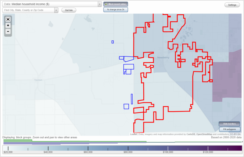
- City boundary
- Neighborhood boundaries
Business Search - 14 Million verified businesses
Neighborhoods:
Carrie Jo Estates, Foxwood Acres, Gilchrist Farm, Honey Bee Farms, Newberry Hills, Norfleet Pines, Waccasassa Highlands, Westlake WoodsCarrie Jo Estates neighborhood in Newberry statistics: (Find on map)
Area: 0.039 square miles
Carrie Jo Estates neighborhood detailed profile
Area: 0.039 square miles
Carrie Jo Estates neighborhood detailed profile
Foxwood Acres neighborhood in Newberry statistics: (Find on map)
Area: 0.516 square miles
Roads and streets: SE 71st St; SE 73rd Ln.
Foxwood Acres neighborhood detailed profile
Area: 0.516 square miles
Roads and streets: SE 71st St; SE 73rd Ln.
Foxwood Acres neighborhood detailed profile
Gilchrist Farm neighborhood in Newberry statistics: (Find on map)
Area: 0.242 square miles
Roads and streets: SE 83rd Ter.
Gilchrist Farm neighborhood detailed profile
Area: 0.242 square miles
Roads and streets: SE 83rd Ter.
Gilchrist Farm neighborhood detailed profile
Honey Bee Farms neighborhood in Newberry statistics: (Find on map)
Area: 0.247 square miles
Roads and streets: SE 86th Ave; SE 83rd Ct.
Honey Bee Farms neighborhood detailed profile
Area: 0.247 square miles
Roads and streets: SE 86th Ave; SE 83rd Ct.
Honey Bee Farms neighborhood detailed profile
Newberry Hills neighborhood in Newberry statistics: (Find on map)
Area: 0.128 square miles
Newberry Hills neighborhood detailed profile
Area: 0.128 square miles
Newberry Hills neighborhood detailed profile
Norfleet Pines neighborhood in Newberry statistics: (Find on map)
Area: 0.424 square miles
Roads and streets: SE 64th St; SE 82nd Ave.
Norfleet Pines neighborhood detailed profile
Area: 0.424 square miles
Roads and streets: SE 64th St; SE 82nd Ave.
Norfleet Pines neighborhood detailed profile
Waccasassa Highlands neighborhood in Newberry statistics: (Find on map)
Area: 0.090 square miles
Waccasassa Highlands neighborhood detailed profile
Area: 0.090 square miles
Waccasassa Highlands neighborhood detailed profile
Westlake Woods neighborhood in Newberry statistics: (Find on map)
Area: 0.131 square miles
Roads and streets: SE 64th St.
Westlake Woods neighborhood detailed profile
Area: 0.131 square miles
Roads and streets: SE 64th St.
Westlake Woods neighborhood detailed profile