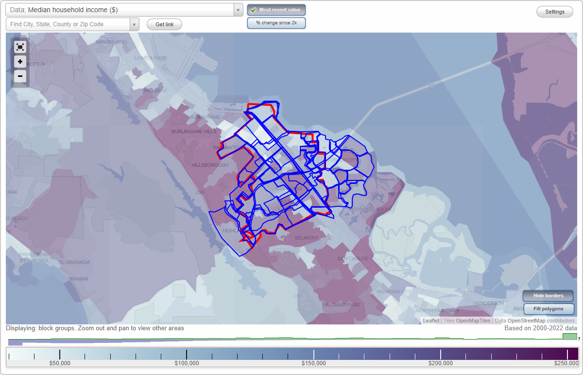
San Mateo, California Neighborhood Map - Income, House Prices, Occupations, Boundaries
Settings
X

- City boundary
- Neighborhood boundaries
Business Search - 14 Million verified businesses
Neighborhoods:
Admirals, Aragon, Bay Meadows, Bays, Baywood, Baywood Knolls, Baywood Park, Beresford, Birds, Boats, Bowie Estate, Central San Mateo, Chess, Clearview, Constellations and Stars, Coyote Point, Downtown San Mateo, East Hillsdale, East San Mateo, Edgewater Isle, Enchanted Hills, Explorers, Famous Ships, Fiesta Gardens, Fish, Foothill Terrace, Glazenwood, Glendale Village, Hacienda, Harbortown, Hayward Park, Haywood Park, Highlands, Hillsdale, Homestead, Islands, Laguna Vista, Lakeshore, Las Casitas, Laurelwood, Laurie Meadows, Lauriedale, Lincoln, Marina Lagoon, Mariner's Cove, Mariner's Green, Mariner's Island, North Central, North Shoreview, Park Western, Parkside, Parrot Park, Pilgrim-Triton, San Mateo Park, San Mateo Terrace, Shoreview, South San Mateo, South Shoreview, Sugarloaf, Sunnybrae, Tobin Clark Estate, Town Center, Vintage Park, Western Hills, Westwood KnollsAdmirals neighborhood in San Mateo statistics: (Find on map)
Area: 0.217 square miles
Population: 1,636
Population density:
Median household income in 2021:
Median rent in in 2021:
Male vs Females
Median age
Housing prices:
Average estimated value of detached houses in 2021 (65.1% of all units):
Average estimated value of townhouses or other attached units in 2021 (31.2% of all units):
Average estimated '21 value of housing units in 3-to-4-unit structures (3.6% of all units):
Average estimated '21 value of housing units in 5-or-more-unit structures (2.7% of all units):
Most popular occupations of males: computer and mathematical occupations (34.3%); life, physical, and social science occupations (14.5%); management occupations (except farmers) (13.5%); sales and office occupations (12.4%); legal occupations (8.1%); business and financial operations occupations (7.8%); healthcare practitioners and technical occupations (4.0%)
Most popular occupations of females: management occupations (except farmers) (38.3%); business and financial operations occupations (11.5%); sales and office occupations (7.8%); service occupations (6.7%); computer and mathematical occupations (6.3%); education, training, and library occupations (5.7%); community and social services occupations (5.4%)
Roads and streets: Farragut Blvd; Spruance Ln; Halsey Blvd; Blythe St; Nimitz Ln; Beach Park Blvd; Decatur St; Greenwich Ln; Bainbridge St; Rickover Ln; Forrestal Ln; Lord Ivelson Ln; Dover Ln; Portsmouth Ln; Gloucester Ln; Mystic Ln; Dewey Dr; Waterbury Ln; Burke Ln; Burrows St; King Ln; Byrd Ln; Lord Nelson Ln; Essex Ln; Radford Ln; Zumwalt Ln; Sprague Ln; Redford Ln; Essex.
Admirals neighborhood detailed profile
Area: 0.217 square miles
Population: 1,636
Population density:
| Admirals: | 7,555 people per square mile |
| San Mateo: | 8,363 people per square mile |
Median household income in 2021:
| Admirals: | $175,577 |
| San Mateo: | $129,957 |
Median rent in in 2021:
| Admirals: | $3,499 |
| San Mateo: | $2,001 |
Male vs Females
| Males: | 757 |
| Females: | 878 |
Median age
| Males: | 44.7 years |
| Females: | 45.8 years |
Housing prices:
Average estimated value of detached houses in 2021 (65.1% of all units):
| Admirals: | $1,351,832 |
| California: | $881,672 |
Average estimated value of townhouses or other attached units in 2021 (31.2% of all units):
| This neighborhood: | $718,925 |
| California: | $745,373 |
Average estimated '21 value of housing units in 3-to-4-unit structures (3.6% of all units):
| Admirals: | $712,823 |
| California: | $689,397 |
Average estimated '21 value of housing units in 5-or-more-unit structures (2.7% of all units):
| Admirals: | $1,227,473 |
| California: | $701,962 |
Most popular occupations of males: computer and mathematical occupations (34.3%); life, physical, and social science occupations (14.5%); management occupations (except farmers) (13.5%); sales and office occupations (12.4%); legal occupations (8.1%); business and financial operations occupations (7.8%); healthcare practitioners and technical occupations (4.0%)
Most popular occupations of females: management occupations (except farmers) (38.3%); business and financial operations occupations (11.5%); sales and office occupations (7.8%); service occupations (6.7%); computer and mathematical occupations (6.3%); education, training, and library occupations (5.7%); community and social services occupations (5.4%)
Roads and streets: Farragut Blvd; Spruance Ln; Halsey Blvd; Blythe St; Nimitz Ln; Beach Park Blvd; Decatur St; Greenwich Ln; Bainbridge St; Rickover Ln; Forrestal Ln; Lord Ivelson Ln; Dover Ln; Portsmouth Ln; Gloucester Ln; Mystic Ln; Dewey Dr; Waterbury Ln; Burke Ln; Burrows St; King Ln; Byrd Ln; Lord Nelson Ln; Essex Ln; Radford Ln; Zumwalt Ln; Sprague Ln; Redford Ln; Essex.
Admirals neighborhood detailed profile
Aragon neighborhood in San Mateo statistics: (Find on map)
Area: 0.247 square miles
Population: 2,278
Population density:
Median household income in 2021:
Median rent in in 2021:
Male vs Females
Median age
Housing prices:
Average estimated value of detached houses in 2021 (72.3% of all units):
Average estimated '21 value of housing units in 5-or-more-unit structures (32.8% of all units):
Most popular occupations of males: management occupations (except farmers) (31.8%); sales and office occupations (24.3%); computer and mathematical occupations (10.6%); business and financial operations occupations (9.7%); education, training, and library occupations (6.8%); architecture and engineering occupations (4.2%); material moving occupations (3.4%)
Most popular occupations of females: management occupations (except farmers) (33.8%); business and financial operations occupations (28.4%); healthcare practitioners and technical occupations (7.1%); sales and office occupations (5.5%); life, physical, and social science occupations (4.4%); legal occupations (4.2%); service occupations (3.8%)
Highways in this neighborhood: State Hwy 82 (S el Camino Real).
Roads and streets: Notre Dame Ave; Aragon Blvd; Hobart Ave; Avila Rd; Seville Way; Castilian Way; Sonora Dr; Edinburgh St; Maple St; Alameda de Las Pulgas (Alameda); Harvard Rd; Woodland Dr; Alameda Delas Pulgas.
Aragon neighborhood detailed profile
Area: 0.247 square miles
Population: 2,278
Population density:
| Aragon: | 9,235 people per square mile |
| San Mateo: | 8,363 people per square mile |
Median household income in 2021:
| Aragon: | $205,978 |
| San Mateo: | $129,957 |
Median rent in in 2021:
| Aragon: | $3,336 |
| San Mateo: | $2,001 |
Male vs Females
| Males: | 1,187 |
| Females: | 1,091 |
Median age
| Males: | 46.0 years |
| Females: | 46.4 years |
Housing prices:
Average estimated value of detached houses in 2021 (72.3% of all units):
| Aragon: | $2,419,729 |
| California: | $881,672 |
Average estimated '21 value of housing units in 5-or-more-unit structures (32.8% of all units):
| Aragon: | $546,090 |
| California: | $701,962 |
Most popular occupations of males: management occupations (except farmers) (31.8%); sales and office occupations (24.3%); computer and mathematical occupations (10.6%); business and financial operations occupations (9.7%); education, training, and library occupations (6.8%); architecture and engineering occupations (4.2%); material moving occupations (3.4%)
Most popular occupations of females: management occupations (except farmers) (33.8%); business and financial operations occupations (28.4%); healthcare practitioners and technical occupations (7.1%); sales and office occupations (5.5%); life, physical, and social science occupations (4.4%); legal occupations (4.2%); service occupations (3.8%)
Highways in this neighborhood: State Hwy 82 (S el Camino Real).
Roads and streets: Notre Dame Ave; Aragon Blvd; Hobart Ave; Avila Rd; Seville Way; Castilian Way; Sonora Dr; Edinburgh St; Maple St; Alameda de Las Pulgas (Alameda); Harvard Rd; Woodland Dr; Alameda Delas Pulgas.
Aragon neighborhood detailed profile
Bay Meadows neighborhood in San Mateo statistics: (Find on map)
Area: 0.177 square miles
Population: 1,168
Population density:
Median household income in 2021:
Median rent in in 2021:
Male vs Females
Median age
Average estimated value of detached houses in 2021 (13.5% of all units):
Most popular occupations of males: computer and mathematical occupations (28.6%); management occupations (except farmers) (27.0%); business and financial operations occupations (10.1%); sales and office occupations (6.3%); life, physical, and social science occupations (5.5%); architecture and engineering occupations (4.5%); arts, design, entertainment, sports, and media occupations (3.2%)
Most popular occupations of females: management occupations (except farmers) (18.3%); computer and mathematical occupations (15.3%); business and financial operations occupations (15.2%); sales and office occupations (10.0%); service occupations (8.4%); healthcare practitioners and technical occupations (8.2%); transportation occupations (7.9%)
Roads and streets: Saratoga Dr; Franklin Pkwy W.
Bay Meadows neighborhood detailed profile
Area: 0.177 square miles
Population: 1,168
Population density:
| Bay Meadows: | 6,591 people per square mile |
| San Mateo: | 8,363 people per square mile |
Median household income in 2021:
| Bay Meadows: | $199,236 |
| San Mateo: | $129,957 |
Median rent in in 2021:
| Bay Meadows: | $3,496 |
| San Mateo: | $2,001 |
Male vs Females
| Males: | 637 |
| Females: | 530 |
Median age
| Males: | 33.9 years |
| Females: | 36.1 years |
Average estimated value of detached houses in 2021 (13.5% of all units):
| Bay Meadows: | $1,717,574 |
| California: | $881,672 |
Most popular occupations of males: computer and mathematical occupations (28.6%); management occupations (except farmers) (27.0%); business and financial operations occupations (10.1%); sales and office occupations (6.3%); life, physical, and social science occupations (5.5%); architecture and engineering occupations (4.5%); arts, design, entertainment, sports, and media occupations (3.2%)
Most popular occupations of females: management occupations (except farmers) (18.3%); computer and mathematical occupations (15.3%); business and financial operations occupations (15.2%); sales and office occupations (10.0%); service occupations (8.4%); healthcare practitioners and technical occupations (8.2%); transportation occupations (7.9%)
Roads and streets: Saratoga Dr; Franklin Pkwy W.
Bay Meadows neighborhood detailed profile
Bays neighborhood in San Mateo statistics: (Find on map)
Area: 0.473 square miles
Population: 3,502
Population density:
Median household income in 2021:
Median rent in in 2021:
Male vs Females
Median age
Housing prices:
Average estimated value of detached houses in 2021 (62.5% of all units):
Average estimated value of townhouses or other attached units in 2021 (9.0% of all units):
Average estimated '21 value of housing units in 3-to-4-unit structures (30.2% of all units):
Average estimated '21 value of housing units in 5-or-more-unit structures (22.4% of all units):
Most popular occupations of males: computer and mathematical occupations (26.0%); management occupations (except farmers) (22.7%); sales and office occupations (14.5%); architecture and engineering occupations (8.5%); business and financial operations occupations (4.0%); life, physical, and social science occupations (3.1%); healthcare practitioners and technical occupations (2.8%)
Most popular occupations of females: sales and office occupations (17.2%); business and financial operations occupations (16.8%); computer and mathematical occupations (13.8%); service occupations (13.6%); management occupations (except farmers) (12.0%); healthcare practitioners and technical occupations (10.6%); education, training, and library occupations (6.8%)
Roads and streets: Port Royal Ave; Edgewater Blvd; Rock Harbor Ln; Monterey Ave; Boothbay Ave; Williams Ln; Thatcher Ln; Chesapeake Ave; Jamaica St; Bodega St; Winchester Ct; Pensacola St; Biscayne Ave; Nantucket St; Avalon Ave; Galveston St; Hatteras Ct; Billingsgate Ln; Hudson Bay St; Trinidad Ln; Tampa Ct; Bowsprit Ln; Baffin St; Sandy Hook Ct; Cumberland Ct; Binnacle Ln; Hawksbury Ln; Dory Ln; Charthouse Ln; Pleasant Ct; Skipjack Ln; Newport Ct; Botany Ct; Crystal Ct; Ross Ln; Plymouth Ln; Coral Ln; Lyme Ln; Coos Ct; Montego Ln; Drake Ct; Morro Ct; Bristol Ct; Oyster Ct.
Other features: Belmont Slough.
Bays neighborhood detailed profile
Area: 0.473 square miles
Population: 3,502
Population density:
| Bays: | 7,401 people per square mile |
| San Mateo: | 8,363 people per square mile |
Median household income in 2021:
| Bays: | $174,171 |
| San Mateo: | $129,957 |
Median rent in in 2021:
| Bays: | $3,458 |
| San Mateo: | $2,001 |
Male vs Females
| Males: | 1,701 |
| Females: | 1,801 |
Median age
| Males: | 40.0 years |
| Females: | 48.5 years |
Housing prices:
Average estimated value of detached houses in 2021 (62.5% of all units):
| Bays: | $1,395,801 |
| California: | $881,672 |
Average estimated value of townhouses or other attached units in 2021 (9.0% of all units):
| This neighborhood: | $1,110,938 |
| California: | $745,373 |
Average estimated '21 value of housing units in 3-to-4-unit structures (30.2% of all units):
| Bays: | $888,435 |
| California: | $689,397 |
Average estimated '21 value of housing units in 5-or-more-unit structures (22.4% of all units):
| Bays: | $1,227,473 |
| California: | $701,962 |
Most popular occupations of males: computer and mathematical occupations (26.0%); management occupations (except farmers) (22.7%); sales and office occupations (14.5%); architecture and engineering occupations (8.5%); business and financial operations occupations (4.0%); life, physical, and social science occupations (3.1%); healthcare practitioners and technical occupations (2.8%)
Most popular occupations of females: sales and office occupations (17.2%); business and financial operations occupations (16.8%); computer and mathematical occupations (13.8%); service occupations (13.6%); management occupations (except farmers) (12.0%); healthcare practitioners and technical occupations (10.6%); education, training, and library occupations (6.8%)
Roads and streets: Port Royal Ave; Edgewater Blvd; Rock Harbor Ln; Monterey Ave; Boothbay Ave; Williams Ln; Thatcher Ln; Chesapeake Ave; Jamaica St; Bodega St; Winchester Ct; Pensacola St; Biscayne Ave; Nantucket St; Avalon Ave; Galveston St; Hatteras Ct; Billingsgate Ln; Hudson Bay St; Trinidad Ln; Tampa Ct; Bowsprit Ln; Baffin St; Sandy Hook Ct; Cumberland Ct; Binnacle Ln; Hawksbury Ln; Dory Ln; Charthouse Ln; Pleasant Ct; Skipjack Ln; Newport Ct; Botany Ct; Crystal Ct; Ross Ln; Plymouth Ln; Coral Ln; Lyme Ln; Coos Ct; Montego Ln; Drake Ct; Morro Ct; Bristol Ct; Oyster Ct.
Other features: Belmont Slough.
Bays neighborhood detailed profile
Baywood neighborhood in San Mateo statistics: (Find on map)
Area: 0.723 square miles
Population: 4,047
Population density:
Median household income in 2021:
Median rent in in 2021:
Male vs Females
Median age
Housing prices:
Average estimated value of detached houses in 2021 (65.2% of all units):
Average estimated '21 value of housing units in 5-or-more-unit structures (39.6% of all units):
Most popular occupations of males: sales and office occupations (16.6%); business and financial operations occupations (16.0%); management occupations (except farmers) (15.5%); architecture and engineering occupations (11.6%); computer and mathematical occupations (9.6%); service occupations (6.5%); arts, design, entertainment, sports, and media occupations (5.9%)
Most popular occupations of females: management occupations (except farmers) (22.7%); business and financial operations occupations (15.7%); sales and office occupations (12.3%); service occupations (9.0%); computer and mathematical occupations (7.9%); healthcare practitioners and technical occupations (7.6%); arts, design, entertainment, sports, and media occupations (4.8%)
Highways in this neighborhood: S el Camino Real (State Hwy 82); N el Camino Real (State Hwy 82).
Roads and streets: Parrott Dr; Crystal Springs Rd; Alameda (Alameda de Las Pulgas); Notre Dame Ave; Virginia Ave; Nevada Ave; Sonora Dr; Harvard Rd; W 3rd Ave; de Sabla Rd; Georgetown Ave; Fairfax Ave; Gramercy Dr; Oregon Ave; Columbia Dr; W 5th Ave; Bucknell Dr; el Cerrito Ave; Maple St; Alhambra Rd; Edinburgh St; Franklin St; Arroyo Ct; Baywood Ave; Mission Dr; Dartmouth Rd; Yale Dr; Fordham Rd; Eaton Rd; W Santa Inez Ave; Cornell Ave; Iowa Dr; Princeton Rd; Colgate Way; Oak Valley Rd; Woodland Dr; Irving St; Jackson St; Carmel Cir; Amherst Ave; Kentucky Ave; W Capistrano Way; Tulane Rd; Capistrano Way; Ericson Rd; E Capistrano Way; W 4th Ave; Melrose Ct; Treetop Ln; Mounds Rd; Baytree Way; Ranelagh Rd; Belford Way; Verano Ct; Tulane Ct; Wildwood Dr; Sherwood Ct; Arlington Ln.
Other features: San Mateo Crk.
Baywood neighborhood detailed profile
Area: 0.723 square miles
Population: 4,047
Population density:
| Baywood: | 5,597 people per square mile |
| San Mateo: | 8,363 people per square mile |
Median household income in 2021:
| Baywood: | $194,782 |
| San Mateo: | $129,957 |
Median rent in in 2021:
| Baywood: | $2,726 |
| San Mateo: | $2,001 |
Male vs Females
| Males: | 1,954 |
| Females: | 2,093 |
Median age
| Males: | 46.1 years |
| Females: | 48.7 years |
Housing prices:
Average estimated value of detached houses in 2021 (65.2% of all units):
| Baywood: | $2,472,085 |
| California: | $881,672 |
Average estimated '21 value of housing units in 5-or-more-unit structures (39.6% of all units):
| Baywood: | $335,219 |
| California: | $701,962 |
Most popular occupations of males: sales and office occupations (16.6%); business and financial operations occupations (16.0%); management occupations (except farmers) (15.5%); architecture and engineering occupations (11.6%); computer and mathematical occupations (9.6%); service occupations (6.5%); arts, design, entertainment, sports, and media occupations (5.9%)
Most popular occupations of females: management occupations (except farmers) (22.7%); business and financial operations occupations (15.7%); sales and office occupations (12.3%); service occupations (9.0%); computer and mathematical occupations (7.9%); healthcare practitioners and technical occupations (7.6%); arts, design, entertainment, sports, and media occupations (4.8%)
Highways in this neighborhood: S el Camino Real (State Hwy 82); N el Camino Real (State Hwy 82).
Roads and streets: Parrott Dr; Crystal Springs Rd; Alameda (Alameda de Las Pulgas); Notre Dame Ave; Virginia Ave; Nevada Ave; Sonora Dr; Harvard Rd; W 3rd Ave; de Sabla Rd; Georgetown Ave; Fairfax Ave; Gramercy Dr; Oregon Ave; Columbia Dr; W 5th Ave; Bucknell Dr; el Cerrito Ave; Maple St; Alhambra Rd; Edinburgh St; Franklin St; Arroyo Ct; Baywood Ave; Mission Dr; Dartmouth Rd; Yale Dr; Fordham Rd; Eaton Rd; W Santa Inez Ave; Cornell Ave; Iowa Dr; Princeton Rd; Colgate Way; Oak Valley Rd; Woodland Dr; Irving St; Jackson St; Carmel Cir; Amherst Ave; Kentucky Ave; W Capistrano Way; Tulane Rd; Capistrano Way; Ericson Rd; E Capistrano Way; W 4th Ave; Melrose Ct; Treetop Ln; Mounds Rd; Baytree Way; Ranelagh Rd; Belford Way; Verano Ct; Tulane Ct; Wildwood Dr; Sherwood Ct; Arlington Ln.
Other features: San Mateo Crk.
Baywood neighborhood detailed profile
Baywood Knolls neighborhood in San Mateo statistics: (Find on map)
Area: 0.194 square miles
Population: 732
Population density:
Median household income in 2021:
Median rent in in 2021:
Male vs Females
Median age
Average estimated value of detached houses in 2021 (93.4% of all units):
Most popular occupations of males: management occupations (except farmers) (29.8%); business and financial operations occupations (22.5%); sales and office occupations (17.6%); computer and mathematical occupations (10.9%); production occupations (6.8%); healthcare practitioners and technical occupations (5.5%); material moving occupations (5.3%)
Most popular occupations of females: business and financial operations occupations (32.4%); sales and office occupations (20.2%); service occupations (6.7%); management occupations (except farmers) (6.2%); material moving occupations (6.0%); arts, design, entertainment, sports, and media occupations (5.5%); education, training, and library occupations (5.2%)
Roads and streets: Alameda (Alameda de Las Pulgas); Parrott Dr; Nevada Ave; Oregon Ave; Columbia Dr; Bucknell Dr; Yale Dr; Iowa Dr; Princeton Rd; Colgate Way; Oak Valley Rd; Woodland Dr; Tulane Rd; Treetop Ln; Virginia Ave; Tulane Ct; Crystal Springs Rd; Wildwood Dr; Georgetown Ave.
Baywood Knolls neighborhood detailed profile
Area: 0.194 square miles
Population: 732
Population density:
| Baywood Knolls: | 3,780 people per square mile |
| San Mateo: | 8,363 people per square mile |
Median household income in 2021:
| Baywood Knolls: | $236,719 |
| San Mateo: | $129,957 |
Median rent in in 2021:
| Baywood Knolls: | $3,501 |
| San Mateo: | $2,001 |
Male vs Females
| Males: | 335 |
| Females: | 397 |
Median age
| Males: | 51.0 years |
| Females: | 46.7 years |
Average estimated value of detached houses in 2021 (93.4% of all units):
| Baywood Knolls: | $3,137,641 |
| California: | $881,672 |
Most popular occupations of males: management occupations (except farmers) (29.8%); business and financial operations occupations (22.5%); sales and office occupations (17.6%); computer and mathematical occupations (10.9%); production occupations (6.8%); healthcare practitioners and technical occupations (5.5%); material moving occupations (5.3%)
Most popular occupations of females: business and financial operations occupations (32.4%); sales and office occupations (20.2%); service occupations (6.7%); management occupations (except farmers) (6.2%); material moving occupations (6.0%); arts, design, entertainment, sports, and media occupations (5.5%); education, training, and library occupations (5.2%)
Roads and streets: Alameda (Alameda de Las Pulgas); Parrott Dr; Nevada Ave; Oregon Ave; Columbia Dr; Bucknell Dr; Yale Dr; Iowa Dr; Princeton Rd; Colgate Way; Oak Valley Rd; Woodland Dr; Tulane Rd; Treetop Ln; Virginia Ave; Tulane Ct; Crystal Springs Rd; Wildwood Dr; Georgetown Ave.
Baywood Knolls neighborhood detailed profile
Baywood Park neighborhood in San Mateo statistics: (Find on map)
Area: 0.570 square miles
Population: 1,734
Population density:
Median household income in 2021:
Median rent in in 2021:
Male vs Females
Median age
Average estimated value of detached houses in 2021 (89.0% of all units):
Most popular occupations of males: management occupations (except farmers) (33.8%); business and financial operations occupations (14.2%); sales and office occupations (12.1%); life, physical, and social science occupations (9.7%); computer and mathematical occupations (7.6%); transportation occupations (3.8%); architecture and engineering occupations (3.6%)
Most popular occupations of females: sales and office occupations (19.3%); management occupations (except farmers) (15.8%); healthcare practitioners and technical occupations (15.6%); business and financial operations occupations (11.5%); education, training, and library occupations (10.3%); life, physical, and social science occupations (6.4%); legal occupations (6.2%)
Limited-access highways (interstate or state) in this neighborhood: .
Roads and streets: Parrott Dr; Polhemus Rd; Ascension Dr; Los Altos Dr; Bel Aire Rd; de Anza Blvd; Enchanted Way; Rainbow Dr; Lakeshore Dr (308); Crystal Springs Rd; Starlite Dr; Valley View Ct; Canyon Oak Ct; Timberlane Rd; Ridgecrest Ter; Csm Dr; Mountain View Pl; Parrott Ct; Linden Ln; Los Altos Pl; Londonderry Dr; Charing Cross Rd; Alderwood Ct; Queens Ln; Timberlane Way; Laurie Ln; Kristin Ct; de Anza Ct; Tartan Trail Rd; Bunker Hill Dr.
Other features: Polhemus Crk; San Mateo Crk.
Baywood Park neighborhood detailed profile
Area: 0.570 square miles
Population: 1,734
Population density:
| Baywood Park (Baywood): | 3,042 people per square mile |
| San Mateo: | 8,363 people per square mile |
Median household income in 2021:
| Baywood Park (Baywood): | $198,611 |
| San Mateo: | $129,957 |
Median rent in in 2021:
| Baywood Park (Baywood): | $3,408 |
| San Mateo: | $2,001 |
Male vs Females
| Males: | 762 |
| Females: | 972 |
Median age
| Males: | 44.3 years |
| Females: | 48.0 years |
Average estimated value of detached houses in 2021 (89.0% of all units):
| Baywood Park (Baywood): | $2,860,050 |
| California: | $881,672 |
Most popular occupations of males: management occupations (except farmers) (33.8%); business and financial operations occupations (14.2%); sales and office occupations (12.1%); life, physical, and social science occupations (9.7%); computer and mathematical occupations (7.6%); transportation occupations (3.8%); architecture and engineering occupations (3.6%)
Most popular occupations of females: sales and office occupations (19.3%); management occupations (except farmers) (15.8%); healthcare practitioners and technical occupations (15.6%); business and financial operations occupations (11.5%); education, training, and library occupations (10.3%); life, physical, and social science occupations (6.4%); legal occupations (6.2%)
Limited-access highways (interstate or state) in this neighborhood: .
Roads and streets: Parrott Dr; Polhemus Rd; Ascension Dr; Los Altos Dr; Bel Aire Rd; de Anza Blvd; Enchanted Way; Rainbow Dr; Lakeshore Dr (308); Crystal Springs Rd; Starlite Dr; Valley View Ct; Canyon Oak Ct; Timberlane Rd; Ridgecrest Ter; Csm Dr; Mountain View Pl; Parrott Ct; Linden Ln; Los Altos Pl; Londonderry Dr; Charing Cross Rd; Alderwood Ct; Queens Ln; Timberlane Way; Laurie Ln; Kristin Ct; de Anza Ct; Tartan Trail Rd; Bunker Hill Dr.
Other features: Polhemus Crk; San Mateo Crk.
Baywood Park neighborhood detailed profile
Beresford neighborhood in San Mateo statistics: (Find on map)
Area: 1.894 square miles
Population: 14,973
Population density:
Median household income in 2021:
Median rent in in 2021:
Male vs Females
Median age
Housing prices:
Average estimated value of detached houses in 2021 (57.3% of all units):
Average estimated '21 value of housing units in 5-or-more-unit structures (23.7% of all units):
Most popular occupations of males: management occupations (except farmers) (20.1%); sales and office occupations (12.8%); computer and mathematical occupations (12.7%); service occupations (11.4%); architecture and engineering occupations (7.4%); business and financial operations occupations (6.8%); construction, extraction, and maintenance occupations (4.4%)
Most popular occupations of females: sales and office occupations (20.9%); management occupations (except farmers) (14.7%); business and financial operations occupations (13.9%); service occupations (12.5%); education, training, and library occupations (10.8%); healthcare practitioners and technical occupations (8.8%); life, physical, and social science occupations (4.3%)
Limited-access highways (interstate or state) in this neighborhood: J Arthur Younger Fwy (State Hwy 92).
Highways in this neighborhood: State Hwy 82 (S el Camino Real).
Roads and streets: W Hillsdale Blvd; Alameda (Alameda de Las Pulgas); 31st Ave; 28th Ave; 29th Ave; 26th Ave; 30th Ave; Hacienda St; Isabelle Ave; 27th Ave; W 20th Ave; Sylvan Ave; 22nd Ave; 23rd Ave; W 25th Ave; 24th Ave; Flores St; Campus Dr; Yew St; Monterey St; Barneson Ave; Edison St; Mason Ln; Ensenada Way; Ventura Ave; Sunset Ter; Louise Ln; Pico Ave; Sequoia Ave; Portola Dr; Foothill Dr; Fernwood St; Murphy Dr; Garfield St; Cuesta Ave; del Monte St; State Hwy 92; Madera Dr; Spuraway Dr; Woodland Dr; Dolores St; Verdun Ave; Ashwood Dr; Vernon Ter; Parkside Way; Delmar Way; Stratford Way; Briar Ln; Arbor Ln; Mary Lu Ln; Juniper St; Hobart Ave; Stephen Rd; Lula Belle Ln; Melissa Ct; Caribbean Way; Wilmington Rd; Buena Vista Ave; la Salle Dr; Alta Ave; Lodato Ave; Terrace Way; Ashwood Ct; Macarthur Ave; Heather Ln; Alder Ln; Caxton Ct; Beverly St; del Ray St; Lansdale St; Pioneer Ct; O'Farrell St; Mountain Wood Ct; Wyoming Way; 26th Pl; Edinburgh St; Chestnut Ln; Mc Aker Ct; Allanhill Ln; Arrowood Ln; Mountain Wood Ln; Gymkhana Rd; Hickory Ln; Cragmont Ct; Parkview Way; Carey School Ln; Corte de Flores; Elkhorn Ct; del Monte Pl; Rockwood Ct; Fairoaks Ct; Chukker Ct; Balmoral Ct; Knapp Ct; Scenic Way; Murphy Pl (Murphy Ct); Hillsdale Pl; Falda Ave; Emerald Ct; Polo Ct; Paulson Ct.
Other features: Laurel Crk.
Beresford neighborhood detailed profile
Area: 1.894 square miles
Population: 14,973
Population density:
| Beresford (Beresford Park): | 7,904 people per square mile |
| San Mateo: | 8,363 people per square mile |
Median household income in 2021:
| Beresford (Beresford Park): | $166,235 |
| San Mateo: | $129,957 |
Median rent in in 2021:
| Beresford (Beresford Park): | $2,591 |
| San Mateo: | $2,001 |
Male vs Females
| Males: | 7,424 |
| Females: | 7,548 |
Median age
| Males: | 41.2 years |
| Females: | 43.4 years |
Housing prices:
Average estimated value of detached houses in 2021 (57.3% of all units):
| Beresford (Beresford Park): | $1,856,265 |
| California: | $881,672 |
Average estimated '21 value of housing units in 5-or-more-unit structures (23.7% of all units):
| Beresford (Beresford Park): | $91,422 |
| California: | $701,962 |
Most popular occupations of males: management occupations (except farmers) (20.1%); sales and office occupations (12.8%); computer and mathematical occupations (12.7%); service occupations (11.4%); architecture and engineering occupations (7.4%); business and financial operations occupations (6.8%); construction, extraction, and maintenance occupations (4.4%)
Most popular occupations of females: sales and office occupations (20.9%); management occupations (except farmers) (14.7%); business and financial operations occupations (13.9%); service occupations (12.5%); education, training, and library occupations (10.8%); healthcare practitioners and technical occupations (8.8%); life, physical, and social science occupations (4.3%)
Limited-access highways (interstate or state) in this neighborhood: J Arthur Younger Fwy (State Hwy 92).
Highways in this neighborhood: State Hwy 82 (S el Camino Real).
Roads and streets: W Hillsdale Blvd; Alameda (Alameda de Las Pulgas); 31st Ave; 28th Ave; 29th Ave; 26th Ave; 30th Ave; Hacienda St; Isabelle Ave; 27th Ave; W 20th Ave; Sylvan Ave; 22nd Ave; 23rd Ave; W 25th Ave; 24th Ave; Flores St; Campus Dr; Yew St; Monterey St; Barneson Ave; Edison St; Mason Ln; Ensenada Way; Ventura Ave; Sunset Ter; Louise Ln; Pico Ave; Sequoia Ave; Portola Dr; Foothill Dr; Fernwood St; Murphy Dr; Garfield St; Cuesta Ave; del Monte St; State Hwy 92; Madera Dr; Spuraway Dr; Woodland Dr; Dolores St; Verdun Ave; Ashwood Dr; Vernon Ter; Parkside Way; Delmar Way; Stratford Way; Briar Ln; Arbor Ln; Mary Lu Ln; Juniper St; Hobart Ave; Stephen Rd; Lula Belle Ln; Melissa Ct; Caribbean Way; Wilmington Rd; Buena Vista Ave; la Salle Dr; Alta Ave; Lodato Ave; Terrace Way; Ashwood Ct; Macarthur Ave; Heather Ln; Alder Ln; Caxton Ct; Beverly St; del Ray St; Lansdale St; Pioneer Ct; O'Farrell St; Mountain Wood Ct; Wyoming Way; 26th Pl; Edinburgh St; Chestnut Ln; Mc Aker Ct; Allanhill Ln; Arrowood Ln; Mountain Wood Ln; Gymkhana Rd; Hickory Ln; Cragmont Ct; Parkview Way; Carey School Ln; Corte de Flores; Elkhorn Ct; del Monte Pl; Rockwood Ct; Fairoaks Ct; Chukker Ct; Balmoral Ct; Knapp Ct; Scenic Way; Murphy Pl (Murphy Ct); Hillsdale Pl; Falda Ave; Emerald Ct; Polo Ct; Paulson Ct.
Other features: Laurel Crk.
Beresford neighborhood detailed profile
Birds neighborhood in San Mateo statistics: (Find on map)
Area: 0.465 square miles
Population: 1,958
Population density:
Median household income in 2021:
Median rent in in 2021:
Male vs Females
Median age
Housing prices:
Average estimated value of detached houses in 2021 (29.2% of all units):
Average estimated value of townhouses or other attached units in 2021 (24.8% of all units):
Average estimated '21 value of housing units in 5-or-more-unit structures (26.3% of all units):
Most popular occupations of males: management occupations (except farmers) (22.1%); computer and mathematical occupations (21.6%); sales and office occupations (11.9%); business and financial operations occupations (11.7%); service occupations (8.4%); life, physical, and social science occupations (6.2%); healthcare practitioners and technical occupations (4.6%)
Most popular occupations of females: sales and office occupations (24.4%); healthcare practitioners and technical occupations (21.7%); business and financial operations occupations (11.6%); management occupations (except farmers) (10.7%); legal occupations (9.8%); service occupations (6.3%); construction, extraction, and maintenance occupations (5.3%)
Limited-access highways (interstate or state) in this neighborhood: State Hwy 92 (J Arthur Younger Fwy); State Hwy 92.
Roads and streets: Beach Park Blvd; Gull Ave; Crane Ave; E Hillsdale Blvd; Shearwater Isle; Widgeon St; Grebe St; Surfbird Isle; Marlin Ave; Puffin Ct; Sandpiper Ct; Killdeer Ct; Curlew Ct; Loon Ct; Pelican Ct; Duck Ct; Stilt Ct; Flying Fish St; Lark Ln; Turnstone Ct; Mallard St; Avocet Ct; Sanderling St; Egret St; Eagle Ln; Teal St; Plover St; Sea Island Ln; Swan St; Condor Ln; Dove Ln.
Birds neighborhood detailed profile
Area: 0.465 square miles
Population: 1,958
Population density:
| Birds: | 4,211 people per square mile |
| San Mateo: | 8,363 people per square mile |
Median household income in 2021:
| Birds: | $211,609 |
| San Mateo: | $129,957 |
Median rent in in 2021:
| Birds: | $3,343 |
| San Mateo: | $2,001 |
Male vs Females
| Males: | 905 |
| Females: | 1,053 |
Median age
| Males: | 37.6 years |
| Females: | 38.5 years |
Housing prices:
Average estimated value of detached houses in 2021 (29.2% of all units):
| Birds: | $2,407,237 |
| California: | $881,672 |
Average estimated value of townhouses or other attached units in 2021 (24.8% of all units):
| This neighborhood: | $3,038,549 |
| California: | $745,373 |
Average estimated '21 value of housing units in 5-or-more-unit structures (26.3% of all units):
| Birds: | $669,204 |
| California: | $701,962 |
Most popular occupations of males: management occupations (except farmers) (22.1%); computer and mathematical occupations (21.6%); sales and office occupations (11.9%); business and financial operations occupations (11.7%); service occupations (8.4%); life, physical, and social science occupations (6.2%); healthcare practitioners and technical occupations (4.6%)
Most popular occupations of females: sales and office occupations (24.4%); healthcare practitioners and technical occupations (21.7%); business and financial operations occupations (11.6%); management occupations (except farmers) (10.7%); legal occupations (9.8%); service occupations (6.3%); construction, extraction, and maintenance occupations (5.3%)
Limited-access highways (interstate or state) in this neighborhood: State Hwy 92 (J Arthur Younger Fwy); State Hwy 92.
Roads and streets: Beach Park Blvd; Gull Ave; Crane Ave; E Hillsdale Blvd; Shearwater Isle; Widgeon St; Grebe St; Surfbird Isle; Marlin Ave; Puffin Ct; Sandpiper Ct; Killdeer Ct; Curlew Ct; Loon Ct; Pelican Ct; Duck Ct; Stilt Ct; Flying Fish St; Lark Ln; Turnstone Ct; Mallard St; Avocet Ct; Sanderling St; Egret St; Eagle Ln; Teal St; Plover St; Sea Island Ln; Swan St; Condor Ln; Dove Ln.
Birds neighborhood detailed profile
Boats neighborhood in San Mateo statistics: (Find on map)
Area: 0.322 square miles
Population: 4,234
Population density:
Median household income in 2021:
Median rent in in 2021:
Male vs Females
Median age
Housing prices:
Average estimated value of detached houses in 2021 (30.6% of all units):
Average estimated value of townhouses or other attached units in 2021 (11.9% of all units):
Average estimated '21 value of housing units in 3-to-4-unit structures (11.6% of all units):
Average estimated '21 value of housing units in 5-or-more-unit structures (25.4% of all units):
Most popular occupations of males: computer and mathematical occupations (26.6%); management occupations (except farmers) (20.7%); sales and office occupations (10.7%); business and financial operations occupations (10.0%); arts, design, entertainment, sports, and media occupations (6.4%); life, physical, and social science occupations (6.2%); architecture and engineering occupations (3.9%)
Most popular occupations of females: management occupations (except farmers) (20.5%); sales and office occupations (18.5%); computer and mathematical occupations (16.7%); business and financial operations occupations (12.5%); service occupations (10.8%); healthcare practitioners and technical occupations (6.7%); life, physical, and social science occupations (3.4%)
Roads and streets: Beach Park Blvd; Foster City Blvd; Catamaran St; Schooner St; Spruance Ln; Shell Blvd; Barkentine St; Spinnaker St; Windjammer Cir; Forrestal Ln; Lord Ivelson Ln; Trimaran Ct; Mainsail Ct; Topsail Ct; Staysail Ct; Marlin Ave; Trysail Ct; Foresail Ct; Halsey Blvd; Cutter St; Clipper Ln; Burke Ln; Sloop Ct; Yawl Ct; Byrd Ln; Lord Nelson Ln; Ketch Ct; Corsair Ln; Sprague Ln.
Boats neighborhood detailed profile
Area: 0.322 square miles
Population: 4,234
Population density:
| Boats (Boat Parts): | 13,134 people per square mile |
| San Mateo: | 8,363 people per square mile |
Median household income in 2021:
| Boats (Boat Parts): | $187,240 |
| San Mateo: | $129,957 |
Median rent in in 2021:
| Boats (Boat Parts): | $3,247 |
| San Mateo: | $2,001 |
Male vs Females
| Males: | 2,001 |
| Females: | 2,232 |
Median age
| Males: | 40.8 years |
| Females: | 41.4 years |
Housing prices:
Average estimated value of detached houses in 2021 (30.6% of all units):
| Boats (Boat Parts): | $1,080,725 |
| California: | $881,672 |
Average estimated value of townhouses or other attached units in 2021 (11.9% of all units):
| This neighborhood: | $784,738 |
| California: | $745,373 |
Average estimated '21 value of housing units in 3-to-4-unit structures (11.6% of all units):
| Boats (Boat Parts): | $947,835 |
| California: | $689,397 |
Average estimated '21 value of housing units in 5-or-more-unit structures (25.4% of all units):
| Boats (Boat Parts): | $105,878 |
| California: | $701,962 |
Most popular occupations of males: computer and mathematical occupations (26.6%); management occupations (except farmers) (20.7%); sales and office occupations (10.7%); business and financial operations occupations (10.0%); arts, design, entertainment, sports, and media occupations (6.4%); life, physical, and social science occupations (6.2%); architecture and engineering occupations (3.9%)
Most popular occupations of females: management occupations (except farmers) (20.5%); sales and office occupations (18.5%); computer and mathematical occupations (16.7%); business and financial operations occupations (12.5%); service occupations (10.8%); healthcare practitioners and technical occupations (6.7%); life, physical, and social science occupations (3.4%)
Roads and streets: Beach Park Blvd; Foster City Blvd; Catamaran St; Schooner St; Spruance Ln; Shell Blvd; Barkentine St; Spinnaker St; Windjammer Cir; Forrestal Ln; Lord Ivelson Ln; Trimaran Ct; Mainsail Ct; Topsail Ct; Staysail Ct; Marlin Ave; Trysail Ct; Foresail Ct; Halsey Blvd; Cutter St; Clipper Ln; Burke Ln; Sloop Ct; Yawl Ct; Byrd Ln; Lord Nelson Ln; Ketch Ct; Corsair Ln; Sprague Ln.
Boats neighborhood detailed profile
Bowie Estate neighborhood in San Mateo statistics: (Find on map)
Area: 0.702 square miles
Population: 8,452
Population density:
Median household income in 2021:
Median rent in in 2021:
Male vs Females
Median age
Average estimated value of detached houses in 2021 (14.5% of all units):
Most popular occupations of males: service occupations (18.8%); computer and mathematical occupations (15.9%); sales and office occupations (11.6%); management occupations (except farmers) (11.5%); production occupations (7.9%); construction, extraction, and maintenance occupations (7.3%); life, physical, and social science occupations (5.3%)
Most popular occupations of females: service occupations (30.6%); management occupations (except farmers) (15.0%); sales and office occupations (14.4%); business and financial operations occupations (8.6%); healthcare practitioners and technical occupations (8.1%); computer and mathematical occupations (7.1%); education, training, and library occupations (4.8%)
Limited-access highways (interstate or state) in this neighborhood: US Hwy 101 (Bayshore Fwy).
Roads and streets: US Hwy 101; Peninsula Ave; N Amphlett Blvd; N Claremont St; N Humboldt St; N Delaware St; N Idaho St; N Bayshore Blvd; E 3rd Ave; N Eldorado St; Monte Diablo Ave; E Santa Inez Ave; Tilton Ave; N Grant St; N Fremont St; 2nd Ave; E Poplar Ave; Indian Ave; Cypress Ave; E 4th Ave; S Fremont St; S Delaware St; S Claremont St; S Humboldt St; S Eldorado St; S Grant St; State St; S Idaho St; S Amphlett Blvd; S Bayshore Blvd; College Ave; San Antonio Ave; 1st Ave; Creekside Ln; E Bellevue Ave; Saint Marys Ct; Serra Ct; Thomas Ct; Cascade Ct; 3rd Ave E.
Other features: San Mateo Crk.
Bowie Estate neighborhood detailed profile
Area: 0.702 square miles
Population: 8,452
Population density:
| Bowie Estate: | 12,035 people per square mile |
| San Mateo: | 8,363 people per square mile |
Median household income in 2021:
| Bowie Estate: | $113,546 |
| San Mateo: | $129,957 |
Median rent in in 2021:
| Bowie Estate: | $2,600 |
| San Mateo: | $2,001 |
Male vs Females
| Males: | 4,572 |
| Females: | 3,879 |
Median age
| Males: | 37.5 years |
| Females: | 39.4 years |
Average estimated value of detached houses in 2021 (14.5% of all units):
| Bowie Estate: | $1,091,985 |
| California: | $881,672 |
Most popular occupations of males: service occupations (18.8%); computer and mathematical occupations (15.9%); sales and office occupations (11.6%); management occupations (except farmers) (11.5%); production occupations (7.9%); construction, extraction, and maintenance occupations (7.3%); life, physical, and social science occupations (5.3%)
Most popular occupations of females: service occupations (30.6%); management occupations (except farmers) (15.0%); sales and office occupations (14.4%); business and financial operations occupations (8.6%); healthcare practitioners and technical occupations (8.1%); computer and mathematical occupations (7.1%); education, training, and library occupations (4.8%)
Limited-access highways (interstate or state) in this neighborhood: US Hwy 101 (Bayshore Fwy).
Roads and streets: US Hwy 101; Peninsula Ave; N Amphlett Blvd; N Claremont St; N Humboldt St; N Delaware St; N Idaho St; N Bayshore Blvd; E 3rd Ave; N Eldorado St; Monte Diablo Ave; E Santa Inez Ave; Tilton Ave; N Grant St; N Fremont St; 2nd Ave; E Poplar Ave; Indian Ave; Cypress Ave; E 4th Ave; S Fremont St; S Delaware St; S Claremont St; S Humboldt St; S Eldorado St; S Grant St; State St; S Idaho St; S Amphlett Blvd; S Bayshore Blvd; College Ave; San Antonio Ave; 1st Ave; Creekside Ln; E Bellevue Ave; Saint Marys Ct; Serra Ct; Thomas Ct; Cascade Ct; 3rd Ave E.
Other features: San Mateo Crk.
Bowie Estate neighborhood detailed profile
Central San Mateo neighborhood in San Mateo statistics: (Find on map)
Area: 3.253 square miles
Population: 29,720
Population density:
Median household income in 2021:
Median rent in in 2021:
Male vs Females
Median age
Housing prices:
Average estimated value of detached houses in 2021 (36.6% of all units):
Average estimated value of townhouses or other attached units in 2021 (9.9% of all units):
Average estimated '21 value of housing units in 5-or-more-unit structures (45.5% of all units):
Most popular occupations of males: management occupations (except farmers) (18.4%); computer and mathematical occupations (15.7%); sales and office occupations (14.2%); service occupations (11.5%); business and financial operations occupations (5.7%); construction, extraction, and maintenance occupations (5.0%); life, physical, and social science occupations (3.6%)
Most popular occupations of females: sales and office occupations (20.1%); management occupations (except farmers) (18.9%); service occupations (15.6%); business and financial operations occupations (10.8%); education, training, and library occupations (8.3%); computer and mathematical occupations (6.4%); healthcare practitioners and technical occupations (6.4%)
Limited-access highways (interstate or state) in this neighborhood: US Hwy 101 (Bayshore Fwy); State Hwy 92 (J Arthur Younger Fwy).
Highways in this neighborhood: S el Camino Real (State Hwy 82); State Hwy 82 (N el Camino Real); Mission St (el Camino Real, State Hwy 82).
Roads and streets: Peninsula Ave; US Hwy 101; S Grant St; S Delaware St; N Amphlett Blvd; S Amphlett Blvd; S Railroad Ave; N Idaho St; S B St; W Poplar Ave; S Claremont St; N San Mateo Dr; E 3rd Ave; N Claremont St; N Humboldt St; N Delaware St; E Santa Inez Ave; Monte Diablo Ave; Palm Ave; E Poplar Ave; 9th Ave; Tilton Ave; E 5th Ave; 10th Ave; Clark Dr; Warren Rd; 2nd Ave; S Fremont St; N Railroad Ave; E 4th Ave; S Idaho St; S Humboldt St; N Bayshore Blvd; Edgewood Rd; S Eldorado St; 7th Ave; Hawthorne Dr (Birch Ave); Highland Ave; State St; Barneson Ave; Hobart Ave; N Ellsworth Ave; Borel Ave; W Bellevue Ave; Costa Rica Ave; Concar Dr; Barroilhet Ave; 19th Ave; E Bellevue Ave; N Eldorado St; E 16th Ave; Grand Blvd; N Grant St; N Fremont St; Cypress Ave; Sunnybrae Blvd; Crescent Ave; Hurlingham Ave; Occidental Ave; Indian Ave; Railroad Ave; Laurel Ave; S Bayshore Blvd; Elm St; Victoria Rd; Villa Ter; Hillsborough Blvd; S San Mateo Dr; Folkstone Ave; Prospect Row; Humboldt Rd (Humboldt St); Woodside Way; 11th Ave; Maple St; 14th Ave; Oak St; Edinburgh St; Nadina St; Fashion Island Blvd; 16th Ave; Carlisle Dr; Alameda (Alameda de Las Pulgas); Dorchester Rd; 12th Ave; Bovet Rd; S Ellsworth Ave; 15th Ave; 13th Ave; 1st Ave; Guildford Ave; 17th Ave; Baldwin Ave; Shafter St; Tilia St; Ramona St; Wolfe Dr; E Grant Pl; Studio Cir; Magnolia Dr; Edna Way; W Grant Pl; Madison Ave; Vanessa Dr; Joanne Dr; South Blvd; Leslie St; Eleanor Dr; Bromfield Rd; Gum St; Bayswater Ave; Rosewood Dr; Hayward Ave; Connie Ave; Celeste Dr; Sycamore Ave; Harrow Ave; Catalpa St; N B St; Midway Ave; Locust St; Jasmine St; Kalmia St; Jefferson Ct; 8th Ave; 6th Ave; Garvey Way; Hillcrest Rd; Turner Ter; Wisnom Ave; Main St; College Ave; Engle Rd; Howard Ave; Fleetwood Dr; Haddon Dr; Aberdeen Dr; St Matthews Ave; Quince St; Rhus St; Hawthorne Dr; San Antonio Ave; Ivy St; Hilltop Rd; W Ellsworth Ct; Borel Pl; Glendale Rd; E Ellsworth Ct; Ben Franklin Ct; Fulton Rd; Chesterton Pl; Creekside Ln; Greenwood Ave; Williams Pl; Amesbury Ave; Rollins Rd; Westmoreland Ave; Saint Johns Ct; el Portal Ave; Pinecrest Ter; Pacific Blvd; Betty Ln; 18th Ave; Jody Ct; Keswick Ln; Park Ln; Tilton Ter; Charles Ln; Hanrahan Ct; Ginniver St; State Hwy 92; Saint Marys Ct; Afton Ct; Thomas Ct; Serra Ct; Cascade Ct; San Juan Ct; Las Sombras Ct; Ellsworth Ave; 3rd Ave E.
Railroad features: Union Pacific RR (Joint Powers Authority RR); Caltrain.
Other features: San Mateo Crk.
Other features: Drainage Ditch.
Central San Mateo neighborhood detailed profile
Area: 3.253 square miles
Population: 29,720
Population density:
| Central San Mateo (Central): | 9,137 people per square mile |
| San Mateo: | 8,363 people per square mile |
Median household income in 2021:
| Central San Mateo (Central): | $155,341 |
| San Mateo: | $129,957 |
Median rent in in 2021:
| Central San Mateo (Central): | $2,618 |
| San Mateo: | $2,001 |
Male vs Females
| Males: | 14,680 |
| Females: | 15,039 |
Median age
| Males: | 39.4 years |
| Females: | 41.8 years |
Housing prices:
Average estimated value of detached houses in 2021 (36.6% of all units):
| Central San Mateo (Central): | $1,878,250 |
| California: | $881,672 |
Average estimated value of townhouses or other attached units in 2021 (9.9% of all units):
| This neighborhood: | $1,010,446 |
| California: | $745,373 |
Average estimated '21 value of housing units in 5-or-more-unit structures (45.5% of all units):
| Central San Mateo (Central): | $448,951 |
| California: | $701,962 |
Most popular occupations of males: management occupations (except farmers) (18.4%); computer and mathematical occupations (15.7%); sales and office occupations (14.2%); service occupations (11.5%); business and financial operations occupations (5.7%); construction, extraction, and maintenance occupations (5.0%); life, physical, and social science occupations (3.6%)
Most popular occupations of females: sales and office occupations (20.1%); management occupations (except farmers) (18.9%); service occupations (15.6%); business and financial operations occupations (10.8%); education, training, and library occupations (8.3%); computer and mathematical occupations (6.4%); healthcare practitioners and technical occupations (6.4%)
Limited-access highways (interstate or state) in this neighborhood: US Hwy 101 (Bayshore Fwy); State Hwy 92 (J Arthur Younger Fwy).
Highways in this neighborhood: S el Camino Real (State Hwy 82); State Hwy 82 (N el Camino Real); Mission St (el Camino Real, State Hwy 82).
Roads and streets: Peninsula Ave; US Hwy 101; S Grant St; S Delaware St; N Amphlett Blvd; S Amphlett Blvd; S Railroad Ave; N Idaho St; S B St; W Poplar Ave; S Claremont St; N San Mateo Dr; E 3rd Ave; N Claremont St; N Humboldt St; N Delaware St; E Santa Inez Ave; Monte Diablo Ave; Palm Ave; E Poplar Ave; 9th Ave; Tilton Ave; E 5th Ave; 10th Ave; Clark Dr; Warren Rd; 2nd Ave; S Fremont St; N Railroad Ave; E 4th Ave; S Idaho St; S Humboldt St; N Bayshore Blvd; Edgewood Rd; S Eldorado St; 7th Ave; Hawthorne Dr (Birch Ave); Highland Ave; State St; Barneson Ave; Hobart Ave; N Ellsworth Ave; Borel Ave; W Bellevue Ave; Costa Rica Ave; Concar Dr; Barroilhet Ave; 19th Ave; E Bellevue Ave; N Eldorado St; E 16th Ave; Grand Blvd; N Grant St; N Fremont St; Cypress Ave; Sunnybrae Blvd; Crescent Ave; Hurlingham Ave; Occidental Ave; Indian Ave; Railroad Ave; Laurel Ave; S Bayshore Blvd; Elm St; Victoria Rd; Villa Ter; Hillsborough Blvd; S San Mateo Dr; Folkstone Ave; Prospect Row; Humboldt Rd (Humboldt St); Woodside Way; 11th Ave; Maple St; 14th Ave; Oak St; Edinburgh St; Nadina St; Fashion Island Blvd; 16th Ave; Carlisle Dr; Alameda (Alameda de Las Pulgas); Dorchester Rd; 12th Ave; Bovet Rd; S Ellsworth Ave; 15th Ave; 13th Ave; 1st Ave; Guildford Ave; 17th Ave; Baldwin Ave; Shafter St; Tilia St; Ramona St; Wolfe Dr; E Grant Pl; Studio Cir; Magnolia Dr; Edna Way; W Grant Pl; Madison Ave; Vanessa Dr; Joanne Dr; South Blvd; Leslie St; Eleanor Dr; Bromfield Rd; Gum St; Bayswater Ave; Rosewood Dr; Hayward Ave; Connie Ave; Celeste Dr; Sycamore Ave; Harrow Ave; Catalpa St; N B St; Midway Ave; Locust St; Jasmine St; Kalmia St; Jefferson Ct; 8th Ave; 6th Ave; Garvey Way; Hillcrest Rd; Turner Ter; Wisnom Ave; Main St; College Ave; Engle Rd; Howard Ave; Fleetwood Dr; Haddon Dr; Aberdeen Dr; St Matthews Ave; Quince St; Rhus St; Hawthorne Dr; San Antonio Ave; Ivy St; Hilltop Rd; W Ellsworth Ct; Borel Pl; Glendale Rd; E Ellsworth Ct; Ben Franklin Ct; Fulton Rd; Chesterton Pl; Creekside Ln; Greenwood Ave; Williams Pl; Amesbury Ave; Rollins Rd; Westmoreland Ave; Saint Johns Ct; el Portal Ave; Pinecrest Ter; Pacific Blvd; Betty Ln; 18th Ave; Jody Ct; Keswick Ln; Park Ln; Tilton Ter; Charles Ln; Hanrahan Ct; Ginniver St; State Hwy 92; Saint Marys Ct; Afton Ct; Thomas Ct; Serra Ct; Cascade Ct; San Juan Ct; Las Sombras Ct; Ellsworth Ave; 3rd Ave E.
Railroad features: Union Pacific RR (Joint Powers Authority RR); Caltrain.
Other features: San Mateo Crk.
Other features: Drainage Ditch.
Central San Mateo neighborhood detailed profile
Chess neighborhood in San Mateo statistics: (Find on map)
Area: 0.131 square miles
Population: 555
Population density:
Median household income in 2021:
Median rent in in 2021:
Male vs Females
Median age
Most popular occupations of males: management occupations (except farmers) (22.0%); computer and mathematical occupations (21.6%); sales and office occupations (11.9%); business and financial operations occupations (11.8%); service occupations (8.4%); life, physical, and social science occupations (6.2%); healthcare practitioners and technical occupations (4.7%)
Most popular occupations of females: sales and office occupations (24.5%); healthcare practitioners and technical occupations (21.8%); business and financial operations occupations (11.4%); management occupations (except farmers) (10.7%); legal occupations (9.9%); service occupations (6.4%); computer and mathematical occupations (4.9%)
Limited-access highways (interstate or state) in this neighborhood: J Arthur Younger Fwy (State Hwy 92); State Hwy 92.
Roads and streets: Chess Dr; Foster City Blvd; Hatch Dr.
Chess neighborhood detailed profile
Area: 0.131 square miles
Population: 555
Population density:
| Chess: | 4,221 people per square mile |
| San Mateo: | 8,363 people per square mile |
Median household income in 2021:
| Chess: | $200,889 |
| San Mateo: | $129,957 |
Median rent in in 2021:
| Chess: | $3,345 |
| San Mateo: | $2,001 |
Male vs Females
| Males: | 256 |
| Females: | 298 |
Median age
| Males: | 39.1 years |
| Females: | 40.1 years |
Most popular occupations of males: management occupations (except farmers) (22.0%); computer and mathematical occupations (21.6%); sales and office occupations (11.9%); business and financial operations occupations (11.8%); service occupations (8.4%); life, physical, and social science occupations (6.2%); healthcare practitioners and technical occupations (4.7%)
Most popular occupations of females: sales and office occupations (24.5%); healthcare practitioners and technical occupations (21.8%); business and financial operations occupations (11.4%); management occupations (except farmers) (10.7%); legal occupations (9.9%); service occupations (6.4%); computer and mathematical occupations (4.9%)
Limited-access highways (interstate or state) in this neighborhood: J Arthur Younger Fwy (State Hwy 92); State Hwy 92.
Roads and streets: Chess Dr; Foster City Blvd; Hatch Dr.
Chess neighborhood detailed profile
Clearview neighborhood in San Mateo statistics: (Find on map)
Area: 0.037 square miles
Population: 131
Population density:
Median household income in 2021:
Median rent in in 2021:
Male vs Females
Median age
Most popular occupations of males: computer and mathematical occupations (19.1%); management occupations (except farmers) (15.9%); sales and office occupations (11.4%); healthcare practitioners and technical occupations (9.6%); service occupations (8.5%); life, physical, and social science occupations (5.8%); education, training, and library occupations (5.6%)
Most popular occupations of females: sales and office occupations (33.9%); management occupations (except farmers) (21.4%); education, training, and library occupations (12.6%); business and financial operations occupations (11.9%); healthcare practitioners and technical occupations (7.6%); life, physical, and social science occupations (3.5%); service occupations (2.2%)
Roads and streets: Clearview Way; Bayridge Way; Creekridge Ct; Lyonridge Ln; Houndridge Ln; Weepingridge Ct; Goldenridge Ct; Tollridge Ct; Clearview Dr; Southridge Ct; Needleridge Ct; Havenridge Ct; Crippleridge Ct; Gallowridge Ct.
Clearview neighborhood detailed profile
Area: 0.037 square miles
Population: 131
Population density:
| Clearview: | 3,582 people per square mile |
| San Mateo: | 8,363 people per square mile |
Median household income in 2021:
| Clearview: | $179,375 |
| San Mateo: | $129,957 |
Median rent in in 2021:
| Clearview: | $3,071 |
| San Mateo: | $2,001 |
Male vs Females
| Males: | 55 |
| Females: | 76 |
Median age
| Males: | 38.2 years |
| Females: | 39.9 years |
Most popular occupations of males: computer and mathematical occupations (19.1%); management occupations (except farmers) (15.9%); sales and office occupations (11.4%); healthcare practitioners and technical occupations (9.6%); service occupations (8.5%); life, physical, and social science occupations (5.8%); education, training, and library occupations (5.6%)
Most popular occupations of females: sales and office occupations (33.9%); management occupations (except farmers) (21.4%); education, training, and library occupations (12.6%); business and financial operations occupations (11.9%); healthcare practitioners and technical occupations (7.6%); life, physical, and social science occupations (3.5%); service occupations (2.2%)
Roads and streets: Clearview Way; Bayridge Way; Creekridge Ct; Lyonridge Ln; Houndridge Ln; Weepingridge Ct; Goldenridge Ct; Tollridge Ct; Clearview Dr; Southridge Ct; Needleridge Ct; Havenridge Ct; Crippleridge Ct; Gallowridge Ct.
Clearview neighborhood detailed profile
Constellations and Stars neighborhood in San Mateo statistics: (Find on map)
Area: 0.503 square miles
Population: 2,710
Population density:
Median household income in 2021:
Median rent in in 2021:
Male vs Females
Median age
Housing prices:
Average estimated value of detached houses in 2021 (38.3% of all units):
Average estimated value of townhouses or other attached units in 2021 (28.6% of all units):
Average estimated '21 value of housing units in 3-to-4-unit structures (6.9% of all units):
Average estimated '21 value of housing units in 5-or-more-unit structures (10.6% of all units):
Most popular occupations of males: computer and mathematical occupations (26.0%); management occupations (except farmers) (22.9%); sales and office occupations (12.1%); construction, extraction, and maintenance occupations (4.7%); service occupations (4.6%); production occupations (4.0%); architecture and engineering occupations (3.9%)
Most popular occupations of females: sales and office occupations (23.6%); business and financial operations occupations (14.4%); management occupations (except farmers) (14.2%); service occupations (12.1%); healthcare practitioners and technical occupations (8.3%); computer and mathematical occupations (7.5%); education, training, and library occupations (5.6%)
Limited-access highways (interstate or state) in this neighborhood: State Hwy 92 (J Arthur Younger Fwy).
Roads and streets: Beach Park Blvd; Polaris Ave; Edgewater Blvd; Vis del Mar; Sea Spray Ln; E Hillsdale Blvd; Celestial Ln; Mariners Island Blvd; Juno Ln; Taurus Dr; Emerald Bay Ln; Vega Cir; Altair Ave; Vis del Sol; Marina Vis; Dorado; Miramar; Mira St; Carina Ln; Neptune Ln; Corvus Ln; Arcturus Cir; Andromedia; Phoenix Ln; Perseus Ln; Cygnus Ln; Ursa Ln; Gemini Ln; Pavo Ln; Regulus St; Castor St; Argus Ct; Columbia Ln; Via Vis; Rigel Ln; Windward Way; Aries Ln; Via Laguna; Aquarius Ln; Apollo Ln; Promontory Point Ln; Pollux Ct; Leo Dr; Pisces Ln; Draco Ln; Jupiter Ct; Hydra Ln; Scorpio Ln; Lynx Ln; Ram Ln; Antares Ln; Andromeda Ln; Orion Ln; Virgo Ln; Hercules Ln; Saturn Ct; Libra Ln; Ara Ln; Vis Cay; Norma Ln; Canis Ln; Volans; Pegasus Ln; Bridgeport Ln; Venus Ct; Centaurus Ln; Volans Ln; Meridian Bay Ln.
Constellations and Stars neighborhood detailed profile
Area: 0.503 square miles
Population: 2,710
Population density:
| Constellations and Stars: | 5,389 people per square mile |
| San Mateo: | 8,363 people per square mile |
Median household income in 2021:
| Constellations and Stars: | $170,433 |
| San Mateo: | $129,957 |
Median rent in in 2021:
| Constellations and Stars: | $3,383 |
| San Mateo: | $2,001 |
Male vs Females
| Males: | 1,317 |
| Females: | 1,392 |
Median age
| Males: | 40.7 years |
| Females: | 46.7 years |
Housing prices:
Average estimated value of detached houses in 2021 (38.3% of all units):
| Constellations and Stars: | $790,000 |
| California: | $881,672 |
Average estimated value of townhouses or other attached units in 2021 (28.6% of all units):
| This neighborhood: | $1,130,956 |
| California: | $745,373 |
Average estimated '21 value of housing units in 3-to-4-unit structures (6.9% of all units):
| Constellations and Stars: | $930,539 |
| California: | $689,397 |
Average estimated '21 value of housing units in 5-or-more-unit structures (10.6% of all units):
| Constellations and Stars: | $1,104,783 |
| California: | $701,962 |
Most popular occupations of males: computer and mathematical occupations (26.0%); management occupations (except farmers) (22.9%); sales and office occupations (12.1%); construction, extraction, and maintenance occupations (4.7%); service occupations (4.6%); production occupations (4.0%); architecture and engineering occupations (3.9%)
Most popular occupations of females: sales and office occupations (23.6%); business and financial operations occupations (14.4%); management occupations (except farmers) (14.2%); service occupations (12.1%); healthcare practitioners and technical occupations (8.3%); computer and mathematical occupations (7.5%); education, training, and library occupations (5.6%)
Limited-access highways (interstate or state) in this neighborhood: State Hwy 92 (J Arthur Younger Fwy).
Roads and streets: Beach Park Blvd; Polaris Ave; Edgewater Blvd; Vis del Mar; Sea Spray Ln; E Hillsdale Blvd; Celestial Ln; Mariners Island Blvd; Juno Ln; Taurus Dr; Emerald Bay Ln; Vega Cir; Altair Ave; Vis del Sol; Marina Vis; Dorado; Miramar; Mira St; Carina Ln; Neptune Ln; Corvus Ln; Arcturus Cir; Andromedia; Phoenix Ln; Perseus Ln; Cygnus Ln; Ursa Ln; Gemini Ln; Pavo Ln; Regulus St; Castor St; Argus Ct; Columbia Ln; Via Vis; Rigel Ln; Windward Way; Aries Ln; Via Laguna; Aquarius Ln; Apollo Ln; Promontory Point Ln; Pollux Ct; Leo Dr; Pisces Ln; Draco Ln; Jupiter Ct; Hydra Ln; Scorpio Ln; Lynx Ln; Ram Ln; Antares Ln; Andromeda Ln; Orion Ln; Virgo Ln; Hercules Ln; Saturn Ct; Libra Ln; Ara Ln; Vis Cay; Norma Ln; Canis Ln; Volans; Pegasus Ln; Bridgeport Ln; Venus Ct; Centaurus Ln; Volans Ln; Meridian Bay Ln.
Constellations and Stars neighborhood detailed profile
Coyote Point neighborhood in San Mateo statistics: (Find on map)
Area: 0.641 square miles
Population: 428
Population density:
Median household income in 2021:
Median rent in in 2021:
Male vs Females
Median age
Most popular occupations of males: service occupations (17.0%); management occupations (except farmers) (16.6%); construction, extraction, and maintenance occupations (10.3%); production occupations (6.1%); business and financial operations occupations (5.9%); sales and office occupations (5.9%); computer and mathematical occupations (5.4%)
Most popular occupations of females: service occupations (31.3%); sales and office occupations (17.0%); management occupations (except farmers) (16.8%); computer and mathematical occupations (7.3%); life, physical, and social science occupations (5.9%); business and financial operations occupations (5.7%); production occupations (4.1%)
Limited-access highways (interstate or state) in this neighborhood: Bayshore Fwy (US Hwy 101).
Roads and streets: US Hwy 101; E Poplar Ave; Coyote Point Dr; N Amphlett Blvd; N Bayshore Blvd.
Coyote Point neighborhood detailed profile
Area: 0.641 square miles
Population: 428
Population density:
| Coyote Point: | 668 people per square mile |
| San Mateo: | 8,363 people per square mile |
Median household income in 2021:
| Coyote Point: | $100,168 |
| San Mateo: | $129,957 |
Median rent in in 2021:
| Coyote Point: | $2,480 |
| San Mateo: | $2,001 |
Male vs Females
| Males: | 234 |
| Females: | 193 |
Median age
| Males: | 34.1 years |
| Females: | 33.9 years |
Most popular occupations of males: service occupations (17.0%); management occupations (except farmers) (16.6%); construction, extraction, and maintenance occupations (10.3%); production occupations (6.1%); business and financial operations occupations (5.9%); sales and office occupations (5.9%); computer and mathematical occupations (5.4%)
Most popular occupations of females: service occupations (31.3%); sales and office occupations (17.0%); management occupations (except farmers) (16.8%); computer and mathematical occupations (7.3%); life, physical, and social science occupations (5.9%); business and financial operations occupations (5.7%); production occupations (4.1%)
Limited-access highways (interstate or state) in this neighborhood: Bayshore Fwy (US Hwy 101).
Roads and streets: US Hwy 101; E Poplar Ave; Coyote Point Dr; N Amphlett Blvd; N Bayshore Blvd.
Coyote Point neighborhood detailed profile
Downtown San Mateo neighborhood in San Mateo statistics: (Find on map)
Area: 0.606 square miles
Population: 6,315
Population density:
Median household income in 2021:
Median rent in in 2021:
Male vs Females
Median age
Housing prices:
Average estimated value of detached houses in 2021 (22.6% of all units):
Average estimated '21 value of housing units in 5-or-more-unit structures (42.6% of all units):
Most popular occupations of males: service occupations (17.8%); sales and office occupations (15.8%); computer and mathematical occupations (15.3%); management occupations (except farmers) (11.1%); construction, extraction, and maintenance occupations (5.4%); production occupations (4.6%); architecture and engineering occupations (4.2%)
Most popular occupations of females: sales and office occupations (24.1%); service occupations (18.3%); management occupations (except farmers) (15.6%); education, training, and library occupations (12.6%); computer and mathematical occupations (9.1%); business and financial operations occupations (6.4%); healthcare practitioners and technical occupations (5.1%)
Limited-access highways (interstate or state) in this neighborhood: US Hwy 101 (Bayshore Fwy).
Highways in this neighborhood: S el Camino Real (State Hwy 82); N el Camino Real (State Hwy 82).
Roads and streets: E 3rd Ave; 9th Ave; E 5th Ave; 2nd Ave; N Railroad Ave; E 4th Ave; 7th Ave; S Railroad Ave; S B St; S Fremont St; S Claremont St; S Delaware St; S Humboldt St; S Eldorado St; S Grant St; Monte Diablo Ave; S San Mateo Dr; S Idaho St; Tilton Ave; N Ellsworth Ave; S Ellsworth Ave; N San Mateo Dr; 1st Ave; Baldwin Ave; S Amphlett Blvd; S Bayshore Blvd; Laurel Ave; US Hwy 101; Catalpa St; N B St; 8th Ave; 6th Ave; Main St; St Matthews Ave; Elm St; Ben Franklin Ct; Creekside Ln; Tilton Ter; Ellsworth Ave; 3rd Ave E.
Railroad features: Union Pacific RR (Joint Powers Authority RR); Caltrain.
Other features: San Mateo Crk.
Downtown San Mateo neighborhood detailed profile
Area: 0.606 square miles
Population: 6,315
Population density:
| Downtown San Mateo (Downtown): | 10,421 people per square mile |
| San Mateo: | 8,363 people per square mile |
Median household income in 2021:
| Downtown San Mateo (Downtown): | $120,181 |
| San Mateo: | $129,957 |
Median rent in in 2021:
| Downtown San Mateo (Downtown): | $2,530 |
| San Mateo: | $2,001 |
Male vs Females
| Males: | 3,018 |
| Females: | 3,296 |
Median age
| Males: | 39.9 years |
| Females: | 46.3 years |
Housing prices:
Average estimated value of detached houses in 2021 (22.6% of all units):
| Downtown San Mateo (Downtown): | $1,494,039 |
| California: | $881,672 |
Average estimated '21 value of housing units in 5-or-more-unit structures (42.6% of all units):
| Downtown San Mateo (Downtown): | $447,594 |
| California: | $701,962 |
Most popular occupations of males: service occupations (17.8%); sales and office occupations (15.8%); computer and mathematical occupations (15.3%); management occupations (except farmers) (11.1%); construction, extraction, and maintenance occupations (5.4%); production occupations (4.6%); architecture and engineering occupations (4.2%)
Most popular occupations of females: sales and office occupations (24.1%); service occupations (18.3%); management occupations (except farmers) (15.6%); education, training, and library occupations (12.6%); computer and mathematical occupations (9.1%); business and financial operations occupations (6.4%); healthcare practitioners and technical occupations (5.1%)
Limited-access highways (interstate or state) in this neighborhood: US Hwy 101 (Bayshore Fwy).
Highways in this neighborhood: S el Camino Real (State Hwy 82); N el Camino Real (State Hwy 82).
Roads and streets: E 3rd Ave; 9th Ave; E 5th Ave; 2nd Ave; N Railroad Ave; E 4th Ave; 7th Ave; S Railroad Ave; S B St; S Fremont St; S Claremont St; S Delaware St; S Humboldt St; S Eldorado St; S Grant St; Monte Diablo Ave; S San Mateo Dr; S Idaho St; Tilton Ave; N Ellsworth Ave; S Ellsworth Ave; N San Mateo Dr; 1st Ave; Baldwin Ave; S Amphlett Blvd; S Bayshore Blvd; Laurel Ave; US Hwy 101; Catalpa St; N B St; 8th Ave; 6th Ave; Main St; St Matthews Ave; Elm St; Ben Franklin Ct; Creekside Ln; Tilton Ter; Ellsworth Ave; 3rd Ave E.
Railroad features: Union Pacific RR (Joint Powers Authority RR); Caltrain.
Other features: San Mateo Crk.
Downtown San Mateo neighborhood detailed profile
East Hillsdale neighborhood in San Mateo statistics: (Find on map)
Area: 0.958 square miles
Population: 7,941
Population density:
Median household income in 2021:
Median rent in in 2021:
Male vs Females
Median age
Housing prices:
Average estimated value of detached houses in 2021 (22.4% of all units):
Average estimated value of townhouses or other attached units in 2021 (17.2% of all units):
Average estimated '21 value of housing units in 5-or-more-unit structures (35.0% of all units):
Most popular occupations of males: management occupations (except farmers) (25.1%); computer and mathematical occupations (22.9%); sales and office occupations (7.9%); business and financial operations occupations (7.7%); architecture and engineering occupations (5.8%); construction, extraction, and maintenance occupations (5.5%); life, physical, and social science occupations (4.3%)
Most popular occupations of females: sales and office occupations (17.0%); management occupations (except farmers) (15.5%); service occupations (12.9%); business and financial operations occupations (12.5%); computer and mathematical occupations (11.6%); healthcare practitioners and technical occupations (6.4%); education, training, and library occupations (5.7%)
Limited-access highways (interstate or state) in this neighborhood: State Hwy 92 (J Arthur Younger Fwy); US Hwy 101 (Bayshore Fwy).
Highways in this neighborhood: State Hwy 82 (S el Camino Real).
Roads and streets: Saratoga Dr; 19th Ave; Bermuda Dr; E Hillsdale Blvd; S Delaware St; Pacific Blvd; Palm Ave; Fiesta Dr; Wayne Way; Mc Lellan Ave; Park Pl; Annapolis Dr; Palm Pl; W 20th Ave; Fashion Island Blvd; Kent St; Ginniver St; Babson Ln; Lafayette St; David Way; Leslie St; Franklin Pkwy W; Rossi Way; E 25th Ave; E 20th Ave; Trinity St; Dublin Way; Sullivan St; Potomac Way; Texas Way; Lodato Ave; Ivy St; Salisbury Way; Southampton Way; Springfield Way; 21st Ave (E 21st Ave); Portsmouth Way; Pioneer Ct; O'Farrell St; Wyoming Way; Curtiss St; Mc Aker Ct; 24th Ave; Palm Ct; Elkhorn Ct; Fiesta Ct; Kent Ct.
Railroad features: Joint Powers Authority RR (Union Pacific RR); Caltrain.
East Hillsdale neighborhood detailed profile
Area: 0.958 square miles
Population: 7,941
Population density:
| East Hillsdale: | 8,293 people per square mile |
| San Mateo: | 8,363 people per square mile |
Median household income in 2021:
| East Hillsdale: | $142,302 |
| San Mateo: | $129,957 |
Median rent in in 2021:
| East Hillsdale: | $3,265 |
| San Mateo: | $2,001 |
Male vs Females
| Males: | 4,038 |
| Females: | 3,902 |
Median age
| Males: | 34.4 years |
| Females: | 39.4 years |
Housing prices:
Average estimated value of detached houses in 2021 (22.4% of all units):
| East Hillsdale: | $1,780,368 |
| California: | $881,672 |
Average estimated value of townhouses or other attached units in 2021 (17.2% of all units):
| This neighborhood: | $1,010,446 |
| California: | $745,373 |
Average estimated '21 value of housing units in 5-or-more-unit structures (35.0% of all units):
| East Hillsdale: | $772,918 |
| California: | $701,962 |
Most popular occupations of males: management occupations (except farmers) (25.1%); computer and mathematical occupations (22.9%); sales and office occupations (7.9%); business and financial operations occupations (7.7%); architecture and engineering occupations (5.8%); construction, extraction, and maintenance occupations (5.5%); life, physical, and social science occupations (4.3%)
Most popular occupations of females: sales and office occupations (17.0%); management occupations (except farmers) (15.5%); service occupations (12.9%); business and financial operations occupations (12.5%); computer and mathematical occupations (11.6%); healthcare practitioners and technical occupations (6.4%); education, training, and library occupations (5.7%)
Limited-access highways (interstate or state) in this neighborhood: State Hwy 92 (J Arthur Younger Fwy); US Hwy 101 (Bayshore Fwy).
Highways in this neighborhood: State Hwy 82 (S el Camino Real).
Roads and streets: Saratoga Dr; 19th Ave; Bermuda Dr; E Hillsdale Blvd; S Delaware St; Pacific Blvd; Palm Ave; Fiesta Dr; Wayne Way; Mc Lellan Ave; Park Pl; Annapolis Dr; Palm Pl; W 20th Ave; Fashion Island Blvd; Kent St; Ginniver St; Babson Ln; Lafayette St; David Way; Leslie St; Franklin Pkwy W; Rossi Way; E 25th Ave; E 20th Ave; Trinity St; Dublin Way; Sullivan St; Potomac Way; Texas Way; Lodato Ave; Ivy St; Salisbury Way; Southampton Way; Springfield Way; 21st Ave (E 21st Ave); Portsmouth Way; Pioneer Ct; O'Farrell St; Wyoming Way; Curtiss St; Mc Aker Ct; 24th Ave; Palm Ct; Elkhorn Ct; Fiesta Ct; Kent Ct.
Railroad features: Joint Powers Authority RR (Union Pacific RR); Caltrain.
East Hillsdale neighborhood detailed profile
East San Mateo neighborhood in San Mateo statistics: (Find on map)
Area: 3.898 square miles
Population: 24,923
Population density:
Median household income in 2021:
Median rent in in 2021:
Male vs Females
Median age
Housing prices:
Average estimated value of detached houses in 2021 (55.3% of all units):
Average estimated value of townhouses or other attached units in 2021 (14.1% of all units):
Average estimated '21 value of housing units in 3-to-4-unit structures (12.3% of all units):
Average estimated '21 value of housing units in 5-or-more-unit structures (8.9% of all units):
Most popular occupations of males: sales and office occupations (14.8%); service occupations (14.5%); computer and mathematical occupations (13.7%); management occupations (except farmers) (13.2%); construction, extraction, and maintenance occupations (8.3%); business and financial operations occupations (4.5%); production occupations (3.8%)
Most popular occupations of females: service occupations (25.9%); sales and office occupations (23.0%); business and financial operations occupations (10.7%); management occupations (except farmers) (9.0%); healthcare practitioners and technical occupations (7.6%); education, training, and library occupations (7.2%); life, physical, and social science occupations (3.9%)
Limited-access highways (interstate or state) in this neighborhood: Bayshore Fwy (US Hwy 101); J Arthur Younger Fwy (State Hwy 92).
Roads and streets: S Norfolk St; US Hwy 101; Kehoe Ave; Mariners Island Blvd; Shoreview Ave; E 3rd Ave; N Amphlett Blvd; N Bayshore Blvd; S Amphlett Blvd; Fashion Island Blvd; J Hart Clinton Dr; Los Prados St; Roberta Dr; Vis del Mar; Norton St (Seabury Rd); Newbridge Ave; la Selva St; N Kingston St; Shoreline Dr; Bridgepointe Cir; Cottage Grove Ave; Gateway Dr; Patricia Ave; E Poplar Ave; Shoal Dr; Monte Diablo Ave; Royal Ave; Cypress Ave; Fathom Dr; Hemlock Ave; 2nd Ave; Lodi Ave; Coyote Point Dr; Dale Ave; Ocean View Ave; Trollman Ave; Eisenhower St; Rand St; Lake St; S Bayshore Blvd; N Quebec St; Waters Park Dr; Huron Ave; Hamlet St; Meadow View Pl; Holland St; Armada Way; Prague St; Windward Way; Dix St; Washington St; Cobb St; E Hillsdale Blvd; Van Buren St; Borden St; York Ave; Ottawa St; Maxine Ave; Lago St; Dakota Ave; Marina Ct; Bridgepointe Pkwy; la Selva Cir; Church Ave; Fallon Ave; Lindbergh St; Detroit Dr; Nash Dr; Casa de Campo (Casa de Campo Way); Vis del Sol; Kimberly Way; Hosmer St; Echo Ave; Marina Vis; Cavanaugh St; Clipper St; Port Dr; Beacon Ave; N Rochester St; Miramar; Bahia St; Baker Way; Kelly St; S Quebec St; Brooks St; Kathryne Ave; Adams St; Playa St; Day Ave; Monroe Ave; Noe Ave; Dewey St; Howe St; Ada St; Bay Lndg (Baylanding); Wharfside Rd; Dore Ave; Young St; State Hwy 92; Fillmore Ave; Wellesley Ave; Harrison Ave; Crestview Dr; S Kingston St; Herschel St; Foster St; Chess Dr; Pierce St; Anna St; Mc Kinley St; Polk Ave; Mefferd Ave; Taylor St; Daisy St; Marisma St; N Norfolk St; Elliott St; Rex St; Evergreen St; Dolan Ave; Neptune Ct; Lorraine Ave; Sharon Pl; Byron Ave; Reef Dr; Llano St; Anchor Rd; Peck Ave; 3rd Ave E; Ryder St; Trader Ln; Metro Center Blvd; Halsey Ave; Pershing Ave; Harding Ave; Hancock Ave; Queens Ave; Speers Ave; Cleveland Ave; Casa de Campo Way; el Parque Ct; Claudia Ave; Darlene Ave; Adrian Ave; Emerald Bay Ln; Rogell Ave; Cary Ave; S Rochester St; Ontario St; Powell St; Klamath Ave; Iris Ct; Via Vis; David Ct; Sextant Ct; Via Laguna; Ark St; Starboard Dr; Bradley Ave; Oxford Ave; Crio Ave; Flint Ave; Darwin Ave; Stanford Ave; Terminal Pl; Boston Ave; Rogell Ct; Church Rd; Harbor Seal Ct; Spar Dr; Scott St; Archer Ct; Vis Cay; Budd Ct; Susan Ct; Kerby Ave; Gloria Ct; Helene Ct; James Ct; Seal St; Huron Ct; Olive Ct; Vine Ct.
Other features: San Mateo Crk.
Other features: Drainage Ditch.
East San Mateo neighborhood detailed profile
Area: 3.898 square miles
Population: 24,923
Population density:
| East San Mateo (East): | 6,394 people per square mile |
| San Mateo: | 8,363 people per square mile |
Median household income in 2021:
| East San Mateo (East): | $141,894 |
| San Mateo: | $129,957 |
Median rent in in 2021:
| East San Mateo (East): | $3,135 |
| San Mateo: | $2,001 |
Male vs Females
| Males: | 12,717 |
| Females: | 12,206 |
Median age
| Males: | 37.3 years |
| Females: | 41.7 years |
Housing prices:
Average estimated value of detached houses in 2021 (55.3% of all units):
| East San Mateo (East): | $1,086,684 |
| California: | $881,672 |
Average estimated value of townhouses or other attached units in 2021 (14.1% of all units):
| This neighborhood: | $1,143,209 |
| California: | $745,373 |
Average estimated '21 value of housing units in 3-to-4-unit structures (12.3% of all units):
| East San Mateo (East): | $930,539 |
| California: | $689,397 |
Average estimated '21 value of housing units in 5-or-more-unit structures (8.9% of all units):
| East San Mateo (East): | $1,104,783 |
| California: | $701,962 |
Most popular occupations of males: sales and office occupations (14.8%); service occupations (14.5%); computer and mathematical occupations (13.7%); management occupations (except farmers) (13.2%); construction, extraction, and maintenance occupations (8.3%); business and financial operations occupations (4.5%); production occupations (3.8%)
Most popular occupations of females: service occupations (25.9%); sales and office occupations (23.0%); business and financial operations occupations (10.7%); management occupations (except farmers) (9.0%); healthcare practitioners and technical occupations (7.6%); education, training, and library occupations (7.2%); life, physical, and social science occupations (3.9%)
Limited-access highways (interstate or state) in this neighborhood: Bayshore Fwy (US Hwy 101); J Arthur Younger Fwy (State Hwy 92).
Roads and streets: S Norfolk St; US Hwy 101; Kehoe Ave; Mariners Island Blvd; Shoreview Ave; E 3rd Ave; N Amphlett Blvd; N Bayshore Blvd; S Amphlett Blvd; Fashion Island Blvd; J Hart Clinton Dr; Los Prados St; Roberta Dr; Vis del Mar; Norton St (Seabury Rd); Newbridge Ave; la Selva St; N Kingston St; Shoreline Dr; Bridgepointe Cir; Cottage Grove Ave; Gateway Dr; Patricia Ave; E Poplar Ave; Shoal Dr; Monte Diablo Ave; Royal Ave; Cypress Ave; Fathom Dr; Hemlock Ave; 2nd Ave; Lodi Ave; Coyote Point Dr; Dale Ave; Ocean View Ave; Trollman Ave; Eisenhower St; Rand St; Lake St; S Bayshore Blvd; N Quebec St; Waters Park Dr; Huron Ave; Hamlet St; Meadow View Pl; Holland St; Armada Way; Prague St; Windward Way; Dix St; Washington St; Cobb St; E Hillsdale Blvd; Van Buren St; Borden St; York Ave; Ottawa St; Maxine Ave; Lago St; Dakota Ave; Marina Ct; Bridgepointe Pkwy; la Selva Cir; Church Ave; Fallon Ave; Lindbergh St; Detroit Dr; Nash Dr; Casa de Campo (Casa de Campo Way); Vis del Sol; Kimberly Way; Hosmer St; Echo Ave; Marina Vis; Cavanaugh St; Clipper St; Port Dr; Beacon Ave; N Rochester St; Miramar; Bahia St; Baker Way; Kelly St; S Quebec St; Brooks St; Kathryne Ave; Adams St; Playa St; Day Ave; Monroe Ave; Noe Ave; Dewey St; Howe St; Ada St; Bay Lndg (Baylanding); Wharfside Rd; Dore Ave; Young St; State Hwy 92; Fillmore Ave; Wellesley Ave; Harrison Ave; Crestview Dr; S Kingston St; Herschel St; Foster St; Chess Dr; Pierce St; Anna St; Mc Kinley St; Polk Ave; Mefferd Ave; Taylor St; Daisy St; Marisma St; N Norfolk St; Elliott St; Rex St; Evergreen St; Dolan Ave; Neptune Ct; Lorraine Ave; Sharon Pl; Byron Ave; Reef Dr; Llano St; Anchor Rd; Peck Ave; 3rd Ave E; Ryder St; Trader Ln; Metro Center Blvd; Halsey Ave; Pershing Ave; Harding Ave; Hancock Ave; Queens Ave; Speers Ave; Cleveland Ave; Casa de Campo Way; el Parque Ct; Claudia Ave; Darlene Ave; Adrian Ave; Emerald Bay Ln; Rogell Ave; Cary Ave; S Rochester St; Ontario St; Powell St; Klamath Ave; Iris Ct; Via Vis; David Ct; Sextant Ct; Via Laguna; Ark St; Starboard Dr; Bradley Ave; Oxford Ave; Crio Ave; Flint Ave; Darwin Ave; Stanford Ave; Terminal Pl; Boston Ave; Rogell Ct; Church Rd; Harbor Seal Ct; Spar Dr; Scott St; Archer Ct; Vis Cay; Budd Ct; Susan Ct; Kerby Ave; Gloria Ct; Helene Ct; James Ct; Seal St; Huron Ct; Olive Ct; Vine Ct.
Other features: San Mateo Crk.
Other features: Drainage Ditch.
East San Mateo neighborhood detailed profile
Edgewater Isle neighborhood in San Mateo statistics: (Find on map)
Area: 0.046 square miles
Population: 92
Population density:
Median household income in 2021:
Median rent in in 2021:
Male vs Females
Median age
Housing prices:
Average estimated value of detached houses in 2021 (11.4% of all units):
Average estimated value of townhouses or other attached units in 2021 (50.0% of all units):
Average estimated '21 value of housing units in 3-to-4-unit structures (11.4% of all units):
Average estimated '21 value of housing units in 5-or-more-unit structures (2.3% of all units):
Most popular occupations of males: computer and mathematical occupations (33.8%); management occupations (except farmers) (18.0%); construction, extraction, and maintenance occupations (8.7%); service occupations (7.3%); life, physical, and social science occupations (7.2%); sales and office occupations (5.3%); architecture and engineering occupations (5.2%)
Most popular occupations of females: sales and office occupations (25.4%); business and financial operations occupations (18.4%); service occupations (16.0%); education, training, and library occupations (10.1%); production occupations (7.9%); healthcare practitioners and technical occupations (5.5%); management occupations (except farmers) (3.6%)
Roads and streets: Vis del Mar; Vis del Sol; Marina Vis; Miramar; Via Vis; Via Laguna; Vis Cay.
Edgewater Isle neighborhood detailed profile
Area: 0.046 square miles
Population: 92
Population density:
| Edgewater Isle (Edgewater Isle South): | 1,997 people per square mile |
| San Mateo: | 8,363 people per square mile |
Median household income in 2021:
| Edgewater Isle (Edgewater Isle South): | $134,926 |
| San Mateo: | $129,957 |
Median rent in in 2021:
| Edgewater Isle (Edgewater Isle South): | $3,398 |
| San Mateo: | $2,001 |
Male vs Females
| Males: | 44 |
| Females: | 48 |
Median age
| Males: | 41.0 years |
| Females: | 40.6 years |
Housing prices:
Average estimated value of detached houses in 2021 (11.4% of all units):
| Edgewater Isle (Edgewater Isle South): | $790,000 |
| California: | $881,672 |
Average estimated value of townhouses or other attached units in 2021 (50.0% of all units):
| This neighborhood: | $1,130,956 |
| California: | $745,373 |
Average estimated '21 value of housing units in 3-to-4-unit structures (11.4% of all units):
| Edgewater Isle (Edgewater Isle South): | $930,539 |
| California: | $689,397 |
Average estimated '21 value of housing units in 5-or-more-unit structures (2.3% of all units):
| Edgewater Isle (Edgewater Isle South): | $687,781 |
| California: | $701,962 |
Most popular occupations of males: computer and mathematical occupations (33.8%); management occupations (except farmers) (18.0%); construction, extraction, and maintenance occupations (8.7%); service occupations (7.3%); life, physical, and social science occupations (7.2%); sales and office occupations (5.3%); architecture and engineering occupations (5.2%)
Most popular occupations of females: sales and office occupations (25.4%); business and financial operations occupations (18.4%); service occupations (16.0%); education, training, and library occupations (10.1%); production occupations (7.9%); healthcare practitioners and technical occupations (5.5%); management occupations (except farmers) (3.6%)
Roads and streets: Vis del Mar; Vis del Sol; Marina Vis; Miramar; Via Vis; Via Laguna; Vis Cay.
Edgewater Isle neighborhood detailed profile
Enchanted Hills neighborhood in San Mateo statistics: (Find on map)
Area: 0.140 square miles
Population: 421
Population density:
Median household income in 2021:
Median rent in in 2021:
Male vs Females
Median age
Average estimated value of detached houses in 2021 (100.0% of all units):
Most popular occupations of males: management occupations (except farmers) (41.3%); business and financial operations occupations (17.6%); sales and office occupations (12.5%); life, physical, and social science occupations (11.2%); healthcare practitioners and technical occupations (8.1%); service occupations (7.1%); education, training, and library occupations (4.7%)
Most popular occupations of females: healthcare practitioners and technical occupations (18.3%); sales and office occupations (14.8%); management occupations (except farmers) (13.7%); business and financial operations occupations (11.0%); education, training, and library occupations (9.5%); legal occupations (8.4%); life, physical, and social science occupations (7.6%)
Roads and streets: Bel Aire Rd; Enchanted Way; Rainbow Dr; Lakeshore Dr (308); Starlite Dr; Valley View Ct; Ascension Dr; Linden Ln.
Enchanted Hills neighborhood detailed profile
Area: 0.140 square miles
Population: 421
Population density:
| Enchanted Hills: | 3,006 people per square mile |
| San Mateo: | 8,363 people per square mile |
Median household income in 2021:
| Enchanted Hills: | $227,917 |
| San Mateo: | $129,957 |
Median rent in in 2021:
| Enchanted Hills: | $3,501 |
| San Mateo: | $2,001 |
Male vs Females
| Males: | 184 |
| Females: | 236 |
Median age
| Males: | 48.0 years |
| Females: | 49.1 years |
Average estimated value of detached houses in 2021 (100.0% of all units):
| Enchanted Hills: | $2,898,877 |
| California: | $881,672 |
Most popular occupations of males: management occupations (except farmers) (41.3%); business and financial operations occupations (17.6%); sales and office occupations (12.5%); life, physical, and social science occupations (11.2%); healthcare practitioners and technical occupations (8.1%); service occupations (7.1%); education, training, and library occupations (4.7%)
Most popular occupations of females: healthcare practitioners and technical occupations (18.3%); sales and office occupations (14.8%); management occupations (except farmers) (13.7%); business and financial operations occupations (11.0%); education, training, and library occupations (9.5%); legal occupations (8.4%); life, physical, and social science occupations (7.6%)
Roads and streets: Bel Aire Rd; Enchanted Way; Rainbow Dr; Lakeshore Dr (308); Starlite Dr; Valley View Ct; Ascension Dr; Linden Ln.
Enchanted Hills neighborhood detailed profile
Explorers neighborhood in San Mateo statistics: (Find on map)
Area: 0.223 square miles
Population: 1,582
Population density:
Median household income in 2021:
Median rent in in 2021:
Male vs Females
Median age
Housing prices:
Average estimated value of detached houses in 2021 (14.9% of all units):
Average estimated value of townhouses or other attached units in 2021 (62.8% of all units):
Average estimated '21 value of housing units in 3-to-4-unit structures (4.4% of all units):
Average estimated '21 value of housing units in 5-or-more-unit structures (82.5% of all units):
Most popular occupations of males: computer and mathematical occupations (36.7%); management occupations (except farmers) (22.9%); sales and office occupations (8.8%); service occupations (6.2%); arts, design, entertainment, sports, and media occupations (4.8%); life, physical, and social science occupations (3.8%); architecture and engineering occupations (2.8%)
Most popular occupations of females: management occupations (except farmers) (24.3%); sales and office occupations (24.0%); computer and mathematical occupations (17.5%); business and financial operations occupations (9.0%); service occupations (8.4%); healthcare practitioners and technical occupations (7.9%); education, training, and library occupations (4.8%)
Roads and streets: Catamaran St; Vespucci Ln; Shell Blvd; Pizarro Ln; Beach Park Blvd; Coronado Ln; Erickson Ln; de Soto Ln; Magellan Ln; Balboa St; Marquette Ln; Peary Ln; Cabot Ln; Cortez Ln; Cartier Ln; Lido St; Vasco Da Gama Ln; Diaz Ln; Corsair Ln; de Leon Ln.
Explorers neighborhood detailed profile
Area: 0.223 square miles
Population: 1,582
Population density:
| Explorers: | 7,086 people per square mile |
| San Mateo: | 8,363 people per square mile |
Median household income in 2021:
| Explorers: | $179,128 |
| San Mateo: | $129,957 |
Median rent in in 2021:
| Explorers: | $3,431 |
| San Mateo: | $2,001 |
Male vs Females
| Males: | 727 |
| Females: | 855 |
Median age
| Males: | 43.5 years |
| Females: | 41.5 years |
Housing prices:
Average estimated value of detached houses in 2021 (14.9% of all units):
| Explorers: | $1,127,788 |
| California: | $881,672 |
Average estimated value of townhouses or other attached units in 2021 (62.8% of all units):
| This neighborhood: | $1,336,574 |
| California: | $745,373 |
Average estimated '21 value of housing units in 3-to-4-unit structures (4.4% of all units):
| Explorers: | $984,847 |
| California: | $689,397 |
Average estimated '21 value of housing units in 5-or-more-unit structures (82.5% of all units):
| Explorers: | $148,339 |
| California: | $701,962 |
Most popular occupations of males: computer and mathematical occupations (36.7%); management occupations (except farmers) (22.9%); sales and office occupations (8.8%); service occupations (6.2%); arts, design, entertainment, sports, and media occupations (4.8%); life, physical, and social science occupations (3.8%); architecture and engineering occupations (2.8%)
Most popular occupations of females: management occupations (except farmers) (24.3%); sales and office occupations (24.0%); computer and mathematical occupations (17.5%); business and financial operations occupations (9.0%); service occupations (8.4%); healthcare practitioners and technical occupations (7.9%); education, training, and library occupations (4.8%)
Roads and streets: Catamaran St; Vespucci Ln; Shell Blvd; Pizarro Ln; Beach Park Blvd; Coronado Ln; Erickson Ln; de Soto Ln; Magellan Ln; Balboa St; Marquette Ln; Peary Ln; Cabot Ln; Cortez Ln; Cartier Ln; Lido St; Vasco Da Gama Ln; Diaz Ln; Corsair Ln; de Leon Ln.
Explorers neighborhood detailed profile
Famous Ships neighborhood in San Mateo statistics: (Find on map)
Area: 0.603 square miles
Population: 4,025
Population density:
Median household income in 2021:
Median rent in in 2021:
Male vs Females
Median age
Housing prices:
Average estimated value of detached houses in 2021 (22.7% of all units):
Average estimated value of townhouses or other attached units in 2021 (41.1% of all units):
Average estimated '21 value of housing units in 3-to-4-unit structures (1.3% of all units):
Average estimated '21 value of housing units in 5-or-more-unit structures (17.0% of all units):
Most popular occupations of males: computer and mathematical occupations (37.5%); business and financial operations occupations (11.7%); sales and office occupations (10.5%); architecture and engineering occupations (10.1%); management occupations (except farmers) (9.7%); community and social services occupations (5.2%); arts, design, entertainment, sports, and media occupations (4.3%)
Most popular occupations of females: computer and mathematical occupations (29.8%); sales and office occupations (16.8%); healthcare practitioners and technical occupations (13.0%); business and financial operations occupations (9.0%); management occupations (except farmers) (7.7%); architecture and engineering occupations (6.9%); service occupations (6.1%)
Roads and streets: Comet Dr; Lurline Dr; E Hillsdale Blvd; Foster City Blvd; Shell Blvd; Bounty Dr; Polynesia Dr; Constitution Dr; Matsonia Dr; Balclutha Dr; Pilgrim Dr; Niantic Dr; Flying Cloud Isle; Harvester Dr; Caravel Ln; Nina Ln; Flying Mist Isle; Shooting Star Isle; Chrysopolis Dr; Admiralty Ln; Santa Maria Ln; Chebec Ln; Pinta Ln; Ranger Cir; Lido Ln; Goldhunter Ct; Galleon Ln; Challenge Ct; Eliza Ct.
Famous Ships neighborhood detailed profile
Area: 0.603 square miles
Population: 4,025
Population density:
| Famous Ships: | 6,670 people per square mile |
| San Mateo: | 8,363 people per square mile |
Median household income in 2021:
| Famous Ships: | $209,723 |
| San Mateo: | $129,957 |
Median rent in in 2021:
| Famous Ships: | $2,571 |
| San Mateo: | $2,001 |
Male vs Females
| Males: | 1,952 |
| Females: | 2,072 |
Median age
| Males: | 38.4 years |
| Females: | 38.2 years |
Housing prices:
Average estimated value of detached houses in 2021 (22.7% of all units):
| Famous Ships: | $10,233,296 |
| California: | $881,672 |
Average estimated value of townhouses or other attached units in 2021 (41.1% of all units):
| This neighborhood: | $1,626,263 |
| California: | $745,373 |
Average estimated '21 value of housing units in 3-to-4-unit structures (1.3% of all units):
| Famous Ships: | $1,604,479 |
| California: | $689,397 |
Average estimated '21 value of housing units in 5-or-more-unit structures (17.0% of all units):
| Famous Ships: | $721,229 |
| California: | $701,962 |
Most popular occupations of males: computer and mathematical occupations (37.5%); business and financial operations occupations (11.7%); sales and office occupations (10.5%); architecture and engineering occupations (10.1%); management occupations (except farmers) (9.7%); community and social services occupations (5.2%); arts, design, entertainment, sports, and media occupations (4.3%)
Most popular occupations of females: computer and mathematical occupations (29.8%); sales and office occupations (16.8%); healthcare practitioners and technical occupations (13.0%); business and financial operations occupations (9.0%); management occupations (except farmers) (7.7%); architecture and engineering occupations (6.9%); service occupations (6.1%)
Roads and streets: Comet Dr; Lurline Dr; E Hillsdale Blvd; Foster City Blvd; Shell Blvd; Bounty Dr; Polynesia Dr; Constitution Dr; Matsonia Dr; Balclutha Dr; Pilgrim Dr; Niantic Dr; Flying Cloud Isle; Harvester Dr; Caravel Ln; Nina Ln; Flying Mist Isle; Shooting Star Isle; Chrysopolis Dr; Admiralty Ln; Santa Maria Ln; Chebec Ln; Pinta Ln; Ranger Cir; Lido Ln; Goldhunter Ct; Galleon Ln; Challenge Ct; Eliza Ct.
Famous Ships neighborhood detailed profile
Fiesta Gardens neighborhood in San Mateo statistics: (Find on map)
Area: 0.242 square miles
Population: 1,590
Population density:
Median household income in 2021:
Median rent in in 2021:
Male vs Females
Median age
Housing prices:
Average estimated value of detached houses in 2021 (14.4% of all units):
Average estimated value of townhouses or other attached units in 2021 (27.3% of all units):
Most popular occupations of males: computer and mathematical occupations (28.7%); management occupations (except farmers) (26.4%); business and financial operations occupations (9.7%); sales and office occupations (6.4%); life, physical, and social science occupations (5.3%); architecture and engineering occupations (4.4%); construction, extraction, and maintenance occupations (3.3%)
Most popular occupations of females: management occupations (except farmers) (17.9%); computer and mathematical occupations (14.8%); business and financial operations occupations (14.7%); sales and office occupations (10.6%); healthcare practitioners and technical occupations (8.6%); service occupations (8.2%); transportation occupations (7.6%)
Limited-access highways (interstate or state) in this neighborhood: State Hwy 92 (J Arthur Younger Fwy); US Hwy 101 (Bayshore Fwy).
Roads and streets: Bermuda Dr; 19th Ave; Fiesta Dr; Saratoga Dr; Annapolis Dr; Fashion Island Blvd; S Delaware St; Kent St; Ginniver St; Lafayette St; Rossi Way; Trinity St; Dublin Way; Sullivan St; Potomac Way; Texas Way; Salisbury Way; Southampton Way; Springfield Way; Portsmouth Way; Fiesta Ct; Kent Ct.
Fiesta Gardens neighborhood detailed profile
Area: 0.242 square miles
Population: 1,590
Population density:
| Fiesta Gardens: | 6,576 people per square mile |
| San Mateo: | 8,363 people per square mile |
Median household income in 2021:
| Fiesta Gardens: | $189,623 |
| San Mateo: | $129,957 |
Median rent in in 2021:
| Fiesta Gardens: | $3,491 |
| San Mateo: | $2,001 |
Male vs Females
| Males: | 861 |
| Females: | 728 |
Median age
| Males: | 33.3 years |
| Females: | 34.0 years |
Housing prices:
Average estimated value of detached houses in 2021 (14.4% of all units):
| Fiesta Gardens: | $1,226,923 |
| California: | $881,672 |
Average estimated value of townhouses or other attached units in 2021 (27.3% of all units):
| This neighborhood: | $1,010,446 |
| California: | $745,373 |
Most popular occupations of males: computer and mathematical occupations (28.7%); management occupations (except farmers) (26.4%); business and financial operations occupations (9.7%); sales and office occupations (6.4%); life, physical, and social science occupations (5.3%); architecture and engineering occupations (4.4%); construction, extraction, and maintenance occupations (3.3%)
Most popular occupations of females: management occupations (except farmers) (17.9%); computer and mathematical occupations (14.8%); business and financial operations occupations (14.7%); sales and office occupations (10.6%); healthcare practitioners and technical occupations (8.6%); service occupations (8.2%); transportation occupations (7.6%)
Limited-access highways (interstate or state) in this neighborhood: State Hwy 92 (J Arthur Younger Fwy); US Hwy 101 (Bayshore Fwy).
Roads and streets: Bermuda Dr; 19th Ave; Fiesta Dr; Saratoga Dr; Annapolis Dr; Fashion Island Blvd; S Delaware St; Kent St; Ginniver St; Lafayette St; Rossi Way; Trinity St; Dublin Way; Sullivan St; Potomac Way; Texas Way; Salisbury Way; Southampton Way; Springfield Way; Portsmouth Way; Fiesta Ct; Kent Ct.
Fiesta Gardens neighborhood detailed profile
Fish neighborhood in San Mateo statistics: (Find on map)
Area: 0.456 square miles
Population: 1,431
Population density:
Median household income in 2021:
Median rent in in 2021:
Male vs Females
Median age
Housing prices:
Average estimated value of detached houses in 2021 (63.8% of all units):
Average estimated value of townhouses or other attached units in 2021 (4.8% of all units):
Average estimated '21 value of housing units in 5-or-more-unit structures (6.3% of all units):
Most popular occupations of males: management occupations (except farmers) (25.4%); computer and mathematical occupations (22.1%); service occupations (10.6%); architecture and engineering occupations (9.5%); life, physical, and social science occupations (7.6%); sales and office occupations (7.1%); business and financial operations occupations (5.8%)
Most popular occupations of females: business and financial operations occupations (27.6%); management occupations (except farmers) (14.0%); life, physical, and social science occupations (11.4%); computer and mathematical occupations (11.1%); sales and office occupations (9.9%); healthcare practitioners and technical occupations (7.4%); service occupations (5.3%)
Roads and streets: Beach Park Blvd; Marlin Ave; Swordfish St; Halibut St; Tarpon St; Pompano Cir; Foster City Blvd; Bonita Ln; Moonsail Ln; Bowfin St; Haddock St; Ribbon St; Albacore Ln; Dolphin Isle; Bluefish Ct; Surfperch St; Cod St; Menhaden Ct; Grunion Ct; Mullet Ct; Sailfish Isle; Bramble Ct; Shad Ct; Sunfish Ct; Flying Fish St; Sea Horse Ct.
Fish neighborhood detailed profile
Area: 0.456 square miles
Population: 1,431
Population density:
| Fish: | 3,137 people per square mile |
| San Mateo: | 8,363 people per square mile |
Median household income in 2021:
| Fish: | $198,233 |
| San Mateo: | $129,957 |
Median rent in in 2021:
| Fish: | $2,943 |
| San Mateo: | $2,001 |
Male vs Females
| Males: | 651 |
| Females: | 780 |
Median age
| Males: | 38.5 years |
| Females: | 39.1 years |
Housing prices:
Average estimated value of detached houses in 2021 (63.8% of all units):
| Fish: | $1,769,224 |
| California: | $881,672 |
Average estimated value of townhouses or other attached units in 2021 (4.8% of all units):
| This neighborhood: | $66,286 |
| California: | $745,373 |
Average estimated '21 value of housing units in 5-or-more-unit structures (6.3% of all units):
| Fish: | $119,111 |
| California: | $701,962 |
Most popular occupations of males: management occupations (except farmers) (25.4%); computer and mathematical occupations (22.1%); service occupations (10.6%); architecture and engineering occupations (9.5%); life, physical, and social science occupations (7.6%); sales and office occupations (7.1%); business and financial operations occupations (5.8%)
Most popular occupations of females: business and financial operations occupations (27.6%); management occupations (except farmers) (14.0%); life, physical, and social science occupations (11.4%); computer and mathematical occupations (11.1%); sales and office occupations (9.9%); healthcare practitioners and technical occupations (7.4%); service occupations (5.3%)
Roads and streets: Beach Park Blvd; Marlin Ave; Swordfish St; Halibut St; Tarpon St; Pompano Cir; Foster City Blvd; Bonita Ln; Moonsail Ln; Bowfin St; Haddock St; Ribbon St; Albacore Ln; Dolphin Isle; Bluefish Ct; Surfperch St; Cod St; Menhaden Ct; Grunion Ct; Mullet Ct; Sailfish Isle; Bramble Ct; Shad Ct; Sunfish Ct; Flying Fish St; Sea Horse Ct.
Fish neighborhood detailed profile
Foothill Terrace neighborhood in San Mateo statistics: (Find on map)
Area: 0.168 square miles
Population: 743
Population density:
Median household income in 2021:
Median rent in in 2021:
Male vs Females
Median age
Housing prices:
Average estimated value of detached houses in 2021 (94.9% of all units):
Average estimated '21 value of housing units in 5-or-more-unit structures (14.3% of all units):
Most popular occupations of males: sales and office occupations (31.1%); management occupations (except farmers) (29.8%); business and financial operations occupations (8.1%); computer and mathematical occupations (8.0%); service occupations (8.0%); healthcare practitioners and technical occupations (4.0%); production occupations (3.6%)
Most popular occupations of females: management occupations (except farmers) (26.3%); sales and office occupations (20.7%); education, training, and library occupations (18.4%); healthcare practitioners and technical occupations (9.3%); service occupations (9.3%); business and financial operations occupations (9.2%); computer and mathematical occupations (3.2%)
Limited-access highways (interstate or state) in this neighborhood: State Hwy 92 (J Arthur Younger Fwy).
Roads and streets: Barneson Ave; Yew St; Foothill Dr; Alameda (Alameda de Las Pulgas); Murphy Dr; Ashwood Dr; Vernon Ter; Hobart Ave; Melissa Ct; Caribbean Way; Wilmington Rd; Woodland Dr; Ashwood Ct; Macarthur Ave; Murphy Pl (Murphy Ct).
Foothill Terrace neighborhood detailed profile
Area: 0.168 square miles
Population: 743
Population density:
| Foothill Terrace: | 4,429 people per square mile |
| San Mateo: | 8,363 people per square mile |
Median household income in 2021:
| Foothill Terrace: | $187,204 |
| San Mateo: | $129,957 |
Median rent in in 2021:
| Foothill Terrace: | $3,439 |
| San Mateo: | $2,001 |
Male vs Females
| Males: | 369 |
| Females: | 373 |
Median age
| Males: | 43.8 years |
| Females: | 42.7 years |
Housing prices:
Average estimated value of detached houses in 2021 (94.9% of all units):
| Foothill Terrace: | $2,002,982 |
| California: | $881,672 |
Average estimated '21 value of housing units in 5-or-more-unit structures (14.3% of all units):
| Foothill Terrace: | $234,874 |
| California: | $701,962 |
Most popular occupations of males: sales and office occupations (31.1%); management occupations (except farmers) (29.8%); business and financial operations occupations (8.1%); computer and mathematical occupations (8.0%); service occupations (8.0%); healthcare practitioners and technical occupations (4.0%); production occupations (3.6%)
Most popular occupations of females: management occupations (except farmers) (26.3%); sales and office occupations (20.7%); education, training, and library occupations (18.4%); healthcare practitioners and technical occupations (9.3%); service occupations (9.3%); business and financial operations occupations (9.2%); computer and mathematical occupations (3.2%)
Limited-access highways (interstate or state) in this neighborhood: State Hwy 92 (J Arthur Younger Fwy).
Roads and streets: Barneson Ave; Yew St; Foothill Dr; Alameda (Alameda de Las Pulgas); Murphy Dr; Ashwood Dr; Vernon Ter; Hobart Ave; Melissa Ct; Caribbean Way; Wilmington Rd; Woodland Dr; Ashwood Ct; Macarthur Ave; Murphy Pl (Murphy Ct).
Foothill Terrace neighborhood detailed profile
Glazenwood neighborhood in San Mateo statistics: (Find on map)
Area: 0.019 square miles
Population: 183
Population density:
Median household income in 2021:
Median rent in in 2021:
Male vs Females
Median age
Housing prices:
Average estimated value of detached houses in 2021 (14.4% of all units):
Average estimated '21 value of housing units in 5-or-more-unit structures (25.4% of all units):
Most popular occupations of males: life, physical, and social science occupations (21.4%); computer and mathematical occupations (17.5%); sales and office occupations (7.8%); business and financial operations occupations (6.8%); management occupations (except farmers) (6.2%); architecture and engineering occupations (5.7%); education, training, and library occupations (4.2%)
Most popular occupations of females: education, training, and library occupations (21.0%); management occupations (except farmers) (18.6%); business and financial operations occupations (16.9%); sales and office occupations (15.6%); architecture and engineering occupations (12.6%); service occupations (7.5%); computer and mathematical occupations (7.4%)
Roads and streets: Laurel Ave; Hayward Ave; Rosewood Dr.
Glazenwood neighborhood detailed profile
Area: 0.019 square miles
Population: 183
Population density:
| Glazenwood: | 9,431 people per square mile |
| San Mateo: | 8,363 people per square mile |
Median household income in 2021:
| Glazenwood: | $161,429 |
| San Mateo: | $129,957 |
Median rent in in 2021:
| Glazenwood: | $2,477 |
| San Mateo: | $2,001 |
Male vs Females
| Males: | 82 |
| Females: | 100 |
Median age
| Males: | 48.7 years |
| Females: | 47.1 years |
Housing prices:
Average estimated value of detached houses in 2021 (14.4% of all units):
| Glazenwood: | $1,475,904 |
| California: | $881,672 |
Average estimated '21 value of housing units in 5-or-more-unit structures (25.4% of all units):
| Glazenwood: | $430,797 |
| California: | $701,962 |
Most popular occupations of males: life, physical, and social science occupations (21.4%); computer and mathematical occupations (17.5%); sales and office occupations (7.8%); business and financial operations occupations (6.8%); management occupations (except farmers) (6.2%); architecture and engineering occupations (5.7%); education, training, and library occupations (4.2%)
Most popular occupations of females: education, training, and library occupations (21.0%); management occupations (except farmers) (18.6%); business and financial operations occupations (16.9%); sales and office occupations (15.6%); architecture and engineering occupations (12.6%); service occupations (7.5%); computer and mathematical occupations (7.4%)
Roads and streets: Laurel Ave; Hayward Ave; Rosewood Dr.
Glazenwood neighborhood detailed profile
Glendale Village neighborhood in San Mateo statistics: (Find on map)
Area: 0.507 square miles
Population: 6,915
Population density:
Median household income in 2021:
Median rent in in 2021:
Male vs Females
Median age
Average estimated value of detached houses in 2021 (69.5% of all units):
Most popular occupations of males: management occupations (except farmers) (16.5%); production occupations (11.2%); healthcare practitioners and technical occupations (10.7%); sales and office occupations (10.5%); transportation occupations (10.1%); computer and mathematical occupations (9.7%); business and financial operations occupations (7.2%)
Most popular occupations of females: sales and office occupations (26.4%); service occupations (14.3%); management occupations (except farmers) (13.6%); business and financial operations occupations (10.1%); healthcare practitioners and technical occupations (7.1%); education, training, and library occupations (7.0%); computer and mathematical occupations (5.5%)
Limited-access highways (interstate or state) in this neighborhood: Bayshore Fwy (US Hwy 101).
Roads and streets: Pacific Blvd; E Hillsdale Blvd; Branson Dr; E 40th Ave; Martin Dr; Poinsettia Ave; E 39th Ave; Pasadena Dr; Casanova Dr; Curtiss St; San Miguel Ave; Mc Lellan Ave; Orinda Dr; Otay Ave; Santa Clara Way; Cupertino Way; E Hillsdale Ct; US Hwy 101; E 38th Ave; Oneill Dr; Regan Dr; Estrella Way; del Rosa Way; Antioch Dr; Santiago St; E 41st Pl; Durand Dr; Los Gatos Way; Almaden Way; Gillis Dr; San Benito St; Saratoga Dr; Oso St; Pike Ln; Meadow Ct.
Railroad features: Joint Powers Authority RR (Union Pacific RR); Caltrain.
Glendale Village neighborhood detailed profile
Area: 0.507 square miles
Population: 6,915
Population density:
| Glendale Village: | 13,629 people per square mile |
| San Mateo: | 8,363 people per square mile |
Median household income in 2021:
| Glendale Village: | $164,511 |
| San Mateo: | $129,957 |
Median rent in in 2021:
| Glendale Village: | $2,972 |
| San Mateo: | $2,001 |
Male vs Females
| Males: | 3,664 |
| Females: | 3,250 |
Median age
| Males: | 36.4 years |
| Females: | 43.5 years |
Average estimated value of detached houses in 2021 (69.5% of all units):
| Glendale Village: | $1,788,364 |
| California: | $881,672 |
Most popular occupations of males: management occupations (except farmers) (16.5%); production occupations (11.2%); healthcare practitioners and technical occupations (10.7%); sales and office occupations (10.5%); transportation occupations (10.1%); computer and mathematical occupations (9.7%); business and financial operations occupations (7.2%)
Most popular occupations of females: sales and office occupations (26.4%); service occupations (14.3%); management occupations (except farmers) (13.6%); business and financial operations occupations (10.1%); healthcare practitioners and technical occupations (7.1%); education, training, and library occupations (7.0%); computer and mathematical occupations (5.5%)
Limited-access highways (interstate or state) in this neighborhood: Bayshore Fwy (US Hwy 101).
Roads and streets: Pacific Blvd; E Hillsdale Blvd; Branson Dr; E 40th Ave; Martin Dr; Poinsettia Ave; E 39th Ave; Pasadena Dr; Casanova Dr; Curtiss St; San Miguel Ave; Mc Lellan Ave; Orinda Dr; Otay Ave; Santa Clara Way; Cupertino Way; E Hillsdale Ct; US Hwy 101; E 38th Ave; Oneill Dr; Regan Dr; Estrella Way; del Rosa Way; Antioch Dr; Santiago St; E 41st Pl; Durand Dr; Los Gatos Way; Almaden Way; Gillis Dr; San Benito St; Saratoga Dr; Oso St; Pike Ln; Meadow Ct.
Railroad features: Joint Powers Authority RR (Union Pacific RR); Caltrain.
Glendale Village neighborhood detailed profile
Hacienda neighborhood in San Mateo statistics: (Find on map)
Area: 0.599 square miles
Population: 6,294
Population density:
Median household income in 2021:
Median rent in in 2021:
Male vs Females
Median age
Housing prices:
Average estimated value of detached houses in 2021 (34.5% of all units):
Average estimated '21 value of housing units in 5-or-more-unit structures (33.1% of all units):
Most popular occupations of males: management occupations (except farmers) (19.5%); service occupations (12.3%); computer and mathematical occupations (11.8%); sales and office occupations (10.2%); architecture and engineering occupations (8.9%); construction, extraction, and maintenance occupations (6.4%); material moving occupations (5.3%)
Most popular occupations of females: sales and office occupations (21.3%); service occupations (14.0%); management occupations (except farmers) (12.8%); business and financial operations occupations (11.9%); education, training, and library occupations (8.7%); healthcare practitioners and technical occupations (7.1%); arts, design, entertainment, sports, and media occupations (6.8%)
Limited-access highways (interstate or state) in this neighborhood: State Hwy 92 (J Arthur Younger Fwy).
Highways in this neighborhood: State Hwy 82 (S el Camino Real).
Roads and streets: Alameda (Alameda de Las Pulgas); W 20th Ave; 22nd Ave; 23rd Ave; W 25th Ave; 24th Ave; 28th Ave; Isabelle Ave; 27th Ave; 26th Ave; Hacienda St; Flores St; Portola Dr; Palm Pl; Spuraway Dr; Ensenada Way; Garfield St; Delmar Way; Stratford Way; Edison St; Mary Lu Ln; Lula Belle Ln; Buena Vista Ave; la Salle Dr; Lodato Ave; Madera Dr; Pioneer Ct; O'Farrell St; Wyoming Way; 26th Pl; Edinburgh St; Mc Aker Ct; Gymkhana Rd; Carey School Ln; Corte de Flores; Parkside Way; Elkhorn Ct; Alta Ave; Chukker Ct; Balmoral Ct; E 25th Ave; Falda Ave; Polo Ct; Paulson Ct.
Hacienda neighborhood detailed profile
Area: 0.599 square miles
Population: 6,294
Population density:
| Hacienda: | 10,504 people per square mile |
| San Mateo: | 8,363 people per square mile |
Median household income in 2021:
| Hacienda: | $130,424 |
| San Mateo: | $129,957 |
Median rent in in 2021:
| Hacienda: | $2,097 |
| San Mateo: | $2,001 |
Male vs Females
| Males: | 2,954 |
| Females: | 3,340 |
Median age
| Males: | 37.2 years |
| Females: | 41.3 years |
Housing prices:
Average estimated value of detached houses in 2021 (34.5% of all units):
| Hacienda: | $1,979,496 |
| California: | $881,672 |
Average estimated '21 value of housing units in 5-or-more-unit structures (33.1% of all units):
| Hacienda: | $371,131 |
| California: | $701,962 |
Most popular occupations of males: management occupations (except farmers) (19.5%); service occupations (12.3%); computer and mathematical occupations (11.8%); sales and office occupations (10.2%); architecture and engineering occupations (8.9%); construction, extraction, and maintenance occupations (6.4%); material moving occupations (5.3%)
Most popular occupations of females: sales and office occupations (21.3%); service occupations (14.0%); management occupations (except farmers) (12.8%); business and financial operations occupations (11.9%); education, training, and library occupations (8.7%); healthcare practitioners and technical occupations (7.1%); arts, design, entertainment, sports, and media occupations (6.8%)
Limited-access highways (interstate or state) in this neighborhood: State Hwy 92 (J Arthur Younger Fwy).
Highways in this neighborhood: State Hwy 82 (S el Camino Real).
Roads and streets: Alameda (Alameda de Las Pulgas); W 20th Ave; 22nd Ave; 23rd Ave; W 25th Ave; 24th Ave; 28th Ave; Isabelle Ave; 27th Ave; 26th Ave; Hacienda St; Flores St; Portola Dr; Palm Pl; Spuraway Dr; Ensenada Way; Garfield St; Delmar Way; Stratford Way; Edison St; Mary Lu Ln; Lula Belle Ln; Buena Vista Ave; la Salle Dr; Lodato Ave; Madera Dr; Pioneer Ct; O'Farrell St; Wyoming Way; 26th Pl; Edinburgh St; Mc Aker Ct; Gymkhana Rd; Carey School Ln; Corte de Flores; Parkside Way; Elkhorn Ct; Alta Ave; Chukker Ct; Balmoral Ct; E 25th Ave; Falda Ave; Polo Ct; Paulson Ct.
Hacienda neighborhood detailed profile
Harbortown neighborhood in San Mateo statistics: (Find on map)
Area: 0.086 square miles
Population: 139
Population density:
Median household income in 2021:
Median rent in in 2021:
Male vs Females
Median age
Housing prices:
Average estimated value of detached houses in 2021 (10.3% of all units):
Average estimated value of townhouses or other attached units in 2021 (60.3% of all units):
Average estimated '21 value of housing units in 3-to-4-unit structures (13.2% of all units):
Most popular occupations of males: computer and mathematical occupations (34.7%); management occupations (except farmers) (18.1%); life, physical, and social science occupations (9.0%); service occupations (8.6%); construction, extraction, and maintenance occupations (8.1%); architecture and engineering occupations (6.1%); sales and office occupations (4.7%)
Most popular occupations of females: sales and office occupations (26.1%); business and financial operations occupations (21.8%); service occupations (17.3%); education, training, and library occupations (11.1%); production occupations (9.4%); life, physical, and social science occupations (7.0%); transportation occupations (4.3%)
Limited-access highways (interstate or state) in this neighborhood: State Hwy 92 (J Arthur Younger Fwy).
Roads and streets: Shoreline Dr; Mariners Island Blvd; Fashion Island Blvd; Wharfside Rd; Harbor Seal Ct.
Harbortown neighborhood detailed profile
Area: 0.086 square miles
Population: 139
Population density:
| Harbortown: | 1,610 people per square mile |
| San Mateo: | 8,363 people per square mile |
Median household income in 2021:
| Harbortown: | $161,711 |
| San Mateo: | $129,957 |
Median rent in in 2021:
| Harbortown: | $3,408 |
| San Mateo: | $2,001 |
Male vs Females
| Males: | 69 |
| Females: | 69 |
Median age
| Males: | 47.7 years |
| Females: | 51.2 years |
Housing prices:
Average estimated value of detached houses in 2021 (10.3% of all units):
| Harbortown: | $790,000 |
| California: | $881,672 |
Average estimated value of townhouses or other attached units in 2021 (60.3% of all units):
| This neighborhood: | $1,130,956 |
| California: | $745,373 |
Average estimated '21 value of housing units in 3-to-4-unit structures (13.2% of all units):
| Harbortown: | $930,539 |
| California: | $689,397 |
Most popular occupations of males: computer and mathematical occupations (34.7%); management occupations (except farmers) (18.1%); life, physical, and social science occupations (9.0%); service occupations (8.6%); construction, extraction, and maintenance occupations (8.1%); architecture and engineering occupations (6.1%); sales and office occupations (4.7%)
Most popular occupations of females: sales and office occupations (26.1%); business and financial operations occupations (21.8%); service occupations (17.3%); education, training, and library occupations (11.1%); production occupations (9.4%); life, physical, and social science occupations (7.0%); transportation occupations (4.3%)
Limited-access highways (interstate or state) in this neighborhood: State Hwy 92 (J Arthur Younger Fwy).
Roads and streets: Shoreline Dr; Mariners Island Blvd; Fashion Island Blvd; Wharfside Rd; Harbor Seal Ct.
Harbortown neighborhood detailed profile
Hayward Park neighborhood in San Mateo statistics: (Find on map)
Area: 0.212 square miles
Population: 2,321
Population density:
Median household income in 2021:
Median rent in in 2021:
Male vs Females
Median age
Housing prices:
Average estimated value of detached houses in 2021 (39.7% of all units):
Average estimated value of townhouses or other attached units in 2021 (15.0% of all units):
Average estimated '21 value of housing units in 5-or-more-unit structures (20.1% of all units):
Most popular occupations of males: sales and office occupations (16.0%); computer and mathematical occupations (12.2%); management occupations (except farmers) (11.8%); service occupations (11.4%); life, physical, and social science occupations (9.1%); architecture and engineering occupations (7.8%); arts, design, entertainment, sports, and media occupations (5.5%)
Most popular occupations of females: sales and office occupations (23.3%); management occupations (except farmers) (20.8%); business and financial operations occupations (12.9%); education, training, and library occupations (10.3%); computer and mathematical occupations (9.7%); service occupations (8.0%); healthcare practitioners and technical occupations (3.9%)
Highways in this neighborhood: State Hwy 82 (S el Camino Real).
Roads and streets: Palm Ave; S B St; 9th Ave; 10th Ave; 14th Ave; 16th Ave; 12th Ave; 15th Ave; 13th Ave; 11th Ave; Railroad Ave; South Blvd; Rosewood Dr; Hayward Ave; Laurel Ave; S Railroad Ave; Hanrahan Ct.
Railroad features: Joint Powers Authority RR (Union Pacific RR); Caltrain.
Hayward Park neighborhood detailed profile
Area: 0.212 square miles
Population: 2,321
Population density:
| Hayward Park: | 10,946 people per square mile |
| San Mateo: | 8,363 people per square mile |
Median household income in 2021:
| Hayward Park: | $147,697 |
| San Mateo: | $129,957 |
Median rent in in 2021:
| Hayward Park: | $2,266 |
| San Mateo: | $2,001 |
Male vs Females
| Males: | 1,079 |
| Females: | 1,242 |
Median age
| Males: | 41.5 years |
| Females: | 44.5 years |
Housing prices:
Average estimated value of detached houses in 2021 (39.7% of all units):
| Hayward Park: | $1,715,975 |
| California: | $881,672 |
Average estimated value of townhouses or other attached units in 2021 (15.0% of all units):
| This neighborhood: | $958,176 |
| California: | $745,373 |
Average estimated '21 value of housing units in 5-or-more-unit structures (20.1% of all units):
| Hayward Park: | $378,250 |
| California: | $701,962 |
Most popular occupations of males: sales and office occupations (16.0%); computer and mathematical occupations (12.2%); management occupations (except farmers) (11.8%); service occupations (11.4%); life, physical, and social science occupations (9.1%); architecture and engineering occupations (7.8%); arts, design, entertainment, sports, and media occupations (5.5%)
Most popular occupations of females: sales and office occupations (23.3%); management occupations (except farmers) (20.8%); business and financial operations occupations (12.9%); education, training, and library occupations (10.3%); computer and mathematical occupations (9.7%); service occupations (8.0%); healthcare practitioners and technical occupations (3.9%)
Highways in this neighborhood: State Hwy 82 (S el Camino Real).
Roads and streets: Palm Ave; S B St; 9th Ave; 10th Ave; 14th Ave; 16th Ave; 12th Ave; 15th Ave; 13th Ave; 11th Ave; Railroad Ave; South Blvd; Rosewood Dr; Hayward Ave; Laurel Ave; S Railroad Ave; Hanrahan Ct.
Railroad features: Joint Powers Authority RR (Union Pacific RR); Caltrain.
Hayward Park neighborhood detailed profile
Haywood Park neighborhood in San Mateo statistics: (Find on map)
Area: 1.196 square miles
Population: 10,757
Population density:
Median household income in 2021:
Median rent in in 2021:
Male vs Females
Median age
Housing prices:
Average estimated value of detached houses in 2021 (48.6% of all units):
Average estimated value of townhouses or other attached units in 2021 (10.8% of all units):
Average estimated '21 value of housing units in 5-or-more-unit structures (40.6% of all units):
Most popular occupations of males: management occupations (except farmers) (19.3%); computer and mathematical occupations (14.5%); sales and office occupations (12.4%); service occupations (9.7%); business and financial operations occupations (7.8%); arts, design, entertainment, sports, and media occupations (5.4%); life, physical, and social science occupations (4.0%)
Most popular occupations of females: sales and office occupations (20.5%); management occupations (except farmers) (17.7%); business and financial operations occupations (15.0%); service occupations (13.4%); education, training, and library occupations (8.6%); healthcare practitioners and technical occupations (5.3%); computer and mathematical occupations (5.2%)
Limited-access highways (interstate or state) in this neighborhood: State Hwy 92 (J Arthur Younger Fwy); US Hwy 101 (Bayshore Fwy).
Highways in this neighborhood: State Hwy 82 (S el Camino Real).
Roads and streets: S Grant St; S Delaware St; Palm Ave; S Amphlett Blvd; 9th Ave; 10th Ave; Hawthorne Dr (Birch Ave); Barneson Ave; S B St; Hobart Ave; Borel Ave; S Railroad Ave; Concar Dr; S Claremont St; E 16th Ave; Sunnybrae Blvd; Railroad Ave; Folkstone Ave; Alameda (Alameda de Las Pulgas); 11th Ave; Maple St; 14th Ave; Oak St; Edinburgh St; Nadina St; 16th Ave; Carlisle Dr; 12th Ave; Bovet Rd; 15th Ave; 13th Ave; Guildford Ave; 17th Ave; Fashion Island Blvd; Shafter St; Tilia St; S Idaho St; Wolfe Dr; E Grant Pl; Magnolia Dr; Edna Way; W Grant Pl; Madison Ave; Vanessa Dr; Joanne Dr; South Blvd; Leslie St; Eleanor Dr; Gum St; Rosewood Dr; Hayward Ave; Connie Ave; Celeste Dr; Harrow Ave; Laurel Ave; Locust St; Jasmine St; Kalmia St; Garvey Way; S Eldorado St; Fleetwood Dr; Haddon Dr; Aberdeen Dr; Quince St; Rhus St; Hawthorne Dr; Ivy St; S Humboldt St; S Fremont St; Borel Pl; Amesbury Ave; Pacific Blvd; Betty Ln; 18th Ave; Jody Ct; Keswick Ln; Charles Ln; Hanrahan Ct; State Hwy 92; Afton Ct.
Railroad features: Joint Powers Authority RR (Union Pacific RR); Caltrain.
Other features: Drainage Ditch.
Haywood Park neighborhood detailed profile
Area: 1.196 square miles
Population: 10,757
Population density:
| Haywood Park: | 8,997 people per square mile |
| San Mateo: | 8,363 people per square mile |
Median household income in 2021:
| Haywood Park: | $159,858 |
| San Mateo: | $129,957 |
Median rent in in 2021:
| Haywood Park: | $2,627 |
| San Mateo: | $2,001 |
Male vs Females
| Males: | 5,131 |
| Females: | 5,626 |
Median age
| Males: | 38.9 years |
| Females: | 40.4 years |
Housing prices:
Average estimated value of detached houses in 2021 (48.6% of all units):
| Haywood Park: | $1,608,859 |
| California: | $881,672 |
Average estimated value of townhouses or other attached units in 2021 (10.8% of all units):
| This neighborhood: | $1,010,446 |
| California: | $745,373 |
Average estimated '21 value of housing units in 5-or-more-unit structures (40.6% of all units):
| Haywood Park: | $554,076 |
| California: | $701,962 |
Most popular occupations of males: management occupations (except farmers) (19.3%); computer and mathematical occupations (14.5%); sales and office occupations (12.4%); service occupations (9.7%); business and financial operations occupations (7.8%); arts, design, entertainment, sports, and media occupations (5.4%); life, physical, and social science occupations (4.0%)
Most popular occupations of females: sales and office occupations (20.5%); management occupations (except farmers) (17.7%); business and financial operations occupations (15.0%); service occupations (13.4%); education, training, and library occupations (8.6%); healthcare practitioners and technical occupations (5.3%); computer and mathematical occupations (5.2%)
Limited-access highways (interstate or state) in this neighborhood: State Hwy 92 (J Arthur Younger Fwy); US Hwy 101 (Bayshore Fwy).
Highways in this neighborhood: State Hwy 82 (S el Camino Real).
Roads and streets: S Grant St; S Delaware St; Palm Ave; S Amphlett Blvd; 9th Ave; 10th Ave; Hawthorne Dr (Birch Ave); Barneson Ave; S B St; Hobart Ave; Borel Ave; S Railroad Ave; Concar Dr; S Claremont St; E 16th Ave; Sunnybrae Blvd; Railroad Ave; Folkstone Ave; Alameda (Alameda de Las Pulgas); 11th Ave; Maple St; 14th Ave; Oak St; Edinburgh St; Nadina St; 16th Ave; Carlisle Dr; 12th Ave; Bovet Rd; 15th Ave; 13th Ave; Guildford Ave; 17th Ave; Fashion Island Blvd; Shafter St; Tilia St; S Idaho St; Wolfe Dr; E Grant Pl; Magnolia Dr; Edna Way; W Grant Pl; Madison Ave; Vanessa Dr; Joanne Dr; South Blvd; Leslie St; Eleanor Dr; Gum St; Rosewood Dr; Hayward Ave; Connie Ave; Celeste Dr; Harrow Ave; Laurel Ave; Locust St; Jasmine St; Kalmia St; Garvey Way; S Eldorado St; Fleetwood Dr; Haddon Dr; Aberdeen Dr; Quince St; Rhus St; Hawthorne Dr; Ivy St; S Humboldt St; S Fremont St; Borel Pl; Amesbury Ave; Pacific Blvd; Betty Ln; 18th Ave; Jody Ct; Keswick Ln; Charles Ln; Hanrahan Ct; State Hwy 92; Afton Ct.
Railroad features: Joint Powers Authority RR (Union Pacific RR); Caltrain.
Other features: Drainage Ditch.
Haywood Park neighborhood detailed profile
Highlands neighborhood in San Mateo statistics: (Find on map)
Area: 1.495 square miles
Population: 3,159
Population density:
Median household income in 2021:
Median rent in in 2021:
Male vs Females
Median age
Housing prices:
Average estimated value of detached houses in 2021 (85.0% of all units):
Average estimated value of townhouses or other attached units in 2021 (9.6% of all units):
Average estimated '21 value of housing units in 3-to-4-unit structures (2.1% of all units):
Average estimated '21 value of housing units in 5-or-more-unit structures (7.8% of all units):
Most popular occupations of males: management occupations (except farmers) (18.3%); computer and mathematical occupations (16.9%); business and financial operations occupations (15.8%); service occupations (8.0%); sales and office occupations (7.8%); life, physical, and social science occupations (5.8%); healthcare practitioners and technical occupations (5.6%)
Most popular occupations of females: service occupations (17.2%); management occupations (except farmers) (14.6%); healthcare practitioners and technical occupations (13.4%); sales and office occupations (13.2%); business and financial operations occupations (12.9%); education, training, and library occupations (7.7%); life, physical, and social science occupations (7.3%)
Limited-access highways (interstate or state) in this neighborhood: Junipero Serra Fwy (I- 280); J Arthur Younger Fwy (State Hwy 92).
Roads and streets: Polhemus Rd; Lexington Ave; Bunker Hill Dr; Ticonderoga Dr; State Hwy 92; Laurel Hill Dr; Yorktown Rd; Tower Rd; Tarrytown St; Brandywine Rd; Forge Rd; New Brunswick Dr; Monticello Rd; Seneca Ln; Allegheny Way; Cobblehill Pl; Bennington Dr; Sheraton Pl; Trenton Pl; Newport St; Oriskany Dr; Roxbury Ln; Hoods Point Way; Laurel Hill Ct; Ticonderoga Ct; Fairfield Ct; W Point Pl (Westpoint Pl); Lundys Ln; Stoney Pl (Stoney Point Pl); Burgoyne Ct; White Plains Ct; French Creek Pl; Shelbourne Pl; Powhatan Pl; Bennington Ct; Amboy Ct; Woodcreek Ct; Cowpens Way; Turtle Bay Pl; Ralston Ave.
Other features: Polhemus Crk; San Mateo Crk.
Highlands neighborhood detailed profile
Area: 1.495 square miles
Population: 3,159
Population density:
| Highlands (Eichler): | 2,113 people per square mile |
| San Mateo: | 8,363 people per square mile |
Median household income in 2021:
| Highlands (Eichler): | $196,196 |
| San Mateo: | $129,957 |
Median rent in in 2021:
| Highlands (Eichler): | $3,132 |
| San Mateo: | $2,001 |
Male vs Females
| Males: | 1,637 |
| Females: | 1,521 |
Median age
| Males: | 44.5 years |
| Females: | 48.5 years |
Housing prices:
Average estimated value of detached houses in 2021 (85.0% of all units):
| Highlands (Eichler): | $2,056,245 |
| California: | $881,672 |
Average estimated value of townhouses or other attached units in 2021 (9.6% of all units):
| This neighborhood: | $3,662,016 |
| California: | $745,373 |
Average estimated '21 value of housing units in 3-to-4-unit structures (2.1% of all units):
| Highlands (Eichler): | $3,343,950 |
| California: | $689,397 |
Average estimated '21 value of housing units in 5-or-more-unit structures (7.8% of all units):
| Highlands (Eichler): | $981,822 |
| California: | $701,962 |
Most popular occupations of males: management occupations (except farmers) (18.3%); computer and mathematical occupations (16.9%); business and financial operations occupations (15.8%); service occupations (8.0%); sales and office occupations (7.8%); life, physical, and social science occupations (5.8%); healthcare practitioners and technical occupations (5.6%)
Most popular occupations of females: service occupations (17.2%); management occupations (except farmers) (14.6%); healthcare practitioners and technical occupations (13.4%); sales and office occupations (13.2%); business and financial operations occupations (12.9%); education, training, and library occupations (7.7%); life, physical, and social science occupations (7.3%)
Limited-access highways (interstate or state) in this neighborhood: Junipero Serra Fwy (I- 280); J Arthur Younger Fwy (State Hwy 92).
Roads and streets: Polhemus Rd; Lexington Ave; Bunker Hill Dr; Ticonderoga Dr; State Hwy 92; Laurel Hill Dr; Yorktown Rd; Tower Rd; Tarrytown St; Brandywine Rd; Forge Rd; New Brunswick Dr; Monticello Rd; Seneca Ln; Allegheny Way; Cobblehill Pl; Bennington Dr; Sheraton Pl; Trenton Pl; Newport St; Oriskany Dr; Roxbury Ln; Hoods Point Way; Laurel Hill Ct; Ticonderoga Ct; Fairfield Ct; W Point Pl (Westpoint Pl); Lundys Ln; Stoney Pl (Stoney Point Pl); Burgoyne Ct; White Plains Ct; French Creek Pl; Shelbourne Pl; Powhatan Pl; Bennington Ct; Amboy Ct; Woodcreek Ct; Cowpens Way; Turtle Bay Pl; Ralston Ave.
Other features: Polhemus Crk; San Mateo Crk.
Highlands neighborhood detailed profile
Hillsdale neighborhood in San Mateo statistics: (Find on map)
Area: 1.692 square miles
Population: 16,136
Population density:
Median household income in 2021:
Median rent in in 2021:
Male vs Females
Median age
Housing prices:
Average estimated value of detached houses in 2021 (40.7% of all units):
Average estimated value of townhouses or other attached units in 2021 (12.3% of all units):
Average estimated '21 value of housing units in 5-or-more-unit structures (26.9% of all units):
Most popular occupations of males: management occupations (except farmers) (20.8%); computer and mathematical occupations (17.1%); sales and office occupations (9.3%); business and financial operations occupations (7.7%); healthcare practitioners and technical occupations (6.2%); production occupations (5.6%); transportation occupations (5.5%)
Most popular occupations of females: sales and office occupations (19.8%); management occupations (except farmers) (16.9%); service occupations (13.0%); business and financial operations occupations (10.8%); computer and mathematical occupations (9.0%); healthcare practitioners and technical occupations (7.0%); education, training, and library occupations (6.5%)
Limited-access highways (interstate or state) in this neighborhood: US Hwy 101 (Bayshore Fwy); State Hwy 92 (J Arthur Younger Fwy).
Highways in this neighborhood: State Hwy 82 (S el Camino Real); el Camino Real (State Hwy 82).
Roads and streets: Pacific Blvd; Saratoga Dr; 19th Ave; Bermuda Dr; E Hillsdale Blvd; Branson Dr; E 40th Ave; Martin Dr; Poinsettia Ave; E 39th Ave; Pasadena Dr; Casanova Dr; Curtiss St; Woodbridge Cir; S Delaware St; US Hwy 101; Palm Ave; Rosilie St; Spinnaker Pl (George Ave); San Miguel Ave; Fiesta Dr; Laurie Meadows Dr; Wayne Way; Mc Lellan Ave; Park Pl; Orinda Dr; Annapolis Dr; Otay Ave; Palm Pl; Santa Clara Way; W 20th Ave; Cupertino Way; E Hillsdale Ct; Vailwood Way; la Selva St; Ramblewood Way; Fashion Island Blvd; Pebblewood Way; E 38th Ave; Oneill Dr; Kent St; Ginniver St; Babson Ln; Tanglewood Way; Regan Dr; Lafayette St; David Way; Estrella Way; Leslie St; del Rosa Way; Antioch Dr; Franklin Pkwy W; Santiago St; E 41st Pl; Rossi Way; E 25th Ave; Durand Dr; Los Gatos Way; E 20th Ave; Trinity St; Almaden Way; Gillis Dr; San Benito St; Blossom Cir; Dublin Way; Sullivan St; Potomac Way; Texas Way; Oso St; Lodato Ave; Ivy St; Salisbury Way; Vailwood Pl; Southampton Way; Springfield Way; 21st Ave (E 21st Ave); Portsmouth Way; Pioneer Ct; O'Farrell St; Sterling View St; Marine View St; Wyoming Way; Seagate Dr; Mc Aker Ct; 24th Ave; Suzie St; Palm Ct; Vista Ave; Margaret Ct; Pike Ln; Elkhorn Ct; 42nd Ave; Old County Rd; Meadow Ct; Fiesta Ct; Kent Ct; Hiller St.
Railroad features: Joint Powers Authority RR (Union Pacific RR); Caltrain.
Hillsdale neighborhood detailed profile
Area: 1.692 square miles
Population: 16,136
Population density:
| Hillsdale (The Lanes): | 9,538 people per square mile |
| San Mateo: | 8,363 people per square mile |
Median household income in 2021:
| Hillsdale (The Lanes): | $147,234 |
| San Mateo: | $129,957 |
Median rent in in 2021:
| Hillsdale (The Lanes): | $3,032 |
| San Mateo: | $2,001 |
Male vs Females
| Males: | 8,349 |
| Females: | 7,786 |
Median age
| Males: | 36.6 years |
| Females: | 41.2 years |
Housing prices:
Average estimated value of detached houses in 2021 (40.7% of all units):
| Hillsdale (The Lanes): | $1,787,746 |
| California: | $881,672 |
Average estimated value of townhouses or other attached units in 2021 (12.3% of all units):
| This neighborhood: | $1,021,766 |
| California: | $745,373 |
Average estimated '21 value of housing units in 5-or-more-unit structures (26.9% of all units):
| Hillsdale (The Lanes): | $1,164,986 |
| California: | $701,962 |
Most popular occupations of males: management occupations (except farmers) (20.8%); computer and mathematical occupations (17.1%); sales and office occupations (9.3%); business and financial operations occupations (7.7%); healthcare practitioners and technical occupations (6.2%); production occupations (5.6%); transportation occupations (5.5%)
Most popular occupations of females: sales and office occupations (19.8%); management occupations (except farmers) (16.9%); service occupations (13.0%); business and financial operations occupations (10.8%); computer and mathematical occupations (9.0%); healthcare practitioners and technical occupations (7.0%); education, training, and library occupations (6.5%)
Limited-access highways (interstate or state) in this neighborhood: US Hwy 101 (Bayshore Fwy); State Hwy 92 (J Arthur Younger Fwy).
Highways in this neighborhood: State Hwy 82 (S el Camino Real); el Camino Real (State Hwy 82).
Roads and streets: Pacific Blvd; Saratoga Dr; 19th Ave; Bermuda Dr; E Hillsdale Blvd; Branson Dr; E 40th Ave; Martin Dr; Poinsettia Ave; E 39th Ave; Pasadena Dr; Casanova Dr; Curtiss St; Woodbridge Cir; S Delaware St; US Hwy 101; Palm Ave; Rosilie St; Spinnaker Pl (George Ave); San Miguel Ave; Fiesta Dr; Laurie Meadows Dr; Wayne Way; Mc Lellan Ave; Park Pl; Orinda Dr; Annapolis Dr; Otay Ave; Palm Pl; Santa Clara Way; W 20th Ave; Cupertino Way; E Hillsdale Ct; Vailwood Way; la Selva St; Ramblewood Way; Fashion Island Blvd; Pebblewood Way; E 38th Ave; Oneill Dr; Kent St; Ginniver St; Babson Ln; Tanglewood Way; Regan Dr; Lafayette St; David Way; Estrella Way; Leslie St; del Rosa Way; Antioch Dr; Franklin Pkwy W; Santiago St; E 41st Pl; Rossi Way; E 25th Ave; Durand Dr; Los Gatos Way; E 20th Ave; Trinity St; Almaden Way; Gillis Dr; San Benito St; Blossom Cir; Dublin Way; Sullivan St; Potomac Way; Texas Way; Oso St; Lodato Ave; Ivy St; Salisbury Way; Vailwood Pl; Southampton Way; Springfield Way; 21st Ave (E 21st Ave); Portsmouth Way; Pioneer Ct; O'Farrell St; Sterling View St; Marine View St; Wyoming Way; Seagate Dr; Mc Aker Ct; 24th Ave; Suzie St; Palm Ct; Vista Ave; Margaret Ct; Pike Ln; Elkhorn Ct; 42nd Ave; Old County Rd; Meadow Ct; Fiesta Ct; Kent Ct; Hiller St.
Railroad features: Joint Powers Authority RR (Union Pacific RR); Caltrain.
Hillsdale neighborhood detailed profile
Homestead neighborhood in San Mateo statistics: (Find on map)
Area: 0.274 square miles
Population: 2,329
Population density:
Median household income in 2021:
Median rent in in 2021:
Male vs Females
Median age
Housing prices:
Average estimated value of detached houses in 2021 (50.8% of all units):
Average estimated '21 value of housing units in 5-or-more-unit structures (45.2% of all units):
Most popular occupations of males: management occupations (except farmers) (19.1%); sales and office occupations (13.3%); computer and mathematical occupations (11.1%); service occupations (9.2%); arts, design, entertainment, sports, and media occupations (9.0%); business and financial operations occupations (6.6%); legal occupations (6.5%)
Most popular occupations of females: sales and office occupations (23.8%); business and financial operations occupations (13.1%); management occupations (except farmers) (11.9%); service occupations (11.4%); education, training, and library occupations (10.4%); healthcare practitioners and technical occupations (9.9%); life, physical, and social science occupations (5.4%)
Limited-access highways (interstate or state) in this neighborhood: State Hwy 92 (J Arthur Younger Fwy).
Highways in this neighborhood: State Hwy 82 (S el Camino Real).
Roads and streets: Barneson Ave; Borel Ave; Hobart Ave; Maple St; Oak St; Nadina St; Alameda (Alameda de Las Pulgas); Bovet Rd; Edinburgh St; Shafter St; Tilia St; Madison Ave; Locust St; Jasmine St; Kalmia St; Quince St; Rhus St; Borel Pl.
Homestead neighborhood detailed profile
Area: 0.274 square miles
Population: 2,329
Population density:
| Homestead: | 8,502 people per square mile |
| San Mateo: | 8,363 people per square mile |
Median household income in 2021:
| Homestead: | $178,349 |
| San Mateo: | $129,957 |
Median rent in in 2021:
| Homestead: | $3,016 |
| San Mateo: | $2,001 |
Male vs Females
| Males: | 1,114 |
| Females: | 1,215 |
Median age
| Males: | 41.7 years |
| Females: | 41.0 years |
Housing prices:
Average estimated value of detached houses in 2021 (50.8% of all units):
| Homestead: | $1,936,776 |
| California: | $881,672 |
Average estimated '21 value of housing units in 5-or-more-unit structures (45.2% of all units):
| Homestead: | $616,757 |
| California: | $701,962 |
Most popular occupations of males: management occupations (except farmers) (19.1%); sales and office occupations (13.3%); computer and mathematical occupations (11.1%); service occupations (9.2%); arts, design, entertainment, sports, and media occupations (9.0%); business and financial operations occupations (6.6%); legal occupations (6.5%)
Most popular occupations of females: sales and office occupations (23.8%); business and financial operations occupations (13.1%); management occupations (except farmers) (11.9%); service occupations (11.4%); education, training, and library occupations (10.4%); healthcare practitioners and technical occupations (9.9%); life, physical, and social science occupations (5.4%)
Limited-access highways (interstate or state) in this neighborhood: State Hwy 92 (J Arthur Younger Fwy).
Highways in this neighborhood: State Hwy 82 (S el Camino Real).
Roads and streets: Barneson Ave; Borel Ave; Hobart Ave; Maple St; Oak St; Nadina St; Alameda (Alameda de Las Pulgas); Bovet Rd; Edinburgh St; Shafter St; Tilia St; Madison Ave; Locust St; Jasmine St; Kalmia St; Quince St; Rhus St; Borel Pl.
Homestead neighborhood detailed profile
Islands neighborhood in San Mateo statistics: (Find on map)
Area: 0.517 square miles
Population: 2,704
Population density:
Median household income in 2021:
Median rent in in 2021:
Male vs Females
Median age
Housing prices:
Average estimated value of detached houses in 2021 (50.5% of all units):
Average estimated value of townhouses or other attached units in 2021 (20.7% of all units):
Average estimated '21 value of housing units in 3-to-4-unit structures (7.7% of all units):
Average estimated '21 value of housing units in 5-or-more-unit structures (8.1% of all units):
Most popular occupations of males: management occupations (except farmers) (26.5%); sales and office occupations (18.5%); computer and mathematical occupations (17.9%); business and financial operations occupations (5.5%); life, physical, and social science occupations (4.9%); healthcare practitioners and technical occupations (4.5%); arts, design, entertainment, sports, and media occupations (3.9%)
Most popular occupations of females: sales and office occupations (27.6%); management occupations (except farmers) (17.0%); business and financial operations occupations (11.2%); service occupations (9.0%); education, training, and library occupations (8.4%); arts, design, entertainment, sports, and media occupations (7.2%); computer and mathematical occupations (6.5%)
Roads and streets: Pitcairn Dr; Baffin St; Cutwater Ln; Edgewater Blvd; Timberhead Ln; Trinidad Ln; Grenada Ln; Antiqua Ln; Aruba Ln; Sea Cloud Dr; Hanbury Ln; Wheel House Ln; Melbourne St; Somerset Ln; Anacapa Ln; Saint Kitts Ln; Cornwallis Ln; Tiller Ln; Barbados Ln; Broughton Ln; Gibraltar Ln; Liberty Ln; Malta Ln; Saint Vincent Ln; Bahama Ln; Beach Park Blvd; Hull Ln; Martinique Ln; Nottingham Ln; Tender Ln; Galley Ln; San Miguel Ln; Cayman Ln; Dominica Ln; Halyard Ln; Prescott Ln; Corsica Ln; Monterey Ave; Helm Ln; Saint Thomas Ln; Rudder Ln; Prowshead Ln; Transom Ln; Leeward Ln; Stanchion Ln; Quadrant Ln; Saint Croix Ln; Cutter Ln; Santa Cruz Ln; Gateshead Ct; Santa Catalina Ln; Windlass Ln; Pinrail Ln; Bobstay Ln; Nicolas Ln; San Clemente Ln; Masthead Ln; Jibstay Ln; Capri Ln; Oyster Ct; San Nicholas Ln; Baffin Ct.
Islands neighborhood detailed profile
Area: 0.517 square miles
Population: 2,704
Population density:
| Islands: | 5,233 people per square mile |
| San Mateo: | 8,363 people per square mile |
Median household income in 2021:
| Islands: | $177,632 |
| San Mateo: | $129,957 |
Median rent in in 2021:
| Islands: | $3,501 |
| San Mateo: | $2,001 |
Male vs Females
| Males: | 1,223 |
| Females: | 1,481 |
Median age
| Males: | 45.0 years |
| Females: | 46.2 years |
Housing prices:
Average estimated value of detached houses in 2021 (50.5% of all units):
| Islands: | $2,577,613 |
| California: | $881,672 |
Average estimated value of townhouses or other attached units in 2021 (20.7% of all units):
| This neighborhood: | $689,374 |
| California: | $745,373 |
Average estimated '21 value of housing units in 3-to-4-unit structures (7.7% of all units):
| Islands: | $594,207 |
| California: | $689,397 |
Average estimated '21 value of housing units in 5-or-more-unit structures (8.1% of all units):
| Islands: | $1,227,473 |
| California: | $701,962 |
Most popular occupations of males: management occupations (except farmers) (26.5%); sales and office occupations (18.5%); computer and mathematical occupations (17.9%); business and financial operations occupations (5.5%); life, physical, and social science occupations (4.9%); healthcare practitioners and technical occupations (4.5%); arts, design, entertainment, sports, and media occupations (3.9%)
Most popular occupations of females: sales and office occupations (27.6%); management occupations (except farmers) (17.0%); business and financial operations occupations (11.2%); service occupations (9.0%); education, training, and library occupations (8.4%); arts, design, entertainment, sports, and media occupations (7.2%); computer and mathematical occupations (6.5%)
Roads and streets: Pitcairn Dr; Baffin St; Cutwater Ln; Edgewater Blvd; Timberhead Ln; Trinidad Ln; Grenada Ln; Antiqua Ln; Aruba Ln; Sea Cloud Dr; Hanbury Ln; Wheel House Ln; Melbourne St; Somerset Ln; Anacapa Ln; Saint Kitts Ln; Cornwallis Ln; Tiller Ln; Barbados Ln; Broughton Ln; Gibraltar Ln; Liberty Ln; Malta Ln; Saint Vincent Ln; Bahama Ln; Beach Park Blvd; Hull Ln; Martinique Ln; Nottingham Ln; Tender Ln; Galley Ln; San Miguel Ln; Cayman Ln; Dominica Ln; Halyard Ln; Prescott Ln; Corsica Ln; Monterey Ave; Helm Ln; Saint Thomas Ln; Rudder Ln; Prowshead Ln; Transom Ln; Leeward Ln; Stanchion Ln; Quadrant Ln; Saint Croix Ln; Cutter Ln; Santa Cruz Ln; Gateshead Ct; Santa Catalina Ln; Windlass Ln; Pinrail Ln; Bobstay Ln; Nicolas Ln; San Clemente Ln; Masthead Ln; Jibstay Ln; Capri Ln; Oyster Ct; San Nicholas Ln; Baffin Ct.
Islands neighborhood detailed profile
Laguna Vista neighborhood in San Mateo statistics: (Find on map)
Area: 0.031 square miles
Population: 167
Population density:
Median household income in 2021:
Median rent in in 2021:
Male vs Females
Median age
Most popular occupations of males: management occupations (except farmers) (33.5%); sales and office occupations (12.5%); education, training, and library occupations (11.9%); computer and mathematical occupations (8.5%); production occupations (7.6%); architecture and engineering occupations (6.3%); material moving occupations (4.9%)
Most popular occupations of females: business and financial operations occupations (36.2%); sales and office occupations (17.4%); management occupations (except farmers) (15.1%); service occupations (14.0%); education, training, and library occupations (5.5%); computer and mathematical occupations (5.0%); arts, design, entertainment, sports, and media occupations (4.5%)
Roads and streets: Kimberly Way; Los Prados St; la Selva St.
Laguna Vista neighborhood detailed profile
Area: 0.031 square miles
Population: 167
Population density:
| Laguna Vista: | 5,423 people per square mile |
| San Mateo: | 8,363 people per square mile |
Median household income in 2021:
| Laguna Vista: | $140,152 |
| San Mateo: | $129,957 |
Median rent in in 2021:
| Laguna Vista: | $3,094 |
| San Mateo: | $2,001 |
Male vs Females
| Males: | 107 |
| Females: | 59 |
Median age
| Males: | 29.2 years |
| Females: | 57.0 years |
Most popular occupations of males: management occupations (except farmers) (33.5%); sales and office occupations (12.5%); education, training, and library occupations (11.9%); computer and mathematical occupations (8.5%); production occupations (7.6%); architecture and engineering occupations (6.3%); material moving occupations (4.9%)
Most popular occupations of females: business and financial operations occupations (36.2%); sales and office occupations (17.4%); management occupations (except farmers) (15.1%); service occupations (14.0%); education, training, and library occupations (5.5%); computer and mathematical occupations (5.0%); arts, design, entertainment, sports, and media occupations (4.5%)
Roads and streets: Kimberly Way; Los Prados St; la Selva St.
Laguna Vista neighborhood detailed profile
Lakeshore neighborhood in San Mateo statistics: (Find on map)
Area: 0.094 square miles
Population: 803
Population density:
Median household income in 2021:
Median rent in in 2021:
Male vs Females
Median age
Most popular occupations of males: computer and mathematical occupations (26.2%); management occupations (except farmers) (15.4%); sales and office occupations (10.9%); material moving occupations (10.0%); construction, extraction, and maintenance occupations (9.4%); production occupations (7.4%); community and social services occupations (5.7%)
Most popular occupations of females: sales and office occupations (27.7%); healthcare practitioners and technical occupations (15.2%); life, physical, and social science occupations (10.7%); service occupations (9.9%); arts, design, entertainment, sports, and media occupations (8.0%); management occupations (except farmers) (7.8%); education, training, and library occupations (6.6%)
Roads and streets: Holland St; S Norfolk St; Hosmer St; Foster St; Elliott St; Claudia Ave; Adrian Ave; Darlene Ave; David Ct; Crio Ave; Flint Ave; Budd Ct; Kerby Ave.
Lakeshore neighborhood detailed profile
Area: 0.094 square miles
Population: 803
Population density:
| Lakeshore: | 8,504 people per square mile |
| San Mateo: | 8,363 people per square mile |
Median household income in 2021:
| Lakeshore: | $130,451 |
| San Mateo: | $129,957 |
Median rent in in 2021:
| Lakeshore: | $3,377 |
| San Mateo: | $2,001 |
Male vs Females
| Males: | 357 |
| Females: | 446 |
Median age
| Males: | 35.6 years |
| Females: | 32.1 years |
Most popular occupations of males: computer and mathematical occupations (26.2%); management occupations (except farmers) (15.4%); sales and office occupations (10.9%); material moving occupations (10.0%); construction, extraction, and maintenance occupations (9.4%); production occupations (7.4%); community and social services occupations (5.7%)
Most popular occupations of females: sales and office occupations (27.7%); healthcare practitioners and technical occupations (15.2%); life, physical, and social science occupations (10.7%); service occupations (9.9%); arts, design, entertainment, sports, and media occupations (8.0%); management occupations (except farmers) (7.8%); education, training, and library occupations (6.6%)
Roads and streets: Holland St; S Norfolk St; Hosmer St; Foster St; Elliott St; Claudia Ave; Adrian Ave; Darlene Ave; David Ct; Crio Ave; Flint Ave; Budd Ct; Kerby Ave.
Lakeshore neighborhood detailed profile
Las Casitas neighborhood in San Mateo statistics: (Find on map)
Area: 0.008 square miles
Population: 12
Population density:
Median household income in 2021:
Median rent in in 2021:
Male vs Females
Median age
Housing prices:
Average estimated value of townhouses or other attached units in 2021 (66.7% of all units):
Most popular occupations of males: computer and mathematical occupations (37.0%); management occupations (except farmers) (19.2%); life, physical, and social science occupations (9.4%); service occupations (8.8%); construction, extraction, and maintenance occupations (8.4%); architecture and engineering occupations (6.5%); arts, design, entertainment, sports, and media occupations (4.2%)
Most popular occupations of females: sales and office occupations (24.8%); business and financial operations occupations (23.1%); service occupations (17.8%); education, training, and library occupations (11.2%); production occupations (10.2%); life, physical, and social science occupations (7.3%); transportation occupations (4.6%)
Las Casitas neighborhood detailed profile
Area: 0.008 square miles
Population: 12
Population density:
| Las Casitas: | 1,425 people per square mile |
| San Mateo: | 8,363 people per square mile |
Median household income in 2021:
| Las Casitas: | $144,271 |
| San Mateo: | $129,957 |
Median rent in in 2021:
| Las Casitas: | $3,404 |
| San Mateo: | $2,001 |
Male vs Females
| Males: | 6 |
| Females: | 6 |
Median age
| Males: | 52.4 years |
| Females: | 58.3 years |
Housing prices:
Average estimated value of townhouses or other attached units in 2021 (66.7% of all units):
| This neighborhood: | $1,130,956 |
| California: | $745,373 |
Most popular occupations of males: computer and mathematical occupations (37.0%); management occupations (except farmers) (19.2%); life, physical, and social science occupations (9.4%); service occupations (8.8%); construction, extraction, and maintenance occupations (8.4%); architecture and engineering occupations (6.5%); arts, design, entertainment, sports, and media occupations (4.2%)
Most popular occupations of females: sales and office occupations (24.8%); business and financial operations occupations (23.1%); service occupations (17.8%); education, training, and library occupations (11.2%); production occupations (10.2%); life, physical, and social science occupations (7.3%); transportation occupations (4.6%)
Las Casitas neighborhood detailed profile
Laurelwood neighborhood in San Mateo statistics: (Find on map)
Area: 0.577 square miles
Population: 2,338
Population density:
Median household income in 2021:
Median rent in in 2021:
Male vs Females
Median age
Housing prices:
Average estimated value of detached houses in 2021 (54.5% of all units):
Average estimated '21 value of housing units in 5-or-more-unit structures (8.2% of all units):
Most popular occupations of males: management occupations (except farmers) (34.2%); sales and office occupations (17.5%); business and financial operations occupations (11.8%); service occupations (11.0%); computer and mathematical occupations (5.3%); community and social services occupations (3.6%); architecture and engineering occupations (3.3%)
Most popular occupations of females: management occupations (except farmers) (28.9%); sales and office occupations (21.9%); education, training, and library occupations (17.1%); business and financial operations occupations (9.4%); service occupations (8.7%); healthcare practitioners and technical occupations (4.4%); life, physical, and social science occupations (3.0%)
Limited-access highways (interstate or state) in this neighborhood: J Arthur Younger Fwy (State Hwy 92).
Roads and streets: W Hillsdale Blvd; State Hwy 92; de Anza Blvd; Parkwood Dr; Glendora Dr; Cherrywood Dr; Laurelwood Dr; Countryside Dr; Overland Dr; Palos Verdes Dr; Cedarwood Dr; Shasta Dr; Woodberry Ave; Crestwood Dr; Greenoak Ct; Oakwood Dr; Mulberry Dr; Overlook St; el Sobrante St; Sugarloaf Dr; Homewood Ave; Denali Dr; Crestwood Ct; Condon Ct; 31st Ave; Amy Dr; Monterey St; E Laurel Creek Dr (E Laurel Creek Rd); del Monte St; Caxton Ct; Spyglass Dr; Westwood Ct; Pinewood Ct; Palos Verdes Ct; Kettering Ct; Leafwood Ct; Chris Ln; Douglas Ct; Oakhill Ct; Cheryl Ct; Scenic Way; Allison Ct.
Other features: Laurel Crk.
Laurelwood neighborhood detailed profile
Area: 0.577 square miles
Population: 2,338
Population density:
| Laurelwood: | 4,051 people per square mile |
| San Mateo: | 8,363 people per square mile |
Median household income in 2021:
| Laurelwood: | $150,054 |
| San Mateo: | $129,957 |
Median rent in in 2021:
| Laurelwood: | $2,584 |
| San Mateo: | $2,001 |
Male vs Females
| Males: | 1,124 |
| Females: | 1,213 |
Median age
| Males: | 43.7 years |
| Females: | 47.0 years |
Housing prices:
Average estimated value of detached houses in 2021 (54.5% of all units):
| Laurelwood: | $1,741,024 |
| California: | $881,672 |
Average estimated '21 value of housing units in 5-or-more-unit structures (8.2% of all units):
| Laurelwood: | $850,000 |
| California: | $701,962 |
Most popular occupations of males: management occupations (except farmers) (34.2%); sales and office occupations (17.5%); business and financial operations occupations (11.8%); service occupations (11.0%); computer and mathematical occupations (5.3%); community and social services occupations (3.6%); architecture and engineering occupations (3.3%)
Most popular occupations of females: management occupations (except farmers) (28.9%); sales and office occupations (21.9%); education, training, and library occupations (17.1%); business and financial operations occupations (9.4%); service occupations (8.7%); healthcare practitioners and technical occupations (4.4%); life, physical, and social science occupations (3.0%)
Limited-access highways (interstate or state) in this neighborhood: J Arthur Younger Fwy (State Hwy 92).
Roads and streets: W Hillsdale Blvd; State Hwy 92; de Anza Blvd; Parkwood Dr; Glendora Dr; Cherrywood Dr; Laurelwood Dr; Countryside Dr; Overland Dr; Palos Verdes Dr; Cedarwood Dr; Shasta Dr; Woodberry Ave; Crestwood Dr; Greenoak Ct; Oakwood Dr; Mulberry Dr; Overlook St; el Sobrante St; Sugarloaf Dr; Homewood Ave; Denali Dr; Crestwood Ct; Condon Ct; 31st Ave; Amy Dr; Monterey St; E Laurel Creek Dr (E Laurel Creek Rd); del Monte St; Caxton Ct; Spyglass Dr; Westwood Ct; Pinewood Ct; Palos Verdes Ct; Kettering Ct; Leafwood Ct; Chris Ln; Douglas Ct; Oakhill Ct; Cheryl Ct; Scenic Way; Allison Ct.
Other features: Laurel Crk.
Laurelwood neighborhood detailed profile
Laurie Meadows neighborhood in San Mateo statistics: (Find on map)
Area: 0.220 square miles
Population: 1,475
Population density:
Median household income in 2021:
Median rent in in 2021:
Male vs Females
Median age
Housing prices:
Average estimated value of detached houses in 2021 (71.8% of all units):
Average estimated value of townhouses or other attached units in 2021 (3.2% of all units):
Most popular occupations of males: management occupations (except farmers) (20.1%); computer and mathematical occupations (13.3%); sales and office occupations (13.1%); business and financial operations occupations (11.0%); transportation occupations (9.4%); healthcare practitioners and technical occupations (8.2%); production occupations (5.6%)
Most popular occupations of females: management occupations (except farmers) (42.1%); sales and office occupations (13.8%); education, training, and library occupations (12.0%); healthcare practitioners and technical occupations (8.7%); material moving occupations (6.0%); computer and mathematical occupations (5.8%); service occupations (4.0%)
Roads and streets: Woodbridge Cir; Rosilie St; Spinnaker Pl (George Ave); Laurie Meadows Dr; Pacific Blvd; Vailwood Way; Ramblewood Way; Pebblewood Way; Tanglewood Way; Blossom Cir; Vailwood Pl; Sterling View St; Marine View St; Seagate Dr; Suzie St; Vista Ave; Margaret Ct; Old County Rd; Hiller St.
Railroad features: Union Pacific RR (Joint Powers Authority RR).
Laurie Meadows neighborhood detailed profile
Area: 0.220 square miles
Population: 1,475
Population density:
| Laurie Meadows: | 6,705 people per square mile |
| San Mateo: | 8,363 people per square mile |
Median household income in 2021:
| Laurie Meadows: | $142,876 |
| San Mateo: | $129,957 |
Median rent in in 2021:
| Laurie Meadows: | $2,730 |
| San Mateo: | $2,001 |
Male vs Females
| Males: | 748 |
| Females: | 727 |
Median age
| Males: | 37.4 years |
| Females: | 46.2 years |
Housing prices:
Average estimated value of detached houses in 2021 (71.8% of all units):
| Laurie Meadows: | $1,456,793 |
| California: | $881,672 |
Average estimated value of townhouses or other attached units in 2021 (3.2% of all units):
| This neighborhood: | $1,110,937 |
| California: | $745,373 |
Most popular occupations of males: management occupations (except farmers) (20.1%); computer and mathematical occupations (13.3%); sales and office occupations (13.1%); business and financial operations occupations (11.0%); transportation occupations (9.4%); healthcare practitioners and technical occupations (8.2%); production occupations (5.6%)
Most popular occupations of females: management occupations (except farmers) (42.1%); sales and office occupations (13.8%); education, training, and library occupations (12.0%); healthcare practitioners and technical occupations (8.7%); material moving occupations (6.0%); computer and mathematical occupations (5.8%); service occupations (4.0%)
Roads and streets: Woodbridge Cir; Rosilie St; Spinnaker Pl (George Ave); Laurie Meadows Dr; Pacific Blvd; Vailwood Way; Ramblewood Way; Pebblewood Way; Tanglewood Way; Blossom Cir; Vailwood Pl; Sterling View St; Marine View St; Seagate Dr; Suzie St; Vista Ave; Margaret Ct; Old County Rd; Hiller St.
Railroad features: Union Pacific RR (Joint Powers Authority RR).
Laurie Meadows neighborhood detailed profile
Lauriedale neighborhood in San Mateo statistics: (Find on map)
Area: 0.211 square miles
Population: 1,447
Population density:
Median household income in 2021:
Median rent in in 2021:
Male vs Females
Median age
Average estimated value of detached houses in 2021 (74.3% of all units):
Most popular occupations of males: management occupations (except farmers) (23.6%); computer and mathematical occupations (13.3%); sales and office occupations (13.3%); business and financial operations occupations (10.5%); transportation occupations (9.2%); healthcare practitioners and technical occupations (8.8%); education, training, and library occupations (4.7%)
Most popular occupations of females: management occupations (except farmers) (39.4%); sales and office occupations (12.3%); education, training, and library occupations (10.0%); healthcare practitioners and technical occupations (8.6%); computer and mathematical occupations (8.4%); service occupations (6.4%); material moving occupations (4.9%)
Roads and streets: Woodbridge Cir; Rosilie St; Spinnaker Pl (George Ave); Laurie Meadows Dr; Oxford Way; Vailwood Way; Ramblewood Way; Seagate Way; Pebblewood Way; Tanglewood Way; Vailwood Pl; Marine View St; Seagate Dr; Briarwood Way; Suzie St; Margaret Ct; Blossom Cir; Seagate Pl.
Lauriedale neighborhood detailed profile
Area: 0.211 square miles
Population: 1,447
Population density:
| Lauriedale: | 6,871 people per square mile |
| San Mateo: | 8,363 people per square mile |
Median household income in 2021:
| Lauriedale: | $135,739 |
| San Mateo: | $129,957 |
Median rent in in 2021:
| Lauriedale: | $2,702 |
| San Mateo: | $2,001 |
Male vs Females
| Males: | 716 |
| Females: | 731 |
Median age
| Males: | 41.2 years |
| Females: | 45.1 years |
Average estimated value of detached houses in 2021 (74.3% of all units):
| Lauriedale: | $1,464,500 |
| California: | $881,672 |
Most popular occupations of males: management occupations (except farmers) (23.6%); computer and mathematical occupations (13.3%); sales and office occupations (13.3%); business and financial operations occupations (10.5%); transportation occupations (9.2%); healthcare practitioners and technical occupations (8.8%); education, training, and library occupations (4.7%)
Most popular occupations of females: management occupations (except farmers) (39.4%); sales and office occupations (12.3%); education, training, and library occupations (10.0%); healthcare practitioners and technical occupations (8.6%); computer and mathematical occupations (8.4%); service occupations (6.4%); material moving occupations (4.9%)
Roads and streets: Woodbridge Cir; Rosilie St; Spinnaker Pl (George Ave); Laurie Meadows Dr; Oxford Way; Vailwood Way; Ramblewood Way; Seagate Way; Pebblewood Way; Tanglewood Way; Vailwood Pl; Marine View St; Seagate Dr; Briarwood Way; Suzie St; Margaret Ct; Blossom Cir; Seagate Pl.
Lauriedale neighborhood detailed profile
Lincoln neighborhood in San Mateo statistics: (Find on map)
Area: 0.109 square miles
Population: 459
Population density:
Median household income in 2021:
Median rent in in 2021:
Male vs Females
Median age
Most popular occupations of males: management occupations (except farmers) (22.0%); computer and mathematical occupations (21.6%); sales and office occupations (11.9%); business and financial operations occupations (11.8%); service occupations (8.4%); life, physical, and social science occupations (6.2%); healthcare practitioners and technical occupations (4.7%)
Most popular occupations of females: sales and office occupations (24.5%); healthcare practitioners and technical occupations (21.8%); business and financial operations occupations (11.4%); management occupations (except farmers) (10.7%); legal occupations (9.9%); service occupations (6.4%); computer and mathematical occupations (4.9%)
Limited-access highways (interstate or state) in this neighborhood: State Hwy 92 (J Arthur Younger Fwy); State Hwy 92.
Roads and streets: E 3rd Ave; Lincoln Centre Dr.
Lincoln neighborhood detailed profile
Area: 0.109 square miles
Population: 459
Population density:
| Lincoln: | 4,220 people per square mile |
| San Mateo: | 8,363 people per square mile |
Median household income in 2021:
| Lincoln: | $200,889 |
| San Mateo: | $129,957 |
Median rent in in 2021:
| Lincoln: | $3,345 |
| San Mateo: | $2,001 |
Male vs Females
| Males: | 212 |
| Females: | 246 |
Median age
| Males: | 39.1 years |
| Females: | 40.1 years |
Most popular occupations of males: management occupations (except farmers) (22.0%); computer and mathematical occupations (21.6%); sales and office occupations (11.9%); business and financial operations occupations (11.8%); service occupations (8.4%); life, physical, and social science occupations (6.2%); healthcare practitioners and technical occupations (4.7%)
Most popular occupations of females: sales and office occupations (24.5%); healthcare practitioners and technical occupations (21.8%); business and financial operations occupations (11.4%); management occupations (except farmers) (10.7%); legal occupations (9.9%); service occupations (6.4%); computer and mathematical occupations (4.9%)
Limited-access highways (interstate or state) in this neighborhood: State Hwy 92 (J Arthur Younger Fwy); State Hwy 92.
Roads and streets: E 3rd Ave; Lincoln Centre Dr.
Lincoln neighborhood detailed profile
Marina Lagoon neighborhood in San Mateo statistics: (Find on map)
Area: 0.157 square miles
Population: 1,613
Population density:
Median household income in 2021:
Median rent in in 2021:
Male vs Females
Median age
Housing prices:
Average estimated value of detached houses in 2021 (91.0% of all units):
Average estimated value of townhouses or other attached units in 2021 (7.5% of all units):
Average estimated '21 value of housing units in 3-to-4-unit structures (3.7% of all units):
Average estimated '21 value of housing units in 5-or-more-unit structures (0.2% of all units):
Most popular occupations of males: sales and office occupations (22.9%); computer and mathematical occupations (9.4%); business and financial operations occupations (9.1%); service occupations (8.2%); management occupations (except farmers) (7.2%); material moving occupations (5.9%); production occupations (5.5%)
Most popular occupations of females: sales and office occupations (40.2%); service occupations (12.7%); community and social services occupations (8.9%); education, training, and library occupations (8.9%); management occupations (except farmers) (8.0%); business and financial operations occupations (6.0%); arts, design, entertainment, sports, and media occupations (5.9%)
Roads and streets: Roberta Dr; Kehoe Ave; Lake St; Clipper St; Kelly St; Ark St; Scott St; Crestview Dr; Seal St; Van Buren St.
Marina Lagoon neighborhood detailed profile
Area: 0.157 square miles
Population: 1,613
Population density:
| Marina Lagoon: | 10,264 people per square mile |
| San Mateo: | 8,363 people per square mile |
Median household income in 2021:
| Marina Lagoon: | $147,710 |
| San Mateo: | $129,957 |
Median rent in in 2021:
| Marina Lagoon: | $3,457 |
| San Mateo: | $2,001 |
Male vs Females
| Males: | 867 |
| Females: | 746 |
Median age
| Males: | 43.8 years |
| Females: | 48.1 years |
Housing prices:
Average estimated value of detached houses in 2021 (91.0% of all units):
| Marina Lagoon: | $1,071,775 |
| California: | $881,672 |
Average estimated value of townhouses or other attached units in 2021 (7.5% of all units):
| This neighborhood: | $1,165,772 |
| California: | $745,373 |
Average estimated '21 value of housing units in 3-to-4-unit structures (3.7% of all units):
| Marina Lagoon: | $930,539 |
| California: | $689,397 |
Average estimated '21 value of housing units in 5-or-more-unit structures (0.2% of all units):
| Marina Lagoon: | $532,295 |
| California: | $701,962 |
Most popular occupations of males: sales and office occupations (22.9%); computer and mathematical occupations (9.4%); business and financial operations occupations (9.1%); service occupations (8.2%); management occupations (except farmers) (7.2%); material moving occupations (5.9%); production occupations (5.5%)
Most popular occupations of females: sales and office occupations (40.2%); service occupations (12.7%); community and social services occupations (8.9%); education, training, and library occupations (8.9%); management occupations (except farmers) (8.0%); business and financial operations occupations (6.0%); arts, design, entertainment, sports, and media occupations (5.9%)
Roads and streets: Roberta Dr; Kehoe Ave; Lake St; Clipper St; Kelly St; Ark St; Scott St; Crestview Dr; Seal St; Van Buren St.
Marina Lagoon neighborhood detailed profile
Mariner's Cove neighborhood in San Mateo statistics: (Find on map)
Area: 0.064 square miles
Population: 93
Population density:
Median household income in 2021:
Median rent in in 2021:
Male vs Females
Median age
Housing prices:
Average estimated value of detached houses in 2021 (4.3% of all units):
Average estimated value of townhouses or other attached units in 2021 (63.8% of all units):
Average estimated '21 value of housing units in 3-to-4-unit structures (14.9% of all units):
Most popular occupations of males: computer and mathematical occupations (36.7%); management occupations (except farmers) (19.2%); life, physical, and social science occupations (9.3%); service occupations (8.8%); construction, extraction, and maintenance occupations (8.5%); architecture and engineering occupations (6.5%); arts, design, entertainment, sports, and media occupations (4.2%)
Most popular occupations of females: sales and office occupations (24.7%); business and financial operations occupations (23.0%); service occupations (17.9%); education, training, and library occupations (11.2%); production occupations (10.2%); transportation occupations (4.6%); community and social services occupations (3.3%)
Roads and streets: E 3rd Ave; Port Dr; Anchor Rd; Reef Dr.
Mariner's Cove neighborhood detailed profile
Area: 0.064 square miles
Population: 93
Population density:
| Mariner's Cove (Mariners Cove): | 1,447 people per square mile |
| San Mateo: | 8,363 people per square mile |
Median household income in 2021:
| Mariner's Cove (Mariners Cove): | $116,045 |
| San Mateo: | $129,957 |
Median rent in in 2021:
| Mariner's Cove (Mariners Cove): | $3,397 |
| San Mateo: | $2,001 |
Male vs Females
| Males: | 46 |
| Females: | 47 |
Median age
| Males: | 40.5 years |
| Females: | 42.1 years |
Housing prices:
Average estimated value of detached houses in 2021 (4.3% of all units):
| Mariner's Cove (Mariners Cove): | $790,000 |
| California: | $881,672 |
Average estimated value of townhouses or other attached units in 2021 (63.8% of all units):
| This neighborhood: | $1,130,956 |
| California: | $745,373 |
Average estimated '21 value of housing units in 3-to-4-unit structures (14.9% of all units):
| Mariner's Cove (Mariners Cove): | $930,539 |
| California: | $689,397 |
Most popular occupations of males: computer and mathematical occupations (36.7%); management occupations (except farmers) (19.2%); life, physical, and social science occupations (9.3%); service occupations (8.8%); construction, extraction, and maintenance occupations (8.5%); architecture and engineering occupations (6.5%); arts, design, entertainment, sports, and media occupations (4.2%)
Most popular occupations of females: sales and office occupations (24.7%); business and financial operations occupations (23.0%); service occupations (17.9%); education, training, and library occupations (11.2%); production occupations (10.2%); transportation occupations (4.6%); community and social services occupations (3.3%)
Roads and streets: E 3rd Ave; Port Dr; Anchor Rd; Reef Dr.
Mariner's Cove neighborhood detailed profile
Mariner's Green neighborhood in San Mateo statistics: (Find on map)
Area: 0.147 square miles
Population: 216
Population density:
Median household income in 2021:
Median rent in in 2021:
Male vs Females
Median age
Housing prices:
Average estimated value of detached houses in 2021 (4.5% of all units):
Average estimated value of townhouses or other attached units in 2021 (64.5% of all units):
Average estimated '21 value of housing units in 3-to-4-unit structures (14.5% of all units):
Average estimated '21 value of housing units in 5-or-more-unit structures (0.9% of all units):
Most popular occupations of males: computer and mathematical occupations (37.0%); management occupations (except farmers) (19.2%); life, physical, and social science occupations (9.4%); service occupations (8.8%); construction, extraction, and maintenance occupations (8.4%); architecture and engineering occupations (6.5%); arts, design, entertainment, sports, and media occupations (4.2%)
Most popular occupations of females: sales and office occupations (24.8%); business and financial operations occupations (23.1%); service occupations (17.8%); education, training, and library occupations (11.2%); production occupations (10.2%); transportation occupations (4.6%); community and social services occupations (3.3%)
Roads and streets: Mariners Island Blvd; Shoal Dr; Fathom Dr; E 3rd Ave; Port Dr; Armada Way; Neptune Ct; Reef Dr; Sextant Ct; Trader Ln; Spar Dr; Starboard Dr; Anchor Rd.
Mariner's Green neighborhood detailed profile
Area: 0.147 square miles
Population: 216
Population density:
| Mariner's Green (Mariners Green): | 1,467 people per square mile |
| San Mateo: | 8,363 people per square mile |
Median household income in 2021:
| Mariner's Green (Mariners Green): | $116,045 |
| San Mateo: | $129,957 |
Median rent in in 2021:
| Mariner's Green (Mariners Green): | $3,403 |
| San Mateo: | $2,001 |
Male vs Females
| Males: | 107 |
| Females: | 109 |
Median age
| Males: | 40.5 years |
| Females: | 42.1 years |
Housing prices:
Average estimated value of detached houses in 2021 (4.5% of all units):
| Mariner's Green (Mariners Green): | $790,000 |
| California: | $881,672 |
Average estimated value of townhouses or other attached units in 2021 (64.5% of all units):
| This neighborhood: | $1,130,956 |
| California: | $745,373 |
Average estimated '21 value of housing units in 3-to-4-unit structures (14.5% of all units):
| Mariner's Green (Mariners Green): | $930,539 |
| California: | $689,397 |
Average estimated '21 value of housing units in 5-or-more-unit structures (0.9% of all units):
| Mariner's Green (Mariners Green): | $728,208 |
| California: | $701,962 |
Most popular occupations of males: computer and mathematical occupations (37.0%); management occupations (except farmers) (19.2%); life, physical, and social science occupations (9.4%); service occupations (8.8%); construction, extraction, and maintenance occupations (8.4%); architecture and engineering occupations (6.5%); arts, design, entertainment, sports, and media occupations (4.2%)
Most popular occupations of females: sales and office occupations (24.8%); business and financial operations occupations (23.1%); service occupations (17.8%); education, training, and library occupations (11.2%); production occupations (10.2%); transportation occupations (4.6%); community and social services occupations (3.3%)
Roads and streets: Mariners Island Blvd; Shoal Dr; Fathom Dr; E 3rd Ave; Port Dr; Armada Way; Neptune Ct; Reef Dr; Sextant Ct; Trader Ln; Spar Dr; Starboard Dr; Anchor Rd.
Mariner's Green neighborhood detailed profile
Mariner's Island neighborhood in San Mateo statistics: (Find on map)
Area: 0.776 square miles
Population: 1,120
Population density:
Median household income in 2021:
Median rent in in 2021:
Male vs Females
Median age
Housing prices:
Average estimated value of detached houses in 2021 (9.7% of all units):
Average estimated value of townhouses or other attached units in 2021 (59.2% of all units):
Average estimated '21 value of housing units in 3-to-4-unit structures (16.1% of all units):
Average estimated '21 value of housing units in 5-or-more-unit structures (1.8% of all units):
Most popular occupations of males: computer and mathematical occupations (34.2%); management occupations (except farmers) (18.9%); service occupations (8.7%); life, physical, and social science occupations (8.5%); construction, extraction, and maintenance occupations (8.5%); architecture and engineering occupations (6.1%); sales and office occupations (4.0%)
Most popular occupations of females: sales and office occupations (25.3%); business and financial operations occupations (21.3%); service occupations (17.6%); education, training, and library occupations (10.8%); production occupations (9.4%); transportation occupations (4.2%); community and social services occupations (3.4%)
Limited-access highways (interstate or state) in this neighborhood: State Hwy 92 (J Arthur Younger Fwy).
Roads and streets: Mariners Island Blvd; Vis del Mar; Shoreline Dr; Bridgepointe Cir; Gateway Dr; E 3rd Ave; Shoal Dr; Fathom Dr; Fashion Island Blvd; Armada Way; Windward Way; Bridgepointe Pkwy; Vis del Sol; Marina Vis; Port Dr; Miramar; Baker Way; Wharfside Rd; Chess Dr; Neptune Ct; Reef Dr; Anchor Rd; Trader Ln; Metro Center Blvd; Emerald Bay Ln; Via Vis; Sextant Ct; Via Laguna; Starboard Dr; Harbor Seal Ct; Spar Dr; State Hwy 92; Vis Cay.
Mariner's Island neighborhood detailed profile
Area: 0.776 square miles
Population: 1,120
Population density:
| Mariner's Island (Mariners Island): | 1,444 people per square mile |
| San Mateo: | 8,363 people per square mile |
Median household income in 2021:
| Mariner's Island (Mariners Island): | $129,858 |
| San Mateo: | $129,957 |
Median rent in in 2021:
| Mariner's Island (Mariners Island): | $3,372 |
| San Mateo: | $2,001 |
Male vs Females
| Males: | 555 |
| Females: | 564 |
Median age
| Males: | 39.5 years |
| Females: | 39.6 years |
Housing prices:
Average estimated value of detached houses in 2021 (9.7% of all units):
| Mariner's Island (Mariners Island): | $790,000 |
| California: | $881,672 |
Average estimated value of townhouses or other attached units in 2021 (59.2% of all units):
| This neighborhood: | $1,130,956 |
| California: | $745,373 |
Average estimated '21 value of housing units in 3-to-4-unit structures (16.1% of all units):
| Mariner's Island (Mariners Island): | $930,539 |
| California: | $689,397 |
Average estimated '21 value of housing units in 5-or-more-unit structures (1.8% of all units):
| Mariner's Island (Mariners Island): | $713,527 |
| California: | $701,962 |
Most popular occupations of males: computer and mathematical occupations (34.2%); management occupations (except farmers) (18.9%); service occupations (8.7%); life, physical, and social science occupations (8.5%); construction, extraction, and maintenance occupations (8.5%); architecture and engineering occupations (6.1%); sales and office occupations (4.0%)
Most popular occupations of females: sales and office occupations (25.3%); business and financial operations occupations (21.3%); service occupations (17.6%); education, training, and library occupations (10.8%); production occupations (9.4%); transportation occupations (4.2%); community and social services occupations (3.4%)
Limited-access highways (interstate or state) in this neighborhood: State Hwy 92 (J Arthur Younger Fwy).
Roads and streets: Mariners Island Blvd; Vis del Mar; Shoreline Dr; Bridgepointe Cir; Gateway Dr; E 3rd Ave; Shoal Dr; Fathom Dr; Fashion Island Blvd; Armada Way; Windward Way; Bridgepointe Pkwy; Vis del Sol; Marina Vis; Port Dr; Miramar; Baker Way; Wharfside Rd; Chess Dr; Neptune Ct; Reef Dr; Anchor Rd; Trader Ln; Metro Center Blvd; Emerald Bay Ln; Via Vis; Sextant Ct; Via Laguna; Starboard Dr; Harbor Seal Ct; Spar Dr; State Hwy 92; Vis Cay.
Mariner's Island neighborhood detailed profile
North Central neighborhood in San Mateo statistics: (Find on map)
Area: 1.066 square miles
Population: 13,989
Population density:
Median household income in 2021:
Median rent in in 2021:
Male vs Females
Median age
Housing prices:
Average estimated value of detached houses in 2021 (12.5% of all units):
Average estimated '21 value of housing units in 5-or-more-unit structures (37.3% of all units):
Most popular occupations of males: computer and mathematical occupations (19.8%); management occupations (except farmers) (17.8%); service occupations (13.4%); sales and office occupations (12.7%); construction, extraction, and maintenance occupations (7.5%); production occupations (6.0%); life, physical, and social science occupations (4.7%)
Most popular occupations of females: service occupations (24.6%); sales and office occupations (16.8%); management occupations (except farmers) (15.9%); healthcare practitioners and technical occupations (10.5%); business and financial operations occupations (7.3%); computer and mathematical occupations (7.2%); education, training, and library occupations (4.9%)
Limited-access highways (interstate or state) in this neighborhood: US Hwy 101 (Bayshore Fwy).
Highways in this neighborhood: State Hwy 82 (N el Camino Real); Mission St (el Camino Real, State Hwy 82).
Roads and streets: Peninsula Ave; N Amphlett Blvd; N Idaho St; US Hwy 101; N Claremont St; N Humboldt St; N Delaware St; E Santa Inez Ave; Monte Diablo Ave; E Poplar Ave; N San Mateo Dr; N Bayshore Blvd; Highland Ave; State St; E Bellevue Ave; N Eldorado St; Tilton Ave; Grand Blvd; N Grant St; N Fremont St; Cypress Ave; Indian Ave; N Ellsworth Ave; N Railroad Ave; Victoria Rd; Villa Ter; Prospect Row; Humboldt Rd (Humboldt St); Woodside Way; 2nd Ave; Ramona St; Elm St; Studio Cir; S Idaho St; Bayswater Ave; S Humboldt St; Catalpa St; Jefferson Ct; S Amphlett Blvd; Turner Ter; S Bayshore Blvd; S Grant St; S Fremont St; Wisnom Ave; College Ave; Howard Ave; E 3rd Ave; San Antonio Ave; W Ellsworth Ct; E Ellsworth Ct; Chesterton Pl; Creekside Ln; Williams Pl; Rollins Rd; S Eldorado St; Saint Johns Ct; S Delaware St; Saint Marys Ct; Serra Ct; Thomas Ct; Cascade Ct; S Railroad Ave.
Railroad features: Union Pacific RR (Joint Powers Authority RR); Caltrain.
Other features: San Mateo Crk.
North Central neighborhood detailed profile
Area: 1.066 square miles
Population: 13,989
Population density:
| North Central (North of downtown): | 13,127 people per square mile |
| San Mateo: | 8,363 people per square mile |
Median household income in 2021:
| North Central (North of downtown): | $127,477 |
| San Mateo: | $129,957 |
Median rent in in 2021:
| North Central (North of downtown): | $2,624 |
| San Mateo: | $2,001 |
Male vs Females
| Males: | 7,758 |
| Females: | 6,231 |
Median age
| Males: | 37.5 years |
| Females: | 40.8 years |
Housing prices:
Average estimated value of detached houses in 2021 (12.5% of all units):
| North Central (North of downtown): | $1,322,085 |
| California: | $881,672 |
Average estimated '21 value of housing units in 5-or-more-unit structures (37.3% of all units):
| North Central (North of downtown): | $842,857 |
| California: | $701,962 |
Most popular occupations of males: computer and mathematical occupations (19.8%); management occupations (except farmers) (17.8%); service occupations (13.4%); sales and office occupations (12.7%); construction, extraction, and maintenance occupations (7.5%); production occupations (6.0%); life, physical, and social science occupations (4.7%)
Most popular occupations of females: service occupations (24.6%); sales and office occupations (16.8%); management occupations (except farmers) (15.9%); healthcare practitioners and technical occupations (10.5%); business and financial operations occupations (7.3%); computer and mathematical occupations (7.2%); education, training, and library occupations (4.9%)
Limited-access highways (interstate or state) in this neighborhood: US Hwy 101 (Bayshore Fwy).
Highways in this neighborhood: State Hwy 82 (N el Camino Real); Mission St (el Camino Real, State Hwy 82).
Roads and streets: Peninsula Ave; N Amphlett Blvd; N Idaho St; US Hwy 101; N Claremont St; N Humboldt St; N Delaware St; E Santa Inez Ave; Monte Diablo Ave; E Poplar Ave; N San Mateo Dr; N Bayshore Blvd; Highland Ave; State St; E Bellevue Ave; N Eldorado St; Tilton Ave; Grand Blvd; N Grant St; N Fremont St; Cypress Ave; Indian Ave; N Ellsworth Ave; N Railroad Ave; Victoria Rd; Villa Ter; Prospect Row; Humboldt Rd (Humboldt St); Woodside Way; 2nd Ave; Ramona St; Elm St; Studio Cir; S Idaho St; Bayswater Ave; S Humboldt St; Catalpa St; Jefferson Ct; S Amphlett Blvd; Turner Ter; S Bayshore Blvd; S Grant St; S Fremont St; Wisnom Ave; College Ave; Howard Ave; E 3rd Ave; San Antonio Ave; W Ellsworth Ct; E Ellsworth Ct; Chesterton Pl; Creekside Ln; Williams Pl; Rollins Rd; S Eldorado St; Saint Johns Ct; S Delaware St; Saint Marys Ct; Serra Ct; Thomas Ct; Cascade Ct; S Railroad Ave.
Railroad features: Union Pacific RR (Joint Powers Authority RR); Caltrain.
Other features: San Mateo Crk.
North Central neighborhood detailed profile
North Shoreview neighborhood in San Mateo statistics: (Find on map)
Area: 0.545 square miles
Population: 4,069
Population density:
Median household income in 2021:
Median rent in in 2021:
Male vs Females
Median age
Average estimated value of detached houses in 2021 (62.7% of all units):
Most popular occupations of males: service occupations (27.5%); sales and office occupations (20.4%); construction, extraction, and maintenance occupations (14.5%); management occupations (except farmers) (6.4%); computer and mathematical occupations (6.2%); business and financial operations occupations (4.3%); farming, fishing, and forestry occupations (4.3%)
Most popular occupations of females: service occupations (49.2%); management occupations (except farmers) (9.1%); sales and office occupations (9.0%); education, training, and library occupations (8.7%); business and financial operations occupations (8.3%); healthcare practitioners and technical occupations (7.8%); production occupations (3.4%)
Limited-access highways (interstate or state) in this neighborhood: US Hwy 101 (Bayshore Fwy).
Roads and streets: N Bayshore Blvd; N Kingston St; US Hwy 101; Monte Diablo Ave; Cypress Ave; N Amphlett Blvd; 2nd Ave; E 3rd Ave; Trollman Ave; N Quebec St; Huron Ave; Prague St; S Norfolk St; York Ave; Ottawa St; Lindbergh St; Cavanaugh St; N Rochester St; S Quebec St; Monroe Ave; Bay Lndg (Baylanding); Dore Ave; E Poplar Ave; J Hart Clinton Dr; S Amphlett Blvd; S Bayshore Blvd; S Kingston St; Mefferd Ave; N Norfolk St; Dolan Ave; Lorraine Ave; Sharon Pl; Peck Ave; 3rd Ave E; Ryder St; Rogell Ave; S Rochester St; Ontario St; Powell St; Iris Ct; Rand St; Bradley Ave; Terminal Pl; Rogell Ct; Church Rd; Archer Ct; Huron Ct; Olive Ct.
Other features: San Mateo Crk.
North Shoreview neighborhood detailed profile
Area: 0.545 square miles
Population: 4,069
Population density:
| North Shoreview: | 7,464 people per square mile |
| San Mateo: | 8,363 people per square mile |
Median household income in 2021:
| North Shoreview: | $109,434 |
| San Mateo: | $129,957 |
Median rent in in 2021:
| North Shoreview: | $2,484 |
| San Mateo: | $2,001 |
Male vs Females
| Males: | 2,127 |
| Females: | 1,942 |
Median age
| Males: | 35.9 years |
| Females: | 36.3 years |
Average estimated value of detached houses in 2021 (62.7% of all units):
| North Shoreview: | $1,023,373 |
| California: | $881,672 |
Most popular occupations of males: service occupations (27.5%); sales and office occupations (20.4%); construction, extraction, and maintenance occupations (14.5%); management occupations (except farmers) (6.4%); computer and mathematical occupations (6.2%); business and financial operations occupations (4.3%); farming, fishing, and forestry occupations (4.3%)
Most popular occupations of females: service occupations (49.2%); management occupations (except farmers) (9.1%); sales and office occupations (9.0%); education, training, and library occupations (8.7%); business and financial operations occupations (8.3%); healthcare practitioners and technical occupations (7.8%); production occupations (3.4%)
Limited-access highways (interstate or state) in this neighborhood: US Hwy 101 (Bayshore Fwy).
Roads and streets: N Bayshore Blvd; N Kingston St; US Hwy 101; Monte Diablo Ave; Cypress Ave; N Amphlett Blvd; 2nd Ave; E 3rd Ave; Trollman Ave; N Quebec St; Huron Ave; Prague St; S Norfolk St; York Ave; Ottawa St; Lindbergh St; Cavanaugh St; N Rochester St; S Quebec St; Monroe Ave; Bay Lndg (Baylanding); Dore Ave; E Poplar Ave; J Hart Clinton Dr; S Amphlett Blvd; S Bayshore Blvd; S Kingston St; Mefferd Ave; N Norfolk St; Dolan Ave; Lorraine Ave; Sharon Pl; Peck Ave; 3rd Ave E; Ryder St; Rogell Ave; S Rochester St; Ontario St; Powell St; Iris Ct; Rand St; Bradley Ave; Terminal Pl; Rogell Ct; Church Rd; Archer Ct; Huron Ct; Olive Ct.
Other features: San Mateo Crk.
North Shoreview neighborhood detailed profile
Park Western neighborhood in San Mateo statistics: (Find on map)
Area: 0.233 square miles
Population: 3,616
Population density:
Median household income in 2021:
Median rent in in 2021:
Male vs Females
Median age
Housing prices:
Average estimated value of detached houses in 2021 (69.4% of all units):
Average estimated '21 value of housing units in 5-or-more-unit structures (11.7% of all units):
Most popular occupations of males: management occupations (except farmers) (18.9%); sales and office occupations (14.2%); computer and mathematical occupations (13.9%); service occupations (9.7%); architecture and engineering occupations (7.5%); business and financial operations occupations (6.0%); construction, extraction, and maintenance occupations (5.7%)
Most popular occupations of females: sales and office occupations (17.8%); education, training, and library occupations (14.1%); service occupations (13.6%); business and financial operations occupations (12.5%); healthcare practitioners and technical occupations (11.8%); management occupations (except farmers) (11.7%); legal occupations (5.2%)
Highways in this neighborhood: S el Camino Real (State Hwy 82).
Roads and streets: 31st Ave; 28th Ave; 27th Ave; 29th Ave; 30th Ave; Sylvan Ave; Hacienda St; Flores St; Alameda de Las Pulgas (Alameda); Isabelle Ave; Edison St; Garfield St; Juniper St; Terrace Way; Knapp Ct.
Park Western neighborhood detailed profile
Area: 0.233 square miles
Population: 3,616
Population density:
| Park Western: | 15,528 people per square mile |
| San Mateo: | 8,363 people per square mile |
Median household income in 2021:
| Park Western: | $138,529 |
| San Mateo: | $129,957 |
Median rent in in 2021:
| Park Western: | $2,634 |
| San Mateo: | $2,001 |
Male vs Females
| Males: | 1,824 |
| Females: | 1,791 |
Median age
| Males: | 34.5 years |
| Females: | 42.1 years |
Housing prices:
Average estimated value of detached houses in 2021 (69.4% of all units):
| Park Western: | $1,509,210 |
| California: | $881,672 |
Average estimated '21 value of housing units in 5-or-more-unit structures (11.7% of all units):
| Park Western: | $1,157,092 |
| California: | $701,962 |
Most popular occupations of males: management occupations (except farmers) (18.9%); sales and office occupations (14.2%); computer and mathematical occupations (13.9%); service occupations (9.7%); architecture and engineering occupations (7.5%); business and financial operations occupations (6.0%); construction, extraction, and maintenance occupations (5.7%)
Most popular occupations of females: sales and office occupations (17.8%); education, training, and library occupations (14.1%); service occupations (13.6%); business and financial operations occupations (12.5%); healthcare practitioners and technical occupations (11.8%); management occupations (except farmers) (11.7%); legal occupations (5.2%)
Highways in this neighborhood: S el Camino Real (State Hwy 82).
Roads and streets: 31st Ave; 28th Ave; 27th Ave; 29th Ave; 30th Ave; Sylvan Ave; Hacienda St; Flores St; Alameda de Las Pulgas (Alameda); Isabelle Ave; Edison St; Garfield St; Juniper St; Terrace Way; Knapp Ct.
Park Western neighborhood detailed profile
Parkside neighborhood in San Mateo statistics: (Find on map)
Area: 0.358 square miles
Population: 4,756
Population density:
Median household income in 2021:
Median rent in in 2021:
Male vs Females
Median age
Housing prices:
Average estimated value of detached houses in 2021 (88.9% of all units):
Average estimated value of townhouses or other attached units in 2021 (7.1% of all units):
Average estimated '21 value of housing units in 3-to-4-unit structures (2.0% of all units):
Average estimated '21 value of housing units in 5-or-more-unit structures (2.9% of all units):
Most popular occupations of males: service occupations (19.1%); sales and office occupations (15.6%); business and financial operations occupations (11.0%); management occupations (except farmers) (10.2%); computer and mathematical occupations (8.7%); production occupations (5.0%); life, physical, and social science occupations (4.3%)
Most popular occupations of females: sales and office occupations (26.0%); service occupations (25.2%); healthcare practitioners and technical occupations (9.8%); arts, design, entertainment, sports, and media occupations (9.6%); management occupations (except farmers) (6.9%); education, training, and library occupations (5.8%); business and financial operations occupations (5.4%)
Limited-access highways (interstate or state) in this neighborhood: Bayshore Fwy (US Hwy 101); J Arthur Younger Fwy (State Hwy 92).
Roads and streets: Roberta Dr; S Norfolk St; Eisenhower St; Hamlet St; Fashion Island Blvd; Washington St; Borden St; Van Buren St; Kehoe Ave; Brooks St; Adams St; Dewey St; Fillmore Ave; Wellesley Ave; Harrison Ave; Herschel St; Pierce St; Mc Kinley St; Polk Ave; Taylor St; Rex St; Halsey Ave; Pershing Ave; State Hwy 92; Harding Ave; Hancock Ave; Queens Ave; Speers Ave; Cleveland Ave; Klamath Ave; Oxford Ave; Darwin Ave; Stanford Ave; Boston Ave; Susan Ct; Seal St.
Parkside neighborhood detailed profile
Area: 0.358 square miles
Population: 4,756
Population density:
| Parkside: | 13,300 people per square mile |
| San Mateo: | 8,363 people per square mile |
Median household income in 2021:
| Parkside: | $171,204 |
| San Mateo: | $129,957 |
Median rent in in 2021:
| Parkside: | $3,101 |
| San Mateo: | $2,001 |
Male vs Females
| Males: | 2,471 |
| Females: | 2,284 |
Median age
| Males: | 38.0 years |
| Females: | 40.2 years |
Housing prices:
Average estimated value of detached houses in 2021 (88.9% of all units):
| Parkside: | $1,082,836 |
| California: | $881,672 |
Average estimated value of townhouses or other attached units in 2021 (7.1% of all units):
| This neighborhood: | $1,261,930 |
| California: | $745,373 |
Average estimated '21 value of housing units in 3-to-4-unit structures (2.0% of all units):
| Parkside: | $930,539 |
| California: | $689,397 |
Average estimated '21 value of housing units in 5-or-more-unit structures (2.9% of all units):
| Parkside: | $426,928 |
| California: | $701,962 |
Most popular occupations of males: service occupations (19.1%); sales and office occupations (15.6%); business and financial operations occupations (11.0%); management occupations (except farmers) (10.2%); computer and mathematical occupations (8.7%); production occupations (5.0%); life, physical, and social science occupations (4.3%)
Most popular occupations of females: sales and office occupations (26.0%); service occupations (25.2%); healthcare practitioners and technical occupations (9.8%); arts, design, entertainment, sports, and media occupations (9.6%); management occupations (except farmers) (6.9%); education, training, and library occupations (5.8%); business and financial operations occupations (5.4%)
Limited-access highways (interstate or state) in this neighborhood: Bayshore Fwy (US Hwy 101); J Arthur Younger Fwy (State Hwy 92).
Roads and streets: Roberta Dr; S Norfolk St; Eisenhower St; Hamlet St; Fashion Island Blvd; Washington St; Borden St; Van Buren St; Kehoe Ave; Brooks St; Adams St; Dewey St; Fillmore Ave; Wellesley Ave; Harrison Ave; Herschel St; Pierce St; Mc Kinley St; Polk Ave; Taylor St; Rex St; Halsey Ave; Pershing Ave; State Hwy 92; Harding Ave; Hancock Ave; Queens Ave; Speers Ave; Cleveland Ave; Klamath Ave; Oxford Ave; Darwin Ave; Stanford Ave; Boston Ave; Susan Ct; Seal St.
Parkside neighborhood detailed profile
Parrot Park neighborhood in San Mateo statistics: (Find on map)
Area: 0.091 square miles
Population: 748
Population density:
Median household income in 2021:
Median rent in in 2021:
Male vs Females
Median age
Housing prices:
Average estimated value of detached houses in 2021 (65.7% of all units):
Average estimated '21 value of housing units in 5-or-more-unit structures (29.2% of all units):
Most popular occupations of males: business and financial operations occupations (21.2%); sales and office occupations (18.4%); computer and mathematical occupations (14.2%); architecture and engineering occupations (12.0%); management occupations (except farmers) (9.4%); service occupations (5.1%); arts, design, entertainment, sports, and media occupations (4.3%)
Most popular occupations of females: management occupations (except farmers) (39.0%); business and financial operations occupations (14.3%); life, physical, and social science occupations (8.9%); computer and mathematical occupations (7.2%); sales and office occupations (6.0%); service occupations (5.3%); healthcare practitioners and technical occupations (4.4%)
Highways in this neighborhood: S el Camino Real (State Hwy 82).
Roads and streets: Notre Dame Ave; W 5th Ave; Alhambra Rd; Maple St; Mission Dr; Edinburgh St; Carmel Cir; W Capistrano Way; Capistrano Way; E Capistrano Way; Virginia Ave.
Parrot Park neighborhood detailed profile
Area: 0.091 square miles
Population: 748
Population density:
| Parrot Park: | 8,240 people per square mile |
| San Mateo: | 8,363 people per square mile |
Median household income in 2021:
| Parrot Park: | $167,665 |
| San Mateo: | $129,957 |
Median rent in in 2021:
| Parrot Park: | $2,799 |
| San Mateo: | $2,001 |
Male vs Females
| Males: | 391 |
| Females: | 356 |
Median age
| Males: | 45.5 years |
| Females: | 53.2 years |
Housing prices:
Average estimated value of detached houses in 2021 (65.7% of all units):
| Parrot Park: | $2,194,987 |
| California: | $881,672 |
Average estimated '21 value of housing units in 5-or-more-unit structures (29.2% of all units):
| Parrot Park: | $363,549 |
| California: | $701,962 |
Most popular occupations of males: business and financial operations occupations (21.2%); sales and office occupations (18.4%); computer and mathematical occupations (14.2%); architecture and engineering occupations (12.0%); management occupations (except farmers) (9.4%); service occupations (5.1%); arts, design, entertainment, sports, and media occupations (4.3%)
Most popular occupations of females: management occupations (except farmers) (39.0%); business and financial operations occupations (14.3%); life, physical, and social science occupations (8.9%); computer and mathematical occupations (7.2%); sales and office occupations (6.0%); service occupations (5.3%); healthcare practitioners and technical occupations (4.4%)
Highways in this neighborhood: S el Camino Real (State Hwy 82).
Roads and streets: Notre Dame Ave; W 5th Ave; Alhambra Rd; Maple St; Mission Dr; Edinburgh St; Carmel Cir; W Capistrano Way; Capistrano Way; E Capistrano Way; Virginia Ave.
Parrot Park neighborhood detailed profile
Pilgrim-Triton neighborhood in San Mateo statistics: (Find on map)
Area: 0.077 square miles
Population: 464
Population density:
Median household income in 2021:
Median rent in in 2021:
Male vs Females
Median age
Most popular occupations of males: computer and mathematical occupations (34.8%); business and financial operations occupations (13.1%); sales and office occupations (11.0%); management occupations (except farmers) (10.1%); architecture and engineering occupations (10.0%); community and social services occupations (5.0%); arts, design, entertainment, sports, and media occupations (3.7%)
Most popular occupations of females: computer and mathematical occupations (25.2%); sales and office occupations (17.8%); healthcare practitioners and technical occupations (15.7%); business and financial operations occupations (9.5%); management occupations (except farmers) (6.6%); architecture and engineering occupations (6.2%); service occupations (6.0%)
Limited-access highways (interstate or state) in this neighborhood: J Arthur Younger Fwy (State Hwy 92).
Roads and streets: Foster City Blvd; E Hillsdale Blvd; Triton Dr; Pilgrim Dr; Metro Center Blvd.
Pilgrim-Triton neighborhood detailed profile
Area: 0.077 square miles
Population: 464
Population density:
| Pilgrim-Triton: | 6,001 people per square mile |
| San Mateo: | 8,363 people per square mile |
Median household income in 2021:
| Pilgrim-Triton: | $219,676 |
| San Mateo: | $129,957 |
Median rent in in 2021:
| Pilgrim-Triton: | $2,654 |
| San Mateo: | $2,001 |
Male vs Females
| Males: | 225 |
| Females: | 239 |
Median age
| Males: | 35.9 years |
| Females: | 37.4 years |
Most popular occupations of males: computer and mathematical occupations (34.8%); business and financial operations occupations (13.1%); sales and office occupations (11.0%); management occupations (except farmers) (10.1%); architecture and engineering occupations (10.0%); community and social services occupations (5.0%); arts, design, entertainment, sports, and media occupations (3.7%)
Most popular occupations of females: computer and mathematical occupations (25.2%); sales and office occupations (17.8%); healthcare practitioners and technical occupations (15.7%); business and financial operations occupations (9.5%); management occupations (except farmers) (6.6%); architecture and engineering occupations (6.2%); service occupations (6.0%)
Limited-access highways (interstate or state) in this neighborhood: J Arthur Younger Fwy (State Hwy 92).
Roads and streets: Foster City Blvd; E Hillsdale Blvd; Triton Dr; Pilgrim Dr; Metro Center Blvd.
Pilgrim-Triton neighborhood detailed profile
San Mateo Park neighborhood in San Mateo statistics: (Find on map)
Area: 0.503 square miles
Population: 2,820
Population density:
Median household income in 2021:
Median rent in in 2021:
Male vs Females
Median age
Average estimated value of detached houses in 2021 (79.1% of all units):
Most popular occupations of males: management occupations (except farmers) (29.5%); sales and office occupations (24.9%); computer and mathematical occupations (8.4%); business and financial operations occupations (7.9%); education, training, and library occupations (4.6%); arts, design, entertainment, sports, and media occupations (3.6%); material moving occupations (3.4%)
Most popular occupations of females: management occupations (except farmers) (36.4%); sales and office occupations (16.4%); arts, design, entertainment, sports, and media occupations (7.7%); business and financial operations occupations (7.5%); healthcare practitioners and technical occupations (5.8%); computer and mathematical occupations (5.7%); education, training, and library occupations (4.9%)
Highways in this neighborhood: State Hwy 82 (N el Camino Real).
Roads and streets: W Poplar Ave; Clark Dr; Warren Rd; Edgewood Rd; W Bellevue Ave; Costa Rica Ave; Barroilhet Ave; Crescent Ave; Hurlingham Ave; Occidental Ave; Hillsborough Blvd; Dorchester Rd; Bromfield Rd; Sycamore Ave; Midway Ave; Hillcrest Rd; Engle Rd; Hilltop Rd; Glendale Rd; Fulton Rd; Greenwood Ave; Westmoreland Ave; el Portal Ave; Pinecrest Ter; Park Ln; San Juan Ct; Las Sombras Ct; E Poplar Ave.
San Mateo Park neighborhood detailed profile
Area: 0.503 square miles
Population: 2,820
Population density:
| San Mateo Park: | 5,607 people per square mile |
| San Mateo: | 8,363 people per square mile |
Median household income in 2021:
| San Mateo Park: | $214,098 |
| San Mateo: | $129,957 |
Median rent in in 2021:
| San Mateo Park: | $2,848 |
| San Mateo: | $2,001 |
Male vs Females
| Males: | 1,326 |
| Females: | 1,493 |
Median age
| Males: | 46.4 years |
| Females: | 49.8 years |
Average estimated value of detached houses in 2021 (79.1% of all units):
| San Mateo Park: | $2,586,250 |
| California: | $881,672 |
Most popular occupations of males: management occupations (except farmers) (29.5%); sales and office occupations (24.9%); computer and mathematical occupations (8.4%); business and financial operations occupations (7.9%); education, training, and library occupations (4.6%); arts, design, entertainment, sports, and media occupations (3.6%); material moving occupations (3.4%)
Most popular occupations of females: management occupations (except farmers) (36.4%); sales and office occupations (16.4%); arts, design, entertainment, sports, and media occupations (7.7%); business and financial operations occupations (7.5%); healthcare practitioners and technical occupations (5.8%); computer and mathematical occupations (5.7%); education, training, and library occupations (4.9%)
Highways in this neighborhood: State Hwy 82 (N el Camino Real).
Roads and streets: W Poplar Ave; Clark Dr; Warren Rd; Edgewood Rd; W Bellevue Ave; Costa Rica Ave; Barroilhet Ave; Crescent Ave; Hurlingham Ave; Occidental Ave; Hillsborough Blvd; Dorchester Rd; Bromfield Rd; Sycamore Ave; Midway Ave; Hillcrest Rd; Engle Rd; Hilltop Rd; Glendale Rd; Fulton Rd; Greenwood Ave; Westmoreland Ave; el Portal Ave; Pinecrest Ter; Park Ln; San Juan Ct; Las Sombras Ct; E Poplar Ave.
San Mateo Park neighborhood detailed profile
San Mateo Terrace neighborhood in San Mateo statistics: (Find on map)
Area: 0.287 square miles
Population: 1,568
Population density:
Median household income in 2021:
Median rent in in 2021:
Male vs Females
Median age
Housing prices:
Average estimated value of detached houses in 2021 (93.8% of all units):
Average estimated '21 value of housing units in 5-or-more-unit structures (10.5% of all units):
Most popular occupations of males: sales and office occupations (19.1%); management occupations (except farmers) (17.1%); architecture and engineering occupations (11.1%); service occupations (10.1%); business and financial operations occupations (8.6%); education, training, and library occupations (7.6%); material moving occupations (7.5%)
Most popular occupations of females: sales and office occupations (33.1%); business and financial operations occupations (32.6%); management occupations (except farmers) (11.9%); service occupations (6.8%); healthcare practitioners and technical occupations (6.5%); education, training, and library occupations (3.5%); life, physical, and social science occupations (1.9%)
Roads and streets: 31st Ave; 28th Ave; Alameda (Alameda de Las Pulgas); 30th Ave; 29th Ave; Ventura Ave; Monterey St; Mason Ln; Sunset Ter; 27th Ave; Fernwood St; Sylvan Ave; del Monte St; Beverly St; del Ray St; Lansdale St; Parkview Way; del Monte Pl.
San Mateo Terrace neighborhood detailed profile
Area: 0.287 square miles
Population: 1,568
Population density:
| San Mateo Terrace: | 5,468 people per square mile |
| San Mateo: | 8,363 people per square mile |
Median household income in 2021:
| San Mateo Terrace: | $150,148 |
| San Mateo: | $129,957 |
Median rent in in 2021:
| San Mateo Terrace: | $3,170 |
| San Mateo: | $2,001 |
Male vs Females
| Males: | 930 |
| Females: | 637 |
Median age
| Males: | 36.7 years |
| Females: | 46.9 years |
Housing prices:
Average estimated value of detached houses in 2021 (93.8% of all units):
| San Mateo Terrace: | $1,742,682 |
| California: | $881,672 |
Average estimated '21 value of housing units in 5-or-more-unit structures (10.5% of all units):
| San Mateo Terrace: | $850,000 |
| California: | $701,962 |
Most popular occupations of males: sales and office occupations (19.1%); management occupations (except farmers) (17.1%); architecture and engineering occupations (11.1%); service occupations (10.1%); business and financial operations occupations (8.6%); education, training, and library occupations (7.6%); material moving occupations (7.5%)
Most popular occupations of females: sales and office occupations (33.1%); business and financial operations occupations (32.6%); management occupations (except farmers) (11.9%); service occupations (6.8%); healthcare practitioners and technical occupations (6.5%); education, training, and library occupations (3.5%); life, physical, and social science occupations (1.9%)
Roads and streets: 31st Ave; 28th Ave; Alameda (Alameda de Las Pulgas); 30th Ave; 29th Ave; Ventura Ave; Monterey St; Mason Ln; Sunset Ter; 27th Ave; Fernwood St; Sylvan Ave; del Monte St; Beverly St; del Ray St; Lansdale St; Parkview Way; del Monte Pl.
San Mateo Terrace neighborhood detailed profile
Shoreview neighborhood in San Mateo statistics: (Find on map)
Area: 2.406 square miles
Population: 19,662
Population density:
Median household income in 2021:
Median rent in in 2021:
Male vs Females
Median age
Housing prices:
Average estimated value of detached houses in 2021 (73.0% of all units):
Average estimated value of townhouses or other attached units in 2021 (8.2% of all units):
Average estimated '21 value of housing units in 3-to-4-unit structures (22.2% of all units):
Average estimated '21 value of housing units in 5-or-more-unit structures (5.8% of all units):
Most popular occupations of males: service occupations (18.4%); sales and office occupations (16.7%); computer and mathematical occupations (11.0%); management occupations (except farmers) (9.4%); construction, extraction, and maintenance occupations (9.1%); business and financial operations occupations (5.5%); transportation occupations (4.4%)
Most popular occupations of females: service occupations (30.1%); sales and office occupations (22.9%); management occupations (except farmers) (8.8%); business and financial operations occupations (8.3%); education, training, and library occupations (7.7%); healthcare practitioners and technical occupations (7.4%); life, physical, and social science occupations (3.2%)
Limited-access highways (interstate or state) in this neighborhood: US Hwy 101 (Bayshore Fwy); J Arthur Younger Fwy (State Hwy 92).
Roads and streets: US Hwy 101; S Norfolk St; Kehoe Ave; Shoreview Ave; N Amphlett Blvd; N Bayshore Blvd; S Amphlett Blvd; J Hart Clinton Dr; Roberta Dr; Norton St (Seabury Rd); Newbridge Ave; N Kingston St; Cottage Grove Ave; Patricia Ave; E Poplar Ave; Monte Diablo Ave; Royal Ave; Cypress Ave; Hemlock Ave; E 3rd Ave; Airport Blvd; 2nd Ave; Lodi Ave; Coyote Point Dr; Dale Ave; Ocean View Ave; Trollman Ave; Eisenhower St; Rand St; Fashion Island Blvd; Lake St; S Bayshore Blvd; N Quebec St; Huron Ave; Hamlet St; Meadow View Pl; Prague St; Dix St; Washington St; Cobb St; Van Buren St; Borden St; York Ave; Ottawa St; Maxine Ave; Dakota Ave; Church Ave; Fallon Ave; Lindbergh St; Detroit Dr; Nash Dr; Echo Ave; Cavanaugh St; Clipper St; Beacon Ave; N Rochester St; Kelly St; S Quebec St; Brooks St; Kathryne Ave; Adams St; Monroe Ave; Noe Ave; Dewey St; Howe St; Ada St; Bay Lndg (Baylanding); Dore Ave; Young St; Fillmore Ave; Wellesley Ave; Harrison Ave; Crestview Dr; S Kingston St; Herschel St; Pierce St; Anna St; Mc Kinley St; Polk Ave; Mefferd Ave; Taylor St; Daisy St; N Norfolk St; Rex St; Evergreen St; Dolan Ave; Lorraine Ave; Sharon Pl; Byron Ave; Peck Ave; 3rd Ave E; Ryder St; Halsey Ave; Pershing Ave; State Hwy 92; Harding Ave; Hancock Ave; Queens Ave; Speers Ave; Cleveland Ave; Rogell Ave; Cary Ave; S Rochester St; Ontario St; Powell St; Klamath Ave; Iris Ct; Ark St; Bradley Ave; Oxford Ave; Darwin Ave; Stanford Ave; Terminal Pl; Boston Ave; Rogell Ct; Church Rd; Scott St; Archer Ct; Susan Ct; Gloria Ct; Helene Ct; James Ct; Seal St; Huron Ct; Olive Ct; Vine Ct.
Other features: San Mateo Crk.
Other features: Drainage Ditch.
Shoreview neighborhood detailed profile
Area: 2.406 square miles
Population: 19,662
Population density:
| Shoreview: | 8,173 people per square mile |
| San Mateo: | 8,363 people per square mile |
Median household income in 2021:
| Shoreview: | $139,255 |
| San Mateo: | $129,957 |
Median rent in in 2021:
| Shoreview: | $3,083 |
| San Mateo: | $2,001 |
Male vs Females
| Males: | 9,974 |
| Females: | 9,688 |
Median age
| Males: | 36.6 years |
| Females: | 38.2 years |
Housing prices:
Average estimated value of detached houses in 2021 (73.0% of all units):
| Shoreview: | $1,090,181 |
| California: | $881,672 |
Average estimated value of townhouses or other attached units in 2021 (8.2% of all units):
| This neighborhood: | $1,165,507 |
| California: | $745,373 |
Average estimated '21 value of housing units in 3-to-4-unit structures (22.2% of all units):
| Shoreview: | $930,539 |
| California: | $689,397 |
Average estimated '21 value of housing units in 5-or-more-unit structures (5.8% of all units):
| Shoreview: | $65,460 |
| California: | $701,962 |
Most popular occupations of males: service occupations (18.4%); sales and office occupations (16.7%); computer and mathematical occupations (11.0%); management occupations (except farmers) (9.4%); construction, extraction, and maintenance occupations (9.1%); business and financial operations occupations (5.5%); transportation occupations (4.4%)
Most popular occupations of females: service occupations (30.1%); sales and office occupations (22.9%); management occupations (except farmers) (8.8%); business and financial operations occupations (8.3%); education, training, and library occupations (7.7%); healthcare practitioners and technical occupations (7.4%); life, physical, and social science occupations (3.2%)
Limited-access highways (interstate or state) in this neighborhood: US Hwy 101 (Bayshore Fwy); J Arthur Younger Fwy (State Hwy 92).
Roads and streets: US Hwy 101; S Norfolk St; Kehoe Ave; Shoreview Ave; N Amphlett Blvd; N Bayshore Blvd; S Amphlett Blvd; J Hart Clinton Dr; Roberta Dr; Norton St (Seabury Rd); Newbridge Ave; N Kingston St; Cottage Grove Ave; Patricia Ave; E Poplar Ave; Monte Diablo Ave; Royal Ave; Cypress Ave; Hemlock Ave; E 3rd Ave; Airport Blvd; 2nd Ave; Lodi Ave; Coyote Point Dr; Dale Ave; Ocean View Ave; Trollman Ave; Eisenhower St; Rand St; Fashion Island Blvd; Lake St; S Bayshore Blvd; N Quebec St; Huron Ave; Hamlet St; Meadow View Pl; Prague St; Dix St; Washington St; Cobb St; Van Buren St; Borden St; York Ave; Ottawa St; Maxine Ave; Dakota Ave; Church Ave; Fallon Ave; Lindbergh St; Detroit Dr; Nash Dr; Echo Ave; Cavanaugh St; Clipper St; Beacon Ave; N Rochester St; Kelly St; S Quebec St; Brooks St; Kathryne Ave; Adams St; Monroe Ave; Noe Ave; Dewey St; Howe St; Ada St; Bay Lndg (Baylanding); Dore Ave; Young St; Fillmore Ave; Wellesley Ave; Harrison Ave; Crestview Dr; S Kingston St; Herschel St; Pierce St; Anna St; Mc Kinley St; Polk Ave; Mefferd Ave; Taylor St; Daisy St; N Norfolk St; Rex St; Evergreen St; Dolan Ave; Lorraine Ave; Sharon Pl; Byron Ave; Peck Ave; 3rd Ave E; Ryder St; Halsey Ave; Pershing Ave; State Hwy 92; Harding Ave; Hancock Ave; Queens Ave; Speers Ave; Cleveland Ave; Rogell Ave; Cary Ave; S Rochester St; Ontario St; Powell St; Klamath Ave; Iris Ct; Ark St; Bradley Ave; Oxford Ave; Darwin Ave; Stanford Ave; Terminal Pl; Boston Ave; Rogell Ct; Church Rd; Scott St; Archer Ct; Susan Ct; Gloria Ct; Helene Ct; James Ct; Seal St; Huron Ct; Olive Ct; Vine Ct.
Other features: San Mateo Crk.
Other features: Drainage Ditch.
Shoreview neighborhood detailed profile
South San Mateo neighborhood in San Mateo statistics: (Find on map)
Area: 4.120 square miles
Population: 27,939
Population density:
Median household income in 2021:
Median rent in in 2021:
Male vs Females
Median age
Housing prices:
Average estimated value of detached houses in 2021 (57.0% of all units):
Average estimated '21 value of housing units in 5-or-more-unit structures (19.5% of all units):
Most popular occupations of males: management occupations (except farmers) (20.3%); sales and office occupations (14.1%); computer and mathematical occupations (12.2%); service occupations (9.1%); business and financial operations occupations (7.2%); architecture and engineering occupations (6.9%); construction, extraction, and maintenance occupations (4.5%)
Most popular occupations of females: sales and office occupations (21.4%); management occupations (except farmers) (17.3%); business and financial operations occupations (12.8%); service occupations (12.2%); education, training, and library occupations (10.1%); healthcare practitioners and technical occupations (8.7%); life, physical, and social science occupations (3.7%)
Limited-access highways (interstate or state) in this neighborhood: J Arthur Younger Fwy (State Hwy 92).
Highways in this neighborhood: State Hwy 82 (S el Camino Real); el Camino Real (State Hwy 82).
Roads and streets: W Hillsdale Blvd; Alameda (Alameda de Las Pulgas); Perimeter Rd; 31st Ave; State Hwy 92; 42nd Ave; Hacienda St; 28th Ave; Edison St; W 39th Ave; 29th Ave; 36th Ave; 26th Ave; 30th Ave; W 41st Ave; de Anza Blvd; Isabelle Ave; 27th Ave; Fernwood St; 37th Ave; Parkwood Dr; W 20th Ave; Sylvan Ave; 22nd Ave; 23rd Ave; W 25th Ave; Kingridge Dr; 24th Ave; Flores St; Campus Dr; Monterey St; Pacific Blvd; Glendora Dr; W 40th Ave; Queens Ln; Laurelwood Dr; la Casa Ave; Cherrywood Dr; W 38th Ave; Lakewood Cir; Mason Ln; Ensenada Way; Clearview Way; 43rd Ave; Ventura Ave; Beresford St; Sunset Ter; Parrott Dr; Louise Ln; Pico Ave; Countryside Dr; Sequoia Ave; Viewridge Dr; Colegrove St; Overland Dr; Portola Dr; Rolling Hills Ave; del Monte St; North Rd; Palos Verdes Dr; Cedarwood Dr; Kings Ln; Greenfield Ave; Fairmont Dr; Palm Pl; E Laurel Creek Rd; Wilshire Ave; Garfield St; Cuesta Ave; Shasta Dr; Madera Dr; Burbank Ave; Csm Dr; Spuraway Dr; Woodberry Ave; E Laurel Creek Dr (E Laurel Creek Rd); Donner St; Dolores St; Verdun Ave; Midvale Ave; Crestwood Dr; Camden Ave; Parkside Way; Greenoak Ct; Southwood Ave; Bayridge Way; Delmar Way; Oakwood Dr; Darcy Ave; Winway Cir; Kenwood Ave; Stratford Way; Mulberry Dr; Briar Ln; Arbor Ln; Whitecliff Way; Caxton Ct; Bayview Ave; Bettina Ave; Mary Lu Ln; Juniper St; Stephen Rd; Eastwood Dr; Marshall Ave; Randall Rd; Overlook St; el Sobrante St; Lula Belle Ln; la Jolla Ave; Creekridge Ct; Voelker Dr; Buena Vista Ave; la Salle Dr; Newlands Ave; Alta Ave; Landfair Ave; 44th Ave; Dalehurst Ave; Lodato Ave; Toyon Ct; Timberlane Way; Sugarloaf Dr; Homewood Ave; Clearview Dr; Michael Dr; Terrace Way; Lyonridge Ln; Haskins Dr (Hoskins Dr); Lola St; Heather Ln; Alder Ln; Olympic Ave; Denali Dr; Beverly St; del Ray St; Lansdale St; Field House Rd; Crestwood Ct; Houndridge Ln; Pioneer Ct; O'Farrell St; Wyoming Way; 26th Pl; Irene Ct; Crown Ct; Condon Ct; Linda Ct; Edinburgh St; Chestnut Ln; Piccadilly Ln; Leona St; Mc Aker Ct; Allanhill Ln; Arrowood Ln; Dumont St; Amy Dr; Gymkhana Rd; Highview Dr; Mulryan Ct; Hickory Ln; Cragmont Ct; Parkview Way; Weepingridge Ct; Goldenridge Ct; Tollridge Ct; Maiden Ln; Carey School Ln; Hillbarn Ct; Corte de Flores; Southridge Ct; Elkhorn Ct; del Monte Pl; Rockwood Ct; King Ln; Spyglass Dr; Fairoaks Ct; Westwood Ct; Pinewood Ct; Deer Lake Ct; Needleridge Ct; Alderwood Ct; Palos Verdes Ct; Kettering Ct; Leafwood Ct; Havenridge Ct; Murray Ct; Hillside Ct; Chris Ln; Kelton Ct; Chukker Ct; Greenfield Ct; Douglas Ct; Oakhill Ct; Balmoral Ct; Dalehurst Ct; Beresford Ct; Dolores Ct; Culver Ct; Knapp Ct; Cheryl Ct; Old County Rd; Scenic Way; Stag Ave; E 25th Ave; Allison Ct; Sky Ct; Crippleridge Ct; Hillsdale Pl; Garden Ln; de Anza Ct; Casey Ct; Highview Ct; Falda Ave; Gallowridge Ct; Whitecliff Ct; Emerald Ct; Polo Ct; Laurel Creek Rd; Miller Ave; King Ct; Paulson Ct; Laurel Ct.
Railroad features: Joint Powers Authority RR (Union Pacific RR).
Other features: Laurel Crk.
South San Mateo neighborhood detailed profile
Area: 4.120 square miles
Population: 27,939
Population density:
| South San Mateo (South): | 6,782 people per square mile |
| San Mateo: | 8,363 people per square mile |
Median household income in 2021:
| South San Mateo (South): | $171,469 |
| San Mateo: | $129,957 |
Median rent in in 2021:
| South San Mateo (South): | $2,633 |
| San Mateo: | $2,001 |
Male vs Females
| Males: | 13,459 |
| Females: | 14,479 |
Median age
| Males: | 41.1 years |
| Females: | 45.1 years |
Housing prices:
Average estimated value of detached houses in 2021 (57.0% of all units):
| South San Mateo (South): | $1,831,040 |
| California: | $881,672 |
Average estimated '21 value of housing units in 5-or-more-unit structures (19.5% of all units):
| South San Mateo (South): | $562,333 |
| California: | $701,962 |
Most popular occupations of males: management occupations (except farmers) (20.3%); sales and office occupations (14.1%); computer and mathematical occupations (12.2%); service occupations (9.1%); business and financial operations occupations (7.2%); architecture and engineering occupations (6.9%); construction, extraction, and maintenance occupations (4.5%)
Most popular occupations of females: sales and office occupations (21.4%); management occupations (except farmers) (17.3%); business and financial operations occupations (12.8%); service occupations (12.2%); education, training, and library occupations (10.1%); healthcare practitioners and technical occupations (8.7%); life, physical, and social science occupations (3.7%)
Limited-access highways (interstate or state) in this neighborhood: J Arthur Younger Fwy (State Hwy 92).
Highways in this neighborhood: State Hwy 82 (S el Camino Real); el Camino Real (State Hwy 82).
Roads and streets: W Hillsdale Blvd; Alameda (Alameda de Las Pulgas); Perimeter Rd; 31st Ave; State Hwy 92; 42nd Ave; Hacienda St; 28th Ave; Edison St; W 39th Ave; 29th Ave; 36th Ave; 26th Ave; 30th Ave; W 41st Ave; de Anza Blvd; Isabelle Ave; 27th Ave; Fernwood St; 37th Ave; Parkwood Dr; W 20th Ave; Sylvan Ave; 22nd Ave; 23rd Ave; W 25th Ave; Kingridge Dr; 24th Ave; Flores St; Campus Dr; Monterey St; Pacific Blvd; Glendora Dr; W 40th Ave; Queens Ln; Laurelwood Dr; la Casa Ave; Cherrywood Dr; W 38th Ave; Lakewood Cir; Mason Ln; Ensenada Way; Clearview Way; 43rd Ave; Ventura Ave; Beresford St; Sunset Ter; Parrott Dr; Louise Ln; Pico Ave; Countryside Dr; Sequoia Ave; Viewridge Dr; Colegrove St; Overland Dr; Portola Dr; Rolling Hills Ave; del Monte St; North Rd; Palos Verdes Dr; Cedarwood Dr; Kings Ln; Greenfield Ave; Fairmont Dr; Palm Pl; E Laurel Creek Rd; Wilshire Ave; Garfield St; Cuesta Ave; Shasta Dr; Madera Dr; Burbank Ave; Csm Dr; Spuraway Dr; Woodberry Ave; E Laurel Creek Dr (E Laurel Creek Rd); Donner St; Dolores St; Verdun Ave; Midvale Ave; Crestwood Dr; Camden Ave; Parkside Way; Greenoak Ct; Southwood Ave; Bayridge Way; Delmar Way; Oakwood Dr; Darcy Ave; Winway Cir; Kenwood Ave; Stratford Way; Mulberry Dr; Briar Ln; Arbor Ln; Whitecliff Way; Caxton Ct; Bayview Ave; Bettina Ave; Mary Lu Ln; Juniper St; Stephen Rd; Eastwood Dr; Marshall Ave; Randall Rd; Overlook St; el Sobrante St; Lula Belle Ln; la Jolla Ave; Creekridge Ct; Voelker Dr; Buena Vista Ave; la Salle Dr; Newlands Ave; Alta Ave; Landfair Ave; 44th Ave; Dalehurst Ave; Lodato Ave; Toyon Ct; Timberlane Way; Sugarloaf Dr; Homewood Ave; Clearview Dr; Michael Dr; Terrace Way; Lyonridge Ln; Haskins Dr (Hoskins Dr); Lola St; Heather Ln; Alder Ln; Olympic Ave; Denali Dr; Beverly St; del Ray St; Lansdale St; Field House Rd; Crestwood Ct; Houndridge Ln; Pioneer Ct; O'Farrell St; Wyoming Way; 26th Pl; Irene Ct; Crown Ct; Condon Ct; Linda Ct; Edinburgh St; Chestnut Ln; Piccadilly Ln; Leona St; Mc Aker Ct; Allanhill Ln; Arrowood Ln; Dumont St; Amy Dr; Gymkhana Rd; Highview Dr; Mulryan Ct; Hickory Ln; Cragmont Ct; Parkview Way; Weepingridge Ct; Goldenridge Ct; Tollridge Ct; Maiden Ln; Carey School Ln; Hillbarn Ct; Corte de Flores; Southridge Ct; Elkhorn Ct; del Monte Pl; Rockwood Ct; King Ln; Spyglass Dr; Fairoaks Ct; Westwood Ct; Pinewood Ct; Deer Lake Ct; Needleridge Ct; Alderwood Ct; Palos Verdes Ct; Kettering Ct; Leafwood Ct; Havenridge Ct; Murray Ct; Hillside Ct; Chris Ln; Kelton Ct; Chukker Ct; Greenfield Ct; Douglas Ct; Oakhill Ct; Balmoral Ct; Dalehurst Ct; Beresford Ct; Dolores Ct; Culver Ct; Knapp Ct; Cheryl Ct; Old County Rd; Scenic Way; Stag Ave; E 25th Ave; Allison Ct; Sky Ct; Crippleridge Ct; Hillsdale Pl; Garden Ln; de Anza Ct; Casey Ct; Highview Ct; Falda Ave; Gallowridge Ct; Whitecliff Ct; Emerald Ct; Polo Ct; Laurel Creek Rd; Miller Ave; King Ct; Paulson Ct; Laurel Ct.
Railroad features: Joint Powers Authority RR (Union Pacific RR).
Other features: Laurel Crk.
South San Mateo neighborhood detailed profile
South Shoreview neighborhood in San Mateo statistics: (Find on map)
Area: 0.813 square miles
Population: 12,987
Population density:
Median household income in 2021:
Median rent in in 2021:
Male vs Females
Median age
Housing prices:
Average estimated value of detached houses in 2021 (72.7% of all units):
Average estimated value of townhouses or other attached units in 2021 (10.3% of all units):
Average estimated '21 value of housing units in 3-to-4-unit structures (7.3% of all units):
Average estimated '21 value of housing units in 5-or-more-unit structures (17.4% of all units):
Most popular occupations of males: computer and mathematical occupations (15.3%); service occupations (14.6%); sales and office occupations (14.4%); management occupations (except farmers) (10.3%); construction, extraction, and maintenance occupations (8.7%); transportation occupations (7.3%); business and financial operations occupations (4.3%)
Most popular occupations of females: service occupations (27.8%); sales and office occupations (24.5%); business and financial operations occupations (9.3%); management occupations (except farmers) (9.2%); education, training, and library occupations (7.5%); healthcare practitioners and technical occupations (7.2%); life, physical, and social science occupations (4.7%)
Limited-access highways (interstate or state) in this neighborhood: US Hwy 101 (Bayshore Fwy).
Roads and streets: Shoreview Ave; S Norfolk St; J Hart Clinton Dr; Kehoe Ave; S Amphlett Blvd; Norton St (Seabury Rd); Newbridge Ave; Cottage Grove Ave; Patricia Ave; Royal Ave; Hemlock Ave; Lodi Ave; Dale Ave; Ocean View Ave; Rand St; Meadow View Pl; E 3rd Ave; Dix St; Cobb St; Maxine Ave; Dakota Ave; Church Ave; Fallon Ave; Detroit Dr; Nash Dr; S Bayshore Blvd; Echo Ave; Beacon Ave; Kathryne Ave; Noe Ave; Howe St; Ada St; Young St; Anna St; Daisy St; Evergreen St; Byron Ave; 3rd Ave E; Cary Ave; US Hwy 101; Gloria Ct; Helene Ct; James Ct; Vine Ct.
Other features: San Mateo Crk.
Other features: Drainage Ditch.
South Shoreview neighborhood detailed profile
Area: 0.813 square miles
Population: 12,987
Population density:
| South Shoreview: | 15,967 people per square mile |
| San Mateo: | 8,363 people per square mile |
Median household income in 2021:
| South Shoreview: | $133,338 |
| San Mateo: | $129,957 |
Median rent in in 2021:
| South Shoreview: | $3,340 |
| San Mateo: | $2,001 |
Male vs Females
| Males: | 6,337 |
| Females: | 6,650 |
Median age
| Males: | 38.8 years |
| Females: | 41.7 years |
Housing prices:
Average estimated value of detached houses in 2021 (72.7% of all units):
| South Shoreview: | $1,121,863 |
| California: | $881,672 |
Average estimated value of townhouses or other attached units in 2021 (10.3% of all units):
| This neighborhood: | $1,082,182 |
| California: | $745,373 |
Average estimated '21 value of housing units in 3-to-4-unit structures (7.3% of all units):
| South Shoreview: | $930,539 |
| California: | $689,397 |
Average estimated '21 value of housing units in 5-or-more-unit structures (17.4% of all units):
| South Shoreview: | $1,104,783 |
| California: | $701,962 |
Most popular occupations of males: computer and mathematical occupations (15.3%); service occupations (14.6%); sales and office occupations (14.4%); management occupations (except farmers) (10.3%); construction, extraction, and maintenance occupations (8.7%); transportation occupations (7.3%); business and financial operations occupations (4.3%)
Most popular occupations of females: service occupations (27.8%); sales and office occupations (24.5%); business and financial operations occupations (9.3%); management occupations (except farmers) (9.2%); education, training, and library occupations (7.5%); healthcare practitioners and technical occupations (7.2%); life, physical, and social science occupations (4.7%)
Limited-access highways (interstate or state) in this neighborhood: US Hwy 101 (Bayshore Fwy).
Roads and streets: Shoreview Ave; S Norfolk St; J Hart Clinton Dr; Kehoe Ave; S Amphlett Blvd; Norton St (Seabury Rd); Newbridge Ave; Cottage Grove Ave; Patricia Ave; Royal Ave; Hemlock Ave; Lodi Ave; Dale Ave; Ocean View Ave; Rand St; Meadow View Pl; E 3rd Ave; Dix St; Cobb St; Maxine Ave; Dakota Ave; Church Ave; Fallon Ave; Detroit Dr; Nash Dr; S Bayshore Blvd; Echo Ave; Beacon Ave; Kathryne Ave; Noe Ave; Howe St; Ada St; Young St; Anna St; Daisy St; Evergreen St; Byron Ave; 3rd Ave E; Cary Ave; US Hwy 101; Gloria Ct; Helene Ct; James Ct; Vine Ct.
Other features: San Mateo Crk.
Other features: Drainage Ditch.
South Shoreview neighborhood detailed profile
Sugarloaf neighborhood in San Mateo statistics: (Find on map)
Area: 1.763 square miles
Population: 11,825
Population density:
Median household income in 2021:
Median rent in in 2021:
Male vs Females
Median age
Housing prices:
Average estimated value of detached houses in 2021 (61.4% of all units):
Average estimated '21 value of housing units in 5-or-more-unit structures (19.9% of all units):
Most popular occupations of males: management occupations (except farmers) (21.4%); sales and office occupations (17.8%); computer and mathematical occupations (10.0%); business and financial operations occupations (8.6%); architecture and engineering occupations (6.6%); service occupations (6.4%); arts, design, entertainment, sports, and media occupations (4.5%)
Most popular occupations of females: management occupations (except farmers) (20.5%); sales and office occupations (19.6%); service occupations (13.4%); business and financial operations occupations (11.8%); education, training, and library occupations (9.7%); healthcare practitioners and technical occupations (9.0%); computer and mathematical occupations (3.5%)
Limited-access highways (interstate or state) in this neighborhood: J Arthur Younger Fwy (State Hwy 92).
Highways in this neighborhood: S el Camino Real (State Hwy 82); el Camino Real (State Hwy 82).
Roads and streets: W Hillsdale Blvd; 42nd Ave; W 39th Ave; 36th Ave; W 41st Ave; State Hwy 92; 37th Ave; Parkwood Dr; Pacific Blvd; de Anza Blvd; Edison St; Kingridge Dr; Alameda (Alameda de Las Pulgas); Fernwood St; Glendora Dr; W 40th Ave; Laurelwood Dr; Cherrywood Dr; W 38th Ave; Hacienda St; 43rd Ave; Beresford St; Countryside Dr; Viewridge Dr; Colegrove St; Overland Dr; Rolling Hills Ave; la Casa Ave; Palos Verdes Dr; Cedarwood Dr; Greenfield Ave; E Laurel Creek Rd; Wilshire Ave; Shasta Dr; North Rd; Burbank Ave; Woodberry Ave; Donner St; Midvale Ave; E Laurel Creek Dr (E Laurel Creek Rd); Crestwood Dr; Camden Ave; Greenoak Ct; Southwood Ave; Oakwood Dr; Darcy Ave; Winway Cir; Kenwood Ave; Mulberry Dr; Bayview Ave; Eastwood Dr; Marshall Ave; Overlook St; el Sobrante St; la Jolla Ave; Voelker Dr; Newlands Ave; Landfair Ave; 44th Ave; Dalehurst Ave; Toyon Ct; Sugarloaf Dr; Homewood Ave; Michael Dr; Lola St; Olympic Ave; Denali Dr; Crestwood Ct; Condon Ct; Linda Ct; 31st Ave; Piccadilly Ln; Leona St; Dumont St; Amy Dr; Highview Dr; Mulryan Ct; Monterey St; Maiden Ln; Hillbarn Ct; del Monte St; Caxton Ct; King Ln; Spyglass Dr; Westwood Ct; Pinewood Ct; Bettina Ave; Palos Verdes Ct; Kettering Ct; Leafwood Ct; Murray Ct; Hillside Ct; Chris Ln; E Hillsdale Blvd; Kelton Ct; Greenfield Ct; Douglas Ct; Oakhill Ct; Dalehurst Ct; Beresford Ct; Dolores Ct; Culver Ct; Cheryl Ct; Old County Rd; Allison Ct; Sky Ct; Hillsdale Pl; Garden Ln; Casey Ct; Highview Ct; Laurel Creek Rd; King Ct.
Railroad features: Joint Powers Authority RR (Union Pacific RR); Caltrain.
Other features: Laurel Crk.
Sugarloaf neighborhood detailed profile
Area: 1.763 square miles
Population: 11,825
Population density:
| Sugarloaf (Sugarloaf Mountain): | 6,706 people per square mile |
| San Mateo: | 8,363 people per square mile |
Median household income in 2021:
| Sugarloaf (Sugarloaf Mountain): | $171,148 |
| San Mateo: | $129,957 |
Median rent in in 2021:
| Sugarloaf (Sugarloaf Mountain): | $2,728 |
| San Mateo: | $2,001 |
Male vs Females
| Males: | 5,674 |
| Females: | 6,151 |
Median age
| Males: | 41.0 years |
| Females: | 44.9 years |
Housing prices:
Average estimated value of detached houses in 2021 (61.4% of all units):
| Sugarloaf (Sugarloaf Mountain): | $1,750,056 |
| California: | $881,672 |
Average estimated '21 value of housing units in 5-or-more-unit structures (19.9% of all units):
| Sugarloaf (Sugarloaf Mountain): | $1,130,427 |
| California: | $701,962 |
Most popular occupations of males: management occupations (except farmers) (21.4%); sales and office occupations (17.8%); computer and mathematical occupations (10.0%); business and financial operations occupations (8.6%); architecture and engineering occupations (6.6%); service occupations (6.4%); arts, design, entertainment, sports, and media occupations (4.5%)
Most popular occupations of females: management occupations (except farmers) (20.5%); sales and office occupations (19.6%); service occupations (13.4%); business and financial operations occupations (11.8%); education, training, and library occupations (9.7%); healthcare practitioners and technical occupations (9.0%); computer and mathematical occupations (3.5%)
Limited-access highways (interstate or state) in this neighborhood: J Arthur Younger Fwy (State Hwy 92).
Highways in this neighborhood: S el Camino Real (State Hwy 82); el Camino Real (State Hwy 82).
Roads and streets: W Hillsdale Blvd; 42nd Ave; W 39th Ave; 36th Ave; W 41st Ave; State Hwy 92; 37th Ave; Parkwood Dr; Pacific Blvd; de Anza Blvd; Edison St; Kingridge Dr; Alameda (Alameda de Las Pulgas); Fernwood St; Glendora Dr; W 40th Ave; Laurelwood Dr; Cherrywood Dr; W 38th Ave; Hacienda St; 43rd Ave; Beresford St; Countryside Dr; Viewridge Dr; Colegrove St; Overland Dr; Rolling Hills Ave; la Casa Ave; Palos Verdes Dr; Cedarwood Dr; Greenfield Ave; E Laurel Creek Rd; Wilshire Ave; Shasta Dr; North Rd; Burbank Ave; Woodberry Ave; Donner St; Midvale Ave; E Laurel Creek Dr (E Laurel Creek Rd); Crestwood Dr; Camden Ave; Greenoak Ct; Southwood Ave; Oakwood Dr; Darcy Ave; Winway Cir; Kenwood Ave; Mulberry Dr; Bayview Ave; Eastwood Dr; Marshall Ave; Overlook St; el Sobrante St; la Jolla Ave; Voelker Dr; Newlands Ave; Landfair Ave; 44th Ave; Dalehurst Ave; Toyon Ct; Sugarloaf Dr; Homewood Ave; Michael Dr; Lola St; Olympic Ave; Denali Dr; Crestwood Ct; Condon Ct; Linda Ct; 31st Ave; Piccadilly Ln; Leona St; Dumont St; Amy Dr; Highview Dr; Mulryan Ct; Monterey St; Maiden Ln; Hillbarn Ct; del Monte St; Caxton Ct; King Ln; Spyglass Dr; Westwood Ct; Pinewood Ct; Bettina Ave; Palos Verdes Ct; Kettering Ct; Leafwood Ct; Murray Ct; Hillside Ct; Chris Ln; E Hillsdale Blvd; Kelton Ct; Greenfield Ct; Douglas Ct; Oakhill Ct; Dalehurst Ct; Beresford Ct; Dolores Ct; Culver Ct; Cheryl Ct; Old County Rd; Allison Ct; Sky Ct; Hillsdale Pl; Garden Ln; Casey Ct; Highview Ct; Laurel Creek Rd; King Ct.
Railroad features: Joint Powers Authority RR (Union Pacific RR); Caltrain.
Other features: Laurel Crk.
Sugarloaf neighborhood detailed profile
Sunnybrae neighborhood in San Mateo statistics: (Find on map)
Area: 0.342 square miles
Population: 3,317
Population density:
Median household income in 2021:
Median rent in in 2021:
Male vs Females
Median age
Housing prices:
Average estimated value of detached houses in 2021 (60.6% of all units):
Average estimated value of townhouses or other attached units in 2021 (11.5% of all units):
Average estimated '21 value of housing units in 5-or-more-unit structures (47.4% of all units):
Most popular occupations of males: management occupations (except farmers) (18.9%); computer and mathematical occupations (15.5%); sales and office occupations (13.2%); service occupations (12.9%); business and financial operations occupations (7.0%); transportation occupations (6.0%); life, physical, and social science occupations (4.1%)
Most popular occupations of females: sales and office occupations (23.8%); management occupations (except farmers) (21.6%); service occupations (15.0%); business and financial operations occupations (10.6%); education, training, and library occupations (7.8%); arts, design, entertainment, sports, and media occupations (7.8%); computer and mathematical occupations (3.4%)
Limited-access highways (interstate or state) in this neighborhood: US Hwy 101 (Bayshore Fwy).
Roads and streets: Hawthorne Dr (Birch Ave); S Grant St; S Delaware St; S Railroad Ave; S Claremont St; E 16th Ave; 10th Ave; 9th Ave; Sunnybrae Blvd; S Amphlett Blvd; Folkstone Ave; Carlisle Dr; Guildford Ave; S Idaho St; E Grant Pl; Magnolia Dr; W Grant Pl; Harrow Ave; S Eldorado St; Fleetwood Dr; Haddon Dr; Aberdeen Dr; Hawthorne Dr; S Humboldt St; S Fremont St; Amesbury Ave; 11th Ave; Keswick Ln; Afton Ct.
Railroad features: Joint Powers Authority RR (Union Pacific RR); Caltrain.
Other features: Drainage Ditch.
Sunnybrae neighborhood detailed profile
Area: 0.342 square miles
Population: 3,317
Population density:
| Sunnybrae: | 9,707 people per square mile |
| San Mateo: | 8,363 people per square mile |
Median household income in 2021:
| Sunnybrae: | $136,295 |
| San Mateo: | $129,957 |
Median rent in in 2021:
| Sunnybrae: | $2,827 |
| San Mateo: | $2,001 |
Male vs Females
| Males: | 1,676 |
| Females: | 1,640 |
Median age
| Males: | 40.1 years |
| Females: | 41.7 years |
Housing prices:
Average estimated value of detached houses in 2021 (60.6% of all units):
| Sunnybrae: | $1,269,201 |
| California: | $881,672 |
Average estimated value of townhouses or other attached units in 2021 (11.5% of all units):
| This neighborhood: | $1,010,446 |
| California: | $745,373 |
Average estimated '21 value of housing units in 5-or-more-unit structures (47.4% of all units):
| Sunnybrae: | $722,803 |
| California: | $701,962 |
Most popular occupations of males: management occupations (except farmers) (18.9%); computer and mathematical occupations (15.5%); sales and office occupations (13.2%); service occupations (12.9%); business and financial operations occupations (7.0%); transportation occupations (6.0%); life, physical, and social science occupations (4.1%)
Most popular occupations of females: sales and office occupations (23.8%); management occupations (except farmers) (21.6%); service occupations (15.0%); business and financial operations occupations (10.6%); education, training, and library occupations (7.8%); arts, design, entertainment, sports, and media occupations (7.8%); computer and mathematical occupations (3.4%)
Limited-access highways (interstate or state) in this neighborhood: US Hwy 101 (Bayshore Fwy).
Roads and streets: Hawthorne Dr (Birch Ave); S Grant St; S Delaware St; S Railroad Ave; S Claremont St; E 16th Ave; 10th Ave; 9th Ave; Sunnybrae Blvd; S Amphlett Blvd; Folkstone Ave; Carlisle Dr; Guildford Ave; S Idaho St; E Grant Pl; Magnolia Dr; W Grant Pl; Harrow Ave; S Eldorado St; Fleetwood Dr; Haddon Dr; Aberdeen Dr; Hawthorne Dr; S Humboldt St; S Fremont St; Amesbury Ave; 11th Ave; Keswick Ln; Afton Ct.
Railroad features: Joint Powers Authority RR (Union Pacific RR); Caltrain.
Other features: Drainage Ditch.
Sunnybrae neighborhood detailed profile
Tobin Clark Estate neighborhood in San Mateo statistics: (Find on map)
Area: 0.611 square miles
Population: 934
Population density:
Median household income in 2021:
Median rent in in 2021:
Male vs Females
Median age
Housing prices:
Average estimated value of detached houses in 2021 (90.2% of all units):
Average estimated '21 value of housing units in 5-or-more-unit structures (10.7% of all units):
Most popular occupations of males: management occupations (except farmers) (32.5%); business and financial operations occupations (14.4%); healthcare practitioners and technical occupations (10.0%); architecture and engineering occupations (8.4%); sales and office occupations (7.1%); service occupations (5.5%); computer and mathematical occupations (4.8%)
Most popular occupations of females: business and financial operations occupations (17.4%); sales and office occupations (16.2%); service occupations (15.7%); management occupations (except farmers) (13.5%); healthcare practitioners and technical occupations (12.8%); transportation occupations (8.0%); education, training, and library occupations (7.2%)
Roads and streets: Tournament Dr; Parrott Dr; Tobin Clark Dr; Clydesdale Dr; Sugar Hill Dr; Bel Aire Rd; Bel Aire Ct; Brooke Ct; Woodland Dr; Verbalee Ln; Bridle Way; Anguido Ct; Verano Ct; Melrose Ct; Brandon Ct; Santa Felicia Ct; Salmark Ct; Paradise Ct; Trophy Ct; Yale Dr; Lohoma Ct; Tournament Ct; Laurie Ln; Bridle Ct; Horseshoe Ct; Murphy Dr; Mountain Wood Ln; Santa Gina Ct; Tournament Way; Percheron Pl.
Tobin Clark Estate neighborhood detailed profile
Area: 0.611 square miles
Population: 934
Population density:
| Tobin Clark Estate (Tobin Clark): | 1,528 people per square mile |
| San Mateo: | 8,363 people per square mile |
Median household income in 2021:
| Tobin Clark Estate (Tobin Clark): | $208,607 |
| San Mateo: | $129,957 |
Median rent in in 2021:
| Tobin Clark Estate (Tobin Clark): | $3,294 |
| San Mateo: | $2,001 |
Male vs Females
| Males: | 428 |
| Females: | 506 |
Median age
| Males: | 46.1 years |
| Females: | 45.3 years |
Housing prices:
Average estimated value of detached houses in 2021 (90.2% of all units):
| Tobin Clark Estate (Tobin Clark): | $3,806,951 |
| California: | $881,672 |
Average estimated '21 value of housing units in 5-or-more-unit structures (10.7% of all units):
| Tobin Clark Estate (Tobin Clark): | $850,000 |
| California: | $701,962 |
Most popular occupations of males: management occupations (except farmers) (32.5%); business and financial operations occupations (14.4%); healthcare practitioners and technical occupations (10.0%); architecture and engineering occupations (8.4%); sales and office occupations (7.1%); service occupations (5.5%); computer and mathematical occupations (4.8%)
Most popular occupations of females: business and financial operations occupations (17.4%); sales and office occupations (16.2%); service occupations (15.7%); management occupations (except farmers) (13.5%); healthcare practitioners and technical occupations (12.8%); transportation occupations (8.0%); education, training, and library occupations (7.2%)
Roads and streets: Tournament Dr; Parrott Dr; Tobin Clark Dr; Clydesdale Dr; Sugar Hill Dr; Bel Aire Rd; Bel Aire Ct; Brooke Ct; Woodland Dr; Verbalee Ln; Bridle Way; Anguido Ct; Verano Ct; Melrose Ct; Brandon Ct; Santa Felicia Ct; Salmark Ct; Paradise Ct; Trophy Ct; Yale Dr; Lohoma Ct; Tournament Ct; Laurie Ln; Bridle Ct; Horseshoe Ct; Murphy Dr; Mountain Wood Ln; Santa Gina Ct; Tournament Way; Percheron Pl.
Tobin Clark Estate neighborhood detailed profile
Town Center neighborhood in San Mateo statistics: (Find on map)
Area: 0.460 square miles
Population: 889
Population density:
Median household income in 2021:
Median rent in in 2021:
Male vs Females
Median age
Housing prices:
Average estimated value of detached houses in 2021 (10.0% of all units):
Average estimated value of townhouses or other attached units in 2021 (57.3% of all units):
Average estimated '21 value of housing units in 3-to-4-unit structures (11.7% of all units):
Average estimated '21 value of housing units in 5-or-more-unit structures (5.1% of all units):
Most popular occupations of males: computer and mathematical occupations (36.6%); management occupations (except farmers) (16.3%); architecture and engineering occupations (7.6%); life, physical, and social science occupations (7.6%); service occupations (7.0%); construction, extraction, and maintenance occupations (6.2%); sales and office occupations (5.3%)
Most popular occupations of females: sales and office occupations (22.8%); business and financial operations occupations (19.5%); service occupations (14.7%); education, training, and library occupations (9.5%); production occupations (7.6%); computer and mathematical occupations (7.0%); healthcare practitioners and technical occupations (5.9%)
Limited-access highways (interstate or state) in this neighborhood: J Arthur Younger Fwy (State Hwy 92).
Roads and streets: E Hillsdale Blvd; Metro Center Blvd; Gateway Dr; Mariners Island Blvd; Commons Ln; E Court Ln; Foster City Blvd; Chess Dr; Vintage Park Dr; Portal Ln; Shell Blvd; Windward Way; Center Park Ln; Triton Dr; W Parkway Ln; Pilgrim Dr; Tower Ln; Village Ln; Cityhomes Ln; Emerald Bay Ln; Town Green Ln; State Hwy 92; Plaza Ln; C0Mmons Ln.
Town Center neighborhood detailed profile
Area: 0.460 square miles
Population: 889
Population density:
| Town Center (Downtown): | 1,933 people per square mile |
| San Mateo: | 8,363 people per square mile |
Median household income in 2021:
| Town Center (Downtown): | $210,869 |
| San Mateo: | $129,957 |
Median rent in in 2021:
| Town Center (Downtown): | $3,120 |
| San Mateo: | $2,001 |
Male vs Females
| Males: | 437 |
| Females: | 451 |
Median age
| Males: | 37.9 years |
| Females: | 39.9 years |
Housing prices:
Average estimated value of detached houses in 2021 (10.0% of all units):
| Town Center (Downtown): | $790,000 |
| California: | $881,672 |
Average estimated value of townhouses or other attached units in 2021 (57.3% of all units):
| This neighborhood: | $1,130,956 |
| California: | $745,373 |
Average estimated '21 value of housing units in 3-to-4-unit structures (11.7% of all units):
| Town Center (Downtown): | $930,539 |
| California: | $689,397 |
Average estimated '21 value of housing units in 5-or-more-unit structures (5.1% of all units):
| Town Center (Downtown): | $1,104,783 |
| California: | $701,962 |
Most popular occupations of males: computer and mathematical occupations (36.6%); management occupations (except farmers) (16.3%); architecture and engineering occupations (7.6%); life, physical, and social science occupations (7.6%); service occupations (7.0%); construction, extraction, and maintenance occupations (6.2%); sales and office occupations (5.3%)
Most popular occupations of females: sales and office occupations (22.8%); business and financial operations occupations (19.5%); service occupations (14.7%); education, training, and library occupations (9.5%); production occupations (7.6%); computer and mathematical occupations (7.0%); healthcare practitioners and technical occupations (5.9%)
Limited-access highways (interstate or state) in this neighborhood: J Arthur Younger Fwy (State Hwy 92).
Roads and streets: E Hillsdale Blvd; Metro Center Blvd; Gateway Dr; Mariners Island Blvd; Commons Ln; E Court Ln; Foster City Blvd; Chess Dr; Vintage Park Dr; Portal Ln; Shell Blvd; Windward Way; Center Park Ln; Triton Dr; W Parkway Ln; Pilgrim Dr; Tower Ln; Village Ln; Cityhomes Ln; Emerald Bay Ln; Town Green Ln; State Hwy 92; Plaza Ln; C0Mmons Ln.
Town Center neighborhood detailed profile
Vintage Park neighborhood in San Mateo statistics: (Find on map)
Area: 0.590 square miles
Population: 872
Population density:
Median household income in 2021:
Median rent in in 2021:
Male vs Females
Median age
Housing prices:
Average estimated value of detached houses in 2021 (5.0% of all units):
Average estimated value of townhouses or other attached units in 2021 (64.6% of all units):
Average estimated '21 value of housing units in 3-to-4-unit structures (15.1% of all units):
Average estimated '21 value of housing units in 5-or-more-unit structures (0.9% of all units):
Most popular occupations of males: computer and mathematical occupations (37.0%); management occupations (except farmers) (19.2%); life, physical, and social science occupations (9.4%); service occupations (8.8%); construction, extraction, and maintenance occupations (8.4%); architecture and engineering occupations (6.5%); arts, design, entertainment, sports, and media occupations (4.0%)
Most popular occupations of females: sales and office occupations (24.8%); business and financial operations occupations (23.1%); service occupations (17.8%); education, training, and library occupations (11.2%); production occupations (10.2%); life, physical, and social science occupations (6.9%); transportation occupations (4.6%)
Limited-access highways (interstate or state) in this neighborhood: J Arthur Younger Fwy (State Hwy 92).
Roads and streets: Mariners Island Blvd; Vintage Park Dr; Lakeside Dr; Bridgepointe Cir; E 3rd Ave; Foster City Blvd; Chess Dr; Velocity Way; Bridgepointe Pkwy; Fashion Island Blvd; Baker Way; Armada Way; Marsh Dr; Reef Dr; Trader Ln.
Vintage Park neighborhood detailed profile
Area: 0.590 square miles
Population: 872
Population density:
| Vintage Park: | 1,478 people per square mile |
| San Mateo: | 8,363 people per square mile |
Median household income in 2021:
| Vintage Park: | $144,271 |
| San Mateo: | $129,957 |
Median rent in in 2021:
| Vintage Park: | $3,404 |
| San Mateo: | $2,001 |
Male vs Females
| Males: | 431 |
| Females: | 440 |
Median age
| Males: | 52.4 years |
| Females: | 58.3 years |
Housing prices:
Average estimated value of detached houses in 2021 (5.0% of all units):
| Vintage Park: | $790,000 |
| California: | $881,672 |
Average estimated value of townhouses or other attached units in 2021 (64.6% of all units):
| This neighborhood: | $1,130,956 |
| California: | $745,373 |
Average estimated '21 value of housing units in 3-to-4-unit structures (15.1% of all units):
| Vintage Park: | $930,539 |
| California: | $689,397 |
Average estimated '21 value of housing units in 5-or-more-unit structures (0.9% of all units):
| Vintage Park: | $740,042 |
| California: | $701,962 |
Most popular occupations of males: computer and mathematical occupations (37.0%); management occupations (except farmers) (19.2%); life, physical, and social science occupations (9.4%); service occupations (8.8%); construction, extraction, and maintenance occupations (8.4%); architecture and engineering occupations (6.5%); arts, design, entertainment, sports, and media occupations (4.0%)
Most popular occupations of females: sales and office occupations (24.8%); business and financial operations occupations (23.1%); service occupations (17.8%); education, training, and library occupations (11.2%); production occupations (10.2%); life, physical, and social science occupations (6.9%); transportation occupations (4.6%)
Limited-access highways (interstate or state) in this neighborhood: J Arthur Younger Fwy (State Hwy 92).
Roads and streets: Mariners Island Blvd; Vintage Park Dr; Lakeside Dr; Bridgepointe Cir; E 3rd Ave; Foster City Blvd; Chess Dr; Velocity Way; Bridgepointe Pkwy; Fashion Island Blvd; Baker Way; Armada Way; Marsh Dr; Reef Dr; Trader Ln.
Vintage Park neighborhood detailed profile
Western Hills neighborhood in San Mateo statistics: (Find on map)
Area: 0.788 square miles
Population: 2,622
Population density:
Median household income in 2021:
Median rent in in 2021:
Male vs Females
Median age
Housing prices:
Average estimated value of detached houses in 2021 (55.3% of all units):
Average estimated value of townhouses or other attached units in 2021 (18.4% of all units):
Average estimated '21 value of housing units in 3-to-4-unit structures (2.1% of all units):
Average estimated '21 value of housing units in 5-or-more-unit structures (4.9% of all units):
Most popular occupations of males: management occupations (except farmers) (18.1%); computer and mathematical occupations (17.7%); sales and office occupations (12.0%); healthcare practitioners and technical occupations (8.6%); service occupations (8.3%); life, physical, and social science occupations (5.4%); business and financial operations occupations (5.2%)
Most popular occupations of females: sales and office occupations (31.4%); management occupations (except farmers) (21.1%); education, training, and library occupations (12.4%); business and financial operations occupations (11.7%); healthcare practitioners and technical occupations (8.0%); life, physical, and social science occupations (3.8%); service occupations (3.8%)
Limited-access highways (interstate or state) in this neighborhood: J Arthur Younger Fwy (State Hwy 92).
Roads and streets: Perimeter Rd; State Hwy 92; Polhemus Rd; Lakewood Cir; Queens Ln; Parrott Dr; de Anza Blvd; Clearview Way; W Hillsdale Blvd; Kings Ln; Fairmont Dr; Randall Rd; Csm Dr; Timberlane Way; Ralston Ave; Bayridge Way; Whitecliff Way; Creekridge Ct; Clearview Dr; Lyonridge Ln; Field House Rd; Houndridge Ln; Crown Ct; Weepingridge Ct; Goldenridge Ct; Tollridge Ct; Southridge Ct; Ticonderoga Dr; Ticonderoga Ct; Londonderry Dr; Deer Lake Ct; Needleridge Ct; Havenridge Ct; Stag Ave; Crippleridge Ct; de Anza Ct; Gallowridge Ct; Whitecliff Ct.
Western Hills neighborhood detailed profile
Area: 0.788 square miles
Population: 2,622
Population density:
| Western Hills: | 3,326 people per square mile |
| San Mateo: | 8,363 people per square mile |
Median household income in 2021:
| Western Hills: | $180,924 |
| San Mateo: | $129,957 |
Median rent in in 2021:
| Western Hills: | $3,054 |
| San Mateo: | $2,001 |
Male vs Females
| Males: | 1,134 |
| Females: | 1,487 |
Median age
| Males: | 45.1 years |
| Females: | 48.3 years |
Housing prices:
Average estimated value of detached houses in 2021 (55.3% of all units):
| Western Hills: | $2,971,911 |
| California: | $881,672 |
Average estimated value of townhouses or other attached units in 2021 (18.4% of all units):
| This neighborhood: | $3,600,210 |
| California: | $745,373 |
Average estimated '21 value of housing units in 3-to-4-unit structures (2.1% of all units):
| Western Hills: | $3,287,513 |
| California: | $689,397 |
Average estimated '21 value of housing units in 5-or-more-unit structures (4.9% of all units):
| Western Hills: | $850,000 |
| California: | $701,962 |
Most popular occupations of males: management occupations (except farmers) (18.1%); computer and mathematical occupations (17.7%); sales and office occupations (12.0%); healthcare practitioners and technical occupations (8.6%); service occupations (8.3%); life, physical, and social science occupations (5.4%); business and financial operations occupations (5.2%)
Most popular occupations of females: sales and office occupations (31.4%); management occupations (except farmers) (21.1%); education, training, and library occupations (12.4%); business and financial operations occupations (11.7%); healthcare practitioners and technical occupations (8.0%); life, physical, and social science occupations (3.8%); service occupations (3.8%)
Limited-access highways (interstate or state) in this neighborhood: J Arthur Younger Fwy (State Hwy 92).
Roads and streets: Perimeter Rd; State Hwy 92; Polhemus Rd; Lakewood Cir; Queens Ln; Parrott Dr; de Anza Blvd; Clearview Way; W Hillsdale Blvd; Kings Ln; Fairmont Dr; Randall Rd; Csm Dr; Timberlane Way; Ralston Ave; Bayridge Way; Whitecliff Way; Creekridge Ct; Clearview Dr; Lyonridge Ln; Field House Rd; Houndridge Ln; Crown Ct; Weepingridge Ct; Goldenridge Ct; Tollridge Ct; Southridge Ct; Ticonderoga Dr; Ticonderoga Ct; Londonderry Dr; Deer Lake Ct; Needleridge Ct; Havenridge Ct; Stag Ave; Crippleridge Ct; de Anza Ct; Gallowridge Ct; Whitecliff Ct.
Western Hills neighborhood detailed profile
Westwood Knolls neighborhood in San Mateo statistics: (Find on map)
Area: 0.497 square miles
Population: 5,113
Population density:
Median household income in 2021:
Median rent in in 2021:
Male vs Females
Median age
Housing prices:
Average estimated value of detached houses in 2021 (68.3% of all units):
Average estimated '21 value of housing units in 5-or-more-unit structures (30.1% of all units):
Most popular occupations of males: sales and office occupations (22.7%); management occupations (except farmers) (14.0%); business and financial operations occupations (9.3%); computer and mathematical occupations (8.7%); arts, design, entertainment, sports, and media occupations (8.3%); architecture and engineering occupations (8.1%); healthcare practitioners and technical occupations (5.3%)
Most popular occupations of females: management occupations (except farmers) (20.5%); sales and office occupations (19.1%); service occupations (13.9%); healthcare practitioners and technical occupations (11.9%); business and financial operations occupations (11.7%); education, training, and library occupations (7.5%); legal occupations (4.1%)
Highways in this neighborhood: S el Camino Real (State Hwy 82); el Camino Real (State Hwy 82).
Roads and streets: 42nd Ave; W 41st Ave; W 39th Ave; 37th Ave; Alameda (Alameda de Las Pulgas); W 40th Ave; Edison St; W 38th Ave; 43rd Ave; Beresford St; Hacienda St; 36th Ave; Rolling Hills Ave; la Casa Ave; Greenfield Ave; Colegrove St; North Rd; Burbank Ave; Donner St; Pacific Blvd; Midvale Ave; Camden Ave; Darcy Ave; Winway Cir; Bayview Ave; Eastwood Dr; la Jolla Ave; Voelker Dr; Landfair Ave; 44th Ave; Michael Dr; Lola St; Olympic Ave; Piccadilly Ln; Leona St; Dumont St; Mulryan Ct; Maiden Ln; Hillbarn Ct; King Ln; Murray Ct; Hillside Ct; Kelton Ct; Greenfield Ct; Beresford Ct; Dolores Ct; Culver Ct; Sky Ct; Garden Ln; King Ct.
Railroad features: Joint Powers Authority RR (Union Pacific RR).
Westwood Knolls neighborhood detailed profile
Area: 0.497 square miles
Population: 5,113
Population density:
| Westwood Knolls: | 10,284 people per square mile |
| San Mateo: | 8,363 people per square mile |
Median household income in 2021:
| Westwood Knolls: | $171,981 |
| San Mateo: | $129,957 |
Median rent in in 2021:
| Westwood Knolls: | $2,788 |
| San Mateo: | $2,001 |
Male vs Females
| Males: | 2,268 |
| Females: | 2,844 |
Median age
| Males: | 38.0 years |
| Females: | 41.2 years |
Housing prices:
Average estimated value of detached houses in 2021 (68.3% of all units):
| Westwood Knolls: | $1,814,779 |
| California: | $881,672 |
Average estimated '21 value of housing units in 5-or-more-unit structures (30.1% of all units):
| Westwood Knolls: | $1,346,179 |
| California: | $701,962 |
Most popular occupations of males: sales and office occupations (22.7%); management occupations (except farmers) (14.0%); business and financial operations occupations (9.3%); computer and mathematical occupations (8.7%); arts, design, entertainment, sports, and media occupations (8.3%); architecture and engineering occupations (8.1%); healthcare practitioners and technical occupations (5.3%)
Most popular occupations of females: management occupations (except farmers) (20.5%); sales and office occupations (19.1%); service occupations (13.9%); healthcare practitioners and technical occupations (11.9%); business and financial operations occupations (11.7%); education, training, and library occupations (7.5%); legal occupations (4.1%)
Highways in this neighborhood: S el Camino Real (State Hwy 82); el Camino Real (State Hwy 82).
Roads and streets: 42nd Ave; W 41st Ave; W 39th Ave; 37th Ave; Alameda (Alameda de Las Pulgas); W 40th Ave; Edison St; W 38th Ave; 43rd Ave; Beresford St; Hacienda St; 36th Ave; Rolling Hills Ave; la Casa Ave; Greenfield Ave; Colegrove St; North Rd; Burbank Ave; Donner St; Pacific Blvd; Midvale Ave; Camden Ave; Darcy Ave; Winway Cir; Bayview Ave; Eastwood Dr; la Jolla Ave; Voelker Dr; Landfair Ave; 44th Ave; Michael Dr; Lola St; Olympic Ave; Piccadilly Ln; Leona St; Dumont St; Mulryan Ct; Maiden Ln; Hillbarn Ct; King Ln; Murray Ct; Hillside Ct; Kelton Ct; Greenfield Ct; Beresford Ct; Dolores Ct; Culver Ct; Sky Ct; Garden Ln; King Ct.
Railroad features: Joint Powers Authority RR (Union Pacific RR).
Westwood Knolls neighborhood detailed profile