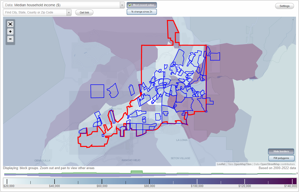
Santa Fe, New Mexico Neighborhood Map - Income, House Prices, Occupations, Boundaries
Settings
X

- City boundary
- Neighborhood boundaries
Business Search - 14 Million verified businesses
Neighborhoods:
Acequie Madre, Alarid, Altamira, Apodaca Hill, Arroyo Chamiso, Artesano Y Carlos Rey, Baca Street, Barrio La Canada, Bellamah, Calle Nopal, Camino La Canada, Camino Ocaso Del Sol, Candlelight, Canyon, Carlos Rey Del Sur, Casa Alegre, Casa Linda, Casa Solana, Cerro De Piedra, Cerros Colorados, Cottonwood Village, Country Club Gardens, Coyote Ridge, Cristo Rey, Cumbre Vista, De Vargas Heights, Don Digeo, Don Gaspar, East, El Canon, El Castillo, Escalante, Fairway Village, Fiesta, Greater Callecita, Historic, Historic Guadalupe, Historic Hillside, Hopewell, Hyde Park, La Canada, La Cieneguita, La Joya, La Madera, Las Acequias, Las Americas, Las Barrancas, Las Estancias, Las Lomas, Los Miradores, Los Senderos, Los Vecinos De Calle San Antonio, Lovato Grant, Nava Ade, Near North Group, Old Santa Fe Trail, Pacheco Street, Park Plazas, Pentastar, Peralta, Pinon Hills, Placita De Descansar, Plaza De Castillo, Pondarosa Ridge, Pueblo Alerge, Pueblos Del Rodeo Road, Pueblos Del Rosario, Pueblos Del Sol, Puestas Del Sol, Rio Vista, San Mateo, San Salvador, Sanchez Street, Santa Fe Hills, Shayakin, Sierra Del Norte, Sierra Vista, Sierra Vista, Southeast, Southwest Bellamah, Summit, Tada, Talaya Hill, The Commons on The Alameda, Tiempo Lindo, Tierra Madre, Tierra Real, Torreon, Town and Country, Valle Del Sol, Via Caballero, Viento Del Norte, Villa San Miguel, Vista Canada Ancha, Vista Del Prado, Vista Encantada, Vista Primera, West Manhattan, Wilderness Gate, Young ParkAcequie Madre neighborhood in Santa Fe statistics: (Find on map)
Area: 0.021 square miles
Population: 10
Population density:
Median household income in 2021:
Median rent in in 2021:
Male vs Females
Median age
Most popular occupations of males: life, physical, and social science occupations (57.1%); healthcare practitioners and technical occupations (25.7%); arts, design, entertainment, sports, and media occupations (21.6%); education, training, and library occupations (15.9%); computer and mathematical occupations (15.8%); sales and office occupations (14.6%); management occupations (except farmers) (8.8%)
Most popular occupations of females: management occupations (except farmers) (38.3%); arts, design, entertainment, sports, and media occupations (18.9%); sales and office occupations (18.3%); business and financial operations occupations (16.5%); education, training, and library occupations (13.7%); healthcare practitioners and technical occupations (10.0%); computer and mathematical occupations (6.9%)
Roads and streets: E Alameda St.
Acequie Madre neighborhood detailed profile
Area: 0.021 square miles
Population: 10
Population density:
| Acequie Madre: | 483 people per square mile |
| Santa Fe: | 2,362 people per square mile |
Median household income in 2021:
| Acequie Madre: | $63,594 |
| Santa Fe: | $60,517 |
Median rent in in 2021:
| Acequie Madre: | $1,403 |
| Santa Fe: | $1,071 |
Male vs Females
| Males: | 4 |
| Females: | 5 |
Median age
| Males: | 50.8 years |
| Females: | 52.7 years |
Most popular occupations of males: life, physical, and social science occupations (57.1%); healthcare practitioners and technical occupations (25.7%); arts, design, entertainment, sports, and media occupations (21.6%); education, training, and library occupations (15.9%); computer and mathematical occupations (15.8%); sales and office occupations (14.6%); management occupations (except farmers) (8.8%)
Most popular occupations of females: management occupations (except farmers) (38.3%); arts, design, entertainment, sports, and media occupations (18.9%); sales and office occupations (18.3%); business and financial operations occupations (16.5%); education, training, and library occupations (13.7%); healthcare practitioners and technical occupations (10.0%); computer and mathematical occupations (6.9%)
Roads and streets: E Alameda St.
Acequie Madre neighborhood detailed profile
Alarid neighborhood in Santa Fe statistics: (Find on map)
Area: 0.028 square miles
Population: 60
Population density:
Median household income in 2021:
Median rent in in 2021:
Male vs Females
Median age
Most popular occupations of males: service occupations (27.1%); sales and office occupations (21.5%); healthcare practitioners and technical occupations (14.6%); construction, extraction, and maintenance occupations (10.9%); management occupations (except farmers) (5.7%); life, physical, and social science occupations (5.3%); legal occupations (4.2%)
Most popular occupations of females: service occupations (30.8%); sales and office occupations (22.7%); legal occupations (19.0%); management occupations (except farmers) (17.2%); education, training, and library occupations (13.9%); healthcare practitioners and technical occupations (7.6%); arts, design, entertainment, sports, and media occupations (6.3%)
Roads and streets: Alarid St; Ninita St; Rosita St; Camino Sierra Vis.
Alarid neighborhood detailed profile
Area: 0.028 square miles
Population: 60
Population density:
| Alarid: | 2,170 people per square mile |
| Santa Fe: | 2,362 people per square mile |
Median household income in 2021:
| Alarid: | $59,167 |
| Santa Fe: | $60,517 |
Median rent in in 2021:
| Alarid: | $970 |
| Santa Fe: | $1,071 |
Male vs Females
| Males: | 34 |
| Females: | 25 |
Median age
| Males: | 47.2 years |
| Females: | 40.7 years |
Most popular occupations of males: service occupations (27.1%); sales and office occupations (21.5%); healthcare practitioners and technical occupations (14.6%); construction, extraction, and maintenance occupations (10.9%); management occupations (except farmers) (5.7%); life, physical, and social science occupations (5.3%); legal occupations (4.2%)
Most popular occupations of females: service occupations (30.8%); sales and office occupations (22.7%); legal occupations (19.0%); management occupations (except farmers) (17.2%); education, training, and library occupations (13.9%); healthcare practitioners and technical occupations (7.6%); arts, design, entertainment, sports, and media occupations (6.3%)
Roads and streets: Alarid St; Ninita St; Rosita St; Camino Sierra Vis.
Alarid neighborhood detailed profile
Altamira neighborhood in Santa Fe statistics: (Find on map)
Area: 0.024 square miles
Roads and streets: Cll Altamira; Caltamira; Cumbre Vista Dr.
Altamira neighborhood detailed profile
Area: 0.024 square miles
Roads and streets: Cll Altamira; Caltamira; Cumbre Vista Dr.
Altamira neighborhood detailed profile
Apodaca Hill neighborhood in Santa Fe statistics: (Find on map)
Area: 0.060 square miles
Population: 41
Population density:
Median household income in 2021:
Median rent in in 2021:
Male vs Females
Median age
Most popular occupations of males: management occupations (except farmers) (24.9%); service occupations (16.4%); arts, design, entertainment, sports, and media occupations (16.0%); legal occupations (14.2%); construction, extraction, and maintenance occupations (14.2%); architecture and engineering occupations (13.0%); computer and mathematical occupations (9.9%)
Most popular occupations of females: education, training, and library occupations (41.1%); service occupations (39.2%); management occupations (except farmers) (13.7%); sales and office occupations (12.6%); community and social services occupations (9.5%); healthcare practitioners and technical occupations (9.5%); business and financial operations occupations (8.4%)
Roads and streets: Apodaca Hill St.
Apodaca Hill neighborhood detailed profile
Area: 0.060 square miles
Population: 41
Population density:
| Apodaca Hill: | 685 people per square mile |
| Santa Fe: | 2,362 people per square mile |
Median household income in 2021:
| Apodaca Hill: | $93,438 |
| Santa Fe: | $60,517 |
Median rent in in 2021:
| Apodaca Hill: | $1,236 |
| Santa Fe: | $1,071 |
Male vs Females
| Males: | 17 |
| Females: | 23 |
Median age
| Males: | 60.3 years |
| Females: | 67.6 years |
Most popular occupations of males: management occupations (except farmers) (24.9%); service occupations (16.4%); arts, design, entertainment, sports, and media occupations (16.0%); legal occupations (14.2%); construction, extraction, and maintenance occupations (14.2%); architecture and engineering occupations (13.0%); computer and mathematical occupations (9.9%)
Most popular occupations of females: education, training, and library occupations (41.1%); service occupations (39.2%); management occupations (except farmers) (13.7%); sales and office occupations (12.6%); community and social services occupations (9.5%); healthcare practitioners and technical occupations (9.5%); business and financial operations occupations (8.4%)
Roads and streets: Apodaca Hill St.
Apodaca Hill neighborhood detailed profile
Arroyo Chamiso neighborhood in Santa Fe statistics: (Find on map)
Area: 2.226 square miles
Population: 2,467
Population density:
Median household income in 2021:
Median rent in in 2021:
Male vs Females
Median age
Housing prices:
Average estimated value of detached houses in 2021 (48.2% of all units):
Average estimated value of townhouses or other attached units in 2021 (6.3% of all units):
Average estimated '21 value of housing units in 5-or-more-unit structures (12.0% of all units):
Most popular occupations of males: business and financial operations occupations (18.7%); community and social services occupations (16.9%); management occupations (except farmers) (14.4%); computer and mathematical occupations (8.7%); education, training, and library occupations (7.8%); life, physical, and social science occupations (6.6%); healthcare practitioners and technical occupations (5.4%)
Most popular occupations of females: healthcare practitioners and technical occupations (28.9%); education, training, and library occupations (16.7%); sales and office occupations (11.5%); service occupations (10.3%); legal occupations (8.5%); arts, design, entertainment, sports, and media occupations (5.8%); business and financial operations occupations (5.4%)
Highways in this neighborhood: Old Pecos Trl (US Hwy 285); W Rodeo Rd (Rodeo Rd, State Rte 300).
Roads and streets: Co Rd 71B (Botulph Rd); Old Santa Fe Trl; Cll Espejo; Sawmill Rd; General Sage Dr; Quail Run Dr; W Zia Rd; Old Arroyo Chamiso; Cll Cacique; Arroyo Chamiso; Cll Tecolote; Cll Halcon; Santa Barbara Dr; Sol Y Nubes; Cll Colibri; Miguel Chavez Rd; Cll Ojo Feliz; Brunn School Rd; Ridgecrest Dr; Siringo Rd; S Covey Trl; Cll San Simon; Herradura Rd; Los Pinones; Cll Tranquilo; Cll Alvarado; Cll Petaca; Brother Abedon Way; Cll Enlace; Starfire Ln; Cll Palomita; Cam Carlitos; Ridgeview Cir; Cmt del Sol; Pradera; Brothers Rd; Cll Paula; Sol Y Lomas Dr; Cll Golondrina; Cam Chico; Cll Pava; Chamiso Ln; Wagon Meadow Rd; Pinon Ridge; Los Pinane; Chelsea Ln; Manuel Medrano Rd; Cam Iris; Callecita Jicarilla; Viejo Rastro; Quail Run Ct; Cll Pinonero; Sun Mountain Ct; Cll Tablas; Wagon Meadow; Cll de Valle; Cll Camarico; N Covey Trl; Cll Azulejo; Sol Y Lamas Dr; Medrano Ln; Brother Luke Pl; Espejo Pl; Nublado; Corte de Pinon; Pla Halcon; Cll Paisano; Chamisa Compound Dr; Stereophile Way; Cll del Sol; Cielo Grande; Callecita Membreno; Pso de la Serna; Cholla Ct; Cll Pecos (Callecita Pecos); Cmt del Donaldo; Botulph Ln; Cll Melitta (Cll Melita); Pla Santa Fe; Juniper Ct; la Salle Cir; Perilla Ct.
Other features: Arroyo de Los Chamisos; Stream.
Arroyo Chamiso neighborhood detailed profile
Area: 2.226 square miles
Population: 2,467
Population density:
| Arroyo Chamiso (Sol Y Lomas): | 1,108 people per square mile |
| Santa Fe: | 2,362 people per square mile |
Median household income in 2021:
| Arroyo Chamiso (Sol Y Lomas): | $92,532 |
| Santa Fe: | $60,517 |
Median rent in in 2021:
| Arroyo Chamiso (Sol Y Lomas): | $1,525 |
| Santa Fe: | $1,071 |
Male vs Females
| Males: | 1,341 |
| Females: | 1,126 |
Median age
| Males: | 43.8 years |
| Females: | 60.1 years |
Housing prices:
Average estimated value of detached houses in 2021 (48.2% of all units):
| Arroyo Chamiso (Sol Y Lomas): | $379,596 |
| Santa Fe: | $445,071 |
Average estimated value of townhouses or other attached units in 2021 (6.3% of all units):
| This neighborhood: | $1,064,949 |
| city: | $218,822 |
Average estimated '21 value of housing units in 5-or-more-unit structures (12.0% of all units):
| Arroyo Chamiso (Sol Y Lomas): | $129,760 |
| Santa Fe: | $179,757 |
Most popular occupations of males: business and financial operations occupations (18.7%); community and social services occupations (16.9%); management occupations (except farmers) (14.4%); computer and mathematical occupations (8.7%); education, training, and library occupations (7.8%); life, physical, and social science occupations (6.6%); healthcare practitioners and technical occupations (5.4%)
Most popular occupations of females: healthcare practitioners and technical occupations (28.9%); education, training, and library occupations (16.7%); sales and office occupations (11.5%); service occupations (10.3%); legal occupations (8.5%); arts, design, entertainment, sports, and media occupations (5.8%); business and financial operations occupations (5.4%)
Highways in this neighborhood: Old Pecos Trl (US Hwy 285); W Rodeo Rd (Rodeo Rd, State Rte 300).
Roads and streets: Co Rd 71B (Botulph Rd); Old Santa Fe Trl; Cll Espejo; Sawmill Rd; General Sage Dr; Quail Run Dr; W Zia Rd; Old Arroyo Chamiso; Cll Cacique; Arroyo Chamiso; Cll Tecolote; Cll Halcon; Santa Barbara Dr; Sol Y Nubes; Cll Colibri; Miguel Chavez Rd; Cll Ojo Feliz; Brunn School Rd; Ridgecrest Dr; Siringo Rd; S Covey Trl; Cll San Simon; Herradura Rd; Los Pinones; Cll Tranquilo; Cll Alvarado; Cll Petaca; Brother Abedon Way; Cll Enlace; Starfire Ln; Cll Palomita; Cam Carlitos; Ridgeview Cir; Cmt del Sol; Pradera; Brothers Rd; Cll Paula; Sol Y Lomas Dr; Cll Golondrina; Cam Chico; Cll Pava; Chamiso Ln; Wagon Meadow Rd; Pinon Ridge; Los Pinane; Chelsea Ln; Manuel Medrano Rd; Cam Iris; Callecita Jicarilla; Viejo Rastro; Quail Run Ct; Cll Pinonero; Sun Mountain Ct; Cll Tablas; Wagon Meadow; Cll de Valle; Cll Camarico; N Covey Trl; Cll Azulejo; Sol Y Lamas Dr; Medrano Ln; Brother Luke Pl; Espejo Pl; Nublado; Corte de Pinon; Pla Halcon; Cll Paisano; Chamisa Compound Dr; Stereophile Way; Cll del Sol; Cielo Grande; Callecita Membreno; Pso de la Serna; Cholla Ct; Cll Pecos (Callecita Pecos); Cmt del Donaldo; Botulph Ln; Cll Melitta (Cll Melita); Pla Santa Fe; Juniper Ct; la Salle Cir; Perilla Ct.
Other features: Arroyo de Los Chamisos; Stream.
Arroyo Chamiso neighborhood detailed profile
Artesano Y Carlos Rey neighborhood in Santa Fe statistics: (Find on map)
Area: 0.056 square miles
Population: 142
Population density:
Median household income in 2021:
Median rent in in 2021:
Male vs Females
Median age
Average estimated value of detached houses in 2021 (88.2% of all units):
Most popular occupations of males: sales and office occupations (14.8%); material moving occupations (11.3%); arts, design, entertainment, sports, and media occupations (8.5%); business and financial operations occupations (8.0%); service occupations (6.8%); management occupations (except farmers) (5.8%); life, physical, and social science occupations (5.8%)
Most popular occupations of females: sales and office occupations (46.7%); service occupations (19.3%); education, training, and library occupations (13.8%); material moving occupations (12.6%); management occupations (except farmers) (3.9%); business and financial operations occupations (3.6%); production occupations (2.8%)
Roads and streets: Cam Artisano; Cam Artista; W Zia Rd; Cam Pintores; Cll Brocha; Cll Agar; Cll Pintora.
Artesano Y Carlos Rey neighborhood detailed profile
Area: 0.056 square miles
Population: 142
Population density:
| Artesano Y Carlos Rey (Camino Pintores): | 2,550 people per square mile |
| Santa Fe: | 2,362 people per square mile |
Median household income in 2021:
| Artesano Y Carlos Rey (Camino Pintores): | $65,251 |
| Santa Fe: | $60,517 |
Median rent in in 2021:
| Artesano Y Carlos Rey (Camino Pintores): | $1,524 |
| Santa Fe: | $1,071 |
Male vs Females
| Males: | 77 |
| Females: | 64 |
Median age
| Males: | 45.4 years |
| Females: | 46.6 years |
Average estimated value of detached houses in 2021 (88.2% of all units):
| Artesano Y Carlos Rey (Camino Pintores): | $305,155 |
| Santa Fe: | $445,071 |
Most popular occupations of males: sales and office occupations (14.8%); material moving occupations (11.3%); arts, design, entertainment, sports, and media occupations (8.5%); business and financial operations occupations (8.0%); service occupations (6.8%); management occupations (except farmers) (5.8%); life, physical, and social science occupations (5.8%)
Most popular occupations of females: sales and office occupations (46.7%); service occupations (19.3%); education, training, and library occupations (13.8%); material moving occupations (12.6%); management occupations (except farmers) (3.9%); business and financial operations occupations (3.6%); production occupations (2.8%)
Roads and streets: Cam Artisano; Cam Artista; W Zia Rd; Cam Pintores; Cll Brocha; Cll Agar; Cll Pintora.
Artesano Y Carlos Rey neighborhood detailed profile
Baca Street neighborhood in Santa Fe statistics: (Find on map)
Area: 0.050 square miles
Population: 95
Population density:
Median household income in 2021:
Median rent in in 2021:
Male vs Females
Median age
Most popular occupations of males: management occupations (except farmers) (16.7%); sales and office occupations (16.1%); service occupations (15.1%); healthcare practitioners and technical occupations (13.3%); computer and mathematical occupations (6.1%); construction, extraction, and maintenance occupations (5.6%); life, physical, and social science occupations (4.5%)
Most popular occupations of females: service occupations (23.8%); management occupations (except farmers) (16.7%); sales and office occupations (15.0%); healthcare practitioners and technical occupations (12.2%); education, training, and library occupations (10.1%); arts, design, entertainment, sports, and media occupations (8.1%); architecture and engineering occupations (4.7%)
Roads and streets: Baca St; Cam Porvenir; Potencia St; Porvenir Ln.
Baca Street neighborhood detailed profile
Area: 0.050 square miles
Population: 95
Population density:
| Baca Street: | 1,896 people per square mile |
| Santa Fe: | 2,362 people per square mile |
Median household income in 2021:
| Baca Street: | $62,713 |
| Santa Fe: | $60,517 |
Median rent in in 2021:
| Baca Street: | $1,019 |
| Santa Fe: | $1,071 |
Male vs Females
| Males: | 49 |
| Females: | 46 |
Median age
| Males: | 51.9 years |
| Females: | 45.6 years |
Most popular occupations of males: management occupations (except farmers) (16.7%); sales and office occupations (16.1%); service occupations (15.1%); healthcare practitioners and technical occupations (13.3%); computer and mathematical occupations (6.1%); construction, extraction, and maintenance occupations (5.6%); life, physical, and social science occupations (4.5%)
Most popular occupations of females: service occupations (23.8%); management occupations (except farmers) (16.7%); sales and office occupations (15.0%); healthcare practitioners and technical occupations (12.2%); education, training, and library occupations (10.1%); arts, design, entertainment, sports, and media occupations (8.1%); architecture and engineering occupations (4.7%)
Roads and streets: Baca St; Cam Porvenir; Potencia St; Porvenir Ln.
Baca Street neighborhood detailed profile
Barrio La Canada neighborhood in Santa Fe statistics: (Find on map)
Area: 0.112 square miles
Population: 286
Population density:
Median household income in 2021:
Median rent in in 2021:
Male vs Females
Median age
Housing prices:
Average estimated value of detached houses in 2021 (71.6% of all units):
Average estimated value of townhouses or other attached units in 2021 (14.9% of all units):
Most popular occupations of males: service occupations (28.1%); management occupations (except farmers) (19.5%); sales and office occupations (12.9%); architecture and engineering occupations (4.7%); education, training, and library occupations (4.1%); production occupations (4.1%); computer and mathematical occupations (3.9%)
Most popular occupations of females: education, training, and library occupations (17.9%); sales and office occupations (17.3%); management occupations (except farmers) (17.1%); healthcare practitioners and technical occupations (14.0%); business and financial operations occupations (12.2%); legal occupations (6.8%); arts, design, entertainment, sports, and media occupations (4.1%)
Roads and streets: Pso de la Conquistadora; Cam de la Canada; Cam de la Vuelta; Ben Hur Dr; Ave Cristobal Colon (Ave Cristobal Colo); Callej�n Emilia; Cam Monica; Callej�n Cordelia; Callej�n Veronica; Callej�n Zenaida; Vuelta Pl; Cam Alcade; Callej�n Melinda; Callej�n Maria; General Wallace Dr.
Barrio La Canada neighborhood detailed profile
Area: 0.112 square miles
Population: 286
Population density:
| Barrio La Canada: | 2,557 people per square mile |
| Santa Fe: | 2,362 people per square mile |
Median household income in 2021:
| Barrio La Canada: | $60,800 |
| Santa Fe: | $60,517 |
Median rent in in 2021:
| Barrio La Canada: | $974 |
| Santa Fe: | $1,071 |
Male vs Females
| Males: | 140 |
| Females: | 145 |
Median age
| Males: | 45.9 years |
| Females: | 48.7 years |
Housing prices:
Average estimated value of detached houses in 2021 (71.6% of all units):
| Barrio La Canada: | $348,904 |
| Santa Fe: | $445,071 |
Average estimated value of townhouses or other attached units in 2021 (14.9% of all units):
| This neighborhood: | $261,077 |
| city: | $218,822 |
Most popular occupations of males: service occupations (28.1%); management occupations (except farmers) (19.5%); sales and office occupations (12.9%); architecture and engineering occupations (4.7%); education, training, and library occupations (4.1%); production occupations (4.1%); computer and mathematical occupations (3.9%)
Most popular occupations of females: education, training, and library occupations (17.9%); sales and office occupations (17.3%); management occupations (except farmers) (17.1%); healthcare practitioners and technical occupations (14.0%); business and financial operations occupations (12.2%); legal occupations (6.8%); arts, design, entertainment, sports, and media occupations (4.1%)
Roads and streets: Pso de la Conquistadora; Cam de la Canada; Cam de la Vuelta; Ben Hur Dr; Ave Cristobal Colon (Ave Cristobal Colo); Callej�n Emilia; Cam Monica; Callej�n Cordelia; Callej�n Veronica; Callej�n Zenaida; Vuelta Pl; Cam Alcade; Callej�n Melinda; Callej�n Maria; General Wallace Dr.
Barrio La Canada neighborhood detailed profile
Bellamah neighborhood in Santa Fe statistics: (Find on map)
Area: 0.202 square miles
Population: 550
Population density:
Median household income in 2021:
Median rent in in 2021:
Male vs Females
Median age
Housing prices:
Average estimated value of detached houses in 2021 (89.4% of all units):
Average estimated value of townhouses or other attached units in 2021 (6.9% of all units):
Most popular occupations of males: material moving occupations (16.5%); service occupations (13.1%); sales and office occupations (12.4%); management occupations (except farmers) (7.5%); production occupations (6.1%); transportation occupations (6.1%); business and financial operations occupations (5.0%)
Most popular occupations of females: sales and office occupations (44.5%); service occupations (12.9%); material moving occupations (11.1%); computer and mathematical occupations (8.3%); management occupations (except farmers) (6.7%); business and financial operations occupations (6.1%); education, training, and library occupations (6.0%)
Roads and streets: Siringo Rd; Alamosa Dr; Cll la Resolana; Cll de Suenos; Cam Carlos Rey; Cam Chueco; Cll Margarita; Cam del Gusto; Santa Clara Dr; Velarde Rd; Practillano Dr; la Junta St; Cam Redondo; Tierra Dr; Flora Dr; San Lorenzo Dr; Alamosa Pl; Cam Rizo; Cll de Oriente; Cll Florinda.
Other features: Arroyo.
Bellamah neighborhood detailed profile
Area: 0.202 square miles
Population: 550
Population density:
| Bellamah (Camino Carlos Rey): | 2,717 people per square mile |
| Santa Fe: | 2,362 people per square mile |
Median household income in 2021:
| Bellamah (Camino Carlos Rey): | $69,497 |
| Santa Fe: | $60,517 |
Median rent in in 2021:
| Bellamah (Camino Carlos Rey): | $1,466 |
| Santa Fe: | $1,071 |
Male vs Females
| Males: | 312 |
| Females: | 237 |
Median age
| Males: | 44.8 years |
| Females: | 46.7 years |
Housing prices:
Average estimated value of detached houses in 2021 (89.4% of all units):
| Bellamah (Camino Carlos Rey): | $305,147 |
| Santa Fe: | $445,071 |
Average estimated value of townhouses or other attached units in 2021 (6.9% of all units):
| This neighborhood: | $234,864 |
| city: | $218,822 |
Most popular occupations of males: material moving occupations (16.5%); service occupations (13.1%); sales and office occupations (12.4%); management occupations (except farmers) (7.5%); production occupations (6.1%); transportation occupations (6.1%); business and financial operations occupations (5.0%)
Most popular occupations of females: sales and office occupations (44.5%); service occupations (12.9%); material moving occupations (11.1%); computer and mathematical occupations (8.3%); management occupations (except farmers) (6.7%); business and financial operations occupations (6.1%); education, training, and library occupations (6.0%)
Roads and streets: Siringo Rd; Alamosa Dr; Cll la Resolana; Cll de Suenos; Cam Carlos Rey; Cam Chueco; Cll Margarita; Cam del Gusto; Santa Clara Dr; Velarde Rd; Practillano Dr; la Junta St; Cam Redondo; Tierra Dr; Flora Dr; San Lorenzo Dr; Alamosa Pl; Cam Rizo; Cll de Oriente; Cll Florinda.
Other features: Arroyo.
Bellamah neighborhood detailed profile
Calle Nopal neighborhood in Santa Fe statistics: (Find on map)
Area: 0.060 square miles
Population: 29
Population density:
Median household income in 2021:
Median rent in in 2021:
Male vs Females
Median age
Most popular occupations of males: business and financial operations occupations (19.4%); construction, extraction, and maintenance occupations (15.3%); production occupations (12.1%); management occupations (except farmers) (9.9%); arts, design, entertainment, sports, and media occupations (8.6%); transportation occupations (6.0%); architecture and engineering occupations (5.6%)
Most popular occupations of females: management occupations (except farmers) (24.5%); service occupations (17.7%); life, physical, and social science occupations (15.8%); sales and office occupations (12.0%); education, training, and library occupations (10.6%); business and financial operations occupations (6.5%); arts, design, entertainment, sports, and media occupations (6.0%)
Roads and streets: Cam Vistas Encantada; Cam Vado; Cll Vado; Cll Corta; Cam del Sol.
Calle Nopal neighborhood detailed profile
Area: 0.060 square miles
Population: 29
Population density:
| Calle Nopal: | 481 people per square mile |
| Santa Fe: | 2,362 people per square mile |
Median household income in 2021:
| Calle Nopal: | $58,813 |
| Santa Fe: | $60,517 |
Median rent in in 2021:
| Calle Nopal: | $693 |
| Santa Fe: | $1,071 |
Male vs Females
| Males: | 13 |
| Females: | 16 |
Median age
| Males: | 57.5 years |
| Females: | 46.5 years |
Most popular occupations of males: business and financial operations occupations (19.4%); construction, extraction, and maintenance occupations (15.3%); production occupations (12.1%); management occupations (except farmers) (9.9%); arts, design, entertainment, sports, and media occupations (8.6%); transportation occupations (6.0%); architecture and engineering occupations (5.6%)
Most popular occupations of females: management occupations (except farmers) (24.5%); service occupations (17.7%); life, physical, and social science occupations (15.8%); sales and office occupations (12.0%); education, training, and library occupations (10.6%); business and financial operations occupations (6.5%); arts, design, entertainment, sports, and media occupations (6.0%)
Roads and streets: Cam Vistas Encantada; Cam Vado; Cll Vado; Cll Corta; Cam del Sol.
Calle Nopal neighborhood detailed profile
Camino La Canada neighborhood in Santa Fe statistics: (Find on map)
Area: 0.012 square miles
Population: 31
Population density:
Median household income in 2021:
Median rent in in 2021:
Male vs Females
Median age
Housing prices:
Average estimated value of detached houses in 2021 (71.4% of all units):
Average estimated value of townhouses or other attached units in 2021 (14.3% of all units):
Most popular occupations of males: service occupations (28.1%); management occupations (except farmers) (19.5%); sales and office occupations (12.9%); architecture and engineering occupations (4.7%); education, training, and library occupations (4.1%); production occupations (4.1%); computer and mathematical occupations (3.9%)
Most popular occupations of females: education, training, and library occupations (17.9%); sales and office occupations (17.3%); management occupations (except farmers) (17.1%); healthcare practitioners and technical occupations (14.0%); business and financial operations occupations (12.2%); legal occupations (6.8%); arts, design, entertainment, sports, and media occupations (4.1%)
Roads and streets: Cam de la Canada; Plz Canada; Cam del Olmo; Cam Alire.
Camino La Canada neighborhood detailed profile
Area: 0.012 square miles
Population: 31
Population density:
| Camino La Canada: | 2,505 people per square mile |
| Santa Fe: | 2,362 people per square mile |
Median household income in 2021:
| Camino La Canada: | $60,800 |
| Santa Fe: | $60,517 |
Median rent in in 2021:
| Camino La Canada: | $974 |
| Santa Fe: | $1,071 |
Male vs Females
| Males: | 15 |
| Females: | 16 |
Median age
| Males: | 45.9 years |
| Females: | 48.7 years |
Housing prices:
Average estimated value of detached houses in 2021 (71.4% of all units):
| Camino La Canada: | $348,904 |
| Santa Fe: | $445,071 |
Average estimated value of townhouses or other attached units in 2021 (14.3% of all units):
| This neighborhood: | $261,077 |
| city: | $218,822 |
Most popular occupations of males: service occupations (28.1%); management occupations (except farmers) (19.5%); sales and office occupations (12.9%); architecture and engineering occupations (4.7%); education, training, and library occupations (4.1%); production occupations (4.1%); computer and mathematical occupations (3.9%)
Most popular occupations of females: education, training, and library occupations (17.9%); sales and office occupations (17.3%); management occupations (except farmers) (17.1%); healthcare practitioners and technical occupations (14.0%); business and financial operations occupations (12.2%); legal occupations (6.8%); arts, design, entertainment, sports, and media occupations (4.1%)
Roads and streets: Cam de la Canada; Plz Canada; Cam del Olmo; Cam Alire.
Camino La Canada neighborhood detailed profile
Camino Ocaso Del Sol neighborhood in Santa Fe statistics: (Find on map)
Area: 0.057 square miles
Population: 39
Population density:
Median household income in 2021:
Median rent in in 2021:
Male vs Females
Median age
Most popular occupations of males: management occupations (except farmers) (24.4%); arts, design, entertainment, sports, and media occupations (16.0%); service occupations (16.0%); legal occupations (14.2%); construction, extraction, and maintenance occupations (14.2%); architecture and engineering occupations (13.0%); computer and mathematical occupations (9.9%)
Most popular occupations of females: education, training, and library occupations (41.1%); service occupations (38.3%); management occupations (except farmers) (13.7%); sales and office occupations (12.6%); community and social services occupations (9.5%); healthcare practitioners and technical occupations (9.3%); business and financial operations occupations (8.4%)
Roads and streets: Cam Ocasco del Sol.
Camino Ocaso Del Sol neighborhood detailed profile
Area: 0.057 square miles
Population: 39
Population density:
| Camino Ocaso Del Sol: | 681 people per square mile |
| Santa Fe: | 2,362 people per square mile |
Median household income in 2021:
| Camino Ocaso Del Sol: | $93,438 |
| Santa Fe: | $60,517 |
Median rent in in 2021:
| Camino Ocaso Del Sol: | $1,236 |
| Santa Fe: | $1,071 |
Male vs Females
| Males: | 17 |
| Females: | 22 |
Median age
| Males: | 60.3 years |
| Females: | 67.6 years |
Most popular occupations of males: management occupations (except farmers) (24.4%); arts, design, entertainment, sports, and media occupations (16.0%); service occupations (16.0%); legal occupations (14.2%); construction, extraction, and maintenance occupations (14.2%); architecture and engineering occupations (13.0%); computer and mathematical occupations (9.9%)
Most popular occupations of females: education, training, and library occupations (41.1%); service occupations (38.3%); management occupations (except farmers) (13.7%); sales and office occupations (12.6%); community and social services occupations (9.5%); healthcare practitioners and technical occupations (9.3%); business and financial operations occupations (8.4%)
Roads and streets: Cam Ocasco del Sol.
Camino Ocaso Del Sol neighborhood detailed profile
Candlelight neighborhood in Santa Fe statistics: (Find on map)
Area: 0.183 square miles
Population: 143
Population density:
Median household income in 2021:
Median rent in in 2021:
Male vs Females
Median age
Housing prices:
Average estimated value of detached houses in 2021 (35.1% of all units):
Average estimated '21 value of housing units in 5-or-more-unit structures (2.1% of all units):
Most popular occupations of males: sales and office occupations (26.9%); production occupations (19.9%); education, training, and library occupations (16.1%); life, physical, and social science occupations (14.0%); construction, extraction, and maintenance occupations (12.5%); computer and mathematical occupations (10.7%); material moving occupations (9.7%)
Most popular occupations of females: service occupations (50.4%); education, training, and library occupations (39.3%); arts, design, entertainment, sports, and media occupations (31.8%); sales and office occupations (28.5%); management occupations (except farmers) (26.8%); business and financial operations occupations (20.4%); legal occupations (9.6%)
Roads and streets: Candelero St; W Zia Rd; Camino Lumbre Rd (Cam Lumbre); Portavela St; Candela St; Cll Miquela; Cll de Rincon Bonito; Cll Luminoso; Brillante St; Quemado St; Galisteo Rd (Galisteo St); Esplendor St; Cam de Pabilo; Vela St; Brillante Ln; Ardor St; Lumbre Ct; Lustre Ct; Ojo Ct; Chamisos Ct.
Candlelight neighborhood detailed profile
Area: 0.183 square miles
Population: 143
Population density:
| Candlelight: | 783 people per square mile |
| Santa Fe: | 2,362 people per square mile |
Median household income in 2021:
| Candlelight: | $46,250 |
| Santa Fe: | $60,517 |
Median rent in in 2021:
| Candlelight: | $1,000 |
| Santa Fe: | $1,071 |
Male vs Females
| Males: | 67 |
| Females: | 76 |
Median age
| Males: | 36.9 years |
| Females: | 62.2 years |
Housing prices:
Average estimated value of detached houses in 2021 (35.1% of all units):
| Candlelight: | $283,556 |
| Santa Fe: | $445,071 |
Average estimated '21 value of housing units in 5-or-more-unit structures (2.1% of all units):
| Candlelight: | $129,760 |
| Santa Fe: | $179,757 |
Most popular occupations of males: sales and office occupations (26.9%); production occupations (19.9%); education, training, and library occupations (16.1%); life, physical, and social science occupations (14.0%); construction, extraction, and maintenance occupations (12.5%); computer and mathematical occupations (10.7%); material moving occupations (9.7%)
Most popular occupations of females: service occupations (50.4%); education, training, and library occupations (39.3%); arts, design, entertainment, sports, and media occupations (31.8%); sales and office occupations (28.5%); management occupations (except farmers) (26.8%); business and financial operations occupations (20.4%); legal occupations (9.6%)
Roads and streets: Candelero St; W Zia Rd; Camino Lumbre Rd (Cam Lumbre); Portavela St; Candela St; Cll Miquela; Cll de Rincon Bonito; Cll Luminoso; Brillante St; Quemado St; Galisteo Rd (Galisteo St); Esplendor St; Cam de Pabilo; Vela St; Brillante Ln; Ardor St; Lumbre Ct; Lustre Ct; Ojo Ct; Chamisos Ct.
Candlelight neighborhood detailed profile
Canyon neighborhood in Santa Fe statistics: (Find on map)
Area: 1.107 square miles
Population: 511
Population density:
Median household income in 2021:
Median rent in in 2021:
Male vs Females
Median age
Most popular occupations of males: arts, design, entertainment, sports, and media occupations (14.9%); legal occupations (13.7%); construction, extraction, and maintenance occupations (13.0%); architecture and engineering occupations (11.9%); healthcare practitioners and technical occupations (9.4%); computer and mathematical occupations (8.9%); education, training, and library occupations (6.3%)
Most popular occupations of females: education, training, and library occupations (35.7%); sales and office occupations (14.0%); management occupations (except farmers) (13.8%); community and social services occupations (8.5%); business and financial operations occupations (7.8%); arts, design, entertainment, sports, and media occupations (5.8%); life, physical, and social science occupations (5.3%)
Roads and streets: Upper Canyon Rd; Cerro Gordo Rd; Cam Militar; Canyon Rd; Esperanza Ln; S Armijo Ln; Cam Pequeno.
Other features: Santa Fe Riv.
Canyon neighborhood detailed profile
Area: 1.107 square miles
Population: 511
Population density:
| Canyon: | 462 people per square mile |
| Santa Fe: | 2,362 people per square mile |
Median household income in 2021:
| Canyon: | $101,843 |
| Santa Fe: | $60,517 |
Median rent in in 2021:
| Canyon: | $1,287 |
| Santa Fe: | $1,071 |
Male vs Females
| Males: | 223 |
| Females: | 287 |
Median age
| Males: | 43.3 years |
| Females: | 56.1 years |
Most popular occupations of males: arts, design, entertainment, sports, and media occupations (14.9%); legal occupations (13.7%); construction, extraction, and maintenance occupations (13.0%); architecture and engineering occupations (11.9%); healthcare practitioners and technical occupations (9.4%); computer and mathematical occupations (8.9%); education, training, and library occupations (6.3%)
Most popular occupations of females: education, training, and library occupations (35.7%); sales and office occupations (14.0%); management occupations (except farmers) (13.8%); community and social services occupations (8.5%); business and financial operations occupations (7.8%); arts, design, entertainment, sports, and media occupations (5.8%); life, physical, and social science occupations (5.3%)
Roads and streets: Upper Canyon Rd; Cerro Gordo Rd; Cam Militar; Canyon Rd; Esperanza Ln; S Armijo Ln; Cam Pequeno.
Other features: Santa Fe Riv.
Canyon neighborhood detailed profile
Carlos Rey Del Sur neighborhood in Santa Fe statistics: (Find on map)
Area: 0.081 square miles
Roads and streets: Governor Lindsey Rd; Governor Miles Rd; Governor Mabry Ct.
Carlos Rey Del Sur neighborhood detailed profile
Area: 0.081 square miles
Roads and streets: Governor Lindsey Rd; Governor Miles Rd; Governor Mabry Ct.
Carlos Rey Del Sur neighborhood detailed profile
Casa Alegre neighborhood in Santa Fe statistics: (Find on map)
Area: 0.380 square miles
Population: 671
Population density:
Median household income in 2021:
Median rent in in 2021:
Male vs Females
Median age
Housing prices:
Average estimated value of detached houses in 2021 (75.9% of all units):
Average estimated value of townhouses or other attached units in 2021 (9.6% of all units):
Most popular occupations of males: management occupations (except farmers) (28.5%); computer and mathematical occupations (12.7%); healthcare practitioners and technical occupations (11.8%); sales and office occupations (10.1%); production occupations (7.8%); material moving occupations (5.7%); business and financial operations occupations (5.1%)
Most popular occupations of females: service occupations (17.0%); healthcare practitioners and technical occupations (16.8%); management occupations (except farmers) (16.2%); arts, design, entertainment, sports, and media occupations (15.9%); architecture and engineering occupations (9.2%); sales and office occupations (7.5%); education, training, and library occupations (6.4%)
Roads and streets: Rosina St; Otowi Rd; Hopi Rd; Kiva Rd; Saint Michaels Dr (Osage Ave); San Felipe Ave; Hano Rd; Maclovia St; San Jose Ave; Osage Cir; Apache Ave; San Ildefonso Rd; Gallegos Ln; Vitalia St; Lujan St; Tijeras Rd; Declovina St; Puye Rd; Tewa Rd; San Felipe Cir; Luana St; Gallegos Dr; Osage Dr; Osage Ln; Isabel St; Maclovia Cir; Maclovia Ln; Isleta Ave; Chama Ave.
Other features: Acequia de Los Pinos.
Casa Alegre neighborhood detailed profile
Area: 0.380 square miles
Population: 671
Population density:
| Casa Alegre: | 1,766 people per square mile |
| Santa Fe: | 2,362 people per square mile |
Median household income in 2021:
| Casa Alegre: | $63,641 |
| Santa Fe: | $60,517 |
Median rent in in 2021:
| Casa Alegre: | $1,100 |
| Santa Fe: | $1,071 |
Male vs Females
| Males: | 323 |
| Females: | 348 |
Median age
| Males: | 51.0 years |
| Females: | 50.4 years |
Housing prices:
Average estimated value of detached houses in 2021 (75.9% of all units):
| Casa Alegre: | $348,904 |
| Santa Fe: | $445,071 |
Average estimated value of townhouses or other attached units in 2021 (9.6% of all units):
| This neighborhood: | $261,077 |
| city: | $218,822 |
Most popular occupations of males: management occupations (except farmers) (28.5%); computer and mathematical occupations (12.7%); healthcare practitioners and technical occupations (11.8%); sales and office occupations (10.1%); production occupations (7.8%); material moving occupations (5.7%); business and financial operations occupations (5.1%)
Most popular occupations of females: service occupations (17.0%); healthcare practitioners and technical occupations (16.8%); management occupations (except farmers) (16.2%); arts, design, entertainment, sports, and media occupations (15.9%); architecture and engineering occupations (9.2%); sales and office occupations (7.5%); education, training, and library occupations (6.4%)
Roads and streets: Rosina St; Otowi Rd; Hopi Rd; Kiva Rd; Saint Michaels Dr (Osage Ave); San Felipe Ave; Hano Rd; Maclovia St; San Jose Ave; Osage Cir; Apache Ave; San Ildefonso Rd; Gallegos Ln; Vitalia St; Lujan St; Tijeras Rd; Declovina St; Puye Rd; Tewa Rd; San Felipe Cir; Luana St; Gallegos Dr; Osage Dr; Osage Ln; Isabel St; Maclovia Cir; Maclovia Ln; Isleta Ave; Chama Ave.
Other features: Acequia de Los Pinos.
Casa Alegre neighborhood detailed profile
Casa Linda neighborhood in Santa Fe statistics: (Find on map)
Area: 0.063 square miles
Population: 164
Population density:
Median household income in 2021:
Median rent in in 2021:
Male vs Females
Median age
Most popular occupations of males: sales and office occupations (28.5%); management occupations (except farmers) (25.6%); material moving occupations (17.9%); life, physical, and social science occupations (10.6%); service occupations (7.7%); education, training, and library occupations (6.3%); arts, design, entertainment, sports, and media occupations (6.3%)
Most popular occupations of females: service occupations (29.2%); education, training, and library occupations (18.5%); sales and office occupations (18.5%); healthcare practitioners and technical occupations (9.2%); computer and mathematical occupations (7.7%); life, physical, and social science occupations (4.6%); community and social services occupations (4.6%)
Roads and streets: Santa Rosa Dr; Santa Cruz Dr; Monterey Dr; San Juan Dr; Monterey Pl.
Casa Linda neighborhood detailed profile
Area: 0.063 square miles
Population: 164
Population density:
| Casa Linda: | 2,614 people per square mile |
| Santa Fe: | 2,362 people per square mile |
Median household income in 2021:
| Casa Linda: | $62,206 |
| Santa Fe: | $60,517 |
Median rent in in 2021:
| Casa Linda: | $1,186 |
| Santa Fe: | $1,071 |
Male vs Females
| Males: | 73 |
| Females: | 90 |
Median age
| Males: | 45.7 years |
| Females: | 46.5 years |
Most popular occupations of males: sales and office occupations (28.5%); management occupations (except farmers) (25.6%); material moving occupations (17.9%); life, physical, and social science occupations (10.6%); service occupations (7.7%); education, training, and library occupations (6.3%); arts, design, entertainment, sports, and media occupations (6.3%)
Most popular occupations of females: service occupations (29.2%); education, training, and library occupations (18.5%); sales and office occupations (18.5%); healthcare practitioners and technical occupations (9.2%); computer and mathematical occupations (7.7%); life, physical, and social science occupations (4.6%); community and social services occupations (4.6%)
Roads and streets: Santa Rosa Dr; Santa Cruz Dr; Monterey Dr; San Juan Dr; Monterey Pl.
Casa Linda neighborhood detailed profile
Casa Solana neighborhood in Santa Fe statistics: (Find on map)
Area: 0.408 square miles
Population: 1,042
Population density:
Median household income in 2021:
Median rent in in 2021:
Male vs Females
Median age
Housing prices:
Average estimated value of detached houses in 2021 (70.7% of all units):
Average estimated value of townhouses or other attached units in 2021 (15.6% of all units):
Most popular occupations of males: service occupations (27.9%); management occupations (except farmers) (19.3%); sales and office occupations (13.0%); architecture and engineering occupations (4.9%); education, training, and library occupations (4.2%); production occupations (4.0%); computer and mathematical occupations (3.8%)
Most popular occupations of females: education, training, and library occupations (17.9%); sales and office occupations (17.5%); management occupations (except farmers) (17.0%); architecture and engineering occupations (13.9%); healthcare practitioners and technical occupations (13.9%); business and financial operations occupations (12.1%); legal occupations (6.7%)
Highways in this neighborhood: .
Roads and streets: Alamo Dr; W Alameda St; Rio Vista St; el Camino de Las Crucitas; Spruce St; Sombrio Dr; Sereno Dr; Solana Dr (Solano Dr); Pla de Oro; Pla Loma; Lugar de Oro St; Las Mananitas St; Rio Seco St; Pine St; S Plata Cir; Cedar St; S Luna Cir; Oak Ave; N Luna Cir; Miramonte St; Cmt Alegre; Cielo Azul St; Ave Aliso; N Plata Cir; Vuelta Roble; Temblon St; Sicomoro St; Alder Ave; Corona St; Sunnyslope St (Sunny Slope Dr); Sunny Slope Dr; Via Robles.
Other features: Canada Rincon.
Casa Solana neighborhood detailed profile
Area: 0.408 square miles
Population: 1,042
Population density:
| Casa Solana (La Nueva Casa Solana): | 2,555 people per square mile |
| Santa Fe: | 2,362 people per square mile |
Median household income in 2021:
| Casa Solana (La Nueva Casa Solana): | $56,020 |
| Santa Fe: | $60,517 |
Median rent in in 2021:
| Casa Solana (La Nueva Casa Solana): | $977 |
| Santa Fe: | $1,071 |
Male vs Females
| Males: | 511 |
| Females: | 530 |
Median age
| Males: | 47.4 years |
| Females: | 45.0 years |
Housing prices:
Average estimated value of detached houses in 2021 (70.7% of all units):
| Casa Solana (La Nueva Casa Solana): | $348,904 |
| Santa Fe: | $445,071 |
Average estimated value of townhouses or other attached units in 2021 (15.6% of all units):
| This neighborhood: | $261,077 |
| city: | $218,822 |
Most popular occupations of males: service occupations (27.9%); management occupations (except farmers) (19.3%); sales and office occupations (13.0%); architecture and engineering occupations (4.9%); education, training, and library occupations (4.2%); production occupations (4.0%); computer and mathematical occupations (3.8%)
Most popular occupations of females: education, training, and library occupations (17.9%); sales and office occupations (17.5%); management occupations (except farmers) (17.0%); architecture and engineering occupations (13.9%); healthcare practitioners and technical occupations (13.9%); business and financial operations occupations (12.1%); legal occupations (6.7%)
Highways in this neighborhood: .
Roads and streets: Alamo Dr; W Alameda St; Rio Vista St; el Camino de Las Crucitas; Spruce St; Sombrio Dr; Sereno Dr; Solana Dr (Solano Dr); Pla de Oro; Pla Loma; Lugar de Oro St; Las Mananitas St; Rio Seco St; Pine St; S Plata Cir; Cedar St; S Luna Cir; Oak Ave; N Luna Cir; Miramonte St; Cmt Alegre; Cielo Azul St; Ave Aliso; N Plata Cir; Vuelta Roble; Temblon St; Sicomoro St; Alder Ave; Corona St; Sunnyslope St (Sunny Slope Dr); Sunny Slope Dr; Via Robles.
Other features: Canada Rincon.
Casa Solana neighborhood detailed profile
Cerro De Piedra neighborhood in Santa Fe statistics: (Find on map)
Area: 0.184 square miles
Roads and streets: Barranca Rd; Barranca Dr.
Cerro De Piedra neighborhood detailed profile
Area: 0.184 square miles
Roads and streets: Barranca Rd; Barranca Dr.
Cerro De Piedra neighborhood detailed profile
Cerros Colorados neighborhood in Santa Fe statistics: (Find on map)
Area: 0.234 square miles
Population: 24
Population density:
Median household income in 2021:
Median rent in in 2021:
Male vs Females
Median age
Most popular occupations of males: management occupations (except farmers) (22.1%); sales and office occupations (17.7%); service occupations (14.5%); legal occupations (9.3%); life, physical, and social science occupations (7.6%); arts, design, entertainment, sports, and media occupations (5.2%); healthcare practitioners and technical occupations (4.7%)
Most popular occupations of females: service occupations (27.1%); sales and office occupations (23.6%); management occupations (except farmers) (14.0%); arts, design, entertainment, sports, and media occupations (8.9%); education, training, and library occupations (7.1%); healthcare practitioners and technical occupations (6.6%); computer and mathematical occupations (5.8%)
Roads and streets: Cerros Colorados; Senda de Andres; Senda de Daniel; Senda de Eleuterio.
Cerros Colorados neighborhood detailed profile
Area: 0.234 square miles
Population: 24
Population density:
| Cerros Colorados: | 103 people per square mile |
| Santa Fe: | 2,362 people per square mile |
Median household income in 2021:
| Cerros Colorados: | $117,750 |
| Santa Fe: | $60,517 |
Median rent in in 2021:
| Cerros Colorados: | $2,154 |
| Santa Fe: | $1,071 |
Male vs Females
| Males: | 11 |
| Females: | 12 |
Median age
| Males: | 58.4 years |
| Females: | 65.3 years |
Most popular occupations of males: management occupations (except farmers) (22.1%); sales and office occupations (17.7%); service occupations (14.5%); legal occupations (9.3%); life, physical, and social science occupations (7.6%); arts, design, entertainment, sports, and media occupations (5.2%); healthcare practitioners and technical occupations (4.7%)
Most popular occupations of females: service occupations (27.1%); sales and office occupations (23.6%); management occupations (except farmers) (14.0%); arts, design, entertainment, sports, and media occupations (8.9%); education, training, and library occupations (7.1%); healthcare practitioners and technical occupations (6.6%); computer and mathematical occupations (5.8%)
Roads and streets: Cerros Colorados; Senda de Andres; Senda de Daniel; Senda de Eleuterio.
Cerros Colorados neighborhood detailed profile
Cottonwood Village neighborhood in Santa Fe statistics: (Find on map)
Area: 0.139 square miles
Population: 217
Population density:
Median household income in 2021:
Median rent in in 2021:
Male vs Females
Median age
Average estimated value of mobile home in 2021 (100.0% of all units):
Most popular occupations of males: service occupations (52.4%); construction, extraction, and maintenance occupations (11.7%); management occupations (except farmers) (9.3%); business and financial operations occupations (6.4%); healthcare practitioners and technical occupations (4.6%); production occupations (4.0%); sales and office occupations (3.4%)
Most popular occupations of females: sales and office occupations (27.5%); service occupations (23.3%); management occupations (except farmers) (19.7%); healthcare practitioners and technical occupations (10.2%); education, training, and library occupations (7.5%); life, physical, and social science occupations (6.7%); business and financial operations occupations (5.2%)
Roads and streets: Sycamore Loop; Aspen Loop; Cottonwood Dr; Walnut St; Ash St; Cypress St; Olive St; Maple St; Birch St; Rosewood St; Redwood St; Locust St; Hickory St; Poplar St; Elm St.
Cottonwood Village neighborhood detailed profile
Area: 0.139 square miles
Population: 217
Population density:
| Cottonwood Village: | 1,565 people per square mile |
| Santa Fe: | 2,362 people per square mile |
Median household income in 2021:
| Cottonwood Village: | $71,328 |
| Santa Fe: | $60,517 |
Median rent in in 2021:
| Cottonwood Village: | $714 |
| Santa Fe: | $1,071 |
Male vs Females
| Males: | 109 |
| Females: | 107 |
Median age
| Males: | 42.3 years |
| Females: | 32.2 years |
Average estimated value of mobile home in 2021 (100.0% of all units):
| Cottonwood Village: | $96,783 |
| Santa Fe: | $64,854 |
Most popular occupations of males: service occupations (52.4%); construction, extraction, and maintenance occupations (11.7%); management occupations (except farmers) (9.3%); business and financial operations occupations (6.4%); healthcare practitioners and technical occupations (4.6%); production occupations (4.0%); sales and office occupations (3.4%)
Most popular occupations of females: sales and office occupations (27.5%); service occupations (23.3%); management occupations (except farmers) (19.7%); healthcare practitioners and technical occupations (10.2%); education, training, and library occupations (7.5%); life, physical, and social science occupations (6.7%); business and financial operations occupations (5.2%)
Roads and streets: Sycamore Loop; Aspen Loop; Cottonwood Dr; Walnut St; Ash St; Cypress St; Olive St; Maple St; Birch St; Rosewood St; Redwood St; Locust St; Hickory St; Poplar St; Elm St.
Cottonwood Village neighborhood detailed profile
Country Club Gardens neighborhood in Santa Fe statistics: (Find on map)
Area: 0.096 square miles
Roads and streets: Country Club Gdns; Country Club Gardens.
Country Club Gardens neighborhood detailed profile
Area: 0.096 square miles
Roads and streets: Country Club Gdns; Country Club Gardens.
Country Club Gardens neighborhood detailed profile
Coyote Ridge neighborhood in Santa Fe statistics: (Find on map)
Area: 0.205 square miles
Population: 101
Population density:
Median household income in 2021:
Median rent in in 2021:
Male vs Females
Median age
Most popular occupations of males: business and financial operations occupations (19.4%); construction, extraction, and maintenance occupations (15.3%); production occupations (12.1%); management occupations (except farmers) (9.9%); arts, design, entertainment, sports, and media occupations (8.6%); transportation occupations (6.0%); architecture and engineering occupations (5.6%)
Most popular occupations of females: management occupations (except farmers) (24.5%); service occupations (17.7%); life, physical, and social science occupations (15.8%); sales and office occupations (12.0%); education, training, and library occupations (10.6%); business and financial operations occupations (6.5%); arts, design, entertainment, sports, and media occupations (6.0%)
Roads and streets: Coyote Ridge Rd; Via Brisa; Co Rd 70 (W Alameda St); Via Magdalena; Brisa Cir; Via Janna Cir.
Coyote Ridge neighborhood detailed profile
Area: 0.205 square miles
Population: 101
Population density:
| Coyote Ridge: | 494 people per square mile |
| Santa Fe: | 2,362 people per square mile |
Median household income in 2021:
| Coyote Ridge: | $58,813 |
| Santa Fe: | $60,517 |
Median rent in in 2021:
| Coyote Ridge: | $693 |
| Santa Fe: | $1,071 |
Male vs Females
| Males: | 46 |
| Females: | 54 |
Median age
| Males: | 57.5 years |
| Females: | 46.5 years |
Most popular occupations of males: business and financial operations occupations (19.4%); construction, extraction, and maintenance occupations (15.3%); production occupations (12.1%); management occupations (except farmers) (9.9%); arts, design, entertainment, sports, and media occupations (8.6%); transportation occupations (6.0%); architecture and engineering occupations (5.6%)
Most popular occupations of females: management occupations (except farmers) (24.5%); service occupations (17.7%); life, physical, and social science occupations (15.8%); sales and office occupations (12.0%); education, training, and library occupations (10.6%); business and financial operations occupations (6.5%); arts, design, entertainment, sports, and media occupations (6.0%)
Roads and streets: Coyote Ridge Rd; Via Brisa; Co Rd 70 (W Alameda St); Via Magdalena; Brisa Cir; Via Janna Cir.
Coyote Ridge neighborhood detailed profile
Cristo Rey neighborhood in Santa Fe statistics: (Find on map)
Area: 0.079 square miles
Population: 39
Population density:
Median household income in 2021:
Median rent in in 2021:
Male vs Females
Median age
Most popular occupations of males: life, physical, and social science occupations (57.0%); healthcare practitioners and technical occupations (25.7%); arts, design, entertainment, sports, and media occupations (21.6%); computer and mathematical occupations (15.8%); sales and office occupations (14.6%); management occupations (except farmers) (8.8%); service occupations (7.4%)
Most popular occupations of females: management occupations (except farmers) (38.3%); arts, design, entertainment, sports, and media occupations (18.8%); sales and office occupations (18.3%); education, training, and library occupations (13.7%); healthcare practitioners and technical occupations (10.0%); computer and mathematical occupations (6.9%); service occupations (3.4%)
Roads and streets: Cam San Acacio; Canyon Rd; Cam Delora; Cristo Rey St; Cam Cerrito; Cam Don Miguel; Cam Cabra; Victoria St; Cam Sin Nombre.
Cristo Rey neighborhood detailed profile
Area: 0.079 square miles
Population: 39
Population density:
| Cristo Rey (San Acacio): | 493 people per square mile |
| Santa Fe: | 2,362 people per square mile |
Median household income in 2021:
| Cristo Rey (San Acacio): | $75,549 |
| Santa Fe: | $60,517 |
Median rent in in 2021:
| Cristo Rey (San Acacio): | $1,403 |
| Santa Fe: | $1,071 |
Male vs Females
| Males: | 18 |
| Females: | 20 |
Median age
| Males: | 54.6 years |
| Females: | 58.7 years |
Most popular occupations of males: life, physical, and social science occupations (57.0%); healthcare practitioners and technical occupations (25.7%); arts, design, entertainment, sports, and media occupations (21.6%); computer and mathematical occupations (15.8%); sales and office occupations (14.6%); management occupations (except farmers) (8.8%); service occupations (7.4%)
Most popular occupations of females: management occupations (except farmers) (38.3%); arts, design, entertainment, sports, and media occupations (18.8%); sales and office occupations (18.3%); education, training, and library occupations (13.7%); healthcare practitioners and technical occupations (10.0%); computer and mathematical occupations (6.9%); service occupations (3.4%)
Roads and streets: Cam San Acacio; Canyon Rd; Cam Delora; Cristo Rey St; Cam Cerrito; Cam Don Miguel; Cam Cabra; Victoria St; Cam Sin Nombre.
Cristo Rey neighborhood detailed profile
Cumbre Vista neighborhood in Santa Fe statistics: (Find on map)
Area: 0.025 square miles
Roads and streets: Cumbre Vista Dr.
Cumbre Vista neighborhood detailed profile
Area: 0.025 square miles
Roads and streets: Cumbre Vista Dr.
Cumbre Vista neighborhood detailed profile
De Vargas Heights neighborhood in Santa Fe statistics: (Find on map)
Area: 0.024 square miles
Population: 20
Population density:
Median household income in 2021:
Median rent in in 2021:
Male vs Females
Median age
Most popular occupations of males: management occupations (except farmers) (29.2%); healthcare practitioners and technical occupations (16.0%); sales and office occupations (14.7%); life, physical, and social science occupations (9.0%); education, training, and library occupations (8.6%); computer and mathematical occupations (5.9%); business and financial operations occupations (5.0%)
Most popular occupations of females: legal occupations (20.0%); education, training, and library occupations (19.1%); sales and office occupations (18.6%); business and financial operations occupations (9.1%); management occupations (except farmers) (6.8%); arts, design, entertainment, sports, and media occupations (6.1%); healthcare practitioners and technical occupations (4.9%)
Roads and streets: Cll de Sebastian.
De Vargas Heights neighborhood detailed profile
Area: 0.024 square miles
Population: 20
Population density:
| De Vargas Heights: | 843 people per square mile |
| Santa Fe: | 2,362 people per square mile |
Median household income in 2021:
| De Vargas Heights: | $121,250 |
| Santa Fe: | $60,517 |
Median rent in in 2021:
| De Vargas Heights: | $2,117 |
| Santa Fe: | $1,071 |
Male vs Females
| Males: | 9 |
| Females: | 11 |
Median age
| Males: | 64.3 years |
| Females: | 69.1 years |
Most popular occupations of males: management occupations (except farmers) (29.2%); healthcare practitioners and technical occupations (16.0%); sales and office occupations (14.7%); life, physical, and social science occupations (9.0%); education, training, and library occupations (8.6%); computer and mathematical occupations (5.9%); business and financial operations occupations (5.0%)
Most popular occupations of females: legal occupations (20.0%); education, training, and library occupations (19.1%); sales and office occupations (18.6%); business and financial operations occupations (9.1%); management occupations (except farmers) (6.8%); arts, design, entertainment, sports, and media occupations (6.1%); healthcare practitioners and technical occupations (4.9%)
Roads and streets: Cll de Sebastian.
De Vargas Heights neighborhood detailed profile
Don Digeo neighborhood in Santa Fe statistics: (Find on map)
Area: 0.262 square miles
Population: 1,036
Population density:
Median household income in 2021:
Median rent in in 2021:
Male vs Females
Median age
Average estimated value of detached houses in 2021 (63.0% of all units):
Most popular occupations of males: service occupations (16.9%); healthcare practitioners and technical occupations (15.1%); arts, design, entertainment, sports, and media occupations (10.3%); farming, fishing, and forestry occupations (8.6%); education, training, and library occupations (7.7%); production occupations (7.1%); management occupations (except farmers) (6.9%)
Most popular occupations of females: service occupations (29.5%); management occupations (except farmers) (15.6%); education, training, and library occupations (12.7%); legal occupations (10.1%); sales and office occupations (9.7%); healthcare practitioners and technical occupations (9.1%); business and financial operations occupations (6.5%)
Roads and streets: Galisteo St; Don Diego Ave; Cam de Los Marquez; W Houghton St; Don Cubero Ave; Cll Grillo; Marquez Pl; Early St; Don Canuto St; Don Fernando Rd; Sena St; W Buena Vista St; Anita Pl; Lomita St; Cll Torreador; Gomez Rd; Pueblo Dr; Allendale St; Cll Lucero; Gilmore St; Linda Vista Rd; Cordova Pl; Chavez Pl; W Gomez Rd; Topeka St; Lugar de Monte Vis; San Isabel Rd (San Isabel St); Don Cubero Pl; W Cordova Rd; Adela St (Cam Adela); Gregory Ln; Don Diego Ct; Rael Rd; Don Manuel St.
Don Digeo neighborhood detailed profile
Area: 0.262 square miles
Population: 1,036
Population density:
| Don Digeo: | 3,950 people per square mile |
| Santa Fe: | 2,362 people per square mile |
Median household income in 2021:
| Don Digeo: | $65,580 |
| Santa Fe: | $60,517 |
Median rent in in 2021:
| Don Digeo: | $1,070 |
| Santa Fe: | $1,071 |
Male vs Females
| Males: | 418 |
| Females: | 618 |
Median age
| Males: | 49.9 years |
| Females: | 56.1 years |
Average estimated value of detached houses in 2021 (63.0% of all units):
| Don Digeo: | $533,985 |
| Santa Fe: | $445,071 |
Most popular occupations of males: service occupations (16.9%); healthcare practitioners and technical occupations (15.1%); arts, design, entertainment, sports, and media occupations (10.3%); farming, fishing, and forestry occupations (8.6%); education, training, and library occupations (7.7%); production occupations (7.1%); management occupations (except farmers) (6.9%)
Most popular occupations of females: service occupations (29.5%); management occupations (except farmers) (15.6%); education, training, and library occupations (12.7%); legal occupations (10.1%); sales and office occupations (9.7%); healthcare practitioners and technical occupations (9.1%); business and financial operations occupations (6.5%)
Roads and streets: Galisteo St; Don Diego Ave; Cam de Los Marquez; W Houghton St; Don Cubero Ave; Cll Grillo; Marquez Pl; Early St; Don Canuto St; Don Fernando Rd; Sena St; W Buena Vista St; Anita Pl; Lomita St; Cll Torreador; Gomez Rd; Pueblo Dr; Allendale St; Cll Lucero; Gilmore St; Linda Vista Rd; Cordova Pl; Chavez Pl; W Gomez Rd; Topeka St; Lugar de Monte Vis; San Isabel Rd (San Isabel St); Don Cubero Pl; W Cordova Rd; Adela St (Cam Adela); Gregory Ln; Don Diego Ct; Rael Rd; Don Manuel St.
Don Digeo neighborhood detailed profile
Don Gaspar neighborhood in Santa Fe statistics: (Find on map)
Area: 0.334 square miles
Population: 895
Population density:
Median household income in 2021:
Median rent in in 2021:
Male vs Females
Median age
Most popular occupations of males: sales and office occupations (19.1%); healthcare practitioners and technical occupations (15.9%); management occupations (except farmers) (14.9%); life, physical, and social science occupations (12.1%); service occupations (8.9%); education, training, and library occupations (5.2%); arts, design, entertainment, sports, and media occupations (3.8%)
Most popular occupations of females: management occupations (except farmers) (26.9%); legal occupations (19.9%); life, physical, and social science occupations (12.1%); service occupations (8.3%); education, training, and library occupations (7.0%); sales and office occupations (7.0%); business and financial operations occupations (4.8%)
Roads and streets: Don Gaspar Ave; E Barcelona Rd; E Coronado Rd; Old Pecos Trl; E Cordova Rd; E Berger St; E Buena Vista St; Old Santa Fe Trl; E Santa Fe Ave; Gildersleeve St; Seville Rd; Webber St; Barcelona Ln; E Booth St; E Houghton St; Madrid Rd; Valencia Rd; W Houghton St; Laughlin St; Granada St; W Barcelona Rd; Coronado Ln; W Booth St; W Buena Vista St; Cross St; Pso de Peralta; W Santa Fe Ave; Madrid Ln; Waldo St; Don Gaspar Ln; Pino Rd.
Don Gaspar neighborhood detailed profile
Area: 0.334 square miles
Population: 895
Population density:
| Don Gaspar: | 2,678 people per square mile |
| Santa Fe: | 2,362 people per square mile |
Median household income in 2021:
| Don Gaspar: | $92,528 |
| Santa Fe: | $60,517 |
Median rent in in 2021:
| Don Gaspar: | $1,144 |
| Santa Fe: | $1,071 |
Male vs Females
| Males: | 386 |
| Females: | 508 |
Median age
| Males: | 55.6 years |
| Females: | 62.3 years |
Most popular occupations of males: sales and office occupations (19.1%); healthcare practitioners and technical occupations (15.9%); management occupations (except farmers) (14.9%); life, physical, and social science occupations (12.1%); service occupations (8.9%); education, training, and library occupations (5.2%); arts, design, entertainment, sports, and media occupations (3.8%)
Most popular occupations of females: management occupations (except farmers) (26.9%); legal occupations (19.9%); life, physical, and social science occupations (12.1%); service occupations (8.3%); education, training, and library occupations (7.0%); sales and office occupations (7.0%); business and financial operations occupations (4.8%)
Roads and streets: Don Gaspar Ave; E Barcelona Rd; E Coronado Rd; Old Pecos Trl; E Cordova Rd; E Berger St; E Buena Vista St; Old Santa Fe Trl; E Santa Fe Ave; Gildersleeve St; Seville Rd; Webber St; Barcelona Ln; E Booth St; E Houghton St; Madrid Rd; Valencia Rd; W Houghton St; Laughlin St; Granada St; W Barcelona Rd; Coronado Ln; W Booth St; W Buena Vista St; Cross St; Pso de Peralta; W Santa Fe Ave; Madrid Ln; Waldo St; Don Gaspar Ln; Pino Rd.
Don Gaspar neighborhood detailed profile
East neighborhood in Santa Fe statistics: (Find on map)
Area: 0.101 square miles
Highways in this neighborhood: Hyde Park Rd (State Rte 475).
Roads and streets: Cam del Este; Cam de Las Trampas; Cam de Jemez; Cam de Levante; Cam Chaco; Pla del Este.
East neighborhood detailed profile
Area: 0.101 square miles
Highways in this neighborhood: Hyde Park Rd (State Rte 475).
Roads and streets: Cam del Este; Cam de Las Trampas; Cam de Jemez; Cam de Levante; Cam Chaco; Pla del Este.
East neighborhood detailed profile
El Canon neighborhood in Santa Fe statistics: (Find on map)
Area: 0.080 square miles
Population: 8
Population density:
Median household income in 2021:
Median rent in in 2021:
Male vs Females
Median age
Most popular occupations of males: management occupations (except farmers) (22.1%); sales and office occupations (17.7%); service occupations (14.5%); legal occupations (9.3%); life, physical, and social science occupations (7.6%); arts, design, entertainment, sports, and media occupations (5.2%); healthcare practitioners and technical occupations (4.7%)
Most popular occupations of females: service occupations (27.1%); sales and office occupations (23.6%); management occupations (except farmers) (14.0%); arts, design, entertainment, sports, and media occupations (8.9%); education, training, and library occupations (7.2%); healthcare practitioners and technical occupations (6.6%); computer and mathematical occupations (5.8%)
Roads and streets: Pso de Don Carlos; Pso de Florencio; Pso de Andres.
El Canon neighborhood detailed profile
Area: 0.080 square miles
Population: 8
Population density:
| El Canon: | 99 people per square mile |
| Santa Fe: | 2,362 people per square mile |
Median household income in 2021:
| El Canon: | $117,750 |
| Santa Fe: | $60,517 |
Median rent in in 2021:
| El Canon: | $2,154 |
| Santa Fe: | $1,071 |
Male vs Females
| Males: | 4 |
| Females: | 4 |
Median age
| Males: | 58.4 years |
| Females: | 65.3 years |
Most popular occupations of males: management occupations (except farmers) (22.1%); sales and office occupations (17.7%); service occupations (14.5%); legal occupations (9.3%); life, physical, and social science occupations (7.6%); arts, design, entertainment, sports, and media occupations (5.2%); healthcare practitioners and technical occupations (4.7%)
Most popular occupations of females: service occupations (27.1%); sales and office occupations (23.6%); management occupations (except farmers) (14.0%); arts, design, entertainment, sports, and media occupations (8.9%); education, training, and library occupations (7.2%); healthcare practitioners and technical occupations (6.6%); computer and mathematical occupations (5.8%)
Roads and streets: Pso de Don Carlos; Pso de Florencio; Pso de Andres.
El Canon neighborhood detailed profile
El Castillo neighborhood in Santa Fe statistics: (Find on map)
Area: 0.008 square miles
Population: 4
Population density:
Median household income in 2021:
Median rent in in 2021:
Male vs Females
Median age
Most popular occupations of males: education, training, and library occupations (22.7%); transportation occupations (22.7%); material moving occupations (22.7%); sales and office occupations (18.2%); service occupations (13.6%)
Most popular occupations of females: management occupations (except farmers) (26.7%); business and financial operations occupations (26.7%); education, training, and library occupations (26.7%); sales and office occupations (20.0%)
El Castillo neighborhood detailed profile
Area: 0.008 square miles
Population: 4
Population density:
| El Castillo: | 494 people per square mile |
| Santa Fe: | 2,362 people per square mile |
Median household income in 2021:
| El Castillo: | $83,750 |
| Santa Fe: | $60,517 |
Median rent in in 2021:
| El Castillo: | $3,168 |
| Santa Fe: | $1,071 |
Male vs Females
| Males: | 1 |
| Females: | 3 |
Median age
| Males: | 72.9 years |
| Females: | 83.6 years |
Most popular occupations of males: education, training, and library occupations (22.7%); transportation occupations (22.7%); material moving occupations (22.7%); sales and office occupations (18.2%); service occupations (13.6%)
Most popular occupations of females: management occupations (except farmers) (26.7%); business and financial operations occupations (26.7%); education, training, and library occupations (26.7%); sales and office occupations (20.0%)
El Castillo neighborhood detailed profile
Escalante neighborhood in Santa Fe statistics: (Find on map)
Area: 0.051 square miles
Population: 133
Population density:
Median household income in 2021:
Median rent in in 2021:
Male vs Females
Median age
Average estimated value of detached houses in 2021 (47.9% of all units):
Most popular occupations of males: education, training, and library occupations (40.8%); service occupations (19.4%); material moving occupations (10.7%); sales and office occupations (10.6%); management occupations (except farmers) (6.6%); construction, extraction, and maintenance occupations (4.5%); business and financial operations occupations (4.2%)
Most popular occupations of females: sales and office occupations (40.4%); service occupations (21.5%); management occupations (except farmers) (19.6%); computer and mathematical occupations (6.2%); business and financial operations occupations (4.9%); healthcare practitioners and technical occupations (4.3%); architecture and engineering occupations (2.8%)
Roads and streets: Letrado St; Alta Vista St; Galisteo Pkwy; Escalante St; Galisteo St; W Cordova Rd; Luisa St; Morelia St; Don Diego Ave.
Escalante neighborhood detailed profile
Area: 0.051 square miles
Population: 133
Population density:
| Escalante (Galisteo): | 2,598 people per square mile |
| Santa Fe: | 2,362 people per square mile |
Median household income in 2021:
| Escalante (Galisteo): | $71,665 |
| Santa Fe: | $60,517 |
Median rent in in 2021:
| Escalante (Galisteo): | $1,142 |
| Santa Fe: | $1,071 |
Male vs Females
| Males: | 60 |
| Females: | 73 |
Median age
| Males: | 47.9 years |
| Females: | 62.0 years |
Average estimated value of detached houses in 2021 (47.9% of all units):
| Escalante (Galisteo): | $533,985 |
| Santa Fe: | $445,071 |
Most popular occupations of males: education, training, and library occupations (40.8%); service occupations (19.4%); material moving occupations (10.7%); sales and office occupations (10.6%); management occupations (except farmers) (6.6%); construction, extraction, and maintenance occupations (4.5%); business and financial operations occupations (4.2%)
Most popular occupations of females: sales and office occupations (40.4%); service occupations (21.5%); management occupations (except farmers) (19.6%); computer and mathematical occupations (6.2%); business and financial operations occupations (4.9%); healthcare practitioners and technical occupations (4.3%); architecture and engineering occupations (2.8%)
Roads and streets: Letrado St; Alta Vista St; Galisteo Pkwy; Escalante St; Galisteo St; W Cordova Rd; Luisa St; Morelia St; Don Diego Ave.
Escalante neighborhood detailed profile
Fairway Village neighborhood in Santa Fe statistics: (Find on map)
Area: 0.050 square miles
Highways in this neighborhood: State Rte 22 (State Rte 588, Agua Fria St).
Roads and streets: Village Way; Willow Way; Sunshine Way; Highland Way; Green Way; Fair Way.
Fairway Village neighborhood detailed profile
Area: 0.050 square miles
Highways in this neighborhood: State Rte 22 (State Rte 588, Agua Fria St).
Roads and streets: Village Way; Willow Way; Sunshine Way; Highland Way; Green Way; Fair Way.
Fairway Village neighborhood detailed profile
Fiesta neighborhood in Santa Fe statistics: (Find on map)
Area: 0.042 square miles
Population: 79
Population density:
Median household income in 2021:
Median rent in in 2021:
Male vs Females
Median age
Most popular occupations of males: sales and office occupations (23.8%); architecture and engineering occupations (21.4%); material moving occupations (20.8%); service occupations (11.9%); legal occupations (11.0%); education, training, and library occupations (10.5%); computer and mathematical occupations (10.2%)
Most popular occupations of females: sales and office occupations (48.4%); service occupations (47.3%); healthcare practitioners and technical occupations (26.8%); community and social services occupations (16.4%); education, training, and library occupations (13.8%); management occupations (except farmers) (8.2%); life, physical, and social science occupations (5.7%)
Roads and streets: Fiesta St; Villeros St; Sabino St; Gran Quivera (Gran Quivira); Melendez St.
Other features: Canada Rincon.
Fiesta neighborhood detailed profile
Area: 0.042 square miles
Population: 79
Population density:
| Fiesta (Villeros): | 1,868 people per square mile |
| Santa Fe: | 2,362 people per square mile |
Median household income in 2021:
| Fiesta (Villeros): | $50,813 |
| Santa Fe: | $60,517 |
Median rent in in 2021:
| Fiesta (Villeros): | $1,072 |
| Santa Fe: | $1,071 |
Male vs Females
| Males: | 34 |
| Females: | 44 |
Median age
| Males: | 49.0 years |
| Females: | 40.9 years |
Most popular occupations of males: sales and office occupations (23.8%); architecture and engineering occupations (21.4%); material moving occupations (20.8%); service occupations (11.9%); legal occupations (11.0%); education, training, and library occupations (10.5%); computer and mathematical occupations (10.2%)
Most popular occupations of females: sales and office occupations (48.4%); service occupations (47.3%); healthcare practitioners and technical occupations (26.8%); community and social services occupations (16.4%); education, training, and library occupations (13.8%); management occupations (except farmers) (8.2%); life, physical, and social science occupations (5.7%)
Roads and streets: Fiesta St; Villeros St; Sabino St; Gran Quivera (Gran Quivira); Melendez St.
Other features: Canada Rincon.
Fiesta neighborhood detailed profile
Greater Callecita neighborhood in Santa Fe statistics: (Find on map)
Area: 0.096 square miles
Roads and streets: Callecita Pl; Williams St; Stagecoach Cir; Sunset St; Hadisway Ave; Campana Pl; Llano Largo St.
Greater Callecita neighborhood detailed profile
Area: 0.096 square miles
Roads and streets: Callecita Pl; Williams St; Stagecoach Cir; Sunset St; Hadisway Ave; Campana Pl; Llano Largo St.
Greater Callecita neighborhood detailed profile
Historic neighborhood in Santa Fe statistics: (Find on map)
Area: 0.316 square miles
Population: 159
Population density:
Median household income in 2021:
Median rent in in 2021:
Male vs Females
Median age
Most popular occupations of males: healthcare practitioners and technical occupations (25.7%); arts, design, entertainment, sports, and media occupations (21.5%); computer and mathematical occupations (15.7%); sales and office occupations (14.7%); management occupations (except farmers) (8.8%); construction, extraction, and maintenance occupations (7.0%); business and financial operations occupations (6.4%)
Most popular occupations of females: management occupations (except farmers) (38.2%); arts, design, entertainment, sports, and media occupations (18.7%); sales and office occupations (18.2%); education, training, and library occupations (13.7%); computer and mathematical occupations (6.8%); service occupations (3.5%); production occupations (3.1%)
Roads and streets: Acequia Madre; Canyon Rd (E Canyon Rd); E Alameda St; Delgado St; E Garcia St; Abeyta St; Cll Corvo; Garcia St; Arroyo Tenorio St; San Pasqual St; San Antonio St; Sosaya Ln; Cam Escondido; Cll la Paz; Cam Manzano; Cam de Las Animas; Johnson Ln; Gormley Ln; Cam del Monte Sol; Cam del Poniente; Douglas St; Plz Balentine; Plz Fatimo; Cll la Pena; Cam Atalaya; Delgado Ln; Miller St; E Palace Ave; Plz Chamisal; Pla Rafaela; Sosaya St; Chavez Ln.
Other features: Santa Fe Riv.
Historic neighborhood detailed profile
Area: 0.316 square miles
Population: 159
Population density:
| Historic: | 504 people per square mile |
| Santa Fe: | 2,362 people per square mile |
Median household income in 2021:
| Historic: | $80,290 |
| Santa Fe: | $60,517 |
Median rent in in 2021:
| Historic: | $1,402 |
| Santa Fe: | $1,071 |
Male vs Females
| Males: | 75 |
| Females: | 84 |
Median age
| Males: | 54.4 years |
| Females: | 59.8 years |
Most popular occupations of males: healthcare practitioners and technical occupations (25.7%); arts, design, entertainment, sports, and media occupations (21.5%); computer and mathematical occupations (15.7%); sales and office occupations (14.7%); management occupations (except farmers) (8.8%); construction, extraction, and maintenance occupations (7.0%); business and financial operations occupations (6.4%)
Most popular occupations of females: management occupations (except farmers) (38.2%); arts, design, entertainment, sports, and media occupations (18.7%); sales and office occupations (18.2%); education, training, and library occupations (13.7%); computer and mathematical occupations (6.8%); service occupations (3.5%); production occupations (3.1%)
Roads and streets: Acequia Madre; Canyon Rd (E Canyon Rd); E Alameda St; Delgado St; E Garcia St; Abeyta St; Cll Corvo; Garcia St; Arroyo Tenorio St; San Pasqual St; San Antonio St; Sosaya Ln; Cam Escondido; Cll la Paz; Cam Manzano; Cam de Las Animas; Johnson Ln; Gormley Ln; Cam del Monte Sol; Cam del Poniente; Douglas St; Plz Balentine; Plz Fatimo; Cll la Pena; Cam Atalaya; Delgado Ln; Miller St; E Palace Ave; Plz Chamisal; Pla Rafaela; Sosaya St; Chavez Ln.
Other features: Santa Fe Riv.
Historic neighborhood detailed profile
Historic Guadalupe neighborhood in Santa Fe statistics: (Find on map)
Area: 0.193 square miles
Population: 390
Population density:
Median household income in 2021:
Median rent in in 2021:
Male vs Females
Median age
Most popular occupations of males: sales and office occupations (22.5%); service occupations (20.7%); healthcare practitioners and technical occupations (9.7%); architecture and engineering occupations (9.0%); construction, extraction, and maintenance occupations (7.5%); legal occupations (7.0%); life, physical, and social science occupations (6.1%)
Most popular occupations of females: sales and office occupations (34.4%); service occupations (16.8%); education, training, and library occupations (13.9%); management occupations (except farmers) (13.1%); legal occupations (11.8%); community and social services occupations (8.6%); life, physical, and social science occupations (4.7%)
Highways in this neighborhood: Agua Fria St (State Rte 588, State Rte 22).
Roads and streets: Alto St; S Guadalupe St; Pso de Peralta; Dunlap St; Irvine St; Montezuma Ave; Closson St; Don Felix St; W Manhattan Ave; Maynard St; Ambrosio St; Barela St; de Fouri St; Polaco St; Alto Ln; Casados St; Cleveland St; Pena Pl.
Railroad features: Santa Fe Southern Rlwy.
Other features: Santa Fe Riv.
Historic Guadalupe neighborhood detailed profile
Area: 0.193 square miles
Population: 390
Population density:
| Historic Guadalupe: | 2,018 people per square mile |
| Santa Fe: | 2,362 people per square mile |
Median household income in 2021:
| Historic Guadalupe: | $57,523 |
| Santa Fe: | $60,517 |
Median rent in in 2021:
| Historic Guadalupe: | $1,035 |
| Santa Fe: | $1,071 |
Male vs Females
| Males: | 196 |
| Females: | 194 |
Median age
| Males: | 50.2 years |
| Females: | 44.4 years |
Most popular occupations of males: sales and office occupations (22.5%); service occupations (20.7%); healthcare practitioners and technical occupations (9.7%); architecture and engineering occupations (9.0%); construction, extraction, and maintenance occupations (7.5%); legal occupations (7.0%); life, physical, and social science occupations (6.1%)
Most popular occupations of females: sales and office occupations (34.4%); service occupations (16.8%); education, training, and library occupations (13.9%); management occupations (except farmers) (13.1%); legal occupations (11.8%); community and social services occupations (8.6%); life, physical, and social science occupations (4.7%)
Highways in this neighborhood: Agua Fria St (State Rte 588, State Rte 22).
Roads and streets: Alto St; S Guadalupe St; Pso de Peralta; Dunlap St; Irvine St; Montezuma Ave; Closson St; Don Felix St; W Manhattan Ave; Maynard St; Ambrosio St; Barela St; de Fouri St; Polaco St; Alto Ln; Casados St; Cleveland St; Pena Pl.
Railroad features: Santa Fe Southern Rlwy.
Other features: Santa Fe Riv.
Historic Guadalupe neighborhood detailed profile
Historic Hillside neighborhood in Santa Fe statistics: (Find on map)
Area: 0.094 square miles
Population: 47
Population density:
Median household income in 2021:
Median rent in in 2021:
Male vs Females
Median age
Most popular occupations of males: life, physical, and social science occupations (62.8%); healthcare practitioners and technical occupations (25.7%); arts, design, entertainment, sports, and media occupations (21.6%); education, training, and library occupations (17.4%); computer and mathematical occupations (15.8%); sales and office occupations (14.6%); management occupations (except farmers) (8.8%)
Most popular occupations of females: management occupations (except farmers) (38.3%); arts, design, entertainment, sports, and media occupations (18.9%); sales and office occupations (18.3%); business and financial operations occupations (18.2%); education, training, and library occupations (13.7%); healthcare practitioners and technical occupations (11.0%); computer and mathematical occupations (6.9%)
Roads and streets: Hillside Ave; Rodriquez St; Armijo St; Armijo Hts; Rodriguez St; Martinez St; E Palace Ave; Tony St; Harkins Ln.
Historic Hillside neighborhood detailed profile
Area: 0.094 square miles
Population: 47
Population density:
| Historic Hillside: | 499 people per square mile |
| Santa Fe: | 2,362 people per square mile |
Median household income in 2021:
| Historic Hillside: | $63,594 |
| Santa Fe: | $60,517 |
Median rent in in 2021:
| Historic Hillside: | $1,403 |
| Santa Fe: | $1,071 |
Male vs Females
| Males: | 22 |
| Females: | 24 |
Median age
| Males: | 50.8 years |
| Females: | 52.7 years |
Most popular occupations of males: life, physical, and social science occupations (62.8%); healthcare practitioners and technical occupations (25.7%); arts, design, entertainment, sports, and media occupations (21.6%); education, training, and library occupations (17.4%); computer and mathematical occupations (15.8%); sales and office occupations (14.6%); management occupations (except farmers) (8.8%)
Most popular occupations of females: management occupations (except farmers) (38.3%); arts, design, entertainment, sports, and media occupations (18.9%); sales and office occupations (18.3%); business and financial operations occupations (18.2%); education, training, and library occupations (13.7%); healthcare practitioners and technical occupations (11.0%); computer and mathematical occupations (6.9%)
Roads and streets: Hillside Ave; Rodriquez St; Armijo St; Armijo Hts; Rodriguez St; Martinez St; E Palace Ave; Tony St; Harkins Ln.
Historic Hillside neighborhood detailed profile
Hopewell neighborhood in Santa Fe statistics: (Find on map)
Area: 0.011 square miles
Population: 76
Population density:
Median household income in 2021:
Median rent in in 2021:
Male vs Females
Median age
Most popular occupations of males: service occupations (27.8%); material moving occupations (27.0%); construction, extraction, and maintenance occupations (20.3%); transportation occupations (9.3%); life, physical, and social science occupations (8.5%); sales and office occupations (5.6%); management occupations (except farmers) (5.4%)
Most popular occupations of females: service occupations (46.3%); community and social services occupations (23.4%); material moving occupations (8.9%); sales and office occupations (7.9%); production occupations (4.9%); management occupations (except farmers) (4.7%); healthcare practitioners and technical occupations (2.9%)
Roads and streets: Mann St.
Hopewell neighborhood detailed profile
Area: 0.011 square miles
Population: 76
Population density:
| Hopewell (Mann Street): | 6,747 people per square mile |
| Santa Fe: | 2,362 people per square mile |
Median household income in 2021:
| Hopewell (Mann Street): | $25,983 |
| Santa Fe: | $60,517 |
Median rent in in 2021:
| Hopewell (Mann Street): | $732 |
| Santa Fe: | $1,071 |
Male vs Females
| Males: | 37 |
| Females: | 39 |
Median age
| Males: | 28.4 years |
| Females: | 27.1 years |
Most popular occupations of males: service occupations (27.8%); material moving occupations (27.0%); construction, extraction, and maintenance occupations (20.3%); transportation occupations (9.3%); life, physical, and social science occupations (8.5%); sales and office occupations (5.6%); management occupations (except farmers) (5.4%)
Most popular occupations of females: service occupations (46.3%); community and social services occupations (23.4%); material moving occupations (8.9%); sales and office occupations (7.9%); production occupations (4.9%); management occupations (except farmers) (4.7%); healthcare practitioners and technical occupations (2.9%)
Roads and streets: Mann St.
Hopewell neighborhood detailed profile
Hyde Park neighborhood in Santa Fe statistics: (Find on map)
Area: 0.414 square miles
Population: 43
Population density:
Median household income in 2021:
Median rent in in 2021:
Male vs Females
Median age
Most popular occupations of males: management occupations (except farmers) (22.1%); sales and office occupations (17.7%); service occupations (14.5%); legal occupations (9.3%); life, physical, and social science occupations (7.6%); arts, design, entertainment, sports, and media occupations (5.2%); healthcare practitioners and technical occupations (4.7%)
Most popular occupations of females: service occupations (27.1%); sales and office occupations (23.6%); management occupations (except farmers) (14.0%); arts, design, entertainment, sports, and media occupations (8.9%); education, training, and library occupations (7.2%); healthcare practitioners and technical occupations (6.6%); computer and mathematical occupations (5.8%)
Roads and streets: Pso Primero (Hyde Park Ests); Hyde Park Ests (Pso del Monte); Pso Ponderosa; el Paseo; Pso Iglesia; Cam Lisa; State Rte 47 (Hyde Park Ests, la Entrada).
Other features: Aztec Spring Crk; Canada Ancha.
Hyde Park neighborhood detailed profile
Area: 0.414 square miles
Population: 43
Population density:
| Hyde Park: | 104 people per square mile |
| Santa Fe: | 2,362 people per square mile |
Median household income in 2021:
| Hyde Park: | $117,750 |
| Santa Fe: | $60,517 |
Median rent in in 2021:
| Hyde Park: | $2,154 |
| Santa Fe: | $1,071 |
Male vs Females
| Males: | 20 |
| Females: | 22 |
Median age
| Males: | 58.4 years |
| Females: | 65.3 years |
Most popular occupations of males: management occupations (except farmers) (22.1%); sales and office occupations (17.7%); service occupations (14.5%); legal occupations (9.3%); life, physical, and social science occupations (7.6%); arts, design, entertainment, sports, and media occupations (5.2%); healthcare practitioners and technical occupations (4.7%)
Most popular occupations of females: service occupations (27.1%); sales and office occupations (23.6%); management occupations (except farmers) (14.0%); arts, design, entertainment, sports, and media occupations (8.9%); education, training, and library occupations (7.2%); healthcare practitioners and technical occupations (6.6%); computer and mathematical occupations (5.8%)
Roads and streets: Pso Primero (Hyde Park Ests); Hyde Park Ests (Pso del Monte); Pso Ponderosa; el Paseo; Pso Iglesia; Cam Lisa; State Rte 47 (Hyde Park Ests, la Entrada).
Other features: Aztec Spring Crk; Canada Ancha.
Hyde Park neighborhood detailed profile
La Canada neighborhood in Santa Fe statistics: (Find on map)
Area: 0.033 square miles
Population: 227
Population density:
Median household income in 2021:
Median rent in in 2021:
Male vs Females
Median age
Most popular occupations of males: service occupations (27.8%); material moving occupations (27.0%); construction, extraction, and maintenance occupations (20.3%); transportation occupations (9.3%); life, physical, and social science occupations (8.5%); sales and office occupations (5.6%); management occupations (except farmers) (5.4%)
Most popular occupations of females: service occupations (46.3%); community and social services occupations (23.4%); material moving occupations (8.9%); sales and office occupations (7.9%); production occupations (4.9%); management occupations (except farmers) (4.7%); healthcare practitioners and technical occupations (2.9%)
Roads and streets: Quapaw St; 3rd St; Espinacitas St; Hopewell St; Quapaw Pl; Lena St.
La Canada neighborhood detailed profile
Area: 0.033 square miles
Population: 227
Population density:
| La Canada: | 6,798 people per square mile |
| Santa Fe: | 2,362 people per square mile |
Median household income in 2021:
| La Canada: | $25,983 |
| Santa Fe: | $60,517 |
Median rent in in 2021:
| La Canada: | $732 |
| Santa Fe: | $1,071 |
Male vs Females
| Males: | 111 |
| Females: | 116 |
Median age
| Males: | 28.4 years |
| Females: | 27.1 years |
Most popular occupations of males: service occupations (27.8%); material moving occupations (27.0%); construction, extraction, and maintenance occupations (20.3%); transportation occupations (9.3%); life, physical, and social science occupations (8.5%); sales and office occupations (5.6%); management occupations (except farmers) (5.4%)
Most popular occupations of females: service occupations (46.3%); community and social services occupations (23.4%); material moving occupations (8.9%); sales and office occupations (7.9%); production occupations (4.9%); management occupations (except farmers) (4.7%); healthcare practitioners and technical occupations (2.9%)
Roads and streets: Quapaw St; 3rd St; Espinacitas St; Hopewell St; Quapaw Pl; Lena St.
La Canada neighborhood detailed profile
La Cieneguita neighborhood in Santa Fe statistics: (Find on map)
Area: 0.086 square miles
Population: 137
Population density:
Median household income in 2021:
Median rent in in 2021:
Male vs Females
Median age
Most popular occupations of males: construction, extraction, and maintenance occupations (29.4%); healthcare practitioners and technical occupations (15.1%); transportation occupations (14.5%); service occupations (13.5%); sales and office occupations (11.8%); education, training, and library occupations (3.8%); community and social services occupations (2.9%)
Most popular occupations of females: service occupations (60.1%); education, training, and library occupations (14.6%); management occupations (except farmers) (11.4%); production occupations (5.1%); sales and office occupations (4.8%); business and financial operations occupations (3.1%); life, physical, and social science occupations (2.9%)
Highways in this neighborhood: Cerrillos Rd.
Roads and streets: la Cieneguita; Maez Rd; Cam Carlos Rey; Cll Angelina; Cll Sotero; Rufina St.
Other features: Acequia de Los Pinos.
La Cieneguita neighborhood detailed profile
Area: 0.086 square miles
Population: 137
Population density:
| La Cieneguita: | 1,592 people per square mile |
| Santa Fe: | 2,362 people per square mile |
Median household income in 2021:
| La Cieneguita: | $56,841 |
| Santa Fe: | $60,517 |
Median rent in in 2021:
| La Cieneguita: | $1,109 |
| Santa Fe: | $1,071 |
Male vs Females
| Males: | 62 |
| Females: | 75 |
Median age
| Males: | 52.9 years |
| Females: | 44.2 years |
Most popular occupations of males: construction, extraction, and maintenance occupations (29.4%); healthcare practitioners and technical occupations (15.1%); transportation occupations (14.5%); service occupations (13.5%); sales and office occupations (11.8%); education, training, and library occupations (3.8%); community and social services occupations (2.9%)
Most popular occupations of females: service occupations (60.1%); education, training, and library occupations (14.6%); management occupations (except farmers) (11.4%); production occupations (5.1%); sales and office occupations (4.8%); business and financial operations occupations (3.1%); life, physical, and social science occupations (2.9%)
Highways in this neighborhood: Cerrillos Rd.
Roads and streets: la Cieneguita; Maez Rd; Cam Carlos Rey; Cll Angelina; Cll Sotero; Rufina St.
Other features: Acequia de Los Pinos.
La Cieneguita neighborhood detailed profile
La Joya neighborhood in Santa Fe statistics: (Find on map)
Area: 0.031 square miles
Population: 80
Population density:
Median household income in 2021:
Median rent in in 2021:
Male vs Females
Median age
Housing prices:
Average estimated value of detached houses in 2021 (73.0% of all units):
Average estimated value of townhouses or other attached units in 2021 (13.5% of all units):
Most popular occupations of males: service occupations (28.1%); management occupations (except farmers) (19.5%); sales and office occupations (12.9%); architecture and engineering occupations (4.7%); education, training, and library occupations (4.1%); production occupations (4.1%); computer and mathematical occupations (3.9%)
Most popular occupations of females: education, training, and library occupations (17.9%); sales and office occupations (17.3%); management occupations (except farmers) (17.1%); healthcare practitioners and technical occupations (14.0%); business and financial operations occupations (12.2%); legal occupations (6.8%); arts, design, entertainment, sports, and media occupations (4.1%)
Highways in this neighborhood: Agua Fria St (State Rte 22, State Rte 588).
Roads and streets: Alejandro St; Mesilla Rd; la Joya St (la Joya Rd); Pso de la Conquistadora.
La Joya neighborhood detailed profile
Area: 0.031 square miles
Population: 80
Population density:
| La Joya: | 2,544 people per square mile |
| Santa Fe: | 2,362 people per square mile |
Median household income in 2021:
| La Joya: | $60,800 |
| Santa Fe: | $60,517 |
Median rent in in 2021:
| La Joya: | $974 |
| Santa Fe: | $1,071 |
Male vs Females
| Males: | 39 |
| Females: | 40 |
Median age
| Males: | 45.9 years |
| Females: | 48.7 years |
Housing prices:
Average estimated value of detached houses in 2021 (73.0% of all units):
| La Joya: | $348,904 |
| Santa Fe: | $445,071 |
Average estimated value of townhouses or other attached units in 2021 (13.5% of all units):
| This neighborhood: | $261,077 |
| city: | $218,822 |
Most popular occupations of males: service occupations (28.1%); management occupations (except farmers) (19.5%); sales and office occupations (12.9%); architecture and engineering occupations (4.7%); education, training, and library occupations (4.1%); production occupations (4.1%); computer and mathematical occupations (3.9%)
Most popular occupations of females: education, training, and library occupations (17.9%); sales and office occupations (17.3%); management occupations (except farmers) (17.1%); healthcare practitioners and technical occupations (14.0%); business and financial operations occupations (12.2%); legal occupations (6.8%); arts, design, entertainment, sports, and media occupations (4.1%)
Highways in this neighborhood: Agua Fria St (State Rte 22, State Rte 588).
Roads and streets: Alejandro St; Mesilla Rd; la Joya St (la Joya Rd); Pso de la Conquistadora.
La Joya neighborhood detailed profile
La Madera neighborhood in Santa Fe statistics: (Find on map)
Area: 0.116 square miles
Population: 296
Population density:
Median household income in 2021:
Median rent in in 2021:
Male vs Females
Median age
Housing prices:
Average estimated value of detached houses in 2021 (71.2% of all units):
Average estimated value of townhouses or other attached units in 2021 (15.1% of all units):
Most popular occupations of males: service occupations (28.1%); management occupations (except farmers) (19.5%); sales and office occupations (12.9%); architecture and engineering occupations (4.7%); education, training, and library occupations (4.1%); production occupations (4.1%); computer and mathematical occupations (3.9%)
Most popular occupations of females: education, training, and library occupations (17.9%); sales and office occupations (17.3%); management occupations (except farmers) (17.1%); healthcare practitioners and technical occupations (14.0%); business and financial operations occupations (12.2%); legal occupations (6.8%); arts, design, entertainment, sports, and media occupations (4.1%)
Highways in this neighborhood: State Rte 22 (State Rte 588, Agua Fria St); S St Francis Dr (US Hwy 285).
Roads and streets: Lopez St; Dunlap St; Alto St; Don Juan St; Urioste St; Kathryn Pl; Salazar Pl; Cortez Pl; Lorenzo St; Montoya St; Franklin Pl; Cll Eloy; Roybal St.
La Madera neighborhood detailed profile
Area: 0.116 square miles
Population: 296
Population density:
| La Madera: | 2,562 people per square mile |
| Santa Fe: | 2,362 people per square mile |
Median household income in 2021:
| La Madera: | $59,997 |
| Santa Fe: | $60,517 |
Median rent in in 2021:
| La Madera: | $974 |
| Santa Fe: | $1,071 |
Male vs Females
| Males: | 145 |
| Females: | 150 |
Median age
| Males: | 46.5 years |
| Females: | 44.8 years |
Housing prices:
Average estimated value of detached houses in 2021 (71.2% of all units):
| La Madera: | $348,904 |
| Santa Fe: | $445,071 |
Average estimated value of townhouses or other attached units in 2021 (15.1% of all units):
| This neighborhood: | $261,077 |
| city: | $218,822 |
Most popular occupations of males: service occupations (28.1%); management occupations (except farmers) (19.5%); sales and office occupations (12.9%); architecture and engineering occupations (4.7%); education, training, and library occupations (4.1%); production occupations (4.1%); computer and mathematical occupations (3.9%)
Most popular occupations of females: education, training, and library occupations (17.9%); sales and office occupations (17.3%); management occupations (except farmers) (17.1%); healthcare practitioners and technical occupations (14.0%); business and financial operations occupations (12.2%); legal occupations (6.8%); arts, design, entertainment, sports, and media occupations (4.1%)
Highways in this neighborhood: State Rte 22 (State Rte 588, Agua Fria St); S St Francis Dr (US Hwy 285).
Roads and streets: Lopez St; Dunlap St; Alto St; Don Juan St; Urioste St; Kathryn Pl; Salazar Pl; Cortez Pl; Lorenzo St; Montoya St; Franklin Pl; Cll Eloy; Roybal St.
La Madera neighborhood detailed profile
Las Acequias neighborhood in Santa Fe statistics: (Find on map)
Area: 0.189 square miles
Roads and streets: Cll Atajo; Senda del Valle; Cll Don Roberto; Acequia Borrada; Cll la Mirada; Vuelta de Las Acequias; Vuelta del Sur; Power Line Rd; Ave de Las Acequias; Rufina St; Pso de la Acequia; Corrida de Agua; Acequia Borrada W (Acequia Borrada E); Ave Linda; Cll Amanda; Chestnut St; Chestnut; Cll Jaime; Senda Ln; Cll Guillermo; Cll Andrew; Rosalinda; Acequia Ln; Cll Cazuella (Cll Cazuela).
Las Acequias neighborhood detailed profile
Las Americas neighborhood in Santa Fe statistics: (Find on map)
Area: 0.013 square miles
Population: 28
Population density:
Median household income in 2021:
Median rent in in 2021:
Male vs Females
Median age
Most popular occupations of males: service occupations (29.7%); sales and office occupations (25.2%); arts, design, entertainment, sports, and media occupations (8.4%); material moving occupations (7.6%); construction, extraction, and maintenance occupations (7.0%); management occupations (except farmers) (3.3%); community and social services occupations (3.1%)
Most popular occupations of females: sales and office occupations (67.0%); service occupations (13.5%); legal occupations (7.8%); business and financial operations occupations (7.6%); education, training, and library occupations (3.5%); healthcare practitioners and technical occupations (2.7%); management occupations (except farmers) (1.4%)
Roads and streets: Ave de Las America.
Las Americas neighborhood detailed profile
Area: 0.013 square miles
Population: 28
Population density:
| Las Americas: | 2,093 people per square mile |
| Santa Fe: | 2,362 people per square mile |
Median household income in 2021:
| Las Americas: | $58,378 |
| Santa Fe: | $60,517 |
Median rent in in 2021:
| Las Americas: | $862 |
| Santa Fe: | $1,071 |
Male vs Females
| Males: | 12 |
| Females: | 15 |
Median age
| Males: | 48.2 years |
| Females: | 48.5 years |
Most popular occupations of males: service occupations (29.7%); sales and office occupations (25.2%); arts, design, entertainment, sports, and media occupations (8.4%); material moving occupations (7.6%); construction, extraction, and maintenance occupations (7.0%); management occupations (except farmers) (3.3%); community and social services occupations (3.1%)
Most popular occupations of females: sales and office occupations (67.0%); service occupations (13.5%); legal occupations (7.8%); business and financial operations occupations (7.6%); education, training, and library occupations (3.5%); healthcare practitioners and technical occupations (2.7%); management occupations (except farmers) (1.4%)
Roads and streets: Ave de Las America.
Las Americas neighborhood detailed profile
Las Barrancas neighborhood in Santa Fe statistics: (Find on map)
Area: 0.073 square miles
Roads and streets: Vis de la Ciudad; Barranca de Oro; Cam Sin Salida; Monte Alto; Gonzales Rd; Cam Montebello; Cam Corto.
Las Barrancas neighborhood detailed profile
Area: 0.073 square miles
Roads and streets: Vis de la Ciudad; Barranca de Oro; Cam Sin Salida; Monte Alto; Gonzales Rd; Cam Montebello; Cam Corto.
Las Barrancas neighborhood detailed profile
Las Estancias neighborhood in Santa Fe statistics: (Find on map)
Area: 0.099 square miles
Roads and streets: Via Berrenda; Via Venado; la Silla Dorada; Cll de Ovejas; Galisteo St; Cll del Reservation; Corte del Porto; Corte del Pozo; Corte del Becerro; Ave la Cerca; Corte de Espuelas; Corte Ojo de Agua.
Las Estancias neighborhood detailed profile
Area: 0.099 square miles
Roads and streets: Via Berrenda; Via Venado; la Silla Dorada; Cll de Ovejas; Galisteo St; Cll del Reservation; Corte del Porto; Corte del Pozo; Corte del Becerro; Ave la Cerca; Corte de Espuelas; Corte Ojo de Agua.
Las Estancias neighborhood detailed profile
Las Lomas neighborhood in Santa Fe statistics: (Find on map)
Area: 0.063 square miles
Roads and streets: The High Rd; Daybreak; City Lights St; Purple Aster; Painted Sky; Starview; E Look (Eastlook); Watchpoint.
Las Lomas neighborhood detailed profile
Area: 0.063 square miles
Roads and streets: The High Rd; Daybreak; City Lights St; Purple Aster; Painted Sky; Starview; E Look (Eastlook); Watchpoint.
Las Lomas neighborhood detailed profile
Los Miradores neighborhood in Santa Fe statistics: (Find on map)
Area: 0.029 square miles
Population: 19
Population density:
Median household income in 2021:
Median rent in in 2021:
Male vs Females
Median age
Most popular occupations of males: life, physical, and social science occupations (31.2%); arts, design, entertainment, sports, and media occupations (17.0%); construction, extraction, and maintenance occupations (13.0%); healthcare practitioners and technical occupations (12.5%); legal occupations (11.8%); computer and mathematical occupations (10.9%); architecture and engineering occupations (10.8%)
Most popular occupations of females: education, training, and library occupations (33.9%); management occupations (except farmers) (20.1%); sales and office occupations (14.1%); healthcare practitioners and technical occupations (9.9%); arts, design, entertainment, sports, and media occupations (8.8%); community and social services occupations (7.0%); business and financial operations occupations (6.2%)
Roads and streets: Cll del Resplendor; Cam de Cruz Blanca Notre; la Rambla; Cam Mirada; Cam de Cruz Blanca.
Los Miradores neighborhood detailed profile
Area: 0.029 square miles
Population: 19
Population density:
| Los Miradores: | 651 people per square mile |
| Santa Fe: | 2,362 people per square mile |
Median household income in 2021:
| Los Miradores: | $75,549 |
| Santa Fe: | $60,517 |
Median rent in in 2021:
| Los Miradores: | $1,288 |
| Santa Fe: | $1,071 |
Male vs Females
| Males: | 8 |
| Females: | 10 |
Median age
| Males: | 54.6 years |
| Females: | 58.7 years |
Most popular occupations of males: life, physical, and social science occupations (31.2%); arts, design, entertainment, sports, and media occupations (17.0%); construction, extraction, and maintenance occupations (13.0%); healthcare practitioners and technical occupations (12.5%); legal occupations (11.8%); computer and mathematical occupations (10.9%); architecture and engineering occupations (10.8%)
Most popular occupations of females: education, training, and library occupations (33.9%); management occupations (except farmers) (20.1%); sales and office occupations (14.1%); healthcare practitioners and technical occupations (9.9%); arts, design, entertainment, sports, and media occupations (8.8%); community and social services occupations (7.0%); business and financial operations occupations (6.2%)
Roads and streets: Cll del Resplendor; Cam de Cruz Blanca Notre; la Rambla; Cam Mirada; Cam de Cruz Blanca.
Los Miradores neighborhood detailed profile
Los Senderos neighborhood in Santa Fe statistics: (Find on map)
Area: 0.047 square miles
Population: 41
Population density:
Median household income in 2021:
Median rent in in 2021:
Male vs Females
Median age
Most popular occupations of males: management occupations (except farmers) (29.2%); healthcare practitioners and technical occupations (16.0%); sales and office occupations (14.7%); life, physical, and social science occupations (9.0%); education, training, and library occupations (8.6%); computer and mathematical occupations (5.9%); business and financial operations occupations (5.0%)
Most popular occupations of females: legal occupations (20.0%); education, training, and library occupations (19.1%); sales and office occupations (18.6%); business and financial operations occupations (9.1%); management occupations (except farmers) (6.8%); arts, design, entertainment, sports, and media occupations (6.1%); healthcare practitioners and technical occupations (4.9%)
Roads and streets: Cll Espejo; Espejo Pl.
Los Senderos neighborhood detailed profile
Area: 0.047 square miles
Population: 41
Population density:
| Los Senderos: | 875 people per square mile |
| Santa Fe: | 2,362 people per square mile |
Median household income in 2021:
| Los Senderos: | $121,250 |
| Santa Fe: | $60,517 |
Median rent in in 2021:
| Los Senderos: | $2,117 |
| Santa Fe: | $1,071 |
Male vs Females
| Males: | 18 |
| Females: | 23 |
Median age
| Males: | 64.3 years |
| Females: | 69.1 years |
Most popular occupations of males: management occupations (except farmers) (29.2%); healthcare practitioners and technical occupations (16.0%); sales and office occupations (14.7%); life, physical, and social science occupations (9.0%); education, training, and library occupations (8.6%); computer and mathematical occupations (5.9%); business and financial operations occupations (5.0%)
Most popular occupations of females: legal occupations (20.0%); education, training, and library occupations (19.1%); sales and office occupations (18.6%); business and financial operations occupations (9.1%); management occupations (except farmers) (6.8%); arts, design, entertainment, sports, and media occupations (6.1%); healthcare practitioners and technical occupations (4.9%)
Roads and streets: Cll Espejo; Espejo Pl.
Los Senderos neighborhood detailed profile
Los Vecinos De Calle San Antonio neighborhood in Santa Fe statistics: (Find on map)
Area: 0.018 square miles
Population: 8
Population density:
Median household income in 2021:
Median rent in in 2021:
Male vs Females
Median age
Most popular occupations of males: life, physical, and social science occupations (57.1%); healthcare practitioners and technical occupations (25.7%); arts, design, entertainment, sports, and media occupations (21.6%); education, training, and library occupations (15.9%); computer and mathematical occupations (15.8%); sales and office occupations (14.6%); management occupations (except farmers) (8.8%)
Most popular occupations of females: management occupations (except farmers) (38.3%); arts, design, entertainment, sports, and media occupations (18.9%); sales and office occupations (18.3%); business and financial operations occupations (16.5%); education, training, and library occupations (13.7%); healthcare practitioners and technical occupations (10.0%); computer and mathematical occupations (6.9%)
Roads and streets: San Pasqual St; San Antonio St; Sosaya St; Chavez Ln.
Los Vecinos De Calle San Antonio neighborhood detailed profile
Area: 0.018 square miles
Population: 8
Population density:
| Los Vecinos De Calle San Antonio: | 446 people per square mile |
| Santa Fe: | 2,362 people per square mile |
Median household income in 2021:
| Los Vecinos De Calle San Antonio: | $63,594 |
| Santa Fe: | $60,517 |
Median rent in in 2021:
| Los Vecinos De Calle San Antonio: | $1,403 |
| Santa Fe: | $1,071 |
Male vs Females
| Males: | 4 |
| Females: | 4 |
Median age
| Males: | 50.8 years |
| Females: | 52.7 years |
Most popular occupations of males: life, physical, and social science occupations (57.1%); healthcare practitioners and technical occupations (25.7%); arts, design, entertainment, sports, and media occupations (21.6%); education, training, and library occupations (15.9%); computer and mathematical occupations (15.8%); sales and office occupations (14.6%); management occupations (except farmers) (8.8%)
Most popular occupations of females: management occupations (except farmers) (38.3%); arts, design, entertainment, sports, and media occupations (18.9%); sales and office occupations (18.3%); business and financial operations occupations (16.5%); education, training, and library occupations (13.7%); healthcare practitioners and technical occupations (10.0%); computer and mathematical occupations (6.9%)
Roads and streets: San Pasqual St; San Antonio St; Sosaya St; Chavez Ln.
Los Vecinos De Calle San Antonio neighborhood detailed profile
Lovato Grant neighborhood in Santa Fe statistics: (Find on map)
Area: 0.039 square miles
Population: 105
Population density:
Median household income in 2021:
Median rent in in 2021:
Male vs Females
Median age
Most popular occupations of males: sales and office occupations (19.2%); healthcare practitioners and technical occupations (15.9%); management occupations (except farmers) (15.0%); life, physical, and social science occupations (12.1%); service occupations (8.9%); farming, fishing, and forestry occupations (7.1%); production occupations (5.9%)
Most popular occupations of females: management occupations (except farmers) (27.0%); legal occupations (20.0%); life, physical, and social science occupations (12.2%); service occupations (8.3%); education, training, and library occupations (7.0%); sales and office occupations (7.0%); business and financial operations occupations (4.8%)
Roads and streets: Barcelona Ln; Don Gaspar Ave; W Barcelona Rd; Coronado Ln.
Lovato Grant neighborhood detailed profile
Area: 0.039 square miles
Population: 105
Population density:
| Lovato Grant: | 2,713 people per square mile |
| Santa Fe: | 2,362 people per square mile |
Median household income in 2021:
| Lovato Grant: | $97,788 |
| Santa Fe: | $60,517 |
Median rent in in 2021:
| Lovato Grant: | $1,137 |
| Santa Fe: | $1,071 |
Male vs Females
| Males: | 45 |
| Females: | 59 |
Median age
| Males: | 52.5 years |
| Females: | 60.2 years |
Most popular occupations of males: sales and office occupations (19.2%); healthcare practitioners and technical occupations (15.9%); management occupations (except farmers) (15.0%); life, physical, and social science occupations (12.1%); service occupations (8.9%); farming, fishing, and forestry occupations (7.1%); production occupations (5.9%)
Most popular occupations of females: management occupations (except farmers) (27.0%); legal occupations (20.0%); life, physical, and social science occupations (12.2%); service occupations (8.3%); education, training, and library occupations (7.0%); sales and office occupations (7.0%); business and financial operations occupations (4.8%)
Roads and streets: Barcelona Ln; Don Gaspar Ave; W Barcelona Rd; Coronado Ln.
Lovato Grant neighborhood detailed profile
Nava Ade neighborhood in Santa Fe statistics: (Find on map)
Area: 0.230 square miles
Roads and streets: Big Sky Rd; Dancing Ground Rd; New Moon Cir; Governor Miles Rd; Soaring Eagle Ln; Lost Feather; Laughing Crow; Rock Castle Ln; Walking Sky (Waking Sky); Autumn Leaf Ln; Whispering Wing Rd; Long Shadow Ln; Chamisa Path Rd; Cactus Flower Ln; Walking Rain Rd; Juniper Hill Ln; Sleeping Bear Ln; Coyote Moon Ln; Midnight Owl; Falling Star Ln; Wandering Trail Ln; Hidden Cricket; Cam Jalisco; Lone Raven; Silent Wing; Whistling Moon; Howling Wolf Ln; Twin Yuccas Ln; Leaping Rabbit; Laughing Crow Ln; Cloud Dance; Indian Summer Ln; Rising Sun Dr.
Nava Ade neighborhood detailed profile
Near North Group neighborhood in Santa Fe statistics: (Find on map)
Area: 0.228 square miles
Roads and streets: Pso de la Cuma; Los Arboles Dr; Los Lovatos St (Los Lovatos Rd); Pso de la Loma; la Cruz Rd; Juniper Dr; Old Taos Hwy; Juniper Ln; Los Arboles Ln; Vera Dr; Descanso Rd; la Loma St; Estrella Ct; Pso del Arroyo; Rendon Rd; Pso Corto.
Near North Group neighborhood detailed profile
Old Santa Fe Trail neighborhood in Santa Fe statistics: (Find on map)
Area: 0.571 square miles
Population: 436
Population density:
Median household income in 2021:
Median rent in in 2021:
Male vs Females
Median age
Most popular occupations of males: management occupations (except farmers) (24.0%); healthcare practitioners and technical occupations (18.4%); sales and office occupations (14.7%); computer and mathematical occupations (8.3%); arts, design, entertainment, sports, and media occupations (7.7%); life, physical, and social science occupations (6.8%); education, training, and library occupations (6.4%)
Most popular occupations of females: sales and office occupations (18.5%); education, training, and library occupations (17.6%); management occupations (except farmers) (15.2%); legal occupations (14.9%); arts, design, entertainment, sports, and media occupations (9.4%); business and financial operations occupations (6.7%); computer and mathematical occupations (4.5%)
Roads and streets: Old Santa Fe Trl; Cam Corrales; Cam Lejo; E Garcia St; Cam Pinones; Cam del Monte Sol; Cam Rancheros; Cam Cacto; E Barcelona Rd; Armenta St; E Coronado Rd.
Old Santa Fe Trail neighborhood detailed profile
Area: 0.571 square miles
Population: 436
Population density:
| Old Santa Fe Trail: | 764 people per square mile |
| Santa Fe: | 2,362 people per square mile |
Median household income in 2021:
| Old Santa Fe Trail: | $101,856 |
| Santa Fe: | $60,517 |
Median rent in in 2021:
| Old Santa Fe Trail: | $1,755 |
| Santa Fe: | $1,071 |
Male vs Females
| Males: | 196 |
| Females: | 239 |
Median age
| Males: | 55.7 years |
| Females: | 60.8 years |
Most popular occupations of males: management occupations (except farmers) (24.0%); healthcare practitioners and technical occupations (18.4%); sales and office occupations (14.7%); computer and mathematical occupations (8.3%); arts, design, entertainment, sports, and media occupations (7.7%); life, physical, and social science occupations (6.8%); education, training, and library occupations (6.4%)
Most popular occupations of females: sales and office occupations (18.5%); education, training, and library occupations (17.6%); management occupations (except farmers) (15.2%); legal occupations (14.9%); arts, design, entertainment, sports, and media occupations (9.4%); business and financial operations occupations (6.7%); computer and mathematical occupations (4.5%)
Roads and streets: Old Santa Fe Trl; Cam Corrales; Cam Lejo; E Garcia St; Cam Pinones; Cam del Monte Sol; Cam Rancheros; Cam Cacto; E Barcelona Rd; Armenta St; E Coronado Rd.
Old Santa Fe Trail neighborhood detailed profile
Pacheco Street neighborhood in Santa Fe statistics: (Find on map)
Area: 0.031 square miles
Population: 110
Population density:
Median household income in 2021:
Median rent in in 2021:
Male vs Females
Median age
Most popular occupations of males: service occupations (39.3%); life, physical, and social science occupations (23.8%); management occupations (except farmers) (15.8%); legal occupations (7.2%); sales and office occupations (6.3%); construction, extraction, and maintenance occupations (2.3%); business and financial operations occupations (1.9%)
Most popular occupations of females: sales and office occupations (44.0%); service occupations (17.6%); education, training, and library occupations (11.9%); arts, design, entertainment, sports, and media occupations (8.4%); management occupations (except farmers) (7.9%); material moving occupations (4.5%); life, physical, and social science occupations (3.8%)
Roads and streets: Pacheco St; Columbia St; Pacheco Ct.
Pacheco Street neighborhood detailed profile
Area: 0.031 square miles
Population: 110
Population density:
| Pacheco Street: | 3,599 people per square mile |
| Santa Fe: | 2,362 people per square mile |
Median household income in 2021:
| Pacheco Street: | $61,422 |
| Santa Fe: | $60,517 |
Median rent in in 2021:
| Pacheco Street: | $1,165 |
| Santa Fe: | $1,071 |
Male vs Females
| Males: | 54 |
| Females: | 56 |
Median age
| Males: | 43.7 years |
| Females: | 50.9 years |
Most popular occupations of males: service occupations (39.3%); life, physical, and social science occupations (23.8%); management occupations (except farmers) (15.8%); legal occupations (7.2%); sales and office occupations (6.3%); construction, extraction, and maintenance occupations (2.3%); business and financial operations occupations (1.9%)
Most popular occupations of females: sales and office occupations (44.0%); service occupations (17.6%); education, training, and library occupations (11.9%); arts, design, entertainment, sports, and media occupations (8.4%); management occupations (except farmers) (7.9%); material moving occupations (4.5%); life, physical, and social science occupations (3.8%)
Roads and streets: Pacheco St; Columbia St; Pacheco Ct.
Pacheco Street neighborhood detailed profile
Park Plazas neighborhood in Santa Fe statistics: (Find on map)
Area: 0.237 square miles
Roads and streets: Plz Blanca; Plz Esmeralda; Plz Amarilla; Cereza; Plz Azul; Relampago Plz; Orchidea Plz; Plz Rojo; Plz del Papagayo; Plz de Junipero; Cisne Plz; Tulipan Plz; Pinon Plz; Lirio Plz; Numbe Plz; Yucca Plz; Cordero Plz; Molina Plz; Paloma Plz; la Luz Plz; Campanilla Plz; Manzana Rojo; Luna Plz; Fresa Plz; Mariposa Plz; Ristra; Narciso Plz; Mirasol; Chomiso; Clavel Plz; Rosa Plz; Colina Plz; Pajarita Plz; Puesta del Sol Plz; Nieve Plz; Flores Plz; Plz del Chili; Plz de Tartuga; Estrella; Plz Verde.
Park Plazas neighborhood detailed profile
Pentastar neighborhood in Santa Fe statistics: (Find on map)
Area: 0.032 square miles
Roads and streets: Michelle Dr; Michelle Ct.
Pentastar neighborhood detailed profile
Area: 0.032 square miles
Roads and streets: Michelle Dr; Michelle Ct.
Pentastar neighborhood detailed profile
Peralta neighborhood in Santa Fe statistics: (Find on map)
Area: 0.055 square miles
Roads and streets: Ave Castellano; Callej�n Arias.
Peralta neighborhood detailed profile
Area: 0.055 square miles
Roads and streets: Ave Castellano; Callej�n Arias.
Peralta neighborhood detailed profile
Pinon Hills neighborhood in Santa Fe statistics: (Find on map)
Area: 1.027 square miles
Population: 284
Population density:
Median household income in 2021:
Median rent in in 2021:
Male vs Females
Median age
Housing prices:
Average estimated value of detached houses in 2021 (73.2% of all units):
Average estimated value of townhouses or other attached units in 2021 (16.8% of all units):
Average estimated value of mobile home in 2021 (6.0% of all units):
Most popular occupations of males: management occupations (except farmers) (32.3%); service occupations (12.0%); arts, design, entertainment, sports, and media occupations (9.5%); sales and office occupations (8.5%); architecture and engineering occupations (7.5%); healthcare practitioners and technical occupations (5.8%); life, physical, and social science occupations (5.6%)
Most popular occupations of females: sales and office occupations (32.6%); management occupations (except farmers) (12.6%); education, training, and library occupations (11.9%); business and financial operations occupations (8.6%); community and social services occupations (7.4%); computer and mathematical occupations (5.9%); arts, design, entertainment, sports, and media occupations (5.0%)
Roads and streets: Cll Francisca E (Cll Francisca); Cll Estevan; Cll Carla; Cll Enrique; Penny Ln; Cll Suzana (Cll Suzanna); Sloman Ln; Sloman Ct.
Other features: Arroyo de Los Frijoles.
Pinon Hills neighborhood detailed profile
Area: 1.027 square miles
Population: 284
Population density:
| Pinon Hills (West SF Association): | 277 people per square mile |
| Santa Fe: | 2,362 people per square mile |
Median household income in 2021:
| Pinon Hills (West SF Association): | $81,695 |
| Santa Fe: | $60,517 |
Median rent in in 2021:
| Pinon Hills (West SF Association): | $2,196 |
| Santa Fe: | $1,071 |
Male vs Females
| Males: | 127 |
| Females: | 157 |
Median age
| Males: | 52.5 years |
| Females: | 50.9 years |
Housing prices:
Average estimated value of detached houses in 2021 (73.2% of all units):
| Pinon Hills (West SF Association): | $933,910 |
| Santa Fe: | $445,071 |
Average estimated value of townhouses or other attached units in 2021 (16.8% of all units):
| This neighborhood: | $389,122 |
| city: | $218,822 |
Average estimated value of mobile home in 2021 (6.0% of all units):
| Pinon Hills (West SF Association): | $158,534 |
| Santa Fe: | $64,854 |
Most popular occupations of males: management occupations (except farmers) (32.3%); service occupations (12.0%); arts, design, entertainment, sports, and media occupations (9.5%); sales and office occupations (8.5%); architecture and engineering occupations (7.5%); healthcare practitioners and technical occupations (5.8%); life, physical, and social science occupations (5.6%)
Most popular occupations of females: sales and office occupations (32.6%); management occupations (except farmers) (12.6%); education, training, and library occupations (11.9%); business and financial operations occupations (8.6%); community and social services occupations (7.4%); computer and mathematical occupations (5.9%); arts, design, entertainment, sports, and media occupations (5.0%)
Roads and streets: Cll Francisca E (Cll Francisca); Cll Estevan; Cll Carla; Cll Enrique; Penny Ln; Cll Suzana (Cll Suzanna); Sloman Ln; Sloman Ct.
Other features: Arroyo de Los Frijoles.
Pinon Hills neighborhood detailed profile
Placita De Descansar neighborhood in Santa Fe statistics: (Find on map)
Area: 0.001 square miles
Median household income in 2021:
Median rent in in 2021:
Most popular occupations of males: life, physical, and social science occupations (57.1%); healthcare practitioners and technical occupations (25.7%); arts, design, entertainment, sports, and media occupations (21.6%); education, training, and library occupations (15.9%); computer and mathematical occupations (15.8%); sales and office occupations (14.6%); management occupations (except farmers) (8.8%)
Most popular occupations of females: management occupations (except farmers) (38.3%); arts, design, entertainment, sports, and media occupations (18.9%); sales and office occupations (18.3%); business and financial operations occupations (16.5%); education, training, and library occupations (13.7%); healthcare practitioners and technical occupations (10.0%); computer and mathematical occupations (6.9%)
Placita De Descansar neighborhood detailed profile
Area: 0.001 square miles
Median household income in 2021:
| Placita De Descansar: | $63,594 |
| Santa Fe: | $60,517 |
Median rent in in 2021:
| Placita De Descansar: | $1,403 |
| Santa Fe: | $1,071 |
Most popular occupations of males: life, physical, and social science occupations (57.1%); healthcare practitioners and technical occupations (25.7%); arts, design, entertainment, sports, and media occupations (21.6%); education, training, and library occupations (15.9%); computer and mathematical occupations (15.8%); sales and office occupations (14.6%); management occupations (except farmers) (8.8%)
Most popular occupations of females: management occupations (except farmers) (38.3%); arts, design, entertainment, sports, and media occupations (18.9%); sales and office occupations (18.3%); business and financial operations occupations (16.5%); education, training, and library occupations (13.7%); healthcare practitioners and technical occupations (10.0%); computer and mathematical occupations (6.9%)
Placita De Descansar neighborhood detailed profile
Plaza De Castillo neighborhood in Santa Fe statistics: (Find on map)
Area: 0.033 square miles
Population: 85
Population density:
Median household income in 2021:
Median rent in in 2021:
Male vs Females
Median age
Most popular occupations of males: sales and office occupations (14.8%); material moving occupations (11.3%); arts, design, entertainment, sports, and media occupations (8.5%); business and financial operations occupations (8.0%); service occupations (6.8%); management occupations (except farmers) (5.8%); life, physical, and social science occupations (5.8%)
Most popular occupations of females: sales and office occupations (46.7%); service occupations (19.3%); education, training, and library occupations (13.9%); material moving occupations (12.7%); management occupations (except farmers) (3.9%); business and financial operations occupations (3.6%); production occupations (2.8%)
Roads and streets: Cam Rancho Siringo; Cll Anna Jean; Sol Y Luz Loop; Anna Jean Ct; Sol Y Luz St.
Plaza De Castillo neighborhood detailed profile
Area: 0.033 square miles
Population: 85
Population density:
| Plaza De Castillo: | 2,557 people per square mile |
| Santa Fe: | 2,362 people per square mile |
Median household income in 2021:
| Plaza De Castillo: | $47,989 |
| Santa Fe: | $60,517 |
Median rent in in 2021:
| Plaza De Castillo: | $1,524 |
| Santa Fe: | $1,071 |
Male vs Females
| Males: | 46 |
| Females: | 38 |
Median age
| Males: | 46.3 years |
| Females: | 39.4 years |
Most popular occupations of males: sales and office occupations (14.8%); material moving occupations (11.3%); arts, design, entertainment, sports, and media occupations (8.5%); business and financial operations occupations (8.0%); service occupations (6.8%); management occupations (except farmers) (5.8%); life, physical, and social science occupations (5.8%)
Most popular occupations of females: sales and office occupations (46.7%); service occupations (19.3%); education, training, and library occupations (13.9%); material moving occupations (12.7%); management occupations (except farmers) (3.9%); business and financial operations occupations (3.6%); production occupations (2.8%)
Roads and streets: Cam Rancho Siringo; Cll Anna Jean; Sol Y Luz Loop; Anna Jean Ct; Sol Y Luz St.
Plaza De Castillo neighborhood detailed profile
Pondarosa Ridge neighborhood in Santa Fe statistics: (Find on map)
Area: 0.103 square miles
Population: 21
Population density:
Median household income in 2021:
Median rent in in 2021:
Male vs Females
Median age
Most popular occupations of males: arts, design, entertainment, sports, and media occupations (12.5%); construction, extraction, and maintenance occupations (12.2%); legal occupations (11.1%); healthcare practitioners and technical occupations (11.0%); architecture and engineering occupations (10.1%); computer and mathematical occupations (9.0%); business and financial operations occupations (8.8%)
Most popular occupations of females: education, training, and library occupations (28.4%); management occupations (except farmers) (15.4%); sales and office occupations (12.9%); service occupations (11.4%); business and financial operations occupations (9.3%); life, physical, and social science occupations (6.3%); arts, design, entertainment, sports, and media occupations (5.4%)
Roads and streets: Cam de Cruz Blanca; E Ridge; Ponderosa Ridge Rd; Cruz Blanca Ct.
Pondarosa Ridge neighborhood detailed profile
Area: 0.103 square miles
Population: 21
Population density:
| Pondarosa Ridge: | 204 people per square mile |
| Santa Fe: | 2,362 people per square mile |
Median household income in 2021:
| Pondarosa Ridge: | $116,753 |
| Santa Fe: | $60,517 |
Median rent in in 2021:
| Pondarosa Ridge: | $1,792 |
| Santa Fe: | $1,071 |
Male vs Females
| Males: | 10 |
| Females: | 11 |
Median age
| Males: | 35.7 years |
| Females: | 55.4 years |
Most popular occupations of males: arts, design, entertainment, sports, and media occupations (12.5%); construction, extraction, and maintenance occupations (12.2%); legal occupations (11.1%); healthcare practitioners and technical occupations (11.0%); architecture and engineering occupations (10.1%); computer and mathematical occupations (9.0%); business and financial operations occupations (8.8%)
Most popular occupations of females: education, training, and library occupations (28.4%); management occupations (except farmers) (15.4%); sales and office occupations (12.9%); service occupations (11.4%); business and financial operations occupations (9.3%); life, physical, and social science occupations (6.3%); arts, design, entertainment, sports, and media occupations (5.4%)
Roads and streets: Cam de Cruz Blanca; E Ridge; Ponderosa Ridge Rd; Cruz Blanca Ct.
Pondarosa Ridge neighborhood detailed profile
Pueblo Alerge neighborhood in Santa Fe statistics: (Find on map)
Area: 0.042 square miles
Population: 74
Population density:
Median household income in 2021:
Median rent in in 2021:
Male vs Females
Median age
Housing prices:
Average estimated value of detached houses in 2021 (73.9% of all units):
Average estimated value of townhouses or other attached units in 2021 (8.7% of all units):
Most popular occupations of males: management occupations (except farmers) (28.4%); computer and mathematical occupations (12.6%); healthcare practitioners and technical occupations (11.8%); sales and office occupations (10.2%); production occupations (7.8%); material moving occupations (5.7%); business and financial operations occupations (5.0%)
Most popular occupations of females: service occupations (17.2%); healthcare practitioners and technical occupations (16.7%); management occupations (except farmers) (16.2%); arts, design, entertainment, sports, and media occupations (15.8%); architecture and engineering occupations (9.2%); sales and office occupations (7.5%); education, training, and library occupations (6.4%)
Roads and streets: Cam de Chelly; Cam Anasazi; Cam Oraibi; Vuelta San Marcos; Cam Haulapai (Cam Hualapai).
Other features: Acequia de Los Pinos.
Pueblo Alerge neighborhood detailed profile
Area: 0.042 square miles
Population: 74
Population density:
| Pueblo Alerge: | 1,744 people per square mile |
| Santa Fe: | 2,362 people per square mile |
Median household income in 2021:
| Pueblo Alerge: | $58,719 |
| Santa Fe: | $60,517 |
Median rent in in 2021:
| Pueblo Alerge: | $1,100 |
| Santa Fe: | $1,071 |
Male vs Females
| Males: | 35 |
| Females: | 38 |
Median age
| Males: | 49.6 years |
| Females: | 46.3 years |
Housing prices:
Average estimated value of detached houses in 2021 (73.9% of all units):
| Pueblo Alerge: | $348,904 |
| Santa Fe: | $445,071 |
Average estimated value of townhouses or other attached units in 2021 (8.7% of all units):
| This neighborhood: | $261,077 |
| city: | $218,822 |
Most popular occupations of males: management occupations (except farmers) (28.4%); computer and mathematical occupations (12.6%); healthcare practitioners and technical occupations (11.8%); sales and office occupations (10.2%); production occupations (7.8%); material moving occupations (5.7%); business and financial operations occupations (5.0%)
Most popular occupations of females: service occupations (17.2%); healthcare practitioners and technical occupations (16.7%); management occupations (except farmers) (16.2%); arts, design, entertainment, sports, and media occupations (15.8%); architecture and engineering occupations (9.2%); sales and office occupations (7.5%); education, training, and library occupations (6.4%)
Roads and streets: Cam de Chelly; Cam Anasazi; Cam Oraibi; Vuelta San Marcos; Cam Haulapai (Cam Hualapai).
Other features: Acequia de Los Pinos.
Pueblo Alerge neighborhood detailed profile
Pueblos Del Rodeo Road neighborhood in Santa Fe statistics: (Find on map)
Area: 0.221 square miles
Roads and streets: la Avenida de San Marcos (la Avenida de San Marc); Pso de Los Pueblos; Cll de Molina; Cam Esquinas; Cam de Los Caballos; el Trebol Ct; Ver Poniente; Ave Alamosa; Cmt San Lucas; Ver Oriente.
Pueblos Del Rodeo Road neighborhood detailed profile
Area: 0.221 square miles
Roads and streets: la Avenida de San Marcos (la Avenida de San Marc); Pso de Los Pueblos; Cll de Molina; Cam Esquinas; Cam de Los Caballos; el Trebol Ct; Ver Poniente; Ave Alamosa; Cmt San Lucas; Ver Oriente.
Pueblos Del Rodeo Road neighborhood detailed profile
Pueblos Del Rosario neighborhood in Santa Fe statistics: (Find on map)
Area: 0.010 square miles
Pueblos Del Rosario neighborhood detailed profile
Area: 0.010 square miles
Pueblos Del Rosario neighborhood detailed profile
Pueblos Del Sol neighborhood in Santa Fe statistics: (Find on map)
Area: 0.232 square miles
Roads and streets: Nizhoni Dr; Cliff Palace; Governor Miles Rd; Pueblo Puye; Pueblo Bonito; Casa Rinconada; Pueblo Jacona; Pueblo Pintado; Pueblo Alto; Cam Carlos Rey; Pueblo Grande; Sandia Cir; Pueblo Halona; Pueblo Sapawe; Pueblo Hawikuh; Pueblo Tsankawi; Jacona Cir; Payupki Cir; Pintado Cir; Betatakin Cir; Bonita Cir; Rinconada Cir; Pueblo San Lazaro.
Pueblos Del Sol neighborhood detailed profile
Puestas Del Sol neighborhood in Santa Fe statistics: (Find on map)
Area: 0.522 square miles
Population: 144
Population density:
Median household income in 2021:
Median rent in in 2021:
Male vs Females
Median age
Housing prices:
Average estimated value of detached houses in 2021 (73.3% of all units):
Average estimated value of townhouses or other attached units in 2021 (16.0% of all units):
Average estimated value of mobile home in 2021 (5.3% of all units):
Most popular occupations of males: management occupations (except farmers) (32.4%); construction, extraction, and maintenance occupations (21.5%); service occupations (12.0%); arts, design, entertainment, sports, and media occupations (9.5%); sales and office occupations (8.5%); architecture and engineering occupations (7.5%); healthcare practitioners and technical occupations (5.8%)
Most popular occupations of females: sales and office occupations (32.6%); management occupations (except farmers) (12.6%); education, training, and library occupations (11.9%); business and financial operations occupations (8.6%); community and social services occupations (7.4%); computer and mathematical occupations (5.9%); arts, design, entertainment, sports, and media occupations (5.0%)
Roads and streets: Cll Sinsonte; Cam Espejo; Cam Peralta; Cll Varada; Cll Benavidez; Cll el Gancho; Entrada (Co Rd 68); Cam del Prado.
Puestas Del Sol neighborhood detailed profile
Area: 0.522 square miles
Population: 144
Population density:
| Puestas Del Sol: | 276 people per square mile |
| Santa Fe: | 2,362 people per square mile |
Median household income in 2021:
| Puestas Del Sol: | $104,531 |
| Santa Fe: | $60,517 |
Median rent in in 2021:
| Puestas Del Sol: | $2,196 |
| Santa Fe: | $1,071 |
Male vs Females
| Males: | 64 |
| Females: | 79 |
Median age
| Males: | 61.8 years |
| Females: | 63.5 years |
Housing prices:
Average estimated value of detached houses in 2021 (73.3% of all units):
| Puestas Del Sol: | $933,910 |
| Santa Fe: | $445,071 |
Average estimated value of townhouses or other attached units in 2021 (16.0% of all units):
| This neighborhood: | $389,122 |
| city: | $218,822 |
Average estimated value of mobile home in 2021 (5.3% of all units):
| Puestas Del Sol: | $158,534 |
| Santa Fe: | $64,854 |
Most popular occupations of males: management occupations (except farmers) (32.4%); construction, extraction, and maintenance occupations (21.5%); service occupations (12.0%); arts, design, entertainment, sports, and media occupations (9.5%); sales and office occupations (8.5%); architecture and engineering occupations (7.5%); healthcare practitioners and technical occupations (5.8%)
Most popular occupations of females: sales and office occupations (32.6%); management occupations (except farmers) (12.6%); education, training, and library occupations (11.9%); business and financial operations occupations (8.6%); community and social services occupations (7.4%); computer and mathematical occupations (5.9%); arts, design, entertainment, sports, and media occupations (5.0%)
Roads and streets: Cll Sinsonte; Cam Espejo; Cam Peralta; Cll Varada; Cll Benavidez; Cll el Gancho; Entrada (Co Rd 68); Cam del Prado.
Puestas Del Sol neighborhood detailed profile
Rio Vista neighborhood in Santa Fe statistics: (Find on map)
Area: 0.037 square miles
Population: 93
Population density:
Median household income in 2021:
Median rent in in 2021:
Male vs Females
Median age
Housing prices:
Average estimated value of detached houses in 2021 (70.5% of all units):
Average estimated value of townhouses or other attached units in 2021 (13.6% of all units):
Most popular occupations of males: service occupations (28.1%); management occupations (except farmers) (19.5%); sales and office occupations (12.9%); architecture and engineering occupations (4.7%); education, training, and library occupations (4.1%); production occupations (4.1%); computer and mathematical occupations (3.9%)
Most popular occupations of females: education, training, and library occupations (17.9%); sales and office occupations (17.3%); management occupations (except farmers) (17.1%); healthcare practitioners and technical occupations (14.0%); business and financial operations occupations (12.2%); legal occupations (6.8%); arts, design, entertainment, sports, and media occupations (4.1%)
Roads and streets: Cll Don Jose; Santa Fe River Rd; Medio.
Rio Vista neighborhood detailed profile
Area: 0.037 square miles
Population: 93
Population density:
| Rio Vista: | 2,540 people per square mile |
| Santa Fe: | 2,362 people per square mile |
Median household income in 2021:
| Rio Vista: | $60,800 |
| Santa Fe: | $60,517 |
Median rent in in 2021:
| Rio Vista: | $974 |
| Santa Fe: | $1,071 |
Male vs Females
| Males: | 45 |
| Females: | 47 |
Median age
| Males: | 45.9 years |
| Females: | 48.7 years |
Housing prices:
Average estimated value of detached houses in 2021 (70.5% of all units):
| Rio Vista: | $348,904 |
| Santa Fe: | $445,071 |
Average estimated value of townhouses or other attached units in 2021 (13.6% of all units):
| This neighborhood: | $261,077 |
| city: | $218,822 |
Most popular occupations of males: service occupations (28.1%); management occupations (except farmers) (19.5%); sales and office occupations (12.9%); architecture and engineering occupations (4.7%); education, training, and library occupations (4.1%); production occupations (4.1%); computer and mathematical occupations (3.9%)
Most popular occupations of females: education, training, and library occupations (17.9%); sales and office occupations (17.3%); management occupations (except farmers) (17.1%); healthcare practitioners and technical occupations (14.0%); business and financial operations occupations (12.2%); legal occupations (6.8%); arts, design, entertainment, sports, and media occupations (4.1%)
Roads and streets: Cll Don Jose; Santa Fe River Rd; Medio.
Rio Vista neighborhood detailed profile
San Mateo neighborhood in Santa Fe statistics: (Find on map)
Area: 0.944 square miles
Population: 1,700
Population density:
Median household income in 2021:
Median rent in in 2021:
Male vs Females
Median age
Housing prices:
Average estimated value of detached houses in 2021 (59.0% of all units):
Average estimated value of townhouses or other attached units in 2021 (3.0% of all units):
Average estimated '21 value of housing units in 5-or-more-unit structures (25.0% of all units):
Most popular occupations of males: education, training, and library occupations (25.8%); service occupations (12.3%); architecture and engineering occupations (11.7%); life, physical, and social science occupations (9.8%); sales and office occupations (7.0%); material moving occupations (6.7%); management occupations (except farmers) (5.4%)
Most popular occupations of females: sales and office occupations (35.4%); management occupations (except farmers) (22.3%); service occupations (18.3%); healthcare practitioners and technical occupations (8.7%); business and financial operations occupations (5.5%); computer and mathematical occupations (3.6%); arts, design, entertainment, sports, and media occupations (2.5%)
Highways in this neighborhood: US Hwy 285 (Saint Michael's Dr, Saint Michaels Dr, State Rte 466).
Roads and streets: W San Mateo Rd; Don Gaspar Ave; Old Pecos Trl; Galisteo St; Luisa St; Columbia St; Cadiz Rd; E San Mateo Rd; Harkle Rd; W Lupita Rd; Miracerros Loop S; E Lupita Rd; Seville Rd; Mateo Cir N; Cll Medico; la Placita Cir; W Alicante Rd; Hospital Dr; Alta Vista St; Encina Rd; la Paloma St; E Alicante Rd; Miracerros Loop N; Balboa Rd; Diolinda Rd (Diolinda St); Cam Teresa; W Cordova Rd; Cam Amado; Galisteo Ln; Letrado St; Arroyo Chamiso; Cll Royale; Madrid Pl; Luisa Ln; Lovato Ln; Luisa Pl; Malaga Ln; Mira-Cerros Ln S; Medico Ln; San Mateo Cir; la Tusa St; Miracerros Ln N; Buchanan Way; Luisa Ct; Madrid Rd.
Other features: Stream.
San Mateo neighborhood detailed profile
Area: 0.944 square miles
Population: 1,700
Population density:
| San Mateo: | 1,802 people per square mile |
| Santa Fe: | 2,362 people per square mile |
Median household income in 2021:
| San Mateo: | $87,433 |
| Santa Fe: | $60,517 |
Median rent in in 2021:
| San Mateo: | $1,316 |
| Santa Fe: | $1,071 |
Male vs Females
| Males: | 767 |
| Females: | 933 |
Median age
| Males: | 50.9 years |
| Females: | 61.7 years |
Housing prices:
Average estimated value of detached houses in 2021 (59.0% of all units):
| San Mateo: | $533,985 |
| Santa Fe: | $445,071 |
Average estimated value of townhouses or other attached units in 2021 (3.0% of all units):
| This neighborhood: | $1,289,272 |
| city: | $218,822 |
Average estimated '21 value of housing units in 5-or-more-unit structures (25.0% of all units):
| San Mateo: | $170,728 |
| Santa Fe: | $179,757 |
Most popular occupations of males: education, training, and library occupations (25.8%); service occupations (12.3%); architecture and engineering occupations (11.7%); life, physical, and social science occupations (9.8%); sales and office occupations (7.0%); material moving occupations (6.7%); management occupations (except farmers) (5.4%)
Most popular occupations of females: sales and office occupations (35.4%); management occupations (except farmers) (22.3%); service occupations (18.3%); healthcare practitioners and technical occupations (8.7%); business and financial operations occupations (5.5%); computer and mathematical occupations (3.6%); arts, design, entertainment, sports, and media occupations (2.5%)
Highways in this neighborhood: US Hwy 285 (Saint Michael's Dr, Saint Michaels Dr, State Rte 466).
Roads and streets: W San Mateo Rd; Don Gaspar Ave; Old Pecos Trl; Galisteo St; Luisa St; Columbia St; Cadiz Rd; E San Mateo Rd; Harkle Rd; W Lupita Rd; Miracerros Loop S; E Lupita Rd; Seville Rd; Mateo Cir N; Cll Medico; la Placita Cir; W Alicante Rd; Hospital Dr; Alta Vista St; Encina Rd; la Paloma St; E Alicante Rd; Miracerros Loop N; Balboa Rd; Diolinda Rd (Diolinda St); Cam Teresa; W Cordova Rd; Cam Amado; Galisteo Ln; Letrado St; Arroyo Chamiso; Cll Royale; Madrid Pl; Luisa Ln; Lovato Ln; Luisa Pl; Malaga Ln; Mira-Cerros Ln S; Medico Ln; San Mateo Cir; la Tusa St; Miracerros Ln N; Buchanan Way; Luisa Ct; Madrid Rd.
Other features: Stream.
San Mateo neighborhood detailed profile
San Salvador neighborhood in Santa Fe statistics: (Find on map)
Area: 0.014 square miles
Population: 36
Population density:
Median household income in 2021:
Median rent in in 2021:
Male vs Females
Median age
Housing prices:
Average estimated value of detached houses in 2021 (70.6% of all units):
Average estimated value of townhouses or other attached units in 2021 (11.8% of all units):
Most popular occupations of males: service occupations (28.1%); management occupations (except farmers) (19.5%); sales and office occupations (12.9%); architecture and engineering occupations (4.7%); education, training, and library occupations (4.1%); production occupations (4.1%); computer and mathematical occupations (3.9%)
Most popular occupations of females: education, training, and library occupations (17.9%); sales and office occupations (17.3%); management occupations (except farmers) (17.1%); healthcare practitioners and technical occupations (14.0%); business and financial operations occupations (12.2%); legal occupations (6.8%); arts, design, entertainment, sports, and media occupations (4.1%)
Roads and streets: Rincon de Torreon; San Salvador Dr; Salvador Pl; San Salvador Ln; W Alameda St.
San Salvador neighborhood detailed profile
Area: 0.014 square miles
Population: 36
Population density:
| San Salvador: | 2,542 people per square mile |
| Santa Fe: | 2,362 people per square mile |
Median household income in 2021:
| San Salvador: | $60,800 |
| Santa Fe: | $60,517 |
Median rent in in 2021:
| San Salvador: | $974 |
| Santa Fe: | $1,071 |
Male vs Females
| Males: | 18 |
| Females: | 18 |
Median age
| Males: | 45.9 years |
| Females: | 48.7 years |
Housing prices:
Average estimated value of detached houses in 2021 (70.6% of all units):
| San Salvador: | $348,904 |
| Santa Fe: | $445,071 |
Average estimated value of townhouses or other attached units in 2021 (11.8% of all units):
| This neighborhood: | $261,077 |
| city: | $218,822 |
Most popular occupations of males: service occupations (28.1%); management occupations (except farmers) (19.5%); sales and office occupations (12.9%); architecture and engineering occupations (4.7%); education, training, and library occupations (4.1%); production occupations (4.1%); computer and mathematical occupations (3.9%)
Most popular occupations of females: education, training, and library occupations (17.9%); sales and office occupations (17.3%); management occupations (except farmers) (17.1%); healthcare practitioners and technical occupations (14.0%); business and financial operations occupations (12.2%); legal occupations (6.8%); arts, design, entertainment, sports, and media occupations (4.1%)
Roads and streets: Rincon de Torreon; San Salvador Dr; Salvador Pl; San Salvador Ln; W Alameda St.
San Salvador neighborhood detailed profile
Sanchez Street neighborhood in Santa Fe statistics: (Find on map)
Area: 0.011 square miles
Population: 6
Population density:
Median household income in 2021:
Median rent in in 2021:
Male vs Females
Median age
Most popular occupations of males: healthcare practitioners and technical occupations (24.8%); arts, design, entertainment, sports, and media occupations (19.9%); sales and office occupations (15.1%); computer and mathematical occupations (14.3%); management occupations (except farmers) (9.4%); construction, extraction, and maintenance occupations (6.3%); business and financial operations occupations (5.8%)
Most popular occupations of females: management occupations (except farmers) (37.2%); arts, design, entertainment, sports, and media occupations (17.4%); sales and office occupations (17.2%); education, training, and library occupations (13.0%); computer and mathematical occupations (6.2%); service occupations (3.9%); production occupations (2.9%)
Roads and streets: Winische Way; Halona St.
Sanchez Street neighborhood detailed profile
Area: 0.011 square miles
Population: 6
Population density:
| Sanchez Street: | 529 people per square mile |
| Santa Fe: | 2,362 people per square mile |
Median household income in 2021:
| Sanchez Street: | $79,773 |
| Santa Fe: | $60,517 |
Median rent in in 2021:
| Sanchez Street: | $1,390 |
| Santa Fe: | $1,071 |
Male vs Females
| Males: | 2 |
| Females: | 3 |
Median age
| Males: | 51.6 years |
| Females: | 56.2 years |
Most popular occupations of males: healthcare practitioners and technical occupations (24.8%); arts, design, entertainment, sports, and media occupations (19.9%); sales and office occupations (15.1%); computer and mathematical occupations (14.3%); management occupations (except farmers) (9.4%); construction, extraction, and maintenance occupations (6.3%); business and financial operations occupations (5.8%)
Most popular occupations of females: management occupations (except farmers) (37.2%); arts, design, entertainment, sports, and media occupations (17.4%); sales and office occupations (17.2%); education, training, and library occupations (13.0%); computer and mathematical occupations (6.2%); service occupations (3.9%); production occupations (2.9%)
Roads and streets: Winische Way; Halona St.
Sanchez Street neighborhood detailed profile
Santa Fe Hills neighborhood in Santa Fe statistics: (Find on map)
Area: 0.054 square miles
Roads and streets: Cam Real.
Santa Fe Hills neighborhood detailed profile
Area: 0.054 square miles
Roads and streets: Cam Real.
Santa Fe Hills neighborhood detailed profile
Shayakin neighborhood in Santa Fe statistics: (Find on map)
Area: 0.018 square miles
Population: 1
Population density:
Median household income in 2021:
Median rent in in 2021:
Most popular occupations of males: management occupations (except farmers) (22.1%); sales and office occupations (17.7%); service occupations (14.5%); legal occupations (9.3%); life, physical, and social science occupations (7.6%); arts, design, entertainment, sports, and media occupations (5.2%); healthcare practitioners and technical occupations (4.7%)
Most popular occupations of females: service occupations (27.1%); sales and office occupations (23.6%); management occupations (except farmers) (14.0%); arts, design, entertainment, sports, and media occupations (8.9%); education, training, and library occupations (7.3%); healthcare practitioners and technical occupations (6.6%); computer and mathematical occupations (5.8%)
Roads and streets: Cerro Gordo Rd.
Shayakin neighborhood detailed profile
Area: 0.018 square miles
Population: 1
Population density:
| Shayakin: | 56 people per square mile |
| Santa Fe: | 2,362 people per square mile |
Median household income in 2021:
| Shayakin: | $117,750 |
| Santa Fe: | $60,517 |
Median rent in in 2021:
| Shayakin: | $2,154 |
| Santa Fe: | $1,071 |
Most popular occupations of males: management occupations (except farmers) (22.1%); sales and office occupations (17.7%); service occupations (14.5%); legal occupations (9.3%); life, physical, and social science occupations (7.6%); arts, design, entertainment, sports, and media occupations (5.2%); healthcare practitioners and technical occupations (4.7%)
Most popular occupations of females: service occupations (27.1%); sales and office occupations (23.6%); management occupations (except farmers) (14.0%); arts, design, entertainment, sports, and media occupations (8.9%); education, training, and library occupations (7.3%); healthcare practitioners and technical occupations (6.6%); computer and mathematical occupations (5.8%)
Roads and streets: Cerro Gordo Rd.
Shayakin neighborhood detailed profile
Sierra Del Norte neighborhood in Santa Fe statistics: (Find on map)
Area: 0.531 square miles
Roads and streets: Sierra del Norte; Piedra Rondo; Sierra Pinon; Pso del Sur; Monte Serena; Piedras Rojas; Cll del Aqua; Cll Conejo; Sierra del Este; Monte Verde; Vista Verde Ct; Padre Kino; Arroyo Piedra; Ojo Azul; Indian Rock Ln; Ojo Verde; Piedra Alta.
Sierra Del Norte neighborhood detailed profile
Sierra Vista neighborhood in Santa Fe statistics: (Find on map)
Area: 0.009 square miles
Population: 230
Population density:
Median household income in 2021:
Median rent in in 2021:
Male vs Females
Median age
Most popular occupations of males: service occupations (27.1%); sales and office occupations (21.5%); healthcare practitioners and technical occupations (14.6%); construction, extraction, and maintenance occupations (10.9%); management occupations (except farmers) (5.7%); life, physical, and social science occupations (5.3%); legal occupations (4.2%)
Most popular occupations of females: service occupations (30.8%); sales and office occupations (22.7%); legal occupations (19.0%); management occupations (except farmers) (17.2%); education, training, and library occupations (13.9%); healthcare practitioners and technical occupations (7.6%); life, physical, and social science occupations (3.9%)
Sierra Vista neighborhood detailed profile
Area: 0.009 square miles
Population: 230
Population density:
| Sierra Vista: | 26,459 people per square mile |
| Santa Fe: | 2,362 people per square mile |
Median household income in 2021:
| Sierra Vista: | $79,395 |
| Santa Fe: | $60,517 |
Median rent in in 2021:
| Sierra Vista: | $1,042 |
| Santa Fe: | $1,071 |
Male vs Females
| Males: | 131 |
| Females: | 98 |
Median age
| Males: | 53.7 years |
| Females: | 50.4 years |
Most popular occupations of males: service occupations (27.1%); sales and office occupations (21.5%); healthcare practitioners and technical occupations (14.6%); construction, extraction, and maintenance occupations (10.9%); management occupations (except farmers) (5.7%); life, physical, and social science occupations (5.3%); legal occupations (4.2%)
Most popular occupations of females: service occupations (30.8%); sales and office occupations (22.7%); legal occupations (19.0%); management occupations (except farmers) (17.2%); education, training, and library occupations (13.9%); healthcare practitioners and technical occupations (7.6%); life, physical, and social science occupations (3.9%)
Sierra Vista neighborhood detailed profile
Southeast neighborhood in Santa Fe statistics: (Find on map)
Area: 1.156 square miles
Population: 750
Population density:
Median household income in 2021:
Median rent in in 2021:
Male vs Females
Median age
Housing prices:
Average estimated value of detached houses in 2021 (77.2% of all units):
Average estimated value of townhouses or other attached units in 2021 (15.1% of all units):
Average estimated '21 value of housing units in 5-or-more-unit structures (0.6% of all units):
Most popular occupations of males: management occupations (except farmers) (28.8%); healthcare practitioners and technical occupations (15.9%); sales and office occupations (14.6%); life, physical, and social science occupations (9.1%); education, training, and library occupations (8.5%); computer and mathematical occupations (5.9%); business and financial operations occupations (5.4%)
Most popular occupations of females: legal occupations (19.2%); education, training, and library occupations (18.8%); sales and office occupations (18.5%); business and financial operations occupations (9.1%); management occupations (except farmers) (7.3%); arts, design, entertainment, sports, and media occupations (6.0%); healthcare practitioners and technical occupations (5.0%)
Highways in this neighborhood: US Hwy 285 (Old Pecos Trl).
Roads and streets: Old Santa Fe Trl; Fort Union Dr; Conejo Dr; E Zia Rd; Cll de Sebastian; Forest Cir; Cll de Valdes (Cll de Valdez); Sun Mountain Dr; Cam Acoma; Mountain Rd; Tatum Ln; Cll de Leon; Cam Zozobra; Sun Mountain Rd; Copita Ln; Cristobal Ln; Zozobra Ln; Trail Cross Ct; Cam Corrales; Old Bridge Ct; Meadow Ct; Valle Vis; N Spur Rd; Vernado Ln; Proctor Ct; S Spur Rd; Cll de Marcos; Bandelier Ct; Cll de Francisco; Valle Rio St; Cam el Toro; Vista Jemez Ct.
Other features: Arroyo de Los Chamisos.
Southeast neighborhood detailed profile
Area: 1.156 square miles
Population: 750
Population density:
| Southeast: | 649 people per square mile |
| Santa Fe: | 2,362 people per square mile |
Median household income in 2021:
| Southeast: | $104,552 |
| Santa Fe: | $60,517 |
Median rent in in 2021:
| Southeast: | $2,161 |
| Santa Fe: | $1,071 |
Male vs Females
| Males: | 336 |
| Females: | 414 |
Median age
| Males: | 46.1 years |
| Females: | 57.5 years |
Housing prices:
Average estimated value of detached houses in 2021 (77.2% of all units):
| Southeast: | $3,051,743 |
| Santa Fe: | $445,071 |
Average estimated value of townhouses or other attached units in 2021 (15.1% of all units):
| This neighborhood: | $3,964,344 |
| city: | $218,822 |
Average estimated '21 value of housing units in 5-or-more-unit structures (0.6% of all units):
| Southeast: | $190,567 |
| Santa Fe: | $179,757 |
Most popular occupations of males: management occupations (except farmers) (28.8%); healthcare practitioners and technical occupations (15.9%); sales and office occupations (14.6%); life, physical, and social science occupations (9.1%); education, training, and library occupations (8.5%); computer and mathematical occupations (5.9%); business and financial operations occupations (5.4%)
Most popular occupations of females: legal occupations (19.2%); education, training, and library occupations (18.8%); sales and office occupations (18.5%); business and financial operations occupations (9.1%); management occupations (except farmers) (7.3%); arts, design, entertainment, sports, and media occupations (6.0%); healthcare practitioners and technical occupations (5.0%)
Highways in this neighborhood: US Hwy 285 (Old Pecos Trl).
Roads and streets: Old Santa Fe Trl; Fort Union Dr; Conejo Dr; E Zia Rd; Cll de Sebastian; Forest Cir; Cll de Valdes (Cll de Valdez); Sun Mountain Dr; Cam Acoma; Mountain Rd; Tatum Ln; Cll de Leon; Cam Zozobra; Sun Mountain Rd; Copita Ln; Cristobal Ln; Zozobra Ln; Trail Cross Ct; Cam Corrales; Old Bridge Ct; Meadow Ct; Valle Vis; N Spur Rd; Vernado Ln; Proctor Ct; S Spur Rd; Cll de Marcos; Bandelier Ct; Cll de Francisco; Valle Rio St; Cam el Toro; Vista Jemez Ct.
Other features: Arroyo de Los Chamisos.
Southeast neighborhood detailed profile
Southwest Bellamah neighborhood in Santa Fe statistics: (Find on map)
Area: 0.182 square miles
Population: 387
Population density:
Median household income in 2021:
Median rent in in 2021:
Male vs Females
Median age
Average estimated value of detached houses in 2021 (93.5% of all units):
Most popular occupations of males: service occupations (29.7%); sales and office occupations (25.2%); arts, design, entertainment, sports, and media occupations (8.4%); material moving occupations (7.6%); construction, extraction, and maintenance occupations (7.0%); management occupations (except farmers) (3.3%); community and social services occupations (3.1%)
Most popular occupations of females: sales and office occupations (67.0%); service occupations (13.5%); legal occupations (7.8%); business and financial operations occupations (7.6%); education, training, and library occupations (3.5%); healthcare practitioners and technical occupations (2.7%); management occupations (except farmers) (1.4%)
Roads and streets: Siringo Rd; Ave Codorniz; Cam Consuelo; Siringo Rondo S; Louraine St; Valerie Cir; Siringo Rondo E; Louraine Cir; Cll Feliz; Cll Vianson; Cll Quieta; Cll Katarina; Richards Ave; Cll del Pajarito; Cll del Cielo; Ave de Las Campana; Siringo Ct; Alamosa Dr; Corte de Princesa.
Southwest Bellamah neighborhood detailed profile
Area: 0.182 square miles
Population: 387
Population density:
| Southwest Bellamah: | 2,122 people per square mile |
| Santa Fe: | 2,362 people per square mile |
Median household income in 2021:
| Southwest Bellamah: | $70,316 |
| Santa Fe: | $60,517 |
Median rent in in 2021:
| Southwest Bellamah: | $1,417 |
| Santa Fe: | $1,071 |
Male vs Females
| Males: | 179 |
| Females: | 207 |
Median age
| Males: | 46.6 years |
| Females: | 51.6 years |
Average estimated value of detached houses in 2021 (93.5% of all units):
| Southwest Bellamah: | $305,155 |
| Santa Fe: | $445,071 |
Most popular occupations of males: service occupations (29.7%); sales and office occupations (25.2%); arts, design, entertainment, sports, and media occupations (8.4%); material moving occupations (7.6%); construction, extraction, and maintenance occupations (7.0%); management occupations (except farmers) (3.3%); community and social services occupations (3.1%)
Most popular occupations of females: sales and office occupations (67.0%); service occupations (13.5%); legal occupations (7.8%); business and financial operations occupations (7.6%); education, training, and library occupations (3.5%); healthcare practitioners and technical occupations (2.7%); management occupations (except farmers) (1.4%)
Roads and streets: Siringo Rd; Ave Codorniz; Cam Consuelo; Siringo Rondo S; Louraine St; Valerie Cir; Siringo Rondo E; Louraine Cir; Cll Feliz; Cll Vianson; Cll Quieta; Cll Katarina; Richards Ave; Cll del Pajarito; Cll del Cielo; Ave de Las Campana; Siringo Ct; Alamosa Dr; Corte de Princesa.
Southwest Bellamah neighborhood detailed profile
Summit neighborhood in Santa Fe statistics: (Find on map)
Area: 0.222 square miles
Roads and streets: N Summit Dr; Rim Rock; Bent Hill; Spanish Hill; Old Sunset Trl; Summit Ridge; Nevado Ridge; N Point Dr.
Summit neighborhood detailed profile
Area: 0.222 square miles
Roads and streets: N Summit Dr; Rim Rock; Bent Hill; Spanish Hill; Old Sunset Trl; Summit Ridge; Nevado Ridge; N Point Dr.
Summit neighborhood detailed profile
Tada neighborhood in Santa Fe statistics: (Find on map)
Area: 0.029 square miles
Tada neighborhood detailed profile
Area: 0.029 square miles
Tada neighborhood detailed profile
Talaya Hill neighborhood in Santa Fe statistics: (Find on map)
Area: 0.085 square miles
Population: 58
Population density:
Median household income in 2021:
Median rent in in 2021:
Male vs Females
Median age
Most popular occupations of males: management occupations (except farmers) (24.6%); service occupations (16.2%); arts, design, entertainment, sports, and media occupations (16.0%); legal occupations (14.2%); construction, extraction, and maintenance occupations (14.2%); architecture and engineering occupations (13.0%); computer and mathematical occupations (9.9%)
Most popular occupations of females: education, training, and library occupations (41.1%); service occupations (38.6%); management occupations (except farmers) (13.7%); sales and office occupations (12.6%); community and social services occupations (9.5%); healthcare practitioners and technical occupations (9.4%); business and financial operations occupations (8.4%)
Roads and streets: W Ridge; Cam de Cruz Blanca.
Talaya Hill neighborhood detailed profile
Area: 0.085 square miles
Population: 58
Population density:
| Talaya Hill: | 682 people per square mile |
| Santa Fe: | 2,362 people per square mile |
Median household income in 2021:
| Talaya Hill: | $93,438 |
| Santa Fe: | $60,517 |
Median rent in in 2021:
| Talaya Hill: | $1,236 |
| Santa Fe: | $1,071 |
Male vs Females
| Males: | 25 |
| Females: | 33 |
Median age
| Males: | 60.3 years |
| Females: | 67.6 years |
Most popular occupations of males: management occupations (except farmers) (24.6%); service occupations (16.2%); arts, design, entertainment, sports, and media occupations (16.0%); legal occupations (14.2%); construction, extraction, and maintenance occupations (14.2%); architecture and engineering occupations (13.0%); computer and mathematical occupations (9.9%)
Most popular occupations of females: education, training, and library occupations (41.1%); service occupations (38.6%); management occupations (except farmers) (13.7%); sales and office occupations (12.6%); community and social services occupations (9.5%); healthcare practitioners and technical occupations (9.4%); business and financial operations occupations (8.4%)
Roads and streets: W Ridge; Cam de Cruz Blanca.
Talaya Hill neighborhood detailed profile
The Commons on The Alameda neighborhood in Santa Fe statistics: (Find on map)
Area: 0.008 square miles
Population: 20
Population density:
Median household income in 2021:
Median rent in in 2021:
Male vs Females
Median age
Housing prices:
Average estimated value of detached houses in 2021 (77.8% of all units):
Average estimated value of townhouses or other attached units in 2021 (11.1% of all units):
Most popular occupations of males: service occupations (28.1%); management occupations (except farmers) (19.5%); sales and office occupations (12.9%); architecture and engineering occupations (4.7%); education, training, and library occupations (4.1%); production occupations (4.1%); computer and mathematical occupations (3.9%)
Most popular occupations of females: education, training, and library occupations (17.9%); sales and office occupations (17.3%); management occupations (except farmers) (17.1%); healthcare practitioners and technical occupations (14.0%); business and financial operations occupations (12.2%); legal occupations (6.8%); arts, design, entertainment, sports, and media occupations (4.1%)
Roads and streets: Manzana Ct.
The Commons on The Alameda neighborhood detailed profile
Area: 0.008 square miles
Population: 20
Population density:
| The Commons on The Alameda: | 2,515 people per square mile |
| Santa Fe: | 2,362 people per square mile |
Median household income in 2021:
| The Commons on The Alameda: | $60,800 |
| Santa Fe: | $60,517 |
Median rent in in 2021:
| The Commons on The Alameda: | $974 |
| Santa Fe: | $1,071 |
Male vs Females
| Males: | 10 |
| Females: | 10 |
Median age
| Males: | 45.9 years |
| Females: | 48.7 years |
Housing prices:
Average estimated value of detached houses in 2021 (77.8% of all units):
| The Commons on The Alameda: | $348,904 |
| Santa Fe: | $445,071 |
Average estimated value of townhouses or other attached units in 2021 (11.1% of all units):
| This neighborhood: | $261,077 |
| city: | $218,822 |
Most popular occupations of males: service occupations (28.1%); management occupations (except farmers) (19.5%); sales and office occupations (12.9%); architecture and engineering occupations (4.7%); education, training, and library occupations (4.1%); production occupations (4.1%); computer and mathematical occupations (3.9%)
Most popular occupations of females: education, training, and library occupations (17.9%); sales and office occupations (17.3%); management occupations (except farmers) (17.1%); healthcare practitioners and technical occupations (14.0%); business and financial operations occupations (12.2%); legal occupations (6.8%); arts, design, entertainment, sports, and media occupations (4.1%)
Roads and streets: Manzana Ct.
The Commons on The Alameda neighborhood detailed profile
Tiempo Lindo neighborhood in Santa Fe statistics: (Find on map)
Area: 0.029 square miles
Roads and streets: Morning Dr; Morning St; Morning Ln.
Tiempo Lindo neighborhood detailed profile
Area: 0.029 square miles
Roads and streets: Morning Dr; Morning St; Morning Ln.
Tiempo Lindo neighborhood detailed profile
Tierra Madre neighborhood in Santa Fe statistics: (Find on map)
Area: 0.021 square miles
Roads and streets: Cam Azul; Cam San Carlos; Cam Verde; Cam San Juan; Cll Turquesa; Ave Contenta; Cll Blanca.
Tierra Madre neighborhood detailed profile
Area: 0.021 square miles
Roads and streets: Cam Azul; Cam San Carlos; Cam Verde; Cam San Juan; Cll Turquesa; Ave Contenta; Cll Blanca.
Tierra Madre neighborhood detailed profile
Tierra Real neighborhood in Santa Fe statistics: (Find on map)
Area: 0.095 square miles
Roads and streets: Vuelta Ventura; Cam Tierra Real; Cll Kryshanna; Vuelta Real; Luna de Miel.
Tierra Real neighborhood detailed profile
Area: 0.095 square miles
Roads and streets: Vuelta Ventura; Cam Tierra Real; Cll Kryshanna; Vuelta Real; Luna de Miel.
Tierra Real neighborhood detailed profile
Torreon neighborhood in Santa Fe statistics: (Find on map)
Area: 0.102 square miles
Population: 261
Population density:
Median household income in 2021:
Median rent in in 2021:
Male vs Females
Median age
Housing prices:
Average estimated value of detached houses in 2021 (70.7% of all units):
Average estimated value of townhouses or other attached units in 2021 (14.6% of all units):
Most popular occupations of males: service occupations (28.1%); management occupations (except farmers) (19.5%); sales and office occupations (12.9%); business and financial operations occupations (9.9%); architecture and engineering occupations (4.7%); education, training, and library occupations (4.1%); production occupations (4.1%)
Most popular occupations of females: education, training, and library occupations (17.9%); sales and office occupations (17.3%); management occupations (except farmers) (17.1%); healthcare practitioners and technical occupations (14.0%); business and financial operations occupations (12.2%); architecture and engineering occupations (12.2%); legal occupations (6.8%)
Roads and streets: Ephriam St; W Alameda St; Mesa Verde St; Bob St; Mesa Vista St; Huddleson St; Sam St; Cll Torreon; Moore St.
Torreon neighborhood detailed profile
Area: 0.102 square miles
Population: 261
Population density:
| Torreon: | 2,563 people per square mile |
| Santa Fe: | 2,362 people per square mile |
Median household income in 2021:
| Torreon: | $60,800 |
| Santa Fe: | $60,517 |
Median rent in in 2021:
| Torreon: | $974 |
| Santa Fe: | $1,071 |
Male vs Females
| Males: | 128 |
| Females: | 133 |
Median age
| Males: | 45.9 years |
| Females: | 48.7 years |
Housing prices:
Average estimated value of detached houses in 2021 (70.7% of all units):
| Torreon: | $348,904 |
| Santa Fe: | $445,071 |
Average estimated value of townhouses or other attached units in 2021 (14.6% of all units):
| This neighborhood: | $261,077 |
| city: | $218,822 |
Most popular occupations of males: service occupations (28.1%); management occupations (except farmers) (19.5%); sales and office occupations (12.9%); business and financial operations occupations (9.9%); architecture and engineering occupations (4.7%); education, training, and library occupations (4.1%); production occupations (4.1%)
Most popular occupations of females: education, training, and library occupations (17.9%); sales and office occupations (17.3%); management occupations (except farmers) (17.1%); healthcare practitioners and technical occupations (14.0%); business and financial operations occupations (12.2%); architecture and engineering occupations (12.2%); legal occupations (6.8%)
Roads and streets: Ephriam St; W Alameda St; Mesa Verde St; Bob St; Mesa Vista St; Huddleson St; Sam St; Cll Torreon; Moore St.
Torreon neighborhood detailed profile
Town and Country neighborhood in Santa Fe statistics: (Find on map)
Area: 0.128 square miles
Population: 272
Population density:
Median household income in 2021:
Median rent in in 2021:
Male vs Females
Median age
Most popular occupations of males: service occupations (29.7%); sales and office occupations (25.2%); arts, design, entertainment, sports, and media occupations (8.4%); material moving occupations (7.6%); construction, extraction, and maintenance occupations (7.0%); management occupations (except farmers) (3.3%); community and social services occupations (3.1%)
Most popular occupations of females: sales and office occupations (67.0%); service occupations (13.5%); legal occupations (7.8%); business and financial operations occupations (7.6%); education, training, and library occupations (3.1%); healthcare practitioners and technical occupations (2.7%); management occupations (except farmers) (1.4%)
Highways in this neighborhood: State Rte 300 (W Rodeo Rd).
Roads and streets: Cll Vera Cruz; Durango Dr; Cam Jalisco; Tobasco Ln.
Town and Country neighborhood detailed profile
Area: 0.128 square miles
Population: 272
Population density:
| Town and Country: | 2,123 people per square mile |
| Santa Fe: | 2,362 people per square mile |
Median household income in 2021:
| Town and Country: | $58,378 |
| Santa Fe: | $60,517 |
Median rent in in 2021:
| Town and Country: | $862 |
| Santa Fe: | $1,071 |
Male vs Females
| Males: | 126 |
| Females: | 145 |
Median age
| Males: | 48.2 years |
| Females: | 48.5 years |
Most popular occupations of males: service occupations (29.7%); sales and office occupations (25.2%); arts, design, entertainment, sports, and media occupations (8.4%); material moving occupations (7.6%); construction, extraction, and maintenance occupations (7.0%); management occupations (except farmers) (3.3%); community and social services occupations (3.1%)
Most popular occupations of females: sales and office occupations (67.0%); service occupations (13.5%); legal occupations (7.8%); business and financial operations occupations (7.6%); education, training, and library occupations (3.1%); healthcare practitioners and technical occupations (2.7%); management occupations (except farmers) (1.4%)
Highways in this neighborhood: State Rte 300 (W Rodeo Rd).
Roads and streets: Cll Vera Cruz; Durango Dr; Cam Jalisco; Tobasco Ln.
Town and Country neighborhood detailed profile
Valle Del Sol neighborhood in Santa Fe statistics: (Find on map)
Area: 0.089 square miles
Roads and streets: la Marta Dr; Loma Entrada; Valle del Sol Dr; Loma Arisco; la Manche Corte; Espalda del Palacio Dr; el Duane Ct; Cuesta del Norte; Cam de la Sierra; Faldas de la Sierra; Valle de Sol Ct; Loma Boreal St; la Marta Ct; Brillantes Arenas St.
Valle Del Sol neighborhood detailed profile
Via Caballero neighborhood in Santa Fe statistics: (Find on map)
Area: 0.317 square miles
Population: 2,115
Population density:
Median household income in 2021:
Median rent in in 2021:
Male vs Females
Median age
Most popular occupations of males: management occupations (except farmers) (14.3%); sales and office occupations (14.2%); education, training, and library occupations (9.4%); construction, extraction, and maintenance occupations (8.1%); service occupations (7.9%); arts, design, entertainment, sports, and media occupations (7.4%); business and financial operations occupations (5.9%)
Most popular occupations of females: sales and office occupations (30.2%); service occupations (22.8%); education, training, and library occupations (17.6%); business and financial operations occupations (8.6%); management occupations (except farmers) (5.9%); healthcare practitioners and technical occupations (4.8%); legal occupations (3.8%)
Highways in this neighborhood: State Rte 300 (W Rodeo Rd).
Roads and streets: Via Caballero del Norte; Via Caballero del Sur; Ave de Isidro; Cll Delfino; Don Quixote; Yucca St; Cam de Vida; Viaje Pavo Real; Cll Melecio; Cam Alfredo; Cll Dulcinea; Cam Piedra Lumbre; Cll de Los Ninos; Galisteo St; Senda del Puerto; Cll Campeon; Canada del Humo; la Bajada; Cll Calmo; Senda Jarosa; Vis Caballero; Puerto Bonito; Cll Derecha; Pso del Herrero (Pasaje del Herrero); Cll Huerefanito; Campeon Ct; Cll Cerrada; Calmo Ct; Vis Bonita; Via Chiquita; Middle Ct; North Ct; South Ct.
Via Caballero neighborhood detailed profile
Area: 0.317 square miles
Population: 2,115
Population density:
| Via Caballero: | 6,680 people per square mile |
| Santa Fe: | 2,362 people per square mile |
Median household income in 2021:
| Via Caballero: | $58,042 |
| Santa Fe: | $60,517 |
Median rent in in 2021:
| Via Caballero: | $1,232 |
| Santa Fe: | $1,071 |
Male vs Females
| Males: | 887 |
| Females: | 1,227 |
Median age
| Males: | 48.4 years |
| Females: | 41.4 years |
Most popular occupations of males: management occupations (except farmers) (14.3%); sales and office occupations (14.2%); education, training, and library occupations (9.4%); construction, extraction, and maintenance occupations (8.1%); service occupations (7.9%); arts, design, entertainment, sports, and media occupations (7.4%); business and financial operations occupations (5.9%)
Most popular occupations of females: sales and office occupations (30.2%); service occupations (22.8%); education, training, and library occupations (17.6%); business and financial operations occupations (8.6%); management occupations (except farmers) (5.9%); healthcare practitioners and technical occupations (4.8%); legal occupations (3.8%)
Highways in this neighborhood: State Rte 300 (W Rodeo Rd).
Roads and streets: Via Caballero del Norte; Via Caballero del Sur; Ave de Isidro; Cll Delfino; Don Quixote; Yucca St; Cam de Vida; Viaje Pavo Real; Cll Melecio; Cam Alfredo; Cll Dulcinea; Cam Piedra Lumbre; Cll de Los Ninos; Galisteo St; Senda del Puerto; Cll Campeon; Canada del Humo; la Bajada; Cll Calmo; Senda Jarosa; Vis Caballero; Puerto Bonito; Cll Derecha; Pso del Herrero (Pasaje del Herrero); Cll Huerefanito; Campeon Ct; Cll Cerrada; Calmo Ct; Vis Bonita; Via Chiquita; Middle Ct; North Ct; South Ct.
Via Caballero neighborhood detailed profile
Viento Del Norte neighborhood in Santa Fe statistics: (Find on map)
Area: 0.054 square miles
Population: 100
Population density:
Median household income in 2021:
Median rent in in 2021:
Male vs Females
Median age
Most popular occupations of males: sales and office occupations (23.8%); architecture and engineering occupations (21.4%); material moving occupations (15.1%); service occupations (11.9%); legal occupations (11.0%); education, training, and library occupations (10.5%); computer and mathematical occupations (7.4%)
Most popular occupations of females: sales and office occupations (48.4%); service occupations (34.2%); healthcare practitioners and technical occupations (19.4%); community and social services occupations (16.4%); education, training, and library occupations (13.8%); management occupations (except farmers) (8.2%); life, physical, and social science occupations (5.7%)
Roads and streets: Cll Mejia; Viento Segundo Dr; Viento Cir; Viento Dr.
Viento Del Norte neighborhood detailed profile
Area: 0.054 square miles
Population: 100
Population density:
| Viento Del Norte: | 1,869 people per square mile |
| Santa Fe: | 2,362 people per square mile |
Median household income in 2021:
| Viento Del Norte: | $50,813 |
| Santa Fe: | $60,517 |
Median rent in in 2021:
| Viento Del Norte: | $1,072 |
| Santa Fe: | $1,071 |
Male vs Females
| Males: | 44 |
| Females: | 56 |
Median age
| Males: | 49.0 years |
| Females: | 40.9 years |
Most popular occupations of males: sales and office occupations (23.8%); architecture and engineering occupations (21.4%); material moving occupations (15.1%); service occupations (11.9%); legal occupations (11.0%); education, training, and library occupations (10.5%); computer and mathematical occupations (7.4%)
Most popular occupations of females: sales and office occupations (48.4%); service occupations (34.2%); healthcare practitioners and technical occupations (19.4%); community and social services occupations (16.4%); education, training, and library occupations (13.8%); management occupations (except farmers) (8.2%); life, physical, and social science occupations (5.7%)
Roads and streets: Cll Mejia; Viento Segundo Dr; Viento Cir; Viento Dr.
Viento Del Norte neighborhood detailed profile
Villa San Miguel neighborhood in Santa Fe statistics: (Find on map)
Area: 0.093 square miles
Population: 110
Population density:
Median household income in 2021:
Median rent in in 2021:
Male vs Females
Median age
Housing prices:
Average estimated value of detached houses in 2021 (39.1% of all units):
Average estimated value of townhouses or other attached units in 2021 (3.1% of all units):
Average estimated '21 value of housing units in 5-or-more-unit structures (14.1% of all units):
Most popular occupations of males: business and financial operations occupations (21.9%); community and social services occupations (20.7%); management occupations (except farmers) (10.9%); computer and mathematical occupations (9.4%); education, training, and library occupations (7.6%); material moving occupations (7.4%); life, physical, and social science occupations (6.1%)
Most popular occupations of females: healthcare practitioners and technical occupations (35.6%); education, training, and library occupations (16.0%); service occupations (12.1%); sales and office occupations (9.5%); arts, design, entertainment, sports, and media occupations (5.7%); legal occupations (5.3%); community and social services occupations (4.6%)
Roads and streets: Miguel Chavez Rd; Brother Abedon Way; Brother Luke Pl; Botulph Rd (Co Rd 71B); la Salle Cir.
Villa San Miguel neighborhood detailed profile
Area: 0.093 square miles
Population: 110
Population density:
| Villa San Miguel: | 1,184 people per square mile |
| Santa Fe: | 2,362 people per square mile |
Median household income in 2021:
| Villa San Miguel: | $85,894 |
| Santa Fe: | $60,517 |
Median rent in in 2021:
| Villa San Miguel: | $1,375 |
| Santa Fe: | $1,071 |
Male vs Females
| Males: | 63 |
| Females: | 47 |
Median age
| Males: | 46.1 years |
| Females: | 57.8 years |
Housing prices:
Average estimated value of detached houses in 2021 (39.1% of all units):
| Villa San Miguel: | $680,029 |
| Santa Fe: | $445,071 |
Average estimated value of townhouses or other attached units in 2021 (3.1% of all units):
| This neighborhood: | $883,387 |
| city: | $218,822 |
Average estimated '21 value of housing units in 5-or-more-unit structures (14.1% of all units):
| Villa San Miguel: | $159,427 |
| Santa Fe: | $179,757 |
Most popular occupations of males: business and financial operations occupations (21.9%); community and social services occupations (20.7%); management occupations (except farmers) (10.9%); computer and mathematical occupations (9.4%); education, training, and library occupations (7.6%); material moving occupations (7.4%); life, physical, and social science occupations (6.1%)
Most popular occupations of females: healthcare practitioners and technical occupations (35.6%); education, training, and library occupations (16.0%); service occupations (12.1%); sales and office occupations (9.5%); arts, design, entertainment, sports, and media occupations (5.7%); legal occupations (5.3%); community and social services occupations (4.6%)
Roads and streets: Miguel Chavez Rd; Brother Abedon Way; Brother Luke Pl; Botulph Rd (Co Rd 71B); la Salle Cir.
Villa San Miguel neighborhood detailed profile
Vista Canada Ancha neighborhood in Santa Fe statistics: (Find on map)
Area: 0.093 square miles
Population: 9
Population density:
Median household income in 2021:
Median rent in in 2021:
Male vs Females
Median age
Most popular occupations of males: management occupations (except farmers) (22.1%); sales and office occupations (17.7%); service occupations (14.5%); legal occupations (9.3%); life, physical, and social science occupations (7.6%); arts, design, entertainment, sports, and media occupations (5.2%); healthcare practitioners and technical occupations (4.7%)
Most popular occupations of females: service occupations (27.1%); sales and office occupations (23.6%); management occupations (except farmers) (14.0%); arts, design, entertainment, sports, and media occupations (8.9%); education, training, and library occupations (7.3%); healthcare practitioners and technical occupations (6.6%); computer and mathematical occupations (5.8%)
Roads and streets: Canada Ancha; 1430 Hyde Park Rd (Vista Canada Ln); Canada del Norte.
Vista Canada Ancha neighborhood detailed profile
Area: 0.093 square miles
Population: 9
Population density:
| Vista Canada Ancha: | 97 people per square mile |
| Santa Fe: | 2,362 people per square mile |
Median household income in 2021:
| Vista Canada Ancha: | $117,750 |
| Santa Fe: | $60,517 |
Median rent in in 2021:
| Vista Canada Ancha: | $2,154 |
| Santa Fe: | $1,071 |
Male vs Females
| Males: | 4 |
| Females: | 5 |
Median age
| Males: | 58.4 years |
| Females: | 65.3 years |
Most popular occupations of males: management occupations (except farmers) (22.1%); sales and office occupations (17.7%); service occupations (14.5%); legal occupations (9.3%); life, physical, and social science occupations (7.6%); arts, design, entertainment, sports, and media occupations (5.2%); healthcare practitioners and technical occupations (4.7%)
Most popular occupations of females: service occupations (27.1%); sales and office occupations (23.6%); management occupations (except farmers) (14.0%); arts, design, entertainment, sports, and media occupations (8.9%); education, training, and library occupations (7.3%); healthcare practitioners and technical occupations (6.6%); computer and mathematical occupations (5.8%)
Roads and streets: Canada Ancha; 1430 Hyde Park Rd (Vista Canada Ln); Canada del Norte.
Vista Canada Ancha neighborhood detailed profile
Vista Del Prado neighborhood in Santa Fe statistics: (Find on map)
Area: 0.059 square miles
Population: 124
Population density:
Median household income in 2021:
Median rent in in 2021:
Male vs Females
Median age
Most popular occupations of males: service occupations (29.7%); sales and office occupations (25.2%); arts, design, entertainment, sports, and media occupations (8.4%); material moving occupations (7.6%); construction, extraction, and maintenance occupations (7.0%); management occupations (except farmers) (3.3%); community and social services occupations (3.1%)
Most popular occupations of females: sales and office occupations (67.0%); service occupations (13.5%); legal occupations (7.8%); business and financial operations occupations (7.6%); education, training, and library occupations (3.5%); healthcare practitioners and technical occupations (2.7%); management occupations (except farmers) (1.4%)
Roads and streets: Cam del Prado; Camino Prado Vis; Ave del Oro; S Richards Ave; Camino Cielo Vis; Vista del Prado Ct; Cielo Vista Ct.
Vista Del Prado neighborhood detailed profile
Area: 0.059 square miles
Population: 124
Population density:
| Vista Del Prado: | 2,118 people per square mile |
| Santa Fe: | 2,362 people per square mile |
Median household income in 2021:
| Vista Del Prado: | $58,378 |
| Santa Fe: | $60,517 |
Median rent in in 2021:
| Vista Del Prado: | $862 |
| Santa Fe: | $1,071 |
Male vs Females
| Males: | 57 |
| Females: | 66 |
Median age
| Males: | 48.2 years |
| Females: | 48.5 years |
Most popular occupations of males: service occupations (29.7%); sales and office occupations (25.2%); arts, design, entertainment, sports, and media occupations (8.4%); material moving occupations (7.6%); construction, extraction, and maintenance occupations (7.0%); management occupations (except farmers) (3.3%); community and social services occupations (3.1%)
Most popular occupations of females: sales and office occupations (67.0%); service occupations (13.5%); legal occupations (7.8%); business and financial operations occupations (7.6%); education, training, and library occupations (3.5%); healthcare practitioners and technical occupations (2.7%); management occupations (except farmers) (1.4%)
Roads and streets: Cam del Prado; Camino Prado Vis; Ave del Oro; S Richards Ave; Camino Cielo Vis; Vista del Prado Ct; Cielo Vista Ct.
Vista Del Prado neighborhood detailed profile
Vista Encantada neighborhood in Santa Fe statistics: (Find on map)
Area: 0.754 square miles
Roads and streets: Cll Largo; Pso Barranca; Cll Arco; Governor Dempsey Dr; Old Taos Hwy; Cll Sierpe; Cll Loma Norte; Sangre de Cristo St; Mansion Ridge Rd; Cll Santa Maria; Cam Encantado; Cll Vistoso; Vista Hermosa St; Chula Vista St; Los Lovatos Rd (Los Lovatos St); Cll Santo Nino (Santo Nino); Cll Oso; Pinos Verdes St; Vistoso Pl; Cll Lento; Santo Nino Pl; Cll Bajo.
Vista Encantada neighborhood detailed profile
Vista Primera neighborhood in Santa Fe statistics: (Find on map)
Area: 0.165 square miles
Roads and streets: Snow Blossom Rd; Kachina Loop; Sagebrush Rd; Sundance St; Cheyenne Cir; Arapahoe Rd; Painted Pony Cir; la Carrera; Cree Cir; Coyote Ln; Saratoga Ln; Saratoga Ct; Roadrunner Ln; Arrowhead Ct (Arrow Head Ct); Maya Ct (Cree Ct); Cheyenne Dr; Roadrunner Ct.
Vista Primera neighborhood detailed profile
West Manhattan neighborhood in Santa Fe statistics: (Find on map)
Area: 0.036 square miles
Population: 77
Population density:
Median household income in 2021:
Median rent in in 2021:
Male vs Females
Median age
Most popular occupations of males: service occupations (27.1%); sales and office occupations (21.5%); healthcare practitioners and technical occupations (14.6%); construction, extraction, and maintenance occupations (10.9%); management occupations (except farmers) (5.7%); life, physical, and social science occupations (5.3%); legal occupations (4.2%)
Most popular occupations of females: service occupations (30.8%); sales and office occupations (22.7%); legal occupations (19.0%); management occupations (except farmers) (17.2%); education, training, and library occupations (13.9%); healthcare practitioners and technical occupations (7.6%); arts, design, entertainment, sports, and media occupations (6.3%)
Roads and streets: W Manhattan Ave; Montez St; Adolfo St; Alarid St.
West Manhattan neighborhood detailed profile
Area: 0.036 square miles
Population: 77
Population density:
| West Manhattan: | 2,149 people per square mile |
| Santa Fe: | 2,362 people per square mile |
Median household income in 2021:
| West Manhattan: | $59,167 |
| Santa Fe: | $60,517 |
Median rent in in 2021:
| West Manhattan: | $970 |
| Santa Fe: | $1,071 |
Male vs Females
| Males: | 44 |
| Females: | 33 |
Median age
| Males: | 47.2 years |
| Females: | 40.7 years |
Most popular occupations of males: service occupations (27.1%); sales and office occupations (21.5%); healthcare practitioners and technical occupations (14.6%); construction, extraction, and maintenance occupations (10.9%); management occupations (except farmers) (5.7%); life, physical, and social science occupations (5.3%); legal occupations (4.2%)
Most popular occupations of females: service occupations (30.8%); sales and office occupations (22.7%); legal occupations (19.0%); management occupations (except farmers) (17.2%); education, training, and library occupations (13.9%); healthcare practitioners and technical occupations (7.6%); arts, design, entertainment, sports, and media occupations (6.3%)
Roads and streets: W Manhattan Ave; Montez St; Adolfo St; Alarid St.
West Manhattan neighborhood detailed profile
Wilderness Gate neighborhood in Santa Fe statistics: (Find on map)
Area: 0.628 square miles
Population: 59
Population density:
Median household income in 2021:
Median rent in in 2021:
Male vs Females
Median age
Most popular occupations of males: business and financial operations occupations (18.3%); management occupations (except farmers) (15.7%); healthcare practitioners and technical occupations (15.0%); service occupations (11.8%); sales and office occupations (11.8%); life, physical, and social science occupations (11.1%); computer and mathematical occupations (5.9%)
Most popular occupations of females: service occupations (25.9%); management occupations (except farmers) (17.5%); sales and office occupations (13.1%); education, training, and library occupations (12.4%); business and financial operations occupations (10.4%); life, physical, and social science occupations (7.6%); healthcare practitioners and technical occupations (6.0%)
Roads and streets: Wilderness Gate Rd; Atalaya Hill Rd; Atalaya Hill Trl; Wilderness Vw; Wilderness Arroyo; Wilderness Ridge; Wilderness Cove; Wilderness Heights Rd (Wilderness Hts); Wilderness Meadow; Cam de Cruz Blanca; Delora Estates Rd; Ponderosa Ridge.
Wilderness Gate neighborhood detailed profile
Area: 0.628 square miles
Population: 59
Population density:
| Wilderness Gate: | 94 people per square mile |
| Santa Fe: | 2,362 people per square mile |
Median household income in 2021:
| Wilderness Gate: | $128,438 |
| Santa Fe: | $60,517 |
Median rent in in 2021:
| Wilderness Gate: | $3,501 |
| Santa Fe: | $1,071 |
Male vs Females
| Males: | 30 |
| Females: | 28 |
Median age
| Males: | 23.3 years |
| Females: | 49.3 years |
Most popular occupations of males: business and financial operations occupations (18.3%); management occupations (except farmers) (15.7%); healthcare practitioners and technical occupations (15.0%); service occupations (11.8%); sales and office occupations (11.8%); life, physical, and social science occupations (11.1%); computer and mathematical occupations (5.9%)
Most popular occupations of females: service occupations (25.9%); management occupations (except farmers) (17.5%); sales and office occupations (13.1%); education, training, and library occupations (12.4%); business and financial operations occupations (10.4%); life, physical, and social science occupations (7.6%); healthcare practitioners and technical occupations (6.0%)
Roads and streets: Wilderness Gate Rd; Atalaya Hill Rd; Atalaya Hill Trl; Wilderness Vw; Wilderness Arroyo; Wilderness Ridge; Wilderness Cove; Wilderness Heights Rd (Wilderness Hts); Wilderness Meadow; Cam de Cruz Blanca; Delora Estates Rd; Ponderosa Ridge.
Wilderness Gate neighborhood detailed profile
Young Park neighborhood in Santa Fe statistics: (Find on map)
Area: 0.094 square miles
Population: 246
Population density:
Median household income in 2021:
Median rent in in 2021:
Male vs Females
Median age
Most popular occupations of males: sales and office occupations (28.5%); management occupations (except farmers) (25.6%); material moving occupations (17.9%); life, physical, and social science occupations (10.6%); service occupations (7.7%); education, training, and library occupations (6.3%); arts, design, entertainment, sports, and media occupations (6.3%)
Most popular occupations of females: service occupations (29.2%); education, training, and library occupations (18.5%); sales and office occupations (18.5%); healthcare practitioners and technical occupations (9.2%); computer and mathematical occupations (7.7%); life, physical, and social science occupations (4.6%); community and social services occupations (4.6%)
Roads and streets: Taos St; Tesuque Dr; Jay St; Navajo Dr; Brae St; Young St; Quapaw St; Nambe St (Nambe); C de Baca Ln; Cochiti St; East St; Zuni St; Laguna St.
Young Park neighborhood detailed profile
Area: 0.094 square miles
Population: 246
Population density:
| Young Park: | 2,606 people per square mile |
| Santa Fe: | 2,362 people per square mile |
Median household income in 2021:
| Young Park: | $62,206 |
| Santa Fe: | $60,517 |
Median rent in in 2021:
| Young Park: | $1,186 |
| Santa Fe: | $1,071 |
Male vs Females
| Males: | 110 |
| Females: | 136 |
Median age
| Males: | 45.7 years |
| Females: | 46.5 years |
Most popular occupations of males: sales and office occupations (28.5%); management occupations (except farmers) (25.6%); material moving occupations (17.9%); life, physical, and social science occupations (10.6%); service occupations (7.7%); education, training, and library occupations (6.3%); arts, design, entertainment, sports, and media occupations (6.3%)
Most popular occupations of females: service occupations (29.2%); education, training, and library occupations (18.5%); sales and office occupations (18.5%); healthcare practitioners and technical occupations (9.2%); computer and mathematical occupations (7.7%); life, physical, and social science occupations (4.6%); community and social services occupations (4.6%)
Roads and streets: Taos St; Tesuque Dr; Jay St; Navajo Dr; Brae St; Young St; Quapaw St; Nambe St (Nambe); C de Baca Ln; Cochiti St; East St; Zuni St; Laguna St.
Young Park neighborhood detailed profile