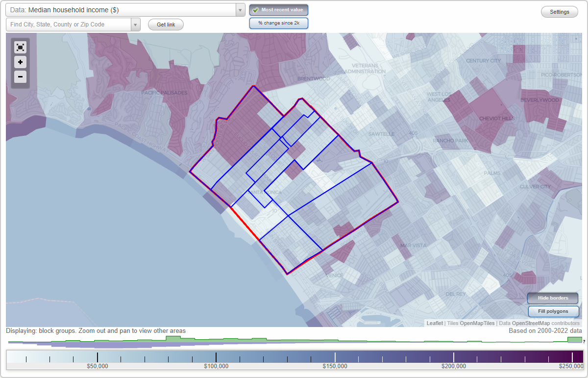
Santa Monica, California Neighborhood Map - Income, House Prices, Occupations, Boundaries
Settings
X

- City boundary
- Neighborhood boundaries
Business Search - 14 Million verified businesses
Neighborhoods:
Mid City, North of Montana, Northeast, Ocean Park, Pico, Sunset Park, WilshireMid City neighborhood in Santa Monica statistics: (Find on map)
Area: 1.296 square miles
Population: 19,654
Population density:
Median household income in 2021:
Median rent in in 2021:
Male vs Females
Median age
Housing prices:
Average estimated value of detached houses in 2021 (9.8% of all units):
Average estimated '21 value of housing units in 5-or-more-unit structures (7.4% of all units):
Most popular occupations of males: management occupations (except farmers) (24.7%); arts, design, entertainment, sports, and media occupations (13.5%); business and financial operations occupations (12.1%); computer and mathematical occupations (9.8%); sales and office occupations (7.9%); service occupations (5.2%); architecture and engineering occupations (4.4%)
Most popular occupations of females: management occupations (except farmers) (21.9%); sales and office occupations (17.0%); arts, design, entertainment, sports, and media occupations (13.5%); service occupations (9.2%); business and financial operations occupations (7.9%); education, training, and library occupations (7.7%); healthcare practitioners and technical occupations (7.4%)
Highways in this neighborhood: Santa Monica Blvd (State Rte 2).
Roads and streets: Arizona Ave; Wilshire Blvd; California Ave; Broadway St (Broadway); Stanford St; Yale St; 26th St; Princeton St; Harvard St; Colorado Ave; 23rd St; Berkeley St; Centinela Ave (S Centinela Ave); Franklin St; 25th St; Chelsea Ave; 24th St; 22nd St; 21st St; Euclid St; 9th St; 12th St; 11th St; 10th St; 7th St; Lincoln Blvd; 6th St; 17th St; 19th St; 20th St; 16th St; 18th St; 15th St; 14th St; 10th Ct; Cloverfield Blvd; 11th Ct; Euclid Ct; 9th Ct; Park Dr; Schader Dr; Arizona Pl; Washington Ave; Chelsea Ct; Washington Pl S; California Pl N; Chelsea Pl.
Mid City neighborhood detailed profile
Area: 1.296 square miles
Population: 19,654
Population density:
| Mid City: | 15,167 people per square mile |
| Santa Monica: | 11,028 people per square mile |
Median household income in 2021:
| Mid City: | $104,720 |
| Santa Monica: | $94,906 |
Median rent in in 2021:
| Mid City: | $1,915 |
| Santa Monica: | $2,001 |
Male vs Females
| Males: | 9,887 |
| Females: | 9,767 |
Median age
| Males: | 40.1 years |
| Females: | 43.3 years |
Housing prices:
Average estimated value of detached houses in 2021 (9.8% of all units):
| Mid City: | $1,933,454 |
| Santa Monica: | $2,614,879 |
Average estimated '21 value of housing units in 5-or-more-unit structures (7.4% of all units):
| Mid City: | $458,724 |
| Santa Monica: | $1,021,744 |
Most popular occupations of males: management occupations (except farmers) (24.7%); arts, design, entertainment, sports, and media occupations (13.5%); business and financial operations occupations (12.1%); computer and mathematical occupations (9.8%); sales and office occupations (7.9%); service occupations (5.2%); architecture and engineering occupations (4.4%)
Most popular occupations of females: management occupations (except farmers) (21.9%); sales and office occupations (17.0%); arts, design, entertainment, sports, and media occupations (13.5%); service occupations (9.2%); business and financial operations occupations (7.9%); education, training, and library occupations (7.7%); healthcare practitioners and technical occupations (7.4%)
Highways in this neighborhood: Santa Monica Blvd (State Rte 2).
Roads and streets: Arizona Ave; Wilshire Blvd; California Ave; Broadway St (Broadway); Stanford St; Yale St; 26th St; Princeton St; Harvard St; Colorado Ave; 23rd St; Berkeley St; Centinela Ave (S Centinela Ave); Franklin St; 25th St; Chelsea Ave; 24th St; 22nd St; 21st St; Euclid St; 9th St; 12th St; 11th St; 10th St; 7th St; Lincoln Blvd; 6th St; 17th St; 19th St; 20th St; 16th St; 18th St; 15th St; 14th St; 10th Ct; Cloverfield Blvd; 11th Ct; Euclid Ct; 9th Ct; Park Dr; Schader Dr; Arizona Pl; Washington Ave; Chelsea Ct; Washington Pl S; California Pl N; Chelsea Pl.
Mid City neighborhood detailed profile
North of Montana neighborhood in Santa Monica statistics: (Find on map)
Area: 1.518 square miles
Population: 8,161
Population density:
Median household income in 2021:
Median rent in in 2021:
Male vs Females
Median age
Housing prices:
Average estimated value of detached houses in 2021 (93.4% of all units):
Average estimated value of townhouses or other attached units in 2021 (13.2% of all units):
Average estimated '21 value of housing units in 3-to-4-unit structures (21.4% of all units):
Average estimated '21 value of housing units in 5-or-more-unit structures (7.9% of all units):
Most popular occupations of males: management occupations (except farmers) (37.3%); sales and office occupations (15.3%); arts, design, entertainment, sports, and media occupations (12.1%); legal occupations (11.8%); business and financial operations occupations (11.4%); healthcare practitioners and technical occupations (5.3%); production occupations (2.5%)
Most popular occupations of females: sales and office occupations (26.2%); arts, design, entertainment, sports, and media occupations (11.7%); service occupations (11.6%); management occupations (except farmers) (10.6%); healthcare practitioners and technical occupations (8.6%); community and social services occupations (8.5%); education, training, and library occupations (7.1%)
Roads and streets: Georgina Ave; San Vicente Blvd; Marguerita Ave; Alta Ave; Montana Ave; Carlyle Ave; 24th St; 21st St; 14th St; 16th St; 17th St; 18th St; 19th St; 20th St; 21st Pl; 22nd St; 23rd St; 25th St; 26th St; 15th St; 11th St; Euclid St; 12th St; 10th St; la Mesa Dr; 4th St (4th Ave); 9th St; 7th St; Ocean Ave (E Ocean Ave); Palisades Ave; Lincoln Blvd; Woodacres Rd; S 26th St; Brentwood Ter; la Mesa Way; Esparta Way; Foxtail Dr; Winnett Pl; Larkin Pl.
North of Montana neighborhood detailed profile
Area: 1.518 square miles
Population: 8,161
Population density:
| North of Montana: | 5,378 people per square mile |
| Santa Monica: | 11,028 people per square mile |
Median household income in 2021:
| North of Montana: | $148,305 |
| Santa Monica: | $94,906 |
Median rent in in 2021:
| North of Montana: | $2,153 |
| Santa Monica: | $2,001 |
Male vs Females
| Males: | 3,996 |
| Females: | 4,164 |
Median age
| Males: | 47.0 years |
| Females: | 43.6 years |
Housing prices:
Average estimated value of detached houses in 2021 (93.4% of all units):
| North of Montana: | $4,213,305 |
| Santa Monica: | $2,614,879 |
Average estimated value of townhouses or other attached units in 2021 (13.2% of all units):
| This neighborhood: | $1,962,500 |
| city: | $1,483,029 |
Average estimated '21 value of housing units in 3-to-4-unit structures (21.4% of all units):
| North of Montana: | $1,388,112 |
| city: | $1,804,410 |
Average estimated '21 value of housing units in 5-or-more-unit structures (7.9% of all units):
| North of Montana: | $1,516,434 |
| Santa Monica: | $1,021,744 |
Most popular occupations of males: management occupations (except farmers) (37.3%); sales and office occupations (15.3%); arts, design, entertainment, sports, and media occupations (12.1%); legal occupations (11.8%); business and financial operations occupations (11.4%); healthcare practitioners and technical occupations (5.3%); production occupations (2.5%)
Most popular occupations of females: sales and office occupations (26.2%); arts, design, entertainment, sports, and media occupations (11.7%); service occupations (11.6%); management occupations (except farmers) (10.6%); healthcare practitioners and technical occupations (8.6%); community and social services occupations (8.5%); education, training, and library occupations (7.1%)
Roads and streets: Georgina Ave; San Vicente Blvd; Marguerita Ave; Alta Ave; Montana Ave; Carlyle Ave; 24th St; 21st St; 14th St; 16th St; 17th St; 18th St; 19th St; 20th St; 21st Pl; 22nd St; 23rd St; 25th St; 26th St; 15th St; 11th St; Euclid St; 12th St; 10th St; la Mesa Dr; 4th St (4th Ave); 9th St; 7th St; Ocean Ave (E Ocean Ave); Palisades Ave; Lincoln Blvd; Woodacres Rd; S 26th St; Brentwood Ter; la Mesa Way; Esparta Way; Foxtail Dr; Winnett Pl; Larkin Pl.
North of Montana neighborhood detailed profile
Northeast neighborhood in Santa Monica statistics: (Find on map)
Area: 0.448 square miles
Population: 3,986
Population density:
Median household income in 2021:
Median rent in in 2021:
Male vs Females
Median age
Housing prices:
Average estimated value of detached houses in 2021 (47.3% of all units):
Average estimated value of townhouses or other attached units in 2021 (5.7% of all units):
Average estimated '21 value of housing units in 3-to-4-unit structures (27.8% of all units):
Average estimated '21 value of housing units in 5-or-more-unit structures (5.0% of all units):
Most popular occupations of males: arts, design, entertainment, sports, and media occupations (19.7%); management occupations (except farmers) (17.5%); business and financial operations occupations (17.4%); sales and office occupations (12.2%); production occupations (7.4%); healthcare practitioners and technical occupations (6.2%); architecture and engineering occupations (4.8%)
Most popular occupations of females: sales and office occupations (25.2%); arts, design, entertainment, sports, and media occupations (15.4%); management occupations (except farmers) (14.7%); business and financial operations occupations (13.1%); healthcare practitioners and technical occupations (8.3%); education, training, and library occupations (5.8%); service occupations (4.1%)
Roads and streets: Wilshire Blvd; Washington Ave; Franklin St; S Centinela Ave (Centinela Ave); Berkeley St; Stanford St; Yale St; Harvard St; Princeton St; 23rd St; 24th St; 25th St; 26th St; Idaho Ave; Chelsea Ave; California Ave; Lipton Ave; 22nd St; Chelsea Ct; Washington Pl S; California Pl N; Montana Ave; Darlington Ave.
Northeast neighborhood detailed profile
Area: 0.448 square miles
Population: 3,986
Population density:
| Northeast: | 8,888 people per square mile |
| Santa Monica: | 11,028 people per square mile |
Median household income in 2021:
| Northeast: | $212,224 |
| Santa Monica: | $94,906 |
Median rent in in 2021:
| Northeast: | $3,830 |
| Santa Monica: | $2,001 |
Male vs Females
| Males: | 2,000 |
| Females: | 1,986 |
Median age
| Males: | 67.0 years |
| Females: | 75.9 years |
Housing prices:
Average estimated value of detached houses in 2021 (47.3% of all units):
| Northeast: | $2,599,673 |
| Santa Monica: | $2,614,879 |
Average estimated value of townhouses or other attached units in 2021 (5.7% of all units):
| This neighborhood: | $1,962,500 |
| city: | $1,483,029 |
Average estimated '21 value of housing units in 3-to-4-unit structures (27.8% of all units):
| Northeast: | $1,388,112 |
| city: | $1,804,410 |
Average estimated '21 value of housing units in 5-or-more-unit structures (5.0% of all units):
| Northeast: | $1,516,434 |
| Santa Monica: | $1,021,744 |
Most popular occupations of males: arts, design, entertainment, sports, and media occupations (19.7%); management occupations (except farmers) (17.5%); business and financial operations occupations (17.4%); sales and office occupations (12.2%); production occupations (7.4%); healthcare practitioners and technical occupations (6.2%); architecture and engineering occupations (4.8%)
Most popular occupations of females: sales and office occupations (25.2%); arts, design, entertainment, sports, and media occupations (15.4%); management occupations (except farmers) (14.7%); business and financial operations occupations (13.1%); healthcare practitioners and technical occupations (8.3%); education, training, and library occupations (5.8%); service occupations (4.1%)
Roads and streets: Wilshire Blvd; Washington Ave; Franklin St; S Centinela Ave (Centinela Ave); Berkeley St; Stanford St; Yale St; Harvard St; Princeton St; 23rd St; 24th St; 25th St; 26th St; Idaho Ave; Chelsea Ave; California Ave; Lipton Ave; 22nd St; Chelsea Ct; Washington Pl S; California Pl N; Montana Ave; Darlington Ave.
Northeast neighborhood detailed profile
Ocean Park neighborhood in Santa Monica statistics: (Find on map)
Area: 0.738 square miles
Population: 21,700
Population density:
Median household income in 2021:
Median rent in in 2021:
Male vs Females
Median age
Housing prices:
Average estimated value of detached houses in 2021 (38.9% of all units):
Average estimated value of townhouses or other attached units in 2021 (2.9% of all units):
Average estimated value of housing units in 2-unit structures in 2021 (2.4% of all units):
Average estimated '21 value of housing units in 3-to-4-unit structures (14.6% of all units):
Average estimated '21 value of housing units in 5-or-more-unit structures (0.8% of all units):
Most popular occupations of males: management occupations (except farmers) (25.2%); sales and office occupations (11.2%); computer and mathematical occupations (10.6%); construction, extraction, and maintenance occupations (10.3%); arts, design, entertainment, sports, and media occupations (10.0%); production occupations (6.9%); legal occupations (5.3%)
Most popular occupations of females: sales and office occupations (20.3%); management occupations (except farmers) (17.9%); business and financial operations occupations (14.8%); education, training, and library occupations (12.3%); service occupations (8.4%); arts, design, entertainment, sports, and media occupations (7.2%); healthcare practitioners and technical occupations (7.0%)
Highways in this neighborhood: Lincoln Blvd (State Rte 1).
Roads and streets: Main St; Neilson Way; 7th St; 3rd St; 6th St; Ocean Park Blvd; Ashland Ave; Ocean Front (The Promenade); Bay St; Barnard Way; Pacific St; Marine St; Strand St; 2nd St; Hill St; 5th St; Pier Ave; Hollister Ave; Highland Ave; 4th St (4th Ave); 4th St; Raymond Ave; Bicknell Ave; Ocean Ave (Ocean Way); Ozone Ave; Navy St; Grant St; Beverly Ave; Kensington Rd; Ocean Front Walk (The Promenade); Pine St; Copeland Ct; Cedar St; Fraser Ave; Hart Ave; Wadsworth Ave; Longfellow St; Sea Colony Dr; Pico Pl; N Ocean Ave; Beach St; Mills St; Norman Pl; Kinney St; Bentley Ct; Ruskin St; Pearl St; Goldsmith St; Maple St.
Ocean Park neighborhood detailed profile
Area: 0.738 square miles
Population: 21,700
Population density:
| Ocean Park: | 29,424 people per square mile |
| Santa Monica: | 11,028 people per square mile |
Median household income in 2021:
| Ocean Park: | $99,908 |
| Santa Monica: | $94,906 |
Median rent in in 2021:
| Ocean Park: | $1,960 |
| Santa Monica: | $2,001 |
Male vs Females
| Males: | 10,593 |
| Females: | 11,106 |
Median age
| Males: | 39.2 years |
| Females: | 40.5 years |
Housing prices:
Average estimated value of detached houses in 2021 (38.9% of all units):
| Ocean Park: | $1,329,710 |
| Santa Monica: | $2,614,879 |
Average estimated value of townhouses or other attached units in 2021 (2.9% of all units):
| This neighborhood: | $1,343,231 |
| city: | $1,483,029 |
Average estimated value of housing units in 2-unit structures in 2021 (2.4% of all units):
| This neighborhood: | $1,051,020 |
| Santa Monica: | $525,229 |
Average estimated '21 value of housing units in 3-to-4-unit structures (14.6% of all units):
| Ocean Park: | $1,393,750 |
| city: | $1,804,410 |
Average estimated '21 value of housing units in 5-or-more-unit structures (0.8% of all units):
| Ocean Park: | $890,847 |
| Santa Monica: | $1,021,744 |
Most popular occupations of males: management occupations (except farmers) (25.2%); sales and office occupations (11.2%); computer and mathematical occupations (10.6%); construction, extraction, and maintenance occupations (10.3%); arts, design, entertainment, sports, and media occupations (10.0%); production occupations (6.9%); legal occupations (5.3%)
Most popular occupations of females: sales and office occupations (20.3%); management occupations (except farmers) (17.9%); business and financial operations occupations (14.8%); education, training, and library occupations (12.3%); service occupations (8.4%); arts, design, entertainment, sports, and media occupations (7.2%); healthcare practitioners and technical occupations (7.0%)
Highways in this neighborhood: Lincoln Blvd (State Rte 1).
Roads and streets: Main St; Neilson Way; 7th St; 3rd St; 6th St; Ocean Park Blvd; Ashland Ave; Ocean Front (The Promenade); Bay St; Barnard Way; Pacific St; Marine St; Strand St; 2nd St; Hill St; 5th St; Pier Ave; Hollister Ave; Highland Ave; 4th St (4th Ave); 4th St; Raymond Ave; Bicknell Ave; Ocean Ave (Ocean Way); Ozone Ave; Navy St; Grant St; Beverly Ave; Kensington Rd; Ocean Front Walk (The Promenade); Pine St; Copeland Ct; Cedar St; Fraser Ave; Hart Ave; Wadsworth Ave; Longfellow St; Sea Colony Dr; Pico Pl; N Ocean Ave; Beach St; Mills St; Norman Pl; Kinney St; Bentley Ct; Ruskin St; Pearl St; Goldsmith St; Maple St.
Ocean Park neighborhood detailed profile
Pico neighborhood in Santa Monica statistics: (Find on map)
Area: 1.434 square miles
Population: 17,532
Population density:
Median household income in 2021:
Median rent in in 2021:
Male vs Females
Median age
Housing prices:
Average estimated value of detached houses in 2021 (18.1% of all units):
Average estimated value of townhouses or other attached units in 2021 (3.1% of all units):
Average estimated value of housing units in 2-unit structures in 2021 (3.6% of all units):
Average estimated '21 value of housing units in 3-to-4-unit structures (10.6% of all units):
Average estimated '21 value of housing units in 5-or-more-unit structures (29.3% of all units):
Most popular occupations of males: management occupations (except farmers) (16.8%); service occupations (11.6%); business and financial operations occupations (11.1%); sales and office occupations (10.7%); computer and mathematical occupations (9.6%); arts, design, entertainment, sports, and media occupations (9.4%); healthcare practitioners and technical occupations (4.7%)
Most popular occupations of females: sales and office occupations (27.3%); management occupations (except farmers) (19.4%); service occupations (17.3%); education, training, and library occupations (8.2%); arts, design, entertainment, sports, and media occupations (8.0%); business and financial operations occupations (5.2%); healthcare practitioners and technical occupations (5.0%)
Limited-access highways (interstate or state) in this neighborhood: I- 10 (Santa Monica Fwy).
Highways in this neighborhood: State Rte 2 (Santa Monica Blvd).
Roads and streets: Olympic Blvd; Pico Blvd; Michigan Ave; Colorado Ave; Delaware Ave; Virginia Ave; 20th St; Broadway St (Broadway); 17th St; 14th St; 19th St; 18th St; Stewart St; 11th St; 16th St; Cloverfield Blvd; Pennsylvania Ave; Euclid St; 9th St; 12th St; Exposition Blvd; Kansas Ave; 10th St; Centinela Ave (S Centinela Ave); Urban Ave; Euclid Ct; Berkeley St; S Centinela Ave; Franklin St; 22nd St; Nebraska Ave; 15th St; Stanford St; 21st St; 26th St; Yorkshire Ave; Dorchester Ave; 24th St; 21st Ct; Warwick Ave; Frank St; High Pl; 27th St; 34th St.
Railroad features: Southern Pacific RR.
Pico neighborhood detailed profile
Area: 1.434 square miles
Population: 17,532
Population density:
| Pico: | 12,228 people per square mile |
| Santa Monica: | 11,028 people per square mile |
Median household income in 2021:
| Pico: | $93,248 |
| Santa Monica: | $94,906 |
Median rent in in 2021:
| Pico: | $1,914 |
| Santa Monica: | $2,001 |
Male vs Females
| Males: | 8,532 |
| Females: | 8,999 |
Median age
| Males: | 38.4 years |
| Females: | 41.2 years |
Housing prices:
Average estimated value of detached houses in 2021 (18.1% of all units):
| Pico: | $873,334 |
| Santa Monica: | $2,614,879 |
Average estimated value of townhouses or other attached units in 2021 (3.1% of all units):
| This neighborhood: | $1,195,082 |
| city: | $1,483,029 |
Average estimated value of housing units in 2-unit structures in 2021 (3.6% of all units):
| This neighborhood: | $1,051,020 |
| Santa Monica: | $525,229 |
Average estimated '21 value of housing units in 3-to-4-unit structures (10.6% of all units):
| Pico: | $508,889 |
| city: | $1,804,410 |
Average estimated '21 value of housing units in 5-or-more-unit structures (29.3% of all units):
| Pico: | $474,682 |
| Santa Monica: | $1,021,744 |
Most popular occupations of males: management occupations (except farmers) (16.8%); service occupations (11.6%); business and financial operations occupations (11.1%); sales and office occupations (10.7%); computer and mathematical occupations (9.6%); arts, design, entertainment, sports, and media occupations (9.4%); healthcare practitioners and technical occupations (4.7%)
Most popular occupations of females: sales and office occupations (27.3%); management occupations (except farmers) (19.4%); service occupations (17.3%); education, training, and library occupations (8.2%); arts, design, entertainment, sports, and media occupations (8.0%); business and financial operations occupations (5.2%); healthcare practitioners and technical occupations (5.0%)
Limited-access highways (interstate or state) in this neighborhood: I- 10 (Santa Monica Fwy).
Highways in this neighborhood: State Rte 2 (Santa Monica Blvd).
Roads and streets: Olympic Blvd; Pico Blvd; Michigan Ave; Colorado Ave; Delaware Ave; Virginia Ave; 20th St; Broadway St (Broadway); 17th St; 14th St; 19th St; 18th St; Stewart St; 11th St; 16th St; Cloverfield Blvd; Pennsylvania Ave; Euclid St; 9th St; 12th St; Exposition Blvd; Kansas Ave; 10th St; Centinela Ave (S Centinela Ave); Urban Ave; Euclid Ct; Berkeley St; S Centinela Ave; Franklin St; 22nd St; Nebraska Ave; 15th St; Stanford St; 21st St; 26th St; Yorkshire Ave; Dorchester Ave; 24th St; 21st Ct; Warwick Ave; Frank St; High Pl; 27th St; 34th St.
Railroad features: Southern Pacific RR.
Pico neighborhood detailed profile
Sunset Park neighborhood in Santa Monica statistics: (Find on map)
Area: 1.813 square miles
Population: 13,477
Population density:
Median household income in 2021:
Median rent in in 2021:
Male vs Females
Median age
Housing prices:
Average estimated value of detached houses in 2021 (42.2% of all units):
Average estimated value of townhouses or other attached units in 2021 (10.0% of all units):
Average estimated value of housing units in 2-unit structures in 2021 (4.0% of all units):
Average estimated '21 value of housing units in 3-to-4-unit structures (13.9% of all units):
Average estimated '21 value of housing units in 5-or-more-unit structures (3.7% of all units):
Most popular occupations of males: management occupations (except farmers) (22.8%); arts, design, entertainment, sports, and media occupations (14.0%); sales and office occupations (13.9%); construction, extraction, and maintenance occupations (7.2%); education, training, and library occupations (5.7%); architecture and engineering occupations (5.6%); service occupations (5.3%)
Most popular occupations of females: management occupations (except farmers) (19.2%); sales and office occupations (15.0%); business and financial operations occupations (11.5%); education, training, and library occupations (10.9%); service occupations (9.3%); healthcare practitioners and technical occupations (8.2%); arts, design, entertainment, sports, and media occupations (7.3%)
Limited-access highways (interstate or state) in this neighborhood: Santa Monica Fwy (I- 10).
Roads and streets: Pearl St; Ocean Park Blvd; Ashland Ave; Hill Pl N; Oak St; Hill St; Ocean Park Pl S; Ashland Pl N; Donald Douglas Loop N; 11th St; 23rd St; 21st St; 16th St; 17th St; Marine St; 14th St; Euclid St; Airport Ave; 18th St; 25th St; Sunset Ave; Maple St; 10th St; Pier Ave; S Centinela Ave; 28th St; Grant St; Pacific St; Cedar St; Pine St; 20th St; Village Pkwy; 22nd St; Cloverfield Blvd; 26th St; Bay St; 34th St; 31st St; Bryn Mawr Ave; 24th St; Dewey St; Ocean Park Pl N; Wellesley Dr; S Pico Pl; Navy St; 30th St; 29th St; 32nd St; 33rd St; Donald Douglas Loop S; 24th Ct; 27th St; Glenn Ave; Ozone Ave; Marine Pl N; Pearl Pl; Glenn Ct; Robson Ave; Ashland Pl; Prospect Ct; Dewey Pl; 11th Ct; Linda Ln; Prospect Ave; Paula Dr; 10th Ct; Pico Blvd; Steiner Ave; Wilson Pl; Margaret Ln; Clover St; Frederick St; Sunset Pkwy.
Sunset Park neighborhood detailed profile
Area: 1.813 square miles
Population: 13,477
Population density:
| Sunset Park: | 7,435 people per square mile |
| Santa Monica: | 11,028 people per square mile |
Median household income in 2021:
| Sunset Park: | $108,069 |
| Santa Monica: | $94,906 |
Median rent in in 2021:
| Sunset Park: | $2,275 |
| Santa Monica: | $2,001 |
Male vs Females
| Males: | 6,380 |
| Females: | 7,097 |
Median age
| Males: | 40.0 years |
| Females: | 41.5 years |
Housing prices:
Average estimated value of detached houses in 2021 (42.2% of all units):
| Sunset Park: | $1,662,969 |
| Santa Monica: | $2,614,879 |
Average estimated value of townhouses or other attached units in 2021 (10.0% of all units):
| This neighborhood: | $1,195,082 |
| city: | $1,483,029 |
Average estimated value of housing units in 2-unit structures in 2021 (4.0% of all units):
| This neighborhood: | $1,051,020 |
| Santa Monica: | $525,229 |
Average estimated '21 value of housing units in 3-to-4-unit structures (13.9% of all units):
| Sunset Park: | $1,393,750 |
| city: | $1,804,410 |
Average estimated '21 value of housing units in 5-or-more-unit structures (3.7% of all units):
| Sunset Park: | $1,128,986 |
| Santa Monica: | $1,021,744 |
Most popular occupations of males: management occupations (except farmers) (22.8%); arts, design, entertainment, sports, and media occupations (14.0%); sales and office occupations (13.9%); construction, extraction, and maintenance occupations (7.2%); education, training, and library occupations (5.7%); architecture and engineering occupations (5.6%); service occupations (5.3%)
Most popular occupations of females: management occupations (except farmers) (19.2%); sales and office occupations (15.0%); business and financial operations occupations (11.5%); education, training, and library occupations (10.9%); service occupations (9.3%); healthcare practitioners and technical occupations (8.2%); arts, design, entertainment, sports, and media occupations (7.3%)
Limited-access highways (interstate or state) in this neighborhood: Santa Monica Fwy (I- 10).
Roads and streets: Pearl St; Ocean Park Blvd; Ashland Ave; Hill Pl N; Oak St; Hill St; Ocean Park Pl S; Ashland Pl N; Donald Douglas Loop N; 11th St; 23rd St; 21st St; 16th St; 17th St; Marine St; 14th St; Euclid St; Airport Ave; 18th St; 25th St; Sunset Ave; Maple St; 10th St; Pier Ave; S Centinela Ave; 28th St; Grant St; Pacific St; Cedar St; Pine St; 20th St; Village Pkwy; 22nd St; Cloverfield Blvd; 26th St; Bay St; 34th St; 31st St; Bryn Mawr Ave; 24th St; Dewey St; Ocean Park Pl N; Wellesley Dr; S Pico Pl; Navy St; 30th St; 29th St; 32nd St; 33rd St; Donald Douglas Loop S; 24th Ct; 27th St; Glenn Ave; Ozone Ave; Marine Pl N; Pearl Pl; Glenn Ct; Robson Ave; Ashland Pl; Prospect Ct; Dewey Pl; 11th Ct; Linda Ln; Prospect Ave; Paula Dr; 10th Ct; Pico Blvd; Steiner Ave; Wilson Pl; Margaret Ln; Clover St; Frederick St; Sunset Pkwy.
Sunset Park neighborhood detailed profile
Wilshire neighborhood in Santa Monica statistics: (Find on map)
Area: 0.913 square miles
Population: 18,342
Population density:
Median household income in 2021:
Median rent in in 2021:
Male vs Females
Median age
Housing prices:
Average estimated value of detached houses in 2021 (3.9% of all units):
Average estimated value of townhouses or other attached units in 2021 (6.1% of all units):
Average estimated '21 value of housing units in 3-to-4-unit structures (11.1% of all units):
Average estimated '21 value of housing units in 5-or-more-unit structures (4.5% of all units):
Most popular occupations of males: management occupations (except farmers) (23.8%); business and financial operations occupations (13.5%); arts, design, entertainment, sports, and media occupations (11.2%); sales and office occupations (10.3%); computer and mathematical occupations (7.8%); service occupations (6.6%); legal occupations (6.3%)
Most popular occupations of females: sales and office occupations (18.2%); management occupations (except farmers) (15.2%); arts, design, entertainment, sports, and media occupations (12.1%); service occupations (12.1%); business and financial operations occupations (11.4%); education, training, and library occupations (10.4%); healthcare practitioners and technical occupations (9.0%)
Highways in this neighborhood: Pacific Coast Hwy (State Rte 1, Palisades Beach Rd); California Incline.
Roads and streets: Washington Ave; Idaho Ave; California Ave; Wilshire Blvd; Lincoln Ct; 20th St; 3rd St; 19th St; 17th St; 11th St; 2nd St; 21st St; 4th St (4th Ave); Lincoln Blvd; 18th St; 10th St; 16th St; 6th St; 5th St; 14th St; 12th St; 9th St; Euclid St; Ocean Ave (E Ocean Ave); 7th St; 6th Ct; 15th St; 9th Ct; 4th Ct; 10th Ct; 11th Ct; Ocean Front (The Promenade); 2nd Ct.
Wilshire neighborhood detailed profile
Area: 0.913 square miles
Population: 18,342
Population density:
| Wilshire (Montana): | 20,091 people per square mile |
| Santa Monica: | 11,028 people per square mile |
Median household income in 2021:
| Wilshire (Montana): | $122,778 |
| Santa Monica: | $94,906 |
Median rent in in 2021:
| Wilshire (Montana): | $2,248 |
| Santa Monica: | $2,001 |
Male vs Females
| Males: | 8,848 |
| Females: | 9,494 |
Median age
| Males: | 42.3 years |
| Females: | 41.6 years |
Housing prices:
Average estimated value of detached houses in 2021 (3.9% of all units):
| Wilshire (Montana): | $1,720,833 |
| Santa Monica: | $2,614,879 |
Average estimated value of townhouses or other attached units in 2021 (6.1% of all units):
| This neighborhood: | $1,962,500 |
| city: | $1,483,029 |
Average estimated '21 value of housing units in 3-to-4-unit structures (11.1% of all units):
| Wilshire (Montana): | $1,388,112 |
| city: | $1,804,410 |
Average estimated '21 value of housing units in 5-or-more-unit structures (4.5% of all units):
| Wilshire (Montana): | $672,881 |
| Santa Monica: | $1,021,744 |
Most popular occupations of males: management occupations (except farmers) (23.8%); business and financial operations occupations (13.5%); arts, design, entertainment, sports, and media occupations (11.2%); sales and office occupations (10.3%); computer and mathematical occupations (7.8%); service occupations (6.6%); legal occupations (6.3%)
Most popular occupations of females: sales and office occupations (18.2%); management occupations (except farmers) (15.2%); arts, design, entertainment, sports, and media occupations (12.1%); service occupations (12.1%); business and financial operations occupations (11.4%); education, training, and library occupations (10.4%); healthcare practitioners and technical occupations (9.0%)
Highways in this neighborhood: Pacific Coast Hwy (State Rte 1, Palisades Beach Rd); California Incline.
Roads and streets: Washington Ave; Idaho Ave; California Ave; Wilshire Blvd; Lincoln Ct; 20th St; 3rd St; 19th St; 17th St; 11th St; 2nd St; 21st St; 4th St (4th Ave); Lincoln Blvd; 18th St; 10th St; 16th St; 6th St; 5th St; 14th St; 12th St; 9th St; Euclid St; Ocean Ave (E Ocean Ave); 7th St; 6th Ct; 15th St; 9th Ct; 4th Ct; 10th Ct; 11th Ct; Ocean Front (The Promenade); 2nd Ct.
Wilshire neighborhood detailed profile