Wellesley, Massachusetts Neighborhood Map - Income, House Prices, Occupations, Boundaries
Settings
X

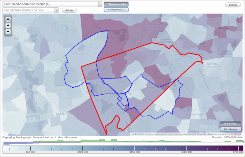
- City boundary
- Neighborhood boundaries
Business Search - 14 Million verified businesses
Neighborhoods:
Babson Park, Historic District, Wellesley Fells, Wellesley Square, Wellesley Square NorthBabson Park neighborhood in Wellesley statistics: (Find on map)
Area: 2.892 square miles
Population: 6,234
Population density:
Median household income in 2021:
Median rent in in 2021:
Male vs Females
Median age
Housing prices:
Average estimated value of detached houses in 2021 (76.8% of all units):
Average estimated value of townhouses or other attached units in 2021 (12.0% of all units):
Average estimated value of housing units in 2-unit structures in 2021 (23.6% of all units):
Average estimated '21 value of housing units in 5-or-more-unit structures (12.1% of all units):
Most popular occupations of males: sales and office occupations (19.8%); management occupations (except farmers) (16.1%); service occupations (12.3%); education, training, and library occupations (9.9%); healthcare practitioners and technical occupations (9.6%); business and financial operations occupations (7.8%); legal occupations (5.7%)
Most popular occupations of females: sales and office occupations (24.3%); business and financial operations occupations (14.5%); education, training, and library occupations (13.8%); service occupations (12.7%); management occupations (except farmers) (11.0%); healthcare practitioners and technical occupations (6.9%); arts, design, entertainment, sports, and media occupations (5.3%)
Highways in this neighborhood: State Hwy 135 (Great Plain Ave); Wellesley Ave (State Hwy 135); Washington St (State Hwy 16, State Hwy 135).
Roads and streets: Forest St; Brook St; Brookside Rd; Central Ave; Woodard Hill Dr; College Dr; Alden Rd; Cartwright Rd; Rice St; Burrill Ln; Seaver St; Benvenue St; Clarke Rd; E Militia Hts; Standish Rd; Fuller Brook Rd; Radcliffe Rd; Hunnewell St; Fuller Brook Ave; Rolling Ln; Macintosh Ave; Glendale Rd; Twitchell St; Babson Park Ave; Vincent Rd; Temple Rd; Woodridge Rd; Whiting Rd; Atwood St; Cottonwood Rd; Allen Rd; Cameron St; Park Ave; Smith St; Sterling Rd; Hampden St; Canavan Cir; Swarthmore Rd; Whiting Way; Map Hill Dr; Mary Chilton Rd; Mayflower Rd; Amherst Rd; Skyline Dr; N Hill Ave; Stockdale Rd; Stewart Rd; Grove St; Pilgrim Rd; Clarke Cir; Wildon Rd; Powder House Rd; Brewster Dr; Southgate Rd; Clifford St; Hobart Rd; Lathrop Rd; Westwood Rd; Ordway Rd; Briar Wood Cir; Elliot St; Marvin Rd; Sumner Rd; Eisenhower Cir; Winslow Rd; Dana Rd; State St; Aberdeen Rd; Howe Rd; Farm Rd; Wilson St; Carol Rd; Peck Ave; Framar Rd; Sunset Rd; Dewing Path; Grant Ave; Woodway Rd; Taylor St; Curtis Rd; Maple Hill Dr; Clark Rd; Mason Rd; Solon St; Middlesex St; Carlton Rd; Cefalo St (Cefalo Rd); Sessions St; Juniper Rd; Vista Rd; Powder House Cir; Seaver Pl; Hopkinson St; Hewins Farm Rd; Morton St; Bernard Ln; Dexter Rd.
Other features: Cochituate Aqueduct (Historical).
Other features: Fuller Brk; Caroline Brk; Rosemary Brk.
Babson Park neighborhood detailed profile
Area: 2.892 square miles
Population: 6,234
Population density:
| Babson Park (Babson): | 2,155 people per square mile |
| Wellesley: | 2,884 people per square mile |
Median household income in 2021:
| Babson Park (Babson): | $187,908 |
| Wellesley: | $226,250 |
Median rent in in 2021:
| Babson Park (Babson): | $931 |
| Wellesley: | $2,001 |
Male vs Females
| Males: | 2,897 |
| Females: | 3,340 |
Median age
| Males: | 39.0 years |
| Females: | 39.1 years |
Housing prices:
Average estimated value of detached houses in 2021 (76.8% of all units):
| Babson Park (Babson): | $2,135,501 |
| Massachusetts: | $512,170 |
Average estimated value of townhouses or other attached units in 2021 (12.0% of all units):
| This neighborhood: | $982,500 |
| Massachusetts: | $446,467 |
Average estimated value of housing units in 2-unit structures in 2021 (23.6% of all units):
| This neighborhood: | $1,040,385 |
| Massachusetts: | $492,911 |
Average estimated '21 value of housing units in 5-or-more-unit structures (12.1% of all units):
| Babson Park (Babson): | $599,728 |
| Massachusetts: | $484,981 |
Most popular occupations of males: sales and office occupations (19.8%); management occupations (except farmers) (16.1%); service occupations (12.3%); education, training, and library occupations (9.9%); healthcare practitioners and technical occupations (9.6%); business and financial operations occupations (7.8%); legal occupations (5.7%)
Most popular occupations of females: sales and office occupations (24.3%); business and financial operations occupations (14.5%); education, training, and library occupations (13.8%); service occupations (12.7%); management occupations (except farmers) (11.0%); healthcare practitioners and technical occupations (6.9%); arts, design, entertainment, sports, and media occupations (5.3%)
Highways in this neighborhood: State Hwy 135 (Great Plain Ave); Wellesley Ave (State Hwy 135); Washington St (State Hwy 16, State Hwy 135).
Roads and streets: Forest St; Brook St; Brookside Rd; Central Ave; Woodard Hill Dr; College Dr; Alden Rd; Cartwright Rd; Rice St; Burrill Ln; Seaver St; Benvenue St; Clarke Rd; E Militia Hts; Standish Rd; Fuller Brook Rd; Radcliffe Rd; Hunnewell St; Fuller Brook Ave; Rolling Ln; Macintosh Ave; Glendale Rd; Twitchell St; Babson Park Ave; Vincent Rd; Temple Rd; Woodridge Rd; Whiting Rd; Atwood St; Cottonwood Rd; Allen Rd; Cameron St; Park Ave; Smith St; Sterling Rd; Hampden St; Canavan Cir; Swarthmore Rd; Whiting Way; Map Hill Dr; Mary Chilton Rd; Mayflower Rd; Amherst Rd; Skyline Dr; N Hill Ave; Stockdale Rd; Stewart Rd; Grove St; Pilgrim Rd; Clarke Cir; Wildon Rd; Powder House Rd; Brewster Dr; Southgate Rd; Clifford St; Hobart Rd; Lathrop Rd; Westwood Rd; Ordway Rd; Briar Wood Cir; Elliot St; Marvin Rd; Sumner Rd; Eisenhower Cir; Winslow Rd; Dana Rd; State St; Aberdeen Rd; Howe Rd; Farm Rd; Wilson St; Carol Rd; Peck Ave; Framar Rd; Sunset Rd; Dewing Path; Grant Ave; Woodway Rd; Taylor St; Curtis Rd; Maple Hill Dr; Clark Rd; Mason Rd; Solon St; Middlesex St; Carlton Rd; Cefalo St (Cefalo Rd); Sessions St; Juniper Rd; Vista Rd; Powder House Cir; Seaver Pl; Hopkinson St; Hewins Farm Rd; Morton St; Bernard Ln; Dexter Rd.
Other features: Cochituate Aqueduct (Historical).
Other features: Fuller Brk; Caroline Brk; Rosemary Brk.
Babson Park neighborhood detailed profile
Historic District neighborhood in Wellesley statistics: (Find on map)
Area: 0.171 square miles
Population: 1,651
Population density:
Median household income in 2021:
Median rent in in 2021:
Male vs Females
Median age
Housing prices:
Average estimated value of detached houses in 2021 (59.0% of all units):
Average estimated value of townhouses or other attached units in 2021 (3.8% of all units):
Average estimated value of housing units in 2-unit structures in 2021 (3.8% of all units):
Average estimated '21 value of housing units in 5-or-more-unit structures (5.1% of all units):
Most popular occupations of males: management occupations (except farmers) (35.6%); sales and office occupations (24.4%); healthcare practitioners and technical occupations (10.4%); education, training, and library occupations (8.0%); business and financial operations occupations (7.3%); legal occupations (6.6%); computer and mathematical occupations (4.5%)
Most popular occupations of females: sales and office occupations (40.5%); education, training, and library occupations (23.2%); service occupations (11.8%); management occupations (except farmers) (6.9%); arts, design, entertainment, sports, and media occupations (4.6%); computer and mathematical occupations (4.3%); material moving occupations (4.3%)
Highways in this neighborhood: Washington St (State Hwy 16); State Hwy 135 (Central St).
Roads and streets: Grove St; Cottage St; Denton Rd; Church St; Wiswall Cir; Weston Rd; Wildwood Cir; Appleby Rd; Leighton Rd; Abbott St; Homestead Rd; Waban St; Cross St; Norfolk Ter; Lovewell Rd; W Riding St.
Other features: Fuller Brk; Waban Brk.
Historic District neighborhood detailed profile
Area: 0.171 square miles
Population: 1,651
Population density:
| Historic District: | 9,638 people per square mile |
| Wellesley: | 2,884 people per square mile |
Median household income in 2021:
| Historic District: | $158,433 |
| Wellesley: | $226,250 |
Median rent in in 2021:
| Historic District: | $2,238 |
| Wellesley: | $2,001 |
Male vs Females
| Males: | 78 |
| Females: | 1,618 |
Median age
| Males: | 55.3 years |
| Females: | 45.1 years |
Housing prices:
Average estimated value of detached houses in 2021 (59.0% of all units):
| Historic District: | $1,672,812 |
| Massachusetts: | $512,170 |
Average estimated value of townhouses or other attached units in 2021 (3.8% of all units):
| This neighborhood: | $982,500 |
| Massachusetts: | $446,467 |
Average estimated value of housing units in 2-unit structures in 2021 (3.8% of all units):
| This neighborhood: | $1,040,385 |
| Massachusetts: | $492,911 |
Average estimated '21 value of housing units in 5-or-more-unit structures (5.1% of all units):
| Historic District: | $1,176,430 |
| Massachusetts: | $484,981 |
Most popular occupations of males: management occupations (except farmers) (35.6%); sales and office occupations (24.4%); healthcare practitioners and technical occupations (10.4%); education, training, and library occupations (8.0%); business and financial operations occupations (7.3%); legal occupations (6.6%); computer and mathematical occupations (4.5%)
Most popular occupations of females: sales and office occupations (40.5%); education, training, and library occupations (23.2%); service occupations (11.8%); management occupations (except farmers) (6.9%); arts, design, entertainment, sports, and media occupations (4.6%); computer and mathematical occupations (4.3%); material moving occupations (4.3%)
Highways in this neighborhood: Washington St (State Hwy 16); State Hwy 135 (Central St).
Roads and streets: Grove St; Cottage St; Denton Rd; Church St; Wiswall Cir; Weston Rd; Wildwood Cir; Appleby Rd; Leighton Rd; Abbott St; Homestead Rd; Waban St; Cross St; Norfolk Ter; Lovewell Rd; W Riding St.
Other features: Fuller Brk; Waban Brk.
Historic District neighborhood detailed profile
Wellesley Fells neighborhood in Wellesley statistics: (Find on map)
Area: 3.285 square miles
Population: 6,195
Population density:
Median household income in 2021:
Median rent in in 2021:
Male vs Females
Median age
Housing prices:
Average estimated value of detached houses in 2021 (94.8% of all units):
Average estimated value of townhouses or other attached units in 2021 (4.8% of all units):
Average estimated value of housing units in 2-unit structures in 2021 (2.9% of all units):
Average estimated '21 value of housing units in 5-or-more-unit structures (1.2% of all units):
Most popular occupations of males: management occupations (except farmers) (23.8%); sales and office occupations (14.9%); business and financial operations occupations (11.4%); service occupations (8.3%); healthcare practitioners and technical occupations (7.5%); education, training, and library occupations (7.2%); architecture and engineering occupations (5.1%)
Most popular occupations of females: sales and office occupations (20.8%); management occupations (except farmers) (19.2%); education, training, and library occupations (15.1%); business and financial operations occupations (12.3%); healthcare practitioners and technical occupations (10.5%); service occupations (7.4%); legal occupations (4.8%)
Limited-access highways (interstate or state) in this neighborhood: I- 90 (Massachusetts Tpke).
Highways in this neighborhood: Worcester St (State Hwy 9).
Roads and streets: Winter St; Wellesley St; Oak St; Sherburne Cir; Radcliffe Rd; Beaver Rd; Rathbun Rd; Bogle St; Sylvan Ln; Beverly Rd; Fox Hill Dr; Harwood Rd; Walnut Rd; Tech Cir; None Such Way; Tyler Rd; Longfellow Rd; Peterson Rd; Erie Dr; Upland Rd; Oxford St; Euclid Ave; Indian Rock Rd; Huron Dr; Connecticut Ave; Gannett Rd; Whittier Rd; Wellesley Rd; Otis St; Orchard Rd; Oakdale Ave; Brenton Rd; Briarwood Rd; Ingleside Rd; Arlington Rd; Alden St; Michigan Dr; Byron Rd; Milford Ave; Oak Hill Rd; Hovey Ave; Nancy Rd; Abbott Rd; Keane Rd; Nonesuch Dr; Massachusetts Ave; Frost St; Melvin Rd; Vermont Ave; Princeton Rd; Sunshine Ave; Lakeside Ave; Maine Ave; Drumlin Rd; Dickson Ln; New Hampshire Ave; Andrew Cir; Overbrook Ter; Craft Rd; Bass Pond Ln; Cabot St; Cooper Rd; Leland Rd; Evergreen Ave; Rhode Island Ave; Arlington Cir; Whitney Cir; Harwood Cir; Westwood Rd; Pickeral Rd; Naples Rd; Euclid Cir; Bass Ter; Bass Rd; Briar Ln; Browning Rd; Whittier Rd Exd; Wells St; Mary Day Camp Rd; Pondview Cir; Upham Way; Wellesley Rd Exd; Ray St; Grove Rd; Ingeside Rd; Keane Ter.
Other features: Bogle Brk; Mud Pond Strm.
Highways in this neighborhood: State Hwy 9 (Worcester St); Central St (State Hwy 135).
Roads and streets: Weston Rd; Turner Rd; Parker Rd; Manor Ave; Overbrook Dr; Mayo Rd; Beechwood Rd; Edgemoor Ave; Woodside Ave; Russell Rd; Upson Rd; High Ledge Ave; Halsey Ave; Macarthur Rd; Patton Rd; Marshall Rd; Shirley Rd; Bay View Rd; Thomas Rd; Leewood Rd; Hodges Ave; Kendall Rd; S Woodside Ave; Fells Rd; Garrison Rd; Bryn Mawr Rd; Durant Rd; Colby Rd; Cedar Brook Rd; Shadow Ln; Bradley Ave; Princeton Rd; Woodfield Rd; Lexington Rd; Berkeley Rd; Hillcroft Rd; Marigold Ave; Stonecleve Rd; Evergreen Ave; Fisher Ave; Beechwood Ter; Simpson Rd; Frost Cir; Lafayette Cir; Sunnyside Ave; Cedarbrook Rd; Lake Rd; Pinevale Ave; Ingleside Rd; Brookmere Ave; Fenmere Rd; Service Rd; Argyle Ave; Brookdale Ave; Bay Rd; Hamilton Rd; Oakdale Ave; Stuart Rd; Nobscot Rd; Ottaway Cir; Fells Cir; Claflin Rd; Regis Rd; Fairlawn Ter; Cleveland Rd; Morrill Cir; Stevens Rd; Beach Rd; Dell St; Meadow Ln.
Railroad features: Penn Central RR.
Other features: Bogle Brk.
Wellesley Fells neighborhood detailed profile
Area: 3.285 square miles
Population: 6,195
Population density:
| Wellesley Fells (The Fells): | 1,886 people per square mile |
| Wellesley: | 2,884 people per square mile |
Median household income in 2021:
| Wellesley Fells (The Fells): | $175,783 |
| Wellesley: | $226,250 |
Median rent in in 2021:
| Wellesley Fells (The Fells): | $1,271 |
| Wellesley: | $2,001 |
Male vs Females
| Males: | 3,093 |
| Females: | 3,102 |
Median age
| Males: | 43.3 years |
| Females: | 45.9 years |
Housing prices:
Average estimated value of detached houses in 2021 (94.8% of all units):
| Wellesley Fells (The Fells): | $963,547 |
| Massachusetts: | $512,170 |
Average estimated value of townhouses or other attached units in 2021 (4.8% of all units):
| This neighborhood: | $798,634 |
| Massachusetts: | $446,467 |
Average estimated value of housing units in 2-unit structures in 2021 (2.9% of all units):
| This neighborhood: | $657,143 |
| Massachusetts: | $492,911 |
Average estimated '21 value of housing units in 5-or-more-unit structures (1.2% of all units):
| Wellesley Fells (The Fells): | $290,027 |
| Massachusetts: | $484,981 |
Most popular occupations of males: management occupations (except farmers) (23.8%); sales and office occupations (14.9%); business and financial operations occupations (11.4%); service occupations (8.3%); healthcare practitioners and technical occupations (7.5%); education, training, and library occupations (7.2%); architecture and engineering occupations (5.1%)
Most popular occupations of females: sales and office occupations (20.8%); management occupations (except farmers) (19.2%); education, training, and library occupations (15.1%); business and financial operations occupations (12.3%); healthcare practitioners and technical occupations (10.5%); service occupations (7.4%); legal occupations (4.8%)
Limited-access highways (interstate or state) in this neighborhood: I- 90 (Massachusetts Tpke).
Highways in this neighborhood: Worcester St (State Hwy 9).
Roads and streets: Winter St; Wellesley St; Oak St; Sherburne Cir; Radcliffe Rd; Beaver Rd; Rathbun Rd; Bogle St; Sylvan Ln; Beverly Rd; Fox Hill Dr; Harwood Rd; Walnut Rd; Tech Cir; None Such Way; Tyler Rd; Longfellow Rd; Peterson Rd; Erie Dr; Upland Rd; Oxford St; Euclid Ave; Indian Rock Rd; Huron Dr; Connecticut Ave; Gannett Rd; Whittier Rd; Wellesley Rd; Otis St; Orchard Rd; Oakdale Ave; Brenton Rd; Briarwood Rd; Ingleside Rd; Arlington Rd; Alden St; Michigan Dr; Byron Rd; Milford Ave; Oak Hill Rd; Hovey Ave; Nancy Rd; Abbott Rd; Keane Rd; Nonesuch Dr; Massachusetts Ave; Frost St; Melvin Rd; Vermont Ave; Princeton Rd; Sunshine Ave; Lakeside Ave; Maine Ave; Drumlin Rd; Dickson Ln; New Hampshire Ave; Andrew Cir; Overbrook Ter; Craft Rd; Bass Pond Ln; Cabot St; Cooper Rd; Leland Rd; Evergreen Ave; Rhode Island Ave; Arlington Cir; Whitney Cir; Harwood Cir; Westwood Rd; Pickeral Rd; Naples Rd; Euclid Cir; Bass Ter; Bass Rd; Briar Ln; Browning Rd; Whittier Rd Exd; Wells St; Mary Day Camp Rd; Pondview Cir; Upham Way; Wellesley Rd Exd; Ray St; Grove Rd; Ingeside Rd; Keane Ter.
Other features: Bogle Brk; Mud Pond Strm.
Highways in this neighborhood: State Hwy 9 (Worcester St); Central St (State Hwy 135).
Roads and streets: Weston Rd; Turner Rd; Parker Rd; Manor Ave; Overbrook Dr; Mayo Rd; Beechwood Rd; Edgemoor Ave; Woodside Ave; Russell Rd; Upson Rd; High Ledge Ave; Halsey Ave; Macarthur Rd; Patton Rd; Marshall Rd; Shirley Rd; Bay View Rd; Thomas Rd; Leewood Rd; Hodges Ave; Kendall Rd; S Woodside Ave; Fells Rd; Garrison Rd; Bryn Mawr Rd; Durant Rd; Colby Rd; Cedar Brook Rd; Shadow Ln; Bradley Ave; Princeton Rd; Woodfield Rd; Lexington Rd; Berkeley Rd; Hillcroft Rd; Marigold Ave; Stonecleve Rd; Evergreen Ave; Fisher Ave; Beechwood Ter; Simpson Rd; Frost Cir; Lafayette Cir; Sunnyside Ave; Cedarbrook Rd; Lake Rd; Pinevale Ave; Ingleside Rd; Brookmere Ave; Fenmere Rd; Service Rd; Argyle Ave; Brookdale Ave; Bay Rd; Hamilton Rd; Oakdale Ave; Stuart Rd; Nobscot Rd; Ottaway Cir; Fells Cir; Claflin Rd; Regis Rd; Fairlawn Ter; Cleveland Rd; Morrill Cir; Stevens Rd; Beach Rd; Dell St; Meadow Ln.
Railroad features: Penn Central RR.
Other features: Bogle Brk.
Wellesley Fells neighborhood detailed profile
Wellesley Square neighborhood in Wellesley statistics: (Find on map)
Area: 0.242 square miles
Population: 2,575
Population density:
Median household income in 2021:
Median rent in in 2021:
Male vs Females
Median age
Housing prices:
Average estimated value of detached houses in 2021 (84.8% of all units):
Average estimated value of townhouses or other attached units in 2021 (2.7% of all units):
Average estimated value of housing units in 2-unit structures in 2021 (3.3% of all units):
Average estimated '21 value of housing units in 5-or-more-unit structures (4.3% of all units):
Most popular occupations of males: management occupations (except farmers) (50.0%); sales and office occupations (23.1%); business and financial operations occupations (13.1%); legal occupations (5.3%); healthcare practitioners and technical occupations (3.1%); education, training, and library occupations (2.4%); computer and mathematical occupations (1.4%)
Most popular occupations of females: sales and office occupations (40.5%); education, training, and library occupations (22.8%); service occupations (11.7%); management occupations (except farmers) (6.9%); arts, design, entertainment, sports, and media occupations (4.5%); material moving occupations (4.3%); computer and mathematical occupations (4.2%)
Highways in this neighborhood: Washington St (State Hwy 16); State Hwy 135 (Central St).
Roads and streets: Grove St; Cottage St; Denton Rd; Church St; Ingraham Rd; Wiswall Cir; Weston Rd; Wildwood Cir; Appleby Rd; Leighton Rd; Tappan Rd; Abbott St; Benton St; Benvenue St; Homestead Rd; Waban St; Birch Rd; Winthrop Rd; Vane St; Cross St; Belair Rd; W Riding St.
Other features: Waban Brk; Fuller Brk.
Other features: Cochituate Aqueduct (Historical).
Wellesley Square neighborhood detailed profile
Area: 0.242 square miles
Population: 2,575
Population density:
| Wellesley Square (Wellesley Sq): | 10,660 people per square mile |
| Wellesley: | 2,884 people per square mile |
Median household income in 2021:
| Wellesley Square (Wellesley Sq): | $158,433 |
| Wellesley: | $226,250 |
Median rent in in 2021:
| Wellesley Square (Wellesley Sq): | $2,071 |
| Wellesley: | $2,001 |
Male vs Females
| Males: | 253 |
| Females: | 2,480 |
Median age
| Males: | 55.3 years |
| Females: | 45.1 years |
Housing prices:
Average estimated value of detached houses in 2021 (84.8% of all units):
| Wellesley Square (Wellesley Sq): | $1,595,177 |
| Massachusetts: | $512,170 |
Average estimated value of townhouses or other attached units in 2021 (2.7% of all units):
| This neighborhood: | $982,500 |
| Massachusetts: | $446,467 |
Average estimated value of housing units in 2-unit structures in 2021 (3.3% of all units):
| This neighborhood: | $1,040,385 |
| Massachusetts: | $492,911 |
Average estimated '21 value of housing units in 5-or-more-unit structures (4.3% of all units):
| Wellesley Square (Wellesley Sq): | $1,176,430 |
| Massachusetts: | $484,981 |
Most popular occupations of males: management occupations (except farmers) (50.0%); sales and office occupations (23.1%); business and financial operations occupations (13.1%); legal occupations (5.3%); healthcare practitioners and technical occupations (3.1%); education, training, and library occupations (2.4%); computer and mathematical occupations (1.4%)
Most popular occupations of females: sales and office occupations (40.5%); education, training, and library occupations (22.8%); service occupations (11.7%); management occupations (except farmers) (6.9%); arts, design, entertainment, sports, and media occupations (4.5%); material moving occupations (4.3%); computer and mathematical occupations (4.2%)
Highways in this neighborhood: Washington St (State Hwy 16); State Hwy 135 (Central St).
Roads and streets: Grove St; Cottage St; Denton Rd; Church St; Ingraham Rd; Wiswall Cir; Weston Rd; Wildwood Cir; Appleby Rd; Leighton Rd; Tappan Rd; Abbott St; Benton St; Benvenue St; Homestead Rd; Waban St; Birch Rd; Winthrop Rd; Vane St; Cross St; Belair Rd; W Riding St.
Other features: Waban Brk; Fuller Brk.
Other features: Cochituate Aqueduct (Historical).
Wellesley Square neighborhood detailed profile
Wellesley Square North neighborhood in Wellesley statistics: (Find on map)
Area: 0.613 square miles
Population: 2,619
Population density:
Median household income in 2021:
Median rent in in 2021:
Male vs Females
Median age
Housing prices:
Average estimated value of detached houses in 2021 (57.7% of all units):
Average estimated value of townhouses or other attached units in 2021 (19.6% of all units):
Average estimated value of housing units in 2-unit structures in 2021 (13.7% of all units):
Average estimated '21 value of housing units in 5-or-more-unit structures (13.9% of all units):
Most popular occupations of males: management occupations (except farmers) (30.1%); sales and office occupations (19.9%); service occupations (12.3%); business and financial operations occupations (8.6%); computer and mathematical occupations (7.4%); education, training, and library occupations (5.6%); architecture and engineering occupations (4.4%)
Most popular occupations of females: management occupations (except farmers) (25.2%); education, training, and library occupations (16.7%); healthcare practitioners and technical occupations (12.8%); sales and office occupations (11.5%); service occupations (7.9%); business and financial operations occupations (7.5%); arts, design, entertainment, sports, and media occupations (6.8%)
Highways in this neighborhood: Washington St (State Hwy 16, State Hwy 135); State Hwy 9 (Worcester St); State Hwy 135 (Central St).
Roads and streets: Weston Rd; Linden St; Oak St; Ivy Rd; Kingsbury St; Pleasant St; School St; Donazetti St; Curve St; Crest Rd; Avon Rd; Crown Ridge Rd; Summit Rd; Willow Rd; Francis Rd; Poplar Rd; Highland Rd; Maurice Rd; Pinewood Rd; Hickory Rd; Sunset Rd; Everett St; Hill Top Rd; Howe St; Lawrence Rd; Granite St; Hollis St; Mellon Rd; Pine Tree Rd; Strathmore Rd; Westerly St; Larch Rd; Oakencroft Rd; Harvard St; Calvin Rd; Dorset Ln; Lilac Cir; Hardy Rd; Stearns Rd; Linden Sq; Highmeadow Cir; Grove St; Railroad Ave; Ivy Cir; Pinewood Cir; Delanson Cir; Waldo Ct.
Railroad features: Penn Central RR.
Wellesley Square North neighborhood detailed profile
Area: 0.613 square miles
Population: 2,619
Population density:
| Wellesley Square North (Wellesley Square N): | 4,273 people per square mile |
| Wellesley: | 2,884 people per square mile |
Median household income in 2021:
| Wellesley Square North (Wellesley Square N): | $181,441 |
| Wellesley: | $226,250 |
Median rent in in 2021:
| Wellesley Square North (Wellesley Square N): | $2,230 |
| Wellesley: | $2,001 |
Male vs Females
| Males: | 1,264 |
| Females: | 1,355 |
Median age
| Males: | 50.8 years |
| Females: | 47.0 years |
Housing prices:
Average estimated value of detached houses in 2021 (57.7% of all units):
| Wellesley Square North (Wellesley Square N): | $1,045,831 |
| Massachusetts: | $512,170 |
Average estimated value of townhouses or other attached units in 2021 (19.6% of all units):
| This neighborhood: | $905,569 |
| Massachusetts: | $446,467 |
Average estimated value of housing units in 2-unit structures in 2021 (13.7% of all units):
| This neighborhood: | $657,143 |
| Massachusetts: | $492,911 |
Average estimated '21 value of housing units in 5-or-more-unit structures (13.9% of all units):
| Wellesley Square North (Wellesley Square N): | $714,514 |
| Massachusetts: | $484,981 |
Most popular occupations of males: management occupations (except farmers) (30.1%); sales and office occupations (19.9%); service occupations (12.3%); business and financial operations occupations (8.6%); computer and mathematical occupations (7.4%); education, training, and library occupations (5.6%); architecture and engineering occupations (4.4%)
Most popular occupations of females: management occupations (except farmers) (25.2%); education, training, and library occupations (16.7%); healthcare practitioners and technical occupations (12.8%); sales and office occupations (11.5%); service occupations (7.9%); business and financial operations occupations (7.5%); arts, design, entertainment, sports, and media occupations (6.8%)
Highways in this neighborhood: Washington St (State Hwy 16, State Hwy 135); State Hwy 9 (Worcester St); State Hwy 135 (Central St).
Roads and streets: Weston Rd; Linden St; Oak St; Ivy Rd; Kingsbury St; Pleasant St; School St; Donazetti St; Curve St; Crest Rd; Avon Rd; Crown Ridge Rd; Summit Rd; Willow Rd; Francis Rd; Poplar Rd; Highland Rd; Maurice Rd; Pinewood Rd; Hickory Rd; Sunset Rd; Everett St; Hill Top Rd; Howe St; Lawrence Rd; Granite St; Hollis St; Mellon Rd; Pine Tree Rd; Strathmore Rd; Westerly St; Larch Rd; Oakencroft Rd; Harvard St; Calvin Rd; Dorset Ln; Lilac Cir; Hardy Rd; Stearns Rd; Linden Sq; Highmeadow Cir; Grove St; Railroad Ave; Ivy Cir; Pinewood Cir; Delanson Cir; Waldo Ct.
Railroad features: Penn Central RR.
Wellesley Square North neighborhood detailed profile