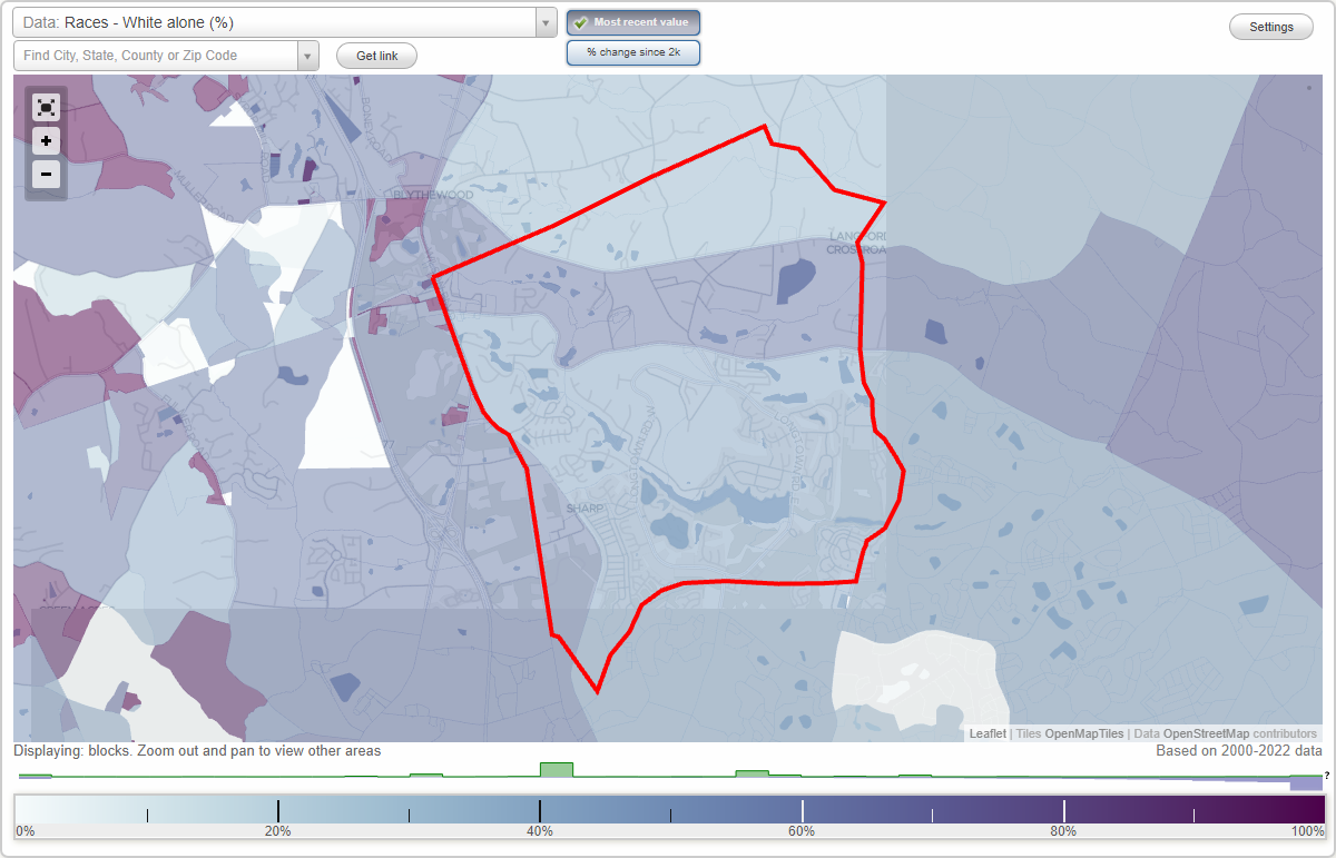
Longcreek Plantation (Long Creek) neighborhood in Blythewood, South Carolina (SC), 29016 detailed profile
Settings
X

Business Search - 14 Million verified businesses
Area: 12.292 square miles
Highways in this neighborhood:
Wilson Blvd (US Hwy 21)
Length: 0.66 miles
Directions: N-S, SE-NW
Address range: 10610 to 10803
Directions: N-S, SE-NW
Address range: 10610 to 10803
Roads and streets:
State Rd S-40-1041 (Rimer Pond Rd)
Length: 4.32 miles
Directions: E-W, N-S, SE-NW
Address range: 100 to 637
Directions: E-W, N-S, SE-NW
Address range: 100 to 637
State Rd S-40-54 (Langford Rd)
Length: 3.69 miles
Directions: E-W, SE-NW
Address range: 402 to 925
Directions: E-W, SE-NW
Address range: 402 to 925
Longtown Rd W (State Rd S-40-1051)
Length: 3.61 miles
Directions: E-W, N-S, SE-NW, SW-NE
Address range: 1 to 899
Directions: E-W, N-S, SE-NW, SW-NE
Address range: 1 to 899
Longtown Rd E
Length: 3.45 miles
Directions: E-W, N-S, SE-NW, SW-NE
Address range: 900 to 2399
Directions: E-W, N-S, SE-NW, SW-NE
Address range: 900 to 2399
Waterville Dr
Length: 1.39 miles
Directions: E-W, SE-NW, SW-NE
Address range: 100 to 399
Directions: E-W, SE-NW, SW-NE
Address range: 100 to 399
Wade Kelly Rd
Length: 1.37 miles
Directions: E-W, N-S, SE-NW, SW-NE
Address range: 100 to 399
Directions: E-W, N-S, SE-NW, SW-NE
Address range: 100 to 399
Hobart Rd (State Rd S-40-2074)
Length: 1.22 miles
Directions: E-W, N-S, SE-NW, SW-NE
Directions: E-W, N-S, SE-NW, SW-NE
Round Top Church Rd (State Rd S-40-1051)
Length: 1.14 miles
Directions: N-S, SE-NW, SW-NE
Address range: 1000 to 1299
Directions: N-S, SE-NW, SW-NE
Address range: 1000 to 1299
Columbia Club Dr E
Length: 1.07 miles
Directions: E-W, SW-NE
Address range: 116 to 399
Directions: E-W, SW-NE
Address range: 116 to 399
Marchbank Pkwy
Length: 0.93 miles
Directions: E-W, N-S, SE-NW, SW-NE
Directions: E-W, N-S, SE-NW, SW-NE
Overlook Dr
Length: 0.90 miles
Directions: E-W, N-S, SE-NW, SW-NE
Address range: 100 to 399
Directions: E-W, N-S, SE-NW, SW-NE
Address range: 100 to 399
Old Course Loop
Length: 0.85 miles
Directions: E-W, N-S, SE-NW, SW-NE
Address range: 100 to 499
Directions: E-W, N-S, SE-NW, SW-NE
Address range: 100 to 499
Soft Stone Dr
Length: 0.83 miles
Directions: E-W, N-S, SE-NW, SW-NE
Address range: 100 to 199
Directions: E-W, N-S, SE-NW, SW-NE
Address range: 100 to 199
Russ Brown Rd
Length: 0.81 miles
Directions: N-S, SE-NW, SW-NE
Address range: 1000 to 1238
Directions: N-S, SE-NW, SW-NE
Address range: 1000 to 1238
Cartgate Cir
Length: 0.80 miles
Directions: E-W, N-S, SE-NW, SW-NE
Address range: 200 to 699
Directions: E-W, N-S, SE-NW, SW-NE
Address range: 200 to 699
Runnymede Dr
Length: 0.78 miles
Directions: E-W, N-S, SE-NW, SW-NE
Address range: 100 to 207
Directions: E-W, N-S, SE-NW, SW-NE
Address range: 100 to 207
High Duck Trl
Length: 0.76 miles
Directions: E-W, SE-NW
Directions: E-W, SE-NW
Columbia Club Dr W
Length: 0.76 miles
Directions: E-W, SE-NW
Address range: 1 to 202
Directions: E-W, SE-NW
Address range: 1 to 202
Claude Bundrick Rd
Length: 0.76 miles
Directions: N-S, SW-NE
Address range: 100 to 309
Directions: N-S, SW-NE
Address range: 100 to 309
State Rd S-40-1899 (Trading Post Rd)
Length: 0.75 miles
Direction: SE-NW
Address range: 1000 to 1299
Direction: SE-NW
Address range: 1000 to 1299
Adams Rd (State Rd S-40-2455)
Length: 0.74 miles
Directions: N-S, SE-NW, SW-NE
Address range: 100 to 399
Directions: N-S, SE-NW, SW-NE
Address range: 100 to 399
Sandfarm Trl
Length: 0.74 miles
Directions: E-W, N-S, SW-NE
Address range: 201 to 299
Directions: E-W, N-S, SW-NE
Address range: 201 to 299
Annie Mills Rd
Length: 0.73 miles
Directions: E-W, N-S, SE-NW, SW-NE
Address range: 100 to 299
Directions: E-W, N-S, SE-NW, SW-NE
Address range: 100 to 299
Gurganious Rd
Length: 0.71 miles
Directions: E-W, N-S, SE-NW, SW-NE
Address range: 100 to 110
Directions: E-W, N-S, SE-NW, SW-NE
Address range: 100 to 110
Bally Bunion Ln
Length: 0.69 miles
Directions: E-W, N-S, SE-NW, SW-NE
Address range: 100 to 598
Directions: E-W, N-S, SE-NW, SW-NE
Address range: 100 to 598
W Lake Farm Dr
Length: 0.67 miles
Directions: E-W, N-S, SE-NW, SW-NE
Address range: 110 to 299
Directions: E-W, N-S, SE-NW, SW-NE
Address range: 110 to 299
Wintergreen Rd
Length: 0.66 miles
Directions: N-S, SE-NW, SW-NE
Directions: N-S, SE-NW, SW-NE
Hard Scrabble Rd (State Rd S-40-83)
Length: 0.66 miles
Directions: N-S, SW-NE
Address range: 5407 to 5418
Directions: N-S, SW-NE
Address range: 5407 to 5418
Winding Wood Cir
Length: 0.64 miles
Directions: E-W, N-S, SE-NW, SW-NE
Address range: 100 to 399
Directions: E-W, N-S, SE-NW, SW-NE
Address range: 100 to 399
Longcreek Plantation Dr
Length: 0.61 miles
Directions: E-W, SE-NW
Address range: 100 to 122
Directions: E-W, SE-NW
Address range: 100 to 122
Smith-Young Rd (State Rd S-40-2766)
Length: 0.59 miles
Directions: E-W, N-S, SE-NW, SW-NE
Address range: 100 to 199
Directions: E-W, N-S, SE-NW, SW-NE
Address range: 100 to 199
Pond Hill Ct
Length: 0.58 miles
Directions: E-W, N-S, SW-NE
Address range: 100 to 199
Directions: E-W, N-S, SW-NE
Address range: 100 to 199
Eagles Ridge Dr
Length: 0.58 miles
Directions: E-W, SW-NE
Address range: 101 to 243
Directions: E-W, SW-NE
Address range: 101 to 243
Sharp Fork Ln
Length: 0.57 miles
Directions: E-W, N-S, SW-NE
Directions: E-W, N-S, SW-NE
Algrave Way
Length: 0.54 miles
Directions: E-W, N-S, SE-NW, SW-NE
Address range: 100 to 199
Directions: E-W, N-S, SE-NW, SW-NE
Address range: 100 to 199
Sarazan Dr
Length: 0.53 miles
Directions: E-W, N-S, SE-NW, SW-NE
Directions: E-W, N-S, SE-NW, SW-NE
Plantation Pkwy
Length: 0.52 miles
Directions: E-W, N-S, SE-NW, SW-NE
Address range: 100 to 328
Directions: E-W, N-S, SE-NW, SW-NE
Address range: 100 to 328
Craigwood Dr
Length: 0.51 miles
Directions: E-W, SW-NE
Address range: 100 to 234
Directions: E-W, SW-NE
Address range: 100 to 234
State Rd S-40-1900 (Hagood Rd)
Length: 0.50 miles
Direction: E-W
Address range: 100 to 299
Direction: E-W
Address range: 100 to 299
Tam-O-Shanter Dr
Length: 0.46 miles
Directions: E-W, N-S, SE-NW, SW-NE
Address range: 100 to 140
Directions: E-W, N-S, SE-NW, SW-NE
Address range: 100 to 140
Hunting Path
Length: 0.46 miles
Directions: E-W, SE-NW, SW-NE
Directions: E-W, SE-NW, SW-NE
Arnell Ct
Length: 0.43 miles
Directions: E-W, N-S, SW-NE
Address range: 100 to 199
Directions: E-W, N-S, SW-NE
Address range: 100 to 199
Windermere Village Way
Length: 0.42 miles
Directions: E-W, N-S, SE-NW, SW-NE
Address range: 100 to 199
Directions: E-W, N-S, SE-NW, SW-NE
Address range: 100 to 199
Broadmoor Dr
Length: 0.42 miles
Directions: E-W, SE-NW
Address range: 401 to 415
Directions: E-W, SE-NW
Address range: 401 to 415
Allen Kelly Ct
Length: 0.40 miles
Directions: E-W, N-S, SE-NW, SW-NE
Address range: 101 to 299
Directions: E-W, N-S, SE-NW, SW-NE
Address range: 101 to 299
Lower Glen Cir
Length: 0.39 miles
Directions: E-W, N-S, SE-NW, SW-NE
Address range: 200 to 399
Directions: E-W, N-S, SE-NW, SW-NE
Address range: 200 to 399
Fox Hill Dr
Length: 0.36 miles
Directions: N-S, SE-NW, SW-NE
Address range: 100 to 120
Directions: N-S, SE-NW, SW-NE
Address range: 100 to 120
Glendevon Dr
Length: 0.35 miles
Directions: E-W, N-S, SE-NW, SW-NE
Directions: E-W, N-S, SE-NW, SW-NE
Soft Stone Ct
Length: 0.35 miles
Direction: E-W
Address range: 1 to 99
Direction: E-W
Address range: 1 to 99
Pine Loop Dr
Length: 0.35 miles
Directions: E-W, N-S, SE-NW, SW-NE
Directions: E-W, N-S, SE-NW, SW-NE
Feather Run Ct
Length: 0.34 miles
Directions: E-W, N-S, SE-NW, SW-NE
Address range: 1 to 39
Directions: E-W, N-S, SE-NW, SW-NE
Address range: 1 to 39
Adams Pond Rd
Length: 0.32 miles
Directions: E-W, N-S, SE-NW
Address range: 120 to 299
Directions: E-W, N-S, SE-NW
Address range: 120 to 299
William Cornelius Rd
Length: 0.32 miles
Directions: E-W, N-S, SE-NW, SW-NE
Directions: E-W, N-S, SE-NW, SW-NE
W Lake Ridge Dr
Length: 0.32 miles
Directions: E-W, N-S, SE-NW, SW-NE
Address range: 101 to 133
Directions: E-W, N-S, SE-NW, SW-NE
Address range: 101 to 133
Boomer Rd
Length: 0.30 miles
Directions: E-W, N-S, SW-NE
Address range: 121 to 1048
Directions: E-W, N-S, SW-NE
Address range: 121 to 1048
Bmt Rd
Length: 0.29 miles
Directions: E-W, N-S, SE-NW, SW-NE
Address range: 1000 to 1098
Directions: E-W, N-S, SE-NW, SW-NE
Address range: 1000 to 1098
Westlake Ridge Dr
Length: 0.28 miles
Directions: E-W, N-S, SE-NW, SW-NE
Address range: 100 to 199
Directions: E-W, N-S, SE-NW, SW-NE
Address range: 100 to 199
Club Colony Cir
Length: 0.27 miles
Directions: E-W, SE-NW
Address range: 300 to 399
Directions: E-W, SE-NW
Address range: 300 to 399
Blackhawk Ct
Length: 0.27 miles
Directions: E-W, SW-NE
Address range: 1 to 99
Directions: E-W, SW-NE
Address range: 1 to 99
Broadmoor Rd
Length: 0.27 miles
Direction: E-W
Address range: 100 to 199
Direction: E-W
Address range: 100 to 199
Foxfield Ln
Length: 0.27 miles
Directions: E-W, N-S, SE-NW, SW-NE
Address range: 1 to 99
Directions: E-W, N-S, SE-NW, SW-NE
Address range: 1 to 99
Louthian Way
Length: 0.27 miles
Directions: E-W, SE-NW
Address range: 100 to 299
Directions: E-W, SE-NW
Address range: 100 to 299
Ray Kelly Rd
Length: 0.27 miles
Directions: E-W, N-S, SW-NE
Address range: 100 to 199
Directions: E-W, N-S, SW-NE
Address range: 100 to 199
Crescent Lake Way
Length: 0.27 miles
Directions: N-S, SE-NW, SW-NE
Address range: 100 to 199
Directions: N-S, SE-NW, SW-NE
Address range: 100 to 199
Monarch Ln
Length: 0.26 miles
Directions: E-W, SE-NW
Address range: 1 to 99
Directions: E-W, SE-NW
Address range: 1 to 99
Wooten Rd
Length: 0.26 miles
Directions: E-W, SE-NW
Address range: 1001 to 1099
Directions: E-W, SE-NW
Address range: 1001 to 1099
Pinewood Cottage Ln
Length: 0.24 miles
Directions: E-W, N-S, SE-NW, SW-NE
Address range: 300 to 304
Directions: E-W, N-S, SE-NW, SW-NE
Address range: 300 to 304
Ascot Ct
Length: 0.24 miles
Directions: N-S, SW-NE
Address range: 1 to 99
Directions: N-S, SW-NE
Address range: 1 to 99
Rice Creek Ln
Length: 0.23 miles
Direction: SW-NE
Direction: SW-NE
Old Course Way
Length: 0.20 miles
Direction: E-W
Direction: E-W
Bent Oak Trl
Length: 0.20 miles
Directions: E-W, N-S, SE-NW, SW-NE
Address range: 100 to 133
Directions: E-W, N-S, SE-NW, SW-NE
Address range: 100 to 133
State Rd S-40-1902 (Round Top Church Ct)
Length: 0.20 miles
Direction: SE-NW
Address range: 101 to 1062
Direction: SE-NW
Address range: 101 to 1062
Whithorn Way
Length: 0.20 miles
Direction: N-S
Address range: 1 to 99
Direction: N-S
Address range: 1 to 99
Demaret Dr
Length: 0.19 miles
Direction: N-S
Address range: 100 to 208
Direction: N-S
Address range: 100 to 208
Richmond Ln
Length: 0.18 miles
Directions: N-S, SE-NW
Address range: 1 to 99
Directions: N-S, SE-NW
Address range: 1 to 99
Bardwell Way
Length: 0.18 miles
Directions: E-W, N-S, SE-NW
Address range: 100 to 199
Directions: E-W, N-S, SE-NW
Address range: 100 to 199
Ashfield Ln
Length: 0.17 miles
Directions: N-S, SE-NW, SW-NE
Address range: 1 to 99
Directions: N-S, SE-NW, SW-NE
Address range: 1 to 99
Weeping Willow Cir
Length: 0.17 miles
Directions: N-S, SE-NW, SW-NE
Directions: N-S, SE-NW, SW-NE
Firetower Exd
Length: 0.16 miles
Directions: E-W, N-S, SE-NW, SW-NE
Directions: E-W, N-S, SE-NW, SW-NE
Pebble Dr
Length: 0.16 miles
Directions: E-W, N-S, SE-NW, SW-NE
Directions: E-W, N-S, SE-NW, SW-NE
Windermere Village Ct
Length: 0.16 miles
Directions: E-W, N-S, SE-NW, SW-NE
Directions: E-W, N-S, SE-NW, SW-NE
Dun Romain Ct
Length: 0.15 miles
Directions: N-S, SW-NE
Address range: 1 to 99
Directions: N-S, SW-NE
Address range: 1 to 99
Muirfield Ct E
Length: 0.15 miles
Directions: E-W, N-S, SW-NE
Address range: 200 to 299
Directions: E-W, N-S, SW-NE
Address range: 200 to 299
Hilltopper Ct
Length: 0.14 miles
Directions: E-W, SW-NE
Address range: 1 to 99
Directions: E-W, SW-NE
Address range: 1 to 99
Jamison Rd
Length: 0.14 miles
Directions: E-W, SE-NW
Address range: 100 to 199
Directions: E-W, SE-NW
Address range: 100 to 199
Longturn W
Length: 0.14 miles
Directions: E-W, SW-NE
Directions: E-W, SW-NE
Ruth Ellen Ct
Length: 0.14 miles
Directions: E-W, SW-NE
Address range: 100 to 199
Directions: E-W, SW-NE
Address range: 100 to 199
Tarnside Ct
Length: 0.13 miles
Directions: E-W, N-S, SW-NE
Address range: 1 to 99
Directions: E-W, N-S, SW-NE
Address range: 1 to 99
Blythedale Cir
Length: 0.13 miles
Direction: E-W
Address range: 100 to 199
Direction: E-W
Address range: 100 to 199
Muirfield Ct W
Length: 0.13 miles
Direction: N-S
Address range: 101 to 246
Direction: N-S
Address range: 101 to 246
Sand Farm Trl
Length: 0.13 miles
Directions: N-S, SE-NW
Directions: N-S, SE-NW
Glendevon Way
Length: 0.13 miles
Direction: SE-NW
Direction: SE-NW
Rosemount Ct
Length: 0.13 miles
Directions: N-S, SE-NW
Address range: 1 to 99
Directions: N-S, SE-NW
Address range: 1 to 99
Derby Run Ct
Length: 0.13 miles
Direction: SW-NE
Address range: 1 to 99
Direction: SW-NE
Address range: 1 to 99
Willow Glenn Cir
Length: 0.12 miles
Directions: N-S, SE-NW, SW-NE
Directions: N-S, SE-NW, SW-NE
Oak Glen Dr
Length: 0.12 miles
Direction: SW-NE
Address range: 100 to 199
Direction: SW-NE
Address range: 100 to 199
Alison Way
Length: 0.12 miles
Directions: N-S, SW-NE
Address range: 1 to 99
Directions: N-S, SW-NE
Address range: 1 to 99
W Wessex Way
Length: 0.11 miles
Directions: E-W, SE-NW
Address range: 1 to 99
Directions: E-W, SE-NW
Address range: 1 to 99
Sand Oak Ct
Length: 0.11 miles
Directions: E-W, N-S, SE-NW
Directions: E-W, N-S, SE-NW
Belmont Ct
Length: 0.11 miles
Direction: SW-NE
Direction: SW-NE
Tavern Ct
Length: 0.11 miles
Directions: N-S, SE-NW, SW-NE
Address range: 1 to 99
Directions: N-S, SE-NW, SW-NE
Address range: 1 to 99
E Wessex Way
Length: 0.11 miles
Directions: E-W, SE-NW
Address range: 1 to 99
Directions: E-W, SE-NW
Address range: 1 to 99
Rollingwood Hills Ct
Length: 0.11 miles
Directions: E-W, N-S, SE-NW, SW-NE
Address range: 1 to 99
Directions: E-W, N-S, SE-NW, SW-NE
Address range: 1 to 99
Sarazen Ct
Length: 0.10 miles
Directions: N-S, SW-NE
Address range: 100 to 199
Directions: N-S, SW-NE
Address range: 100 to 199
Dunes Point Dr
Length: 0.10 miles
Direction: N-S
Address range: 1 to 19
Direction: N-S
Address range: 1 to 19
Crescent Lake Ct
Length: 0.10 miles
Directions: E-W, SE-NW
Address range: 1 to 99
Directions: E-W, SE-NW
Address range: 1 to 99
Pine Wedge Dr
Length: 0.10 miles
Direction: SW-NE
Direction: SW-NE
Rose Haven Ct
Length: 0.10 miles
Direction: E-W
Address range: 1 to 99
Direction: E-W
Address range: 1 to 99
Fairway Ln
Length: 0.10 miles
Directions: N-S, SW-NE
Address range: 1 to 10
Directions: N-S, SW-NE
Address range: 1 to 10
Cupula Ct
Length: 0.10 miles
Direction: E-W
Address range: 1 to 99
Direction: E-W
Address range: 1 to 99
S Canterbury Ct
Length: 0.09 miles
Directions: E-W, N-S, SE-NW
Address range: 1 to 99
Directions: E-W, N-S, SE-NW
Address range: 1 to 99
Burberry Dr
Length: 0.09 miles
Directions: N-S, SE-NW
Address range: 1 to 201
Directions: N-S, SE-NW
Address range: 1 to 201
Holly Hedge Ln
Length: 0.09 miles
Direction: E-W
Address range: 1 to 99
Direction: E-W
Address range: 1 to 99
Winding Wood Ct
Length: 0.09 miles
Directions: N-S, SE-NW, SW-NE
Address range: 1 to 99
Directions: N-S, SE-NW, SW-NE
Address range: 1 to 99
Burberry Ln
Length: 0.09 miles
Directions: E-W, SW-NE
Directions: E-W, SW-NE
Stockton Ct
Length: 0.09 miles
Directions: N-S, SW-NE
Address range: 1 to 7
Directions: N-S, SW-NE
Address range: 1 to 7
Westmoreland Rd
Length: 0.09 miles
Direction: E-W
Direction: E-W
Upper Glen Dr
Length: 0.08 miles
Directions: N-S, SW-NE
Address range: 100 to 199
Directions: N-S, SW-NE
Address range: 100 to 199
Foxwood Knoll
Length: 0.07 miles
Directions: N-S, SE-NW
Address range: 1 to 99
Directions: N-S, SE-NW
Address range: 1 to 99
E Canterbury Ct
Length: 0.07 miles
Directions: N-S, SE-NW
Address range: 1 to 99
Directions: N-S, SE-NW
Address range: 1 to 99
Bardwell Ct
Length: 0.07 miles
Direction: E-W
Address range: 1 to 99
Direction: E-W
Address range: 1 to 99
Lakemor Ct
Length: 0.07 miles
Directions: E-W, SE-NW
Address range: 1 to 98
Directions: E-W, SE-NW
Address range: 1 to 98
Hunt Cup Ln
Length: 0.06 miles
Direction: SW-NE
Address range: 1 to 99
Direction: SW-NE
Address range: 1 to 99
Ambleside Ct
Length: 0.06 miles
Directions: N-S, SE-NW, SW-NE
Address range: 1 to 99
Directions: N-S, SE-NW, SW-NE
Address range: 1 to 99
Baying Hound Way
Length: 0.06 miles
Direction: SW-NE
Address range: 1 to 99
Direction: SW-NE
Address range: 1 to 99
Sand Creek Ct
Length: 0.06 miles
Direction: N-S
Address range: 1 to 99
Direction: N-S
Address range: 1 to 99
Sandy Creek Ct
Length: 0.06 miles
Directions: E-W, N-S, SE-NW, SW-NE
Directions: E-W, N-S, SE-NW, SW-NE
Turkey Oak Ct
Length: 0.06 miles
Direction: N-S
Direction: N-S
W Canterbury Ct
Length: 0.05 miles
Direction: N-S
Address range: 2 to 98
Direction: N-S
Address range: 2 to 98
Old Hickory Ct
Length: 0.05 miles
Directions: N-S, SW-NE
Directions: N-S, SW-NE
Oak Lake Ct
Length: 0.05 miles
Directions: N-S, SW-NE
Directions: N-S, SW-NE
Sunset Maple Ct
Length: 0.05 miles
Direction: N-S
Direction: N-S
Tateswood Ct
Length: 0.05 miles
Directions: N-S, SE-NW, SW-NE
Directions: N-S, SE-NW, SW-NE
Sly Fox Run
Length: 0.05 miles
Directions: E-W, SE-NW
Address range: 2 to 98
Directions: E-W, SE-NW
Address range: 2 to 98
Small Oak Ct
Length: 0.05 miles
Direction: N-S
Direction: N-S
Fenwood Ct
Length: 0.05 miles
Directions: N-S, SE-NW
Address range: 1 to 99
Directions: N-S, SE-NW
Address range: 1 to 99
Lower Glen Ct
Length: 0.04 miles
Directions: E-W, SW-NE
Address range: 1 to 11
Directions: E-W, SW-NE
Address range: 1 to 11
Bertram Ct
Length: 0.04 miles
Direction: SW-NE
Address range: 1 to 99
Direction: SW-NE
Address range: 1 to 99
Ole Sand Ct
Length: 0.04 miles
Directions: E-W, SW-NE
Address range: 1 to 19
Directions: E-W, SW-NE
Address range: 1 to 19
Oakvale Ct
Length: 0.03 miles
Direction: N-S
Direction: N-S
Runnymede Ct
Length: 0.03 miles
Direction: SE-NW
Address range: 2 to 159
Direction: SE-NW
Address range: 2 to 159
Glendevon Ct
Length: 0.03 miles
Directions: N-S, SE-NW
Directions: N-S, SE-NW
Scottish Ct
Length: 0.03 miles
Direction: SW-NE
Direction: SW-NE
Eagles Ridge Ct
Length: 0.03 miles
Direction: N-S
Address range: 2 to 10
Direction: N-S
Address range: 2 to 10
Glendevon Cir
Length: 0.02 miles
Direction: SW-NE
Direction: SW-NE
Knot Dr
Length: 0.02 miles
Direction: E-W
Direction: E-W
Pine Loop Ct
Length: 0.02 miles
Direction: N-S
Direction: N-S
Railroad features:
Southern RR
Length: 3.05 miles
Directions: N-S, SE-NW
Directions: N-S, SE-NW
Other features:
Rice Crk
Length: 2.50 miles
Directions: E-W, N-S, SE-NW
Directions: E-W, N-S, SE-NW
Round Top Br
Length: 1.11 miles
Directions: E-W, N-S, SE-NW, SW-NE
Directions: E-W, N-S, SE-NW, SW-NE
Hood Br
Length: 0.74 miles
Directions: E-W, SW-NE
Directions: E-W, SW-NE
Simmons Crk
Length: 0.24 miles
Directions: N-S, SE-NW
Directions: N-S, SE-NW