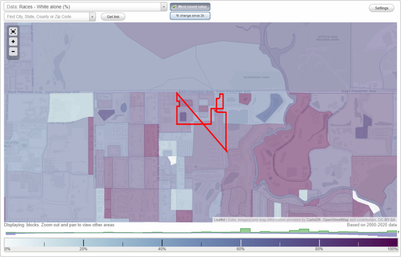
 |
|
Back to: Tampa main page, Florida, Florida smaller cities, Florida small towns, Florida forum, All U.S. Cities.
Data type:
Area: 286.879 square miles
Population: 3,046
Population density:
| Mar Jo University Terrace: | 11 people per square mile | | Tampa: | 2,708 people per square mile |
Discuss Mar Jo University Terrace neighborhood (subdivision, block, or community) on our hugely popular Florida forum.
Zip codes: 33617.
| Males: | 1,517 | | Females: | 1,530 |
Median age: Males:
| This neighborhood: | 18.3 years | | Whole city: | 34.7 years |
Females:
| This neighborhood: | 20.6 years | | Whole city: | 35.7 years |
Average household size:
| Mar Jo University Terrace: | 2.3 people | | Tampa: | 2.4 people |
Average family size:
| Mar Jo University Terrace: | 2.9 members | | Tampa: | 3.1 members |
Percentage of married-couple families (among all households):
| Here: | 41.9% | | city: | 36.4% |
Percentage of married-couple families with children (among all households):
| Mar Jo University Terrace: | 14.7% | | Tampa: | 15.8% |
Percentage of single-mother households (among all households):
| This neighborhood: | 8.5% | | Tampa: | 11.4% |
Percentage of never married males 15 years old and over:
| Here: | 13.1% | | Tampa: | 16.8% |
Percentage of never married females 15 years old and over:
| Mar Jo University Terrace: | 11.1% | | city: | 14.2% |
Percentage of people that speak English not well or not at all:
| This neighborhood: | 1.9% | | Tampa: | 5.5% |
Percentage of people born in this state:
| Here: | 42.3% | | Tampa: | 44.8% |
Percentage of people born in another U.S. state:
| Mar Jo University Terrace: | 48.1% | | Tampa: | 38.8% |
Percentage of native residents but born outside the U.S.:
| Here: | 1.7% | | city: | 4.1% |
Percentage of foreign born residents:
| Here: | 7.9% | | Tampa: | 12.2% |
Rooms in owner-occupied houses/condos in Mar Jo University Terrace: |
|
- 1 room: 39
- 2 rooms: 757
- 3 rooms: 2,904
- 4 rooms: 9,228
- 5 rooms: 15,764
- 6 rooms: 12,456
- 7 rooms: 6,943
- 8 rooms: 4,126
- 9+ rooms: 2,244
|
|
Rooms in renter-occupied apartments in Mar Jo University Terrace: |
|
- 1 room: 829
- 2 rooms: 3,430
- 3 rooms: 6,345
- 4 rooms: 12,492
- 5 rooms: 7,667
- 6 rooms: 2,411
- 7 rooms: 992
- 8 rooms: 231
- 9+ rooms: 104
|
|
Bedrooms in owner-occupied houses and condos in Mar Jo University Terrace: |
|
- no bedroom: 327
- 1 bedroom: 2,597
- 2 bedrooms: 22,294
- 3 bedrooms: 22,691
- 4 bedrooms: 5,734
- 5+ bedrooms: 818
|
|
Bedrooms in owner-occupied houses and condos in Mar Jo University Terrace: |
|
- no bedroom: 1,182
- 1 bedroom: 8,618
- 2 bedrooms: 18,840
- 3 bedrooms: 5,000
- 4 bedrooms: 752
- 5+ bedrooms: 112
|
|
Average number of cars or other vehicles available in houses/condos:
| This neighborhood: | 1.6 | | Tampa: | 1.7 |
Average number of cars or other vehicles available in houses/condos:
| Here: | 1.3 | | city: | 1.1 |
Percentage of units with a mortgage:
| Mar Jo University Terrace: | 64.2% | | Tampa: | 70.8% |
Housing prices:
Average estimated value of detached houses in 2007 (46.3% of all units):
| Mar Jo University Terrace: | $272,304 | | Tampa: | $314,392 |
Average estimated value of townhouses or other attached units in 2007 (4.0% of all units):
| This neighborhood: | $49,166 | | city: | $141,151 |
Average estimated value of housing units in 2-unit structures in 2007 (5.7% of all units):
| This neighborhood: | $4,414 | | Tampa: | $88,740 |
Average estimated '07 value of housing units in 3-to-4-unit structures (6.0% of all units):
| Mar Jo University Terrace: | $79,426 | | city: | $338,570 |
Average estimated '07 value of housing units in 5-or-more-unit structures (16.8% of all units):
| Mar Jo University Terrace: | $59,762 | | Tampa: | $290,731 |
Average estimated value of mobile home in 2007 (20.8% of all units):
| Mar Jo University Terrace: | $45,265 | | Tampa: | $52,090 |
Average estimated value of boats, RVs, vans, etc. in 2007 (0.4% of all units):
| This neighborhood: | $492 | | city: | $37,500 |
Owners and renters by unit type in %
|

Occupations of males:
Percentage of males in management occupations (except farmers):
| Here: | 7.6% | | city: | 9.9% |
Percentage of males in business and financial operations occupations:
| Here: | 3.3% | | city: | 4.8% |
Percentage of males in computer and mathematical occupations:
| Here: | 3.8% | | city: | 3.3% |
Percentage of males in architecture and engineering occupations:
| Here: | 3.1% | | city: | 2.8% |
Percentage of males in community and social services occupations:
| Here: | 1.5% | | city: | 1.0% |
Percentage of males in education, training, and library occupations:
| Here: | 2.1% | | city: | 2.4% |
Percentage of males in arts, design, entertainment, sports, and media occupations:
| Here: | 2.1% | | city: | 2.5% |
Percentage of males in healthcare practitioners and technical occupations:
| Here: | 2.4% | | city: | 3.3% |
Percentage of males in service occupations:
| Here: | 14.2% | | city: | 14.3% |
Percentage of males in sales and office occupations:
| Here: | 16.9% | | city: | 22.0% |
Percentage of males in construction, extraction, and maintenance occupations:
| Here: | 20.4% | | city: | 15.4% |
Percentage of males in production occupations:
| Here: | 7.0% | | city: | 5.9% |
Percentage of males in transportation and material moving occupations:
| Here: | 13.4% | | city: | 9.1% |
Occupations of females:
Percentage of females in management occupations (except farmers):
| Here: | 6.3% | | city: | 7.3% |
Percentage of females in business and financial operations occupations:
| Here: | 4.7% | | city: | 5.4% |
Percentage of females in computer and mathematical occupations:
| Here: | 1.7% | | city: | 1.6% |
Percentage of females in community and social services occupations:
| Here: | 1.3% | | city: | 1.9% |
Percentage of females in education, training, and library occupations:
| Here: | 8.5% | | city: | 7.3% |
Percentage of females in arts, design, entertainment, sports, and media occupations:
| Here: | 1.2% | | city: | 2.0% |
Percentage of females in healthcare practitioners and technical occupations:
| Here: | 7.3% | | city: | 6.2% |
Percentage of females in service occupations:
| Here: | 17.5% | | city: | 18.5% |
Percentage of females in sales and office occupations:
| Here: | 40.4% | | city: | 39.2% |
Percentage of females in construction, extraction, and maintenance occupations:
| Here: | 1.2% | | city: | 0.8% |
Percentage of females in production occupations:
| Here: | 5.4% | | city: | 4.5% |
Percentage of females in transportation and material moving occupations:
| Here: | 2.2% | | city: | 1.8% |
Percentage of people 18-64 in Armed Forces:
| Mar Jo University Terrace: | 0.3% | | Tampa: | 1.0% |
Education in this neighborhood (subdivision or community):
Percentage of people 3 years and older in K-12 schools:
| Mar Jo University Terrace: | 16.8% | | Tampa: | 19.1% |
Percentage of people 3 years and older in undgraduate colleges:
| Mar Jo University Terrace: | 4.8% | | Tampa: | 5.9% |
Percentage of people 3 years and older in grad. or professional schools:
| Mar Jo University Terrace: | 1.0% | | Tampa: | 1.1% |
Percentage of students K-12 enrolled in private schools:
| Mar Jo University Terrace: | 9.1% | | Tampa: | 12.1% |
Percentage of population below poverty level:
| Mar Jo University Terrace: | 16.1% | | Tampa: | 18.1% |
Median year owner moved in (as recorded in 2000):
| Mar Jo University Terrace: | 1989 | | Tampa: | 1991 |
Median year renter moved in (as recorded in 2000):
| Mar Jo University Terrace: | 1998 | | Tampa: | 1999 |
Median rent in 2007:
| Mar Jo University Terrace: | $709 | | Tampa: | $727 |
Percentage of married-couple families with both working:
| Mar Jo University Terrace: | 47.7% | | Tampa: | 58.2% |
Most commonly used house heating fuel: |
|
|
- Electricity (90%)
- Utility gas (5%)
- Bottled, tank, or LP gas (4%)
- Fuel oil, kerosene, etc. (1%)
- No fuel used (1%)
|
Highways in this neighborhood:
S Harbor City Blvd (State Hwy 5, US Hwy 1)
Length: 0.06 miles
Direction: SE-NW
Address range: 2700 to 2713
Co Rd 509 (Minton Rd)
Length: 0.03 miles
Direction: N-S
Address range: 2500 to 2599
Roads and streets:
Milwaukee Ave
Length: 1.98 miles
Directions: E-W, SW-NE
Address range: 3000 to 4399
Heritage Oaks Blvd
Length: 0.88 miles
Direction: E-W
Ocean Ave
Length: 0.62 miles
Directions: E-W, SE-NW, SW-NE
Address range: 100 to 599
Ryoland St
Length: 0.28 miles
Direction: E-W
Address range: 500 to 699
Williams St
Length: 0.28 miles
Direction: E-W
Address range: 500 to 699
Irene St
Length: 0.28 miles
Direction: E-W
Address range: 3000 to 3502
Church St
Length: 0.27 miles
Directions: E-W, N-S, SW-NE
Address range: 700 to 1106
Mary St
Length: 0.26 miles
Direction: E-W
Address range: 3000 to 3499
Lookout Ter
Length: 0.20 miles
Direction: SW-NE
Address range: 1400 to 1499
Arcadia Ave
Length: 0.17 miles
Directions: E-W, SE-NW, SW-NE
Address range: 300 to 399
Hailwood Dr
Length: 0.14 miles
Direction: E-W
Address range: 300 to 499
Brookshire Cir
Length: 0.12 miles
Directions: E-W, N-S
Boone Ave (Needle St)
Length: 0.11 miles
Direction: E-W
Address range: 458 to 487
Florida Ave
Length: 0.10 miles
Direction: E-W
Address range: 5300 to 5499
Ranch Rd
Length: 0.10 miles
Direction: E-W
Lee Ct
Length: 0.10 miles
Directions: E-W, SW-NE
Address range: 500 to 533
Jernigan Ave
Length: 0.09 miles
Directions: E-W, SW-NE
Address range: 1200 to 1302
Hollywood Blvd
Length: 0.08 miles
Direction: N-S
Durango Pl
Length: 0.08 miles
Direction: E-W
Address range: 4800 to 4899
Brandywine Ln
Length: 0.08 miles
Direction: SE-NW
Powell Ave
Length: 0.07 miles
Directions: E-W, SW-NE
Address range: 1415 to 1499
Riverview Dr
Length: 0.06 miles
Directions: N-S, SE-NW
Address range: 2710 to 2799
Melwood Dr
Length: 0.06 miles
Direction: SE-NW
Address range: 2712 to 2799
Grant St (S Grant St)
Length: 0.05 miles
Direction: N-S
Address range: 2700 to 2712
Leonard Weaver Blvd (S Hickory St)
Length: 0.05 miles
Direction: N-S
Address range: 2700 to 2709
Carver St
Length: 0.05 miles
Direction: N-S
Address range: 2701 to 2703
Botanica Cir
Length: 0.03 miles
Direction: N-S
Dairy Rd
Length: 0.03 miles
Direction: N-S
Address range: 2694 to 2749
S Country Club Rd
Length: 0.03 miles
Direction: N-S
Address range: 2660 to 2679
Sylvia Rd
Length: 0.03 miles
Direction: N-S
Address range: 580 to 599
Parker Rd
Length: 0.03 miles
Direction: N-S
Other features:
Crane Crk
Length: 0.12 miles
Directions: E-W, SE-NW, SW-NE
Highways in this neighborhood:
US Hwy 301 (State Hwy 41)
Length: 0.08 miles
Direction: SW-NE
Address range: 12286 to 12299
State Hwy 579 (Co Rd 579)
Length: 0.04 miles
Direction: N-S
Roads and streets:
Frontage Rd
Length: 0.39 miles
Direction: E-W
Address range: 5800 to 6199
Markstown Dr
Length: 0.31 miles
Directions: E-W, N-S, SW-NE
Address range: 6200 to 6699
Morris Bridge Rd
Length: 0.31 miles
Directions: E-W, SE-NW, SW-NE
Jamesville Dr
Length: 0.29 miles
Direction: E-W
Address range: 6521 to 6707
Jenny Dr
Length: 0.22 miles
Directions: E-W, SE-NW, SW-NE
Address range: 5800 to 5999
Shalimar Wood Dr
Length: 0.20 miles
Direction: E-W
Address range: 10300 to 10499
Berta Cir
Length: 0.19 miles
Directions: E-W, N-S, SE-NW, SW-NE
Address range: 5800 to 5899
Marta Dr
Length: 0.19 miles
Direction: E-W
Address range: 5800 to 5999
Mike Dr
Length: 0.17 miles
Directions: N-S, SE-NW, SW-NE
Address range: 13100 to 13499
Berta Dr
Length: 0.13 miles
Direction: E-W
Address range: 5800 to 5999
L H Dr
Length: 0.13 miles
Direction: E-W
Address range: 1 to 116
Sea Harbour Ln
Length: 0.13 miles
Directions: E-W, N-S, SW-NE
Address range: 8400 to 8628
Ollie Rd
Length: 0.11 miles
Direction: E-W
Mar-Jo Dr
Length: 0.11 miles
Direction: E-W
Address range: 5301 to 5899
Dottie Dr
Length: 0.10 miles
Directions: N-S, SE-NW
Address range: 13400 to 13450
Telecom Dr
Length: 0.09 miles
Directions: N-S, SW-NE
Address range: 13406 to 13499
Whitestone Dr
Length: 0.09 miles
Direction: N-S
Connersville Blvd
Length: 0.09 miles
Direction: N-S
Address range: 13300 to 13414
Kitten Dr
Length: 0.09 miles
Direction: N-S
Address range: 13306 to 13498
Joan Dr
Length: 0.09 miles
Direction: N-S
Address range: 13300 to 13369
Kelso Rd
Length: 0.07 miles
Directions: E-W, N-S, SE-NW
Grovewood Ave
Length: 0.06 miles
Direction: SW-NE
Arbor Isle Dr
Length: 0.05 miles
Direction: N-S
Address range: 13400 to 13499
Santuary Cove Ct
Length: 0.05 miles
Direction: E-W
Santuary Cove Dr
Length: 0.03 miles
Directions: N-S, SE-NW
Address range: 13370 to 13455
Island Breeze Ln
Length: 0.03 miles
Direction: E-W
Co Rd 579
Length: 0.02 miles
Direction: SE-NW
Other features:
Flint Crk
Length: 0.30 miles
Direction: E-W
Itchepackesassa Crk
Length: 0.12 miles
Direction: SE-NW
Highways in this neighborhood:
US Hwy 92
Length: 0.12 miles
Directions: E-W, SW-NE
Address range: 1670 to 1717
Co Rd 700 (Co Rd 35, N Florida Ave, US Hwy 98)
Length: 0.07 miles
Direction: N-S
Address range: 1700 to 1751
State Hwy 33 (Lakeland Hills Blvd)
Length: 0.06 miles
Direction: N-S
Address range: 1700 to 1725
Roads and streets:
Lakehurst St
Length: 0.63 miles
Direction: E-W
Address range: 500 to 999
E Lowell St
Length: 0.63 miles
Direction: E-W
Address range: 500 to 999
Smoke Rd
Length: 0.42 miles
Direction: E-W
Address range: 2400 to 2499
Lavon St
Length: 0.35 miles
Direction: E-W
Address range: 1700 to 1948
Modest St
Length: 0.34 miles
Direction: E-W
Address range: 100 to 599
Barnes Rd
Length: 0.28 miles
Direction: E-W
Address range: 2569 to 2599
Alderman Rd
Length: 0.28 miles
Direction: E-W
Address range: 2000 to 2099
Poinciana Pkwy
Length: 0.28 miles
Direction: E-W
Arneson Ave
Length: 0.28 miles
Direction: E-W
Address range: 100 to 599
Robinson St
Length: 0.28 miles
Direction: E-W
Mason St
Length: 0.26 miles
Direction: E-W
Address range: 100 to 612
Luna Rd
Length: 0.24 miles
Directions: E-W, SE-NW
Address range: 300 to 399
Camelot Dr
Length: 0.22 miles
Directions: E-W, SW-NE
Robyn Ln
Length: 0.18 miles
Directions: E-W, SE-NW, SW-NE
Address range: 1 to 99
Michigan Ln
Length: 0.17 miles
Directions: E-W, SE-NW
Ariana Blvd (Harriet St)
Length: 0.17 miles
Directions: E-W, N-S, SE-NW
Great Barford St
Length: 0.16 miles
Directions: E-W, SE-NW, SW-NE
Address range: 700 to 799
Lakeview Ct
Length: 0.15 miles
Direction: E-W
Northport Dr
Length: 0.14 miles
Direction: E-W
Address range: 2600 to 2699
Pacific Rd
Length: 0.14 miles
Directions: N-S, SE-NW
Blossom Cir N
Length: 0.12 miles
Directions: E-W, SW-NE
Address range: 1100 to 1733
Boyd Dr
Length: 0.12 miles
Direction: E-W
Address range: 2500 to 2599
Kim St
Length: 0.11 miles
Direction: E-W
Address range: 100 to 199
Williston Dr
Length: 0.11 miles
Direction: E-W
Address range: 2600 to 2699
Whispering Pines Dr
Length: 0.11 miles
Directions: E-W, N-S
Address range: 700 to 799
Terry Rd
Length: 0.10 miles
Direction: N-S
Address range: 1674 to 1759
Wydine Rd (Wydine Dr)
Length: 0.10 miles
Direction: E-W
Address range: 2300 to 2399
S Berkley Rd (Co Rd 655)
Length: 0.10 miles
Direction: N-S
Address range: 300 to 399
Scott Cir
Length: 0.09 miles
Directions: E-W, N-S, SE-NW
Address range: 1300 to 1399
Estella Way
Length: 0.09 miles
Directions: E-W, SE-NW
Address range: 301 to 309
Florida Dr
Length: 0.09 miles
Direction: N-S
Address range: 300 to 499
Adams St
Length: 0.08 miles
Direction: N-S
Ramsgate Rd
Length: 0.07 miles
Direction: SE-NW
New York Ave
Length: 0.07 miles
Directions: N-S, SE-NW
Leisure Ln
Length: 0.07 miles
Direction: E-W
Address range: 14 to 99
Lynchburg Rd
Length: 0.07 miles
Directions: N-S, SE-NW
Address range: 3900 to 4041
Church St
Length: 0.07 miles
Direction: E-W
W Lake Parker Dr
Length: 0.07 miles
Direction: N-S
Address range: 1900 to 1923
Gandy St
Length: 0.07 miles
Direction: N-S
Address range: 234 to 299
Prairie Ter
Length: 0.07 miles
Direction: E-W
Lake Lena Blvd
Length: 0.07 miles
Direction: SW-NE
Washington Ave
Length: 0.06 miles
Direction: N-S
Address range: 1650 to 1799
N Lake Ave
Length: 0.06 miles
Direction: N-S
Address range: 1700 to 1725
St James Ave
Length: 0.06 miles
Direction: N-S
Address range: 1700 to 1799
N Gilmore Ave
Length: 0.06 miles
Direction: N-S
Address range: 1700 to 1726
Martin L King Jr Ave
Length: 0.06 miles
Direction: N-S
Address range: 1800 to 1887
Co Rd 659 (N Combee Rd, Co Rd 33 A)
Length: 0.06 miles
Direction: N-S
Address range: 1713 to 1900
Burnway Rd
Length: 0.06 miles
Direction: N-S
Bayview Dr
Length: 0.06 miles
Direction: E-W
Address range: 1772 to 1799
North Dr
Length: 0.06 miles
Directions: E-W, SE-NW, SW-NE
Address range: 1700 to 1799
Taylor Rd E
Length: 0.06 miles
Direction: N-S
Shirah Rd (Midway Blvd)
Length: 0.06 miles
Direction: N-S
Tempsford Rd
Length: 0.06 miles
Directions: SE-NW, SW-NE
Michigan Ct
Length: 0.06 miles
Direction: N-S
Address range: 1954 to 1960
Esperanza Rd
Length: 0.05 miles
Direction: N-S
Address range: 1 to 699
Pickens St
Length: 0.05 miles
Direction: E-W
Address range: 500 to 599
Lowell St
Length: 0.05 miles
Direction: E-W
Address range: 500 to 529
Michigan Dr
Length: 0.05 miles
Direction: SW-NE
Abbey Ct
Length: 0.04 miles
Directions: E-W, SE-NW
Harriet St
Length: 0.04 miles
Directions: E-W, SE-NW
Canal Rd
Length: 0.04 miles
Directions: N-S, SE-NW
Highland Ave
Length: 0.04 miles
Direction: SE-NW
Michigan Pl
Length: 0.04 miles
Direction: E-W
Address range: 300 to 399
Lakeview Ln
Length: 0.04 miles
Directions: N-S, SE-NW
Lakeview Rd
Length: 0.04 miles
Direction: E-W
Lazy Ln
Length: 0.04 miles
Directions: N-S, SE-NW
Easy Ln
Length: 0.04 miles
Directions: N-S, SE-NW
Eau Claire Ave
Length: 0.04 miles
Direction: N-S
Barford St (Little Barford St)
Length: 0.04 miles
Direction: SW-NE
Address range: 100 to 141
Lakeview Way
Length: 0.03 miles
Direction: N-S
Pearl St
Length: 0.03 miles
Direction: N-S
Oak Dr
Length: 0.03 miles
Direction: N-S
Address range: 4000 to 4121
Tranquility Ln
Length: 0.03 miles
Direction: E-W
Norman Dr
Length: 0.03 miles
Direction: N-S
Fish Hatchery Rd
Length: 0.02 miles
Direction: N-S
Address range: 1868 to 1893
Other features:
Itchepackesassa Crk
Length: 0.18 miles
Direction: E-W
Saddle Crk
Length: 0.07 miles
Direction: SE-NW
|
Discuss Mar Jo University Terrace neighborhood (subdivision, block, or community) on our hugely popular Florida forum.
Back to: Tampa, FL, Florida, Florida smaller cities, Florida small towns, All cities.
Back to the top
City-data.com does not guarantee the accuracy or timeliness of any information on this site. Use at your own risk.
Some parts © 2009 Advameg, Inc.
|
 |