Please register to participate in our discussions with 2 million other members - it's free and quick! Some forums can only be seen by registered members. After you create your account, you'll be able to customize options and access all our 15,000 new posts/day with fewer ads.
is really that record candidate? I thought that zone was capable of even more. Those numbers are pretty reachable like every winter here in the central Andes, in fact even during this year's very lackluster season there was one atmosferic river in that range of snow maker. And of course in the southern patagonian icefield they're the norm.
Looks like my area will be on the northern end of a frontal boundary low later this week. Forecast is now calling for temps around 50 F/10 C with showers on Friday into Friday night with 30s possible on Saturday night.
Should speed up the foliage.
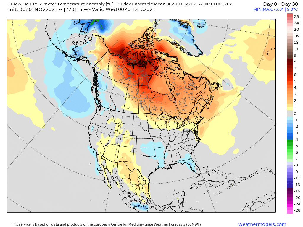
I don't see much of any below average temperatures for November on the GFS, although that could change. Mostly well above average for the middle part of the month across most areas east of the Rockies.
Looks like my area will be on the northern end of a frontal boundary low later this week. Forecast is now calling for temps around 50 F/10 C with showers on Friday into Friday night with 30s possible on Saturday night.
Should speed up the foliage.
Enjoying Fall down there so far?
Beckley WV reporting light snow at 2500' right now. I see precip is falling with 850mb temps just below freezing there.
Clouds stuck around much of the night and kept Indianapolis a bit warmer than forecast, bottoming out at 34F. The next 4 nights, though, under clear skies should easily bring a freeze each night, possibly a couple hard freezes in there as well.
Please register to post and access all features of our very popular forum. It is free and quick. Over $68,000 in prizes has already been given out to active posters on our forum. Additional giveaways are planned.
Detailed information about all U.S. cities, counties, and zip codes on our site: City-data.com.

 Please register to participate in our discussions with 2 million other members - it's free and quick! Some forums can only be seen by registered members. After you create your account, you'll be able to customize options and access all our 15,000 new posts/day with fewer ads.