Please register to participate in our discussions with 2 million other members - it's free and quick! Some forums can only be seen by registered members. After you create your account, you'll be able to customize options and access all our 15,000 new posts/day with fewer ads.
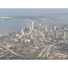
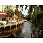
Have you seen the view? Come on Coconut, stop being your usual argumentative self. You know darn well M Path is beyond ugly, desolate and goes no where. If I live in Downtown per say and I want to take a bike ride to the grove, well i have shops, eating and a bay view I can ride along or stop at in Brickell. I have beautiful tree lined streets with nice homes in the Grove and I stop off and shop or eat or whatever in center grove. Come on Coconut, your better than this! You know I am right.
I assure you, the scenery along the M-Path is 100% better than the view from a car on US1.
Here are some points of interest within a few blocks of the M-Path:
-Brickell, including Mary Brickell Village
-Viscaya and Miami Science Museum
-Rickenbacker Causeway--Miami's mecca for cyclists and triathletes--which also connects to Old Cutler bike path.
-Cocowalk and Coconut Grove marinas and parks (via 27th Ave. or Grand Ave.--ok, this is the furthest away from M-Path that I will include, though Miracle Mile wouldn't be much further away, and there are plans for bike lines along Ponce)
-Village of Merrick Park
-University of Miami
-Sunset Place and downtown South Miami (including the popular Mack Cycle bike shop and nearby triathlon shop)
-Dadeland area for all the shopping you would ever want to do.
-Connects to South Dade Trail. Quite a few times I've done M-Path from Viscaya to South Dade Trail to Palmetto Bay to visit family--much better then sitting in afternoon traffic on US1.
-Connects to a (admittedly patchwork but) growing network of bike lanes in downtown Miami, which can connect you to Midtown, the Design District or the Venetian Causeway to South Beach.
-People do work and live along the M-Path inbetween Metrorail stations.
I've stated before, the main issue with the M-path is inadequate crossings of many of the cross roads, most people feel unsafe crossing 6 lane roads with just two faded strips of paint and blind crossings. Those really need to be flashing crosswalks with "caution--shared use path crossing" signage and no turn turn on red. With today's technology, you can set it up to the crosswalk flashes automatically and a right turn arrow turns to a red arrow when the walk sign is on and someone approaches the crossing. Some kind of lighting at night would help as well, especially near the crossings. You would think paint and lights are scarce commodities around here... Also, signage is not adequate near Bird and Douglass roads, it's easy to lose the trail there.
All Aboard Florida may have a trail component similar to the South Dade Trail, which would allow you to connect from the M-Path to Aventura, Fort Lauderdale, and beyond.
The first four you mentioned are not along the M Path and you would have to cross US 1 and a ton of traffic to get to them (which you do mention later on). So why would I, a biker hop on some desolate and again UGLY path with a bunch of run down, architecturally unappealing buildings, when I can take any number of streets from downtown, through brickell and into the grove? It is more hassle than anything, get what I am saying? I am not debating if it is better than sitting in a car on US1, I mean I suppose it is better. But in the grand scheme of things, if I live east of 95 or south of US1, then i am not getting on the M Path. I would just take Bayview to brickell, and from then to downtown or wherever it is I want to go. That is just my take on it.
The first four you mentioned are not along the M Path and you would have to cross US 1 and a ton of traffic to get to them (which you do mention later on). So why would I, a biker hop on some desolate and again UGLY path with a bunch of run down, architecturally unappealing buildings, when I can take any number of streets from downtown, through brickell and into the grove? It is more hassle than anything, get what I am saying? I am not debating if it is better than sitting in a car on US1, I mean I suppose it is better. But in the grand scheme of things, if I live east of 95 or south of US1, then i am not getting on the M Path. I would just take Bayview to brickell, and from then to downtown or wherever it is I want to go. That is just my take on it.
That is one strange route if you're crossing 1 to get from the M-Path to MBV.
If you think crossing 1 is bad, how is riding on the street the entire way less dangerous?
And all this discussion about points of interest is really irrelevant anyway since as I said before, it has nothing to do with that. The M-Path is a recreation path/area which is the same as what they want to do under this bridge.
I know you said points of interest have nothing to do with it, but that's your opinion, one I don't agree with. I also believe many people don't agree with your opinion either, judging by how under utilized it (the M-Path) is. Yet you can see any number of bike riders, joggers and walkers up and down tigertail and bayshore drive in the Grove, leading all the way into Brickell and Downtown.
As for the bridge, there are points of interest and in my opinion it will be fine. Time will tell.
The first four you mentioned are not along the M Path and you would have to cross US 1 and a ton of traffic to get to them (which you do mention later on). So why would I, a biker hop on some desolate and again UGLY path with a bunch of run down, architecturally unappealing buildings, when I can take any number of streets from downtown, through brickell and into the grove? It is more hassle than anything, get what I am saying? I am not debating if it is better than sitting in a car on US1, I mean I suppose it is better. But in the grand scheme of things, if I live east of 95 or south of US1, then i am not getting on the M Path. I would just take Bayview to brickell, and from then to downtown or wherever it is I want to go. That is just my take on it.
Who says all bikers start their trip in downtown Miami and only go to the Grove????? As a diagonal route, M path can be much more direct than the local roads for longer distances. Sure, it's not the most scenic route--we can both agree about that--but it's still mostly shaded and well landscaped. It's not like it's the median of Kendall Drive... Try biking from Dadeland to Brickell via only local roads and see how it works out.
It's actually not very difficult for a cyclist to use residential side streets for something that's a few blocks off the path, even if you are not comfortable with the traffic and use the sidewalks. It would be like complaining that you can't get to Mary Brickell Village from Brickell Avenue...
Hurricane I agree with what your saying man. i am just saying, more people (from what i see every day) take the streets through the grove and I see them going up to brickell or over the causeway or to downtown. But I don't generally see that many people on MPath, and I was giving the reasons that I think explain why this is so.
Hurricane I agree with what your saying man. i am just saying, more people (from what i see every day) take the streets through the grove and I see them going up to brickell or over the causeway or to downtown. But I don't generally see that many people on MPath, and I was giving the reasons that I think explain why this is so.
Yep, and I also do Brickell/Miami Ave. and the causeway much more than MPath. The one part of the MPath I frequent is the part from Viscaya station to 26th rd. Quicker access to the causeway than using the Viscaya overpass. For people who live south, I still think the issue is safety more than scenery though.
As for the bridge, there are points of interest and in my opinion it will be fine. Time will tell.
I can see it working well it they connect directly to the Venetian Causeway and the Museum Park, which I don't see why they wouldn't do. If the crossings were done well (safe, visible, and not taking forever to cross), I would ride under the bridge instead of Miami Ave. up to NE 15 ST. Of course, there's Miami World Center going up, and the rail station. Going west, where do you connect to? That's trickier, but the Marilin's stadium is one possibility, and I'd love to see it connect to some kind of future riverfront greenway. However, I'm worried it will be more decorative than functional as far as cycling goes.
I can see it working well it they connect directly to the Venetian Causeway and the Museum Park, which I don't see why they wouldn't do. If the crossings were done well (safe, visible, and not taking forever to cross), I would ride under the bridge instead of Miami Ave. up to NE 15 ST. Of course, there's Miami World Center going up, and the rail station. Going west, where do you connect to? That's trickier, but the Marilin's stadium is one possibility, and I'd love to see it connect to some kind of future riverfront greenway. However, I'm worried it will be more decorative than functional as far as cycling goes.
Maybe a cycling over pass? That would be nice.
Please register to post and access all features of our very popular forum. It is free and quick. Over $68,000 in prizes has already been given out to active posters on our forum. Additional giveaways are planned.
Detailed information about all U.S. cities, counties, and zip codes on our site: City-data.com.

 Please register to participate in our discussions with 2 million other members - it's free and quick! Some forums can only be seen by registered members. After you create your account, you'll be able to customize options and access all our 15,000 new posts/day with fewer ads.

 .
.