Welcome to City-Data.com Forum!
U.S. CitiesCity-Data Forum Index
Go Back   City-Data Forum > General Forums > Weather
 [Register]
Please register to participate in our discussions with 2 million other members - it's free and quick! Some forums can only be seen by registered members. After you create your account, you'll be able to customize options and access all our 15,000 new posts/day with fewer ads.
View detailed profile (Advanced) or search
site with Google Custom Search

Search Forums  (Advanced)
Reply Start New Thread
 
Old 11-26-2013, 01:22 PM
 
Location: Ashburn, VA
2,794 posts, read 2,934,817 times
Reputation: 4914

Advertisements

Quote:
Originally Posted by miamihurricane555 View Post
where is all the rain I was suppose to get today?

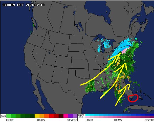
Well lets see you are located in the red area... and in the yellow that's where all the precipitation is going.. lol!!!!!!! So you my friend are in the anti-storm bubble zone!!!


Attached Thumbnails
Pre Thanksgiving Storm 2013-mappy111.jpg  
Reply With Quote Quick reply to this message

 
Old 11-26-2013, 02:35 PM
 
Location: Near the Coast SWCT
83,539 posts, read 75,373,979 times
Reputation: 16634
I always love when its cold & raining. 36°F & drizzling.

Hoping those folks in PA dont have trouble commuting home. It's been freezing rain all day in many areas and now with sundown roads might get slick

850mb moisture transport showing ton of moisture being drawn from the gulf

http://www.spc.noaa.gov/sfctest/new/...r=19&parm=pmsl#

Reply With Quote Quick reply to this message
 
Old 11-26-2013, 03:22 PM
 
Location: Near the Coast SWCT
83,539 posts, read 75,373,979 times
Reputation: 16634
Anyone on twitter and loves weather, I highly recommend following this guy...

Steve D has been in rapid storm mode tweeting all day. lol Here's the latest. Just a little to late and too far behind with the phasing.

"Meanwhile the phase of the polar and subtropical disturbances has started"


https://twitter.com/nynjpaweather/st...59150596870144


Few more:

"Interior E PA, elevations above 500 feet on through C PA are at risk for continues snow, sleet, and freezing rain."

"Heavy waves of precipitation will start to invade from the south now through 10 AM tomorrow"

"Change over to rain for interior expected to take place over next 2-3 hrs."
Reply With Quote Quick reply to this message
 
Old 11-26-2013, 03:55 PM
 
Location: Near the Coast SWCT
83,539 posts, read 75,373,979 times
Reputation: 16634
North Carolina, Tornado Watches & Winter Storm Warning at the same time

Reply With Quote Quick reply to this message
 
Old 11-26-2013, 04:00 PM
 
Location: UpstateNY
8,612 posts, read 10,769,221 times
Reputation: 7596
eek, laff it up guys, we're in the thick of snow here. I'm hoping we will be driving in rain to the chiro tomorrow.

And my mom is in Miami LOL.
Reply With Quote Quick reply to this message
 
Old 11-26-2013, 04:01 PM
 
Location: Miami,FL
2,886 posts, read 4,109,947 times
Reputation: 715
Local nws now saying that our bad weather won't arrive till after 1 am tonight and our squall line coming in around 12z -_-.
Reply With Quote Quick reply to this message
 
Old 11-26-2013, 04:02 PM
 
Location: Miami,FL
2,886 posts, read 4,109,947 times
Reputation: 715
Quote:
Originally Posted by CCc girl View Post
eek, laff it up guys, we're in the thick of snow here. I'm hoping we will be driving in rain to the chiro tomorrow.

And my mom is in Miami LOL.
she we be surprised in the morning then as we a going to see a squall line come through in the early morning hours.
Reply With Quote Quick reply to this message
 
Old 11-26-2013, 04:57 PM
 
Location: Lexington, KY
12,278 posts, read 9,459,659 times
Reputation: 2763
It's here.....

Reply With Quote Quick reply to this message
 
Old 11-26-2013, 04:58 PM
 
Location: Near the Coast SWCT
83,539 posts, read 75,373,979 times
Reputation: 16634
Quote:
Originally Posted by CCc girl View Post
eek, laff it up guys, we're in the thick of snow here. I'm hoping we will be driving in rain to the chiro tomorrow.

And my mom is in Miami LOL.
Be safe. Post some pics if you can.

Heavy snow warning for you (if your within the blue outline) My sister is.

SPC Concerning Heavy Snow. Rates of 1" per hour for areas outlined in Blue. http://www.spc.noaa.gov/products/md/md2046.html


Quote:
AREAS AFFECTED...NWRN PA...WRN NY

CONCERNING...HEAVY SNOW

VALID 262315Z - 270315Z

SUMMARY...SNOWFALL RATES NEAR 1 IN/HR ARE FORECAST TO DEVELOP OVER
NWRN PA BY 00Z...AND THEN SPREAD NEWD ACROSS WRN NY THROUGH 06Z.

DISCUSSION...SHORTWAVE TROUGHS OVER THE UPPER GREAT LAKES REGION AND
SABINE RIVER VALLEY ARE IN THE PROCESS OF PHASING THIS EVENING. WARM
CONVEYOR BELT IS STRENGTHENING OVER THE E COAST AHEAD OF THESE UPPER
WAVES...WHICH IS AIDING IN THE NWD TRANSPORT OF MOISTURE AND
SUBSEQUENT EXPANSION OF A LARGE PRECIPITATION SHIELD INTO THE NERN
CONUS. WARM AIR WITH SURFACE TEMPERATURES AOA FREEZING WILL ALSO
SPREAD ACROSS CNTRL PA/NY TONIGHT...WHICH WILL FAVOR MAINLY RAIN.
FARTHER W...TEMPERATURES AT THE SURFACE AND ALOFT ARE FORECAST TO
REMAIN AT OR SLIGHTLY BELOW FREEZING OVER NWRN PA INTO WRN
NY...WHICH WILL FAVOR PRECIPITATION IN THE FORM OF SNOW.

DURING THE 00-06Z PERIOD...SHORT-TERM MODEL GUIDANCE FORECASTS A 70
KT LOW-LEVEL SLY JET TO SHIFT NWD ACROSS THE MID-ATLANTIC
REGION...WHICH WILL FOCUS STRONG LOW-LEVEL WAA AND FRONTOGENESIS
OVER PA AND NY. PRECIPITATION WILL INCREASE IN INTENSITY AS A
RESULT...WITH SNOWFALL RATES APPROACHING 1 IN/HR OVER NWRN PA BY
00Z...AND WRN NY BETWEEN 00-06Z.
Reply With Quote Quick reply to this message
 
Old 11-26-2013, 05:02 PM
 
Location: Broward County, FL
16,191 posts, read 11,372,298 times
Reputation: 3530
All the heavy thunderstorms have moved out of the area but look like more steady rain is on its way in a couple of hours, all rain should be over by about 2-3 am.
Reply With Quote Quick reply to this message
Please register to post and access all features of our very popular forum. It is free and quick. Over $68,000 in prizes has already been given out to active posters on our forum. Additional giveaways are planned.

Detailed information about all U.S. cities, counties, and zip codes on our site: City-data.com.


Reply
Please update this thread with any new information or opinions. This open thread is still read by thousands of people, so we encourage all additional points of view.

Quick Reply
Message:


Over $104,000 in prizes was already given out to active posters on our forum and additional giveaways are planned!

Go Back   City-Data Forum > General Forums > Weather

All times are GMT -6. The time now is 02:00 PM.

© 2005-2024, Advameg, Inc. · Please obey Forum Rules · Terms of Use and Privacy Policy · Bug Bounty

City-Data.com - Contact Us - Archive 1, 2, 3, 4, 5, 6, 7, 8, 9, 10, 11, 12, 13, 14, 15, 16, 17, 18, 19, 20, 21, 22, 23, 24, 25, 26, 27, 28, 29, 30, 31, 32, 33, 34, 35, 36, 37 - Top