Please register to participate in our discussions with 2 million other members - it's free and quick! Some forums can only be seen by registered members. After you create your account, you'll be able to customize options and access all our 15,000 new posts/day with fewer ads.
Here is fire hazard map from weather service, looks like the fire hazard is pretty high, especially yesterday when most of territory had within IV zone. That is a bit surprising as the weather has not been good.
We've only had around 5mm so far this month and in some months we have had practically zero.. so I don't see why it's surprising. I remember a wildfire breaking out not far from where I live, a large area of bushes was incinerated. Those bushes are to this day dead and black. It spread like, well, wildfire. It was after the dry and warm March 2012.
We've only had around 5mm so far this month and in some months we have had practically zero.. so I don't see why it's surprising. I remember a wildfire breaking out not far from where I live, a large area of bushes was incinerated. Those bushes are to this day dead and black. It spread like, well, wildfire. It was after the dry and warm March 2012.
You started that fire didn't you?
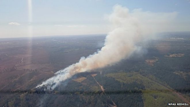
No seriously look how green that grass is and then you have that ball of fire. I understand why it happens but makes no sense that a Oceanic climate sees wildfires quite regularly.
Please register to post and access all features of our very popular forum. It is free and quick. Over $68,000 in prizes has already been given out to active posters on our forum. Additional giveaways are planned.
Detailed information about all U.S. cities, counties, and zip codes on our site: City-data.com.

 Please register to participate in our discussions with 2 million other members - it's free and quick! Some forums can only be seen by registered members. After you create your account, you'll be able to customize options and access all our 15,000 new posts/day with fewer ads.


 It was after the dry and warm March 2012.