Please register to participate in our discussions with 2 million other members - it's free and quick! Some forums can only be seen by registered members. After you create your account, you'll be able to customize options and access all our 15,000 new posts/day with fewer ads.
Max temperature reached low-70s today, not quiet impressive despite it was much below normal(11°F below) plus entire overcast.
Maybe I should wait until once temperatures get below 60 degree day of high and truly I can enjoy the gracious weather.
Will the cold front stalled over North Florida push this far south?
From NWS Melbourne discussion
EXTENDED...HIGHER POPS LIKELY TO CONTINUE INTO THU AS THE FRONTAL
BOUNDARY MOVES SOUTH ACROSS E CENTRAL FL. 12Z GFS/ECMWF INDICATE THE
LOW PRESSURE AREA SHOULD MOVE OFFSHORE THU NIGHT AND FRIDAY WITH
ENE/NE LOW LVL FLOW BEHIND THE FRONT FOR FRI INTO SAT. SOME QUESTION
IF DEEP MOISTURE WILL PUSH ALL THE WAY TO SOUTH FLORIDA OR STALL
NEAR THE FORECAST AREA LONGER THAN EXPECTED AT THIS TIME. WILL KEEP
POPS IN THE 30-40 PCT RANGE FOR FRIDAY-SUNDAY PERIOD CLOSE TO A
BLEND OF GFS AND ECMWF GUID.
Yup.. for here we'll have to wait till Sunday for it but looks short lived and only seasonable..
Look at the latest GFS for East of you in Youngstown.. Stays cool/cold till Friday. Warms back up to seasonable/warm Saturday to Tuesday. Then back into the Fridge as the Polar Jet takes a dive into the Northeast again.
More cold days than warm...not a pattern for warm/hot needers
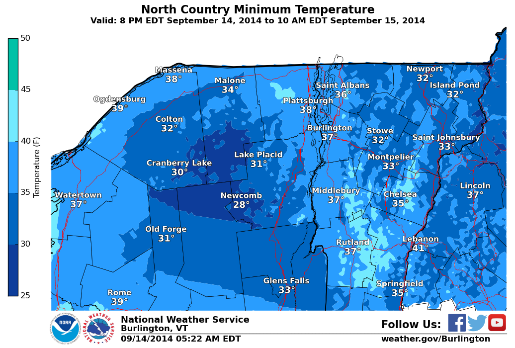
Hey look, GFS wins a battle vs Euro & models. From NWS Caribou. Also, looks like growing season will end in northern Maine Friday and probably some other New England areas..
Please register to post and access all features of our very popular forum. It is free and quick. Over $68,000 in prizes has already been given out to active posters on our forum. Additional giveaways are planned.
Detailed information about all U.S. cities, counties, and zip codes on our site: City-data.com.

 Please register to participate in our discussions with 2 million other members - it's free and quick! Some forums can only be seen by registered members. After you create your account, you'll be able to customize options and access all our 15,000 new posts/day with fewer ads.


 .
.
