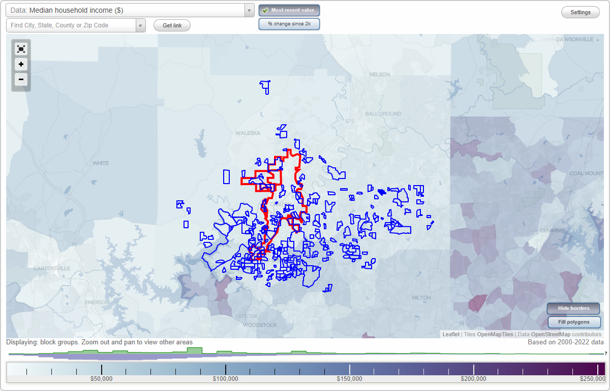
Canton, Georgia Neighborhood Map - Income, House Prices, Occupations, Boundaries
Settings
X

- City boundary
- Neighborhood boundaries
Business Search - 14 Million verified businesses
Allatoona Estates - Shiloh Place Neighborhoods:
Allatoona Estates, Allatoona Landing, Apple Orchard, Arbor Hill Farms, Arcadia, Ashlin Meadows, Ashton Farms, Autumn Woods Estates, Avery Estates, Barrett Farms, Barrett Springs, Barrington Farms, Beauty Heights, Bellview Heights, Belmont Estates, Billings Farm, Birchwood, Blue Pond Estates, Blueberry Hills, Bradshaw Farms, Brannon Estates, Braswell Farms, Breckenridge, Breeze Hill, Brickmill, Bridgemill, Bridgewater, Brooke Park, Brookhaven, Buffington Manor, Camden Woods, Canton Heights, Carmel Ridge Estates, Carmichael Farms, Carrington Farm, Cedar Valley, Cherokee East, Cherokee Overlook, Chestnut Hill, Clayton Community Estates, Clydesdale, Copper Creek, Copper Hills, Cottonwood Creek, Country Cove, Country Places, Creekwood, Crestmont, Crystal Springs, Curtis Farm, Cypress Springs, Deerfield, Diamond Ridge, Dogwood Farms, Dominion Park, Dry Pond Estates, Eagle Pointe, Eagle Ridge, Eagles Nest, East Hickory Springs, Edwards Heights, Estates at the Lake, Falcon Pointe, Fieldstone, Flying Hills, Forest Creek, Forest Hills, Fossett Farms, Fox Hills, Foxhollow, Galbraith Estates, Governors Preserve, Governors Walk, Grand Oaks, Great Sky, Greenwood Acres, Greystone Village, Haley Farm, Hampton Station, Hardie Moore, Hardwick Farms, Hardwood Manor, Harmony on the Lakes, Harmony on the Lakes Southside, Hembredge Hills, Heritage Farms, Heritage Town Park, Hickory Flat, Hickory Flat Township, Hickory Hills Estates, Hickory Meadows, Hickory Plantation, Hickory Point, Hickory Woods, Hidden Acres, Hidden Branches, Hidden Creek, Hidden Lake, Hidden Springs, Hideaway Acres, Highland, Highland Point, Highland Ridge, Hillcrest, Holly Brook Farms, Holly Commons, Holly Hills Estates, Holly Mill, Holly Oak, Holly Place, Holly Reserve, Holly Ridge, Holly Springs, Holly Springs, Indian Brook, Indian Knoll, Indian Springs, Iris Park, Lake Sovereign, Lakefield, Lakeside at Allatoona, Lakeview, Larkwood, Laurel Canyon, Laurel Creek, Laurel Valley, Laurel Woods, Little Bear, Little Pond, Little River Farms, Little River Manor, Longview, Lynn Hill Estates, Macedonia Forest, Madison Park, Magnolia Springs, Mansous Manor, Mcwhirter Place, Middlebrooke, Mill Creek, Mill Creek Overlook, Mills Ridge, Millstone Creek, Misty Ridge, Mitchell Farms, Morgan Falls, Morgan Park, Morgan Springs, Mountain Crest, Mountain Falls, Mountain View, North Lake, Northampton Falls, Northside, Norton Lake, Oak Forest, Oak Hill Estates, Oak Ridge Springs, Oakdale Point, Oakridge Estates, Oakwind, Observation Hill, Old Magnolia, Old Mill Place, Olde Farm Mill Estates, Orange Shoals, Orange Village, Page Place, Palm Ridge, Palm Springs, Park North, Park Village, Pebblebrooke, Pine Acres, Pinecrest, Plainview, Prominence, Providence Walk, Quail Pointe, Ranchwood, Red Gate Lakes, Red Gate Ridge, Ridge Brook Station, Ridgeview, River Brooke, River Falls, River Green, Riverdale, Riverstone, Riverview, Rock Creek Estates, Rolling Hills Heights, Rose Ridge, Royal Oaks, Savanna Estates, Saxon Heights Estates, Serenoa, Shady Lane, Shadybrook Acres, Shiloh PlaceAllatoona Estates neighborhood in Canton statistics: (Find on map)
Area: 0.184 square miles
Roads and streets: Sweetwater Creek Dr; Sweetwater Creek Ct; Sweetwater Creek Cove.
Allatoona Estates neighborhood detailed profile
Area: 0.184 square miles
Roads and streets: Sweetwater Creek Dr; Sweetwater Creek Ct; Sweetwater Creek Cove.
Allatoona Estates neighborhood detailed profile
Allatoona Landing neighborhood in Canton statistics: (Find on map)
Area: 0.721 square miles
Roads and streets: Allatoona Shores Dr; Fields Landing Dr; Anthony Pl; Robert Ln; Alexander Ct; Michael St (Michael Cir); Eileen Cir; Christopher Ln.
Allatoona Landing neighborhood detailed profile
Area: 0.721 square miles
Roads and streets: Allatoona Shores Dr; Fields Landing Dr; Anthony Pl; Robert Ln; Alexander Ct; Michael St (Michael Cir); Eileen Cir; Christopher Ln.
Allatoona Landing neighborhood detailed profile
Apple Orchard neighborhood in Canton statistics: (Find on map)
Area: 0.114 square miles
Roads and streets: Toonigh Rd; Apple Orchard Ln; Jonathan Trce; Jonathan Way; Joseph St; Apple Orchard Way.
Apple Orchard neighborhood detailed profile
Area: 0.114 square miles
Roads and streets: Toonigh Rd; Apple Orchard Ln; Jonathan Trce; Jonathan Way; Joseph St; Apple Orchard Way.
Apple Orchard neighborhood detailed profile
Arbor Hill Farms neighborhood in Canton statistics: (Find on map)
Area: 0.052 square miles
Roads and streets: Branch Rd.
Arbor Hill Farms neighborhood detailed profile
Area: 0.052 square miles
Roads and streets: Branch Rd.
Arbor Hill Farms neighborhood detailed profile
Arcadia neighborhood in Canton statistics: (Find on map)
Area: 0.046 square miles
Limited-access highways (interstate or state) in this neighborhood: I- 575 (Hickory Flat Hwy, State Rte 5, State Rte 140).
Roads and streets: Broad St; Scott Mill Rd; W South St; Short St.
Arcadia neighborhood detailed profile
Area: 0.046 square miles
Limited-access highways (interstate or state) in this neighborhood: I- 575 (Hickory Flat Hwy, State Rte 5, State Rte 140).
Roads and streets: Broad St; Scott Mill Rd; W South St; Short St.
Arcadia neighborhood detailed profile
Ashlin Meadows neighborhood in Canton statistics: (Find on map)
Area: 0.079 square miles
Roads and streets: Melanie Ct; Landsdowne Dr.
Ashlin Meadows neighborhood detailed profile
Area: 0.079 square miles
Roads and streets: Melanie Ct; Landsdowne Dr.
Ashlin Meadows neighborhood detailed profile
Ashton Farms neighborhood in Canton statistics: (Find on map)
Area: 0.073 square miles
Ashton Farms neighborhood detailed profile
Area: 0.073 square miles
Ashton Farms neighborhood detailed profile
Autumn Woods Estates neighborhood in Canton statistics: (Find on map)
Area: 0.110 square miles
Roads and streets: Autumn Dr; White City Dr; Autumn Ct; White City Ct.
Autumn Woods Estates neighborhood detailed profile
Area: 0.110 square miles
Roads and streets: Autumn Dr; White City Dr; Autumn Ct; White City Ct.
Autumn Woods Estates neighborhood detailed profile
Avery Estates neighborhood in Canton statistics: (Find on map)
Area: 0.044 square miles
Avery Estates neighborhood detailed profile
Area: 0.044 square miles
Avery Estates neighborhood detailed profile
Barrett Farms neighborhood in Canton statistics: (Find on map)
Area: 0.107 square miles
Roads and streets: Carl Barrett Dr; Apache Dr; Joseph St; Hampton Way; Lee Ct; Park Ln; Reese St.
Barrett Farms neighborhood detailed profile
Area: 0.107 square miles
Roads and streets: Carl Barrett Dr; Apache Dr; Joseph St; Hampton Way; Lee Ct; Park Ln; Reese St.
Barrett Farms neighborhood detailed profile
Barrett Springs neighborhood in Canton statistics: (Find on map)
Area: 0.077 square miles
Roads and streets: Barrett Springs Way; Barrett Springs Dr; Millner Dr; Barrett Springs Ct.
Barrett Springs neighborhood detailed profile
Area: 0.077 square miles
Roads and streets: Barrett Springs Way; Barrett Springs Dr; Millner Dr; Barrett Springs Ct.
Barrett Springs neighborhood detailed profile
Barrington Farms neighborhood in Canton statistics: (Find on map)
Area: 0.066 square miles
Barrington Farms neighborhood detailed profile
Area: 0.066 square miles
Barrington Farms neighborhood detailed profile
Beauty Heights neighborhood in Canton statistics: (Find on map)
Area: 0.027 square miles
Roads and streets: Ball Ground Hwy; Beauty Dr; Diana Dr.
Beauty Heights neighborhood detailed profile
Area: 0.027 square miles
Roads and streets: Ball Ground Hwy; Beauty Dr; Diana Dr.
Beauty Heights neighborhood detailed profile
Bellview Heights neighborhood in Canton statistics: (Find on map)
Area: 0.033 square miles
Bellview Heights neighborhood detailed profile
Area: 0.033 square miles
Bellview Heights neighborhood detailed profile
Belmont Estates neighborhood in Canton statistics: (Find on map)
Area: 0.032 square miles
Belmont Estates neighborhood detailed profile
Area: 0.032 square miles
Belmont Estates neighborhood detailed profile
Billings Farm neighborhood in Canton statistics: (Find on map)
Area: 0.041 square miles
Billings Farm neighborhood detailed profile
Area: 0.041 square miles
Billings Farm neighborhood detailed profile
Birchwood neighborhood in Canton statistics: (Find on map)
Area: 0.136 square miles
Highways in this neighborhood: Cumming Hwy (State Rte 20).
Roads and streets: Birchwood Dr.
Birchwood neighborhood detailed profile
Area: 0.136 square miles
Highways in this neighborhood: Cumming Hwy (State Rte 20).
Roads and streets: Birchwood Dr.
Birchwood neighborhood detailed profile
Blue Pond Estates neighborhood in Canton statistics: (Find on map)
Area: 0.151 square miles
Roads and streets: Blue Pond Dr; Della Smith Ln; Blue Pond Ct.
Blue Pond Estates neighborhood detailed profile
Area: 0.151 square miles
Roads and streets: Blue Pond Dr; Della Smith Ln; Blue Pond Ct.
Blue Pond Estates neighborhood detailed profile
Blueberry Hills neighborhood in Canton statistics: (Find on map)
Area: 0.029 square miles
Highways in this neighborhood: Knox Bridge Hwy (State Rte 20).
Roads and streets: Weeks Rd; Beverly Dr; Ann Dr; Delores St.
Blueberry Hills neighborhood detailed profile
Area: 0.029 square miles
Highways in this neighborhood: Knox Bridge Hwy (State Rte 20).
Roads and streets: Weeks Rd; Beverly Dr; Ann Dr; Delores St.
Blueberry Hills neighborhood detailed profile
Bradshaw Farms neighborhood in Canton statistics: (Find on map)
Area: 1.494 square miles
Roads and streets: Hickory Fairway Dr; Hickory Hills Dr; Avery Creek Dr; Woodside Park Dr; Fairway Crossing Dr; Bradshaw Club Dr; Fairway Overlook; Jeffery Dr; E Cherokee Dr; Bradshaw Estates Dr; Creekbank Ct; Oak Meadow Dr; Maple Creek Chase; Clubhouse Pointe; Hickory Fairway Ct; Lazy X Rd; Jessica Ln; Bradshaw Lake Ct; Champions Ct; Silo View Ct; Masters Cir; Avery Creek Pointe; Wayfair Overlook; Farm Path Ct; Augusta Cir; Palmer Ct; Avery Creek Way; Woodside Pl; Kayse Ct; Farm Path Pl; Luke St; Valley View Ct; Farm Brook Cove; Woodside Ct; Maple Creek Ct; Golden Bell Way.
Bradshaw Farms neighborhood detailed profile
Brannon Estates neighborhood in Canton statistics: (Find on map)
Area: 0.208 square miles
Brannon Estates neighborhood detailed profile
Area: 0.208 square miles
Brannon Estates neighborhood detailed profile
Braswell Farms neighborhood in Canton statistics: (Find on map)
Area: 0.033 square miles
Roads and streets: Braswell Farms Rd.
Braswell Farms neighborhood detailed profile
Area: 0.033 square miles
Roads and streets: Braswell Farms Rd.
Braswell Farms neighborhood detailed profile
Breckenridge neighborhood in Canton statistics: (Find on map)
Area: 0.071 square miles
Roads and streets: Breckenridge Dr.
Breckenridge neighborhood detailed profile
Area: 0.071 square miles
Roads and streets: Breckenridge Dr.
Breckenridge neighborhood detailed profile
Breeze Hill neighborhood in Canton statistics: (Find on map)
Area: 0.114 square miles
Roads and streets: Breeze Hill Ln; Breeze Hill Ct; Cumming Hwy (E Main St).
Breeze Hill neighborhood detailed profile
Area: 0.114 square miles
Roads and streets: Breeze Hill Ln; Breeze Hill Ct; Cumming Hwy (E Main St).
Breeze Hill neighborhood detailed profile
Brickmill neighborhood in Canton statistics: (Find on map)
Area: 0.073 square miles
Roads and streets: Brick Mill Rd.
Brickmill neighborhood detailed profile
Area: 0.073 square miles
Roads and streets: Brick Mill Rd.
Brickmill neighborhood detailed profile
Bridgemill neighborhood in Canton statistics: (Find on map)
Area: 5.392 square miles
Population: 2,077
Population density:
Median household income in 2021:
Median rent in in 2021:
Male vs Females
Median age
Housing prices:
Average estimated value of detached houses in 2021 (94.8% of all units):
Average estimated value of townhouses or other attached units in 2021 (3.4% of all units):
Most popular occupations of males: computer and mathematical occupations (19.0%); management occupations (except farmers) (14.7%); sales and office occupations (11.9%); architecture and engineering occupations (10.2%); business and financial operations occupations (9.3%); production occupations (8.7%); service occupations (7.6%)
Most popular occupations of females: sales and office occupations (34.1%); service occupations (23.6%); business and financial operations occupations (17.8%); education, training, and library occupations (15.3%); management occupations (except farmers) (5.0%); legal occupations (3.5%); production occupations (3.1%)
Highways in this neighborhood: Knox Bridge Hwy (State Rte 20).
Roads and streets: Bridge Mill Ave; Bells Ferry Rd; Steel Bridge Rd; Gold Valley Pass; Hillhouse Lodge Ln; Woodbrook Crst; Birchwood Pass; Delta Dr; Greenhill Pass; Airstrip Dr; Faye Dr; Misty Valley Dr; Wooten Dr; White Oak Dr; Lusk Ct; Ivygreen Chase; Gold Leaf Pkwy; Chestnut Walk; Tall Oaks Dr; Heatherbrook Trce; Pinehurst Way; Air Strip Dr; Evergreen Trce; Valley Dr; Dogwood Way; Redwood Ln; Marina Ct; Chickory Ln; Holly St; Spring Shade Ln; Settlers Xing; Bridgemill Pkwy; Cedar Woods Trl; Woodbrook Ln; Willow View Ln; Hale St; Magnolia Trce; Misty Valley Way; Old Steels Bridge Rd; Bridgemill Ave; Tall Oaks Ct; Gold Leaf Ln; Woodbrook Ct; Dogwood Hts; Butler Ln; Gold Ridge Pl; Rocky Ridge Pass; Holly Chase Ct; Gold Leaf Ct; Willow View Ct; Misty Valley Ct; Gold Ridge Ln; Fields Landing Dr; Steels Bridge Rd; Summerstone Ct; Redwood Ps; Mossy Pointe; Woodbrook Trl; Springshade Ct; Rocky Ridge Ct.
Other features: Downing Crk.
Bridgemill neighborhood detailed profile
Area: 5.392 square miles
Population: 2,077
Population density:
| Bridgemill: | 385 people per square mile |
| Canton: | 2,268 people per square mile |
Median household income in 2021:
| Bridgemill: | $115,000 |
| Canton: | $67,355 |
Median rent in in 2021:
| Bridgemill: | $1,696 |
| Canton: | $1,155 |
Male vs Females
| Males: | 1,015 |
| Females: | 1,061 |
Median age
| Males: | 52.6 years |
| Females: | 48.7 years |
Housing prices:
Average estimated value of detached houses in 2021 (94.8% of all units):
| Bridgemill: | $316,232 |
| Georgia: | $321,242 |
Average estimated value of townhouses or other attached units in 2021 (3.4% of all units):
| This neighborhood: | $272,920 |
| Georgia: | $287,739 |
Most popular occupations of males: computer and mathematical occupations (19.0%); management occupations (except farmers) (14.7%); sales and office occupations (11.9%); architecture and engineering occupations (10.2%); business and financial operations occupations (9.3%); production occupations (8.7%); service occupations (7.6%)
Most popular occupations of females: sales and office occupations (34.1%); service occupations (23.6%); business and financial operations occupations (17.8%); education, training, and library occupations (15.3%); management occupations (except farmers) (5.0%); legal occupations (3.5%); production occupations (3.1%)
Highways in this neighborhood: Knox Bridge Hwy (State Rte 20).
Roads and streets: Bridge Mill Ave; Bells Ferry Rd; Steel Bridge Rd; Gold Valley Pass; Hillhouse Lodge Ln; Woodbrook Crst; Birchwood Pass; Delta Dr; Greenhill Pass; Airstrip Dr; Faye Dr; Misty Valley Dr; Wooten Dr; White Oak Dr; Lusk Ct; Ivygreen Chase; Gold Leaf Pkwy; Chestnut Walk; Tall Oaks Dr; Heatherbrook Trce; Pinehurst Way; Air Strip Dr; Evergreen Trce; Valley Dr; Dogwood Way; Redwood Ln; Marina Ct; Chickory Ln; Holly St; Spring Shade Ln; Settlers Xing; Bridgemill Pkwy; Cedar Woods Trl; Woodbrook Ln; Willow View Ln; Hale St; Magnolia Trce; Misty Valley Way; Old Steels Bridge Rd; Bridgemill Ave; Tall Oaks Ct; Gold Leaf Ln; Woodbrook Ct; Dogwood Hts; Butler Ln; Gold Ridge Pl; Rocky Ridge Pass; Holly Chase Ct; Gold Leaf Ct; Willow View Ct; Misty Valley Ct; Gold Ridge Ln; Fields Landing Dr; Steels Bridge Rd; Summerstone Ct; Redwood Ps; Mossy Pointe; Woodbrook Trl; Springshade Ct; Rocky Ridge Ct.
Other features: Downing Crk.
Bridgemill neighborhood detailed profile
Bridgewater neighborhood in Canton statistics: (Find on map)
Area: 0.134 square miles
Roads and streets: Bridgewater Trl; Bridgewater Dr; Bridgewater Pl; Bart Manous Rd; Bridgewater Ct; Bridgewater Ter.
Bridgewater neighborhood detailed profile
Area: 0.134 square miles
Roads and streets: Bridgewater Trl; Bridgewater Dr; Bridgewater Pl; Bart Manous Rd; Bridgewater Ct; Bridgewater Ter.
Bridgewater neighborhood detailed profile
Brooke Park neighborhood in Canton statistics: (Find on map)
Area: 0.067 square miles
Roads and streets: Brooke Pl.
Brooke Park neighborhood detailed profile
Area: 0.067 square miles
Roads and streets: Brooke Pl.
Brooke Park neighborhood detailed profile
Brookhaven neighborhood in Canton statistics: (Find on map)
Area: 0.053 square miles
Roads and streets: Rabbit Hill Rd.
Brookhaven neighborhood detailed profile
Area: 0.053 square miles
Roads and streets: Rabbit Hill Rd.
Brookhaven neighborhood detailed profile
Buffington Manor neighborhood in Canton statistics: (Find on map)
Area: 0.038 square miles
Buffington Manor neighborhood detailed profile
Area: 0.038 square miles
Buffington Manor neighborhood detailed profile
Camden Woods neighborhood in Canton statistics: (Find on map)
Area: 0.072 square miles
Roads and streets: Windstone Trl; Timberland Dr; Moss Rose Ln; Red Fern Ct.
Camden Woods neighborhood detailed profile
Area: 0.072 square miles
Roads and streets: Windstone Trl; Timberland Dr; Moss Rose Ln; Red Fern Ct.
Camden Woods neighborhood detailed profile
Canton Heights neighborhood in Canton statistics: (Find on map)
Area: 0.030 square miles
Canton Heights neighborhood detailed profile
Area: 0.030 square miles
Canton Heights neighborhood detailed profile
Carmel Ridge Estates neighborhood in Canton statistics: (Find on map)
Area: 0.080 square miles
Carmel Ridge Estates neighborhood detailed profile
Area: 0.080 square miles
Carmel Ridge Estates neighborhood detailed profile
Carmichael Farms neighborhood in Canton statistics: (Find on map)
Area: 0.279 square miles
Roads and streets: Union Hill Rd.
Carmichael Farms neighborhood detailed profile
Area: 0.279 square miles
Roads and streets: Union Hill Rd.
Carmichael Farms neighborhood detailed profile
Carrington Farm neighborhood in Canton statistics: (Find on map)
Area: 0.089 square miles
Roads and streets: Carrington Way; Carrington Ct; Harvest Pl; Meadow Pt.
Carrington Farm neighborhood detailed profile
Area: 0.089 square miles
Roads and streets: Carrington Way; Carrington Ct; Harvest Pl; Meadow Pt.
Carrington Farm neighborhood detailed profile
Cedar Valley neighborhood in Canton statistics: (Find on map)
Area: 0.065 square miles
Roads and streets: Cedar Valley Dr; Cedar Valley Ct.
Cedar Valley neighborhood detailed profile
Area: 0.065 square miles
Roads and streets: Cedar Valley Dr; Cedar Valley Ct.
Cedar Valley neighborhood detailed profile
Cherokee East neighborhood in Canton statistics: (Find on map)
Area: 0.105 square miles
Roads and streets: Jade Trl; Union Hill Rd; Jade Dr; Jade Ct.
Cherokee East neighborhood detailed profile
Area: 0.105 square miles
Roads and streets: Jade Trl; Union Hill Rd; Jade Dr; Jade Ct.
Cherokee East neighborhood detailed profile
Cherokee Overlook neighborhood in Canton statistics: (Find on map)
Area: 0.105 square miles
Roads and streets: Cherokee Overlook Dr; Overlook Trl; Trenton Dr; Lightfoot Dr; Cherokee Overlook Ct; Cherokee Trce; Overlook Pl; Corley Chase; Denae Ct; Lightfoot Ct; Duckett Dr.
Cherokee Overlook neighborhood detailed profile
Area: 0.105 square miles
Roads and streets: Cherokee Overlook Dr; Overlook Trl; Trenton Dr; Lightfoot Dr; Cherokee Overlook Ct; Cherokee Trce; Overlook Pl; Corley Chase; Denae Ct; Lightfoot Ct; Duckett Dr.
Cherokee Overlook neighborhood detailed profile
Chestnut Hill neighborhood in Canton statistics: (Find on map)
Area: 0.065 square miles
Chestnut Hill neighborhood detailed profile
Area: 0.065 square miles
Chestnut Hill neighborhood detailed profile
Clayton Community Estates neighborhood in Canton statistics: (Find on map)
Area: 0.125 square miles
Roads and streets: Clayton Trl.
Clayton Community Estates neighborhood detailed profile
Area: 0.125 square miles
Roads and streets: Clayton Trl.
Clayton Community Estates neighborhood detailed profile
Clydesdale neighborhood in Canton statistics: (Find on map)
Area: 0.105 square miles
Highways in this neighborhood: State Rte 20 (Ball Ground Hwy, Riverstone Pkwy).
Roads and streets: Transit Ave; Milton Dr; Spring St; Circle Dr.
Clydesdale neighborhood detailed profile
Area: 0.105 square miles
Highways in this neighborhood: State Rte 20 (Ball Ground Hwy, Riverstone Pkwy).
Roads and streets: Transit Ave; Milton Dr; Spring St; Circle Dr.
Clydesdale neighborhood detailed profile
Copper Creek neighborhood in Canton statistics: (Find on map)
Area: 0.248 square miles
Roads and streets: Copper Creek Dr; Gold Ridge; Northlake Trial; Redfield Dr; Ruby Ln; Garnet Ct; Little Creek Ct; Copper Trial; Lake Side Ln.
Other features: Blankets Crk.
Copper Creek neighborhood detailed profile
Area: 0.248 square miles
Roads and streets: Copper Creek Dr; Gold Ridge; Northlake Trial; Redfield Dr; Ruby Ln; Garnet Ct; Little Creek Ct; Copper Trial; Lake Side Ln.
Other features: Blankets Crk.
Copper Creek neighborhood detailed profile
Copper Hills neighborhood in Canton statistics: (Find on map)
Area: 0.903 square miles
Highways in this neighborhood: State Rte 20 (Knox Bridge Hwy).
Roads and streets: Knox Bridge Trl; Knox Bridge Ct.
Copper Hills neighborhood detailed profile
Area: 0.903 square miles
Highways in this neighborhood: State Rte 20 (Knox Bridge Hwy).
Roads and streets: Knox Bridge Trl; Knox Bridge Ct.
Copper Hills neighborhood detailed profile
Cottonwood Creek neighborhood in Canton statistics: (Find on map)
Area: 0.029 square miles
Roads and streets: Cottonwood Creek Cir; Jesse McCollum Dr; Cottonwood Creek Dr; Travis Tritt Ln.
Cottonwood Creek neighborhood detailed profile
Area: 0.029 square miles
Roads and streets: Cottonwood Creek Cir; Jesse McCollum Dr; Cottonwood Creek Dr; Travis Tritt Ln.
Cottonwood Creek neighborhood detailed profile
Country Cove neighborhood in Canton statistics: (Find on map)
Area: 0.267 square miles
Roads and streets: Ellenwood Dr; Springwood Ct; Valleywood Ct.
Country Cove neighborhood detailed profile
Area: 0.267 square miles
Roads and streets: Ellenwood Dr; Springwood Ct; Valleywood Ct.
Country Cove neighborhood detailed profile
Country Places neighborhood in Canton statistics: (Find on map)
Area: 0.028 square miles
Country Places neighborhood detailed profile
Area: 0.028 square miles
Country Places neighborhood detailed profile
Creekwood neighborhood in Canton statistics: (Find on map)
Area: 0.014 square miles
Creekwood neighborhood detailed profile
Area: 0.014 square miles
Creekwood neighborhood detailed profile
Crestmont neighborhood in Canton statistics: (Find on map)
Area: 0.170 square miles
Roads and streets: Jenny St Ln.
Crestmont neighborhood detailed profile
Area: 0.170 square miles
Roads and streets: Jenny St Ln.
Crestmont neighborhood detailed profile
Crystal Springs neighborhood in Canton statistics: (Find on map)
Area: 0.034 square miles
Roads and streets: Greystone Dr; Toonigh Rd.
Crystal Springs neighborhood detailed profile
Area: 0.034 square miles
Roads and streets: Greystone Dr; Toonigh Rd.
Crystal Springs neighborhood detailed profile
Curtis Farm neighborhood in Canton statistics: (Find on map)
Area: 0.089 square miles
Curtis Farm neighborhood detailed profile
Area: 0.089 square miles
Curtis Farm neighborhood detailed profile
Cypress Springs neighborhood in Canton statistics: (Find on map)
Area: 0.017 square miles
Cypress Springs neighborhood detailed profile
Area: 0.017 square miles
Cypress Springs neighborhood detailed profile
Deerfield neighborhood in Canton statistics: (Find on map)
Area: 0.092 square miles
Roads and streets: Creekmore St; Fawn Dr; Doefield St; Deerfield Dr.
Deerfield neighborhood detailed profile
Area: 0.092 square miles
Roads and streets: Creekmore St; Fawn Dr; Doefield St; Deerfield Dr.
Deerfield neighborhood detailed profile
Diamond Ridge neighborhood in Canton statistics: (Find on map)
Area: 0.100 square miles
Roads and streets: Ridge Cir.
Diamond Ridge neighborhood detailed profile
Area: 0.100 square miles
Roads and streets: Ridge Cir.
Diamond Ridge neighborhood detailed profile
Dogwood Farms neighborhood in Canton statistics: (Find on map)
Area: 0.227 square miles
Roads and streets: Whiteleaf Way; Woodvalley Dr; Woodberry Ct; Longwood Chase; Blossomwood Dr; Wild Magnolia Ct; Greenwood Way; Woodspring Ct; White Petal Ct; Twig Haven Cir; Wild Cherry Ct; Woodfern Ct; Redberry Trl; Whiteleaf Ct.
Dogwood Farms neighborhood detailed profile
Dominion Park neighborhood in Canton statistics: (Find on map)
Area: 0.008 square miles
Dominion Park neighborhood detailed profile
Area: 0.008 square miles
Dominion Park neighborhood detailed profile
Dry Pond Estates neighborhood in Canton statistics: (Find on map)
Area: 0.089 square miles
Dry Pond Estates neighborhood detailed profile
Area: 0.089 square miles
Dry Pond Estates neighborhood detailed profile
Eagle Pointe neighborhood in Canton statistics: (Find on map)
Area: 0.053 square miles
Roads and streets: Talon Dr; Golden Lndg; Sixes Rd.
Eagle Pointe neighborhood detailed profile
Area: 0.053 square miles
Roads and streets: Talon Dr; Golden Lndg; Sixes Rd.
Eagle Pointe neighborhood detailed profile
Eagle Ridge neighborhood in Canton statistics: (Find on map)
Area: 0.121 square miles
Roads and streets: Eagle Ridge Ln; Eagle Ridge Trl; Eagle Ridge Dr; Eagle Ridge Pl; Golden Ct; Eagle Valley Ct; Eagle Ridge Ct.
Eagle Ridge neighborhood detailed profile
Area: 0.121 square miles
Roads and streets: Eagle Ridge Ln; Eagle Ridge Trl; Eagle Ridge Dr; Eagle Ridge Pl; Golden Ct; Eagle Valley Ct; Eagle Ridge Ct.
Eagle Ridge neighborhood detailed profile
Eagles Nest neighborhood in Canton statistics: (Find on map)
Area: 0.024 square miles
Eagles Nest neighborhood detailed profile
Area: 0.024 square miles
Eagles Nest neighborhood detailed profile
East Hickory Springs neighborhood in Canton statistics: (Find on map)
Area: 0.075 square miles
Roads and streets: Lingerfelt Ln; Brandie Ct; Julie Ct.
East Hickory Springs neighborhood detailed profile
Area: 0.075 square miles
Roads and streets: Lingerfelt Ln; Brandie Ct; Julie Ct.
East Hickory Springs neighborhood detailed profile
Edwards Heights neighborhood in Canton statistics: (Find on map)
Area: 0.027 square miles
Roads and streets: Marietta Hwy (State Rte 5); Heights Pl.
Edwards Heights neighborhood detailed profile
Area: 0.027 square miles
Roads and streets: Marietta Hwy (State Rte 5); Heights Pl.
Edwards Heights neighborhood detailed profile
Estates at the Lake neighborhood in Canton statistics: (Find on map)
Area: 0.056 square miles
Estates at the Lake neighborhood detailed profile
Area: 0.056 square miles
Estates at the Lake neighborhood detailed profile
Falcon Pointe neighborhood in Canton statistics: (Find on map)
Area: 0.064 square miles
Roads and streets: Falcon Pointe Ct; Falcon Pointe Dr.
Falcon Pointe neighborhood detailed profile
Area: 0.064 square miles
Roads and streets: Falcon Pointe Ct; Falcon Pointe Dr.
Falcon Pointe neighborhood detailed profile
Fieldstone neighborhood in Canton statistics: (Find on map)
Area: 0.259 square miles
Roads and streets: Fieldstone Dr; Saddlewood Dr; Lancaster Dr; Bentwood Trl; Stonegate Ct; Newcastle Ct; Bridle Ct.
Fieldstone neighborhood detailed profile
Area: 0.259 square miles
Roads and streets: Fieldstone Dr; Saddlewood Dr; Lancaster Dr; Bentwood Trl; Stonegate Ct; Newcastle Ct; Bridle Ct.
Fieldstone neighborhood detailed profile
Flying Hills neighborhood in Canton statistics: (Find on map)
Area: 0.063 square miles
Roads and streets: Sky Mountain Ln.
Flying Hills neighborhood detailed profile
Area: 0.063 square miles
Roads and streets: Sky Mountain Ln.
Flying Hills neighborhood detailed profile
Forest Creek neighborhood in Canton statistics: (Find on map)
Area: 0.376 square miles
Highways in this neighborhood: Cumming Hwy (State Rte 20).
Roads and streets: Lawson Rd; Evans Cook Rd.
Forest Creek neighborhood detailed profile
Area: 0.376 square miles
Highways in this neighborhood: Cumming Hwy (State Rte 20).
Roads and streets: Lawson Rd; Evans Cook Rd.
Forest Creek neighborhood detailed profile
Forest Hills neighborhood in Canton statistics: (Find on map)
Area: 0.063 square miles
Forest Hills neighborhood detailed profile
Area: 0.063 square miles
Forest Hills neighborhood detailed profile
Fossett Farms neighborhood in Canton statistics: (Find on map)
Area: 0.114 square miles
Roads and streets: Allendale Dr.
Fossett Farms neighborhood detailed profile
Area: 0.114 square miles
Roads and streets: Allendale Dr.
Fossett Farms neighborhood detailed profile
Fox Hills neighborhood in Canton statistics: (Find on map)
Area: 0.201 square miles
Fox Hills neighborhood detailed profile
Area: 0.201 square miles
Fox Hills neighborhood detailed profile
Foxhollow neighborhood in Canton statistics: (Find on map)
Area: 0.049 square miles
Foxhollow neighborhood detailed profile
Area: 0.049 square miles
Foxhollow neighborhood detailed profile
Galbraith Estates neighborhood in Canton statistics: (Find on map)
Area: 0.077 square miles
Galbraith Estates neighborhood detailed profile
Area: 0.077 square miles
Galbraith Estates neighborhood detailed profile
Governors Preserve neighborhood in Canton statistics: (Find on map)
Area: 0.753 square miles
Roads and streets: Harmony Dr.
Governors Preserve neighborhood detailed profile
Area: 0.753 square miles
Roads and streets: Harmony Dr.
Governors Preserve neighborhood detailed profile
Governors Walk neighborhood in Canton statistics: (Find on map)
Area: 0.086 square miles
Roads and streets: Confederate Pt; Rebels Run; Governors Walk Dr (Governors Way); Tara Ln.
Governors Walk neighborhood detailed profile
Area: 0.086 square miles
Roads and streets: Confederate Pt; Rebels Run; Governors Walk Dr (Governors Way); Tara Ln.
Governors Walk neighborhood detailed profile
Grand Oaks neighborhood in Canton statistics: (Find on map)
Area: 0.016 square miles
Roads and streets: Gaddis Rd.
Grand Oaks neighborhood detailed profile
Area: 0.016 square miles
Roads and streets: Gaddis Rd.
Grand Oaks neighborhood detailed profile
Great Sky neighborhood in Canton statistics: (Find on map)
Area: 0.737 square miles
Roads and streets: Great Sky Pkwy; Daybreak Rush; Crescent Moon Way; Stargaze Ridge; Morning Breeze Ln; Twlight Overlook; Warm Winds Trl; Wooded Mountain Trl; White Cloud Trce; Skyview Ln; Morning Dew Ct; Windy Sky Bluff.
Great Sky neighborhood detailed profile
Area: 0.737 square miles
Roads and streets: Great Sky Pkwy; Daybreak Rush; Crescent Moon Way; Stargaze Ridge; Morning Breeze Ln; Twlight Overlook; Warm Winds Trl; Wooded Mountain Trl; White Cloud Trce; Skyview Ln; Morning Dew Ct; Windy Sky Bluff.
Great Sky neighborhood detailed profile
Greenwood Acres neighborhood in Canton statistics: (Find on map)
Area: 0.048 square miles
Greenwood Acres neighborhood detailed profile
Area: 0.048 square miles
Greenwood Acres neighborhood detailed profile
Greystone Village neighborhood in Canton statistics: (Find on map)
Area: 0.064 square miles
Roads and streets: Whitestone Dr; Greystone Way.
Greystone Village neighborhood detailed profile
Area: 0.064 square miles
Roads and streets: Whitestone Dr; Greystone Way.
Greystone Village neighborhood detailed profile
Haley Farm neighborhood in Canton statistics: (Find on map)
Area: 0.080 square miles
Haley Farm neighborhood detailed profile
Area: 0.080 square miles
Haley Farm neighborhood detailed profile
Hampton Station neighborhood in Canton statistics: (Find on map)
Area: 0.109 square miles
Hampton Station neighborhood detailed profile
Area: 0.109 square miles
Hampton Station neighborhood detailed profile
Hardie Moore neighborhood in Canton statistics: (Find on map)
Area: 0.034 square miles
Roads and streets: Morris Rd; Killian Rd; Pine St.
Hardie Moore neighborhood detailed profile
Area: 0.034 square miles
Roads and streets: Morris Rd; Killian Rd; Pine St.
Hardie Moore neighborhood detailed profile
Hardwick Farms neighborhood in Canton statistics: (Find on map)
Area: 0.105 square miles
Hardwick Farms neighborhood detailed profile
Area: 0.105 square miles
Hardwick Farms neighborhood detailed profile
Hardwood Manor neighborhood in Canton statistics: (Find on map)
Area: 0.116 square miles
Powerlines: Power Trans Ln.
Hardwood Manor neighborhood detailed profile
Area: 0.116 square miles
Powerlines: Power Trans Ln.
Hardwood Manor neighborhood detailed profile
Harmony on the Lakes neighborhood in Canton statistics: (Find on map)
Area: 0.562 square miles
Roads and streets: Tom Charles Ln.
Other features: Avery Crk.
Harmony on the Lakes neighborhood detailed profile
Area: 0.562 square miles
Roads and streets: Tom Charles Ln.
Other features: Avery Crk.
Harmony on the Lakes neighborhood detailed profile
Harmony on the Lakes Southside neighborhood in Canton statistics: (Find on map)
Area: 0.086 square miles
Harmony on the Lakes Southside neighborhood detailed profile
Area: 0.086 square miles
Harmony on the Lakes Southside neighborhood detailed profile
Hembredge Hills neighborhood in Canton statistics: (Find on map)
Area: 0.069 square miles
Roads and streets: Mountainview Cir; Hembree Dr (Rat St); Pinecrest Rd (Shiloh Rd); Hongbredge Dr; Edge Dr.
Railroad features: Csx RR.
Hembredge Hills neighborhood detailed profile
Area: 0.069 square miles
Roads and streets: Mountainview Cir; Hembree Dr (Rat St); Pinecrest Rd (Shiloh Rd); Hongbredge Dr; Edge Dr.
Railroad features: Csx RR.
Hembredge Hills neighborhood detailed profile
Heritage Farms neighborhood in Canton statistics: (Find on map)
Area: 0.020 square miles
Heritage Farms neighborhood detailed profile
Area: 0.020 square miles
Heritage Farms neighborhood detailed profile
Heritage Town Park neighborhood in Canton statistics: (Find on map)
Area: 0.051 square miles
Heritage Town Park neighborhood detailed profile
Area: 0.051 square miles
Heritage Town Park neighborhood detailed profile
Hickory Flat neighborhood in Canton statistics: (Find on map)
Area: 0.038 square miles
Hickory Flat neighborhood detailed profile
Area: 0.038 square miles
Hickory Flat neighborhood detailed profile
Hickory Flat Township neighborhood in Canton statistics: (Find on map)
Area: 0.060 square miles
Roads and streets: E Point Dr; Dekalb Way; Field Crest St; Township Way.
Hickory Flat Township neighborhood detailed profile
Area: 0.060 square miles
Roads and streets: E Point Dr; Dekalb Way; Field Crest St; Township Way.
Hickory Flat Township neighborhood detailed profile
Hickory Hills Estates neighborhood in Canton statistics: (Find on map)
Area: 0.049 square miles
Hickory Hills Estates neighborhood detailed profile
Area: 0.049 square miles
Hickory Hills Estates neighborhood detailed profile
Hickory Meadows neighborhood in Canton statistics: (Find on map)
Area: 0.032 square miles
Hickory Meadows neighborhood detailed profile
Area: 0.032 square miles
Hickory Meadows neighborhood detailed profile
Hickory Plantation neighborhood in Canton statistics: (Find on map)
Area: 0.090 square miles
Roads and streets: White Columns Blvd; Teresa Ln; Zachary Ct; Confederate Ridge; Tara Branch Walk.
Hickory Plantation neighborhood detailed profile
Area: 0.090 square miles
Roads and streets: White Columns Blvd; Teresa Ln; Zachary Ct; Confederate Ridge; Tara Branch Walk.
Hickory Plantation neighborhood detailed profile
Hickory Point neighborhood in Canton statistics: (Find on map)
Area: 0.027 square miles
Hickory Point neighborhood detailed profile
Area: 0.027 square miles
Hickory Point neighborhood detailed profile
Hickory Woods neighborhood in Canton statistics: (Find on map)
Area: 0.084 square miles
Roads and streets: Hickory Woods Way; Shagbark Trl; Sourwood Ln; Bitternut Ct.
Hickory Woods neighborhood detailed profile
Area: 0.084 square miles
Roads and streets: Hickory Woods Way; Shagbark Trl; Sourwood Ln; Bitternut Ct.
Hickory Woods neighborhood detailed profile
Hidden Acres neighborhood in Canton statistics: (Find on map)
Area: 0.024 square miles
Roads and streets: Fox Pl; Deer Run.
Hidden Acres neighborhood detailed profile
Area: 0.024 square miles
Roads and streets: Fox Pl; Deer Run.
Hidden Acres neighborhood detailed profile
Hidden Branches neighborhood in Canton statistics: (Find on map)
Area: 0.411 square miles
Population: 2,735
Population density:
Median household income in 2021:
Male vs Females
Median age
Most popular occupations of males: management occupations (except farmers) (29.8%); business and financial operations occupations (22.3%); sales and office occupations (16.7%); computer and mathematical occupations (11.7%); healthcare practitioners and technical occupations (10.7%); architecture and engineering occupations (6.3%); legal occupations (3.8%)
Most popular occupations of females: management occupations (except farmers) (21.9%); service occupations (20.1%); business and financial operations occupations (14.6%); healthcare practitioners and technical occupations (12.1%); education, training, and library occupations (8.5%); sales and office occupations (8.5%); community and social services occupations (6.3%)
Roads and streets: Town Creek Dr; Hidden Branches Trl; Daniel Ct; Karina Pl.
Other features: Canton Crk.
Hidden Branches neighborhood detailed profile
Area: 0.411 square miles
Population: 2,735
Population density:
| Hidden Branches: | 6,653 people per square mile |
| Canton: | 2,268 people per square mile |
Median household income in 2021:
| Hidden Branches: | $223,262 |
| Canton: | $67,355 |
Male vs Females
| Males: | 1,219 |
| Females: | 1,516 |
Median age
| Males: | 57.3 years |
| Females: | 47.0 years |
Most popular occupations of males: management occupations (except farmers) (29.8%); business and financial operations occupations (22.3%); sales and office occupations (16.7%); computer and mathematical occupations (11.7%); healthcare practitioners and technical occupations (10.7%); architecture and engineering occupations (6.3%); legal occupations (3.8%)
Most popular occupations of females: management occupations (except farmers) (21.9%); service occupations (20.1%); business and financial operations occupations (14.6%); healthcare practitioners and technical occupations (12.1%); education, training, and library occupations (8.5%); sales and office occupations (8.5%); community and social services occupations (6.3%)
Roads and streets: Town Creek Dr; Hidden Branches Trl; Daniel Ct; Karina Pl.
Other features: Canton Crk.
Hidden Branches neighborhood detailed profile
Hidden Creek neighborhood in Canton statistics: (Find on map)
Area: 0.060 square miles
Other features: Blankets Crk.
Hidden Creek neighborhood detailed profile
Area: 0.060 square miles
Other features: Blankets Crk.
Hidden Creek neighborhood detailed profile
Hidden Lake neighborhood in Canton statistics: (Find on map)
Area: 0.057 square miles
Roads and streets: Hidden Valley Dr.
Hidden Lake neighborhood detailed profile
Area: 0.057 square miles
Roads and streets: Hidden Valley Dr.
Hidden Lake neighborhood detailed profile
Hidden Springs neighborhood in Canton statistics: (Find on map)
Area: 0.066 square miles
Hidden Springs neighborhood detailed profile
Area: 0.066 square miles
Hidden Springs neighborhood detailed profile
Hideaway Acres neighborhood in Canton statistics: (Find on map)
Area: 0.024 square miles
Hideaway Acres neighborhood detailed profile
Area: 0.024 square miles
Hideaway Acres neighborhood detailed profile
Highland neighborhood in Canton statistics: (Find on map)
Area: 0.015 square miles
Highland neighborhood detailed profile
Area: 0.015 square miles
Highland neighborhood detailed profile
Highland Point neighborhood in Canton statistics: (Find on map)
Area: 0.165 square miles
Roads and streets: Blankets Creek Dr; Blankets Creek Way; Sixes Dr; Blankets Creek Ct; Sixes Way.
Highland Point neighborhood detailed profile
Area: 0.165 square miles
Roads and streets: Blankets Creek Dr; Blankets Creek Way; Sixes Dr; Blankets Creek Ct; Sixes Way.
Highland Point neighborhood detailed profile
Highland Ridge neighborhood in Canton statistics: (Find on map)
Area: 0.451 square miles
Roads and streets: Patriot Trl; Liberty Ln; Eagle Trl; Rampley Trl.
Highland Ridge neighborhood detailed profile
Area: 0.451 square miles
Roads and streets: Patriot Trl; Liberty Ln; Eagle Trl; Rampley Trl.
Highland Ridge neighborhood detailed profile
Hillcrest neighborhood in Canton statistics: (Find on map)
Area: 0.081 square miles
Roads and streets: Hillcrest Ridge; Hillcrest Ln; Hillcrest Cmns; Hillcrest Cross Rd; Hillcrest Dr.
Hillcrest neighborhood detailed profile
Area: 0.081 square miles
Roads and streets: Hillcrest Ridge; Hillcrest Ln; Hillcrest Cmns; Hillcrest Cross Rd; Hillcrest Dr.
Hillcrest neighborhood detailed profile
Holly Brook Farms neighborhood in Canton statistics: (Find on map)
Area: 0.113 square miles
Roads and streets: Holly Brook Ln; Little Creek Ct.
Holly Brook Farms neighborhood detailed profile
Area: 0.113 square miles
Roads and streets: Holly Brook Ln; Little Creek Ct.
Holly Brook Farms neighborhood detailed profile
Holly Commons neighborhood in Canton statistics: (Find on map)
Area: 0.075 square miles
Highways in this neighborhood: Hickory Flat Hwy (State Rte 140).
Holly Commons neighborhood detailed profile
Area: 0.075 square miles
Highways in this neighborhood: Hickory Flat Hwy (State Rte 140).
Holly Commons neighborhood detailed profile
Holly Hills Estates neighborhood in Canton statistics: (Find on map)
Area: 0.054 square miles
Roads and streets: Hickory Ln; Hickory Trl; Hickory Way; Hickory St; Nature Cove.
Holly Hills Estates neighborhood detailed profile
Area: 0.054 square miles
Roads and streets: Hickory Ln; Hickory Trl; Hickory Way; Hickory St; Nature Cove.
Holly Hills Estates neighborhood detailed profile
Holly Mill neighborhood in Canton statistics: (Find on map)
Area: 0.257 square miles
Roads and streets: Drury Ln; Holly St; Picadilly Pl; Ilex Dr; Holly Mill; Westminster Dr; Yonah Dr; Osmathus Way; Wild Flower Pl; Pieris Dr; Windsor Way; Meadows Ln; Red Oak Ln.
Other features: Blankets Crk.
Holly Mill neighborhood detailed profile
Area: 0.257 square miles
Roads and streets: Drury Ln; Holly St; Picadilly Pl; Ilex Dr; Holly Mill; Westminster Dr; Yonah Dr; Osmathus Way; Wild Flower Pl; Pieris Dr; Windsor Way; Meadows Ln; Red Oak Ln.
Other features: Blankets Crk.
Holly Mill neighborhood detailed profile
Holly Oak neighborhood in Canton statistics: (Find on map)
Area: 0.081 square miles
Roads and streets: Holly Oak Trce; Holly St.
Holly Oak neighborhood detailed profile
Area: 0.081 square miles
Roads and streets: Holly Oak Trce; Holly St.
Holly Oak neighborhood detailed profile
Holly Place neighborhood in Canton statistics: (Find on map)
Area: 0.046 square miles
Roads and streets: Holly Park Ln.
Holly Place neighborhood detailed profile
Area: 0.046 square miles
Roads and streets: Holly Park Ln.
Holly Place neighborhood detailed profile
Holly Reserve neighborhood in Canton statistics: (Find on map)
Area: 0.055 square miles
Holly Reserve neighborhood detailed profile
Area: 0.055 square miles
Holly Reserve neighborhood detailed profile
Holly Ridge neighborhood in Canton statistics: (Find on map)
Area: 0.059 square miles
Roads and streets: Al Cove.
Holly Ridge neighborhood detailed profile
Area: 0.059 square miles
Roads and streets: Al Cove.
Holly Ridge neighborhood detailed profile
Holly Springs neighborhood in Canton statistics: (Find on map)
Area: 0.296 square miles
Limited-access highways (interstate or state) in this neighborhood: I- 575 (State Rte 5).
Roads and streets: Holly St; Kimberly Pl; Holly Lynn Ct; Traflagar Ct; Joel Ct.
Holly Springs neighborhood detailed profile
Area: 0.296 square miles
Limited-access highways (interstate or state) in this neighborhood: I- 575 (State Rte 5).
Roads and streets: Holly St; Kimberly Pl; Holly Lynn Ct; Traflagar Ct; Joel Ct.
Holly Springs neighborhood detailed profile
Indian Brook neighborhood in Canton statistics: (Find on map)
Area: 0.097 square miles
Roads and streets: Little Deer Run; White Path Trl; Adobe Trl.
Indian Brook neighborhood detailed profile
Area: 0.097 square miles
Roads and streets: Little Deer Run; White Path Trl; Adobe Trl.
Indian Brook neighborhood detailed profile
Indian Knoll neighborhood in Canton statistics: (Find on map)
Area: 0.043 square miles
Roads and streets: Tom Hulsey Dr; Dilbeck Ct.
Indian Knoll neighborhood detailed profile
Area: 0.043 square miles
Roads and streets: Tom Hulsey Dr; Dilbeck Ct.
Indian Knoll neighborhood detailed profile
Indian Springs neighborhood in Canton statistics: (Find on map)
Area: 0.126 square miles
Roads and streets: Sequoyah Cir; Holly Ln; Longbow Ct; Indian Trl; Spring Pl.
Indian Springs neighborhood detailed profile
Area: 0.126 square miles
Roads and streets: Sequoyah Cir; Holly Ln; Longbow Ct; Indian Trl; Spring Pl.
Indian Springs neighborhood detailed profile
Iris Park neighborhood in Canton statistics: (Find on map)
Area: 0.083 square miles
Roads and streets: Coppermine Pl.
Iris Park neighborhood detailed profile
Area: 0.083 square miles
Roads and streets: Coppermine Pl.
Iris Park neighborhood detailed profile
Lake Sovereign neighborhood in Canton statistics: (Find on map)
Area: 0.284 square miles
Roads and streets: E Shore Dr; W Ridge Ct; Lake Overlook Dr; Lake Ridge Ct; Lake Sovereign Ct; Redfield Dr; Ruby Ln; Still Water Ct.
Other features: Blankets Crk.
Lake Sovereign neighborhood detailed profile
Area: 0.284 square miles
Roads and streets: E Shore Dr; W Ridge Ct; Lake Overlook Dr; Lake Ridge Ct; Lake Sovereign Ct; Redfield Dr; Ruby Ln; Still Water Ct.
Other features: Blankets Crk.
Lake Sovereign neighborhood detailed profile
Lakefield neighborhood in Canton statistics: (Find on map)
Area: 0.062 square miles
Roads and streets: Lakefield Dr.
Lakefield neighborhood detailed profile
Area: 0.062 square miles
Roads and streets: Lakefield Dr.
Lakefield neighborhood detailed profile
Lakeside at Allatoona neighborhood in Canton statistics: (Find on map)
Area: 0.056 square miles
Lakeside at Allatoona neighborhood detailed profile
Area: 0.056 square miles
Lakeside at Allatoona neighborhood detailed profile
Lakeview neighborhood in Canton statistics: (Find on map)
Area: 0.117 square miles
Roads and streets: Mason Dr; Johnson Dr; Brittany Dr; Carmon Dr; Marsha Dr; Sharon Dr; Wanda Ave.
Lakeview neighborhood detailed profile
Area: 0.117 square miles
Roads and streets: Mason Dr; Johnson Dr; Brittany Dr; Carmon Dr; Marsha Dr; Sharon Dr; Wanda Ave.
Lakeview neighborhood detailed profile
Larkwood neighborhood in Canton statistics: (Find on map)
Area: 0.071 square miles
Roads and streets: Pine Lark Dr; Larkwood Dr; Sky Lark Dr.
Larkwood neighborhood detailed profile
Area: 0.071 square miles
Roads and streets: Pine Lark Dr; Larkwood Dr; Sky Lark Dr.
Larkwood neighborhood detailed profile
Laurel Canyon neighborhood in Canton statistics: (Find on map)
Area: 0.407 square miles
Laurel Canyon neighborhood detailed profile
Area: 0.407 square miles
Laurel Canyon neighborhood detailed profile
Laurel Creek neighborhood in Canton statistics: (Find on map)
Area: 0.064 square miles
Roads and streets: White Stag Ln.
Laurel Creek neighborhood detailed profile
Area: 0.064 square miles
Roads and streets: White Stag Ln.
Laurel Creek neighborhood detailed profile
Laurel Valley neighborhood in Canton statistics: (Find on map)
Area: 0.101 square miles
Roads and streets: Tony Allen Dr.
Other features: Jug Crk.
Laurel Valley neighborhood detailed profile
Area: 0.101 square miles
Roads and streets: Tony Allen Dr.
Other features: Jug Crk.
Laurel Valley neighborhood detailed profile
Laurel Woods neighborhood in Canton statistics: (Find on map)
Area: 0.075 square miles
Roads and streets: Mountain Trce; Wentworth Dr; Sherwood Ct; Wentworth Ct.
Laurel Woods neighborhood detailed profile
Area: 0.075 square miles
Roads and streets: Mountain Trce; Wentworth Dr; Sherwood Ct; Wentworth Ct.
Laurel Woods neighborhood detailed profile
Little Bear neighborhood in Canton statistics: (Find on map)
Area: 0.262 square miles
Little Bear neighborhood detailed profile
Area: 0.262 square miles
Little Bear neighborhood detailed profile
Little Pond neighborhood in Canton statistics: (Find on map)
Area: 0.023 square miles
Little Pond neighborhood detailed profile
Area: 0.023 square miles
Little Pond neighborhood detailed profile
Little River Farms neighborhood in Canton statistics: (Find on map)
Area: 0.051 square miles
Little River Farms neighborhood detailed profile
Area: 0.051 square miles
Little River Farms neighborhood detailed profile
Little River Manor neighborhood in Canton statistics: (Find on map)
Area: 0.017 square miles
Little River Manor neighborhood detailed profile
Area: 0.017 square miles
Little River Manor neighborhood detailed profile
Longview neighborhood in Canton statistics: (Find on map)
Area: 0.033 square miles
Roads and streets: Marietta Rd; Coppermine Pl.
Longview neighborhood detailed profile
Area: 0.033 square miles
Roads and streets: Marietta Rd; Coppermine Pl.
Longview neighborhood detailed profile
Lynn Hill Estates neighborhood in Canton statistics: (Find on map)
Area: 0.056 square miles
Roads and streets: Candy Ln; Curtis Cove; Amanda Ln; Opal Ct; Palm St.
Lynn Hill Estates neighborhood detailed profile
Area: 0.056 square miles
Roads and streets: Candy Ln; Curtis Cove; Amanda Ln; Opal Ct; Palm St.
Lynn Hill Estates neighborhood detailed profile
Macedonia Forest neighborhood in Canton statistics: (Find on map)
Area: 0.031 square miles
Roads and streets: Macedonia Forest Cir.
Macedonia Forest neighborhood detailed profile
Area: 0.031 square miles
Roads and streets: Macedonia Forest Cir.
Macedonia Forest neighborhood detailed profile
Madison Park neighborhood in Canton statistics: (Find on map)
Area: 0.067 square miles
Madison Park neighborhood detailed profile
Area: 0.067 square miles
Madison Park neighborhood detailed profile
Magnolia Springs neighborhood in Canton statistics: (Find on map)
Area: 0.067 square miles
Roads and streets: Magnolia Springs Trce; Magnolia Springs Ln; Magnolia Springs Dr; Magnolia Springs Cove.
Magnolia Springs neighborhood detailed profile
Area: 0.067 square miles
Roads and streets: Magnolia Springs Trce; Magnolia Springs Ln; Magnolia Springs Dr; Magnolia Springs Cove.
Magnolia Springs neighborhood detailed profile
Mansous Manor neighborhood in Canton statistics: (Find on map)
Area: 0.056 square miles
Mansous Manor neighborhood detailed profile
Area: 0.056 square miles
Mansous Manor neighborhood detailed profile
Mcwhirter Place neighborhood in Canton statistics: (Find on map)
Area: 0.025 square miles
Roads and streets: McWhirter Dr; Holly Dr; McWhirter Pl.
Mcwhirter Place neighborhood detailed profile
Area: 0.025 square miles
Roads and streets: McWhirter Dr; Holly Dr; McWhirter Pl.
Mcwhirter Place neighborhood detailed profile
Middlebrooke neighborhood in Canton statistics: (Find on map)
Area: 0.114 square miles
Roads and streets: Middlebrook Dr; Middlebrooke St; Middlebrook Ct; Middlebrooke Trce; Middlebrooke Way.
Middlebrooke neighborhood detailed profile
Area: 0.114 square miles
Roads and streets: Middlebrook Dr; Middlebrooke St; Middlebrook Ct; Middlebrooke Trce; Middlebrooke Way.
Middlebrooke neighborhood detailed profile
Mill Creek neighborhood in Canton statistics: (Find on map)
Area: 0.428 square miles
Mill Creek neighborhood detailed profile
Area: 0.428 square miles
Mill Creek neighborhood detailed profile
Mill Creek Overlook neighborhood in Canton statistics: (Find on map)
Area: 0.058 square miles
Roads and streets: Mill Creak Overlook.
Mill Creek Overlook neighborhood detailed profile
Area: 0.058 square miles
Roads and streets: Mill Creak Overlook.
Mill Creek Overlook neighborhood detailed profile
Mills Ridge neighborhood in Canton statistics: (Find on map)
Area: 0.158 square miles
Roads and streets: Mills Wood Run; Mills Ridge Dr; Lori Ln; Dena Dr; Ridge View Ln; Mills Lk Dr; Lewis Ct.
Mills Ridge neighborhood detailed profile
Area: 0.158 square miles
Roads and streets: Mills Wood Run; Mills Ridge Dr; Lori Ln; Dena Dr; Ridge View Ln; Mills Lk Dr; Lewis Ct.
Mills Ridge neighborhood detailed profile
Millstone Creek neighborhood in Canton statistics: (Find on map)
Area: 0.092 square miles
Millstone Creek neighborhood detailed profile
Area: 0.092 square miles
Millstone Creek neighborhood detailed profile
Misty Ridge neighborhood in Canton statistics: (Find on map)
Area: 0.041 square miles
Highways in this neighborhood: State Rte 20 (Knox Bridge Hwy).
Roads and streets: Misty Way; Misty Ct.
Misty Ridge neighborhood detailed profile
Area: 0.041 square miles
Highways in this neighborhood: State Rte 20 (Knox Bridge Hwy).
Roads and streets: Misty Way; Misty Ct.
Misty Ridge neighborhood detailed profile
Mitchell Farms neighborhood in Canton statistics: (Find on map)
Area: 0.756 square miles
Roads and streets: Iron Mountain Rd; Tellico Rd; Chilhoe Dr.
Mitchell Farms neighborhood detailed profile
Area: 0.756 square miles
Roads and streets: Iron Mountain Rd; Tellico Rd; Chilhoe Dr.
Mitchell Farms neighborhood detailed profile
Morgan Falls neighborhood in Canton statistics: (Find on map)
Area: 0.125 square miles
Roads and streets: Holly Ln; Morgan Trce; Morgan Walk; Laurel Ln; Morgan Rd.
Morgan Falls neighborhood detailed profile
Area: 0.125 square miles
Roads and streets: Holly Ln; Morgan Trce; Morgan Walk; Laurel Ln; Morgan Rd.
Morgan Falls neighborhood detailed profile
Morgan Park neighborhood in Canton statistics: (Find on map)
Area: 0.017 square miles
Morgan Park neighborhood detailed profile
Area: 0.017 square miles
Morgan Park neighborhood detailed profile
Morgan Springs neighborhood in Canton statistics: (Find on map)
Area: 0.077 square miles
Roads and streets: Morgan Springs Ct; Springs Dr.
Morgan Springs neighborhood detailed profile
Area: 0.077 square miles
Roads and streets: Morgan Springs Ct; Springs Dr.
Morgan Springs neighborhood detailed profile
Mountain Crest neighborhood in Canton statistics: (Find on map)
Area: 0.031 square miles
Highways in this neighborhood: State Rte 140 (Reinhardt College Pkwy).
Roads and streets: Mountain Crest Dr.
Mountain Crest neighborhood detailed profile
Area: 0.031 square miles
Highways in this neighborhood: State Rte 140 (Reinhardt College Pkwy).
Roads and streets: Mountain Crest Dr.
Mountain Crest neighborhood detailed profile
Mountain Falls neighborhood in Canton statistics: (Find on map)
Area: 0.061 square miles
Mountain Falls neighborhood detailed profile
Area: 0.061 square miles
Mountain Falls neighborhood detailed profile
Mountain View neighborhood in Canton statistics: (Find on map)
Area: 0.170 square miles
Roads and streets: Autumn Ridge Dr; Mountain Vista Blvd; Spring Hill Dr; Hidden Hills Ct; Forest Trce.
Mountain View neighborhood detailed profile
Area: 0.170 square miles
Roads and streets: Autumn Ridge Dr; Mountain Vista Blvd; Spring Hill Dr; Hidden Hills Ct; Forest Trce.
Mountain View neighborhood detailed profile
North Lake neighborhood in Canton statistics: (Find on map)
Area: 0.404 square miles
Roads and streets: N Lake Dr; N Lake Ln; N Lake Ct.
Other features: Mill Crk.
North Lake neighborhood detailed profile
Area: 0.404 square miles
Roads and streets: N Lake Dr; N Lake Ln; N Lake Ct.
Other features: Mill Crk.
North Lake neighborhood detailed profile
Northampton Falls neighborhood in Canton statistics: (Find on map)
Area: 0.168 square miles
Northampton Falls neighborhood detailed profile
Area: 0.168 square miles
Northampton Falls neighborhood detailed profile
Northside neighborhood in Canton statistics: (Find on map)
Area: 0.108 square miles
Roads and streets: Ball Ground Hwy; Georgia Ave; Adel St; Wright Dr.
Northside neighborhood detailed profile
Area: 0.108 square miles
Roads and streets: Ball Ground Hwy; Georgia Ave; Adel St; Wright Dr.
Northside neighborhood detailed profile
Norton Lake neighborhood in Canton statistics: (Find on map)
Area: 0.029 square miles
Norton Lake neighborhood detailed profile
Area: 0.029 square miles
Norton Lake neighborhood detailed profile
Oak Forest neighborhood in Canton statistics: (Find on map)
Area: 0.024 square miles
Roads and streets: Oak Forest Dr; Epperson Rd.
Oak Forest neighborhood detailed profile
Area: 0.024 square miles
Roads and streets: Oak Forest Dr; Epperson Rd.
Oak Forest neighborhood detailed profile
Oak Hill Estates neighborhood in Canton statistics: (Find on map)
Area: 0.181 square miles
Roads and streets: Oak Hill Ln; Sugar Pike Way; Sugar Pike Ln; Oak Hill Ct; Oak Hill Dr.
Oak Hill Estates neighborhood detailed profile
Area: 0.181 square miles
Roads and streets: Oak Hill Ln; Sugar Pike Way; Sugar Pike Ln; Oak Hill Ct; Oak Hill Dr.
Oak Hill Estates neighborhood detailed profile
Oak Ridge Springs neighborhood in Canton statistics: (Find on map)
Area: 0.041 square miles
Oak Ridge Springs neighborhood detailed profile
Area: 0.041 square miles
Oak Ridge Springs neighborhood detailed profile
Oakdale Point neighborhood in Canton statistics: (Find on map)
Area: 0.014 square miles
Oakdale Point neighborhood detailed profile
Area: 0.014 square miles
Oakdale Point neighborhood detailed profile
Oakridge Estates neighborhood in Canton statistics: (Find on map)
Area: 0.086 square miles
Roads and streets: Matthew Dr; Lauren Ln; Pamela Pl; Blake Way; Erica Ct.
Oakridge Estates neighborhood detailed profile
Area: 0.086 square miles
Roads and streets: Matthew Dr; Lauren Ln; Pamela Pl; Blake Way; Erica Ct.
Oakridge Estates neighborhood detailed profile
Oakwind neighborhood in Canton statistics: (Find on map)
Area: 0.094 square miles
Oakwind neighborhood detailed profile
Area: 0.094 square miles
Oakwind neighborhood detailed profile
Observation Hill neighborhood in Canton statistics: (Find on map)
Area: 0.079 square miles
Roads and streets: Muriel St; Hospital Cir.
Observation Hill neighborhood detailed profile
Area: 0.079 square miles
Roads and streets: Muriel St; Hospital Cir.
Observation Hill neighborhood detailed profile
Old Magnolia neighborhood in Canton statistics: (Find on map)
Area: 0.054 square miles
Roads and streets: Magnolia Springs Ln.
Old Magnolia neighborhood detailed profile
Area: 0.054 square miles
Roads and streets: Magnolia Springs Ln.
Old Magnolia neighborhood detailed profile
Old Mill Place neighborhood in Canton statistics: (Find on map)
Area: 0.238 square miles
Highways in this neighborhood: State Rte 20 (Cumming Hwy).
Roads and streets: Trenton Ln.
Old Mill Place neighborhood detailed profile
Area: 0.238 square miles
Highways in this neighborhood: State Rte 20 (Cumming Hwy).
Roads and streets: Trenton Ln.
Old Mill Place neighborhood detailed profile
Olde Farm Mill Estates neighborhood in Canton statistics: (Find on map)
Area: 0.028 square miles
Roads and streets: Sherry Ln; Kathy Ct.
Olde Farm Mill Estates neighborhood detailed profile
Area: 0.028 square miles
Roads and streets: Sherry Ln; Kathy Ct.
Olde Farm Mill Estates neighborhood detailed profile
Orange Shoals neighborhood in Canton statistics: (Find on map)
Area: 0.613 square miles
Roads and streets: Winter Green Way; Orange Shoals Dr; Creek Side Dr; Sweet Gum Way; Sunflower Ridge; Morning Glory Ridge; Thorntree Ln; Fern Way; Holly Ridge; Bayberry Pt; Pin Oak Plc; Lady Slipper Way; Muscadine Pt; Spring Garden Way; Olive Ct.
Other features: Smithwick Crk.
Orange Shoals neighborhood detailed profile
Orange Village neighborhood in Canton statistics: (Find on map)
Area: 0.025 square miles
Orange Village neighborhood detailed profile
Area: 0.025 square miles
Orange Village neighborhood detailed profile
Page Place neighborhood in Canton statistics: (Find on map)
Area: 0.140 square miles
Roads and streets: Page Pl; Old Orchard Ln.
Page Place neighborhood detailed profile
Area: 0.140 square miles
Roads and streets: Page Pl; Old Orchard Ln.
Page Place neighborhood detailed profile
Palm Ridge neighborhood in Canton statistics: (Find on map)
Area: 0.061 square miles
Roads and streets: Palm Ridge Trce; Palm Ridge Ct; Palm Ridge Way; Toonigh Creek (Palm St).
Palm Ridge neighborhood detailed profile
Area: 0.061 square miles
Roads and streets: Palm Ridge Trce; Palm Ridge Ct; Palm Ridge Way; Toonigh Creek (Palm St).
Palm Ridge neighborhood detailed profile
Palm Springs neighborhood in Canton statistics: (Find on map)
Area: 0.014 square miles
Roads and streets: Barn Rd.
Palm Springs neighborhood detailed profile
Area: 0.014 square miles
Roads and streets: Barn Rd.
Palm Springs neighborhood detailed profile
Park North neighborhood in Canton statistics: (Find on map)
Area: 0.181 square miles
Roads and streets: Woodland Brook Dr; Northcreek Dr.
Park North neighborhood detailed profile
Area: 0.181 square miles
Roads and streets: Woodland Brook Dr; Northcreek Dr.
Park North neighborhood detailed profile
Park Village neighborhood in Canton statistics: (Find on map)
Area: 0.061 square miles
Park Village neighborhood detailed profile
Area: 0.061 square miles
Park Village neighborhood detailed profile
Pebblebrooke neighborhood in Canton statistics: (Find on map)
Area: 0.164 square miles
Pebblebrooke neighborhood detailed profile
Area: 0.164 square miles
Pebblebrooke neighborhood detailed profile
Pine Acres neighborhood in Canton statistics: (Find on map)
Area: 0.089 square miles
Roads and streets: Pine Trl; Pine Acres Dr; Toonigh Rd.
Pine Acres neighborhood detailed profile
Area: 0.089 square miles
Roads and streets: Pine Trl; Pine Acres Dr; Toonigh Rd.
Pine Acres neighborhood detailed profile
Pinecrest neighborhood in Canton statistics: (Find on map)
Area: 0.091 square miles
Roads and streets: Ridge Pine Dr; State Rte 5 (Marietta Hwy); Fowler Dr.
Pinecrest neighborhood detailed profile
Area: 0.091 square miles
Roads and streets: Ridge Pine Dr; State Rte 5 (Marietta Hwy); Fowler Dr.
Pinecrest neighborhood detailed profile
Plainview neighborhood in Canton statistics: (Find on map)
Area: 0.063 square miles
Roads and streets: Univeter Rd; New Light Rd; Howell Dr; New Light Ln; Arthur Dr.
Plainview neighborhood detailed profile
Area: 0.063 square miles
Roads and streets: Univeter Rd; New Light Rd; Howell Dr; New Light Ln; Arthur Dr.
Plainview neighborhood detailed profile
Prominence neighborhood in Canton statistics: (Find on map)
Area: 0.318 square miles
Roads and streets: Gray Rd; Keeter Rd.
Prominence neighborhood detailed profile
Area: 0.318 square miles
Roads and streets: Gray Rd; Keeter Rd.
Prominence neighborhood detailed profile
Providence Walk neighborhood in Canton statistics: (Find on map)
Area: 0.064 square miles
Providence Walk neighborhood detailed profile
Area: 0.064 square miles
Providence Walk neighborhood detailed profile
Quail Pointe neighborhood in Canton statistics: (Find on map)
Area: 0.184 square miles
Roads and streets: Drake Ln; Hummingbird Dr; Bobwhite Trl; Swan Ln; New Light Rd; Raven Dr; Fawn Ridge.
Quail Pointe neighborhood detailed profile
Area: 0.184 square miles
Roads and streets: Drake Ln; Hummingbird Dr; Bobwhite Trl; Swan Ln; New Light Rd; Raven Dr; Fawn Ridge.
Quail Pointe neighborhood detailed profile
Ranchwood neighborhood in Canton statistics: (Find on map)
Area: 0.053 square miles
Ranchwood neighborhood detailed profile
Area: 0.053 square miles
Ranchwood neighborhood detailed profile
Red Gate Lakes neighborhood in Canton statistics: (Find on map)
Area: 0.145 square miles
Roads and streets: Red Gate Lakes; Red Gate Overlook; Red Gate Ter.
Red Gate Lakes neighborhood detailed profile
Area: 0.145 square miles
Roads and streets: Red Gate Lakes; Red Gate Overlook; Red Gate Ter.
Red Gate Lakes neighborhood detailed profile
Red Gate Ridge neighborhood in Canton statistics: (Find on map)
Area: 0.053 square miles
Red Gate Ridge neighborhood detailed profile
Area: 0.053 square miles
Red Gate Ridge neighborhood detailed profile
Ridge Brook Station neighborhood in Canton statistics: (Find on map)
Area: 0.013 square miles
Roads and streets: Ridge Brook Station.
Ridge Brook Station neighborhood detailed profile
Area: 0.013 square miles
Roads and streets: Ridge Brook Station.
Ridge Brook Station neighborhood detailed profile
Ridgeview neighborhood in Canton statistics: (Find on map)
Area: 0.062 square miles
Roads and streets: Ridge Rd.
Ridgeview neighborhood detailed profile
Area: 0.062 square miles
Roads and streets: Ridge Rd.
Ridgeview neighborhood detailed profile
River Brooke neighborhood in Canton statistics: (Find on map)
Area: 0.046 square miles
River Brooke neighborhood detailed profile
Area: 0.046 square miles
River Brooke neighborhood detailed profile
River Falls neighborhood in Canton statistics: (Find on map)
Area: 0.130 square miles
Roads and streets: Oakdale Rd; Winooki Dr; Colony Dr; Magnolia Dr; Oakdale Ln; Colony Cir; Oakdale Cir.
River Falls neighborhood detailed profile
Area: 0.130 square miles
Roads and streets: Oakdale Rd; Winooki Dr; Colony Dr; Magnolia Dr; Oakdale Ln; Colony Cir; Oakdale Cir.
River Falls neighborhood detailed profile
River Green neighborhood in Canton statistics: (Find on map)
Area: 1.647 square miles
Roads and streets: Brooks Dr; Rivergreen Pkwy; Delamar Ln (Delamar Ct); Blanton Dr.
River Green neighborhood detailed profile
Area: 1.647 square miles
Roads and streets: Brooks Dr; Rivergreen Pkwy; Delamar Ln (Delamar Ct); Blanton Dr.
River Green neighborhood detailed profile
Riverdale neighborhood in Canton statistics: (Find on map)
Area: 0.013 square miles
Roads and streets: Riverdale Cir; Middle St; Waleska St.
Riverdale neighborhood detailed profile
Area: 0.013 square miles
Roads and streets: Riverdale Cir; Middle St; Waleska St.
Riverdale neighborhood detailed profile
Riverstone neighborhood in Canton statistics: (Find on map)
Area: 0.045 square miles
Riverstone neighborhood detailed profile
Area: 0.045 square miles
Riverstone neighborhood detailed profile
Riverview neighborhood in Canton statistics: (Find on map)
Area: 0.143 square miles
Highways in this neighborhood: Riverstone Pkwy (State Rte 20, Ball Ground Hwy).
Roads and streets: Center St; Juniper St; Birch St; Lakeview Dr; Highland St; Elmwood St; Alpine St; Ivy St; Cross St; Glenwood St; Oakside Ct.
Riverview neighborhood detailed profile
Area: 0.143 square miles
Highways in this neighborhood: Riverstone Pkwy (State Rte 20, Ball Ground Hwy).
Roads and streets: Center St; Juniper St; Birch St; Lakeview Dr; Highland St; Elmwood St; Alpine St; Ivy St; Cross St; Glenwood St; Oakside Ct.
Riverview neighborhood detailed profile
Rock Creek Estates neighborhood in Canton statistics: (Find on map)
Area: 0.150 square miles
Roads and streets: Crabapple Rd; Old Shoal Creek Trl; Huckleberry Rd; Spring Park Dr; Rock Creek Dr; Hembree Hill Dr; Hank Cir (Hank Ln); Ranch Rd (Ranch Dr); Honeydew Dr; Blackberry Dr; Dewberry Ln.
Rock Creek Estates neighborhood detailed profile
Area: 0.150 square miles
Roads and streets: Crabapple Rd; Old Shoal Creek Trl; Huckleberry Rd; Spring Park Dr; Rock Creek Dr; Hembree Hill Dr; Hank Cir (Hank Ln); Ranch Rd (Ranch Dr); Honeydew Dr; Blackberry Dr; Dewberry Ln.
Rock Creek Estates neighborhood detailed profile
Rolling Hills Heights neighborhood in Canton statistics: (Find on map)
Area: 0.307 square miles
Roads and streets: Sunset Dr; Pine Ln; S McCollum Dr; Sunset Pl; Univeter Rd; Ivey Dr.
Rolling Hills Heights neighborhood detailed profile
Area: 0.307 square miles
Roads and streets: Sunset Dr; Pine Ln; S McCollum Dr; Sunset Pl; Univeter Rd; Ivey Dr.
Rolling Hills Heights neighborhood detailed profile
Rose Ridge neighborhood in Canton statistics: (Find on map)
Area: 0.231 square miles
Roads and streets: Rose Ridge Dr; Rose Ridge Ct.
Rose Ridge neighborhood detailed profile
Area: 0.231 square miles
Roads and streets: Rose Ridge Dr; Rose Ridge Ct.
Rose Ridge neighborhood detailed profile
Royal Oaks neighborhood in Canton statistics: (Find on map)
Area: 0.151 square miles
Royal Oaks neighborhood detailed profile
Area: 0.151 square miles
Royal Oaks neighborhood detailed profile
Savanna Estates neighborhood in Canton statistics: (Find on map)
Area: 0.217 square miles
Savanna Estates neighborhood detailed profile
Area: 0.217 square miles
Savanna Estates neighborhood detailed profile
Saxon Heights Estates neighborhood in Canton statistics: (Find on map)
Area: 0.019 square miles
Roads and streets: Saxon Ct; Fields Landing Dr.
Saxon Heights Estates neighborhood detailed profile
Area: 0.019 square miles
Roads and streets: Saxon Ct; Fields Landing Dr.
Saxon Heights Estates neighborhood detailed profile
Serenoa neighborhood in Canton statistics: (Find on map)
Area: 0.047 square miles
Serenoa neighborhood detailed profile
Area: 0.047 square miles
Serenoa neighborhood detailed profile
Shady Lane neighborhood in Canton statistics: (Find on map)
Area: 0.050 square miles
Roads and streets: Shady Lane Cir; Shady Ln.
Shady Lane neighborhood detailed profile
Area: 0.050 square miles
Roads and streets: Shady Lane Cir; Shady Ln.
Shady Lane neighborhood detailed profile
Shadybrook Acres neighborhood in Canton statistics: (Find on map)
Area: 0.065 square miles
Roads and streets: Crestwood Dr; Brookwood Dr; Shady Brook Dr; Brook Hollow Dr; Brookside Ct.
Shadybrook Acres neighborhood detailed profile
Area: 0.065 square miles
Roads and streets: Crestwood Dr; Brookwood Dr; Shady Brook Dr; Brook Hollow Dr; Brookside Ct.
Shadybrook Acres neighborhood detailed profile
Shiloh Place neighborhood in Canton statistics: (Find on map)
Area: 0.025 square miles
Shiloh Place neighborhood detailed profile
Area: 0.025 square miles
Shiloh Place neighborhood detailed profile