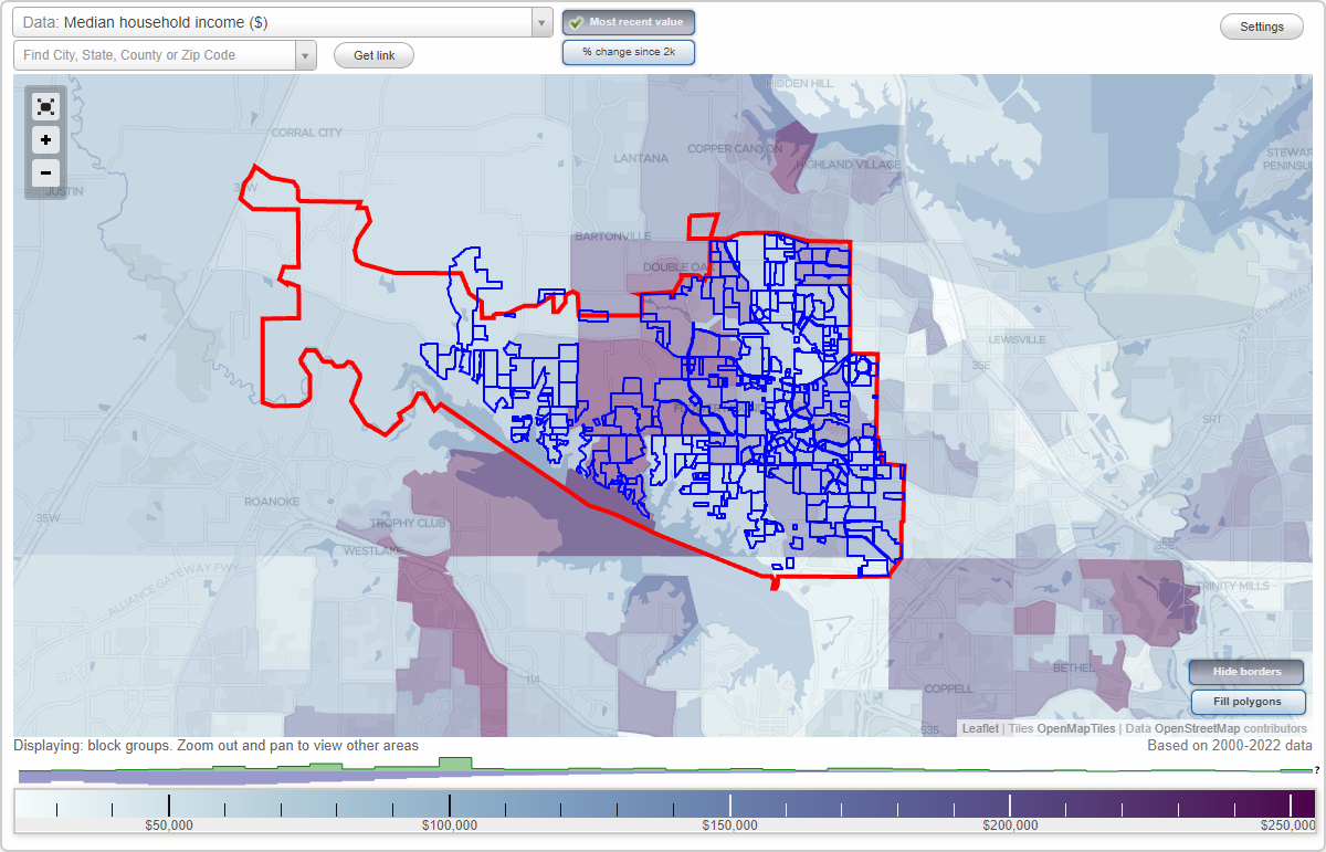
Flower Mound, Texas Neighborhood Map - Income, House Prices, Occupations, Boundaries
Settings
X

- City boundary
- Neighborhood boundaries
Business Search - 14 Million verified businesses
A B Ranch - Shady Point Acres Neighborhoods:
A B Ranch, Adams Estates, American National Business Park, Angel Vet Center, Ann Odes, Anwyll, Arbor Crossing, Arborwood, Autumn Leaves Of Flower Mound, Bakers Branch Estates, Barnett Lane, Beckham, Bella Lago, Belle Creek, Bentley Woods, Bolo Point, Bolo Point East, Boyette, Bradbury, Brandywine At Wellington, Brazos Substation, Bridlewood, Bright Steps, Brookstone, Brown Estates, Bryn Mar Estates, Cameron Woods, Candlebrook Estates, Cannon, Canterbury Row, Cardinal Estates, Cedar Bluff, Cedar Creek, Chaparral Cove, Chateau Du Lac, Chaucer Estates, Chevron, Childers, Children's Courtyard, Chimney Rock, Chinn Chapel Place, Clegg, Coeur Du Lac, Coker, Colli, Collinsworth, Collister, Conoco Corners, Cornerstone, Cornerstone Learning Center, Corporate Circle, Country Meadows, Country Oak Estates, Countryside Estates, Creekside At Cross Timbers, Creekwood, Diamond Belle Estates, Diamond Shamrock, Dixon Estates, Dominion Estates, Downtown Flower Mound, Egbert, Emerald Bay, Estates At Creekwood, Estates At Park Place, Estates Of Flower Mound, Fallbrook, Fellowship Of Flower Mound, Firestone, Firewheel, Firewheel Office Park, Flower Mound Crossing, Flower Mound Crossing West, Flower Mound Farms, Flower Mound Municipal Plaza, Flower Mound Plaza, Flower Mound Post Office, Flower Mound Retail Center, Flower Mound Retirement Residence, Flower Mound South Substation, Flower Mound Town Center, Fluffy Estates, Forest Hill Estates, Forest Park Estates, Forums, Fountain Park, Foxborough Hollow, Franklin Hills, Garden Ridge Elem, Gaston Park, Gavitt, Gerault Park, Glenwick Estates, Grand Park Estates, Green Meadows Estates, Harbor View, Hawk Road Estates, Hearthstone At Firewheel, Hickory Springs, Hidden Acres Estates, Hidden Oaks At Lake Forest, Hidden Valley Country Estates, High Road Ridge, Highland Oaks, Highlands Ranch, Hillcrest At Wellington, Hilltop Estates, Home Depot-Silveron, Hood, Hunter, Icarus, Immel Estates, Ivy Estates, Jones, Kensington Park Estates, Kid Country, Kirkpatrick Retirement Residence, Kol Ami, Kwik Kar At Flower Mound Rd, Lake Bluff, Lake Forest, Lake Forest Estates, Lake Forest Garden Homes, Lake Forest On The Creek, Lake Forest Plaza, Lake Hills Estates, Lakemont, Lakeshore, Lakeside, Lakeview Estates, Latter Day Saints, Lexington Glen, Lipscomb, Lost Canyon Estates, Lost Creek, M L Sagebrush, Masjid Al-Noor Peters Colony, Mccall, Mcgee Subdivision, Mckamey Creek, Meadowlands, Meadows At Cross Timbers, Medinis Estate, Morriss Commons, Natatorium, North Point Center, North Ridge Estates, North Shiloh, North Shores Estates, Northlake Estates, Northlake Highlands, Northwest Plaza, Oak Bend Estates, Oak Creek Estates, Oak Heights, Oak Park, Oak Ridge Estates, Oak Valley Estates, Oaks Of Lake Forest, Oakwood Estates, Old Settlers Montessori, One Place, Parker Square, Pat Lester, Pecan Acres, Pecan Meadows, Pecan Park Estates, Peninsula At Twin Coves, Plaza De Flores, Point Noble, Post Oak, Post Oak West, Powdermaker, Powdermaker Ranch, Prairie Creek, Prince Estates, Red Bud Acres, Red Bud Point Development, Regency Park, Regions Bank, Remberts, Reserve At Hickory Springs, Restoration, River Oaks, Roanoke Hills, Robbins Point, Robertson Creek, Rock Haven Estates, Royal Oaks, Rustic Ranch, Rustic Timbers, SEC Village At Flower Mound, SWC Village At Flower Mound, Saddle Oaks, Sanctuary, Sandy Shores Estates, Security Bank, Shadow Ridge, Shadowridge South, Shady Point AcresA B Ranch neighborhood in Flower Mound statistics: (Find on map)
Area: 0.015 square miles
A B Ranch neighborhood detailed profile
Area: 0.015 square miles
A B Ranch neighborhood detailed profile
Adams Estates neighborhood in Flower Mound statistics: (Find on map)
Area: 0.039 square miles
Roads and streets: Gremar St; Jaclamo St; Jackson Way; Jenbri Way.
Adams Estates neighborhood detailed profile
Area: 0.039 square miles
Roads and streets: Gremar St; Jaclamo St; Jackson Way; Jenbri Way.
Adams Estates neighborhood detailed profile
American National Business Park neighborhood in Flower Mound statistics: (Find on map)
Area: 0.011 square miles
American National Business Park neighborhood detailed profile
Area: 0.011 square miles
American National Business Park neighborhood detailed profile
Angel Vet Center neighborhood in Flower Mound statistics: (Find on map)
Area: 0.002 square miles
Angel Vet Center neighborhood detailed profile
Area: 0.002 square miles
Angel Vet Center neighborhood detailed profile
Ann Odes neighborhood in Flower Mound statistics: (Find on map)
Area: 0.010 square miles
Ann Odes neighborhood detailed profile
Area: 0.010 square miles
Ann Odes neighborhood detailed profile
Anwyll neighborhood in Flower Mound statistics: (Find on map)
Area: 0.012 square miles
Population: 2
Population density:
Median household income in 2021:
Median rent in in 2021:
Male vs Females
Median age
Most popular occupations of males: sales and office occupations (31.4%); management occupations (except farmers) (19.6%); computer and mathematical occupations (12.2%); service occupations (8.0%); construction, extraction, and maintenance occupations (8.0%); arts, design, entertainment, sports, and media occupations (6.4%); business and financial operations occupations (5.1%)
Most popular occupations of females: sales and office occupations (31.1%); service occupations (17.6%); education, training, and library occupations (15.5%); arts, design, entertainment, sports, and media occupations (15.1%); healthcare practitioners and technical occupations (4.8%); business and financial operations occupations (4.5%); community and social services occupations (3.7%)
Roads and streets: Meadow Dr.
Anwyll neighborhood detailed profile
Area: 0.012 square miles
Population: 2
Population density:
| Anwyll: | 173 people per square mile |
| Flower Mound: | 1,917 people per square mile |
Median household income in 2021:
| Anwyll: | $153,924 |
| Flower Mound: | $144,642 |
Median rent in in 2021:
| Anwyll: | $1,133 |
| Flower Mound: | $1,591 |
Male vs Females
| Males: | 1 |
| Females: | 1 |
Median age
| Males: | 52.2 years |
| Females: | 42.4 years |
Most popular occupations of males: sales and office occupations (31.4%); management occupations (except farmers) (19.6%); computer and mathematical occupations (12.2%); service occupations (8.0%); construction, extraction, and maintenance occupations (8.0%); arts, design, entertainment, sports, and media occupations (6.4%); business and financial operations occupations (5.1%)
Most popular occupations of females: sales and office occupations (31.1%); service occupations (17.6%); education, training, and library occupations (15.5%); arts, design, entertainment, sports, and media occupations (15.1%); healthcare practitioners and technical occupations (4.8%); business and financial operations occupations (4.5%); community and social services occupations (3.7%)
Roads and streets: Meadow Dr.
Anwyll neighborhood detailed profile
Arbor Crossing neighborhood in Flower Mound statistics: (Find on map)
Area: 0.006 square miles
Arbor Crossing neighborhood detailed profile
Area: 0.006 square miles
Arbor Crossing neighborhood detailed profile
Arborwood neighborhood in Flower Mound statistics: (Find on map)
Area: 0.050 square miles
Roads and streets: Water Oak Dr; White Pine Dr; Welch Ct; Southernwood Ct; Water Oak Ct.
Arborwood neighborhood detailed profile
Area: 0.050 square miles
Roads and streets: Water Oak Dr; White Pine Dr; Welch Ct; Southernwood Ct; Water Oak Ct.
Arborwood neighborhood detailed profile
Autumn Leaves Of Flower Mound neighborhood in Flower Mound statistics: (Find on map)
Area: 0.005 square miles
Autumn Leaves Of Flower Mound neighborhood detailed profile
Area: 0.005 square miles
Autumn Leaves Of Flower Mound neighborhood detailed profile
Bakers Branch Estates neighborhood in Flower Mound statistics: (Find on map)
Area: 0.090 square miles
Roads and streets: Big Canyon Dr; Currant Way; Cilantro Dr; Rosemary Dr; Tarragon Dr; Cayenne Dr; Basil Dr; Paprika Dr; Ginger Dr; Clove Way; Sweetwater Ln; Cinnamon Dr.
Bakers Branch Estates neighborhood detailed profile
Area: 0.090 square miles
Roads and streets: Big Canyon Dr; Currant Way; Cilantro Dr; Rosemary Dr; Tarragon Dr; Cayenne Dr; Basil Dr; Paprika Dr; Ginger Dr; Clove Way; Sweetwater Ln; Cinnamon Dr.
Bakers Branch Estates neighborhood detailed profile
Barnett Lane neighborhood in Flower Mound statistics: (Find on map)
Area: 0.023 square miles
Roads and streets: Morriss Rd.
Barnett Lane neighborhood detailed profile
Area: 0.023 square miles
Roads and streets: Morriss Rd.
Barnett Lane neighborhood detailed profile
Beckham neighborhood in Flower Mound statistics: (Find on map)
Area: 0.007 square miles
Population: 1
Population density:
Median household income in 2021:
Median rent in in 2021:
Most popular occupations of males: sales and office occupations (31.4%); management occupations (except farmers) (19.6%); computer and mathematical occupations (12.2%); service occupations (8.0%); construction, extraction, and maintenance occupations (8.0%); arts, design, entertainment, sports, and media occupations (6.4%); business and financial operations occupations (5.1%)
Most popular occupations of females: sales and office occupations (31.1%); service occupations (17.6%); education, training, and library occupations (15.5%); arts, design, entertainment, sports, and media occupations (15.1%); healthcare practitioners and technical occupations (4.8%); business and financial operations occupations (4.5%); community and social services occupations (3.7%)
Beckham neighborhood detailed profile
Area: 0.007 square miles
Population: 1
Population density:
| Beckham: | 147 people per square mile |
| Flower Mound: | 1,917 people per square mile |
Median household income in 2021:
| Beckham: | $153,924 |
| Flower Mound: | $144,642 |
Median rent in in 2021:
| Beckham: | $1,133 |
| Flower Mound: | $1,591 |
Most popular occupations of males: sales and office occupations (31.4%); management occupations (except farmers) (19.6%); computer and mathematical occupations (12.2%); service occupations (8.0%); construction, extraction, and maintenance occupations (8.0%); arts, design, entertainment, sports, and media occupations (6.4%); business and financial operations occupations (5.1%)
Most popular occupations of females: sales and office occupations (31.1%); service occupations (17.6%); education, training, and library occupations (15.5%); arts, design, entertainment, sports, and media occupations (15.1%); healthcare practitioners and technical occupations (4.8%); business and financial operations occupations (4.5%); community and social services occupations (3.7%)
Beckham neighborhood detailed profile
Bella Lago neighborhood in Flower Mound statistics: (Find on map)
Area: 0.153 square miles
Roads and streets: Bella Lago Dr; Lake Lugano Dr; Lake Victoria Ct; Lake Windermere Dr; Lake Geneva Ct; Kelcourt Dr; Lake Lucern Ct.
Bella Lago neighborhood detailed profile
Area: 0.153 square miles
Roads and streets: Bella Lago Dr; Lake Lugano Dr; Lake Victoria Ct; Lake Windermere Dr; Lake Geneva Ct; Kelcourt Dr; Lake Lucern Ct.
Bella Lago neighborhood detailed profile
Belle Creek neighborhood in Flower Mound statistics: (Find on map)
Area: 0.038 square miles
Roads and streets: Honeysuckle Way; Petunia Dr; Daisy Ln; Caladium Dr; Acacia St.
Belle Creek neighborhood detailed profile
Area: 0.038 square miles
Roads and streets: Honeysuckle Way; Petunia Dr; Daisy Ln; Caladium Dr; Acacia St.
Belle Creek neighborhood detailed profile
Bentley Woods neighborhood in Flower Mound statistics: (Find on map)
Area: 0.081 square miles
Roads and streets: Springwood Rd; Oakwood Ct; Almond Dr; Orchid Ct; Holly Oak Ct; Fallow Cir; Springwood Cir.
Bentley Woods neighborhood detailed profile
Area: 0.081 square miles
Roads and streets: Springwood Rd; Oakwood Ct; Almond Dr; Orchid Ct; Holly Oak Ct; Fallow Cir; Springwood Cir.
Bentley Woods neighborhood detailed profile
Bolo Point neighborhood in Flower Mound statistics: (Find on map)
Area: 0.021 square miles
Population: 4
Population density:
Median household income in 2021:
Median rent in in 2021:
Male vs Females
Median age
Average estimated value of detached houses in 2021 (100.0% of all units):
Most popular occupations of males: sales and office occupations (31.4%); management occupations (except farmers) (19.6%); computer and mathematical occupations (12.2%); service occupations (8.0%); construction, extraction, and maintenance occupations (8.0%); arts, design, entertainment, sports, and media occupations (6.4%); business and financial operations occupations (5.1%)
Most popular occupations of females: sales and office occupations (31.1%); service occupations (17.6%); education, training, and library occupations (15.5%); arts, design, entertainment, sports, and media occupations (15.1%); healthcare practitioners and technical occupations (4.8%); business and financial operations occupations (4.5%); community and social services occupations (3.7%)
Roads and streets: Bolo Ln; Long Ln.
Bolo Point neighborhood detailed profile
Area: 0.021 square miles
Population: 4
Population density:
| Bolo Point: | 187 people per square mile |
| Flower Mound: | 1,917 people per square mile |
Median household income in 2021:
| Bolo Point: | $153,924 |
| Flower Mound: | $144,642 |
Median rent in in 2021:
| Bolo Point: | $1,133 |
| Flower Mound: | $1,591 |
Male vs Females
| Males: | 1 |
| Females: | 2 |
Median age
| Males: | 52.2 years |
| Females: | 42.4 years |
Average estimated value of detached houses in 2021 (100.0% of all units):
| Bolo Point: | $449,141 |
| Texas: | $313,123 |
Most popular occupations of males: sales and office occupations (31.4%); management occupations (except farmers) (19.6%); computer and mathematical occupations (12.2%); service occupations (8.0%); construction, extraction, and maintenance occupations (8.0%); arts, design, entertainment, sports, and media occupations (6.4%); business and financial operations occupations (5.1%)
Most popular occupations of females: sales and office occupations (31.1%); service occupations (17.6%); education, training, and library occupations (15.5%); arts, design, entertainment, sports, and media occupations (15.1%); healthcare practitioners and technical occupations (4.8%); business and financial operations occupations (4.5%); community and social services occupations (3.7%)
Roads and streets: Bolo Ln; Long Ln.
Bolo Point neighborhood detailed profile
Bolo Point East neighborhood in Flower Mound statistics: (Find on map)
Area: 0.009 square miles
Population: 1
Population density:
Median household income in 2021:
Median rent in in 2021:
Most popular occupations of males: sales and office occupations (31.4%); management occupations (except farmers) (19.6%); computer and mathematical occupations (12.2%); service occupations (8.0%); construction, extraction, and maintenance occupations (8.0%); arts, design, entertainment, sports, and media occupations (6.4%); business and financial operations occupations (5.1%)
Most popular occupations of females: sales and office occupations (31.1%); service occupations (17.6%); education, training, and library occupations (15.5%); arts, design, entertainment, sports, and media occupations (15.1%); healthcare practitioners and technical occupations (4.8%); business and financial operations occupations (4.5%); community and social services occupations (3.7%)
Bolo Point East neighborhood detailed profile
Area: 0.009 square miles
Population: 1
Population density:
| Bolo Point East: | 110 people per square mile |
| Flower Mound: | 1,917 people per square mile |
Median household income in 2021:
| Bolo Point East: | $153,924 |
| Flower Mound: | $144,642 |
Median rent in in 2021:
| Bolo Point East: | $1,133 |
| Flower Mound: | $1,591 |
Most popular occupations of males: sales and office occupations (31.4%); management occupations (except farmers) (19.6%); computer and mathematical occupations (12.2%); service occupations (8.0%); construction, extraction, and maintenance occupations (8.0%); arts, design, entertainment, sports, and media occupations (6.4%); business and financial operations occupations (5.1%)
Most popular occupations of females: sales and office occupations (31.1%); service occupations (17.6%); education, training, and library occupations (15.5%); arts, design, entertainment, sports, and media occupations (15.1%); healthcare practitioners and technical occupations (4.8%); business and financial operations occupations (4.5%); community and social services occupations (3.7%)
Bolo Point East neighborhood detailed profile
Boyette neighborhood in Flower Mound statistics: (Find on map)
Area: 0.004 square miles
Boyette neighborhood detailed profile
Area: 0.004 square miles
Boyette neighborhood detailed profile
Bradbury neighborhood in Flower Mound statistics: (Find on map)
Area: 0.004 square miles
Median household income in 2021:
Median rent in in 2021:
Most popular occupations of males: sales and office occupations (31.4%); management occupations (except farmers) (19.6%); computer and mathematical occupations (12.2%); service occupations (8.0%); construction, extraction, and maintenance occupations (8.0%); arts, design, entertainment, sports, and media occupations (6.4%); business and financial operations occupations (5.1%)
Most popular occupations of females: sales and office occupations (31.1%); service occupations (17.6%); education, training, and library occupations (15.5%); arts, design, entertainment, sports, and media occupations (15.1%); healthcare practitioners and technical occupations (4.8%); business and financial operations occupations (4.5%); community and social services occupations (3.7%)
Bradbury neighborhood detailed profile
Area: 0.004 square miles
Median household income in 2021:
| Bradbury: | $153,924 |
| Flower Mound: | $144,642 |
Median rent in in 2021:
| Bradbury: | $1,133 |
| Flower Mound: | $1,591 |
Most popular occupations of males: sales and office occupations (31.4%); management occupations (except farmers) (19.6%); computer and mathematical occupations (12.2%); service occupations (8.0%); construction, extraction, and maintenance occupations (8.0%); arts, design, entertainment, sports, and media occupations (6.4%); business and financial operations occupations (5.1%)
Most popular occupations of females: sales and office occupations (31.1%); service occupations (17.6%); education, training, and library occupations (15.5%); arts, design, entertainment, sports, and media occupations (15.1%); healthcare practitioners and technical occupations (4.8%); business and financial operations occupations (4.5%); community and social services occupations (3.7%)
Bradbury neighborhood detailed profile
Brandywine At Wellington neighborhood in Flower Mound statistics: (Find on map)
Area: 0.028 square miles
Roads and streets: Sonoma Bend; Edna Valley Ct; Napa Ct; Opus Ct.
Brandywine At Wellington neighborhood detailed profile
Area: 0.028 square miles
Roads and streets: Sonoma Bend; Edna Valley Ct; Napa Ct; Opus Ct.
Brandywine At Wellington neighborhood detailed profile
Brazos Substation neighborhood in Flower Mound statistics: (Find on map)
Area: 0.005 square miles
Brazos Substation neighborhood detailed profile
Area: 0.005 square miles
Brazos Substation neighborhood detailed profile
Bridlewood neighborhood in Flower Mound statistics: (Find on map)
Area: 1.291 square miles
Roads and streets: Remington Park Dr; Bridlewood Blvd; Fairway Dr; Crown Knoll Cir; Auburn Dr; Country Club Dr; Windmill Ln; Equestrian Way; Windsor Dr (W Windsor Dr); Balmoral Ln; Manor Way; Preakness Dr; Austin Ct; Skyline Dr; Morningstar Dr; Hampshire Dr; Bent Grass Way; Seville Ln; Par Dr; Lippizaner Dr; Largo Dr; Ironwood Dr; Withers Ave; Polo Run Dr; Blue Grass Dr; Imperial Dr; Saddle Ridge Trl; Range Wood Dr; Joshua Dr; Zachary Way; Gallop Ct; Dade Dr; Chilton Ln; Fairfax Way; Biscayne Dr; Liberty Ct; Fairbank Ln; Old Mill Dr; Indale Way; Marshall Creek; Pack Saddle Way; Remington Park Ct; Bristol Dr; Belstrum Dr; Connors Dr; Brownstone Dr; Glen Heather Dr; Glenshire Dr; Jubilee Dr; Kingswood Dr; Abbey Glen Dr; Sorrel Dr; Ping Dr; Wolcott Dr; Saddle Dr; Canter Way; Morningstar Cir; Samuel Ct; Huntwick Ln; Beacon St; Sorrel Ct; Gallant Ct; Kincross Ct; Georgetown Dr; Vintage Pl; Narrow Brook Dr (Narrowbrook Dr); Halter Way; Fairfax Ct; Kyle Ln; Equestrian Ct; Jenny Ln; Haley Dr; Amy Ln; Zane Dr; Bosque Ct; Blue Grass Ct; Watch Hill Dr; Mustang Trl; Aurora Ct; Teaberry Ct; Temple Dr; Stone Ct; Belstrum Ct; Beacon Ct; Calloway Ct; Amber Ct; Balmoral Pl; Lippizaner Ct; Ironwood Ct; Eagle Pkwy; Windmill Ct; Largo Ct.
Other features: Timber Crk.
Bridlewood neighborhood detailed profile
Bright Steps neighborhood in Flower Mound statistics: (Find on map)
Area: 0.002 square miles
Bright Steps neighborhood detailed profile
Area: 0.002 square miles
Bright Steps neighborhood detailed profile
Brookstone neighborhood in Flower Mound statistics: (Find on map)
Area: 0.046 square miles
Roads and streets: Crestbrook Dr; Brookwood Dr; Inglewood Dr; Woodbury Dr; Diana Ln; Stonehenge Ln.
Brookstone neighborhood detailed profile
Area: 0.046 square miles
Roads and streets: Crestbrook Dr; Brookwood Dr; Inglewood Dr; Woodbury Dr; Diana Ln; Stonehenge Ln.
Brookstone neighborhood detailed profile
Brown Estates neighborhood in Flower Mound statistics: (Find on map)
Area: 0.003 square miles
Brown Estates neighborhood detailed profile
Area: 0.003 square miles
Brown Estates neighborhood detailed profile
Bryn Mar Estates neighborhood in Flower Mound statistics: (Find on map)
Area: 0.063 square miles
Roads and streets: Lake Forest Blvd; Beretta Dr; Bellanca Ct; Lincoln Ct; Lamplighter Dr; Parker Dr; Dana Ct.
Bryn Mar Estates neighborhood detailed profile
Area: 0.063 square miles
Roads and streets: Lake Forest Blvd; Beretta Dr; Bellanca Ct; Lincoln Ct; Lamplighter Dr; Parker Dr; Dana Ct.
Bryn Mar Estates neighborhood detailed profile
Cameron Woods neighborhood in Flower Mound statistics: (Find on map)
Cameron Woods neighborhood detailed profile
Cameron Woods neighborhood detailed profile
Candlebrook Estates neighborhood in Flower Mound statistics: (Find on map)
Area: 0.007 square miles
Candlebrook Estates neighborhood detailed profile
Area: 0.007 square miles
Candlebrook Estates neighborhood detailed profile
Cannon neighborhood in Flower Mound statistics: (Find on map)
Area: 0.010 square miles
Cannon neighborhood detailed profile
Area: 0.010 square miles
Cannon neighborhood detailed profile
Canterbury Row neighborhood in Flower Mound statistics: (Find on map)
Area: 0.008 square miles
Canterbury Row neighborhood detailed profile
Area: 0.008 square miles
Canterbury Row neighborhood detailed profile
Cardinal Estates neighborhood in Flower Mound statistics: (Find on map)
Area: 0.032 square miles
Population: 6
Population density:
Median household income in 2021:
Median rent in in 2021:
Male vs Females
Median age
Average estimated value of detached houses in 2021 (100.0% of all units):
Most popular occupations of males: sales and office occupations (31.4%); management occupations (except farmers) (19.6%); computer and mathematical occupations (12.2%); service occupations (8.0%); construction, extraction, and maintenance occupations (8.0%); arts, design, entertainment, sports, and media occupations (6.4%); business and financial operations occupations (5.1%)
Most popular occupations of females: sales and office occupations (31.1%); service occupations (17.6%); education, training, and library occupations (15.5%); arts, design, entertainment, sports, and media occupations (15.1%); healthcare practitioners and technical occupations (4.8%); business and financial operations occupations (4.5%); community and social services occupations (3.7%)
Roads and streets: Cardinal Dr.
Cardinal Estates neighborhood detailed profile
Area: 0.032 square miles
Population: 6
Population density:
| Cardinal Estates: | 187 people per square mile |
| Flower Mound: | 1,917 people per square mile |
Median household income in 2021:
| Cardinal Estates: | $153,924 |
| Flower Mound: | $144,642 |
Median rent in in 2021:
| Cardinal Estates: | $1,133 |
| Flower Mound: | $1,591 |
Male vs Females
| Males: | 2 |
| Females: | 3 |
Median age
| Males: | 52.2 years |
| Females: | 42.4 years |
Average estimated value of detached houses in 2021 (100.0% of all units):
| Cardinal Estates: | $449,141 |
| Texas: | $313,123 |
Most popular occupations of males: sales and office occupations (31.4%); management occupations (except farmers) (19.6%); computer and mathematical occupations (12.2%); service occupations (8.0%); construction, extraction, and maintenance occupations (8.0%); arts, design, entertainment, sports, and media occupations (6.4%); business and financial operations occupations (5.1%)
Most popular occupations of females: sales and office occupations (31.1%); service occupations (17.6%); education, training, and library occupations (15.5%); arts, design, entertainment, sports, and media occupations (15.1%); healthcare practitioners and technical occupations (4.8%); business and financial operations occupations (4.5%); community and social services occupations (3.7%)
Roads and streets: Cardinal Dr.
Cardinal Estates neighborhood detailed profile
Cedar Bluff neighborhood in Flower Mound statistics: (Find on map)
Area: 0.098 square miles
Roads and streets: Sweetwater Ln; San Jacinto Dr; Doubletree Trl; Pearl River Dr; Big Canyon Dr; Saint Francis Ln; ; San Bernard Ct; Trinity Ct.
Cedar Bluff neighborhood detailed profile
Area: 0.098 square miles
Roads and streets: Sweetwater Ln; San Jacinto Dr; Doubletree Trl; Pearl River Dr; Big Canyon Dr; Saint Francis Ln; ; San Bernard Ct; Trinity Ct.
Cedar Bluff neighborhood detailed profile
Cedar Creek neighborhood in Flower Mound statistics: (Find on map)
Area: 0.027 square miles
Roads and streets: Barkridge Trl; Shepherd Pl; Maddy Ln; Shamrock Dr.
Cedar Creek neighborhood detailed profile
Area: 0.027 square miles
Roads and streets: Barkridge Trl; Shepherd Pl; Maddy Ln; Shamrock Dr.
Cedar Creek neighborhood detailed profile
Chaparral Cove neighborhood in Flower Mound statistics: (Find on map)
Area: 0.018 square miles
Chaparral Cove neighborhood detailed profile
Area: 0.018 square miles
Chaparral Cove neighborhood detailed profile
Chateau Du Lac neighborhood in Flower Mound statistics: (Find on map)
Area: 0.124 square miles
Roads and streets: Pt de Vue; Cavalier Way; High Meadow Rd; Evergreen; la Rochelle; Giverny; Rue Jordan.
Chateau Du Lac neighborhood detailed profile
Area: 0.124 square miles
Roads and streets: Pt de Vue; Cavalier Way; High Meadow Rd; Evergreen; la Rochelle; Giverny; Rue Jordan.
Chateau Du Lac neighborhood detailed profile
Chaucer Estates neighborhood in Flower Mound statistics: (Find on map)
Area: 0.084 square miles
Roads and streets: Frost Ln; Tennyson Dr; Longfellow Ln; Stevenson Ln; Bishop Dr; Twain Dr.
Chaucer Estates neighborhood detailed profile
Area: 0.084 square miles
Roads and streets: Frost Ln; Tennyson Dr; Longfellow Ln; Stevenson Ln; Bishop Dr; Twain Dr.
Chaucer Estates neighborhood detailed profile
Chevron neighborhood in Flower Mound statistics: (Find on map)
Area: 0.002 square miles
Chevron neighborhood detailed profile
Area: 0.002 square miles
Chevron neighborhood detailed profile
Childers neighborhood in Flower Mound statistics: (Find on map)
Area: 0.025 square miles
Childers neighborhood detailed profile
Area: 0.025 square miles
Childers neighborhood detailed profile
Children's Courtyard neighborhood in Flower Mound statistics: (Find on map)
Area: 0.002 square miles
Children's Courtyard neighborhood detailed profile
Area: 0.002 square miles
Children's Courtyard neighborhood detailed profile
Chimney Rock neighborhood in Flower Mound statistics: (Find on map)
Area: 0.162 square miles
Roads and streets: Chimney Rock Dr; Long Meadow Dr; Woodland Hills Ct.
Chimney Rock neighborhood detailed profile
Area: 0.162 square miles
Roads and streets: Chimney Rock Dr; Long Meadow Dr; Woodland Hills Ct.
Chimney Rock neighborhood detailed profile
Chinn Chapel Place neighborhood in Flower Mound statistics: (Find on map)
Area: 0.056 square miles
Roads and streets: Chinn Chapel Rd; Chapel Ct; Prairie Ct; Berry Hill Ct.
Chinn Chapel Place neighborhood detailed profile
Area: 0.056 square miles
Roads and streets: Chinn Chapel Rd; Chapel Ct; Prairie Ct; Berry Hill Ct.
Chinn Chapel Place neighborhood detailed profile
Clegg neighborhood in Flower Mound statistics: (Find on map)
Area: 0.005 square miles
Population: 1
Population density:
Median household income in 2021:
Median rent in in 2021:
Most popular occupations of males: sales and office occupations (31.4%); management occupations (except farmers) (19.6%); computer and mathematical occupations (12.2%); service occupations (8.0%); construction, extraction, and maintenance occupations (8.0%); arts, design, entertainment, sports, and media occupations (6.4%); business and financial operations occupations (5.1%)
Most popular occupations of females: sales and office occupations (31.1%); service occupations (17.6%); education, training, and library occupations (15.5%); arts, design, entertainment, sports, and media occupations (15.1%); healthcare practitioners and technical occupations (4.8%); business and financial operations occupations (4.5%); community and social services occupations (3.7%)
Clegg neighborhood detailed profile
Area: 0.005 square miles
Population: 1
Population density:
| Clegg: | 183 people per square mile |
| Flower Mound: | 1,917 people per square mile |
Median household income in 2021:
| Clegg: | $153,924 |
| Flower Mound: | $144,642 |
Median rent in in 2021:
| Clegg: | $1,133 |
| Flower Mound: | $1,591 |
Most popular occupations of males: sales and office occupations (31.4%); management occupations (except farmers) (19.6%); computer and mathematical occupations (12.2%); service occupations (8.0%); construction, extraction, and maintenance occupations (8.0%); arts, design, entertainment, sports, and media occupations (6.4%); business and financial operations occupations (5.1%)
Most popular occupations of females: sales and office occupations (31.1%); service occupations (17.6%); education, training, and library occupations (15.5%); arts, design, entertainment, sports, and media occupations (15.1%); healthcare practitioners and technical occupations (4.8%); business and financial operations occupations (4.5%); community and social services occupations (3.7%)
Clegg neighborhood detailed profile
Coeur Du Lac neighborhood in Flower Mound statistics: (Find on map)
Area: 0.077 square miles
Population: 14
Population density:
Median household income in 2021:
Median rent in in 2021:
Male vs Females
Median age
Average estimated value of detached houses in 2021 (100.0% of all units):
Most popular occupations of males: sales and office occupations (31.4%); management occupations (except farmers) (19.6%); computer and mathematical occupations (12.2%); service occupations (8.0%); construction, extraction, and maintenance occupations (8.0%); arts, design, entertainment, sports, and media occupations (6.4%); business and financial operations occupations (5.1%)
Most popular occupations of females: sales and office occupations (31.1%); service occupations (17.6%); education, training, and library occupations (15.5%); arts, design, entertainment, sports, and media occupations (15.1%); healthcare practitioners and technical occupations (4.8%); business and financial operations occupations (4.5%); community and social services occupations (3.7%)
Roads and streets: Coeur du Lac Ln; N Dumas Ct; N Monet Ct; N Hugo Ct; Dumas Ct; Hugo Ct; Monet Ct.
Coeur Du Lac neighborhood detailed profile
Area: 0.077 square miles
Population: 14
Population density:
| Coeur Du Lac: | 182 people per square mile |
| Flower Mound: | 1,917 people per square mile |
Median household income in 2021:
| Coeur Du Lac: | $153,924 |
| Flower Mound: | $144,642 |
Median rent in in 2021:
| Coeur Du Lac: | $1,133 |
| Flower Mound: | $1,591 |
Male vs Females
| Males: | 6 |
| Females: | 7 |
Median age
| Males: | 52.2 years |
| Females: | 42.4 years |
Average estimated value of detached houses in 2021 (100.0% of all units):
| Coeur Du Lac: | $449,141 |
| Texas: | $313,123 |
Most popular occupations of males: sales and office occupations (31.4%); management occupations (except farmers) (19.6%); computer and mathematical occupations (12.2%); service occupations (8.0%); construction, extraction, and maintenance occupations (8.0%); arts, design, entertainment, sports, and media occupations (6.4%); business and financial operations occupations (5.1%)
Most popular occupations of females: sales and office occupations (31.1%); service occupations (17.6%); education, training, and library occupations (15.5%); arts, design, entertainment, sports, and media occupations (15.1%); healthcare practitioners and technical occupations (4.8%); business and financial operations occupations (4.5%); community and social services occupations (3.7%)
Roads and streets: Coeur du Lac Ln; N Dumas Ct; N Monet Ct; N Hugo Ct; Dumas Ct; Hugo Ct; Monet Ct.
Coeur Du Lac neighborhood detailed profile
Coker neighborhood in Flower Mound statistics: (Find on map)
Area: 0.015 square miles
Coker neighborhood detailed profile
Area: 0.015 square miles
Coker neighborhood detailed profile
Colli neighborhood in Flower Mound statistics: (Find on map)
Area: 0.003 square miles
Colli neighborhood detailed profile
Area: 0.003 square miles
Colli neighborhood detailed profile
Collinsworth neighborhood in Flower Mound statistics: (Find on map)
Area: 0.007 square miles
Collinsworth neighborhood detailed profile
Area: 0.007 square miles
Collinsworth neighborhood detailed profile
Collister neighborhood in Flower Mound statistics: (Find on map)
Area: 0.007 square miles
Collister neighborhood detailed profile
Area: 0.007 square miles
Collister neighborhood detailed profile
Conoco Corners neighborhood in Flower Mound statistics: (Find on map)
Area: 0.004 square miles
Conoco Corners neighborhood detailed profile
Area: 0.004 square miles
Conoco Corners neighborhood detailed profile
Cornerstone neighborhood in Flower Mound statistics: (Find on map)
Area: 0.099 square miles
Cornerstone neighborhood detailed profile
Area: 0.099 square miles
Cornerstone neighborhood detailed profile
Cornerstone Learning Center neighborhood in Flower Mound statistics: (Find on map)
Area: 0.005 square miles
Cornerstone Learning Center neighborhood detailed profile
Area: 0.005 square miles
Cornerstone Learning Center neighborhood detailed profile
Corporate Circle neighborhood in Flower Mound statistics: (Find on map)
Area: 0.024 square miles
Corporate Circle neighborhood detailed profile
Area: 0.024 square miles
Corporate Circle neighborhood detailed profile
Country Meadows neighborhood in Flower Mound statistics: (Find on map)
Area: 0.050 square miles
Roads and streets: Eagle Creek Dr; Blue Ridge Trl; Branchwood Trl; Cross Haven Dr; Blossom Trl; Country Meadow Dr; Coldwater Ln; Brandywine Dr; Buttonwood Dr.
Country Meadows neighborhood detailed profile
Area: 0.050 square miles
Roads and streets: Eagle Creek Dr; Blue Ridge Trl; Branchwood Trl; Cross Haven Dr; Blossom Trl; Country Meadow Dr; Coldwater Ln; Brandywine Dr; Buttonwood Dr.
Country Meadows neighborhood detailed profile
Country Oak Estates neighborhood in Flower Mound statistics: (Find on map)
Area: 0.020 square miles
Population: 3
Population density:
Median household income in 2021:
Median rent in in 2021:
Male vs Females
Median age
Average estimated value of detached houses in 2021 (100.0% of all units):
Most popular occupations of males: sales and office occupations (31.4%); management occupations (except farmers) (19.6%); computer and mathematical occupations (12.2%); service occupations (8.0%); construction, extraction, and maintenance occupations (8.0%); arts, design, entertainment, sports, and media occupations (6.4%); business and financial operations occupations (5.1%)
Most popular occupations of females: sales and office occupations (31.1%); service occupations (17.6%); education, training, and library occupations (15.5%); arts, design, entertainment, sports, and media occupations (15.1%); healthcare practitioners and technical occupations (4.8%); business and financial operations occupations (4.5%); community and social services occupations (3.7%)
Country Oak Estates neighborhood detailed profile
Area: 0.020 square miles
Population: 3
Population density:
| Country Oak Estates: | 154 people per square mile |
| Flower Mound: | 1,917 people per square mile |
Median household income in 2021:
| Country Oak Estates: | $153,924 |
| Flower Mound: | $144,642 |
Median rent in in 2021:
| Country Oak Estates: | $1,133 |
| Flower Mound: | $1,591 |
Male vs Females
| Males: | 1 |
| Females: | 2 |
Median age
| Males: | 52.2 years |
| Females: | 42.4 years |
Average estimated value of detached houses in 2021 (100.0% of all units):
| Country Oak Estates: | $449,141 |
| Texas: | $313,123 |
Most popular occupations of males: sales and office occupations (31.4%); management occupations (except farmers) (19.6%); computer and mathematical occupations (12.2%); service occupations (8.0%); construction, extraction, and maintenance occupations (8.0%); arts, design, entertainment, sports, and media occupations (6.4%); business and financial operations occupations (5.1%)
Most popular occupations of females: sales and office occupations (31.1%); service occupations (17.6%); education, training, and library occupations (15.5%); arts, design, entertainment, sports, and media occupations (15.1%); healthcare practitioners and technical occupations (4.8%); business and financial operations occupations (4.5%); community and social services occupations (3.7%)
Country Oak Estates neighborhood detailed profile
Countryside Estates neighborhood in Flower Mound statistics: (Find on map)
Area: 0.061 square miles
Roads and streets: Hazy Meadows Ln; Weathervane Ln; Valleydale Dr; Meadow Chase Ln; Summerfields Dr; Misty Trail Ln; Stoney Brook Ln; Glenbrook St.
Countryside Estates neighborhood detailed profile
Area: 0.061 square miles
Roads and streets: Hazy Meadows Ln; Weathervane Ln; Valleydale Dr; Meadow Chase Ln; Summerfields Dr; Misty Trail Ln; Stoney Brook Ln; Glenbrook St.
Countryside Estates neighborhood detailed profile
Creekside At Cross Timbers neighborhood in Flower Mound statistics: (Find on map)
Area: 0.071 square miles
Roads and streets: Hunters Run; Elm Creek Ln; Brush Creek Ln; Atwood Dr; Branch Hollow Cir; Rose Bluff Ter; Compton Ct; Glory Creek Cir; Lakehollow Ln.
Creekside At Cross Timbers neighborhood detailed profile
Area: 0.071 square miles
Roads and streets: Hunters Run; Elm Creek Ln; Brush Creek Ln; Atwood Dr; Branch Hollow Cir; Rose Bluff Ter; Compton Ct; Glory Creek Cir; Lakehollow Ln.
Creekside At Cross Timbers neighborhood detailed profile
Creekwood neighborhood in Flower Mound statistics: (Find on map)
Area: 0.079 square miles
Roads and streets: Trailwood Ln; Timber Ridge Ln; Katina Dr; Brook Hollow Ln; Branch Oaks Ln; Amber Ln; Delaney Ter; Shadow Oak Ct; Oak Bend Ct.
Creekwood neighborhood detailed profile
Area: 0.079 square miles
Roads and streets: Trailwood Ln; Timber Ridge Ln; Katina Dr; Brook Hollow Ln; Branch Oaks Ln; Amber Ln; Delaney Ter; Shadow Oak Ct; Oak Bend Ct.
Creekwood neighborhood detailed profile
Diamond Belle Estates neighborhood in Flower Mound statistics: (Find on map)
Area: 0.012 square miles
Roads and streets: Bonanza Ln.
Diamond Belle Estates neighborhood detailed profile
Area: 0.012 square miles
Roads and streets: Bonanza Ln.
Diamond Belle Estates neighborhood detailed profile
Diamond Shamrock neighborhood in Flower Mound statistics: (Find on map)
Area: 0.004 square miles
Diamond Shamrock neighborhood detailed profile
Area: 0.004 square miles
Diamond Shamrock neighborhood detailed profile
Dixon Estates neighborhood in Flower Mound statistics: (Find on map)
Area: 0.037 square miles
Dixon Estates neighborhood detailed profile
Area: 0.037 square miles
Dixon Estates neighborhood detailed profile
Dominion Estates neighborhood in Flower Mound statistics: (Find on map)
Area: 0.023 square miles
Roads and streets: Dominion Ct; Guardian Ct.
Dominion Estates neighborhood detailed profile
Area: 0.023 square miles
Roads and streets: Dominion Ct; Guardian Ct.
Dominion Estates neighborhood detailed profile
Downtown Flower Mound neighborhood in Flower Mound statistics: (Find on map)
Area: 0.016 square miles
Downtown Flower Mound neighborhood detailed profile
Area: 0.016 square miles
Downtown Flower Mound neighborhood detailed profile
Egbert neighborhood in Flower Mound statistics: (Find on map)
Area: 0.008 square miles
Egbert neighborhood detailed profile
Area: 0.008 square miles
Egbert neighborhood detailed profile
Emerald Bay neighborhood in Flower Mound statistics: (Find on map)
Area: 0.122 square miles
Roads and streets: Beachview Dr; Paradise Ln; Coral Springs Dr; Reflection Ct; Topaz Ct; Peaceful Cove; Prince Edward Ct.
Emerald Bay neighborhood detailed profile
Area: 0.122 square miles
Roads and streets: Beachview Dr; Paradise Ln; Coral Springs Dr; Reflection Ct; Topaz Ct; Peaceful Cove; Prince Edward Ct.
Emerald Bay neighborhood detailed profile
Estates At Creekwood neighborhood in Flower Mound statistics: (Find on map)
Area: 0.040 square miles
Roads and streets: Misty Glen Dr; Laurel Hill Dr; Ridgemere Dr; Glenridge Dr; Waverly Rd.
Estates At Creekwood neighborhood detailed profile
Area: 0.040 square miles
Roads and streets: Misty Glen Dr; Laurel Hill Dr; Ridgemere Dr; Glenridge Dr; Waverly Rd.
Estates At Creekwood neighborhood detailed profile
Estates At Park Place neighborhood in Flower Mound statistics: (Find on map)
Area: 0.042 square miles
Estates At Park Place neighborhood detailed profile
Area: 0.042 square miles
Estates At Park Place neighborhood detailed profile
Estates Of Flower Mound neighborhood in Flower Mound statistics: (Find on map)
Area: 0.037 square miles
Roads and streets: Crestfield Dr; Woodstone Ct; Stillwater Ct.
Estates Of Flower Mound neighborhood detailed profile
Area: 0.037 square miles
Roads and streets: Crestfield Dr; Woodstone Ct; Stillwater Ct.
Estates Of Flower Mound neighborhood detailed profile
Fallbrook neighborhood in Flower Mound statistics: (Find on map)
Area: 0.055 square miles
Roads and streets: Fallbrook Dr; Briaroaks Dr; Belmeade Ln; Somerset Dr; Rockcreek Ct; Crooked Creek Ct.
Fallbrook neighborhood detailed profile
Area: 0.055 square miles
Roads and streets: Fallbrook Dr; Briaroaks Dr; Belmeade Ln; Somerset Dr; Rockcreek Ct; Crooked Creek Ct.
Fallbrook neighborhood detailed profile
Fellowship Of Flower Mound neighborhood in Flower Mound statistics: (Find on map)
Area: 0.012 square miles
Fellowship Of Flower Mound neighborhood detailed profile
Area: 0.012 square miles
Fellowship Of Flower Mound neighborhood detailed profile
Firestone neighborhood in Flower Mound statistics: (Find on map)
Area: 0.002 square miles
Firestone neighborhood detailed profile
Area: 0.002 square miles
Firestone neighborhood detailed profile
Firewheel neighborhood in Flower Mound statistics: (Find on map)
Area: 0.007 square miles
Firewheel neighborhood detailed profile
Area: 0.007 square miles
Firewheel neighborhood detailed profile
Firewheel Office Park neighborhood in Flower Mound statistics: (Find on map)
Area: 0.002 square miles
Firewheel Office Park neighborhood detailed profile
Area: 0.002 square miles
Firewheel Office Park neighborhood detailed profile
Flower Mound Crossing neighborhood in Flower Mound statistics: (Find on map)
Area: 0.018 square miles
Flower Mound Crossing neighborhood detailed profile
Area: 0.018 square miles
Flower Mound Crossing neighborhood detailed profile
Flower Mound Crossing West neighborhood in Flower Mound statistics: (Find on map)
Area: 0.004 square miles
Flower Mound Crossing West neighborhood detailed profile
Area: 0.004 square miles
Flower Mound Crossing West neighborhood detailed profile
Flower Mound Farms neighborhood in Flower Mound statistics: (Find on map)
Area: 0.175 square miles
Roads and streets: Red Oak Ln.
Flower Mound Farms neighborhood detailed profile
Area: 0.175 square miles
Roads and streets: Red Oak Ln.
Flower Mound Farms neighborhood detailed profile
Flower Mound Municipal Plaza neighborhood in Flower Mound statistics: (Find on map)
Area: 0.009 square miles
Flower Mound Municipal Plaza neighborhood detailed profile
Area: 0.009 square miles
Flower Mound Municipal Plaza neighborhood detailed profile
Flower Mound Plaza neighborhood in Flower Mound statistics: (Find on map)
Area: 0.014 square miles
Flower Mound Plaza neighborhood detailed profile
Area: 0.014 square miles
Flower Mound Plaza neighborhood detailed profile
Flower Mound Post Office neighborhood in Flower Mound statistics: (Find on map)
Area: 0.005 square miles
Flower Mound Post Office neighborhood detailed profile
Area: 0.005 square miles
Flower Mound Post Office neighborhood detailed profile
Flower Mound Retail Center neighborhood in Flower Mound statistics: (Find on map)
Area: 0.015 square miles
Flower Mound Retail Center neighborhood detailed profile
Area: 0.015 square miles
Flower Mound Retail Center neighborhood detailed profile
Flower Mound Retirement Residence neighborhood in Flower Mound statistics: (Find on map)
Area: 0.003 square miles
Flower Mound Retirement Residence neighborhood detailed profile
Area: 0.003 square miles
Flower Mound Retirement Residence neighborhood detailed profile
Flower Mound South Substation neighborhood in Flower Mound statistics: (Find on map)
Area: 0.004 square miles
Flower Mound South Substation neighborhood detailed profile
Area: 0.004 square miles
Flower Mound South Substation neighborhood detailed profile
Flower Mound Town Center neighborhood in Flower Mound statistics: (Find on map)
Area: 0.016 square miles
Flower Mound Town Center neighborhood detailed profile
Area: 0.016 square miles
Flower Mound Town Center neighborhood detailed profile
Fluffy Estates neighborhood in Flower Mound statistics: (Find on map)
Area: 0.007 square miles
Fluffy Estates neighborhood detailed profile
Area: 0.007 square miles
Fluffy Estates neighborhood detailed profile
Forest Hill Estates neighborhood in Flower Mound statistics: (Find on map)
Area: 0.038 square miles
Roads and streets: Forest Hill Cir.
Forest Hill Estates neighborhood detailed profile
Area: 0.038 square miles
Roads and streets: Forest Hill Cir.
Forest Hill Estates neighborhood detailed profile
Forest Park Estates neighborhood in Flower Mound statistics: (Find on map)
Area: 0.051 square miles
Roads and streets: Ash Leaf Ln; Birch Leaf Pl; Cypress Leaf Ln; Hickory Leaf Ln; Sycamore Leaf Ln; Magnolia Leaf Ln; Holly Leaf Ln; Pecan Leaf Ln.
Forest Park Estates neighborhood detailed profile
Area: 0.051 square miles
Roads and streets: Ash Leaf Ln; Birch Leaf Pl; Cypress Leaf Ln; Hickory Leaf Ln; Sycamore Leaf Ln; Magnolia Leaf Ln; Holly Leaf Ln; Pecan Leaf Ln.
Forest Park Estates neighborhood detailed profile
Forums neighborhood in Flower Mound statistics: (Find on map)
Area: 0.003 square miles
Forums neighborhood detailed profile
Area: 0.003 square miles
Forums neighborhood detailed profile
Fountain Park neighborhood in Flower Mound statistics: (Find on map)
Area: 0.014 square miles
Fountain Park neighborhood detailed profile
Area: 0.014 square miles
Fountain Park neighborhood detailed profile
Foxborough Hollow neighborhood in Flower Mound statistics: (Find on map)
Area: 0.069 square miles
Roads and streets: Doubletree Trl; Echo Bluff; Roundrock Way; Amberwood Glen.
Foxborough Hollow neighborhood detailed profile
Area: 0.069 square miles
Roads and streets: Doubletree Trl; Echo Bluff; Roundrock Way; Amberwood Glen.
Foxborough Hollow neighborhood detailed profile
Franklin Hills neighborhood in Flower Mound statistics: (Find on map)
Area: 0.158 square miles
Roads and streets: Sunnyview Ln; Lakewood Ln; Rolling Hill; Indian Trl; Shady Oaks.
Franklin Hills neighborhood detailed profile
Area: 0.158 square miles
Roads and streets: Sunnyview Ln; Lakewood Ln; Rolling Hill; Indian Trl; Shady Oaks.
Franklin Hills neighborhood detailed profile
Garden Ridge Elem neighborhood in Flower Mound statistics: (Find on map)
Area: 0.014 square miles
Garden Ridge Elem neighborhood detailed profile
Area: 0.014 square miles
Garden Ridge Elem neighborhood detailed profile
Gaston Park neighborhood in Flower Mound statistics: (Find on map)
Area: 0.016 square miles
Other features: Timber Crk.
Gaston Park neighborhood detailed profile
Area: 0.016 square miles
Other features: Timber Crk.
Gaston Park neighborhood detailed profile
Gavitt neighborhood in Flower Mound statistics: (Find on map)
Area: 0.008 square miles
Gavitt neighborhood detailed profile
Area: 0.008 square miles
Gavitt neighborhood detailed profile
Gerault Park neighborhood in Flower Mound statistics: (Find on map)
Area: 0.133 square miles
Gerault Park neighborhood detailed profile
Area: 0.133 square miles
Gerault Park neighborhood detailed profile
Glenwick Estates neighborhood in Flower Mound statistics: (Find on map)
Area: 0.148 square miles
Roads and streets: Druid Way; Lauren Way; Crescent Dr; Camden Dr; Heather Glen Dr; Glenwick Blvd; Jameston Dr; Augusta Dr; Kelsey Ct; Addington Pl; Weldon Dr; Talon Dr; Augusta Pl; Crescent Ct; Augusta Ct.
Glenwick Estates neighborhood detailed profile
Area: 0.148 square miles
Roads and streets: Druid Way; Lauren Way; Crescent Dr; Camden Dr; Heather Glen Dr; Glenwick Blvd; Jameston Dr; Augusta Dr; Kelsey Ct; Addington Pl; Weldon Dr; Talon Dr; Augusta Pl; Crescent Ct; Augusta Ct.
Glenwick Estates neighborhood detailed profile
Grand Park Estates neighborhood in Flower Mound statistics: (Find on map)
Area: 0.057 square miles
Roads and streets: Annabel Ln; Grand Park Pl; Madeline Ln; Grand Meadow Ln; Browning Dr; Cartwright Ct; Dillion Ct; Beau Ridge Ct; Wayne Ct; Devereux Ct; Banner Ct.
Grand Park Estates neighborhood detailed profile
Area: 0.057 square miles
Roads and streets: Annabel Ln; Grand Park Pl; Madeline Ln; Grand Meadow Ln; Browning Dr; Cartwright Ct; Dillion Ct; Beau Ridge Ct; Wayne Ct; Devereux Ct; Banner Ct.
Grand Park Estates neighborhood detailed profile
Green Meadows Estates neighborhood in Flower Mound statistics: (Find on map)
Area: 0.053 square miles
Population: 10
Population density:
Median household income in 2021:
Median rent in in 2021:
Male vs Females
Median age
Average estimated value of detached houses in 2021 (100.0% of all units):
Most popular occupations of males: transportation occupations (37.9%); sales and office occupations (31.4%); management occupations (except farmers) (19.6%); architecture and engineering occupations (13.4%); farming, fishing, and forestry occupations (13.4%); computer and mathematical occupations (12.2%); legal occupations (11.1%)
Most popular occupations of females: sales and office occupations (31.1%); service occupations (17.6%); education, training, and library occupations (15.5%); arts, design, entertainment, sports, and media occupations (15.1%); material moving occupations (7.3%); healthcare practitioners and technical occupations (4.8%); business and financial operations occupations (4.5%)
Roads and streets: Green Meadow Ln; High Rd; Green Meadow Ct.
Green Meadows Estates neighborhood detailed profile
Area: 0.053 square miles
Population: 10
Population density:
| Green Meadows Estates: | 187 people per square mile |
| Flower Mound: | 1,917 people per square mile |
Median household income in 2021:
| Green Meadows Estates: | $153,924 |
| Flower Mound: | $144,642 |
Median rent in in 2021:
| Green Meadows Estates: | $1,133 |
| Flower Mound: | $1,591 |
Male vs Females
| Males: | 4 |
| Females: | 5 |
Median age
| Males: | 52.2 years |
| Females: | 42.4 years |
Average estimated value of detached houses in 2021 (100.0% of all units):
| Green Meadows Estates: | $449,141 |
| Texas: | $313,123 |
Most popular occupations of males: transportation occupations (37.9%); sales and office occupations (31.4%); management occupations (except farmers) (19.6%); architecture and engineering occupations (13.4%); farming, fishing, and forestry occupations (13.4%); computer and mathematical occupations (12.2%); legal occupations (11.1%)
Most popular occupations of females: sales and office occupations (31.1%); service occupations (17.6%); education, training, and library occupations (15.5%); arts, design, entertainment, sports, and media occupations (15.1%); material moving occupations (7.3%); healthcare practitioners and technical occupations (4.8%); business and financial operations occupations (4.5%)
Roads and streets: Green Meadow Ln; High Rd; Green Meadow Ct.
Green Meadows Estates neighborhood detailed profile
Harbor View neighborhood in Flower Mound statistics: (Find on map)
Area: 0.015 square miles
Harbor View neighborhood detailed profile
Area: 0.015 square miles
Harbor View neighborhood detailed profile
Hawk Road Estates neighborhood in Flower Mound statistics: (Find on map)
Area: 0.060 square miles
Hawk Road Estates neighborhood detailed profile
Area: 0.060 square miles
Hawk Road Estates neighborhood detailed profile
Hearthstone At Firewheel neighborhood in Flower Mound statistics: (Find on map)
Area: 0.015 square miles
Roads and streets: Saint James Dr; Hearthstone Dr; Saint James; Mount Vernon Ct; Tara Ct; Spinniker Ct; Monticello Ct; Francis Ct.
Hearthstone At Firewheel neighborhood detailed profile
Area: 0.015 square miles
Roads and streets: Saint James Dr; Hearthstone Dr; Saint James; Mount Vernon Ct; Tara Ct; Spinniker Ct; Monticello Ct; Francis Ct.
Hearthstone At Firewheel neighborhood detailed profile
Hickory Springs neighborhood in Flower Mound statistics: (Find on map)
Area: 0.028 square miles
Population: 5
Population density:
Median household income in 2021:
Median rent in in 2021:
Male vs Females
Median age
Average estimated value of detached houses in 2021 (100.0% of all units):
Most popular occupations of males: sales and office occupations (31.4%); management occupations (except farmers) (19.6%); computer and mathematical occupations (12.2%); service occupations (8.0%); construction, extraction, and maintenance occupations (8.0%); arts, design, entertainment, sports, and media occupations (6.4%); business and financial operations occupations (5.1%)
Most popular occupations of females: sales and office occupations (31.1%); service occupations (17.6%); education, training, and library occupations (15.5%); arts, design, entertainment, sports, and media occupations (15.1%); healthcare practitioners and technical occupations (4.8%); business and financial operations occupations (4.5%); community and social services occupations (3.7%)
Hickory Springs neighborhood detailed profile
Area: 0.028 square miles
Population: 5
Population density:
| Hickory Springs: | 177 people per square mile |
| Flower Mound: | 1,917 people per square mile |
Median household income in 2021:
| Hickory Springs: | $153,924 |
| Flower Mound: | $144,642 |
Median rent in in 2021:
| Hickory Springs: | $1,133 |
| Flower Mound: | $1,591 |
Male vs Females
| Males: | 2 |
| Females: | 2 |
Median age
| Males: | 52.2 years |
| Females: | 42.4 years |
Average estimated value of detached houses in 2021 (100.0% of all units):
| Hickory Springs: | $449,141 |
| Texas: | $313,123 |
Most popular occupations of males: sales and office occupations (31.4%); management occupations (except farmers) (19.6%); computer and mathematical occupations (12.2%); service occupations (8.0%); construction, extraction, and maintenance occupations (8.0%); arts, design, entertainment, sports, and media occupations (6.4%); business and financial operations occupations (5.1%)
Most popular occupations of females: sales and office occupations (31.1%); service occupations (17.6%); education, training, and library occupations (15.5%); arts, design, entertainment, sports, and media occupations (15.1%); healthcare practitioners and technical occupations (4.8%); business and financial operations occupations (4.5%); community and social services occupations (3.7%)
Hickory Springs neighborhood detailed profile
Hidden Acres Estates neighborhood in Flower Mound statistics: (Find on map)
Area: 0.004 square miles
Median household income in 2021:
Median rent in in 2021:
Most popular occupations of males: sales and office occupations (31.4%); management occupations (except farmers) (19.6%); computer and mathematical occupations (12.2%); service occupations (8.0%); construction, extraction, and maintenance occupations (8.0%); arts, design, entertainment, sports, and media occupations (6.4%); business and financial operations occupations (5.1%)
Most popular occupations of females: sales and office occupations (31.1%); service occupations (17.6%); education, training, and library occupations (15.5%); arts, design, entertainment, sports, and media occupations (15.1%); healthcare practitioners and technical occupations (4.8%); business and financial operations occupations (4.5%); community and social services occupations (3.7%)
Hidden Acres Estates neighborhood detailed profile
Area: 0.004 square miles
Median household income in 2021:
| Hidden Acres Estates: | $153,924 |
| Flower Mound: | $144,642 |
Median rent in in 2021:
| Hidden Acres Estates: | $1,133 |
| Flower Mound: | $1,591 |
Most popular occupations of males: sales and office occupations (31.4%); management occupations (except farmers) (19.6%); computer and mathematical occupations (12.2%); service occupations (8.0%); construction, extraction, and maintenance occupations (8.0%); arts, design, entertainment, sports, and media occupations (6.4%); business and financial operations occupations (5.1%)
Most popular occupations of females: sales and office occupations (31.1%); service occupations (17.6%); education, training, and library occupations (15.5%); arts, design, entertainment, sports, and media occupations (15.1%); healthcare practitioners and technical occupations (4.8%); business and financial operations occupations (4.5%); community and social services occupations (3.7%)
Hidden Acres Estates neighborhood detailed profile
Hidden Oaks At Lake Forest neighborhood in Flower Mound statistics: (Find on map)
Area: 0.014 square miles
Roads and streets: Upton Ln.
Hidden Oaks At Lake Forest neighborhood detailed profile
Area: 0.014 square miles
Roads and streets: Upton Ln.
Hidden Oaks At Lake Forest neighborhood detailed profile
Hidden Valley Country Estates neighborhood in Flower Mound statistics: (Find on map)
Area: 0.359 square miles
Population: 68
Population density:
Median household income in 2021:
Median rent in in 2021:
Male vs Females
Median age
Average estimated value of detached houses in 2021 (100.0% of all units):
Most popular occupations of males: sales and office occupations (31.4%); management occupations (except farmers) (19.6%); computer and mathematical occupations (12.2%); service occupations (8.0%); construction, extraction, and maintenance occupations (8.0%); arts, design, entertainment, sports, and media occupations (6.4%); business and financial operations occupations (5.1%)
Most popular occupations of females: sales and office occupations (31.1%); service occupations (17.6%); education, training, and library occupations (15.5%); arts, design, entertainment, sports, and media occupations (15.1%); healthcare practitioners and technical occupations (4.8%); business and financial operations occupations (4.5%); community and social services occupations (3.7%)
Roads and streets: Valley View Ln; Ridgecrest Dr; Hidden Trl; Meadowcrest Ln; Raintree Pl; Hillcrest Rd; Ada Dr; Windswept Ct; Ridge View Ct; Hidden Trail Ct; Elmcrest Ct; Stonehill Ct.
Hidden Valley Country Estates neighborhood detailed profile
Area: 0.359 square miles
Population: 68
Population density:
| Hidden Valley Country Estates: | 189 people per square mile |
| Flower Mound: | 1,917 people per square mile |
Median household income in 2021:
| Hidden Valley Country Estates: | $153,924 |
| Flower Mound: | $144,642 |
Median rent in in 2021:
| Hidden Valley Country Estates: | $1,133 |
| Flower Mound: | $1,591 |
Male vs Females
| Males: | 31 |
| Females: | 37 |
Median age
| Males: | 52.2 years |
| Females: | 42.4 years |
Average estimated value of detached houses in 2021 (100.0% of all units):
| Hidden Valley Country Estates: | $449,141 |
| Texas: | $313,123 |
Most popular occupations of males: sales and office occupations (31.4%); management occupations (except farmers) (19.6%); computer and mathematical occupations (12.2%); service occupations (8.0%); construction, extraction, and maintenance occupations (8.0%); arts, design, entertainment, sports, and media occupations (6.4%); business and financial operations occupations (5.1%)
Most popular occupations of females: sales and office occupations (31.1%); service occupations (17.6%); education, training, and library occupations (15.5%); arts, design, entertainment, sports, and media occupations (15.1%); healthcare practitioners and technical occupations (4.8%); business and financial operations occupations (4.5%); community and social services occupations (3.7%)
Roads and streets: Valley View Ln; Ridgecrest Dr; Hidden Trl; Meadowcrest Ln; Raintree Pl; Hillcrest Rd; Ada Dr; Windswept Ct; Ridge View Ct; Hidden Trail Ct; Elmcrest Ct; Stonehill Ct.
Hidden Valley Country Estates neighborhood detailed profile
High Road Ridge neighborhood in Flower Mound statistics: (Find on map)
Area: 0.039 square miles
Population: 7
Population density:
Median household income in 2021:
Median rent in in 2021:
Male vs Females
Median age
Average estimated value of detached houses in 2021 (100.0% of all units):
Most popular occupations of males: sales and office occupations (31.4%); management occupations (except farmers) (19.6%); computer and mathematical occupations (12.2%); service occupations (8.0%); construction, extraction, and maintenance occupations (8.0%); arts, design, entertainment, sports, and media occupations (6.4%); business and financial operations occupations (5.1%)
Most popular occupations of females: sales and office occupations (31.1%); service occupations (17.6%); education, training, and library occupations (15.5%); arts, design, entertainment, sports, and media occupations (15.1%); healthcare practitioners and technical occupations (4.8%); business and financial operations occupations (4.5%); community and social services occupations (3.7%)
Roads and streets: Lake Ridge Rd; Briar Patch Ln; Green Tree Ln.
High Road Ridge neighborhood detailed profile
Area: 0.039 square miles
Population: 7
Population density:
| High Road Ridge: | 180 people per square mile |
| Flower Mound: | 1,917 people per square mile |
Median household income in 2021:
| High Road Ridge: | $153,924 |
| Flower Mound: | $144,642 |
Median rent in in 2021:
| High Road Ridge: | $1,133 |
| Flower Mound: | $1,591 |
Male vs Females
| Males: | 3 |
| Females: | 4 |
Median age
| Males: | 52.2 years |
| Females: | 42.4 years |
Average estimated value of detached houses in 2021 (100.0% of all units):
| High Road Ridge: | $449,141 |
| Texas: | $313,123 |
Most popular occupations of males: sales and office occupations (31.4%); management occupations (except farmers) (19.6%); computer and mathematical occupations (12.2%); service occupations (8.0%); construction, extraction, and maintenance occupations (8.0%); arts, design, entertainment, sports, and media occupations (6.4%); business and financial operations occupations (5.1%)
Most popular occupations of females: sales and office occupations (31.1%); service occupations (17.6%); education, training, and library occupations (15.5%); arts, design, entertainment, sports, and media occupations (15.1%); healthcare practitioners and technical occupations (4.8%); business and financial operations occupations (4.5%); community and social services occupations (3.7%)
Roads and streets: Lake Ridge Rd; Briar Patch Ln; Green Tree Ln.
High Road Ridge neighborhood detailed profile
Highland Oaks neighborhood in Flower Mound statistics: (Find on map)
Area: 0.034 square miles
Roads and streets: Creekhaven Dr; Lakeshore Dr; Grandview Dr; Ellis Dr; Grandview Ct; Belmont Ct.
Highland Oaks neighborhood detailed profile
Area: 0.034 square miles
Roads and streets: Creekhaven Dr; Lakeshore Dr; Grandview Dr; Ellis Dr; Grandview Ct; Belmont Ct.
Highland Oaks neighborhood detailed profile
Highlands Ranch neighborhood in Flower Mound statistics: (Find on map)
Area: 0.054 square miles
Highlands Ranch neighborhood detailed profile
Area: 0.054 square miles
Highlands Ranch neighborhood detailed profile
Hillcrest At Wellington neighborhood in Flower Mound statistics: (Find on map)
Area: 0.152 square miles
Roads and streets: Pasadena Pl; Huntly Ln; Tulane St; Carterton Way; Windpage Rd; Cape Brett Dr; Ashburton Way; Richland Rd; Hornby Ln; Napier Ln; Northview Rd; Withers Rd; Hastings Way; Carterton Ct; Cromwell Way; Eastbourne Ln; Northview Ct.
Hillcrest At Wellington neighborhood detailed profile
Hilltop Estates neighborhood in Flower Mound statistics: (Find on map)
Area: 0.083 square miles
Roads and streets: Crested Butte Trl; Telluride Dr; Aspen Way; Saddleback Ln; Sierra Ln; Boulder Way; Shasta Ln; Gunnison Trl; Ranier Way; Caprock Cove; Outlook Cove.
Hilltop Estates neighborhood detailed profile
Area: 0.083 square miles
Roads and streets: Crested Butte Trl; Telluride Dr; Aspen Way; Saddleback Ln; Sierra Ln; Boulder Way; Shasta Ln; Gunnison Trl; Ranier Way; Caprock Cove; Outlook Cove.
Hilltop Estates neighborhood detailed profile
Home Depot-Silveron neighborhood in Flower Mound statistics: (Find on map)
Area: 0.035 square miles
Home Depot-Silveron neighborhood detailed profile
Area: 0.035 square miles
Home Depot-Silveron neighborhood detailed profile
Hood neighborhood in Flower Mound statistics: (Find on map)
Area: 0.002 square miles
Hood neighborhood detailed profile
Area: 0.002 square miles
Hood neighborhood detailed profile
Hunter neighborhood in Flower Mound statistics: (Find on map)
Area: 0.011 square miles
Hunter neighborhood detailed profile
Area: 0.011 square miles
Hunter neighborhood detailed profile
Icarus neighborhood in Flower Mound statistics: (Find on map)
Area: 0.044 square miles
Icarus neighborhood detailed profile
Area: 0.044 square miles
Icarus neighborhood detailed profile
Immel Estates neighborhood in Flower Mound statistics: (Find on map)
Area: 0.212 square miles
Population: 40
Population density:
Median household income in 2021:
Median rent in in 2021:
Male vs Females
Median age
Average estimated value of detached houses in 2021 (100.0% of all units):
Most popular occupations of males: sales and office occupations (31.4%); management occupations (except farmers) (19.6%); computer and mathematical occupations (12.2%); service occupations (8.0%); construction, extraction, and maintenance occupations (8.0%); arts, design, entertainment, sports, and media occupations (6.4%); business and financial operations occupations (5.1%)
Most popular occupations of females: sales and office occupations (31.1%); service occupations (17.6%); education, training, and library occupations (15.5%); arts, design, entertainment, sports, and media occupations (15.1%); healthcare practitioners and technical occupations (4.8%); business and financial operations occupations (4.5%); community and social services occupations (3.7%)
Roads and streets: Sarah Springs Trl; Immel Dr; Stallion Cir; Old Ox Rd; Palomino Cir; Raintree Pl; Arabian Cir.
Other features: Sharps Branch Denton Crk.
Immel Estates neighborhood detailed profile
Area: 0.212 square miles
Population: 40
Population density:
| Immel Estates: | 189 people per square mile |
| Flower Mound: | 1,917 people per square mile |
Median household income in 2021:
| Immel Estates: | $153,924 |
| Flower Mound: | $144,642 |
Median rent in in 2021:
| Immel Estates: | $1,133 |
| Flower Mound: | $1,591 |
Male vs Females
| Males: | 18 |
| Females: | 21 |
Median age
| Males: | 52.2 years |
| Females: | 42.4 years |
Average estimated value of detached houses in 2021 (100.0% of all units):
| Immel Estates: | $449,141 |
| Texas: | $313,123 |
Most popular occupations of males: sales and office occupations (31.4%); management occupations (except farmers) (19.6%); computer and mathematical occupations (12.2%); service occupations (8.0%); construction, extraction, and maintenance occupations (8.0%); arts, design, entertainment, sports, and media occupations (6.4%); business and financial operations occupations (5.1%)
Most popular occupations of females: sales and office occupations (31.1%); service occupations (17.6%); education, training, and library occupations (15.5%); arts, design, entertainment, sports, and media occupations (15.1%); healthcare practitioners and technical occupations (4.8%); business and financial operations occupations (4.5%); community and social services occupations (3.7%)
Roads and streets: Sarah Springs Trl; Immel Dr; Stallion Cir; Old Ox Rd; Palomino Cir; Raintree Pl; Arabian Cir.
Other features: Sharps Branch Denton Crk.
Immel Estates neighborhood detailed profile
Ivy Estates neighborhood in Flower Mound statistics: (Find on map)
Area: 0.003 square miles
Ivy Estates neighborhood detailed profile
Area: 0.003 square miles
Ivy Estates neighborhood detailed profile
Jones neighborhood in Flower Mound statistics: (Find on map)
Area: 0.002 square miles
Median household income in 2021:
Median rent in in 2021:
Most popular occupations of males: sales and office occupations (31.4%); management occupations (except farmers) (19.6%); computer and mathematical occupations (12.2%); service occupations (8.0%); construction, extraction, and maintenance occupations (8.0%); arts, design, entertainment, sports, and media occupations (6.4%); business and financial operations occupations (5.1%)
Most popular occupations of females: sales and office occupations (31.1%); service occupations (17.6%); education, training, and library occupations (15.5%); arts, design, entertainment, sports, and media occupations (15.1%); healthcare practitioners and technical occupations (4.8%); business and financial operations occupations (4.5%); community and social services occupations (3.7%)
Jones neighborhood detailed profile
Area: 0.002 square miles
Median household income in 2021:
| Jones: | $153,924 |
| Flower Mound: | $144,642 |
Median rent in in 2021:
| Jones: | $1,133 |
| Flower Mound: | $1,591 |
Most popular occupations of males: sales and office occupations (31.4%); management occupations (except farmers) (19.6%); computer and mathematical occupations (12.2%); service occupations (8.0%); construction, extraction, and maintenance occupations (8.0%); arts, design, entertainment, sports, and media occupations (6.4%); business and financial operations occupations (5.1%)
Most popular occupations of females: sales and office occupations (31.1%); service occupations (17.6%); education, training, and library occupations (15.5%); arts, design, entertainment, sports, and media occupations (15.1%); healthcare practitioners and technical occupations (4.8%); business and financial operations occupations (4.5%); community and social services occupations (3.7%)
Jones neighborhood detailed profile
Kensington Park Estates neighborhood in Flower Mound statistics: (Find on map)
Area: 0.082 square miles
Roads and streets: Kensington Ct.
Kensington Park Estates neighborhood detailed profile
Area: 0.082 square miles
Roads and streets: Kensington Ct.
Kensington Park Estates neighborhood detailed profile
Kid Country neighborhood in Flower Mound statistics: (Find on map)
Area: 0.003 square miles
Kid Country neighborhood detailed profile
Area: 0.003 square miles
Kid Country neighborhood detailed profile
Kirkpatrick Retirement Residence neighborhood in Flower Mound statistics: (Find on map)
Area: 0.035 square miles
Kirkpatrick Retirement Residence neighborhood detailed profile
Area: 0.035 square miles
Kirkpatrick Retirement Residence neighborhood detailed profile
Kol Ami neighborhood in Flower Mound statistics: (Find on map)
Area: 0.004 square miles
Kol Ami neighborhood detailed profile
Area: 0.004 square miles
Kol Ami neighborhood detailed profile
Kwik Kar At Flower Mound Rd neighborhood in Flower Mound statistics: (Find on map)
Area: 0.004 square miles
Kwik Kar At Flower Mound Rd neighborhood detailed profile
Area: 0.004 square miles
Kwik Kar At Flower Mound Rd neighborhood detailed profile
Lake Bluff neighborhood in Flower Mound statistics: (Find on map)
Area: 0.098 square miles
Roads and streets: Lake Bluff Dr; Paisley Dr; Teakwood Dr; Stone Trail Dr; Riverplace Dr; Silverthorn Ln; Blue Leaf Dr; Flamingo Dr; Lavender Ln; Regency Dr; Larkspur St; Shelmar Dr; Teakwood Ct; Lake Bluff Ct.
Lake Bluff neighborhood detailed profile
Area: 0.098 square miles
Roads and streets: Lake Bluff Dr; Paisley Dr; Teakwood Dr; Stone Trail Dr; Riverplace Dr; Silverthorn Ln; Blue Leaf Dr; Flamingo Dr; Lavender Ln; Regency Dr; Larkspur St; Shelmar Dr; Teakwood Ct; Lake Bluff Ct.
Lake Bluff neighborhood detailed profile
Lake Forest neighborhood in Flower Mound statistics: (Find on map)
Area: 0.204 square miles
Roads and streets: Amhearst Ln; Stanford Dr; Warrington Ave; Covington Dr; Princeton Dr; Steppington Ave; Bennington Ave; Bentley Dr; Hamilton Dr; Loyola Dr; Claremont Ct; Bershire Dr; Remington Dr; Warwick Ave; Marquette Dr; Kent Dr; Chatham Dr; Winslow Ave; Sheffield Ln; Carrington Ave; Fairmont Dr; Carlisle Ct; Channing Ct; Livingston Ln; Pendleton Ln; Sheffield Ct; Whitman Ln; Fordham Ct; Winslow Ct; Amhearst Ct.
Lake Forest neighborhood detailed profile
Lake Forest Estates neighborhood in Flower Mound statistics: (Find on map)
Area: 0.104 square miles
Roads and streets: Cornell Dr; Harvard Dr; Emory Dr; Yale Dr; Flower Mound Rd (FM 3040); Stanford Dr; Columbia Dr; Brown Dr; Vanderbilt Dr; Dartmouth Dr; Stanford Ct.
Lake Forest Estates neighborhood detailed profile
Area: 0.104 square miles
Roads and streets: Cornell Dr; Harvard Dr; Emory Dr; Yale Dr; Flower Mound Rd (FM 3040); Stanford Dr; Columbia Dr; Brown Dr; Vanderbilt Dr; Dartmouth Dr; Stanford Ct.
Lake Forest Estates neighborhood detailed profile
Lake Forest Garden Homes neighborhood in Flower Mound statistics: (Find on map)
Area: 0.056 square miles
Roads and streets: Shenandoah Ln; Centenary Dr; Potomac Dr; Westin Ln; Brookville Ln; Chancellor Dr; Southwestern Dr; Armstrong Dr; Normandy Dr; Stanton Ct; Moorefield Dr.
Lake Forest Garden Homes neighborhood detailed profile
Area: 0.056 square miles
Roads and streets: Shenandoah Ln; Centenary Dr; Potomac Dr; Westin Ln; Brookville Ln; Chancellor Dr; Southwestern Dr; Armstrong Dr; Normandy Dr; Stanton Ct; Moorefield Dr.
Lake Forest Garden Homes neighborhood detailed profile
Lake Forest On The Creek neighborhood in Flower Mound statistics: (Find on map)
Area: 0.017 square miles
Roads and streets: Forestwood Dr; Creekhaven Dr; Woodhaven Dr; Springwater Dr.
Lake Forest On The Creek neighborhood detailed profile
Area: 0.017 square miles
Roads and streets: Forestwood Dr; Creekhaven Dr; Woodhaven Dr; Springwater Dr.
Lake Forest On The Creek neighborhood detailed profile
Lake Forest Plaza neighborhood in Flower Mound statistics: (Find on map)
Area: 0.015 square miles
Lake Forest Plaza neighborhood detailed profile
Area: 0.015 square miles
Lake Forest Plaza neighborhood detailed profile
Lake Hills Estates neighborhood in Flower Mound statistics: (Find on map)
Area: 0.122 square miles
Population: 23
Population density:
Median household income in 2021:
Median rent in in 2021:
Male vs Females
Median age
Average estimated value of detached houses in 2021 (100.0% of all units):
Most popular occupations of males: sales and office occupations (31.4%); management occupations (except farmers) (19.6%); computer and mathematical occupations (12.2%); service occupations (8.0%); construction, extraction, and maintenance occupations (8.0%); arts, design, entertainment, sports, and media occupations (6.4%); business and financial operations occupations (5.1%)
Most popular occupations of females: sales and office occupations (31.1%); service occupations (17.6%); education, training, and library occupations (15.5%); arts, design, entertainment, sports, and media occupations (15.1%); healthcare practitioners and technical occupations (4.8%); business and financial operations occupations (4.5%); community and social services occupations (3.7%)
Roads and streets: Raintree Dr.
Lake Hills Estates neighborhood detailed profile
Area: 0.122 square miles
Population: 23
Population density:
| Lake Hills Estates: | 189 people per square mile |
| Flower Mound: | 1,917 people per square mile |
Median household income in 2021:
| Lake Hills Estates: | $153,924 |
| Flower Mound: | $144,642 |
Median rent in in 2021:
| Lake Hills Estates: | $1,133 |
| Flower Mound: | $1,591 |
Male vs Females
| Males: | 10 |
| Females: | 12 |
Median age
| Males: | 52.2 years |
| Females: | 42.4 years |
Average estimated value of detached houses in 2021 (100.0% of all units):
| Lake Hills Estates: | $449,141 |
| Texas: | $313,123 |
Most popular occupations of males: sales and office occupations (31.4%); management occupations (except farmers) (19.6%); computer and mathematical occupations (12.2%); service occupations (8.0%); construction, extraction, and maintenance occupations (8.0%); arts, design, entertainment, sports, and media occupations (6.4%); business and financial operations occupations (5.1%)
Most popular occupations of females: sales and office occupations (31.1%); service occupations (17.6%); education, training, and library occupations (15.5%); arts, design, entertainment, sports, and media occupations (15.1%); healthcare practitioners and technical occupations (4.8%); business and financial operations occupations (4.5%); community and social services occupations (3.7%)
Roads and streets: Raintree Dr.
Lake Hills Estates neighborhood detailed profile
Lakemont neighborhood in Flower Mound statistics: (Find on map)
Area: 0.061 square miles
Roads and streets: Lavon Dr; Ridgemont Dr; Conroe Ct; Travis Ct; Rainbow Ct.
Lakemont neighborhood detailed profile
Area: 0.061 square miles
Roads and streets: Lavon Dr; Ridgemont Dr; Conroe Ct; Travis Ct; Rainbow Ct.
Lakemont neighborhood detailed profile
Lakeshore neighborhood in Flower Mound statistics: (Find on map)
Area: 0.021 square miles
Roads and streets: Lakeway Ter; Lakeshore Dr; Cypress Ct; Turtle Cove; Lake Forest Blvd.
Lakeshore neighborhood detailed profile
Area: 0.021 square miles
Roads and streets: Lakeway Ter; Lakeshore Dr; Cypress Ct; Turtle Cove; Lake Forest Blvd.
Lakeshore neighborhood detailed profile
Lakeside neighborhood in Flower Mound statistics: (Find on map)
Area: 0.686 square miles
Lakeside neighborhood detailed profile
Area: 0.686 square miles
Lakeside neighborhood detailed profile
Lakeview Estates neighborhood in Flower Mound statistics: (Find on map)
Area: 0.082 square miles
Roads and streets: Lake Harrison Ln; Lake Ville Dr; Lakehurst Dr; Lake Crest Dr; Lake Breeze Ln; Pond Wood Dr; Lakemont Dr; Lake Flower Dr; Lake Crest Ct.
Lakeview Estates neighborhood detailed profile
Area: 0.082 square miles
Roads and streets: Lake Harrison Ln; Lake Ville Dr; Lakehurst Dr; Lake Crest Dr; Lake Breeze Ln; Pond Wood Dr; Lakemont Dr; Lake Flower Dr; Lake Crest Ct.
Lakeview Estates neighborhood detailed profile
Latter Day Saints neighborhood in Flower Mound statistics: (Find on map)
Area: 0.010 square miles
Latter Day Saints neighborhood detailed profile
Area: 0.010 square miles
Latter Day Saints neighborhood detailed profile
Lexington Glen neighborhood in Flower Mound statistics: (Find on map)
Area: 0.025 square miles
Roads and streets: Granby Ln.
Lexington Glen neighborhood detailed profile
Area: 0.025 square miles
Roads and streets: Granby Ln.
Lexington Glen neighborhood detailed profile
Lipscomb neighborhood in Flower Mound statistics: (Find on map)
Area: 0.006 square miles
Lipscomb neighborhood detailed profile
Area: 0.006 square miles
Lipscomb neighborhood detailed profile
Lost Canyon Estates neighborhood in Flower Mound statistics: (Find on map)
Area: 0.052 square miles
Population: 9
Population density:
Median household income in 2021:
Median rent in in 2021:
Male vs Females
Median age
Average estimated value of detached houses in 2021 (100.0% of all units):
Most popular occupations of males: sales and office occupations (31.4%); management occupations (except farmers) (19.6%); computer and mathematical occupations (12.2%); service occupations (8.0%); construction, extraction, and maintenance occupations (8.0%); arts, design, entertainment, sports, and media occupations (6.4%); business and financial operations occupations (5.1%)
Most popular occupations of females: sales and office occupations (31.1%); service occupations (17.6%); education, training, and library occupations (15.5%); arts, design, entertainment, sports, and media occupations (15.1%); healthcare practitioners and technical occupations (4.8%); business and financial operations occupations (4.5%); community and social services occupations (3.7%)
Roads and streets: Thoreau Cir; Emerson Ln.
Lost Canyon Estates neighborhood detailed profile
Area: 0.052 square miles
Population: 9
Population density:
| Lost Canyon Estates: | 173 people per square mile |
| Flower Mound: | 1,917 people per square mile |
Median household income in 2021:
| Lost Canyon Estates: | $153,924 |
| Flower Mound: | $144,642 |
Median rent in in 2021:
| Lost Canyon Estates: | $1,133 |
| Flower Mound: | $1,591 |
Male vs Females
| Males: | 4 |
| Females: | 5 |
Median age
| Males: | 52.2 years |
| Females: | 42.4 years |
Average estimated value of detached houses in 2021 (100.0% of all units):
| Lost Canyon Estates: | $449,141 |
| Texas: | $313,123 |
Most popular occupations of males: sales and office occupations (31.4%); management occupations (except farmers) (19.6%); computer and mathematical occupations (12.2%); service occupations (8.0%); construction, extraction, and maintenance occupations (8.0%); arts, design, entertainment, sports, and media occupations (6.4%); business and financial operations occupations (5.1%)
Most popular occupations of females: sales and office occupations (31.1%); service occupations (17.6%); education, training, and library occupations (15.5%); arts, design, entertainment, sports, and media occupations (15.1%); healthcare practitioners and technical occupations (4.8%); business and financial operations occupations (4.5%); community and social services occupations (3.7%)
Roads and streets: Thoreau Cir; Emerson Ln.
Lost Canyon Estates neighborhood detailed profile
Lost Creek neighborhood in Flower Mound statistics: (Find on map)
Area: 0.032 square miles
Population: 6
Population density:
Median household income in 2021:
Median rent in in 2021:
Male vs Females
Median age
Average estimated value of detached houses in 2021 (100.0% of all units):
Most popular occupations of males: sales and office occupations (31.4%); management occupations (except farmers) (19.6%); computer and mathematical occupations (12.2%); service occupations (8.0%); construction, extraction, and maintenance occupations (8.0%); arts, design, entertainment, sports, and media occupations (6.4%); business and financial operations occupations (5.1%)
Most popular occupations of females: sales and office occupations (31.1%); service occupations (17.6%); education, training, and library occupations (15.5%); arts, design, entertainment, sports, and media occupations (15.1%); healthcare practitioners and technical occupations (4.8%); business and financial operations occupations (4.5%); community and social services occupations (3.7%)
Roads and streets: South Dr; North Dr; Lost Creek.
Lost Creek neighborhood detailed profile
Area: 0.032 square miles
Population: 6
Population density:
| Lost Creek: | 187 people per square mile |
| Flower Mound: | 1,917 people per square mile |
Median household income in 2021:
| Lost Creek: | $153,924 |
| Flower Mound: | $144,642 |
Median rent in in 2021:
| Lost Creek: | $1,133 |
| Flower Mound: | $1,591 |
Male vs Females
| Males: | 2 |
| Females: | 3 |
Median age
| Males: | 52.2 years |
| Females: | 42.4 years |
Average estimated value of detached houses in 2021 (100.0% of all units):
| Lost Creek: | $449,141 |
| Texas: | $313,123 |
Most popular occupations of males: sales and office occupations (31.4%); management occupations (except farmers) (19.6%); computer and mathematical occupations (12.2%); service occupations (8.0%); construction, extraction, and maintenance occupations (8.0%); arts, design, entertainment, sports, and media occupations (6.4%); business and financial operations occupations (5.1%)
Most popular occupations of females: sales and office occupations (31.1%); service occupations (17.6%); education, training, and library occupations (15.5%); arts, design, entertainment, sports, and media occupations (15.1%); healthcare practitioners and technical occupations (4.8%); business and financial operations occupations (4.5%); community and social services occupations (3.7%)
Roads and streets: South Dr; North Dr; Lost Creek.
Lost Creek neighborhood detailed profile
M L Sagebrush neighborhood in Flower Mound statistics: (Find on map)
Area: 0.004 square miles
M L Sagebrush neighborhood detailed profile
Area: 0.004 square miles
M L Sagebrush neighborhood detailed profile
Masjid Al-Noor Peters Colony neighborhood in Flower Mound statistics: (Find on map)
Area: 0.006 square miles
Masjid Al-Noor Peters Colony neighborhood detailed profile
Area: 0.006 square miles
Masjid Al-Noor Peters Colony neighborhood detailed profile
Mccall neighborhood in Flower Mound statistics: (Find on map)
Area: 0.023 square miles
Mccall neighborhood detailed profile
Area: 0.023 square miles
Mccall neighborhood detailed profile
Mcgee Subdivision neighborhood in Flower Mound statistics: (Find on map)
Area: 0.010 square miles
Mcgee Subdivision neighborhood detailed profile
Area: 0.010 square miles
Mcgee Subdivision neighborhood detailed profile
Mckamey Creek neighborhood in Flower Mound statistics: (Find on map)
Area: 0.040 square miles
Roads and streets: Winding Creek Blvd.
Mckamey Creek neighborhood detailed profile
Area: 0.040 square miles
Roads and streets: Winding Creek Blvd.
Mckamey Creek neighborhood detailed profile
Meadowlands neighborhood in Flower Mound statistics: (Find on map)
Area: 0.017 square miles
Meadowlands neighborhood detailed profile
Area: 0.017 square miles
Meadowlands neighborhood detailed profile
Meadows At Cross Timbers neighborhood in Flower Mound statistics: (Find on map)
Area: 0.024 square miles
Roads and streets: Oak Meadow Dr; Forest Meadow Dr; Dove Meadow Dr; Timber Meadow Dr.
Meadows At Cross Timbers neighborhood detailed profile
Area: 0.024 square miles
Roads and streets: Oak Meadow Dr; Forest Meadow Dr; Dove Meadow Dr; Timber Meadow Dr.
Meadows At Cross Timbers neighborhood detailed profile
Medinis Estate neighborhood in Flower Mound statistics: (Find on map)
Area: 0.005 square miles
Medinis Estate neighborhood detailed profile
Area: 0.005 square miles
Medinis Estate neighborhood detailed profile
Morriss Commons neighborhood in Flower Mound statistics: (Find on map)
Area: 0.019 square miles
Roads and streets: Morriss Rd.
Morriss Commons neighborhood detailed profile
Area: 0.019 square miles
Roads and streets: Morriss Rd.
Morriss Commons neighborhood detailed profile
Natatorium neighborhood in Flower Mound statistics: (Find on map)
Area: 0.007 square miles
Natatorium neighborhood detailed profile
Area: 0.007 square miles
Natatorium neighborhood detailed profile
North Point Center neighborhood in Flower Mound statistics: (Find on map)
Area: 0.013 square miles
North Point Center neighborhood detailed profile
Area: 0.013 square miles
North Point Center neighborhood detailed profile
North Ridge Estates neighborhood in Flower Mound statistics: (Find on map)
Area: 0.020 square miles
Population: 3
Population density:
Median household income in 2021:
Median rent in in 2021:
Male vs Females
Median age
Average estimated value of detached houses in 2021 (100.0% of all units):
Most popular occupations of males: sales and office occupations (31.4%); management occupations (except farmers) (19.6%); computer and mathematical occupations (12.2%); service occupations (8.0%); construction, extraction, and maintenance occupations (8.0%); arts, design, entertainment, sports, and media occupations (6.4%); business and financial operations occupations (5.1%)
Most popular occupations of females: sales and office occupations (31.1%); service occupations (17.6%); education, training, and library occupations (15.5%); arts, design, entertainment, sports, and media occupations (15.1%); healthcare practitioners and technical occupations (4.8%); business and financial operations occupations (4.5%); community and social services occupations (3.7%)
North Ridge Estates neighborhood detailed profile
Area: 0.020 square miles
Population: 3
Population density:
| North Ridge Estates: | 152 people per square mile |
| Flower Mound: | 1,917 people per square mile |
Median household income in 2021:
| North Ridge Estates: | $153,924 |
| Flower Mound: | $144,642 |
Median rent in in 2021:
| North Ridge Estates: | $1,133 |
| Flower Mound: | $1,591 |
Male vs Females
| Males: | 1 |
| Females: | 2 |
Median age
| Males: | 52.2 years |
| Females: | 42.4 years |
Average estimated value of detached houses in 2021 (100.0% of all units):
| North Ridge Estates: | $449,141 |
| Texas: | $313,123 |
Most popular occupations of males: sales and office occupations (31.4%); management occupations (except farmers) (19.6%); computer and mathematical occupations (12.2%); service occupations (8.0%); construction, extraction, and maintenance occupations (8.0%); arts, design, entertainment, sports, and media occupations (6.4%); business and financial operations occupations (5.1%)
Most popular occupations of females: sales and office occupations (31.1%); service occupations (17.6%); education, training, and library occupations (15.5%); arts, design, entertainment, sports, and media occupations (15.1%); healthcare practitioners and technical occupations (4.8%); business and financial operations occupations (4.5%); community and social services occupations (3.7%)
North Ridge Estates neighborhood detailed profile
North Shiloh neighborhood in Flower Mound statistics: (Find on map)
Area: 0.096 square miles
Roads and streets: Pepperport Ln.
North Shiloh neighborhood detailed profile
Area: 0.096 square miles
Roads and streets: Pepperport Ln.
North Shiloh neighborhood detailed profile
North Shores Estates neighborhood in Flower Mound statistics: (Find on map)
Area: 0.054 square miles
North Shores Estates neighborhood detailed profile
Area: 0.054 square miles
North Shores Estates neighborhood detailed profile
Northlake Estates neighborhood in Flower Mound statistics: (Find on map)
Area: 0.074 square miles
Northlake Estates neighborhood detailed profile
Area: 0.074 square miles
Northlake Estates neighborhood detailed profile
Northlake Highlands neighborhood in Flower Mound statistics: (Find on map)
Area: 0.065 square miles
Roads and streets: Sleepy Lagoon Dr; Holly Ln; Starlight Trl; Orly Ln; Oakdale Ln; Mistletoe Dr; Moon River; Oriole Dr; Holly Pl.
Northlake Highlands neighborhood detailed profile
Area: 0.065 square miles
Roads and streets: Sleepy Lagoon Dr; Holly Ln; Starlight Trl; Orly Ln; Oakdale Ln; Mistletoe Dr; Moon River; Oriole Dr; Holly Pl.
Northlake Highlands neighborhood detailed profile
Northwest Plaza neighborhood in Flower Mound statistics: (Find on map)
Area: 0.010 square miles
Northwest Plaza neighborhood detailed profile
Area: 0.010 square miles
Northwest Plaza neighborhood detailed profile
Oak Bend Estates neighborhood in Flower Mound statistics: (Find on map)
Area: 0.021 square miles
Roads and streets: Oaksprings Dr; Whitney Ln; Oak Tree Ln.
Oak Bend Estates neighborhood detailed profile
Area: 0.021 square miles
Roads and streets: Oaksprings Dr; Whitney Ln; Oak Tree Ln.
Oak Bend Estates neighborhood detailed profile
Oak Creek Estates neighborhood in Flower Mound statistics: (Find on map)
Area: 0.015 square miles
Oak Creek Estates neighborhood detailed profile
Area: 0.015 square miles
Oak Creek Estates neighborhood detailed profile
Oak Heights neighborhood in Flower Mound statistics: (Find on map)
Area: 0.134 square miles
Oak Heights neighborhood detailed profile
Area: 0.134 square miles
Oak Heights neighborhood detailed profile
Oak Park neighborhood in Flower Mound statistics: (Find on map)
Area: 0.041 square miles
Roads and streets: Oak Park Dr; Spanish Oak Dr; Laurel Oak Dr; Oak Grove Ct; Wood Creek Dr; Ashwood Cir.
Oak Park neighborhood detailed profile
Area: 0.041 square miles
Roads and streets: Oak Park Dr; Spanish Oak Dr; Laurel Oak Dr; Oak Grove Ct; Wood Creek Dr; Ashwood Cir.
Oak Park neighborhood detailed profile
Oak Ridge Estates neighborhood in Flower Mound statistics: (Find on map)
Area: 0.062 square miles
Roads and streets: Hidden Ridge Dr.
Oak Ridge Estates neighborhood detailed profile
Area: 0.062 square miles
Roads and streets: Hidden Ridge Dr.
Oak Ridge Estates neighborhood detailed profile
Oak Valley Estates neighborhood in Flower Mound statistics: (Find on map)
Area: 0.029 square miles
Population: 5
Population density:
Median household income in 2021:
Median rent in in 2021:
Male vs Females
Median age
Average estimated value of detached houses in 2021 (100.0% of all units):
Most popular occupations of males: sales and office occupations (31.4%); management occupations (except farmers) (19.6%); computer and mathematical occupations (12.2%); service occupations (8.0%); construction, extraction, and maintenance occupations (8.0%); arts, design, entertainment, sports, and media occupations (6.4%); business and financial operations occupations (5.1%)
Most popular occupations of females: sales and office occupations (31.1%); service occupations (17.6%); education, training, and library occupations (15.5%); arts, design, entertainment, sports, and media occupations (15.1%); healthcare practitioners and technical occupations (4.8%); business and financial operations occupations (4.5%); community and social services occupations (3.7%)
Oak Valley Estates neighborhood detailed profile
Area: 0.029 square miles
Population: 5
Population density:
| Oak Valley Estates: | 175 people per square mile |
| Flower Mound: | 1,917 people per square mile |
Median household income in 2021:
| Oak Valley Estates: | $153,924 |
| Flower Mound: | $144,642 |
Median rent in in 2021:
| Oak Valley Estates: | $1,133 |
| Flower Mound: | $1,591 |
Male vs Females
| Males: | 2 |
| Females: | 2 |
Median age
| Males: | 52.2 years |
| Females: | 42.4 years |
Average estimated value of detached houses in 2021 (100.0% of all units):
| Oak Valley Estates: | $449,141 |
| Texas: | $313,123 |
Most popular occupations of males: sales and office occupations (31.4%); management occupations (except farmers) (19.6%); computer and mathematical occupations (12.2%); service occupations (8.0%); construction, extraction, and maintenance occupations (8.0%); arts, design, entertainment, sports, and media occupations (6.4%); business and financial operations occupations (5.1%)
Most popular occupations of females: sales and office occupations (31.1%); service occupations (17.6%); education, training, and library occupations (15.5%); arts, design, entertainment, sports, and media occupations (15.1%); healthcare practitioners and technical occupations (4.8%); business and financial operations occupations (4.5%); community and social services occupations (3.7%)
Oak Valley Estates neighborhood detailed profile
Oaks Of Lake Forest neighborhood in Flower Mound statistics: (Find on map)
Area: 0.046 square miles
Roads and streets: Red Maple Rd; Mahogany St; Plum Tree Ln; Black Walnut Dr; Suntree Ln; Hemlock Ln; Spicewood Dr.
Oaks Of Lake Forest neighborhood detailed profile
Area: 0.046 square miles
Roads and streets: Red Maple Rd; Mahogany St; Plum Tree Ln; Black Walnut Dr; Suntree Ln; Hemlock Ln; Spicewood Dr.
Oaks Of Lake Forest neighborhood detailed profile
Oakwood Estates neighborhood in Flower Mound statistics: (Find on map)
Area: 0.042 square miles
Roads and streets: Pinehurst Dr; Sugarberry Ln; Sun Ridge Dr; Sweet Grass Trl.
Oakwood Estates neighborhood detailed profile
Area: 0.042 square miles
Roads and streets: Pinehurst Dr; Sugarberry Ln; Sun Ridge Dr; Sweet Grass Trl.
Oakwood Estates neighborhood detailed profile
Old Settlers Montessori neighborhood in Flower Mound statistics: (Find on map)
Area: 0.002 square miles
Old Settlers Montessori neighborhood detailed profile
Area: 0.002 square miles
Old Settlers Montessori neighborhood detailed profile
One Place neighborhood in Flower Mound statistics: (Find on map)
Area: 0.019 square miles
One Place neighborhood detailed profile
Area: 0.019 square miles
One Place neighborhood detailed profile
Parker Square neighborhood in Flower Mound statistics: (Find on map)
Area: 0.038 square miles
Parker Square neighborhood detailed profile
Area: 0.038 square miles
Parker Square neighborhood detailed profile
Pat Lester neighborhood in Flower Mound statistics: (Find on map)
Area: 0.006 square miles
Pat Lester neighborhood detailed profile
Area: 0.006 square miles
Pat Lester neighborhood detailed profile
Pecan Acres neighborhood in Flower Mound statistics: (Find on map)
Area: 0.205 square miles
Roads and streets: Pecan Dr; Willow Dr; Bayberry St; Cottonwood Dr; Elm St; Sycamore Dr; Cedar St; Juniper St; Mesquite St; Walnut St; Hazel St; Hackberry St; Spruce St; Pinon St; Plum St; Youpon; Dogwood St; Ash St; Birch St; Mulberry St.
Other features: Timber Crk.
Pecan Acres neighborhood detailed profile
Pecan Meadows neighborhood in Flower Mound statistics: (Find on map)
Area: 0.061 square miles
Roads and streets: Bayberry St; Singing Brook Rd; Pecan Meadows Dr; Muller Dr.
Pecan Meadows neighborhood detailed profile
Area: 0.061 square miles
Roads and streets: Bayberry St; Singing Brook Rd; Pecan Meadows Dr; Muller Dr.
Pecan Meadows neighborhood detailed profile
Pecan Park Estates neighborhood in Flower Mound statistics: (Find on map)
Area: 0.027 square miles
Pecan Park Estates neighborhood detailed profile
Area: 0.027 square miles
Pecan Park Estates neighborhood detailed profile
Peninsula At Twin Coves neighborhood in Flower Mound statistics: (Find on map)
Area: 0.187 square miles
Roads and streets: Peninsula Dr; Seaview Dr; Breaker Ln; Harbor Dr; Mariner Ct; Seafarer Ct; Schooner Ct (Nantucket Ct); Neptune Ct; Nautilus Ct; Nantucket Ct; Harbor Ct; Anchor Ct.
Peninsula At Twin Coves neighborhood detailed profile
Area: 0.187 square miles
Roads and streets: Peninsula Dr; Seaview Dr; Breaker Ln; Harbor Dr; Mariner Ct; Seafarer Ct; Schooner Ct (Nantucket Ct); Neptune Ct; Nautilus Ct; Nantucket Ct; Harbor Ct; Anchor Ct.
Peninsula At Twin Coves neighborhood detailed profile
Plaza De Flores neighborhood in Flower Mound statistics: (Find on map)
Area: 0.011 square miles
Plaza De Flores neighborhood detailed profile
Area: 0.011 square miles
Plaza De Flores neighborhood detailed profile
Point Noble neighborhood in Flower Mound statistics: (Find on map)
Area: 0.112 square miles
Roads and streets: Noble Way; Prince Ln; Knights Ct; Deer Path; Colli Center.
Point Noble neighborhood detailed profile
Area: 0.112 square miles
Roads and streets: Noble Way; Prince Ln; Knights Ct; Deer Path; Colli Center.
Point Noble neighborhood detailed profile
Post Oak neighborhood in Flower Mound statistics: (Find on map)
Area: 0.031 square miles
Post Oak neighborhood detailed profile
Area: 0.031 square miles
Post Oak neighborhood detailed profile
Post Oak West neighborhood in Flower Mound statistics: (Find on map)
Area: 0.055 square miles
Post Oak West neighborhood detailed profile
Area: 0.055 square miles
Post Oak West neighborhood detailed profile
Powdermaker neighborhood in Flower Mound statistics: (Find on map)
Area: 0.055 square miles
Powdermaker neighborhood detailed profile
Area: 0.055 square miles
Powdermaker neighborhood detailed profile
Powdermaker Ranch neighborhood in Flower Mound statistics: (Find on map)
Area: 0.010 square miles
Powdermaker Ranch neighborhood detailed profile
Area: 0.010 square miles
Powdermaker Ranch neighborhood detailed profile
Prairie Creek neighborhood in Flower Mound statistics: (Find on map)
Area: 0.215 square miles
Roads and streets: Colony St; Colonial Dr; Coker Dr; Prospect Dr; Prairie Creek Dr; Marcus Dr; Superior Dr; Homestead St; Ponder Way; Superior Pl; Ponder Pl; Christie Ct; Colony Ct; Prairie Creek Ct; Colonial Ct; Blum Ct; Marcus Ct; Colonial Pl; Prairie Creek Pl; Carriage Ct; Park Pl; Superior Ct.
Prairie Creek neighborhood detailed profile
Prince Estates neighborhood in Flower Mound statistics: (Find on map)
Area: 0.014 square miles
Roads and streets: Prince Ln.
Prince Estates neighborhood detailed profile
Area: 0.014 square miles
Roads and streets: Prince Ln.
Prince Estates neighborhood detailed profile
Red Bud Acres neighborhood in Flower Mound statistics: (Find on map)
Area: 0.013 square miles
Population: 2
Population density:
Median household income in 2021:
Median rent in in 2021:
Male vs Females
Median age
Most popular occupations of males: sales and office occupations (31.4%); management occupations (except farmers) (19.6%); computer and mathematical occupations (12.2%); service occupations (8.0%); construction, extraction, and maintenance occupations (8.0%); arts, design, entertainment, sports, and media occupations (6.4%); business and financial operations occupations (5.1%)
Most popular occupations of females: sales and office occupations (31.1%); service occupations (17.6%); education, training, and library occupations (15.5%); arts, design, entertainment, sports, and media occupations (15.1%); healthcare practitioners and technical occupations (4.8%); business and financial operations occupations (4.5%); community and social services occupations (3.7%)
Red Bud Acres neighborhood detailed profile
Area: 0.013 square miles
Population: 2
Population density:
| Red Bud Acres: | 155 people per square mile |
| Flower Mound: | 1,917 people per square mile |
Median household income in 2021:
| Red Bud Acres: | $153,924 |
| Flower Mound: | $144,642 |
Median rent in in 2021:
| Red Bud Acres: | $1,133 |
| Flower Mound: | $1,591 |
Male vs Females
| Males: | 1 |
| Females: | 1 |
Median age
| Males: | 52.2 years |
| Females: | 42.4 years |
Most popular occupations of males: sales and office occupations (31.4%); management occupations (except farmers) (19.6%); computer and mathematical occupations (12.2%); service occupations (8.0%); construction, extraction, and maintenance occupations (8.0%); arts, design, entertainment, sports, and media occupations (6.4%); business and financial operations occupations (5.1%)
Most popular occupations of females: sales and office occupations (31.1%); service occupations (17.6%); education, training, and library occupations (15.5%); arts, design, entertainment, sports, and media occupations (15.1%); healthcare practitioners and technical occupations (4.8%); business and financial operations occupations (4.5%); community and social services occupations (3.7%)
Red Bud Acres neighborhood detailed profile
Red Bud Point Development neighborhood in Flower Mound statistics: (Find on map)
Area: 0.093 square miles
Population: 17
Population density:
Median household income in 2021:
Median rent in in 2021:
Male vs Females
Median age
Average estimated value of detached houses in 2021 (100.0% of all units):
Most popular occupations of males: sales and office occupations (31.4%); management occupations (except farmers) (19.6%); computer and mathematical occupations (12.2%); service occupations (8.0%); construction, extraction, and maintenance occupations (8.0%); arts, design, entertainment, sports, and media occupations (6.4%); business and financial operations occupations (5.1%)
Most popular occupations of females: sales and office occupations (31.1%); service occupations (17.6%); education, training, and library occupations (15.5%); arts, design, entertainment, sports, and media occupations (15.1%); healthcare practitioners and technical occupations (4.8%); business and financial operations occupations (4.5%); community and social services occupations (3.7%)
Roads and streets: Redbud Dr; Crooked Ln; Lakeside Dr; Grapevine Rd; Ferndale Dr; Lakeview Ln; Green Leaf Dr; Meadow Dr; Greenbrier Ln; Beach Pl.
Red Bud Point Development neighborhood detailed profile
Area: 0.093 square miles
Population: 17
Population density:
| Red Bud Point Development: | 184 people per square mile |
| Flower Mound: | 1,917 people per square mile |
Median household income in 2021:
| Red Bud Point Development: | $153,924 |
| Flower Mound: | $144,642 |
Median rent in in 2021:
| Red Bud Point Development: | $1,133 |
| Flower Mound: | $1,591 |
Male vs Females
| Males: | 8 |
| Females: | 9 |
Median age
| Males: | 52.2 years |
| Females: | 42.4 years |
Average estimated value of detached houses in 2021 (100.0% of all units):
| Red Bud Point Development: | $449,141 |
| Texas: | $313,123 |
Most popular occupations of males: sales and office occupations (31.4%); management occupations (except farmers) (19.6%); computer and mathematical occupations (12.2%); service occupations (8.0%); construction, extraction, and maintenance occupations (8.0%); arts, design, entertainment, sports, and media occupations (6.4%); business and financial operations occupations (5.1%)
Most popular occupations of females: sales and office occupations (31.1%); service occupations (17.6%); education, training, and library occupations (15.5%); arts, design, entertainment, sports, and media occupations (15.1%); healthcare practitioners and technical occupations (4.8%); business and financial operations occupations (4.5%); community and social services occupations (3.7%)
Roads and streets: Redbud Dr; Crooked Ln; Lakeside Dr; Grapevine Rd; Ferndale Dr; Lakeview Ln; Green Leaf Dr; Meadow Dr; Greenbrier Ln; Beach Pl.
Red Bud Point Development neighborhood detailed profile
Regency Park neighborhood in Flower Mound statistics: (Find on map)
Area: 0.016 square miles
Roads and streets: Regency Park Ct.
Regency Park neighborhood detailed profile
Area: 0.016 square miles
Roads and streets: Regency Park Ct.
Regency Park neighborhood detailed profile
Regions Bank neighborhood in Flower Mound statistics: (Find on map)
Area: 0.002 square miles
Regions Bank neighborhood detailed profile
Area: 0.002 square miles
Regions Bank neighborhood detailed profile
Remberts neighborhood in Flower Mound statistics: (Find on map)
Area: 0.008 square miles
Remberts neighborhood detailed profile
Area: 0.008 square miles
Remberts neighborhood detailed profile
Reserve At Hickory Springs neighborhood in Flower Mound statistics: (Find on map)
Area: 0.046 square miles
Roads and streets: Timberview Dr.
Reserve At Hickory Springs neighborhood detailed profile
Area: 0.046 square miles
Roads and streets: Timberview Dr.
Reserve At Hickory Springs neighborhood detailed profile
Restoration neighborhood in Flower Mound statistics: (Find on map)
Area: 0.010 square miles
Restoration neighborhood detailed profile
Area: 0.010 square miles
Restoration neighborhood detailed profile
River Oaks neighborhood in Flower Mound statistics: (Find on map)
Area: 0.248 square miles
Roads and streets: River Hill Dr; Clear Creek Dr; River Bend Trl; Oak Crest Dr; Beaver Creek Dr; High Point Dr; Cedar Ridge Dr; Corkwood Cir; Blue Wood Trl; N Creek Xing; River Bend Ct; River Hill Ct.
River Oaks neighborhood detailed profile
Area: 0.248 square miles
Roads and streets: River Hill Dr; Clear Creek Dr; River Bend Trl; Oak Crest Dr; Beaver Creek Dr; High Point Dr; Cedar Ridge Dr; Corkwood Cir; Blue Wood Trl; N Creek Xing; River Bend Ct; River Hill Ct.
River Oaks neighborhood detailed profile
Roanoke Hills neighborhood in Flower Mound statistics: (Find on map)
Area: 0.116 square miles
Roads and streets: Pocohantas Dr; Apache Trl; Shawnee Trl; Choctaw Trl; Cherokee Trl; Shoshone Trl; Mohawk; Seminole Cir; Cheyenne Cir.
Roanoke Hills neighborhood detailed profile
Area: 0.116 square miles
Roads and streets: Pocohantas Dr; Apache Trl; Shawnee Trl; Choctaw Trl; Cherokee Trl; Shoshone Trl; Mohawk; Seminole Cir; Cheyenne Cir.
Roanoke Hills neighborhood detailed profile
Robbins Point neighborhood in Flower Mound statistics: (Find on map)
Area: 0.013 square miles
Robbins Point neighborhood detailed profile
Area: 0.013 square miles
Robbins Point neighborhood detailed profile
Robertson Creek neighborhood in Flower Mound statistics: (Find on map)
Area: 0.075 square miles
Robertson Creek neighborhood detailed profile
Area: 0.075 square miles
Robertson Creek neighborhood detailed profile
Rock Haven Estates neighborhood in Flower Mound statistics: (Find on map)
Area: 0.025 square miles
Roads and streets: Rock Haven Dr; Rock Haven Ct.
Rock Haven Estates neighborhood detailed profile
Area: 0.025 square miles
Roads and streets: Rock Haven Dr; Rock Haven Ct.
Rock Haven Estates neighborhood detailed profile
Royal Oaks neighborhood in Flower Mound statistics: (Find on map)
Area: 0.058 square miles
Roads and streets: Kings Dr; Alexander Dr; Margie Ct; Kings Ct; Castle Ct; Dexter Ct; Taylor Ct.
Royal Oaks neighborhood detailed profile
Area: 0.058 square miles
Roads and streets: Kings Dr; Alexander Dr; Margie Ct; Kings Ct; Castle Ct; Dexter Ct; Taylor Ct.
Royal Oaks neighborhood detailed profile
Rustic Ranch neighborhood in Flower Mound statistics: (Find on map)
Area: 0.016 square miles
Rustic Ranch neighborhood detailed profile
Area: 0.016 square miles
Rustic Ranch neighborhood detailed profile
Rustic Timbers neighborhood in Flower Mound statistics: (Find on map)
Area: 0.134 square miles
Roads and streets: Rustic Timbers Ln; Rosewood Trl; Golden Aspen Dr; Hidden Forest Dr; Cherry Brook Way; Redwood Crest Ln; Blairwood Dr; Cedar Bluff Ln; Lofty Pines Ln; Maple Grove Dr; Mayhaw Dr; Luther Ln; Ash Grove Ct; Scenic Fir Pl; Silverleaf Ct.
Rustic Timbers neighborhood detailed profile
SEC Village At Flower Mound neighborhood in Flower Mound statistics: (Find on map)
Area: 0.011 square miles
SEC Village At Flower Mound neighborhood detailed profile
Area: 0.011 square miles
SEC Village At Flower Mound neighborhood detailed profile
SWC Village At Flower Mound neighborhood in Flower Mound statistics: (Find on map)
Area: 0.012 square miles
SWC Village At Flower Mound neighborhood detailed profile
Area: 0.012 square miles
SWC Village At Flower Mound neighborhood detailed profile
Saddle Oaks neighborhood in Flower Mound statistics: (Find on map)
Area: 0.084 square miles
Roads and streets: Pacer Way; Trotter Ln.
Saddle Oaks neighborhood detailed profile
Area: 0.084 square miles
Roads and streets: Pacer Way; Trotter Ln.
Saddle Oaks neighborhood detailed profile
Sanctuary neighborhood in Flower Mound statistics: (Find on map)
Area: 0.154 square miles
Sanctuary neighborhood detailed profile
Area: 0.154 square miles
Sanctuary neighborhood detailed profile
Sandy Shores Estates neighborhood in Flower Mound statistics: (Find on map)
Area: 0.059 square miles
Population: 11
Population density:
Median household income in 2021:
Median rent in in 2021:
Male vs Females
Median age
Average estimated value of detached houses in 2021 (100.0% of all units):
Most popular occupations of males: sales and office occupations (31.4%); management occupations (except farmers) (19.6%); computer and mathematical occupations (12.2%); service occupations (8.0%); construction, extraction, and maintenance occupations (8.0%); arts, design, entertainment, sports, and media occupations (6.4%); business and financial operations occupations (5.1%)
Most popular occupations of females: sales and office occupations (31.1%); service occupations (17.6%); education, training, and library occupations (15.5%); arts, design, entertainment, sports, and media occupations (15.1%); healthcare practitioners and technical occupations (4.8%); business and financial operations occupations (4.5%); community and social services occupations (3.7%)
Sandy Shores Estates neighborhood detailed profile
Area: 0.059 square miles
Population: 11
Population density:
| Sandy Shores Estates: | 187 people per square mile |
| Flower Mound: | 1,917 people per square mile |
Median household income in 2021:
| Sandy Shores Estates: | $153,924 |
| Flower Mound: | $144,642 |
Median rent in in 2021:
| Sandy Shores Estates: | $1,133 |
| Flower Mound: | $1,591 |
Male vs Females
| Males: | 5 |
| Females: | 6 |
Median age
| Males: | 52.2 years |
| Females: | 42.4 years |
Average estimated value of detached houses in 2021 (100.0% of all units):
| Sandy Shores Estates: | $449,141 |
| Texas: | $313,123 |
Most popular occupations of males: sales and office occupations (31.4%); management occupations (except farmers) (19.6%); computer and mathematical occupations (12.2%); service occupations (8.0%); construction, extraction, and maintenance occupations (8.0%); arts, design, entertainment, sports, and media occupations (6.4%); business and financial operations occupations (5.1%)
Most popular occupations of females: sales and office occupations (31.1%); service occupations (17.6%); education, training, and library occupations (15.5%); arts, design, entertainment, sports, and media occupations (15.1%); healthcare practitioners and technical occupations (4.8%); business and financial operations occupations (4.5%); community and social services occupations (3.7%)
Sandy Shores Estates neighborhood detailed profile
Security Bank neighborhood in Flower Mound statistics: (Find on map)
Area: 0.004 square miles
Security Bank neighborhood detailed profile
Area: 0.004 square miles
Security Bank neighborhood detailed profile
Shadow Ridge neighborhood in Flower Mound statistics: (Find on map)
Area: 0.053 square miles
Roads and streets: Trail Ridge Ln; Shadywood Ln; Bar Harbor Ln; Rock Cliff Ln.
Shadow Ridge neighborhood detailed profile
Area: 0.053 square miles
Roads and streets: Trail Ridge Ln; Shadywood Ln; Bar Harbor Ln; Rock Cliff Ln.
Shadow Ridge neighborhood detailed profile
Shadowridge South neighborhood in Flower Mound statistics: (Find on map)
Area: 0.113 square miles
Roads and streets: Lexington Ave; Flatwood Dr; Tree Line Rd; Basswood Dr; Honey Mesquite Ln; Arrow Wood Dr; Sumac Dr; Indian Cherry Ln; Crabapple Ln; Silverwood Dr; Weatherwood Dr; Catalpa Rd; Thorny Locust Dr; Tanglewood Ln.
Shadowridge South neighborhood detailed profile
Area: 0.113 square miles
Roads and streets: Lexington Ave; Flatwood Dr; Tree Line Rd; Basswood Dr; Honey Mesquite Ln; Arrow Wood Dr; Sumac Dr; Indian Cherry Ln; Crabapple Ln; Silverwood Dr; Weatherwood Dr; Catalpa Rd; Thorny Locust Dr; Tanglewood Ln.
Shadowridge South neighborhood detailed profile
Shady Point Acres neighborhood in Flower Mound statistics: (Find on map)
Area: 0.053 square miles
Roads and streets: McPherson Ln; N Park Dr; Oak Ridge Rd; Shorecrest Dr; Oak Ridge Ln; Elmwood.
Shady Point Acres neighborhood detailed profile
Area: 0.053 square miles
Roads and streets: McPherson Ln; N Park Dr; Oak Ridge Rd; Shorecrest Dr; Oak Ridge Ln; Elmwood.
Shady Point Acres neighborhood detailed profile