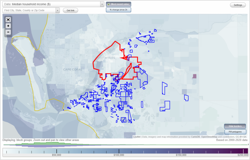
Fort Myers, Florida Neighborhood Map - Income, House Prices, Occupations, Boundaries
Settings
X

- City boundary
- Neighborhood boundaries
Business Search - 14 Million verified businesses
10 Acre Housing Project - Southwest Florida International Airport Neighborhoods:
10 Acre Housing Project, Airport South Interchange, Airport Woods, Alico - Three Oaks, Alico Airpark Center, Alico Commerce Center, Alico Commercial Park, Alico Crossroads Center, Alico Interchange Park, Alico Lakes, Alico Lakeside, Alico Park, Alico Road 250 Industrial Subdivision, Alico Road Center, Alico Road Greenmeadow Mine, Alico Road Industrial Park, Alico-Gator Road, Arden Courts, Arlington Commerce Park, Ascot Preserve, Banyan Bay, Banyan Creek Condo, Baum Plaza, Beach Road Suites, Beach Skating Rink, Brookshire Village, Bruno Plaza, Buckingham 320, Caloosa Ridge, Caloosa Trace, Caloosahatchee Estates, Calusa Palms, Canterbury School, Carissa, Catalpa Pointe, Central Metro Comm, Chancellor of Fort Myers, Cherry Professional Plaza, Chippendale, Cobblestone, Coconut Creek, Colony Trace, Connie Mack Island, Coral Rock, Coral Woods, Corlico, Corlico Villages, Country Oaks, Countryside Lakes, Creekside Cove, Cross Creek Estates, Crosslands, Crossroads Commerce Center, Crystal Commercial Center, Crystal Drive Metro Parkway Commerce Center., Cypress Hammock, Cypress Lake Center, Cypress Lake Land, Cypress View, Cypress Village, Cypress Woods, Danforth, Daniels Falls, Daniels Marketplace, Daniels Metro Center, Daniels Plantation Park, Daniels Preserve, Daniels/I-75 Commerce Center, Danport Center, Deep Lagoon Marina, Down River Fleet, Eagle Ridge, Eagle Ridge Lakes, East Pine, Eastgate Square, Emerald Pines, Estero Golf Resort, EsteroVista LLC, Fiddlesticks, Flex Industrial Park, Florida Community Bank, Fort Myers Beach RV Resort, Fort Myers Petro Term, Galleria West, Gardens at Riverwalk, Gateway, Gladiolus Gateway Shopping Center, Gladiolus Home Impr, Gladiolus/Summerlin, Golden Ponds Estates, Good News Baptist Church, Gralnick Foundation Center, Green Meadow, Greenmeadow Mine Expansion, Gulf Coast Hospital, Gulf Harbor, Hansen, Harbor Ridge, Harborage, Hayloft, Height's Produce, Heights Community Center, Hemmingway Pointe, Heritage Cove, Heritage Gulf Lakes, Heritage Palms, Hidden Harbor, Hidden Lakes, Hideaway Cove, Home Depot, Hughes - Commerce Park, Hyde Point, Indian Farm Garden Villas, Interchange Office Park, International Plaza, Iron Horse Commerce Park, James Mann Properties, Jetport Intrstate Commerce Park, Jetway Tradeport, Key West Cove, Knights of Columbus-Park Meadows, Laguna Lakes, Lake Devonwood Plaza, Lake McGregor Drive, Lakeridge Park, Lakes Park Library, Lakeside San Carlos, Lee Co Airport Autopark, Lee Memorial Park, Lee-Max Mobile Home Park, Leisure Tech, Leisure Villages, Lexington Country Club, Light Lane, Marina 31, Market Square, Massey Commercial Center, McGee Safety Lane, McGregor Pines, Metro Business Park, Metro Corner, Metro Crystal, Metro Parkway Office Park, Metro Plaza, Metro Trade Center, Miranda, Morris McGregor Center, Myerlee, Old Hickory Club, Old Town Plantation, One University Center, Orange Harbor Mobile Home Park, Orange River Blvd, Orange River Centre Retail, Orange River Estates, Orange River Landing, Orange River Oaks, Osprey Village, Otter Creek, Page Field Commons, Page Field Medical Village, Palm Cove, Palomino Park, Park Center fka Mt Siani, Park View Point, Parker Lakes, Parker Plaza Office Park, Penzance, Penzance Center, Phoenix 90 Land Trust, Pine Grove Enterprises, Pine Ridge Comm Park, Pine Ridge Complex, Pinto Lane, Plantation 19, Plantation I, Plantation II, Plantation Preserve, Port Sanibel Marina, Punta Rassa, Reflection Lakes, River Pointe, River Reach, Riverview Lakes, Rookery, SR 31 Multi-Family, Sandy Key Lane, Sanibel Way Townhomes, Shadow Wood Preserve, Shell Point, Sherrill Point, Shoppes at Fiddlesticks, Siesta Mobile Home Park, Six Mile Crossing, Somerset, South Metropolitan Comm Center, South Pointe, South Professional Center, Southpark, Southwest Florida International Airport10 Acre Housing Project neighborhood in Fort Myers statistics: (Find on map)
Area: 0.015 square miles
Population: 21
Population density:
Median household income in 2021:
Median rent in in 2021:
Male vs Females
Median age
Most popular occupations of males: service occupations (51.0%); construction, extraction, and maintenance occupations (23.1%); production occupations (8.7%); management occupations (except farmers) (6.2%); sales and office occupations (5.7%); community and social services occupations (4.5%)
Most popular occupations of females: service occupations (34.1%); sales and office occupations (27.3%); farming, fishing, and forestry occupations (22.0%); healthcare practitioners and technical occupations (11.4%); education, training, and library occupations (5.3%); management occupations (except farmers) (2.9%); material moving occupations (1.1%)
10 Acre Housing Project neighborhood detailed profile
Area: 0.015 square miles
Population: 21
Population density:
| 10 Acre Housing Project: | 1,369 people per square mile |
| Fort Myers: | 2,898 people per square mile |
Median household income in 2021:
| 10 Acre Housing Project: | $29,145 |
| Fort Myers: | $53,583 |
Median rent in in 2021:
| 10 Acre Housing Project: | $796 |
| Fort Myers: | $1,028 |
Male vs Females
| Males: | 15 |
| Females: | 6 |
Median age
| Males: | 40.8 years |
| Females: | 35.0 years |
Most popular occupations of males: service occupations (51.0%); construction, extraction, and maintenance occupations (23.1%); production occupations (8.7%); management occupations (except farmers) (6.2%); sales and office occupations (5.7%); community and social services occupations (4.5%)
Most popular occupations of females: service occupations (34.1%); sales and office occupations (27.3%); farming, fishing, and forestry occupations (22.0%); healthcare practitioners and technical occupations (11.4%); education, training, and library occupations (5.3%); management occupations (except farmers) (2.9%); material moving occupations (1.1%)
10 Acre Housing Project neighborhood detailed profile
Airport South Interchange neighborhood in Fort Myers statistics: (Find on map)
Area: 0.050 square miles
Airport South Interchange neighborhood detailed profile
Area: 0.050 square miles
Airport South Interchange neighborhood detailed profile
Airport Woods neighborhood in Fort Myers statistics: (Find on map)
Area: 0.108 square miles
Roads and streets: Bavaria Rd; Amberwood Rd; Tree Line Ave; Matterhorn Rd.
Airport Woods neighborhood detailed profile
Area: 0.108 square miles
Roads and streets: Bavaria Rd; Amberwood Rd; Tree Line Ave; Matterhorn Rd.
Airport Woods neighborhood detailed profile
Alico - Three Oaks neighborhood in Fort Myers statistics: (Find on map)
Area: 0.082 square miles
Alico - Three Oaks neighborhood detailed profile
Area: 0.082 square miles
Alico - Three Oaks neighborhood detailed profile
Alico Airpark Center neighborhood in Fort Myers statistics: (Find on map)
Area: 0.377 square miles
Alico Airpark Center neighborhood detailed profile
Area: 0.377 square miles
Alico Airpark Center neighborhood detailed profile
Alico Commerce Center neighborhood in Fort Myers statistics: (Find on map)
Area: 0.030 square miles
Roads and streets: Alico Commerce Ct.
Alico Commerce Center neighborhood detailed profile
Area: 0.030 square miles
Roads and streets: Alico Commerce Ct.
Alico Commerce Center neighborhood detailed profile
Alico Commercial Park neighborhood in Fort Myers statistics: (Find on map)
Area: 0.115 square miles
Roads and streets: Drew Cir.
Alico Commercial Park neighborhood detailed profile
Area: 0.115 square miles
Roads and streets: Drew Cir.
Alico Commercial Park neighborhood detailed profile
Alico Crossroads Center neighborhood in Fort Myers statistics: (Find on map)
Area: 0.077 square miles
Alico Crossroads Center neighborhood detailed profile
Area: 0.077 square miles
Alico Crossroads Center neighborhood detailed profile
Alico Interchange Park neighborhood in Fort Myers statistics: (Find on map)
Area: 0.249 square miles
Roads and streets: Pittsburgh Blvd; Scarlette Oak Ave; Sterling Lake Dr; Oakmont Ridge Cir; Stepping Stone Dr; Three Oaks Pkwy; Holly Oak Ave; Middle Oak Dr; Golden Rain Ln; Kings Cove Ct; Silver Pine Loop; Crystal View Ct; Blue Lake Ct; Northbrook Ct; Middle Oak Ct.
Alico Interchange Park neighborhood detailed profile
Alico Lakes neighborhood in Fort Myers statistics: (Find on map)
Area: 0.010 square miles
Alico Lakes neighborhood detailed profile
Area: 0.010 square miles
Alico Lakes neighborhood detailed profile
Alico Lakeside neighborhood in Fort Myers statistics: (Find on map)
Area: 0.454 square miles
Alico Lakeside neighborhood detailed profile
Area: 0.454 square miles
Alico Lakeside neighborhood detailed profile
Alico Park neighborhood in Fort Myers statistics: (Find on map)
Area: 0.023 square miles
Alico Park neighborhood detailed profile
Area: 0.023 square miles
Alico Park neighborhood detailed profile
Alico Road 250 Industrial Subdivision neighborhood in Fort Myers statistics: (Find on map)
Area: 0.398 square miles
Alico Road 250 Industrial Subdivision neighborhood detailed profile
Area: 0.398 square miles
Alico Road 250 Industrial Subdivision neighborhood detailed profile
Alico Road Center neighborhood in Fort Myers statistics: (Find on map)
Area: 0.010 square miles
Alico Road Center neighborhood detailed profile
Area: 0.010 square miles
Alico Road Center neighborhood detailed profile
Alico Road Greenmeadow Mine neighborhood in Fort Myers statistics: (Find on map)
Area: 0.056 square miles
Alico Road Greenmeadow Mine neighborhood detailed profile
Area: 0.056 square miles
Alico Road Greenmeadow Mine neighborhood detailed profile
Alico Road Industrial Park neighborhood in Fort Myers statistics: (Find on map)
Area: 0.067 square miles
Alico Road Industrial Park neighborhood detailed profile
Area: 0.067 square miles
Alico Road Industrial Park neighborhood detailed profile
Alico-Gator Road neighborhood in Fort Myers statistics: (Find on map)
Area: 0.021 square miles
Alico-Gator Road neighborhood detailed profile
Area: 0.021 square miles
Alico-Gator Road neighborhood detailed profile
Arden Courts neighborhood in Fort Myers statistics: (Find on map)
Area: 0.021 square miles
Arden Courts neighborhood detailed profile
Area: 0.021 square miles
Arden Courts neighborhood detailed profile
Arlington Commerce Park neighborhood in Fort Myers statistics: (Find on map)
Area: 0.126 square miles
Arlington Commerce Park neighborhood detailed profile
Area: 0.126 square miles
Arlington Commerce Park neighborhood detailed profile
Ascot Preserve neighborhood in Fort Myers statistics: (Find on map)
Area: 0.094 square miles
Ascot Preserve neighborhood detailed profile
Area: 0.094 square miles
Ascot Preserve neighborhood detailed profile
Banyan Bay neighborhood in Fort Myers statistics: (Find on map)
Area: 0.139 square miles
Banyan Bay neighborhood detailed profile
Area: 0.139 square miles
Banyan Bay neighborhood detailed profile
Banyan Creek Condo neighborhood in Fort Myers statistics: (Find on map)
Area: 0.003 square miles
Banyan Creek Condo neighborhood detailed profile
Area: 0.003 square miles
Banyan Creek Condo neighborhood detailed profile
Baum Plaza neighborhood in Fort Myers statistics: (Find on map)
Area: 0.005 square miles
Baum Plaza neighborhood detailed profile
Area: 0.005 square miles
Baum Plaza neighborhood detailed profile
Beach Road Suites neighborhood in Fort Myers statistics: (Find on map)
Area: 0.005 square miles
Beach Road Suites neighborhood detailed profile
Area: 0.005 square miles
Beach Road Suites neighborhood detailed profile
Beach Skating Rink neighborhood in Fort Myers statistics: (Find on map)
Area: 0.003 square miles
Beach Skating Rink neighborhood detailed profile
Area: 0.003 square miles
Beach Skating Rink neighborhood detailed profile
Brookshire Village neighborhood in Fort Myers statistics: (Find on map)
Area: 0.203 square miles
Roads and streets: Brookshire Lake Blvd; Southwell Dr; Heather Ridge Loop; Saint Edmunds Loop; Saint Ives Ct; Whitehaven Ln; Pentland Way; Wakefield Dr; Radcliffe Dr; Winsford Ln; Regent Cir; Greywood Cir; Whitby Way; Stirling Way.
Brookshire Village neighborhood detailed profile
Bruno Plaza neighborhood in Fort Myers statistics: (Find on map)
Area: 0.002 square miles
Bruno Plaza neighborhood detailed profile
Area: 0.002 square miles
Bruno Plaza neighborhood detailed profile
Buckingham 320 neighborhood in Fort Myers statistics: (Find on map)
Area: 0.540 square miles
Buckingham 320 neighborhood detailed profile
Area: 0.540 square miles
Buckingham 320 neighborhood detailed profile
Caloosa Ridge neighborhood in Fort Myers statistics: (Find on map)
Area: 0.032 square miles
Caloosa Ridge neighborhood detailed profile
Area: 0.032 square miles
Caloosa Ridge neighborhood detailed profile
Caloosa Trace neighborhood in Fort Myers statistics: (Find on map)
Area: 0.073 square miles
Roads and streets: Caloosa Trace Cir; Bear Hollow Cir; Ramblers Strand; Trappers Dr; Beavers Den; Woodbine Way; Alico Rd.
Caloosa Trace neighborhood detailed profile
Area: 0.073 square miles
Roads and streets: Caloosa Trace Cir; Bear Hollow Cir; Ramblers Strand; Trappers Dr; Beavers Den; Woodbine Way; Alico Rd.
Caloosa Trace neighborhood detailed profile
Caloosahatchee Estates neighborhood in Fort Myers statistics: (Find on map)
Area: 0.144 square miles
Caloosahatchee Estates neighborhood detailed profile
Area: 0.144 square miles
Caloosahatchee Estates neighborhood detailed profile
Calusa Palms neighborhood in Fort Myers statistics: (Find on map)
Area: 0.110 square miles
Roads and streets: Calusa Palms Dr; Mendocino Dr; Mendicino Dr; Lassen Ct.
Calusa Palms neighborhood detailed profile
Area: 0.110 square miles
Roads and streets: Calusa Palms Dr; Mendocino Dr; Mendicino Dr; Lassen Ct.
Calusa Palms neighborhood detailed profile
Canterbury School neighborhood in Fort Myers statistics: (Find on map)
Area: 0.049 square miles
Population: 26
Population density:
Median household income in 2021:
Median rent in in 2021:
Male vs Females
Median age
Housing prices:
Average estimated value of detached houses in 2021 (46.2% of all units):
Average estimated '21 value of housing units in 3-to-4-unit structures (7.7% of all units):
Average estimated '21 value of housing units in 5-or-more-unit structures (7.7% of all units):
Most popular occupations of males: service occupations (30.3%); sales and office occupations (14.3%); management occupations (except farmers) (11.5%); community and social services occupations (6.4%); transportation occupations (3.9%); material moving occupations (3.6%); arts, design, entertainment, sports, and media occupations (3.4%)
Most popular occupations of females: material moving occupations (23.1%); service occupations (21.8%); sales and office occupations (19.2%); arts, design, entertainment, sports, and media occupations (7.5%); management occupations (except farmers) (6.3%); healthcare practitioners and technical occupations (5.8%); community and social services occupations (5.3%)
Canterbury School neighborhood detailed profile
Area: 0.049 square miles
Population: 26
Population density:
| Canterbury School: | 528 people per square mile |
| Fort Myers: | 2,898 people per square mile |
Median household income in 2021:
| Canterbury School: | $18,881 |
| Fort Myers: | $53,583 |
Median rent in in 2021:
| Canterbury School: | $480 |
| Fort Myers: | $1,028 |
Male vs Females
| Males: | 12 |
| Females: | 13 |
Median age
| Males: | 13.4 years |
| Females: | 17.4 years |
Housing prices:
Average estimated value of detached houses in 2021 (46.2% of all units):
| Canterbury School: | $214,740 |
| Florida: | $399,750 |
Average estimated '21 value of housing units in 3-to-4-unit structures (7.7% of all units):
| Canterbury School: | $86,266 |
| Florida: | $237,420 |
Average estimated '21 value of housing units in 5-or-more-unit structures (7.7% of all units):
| Canterbury School: | $78,902 |
| Florida: | $369,045 |
Most popular occupations of males: service occupations (30.3%); sales and office occupations (14.3%); management occupations (except farmers) (11.5%); community and social services occupations (6.4%); transportation occupations (3.9%); material moving occupations (3.6%); arts, design, entertainment, sports, and media occupations (3.4%)
Most popular occupations of females: material moving occupations (23.1%); service occupations (21.8%); sales and office occupations (19.2%); arts, design, entertainment, sports, and media occupations (7.5%); management occupations (except farmers) (6.3%); healthcare practitioners and technical occupations (5.8%); community and social services occupations (5.3%)
Canterbury School neighborhood detailed profile
Carissa neighborhood in Fort Myers statistics: (Find on map)
Area: 0.030 square miles
Carissa neighborhood detailed profile
Area: 0.030 square miles
Carissa neighborhood detailed profile
Catalpa Pointe neighborhood in Fort Myers statistics: (Find on map)
Area: 0.007 square miles
Catalpa Pointe neighborhood detailed profile
Area: 0.007 square miles
Catalpa Pointe neighborhood detailed profile
Central Metro Comm neighborhood in Fort Myers statistics: (Find on map)
Area: 0.024 square miles
Roads and streets: Metro Pkwy; Metropolis Ave; Endeavor Ln; Atlantis Ln.
Central Metro Comm neighborhood detailed profile
Area: 0.024 square miles
Roads and streets: Metro Pkwy; Metropolis Ave; Endeavor Ln; Atlantis Ln.
Central Metro Comm neighborhood detailed profile
Chancellor of Fort Myers neighborhood in Fort Myers statistics: (Find on map)
Area: 0.008 square miles
Population: 19
Population density:
Median household income in 2021:
Median rent in in 2021:
Male vs Females
Median age
Housing prices:
Average estimated value of detached houses in 2021 (44.4% of all units):
Average estimated '21 value of housing units in 3-to-4-unit structures (11.1% of all units):
Most popular occupations of males: service occupations (30.3%); sales and office occupations (14.3%); management occupations (except farmers) (11.5%); community and social services occupations (6.4%); transportation occupations (3.9%); material moving occupations (3.6%); arts, design, entertainment, sports, and media occupations (3.4%)
Most popular occupations of females: material moving occupations (23.1%); service occupations (21.8%); sales and office occupations (19.2%); arts, design, entertainment, sports, and media occupations (7.5%); management occupations (except farmers) (6.3%); healthcare practitioners and technical occupations (5.8%); community and social services occupations (5.3%)
Chancellor of Fort Myers neighborhood detailed profile
Area: 0.008 square miles
Population: 19
Population density:
| Chancellor of Fort Myers (University Place): | 2,351 people per square mile |
| Fort Myers: | 2,898 people per square mile |
Median household income in 2021:
| Chancellor of Fort Myers (University Place): | $53,648 |
| Fort Myers: | $53,583 |
Median rent in in 2021:
| Chancellor of Fort Myers (University Place): | $1,365 |
| Fort Myers: | $1,028 |
Male vs Females
| Males: | 9 |
| Females: | 9 |
Median age
| Males: | 38.0 years |
| Females: | 49.3 years |
Housing prices:
Average estimated value of detached houses in 2021 (44.4% of all units):
| Chancellor of Fort Myers (University Place): | $214,740 |
| Florida: | $399,750 |
Average estimated '21 value of housing units in 3-to-4-unit structures (11.1% of all units):
| Chancellor of Fort Myers (University Place): | $86,266 |
| Florida: | $237,420 |
Most popular occupations of males: service occupations (30.3%); sales and office occupations (14.3%); management occupations (except farmers) (11.5%); community and social services occupations (6.4%); transportation occupations (3.9%); material moving occupations (3.6%); arts, design, entertainment, sports, and media occupations (3.4%)
Most popular occupations of females: material moving occupations (23.1%); service occupations (21.8%); sales and office occupations (19.2%); arts, design, entertainment, sports, and media occupations (7.5%); management occupations (except farmers) (6.3%); healthcare practitioners and technical occupations (5.8%); community and social services occupations (5.3%)
Chancellor of Fort Myers neighborhood detailed profile
Cherry Professional Plaza neighborhood in Fort Myers statistics: (Find on map)
Area: 0.001 square miles
Population: 4
Population density:
Median household income in 2021:
Median rent in in 2021:
Male vs Females
Median age
Most popular occupations of males: service occupations (34.9%); legal occupations (15.8%); sales and office occupations (15.8%); computer and mathematical occupations (10.4%); management occupations (except farmers) (8.4%); transportation occupations (8.3%); business and financial operations occupations (6.6%)
Most popular occupations of females: sales and office occupations (38.5%); service occupations (21.8%); transportation occupations (18.3%); material moving occupations (11.2%); management occupations (except farmers) (7.8%); education, training, and library occupations (7.8%); community and social services occupations (4.1%)
Cherry Professional Plaza neighborhood detailed profile
Area: 0.001 square miles
Population: 4
Population density:
| Cherry Professional Plaza: | 2,745 people per square mile |
| Fort Myers: | 2,898 people per square mile |
Median household income in 2021:
| Cherry Professional Plaza: | $55,606 |
| Fort Myers: | $53,583 |
Median rent in in 2021:
| Cherry Professional Plaza: | $1,113 |
| Fort Myers: | $1,028 |
Male vs Females
| Males: | 2 |
| Females: | 2 |
Median age
| Males: | 55.8 years |
| Females: | 66.6 years |
Most popular occupations of males: service occupations (34.9%); legal occupations (15.8%); sales and office occupations (15.8%); computer and mathematical occupations (10.4%); management occupations (except farmers) (8.4%); transportation occupations (8.3%); business and financial operations occupations (6.6%)
Most popular occupations of females: sales and office occupations (38.5%); service occupations (21.8%); transportation occupations (18.3%); material moving occupations (11.2%); management occupations (except farmers) (7.8%); education, training, and library occupations (7.8%); community and social services occupations (4.1%)
Cherry Professional Plaza neighborhood detailed profile
Chippendale neighborhood in Fort Myers statistics: (Find on map)
Area: 0.009 square miles
Chippendale neighborhood detailed profile
Area: 0.009 square miles
Chippendale neighborhood detailed profile
Cobblestone neighborhood in Fort Myers statistics: (Find on map)
Area: 0.078 square miles
Cobblestone neighborhood detailed profile
Area: 0.078 square miles
Cobblestone neighborhood detailed profile
Coconut Creek neighborhood in Fort Myers statistics: (Find on map)
Area: 0.130 square miles
Highways in this neighborhood: McGregor Blvd (State Hwy 867).
Roads and streets: Coconut Creek Ct; McGregor Palms Dr; Bentwood Palms Dr.
Coconut Creek neighborhood detailed profile
Area: 0.130 square miles
Highways in this neighborhood: McGregor Blvd (State Hwy 867).
Roads and streets: Coconut Creek Ct; McGregor Palms Dr; Bentwood Palms Dr.
Coconut Creek neighborhood detailed profile
Colony Trace neighborhood in Fort Myers statistics: (Find on map)
Area: 0.031 square miles
Colony Trace neighborhood detailed profile
Area: 0.031 square miles
Colony Trace neighborhood detailed profile
Connie Mack Island neighborhood in Fort Myers statistics: (Find on map)
Area: 0.063 square miles
Roads and streets: Jonathan Harbour Dr; Marina Cove Ln; Tidewater Ln; Palm Dr.
Connie Mack Island neighborhood detailed profile
Area: 0.063 square miles
Roads and streets: Jonathan Harbour Dr; Marina Cove Ln; Tidewater Ln; Palm Dr.
Connie Mack Island neighborhood detailed profile
Coral Rock neighborhood in Fort Myers statistics: (Find on map)
Area: 0.016 square miles
Coral Rock neighborhood detailed profile
Area: 0.016 square miles
Coral Rock neighborhood detailed profile
Coral Woods neighborhood in Fort Myers statistics: (Find on map)
Area: 0.017 square miles
Coral Woods neighborhood detailed profile
Area: 0.017 square miles
Coral Woods neighborhood detailed profile
Corlico Villages neighborhood in Fort Myers statistics: (Find on map)
Area: 0.035 square miles
Corlico Villages neighborhood detailed profile
Area: 0.035 square miles
Corlico Villages neighborhood detailed profile
Country Oaks neighborhood in Fort Myers statistics: (Find on map)
Area: 0.060 square miles
Population: 9
Population density:
Median household income in 2021:
Median rent in in 2021:
Male vs Females
Median age
Housing prices:
Average estimated value of detached houses in 2021 (75.0% of all units):
Most popular occupations of males: service occupations (32.2%); management occupations (except farmers) (18.1%); construction, extraction, and maintenance occupations (11.2%); sales and office occupations (8.7%); transportation occupations (7.0%); business and financial operations occupations (4.4%); computer and mathematical occupations (3.5%)
Most popular occupations of females: sales and office occupations (45.1%); management occupations (except farmers) (11.4%); healthcare practitioners and technical occupations (7.4%); education, training, and library occupations (5.8%); service occupations (5.7%); computer and mathematical occupations (5.3%); community and social services occupations (5.3%)
Roads and streets: Country Oaks Dr; Oak Forest Dr; Laketree Ct; Waters Way.
Country Oaks neighborhood detailed profile
Area: 0.060 square miles
Population: 9
Population density:
| Country Oaks: | 150 people per square mile |
| Fort Myers: | 2,898 people per square mile |
Median household income in 2021:
| Country Oaks: | $73,969 |
| Fort Myers: | $53,583 |
Median rent in in 2021:
| Country Oaks: | $1,929 |
| Fort Myers: | $1,028 |
Male vs Females
| Males: | 5 |
| Females: | 4 |
Median age
| Males: | 54.7 years |
| Females: | 52.6 years |
Housing prices:
Average estimated value of detached houses in 2021 (75.0% of all units):
| Country Oaks: | $209,560 |
| Florida: | $399,750 |
Most popular occupations of males: service occupations (32.2%); management occupations (except farmers) (18.1%); construction, extraction, and maintenance occupations (11.2%); sales and office occupations (8.7%); transportation occupations (7.0%); business and financial operations occupations (4.4%); computer and mathematical occupations (3.5%)
Most popular occupations of females: sales and office occupations (45.1%); management occupations (except farmers) (11.4%); healthcare practitioners and technical occupations (7.4%); education, training, and library occupations (5.8%); service occupations (5.7%); computer and mathematical occupations (5.3%); community and social services occupations (5.3%)
Roads and streets: Country Oaks Dr; Oak Forest Dr; Laketree Ct; Waters Way.
Country Oaks neighborhood detailed profile
Countryside Lakes neighborhood in Fort Myers statistics: (Find on map)
Area: 0.122 square miles
Roads and streets: A and W Bulb Rd.
Countryside Lakes neighborhood detailed profile
Area: 0.122 square miles
Roads and streets: A and W Bulb Rd.
Countryside Lakes neighborhood detailed profile
Creekside Cove neighborhood in Fort Myers statistics: (Find on map)
Area: 0.011 square miles
Creekside Cove neighborhood detailed profile
Area: 0.011 square miles
Creekside Cove neighborhood detailed profile
Cross Creek Estates neighborhood in Fort Myers statistics: (Find on map)
Area: 0.392 square miles
Roads and streets: Cross Creek Blvd; Kedleston Cir; Allendale Cir; Breton Cir; Dresden Ct; Arborfield Ct; Manderston Ct; Chartwell Dr; Strathmore Loop; Kilkenny Ct; Trentwood Ct; Chatsworth Ct; Chardon Ct.
Cross Creek Estates neighborhood detailed profile
Area: 0.392 square miles
Roads and streets: Cross Creek Blvd; Kedleston Cir; Allendale Cir; Breton Cir; Dresden Ct; Arborfield Ct; Manderston Ct; Chartwell Dr; Strathmore Loop; Kilkenny Ct; Trentwood Ct; Chatsworth Ct; Chardon Ct.
Cross Creek Estates neighborhood detailed profile
Crosslands neighborhood in Fort Myers statistics: (Find on map)
Area: 0.008 square miles
Crosslands neighborhood detailed profile
Area: 0.008 square miles
Crosslands neighborhood detailed profile
Crossroads Commerce Center neighborhood in Fort Myers statistics: (Find on map)
Area: 0.119 square miles
Crossroads Commerce Center neighborhood detailed profile
Area: 0.119 square miles
Crossroads Commerce Center neighborhood detailed profile
Crystal Commercial Center neighborhood in Fort Myers statistics: (Find on map)
Area: 0.036 square miles
Crystal Commercial Center neighborhood detailed profile
Area: 0.036 square miles
Crystal Commercial Center neighborhood detailed profile
Crystal Drive Metro Parkway Commerce Center. neighborhood in Fort Myers statistics: (Find on map)
Area: 0.012 square miles
Crystal Drive Metro Parkway Commerce Center. neighborhood detailed profile
Area: 0.012 square miles
Crystal Drive Metro Parkway Commerce Center. neighborhood detailed profile
Cypress Hammock neighborhood in Fort Myers statistics: (Find on map)
Area: 0.040 square miles
Cypress Hammock neighborhood detailed profile
Area: 0.040 square miles
Cypress Hammock neighborhood detailed profile
Cypress Lake Center neighborhood in Fort Myers statistics: (Find on map)
Area: 0.066 square miles
Population: 64
Population density:
Median household income in 2021:
Median rent in in 2021:
Male vs Females
Median age
Most popular occupations of males: sales and office occupations (30.2%); management occupations (except farmers) (16.4%); business and financial operations occupations (15.1%); transportation occupations (13.8%); healthcare practitioners and technical occupations (13.4%); service occupations (8.4%); construction, extraction, and maintenance occupations (7.0%)
Most popular occupations of females: sales and office occupations (26.0%); service occupations (24.9%); management occupations (except farmers) (16.0%); community and social services occupations (10.0%); education, training, and library occupations (6.3%); healthcare practitioners and technical occupations (5.4%); life, physical, and social science occupations (3.7%)
Roads and streets: Lakes Ave; Cypress Ter.
Cypress Lake Center neighborhood detailed profile
Area: 0.066 square miles
Population: 64
Population density:
| Cypress Lake Center: | 966 people per square mile |
| Fort Myers: | 2,898 people per square mile |
Median household income in 2021:
| Cypress Lake Center: | $89,531 |
| Fort Myers: | $53,583 |
Median rent in in 2021:
| Cypress Lake Center: | $1,710 |
| Fort Myers: | $1,028 |
Male vs Females
| Males: | 28 |
| Females: | 35 |
Median age
| Males: | 44.7 years |
| Females: | 50.5 years |
Most popular occupations of males: sales and office occupations (30.2%); management occupations (except farmers) (16.4%); business and financial operations occupations (15.1%); transportation occupations (13.8%); healthcare practitioners and technical occupations (13.4%); service occupations (8.4%); construction, extraction, and maintenance occupations (7.0%)
Most popular occupations of females: sales and office occupations (26.0%); service occupations (24.9%); management occupations (except farmers) (16.0%); community and social services occupations (10.0%); education, training, and library occupations (6.3%); healthcare practitioners and technical occupations (5.4%); life, physical, and social science occupations (3.7%)
Roads and streets: Lakes Ave; Cypress Ter.
Cypress Lake Center neighborhood detailed profile
Cypress Lake Land neighborhood in Fort Myers statistics: (Find on map)
Area: 0.404 square miles
Roads and streets: Reflection Lakes Pkwy; Lake Mahogany Blvd; Bald Cypress Cir; Bay Lake Dr; Lily Pad Cir; Shimmering Lake Ct; Reflection Lakes Dr; Summerlin Lakes Dr; Gulfbreeze St; Clear Water Ln; Image Lake Ct; Harmony Lake Ct; Magnolia Lake Ct.
Cypress Lake Land neighborhood detailed profile
Cypress View neighborhood in Fort Myers statistics: (Find on map)
Area: 0.016 square miles
Cypress View neighborhood detailed profile
Area: 0.016 square miles
Cypress View neighborhood detailed profile
Cypress Village neighborhood in Fort Myers statistics: (Find on map)
Area: 0.014 square miles
Cypress Village neighborhood detailed profile
Area: 0.014 square miles
Cypress Village neighborhood detailed profile
Cypress Woods neighborhood in Fort Myers statistics: (Find on map)
Area: 0.237 square miles
Roads and streets: Nightwood Dr; Brightwood Dr; Maplewood Ct; Cypress Woods Resort Dr; Shadowood Ct; Pathwood Ct; Burrwood Ct; Parkwood Dr; Willow Dr.
Cypress Woods neighborhood detailed profile
Area: 0.237 square miles
Roads and streets: Nightwood Dr; Brightwood Dr; Maplewood Ct; Cypress Woods Resort Dr; Shadowood Ct; Pathwood Ct; Burrwood Ct; Parkwood Dr; Willow Dr.
Cypress Woods neighborhood detailed profile
Danforth neighborhood in Fort Myers statistics: (Find on map)
Area: 0.191 square miles
Roads and streets: Fawn Ridge Dr; Aston Oaks Dr; Falcon Pointe Lp; Danford Lakes Blvd; Cedar Hollow Dr; Meadowhawk Dr; Palomino Ln; Havenridge Cir; Maple Glen Cir; Fox Hollow Cir; Oakpointe Cir; Oakpoint Cir.
Danforth neighborhood detailed profile
Area: 0.191 square miles
Roads and streets: Fawn Ridge Dr; Aston Oaks Dr; Falcon Pointe Lp; Danford Lakes Blvd; Cedar Hollow Dr; Meadowhawk Dr; Palomino Ln; Havenridge Cir; Maple Glen Cir; Fox Hollow Cir; Oakpointe Cir; Oakpoint Cir.
Danforth neighborhood detailed profile
Daniels Falls neighborhood in Fort Myers statistics: (Find on map)
Area: 0.051 square miles
Daniels Falls neighborhood detailed profile
Area: 0.051 square miles
Daniels Falls neighborhood detailed profile
Daniels Marketplace neighborhood in Fort Myers statistics: (Find on map)
Area: 0.103 square miles
Daniels Marketplace neighborhood detailed profile
Area: 0.103 square miles
Daniels Marketplace neighborhood detailed profile
Daniels Metro Center neighborhood in Fort Myers statistics: (Find on map)
Area: 0.021 square miles
Roads and streets: Metro Pkwy.
Daniels Metro Center neighborhood detailed profile
Area: 0.021 square miles
Roads and streets: Metro Pkwy.
Daniels Metro Center neighborhood detailed profile
Daniels Plantation Park neighborhood in Fort Myers statistics: (Find on map)
Area: 0.022 square miles
Daniels Plantation Park neighborhood detailed profile
Area: 0.022 square miles
Daniels Plantation Park neighborhood detailed profile
Daniels Preserve neighborhood in Fort Myers statistics: (Find on map)
Area: 0.483 square miles
Roads and streets: Country Day Cir; Pastures Way; Valdosta Pl; Village Gate Ct.
Daniels Preserve neighborhood detailed profile
Area: 0.483 square miles
Roads and streets: Country Day Cir; Pastures Way; Valdosta Pl; Village Gate Ct.
Daniels Preserve neighborhood detailed profile
Daniels/I-75 Commerce Center neighborhood in Fort Myers statistics: (Find on map)
Area: 0.100 square miles
Daniels/I-75 Commerce Center neighborhood detailed profile
Area: 0.100 square miles
Daniels/I-75 Commerce Center neighborhood detailed profile
Danport Center neighborhood in Fort Myers statistics: (Find on map)
Area: 0.306 square miles
Roads and streets: Morgan Hill Rd; Renaissance Way; Victoria Way; Villagio Way; Palomino Ln.
Danport Center neighborhood detailed profile
Area: 0.306 square miles
Roads and streets: Morgan Hill Rd; Renaissance Way; Victoria Way; Villagio Way; Palomino Ln.
Danport Center neighborhood detailed profile
Deep Lagoon Marina neighborhood in Fort Myers statistics: (Find on map)
Area: 0.049 square miles
Population: 67
Population density:
Median household income in 2021:
Median rent in in 2021:
Male vs Females
Median age
Housing prices:
Average estimated value of detached houses in 2021 (81.0% of all units):
Average estimated '21 value of housing units in 5-or-more-unit structures (11.9% of all units):
Most popular occupations of males: sales and office occupations (33.5%); healthcare practitioners and technical occupations (18.5%); management occupations (except farmers) (8.8%); transportation occupations (8.8%); material moving occupations (5.9%); service occupations (5.2%); legal occupations (4.2%)
Most popular occupations of females: sales and office occupations (28.8%); healthcare practitioners and technical occupations (17.8%); management occupations (except farmers) (12.2%); community and social services occupations (10.0%); legal occupations (10.0%); production occupations (6.1%); business and financial operations occupations (3.5%)
Highways in this neighborhood: McGregor Blvd (State Hwy 867).
Roads and streets: Unity Dr.
Deep Lagoon Marina neighborhood detailed profile
Area: 0.049 square miles
Population: 67
Population density:
| Deep Lagoon Marina: | 1,365 people per square mile |
| Fort Myers: | 2,898 people per square mile |
Median household income in 2021:
| Deep Lagoon Marina: | $93,112 |
| Fort Myers: | $53,583 |
Median rent in in 2021:
| Deep Lagoon Marina: | $1,065 |
| Fort Myers: | $1,028 |
Male vs Females
| Males: | 41 |
| Females: | 26 |
Median age
| Males: | 65.3 years |
| Females: | 61.8 years |
Housing prices:
Average estimated value of detached houses in 2021 (81.0% of all units):
| Deep Lagoon Marina: | $876,136 |
| Florida: | $399,750 |
Average estimated '21 value of housing units in 5-or-more-unit structures (11.9% of all units):
| Deep Lagoon Marina: | $100,051 |
| Florida: | $369,045 |
Most popular occupations of males: sales and office occupations (33.5%); healthcare practitioners and technical occupations (18.5%); management occupations (except farmers) (8.8%); transportation occupations (8.8%); material moving occupations (5.9%); service occupations (5.2%); legal occupations (4.2%)
Most popular occupations of females: sales and office occupations (28.8%); healthcare practitioners and technical occupations (17.8%); management occupations (except farmers) (12.2%); community and social services occupations (10.0%); legal occupations (10.0%); production occupations (6.1%); business and financial operations occupations (3.5%)
Highways in this neighborhood: McGregor Blvd (State Hwy 867).
Roads and streets: Unity Dr.
Deep Lagoon Marina neighborhood detailed profile
Down River Fleet neighborhood in Fort Myers statistics: (Find on map)
Area: 0.005 square miles
Down River Fleet neighborhood detailed profile
Area: 0.005 square miles
Down River Fleet neighborhood detailed profile
Eagle Ridge neighborhood in Fort Myers statistics: (Find on map)
Area: 1.032 square miles
Roads and streets: Eagle Ridge Dr; Georgian Bay Cir; Aeries Way Dr; Twin Eagle Ln; Eagle Ridge Lakes Dr; Eagles Flight Ln; Bald Eagle Dr; Georgian Cir; Majestic Eagle Ct; Golden Eagle Ct; Eagles Lookout Ct; Eaglet Ct; Triple Eagle Ct; Soaring Eagle Ct; American Eagle Ct; Double Eagle Ct.
Eagle Ridge neighborhood detailed profile
Eagle Ridge Lakes neighborhood in Fort Myers statistics: (Find on map)
Area: 0.453 square miles
Roads and streets: Georgian Bay Cir; Eagle Ridge Lakes Dr; Georgian Cir; Eagle Ridge Dr.
Eagle Ridge Lakes neighborhood detailed profile
Area: 0.453 square miles
Roads and streets: Georgian Bay Cir; Eagle Ridge Lakes Dr; Georgian Cir; Eagle Ridge Dr.
Eagle Ridge Lakes neighborhood detailed profile
East Pine neighborhood in Fort Myers statistics: (Find on map)
Area: 0.005 square miles
East Pine neighborhood detailed profile
Area: 0.005 square miles
East Pine neighborhood detailed profile
Eastgate Square neighborhood in Fort Myers statistics: (Find on map)
Area: 0.025 square miles
Eastgate Square neighborhood detailed profile
Area: 0.025 square miles
Eastgate Square neighborhood detailed profile
Emerald Pines neighborhood in Fort Myers statistics: (Find on map)
Area: 0.037 square miles
Roads and streets: Emerald Pines Cir; Plantation Rd.
Emerald Pines neighborhood detailed profile
Area: 0.037 square miles
Roads and streets: Emerald Pines Cir; Plantation Rd.
Emerald Pines neighborhood detailed profile
Estero Golf Resort neighborhood in Fort Myers statistics: (Find on map)
Area: 0.490 square miles
Roads and streets: Sedonia Cir; Maddelena Cir; Casa Verde Way; la Serena Dr; Largo Mar Dr; Caladesi Dr; el Mirasol Ct.
Estero Golf Resort neighborhood detailed profile
Area: 0.490 square miles
Roads and streets: Sedonia Cir; Maddelena Cir; Casa Verde Way; la Serena Dr; Largo Mar Dr; Caladesi Dr; el Mirasol Ct.
Estero Golf Resort neighborhood detailed profile
EsteroVista LLC neighborhood in Fort Myers statistics: (Find on map)
Area: 0.032 square miles
Roads and streets: Santa Maria St.
EsteroVista LLC neighborhood detailed profile
Area: 0.032 square miles
Roads and streets: Santa Maria St.
EsteroVista LLC neighborhood detailed profile
Fiddlesticks neighborhood in Fort Myers statistics: (Find on map)
Area: 1.092 square miles
Roads and streets: Fiddlesticks Blvd; Glenfinnan Cir; Lockmaben Ave; Cannongate Dr; Kilbirnie Dr; Queensferry Dr; Glenisle Way; Kilmarnock Dr; Glen Abbey Cir; Greenock Ln; Glenlyon Ct; Carriedale Ln; Grey Friars Ct; Gullane Ct; Abbotsford Ter; Tweedale Cir; Kinross Cir; Carberry Ct; Highland Dr; Bagpipe Way; Highlands Dr; Pipers Glen; Briarcliff Rd; Palomino Ln.
Fiddlesticks neighborhood detailed profile
Flex Industrial Park neighborhood in Fort Myers statistics: (Find on map)
Area: 0.013 square miles
Flex Industrial Park neighborhood detailed profile
Area: 0.013 square miles
Flex Industrial Park neighborhood detailed profile
Florida Community Bank neighborhood in Fort Myers statistics: (Find on map)
Area: 0.012 square miles
Florida Community Bank neighborhood detailed profile
Area: 0.012 square miles
Florida Community Bank neighborhood detailed profile
Fort Myers Beach RV Resort neighborhood in Fort Myers statistics: (Find on map)
Area: 0.023 square miles
Fort Myers Beach RV Resort neighborhood detailed profile
Area: 0.023 square miles
Fort Myers Beach RV Resort neighborhood detailed profile
Fort Myers Petro Term neighborhood in Fort Myers statistics: (Find on map)
Area: 0.104 square miles
Roads and streets: Fuel Farm Rd.
Fort Myers Petro Term neighborhood detailed profile
Area: 0.104 square miles
Roads and streets: Fuel Farm Rd.
Fort Myers Petro Term neighborhood detailed profile
Galleria West neighborhood in Fort Myers statistics: (Find on map)
Area: 0.023 square miles
Galleria West neighborhood detailed profile
Area: 0.023 square miles
Galleria West neighborhood detailed profile
Gardens at Riverwalk neighborhood in Fort Myers statistics: (Find on map)
Area: 0.013 square miles
Population: 60
Population density:
Median household income in 2021:
Median rent in in 2021:
Male vs Females
Median age
Housing prices:
Average estimated value of detached houses in 2021 (51.3% of all units):
Average estimated value of townhouses or other attached units in 2021 (17.9% of all units):
Average estimated value of housing units in 2-unit structures in 2021 (17.9% of all units):
Average estimated '21 value of housing units in 5-or-more-unit structures (5.1% of all units):
Most popular occupations of males: life, physical, and social science occupations (33.5%); healthcare practitioners and technical occupations (30.8%); management occupations (except farmers) (23.6%); sales and office occupations (20.7%); production occupations (17.7%); business and financial operations occupations (11.8%); architecture and engineering occupations (3.8%)
Most popular occupations of females: education, training, and library occupations (40.7%); healthcare practitioners and technical occupations (16.8%); production occupations (14.7%); business and financial operations occupations (14.0%); legal occupations (13.9%); sales and office occupations (13.4%); life, physical, and social science occupations (2.0%)
Roads and streets: Riverwalk Park Blvd.
Gardens at Riverwalk neighborhood detailed profile
Area: 0.013 square miles
Population: 60
Population density:
| Gardens at Riverwalk: | 4,692 people per square mile |
| Fort Myers: | 2,898 people per square mile |
Median household income in 2021:
| Gardens at Riverwalk: | $75,755 |
| Fort Myers: | $53,583 |
Median rent in in 2021:
| Gardens at Riverwalk: | $1,125 |
| Fort Myers: | $1,028 |
Male vs Females
| Males: | 32 |
| Females: | 27 |
Median age
| Males: | 62.5 years |
| Females: | 63.3 years |
Housing prices:
Average estimated value of detached houses in 2021 (51.3% of all units):
| Gardens at Riverwalk: | $509,494 |
| Florida: | $399,750 |
Average estimated value of townhouses or other attached units in 2021 (17.9% of all units):
| This neighborhood: | $189,390 |
| Florida: | $293,437 |
Average estimated value of housing units in 2-unit structures in 2021 (17.9% of all units):
| This neighborhood: | $206,207 |
| Florida: | $321,785 |
Average estimated '21 value of housing units in 5-or-more-unit structures (5.1% of all units):
| Gardens at Riverwalk: | $155,571 |
| Florida: | $369,045 |
Most popular occupations of males: life, physical, and social science occupations (33.5%); healthcare practitioners and technical occupations (30.8%); management occupations (except farmers) (23.6%); sales and office occupations (20.7%); production occupations (17.7%); business and financial operations occupations (11.8%); architecture and engineering occupations (3.8%)
Most popular occupations of females: education, training, and library occupations (40.7%); healthcare practitioners and technical occupations (16.8%); production occupations (14.7%); business and financial operations occupations (14.0%); legal occupations (13.9%); sales and office occupations (13.4%); life, physical, and social science occupations (2.0%)
Roads and streets: Riverwalk Park Blvd.
Gardens at Riverwalk neighborhood detailed profile
Gateway neighborhood in Fort Myers statistics: (Find on map)
Area: 4.664 square miles
Highways in this neighborhood: Daniels Pkwy (State Hwy 865).
Roads and streets: Gateway Blvd; Commerce Lakes Dr; Lakeland Cir; Mahogany Run; Gateway Greens Dr; Westlinks Dr; Villa Grand; Pebble Brook Blvd; Championship Dr (Championship Isle Dr); Eagle Pointe Cir; Griffin Dr; Blue Stone Cir; Ivory Stone Loop; East W; Waterford Village Dr; Callaway Greens Dr; Bristol Park Way; Bent Pine Dr; Cypress Links Dr; Lake Cypress Loop; Highland Chase Pl; Hampton Park Ct; Summergate Cir; Hidden Links Dr; Timber Ridge Dr; Rosemount Dr; Hampton Greens Dr; Vista Pine Cir; Parkline Dr; Devonshire Lakes Dr; Fairway Lakes Dr; Devonshire Lakes Cir; Stone Valley Loop; Mahogany Isle Ln; Pine Timber Ln; Green Stone Ct; Grand Isles Ln; Lake Meadow Dr; Wedge Dr; Shannondale Dr; Championship Cir (Championship Isle Dr); Pinewood Lakes Dr; Pond Ridge Dr; Girl Scout Ln; Callaway Greens Ct; Walden Run Dr; Towne Lake Dr; Fairway Isles Dr; Venicia Dr; Woodtimber Ln; Weather Stone Pl; Eagle Pointe Dr; Lake Run Dr; Hasting Ln; Cypress Tree Cir; Meadow Pine Ln; Persimmon Ct; Spoonbill Ln; Morning Glory Ln; Shoreside Ct; Silver Bay Ct; Grey Timber Ln; Sabal Dunes Ln; Lakehurst Ct; Fairway Pointe Ln; Bay Timber Ct; Teak Cir; Sabal Lakes Ln; White Pine Ln; Lakeshire Ct; Wellesley Ct; Silver Sands Dr; Brassie Loop; Cypress Head Dr; Cypress Cay Dr; Woodshire Cir; Hampton Greens Ct; Lake Pines Ct; Kensington Ct; Waterford Village Ct; Rosemount Ct; Shannondale Ct.
Gateway neighborhood detailed profile
Gladiolus Gateway Shopping Center neighborhood in Fort Myers statistics: (Find on map)
Area: 0.044 square miles
Highways in this neighborhood: State Hwy 865 (Gladiolus Dr).
Roads and streets: Loverock Way.
Gladiolus Gateway Shopping Center neighborhood detailed profile
Area: 0.044 square miles
Highways in this neighborhood: State Hwy 865 (Gladiolus Dr).
Roads and streets: Loverock Way.
Gladiolus Gateway Shopping Center neighborhood detailed profile
Gladiolus Home Impr neighborhood in Fort Myers statistics: (Find on map)
Area: 0.006 square miles
Population: 6
Population density:
Median household income in 2021:
Median rent in in 2021:
Male vs Females
Median age
Most popular occupations of males: sales and office occupations (30.2%); management occupations (except farmers) (16.4%); business and financial operations occupations (15.1%); transportation occupations (13.8%); healthcare practitioners and technical occupations (13.4%); service occupations (8.4%); construction, extraction, and maintenance occupations (8.3%)
Most popular occupations of females: sales and office occupations (26.0%); service occupations (24.9%); management occupations (except farmers) (16.0%); community and social services occupations (10.0%); education, training, and library occupations (6.3%); healthcare practitioners and technical occupations (5.4%); life, physical, and social science occupations (3.7%)
Gladiolus Home Impr neighborhood detailed profile
Area: 0.006 square miles
Population: 6
Population density:
| Gladiolus Home Impr: | 957 people per square mile |
| Fort Myers: | 2,898 people per square mile |
Median household income in 2021:
| Gladiolus Home Impr: | $89,531 |
| Fort Myers: | $53,583 |
Median rent in in 2021:
| Gladiolus Home Impr: | $1,710 |
| Fort Myers: | $1,028 |
Male vs Females
| Males: | 2 |
| Females: | 3 |
Median age
| Males: | 44.7 years |
| Females: | 50.5 years |
Most popular occupations of males: sales and office occupations (30.2%); management occupations (except farmers) (16.4%); business and financial operations occupations (15.1%); transportation occupations (13.8%); healthcare practitioners and technical occupations (13.4%); service occupations (8.4%); construction, extraction, and maintenance occupations (8.3%)
Most popular occupations of females: sales and office occupations (26.0%); service occupations (24.9%); management occupations (except farmers) (16.0%); community and social services occupations (10.0%); education, training, and library occupations (6.3%); healthcare practitioners and technical occupations (5.4%); life, physical, and social science occupations (3.7%)
Gladiolus Home Impr neighborhood detailed profile
Gladiolus/Summerlin neighborhood in Fort Myers statistics: (Find on map)
Area: 0.093 square miles
Gladiolus/Summerlin neighborhood detailed profile
Area: 0.093 square miles
Gladiolus/Summerlin neighborhood detailed profile
Golden Ponds Estates neighborhood in Fort Myers statistics: (Find on map)
Area: 0.030 square miles
Roads and streets: S Lake Cir; Stonebridge.
Golden Ponds Estates neighborhood detailed profile
Area: 0.030 square miles
Roads and streets: S Lake Cir; Stonebridge.
Golden Ponds Estates neighborhood detailed profile
Good News Baptist Church neighborhood in Fort Myers statistics: (Find on map)
Area: 0.002 square miles
Population: 41
Population density:
Median household income in 2021:
Median rent in in 2021:
Male vs Females
Median age
Most popular occupations of males: construction, extraction, and maintenance occupations (49.4%); service occupations (26.0%); sales and office occupations (7.7%); management occupations (except farmers) (6.0%); production occupations (5.7%); life, physical, and social science occupations (5.1%); healthcare practitioners and technical occupations (3.7%)
Most popular occupations of females: service occupations (71.1%); sales and office occupations (28.9%); community and social services occupations (19.3%); management occupations (except farmers) (16.9%); education, training, and library occupations (13.7%); material moving occupations (6.0%); healthcare practitioners and technical occupations (4.5%)
Good News Baptist Church neighborhood detailed profile
Area: 0.002 square miles
Population: 41
Population density:
| Good News Baptist Church: | 16,659 people per square mile |
| Fort Myers: | 2,898 people per square mile |
Median household income in 2021:
| Good News Baptist Church: | $27,817 |
| Fort Myers: | $53,583 |
Median rent in in 2021:
| Good News Baptist Church: | $730 |
| Fort Myers: | $1,028 |
Male vs Females
| Males: | 28 |
| Females: | 13 |
Median age
| Males: | 30.2 years |
| Females: | 38.0 years |
Most popular occupations of males: construction, extraction, and maintenance occupations (49.4%); service occupations (26.0%); sales and office occupations (7.7%); management occupations (except farmers) (6.0%); production occupations (5.7%); life, physical, and social science occupations (5.1%); healthcare practitioners and technical occupations (3.7%)
Most popular occupations of females: service occupations (71.1%); sales and office occupations (28.9%); community and social services occupations (19.3%); management occupations (except farmers) (16.9%); education, training, and library occupations (13.7%); material moving occupations (6.0%); healthcare practitioners and technical occupations (4.5%)
Good News Baptist Church neighborhood detailed profile
Gralnick Foundation Center neighborhood in Fort Myers statistics: (Find on map)
Area: 0.015 square miles
Gralnick Foundation Center neighborhood detailed profile
Area: 0.015 square miles
Gralnick Foundation Center neighborhood detailed profile
Green Meadow neighborhood in Fort Myers statistics: (Find on map)
Area: 1.495 square miles
Population: 3,945
Population density:
Median household income in 2021:
Median rent in in 2021:
Male vs Females
Median age
Average estimated value of detached houses in 2021 (87.7% of all units):
Most popular occupations of males: education, training, and library occupations (39.6%); sales and office occupations (26.6%); legal occupations (15.6%); service occupations (13.8%); construction, extraction, and maintenance occupations (2.9%); management occupations (except farmers) (1.6%)
Most popular occupations of females: management occupations (except farmers) (55.0%); sales and office occupations (17.7%); healthcare practitioners and technical occupations (13.1%); education, training, and library occupations (6.7%); business and financial operations occupations (3.1%); life, physical, and social science occupations (2.4%); legal occupations (1.8%)
Roads and streets: Green Meadows Rd; Kentara Way.
Green Meadow neighborhood detailed profile
Area: 1.495 square miles
Population: 3,945
Population density:
| Green Meadow: | 2,638 people per square mile |
| Fort Myers: | 2,898 people per square mile |
Median household income in 2021:
| Green Meadow: | $113,661 |
| Fort Myers: | $53,583 |
Median rent in in 2021:
| Green Meadow: | $1,530 |
| Fort Myers: | $1,028 |
Male vs Females
| Males: | 1,614 |
| Females: | 2,330 |
Median age
| Males: | 52.9 years |
| Females: | 55.3 years |
Average estimated value of detached houses in 2021 (87.7% of all units):
| Green Meadow: | $339,099 |
| Florida: | $399,750 |
Most popular occupations of males: education, training, and library occupations (39.6%); sales and office occupations (26.6%); legal occupations (15.6%); service occupations (13.8%); construction, extraction, and maintenance occupations (2.9%); management occupations (except farmers) (1.6%)
Most popular occupations of females: management occupations (except farmers) (55.0%); sales and office occupations (17.7%); healthcare practitioners and technical occupations (13.1%); education, training, and library occupations (6.7%); business and financial operations occupations (3.1%); life, physical, and social science occupations (2.4%); legal occupations (1.8%)
Roads and streets: Green Meadows Rd; Kentara Way.
Green Meadow neighborhood detailed profile
Greenmeadow Mine Expansion neighborhood in Fort Myers statistics: (Find on map)
Area: 2.336 square miles
Greenmeadow Mine Expansion neighborhood detailed profile
Area: 2.336 square miles
Greenmeadow Mine Expansion neighborhood detailed profile
Gulf Coast Hospital neighborhood in Fort Myers statistics: (Find on map)
Area: 0.030 square miles
Gulf Coast Hospital neighborhood detailed profile
Area: 0.030 square miles
Gulf Coast Hospital neighborhood detailed profile
Gulf Harbor neighborhood in Fort Myers statistics: (Find on map)
Area: 0.846 square miles
Population: 276
Population density:
Median household income in 2021:
Median rent in in 2021:
Male vs Females
Median age
Most popular occupations of males: sales and office occupations (57.1%); architecture and engineering occupations (24.4%); legal occupations (21.4%); management occupations (except farmers) (17.9%); community and social services occupations (15.5%); service occupations (11.3%); computer and mathematical occupations (8.9%)
Most popular occupations of females: sales and office occupations (71.2%); business and financial operations occupations (11.6%); management occupations (except farmers) (10.1%); computer and mathematical occupations (10.1%); healthcare practitioners and technical occupations (7.1%); legal occupations (4.5%); community and social services occupations (4.0%)
Highways in this neighborhood: State Hwy 867 (McGregor Blvd).
Roads and streets: Vista River Dr; Compass Point Dr; Harbour Yacht Ct; Westport Dr; Longwater Chase Ct; Tamarind Cay Ct; Olde Millpond Ct; Osprey Point Dr; Grande Cay Cir; Harbour Landings Dr; Harbour Links Dr; Ct of Palms; Harbour Estates Cir; Osprey Landing Way; Rivers Edge Ct; Farragut Ct; Crescent Cove Dr; Harbour Links Ct; Sagamore Ct; Ocean Bluff Dr; Bienvenida Way; Headwater Bay Ln; Dory Ln; Royal Harbour Ct; Wellfleet Dr; Bienvenida Ct; Jacana Ct; Crooked Pond Ct; Marblehead Manor Ct; Safe Landing Ct; Seabury Ct; Highland Harbour Ct; Greensedge Landing Ct; Tamarind Cay Ln; Greenside Landing Ct.
Gulf Harbor neighborhood detailed profile
Area: 0.846 square miles
Population: 276
Population density:
| Gulf Harbor (Rivers Edge): | 326 people per square mile |
| Fort Myers: | 2,898 people per square mile |
Median household income in 2021:
| Gulf Harbor (Rivers Edge): | $78,289 |
| Fort Myers: | $53,583 |
Median rent in in 2021:
| Gulf Harbor (Rivers Edge): | $1,013 |
| Fort Myers: | $1,028 |
Male vs Females
| Males: | 145 |
| Females: | 131 |
Median age
| Males: | 66.5 years |
| Females: | 64.1 years |
Most popular occupations of males: sales and office occupations (57.1%); architecture and engineering occupations (24.4%); legal occupations (21.4%); management occupations (except farmers) (17.9%); community and social services occupations (15.5%); service occupations (11.3%); computer and mathematical occupations (8.9%)
Most popular occupations of females: sales and office occupations (71.2%); business and financial operations occupations (11.6%); management occupations (except farmers) (10.1%); computer and mathematical occupations (10.1%); healthcare practitioners and technical occupations (7.1%); legal occupations (4.5%); community and social services occupations (4.0%)
Highways in this neighborhood: State Hwy 867 (McGregor Blvd).
Roads and streets: Vista River Dr; Compass Point Dr; Harbour Yacht Ct; Westport Dr; Longwater Chase Ct; Tamarind Cay Ct; Olde Millpond Ct; Osprey Point Dr; Grande Cay Cir; Harbour Landings Dr; Harbour Links Dr; Ct of Palms; Harbour Estates Cir; Osprey Landing Way; Rivers Edge Ct; Farragut Ct; Crescent Cove Dr; Harbour Links Ct; Sagamore Ct; Ocean Bluff Dr; Bienvenida Way; Headwater Bay Ln; Dory Ln; Royal Harbour Ct; Wellfleet Dr; Bienvenida Ct; Jacana Ct; Crooked Pond Ct; Marblehead Manor Ct; Safe Landing Ct; Seabury Ct; Highland Harbour Ct; Greensedge Landing Ct; Tamarind Cay Ln; Greenside Landing Ct.
Gulf Harbor neighborhood detailed profile
Hansen neighborhood in Fort Myers statistics: (Find on map)
Area: 0.007 square miles
Population: 5
Population density:
Median household income in 2021:
Median rent in in 2021:
Male vs Females
Median age
Housing prices:
Average estimated value of detached houses in 2021 (50.0% of all units):
Average estimated value of mobile home in 2021 (50.0% of all units):
Most popular occupations of males: sales and office occupations (57.8%); management occupations (except farmers) (32.5%); construction, extraction, and maintenance occupations (29.4%); production occupations (28.9%); service occupations (13.3%); architecture and engineering occupations (8.8%); arts, design, entertainment, sports, and media occupations (8.0%)
Most popular occupations of females: service occupations (48.7%); arts, design, entertainment, sports, and media occupations (19.7%); management occupations (except farmers) (17.1%); transportation occupations (12.7%); architecture and engineering occupations (9.5%); healthcare practitioners and technical occupations (9.2%); education, training, and library occupations (6.3%)
Hansen neighborhood detailed profile
Area: 0.007 square miles
Population: 5
Population density:
| Hansen: | 740 people per square mile |
| Fort Myers: | 2,898 people per square mile |
Median household income in 2021:
| Hansen: | $53,472 |
| Fort Myers: | $53,583 |
Median rent in in 2021:
| Hansen: | $1,323 |
| Fort Myers: | $1,028 |
Male vs Females
| Males: | 2 |
| Females: | 2 |
Median age
| Males: | 66.8 years |
| Females: | 69.7 years |
Housing prices:
Average estimated value of detached houses in 2021 (50.0% of all units):
| Hansen: | $249,612 |
| Florida: | $399,750 |
Average estimated value of mobile home in 2021 (50.0% of all units):
| Hansen: | $58,626 |
| Florida: | $101,985 |
Most popular occupations of males: sales and office occupations (57.8%); management occupations (except farmers) (32.5%); construction, extraction, and maintenance occupations (29.4%); production occupations (28.9%); service occupations (13.3%); architecture and engineering occupations (8.8%); arts, design, entertainment, sports, and media occupations (8.0%)
Most popular occupations of females: service occupations (48.7%); arts, design, entertainment, sports, and media occupations (19.7%); management occupations (except farmers) (17.1%); transportation occupations (12.7%); architecture and engineering occupations (9.5%); healthcare practitioners and technical occupations (9.2%); education, training, and library occupations (6.3%)
Hansen neighborhood detailed profile
Harbor Ridge neighborhood in Fort Myers statistics: (Find on map)
Area: 0.060 square miles
Harbor Ridge neighborhood detailed profile
Area: 0.060 square miles
Harbor Ridge neighborhood detailed profile
Harborage neighborhood in Fort Myers statistics: (Find on map)
Area: 0.281 square miles
Highways in this neighborhood: US Hwy 41 (S Tamiami Trl, State Hwy 41).
Roads and streets: Harborage Dr.
Harborage neighborhood detailed profile
Area: 0.281 square miles
Highways in this neighborhood: US Hwy 41 (S Tamiami Trl, State Hwy 41).
Roads and streets: Harborage Dr.
Harborage neighborhood detailed profile
Hayloft neighborhood in Fort Myers statistics: (Find on map)
Area: 0.001 square miles
Population: 1
Population density:
Median household income in 2021:
Median rent in in 2021:
Male vs Females
Median age
Most popular occupations of males: construction, extraction, and maintenance occupations (44.2%); sales and office occupations (17.6%); service occupations (12.9%); management occupations (except farmers) (6.9%); transportation occupations (6.4%); material moving occupations (5.2%); production occupations (3.0%)
Most popular occupations of females: service occupations (39.3%); sales and office occupations (35.7%); production occupations (20.8%); healthcare practitioners and technical occupations (9.3%); construction, extraction, and maintenance occupations (7.0%); community and social services occupations (4.2%); business and financial operations occupations (3.9%)
Hayloft neighborhood detailed profile
Area: 0.001 square miles
Population: 1
Population density:
| Hayloft: | 902 people per square mile |
| Fort Myers: | 2,898 people per square mile |
Median household income in 2021:
| Hayloft: | $65,093 |
| Fort Myers: | $53,583 |
Median rent in in 2021:
| Hayloft: | $863 |
| Fort Myers: | $1,028 |
Male vs Females
| Males: | 1 |
| Females: | 0 |
Median age
| Males: | 26.2 years |
| Females: | 35.1 years |
Most popular occupations of males: construction, extraction, and maintenance occupations (44.2%); sales and office occupations (17.6%); service occupations (12.9%); management occupations (except farmers) (6.9%); transportation occupations (6.4%); material moving occupations (5.2%); production occupations (3.0%)
Most popular occupations of females: service occupations (39.3%); sales and office occupations (35.7%); production occupations (20.8%); healthcare practitioners and technical occupations (9.3%); construction, extraction, and maintenance occupations (7.0%); community and social services occupations (4.2%); business and financial operations occupations (3.9%)
Hayloft neighborhood detailed profile
Height's Produce neighborhood in Fort Myers statistics: (Find on map)
Height's Produce neighborhood detailed profile
Height's Produce neighborhood detailed profile
Heights Community Center neighborhood in Fort Myers statistics: (Find on map)
Area: 0.008 square miles
Roads and streets: Concourse Rd.
Heights Community Center neighborhood detailed profile
Area: 0.008 square miles
Roads and streets: Concourse Rd.
Heights Community Center neighborhood detailed profile
Hemmingway Pointe neighborhood in Fort Myers statistics: (Find on map)
Area: 0.117 square miles
Hemmingway Pointe neighborhood detailed profile
Area: 0.117 square miles
Hemmingway Pointe neighborhood detailed profile
Heritage Cove neighborhood in Fort Myers statistics: (Find on map)
Area: 0.234 square miles
Roads and streets: Brant Point Cir; Grosse Pointe Ln; Plum Island Dr; Montauk Ln; Castle Hill Way; Mystic Seaport Way; Hilton Head Dr; Dunkirk Dr; Prim Point Ln; Point Judith Ln; Seguin Way; Brenton Reef Way; Heritage Cove Blvd; Bristol Ferry Way; Diamond Head Ln; Avery Point Ln.
Other features: Hendry Crk.
Heritage Cove neighborhood detailed profile
Heritage Gulf Lakes neighborhood in Fort Myers statistics: (Find on map)
Area: 0.045 square miles
Heritage Gulf Lakes neighborhood detailed profile
Area: 0.045 square miles
Heritage Gulf Lakes neighborhood detailed profile
Heritage Palms neighborhood in Fort Myers statistics: (Find on map)
Area: 0.837 square miles
Roads and streets: Washingtonia Palm Way; Six Mile Cypress Pkwy (Ben C Pratt Pkwy); Queen Palm Ln; Curry Palm Ln; Wine Palm Rd; Bismark Palm Way; Tiger Palm Way; Butterfly Palm Dr; Gator Palm Dr; White Palm Way; Heritage Palms Blvd; Hurricane Palm Dr (Go Canes Way); Sago Palm Way.
Heritage Palms neighborhood detailed profile
Hidden Harbor neighborhood in Fort Myers statistics: (Find on map)
Area: 0.088 square miles
Hidden Harbor neighborhood detailed profile
Area: 0.088 square miles
Hidden Harbor neighborhood detailed profile
Hidden Lakes neighborhood in Fort Myers statistics: (Find on map)
Area: 0.128 square miles
Population: 58
Population density:
Median household income in 2021:
Median rent in in 2021:
Male vs Females
Median age
Housing prices:
Average estimated value of detached houses in 2021 (69.0% of all units):
Average estimated value of mobile home in 2021 (17.2% of all units):
Most popular occupations of males: management occupations (except farmers) (20.7%); sales and office occupations (19.6%); service occupations (17.9%); construction, extraction, and maintenance occupations (15.1%); production occupations (6.7%); business and financial operations occupations (4.7%); transportation occupations (3.9%)
Most popular occupations of females: sales and office occupations (31.9%); service occupations (31.1%); management occupations (except farmers) (11.5%); community and social services occupations (8.6%); arts, design, entertainment, sports, and media occupations (6.1%); business and financial operations occupations (3.4%); healthcare practitioners and technical occupations (3.1%)
Hidden Lakes neighborhood detailed profile
Area: 0.128 square miles
Population: 58
Population density:
| Hidden Lakes: | 454 people per square mile |
| Fort Myers: | 2,898 people per square mile |
Median household income in 2021:
| Hidden Lakes: | $59,507 |
| Fort Myers: | $53,583 |
Median rent in in 2021:
| Hidden Lakes: | $1,394 |
| Fort Myers: | $1,028 |
Male vs Females
| Males: | 27 |
| Females: | 30 |
Median age
| Males: | 54.2 years |
| Females: | 55.7 years |
Housing prices:
Average estimated value of detached houses in 2021 (69.0% of all units):
| Hidden Lakes: | $268,252 |
| Florida: | $399,750 |
Average estimated value of mobile home in 2021 (17.2% of all units):
| Hidden Lakes: | $65,328 |
| Florida: | $101,985 |
Most popular occupations of males: management occupations (except farmers) (20.7%); sales and office occupations (19.6%); service occupations (17.9%); construction, extraction, and maintenance occupations (15.1%); production occupations (6.7%); business and financial operations occupations (4.7%); transportation occupations (3.9%)
Most popular occupations of females: sales and office occupations (31.9%); service occupations (31.1%); management occupations (except farmers) (11.5%); community and social services occupations (8.6%); arts, design, entertainment, sports, and media occupations (6.1%); business and financial operations occupations (3.4%); healthcare practitioners and technical occupations (3.1%)
Hidden Lakes neighborhood detailed profile
Hideaway Cove neighborhood in Fort Myers statistics: (Find on map)
Area: 0.094 square miles
Powerlines: Power Line.
Hideaway Cove neighborhood detailed profile
Area: 0.094 square miles
Powerlines: Power Line.
Hideaway Cove neighborhood detailed profile
Home Depot neighborhood in Fort Myers statistics: (Find on map)
Area: 0.037 square miles
Population: 35
Population density:
Median household income in 2021:
Median rent in in 2021:
Male vs Females
Median age
Most popular occupations of males: sales and office occupations (30.2%); management occupations (except farmers) (16.4%); business and financial operations occupations (15.1%); transportation occupations (13.8%); healthcare practitioners and technical occupations (13.4%); service occupations (8.4%); construction, extraction, and maintenance occupations (4.7%)
Most popular occupations of females: sales and office occupations (26.0%); service occupations (24.9%); management occupations (except farmers) (16.0%); community and social services occupations (10.0%); education, training, and library occupations (6.3%); healthcare practitioners and technical occupations (5.4%); life, physical, and social science occupations (3.7%)
Home Depot neighborhood detailed profile
Area: 0.037 square miles
Population: 35
Population density:
| Home Depot: | 951 people per square mile |
| Fort Myers: | 2,898 people per square mile |
Median household income in 2021:
| Home Depot: | $89,531 |
| Fort Myers: | $53,583 |
Median rent in in 2021:
| Home Depot: | $1,710 |
| Fort Myers: | $1,028 |
Male vs Females
| Males: | 15 |
| Females: | 19 |
Median age
| Males: | 44.7 years |
| Females: | 50.5 years |
Most popular occupations of males: sales and office occupations (30.2%); management occupations (except farmers) (16.4%); business and financial operations occupations (15.1%); transportation occupations (13.8%); healthcare practitioners and technical occupations (13.4%); service occupations (8.4%); construction, extraction, and maintenance occupations (4.7%)
Most popular occupations of females: sales and office occupations (26.0%); service occupations (24.9%); management occupations (except farmers) (16.0%); community and social services occupations (10.0%); education, training, and library occupations (6.3%); healthcare practitioners and technical occupations (5.4%); life, physical, and social science occupations (3.7%)
Home Depot neighborhood detailed profile
Hughes - Commerce Park neighborhood in Fort Myers statistics: (Find on map)
Area: 0.003 square miles
Hughes - Commerce Park neighborhood detailed profile
Area: 0.003 square miles
Hughes - Commerce Park neighborhood detailed profile
Hyde Point neighborhood in Fort Myers statistics: (Find on map)
Area: 0.062 square miles
Population: 153
Population density:
Median household income in 2021:
Median rent in in 2021:
Male vs Females
Median age
Housing prices:
Average estimated value of detached houses in 2021 (25.5% of all units):
Average estimated value of townhouses or other attached units in 2021 (9.6% of all units):
Average estimated value of mobile home in 2021 (27.7% of all units):
Most popular occupations of males: management occupations (except farmers) (27.8%); construction, extraction, and maintenance occupations (25.2%); service occupations (17.3%); production occupations (8.5%); architecture and engineering occupations (7.5%); arts, design, entertainment, sports, and media occupations (6.9%); sales and office occupations (4.6%)
Most popular occupations of females: healthcare practitioners and technical occupations (26.2%); service occupations (17.6%); sales and office occupations (15.7%); transportation occupations (10.5%); management occupations (except farmers) (9.4%); architecture and engineering occupations (7.9%); education, training, and library occupations (5.2%)
Roads and streets: Tice St.
Hyde Point neighborhood detailed profile
Area: 0.062 square miles
Population: 153
Population density:
| Hyde Point: | 2,453 people per square mile |
| Fort Myers: | 2,898 people per square mile |
Median household income in 2021:
| Hyde Point: | $56,779 |
| Fort Myers: | $53,583 |
Median rent in in 2021:
| Hyde Point: | $1,319 |
| Fort Myers: | $1,028 |
Male vs Females
| Males: | 64 |
| Females: | 89 |
Median age
| Males: | 60.9 years |
| Females: | 65.3 years |
Housing prices:
Average estimated value of detached houses in 2021 (25.5% of all units):
| Hyde Point: | $148,189 |
| Florida: | $399,750 |
Average estimated value of townhouses or other attached units in 2021 (9.6% of all units):
| This neighborhood: | $129,839 |
| Florida: | $293,437 |
Average estimated value of mobile home in 2021 (27.7% of all units):
| Hyde Point: | $86,314 |
| Florida: | $101,985 |
Most popular occupations of males: management occupations (except farmers) (27.8%); construction, extraction, and maintenance occupations (25.2%); service occupations (17.3%); production occupations (8.5%); architecture and engineering occupations (7.5%); arts, design, entertainment, sports, and media occupations (6.9%); sales and office occupations (4.6%)
Most popular occupations of females: healthcare practitioners and technical occupations (26.2%); service occupations (17.6%); sales and office occupations (15.7%); transportation occupations (10.5%); management occupations (except farmers) (9.4%); architecture and engineering occupations (7.9%); education, training, and library occupations (5.2%)
Roads and streets: Tice St.
Hyde Point neighborhood detailed profile
Indian Farm Garden Villas neighborhood in Fort Myers statistics: (Find on map)
Area: 0.077 square miles
Roads and streets: Colony Lakes Blvd; Baytowne Loop; Cranes Nest Ct.
Indian Farm Garden Villas neighborhood detailed profile
Area: 0.077 square miles
Roads and streets: Colony Lakes Blvd; Baytowne Loop; Cranes Nest Ct.
Indian Farm Garden Villas neighborhood detailed profile
Interchange Office Park neighborhood in Fort Myers statistics: (Find on map)
Area: 0.087 square miles
Interchange Office Park neighborhood detailed profile
Area: 0.087 square miles
Interchange Office Park neighborhood detailed profile
International Plaza neighborhood in Fort Myers statistics: (Find on map)
Area: 0.022 square miles
Roads and streets: International Dr.
International Plaza neighborhood detailed profile
Area: 0.022 square miles
Roads and streets: International Dr.
International Plaza neighborhood detailed profile
Iron Horse Commerce Park neighborhood in Fort Myers statistics: (Find on map)
Area: 0.019 square miles
Roads and streets: Six Mile Cypress Pkwy (Ben C Pratt Pkwy).
Iron Horse Commerce Park neighborhood detailed profile
Area: 0.019 square miles
Roads and streets: Six Mile Cypress Pkwy (Ben C Pratt Pkwy).
Iron Horse Commerce Park neighborhood detailed profile
James Mann Properties neighborhood in Fort Myers statistics: (Find on map)
Area: 0.070 square miles
James Mann Properties neighborhood detailed profile
Area: 0.070 square miles
James Mann Properties neighborhood detailed profile
Jetport Intrstate Commerce Park neighborhood in Fort Myers statistics: (Find on map)
Area: 0.269 square miles
Highways in this neighborhood: State Hwy 865 (Daniels Pkwy).
Roads and streets: Jetport Loop; Jetport Commerce Pkwy; Tree Line Ave S; Daniels 10000; Intercom Ln; Intercom Dr; Jetport Ln.
Jetport Intrstate Commerce Park neighborhood detailed profile
Area: 0.269 square miles
Highways in this neighborhood: State Hwy 865 (Daniels Pkwy).
Roads and streets: Jetport Loop; Jetport Commerce Pkwy; Tree Line Ave S; Daniels 10000; Intercom Ln; Intercom Dr; Jetport Ln.
Jetport Intrstate Commerce Park neighborhood detailed profile
Jetway Tradeport neighborhood in Fort Myers statistics: (Find on map)
Area: 0.002 square miles
Jetway Tradeport neighborhood detailed profile
Area: 0.002 square miles
Jetway Tradeport neighborhood detailed profile
Key West Cove neighborhood in Fort Myers statistics: (Find on map)
Area: 0.094 square miles
Roads and streets: Shamrock Ln; Shannon Dr.
Key West Cove neighborhood detailed profile
Area: 0.094 square miles
Roads and streets: Shamrock Ln; Shannon Dr.
Key West Cove neighborhood detailed profile
Knights of Columbus-Park Meadows neighborhood in Fort Myers statistics: (Find on map)
Area: 0.012 square miles
Population: 84
Population density:
Median household income in 2021:
Median rent in in 2021:
Male vs Females
Median age
Housing prices:
Average estimated value of townhouses or other attached units in 2021 (22.0% of all units):
Average estimated '21 value of housing units in 3-to-4-unit structures (43.9% of all units):
Most popular occupations of males: service occupations (41.2%); sales and office occupations (23.8%); production occupations (12.7%); management occupations (except farmers) (5.8%); transportation occupations (5.1%); arts, design, entertainment, sports, and media occupations (3.0%); material moving occupations (2.8%)
Most popular occupations of females: sales and office occupations (34.6%); education, training, and library occupations (22.4%); material moving occupations (9.7%); management occupations (except farmers) (9.6%); service occupations (5.5%); computer and mathematical occupations (5.4%); community and social services occupations (5.2%)
Knights of Columbus-Park Meadows neighborhood detailed profile
Area: 0.012 square miles
Population: 84
Population density:
| Knights of Columbus-Park Meadows: | 7,030 people per square mile |
| Fort Myers: | 2,898 people per square mile |
Median household income in 2021:
| Knights of Columbus-Park Meadows: | $57,316 |
| Fort Myers: | $53,583 |
Median rent in in 2021:
| Knights of Columbus-Park Meadows: | $1,131 |
| Fort Myers: | $1,028 |
Male vs Females
| Males: | 38 |
| Females: | 46 |
Median age
| Males: | 33.4 years |
| Females: | 44.6 years |
Housing prices:
Average estimated value of townhouses or other attached units in 2021 (22.0% of all units):
| This neighborhood: | $123,959 |
| Florida: | $293,437 |
Average estimated '21 value of housing units in 3-to-4-unit structures (43.9% of all units):
| Knights of Columbus-Park Meadows: | $141,052 |
| Florida: | $237,420 |
Most popular occupations of males: service occupations (41.2%); sales and office occupations (23.8%); production occupations (12.7%); management occupations (except farmers) (5.8%); transportation occupations (5.1%); arts, design, entertainment, sports, and media occupations (3.0%); material moving occupations (2.8%)
Most popular occupations of females: sales and office occupations (34.6%); education, training, and library occupations (22.4%); material moving occupations (9.7%); management occupations (except farmers) (9.6%); service occupations (5.5%); computer and mathematical occupations (5.4%); community and social services occupations (5.2%)
Knights of Columbus-Park Meadows neighborhood detailed profile
Laguna Lakes neighborhood in Fort Myers statistics: (Find on map)
Area: 0.243 square miles
Roads and streets: Paseo de Valencia St; Spring Mountain Way; Laguna Hills Dr; Alton Dr; Lakes of Laguna Blvd; Red Canyon Dr; Los Alisos Way.
Laguna Lakes neighborhood detailed profile
Area: 0.243 square miles
Roads and streets: Paseo de Valencia St; Spring Mountain Way; Laguna Hills Dr; Alton Dr; Lakes of Laguna Blvd; Red Canyon Dr; Los Alisos Way.
Laguna Lakes neighborhood detailed profile
Lake Devonwood Plaza neighborhood in Fort Myers statistics: (Find on map)
Area: 0.008 square miles
Lake Devonwood Plaza neighborhood detailed profile
Area: 0.008 square miles
Lake Devonwood Plaza neighborhood detailed profile
Lake McGregor Drive neighborhood in Fort Myers statistics: (Find on map)
Area: 0.011 square miles
Lake McGregor Drive neighborhood detailed profile
Area: 0.011 square miles
Lake McGregor Drive neighborhood detailed profile
Lakeridge Park neighborhood in Fort Myers statistics: (Find on map)
Area: 0.017 square miles
Lakeridge Park neighborhood detailed profile
Area: 0.017 square miles
Lakeridge Park neighborhood detailed profile
Lakes Park Library neighborhood in Fort Myers statistics: (Find on map)
Area: 0.022 square miles
Lakes Park Library neighborhood detailed profile
Area: 0.022 square miles
Lakes Park Library neighborhood detailed profile
Lakeside San Carlos neighborhood in Fort Myers statistics: (Find on map)
Area: 0.012 square miles
Lakeside San Carlos neighborhood detailed profile
Area: 0.012 square miles
Lakeside San Carlos neighborhood detailed profile
Lee Co Airport Autopark neighborhood in Fort Myers statistics: (Find on map)
Area: 0.048 square miles
Roads and streets: Treeline Ave S.
Lee Co Airport Autopark neighborhood detailed profile
Area: 0.048 square miles
Roads and streets: Treeline Ave S.
Lee Co Airport Autopark neighborhood detailed profile
Lee Memorial Park neighborhood in Fort Myers statistics: (Find on map)
Area: 0.132 square miles
Lee Memorial Park neighborhood detailed profile
Area: 0.132 square miles
Lee Memorial Park neighborhood detailed profile
Lee-Max Mobile Home Park neighborhood in Fort Myers statistics: (Find on map)
Area: 0.015 square miles
Lee-Max Mobile Home Park neighborhood detailed profile
Area: 0.015 square miles
Lee-Max Mobile Home Park neighborhood detailed profile
Leisure Tech neighborhood in Fort Myers statistics: (Find on map)
Area: 0.038 square miles
Roads and streets: University Center Blvd.
Leisure Tech neighborhood detailed profile
Area: 0.038 square miles
Roads and streets: University Center Blvd.
Leisure Tech neighborhood detailed profile
Leisure Villages neighborhood in Fort Myers statistics: (Find on map)
Area: 0.279 square miles
Population: 659
Population density:
Median household income in 2021:
Median rent in in 2021:
Male vs Females
Median age
Housing prices:
Average estimated value of detached houses in 2021 (45.9% of all units):
Average estimated value of townhouses or other attached units in 2021 (6.8% of all units):
Average estimated '21 value of housing units in 3-to-4-unit structures (14.4% of all units):
Average estimated '21 value of housing units in 5-or-more-unit structures (7.9% of all units):
Most popular occupations of males: service occupations (30.3%); sales and office occupations (14.3%); management occupations (except farmers) (11.5%); community and social services occupations (6.4%); transportation occupations (3.9%); material moving occupations (3.6%); arts, design, entertainment, sports, and media occupations (3.4%)
Most popular occupations of females: material moving occupations (23.1%); service occupations (21.8%); sales and office occupations (19.2%); arts, design, entertainment, sports, and media occupations (7.5%); management occupations (except farmers) (6.3%); healthcare practitioners and technical occupations (5.8%); community and social services occupations (5.3%)
Roads and streets: Pine Valley Dr; Augusta Dr; Lake Breeze Dr; Cypress Lake Dr; Pebble Beach Dr; Greenbrair Dr; Pine Glade Cir; Bent Tree Cir; Oakmont Dr; Seven Lakes Blvd; Leisure Dr; Augusta Dr SW; Medinah Cir; Medinah Cir W; Lake Breeze Way; University Pointe Dr; University Dr.
Leisure Villages neighborhood detailed profile
Area: 0.279 square miles
Population: 659
Population density:
| Leisure Villages: | 2,364 people per square mile |
| Fort Myers: | 2,898 people per square mile |
Median household income in 2021:
| Leisure Villages: | $53,648 |
| Fort Myers: | $53,583 |
Median rent in in 2021:
| Leisure Villages: | $1,365 |
| Fort Myers: | $1,028 |
Male vs Females
| Males: | 323 |
| Females: | 335 |
Median age
| Males: | 38.0 years |
| Females: | 49.3 years |
Housing prices:
Average estimated value of detached houses in 2021 (45.9% of all units):
| Leisure Villages: | $214,740 |
| Florida: | $399,750 |
Average estimated value of townhouses or other attached units in 2021 (6.8% of all units):
| This neighborhood: | $109,538 |
| Florida: | $293,437 |
Average estimated '21 value of housing units in 3-to-4-unit structures (14.4% of all units):
| Leisure Villages: | $86,266 |
| Florida: | $237,420 |
Average estimated '21 value of housing units in 5-or-more-unit structures (7.9% of all units):
| Leisure Villages: | $83,158 |
| Florida: | $369,045 |
Most popular occupations of males: service occupations (30.3%); sales and office occupations (14.3%); management occupations (except farmers) (11.5%); community and social services occupations (6.4%); transportation occupations (3.9%); material moving occupations (3.6%); arts, design, entertainment, sports, and media occupations (3.4%)
Most popular occupations of females: material moving occupations (23.1%); service occupations (21.8%); sales and office occupations (19.2%); arts, design, entertainment, sports, and media occupations (7.5%); management occupations (except farmers) (6.3%); healthcare practitioners and technical occupations (5.8%); community and social services occupations (5.3%)
Roads and streets: Pine Valley Dr; Augusta Dr; Lake Breeze Dr; Cypress Lake Dr; Pebble Beach Dr; Greenbrair Dr; Pine Glade Cir; Bent Tree Cir; Oakmont Dr; Seven Lakes Blvd; Leisure Dr; Augusta Dr SW; Medinah Cir; Medinah Cir W; Lake Breeze Way; University Pointe Dr; University Dr.
Leisure Villages neighborhood detailed profile
Lexington Country Club neighborhood in Fort Myers statistics: (Find on map)
Area: 0.704 square miles
Roads and streets: Edgemont Dr; Willowcrest Way; Bayberry Bend; Southmont Cove; Millstone Cir; Bristol Bend; E Bay Cir; Stockbridge Dr; Middlebrook Dr; Garden Pointe; Island Club; Cherry Hill Ct; Willowcrest Ct; Bass Rd; Middlebrook Ct.
Lexington Country Club neighborhood detailed profile
Light Lane neighborhood in Fort Myers statistics: (Find on map)
Area: 0.020 square miles
Roads and streets: Light Ln; Metropolis Ave.
Light Lane neighborhood detailed profile
Area: 0.020 square miles
Roads and streets: Light Ln; Metropolis Ave.
Light Lane neighborhood detailed profile
Marina 31 neighborhood in Fort Myers statistics: (Find on map)
Area: 0.006 square miles
Marina 31 neighborhood detailed profile
Area: 0.006 square miles
Marina 31 neighborhood detailed profile
Market Square neighborhood in Fort Myers statistics: (Find on map)
Area: 0.095 square miles
Population: 96
Population density:
Median household income in 2021:
Median rent in in 2021:
Male vs Females
Median age
Most popular occupations of males: sales and office occupations (30.4%); management occupations (except farmers) (17.4%); business and financial operations occupations (14.2%); transportation occupations (13.4%); healthcare practitioners and technical occupations (12.7%); service occupations (8.9%); construction, extraction, and maintenance occupations (5.0%)
Most popular occupations of females: sales and office occupations (27.3%); service occupations (24.6%); management occupations (except farmers) (15.2%); community and social services occupations (9.4%); education, training, and library occupations (6.1%); healthcare practitioners and technical occupations (5.9%); life, physical, and social science occupations (3.6%)
Highways in this neighborhood: State Hwy 865 (Daniels Pkwy).
Roads and streets: Sauer Dr.
Market Square neighborhood detailed profile
Area: 0.095 square miles
Population: 96
Population density:
| Market Square: | 1,011 people per square mile |
| Fort Myers: | 2,898 people per square mile |
Median household income in 2021:
| Market Square: | $69,664 |
| Fort Myers: | $53,583 |
Median rent in in 2021:
| Market Square: | $1,674 |
| Fort Myers: | $1,028 |
Male vs Females
| Males: | 42 |
| Females: | 53 |
Median age
| Males: | 50.0 years |
| Females: | 56.8 years |
Most popular occupations of males: sales and office occupations (30.4%); management occupations (except farmers) (17.4%); business and financial operations occupations (14.2%); transportation occupations (13.4%); healthcare practitioners and technical occupations (12.7%); service occupations (8.9%); construction, extraction, and maintenance occupations (5.0%)
Most popular occupations of females: sales and office occupations (27.3%); service occupations (24.6%); management occupations (except farmers) (15.2%); community and social services occupations (9.4%); education, training, and library occupations (6.1%); healthcare practitioners and technical occupations (5.9%); life, physical, and social science occupations (3.6%)
Highways in this neighborhood: State Hwy 865 (Daniels Pkwy).
Roads and streets: Sauer Dr.
Market Square neighborhood detailed profile
Massey Commercial Center neighborhood in Fort Myers statistics: (Find on map)
Massey Commercial Center neighborhood detailed profile
Massey Commercial Center neighborhood detailed profile
McGee Safety Lane neighborhood in Fort Myers statistics: (Find on map)
Area: 0.009 square miles
Population: 1
Population density:
Median household income in 2021:
Median rent in in 2021:
Most popular occupations of males: sales and office occupations (21.6%); production occupations (19.8%); management occupations (except farmers) (17.2%); farming, fishing, and forestry occupations (10.3%); healthcare practitioners and technical occupations (9.5%); service occupations (6.0%); arts, design, entertainment, sports, and media occupations (5.2%)
Most popular occupations of females: sales and office occupations (29.3%); management occupations (except farmers) (26.1%); healthcare practitioners and technical occupations (13.0%); production occupations (13.0%); service occupations (12.0%); education, training, and library occupations (6.5%)
McGee Safety Lane neighborhood detailed profile
Area: 0.009 square miles
Population: 1
Population density:
| McGee Safety Lane: | 106 people per square mile |
| Fort Myers: | 2,898 people per square mile |
Median household income in 2021:
| McGee Safety Lane: | $75,865 |
| Fort Myers: | $53,583 |
Median rent in in 2021:
| McGee Safety Lane: | $1,063 |
| Fort Myers: | $1,028 |
Most popular occupations of males: sales and office occupations (21.6%); production occupations (19.8%); management occupations (except farmers) (17.2%); farming, fishing, and forestry occupations (10.3%); healthcare practitioners and technical occupations (9.5%); service occupations (6.0%); arts, design, entertainment, sports, and media occupations (5.2%)
Most popular occupations of females: sales and office occupations (29.3%); management occupations (except farmers) (26.1%); healthcare practitioners and technical occupations (13.0%); production occupations (13.0%); service occupations (12.0%); education, training, and library occupations (6.5%)
McGee Safety Lane neighborhood detailed profile
McGregor Pines neighborhood in Fort Myers statistics: (Find on map)
Area: 0.020 square miles
Roads and streets: Mahoe Ct.
McGregor Pines neighborhood detailed profile
Area: 0.020 square miles
Roads and streets: Mahoe Ct.
McGregor Pines neighborhood detailed profile
Metro Business Park neighborhood in Fort Myers statistics: (Find on map)
Area: 0.040 square miles
Roads and streets: Metropolis Ave; Metro Pkwy; N Gulf Coast Ln; S Gulf Coast Ln.
Metro Business Park neighborhood detailed profile
Area: 0.040 square miles
Roads and streets: Metropolis Ave; Metro Pkwy; N Gulf Coast Ln; S Gulf Coast Ln.
Metro Business Park neighborhood detailed profile
Metro Corner neighborhood in Fort Myers statistics: (Find on map)
Area: 0.011 square miles
Metro Corner neighborhood detailed profile
Area: 0.011 square miles
Metro Corner neighborhood detailed profile
Metro Crystal neighborhood in Fort Myers statistics: (Find on map)
Area: 0.005 square miles
Metro Crystal neighborhood detailed profile
Area: 0.005 square miles
Metro Crystal neighborhood detailed profile
Metro Parkway Office Park neighborhood in Fort Myers statistics: (Find on map)
Area: 0.029 square miles
Metro Parkway Office Park neighborhood detailed profile
Area: 0.029 square miles
Metro Parkway Office Park neighborhood detailed profile
Metro Plaza neighborhood in Fort Myers statistics: (Find on map)
Area: 0.018 square miles
Metro Plaza neighborhood detailed profile
Area: 0.018 square miles
Metro Plaza neighborhood detailed profile
Metro Trade Center neighborhood in Fort Myers statistics: (Find on map)
Area: 0.073 square miles
Metro Trade Center neighborhood detailed profile
Area: 0.073 square miles
Metro Trade Center neighborhood detailed profile
Miranda neighborhood in Fort Myers statistics: (Find on map)
Area: 0.092 square miles
Miranda neighborhood detailed profile
Area: 0.092 square miles
Miranda neighborhood detailed profile
Morris McGregor Center neighborhood in Fort Myers statistics: (Find on map)
Area: 0.003 square miles
Morris McGregor Center neighborhood detailed profile
Area: 0.003 square miles
Morris McGregor Center neighborhood detailed profile
Myerlee neighborhood in Fort Myers statistics: (Find on map)
Area: 0.429 square miles
Roads and streets: Myerlee Country Club Blvd; S Brandywine Cir; N Brandywine Cir; Broadwater Dr; Medinah Dr; Cedarhurst Dr; Myerlee Gardens Ave; Edgewater Cir; Sandtrap Dr N; W Brandywine Cir; Sandtrap Dr; Bogey Dr; Foxfire Dr; Turnberry Dr; Hazeltine Dr; Arcola Dr; Saddle Woode Dr; Palm Woode Dr; E Brandywine Cir; Bunker Way; Birdie Way; Esquire Ct; Dog Leg Way; Eagle Way; Par Way; Tee Way.
Other features: Hendry Crk.
Myerlee neighborhood detailed profile
Old Hickory Club neighborhood in Fort Myers statistics: (Find on map)
Area: 0.488 square miles
Roads and streets: Old Hickory Blvd; Old Hickory Cir; Hickory Links Ct; Hickory Greens Ct; White Hickory Ln; Hickory Hill Ct; Hickory Marsh Ln; Hickory Fairway Ct.
Old Hickory Club neighborhood detailed profile
Area: 0.488 square miles
Roads and streets: Old Hickory Blvd; Old Hickory Cir; Hickory Links Ct; Hickory Greens Ct; White Hickory Ln; Hickory Hill Ct; Hickory Marsh Ln; Hickory Fairway Ct.
Old Hickory Club neighborhood detailed profile
Old Town Plantation neighborhood in Fort Myers statistics: (Find on map)
Area: 0.037 square miles
Old Town Plantation neighborhood detailed profile
Area: 0.037 square miles
Old Town Plantation neighborhood detailed profile
One University Center neighborhood in Fort Myers statistics: (Find on map)
Area: 0.032 square miles
Population: 75
Population density:
Median household income in 2021:
Median rent in in 2021:
Male vs Females
Median age
Housing prices:
Average estimated value of detached houses in 2021 (46.2% of all units):
Average estimated value of townhouses or other attached units in 2021 (7.7% of all units):
Average estimated value of housing units in 2-unit structures in 2021 (2.6% of all units):
Average estimated '21 value of housing units in 3-to-4-unit structures (12.8% of all units):
Average estimated '21 value of housing units in 5-or-more-unit structures (7.7% of all units):
Most popular occupations of males: service occupations (29.7%); sales and office occupations (14.7%); management occupations (except farmers) (11.7%); legal occupations (7.1%); community and social services occupations (6.3%); transportation occupations (3.8%); material moving occupations (3.6%)
Most popular occupations of females: material moving occupations (22.7%); service occupations (21.5%); sales and office occupations (19.4%); arts, design, entertainment, sports, and media occupations (7.5%); management occupations (except farmers) (6.4%); healthcare practitioners and technical occupations (6.0%); community and social services occupations (5.3%)
Highways in this neighborhood: State Hwy 869 (Summerlin Rd).
Roads and streets: University Dr; College Pkwy; Royal Canadian Trce.
One University Center neighborhood detailed profile
Area: 0.032 square miles
Population: 75
Population density:
| One University Center: | 2,360 people per square mile |
| Fort Myers: | 2,898 people per square mile |
Median household income in 2021:
| One University Center: | $68,681 |
| Fort Myers: | $53,583 |
Median rent in in 2021:
| One University Center: | $1,365 |
| Fort Myers: | $1,028 |
Male vs Females
| Males: | 37 |
| Females: | 38 |
Median age
| Males: | 54.5 years |
| Females: | 60.5 years |
Housing prices:
Average estimated value of detached houses in 2021 (46.2% of all units):
| One University Center: | $218,859 |
| Florida: | $399,750 |
Average estimated value of townhouses or other attached units in 2021 (7.7% of all units):
| This neighborhood: | $125,079 |
| Florida: | $293,437 |
Average estimated value of housing units in 2-unit structures in 2021 (2.6% of all units):
| This neighborhood: | $206,207 |
| Florida: | $321,785 |
Average estimated '21 value of housing units in 3-to-4-unit structures (12.8% of all units):
| One University Center: | $86,266 |
| Florida: | $237,420 |
Average estimated '21 value of housing units in 5-or-more-unit structures (7.7% of all units):
| One University Center: | $58,370 |
| Florida: | $369,045 |
Most popular occupations of males: service occupations (29.7%); sales and office occupations (14.7%); management occupations (except farmers) (11.7%); legal occupations (7.1%); community and social services occupations (6.3%); transportation occupations (3.8%); material moving occupations (3.6%)
Most popular occupations of females: material moving occupations (22.7%); service occupations (21.5%); sales and office occupations (19.4%); arts, design, entertainment, sports, and media occupations (7.5%); management occupations (except farmers) (6.4%); healthcare practitioners and technical occupations (6.0%); community and social services occupations (5.3%)
Highways in this neighborhood: State Hwy 869 (Summerlin Rd).
Roads and streets: University Dr; College Pkwy; Royal Canadian Trce.
One University Center neighborhood detailed profile
Orange Harbor Mobile Home Park neighborhood in Fort Myers statistics: (Find on map)
Area: 0.015 square miles
Roads and streets: 1st St; 3rd St; 2nd St; 4th St; Easy St.
Orange Harbor Mobile Home Park neighborhood detailed profile
Area: 0.015 square miles
Roads and streets: 1st St; 3rd St; 2nd St; 4th St; Easy St.
Orange Harbor Mobile Home Park neighborhood detailed profile
Orange River Blvd neighborhood in Fort Myers statistics: (Find on map)
Area: 0.019 square miles
Population: 47
Population density:
Median household income in 2021:
Median rent in in 2021:
Male vs Females
Median age
Housing prices:
Average estimated value of detached houses in 2021 (24.1% of all units):
Average estimated value of townhouses or other attached units in 2021 (6.9% of all units):
Average estimated value of mobile home in 2021 (27.6% of all units):
Most popular occupations of males: management occupations (except farmers) (27.8%); construction, extraction, and maintenance occupations (25.2%); service occupations (17.3%); production occupations (8.5%); architecture and engineering occupations (7.5%); arts, design, entertainment, sports, and media occupations (6.9%); sales and office occupations (4.6%)
Most popular occupations of females: healthcare practitioners and technical occupations (26.2%); service occupations (17.6%); sales and office occupations (15.7%); transportation occupations (10.5%); management occupations (except farmers) (9.4%); architecture and engineering occupations (7.9%); education, training, and library occupations (5.2%)
Orange River Blvd neighborhood detailed profile
Area: 0.019 square miles
Population: 47
Population density:
| Orange River Blvd: | 2,443 people per square mile |
| Fort Myers: | 2,898 people per square mile |
Median household income in 2021:
| Orange River Blvd: | $56,779 |
| Fort Myers: | $53,583 |
Median rent in in 2021:
| Orange River Blvd: | $1,319 |
| Fort Myers: | $1,028 |
Male vs Females
| Males: | 19 |
| Females: | 27 |
Median age
| Males: | 60.9 years |
| Females: | 65.3 years |
Housing prices:
Average estimated value of detached houses in 2021 (24.1% of all units):
| Orange River Blvd: | $148,189 |
| Florida: | $399,750 |
Average estimated value of townhouses or other attached units in 2021 (6.9% of all units):
| This neighborhood: | $129,839 |
| Florida: | $293,437 |
Average estimated value of mobile home in 2021 (27.6% of all units):
| Orange River Blvd: | $86,314 |
| Florida: | $101,985 |
Most popular occupations of males: management occupations (except farmers) (27.8%); construction, extraction, and maintenance occupations (25.2%); service occupations (17.3%); production occupations (8.5%); architecture and engineering occupations (7.5%); arts, design, entertainment, sports, and media occupations (6.9%); sales and office occupations (4.6%)
Most popular occupations of females: healthcare practitioners and technical occupations (26.2%); service occupations (17.6%); sales and office occupations (15.7%); transportation occupations (10.5%); management occupations (except farmers) (9.4%); architecture and engineering occupations (7.9%); education, training, and library occupations (5.2%)
Orange River Blvd neighborhood detailed profile
Orange River Centre Retail neighborhood in Fort Myers statistics: (Find on map)
Area: 0.021 square miles
Population: 49
Population density:
Median household income in 2021:
Median rent in in 2021:
Male vs Females
Median age
Housing prices:
Average estimated value of detached houses in 2021 (26.7% of all units):
Average estimated value of townhouses or other attached units in 2021 (10.0% of all units):
Average estimated value of mobile home in 2021 (26.7% of all units):
Most popular occupations of males: management occupations (except farmers) (27.5%); construction, extraction, and maintenance occupations (24.9%); service occupations (17.3%); production occupations (8.7%); architecture and engineering occupations (7.4%); arts, design, entertainment, sports, and media occupations (6.8%); sales and office occupations (5.2%)
Most popular occupations of females: healthcare practitioners and technical occupations (26.0%); service occupations (17.9%); sales and office occupations (15.6%); transportation occupations (10.4%); management occupations (except farmers) (9.4%); architecture and engineering occupations (7.8%); education, training, and library occupations (5.2%)
Roads and streets: Boatways Rd; Orange River Blvd.
Orange River Centre Retail neighborhood detailed profile
Area: 0.021 square miles
Population: 49
Population density:
| Orange River Centre Retail: | 2,370 people per square mile |
| Fort Myers: | 2,898 people per square mile |
Median household income in 2021:
| Orange River Centre Retail: | $55,682 |
| Fort Myers: | $53,583 |
Median rent in in 2021:
| Orange River Centre Retail: | $1,319 |
| Fort Myers: | $1,028 |
Male vs Females
| Males: | 20 |
| Females: | 28 |
Median age
| Males: | 62.9 years |
| Females: | 66.8 years |
Housing prices:
Average estimated value of detached houses in 2021 (26.7% of all units):
| Orange River Centre Retail: | $150,821 |
| Florida: | $399,750 |
Average estimated value of townhouses or other attached units in 2021 (10.0% of all units):
| This neighborhood: | $129,839 |
| Florida: | $293,437 |
Average estimated value of mobile home in 2021 (26.7% of all units):
| Orange River Centre Retail: | $85,907 |
| Florida: | $101,985 |
Most popular occupations of males: management occupations (except farmers) (27.5%); construction, extraction, and maintenance occupations (24.9%); service occupations (17.3%); production occupations (8.7%); architecture and engineering occupations (7.4%); arts, design, entertainment, sports, and media occupations (6.8%); sales and office occupations (5.2%)
Most popular occupations of females: healthcare practitioners and technical occupations (26.0%); service occupations (17.9%); sales and office occupations (15.6%); transportation occupations (10.4%); management occupations (except farmers) (9.4%); architecture and engineering occupations (7.8%); education, training, and library occupations (5.2%)
Roads and streets: Boatways Rd; Orange River Blvd.
Orange River Centre Retail neighborhood detailed profile
Orange River Estates neighborhood in Fort Myers statistics: (Find on map)
Area: 0.202 square miles
Orange River Estates neighborhood detailed profile
Area: 0.202 square miles
Orange River Estates neighborhood detailed profile
Orange River Landing neighborhood in Fort Myers statistics: (Find on map)
Area: 0.038 square miles
Orange River Landing neighborhood detailed profile
Area: 0.038 square miles
Orange River Landing neighborhood detailed profile
Orange River Oaks neighborhood in Fort Myers statistics: (Find on map)
Area: 0.016 square miles
Orange River Oaks neighborhood detailed profile
Area: 0.016 square miles
Orange River Oaks neighborhood detailed profile
Osprey Village neighborhood in Fort Myers statistics: (Find on map)
Area: 0.255 square miles
Osprey Village neighborhood detailed profile
Area: 0.255 square miles
Osprey Village neighborhood detailed profile
Otter Creek neighborhood in Fort Myers statistics: (Find on map)
Area: 0.300 square miles
Roads and streets: Wine Palm Rd; Seminole Palm Way; King Palm Ct; Sugar Palm Ct; Penzance Blvd.
Otter Creek neighborhood detailed profile
Area: 0.300 square miles
Roads and streets: Wine Palm Rd; Seminole Palm Way; King Palm Ct; Sugar Palm Ct; Penzance Blvd.
Otter Creek neighborhood detailed profile
Page Field Commons neighborhood in Fort Myers statistics: (Find on map)
Area: 0.085 square miles
Population: 57
Population density:
Median household income in 2021:
Median rent in in 2021:
Male vs Females
Median age
Most popular occupations of males: construction, extraction, and maintenance occupations (32.6%); service occupations (16.7%); transportation occupations (16.7%); life, physical, and social science occupations (8.4%); sales and office occupations (7.0%); management occupations (except farmers) (5.7%); production occupations (3.9%)
Most popular occupations of females: service occupations (71.3%); sales and office occupations (20.9%); healthcare practitioners and technical occupations (15.0%); education, training, and library occupations (11.5%); production occupations (10.4%); management occupations (except farmers) (5.2%); community and social services occupations (2.9%)
Roads and streets: Fowler St.
Page Field Commons neighborhood detailed profile
Area: 0.085 square miles
Population: 57
Population density:
| Page Field Commons: | 671 people per square mile |
| Fort Myers: | 2,898 people per square mile |
Median household income in 2021:
| Page Field Commons: | $36,782 |
| Fort Myers: | $53,583 |
Median rent in in 2021:
| Page Field Commons: | $793 |
| Fort Myers: | $1,028 |
Male vs Females
| Males: | 30 |
| Females: | 27 |
Median age
| Males: | 26.8 years |
| Females: | 41.7 years |
Most popular occupations of males: construction, extraction, and maintenance occupations (32.6%); service occupations (16.7%); transportation occupations (16.7%); life, physical, and social science occupations (8.4%); sales and office occupations (7.0%); management occupations (except farmers) (5.7%); production occupations (3.9%)
Most popular occupations of females: service occupations (71.3%); sales and office occupations (20.9%); healthcare practitioners and technical occupations (15.0%); education, training, and library occupations (11.5%); production occupations (10.4%); management occupations (except farmers) (5.2%); community and social services occupations (2.9%)
Roads and streets: Fowler St.
Page Field Commons neighborhood detailed profile
Page Field Medical Village neighborhood in Fort Myers statistics: (Find on map)
Area: 0.006 square miles
Population: 4
Population density:
Median household income in 2021:
Median rent in in 2021:
Male vs Females
Median age
Most popular occupations of males: construction, extraction, and maintenance occupations (32.6%); service occupations (16.7%); transportation occupations (16.7%); life, physical, and social science occupations (8.4%); sales and office occupations (7.0%); management occupations (except farmers) (5.7%); production occupations (3.9%)
Most popular occupations of females: service occupations (71.3%); sales and office occupations (20.9%); healthcare practitioners and technical occupations (14.9%); education, training, and library occupations (11.4%); production occupations (10.3%); management occupations (except farmers) (5.2%); community and social services occupations (2.9%)
Page Field Medical Village neighborhood detailed profile
Area: 0.006 square miles
Population: 4
Population density:
| Page Field Medical Village: | 644 people per square mile |
| Fort Myers: | 2,898 people per square mile |
Median household income in 2021:
| Page Field Medical Village: | $36,782 |
| Fort Myers: | $53,583 |
Median rent in in 2021:
| Page Field Medical Village: | $793 |
| Fort Myers: | $1,028 |
Male vs Females
| Males: | 2 |
| Females: | 2 |
Median age
| Males: | 26.8 years |
| Females: | 41.7 years |
Most popular occupations of males: construction, extraction, and maintenance occupations (32.6%); service occupations (16.7%); transportation occupations (16.7%); life, physical, and social science occupations (8.4%); sales and office occupations (7.0%); management occupations (except farmers) (5.7%); production occupations (3.9%)
Most popular occupations of females: service occupations (71.3%); sales and office occupations (20.9%); healthcare practitioners and technical occupations (14.9%); education, training, and library occupations (11.4%); production occupations (10.3%); management occupations (except farmers) (5.2%); community and social services occupations (2.9%)
Page Field Medical Village neighborhood detailed profile
Palm Cove neighborhood in Fort Myers statistics: (Find on map)
Area: 0.030 square miles
Palm Cove neighborhood detailed profile
Area: 0.030 square miles
Palm Cove neighborhood detailed profile
Palomino Park neighborhood in Fort Myers statistics: (Find on map)
Area: 0.029 square miles
Palomino Park neighborhood detailed profile
Area: 0.029 square miles
Palomino Park neighborhood detailed profile
Park Center fka Mt Siani neighborhood in Fort Myers statistics: (Find on map)
Area: 0.003 square miles
Population: 7
Population density:
Median household income in 2021:
Median rent in in 2021:
Male vs Females
Median age
Housing prices:
Average estimated value of detached houses in 2021 (33.3% of all units):
Most popular occupations of males: service occupations (30.3%); sales and office occupations (14.3%); management occupations (except farmers) (11.5%); community and social services occupations (6.4%); transportation occupations (3.9%); material moving occupations (3.6%); arts, design, entertainment, sports, and media occupations (3.4%)
Most popular occupations of females: material moving occupations (23.1%); service occupations (21.8%); sales and office occupations (19.2%); arts, design, entertainment, sports, and media occupations (7.5%); management occupations (except farmers) (6.3%); healthcare practitioners and technical occupations (5.8%); community and social services occupations (5.3%)
Park Center fka Mt Siani neighborhood detailed profile
Area: 0.003 square miles
Population: 7
Population density:
| Park Center fka Mt Siani: | 2,402 people per square mile |
| Fort Myers: | 2,898 people per square mile |
Median household income in 2021:
| Park Center fka Mt Siani: | $53,648 |
| Fort Myers: | $53,583 |
Median rent in in 2021:
| Park Center fka Mt Siani: | $1,365 |
| Fort Myers: | $1,028 |
Male vs Females
| Males: | 3 |
| Females: | 3 |
Median age
| Males: | 38.0 years |
| Females: | 49.3 years |
Housing prices:
Average estimated value of detached houses in 2021 (33.3% of all units):
| Park Center fka Mt Siani: | $214,740 |
| Florida: | $399,750 |
Most popular occupations of males: service occupations (30.3%); sales and office occupations (14.3%); management occupations (except farmers) (11.5%); community and social services occupations (6.4%); transportation occupations (3.9%); material moving occupations (3.6%); arts, design, entertainment, sports, and media occupations (3.4%)
Most popular occupations of females: material moving occupations (23.1%); service occupations (21.8%); sales and office occupations (19.2%); arts, design, entertainment, sports, and media occupations (7.5%); management occupations (except farmers) (6.3%); healthcare practitioners and technical occupations (5.8%); community and social services occupations (5.3%)
Park Center fka Mt Siani neighborhood detailed profile
Park View Point neighborhood in Fort Myers statistics: (Find on map)
Area: 0.015 square miles
Park View Point neighborhood detailed profile
Area: 0.015 square miles
Park View Point neighborhood detailed profile
Parker Lakes neighborhood in Fort Myers statistics: (Find on map)
Area: 0.379 square miles
Highways in this neighborhood: State Hwy 865 (Gladiolus Dr).
Roads and streets: Parker Lakes Blvd; Lake Olive Dr; Bass Rd; Palm Isle Dr; Cloverdale Dr; N Parker Dr; Cricket Ln; Coral Isle Way; Lakeside View Dr; Blackbird Ln; Crystal Cove Ct; Glen Cove Dr; Grand View Way; Daffodil Dr; Bridgeway Ln; Paradigm Ct; Coral Isle Ct; Alamander Ct; Water Lily Ct; Lady Bug Ct; Clove Ct; Lalique Ln; Marigold Ct; Thyme Ct; Butterfly Ct; Bramble Ct; Greenleaf Ct; Lightning Bug Ct; Raspberry Ct; Buttercup Ct; Black Olive Ct; Vista View Way; Silver Palm Ct; Quail Ct.
Parker Lakes neighborhood detailed profile
Parker Plaza Office Park neighborhood in Fort Myers statistics: (Find on map)
Area: 0.049 square miles
Parker Plaza Office Park neighborhood detailed profile
Area: 0.049 square miles
Parker Plaza Office Park neighborhood detailed profile
Penzance neighborhood in Fort Myers statistics: (Find on map)
Area: 0.026 square miles
Penzance neighborhood detailed profile
Area: 0.026 square miles
Penzance neighborhood detailed profile
Penzance Center neighborhood in Fort Myers statistics: (Find on map)
Area: 0.016 square miles
Penzance Center neighborhood detailed profile
Area: 0.016 square miles
Penzance Center neighborhood detailed profile
Phoenix 90 Land Trust neighborhood in Fort Myers statistics: (Find on map)
Area: 0.012 square miles
Roads and streets: Congdon Rd; Coca Sabal Ln.
Phoenix 90 Land Trust neighborhood detailed profile
Area: 0.012 square miles
Roads and streets: Congdon Rd; Coca Sabal Ln.
Phoenix 90 Land Trust neighborhood detailed profile
Pine Grove Enterprises neighborhood in Fort Myers statistics: (Find on map)
Area: 0.017 square miles
Population: 73
Population density:
Median household income in 2021:
Median rent in in 2021:
Male vs Females
Median age
Most popular occupations of males: sales and office occupations (48.1%); healthcare practitioners and technical occupations (18.7%); service occupations (8.3%); management occupations (except farmers) (5.4%); computer and mathematical occupations (4.1%); construction, extraction, and maintenance occupations (3.0%); production occupations (2.5%)
Most popular occupations of females: sales and office occupations (50.8%); service occupations (23.0%); community and social services occupations (21.1%); education, training, and library occupations (5.8%); management occupations (except farmers) (3.2%); material moving occupations (2.5%); healthcare practitioners and technical occupations (1.9%)
Roads and streets: Pine Grove; Crystal Dr.
Pine Grove Enterprises neighborhood detailed profile
Area: 0.017 square miles
Population: 73
Population density:
| Pine Grove Enterprises: | 4,355 people per square mile |
| Fort Myers: | 2,898 people per square mile |
Median household income in 2021:
| Pine Grove Enterprises: | $57,819 |
| Fort Myers: | $53,583 |
Median rent in in 2021:
| Pine Grove Enterprises: | $1,206 |
| Fort Myers: | $1,028 |
Male vs Females
| Males: | 41 |
| Females: | 31 |
Median age
| Males: | 35.1 years |
| Females: | 35.4 years |
Most popular occupations of males: sales and office occupations (48.1%); healthcare practitioners and technical occupations (18.7%); service occupations (8.3%); management occupations (except farmers) (5.4%); computer and mathematical occupations (4.1%); construction, extraction, and maintenance occupations (3.0%); production occupations (2.5%)
Most popular occupations of females: sales and office occupations (50.8%); service occupations (23.0%); community and social services occupations (21.1%); education, training, and library occupations (5.8%); management occupations (except farmers) (3.2%); material moving occupations (2.5%); healthcare practitioners and technical occupations (1.9%)
Roads and streets: Pine Grove; Crystal Dr.
Pine Grove Enterprises neighborhood detailed profile
Pine Ridge Comm Park neighborhood in Fort Myers statistics: (Find on map)
Area: 0.030 square miles
Pine Ridge Comm Park neighborhood detailed profile
Area: 0.030 square miles
Pine Ridge Comm Park neighborhood detailed profile
Pine Ridge Complex neighborhood in Fort Myers statistics: (Find on map)
Area: 0.014 square miles
Pine Ridge Complex neighborhood detailed profile
Area: 0.014 square miles
Pine Ridge Complex neighborhood detailed profile
Pinto Lane neighborhood in Fort Myers statistics: (Find on map)
Area: 0.008 square miles
Pinto Lane neighborhood detailed profile
Area: 0.008 square miles
Pinto Lane neighborhood detailed profile
Plantation 19 neighborhood in Fort Myers statistics: (Find on map)
Area: 0.029 square miles
Plantation 19 neighborhood detailed profile
Area: 0.029 square miles
Plantation 19 neighborhood detailed profile
Plantation I neighborhood in Fort Myers statistics: (Find on map)
Area: 0.077 square miles
Roads and streets: Highland Pines Cir; Highland Park Cir; Martins Way; Penny Ln.
Plantation I neighborhood detailed profile
Area: 0.077 square miles
Roads and streets: Highland Pines Cir; Highland Park Cir; Martins Way; Penny Ln.
Plantation I neighborhood detailed profile
Plantation II neighborhood in Fort Myers statistics: (Find on map)
Area: 0.080 square miles
Roads and streets: Willow Lake Cir; Salix Ct.
Plantation II neighborhood detailed profile
Area: 0.080 square miles
Roads and streets: Willow Lake Cir; Salix Ct.
Plantation II neighborhood detailed profile
Plantation Preserve neighborhood in Fort Myers statistics: (Find on map)
Area: 0.061 square miles
Roads and streets: Plantation Preserve Cir S; Plantation Preserve Cir N.
Plantation Preserve neighborhood detailed profile
Area: 0.061 square miles
Roads and streets: Plantation Preserve Cir S; Plantation Preserve Cir N.
Plantation Preserve neighborhood detailed profile
Port Sanibel Marina neighborhood in Fort Myers statistics: (Find on map)
Area: 0.023 square miles
Roads and streets: Port Comfort Rd.
Port Sanibel Marina neighborhood detailed profile
Area: 0.023 square miles
Roads and streets: Port Comfort Rd.
Port Sanibel Marina neighborhood detailed profile
Punta Rassa neighborhood in Fort Myers statistics: (Find on map)
Area: 0.009 square miles
Punta Rassa neighborhood detailed profile
Area: 0.009 square miles
Punta Rassa neighborhood detailed profile
Reflection Lakes neighborhood in Fort Myers statistics: (Find on map)
Area: 0.013 square miles
Reflection Lakes neighborhood detailed profile
Area: 0.013 square miles
Reflection Lakes neighborhood detailed profile
River Pointe neighborhood in Fort Myers statistics: (Find on map)
Area: 0.062 square miles
River Pointe neighborhood detailed profile
Area: 0.062 square miles
River Pointe neighborhood detailed profile
River Reach neighborhood in Fort Myers statistics: (Find on map)
Area: 0.095 square miles
Population: 199
Population density:
Median household income in 2021:
Median rent in in 2021:
Male vs Females
Median age
Most popular occupations of males: service occupations (25.5%); construction, extraction, and maintenance occupations (17.7%); management occupations (except farmers) (14.3%); business and financial operations occupations (12.9%); sales and office occupations (8.4%); material moving occupations (5.2%); transportation occupations (3.6%)
Most popular occupations of females: service occupations (29.4%); sales and office occupations (19.1%); management occupations (except farmers) (13.8%); healthcare practitioners and technical occupations (12.2%); education, training, and library occupations (11.9%); business and financial operations occupations (5.2%); architecture and engineering occupations (1.7%)
Roads and streets: Cutters Ct; John Morris Rd; Cook Rd; Village Creek Dr; Iona Rd; Creek Ct; Village Pond Dr; Coconut Village Dr.
River Reach neighborhood detailed profile
Area: 0.095 square miles
Population: 199
Population density:
| River Reach: | 2,094 people per square mile |
| Fort Myers: | 2,898 people per square mile |
Median household income in 2021:
| River Reach: | $86,231 |
| Fort Myers: | $53,583 |
Median rent in in 2021:
| River Reach: | $1,859 |
| Fort Myers: | $1,028 |
Male vs Females
| Males: | 120 |
| Females: | 79 |
Median age
| Males: | 49.2 years |
| Females: | 65.1 years |
Most popular occupations of males: service occupations (25.5%); construction, extraction, and maintenance occupations (17.7%); management occupations (except farmers) (14.3%); business and financial operations occupations (12.9%); sales and office occupations (8.4%); material moving occupations (5.2%); transportation occupations (3.6%)
Most popular occupations of females: service occupations (29.4%); sales and office occupations (19.1%); management occupations (except farmers) (13.8%); healthcare practitioners and technical occupations (12.2%); education, training, and library occupations (11.9%); business and financial operations occupations (5.2%); architecture and engineering occupations (1.7%)
Roads and streets: Cutters Ct; John Morris Rd; Cook Rd; Village Creek Dr; Iona Rd; Creek Ct; Village Pond Dr; Coconut Village Dr.
River Reach neighborhood detailed profile
Riverview Lakes neighborhood in Fort Myers statistics: (Find on map)
Area: 0.094 square miles
Roads and streets: Caloosa Creek Cir; John Morris Rd; Iona Rd; Caloosa Cove Ct.
Riverview Lakes neighborhood detailed profile
Area: 0.094 square miles
Roads and streets: Caloosa Creek Cir; John Morris Rd; Iona Rd; Caloosa Cove Ct.
Riverview Lakes neighborhood detailed profile
Rookery neighborhood in Fort Myers statistics: (Find on map)
Area: 0.062 square miles
Roads and streets: Kestrel Cir.
Rookery neighborhood detailed profile
Area: 0.062 square miles
Roads and streets: Kestrel Cir.
Rookery neighborhood detailed profile
SR 31 Multi-Family neighborhood in Fort Myers statistics: (Find on map)
Area: 0.035 square miles
SR 31 Multi-Family neighborhood detailed profile
Area: 0.035 square miles
SR 31 Multi-Family neighborhood detailed profile
Sandy Key Lane neighborhood in Fort Myers statistics: (Find on map)
Area: 0.022 square miles
Sandy Key Lane neighborhood detailed profile
Area: 0.022 square miles
Sandy Key Lane neighborhood detailed profile
Sanibel Way Townhomes neighborhood in Fort Myers statistics: (Find on map)
Area: 0.032 square miles
Sanibel Way Townhomes neighborhood detailed profile
Area: 0.032 square miles
Sanibel Way Townhomes neighborhood detailed profile
Shadow Wood Preserve neighborhood in Fort Myers statistics: (Find on map)
Area: 0.006 square miles
Shadow Wood Preserve neighborhood detailed profile
Area: 0.006 square miles
Shadow Wood Preserve neighborhood detailed profile
Shell Point neighborhood in Fort Myers statistics: (Find on map)
Area: 0.091 square miles
Shell Point neighborhood detailed profile
Area: 0.091 square miles
Shell Point neighborhood detailed profile
Sherrill Point neighborhood in Fort Myers statistics: (Find on map)
Area: 0.016 square miles
Roads and streets: Catalpa Cove Ln; Sherrill Point Ct.
Sherrill Point neighborhood detailed profile
Area: 0.016 square miles
Roads and streets: Catalpa Cove Ln; Sherrill Point Ct.
Sherrill Point neighborhood detailed profile
Shoppes at Fiddlesticks neighborhood in Fort Myers statistics: (Find on map)
Area: 0.026 square miles
Shoppes at Fiddlesticks neighborhood detailed profile
Area: 0.026 square miles
Shoppes at Fiddlesticks neighborhood detailed profile
Siesta Mobile Home Park neighborhood in Fort Myers statistics: (Find on map)
Area: 0.016 square miles
Population: 39
Population density:
Median household income in 2021:
Median rent in in 2021:
Male vs Females
Median age
Housing prices:
Average estimated value of detached houses in 2021 (26.1% of all units):
Average estimated value of townhouses or other attached units in 2021 (8.7% of all units):
Average estimated value of mobile home in 2021 (26.1% of all units):
Most popular occupations of males: management occupations (except farmers) (27.8%); construction, extraction, and maintenance occupations (25.2%); service occupations (17.3%); production occupations (8.5%); architecture and engineering occupations (7.5%); arts, design, entertainment, sports, and media occupations (6.9%); sales and office occupations (4.6%)
Most popular occupations of females: healthcare practitioners and technical occupations (26.2%); service occupations (17.6%); sales and office occupations (15.7%); transportation occupations (10.5%); management occupations (except farmers) (9.4%); architecture and engineering occupations (7.9%); education, training, and library occupations (5.2%)
Roads and streets: S Buell Dr.
Siesta Mobile Home Park neighborhood detailed profile
Area: 0.016 square miles
Population: 39
Population density:
| Siesta Mobile Home Park: | 2,446 people per square mile |
| Fort Myers: | 2,898 people per square mile |
Median household income in 2021:
| Siesta Mobile Home Park: | $56,779 |
| Fort Myers: | $53,583 |
Median rent in in 2021:
| Siesta Mobile Home Park: | $1,319 |
| Fort Myers: | $1,028 |
Male vs Females
| Males: | 16 |
| Females: | 22 |
Median age
| Males: | 60.9 years |
| Females: | 65.3 years |
Housing prices:
Average estimated value of detached houses in 2021 (26.1% of all units):
| Siesta Mobile Home Park: | $148,189 |
| Florida: | $399,750 |
Average estimated value of townhouses or other attached units in 2021 (8.7% of all units):
| This neighborhood: | $129,839 |
| Florida: | $293,437 |
Average estimated value of mobile home in 2021 (26.1% of all units):
| Siesta Mobile Home Park: | $86,314 |
| Florida: | $101,985 |
Most popular occupations of males: management occupations (except farmers) (27.8%); construction, extraction, and maintenance occupations (25.2%); service occupations (17.3%); production occupations (8.5%); architecture and engineering occupations (7.5%); arts, design, entertainment, sports, and media occupations (6.9%); sales and office occupations (4.6%)
Most popular occupations of females: healthcare practitioners and technical occupations (26.2%); service occupations (17.6%); sales and office occupations (15.7%); transportation occupations (10.5%); management occupations (except farmers) (9.4%); architecture and engineering occupations (7.9%); education, training, and library occupations (5.2%)
Roads and streets: S Buell Dr.
Siesta Mobile Home Park neighborhood detailed profile
Six Mile Crossing neighborhood in Fort Myers statistics: (Find on map)
Area: 0.059 square miles
Population: 57
Population density:
Median household income in 2021:
Median rent in in 2021:
Male vs Females
Median age
Most popular occupations of males: sales and office occupations (30.2%); management occupations (except farmers) (16.4%); business and financial operations occupations (15.1%); transportation occupations (13.8%); healthcare practitioners and technical occupations (13.4%); service occupations (8.4%); construction, extraction, and maintenance occupations (4.7%)
Most popular occupations of females: sales and office occupations (26.0%); service occupations (24.9%); management occupations (except farmers) (16.0%); community and social services occupations (10.0%); education, training, and library occupations (6.3%); healthcare practitioners and technical occupations (5.4%); life, physical, and social science occupations (3.7%)
Six Mile Crossing neighborhood detailed profile
Area: 0.059 square miles
Population: 57
Population density:
| Six Mile Crossing: | 965 people per square mile |
| Fort Myers: | 2,898 people per square mile |
Median household income in 2021:
| Six Mile Crossing: | $89,531 |
| Fort Myers: | $53,583 |
Median rent in in 2021:
| Six Mile Crossing: | $1,710 |
| Fort Myers: | $1,028 |
Male vs Females
| Males: | 25 |
| Females: | 32 |
Median age
| Males: | 44.7 years |
| Females: | 50.5 years |
Most popular occupations of males: sales and office occupations (30.2%); management occupations (except farmers) (16.4%); business and financial operations occupations (15.1%); transportation occupations (13.8%); healthcare practitioners and technical occupations (13.4%); service occupations (8.4%); construction, extraction, and maintenance occupations (4.7%)
Most popular occupations of females: sales and office occupations (26.0%); service occupations (24.9%); management occupations (except farmers) (16.0%); community and social services occupations (10.0%); education, training, and library occupations (6.3%); healthcare practitioners and technical occupations (5.4%); life, physical, and social science occupations (3.7%)
Six Mile Crossing neighborhood detailed profile
Somerset neighborhood in Fort Myers statistics: (Find on map)
Area: 0.016 square miles
Population: 1,487
Population density:
Median household income in 2021:
Median rent in in 2021:
Male vs Females
Median age
Most popular occupations of males: sales and office occupations (19.3%); computer and mathematical occupations (11.3%); service occupations (10.7%); construction, extraction, and maintenance occupations (9.0%); farming, fishing, and forestry occupations (8.4%); business and financial operations occupations (7.6%); transportation occupations (5.9%)
Most popular occupations of females: sales and office occupations (35.1%); service occupations (14.1%); management occupations (except farmers) (11.3%); business and financial operations occupations (10.7%); education, training, and library occupations (10.2%); transportation occupations (7.1%); production occupations (2.6%)
Somerset neighborhood detailed profile
Area: 0.016 square miles
Population: 1,487
Population density:
| Somerset: | 90,685 people per square mile |
| Fort Myers: | 2,898 people per square mile |
Median household income in 2021:
| Somerset: | $60,763 |
| Fort Myers: | $53,583 |
Median rent in in 2021:
| Somerset: | $1,457 |
| Fort Myers: | $1,028 |
Male vs Females
| Males: | 609 |
| Females: | 878 |
Median age
| Males: | 64.2 years |
| Females: | 59.4 years |
Most popular occupations of males: sales and office occupations (19.3%); computer and mathematical occupations (11.3%); service occupations (10.7%); construction, extraction, and maintenance occupations (9.0%); farming, fishing, and forestry occupations (8.4%); business and financial operations occupations (7.6%); transportation occupations (5.9%)
Most popular occupations of females: sales and office occupations (35.1%); service occupations (14.1%); management occupations (except farmers) (11.3%); business and financial operations occupations (10.7%); education, training, and library occupations (10.2%); transportation occupations (7.1%); production occupations (2.6%)
Somerset neighborhood detailed profile
South Metropolitan Comm Center neighborhood in Fort Myers statistics: (Find on map)
Area: 0.018 square miles
South Metropolitan Comm Center neighborhood detailed profile
Area: 0.018 square miles
South Metropolitan Comm Center neighborhood detailed profile
South Pointe neighborhood in Fort Myers statistics: (Find on map)
Area: 0.003 square miles
South Pointe neighborhood detailed profile
Area: 0.003 square miles
South Pointe neighborhood detailed profile
South Professional Center neighborhood in Fort Myers statistics: (Find on map)
Area: 0.016 square miles
South Professional Center neighborhood detailed profile
Area: 0.016 square miles
South Professional Center neighborhood detailed profile
Southpark neighborhood in Fort Myers statistics: (Find on map)
Area: 0.051 square miles
Southpark neighborhood detailed profile
Area: 0.051 square miles
Southpark neighborhood detailed profile
Southwest Florida International Airport neighborhood in Fort Myers statistics: (Find on map)
Area: 0.011 square miles
Southwest Florida International Airport neighborhood detailed profile
Area: 0.011 square miles
Southwest Florida International Airport neighborhood detailed profile