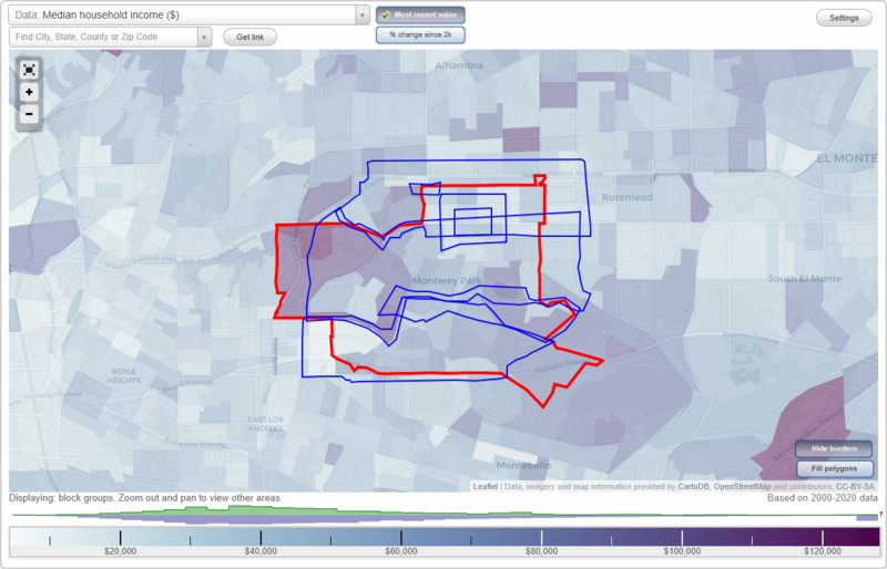
Monterey Park, California Neighborhood Map - Income, House Prices, Occupations, Boundaries
Settings
X

- City boundary
- Neighborhood boundaries
Business Search - 14 Million verified businesses
Neighborhoods:
Aldergate, Atlantic Times Square, Downtown Monterey Park, El Repetto, Luminaria Hills, Monterey Park Towne Center, WilmarAldergate neighborhood in Monterey Park statistics: (Find on map)
Area: 2.655 square miles
Population: 29,825
Population density:
Median household income in 2021:
Median rent in in 2021:
Male vs Females
Median age
Housing prices:
Average estimated value of detached houses in 2021 (63.4% of all units):
Average estimated value of townhouses or other attached units in 2021 (14.2% of all units):
Most popular occupations of males: sales and office occupations (20.3%); service occupations (14.9%); management occupations (except farmers) (9.5%); transportation occupations (8.4%); construction, extraction, and maintenance occupations (8.2%); material moving occupations (7.7%); computer and mathematical occupations (6.1%)
Most popular occupations of females: sales and office occupations (27.7%); service occupations (22.8%); education, training, and library occupations (9.2%); management occupations (except farmers) (6.7%); business and financial operations occupations (5.9%); production occupations (5.5%); healthcare practitioners and technical occupations (4.6%)
Highways in this neighborhood: Pomona Fwy (State Rte 60).
Roads and streets: S Atlantic Blvd; W Floral Dr; Via Campo St; W Riggin St; Bradshawe Ave; Via Campo St (Via Campo); Potrero Grande Dr; Fulton Ave; Wilcox Ave; W Pomona Blvd; E Markland Dr; W Fernfield Dr; S Garfield Ave; W Markland Dr; W Gleason St; W el Repetto Dr; W Hammel St; E Fernfield Dr; E Riggin St; Coral View St; Ave Cesar Chavez; Saturn St; S McPherrin Ave; E Floral Dr; 1st St; Pomona Blvd; W Elmgate St; Dorner Dr; Keller St; E Pomona Blvd; Brightwood St; S Isabella Ave; Grandridge Ave; Hendricks Ave; E Arlight St; Lupine Ave; N Mednik Ave; Vancouver Ave; E 3rd St; W Almora St; Bleakwood Ave; Findlay Ave; Mancha Way; College View Dr; S Mednik Ave; W Arlight St; Woods Ave; W Andrix St; E 1st St; E Cesar E Chavez Ave; E Andrix St; Telford St; Heather Dr; Collegian Ave; Isabella Ave; E Gleason St; Graylock Ave; Fernbank Ave; Doncrest St; Floral Dr; S Gerhart Ave (Gerhart Ave); Loma Verde St; Bloom Dr; Ferdinand Ave; Brockwell Ave; S Westcott Ave; Cliffhill Dr; S Ynez Ave; E Hammel St; Kempton Ave; Zaring St; Whitehurst Dr; Clover Dr; Mira Valle St; S Woods Ave; N Kern Ave; Colonia de Las Palmas; Wheeler Dr; Roscommon Ave (S Roscommon Ave); S Grandridge Ave; Hillview Ave; Avalanche Way; Aldergate St; Atlas Ave; Bluffdale St; Garfield Pl; Gladmar St; Cielito Ave; S Orange Ave; Schoolside Ave (School Side Ave); S Kern Ave; Oakgate St; S Fetterly Ave; Gleason St; Via Norte Ave; S Hillview Ave; S Vancouver Ave; Sadler Ave; Starbird Dr; E Colonia de Los Pinos; Juneway Rd; S Bleakwood Ave; Divine Dr; Adobe Pl; E el Repetto Dr; Foxglove Dr; Iris Way; S Roscommon Ave; Sherbrook Ave; Colonia de Las Magnolias; Emerald Way; College View Ln; Cupania Cir; Fernfield Dr; Pavo Real Ave; Grandridge Pl; N Colonia de Los Cedros (Colonia de Los Cedros); E Elmgate St; Sunrise Dr; N Fetterly Ave; Maplegate St; Punta Way; S Sadler Ave; Red Plum Cir; Ackley St; N Wilcox Ave; Hendron Way; N Garfield Ave; N Findlay Ave; Piedra Way; Mancha Pl; Agate Way; Kempton Pl; Dewar Ave; Crest Vista Dr; Valley Vista Dr; Sherwood Cir; Lupine Pl; Poco Way; Woodland Way; E Colonia de Las Rosas; Simmons Ave; Pluma Way; Starbird Pl; Coral Cir.
Aldergate neighborhood detailed profile
Area: 2.655 square miles
Population: 29,825
Population density:
| Aldergate: | 11,234 people per square mile |
| Monterey Park: | 8,014 people per square mile |
Median household income in 2021:
| Aldergate: | $76,608 |
| Monterey Park: | $68,497 |
Median rent in in 2021:
| Aldergate: | $1,624 |
| Monterey Park: | $1,551 |
Male vs Females
| Males: | 14,074 |
| Females: | 15,750 |
Median age
| Males: | 40.9 years |
| Females: | 43.3 years |
Housing prices:
Average estimated value of detached houses in 2021 (63.4% of all units):
| Aldergate: | $587,402 |
| Monterey Park: | $710,751 |
Average estimated value of townhouses or other attached units in 2021 (14.2% of all units):
| This neighborhood: | $491,993 |
| city: | $508,339 |
Most popular occupations of males: sales and office occupations (20.3%); service occupations (14.9%); management occupations (except farmers) (9.5%); transportation occupations (8.4%); construction, extraction, and maintenance occupations (8.2%); material moving occupations (7.7%); computer and mathematical occupations (6.1%)
Most popular occupations of females: sales and office occupations (27.7%); service occupations (22.8%); education, training, and library occupations (9.2%); management occupations (except farmers) (6.7%); business and financial operations occupations (5.9%); production occupations (5.5%); healthcare practitioners and technical occupations (4.6%)
Highways in this neighborhood: Pomona Fwy (State Rte 60).
Roads and streets: S Atlantic Blvd; W Floral Dr; Via Campo St; W Riggin St; Bradshawe Ave; Via Campo St (Via Campo); Potrero Grande Dr; Fulton Ave; Wilcox Ave; W Pomona Blvd; E Markland Dr; W Fernfield Dr; S Garfield Ave; W Markland Dr; W Gleason St; W el Repetto Dr; W Hammel St; E Fernfield Dr; E Riggin St; Coral View St; Ave Cesar Chavez; Saturn St; S McPherrin Ave; E Floral Dr; 1st St; Pomona Blvd; W Elmgate St; Dorner Dr; Keller St; E Pomona Blvd; Brightwood St; S Isabella Ave; Grandridge Ave; Hendricks Ave; E Arlight St; Lupine Ave; N Mednik Ave; Vancouver Ave; E 3rd St; W Almora St; Bleakwood Ave; Findlay Ave; Mancha Way; College View Dr; S Mednik Ave; W Arlight St; Woods Ave; W Andrix St; E 1st St; E Cesar E Chavez Ave; E Andrix St; Telford St; Heather Dr; Collegian Ave; Isabella Ave; E Gleason St; Graylock Ave; Fernbank Ave; Doncrest St; Floral Dr; S Gerhart Ave (Gerhart Ave); Loma Verde St; Bloom Dr; Ferdinand Ave; Brockwell Ave; S Westcott Ave; Cliffhill Dr; S Ynez Ave; E Hammel St; Kempton Ave; Zaring St; Whitehurst Dr; Clover Dr; Mira Valle St; S Woods Ave; N Kern Ave; Colonia de Las Palmas; Wheeler Dr; Roscommon Ave (S Roscommon Ave); S Grandridge Ave; Hillview Ave; Avalanche Way; Aldergate St; Atlas Ave; Bluffdale St; Garfield Pl; Gladmar St; Cielito Ave; S Orange Ave; Schoolside Ave (School Side Ave); S Kern Ave; Oakgate St; S Fetterly Ave; Gleason St; Via Norte Ave; S Hillview Ave; S Vancouver Ave; Sadler Ave; Starbird Dr; E Colonia de Los Pinos; Juneway Rd; S Bleakwood Ave; Divine Dr; Adobe Pl; E el Repetto Dr; Foxglove Dr; Iris Way; S Roscommon Ave; Sherbrook Ave; Colonia de Las Magnolias; Emerald Way; College View Ln; Cupania Cir; Fernfield Dr; Pavo Real Ave; Grandridge Pl; N Colonia de Los Cedros (Colonia de Los Cedros); E Elmgate St; Sunrise Dr; N Fetterly Ave; Maplegate St; Punta Way; S Sadler Ave; Red Plum Cir; Ackley St; N Wilcox Ave; Hendron Way; N Garfield Ave; N Findlay Ave; Piedra Way; Mancha Pl; Agate Way; Kempton Pl; Dewar Ave; Crest Vista Dr; Valley Vista Dr; Sherwood Cir; Lupine Pl; Poco Way; Woodland Way; E Colonia de Las Rosas; Simmons Ave; Pluma Way; Starbird Pl; Coral Cir.
Aldergate neighborhood detailed profile
Atlantic Times Square neighborhood in Monterey Park statistics: (Find on map)
Area: 0.055 square miles
Population: 868
Population density:
Median household income in 2021:
Median rent in in 2021:
Male vs Females
Median age
Most popular occupations of males: management occupations (except farmers) (21.9%); sales and office occupations (19.8%); service occupations (19.1%); production occupations (9.0%); arts, design, entertainment, sports, and media occupations (7.1%); architecture and engineering occupations (5.5%); computer and mathematical occupations (4.5%)
Most popular occupations of females: service occupations (32.3%); sales and office occupations (23.3%); business and financial operations occupations (9.7%); healthcare practitioners and technical occupations (8.8%); arts, design, entertainment, sports, and media occupations (7.4%); management occupations (except farmers) (5.8%); farming, fishing, and forestry occupations (4.7%)
Roads and streets: W Hellman Ave; S Atlantic Blvd.
Atlantic Times Square neighborhood detailed profile
Area: 0.055 square miles
Population: 868
Population density:
| Atlantic Times Square: | 15,811 people per square mile |
| Monterey Park: | 8,014 people per square mile |
Median household income in 2021:
| Atlantic Times Square: | $80,663 |
| Monterey Park: | $68,497 |
Median rent in in 2021:
| Atlantic Times Square: | $1,681 |
| Monterey Park: | $1,551 |
Male vs Females
| Males: | 468 |
| Females: | 399 |
Median age
| Males: | 40.8 years |
| Females: | 49.4 years |
Most popular occupations of males: management occupations (except farmers) (21.9%); sales and office occupations (19.8%); service occupations (19.1%); production occupations (9.0%); arts, design, entertainment, sports, and media occupations (7.1%); architecture and engineering occupations (5.5%); computer and mathematical occupations (4.5%)
Most popular occupations of females: service occupations (32.3%); sales and office occupations (23.3%); business and financial operations occupations (9.7%); healthcare practitioners and technical occupations (8.8%); arts, design, entertainment, sports, and media occupations (7.4%); management occupations (except farmers) (5.8%); farming, fishing, and forestry occupations (4.7%)
Roads and streets: W Hellman Ave; S Atlantic Blvd.
Atlantic Times Square neighborhood detailed profile
Downtown Monterey Park neighborhood in Monterey Park statistics: (Find on map)
Area: 0.584 square miles
Population: 7,861
Population density:
Median household income in 2021:
Median rent in in 2021:
Male vs Females
Median age
Housing prices:
Average estimated value of detached houses in 2021 (38.6% of all units):
Average estimated value of townhouses or other attached units in 2021 (14.0% of all units):
Average estimated value of housing units in 2-unit structures in 2021 (6.5% of all units):
Average estimated '21 value of housing units in 3-to-4-unit structures (7.4% of all units):
Average estimated '21 value of housing units in 5-or-more-unit structures (34.3% of all units):
Most popular occupations of males: service occupations (25.1%); sales and office occupations (21.0%); management occupations (except farmers) (8.9%); transportation occupations (7.5%); arts, design, entertainment, sports, and media occupations (5.5%); material moving occupations (5.3%); production occupations (4.7%)
Most popular occupations of females: sales and office occupations (31.1%); service occupations (25.1%); healthcare practitioners and technical occupations (8.8%); business and financial operations occupations (8.6%); education, training, and library occupations (7.9%); management occupations (except farmers) (6.7%); arts, design, entertainment, sports, and media occupations (4.2%)
Roads and streets: W Garvey Ave; W Newmark Ave; E Newmark Ave; Garcelon Ave; Hillard Ave; Avondale Ave; W Emerson Ave; E Emerson Ave; E Garvey Ave; N Garfield Ave; N Huntington Ave; N Baltimore Ave; N Ynez Ave; N Mc Pherrin Ave; N Lincoln Ave; N Nicholson Ave; N Moore Ave; N Alhambra Ave; S Russell Ave; S Alhambra Ave; S Lincoln Ave; S Mc Pherrin Ave; Garfield Ave; S Moore Ave; S Ynez Ave; Roselyn Pl; S Ramona Ave; S Nicholson Ave; Edgley Dr; Everett Ave; Roselyn Way.
Downtown Monterey Park neighborhood detailed profile
Area: 0.584 square miles
Population: 7,861
Population density:
| Downtown Monterey Park (Downtown): | 13,451 people per square mile |
| Monterey Park: | 8,014 people per square mile |
Median household income in 2021:
| Downtown Monterey Park (Downtown): | $63,396 |
| Monterey Park: | $68,497 |
Median rent in in 2021:
| Downtown Monterey Park (Downtown): | $1,433 |
| Monterey Park: | $1,551 |
Male vs Females
| Males: | 3,759 |
| Females: | 4,101 |
Median age
| Males: | 42.8 years |
| Females: | 47.1 years |
Housing prices:
Average estimated value of detached houses in 2021 (38.6% of all units):
| Downtown Monterey Park (Downtown): | $613,462 |
| Monterey Park: | $710,751 |
Average estimated value of townhouses or other attached units in 2021 (14.0% of all units):
| This neighborhood: | $467,416 |
| city: | $508,339 |
Average estimated value of housing units in 2-unit structures in 2021 (6.5% of all units):
| This neighborhood: | $627,778 |
| Monterey Park: | $582,941 |
Average estimated '21 value of housing units in 3-to-4-unit structures (7.4% of all units):
| Downtown Monterey Park (Downtown): | $389,492 |
| city: | $615,096 |
Average estimated '21 value of housing units in 5-or-more-unit structures (34.3% of all units):
| Downtown Monterey Park (Downtown): | $508,716 |
| Monterey Park: | $501,388 |
Most popular occupations of males: service occupations (25.1%); sales and office occupations (21.0%); management occupations (except farmers) (8.9%); transportation occupations (7.5%); arts, design, entertainment, sports, and media occupations (5.5%); material moving occupations (5.3%); production occupations (4.7%)
Most popular occupations of females: sales and office occupations (31.1%); service occupations (25.1%); healthcare practitioners and technical occupations (8.8%); business and financial operations occupations (8.6%); education, training, and library occupations (7.9%); management occupations (except farmers) (6.7%); arts, design, entertainment, sports, and media occupations (4.2%)
Roads and streets: W Garvey Ave; W Newmark Ave; E Newmark Ave; Garcelon Ave; Hillard Ave; Avondale Ave; W Emerson Ave; E Emerson Ave; E Garvey Ave; N Garfield Ave; N Huntington Ave; N Baltimore Ave; N Ynez Ave; N Mc Pherrin Ave; N Lincoln Ave; N Nicholson Ave; N Moore Ave; N Alhambra Ave; S Russell Ave; S Alhambra Ave; S Lincoln Ave; S Mc Pherrin Ave; Garfield Ave; S Moore Ave; S Ynez Ave; Roselyn Pl; S Ramona Ave; S Nicholson Ave; Edgley Dr; Everett Ave; Roselyn Way.
Downtown Monterey Park neighborhood detailed profile
El Repetto neighborhood in Monterey Park statistics: (Find on map)
Area: 1.064 square miles
Population: 6,218
Population density:
Median household income in 2021:
Median rent in in 2021:
Male vs Females
Median age
Average estimated value of detached houses in 2021 (85.0% of all units):
Most popular occupations of males: sales and office occupations (21.6%); service occupations (19.2%); management occupations (except farmers) (10.6%); transportation occupations (8.5%); computer and mathematical occupations (7.1%); healthcare practitioners and technical occupations (5.0%); business and financial operations occupations (4.7%)
Most popular occupations of females: sales and office occupations (25.6%); service occupations (23.2%); education, training, and library occupations (14.0%); management occupations (except farmers) (10.4%); healthcare practitioners and technical occupations (7.6%); production occupations (4.8%); business and financial operations occupations (4.0%)
Roads and streets: W el Repetto Dr; Ackley St; Potrero Grande Dr; Fulton Ave; Keller St; S Orange Ave; Wilcox Ave; Kempton Ave; Holly Oak Dr; Bradshawe Ave; Van Buren Dr; Starbird Dr; Arroyo Dr; Berne St; Taylor Dr; Ash Dr; Whitehurst Dr; Alisar Ave; Kenton Dr; Grandridge Ave; San Patricio Dr; Harrison Rd; Lupine Ave; Trumbower Ave; Magnolia Dr; Pepper St; Fillmore Dr; S Ynez Ave; Robinlinda Ln; Tyler Dr; S Atlantic Blvd; Mancha Way; Sevilla St; Sunside Dr; de la Fuente St; Mira Valle St; Laurel Dr; Luy St; Loma Verde St; E el Repetto Dr; S Garfield Ave; Bluestone Ln; Snyder Ln; Cape St; Palm Ave; Grandridge Pl; S McPherrin Ave; Milam Pl; Sunrise Dr; Adams Way; Scudder Way; Polk Way; Friar Rd; Punta Way; Mei Kwock Way; Vercoe Pl; Erica Dr; Vis Estrada; Pavo Real Ave; Coriolanus Dr; Piedra Way; Mancha Pl; Buchanan Pl; Kempton Pl; Laurel Pl; Holly Oak Pl; Ackley Pl; Grant St; Langley Way; Olive Pl; Lupine Pl; Poco Way; Sunrise Pl; Pierce Pl; Dell Dr; Wilson Pl; Orange Pl; Taft Ct; Laurel Cir; Starbird Pl; Isabella Ave.
El Repetto neighborhood detailed profile
Area: 1.064 square miles
Population: 6,218
Population density:
| El Repetto: | 5,846 people per square mile |
| Monterey Park: | 8,014 people per square mile |
Median household income in 2021:
| El Repetto: | $90,028 |
| Monterey Park: | $68,497 |
Median rent in in 2021:
| El Repetto: | $2,220 |
| Monterey Park: | $1,551 |
Male vs Females
| Males: | 2,938 |
| Females: | 3,280 |
Median age
| Males: | 46.0 years |
| Females: | 46.0 years |
Average estimated value of detached houses in 2021 (85.0% of all units):
| El Repetto: | $648,699 |
| Monterey Park: | $710,751 |
Most popular occupations of males: sales and office occupations (21.6%); service occupations (19.2%); management occupations (except farmers) (10.6%); transportation occupations (8.5%); computer and mathematical occupations (7.1%); healthcare practitioners and technical occupations (5.0%); business and financial operations occupations (4.7%)
Most popular occupations of females: sales and office occupations (25.6%); service occupations (23.2%); education, training, and library occupations (14.0%); management occupations (except farmers) (10.4%); healthcare practitioners and technical occupations (7.6%); production occupations (4.8%); business and financial operations occupations (4.0%)
Roads and streets: W el Repetto Dr; Ackley St; Potrero Grande Dr; Fulton Ave; Keller St; S Orange Ave; Wilcox Ave; Kempton Ave; Holly Oak Dr; Bradshawe Ave; Van Buren Dr; Starbird Dr; Arroyo Dr; Berne St; Taylor Dr; Ash Dr; Whitehurst Dr; Alisar Ave; Kenton Dr; Grandridge Ave; San Patricio Dr; Harrison Rd; Lupine Ave; Trumbower Ave; Magnolia Dr; Pepper St; Fillmore Dr; S Ynez Ave; Robinlinda Ln; Tyler Dr; S Atlantic Blvd; Mancha Way; Sevilla St; Sunside Dr; de la Fuente St; Mira Valle St; Laurel Dr; Luy St; Loma Verde St; E el Repetto Dr; S Garfield Ave; Bluestone Ln; Snyder Ln; Cape St; Palm Ave; Grandridge Pl; S McPherrin Ave; Milam Pl; Sunrise Dr; Adams Way; Scudder Way; Polk Way; Friar Rd; Punta Way; Mei Kwock Way; Vercoe Pl; Erica Dr; Vis Estrada; Pavo Real Ave; Coriolanus Dr; Piedra Way; Mancha Pl; Buchanan Pl; Kempton Pl; Laurel Pl; Holly Oak Pl; Ackley Pl; Grant St; Langley Way; Olive Pl; Lupine Pl; Poco Way; Sunrise Pl; Pierce Pl; Dell Dr; Wilson Pl; Orange Pl; Taft Ct; Laurel Cir; Starbird Pl; Isabella Ave.
El Repetto neighborhood detailed profile
Luminaria Hills neighborhood in Monterey Park statistics: (Find on map)
Area: 4.399 square miles
Population: 38,105
Population density:
Median household income in 2021:
Median rent in in 2021:
Male vs Females
Median age
Housing prices:
Average estimated value of detached houses in 2021 (60.5% of all units):
Average estimated value of townhouses or other attached units in 2021 (14.0% of all units):
Average estimated value of housing units in 2-unit structures in 2021 (5.1% of all units):
Average estimated '21 value of housing units in 3-to-4-unit structures (10.1% of all units):
Average estimated '21 value of housing units in 5-or-more-unit structures (9.3% of all units):
Most popular occupations of males: sales and office occupations (20.6%); service occupations (17.7%); management occupations (except farmers) (9.2%); transportation occupations (7.9%); business and financial operations occupations (5.7%); production occupations (5.3%); computer and mathematical occupations (5.0%)
Most popular occupations of females: sales and office occupations (28.8%); service occupations (27.5%); management occupations (except farmers) (7.8%); healthcare practitioners and technical occupations (7.1%); education, training, and library occupations (7.0%); business and financial operations occupations (6.9%); production occupations (4.7%)
Roads and streets: W Garvey Ave; Monterey Pass Rd; Ridgecrest St; S Atlantic Blvd; E Graves Ave; Mooney Dr; Brightwood St; W Newmark Ave; Abajo Dr; S Ynez Ave; College View Dr; Crest Vista Dr; E Newmark Ave; E Garvey Ave; W Floral Dr; del Mar Ave; S Orange Ave; de la Fuente St; S Lincoln Ave; Casuda Canyon Dr; Arriba Dr; Verde Vis; Harding Ave; S Alhambra Ave; Barnum Way; S Russell Ave; Ridgeside Dr; Bradshawe Ave; Ladera St; Jackson Ave; Fern Ave; Garvey Ave; Tegner Dr; Garfield Ave; S New Ave (New Ave); W Mabel Ave; S Sefton Ave; Cadiz St; el Mercado Ave; Kingsford St; Longhill Dr (W Longhill Dr); Hillside St; Grandridge Ave; Garvalia Ave; W Graves Ave; Barranca Dr; S Chandler Ave; Teresa Ave; S Ramona Ave; Sunrise Dr; S Mc Pherrin Ave; Wandering Dr; S Garfield Ave; Cecil St; Bluffhill Dr; S Moore Ave; Sombrero Dr; Vagabond Dr; Redding Ave; Edgley Dr; Toll Dr; Marsh Ave; Newmark Ave; S Pomelo Ave; Kempton Ave; Floral Dr; Berne St; Montezuma Ave; Country Rd; Everett Ave; Metro Dr; Fulton Ave; Branham St; Highland Dr; Egley Ave; Cerco Alta Dr; Roca Way; Highcliff St; Hermosa Vista St; Wilcox Ave; Pebbledon St; W el Repetto Dr; Avion Dr; Divina Vista St; Melrose Ave; Copa Way; Cathryn Dr; Sunnyslope Dr; Abe Way; S Electric Ave; Williams St; Rolling Hill Dr; S Fremont Ave; Potrero Grande Dr; Dell Dr; el Portal Pl; Alamo Dr; Valley Vista Dr; Solar Dr; Evelyn Ave; Brier Cliff Way; Jade Tree Dr; Prospect Ave; Grandeza St; Young Ave; E Mabel Ave; Knoll Dr; Kays Ave; Villa Montes Ave; Sunnyhill Dr; Aztec Way; Kingford St; Bailey Ave; Cumbre St; Lunar Dr; Rock View St; Montechico Dr; Stevens Ave; Moonbeam Dr; Roselyn Pl; McComb Way; Village Dr; S Nicholson Ave; Alzado St; Isabella Ave; Browning Pl; Fotini Pl; Light View St; Marguerita Ave; Glenview Ter; W Crest Way; Star Ridge Dr; Sevilla St; Sunside Dr; Pelon Way; Crest Haven Way; Maronde Way; Triana St; Peach St; Langley Way; Stonewell St; Stone Gate St; Pebble Vale St; Rodman Cir; Hillvale Dr; Pebble Hurst St; Rockhaven St; Steddom Dr; Bataan Pl; Lamont Dr; Lindy Ave; S Rural Dr; Wilmar Pl; S Dequine Ave; W East Crest Way; S Sierra Vista St; Westminister Ave; Park Ave; Pebble Ct; Miralinda Dr; Triana Pl; Wasola St; Via Venti; Vandorf St; Casitas St; Newlee St; Lerida Pl; Huntington Ave; Durango Dr; Dover Way; Snyder Ln; Tedford Way; College View Ln; N Sierra Vista St; Cape St; W Longhill Dr; Isabella Ter; Stone Ct; Windover Way; Grand Vista Way; Loma Verde St; Pueblo Dr; Ransom Way; Graves Ave; Milam Pl; N Lincoln Ave; Craighurst Ter; Orange Grove Ave; Town Ave; Shady Crest Ln; Scudder Way; Hill Dr; Sierra Alta Way; E la Mont Dr; Ridgecrest Way; Mei Kwock Way; Hamlet Dr; Vercoe Pl; Diane Way; Campanita Ct; N Ridge Pl; Roselyn Way; N Alhambra Ave; N Nicholson Ave; Plateau Ave; Feliz St; Susan Way; Rockview Ct; Mesa Way; Nachi Way; Arboles St; Longhill Way; Eucalyptus Dr; Alpine Ter; Elevado Ter; Whitney Pl; Amory Ave; Cathryn Pl; Isabel Ave; Daroca Ave; Cipriano Pl; Chalet Ter; S Alta Mesa Pl; Aliso St; Sunny Slope Pl; Sunrise Pl; Colina Ter; Village Pl; S Bradshawe Pl; Caliente St; Grand Vista Pl; Country Pl; Campo St; Karl Burnum Way; Berkebile Ct; Bonita Ter; Eucalyptus Way; Davidson Dr.
Luminaria Hills neighborhood detailed profile
Area: 4.399 square miles
Population: 38,105
Population density:
| Luminaria Hills: | 8,662 people per square mile |
| Monterey Park: | 8,014 people per square mile |
Median household income in 2021:
| Luminaria Hills: | $73,441 |
| Monterey Park: | $68,497 |
Median rent in in 2021:
| Luminaria Hills: | $1,626 |
| Monterey Park: | $1,551 |
Male vs Females
| Males: | 18,290 |
| Females: | 19,815 |
Median age
| Males: | 42.8 years |
| Females: | 45.8 years |
Housing prices:
Average estimated value of detached houses in 2021 (60.5% of all units):
| Luminaria Hills: | $705,879 |
| Monterey Park: | $710,751 |
Average estimated value of townhouses or other attached units in 2021 (14.0% of all units):
| This neighborhood: | $475,380 |
| city: | $508,339 |
Average estimated value of housing units in 2-unit structures in 2021 (5.1% of all units):
| This neighborhood: | $627,778 |
| Monterey Park: | $582,941 |
Average estimated '21 value of housing units in 3-to-4-unit structures (10.1% of all units):
| Luminaria Hills: | $415,789 |
| city: | $615,096 |
Average estimated '21 value of housing units in 5-or-more-unit structures (9.3% of all units):
| Luminaria Hills: | $508,716 |
| Monterey Park: | $501,388 |
Most popular occupations of males: sales and office occupations (20.6%); service occupations (17.7%); management occupations (except farmers) (9.2%); transportation occupations (7.9%); business and financial operations occupations (5.7%); production occupations (5.3%); computer and mathematical occupations (5.0%)
Most popular occupations of females: sales and office occupations (28.8%); service occupations (27.5%); management occupations (except farmers) (7.8%); healthcare practitioners and technical occupations (7.1%); education, training, and library occupations (7.0%); business and financial operations occupations (6.9%); production occupations (4.7%)
Roads and streets: W Garvey Ave; Monterey Pass Rd; Ridgecrest St; S Atlantic Blvd; E Graves Ave; Mooney Dr; Brightwood St; W Newmark Ave; Abajo Dr; S Ynez Ave; College View Dr; Crest Vista Dr; E Newmark Ave; E Garvey Ave; W Floral Dr; del Mar Ave; S Orange Ave; de la Fuente St; S Lincoln Ave; Casuda Canyon Dr; Arriba Dr; Verde Vis; Harding Ave; S Alhambra Ave; Barnum Way; S Russell Ave; Ridgeside Dr; Bradshawe Ave; Ladera St; Jackson Ave; Fern Ave; Garvey Ave; Tegner Dr; Garfield Ave; S New Ave (New Ave); W Mabel Ave; S Sefton Ave; Cadiz St; el Mercado Ave; Kingsford St; Longhill Dr (W Longhill Dr); Hillside St; Grandridge Ave; Garvalia Ave; W Graves Ave; Barranca Dr; S Chandler Ave; Teresa Ave; S Ramona Ave; Sunrise Dr; S Mc Pherrin Ave; Wandering Dr; S Garfield Ave; Cecil St; Bluffhill Dr; S Moore Ave; Sombrero Dr; Vagabond Dr; Redding Ave; Edgley Dr; Toll Dr; Marsh Ave; Newmark Ave; S Pomelo Ave; Kempton Ave; Floral Dr; Berne St; Montezuma Ave; Country Rd; Everett Ave; Metro Dr; Fulton Ave; Branham St; Highland Dr; Egley Ave; Cerco Alta Dr; Roca Way; Highcliff St; Hermosa Vista St; Wilcox Ave; Pebbledon St; W el Repetto Dr; Avion Dr; Divina Vista St; Melrose Ave; Copa Way; Cathryn Dr; Sunnyslope Dr; Abe Way; S Electric Ave; Williams St; Rolling Hill Dr; S Fremont Ave; Potrero Grande Dr; Dell Dr; el Portal Pl; Alamo Dr; Valley Vista Dr; Solar Dr; Evelyn Ave; Brier Cliff Way; Jade Tree Dr; Prospect Ave; Grandeza St; Young Ave; E Mabel Ave; Knoll Dr; Kays Ave; Villa Montes Ave; Sunnyhill Dr; Aztec Way; Kingford St; Bailey Ave; Cumbre St; Lunar Dr; Rock View St; Montechico Dr; Stevens Ave; Moonbeam Dr; Roselyn Pl; McComb Way; Village Dr; S Nicholson Ave; Alzado St; Isabella Ave; Browning Pl; Fotini Pl; Light View St; Marguerita Ave; Glenview Ter; W Crest Way; Star Ridge Dr; Sevilla St; Sunside Dr; Pelon Way; Crest Haven Way; Maronde Way; Triana St; Peach St; Langley Way; Stonewell St; Stone Gate St; Pebble Vale St; Rodman Cir; Hillvale Dr; Pebble Hurst St; Rockhaven St; Steddom Dr; Bataan Pl; Lamont Dr; Lindy Ave; S Rural Dr; Wilmar Pl; S Dequine Ave; W East Crest Way; S Sierra Vista St; Westminister Ave; Park Ave; Pebble Ct; Miralinda Dr; Triana Pl; Wasola St; Via Venti; Vandorf St; Casitas St; Newlee St; Lerida Pl; Huntington Ave; Durango Dr; Dover Way; Snyder Ln; Tedford Way; College View Ln; N Sierra Vista St; Cape St; W Longhill Dr; Isabella Ter; Stone Ct; Windover Way; Grand Vista Way; Loma Verde St; Pueblo Dr; Ransom Way; Graves Ave; Milam Pl; N Lincoln Ave; Craighurst Ter; Orange Grove Ave; Town Ave; Shady Crest Ln; Scudder Way; Hill Dr; Sierra Alta Way; E la Mont Dr; Ridgecrest Way; Mei Kwock Way; Hamlet Dr; Vercoe Pl; Diane Way; Campanita Ct; N Ridge Pl; Roselyn Way; N Alhambra Ave; N Nicholson Ave; Plateau Ave; Feliz St; Susan Way; Rockview Ct; Mesa Way; Nachi Way; Arboles St; Longhill Way; Eucalyptus Dr; Alpine Ter; Elevado Ter; Whitney Pl; Amory Ave; Cathryn Pl; Isabel Ave; Daroca Ave; Cipriano Pl; Chalet Ter; S Alta Mesa Pl; Aliso St; Sunny Slope Pl; Sunrise Pl; Colina Ter; Village Pl; S Bradshawe Pl; Caliente St; Grand Vista Pl; Country Pl; Campo St; Karl Burnum Way; Berkebile Ct; Bonita Ter; Eucalyptus Way; Davidson Dr.
Luminaria Hills neighborhood detailed profile
Monterey Park Towne Center neighborhood in Monterey Park statistics: (Find on map)
Area: 0.174 square miles
Population: 2,401
Population density:
Median household income in 2021:
Median rent in in 2021:
Male vs Females
Median age
Housing prices:
Average estimated value of detached houses in 2021 (41.8% of all units):
Average estimated value of townhouses or other attached units in 2021 (14.5% of all units):
Average estimated value of housing units in 2-unit structures in 2021 (6.9% of all units):
Average estimated '21 value of housing units in 3-to-4-unit structures (5.9% of all units):
Average estimated '21 value of housing units in 5-or-more-unit structures (30.4% of all units):
Most popular occupations of males: service occupations (25.3%); sales and office occupations (23.7%); transportation occupations (10.2%); management occupations (except farmers) (7.9%); arts, design, entertainment, sports, and media occupations (7.3%); material moving occupations (6.9%); healthcare practitioners and technical occupations (3.0%)
Most popular occupations of females: sales and office occupations (41.5%); service occupations (20.0%); business and financial operations occupations (10.4%); healthcare practitioners and technical occupations (8.9%); education, training, and library occupations (6.8%); arts, design, entertainment, sports, and media occupations (5.2%); production occupations (3.8%)
Roads and streets: W Garvey Ave; Garcelon Ave; Avondale Ave; E Garvey Ave; N Lincoln Ave; Roselyn Pl; N Huntington Ave; N Mc Pherrin Ave; N Baltimore Ave; N Garfield Ave; S Ramona Ave; S Lincoln Ave; S Mc Pherrin Ave; Garfield Ave; Roselyn Way; S Russell Ave.
Monterey Park Towne Center neighborhood detailed profile
Area: 0.174 square miles
Population: 2,401
Population density:
| Monterey Park Towne Center (Towne Center): | 13,783 people per square mile |
| Monterey Park: | 8,014 people per square mile |
Median household income in 2021:
| Monterey Park Towne Center (Towne Center): | $62,738 |
| Monterey Park: | $68,497 |
Median rent in in 2021:
| Monterey Park Towne Center (Towne Center): | $1,427 |
| Monterey Park: | $1,551 |
Male vs Females
| Males: | 1,131 |
| Females: | 1,269 |
Median age
| Males: | 42.5 years |
| Females: | 44.9 years |
Housing prices:
Average estimated value of detached houses in 2021 (41.8% of all units):
| Monterey Park Towne Center (Towne Center): | $613,462 |
| Monterey Park: | $710,751 |
Average estimated value of townhouses or other attached units in 2021 (14.5% of all units):
| This neighborhood: | $467,416 |
| city: | $508,339 |
Average estimated value of housing units in 2-unit structures in 2021 (6.9% of all units):
| This neighborhood: | $627,778 |
| Monterey Park: | $582,941 |
Average estimated '21 value of housing units in 3-to-4-unit structures (5.9% of all units):
| Monterey Park Towne Center (Towne Center): | $95,096 |
| city: | $615,096 |
Average estimated '21 value of housing units in 5-or-more-unit structures (30.4% of all units):
| Monterey Park Towne Center (Towne Center): | $508,716 |
| Monterey Park: | $501,388 |
Most popular occupations of males: service occupations (25.3%); sales and office occupations (23.7%); transportation occupations (10.2%); management occupations (except farmers) (7.9%); arts, design, entertainment, sports, and media occupations (7.3%); material moving occupations (6.9%); healthcare practitioners and technical occupations (3.0%)
Most popular occupations of females: sales and office occupations (41.5%); service occupations (20.0%); business and financial operations occupations (10.4%); healthcare practitioners and technical occupations (8.9%); education, training, and library occupations (6.8%); arts, design, entertainment, sports, and media occupations (5.2%); production occupations (3.8%)
Roads and streets: W Garvey Ave; Garcelon Ave; Avondale Ave; E Garvey Ave; N Lincoln Ave; Roselyn Pl; N Huntington Ave; N Mc Pherrin Ave; N Baltimore Ave; N Garfield Ave; S Ramona Ave; S Lincoln Ave; S Mc Pherrin Ave; Garfield Ave; Roselyn Way; S Russell Ave.
Monterey Park Towne Center neighborhood detailed profile
Wilmar neighborhood in Monterey Park statistics: (Find on map)
Area: 3.115 square miles
Population: 40,309
Population density:
Median household income in 2021:
Median rent in in 2021:
Male vs Females
Median age
Housing prices:
Average estimated value of detached houses in 2021 (53.5% of all units):
Average estimated value of townhouses or other attached units in 2021 (15.5% of all units):
Average estimated value of housing units in 2-unit structures in 2021 (3.6% of all units):
Average estimated '21 value of housing units in 3-to-4-unit structures (6.8% of all units):
Average estimated '21 value of housing units in 5-or-more-unit structures (17.5% of all units):
Most popular occupations of males: service occupations (23.8%); sales and office occupations (17.0%); management occupations (except farmers) (8.8%); transportation occupations (7.9%); production occupations (6.7%); computer and mathematical occupations (5.5%); construction, extraction, and maintenance occupations (4.8%)
Most popular occupations of females: service occupations (32.2%); sales and office occupations (27.2%); healthcare practitioners and technical occupations (7.8%); management occupations (except farmers) (6.7%); business and financial operations occupations (6.4%); education, training, and library occupations (4.9%); production occupations (4.6%)
Limited-access highways (interstate or state) in this neighborhood: San Bernardino Fwy (I- 10).
Roads and streets: W Ramona Rd; W Garvey Ave; W Glendon Way; W Hellman Ave; E Emerson Ave; E Hellman Ave; E Garvey Ave; E Glendon Way; New Ave (S New Ave); del Mar Ave; Jackson Ave; Midwickhill Dr; S Fremont Ave; Garvey Ave; W Emerson Ave; E Ramona Rd; Whitney Dr; Sarazen Dr; Evelyn Ave; Emerson Pl; Hellman Ave; Siwanoy Dr; W Saxon Ave; Montezuma Ave; Columbia St; E Ross Ave; Prospect Ave; Carlos St; Stranahan Dr; N Atlantic Blvd; N Chandler Ave; N Huntington Ave; N Ynez Ave; N Moore Ave; N Baltimore Ave; N Orange Ave; N Mc Pherrin Ave; N Rural Dr; N Sierra Vista St; N Lincoln Ave; N Garfield Ave; Hitchcock Dr; N Alhambra Ave; N Nicholson Ave; S Campbell Ave; Hathaway Ave; S 6th St; S Palm Ave; Whitmore St; Monterey Pass Rd; Isabel Ave; Garcelon Ave; Hillard Ave; W Hampton Ave; Avondale Ave; S Atlantic Blvd; Brighton St; W Ramona Blvd; S Curtis Ave; Gladys Ave; Elizabeth Ave; Florence Ave; Edgley Dr; Newmark Ave; S Electric Ave; Hershey Ave; Loma Vista Dr; Date Ave; Pedley Dr; Snead Dr; Almansor St Ovp; el Paseo (el Paseo St); S Marengo Ave; Egley Ave; S Garfield Ave; Hagen Dr; Roark Dr; S Marguerita Ave; S Sierra Vista Ave; S Chapel Ave; S Monterey St; S 3rd St; Stevens Ave; S 4th St; S 5th St; S 7th St; S 8th St; S Almansor St; S Stoneman Ave; S 2nd St; S Olive Ave; S 9th St; Florentina Dr; W Ross Ave; E Mabel Ave; Essexfells Dr; Knoll Dr; S Raymond Ave; Las Flores St; San Clemente Ave; Aurora Ter; Roselyn Pl; la Crescenta Ave; Crestline Ter; Wetherhead Dr; Carwile Dr; Edgewood Dr; Baltusrol Dr; Carlos Ave; S Chandler Ave; Pine Valley Dr; S Ramona Ave; S Lincoln Ave; S Mc Pherrin Ave; Lindy Ave; S Ethel Ave; S Alhambra Ave; S Orange Ave; S Rural Dr; S Dequine Ave; Wilson Way; Geranio Dr; S Hidalgo Ave; Azalea Dr; S Sierra Vista St; S Cordova St; S Sefton Ave; S Vega St; S Granada Ave; W Mabel Ave; S el Molino St; S Valencia St; Everett Ave; S Nicholson Ave; Dorothy St; Hershey St; S Primrose Ave; S Bushnell Ave; Ethel Ave; Guest Dr; Garfield Ave; Loftus Dr; W Ramona Rd S; Crone St; Melhorn Dr; S Moore Ave; Roselyn Way; Riegel Dr; E Saxon Ave; Rensselaer Dr; Artson St; Emerson Ave; W Newmark Ave.
Other features: Alhambra Wash.
Wilmar neighborhood detailed profile
Area: 3.115 square miles
Population: 40,309
Population density:
| Wilmar: | 12,942 people per square mile |
| Monterey Park: | 8,014 people per square mile |
Median household income in 2021:
| Wilmar: | $67,477 |
| Monterey Park: | $68,497 |
Median rent in in 2021:
| Wilmar: | $1,488 |
| Monterey Park: | $1,551 |
Male vs Females
| Males: | 19,775 |
| Females: | 20,533 |
Median age
| Males: | 40.8 years |
| Females: | 44.6 years |
Housing prices:
Average estimated value of detached houses in 2021 (53.5% of all units):
| Wilmar: | $706,837 |
| Monterey Park: | $710,751 |
Average estimated value of townhouses or other attached units in 2021 (15.5% of all units):
| This neighborhood: | $550,636 |
| city: | $508,339 |
Average estimated value of housing units in 2-unit structures in 2021 (3.6% of all units):
| This neighborhood: | $627,778 |
| Monterey Park: | $582,941 |
Average estimated '21 value of housing units in 3-to-4-unit structures (6.8% of all units):
| Wilmar: | $415,789 |
| city: | $615,096 |
Average estimated '21 value of housing units in 5-or-more-unit structures (17.5% of all units):
| Wilmar: | $508,716 |
| Monterey Park: | $501,388 |
Most popular occupations of males: service occupations (23.8%); sales and office occupations (17.0%); management occupations (except farmers) (8.8%); transportation occupations (7.9%); production occupations (6.7%); computer and mathematical occupations (5.5%); construction, extraction, and maintenance occupations (4.8%)
Most popular occupations of females: service occupations (32.2%); sales and office occupations (27.2%); healthcare practitioners and technical occupations (7.8%); management occupations (except farmers) (6.7%); business and financial operations occupations (6.4%); education, training, and library occupations (4.9%); production occupations (4.6%)
Limited-access highways (interstate or state) in this neighborhood: San Bernardino Fwy (I- 10).
Roads and streets: W Ramona Rd; W Garvey Ave; W Glendon Way; W Hellman Ave; E Emerson Ave; E Hellman Ave; E Garvey Ave; E Glendon Way; New Ave (S New Ave); del Mar Ave; Jackson Ave; Midwickhill Dr; S Fremont Ave; Garvey Ave; W Emerson Ave; E Ramona Rd; Whitney Dr; Sarazen Dr; Evelyn Ave; Emerson Pl; Hellman Ave; Siwanoy Dr; W Saxon Ave; Montezuma Ave; Columbia St; E Ross Ave; Prospect Ave; Carlos St; Stranahan Dr; N Atlantic Blvd; N Chandler Ave; N Huntington Ave; N Ynez Ave; N Moore Ave; N Baltimore Ave; N Orange Ave; N Mc Pherrin Ave; N Rural Dr; N Sierra Vista St; N Lincoln Ave; N Garfield Ave; Hitchcock Dr; N Alhambra Ave; N Nicholson Ave; S Campbell Ave; Hathaway Ave; S 6th St; S Palm Ave; Whitmore St; Monterey Pass Rd; Isabel Ave; Garcelon Ave; Hillard Ave; W Hampton Ave; Avondale Ave; S Atlantic Blvd; Brighton St; W Ramona Blvd; S Curtis Ave; Gladys Ave; Elizabeth Ave; Florence Ave; Edgley Dr; Newmark Ave; S Electric Ave; Hershey Ave; Loma Vista Dr; Date Ave; Pedley Dr; Snead Dr; Almansor St Ovp; el Paseo (el Paseo St); S Marengo Ave; Egley Ave; S Garfield Ave; Hagen Dr; Roark Dr; S Marguerita Ave; S Sierra Vista Ave; S Chapel Ave; S Monterey St; S 3rd St; Stevens Ave; S 4th St; S 5th St; S 7th St; S 8th St; S Almansor St; S Stoneman Ave; S 2nd St; S Olive Ave; S 9th St; Florentina Dr; W Ross Ave; E Mabel Ave; Essexfells Dr; Knoll Dr; S Raymond Ave; Las Flores St; San Clemente Ave; Aurora Ter; Roselyn Pl; la Crescenta Ave; Crestline Ter; Wetherhead Dr; Carwile Dr; Edgewood Dr; Baltusrol Dr; Carlos Ave; S Chandler Ave; Pine Valley Dr; S Ramona Ave; S Lincoln Ave; S Mc Pherrin Ave; Lindy Ave; S Ethel Ave; S Alhambra Ave; S Orange Ave; S Rural Dr; S Dequine Ave; Wilson Way; Geranio Dr; S Hidalgo Ave; Azalea Dr; S Sierra Vista St; S Cordova St; S Sefton Ave; S Vega St; S Granada Ave; W Mabel Ave; S el Molino St; S Valencia St; Everett Ave; S Nicholson Ave; Dorothy St; Hershey St; S Primrose Ave; S Bushnell Ave; Ethel Ave; Guest Dr; Garfield Ave; Loftus Dr; W Ramona Rd S; Crone St; Melhorn Dr; S Moore Ave; Roselyn Way; Riegel Dr; E Saxon Ave; Rensselaer Dr; Artson St; Emerson Ave; W Newmark Ave.
Other features: Alhambra Wash.
Wilmar neighborhood detailed profile