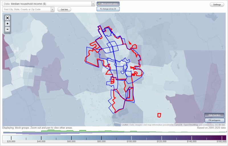
Napa, California Neighborhood Map - Income, House Prices, Occupations, Boundaries
Settings
X

- City boundary
- Neighborhood boundaries
Business Search - 14 Million verified businesses
Neighborhoods:
Abajo, Browns Valley, Downtown, East Napa, Imola, Los Robles, North Napa, Rocktram, Salvador, Shipyard Acres, South Napa, Stanley, Union, Westside, WestwoodAbajo neighborhood in Napa statistics: (Find on map)
Area: 0.142 square miles
Population: 1,187
Population density:
Median household income in 2021:
Median rent in in 2021:
Male vs Females
Median age
Average estimated value of detached houses in 2021 (51.4% of all units):
Most popular occupations of males: service occupations (33.0%); production occupations (13.0%); construction, extraction, and maintenance occupations (10.0%); sales and office occupations (7.7%); management occupations (except farmers) (7.4%); farming, fishing, and forestry occupations (4.5%); business and financial operations occupations (3.3%)
Most popular occupations of females: sales and office occupations (25.6%); service occupations (23.8%); business and financial operations occupations (11.4%); healthcare practitioners and technical occupations (8.4%); management occupations (except farmers) (8.1%); production occupations (7.3%); education, training, and library occupations (6.2%)
Roads and streets: Riverside Dr; Brown St; Laurel St; Oak St; Pine St; Elm St; Randolph St; Coombs St; Franklin St; Cross St.
Abajo neighborhood detailed profile
Area: 0.142 square miles
Population: 1,187
Population density:
| Abajo (Napa Abajo): | 8,333 people per square mile |
| Napa: | 4,454 people per square mile |
Median household income in 2021:
| Abajo (Napa Abajo): | $68,088 |
| Napa: | $92,878 |
Median rent in in 2021:
| Abajo (Napa Abajo): | $1,581 |
| Napa: | $1,718 |
Male vs Females
| Males: | 599 |
| Females: | 587 |
Median age
| Males: | 36.9 years |
| Females: | 34.9 years |
Average estimated value of detached houses in 2021 (51.4% of all units):
| Abajo (Napa Abajo): | $543,570 |
| California: | $881,672 |
Most popular occupations of males: service occupations (33.0%); production occupations (13.0%); construction, extraction, and maintenance occupations (10.0%); sales and office occupations (7.7%); management occupations (except farmers) (7.4%); farming, fishing, and forestry occupations (4.5%); business and financial operations occupations (3.3%)
Most popular occupations of females: sales and office occupations (25.6%); service occupations (23.8%); business and financial operations occupations (11.4%); healthcare practitioners and technical occupations (8.4%); management occupations (except farmers) (8.1%); production occupations (7.3%); education, training, and library occupations (6.2%)
Roads and streets: Riverside Dr; Brown St; Laurel St; Oak St; Pine St; Elm St; Randolph St; Coombs St; Franklin St; Cross St.
Abajo neighborhood detailed profile
Browns Valley neighborhood in Napa statistics: (Find on map)
Area: 1.211 square miles
Population: 3,115
Population density:
Median household income in 2021:
Median rent in in 2021:
Male vs Females
Median age
Average estimated value of detached houses in 2021 (98.1% of all units):
Most popular occupations of males: sales and office occupations (29.4%); management occupations (except farmers) (16.0%); architecture and engineering occupations (15.0%); service occupations (10.6%); healthcare practitioners and technical occupations (4.8%); arts, design, entertainment, sports, and media occupations (4.5%); transportation occupations (3.6%)
Most popular occupations of females: healthcare practitioners and technical occupations (22.2%); sales and office occupations (19.6%); service occupations (18.9%); business and financial operations occupations (11.9%); management occupations (except farmers) (8.4%); community and social services occupations (5.9%); production occupations (3.2%)
Highways in this neighborhood: State Hwy 29 (Saint Helena Hwy).
Roads and streets: W Park Ave; Browns Valley Rd; W Pueblo Ave; Lone Oak Ave; 1st St; Solano Ave; W Lincoln Ave; Waverly St; Euclid Ave; Pinewood Dr; Redwood Rd; W F St; Brittany Cir; Linda Vista Ave; Scenic Dr; Morlan Dr; Kingston Ave; Austin Way; Larkin Way; Hazelwood Dr; Kensington Cir; Ridgetop Way; Rollingwood Dr; Coffield Ave; Carmel Dr; Westview Dr; Hidden Valley Ln; Johnston St; Brookwood Dr; Rancho Dr; Emerson St; Massa Dr; Easum Dr; Robinson Ln; Skycrest Way; Chad Ct; Creekside Ave; Banbury Ct; Arden Way; Charlson Way; Morgan Ln; Bradford St; W Pueblo Pl; Roberto St; Bueno St; Lone Oak Ct; Woodlawn Dr; Donwood Ln; Woodcrest Dr; Elodia Cir; Jami Lee Ln; Todd St; Homestead Ct; Shadow Hill Ln; England Ln; Huntington Ct; Eugene Ct; Greystone Ct; Matt Dr; Thornhill Dr; Park Ave; Crystal Ct; Prince Ct; Blane Way; Alderwood Ct; Queens Ct; Applewood Ct; Hall Ct; Lowell St (Lowell Ave); Whitman St; Abbey Ct; Toldi Ln; Stratford Ct; Reuben Ct; Carlos St; Sterling Ct; Teakwood Ct; Lee Ann Ct (Leeann Ct); Cambridge Ct; Greenwood Ct; Michael Way; Eagle Ln; Hudson Ln; Buckeye Ct; Braeton Ct; Lemon Ct; Bromley St (Bromley Ct); Oakwood Ct; Grove Ave; Lynn Dr; Kensington Ct; Nyla Dr; Basswood Ct.
Other features: Redwood Crk; Napa Crk; Browns Valley Crk; Browns Crk.
Browns Valley neighborhood detailed profile
Area: 1.211 square miles
Population: 3,115
Population density:
| Browns Valley: | 2,573 people per square mile |
| Napa: | 4,454 people per square mile |
Median household income in 2021:
| Browns Valley: | $107,176 |
| Napa: | $92,878 |
Median rent in in 2021:
| Browns Valley: | $1,541 |
| Napa: | $1,718 |
Male vs Females
| Males: | 1,597 |
| Females: | 1,518 |
Median age
| Males: | 40.6 years |
| Females: | 34.3 years |
Average estimated value of detached houses in 2021 (98.1% of all units):
| Browns Valley: | $627,100 |
| California: | $881,672 |
Most popular occupations of males: sales and office occupations (29.4%); management occupations (except farmers) (16.0%); architecture and engineering occupations (15.0%); service occupations (10.6%); healthcare practitioners and technical occupations (4.8%); arts, design, entertainment, sports, and media occupations (4.5%); transportation occupations (3.6%)
Most popular occupations of females: healthcare practitioners and technical occupations (22.2%); sales and office occupations (19.6%); service occupations (18.9%); business and financial operations occupations (11.9%); management occupations (except farmers) (8.4%); community and social services occupations (5.9%); production occupations (3.2%)
Highways in this neighborhood: State Hwy 29 (Saint Helena Hwy).
Roads and streets: W Park Ave; Browns Valley Rd; W Pueblo Ave; Lone Oak Ave; 1st St; Solano Ave; W Lincoln Ave; Waverly St; Euclid Ave; Pinewood Dr; Redwood Rd; W F St; Brittany Cir; Linda Vista Ave; Scenic Dr; Morlan Dr; Kingston Ave; Austin Way; Larkin Way; Hazelwood Dr; Kensington Cir; Ridgetop Way; Rollingwood Dr; Coffield Ave; Carmel Dr; Westview Dr; Hidden Valley Ln; Johnston St; Brookwood Dr; Rancho Dr; Emerson St; Massa Dr; Easum Dr; Robinson Ln; Skycrest Way; Chad Ct; Creekside Ave; Banbury Ct; Arden Way; Charlson Way; Morgan Ln; Bradford St; W Pueblo Pl; Roberto St; Bueno St; Lone Oak Ct; Woodlawn Dr; Donwood Ln; Woodcrest Dr; Elodia Cir; Jami Lee Ln; Todd St; Homestead Ct; Shadow Hill Ln; England Ln; Huntington Ct; Eugene Ct; Greystone Ct; Matt Dr; Thornhill Dr; Park Ave; Crystal Ct; Prince Ct; Blane Way; Alderwood Ct; Queens Ct; Applewood Ct; Hall Ct; Lowell St (Lowell Ave); Whitman St; Abbey Ct; Toldi Ln; Stratford Ct; Reuben Ct; Carlos St; Sterling Ct; Teakwood Ct; Lee Ann Ct (Leeann Ct); Cambridge Ct; Greenwood Ct; Michael Way; Eagle Ln; Hudson Ln; Buckeye Ct; Braeton Ct; Lemon Ct; Bromley St (Bromley Ct); Oakwood Ct; Grove Ave; Lynn Dr; Kensington Ct; Nyla Dr; Basswood Ct.
Other features: Redwood Crk; Napa Crk; Browns Valley Crk; Browns Crk.
Browns Valley neighborhood detailed profile
Downtown neighborhood in Napa statistics: (Find on map)
Area: 0.889 square miles
Population: 5,296
Population density:
Median household income in 2021:
Median rent in in 2021:
Male vs Females
Median age
Housing prices:
Average estimated value of detached houses in 2021 (53.5% of all units):
Average estimated value of townhouses or other attached units in 2021 (7.7% of all units):
Most popular occupations of males: service occupations (28.8%); management occupations (except farmers) (14.0%); production occupations (9.8%); sales and office occupations (8.6%); construction, extraction, and maintenance occupations (8.6%); business and financial operations occupations (4.3%); computer and mathematical occupations (4.0%)
Most popular occupations of females: sales and office occupations (33.3%); service occupations (25.5%); management occupations (except farmers) (9.7%); education, training, and library occupations (5.4%); business and financial operations occupations (5.0%); production occupations (5.0%); community and social services occupations (3.7%)
Highways in this neighborhood: State Hwy 29; State Hwy 29 (Saint Helena Hwy).
Roads and streets: 3rd St; 1st St; Oak St; 2nd St; Coombs St; Laurel St; Randolph St; Brown St; W Clay St; Franklin St; Main St; Seminary St; California Blvd; Soscol Ave; Jefferson St; Riverside Dr; Stockton St; Pearl St; Seymour St; Napa St; 4th St; McKinstry St; Pine St; Factory Stores Dr; Division St; Freeway Dr; Clinton St; Calistoga Ave; Patchett St; Montgomery St; Caymus St; Elm St; Yajome St; Juarez St; Polk St; Warren St; Monroe St; 5th St; Cross St; Wilson St; Palmer St; West St; Even St; School St; Madison St; Arroyo Dr; Napa Town Center; Water St; Washington St; Center St; Kilburn Ave; Walnut St; Clay St; Sam Ln; Ash St; Church St; Taylor St; Post St; College St; Tulocay St; Dewoody St; Bulson Ct; Behrens St; Earl St; Lola Ln; Parkway Mall; Grigsby Ct; Laurelwood Ln; Vernon St.
Railroad features: Napa Valley Wine Train (Union Pacific RR).
Other features: Napa Crk; Napa Riv.
Downtown neighborhood detailed profile
Area: 0.889 square miles
Population: 5,296
Population density:
| Downtown (Napa Town Center): | 5,958 people per square mile |
| Napa: | 4,454 people per square mile |
Median household income in 2021:
| Downtown (Napa Town Center): | $81,226 |
| Napa: | $92,878 |
Median rent in in 2021:
| Downtown (Napa Town Center): | $1,511 |
| Napa: | $1,718 |
Male vs Females
| Males: | 2,696 |
| Females: | 2,599 |
Median age
| Males: | 37.9 years |
| Females: | 37.4 years |
Housing prices:
Average estimated value of detached houses in 2021 (53.5% of all units):
| Downtown (Napa Town Center): | $721,874 |
| California: | $881,672 |
Average estimated value of townhouses or other attached units in 2021 (7.7% of all units):
| This neighborhood: | $639,615 |
| California: | $745,373 |
Most popular occupations of males: service occupations (28.8%); management occupations (except farmers) (14.0%); production occupations (9.8%); sales and office occupations (8.6%); construction, extraction, and maintenance occupations (8.6%); business and financial operations occupations (4.3%); computer and mathematical occupations (4.0%)
Most popular occupations of females: sales and office occupations (33.3%); service occupations (25.5%); management occupations (except farmers) (9.7%); education, training, and library occupations (5.4%); business and financial operations occupations (5.0%); production occupations (5.0%); community and social services occupations (3.7%)
Highways in this neighborhood: State Hwy 29; State Hwy 29 (Saint Helena Hwy).
Roads and streets: 3rd St; 1st St; Oak St; 2nd St; Coombs St; Laurel St; Randolph St; Brown St; W Clay St; Franklin St; Main St; Seminary St; California Blvd; Soscol Ave; Jefferson St; Riverside Dr; Stockton St; Pearl St; Seymour St; Napa St; 4th St; McKinstry St; Pine St; Factory Stores Dr; Division St; Freeway Dr; Clinton St; Calistoga Ave; Patchett St; Montgomery St; Caymus St; Elm St; Yajome St; Juarez St; Polk St; Warren St; Monroe St; 5th St; Cross St; Wilson St; Palmer St; West St; Even St; School St; Madison St; Arroyo Dr; Napa Town Center; Water St; Washington St; Center St; Kilburn Ave; Walnut St; Clay St; Sam Ln; Ash St; Church St; Taylor St; Post St; College St; Tulocay St; Dewoody St; Bulson Ct; Behrens St; Earl St; Lola Ln; Parkway Mall; Grigsby Ct; Laurelwood Ln; Vernon St.
Railroad features: Napa Valley Wine Train (Union Pacific RR).
Other features: Napa Crk; Napa Riv.
Downtown neighborhood detailed profile
East Napa neighborhood in Napa statistics: (Find on map)
Area: 9.780 square miles
Population: 34,590
Population density:
Median household income in 2021:
Median rent in in 2021:
Male vs Females
Median age
Housing prices:
Average estimated value of detached houses in 2021 (72.4% of all units):
Average estimated value of townhouses or other attached units in 2021 (6.4% of all units):
Average estimated value of mobile home in 2021 (56.8% of all units):
Most popular occupations of males: service occupations (20.9%); management occupations (except farmers) (16.1%); sales and office occupations (11.3%); construction, extraction, and maintenance occupations (10.2%); production occupations (7.3%); transportation occupations (5.2%); farming, fishing, and forestry occupations (4.6%)
Most popular occupations of females: sales and office occupations (32.3%); service occupations (27.1%); management occupations (except farmers) (10.8%); education, training, and library occupations (5.7%); healthcare practitioners and technical occupations (4.1%); production occupations (3.9%); business and financial operations occupations (3.6%)
Highways in this neighborhood: Saint Helena Hwy (State Hwy 29); State Hwy 121 (Silverado Trl); W Imola Ave (State Hwy 121); Napa Vallejo Hwy (State Hwy 221); State Hwy 29.
Roads and streets: Jefferson St; Soscol Ave; 1st St; Main St; Lincoln Ave; Montecito Blvd; Brown St; 3rd St; Trancas St; California Blvd; Pueblo Ave; 2nd St; Imola Ave; Oak St; Laurel St; Pine St; Yajome St; East Ave; Coombs St; Randolph St; Central Ave; Franklin St; Trower Ave; Coombsville Rd; Shetler Ave; Kansas Ave; Seminary St; Big Ranch Rd; S Jefferson St; G St; Villa Ln; Sierra Ave; Shurtleff Ave; W Clay St; Cayetano Dr; el Centro Ave; N Newport Dr; Adrian St; Elm St; Salvador Ave; College Way; Seville Dr; River Park Blvd; Stonehouse Dr; Spruce St; Beckworth Dr; Ashlar Dr; Reed Cir; N Oak Dr; la Homa Dr; Marin St; Hemlock St; Park Ave; Menlo Ave; Streblow Dr; Riverside Dr; E St; H St; F St; Fountain Grove Cir; Willis Dr; Tallac St; D St (D Street Aly); S Terrace Dr; Baxter Ave; Highland Dr; Diablo St; Rubicon St; Seymour St; E Spring St; Ash St; Beard Rd; Idlewild Ave; 4th St; Summerfield Dr; el Capitan Way; Georgia St; Spencer St; York St; Old Sonoma Rd; Terrace Dr; Valley Club Cir; Lassen St; Summerbrooke Cir; Walnut St; Monroe St; Summit Ave; Marina Dr; Moffitt Dr; Cypress Cir; Wise Dr; Yellowstone St; Jackson St; S Coombs St; Patton Ave; Juniper Cir; Glenwood Dr; Meadowlark Dr; Garfield Ln; Sonoma St; Vallejo St; Tanglewood Way; Madrone Dr; Monte Vista Dr; Sheveland Ln (Sheveland Ranch); Tamarisk Dr; Stonecrest Dr; Windsor St; Lathrop St; Stockton St; Cedar Dr; Juarez St; Pearl St; E 1st St; Lernhart St; S Newport Dr; Napa St; Minahen St; Magnolia Dr; Montgomery St; Klamath Way; Stadium Ave; B St; Penny Ln; Clark St; River Glen Dr; Old Vine Way; Locust St; Wilson St; McKenzie Dr; Wilkins Ave; Evans Ave; Bel Aire Plz; Edgewater Dr; Coronado Ave; Webber St; Shelter Creek Dr; King Ave; McKinstry St; Meek Ave; Carriage Pl; S Hartson St; Los Robles Dr; Piedmont Ave; Division St; Pear Tree Ln (Peartree Ln); Valle Verde Dr; Harkness St; Washington St; Burrows Ct; Shoreline Dr; Liberty Dr; Sage Way; S Minahen St; Berna Ave; Clinton St; Sheridan Dr; Kennedy Way; Gasser Dr; Claremont Way; Myrtle Ave; San Vicente Ave; Arboreo St; Montclair Ave; Sycamore St; Redwood Dr; S Oak Dr; Sommer St; London Way; S Montgomery St; Republic Ave; Sequoia St; Russell St; Hayes St; Laredo St; Permanente Way; Burnell St; Lakeview Dr; E Berna Ave; Spring St; Calistoga Ave; Patchett St; Gordon Dr; Muller Dr; Atrium Pkwy; Ora Dr; Caymus St; Paulson Way; Dale Dr; Rockwood Ave; Banks Ave; Oakmont Ct; Cabot Way; Chapel Hill Dr; Kingsford Dr; Sproul Ave; Monarch Dr; Julian Ave; Sacramento St; Pacific St; Fairview Dr; Yount St; Maxwell Ave; Professional Dr; Valley West Cir; Hamilton St; Skipping Rock Way; Palomar Way; Muir St; Parrett Ave; Springwood Dr; Eva St; Sweetbriar Dr; Ranier Ave; Wisteria Way; Solomon Ave; Polk St; S Franklin St; Merced St; Rosewood Ln; Heather Ln; Alice St; Beecham St; Warren St; Winding Way; Plass Dr; Dillon Dr; S Seminary St; Jordan Ln; Cesta St; Laguna St; Greenbach St; 5th St; Sumner Ave; el Monte Way; S Seymour St; Eggleston St; Lakepark Dr; Sherman Ave; Tanen St; Cross St; Holmes Ave; Costa Dr; Sycamore Dr; Clay St; Arthur St; Encanto Dr; Hermosa Dr; Imperial Way; Barry St; Even St; Oil Company Rd; Firefly Ln; 8th St; Palmer St; Stallings Dr; Montoyas Aly; Encina Dr; Adobe Ln; Perkins St; Capitola Dr; Maria Dr; Spruce Dr; Shasta Ave; Iwanuma Dr; Belvedere Ct; Joseph Ct; West St; Hartson St; Linden St; I St; Tamalpais St; A St; C St; Bohen St; Louisa St; Elks Way; Industrial Way; Cascade St; Legion Ave; Sousa Ln; Parrish Rd; Iroquois St; Butte St; Lantana Ln; Marshall Ave; Manchester Dr; Cunard Dr; Bonita Ave; Davis Ave; Paul St (Paul Ave); Jenkins Ave; Parkwood St; Morse Ct; Cedar Ave; Saratoga Dr; Lighthouse Ct; School St; Santiago Ave; Matson Dr; Rio Vista Dr; Raymond Ave; Elder Dr; Yosemite St; Bridgegate Way; Acacia Dr; Wild Rye Way; Escuela Dr; Byway E; Madison St; Stover St; Trabjo Ln; el Nido Dr; Taylor St; Regina Dr; Behrens St; Griffen Ln; Seneca Way; Michelle Ct; Blackberry Dr; Hopkins Ln; Post St; Bella Dr; Birkdale Dr; Harding St (Harding Ave); Pheasant Ln; Hillside Ave; Foxboro Dr; Madrona St; Sandalwood St; Hennessy Dr; Northbay Dr; Beach Dr (Beach St); Sea Breeze Ct; Gerald St; Lone Oak Ave; Via la Paz; Hyde Park Pl; Trinity Way; Regatta Way; Rita Ct; Arroyo Dr; Trout Ct (Trout Way); 6th St; Juanita St; Oak Grove Way; Trotter Ln; Darling St; Twin Creeks Ct; Peninsula Ct; Cinnamond St; Carolina St; Bryce Ct; Moss Ln; Stevenson Ct; Napa Town Center; Shrimp Boat Grotto Rd; Water St; Frederick Dr; Lugo Ln; Almandera Ct; Cercado Ct; Nielson Ave; Wyatt Ave; Center St; Quarry Dr; Alabama St; Linnell Ave; Mallard Ct; Culbertson Ct; Tonbridge Way; Jacob Ct; Navarre St; Granada St; Whitney Ave; Hoffman Ave; Hunt St; Scott Way; Pike Dr (E Pike Dr); Calaveras Ct; Tejas Ave; Willow Ave; River St; Gesford St; Bancal Ct; Marsh Dr; Glacier Dr; Stuart Way; Ida St; Acacia Ave; Walkabout Ln; Wildwood Ct; Black Walnut Ln; Cove Ct; Kansas Ct; Terra Verde Dr; 7th St; Von Brandt St; Tyson Ct; Mayfair Dr; Elnora Ct; Winestone Ct; Zeller Ave; Randean Way; Verbena St; Pine Dr; Monez Blvd (Montez Blvd); Mariposa Ct; Hyde Park Dr (Hyde Park Dr W); Palo Verde St; Jacks Ln; Sam Ln; Dewoody St; Crocker St; Temblor St; Azalea St; Big Leaf Ct; Fuller Way; Adams St; Maple Dr; Olympia Ct; Vale Ave; Action Ave; Vista Ave; Legacy Ct; Hill Ave; Paradise Dr; Hoover St; Sherwood Cir; George St; Unwin Dr; Ramona Ave; Carter Ct; Seville Ct; Joshua Ct; el Cortez Dr; Martin St; Bale St; Via del Arroyo; Kenwood St; K St; Little St; Lee Ave; Guidotti Ln; Hampton Way; Capstone Ct; Church St; Wilkins Ct; Sylvia Ct; Lucero St; Alta Ave; Santa Clara St; Parker Ct; el Dorado St; Virginia Way; Daffodil Dr; Maplewood Ave; Fern Dr; Sutter Ct; Klamath Ct; Capitola Ct; Musante Ln; Cask Way; Evergreen Ct; Towpath Dr; Cooper Ct; el Camino Dr; del Norte Ave; Arcadia Ct; Aburey Ct; Rainbow Dr; Meneely Ct; Grapewood St; Lawrence St; College St; Aragon Ct; Stonehouse Ct; Vidal St; Coleman St; Jerry Ln; Stern Dr; Tulocay St; Nursery St; Mosswood Dr; Emily Ave; Grant St; Bulson Ct; Lewis Way; Alexnoel Ct; Gordon Ct; Driftwood St; Lupina St; Molina St; Norton St; Rose Ln; Bailey St; Financial Plz; Presidio Way; Earl St; Lexington Ct; la Homa Ct; Plaza Ave; Terrace Ln; Belgium Ct; Lisa Ct; Joliet Way; Tiburon St; Marsh Ct; Perch Dr; Avalon Ct; Lola Ln; Coolidge Dr; Polley Dr; Parkway Mall; Lathrop Ct; Hischier Ct; Bruin Ct; Monarch Ct; Cardwell Ct; la Salle Way; Lecair Ct; Ione Ct; Ornduff St; Villa Ct; Magellan Way; Oakcrest Ct; Kearny Way; Elan Way; Exeter Ct; Grigsby Ct; Caber Ct; Lorac Ct; Shar Cir; Cabot Ct; Linus Ct; Manchester Ct; E Evans Ave; William Ct; Dove Ct; Parkwood Ct; Lutge Ct; Mallard Dr; Ilium Ct; Vin Ct; Aguirre Way; Solomon Ct; Crater Ct; Laurelwood Ln; Basque Ct; Finch Ct; Jay Ct; Madrid Ct; Solano Ave; Wintun Ct; Keller Ct; Beecham Ct; Kingsford Ct; Springwood Ct; Cobblestone Ct; Vernon St; Chesapeake Ct; Lantana Ct; Spinaker Way; Joanne Cir; Kimberly Ct; Castile Ct; Wall St; Eastwood Ct; Juanita Ct; Moss Ct; Balboa Way; Amanda Ct; Jefferson Ct; Spinnaker Way; Cardinal Ct; Concord Ct; Morning Glory St; Cayetano Ct; Miller Ct; la Quinta Ct.
Railroad features: Union Pacific RR (Napa Valley Wine Train).
Other features: Napa Riv; Napa Crk; Tulucay Crk; Tulocay Crk; Marie Crk; Kruese Crk.
East Napa neighborhood detailed profile
Area: 9.780 square miles
Population: 34,590
Population density:
| East Napa: | 3,537 people per square mile |
| Napa: | 4,454 people per square mile |
Median household income in 2021:
| East Napa: | $79,289 |
| Napa: | $92,878 |
Median rent in in 2021:
| East Napa: | $1,725 |
| Napa: | $1,718 |
Male vs Females
| Males: | 17,097 |
| Females: | 17,493 |
Median age
| Males: | 40.7 years |
| Females: | 40.5 years |
Housing prices:
Average estimated value of detached houses in 2021 (72.4% of all units):
| East Napa: | $703,559 |
| California: | $881,672 |
Average estimated value of townhouses or other attached units in 2021 (6.4% of all units):
| This neighborhood: | $886,053 |
| California: | $745,373 |
Average estimated value of mobile home in 2021 (56.8% of all units):
| East Napa: | $213,056 |
| California: | $174,181 |
Most popular occupations of males: service occupations (20.9%); management occupations (except farmers) (16.1%); sales and office occupations (11.3%); construction, extraction, and maintenance occupations (10.2%); production occupations (7.3%); transportation occupations (5.2%); farming, fishing, and forestry occupations (4.6%)
Most popular occupations of females: sales and office occupations (32.3%); service occupations (27.1%); management occupations (except farmers) (10.8%); education, training, and library occupations (5.7%); healthcare practitioners and technical occupations (4.1%); production occupations (3.9%); business and financial operations occupations (3.6%)
Highways in this neighborhood: Saint Helena Hwy (State Hwy 29); State Hwy 121 (Silverado Trl); W Imola Ave (State Hwy 121); Napa Vallejo Hwy (State Hwy 221); State Hwy 29.
Roads and streets: Jefferson St; Soscol Ave; 1st St; Main St; Lincoln Ave; Montecito Blvd; Brown St; 3rd St; Trancas St; California Blvd; Pueblo Ave; 2nd St; Imola Ave; Oak St; Laurel St; Pine St; Yajome St; East Ave; Coombs St; Randolph St; Central Ave; Franklin St; Trower Ave; Coombsville Rd; Shetler Ave; Kansas Ave; Seminary St; Big Ranch Rd; S Jefferson St; G St; Villa Ln; Sierra Ave; Shurtleff Ave; W Clay St; Cayetano Dr; el Centro Ave; N Newport Dr; Adrian St; Elm St; Salvador Ave; College Way; Seville Dr; River Park Blvd; Stonehouse Dr; Spruce St; Beckworth Dr; Ashlar Dr; Reed Cir; N Oak Dr; la Homa Dr; Marin St; Hemlock St; Park Ave; Menlo Ave; Streblow Dr; Riverside Dr; E St; H St; F St; Fountain Grove Cir; Willis Dr; Tallac St; D St (D Street Aly); S Terrace Dr; Baxter Ave; Highland Dr; Diablo St; Rubicon St; Seymour St; E Spring St; Ash St; Beard Rd; Idlewild Ave; 4th St; Summerfield Dr; el Capitan Way; Georgia St; Spencer St; York St; Old Sonoma Rd; Terrace Dr; Valley Club Cir; Lassen St; Summerbrooke Cir; Walnut St; Monroe St; Summit Ave; Marina Dr; Moffitt Dr; Cypress Cir; Wise Dr; Yellowstone St; Jackson St; S Coombs St; Patton Ave; Juniper Cir; Glenwood Dr; Meadowlark Dr; Garfield Ln; Sonoma St; Vallejo St; Tanglewood Way; Madrone Dr; Monte Vista Dr; Sheveland Ln (Sheveland Ranch); Tamarisk Dr; Stonecrest Dr; Windsor St; Lathrop St; Stockton St; Cedar Dr; Juarez St; Pearl St; E 1st St; Lernhart St; S Newport Dr; Napa St; Minahen St; Magnolia Dr; Montgomery St; Klamath Way; Stadium Ave; B St; Penny Ln; Clark St; River Glen Dr; Old Vine Way; Locust St; Wilson St; McKenzie Dr; Wilkins Ave; Evans Ave; Bel Aire Plz; Edgewater Dr; Coronado Ave; Webber St; Shelter Creek Dr; King Ave; McKinstry St; Meek Ave; Carriage Pl; S Hartson St; Los Robles Dr; Piedmont Ave; Division St; Pear Tree Ln (Peartree Ln); Valle Verde Dr; Harkness St; Washington St; Burrows Ct; Shoreline Dr; Liberty Dr; Sage Way; S Minahen St; Berna Ave; Clinton St; Sheridan Dr; Kennedy Way; Gasser Dr; Claremont Way; Myrtle Ave; San Vicente Ave; Arboreo St; Montclair Ave; Sycamore St; Redwood Dr; S Oak Dr; Sommer St; London Way; S Montgomery St; Republic Ave; Sequoia St; Russell St; Hayes St; Laredo St; Permanente Way; Burnell St; Lakeview Dr; E Berna Ave; Spring St; Calistoga Ave; Patchett St; Gordon Dr; Muller Dr; Atrium Pkwy; Ora Dr; Caymus St; Paulson Way; Dale Dr; Rockwood Ave; Banks Ave; Oakmont Ct; Cabot Way; Chapel Hill Dr; Kingsford Dr; Sproul Ave; Monarch Dr; Julian Ave; Sacramento St; Pacific St; Fairview Dr; Yount St; Maxwell Ave; Professional Dr; Valley West Cir; Hamilton St; Skipping Rock Way; Palomar Way; Muir St; Parrett Ave; Springwood Dr; Eva St; Sweetbriar Dr; Ranier Ave; Wisteria Way; Solomon Ave; Polk St; S Franklin St; Merced St; Rosewood Ln; Heather Ln; Alice St; Beecham St; Warren St; Winding Way; Plass Dr; Dillon Dr; S Seminary St; Jordan Ln; Cesta St; Laguna St; Greenbach St; 5th St; Sumner Ave; el Monte Way; S Seymour St; Eggleston St; Lakepark Dr; Sherman Ave; Tanen St; Cross St; Holmes Ave; Costa Dr; Sycamore Dr; Clay St; Arthur St; Encanto Dr; Hermosa Dr; Imperial Way; Barry St; Even St; Oil Company Rd; Firefly Ln; 8th St; Palmer St; Stallings Dr; Montoyas Aly; Encina Dr; Adobe Ln; Perkins St; Capitola Dr; Maria Dr; Spruce Dr; Shasta Ave; Iwanuma Dr; Belvedere Ct; Joseph Ct; West St; Hartson St; Linden St; I St; Tamalpais St; A St; C St; Bohen St; Louisa St; Elks Way; Industrial Way; Cascade St; Legion Ave; Sousa Ln; Parrish Rd; Iroquois St; Butte St; Lantana Ln; Marshall Ave; Manchester Dr; Cunard Dr; Bonita Ave; Davis Ave; Paul St (Paul Ave); Jenkins Ave; Parkwood St; Morse Ct; Cedar Ave; Saratoga Dr; Lighthouse Ct; School St; Santiago Ave; Matson Dr; Rio Vista Dr; Raymond Ave; Elder Dr; Yosemite St; Bridgegate Way; Acacia Dr; Wild Rye Way; Escuela Dr; Byway E; Madison St; Stover St; Trabjo Ln; el Nido Dr; Taylor St; Regina Dr; Behrens St; Griffen Ln; Seneca Way; Michelle Ct; Blackberry Dr; Hopkins Ln; Post St; Bella Dr; Birkdale Dr; Harding St (Harding Ave); Pheasant Ln; Hillside Ave; Foxboro Dr; Madrona St; Sandalwood St; Hennessy Dr; Northbay Dr; Beach Dr (Beach St); Sea Breeze Ct; Gerald St; Lone Oak Ave; Via la Paz; Hyde Park Pl; Trinity Way; Regatta Way; Rita Ct; Arroyo Dr; Trout Ct (Trout Way); 6th St; Juanita St; Oak Grove Way; Trotter Ln; Darling St; Twin Creeks Ct; Peninsula Ct; Cinnamond St; Carolina St; Bryce Ct; Moss Ln; Stevenson Ct; Napa Town Center; Shrimp Boat Grotto Rd; Water St; Frederick Dr; Lugo Ln; Almandera Ct; Cercado Ct; Nielson Ave; Wyatt Ave; Center St; Quarry Dr; Alabama St; Linnell Ave; Mallard Ct; Culbertson Ct; Tonbridge Way; Jacob Ct; Navarre St; Granada St; Whitney Ave; Hoffman Ave; Hunt St; Scott Way; Pike Dr (E Pike Dr); Calaveras Ct; Tejas Ave; Willow Ave; River St; Gesford St; Bancal Ct; Marsh Dr; Glacier Dr; Stuart Way; Ida St; Acacia Ave; Walkabout Ln; Wildwood Ct; Black Walnut Ln; Cove Ct; Kansas Ct; Terra Verde Dr; 7th St; Von Brandt St; Tyson Ct; Mayfair Dr; Elnora Ct; Winestone Ct; Zeller Ave; Randean Way; Verbena St; Pine Dr; Monez Blvd (Montez Blvd); Mariposa Ct; Hyde Park Dr (Hyde Park Dr W); Palo Verde St; Jacks Ln; Sam Ln; Dewoody St; Crocker St; Temblor St; Azalea St; Big Leaf Ct; Fuller Way; Adams St; Maple Dr; Olympia Ct; Vale Ave; Action Ave; Vista Ave; Legacy Ct; Hill Ave; Paradise Dr; Hoover St; Sherwood Cir; George St; Unwin Dr; Ramona Ave; Carter Ct; Seville Ct; Joshua Ct; el Cortez Dr; Martin St; Bale St; Via del Arroyo; Kenwood St; K St; Little St; Lee Ave; Guidotti Ln; Hampton Way; Capstone Ct; Church St; Wilkins Ct; Sylvia Ct; Lucero St; Alta Ave; Santa Clara St; Parker Ct; el Dorado St; Virginia Way; Daffodil Dr; Maplewood Ave; Fern Dr; Sutter Ct; Klamath Ct; Capitola Ct; Musante Ln; Cask Way; Evergreen Ct; Towpath Dr; Cooper Ct; el Camino Dr; del Norte Ave; Arcadia Ct; Aburey Ct; Rainbow Dr; Meneely Ct; Grapewood St; Lawrence St; College St; Aragon Ct; Stonehouse Ct; Vidal St; Coleman St; Jerry Ln; Stern Dr; Tulocay St; Nursery St; Mosswood Dr; Emily Ave; Grant St; Bulson Ct; Lewis Way; Alexnoel Ct; Gordon Ct; Driftwood St; Lupina St; Molina St; Norton St; Rose Ln; Bailey St; Financial Plz; Presidio Way; Earl St; Lexington Ct; la Homa Ct; Plaza Ave; Terrace Ln; Belgium Ct; Lisa Ct; Joliet Way; Tiburon St; Marsh Ct; Perch Dr; Avalon Ct; Lola Ln; Coolidge Dr; Polley Dr; Parkway Mall; Lathrop Ct; Hischier Ct; Bruin Ct; Monarch Ct; Cardwell Ct; la Salle Way; Lecair Ct; Ione Ct; Ornduff St; Villa Ct; Magellan Way; Oakcrest Ct; Kearny Way; Elan Way; Exeter Ct; Grigsby Ct; Caber Ct; Lorac Ct; Shar Cir; Cabot Ct; Linus Ct; Manchester Ct; E Evans Ave; William Ct; Dove Ct; Parkwood Ct; Lutge Ct; Mallard Dr; Ilium Ct; Vin Ct; Aguirre Way; Solomon Ct; Crater Ct; Laurelwood Ln; Basque Ct; Finch Ct; Jay Ct; Madrid Ct; Solano Ave; Wintun Ct; Keller Ct; Beecham Ct; Kingsford Ct; Springwood Ct; Cobblestone Ct; Vernon St; Chesapeake Ct; Lantana Ct; Spinaker Way; Joanne Cir; Kimberly Ct; Castile Ct; Wall St; Eastwood Ct; Juanita Ct; Moss Ct; Balboa Way; Amanda Ct; Jefferson Ct; Spinnaker Way; Cardinal Ct; Concord Ct; Morning Glory St; Cayetano Ct; Miller Ct; la Quinta Ct.
Railroad features: Union Pacific RR (Napa Valley Wine Train).
Other features: Napa Riv; Napa Crk; Tulucay Crk; Tulocay Crk; Marie Crk; Kruese Crk.
East Napa neighborhood detailed profile
Imola neighborhood in Napa statistics: (Find on map)
Area: 0.298 square miles
Population: 173
Population density:
Median household income in 2021:
Median rent in in 2021:
Male vs Females
Median age
Most popular occupations of males: sales and office occupations (21.5%); service occupations (16.6%); management occupations (except farmers) (15.1%); construction, extraction, and maintenance occupations (11.2%); production occupations (9.7%); material moving occupations (6.0%); farming, fishing, and forestry occupations (3.9%)
Most popular occupations of females: service occupations (33.7%); sales and office occupations (28.9%); management occupations (except farmers) (13.5%); education, training, and library occupations (6.3%); legal occupations (5.6%); business and financial operations occupations (4.1%); arts, design, entertainment, sports, and media occupations (3.7%)
Highways in this neighborhood: W Imola Ave (State Hwy 121); State Hwy 121 (Soscol Ave); State Hwy 221 (Napa Vallejo Hwy).
Roads and streets: Gasser Dr; Kansas Ave; Shrimp Boat Grotto Rd.
Railroad features: Union Pacific RR.
Other features: Tulocay Crk; Tulucay Crk.
Imola neighborhood detailed profile
Area: 0.298 square miles
Population: 173
Population density:
| Imola: | 580 people per square mile |
| Napa: | 4,454 people per square mile |
Median household income in 2021:
| Imola: | $29,365 |
| Napa: | $92,878 |
Median rent in in 2021:
| Imola: | $1,375 |
| Napa: | $1,718 |
Male vs Females
| Males: | 110 |
| Females: | 63 |
Median age
| Males: | 45.0 years |
| Females: | 45.0 years |
Most popular occupations of males: sales and office occupations (21.5%); service occupations (16.6%); management occupations (except farmers) (15.1%); construction, extraction, and maintenance occupations (11.2%); production occupations (9.7%); material moving occupations (6.0%); farming, fishing, and forestry occupations (3.9%)
Most popular occupations of females: service occupations (33.7%); sales and office occupations (28.9%); management occupations (except farmers) (13.5%); education, training, and library occupations (6.3%); legal occupations (5.6%); business and financial operations occupations (4.1%); arts, design, entertainment, sports, and media occupations (3.7%)
Highways in this neighborhood: W Imola Ave (State Hwy 121); State Hwy 121 (Soscol Ave); State Hwy 221 (Napa Vallejo Hwy).
Roads and streets: Gasser Dr; Kansas Ave; Shrimp Boat Grotto Rd.
Railroad features: Union Pacific RR.
Other features: Tulocay Crk; Tulucay Crk.
Imola neighborhood detailed profile
Los Robles neighborhood in Napa statistics: (Find on map)
Area: 0.065 square miles
Population: 533
Population density:
Median household income in 2021:
Median rent in in 2021:
Male vs Females
Median age
Most popular occupations of males: sales and office occupations (16.8%); service occupations (12.9%); construction, extraction, and maintenance occupations (11.6%); management occupations (except farmers) (10.8%); production occupations (8.1%); transportation occupations (7.6%); material moving occupations (5.5%)
Most popular occupations of females: service occupations (30.4%); sales and office occupations (29.3%); management occupations (except farmers) (11.1%); business and financial operations occupations (6.7%); healthcare practitioners and technical occupations (5.2%); education, training, and library occupations (4.8%); legal occupations (4.6%)
Roads and streets: Arboreo St; S Franklin St; Cesta St; Hemlock St; Almandera Ct; Cercado Ct; Bancal Ct.
Los Robles neighborhood detailed profile
Area: 0.065 square miles
Population: 533
Population density:
| Los Robles: | 8,167 people per square mile |
| Napa: | 4,454 people per square mile |
Median household income in 2021:
| Los Robles: | $80,039 |
| Napa: | $92,878 |
Median rent in in 2021:
| Los Robles: | $1,594 |
| Napa: | $1,718 |
Male vs Females
| Males: | 258 |
| Females: | 274 |
Median age
| Males: | 37.2 years |
| Females: | 35.4 years |
Most popular occupations of males: sales and office occupations (16.8%); service occupations (12.9%); construction, extraction, and maintenance occupations (11.6%); management occupations (except farmers) (10.8%); production occupations (8.1%); transportation occupations (7.6%); material moving occupations (5.5%)
Most popular occupations of females: service occupations (30.4%); sales and office occupations (29.3%); management occupations (except farmers) (11.1%); business and financial operations occupations (6.7%); healthcare practitioners and technical occupations (5.2%); education, training, and library occupations (4.8%); legal occupations (4.6%)
Roads and streets: Arboreo St; S Franklin St; Cesta St; Hemlock St; Almandera Ct; Cercado Ct; Bancal Ct.
Los Robles neighborhood detailed profile
North Napa neighborhood in Napa statistics: (Find on map)
Area: 3.394 square miles
Population: 1,159
Population density:
Median household income in 2021:
Median rent in in 2021:
Male vs Females
Median age
Housing prices:
Average estimated value of detached houses in 2021 (61.4% of all units):
Average estimated value of mobile home in 2021 (700.5% of all units):
Most popular occupations of males: service occupations (15.9%); construction, extraction, and maintenance occupations (12.8%); management occupations (except farmers) (12.3%); farming, fishing, and forestry occupations (11.0%); production occupations (10.7%); sales and office occupations (10.4%); transportation occupations (10.4%)
Most popular occupations of females: service occupations (36.5%); sales and office occupations (24.5%); management occupations (except farmers) (13.8%); healthcare practitioners and technical occupations (7.0%); transportation occupations (5.9%); business and financial operations occupations (4.3%); production occupations (3.7%)
Highways in this neighborhood: Saint Helena Hwy (State Hwy 29).
Roads and streets: Solano Ave; Trower Ave; Jefferson St; Trancas St; Linda Vista Ave; Redwood Rd; Wine Country Ave; el Centro Ave; Salvador Ave; Sierra Ave; Hacienda Dr; Byway E; Newell Cir; Beckworth Dr; Reed Cir; Oxford St; Falcon Crest Cir; Villa Ln; Young Ave; Vine Hill Dr; Fountain Grove Cir; Willis Dr; Tallac St; Summerfield Dr; Maher St; Big Ranch Rd; Dry Creek Rd; Baxter Ave; Diablo St; Wise Dr; Rubicon St; Idlewild Ave; el Capitan Way; Valley Club Cir; Lassen St; Summerbrooke Cir; Meadowlark Dr; Dover St; Moffitt Dr; Yellowstone St; Tanglewood Way; Pinot Dr; Klamath Way; Rigdon St; Bel Aire Plz; Tokay Dr; Shelter Creek Dr; Fairfax Dr; Norfolk St; Valencia St; Clover Way; Oak Dr; Newark Dr; Luke Dr; Valle Verde Dr; Harkness St; Devonshire Dr; Garfield Ln; Chablis Dr; Garth St; Orchard Ave; San Vicente Ave; Salvador Ave W; Culpepper St; Lloyd Dr; Sequoia St; Monarch Dr; Hahnemann Ln; Briarwood St; Las Flores Dr; Haven Way; Gordon Dr; Jomar Dr; Argyle St; Paulson Way; Dale Dr; Rockwood Ave; Camelia Dr; Robin St; Kingsford Dr; Autumn Run Way; Darling St; Sandalwood St; Mosswood Dr; Hamilton St; Skipping Rock Way; Palomar Way; Parrett Ave; Cabana Dr; Daisy Dr; Springwood Dr; Sweetbriar Dr; Ranier Ave; Flagstone Dr; Wisteria Way; Kaywoodie St; Solomon Ave; Heather Ln; Plass Dr; Stillson St; Dillon Dr; Cherry Ln; Patricia Dr; Tammy Way; Dunhill St; Encanto Dr; Hermosa Dr; Robert Way; Cabernet St; Raleigh St; Firefly Ln; Alexander St; Stallings Dr; Emperor Way; Camenson St; Renfrew St; Clara Dr; Encina Dr; Burgundy Way; Rosewood Ln; Shasta Ave; Tamalpais St; Harvest Ln; Cascade St; Dickerson Ln; Lantana Ln; Manchester Dr; Dalton Dr; Parkwood St; Morse Ct; Santiago Ave; Alley Way; Yosemite St; Trent Dr; Claret St; Wild Rye Way; Escuela Dr; Montrose St; Stover St; Carol Dr; Dumas St; Regina Dr; Griffen Ln; Seneca Way; Blackberry Dr; Bella Dr; Pheasant Ln; Grape Vine Dr; Ruston Ln; Verona Way; Allegheny Dr; Marsala Way; Wingard Cir; Ravenwood Ln; Lennox St; Via la Paz; Hyde Park Pl; Trinity Way; Gina Dr; Vindel Ln; Mataro St; Bryce Ct; Moss Ln; Merlot Dr; Vintage St; Culbertson Ct; Trojan Rd; Wales St; Berks St; Mobile Ln; Shirley Ct; Winedale Ln; Patty Way; Stacey Way; Avalon Ct; Trower Ct; Vintage Ct; Merano Way; Flora St; Mark Way; Glacier Dr; Walkabout Ln; Winestone Ct; Verbena St; Mariposa Ct; Hyde Park Dr (Hyde Park Dr W); Palo Verde St; Darroch Ct; Edgefield Ct; Temblor St; Ginger Way; Malaga Way; Stanislaus Ln; Big Leaf Ct; Salmon Creek Ln; Primrose Way; Balfour Ct; Alchemy Way; Malaga Ct; Olympia Ct; Paradise Dr; Rigdon Ct; Unwin Dr; Wine Barrel Ln; Alston Ln; White Tail Dr; Joshua Ct; Martin St; Corbett Ct; Tokay Ct; Kellebrew Ct; Hampton Way; Ortez Ct; Lucero St; Lap Ct; Virginia Way; Daffodil Dr; Klamath Ct; Musante Ln; Casassa Ct; Cask Way; Evergreen Ct; Quicksilver Ln; Cabernet Ct; Penrod Ct; Cesar St; Arcadia Ct; Aburey Ct; Christie Ct; Fireside Ct; Packard Ct; Vine Hill Ct; Grapewood St; Bernadine Pl; Amber Leaf Ct; Cozy Way; Chalet Way; Claret Ct; Nicolas Ct (Nicholas Ct); Gordon Ct; Driftwood St; Lupina St; Jane Way; Clara Ct; Essex St; Young Ct; Presidio Way; Julie Pl; Janai Ct; Lloyd Ct; Betsy Pl; Daphne Dr; Portofino Way; Abruzzini Ct; Hischier Ct; Monarch Ct; Rhine Ct; Ione Ct; Heritage Ct; Villa Ct; Fallen Leaf Ct; Wine Press Way; Nicole Way; Exeter Ct; Caber Ct; Lorac Ct; Nobel Ln; Mataro Ct; Linus Ct; Manchester Ct; Lodestar Ln; Ravenwood Ct; Dove Ct; Washington St; Parkwood Ct; Cano Ct; Ilium Ct; Vin Ct; Meadowlark Ct; Solomon Ct; Harold Ct; Crater Ct; Chablis Ct; Bristol Ct; Finch Ct; Jay Ct; Cynthia Ct; Diane Ct; Kingsford Ct; Madeira Ct; Chardonnay Ct; Springwood Ct; Easley Ct; Cobblestone Ct; Cherilyn Ct; Lantana Ct; Pall Mall Ct; Cavendish Ct; Silver Maple Ct; Eastwood Ct; Sparrow Ct (Sparrow Dr); Moss Ct; Emperor Ct; Kiess Barn Pl; Wesley Ct; Jefferson Ct; Cardinal Ct; White Fir Ct; Chaudhary Ct; Gamay Ct; Helman Ct; Justin Ct; Morning Glory St.
Railroad features: Union Pacific RR (Napa Valley Wine Train).
North Napa neighborhood detailed profile
Area: 3.394 square miles
Population: 1,159
Population density:
| North Napa: | 341 people per square mile |
| Napa: | 4,454 people per square mile |
Median household income in 2021:
| North Napa: | $97,485 |
| Napa: | $92,878 |
Median rent in in 2021:
| North Napa: | $2,066 |
| Napa: | $1,718 |
Male vs Females
| Males: | 589 |
| Females: | 569 |
Median age
| Males: | 46.8 years |
| Females: | 46.2 years |
Housing prices:
Average estimated value of detached houses in 2021 (61.4% of all units):
| North Napa: | $1,687,196 |
| California: | $881,672 |
Average estimated value of mobile home in 2021 (700.5% of all units):
| North Napa: | $213,056 |
| California: | $174,181 |
Most popular occupations of males: service occupations (15.9%); construction, extraction, and maintenance occupations (12.8%); management occupations (except farmers) (12.3%); farming, fishing, and forestry occupations (11.0%); production occupations (10.7%); sales and office occupations (10.4%); transportation occupations (10.4%)
Most popular occupations of females: service occupations (36.5%); sales and office occupations (24.5%); management occupations (except farmers) (13.8%); healthcare practitioners and technical occupations (7.0%); transportation occupations (5.9%); business and financial operations occupations (4.3%); production occupations (3.7%)
Highways in this neighborhood: Saint Helena Hwy (State Hwy 29).
Roads and streets: Solano Ave; Trower Ave; Jefferson St; Trancas St; Linda Vista Ave; Redwood Rd; Wine Country Ave; el Centro Ave; Salvador Ave; Sierra Ave; Hacienda Dr; Byway E; Newell Cir; Beckworth Dr; Reed Cir; Oxford St; Falcon Crest Cir; Villa Ln; Young Ave; Vine Hill Dr; Fountain Grove Cir; Willis Dr; Tallac St; Summerfield Dr; Maher St; Big Ranch Rd; Dry Creek Rd; Baxter Ave; Diablo St; Wise Dr; Rubicon St; Idlewild Ave; el Capitan Way; Valley Club Cir; Lassen St; Summerbrooke Cir; Meadowlark Dr; Dover St; Moffitt Dr; Yellowstone St; Tanglewood Way; Pinot Dr; Klamath Way; Rigdon St; Bel Aire Plz; Tokay Dr; Shelter Creek Dr; Fairfax Dr; Norfolk St; Valencia St; Clover Way; Oak Dr; Newark Dr; Luke Dr; Valle Verde Dr; Harkness St; Devonshire Dr; Garfield Ln; Chablis Dr; Garth St; Orchard Ave; San Vicente Ave; Salvador Ave W; Culpepper St; Lloyd Dr; Sequoia St; Monarch Dr; Hahnemann Ln; Briarwood St; Las Flores Dr; Haven Way; Gordon Dr; Jomar Dr; Argyle St; Paulson Way; Dale Dr; Rockwood Ave; Camelia Dr; Robin St; Kingsford Dr; Autumn Run Way; Darling St; Sandalwood St; Mosswood Dr; Hamilton St; Skipping Rock Way; Palomar Way; Parrett Ave; Cabana Dr; Daisy Dr; Springwood Dr; Sweetbriar Dr; Ranier Ave; Flagstone Dr; Wisteria Way; Kaywoodie St; Solomon Ave; Heather Ln; Plass Dr; Stillson St; Dillon Dr; Cherry Ln; Patricia Dr; Tammy Way; Dunhill St; Encanto Dr; Hermosa Dr; Robert Way; Cabernet St; Raleigh St; Firefly Ln; Alexander St; Stallings Dr; Emperor Way; Camenson St; Renfrew St; Clara Dr; Encina Dr; Burgundy Way; Rosewood Ln; Shasta Ave; Tamalpais St; Harvest Ln; Cascade St; Dickerson Ln; Lantana Ln; Manchester Dr; Dalton Dr; Parkwood St; Morse Ct; Santiago Ave; Alley Way; Yosemite St; Trent Dr; Claret St; Wild Rye Way; Escuela Dr; Montrose St; Stover St; Carol Dr; Dumas St; Regina Dr; Griffen Ln; Seneca Way; Blackberry Dr; Bella Dr; Pheasant Ln; Grape Vine Dr; Ruston Ln; Verona Way; Allegheny Dr; Marsala Way; Wingard Cir; Ravenwood Ln; Lennox St; Via la Paz; Hyde Park Pl; Trinity Way; Gina Dr; Vindel Ln; Mataro St; Bryce Ct; Moss Ln; Merlot Dr; Vintage St; Culbertson Ct; Trojan Rd; Wales St; Berks St; Mobile Ln; Shirley Ct; Winedale Ln; Patty Way; Stacey Way; Avalon Ct; Trower Ct; Vintage Ct; Merano Way; Flora St; Mark Way; Glacier Dr; Walkabout Ln; Winestone Ct; Verbena St; Mariposa Ct; Hyde Park Dr (Hyde Park Dr W); Palo Verde St; Darroch Ct; Edgefield Ct; Temblor St; Ginger Way; Malaga Way; Stanislaus Ln; Big Leaf Ct; Salmon Creek Ln; Primrose Way; Balfour Ct; Alchemy Way; Malaga Ct; Olympia Ct; Paradise Dr; Rigdon Ct; Unwin Dr; Wine Barrel Ln; Alston Ln; White Tail Dr; Joshua Ct; Martin St; Corbett Ct; Tokay Ct; Kellebrew Ct; Hampton Way; Ortez Ct; Lucero St; Lap Ct; Virginia Way; Daffodil Dr; Klamath Ct; Musante Ln; Casassa Ct; Cask Way; Evergreen Ct; Quicksilver Ln; Cabernet Ct; Penrod Ct; Cesar St; Arcadia Ct; Aburey Ct; Christie Ct; Fireside Ct; Packard Ct; Vine Hill Ct; Grapewood St; Bernadine Pl; Amber Leaf Ct; Cozy Way; Chalet Way; Claret Ct; Nicolas Ct (Nicholas Ct); Gordon Ct; Driftwood St; Lupina St; Jane Way; Clara Ct; Essex St; Young Ct; Presidio Way; Julie Pl; Janai Ct; Lloyd Ct; Betsy Pl; Daphne Dr; Portofino Way; Abruzzini Ct; Hischier Ct; Monarch Ct; Rhine Ct; Ione Ct; Heritage Ct; Villa Ct; Fallen Leaf Ct; Wine Press Way; Nicole Way; Exeter Ct; Caber Ct; Lorac Ct; Nobel Ln; Mataro Ct; Linus Ct; Manchester Ct; Lodestar Ln; Ravenwood Ct; Dove Ct; Washington St; Parkwood Ct; Cano Ct; Ilium Ct; Vin Ct; Meadowlark Ct; Solomon Ct; Harold Ct; Crater Ct; Chablis Ct; Bristol Ct; Finch Ct; Jay Ct; Cynthia Ct; Diane Ct; Kingsford Ct; Madeira Ct; Chardonnay Ct; Springwood Ct; Easley Ct; Cobblestone Ct; Cherilyn Ct; Lantana Ct; Pall Mall Ct; Cavendish Ct; Silver Maple Ct; Eastwood Ct; Sparrow Ct (Sparrow Dr); Moss Ct; Emperor Ct; Kiess Barn Pl; Wesley Ct; Jefferson Ct; Cardinal Ct; White Fir Ct; Chaudhary Ct; Gamay Ct; Helman Ct; Justin Ct; Morning Glory St.
Railroad features: Union Pacific RR (Napa Valley Wine Train).
North Napa neighborhood detailed profile
Rocktram neighborhood in Napa statistics: (Find on map)
Area: 0.317 square miles
Population: 111
Population density:
Median household income in 2021:
Median rent in in 2021:
Male vs Females
Median age
Most popular occupations of males: sales and office occupations (58.2%); service occupations (13.8%); construction, extraction, and maintenance occupations (7.5%); farming, fishing, and forestry occupations (6.0%); management occupations (except farmers) (4.9%); education, training, and library occupations (2.8%); healthcare practitioners and technical occupations (1.4%)
Most popular occupations of females: education, training, and library occupations (38.9%); sales and office occupations (25.9%); service occupations (12.9%); healthcare practitioners and technical occupations (7.1%); management occupations (except farmers) (5.6%); business and financial operations occupations (5.1%); community and social services occupations (2.5%)
Roads and streets: Kaiser Rd; Basalt Rd.
Railroad features: Union Pacific RR.
Rocktram neighborhood detailed profile
Area: 0.317 square miles
Population: 111
Population density:
| Rocktram: | 351 people per square mile |
| Napa: | 4,454 people per square mile |
Median household income in 2021:
| Rocktram: | $39,779 |
| Napa: | $92,878 |
Median rent in in 2021:
| Rocktram: | $1,724 |
| Napa: | $1,718 |
Male vs Females
| Males: | 76 |
| Females: | 34 |
Median age
| Males: | 42.3 years |
| Females: | 45.8 years |
Most popular occupations of males: sales and office occupations (58.2%); service occupations (13.8%); construction, extraction, and maintenance occupations (7.5%); farming, fishing, and forestry occupations (6.0%); management occupations (except farmers) (4.9%); education, training, and library occupations (2.8%); healthcare practitioners and technical occupations (1.4%)
Most popular occupations of females: education, training, and library occupations (38.9%); sales and office occupations (25.9%); service occupations (12.9%); healthcare practitioners and technical occupations (7.1%); management occupations (except farmers) (5.6%); business and financial operations occupations (5.1%); community and social services occupations (2.5%)
Roads and streets: Kaiser Rd; Basalt Rd.
Railroad features: Union Pacific RR.
Rocktram neighborhood detailed profile
Salvador neighborhood in Napa statistics: (Find on map)
Area: 0.501 square miles
Population: 88
Population density:
Median household income in 2021:
Median rent in in 2021:
Male vs Females
Median age
Most popular occupations of males: production occupations (19.9%); service occupations (18.5%); management occupations (except farmers) (14.7%); construction, extraction, and maintenance occupations (10.3%); sales and office occupations (9.9%); transportation occupations (5.7%); farming, fishing, and forestry occupations (4.3%)
Most popular occupations of females: service occupations (36.9%); management occupations (except farmers) (24.1%); sales and office occupations (13.4%); education, training, and library occupations (8.1%); healthcare practitioners and technical occupations (7.5%); business and financial operations occupations (4.2%); life, physical, and social science occupations (2.2%)
Highways in this neighborhood: Saint Helena Hwy (State Hwy 29).
Roads and streets: Salvador Ave; Jefferson St; Summerfield Dr; Meadowlark Dr; Moffitt Dr; Tanglewood Way; Byway E; San Vicente Ave; Monarch Dr; Gordon Dr; Paulson Way; Dale Dr; Rockwood Ave; Kingsford Dr; Darling St; Sandalwood St; Mosswood Dr; el Centro Ave; Springwood Dr; Plass Dr; Encanto Dr; Hermosa Dr; Stallings Dr; Encina Dr; Manchester Dr; Parkwood St; Morse Ct; Santiago Ave; Escuela Dr; Bella Dr; Via la Paz; Hyde Park Pl; Winestone Ct; Hyde Park Dr (Hyde Park Dr W); Joshua Ct; Virginia Way; Musante Ln; Grapewood St; Gordon Ct; Driftwood St; Presidio Way; Monarch Ct; Exeter Ct; Caber Ct; Lorac Ct; Linus Ct; Manchester Ct; Dove Ct; Parkwood Ct; Vin Ct; Meadowlark Ct; Finch Ct; Jay Ct; Kingsford Ct; Springwood Ct; Cobblestone Ct; Eastwood Ct; Sparrow Ct (Sparrow Dr); Moss Ct; Jefferson Ct; Cardinal Ct; Washington St.
Salvador neighborhood detailed profile
Area: 0.501 square miles
Population: 88
Population density:
| Salvador: | 176 people per square mile |
| Napa: | 4,454 people per square mile |
Median household income in 2021:
| Salvador: | $78,839 |
| Napa: | $92,878 |
Median rent in in 2021:
| Salvador: | $2,036 |
| Napa: | $1,718 |
Male vs Females
| Males: | 43 |
| Females: | 44 |
Median age
| Males: | 48.1 years |
| Females: | 52.4 years |
Most popular occupations of males: production occupations (19.9%); service occupations (18.5%); management occupations (except farmers) (14.7%); construction, extraction, and maintenance occupations (10.3%); sales and office occupations (9.9%); transportation occupations (5.7%); farming, fishing, and forestry occupations (4.3%)
Most popular occupations of females: service occupations (36.9%); management occupations (except farmers) (24.1%); sales and office occupations (13.4%); education, training, and library occupations (8.1%); healthcare practitioners and technical occupations (7.5%); business and financial operations occupations (4.2%); life, physical, and social science occupations (2.2%)
Highways in this neighborhood: Saint Helena Hwy (State Hwy 29).
Roads and streets: Salvador Ave; Jefferson St; Summerfield Dr; Meadowlark Dr; Moffitt Dr; Tanglewood Way; Byway E; San Vicente Ave; Monarch Dr; Gordon Dr; Paulson Way; Dale Dr; Rockwood Ave; Kingsford Dr; Darling St; Sandalwood St; Mosswood Dr; el Centro Ave; Springwood Dr; Plass Dr; Encanto Dr; Hermosa Dr; Stallings Dr; Encina Dr; Manchester Dr; Parkwood St; Morse Ct; Santiago Ave; Escuela Dr; Bella Dr; Via la Paz; Hyde Park Pl; Winestone Ct; Hyde Park Dr (Hyde Park Dr W); Joshua Ct; Virginia Way; Musante Ln; Grapewood St; Gordon Ct; Driftwood St; Presidio Way; Monarch Ct; Exeter Ct; Caber Ct; Lorac Ct; Linus Ct; Manchester Ct; Dove Ct; Parkwood Ct; Vin Ct; Meadowlark Ct; Finch Ct; Jay Ct; Kingsford Ct; Springwood Ct; Cobblestone Ct; Eastwood Ct; Sparrow Ct (Sparrow Dr); Moss Ct; Jefferson Ct; Cardinal Ct; Washington St.
Salvador neighborhood detailed profile
Shipyard Acres neighborhood in Napa statistics: (Find on map)
Area: 0.838 square miles
Population: 282
Population density:
Median household income in 2021:
Male vs Females
Median age
Highways in this neighborhood: Napa Vallejo Hwy (State Hwy 221); State Hwy 12 (State Hwy 29).
Roads and streets: Napa Valley Corporate Dr; Kaiser Rd; Basalt Rd; Trefethen Way; Enterprise Way; Napa Valley Corporate Way; Anselmo Ct; Latour Ct.
Railroad features: Union Pacific RR.
Shipyard Acres neighborhood detailed profile
Area: 0.838 square miles
Population: 282
Population density:
| Shipyard Acres: | 336 people per square mile |
| Napa: | 4,454 people per square mile |
Median household income in 2021:
| Shipyard Acres: | $8,667 |
| Napa: | $92,878 |
Male vs Females
| Males: | 198 |
| Females: | 84 |
Median age
| Males: | 52.3 years |
| Females: | 49.7 years |
Highways in this neighborhood: Napa Vallejo Hwy (State Hwy 221); State Hwy 12 (State Hwy 29).
Roads and streets: Napa Valley Corporate Dr; Kaiser Rd; Basalt Rd; Trefethen Way; Enterprise Way; Napa Valley Corporate Way; Anselmo Ct; Latour Ct.
Railroad features: Union Pacific RR.
Shipyard Acres neighborhood detailed profile
South Napa neighborhood in Napa statistics: (Find on map)
Area: 2.942 square miles
Population: 14,426
Population density:
Median household income in 2021:
Median rent in in 2021:
Male vs Females
Median age
Housing prices:
Average estimated value of detached houses in 2021 (60.0% of all units):
Average estimated value of townhouses or other attached units in 2021 (7.9% of all units):
Most popular occupations of males: service occupations (25.3%); sales and office occupations (11.8%); management occupations (except farmers) (11.0%); production occupations (9.8%); construction, extraction, and maintenance occupations (9.7%); transportation occupations (5.4%); business and financial operations occupations (2.9%)
Most popular occupations of females: sales and office occupations (30.7%); service occupations (23.6%); business and financial operations occupations (11.4%); management occupations (except farmers) (8.5%); education, training, and library occupations (6.8%); healthcare practitioners and technical occupations (4.9%); production occupations (3.8%)
Highways in this neighborhood: State Hwy 29; State Hwy 29 (S Napa-Vallejo Hwy); State Hwy 121 (W Imola Ave); State Hwy 29 (Saint Helena Hwy).
Roads and streets: Laurel St; 1st St; Pine St; Old Sonoma Rd; Oak St; Elm St; 3rd St; 2nd St; Randolph St; Coombs St; Franklin St; Freeway Dr; Kilburn Ave; S Jefferson St; Homewood Ave; Jefferson St; W Clay St; N Newport Dr; Foster Rd; River Park Blvd; Spruce St; Brown St; Seminary St; Hemlock St; Golden Gate Dr; Golden Gate Cir; Casswall St; California Blvd; Seymour St; Ash St; Village Pkwy; Riverside Dr; Walnut St; Monroe St; Marina Dr; S Freeway Dr; S Coombs St; Chelsea Ave; Foothill Blvd; Roosevelt St; Hilltop Dr; Sheveland Ln (Sheveland Ranch); Stockton St; Lernhart St; S Newport Dr; Bryan Ave; Minahen St; Montgomery St; Locust St; Imola Ave W; Wilson St; Harrison Ave; 4th St; Webber St; Indiana St; Dewitt Ave; Factory Stores Dr; S Hartson St; Division St; Utah St; S Minahen St; Arboreo St; Main St; Sycamore St; S Montgomery St; Calistoga Ave; Patchett St; Atrium Pkwy; Cabot Way; Eva St; Polk St; S Franklin St; Wimbledon St; Warren St; Pickwick Dr; S Seminary St; Cypress St; Cesta St; Idaho St; Greenbach St; 5th St; S Seymour St; Collier Blvd; Hickory St; Cross St; Westwood Ave; Iowa St; Arthur St; Barry St; Even St; Devita Dr; Illinois St; Johnston St; Palmer St; Browns Valley Rd; Hudson Ln; Bellevue Ave; Hartson St; Pearl St; Bohen St; Archer Ave; Underhill Dr; Kent St; Sunrise Dr; Conifer Ct; Lighthouse Ct; School St; Dorset St; Bridgegate Way; Easum Dr; Madison St; Robinson Ln; Tiffany Ln; Madrona St; Jacqueline Ct; Almond Ave; Bremen Ct; Aspen Ln; Sea Breeze Ct; Gerald St; Charlson Way; Regatta Way; Cherryview Ct; Peninsula Ct; Cinnamond St; Stevenson Ct; Napa Town Center; Frederick Dr; Lilienthal Ave; Almandera Ct; Arrowwood Ave; Cercado Ct; Griggs Ln; Oran Ct; Greco Dr; Washington St; Center St; Clifford St; Behrens St; Hunt St; Calaveras Ct; Cornwall Ave; Gesford St; Bancal Ct; Cove Ct; Antibes Pl; Clay St; Elodia Cir; Von Brandt St; Sam Ln; Shadow Hill Ln; Vanessa Ct W; Fuller Way; Hawthorne Ct; Adams St; Legacy Ct; Hoover St; Sherwood Cir; Somerset Pl; Avon Ave; Vanessa Ln; Matt Dr; Church St; Sutter Ct; Blane Way; Victoria Ct; College St; Birch Pl; Bulson Ct; Lewis Way; Earl St; Maple St; Bancroft Ct; Colina Ct; Belgium Ct; Joliet Way; Lola Ln; Parkway Mall; la Salle Way; Ornduff St; Magellan Way; Mannering St; Poe Ct; Blossom Ln; Cooks Ct; Kearny Way; Cabot Ct; Laurelwood Ln; Chesapeake Ct; Spinaker Way; Joanne Cir; Vanessa Ct E; Blossom Ct W; Balboa Way; Blossom Ct E; Stiles Ct; Spinnaker Way; Jade Ct.
Railroad features: Union Pacific RR (Napa Valley Wine Train).
Other features: Napa Riv; Napa Crk.
South Napa neighborhood detailed profile
Area: 2.942 square miles
Population: 14,426
Population density:
| South Napa: | 4,903 people per square mile |
| Napa: | 4,454 people per square mile |
Median household income in 2021:
| South Napa: | $78,445 |
| Napa: | $92,878 |
Median rent in in 2021:
| South Napa: | $1,626 |
| Napa: | $1,718 |
Male vs Females
| Males: | 7,054 |
| Females: | 7,371 |
Median age
| Males: | 38.5 years |
| Females: | 37.8 years |
Housing prices:
Average estimated value of detached houses in 2021 (60.0% of all units):
| South Napa: | $708,412 |
| California: | $881,672 |
Average estimated value of townhouses or other attached units in 2021 (7.9% of all units):
| This neighborhood: | $639,615 |
| California: | $745,373 |
Most popular occupations of males: service occupations (25.3%); sales and office occupations (11.8%); management occupations (except farmers) (11.0%); production occupations (9.8%); construction, extraction, and maintenance occupations (9.7%); transportation occupations (5.4%); business and financial operations occupations (2.9%)
Most popular occupations of females: sales and office occupations (30.7%); service occupations (23.6%); business and financial operations occupations (11.4%); management occupations (except farmers) (8.5%); education, training, and library occupations (6.8%); healthcare practitioners and technical occupations (4.9%); production occupations (3.8%)
Highways in this neighborhood: State Hwy 29; State Hwy 29 (S Napa-Vallejo Hwy); State Hwy 121 (W Imola Ave); State Hwy 29 (Saint Helena Hwy).
Roads and streets: Laurel St; 1st St; Pine St; Old Sonoma Rd; Oak St; Elm St; 3rd St; 2nd St; Randolph St; Coombs St; Franklin St; Freeway Dr; Kilburn Ave; S Jefferson St; Homewood Ave; Jefferson St; W Clay St; N Newport Dr; Foster Rd; River Park Blvd; Spruce St; Brown St; Seminary St; Hemlock St; Golden Gate Dr; Golden Gate Cir; Casswall St; California Blvd; Seymour St; Ash St; Village Pkwy; Riverside Dr; Walnut St; Monroe St; Marina Dr; S Freeway Dr; S Coombs St; Chelsea Ave; Foothill Blvd; Roosevelt St; Hilltop Dr; Sheveland Ln (Sheveland Ranch); Stockton St; Lernhart St; S Newport Dr; Bryan Ave; Minahen St; Montgomery St; Locust St; Imola Ave W; Wilson St; Harrison Ave; 4th St; Webber St; Indiana St; Dewitt Ave; Factory Stores Dr; S Hartson St; Division St; Utah St; S Minahen St; Arboreo St; Main St; Sycamore St; S Montgomery St; Calistoga Ave; Patchett St; Atrium Pkwy; Cabot Way; Eva St; Polk St; S Franklin St; Wimbledon St; Warren St; Pickwick Dr; S Seminary St; Cypress St; Cesta St; Idaho St; Greenbach St; 5th St; S Seymour St; Collier Blvd; Hickory St; Cross St; Westwood Ave; Iowa St; Arthur St; Barry St; Even St; Devita Dr; Illinois St; Johnston St; Palmer St; Browns Valley Rd; Hudson Ln; Bellevue Ave; Hartson St; Pearl St; Bohen St; Archer Ave; Underhill Dr; Kent St; Sunrise Dr; Conifer Ct; Lighthouse Ct; School St; Dorset St; Bridgegate Way; Easum Dr; Madison St; Robinson Ln; Tiffany Ln; Madrona St; Jacqueline Ct; Almond Ave; Bremen Ct; Aspen Ln; Sea Breeze Ct; Gerald St; Charlson Way; Regatta Way; Cherryview Ct; Peninsula Ct; Cinnamond St; Stevenson Ct; Napa Town Center; Frederick Dr; Lilienthal Ave; Almandera Ct; Arrowwood Ave; Cercado Ct; Griggs Ln; Oran Ct; Greco Dr; Washington St; Center St; Clifford St; Behrens St; Hunt St; Calaveras Ct; Cornwall Ave; Gesford St; Bancal Ct; Cove Ct; Antibes Pl; Clay St; Elodia Cir; Von Brandt St; Sam Ln; Shadow Hill Ln; Vanessa Ct W; Fuller Way; Hawthorne Ct; Adams St; Legacy Ct; Hoover St; Sherwood Cir; Somerset Pl; Avon Ave; Vanessa Ln; Matt Dr; Church St; Sutter Ct; Blane Way; Victoria Ct; College St; Birch Pl; Bulson Ct; Lewis Way; Earl St; Maple St; Bancroft Ct; Colina Ct; Belgium Ct; Joliet Way; Lola Ln; Parkway Mall; la Salle Way; Ornduff St; Magellan Way; Mannering St; Poe Ct; Blossom Ln; Cooks Ct; Kearny Way; Cabot Ct; Laurelwood Ln; Chesapeake Ct; Spinaker Way; Joanne Cir; Vanessa Ct E; Blossom Ct W; Balboa Way; Blossom Ct E; Stiles Ct; Spinnaker Way; Jade Ct.
Railroad features: Union Pacific RR (Napa Valley Wine Train).
Other features: Napa Riv; Napa Crk.
South Napa neighborhood detailed profile
Stanley neighborhood in Napa statistics: (Find on map)
Area: 2.322 square miles
Population: 2,058
Population density:
Median household income in 2021:
Median rent in in 2021:
Male vs Females
Median age
Most popular occupations of males: service occupations (28.8%); construction, extraction, and maintenance occupations (15.7%); farming, fishing, and forestry occupations (12.4%); sales and office occupations (11.9%); management occupations (except farmers) (10.2%); education, training, and library occupations (5.8%); healthcare practitioners and technical occupations (2.8%)
Most popular occupations of females: sales and office occupations (38.8%); service occupations (19.6%); healthcare practitioners and technical occupations (10.9%); management occupations (except farmers) (8.6%); business and financial operations occupations (7.7%); education, training, and library occupations (7.7%); community and social services occupations (3.8%)
Highways in this neighborhood: State Hwy 29 (State Hwy 12); State Hwy 121 (Carneros Hwy, Sonoma Hwy, State Hwy 12); State Hwy 29 (State Hwy 121, S Napa-Vallejo Hwy).
Roads and streets: Stanley Ln; Cuttings Wharf Rd.
Stanley neighborhood detailed profile
Area: 2.322 square miles
Population: 2,058
Population density:
| Stanley: | 886 people per square mile |
| Napa: | 4,454 people per square mile |
Median household income in 2021:
| Stanley: | $83,221 |
| Napa: | $92,878 |
Median rent in in 2021:
| Stanley: | $1,728 |
| Napa: | $1,718 |
Male vs Females
| Males: | 992 |
| Females: | 1,066 |
Median age
| Males: | 35.5 years |
| Females: | 44.6 years |
Most popular occupations of males: service occupations (28.8%); construction, extraction, and maintenance occupations (15.7%); farming, fishing, and forestry occupations (12.4%); sales and office occupations (11.9%); management occupations (except farmers) (10.2%); education, training, and library occupations (5.8%); healthcare practitioners and technical occupations (2.8%)
Most popular occupations of females: sales and office occupations (38.8%); service occupations (19.6%); healthcare practitioners and technical occupations (10.9%); management occupations (except farmers) (8.6%); business and financial operations occupations (7.7%); education, training, and library occupations (7.7%); community and social services occupations (3.8%)
Highways in this neighborhood: State Hwy 29 (State Hwy 12); State Hwy 121 (Carneros Hwy, Sonoma Hwy, State Hwy 12); State Hwy 29 (State Hwy 121, S Napa-Vallejo Hwy).
Roads and streets: Stanley Ln; Cuttings Wharf Rd.
Stanley neighborhood detailed profile
Union neighborhood in Napa statistics: (Find on map)
Area: 0.776 square miles
Population: 6,726
Population density:
Median household income in 2021:
Median rent in in 2021:
Male vs Females
Median age
Most popular occupations of males: service occupations (21.2%); farming, fishing, and forestry occupations (15.8%); construction, extraction, and maintenance occupations (13.7%); transportation occupations (12.9%); management occupations (except farmers) (12.1%); material moving occupations (7.1%); sales and office occupations (6.4%)
Most popular occupations of females: service occupations (45.6%); sales and office occupations (29.0%); transportation occupations (8.9%); management occupations (except farmers) (5.4%); business and financial operations occupations (4.1%); material moving occupations (3.6%); computer and mathematical occupations (3.4%)
Highways in this neighborhood: Saint Helena Hwy (State Hwy 29).
Roads and streets: Solano Ave; Jefferson St; Beckworth Dr; Trancas St; Tallac St; Baxter Ave; California Blvd; Idlewild Ave; Delpha Dr; Redwood Rd; Bel Aire Plz; W Pueblo Ave; Sheridan Dr; Claremont Way; el Capitan Way; Permanente Way; Sandra Dr; Carol Dr; Janette Dr; Rubicon St; Diablo St; Harkness St; Palomar Way; Ethel Porter Dr; Stadium Ave; Sumner Ave; Sherman Ave; Kathleen Dr; Pueblo Ave; Industrial Way; Verna Dr; Seneca Way; Rita Ct; Scott Way; Stuart Way; Geraldine Ct; Edith Ct; Margo Ct; Burnette Ct; Evergreen Ct; Sierra Ave; Bruin Ct; Noelle Way; Patrick Ct; Valerie Ln; Joyce Ct; Nancy Ct.
Railroad features: Union Pacific RR (Napa Valley Wine Train).
Union neighborhood detailed profile
Area: 0.776 square miles
Population: 6,726
Population density:
| Union: | 8,664 people per square mile |
| Napa: | 4,454 people per square mile |
Median household income in 2021:
| Union: | $78,516 |
| Napa: | $92,878 |
Median rent in in 2021:
| Union: | $1,933 |
| Napa: | $1,718 |
Male vs Females
| Males: | 3,281 |
| Females: | 3,444 |
Median age
| Males: | 35.1 years |
| Females: | 29.3 years |
Most popular occupations of males: service occupations (21.2%); farming, fishing, and forestry occupations (15.8%); construction, extraction, and maintenance occupations (13.7%); transportation occupations (12.9%); management occupations (except farmers) (12.1%); material moving occupations (7.1%); sales and office occupations (6.4%)
Most popular occupations of females: service occupations (45.6%); sales and office occupations (29.0%); transportation occupations (8.9%); management occupations (except farmers) (5.4%); business and financial operations occupations (4.1%); material moving occupations (3.6%); computer and mathematical occupations (3.4%)
Highways in this neighborhood: Saint Helena Hwy (State Hwy 29).
Roads and streets: Solano Ave; Jefferson St; Beckworth Dr; Trancas St; Tallac St; Baxter Ave; California Blvd; Idlewild Ave; Delpha Dr; Redwood Rd; Bel Aire Plz; W Pueblo Ave; Sheridan Dr; Claremont Way; el Capitan Way; Permanente Way; Sandra Dr; Carol Dr; Janette Dr; Rubicon St; Diablo St; Harkness St; Palomar Way; Ethel Porter Dr; Stadium Ave; Sumner Ave; Sherman Ave; Kathleen Dr; Pueblo Ave; Industrial Way; Verna Dr; Seneca Way; Rita Ct; Scott Way; Stuart Way; Geraldine Ct; Edith Ct; Margo Ct; Burnette Ct; Evergreen Ct; Sierra Ave; Bruin Ct; Noelle Way; Patrick Ct; Valerie Ln; Joyce Ct; Nancy Ct.
Railroad features: Union Pacific RR (Napa Valley Wine Train).
Union neighborhood detailed profile
Westside neighborhood in Napa statistics: (Find on map)
Area: 7.700 square miles
Population: 15,140
Population density:
Median household income in 2021:
Median rent in in 2021:
Male vs Females
Median age
Housing prices:
Average estimated value of detached houses in 2021 (80.3% of all units):
Average estimated value of townhouses or other attached units in 2021 (7.8% of all units):
Most popular occupations of males: sales and office occupations (26.8%); service occupations (16.8%); management occupations (except farmers) (10.2%); construction, extraction, and maintenance occupations (8.9%); architecture and engineering occupations (6.3%); life, physical, and social science occupations (6.0%); transportation occupations (4.6%)
Most popular occupations of females: sales and office occupations (19.8%); business and financial operations occupations (19.7%); service occupations (18.1%); healthcare practitioners and technical occupations (16.2%); management occupations (except farmers) (10.5%); education, training, and library occupations (5.2%); community and social services occupations (2.9%)
Highways in this neighborhood: Saint Helena Hwy (State Hwy 29); State Hwy 29 (S Napa-Vallejo Hwy); State Hwy 29.
Roads and streets: Solano Ave; Redwood Rd; Browns Valley Rd; Linda Vista Ave; Foster Rd; Golden Gate Dr; W Pueblo Ave; Partrick Rd; Twin Oaks Dr; Laurel St; Scenic Dr; Trower Ave; Wine Country Ave; W Park Ave; Freeway Dr; Old Sonoma Rd; Kilburn Ave; Grandview Dr; 1st St; Hacienda Dr; Homewood Ave; Timberhill Ln; Buhman Ave; Newell Cir; Lone Oak Ave; Broadmoor Dr; W Lincoln Ave; Westview Dr; Carol Dr; Oxford St; Falcon Crest Cir; Thompson Ave; Kathleen Dr; Young Ave; Pine St; Vine Hill Dr; Stonebridge Dr; Maher St; Elm St; Ethel Porter Dr; Dry Creek Rd; Waverly St; Golden Gate Cir; Casswall St; Euclid Ave; Pinewood Dr; Morningside Dr; Delpha Dr; Janette Dr; Village Pkwy; Dover St; W F St; Meadow Brook Dr (Meadowbrook Dr); Stonybrook Dr; S Freeway Dr; Baywood Ln; Brittany Cir; Canterbury Dr; Chelsea Ave; Foothill Blvd; Roosevelt St; Hilltop Dr; Pinot Dr; Sandra Dr; Crestview Way; Bryan Ave; Rigdon St; Forest Dr; Morlan Dr; Imola Ave W; Harrison Ave; Tokay Dr; Skylark Way; Fairfax Dr; Kingston Ave; Linda Mesa Way; Indiana St; Dewitt Ave; Oak Dr; Factory Stores Dr; Norfolk St; Clover Way; Westminster Way; Newark Dr; Round Hill Cir; Austin Way; Utah St; Luke Dr; Devonshire Dr; Modoc Ct; Chablis Dr; Garth St; Hilton Ave; Borrette Ln; Salvador Ave W; Williamo Ln; St Francis Cir; Larkin Way; Culpepper St; Hazelwood Dr; Lloyd Dr; Kensington Cir; Ridgetop Way; Covey Ct; Leaning Oak Dr; Hahnemann Ln; Rollingwood Dr; Byway E; Briarwood St; Mac Lennan St (Maclennan St); Las Flores Dr; Haven Way; Harvard Ln; Jomar Dr; Argyle St; Ellen Way; Camelia Dr; Robin St; Westminster Ct; Camilla Dr; Coffield Ave; Carmel Dr; Daisy Dr; McCormick Ln; Flagstone Dr; Maidu Ct; Twin Oaks Ct; Kaywoodie St; Sunview Dr; Hidden Valley Ln; Macgregor Ct (Mac Gregor Ct); White Cliff Cir; Century Dr; Wimbledon St; Foxridge Way; Macleod St (Mac Leod St); Stillson St; Pickwick Dr; Cypress St; Cherry Ln; Autumn Run Way; Sandybrook Ln; Idaho St; Karen Dr; Patricia Dr; Tammy Way; Collier Blvd; Cabana Dr; Hickory St; Dunhill St; Westwood Ave; Deerfield Dr; Washington St; Iowa St; Hunters Cir; Orchard Ave; Robert Way; Devita Dr; Illinois St; Cabernet St; Raleigh St; Johnston St; Macdonald St (Mac Donald St); Alexander St; Brookwood Dr; Emperor Way; Camenson St; Renfrew St; Hudson Ln; Thomas Dr; Rancho Dr; Glenbrook Ln; Burgundy Way; Columbia Dr; Bellevue Ave; Barbara Rd; Harvest Ln; Archer Ave; Mountain View Cir; Underhill Dr; Kent St; Sutherland Dr; Dickerson Ln; Alpine Ct; Glen Ct; Pamela Dr; Mac Lean St (Maclean St); Dalton Dr; Sunrise Dr; Conifer Ct; Sherry Dr; W Pueblo Pl; Alley Way; Craigie Ct; Verna Dr; Macfadden St (Mac Fadden St); Malone Dr; Emerson St; Lynn Dr; Dorset St; Trent Dr; Claret St; Massa Dr; Easum Dr; Valley Glen Ln; Montrose St; Mac Beth St (Macbeth St); Robinson Ln; Kerns Ct; Dumas St; Douglas Ave; Dartmouth Dr; Dellbrook Dr; Skycrest Way; Tiffany Ln; Grape Vine Dr; Jacqueline Ct; Ruston Ln; Chad Ct; Verona Way; Allegheny Dr; Almond Ave; Clara Dr; Bremen Ct; Aspen Ln; Valley Green Ln; Creekside Ave; Mac Millan St (Macmillan St); Marsala Way; Vassar Dr; Wingard Cir; Laurel Ln; Ravenwood Ln; Woodbrook Dr; Donna Dr; Lennox St; Banbury Ct; Arden Way; Charlson Way; Remington Ct; Gina Dr; Vindel Ln; Meadowbrook Ct (Meadow Brook Ct); Morgan Ln; Norma Dr; Bradford St; Cherryview Ct; Swiss Ct; Mataro St; Blue Jay Way; Lilienthal Ave; Arrowwood Ave; Griggs Ln; Greco Dr; Merlot Dr; Roberto St; Bueno St; Lone Oak Ct; Vintage St; Deerfield Ct; Trojan Rd; Wales St; Berks St; Mobile Ln; Shirley Ct; Winedale Ln; Clifford St; Patty Way; Woodlawn Dr; Stacey Way; Regal Dr; David Dr; Lowrey Ct; Trower Ct; Vintage Ct; Merano Way; Flora St; Cornwall Ave; Mary C Dr; Mark Way; Donwood Ln; Blue Jay Ct; Antibes Pl; Clement Ct; Woodcrest Dr; Elodia Cir; Estates Dr; Buhman Ct; Jami Lee Ln; Todd St; Homestead Ct; Darroch Ct; Edgefield Ct; Anita Ct; Alberta Dr; Ginger Way; Shadow Hill Ln; Rowena Ln; Nottingham Ct; Malaga Way; Vanessa Ct W; Stanislaus Ln; Stanford Ct; Salmon Creek Ln; Primrose Way; Mayfield Ct; Balfour Ct; Montana Dr; England Ln; Hawthorne Ct; Alchemy Way; Huntington Ct; Malaga Ct; Dodge Ct; Somerset Pl; Dezerai Ct; Rigdon Ct; Avon Ave; Wine Barrel Ln; Eugene Ct; Alston Ln; White Tail Dr; Sutro Dr; Vanessa Ln; Geraldine Ct; Corbett Ct; Edith Ct; Tokay Ct; Greystone Ct; Margo Ct; Matt Dr; Valley Wood Ln; Kellebrew Ct; Ortez Ct; Ceriani Ct; Miwok Ct; Lap Ct; Thornhill Dr; Park Ave; Burnette Ct; Crystal Ct; Prince Ct; Stonebridge Ct; Blane Way; Princeton Ln; Marjorie Dr; Casassa Ct; Quicksilver Ln; Cabernet Ct; Lonnie Dr; Alderwood Ct; Queens Ct; Penrod Ct; Tuscany Ct; Applewood Ct; Cesar St; Hall Ct; Victoria Ct; Lowell St (Lowell Ave); Christie Ct; Fireside Ct; Packard Ct; Vine Hill Ct; Bernadine Pl; Spyglass Ct; Reno Ct; Amber Leaf Ct; Mason St; Whitman St; Cozy Way; Chalet Way; Pebble Ct; Claret Ct; Nicolas Ct (Nicholas Ct); Macbride St (Mac Bride St); Tonya Ln; Abbey Ct; Birch Pl; Fair Dr; Ellen Ct; Toldi Ln; Jane Way; Clara Ct; Ruth Dr; Essex St; Sprig Ct; Young Ct; Skylark Ct; Julie Pl; Janai Ct; Maple St; Lloyd Ct; Bancroft Ct; Andrea Cir (Andrea Ct); Colina Ct; Betsy Pl; Daphne Dr; Royal Ct; Portofino Way; Abruzzini Ct; Stratford Ct; Salvador Ave; Round Hill Ct; Crestview Ct; Rhine Ct; Reuben Ct; Heritage Ct; Fallen Leaf Ct; Noelle Way; Mannering St; Poe Ct; Carlos St; Blossom Ln; Wine Press Way; Cooks Ct; Canopy Ln; Nicole Way; Nobel Ln; Mataro Ct; Lodestar Ln; Sterling Ct; Teakwood Ct; Foxridge Ct; Susan Ct; Ravenwood Ct; Quail Ct; Lee Ann Ct (Leeann Ct); Cano Ct; Cambridge Ct; Greenwood Ct; St Francis Ct; Patrick Ct; McCormick Ct; Lincoln Ave; Michael Way; Eagle Ln; Harold Ct; Chablis Ct; Bristol Ct; Century Ct; Valerie Ln; Cynthia Ct; Pomo Ct; Buckeye Ct; Diane Ct; Madeira Ct; Braeton Ct; Chardonnay Ct; Lemon Ct; Boulder Creek Ct; Easley Ct; Bromley St (Bromley Ct); Cherilyn Ct; Pall Mall Ct; Tahoe Ct; Cavendish Ct; Silver Maple Ct; Vanessa Ct E; Oakwood Ct; Macinnes Ct; Blossom Ct W; Emperor Ct; Lynbrook Ct; Kiess Barn Pl; Janette Ct; Blossom Ct E; Macall Ct (Mac All Ct); Calvary Ct; Wesley Ct; Grove Ave; Yale Ct; Stiles Ct; Geneva Ct; Joyce Ct; White Fir Ct; Nancy Ct; Chaudhary Ct; Gamay Ct; Kensington Ct; Helman Ct; Nyla Dr; Justin Ct; Jade Ct; Basswood Ct; Gladys Ct; Mac Adam Ct.
Railroad features: Union Pacific RR (Napa Valley Wine Train).
Other features: Browns Valley Crk; Redwood Crk; Napa Crk; Browns Crk.
Westside neighborhood detailed profile
Area: 7.700 square miles
Population: 15,140
Population density:
| Westside (West Napa): | 1,966 people per square mile |
| Napa: | 4,454 people per square mile |
Median household income in 2021:
| Westside (West Napa): | $96,500 |
| Napa: | $92,878 |
Median rent in in 2021:
| Westside (West Napa): | $1,810 |
| Napa: | $1,718 |
Male vs Females
| Males: | 7,182 |
| Females: | 7,958 |
Median age
| Males: | 37.7 years |
| Females: | 37.2 years |
Housing prices:
Average estimated value of detached houses in 2021 (80.3% of all units):
| Westside (West Napa): | $725,501 |
| California: | $881,672 |
Average estimated value of townhouses or other attached units in 2021 (7.8% of all units):
| This neighborhood: | $639,615 |
| California: | $745,373 |
Most popular occupations of males: sales and office occupations (26.8%); service occupations (16.8%); management occupations (except farmers) (10.2%); construction, extraction, and maintenance occupations (8.9%); architecture and engineering occupations (6.3%); life, physical, and social science occupations (6.0%); transportation occupations (4.6%)
Most popular occupations of females: sales and office occupations (19.8%); business and financial operations occupations (19.7%); service occupations (18.1%); healthcare practitioners and technical occupations (16.2%); management occupations (except farmers) (10.5%); education, training, and library occupations (5.2%); community and social services occupations (2.9%)
Highways in this neighborhood: Saint Helena Hwy (State Hwy 29); State Hwy 29 (S Napa-Vallejo Hwy); State Hwy 29.
Roads and streets: Solano Ave; Redwood Rd; Browns Valley Rd; Linda Vista Ave; Foster Rd; Golden Gate Dr; W Pueblo Ave; Partrick Rd; Twin Oaks Dr; Laurel St; Scenic Dr; Trower Ave; Wine Country Ave; W Park Ave; Freeway Dr; Old Sonoma Rd; Kilburn Ave; Grandview Dr; 1st St; Hacienda Dr; Homewood Ave; Timberhill Ln; Buhman Ave; Newell Cir; Lone Oak Ave; Broadmoor Dr; W Lincoln Ave; Westview Dr; Carol Dr; Oxford St; Falcon Crest Cir; Thompson Ave; Kathleen Dr; Young Ave; Pine St; Vine Hill Dr; Stonebridge Dr; Maher St; Elm St; Ethel Porter Dr; Dry Creek Rd; Waverly St; Golden Gate Cir; Casswall St; Euclid Ave; Pinewood Dr; Morningside Dr; Delpha Dr; Janette Dr; Village Pkwy; Dover St; W F St; Meadow Brook Dr (Meadowbrook Dr); Stonybrook Dr; S Freeway Dr; Baywood Ln; Brittany Cir; Canterbury Dr; Chelsea Ave; Foothill Blvd; Roosevelt St; Hilltop Dr; Pinot Dr; Sandra Dr; Crestview Way; Bryan Ave; Rigdon St; Forest Dr; Morlan Dr; Imola Ave W; Harrison Ave; Tokay Dr; Skylark Way; Fairfax Dr; Kingston Ave; Linda Mesa Way; Indiana St; Dewitt Ave; Oak Dr; Factory Stores Dr; Norfolk St; Clover Way; Westminster Way; Newark Dr; Round Hill Cir; Austin Way; Utah St; Luke Dr; Devonshire Dr; Modoc Ct; Chablis Dr; Garth St; Hilton Ave; Borrette Ln; Salvador Ave W; Williamo Ln; St Francis Cir; Larkin Way; Culpepper St; Hazelwood Dr; Lloyd Dr; Kensington Cir; Ridgetop Way; Covey Ct; Leaning Oak Dr; Hahnemann Ln; Rollingwood Dr; Byway E; Briarwood St; Mac Lennan St (Maclennan St); Las Flores Dr; Haven Way; Harvard Ln; Jomar Dr; Argyle St; Ellen Way; Camelia Dr; Robin St; Westminster Ct; Camilla Dr; Coffield Ave; Carmel Dr; Daisy Dr; McCormick Ln; Flagstone Dr; Maidu Ct; Twin Oaks Ct; Kaywoodie St; Sunview Dr; Hidden Valley Ln; Macgregor Ct (Mac Gregor Ct); White Cliff Cir; Century Dr; Wimbledon St; Foxridge Way; Macleod St (Mac Leod St); Stillson St; Pickwick Dr; Cypress St; Cherry Ln; Autumn Run Way; Sandybrook Ln; Idaho St; Karen Dr; Patricia Dr; Tammy Way; Collier Blvd; Cabana Dr; Hickory St; Dunhill St; Westwood Ave; Deerfield Dr; Washington St; Iowa St; Hunters Cir; Orchard Ave; Robert Way; Devita Dr; Illinois St; Cabernet St; Raleigh St; Johnston St; Macdonald St (Mac Donald St); Alexander St; Brookwood Dr; Emperor Way; Camenson St; Renfrew St; Hudson Ln; Thomas Dr; Rancho Dr; Glenbrook Ln; Burgundy Way; Columbia Dr; Bellevue Ave; Barbara Rd; Harvest Ln; Archer Ave; Mountain View Cir; Underhill Dr; Kent St; Sutherland Dr; Dickerson Ln; Alpine Ct; Glen Ct; Pamela Dr; Mac Lean St (Maclean St); Dalton Dr; Sunrise Dr; Conifer Ct; Sherry Dr; W Pueblo Pl; Alley Way; Craigie Ct; Verna Dr; Macfadden St (Mac Fadden St); Malone Dr; Emerson St; Lynn Dr; Dorset St; Trent Dr; Claret St; Massa Dr; Easum Dr; Valley Glen Ln; Montrose St; Mac Beth St (Macbeth St); Robinson Ln; Kerns Ct; Dumas St; Douglas Ave; Dartmouth Dr; Dellbrook Dr; Skycrest Way; Tiffany Ln; Grape Vine Dr; Jacqueline Ct; Ruston Ln; Chad Ct; Verona Way; Allegheny Dr; Almond Ave; Clara Dr; Bremen Ct; Aspen Ln; Valley Green Ln; Creekside Ave; Mac Millan St (Macmillan St); Marsala Way; Vassar Dr; Wingard Cir; Laurel Ln; Ravenwood Ln; Woodbrook Dr; Donna Dr; Lennox St; Banbury Ct; Arden Way; Charlson Way; Remington Ct; Gina Dr; Vindel Ln; Meadowbrook Ct (Meadow Brook Ct); Morgan Ln; Norma Dr; Bradford St; Cherryview Ct; Swiss Ct; Mataro St; Blue Jay Way; Lilienthal Ave; Arrowwood Ave; Griggs Ln; Greco Dr; Merlot Dr; Roberto St; Bueno St; Lone Oak Ct; Vintage St; Deerfield Ct; Trojan Rd; Wales St; Berks St; Mobile Ln; Shirley Ct; Winedale Ln; Clifford St; Patty Way; Woodlawn Dr; Stacey Way; Regal Dr; David Dr; Lowrey Ct; Trower Ct; Vintage Ct; Merano Way; Flora St; Cornwall Ave; Mary C Dr; Mark Way; Donwood Ln; Blue Jay Ct; Antibes Pl; Clement Ct; Woodcrest Dr; Elodia Cir; Estates Dr; Buhman Ct; Jami Lee Ln; Todd St; Homestead Ct; Darroch Ct; Edgefield Ct; Anita Ct; Alberta Dr; Ginger Way; Shadow Hill Ln; Rowena Ln; Nottingham Ct; Malaga Way; Vanessa Ct W; Stanislaus Ln; Stanford Ct; Salmon Creek Ln; Primrose Way; Mayfield Ct; Balfour Ct; Montana Dr; England Ln; Hawthorne Ct; Alchemy Way; Huntington Ct; Malaga Ct; Dodge Ct; Somerset Pl; Dezerai Ct; Rigdon Ct; Avon Ave; Wine Barrel Ln; Eugene Ct; Alston Ln; White Tail Dr; Sutro Dr; Vanessa Ln; Geraldine Ct; Corbett Ct; Edith Ct; Tokay Ct; Greystone Ct; Margo Ct; Matt Dr; Valley Wood Ln; Kellebrew Ct; Ortez Ct; Ceriani Ct; Miwok Ct; Lap Ct; Thornhill Dr; Park Ave; Burnette Ct; Crystal Ct; Prince Ct; Stonebridge Ct; Blane Way; Princeton Ln; Marjorie Dr; Casassa Ct; Quicksilver Ln; Cabernet Ct; Lonnie Dr; Alderwood Ct; Queens Ct; Penrod Ct; Tuscany Ct; Applewood Ct; Cesar St; Hall Ct; Victoria Ct; Lowell St (Lowell Ave); Christie Ct; Fireside Ct; Packard Ct; Vine Hill Ct; Bernadine Pl; Spyglass Ct; Reno Ct; Amber Leaf Ct; Mason St; Whitman St; Cozy Way; Chalet Way; Pebble Ct; Claret Ct; Nicolas Ct (Nicholas Ct); Macbride St (Mac Bride St); Tonya Ln; Abbey Ct; Birch Pl; Fair Dr; Ellen Ct; Toldi Ln; Jane Way; Clara Ct; Ruth Dr; Essex St; Sprig Ct; Young Ct; Skylark Ct; Julie Pl; Janai Ct; Maple St; Lloyd Ct; Bancroft Ct; Andrea Cir (Andrea Ct); Colina Ct; Betsy Pl; Daphne Dr; Royal Ct; Portofino Way; Abruzzini Ct; Stratford Ct; Salvador Ave; Round Hill Ct; Crestview Ct; Rhine Ct; Reuben Ct; Heritage Ct; Fallen Leaf Ct; Noelle Way; Mannering St; Poe Ct; Carlos St; Blossom Ln; Wine Press Way; Cooks Ct; Canopy Ln; Nicole Way; Nobel Ln; Mataro Ct; Lodestar Ln; Sterling Ct; Teakwood Ct; Foxridge Ct; Susan Ct; Ravenwood Ct; Quail Ct; Lee Ann Ct (Leeann Ct); Cano Ct; Cambridge Ct; Greenwood Ct; St Francis Ct; Patrick Ct; McCormick Ct; Lincoln Ave; Michael Way; Eagle Ln; Harold Ct; Chablis Ct; Bristol Ct; Century Ct; Valerie Ln; Cynthia Ct; Pomo Ct; Buckeye Ct; Diane Ct; Madeira Ct; Braeton Ct; Chardonnay Ct; Lemon Ct; Boulder Creek Ct; Easley Ct; Bromley St (Bromley Ct); Cherilyn Ct; Pall Mall Ct; Tahoe Ct; Cavendish Ct; Silver Maple Ct; Vanessa Ct E; Oakwood Ct; Macinnes Ct; Blossom Ct W; Emperor Ct; Lynbrook Ct; Kiess Barn Pl; Janette Ct; Blossom Ct E; Macall Ct (Mac All Ct); Calvary Ct; Wesley Ct; Grove Ave; Yale Ct; Stiles Ct; Geneva Ct; Joyce Ct; White Fir Ct; Nancy Ct; Chaudhary Ct; Gamay Ct; Kensington Ct; Helman Ct; Nyla Dr; Justin Ct; Jade Ct; Basswood Ct; Gladys Ct; Mac Adam Ct.
Railroad features: Union Pacific RR (Napa Valley Wine Train).
Other features: Browns Valley Crk; Redwood Crk; Napa Crk; Browns Crk.
Westside neighborhood detailed profile
Westwood neighborhood in Napa statistics: (Find on map)
Area: 0.800 square miles
Population: 3,203
Population density:
Median household income in 2021:
Median rent in in 2021:
Male vs Females
Median age
Housing prices:
Average estimated value of detached houses in 2021 (78.9% of all units):
Average estimated value of townhouses or other attached units in 2021 (6.0% of all units):
Most popular occupations of males: service occupations (21.9%); management occupations (except farmers) (20.8%); sales and office occupations (17.2%); architecture and engineering occupations (8.3%); construction, extraction, and maintenance occupations (4.3%); community and social services occupations (3.6%); production occupations (3.6%)
Most popular occupations of females: sales and office occupations (27.7%); service occupations (25.1%); management occupations (except farmers) (9.7%); healthcare practitioners and technical occupations (9.0%); business and financial operations occupations (6.9%); education, training, and library occupations (6.9%); community and social services occupations (4.8%)
Highways in this neighborhood: State Hwy 29; State Hwy 29 (Saint Helena Hwy).
Roads and streets: Laurel St; Freeway Dr; Kilburn Ave; 1st St; Homewood Ave; Old Sonoma Rd; Pine St; Elm St; Chelsea Ave; Foothill Blvd; Roosevelt St; Hilltop Dr; Bryan Ave; Harrison Ave; Dewitt Ave; Factory Stores Dr; Cypress St; Collier Blvd; Hickory St; Westwood Ave; Devita Dr; Johnston St; Browns Valley Rd; Hudson Ln; Bellevue Ave; Archer Ave; Sunrise Dr; Conifer Ct; Easum Dr; Robinson Ln; Tiffany Ln; Almond Ave; Bremen Ct; Aspen Ln; Laurel Ln; Charlson Way; Cherryview Ct; Lilienthal Ave; Arrowwood Ave; Griggs Ln; Greco Dr; Cornwall Ave; Antibes Pl; Elodia Cir; Shadow Hill Ln; Hawthorne Ct; Avon Ave; Matt Dr; Casswall St; Blane Way; Victoria Ct; Birch Pl; Maple St; Bancroft Ct; Mannering St; Poe Ct; Cooks Ct; Jade Ct.
Other features: Napa Crk.
Westwood neighborhood detailed profile
Area: 0.800 square miles
Population: 3,203
Population density:
| Westwood: | 4,002 people per square mile |
| Napa: | 4,454 people per square mile |
Median household income in 2021:
| Westwood: | $114,534 |
| Napa: | $92,878 |
Median rent in in 2021:
| Westwood: | $1,862 |
| Napa: | $1,718 |
Male vs Females
| Males: | 1,691 |
| Females: | 1,511 |
Median age
| Males: | 39.5 years |
| Females: | 40.8 years |
Housing prices:
Average estimated value of detached houses in 2021 (78.9% of all units):
| Westwood: | $721,582 |
| California: | $881,672 |
Average estimated value of townhouses or other attached units in 2021 (6.0% of all units):
| This neighborhood: | $639,615 |
| California: | $745,373 |
Most popular occupations of males: service occupations (21.9%); management occupations (except farmers) (20.8%); sales and office occupations (17.2%); architecture and engineering occupations (8.3%); construction, extraction, and maintenance occupations (4.3%); community and social services occupations (3.6%); production occupations (3.6%)
Most popular occupations of females: sales and office occupations (27.7%); service occupations (25.1%); management occupations (except farmers) (9.7%); healthcare practitioners and technical occupations (9.0%); business and financial operations occupations (6.9%); education, training, and library occupations (6.9%); community and social services occupations (4.8%)
Highways in this neighborhood: State Hwy 29; State Hwy 29 (Saint Helena Hwy).
Roads and streets: Laurel St; Freeway Dr; Kilburn Ave; 1st St; Homewood Ave; Old Sonoma Rd; Pine St; Elm St; Chelsea Ave; Foothill Blvd; Roosevelt St; Hilltop Dr; Bryan Ave; Harrison Ave; Dewitt Ave; Factory Stores Dr; Cypress St; Collier Blvd; Hickory St; Westwood Ave; Devita Dr; Johnston St; Browns Valley Rd; Hudson Ln; Bellevue Ave; Archer Ave; Sunrise Dr; Conifer Ct; Easum Dr; Robinson Ln; Tiffany Ln; Almond Ave; Bremen Ct; Aspen Ln; Laurel Ln; Charlson Way; Cherryview Ct; Lilienthal Ave; Arrowwood Ave; Griggs Ln; Greco Dr; Cornwall Ave; Antibes Pl; Elodia Cir; Shadow Hill Ln; Hawthorne Ct; Avon Ave; Matt Dr; Casswall St; Blane Way; Victoria Ct; Birch Pl; Maple St; Bancroft Ct; Mannering St; Poe Ct; Cooks Ct; Jade Ct.
Other features: Napa Crk.
Westwood neighborhood detailed profile