Raleigh, North Carolina Neighborhood Map - Income, House Prices, Occupations, Boundaries
Settings
X

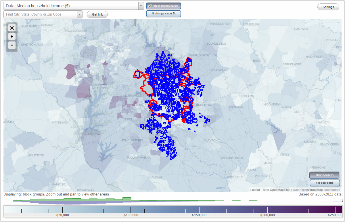
- City boundary
- Neighborhood boundaries
Business Search - 14 Million verified businesses
Abbington Ridge - Calloway on The Green Neighborhoods:
Abbington Ridge, Adams Mountain, Addison Reserve, Alanda, Alexander Place Townhomes, Alexandria Square, Alpha, Alpine Forest, Alslee Oaks, Alta Oakridge, Altice Estates, Alyson Pond, Amberfield, Ammondale, Anderson Forest, Anderson Heights, Andrews Hills, Antelope Point, Appollo Heights, Arbor Chase, Arbor Ridge, Arbor at Harrington Grove, Arden Forest, Arlington Hills, Arlington Place, Arnold Hills North, Arrowspring, Arrowwood Hills, Asbury Park, Ashebrook, Ashebrook, Ashland Place, Ashleigh Place Townhomes, Ashley Park, Ashley Place, Ashley Ridge, Ashton Hall, Ashworth Estate, Ashworth Townes, Athens, Atherton, Atkins Farms Inc, Auburn Estates, Auburn Hills, Augusta Crossing, Autumn Crest Farm, Autumn Hill, Autumn Woods, Autumn Woods, Avallon, Avanlea, Avenshire, Avington Place, Aztec Park, Bagwell, Bailey Grove, Bailey's Landing, Baileycroft, Baileys Landing, Bakers Landing Greystone, Bakersfield, Banbury Woods, Banbury Woods Place, Banks Pointe, Bannister, Barclay Manor, Barony, Barrington Village, Barrington Woods, Barsanlaw Acres, Barton Place Townhomes, Bartons Creek Bluffs, Bartons Creek Farm, Barwell Estates, Barwell Road, Bashford Bluffs, Bashford Ridge, Bashford Road, Battery Heights, Battle Bridge, Battleridge North, Bayleaf Farm, Bayleaf Forest, Bayleaf Ridge, Bayleaf Trail, Baystone Townes, Baytree, Beachwood, Beasley Heights, Beaver Pond, Beaverdam Heights, Bedford, Bedford Heights, Bedford at Falls River, Beechwood, Belair, Belden, Bell Estates, Belle Meade Estates, Bellevue Terrace, Bellewood Farms, Belmont Ridge, Belvedere Park, Bembridge, Bend of The Barton, Bennett Place, Bennett Woods, Bent Creek, Bent Tree South, Bentley Ridge Townhomes, Bentley Woods, Berkely Square Townhomes, Berkshire, Berkshire Downs, Berkshire Village at Wakefield, Bethel Park, Biltmore Hills, Biltomore Heights Townhomes, Birchfalls, Birchwood Hills, Bison Court Townhomes, Black Horse Run, Blaire Woods, Blanthem, Bleeker Court, Blenheim Place, Bloomsbury Historic District, Blount Street, Blue Moon Ridge, Blueberry Forest, Bluffridge at Greystone, Bluffs East, Bluffs at Harrington Grove, Bolton, Bostian, Boulder Creek, Boulder Lake, Boulevard Park, Bournemouth Heights, Boylan Heights, Bradford Place, Braefield, Braeloch, Branchwood Manor, Brandermill, Brandon Station, Brandywine, Brandywine, Brandywood, Brass Lantern, Brassfield, Brassfield Pond, Breckenridge, Breeland Park, Breezy Heights, Brentwood, Briarcliff, Briarwood North, Bridgepoint, Bridgeton Park, Bridgewater, Brier Creek Country Club, Brier Stream Run, Brighton Knoll, Brightwater, Bristol, Bristol, Britt Estates, Brittany Estates, Brittany Hills, Brittany Woods, Broad Creek Landing, Broad Oaks Townhomes, Broadhurst, Broadlands, Brook Forest, Brook Forest Townhomes, Brookdale, Brookdale, Brookhaven, Brooklyn, Brooklyn Hill, Brookshire, Brookside Dr, Brookside Village, Brookstone, Brookstone, Brookview, Brookwood, Brookwood, Brown Place, Bryan Woods, Bryarton, Bryn Mawr, Brynnan Place, Buckhorn Place, Budleigh, Byrum Woods, Calender, Calloway on The GreenAbbington Ridge neighborhood in Raleigh statistics: (Find on map)
Area: 0.132 square miles
Roads and streets: Volkswalk Pl; Laurel Glen Dr; Abbington Way; Flat Fern Dr; Tallis Ct.
Abbington Ridge neighborhood detailed profile
Area: 0.132 square miles
Roads and streets: Volkswalk Pl; Laurel Glen Dr; Abbington Way; Flat Fern Dr; Tallis Ct.
Abbington Ridge neighborhood detailed profile
Adams Mountain neighborhood in Raleigh statistics: (Find on map)
Area: 0.266 square miles
Roads and streets: Adams Mountain Rd; Wagon Ridge Rd; Cliffside Cir; Falls Lake Cir; Soco Ct; Mountain View Cir; Clingmans Pl; Soapstone Cir.
Adams Mountain neighborhood detailed profile
Area: 0.266 square miles
Roads and streets: Adams Mountain Rd; Wagon Ridge Rd; Cliffside Cir; Falls Lake Cir; Soco Ct; Mountain View Cir; Clingmans Pl; Soapstone Cir.
Adams Mountain neighborhood detailed profile
Addison Reserve neighborhood in Raleigh statistics: (Find on map)
Area: 0.056 square miles
Roads and streets: Neuse Wood Dr; San Marcos Way; Tierra del Sol Way; Glenwood Springs Ct; Boca Pt.
Addison Reserve neighborhood detailed profile
Area: 0.056 square miles
Roads and streets: Neuse Wood Dr; San Marcos Way; Tierra del Sol Way; Glenwood Springs Ct; Boca Pt.
Addison Reserve neighborhood detailed profile
Alanda neighborhood in Raleigh statistics: (Find on map)
Area: 0.019 square miles
Alanda neighborhood detailed profile
Area: 0.019 square miles
Alanda neighborhood detailed profile
Alexander Place Townhomes neighborhood in Raleigh statistics: (Find on map)
Area: 0.089 square miles
Population: 3
Population density:
Median household income in 2021:
Median rent in in 2021:
Male vs Females
Median age
Average estimated value of detached houses in 2021 (100.0% of all units):
Most popular occupations of males: computer and mathematical occupations (71.6%); community and social services occupations (40.7%); healthcare practitioners and technical occupations (29.0%); production occupations (25.2%); business and financial operations occupations (21.9%); management occupations (except farmers) (21.3%); sales and office occupations (20.6%)
Most popular occupations of females: legal occupations (30.6%); education, training, and library occupations (26.5%); business and financial operations occupations (26.0%); sales and office occupations (24.5%); management occupations (except farmers) (23.5%); architecture and engineering occupations (20.9%); computer and mathematical occupations (18.4%)
Other features: Sycamore Crk.
Other features: Sycamore Crk.
Alexander Place Townhomes neighborhood detailed profile
Area: 0.089 square miles
Population: 3
Population density:
| Alexander Place Townhomes: | 34 people per square mile |
| Raleigh: | 4,097 people per square mile |
Median household income in 2021:
| Alexander Place Townhomes: | $94,922 |
| Raleigh: | $74,612 |
Median rent in in 2021:
| Alexander Place Townhomes: | $1,524 |
| Raleigh: | $1,133 |
Male vs Females
| Males: | 1 |
| Females: | 1 |
Median age
| Males: | 60.4 years |
| Females: | 44.5 years |
Average estimated value of detached houses in 2021 (100.0% of all units):
| Alexander Place Townhomes: | $362,960 |
| Raleigh: | $446,507 |
Most popular occupations of males: computer and mathematical occupations (71.6%); community and social services occupations (40.7%); healthcare practitioners and technical occupations (29.0%); production occupations (25.2%); business and financial operations occupations (21.9%); management occupations (except farmers) (21.3%); sales and office occupations (20.6%)
Most popular occupations of females: legal occupations (30.6%); education, training, and library occupations (26.5%); business and financial operations occupations (26.0%); sales and office occupations (24.5%); management occupations (except farmers) (23.5%); architecture and engineering occupations (20.9%); computer and mathematical occupations (18.4%)
Other features: Sycamore Crk.
Other features: Sycamore Crk.
Alexander Place Townhomes neighborhood detailed profile
Alexandria Square neighborhood in Raleigh statistics: (Find on map)
Area: 0.025 square miles
Alexandria Square neighborhood detailed profile
Area: 0.025 square miles
Alexandria Square neighborhood detailed profile
Alpha neighborhood in Raleigh statistics: (Find on map)
Area: 0.005 square miles
Population: 40
Population density:
Median household income in 2021:
Median rent in in 2021:
Male vs Females
Median age
Housing prices:
Average estimated value of detached houses in 2021 (60.0% of all units):
Average estimated value of townhouses or other attached units in 2021 (6.7% of all units):
Most popular occupations of males: education, training, and library occupations (16.9%); arts, design, entertainment, sports, and media occupations (16.9%); sales and office occupations (13.3%); business and financial operations occupations (10.7%); computer and mathematical occupations (9.9%); architecture and engineering occupations (9.1%); material moving occupations (9.1%)
Most popular occupations of females: service occupations (59.0%); sales and office occupations (12.7%); computer and mathematical occupations (8.4%); arts, design, entertainment, sports, and media occupations (5.6%); management occupations (except farmers) (3.8%); legal occupations (3.8%); production occupations (3.6%)
Alpha neighborhood detailed profile
Area: 0.005 square miles
Population: 40
Population density:
| Alpha: | 8,198 people per square mile |
| Raleigh: | 4,097 people per square mile |
Median household income in 2021:
| Alpha: | $97,383 |
| Raleigh: | $74,612 |
Median rent in in 2021:
| Alpha: | $727 |
| Raleigh: | $1,133 |
Male vs Females
| Males: | 20 |
| Females: | 20 |
Median age
| Males: | 30.1 years |
| Females: | 38.8 years |
Housing prices:
Average estimated value of detached houses in 2021 (60.0% of all units):
| Alpha: | $618,114 |
| Raleigh: | $446,507 |
Average estimated value of townhouses or other attached units in 2021 (6.7% of all units):
| This neighborhood: | $405,921 |
| city: | $292,086 |
Most popular occupations of males: education, training, and library occupations (16.9%); arts, design, entertainment, sports, and media occupations (16.9%); sales and office occupations (13.3%); business and financial operations occupations (10.7%); computer and mathematical occupations (9.9%); architecture and engineering occupations (9.1%); material moving occupations (9.1%)
Most popular occupations of females: service occupations (59.0%); sales and office occupations (12.7%); computer and mathematical occupations (8.4%); arts, design, entertainment, sports, and media occupations (5.6%); management occupations (except farmers) (3.8%); legal occupations (3.8%); production occupations (3.6%)
Alpha neighborhood detailed profile
Alpine Forest neighborhood in Raleigh statistics: (Find on map)
Area: 0.092 square miles
Alpine Forest neighborhood detailed profile
Area: 0.092 square miles
Alpine Forest neighborhood detailed profile
Alslee Oaks neighborhood in Raleigh statistics: (Find on map)
Area: 0.014 square miles
Roads and streets: Alslee Oaks Dr; State Rd 1386 (Graham Newton Rd).
Alslee Oaks neighborhood detailed profile
Area: 0.014 square miles
Roads and streets: Alslee Oaks Dr; State Rd 1386 (Graham Newton Rd).
Alslee Oaks neighborhood detailed profile
Alta Oakridge neighborhood in Raleigh statistics: (Find on map)
Area: 0.023 square miles
Alta Oakridge neighborhood detailed profile
Area: 0.023 square miles
Alta Oakridge neighborhood detailed profile
Altice Estates neighborhood in Raleigh statistics: (Find on map)
Area: 0.097 square miles
Roads and streets: Cy Ln.
Altice Estates neighborhood detailed profile
Area: 0.097 square miles
Roads and streets: Cy Ln.
Altice Estates neighborhood detailed profile
Alyson Pond neighborhood in Raleigh statistics: (Find on map)
Area: 0.096 square miles
Roads and streets: Coxindale Dr; Yucca Trl; Iman Dr; Funster Ln; Wheeling Dr; Averell Ct; Bluebill Ct; Babble Ln; Shofield Ct; Greenhead Ct; Trickle Ct; Waynesboro Ct.
Alyson Pond neighborhood detailed profile
Area: 0.096 square miles
Roads and streets: Coxindale Dr; Yucca Trl; Iman Dr; Funster Ln; Wheeling Dr; Averell Ct; Bluebill Ct; Babble Ln; Shofield Ct; Greenhead Ct; Trickle Ct; Waynesboro Ct.
Alyson Pond neighborhood detailed profile
Amberfield neighborhood in Raleigh statistics: (Find on map)
Area: 0.091 square miles
Roads and streets: Bethwicke Ct; Bellenden Pl; Amberfield Way; Rocky Brook Xing; Carriage Light Ct; Marbletree Ct; Heatherfield Way; Marblewood Ct; Southall Rd.
Amberfield neighborhood detailed profile
Area: 0.091 square miles
Roads and streets: Bethwicke Ct; Bellenden Pl; Amberfield Way; Rocky Brook Xing; Carriage Light Ct; Marbletree Ct; Heatherfield Way; Marblewood Ct; Southall Rd.
Amberfield neighborhood detailed profile
Ammondale neighborhood in Raleigh statistics: (Find on map)
Area: 0.026 square miles
Population: 74
Population density:
Median household income in 2021:
Median rent in in 2021:
Male vs Females
Median age
Most popular occupations of males: service occupations (33.6%); sales and office occupations (19.1%); transportation occupations (7.6%); construction, extraction, and maintenance occupations (7.1%); production occupations (6.9%); computer and mathematical occupations (4.7%); management occupations (except farmers) (4.5%)
Most popular occupations of females: healthcare practitioners and technical occupations (18.0%); sales and office occupations (15.3%); service occupations (14.6%); management occupations (except farmers) (14.5%); business and financial operations occupations (13.7%); material moving occupations (5.9%); legal occupations (5.0%)
Ammondale neighborhood detailed profile
Area: 0.026 square miles
Population: 74
Population density:
| Ammondale: | 2,824 people per square mile |
| Raleigh: | 4,097 people per square mile |
Median household income in 2021:
| Ammondale: | $44,444 |
| Raleigh: | $74,612 |
Median rent in in 2021:
| Ammondale: | $958 |
| Raleigh: | $1,133 |
Male vs Females
| Males: | 34 |
| Females: | 40 |
Median age
| Males: | 26.6 years |
| Females: | 27.0 years |
Most popular occupations of males: service occupations (33.6%); sales and office occupations (19.1%); transportation occupations (7.6%); construction, extraction, and maintenance occupations (7.1%); production occupations (6.9%); computer and mathematical occupations (4.7%); management occupations (except farmers) (4.5%)
Most popular occupations of females: healthcare practitioners and technical occupations (18.0%); sales and office occupations (15.3%); service occupations (14.6%); management occupations (except farmers) (14.5%); business and financial operations occupations (13.7%); material moving occupations (5.9%); legal occupations (5.0%)
Ammondale neighborhood detailed profile
Anderson Forest neighborhood in Raleigh statistics: (Find on map)
Area: 0.027 square miles
Population: 54
Population density:
Median household income in 2021:
Median rent in in 2021:
Male vs Females
Median age
Housing prices:
Average estimated value of detached houses in 2021 (48.1% of all units):
Average estimated value of townhouses or other attached units in 2021 (14.8% of all units):
Average estimated '21 value of housing units in 5-or-more-unit structures (14.8% of all units):
Most popular occupations of males: management occupations (except farmers) (41.4%); sales and office occupations (27.2%); business and financial operations occupations (8.1%); legal occupations (4.8%); architecture and engineering occupations (4.6%); arts, design, entertainment, sports, and media occupations (4.1%); service occupations (2.7%)
Most popular occupations of females: management occupations (except farmers) (23.5%); computer and mathematical occupations (14.3%); education, training, and library occupations (13.7%); service occupations (11.0%); sales and office occupations (10.4%); healthcare practitioners and technical occupations (7.6%); business and financial operations occupations (5.7%)
Roads and streets: Shaftsberry Ct.
Anderson Forest neighborhood detailed profile
Area: 0.027 square miles
Population: 54
Population density:
| Anderson Forest: | 1,998 people per square mile |
| Raleigh: | 4,097 people per square mile |
Median household income in 2021:
| Anderson Forest: | $88,237 |
| Raleigh: | $74,612 |
Median rent in in 2021:
| Anderson Forest: | $1,366 |
| Raleigh: | $1,133 |
Male vs Females
| Males: | 25 |
| Females: | 28 |
Median age
| Males: | 31.4 years |
| Females: | 31.7 years |
Housing prices:
Average estimated value of detached houses in 2021 (48.1% of all units):
| Anderson Forest: | $180,927 |
| Raleigh: | $446,507 |
Average estimated value of townhouses or other attached units in 2021 (14.8% of all units):
| This neighborhood: | $202,667 |
| city: | $292,086 |
Average estimated '21 value of housing units in 5-or-more-unit structures (14.8% of all units):
| Anderson Forest: | $179,760 |
| Raleigh: | $306,998 |
Most popular occupations of males: management occupations (except farmers) (41.4%); sales and office occupations (27.2%); business and financial operations occupations (8.1%); legal occupations (4.8%); architecture and engineering occupations (4.6%); arts, design, entertainment, sports, and media occupations (4.1%); service occupations (2.7%)
Most popular occupations of females: management occupations (except farmers) (23.5%); computer and mathematical occupations (14.3%); education, training, and library occupations (13.7%); service occupations (11.0%); sales and office occupations (10.4%); healthcare practitioners and technical occupations (7.6%); business and financial operations occupations (5.7%)
Roads and streets: Shaftsberry Ct.
Anderson Forest neighborhood detailed profile
Anderson Heights neighborhood in Raleigh statistics: (Find on map)
Area: 0.370 square miles
Population: 853
Population density:
Median household income in 2021:
Median rent in in 2021:
Male vs Females
Median age
Average estimated value of detached houses in 2021 (98.5% of all units):
Most popular occupations of males: management occupations (except farmers) (24.7%); sales and office occupations (18.5%); legal occupations (18.0%); business and financial operations occupations (13.9%); computer and mathematical occupations (7.2%); architecture and engineering occupations (5.9%); service occupations (5.8%)
Most popular occupations of females: sales and office occupations (28.0%); healthcare practitioners and technical occupations (17.6%); management occupations (except farmers) (12.6%); education, training, and library occupations (8.8%); legal occupations (7.6%); life, physical, and social science occupations (6.8%); business and financial operations occupations (6.7%)
Roads and streets: Anderson Dr; White Oak Rd; Rothgeb Dr; Byrd St; Hazelwood Dr; Royster St; Hostetler St; Lochmore Dr; Kenmore Dr; Beechridge Rd; Webb St; Breeze Rd; Walden Pl; Dekoven Pl.
Other features: Oxford Br.
Anderson Heights neighborhood detailed profile
Area: 0.370 square miles
Population: 853
Population density:
| Anderson Heights: | 2,304 people per square mile |
| Raleigh: | 4,097 people per square mile |
Median household income in 2021:
| Anderson Heights: | $235,030 |
| Raleigh: | $74,612 |
Median rent in in 2021:
| Anderson Heights: | $2,123 |
| Raleigh: | $1,133 |
Male vs Females
| Males: | 439 |
| Females: | 414 |
Median age
| Males: | 37.5 years |
| Females: | 42.7 years |
Average estimated value of detached houses in 2021 (98.5% of all units):
| Anderson Heights: | $847,871 |
| Raleigh: | $446,507 |
Most popular occupations of males: management occupations (except farmers) (24.7%); sales and office occupations (18.5%); legal occupations (18.0%); business and financial operations occupations (13.9%); computer and mathematical occupations (7.2%); architecture and engineering occupations (5.9%); service occupations (5.8%)
Most popular occupations of females: sales and office occupations (28.0%); healthcare practitioners and technical occupations (17.6%); management occupations (except farmers) (12.6%); education, training, and library occupations (8.8%); legal occupations (7.6%); life, physical, and social science occupations (6.8%); business and financial operations occupations (6.7%)
Roads and streets: Anderson Dr; White Oak Rd; Rothgeb Dr; Byrd St; Hazelwood Dr; Royster St; Hostetler St; Lochmore Dr; Kenmore Dr; Beechridge Rd; Webb St; Breeze Rd; Walden Pl; Dekoven Pl.
Other features: Oxford Br.
Anderson Heights neighborhood detailed profile
Andrews Hills neighborhood in Raleigh statistics: (Find on map)
Area: 0.012 square miles
Andrews Hills neighborhood detailed profile
Area: 0.012 square miles
Andrews Hills neighborhood detailed profile
Antelope Point neighborhood in Raleigh statistics: (Find on map)
Area: 0.015 square miles
Antelope Point neighborhood detailed profile
Area: 0.015 square miles
Antelope Point neighborhood detailed profile
Appollo Heights neighborhood in Raleigh statistics: (Find on map)
Area: 0.116 square miles
Population: 301
Population density:
Median household income in 2021:
Median rent in in 2021:
Male vs Females
Median age
Most popular occupations of males: sales and office occupations (34.2%); transportation occupations (24.7%); management occupations (except farmers) (11.1%); service occupations (8.4%); material moving occupations (5.5%); healthcare practitioners and technical occupations (5.4%); farming, fishing, and forestry occupations (3.5%)
Most popular occupations of females: sales and office occupations (32.1%); education, training, and library occupations (21.4%); community and social services occupations (10.1%); service occupations (8.7%); management occupations (except farmers) (8.5%); production occupations (6.2%); business and financial operations occupations (5.8%)
Roads and streets: Grantland Dr; Solar Dr; Lunar Dr; Sunview St; Sundial Pl; Juno Ct; Cynthia Pl; Carmen Ct.
Appollo Heights neighborhood detailed profile
Area: 0.116 square miles
Population: 301
Population density:
| Appollo Heights: | 2,584 people per square mile |
| Raleigh: | 4,097 people per square mile |
Median household income in 2021:
| Appollo Heights: | $50,414 |
| Raleigh: | $74,612 |
Median rent in in 2021:
| Appollo Heights: | $900 |
| Raleigh: | $1,133 |
Male vs Females
| Males: | 162 |
| Females: | 138 |
Median age
| Males: | 36.0 years |
| Females: | 42.9 years |
Most popular occupations of males: sales and office occupations (34.2%); transportation occupations (24.7%); management occupations (except farmers) (11.1%); service occupations (8.4%); material moving occupations (5.5%); healthcare practitioners and technical occupations (5.4%); farming, fishing, and forestry occupations (3.5%)
Most popular occupations of females: sales and office occupations (32.1%); education, training, and library occupations (21.4%); community and social services occupations (10.1%); service occupations (8.7%); management occupations (except farmers) (8.5%); production occupations (6.2%); business and financial operations occupations (5.8%)
Roads and streets: Grantland Dr; Solar Dr; Lunar Dr; Sunview St; Sundial Pl; Juno Ct; Cynthia Pl; Carmen Ct.
Appollo Heights neighborhood detailed profile
Arbor Chase neighborhood in Raleigh statistics: (Find on map)
Area: 0.043 square miles
Other features: Beaverdam Crk.
Arbor Chase neighborhood detailed profile
Area: 0.043 square miles
Other features: Beaverdam Crk.
Arbor Chase neighborhood detailed profile
Arbor Ridge neighborhood in Raleigh statistics: (Find on map)
Area: 0.025 square miles
Arbor Ridge neighborhood detailed profile
Area: 0.025 square miles
Arbor Ridge neighborhood detailed profile
Arbor at Harrington Grove neighborhood in Raleigh statistics: (Find on map)
Area: 0.062 square miles
Population: 2
Population density:
Median household income in 2021:
Median rent in in 2021:
Male vs Females
Median age
Average estimated value of detached houses in 2021 (100.0% of all units):
Most popular occupations of males: computer and mathematical occupations (53.8%); community and social services occupations (30.5%); business and financial operations occupations (21.9%); healthcare practitioners and technical occupations (21.8%); management occupations (except farmers) (21.3%); sales and office occupations (20.6%); production occupations (18.9%)
Most popular occupations of females: education, training, and library occupations (26.5%); sales and office occupations (24.5%); management occupations (except farmers) (23.5%); legal occupations (23.0%); business and financial operations occupations (19.6%); architecture and engineering occupations (15.7%); service occupations (14.3%)
Roads and streets: Raddington St; Netherby Ct.
Roads and streets: Raddington St; Tappersfield Ct; Barham Ct; Harrington Grove Dr; Netherby Ct; Islehurst Ct.
Arbor at Harrington Grove neighborhood detailed profile
Area: 0.062 square miles
Population: 2
Population density:
| Arbor at Harrington Grove: | 32 people per square mile |
| Raleigh: | 4,097 people per square mile |
Median household income in 2021:
| Arbor at Harrington Grove: | $94,922 |
| Raleigh: | $74,612 |
Median rent in in 2021:
| Arbor at Harrington Grove: | $1,524 |
| Raleigh: | $1,133 |
Male vs Females
| Males: | 1 |
| Females: | 1 |
Median age
| Males: | 60.4 years |
| Females: | 44.5 years |
Average estimated value of detached houses in 2021 (100.0% of all units):
| Arbor at Harrington Grove: | $362,960 |
| Raleigh: | $446,507 |
Most popular occupations of males: computer and mathematical occupations (53.8%); community and social services occupations (30.5%); business and financial operations occupations (21.9%); healthcare practitioners and technical occupations (21.8%); management occupations (except farmers) (21.3%); sales and office occupations (20.6%); production occupations (18.9%)
Most popular occupations of females: education, training, and library occupations (26.5%); sales and office occupations (24.5%); management occupations (except farmers) (23.5%); legal occupations (23.0%); business and financial operations occupations (19.6%); architecture and engineering occupations (15.7%); service occupations (14.3%)
Roads and streets: Raddington St; Netherby Ct.
Roads and streets: Raddington St; Tappersfield Ct; Barham Ct; Harrington Grove Dr; Netherby Ct; Islehurst Ct.
Arbor at Harrington Grove neighborhood detailed profile
Arden Forest neighborhood in Raleigh statistics: (Find on map)
Area: 0.042 square miles
Roads and streets: Touchstone Forest Rd; Gamelyn Walk; Corin Ct.
Arden Forest neighborhood detailed profile
Area: 0.042 square miles
Roads and streets: Touchstone Forest Rd; Gamelyn Walk; Corin Ct.
Arden Forest neighborhood detailed profile
Arlington Hills neighborhood in Raleigh statistics: (Find on map)
Area: 0.039 square miles
Population: 94
Population density:
Median household income in 2021:
Median rent in in 2021:
Male vs Females
Median age
Average estimated value of detached houses in 2021 (100.0% of all units):
Most popular occupations of males: management occupations (except farmers) (30.5%); sales and office occupations (16.7%); education, training, and library occupations (9.3%); arts, design, entertainment, sports, and media occupations (6.6%); healthcare practitioners and technical occupations (6.6%); architecture and engineering occupations (6.4%); life, physical, and social science occupations (6.4%)
Most popular occupations of females: business and financial operations occupations (26.0%); management occupations (except farmers) (21.0%); healthcare practitioners and technical occupations (11.1%); sales and office occupations (10.9%); education, training, and library occupations (9.4%); service occupations (7.2%); life, physical, and social science occupations (5.4%)
Roads and streets: Longwood Dr; Blackwood Dr; Knollrock Dr; Danville Dr; Canewood Pl.
Arlington Hills neighborhood detailed profile
Area: 0.039 square miles
Population: 94
Population density:
| Arlington Hills: | 2,422 people per square mile |
| Raleigh: | 4,097 people per square mile |
Median household income in 2021:
| Arlington Hills: | $137,679 |
| Raleigh: | $74,612 |
Median rent in in 2021:
| Arlington Hills: | $1,052 |
| Raleigh: | $1,133 |
Male vs Females
| Males: | 44 |
| Females: | 50 |
Median age
| Males: | 45.7 years |
| Females: | 49.1 years |
Average estimated value of detached houses in 2021 (100.0% of all units):
| Arlington Hills: | $363,046 |
| Raleigh: | $446,507 |
Most popular occupations of males: management occupations (except farmers) (30.5%); sales and office occupations (16.7%); education, training, and library occupations (9.3%); arts, design, entertainment, sports, and media occupations (6.6%); healthcare practitioners and technical occupations (6.6%); architecture and engineering occupations (6.4%); life, physical, and social science occupations (6.4%)
Most popular occupations of females: business and financial operations occupations (26.0%); management occupations (except farmers) (21.0%); healthcare practitioners and technical occupations (11.1%); sales and office occupations (10.9%); education, training, and library occupations (9.4%); service occupations (7.2%); life, physical, and social science occupations (5.4%)
Roads and streets: Longwood Dr; Blackwood Dr; Knollrock Dr; Danville Dr; Canewood Pl.
Arlington Hills neighborhood detailed profile
Arlington Place neighborhood in Raleigh statistics: (Find on map)
Area: 0.003 square miles
Population: 7
Population density:
Median household income in 2021:
Median rent in in 2021:
Male vs Females
Median age
Housing prices:
Average estimated value of detached houses in 2021 (100.0% of all units):
Most popular occupations of males: healthcare practitioners and technical occupations (32.4%); management occupations (except farmers) (20.2%); legal occupations (18.7%); business and financial operations occupations (18.3%); arts, design, entertainment, sports, and media occupations (7.6%); education, training, and library occupations (6.1%); computer and mathematical occupations (5.0%)
Most popular occupations of females: management occupations (except farmers) (39.0%); education, training, and library occupations (27.0%); arts, design, entertainment, sports, and media occupations (26.8%); sales and office occupations (23.2%); service occupations (16.1%); business and financial operations occupations (15.0%); legal occupations (11.0%)
Arlington Place neighborhood detailed profile
Area: 0.003 square miles
Population: 7
Population density:
| Arlington Place: | 2,557 people per square mile |
| Raleigh: | 4,097 people per square mile |
Median household income in 2021:
| Arlington Place: | $250,001 |
| Raleigh: | $74,612 |
Median rent in in 2021:
| Arlington Place: | $1,007 |
| Raleigh: | $1,133 |
Male vs Females
| Males: | 3 |
| Females: | 4 |
Median age
| Males: | 52.1 years |
| Females: | 40.5 years |
Housing prices:
Average estimated value of detached houses in 2021 (100.0% of all units):
| Arlington Place: | $1,005,942 |
| Raleigh: | $446,507 |
Most popular occupations of males: healthcare practitioners and technical occupations (32.4%); management occupations (except farmers) (20.2%); legal occupations (18.7%); business and financial operations occupations (18.3%); arts, design, entertainment, sports, and media occupations (7.6%); education, training, and library occupations (6.1%); computer and mathematical occupations (5.0%)
Most popular occupations of females: management occupations (except farmers) (39.0%); education, training, and library occupations (27.0%); arts, design, entertainment, sports, and media occupations (26.8%); sales and office occupations (23.2%); service occupations (16.1%); business and financial operations occupations (15.0%); legal occupations (11.0%)
Arlington Place neighborhood detailed profile
Arnold Hills North neighborhood in Raleigh statistics: (Find on map)
Area: 0.164 square miles
Roads and streets: John Allen Rd; Landscape Ln.
Arnold Hills North neighborhood detailed profile
Area: 0.164 square miles
Roads and streets: John Allen Rd; Landscape Ln.
Arnold Hills North neighborhood detailed profile
Arrowspring neighborhood in Raleigh statistics: (Find on map)
Area: 0.049 square miles
Population: 15
Population density:
Median household income in 2021:
Median rent in in 2021:
Male vs Females
Median age
Housing prices:
Average estimated value of detached houses in 2021 (100.0% of all units):
Most popular occupations of males: business and financial operations occupations (15.5%); management occupations (except farmers) (13.7%); service occupations (12.5%); sales and office occupations (11.1%); production occupations (10.5%); community and social services occupations (8.1%); computer and mathematical occupations (7.8%)
Most popular occupations of females: sales and office occupations (24.3%); healthcare practitioners and technical occupations (20.7%); service occupations (13.9%); management occupations (except farmers) (12.8%); legal occupations (10.9%); education, training, and library occupations (6.8%); material moving occupations (3.4%)
Arrowspring neighborhood detailed profile
Area: 0.049 square miles
Population: 15
Population density:
| Arrowspring: | 304 people per square mile |
| Raleigh: | 4,097 people per square mile |
Median household income in 2021:
| Arrowspring: | $128,438 |
| Raleigh: | $74,612 |
Median rent in in 2021:
| Arrowspring: | $428 |
| Raleigh: | $1,133 |
Male vs Females
| Males: | 7 |
| Females: | 7 |
Median age
| Males: | 43.0 years |
| Females: | 44.0 years |
Housing prices:
Average estimated value of detached houses in 2021 (100.0% of all units):
| Arrowspring: | $283,606 |
| Raleigh: | $446,507 |
Most popular occupations of males: business and financial operations occupations (15.5%); management occupations (except farmers) (13.7%); service occupations (12.5%); sales and office occupations (11.1%); production occupations (10.5%); community and social services occupations (8.1%); computer and mathematical occupations (7.8%)
Most popular occupations of females: sales and office occupations (24.3%); healthcare practitioners and technical occupations (20.7%); service occupations (13.9%); management occupations (except farmers) (12.8%); legal occupations (10.9%); education, training, and library occupations (6.8%); material moving occupations (3.4%)
Arrowspring neighborhood detailed profile
Arrowwood Hills neighborhood in Raleigh statistics: (Find on map)
Area: 0.067 square miles
Roads and streets: Arrowood Ln; Timber Ln; Chestnut St; Silvers Rd.
Arrowwood Hills neighborhood detailed profile
Area: 0.067 square miles
Roads and streets: Arrowood Ln; Timber Ln; Chestnut St; Silvers Rd.
Arrowwood Hills neighborhood detailed profile
Asbury Park neighborhood in Raleigh statistics: (Find on map)
Area: 0.003 square miles
Asbury Park neighborhood detailed profile
Area: 0.003 square miles
Asbury Park neighborhood detailed profile
Ashebrook neighborhood in Raleigh statistics: (Find on map)
Area: 0.056 square miles
Roads and streets: Cinder Bluff Dr; Wishing Willow Dr.
Ashebrook neighborhood detailed profile
Area: 0.056 square miles
Roads and streets: Cinder Bluff Dr; Wishing Willow Dr.
Ashebrook neighborhood detailed profile
Ashebrook neighborhood in Raleigh statistics: (Find on map)
Area: 0.056 square miles
Roads and streets: Cinder Bluff Dr; Wishing Willow Dr.
Ashebrook neighborhood detailed profile
Area: 0.056 square miles
Roads and streets: Cinder Bluff Dr; Wishing Willow Dr.
Ashebrook neighborhood detailed profile
Ashland Place neighborhood in Raleigh statistics: (Find on map)
Area: 0.002 square miles
Population: 5
Population density:
Median household income in 2021:
Median rent in in 2021:
Male vs Females
Median age
Housing prices:
Average estimated value of detached houses in 2021 (100.0% of all units):
Most popular occupations of males: healthcare practitioners and technical occupations (32.4%); management occupations (except farmers) (20.2%); legal occupations (18.7%); business and financial operations occupations (18.3%); arts, design, entertainment, sports, and media occupations (7.7%); education, training, and library occupations (6.1%); computer and mathematical occupations (5.1%)
Most popular occupations of females: management occupations (except farmers) (39.0%); arts, design, entertainment, sports, and media occupations (27.3%); education, training, and library occupations (27.0%); sales and office occupations (23.7%); service occupations (16.5%); business and financial operations occupations (15.0%); legal occupations (11.0%)
Ashland Place neighborhood detailed profile
Area: 0.002 square miles
Population: 5
Population density:
| Ashland Place: | 2,568 people per square mile |
| Raleigh: | 4,097 people per square mile |
Median household income in 2021:
| Ashland Place: | $250,001 |
| Raleigh: | $74,612 |
Median rent in in 2021:
| Ashland Place: | $1,007 |
| Raleigh: | $1,133 |
Male vs Females
| Males: | 2 |
| Females: | 2 |
Median age
| Males: | 52.1 years |
| Females: | 40.5 years |
Housing prices:
Average estimated value of detached houses in 2021 (100.0% of all units):
| Ashland Place: | $1,005,942 |
| Raleigh: | $446,507 |
Most popular occupations of males: healthcare practitioners and technical occupations (32.4%); management occupations (except farmers) (20.2%); legal occupations (18.7%); business and financial operations occupations (18.3%); arts, design, entertainment, sports, and media occupations (7.7%); education, training, and library occupations (6.1%); computer and mathematical occupations (5.1%)
Most popular occupations of females: management occupations (except farmers) (39.0%); arts, design, entertainment, sports, and media occupations (27.3%); education, training, and library occupations (27.0%); sales and office occupations (23.7%); service occupations (16.5%); business and financial operations occupations (15.0%); legal occupations (11.0%)
Ashland Place neighborhood detailed profile
Ashleigh Place Townhomes neighborhood in Raleigh statistics: (Find on map)
Area: 0.005 square miles
Ashleigh Place Townhomes neighborhood detailed profile
Area: 0.005 square miles
Ashleigh Place Townhomes neighborhood detailed profile
Ashley Park neighborhood in Raleigh statistics: (Find on map)
Area: 0.040 square miles
Population: 128
Population density:
Median household income in 2021:
Median rent in in 2021:
Male vs Females
Median age
Housing prices:
Average estimated value of detached houses in 2021 (98.4% of all units):
Average estimated '21 value of housing units in 5-or-more-unit structures (71.9% of all units):
Most popular occupations of males: service occupations (22.4%); management occupations (except farmers) (19.6%); education, training, and library occupations (12.1%); computer and mathematical occupations (10.1%); sales and office occupations (9.3%); business and financial operations occupations (7.9%); legal occupations (5.5%)
Most popular occupations of females: sales and office occupations (25.0%); healthcare practitioners and technical occupations (21.0%); business and financial operations occupations (11.9%); service occupations (8.4%); management occupations (except farmers) (7.7%); architecture and engineering occupations (6.8%); computer and mathematical occupations (4.5%)
Roads and streets: N Glen Dr; Cottonwood Cir; Sandlewood Dr; Peachwood Pl; Redwood Cir.
Ashley Park neighborhood detailed profile
Area: 0.040 square miles
Population: 128
Population density:
| Ashley Park: | 3,230 people per square mile |
| Raleigh: | 4,097 people per square mile |
Median household income in 2021:
| Ashley Park: | $123,203 |
| Raleigh: | $74,612 |
Median rent in in 2021:
| Ashley Park: | $1,106 |
| Raleigh: | $1,133 |
Male vs Females
| Males: | 60 |
| Females: | 68 |
Median age
| Males: | 31.6 years |
| Females: | 36.9 years |
Housing prices:
Average estimated value of detached houses in 2021 (98.4% of all units):
| Ashley Park: | $316,173 |
| Raleigh: | $446,507 |
Average estimated '21 value of housing units in 5-or-more-unit structures (71.9% of all units):
| Ashley Park: | $158,808 |
| Raleigh: | $306,998 |
Most popular occupations of males: service occupations (22.4%); management occupations (except farmers) (19.6%); education, training, and library occupations (12.1%); computer and mathematical occupations (10.1%); sales and office occupations (9.3%); business and financial operations occupations (7.9%); legal occupations (5.5%)
Most popular occupations of females: sales and office occupations (25.0%); healthcare practitioners and technical occupations (21.0%); business and financial operations occupations (11.9%); service occupations (8.4%); management occupations (except farmers) (7.7%); architecture and engineering occupations (6.8%); computer and mathematical occupations (4.5%)
Roads and streets: N Glen Dr; Cottonwood Cir; Sandlewood Dr; Peachwood Pl; Redwood Cir.
Ashley Park neighborhood detailed profile
Ashley Place neighborhood in Raleigh statistics: (Find on map)
Area: 0.023 square miles
Roads and streets: Palafox Ct; Tensity Dr; Charny Dr.
Ashley Place neighborhood detailed profile
Area: 0.023 square miles
Roads and streets: Palafox Ct; Tensity Dr; Charny Dr.
Ashley Place neighborhood detailed profile
Ashley Ridge neighborhood in Raleigh statistics: (Find on map)
Area: 0.015 square miles
Population: 37
Population density:
Median household income in 2021:
Median rent in in 2021:
Male vs Females
Median age
Average estimated value of detached houses in 2021 (100.0% of all units):
Most popular occupations of males: management occupations (except farmers) (30.5%); sales and office occupations (16.7%); education, training, and library occupations (9.3%); arts, design, entertainment, sports, and media occupations (6.6%); healthcare practitioners and technical occupations (6.6%); architecture and engineering occupations (6.4%); life, physical, and social science occupations (6.4%)
Most popular occupations of females: business and financial operations occupations (26.0%); management occupations (except farmers) (21.0%); healthcare practitioners and technical occupations (11.1%); sales and office occupations (10.9%); education, training, and library occupations (9.4%); service occupations (7.2%); life, physical, and social science occupations (5.4%)
Roads and streets: Capers Ct; Ashley Ridge Dr.
Ashley Ridge neighborhood detailed profile
Area: 0.015 square miles
Population: 37
Population density:
| Ashley Ridge: | 2,399 people per square mile |
| Raleigh: | 4,097 people per square mile |
Median household income in 2021:
| Ashley Ridge: | $137,679 |
| Raleigh: | $74,612 |
Median rent in in 2021:
| Ashley Ridge: | $1,052 |
| Raleigh: | $1,133 |
Male vs Females
| Males: | 17 |
| Females: | 20 |
Median age
| Males: | 45.7 years |
| Females: | 49.1 years |
Average estimated value of detached houses in 2021 (100.0% of all units):
| Ashley Ridge: | $363,046 |
| Raleigh: | $446,507 |
Most popular occupations of males: management occupations (except farmers) (30.5%); sales and office occupations (16.7%); education, training, and library occupations (9.3%); arts, design, entertainment, sports, and media occupations (6.6%); healthcare practitioners and technical occupations (6.6%); architecture and engineering occupations (6.4%); life, physical, and social science occupations (6.4%)
Most popular occupations of females: business and financial operations occupations (26.0%); management occupations (except farmers) (21.0%); healthcare practitioners and technical occupations (11.1%); sales and office occupations (10.9%); education, training, and library occupations (9.4%); service occupations (7.2%); life, physical, and social science occupations (5.4%)
Roads and streets: Capers Ct; Ashley Ridge Dr.
Ashley Ridge neighborhood detailed profile
Ashton Hall neighborhood in Raleigh statistics: (Find on map)
Area: 0.010 square miles
Population: 24
Population density:
Median household income in 2021:
Median rent in in 2021:
Male vs Females
Median age
Housing prices:
Average estimated value of detached houses in 2021 (63.6% of all units):
Average estimated value of townhouses or other attached units in 2021 (18.2% of all units):
Most popular occupations of males: sales and office occupations (42.5%); service occupations (19.8%); management occupations (except farmers) (8.8%); business and financial operations occupations (7.9%); architecture and engineering occupations (4.0%); education, training, and library occupations (3.8%); computer and mathematical occupations (3.5%)
Most popular occupations of females: business and financial operations occupations (27.0%); service occupations (25.2%); sales and office occupations (24.1%); management occupations (except farmers) (9.1%); computer and mathematical occupations (6.9%); healthcare practitioners and technical occupations (3.0%); arts, design, entertainment, sports, and media occupations (2.4%)
Ashton Hall neighborhood detailed profile
Area: 0.010 square miles
Population: 24
Population density:
| Ashton Hall: | 2,389 people per square mile |
| Raleigh: | 4,097 people per square mile |
Median household income in 2021:
| Ashton Hall: | $93,021 |
| Raleigh: | $74,612 |
Median rent in in 2021:
| Ashton Hall: | $1,302 |
| Raleigh: | $1,133 |
Male vs Females
| Males: | 9 |
| Females: | 15 |
Median age
| Males: | 48.6 years |
| Females: | 38.8 years |
Housing prices:
Average estimated value of detached houses in 2021 (63.6% of all units):
| Ashton Hall: | $304,719 |
| Raleigh: | $446,507 |
Average estimated value of townhouses or other attached units in 2021 (18.2% of all units):
| This neighborhood: | $265,408 |
| city: | $292,086 |
Most popular occupations of males: sales and office occupations (42.5%); service occupations (19.8%); management occupations (except farmers) (8.8%); business and financial operations occupations (7.9%); architecture and engineering occupations (4.0%); education, training, and library occupations (3.8%); computer and mathematical occupations (3.5%)
Most popular occupations of females: business and financial operations occupations (27.0%); service occupations (25.2%); sales and office occupations (24.1%); management occupations (except farmers) (9.1%); computer and mathematical occupations (6.9%); healthcare practitioners and technical occupations (3.0%); arts, design, entertainment, sports, and media occupations (2.4%)
Ashton Hall neighborhood detailed profile
Ashworth Estate neighborhood in Raleigh statistics: (Find on map)
Area: 0.035 square miles
Roads and streets: Eden Park Dr; Benzinger Dr; Royton Cir; Dunnington Cir; Delavan Cir; Parkstone Dr.
Ashworth Estate neighborhood detailed profile
Area: 0.035 square miles
Roads and streets: Eden Park Dr; Benzinger Dr; Royton Cir; Dunnington Cir; Delavan Cir; Parkstone Dr.
Ashworth Estate neighborhood detailed profile
Ashworth Townes neighborhood in Raleigh statistics: (Find on map)
Area: 0.004 square miles
Ashworth Townes neighborhood detailed profile
Area: 0.004 square miles
Ashworth Townes neighborhood detailed profile
Athens neighborhood in Raleigh statistics: (Find on map)
Area: 0.073 square miles
Population: 61
Population density:
Median household income in 2021:
Median rent in in 2021:
Male vs Females
Median age
Most popular occupations of males: service occupations (17.4%); management occupations (except farmers) (16.1%); computer and mathematical occupations (10.9%); arts, design, entertainment, sports, and media occupations (8.5%); education, training, and library occupations (7.9%); legal occupations (4.8%); life, physical, and social science occupations (4.1%)
Most popular occupations of females: sales and office occupations (29.6%); education, training, and library occupations (22.1%); service occupations (10.8%); management occupations (except farmers) (9.0%); business and financial operations occupations (6.3%); healthcare practitioners and technical occupations (5.4%); life, physical, and social science occupations (4.1%)
Roads and streets: Thea Ln; Athena Woods Ln; Grecian Woods Pl.
Athens neighborhood detailed profile
Area: 0.073 square miles
Population: 61
Population density:
| Athens: | 835 people per square mile |
| Raleigh: | 4,097 people per square mile |
Median household income in 2021:
| Athens: | $122,781 |
| Raleigh: | $74,612 |
Median rent in in 2021:
| Athens: | $1,455 |
| Raleigh: | $1,133 |
Male vs Females
| Males: | 31 |
| Females: | 30 |
Median age
| Males: | 54.5 years |
| Females: | 48.6 years |
Most popular occupations of males: service occupations (17.4%); management occupations (except farmers) (16.1%); computer and mathematical occupations (10.9%); arts, design, entertainment, sports, and media occupations (8.5%); education, training, and library occupations (7.9%); legal occupations (4.8%); life, physical, and social science occupations (4.1%)
Most popular occupations of females: sales and office occupations (29.6%); education, training, and library occupations (22.1%); service occupations (10.8%); management occupations (except farmers) (9.0%); business and financial operations occupations (6.3%); healthcare practitioners and technical occupations (5.4%); life, physical, and social science occupations (4.1%)
Roads and streets: Thea Ln; Athena Woods Ln; Grecian Woods Pl.
Athens neighborhood detailed profile
Atherton neighborhood in Raleigh statistics: (Find on map)
Area: 0.015 square miles
Atherton neighborhood detailed profile
Area: 0.015 square miles
Atherton neighborhood detailed profile
Atkins Farms Inc neighborhood in Raleigh statistics: (Find on map)
Area: 0.016 square miles
Atkins Farms Inc neighborhood detailed profile
Area: 0.016 square miles
Atkins Farms Inc neighborhood detailed profile
Auburn Estates neighborhood in Raleigh statistics: (Find on map)
Area: 0.080 square miles
Auburn Estates neighborhood detailed profile
Area: 0.080 square miles
Auburn Estates neighborhood detailed profile
Auburn Hills neighborhood in Raleigh statistics: (Find on map)
Area: 0.135 square miles
Population: 39
Population density:
Median household income in 2021:
Median rent in in 2021:
Male vs Females
Median age
Housing prices:
Average estimated value of detached houses in 2021 (73.3% of all units):
Average estimated value of mobile home in 2021 (26.7% of all units):
Most popular occupations of males: sales and office occupations (22.6%); construction, extraction, and maintenance occupations (18.5%); transportation occupations (17.6%); service occupations (14.7%); material moving occupations (8.9%); business and financial operations occupations (4.8%); computer and mathematical occupations (4.6%)
Most popular occupations of females: sales and office occupations (35.3%); service occupations (27.1%); management occupations (except farmers) (7.5%); business and financial operations occupations (7.5%); education, training, and library occupations (6.5%); healthcare practitioners and technical occupations (4.2%); computer and mathematical occupations (2.3%)
Roads and streets: Grassy Field Dr; Winding Stream Dr; Flower Blossom Cir; Silver Star Dr.
Auburn Hills neighborhood detailed profile
Area: 0.135 square miles
Population: 39
Population density:
| Auburn Hills: | 290 people per square mile |
| Raleigh: | 4,097 people per square mile |
Median household income in 2021:
| Auburn Hills: | $79,792 |
| Raleigh: | $74,612 |
Median rent in in 2021:
| Auburn Hills: | $425 |
| Raleigh: | $1,133 |
Male vs Females
| Males: | 19 |
| Females: | 20 |
Median age
| Males: | 33.8 years |
| Females: | 31.8 years |
Housing prices:
Average estimated value of detached houses in 2021 (73.3% of all units):
| Auburn Hills: | $273,637 |
| Raleigh: | $446,507 |
Average estimated value of mobile home in 2021 (26.7% of all units):
| Auburn Hills: | $72,337 |
| Raleigh: | $31,622 |
Most popular occupations of males: sales and office occupations (22.6%); construction, extraction, and maintenance occupations (18.5%); transportation occupations (17.6%); service occupations (14.7%); material moving occupations (8.9%); business and financial operations occupations (4.8%); computer and mathematical occupations (4.6%)
Most popular occupations of females: sales and office occupations (35.3%); service occupations (27.1%); management occupations (except farmers) (7.5%); business and financial operations occupations (7.5%); education, training, and library occupations (6.5%); healthcare practitioners and technical occupations (4.2%); computer and mathematical occupations (2.3%)
Roads and streets: Grassy Field Dr; Winding Stream Dr; Flower Blossom Cir; Silver Star Dr.
Auburn Hills neighborhood detailed profile
Augusta Crossing neighborhood in Raleigh statistics: (Find on map)
Area: 0.051 square miles
Augusta Crossing neighborhood detailed profile
Area: 0.051 square miles
Augusta Crossing neighborhood detailed profile
Autumn Crest Farm neighborhood in Raleigh statistics: (Find on map)
Area: 0.035 square miles
Autumn Crest Farm neighborhood detailed profile
Area: 0.035 square miles
Autumn Crest Farm neighborhood detailed profile
Autumn Hill neighborhood in Raleigh statistics: (Find on map)
Area: 0.046 square miles
Roads and streets: Cool Spring Rd; October Rd; Crisp Dr; September Ct.
Autumn Hill neighborhood detailed profile
Area: 0.046 square miles
Roads and streets: Cool Spring Rd; October Rd; Crisp Dr; September Ct.
Autumn Hill neighborhood detailed profile
Autumn Woods neighborhood in Raleigh statistics: (Find on map)
Area: 0.013 square miles
Roads and streets: Altha St; Lawhorn St; Merendino St.
Autumn Woods neighborhood detailed profile
Area: 0.013 square miles
Roads and streets: Altha St; Lawhorn St; Merendino St.
Autumn Woods neighborhood detailed profile
Avallon neighborhood in Raleigh statistics: (Find on map)
Area: 0.018 square miles
Roads and streets: Clayette Ct; Morvan Way.
Avallon neighborhood detailed profile
Area: 0.018 square miles
Roads and streets: Clayette Ct; Morvan Way.
Avallon neighborhood detailed profile
Avanlea neighborhood in Raleigh statistics: (Find on map)
Area: 0.069 square miles
Avanlea neighborhood detailed profile
Area: 0.069 square miles
Avanlea neighborhood detailed profile
Avenshire neighborhood in Raleigh statistics: (Find on map)
Area: 0.004 square miles
Roads and streets: Avenshire Cir.
Avenshire neighborhood detailed profile
Area: 0.004 square miles
Roads and streets: Avenshire Cir.
Avenshire neighborhood detailed profile
Avington Place neighborhood in Raleigh statistics: (Find on map)
Area: 0.084 square miles
Roads and streets: Saybrooke Dr; Whatley Ln; Kentwell Palce; Jordan Oaks Way; Glencross Ct; Bekonscot Ave.
Avington Place neighborhood detailed profile
Area: 0.084 square miles
Roads and streets: Saybrooke Dr; Whatley Ln; Kentwell Palce; Jordan Oaks Way; Glencross Ct; Bekonscot Ave.
Avington Place neighborhood detailed profile
Aztec Park neighborhood in Raleigh statistics: (Find on map)
Area: 0.039 square miles
Other features: Turkey Crk.
Aztec Park neighborhood detailed profile
Area: 0.039 square miles
Other features: Turkey Crk.
Aztec Park neighborhood detailed profile
Bagwell neighborhood in Raleigh statistics: (Find on map)
Area: 0.029 square miles
Population: 138
Population density:
Median household income in 2021:
Median rent in in 2021:
Male vs Females
Median age
Average estimated value of detached houses in 2021 (62.7% of all units):
Most popular occupations of males: education, training, and library occupations (29.6%); management occupations (except farmers) (14.7%); arts, design, entertainment, sports, and media occupations (13.5%); computer and mathematical occupations (8.1%); business and financial operations occupations (7.8%); transportation occupations (6.9%); construction, extraction, and maintenance occupations (6.7%)
Most popular occupations of females: management occupations (except farmers) (33.9%); education, training, and library occupations (21.2%); service occupations (13.0%); sales and office occupations (9.5%); architecture and engineering occupations (7.4%); production occupations (6.5%); computer and mathematical occupations (4.3%)
Bagwell neighborhood detailed profile
Area: 0.029 square miles
Population: 138
Population density:
| Bagwell: | 4,833 people per square mile |
| Raleigh: | 4,097 people per square mile |
Median household income in 2021:
| Bagwell: | $68,156 |
| Raleigh: | $74,612 |
Median rent in in 2021:
| Bagwell: | $970 |
| Raleigh: | $1,133 |
Male vs Females
| Males: | 64 |
| Females: | 73 |
Median age
| Males: | 33.6 years |
| Females: | 26.4 years |
Average estimated value of detached houses in 2021 (62.7% of all units):
| Bagwell: | $638,351 |
| Raleigh: | $446,507 |
Most popular occupations of males: education, training, and library occupations (29.6%); management occupations (except farmers) (14.7%); arts, design, entertainment, sports, and media occupations (13.5%); computer and mathematical occupations (8.1%); business and financial operations occupations (7.8%); transportation occupations (6.9%); construction, extraction, and maintenance occupations (6.7%)
Most popular occupations of females: management occupations (except farmers) (33.9%); education, training, and library occupations (21.2%); service occupations (13.0%); sales and office occupations (9.5%); architecture and engineering occupations (7.4%); production occupations (6.5%); computer and mathematical occupations (4.3%)
Bagwell neighborhood detailed profile
Bailey Grove neighborhood in Raleigh statistics: (Find on map)
Area: 0.008 square miles
Bailey Grove neighborhood detailed profile
Area: 0.008 square miles
Bailey Grove neighborhood detailed profile
Bailey's Landing neighborhood in Raleigh statistics: (Find on map)
Area: 0.021 square miles
Bailey's Landing neighborhood detailed profile
Area: 0.021 square miles
Bailey's Landing neighborhood detailed profile
Baileycroft neighborhood in Raleigh statistics: (Find on map)
Area: 0.023 square miles
Population: 38
Population density:
Median household income in 2021:
Median rent in in 2021:
Male vs Females
Median age
Most popular occupations of males: business and financial operations occupations (16.1%); sales and office occupations (12.6%); education, training, and library occupations (10.9%); service occupations (10.2%); construction, extraction, and maintenance occupations (8.5%); arts, design, entertainment, sports, and media occupations (6.0%); material moving occupations (5.9%)
Most popular occupations of females: sales and office occupations (28.9%); business and financial operations occupations (28.4%); education, training, and library occupations (12.7%); healthcare practitioners and technical occupations (8.4%); management occupations (except farmers) (6.8%); transportation occupations (5.4%); production occupations (2.2%)
Roads and streets: Baileycroft Dr; Old Well Ln; Gaspari Ct; Kitzel Way; Harbison Way.
Baileycroft neighborhood detailed profile
Area: 0.023 square miles
Population: 38
Population density:
| Baileycroft: | 1,674 people per square mile |
| Raleigh: | 4,097 people per square mile |
Median household income in 2021:
| Baileycroft: | $65,793 |
| Raleigh: | $74,612 |
Median rent in in 2021:
| Baileycroft: | $1,057 |
| Raleigh: | $1,133 |
Male vs Females
| Males: | 19 |
| Females: | 19 |
Median age
| Males: | 46.3 years |
| Females: | 43.2 years |
Most popular occupations of males: business and financial operations occupations (16.1%); sales and office occupations (12.6%); education, training, and library occupations (10.9%); service occupations (10.2%); construction, extraction, and maintenance occupations (8.5%); arts, design, entertainment, sports, and media occupations (6.0%); material moving occupations (5.9%)
Most popular occupations of females: sales and office occupations (28.9%); business and financial operations occupations (28.4%); education, training, and library occupations (12.7%); healthcare practitioners and technical occupations (8.4%); management occupations (except farmers) (6.8%); transportation occupations (5.4%); production occupations (2.2%)
Roads and streets: Baileycroft Dr; Old Well Ln; Gaspari Ct; Kitzel Way; Harbison Way.
Baileycroft neighborhood detailed profile
Baileys Landing neighborhood in Raleigh statistics: (Find on map)
Area: 0.044 square miles
Roads and streets: Baileys Landing Dr; Corley Wood Dr; Majestic Prince Ct.
Baileys Landing neighborhood detailed profile
Area: 0.044 square miles
Roads and streets: Baileys Landing Dr; Corley Wood Dr; Majestic Prince Ct.
Baileys Landing neighborhood detailed profile
Bakers Landing Greystone neighborhood in Raleigh statistics: (Find on map)
Area: 0.022 square miles
Roads and streets: Breckon Way; Boathouse Ct; Bridge Way.
Bakers Landing Greystone neighborhood detailed profile
Area: 0.022 square miles
Roads and streets: Breckon Way; Boathouse Ct; Bridge Way.
Bakers Landing Greystone neighborhood detailed profile
Bakersfield neighborhood in Raleigh statistics: (Find on map)
Area: 0.044 square miles
Roads and streets: Bakersfield Dr; Holly Springs Rd (State Rd 1152).
Bakersfield neighborhood detailed profile
Area: 0.044 square miles
Roads and streets: Bakersfield Dr; Holly Springs Rd (State Rd 1152).
Bakersfield neighborhood detailed profile
Banbury Woods neighborhood in Raleigh statistics: (Find on map)
Area: 0.299 square miles
Roads and streets: Pacesferry Dr; Chastain Dr; Acres Way; Bascomb Dr; Deerhurst Dr; Burberry Dr; Woodmanor Dr; Weidman Dr; Foxford Ct; Chipaway Ct; Velvet Ct; Petrucelli Ln.
Banbury Woods neighborhood detailed profile
Area: 0.299 square miles
Roads and streets: Pacesferry Dr; Chastain Dr; Acres Way; Bascomb Dr; Deerhurst Dr; Burberry Dr; Woodmanor Dr; Weidman Dr; Foxford Ct; Chipaway Ct; Velvet Ct; Petrucelli Ln.
Banbury Woods neighborhood detailed profile
Banbury Woods Place neighborhood in Raleigh statistics: (Find on map)
Area: 0.001 square miles
Population: 4
Population density:
Median household income in 2021:
Median rent in in 2021:
Male vs Females
Median age
Average estimated value of detached houses in 2021 (50.0% of all units):
Most popular occupations of males: computer and mathematical occupations (20.1%); legal occupations (16.9%); management occupations (except farmers) (15.3%); education, training, and library occupations (15.0%); business and financial operations occupations (12.7%); material moving occupations (11.6%); life, physical, and social science occupations (10.8%)
Most popular occupations of females: business and financial operations occupations (31.9%); management occupations (except farmers) (19.5%); arts, design, entertainment, sports, and media occupations (15.5%); healthcare practitioners and technical occupations (13.9%); sales and office occupations (9.9%); service occupations (9.6%); legal occupations (5.2%)
Banbury Woods Place neighborhood detailed profile
Area: 0.001 square miles
Population: 4
Population density:
| Banbury Woods Place: | 3,543 people per square mile |
| Raleigh: | 4,097 people per square mile |
Median household income in 2021:
| Banbury Woods Place: | $112,649 |
| Raleigh: | $74,612 |
Median rent in in 2021:
| Banbury Woods Place: | $923 |
| Raleigh: | $1,133 |
Male vs Females
| Males: | 2 |
| Females: | 1 |
Median age
| Males: | 26.3 years |
| Females: | 47.8 years |
Average estimated value of detached houses in 2021 (50.0% of all units):
| Banbury Woods Place: | $604,763 |
| Raleigh: | $446,507 |
Most popular occupations of males: computer and mathematical occupations (20.1%); legal occupations (16.9%); management occupations (except farmers) (15.3%); education, training, and library occupations (15.0%); business and financial operations occupations (12.7%); material moving occupations (11.6%); life, physical, and social science occupations (10.8%)
Most popular occupations of females: business and financial operations occupations (31.9%); management occupations (except farmers) (19.5%); arts, design, entertainment, sports, and media occupations (15.5%); healthcare practitioners and technical occupations (13.9%); sales and office occupations (9.9%); service occupations (9.6%); legal occupations (5.2%)
Banbury Woods Place neighborhood detailed profile
Banks Pointe neighborhood in Raleigh statistics: (Find on map)
Area: 0.154 square miles
Roads and streets: Banks Stone Dr; Cotten Rd; Bankshire Ln; Chelsea Dr; Bankswood Dr; Sorrell Brothers Ct.
Banks Pointe neighborhood detailed profile
Area: 0.154 square miles
Roads and streets: Banks Stone Dr; Cotten Rd; Bankshire Ln; Chelsea Dr; Bankswood Dr; Sorrell Brothers Ct.
Banks Pointe neighborhood detailed profile
Bannister neighborhood in Raleigh statistics: (Find on map)
Area: 0.006 square miles
Bannister neighborhood detailed profile
Area: 0.006 square miles
Bannister neighborhood detailed profile
Barclay Manor neighborhood in Raleigh statistics: (Find on map)
Area: 0.066 square miles
Roads and streets: Barclay Manor Way; Barclay Woods Ct.
Barclay Manor neighborhood detailed profile
Area: 0.066 square miles
Roads and streets: Barclay Manor Way; Barclay Woods Ct.
Barclay Manor neighborhood detailed profile
Barony neighborhood in Raleigh statistics: (Find on map)
Area: 0.125 square miles
Roads and streets: Barony Lake Way; Exeter Field Cir.
Barony neighborhood detailed profile
Area: 0.125 square miles
Roads and streets: Barony Lake Way; Exeter Field Cir.
Barony neighborhood detailed profile
Barrington Village neighborhood in Raleigh statistics: (Find on map)
Area: 0.009 square miles
Barrington Village neighborhood detailed profile
Area: 0.009 square miles
Barrington Village neighborhood detailed profile
Barrington Woods neighborhood in Raleigh statistics: (Find on map)
Area: 0.048 square miles
Roads and streets: Snowden Pl; Chatterson Dr.
Barrington Woods neighborhood detailed profile
Area: 0.048 square miles
Roads and streets: Snowden Pl; Chatterson Dr.
Barrington Woods neighborhood detailed profile
Barsanlaw Acres neighborhood in Raleigh statistics: (Find on map)
Area: 0.052 square miles
Roads and streets: Kristy Cir; Barsanlaw Dr.
Barsanlaw Acres neighborhood detailed profile
Area: 0.052 square miles
Roads and streets: Kristy Cir; Barsanlaw Dr.
Barsanlaw Acres neighborhood detailed profile
Barton Place Townhomes neighborhood in Raleigh statistics: (Find on map)
Area: 0.004 square miles
Population: 10
Population density:
Median household income in 2021:
Median rent in in 2021:
Male vs Females
Median age
Most popular occupations of males: management occupations (except farmers) (45.1%); sales and office occupations (12.8%); education, training, and library occupations (11.7%); business and financial operations occupations (6.5%); service occupations (6.5%); healthcare practitioners and technical occupations (6.1%); material moving occupations (5.4%)
Most popular occupations of females: sales and office occupations (33.9%); healthcare practitioners and technical occupations (18.9%); management occupations (except farmers) (15.3%); business and financial operations occupations (15.0%); arts, design, entertainment, sports, and media occupations (8.8%); legal occupations (7.4%); life, physical, and social science occupations (4.9%)
Barton Place Townhomes neighborhood detailed profile
Area: 0.004 square miles
Population: 10
Population density:
| Barton Place Townhomes: | 2,735 people per square mile |
| Raleigh: | 4,097 people per square mile |
Median household income in 2021:
| Barton Place Townhomes: | $122,083 |
| Raleigh: | $74,612 |
Median rent in in 2021:
| Barton Place Townhomes: | $1,455 |
| Raleigh: | $1,133 |
Male vs Females
| Males: | 5 |
| Females: | 4 |
Median age
| Males: | 25.4 years |
| Females: | 43.5 years |
Most popular occupations of males: management occupations (except farmers) (45.1%); sales and office occupations (12.8%); education, training, and library occupations (11.7%); business and financial operations occupations (6.5%); service occupations (6.5%); healthcare practitioners and technical occupations (6.1%); material moving occupations (5.4%)
Most popular occupations of females: sales and office occupations (33.9%); healthcare practitioners and technical occupations (18.9%); management occupations (except farmers) (15.3%); business and financial operations occupations (15.0%); arts, design, entertainment, sports, and media occupations (8.8%); legal occupations (7.4%); life, physical, and social science occupations (4.9%)
Barton Place Townhomes neighborhood detailed profile
Bartons Creek Bluffs neighborhood in Raleigh statistics: (Find on map)
Area: 0.725 square miles
Roads and streets: Sunnystone Way; Bartons Enclave Ln; Amoretto Way; Wild Orchid Trl; Big Creek Rd; Indigo Moon Way; N Hawthorne Way; Kinleys Way; Jasper Ln; Orchid Valley Rd; Victory Church Rd (State Rd 1841); Dray Ct; Martin Farm Rd; Ventry Ct; Perception Ln; Primrose Valley Ct; Kissing Ct; Bartons Bluff Ct; Hideaway Ct; Valley Mist Ct; Sweet Birch Ct; Clark Ridge Ct; Fern Creek Ct; Scarlet Sage Ct; Barton Ridge Ct; Sorrento Ct; Six Pence Ct.
Other features: Upper Barton Crk.
Bartons Creek Bluffs neighborhood detailed profile
Bartons Creek Farm neighborhood in Raleigh statistics: (Find on map)
Area: 0.030 square miles
Bartons Creek Farm neighborhood detailed profile
Area: 0.030 square miles
Bartons Creek Farm neighborhood detailed profile
Barwell Estates neighborhood in Raleigh statistics: (Find on map)
Area: 0.026 square miles
Barwell Estates neighborhood detailed profile
Area: 0.026 square miles
Barwell Estates neighborhood detailed profile
Barwell Road neighborhood in Raleigh statistics: (Find on map)
Area: 0.024 square miles
Barwell Road neighborhood detailed profile
Area: 0.024 square miles
Barwell Road neighborhood detailed profile
Bashford Bluffs neighborhood in Raleigh statistics: (Find on map)
Area: 0.064 square miles
Bashford Bluffs neighborhood detailed profile
Area: 0.064 square miles
Bashford Bluffs neighborhood detailed profile
Bashford Ridge neighborhood in Raleigh statistics: (Find on map)
Area: 0.021 square miles
Bashford Ridge neighborhood detailed profile
Area: 0.021 square miles
Bashford Ridge neighborhood detailed profile
Bashford Road neighborhood in Raleigh statistics: (Find on map)
Area: 0.004 square miles
Bashford Road neighborhood detailed profile
Area: 0.004 square miles
Bashford Road neighborhood detailed profile
Battery Heights neighborhood in Raleigh statistics: (Find on map)
Area: 0.087 square miles
Population: 304
Population density:
Median household income in 2021:
Median rent in in 2021:
Male vs Females
Median age
Average estimated value of detached houses in 2021 (67.4% of all units):
Most popular occupations of males: service occupations (29.4%); management occupations (except farmers) (14.6%); construction, extraction, and maintenance occupations (12.1%); business and financial operations occupations (12.0%); sales and office occupations (6.8%); transportation occupations (6.7%); production occupations (4.8%)
Most popular occupations of females: service occupations (36.6%); management occupations (except farmers) (13.6%); education, training, and library occupations (11.3%); computer and mathematical occupations (10.2%); sales and office occupations (6.8%); business and financial operations occupations (5.7%); transportation occupations (5.2%)
Roads and streets: E Hargett St; Bart St; Battery Dr; S Pettigrew St; Parrish St; Sherrybrook Dr.
Battery Heights neighborhood detailed profile
Area: 0.087 square miles
Population: 304
Population density:
| Battery Heights: | 3,475 people per square mile |
| Raleigh: | 4,097 people per square mile |
Median household income in 2021:
| Battery Heights: | $48,650 |
| Raleigh: | $74,612 |
Median rent in in 2021:
| Battery Heights: | $550 |
| Raleigh: | $1,133 |
Male vs Females
| Males: | 150 |
| Females: | 153 |
Median age
| Males: | 34.9 years |
| Females: | 39.4 years |
Average estimated value of detached houses in 2021 (67.4% of all units):
| Battery Heights: | $230,947 |
| Raleigh: | $446,507 |
Most popular occupations of males: service occupations (29.4%); management occupations (except farmers) (14.6%); construction, extraction, and maintenance occupations (12.1%); business and financial operations occupations (12.0%); sales and office occupations (6.8%); transportation occupations (6.7%); production occupations (4.8%)
Most popular occupations of females: service occupations (36.6%); management occupations (except farmers) (13.6%); education, training, and library occupations (11.3%); computer and mathematical occupations (10.2%); sales and office occupations (6.8%); business and financial operations occupations (5.7%); transportation occupations (5.2%)
Roads and streets: E Hargett St; Bart St; Battery Dr; S Pettigrew St; Parrish St; Sherrybrook Dr.
Battery Heights neighborhood detailed profile
Battle Bridge neighborhood in Raleigh statistics: (Find on map)
Area: 0.168 square miles
Roads and streets: Cold Harbour Dr; Bay Rum Ln; Mackinac Island Ln; Missionary Ridge Dr; Spanglers Spring Way; Belleau Woods Dr; Mechanicsville Run; San Juan Hill Ct; Chancellorsville Ct; Pea Ridge Ln; Culps Hill Ct; Enduring Freedom Dr; Bentonville Ct; Bristoe Station Ln; Snodgrass Hill Ct; Sandygrass Ct; Arconne Way; Orchard Knob Dr.
Battle Bridge neighborhood detailed profile
Battleridge North neighborhood in Raleigh statistics: (Find on map)
Area: 0.192 square miles
Battleridge North neighborhood detailed profile
Area: 0.192 square miles
Battleridge North neighborhood detailed profile
Bayleaf Farm neighborhood in Raleigh statistics: (Find on map)
Area: 0.079 square miles
Roads and streets: Birchfalls Dr; Dogwood View Ln.
Bayleaf Farm neighborhood detailed profile
Area: 0.079 square miles
Roads and streets: Birchfalls Dr; Dogwood View Ln.
Bayleaf Farm neighborhood detailed profile
Bayleaf Forest neighborhood in Raleigh statistics: (Find on map)
Area: 0.063 square miles
Roads and streets: Bayleaf Dr.
Bayleaf Forest neighborhood detailed profile
Area: 0.063 square miles
Roads and streets: Bayleaf Dr.
Bayleaf Forest neighborhood detailed profile
Bayleaf Ridge neighborhood in Raleigh statistics: (Find on map)
Area: 0.059 square miles
Roads and streets: Janice Rd; Sun Dr; Virgil Dr; Sue Ct.
Bayleaf Ridge neighborhood detailed profile
Area: 0.059 square miles
Roads and streets: Janice Rd; Sun Dr; Virgil Dr; Sue Ct.
Bayleaf Ridge neighborhood detailed profile
Bayleaf Trail neighborhood in Raleigh statistics: (Find on map)
Area: 0.017 square miles
Bayleaf Trail neighborhood detailed profile
Area: 0.017 square miles
Bayleaf Trail neighborhood detailed profile
Baystone Townes neighborhood in Raleigh statistics: (Find on map)
Area: 0.016 square miles
Roads and streets: Stetson Cir.
Baystone Townes neighborhood detailed profile
Area: 0.016 square miles
Roads and streets: Stetson Cir.
Baystone Townes neighborhood detailed profile
Baytree neighborhood in Raleigh statistics: (Find on map)
Area: 0.093 square miles
Roads and streets: Baytree Ln; Sandhurst Rd; Heathwood Ct.
Baytree neighborhood detailed profile
Area: 0.093 square miles
Roads and streets: Baytree Ln; Sandhurst Rd; Heathwood Ct.
Baytree neighborhood detailed profile
Beachwood neighborhood in Raleigh statistics: (Find on map)
Area: 0.137 square miles
Roads and streets: Penselwood Dr; Lighthall Ln; Panhill Way; Pilton Pl; Torness Ct; Preston Pl; Blacket Ct; Cranmoore Ct; Cholderton Ct.
Beachwood neighborhood detailed profile
Area: 0.137 square miles
Roads and streets: Penselwood Dr; Lighthall Ln; Panhill Way; Pilton Pl; Torness Ct; Preston Pl; Blacket Ct; Cranmoore Ct; Cholderton Ct.
Beachwood neighborhood detailed profile
Beasley Heights neighborhood in Raleigh statistics: (Find on map)
Area: 0.004 square miles
Population: 1
Population density:
Median household income in 2021:
Median rent in in 2021:
Male vs Females
Median age
Most popular occupations of males: service occupations (49.6%); production occupations (48.9%); construction, extraction, and maintenance occupations (46.1%); transportation occupations (28.2%); sales and office occupations (16.1%); arts, design, entertainment, sports, and media occupations (13.1%); management occupations (except farmers) (11.8%)
Most popular occupations of females: sales and office occupations (40.3%); transportation occupations (33.6%); community and social services occupations (30.1%); service occupations (27.3%); education, training, and library occupations (26.5%); business and financial operations occupations (14.1%); management occupations (except farmers) (4.9%)
Beasley Heights neighborhood detailed profile
Area: 0.004 square miles
Population: 1
Population density:
| Beasley Heights: | 241 people per square mile |
| Raleigh: | 4,097 people per square mile |
Median household income in 2021:
| Beasley Heights: | $34,111 |
| Raleigh: | $74,612 |
Median rent in in 2021:
| Beasley Heights: | $922 |
| Raleigh: | $1,133 |
Male vs Females
| Males: | 0 |
| Females: | 1 |
Median age
| Males: | 37.5 years |
| Females: | 40.0 years |
Most popular occupations of males: service occupations (49.6%); production occupations (48.9%); construction, extraction, and maintenance occupations (46.1%); transportation occupations (28.2%); sales and office occupations (16.1%); arts, design, entertainment, sports, and media occupations (13.1%); management occupations (except farmers) (11.8%)
Most popular occupations of females: sales and office occupations (40.3%); transportation occupations (33.6%); community and social services occupations (30.1%); service occupations (27.3%); education, training, and library occupations (26.5%); business and financial operations occupations (14.1%); management occupations (except farmers) (4.9%)
Beasley Heights neighborhood detailed profile
Beaver Pond neighborhood in Raleigh statistics: (Find on map)
Area: 0.030 square miles
Beaver Pond neighborhood detailed profile
Area: 0.030 square miles
Beaver Pond neighborhood detailed profile
Beaverdam Heights neighborhood in Raleigh statistics: (Find on map)
Area: 0.018 square miles
Population: 29
Population density:
Median household income in 2021:
Median rent in in 2021:
Male vs Females
Median age
Average estimated value of detached houses in 2021 (15.8% of all units):
Most popular occupations of males: management occupations (except farmers) (47.1%); business and financial operations occupations (28.9%); computer and mathematical occupations (16.5%); healthcare practitioners and technical occupations (13.6%); sales and office occupations (7.4%); legal occupations (5.0%); transportation occupations (4.8%)
Most popular occupations of females: management occupations (except farmers) (23.9%); sales and office occupations (20.6%); education, training, and library occupations (13.5%); service occupations (11.0%); computer and mathematical occupations (10.7%); business and financial operations occupations (9.3%); healthcare practitioners and technical occupations (9.3%)
Roads and streets: Devonshire Dr.
Beaverdam Heights neighborhood detailed profile
Area: 0.018 square miles
Population: 29
Population density:
| Beaverdam Heights: | 1,607 people per square mile |
| Raleigh: | 4,097 people per square mile |
Median household income in 2021:
| Beaverdam Heights: | $79,757 |
| Raleigh: | $74,612 |
Median rent in in 2021:
| Beaverdam Heights: | $1,645 |
| Raleigh: | $1,133 |
Male vs Females
| Males: | 8 |
| Females: | 20 |
Median age
| Males: | 34.8 years |
| Females: | 29.7 years |
Average estimated value of detached houses in 2021 (15.8% of all units):
| Beaverdam Heights: | $739,683 |
| Raleigh: | $446,507 |
Most popular occupations of males: management occupations (except farmers) (47.1%); business and financial operations occupations (28.9%); computer and mathematical occupations (16.5%); healthcare practitioners and technical occupations (13.6%); sales and office occupations (7.4%); legal occupations (5.0%); transportation occupations (4.8%)
Most popular occupations of females: management occupations (except farmers) (23.9%); sales and office occupations (20.6%); education, training, and library occupations (13.5%); service occupations (11.0%); computer and mathematical occupations (10.7%); business and financial operations occupations (9.3%); healthcare practitioners and technical occupations (9.3%)
Roads and streets: Devonshire Dr.
Beaverdam Heights neighborhood detailed profile
Bedford neighborhood in Raleigh statistics: (Find on map)
Area: 0.043 square miles
Roads and streets: Bedford Hills Ct; Greenevers Dr; Bedford Pines Ct.
Bedford neighborhood detailed profile
Area: 0.043 square miles
Roads and streets: Bedford Hills Ct; Greenevers Dr; Bedford Pines Ct.
Bedford neighborhood detailed profile
Bedford Heights neighborhood in Raleigh statistics: (Find on map)
Area: 0.011 square miles
Population: 58
Population density:
Median household income in 2021:
Median rent in in 2021:
Male vs Females
Median age
Average estimated value of detached houses in 2021 (65.2% of all units):
Most popular occupations of males: education, training, and library occupations (39.0%); arts, design, entertainment, sports, and media occupations (17.7%); construction, extraction, and maintenance occupations (8.9%); sales and office occupations (8.6%); computer and mathematical occupations (7.4%); management occupations (except farmers) (6.7%); transportation occupations (6.3%)
Most popular occupations of females: management occupations (except farmers) (45.0%); service occupations (15.7%); education, training, and library occupations (12.9%); sales and office occupations (11.3%); architecture and engineering occupations (10.7%); business and financial operations occupations (10.5%); arts, design, entertainment, sports, and media occupations (6.0%)
Bedford Heights neighborhood detailed profile
Area: 0.011 square miles
Population: 58
Population density:
| Bedford Heights: | 5,484 people per square mile |
| Raleigh: | 4,097 people per square mile |
Median household income in 2021:
| Bedford Heights: | $70,375 |
| Raleigh: | $74,612 |
Median rent in in 2021:
| Bedford Heights: | $932 |
| Raleigh: | $1,133 |
Male vs Females
| Males: | 28 |
| Females: | 30 |
Median age
| Males: | 24.7 years |
| Females: | 26.0 years |
Average estimated value of detached houses in 2021 (65.2% of all units):
| Bedford Heights: | $638,351 |
| Raleigh: | $446,507 |
Most popular occupations of males: education, training, and library occupations (39.0%); arts, design, entertainment, sports, and media occupations (17.7%); construction, extraction, and maintenance occupations (8.9%); sales and office occupations (8.6%); computer and mathematical occupations (7.4%); management occupations (except farmers) (6.7%); transportation occupations (6.3%)
Most popular occupations of females: management occupations (except farmers) (45.0%); service occupations (15.7%); education, training, and library occupations (12.9%); sales and office occupations (11.3%); architecture and engineering occupations (10.7%); business and financial operations occupations (10.5%); arts, design, entertainment, sports, and media occupations (6.0%)
Bedford Heights neighborhood detailed profile
Bedford at Falls River neighborhood in Raleigh statistics: (Find on map)
Area: 0.811 square miles
Roads and streets: Falls River Ave; Bedfordtown Dr; Cardington Ln; Evergreen Spring Pl; Hopeton Ave; Saint Pauls Sq; Grand Journey Ave; Winding Waters Way; Hornbeck Ct; Thoughtful Spot Way; All Points View Way; Settle in Ln; Edmundson Ave; Canoe Brook Pkwy; Chandler Way; Swerling Way; Royal Forrest Dr; Grandview Heights Ln; Hidden Waters Cir; Wide River Dr; Friendly Neighbor Ln; Winter Song Rd; Shadow Elms Ln; Gentle Breezes Ln; Rain Forrest Way; Van Hessen Dr; Country Charm Rd; Karns Pl; Rogerson St; Longholme Way; Goodrich Dr; Greater Hills St; Treen St; Connally Ln; Enchanted Hollow Way; Lofty Heights Pl; Cloud Cover Ln; Snowy Meadow Ct; Mummeret Way; Elegance Dr; Zuzu Dr; Treasures Ln; Belden Pl; Caramoor Ln; Mount Prospect Cir; Bankshill Row; Flower Bed Ct; Gregmoor Ct; Bright Future Way; Hagney St; Rabbit Hollow Trl; Meakin Dr; Willow Pines Pl; Spacious Skies St; Happiness Hill Ln; Wyatt Ln; Hickman Dr; Morgause Dr; Peppermill Dr; Pumpkin Ln; Brunetti Ct; Storybook Ln; Forward Way; Happy Ln; Rooster Way; Silver Forrest Ln; Crystal Breeze St; Shadow Pines St; Rainbow Hill Way; Brimming Lake Ct; Kira Ln; Summer Elms Ct; Cheery Knoll; Sunny Corners Ct; Magic Hollow Ct; Sugar and Spice St; Harline Ct; Dunlin Ln; Bouncy Day Ct; Gerber Ct; Up Above Ln; Windy Meadow Ct; Bright Horizons Way; Biroc Ct; Magical Pl.
Bedford at Falls River neighborhood detailed profile
Beechwood neighborhood in Raleigh statistics: (Find on map)
Area: 0.039 square miles
Roads and streets: Ann Ave; Charles St.
Beechwood neighborhood detailed profile
Area: 0.039 square miles
Roads and streets: Ann Ave; Charles St.
Beechwood neighborhood detailed profile
Belair neighborhood in Raleigh statistics: (Find on map)
Area: 0.012 square miles
Population: 29
Population density:
Median household income in 2021:
Median rent in in 2021:
Male vs Females
Median age
Average estimated value of detached houses in 2021 (63.6% of all units):
Most popular occupations of males: service occupations (38.9%); management occupations (except farmers) (13.3%); sales and office occupations (8.2%); computer and mathematical occupations (7.6%); material moving occupations (6.7%); production occupations (5.0%); education, training, and library occupations (3.4%)
Most popular occupations of females: sales and office occupations (37.6%); service occupations (22.3%); business and financial operations occupations (17.2%); management occupations (except farmers) (10.1%); education, training, and library occupations (6.7%); construction, extraction, and maintenance occupations (6.1%); healthcare practitioners and technical occupations (4.6%)
Belair neighborhood detailed profile
Area: 0.012 square miles
Population: 29
Population density:
| Belair: | 2,383 people per square mile |
| Raleigh: | 4,097 people per square mile |
Median household income in 2021:
| Belair: | $51,065 |
| Raleigh: | $74,612 |
Median rent in in 2021:
| Belair: | $1,061 |
| Raleigh: | $1,133 |
Male vs Females
| Males: | 16 |
| Females: | 13 |
Median age
| Males: | 42.4 years |
| Females: | 38.9 years |
Average estimated value of detached houses in 2021 (63.6% of all units):
| Belair: | $406,667 |
| Raleigh: | $446,507 |
Most popular occupations of males: service occupations (38.9%); management occupations (except farmers) (13.3%); sales and office occupations (8.2%); computer and mathematical occupations (7.6%); material moving occupations (6.7%); production occupations (5.0%); education, training, and library occupations (3.4%)
Most popular occupations of females: sales and office occupations (37.6%); service occupations (22.3%); business and financial operations occupations (17.2%); management occupations (except farmers) (10.1%); education, training, and library occupations (6.7%); construction, extraction, and maintenance occupations (6.1%); healthcare practitioners and technical occupations (4.6%)
Belair neighborhood detailed profile
Belden neighborhood in Raleigh statistics: (Find on map)
Area: 0.003 square miles
Belden neighborhood detailed profile
Area: 0.003 square miles
Belden neighborhood detailed profile
Bell Estates neighborhood in Raleigh statistics: (Find on map)
Area: 0.002 square miles
Median household income in 2021:
Median rent in in 2021:
Most popular occupations of males: production occupations (48.9%); service occupations (47.1%); construction, extraction, and maintenance occupations (43.7%); transportation occupations (28.2%); sales and office occupations (16.1%); arts, design, entertainment, sports, and media occupations (12.4%); management occupations (except farmers) (11.2%)
Most popular occupations of females: sales and office occupations (38.2%); transportation occupations (33.6%); community and social services occupations (30.1%); education, training, and library occupations (26.5%); service occupations (25.9%); business and financial operations occupations (13.4%); management occupations (except farmers) (4.9%)
Bell Estates neighborhood detailed profile
Area: 0.002 square miles
Median household income in 2021:
| Bell Estates: | $34,111 |
| Raleigh: | $74,612 |
Median rent in in 2021:
| Bell Estates: | $922 |
| Raleigh: | $1,133 |
Most popular occupations of males: production occupations (48.9%); service occupations (47.1%); construction, extraction, and maintenance occupations (43.7%); transportation occupations (28.2%); sales and office occupations (16.1%); arts, design, entertainment, sports, and media occupations (12.4%); management occupations (except farmers) (11.2%)
Most popular occupations of females: sales and office occupations (38.2%); transportation occupations (33.6%); community and social services occupations (30.1%); education, training, and library occupations (26.5%); service occupations (25.9%); business and financial operations occupations (13.4%); management occupations (except farmers) (4.9%)
Bell Estates neighborhood detailed profile
Belle Meade Estates neighborhood in Raleigh statistics: (Find on map)
Area: 0.118 square miles
Roads and streets: Baird Dr (State Rd 1516); Crutchfield Rd.
Belle Meade Estates neighborhood detailed profile
Area: 0.118 square miles
Roads and streets: Baird Dr (State Rd 1516); Crutchfield Rd.
Belle Meade Estates neighborhood detailed profile
Bellevue Terrace neighborhood in Raleigh statistics: (Find on map)
Area: 0.089 square miles
Population: 183
Population density:
Median household income in 2021:
Median rent in in 2021:
Male vs Females
Median age
Housing prices:
Average estimated value of detached houses in 2021 (47.3% of all units):
Average estimated value of townhouses or other attached units in 2021 (12.9% of all units):
Average estimated '21 value of housing units in 5-or-more-unit structures (17.2% of all units):
Most popular occupations of males: management occupations (except farmers) (42.2%); sales and office occupations (27.6%); business and financial operations occupations (8.4%); legal occupations (5.0%); architecture and engineering occupations (4.6%); arts, design, entertainment, sports, and media occupations (4.2%); service occupations (2.6%)
Most popular occupations of females: management occupations (except farmers) (24.1%); computer and mathematical occupations (14.7%); education, training, and library occupations (13.8%); service occupations (10.9%); sales and office occupations (9.9%); healthcare practitioners and technical occupations (7.7%); business and financial operations occupations (5.2%)
Roads and streets: Bellevue Rd; Rock Creek Dr; Turnbridge Dr; Dell Dr; Terrace Dr.
Bellevue Terrace neighborhood detailed profile
Area: 0.089 square miles
Population: 183
Population density:
| Bellevue Terrace: | 2,047 people per square mile |
| Raleigh: | 4,097 people per square mile |
Median household income in 2021:
| Bellevue Terrace: | $110,690 |
| Raleigh: | $74,612 |
Median rent in in 2021:
| Bellevue Terrace: | $1,388 |
| Raleigh: | $1,133 |
Male vs Females
| Males: | 85 |
| Females: | 97 |
Median age
| Males: | 29.8 years |
| Females: | 32.8 years |
Housing prices:
Average estimated value of detached houses in 2021 (47.3% of all units):
| Bellevue Terrace: | $640,007 |
| Raleigh: | $446,507 |
Average estimated value of townhouses or other attached units in 2021 (12.9% of all units):
| This neighborhood: | $324,167 |
| city: | $292,086 |
Average estimated '21 value of housing units in 5-or-more-unit structures (17.2% of all units):
| Bellevue Terrace: | $180,415 |
| Raleigh: | $306,998 |
Most popular occupations of males: management occupations (except farmers) (42.2%); sales and office occupations (27.6%); business and financial operations occupations (8.4%); legal occupations (5.0%); architecture and engineering occupations (4.6%); arts, design, entertainment, sports, and media occupations (4.2%); service occupations (2.6%)
Most popular occupations of females: management occupations (except farmers) (24.1%); computer and mathematical occupations (14.7%); education, training, and library occupations (13.8%); service occupations (10.9%); sales and office occupations (9.9%); healthcare practitioners and technical occupations (7.7%); business and financial operations occupations (5.2%)
Roads and streets: Bellevue Rd; Rock Creek Dr; Turnbridge Dr; Dell Dr; Terrace Dr.
Bellevue Terrace neighborhood detailed profile
Bellewood Farms neighborhood in Raleigh statistics: (Find on map)
Area: 0.065 square miles
Roads and streets: Bellewood Farms Rd; Quail Side Ct; Maton Pl.
Bellewood Farms neighborhood detailed profile
Area: 0.065 square miles
Roads and streets: Bellewood Farms Rd; Quail Side Ct; Maton Pl.
Bellewood Farms neighborhood detailed profile
Belmont Ridge neighborhood in Raleigh statistics: (Find on map)
Area: 0.035 square miles
Roads and streets: Tobiano Ln; Saratoga Falls Ln.
Belmont Ridge neighborhood detailed profile
Area: 0.035 square miles
Roads and streets: Tobiano Ln; Saratoga Falls Ln.
Belmont Ridge neighborhood detailed profile
Belvedere Park neighborhood in Raleigh statistics: (Find on map)
Area: 0.094 square miles
Population: 359
Population density:
Median household income in 2021:
Median rent in in 2021:
Male vs Females
Median age
Most popular occupations of males: sales and office occupations (15.8%); computer and mathematical occupations (15.5%); education, training, and library occupations (14.2%); management occupations (except farmers) (14.0%); business and financial operations occupations (8.7%); arts, design, entertainment, sports, and media occupations (5.3%); production occupations (5.1%)
Most popular occupations of females: sales and office occupations (24.6%); education, training, and library occupations (11.8%); service occupations (9.0%); management occupations (except farmers) (8.6%); business and financial operations occupations (8.2%); legal occupations (7.9%); healthcare practitioners and technical occupations (7.2%)
Roads and streets: Plainview Ave; Dennis Ave; Rankin St; Baggett Ave; Midwood Dr; Myers Ave; Columbia Dr; Bennett St; Watkins St.
Belvedere Park neighborhood detailed profile
Area: 0.094 square miles
Population: 359
Population density:
| Belvedere Park: | 3,833 people per square mile |
| Raleigh: | 4,097 people per square mile |
Median household income in 2021:
| Belvedere Park: | $106,150 |
| Raleigh: | $74,612 |
Median rent in in 2021:
| Belvedere Park: | $1,049 |
| Raleigh: | $1,133 |
Male vs Females
| Males: | 174 |
| Females: | 185 |
Median age
| Males: | 38.1 years |
| Females: | 41.5 years |
Most popular occupations of males: sales and office occupations (15.8%); computer and mathematical occupations (15.5%); education, training, and library occupations (14.2%); management occupations (except farmers) (14.0%); business and financial operations occupations (8.7%); arts, design, entertainment, sports, and media occupations (5.3%); production occupations (5.1%)
Most popular occupations of females: sales and office occupations (24.6%); education, training, and library occupations (11.8%); service occupations (9.0%); management occupations (except farmers) (8.6%); business and financial operations occupations (8.2%); legal occupations (7.9%); healthcare practitioners and technical occupations (7.2%)
Roads and streets: Plainview Ave; Dennis Ave; Rankin St; Baggett Ave; Midwood Dr; Myers Ave; Columbia Dr; Bennett St; Watkins St.
Belvedere Park neighborhood detailed profile
Bembridge neighborhood in Raleigh statistics: (Find on map)
Area: 0.030 square miles
Population: 86
Population density:
Median household income in 2021:
Median rent in in 2021:
Male vs Females
Median age
Housing prices:
Average estimated value of detached houses in 2021 (87.5% of all units):
Average estimated value of townhouses or other attached units in 2021 (9.4% of all units):
Most popular occupations of males: sales and office occupations (28.5%); service occupations (20.8%); management occupations (except farmers) (8.7%); transportation occupations (8.3%); construction, extraction, and maintenance occupations (7.8%); healthcare practitioners and technical occupations (5.4%); life, physical, and social science occupations (5.0%)
Most popular occupations of females: sales and office occupations (26.1%); management occupations (except farmers) (23.1%); education, training, and library occupations (12.0%); service occupations (10.7%); arts, design, entertainment, sports, and media occupations (8.8%); production occupations (8.2%); architecture and engineering occupations (3.6%)
Roads and streets: Wertherson Ln; Wilderness Rd; Amstel Way.
Bembridge neighborhood detailed profile
Area: 0.030 square miles
Population: 86
Population density:
| Bembridge: | 2,909 people per square mile |
| Raleigh: | 4,097 people per square mile |
Median household income in 2021:
| Bembridge: | $109,019 |
| Raleigh: | $74,612 |
Median rent in in 2021:
| Bembridge: | $1,738 |
| Raleigh: | $1,133 |
Male vs Females
| Males: | 39 |
| Females: | 46 |
Median age
| Males: | 46.3 years |
| Females: | 46.7 years |
Housing prices:
Average estimated value of detached houses in 2021 (87.5% of all units):
| Bembridge: | $369,239 |
| Raleigh: | $446,507 |
Average estimated value of townhouses or other attached units in 2021 (9.4% of all units):
| This neighborhood: | $198,493 |
| city: | $292,086 |
Most popular occupations of males: sales and office occupations (28.5%); service occupations (20.8%); management occupations (except farmers) (8.7%); transportation occupations (8.3%); construction, extraction, and maintenance occupations (7.8%); healthcare practitioners and technical occupations (5.4%); life, physical, and social science occupations (5.0%)
Most popular occupations of females: sales and office occupations (26.1%); management occupations (except farmers) (23.1%); education, training, and library occupations (12.0%); service occupations (10.7%); arts, design, entertainment, sports, and media occupations (8.8%); production occupations (8.2%); architecture and engineering occupations (3.6%)
Roads and streets: Wertherson Ln; Wilderness Rd; Amstel Way.
Bembridge neighborhood detailed profile
Bend of The Barton neighborhood in Raleigh statistics: (Find on map)
Area: 0.027 square miles
Bend of The Barton neighborhood detailed profile
Area: 0.027 square miles
Bend of The Barton neighborhood detailed profile
Bennett Place neighborhood in Raleigh statistics: (Find on map)
Area: 0.018 square miles
Population: 43
Population density:
Median household income in 2021:
Median rent in in 2021:
Male vs Females
Median age
Average estimated value of detached houses in 2021 (100.0% of all units):
Most popular occupations of males: management occupations (except farmers) (30.5%); sales and office occupations (16.7%); education, training, and library occupations (9.3%); arts, design, entertainment, sports, and media occupations (6.6%); healthcare practitioners and technical occupations (6.6%); architecture and engineering occupations (6.4%); life, physical, and social science occupations (6.4%)
Most popular occupations of females: business and financial operations occupations (26.0%); management occupations (except farmers) (21.0%); healthcare practitioners and technical occupations (11.1%); sales and office occupations (10.9%); education, training, and library occupations (9.4%); service occupations (7.2%); life, physical, and social science occupations (5.4%)
Bennett Place neighborhood detailed profile
Area: 0.018 square miles
Population: 43
Population density:
| Bennett Place: | 2,401 people per square mile |
| Raleigh: | 4,097 people per square mile |
Median household income in 2021:
| Bennett Place: | $137,679 |
| Raleigh: | $74,612 |
Median rent in in 2021:
| Bennett Place: | $1,052 |
| Raleigh: | $1,133 |
Male vs Females
| Males: | 20 |
| Females: | 23 |
Median age
| Males: | 45.7 years |
| Females: | 49.1 years |
Average estimated value of detached houses in 2021 (100.0% of all units):
| Bennett Place: | $363,046 |
| Raleigh: | $446,507 |
Most popular occupations of males: management occupations (except farmers) (30.5%); sales and office occupations (16.7%); education, training, and library occupations (9.3%); arts, design, entertainment, sports, and media occupations (6.6%); healthcare practitioners and technical occupations (6.6%); architecture and engineering occupations (6.4%); life, physical, and social science occupations (6.4%)
Most popular occupations of females: business and financial operations occupations (26.0%); management occupations (except farmers) (21.0%); healthcare practitioners and technical occupations (11.1%); sales and office occupations (10.9%); education, training, and library occupations (9.4%); service occupations (7.2%); life, physical, and social science occupations (5.4%)
Bennett Place neighborhood detailed profile
Bennett Woods neighborhood in Raleigh statistics: (Find on map)
Area: 0.012 square miles
Population: 46
Population density:
Median household income in 2021:
Median rent in in 2021:
Male vs Females
Median age
Most popular occupations of males: sales and office occupations (17.1%); computer and mathematical occupations (16.7%); education, training, and library occupations (15.9%); management occupations (except farmers) (13.6%); business and financial operations occupations (8.1%); production occupations (5.4%); arts, design, entertainment, sports, and media occupations (4.8%)
Most popular occupations of females: sales and office occupations (22.0%); education, training, and library occupations (14.1%); legal occupations (8.8%); service occupations (8.6%); management occupations (except farmers) (8.3%); computer and mathematical occupations (7.6%); business and financial operations occupations (7.2%)
Roads and streets: Weatherford Cir.
Bennett Woods neighborhood detailed profile
Area: 0.012 square miles
Population: 46
Population density:
| Bennett Woods: | 3,913 people per square mile |
| Raleigh: | 4,097 people per square mile |
Median household income in 2021:
| Bennett Woods: | $82,273 |
| Raleigh: | $74,612 |
Median rent in in 2021:
| Bennett Woods: | $1,015 |
| Raleigh: | $1,133 |
Male vs Females
| Males: | 22 |
| Females: | 23 |
Median age
| Males: | 35.6 years |
| Females: | 47.0 years |
Most popular occupations of males: sales and office occupations (17.1%); computer and mathematical occupations (16.7%); education, training, and library occupations (15.9%); management occupations (except farmers) (13.6%); business and financial operations occupations (8.1%); production occupations (5.4%); arts, design, entertainment, sports, and media occupations (4.8%)
Most popular occupations of females: sales and office occupations (22.0%); education, training, and library occupations (14.1%); legal occupations (8.8%); service occupations (8.6%); management occupations (except farmers) (8.3%); computer and mathematical occupations (7.6%); business and financial operations occupations (7.2%)
Roads and streets: Weatherford Cir.
Bennett Woods neighborhood detailed profile
Bent Creek neighborhood in Raleigh statistics: (Find on map)
Area: 0.059 square miles
Roads and streets: English Oaks Dr; Bent Creek Dr; Hearthstone Dr; Chauncey Dr; English Ivy Ln; Thetford Dr; Benchmark Dr; Orford Ct.
Bent Creek neighborhood detailed profile
Area: 0.059 square miles
Roads and streets: English Oaks Dr; Bent Creek Dr; Hearthstone Dr; Chauncey Dr; English Ivy Ln; Thetford Dr; Benchmark Dr; Orford Ct.
Bent Creek neighborhood detailed profile
Bent Tree South neighborhood in Raleigh statistics: (Find on map)
Area: 0.268 square miles
Roads and streets: Hometown Dr; Chatterson Dr; Meeting House Cir; Carriage Tour Ln; Bell Grove Way; Berry Hill Dr; Baybush Dr; Mumm Ln; Bent Ridge Pl; Wild Rose Ct; Dwellinghouse Ct; White Ash Ct; Medoc Ln; Porchlamp Ct; Chandon Ln; Veranda Ct; White Springs Cir.
Bent Tree South neighborhood detailed profile
Bentley Ridge Townhomes neighborhood in Raleigh statistics: (Find on map)
Area: 0.018 square miles
Population: 16
Population density:
Median household income in 2021:
Median rent in in 2021:
Male vs Females
Median age
Housing prices:
Average estimated value of detached houses in 2021 (62.5% of all units):
Average estimated value of townhouses or other attached units in 2021 (25.0% of all units):
Most popular occupations of males: management occupations (except farmers) (27.5%); legal occupations (23.5%); sales and office occupations (13.5%); arts, design, entertainment, sports, and media occupations (8.0%); architecture and engineering occupations (7.0%); computer and mathematical occupations (5.8%); healthcare practitioners and technical occupations (5.1%)
Most popular occupations of females: management occupations (except farmers) (24.0%); legal occupations (23.6%); sales and office occupations (20.6%); business and financial operations occupations (6.7%); architecture and engineering occupations (5.9%); community and social services occupations (5.5%); education, training, and library occupations (4.5%)
Roads and streets: Stags Leap Cir; Bentley Bridge Rd; Napa Valley Dr; Bentley Meadow Ln; Turning Leaf Cir; Bentley Forest Trl; Bentley Hill Rd.
Bentley Ridge Townhomes neighborhood detailed profile
Area: 0.018 square miles
Population: 16
Population density:
| Bentley Ridge Townhomes: | 901 people per square mile |
| Raleigh: | 4,097 people per square mile |
Median household income in 2021:
| Bentley Ridge Townhomes: | $85,000 |
| Raleigh: | $74,612 |
Median rent in in 2021:
| Bentley Ridge Townhomes: | $1,137 |
| Raleigh: | $1,133 |
Male vs Females
| Males: | 6 |
| Females: | 10 |
Median age
| Males: | 42.9 years |
| Females: | 40.6 years |
Housing prices:
Average estimated value of detached houses in 2021 (62.5% of all units):
| Bentley Ridge Townhomes: | $450,951 |
| Raleigh: | $446,507 |
Average estimated value of townhouses or other attached units in 2021 (25.0% of all units):
| This neighborhood: | $226,066 |
| city: | $292,086 |
Most popular occupations of males: management occupations (except farmers) (27.5%); legal occupations (23.5%); sales and office occupations (13.5%); arts, design, entertainment, sports, and media occupations (8.0%); architecture and engineering occupations (7.0%); computer and mathematical occupations (5.8%); healthcare practitioners and technical occupations (5.1%)
Most popular occupations of females: management occupations (except farmers) (24.0%); legal occupations (23.6%); sales and office occupations (20.6%); business and financial operations occupations (6.7%); architecture and engineering occupations (5.9%); community and social services occupations (5.5%); education, training, and library occupations (4.5%)
Roads and streets: Stags Leap Cir; Bentley Bridge Rd; Napa Valley Dr; Bentley Meadow Ln; Turning Leaf Cir; Bentley Forest Trl; Bentley Hill Rd.
Bentley Ridge Townhomes neighborhood detailed profile
Bentley Woods neighborhood in Raleigh statistics: (Find on map)
Area: 0.314 square miles
Roads and streets: Carlton Dr; Beaverwood Dr; Norton Ln; Pilgrim Rd; Havenwood Dr; Parrott Dr; Ashley Dr; Pear Orchard Ln; Bentley Wood Ln; Pinewood Ln; Fox Rd; Park Pl; Pear Orchard Cir; Perry Cir; Garrett Ct; Joydon Ct; Ives Ct; Beacon Hill Ct; Wettaw Ln.
Bentley Woods neighborhood detailed profile
Berkely Square Townhomes neighborhood in Raleigh statistics: (Find on map)
Area: 0.002 square miles
Berkely Square Townhomes neighborhood detailed profile
Area: 0.002 square miles
Berkely Square Townhomes neighborhood detailed profile
Berkshire neighborhood in Raleigh statistics: (Find on map)
Area: 0.024 square miles
Roads and streets: Townfield Dr; Covered Bridge Ct; Stanton Hall Ct; Brockfield Ct.
Berkshire neighborhood detailed profile
Area: 0.024 square miles
Roads and streets: Townfield Dr; Covered Bridge Ct; Stanton Hall Ct; Brockfield Ct.
Berkshire neighborhood detailed profile
Berkshire Downs neighborhood in Raleigh statistics: (Find on map)
Area: 0.351 square miles
Roads and streets: Berkshire Downs Dr; McGuire Dr; Wynewood Dr; Merriweather Cir; Wynewood Ct; Jacqueline Ln; Farmlea Cir; Berkshire Village Ct; Dice Dr; Longfield Dr; Rocky Ct; Capehart Ct; Stephen Boyd Ct; Lightwood Ct; Duckworth Ct; Alamo Ct; Whisper Ct; Shell Dr; Ranada Ct; Maeve Ct.
Berkshire Downs neighborhood detailed profile
Berkshire Village at Wakefield neighborhood in Raleigh statistics: (Find on map)
Area: 0.048 square miles
Roads and streets: Townfield Dr; Barton Oaks Dr; Garden Wall Ct; Spruce Grove Ct; Ellesmere Ct.
Berkshire Village at Wakefield neighborhood detailed profile
Area: 0.048 square miles
Roads and streets: Townfield Dr; Barton Oaks Dr; Garden Wall Ct; Spruce Grove Ct; Ellesmere Ct.
Berkshire Village at Wakefield neighborhood detailed profile
Bethel Park neighborhood in Raleigh statistics: (Find on map)
Area: 0.005 square miles
Bethel Park neighborhood detailed profile
Area: 0.005 square miles
Bethel Park neighborhood detailed profile
Biltmore Hills neighborhood in Raleigh statistics: (Find on map)
Area: 0.164 square miles
Population: 2,825
Population density:
Median household income in 2021:
Median rent in in 2021:
Male vs Females
Median age
Average estimated value of detached houses in 2021 (78.1% of all units):
Most popular occupations of males: service occupations (29.0%); transportation occupations (18.6%); construction, extraction, and maintenance occupations (16.3%); arts, design, entertainment, sports, and media occupations (8.5%); management occupations (except farmers) (7.7%); computer and mathematical occupations (5.7%); community and social services occupations (4.6%)
Most popular occupations of females: management occupations (except farmers) (18.5%); service occupations (18.4%); sales and office occupations (17.0%); transportation occupations (11.4%); business and financial operations occupations (9.8%); education, training, and library occupations (7.3%); production occupations (5.7%)
Roads and streets: Bunche Dr; Hadley Dr; Fitzgerald Dr; Newcombe Rd; Dandridge Dr; Campanella Ln; Gilliam Ln; Waters Dr; Kitt Pl; Owens Ln.
Biltmore Hills neighborhood detailed profile
Area: 0.164 square miles
Population: 2,825
Population density:
| Biltmore Hills: | 17,202 people per square mile |
| Raleigh: | 4,097 people per square mile |
Median household income in 2021:
| Biltmore Hills: | $43,644 |
| Raleigh: | $74,612 |
Median rent in in 2021:
| Biltmore Hills: | $961 |
| Raleigh: | $1,133 |
Male vs Females
| Males: | 1,419 |
| Females: | 1,406 |
Median age
| Males: | 31.5 years |
| Females: | 38.4 years |
Average estimated value of detached houses in 2021 (78.1% of all units):
| Biltmore Hills: | $263,134 |
| Raleigh: | $446,507 |
Most popular occupations of males: service occupations (29.0%); transportation occupations (18.6%); construction, extraction, and maintenance occupations (16.3%); arts, design, entertainment, sports, and media occupations (8.5%); management occupations (except farmers) (7.7%); computer and mathematical occupations (5.7%); community and social services occupations (4.6%)
Most popular occupations of females: management occupations (except farmers) (18.5%); service occupations (18.4%); sales and office occupations (17.0%); transportation occupations (11.4%); business and financial operations occupations (9.8%); education, training, and library occupations (7.3%); production occupations (5.7%)
Roads and streets: Bunche Dr; Hadley Dr; Fitzgerald Dr; Newcombe Rd; Dandridge Dr; Campanella Ln; Gilliam Ln; Waters Dr; Kitt Pl; Owens Ln.
Biltmore Hills neighborhood detailed profile
Biltomore Heights Townhomes neighborhood in Raleigh statistics: (Find on map)
Area: 0.010 square miles
Population: 4
Population density:
Median household income in 2021:
Median rent in in 2021:
Male vs Females
Median age
Average estimated value of detached houses in 2021 (100.0% of all units):
Most popular occupations of males: production occupations (48.9%); service occupations (48.8%); construction, extraction, and maintenance occupations (45.2%); transportation occupations (28.2%); sales and office occupations (16.1%); arts, design, entertainment, sports, and media occupations (12.9%); management occupations (except farmers) (11.6%)
Most popular occupations of females: sales and office occupations (39.6%); transportation occupations (33.6%); community and social services occupations (30.1%); service occupations (26.8%); education, training, and library occupations (26.5%); business and financial operations occupations (13.9%); management occupations (except farmers) (4.9%)
Biltomore Heights Townhomes neighborhood detailed profile
Area: 0.010 square miles
Population: 4
Population density:
| Biltomore Heights Townhomes: | 405 people per square mile |
| Raleigh: | 4,097 people per square mile |
Median household income in 2021:
| Biltomore Heights Townhomes: | $34,111 |
| Raleigh: | $74,612 |
Median rent in in 2021:
| Biltomore Heights Townhomes: | $922 |
| Raleigh: | $1,133 |
Male vs Females
| Males: | 1 |
| Females: | 2 |
Median age
| Males: | 37.5 years |
| Females: | 40.0 years |
Average estimated value of detached houses in 2021 (100.0% of all units):
| Biltomore Heights Townhomes: | $263,134 |
| Raleigh: | $446,507 |
Most popular occupations of males: production occupations (48.9%); service occupations (48.8%); construction, extraction, and maintenance occupations (45.2%); transportation occupations (28.2%); sales and office occupations (16.1%); arts, design, entertainment, sports, and media occupations (12.9%); management occupations (except farmers) (11.6%)
Most popular occupations of females: sales and office occupations (39.6%); transportation occupations (33.6%); community and social services occupations (30.1%); service occupations (26.8%); education, training, and library occupations (26.5%); business and financial operations occupations (13.9%); management occupations (except farmers) (4.9%)
Biltomore Heights Townhomes neighborhood detailed profile
Birchfalls neighborhood in Raleigh statistics: (Find on map)
Area: 0.070 square miles
Roads and streets: Wickershire Ct.
Birchfalls neighborhood detailed profile
Area: 0.070 square miles
Roads and streets: Wickershire Ct.
Birchfalls neighborhood detailed profile
Birchwood Hills neighborhood in Raleigh statistics: (Find on map)
Area: 0.058 square miles
Roads and streets: Hillock Dr; Woodbury Dr; Edgehill Ct; Woodbridge Ct; Leaf Ct.
Birchwood Hills neighborhood detailed profile
Area: 0.058 square miles
Roads and streets: Hillock Dr; Woodbury Dr; Edgehill Ct; Woodbridge Ct; Leaf Ct.
Birchwood Hills neighborhood detailed profile
Bison Court Townhomes neighborhood in Raleigh statistics: (Find on map)
Area: 0.012 square miles
Roads and streets: Bison Hill Ln.
Bison Court Townhomes neighborhood detailed profile
Area: 0.012 square miles
Roads and streets: Bison Hill Ln.
Bison Court Townhomes neighborhood detailed profile
Black Horse Run neighborhood in Raleigh statistics: (Find on map)
Area: 0.637 square miles
Roads and streets: Black Horse Run; Horseshoe Bend; Appaloosa Run E; Man O War Trl; Appaloosa Run W; Horseman's Trl; 1st Pl; Hackney Ct; Derby Ln; Paddock Cir; Saddleview Ct; Stallion Ct; Cananero Pl.
Other features: Upper Barton Crk.
Black Horse Run neighborhood detailed profile
Blaire Woods neighborhood in Raleigh statistics: (Find on map)
Area: 0.011 square miles
Population: 3
Population density:
Median household income in 2021:
Median rent in in 2021:
Male vs Females
Median age
Housing prices:
Most popular occupations of males: sales and office occupations (22.6%); construction, extraction, and maintenance occupations (18.5%); transportation occupations (17.6%); service occupations (14.7%); material moving occupations (8.9%); business and financial operations occupations (4.8%); computer and mathematical occupations (4.6%)
Most popular occupations of females: sales and office occupations (35.3%); service occupations (27.1%); management occupations (except farmers) (7.5%); business and financial operations occupations (7.5%); education, training, and library occupations (6.5%); healthcare practitioners and technical occupations (4.2%); computer and mathematical occupations (2.3%)
Blaire Woods neighborhood detailed profile
Area: 0.011 square miles
Population: 3
Population density:
| Blaire Woods: | 276 people per square mile |
| Raleigh: | 4,097 people per square mile |
Median household income in 2021:
| Blaire Woods: | $79,792 |
| Raleigh: | $74,612 |
Median rent in in 2021:
| Blaire Woods: | $425 |
| Raleigh: | $1,133 |
Male vs Females
| Males: | 1 |
| Females: | 1 |
Median age
| Males: | 33.8 years |
| Females: | 31.8 years |
Housing prices:
Most popular occupations of males: sales and office occupations (22.6%); construction, extraction, and maintenance occupations (18.5%); transportation occupations (17.6%); service occupations (14.7%); material moving occupations (8.9%); business and financial operations occupations (4.8%); computer and mathematical occupations (4.6%)
Most popular occupations of females: sales and office occupations (35.3%); service occupations (27.1%); management occupations (except farmers) (7.5%); business and financial operations occupations (7.5%); education, training, and library occupations (6.5%); healthcare practitioners and technical occupations (4.2%); computer and mathematical occupations (2.3%)
Blaire Woods neighborhood detailed profile
Blanthem neighborhood in Raleigh statistics: (Find on map)
Area: 0.003 square miles
Blanthem neighborhood detailed profile
Area: 0.003 square miles
Blanthem neighborhood detailed profile
Bleeker Court neighborhood in Raleigh statistics: (Find on map)
Area: 0.003 square miles
Roads and streets: Bleeker Ct.
Bleeker Court neighborhood detailed profile
Area: 0.003 square miles
Roads and streets: Bleeker Ct.
Bleeker Court neighborhood detailed profile
Blenheim Place neighborhood in Raleigh statistics: (Find on map)
Area: 0.095 square miles
Population: 236
Population density:
Median household income in 2021:
Median rent in in 2021:
Male vs Females
Median age
Most popular occupations of males: management occupations (except farmers) (24.7%); sales and office occupations (19.7%); service occupations (14.5%); construction, extraction, and maintenance occupations (9.5%); business and financial operations occupations (6.3%); architecture and engineering occupations (5.1%); computer and mathematical occupations (4.8%)
Most popular occupations of females: service occupations (28.3%); education, training, and library occupations (23.1%); management occupations (except farmers) (15.3%); sales and office occupations (12.2%); business and financial operations occupations (8.7%); legal occupations (4.3%); computer and mathematical occupations (3.5%)
Roads and streets: Blenheim Dr; Childers St; Old Saybrook Ct; Marblehead Ln; Downs Ct; Sturbridge Ct; Barnstable Ct.
Blenheim Place neighborhood detailed profile
Area: 0.095 square miles
Population: 236
Population density:
| Blenheim Place: | 2,476 people per square mile |
| Raleigh: | 4,097 people per square mile |
Median household income in 2021:
| Blenheim Place: | $83,292 |
| Raleigh: | $74,612 |
Median rent in in 2021:
| Blenheim Place: | $1,047 |
| Raleigh: | $1,133 |
Male vs Females
| Males: | 111 |
| Females: | 124 |
Median age
| Males: | 39.5 years |
| Females: | 37.9 years |
Most popular occupations of males: management occupations (except farmers) (24.7%); sales and office occupations (19.7%); service occupations (14.5%); construction, extraction, and maintenance occupations (9.5%); business and financial operations occupations (6.3%); architecture and engineering occupations (5.1%); computer and mathematical occupations (4.8%)
Most popular occupations of females: service occupations (28.3%); education, training, and library occupations (23.1%); management occupations (except farmers) (15.3%); sales and office occupations (12.2%); business and financial operations occupations (8.7%); legal occupations (4.3%); computer and mathematical occupations (3.5%)
Roads and streets: Blenheim Dr; Childers St; Old Saybrook Ct; Marblehead Ln; Downs Ct; Sturbridge Ct; Barnstable Ct.
Blenheim Place neighborhood detailed profile
Bloomsbury Historic District neighborhood in Raleigh statistics: (Find on map)
Area: 0.183 square miles
Population: 532
Population density:
Median household income in 2021:
Median rent in in 2021:
Male vs Females
Median age
Housing prices:
Average estimated value of detached houses in 2021 (83.6% of all units):
Average estimated value of townhouses or other attached units in 2021 (4.2% of all units):
Average estimated '21 value of housing units in 5-or-more-unit structures (5.5% of all units):
Most popular occupations of males: management occupations (except farmers) (26.5%); sales and office occupations (19.2%); business and financial operations occupations (15.1%); legal occupations (13.4%); architecture and engineering occupations (7.4%); arts, design, entertainment, sports, and media occupations (6.9%); healthcare practitioners and technical occupations (4.5%)
Most popular occupations of females: sales and office occupations (34.9%); management occupations (except farmers) (25.1%); arts, design, entertainment, sports, and media occupations (10.1%); business and financial operations occupations (9.8%); healthcare practitioners and technical occupations (7.5%); legal occupations (4.5%); education, training, and library occupations (3.4%)
Highways in this neighborhood: State Hwy 50 (Glenwood Ave, US Hwy 70).
Roads and streets: The Circle; White Oak Rd; Creston Rd; Sunset Dr; Woodland Ave; Beechridge Rd; Breeze Rd; Hales Rd; W Whitaker Mill Rd; Myrtle Ave; Alexander Rd.
Bloomsbury Historic District neighborhood detailed profile
Area: 0.183 square miles
Population: 532
Population density:
| Bloomsbury Historic District: | 2,914 people per square mile |
| Raleigh: | 4,097 people per square mile |
Median household income in 2021:
| Bloomsbury Historic District: | $200,900 |
| Raleigh: | $74,612 |
Median rent in in 2021:
| Bloomsbury Historic District: | $814 |
| Raleigh: | $1,133 |
Male vs Females
| Males: | 269 |
| Females: | 263 |
Median age
| Males: | 36.9 years |
| Females: | 41.3 years |
Housing prices:
Average estimated value of detached houses in 2021 (83.6% of all units):
| Bloomsbury Historic District: | $738,638 |
| Raleigh: | $446,507 |
Average estimated value of townhouses or other attached units in 2021 (4.2% of all units):
| This neighborhood: | $807,917 |
| city: | $292,086 |
Average estimated '21 value of housing units in 5-or-more-unit structures (5.5% of all units):
| Bloomsbury Historic District: | $467,116 |
| Raleigh: | $306,998 |
Most popular occupations of males: management occupations (except farmers) (26.5%); sales and office occupations (19.2%); business and financial operations occupations (15.1%); legal occupations (13.4%); architecture and engineering occupations (7.4%); arts, design, entertainment, sports, and media occupations (6.9%); healthcare practitioners and technical occupations (4.5%)
Most popular occupations of females: sales and office occupations (34.9%); management occupations (except farmers) (25.1%); arts, design, entertainment, sports, and media occupations (10.1%); business and financial operations occupations (9.8%); healthcare practitioners and technical occupations (7.5%); legal occupations (4.5%); education, training, and library occupations (3.4%)
Highways in this neighborhood: State Hwy 50 (Glenwood Ave, US Hwy 70).
Roads and streets: The Circle; White Oak Rd; Creston Rd; Sunset Dr; Woodland Ave; Beechridge Rd; Breeze Rd; Hales Rd; W Whitaker Mill Rd; Myrtle Ave; Alexander Rd.
Bloomsbury Historic District neighborhood detailed profile
Blount Street neighborhood in Raleigh statistics: (Find on map)
Area: 0.071 square miles
Population: 102
Population density:
Median household income in 2021:
Median rent in in 2021:
Male vs Females
Median age
Housing prices:
Average estimated value of detached houses in 2021 (17.9% of all units):
Average estimated value of townhouses or other attached units in 2021 (8.9% of all units):
Average estimated value of housing units in 2-unit structures in 2021 (10.7% of all units):
Average estimated '21 value of housing units in 5-or-more-unit structures (33.9% of all units):
Most popular occupations of males: sales and office occupations (21.7%); computer and mathematical occupations (19.7%); management occupations (except farmers) (18.8%); arts, design, entertainment, sports, and media occupations (12.1%); business and financial operations occupations (8.1%); service occupations (7.2%); architecture and engineering occupations (5.6%)
Most popular occupations of females: business and financial operations occupations (23.2%); management occupations (except farmers) (22.1%); sales and office occupations (14.6%); education, training, and library occupations (13.2%); service occupations (12.1%); healthcare practitioners and technical occupations (8.9%); life, physical, and social science occupations (5.1%)
Roads and streets: N Person St; N Blount St; Polk St; E Lane St; E North St; E Jones St.
Blount Street neighborhood detailed profile
Area: 0.071 square miles
Population: 102
Population density:
| Blount Street: | 1,442 people per square mile |
| Raleigh: | 4,097 people per square mile |
Median household income in 2021:
| Blount Street: | $97,917 |
| Raleigh: | $74,612 |
Median rent in in 2021:
| Blount Street: | $1,185 |
| Raleigh: | $1,133 |
Male vs Females
| Males: | 53 |
| Females: | 49 |
Median age
| Males: | 32.6 years |
| Females: | 30.8 years |
Housing prices:
Average estimated value of detached houses in 2021 (17.9% of all units):
| Blount Street: | $533,853 |
| Raleigh: | $446,507 |
Average estimated value of townhouses or other attached units in 2021 (8.9% of all units):
| This neighborhood: | $422,667 |
| city: | $292,086 |
Average estimated value of housing units in 2-unit structures in 2021 (10.7% of all units):
| This neighborhood: | $471,094 |
| Raleigh: | $403,968 |
Average estimated '21 value of housing units in 5-or-more-unit structures (33.9% of all units):
| Blount Street: | $33,618 |
| Raleigh: | $306,998 |
Most popular occupations of males: sales and office occupations (21.7%); computer and mathematical occupations (19.7%); management occupations (except farmers) (18.8%); arts, design, entertainment, sports, and media occupations (12.1%); business and financial operations occupations (8.1%); service occupations (7.2%); architecture and engineering occupations (5.6%)
Most popular occupations of females: business and financial operations occupations (23.2%); management occupations (except farmers) (22.1%); sales and office occupations (14.6%); education, training, and library occupations (13.2%); service occupations (12.1%); healthcare practitioners and technical occupations (8.9%); life, physical, and social science occupations (5.1%)
Roads and streets: N Person St; N Blount St; Polk St; E Lane St; E North St; E Jones St.
Blount Street neighborhood detailed profile
Blue Moon Ridge neighborhood in Raleigh statistics: (Find on map)
Area: 0.014 square miles
Population: 54
Population density:
Median household income in 2021:
Median rent in in 2021:
Male vs Females
Median age
Average estimated value of detached houses in 2021 (69.2% of all units):
Most popular occupations of males: computer and mathematical occupations (20.1%); legal occupations (16.9%); education, training, and library occupations (15.6%); management occupations (except farmers) (15.3%); business and financial operations occupations (13.2%); material moving occupations (11.6%); life, physical, and social science occupations (10.8%)
Most popular occupations of females: business and financial operations occupations (31.9%); management occupations (except farmers) (19.5%); arts, design, entertainment, sports, and media occupations (15.5%); healthcare practitioners and technical occupations (13.9%); sales and office occupations (10.3%); service occupations (9.6%); legal occupations (5.2%)
Blue Moon Ridge neighborhood detailed profile
Area: 0.014 square miles
Population: 54
Population density:
| Blue Moon Ridge: | 3,878 people per square mile |
| Raleigh: | 4,097 people per square mile |
Median household income in 2021:
| Blue Moon Ridge: | $112,649 |
| Raleigh: | $74,612 |
Median rent in in 2021:
| Blue Moon Ridge: | $923 |
| Raleigh: | $1,133 |
Male vs Females
| Males: | 31 |
| Females: | 22 |
Median age
| Males: | 26.3 years |
| Females: | 47.8 years |
Average estimated value of detached houses in 2021 (69.2% of all units):
| Blue Moon Ridge: | $604,763 |
| Raleigh: | $446,507 |
Most popular occupations of males: computer and mathematical occupations (20.1%); legal occupations (16.9%); education, training, and library occupations (15.6%); management occupations (except farmers) (15.3%); business and financial operations occupations (13.2%); material moving occupations (11.6%); life, physical, and social science occupations (10.8%)
Most popular occupations of females: business and financial operations occupations (31.9%); management occupations (except farmers) (19.5%); arts, design, entertainment, sports, and media occupations (15.5%); healthcare practitioners and technical occupations (13.9%); sales and office occupations (10.3%); service occupations (9.6%); legal occupations (5.2%)
Blue Moon Ridge neighborhood detailed profile
Blueberry Forest neighborhood in Raleigh statistics: (Find on map)
Area: 0.010 square miles
Population: 9
Population density:
Median household income in 2021:
Median rent in in 2021:
Male vs Females
Median age
Housing prices:
Average estimated value of detached houses in 2021 (75.0% of all units):
Average estimated value of townhouses or other attached units in 2021 (25.0% of all units):
Most popular occupations of males: management occupations (except farmers) (27.5%); legal occupations (23.5%); sales and office occupations (13.5%); arts, design, entertainment, sports, and media occupations (8.0%); architecture and engineering occupations (7.0%); computer and mathematical occupations (5.8%); healthcare practitioners and technical occupations (5.0%)
Most popular occupations of females: management occupations (except farmers) (24.0%); legal occupations (23.6%); sales and office occupations (20.6%); business and financial operations occupations (6.7%); architecture and engineering occupations (5.9%); community and social services occupations (5.5%); education, training, and library occupations (4.5%)
Blueberry Forest neighborhood detailed profile
Area: 0.010 square miles
Population: 9
Population density:
| Blueberry Forest: | 891 people per square mile |
| Raleigh: | 4,097 people per square mile |
Median household income in 2021:
| Blueberry Forest: | $85,000 |
| Raleigh: | $74,612 |
Median rent in in 2021:
| Blueberry Forest: | $1,137 |
| Raleigh: | $1,133 |
Male vs Females
| Males: | 3 |
| Females: | 5 |
Median age
| Males: | 42.9 years |
| Females: | 40.6 years |
Housing prices:
Average estimated value of detached houses in 2021 (75.0% of all units):
| Blueberry Forest: | $450,951 |
| Raleigh: | $446,507 |
Average estimated value of townhouses or other attached units in 2021 (25.0% of all units):
| This neighborhood: | $226,066 |
| city: | $292,086 |
Most popular occupations of males: management occupations (except farmers) (27.5%); legal occupations (23.5%); sales and office occupations (13.5%); arts, design, entertainment, sports, and media occupations (8.0%); architecture and engineering occupations (7.0%); computer and mathematical occupations (5.8%); healthcare practitioners and technical occupations (5.0%)
Most popular occupations of females: management occupations (except farmers) (24.0%); legal occupations (23.6%); sales and office occupations (20.6%); business and financial operations occupations (6.7%); architecture and engineering occupations (5.9%); community and social services occupations (5.5%); education, training, and library occupations (4.5%)
Blueberry Forest neighborhood detailed profile
Bluffridge at Greystone neighborhood in Raleigh statistics: (Find on map)
Area: 0.044 square miles
Roads and streets: Bluffridge Dr; Coldstream Ct; Stone Creek Way; Cliffside Cir; Bluff Top Ct; Ripplestar Ct.
Bluffridge at Greystone neighborhood detailed profile
Area: 0.044 square miles
Roads and streets: Bluffridge Dr; Coldstream Ct; Stone Creek Way; Cliffside Cir; Bluff Top Ct; Ripplestar Ct.
Bluffridge at Greystone neighborhood detailed profile
Bluffs East neighborhood in Raleigh statistics: (Find on map)
Area: 0.047 square miles
Bluffs East neighborhood detailed profile
Area: 0.047 square miles
Bluffs East neighborhood detailed profile
Bluffs at Harrington Grove neighborhood in Raleigh statistics: (Find on map)
Area: 0.026 square miles
Roads and streets: Timbercroft Ct; Crossfield Dr.
Bluffs at Harrington Grove neighborhood detailed profile
Area: 0.026 square miles
Roads and streets: Timbercroft Ct; Crossfield Dr.
Bluffs at Harrington Grove neighborhood detailed profile
Bolton neighborhood in Raleigh statistics: (Find on map)
Area: 0.032 square miles
Population: 74
Population density:
Median household income in 2021:
Median rent in in 2021:
Male vs Females
Median age
Most popular occupations of males: management occupations (except farmers) (21.9%); sales and office occupations (21.3%); healthcare practitioners and technical occupations (14.3%); computer and mathematical occupations (9.1%); business and financial operations occupations (5.7%); legal occupations (5.3%); transportation occupations (5.1%)
Most popular occupations of females: healthcare practitioners and technical occupations (20.6%); sales and office occupations (16.5%); education, training, and library occupations (14.8%); arts, design, entertainment, sports, and media occupations (11.9%); computer and mathematical occupations (6.8%); life, physical, and social science occupations (6.5%); legal occupations (6.5%)
Roads and streets: Dellwood Dr; Elvin Ct; Churchill Rd.
Bolton neighborhood detailed profile
Area: 0.032 square miles
Population: 74
Population density:
| Bolton: | 2,334 people per square mile |
| Raleigh: | 4,097 people per square mile |
Median household income in 2021:
| Bolton: | $145,313 |
| Raleigh: | $74,612 |
Median rent in in 2021:
| Bolton: | $917 |
| Raleigh: | $1,133 |
Male vs Females
| Males: | 39 |
| Females: | 35 |
Median age
| Males: | 42.4 years |
| Females: | 41.4 years |
Most popular occupations of males: management occupations (except farmers) (21.9%); sales and office occupations (21.3%); healthcare practitioners and technical occupations (14.3%); computer and mathematical occupations (9.1%); business and financial operations occupations (5.7%); legal occupations (5.3%); transportation occupations (5.1%)
Most popular occupations of females: healthcare practitioners and technical occupations (20.6%); sales and office occupations (16.5%); education, training, and library occupations (14.8%); arts, design, entertainment, sports, and media occupations (11.9%); computer and mathematical occupations (6.8%); life, physical, and social science occupations (6.5%); legal occupations (6.5%)
Roads and streets: Dellwood Dr; Elvin Ct; Churchill Rd.
Bolton neighborhood detailed profile
Bostian neighborhood in Raleigh statistics: (Find on map)
Area: 0.011 square miles
Population: 27
Population density:
Median household income in 2021:
Median rent in in 2021:
Male vs Females
Median age
Most popular occupations of males: management occupations (except farmers) (31.5%); sales and office occupations (16.8%); business and financial operations occupations (13.1%); architecture and engineering occupations (9.1%); computer and mathematical occupations (7.3%); arts, design, entertainment, sports, and media occupations (6.5%); legal occupations (5.2%)
Most popular occupations of females: service occupations (22.5%); sales and office occupations (17.8%); education, training, and library occupations (15.1%); business and financial operations occupations (14.4%); management occupations (except farmers) (13.6%); community and social services occupations (10.2%); arts, design, entertainment, sports, and media occupations (2.9%)
Bostian neighborhood detailed profile
Area: 0.011 square miles
Population: 27
Population density:
| Bostian: | 2,550 people per square mile |
| Raleigh: | 4,097 people per square mile |
Median household income in 2021:
| Bostian: | $250,001 |
| Raleigh: | $74,612 |
Median rent in in 2021:
| Bostian: | $1,059 |
| Raleigh: | $1,133 |
Male vs Females
| Males: | 14 |
| Females: | 13 |
Median age
| Males: | 44.1 years |
| Females: | 43.7 years |
Most popular occupations of males: management occupations (except farmers) (31.5%); sales and office occupations (16.8%); business and financial operations occupations (13.1%); architecture and engineering occupations (9.1%); computer and mathematical occupations (7.3%); arts, design, entertainment, sports, and media occupations (6.5%); legal occupations (5.2%)
Most popular occupations of females: service occupations (22.5%); sales and office occupations (17.8%); education, training, and library occupations (15.1%); business and financial operations occupations (14.4%); management occupations (except farmers) (13.6%); community and social services occupations (10.2%); arts, design, entertainment, sports, and media occupations (2.9%)
Bostian neighborhood detailed profile
Boulder Creek neighborhood in Raleigh statistics: (Find on map)
Area: 0.228 square miles
Roads and streets: Laurel Rock Ln; Rock Canyon Rd; Boulder Creek Ln; Rocky Point Ct; Weather Rock Ct; Stone Canyon Ct; Sand Pebble Pl.
Other features: Upper Barton Crk; Boulder Crk.
Boulder Creek neighborhood detailed profile
Area: 0.228 square miles
Roads and streets: Laurel Rock Ln; Rock Canyon Rd; Boulder Creek Ln; Rocky Point Ct; Weather Rock Ct; Stone Canyon Ct; Sand Pebble Pl.
Other features: Upper Barton Crk; Boulder Crk.
Boulder Creek neighborhood detailed profile
Boulder Lake neighborhood in Raleigh statistics: (Find on map)
Area: 0.110 square miles
Boulder Lake neighborhood detailed profile
Area: 0.110 square miles
Boulder Lake neighborhood detailed profile
Boulevard Park neighborhood in Raleigh statistics: (Find on map)
Area: 0.035 square miles
Boulevard Park neighborhood detailed profile
Area: 0.035 square miles
Boulevard Park neighborhood detailed profile
Bournemouth Heights neighborhood in Raleigh statistics: (Find on map)
Area: 0.084 square miles
Roads and streets: Beckley Ct.
Bournemouth Heights neighborhood detailed profile
Area: 0.084 square miles
Roads and streets: Beckley Ct.
Bournemouth Heights neighborhood detailed profile
Boylan Heights neighborhood in Raleigh statistics: (Find on map)
Area: 0.106 square miles
Population: 482
Population density:
Median household income in 2021:
Median rent in in 2021:
Male vs Females
Median age
Most popular occupations of males: management occupations (except farmers) (28.5%); service occupations (21.0%); sales and office occupations (14.4%); business and financial operations occupations (10.7%); arts, design, entertainment, sports, and media occupations (6.9%); life, physical, and social science occupations (4.3%); architecture and engineering occupations (3.7%)
Most popular occupations of females: management occupations (except farmers) (23.8%); education, training, and library occupations (17.3%); service occupations (17.3%); healthcare practitioners and technical occupations (12.7%); business and financial operations occupations (11.5%); arts, design, entertainment, sports, and media occupations (10.1%); community and social services occupations (8.8%)
Highways in this neighborhood: W South St (US Hwy 64); US Hwy 70 (Kinsey St, State Hwy 50, US Hwy 401).
Roads and streets: S Boylan Ave; W Cabarrus St; W Lenoir St; Dupont Cir; Florence St; Cutler St; Dorothea Dr; Mc Culloch St; Stokes St.
Boylan Heights neighborhood detailed profile
Area: 0.106 square miles
Population: 482
Population density:
| Boylan Heights: | 4,533 people per square mile |
| Raleigh: | 4,097 people per square mile |
Median household income in 2021:
| Boylan Heights: | $71,205 |
| Raleigh: | $74,612 |
Median rent in in 2021:
| Boylan Heights: | $975 |
| Raleigh: | $1,133 |
Male vs Females
| Males: | 235 |
| Females: | 247 |
Median age
| Males: | 39.1 years |
| Females: | 37.1 years |
Most popular occupations of males: management occupations (except farmers) (28.5%); service occupations (21.0%); sales and office occupations (14.4%); business and financial operations occupations (10.7%); arts, design, entertainment, sports, and media occupations (6.9%); life, physical, and social science occupations (4.3%); architecture and engineering occupations (3.7%)
Most popular occupations of females: management occupations (except farmers) (23.8%); education, training, and library occupations (17.3%); service occupations (17.3%); healthcare practitioners and technical occupations (12.7%); business and financial operations occupations (11.5%); arts, design, entertainment, sports, and media occupations (10.1%); community and social services occupations (8.8%)
Highways in this neighborhood: W South St (US Hwy 64); US Hwy 70 (Kinsey St, State Hwy 50, US Hwy 401).
Roads and streets: S Boylan Ave; W Cabarrus St; W Lenoir St; Dupont Cir; Florence St; Cutler St; Dorothea Dr; Mc Culloch St; Stokes St.
Boylan Heights neighborhood detailed profile
Bradford Place neighborhood in Raleigh statistics: (Find on map)
Area: 0.088 square miles
Roads and streets: Bradford Grove Pl; Blue Cypress Ln.
Bradford Place neighborhood detailed profile
Area: 0.088 square miles
Roads and streets: Bradford Grove Pl; Blue Cypress Ln.
Bradford Place neighborhood detailed profile
Braefield neighborhood in Raleigh statistics: (Find on map)
Area: 0.082 square miles
Roads and streets: Willowglen Dr; Rolling Glenn Dr; Braefield Dr; Marshall Brae Dr; Marsh Hollow Dr; Oak Marsh Dr; Wrightwood Dr; Hidden Creek Dr; Green Mill Dr.
Braefield neighborhood detailed profile
Area: 0.082 square miles
Roads and streets: Willowglen Dr; Rolling Glenn Dr; Braefield Dr; Marshall Brae Dr; Marsh Hollow Dr; Oak Marsh Dr; Wrightwood Dr; Hidden Creek Dr; Green Mill Dr.
Braefield neighborhood detailed profile
Braeloch neighborhood in Raleigh statistics: (Find on map)
Area: 0.055 square miles
Roads and streets: Fincastle Dr; Duxbury Dr; Mc Cleary Ct; Elsmore Ct; Tecumseh Ct.
Braeloch neighborhood detailed profile
Area: 0.055 square miles
Roads and streets: Fincastle Dr; Duxbury Dr; Mc Cleary Ct; Elsmore Ct; Tecumseh Ct.
Braeloch neighborhood detailed profile
Branchwood Manor neighborhood in Raleigh statistics: (Find on map)
Area: 0.014 square miles
Branchwood Manor neighborhood detailed profile
Area: 0.014 square miles
Branchwood Manor neighborhood detailed profile
Brandermill neighborhood in Raleigh statistics: (Find on map)
Area: 0.037 square miles
Population: 110
Population density:
Median household income in 2021:
Median rent in in 2021:
Male vs Females
Median age
Most popular occupations of males: management occupations (except farmers) (16.1%); construction, extraction, and maintenance occupations (16.1%); sales and office occupations (14.1%); computer and mathematical occupations (11.8%); service occupations (10.7%); production occupations (6.6%); architecture and engineering occupations (6.1%)
Most popular occupations of females: sales and office occupations (33.3%); service occupations (15.8%); business and financial operations occupations (14.4%); management occupations (except farmers) (9.7%); education, training, and library occupations (8.6%); healthcare practitioners and technical occupations (7.8%); computer and mathematical occupations (5.6%)
Roads and streets: Iris Dr; Tarnhour Ct; Calorie Ct; Lakehaven Dr.
Brandermill neighborhood detailed profile
Area: 0.037 square miles
Population: 110
Population density:
| Brandermill: | 2,953 people per square mile |
| Raleigh: | 4,097 people per square mile |
Median household income in 2021:
| Brandermill: | $55,000 |
| Raleigh: | $74,612 |
Median rent in in 2021:
| Brandermill: | $1,052 |
| Raleigh: | $1,133 |
Male vs Females
| Males: | 53 |
| Females: | 56 |
Median age
| Males: | 45.4 years |
| Females: | 48.8 years |
Most popular occupations of males: management occupations (except farmers) (16.1%); construction, extraction, and maintenance occupations (16.1%); sales and office occupations (14.1%); computer and mathematical occupations (11.8%); service occupations (10.7%); production occupations (6.6%); architecture and engineering occupations (6.1%)
Most popular occupations of females: sales and office occupations (33.3%); service occupations (15.8%); business and financial operations occupations (14.4%); management occupations (except farmers) (9.7%); education, training, and library occupations (8.6%); healthcare practitioners and technical occupations (7.8%); computer and mathematical occupations (5.6%)
Roads and streets: Iris Dr; Tarnhour Ct; Calorie Ct; Lakehaven Dr.
Brandermill neighborhood detailed profile
Brandon Station neighborhood in Raleigh statistics: (Find on map)
Area: 0.156 square miles
Population: 160
Population density:
Median household income in 2021:
Median rent in in 2021:
Male vs Females
Median age
Most popular occupations of males: business and financial operations occupations (22.9%); management occupations (except farmers) (19.6%); computer and mathematical occupations (15.0%); arts, design, entertainment, sports, and media occupations (11.0%); architecture and engineering occupations (9.7%); sales and office occupations (9.6%); life, physical, and social science occupations (4.7%)
Most popular occupations of females: management occupations (except farmers) (26.2%); computer and mathematical occupations (13.3%); healthcare practitioners and technical occupations (12.6%); education, training, and library occupations (10.6%); business and financial operations occupations (10.3%); arts, design, entertainment, sports, and media occupations (6.0%); sales and office occupations (4.0%)
Roads and streets: Brandon Station Rd; Brenan Dr; Mansfield Dr; Brookdale Dr; Avondale Ct; Rutledge Ct; Weathersfield Ct; Chesley Ct; Perrin Pl; Morgans Way; Broadmore Ct.
Brandon Station neighborhood detailed profile
Area: 0.156 square miles
Population: 160
Population density:
| Brandon Station: | 1,028 people per square mile |
| Raleigh: | 4,097 people per square mile |
Median household income in 2021:
| Brandon Station: | $120,781 |
| Raleigh: | $74,612 |
Median rent in in 2021:
| Brandon Station: | $1,397 |
| Raleigh: | $1,133 |
Male vs Females
| Males: | 79 |
| Females: | 81 |
Median age
| Males: | 44.5 years |
| Females: | 42.5 years |
Most popular occupations of males: business and financial operations occupations (22.9%); management occupations (except farmers) (19.6%); computer and mathematical occupations (15.0%); arts, design, entertainment, sports, and media occupations (11.0%); architecture and engineering occupations (9.7%); sales and office occupations (9.6%); life, physical, and social science occupations (4.7%)
Most popular occupations of females: management occupations (except farmers) (26.2%); computer and mathematical occupations (13.3%); healthcare practitioners and technical occupations (12.6%); education, training, and library occupations (10.6%); business and financial operations occupations (10.3%); arts, design, entertainment, sports, and media occupations (6.0%); sales and office occupations (4.0%)
Roads and streets: Brandon Station Rd; Brenan Dr; Mansfield Dr; Brookdale Dr; Avondale Ct; Rutledge Ct; Weathersfield Ct; Chesley Ct; Perrin Pl; Morgans Way; Broadmore Ct.
Brandon Station neighborhood detailed profile
Brandywine neighborhood in Raleigh statistics: (Find on map)
Area: 0.028 square miles
Roads and streets: Red Grape Dr; Bianco Dr; Brandywine Dr.
Brandywine neighborhood detailed profile
Area: 0.028 square miles
Roads and streets: Red Grape Dr; Bianco Dr; Brandywine Dr.
Brandywine neighborhood detailed profile
Brandywood neighborhood in Raleigh statistics: (Find on map)
Area: 0.085 square miles
Roads and streets: Continental Way; Chatmoss Dr; Brandycrest Dr; Talbot Ct; Sherrif Pl W (Sherrif W Pl); August Way; Deeda Ct; State Rd 2551 (Barwell Rd); Rudolph Ct; Sherrif E Pl (Sherrif Pl E); Brandy Trace Cir; Vivian Ct; Damon Ct.
Brandywood neighborhood detailed profile
Brass Lantern neighborhood in Raleigh statistics: (Find on map)
Area: 0.038 square miles
Brass Lantern neighborhood detailed profile
Area: 0.038 square miles
Brass Lantern neighborhood detailed profile
Brassfield neighborhood in Raleigh statistics: (Find on map)
Area: 0.112 square miles
Roads and streets: Brass Kettle Rd; Old Lantern Ct.
Brassfield neighborhood detailed profile
Area: 0.112 square miles
Roads and streets: Brass Kettle Rd; Old Lantern Ct.
Brassfield neighborhood detailed profile
Brassfield Pond neighborhood in Raleigh statistics: (Find on map)
Area: 0.025 square miles
Roads and streets: Downhill Slide Trl; Anna Brook Ln.
Brassfield Pond neighborhood detailed profile
Area: 0.025 square miles
Roads and streets: Downhill Slide Trl; Anna Brook Ln.
Brassfield Pond neighborhood detailed profile
Breckenridge neighborhood in Raleigh statistics: (Find on map)
Area: 0.094 square miles
Roads and streets: Hilburn Dr; Highlandview Cir; Mayapple Pl; Gwynebrook Cir; Housewren Pl; Pike Rd; Percy Ct; Groundnut Ct; Harborough Ct; Ennismore Cir; Juneberry Pl; Fortingale Cir.
Breckenridge neighborhood detailed profile
Area: 0.094 square miles
Roads and streets: Hilburn Dr; Highlandview Cir; Mayapple Pl; Gwynebrook Cir; Housewren Pl; Pike Rd; Percy Ct; Groundnut Ct; Harborough Ct; Ennismore Cir; Juneberry Pl; Fortingale Cir.
Breckenridge neighborhood detailed profile
Breeland Park neighborhood in Raleigh statistics: (Find on map)
Area: 0.045 square miles
Population: 35
Population density:
Median household income in 2021:
Median rent in in 2021:
Male vs Females
Median age
Housing prices:
Average estimated value of detached houses in 2021 (92.3% of all units):
Average estimated value of townhouses or other attached units in 2021 (7.7% of all units):
Most popular occupations of males: management occupations (except farmers) (19.6%); service occupations (19.3%); business and financial operations occupations (15.1%); healthcare practitioners and technical occupations (13.8%); sales and office occupations (13.5%); education, training, and library occupations (10.1%); architecture and engineering occupations (7.0%)
Most popular occupations of females: management occupations (except farmers) (25.1%); sales and office occupations (21.3%); service occupations (20.5%); healthcare practitioners and technical occupations (15.0%); community and social services occupations (11.0%); education, training, and library occupations (10.0%); computer and mathematical occupations (4.3%)
Roads and streets: Breeland Way; Braceridge Rd; Batiste Rd; Sunridge Rd; Admaston Dr; Sprucedale Dr; Halburton Rd; Crystal Clay Ct.
Breeland Park neighborhood detailed profile
Area: 0.045 square miles
Population: 35
Population density:
| Breeland Park: | 784 people per square mile |
| Raleigh: | 4,097 people per square mile |
Median household income in 2021:
| Breeland Park: | $145,341 |
| Raleigh: | $74,612 |
Median rent in in 2021:
| Breeland Park: | $977 |
| Raleigh: | $1,133 |
Male vs Females
| Males: | 17 |
| Females: | 18 |
Median age
| Males: | 42.4 years |
| Females: | 46.7 years |
Housing prices:
Average estimated value of detached houses in 2021 (92.3% of all units):
| Breeland Park: | $568,202 |
| Raleigh: | $446,507 |
Average estimated value of townhouses or other attached units in 2021 (7.7% of all units):
| This neighborhood: | $390,612 |
| city: | $292,086 |
Most popular occupations of males: management occupations (except farmers) (19.6%); service occupations (19.3%); business and financial operations occupations (15.1%); healthcare practitioners and technical occupations (13.8%); sales and office occupations (13.5%); education, training, and library occupations (10.1%); architecture and engineering occupations (7.0%)
Most popular occupations of females: management occupations (except farmers) (25.1%); sales and office occupations (21.3%); service occupations (20.5%); healthcare practitioners and technical occupations (15.0%); community and social services occupations (11.0%); education, training, and library occupations (10.0%); computer and mathematical occupations (4.3%)
Roads and streets: Breeland Way; Braceridge Rd; Batiste Rd; Sunridge Rd; Admaston Dr; Sprucedale Dr; Halburton Rd; Crystal Clay Ct.
Breeland Park neighborhood detailed profile
Breezy Heights neighborhood in Raleigh statistics: (Find on map)
Area: 0.005 square miles
Population: 21
Population density:
Median household income in 2021:
Median rent in in 2021:
Male vs Females
Median age
Most popular occupations of males: sales and office occupations (17.1%); computer and mathematical occupations (16.7%); education, training, and library occupations (15.9%); management occupations (except farmers) (13.6%); business and financial operations occupations (8.1%); production occupations (5.4%); arts, design, entertainment, sports, and media occupations (4.8%)
Most popular occupations of females: sales and office occupations (22.0%); education, training, and library occupations (14.1%); legal occupations (8.8%); service occupations (8.6%); management occupations (except farmers) (8.3%); computer and mathematical occupations (7.6%); business and financial operations occupations (7.2%)
Breezy Heights neighborhood detailed profile
Area: 0.005 square miles
Population: 21
Population density:
| Breezy Heights: | 3,985 people per square mile |
| Raleigh: | 4,097 people per square mile |
Median household income in 2021:
| Breezy Heights: | $82,273 |
| Raleigh: | $74,612 |
Median rent in in 2021:
| Breezy Heights: | $1,015 |
| Raleigh: | $1,133 |
Male vs Females
| Males: | 10 |
| Females: | 10 |
Median age
| Males: | 35.6 years |
| Females: | 47.0 years |
Most popular occupations of males: sales and office occupations (17.1%); computer and mathematical occupations (16.7%); education, training, and library occupations (15.9%); management occupations (except farmers) (13.6%); business and financial operations occupations (8.1%); production occupations (5.4%); arts, design, entertainment, sports, and media occupations (4.8%)
Most popular occupations of females: sales and office occupations (22.0%); education, training, and library occupations (14.1%); legal occupations (8.8%); service occupations (8.6%); management occupations (except farmers) (8.3%); computer and mathematical occupations (7.6%); business and financial operations occupations (7.2%)
Breezy Heights neighborhood detailed profile
Brentwood neighborhood in Raleigh statistics: (Find on map)
Area: 0.797 square miles
Population: 816
Population density:
Median household income in 2021:
Median rent in in 2021:
Male vs Females
Median age
Housing prices:
Average estimated value of detached houses in 2021 (55.9% of all units):
Average estimated value of townhouses or other attached units in 2021 (22.0% of all units):
Average estimated '21 value of housing units in 5-or-more-unit structures (17.7% of all units):
Most popular occupations of males: service occupations (17.0%); sales and office occupations (14.9%); business and financial operations occupations (8.6%); production occupations (8.4%); transportation occupations (8.4%); education, training, and library occupations (8.0%); management occupations (except farmers) (6.2%)
Most popular occupations of females: service occupations (23.0%); education, training, and library occupations (17.9%); sales and office occupations (14.2%); material moving occupations (11.8%); arts, design, entertainment, sports, and media occupations (8.9%); architecture and engineering occupations (6.9%); business and financial operations occupations (6.6%)
Roads and streets: Brentwood Rd; Ingram Dr; Arrowood Dr; Huntleigh Dr; Greywood Dr; Glenridge Dr; Allendale Dr; Julian Dr; Ward Rd; Carolyn Dr; Saratoga Dr; Glenraven Dr; Fordham Ln; Ramsey Rd; Pine Knoll Dr; Bardwell Rd; Brinkley Dr; Mc Adams Dr; Patrick Rd; Crandon Ln; Long Bow Dr; Morton Rd; Quinley Pl; Tulane Dr; Victor Pl; Barker Pl; Ashby Pl; Heritage Pl; Woodlea Dr; Broyhill Cir; Marlin Ct; Cascade Ct; Ann Arbor Ct; Crofton Ct; Lancelot Ct; Vinson Pl; Beaumont Ct; Peppertree Pl (Bukhannon Ct); Fairforest Pl; Yorkshire Ct; Southhampton Ct; Old Creek Ct; Lucerne Pl; Camero Pl (Camaro Ct); Winslow Ct; Chesnee Pl; Mason Pl.
Other features: Marsh Crk.
Brentwood neighborhood detailed profile
Area: 0.797 square miles
Population: 816
Population density:
| Brentwood: | 1,024 people per square mile |
| Raleigh: | 4,097 people per square mile |
Median household income in 2021:
| Brentwood: | $57,279 |
| Raleigh: | $74,612 |
Median rent in in 2021:
| Brentwood: | $1,002 |
| Raleigh: | $1,133 |
Male vs Females
| Males: | 498 |
| Females: | 317 |
Median age
| Males: | 38.0 years |
| Females: | 42.3 years |
Housing prices:
Average estimated value of detached houses in 2021 (55.9% of all units):
| Brentwood: | $204,589 |
| Raleigh: | $446,507 |
Average estimated value of townhouses or other attached units in 2021 (22.0% of all units):
| This neighborhood: | $166,974 |
| city: | $292,086 |
Average estimated '21 value of housing units in 5-or-more-unit structures (17.7% of all units):
| Brentwood: | $172,917 |
| Raleigh: | $306,998 |
Most popular occupations of males: service occupations (17.0%); sales and office occupations (14.9%); business and financial operations occupations (8.6%); production occupations (8.4%); transportation occupations (8.4%); education, training, and library occupations (8.0%); management occupations (except farmers) (6.2%)
Most popular occupations of females: service occupations (23.0%); education, training, and library occupations (17.9%); sales and office occupations (14.2%); material moving occupations (11.8%); arts, design, entertainment, sports, and media occupations (8.9%); architecture and engineering occupations (6.9%); business and financial operations occupations (6.6%)
Roads and streets: Brentwood Rd; Ingram Dr; Arrowood Dr; Huntleigh Dr; Greywood Dr; Glenridge Dr; Allendale Dr; Julian Dr; Ward Rd; Carolyn Dr; Saratoga Dr; Glenraven Dr; Fordham Ln; Ramsey Rd; Pine Knoll Dr; Bardwell Rd; Brinkley Dr; Mc Adams Dr; Patrick Rd; Crandon Ln; Long Bow Dr; Morton Rd; Quinley Pl; Tulane Dr; Victor Pl; Barker Pl; Ashby Pl; Heritage Pl; Woodlea Dr; Broyhill Cir; Marlin Ct; Cascade Ct; Ann Arbor Ct; Crofton Ct; Lancelot Ct; Vinson Pl; Beaumont Ct; Peppertree Pl (Bukhannon Ct); Fairforest Pl; Yorkshire Ct; Southhampton Ct; Old Creek Ct; Lucerne Pl; Camero Pl (Camaro Ct); Winslow Ct; Chesnee Pl; Mason Pl.
Other features: Marsh Crk.
Brentwood neighborhood detailed profile
Briarcliff neighborhood in Raleigh statistics: (Find on map)
Area: 0.050 square miles
Population: 139
Population density:
Median household income in 2021:
Median rent in in 2021:
Male vs Females
Median age
Average estimated value of detached houses in 2021 (100.0% of all units):
Most popular occupations of males: sales and office occupations (26.0%); service occupations (17.9%); computer and mathematical occupations (11.2%); healthcare practitioners and technical occupations (8.4%); business and financial operations occupations (8.3%); management occupations (except farmers) (7.9%); construction, extraction, and maintenance occupations (5.2%)
Most popular occupations of females: business and financial operations occupations (18.6%); sales and office occupations (18.6%); management occupations (except farmers) (17.4%); legal occupations (13.7%); education, training, and library occupations (6.1%); service occupations (6.1%); computer and mathematical occupations (5.8%)
Roads and streets: Foxhall St; Ellwood Dr; Poland Pl; Pamlico Dr; Lear Pl.
Briarcliff neighborhood detailed profile
Area: 0.050 square miles
Population: 139
Population density:
| Briarcliff: | 2,762 people per square mile |
| Raleigh: | 4,097 people per square mile |
Median household income in 2021:
| Briarcliff: | $181,705 |
| Raleigh: | $74,612 |
Median rent in in 2021:
| Briarcliff: | $1,485 |
| Raleigh: | $1,133 |
Male vs Females
| Males: | 71 |
| Females: | 67 |
Median age
| Males: | 37.8 years |
| Females: | 40.3 years |
Average estimated value of detached houses in 2021 (100.0% of all units):
| Briarcliff: | $520,509 |
| Raleigh: | $446,507 |
Most popular occupations of males: sales and office occupations (26.0%); service occupations (17.9%); computer and mathematical occupations (11.2%); healthcare practitioners and technical occupations (8.4%); business and financial operations occupations (8.3%); management occupations (except farmers) (7.9%); construction, extraction, and maintenance occupations (5.2%)
Most popular occupations of females: business and financial operations occupations (18.6%); sales and office occupations (18.6%); management occupations (except farmers) (17.4%); legal occupations (13.7%); education, training, and library occupations (6.1%); service occupations (6.1%); computer and mathematical occupations (5.8%)
Roads and streets: Foxhall St; Ellwood Dr; Poland Pl; Pamlico Dr; Lear Pl.
Briarcliff neighborhood detailed profile
Briarwood North neighborhood in Raleigh statistics: (Find on map)
Area: 0.093 square miles
Population: 172
Population density:
Median household income in 2021:
Median rent in in 2021:
Male vs Females
Median age
Housing prices:
Average estimated value of detached houses in 2021 (81.5% of all units):
Average estimated value of townhouses or other attached units in 2021 (27.7% of all units):
Most popular occupations of males: sales and office occupations (24.8%); service occupations (16.2%); computer and mathematical occupations (12.4%); healthcare practitioners and technical occupations (8.2%); business and financial operations occupations (7.8%); management occupations (except farmers) (6.7%); production occupations (6.4%)
Most popular occupations of females: management occupations (except farmers) (16.8%); business and financial operations occupations (14.1%); sales and office occupations (13.8%); legal occupations (9.6%); healthcare practitioners and technical occupations (7.2%); material moving occupations (7.0%); arts, design, entertainment, sports, and media occupations (6.6%)
Roads and streets: Shadowbrook Dr; Shadowood Ln; Shelley Rd; Ashton Dr; Kimbrook Dr; Lennox Pl; Kintyre Cir; N Hills Dr; Prisma Ct; Laniel Ct.
Briarwood North neighborhood detailed profile
Area: 0.093 square miles
Population: 172
Population density:
| Briarwood North: | 1,857 people per square mile |
| Raleigh: | 4,097 people per square mile |
Median household income in 2021:
| Briarwood North: | $139,775 |
| Raleigh: | $74,612 |
Median rent in in 2021:
| Briarwood North: | $1,139 |
| Raleigh: | $1,133 |
Male vs Females
| Males: | 84 |
| Females: | 88 |
Median age
| Males: | 35.6 years |
| Females: | 39.5 years |
Housing prices:
Average estimated value of detached houses in 2021 (81.5% of all units):
| Briarwood North: | $497,599 |
| Raleigh: | $446,507 |
Average estimated value of townhouses or other attached units in 2021 (27.7% of all units):
| This neighborhood: | $212,020 |
| city: | $292,086 |
Most popular occupations of males: sales and office occupations (24.8%); service occupations (16.2%); computer and mathematical occupations (12.4%); healthcare practitioners and technical occupations (8.2%); business and financial operations occupations (7.8%); management occupations (except farmers) (6.7%); production occupations (6.4%)
Most popular occupations of females: management occupations (except farmers) (16.8%); business and financial operations occupations (14.1%); sales and office occupations (13.8%); legal occupations (9.6%); healthcare practitioners and technical occupations (7.2%); material moving occupations (7.0%); arts, design, entertainment, sports, and media occupations (6.6%)
Roads and streets: Shadowbrook Dr; Shadowood Ln; Shelley Rd; Ashton Dr; Kimbrook Dr; Lennox Pl; Kintyre Cir; N Hills Dr; Prisma Ct; Laniel Ct.
Briarwood North neighborhood detailed profile
Bridgepoint neighborhood in Raleigh statistics: (Find on map)
Area: 0.151 square miles
Roads and streets: Kaywoody Ct; Dunhill Ter; Hi Bridge Ct.
Bridgepoint neighborhood detailed profile
Area: 0.151 square miles
Roads and streets: Kaywoody Ct; Dunhill Ter; Hi Bridge Ct.
Bridgepoint neighborhood detailed profile
Bridgeton Park neighborhood in Raleigh statistics: (Find on map)
Area: 0.079 square miles
Roads and streets: Bridgeton Park Dr; Stone Gap Ct; Belspring Ln; Grenadine Ct; Sandbridge Ct; Doe Hill Ct; Brightwood Ln; Glade Spring Ct.
Bridgeton Park neighborhood detailed profile
Area: 0.079 square miles
Roads and streets: Bridgeton Park Dr; Stone Gap Ct; Belspring Ln; Grenadine Ct; Sandbridge Ct; Doe Hill Ct; Brightwood Ln; Glade Spring Ct.
Bridgeton Park neighborhood detailed profile
Bridgewater neighborhood in Raleigh statistics: (Find on map)
Area: 0.028 square miles
Population: 21
Population density:
Median household income in 2021:
Median rent in in 2021:
Male vs Females
Median age
Housing prices:
Average estimated value of detached houses in 2021 (87.5% of all units):
Most popular occupations of males: management occupations (except farmers) (19.6%); service occupations (19.3%); business and financial operations occupations (15.1%); healthcare practitioners and technical occupations (13.8%); sales and office occupations (13.5%); education, training, and library occupations (10.1%); architecture and engineering occupations (7.0%)
Most popular occupations of females: management occupations (except farmers) (25.1%); sales and office occupations (21.3%); service occupations (20.5%); healthcare practitioners and technical occupations (15.0%); community and social services occupations (11.0%); education, training, and library occupations (10.0%); computer and mathematical occupations (4.3%)
Roads and streets: Riverview Park Dr; Fenn Brook Ln; Sunridge Rd; Halburton Rd; Watertown Cir.
Bridgewater neighborhood detailed profile
Area: 0.028 square miles
Population: 21
Population density:
| Bridgewater: | 760 people per square mile |
| Raleigh: | 4,097 people per square mile |
Median household income in 2021:
| Bridgewater: | $145,341 |
| Raleigh: | $74,612 |
Median rent in in 2021:
| Bridgewater: | $977 |
| Raleigh: | $1,133 |
Male vs Females
| Males: | 10 |
| Females: | 11 |
Median age
| Males: | 42.4 years |
| Females: | 46.7 years |
Housing prices:
Average estimated value of detached houses in 2021 (87.5% of all units):
| Bridgewater: | $568,202 |
| Raleigh: | $446,507 |
Most popular occupations of males: management occupations (except farmers) (19.6%); service occupations (19.3%); business and financial operations occupations (15.1%); healthcare practitioners and technical occupations (13.8%); sales and office occupations (13.5%); education, training, and library occupations (10.1%); architecture and engineering occupations (7.0%)
Most popular occupations of females: management occupations (except farmers) (25.1%); sales and office occupations (21.3%); service occupations (20.5%); healthcare practitioners and technical occupations (15.0%); community and social services occupations (11.0%); education, training, and library occupations (10.0%); computer and mathematical occupations (4.3%)
Roads and streets: Riverview Park Dr; Fenn Brook Ln; Sunridge Rd; Halburton Rd; Watertown Cir.
Bridgewater neighborhood detailed profile
Brier Creek Country Club neighborhood in Raleigh statistics: (Find on map)
Area: 1.565 square miles
Roads and streets: State Rd 1645 (Lumley Rd); Palm Bay Cir; Arnold Palmer Dr; Bruckhaus St; Brier Creek Pkwy; Winged Thistle Ct; Clubvalley Way; Tarton Fields Cir; Strome Ave; Sablewood Dr; Blackwell Dr; Alm St; Empire Lakes Dr; Bothwell St; Club Hill Dr; Collingdale Way; Broadfield Ct; Auldbury Way; Count Fleet Dr; Fawn Hill Ct; Heathermill Ln; Moncreiffe Rd; (Presidio Dr); Rosegate Ct; Maplecroft Ct; Cascades Blvd; Brookchase Dr; White Eagle Ct; Aristides Cir; Layla Ave; Kedvale Ave; Cerny St; Mizner Ln; Ridgegate Dr; Dellcain Ct; Brokers Tip Ln; Ashland Mill Ct; Misty Creek Ln; Jayman Dr; Oglebay Ct; Ponder Ln; Grettle Ct; Tawny Chase Dr; Penderwood Ct; Dellbrook Ct; Timberknoll Dr; Sporting Club Dr; (Vira Dr); Threave Rd; Foxgrove Ct; Broadrun Dr; Rink Rd; Calabria Dr; Harvest Brook Ln; Falkland Ave; Castain Dr; Treesdale Ln; Harvest Acres Ct; Cicero Dr; Fair Chase Ct; Donerail Way; Helmond Way; Bold Venture Ln; Briertownes Pkwy; Crest Haven Dr; Clovermill Cir; Craft Farms Dr; Lost Key Ct; Wasser Ct; Cleaver Ct; Jordy Dr; Hunters Pond Dr; Clyborn Ct; Raya Ct; Rock Hollow Rd; Suntree Ct; Kedzie Ct; Reanne Ct; Jerome Ct; Shellwood Ct; Welbury Ct; Chasemill Ct; Pensive Pl; Marni Ct; Crichton St; Teal Chappel Ct.
Other features: Little Brier Crk.
Brier Creek Country Club neighborhood detailed profile
Brier Stream Run neighborhood in Raleigh statistics: (Find on map)
Area: 0.009 square miles
Brier Stream Run neighborhood detailed profile
Area: 0.009 square miles
Brier Stream Run neighborhood detailed profile
Brighton Knoll neighborhood in Raleigh statistics: (Find on map)
Area: 0.082 square miles
Roads and streets: Brilliant Dr; Cherrybark Ln; Endwell Dr; Annsbury Ct; Catkins Ct.
Brighton Knoll neighborhood detailed profile
Area: 0.082 square miles
Roads and streets: Brilliant Dr; Cherrybark Ln; Endwell Dr; Annsbury Ct; Catkins Ct.
Brighton Knoll neighborhood detailed profile
Brightwater neighborhood in Raleigh statistics: (Find on map)
Area: 0.098 square miles
Brightwater neighborhood detailed profile
Area: 0.098 square miles
Brightwater neighborhood detailed profile
Bristol neighborhood in Raleigh statistics: (Find on map)
Area: 0.076 square miles
Roads and streets: S Downs Dr; Walking Stick Trl; New Castle Ct.
Bristol neighborhood detailed profile
Area: 0.076 square miles
Roads and streets: S Downs Dr; Walking Stick Trl; New Castle Ct.
Bristol neighborhood detailed profile
Britt Estates neighborhood in Raleigh statistics: (Find on map)
Area: 0.083 square miles
Roads and streets: Blue River Farm Dr; Hunters Farm Dr; Britt Farm Dr; Britt Ridge Ct; Hunterfox Ct.
Britt Estates neighborhood detailed profile
Area: 0.083 square miles
Roads and streets: Blue River Farm Dr; Hunters Farm Dr; Britt Farm Dr; Britt Ridge Ct; Hunterfox Ct.
Britt Estates neighborhood detailed profile
Brittany Estates neighborhood in Raleigh statistics: (Find on map)
Area: 0.008 square miles
Brittany Estates neighborhood detailed profile
Area: 0.008 square miles
Brittany Estates neighborhood detailed profile
Brittany Hills neighborhood in Raleigh statistics: (Find on map)
Area: 0.032 square miles
Brittany Hills neighborhood detailed profile
Area: 0.032 square miles
Brittany Hills neighborhood detailed profile
Brittany Woods neighborhood in Raleigh statistics: (Find on map)
Area: 0.103 square miles
Roads and streets: Lancashire Dr; Sandringham Dr; Epping Forest Dr; Glendower Rd; Kinross Dr; Hamptonshire Dr; Tetbury Pl; Tullamore Dr; Queen Annes Dr; Hershey Ct; Benhart Dr; Norwich Dr; Chinquoteague Ct; Lynn Rd; Daltrey Ct; Rutland Ct; Sandringham Ct.
Brittany Woods neighborhood detailed profile
Broad Creek Landing neighborhood in Raleigh statistics: (Find on map)
Area: 0.002 square miles
Population: 10
Population density:
Median household income in 2021:
Median rent in in 2021:
Male vs Females
Median age
Average estimated value of detached houses in 2021 (100.0% of all units):
Most popular occupations of males: production occupations (17.5%); transportation occupations (17.5%); service occupations (14.4%); management occupations (except farmers) (9.7%); life, physical, and social science occupations (6.8%); construction, extraction, and maintenance occupations (4.4%); computer and mathematical occupations (4.0%)
Most popular occupations of females: service occupations (29.8%); sales and office occupations (27.9%); healthcare practitioners and technical occupations (12.7%); arts, design, entertainment, sports, and media occupations (9.4%); management occupations (except farmers) (7.0%); education, training, and library occupations (5.3%); life, physical, and social science occupations (2.7%)
Broad Creek Landing neighborhood detailed profile
Area: 0.002 square miles
Population: 10
Population density:
| Broad Creek Landing: | 4,061 people per square mile |
| Raleigh: | 4,097 people per square mile |
Median household income in 2021:
| Broad Creek Landing: | $72,022 |
| Raleigh: | $74,612 |
Median rent in in 2021:
| Broad Creek Landing: | $936 |
| Raleigh: | $1,133 |
Male vs Females
| Males: | 4 |
| Females: | 5 |
Median age
| Males: | 32.9 years |
| Females: | 35.1 years |
Average estimated value of detached houses in 2021 (100.0% of all units):
| Broad Creek Landing: | $317,438 |
| Raleigh: | $446,507 |
Most popular occupations of males: production occupations (17.5%); transportation occupations (17.5%); service occupations (14.4%); management occupations (except farmers) (9.7%); life, physical, and social science occupations (6.8%); construction, extraction, and maintenance occupations (4.4%); computer and mathematical occupations (4.0%)
Most popular occupations of females: service occupations (29.8%); sales and office occupations (27.9%); healthcare practitioners and technical occupations (12.7%); arts, design, entertainment, sports, and media occupations (9.4%); management occupations (except farmers) (7.0%); education, training, and library occupations (5.3%); life, physical, and social science occupations (2.7%)
Broad Creek Landing neighborhood detailed profile
Broad Oaks Townhomes neighborhood in Raleigh statistics: (Find on map)
Area: 0.009 square miles
Broad Oaks Townhomes neighborhood detailed profile
Area: 0.009 square miles
Broad Oaks Townhomes neighborhood detailed profile
Broadhurst neighborhood in Raleigh statistics: (Find on map)
Area: 0.092 square miles
Roads and streets: Broadhaven Dr; Moorhaven Dr; Glenhurst North Dr (N Glenhurst Dr); Havenhill Ct; Havenhurst Ct.
Broadhurst neighborhood detailed profile
Area: 0.092 square miles
Roads and streets: Broadhaven Dr; Moorhaven Dr; Glenhurst North Dr (N Glenhurst Dr); Havenhill Ct; Havenhurst Ct.
Broadhurst neighborhood detailed profile
Broadlands neighborhood in Raleigh statistics: (Find on map)
Area: 0.074 square miles
Roads and streets: E Jameson Rd; Broadland Dr; W Jameson Rd; Bedfordshire Ct; Flintshire Rd; E Annaly Dr; Chippendale Rd; Derbyshire Pl; W Folkstone Pl; W Annaly Dr; Gatcombe Pl; Bannf Ct; E Folkstone Pl.
Broadlands neighborhood detailed profile
Area: 0.074 square miles
Roads and streets: E Jameson Rd; Broadland Dr; W Jameson Rd; Bedfordshire Ct; Flintshire Rd; E Annaly Dr; Chippendale Rd; Derbyshire Pl; W Folkstone Pl; W Annaly Dr; Gatcombe Pl; Bannf Ct; E Folkstone Pl.
Broadlands neighborhood detailed profile
Brook Forest neighborhood in Raleigh statistics: (Find on map)
Area: 0.005 square miles
Brook Forest neighborhood detailed profile
Area: 0.005 square miles
Brook Forest neighborhood detailed profile
Brook Forest Townhomes neighborhood in Raleigh statistics: (Find on map)
Area: 0.021 square miles
Population: 52
Population density:
Median household income in 2021:
Median rent in in 2021:
Male vs Females
Median age
Average estimated value of detached houses in 2021 (65.0% of all units):
Most popular occupations of males: service occupations (38.9%); management occupations (except farmers) (13.3%); sales and office occupations (8.2%); computer and mathematical occupations (7.6%); material moving occupations (6.7%); production occupations (5.0%); education, training, and library occupations (3.4%)
Most popular occupations of females: sales and office occupations (37.6%); service occupations (22.3%); business and financial operations occupations (17.2%); management occupations (except farmers) (10.1%); education, training, and library occupations (6.7%); construction, extraction, and maintenance occupations (6.1%); healthcare practitioners and technical occupations (4.6%)
Roads and streets: Wyatt Brook Way; Sorrell Brook Way; Zachary Brook Ln; Brook Fern Way; Grace Brook Rd; Natalie Brook Way; Brook Knoll Pl.
Brook Forest Townhomes neighborhood detailed profile
Area: 0.021 square miles
Population: 52
Population density:
| Brook Forest Townhomes: | 2,488 people per square mile |
| Raleigh: | 4,097 people per square mile |
Median household income in 2021:
| Brook Forest Townhomes: | $51,065 |
| Raleigh: | $74,612 |
Median rent in in 2021:
| Brook Forest Townhomes: | $1,061 |
| Raleigh: | $1,133 |
Male vs Females
| Males: | 29 |
| Females: | 22 |
Median age
| Males: | 42.4 years |
| Females: | 38.9 years |
Average estimated value of detached houses in 2021 (65.0% of all units):
| Brook Forest Townhomes: | $406,667 |
| Raleigh: | $446,507 |
Most popular occupations of males: service occupations (38.9%); management occupations (except farmers) (13.3%); sales and office occupations (8.2%); computer and mathematical occupations (7.6%); material moving occupations (6.7%); production occupations (5.0%); education, training, and library occupations (3.4%)
Most popular occupations of females: sales and office occupations (37.6%); service occupations (22.3%); business and financial operations occupations (17.2%); management occupations (except farmers) (10.1%); education, training, and library occupations (6.7%); construction, extraction, and maintenance occupations (6.1%); healthcare practitioners and technical occupations (4.6%)
Roads and streets: Wyatt Brook Way; Sorrell Brook Way; Zachary Brook Ln; Brook Fern Way; Grace Brook Rd; Natalie Brook Way; Brook Knoll Pl.
Brook Forest Townhomes neighborhood detailed profile
Brookdale neighborhood in Raleigh statistics: (Find on map)
Area: 0.041 square miles
Population: 121
Population density:
Median household income in 2021:
Median rent in in 2021:
Male vs Females
Median age
Housing prices:
Average estimated value of detached houses in 2021 (86.7% of all units):
Average estimated value of townhouses or other attached units in 2021 (11.1% of all units):
Most popular occupations of males: sales and office occupations (28.5%); service occupations (20.8%); management occupations (except farmers) (8.7%); transportation occupations (8.3%); construction, extraction, and maintenance occupations (7.8%); healthcare practitioners and technical occupations (5.4%); life, physical, and social science occupations (5.0%)
Most popular occupations of females: sales and office occupations (26.1%); management occupations (except farmers) (23.1%); education, training, and library occupations (12.0%); service occupations (10.7%); arts, design, entertainment, sports, and media occupations (8.8%); production occupations (8.2%); architecture and engineering occupations (3.6%)
Roads and streets: Wilderness Rd; Battleford Dr; Rydal Ct; Westmill Ct; Roxton Ct.
Brookdale neighborhood detailed profile
Area: 0.041 square miles
Population: 121
Population density:
| Brookdale: | 2,929 people per square mile |
| Raleigh: | 4,097 people per square mile |
Median household income in 2021:
| Brookdale: | $109,019 |
| Raleigh: | $74,612 |
Median rent in in 2021:
| Brookdale: | $1,738 |
| Raleigh: | $1,133 |
Male vs Females
| Males: | 55 |
| Females: | 65 |
Median age
| Males: | 46.3 years |
| Females: | 46.7 years |
Housing prices:
Average estimated value of detached houses in 2021 (86.7% of all units):
| Brookdale: | $369,239 |
| Raleigh: | $446,507 |
Average estimated value of townhouses or other attached units in 2021 (11.1% of all units):
| This neighborhood: | $198,493 |
| city: | $292,086 |
Most popular occupations of males: sales and office occupations (28.5%); service occupations (20.8%); management occupations (except farmers) (8.7%); transportation occupations (8.3%); construction, extraction, and maintenance occupations (7.8%); healthcare practitioners and technical occupations (5.4%); life, physical, and social science occupations (5.0%)
Most popular occupations of females: sales and office occupations (26.1%); management occupations (except farmers) (23.1%); education, training, and library occupations (12.0%); service occupations (10.7%); arts, design, entertainment, sports, and media occupations (8.8%); production occupations (8.2%); architecture and engineering occupations (3.6%)
Roads and streets: Wilderness Rd; Battleford Dr; Rydal Ct; Westmill Ct; Roxton Ct.
Brookdale neighborhood detailed profile
Brookhaven neighborhood in Raleigh statistics: (Find on map)
Area: 0.908 square miles
Population: 2,785
Population density:
Median household income in 2021:
Median rent in in 2021:
Male vs Females
Median age
Most popular occupations of males: management occupations (except farmers) (53.8%); business and financial operations occupations (19.0%); sales and office occupations (10.3%); transportation occupations (9.5%); arts, design, entertainment, sports, and media occupations (8.7%); architecture and engineering occupations (5.3%); construction, extraction, and maintenance occupations (2.5%)
Most popular occupations of females: sales and office occupations (37.0%); education, training, and library occupations (18.6%); management occupations (except farmers) (9.6%); service occupations (8.8%); healthcare practitioners and technical occupations (7.8%); legal occupations (4.3%); production occupations (3.5%)
Highways in this neighborhood: US Hwy 70 (Glenwood Ave).
Roads and streets: Winthrop Dr; Rembert Dr; Gainsborough Dr; Brookhaven Dr; Hermitage Dr; Shamrock Dr; Dodsworth Dr; Carteret Dr; Battleford Dr; Morehead Dr; Parkwood Dr; Wedgewood Dr; Wildwood St; Calton Dr; Braddock Dr; Larchmont St; Cartwright Dr; Bayswater Trl; Monticello Dr; Wilkinsburg Rd; W Millbrook Rd; Godfrey Dr; Fernwood Dr; Eddystone Rd; Chapman Ct; Sleepy Hollow Dr; Jeffreys Grove School Rd; Queens Rd; Berkley St; Blairmore Ct; Contour Dr; Redmond Ct; Joyner Pl; Margate Ct; Chelsea Pl; Hayden Ct; Silkwood Way; Fairhaven Ct; Peyton Oaks Ct; Saint Thomas Pl; Charwood Dr; Old Mill Pl.
Other features: Hair Snipe Crk.
Brookhaven neighborhood detailed profile
Area: 0.908 square miles
Population: 2,785
Population density:
| Brookhaven: | 3,066 people per square mile |
| Raleigh: | 4,097 people per square mile |
Median household income in 2021:
| Brookhaven: | $75,559 |
| Raleigh: | $74,612 |
Median rent in in 2021:
| Brookhaven: | $1,266 |
| Raleigh: | $1,133 |
Male vs Females
| Males: | 960 |
| Females: | 1,824 |
Median age
| Males: | 38.3 years |
| Females: | 34.8 years |
Most popular occupations of males: management occupations (except farmers) (53.8%); business and financial operations occupations (19.0%); sales and office occupations (10.3%); transportation occupations (9.5%); arts, design, entertainment, sports, and media occupations (8.7%); architecture and engineering occupations (5.3%); construction, extraction, and maintenance occupations (2.5%)
Most popular occupations of females: sales and office occupations (37.0%); education, training, and library occupations (18.6%); management occupations (except farmers) (9.6%); service occupations (8.8%); healthcare practitioners and technical occupations (7.8%); legal occupations (4.3%); production occupations (3.5%)
Highways in this neighborhood: US Hwy 70 (Glenwood Ave).
Roads and streets: Winthrop Dr; Rembert Dr; Gainsborough Dr; Brookhaven Dr; Hermitage Dr; Shamrock Dr; Dodsworth Dr; Carteret Dr; Battleford Dr; Morehead Dr; Parkwood Dr; Wedgewood Dr; Wildwood St; Calton Dr; Braddock Dr; Larchmont St; Cartwright Dr; Bayswater Trl; Monticello Dr; Wilkinsburg Rd; W Millbrook Rd; Godfrey Dr; Fernwood Dr; Eddystone Rd; Chapman Ct; Sleepy Hollow Dr; Jeffreys Grove School Rd; Queens Rd; Berkley St; Blairmore Ct; Contour Dr; Redmond Ct; Joyner Pl; Margate Ct; Chelsea Pl; Hayden Ct; Silkwood Way; Fairhaven Ct; Peyton Oaks Ct; Saint Thomas Pl; Charwood Dr; Old Mill Pl.
Other features: Hair Snipe Crk.
Brookhaven neighborhood detailed profile
Brooklyn neighborhood in Raleigh statistics: (Find on map)
Area: 0.240 square miles
Population: 1,491
Population density:
Median household income in 2021:
Median rent in in 2021:
Male vs Females
Median age
Housing prices:
Average estimated value of detached houses in 2021 (16.3% of all units):
Average estimated value of townhouses or other attached units in 2021 (18.1% of all units):
Average estimated value of housing units in 2-unit structures in 2021 (3.4% of all units):
Average estimated '21 value of housing units in 5-or-more-unit structures (2.0% of all units):
Most popular occupations of males: sales and office occupations (34.1%); management occupations (except farmers) (12.0%); healthcare practitioners and technical occupations (11.6%); construction, extraction, and maintenance occupations (9.6%); service occupations (8.8%); business and financial operations occupations (7.2%); architecture and engineering occupations (5.3%)
Most popular occupations of females: service occupations (23.9%); business and financial operations occupations (16.1%); management occupations (except farmers) (13.2%); healthcare practitioners and technical occupations (9.4%); sales and office occupations (8.5%); legal occupations (8.2%); education, training, and library occupations (8.1%)
Highways in this neighborhood: Glenwood Ave (State Hwy 50, US Hwy 70, US Hwy 401).
Roads and streets: Washington St; Devereux St; W Peace St; N Boylan Ave; Bishops Park Dr; Hinsdale St; Adams St; Jefferson St; Filmore St; Gaston St; Cleveland St; Tilden St; Pierce St; Wills Forest St; McClure Dr; Gaston Wood Ct; Nicholwood Dr; Brooklyn St; Clay St; Spring St.
Railroad features: Norfolk Southern Rlwy.
Brooklyn neighborhood detailed profile
Area: 0.240 square miles
Population: 1,491
Population density:
| Brooklyn (Glenwood): | 6,218 people per square mile |
| Raleigh: | 4,097 people per square mile |
Median household income in 2021:
| Brooklyn (Glenwood): | $91,568 |
| Raleigh: | $74,612 |
Median rent in in 2021:
| Brooklyn (Glenwood): | $907 |
| Raleigh: | $1,133 |
Male vs Females
| Males: | 746 |
| Females: | 744 |
Median age
| Males: | 35.6 years |
| Females: | 31.6 years |
Housing prices:
Average estimated value of detached houses in 2021 (16.3% of all units):
| Brooklyn (Glenwood): | $533,853 |
| Raleigh: | $446,507 |
Average estimated value of townhouses or other attached units in 2021 (18.1% of all units):
| This neighborhood: | $422,667 |
| city: | $292,086 |
Average estimated value of housing units in 2-unit structures in 2021 (3.4% of all units):
| This neighborhood: | $471,094 |
| Raleigh: | $403,968 |
Average estimated '21 value of housing units in 5-or-more-unit structures (2.0% of all units):
| Brooklyn (Glenwood): | $316,397 |
| Raleigh: | $306,998 |
Most popular occupations of males: sales and office occupations (34.1%); management occupations (except farmers) (12.0%); healthcare practitioners and technical occupations (11.6%); construction, extraction, and maintenance occupations (9.6%); service occupations (8.8%); business and financial operations occupations (7.2%); architecture and engineering occupations (5.3%)
Most popular occupations of females: service occupations (23.9%); business and financial operations occupations (16.1%); management occupations (except farmers) (13.2%); healthcare practitioners and technical occupations (9.4%); sales and office occupations (8.5%); legal occupations (8.2%); education, training, and library occupations (8.1%)
Highways in this neighborhood: Glenwood Ave (State Hwy 50, US Hwy 70, US Hwy 401).
Roads and streets: Washington St; Devereux St; W Peace St; N Boylan Ave; Bishops Park Dr; Hinsdale St; Adams St; Jefferson St; Filmore St; Gaston St; Cleveland St; Tilden St; Pierce St; Wills Forest St; McClure Dr; Gaston Wood Ct; Nicholwood Dr; Brooklyn St; Clay St; Spring St.
Railroad features: Norfolk Southern Rlwy.
Brooklyn neighborhood detailed profile
Brooklyn Hill neighborhood in Raleigh statistics: (Find on map)
Area: 0.006 square miles
Population: 37
Population density:
Median household income in 2021:
Median rent in in 2021:
Male vs Females
Median age
Most popular occupations of males: sales and office occupations (34.8%); management occupations (except farmers) (11.9%); healthcare practitioners and technical occupations (11.9%); transportation occupations (11.1%); construction, extraction, and maintenance occupations (9.9%); service occupations (9.0%); business and financial operations occupations (7.2%)
Most popular occupations of females: service occupations (24.4%); business and financial operations occupations (15.9%); management occupations (except farmers) (13.1%); healthcare practitioners and technical occupations (9.3%); legal occupations (8.3%); sales and office occupations (8.3%); education, training, and library occupations (8.2%)
Brooklyn Hill neighborhood detailed profile
Area: 0.006 square miles
Population: 37
Population density:
| Brooklyn Hill: | 6,536 people per square mile |
| Raleigh: | 4,097 people per square mile |
Median household income in 2021:
| Brooklyn Hill: | $67,536 |
| Raleigh: | $74,612 |
Median rent in in 2021:
| Brooklyn Hill: | $896 |
| Raleigh: | $1,133 |
Male vs Females
| Males: | 18 |
| Females: | 18 |
Median age
| Males: | 40.1 years |
| Females: | 31.3 years |
Most popular occupations of males: sales and office occupations (34.8%); management occupations (except farmers) (11.9%); healthcare practitioners and technical occupations (11.9%); transportation occupations (11.1%); construction, extraction, and maintenance occupations (9.9%); service occupations (9.0%); business and financial operations occupations (7.2%)
Most popular occupations of females: service occupations (24.4%); business and financial operations occupations (15.9%); management occupations (except farmers) (13.1%); healthcare practitioners and technical occupations (9.3%); legal occupations (8.3%); sales and office occupations (8.3%); education, training, and library occupations (8.2%)
Brooklyn Hill neighborhood detailed profile
Brookshire neighborhood in Raleigh statistics: (Find on map)
Area: 0.009 square miles
Population: 23
Population density:
Median household income in 2021:
Median rent in in 2021:
Male vs Females
Median age
Housing prices:
Average estimated value of detached houses in 2021 (38.5% of all units):
Average estimated value of townhouses or other attached units in 2021 (23.1% of all units):
Most popular occupations of males: sales and office occupations (54.6%); computer and mathematical occupations (14.1%); management occupations (except farmers) (10.6%); business and financial operations occupations (9.5%); architecture and engineering occupations (5.3%); material moving occupations (5.1%); transportation occupations (4.7%)
Most popular occupations of females: service occupations (41.9%); sales and office occupations (36.6%); business and financial operations occupations (21.5%); management occupations (except farmers) (15.5%); computer and mathematical occupations (7.7%); healthcare practitioners and technical occupations (2.7%); arts, design, entertainment, sports, and media occupations (2.2%)
Roads and streets: Ivy Ln; Sinesis Ct.
Brookshire neighborhood detailed profile
Area: 0.009 square miles
Population: 23
Population density:
| Brookshire: | 2,497 people per square mile |
| Raleigh: | 4,097 people per square mile |
Median household income in 2021:
| Brookshire: | $38,750 |
| Raleigh: | $74,612 |
Median rent in in 2021:
| Brookshire: | $634 |
| Raleigh: | $1,133 |
Male vs Females
| Males: | 10 |
| Females: | 12 |
Median age
| Males: | 38.9 years |
| Females: | 57.6 years |
Housing prices:
Average estimated value of detached houses in 2021 (38.5% of all units):
| Brookshire: | $336,682 |
| Raleigh: | $446,507 |
Average estimated value of townhouses or other attached units in 2021 (23.1% of all units):
| This neighborhood: | $182,990 |
| city: | $292,086 |
Most popular occupations of males: sales and office occupations (54.6%); computer and mathematical occupations (14.1%); management occupations (except farmers) (10.6%); business and financial operations occupations (9.5%); architecture and engineering occupations (5.3%); material moving occupations (5.1%); transportation occupations (4.7%)
Most popular occupations of females: service occupations (41.9%); sales and office occupations (36.6%); business and financial operations occupations (21.5%); management occupations (except farmers) (15.5%); computer and mathematical occupations (7.7%); healthcare practitioners and technical occupations (2.7%); arts, design, entertainment, sports, and media occupations (2.2%)
Roads and streets: Ivy Ln; Sinesis Ct.
Brookshire neighborhood detailed profile
Brookside Dr neighborhood in Raleigh statistics: (Find on map)
Area: 0.003 square miles
Population: 5
Population density:
Median household income in 2021:
Median rent in in 2021:
Male vs Females
Median age
Average estimated value of detached houses in 2021 (50.0% of all units):
Most popular occupations of males: management occupations (except farmers) (31.6%); sales and office occupations (17.8%); production occupations (13.3%); computer and mathematical occupations (10.2%); service occupations (8.4%); business and financial operations occupations (6.2%); legal occupations (5.6%)
Most popular occupations of females: education, training, and library occupations (35.3%); management occupations (except farmers) (31.0%); service occupations (19.3%); business and financial operations occupations (8.0%); arts, design, entertainment, sports, and media occupations (7.5%); healthcare practitioners and technical occupations (5.3%); legal occupations (4.3%)
Brookside Dr neighborhood detailed profile
Area: 0.003 square miles
Population: 5
Population density:
| Brookside Dr: | 1,582 people per square mile |
| Raleigh: | 4,097 people per square mile |
Median household income in 2021:
| Brookside Dr: | $93,349 |
| Raleigh: | $74,612 |
Median rent in in 2021:
| Brookside Dr: | $925 |
| Raleigh: | $1,133 |
Male vs Females
| Males: | 2 |
| Females: | 2 |
Median age
| Males: | 36.2 years |
| Females: | 34.7 years |
Average estimated value of detached houses in 2021 (50.0% of all units):
| Brookside Dr: | $327,469 |
| Raleigh: | $446,507 |
Most popular occupations of males: management occupations (except farmers) (31.6%); sales and office occupations (17.8%); production occupations (13.3%); computer and mathematical occupations (10.2%); service occupations (8.4%); business and financial operations occupations (6.2%); legal occupations (5.6%)
Most popular occupations of females: education, training, and library occupations (35.3%); management occupations (except farmers) (31.0%); service occupations (19.3%); business and financial operations occupations (8.0%); arts, design, entertainment, sports, and media occupations (7.5%); healthcare practitioners and technical occupations (5.3%); legal occupations (4.3%)
Brookside Dr neighborhood detailed profile
Brookside Village neighborhood in Raleigh statistics: (Find on map)
Area: 0.007 square miles
Roads and streets: Crestmore Rd; Crab Creek Dr; Glenmist Ct.
Brookside Village neighborhood detailed profile
Area: 0.007 square miles
Roads and streets: Crestmore Rd; Crab Creek Dr; Glenmist Ct.
Brookside Village neighborhood detailed profile
Brookstone neighborhood in Raleigh statistics: (Find on map)
Area: 0.145 square miles
Roads and streets: Starburst Ln; Walnut Cove Dr; Willow Winds Dr; Christabelle Cir.
Brookstone neighborhood detailed profile
Area: 0.145 square miles
Roads and streets: Starburst Ln; Walnut Cove Dr; Willow Winds Dr; Christabelle Cir.
Brookstone neighborhood detailed profile
Brookview neighborhood in Raleigh statistics: (Find on map)
Area: 0.015 square miles
Population: 25
Population density:
Median household income in 2021:
Median rent in in 2021:
Male vs Females
Median age
Average estimated value of detached houses in 2021 (81.8% of all units):
Most popular occupations of males: management occupations (except farmers) (31.6%); sales and office occupations (17.8%); production occupations (13.3%); computer and mathematical occupations (10.2%); service occupations (8.4%); business and financial operations occupations (6.3%); legal occupations (5.7%)
Most popular occupations of females: education, training, and library occupations (35.3%); management occupations (except farmers) (31.0%); service occupations (19.3%); business and financial operations occupations (8.1%); arts, design, entertainment, sports, and media occupations (7.5%); healthcare practitioners and technical occupations (5.4%); legal occupations (4.3%)
Roads and streets: Virginia Ave.
Brookview neighborhood detailed profile
Area: 0.015 square miles
Population: 25
Population density:
| Brookview: | 1,710 people per square mile |
| Raleigh: | 4,097 people per square mile |
Median household income in 2021:
| Brookview: | $93,349 |
| Raleigh: | $74,612 |
Median rent in in 2021:
| Brookview: | $925 |
| Raleigh: | $1,133 |
Male vs Females
| Males: | 13 |
| Females: | 11 |
Median age
| Males: | 36.2 years |
| Females: | 34.7 years |
Average estimated value of detached houses in 2021 (81.8% of all units):
| Brookview: | $327,469 |
| Raleigh: | $446,507 |
Most popular occupations of males: management occupations (except farmers) (31.6%); sales and office occupations (17.8%); production occupations (13.3%); computer and mathematical occupations (10.2%); service occupations (8.4%); business and financial operations occupations (6.3%); legal occupations (5.7%)
Most popular occupations of females: education, training, and library occupations (35.3%); management occupations (except farmers) (31.0%); service occupations (19.3%); business and financial operations occupations (8.1%); arts, design, entertainment, sports, and media occupations (7.5%); healthcare practitioners and technical occupations (5.4%); legal occupations (4.3%)
Roads and streets: Virginia Ave.
Brookview neighborhood detailed profile
Brookwood neighborhood in Raleigh statistics: (Find on map)
Area: 0.370 square miles
Roads and streets: Parkway Dr; State Rd 2857 (Brookwood Dr); Cedric Dr; Woodnell Dr; Eastover Dr; April Dr; Green Meadow Ct; Jennifer Dr.
Brookwood neighborhood detailed profile
Area: 0.370 square miles
Roads and streets: Parkway Dr; State Rd 2857 (Brookwood Dr); Cedric Dr; Woodnell Dr; Eastover Dr; April Dr; Green Meadow Ct; Jennifer Dr.
Brookwood neighborhood detailed profile
Brown Place neighborhood in Raleigh statistics: (Find on map)
Area: 0.023 square miles
Roads and streets: Hopson Dr.
Brown Place neighborhood detailed profile
Area: 0.023 square miles
Roads and streets: Hopson Dr.
Brown Place neighborhood detailed profile
Bryan Woods neighborhood in Raleigh statistics: (Find on map)
Area: 0.006 square miles
Roads and streets: Delbarton Ct; Fostoria Ct.
Bryan Woods neighborhood detailed profile
Area: 0.006 square miles
Roads and streets: Delbarton Ct; Fostoria Ct.
Bryan Woods neighborhood detailed profile
Bryarton neighborhood in Raleigh statistics: (Find on map)
Area: 0.086 square miles
Roads and streets: Yates Garden Ln; Southern Cross Ave; Bryarton Woods Dr; Asher View Ct; School Creek Pl; Silver Lake Trl; Yates Mill Pond Rd; McKenna Pl; Purple Martin Ln; Gold Finch Way; Barday Downs Ln; Bryarton Village Way; Antebellum Rd; Nur Ln.
Bryarton neighborhood detailed profile
Bryn Mawr neighborhood in Raleigh statistics: (Find on map)
Area: 0.122 square miles
Population: 198
Population density:
Median household income in 2021:
Median rent in in 2021:
Male vs Females
Median age
Most popular occupations of males: service occupations (17.4%); management occupations (except farmers) (16.1%); computer and mathematical occupations (10.9%); arts, design, entertainment, sports, and media occupations (8.5%); education, training, and library occupations (7.9%); legal occupations (4.8%); life, physical, and social science occupations (4.1%)
Most popular occupations of females: sales and office occupations (29.6%); education, training, and library occupations (22.1%); service occupations (10.8%); management occupations (except farmers) (9.0%); business and financial operations occupations (6.3%); healthcare practitioners and technical occupations (5.4%); life, physical, and social science occupations (4.1%)
Roads and streets: Valerie Dr; Merwin Rd; Eakley Ct; Octavia St; Swift Dr; Barbara Dr; Nuttree Pl; Lail Ct; Sloan Ct.
Other features: Simmons Br.
Bryn Mawr neighborhood detailed profile
Area: 0.122 square miles
Population: 198
Population density:
| Bryn Mawr: | 1,620 people per square mile |
| Raleigh: | 4,097 people per square mile |
Median household income in 2021:
| Bryn Mawr: | $87,400 |
| Raleigh: | $74,612 |
Median rent in in 2021:
| Bryn Mawr: | $1,036 |
| Raleigh: | $1,133 |
Male vs Females
| Males: | 101 |
| Females: | 97 |
Median age
| Males: | 38.8 years |
| Females: | 34.6 years |
Most popular occupations of males: service occupations (17.4%); management occupations (except farmers) (16.1%); computer and mathematical occupations (10.9%); arts, design, entertainment, sports, and media occupations (8.5%); education, training, and library occupations (7.9%); legal occupations (4.8%); life, physical, and social science occupations (4.1%)
Most popular occupations of females: sales and office occupations (29.6%); education, training, and library occupations (22.1%); service occupations (10.8%); management occupations (except farmers) (9.0%); business and financial operations occupations (6.3%); healthcare practitioners and technical occupations (5.4%); life, physical, and social science occupations (4.1%)
Roads and streets: Valerie Dr; Merwin Rd; Eakley Ct; Octavia St; Swift Dr; Barbara Dr; Nuttree Pl; Lail Ct; Sloan Ct.
Other features: Simmons Br.
Bryn Mawr neighborhood detailed profile
Brynnan Place neighborhood in Raleigh statistics: (Find on map)
Area: 0.017 square miles
Brynnan Place neighborhood detailed profile
Area: 0.017 square miles
Brynnan Place neighborhood detailed profile
Buckhorn Place neighborhood in Raleigh statistics: (Find on map)
Area: 0.196 square miles
Buckhorn Place neighborhood detailed profile
Area: 0.196 square miles
Buckhorn Place neighborhood detailed profile
Budleigh neighborhood in Raleigh statistics: (Find on map)
Area: 0.432 square miles
Population: 1,078
Population density:
Median household income in 2021:
Median rent in in 2021:
Male vs Females
Median age
Housing prices:
Average estimated value of detached houses in 2021 (79.6% of all units):
Average estimated value of townhouses or other attached units in 2021 (14.6% of all units):
Average estimated '21 value of housing units in 5-or-more-unit structures (7.5% of all units):
Most popular occupations of males: management occupations (except farmers) (29.8%); sales and office occupations (15.1%); business and financial operations occupations (12.9%); healthcare practitioners and technical occupations (8.8%); arts, design, entertainment, sports, and media occupations (7.7%); computer and mathematical occupations (5.0%); legal occupations (4.8%)
Most popular occupations of females: management occupations (except farmers) (20.7%); education, training, and library occupations (15.5%); service occupations (14.2%); sales and office occupations (12.7%); business and financial operations occupations (12.1%); arts, design, entertainment, sports, and media occupations (8.9%); healthcare practitioners and technical occupations (6.5%)
Roads and streets: Fairview Rd; Eton Rd; Yarmouth Rd; Banbury Rd; Canterbury Rd; Cambridge Rd; Lake Boone Trl; Runnymede Rd; Exeter Cir; London Dr; Chesterfield Rd; Manning Pl; Buckingham Rd; Cromwell Rd; Victoria Rd; Edinburgh Rd.
Other features: Southwest Prong; Southeast Prong.
Budleigh neighborhood detailed profile
Area: 0.432 square miles
Population: 1,078
Population density:
| Budleigh: | 2,495 people per square mile |
| Raleigh: | 4,097 people per square mile |
Median household income in 2021:
| Budleigh: | $189,118 |
| Raleigh: | $74,612 |
Median rent in in 2021:
| Budleigh: | $1,372 |
| Raleigh: | $1,133 |
Male vs Females
| Males: | 514 |
| Females: | 564 |
Median age
| Males: | 42.1 years |
| Females: | 42.2 years |
Housing prices:
Average estimated value of detached houses in 2021 (79.6% of all units):
| Budleigh: | $882,041 |
| Raleigh: | $446,507 |
Average estimated value of townhouses or other attached units in 2021 (14.6% of all units):
| This neighborhood: | $10,901,983 |
| city: | $292,086 |
Average estimated '21 value of housing units in 5-or-more-unit structures (7.5% of all units):
| Budleigh: | $373,653 |
| Raleigh: | $306,998 |
Most popular occupations of males: management occupations (except farmers) (29.8%); sales and office occupations (15.1%); business and financial operations occupations (12.9%); healthcare practitioners and technical occupations (8.8%); arts, design, entertainment, sports, and media occupations (7.7%); computer and mathematical occupations (5.0%); legal occupations (4.8%)
Most popular occupations of females: management occupations (except farmers) (20.7%); education, training, and library occupations (15.5%); service occupations (14.2%); sales and office occupations (12.7%); business and financial operations occupations (12.1%); arts, design, entertainment, sports, and media occupations (8.9%); healthcare practitioners and technical occupations (6.5%)
Roads and streets: Fairview Rd; Eton Rd; Yarmouth Rd; Banbury Rd; Canterbury Rd; Cambridge Rd; Lake Boone Trl; Runnymede Rd; Exeter Cir; London Dr; Chesterfield Rd; Manning Pl; Buckingham Rd; Cromwell Rd; Victoria Rd; Edinburgh Rd.
Other features: Southwest Prong; Southeast Prong.
Budleigh neighborhood detailed profile
Byrum Woods neighborhood in Raleigh statistics: (Find on map)
Area: 0.193 square miles
Roads and streets: Byrum Woods Dr; Patrie Pl; Matlyn Ct; Daventry Ln; Vestry Way; Kenwick Ct; Two Robins Ct.
Byrum Woods neighborhood detailed profile
Area: 0.193 square miles
Roads and streets: Byrum Woods Dr; Patrie Pl; Matlyn Ct; Daventry Ln; Vestry Way; Kenwick Ct; Two Robins Ct.
Byrum Woods neighborhood detailed profile
Calender neighborhood in Raleigh statistics: (Find on map)
Area: 0.002 square miles
Population: 3
Population density:
Median household income in 2021:
Median rent in in 2021:
Male vs Females
Median age
Most popular occupations of males: service occupations (32.8%); sales and office occupations (16.7%); computer and mathematical occupations (9.1%); community and social services occupations (8.3%); farming, fishing, and forestry occupations (8.2%); education, training, and library occupations (6.6%); construction, extraction, and maintenance occupations (5.1%)
Most popular occupations of females: sales and office occupations (28.2%); education, training, and library occupations (22.3%); management occupations (except farmers) (16.2%); healthcare practitioners and technical occupations (13.5%); service occupations (7.1%); transportation occupations (6.6%); community and social services occupations (6.1%)
Calender neighborhood detailed profile
Area: 0.002 square miles
Population: 3
Population density:
| Calender: | 1,998 people per square mile |
| Raleigh: | 4,097 people per square mile |
Median household income in 2021:
| Calender: | $69,167 |
| Raleigh: | $74,612 |
Median rent in in 2021:
| Calender: | $1,259 |
| Raleigh: | $1,133 |
Male vs Females
| Males: | 2 |
| Females: | 1 |
Median age
| Males: | 34.5 years |
| Females: | 37.0 years |
Most popular occupations of males: service occupations (32.8%); sales and office occupations (16.7%); computer and mathematical occupations (9.1%); community and social services occupations (8.3%); farming, fishing, and forestry occupations (8.2%); education, training, and library occupations (6.6%); construction, extraction, and maintenance occupations (5.1%)
Most popular occupations of females: sales and office occupations (28.2%); education, training, and library occupations (22.3%); management occupations (except farmers) (16.2%); healthcare practitioners and technical occupations (13.5%); service occupations (7.1%); transportation occupations (6.6%); community and social services occupations (6.1%)
Calender neighborhood detailed profile
Calloway on The Green neighborhood in Raleigh statistics: (Find on map)
Area: 0.032 square miles
Roads and streets: Imperial Oaks Dr; Orchardgrass Ln; Elm Tree Ln; Fortress Gate Dr; Garden Hill Dr; Columbia Woods Dr; Mossgreen St.
Calloway on The Green neighborhood detailed profile
Area: 0.032 square miles
Roads and streets: Imperial Oaks Dr; Orchardgrass Ln; Elm Tree Ln; Fortress Gate Dr; Garden Hill Dr; Columbia Woods Dr; Mossgreen St.
Calloway on The Green neighborhood detailed profile