Toledo, Ohio Neighborhood Map - Income, House Prices, Occupations, Boundaries
Settings
X

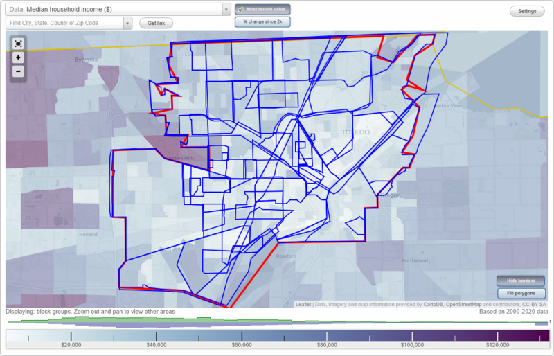
- City boundary
- Neighborhood boundaries
Business Search - 14 Million verified businesses
Neighborhoods:
Air Line Junction, Alexis Addition, Alexis Road, Auburn-Delaware, BUMA, Bancroft Hills, Beverly, Birckhead Place, Birmingham, Cathedral Square, City Center, Collingwood Springs, DeVeaux, East Toledo, Elmhurst, Fitch, Five Points, Franklin Park, Glendale, Gould, Harvard Terrace, Highland Heights, Homeville, Indian Hills, Inverness Village, Ironwood, Lagrange, Library Village, Lincolnshire, Nasby, North Toledo, North Towne, Northriver, ONYX, Old Orchard, Old Towne, Old West End, Ottawa, Point Place, Polish Village, Reynolds Corner, River East, Roosevelt, Scott Park, Secor Gardens, Shoreland, South Side, Southwyck, Stickney, The Corridor, Trilby, United, University Hills, Uptown, Warehouse District, Warren Sherman, Wernert's Corner, West Toledo, Westgate, Westmoreland, Whitmer, WoodsdaleAir Line Junction neighborhood in Toledo statistics: (Find on map)
Area: 1.704 square miles
Population: 4,567
Population density:
Median household income in 2021:
Median rent in in 2021:
Male vs Females
Median age
Average estimated value of detached houses in 2021 (88.4% of all units):
Most popular occupations of males: material moving occupations (30.3%); production occupations (22.8%); transportation occupations (17.4%); sales and office occupations (11.0%); service occupations (9.9%); construction, extraction, and maintenance occupations (2.3%); education, training, and library occupations (2.0%)
Most popular occupations of females: service occupations (49.5%); sales and office occupations (20.1%); production occupations (11.5%); material moving occupations (7.4%); architecture and engineering occupations (5.4%); business and financial operations occupations (3.1%); healthcare practitioners and technical occupations (2.2%)
Highways in this neighborhood: US Hwy 24 (Buckingham St); State Rte 2 (Airport Hwy); State Rte 2 (Western Ave); N Fearing Blvd (US Hwy 24); S Detroit Ave (US Hwy 24); S Fearing Blvd (US Hwy 24).
Roads and streets: South Ave; Airline Ave; Hamilton St; Tecumseh St; Campbell St; Nebraska Ave; Walbridge Ave; Colton St; Dunham St; Dana St; S Hawley St; N Hawley St; Gordon St; Spencer St; Wayne St; Champion St; Dale St; Decatur St; Somerset St; Danberry St; Kenmore Ave; Finch St; Daniels Ave; N Detroit Ave; Hiett Ave; Shasta Dr; Mayberry St; Eldred Ave; Emery St; Ward St; Chester St; Hoag St; Pulaski St; Junction Ave; Gibbons St; Klondike St; King St; Hanover St; Corinth St; Beecham St; Pere St; Bow St; Lake Shore Ave; Wendell St; Whiting Ave; Brown Ave; Hill Ave; Hillside Ave; Holbrook St; Southcrest St; Edna St; Queens St; Ralph St; Davis St; Storrs St; Bender Dr; Louie St; Emma St; Sobieski St; Queen St; Regent St; Prince St.
Railroad features: New York Central RR; Norfolk Southern RR.
Other features: Swan Crk.
Air Line Junction neighborhood detailed profile
Area: 1.704 square miles
Population: 4,567
Population density:
| Air Line Junction (Airline): | 2,680 people per square mile |
| Toledo: | 3,330 people per square mile |
Median household income in 2021:
| Air Line Junction (Airline): | $37,761 |
| Toledo: | $44,150 |
Median rent in in 2021:
| Air Line Junction (Airline): | $642 |
| Toledo: | $620 |
Male vs Females
| Males: | 2,519 |
| Females: | 2,048 |
Median age
| Males: | 33.4 years |
| Females: | 40.7 years |
Average estimated value of detached houses in 2021 (88.4% of all units):
| Air Line Junction (Airline): | $45,013 |
| Toledo: | $91,826 |
Most popular occupations of males: material moving occupations (30.3%); production occupations (22.8%); transportation occupations (17.4%); sales and office occupations (11.0%); service occupations (9.9%); construction, extraction, and maintenance occupations (2.3%); education, training, and library occupations (2.0%)
Most popular occupations of females: service occupations (49.5%); sales and office occupations (20.1%); production occupations (11.5%); material moving occupations (7.4%); architecture and engineering occupations (5.4%); business and financial operations occupations (3.1%); healthcare practitioners and technical occupations (2.2%)
Highways in this neighborhood: US Hwy 24 (Buckingham St); State Rte 2 (Airport Hwy); State Rte 2 (Western Ave); N Fearing Blvd (US Hwy 24); S Detroit Ave (US Hwy 24); S Fearing Blvd (US Hwy 24).
Roads and streets: South Ave; Airline Ave; Hamilton St; Tecumseh St; Campbell St; Nebraska Ave; Walbridge Ave; Colton St; Dunham St; Dana St; S Hawley St; N Hawley St; Gordon St; Spencer St; Wayne St; Champion St; Dale St; Decatur St; Somerset St; Danberry St; Kenmore Ave; Finch St; Daniels Ave; N Detroit Ave; Hiett Ave; Shasta Dr; Mayberry St; Eldred Ave; Emery St; Ward St; Chester St; Hoag St; Pulaski St; Junction Ave; Gibbons St; Klondike St; King St; Hanover St; Corinth St; Beecham St; Pere St; Bow St; Lake Shore Ave; Wendell St; Whiting Ave; Brown Ave; Hill Ave; Hillside Ave; Holbrook St; Southcrest St; Edna St; Queens St; Ralph St; Davis St; Storrs St; Bender Dr; Louie St; Emma St; Sobieski St; Queen St; Regent St; Prince St.
Railroad features: New York Central RR; Norfolk Southern RR.
Other features: Swan Crk.
Air Line Junction neighborhood detailed profile
Alexis Addition neighborhood in Toledo statistics: (Find on map)
Area: 4.509 square miles
Population: 10,718
Population density:
Median household income in 2021:
Median rent in in 2021:
Male vs Females
Median age
Average estimated value of detached houses in 2021 (80.4% of all units):
Most popular occupations of males: production occupations (25.2%); material moving occupations (15.7%); sales and office occupations (9.5%); service occupations (9.4%); transportation occupations (6.7%); construction, extraction, and maintenance occupations (4.0%); management occupations (except farmers) (3.9%)
Most popular occupations of females: sales and office occupations (44.8%); production occupations (43.8%); service occupations (28.4%); transportation occupations (25.7%); healthcare practitioners and technical occupations (18.1%); management occupations (except farmers) (7.6%); community and social services occupations (2.4%)
Limited-access highways (interstate or state) in this neighborhood: I- 75.
Highways in this neighborhood: E Alexis Rd (State Rte 184).
Roads and streets: Shoreland Ave; Benore Rd; Suder Ave; Stickney Ave; Matzinger Rd; Enterprise Blvd; Hagman Rd; Angel Ave; Brent Dr; Bahiamar Rd; Vistamar Rd; Villamar Rd; Torgler Ave; Ruthanne Dr; Fortune Dr; Summit St (N Summit St); Pageland Dr; Brophy Dr; Ketukkee Trl; Rounding River Ln; American Rd; Point Pleasant Dr; Advantage Dr; Jasik Dr; Patriot Dr; Woodfox Dr; Chalmette Dr; S Ottawa Cove Dr; Grosse Point Pkwy; E Harbor Dr; Coveview Dr; Tulane Ave; Belpre Dr; Mayport Dr; Raintree Pkwy; Holliday Dr; Progress Ave; Thornbrook Trl; Progress (Progress Ave); Cassandra Dr; Hammond Dr; Brook Point Rd; Riviera Dr; Capri Dr; Jason St; Andover Ave; Windamar Rd; Shallowford Dr; Greenwich Ln; N Matzinger Rd; Cypress Ln; Pine Ridge St; Whitehouse Dr; Raintree Ln; Foch Ave; Homeland Dr; Jamie Ln; Redfox Dr; Moss Creek St; Lemon Creek St; Susan Ln; President Dr; Petee Rd; Viramar Rd; Walnut Ln; Cedar Ridge; Willow Creek; David Dr; Strotz Dr; Gibson Dr; Apple Creek St; American Rd E; Engel Blvd; Omar Ave; Randon Dr; Kyle St; Tralger Dr; Northshore Dr; Terramar Rd; Capshore Cir; Omar St; Blessing Dr; Rosemar Rd; Heritage Ct; Schwartz Rd; Vernice Dr; Water Point Ct; Meadowrise Ct; Malabar Dr; Rye Mill Ct; Lachapelle Dr; Apple Creek; Lemon Creek (Susan Ln); Bridgeview Dr; Scarsbrook Cir; Sanlin Dr; Havencrest Ct; Silver Dr; Shorebridge Dr; E Futura Dr; Scarsborough Cir; Brendamar Ct; Creekview Dr; Windbrook Ct; Moss Creek; Advantage Rd.
Railroad features: Chesapeake and Ohio Rlwy; New York Central RR; Cincinnati Northern RR; Toledo Terminal RR; Csx Transportation RR.
Other features: Shantee Crk; Silver Crk; Halfway Crk; Ottawa Riv.
Alexis Addition neighborhood detailed profile
Area: 4.509 square miles
Population: 10,718
Population density:
| Alexis Addition: | 2,377 people per square mile |
| Toledo: | 3,330 people per square mile |
Median household income in 2021:
| Alexis Addition: | $52,577 |
| Toledo: | $44,150 |
Median rent in in 2021:
| Alexis Addition: | $658 |
| Toledo: | $620 |
Male vs Females
| Males: | 5,815 |
| Females: | 4,903 |
Median age
| Males: | 35.8 years |
| Females: | 42.9 years |
Average estimated value of detached houses in 2021 (80.4% of all units):
| Alexis Addition: | $60,753 |
| Toledo: | $91,826 |
Most popular occupations of males: production occupations (25.2%); material moving occupations (15.7%); sales and office occupations (9.5%); service occupations (9.4%); transportation occupations (6.7%); construction, extraction, and maintenance occupations (4.0%); management occupations (except farmers) (3.9%)
Most popular occupations of females: sales and office occupations (44.8%); production occupations (43.8%); service occupations (28.4%); transportation occupations (25.7%); healthcare practitioners and technical occupations (18.1%); management occupations (except farmers) (7.6%); community and social services occupations (2.4%)
Limited-access highways (interstate or state) in this neighborhood: I- 75.
Highways in this neighborhood: E Alexis Rd (State Rte 184).
Roads and streets: Shoreland Ave; Benore Rd; Suder Ave; Stickney Ave; Matzinger Rd; Enterprise Blvd; Hagman Rd; Angel Ave; Brent Dr; Bahiamar Rd; Vistamar Rd; Villamar Rd; Torgler Ave; Ruthanne Dr; Fortune Dr; Summit St (N Summit St); Pageland Dr; Brophy Dr; Ketukkee Trl; Rounding River Ln; American Rd; Point Pleasant Dr; Advantage Dr; Jasik Dr; Patriot Dr; Woodfox Dr; Chalmette Dr; S Ottawa Cove Dr; Grosse Point Pkwy; E Harbor Dr; Coveview Dr; Tulane Ave; Belpre Dr; Mayport Dr; Raintree Pkwy; Holliday Dr; Progress Ave; Thornbrook Trl; Progress (Progress Ave); Cassandra Dr; Hammond Dr; Brook Point Rd; Riviera Dr; Capri Dr; Jason St; Andover Ave; Windamar Rd; Shallowford Dr; Greenwich Ln; N Matzinger Rd; Cypress Ln; Pine Ridge St; Whitehouse Dr; Raintree Ln; Foch Ave; Homeland Dr; Jamie Ln; Redfox Dr; Moss Creek St; Lemon Creek St; Susan Ln; President Dr; Petee Rd; Viramar Rd; Walnut Ln; Cedar Ridge; Willow Creek; David Dr; Strotz Dr; Gibson Dr; Apple Creek St; American Rd E; Engel Blvd; Omar Ave; Randon Dr; Kyle St; Tralger Dr; Northshore Dr; Terramar Rd; Capshore Cir; Omar St; Blessing Dr; Rosemar Rd; Heritage Ct; Schwartz Rd; Vernice Dr; Water Point Ct; Meadowrise Ct; Malabar Dr; Rye Mill Ct; Lachapelle Dr; Apple Creek; Lemon Creek (Susan Ln); Bridgeview Dr; Scarsbrook Cir; Sanlin Dr; Havencrest Ct; Silver Dr; Shorebridge Dr; E Futura Dr; Scarsborough Cir; Brendamar Ct; Creekview Dr; Windbrook Ct; Moss Creek; Advantage Rd.
Railroad features: Chesapeake and Ohio Rlwy; New York Central RR; Cincinnati Northern RR; Toledo Terminal RR; Csx Transportation RR.
Other features: Shantee Crk; Silver Crk; Halfway Crk; Ottawa Riv.
Alexis Addition neighborhood detailed profile
Alexis Road neighborhood in Toledo statistics: (Find on map)
Area: 2.253 square miles
Population: 5,205
Population density:
Median household income in 2021:
Median rent in in 2021:
Male vs Females
Median age
Housing prices:
Average estimated value of detached houses in 2021 (37.9% of all units):
Average estimated value of mobile home in 2021 (3.8% of all units):
Most popular occupations of males: production occupations (59.9%); service occupations (17.7%); material moving occupations (9.6%); transportation occupations (4.5%); construction, extraction, and maintenance occupations (2.8%); architecture and engineering occupations (2.2%)
Most popular occupations of females: service occupations (38.2%); healthcare practitioners and technical occupations (23.5%); sales and office occupations (17.3%); production occupations (11.5%); education, training, and library occupations (6.1%); computer and mathematical occupations (1.8%)
Highways in this neighborhood: N Detroit Ave (US Hwy 24); E Alexis Rd (State Rte 184); W Alexis Rd (State Rte 184).
Roads and streets: Telegraph Rd; W State Line Rd; Mel Simon Dr; Lewis Ave; E State Line Rd; Celesta Dr; New Towne Square Dr; Rozelle Dr; Orville Dr; E Northgate Pkwy; Benore Rd; Benalex Dr E; Benalex Dr W; Willamont Rd; Holly Glenn Dr; Stickney Ave; Warrington Rd; Skyview Dr; Gribbin Ln; Terminal Rd; Rolland Dr; Teletowne Dr; Davida Dr; W Laskey Rd; E Laskey Rd; Suzanne Dr; Middlehurst Dr; Crabb Rd; Holly Valley Dr; Westfield Dr; Bennett Rd; Suffield Dr; Birdsall Rd; Silverside Dr; Russlor Dr; Middlebury Ln; Northlawn Dr; Woodlawn Dr; Shoreham Ln; Wallingford Rd; Dearden Pl; Fairfax St; Pepperell Pl; Harrington Dr; Portland Rd; Fairfax Ct; Joann Dr; Durfee Dr; Rubuls Dr; Fleming Dr; Stockbridge Dr; Alexitowne Dr; Edelen Dr; Raddatz Dr; Marquette Pkwy; Westfield Ct; Morningside Dr; Hardwood Ct; Suffield Ct; Northridge Ln; Northtowne Ct; Northview Ln; Northbrook Ln; Opper St; Northlawn Ct.
Railroad features: New York Central RR; Chesapeake and Ohio Rlwy; Ann Arbor RR.
Other features: Silver Crk; Shantee Crk; Half Way Crk; Halfway Crk.
Alexis Road neighborhood detailed profile
Area: 2.253 square miles
Population: 5,205
Population density:
| Alexis Road: | 2,311 people per square mile |
| Toledo: | 3,330 people per square mile |
Median household income in 2021:
| Alexis Road: | $46,773 |
| Toledo: | $44,150 |
Median rent in in 2021:
| Alexis Road: | $640 |
| Toledo: | $620 |
Male vs Females
| Males: | 2,777 |
| Females: | 2,427 |
Median age
| Males: | 32.3 years |
| Females: | 46.4 years |
Housing prices:
Average estimated value of detached houses in 2021 (37.9% of all units):
| Alexis Road: | $84,772 |
| Toledo: | $91,826 |
Average estimated value of mobile home in 2021 (3.8% of all units):
| Alexis Road: | $23,764 |
| Toledo: | $44,833 |
Most popular occupations of males: production occupations (59.9%); service occupations (17.7%); material moving occupations (9.6%); transportation occupations (4.5%); construction, extraction, and maintenance occupations (2.8%); architecture and engineering occupations (2.2%)
Most popular occupations of females: service occupations (38.2%); healthcare practitioners and technical occupations (23.5%); sales and office occupations (17.3%); production occupations (11.5%); education, training, and library occupations (6.1%); computer and mathematical occupations (1.8%)
Highways in this neighborhood: N Detroit Ave (US Hwy 24); E Alexis Rd (State Rte 184); W Alexis Rd (State Rte 184).
Roads and streets: Telegraph Rd; W State Line Rd; Mel Simon Dr; Lewis Ave; E State Line Rd; Celesta Dr; New Towne Square Dr; Rozelle Dr; Orville Dr; E Northgate Pkwy; Benore Rd; Benalex Dr E; Benalex Dr W; Willamont Rd; Holly Glenn Dr; Stickney Ave; Warrington Rd; Skyview Dr; Gribbin Ln; Terminal Rd; Rolland Dr; Teletowne Dr; Davida Dr; W Laskey Rd; E Laskey Rd; Suzanne Dr; Middlehurst Dr; Crabb Rd; Holly Valley Dr; Westfield Dr; Bennett Rd; Suffield Dr; Birdsall Rd; Silverside Dr; Russlor Dr; Middlebury Ln; Northlawn Dr; Woodlawn Dr; Shoreham Ln; Wallingford Rd; Dearden Pl; Fairfax St; Pepperell Pl; Harrington Dr; Portland Rd; Fairfax Ct; Joann Dr; Durfee Dr; Rubuls Dr; Fleming Dr; Stockbridge Dr; Alexitowne Dr; Edelen Dr; Raddatz Dr; Marquette Pkwy; Westfield Ct; Morningside Dr; Hardwood Ct; Suffield Ct; Northridge Ln; Northtowne Ct; Northview Ln; Northbrook Ln; Opper St; Northlawn Ct.
Railroad features: New York Central RR; Chesapeake and Ohio Rlwy; Ann Arbor RR.
Other features: Silver Crk; Shantee Crk; Half Way Crk; Halfway Crk.
Alexis Road neighborhood detailed profile
Auburn-Delaware neighborhood in Toledo statistics: (Find on map)
Area: 0.400 square miles
Population: 806
Population density:
Median household income in 2021:
Median rent in in 2021:
Male vs Females
Median age
Housing prices:
Average estimated value of detached houses in 2021 (76.1% of all units):
Average estimated value of housing units in 2-unit structures in 2021 (21.1% of all units):
Most popular occupations of males: business and financial operations occupations (25.8%); transportation occupations (22.7%); sales and office occupations (17.3%); material moving occupations (10.3%); production occupations (8.5%); construction, extraction, and maintenance occupations (5.8%)
Most popular occupations of females: service occupations (61.1%); sales and office occupations (26.2%); production occupations (8.7%); transportation occupations (1.7%)
Limited-access highways (interstate or state) in this neighborhood: I- 75.
Highways in this neighborhood: State Rte 51 (Monroe St); W Central Ave (State Rte 120, Central Ave W).
Roads and streets: Albion St; S Cove Blvd; W Delaware Ave; Kress St; Palmetto Ave; Goodale Ave; Auburn Ave; Bishop St; Lexington Ave; Parkview Ave; Gasser St; Thatcher Dr; Ayers Ave; Baxter St; Rosedale Ave; Joel Ave; Blaine Ave; Trenton Ave; Hood St; Trowbridge Dr; Cardinal St; Post St.
Railroad features: New York Central RR; Penn Central RR.
Other features: Ottawa Riv.
Auburn-Delaware neighborhood detailed profile
Area: 0.400 square miles
Population: 806
Population density:
| Auburn-Delaware: | 2,017 people per square mile |
| Toledo: | 3,330 people per square mile |
Median household income in 2021:
| Auburn-Delaware: | $32,385 |
| Toledo: | $44,150 |
Median rent in in 2021:
| Auburn-Delaware: | $510 |
| Toledo: | $620 |
Male vs Females
| Males: | 500 |
| Females: | 305 |
Median age
| Males: | 37.9 years |
| Females: | 45.7 years |
Housing prices:
Average estimated value of detached houses in 2021 (76.1% of all units):
| Auburn-Delaware: | $50,779 |
| Toledo: | $91,826 |
Average estimated value of housing units in 2-unit structures in 2021 (21.1% of all units):
| This neighborhood: | $94,167 |
| Toledo: | $90,397 |
Most popular occupations of males: business and financial operations occupations (25.8%); transportation occupations (22.7%); sales and office occupations (17.3%); material moving occupations (10.3%); production occupations (8.5%); construction, extraction, and maintenance occupations (5.8%)
Most popular occupations of females: service occupations (61.1%); sales and office occupations (26.2%); production occupations (8.7%); transportation occupations (1.7%)
Limited-access highways (interstate or state) in this neighborhood: I- 75.
Highways in this neighborhood: State Rte 51 (Monroe St); W Central Ave (State Rte 120, Central Ave W).
Roads and streets: Albion St; S Cove Blvd; W Delaware Ave; Kress St; Palmetto Ave; Goodale Ave; Auburn Ave; Bishop St; Lexington Ave; Parkview Ave; Gasser St; Thatcher Dr; Ayers Ave; Baxter St; Rosedale Ave; Joel Ave; Blaine Ave; Trenton Ave; Hood St; Trowbridge Dr; Cardinal St; Post St.
Railroad features: New York Central RR; Penn Central RR.
Other features: Ottawa Riv.
Auburn-Delaware neighborhood detailed profile
BUMA neighborhood in Toledo statistics: (Find on map)
Area: 0.465 square miles
Population: 1,464
Population density:
Median household income in 2021:
Median rent in in 2021:
Male vs Females
Median age
Housing prices:
Average estimated value of detached houses in 2021 (75.0% of all units):
Average estimated value of housing units in 2-unit structures in 2021 (8.9% of all units):
Most popular occupations of males: production occupations (20.4%); sales and office occupations (17.4%); service occupations (16.9%); material moving occupations (16.4%); construction, extraction, and maintenance occupations (11.1%); transportation occupations (6.0%); management occupations (except farmers) (3.4%)
Most popular occupations of females: service occupations (45.1%); production occupations (25.8%); sales and office occupations (15.3%); business and financial operations occupations (3.3%); education, training, and library occupations (2.9%); management occupations (except farmers) (2.3%); healthcare practitioners and technical occupations (2.3%)
Highways in this neighborhood: State Rte 51 (Monroe St); N Detroit Ave (US Hwy 24).
Roads and streets: W Bancroft St; Milburn Ave; Macomber St; Freeman St; Upton Ave; Ottawa Dr; Cone St; Rosedale Ave; Auburn Ave; Isherwood St; S Cove Blvd; Bluff St; Albion St; Smead Ave; Milburn Ct; Evans St; N Cove Blvd; Lane Ave; Sylvan Ave; Academy Ave; Irvington Pl; Sanford St; Bachelor Ln; Swiler Dr; Utopia St; Lorle St; Oxford Dr; Inwood Dr.
Railroad features: New York Central RR; Penn Central RR.
Other features: Ottawa Riv.
BUMA neighborhood detailed profile
Area: 0.465 square miles
Population: 1,464
Population density:
| BUMA (Bancroft-Upton-Monroe): | 3,150 people per square mile |
| Toledo: | 3,330 people per square mile |
Median household income in 2021:
| BUMA (Bancroft-Upton-Monroe): | $45,609 |
| Toledo: | $44,150 |
Median rent in in 2021:
| BUMA (Bancroft-Upton-Monroe): | $570 |
| Toledo: | $620 |
Male vs Females
| Males: | 700 |
| Females: | 764 |
Median age
| Males: | 38.4 years |
| Females: | 42.0 years |
Housing prices:
Average estimated value of detached houses in 2021 (75.0% of all units):
| BUMA (Bancroft-Upton-Monroe): | $54,829 |
| Toledo: | $91,826 |
Average estimated value of housing units in 2-unit structures in 2021 (8.9% of all units):
| This neighborhood: | $75,972 |
| Toledo: | $90,397 |
Most popular occupations of males: production occupations (20.4%); sales and office occupations (17.4%); service occupations (16.9%); material moving occupations (16.4%); construction, extraction, and maintenance occupations (11.1%); transportation occupations (6.0%); management occupations (except farmers) (3.4%)
Most popular occupations of females: service occupations (45.1%); production occupations (25.8%); sales and office occupations (15.3%); business and financial operations occupations (3.3%); education, training, and library occupations (2.9%); management occupations (except farmers) (2.3%); healthcare practitioners and technical occupations (2.3%)
Highways in this neighborhood: State Rte 51 (Monroe St); N Detroit Ave (US Hwy 24).
Roads and streets: W Bancroft St; Milburn Ave; Macomber St; Freeman St; Upton Ave; Ottawa Dr; Cone St; Rosedale Ave; Auburn Ave; Isherwood St; S Cove Blvd; Bluff St; Albion St; Smead Ave; Milburn Ct; Evans St; N Cove Blvd; Lane Ave; Sylvan Ave; Academy Ave; Irvington Pl; Sanford St; Bachelor Ln; Swiler Dr; Utopia St; Lorle St; Oxford Dr; Inwood Dr.
Railroad features: New York Central RR; Penn Central RR.
Other features: Ottawa Riv.
BUMA neighborhood detailed profile
Bancroft Hills neighborhood in Toledo statistics: (Find on map)
Area: 0.558 square miles
Population: 2,651
Population density:
Median household income in 2021:
Median rent in in 2021:
Male vs Females
Median age
Housing prices:
Average estimated value of detached houses in 2021 (56.7% of all units):
Average estimated value of housing units in 2-unit structures in 2021 (7.0% of all units):
Most popular occupations of males: production occupations (22.0%); sales and office occupations (18.8%); transportation occupations (11.4%); healthcare practitioners and technical occupations (11.0%); management occupations (except farmers) (7.6%); service occupations (7.5%); construction, extraction, and maintenance occupations (6.1%)
Most popular occupations of females: service occupations (37.1%); sales and office occupations (16.4%); education, training, and library occupations (11.8%); production occupations (8.3%); architecture and engineering occupations (7.6%); transportation occupations (6.5%); healthcare practitioners and technical occupations (6.1%)
Highways in this neighborhood: State Rte 246 (Dorr St).
Roads and streets: W Bancroft St; Parkside Blvd; N Douglas Rd; N Westwood Ave; Alvin St; Perth St; Evansdale Ave; Wyndhurst Rd; Oakwood Ave; Kensington Rd; Greenway St; Montebello Rd; Indian River (Indian River Rd); Greenbriar Rd; Lawnview Ave; Roosevelt Ave; Fairlawn Ave; Olds Ave; Calverton Rd; Farnham Rd; Pilgrim Rd; Roosevelt Cir; Zenda St; Fernhill Rd; Marwood Ave.
Railroad features: Csx Transportation RR; New York Central RR.
Other features: Ottawa Riv.
Bancroft Hills neighborhood detailed profile
Area: 0.558 square miles
Population: 2,651
Population density:
| Bancroft Hills: | 4,755 people per square mile |
| Toledo: | 3,330 people per square mile |
Median household income in 2021:
| Bancroft Hills: | $40,414 |
| Toledo: | $44,150 |
Median rent in in 2021:
| Bancroft Hills: | $750 |
| Toledo: | $620 |
Male vs Females
| Males: | 1,814 |
| Females: | 836 |
Median age
| Males: | 30.3 years |
| Females: | 37.4 years |
Housing prices:
Average estimated value of detached houses in 2021 (56.7% of all units):
| Bancroft Hills: | $56,199 |
| Toledo: | $91,826 |
Average estimated value of housing units in 2-unit structures in 2021 (7.0% of all units):
| This neighborhood: | $85,000 |
| Toledo: | $90,397 |
Most popular occupations of males: production occupations (22.0%); sales and office occupations (18.8%); transportation occupations (11.4%); healthcare practitioners and technical occupations (11.0%); management occupations (except farmers) (7.6%); service occupations (7.5%); construction, extraction, and maintenance occupations (6.1%)
Most popular occupations of females: service occupations (37.1%); sales and office occupations (16.4%); education, training, and library occupations (11.8%); production occupations (8.3%); architecture and engineering occupations (7.6%); transportation occupations (6.5%); healthcare practitioners and technical occupations (6.1%)
Highways in this neighborhood: State Rte 246 (Dorr St).
Roads and streets: W Bancroft St; Parkside Blvd; N Douglas Rd; N Westwood Ave; Alvin St; Perth St; Evansdale Ave; Wyndhurst Rd; Oakwood Ave; Kensington Rd; Greenway St; Montebello Rd; Indian River (Indian River Rd); Greenbriar Rd; Lawnview Ave; Roosevelt Ave; Fairlawn Ave; Olds Ave; Calverton Rd; Farnham Rd; Pilgrim Rd; Roosevelt Cir; Zenda St; Fernhill Rd; Marwood Ave.
Railroad features: Csx Transportation RR; New York Central RR.
Other features: Ottawa Riv.
Bancroft Hills neighborhood detailed profile
Beverly neighborhood in Toledo statistics: (Find on map)
Area: 2.747 square miles
Population: 10,664
Population density:
Median household income in 2021:
Median rent in in 2021:
Male vs Females
Median age
Average estimated value of detached houses in 2021 (78.5% of all units):
Most popular occupations of males: sales and office occupations (15.8%); service occupations (11.9%); construction, extraction, and maintenance occupations (10.9%); transportation occupations (8.7%); material moving occupations (8.4%); education, training, and library occupations (8.1%); management occupations (except farmers) (5.8%)
Most popular occupations of females: sales and office occupations (31.1%); service occupations (16.4%); healthcare practitioners and technical occupations (16.2%); education, training, and library occupations (7.3%); management occupations (except farmers) (5.9%); business and financial operations occupations (5.5%); production occupations (4.5%)
Limited-access highways (interstate or state) in this neighborhood: I- 80 (I- 90, Ohio Tpke).
Highways in this neighborhood: State Rte 25 (Anthony Wayne Trl); S Detroit Ave (US Hwy 24).
Roads and streets: River Rd; Beverly Dr; Copland Blvd; Glendale Ave; Wildwood Rd; Broadway St; Brookford Dr; Sherwood Ave; Wildwood Blvd; Daleford Dr; Rugby Dr; Beechway Blvd; Medford Dr; Marengo St; Devonshire Rd; Mapleway Dr; Princeton Dr; Escott Ave; Oxbridge Dr; Deepwood Ln; Frampton Dr; Marlboro St; Island Ave; Rohr Blvd; Townley Rd; Watova Rd; Ogontz Ave; Orono Dr; Glenview Rd; S Byrne Rd; Dorian Dr; Kingsford Dr; Astor Ave; Central Grove Ave; Villa Dr; Circular Rd; Gilbert Rd; May Ave; Burroughs Dr; Stamford Dr; Amherst Dr; Harvard Blvd; Penrose Ave; Radford Dr; Oakway Dr; Foraker Ave; University Blvd; Glenbrook Dr; Dartmouth Dr; Chipplegate Rd; Peabody Ave; Chevy Chase Ln; Glynn Dr; Colby Dr; Glanzman Rd; Shadowlawn Dr; Sandalwood Dr; Tulley Ave (Tully Ave); Ratcliffe Dr; Elmway Dr; Rocksberry Ave; Lombard Ave; Bradford Dr; Tamarack Dr; Stengel St; N May Ave; S May Ave; Royton Rd; Hemlock Dr; Dikway Dr; Folkstone Rd; Kenyon Dr; Stengel Ave; Yale Dr; Erawa Dr; Cornell Dr; Overbrook Dr; Wesleyan Dr; Rosemary St; Fanning Dr; Juniper Dr; Westmeyer St; Terrace Downs St; Bittersweet Dr; Midland Ave; Pineway Dr; Cranford Dr; Yosemite Dr; Hedge Ln; Riverview Ct; Flint Dr; Vassar Dr; Lutaway Dr; St James Ct; Romona Dr; Glenford Dr; Zale Pl; Laurel Ave; April Dr; Corry Ave; Abbott Ave; Mound Ave; Almon Ave; June Dr; March Dr; Pickford Dr; Salem St; Birch Dr; Golf Ln; Gloria Ct; Yaryan Dr; Penrose Ct; Cable Ln; Kirk St; Sheri Ln; Blake Pl; Shortford Dr; Rocksberry Ct; Glynn Ct; Alden Ct; Dorian Ct; Bampton Ave; Opal St; Woodbine Dr; Marengo Dr; Loague Dr; Southwood Rd; Spruce Ln.
Railroad features: Toledo Terminal RR; New York Chicago and St Louis RR.
Other features: Delaware Crk.
Beverly neighborhood detailed profile
Area: 2.747 square miles
Population: 10,664
Population density:
| Beverly: | 3,883 people per square mile |
| Toledo: | 3,330 people per square mile |
Median household income in 2021:
| Beverly: | $65,116 |
| Toledo: | $44,150 |
Median rent in in 2021:
| Beverly: | $665 |
| Toledo: | $620 |
Male vs Females
| Males: | 5,388 |
| Females: | 5,275 |
Median age
| Males: | 34.7 years |
| Females: | 42.6 years |
Average estimated value of detached houses in 2021 (78.5% of all units):
| Beverly: | $121,231 |
| Toledo: | $91,826 |
Most popular occupations of males: sales and office occupations (15.8%); service occupations (11.9%); construction, extraction, and maintenance occupations (10.9%); transportation occupations (8.7%); material moving occupations (8.4%); education, training, and library occupations (8.1%); management occupations (except farmers) (5.8%)
Most popular occupations of females: sales and office occupations (31.1%); service occupations (16.4%); healthcare practitioners and technical occupations (16.2%); education, training, and library occupations (7.3%); management occupations (except farmers) (5.9%); business and financial operations occupations (5.5%); production occupations (4.5%)
Limited-access highways (interstate or state) in this neighborhood: I- 80 (I- 90, Ohio Tpke).
Highways in this neighborhood: State Rte 25 (Anthony Wayne Trl); S Detroit Ave (US Hwy 24).
Roads and streets: River Rd; Beverly Dr; Copland Blvd; Glendale Ave; Wildwood Rd; Broadway St; Brookford Dr; Sherwood Ave; Wildwood Blvd; Daleford Dr; Rugby Dr; Beechway Blvd; Medford Dr; Marengo St; Devonshire Rd; Mapleway Dr; Princeton Dr; Escott Ave; Oxbridge Dr; Deepwood Ln; Frampton Dr; Marlboro St; Island Ave; Rohr Blvd; Townley Rd; Watova Rd; Ogontz Ave; Orono Dr; Glenview Rd; S Byrne Rd; Dorian Dr; Kingsford Dr; Astor Ave; Central Grove Ave; Villa Dr; Circular Rd; Gilbert Rd; May Ave; Burroughs Dr; Stamford Dr; Amherst Dr; Harvard Blvd; Penrose Ave; Radford Dr; Oakway Dr; Foraker Ave; University Blvd; Glenbrook Dr; Dartmouth Dr; Chipplegate Rd; Peabody Ave; Chevy Chase Ln; Glynn Dr; Colby Dr; Glanzman Rd; Shadowlawn Dr; Sandalwood Dr; Tulley Ave (Tully Ave); Ratcliffe Dr; Elmway Dr; Rocksberry Ave; Lombard Ave; Bradford Dr; Tamarack Dr; Stengel St; N May Ave; S May Ave; Royton Rd; Hemlock Dr; Dikway Dr; Folkstone Rd; Kenyon Dr; Stengel Ave; Yale Dr; Erawa Dr; Cornell Dr; Overbrook Dr; Wesleyan Dr; Rosemary St; Fanning Dr; Juniper Dr; Westmeyer St; Terrace Downs St; Bittersweet Dr; Midland Ave; Pineway Dr; Cranford Dr; Yosemite Dr; Hedge Ln; Riverview Ct; Flint Dr; Vassar Dr; Lutaway Dr; St James Ct; Romona Dr; Glenford Dr; Zale Pl; Laurel Ave; April Dr; Corry Ave; Abbott Ave; Mound Ave; Almon Ave; June Dr; March Dr; Pickford Dr; Salem St; Birch Dr; Golf Ln; Gloria Ct; Yaryan Dr; Penrose Ct; Cable Ln; Kirk St; Sheri Ln; Blake Pl; Shortford Dr; Rocksberry Ct; Glynn Ct; Alden Ct; Dorian Ct; Bampton Ave; Opal St; Woodbine Dr; Marengo Dr; Loague Dr; Southwood Rd; Spruce Ln.
Railroad features: Toledo Terminal RR; New York Chicago and St Louis RR.
Other features: Delaware Crk.
Beverly neighborhood detailed profile
Birckhead Place neighborhood in Toledo statistics: (Find on map)
Area: 0.042 square miles
Population: 340
Population density:
Median household income in 2021:
Median rent in in 2021:
Male vs Females
Median age
Average estimated value of detached houses in 2021 (68.0% of all units):
Most popular occupations of males: production occupations (42.7%); management occupations (except farmers) (33.7%); material moving occupations (11.2%)
Most popular occupations of females: service occupations (35.4%); sales and office occupations (26.8%); production occupations (19.7%); healthcare practitioners and technical occupations (12.6%); management occupations (except farmers) (5.5%)
Highways in this neighborhood: Cherry St (State Rte 120).
Roads and streets: Birkhead Pl; Mettler St; Warsaw St; Birckhead Pl; Birckhead Place C Ave; Birckhead Place E Ave.
Birckhead Place neighborhood detailed profile
Area: 0.042 square miles
Population: 340
Population density:
| Birckhead Place: | 8,187 people per square mile |
| Toledo: | 3,330 people per square mile |
Median household income in 2021:
| Birckhead Place: | $32,909 |
| Toledo: | $44,150 |
Median rent in in 2021:
| Birckhead Place: | $493 |
| Toledo: | $620 |
Male vs Females
| Males: | 193 |
| Females: | 146 |
Median age
| Males: | 36.9 years |
| Females: | 27.8 years |
Average estimated value of detached houses in 2021 (68.0% of all units):
| Birckhead Place: | $47,759 |
| Toledo: | $91,826 |
Most popular occupations of males: production occupations (42.7%); management occupations (except farmers) (33.7%); material moving occupations (11.2%)
Most popular occupations of females: service occupations (35.4%); sales and office occupations (26.8%); production occupations (19.7%); healthcare practitioners and technical occupations (12.6%); management occupations (except farmers) (5.5%)
Highways in this neighborhood: Cherry St (State Rte 120).
Roads and streets: Birkhead Pl; Mettler St; Warsaw St; Birckhead Pl; Birckhead Place C Ave; Birckhead Place E Ave.
Birckhead Place neighborhood detailed profile
Birmingham neighborhood in Toledo statistics: (Find on map)
Area: 2.483 square miles
Population: 5,196
Population density:
Median household income in 2021:
Median rent in in 2021:
Male vs Females
Median age
Housing prices:
Average estimated value of detached houses in 2021 (56.4% of all units):
Average estimated value of housing units in 2-unit structures in 2021 (10.6% of all units):
Most popular occupations of males: service occupations (24.3%); material moving occupations (23.2%); production occupations (16.0%); construction, extraction, and maintenance occupations (9.8%); transportation occupations (7.7%); sales and office occupations (7.6%); management occupations (except farmers) (1.7%)
Most popular occupations of females: service occupations (38.7%); production occupations (27.6%); sales and office occupations (7.9%); management occupations (except farmers) (5.2%); education, training, and library occupations (5.0%); healthcare practitioners and technical occupations (5.0%); business and financial operations occupations (3.0%)
Limited-access highways (interstate or state) in this neighborhood: I- 280.
Roads and streets: Front St; Consaul St; N Wheeling St; York St; Seaman St; Genesee St; Caledonia St; Woodford St; Burger St; Bakewell St; Valentine St; Paine Ave; Collins Park Ave; Reineck Dr; S Park Ci; Creston St; Appleton Dr; W Park Ci; Whitlock Ave; N Whittlesey St; Milford Ave; Minerva St; Whittemore St; N Berlin Ave (Benedict St); Poplar St; Craig St; Seville St; Winter St; Fremont St; Reed St; Birmingham Ter; Bogar St; Van Buren Ave; Brummel St; Mechanic St; Quincy St; Koester St; Pratt St; Digby St; Clyde St; Birchard St; Norwalk St; Ledge Ln; Moravan St; Barker St; Ravine Park Village; Arch St; Ira Rd; Hartley St; N Ravine Pkwy; Magyar St; Benedict St; Kossuth St; Hickory St; Earlwood Ave; Hayden St; Knox St; Stitt St; Stitt; Esther St; Wendon Dr; Massillon St; Burr St; Cady Rd; Landers Rd; Penoyer Rd; Worth St; Hunker Rd; Hull St; Farkas Rd; Randolph St; Parnell St; Starr Ave; Yambor St; Perry Ave; Taylor Rd; Juhasz St; Peiter Rd; Nagy St; Brummell St; Marcy St; Ruthdale Ave; Betag St; Lucian St; Nagel Rd.
Railroad features: New York Chicago and St Louis RR; Toledo Terminal RR; Norfolk and Western Rlwy; Csx Transportation RR.
Other features: Duck Crk; Otter Crk.
Birmingham neighborhood detailed profile
Area: 2.483 square miles
Population: 5,196
Population density:
| Birmingham: | 2,093 people per square mile |
| Toledo: | 3,330 people per square mile |
Median household income in 2021:
| Birmingham: | $38,328 |
| Toledo: | $44,150 |
Median rent in in 2021:
| Birmingham: | $513 |
| Toledo: | $620 |
Male vs Females
| Males: | 2,788 |
| Females: | 2,407 |
Median age
| Males: | 38.0 years |
| Females: | 42.3 years |
Housing prices:
Average estimated value of detached houses in 2021 (56.4% of all units):
| Birmingham: | $45,828 |
| Toledo: | $91,826 |
Average estimated value of housing units in 2-unit structures in 2021 (10.6% of all units):
| This neighborhood: | $6,752 |
| Toledo: | $90,397 |
Most popular occupations of males: service occupations (24.3%); material moving occupations (23.2%); production occupations (16.0%); construction, extraction, and maintenance occupations (9.8%); transportation occupations (7.7%); sales and office occupations (7.6%); management occupations (except farmers) (1.7%)
Most popular occupations of females: service occupations (38.7%); production occupations (27.6%); sales and office occupations (7.9%); management occupations (except farmers) (5.2%); education, training, and library occupations (5.0%); healthcare practitioners and technical occupations (5.0%); business and financial operations occupations (3.0%)
Limited-access highways (interstate or state) in this neighborhood: I- 280.
Roads and streets: Front St; Consaul St; N Wheeling St; York St; Seaman St; Genesee St; Caledonia St; Woodford St; Burger St; Bakewell St; Valentine St; Paine Ave; Collins Park Ave; Reineck Dr; S Park Ci; Creston St; Appleton Dr; W Park Ci; Whitlock Ave; N Whittlesey St; Milford Ave; Minerva St; Whittemore St; N Berlin Ave (Benedict St); Poplar St; Craig St; Seville St; Winter St; Fremont St; Reed St; Birmingham Ter; Bogar St; Van Buren Ave; Brummel St; Mechanic St; Quincy St; Koester St; Pratt St; Digby St; Clyde St; Birchard St; Norwalk St; Ledge Ln; Moravan St; Barker St; Ravine Park Village; Arch St; Ira Rd; Hartley St; N Ravine Pkwy; Magyar St; Benedict St; Kossuth St; Hickory St; Earlwood Ave; Hayden St; Knox St; Stitt St; Stitt; Esther St; Wendon Dr; Massillon St; Burr St; Cady Rd; Landers Rd; Penoyer Rd; Worth St; Hunker Rd; Hull St; Farkas Rd; Randolph St; Parnell St; Starr Ave; Yambor St; Perry Ave; Taylor Rd; Juhasz St; Peiter Rd; Nagy St; Brummell St; Marcy St; Ruthdale Ave; Betag St; Lucian St; Nagel Rd.
Railroad features: New York Chicago and St Louis RR; Toledo Terminal RR; Norfolk and Western Rlwy; Csx Transportation RR.
Other features: Duck Crk; Otter Crk.
Birmingham neighborhood detailed profile
Cathedral Square neighborhood in Toledo statistics: (Find on map)
Area: 0.110 square miles
Population: 582
Population density:
Median household income in 2021:
Median rent in in 2021:
Male vs Females
Median age
Most popular occupations of males: service occupations (22.4%); material moving occupations (20.4%); management occupations (except farmers) (17.7%); legal occupations (16.3%); architecture and engineering occupations (15.0%); community and social services occupations (10.3%); construction, extraction, and maintenance occupations (9.4%)
Most popular occupations of females: management occupations (except farmers) (27.6%); service occupations (20.7%); education, training, and library occupations (18.2%); sales and office occupations (14.8%); business and financial operations occupations (10.3%); arts, design, entertainment, sports, and media occupations (9.0%); life, physical, and social science occupations (8.4%)
Roads and streets: Islington St; W Delaware Ave; Collingwood Blvd; Parkwood Ave; Machen St; Melrose Ave; Fulton St; Melington Dr; Winthrop St; Mellington Dr; Brentwood Ave; Tennyson Pl; Colonial Ct.
Cathedral Square neighborhood detailed profile
Area: 0.110 square miles
Population: 582
Population density:
| Cathedral Square: | 5,310 people per square mile |
| Toledo: | 3,330 people per square mile |
Median household income in 2021:
| Cathedral Square: | $41,400 |
| Toledo: | $44,150 |
Median rent in in 2021:
| Cathedral Square: | $458 |
| Toledo: | $620 |
Male vs Females
| Males: | 257 |
| Females: | 325 |
Median age
| Males: | 54.9 years |
| Females: | 51.1 years |
Most popular occupations of males: service occupations (22.4%); material moving occupations (20.4%); management occupations (except farmers) (17.7%); legal occupations (16.3%); architecture and engineering occupations (15.0%); community and social services occupations (10.3%); construction, extraction, and maintenance occupations (9.4%)
Most popular occupations of females: management occupations (except farmers) (27.6%); service occupations (20.7%); education, training, and library occupations (18.2%); sales and office occupations (14.8%); business and financial operations occupations (10.3%); arts, design, entertainment, sports, and media occupations (9.0%); life, physical, and social science occupations (8.4%)
Roads and streets: Islington St; W Delaware Ave; Collingwood Blvd; Parkwood Ave; Machen St; Melrose Ave; Fulton St; Melington Dr; Winthrop St; Mellington Dr; Brentwood Ave; Tennyson Pl; Colonial Ct.
Cathedral Square neighborhood detailed profile
City Center neighborhood in Toledo statistics: (Find on map)
Area: 1.240 square miles
Population: 3,111
Population density:
Median household income in 2021:
Median rent in in 2021:
Male vs Females
Median age
Most popular occupations of males: service occupations (28.0%); material moving occupations (22.1%); healthcare practitioners and technical occupations (12.0%); management occupations (except farmers) (10.5%); construction, extraction, and maintenance occupations (10.5%); production occupations (8.5%); sales and office occupations (7.1%)
Most popular occupations of females: sales and office occupations (34.4%); management occupations (except farmers) (13.9%); healthcare practitioners and technical occupations (13.0%); service occupations (12.3%); transportation occupations (6.6%); business and financial operations occupations (4.9%); education, training, and library occupations (4.9%)
Limited-access highways (interstate or state) in this neighborhood: I- 75.
Highways in this neighborhood: State Rte 51 (Monroe St); State Rte 65 (N Summit St); Cherry St (State Rte 120); Clayton St (State Rte 51); State Rte 65 (S Summit St); State Rte 246 (Dorr St).
Roads and streets: Jefferson Ave; Washington St; Madison Ave; Adams St; Anthony Wayne Trl; N Huron St; N Superior St; Jackson St; N Erie St; Water St; N St Clair St; Lafayette St; S 15th St; Orange St; 14th St; N Ontario St; 12th St; 13th St; N Michigan St; 21st St; 10th St; State Rte 246 (17th St); S Erie St; S St Clair St; Ottawa St; Magnolia Aly; 16th St; 19th St; 20th St; N 11th St; 18th St; Nebraska Ave; Indiana Ave; Commadore Dr; S Superior St; S 13th St; 11th St (S 11th St); Lucas St; Laburnum Aly; 15th St; Avondale Ave; Brookwood Ave; Belmont Ave; S Huron St; Spielbusch Ave; 22nd St (S 22nd St); S 14th St; Beech St; Market St; Moorish Ave; Wabash St; Morris St; Kraus St; Broadway St; S 11th St; Owens Corning Pkwy; Laburnum Ln; 23rd St; S Michigan St; N 22nd St; Depot St; S Ontario St; Vance St; Main St; Cushing St; Pinewood Ave; Perry St; Norwood Ct; Gratiot St; Cornus Aly; Larch Aly; Linden Aly; Government Center; Maritime Plz.
Railroad features: New York Chicago and St Louis RR; New York Central RR.
Other features: Swan Crk.
City Center neighborhood detailed profile
Area: 1.240 square miles
Population: 3,111
Population density:
| City Center (Downtown): | 2,509 people per square mile |
| Toledo: | 3,330 people per square mile |
Median household income in 2021:
| City Center (Downtown): | $27,498 |
| Toledo: | $44,150 |
Median rent in in 2021:
| City Center (Downtown): | $378 |
| Toledo: | $620 |
Male vs Females
| Males: | 2,138 |
| Females: | 972 |
Median age
| Males: | 40.3 years |
| Females: | 44.3 years |
Most popular occupations of males: service occupations (28.0%); material moving occupations (22.1%); healthcare practitioners and technical occupations (12.0%); management occupations (except farmers) (10.5%); construction, extraction, and maintenance occupations (10.5%); production occupations (8.5%); sales and office occupations (7.1%)
Most popular occupations of females: sales and office occupations (34.4%); management occupations (except farmers) (13.9%); healthcare practitioners and technical occupations (13.0%); service occupations (12.3%); transportation occupations (6.6%); business and financial operations occupations (4.9%); education, training, and library occupations (4.9%)
Limited-access highways (interstate or state) in this neighborhood: I- 75.
Highways in this neighborhood: State Rte 51 (Monroe St); State Rte 65 (N Summit St); Cherry St (State Rte 120); Clayton St (State Rte 51); State Rte 65 (S Summit St); State Rte 246 (Dorr St).
Roads and streets: Jefferson Ave; Washington St; Madison Ave; Adams St; Anthony Wayne Trl; N Huron St; N Superior St; Jackson St; N Erie St; Water St; N St Clair St; Lafayette St; S 15th St; Orange St; 14th St; N Ontario St; 12th St; 13th St; N Michigan St; 21st St; 10th St; State Rte 246 (17th St); S Erie St; S St Clair St; Ottawa St; Magnolia Aly; 16th St; 19th St; 20th St; N 11th St; 18th St; Nebraska Ave; Indiana Ave; Commadore Dr; S Superior St; S 13th St; 11th St (S 11th St); Lucas St; Laburnum Aly; 15th St; Avondale Ave; Brookwood Ave; Belmont Ave; S Huron St; Spielbusch Ave; 22nd St (S 22nd St); S 14th St; Beech St; Market St; Moorish Ave; Wabash St; Morris St; Kraus St; Broadway St; S 11th St; Owens Corning Pkwy; Laburnum Ln; 23rd St; S Michigan St; N 22nd St; Depot St; S Ontario St; Vance St; Main St; Cushing St; Pinewood Ave; Perry St; Norwood Ct; Gratiot St; Cornus Aly; Larch Aly; Linden Aly; Government Center; Maritime Plz.
Railroad features: New York Chicago and St Louis RR; New York Central RR.
Other features: Swan Crk.
City Center neighborhood detailed profile
Collingwood Springs neighborhood in Toledo statistics: (Find on map)
Area: 0.101 square miles
Population: 510
Population density:
Median household income in 2021:
Median rent in in 2021:
Male vs Females
Median age
Most popular occupations of males: service occupations (24.0%); material moving occupations (22.8%); management occupations (except farmers) (15.2%); legal occupations (8.9%); architecture and engineering occupations (8.1%); construction, extraction, and maintenance occupations (5.6%); transportation occupations (4.8%)
Most popular occupations of females: management occupations (except farmers) (23.7%); sales and office occupations (19.0%); service occupations (18.9%); education, training, and library occupations (16.7%); business and financial operations occupations (9.8%); life, physical, and social science occupations (7.2%); healthcare practitioners and technical occupations (2.5%)
Roads and streets: Ashland Ave; Collingwood Blvd; W Woodruff Ave; Floyd St; Prescott St; Horton St; W Bancroft St; Irving St; Tremain Dr; Winthrop St.
Collingwood Springs neighborhood detailed profile
Area: 0.101 square miles
Population: 510
Population density:
| Collingwood Springs: | 5,062 people per square mile |
| Toledo: | 3,330 people per square mile |
Median household income in 2021:
| Collingwood Springs: | $45,550 |
| Toledo: | $44,150 |
Median rent in in 2021:
| Collingwood Springs: | $492 |
| Toledo: | $620 |
Male vs Females
| Males: | 256 |
| Females: | 254 |
Median age
| Males: | 44.9 years |
| Females: | 42.4 years |
Most popular occupations of males: service occupations (24.0%); material moving occupations (22.8%); management occupations (except farmers) (15.2%); legal occupations (8.9%); architecture and engineering occupations (8.1%); construction, extraction, and maintenance occupations (5.6%); transportation occupations (4.8%)
Most popular occupations of females: management occupations (except farmers) (23.7%); sales and office occupations (19.0%); service occupations (18.9%); education, training, and library occupations (16.7%); business and financial operations occupations (9.8%); life, physical, and social science occupations (7.2%); healthcare practitioners and technical occupations (2.5%)
Roads and streets: Ashland Ave; Collingwood Blvd; W Woodruff Ave; Floyd St; Prescott St; Horton St; W Bancroft St; Irving St; Tremain Dr; Winthrop St.
Collingwood Springs neighborhood detailed profile
DeVeaux neighborhood in Toledo statistics: (Find on map)
Area: 4.579 square miles
Population: 22,039
Population density:
Median household income in 2021:
Median rent in in 2021:
Male vs Females
Median age
Housing prices:
Average estimated value of detached houses in 2021 (71.9% of all units):
Average estimated value of housing units in 2-unit structures in 2021 (11.9% of all units):
Most popular occupations of males: service occupations (18.4%); production occupations (16.8%); material moving occupations (16.5%); sales and office occupations (10.5%); construction, extraction, and maintenance occupations (9.9%); transportation occupations (7.2%); management occupations (except farmers) (3.9%)
Most popular occupations of females: sales and office occupations (32.4%); service occupations (30.6%); management occupations (except farmers) (8.7%); production occupations (8.7%); healthcare practitioners and technical occupations (5.8%); material moving occupations (3.0%); arts, design, entertainment, sports, and media occupations (2.8%)
Limited-access highways (interstate or state) in this neighborhood: I- 280; I- 75.
Highways in this neighborhood: State Rte 65 (Miami St); State Rte 51 (Woodville Rd).
Roads and streets: Nevada St; Navarre Ave; E Broadway St; Greenwood Ave; Oak St; Starr Ave; Oakdale Ave; White St; Front St; Dearborn Ave; Utah St; Seaman St; Idaho St; Kelsey Ave; Delence St; Yondota St; E Florence Ave; Willard St; Clark St; Earl St; Mason St; Main St; Raymer Blvd; Spring Grove Ave; Fassett St; Freedom St; 2nd St; Hurd St; Sylvester St; Valleywood Dr; Euclid Ave; Liberty St; Plymouth St; Forsythe St; Richford St; Vinal St; Albert St; Parker Ave; 1st St; Mott Ave; Hirzel St; 4th St; S Ravine Parkway Dr; Kedron St; Oswald St; Ironwood Ave; W Florence Ave; Holmes St; Berry St; Platt St; W Plumer St; Dover Pl; Thurston St; Howland Ave; Pool St; Leonard St; 6th St; Price St; Heffner St; Morrison Dr; Church St; Varland Ave; Hathaway St; Milroy St; Elmore St; Jay St; Belt St; Lebanon St; N Ravine Pkwy; Girard St; Poplar St; Clyde St; Maryland Ave; Worthington St; Elgin Ave; Licking St; Steel St; Camden St; 3rd St; Halstead St; Reed St; Prentice Ave; Rogers St; Willow Ave; Kingston Ave; Mc Kinley Ave; Butler St; Van Buren Ave; Milton St; Graham St; Schomberg St; Bond St; Mechanic St; Homestead St; Tracy St; Wilmot St; Artis Pl; Colorado St; Stillman St; Fairmont St; Myrtle St; Lakewood St; Longdale Ave; St Louis St; Arden Pl; Walden Ave; Potter St; Oakmont St; Akron St; Remington St; Leach Ave; Digby St; Midvale Ave; Wardell St; W Foulkes St; Emerson St; Carlyle St; Crystal St; Steadman St; Chesbrough St; Ravine Park Village; Oregon Rd; Arch St; Cyril St; Ellis Ave; Neise Ave; 5th St; Dawson St; Stratton St; Felt St; Federal St; Atkins St; E Broadway; Essex St; Carbon St; Denver Ave; Gessner St; Sheldon St; Basswood St; Madeline St; Tadmore Dr; Hickory St; Wofford Dr; Earlwood Ave; Hayden St; Fairsmith Dr; Allison Ave; Bateman St; Hazelwood St; Easterly Ct; Boles Dr; Deal Ave; Oaklawn Ave; Coyne Ave; Viking St; E Plumer St; Botkins Dr; Delmond Ave; Linmore St; Hanson St; Garfield Pl; Owens St; Rumley Dr; Elsmere Ave; Selkirk St; E Foulkes St; Greenfield St; Glencoe St; Bangor St; Summerdale Ave; Goodwin Ave; Camp St; Rivercrest Ave; Lemert St; Deshler Ave; Barlow St; Cutter St; Lyle Ln; Sisson Dr; Rall Rd; Woodmore St; Gill St; Industrial St; Coney Ct; Boone St; Buczko St (Goorley Ave); Marcy St; Ruthdale Ave; Panama St; Meadow St; Huberdale Ct; Stroehlein Ave; Milan St; Crescent St; Stroenlein Ave; Siegel Ct; Lott Ct; Eads St.
Railroad features: New York Chicago and St Louis RR; Chesapeake and Ohio Rlwy; Baltimore and Ohio RR; Penn Central RR; New York Central RR; Toledo Terminal RR; Csx Transportation RR; Norfolk Southern RR.
Roads and streets: E Florence Ave; W Florence Ave; E Broadway St.
DeVeaux neighborhood detailed profile
Area: 4.579 square miles
Population: 22,039
Population density:
| DeVeaux: | 4,813 people per square mile |
| Toledo: | 3,330 people per square mile |
Median household income in 2021:
| DeVeaux: | $42,412 |
| Toledo: | $44,150 |
Median rent in in 2021:
| DeVeaux: | $568 |
| Toledo: | $620 |
Male vs Females
| Males: | 10,811 |
| Females: | 11,228 |
Median age
| Males: | 35.7 years |
| Females: | 36.7 years |
Housing prices:
Average estimated value of detached houses in 2021 (71.9% of all units):
| DeVeaux: | $55,111 |
| Toledo: | $91,826 |
Average estimated value of housing units in 2-unit structures in 2021 (11.9% of all units):
| This neighborhood: | $106,176 |
| Toledo: | $90,397 |
Most popular occupations of males: service occupations (18.4%); production occupations (16.8%); material moving occupations (16.5%); sales and office occupations (10.5%); construction, extraction, and maintenance occupations (9.9%); transportation occupations (7.2%); management occupations (except farmers) (3.9%)
Most popular occupations of females: sales and office occupations (32.4%); service occupations (30.6%); management occupations (except farmers) (8.7%); production occupations (8.7%); healthcare practitioners and technical occupations (5.8%); material moving occupations (3.0%); arts, design, entertainment, sports, and media occupations (2.8%)
Limited-access highways (interstate or state) in this neighborhood: I- 280; I- 75.
Highways in this neighborhood: State Rte 65 (Miami St); State Rte 51 (Woodville Rd).
Roads and streets: Nevada St; Navarre Ave; E Broadway St; Greenwood Ave; Oak St; Starr Ave; Oakdale Ave; White St; Front St; Dearborn Ave; Utah St; Seaman St; Idaho St; Kelsey Ave; Delence St; Yondota St; E Florence Ave; Willard St; Clark St; Earl St; Mason St; Main St; Raymer Blvd; Spring Grove Ave; Fassett St; Freedom St; 2nd St; Hurd St; Sylvester St; Valleywood Dr; Euclid Ave; Liberty St; Plymouth St; Forsythe St; Richford St; Vinal St; Albert St; Parker Ave; 1st St; Mott Ave; Hirzel St; 4th St; S Ravine Parkway Dr; Kedron St; Oswald St; Ironwood Ave; W Florence Ave; Holmes St; Berry St; Platt St; W Plumer St; Dover Pl; Thurston St; Howland Ave; Pool St; Leonard St; 6th St; Price St; Heffner St; Morrison Dr; Church St; Varland Ave; Hathaway St; Milroy St; Elmore St; Jay St; Belt St; Lebanon St; N Ravine Pkwy; Girard St; Poplar St; Clyde St; Maryland Ave; Worthington St; Elgin Ave; Licking St; Steel St; Camden St; 3rd St; Halstead St; Reed St; Prentice Ave; Rogers St; Willow Ave; Kingston Ave; Mc Kinley Ave; Butler St; Van Buren Ave; Milton St; Graham St; Schomberg St; Bond St; Mechanic St; Homestead St; Tracy St; Wilmot St; Artis Pl; Colorado St; Stillman St; Fairmont St; Myrtle St; Lakewood St; Longdale Ave; St Louis St; Arden Pl; Walden Ave; Potter St; Oakmont St; Akron St; Remington St; Leach Ave; Digby St; Midvale Ave; Wardell St; W Foulkes St; Emerson St; Carlyle St; Crystal St; Steadman St; Chesbrough St; Ravine Park Village; Oregon Rd; Arch St; Cyril St; Ellis Ave; Neise Ave; 5th St; Dawson St; Stratton St; Felt St; Federal St; Atkins St; E Broadway; Essex St; Carbon St; Denver Ave; Gessner St; Sheldon St; Basswood St; Madeline St; Tadmore Dr; Hickory St; Wofford Dr; Earlwood Ave; Hayden St; Fairsmith Dr; Allison Ave; Bateman St; Hazelwood St; Easterly Ct; Boles Dr; Deal Ave; Oaklawn Ave; Coyne Ave; Viking St; E Plumer St; Botkins Dr; Delmond Ave; Linmore St; Hanson St; Garfield Pl; Owens St; Rumley Dr; Elsmere Ave; Selkirk St; E Foulkes St; Greenfield St; Glencoe St; Bangor St; Summerdale Ave; Goodwin Ave; Camp St; Rivercrest Ave; Lemert St; Deshler Ave; Barlow St; Cutter St; Lyle Ln; Sisson Dr; Rall Rd; Woodmore St; Gill St; Industrial St; Coney Ct; Boone St; Buczko St (Goorley Ave); Marcy St; Ruthdale Ave; Panama St; Meadow St; Huberdale Ct; Stroehlein Ave; Milan St; Crescent St; Stroenlein Ave; Siegel Ct; Lott Ct; Eads St.
Railroad features: New York Chicago and St Louis RR; Chesapeake and Ohio Rlwy; Baltimore and Ohio RR; Penn Central RR; New York Central RR; Toledo Terminal RR; Csx Transportation RR; Norfolk Southern RR.
Roads and streets: E Florence Ave; W Florence Ave; E Broadway St.
DeVeaux neighborhood detailed profile
East Toledo neighborhood in Toledo statistics: (Find on map)
Area: 9.766 square miles
Population: 30,598
Population density:
Median household income in 2021:
Median rent in in 2021:
Male vs Females
Median age
Housing prices:
Average estimated value of detached houses in 2021 (71.4% of all units):
Average estimated value of housing units in 2-unit structures in 2021 (11.2% of all units):
Most popular occupations of males: service occupations (19.9%); production occupations (16.7%); material moving occupations (16.1%); construction, extraction, and maintenance occupations (10.1%); sales and office occupations (9.6%); transportation occupations (8.7%); management occupations (except farmers) (3.0%)
Most popular occupations of females: service occupations (31.9%); sales and office occupations (28.1%); production occupations (12.5%); management occupations (except farmers) (7.7%); healthcare practitioners and technical occupations (6.3%); education, training, and library occupations (2.7%); material moving occupations (2.6%)
Limited-access highways (interstate or state) in this neighborhood: I- 280; I- 75.
Highways in this neighborhood: State Rte 65 (Miami St); State Rte 51 (Woodville Rd).
Roads and streets: Front St; Starr Ave; Nevada St; Navarre Ave; E Broadway St; Greenwood Ave; Oak St; Consaul St; Oakdale Ave; York St; White St; Dearborn Ave; Utah St; Seaman St; Millard Ave; N Wheeling St; Idaho St; Kelsey Ave; Delence St; Yondota St; E Florence Ave; Willard St; Clark St; Earl St; Mason St; St Lawrence Dr; Main St; Raymer Blvd; Genesee St; Spring Grove Ave; Caledonia St; Fassett St; Freedom St; Otter Creek Rd; Woodford St; 2nd St; Hurd St; George Hardy Dr; Sylvester St; Valleywood Dr; Euclid Ave; Burger St; Bakewell St; Liberty St; Valentine St; Plymouth St; Forsythe St; Richford St; Vinal St; Albert St; Parker Ave; Paine Ave; 1st St; Mott Ave; Hirzel St; 4th St; S Ravine Parkway Dr; Kedron St; N Ravine Pkwy; Oswald St; Ironwood Ave; W Florence Ave; Holmes St; Berry St; Collins Park Ave; Platt St; Van Buren Ave; W Plumer St; Dover Pl; Thurston St; Reineck Dr; Howland Ave; Pool St; Leonard St; S Park Ci; Sinclair Ave; 6th St; Price St; Heffner St; Morrison Dr; Creston St; Appleton Dr; W Park Ci; Church St; Varland Ave; Hathaway St; Milroy St; Whitlock Ave; Elmore St; Jay St; N Whittlesey St; Milford Ave; Belt St; Lebanon St; Minerva St; John Q Carey Dr; Luther Hills Cir; Whittemore St; N Berlin Ave (Benedict St); Girard St; Poplar St; Craig St; Clyde St; Maryland Ave; Worthington St; Elgin Ave; Seville St; Licking St; Steel St; Winter St; Camden St; 3rd St; Fremont St; Halstead St; Reed St; Birmingham Ter; Mechanic St; Prentice Ave; Rogers St; Willow Ave; Kingston Ave; Mc Kinley Ave; Butler St; Bogar St; S Wheeling St; Milton St; Graham St; Brummel St; Schomberg St; Bond St; Homestead St; Tracy St; Wilmot St; Artis Pl; Colorado St; Quincy St; Stillman St; Fairmont St; Myrtle St; Koester St; Lakewood St; Longdale Ave; St Louis St; Arden Pl; Walden Ave; Potter St; Pratt St; Oakmont St; Akron St; Remington St; Leach Ave; Digby St; Earlwood Ave; Midvale Ave; Wardell St; W Foulkes St; Emerson St; Carlyle St; Birchard St; Norwalk St; Ledge Ln; Moravan St; Barker St; Crystal St; Steadman St; Hayden St; Chesbrough St; Ravine Park Village; Oregon Rd; Arch St; Tiffin Ave; Cyril St; Ira Rd; Ellis Ave; Neise Ave; 5th St; Dawson St; Stratton St; Hartley St; Olivewood Ave; Felt St; Crestway Dr; Magyar St; Taylor Rd; Federal St; Ruthdale Ave; Benedict St; Old Millard Ave; Kossuth St; Atkins St; E Broadway; Essex St; Carbon St; Denver Ave; Gessner St; Sheldon St; Basswood St; Madeline St; N Yarrow St; Tadmore Dr; Hickory St; Worth St; Wofford Dr; Bleeker St; Fairsmith Dr; Knox St; Allison Ave; Bateman St; Lee St; Hazelwood St; Ridgeway Dr; Easterly Ct; Boles Dr; Deal Ave; Stitt St; Oaklawn Ave; Coyne Ave; Viking St; E Plumer St; Botkins Dr; Delmond Ave; Stitt; Linmore St; Hanson St; Garfield Pl; Owens St; Esther St; Wendon Dr; Massillon St; Luther Hills Dr; Rumley Dr; Elsmere Ave; Selkirk St; E Foulkes St; Greenfield St; Jessie St; Glencoe St; Burr St; Cady Rd; Bangor St; Landers Rd; Summerdale Ave; Penoyer Rd; Goodwin Ave; Bay St; Camp St; Rivercrest Ave; Hunker Rd; Lemert St; Deshler Ave; Hull St; Farkas Rd; Portland St; Randolph St; Parnell St; Barlow St; Cutter St; Yambor St; Lyle Ln; Sisson Dr; Perry Ave; Rall Rd; Juhasz St; Woodmore St; Peiter Rd; Nagy St; Gill St; Industrial St; Coney Ct; Brummell St; Boone St; Buczko St (Goorley Ave); Marcy St; Panama St; Meadow St; Corduroy Rd; Betag St; Huberdale Ct; Stroehlein Ave; Milan St; Lucian St; Crescent St; Stroenlein Ave; Siegel Ct; Lott Ct; Grasser St; Nagel Rd; Eads St; Arthur St.
Railroad features: New York Chicago and St Louis RR; Toledo Terminal RR; Chesapeake and Ohio Rlwy; Penn Central RR; Baltimore and Ohio RR; Norfolk and Western Rlwy; New York Central RR; Csx Transportation RR; Norfolk Southern RR.
Other features: Otter Crk; Duck Crk.
Roads and streets: E Florence Ave; W Florence Ave; E Broadway St.
East Toledo neighborhood detailed profile
Area: 9.766 square miles
Population: 30,598
Population density:
| East Toledo: | 3,133 people per square mile |
| Toledo: | 3,330 people per square mile |
Median household income in 2021:
| East Toledo: | $43,591 |
| Toledo: | $44,150 |
Median rent in in 2021:
| East Toledo: | $570 |
| Toledo: | $620 |
Male vs Females
| Males: | 15,137 |
| Females: | 15,460 |
Median age
| Males: | 36.1 years |
| Females: | 37.0 years |
Housing prices:
Average estimated value of detached houses in 2021 (71.4% of all units):
| East Toledo: | $58,355 |
| Toledo: | $91,826 |
Average estimated value of housing units in 2-unit structures in 2021 (11.2% of all units):
| This neighborhood: | $10,154 |
| Toledo: | $90,397 |
Most popular occupations of males: service occupations (19.9%); production occupations (16.7%); material moving occupations (16.1%); construction, extraction, and maintenance occupations (10.1%); sales and office occupations (9.6%); transportation occupations (8.7%); management occupations (except farmers) (3.0%)
Most popular occupations of females: service occupations (31.9%); sales and office occupations (28.1%); production occupations (12.5%); management occupations (except farmers) (7.7%); healthcare practitioners and technical occupations (6.3%); education, training, and library occupations (2.7%); material moving occupations (2.6%)
Limited-access highways (interstate or state) in this neighborhood: I- 280; I- 75.
Highways in this neighborhood: State Rte 65 (Miami St); State Rte 51 (Woodville Rd).
Roads and streets: Front St; Starr Ave; Nevada St; Navarre Ave; E Broadway St; Greenwood Ave; Oak St; Consaul St; Oakdale Ave; York St; White St; Dearborn Ave; Utah St; Seaman St; Millard Ave; N Wheeling St; Idaho St; Kelsey Ave; Delence St; Yondota St; E Florence Ave; Willard St; Clark St; Earl St; Mason St; St Lawrence Dr; Main St; Raymer Blvd; Genesee St; Spring Grove Ave; Caledonia St; Fassett St; Freedom St; Otter Creek Rd; Woodford St; 2nd St; Hurd St; George Hardy Dr; Sylvester St; Valleywood Dr; Euclid Ave; Burger St; Bakewell St; Liberty St; Valentine St; Plymouth St; Forsythe St; Richford St; Vinal St; Albert St; Parker Ave; Paine Ave; 1st St; Mott Ave; Hirzel St; 4th St; S Ravine Parkway Dr; Kedron St; N Ravine Pkwy; Oswald St; Ironwood Ave; W Florence Ave; Holmes St; Berry St; Collins Park Ave; Platt St; Van Buren Ave; W Plumer St; Dover Pl; Thurston St; Reineck Dr; Howland Ave; Pool St; Leonard St; S Park Ci; Sinclair Ave; 6th St; Price St; Heffner St; Morrison Dr; Creston St; Appleton Dr; W Park Ci; Church St; Varland Ave; Hathaway St; Milroy St; Whitlock Ave; Elmore St; Jay St; N Whittlesey St; Milford Ave; Belt St; Lebanon St; Minerva St; John Q Carey Dr; Luther Hills Cir; Whittemore St; N Berlin Ave (Benedict St); Girard St; Poplar St; Craig St; Clyde St; Maryland Ave; Worthington St; Elgin Ave; Seville St; Licking St; Steel St; Winter St; Camden St; 3rd St; Fremont St; Halstead St; Reed St; Birmingham Ter; Mechanic St; Prentice Ave; Rogers St; Willow Ave; Kingston Ave; Mc Kinley Ave; Butler St; Bogar St; S Wheeling St; Milton St; Graham St; Brummel St; Schomberg St; Bond St; Homestead St; Tracy St; Wilmot St; Artis Pl; Colorado St; Quincy St; Stillman St; Fairmont St; Myrtle St; Koester St; Lakewood St; Longdale Ave; St Louis St; Arden Pl; Walden Ave; Potter St; Pratt St; Oakmont St; Akron St; Remington St; Leach Ave; Digby St; Earlwood Ave; Midvale Ave; Wardell St; W Foulkes St; Emerson St; Carlyle St; Birchard St; Norwalk St; Ledge Ln; Moravan St; Barker St; Crystal St; Steadman St; Hayden St; Chesbrough St; Ravine Park Village; Oregon Rd; Arch St; Tiffin Ave; Cyril St; Ira Rd; Ellis Ave; Neise Ave; 5th St; Dawson St; Stratton St; Hartley St; Olivewood Ave; Felt St; Crestway Dr; Magyar St; Taylor Rd; Federal St; Ruthdale Ave; Benedict St; Old Millard Ave; Kossuth St; Atkins St; E Broadway; Essex St; Carbon St; Denver Ave; Gessner St; Sheldon St; Basswood St; Madeline St; N Yarrow St; Tadmore Dr; Hickory St; Worth St; Wofford Dr; Bleeker St; Fairsmith Dr; Knox St; Allison Ave; Bateman St; Lee St; Hazelwood St; Ridgeway Dr; Easterly Ct; Boles Dr; Deal Ave; Stitt St; Oaklawn Ave; Coyne Ave; Viking St; E Plumer St; Botkins Dr; Delmond Ave; Stitt; Linmore St; Hanson St; Garfield Pl; Owens St; Esther St; Wendon Dr; Massillon St; Luther Hills Dr; Rumley Dr; Elsmere Ave; Selkirk St; E Foulkes St; Greenfield St; Jessie St; Glencoe St; Burr St; Cady Rd; Bangor St; Landers Rd; Summerdale Ave; Penoyer Rd; Goodwin Ave; Bay St; Camp St; Rivercrest Ave; Hunker Rd; Lemert St; Deshler Ave; Hull St; Farkas Rd; Portland St; Randolph St; Parnell St; Barlow St; Cutter St; Yambor St; Lyle Ln; Sisson Dr; Perry Ave; Rall Rd; Juhasz St; Woodmore St; Peiter Rd; Nagy St; Gill St; Industrial St; Coney Ct; Brummell St; Boone St; Buczko St (Goorley Ave); Marcy St; Panama St; Meadow St; Corduroy Rd; Betag St; Huberdale Ct; Stroehlein Ave; Milan St; Lucian St; Crescent St; Stroenlein Ave; Siegel Ct; Lott Ct; Grasser St; Nagel Rd; Eads St; Arthur St.
Railroad features: New York Chicago and St Louis RR; Toledo Terminal RR; Chesapeake and Ohio Rlwy; Penn Central RR; Baltimore and Ohio RR; Norfolk and Western Rlwy; New York Central RR; Csx Transportation RR; Norfolk Southern RR.
Other features: Otter Crk; Duck Crk.
Roads and streets: E Florence Ave; W Florence Ave; E Broadway St.
East Toledo neighborhood detailed profile
Elmhurst neighborhood in Toledo statistics: (Find on map)
Area: 1.590 square miles
Population: 9,290
Population density:
Median household income in 2021:
Median rent in in 2021:
Male vs Females
Median age
Average estimated value of detached houses in 2021 (87.4% of all units):
Most popular occupations of males: production occupations (16.5%); sales and office occupations (15.2%); service occupations (12.7%); construction, extraction, and maintenance occupations (9.3%); management occupations (except farmers) (9.0%); material moving occupations (6.8%); transportation occupations (6.0%)
Most popular occupations of females: sales and office occupations (30.2%); service occupations (16.5%); education, training, and library occupations (14.1%); healthcare practitioners and technical occupations (10.8%); management occupations (except farmers) (6.7%); production occupations (6.4%); arts, design, entertainment, sports, and media occupations (4.1%)
Limited-access highways (interstate or state) in this neighborhood: I- 475.
Highways in this neighborhood: State Rte 51 (Monroe St).
Roads and streets: Douglas Rd; Elmhurst Rd; Bowen Rd; Secor Rd; W Laskey Rd; Portsmouth Ave; Sylvania Ave (W Sylvania Ave); Gracewood Rd; Garrison Rd; Berdan Ave; Oak Grove Pl; Eastbrook Dr; Grantwood Dr; Grantley Rd; Stannard Dr; Woodmont Rd; Vogel Dr; Lambert Dr; Elsie Ave; Westbrook Dr; Drummond Rd; Castleton Ave; Bales Rd; Langenderfer Dr; Boxwood Rd; Groveland Rd; Wyndale Rd; Maxwell Rd; Rohr Dr; Claredale Rd; Pennhurst Rd; Elmview Dr; Crary Dr; Rushland Ave; Nash Rd; Thoman Pl; Ivy Pl; Corydon Dr; Oak Glen Dr; Seckinger Dr; Elm Pl; Cedarhurst Rd; Bowser Dr; Doty Dr; Beaufort Ave; Kingsmoor Dr; Buell Ave; Charlestown Ave; Georgetown Ave; Brott Rd; Harley Rd; Wynnewood Dr; Yellowstone Dr; Wyckliffe Pkwy; Pinehurst Dr; Pershing Dr; Ridgedale Rd; Roywood Rd; Seckinger Ct; Terry Dr; Wyndale Ct; W Sylvania Ave; W Bowen Rd; E Bowen Rd.
Other features: Tifft Ditch; Eisenbraum Ditch.
Elmhurst neighborhood detailed profile
Area: 1.590 square miles
Population: 9,290
Population density:
| Elmhurst: | 5,842 people per square mile |
| Toledo: | 3,330 people per square mile |
Median household income in 2021:
| Elmhurst: | $61,085 |
| Toledo: | $44,150 |
Median rent in in 2021:
| Elmhurst: | $756 |
| Toledo: | $620 |
Male vs Females
| Males: | 4,614 |
| Females: | 4,676 |
Median age
| Males: | 35.3 years |
| Females: | 38.8 years |
Average estimated value of detached houses in 2021 (87.4% of all units):
| Elmhurst: | $115,565 |
| Toledo: | $91,826 |
Most popular occupations of males: production occupations (16.5%); sales and office occupations (15.2%); service occupations (12.7%); construction, extraction, and maintenance occupations (9.3%); management occupations (except farmers) (9.0%); material moving occupations (6.8%); transportation occupations (6.0%)
Most popular occupations of females: sales and office occupations (30.2%); service occupations (16.5%); education, training, and library occupations (14.1%); healthcare practitioners and technical occupations (10.8%); management occupations (except farmers) (6.7%); production occupations (6.4%); arts, design, entertainment, sports, and media occupations (4.1%)
Limited-access highways (interstate or state) in this neighborhood: I- 475.
Highways in this neighborhood: State Rte 51 (Monroe St).
Roads and streets: Douglas Rd; Elmhurst Rd; Bowen Rd; Secor Rd; W Laskey Rd; Portsmouth Ave; Sylvania Ave (W Sylvania Ave); Gracewood Rd; Garrison Rd; Berdan Ave; Oak Grove Pl; Eastbrook Dr; Grantwood Dr; Grantley Rd; Stannard Dr; Woodmont Rd; Vogel Dr; Lambert Dr; Elsie Ave; Westbrook Dr; Drummond Rd; Castleton Ave; Bales Rd; Langenderfer Dr; Boxwood Rd; Groveland Rd; Wyndale Rd; Maxwell Rd; Rohr Dr; Claredale Rd; Pennhurst Rd; Elmview Dr; Crary Dr; Rushland Ave; Nash Rd; Thoman Pl; Ivy Pl; Corydon Dr; Oak Glen Dr; Seckinger Dr; Elm Pl; Cedarhurst Rd; Bowser Dr; Doty Dr; Beaufort Ave; Kingsmoor Dr; Buell Ave; Charlestown Ave; Georgetown Ave; Brott Rd; Harley Rd; Wynnewood Dr; Yellowstone Dr; Wyckliffe Pkwy; Pinehurst Dr; Pershing Dr; Ridgedale Rd; Roywood Rd; Seckinger Ct; Terry Dr; Wyndale Ct; W Sylvania Ave; W Bowen Rd; E Bowen Rd.
Other features: Tifft Ditch; Eisenbraum Ditch.
Elmhurst neighborhood detailed profile
Fitch neighborhood in Toledo statistics: (Find on map)
Area: 1.917 square miles
Population: 7,489
Population density:
Median household income in 2021:
Median rent in in 2021:
Male vs Females
Median age
Housing prices:
Average estimated value of detached houses in 2021 (84.2% of all units):
Average estimated value of housing units in 2-unit structures in 2021 (12.5% of all units):
Most popular occupations of males: sales and office occupations (18.5%); service occupations (15.7%); production occupations (14.9%); business and financial operations occupations (12.6%); management occupations (except farmers) (8.9%); transportation occupations (8.7%); computer and mathematical occupations (4.3%)
Most popular occupations of females: sales and office occupations (37.2%); service occupations (17.3%); education, training, and library occupations (8.4%); business and financial operations occupations (8.3%); community and social services occupations (8.0%); management occupations (except farmers) (7.8%); production occupations (6.5%)
Limited-access highways (interstate or state) in this neighborhood: I- 475.
Highways in this neighborhood: W Central Ave (State Rte 120, Central Ave W).
Roads and streets: Jackman Rd; Tremainsville Rd; Douglas Rd; Berdan Ave; Sylvania Ave (W Sylvania Ave); W Laskey Rd; Upton Ave; Bellevue Rd; Marlow Rd; Eastbrook Dr; Mansfield Rd; Fairfax Rd; Loxley Rd; Talbot St; Grantwood Dr; Matlack Ave; Sherbrooke Rd; Roanoke Rd; Castlewood Dr; Balkan Pl; Barrows St; Berkshire Pl; Brussels St; Westland Ave; Westbrook Dr; Brame Pl; Charlestown Ave; Kelly Ave; Portsmouth Ave; Georgia Ave; Kershaw Ave; Georgetown Ave; Rood St; Giant St; Groveland Rd; Mellwood Ave; Beaufort Ave; Oak Grove Pl; Duncan Rd; Wychwood St; Stahlwood Ave; Marne Ave; Garden Park Dr; Mellwood Ct; Fitch Rd; Lambert Dr; Harris St; Bigelow St; Larchmont Pkwy; Templar Rd; Anderson Pkwy; Fir Ln; Leamington Ave; Glenn Oaks Dr; Fair Oaks Dr; Fitkin St; Hearthstone Pl; Saint Bernard Dr; Farragut Ave; Northwood Ave; Shelbourne Ave; Coolidge Pkwy; Olin Dr; St Bernard Dr; Burr Oaks Dr; Gilliotte Ave; Nathalie St; Irma Pl; Kelley Ave; McKeever Ave; Ledyard Ave.
Railroad features: Csx Transportation RR.
Other features: Tifft Ditch; Peterson Ditch.
Fitch neighborhood detailed profile
Area: 1.917 square miles
Population: 7,489
Population density:
| Fitch: | 3,906 people per square mile |
| Toledo: | 3,330 people per square mile |
Median household income in 2021:
| Fitch: | $60,687 |
| Toledo: | $44,150 |
Median rent in in 2021:
| Fitch: | $732 |
| Toledo: | $620 |
Male vs Females
| Males: | 3,776 |
| Females: | 3,713 |
Median age
| Males: | 32.8 years |
| Females: | 36.9 years |
Housing prices:
Average estimated value of detached houses in 2021 (84.2% of all units):
| Fitch: | $105,540 |
| Toledo: | $91,826 |
Average estimated value of housing units in 2-unit structures in 2021 (12.5% of all units):
| This neighborhood: | $43,264 |
| Toledo: | $90,397 |
Most popular occupations of males: sales and office occupations (18.5%); service occupations (15.7%); production occupations (14.9%); business and financial operations occupations (12.6%); management occupations (except farmers) (8.9%); transportation occupations (8.7%); computer and mathematical occupations (4.3%)
Most popular occupations of females: sales and office occupations (37.2%); service occupations (17.3%); education, training, and library occupations (8.4%); business and financial operations occupations (8.3%); community and social services occupations (8.0%); management occupations (except farmers) (7.8%); production occupations (6.5%)
Limited-access highways (interstate or state) in this neighborhood: I- 475.
Highways in this neighborhood: W Central Ave (State Rte 120, Central Ave W).
Roads and streets: Jackman Rd; Tremainsville Rd; Douglas Rd; Berdan Ave; Sylvania Ave (W Sylvania Ave); W Laskey Rd; Upton Ave; Bellevue Rd; Marlow Rd; Eastbrook Dr; Mansfield Rd; Fairfax Rd; Loxley Rd; Talbot St; Grantwood Dr; Matlack Ave; Sherbrooke Rd; Roanoke Rd; Castlewood Dr; Balkan Pl; Barrows St; Berkshire Pl; Brussels St; Westland Ave; Westbrook Dr; Brame Pl; Charlestown Ave; Kelly Ave; Portsmouth Ave; Georgia Ave; Kershaw Ave; Georgetown Ave; Rood St; Giant St; Groveland Rd; Mellwood Ave; Beaufort Ave; Oak Grove Pl; Duncan Rd; Wychwood St; Stahlwood Ave; Marne Ave; Garden Park Dr; Mellwood Ct; Fitch Rd; Lambert Dr; Harris St; Bigelow St; Larchmont Pkwy; Templar Rd; Anderson Pkwy; Fir Ln; Leamington Ave; Glenn Oaks Dr; Fair Oaks Dr; Fitkin St; Hearthstone Pl; Saint Bernard Dr; Farragut Ave; Northwood Ave; Shelbourne Ave; Coolidge Pkwy; Olin Dr; St Bernard Dr; Burr Oaks Dr; Gilliotte Ave; Nathalie St; Irma Pl; Kelley Ave; McKeever Ave; Ledyard Ave.
Railroad features: Csx Transportation RR.
Other features: Tifft Ditch; Peterson Ditch.
Fitch neighborhood detailed profile
Five Points neighborhood in Toledo statistics: (Find on map)
Area: 3.246 square miles
Population: 13,264
Population density:
Median household income in 2021:
Median rent in in 2021:
Male vs Females
Median age
Housing prices:
Average estimated value of detached houses in 2021 (94.9% of all units):
Average estimated value of housing units in 2-unit structures in 2021 (1.6% of all units):
Most popular occupations of males: sales and office occupations (17.1%); service occupations (15.1%); construction, extraction, and maintenance occupations (14.8%); production occupations (14.7%); transportation occupations (9.7%); material moving occupations (8.7%); management occupations (except farmers) (6.1%)
Most popular occupations of females: sales and office occupations (23.9%); service occupations (16.4%); healthcare practitioners and technical occupations (15.4%); management occupations (except farmers) (12.1%); business and financial operations occupations (9.7%); material moving occupations (8.2%); education, training, and library occupations (4.1%)
Limited-access highways (interstate or state) in this neighborhood: I- 75.
Highways in this neighborhood: N Detroit Ave (US Hwy 24); W Central Ave (State Rte 120, Central Ave W).
Roads and streets: Sylvania Ave (W Sylvania Ave); Eleanor Ave; Willys Pkwy; Berdan Ave; Slater St; W Gramercy Ave; Poinsetta Ave; Overland Pkwy; Phillips Ave; Burnham Ave; W Capistrano Ave; Lewis Ave; Bennett Rd; Hillcrest Ave; N Haven Ave; Royalton Rd; W Crawford Ave; Pasadena Blvd; Walker Ave; Vermaas Ave; Westway St; California Blvd; Commonwealth Ave; Waggoner Blvd; Sunset Blvd; Crestwood Rd; Eastway St; Belmar Ave; Lagrange St; Dryden Dr; Corbin Rd; N Lockwood Ave; W Laskey Rd; Craigwood Rd; Amesbury Rd; Gradolph St; Fairview Dr; Jeep Pkwy; Berwick Ave; Sabra Rd; Lyman Ave; Packard Rd; Caroline Ave; Asbury Dr; Wallwerth Dr; Torrance Dr; Almeda Dr; Burton Ave; Leybourn Ave; Homewood Ave; Watson Ave; Revere Dr; Hoiles Ave; Hazelhurst Ave; Rollins Rd; Cribb St; Gould Rd; Rampart St; Santa Monica St; Hagley Rd; Rosetta St; Parrakeet Ave; Kingsbury Ave; Drexel Dr; Alvison Rd; Brinton Dr; Annabelle Dr; Berkeley Dr; Bradmore Dr; Kipling Dr; N Cove Blvd S; Lockwood Ave; Martha Ave; Olson St; Hawk St; Martin Ave; Clara Ave; Mc Donald St; Birchall Rd; Lowe Rd; Schuyler Rd; Canada Southern Ave; Alva St; Haverhill Dr; Seiss Ave; Tudor St; Bellevista Dr; Mallett St; Branleigh Dr; Clymena St; Funston St; Alcott St; Pennfield Rd; Opper St; Peak Ave; Castener St; Kepler Rd; W Sylvania Ave; Kane St; Catawba St; Laclede Rd; Peru St; Higley St; Manorwood Rd; Carthage Rd; Concord St; E Crawford Ave; Ruxton Rd; Woodhaven Dr; Lawndale Pl; Harford Rd; Eggeman Ave; E Capistrano Ave; Mayfield Dr; Thornton Ave; Imlay St; Wetzler Rd; Trent St; Pingree Rd; Keeshin Pl; Baltimore St; Bailey Pl; Edgewood Dr; Sampson St; Dewey St; Schley St; N Cove Blvd N; Ovid Pl; E Gramercy Ave; Gens Dr; Isabella; Flomar Ct; W Central Ave (State Rte 120).
Railroad features: Toledo Terminal RR; Csx Transportation RR; New York Central RR; Norfolk Southern RR; Detroit Toledo and Ironton RR.
Other features: Shantee Crk; Sibley Crk; Willys Crk; Ottawa Riv.
Five Points neighborhood detailed profile
Area: 3.246 square miles
Population: 13,264
Population density:
| Five Points: | 4,086 people per square mile |
| Toledo: | 3,330 people per square mile |
Median household income in 2021:
| Five Points: | $39,511 |
| Toledo: | $44,150 |
Median rent in in 2021:
| Five Points: | $765 |
| Toledo: | $620 |
Male vs Females
| Males: | 6,656 |
| Females: | 6,608 |
Median age
| Males: | 27.4 years |
| Females: | 38.5 years |
Housing prices:
Average estimated value of detached houses in 2021 (94.9% of all units):
| Five Points: | $65,862 |
| Toledo: | $91,826 |
Average estimated value of housing units in 2-unit structures in 2021 (1.6% of all units):
| This neighborhood: | $94,167 |
| Toledo: | $90,397 |
Most popular occupations of males: sales and office occupations (17.1%); service occupations (15.1%); construction, extraction, and maintenance occupations (14.8%); production occupations (14.7%); transportation occupations (9.7%); material moving occupations (8.7%); management occupations (except farmers) (6.1%)
Most popular occupations of females: sales and office occupations (23.9%); service occupations (16.4%); healthcare practitioners and technical occupations (15.4%); management occupations (except farmers) (12.1%); business and financial operations occupations (9.7%); material moving occupations (8.2%); education, training, and library occupations (4.1%)
Limited-access highways (interstate or state) in this neighborhood: I- 75.
Highways in this neighborhood: N Detroit Ave (US Hwy 24); W Central Ave (State Rte 120, Central Ave W).
Roads and streets: Sylvania Ave (W Sylvania Ave); Eleanor Ave; Willys Pkwy; Berdan Ave; Slater St; W Gramercy Ave; Poinsetta Ave; Overland Pkwy; Phillips Ave; Burnham Ave; W Capistrano Ave; Lewis Ave; Bennett Rd; Hillcrest Ave; N Haven Ave; Royalton Rd; W Crawford Ave; Pasadena Blvd; Walker Ave; Vermaas Ave; Westway St; California Blvd; Commonwealth Ave; Waggoner Blvd; Sunset Blvd; Crestwood Rd; Eastway St; Belmar Ave; Lagrange St; Dryden Dr; Corbin Rd; N Lockwood Ave; W Laskey Rd; Craigwood Rd; Amesbury Rd; Gradolph St; Fairview Dr; Jeep Pkwy; Berwick Ave; Sabra Rd; Lyman Ave; Packard Rd; Caroline Ave; Asbury Dr; Wallwerth Dr; Torrance Dr; Almeda Dr; Burton Ave; Leybourn Ave; Homewood Ave; Watson Ave; Revere Dr; Hoiles Ave; Hazelhurst Ave; Rollins Rd; Cribb St; Gould Rd; Rampart St; Santa Monica St; Hagley Rd; Rosetta St; Parrakeet Ave; Kingsbury Ave; Drexel Dr; Alvison Rd; Brinton Dr; Annabelle Dr; Berkeley Dr; Bradmore Dr; Kipling Dr; N Cove Blvd S; Lockwood Ave; Martha Ave; Olson St; Hawk St; Martin Ave; Clara Ave; Mc Donald St; Birchall Rd; Lowe Rd; Schuyler Rd; Canada Southern Ave; Alva St; Haverhill Dr; Seiss Ave; Tudor St; Bellevista Dr; Mallett St; Branleigh Dr; Clymena St; Funston St; Alcott St; Pennfield Rd; Opper St; Peak Ave; Castener St; Kepler Rd; W Sylvania Ave; Kane St; Catawba St; Laclede Rd; Peru St; Higley St; Manorwood Rd; Carthage Rd; Concord St; E Crawford Ave; Ruxton Rd; Woodhaven Dr; Lawndale Pl; Harford Rd; Eggeman Ave; E Capistrano Ave; Mayfield Dr; Thornton Ave; Imlay St; Wetzler Rd; Trent St; Pingree Rd; Keeshin Pl; Baltimore St; Bailey Pl; Edgewood Dr; Sampson St; Dewey St; Schley St; N Cove Blvd N; Ovid Pl; E Gramercy Ave; Gens Dr; Isabella; Flomar Ct; W Central Ave (State Rte 120).
Railroad features: Toledo Terminal RR; Csx Transportation RR; New York Central RR; Norfolk Southern RR; Detroit Toledo and Ironton RR.
Other features: Shantee Crk; Sibley Crk; Willys Crk; Ottawa Riv.
Five Points neighborhood detailed profile
Franklin Park neighborhood in Toledo statistics: (Find on map)
Area: 4.375 square miles
Population: 13,274
Population density:
Median household income in 2021:
Median rent in in 2021:
Male vs Females
Median age
Average estimated value of detached houses in 2021 (88.7% of all units):
Most popular occupations of males: transportation occupations (21.0%); production occupations (14.9%); sales and office occupations (14.6%); construction, extraction, and maintenance occupations (10.2%); management occupations (except farmers) (8.3%); service occupations (7.6%); material moving occupations (6.5%)
Most popular occupations of females: sales and office occupations (35.1%); education, training, and library occupations (15.9%); service occupations (14.3%); healthcare practitioners and technical occupations (13.2%); business and financial operations occupations (4.8%); production occupations (4.8%); management occupations (except farmers) (4.4%)
Limited-access highways (interstate or state) in this neighborhood: I- 475.
Highways in this neighborhood: W Alexis Rd (State Rte 184); State Rte 51 (Monroe St); W Central Ave (State Rte 120, Central Ave W).
Roads and streets: Secor Rd; Harvest Ln; Sylvania Ave (W Sylvania Ave); Talmadge Rd; Rambo Ln; Clover Ln; Mc Gregor Ln; W Laskey Rd; Ariel Ave; Barstow Ave; Carskaddon Ave; Oak Ridge Dr; Imperial Dr; Airedale Ave; Quinton Ave; Luann Ave; Otjen Rd; Westchester Rd; Malden Ave; Naomi Dr; Violet Rd; Springbrook Dr; Fairhaven Dr; Brock Dr; Yarmouth Ave; Comet Ave; Boydson Dr; Herman Pl; Clawson Ave; Torquay Ave; Rose Garden Dr; Vail Ave; Harschel Dr; Buchanan Dr; Woods Ave; Meteor Ave; Planet Ave; Monac Dr; Haddington Dr; Scarsborough Rd; Hannaford Dr; Acoma Dr; Steffens Ave; Philmar Dr; Garden Estates Dr; Kirk Ave; Whiteford Center Rd; Penelope Dr; Donegal Dr; Albar Dr; Wrenwood Rd; Merle St; Clarewood Dr; Tiverton Ave; Armada Dr; Bannockburn Dr; Kathy Ln; Jamesway Dr; Harbord Dr; Willis Blvd; Graceway Dr; Talmadge Green Rd; Clareridge Dr; Royer Rd; Cedarbrook Ln; Stock Ave; Ginger Tree Ln; Quast Ln; Helene Ct; Coral Ave; Grayling Pl; Althea Ln; Fredelia Dr; Forest Grove Dr; Barbara Dr; Carlingfort Dr; Sulgrave Dr; Snowden Dr; Fox Glove Rd; Branch Dr; Fenwick Dr; Bridlington Dr; Flowers Rd; Regis Dr; Home Ln; Mantey Ln; Rega Pl; Bromley Dr; Woodbriar Dr; Oak Crest Rd; Murnen Rd; Ganymede Dr; Donnelly Rd; Coronada Dr; Strang Cir; Hidden Pines Way; Briarcrest Rd; Nantucket Dr; Robin Rd; Buchannan Dr; Estero Pl; Friedley Dr; Rose Acres Dr; Barcelona Dr; Woodley Rd; Lauderdale Dr; Willow Lane Dr; Cherrywood Ln; Shamrock Dr; Naples Dr; Calyx Ln; Oak Tree Dr; Gilhouse Rd; Brockton Dr; Professional Dr; Surrey Rd; Talmadge Woods; Darewood Dr; Tavistock Dr; Brookfield Dr; Baybrook Ln; Pendleton Rd; Thelma Dr; Waterford Pl; Zachary Rd; Birchdale Dr; Mapleview Dr; Satinwood Dr; Brant Rd; Homerdale Ave; Pinecrest Dr; Bonwood Dr; Davewood Dr; Wenwood Dr; Cropthorn Dr; Imperial St; Greenview Dr; Cypress Ave; Clover Ridge Ct; Cedardale Ct; Mc Kain Dr; Morrell Dr; Londonderry Ln; Brant Ct; Mill Run Ct; Hines Rd; Birchtree Dr; Corey Rd; Sunforest Ct; Seagert Dr; Penridge Rd; Avonhurst Rd; Lawrin Dr; Shadygrove Ct; Imperial Blvd; Sefton Rd; Donerail Dr; Sheffield Ct; S Barstow Ave; E Oakridge Dr; Regency Ct; Sugarmaple Ln; Richnor Rd; Flamingo Pl; Wedgewood Ct; Eddington Ct; Granville Ct; Honeymaple Ln; Pinestead Dr; Sylvan Ridge Ct; Lenticel Dr; Sylvan Ridge Dr; Day St; Kerr St; Dianne Ct; Karen Dr; Woodview Dr; Holifield Dr; Tillmon Trl; Canevin Dr; Talmadge Ct; Pear Tree Ln; Pine Ridge Rd; Shakespeare Ln; Belfair Ct; Durham Ct; Satinwood Ct; Strang Dr; W Sylvania Ave; Rose Glenn Dr; Friedly Dr; Streatham Ct; Talmadge Woods Dr.
Other features: Eisenbraum Ditch; Tifft Ditch; Wing Ditch; Haughton Ditch; Peterson Ditch; Silver Ditch.
Other features: Silver Creek South Br; Silver Crk.
Franklin Park neighborhood detailed profile
Area: 4.375 square miles
Population: 13,274
Population density:
| Franklin Park: | 3,034 people per square mile |
| Toledo: | 3,330 people per square mile |
Median household income in 2021:
| Franklin Park: | $87,218 |
| Toledo: | $44,150 |
Median rent in in 2021:
| Franklin Park: | $730 |
| Toledo: | $620 |
Male vs Females
| Males: | 6,256 |
| Females: | 7,018 |
Median age
| Males: | 41.3 years |
| Females: | 45.0 years |
Average estimated value of detached houses in 2021 (88.7% of all units):
| Franklin Park: | $233,483 |
| Toledo: | $91,826 |
Most popular occupations of males: transportation occupations (21.0%); production occupations (14.9%); sales and office occupations (14.6%); construction, extraction, and maintenance occupations (10.2%); management occupations (except farmers) (8.3%); service occupations (7.6%); material moving occupations (6.5%)
Most popular occupations of females: sales and office occupations (35.1%); education, training, and library occupations (15.9%); service occupations (14.3%); healthcare practitioners and technical occupations (13.2%); business and financial operations occupations (4.8%); production occupations (4.8%); management occupations (except farmers) (4.4%)
Limited-access highways (interstate or state) in this neighborhood: I- 475.
Highways in this neighborhood: W Alexis Rd (State Rte 184); State Rte 51 (Monroe St); W Central Ave (State Rte 120, Central Ave W).
Roads and streets: Secor Rd; Harvest Ln; Sylvania Ave (W Sylvania Ave); Talmadge Rd; Rambo Ln; Clover Ln; Mc Gregor Ln; W Laskey Rd; Ariel Ave; Barstow Ave; Carskaddon Ave; Oak Ridge Dr; Imperial Dr; Airedale Ave; Quinton Ave; Luann Ave; Otjen Rd; Westchester Rd; Malden Ave; Naomi Dr; Violet Rd; Springbrook Dr; Fairhaven Dr; Brock Dr; Yarmouth Ave; Comet Ave; Boydson Dr; Herman Pl; Clawson Ave; Torquay Ave; Rose Garden Dr; Vail Ave; Harschel Dr; Buchanan Dr; Woods Ave; Meteor Ave; Planet Ave; Monac Dr; Haddington Dr; Scarsborough Rd; Hannaford Dr; Acoma Dr; Steffens Ave; Philmar Dr; Garden Estates Dr; Kirk Ave; Whiteford Center Rd; Penelope Dr; Donegal Dr; Albar Dr; Wrenwood Rd; Merle St; Clarewood Dr; Tiverton Ave; Armada Dr; Bannockburn Dr; Kathy Ln; Jamesway Dr; Harbord Dr; Willis Blvd; Graceway Dr; Talmadge Green Rd; Clareridge Dr; Royer Rd; Cedarbrook Ln; Stock Ave; Ginger Tree Ln; Quast Ln; Helene Ct; Coral Ave; Grayling Pl; Althea Ln; Fredelia Dr; Forest Grove Dr; Barbara Dr; Carlingfort Dr; Sulgrave Dr; Snowden Dr; Fox Glove Rd; Branch Dr; Fenwick Dr; Bridlington Dr; Flowers Rd; Regis Dr; Home Ln; Mantey Ln; Rega Pl; Bromley Dr; Woodbriar Dr; Oak Crest Rd; Murnen Rd; Ganymede Dr; Donnelly Rd; Coronada Dr; Strang Cir; Hidden Pines Way; Briarcrest Rd; Nantucket Dr; Robin Rd; Buchannan Dr; Estero Pl; Friedley Dr; Rose Acres Dr; Barcelona Dr; Woodley Rd; Lauderdale Dr; Willow Lane Dr; Cherrywood Ln; Shamrock Dr; Naples Dr; Calyx Ln; Oak Tree Dr; Gilhouse Rd; Brockton Dr; Professional Dr; Surrey Rd; Talmadge Woods; Darewood Dr; Tavistock Dr; Brookfield Dr; Baybrook Ln; Pendleton Rd; Thelma Dr; Waterford Pl; Zachary Rd; Birchdale Dr; Mapleview Dr; Satinwood Dr; Brant Rd; Homerdale Ave; Pinecrest Dr; Bonwood Dr; Davewood Dr; Wenwood Dr; Cropthorn Dr; Imperial St; Greenview Dr; Cypress Ave; Clover Ridge Ct; Cedardale Ct; Mc Kain Dr; Morrell Dr; Londonderry Ln; Brant Ct; Mill Run Ct; Hines Rd; Birchtree Dr; Corey Rd; Sunforest Ct; Seagert Dr; Penridge Rd; Avonhurst Rd; Lawrin Dr; Shadygrove Ct; Imperial Blvd; Sefton Rd; Donerail Dr; Sheffield Ct; S Barstow Ave; E Oakridge Dr; Regency Ct; Sugarmaple Ln; Richnor Rd; Flamingo Pl; Wedgewood Ct; Eddington Ct; Granville Ct; Honeymaple Ln; Pinestead Dr; Sylvan Ridge Ct; Lenticel Dr; Sylvan Ridge Dr; Day St; Kerr St; Dianne Ct; Karen Dr; Woodview Dr; Holifield Dr; Tillmon Trl; Canevin Dr; Talmadge Ct; Pear Tree Ln; Pine Ridge Rd; Shakespeare Ln; Belfair Ct; Durham Ct; Satinwood Ct; Strang Dr; W Sylvania Ave; Rose Glenn Dr; Friedly Dr; Streatham Ct; Talmadge Woods Dr.
Other features: Eisenbraum Ditch; Tifft Ditch; Wing Ditch; Haughton Ditch; Peterson Ditch; Silver Ditch.
Other features: Silver Creek South Br; Silver Crk.
Franklin Park neighborhood detailed profile
Glendale neighborhood in Toledo statistics: (Find on map)
Area: 3.738 square miles
Population: 18,773
Population density:
Median household income in 2021:
Median rent in in 2021:
Male vs Females
Median age
Housing prices:
Average estimated value of detached houses in 2021 (81.5% of all units):
Average estimated value of townhouses or other attached units in 2021 (5.4% of all units):
Average estimated '21 value of housing units in 5-or-more-unit structures (3.4% of all units):
Most popular occupations of males: management occupations (except farmers) (24.5%); service occupations (18.3%); sales and office occupations (11.7%); production occupations (11.5%); construction, extraction, and maintenance occupations (7.3%); material moving occupations (4.9%); business and financial operations occupations (3.6%)
Most popular occupations of females: service occupations (24.5%); sales and office occupations (22.5%); education, training, and library occupations (11.4%); management occupations (except farmers) (8.9%); arts, design, entertainment, sports, and media occupations (7.5%); business and financial operations occupations (6.3%); healthcare practitioners and technical occupations (6.0%)
Highways in this neighborhood: S Detroit Ave (US Hwy 24).
Roads and streets: Arlington Ave; Glendale Ave; Heatherdowns Blvd; Schneider Rd; S Byrne Rd; Cherrylawn Dr; Cragmoor Ave; Muirfield Ave; Winston Blvd; E Campus Dr; Oak Hill Ct; Glencairn Ave; Ravenwood Blvd; Glanzman Rd; Wilshire Ave; Heatherlawn Dr; Woodhurst Dr; Havenhurst Ave; Greenvalley Dr; Pinelawn Dr; Patrick Rafter Blvd; W Campus Dr; Strathmoor Ave; Birchwood Ave; Heatherwood Dr; Rosearbor Dr; Archwood Ln; Greenlawn Dr; Royal Haven Rd; Maeterlinck Ave; Meadowlark Ave; Research Dr; Lynbrook Dr; Aberdeen Ave; Park Forest Dr; Nieson Blvd; Francis Ave; Garden Lake Dr; Brest Dr; Juliet Dr; Treelawn Dr; Eaton Dr; Tall Oaks Dr; Colony Dr; Tedrow Rd; Centerway East Dr; Elmlawn Dr; Buxton Dr; Oak Forest Dr; Glenton Dr; Pennelwood Dr; Shadylawn Dr; S Beverly Hills Dr; Dana Dr; Roberta Dr; Tarkington Ave; N Beverly Hills Dr; Blairmont Ave; W Country Club Pkwy; Camille Dr; Claudia Dr; Denise Dr; Brenda Dr; Brierheath Ave; Richlawn Dr; Greengate Dr; Timberlawn Rd; Kimberton Dr; Southwood Rd; Golfgate Dr; Charmaine Dr; Luscombe Dr; Stanwix Dr; Leith Dr; Winnette Dr; Firlawn Dr; Bensch Dr; Driftwood Rd; Library Cir; Heatherton Dr; Linden Green Dr; Prairie Ave; McO Blvd; Heatherbrook Dr; Oaklawn Dr; Claybourne Dr; Sunnylawn Dr; S Country Club Pkwy; Hospital Dr; Stengel Ave; E Beverly Hills Dr; Garden Lake Pkwy; Fullington Rd; Wilmore Dr; E Country Club Pkwy; Larc Ln; Southlawn Dr; Radisson Ave; S Kennison Dr; Ravine Dr; Toledo Ave; Hinsdale Dr; Wylie Ave; Midlawn Dr; Blairmont Blvd; Centerway West Dr; Cummings Ave; Colleen Ct; Michele Dr; Gateway Dr; Dewlawn Dr; Perlawn Dr; Health Center Dr; Autumn View Ct; Highland Green Dr; Meyerwood St; Watkins Dr; Grand View Ct; Byrneway Dr; Beverly Hills Dr; Calvert Pl; Carmelle Ct; Opal St; S Westwood Ave; Chadwick Dr; Greenlawn Ct; Deer Path Ln; Richwood Ave; Greenbrook Ct; Southway Ct; Nelson Ave; Hurley Ct; Wreford Ct; Green Meadow Ct; Garden Lake Blvd; Greencrest Ln; Brigitte Dr; Hinsdale Rd; Garden Lake Pl; Nanette Dr; N Colleen Ct; Green Rose Ct; Cherry Ct; Garden Lake Ct; Wilton St; Rose Ct.
Railroad features: Toledo Terminal RR; New York Chicago and St Louis RR; Norfolk and Western Rlwy.
Other features: Gerdes Ditch; Heilman Ditch.
Other features: Swan Crk.
Glendale neighborhood detailed profile
Area: 3.738 square miles
Population: 18,773
Population density:
| Glendale (Heatherdowns): | 5,022 people per square mile |
| Toledo: | 3,330 people per square mile |
Median household income in 2021:
| Glendale (Heatherdowns): | $52,651 |
| Toledo: | $44,150 |
Median rent in in 2021:
| Glendale (Heatherdowns): | $760 |
| Toledo: | $620 |
Male vs Females
| Males: | 10,338 |
| Females: | 8,434 |
Median age
| Males: | 37.1 years |
| Females: | 49.9 years |
Housing prices:
Average estimated value of detached houses in 2021 (81.5% of all units):
| Glendale (Heatherdowns): | $115,704 |
| Toledo: | $91,826 |
Average estimated value of townhouses or other attached units in 2021 (5.4% of all units):
| This neighborhood: | $93,765 |
| city: | $107,217 |
Average estimated '21 value of housing units in 5-or-more-unit structures (3.4% of all units):
| Glendale (Heatherdowns): | $95,000 |
| Toledo: | $96,426 |
Most popular occupations of males: management occupations (except farmers) (24.5%); service occupations (18.3%); sales and office occupations (11.7%); production occupations (11.5%); construction, extraction, and maintenance occupations (7.3%); material moving occupations (4.9%); business and financial operations occupations (3.6%)
Most popular occupations of females: service occupations (24.5%); sales and office occupations (22.5%); education, training, and library occupations (11.4%); management occupations (except farmers) (8.9%); arts, design, entertainment, sports, and media occupations (7.5%); business and financial operations occupations (6.3%); healthcare practitioners and technical occupations (6.0%)
Highways in this neighborhood: S Detroit Ave (US Hwy 24).
Roads and streets: Arlington Ave; Glendale Ave; Heatherdowns Blvd; Schneider Rd; S Byrne Rd; Cherrylawn Dr; Cragmoor Ave; Muirfield Ave; Winston Blvd; E Campus Dr; Oak Hill Ct; Glencairn Ave; Ravenwood Blvd; Glanzman Rd; Wilshire Ave; Heatherlawn Dr; Woodhurst Dr; Havenhurst Ave; Greenvalley Dr; Pinelawn Dr; Patrick Rafter Blvd; W Campus Dr; Strathmoor Ave; Birchwood Ave; Heatherwood Dr; Rosearbor Dr; Archwood Ln; Greenlawn Dr; Royal Haven Rd; Maeterlinck Ave; Meadowlark Ave; Research Dr; Lynbrook Dr; Aberdeen Ave; Park Forest Dr; Nieson Blvd; Francis Ave; Garden Lake Dr; Brest Dr; Juliet Dr; Treelawn Dr; Eaton Dr; Tall Oaks Dr; Colony Dr; Tedrow Rd; Centerway East Dr; Elmlawn Dr; Buxton Dr; Oak Forest Dr; Glenton Dr; Pennelwood Dr; Shadylawn Dr; S Beverly Hills Dr; Dana Dr; Roberta Dr; Tarkington Ave; N Beverly Hills Dr; Blairmont Ave; W Country Club Pkwy; Camille Dr; Claudia Dr; Denise Dr; Brenda Dr; Brierheath Ave; Richlawn Dr; Greengate Dr; Timberlawn Rd; Kimberton Dr; Southwood Rd; Golfgate Dr; Charmaine Dr; Luscombe Dr; Stanwix Dr; Leith Dr; Winnette Dr; Firlawn Dr; Bensch Dr; Driftwood Rd; Library Cir; Heatherton Dr; Linden Green Dr; Prairie Ave; McO Blvd; Heatherbrook Dr; Oaklawn Dr; Claybourne Dr; Sunnylawn Dr; S Country Club Pkwy; Hospital Dr; Stengel Ave; E Beverly Hills Dr; Garden Lake Pkwy; Fullington Rd; Wilmore Dr; E Country Club Pkwy; Larc Ln; Southlawn Dr; Radisson Ave; S Kennison Dr; Ravine Dr; Toledo Ave; Hinsdale Dr; Wylie Ave; Midlawn Dr; Blairmont Blvd; Centerway West Dr; Cummings Ave; Colleen Ct; Michele Dr; Gateway Dr; Dewlawn Dr; Perlawn Dr; Health Center Dr; Autumn View Ct; Highland Green Dr; Meyerwood St; Watkins Dr; Grand View Ct; Byrneway Dr; Beverly Hills Dr; Calvert Pl; Carmelle Ct; Opal St; S Westwood Ave; Chadwick Dr; Greenlawn Ct; Deer Path Ln; Richwood Ave; Greenbrook Ct; Southway Ct; Nelson Ave; Hurley Ct; Wreford Ct; Green Meadow Ct; Garden Lake Blvd; Greencrest Ln; Brigitte Dr; Hinsdale Rd; Garden Lake Pl; Nanette Dr; N Colleen Ct; Green Rose Ct; Cherry Ct; Garden Lake Ct; Wilton St; Rose Ct.
Railroad features: Toledo Terminal RR; New York Chicago and St Louis RR; Norfolk and Western Rlwy.
Other features: Gerdes Ditch; Heilman Ditch.
Other features: Swan Crk.
Glendale neighborhood detailed profile
Gould neighborhood in Toledo statistics: (Find on map)
Area: 0.982 square miles
Population: 5,151
Population density:
Median household income in 2021:
Median rent in in 2021:
Male vs Females
Median age
Average estimated value of detached houses in 2021 (87.3% of all units):
Most popular occupations of males: management occupations (except farmers) (25.7%); service occupations (14.8%); production occupations (12.1%); sales and office occupations (12.0%); construction, extraction, and maintenance occupations (9.0%); material moving occupations (5.4%); business and financial operations occupations (3.2%)
Most popular occupations of females: service occupations (25.3%); sales and office occupations (19.9%); management occupations (except farmers) (8.6%); education, training, and library occupations (8.4%); healthcare practitioners and technical occupations (7.5%); business and financial operations occupations (6.2%); arts, design, entertainment, sports, and media occupations (5.8%)
Highways in this neighborhood: S Detroit Ave (US Hwy 24).
Roads and streets: Glendale Ave; Schneider Rd; Glanzman Rd; Heatherdowns Blvd; Cragmoor Ave; S Byrne Rd; Winston Blvd; Muirfield Ave; Glencairn Ave; Ravenwood Blvd; Strathmoor Ave; Birchwood Ave; Royal Haven Rd; Maeterlinck Ave; Meadowlark Ave; Havenhurst Ave; Southwood Rd; Wilshire Ave; Glenbrook Dr; Tarkington Ave; Blairmont Ave; Brierheath Ave; Charmaine Dr; Lombard Ave; Fullington Rd; Radisson Ave; Hinsdale Dr; Colleen Ct; Watkins Dr; Calvert Pl; Carmelle Ct; Richwood Ave; Watova Rd; Hinsdale Rd; Orleans Dr; Tedrow Rd; Pennelwood Dr; Gateway Dr; Loague Dr; N Colleen Ct; Pickford Dr.
Railroad features: New York Chicago and St Louis RR; Toledo Terminal RR.
Other features: Gerdes Ditch.
Other features: Delaware Crk.
Gould neighborhood detailed profile
Area: 0.982 square miles
Population: 5,151
Population density:
| Gould: | 5,245 people per square mile |
| Toledo: | 3,330 people per square mile |
Median household income in 2021:
| Gould: | $61,856 |
| Toledo: | $44,150 |
Median rent in in 2021:
| Gould: | $818 |
| Toledo: | $620 |
Male vs Females
| Males: | 2,870 |
| Females: | 2,280 |
Median age
| Males: | 37.0 years |
| Females: | 41.3 years |
Average estimated value of detached houses in 2021 (87.3% of all units):
| Gould: | $106,678 |
| Toledo: | $91,826 |
Most popular occupations of males: management occupations (except farmers) (25.7%); service occupations (14.8%); production occupations (12.1%); sales and office occupations (12.0%); construction, extraction, and maintenance occupations (9.0%); material moving occupations (5.4%); business and financial operations occupations (3.2%)
Most popular occupations of females: service occupations (25.3%); sales and office occupations (19.9%); management occupations (except farmers) (8.6%); education, training, and library occupations (8.4%); healthcare practitioners and technical occupations (7.5%); business and financial operations occupations (6.2%); arts, design, entertainment, sports, and media occupations (5.8%)
Highways in this neighborhood: S Detroit Ave (US Hwy 24).
Roads and streets: Glendale Ave; Schneider Rd; Glanzman Rd; Heatherdowns Blvd; Cragmoor Ave; S Byrne Rd; Winston Blvd; Muirfield Ave; Glencairn Ave; Ravenwood Blvd; Strathmoor Ave; Birchwood Ave; Royal Haven Rd; Maeterlinck Ave; Meadowlark Ave; Havenhurst Ave; Southwood Rd; Wilshire Ave; Glenbrook Dr; Tarkington Ave; Blairmont Ave; Brierheath Ave; Charmaine Dr; Lombard Ave; Fullington Rd; Radisson Ave; Hinsdale Dr; Colleen Ct; Watkins Dr; Calvert Pl; Carmelle Ct; Richwood Ave; Watova Rd; Hinsdale Rd; Orleans Dr; Tedrow Rd; Pennelwood Dr; Gateway Dr; Loague Dr; N Colleen Ct; Pickford Dr.
Railroad features: New York Chicago and St Louis RR; Toledo Terminal RR.
Other features: Gerdes Ditch.
Other features: Delaware Crk.
Gould neighborhood detailed profile
Harvard Terrace neighborhood in Toledo statistics: (Find on map)
Area: 0.198 square miles
Population: 2,180
Population density:
Median household income in 2021:
Median rent in in 2021:
Male vs Females
Median age
Average estimated value of detached houses in 2021 (72.0% of all units):
Most popular occupations of males: transportation occupations (31.8%); construction, extraction, and maintenance occupations (19.2%); sales and office occupations (12.2%); service occupations (11.1%); management occupations (except farmers) (6.3%); education, training, and library occupations (5.6%); healthcare practitioners and technical occupations (2.5%)
Most popular occupations of females: sales and office occupations (47.1%); service occupations (16.3%); healthcare practitioners and technical occupations (12.0%); business and financial operations occupations (11.1%); management occupations (except farmers) (6.4%); education, training, and library occupations (4.8%)
Highways in this neighborhood: State Rte 25 (Anthony Wayne Trl).
Roads and streets: Glendale Ave; Princeton Dr; Broadway St; Amherst Dr; Harvard Blvd; University Blvd; Dartmouth Dr; Kenyon Dr; Yale Dr; Cornell Dr; Vassar Dr; Woodsdale Ave.
Harvard Terrace neighborhood detailed profile
Area: 0.198 square miles
Population: 2,180
Population density:
| Harvard Terrace: | 11,014 people per square mile |
| Toledo: | 3,330 people per square mile |
Median household income in 2021:
| Harvard Terrace: | $62,718 |
| Toledo: | $44,150 |
Median rent in in 2021:
| Harvard Terrace: | $562 |
| Toledo: | $620 |
Male vs Females
| Males: | 1,132 |
| Females: | 1,047 |
Median age
| Males: | 34.3 years |
| Females: | 37.6 years |
Average estimated value of detached houses in 2021 (72.0% of all units):
| Harvard Terrace: | $125,526 |
| Toledo: | $91,826 |
Most popular occupations of males: transportation occupations (31.8%); construction, extraction, and maintenance occupations (19.2%); sales and office occupations (12.2%); service occupations (11.1%); management occupations (except farmers) (6.3%); education, training, and library occupations (5.6%); healthcare practitioners and technical occupations (2.5%)
Most popular occupations of females: sales and office occupations (47.1%); service occupations (16.3%); healthcare practitioners and technical occupations (12.0%); business and financial operations occupations (11.1%); management occupations (except farmers) (6.4%); education, training, and library occupations (4.8%)
Highways in this neighborhood: State Rte 25 (Anthony Wayne Trl).
Roads and streets: Glendale Ave; Princeton Dr; Broadway St; Amherst Dr; Harvard Blvd; University Blvd; Dartmouth Dr; Kenyon Dr; Yale Dr; Cornell Dr; Vassar Dr; Woodsdale Ave.
Harvard Terrace neighborhood detailed profile
Highland Heights neighborhood in Toledo statistics: (Find on map)
Area: 5.564 square miles
Population: 17,723
Population density:
Median household income in 2021:
Median rent in in 2021:
Male vs Females
Median age
Housing prices:
Average estimated value of detached houses in 2021 (81.9% of all units):
Average estimated value of housing units in 2-unit structures in 2021 (8.4% of all units):
Most popular occupations of males: service occupations (20.2%); material moving occupations (18.8%); production occupations (18.2%); sales and office occupations (12.9%); transportation occupations (9.3%); construction, extraction, and maintenance occupations (4.5%); education, training, and library occupations (2.5%)
Most popular occupations of females: service occupations (37.9%); sales and office occupations (30.1%); production occupations (6.6%); healthcare practitioners and technical occupations (5.3%); business and financial operations occupations (4.9%); community and social services occupations (3.6%); material moving occupations (3.4%)
Highways in this neighborhood: S Detroit Ave (US Hwy 24); State Rte 25 (Anthony Wayne Trl); State Rte 2 (Airport Hwy); State Rte 246 (Dorr St); US Hwy 24 (Buckingham St); State Rte 2 (Western Ave); N Fearing Blvd (US Hwy 24); S Fearing Blvd (US Hwy 24).
Roads and streets: South Ave; Nebraska Ave; Avondale Ave; Arlington Ave; Spencer St; Airline Ave; Parkside Blvd; Hill Ave; Hamilton St; Tecumseh St; Belmont Ave; Vance St; Indiana Ave; Prouty Ave; Campbell St; Pinewood Ave; Woodland Ave; S Westwood Ave; N Hawley St; Glendale Ave; N Detroit Ave; Nelson Ave; Walbridge Ave; Colton St; Woodsdale Ave; Victory Ave; Hoag St; Junction Ave; Brown Ave; Dunham St; Blum St; Toronto Ave; Geneva Ave; Wright Ave; Grafton Ave; Ogden Ave; Dana St; S Hawley St; Colburn St; Hampton Ave; Patrick Rafter Blvd; N Westwood Ave; Burbank Dr; Wamba Ave; Montrose Ave; Forest Ave; Brighton Ave; Hartwell Ave; Gordon St; Kemper Ave; Midway Plaisance St; Shasta Dr; Danberry St; Francis Ave; Atlantic Ave; Wilton St; Research Dr; Aberdeen Ave; Nieson Blvd; Lodge Ave; Schneider Rd; Wayne St; National Ave; Champion St; Daniels Ave; Dale St; Garden Lake Dr; Durango Dr; Hiett Ave; Colima Dr; Waverly Ave; Evesham Ave; Marmion Ave; Woodstock Ave; Bronx Dr; Nicholas St; Dundee Ave; Decatur St; Lucas St; Somerset St; Hinde Rd; Andora Dr; Brest Dr; Apple Ave; Pennelwood Dr; Kenmore Ave; Glenbrook Dr; Glencove Dr; Finch St; Carlton St; Heston St; Liberty E (Liberty W); Southmoor Dr; Southwood Rd; Larkin Dr; Peabody Ave; Westmonte Rd; Upton Ave; Mayberry St; Eldred Ave; Emery St; True St; Ward St; Luscombe Dr; Stanwix Dr; Leith Dr; Buxton Dr; Chester St; Mound Ave; Abbott Ave; Corry Ave; Pulaski St; Laurel Ave; Gibbons St; Barclay Dr; Klondike St; King St; Myers St; Caswell Ave; Heatherdale Dr; Gilbert Rd; Lombard Ave; Burwell Dr; Stateview Dr; Kopernik Ave; Opal St; Hanover St; Southview Dr; Corinth St; N Kennison Dr; Garden Lake Pkwy; Fullington Rd; Williamsdale Dr; Glenview Rd; Bonfield Dr; Federman St; Conrad Ave; Larc Ln; Ascot Ave; Darrow Ave; Henderson St; Hastings Ave; N University Ave; Smead Ave; S Kennison Dr; Toledo Ave; Beecham St; Hinsdale Dr; Wylie Ave; Ingomar Ave; Stockdale St; Hawkins St; Pere St; Thad St; Bow St; Lomond Dr; Cummings Ave; Gateway Dr; Lake Shore Ave; Almon Ave; Watova Rd; Wendell St; Walsh St; Shea St; Whiting Ave; Meyerwood St; Griffin St; Polonia Ct; Greening Rd; Watkins Dr; Hillside Ave; Calvert Pl; Holbrook St; Liberty Central; Southcrest St; Edna St; Queens St; Ralph St; Glengate Dr; Lake Vista Dr; Lynhaven Dr; Falcon Rd; Davis St; Storrs St; Manila St; Garden Lake Blvd; Forrer St; Zale Pl; Orleans Dr; Bender Dr; Louie St; Avondale Ct; Garden Lake Pl; Ivanhoe Ave; Brentford Ct; Westbury Ct; Emma St; Sobieski St; Loague Dr; Garden Lake Ct; Queen St; Regent St; Melamad Ct; Prince St.
Railroad features: New York Central RR; Toledo Terminal RR; New York Chicago and St Louis RR; Wabash RR; Norfolk Southern RR.
Other features: Swan Crk.
Other features: Williams Ditch.
Highland Heights neighborhood detailed profile
Area: 5.564 square miles
Population: 17,723
Population density:
| Highland Heights: | 3,185 people per square mile |
| Toledo: | 3,330 people per square mile |
Median household income in 2021:
| Highland Heights: | $40,264 |
| Toledo: | $44,150 |
Median rent in in 2021:
| Highland Heights: | $625 |
| Toledo: | $620 |
Male vs Females
| Males: | 9,292 |
| Females: | 8,431 |
Median age
| Males: | 35.0 years |
| Females: | 43.2 years |
Housing prices:
Average estimated value of detached houses in 2021 (81.9% of all units):
| Highland Heights: | $64,141 |
| Toledo: | $91,826 |
Average estimated value of housing units in 2-unit structures in 2021 (8.4% of all units):
| This neighborhood: | $75,972 |
| Toledo: | $90,397 |
Most popular occupations of males: service occupations (20.2%); material moving occupations (18.8%); production occupations (18.2%); sales and office occupations (12.9%); transportation occupations (9.3%); construction, extraction, and maintenance occupations (4.5%); education, training, and library occupations (2.5%)
Most popular occupations of females: service occupations (37.9%); sales and office occupations (30.1%); production occupations (6.6%); healthcare practitioners and technical occupations (5.3%); business and financial operations occupations (4.9%); community and social services occupations (3.6%); material moving occupations (3.4%)
Highways in this neighborhood: S Detroit Ave (US Hwy 24); State Rte 25 (Anthony Wayne Trl); State Rte 2 (Airport Hwy); State Rte 246 (Dorr St); US Hwy 24 (Buckingham St); State Rte 2 (Western Ave); N Fearing Blvd (US Hwy 24); S Fearing Blvd (US Hwy 24).
Roads and streets: South Ave; Nebraska Ave; Avondale Ave; Arlington Ave; Spencer St; Airline Ave; Parkside Blvd; Hill Ave; Hamilton St; Tecumseh St; Belmont Ave; Vance St; Indiana Ave; Prouty Ave; Campbell St; Pinewood Ave; Woodland Ave; S Westwood Ave; N Hawley St; Glendale Ave; N Detroit Ave; Nelson Ave; Walbridge Ave; Colton St; Woodsdale Ave; Victory Ave; Hoag St; Junction Ave; Brown Ave; Dunham St; Blum St; Toronto Ave; Geneva Ave; Wright Ave; Grafton Ave; Ogden Ave; Dana St; S Hawley St; Colburn St; Hampton Ave; Patrick Rafter Blvd; N Westwood Ave; Burbank Dr; Wamba Ave; Montrose Ave; Forest Ave; Brighton Ave; Hartwell Ave; Gordon St; Kemper Ave; Midway Plaisance St; Shasta Dr; Danberry St; Francis Ave; Atlantic Ave; Wilton St; Research Dr; Aberdeen Ave; Nieson Blvd; Lodge Ave; Schneider Rd; Wayne St; National Ave; Champion St; Daniels Ave; Dale St; Garden Lake Dr; Durango Dr; Hiett Ave; Colima Dr; Waverly Ave; Evesham Ave; Marmion Ave; Woodstock Ave; Bronx Dr; Nicholas St; Dundee Ave; Decatur St; Lucas St; Somerset St; Hinde Rd; Andora Dr; Brest Dr; Apple Ave; Pennelwood Dr; Kenmore Ave; Glenbrook Dr; Glencove Dr; Finch St; Carlton St; Heston St; Liberty E (Liberty W); Southmoor Dr; Southwood Rd; Larkin Dr; Peabody Ave; Westmonte Rd; Upton Ave; Mayberry St; Eldred Ave; Emery St; True St; Ward St; Luscombe Dr; Stanwix Dr; Leith Dr; Buxton Dr; Chester St; Mound Ave; Abbott Ave; Corry Ave; Pulaski St; Laurel Ave; Gibbons St; Barclay Dr; Klondike St; King St; Myers St; Caswell Ave; Heatherdale Dr; Gilbert Rd; Lombard Ave; Burwell Dr; Stateview Dr; Kopernik Ave; Opal St; Hanover St; Southview Dr; Corinth St; N Kennison Dr; Garden Lake Pkwy; Fullington Rd; Williamsdale Dr; Glenview Rd; Bonfield Dr; Federman St; Conrad Ave; Larc Ln; Ascot Ave; Darrow Ave; Henderson St; Hastings Ave; N University Ave; Smead Ave; S Kennison Dr; Toledo Ave; Beecham St; Hinsdale Dr; Wylie Ave; Ingomar Ave; Stockdale St; Hawkins St; Pere St; Thad St; Bow St; Lomond Dr; Cummings Ave; Gateway Dr; Lake Shore Ave; Almon Ave; Watova Rd; Wendell St; Walsh St; Shea St; Whiting Ave; Meyerwood St; Griffin St; Polonia Ct; Greening Rd; Watkins Dr; Hillside Ave; Calvert Pl; Holbrook St; Liberty Central; Southcrest St; Edna St; Queens St; Ralph St; Glengate Dr; Lake Vista Dr; Lynhaven Dr; Falcon Rd; Davis St; Storrs St; Manila St; Garden Lake Blvd; Forrer St; Zale Pl; Orleans Dr; Bender Dr; Louie St; Avondale Ct; Garden Lake Pl; Ivanhoe Ave; Brentford Ct; Westbury Ct; Emma St; Sobieski St; Loague Dr; Garden Lake Ct; Queen St; Regent St; Melamad Ct; Prince St.
Railroad features: New York Central RR; Toledo Terminal RR; New York Chicago and St Louis RR; Wabash RR; Norfolk Southern RR.
Other features: Swan Crk.
Other features: Williams Ditch.
Highland Heights neighborhood detailed profile
Homeville neighborhood in Toledo statistics: (Find on map)
Area: 1.292 square miles
Population: 5,509
Population density:
Median household income in 2021:
Median rent in in 2021:
Male vs Females
Median age
Average estimated value of detached houses in 2021 (93.4% of all units):
Most popular occupations of males: sales and office occupations (20.0%); construction, extraction, and maintenance occupations (18.2%); service occupations (14.2%); transportation occupations (13.6%); business and financial operations occupations (9.7%); management occupations (except farmers) (5.4%); material moving occupations (4.7%)
Most popular occupations of females: healthcare practitioners and technical occupations (29.4%); sales and office occupations (20.6%); service occupations (19.2%); management occupations (except farmers) (8.8%); community and social services occupations (7.3%); material moving occupations (5.1%); education, training, and library occupations (4.7%)
Roads and streets: Sylvania Ave (W Sylvania Ave); Slater St; Eleanor Ave; Overland Pkwy; Lewis Ave; Crestwood Rd; Willys Pkwy; N Haven Ave; Royalton Rd; Westway St; Commonwealth Ave; Jackman Rd; Eastway St; Belmar Ave; Corbin Rd; N Lockwood Ave; Gould Rd; Hagley Rd; Craigwood Rd; Amesbury Rd; W Laskey Rd; Berwick Ave; Sabra Rd; Lyman Ave; Tremainsville Rd; Rollins Rd; Cribb St; Parrakeet Ave; Kingsbury Ave; Bradmore Dr; Olson St; Hawk St; Garden Park Dr; Martin Ave; Fitch Rd; Mc Donald St; Harris St; Birchall Rd; Lowe Rd; Schuyler Rd; Mallett St; Branleigh Dr; Clymena St; Alcott St; Upton Ave; Kipling Dr; Pennfield Rd; Kepler Rd; Irma Pl; Laclede Rd; Higley St; Manorwood Rd; Hearthstone Pl; Carthage Rd; Ruxton Rd; Harford Rd; Stanberry Ct; Mayfield Dr; Thornton Ave; Burgoyne Dr; Kalida Dr; Dartmoor Dr; Kennerly Dr; Wetzler Rd; Pingree Rd; Shady Dr; W Sylvania Ave; Nathalie St; Flomar Ct.
Railroad features: Csx Transportation RR; Detroit Toledo and Ironton RR.
Other features: Shantee Crk.
Other features: Tifft Ditch.
Homeville neighborhood detailed profile
Area: 1.292 square miles
Population: 5,509
Population density:
| Homeville: | 4,264 people per square mile |
| Toledo: | 3,330 people per square mile |
Median household income in 2021:
| Homeville: | $48,398 |
| Toledo: | $44,150 |
Median rent in in 2021:
| Homeville: | $727 |
| Toledo: | $620 |
Male vs Females
| Males: | 2,849 |
| Females: | 2,660 |
Median age
| Males: | 28.5 years |
| Females: | 40.4 years |
Average estimated value of detached houses in 2021 (93.4% of all units):
| Homeville: | $92,575 |
| Toledo: | $91,826 |
Most popular occupations of males: sales and office occupations (20.0%); construction, extraction, and maintenance occupations (18.2%); service occupations (14.2%); transportation occupations (13.6%); business and financial operations occupations (9.7%); management occupations (except farmers) (5.4%); material moving occupations (4.7%)
Most popular occupations of females: healthcare practitioners and technical occupations (29.4%); sales and office occupations (20.6%); service occupations (19.2%); management occupations (except farmers) (8.8%); community and social services occupations (7.3%); material moving occupations (5.1%); education, training, and library occupations (4.7%)
Roads and streets: Sylvania Ave (W Sylvania Ave); Slater St; Eleanor Ave; Overland Pkwy; Lewis Ave; Crestwood Rd; Willys Pkwy; N Haven Ave; Royalton Rd; Westway St; Commonwealth Ave; Jackman Rd; Eastway St; Belmar Ave; Corbin Rd; N Lockwood Ave; Gould Rd; Hagley Rd; Craigwood Rd; Amesbury Rd; W Laskey Rd; Berwick Ave; Sabra Rd; Lyman Ave; Tremainsville Rd; Rollins Rd; Cribb St; Parrakeet Ave; Kingsbury Ave; Bradmore Dr; Olson St; Hawk St; Garden Park Dr; Martin Ave; Fitch Rd; Mc Donald St; Harris St; Birchall Rd; Lowe Rd; Schuyler Rd; Mallett St; Branleigh Dr; Clymena St; Alcott St; Upton Ave; Kipling Dr; Pennfield Rd; Kepler Rd; Irma Pl; Laclede Rd; Higley St; Manorwood Rd; Hearthstone Pl; Carthage Rd; Ruxton Rd; Harford Rd; Stanberry Ct; Mayfield Dr; Thornton Ave; Burgoyne Dr; Kalida Dr; Dartmoor Dr; Kennerly Dr; Wetzler Rd; Pingree Rd; Shady Dr; W Sylvania Ave; Nathalie St; Flomar Ct.
Railroad features: Csx Transportation RR; Detroit Toledo and Ironton RR.
Other features: Shantee Crk.
Other features: Tifft Ditch.
Homeville neighborhood detailed profile
Indian Hills neighborhood in Toledo statistics: (Find on map)
Area: 0.053 square miles
Population: 249
Population density:
Median household income in 2021:
Median rent in in 2021:
Male vs Females
Median age
Housing prices:
Average estimated value of detached houses in 2021 (44.3% of all units):
Average estimated value of townhouses or other attached units in 2021 (9.1% of all units):
Most popular occupations of males: sales and office occupations (22.8%); management occupations (except farmers) (18.7%); education, training, and library occupations (12.9%); arts, design, entertainment, sports, and media occupations (10.3%); service occupations (8.0%); architecture and engineering occupations (7.1%); computer and mathematical occupations (5.3%)
Most popular occupations of females: sales and office occupations (33.2%); business and financial operations occupations (22.2%); healthcare practitioners and technical occupations (18.4%); education, training, and library occupations (14.5%); management occupations (except farmers) (5.8%); service occupations (3.9%); farming, fishing, and forestry occupations (1.9%)
Roads and streets: Brookdale Rd; Secor Rd; Towerview Blvd W; W Bancroft St; Kylemore Rd; Bretton Pl; Audubon Pl.
Indian Hills neighborhood detailed profile
Area: 0.053 square miles
Population: 249
Population density:
| Indian Hills: | 4,673 people per square mile |
| Toledo: | 3,330 people per square mile |
Median household income in 2021:
| Indian Hills: | $141,349 |
| Toledo: | $44,150 |
Median rent in in 2021:
| Indian Hills: | $1,406 |
| Toledo: | $620 |
Male vs Females
| Males: | 131 |
| Females: | 117 |
Median age
| Males: | 36.0 years |
| Females: | 43.7 years |
Housing prices:
Average estimated value of detached houses in 2021 (44.3% of all units):
| Indian Hills: | $323,642 |
| Toledo: | $91,826 |
Average estimated value of townhouses or other attached units in 2021 (9.1% of all units):
| This neighborhood: | $36,903 |
| city: | $107,217 |
Most popular occupations of males: sales and office occupations (22.8%); management occupations (except farmers) (18.7%); education, training, and library occupations (12.9%); arts, design, entertainment, sports, and media occupations (10.3%); service occupations (8.0%); architecture and engineering occupations (7.1%); computer and mathematical occupations (5.3%)
Most popular occupations of females: sales and office occupations (33.2%); business and financial operations occupations (22.2%); healthcare practitioners and technical occupations (18.4%); education, training, and library occupations (14.5%); management occupations (except farmers) (5.8%); service occupations (3.9%); farming, fishing, and forestry occupations (1.9%)
Roads and streets: Brookdale Rd; Secor Rd; Towerview Blvd W; W Bancroft St; Kylemore Rd; Bretton Pl; Audubon Pl.
Indian Hills neighborhood detailed profile
Inverness Village neighborhood in Toledo statistics: (Find on map)
Area: 0.206 square miles
Highways in this neighborhood: State Rte 246 (Dorr St).
Roads and streets: Independence Rd; Burke Glen Rd; Loch Lomond Ave; Inverness Ave; Greenhills Rd; House of Stuart Ave; Southbriar Rd; Whitegate Dr; Gretna Green Ave; Ben Lomond Ct; Scotsmore Ln; Nancy Dr; Victory Ave; Vineyard Ct.
Other features: Dennis Ditch.
Inverness Village neighborhood detailed profile
Ironwood neighborhood in Toledo statistics: (Find on map)
Area: 0.328 square miles
Population: 2,304
Population density:
Median household income in 2021:
Median rent in in 2021:
Male vs Females
Median age
Average estimated value of detached houses in 2021 (84.8% of all units):
Most popular occupations of males: service occupations (24.0%); production occupations (16.1%); material moving occupations (13.6%); arts, design, entertainment, sports, and media occupations (11.4%); construction, extraction, and maintenance occupations (9.2%); transportation occupations (8.3%); business and financial operations occupations (5.6%)
Most popular occupations of females: service occupations (42.5%); arts, design, entertainment, sports, and media occupations (21.8%); sales and office occupations (21.5%); production occupations (8.2%); construction, extraction, and maintenance occupations (1.6%); legal occupations (1.4%)
Highways in this neighborhood: State Rte 51 (Woodville Rd).
Roads and streets: Freedom St; Liberty St; Vinal St; Albert St; Hirzel St; Ironwood Ave; Holmes St; White St; Oakdale Ave; Girard St; E Broadway St; Willard St; Myrtle St; Emerson St; Carlyle St; Crystal St; Basswood St; Hazelwood St; Delmond Ave; Deshler Ave; Panama St.
Railroad features: Chesapeake and Ohio Rlwy; Toledo Terminal RR; New York Chicago and St Louis RR; Norfolk Southern RR.
Ironwood neighborhood detailed profile
Area: 0.328 square miles
Population: 2,304
Population density:
| Ironwood: | 7,031 people per square mile |
| Toledo: | 3,330 people per square mile |
Median household income in 2021:
| Ironwood: | $38,175 |
| Toledo: | $44,150 |
Median rent in in 2021:
| Ironwood: | $520 |
| Toledo: | $620 |
Male vs Females
| Males: | 1,214 |
| Females: | 1,089 |
Median age
| Males: | 31.2 years |
| Females: | 31.6 years |
Average estimated value of detached houses in 2021 (84.8% of all units):
| Ironwood: | $38,180 |
| Toledo: | $91,826 |
Most popular occupations of males: service occupations (24.0%); production occupations (16.1%); material moving occupations (13.6%); arts, design, entertainment, sports, and media occupations (11.4%); construction, extraction, and maintenance occupations (9.2%); transportation occupations (8.3%); business and financial operations occupations (5.6%)
Most popular occupations of females: service occupations (42.5%); arts, design, entertainment, sports, and media occupations (21.8%); sales and office occupations (21.5%); production occupations (8.2%); construction, extraction, and maintenance occupations (1.6%); legal occupations (1.4%)
Highways in this neighborhood: State Rte 51 (Woodville Rd).
Roads and streets: Freedom St; Liberty St; Vinal St; Albert St; Hirzel St; Ironwood Ave; Holmes St; White St; Oakdale Ave; Girard St; E Broadway St; Willard St; Myrtle St; Emerson St; Carlyle St; Crystal St; Basswood St; Hazelwood St; Delmond Ave; Deshler Ave; Panama St.
Railroad features: Chesapeake and Ohio Rlwy; Toledo Terminal RR; New York Chicago and St Louis RR; Norfolk Southern RR.
Ironwood neighborhood detailed profile
Lagrange neighborhood in Toledo statistics: (Find on map)
Area: 2.984 square miles
Population: 15,268
Population density:
Median household income in 2021:
Median rent in in 2021:
Male vs Females
Median age
Average estimated value of detached houses in 2021 (81.7% of all units):
Most popular occupations of males: production occupations (23.1%); service occupations (17.4%); sales and office occupations (14.3%); material moving occupations (13.8%); construction, extraction, and maintenance occupations (11.5%); transportation occupations (6.2%); management occupations (except farmers) (4.3%)
Most popular occupations of females: service occupations (31.7%); sales and office occupations (22.7%); healthcare practitioners and technical occupations (18.6%); production occupations (13.7%); material moving occupations (4.5%); transportation occupations (2.5%); education, training, and library occupations (1.8%)
Limited-access highways (interstate or state) in this neighborhood: I- 75; I- 280.
Highways in this neighborhood: N Detroit Ave (US Hwy 24).
Roads and streets: Buckeye Basin Pkwy (State Rte 25, Greenbelt Pkwy); E Central Ave; Cherry St; E Manhattan Blvd; Lagrange St; Bronson Ave; S Expressway Dr; Elm St; N Expressway Dr; Chestnut St; E Hudson St; E Lake St; E Pearl St; E Oakland St; Mulberry St; Stickney Ave; E Streicher St; W Manhattan Blvd; E Park St; Moore St; Mettler St; Noble St; E Weber St; Yates St; Sherman St; Page St; Walnut St; Buckeye St; Dexter St; Locust St; Everett St; Austin St; Peck St; Ketcham Ave; Palmer St; Doyle St; Clay Ave; Homer Ave; Birkhead Pl; Baker St; E Bancroft St; Spring St; St John Ave; Paxton St; Franklin Ave; Maher St; Brigham St; Warsaw St; Oneida St; Utica St; E Delaware Ave; George St; W Oakland St; Seneca St; Beaumont Dr; Blackstone Dr; Jeannette Ave; Booth Ave; Maple St; Bronson Pl; Mont Royal Dr; Majestic Dr; W Central Ave (State Rte 120, Central Ave W); Windemere Blvd E; Woodward Ave; Bricker Ave; Ashwood Ave; W Park St; Maywood Ave; Russell St; Otto St; Ormond Dr E (Windemere Blvd); Cottage Ave; Twining St; Kosciusko St; Hausman St; Collingwood Blvd; Ferris Ave; A St; B St; C St; D St; E St; Champlain St; Richardson Dr; Frederick St; Amber Ct; Mark St; Cecelia Ave; Hartman St; F St; Zellin St; Phillips Ave; Stanley Ct; Blanchard St; W Streicher St; Wilson Pl; Dean Ave; Wersell Ave; Nearing Ave; Oconnell St; Condley Dr; Janis Dr; Moss St; Aria Dr; Kenilworth Ave; Higgins St; Rockingham St; Enright St; Pomeroy St; Arcadia Ave; Woodrow Blvd; W Weber St; Windemere Blvd W; Birckhead Pl; Elder Dr; Berwin St; Polk Pl; Elton St; Worley Pl; Kirby Pl; Gorney Pl; W Hudson St; W Lake St; W Pearl St; Birckhead Place C Ave; Richardson Dr N; Angela Pl; Gladstone Ave; Emmet St; Fellows Ave; Birckhead Place E Ave; Ormond Dr (Windermere Blvd); Percy St; Expressway Dr; Rock Ct; Hillwood Dr; Mentor Dr; Ridgewood Ave; Vermont Ave; Harold Ct; Bevan Pl; Windemere Blvd.
Railroad features: Toledo Terminal RR; New York Chicago and St Louis RR; Ann Arbor RR.
Lagrange neighborhood detailed profile
Area: 2.984 square miles
Population: 15,268
Population density:
| Lagrange: | 5,117 people per square mile |
| Toledo: | 3,330 people per square mile |
Median household income in 2021:
| Lagrange: | $25,074 |
| Toledo: | $44,150 |
Median rent in in 2021:
| Lagrange: | $517 |
| Toledo: | $620 |
Male vs Females
| Males: | 7,419 |
| Females: | 7,848 |
Median age
| Males: | 33.8 years |
| Females: | 37.8 years |
Average estimated value of detached houses in 2021 (81.7% of all units):
| Lagrange: | $41,554 |
| Toledo: | $91,826 |
Most popular occupations of males: production occupations (23.1%); service occupations (17.4%); sales and office occupations (14.3%); material moving occupations (13.8%); construction, extraction, and maintenance occupations (11.5%); transportation occupations (6.2%); management occupations (except farmers) (4.3%)
Most popular occupations of females: service occupations (31.7%); sales and office occupations (22.7%); healthcare practitioners and technical occupations (18.6%); production occupations (13.7%); material moving occupations (4.5%); transportation occupations (2.5%); education, training, and library occupations (1.8%)
Limited-access highways (interstate or state) in this neighborhood: I- 75; I- 280.
Highways in this neighborhood: N Detroit Ave (US Hwy 24).
Roads and streets: Buckeye Basin Pkwy (State Rte 25, Greenbelt Pkwy); E Central Ave; Cherry St; E Manhattan Blvd; Lagrange St; Bronson Ave; S Expressway Dr; Elm St; N Expressway Dr; Chestnut St; E Hudson St; E Lake St; E Pearl St; E Oakland St; Mulberry St; Stickney Ave; E Streicher St; W Manhattan Blvd; E Park St; Moore St; Mettler St; Noble St; E Weber St; Yates St; Sherman St; Page St; Walnut St; Buckeye St; Dexter St; Locust St; Everett St; Austin St; Peck St; Ketcham Ave; Palmer St; Doyle St; Clay Ave; Homer Ave; Birkhead Pl; Baker St; E Bancroft St; Spring St; St John Ave; Paxton St; Franklin Ave; Maher St; Brigham St; Warsaw St; Oneida St; Utica St; E Delaware Ave; George St; W Oakland St; Seneca St; Beaumont Dr; Blackstone Dr; Jeannette Ave; Booth Ave; Maple St; Bronson Pl; Mont Royal Dr; Majestic Dr; W Central Ave (State Rte 120, Central Ave W); Windemere Blvd E; Woodward Ave; Bricker Ave; Ashwood Ave; W Park St; Maywood Ave; Russell St; Otto St; Ormond Dr E (Windemere Blvd); Cottage Ave; Twining St; Kosciusko St; Hausman St; Collingwood Blvd; Ferris Ave; A St; B St; C St; D St; E St; Champlain St; Richardson Dr; Frederick St; Amber Ct; Mark St; Cecelia Ave; Hartman St; F St; Zellin St; Phillips Ave; Stanley Ct; Blanchard St; W Streicher St; Wilson Pl; Dean Ave; Wersell Ave; Nearing Ave; Oconnell St; Condley Dr; Janis Dr; Moss St; Aria Dr; Kenilworth Ave; Higgins St; Rockingham St; Enright St; Pomeroy St; Arcadia Ave; Woodrow Blvd; W Weber St; Windemere Blvd W; Birckhead Pl; Elder Dr; Berwin St; Polk Pl; Elton St; Worley Pl; Kirby Pl; Gorney Pl; W Hudson St; W Lake St; W Pearl St; Birckhead Place C Ave; Richardson Dr N; Angela Pl; Gladstone Ave; Emmet St; Fellows Ave; Birckhead Place E Ave; Ormond Dr (Windermere Blvd); Percy St; Expressway Dr; Rock Ct; Hillwood Dr; Mentor Dr; Ridgewood Ave; Vermont Ave; Harold Ct; Bevan Pl; Windemere Blvd.
Railroad features: Toledo Terminal RR; New York Chicago and St Louis RR; Ann Arbor RR.
Lagrange neighborhood detailed profile
Library Village neighborhood in Toledo statistics: (Find on map)
Area: 0.829 square miles
Population: 3,805
Population density:
Median household income in 2021:
Median rent in in 2021:
Male vs Females
Median age
Average estimated value of detached houses in 2021 (96.5% of all units):
Most popular occupations of males: sales and office occupations (36.7%); production occupations (13.9%); material moving occupations (9.6%); transportation occupations (7.5%); service occupations (7.3%); community and social services occupations (6.9%); business and financial operations occupations (5.7%)
Most popular occupations of females: healthcare practitioners and technical occupations (32.9%); management occupations (except farmers) (15.1%); material moving occupations (15.0%); sales and office occupations (14.0%); service occupations (8.2%); business and financial operations occupations (5.6%); production occupations (5.6%)
Roads and streets: Eleanor Ave; Sylvania Ave (W Sylvania Ave); Royalton Rd; Dryden Dr; Overland Pkwy; Willys Pkwy; Eastway St; Westway St; Berwick Ave; Sabra Rd; N Lockwood Ave; Bennett Rd; N Haven Ave; Lyman Ave; Packard Rd; Caroline Ave; Burnham Ave; Commonwealth Ave; Lewis Ave; Vermaas Ave; Belmar Ave; Asbury Dr; Walker Ave; Jackman Rd; Rollins Rd; Fairview Dr; Parrakeet Ave; Kingsbury Ave; Martin Ave; Clara Ave; Mc Donald St; Birchall Rd; Lowe Rd; Schuyler Rd; Bellevista Dr; Mallett St; Branleigh Dr; Clymena St; Alcott St; Pennfield Rd; Peak Ave; Kepler Rd; W Sylvania Ave; Laclede Rd; Carthage Rd; Lawndale Pl; Mayfield Dr; Thornton Ave; Burgoyne Dr; Kalida Dr; Irma Pl; Dartmoor Dr; Kennerly Dr; Wetzler Rd; Pingree Rd; Shady Dr; Bailey Pl; Ovid Pl; Flomar Ct.
Other features: Sibley Crk.
Library Village neighborhood detailed profile
Area: 0.829 square miles
Population: 3,805
Population density:
| Library Village: | 4,589 people per square mile |
| Toledo: | 3,330 people per square mile |
Median household income in 2021:
| Library Village: | $40,721 |
| Toledo: | $44,150 |
Median rent in in 2021:
| Library Village: | $807 |
| Toledo: | $620 |
Male vs Females
| Males: | 1,819 |
| Females: | 1,986 |
Median age
| Males: | 22.8 years |
| Females: | 34.7 years |
Average estimated value of detached houses in 2021 (96.5% of all units):
| Library Village: | $66,675 |
| Toledo: | $91,826 |
Most popular occupations of males: sales and office occupations (36.7%); production occupations (13.9%); material moving occupations (9.6%); transportation occupations (7.5%); service occupations (7.3%); community and social services occupations (6.9%); business and financial operations occupations (5.7%)
Most popular occupations of females: healthcare practitioners and technical occupations (32.9%); management occupations (except farmers) (15.1%); material moving occupations (15.0%); sales and office occupations (14.0%); service occupations (8.2%); business and financial operations occupations (5.6%); production occupations (5.6%)
Roads and streets: Eleanor Ave; Sylvania Ave (W Sylvania Ave); Royalton Rd; Dryden Dr; Overland Pkwy; Willys Pkwy; Eastway St; Westway St; Berwick Ave; Sabra Rd; N Lockwood Ave; Bennett Rd; N Haven Ave; Lyman Ave; Packard Rd; Caroline Ave; Burnham Ave; Commonwealth Ave; Lewis Ave; Vermaas Ave; Belmar Ave; Asbury Dr; Walker Ave; Jackman Rd; Rollins Rd; Fairview Dr; Parrakeet Ave; Kingsbury Ave; Martin Ave; Clara Ave; Mc Donald St; Birchall Rd; Lowe Rd; Schuyler Rd; Bellevista Dr; Mallett St; Branleigh Dr; Clymena St; Alcott St; Pennfield Rd; Peak Ave; Kepler Rd; W Sylvania Ave; Laclede Rd; Carthage Rd; Lawndale Pl; Mayfield Dr; Thornton Ave; Burgoyne Dr; Kalida Dr; Irma Pl; Dartmoor Dr; Kennerly Dr; Wetzler Rd; Pingree Rd; Shady Dr; Bailey Pl; Ovid Pl; Flomar Ct.
Other features: Sibley Crk.
Library Village neighborhood detailed profile
Lincolnshire neighborhood in Toledo statistics: (Find on map)
Area: 0.495 square miles
Population: 1,098
Population density:
Median household income in 2021:
Median rent in in 2021:
Male vs Females
Median age
Housing prices:
Average estimated value of detached houses in 2021 (41.1% of all units):
Average estimated value of townhouses or other attached units in 2021 (3.9% of all units):
Most popular occupations of males: service occupations (25.0%); management occupations (except farmers) (18.1%); transportation occupations (13.5%); sales and office occupations (12.2%); production occupations (6.6%); healthcare practitioners and technical occupations (3.8%); community and social services occupations (3.3%)
Most popular occupations of females: sales and office occupations (29.4%); education, training, and library occupations (26.0%); service occupations (11.7%); management occupations (except farmers) (8.2%); community and social services occupations (5.5%); life, physical, and social science occupations (4.8%); production occupations (4.8%)
Limited-access highways (interstate or state) in this neighborhood: I- 475.
Highways in this neighborhood: W Central Ave (State Rte 120, Central Ave W).
Roads and streets: Queenswood Blvd; Executive Pkwy; W Lincolnshire Blvd; Secor Rd; Orchard Trail Dr; E Lincolnshire Blvd; Lincolnshire Woods Rd; Stanhope Dr; Devon Hill Rd; Westol Dr; Manchester Blvd; Huntley Rd; Cavalear Dr; Woodley Rd; Edinborough Dr; Oak Alley Ct; Marvindale Dr; Plum Tree Ct; Evergreen Rd; Pinetree Ct; Rose Tree Ct.
Other features: Peterson Ditch; Haughton Ditch.
Lincolnshire neighborhood detailed profile
Area: 0.495 square miles
Population: 1,098
Population density:
| Lincolnshire: | 2,219 people per square mile |
| Toledo: | 3,330 people per square mile |
Median household income in 2021:
| Lincolnshire: | $62,935 |
| Toledo: | $44,150 |
Median rent in in 2021:
| Lincolnshire: | $765 |
| Toledo: | $620 |
Male vs Females
| Males: | 507 |
| Females: | 590 |
Median age
| Males: | 45.7 years |
| Females: | 47.8 years |
Housing prices:
Average estimated value of detached houses in 2021 (41.1% of all units):
| Lincolnshire: | $650,483 |
| Toledo: | $91,826 |
Average estimated value of townhouses or other attached units in 2021 (3.9% of all units):
| This neighborhood: | $130,909 |
| city: | $107,217 |
Most popular occupations of males: service occupations (25.0%); management occupations (except farmers) (18.1%); transportation occupations (13.5%); sales and office occupations (12.2%); production occupations (6.6%); healthcare practitioners and technical occupations (3.8%); community and social services occupations (3.3%)
Most popular occupations of females: sales and office occupations (29.4%); education, training, and library occupations (26.0%); service occupations (11.7%); management occupations (except farmers) (8.2%); community and social services occupations (5.5%); life, physical, and social science occupations (4.8%); production occupations (4.8%)
Limited-access highways (interstate or state) in this neighborhood: I- 475.
Highways in this neighborhood: W Central Ave (State Rte 120, Central Ave W).
Roads and streets: Queenswood Blvd; Executive Pkwy; W Lincolnshire Blvd; Secor Rd; Orchard Trail Dr; E Lincolnshire Blvd; Lincolnshire Woods Rd; Stanhope Dr; Devon Hill Rd; Westol Dr; Manchester Blvd; Huntley Rd; Cavalear Dr; Woodley Rd; Edinborough Dr; Oak Alley Ct; Marvindale Dr; Plum Tree Ct; Evergreen Rd; Pinetree Ct; Rose Tree Ct.
Other features: Peterson Ditch; Haughton Ditch.
Lincolnshire neighborhood detailed profile
Nasby neighborhood in Toledo statistics: (Find on map)
Area: 0.762 square miles
Population: 693
Population density:
Median household income in 2021:
Median rent in in 2021:
Male vs Females
Median age
Average estimated value of detached houses in 2021 (58.3% of all units):
Most popular occupations of males: management occupations (except farmers) (27.0%); healthcare practitioners and technical occupations (23.4%); service occupations (9.0%); production occupations (7.7%); material moving occupations (6.2%); sales and office occupations (2.0%); construction, extraction, and maintenance occupations (1.1%)
Most popular occupations of females: healthcare practitioners and technical occupations (41.6%); sales and office occupations (38.1%); business and financial operations occupations (20.1%); service occupations (16.7%); transportation occupations (13.6%); community and social services occupations (1.6%); management occupations (except farmers) (1.0%)
Highways in this neighborhood: State Rte 2 (Airport Hwy).
Roads and streets: South Ave; S Byrne Rd; Hill Ave; Elmdale Rd; Mercer St; Arco Dr; Wyman St; Weston St; Frenchmens Rd; Foredale Ave; Brysen Ave; Gawil Ave; Williamsville Ave; Telstar Dr; Elmdale Ct; Mercer Ct.
Railroad features: New York Central RR; Toledo Terminal RR; Norfolk Southern RR.
Other features: Williams Ditch.
Nasby neighborhood detailed profile
Area: 0.762 square miles
Population: 693
Population density:
| Nasby: | 909 people per square mile |
| Toledo: | 3,330 people per square mile |
Median household income in 2021:
| Nasby: | $30,221 |
| Toledo: | $44,150 |
Median rent in in 2021:
| Nasby: | $523 |
| Toledo: | $620 |
Male vs Females
| Males: | 380 |
| Females: | 312 |
Median age
| Males: | 53.0 years |
| Females: | 35.4 years |
Average estimated value of detached houses in 2021 (58.3% of all units):
| Nasby: | $76,792 |
| Toledo: | $91,826 |
Most popular occupations of males: management occupations (except farmers) (27.0%); healthcare practitioners and technical occupations (23.4%); service occupations (9.0%); production occupations (7.7%); material moving occupations (6.2%); sales and office occupations (2.0%); construction, extraction, and maintenance occupations (1.1%)
Most popular occupations of females: healthcare practitioners and technical occupations (41.6%); sales and office occupations (38.1%); business and financial operations occupations (20.1%); service occupations (16.7%); transportation occupations (13.6%); community and social services occupations (1.6%); management occupations (except farmers) (1.0%)
Highways in this neighborhood: State Rte 2 (Airport Hwy).
Roads and streets: South Ave; S Byrne Rd; Hill Ave; Elmdale Rd; Mercer St; Arco Dr; Wyman St; Weston St; Frenchmens Rd; Foredale Ave; Brysen Ave; Gawil Ave; Williamsville Ave; Telstar Dr; Elmdale Ct; Mercer Ct.
Railroad features: New York Central RR; Toledo Terminal RR; Norfolk Southern RR.
Other features: Williams Ditch.
Nasby neighborhood detailed profile
North Toledo neighborhood in Toledo statistics: (Find on map)
Area: 43.806 square miles
Population: 151,095
Population density:
Median household income in 2021:
Median rent in in 2021:
Male vs Females
Median age
Housing prices:
Average estimated value of detached houses in 2021 (71.4% of all units):
Average estimated value of townhouses or other attached units in 2021 (6.1% of all units):
Average estimated value of housing units in 2-unit structures in 2021 (8.2% of all units):
Average estimated value of mobile home in 2021 (7.9% of all units):
Most popular occupations of males: production occupations (17.6%); service occupations (15.4%); sales and office occupations (15.0%); material moving occupations (9.1%); transportation occupations (8.8%); construction, extraction, and maintenance occupations (8.6%); management occupations (except farmers) (6.3%)
Most popular occupations of females: sales and office occupations (27.9%); service occupations (21.2%); healthcare practitioners and technical occupations (10.7%); education, training, and library occupations (9.9%); management occupations (except farmers) (7.7%); production occupations (7.3%); business and financial operations occupations (4.1%)
Limited-access highways (interstate or state) in this neighborhood: I- 75; I- 475; I- 280.
Highways in this neighborhood: State Rte 51 (Monroe St); W Central Ave (State Rte 120, Central Ave W); W Alexis Rd (State Rte 184); N Detroit Ave (US Hwy 24); E Alexis Rd (State Rte 184); State Rte 65 (N Summit St).
Roads and streets: Sylvania Ave (W Sylvania Ave); W Laskey Rd; E Manhattan Blvd; Summit St (N Summit St); Berdan Ave; N Erie St; Stickney Ave; N Michigan St; N Ontario St; Buckeye Basin Pkwy (State Rte 25, Greenbelt Pkwy); Suder Ave; Secor Rd; Jackman Rd; Douglas Rd; Lagrange St; Tremainsville Rd; Champlain St; Cherry St; Matzinger Rd; E Central Ave; Talmadge Rd; Shoreland Ave; Lewis Ave; Elm St; Harvest Ln; Benore Rd; N Huron St; Collingwood Blvd; W Delaware Ave; Rambo Ln; N Superior St; Chase St; Clover Ln; Eleanor Ave; N Expressway Dr; Bennett Rd; Jefferson Ave; Bronson Ave; Chrysler Dr; S Expressway Dr; Mc Gregor Ln; Eastbrook Dr; Chestnut St; Portsmouth Ave; 104th St; Glenwood Ave; Parkwood Ave; Ottawa River Rd; Mulberry St; Grantwood Dr; W Bancroft St; Telegraph Rd; Willys Pkwy; N Cove Blvd; Bellevue Rd; Buckeye St; Franklin Ave; Walnut St; Bowen Rd; Islington St; Madison Ave; Maplewood Ave; Upton Ave; Westbrook Dr; Oak Grove Pl; Carskaddon Ave; Hoffman Rd; Elmhurst Rd; Adams St; Scottwood Ave; W State Line Rd; Locust St; Jackson St; Slater St; Phillips Ave; Page St; E Hudson St; E Lake St; E Pearl St; E Oakland St; Drummond Rd; Lehman Ave; Edgewater Dr; E Streicher St; W Gramercy Ave; Gracewood Rd; Garrison Rd; Robinwood Ave; Bucklew Dr; Lambert Dr; E Bancroft St; Sherman St; Brock Dr; Poinsetta Ave; 288th St; W Manhattan Blvd; Fulton St; Waybridge Rd; Ariel Ave; Overland Pkwy; Ketcham Ave; Burnham Ave; Groveland Rd; Sherbrooke Rd; Water St; Yermo Dr; W Capistrano Ave; Whiteford Rd; Woodmont Rd; E Park St; Moore St; Barstow Ave; Newport Ave; Mettler St; Hillcrest Ave; 108th St; Homer Ave; Jermain Dr; Giant St; W Woodruff Ave; Enterprise Blvd; Grantley Rd; Woodley Rd; Noble St; Swan Ln; E Weber St; Yates St; Homerdale Ave; Edison St; Lawrence Ave; Hagman Rd; Crestwood Rd; Clay Ave; Marlow Rd; N Haven Ave; Southover Rd; Arcadia Ave; Stannard Dr; New York Ave; Custer Dr; Winthrop St; Nantucket Dr; Albion St; Royalton Rd; Adella St; 290th St; Vogel Dr; Galena St; Mansfield Rd; 116th St; 101st St; W Crawford Ave; Pasadena Blvd; Doyle St; Walker Ave; Oak Ridge Dr; Primrose Ave; Dura Ave; Vermaas Ave; Westway St; California Blvd; Queenswood Blvd; Fairfax Rd; Ostrich Ln; Crane Ln; Loxley Rd; 117th St; Warren St; Imperial Dr; 131st St; Elsie Ave; Commonwealth Ave; Floyd St; Dexter St; Everett St; Gage Rd; Austin St; W Northgate Pkwy; Mayfair Blvd; Talbot St; Virginia St; Joseph St; Brooke Park Dr; Peck St; 119th St; Airedale Ave; Schwartz Rd; Putnam St; Cleveland St; Mel Simon Dr; Palmer St; Pawnee Rd; Collins St; Castleton Ave; S Cove Blvd; Westland Ave; Waggoner Blvd; Maxwell Rd; Charlestown Ave; Quinton Ave; Sunset Blvd; E State Line Rd; Executive Pkwy; Edgebrook Dr; Eastway St; Ashland Ave; Luann Ave; Eagle Ln; Hoffman Relocated Rd; Bales Rd; Nesslewood Ave; Otjen Rd; Machen St; Celesta Dr; Northover Rd; Belmar Ave; Troy St; Albany St; Matlack Ave; Bodette Ave; Bassett St; Langenderfer Dr; Westchester Rd; Gay St; W Lincolnshire Blvd; Rockingham St; Angel Ave; 146th St; Birkhead Pl; Brim Dr; E Woodruff Ave; Marvin Ave; Boxwood Rd; Auburn Ave; Georgetown Ave; Malden Ave; Rushland Ave; Baker St; Dove Ln; Erie St; 145th St; Beaufort Ave; Naomi Dr; 106th St; Melrose Ave; Booth Ave; Violet Rd; Springbrook Dr; Spring St; Glenn St; 149th St; Dryden Dr; Goodwood Ave; Kenilworth Ave; Roanoke Rd; Columbus St; Castlewood Dr; St John Ave; Paxton St; Cloverdale Rd; Bush St; Prescott St; Balkan Pl; Corbin Rd; Barrows St; N Lockwood Ave; Berkshire Pl; Gould Rd; Brussels St; Gribbin Ln; Fern Dr; Pontiac St; New Towne Square Dr; Brame Pl; Rowland Rd; Hagley Rd; Southard Ave; Old State Line Rd; Vineyard Rd; Wellesley Dr; Pickard Dr; Atwell Rd; Fairhaven Dr; 305th St; Travis Dr; Brent Dr; Edgar St; Wyndale Rd; Craigwood Rd; Ginger Tree Ln; 124th St; Yarmouth Ave; Orchard Trail Dr; Comet Ave; Ketner Ave; Amesbury Rd; Winona Dr; Welker Ave; Christian Ave; Sandralee Dr; E Delaware Ave; Vermont Ave; Arletta St; Chippewa Rd; Boydson Dr; Bahiamar Rd; 118th St; Rohr Dr; Magnolia St; Sciota St; Vistamar Rd; Adelaide Dr; Kelly Ave; Herman Pl; Clawson Ave; Villamar Rd; Torquay Ave; 128th St; Maher St; Rose Garden Dr; Vail Ave; Batavia St; Regina Pkwy; Brigham St; Warsaw St; Rozelle Dr; Counter St; 304th St; Kershaw Ave; 123rd St; 13th St; Georgia Ave; Hollywood Ave; Torgler Ave; Lakeside Ave; N 12th St; Front St; Sandra Dr; Cowan St; Canton St; Gradolph St; Sadalia Rd; N St Clair St; Ruthanne Dr; Foth Dr; Claredale Rd; Rudgate Blvd; Curson Dr; 102nd St; Fortune Dr; Herst Rd; 289th St; Orville Dr; Fairview Dr; E Lincolnshire Blvd; Highland Ave; Oneida St; 12th St; Utica St; Photos Dr; Pageland Dr; Mockingbird Ln; Columbia St; George St; Everwood Rd; 282nd St; Harschel Dr; Jeep Pkwy; Buchanan Dr; 283rd St; 285th St; Woods Ave; 286th St; Berwick Ave; Sabra Rd; Irving St; Rood St; Lyman Ave; Dixon Ave; Packard Rd; Fairgreen Dr; Goddard Rd; Caroline Ave; Pennhurst Rd; Brophy Dr; Chicago St; Meteor Ave; 121st St; Asbury Dr; 113th St; Cheltenham Rd; Meadowvale Dr; Wallwerth Dr; Ash St; Eldora Dr; Merriweather Rd; Planet Ave; Monac Dr; Torrance Dr; Almeda Dr; Ilger Ave; Middlesex Dr; W Oakland St; Haddington Dr; Scarsborough Rd; Burton Ave; Leybourn Ave; Homewood Ave; Kalamazoo St; Hannaford Dr; Watson Ave; Revere Dr; Hoiles Ave; Twining St; Hazelhurst Ave; Breezeway Dr; Rollins Rd; Marlaine Dr; Ketukkee Trl; Elmview Dr; E Northgate Pkwy; Orange St; Crary Dr; Clifford St; Cribb St; 135th St; Acoma Dr; Steffens Ave; Allendale Dr; Wernert Ave; Philmar Dr; Oldham Dr; Trimble Rd; Rolandale Ave; Northwyck Dr; 1st St; 10th St; Mayo St; N 11th St; Winchester Rd; Katherine Ave; Murray Dr; Benalex Dr E; Seneca St; Charlotte St; Aldringham Rd; Mellwood Ave; Benalex Dr W; Hoops Dr; Wichita Rd; Paradise Ave; Northdale Dr; Recamper Dr; Beacon St; Ozark Rd; 308th St; Rampart St; Willamont Rd; Santa Monica St; Garden Estates Dr; 302nd St; Selma St; N 14th St; Nash Rd; Rounding River Ln; Main St; Westol Dr; Bigelow St; Whitmer Dr; Harvey St; Ledyard Ave; Holly Glenn Dr; 14th St; Sheila Dr; Harley Rd; 298th St; Beaumont Dr; Burdette St; Blackstone Dr; Reen Dr; Northwood Ave; Ohio St; Jeannette Ave; Kirk Ave; 303rd St; Warrington Rd; Kress St; Rosetta St; American Rd; 21st St; Point Pleasant Dr; 109th St; Parrakeet Ave; Kingsbury Ave; Whiteford Center Rd; Arnelle Rd; Penelope Dr; Donegal Dr; Drexel Dr; Wyckliffe Pkwy; Albar Dr; Cecelia Ave; Forestlawn Dr; Wrenwood Rd; Tractor Rd; Wallace Blvd; Reinwood Dr; Terrace Dr; Tetherwood Dr; Linda Dr; Shawnee Rd; Advantage Dr; Livingston Dr; Merle St; Van Wormer Dr; Jasik Dr; Clarewood Dr; Anderson Pkwy; Thoman Pl; Tiverton Ave; Post St; Ivy Pl; Algonquin Pkwy; Armada Dr; Maple St; Patriot Dr; Woodfox Dr; Bannockburn Dr; Duncan Rd; Corydon Dr; Wychwood St; E Benwick Rd; Magnolia Aly; Chalmette Dr; S Ottawa Cove Dr; Inwood Dr; Dixie Dr; Alvison Rd; Brinton Dr; Annabelle Dr; Berkeley Dr; Grosse Point Pkwy; Sullivan Rd; St Bernard Dr; Kathy Ln; Jamesway Dr; Harbord Dr; Bradmore Dr; Willis Blvd; Skyview Dr; Kipling Dr; Buffalo St; Adrian St; Graceway Dr; E Harbor Dr; Sandusky St; Oak Glen Dr; Keen Ave; Bronson Pl; Talmadge Green Rd; Coveview Dr; Elaine Dr; Tulane Ave; Belpre Dr; Clareridge Dr; 115th St; Mont Royal Dr; Expressway Dr N; Dellwood Dr; N Cove Blvd S; Nearing Ave; Mayport Dr; Northville Dr; W Rowland Rd; 16th St; 20th St; 17th St; E Rowland Rd; 114th St; 18th St; Royer Rd; Hunters Green Dr; Brookridge Dr; Spielbusch Ave; Terminal Rd; Raintree Pkwy; Cedarbrook Ln; Sulgrave Dr; 140th St; Courville Ave; Lockwood Ave; Stock Ave; 111th St; Holliday Dr; Majestic Dr; Windemere Blvd E; Progress Ave; Riverside Park Dr; Ida Dr; Woodward Ave; Martha Ave; Bricker Ave; Chalice Way; Thornbrook Trl; Fredonia Ave; Quast Ln; Helene Ct; Wendover Dr; Coral Ave; Coeli Dr; Roseview Dr; Grayling Pl; Althea Ln; Fredelia Dr; Forest Grove Dr; Barbara Dr; Ashwood Ave; Schroeder St; Palmetto Ave; W Park St; Stahlwood Ave; Goodale Ave; Coining Dr; Maywood Ave; Marne Ave; Olson St; Hawk St; Boston Pl; Russell St; Jutland St; Lint Ave; Keemont Dr; Victoria Pl; Talwood Ln; Piddock Rd; Progress (Progress Ave); Mona Ln; Cassandra Dr; Hammond Dr; Brook Point Rd; Spicer Rd; Waldorf Dr; Cincinnati St; Carlingfort Dr; 138th St; Frederick St; 120th St; Garden Park Dr; Mellwood Ct; Burningtree Dr; Rolland Dr; Otto St; Snowden Dr; Seckinger Dr; Northridge Dr; Teletowne Dr; Ormond Dr E (Windemere Blvd); 19th St; Lincolnshire Woods Rd; Elm Pl; Gallier Dr; Fox Glove Rd; Cedarhurst Rd; Riviera Dr; Capri Dr; Ambia St; 122nd St; Bluff St; Branch Dr; Davida Dr; Fenwick Dr; Jason St; Martin Ave; Stanhope Dr; Cottage Ave; 294th St; 137th St; Devon Hill Rd; State St; 141st St; E Laskey Rd; Fitch Rd; Clara Ave; Oakwood Ave; Sarasota Dr; Sunnyside Dr; Haughton Dr; Cherokee Rd; N Cove Blvd N; Mc Donald St; 147th St; Elbon St; Harris St; Ruth Ave; Bowser Dr; Acklin Ave; Andover Ave; Bridlington Dr; W Sylvania Ave; Kosciusko St; Woodley Ct; Summerfield Rd; Valencia Dr; 301st St; Lima Ave; Marin Dr; Birchall Rd; 23rd St; Windamar Rd; Springdale Ave; Stirrup Ln; Lowe Rd; 136th St; Bishop St; Flowers Rd; Echo Rd; Clegg Dr; Regis Dr; Home Ln; Crabb Rd; Shallowford Dr; Corey Rd; Cambridge St; Mantey Ln; Homerdale; Schuyler Rd; Hausman St; S 109th St; Canada Southern Ave; Lyceum Pl; Greenwich Ln; Belvoir Dr; Lark Ave; Cartagena Dr; Laburnum Aly; Dahlia Dr; N Matzinger Rd; Meadowbrook Ct; 110th St; Cypress Ln; Ferris Ave; Southbridge Rd; Pine Ridge St; Roseann Dr; Elmridge Rd; Whitehouse Dr; Raintree Ln; Ottawa Trail Dr; Rega Pl; Suzanne Dr; Bromley Dr; Edgemont Rd; 125th St; Rosalind Pl; Ridgewood Ave; Winona Rd; Woodbriar Dr; Lexington Ave; Oak Crest Rd; A St; Horton St; B St; Riverside Ct; 129th St; C St; Murnen Rd; D St; E St; Middlehurst Dr; Doty Dr; Valley Forge Dr; Tamaron Dr; Ganymede Dr; Donnelly Rd; Coronada Dr; Foch Ave; Ralphwood Dr; Alva St; Strang Cir; Kimball Ave; Hiddenbrook Dr; Onondaga Ave; Lawton Ave; 130th St; Haverhill Dr; Roselawn Dr; Homeland Dr; Deane Dr; Hidden Pines Way; Semoff Dr; Wall St; Ratteree Dr; Bellaire Dr; Rommany Dr; N 109th St; Briarcrest Rd; Seiss Ave; Larchmont Pkwy; 15th St; Richardson Dr; Brookwood Ave; Tudor St; Marvindale Dr; Bellevista Dr; Robin Rd; 307th St; Amsden Ave; Buchannan Dr; 291st St; 126th St; Estero Pl; Amber Ct; Mallett St; Friedley Dr; Kingsmoor Dr; Rosewood Ave; Jamie Ln; Mark St; Hallgate Ave; Templar Rd; 293rd St; Rose Acres Dr; Barcelona Dr; 107th St; Southdale Rd; Redfox Dr; Buell Ave; Moss Creek St; Lemon Creek St; Wyndwood Dr; Susan Ln; Lauderdale Dr; Willow Lane Dr; Fairfield Dr; Cherrywood Ln; 127th St; Shamrock Dr; Naples Dr; Valeway Dr; Midwest Ave; Parkview Ave; 295th St; 296th St; Calyx Ln; 309th St; Larkhaven Dr; E Sylvania Ave; Georgedale Rd; Glastonberry Ct; Mc Clure Rd; 310th St; President Dr; Branleigh Dr; Clymena St; Oak Tree Dr; Gasser St; Manchester Blvd; Petee Rd; Rulo Rd; Saddlewood Dr; Funston St; 319th St; 324th St; 297th St; Alcott St; Viramar Rd; Hartman St; Kincora Dr; Gilhouse Rd; F St; Milburn Ct; Thatcher Dr; Zellin St; Tarrytowne Dr; Creekside Ave; Brockton Dr; Shamley Green Dr; Holyoke Dr; Provincetowne Dr; Brentwood Ave; Professional Dr; Walnut Ln; Cedar Ridge; Pennfield Rd; Stanley Ct; Opper St; Tappan Ave; Fir Ln; 148th St; Surrey Rd; Koehler Ave; Blanchard St; Whitney Ave; Peak Ave; Lerado Rd; Ayers Ave; Rosedale Ave; Talmadge Woods; Tyler St; Mayville Pl; Kelley Ave; Willow Creek; Darewood Dr; David Dr; Lainar Dr; Strotz Dr; Gibson Dr; Holly Valley Dr; Castener St; Kepler Rd; Flanders Rd; W Streicher St; Tavistock Dr; 299th St; Apple Creek St; Ford Ave; Grimes Golden Dr; Glastonberry Rd E; Wilson Pl; Dean Ave; Brookfield Dr; N 13th St; Daytona Dr; Baybrook Ln; Castle Blvd; Prosperity Rd; Partridge Ln; Council St; Pendleton Rd; Biscayne Dr; Leamington Ave; Markway Rd; Wersell Ave; 22nd St (S 22nd St); Darrell Rd; Irma Pl; Sutton Pl; Thelma Dr; Cumberland Pl; Kane St; 139th St; Waterford Pl; Westfield Dr; Northtowne Dr; Oconnell St; Catawba St; Condley Dr; Laclede Rd; Haynes Ave; Detwiler Dr; American Rd E; Homeside Ave; Baxter St; Caxton Ln; 318th St; Glenn Oaks Dr; Fair Oaks Dr; Lindell Dr; 105th St; Zachary Rd; Peru St; 317th St; Birchdale Dr; Hargo Rd; Christie St; Mapleview Dr; Sagamore Rd; Satinwood Dr; Kent St; Wyckham Rd; Pennington Rd; Edgewater Park; Suffield Dr; Branbury Rd; Brant Rd; Chollett Dr; Higley St; Benton St; Huntley Rd; Fitkin St; Boxhall Rd; Manorwood Rd; Beech St; Janis Dr; Moss St; San Paulo (San Paulo Dr); San Pedro (San Pedro Dr); Aria Dr; Brott Rd; Larchway Rd; 287th St; Hearthstone Pl; Oatis Ave; Carthage Rd; Statesville Dr; Abygail Trl; Concord St; Melington Dr; Willow Brook Ln; E Crawford Ave; Goodwill Rd; Wynnewood Dr; Ruxton Rd; San Juan Dr; 142nd St; Brunswick Dr; Glen Ln; Cavalear Dr; Oldenburg Dr; Pinedale Dr; Engel Blvd; Omar Ave; Randon Dr; Commercial St; Woodhaven Dr; Pinecrest Dr; Yellowstone Dr; Higgins St; Kyle St; Tralger Dr; Birdsall Rd; North St; Bonwood Dr; Dalton Rd; Enright St; 325th St; 323rd St; Pomeroy St; Pinehurst Dr; Thousand Oaks Dr; Smith St; Northshore Dr; Terramar Rd; Davewood Dr; Proctor Pl; 144th St; Wenwood Dr; Silverside Dr; Opportunity Dr; Tryon Ln; Appledore Pl; Waite Ave; Russlor Dr; Kevin Pl; 326th St; Middlebury Ln; 306th St; Baldwin Pl; Wayman Palmer Ct; Stratford Pl; Northlawn Dr; Cropthorn Dr; Lamson St; Breckenridge Dr; Lawndale Pl; 134th St; Imperial St; Greenview Dr; Plumbrook Dr; E Heights Dr; Jamieson Dr; Cypress Ave; 322nd St; Woodlawn Dr; Lighthouse Dr; Wakefield Dr; Shakespeare Ln; Capshore Cir; Harford Rd; Catalpa Aly; Omar St; Lindsey Ave; Shoreham Ln; Northgrove Pl; Old Saybrook Dr; Clover Ridge Ct; Tennyson Pl; Saint Bernard Dr; Winfield Rd; Lapier St; Harleau St; Wallingford Rd; Scott St; Woodrow Blvd; Farragut Ave; W Weber St; Mellen Ave; Joel Ave; Mellington Dr; 311th St; Blessing Dr; Linwood Ave; Stanberry Ct; Eggeman Ave; Dearden Pl; Rockwood Pl; Anglebrook Ct; Cedardale Ct; Mc Kain Dr; Morrell Dr; Lisa Ln; Londonderry Ln; Raven Dr; Brant Ct; E Capistrano Ave; Mayfield Dr; Thornton Ave; Pierce St; Wanamaker Dr; Ellenridge Ln; Windemere Blvd W; Ilger Ct; Mill Run Ct; 321st St; Rosemar Rd; Laburnum Ln; Milstead Dr; N 22nd St; 292nd St; Heritage Ct; Ann Dr; Hines Rd; Lowell Dr; Fairfax St; Raleigh Dr; Hackett Rd; Birckhead Pl; Bates Rd; Pershing Dr; Orlando Dr; Farrington Rd; Edinborough Dr; Oak Alley Ct; Pepperell Pl; Winsted Dr; Glastonberry Rd S; Ridgedale Rd; Burgoyne Dr; Kalida Dr; Roywood Rd; Dartmoor Dr; Kennerly Dr; Bickford Ln; Mabel St; Silverdale Dr; Imlay St; Acacia Aly; Birchtree Dr; Wetzler Rd; Beaconsfield Ct; Deland Dr; Sr51 (Monroe St); Sunforest Ct; Elder Dr; Seagert Dr; Penridge Rd; E Glenn Dr; Trent St; Berwin St; E Sullivan Dr; Cranbrook Dr; Avonhurst Rd; Vernice Dr; Old Lyme Dr; 315th St; Pitt St; Cadillac Ct; Pingree Rd; Polk Pl; Ottawa Dr; Avalon Pl; Blaine Ave; Harrington Dr; The Glen; San Mateo (San Mateo Dr); Elton St; Lawrin Dr; Shady Dr; Worley Pl; Lane Ave; Shadygrove Ct; Charrington Ave; Edmund Ln; Smead Ave; Shelbourne Ave; Matson Rd; Seckinger Ct; Keeshin Pl; Kirby Pl; 320th St; Wiler Ln; River Pl; Imperial Blvd; Baltimore St; Sefton Rd; Coolidge Pkwy; Olin Dr; Portland Rd; St Clement Ct; 132nd St; Northcroft Ln; Donerail Dr; Trenton Ave; Water Point Ct; 316th St; Sheffield Ct; Bryn Mawr Dr; 103rd St; Gorney Pl; Vandalia St; W Hudson St; Sunny Dale; S Barstow Ave; W Lake St; W Pearl St; Birckhead Place C Ave; 313th St; Richardson Dr N; Angela Pl; Gladstone Ave; Fairfax Ct; Roanwood Dr; Ancona Dr; E Oakridge Dr; 112th St; Regency Ct; Lasalle St; Rathbun Dr; Service St; Meadowrise Ct; Sycamore St; Sugarmaple Ln; Bailey Pl; Malabar Dr; 143rd St; Richnor Rd; 284th St; 133rd St; Joann Dr; Flamingo Pl; Brook Park Dr; Peggy Ln; Durfee Dr; Wedgewood Ct; Edgewood Dr; Eddington Ct; Granville Ct; Bayard Ave; Rubuls Dr; Fleming Dr; Alexandria Dr; Knollcrest Rd; W Central Ave (State Rte 120); Burr Oaks Dr; Stockbridge Dr; Hood St; Doris Ave; Terry Dr; Honeymaple Ln; Emmet St; Torisdale Ct; Tremain Dr; Hoehler Dr; Isabella St; Rye Mill Ct; Revillo Ct; Pinestead Dr; Blair Ct; Faythe St; Dayton St; Cincinatti St; Trowbridge Dr; Fellows Ave; Cardinal St; Briar Cliff Rd; Lachapelle Dr; Bachelor Ln; Birckhead Place E Ave; Ormond Dr (Windermere Blvd); Sylvan Ridge Ct; Wyndale Ct; Gilliotte Ave; Lenticel Dr; Sylvan Ridge Dr; Silver Creek Rd; Sampson St; Alexitowne Dr; Dewey St; Apple Creek; Lemon Creek (Susan Ln); Schley St; Norwood Ct; Day St; Kerr St; Edelen Dr; Rex St; Raddatz Dr; Oak St; Lois Ct; Nathalie St; Dianne Ct; Karen Dr; Percy St; Towne Ct; Chatham Ct; Evanston Ct; Bridgeview Dr; Erin St; Pemberton Dr; Marquette Pkwy; Pine St; Bayview Ct; Woodview Dr; Last Farms; Scarsbrook Cir; Northshire Rd; Sanlin Dr; Densmore Dr; Transport Dr; Expressway Dr; N Benwick Rd; Queens Berry Ct; Havencrest Ct; Ovid Pl; Westlake St; Rock Ct; Kettering Dr; Plum Tree Ct; Horace St; Swiss Garden Rd; Pembroke Rd; Turnbrook Dr; Westfield Ct; Euclid Ave; Silver Dr; W Bowen Rd; Nottingham Ter; Hillwood Dr; E Bowen Rd; Dawn Rd; Northeast Dr; Milburn Ave; Grand Ave; Colonial Ct; Brenner Ct; Schroeder Ct; Olive St; Morningside Dr; Cedar St; E Gramercy Ave; Holifield Dr; Larchway Ct; Waterford Ct; Shorebridge Dr; Shepard St; Huron Ct; Tillmon Trl; Canevin Dr; McKeever Ave; Mentor Dr; Seagull Ln; Jan Ct; Lenox St; Talmadge Ct; Cardiff Ct; E Futura Dr; Gens Dr; Hardwood Ct; Pear Tree Ln; Cowan Rd (Cowan St); Bryant Ct; Unity Walk; Pine Ridge Rd; Evergreen Rd; Scarsborough Cir; Edgedale Cir; 314th St; Devon Pl; Falla Ct; Harold Ct; Isabella; Belfair Ct; Giger Dr; Asta Ct; Barnstable Dr; Helmond Ct; Evergreen Ct; Hyde Pl; Letchworth Pkwy; Old Farm Ct; Ashdale Ct; Melva Ct; Halfway Ct; Park Lane Rd; Suffield Ct; Hecla Ct; Overly Ct; Northridge Ln; Cornus Aly; Lookover Ct; Larch Aly; Flomar Ct; Linden Aly; Brendamar Ct; Tourville Dr; Colgate Rd; Northtowne Ct; Durham Ct; Rose Point Ct; Ann Rose Ct; Cullen Ln; Creekview Dr; Windbrook Ct; Midwood Ave; Dahlia Cir; Government Center; State Line Rd; Davids Creek; Moss Creek; Pinetree Ct; Avon St; Satinwood Ct; Burnett Pl; Strang Dr; Northview Ln; Galahad Dr; Rose Glenn Dr; Advantage Rd; Rose Tree Ct; Northbrook Ln; Friedly Dr; Bevan Pl; Northlawn Ct; Evans St; Windemere Blvd; Ext; Maritime Plz; Bucklew Ct; Streatham Ct; Talmadge Woods Dr; Foxbrook Ct; Dellwood Ct.
Railroad features: Toledo Terminal RR; Chesapeake and Ohio Rlwy; New York Central RR; Cincinnati Northern RR; Csx Transportation RR; New York Chicago and St Louis RR; Penn Central RR; Detroit Toledo and Ironton RR; Ann Arbor RR; Norfolk and Western Rlwy; Norfolk Southern RR; C N North America RR.
Other features: Silver Crk; Shantee Crk.
Other features: Tifft Ditch; Peterson Ditch.
Other features: Half Way Crk.
Other features: Eisenbraum Ditch; Ketcham Ditch.
Other features: Mud Crk; Ottawa Riv; Halfway Crk.
Other features: Detwiler Ditch.
Other features: Sibley Crk.
Other features: Haughton Ditch; Wing Ditch; Brock Ditch.
Other features: Willys Crk.
Other features: Silver Ditch.
Other features: Silver Creek South Br; Maumee River North Bank; Swan Crk.
North Toledo neighborhood detailed profile
Area: 43.806 square miles
Population: 151,095
Population density:
| North Toledo (North End): | 3,449 people per square mile |
| Toledo: | 3,330 people per square mile |
Median household income in 2021:
| North Toledo (North End): | $54,859 |
| Toledo: | $44,150 |
Median rent in in 2021:
| North Toledo (North End): | $621 |
| Toledo: | $620 |
Male vs Females
| Males: | 75,495 |
| Females: | 75,599 |
Median age
| Males: | 37.1 years |
| Females: | 41.5 years |
Housing prices:
Average estimated value of detached houses in 2021 (71.4% of all units):
| North Toledo (North End): | $103,112 |
| Toledo: | $91,826 |
Average estimated value of townhouses or other attached units in 2021 (6.1% of all units):
| This neighborhood: | $325,441 |
| city: | $107,217 |
Average estimated value of housing units in 2-unit structures in 2021 (8.2% of all units):
| This neighborhood: | $85,000 |
| Toledo: | $90,397 |
Average estimated value of mobile home in 2021 (7.9% of all units):
| North Toledo (North End): | $23,764 |
| Toledo: | $44,833 |
Most popular occupations of males: production occupations (17.6%); service occupations (15.4%); sales and office occupations (15.0%); material moving occupations (9.1%); transportation occupations (8.8%); construction, extraction, and maintenance occupations (8.6%); management occupations (except farmers) (6.3%)
Most popular occupations of females: sales and office occupations (27.9%); service occupations (21.2%); healthcare practitioners and technical occupations (10.7%); education, training, and library occupations (9.9%); management occupations (except farmers) (7.7%); production occupations (7.3%); business and financial operations occupations (4.1%)
Limited-access highways (interstate or state) in this neighborhood: I- 75; I- 475; I- 280.
Highways in this neighborhood: State Rte 51 (Monroe St); W Central Ave (State Rte 120, Central Ave W); W Alexis Rd (State Rte 184); N Detroit Ave (US Hwy 24); E Alexis Rd (State Rte 184); State Rte 65 (N Summit St).
Roads and streets: Sylvania Ave (W Sylvania Ave); W Laskey Rd; E Manhattan Blvd; Summit St (N Summit St); Berdan Ave; N Erie St; Stickney Ave; N Michigan St; N Ontario St; Buckeye Basin Pkwy (State Rte 25, Greenbelt Pkwy); Suder Ave; Secor Rd; Jackman Rd; Douglas Rd; Lagrange St; Tremainsville Rd; Champlain St; Cherry St; Matzinger Rd; E Central Ave; Talmadge Rd; Shoreland Ave; Lewis Ave; Elm St; Harvest Ln; Benore Rd; N Huron St; Collingwood Blvd; W Delaware Ave; Rambo Ln; N Superior St; Chase St; Clover Ln; Eleanor Ave; N Expressway Dr; Bennett Rd; Jefferson Ave; Bronson Ave; Chrysler Dr; S Expressway Dr; Mc Gregor Ln; Eastbrook Dr; Chestnut St; Portsmouth Ave; 104th St; Glenwood Ave; Parkwood Ave; Ottawa River Rd; Mulberry St; Grantwood Dr; W Bancroft St; Telegraph Rd; Willys Pkwy; N Cove Blvd; Bellevue Rd; Buckeye St; Franklin Ave; Walnut St; Bowen Rd; Islington St; Madison Ave; Maplewood Ave; Upton Ave; Westbrook Dr; Oak Grove Pl; Carskaddon Ave; Hoffman Rd; Elmhurst Rd; Adams St; Scottwood Ave; W State Line Rd; Locust St; Jackson St; Slater St; Phillips Ave; Page St; E Hudson St; E Lake St; E Pearl St; E Oakland St; Drummond Rd; Lehman Ave; Edgewater Dr; E Streicher St; W Gramercy Ave; Gracewood Rd; Garrison Rd; Robinwood Ave; Bucklew Dr; Lambert Dr; E Bancroft St; Sherman St; Brock Dr; Poinsetta Ave; 288th St; W Manhattan Blvd; Fulton St; Waybridge Rd; Ariel Ave; Overland Pkwy; Ketcham Ave; Burnham Ave; Groveland Rd; Sherbrooke Rd; Water St; Yermo Dr; W Capistrano Ave; Whiteford Rd; Woodmont Rd; E Park St; Moore St; Barstow Ave; Newport Ave; Mettler St; Hillcrest Ave; 108th St; Homer Ave; Jermain Dr; Giant St; W Woodruff Ave; Enterprise Blvd; Grantley Rd; Woodley Rd; Noble St; Swan Ln; E Weber St; Yates St; Homerdale Ave; Edison St; Lawrence Ave; Hagman Rd; Crestwood Rd; Clay Ave; Marlow Rd; N Haven Ave; Southover Rd; Arcadia Ave; Stannard Dr; New York Ave; Custer Dr; Winthrop St; Nantucket Dr; Albion St; Royalton Rd; Adella St; 290th St; Vogel Dr; Galena St; Mansfield Rd; 116th St; 101st St; W Crawford Ave; Pasadena Blvd; Doyle St; Walker Ave; Oak Ridge Dr; Primrose Ave; Dura Ave; Vermaas Ave; Westway St; California Blvd; Queenswood Blvd; Fairfax Rd; Ostrich Ln; Crane Ln; Loxley Rd; 117th St; Warren St; Imperial Dr; 131st St; Elsie Ave; Commonwealth Ave; Floyd St; Dexter St; Everett St; Gage Rd; Austin St; W Northgate Pkwy; Mayfair Blvd; Talbot St; Virginia St; Joseph St; Brooke Park Dr; Peck St; 119th St; Airedale Ave; Schwartz Rd; Putnam St; Cleveland St; Mel Simon Dr; Palmer St; Pawnee Rd; Collins St; Castleton Ave; S Cove Blvd; Westland Ave; Waggoner Blvd; Maxwell Rd; Charlestown Ave; Quinton Ave; Sunset Blvd; E State Line Rd; Executive Pkwy; Edgebrook Dr; Eastway St; Ashland Ave; Luann Ave; Eagle Ln; Hoffman Relocated Rd; Bales Rd; Nesslewood Ave; Otjen Rd; Machen St; Celesta Dr; Northover Rd; Belmar Ave; Troy St; Albany St; Matlack Ave; Bodette Ave; Bassett St; Langenderfer Dr; Westchester Rd; Gay St; W Lincolnshire Blvd; Rockingham St; Angel Ave; 146th St; Birkhead Pl; Brim Dr; E Woodruff Ave; Marvin Ave; Boxwood Rd; Auburn Ave; Georgetown Ave; Malden Ave; Rushland Ave; Baker St; Dove Ln; Erie St; 145th St; Beaufort Ave; Naomi Dr; 106th St; Melrose Ave; Booth Ave; Violet Rd; Springbrook Dr; Spring St; Glenn St; 149th St; Dryden Dr; Goodwood Ave; Kenilworth Ave; Roanoke Rd; Columbus St; Castlewood Dr; St John Ave; Paxton St; Cloverdale Rd; Bush St; Prescott St; Balkan Pl; Corbin Rd; Barrows St; N Lockwood Ave; Berkshire Pl; Gould Rd; Brussels St; Gribbin Ln; Fern Dr; Pontiac St; New Towne Square Dr; Brame Pl; Rowland Rd; Hagley Rd; Southard Ave; Old State Line Rd; Vineyard Rd; Wellesley Dr; Pickard Dr; Atwell Rd; Fairhaven Dr; 305th St; Travis Dr; Brent Dr; Edgar St; Wyndale Rd; Craigwood Rd; Ginger Tree Ln; 124th St; Yarmouth Ave; Orchard Trail Dr; Comet Ave; Ketner Ave; Amesbury Rd; Winona Dr; Welker Ave; Christian Ave; Sandralee Dr; E Delaware Ave; Vermont Ave; Arletta St; Chippewa Rd; Boydson Dr; Bahiamar Rd; 118th St; Rohr Dr; Magnolia St; Sciota St; Vistamar Rd; Adelaide Dr; Kelly Ave; Herman Pl; Clawson Ave; Villamar Rd; Torquay Ave; 128th St; Maher St; Rose Garden Dr; Vail Ave; Batavia St; Regina Pkwy; Brigham St; Warsaw St; Rozelle Dr; Counter St; 304th St; Kershaw Ave; 123rd St; 13th St; Georgia Ave; Hollywood Ave; Torgler Ave; Lakeside Ave; N 12th St; Front St; Sandra Dr; Cowan St; Canton St; Gradolph St; Sadalia Rd; N St Clair St; Ruthanne Dr; Foth Dr; Claredale Rd; Rudgate Blvd; Curson Dr; 102nd St; Fortune Dr; Herst Rd; 289th St; Orville Dr; Fairview Dr; E Lincolnshire Blvd; Highland Ave; Oneida St; 12th St; Utica St; Photos Dr; Pageland Dr; Mockingbird Ln; Columbia St; George St; Everwood Rd; 282nd St; Harschel Dr; Jeep Pkwy; Buchanan Dr; 283rd St; 285th St; Woods Ave; 286th St; Berwick Ave; Sabra Rd; Irving St; Rood St; Lyman Ave; Dixon Ave; Packard Rd; Fairgreen Dr; Goddard Rd; Caroline Ave; Pennhurst Rd; Brophy Dr; Chicago St; Meteor Ave; 121st St; Asbury Dr; 113th St; Cheltenham Rd; Meadowvale Dr; Wallwerth Dr; Ash St; Eldora Dr; Merriweather Rd; Planet Ave; Monac Dr; Torrance Dr; Almeda Dr; Ilger Ave; Middlesex Dr; W Oakland St; Haddington Dr; Scarsborough Rd; Burton Ave; Leybourn Ave; Homewood Ave; Kalamazoo St; Hannaford Dr; Watson Ave; Revere Dr; Hoiles Ave; Twining St; Hazelhurst Ave; Breezeway Dr; Rollins Rd; Marlaine Dr; Ketukkee Trl; Elmview Dr; E Northgate Pkwy; Orange St; Crary Dr; Clifford St; Cribb St; 135th St; Acoma Dr; Steffens Ave; Allendale Dr; Wernert Ave; Philmar Dr; Oldham Dr; Trimble Rd; Rolandale Ave; Northwyck Dr; 1st St; 10th St; Mayo St; N 11th St; Winchester Rd; Katherine Ave; Murray Dr; Benalex Dr E; Seneca St; Charlotte St; Aldringham Rd; Mellwood Ave; Benalex Dr W; Hoops Dr; Wichita Rd; Paradise Ave; Northdale Dr; Recamper Dr; Beacon St; Ozark Rd; 308th St; Rampart St; Willamont Rd; Santa Monica St; Garden Estates Dr; 302nd St; Selma St; N 14th St; Nash Rd; Rounding River Ln; Main St; Westol Dr; Bigelow St; Whitmer Dr; Harvey St; Ledyard Ave; Holly Glenn Dr; 14th St; Sheila Dr; Harley Rd; 298th St; Beaumont Dr; Burdette St; Blackstone Dr; Reen Dr; Northwood Ave; Ohio St; Jeannette Ave; Kirk Ave; 303rd St; Warrington Rd; Kress St; Rosetta St; American Rd; 21st St; Point Pleasant Dr; 109th St; Parrakeet Ave; Kingsbury Ave; Whiteford Center Rd; Arnelle Rd; Penelope Dr; Donegal Dr; Drexel Dr; Wyckliffe Pkwy; Albar Dr; Cecelia Ave; Forestlawn Dr; Wrenwood Rd; Tractor Rd; Wallace Blvd; Reinwood Dr; Terrace Dr; Tetherwood Dr; Linda Dr; Shawnee Rd; Advantage Dr; Livingston Dr; Merle St; Van Wormer Dr; Jasik Dr; Clarewood Dr; Anderson Pkwy; Thoman Pl; Tiverton Ave; Post St; Ivy Pl; Algonquin Pkwy; Armada Dr; Maple St; Patriot Dr; Woodfox Dr; Bannockburn Dr; Duncan Rd; Corydon Dr; Wychwood St; E Benwick Rd; Magnolia Aly; Chalmette Dr; S Ottawa Cove Dr; Inwood Dr; Dixie Dr; Alvison Rd; Brinton Dr; Annabelle Dr; Berkeley Dr; Grosse Point Pkwy; Sullivan Rd; St Bernard Dr; Kathy Ln; Jamesway Dr; Harbord Dr; Bradmore Dr; Willis Blvd; Skyview Dr; Kipling Dr; Buffalo St; Adrian St; Graceway Dr; E Harbor Dr; Sandusky St; Oak Glen Dr; Keen Ave; Bronson Pl; Talmadge Green Rd; Coveview Dr; Elaine Dr; Tulane Ave; Belpre Dr; Clareridge Dr; 115th St; Mont Royal Dr; Expressway Dr N; Dellwood Dr; N Cove Blvd S; Nearing Ave; Mayport Dr; Northville Dr; W Rowland Rd; 16th St; 20th St; 17th St; E Rowland Rd; 114th St; 18th St; Royer Rd; Hunters Green Dr; Brookridge Dr; Spielbusch Ave; Terminal Rd; Raintree Pkwy; Cedarbrook Ln; Sulgrave Dr; 140th St; Courville Ave; Lockwood Ave; Stock Ave; 111th St; Holliday Dr; Majestic Dr; Windemere Blvd E; Progress Ave; Riverside Park Dr; Ida Dr; Woodward Ave; Martha Ave; Bricker Ave; Chalice Way; Thornbrook Trl; Fredonia Ave; Quast Ln; Helene Ct; Wendover Dr; Coral Ave; Coeli Dr; Roseview Dr; Grayling Pl; Althea Ln; Fredelia Dr; Forest Grove Dr; Barbara Dr; Ashwood Ave; Schroeder St; Palmetto Ave; W Park St; Stahlwood Ave; Goodale Ave; Coining Dr; Maywood Ave; Marne Ave; Olson St; Hawk St; Boston Pl; Russell St; Jutland St; Lint Ave; Keemont Dr; Victoria Pl; Talwood Ln; Piddock Rd; Progress (Progress Ave); Mona Ln; Cassandra Dr; Hammond Dr; Brook Point Rd; Spicer Rd; Waldorf Dr; Cincinnati St; Carlingfort Dr; 138th St; Frederick St; 120th St; Garden Park Dr; Mellwood Ct; Burningtree Dr; Rolland Dr; Otto St; Snowden Dr; Seckinger Dr; Northridge Dr; Teletowne Dr; Ormond Dr E (Windemere Blvd); 19th St; Lincolnshire Woods Rd; Elm Pl; Gallier Dr; Fox Glove Rd; Cedarhurst Rd; Riviera Dr; Capri Dr; Ambia St; 122nd St; Bluff St; Branch Dr; Davida Dr; Fenwick Dr; Jason St; Martin Ave; Stanhope Dr; Cottage Ave; 294th St; 137th St; Devon Hill Rd; State St; 141st St; E Laskey Rd; Fitch Rd; Clara Ave; Oakwood Ave; Sarasota Dr; Sunnyside Dr; Haughton Dr; Cherokee Rd; N Cove Blvd N; Mc Donald St; 147th St; Elbon St; Harris St; Ruth Ave; Bowser Dr; Acklin Ave; Andover Ave; Bridlington Dr; W Sylvania Ave; Kosciusko St; Woodley Ct; Summerfield Rd; Valencia Dr; 301st St; Lima Ave; Marin Dr; Birchall Rd; 23rd St; Windamar Rd; Springdale Ave; Stirrup Ln; Lowe Rd; 136th St; Bishop St; Flowers Rd; Echo Rd; Clegg Dr; Regis Dr; Home Ln; Crabb Rd; Shallowford Dr; Corey Rd; Cambridge St; Mantey Ln; Homerdale; Schuyler Rd; Hausman St; S 109th St; Canada Southern Ave; Lyceum Pl; Greenwich Ln; Belvoir Dr; Lark Ave; Cartagena Dr; Laburnum Aly; Dahlia Dr; N Matzinger Rd; Meadowbrook Ct; 110th St; Cypress Ln; Ferris Ave; Southbridge Rd; Pine Ridge St; Roseann Dr; Elmridge Rd; Whitehouse Dr; Raintree Ln; Ottawa Trail Dr; Rega Pl; Suzanne Dr; Bromley Dr; Edgemont Rd; 125th St; Rosalind Pl; Ridgewood Ave; Winona Rd; Woodbriar Dr; Lexington Ave; Oak Crest Rd; A St; Horton St; B St; Riverside Ct; 129th St; C St; Murnen Rd; D St; E St; Middlehurst Dr; Doty Dr; Valley Forge Dr; Tamaron Dr; Ganymede Dr; Donnelly Rd; Coronada Dr; Foch Ave; Ralphwood Dr; Alva St; Strang Cir; Kimball Ave; Hiddenbrook Dr; Onondaga Ave; Lawton Ave; 130th St; Haverhill Dr; Roselawn Dr; Homeland Dr; Deane Dr; Hidden Pines Way; Semoff Dr; Wall St; Ratteree Dr; Bellaire Dr; Rommany Dr; N 109th St; Briarcrest Rd; Seiss Ave; Larchmont Pkwy; 15th St; Richardson Dr; Brookwood Ave; Tudor St; Marvindale Dr; Bellevista Dr; Robin Rd; 307th St; Amsden Ave; Buchannan Dr; 291st St; 126th St; Estero Pl; Amber Ct; Mallett St; Friedley Dr; Kingsmoor Dr; Rosewood Ave; Jamie Ln; Mark St; Hallgate Ave; Templar Rd; 293rd St; Rose Acres Dr; Barcelona Dr; 107th St; Southdale Rd; Redfox Dr; Buell Ave; Moss Creek St; Lemon Creek St; Wyndwood Dr; Susan Ln; Lauderdale Dr; Willow Lane Dr; Fairfield Dr; Cherrywood Ln; 127th St; Shamrock Dr; Naples Dr; Valeway Dr; Midwest Ave; Parkview Ave; 295th St; 296th St; Calyx Ln; 309th St; Larkhaven Dr; E Sylvania Ave; Georgedale Rd; Glastonberry Ct; Mc Clure Rd; 310th St; President Dr; Branleigh Dr; Clymena St; Oak Tree Dr; Gasser St; Manchester Blvd; Petee Rd; Rulo Rd; Saddlewood Dr; Funston St; 319th St; 324th St; 297th St; Alcott St; Viramar Rd; Hartman St; Kincora Dr; Gilhouse Rd; F St; Milburn Ct; Thatcher Dr; Zellin St; Tarrytowne Dr; Creekside Ave; Brockton Dr; Shamley Green Dr; Holyoke Dr; Provincetowne Dr; Brentwood Ave; Professional Dr; Walnut Ln; Cedar Ridge; Pennfield Rd; Stanley Ct; Opper St; Tappan Ave; Fir Ln; 148th St; Surrey Rd; Koehler Ave; Blanchard St; Whitney Ave; Peak Ave; Lerado Rd; Ayers Ave; Rosedale Ave; Talmadge Woods; Tyler St; Mayville Pl; Kelley Ave; Willow Creek; Darewood Dr; David Dr; Lainar Dr; Strotz Dr; Gibson Dr; Holly Valley Dr; Castener St; Kepler Rd; Flanders Rd; W Streicher St; Tavistock Dr; 299th St; Apple Creek St; Ford Ave; Grimes Golden Dr; Glastonberry Rd E; Wilson Pl; Dean Ave; Brookfield Dr; N 13th St; Daytona Dr; Baybrook Ln; Castle Blvd; Prosperity Rd; Partridge Ln; Council St; Pendleton Rd; Biscayne Dr; Leamington Ave; Markway Rd; Wersell Ave; 22nd St (S 22nd St); Darrell Rd; Irma Pl; Sutton Pl; Thelma Dr; Cumberland Pl; Kane St; 139th St; Waterford Pl; Westfield Dr; Northtowne Dr; Oconnell St; Catawba St; Condley Dr; Laclede Rd; Haynes Ave; Detwiler Dr; American Rd E; Homeside Ave; Baxter St; Caxton Ln; 318th St; Glenn Oaks Dr; Fair Oaks Dr; Lindell Dr; 105th St; Zachary Rd; Peru St; 317th St; Birchdale Dr; Hargo Rd; Christie St; Mapleview Dr; Sagamore Rd; Satinwood Dr; Kent St; Wyckham Rd; Pennington Rd; Edgewater Park; Suffield Dr; Branbury Rd; Brant Rd; Chollett Dr; Higley St; Benton St; Huntley Rd; Fitkin St; Boxhall Rd; Manorwood Rd; Beech St; Janis Dr; Moss St; San Paulo (San Paulo Dr); San Pedro (San Pedro Dr); Aria Dr; Brott Rd; Larchway Rd; 287th St; Hearthstone Pl; Oatis Ave; Carthage Rd; Statesville Dr; Abygail Trl; Concord St; Melington Dr; Willow Brook Ln; E Crawford Ave; Goodwill Rd; Wynnewood Dr; Ruxton Rd; San Juan Dr; 142nd St; Brunswick Dr; Glen Ln; Cavalear Dr; Oldenburg Dr; Pinedale Dr; Engel Blvd; Omar Ave; Randon Dr; Commercial St; Woodhaven Dr; Pinecrest Dr; Yellowstone Dr; Higgins St; Kyle St; Tralger Dr; Birdsall Rd; North St; Bonwood Dr; Dalton Rd; Enright St; 325th St; 323rd St; Pomeroy St; Pinehurst Dr; Thousand Oaks Dr; Smith St; Northshore Dr; Terramar Rd; Davewood Dr; Proctor Pl; 144th St; Wenwood Dr; Silverside Dr; Opportunity Dr; Tryon Ln; Appledore Pl; Waite Ave; Russlor Dr; Kevin Pl; 326th St; Middlebury Ln; 306th St; Baldwin Pl; Wayman Palmer Ct; Stratford Pl; Northlawn Dr; Cropthorn Dr; Lamson St; Breckenridge Dr; Lawndale Pl; 134th St; Imperial St; Greenview Dr; Plumbrook Dr; E Heights Dr; Jamieson Dr; Cypress Ave; 322nd St; Woodlawn Dr; Lighthouse Dr; Wakefield Dr; Shakespeare Ln; Capshore Cir; Harford Rd; Catalpa Aly; Omar St; Lindsey Ave; Shoreham Ln; Northgrove Pl; Old Saybrook Dr; Clover Ridge Ct; Tennyson Pl; Saint Bernard Dr; Winfield Rd; Lapier St; Harleau St; Wallingford Rd; Scott St; Woodrow Blvd; Farragut Ave; W Weber St; Mellen Ave; Joel Ave; Mellington Dr; 311th St; Blessing Dr; Linwood Ave; Stanberry Ct; Eggeman Ave; Dearden Pl; Rockwood Pl; Anglebrook Ct; Cedardale Ct; Mc Kain Dr; Morrell Dr; Lisa Ln; Londonderry Ln; Raven Dr; Brant Ct; E Capistrano Ave; Mayfield Dr; Thornton Ave; Pierce St; Wanamaker Dr; Ellenridge Ln; Windemere Blvd W; Ilger Ct; Mill Run Ct; 321st St; Rosemar Rd; Laburnum Ln; Milstead Dr; N 22nd St; 292nd St; Heritage Ct; Ann Dr; Hines Rd; Lowell Dr; Fairfax St; Raleigh Dr; Hackett Rd; Birckhead Pl; Bates Rd; Pershing Dr; Orlando Dr; Farrington Rd; Edinborough Dr; Oak Alley Ct; Pepperell Pl; Winsted Dr; Glastonberry Rd S; Ridgedale Rd; Burgoyne Dr; Kalida Dr; Roywood Rd; Dartmoor Dr; Kennerly Dr; Bickford Ln; Mabel St; Silverdale Dr; Imlay St; Acacia Aly; Birchtree Dr; Wetzler Rd; Beaconsfield Ct; Deland Dr; Sr51 (Monroe St); Sunforest Ct; Elder Dr; Seagert Dr; Penridge Rd; E Glenn Dr; Trent St; Berwin St; E Sullivan Dr; Cranbrook Dr; Avonhurst Rd; Vernice Dr; Old Lyme Dr; 315th St; Pitt St; Cadillac Ct; Pingree Rd; Polk Pl; Ottawa Dr; Avalon Pl; Blaine Ave; Harrington Dr; The Glen; San Mateo (San Mateo Dr); Elton St; Lawrin Dr; Shady Dr; Worley Pl; Lane Ave; Shadygrove Ct; Charrington Ave; Edmund Ln; Smead Ave; Shelbourne Ave; Matson Rd; Seckinger Ct; Keeshin Pl; Kirby Pl; 320th St; Wiler Ln; River Pl; Imperial Blvd; Baltimore St; Sefton Rd; Coolidge Pkwy; Olin Dr; Portland Rd; St Clement Ct; 132nd St; Northcroft Ln; Donerail Dr; Trenton Ave; Water Point Ct; 316th St; Sheffield Ct; Bryn Mawr Dr; 103rd St; Gorney Pl; Vandalia St; W Hudson St; Sunny Dale; S Barstow Ave; W Lake St; W Pearl St; Birckhead Place C Ave; 313th St; Richardson Dr N; Angela Pl; Gladstone Ave; Fairfax Ct; Roanwood Dr; Ancona Dr; E Oakridge Dr; 112th St; Regency Ct; Lasalle St; Rathbun Dr; Service St; Meadowrise Ct; Sycamore St; Sugarmaple Ln; Bailey Pl; Malabar Dr; 143rd St; Richnor Rd; 284th St; 133rd St; Joann Dr; Flamingo Pl; Brook Park Dr; Peggy Ln; Durfee Dr; Wedgewood Ct; Edgewood Dr; Eddington Ct; Granville Ct; Bayard Ave; Rubuls Dr; Fleming Dr; Alexandria Dr; Knollcrest Rd; W Central Ave (State Rte 120); Burr Oaks Dr; Stockbridge Dr; Hood St; Doris Ave; Terry Dr; Honeymaple Ln; Emmet St; Torisdale Ct; Tremain Dr; Hoehler Dr; Isabella St; Rye Mill Ct; Revillo Ct; Pinestead Dr; Blair Ct; Faythe St; Dayton St; Cincinatti St; Trowbridge Dr; Fellows Ave; Cardinal St; Briar Cliff Rd; Lachapelle Dr; Bachelor Ln; Birckhead Place E Ave; Ormond Dr (Windermere Blvd); Sylvan Ridge Ct; Wyndale Ct; Gilliotte Ave; Lenticel Dr; Sylvan Ridge Dr; Silver Creek Rd; Sampson St; Alexitowne Dr; Dewey St; Apple Creek; Lemon Creek (Susan Ln); Schley St; Norwood Ct; Day St; Kerr St; Edelen Dr; Rex St; Raddatz Dr; Oak St; Lois Ct; Nathalie St; Dianne Ct; Karen Dr; Percy St; Towne Ct; Chatham Ct; Evanston Ct; Bridgeview Dr; Erin St; Pemberton Dr; Marquette Pkwy; Pine St; Bayview Ct; Woodview Dr; Last Farms; Scarsbrook Cir; Northshire Rd; Sanlin Dr; Densmore Dr; Transport Dr; Expressway Dr; N Benwick Rd; Queens Berry Ct; Havencrest Ct; Ovid Pl; Westlake St; Rock Ct; Kettering Dr; Plum Tree Ct; Horace St; Swiss Garden Rd; Pembroke Rd; Turnbrook Dr; Westfield Ct; Euclid Ave; Silver Dr; W Bowen Rd; Nottingham Ter; Hillwood Dr; E Bowen Rd; Dawn Rd; Northeast Dr; Milburn Ave; Grand Ave; Colonial Ct; Brenner Ct; Schroeder Ct; Olive St; Morningside Dr; Cedar St; E Gramercy Ave; Holifield Dr; Larchway Ct; Waterford Ct; Shorebridge Dr; Shepard St; Huron Ct; Tillmon Trl; Canevin Dr; McKeever Ave; Mentor Dr; Seagull Ln; Jan Ct; Lenox St; Talmadge Ct; Cardiff Ct; E Futura Dr; Gens Dr; Hardwood Ct; Pear Tree Ln; Cowan Rd (Cowan St); Bryant Ct; Unity Walk; Pine Ridge Rd; Evergreen Rd; Scarsborough Cir; Edgedale Cir; 314th St; Devon Pl; Falla Ct; Harold Ct; Isabella; Belfair Ct; Giger Dr; Asta Ct; Barnstable Dr; Helmond Ct; Evergreen Ct; Hyde Pl; Letchworth Pkwy; Old Farm Ct; Ashdale Ct; Melva Ct; Halfway Ct; Park Lane Rd; Suffield Ct; Hecla Ct; Overly Ct; Northridge Ln; Cornus Aly; Lookover Ct; Larch Aly; Flomar Ct; Linden Aly; Brendamar Ct; Tourville Dr; Colgate Rd; Northtowne Ct; Durham Ct; Rose Point Ct; Ann Rose Ct; Cullen Ln; Creekview Dr; Windbrook Ct; Midwood Ave; Dahlia Cir; Government Center; State Line Rd; Davids Creek; Moss Creek; Pinetree Ct; Avon St; Satinwood Ct; Burnett Pl; Strang Dr; Northview Ln; Galahad Dr; Rose Glenn Dr; Advantage Rd; Rose Tree Ct; Northbrook Ln; Friedly Dr; Bevan Pl; Northlawn Ct; Evans St; Windemere Blvd; Ext; Maritime Plz; Bucklew Ct; Streatham Ct; Talmadge Woods Dr; Foxbrook Ct; Dellwood Ct.
Railroad features: Toledo Terminal RR; Chesapeake and Ohio Rlwy; New York Central RR; Cincinnati Northern RR; Csx Transportation RR; New York Chicago and St Louis RR; Penn Central RR; Detroit Toledo and Ironton RR; Ann Arbor RR; Norfolk and Western Rlwy; Norfolk Southern RR; C N North America RR.
Other features: Silver Crk; Shantee Crk.
Other features: Tifft Ditch; Peterson Ditch.
Other features: Half Way Crk.
Other features: Eisenbraum Ditch; Ketcham Ditch.
Other features: Mud Crk; Ottawa Riv; Halfway Crk.
Other features: Detwiler Ditch.
Other features: Sibley Crk.
Other features: Haughton Ditch; Wing Ditch; Brock Ditch.
Other features: Willys Crk.
Other features: Silver Ditch.
Other features: Silver Creek South Br; Maumee River North Bank; Swan Crk.
North Toledo neighborhood detailed profile
North Towne neighborhood in Toledo statistics: (Find on map)
Area: 2.985 square miles
Population: 7,006
Population density:
Median household income in 2021:
Median rent in in 2021:
Male vs Females
Median age
Housing prices:
Average estimated value of detached houses in 2021 (40.2% of all units):
Average estimated value of mobile home in 2021 (9.0% of all units):
Most popular occupations of males: production occupations (46.3%); service occupations (22.4%); transportation occupations (7.8%); material moving occupations (6.1%); computer and mathematical occupations (5.1%); management occupations (except farmers) (3.3%); education, training, and library occupations (2.5%)
Most popular occupations of females: service occupations (31.6%); sales and office occupations (25.1%); healthcare practitioners and technical occupations (18.2%); production occupations (13.6%); education, training, and library occupations (8.4%); computer and mathematical occupations (1.4%)
Highways in this neighborhood: N Detroit Ave (US Hwy 24); W Alexis Rd (State Rte 184); E Alexis Rd (State Rte 184).
Roads and streets: Telegraph Rd; Lewis Ave; W State Line Rd; Waybridge Rd; Bennett Rd; Southover Rd; W Laskey Rd; Custer Dr; W Northgate Pkwy; Mayfair Blvd; Mel Simon Dr; E State Line Rd; Celesta Dr; Goodwood Ave; Cloverdale Rd; Gribbin Ln; New Towne Square Dr; Sandralee Dr; Regina Pkwy; Rozelle Dr; Orville Dr; E Northgate Pkwy; Benalex Dr E; Benalex Dr W; Northdale Dr; Willamont Rd; Holly Glenn Dr; Warrington Rd; Linda Dr; Tractor Rd; Skyview Dr; Northville Dr; Coeli Dr; Spicer Rd; Rolland Dr; Teletowne Dr; Davida Dr; E Laskey Rd; Sunnyside Dr; Crabb Rd; Suzanne Dr; Middlehurst Dr; Hallgate Ave; Southdale Rd; Kincora Dr; Tappan Ave; Holly Valley Dr; Ford Ave; Brooke Park Dr; Homeside Ave; Wyckham Rd; Pennington Rd; Branbury Rd; Boxhall Rd; San Paulo (San Paulo Dr); San Pedro (San Pedro Dr); San Juan Dr; Silverside Dr; Opportunity Dr; Russlor Dr; Middlebury Ln; Northlawn Dr; Woodlawn Dr; Shoreham Ln; Wallingford Rd; Pepperell Pl; Silverdale Dr; Harrington Dr; San Mateo (San Mateo Dr); Joann Dr; Durfee Dr; Rubuls Dr; Fleming Dr; Stockbridge Dr; Alexitowne Dr; Edelen Dr; Raddatz Dr; Swiss Garden Rd; Dawn Rd; Morningside Dr; Hardwood Ct; Old Farm Ct; Ashdale Ct; Halfway Ct; Northridge Ln; Lookover Ct; Tourville Dr; Northtowne Ct; State Line Rd; Northview Ln; Northbrook Ln; Northlawn Ct.
Railroad features: Detroit Toledo and Ironton RR; Ann Arbor RR; Chesapeake and Ohio Rlwy.
Other features: Silver Crk; Half Way Crk; Shantee Crk; Halfway Crk.
North Towne neighborhood detailed profile
Area: 2.985 square miles
Population: 7,006
Population density:
| North Towne: | 2,347 people per square mile |
| Toledo: | 3,330 people per square mile |
Median household income in 2021:
| North Towne: | $47,657 |
| Toledo: | $44,150 |
Median rent in in 2021:
| North Towne: | $626 |
| Toledo: | $620 |
Male vs Females
| Males: | 3,846 |
| Females: | 3,160 |
Median age
| Males: | 36.6 years |
| Females: | 50.8 years |
Housing prices:
Average estimated value of detached houses in 2021 (40.2% of all units):
| North Towne: | $115,996 |
| Toledo: | $91,826 |
Average estimated value of mobile home in 2021 (9.0% of all units):
| North Towne: | $23,764 |
| Toledo: | $44,833 |
Most popular occupations of males: production occupations (46.3%); service occupations (22.4%); transportation occupations (7.8%); material moving occupations (6.1%); computer and mathematical occupations (5.1%); management occupations (except farmers) (3.3%); education, training, and library occupations (2.5%)
Most popular occupations of females: service occupations (31.6%); sales and office occupations (25.1%); healthcare practitioners and technical occupations (18.2%); production occupations (13.6%); education, training, and library occupations (8.4%); computer and mathematical occupations (1.4%)
Highways in this neighborhood: N Detroit Ave (US Hwy 24); W Alexis Rd (State Rte 184); E Alexis Rd (State Rte 184).
Roads and streets: Telegraph Rd; Lewis Ave; W State Line Rd; Waybridge Rd; Bennett Rd; Southover Rd; W Laskey Rd; Custer Dr; W Northgate Pkwy; Mayfair Blvd; Mel Simon Dr; E State Line Rd; Celesta Dr; Goodwood Ave; Cloverdale Rd; Gribbin Ln; New Towne Square Dr; Sandralee Dr; Regina Pkwy; Rozelle Dr; Orville Dr; E Northgate Pkwy; Benalex Dr E; Benalex Dr W; Northdale Dr; Willamont Rd; Holly Glenn Dr; Warrington Rd; Linda Dr; Tractor Rd; Skyview Dr; Northville Dr; Coeli Dr; Spicer Rd; Rolland Dr; Teletowne Dr; Davida Dr; E Laskey Rd; Sunnyside Dr; Crabb Rd; Suzanne Dr; Middlehurst Dr; Hallgate Ave; Southdale Rd; Kincora Dr; Tappan Ave; Holly Valley Dr; Ford Ave; Brooke Park Dr; Homeside Ave; Wyckham Rd; Pennington Rd; Branbury Rd; Boxhall Rd; San Paulo (San Paulo Dr); San Pedro (San Pedro Dr); San Juan Dr; Silverside Dr; Opportunity Dr; Russlor Dr; Middlebury Ln; Northlawn Dr; Woodlawn Dr; Shoreham Ln; Wallingford Rd; Pepperell Pl; Silverdale Dr; Harrington Dr; San Mateo (San Mateo Dr); Joann Dr; Durfee Dr; Rubuls Dr; Fleming Dr; Stockbridge Dr; Alexitowne Dr; Edelen Dr; Raddatz Dr; Swiss Garden Rd; Dawn Rd; Morningside Dr; Hardwood Ct; Old Farm Ct; Ashdale Ct; Halfway Ct; Northridge Ln; Lookover Ct; Tourville Dr; Northtowne Ct; State Line Rd; Northview Ln; Northbrook Ln; Northlawn Ct.
Railroad features: Detroit Toledo and Ironton RR; Ann Arbor RR; Chesapeake and Ohio Rlwy.
Other features: Silver Crk; Half Way Crk; Shantee Crk; Halfway Crk.
North Towne neighborhood detailed profile
Northriver neighborhood in Toledo statistics: (Find on map)
Area: 3.378 square miles
Population: 9,480
Population density:
Median household income in 2021:
Median rent in in 2021:
Male vs Females
Median age
Housing prices:
Average estimated value of detached houses in 2021 (47.9% of all units):
Average estimated value of housing units in 2-unit structures in 2021 (7.5% of all units):
Most popular occupations of males: production occupations (22.8%); service occupations (18.4%); material moving occupations (17.3%); sales and office occupations (13.6%); construction, extraction, and maintenance occupations (8.3%); transportation occupations (6.2%); management occupations (except farmers) (3.2%)
Most popular occupations of females: service occupations (34.0%); sales and office occupations (21.1%); education, training, and library occupations (12.4%); production occupations (9.0%); transportation occupations (6.9%); healthcare practitioners and technical occupations (5.6%); management occupations (except farmers) (4.6%)
Limited-access highways (interstate or state) in this neighborhood: I- 280.
Highways in this neighborhood: State Rte 65 (N Summit St); Cherry St (State Rte 120).
Roads and streets: N Erie St; N Ontario St; N Michigan St; Summit St (N Summit St); Champlain St; Chase St; E Manhattan Blvd; N Huron St; N Superior St; Buckeye Basin Pkwy (State Rte 25, Greenbelt Pkwy); Lagrange St; Swan Ln; Edison St; Elm St; New York Ave; Galena St; Ostrich Ln; Crane Ln; Walnut St; Joseph St; Locust St; Cleveland St; Eagle Ln; Troy St; Albany St; Bassett St; Baker St; E Bancroft St; Dove Ln; Erie St; Columbus St; Pontiac St; Chestnut St; Sciota St; Magnolia St; Oneida St; Utica St; George St; Suder Ave; Chicago St; Kalamazoo St; Buckeye St; Mulberry St; Clifford St; Mayo St; Seneca St; Bush St; Ohio St; Counter St; Ash St; Water St; Adrian St; Sandusky St; Harvey St; Riverside Park Dr; Cincinnati St; E Central Ave; Buffalo St; Fredonia Ave; Riverside Ct; Stickney Ave; Ketcham Ave; Homer Ave; Booth Ave; Haynes Ave; Benton St; Clay Ave; Commercial St; Lighthouse Dr; Lapier St; Ridgewood Ave; Avalon Pl; River Pl; Vandalia St; Lasalle St; Sycamore St; Blair Ct; Cincinatti St; Rex St; Pine St; Olive St; Cedar St; Huron Ct; Hecla Ct; Terrace Dr.
Railroad features: Toledo Terminal RR; New York Chicago and St Louis RR; Chesapeake and Ohio Rlwy; Penn Central RR; Ann Arbor RR; Norfolk and Western Rlwy; Norfolk Southern RR; New York Central RR; C N North America RR.
Other features: Detwiler Ditch.
Northriver neighborhood detailed profile
Area: 3.378 square miles
Population: 9,480
Population density:
| Northriver: | 2,807 people per square mile |
| Toledo: | 3,330 people per square mile |
Median household income in 2021:
| Northriver: | $27,656 |
| Toledo: | $44,150 |
Median rent in in 2021:
| Northriver: | $306 |
| Toledo: | $620 |
Male vs Females
| Males: | 5,199 |
| Females: | 4,281 |
Median age
| Males: | 37.3 years |
| Females: | 39.7 years |
Housing prices:
Average estimated value of detached houses in 2021 (47.9% of all units):
| Northriver: | $43,886 |
| Toledo: | $91,826 |
Average estimated value of housing units in 2-unit structures in 2021 (7.5% of all units):
| This neighborhood: | $7,082 |
| Toledo: | $90,397 |
Most popular occupations of males: production occupations (22.8%); service occupations (18.4%); material moving occupations (17.3%); sales and office occupations (13.6%); construction, extraction, and maintenance occupations (8.3%); transportation occupations (6.2%); management occupations (except farmers) (3.2%)
Most popular occupations of females: service occupations (34.0%); sales and office occupations (21.1%); education, training, and library occupations (12.4%); production occupations (9.0%); transportation occupations (6.9%); healthcare practitioners and technical occupations (5.6%); management occupations (except farmers) (4.6%)
Limited-access highways (interstate or state) in this neighborhood: I- 280.
Highways in this neighborhood: State Rte 65 (N Summit St); Cherry St (State Rte 120).
Roads and streets: N Erie St; N Ontario St; N Michigan St; Summit St (N Summit St); Champlain St; Chase St; E Manhattan Blvd; N Huron St; N Superior St; Buckeye Basin Pkwy (State Rte 25, Greenbelt Pkwy); Lagrange St; Swan Ln; Edison St; Elm St; New York Ave; Galena St; Ostrich Ln; Crane Ln; Walnut St; Joseph St; Locust St; Cleveland St; Eagle Ln; Troy St; Albany St; Bassett St; Baker St; E Bancroft St; Dove Ln; Erie St; Columbus St; Pontiac St; Chestnut St; Sciota St; Magnolia St; Oneida St; Utica St; George St; Suder Ave; Chicago St; Kalamazoo St; Buckeye St; Mulberry St; Clifford St; Mayo St; Seneca St; Bush St; Ohio St; Counter St; Ash St; Water St; Adrian St; Sandusky St; Harvey St; Riverside Park Dr; Cincinnati St; E Central Ave; Buffalo St; Fredonia Ave; Riverside Ct; Stickney Ave; Ketcham Ave; Homer Ave; Booth Ave; Haynes Ave; Benton St; Clay Ave; Commercial St; Lighthouse Dr; Lapier St; Ridgewood Ave; Avalon Pl; River Pl; Vandalia St; Lasalle St; Sycamore St; Blair Ct; Cincinatti St; Rex St; Pine St; Olive St; Cedar St; Huron Ct; Hecla Ct; Terrace Dr.
Railroad features: Toledo Terminal RR; New York Chicago and St Louis RR; Chesapeake and Ohio Rlwy; Penn Central RR; Ann Arbor RR; Norfolk and Western Rlwy; Norfolk Southern RR; New York Central RR; C N North America RR.
Other features: Detwiler Ditch.
Northriver neighborhood detailed profile
ONYX neighborhood in Toledo statistics: (Find on map)
Area: 1.693 square miles
Population: 5,140
Population density:
Median household income in 2021:
Median rent in in 2021:
Male vs Females
Median age
Average estimated value of detached houses in 2021 (83.5% of all units):
Most popular occupations of males: service occupations (23.3%); production occupations (20.4%); material moving occupations (16.5%); transportation occupations (13.1%); sales and office occupations (9.8%); construction, extraction, and maintenance occupations (5.8%); management occupations (except farmers) (4.1%)
Most popular occupations of females: sales and office occupations (40.6%); service occupations (35.4%); production occupations (5.1%); community and social services occupations (4.9%); management occupations (except farmers) (4.4%); education, training, and library occupations (2.8%); material moving occupations (2.5%)
Limited-access highways (interstate or state) in this neighborhood: I- 75.
Highways in this neighborhood: US Hwy 24 (Buckingham St); N Fearing Blvd (US Hwy 24).
Roads and streets: Avondale Ave; Nebraska Ave; Belmont Ave; Indiana Ave; Hamilton St; Pinewood Ave; Tecumseh St; Vance St; Woodland Ave; Campbell St; Blum St; N Hawley St; Collingwood Blvd; N Detroit Ave; Anthony Wayne Trl (State Rte 25); City Park Ave; Lucas St; Brown Ave; Hoag St; Junction Ave; Ewing St; N Miller St; Elizabeth St; Division St; Forest Ave; Imani Cir; Weiler Ave; Creek Side; Heston St; Blucher St; Humboldt St; Pulaski St; Klondike St; King St; Wellington St; Moorish Ave; True St; Wabash St; Bismark St; Factory St; Johnson St; Holbrook St; Smead Ave; Hildebrand Ave; Takas Ct; Obrien St; Dameron Ct; Avondale Ct; Brewster St; Amelia St; Ross St; Sobieski St; Salisbury Ave; Harper St; Sheridan St; Simmons Ct; Cowell Ct; Otis St; Berg St; Shannon St; Miller St; Brand Whitlock Homes.
Railroad features: New York Central RR; New York Chicago and St Louis RR; Norfolk Southern RR.
Other features: Swan Crk.
ONYX neighborhood detailed profile
Area: 1.693 square miles
Population: 5,140
Population density:
| ONYX: | 3,036 people per square mile |
| Toledo: | 3,330 people per square mile |
Median household income in 2021:
| ONYX: | $35,207 |
| Toledo: | $44,150 |
Median rent in in 2021:
| ONYX: | $607 |
| Toledo: | $620 |
Male vs Females
| Males: | 2,591 |
| Females: | 2,548 |
Median age
| Males: | 39.3 years |
| Females: | 43.5 years |
Average estimated value of detached houses in 2021 (83.5% of all units):
| ONYX: | $48,425 |
| Toledo: | $91,826 |
Most popular occupations of males: service occupations (23.3%); production occupations (20.4%); material moving occupations (16.5%); transportation occupations (13.1%); sales and office occupations (9.8%); construction, extraction, and maintenance occupations (5.8%); management occupations (except farmers) (4.1%)
Most popular occupations of females: sales and office occupations (40.6%); service occupations (35.4%); production occupations (5.1%); community and social services occupations (4.9%); management occupations (except farmers) (4.4%); education, training, and library occupations (2.8%); material moving occupations (2.5%)
Limited-access highways (interstate or state) in this neighborhood: I- 75.
Highways in this neighborhood: US Hwy 24 (Buckingham St); N Fearing Blvd (US Hwy 24).
Roads and streets: Avondale Ave; Nebraska Ave; Belmont Ave; Indiana Ave; Hamilton St; Pinewood Ave; Tecumseh St; Vance St; Woodland Ave; Campbell St; Blum St; N Hawley St; Collingwood Blvd; N Detroit Ave; Anthony Wayne Trl (State Rte 25); City Park Ave; Lucas St; Brown Ave; Hoag St; Junction Ave; Ewing St; N Miller St; Elizabeth St; Division St; Forest Ave; Imani Cir; Weiler Ave; Creek Side; Heston St; Blucher St; Humboldt St; Pulaski St; Klondike St; King St; Wellington St; Moorish Ave; True St; Wabash St; Bismark St; Factory St; Johnson St; Holbrook St; Smead Ave; Hildebrand Ave; Takas Ct; Obrien St; Dameron Ct; Avondale Ct; Brewster St; Amelia St; Ross St; Sobieski St; Salisbury Ave; Harper St; Sheridan St; Simmons Ct; Cowell Ct; Otis St; Berg St; Shannon St; Miller St; Brand Whitlock Homes.
Railroad features: New York Central RR; New York Chicago and St Louis RR; Norfolk Southern RR.
Other features: Swan Crk.
ONYX neighborhood detailed profile
Old Orchard neighborhood in Toledo statistics: (Find on map)
Area: 0.438 square miles
Population: 2,716
Population density:
Median household income in 2021:
Median rent in in 2021:
Male vs Females
Median age
Housing prices:
Average estimated value of detached houses in 2021 (52.4% of all units):
Average estimated value of townhouses or other attached units in 2021 (6.0% of all units):
Average estimated value of housing units in 2-unit structures in 2021 (6.9% of all units):
Most popular occupations of males: material moving occupations (26.8%); education, training, and library occupations (19.6%); service occupations (11.2%); transportation occupations (7.9%); management occupations (except farmers) (5.3%); architecture and engineering occupations (5.0%); legal occupations (4.1%)
Most popular occupations of females: sales and office occupations (33.7%); service occupations (19.0%); education, training, and library occupations (11.7%); healthcare practitioners and technical occupations (8.7%); business and financial operations occupations (8.0%); management occupations (except farmers) (7.2%); material moving occupations (5.6%)
Roads and streets: Kenwood Blvd; W Bancroft St; Darlington Rd; Pelham Rd; Brantford Rd; Drummond Rd; Meadowwood Dr; Secor Rd; Densmore Dr; Middlesex Dr; Goddard Rd; Cheltenham Rd; Douglas Rd; Pemberton Dr; Barrington Dr; Hopewell Pl; University Hills Blvd; Aldringham Rd; Wayman Palmer Dr.
Railroad features: Csx Transportation RR.
Old Orchard neighborhood detailed profile
Area: 0.438 square miles
Population: 2,716
Population density:
| Old Orchard: | 6,206 people per square mile |
| Toledo: | 3,330 people per square mile |
Median household income in 2021:
| Old Orchard: | $78,670 |
| Toledo: | $44,150 |
Median rent in in 2021:
| Old Orchard: | $569 |
| Toledo: | $620 |
Male vs Females
| Males: | 1,362 |
| Females: | 1,353 |
Median age
| Males: | 34.3 years |
| Females: | 40.4 years |
Housing prices:
Average estimated value of detached houses in 2021 (52.4% of all units):
| Old Orchard: | $189,954 |
| Toledo: | $91,826 |
Average estimated value of townhouses or other attached units in 2021 (6.0% of all units):
| This neighborhood: | $130,909 |
| city: | $107,217 |
Average estimated value of housing units in 2-unit structures in 2021 (6.9% of all units):
| This neighborhood: | $85,000 |
| Toledo: | $90,397 |
Most popular occupations of males: material moving occupations (26.8%); education, training, and library occupations (19.6%); service occupations (11.2%); transportation occupations (7.9%); management occupations (except farmers) (5.3%); architecture and engineering occupations (5.0%); legal occupations (4.1%)
Most popular occupations of females: sales and office occupations (33.7%); service occupations (19.0%); education, training, and library occupations (11.7%); healthcare practitioners and technical occupations (8.7%); business and financial operations occupations (8.0%); management occupations (except farmers) (7.2%); material moving occupations (5.6%)
Roads and streets: Kenwood Blvd; W Bancroft St; Darlington Rd; Pelham Rd; Brantford Rd; Drummond Rd; Meadowwood Dr; Secor Rd; Densmore Dr; Middlesex Dr; Goddard Rd; Cheltenham Rd; Douglas Rd; Pemberton Dr; Barrington Dr; Hopewell Pl; University Hills Blvd; Aldringham Rd; Wayman Palmer Dr.
Railroad features: Csx Transportation RR.
Old Orchard neighborhood detailed profile
Old Towne neighborhood in Toledo statistics: (Find on map)
Area: 0.509 square miles
Population: 3,601
Population density:
Median household income in 2021:
Median rent in in 2021:
Male vs Females
Median age
Average estimated value of detached houses in 2021 (79.3% of all units):
Most popular occupations of males: material moving occupations (29.9%); sales and office occupations (21.6%); transportation occupations (18.7%); management occupations (except farmers) (10.8%); service occupations (5.6%); production occupations (4.5%); construction, extraction, and maintenance occupations (1.7%)
Most popular occupations of females: sales and office occupations (27.0%); service occupations (25.0%); material moving occupations (13.7%); production occupations (8.9%); transportation occupations (5.4%); management occupations (except farmers) (4.4%); community and social services occupations (4.4%)
Highways in this neighborhood: W Central Ave (State Rte 120, Central Ave W).
Roads and streets: Fulton St; Winthrop St; Melrose Ave; Batavia St; Franklin Ave; Columbia St; Warren St; Putnam St; W Bancroft St; Machen St; W Delaware Ave; Ashland Ave; Cherry St; Cambridge St; Brentwood Ave; Islington St; Kenilworth Ave; Rockingham St; Melington Dr; Arcadia Ave; Mellington Dr; Edmund Ln; Rosalind Pl; E Delaware Ave; Tremain Dr; Evanston Ct; Mentor Dr; Lenox St; Unity Walk; Hyde Pl; Avon St.
Old Towne neighborhood detailed profile
Area: 0.509 square miles
Population: 3,601
Population density:
| Old Towne (Olde Towne): | 7,074 people per square mile |
| Toledo: | 3,330 people per square mile |
Median household income in 2021:
| Old Towne (Olde Towne): | $38,417 |
| Toledo: | $44,150 |
Median rent in in 2021:
| Old Towne (Olde Towne): | $559 |
| Toledo: | $620 |
Male vs Females
| Males: | 1,568 |
| Females: | 2,033 |
Median age
| Males: | 27.6 years |
| Females: | 36.8 years |
Average estimated value of detached houses in 2021 (79.3% of all units):
| Old Towne (Olde Towne): | $25,118 |
| Toledo: | $91,826 |
Most popular occupations of males: material moving occupations (29.9%); sales and office occupations (21.6%); transportation occupations (18.7%); management occupations (except farmers) (10.8%); service occupations (5.6%); production occupations (4.5%); construction, extraction, and maintenance occupations (1.7%)
Most popular occupations of females: sales and office occupations (27.0%); service occupations (25.0%); material moving occupations (13.7%); production occupations (8.9%); transportation occupations (5.4%); management occupations (except farmers) (4.4%); community and social services occupations (4.4%)
Highways in this neighborhood: W Central Ave (State Rte 120, Central Ave W).
Roads and streets: Fulton St; Winthrop St; Melrose Ave; Batavia St; Franklin Ave; Columbia St; Warren St; Putnam St; W Bancroft St; Machen St; W Delaware Ave; Ashland Ave; Cherry St; Cambridge St; Brentwood Ave; Islington St; Kenilworth Ave; Rockingham St; Melington Dr; Arcadia Ave; Mellington Dr; Edmund Ln; Rosalind Pl; E Delaware Ave; Tremain Dr; Evanston Ct; Mentor Dr; Lenox St; Unity Walk; Hyde Pl; Avon St.
Old Towne neighborhood detailed profile
Old West End neighborhood in Toledo statistics: (Find on map)
Area: 1.261 square miles
Population: 4,528
Population density:
Median household income in 2021:
Median rent in in 2021:
Male vs Females
Median age
Average estimated value of detached houses in 2021 (55.8% of all units):
Most popular occupations of males: service occupations (20.2%); material moving occupations (19.5%); transportation occupations (10.5%); sales and office occupations (8.2%); management occupations (except farmers) (7.0%); community and social services occupations (6.9%); construction, extraction, and maintenance occupations (4.2%)
Most popular occupations of females: service occupations (22.3%); sales and office occupations (17.2%); management occupations (except farmers) (16.6%); education, training, and library occupations (13.6%); community and social services occupations (6.3%); arts, design, entertainment, sports, and media occupations (4.5%); production occupations (4.1%)
Limited-access highways (interstate or state) in this neighborhood: I- 75.
Highways in this neighborhood: N Detroit Ave (US Hwy 24); State Rte 51 (Monroe St); W Central Ave (State Rte 120, Central Ave W).
Roads and streets: Collingwood Blvd; Parkwood Ave; Glenwood Ave; Maplewood Ave; Scottwood Ave; Robinwood Ave; W Delaware Ave; Islington St; Lawrence Ave; W Bancroft St; Virginia St; Collins St; Nesslewood Ave; W Woodruff Ave; Floyd St; Arcadia Ave; Hollywood Ave; Highland Ave; Jefferson Ave; Ambia St; Acklin Ave; Winthrop St; Prescott St; Kimball Ave; Lawton Ave; Wall St; Ashland Ave; Rosewood Ave; Post St; Oakwood Ave; Whitney Ave; Irving St; Horton St; Castle Blvd; Council St; Lincoln Ave; Proctor Pl; Tryon Ln; Baldwin Pl; Stratford Pl; Lamson St; Lindsey Ave; Cherry St; Tennyson Pl; Winfield Rd; Harleau St; Rockwood Pl; Pierce St; Lowell Dr; Hackett Rd; Bates Rd; Cadillac Ct; Chatham Ct; Westlake St; Nottingham Ter; Colonial Ct; Devon Pl; Burnett Pl.
Railroad features: New York Central RR.
Old West End neighborhood detailed profile
Area: 1.261 square miles
Population: 4,528
Population density:
| Old West End: | 3,590 people per square mile |
| Toledo: | 3,330 people per square mile |
Median household income in 2021:
| Old West End: | $33,606 |
| Toledo: | $44,150 |
Median rent in in 2021:
| Old West End: | $544 |
| Toledo: | $620 |
Male vs Females
| Males: | 1,967 |
| Females: | 2,561 |
Median age
| Males: | 41.1 years |
| Females: | 44.6 years |
Average estimated value of detached houses in 2021 (55.8% of all units):
| Old West End: | $59,174 |
| Toledo: | $91,826 |
Most popular occupations of males: service occupations (20.2%); material moving occupations (19.5%); transportation occupations (10.5%); sales and office occupations (8.2%); management occupations (except farmers) (7.0%); community and social services occupations (6.9%); construction, extraction, and maintenance occupations (4.2%)
Most popular occupations of females: service occupations (22.3%); sales and office occupations (17.2%); management occupations (except farmers) (16.6%); education, training, and library occupations (13.6%); community and social services occupations (6.3%); arts, design, entertainment, sports, and media occupations (4.5%); production occupations (4.1%)
Limited-access highways (interstate or state) in this neighborhood: I- 75.
Highways in this neighborhood: N Detroit Ave (US Hwy 24); State Rte 51 (Monroe St); W Central Ave (State Rte 120, Central Ave W).
Roads and streets: Collingwood Blvd; Parkwood Ave; Glenwood Ave; Maplewood Ave; Scottwood Ave; Robinwood Ave; W Delaware Ave; Islington St; Lawrence Ave; W Bancroft St; Virginia St; Collins St; Nesslewood Ave; W Woodruff Ave; Floyd St; Arcadia Ave; Hollywood Ave; Highland Ave; Jefferson Ave; Ambia St; Acklin Ave; Winthrop St; Prescott St; Kimball Ave; Lawton Ave; Wall St; Ashland Ave; Rosewood Ave; Post St; Oakwood Ave; Whitney Ave; Irving St; Horton St; Castle Blvd; Council St; Lincoln Ave; Proctor Pl; Tryon Ln; Baldwin Pl; Stratford Pl; Lamson St; Lindsey Ave; Cherry St; Tennyson Pl; Winfield Rd; Harleau St; Rockwood Pl; Pierce St; Lowell Dr; Hackett Rd; Bates Rd; Cadillac Ct; Chatham Ct; Westlake St; Nottingham Ter; Colonial Ct; Devon Pl; Burnett Pl.
Railroad features: New York Central RR.
Old West End neighborhood detailed profile
Ottawa neighborhood in Toledo statistics: (Find on map)
Area: 4.334 square miles
Population: 18,890
Population density:
Median household income in 2021:
Median rent in in 2021:
Male vs Females
Median age
Housing prices:
Average estimated value of detached houses in 2021 (64.5% of all units):
Average estimated value of townhouses or other attached units in 2021 (3.7% of all units):
Average estimated value of housing units in 2-unit structures in 2021 (12.0% of all units):
Most popular occupations of males: service occupations (14.6%); production occupations (14.1%); sales and office occupations (13.9%); material moving occupations (10.6%); management occupations (except farmers) (7.7%); transportation occupations (6.4%); education, training, and library occupations (5.4%)
Most popular occupations of females: service occupations (24.4%); sales and office occupations (20.6%); healthcare practitioners and technical occupations (11.2%); education, training, and library occupations (10.8%); production occupations (9.3%); management occupations (except farmers) (6.1%); business and financial operations occupations (5.9%)
Limited-access highways (interstate or state) in this neighborhood: I- 475; I- 75.
Highways in this neighborhood: State Rte 246 (Dorr St); W Central Ave (State Rte 120, Central Ave W); State Rte 51 (Monroe St).
Roads and streets: W Bancroft St; Kenwood Blvd; Ottawa Dr (Ottawa Pkwy); Upton Ave; Christie St; Oakwood Ave; Parkside Blvd; N Cove Blvd; Hughes Dr; W Campus Loop (W Campus Rd); Milburn Ave; S Cove Blvd; Auburn Ave; Middlesex Dr; Jermain Dr; Macomber St; Sherbrooke Rd; Densmore Dr; Meadowwood Dr; Drummond Rd; Goddard Rd; Cheltenham Rd; Grand Ave; W Woodruff Ave; Freeman St; Douglas Rd; Pemberton Dr; Algonquin Pkwy; Barrington Dr; Darlington Rd; Pelham Rd; Cone St; Mount Vernon Ave; Northwood Ave; Shenandoah Rd; W Circle Ln; Potomac Dr; N Douglas Rd; Giant St; N Westwood Ave; Ottawa Pkwy; Brantford Rd; Rosedale Ave; Wellesley Dr; Clinton St; Gunckel Blvd; Midwood Ave; Fernwood Ave; Tower View Blvd; Alisdale Dr; Albion St; Latonia Blvd; Joffre Ave; Calumet Ave; Parkdale Ave; Alvin St; Perth St; W Delaware Ave; Evansdale Ave; Powhattan Pkwy; Letchworth Pkwy; Wyndhurst Rd; Oatis Ave; Richmond Rd; Kendale Dr; Foster Ave; Kress St; Kensington Rd; Inwood Dr; St Bernard Dr; Hopewell Pl; Norwood Ave; Isherwood St; Torrey Hill Dr; Merrimac Blvd; Stadium Dr; Palmetto Ave; Goodale Ave; Squad Rd; Greenway St; Montebello Rd; Clarendon Dr; Bluff St; E Circle Ln; Rathbun Dr; Bishop St; Campus Rd; Meadowbrook Ct; Waverly Ave; Addington Rd; Lexington Ave; Indian River (Indian River Rd); Hawthorne St; Elliott Ave; Greenbriar Rd; Winsted Dr; Lawnview Ave; Roosevelt Ave; Fairlawn Ave; Parkview Ave; Baron Steel Ave; Center Dr; Gasser St; Olds Ave; Milburn Ct; Miles Ave; Thatcher Dr; Holyoke Dr; Groveland Rd; University Hills Blvd; Crosswell Pl; Ayers Ave; Brookdale Rd; Frontenac St; Palmwood Ave; Calverton Rd; Baxter St; Whiteway Rd; Bigelow St; Falloden Rd; Sagamore Rd; Smead Ave; Farnham Rd; Pilgrim Rd; Kelley Ave; Evans St; Roosevelt Cir; Glen Ln; Zenda St; Argyle St; Appledore Pl; Aldringham Rd; Hoehler Dr; Wayman Palmer Dr; Westland Ave; Montcalm St; Mercereau Pl; Fernhill Rd; Sussex Pl; Haughton Dr; Blaine Ave; Bogart St; The Glen; Matson Rd; Tower View Bl; Trenton Ave; Bryn Mawr Dr; Markway Rd; Allenby Rd; Service St; Walden Pond Dr; Bayard Ave; Marwood Ave; Richmond Rd W; Irvington Pl; Doris Ave; Sanford St; Midwood Ln; Trowbridge Dr; Cardinal St; Briar Cliff Rd; Swiler Dr; Utopia St; Bretton Pl; Audubon Pl; Georgia Ave; Charlevoix Ct; Eden Ct; Marcella Ct; Sr51 (Monroe St); W Central Ave (State Rte 120); Bna Boundary.
Railroad features: Csx Transportation RR; New York Central RR; Penn Central RR.
Other features: Ottawa Riv.
Other features: Peterson Ditch.
Ottawa neighborhood detailed profile
Area: 4.334 square miles
Population: 18,890
Population density:
| Ottawa: | 4,358 people per square mile |
| Toledo: | 3,330 people per square mile |
Median household income in 2021:
| Ottawa: | $47,080 |
| Toledo: | $44,150 |
Median rent in in 2021:
| Ottawa: | $685 |
| Toledo: | $620 |
Male vs Females
| Males: | 10,016 |
| Females: | 8,874 |
Median age
| Males: | 35.3 years |
| Females: | 39.5 years |
Housing prices:
Average estimated value of detached houses in 2021 (64.5% of all units):
| Ottawa: | $124,467 |
| Toledo: | $91,826 |
Average estimated value of townhouses or other attached units in 2021 (3.7% of all units):
| This neighborhood: | $130,909 |
| city: | $107,217 |
Average estimated value of housing units in 2-unit structures in 2021 (12.0% of all units):
| This neighborhood: | $81,221 |
| Toledo: | $90,397 |
Most popular occupations of males: service occupations (14.6%); production occupations (14.1%); sales and office occupations (13.9%); material moving occupations (10.6%); management occupations (except farmers) (7.7%); transportation occupations (6.4%); education, training, and library occupations (5.4%)
Most popular occupations of females: service occupations (24.4%); sales and office occupations (20.6%); healthcare practitioners and technical occupations (11.2%); education, training, and library occupations (10.8%); production occupations (9.3%); management occupations (except farmers) (6.1%); business and financial operations occupations (5.9%)
Limited-access highways (interstate or state) in this neighborhood: I- 475; I- 75.
Highways in this neighborhood: State Rte 246 (Dorr St); W Central Ave (State Rte 120, Central Ave W); State Rte 51 (Monroe St).
Roads and streets: W Bancroft St; Kenwood Blvd; Ottawa Dr (Ottawa Pkwy); Upton Ave; Christie St; Oakwood Ave; Parkside Blvd; N Cove Blvd; Hughes Dr; W Campus Loop (W Campus Rd); Milburn Ave; S Cove Blvd; Auburn Ave; Middlesex Dr; Jermain Dr; Macomber St; Sherbrooke Rd; Densmore Dr; Meadowwood Dr; Drummond Rd; Goddard Rd; Cheltenham Rd; Grand Ave; W Woodruff Ave; Freeman St; Douglas Rd; Pemberton Dr; Algonquin Pkwy; Barrington Dr; Darlington Rd; Pelham Rd; Cone St; Mount Vernon Ave; Northwood Ave; Shenandoah Rd; W Circle Ln; Potomac Dr; N Douglas Rd; Giant St; N Westwood Ave; Ottawa Pkwy; Brantford Rd; Rosedale Ave; Wellesley Dr; Clinton St; Gunckel Blvd; Midwood Ave; Fernwood Ave; Tower View Blvd; Alisdale Dr; Albion St; Latonia Blvd; Joffre Ave; Calumet Ave; Parkdale Ave; Alvin St; Perth St; W Delaware Ave; Evansdale Ave; Powhattan Pkwy; Letchworth Pkwy; Wyndhurst Rd; Oatis Ave; Richmond Rd; Kendale Dr; Foster Ave; Kress St; Kensington Rd; Inwood Dr; St Bernard Dr; Hopewell Pl; Norwood Ave; Isherwood St; Torrey Hill Dr; Merrimac Blvd; Stadium Dr; Palmetto Ave; Goodale Ave; Squad Rd; Greenway St; Montebello Rd; Clarendon Dr; Bluff St; E Circle Ln; Rathbun Dr; Bishop St; Campus Rd; Meadowbrook Ct; Waverly Ave; Addington Rd; Lexington Ave; Indian River (Indian River Rd); Hawthorne St; Elliott Ave; Greenbriar Rd; Winsted Dr; Lawnview Ave; Roosevelt Ave; Fairlawn Ave; Parkview Ave; Baron Steel Ave; Center Dr; Gasser St; Olds Ave; Milburn Ct; Miles Ave; Thatcher Dr; Holyoke Dr; Groveland Rd; University Hills Blvd; Crosswell Pl; Ayers Ave; Brookdale Rd; Frontenac St; Palmwood Ave; Calverton Rd; Baxter St; Whiteway Rd; Bigelow St; Falloden Rd; Sagamore Rd; Smead Ave; Farnham Rd; Pilgrim Rd; Kelley Ave; Evans St; Roosevelt Cir; Glen Ln; Zenda St; Argyle St; Appledore Pl; Aldringham Rd; Hoehler Dr; Wayman Palmer Dr; Westland Ave; Montcalm St; Mercereau Pl; Fernhill Rd; Sussex Pl; Haughton Dr; Blaine Ave; Bogart St; The Glen; Matson Rd; Tower View Bl; Trenton Ave; Bryn Mawr Dr; Markway Rd; Allenby Rd; Service St; Walden Pond Dr; Bayard Ave; Marwood Ave; Richmond Rd W; Irvington Pl; Doris Ave; Sanford St; Midwood Ln; Trowbridge Dr; Cardinal St; Briar Cliff Rd; Swiler Dr; Utopia St; Bretton Pl; Audubon Pl; Georgia Ave; Charlevoix Ct; Eden Ct; Marcella Ct; Sr51 (Monroe St); W Central Ave (State Rte 120); Bna Boundary.
Railroad features: Csx Transportation RR; New York Central RR; Penn Central RR.
Other features: Ottawa Riv.
Other features: Peterson Ditch.
Ottawa neighborhood detailed profile
Point Place neighborhood in Toledo statistics: (Find on map)
Area: 4.080 square miles
Population: 12,544
Population density:
Median household income in 2021:
Median rent in in 2021:
Male vs Females
Median age
Average estimated value of detached houses in 2021 (88.7% of all units):
Most popular occupations of males: production occupations (22.2%); sales and office occupations (13.7%); service occupations (13.1%); material moving occupations (10.1%); construction, extraction, and maintenance occupations (7.5%); transportation occupations (6.1%); business and financial operations occupations (3.7%)
Most popular occupations of females: sales and office occupations (30.3%); service occupations (24.1%); production occupations (10.1%); management occupations (except farmers) (7.8%); healthcare practitioners and technical occupations (7.5%); education, training, and library occupations (5.5%); business and financial operations occupations (5.2%)
Limited-access highways (interstate or state) in this neighborhood: I- 75.
Roads and streets: Summit St (N Summit St); Suder Ave; 104th St; Ottawa River Rd; E Manhattan Blvd; 288th St; Edgewater Dr; Lehman Ave; 108th St; Shoreland Ave; 290th St; 116th St; 101st St; 117th St; 131st St; 119th St; 146th St; 145th St; 106th St; 149th St; 305th St; 124th St; 118th St; 128th St; 304th St; 123rd St; Lakeside Ave; Ruthanne Dr; 102nd St; 289th St; 282nd St; 283rd St; 285th St; 286th St; 121st St; 113th St; Ketukkee Trl; 135th St; Allendale Dr; Northwyck Dr; Hoops Dr; 308th St; 302nd St; 298th St; 303rd St; 109th St; Chalmette Dr; S Ottawa Cove Dr; Grosse Point Pkwy; Keen Ave; Tulane Ave; 115th St; Mayport Dr; 114th St; Angel Ave; 140th St; 111th St; Thornbrook Trl; Brook Point Rd; 138th St; 120th St; Northridge Dr; Gallier Dr; Riviera Dr; 122nd St; 294th St; 137th St; 141st St; 147th St; Hoffman Rd; 301st St; 136th St; S 109th St; Greenwich Ln; Dahlia Dr; 110th St; Roseann Dr; Whitehouse Dr; Ottawa Trail Dr; Edgemont Rd; 125th St; 129th St; Terrace Dr; Dixie Dr; Wallace Blvd; Onondaga Ave; 130th St; Roselawn Dr; Homeland Dr; Ratteree Dr; Bellaire Dr; N 109th St; 307th St; 291st St; 126th St; 293rd St; 107th St; Erie St; 127th St; 295th St; 296th St; 309th St; 310th St; 319th St; 324th St; 297th St; 148th St; Waldorf Dr; 299th St; Grimes Golden Dr; 139th St; Northtowne Dr; Detwiler Dr; 318th St; Lindell Dr; 105th St; 317th St; Edgewater Park; N Erie St; 287th St; Abygail Trl; Willow Brook Ln; Chrysler Dr; 142nd St; Oldenburg Dr; Engel Blvd; 325th St; 323rd St; 144th St; E Alexis Rd; 326th St; 306th St; 134th St; 322nd St; Lighthouse Dr; Northgrove Pl; Lapier St; 311th St; Anglebrook Ct; Lisa Ln; Torgler Ave; 321st St; 292nd St; 315th St; E Harbor Dr; 320th St; Wiler Ln; 132nd St; Northcroft Ln; 316th St; 103rd St; 313th St; 112th St; Lasalle St; Malabar Dr; 143rd St; 284th St; 133rd St; Knollcrest Rd; Torisdale Ct; Bayview Ct; Scarsbrook Cir; Northshire Rd; Sanlin Dr; Havencrest Ct; Brenner Ct; Seagull Ln; Scarsborough Cir; 314th St; Giger Dr; Helmond Ct; Melva Ct; Overly Ct; Rose Point Ct; Ann Rose Ct; Cullen Ln; Windbrook Ct; Dahlia Cir; Davids Creek; Ext; Foxbrook Ct.
Railroad features: Toledo Terminal RR; Chesapeake and Ohio Rlwy; Norfolk and Western Rlwy.
Other features: Mud Crk.
Other features: Detwiler Ditch.
Other features: Ottawa Riv.
Point Place neighborhood detailed profile
Area: 4.080 square miles
Population: 12,544
Population density:
| Point Place: | 3,075 people per square mile |
| Toledo: | 3,330 people per square mile |
Median household income in 2021:
| Point Place: | $49,327 |
| Toledo: | $44,150 |
Median rent in in 2021:
| Point Place: | $665 |
| Toledo: | $620 |
Male vs Females
| Males: | 5,924 |
| Females: | 6,620 |
Median age
| Males: | 39.8 years |
| Females: | 42.2 years |
Average estimated value of detached houses in 2021 (88.7% of all units):
| Point Place: | $90,304 |
| Toledo: | $91,826 |
Most popular occupations of males: production occupations (22.2%); sales and office occupations (13.7%); service occupations (13.1%); material moving occupations (10.1%); construction, extraction, and maintenance occupations (7.5%); transportation occupations (6.1%); business and financial operations occupations (3.7%)
Most popular occupations of females: sales and office occupations (30.3%); service occupations (24.1%); production occupations (10.1%); management occupations (except farmers) (7.8%); healthcare practitioners and technical occupations (7.5%); education, training, and library occupations (5.5%); business and financial operations occupations (5.2%)
Limited-access highways (interstate or state) in this neighborhood: I- 75.
Roads and streets: Summit St (N Summit St); Suder Ave; 104th St; Ottawa River Rd; E Manhattan Blvd; 288th St; Edgewater Dr; Lehman Ave; 108th St; Shoreland Ave; 290th St; 116th St; 101st St; 117th St; 131st St; 119th St; 146th St; 145th St; 106th St; 149th St; 305th St; 124th St; 118th St; 128th St; 304th St; 123rd St; Lakeside Ave; Ruthanne Dr; 102nd St; 289th St; 282nd St; 283rd St; 285th St; 286th St; 121st St; 113th St; Ketukkee Trl; 135th St; Allendale Dr; Northwyck Dr; Hoops Dr; 308th St; 302nd St; 298th St; 303rd St; 109th St; Chalmette Dr; S Ottawa Cove Dr; Grosse Point Pkwy; Keen Ave; Tulane Ave; 115th St; Mayport Dr; 114th St; Angel Ave; 140th St; 111th St; Thornbrook Trl; Brook Point Rd; 138th St; 120th St; Northridge Dr; Gallier Dr; Riviera Dr; 122nd St; 294th St; 137th St; 141st St; 147th St; Hoffman Rd; 301st St; 136th St; S 109th St; Greenwich Ln; Dahlia Dr; 110th St; Roseann Dr; Whitehouse Dr; Ottawa Trail Dr; Edgemont Rd; 125th St; 129th St; Terrace Dr; Dixie Dr; Wallace Blvd; Onondaga Ave; 130th St; Roselawn Dr; Homeland Dr; Ratteree Dr; Bellaire Dr; N 109th St; 307th St; 291st St; 126th St; 293rd St; 107th St; Erie St; 127th St; 295th St; 296th St; 309th St; 310th St; 319th St; 324th St; 297th St; 148th St; Waldorf Dr; 299th St; Grimes Golden Dr; 139th St; Northtowne Dr; Detwiler Dr; 318th St; Lindell Dr; 105th St; 317th St; Edgewater Park; N Erie St; 287th St; Abygail Trl; Willow Brook Ln; Chrysler Dr; 142nd St; Oldenburg Dr; Engel Blvd; 325th St; 323rd St; 144th St; E Alexis Rd; 326th St; 306th St; 134th St; 322nd St; Lighthouse Dr; Northgrove Pl; Lapier St; 311th St; Anglebrook Ct; Lisa Ln; Torgler Ave; 321st St; 292nd St; 315th St; E Harbor Dr; 320th St; Wiler Ln; 132nd St; Northcroft Ln; 316th St; 103rd St; 313th St; 112th St; Lasalle St; Malabar Dr; 143rd St; 284th St; 133rd St; Knollcrest Rd; Torisdale Ct; Bayview Ct; Scarsbrook Cir; Northshire Rd; Sanlin Dr; Havencrest Ct; Brenner Ct; Seagull Ln; Scarsborough Cir; 314th St; Giger Dr; Helmond Ct; Melva Ct; Overly Ct; Rose Point Ct; Ann Rose Ct; Cullen Ln; Windbrook Ct; Dahlia Cir; Davids Creek; Ext; Foxbrook Ct.
Railroad features: Toledo Terminal RR; Chesapeake and Ohio Rlwy; Norfolk and Western Rlwy.
Other features: Mud Crk.
Other features: Detwiler Ditch.
Other features: Ottawa Riv.
Point Place neighborhood detailed profile
Polish Village neighborhood in Toledo statistics: (Find on map)
Area: 2.974 square miles
Population: 15,047
Population density:
Median household income in 2021:
Median rent in in 2021:
Male vs Females
Median age
Average estimated value of detached houses in 2021 (81.9% of all units):
Most popular occupations of males: production occupations (23.8%); service occupations (17.6%); sales and office occupations (14.1%); material moving occupations (13.1%); construction, extraction, and maintenance occupations (12.8%); transportation occupations (5.6%); management occupations (except farmers) (4.0%)
Most popular occupations of females: service occupations (31.7%); sales and office occupations (22.3%); healthcare practitioners and technical occupations (19.1%); production occupations (13.5%); material moving occupations (4.4%); transportation occupations (2.3%); education, training, and library occupations (2.2%)
Limited-access highways (interstate or state) in this neighborhood: I- 75; I- 280.
Roads and streets: Buckeye Basin Pkwy (State Rte 25, Greenbelt Pkwy); E Central Ave; E Manhattan Blvd; Lagrange St; Bronson Ave; Elm St; S Expressway Dr; Cherry St; Champlain St; Chestnut St; E Hudson St; E Lake St; E Pearl St; E Oakland St; Mulberry St; Stickney Ave; E Streicher St; W Manhattan Blvd; E Park St; Buckeye St; Moore St; Mettler St; Noble St; E Weber St; Yates St; Sherman St; Page St; Walnut St; Dexter St; Locust St; Everett St; Austin St; Peck St; Ketcham Ave; Palmer St; Doyle St; Clay Ave; Homer Ave; Birkhead Pl; Baker St; E Bancroft St; Spring St; St John Ave; Paxton St; Maher St; Brigham St; Franklin Ave; Warsaw St; Oneida St; Utica St; George St; E Delaware Ave; Seneca St; Beaumont Dr; Blackstone Dr; Jeannette Ave; W Oakland St; Booth Ave; Maple St; Bronson Pl; Mont Royal Dr; Majestic Dr; Windemere Blvd E; Woodward Ave; Bricker Ave; Ashwood Ave; W Park St; Maywood Ave; Russell St; Otto St; Ormond Dr E (Windemere Blvd); Cottage Ave; W Central Ave (State Rte 120, Central Ave W); Twining St; Kosciusko St; Hausman St; Ferris Ave; A St; B St; C St; D St; E St; Frederick St; Amber Ct; Mark St; Hartman St; F St; Zellin St; Phillips Ave; Blanchard St; W Streicher St; Wilson Pl; Dean Ave; Wersell Ave; Nearing Ave; Oconnell St; Cecelia Ave; Bush St; Janis Dr; Moss St; Aria Dr; Kenilworth Ave; Higgins St; Rockingham St; Enright St; Pomeroy St; W Weber St; Windemere Blvd W; Birckhead Pl; Elder Dr; Berwin St; Polk Pl; Elton St; Worley Pl; Kirby Pl; Gorney Pl; W Hudson St; W Lake St; W Pearl St; Birckhead Place C Ave; Richardson Dr N; Angela Pl; Gladstone Ave; Fellows Ave; Birckhead Place E Ave; Ormond Dr (Windermere Blvd); Richardson Dr; Percy St; Rock Ct; Ridgewood Ave; Harold Ct; Woodrow Blvd; Ash St; Expressway Dr; Bevan Pl; Windemere Blvd.
Railroad features: New York Chicago and St Louis RR; Ann Arbor RR; Toledo Terminal RR.
Polish Village neighborhood detailed profile
Area: 2.974 square miles
Population: 15,047
Population density:
| Polish Village (Lagrange): | 5,059 people per square mile |
| Toledo: | 3,330 people per square mile |
Median household income in 2021:
| Polish Village (Lagrange): | $25,472 |
| Toledo: | $44,150 |
Median rent in in 2021:
| Polish Village (Lagrange): | $515 |
| Toledo: | $620 |
Male vs Females
| Males: | 7,393 |
| Females: | 7,653 |
Median age
| Males: | 33.9 years |
| Females: | 37.7 years |
Average estimated value of detached houses in 2021 (81.9% of all units):
| Polish Village (Lagrange): | $40,467 |
| Toledo: | $91,826 |
Most popular occupations of males: production occupations (23.8%); service occupations (17.6%); sales and office occupations (14.1%); material moving occupations (13.1%); construction, extraction, and maintenance occupations (12.8%); transportation occupations (5.6%); management occupations (except farmers) (4.0%)
Most popular occupations of females: service occupations (31.7%); sales and office occupations (22.3%); healthcare practitioners and technical occupations (19.1%); production occupations (13.5%); material moving occupations (4.4%); transportation occupations (2.3%); education, training, and library occupations (2.2%)
Limited-access highways (interstate or state) in this neighborhood: I- 75; I- 280.
Roads and streets: Buckeye Basin Pkwy (State Rte 25, Greenbelt Pkwy); E Central Ave; E Manhattan Blvd; Lagrange St; Bronson Ave; Elm St; S Expressway Dr; Cherry St; Champlain St; Chestnut St; E Hudson St; E Lake St; E Pearl St; E Oakland St; Mulberry St; Stickney Ave; E Streicher St; W Manhattan Blvd; E Park St; Buckeye St; Moore St; Mettler St; Noble St; E Weber St; Yates St; Sherman St; Page St; Walnut St; Dexter St; Locust St; Everett St; Austin St; Peck St; Ketcham Ave; Palmer St; Doyle St; Clay Ave; Homer Ave; Birkhead Pl; Baker St; E Bancroft St; Spring St; St John Ave; Paxton St; Maher St; Brigham St; Franklin Ave; Warsaw St; Oneida St; Utica St; George St; E Delaware Ave; Seneca St; Beaumont Dr; Blackstone Dr; Jeannette Ave; W Oakland St; Booth Ave; Maple St; Bronson Pl; Mont Royal Dr; Majestic Dr; Windemere Blvd E; Woodward Ave; Bricker Ave; Ashwood Ave; W Park St; Maywood Ave; Russell St; Otto St; Ormond Dr E (Windemere Blvd); Cottage Ave; W Central Ave (State Rte 120, Central Ave W); Twining St; Kosciusko St; Hausman St; Ferris Ave; A St; B St; C St; D St; E St; Frederick St; Amber Ct; Mark St; Hartman St; F St; Zellin St; Phillips Ave; Blanchard St; W Streicher St; Wilson Pl; Dean Ave; Wersell Ave; Nearing Ave; Oconnell St; Cecelia Ave; Bush St; Janis Dr; Moss St; Aria Dr; Kenilworth Ave; Higgins St; Rockingham St; Enright St; Pomeroy St; W Weber St; Windemere Blvd W; Birckhead Pl; Elder Dr; Berwin St; Polk Pl; Elton St; Worley Pl; Kirby Pl; Gorney Pl; W Hudson St; W Lake St; W Pearl St; Birckhead Place C Ave; Richardson Dr N; Angela Pl; Gladstone Ave; Fellows Ave; Birckhead Place E Ave; Ormond Dr (Windermere Blvd); Richardson Dr; Percy St; Rock Ct; Ridgewood Ave; Harold Ct; Woodrow Blvd; Ash St; Expressway Dr; Bevan Pl; Windemere Blvd.
Railroad features: New York Chicago and St Louis RR; Ann Arbor RR; Toledo Terminal RR.
Polish Village neighborhood detailed profile
Reynolds Corner neighborhood in Toledo statistics: (Find on map)
Area: 11.198 square miles
Population: 17,608
Population density:
Median household income in 2021:
Median rent in in 2021:
Male vs Females
Median age
Housing prices:
Average estimated value of detached houses in 2021 (49.7% of all units):
Average estimated value of townhouses or other attached units in 2021 (4.6% of all units):
Average estimated '21 value of housing units in 5-or-more-unit structures (6.7% of all units):
Most popular occupations of males: computer and mathematical occupations (19.9%); service occupations (17.7%); sales and office occupations (17.7%); production occupations (9.9%); material moving occupations (7.2%); construction, extraction, and maintenance occupations (6.4%); transportation occupations (6.1%)
Most popular occupations of females: service occupations (31.8%); sales and office occupations (27.1%); material moving occupations (15.5%); production occupations (5.7%); management occupations (except farmers) (5.5%); life, physical, and social science occupations (5.3%); community and social services occupations (5.3%)
Highways in this neighborhood: State Rte 2 (Airport Hwy); N Reynolds Rd (US Hwy 20); S Reynolds Rd (US Hwy 20).
Roads and streets: Hill Ave; Dorr St; Angola Rd; South Ave; W Bancroft St; Nebraska Ave; N Holland Sylvania Ave; Richards Rd; Fleet Rd; Wenz Rd; Independence Rd; Rochelle Rd; Marriat Rd; Dulton Dr; Greenridge Dr; S Byrne Rd; Luddington Dr; Brandon Rd; Kellogg Rd; Orchard Lakes Pl; Merry Ln; Bernath Pkwy; Norwich Rd; Melvin Dr; Judge Dr; Fryer Ave; Twin Oaks Dr; Grelyn Dr; Atwood Rd; Eileen Rd; Calla Ln; Brookview Dr; Reo St; Copley Dr; Bapst Ave; Olimphia Rd; N Westhaven Rd; Pine Valley Ln; Carver Blvd; Hayes Rd; Eastgate Rd; Cuba St; Saturn Dr; Castle Rock Dr; Heritage Hill; Parkstone Dr; Heidelberg Rd; Sawyer Rd; Sibley Rd; Ventura Dr; S Holland Sylvania Rd; Twp Hwy 30 (Hasty Rd); Chorus Ln; Penn Rd; Morrow Rd; Mc Tigue Dr; Teal Dr; S Terrace View St; Nela Pkwy; Continental Blvd; Willowhill Ln; Dority Rd; Pickfair Dr; Dorchester Dr; Orchard Hills Blvd; Country Squire Ln; Valley Brook Dr; St Andrews Rd; Vanderbilt Rd; Eton Rd; Harrow Rd; N Terrace View St; N Haven Rd; Torrington Dr; Rivard Rd; Harlan Rd; Clifton Blvd; Florita Rd; Paisley Rd; Marine Rd; Amsterdam Rd; Kinder Rd; Overlook Blvd; Linden Ln; Westgate Rd; Ivanhill Rd; Sims Dr; Clifton Rd; Cranston Dr; White Oak Dr; Vaness Dr; Hilltop Ln; Kingswood Trail Dr; Shadow Ln; Deline Dr; Darlene Dr; Steeple Chase Cir; Cedar Ridge Ln; Stillwater Dr; San Jose Dr (Catalina Dr); Bubblingwell Dr; Souhtgate Circle Dr; Sanders Dr; Norton Pl; Country Creek Ln; Acton Dr; Hargrave Rd; Forest Green Dr; Veldt St; Victory St; Eaglebrook Rd; Krieger Dr; Bentwood Dr; Macklyn Dr; Avondale Ave; Cook Dr; Banbury Dr; Mardone Dr; Carnation Dr; Wissman Rd; Ancil Rd; Egger Rd; Inverdale Ave; Thobe Rd; Golden Rd; Prestler Rd; Foxchapel Rd; Amanda Cir; Chelmsley Ct; Yorkshire Dr; Burlingame Dr; St Aubin Dr; Carriage Dr; S Haven Rd; Woolcut Ln; Woodbridge Rd; Thornbush Dr; Mapleway Dr; Bluegrass St; Pine View Dr; Firethorne Dr; Meadow Ln; Fallen Leaf Dr; Butterfield Dr; Broadstone Rd; E Grecourt Dr; Eastview Dr; Glann Rd; Willowvale Dr; Thunder Hollow Dr; Holman Rd; San Jose Dr; Birkdale Rd; Sloan Rd; Heathshire Dr; Koch Dr; Lancaster Ave; Brookside Dr; Dickens Dr; Newhart Cir; Jean Rd; Brancaster Rd; S Westhaven Rd; Camberley Dr; Palm Dr; Cocoanut Dr; Kitchener Dr; Parkridge Ln; Bonaparte Dr; Sandringham Dr; Bermuda St; Fescue St; Bedford Woods Dr; Raynor Dr; Rockcress Dr; Oakhaven Rd; Acorn Dr; Hickory Ln; Fox Run Ln; Arklow Dr; Village Dr; Clover Ln; Leander Dr; Emmajean Rd; Pinebrook Pkwy; Bandore Rd; Greystone Pkwy; Timothy St; Windgate Dr; Hancock Ave; Seymour Rd; Melody Ln; Birdie Dr; Maple Ln; Malcom Rd; Oak Creek Ln; Grecourt Dr; Foxcroft Rd; Fries Ave; Bobolink Ln; Vallejo Dr; Aspen Dr; Bluestem Dr; Metcalf Rd; San Joaquin Dr; Southaire Dr; Sudan Dr; Steeplebush Dr; Bloomfield Ave; San Rafael Ave; Silverpine Ct; E Willcrest Dr; Rondeau St; Marybrook Dr; Carol Ln; Harmony Ln; Applegate St; Longwood Dr; Park Ln; Estateway Rd; Hunters Trail Dr; Kimberly Dr; Spring Hollow Dr; Lynn Park Dr; Amara Dr; Sandown Rd; Timbercreek Dr; Laurelwood Dr; Ruskin Dr; Hidden Ridge Rd; Stoneham Rd; Cherry Hill Rd; Fielding Ave; Sky View Dr; Redondo Ave; Westland Gardens Rd; Brownlee Dr; Bernath Ct; Sentry Hill Rd; Capital Commons Dr; Champe Rd; Larkspur Ln; Verna Dr; Byrne Hill Ct; Baronswood Cir; Clarion Ave; Four Seasons Dr; Hermosa Ave; Hidden Valley Dr; Dunderry Ln; Carrousel Dr; Brome Cir; Buckwheat Cir; Brandle Cir; Ryegrass Cir; Applewood Dr; Idlewood Dr; Plain Tain Dr; Circleview Dr; Hal Dr; Treetop Ct; Granite Ln; Woonsocket Rd; Timberlane Dr; Copper Creek Ln; Chicory Dr; Royce Rd; Rockingham Dr; Globe Ave; Eberle Dr; N Willcrest Dr; Hogarth Rd; Westside Dr; W Grecourt Dr; Willowood Ct; Claxton Dr; Dubois St; Delmonte Dr; Boyd St; S Creek Ln; Tampa Ave; Caramel Dr; W Terrace View St; Rector St; Cherry Creek Ln; Chardonny Dr; Forest Hills Dr; Tiffany Square Dr; Sunnybrook Ln; Valley Stream Rd; Wickford Point Dr; Tibaron Ln; Creek Run; Renwyck Dr; Collomore Rd; Quaker Ridge; Rosehill Dr; Butternut Ln; Parkview Dr; Pautucket Rd; Warehouse Rd; Truxton Place Dr; Hess Rd; Forest Bend Ct; S Bent St; Pin Oak Ln; Jennings Dr; Chatfield Dr; Deerwood Ln; Lyric Ln; Ralston Cir; Harold Ave; Beecher Ave; Shade Tree Dr; Vista Dr; Hillcroft Dr; Denby St; Deigle Dr; Geer Ln; Glencrag Way; Pine Grove Ct; Pinecroft Dr; Angel Wood Dr; Cypress Creek Ln; Shady Wood Dr; Bent St; Capricorn Dr; Beechwood Ln; Char Ming Ave; Calico Dr; Cinnamon Dr; Southern Ln; Coffee Rd; Maple; Evergreen Rd; Highland Ln; Gloucester Dr; Glenloch Way; Rainswood Dr; Laning Rd; Montain Rd; Valerian Ct; la Jolla Dr; Shoal Creek; Central Park Dr; Boothbay Dr; Kingswood Dr; Trailwood Ct; Parkcliff Ln; Shinnecock Hill; Leisure Dr; Garden Ln; Hillwyck Dr; Baronsmede Dr; Helen Dr; Farm View Ct; Princess Dr; Adelbert Rd; Blackburn Rd; Swift Rd; Meadowcroft Ln; Felice St; Kingsley Ct; Blue Rock Ct; S Willcrest Dr; Flair Dr; Rudford Dr; W Candlestick Ct; Keefer Dr; E Candlestick Ct; Cheshire Way; Hiddenwood Ct; Piedmont Dr; Roundtree Dr; Sugar Creek Ln; Circle Dr; el Centro Dr; Cape Ln; N Bent St; Forest Hills Ct; Scioto; Gronlund Cir; Baronial Plaza Dr; Saddlebrook Ct; Parkglen Ct; Chelsea Ct; Patmore Ct; Rector Rd; Campanile Ct; Birnham Wood Dr; Beachwood Dr; Shaftsbury Dr; Crompton Cir; Hilary Ln; Glenmere Way; Bexley Rd; Zelpha Dr; Hazeltine; Shale Ln; Foxfire Ct; Dunloe Ct; Shawn Ter; Markham Ct; Springburn Dr; Lindbergh Dr; Melleray Ct; Sheraton Pl; Inverness Ave; Pinecroft Ct; Valbon Ct; Debra Ct; Baronswood Dr; Glenrock Ct; Lexham Rd; Y St; Sierra Ct; Greenridge Ln; Barksdale Dr; Susan Pl; Sunnybrook Dr; Joanne Pl; Swan Creek Ln; Farm View Dr; Tara Way; Swinburne Rd; Verona Ave; Hopkins Ct; Pineview Ln; Southgate Circle Dr; Macauley Ct; Clifton Ave; Skye Dr; Moffat Rd; Brompton Ct; Shadywood Dr; Mesa Ave; Guardian Dr; Pin Oak Dr (Sunnybrook Dr); Gronlund Ct.
Railroad features: Norfolk Southern RR; Penn Central RR.
Other features: Heldman Ditch; Haefner Ditch; Hill Ditch.
Other features: Swan Crk.
Other features: Deline Ditch; Dennis Ditch; Wahl Ditch; Williams Ditch; Good Ditch.
Other features: Wolf Crk.
Reynolds Corner neighborhood detailed profile
Area: 11.198 square miles
Population: 17,608
Population density:
| Reynolds Corner: | 1,572 people per square mile |
| Toledo: | 3,330 people per square mile |
Median household income in 2021:
| Reynolds Corner: | $92,210 |
| Toledo: | $44,150 |
Median rent in in 2021:
| Reynolds Corner: | $670 |
| Toledo: | $620 |
Male vs Females
| Males: | 7,172 |
| Females: | 10,435 |
Median age
| Males: | 43.8 years |
| Females: | 44.0 years |
Housing prices:
Average estimated value of detached houses in 2021 (49.7% of all units):
| Reynolds Corner: | $76,792 |
| Toledo: | $91,826 |
Average estimated value of townhouses or other attached units in 2021 (4.6% of all units):
| This neighborhood: | $93,765 |
| city: | $107,217 |
Average estimated '21 value of housing units in 5-or-more-unit structures (6.7% of all units):
| Reynolds Corner: | $95,000 |
| Toledo: | $96,426 |
Most popular occupations of males: computer and mathematical occupations (19.9%); service occupations (17.7%); sales and office occupations (17.7%); production occupations (9.9%); material moving occupations (7.2%); construction, extraction, and maintenance occupations (6.4%); transportation occupations (6.1%)
Most popular occupations of females: service occupations (31.8%); sales and office occupations (27.1%); material moving occupations (15.5%); production occupations (5.7%); management occupations (except farmers) (5.5%); life, physical, and social science occupations (5.3%); community and social services occupations (5.3%)
Highways in this neighborhood: State Rte 2 (Airport Hwy); N Reynolds Rd (US Hwy 20); S Reynolds Rd (US Hwy 20).
Roads and streets: Hill Ave; Dorr St; Angola Rd; South Ave; W Bancroft St; Nebraska Ave; N Holland Sylvania Ave; Richards Rd; Fleet Rd; Wenz Rd; Independence Rd; Rochelle Rd; Marriat Rd; Dulton Dr; Greenridge Dr; S Byrne Rd; Luddington Dr; Brandon Rd; Kellogg Rd; Orchard Lakes Pl; Merry Ln; Bernath Pkwy; Norwich Rd; Melvin Dr; Judge Dr; Fryer Ave; Twin Oaks Dr; Grelyn Dr; Atwood Rd; Eileen Rd; Calla Ln; Brookview Dr; Reo St; Copley Dr; Bapst Ave; Olimphia Rd; N Westhaven Rd; Pine Valley Ln; Carver Blvd; Hayes Rd; Eastgate Rd; Cuba St; Saturn Dr; Castle Rock Dr; Heritage Hill; Parkstone Dr; Heidelberg Rd; Sawyer Rd; Sibley Rd; Ventura Dr; S Holland Sylvania Rd; Twp Hwy 30 (Hasty Rd); Chorus Ln; Penn Rd; Morrow Rd; Mc Tigue Dr; Teal Dr; S Terrace View St; Nela Pkwy; Continental Blvd; Willowhill Ln; Dority Rd; Pickfair Dr; Dorchester Dr; Orchard Hills Blvd; Country Squire Ln; Valley Brook Dr; St Andrews Rd; Vanderbilt Rd; Eton Rd; Harrow Rd; N Terrace View St; N Haven Rd; Torrington Dr; Rivard Rd; Harlan Rd; Clifton Blvd; Florita Rd; Paisley Rd; Marine Rd; Amsterdam Rd; Kinder Rd; Overlook Blvd; Linden Ln; Westgate Rd; Ivanhill Rd; Sims Dr; Clifton Rd; Cranston Dr; White Oak Dr; Vaness Dr; Hilltop Ln; Kingswood Trail Dr; Shadow Ln; Deline Dr; Darlene Dr; Steeple Chase Cir; Cedar Ridge Ln; Stillwater Dr; San Jose Dr (Catalina Dr); Bubblingwell Dr; Souhtgate Circle Dr; Sanders Dr; Norton Pl; Country Creek Ln; Acton Dr; Hargrave Rd; Forest Green Dr; Veldt St; Victory St; Eaglebrook Rd; Krieger Dr; Bentwood Dr; Macklyn Dr; Avondale Ave; Cook Dr; Banbury Dr; Mardone Dr; Carnation Dr; Wissman Rd; Ancil Rd; Egger Rd; Inverdale Ave; Thobe Rd; Golden Rd; Prestler Rd; Foxchapel Rd; Amanda Cir; Chelmsley Ct; Yorkshire Dr; Burlingame Dr; St Aubin Dr; Carriage Dr; S Haven Rd; Woolcut Ln; Woodbridge Rd; Thornbush Dr; Mapleway Dr; Bluegrass St; Pine View Dr; Firethorne Dr; Meadow Ln; Fallen Leaf Dr; Butterfield Dr; Broadstone Rd; E Grecourt Dr; Eastview Dr; Glann Rd; Willowvale Dr; Thunder Hollow Dr; Holman Rd; San Jose Dr; Birkdale Rd; Sloan Rd; Heathshire Dr; Koch Dr; Lancaster Ave; Brookside Dr; Dickens Dr; Newhart Cir; Jean Rd; Brancaster Rd; S Westhaven Rd; Camberley Dr; Palm Dr; Cocoanut Dr; Kitchener Dr; Parkridge Ln; Bonaparte Dr; Sandringham Dr; Bermuda St; Fescue St; Bedford Woods Dr; Raynor Dr; Rockcress Dr; Oakhaven Rd; Acorn Dr; Hickory Ln; Fox Run Ln; Arklow Dr; Village Dr; Clover Ln; Leander Dr; Emmajean Rd; Pinebrook Pkwy; Bandore Rd; Greystone Pkwy; Timothy St; Windgate Dr; Hancock Ave; Seymour Rd; Melody Ln; Birdie Dr; Maple Ln; Malcom Rd; Oak Creek Ln; Grecourt Dr; Foxcroft Rd; Fries Ave; Bobolink Ln; Vallejo Dr; Aspen Dr; Bluestem Dr; Metcalf Rd; San Joaquin Dr; Southaire Dr; Sudan Dr; Steeplebush Dr; Bloomfield Ave; San Rafael Ave; Silverpine Ct; E Willcrest Dr; Rondeau St; Marybrook Dr; Carol Ln; Harmony Ln; Applegate St; Longwood Dr; Park Ln; Estateway Rd; Hunters Trail Dr; Kimberly Dr; Spring Hollow Dr; Lynn Park Dr; Amara Dr; Sandown Rd; Timbercreek Dr; Laurelwood Dr; Ruskin Dr; Hidden Ridge Rd; Stoneham Rd; Cherry Hill Rd; Fielding Ave; Sky View Dr; Redondo Ave; Westland Gardens Rd; Brownlee Dr; Bernath Ct; Sentry Hill Rd; Capital Commons Dr; Champe Rd; Larkspur Ln; Verna Dr; Byrne Hill Ct; Baronswood Cir; Clarion Ave; Four Seasons Dr; Hermosa Ave; Hidden Valley Dr; Dunderry Ln; Carrousel Dr; Brome Cir; Buckwheat Cir; Brandle Cir; Ryegrass Cir; Applewood Dr; Idlewood Dr; Plain Tain Dr; Circleview Dr; Hal Dr; Treetop Ct; Granite Ln; Woonsocket Rd; Timberlane Dr; Copper Creek Ln; Chicory Dr; Royce Rd; Rockingham Dr; Globe Ave; Eberle Dr; N Willcrest Dr; Hogarth Rd; Westside Dr; W Grecourt Dr; Willowood Ct; Claxton Dr; Dubois St; Delmonte Dr; Boyd St; S Creek Ln; Tampa Ave; Caramel Dr; W Terrace View St; Rector St; Cherry Creek Ln; Chardonny Dr; Forest Hills Dr; Tiffany Square Dr; Sunnybrook Ln; Valley Stream Rd; Wickford Point Dr; Tibaron Ln; Creek Run; Renwyck Dr; Collomore Rd; Quaker Ridge; Rosehill Dr; Butternut Ln; Parkview Dr; Pautucket Rd; Warehouse Rd; Truxton Place Dr; Hess Rd; Forest Bend Ct; S Bent St; Pin Oak Ln; Jennings Dr; Chatfield Dr; Deerwood Ln; Lyric Ln; Ralston Cir; Harold Ave; Beecher Ave; Shade Tree Dr; Vista Dr; Hillcroft Dr; Denby St; Deigle Dr; Geer Ln; Glencrag Way; Pine Grove Ct; Pinecroft Dr; Angel Wood Dr; Cypress Creek Ln; Shady Wood Dr; Bent St; Capricorn Dr; Beechwood Ln; Char Ming Ave; Calico Dr; Cinnamon Dr; Southern Ln; Coffee Rd; Maple; Evergreen Rd; Highland Ln; Gloucester Dr; Glenloch Way; Rainswood Dr; Laning Rd; Montain Rd; Valerian Ct; la Jolla Dr; Shoal Creek; Central Park Dr; Boothbay Dr; Kingswood Dr; Trailwood Ct; Parkcliff Ln; Shinnecock Hill; Leisure Dr; Garden Ln; Hillwyck Dr; Baronsmede Dr; Helen Dr; Farm View Ct; Princess Dr; Adelbert Rd; Blackburn Rd; Swift Rd; Meadowcroft Ln; Felice St; Kingsley Ct; Blue Rock Ct; S Willcrest Dr; Flair Dr; Rudford Dr; W Candlestick Ct; Keefer Dr; E Candlestick Ct; Cheshire Way; Hiddenwood Ct; Piedmont Dr; Roundtree Dr; Sugar Creek Ln; Circle Dr; el Centro Dr; Cape Ln; N Bent St; Forest Hills Ct; Scioto; Gronlund Cir; Baronial Plaza Dr; Saddlebrook Ct; Parkglen Ct; Chelsea Ct; Patmore Ct; Rector Rd; Campanile Ct; Birnham Wood Dr; Beachwood Dr; Shaftsbury Dr; Crompton Cir; Hilary Ln; Glenmere Way; Bexley Rd; Zelpha Dr; Hazeltine; Shale Ln; Foxfire Ct; Dunloe Ct; Shawn Ter; Markham Ct; Springburn Dr; Lindbergh Dr; Melleray Ct; Sheraton Pl; Inverness Ave; Pinecroft Ct; Valbon Ct; Debra Ct; Baronswood Dr; Glenrock Ct; Lexham Rd; Y St; Sierra Ct; Greenridge Ln; Barksdale Dr; Susan Pl; Sunnybrook Dr; Joanne Pl; Swan Creek Ln; Farm View Dr; Tara Way; Swinburne Rd; Verona Ave; Hopkins Ct; Pineview Ln; Southgate Circle Dr; Macauley Ct; Clifton Ave; Skye Dr; Moffat Rd; Brompton Ct; Shadywood Dr; Mesa Ave; Guardian Dr; Pin Oak Dr (Sunnybrook Dr); Gronlund Ct.
Railroad features: Norfolk Southern RR; Penn Central RR.
Other features: Heldman Ditch; Haefner Ditch; Hill Ditch.
Other features: Swan Crk.
Other features: Deline Ditch; Dennis Ditch; Wahl Ditch; Williams Ditch; Good Ditch.
Other features: Wolf Crk.
Reynolds Corner neighborhood detailed profile
River East neighborhood in Toledo statistics: (Find on map)
Area: 8.071 square miles
Population: 25,815
Population density:
Median household income in 2021:
Median rent in in 2021:
Male vs Females
Median age
Housing prices:
Average estimated value of detached houses in 2021 (71.7% of all units):
Average estimated value of housing units in 2-unit structures in 2021 (11.2% of all units):
Most popular occupations of males: service occupations (20.4%); production occupations (16.7%); material moving occupations (16.5%); sales and office occupations (10.0%); construction, extraction, and maintenance occupations (9.9%); transportation occupations (7.6%); management occupations (except farmers) (3.1%)
Most popular occupations of females: service occupations (31.6%); sales and office occupations (28.1%); production occupations (12.7%); management occupations (except farmers) (7.8%); healthcare practitioners and technical occupations (6.1%); education, training, and library occupations (2.7%); material moving occupations (2.6%)
Limited-access highways (interstate or state) in this neighborhood: I- 280; I- 75.
Highways in this neighborhood: State Rte 65 (Miami St); State Rte 51 (Woodville Rd).
Roads and streets: Front St; Nevada St; Navarre Ave; E Broadway St; Greenwood Ave; Oak St; Starr Ave; Consaul St; Oakdale Ave; White St; Dearborn Ave; Utah St; Seaman St; N Wheeling St; Idaho St; York St; Kelsey Ave; Delence St; Yondota St; E Florence Ave; Willard St; Clark St; Earl St; Mason St; St Lawrence Dr; Main St; Raymer Blvd; Genesee St; Spring Grove Ave; Caledonia St; Fassett St; Freedom St; Woodford St; 2nd St; Hurd St; Millard Ave; Sylvester St; Valleywood Dr; Euclid Ave; Burger St; Bakewell St; Liberty St; Valentine St; Plymouth St; Forsythe St; Richford St; Vinal St; Albert St; Parker Ave; Paine Ave; 1st St; Mott Ave; Hirzel St; 4th St; S Ravine Parkway Dr; Kedron St; N Ravine Pkwy; Oswald St; Ironwood Ave; W Florence Ave; Holmes St; Berry St; Collins Park Ave; Platt St; W Plumer St; Dover Pl; Thurston St; Reineck Dr; Howland Ave; Pool St; Leonard St; S Park Ci; Sinclair Ave; 6th St; Price St; Heffner St; Morrison Dr; Creston St; Appleton Dr; W Park Ci; Church St; Varland Ave; Hathaway St; George Hardy Dr; Milroy St; Whitlock Ave; Elmore St; Jay St; N Whittlesey St; Milford Ave; Belt St; Lebanon St; Minerva St; John Q Carey Dr; Whittemore St; N Berlin Ave (Benedict St); Girard St; Poplar St; Craig St; Clyde St; Maryland Ave; Worthington St; Elgin Ave; Seville St; Licking St; Steel St; Winter St; Camden St; 3rd St; Fremont St; Halstead St; Reed St; Birmingham Ter; Prentice Ave; Rogers St; Willow Ave; Kingston Ave; Mc Kinley Ave; Butler St; Bogar St; Van Buren Ave; Milton St; Graham St; Brummel St; Schomberg St; Bond St; Mechanic St; Homestead St; Tracy St; Wilmot St; Artis Pl; Colorado St; Quincy St; Stillman St; Fairmont St; Myrtle St; Koester St; Lakewood St; Longdale Ave; St Louis St; Arden Pl; Walden Ave; Potter St; Pratt St; Oakmont St; Akron St; Remington St; Leach Ave; Digby St; Midvale Ave; Wardell St; W Foulkes St; Emerson St; Carlyle St; Birchard St; Norwalk St; Ledge Ln; Moravan St; Barker St; Crystal St; Steadman St; Chesbrough St; Ravine Park Village; Oregon Rd; Arch St; Tiffin Ave; Cyril St; Ira Rd; Ellis Ave; Neise Ave; 5th St; Dawson St; Stratton St; Hartley St; Felt St; Magyar St; Federal St; Benedict St; Kossuth St; Atkins St; E Broadway; Essex St; Carbon St; Denver Ave; Gessner St; Sheldon St; Basswood St; Madeline St; Tadmore Dr; Hickory St; Wofford Dr; Earlwood Ave; Hayden St; Fairsmith Dr; Knox St; Allison Ave; Bateman St; Lee St; Hazelwood St; Easterly Ct; Boles Dr; Deal Ave; Stitt St; Oaklawn Ave; Coyne Ave; Viking St; E Plumer St; Botkins Dr; Delmond Ave; Stitt; Linmore St; Hanson St; Garfield Pl; Owens St; Esther St; Wendon Dr; Massillon St; Rumley Dr; Elsmere Ave; Selkirk St; E Foulkes St; Greenfield St; Jessie St; Glencoe St; Burr St; Cady Rd; Bangor St; Landers Rd; Summerdale Ave; Penoyer Rd; Goodwin Ave; Worth St; Bay St; Camp St; Rivercrest Ave; Hunker Rd; Lemert St; Deshler Ave; Hull St; Farkas Rd; Randolph St; Parnell St; Barlow St; Cutter St; Yambor St; Lyle Ln; Sisson Dr; Perry Ave; Rall Rd; Taylor Rd; Juhasz St; Woodmore St; Peiter Rd; Nagy St; Gill St; Industrial St; Coney Ct; Brummell St; Boone St; Buczko St (Goorley Ave); Marcy St; Ruthdale Ave; Panama St; Meadow St; Betag St; Huberdale Ct; Stroehlein Ave; Milan St; Lucian St; Crescent St; Stroenlein Ave; Siegel Ct; Lott Ct; Nagel Rd; Eads St.
Railroad features: New York Chicago and St Louis RR; Chesapeake and Ohio Rlwy; Penn Central RR; Toledo Terminal RR; Baltimore and Ohio RR; Norfolk and Western Rlwy; New York Central RR; Csx Transportation RR; Norfolk Southern RR.
Other features: Duck Crk; Otter Crk.
Roads and streets: E Florence Ave; W Florence Ave; E Broadway St.
River East neighborhood detailed profile
Area: 8.071 square miles
Population: 25,815
Population density:
| River East: | 3,198 people per square mile |
| Toledo: | 3,330 people per square mile |
Median household income in 2021:
| River East: | $44,119 |
| Toledo: | $44,150 |
Median rent in in 2021:
| River East: | $571 |
| Toledo: | $620 |
Male vs Females
| Males: | 12,726 |
| Females: | 13,089 |
Median age
| Males: | 36.1 years |
| Females: | 37.1 years |
Housing prices:
Average estimated value of detached houses in 2021 (71.7% of all units):
| River East: | $55,130 |
| Toledo: | $91,826 |
Average estimated value of housing units in 2-unit structures in 2021 (11.2% of all units):
| This neighborhood: | $36,931 |
| Toledo: | $90,397 |
Most popular occupations of males: service occupations (20.4%); production occupations (16.7%); material moving occupations (16.5%); sales and office occupations (10.0%); construction, extraction, and maintenance occupations (9.9%); transportation occupations (7.6%); management occupations (except farmers) (3.1%)
Most popular occupations of females: service occupations (31.6%); sales and office occupations (28.1%); production occupations (12.7%); management occupations (except farmers) (7.8%); healthcare practitioners and technical occupations (6.1%); education, training, and library occupations (2.7%); material moving occupations (2.6%)
Limited-access highways (interstate or state) in this neighborhood: I- 280; I- 75.
Highways in this neighborhood: State Rte 65 (Miami St); State Rte 51 (Woodville Rd).
Roads and streets: Front St; Nevada St; Navarre Ave; E Broadway St; Greenwood Ave; Oak St; Starr Ave; Consaul St; Oakdale Ave; White St; Dearborn Ave; Utah St; Seaman St; N Wheeling St; Idaho St; York St; Kelsey Ave; Delence St; Yondota St; E Florence Ave; Willard St; Clark St; Earl St; Mason St; St Lawrence Dr; Main St; Raymer Blvd; Genesee St; Spring Grove Ave; Caledonia St; Fassett St; Freedom St; Woodford St; 2nd St; Hurd St; Millard Ave; Sylvester St; Valleywood Dr; Euclid Ave; Burger St; Bakewell St; Liberty St; Valentine St; Plymouth St; Forsythe St; Richford St; Vinal St; Albert St; Parker Ave; Paine Ave; 1st St; Mott Ave; Hirzel St; 4th St; S Ravine Parkway Dr; Kedron St; N Ravine Pkwy; Oswald St; Ironwood Ave; W Florence Ave; Holmes St; Berry St; Collins Park Ave; Platt St; W Plumer St; Dover Pl; Thurston St; Reineck Dr; Howland Ave; Pool St; Leonard St; S Park Ci; Sinclair Ave; 6th St; Price St; Heffner St; Morrison Dr; Creston St; Appleton Dr; W Park Ci; Church St; Varland Ave; Hathaway St; George Hardy Dr; Milroy St; Whitlock Ave; Elmore St; Jay St; N Whittlesey St; Milford Ave; Belt St; Lebanon St; Minerva St; John Q Carey Dr; Whittemore St; N Berlin Ave (Benedict St); Girard St; Poplar St; Craig St; Clyde St; Maryland Ave; Worthington St; Elgin Ave; Seville St; Licking St; Steel St; Winter St; Camden St; 3rd St; Fremont St; Halstead St; Reed St; Birmingham Ter; Prentice Ave; Rogers St; Willow Ave; Kingston Ave; Mc Kinley Ave; Butler St; Bogar St; Van Buren Ave; Milton St; Graham St; Brummel St; Schomberg St; Bond St; Mechanic St; Homestead St; Tracy St; Wilmot St; Artis Pl; Colorado St; Quincy St; Stillman St; Fairmont St; Myrtle St; Koester St; Lakewood St; Longdale Ave; St Louis St; Arden Pl; Walden Ave; Potter St; Pratt St; Oakmont St; Akron St; Remington St; Leach Ave; Digby St; Midvale Ave; Wardell St; W Foulkes St; Emerson St; Carlyle St; Birchard St; Norwalk St; Ledge Ln; Moravan St; Barker St; Crystal St; Steadman St; Chesbrough St; Ravine Park Village; Oregon Rd; Arch St; Tiffin Ave; Cyril St; Ira Rd; Ellis Ave; Neise Ave; 5th St; Dawson St; Stratton St; Hartley St; Felt St; Magyar St; Federal St; Benedict St; Kossuth St; Atkins St; E Broadway; Essex St; Carbon St; Denver Ave; Gessner St; Sheldon St; Basswood St; Madeline St; Tadmore Dr; Hickory St; Wofford Dr; Earlwood Ave; Hayden St; Fairsmith Dr; Knox St; Allison Ave; Bateman St; Lee St; Hazelwood St; Easterly Ct; Boles Dr; Deal Ave; Stitt St; Oaklawn Ave; Coyne Ave; Viking St; E Plumer St; Botkins Dr; Delmond Ave; Stitt; Linmore St; Hanson St; Garfield Pl; Owens St; Esther St; Wendon Dr; Massillon St; Rumley Dr; Elsmere Ave; Selkirk St; E Foulkes St; Greenfield St; Jessie St; Glencoe St; Burr St; Cady Rd; Bangor St; Landers Rd; Summerdale Ave; Penoyer Rd; Goodwin Ave; Worth St; Bay St; Camp St; Rivercrest Ave; Hunker Rd; Lemert St; Deshler Ave; Hull St; Farkas Rd; Randolph St; Parnell St; Barlow St; Cutter St; Yambor St; Lyle Ln; Sisson Dr; Perry Ave; Rall Rd; Taylor Rd; Juhasz St; Woodmore St; Peiter Rd; Nagy St; Gill St; Industrial St; Coney Ct; Brummell St; Boone St; Buczko St (Goorley Ave); Marcy St; Ruthdale Ave; Panama St; Meadow St; Betag St; Huberdale Ct; Stroehlein Ave; Milan St; Lucian St; Crescent St; Stroenlein Ave; Siegel Ct; Lott Ct; Nagel Rd; Eads St.
Railroad features: New York Chicago and St Louis RR; Chesapeake and Ohio Rlwy; Penn Central RR; Toledo Terminal RR; Baltimore and Ohio RR; Norfolk and Western Rlwy; New York Central RR; Csx Transportation RR; Norfolk Southern RR.
Other features: Duck Crk; Otter Crk.
Roads and streets: E Florence Ave; W Florence Ave; E Broadway St.
River East neighborhood detailed profile
Roosevelt neighborhood in Toledo statistics: (Find on map)
Area: 0.845 square miles
Population: 3,028
Population density:
Median household income in 2021:
Median rent in in 2021:
Male vs Females
Median age
Housing prices:
Average estimated value of detached houses in 2021 (79.8% of all units):
Average estimated value of housing units in 2-unit structures in 2021 (8.0% of all units):
Most popular occupations of males: production occupations (51.6%); service occupations (30.0%); sales and office occupations (11.5%); material moving occupations (3.0%); construction, extraction, and maintenance occupations (1.7%); transportation occupations (1.6%)
Most popular occupations of females: service occupations (35.3%); sales and office occupations (34.1%); education, training, and library occupations (6.0%); production occupations (5.5%); community and social services occupations (5.3%); healthcare practitioners and technical occupations (4.7%); management occupations (except farmers) (2.8%)
Limited-access highways (interstate or state) in this neighborhood: I- 75.
Highways in this neighborhood: State Rte 246 (Dorr St); N Detroit Ave (US Hwy 24); State Rte 51 (Monroe St).
Roads and streets: Fernwood Ave; Oakwood Ave; Norwood Ave; Lincoln Ave; Palmwood Ave; Forest Ave; Smead Ave; Grand Ave; Prospect Ave; Waite Ave; Lawrence Ave; W Woodruff Ave; W Bancroft St; Hoag St; Fitchland Ave; Horace St; Sylvan Ave; Wells St; W Grove Pl; Elmwood Ave; Bell Ave; Grosebeck St; Ewing St; Wheeler St; Collingwood Blvd; E London Sq; Lane Ave; Ray St; Colfax St; Academy Ave; Bachelor Ln; Glenwood Ave; Lorle St; Oxford Dr; W London Sq; S London Sq; Trinity Dr.
Railroad features: New York Central RR; Penn Central RR.
Roosevelt neighborhood detailed profile
Area: 0.845 square miles
Population: 3,028
Population density:
| Roosevelt: | 3,582 people per square mile |
| Toledo: | 3,330 people per square mile |
Median household income in 2021:
| Roosevelt: | $35,430 |
| Toledo: | $44,150 |
Median rent in in 2021:
| Roosevelt: | $552 |
| Toledo: | $620 |
Male vs Females
| Males: | 1,246 |
| Females: | 1,782 |
Median age
| Males: | 42.4 years |
| Females: | 46.4 years |
Housing prices:
Average estimated value of detached houses in 2021 (79.8% of all units):
| Roosevelt: | $43,393 |
| Toledo: | $91,826 |
Average estimated value of housing units in 2-unit structures in 2021 (8.0% of all units):
| This neighborhood: | $75,972 |
| Toledo: | $90,397 |
Most popular occupations of males: production occupations (51.6%); service occupations (30.0%); sales and office occupations (11.5%); material moving occupations (3.0%); construction, extraction, and maintenance occupations (1.7%); transportation occupations (1.6%)
Most popular occupations of females: service occupations (35.3%); sales and office occupations (34.1%); education, training, and library occupations (6.0%); production occupations (5.5%); community and social services occupations (5.3%); healthcare practitioners and technical occupations (4.7%); management occupations (except farmers) (2.8%)
Limited-access highways (interstate or state) in this neighborhood: I- 75.
Highways in this neighborhood: State Rte 246 (Dorr St); N Detroit Ave (US Hwy 24); State Rte 51 (Monroe St).
Roads and streets: Fernwood Ave; Oakwood Ave; Norwood Ave; Lincoln Ave; Palmwood Ave; Forest Ave; Smead Ave; Grand Ave; Prospect Ave; Waite Ave; Lawrence Ave; W Woodruff Ave; W Bancroft St; Hoag St; Fitchland Ave; Horace St; Sylvan Ave; Wells St; W Grove Pl; Elmwood Ave; Bell Ave; Grosebeck St; Ewing St; Wheeler St; Collingwood Blvd; E London Sq; Lane Ave; Ray St; Colfax St; Academy Ave; Bachelor Ln; Glenwood Ave; Lorle St; Oxford Dr; W London Sq; S London Sq; Trinity Dr.
Railroad features: New York Central RR; Penn Central RR.
Roosevelt neighborhood detailed profile
Scott Park neighborhood in Toledo statistics: (Find on map)
Area: 3.557 square miles
Population: 9,090
Population density:
Median household income in 2021:
Median rent in in 2021:
Male vs Females
Median age
Average estimated value of detached houses in 2021 (83.4% of all units):
Most popular occupations of males: material moving occupations (17.3%); healthcare practitioners and technical occupations (11.8%); production occupations (10.0%); management occupations (except farmers) (9.7%); sales and office occupations (9.7%); transportation occupations (8.3%); service occupations (5.8%)
Most popular occupations of females: service occupations (33.4%); sales and office occupations (29.4%); business and financial operations occupations (13.6%); healthcare practitioners and technical occupations (13.3%); education, training, and library occupations (6.1%); transportation occupations (2.2%); arts, design, entertainment, sports, and media occupations (1.4%)
Highways in this neighborhood: State Rte 246 (Dorr St); N Fearing Blvd (US Hwy 24).
Roads and streets: Nebraska Ave; Hill Ave; Avondale Ave; Victory Ave; Parkside Blvd; Inverness Ave; N Byrne Rd; Independence Rd; Secor Rd; N Westwood Ave; Midway Plaisance St; Wamba Ave; College Dr; Burbank Dr; Carver Blvd; Bel-Aire Ests; Whitegate Dr; Hartwell Ave; Continental Blvd; Moran Ave; Searles Rd; Clifton Blvd; Valleston Pkwy; Willow Run Dr; Overlook Blvd; Cuthbert Rd; Turret Green Dr; Elysian Ave; Broer Ave; Ranch Dr; Brookley Blvd; Underwood Ave; Mackow Dr; Montrose Ave; Waverly Ave; Evesham Ave; Marmion Ave; Woodstock Ave; Hinde Rd; Clifton Rd; Burke Glen Rd; Estateway Rd; Loch Lomond Ave; Keil Rd; Dickens Dr; Turner Ave; Liberty E (Liberty W); Victory St; Arco Dr; Westmonte Rd; Emmajean Rd; Amsterdam Rd; Downing Ave; Ryder Rd; Greenhills Rd; Hilltop Blvd; House of Stuart Ave; Ruskin Dr; Kopernik Ave; Southbriar Rd; Conrad Ave; Ascot Ave; Darrow Ave; Hastings Ave; N University Ave; Dorchester Dr; Stockdale St; Hawkins St; Richards Rd; Telstar Dr; Gretna Green Ave; Bowlus Ave; Polonia Ct; Greening Rd; Upton Ave; Dolores Ave; Alldays Ave; Addison Ave; Shirley Ave; Coventry Ave; Liberty Central; Evergreen Rd; Warwick Ave; Indian Knoll Dr; Glenway Rd; Jamestown Dr; Weirwood Dr; Ben Lomond Ct; Falcon Rd; Kingsley Ct; Forrer St; Scotsmore Ln; Patmore Ct; Ivanhoe Ave; Nancy Dr; Cherry Valley Rd; Winterfield Ct; Swinburne Rd; Hopkins Ct; Macauley Ct; Marthal Rd; Croton Dr; Pelee St; Vineyard Ct.
Railroad features: New York Central RR; Toledo Terminal RR; Penn Central RR; Norfolk Southern RR.
Other features: Williams Ditch; Heldman Ditch; Hill Ditch; Dennis Ditch.
Scott Park neighborhood detailed profile
Area: 3.557 square miles
Population: 9,090
Population density:
| Scott Park: | 2,556 people per square mile |
| Toledo: | 3,330 people per square mile |
Median household income in 2021:
| Scott Park: | $55,560 |
| Toledo: | $44,150 |
Median rent in in 2021:
| Scott Park: | $715 |
| Toledo: | $620 |
Male vs Females
| Males: | 4,550 |
| Females: | 4,539 |
Median age
| Males: | 40.8 years |
| Females: | 53.7 years |
Average estimated value of detached houses in 2021 (83.4% of all units):
| Scott Park: | $67,089 |
| Toledo: | $91,826 |
Most popular occupations of males: material moving occupations (17.3%); healthcare practitioners and technical occupations (11.8%); production occupations (10.0%); management occupations (except farmers) (9.7%); sales and office occupations (9.7%); transportation occupations (8.3%); service occupations (5.8%)
Most popular occupations of females: service occupations (33.4%); sales and office occupations (29.4%); business and financial operations occupations (13.6%); healthcare practitioners and technical occupations (13.3%); education, training, and library occupations (6.1%); transportation occupations (2.2%); arts, design, entertainment, sports, and media occupations (1.4%)
Highways in this neighborhood: State Rte 246 (Dorr St); N Fearing Blvd (US Hwy 24).
Roads and streets: Nebraska Ave; Hill Ave; Avondale Ave; Victory Ave; Parkside Blvd; Inverness Ave; N Byrne Rd; Independence Rd; Secor Rd; N Westwood Ave; Midway Plaisance St; Wamba Ave; College Dr; Burbank Dr; Carver Blvd; Bel-Aire Ests; Whitegate Dr; Hartwell Ave; Continental Blvd; Moran Ave; Searles Rd; Clifton Blvd; Valleston Pkwy; Willow Run Dr; Overlook Blvd; Cuthbert Rd; Turret Green Dr; Elysian Ave; Broer Ave; Ranch Dr; Brookley Blvd; Underwood Ave; Mackow Dr; Montrose Ave; Waverly Ave; Evesham Ave; Marmion Ave; Woodstock Ave; Hinde Rd; Clifton Rd; Burke Glen Rd; Estateway Rd; Loch Lomond Ave; Keil Rd; Dickens Dr; Turner Ave; Liberty E (Liberty W); Victory St; Arco Dr; Westmonte Rd; Emmajean Rd; Amsterdam Rd; Downing Ave; Ryder Rd; Greenhills Rd; Hilltop Blvd; House of Stuart Ave; Ruskin Dr; Kopernik Ave; Southbriar Rd; Conrad Ave; Ascot Ave; Darrow Ave; Hastings Ave; N University Ave; Dorchester Dr; Stockdale St; Hawkins St; Richards Rd; Telstar Dr; Gretna Green Ave; Bowlus Ave; Polonia Ct; Greening Rd; Upton Ave; Dolores Ave; Alldays Ave; Addison Ave; Shirley Ave; Coventry Ave; Liberty Central; Evergreen Rd; Warwick Ave; Indian Knoll Dr; Glenway Rd; Jamestown Dr; Weirwood Dr; Ben Lomond Ct; Falcon Rd; Kingsley Ct; Forrer St; Scotsmore Ln; Patmore Ct; Ivanhoe Ave; Nancy Dr; Cherry Valley Rd; Winterfield Ct; Swinburne Rd; Hopkins Ct; Macauley Ct; Marthal Rd; Croton Dr; Pelee St; Vineyard Ct.
Railroad features: New York Central RR; Toledo Terminal RR; Penn Central RR; Norfolk Southern RR.
Other features: Williams Ditch; Heldman Ditch; Hill Ditch; Dennis Ditch.
Scott Park neighborhood detailed profile
Secor Gardens neighborhood in Toledo statistics: (Find on map)
Area: 0.575 square miles
Population: 1,935
Population density:
Median household income in 2021:
Median rent in in 2021:
Male vs Females
Median age
Average estimated value of detached houses in 2021 (82.8% of all units):
Most popular occupations of males: production occupations (21.2%); healthcare practitioners and technical occupations (18.9%); material moving occupations (15.2%); sales and office occupations (12.6%); service occupations (6.3%); management occupations (except farmers) (5.3%); architecture and engineering occupations (4.8%)
Most popular occupations of females: service occupations (37.4%); business and financial operations occupations (17.2%); sales and office occupations (16.2%); healthcare practitioners and technical occupations (15.9%); transportation occupations (6.0%); education, training, and library occupations (5.9%)
Highways in this neighborhood: State Rte 246 (Dorr St).
Roads and streets: Nebraska Ave; Avondale Ave; Inverness Ave; Victory Ave; Secor Rd; N Westwood Ave; Elysian Ave; Broer Ave; Brookley Blvd; Underwood Ave; Moran Ave; Mackow Dr; Searles Rd; N Byrne Rd; Wamba Ave; Turner Ave; Cuthbert Rd; Ranch Dr; Keil Rd; Bowlus Ave; Downing Ave; Burbank Dr; Dolores Ave.
Railroad features: Toledo Terminal RR; New York Central RR.
Other features: Williams Ditch.
Secor Gardens neighborhood detailed profile
Area: 0.575 square miles
Population: 1,935
Population density:
| Secor Gardens: | 3,364 people per square mile |
| Toledo: | 3,330 people per square mile |
Median household income in 2021:
| Secor Gardens: | $32,615 |
| Toledo: | $44,150 |
Median rent in in 2021:
| Secor Gardens: | $687 |
| Toledo: | $620 |
Male vs Females
| Males: | 1,053 |
| Females: | 882 |
Median age
| Males: | 27.0 years |
| Females: | 41.8 years |
Average estimated value of detached houses in 2021 (82.8% of all units):
| Secor Gardens: | $65,265 |
| Toledo: | $91,826 |
Most popular occupations of males: production occupations (21.2%); healthcare practitioners and technical occupations (18.9%); material moving occupations (15.2%); sales and office occupations (12.6%); service occupations (6.3%); management occupations (except farmers) (5.3%); architecture and engineering occupations (4.8%)
Most popular occupations of females: service occupations (37.4%); business and financial operations occupations (17.2%); sales and office occupations (16.2%); healthcare practitioners and technical occupations (15.9%); transportation occupations (6.0%); education, training, and library occupations (5.9%)
Highways in this neighborhood: State Rte 246 (Dorr St).
Roads and streets: Nebraska Ave; Avondale Ave; Inverness Ave; Victory Ave; Secor Rd; N Westwood Ave; Elysian Ave; Broer Ave; Brookley Blvd; Underwood Ave; Moran Ave; Mackow Dr; Searles Rd; N Byrne Rd; Wamba Ave; Turner Ave; Cuthbert Rd; Ranch Dr; Keil Rd; Bowlus Ave; Downing Ave; Burbank Dr; Dolores Ave.
Railroad features: Toledo Terminal RR; New York Central RR.
Other features: Williams Ditch.
Secor Gardens neighborhood detailed profile
Shoreland neighborhood in Toledo statistics: (Find on map)
Area: 0.398 square miles
Population: 1,357
Population density:
Median household income in 2021:
Median rent in in 2021:
Male vs Females
Median age
Average estimated value of detached houses in 2021 (4.1% of all units):
Most popular occupations of males: service occupations (27.1%); material moving occupations (24.8%); construction, extraction, and maintenance occupations (11.9%); management occupations (except farmers) (11.8%); sales and office occupations (8.0%); arts, design, entertainment, sports, and media occupations (6.1%); healthcare practitioners and technical occupations (3.8%)
Most popular occupations of females: sales and office occupations (40.7%); healthcare practitioners and technical occupations (16.2%); service occupations (11.0%); education, training, and library occupations (7.3%); business and financial operations occupations (6.0%); management occupations (except farmers) (5.3%); community and social services occupations (1.2%)
Limited-access highways (interstate or state) in this neighborhood: I- 75.
Highways in this neighborhood: State Rte 51 (Monroe St); State Rte 246 (Dorr St).
Roads and streets: Jefferson Ave; Washington St; Anthony Wayne Trl; S 15th St; Collingwood Blvd; Indiana Ave; S 13th St; 11th St (S 11th St); State Rte 246 (17th St); N Ontario St; 14th St; 21st St; 12th St; 13th St; N Michigan St; 16th St; N Erie St; 19th St; 10th St; Avondale Ave; Brookwood Ave; Belmont Ave; Nebraska Ave; S 14th St; Moorish Ave; 20th St; 15th St; 23rd St; 18th St; N 11th St; S Michigan St; Lucas St; N 22nd St; S Ontario St; 22nd St (S 22nd St); Lafayette St; Oakwood Ave; Pinewood Ave; Norwood Ave; Norwood Ct; Weiler Ave.
Railroad features: New York Chicago and St Louis RR.
Shoreland neighborhood detailed profile
Area: 0.398 square miles
Population: 1,357
Population density:
| Shoreland: | 3,406 people per square mile |
| Toledo: | 3,330 people per square mile |
Median household income in 2021:
| Shoreland: | $31,842 |
| Toledo: | $44,150 |
Median rent in in 2021:
| Shoreland: | $500 |
| Toledo: | $620 |
Male vs Females
| Males: | 874 |
| Females: | 482 |
Median age
| Males: | 39.7 years |
| Females: | 46.7 years |
Average estimated value of detached houses in 2021 (4.1% of all units):
| Shoreland: | $66,286 |
| Toledo: | $91,826 |
Most popular occupations of males: service occupations (27.1%); material moving occupations (24.8%); construction, extraction, and maintenance occupations (11.9%); management occupations (except farmers) (11.8%); sales and office occupations (8.0%); arts, design, entertainment, sports, and media occupations (6.1%); healthcare practitioners and technical occupations (3.8%)
Most popular occupations of females: sales and office occupations (40.7%); healthcare practitioners and technical occupations (16.2%); service occupations (11.0%); education, training, and library occupations (7.3%); business and financial operations occupations (6.0%); management occupations (except farmers) (5.3%); community and social services occupations (1.2%)
Limited-access highways (interstate or state) in this neighborhood: I- 75.
Highways in this neighborhood: State Rte 51 (Monroe St); State Rte 246 (Dorr St).
Roads and streets: Jefferson Ave; Washington St; Anthony Wayne Trl; S 15th St; Collingwood Blvd; Indiana Ave; S 13th St; 11th St (S 11th St); State Rte 246 (17th St); N Ontario St; 14th St; 21st St; 12th St; 13th St; N Michigan St; 16th St; N Erie St; 19th St; 10th St; Avondale Ave; Brookwood Ave; Belmont Ave; Nebraska Ave; S 14th St; Moorish Ave; 20th St; 15th St; 23rd St; 18th St; N 11th St; S Michigan St; Lucas St; N 22nd St; S Ontario St; 22nd St (S 22nd St); Lafayette St; Oakwood Ave; Pinewood Ave; Norwood Ave; Norwood Ct; Weiler Ave.
Railroad features: New York Chicago and St Louis RR.
Shoreland neighborhood detailed profile
South Side neighborhood in Toledo statistics: (Find on map)
Area: 4.983 square miles
Population: 15,128
Population density:
Median household income in 2021:
Median rent in in 2021:
Male vs Females
Median age
Average estimated value of detached houses in 2021 (74.7% of all units):
Most popular occupations of males: service occupations (22.5%); material moving occupations (16.8%); transportation occupations (12.7%); production occupations (11.2%); sales and office occupations (11.1%); management occupations (except farmers) (5.4%); healthcare practitioners and technical occupations (4.2%)
Most popular occupations of females: service occupations (37.6%); sales and office occupations (18.4%); production occupations (15.0%); material moving occupations (7.7%); education, training, and library occupations (5.7%); community and social services occupations (3.5%); management occupations (except farmers) (3.2%)
Limited-access highways (interstate or state) in this neighborhood: I- 75.
Highways in this neighborhood: State Rte 25 (Anthony Wayne Trl); State Rte 2 (Western Ave); State Rte 2 (Airport Hwy); S Detroit Ave (US Hwy 24); S Fearing Blvd (US Hwy 24); State Rte 65 (S Summit St); Clayton St (State Rte 51).
Roads and streets: South Ave; Prouty Ave; Broadway St; Walbridge Ave; Colburn St; Spencer St; Airline Ave; Orchard St; Emerald Ave; Segur Ave; Knower St; S Hawley St; Colton St; Eastern Ave; Lotus Ave; Nelson Ave; Curtis St; S Westwood Ave; Woodsdale Ave; Jervis St; Maumee Ave; Dunham St; Gordon St; Toronto Ave; Geneva Ave; Edwin Dr; Wright Ave; Arlington Ave; Grafton Ave; Ogden Ave; Dana St; Canal Ave; Hampton Ave; S Erie St; Mercer St; Harding Dr; Brighton Ave; S St Clair St; Kemper Ave; Kuhlman Dr; Courtland Ave; Sumner St; Shasta Dr; Crittenden Ave; Danberry St; Stebbins St; Atlantic Ave; Langdon St; Lodge Ave; Wayne St; National Ave; Champion St; Wyman St; Daniels Ave; Dale St; Newton St; Newbury St; Durango Dr; Weston St; Hiett Ave; Thayer St; Colima Dr; Elmdale Rd; Byrneport Dr; Williams St; Field Ave; Bronx Dr; Nicholas St; Dundee Ave; Vinton St; Wade St; Wilton St; Logan St; Greene St; Decatur St; Harrison St; Somerset St; Andora Dr; Foredale Ave; Chapin St; Mill St; Apple Ave; Boody St; Brysen Ave; Kenmore Ave; Collingwood Blvd; Marion St; Griffin St; Glencove Dr; Finch St; Carlton St; Congress St; Gawil Ave; Oliver St; Leland Ave; Southmoor Dr; Lorain St; Larkin Dr; Williamsville Ave; Pleasant Pl; Mayberry St; Eldred Ave; Baden St; Thornwood Dr; Emery St; Boalt St; Ward St; Havre St; Hobart St; Chester St; Gibbons St; Wasaon St; Barclay Dr; Bowman St; Myers St; Caswell Ave; Center St; Heatherdale Dr; Bartley Pl; Burwell Dr; Stateview Dr; City Park Ave; Garland Ave; S Miller St; Sterling St; Redwood Ave; Hanover St; Southview Dr; Corinth St; Waterworks Dr; Williamsdale Dr; Bonfield Dr; Federman St; Knapp St; Henderson St; Beecham St; Ingomar Ave; Stanton St; Pere St; Thad St; Bow St; Lomond Dr; Shepler St; Mozart St; Yuma Ln; Lake Shore Ave; Linden Pl; High St; Whittier St; Wadsworth St; Thomas St; Dix Ln; Balfe St; Wendell St; Walsh St; Shea St; Hamilton St; Mitchell St; Whiting Ave; Bloomfield St; Elmdale Ct; Hillside Ave; Charles St; Southcrest St; Cordova St; Frank St; Edna St; Dunwood Ct; Creek Side; Queens St; St Marys St; Ralph St; Lynhaven Dr; Roff St; Tunnel St; Central Union Plz; Davis St; Storrs St; Garland; Monterey Ct; Mercer Ct; Banks St; Bender Dr; Louie St; Carroll Pl; Brentford Ct; Westbury Ct; Emma St; Morton St; Miller St; Marion Ct; Queen St; Regent St; Melamad Ct; Prince St; Aurora L Gonzalez Dr; N Hawley St.
Railroad features: New York Central RR; Wabash RR; New York Chicago and St Louis RR; Toledo Terminal RR; Norfolk Southern RR.
Other features: Swan Crk.
South Side neighborhood detailed profile
Area: 4.983 square miles
Population: 15,128
Population density:
| South Side: | 3,036 people per square mile |
| Toledo: | 3,330 people per square mile |
Median household income in 2021:
| South Side: | $38,226 |
| Toledo: | $44,150 |
Median rent in in 2021:
| South Side: | $577 |
| Toledo: | $620 |
Male vs Females
| Males: | 8,056 |
| Females: | 7,072 |
Median age
| Males: | 29.3 years |
| Females: | 33.4 years |
Average estimated value of detached houses in 2021 (74.7% of all units):
| South Side: | $43,755 |
| Toledo: | $91,826 |
Most popular occupations of males: service occupations (22.5%); material moving occupations (16.8%); transportation occupations (12.7%); production occupations (11.2%); sales and office occupations (11.1%); management occupations (except farmers) (5.4%); healthcare practitioners and technical occupations (4.2%)
Most popular occupations of females: service occupations (37.6%); sales and office occupations (18.4%); production occupations (15.0%); material moving occupations (7.7%); education, training, and library occupations (5.7%); community and social services occupations (3.5%); management occupations (except farmers) (3.2%)
Limited-access highways (interstate or state) in this neighborhood: I- 75.
Highways in this neighborhood: State Rte 25 (Anthony Wayne Trl); State Rte 2 (Western Ave); State Rte 2 (Airport Hwy); S Detroit Ave (US Hwy 24); S Fearing Blvd (US Hwy 24); State Rte 65 (S Summit St); Clayton St (State Rte 51).
Roads and streets: South Ave; Prouty Ave; Broadway St; Walbridge Ave; Colburn St; Spencer St; Airline Ave; Orchard St; Emerald Ave; Segur Ave; Knower St; S Hawley St; Colton St; Eastern Ave; Lotus Ave; Nelson Ave; Curtis St; S Westwood Ave; Woodsdale Ave; Jervis St; Maumee Ave; Dunham St; Gordon St; Toronto Ave; Geneva Ave; Edwin Dr; Wright Ave; Arlington Ave; Grafton Ave; Ogden Ave; Dana St; Canal Ave; Hampton Ave; S Erie St; Mercer St; Harding Dr; Brighton Ave; S St Clair St; Kemper Ave; Kuhlman Dr; Courtland Ave; Sumner St; Shasta Dr; Crittenden Ave; Danberry St; Stebbins St; Atlantic Ave; Langdon St; Lodge Ave; Wayne St; National Ave; Champion St; Wyman St; Daniels Ave; Dale St; Newton St; Newbury St; Durango Dr; Weston St; Hiett Ave; Thayer St; Colima Dr; Elmdale Rd; Byrneport Dr; Williams St; Field Ave; Bronx Dr; Nicholas St; Dundee Ave; Vinton St; Wade St; Wilton St; Logan St; Greene St; Decatur St; Harrison St; Somerset St; Andora Dr; Foredale Ave; Chapin St; Mill St; Apple Ave; Boody St; Brysen Ave; Kenmore Ave; Collingwood Blvd; Marion St; Griffin St; Glencove Dr; Finch St; Carlton St; Congress St; Gawil Ave; Oliver St; Leland Ave; Southmoor Dr; Lorain St; Larkin Dr; Williamsville Ave; Pleasant Pl; Mayberry St; Eldred Ave; Baden St; Thornwood Dr; Emery St; Boalt St; Ward St; Havre St; Hobart St; Chester St; Gibbons St; Wasaon St; Barclay Dr; Bowman St; Myers St; Caswell Ave; Center St; Heatherdale Dr; Bartley Pl; Burwell Dr; Stateview Dr; City Park Ave; Garland Ave; S Miller St; Sterling St; Redwood Ave; Hanover St; Southview Dr; Corinth St; Waterworks Dr; Williamsdale Dr; Bonfield Dr; Federman St; Knapp St; Henderson St; Beecham St; Ingomar Ave; Stanton St; Pere St; Thad St; Bow St; Lomond Dr; Shepler St; Mozart St; Yuma Ln; Lake Shore Ave; Linden Pl; High St; Whittier St; Wadsworth St; Thomas St; Dix Ln; Balfe St; Wendell St; Walsh St; Shea St; Hamilton St; Mitchell St; Whiting Ave; Bloomfield St; Elmdale Ct; Hillside Ave; Charles St; Southcrest St; Cordova St; Frank St; Edna St; Dunwood Ct; Creek Side; Queens St; St Marys St; Ralph St; Lynhaven Dr; Roff St; Tunnel St; Central Union Plz; Davis St; Storrs St; Garland; Monterey Ct; Mercer Ct; Banks St; Bender Dr; Louie St; Carroll Pl; Brentford Ct; Westbury Ct; Emma St; Morton St; Miller St; Marion Ct; Queen St; Regent St; Melamad Ct; Prince St; Aurora L Gonzalez Dr; N Hawley St.
Railroad features: New York Central RR; Wabash RR; New York Chicago and St Louis RR; Toledo Terminal RR; Norfolk Southern RR.
Other features: Swan Crk.
South Side neighborhood detailed profile
Southwyck neighborhood in Toledo statistics: (Find on map)
Area: 3.255 square miles
Population: 6,501
Population density:
Median household income in 2021:
Median rent in in 2021:
Male vs Females
Median age
Housing prices:
Average estimated value of detached houses in 2021 (43.4% of all units):
Average estimated value of townhouses or other attached units in 2021 (9.0% of all units):
Average estimated '21 value of housing units in 5-or-more-unit structures (14.6% of all units):
Most popular occupations of males: computer and mathematical occupations (21.6%); service occupations (20.0%); sales and office occupations (12.3%); management occupations (except farmers) (9.1%); production occupations (6.9%); material moving occupations (6.1%); education, training, and library occupations (5.7%)
Most popular occupations of females: sales and office occupations (30.2%); service occupations (23.7%); education, training, and library occupations (13.5%); healthcare practitioners and technical occupations (11.7%); business and financial operations occupations (11.2%); life, physical, and social science occupations (5.7%); material moving occupations (4.6%)
Limited-access highways (interstate or state) in this neighborhood: I- 80 (I- 90, Ohio Tpke).
Highways in this neighborhood: S Reynolds Rd (US Hwy 20).
Roads and streets: Heatherdowns Blvd; Eastgate Rd; Glendale Ave; Southwyck Blvd; Cass Rd; Greenvalley Dr; Ryan Rd; Cresthaven Ln; Plum Leaf Ln; Swan Creek Dr; Belvedere Dr; Ryewyck Dr; Whitechapel Dr; Briar Ln; Ragan Woods Dr; Garden Ridge Dr; Brownstone Blvd; Tanglewood Dr; Rockspring Rd; Key St; S Village Dr; Parkridge Ln; Winterset Dr; Glen Arbor Dr; Brogan Dr; Cheynne Blvd; Larchwood Ln; Glenbrier Rd; Keygate Dr; Bridlewood Dr; Havenwood Dr; Blackthorn Dr; Glen Ridge Dr; Holly Hill Dr; Thornapple Dr; Staghorn Dr; Kneer Dr; Perrysburg Holland Rd; Knightsbridge Dr; Brook Cliffe Rd; Glen Ellyn Dr; Eastwick Dr; Swan Creek Ln; Chatsworth Rd; Hurley Dr; Ashbrook Dr; E Crest Dr; Bishopgate Dr; Glen Valley Dr; S Watercrest Dr; N Watercrest Dr; Meadow Rue Dr; Heatherbank Rd; N Park Ln; Shellbrook Ln; Lynbridge Ln; Claradale Rd; Crossbough Dr; W Crest Dr; Laurentide Ln; Maryann Pl; Old Stone Ct; Village Ln; Foxbourne Rd; Laurel Valley Dr; Garden Rd; Manley Rd; Heather Valley Pl (Heatherlake Pl); Westedge Dr; W Bank Rd; Forest Scene Dr; Larkhall Dr; Greenglen Rd; Santa Maria Dr; Shadowood Ln; Miramar Dr; Chelmsford Ln; Knightshill Ln; Dublin Pl; Chadbury Ln; Valley Way Dr; Eastedge Dr; Heathervalley Pl; Fallbrook Rd; Brothan Dr; W Village Dr; Glenfield Ln; Fallbrook Ct; Heather Hills Rd; Ryewyck Ct; Thornridge Dr; Sweetwater Ct; Valley Ridge Ct; Pacquin Ln; Woodlore Dr; Deer Park Ct; Heathercove Pl; Glendel Ln; Karendale Dr; Meadow Creek Ct; Ryan Ridge Pl; Ainsworth Ln; Meadowhill Ct; Swanbrook Ct; S Park Ln; Heathfield Dr; Pine Trace Dr; Lampwick Pl; Co Rd 26 (Nebraska Ave); Daleview Ct; Heather Gate Blvd; Heatherwyck Ct; Unity Ct; Vosper Ct; Christopher Ct; Queensdale Rd; Crosshaven Ln; Homedale Ave; Ryan Ct; Ext; Fox Borough Ct; Salzburg Rd; Creek Run.
Other features: Swan Crk.
Other features: Heilman Ditch; Graham Ditch; Gerdes Ditch.
Southwyck neighborhood detailed profile
Area: 3.255 square miles
Population: 6,501
Population density:
| Southwyck: | 1,997 people per square mile |
| Toledo: | 3,330 people per square mile |
Median household income in 2021:
| Southwyck: | $54,880 |
| Toledo: | $44,150 |
Median rent in in 2021:
| Southwyck: | $622 |
| Toledo: | $620 |
Male vs Females
| Males: | 3,152 |
| Females: | 3,348 |
Median age
| Males: | 38.6 years |
| Females: | 46.5 years |
Housing prices:
Average estimated value of detached houses in 2021 (43.4% of all units):
| Southwyck: | $149,229 |
| Toledo: | $91,826 |
Average estimated value of townhouses or other attached units in 2021 (9.0% of all units):
| This neighborhood: | $103,400 |
| city: | $107,217 |
Average estimated '21 value of housing units in 5-or-more-unit structures (14.6% of all units):
| Southwyck: | $95,000 |
| Toledo: | $96,426 |
Most popular occupations of males: computer and mathematical occupations (21.6%); service occupations (20.0%); sales and office occupations (12.3%); management occupations (except farmers) (9.1%); production occupations (6.9%); material moving occupations (6.1%); education, training, and library occupations (5.7%)
Most popular occupations of females: sales and office occupations (30.2%); service occupations (23.7%); education, training, and library occupations (13.5%); healthcare practitioners and technical occupations (11.7%); business and financial operations occupations (11.2%); life, physical, and social science occupations (5.7%); material moving occupations (4.6%)
Limited-access highways (interstate or state) in this neighborhood: I- 80 (I- 90, Ohio Tpke).
Highways in this neighborhood: S Reynolds Rd (US Hwy 20).
Roads and streets: Heatherdowns Blvd; Eastgate Rd; Glendale Ave; Southwyck Blvd; Cass Rd; Greenvalley Dr; Ryan Rd; Cresthaven Ln; Plum Leaf Ln; Swan Creek Dr; Belvedere Dr; Ryewyck Dr; Whitechapel Dr; Briar Ln; Ragan Woods Dr; Garden Ridge Dr; Brownstone Blvd; Tanglewood Dr; Rockspring Rd; Key St; S Village Dr; Parkridge Ln; Winterset Dr; Glen Arbor Dr; Brogan Dr; Cheynne Blvd; Larchwood Ln; Glenbrier Rd; Keygate Dr; Bridlewood Dr; Havenwood Dr; Blackthorn Dr; Glen Ridge Dr; Holly Hill Dr; Thornapple Dr; Staghorn Dr; Kneer Dr; Perrysburg Holland Rd; Knightsbridge Dr; Brook Cliffe Rd; Glen Ellyn Dr; Eastwick Dr; Swan Creek Ln; Chatsworth Rd; Hurley Dr; Ashbrook Dr; E Crest Dr; Bishopgate Dr; Glen Valley Dr; S Watercrest Dr; N Watercrest Dr; Meadow Rue Dr; Heatherbank Rd; N Park Ln; Shellbrook Ln; Lynbridge Ln; Claradale Rd; Crossbough Dr; W Crest Dr; Laurentide Ln; Maryann Pl; Old Stone Ct; Village Ln; Foxbourne Rd; Laurel Valley Dr; Garden Rd; Manley Rd; Heather Valley Pl (Heatherlake Pl); Westedge Dr; W Bank Rd; Forest Scene Dr; Larkhall Dr; Greenglen Rd; Santa Maria Dr; Shadowood Ln; Miramar Dr; Chelmsford Ln; Knightshill Ln; Dublin Pl; Chadbury Ln; Valley Way Dr; Eastedge Dr; Heathervalley Pl; Fallbrook Rd; Brothan Dr; W Village Dr; Glenfield Ln; Fallbrook Ct; Heather Hills Rd; Ryewyck Ct; Thornridge Dr; Sweetwater Ct; Valley Ridge Ct; Pacquin Ln; Woodlore Dr; Deer Park Ct; Heathercove Pl; Glendel Ln; Karendale Dr; Meadow Creek Ct; Ryan Ridge Pl; Ainsworth Ln; Meadowhill Ct; Swanbrook Ct; S Park Ln; Heathfield Dr; Pine Trace Dr; Lampwick Pl; Co Rd 26 (Nebraska Ave); Daleview Ct; Heather Gate Blvd; Heatherwyck Ct; Unity Ct; Vosper Ct; Christopher Ct; Queensdale Rd; Crosshaven Ln; Homedale Ave; Ryan Ct; Ext; Fox Borough Ct; Salzburg Rd; Creek Run.
Other features: Swan Crk.
Other features: Heilman Ditch; Graham Ditch; Gerdes Ditch.
Southwyck neighborhood detailed profile
Stickney neighborhood in Toledo statistics: (Find on map)
Area: 5.407 square miles
Population: 3,825
Population density:
Median household income in 2021:
Median rent in in 2021:
Male vs Females
Median age
Average estimated value of detached houses in 2021 (88.9% of all units):
Most popular occupations of males: service occupations (23.6%); sales and office occupations (20.0%); material moving occupations (14.6%); production occupations (14.1%); transportation occupations (10.6%); construction, extraction, and maintenance occupations (2.8%); management occupations (except farmers) (1.6%)
Most popular occupations of females: sales and office occupations (35.3%); service occupations (20.0%); healthcare practitioners and technical occupations (10.7%); material moving occupations (10.7%); management occupations (except farmers) (7.1%); community and social services occupations (6.0%); business and financial operations occupations (4.1%)
Limited-access highways (interstate or state) in this neighborhood: I- 75.
Highways in this neighborhood: N Detroit Ave (US Hwy 24); E Alexis Rd (State Rte 184).
Roads and streets: Matzinger Rd; Stickney Ave; N Expressway Dr; Chrysler Dr; S Expressway Dr; Hoffman Rd; Benore Rd; Enterprise Blvd; Dura Ave; Schwartz Rd; Lagrange St; Hoffman Relocated Rd; Gradolph St; Sylvania Ave (W Sylvania Ave); Hagman Rd; Advantage Dr; Expressway Dr N; Terminal Rd; Raintree Pkwy; Progress Ave; Lint Ave; Progress (Progress Ave); Ormond Dr E (Windemere Blvd); Elbon St; Andover Ave; Phillips Ave; N Matzinger Rd; Cypress Ln; Pine Ridge St; Lehman Ave; Cecelia Ave; Moss Creek St; Lemon Creek St; Susan Ln; E Sylvania Ave; Funston St; Twining St; Creekside Ave; Walnut Ln; Cedar Ridge; Tyler St; Willow Creek; David Dr; Strotz Dr; Gibson Dr; Castener St; Apple Creek St; Nearing Ave; Doyle St; Catawba St; Concord St; Oldenburg Dr; Omar Ave; Tralger Dr; Omar St; Blessing Dr; Raven Dr; Mabel St; Imlay St; Vernice Dr; Pitt St; Dayton St; Ormond Dr (Windermere Blvd); Sampson St; Dewey St; Apple Creek; Lemon Creek (Susan Ln); Schley St; Erin St; Expressway Dr; Kettering Dr; Silver Dr; Northeast Dr; Telegraph Rd; E Laskey Rd; Moss Creek; Northcroft Ln; Advantage Rd; Windemere Blvd.
Railroad features: Chesapeake and Ohio Rlwy; Toledo Terminal RR; Cincinnati Northern RR; New York Central RR; Csx Transportation RR; Norfolk Southern RR; Norfolk and Western Rlwy.
Other features: Shantee Crk; Mud Crk; Sibley Crk; Silver Crk; Ottawa Riv.
Stickney neighborhood detailed profile
Area: 5.407 square miles
Population: 3,825
Population density:
| Stickney: | 707 people per square mile |
| Toledo: | 3,330 people per square mile |
Median household income in 2021:
| Stickney: | $47,577 |
| Toledo: | $44,150 |
Median rent in in 2021:
| Stickney: | $651 |
| Toledo: | $620 |
Male vs Females
| Males: | 2,052 |
| Females: | 1,772 |
Median age
| Males: | 33.2 years |
| Females: | 38.0 years |
Average estimated value of detached houses in 2021 (88.9% of all units):
| Stickney: | $50,920 |
| Toledo: | $91,826 |
Most popular occupations of males: service occupations (23.6%); sales and office occupations (20.0%); material moving occupations (14.6%); production occupations (14.1%); transportation occupations (10.6%); construction, extraction, and maintenance occupations (2.8%); management occupations (except farmers) (1.6%)
Most popular occupations of females: sales and office occupations (35.3%); service occupations (20.0%); healthcare practitioners and technical occupations (10.7%); material moving occupations (10.7%); management occupations (except farmers) (7.1%); community and social services occupations (6.0%); business and financial operations occupations (4.1%)
Limited-access highways (interstate or state) in this neighborhood: I- 75.
Highways in this neighborhood: N Detroit Ave (US Hwy 24); E Alexis Rd (State Rte 184).
Roads and streets: Matzinger Rd; Stickney Ave; N Expressway Dr; Chrysler Dr; S Expressway Dr; Hoffman Rd; Benore Rd; Enterprise Blvd; Dura Ave; Schwartz Rd; Lagrange St; Hoffman Relocated Rd; Gradolph St; Sylvania Ave (W Sylvania Ave); Hagman Rd; Advantage Dr; Expressway Dr N; Terminal Rd; Raintree Pkwy; Progress Ave; Lint Ave; Progress (Progress Ave); Ormond Dr E (Windemere Blvd); Elbon St; Andover Ave; Phillips Ave; N Matzinger Rd; Cypress Ln; Pine Ridge St; Lehman Ave; Cecelia Ave; Moss Creek St; Lemon Creek St; Susan Ln; E Sylvania Ave; Funston St; Twining St; Creekside Ave; Walnut Ln; Cedar Ridge; Tyler St; Willow Creek; David Dr; Strotz Dr; Gibson Dr; Castener St; Apple Creek St; Nearing Ave; Doyle St; Catawba St; Concord St; Oldenburg Dr; Omar Ave; Tralger Dr; Omar St; Blessing Dr; Raven Dr; Mabel St; Imlay St; Vernice Dr; Pitt St; Dayton St; Ormond Dr (Windermere Blvd); Sampson St; Dewey St; Apple Creek; Lemon Creek (Susan Ln); Schley St; Erin St; Expressway Dr; Kettering Dr; Silver Dr; Northeast Dr; Telegraph Rd; E Laskey Rd; Moss Creek; Northcroft Ln; Advantage Rd; Windemere Blvd.
Railroad features: Chesapeake and Ohio Rlwy; Toledo Terminal RR; Cincinnati Northern RR; New York Central RR; Csx Transportation RR; Norfolk Southern RR; Norfolk and Western Rlwy.
Other features: Shantee Crk; Mud Crk; Sibley Crk; Silver Crk; Ottawa Riv.
Stickney neighborhood detailed profile
The Corridor neighborhood in Toledo statistics: (Find on map)
Area: 1.596 square miles
Population: 5,093
Population density:
Median household income in 2021:
Median rent in in 2021:
Male vs Females
Median age
Housing prices:
Average estimated value of detached houses in 2021 (58.7% of all units):
Average estimated value of housing units in 2-unit structures in 2021 (11.7% of all units):
Most popular occupations of males: material moving occupations (24.9%); service occupations (18.7%); management occupations (except farmers) (11.4%); transportation occupations (11.3%); sales and office occupations (10.7%); legal occupations (5.4%); architecture and engineering occupations (4.9%)
Most popular occupations of females: service occupations (22.4%); sales and office occupations (21.5%); management occupations (except farmers) (12.8%); education, training, and library occupations (8.5%); production occupations (7.7%); material moving occupations (6.0%); healthcare practitioners and technical occupations (4.6%)
Limited-access highways (interstate or state) in this neighborhood: I- 75.
Highways in this neighborhood: W Central Ave (State Rte 120, Central Ave W); N Detroit Ave (US Hwy 24).
Roads and streets: Collingwood Blvd; Parkwood Ave; Scottwood Ave; Cherry St; Fulton St; W Woodruff Ave; Winthrop St; W Bancroft St; W Delaware Ave; Islington St; Franklin Ave; Floyd St; N Cove Blvd; Arcadia Ave; Putnam St; Warren St; Ashland Ave; Glenwood Ave; Melrose Ave; Prescott St; Machen St; Maplewood Ave; Batavia St; Rockingham St; Kenilworth Ave; Highland Ave; Columbia St; Irving St; Berdan Ave; Boston Pl; Victoria Pl; N Cove Blvd N; Nesslewood Ave; Acklin Ave; Virginia St; Cambridge St; Collins St; Rosalind Pl; Horton St; Kimball Ave; Brentwood Ave; Castle Blvd; Cumberland Pl; Melington Dr; Proctor Pl; Kevin Pl; Baldwin Pl; Stratford Pl; Tennyson Pl; Winfield Rd; Mellington Dr; Rockwood Pl; Willys Pkwy; Adams St; Lowell Dr; Hackett Rd; Bates Rd; Acacia Aly; Cadillac Ct; Edmund Ln; Albion St; Tremain Dr; Madison Ave; N Cove Blvd S; Chatham Ct; Evanston Ct; Nottingham Ter; W Manhattan Blvd; Colonial Ct; Mentor Dr; Lenox St; Bryant Ct; Unity Walk; Devon Pl; Jefferson Ave; Evergreen Ct; Hyde Pl; 22nd St; 23rd St; W Central Ave (State Rte 120); Avon St; Burnett Pl.
Railroad features: New York Central RR.
Other features: Ottawa Riv; Willys Crk.
The Corridor neighborhood detailed profile
Area: 1.596 square miles
Population: 5,093
Population density:
| The Corridor: | 3,191 people per square mile |
| Toledo: | 3,330 people per square mile |
Median household income in 2021:
| The Corridor: | $39,432 |
| Toledo: | $44,150 |
Median rent in in 2021:
| The Corridor: | $533 |
| Toledo: | $620 |
Male vs Females
| Males: | 2,271 |
| Females: | 2,821 |
Median age
| Males: | 36.2 years |
| Females: | 42.3 years |
Housing prices:
Average estimated value of detached houses in 2021 (58.7% of all units):
| The Corridor: | $32,583 |
| Toledo: | $91,826 |
Average estimated value of housing units in 2-unit structures in 2021 (11.7% of all units):
| This neighborhood: | $94,167 |
| Toledo: | $90,397 |
Most popular occupations of males: material moving occupations (24.9%); service occupations (18.7%); management occupations (except farmers) (11.4%); transportation occupations (11.3%); sales and office occupations (10.7%); legal occupations (5.4%); architecture and engineering occupations (4.9%)
Most popular occupations of females: service occupations (22.4%); sales and office occupations (21.5%); management occupations (except farmers) (12.8%); education, training, and library occupations (8.5%); production occupations (7.7%); material moving occupations (6.0%); healthcare practitioners and technical occupations (4.6%)
Limited-access highways (interstate or state) in this neighborhood: I- 75.
Highways in this neighborhood: W Central Ave (State Rte 120, Central Ave W); N Detroit Ave (US Hwy 24).
Roads and streets: Collingwood Blvd; Parkwood Ave; Scottwood Ave; Cherry St; Fulton St; W Woodruff Ave; Winthrop St; W Bancroft St; W Delaware Ave; Islington St; Franklin Ave; Floyd St; N Cove Blvd; Arcadia Ave; Putnam St; Warren St; Ashland Ave; Glenwood Ave; Melrose Ave; Prescott St; Machen St; Maplewood Ave; Batavia St; Rockingham St; Kenilworth Ave; Highland Ave; Columbia St; Irving St; Berdan Ave; Boston Pl; Victoria Pl; N Cove Blvd N; Nesslewood Ave; Acklin Ave; Virginia St; Cambridge St; Collins St; Rosalind Pl; Horton St; Kimball Ave; Brentwood Ave; Castle Blvd; Cumberland Pl; Melington Dr; Proctor Pl; Kevin Pl; Baldwin Pl; Stratford Pl; Tennyson Pl; Winfield Rd; Mellington Dr; Rockwood Pl; Willys Pkwy; Adams St; Lowell Dr; Hackett Rd; Bates Rd; Acacia Aly; Cadillac Ct; Edmund Ln; Albion St; Tremain Dr; Madison Ave; N Cove Blvd S; Chatham Ct; Evanston Ct; Nottingham Ter; W Manhattan Blvd; Colonial Ct; Mentor Dr; Lenox St; Bryant Ct; Unity Walk; Devon Pl; Jefferson Ave; Evergreen Ct; Hyde Pl; 22nd St; 23rd St; W Central Ave (State Rte 120); Avon St; Burnett Pl.
Railroad features: New York Central RR.
Other features: Ottawa Riv; Willys Crk.
The Corridor neighborhood detailed profile
Trilby neighborhood in Toledo statistics: (Find on map)
Area: 1.688 square miles
Population: 7,734
Population density:
Median household income in 2021:
Median rent in in 2021:
Male vs Females
Median age
Average estimated value of detached houses in 2021 (80.9% of all units):
Most popular occupations of males: production occupations (20.7%); sales and office occupations (18.1%); service occupations (13.8%); construction, extraction, and maintenance occupations (11.1%); transportation occupations (10.3%); material moving occupations (6.9%); business and financial operations occupations (5.0%)
Most popular occupations of females: sales and office occupations (35.2%); service occupations (20.8%); healthcare practitioners and technical occupations (14.6%); education, training, and library occupations (10.0%); management occupations (except farmers) (7.5%); production occupations (3.8%); community and social services occupations (2.9%)
Highways in this neighborhood: W Alexis Rd (State Rte 184).
Roads and streets: Brock Dr; Mc Gregor Ln; Secor Rd; Douglas Rd; Rambo Ln; Harvest Ln; Tremainsville Rd; Edgebrook Dr; Gay St; Otjen Rd; Glenn St; Atwell Rd; Fairhaven Dr; Edgar St; Arletta St; Chippewa Rd; Adelaide Dr; Herst Rd; Everwood Rd; Buchanan Dr; Dixon Ave; Meadowvale Dr; Acoma Dr; Katherine Ave; Wichita Rd; Whitmer Dr; Burdette St; Whiteford Center Rd; Shawnee Rd; Sullivan Rd; Eldora Dr; Quast Ln; Coral Ave; Grayling Pl; Althea Ln; Cowan St; Schroeder St; Jutland St; Keemont Dr; Mona Ln; Cherokee Rd; Pawnee Rd; Ruth Ave; Clegg Dr; Home Ln; Mantey Ln; Lyceum Pl; Elmridge Rd; Murnen Rd; Ganymede Dr; Donnelly Rd; Ralphwood Dr; Deane Dr; Buchannan Dr; Midwest Ave; Georgedale Rd; Ozark Rd; Rulo Rd; Echo Rd; Tarrytowne Dr; Provincetowne Dr; Planet Ave; Pendleton Rd; Thelma Dr; Zachary Rd; Birchdale Dr; Mapleview Dr; Larchway Rd; E Heights Dr; Morrell Dr; Wanamaker Dr; Orlando Dr; E Glenn Dr; E Sullivan Dr; St Clement Ct; Peggy Ln; Sandra Dr; Fern Dr; Photos Dr; Schroeder Ct; Larchway Ct; Cowan Rd (Cowan St); Edgedale Cir; Falla Ct; Barnstable Dr; Asta Ct.
Other features: Brock Ditch.
Other features: Silver Crk.
Other features: Wing Ditch.
Other features: Silver Creek South Br.
Other features: Silver Ditch.
Trilby neighborhood detailed profile
Area: 1.688 square miles
Population: 7,734
Population density:
| Trilby: | 4,582 people per square mile |
| Toledo: | 3,330 people per square mile |
Median household income in 2021:
| Trilby: | $75,148 |
| Toledo: | $44,150 |
Median rent in in 2021:
| Trilby: | $666 |
| Toledo: | $620 |
Male vs Females
| Males: | 3,823 |
| Females: | 3,911 |
Median age
| Males: | 38.4 years |
| Females: | 36.4 years |
Average estimated value of detached houses in 2021 (80.9% of all units):
| Trilby: | $124,304 |
| Toledo: | $91,826 |
Most popular occupations of males: production occupations (20.7%); sales and office occupations (18.1%); service occupations (13.8%); construction, extraction, and maintenance occupations (11.1%); transportation occupations (10.3%); material moving occupations (6.9%); business and financial operations occupations (5.0%)
Most popular occupations of females: sales and office occupations (35.2%); service occupations (20.8%); healthcare practitioners and technical occupations (14.6%); education, training, and library occupations (10.0%); management occupations (except farmers) (7.5%); production occupations (3.8%); community and social services occupations (2.9%)
Highways in this neighborhood: W Alexis Rd (State Rte 184).
Roads and streets: Brock Dr; Mc Gregor Ln; Secor Rd; Douglas Rd; Rambo Ln; Harvest Ln; Tremainsville Rd; Edgebrook Dr; Gay St; Otjen Rd; Glenn St; Atwell Rd; Fairhaven Dr; Edgar St; Arletta St; Chippewa Rd; Adelaide Dr; Herst Rd; Everwood Rd; Buchanan Dr; Dixon Ave; Meadowvale Dr; Acoma Dr; Katherine Ave; Wichita Rd; Whitmer Dr; Burdette St; Whiteford Center Rd; Shawnee Rd; Sullivan Rd; Eldora Dr; Quast Ln; Coral Ave; Grayling Pl; Althea Ln; Cowan St; Schroeder St; Jutland St; Keemont Dr; Mona Ln; Cherokee Rd; Pawnee Rd; Ruth Ave; Clegg Dr; Home Ln; Mantey Ln; Lyceum Pl; Elmridge Rd; Murnen Rd; Ganymede Dr; Donnelly Rd; Ralphwood Dr; Deane Dr; Buchannan Dr; Midwest Ave; Georgedale Rd; Ozark Rd; Rulo Rd; Echo Rd; Tarrytowne Dr; Provincetowne Dr; Planet Ave; Pendleton Rd; Thelma Dr; Zachary Rd; Birchdale Dr; Mapleview Dr; Larchway Rd; E Heights Dr; Morrell Dr; Wanamaker Dr; Orlando Dr; E Glenn Dr; E Sullivan Dr; St Clement Ct; Peggy Ln; Sandra Dr; Fern Dr; Photos Dr; Schroeder Ct; Larchway Ct; Cowan Rd (Cowan St); Edgedale Cir; Falla Ct; Barnstable Dr; Asta Ct.
Other features: Brock Ditch.
Other features: Silver Crk.
Other features: Wing Ditch.
Other features: Silver Creek South Br.
Other features: Silver Ditch.
Trilby neighborhood detailed profile
United neighborhood in Toledo statistics: (Find on map)
Area: 1.679 square miles
Population: 5,429
Population density:
Median household income in 2021:
Median rent in in 2021:
Male vs Females
Median age
Average estimated value of detached houses in 2021 (83.1% of all units):
Most popular occupations of males: production occupations (25.2%); healthcare practitioners and technical occupations (15.0%); material moving occupations (12.0%); sales and office occupations (11.0%); management occupations (except farmers) (7.1%); service occupations (6.4%); transportation occupations (6.1%)
Most popular occupations of females: service occupations (36.6%); sales and office occupations (19.5%); business and financial operations occupations (13.5%); healthcare practitioners and technical occupations (13.1%); transportation occupations (10.1%); education, training, and library occupations (5.2%)
Highways in this neighborhood: State Rte 246 (Dorr St).
Roads and streets: Nebraska Ave; Avondale Ave; Inverness Ave; Victory Ave; Richards Rd; Secor Rd; Independence Rd; College Dr; N Byrne Rd; W Campus Loop (W Campus Rd); N Westwood Ave; Carver Blvd; Whitegate Dr; Estateway Rd; Emmajean Rd; Elysian Ave; Broer Ave; Brookley Blvd; Underwood Ave; Moran Ave; Mackow Dr; Searles Rd; Continental Blvd; Dorchester Dr; Clifton Blvd; Valleston Pkwy; Willow Run Dr; Wamba Ave; Overlook Blvd; Turner Ave; Cuthbert Rd; Turret Green Dr; Ranch Dr; Victory St; Amsterdam Rd; Burke Glen Rd; Loch Lomond Ave; Keil Rd; Bowlus Ave; Downing Ave; Greenhills Rd; House of Stuart Ave; Ruskin Dr; Southbriar Rd; Frontenac St; Falloden Rd; Gretna Green Ave; Argyle St; Montcalm St; Burbank Dr; Dolores Ave; Mercereau Pl; Evergreen Rd; Kury Ave; Bogart St; Indian Knoll Dr; Glenway Rd; Jamestown Dr; Weirwood Dr; Ben Lomond Ct; Scotsmore Ln; Nancy Dr; Clifton Rd; Cherry Valley Rd; Marthal Rd; Croton Dr; N Douglas Rd; Hilltop Blvd; Vineyard Ct.
Railroad features: Penn Central RR; Toledo Terminal RR; New York Central RR; Csx Transportation RR.
Other features: Heldman Ditch; Hill Ditch; Dennis Ditch; Haefner Ditch; Williams Ditch.
United neighborhood detailed profile
Area: 1.679 square miles
Population: 5,429
Population density:
| United: | 3,233 people per square mile |
| Toledo: | 3,330 people per square mile |
Median household income in 2021:
| United: | $32,615 |
| Toledo: | $44,150 |
Median rent in in 2021:
| United: | $677 |
| Toledo: | $620 |
Male vs Females
| Males: | 2,929 |
| Females: | 2,499 |
Median age
| Males: | 27.0 years |
| Females: | 41.8 years |
Average estimated value of detached houses in 2021 (83.1% of all units):
| United: | $67,122 |
| Toledo: | $91,826 |
Most popular occupations of males: production occupations (25.2%); healthcare practitioners and technical occupations (15.0%); material moving occupations (12.0%); sales and office occupations (11.0%); management occupations (except farmers) (7.1%); service occupations (6.4%); transportation occupations (6.1%)
Most popular occupations of females: service occupations (36.6%); sales and office occupations (19.5%); business and financial operations occupations (13.5%); healthcare practitioners and technical occupations (13.1%); transportation occupations (10.1%); education, training, and library occupations (5.2%)
Highways in this neighborhood: State Rte 246 (Dorr St).
Roads and streets: Nebraska Ave; Avondale Ave; Inverness Ave; Victory Ave; Richards Rd; Secor Rd; Independence Rd; College Dr; N Byrne Rd; W Campus Loop (W Campus Rd); N Westwood Ave; Carver Blvd; Whitegate Dr; Estateway Rd; Emmajean Rd; Elysian Ave; Broer Ave; Brookley Blvd; Underwood Ave; Moran Ave; Mackow Dr; Searles Rd; Continental Blvd; Dorchester Dr; Clifton Blvd; Valleston Pkwy; Willow Run Dr; Wamba Ave; Overlook Blvd; Turner Ave; Cuthbert Rd; Turret Green Dr; Ranch Dr; Victory St; Amsterdam Rd; Burke Glen Rd; Loch Lomond Ave; Keil Rd; Bowlus Ave; Downing Ave; Greenhills Rd; House of Stuart Ave; Ruskin Dr; Southbriar Rd; Frontenac St; Falloden Rd; Gretna Green Ave; Argyle St; Montcalm St; Burbank Dr; Dolores Ave; Mercereau Pl; Evergreen Rd; Kury Ave; Bogart St; Indian Knoll Dr; Glenway Rd; Jamestown Dr; Weirwood Dr; Ben Lomond Ct; Scotsmore Ln; Nancy Dr; Clifton Rd; Cherry Valley Rd; Marthal Rd; Croton Dr; N Douglas Rd; Hilltop Blvd; Vineyard Ct.
Railroad features: Penn Central RR; Toledo Terminal RR; New York Central RR; Csx Transportation RR.
Other features: Heldman Ditch; Hill Ditch; Dennis Ditch; Haefner Ditch; Williams Ditch.
United neighborhood detailed profile
University Hills neighborhood in Toledo statistics: (Find on map)
Area: 0.065 square miles
Population: 570
Population density:
Median household income in 2021:
Median rent in in 2021:
Male vs Females
Median age
Housing prices:
Average estimated value of detached houses in 2021 (18.7% of all units):
Average estimated value of townhouses or other attached units in 2021 (1.9% of all units):
Average estimated value of housing units in 2-unit structures in 2021 (5.6% of all units):
Most popular occupations of males: material moving occupations (39.2%); service occupations (17.3%); education, training, and library occupations (17.1%); transportation occupations (8.3%); management occupations (except farmers) (5.1%); production occupations (4.9%); computer and mathematical occupations (3.1%)
Most popular occupations of females: sales and office occupations (59.8%); service occupations (18.1%); material moving occupations (7.4%); business and financial operations occupations (5.0%); healthcare practitioners and technical occupations (4.7%); management occupations (except farmers) (3.3%); education, training, and library occupations (1.3%)
Roads and streets: W Bancroft St; Pelham Rd; Douglas Rd; Cheltenham Rd; University Hills Blvd; Wayman Palmer Dr; Brantford Rd.
University Hills neighborhood detailed profile
Area: 0.065 square miles
Population: 570
Population density:
| University Hills: | 8,715 people per square mile |
| Toledo: | 3,330 people per square mile |
Median household income in 2021:
| University Hills: | $50,730 |
| Toledo: | $44,150 |
Median rent in in 2021:
| University Hills: | $467 |
| Toledo: | $620 |
Male vs Females
| Males: | 288 |
| Females: | 281 |
Median age
| Males: | 32.3 years |
| Females: | 33.4 years |
Housing prices:
Average estimated value of detached houses in 2021 (18.7% of all units):
| University Hills: | $164,767 |
| Toledo: | $91,826 |
Average estimated value of townhouses or other attached units in 2021 (1.9% of all units):
| This neighborhood: | $130,909 |
| city: | $107,217 |
Average estimated value of housing units in 2-unit structures in 2021 (5.6% of all units):
| This neighborhood: | $85,000 |
| Toledo: | $90,397 |
Most popular occupations of males: material moving occupations (39.2%); service occupations (17.3%); education, training, and library occupations (17.1%); transportation occupations (8.3%); management occupations (except farmers) (5.1%); production occupations (4.9%); computer and mathematical occupations (3.1%)
Most popular occupations of females: sales and office occupations (59.8%); service occupations (18.1%); material moving occupations (7.4%); business and financial operations occupations (5.0%); healthcare practitioners and technical occupations (4.7%); management occupations (except farmers) (3.3%); education, training, and library occupations (1.3%)
Roads and streets: W Bancroft St; Pelham Rd; Douglas Rd; Cheltenham Rd; University Hills Blvd; Wayman Palmer Dr; Brantford Rd.
University Hills neighborhood detailed profile
Uptown neighborhood in Toledo statistics: (Find on map)
Area: 0.605 square miles
Population: 2,068
Population density:
Median household income in 2021:
Median rent in in 2021:
Male vs Females
Median age
Average estimated value of detached houses in 2021 (2.7% of all units):
Most popular occupations of males: service occupations (27.0%); material moving occupations (25.1%); construction, extraction, and maintenance occupations (12.0%); management occupations (except farmers) (11.9%); sales and office occupations (8.1%); arts, design, entertainment, sports, and media occupations (6.0%); healthcare practitioners and technical occupations (3.9%)
Most popular occupations of females: sales and office occupations (41.5%); healthcare practitioners and technical occupations (16.8%); service occupations (10.2%); education, training, and library occupations (7.0%); business and financial operations occupations (6.3%); management occupations (except farmers) (5.4%)
Limited-access highways (interstate or state) in this neighborhood: I- 75.
Highways in this neighborhood: State Rte 51 (Monroe St); State Rte 246 (Dorr St).
Roads and streets: Jefferson Ave; Madison Ave; Adams St; Washington St; Anthony Wayne Trl; State Rte 246 (17th St); Collingwood Blvd; S 15th St; 14th St; N Ontario St; 16th St; 12th St; 13th St; N Michigan St; N Erie St; 21st St; 10th St; W Woodruff Ave; Magnolia Aly; 19th St; 20th St; N 11th St; 18th St; Indiana Ave; S 13th St; 23rd St; 11th St (S 11th St); Laburnum Aly; 15th St; Avondale Ave; Brookwood Ave; Belmont Ave; 22nd St (S 22nd St); Nebraska Ave; Lafayette St; S 14th St; Moorish Ave; Laburnum Ln; S Michigan St; Lucas St; N 22nd St; S Erie St; S Ontario St; Oakwood Ave; Pinewood Ave; Norwood Ave; Norwood Ct; Ashland Ave; Cornus Aly; Larch Aly; Linden Aly; Jackson St.
Railroad features: New York Chicago and St Louis RR.
Uptown neighborhood detailed profile
Area: 0.605 square miles
Population: 2,068
Population density:
| Uptown: | 3,419 people per square mile |
| Toledo: | 3,330 people per square mile |
Median household income in 2021:
| Uptown: | $33,383 |
| Toledo: | $44,150 |
Median rent in in 2021:
| Uptown: | $496 |
| Toledo: | $620 |
Male vs Females
| Males: | 1,345 |
| Females: | 722 |
Median age
| Males: | 42.2 years |
| Females: | 47.4 years |
Average estimated value of detached houses in 2021 (2.7% of all units):
| Uptown: | $67,882 |
| Toledo: | $91,826 |
Most popular occupations of males: service occupations (27.0%); material moving occupations (25.1%); construction, extraction, and maintenance occupations (12.0%); management occupations (except farmers) (11.9%); sales and office occupations (8.1%); arts, design, entertainment, sports, and media occupations (6.0%); healthcare practitioners and technical occupations (3.9%)
Most popular occupations of females: sales and office occupations (41.5%); healthcare practitioners and technical occupations (16.8%); service occupations (10.2%); education, training, and library occupations (7.0%); business and financial operations occupations (6.3%); management occupations (except farmers) (5.4%)
Limited-access highways (interstate or state) in this neighborhood: I- 75.
Highways in this neighborhood: State Rte 51 (Monroe St); State Rte 246 (Dorr St).
Roads and streets: Jefferson Ave; Madison Ave; Adams St; Washington St; Anthony Wayne Trl; State Rte 246 (17th St); Collingwood Blvd; S 15th St; 14th St; N Ontario St; 16th St; 12th St; 13th St; N Michigan St; N Erie St; 21st St; 10th St; W Woodruff Ave; Magnolia Aly; 19th St; 20th St; N 11th St; 18th St; Indiana Ave; S 13th St; 23rd St; 11th St (S 11th St); Laburnum Aly; 15th St; Avondale Ave; Brookwood Ave; Belmont Ave; 22nd St (S 22nd St); Nebraska Ave; Lafayette St; S 14th St; Moorish Ave; Laburnum Ln; S Michigan St; Lucas St; N 22nd St; S Erie St; S Ontario St; Oakwood Ave; Pinewood Ave; Norwood Ave; Norwood Ct; Ashland Ave; Cornus Aly; Larch Aly; Linden Aly; Jackson St.
Railroad features: New York Chicago and St Louis RR.
Uptown neighborhood detailed profile
Warehouse District neighborhood in Toledo statistics: (Find on map)
Area: 0.404 square miles
Population: 634
Population density:
Median household income in 2021:
Median rent in in 2021:
Male vs Females
Median age
Most popular occupations of males: sales and office occupations (265.8%); healthcare practitioners and technical occupations (157.2%); arts, design, entertainment, sports, and media occupations (149.9%); management occupations (except farmers) (138.0%); computer and mathematical occupations (65.2%); service occupations (57.7%); education, training, and library occupations (57.5%)
Most popular occupations of females: healthcare practitioners and technical occupations (117.0%); sales and office occupations (77.1%); management occupations (except farmers) (65.2%); service occupations (34.8%); business and financial operations occupations (26.0%); arts, design, entertainment, sports, and media occupations (21.7%); material moving occupations (7.6%)
Limited-access highways (interstate or state) in this neighborhood: I- 75.
Highways in this neighborhood: State Rte 51 (Monroe St); Clayton St (State Rte 51); State Rte 65 (S Summit St); State Rte 65 (N Summit St).
Roads and streets: Anthony Wayne Trl; Washington St; Lafayette St; S Erie St; S St Clair St; Ottawa St; Nebraska Ave; Commadore Dr; S Superior St; Lucas St; Avondale Ave; Belmont Ave; S Huron St; S 15th St; S 14th St; Market St; S 13th St; Moorish Ave; Wabash St; Morris St; Kraus St; Broadway St; N Huron St; S 11th St; N Erie St; Owens Corning Pkwy; N Superior St; N Ontario St; N St Clair St; N Michigan St; S Michigan St; Depot St; S Ontario St; Vance St; 11th St (S 11th St); Cushing St; Perry St; Gratiot St.
Railroad features: New York Chicago and St Louis RR; New York Central RR.
Other features: Swan Crk.
Warehouse District neighborhood detailed profile
Area: 0.404 square miles
Population: 634
Population density:
| Warehouse District: | 1,569 people per square mile |
| Toledo: | 3,330 people per square mile |
Median household income in 2021:
| Warehouse District: | $10,871 |
| Toledo: | $44,150 |
Median rent in in 2021:
| Warehouse District: | $232 |
| Toledo: | $620 |
Male vs Females
| Males: | 505 |
| Females: | 129 |
Median age
| Males: | 33.1 years |
| Females: | 53.3 years |
Most popular occupations of males: sales and office occupations (265.8%); healthcare practitioners and technical occupations (157.2%); arts, design, entertainment, sports, and media occupations (149.9%); management occupations (except farmers) (138.0%); computer and mathematical occupations (65.2%); service occupations (57.7%); education, training, and library occupations (57.5%)
Most popular occupations of females: healthcare practitioners and technical occupations (117.0%); sales and office occupations (77.1%); management occupations (except farmers) (65.2%); service occupations (34.8%); business and financial operations occupations (26.0%); arts, design, entertainment, sports, and media occupations (21.7%); material moving occupations (7.6%)
Limited-access highways (interstate or state) in this neighborhood: I- 75.
Highways in this neighborhood: State Rte 51 (Monroe St); Clayton St (State Rte 51); State Rte 65 (S Summit St); State Rte 65 (N Summit St).
Roads and streets: Anthony Wayne Trl; Washington St; Lafayette St; S Erie St; S St Clair St; Ottawa St; Nebraska Ave; Commadore Dr; S Superior St; Lucas St; Avondale Ave; Belmont Ave; S Huron St; S 15th St; S 14th St; Market St; S 13th St; Moorish Ave; Wabash St; Morris St; Kraus St; Broadway St; N Huron St; S 11th St; N Erie St; Owens Corning Pkwy; N Superior St; N Ontario St; N St Clair St; N Michigan St; S Michigan St; Depot St; S Ontario St; Vance St; 11th St (S 11th St); Cushing St; Perry St; Gratiot St.
Railroad features: New York Chicago and St Louis RR; New York Central RR.
Other features: Swan Crk.
Warehouse District neighborhood detailed profile
Warren Sherman neighborhood in Toledo statistics: (Find on map)
Area: 0.374 square miles
Population: 1,123
Population density:
Median household income in 2021:
Median rent in in 2021:
Male vs Females
Median age
Most popular occupations of males: service occupations (27.6%); material moving occupations (24.8%); management occupations (except farmers) (11.8%); construction, extraction, and maintenance occupations (11.8%); sales and office occupations (8.0%); healthcare practitioners and technical occupations (6.7%); arts, design, entertainment, sports, and media occupations (5.9%)
Most popular occupations of females: sales and office occupations (40.4%); healthcare practitioners and technical occupations (16.6%); service occupations (10.8%); management occupations (except farmers) (8.5%); business and financial operations occupations (6.2%); education, training, and library occupations (6.2%); arts, design, entertainment, sports, and media occupations (2.8%)
Roads and streets: N 12th St; Southard Ave; E Woodruff Ave; Canton St; Jackson St; Vermont Ave; N 14th St; Beacon St; Franklin Ave; Prescott St; E Bancroft St; Warren St; Floyd St; Putnam St; Irving St; W Woodruff Ave; Page St; Mayville Pl; N 13th St; Kent St; North St; State St; Smith St; Wayman Palmer Ct; Catalpa Aly; Linwood Ave; Sherman St; Acacia Aly; 13th St (N 13th St); Adams St; Fulton St; 12th St.
Warren Sherman neighborhood detailed profile
Area: 0.374 square miles
Population: 1,123
Population density:
| Warren Sherman: | 3,003 people per square mile |
| Toledo: | 3,330 people per square mile |
Median household income in 2021:
| Warren Sherman: | $14,580 |
| Toledo: | $44,150 |
Median rent in in 2021:
| Warren Sherman: | $449 |
| Toledo: | $620 |
Male vs Females
| Males: | 755 |
| Females: | 367 |
Median age
| Males: | 39.0 years |
| Females: | 53.5 years |
Most popular occupations of males: service occupations (27.6%); material moving occupations (24.8%); management occupations (except farmers) (11.8%); construction, extraction, and maintenance occupations (11.8%); sales and office occupations (8.0%); healthcare practitioners and technical occupations (6.7%); arts, design, entertainment, sports, and media occupations (5.9%)
Most popular occupations of females: sales and office occupations (40.4%); healthcare practitioners and technical occupations (16.6%); service occupations (10.8%); management occupations (except farmers) (8.5%); business and financial operations occupations (6.2%); education, training, and library occupations (6.2%); arts, design, entertainment, sports, and media occupations (2.8%)
Roads and streets: N 12th St; Southard Ave; E Woodruff Ave; Canton St; Jackson St; Vermont Ave; N 14th St; Beacon St; Franklin Ave; Prescott St; E Bancroft St; Warren St; Floyd St; Putnam St; Irving St; W Woodruff Ave; Page St; Mayville Pl; N 13th St; Kent St; North St; State St; Smith St; Wayman Palmer Ct; Catalpa Aly; Linwood Ave; Sherman St; Acacia Aly; 13th St (N 13th St); Adams St; Fulton St; 12th St.
Warren Sherman neighborhood detailed profile
Wernert's Corner neighborhood in Toledo statistics: (Find on map)
Area: 0.401 square miles
Population: 1,090
Population density:
Median household income in 2021:
Median rent in in 2021:
Male vs Females
Median age
Average estimated value of detached houses in 2021 (86.4% of all units):
Most popular occupations of males: service occupations (22.1%); business and financial operations occupations (19.2%); transportation occupations (14.9%); production occupations (11.9%); sales and office occupations (9.9%); management occupations (except farmers) (7.0%); architecture and engineering occupations (4.0%)
Most popular occupations of females: sales and office occupations (35.9%); service occupations (19.6%); community and social services occupations (13.7%); education, training, and library occupations (8.4%); production occupations (7.8%); management occupations (except farmers) (6.8%); business and financial operations occupations (2.6%)
Roads and streets: W Laskey Rd; Tremainsville Rd; Westbrook Dr; Douglas Rd; Rood St; Mellwood Ave; Oak Grove Pl; Mellwood Ct; Lambert Dr; Leamington Ave; Glenn Oaks Dr; Fair Oaks Dr; Fitkin St; Farragut Ave; Fir Ln; Olin Dr; Burr Oaks Dr; Gilliotte Ave; McKeever Ave.
Other features: Tifft Ditch.
Wernert's Corner neighborhood detailed profile
Area: 0.401 square miles
Population: 1,090
Population density:
| Wernert's Corner: | 2,715 people per square mile |
| Toledo: | 3,330 people per square mile |
Median household income in 2021:
| Wernert's Corner: | $61,117 |
| Toledo: | $44,150 |
Median rent in in 2021:
| Wernert's Corner: | $670 |
| Toledo: | $620 |
Male vs Females
| Males: | 562 |
| Females: | 528 |
Median age
| Males: | 34.4 years |
| Females: | 38.5 years |
Average estimated value of detached houses in 2021 (86.4% of all units):
| Wernert's Corner: | $109,562 |
| Toledo: | $91,826 |
Most popular occupations of males: service occupations (22.1%); business and financial operations occupations (19.2%); transportation occupations (14.9%); production occupations (11.9%); sales and office occupations (9.9%); management occupations (except farmers) (7.0%); architecture and engineering occupations (4.0%)
Most popular occupations of females: sales and office occupations (35.9%); service occupations (19.6%); community and social services occupations (13.7%); education, training, and library occupations (8.4%); production occupations (7.8%); management occupations (except farmers) (6.8%); business and financial operations occupations (2.6%)
Roads and streets: W Laskey Rd; Tremainsville Rd; Westbrook Dr; Douglas Rd; Rood St; Mellwood Ave; Oak Grove Pl; Mellwood Ct; Lambert Dr; Leamington Ave; Glenn Oaks Dr; Fair Oaks Dr; Fitkin St; Farragut Ave; Fir Ln; Olin Dr; Burr Oaks Dr; Gilliotte Ave; McKeever Ave.
Other features: Tifft Ditch.
Wernert's Corner neighborhood detailed profile
West Toledo neighborhood in Toledo statistics: (Find on map)
Area: 51.327 square miles
Population: 174,882
Population density:
Median household income in 2021:
Median rent in in 2021:
Male vs Females
Median age
Housing prices:
Average estimated value of detached houses in 2021 (71.0% of all units):
Average estimated value of townhouses or other attached units in 2021 (4.5% of all units):
Average estimated value of housing units in 2-unit structures in 2021 (10.1% of all units):
Average estimated '21 value of housing units in 5-or-more-unit structures (10.3% of all units):
Average estimated value of mobile home in 2021 (8.5% of all units):
Most popular occupations of males: production occupations (14.9%); service occupations (14.6%); sales and office occupations (14.2%); management occupations (except farmers) (8.2%); material moving occupations (8.1%); transportation occupations (7.8%); construction, extraction, and maintenance occupations (7.4%)
Most popular occupations of females: sales and office occupations (27.9%); service occupations (21.2%); education, training, and library occupations (10.8%); healthcare practitioners and technical occupations (10.7%); management occupations (except farmers) (7.0%); production occupations (5.8%); business and financial operations occupations (5.6%)
Limited-access highways (interstate or state) in this neighborhood: US Hwy 23 (I- 475); I- 80 (I- 90, Ohio Tpke); I- 75.
Highways in this neighborhood: W Alexis Rd (State Rte 184); State Rte 51 (Monroe St); State Rte 2 (Airport Hwy); W Central Ave (State Rte 120, Central Ave W); S Detroit Ave (US Hwy 24); S Reynolds Rd (US Hwy 20); N Reynolds Rd (US Hwy 20); E Alexis Rd (State Rte 184); N Fearing Blvd (US Hwy 24); State Rte 25 (Anthony Wayne Trl); US Hwy 24 (Buckingham St); S Fearing Blvd (US Hwy 24).
Roads and streets: Dorr St; W Laskey Rd; Sylvania Ave (W Sylvania Ave); N Detroit Ave; Hill Ave; W Bancroft St; Nebraska Ave; Secor Rd; South Ave; Heatherdowns Blvd; Douglas Rd; Glendale Ave; Berdan Ave; S Byrne Rd; Kenwood Blvd; Angola Rd; Parkside Blvd; Jackman Rd; Tremainsville Rd; Upton Ave; Avondale Ave; Talmadge Rd; Eastgate Rd; Lewis Ave; N Cove Blvd; Harvest Ln; Arlington Ave; Drummond Rd; Clover Ln; Oakwood Ave; N Holland Sylvania Ave; Ottawa Dr (Ottawa Pkwy); Victory Ave; Rambo Ln; Eleanor Ave; Bennett Rd; Schneider Rd; Mc Gregor Ln; Greenvalley Dr; Eastbrook Dr; Portsmouth Ave; Christie St; Grantwood Dr; Telegraph Rd; Willys Pkwy; N Westwood Ave; Sherbrooke Rd; Bellevue Rd; Richards Rd; Middlesex Dr; Bowen Rd; Goddard Rd; Cheltenham Rd; Westbrook Dr; Hughes Dr; Oak Grove Pl; Carskaddon Ave; Fleet Rd; Elmhurst Rd; W Woodruff Ave; W State Line Rd; Slater St; Wenz Rd; Grand Ave; Inverness Ave; Smead Ave; W Campus Loop (W Campus Rd); W Gramercy Ave; Gracewood Rd; Garrison Rd; Bucklew Dr; Fernwood Ave; Lambert Dr; Albion St; Brock Dr; Poinsetta Ave; Southwyck Blvd; Cherrylawn Dr; Cass Rd; Waybridge Rd; Ariel Ave; Overland Pkwy; Burnham Ave; Groveland Rd; Yermo Dr; W Capistrano Ave; Auburn Ave; Woodmont Rd; Glanzman Rd; Christie Blvd; S Westwood Ave; Milburn Ave; S Cove Blvd; Independence Rd; Norwood Ave; Whiteford Rd; Barstow Ave; Newport Ave; Hillcrest Ave; Rochelle Rd; Jermain Dr; Giant St; Airline Ave; Grantley Rd; N Byrne Rd; Woodley Rd; Macomber St; Cragmoor Ave; Ryan Rd; Densmore Dr; Meadowwood Dr; Homerdale Ave; Marriat Rd; Crestwood Rd; Muirfield Ave; Marlow Rd; Darlington Rd; Pelham Rd; N Haven Ave; Freeman St; Southover Rd; Phillips Ave; W Lincolnshire Blvd; Stannard Dr; Custer Dr; Nantucket Dr; Royalton Rd; Copland Blvd; Adella St; Northwood Ave; Vogel Dr; Dulton Dr; Greenridge Dr; Mansfield Rd; W Crawford Ave; Pasadena Blvd; Cresthaven Ln; Walker Ave; Pemberton Dr; Wamba Ave; Oak Ridge Dr; Primrose Ave; Vermaas Ave; Westway St; Winston Blvd; Midway Plaisance St; California Blvd; Algonquin Pkwy; Barrington Dr; E Campus Dr; Queenswood Blvd; Fairfax Rd; Loxley Rd; Imperial Dr; Elsie Ave; Rugby Dr; Commonwealth Ave; Foster Ave; Gage Rd; Oak Hill Ct; Cone St; W Northgate Pkwy; Mount Vernon Ave; Mayfair Blvd; Talbot St; Brooke Park Dr; Airedale Ave; Luddington Dr; Maplewood Ave; Mel Simon Dr; Pawnee Rd; Glencairn Ave; Brandon Rd; Castleton Ave; Westland Ave; Kellogg Rd; Waggoner Blvd; Maxwell Rd; Orchard Lakes Pl; Charlestown Ave; Quinton Ave; Plum Leaf Ln; Sunset Blvd; E State Line Rd; Executive Pkwy; Waverly Ave; Heatherwood Dr; Glenwood Ave; Shenandoah Rd; W Circle Ln; Potomac Dr; Edgebrook Dr; Eastway St; Merry Ln; Luann Ave; Brantford Rd; E Lincolnshire Blvd; Bales Rd; Swan Creek Dr; Otjen Rd; Bernath Pkwy; Celesta Dr; Northover Rd; Hughes Blvd; Belmar Ave; Kingsgate Blvd; Bentley Blvd; Brown Ave; Norwich Rd; Matlack Ave; Melvin Dr; Bodette Ave; Langenderfer Dr; N Douglas Rd; Westchester Rd; Gay St; Ravenwood Blvd; Manchester Blvd; Judge Dr; Brim Dr; W Delaware Ave; Marvin Ave; Boxwood Rd; Georgetown Ave; Malden Ave; Rushland Ave; Ottawa Pkwy; Fryer Ave; College Dr; Beaufort Ave; Naomi Dr; Elmdale Rd; Violet Rd; Springbrook Dr; Glenn St; Calla Ln; Dryden Dr; Goodwood Ave; Wilshire Ave; Bapst Ave; Roanoke Rd; Clinton St; Castlewood Dr; Cloverdale Rd; Mercer St; Balkan Pl; Corbin Rd; Barrows St; N Lockwood Ave; Berkshire Pl; Gould Rd; Brussels St; Devonshire Rd; Woodland Ave; Gribbin Ln; Fern Dr; Parkridge Ln; Belvedere Dr; Evergreen Rd; New Towne Square Dr; Brame Pl; Rowland Rd; Twin Oaks Dr; Arco Dr; Heatherlawn Dr; Grelyn Dr; Daleford Dr; Rosedale Ave; Burbank Dr; Hagley Rd; Old State Line Rd; Palmwood Ave; Vineyard Rd; Wellesley Dr; Atwood Rd; Pickard Dr; Eileen Rd; Atwell Rd; Fairhaven Dr; Brookview Dr; Travis Dr; Indiana Ave; Woodhurst Dr; Edgar St; Wyndale Rd; Twp Hwy 30 (Hasty Rd); Havenhurst Ave; Reo St; Escott Ave; Copley Dr; Craigwood Rd; Ginger Tree Ln; Yarmouth Ave; Orchard Trail Dr; Comet Ave; Ketner Ave; Amesbury Rd; Dunham St; Winona Dr; Welker Ave; Christian Ave; Sandralee Dr; Aldringham Rd; Arletta St; Chippewa Rd; Dana St; Boydson Dr; Rohr Dr; Adelaide Dr; Kelly Ave; Herman Pl; Pinewood Ave; Clawson Ave; Torquay Ave; Olimphia Rd; Ryewyck Dr; Medford Dr; Pinelawn Dr; Rose Garden Dr; Vail Ave; Regina Pkwy; Patrick Rafter Blvd; W Campus Dr; N Westhaven Rd; Rozelle Dr; Pine Valley Ln; Gunckel Blvd; Strathmoor Ave; Kershaw Ave; Midwood Ave; Carver Blvd; Hayes Rd; Georgia Ave; Bel-Aire Ests; Frampton Dr; Lincoln Ave; Whitegate Dr; Cuba St; Saturn Dr; Sandra Dr; Cowan St; Castle Rock Dr; Heritage Hill; Stengel Ave; Sadalia Rd; Parkstone Dr; Estateway Rd; Heidelberg Rd; Briar Ln; Foth Dr; Claredale Rd; Sawyer Rd; Rudgate Blvd; Sibley Rd; Curson Dr; Ventura Dr; Herst Rd; Orville Dr; Chorus Ln; Fairview Dr; Strauss Ave; Emmajean Rd; Tower View Blvd; Emmick Dr; Birchwood Ave; Alisdale Dr; Isha Laye Dr; Marmion Ave; Woodstock Ave; Montrose Ave; Evesham Ave; Penn Rd; Elysian Ave; Broer Ave; Photos Dr; Beechway Blvd; Brookley Blvd; Underwood Ave; Moran Ave; Mackow Dr; Mockingbird Ln; Whitechapel Dr; Searles Rd; Everwood Rd; Harschel Dr; Jeep Pkwy; Buchanan Dr; Morrow Rd; Woods Ave; Hartwell Ave; Berwick Ave; Sabra Rd; Rood St; Lyman Ave; Dixon Ave; Packard Rd; Fairgreen Dr; Caroline Ave; Latonia Blvd; Mc Tigue Dr; Teal Dr; Prospect Ave; Pennhurst Rd; Joffre Ave; Calumet Ave; Parkdale Ave; Meteor Ave; Asbury Dr; Alvin St; Perth St; Meadowvale Dr; Evansdale Ave; Vaness Dr; Wallwerth Dr; Powhattan Pkwy; Eldora Dr; Merriweather Rd; Planet Ave; Monac Dr; Torrance Dr; Letchworth Pkwy; Almeda Dr; Ilger Ave; Haddington Dr; Scarsborough Rd; Rosearbor Dr; Burton Ave; Leybourn Ave; Homewood Ave; Hannaford Dr; Watson Ave; May Ave; Revere Dr; Hoiles Ave; Penrose Ave; Hazelhurst Ave; Breezeway Dr; Rollins Rd; Marlaine Dr; S Terrace View St; Archwood Ln; Nela Pkwy; Elmview Dr; E Northgate Pkwy; Continental Blvd; Willowhill Ln; Dority Rd; Kemper Ave; Crary Dr; Pickfair Dr; Cribb St; Dorchester Dr; Acoma Dr; Steffens Ave; Orchard Hills Blvd; Wyndhurst Rd; Wernert Ave; Shasta Dr; Greenlawn Dr; Philmar Dr; Ragan Woods Dr; Oldham Dr; Danberry St; Royal Haven Rd; Cheynne Blvd; Oatis Ave; Trimble Rd; Rolandale Ave; Wicklow Rd; Country Squire Ln; Benore Rd; Winchester Rd; Valley Brook Dr; Maeterlinck Ave; Katherine Ave; Murray Dr; Benalex Dr E; St Andrews Rd; Charlotte St; Mellwood Ave; Benalex Dr W; Vanderbilt Rd; Eton Rd; Carriage Dr; Ogontz Ave; Harrow Rd; Wichita Rd; Paradise Ave; Orono Dr; Northdale Dr; N Terrace View St; Recamper Dr; Ozark Rd; N Haven Rd; Rampart St; Willamont Rd; Santa Monica St; Meadowlark Ave; Perrysburg Holland Rd; Garden Estates Dr; Torrington Dr; Selma St; Nash Rd; Research Dr; Lynbrook Dr; Garden Ridge Dr; Westol Dr; Bigelow St; Rivard Rd; Harlan Rd; Whitmer Dr; Park Forest Dr; Ledyard Ave; Clifton Blvd; Richmond Rd; Kendale Dr; Holly Glenn Dr; Sheila Dr; Nieson Blvd; Harley Rd; Dorian Dr; Belmont Ave; Valleston Pkwy; Florita Rd; Willow Run Dr; Burdette St; Paisley Rd; Reen Dr; Brownstone Blvd; Tanglewood Dr; Kirk Ave; Wyman St; Marine Rd; Amsterdam Rd; Stickney Ave; Warrington Rd; S Holland Sylvania Rd; Kinder Rd; Kress St; Rosetta St; Overlook Blvd; Linden Ln; Turner Ave; Brest Dr; Westgate Rd; Kensington Rd; Ivanhill Rd; Astor Ave; Cuthbert Rd; Parrakeet Ave; Kingsbury Ave; Whiteford Center Rd; Mapleway Dr; Arnelle Rd; Penelope Dr; Donegal Dr; Drexel Dr; Wyckliffe Pkwy; Sims Dr; Albar Dr; Durango Dr; Haughton Dr; Forestlawn Dr; Wrenwood Rd; Weston St; Tractor Rd; Reinwood Dr; Rockspring Rd; Turret Green Dr; Tetherwood Dr; Linda Dr; Shawnee Rd; Rocksberry Ave; Villa Dr; Livingston Dr; Clifton Rd; Cranston Dr; Juliet Dr; Merle St; Van Wormer Dr; Treelawn Dr; Colima Dr; Key St; Clarewood Dr; Anderson Pkwy; Thoman Pl; Eaton Dr; White Oak Dr; Tiverton Ave; Southwood Rd; Post St; Byrneport Dr; Ivy Pl; Armada Dr; S Village Dr; Hilltop Ln; Bannockburn Dr; Ranch Dr; Jodore Ave; Kingswood Trail Dr; Duncan Rd; Corydon Dr; Wychwood St; Fitchland Ave; Shadow Ln; Deline Dr; E Benwick Rd; Inwood Dr; Winterset Dr; Darlene Dr; Glen Arbor Dr; Alvison Rd; Brinton Dr; Annabelle Dr; Berkeley Dr; Sullivan Rd; St Bernard Dr; Kathy Ln; Jamesway Dr; Harbord Dr; Bradmore Dr; Lawrence Ave; Steeple Chase Cir; Cedar Ridge Ln; Vance St; Stillwater Dr; Willis Blvd; Skyview Dr; Tall Oaks Dr; Kipling Dr; Bronx Dr; San Jose Dr (Catalina Dr); Hopewell Pl; Graceway Dr; Bubblingwell Dr; Oak Glen Dr; Brogan Dr; Dundee Ave; Souhtgate Circle Dr; Swan Creek Ln; Colony Dr; Sanders Dr; Talmadge Green Rd; Nesslewood Ave; Elaine Dr; Norton Pl; Clareridge Dr; Frenchmens Rd; Isherwood St; Larchwood Ln; Country Creek Ln; Torrey Hill Dr; Merrimac Blvd; Wildwood Rd; Dellwood Dr; Glenbrier Rd; N Cove Blvd S; Acton Dr; Hargrave Rd; Northville Dr; W Rowland Rd; Forest Green Dr; Veldt St; E Rowland Rd; Royer Rd; Victory St; Hunters Green Dr; Brookridge Dr; Hurley Dr; Tedrow Rd; Eaglebrook Rd; Terminal Rd; Cedarbrook Ln; Sulgrave Dr; Courville Ave; Krieger Dr; Stengel St; Lockwood Ave; Bentwood Dr; Stock Ave; Stadium Dr; Decatur St; Macklyn Dr; Keygate Dr; Cook Dr; Banbury Dr; Mardone Dr; Carnation Dr; Somerset St; Hinde Rd; Andora Dr; Wissman Rd; Ida Dr; Martha Ave; Ancil Rd; Chalice Way; Egger Rd; Centerway East Dr; Inverdale Ave; Quast Ln; Islington St; Helene Ct; Wendover Dr; Thobe Rd; Coral Ave; Coeli Dr; Golden Rd; Prestler Rd; Roseview Dr; Grayling Pl; Althea Ln; Fredelia Dr; Forest Grove Dr; Barbara Dr; Foxchapel Rd; Schroeder St; Amanda Cir; Palmetto Ave; Stahlwood Ave; Goodale Ave; Radford Dr; Coining Dr; Bridlewood Dr; Marne Ave; Olson St; Hawk St; Foredale Ave; Hancock Ave; Squad Rd; Greenway St; Jutland St; Chelmsley Ct; Elmlawn Dr; Keemont Dr; Highland Ave; Havenwood Dr; Talwood Ln; Yorkshire Dr; Burlingame Dr; St Aubin Dr; Lape Kala Way; Piddock Rd; Crosby Way; Burke Glen Rd; Mona Ln; Blackthorn Dr; Spicer Rd; Buxton Dr; N Chanticleer Dr; Collins St; S Haven Rd; Carlingfort Dr; Brookdale Rd; Oxbridge Dr; Apple Ave; Woolcut Ln; Oak Forest Dr; Woodbridge Rd; Garden Park Dr; Glenton Dr; Thornbush Dr; Manley Rd; Mellwood Ct; Burningtree Dr; Rolland Dr; Snowden Dr; Seckinger Dr; Corey Rd; Brysen Ave; Pennelwood Dr; Loch Lomond Ave; Bluegrass St; Pine View Dr; Teletowne Dr; Firethorne Dr; Montebello Rd; Meadow Ln; Lincolnshire Woods Rd; Elm Pl; Fox Glove Rd; Cedarhurst Rd; Fallen Leaf Dr; Butterfield Dr; Glen Ridge Dr; Kenmore Ave; Holly Hill Dr; Glenbrook Dr; Thornapple Dr; Broadstone Rd; E Grecourt Dr; Clarendon Dr; Eastview Dr; Ambia St; Bluff St; Staghorn Dr; Branch Dr; Glann Rd; Kneer Dr; Davida Dr; Fenwick Dr; Creek Run; Shadylawn Dr; Martin Ave; Stanhope Dr; Aberdeen Ave; Willowvale Dr; Thunder Hollow Dr; Knightsbridge Dr; Holman Rd; S Beverly Hills Dr; Devon Hill Rd; Brook Cliffe Rd; San Jose Dr; Birkdale Rd; E Laskey Rd; E Circle Ln; Sloan Rd; Keil Rd; Heathshire Dr; Rathbun Dr; Gawil Ave; Fitch Rd; Dana Dr; Koch Dr; Clara Ave; Lancaster Ave; Sarasota Dr; Glen Ellyn Dr; Sunnyside Dr; Cherokee Rd; Indian Rd; N Cove Blvd N; Roberta Dr; Brookside Dr; Dickens Dr; Tarkington Ave; N Beverly Hills Dr; Mc Donald St; Blairmont Ave; Newhart Cir; Jean Rd; W Country Club Pkwy; Harris St; Ruth Ave; Bowser Dr; Kimberly Dr; Brancaster Rd; Bridlington Dr; Liberty E (Liberty W); W Sylvania Ave; S Westhaven Rd; Woodley Ct; Chipplegate Rd; Camille Dr; Claudia Dr; Camberley Dr; Denise Dr; Sylvan Ave; Brenda Dr; Palm Dr; Summerfield Rd; Cocoanut Dr; Valencia Dr; Eastwick Dr; Lima Ave; Kitchener Dr; Marin Dr; Brierheath Ave; Birchall Rd; Richlawn Dr; Pine Ridge Rd; Bonaparte Dr; Sandringham Dr; Bermuda St; Springdale Ave; Larkin Dr; Stirrup Ln; Lowe Rd; Greengate Dr; Williamsville Ave; Fescue St; Bishop St; Bedford Woods Dr; Flowers Rd; Tecumseh St; Arcadia Ave; Raynor Dr; Echo Rd; Clegg Dr; Rockcress Dr; Regis Dr; Home Ln; Oakhaven Rd; Crabb Rd; Acorn Dr; Chatsworth Rd; Campus Rd; Mantey Ln; Hickory Ln; Fox Run Ln; Timberlawn Rd; Kimberton Dr; Homerdale; Schuyler Rd; Byrne Hill Ct; Westmonte Rd; Canada Southern Ave; Lyceum Pl; Arklow Dr; Colby Dr; Belvoir Dr; Lark Ave; Cartagena Dr; Golfgate Dr; Village Dr; Mayberry St; Meadowbrook Ct; Leander Dr; Hilton Dr; Southbridge Rd; Bowlus Ave; Thornwood Dr; Elmridge Rd; Ashbrook Dr; Pinebrook Pkwy; Addington Rd; Rega Pl; Charmaine Dr; Suzanne Dr; Bromley Dr; Bandore Rd; Greystone Pkwy; Ward St; Junction Ave; Winona Rd; Alldays Ave; Woodbriar Dr; Lexington Ave; Oak Crest Rd; Downing Ave; Ryder Rd; Shirley Ave; Coventry Ave; Luscombe Dr; Stanwix Dr; Timothy St; Windgate Dr; Joyce Ln; E Crest Dr; Murnen Rd; Leith Dr; Seymour Rd; Bishopgate Dr; Indian River (Indian River Rd); Middlehurst Dr; Doty Dr; Valley Forge Dr; Hawthorne St; Tamaron Dr; Melody Ln; Ganymede Dr; Donnelly Rd; Winnette Dr; Coronada Dr; Firlawn Dr; Wildwood Blvd; Ralphwood Dr; Glen Valley Dr; Alva St; Birdie Dr; Strang Cir; S Willcrest Dr; Elmwood Ave; Bensch Dr; Greenhills Rd; Elliott Ave; S Watercrest Dr; Hiddenbrook Dr; N Watercrest Dr; Maple Ln; Malcom Rd; Hilltop Blvd; Lawton Ave; Oak Creek Ln; Warwick Ave; Grecourt Dr; Meadow Rue Dr; Haverhill Dr; Deane Dr; Foxcroft Rd; Hidden Pines Way; Semoff Dr; Wall St; Rommany Dr; Briarcrest Rd; Fries Ave; Corry Ave; Seiss Ave; Heatherbank Rd; Larchmont Pkwy; Bobolink Ln; Laurel Ave; Hamilton St; Elmer Dr; Vallejo Dr; Aspen Dr; Tudor St; Marvindale Dr; Bellevista Dr; Robin Rd; Brookford Dr; Amsden Ave; Driftwood Rd; Buchannan Dr; N Park Ln; Bluestem Dr; Library Cir; Heatherton Dr; Estero Pl; Mallett St; Metcalf Rd; Friedley Dr; San Joaquin Dr; Kingsmoor Dr; Barclay Dr; Linden Green Dr; Shellbrook Ln; Hallgate Ave; Templar Rd; Southaire Dr; Rose Acres Dr; Tulley Ave (Tully Ave); Barcelona Dr; Prairie Ave; Sudan Dr; Southdale Rd; Greenbriar Rd; Steeplebush Dr; McO Blvd; Bloomfield Ave; Winsted Dr; Myers St; Creekwood Ln; Lawnview Ave; Roosevelt Ave; Buell Ave; San Rafael Ave; Fairlawn Ave; Silverpine Ct; Wyndwood Dr; E Willcrest Dr; Lauderdale Dr; Willow Lane Dr; Lynbridge Ln; Briarwood Ln; Fairfield Dr; Cherrywood Ln; Heatherbrook Dr; Rondeau St; Caswell Ave; S Chanticleer Dr; Shamrock Dr; Oaklawn Dr; Naples Dr; Marybrook Dr; Valeway Dr; Claradale Rd; Claybourne Dr; Carol Ln; Crossbough Dr; Midwest Ave; Elmway Dr; Parkview Ave; Harmony Ln; Sunnylawn Dr; Towerview Blvd W; Applegate St; Calyx Ln; Baron Steel Ave; Larkhaven Dr; Lombard Ave; Center Dr; Longwood Dr; W Crest Dr; S Country Club Pkwy; Georgedale Rd; Bradford Dr; Laurentide Ln; Glastonberry Ct; Mc Clure Rd; Park Ln; Burwell Dr; Hospital Dr; Stateview Dr; Branleigh Dr; Clymena St; Beverly Dr; Kingsford Dr; Oak Tree Dr; Gasser St; Rulo Rd; Saddlewood Dr; Hunters Trail Dr; Spring Hollow Dr; Lynn Park Dr; House of Stuart Ave; Alcott St; Amara Dr; Sandown Rd; Olds Ave; Maryann Pl; Kincora Dr; Gilhouse Rd; Sherwood Ave; Milburn Ct; Timbercreek Dr; Laurelwood Dr; Ruskin Dr; Miles Ave; Thatcher Dr; E Beverly Hills Dr; Kopernik Ave; Tarrytowne Dr; Brockton Dr; Shamley Green Dr; Holyoke Dr; Provincetowne Dr; Old Stone Ct; Professional Dr; Pennfield Rd; Hidden Ridge Rd; Stoneham Rd; Village Ln; N May Ave; Foxbourne Rd; Hanover St; Opper St; Southbriar Rd; Cherry Hill Rd; Tappan Ave; Fir Ln; S May Ave; Southview Dr; Surrey Rd; University Hills Blvd; Koehler Ave; N Kennison Dr; Fielding Ave; Sky View Dr; Laurel Valley Dr; Garden Lake Pkwy; Crosswell Pl; Fullington Rd; Garden Rd; Valley Grove Dr; Redondo Ave; Wilmore Dr; Williamsdale Dr; Westland Gardens Rd; Peak Ave; Lerado Rd; Ayers Ave; Talmadge Woods; Brownlee Dr; E Country Club Pkwy; Bernath Ct; Indianola Dr; Sentry Hill Rd; Bonfield Dr; Federman St; Kelley Ave; Darewood Dr; Capital Commons Dr; Hoag St; Conrad Ave; Lainar Dr; Champe Rd; Larkspur Ln; Verna Dr; Holly Valley Dr; Kepler Rd; Flanders Rd; Sylvan Ridge Dr; Baronswood Cir; Tavistock Dr; Clarion Ave; Southlawn Dr; Four Seasons Dr; Hermosa Ave; Ascot Ave; Hidden Valley Dr; Frontenac St; Darrow Ave; Dunderry Ln; Ford Ave; Dikway Dr; Heather Valley Pl (Heatherlake Pl); Glastonberry Rd E; Carrousel Dr; Brookfield Dr; Daytona Dr; Henderson St; Radisson Ave; Baybrook Ln; Castle Blvd; Prosperity Rd; Partridge Ln; Brome Cir; Buckwheat Cir; Council St; Pendleton Rd; Biscayne Dr; Leamington Ave; Hastings Ave; Markway Rd; Brandle Cir; N University Ave; Folkstone Rd; Darrell Rd; Gibraltar Heights Dr; Ryegrass Cir; Irma Pl; Sutton Pl; Thelma Dr; Westedge Dr; S Kennison Dr; Kane St; Calverton Rd; Applewood Dr; Waterford Pl; Idlewood Dr; Ravine Dr; Westfield Dr; Toledo Ave; Plain Tain Dr; E Rockridge Cir; Circleview Dr; Hal Dr; W Rockridge Cir; Treetop Ct; Granite Ln; Laclede Rd; Hinsdale Dr; Homeside Ave; W Bank Rd; Baxter St; Forest Scene Dr; Caxton Ln; Wylie Ave; Stamford Dr; Van Dusen Way; Kylemore Rd; Woonsocket Rd; Timberlane Dr; Copper Creek Ln; Midlawn Dr; Whiteway Rd; Chicory Dr; Royce Rd; Glenn Oaks Dr; Rockingham Dr; Fair Oaks Dr; Globe Ave; Larkhall Dr; Greenglen Rd; Eberle Dr; Zachary Rd; Peru St; N Willcrest Dr; Stockdale St; Hogarth Rd; Birchdale Dr; Hargo Rd; Santa Maria Dr; Shadowood Ln; Mapleview Dr; Hawkins St; Miramar Dr; Falloden Rd; Sagamore Rd; Satinwood Dr; Wyckham Rd; Pennington Rd; Westside Dr; Glencove Dr; Richland St; Suffield Dr; Branbury Rd; Brant Rd; Chollett Dr; Higley St; Chelmsford Ln; W Grecourt Dr; Huntley Rd; Fitkin St; Boxhall Rd; Manorwood Rd; San Paulo (San Paulo Dr); San Pedro (San Pedro Dr); Wesleyan Dr; Brott Rd; Thad St; Larchway Rd; Rosemary St; Willowood Ct; Blairmont Blvd; Hearthstone Pl; Claxton Dr; Pelee St; Carthage Rd; Dubois St; Delmonte Dr; Farnham Rd; Centerway West Dr; Statesville Dr; Boyd St; Gilbert Rd; Cummings Ave; Pilgrim Rd; S Creek Ln; Knightshill Ln; E Crawford Ave; Colleen Ct; Dublin Pl; Goodwill Rd; Wynnewood Dr; Michele Dr; Evans St; Tampa Ave; Gateway Dr; Ruxton Rd; San Juan Dr; Terrace Downs St; Caramel Dr; Brunswick Dr; W Terrace View St; Roosevelt Cir; Glen Ln; Chadbury Ln; Rector St; Zenda St; Valley Way Dr; Cherry Creek Ln; Cavalear Dr; Telstar Dr; Pinedale Dr; Dewlawn Dr; Chardonny Dr; Eastedge Dr; Woodhaven Dr; Forest Hills Dr; Pinecrest Dr; Gretna Green Ave; Yellowstone Dr; Tiffany Square Dr; Sunnybrook Ln; Perlawn Dr; Heathervalley Pl; Fallbrook Rd; Birdsall Rd; Bonwood Dr; Health Center Dr; Valley Stream Rd; Dalton Rd; Wickford Point Dr; Brothan Dr; Autumn View Ct; Tibaron Ln; Watova Rd; W Village Dr; Argyle St; Pinehurst Dr; Glenfield Ln; Renwyck Dr; Thousand Oaks Dr; Collomore Rd; Walsh St; Quaker Ridge; Davewood Dr; Wenwood Dr; Silverside Dr; Opportunity Dr; Central Park Dr; Appledore Pl; Shea St; Rosehill Dr; Valley Crest Ct; Russlor Dr; Butternut Ln; Middlebury Ln; Cranford Dr; Parkview Dr; Pautucket Rd; Fallbrook Ct; Warehouse Rd; Southmoor Dr; Heather Hills Rd; Northlawn Dr; Cropthorn Dr; Lamson St; Breckenridge Dr; Lawndale Pl; Truxton Place Dr; Hoehler Dr; Hess Rd; Imperial St; Highland Green Dr; Greenview Dr; Plumbrook Dr; E Heights Dr; Peabody Ave; Jamieson Dr; Wayman Palmer Dr; Cypress Ave; Forest Bend Ct; Abbott Ave; S Bent St; Woodlawn Dr; Wakefield Dr; Pin Oak Ln; Jennings Dr; Chatfield Dr; Harford Rd; Meyerwood St; Lindsey Ave; Montcalm St; Shoreham Ln; Deerwood Ln; Old Saybrook Dr; Clover Ridge Ct; Saint Bernard Dr; Polonia Ct; Harleau St; Elmdale Ct; Greening Rd; Wallingford Rd; Watkins Dr; Farragut Ave; Mellen Ave; Lyric Ln; Joel Ave; Ralston Cir; Harold Ave; Grand View Ct; Beecher Ave; Sugar Maple Ct; Shade Tree Dr; Vista Dr; Hillcroft Dr; Stanberry Ct; Denby St; Dolores Ave; Eggeman Ave; Deigle Dr; Dearden Pl; Byrneway Dr; Cedardale Ct; Mc Kain Dr; Morrell Dr; Ryewyck Ct; Londonderry Ln; Mercereau Pl; Brant Ct; E Capistrano Ave; Thornridge Dr; Beverly Hills Dr; Mayfield Dr; Thornton Ave; Pierce St; Wanamaker Dr; Ellenridge Ln; Kirk St; Geer Ln; Glencrag Way; Sweetwater Ct; Fernhill Rd; Ilger Ct; Pine Grove Ct; Pinecroft Dr; Bell Ave; Addison Ave; Angel Wood Dr; Mill Run Ct; Cypress Creek Ln; Calvert Pl; Shady Wood Dr; Carmelle Ct; Liberty Central; Valley Ridge Ct; Milstead Dr; Pacquin Ln; Bent St; Ann Dr; Hines Rd; Capricorn Dr; Sussex Pl; Woodlore Dr; Fairfax St; Raleigh Dr; Beechwood Ln; Pershing Dr; Orlando Dr; Farrington Rd; Lutaway Dr; Edinborough Dr; Oak Alley Ct; Pepperell Pl; Char Ming Ave; Glastonberry Rd S; Ridgedale Rd; Burgoyne Dr; Calico Dr; Kalida Dr; Roywood Rd; Dartmoor Dr; Cinnamon Dr; Kennerly Dr; Bickford Ln; Silverdale Dr; Southern Ln; Coffee Rd; Deer Park Ct; Maple; Birchtree Dr; Highland Ln; Wetzler Rd; Beaconsfield Ct; Deland Dr; Gloucester Dr; Sr51 (Monroe St); Sunforest Ct; Seagert Dr; Penridge Rd; E Glenn Dr; Trent St; Heathercove Pl; E Sullivan Dr; Avonhurst Rd; Old Lyme Dr; Rockridge Cir; April Dr; Glenloch Way; Kury Ave; June Dr; Pingree Rd; Chadwick Dr; Blaine Ave; Harrington Dr; Bogart St; Rainswood Dr; The Glen; Glendel Ln; March Dr; San Mateo (San Mateo Dr); Lawrin Dr; Shady Dr; Matzinger Rd; Lane Ave; Karendale Dr; Shadygrove Ct; Charrington Ave; Shelbourne Ave; Matson Rd; Laning Rd; Montain Rd; Valerian Ct; Seckinger Ct; Keeshin Pl; la Jolla Dr; Glengate Dr; Indian Knoll Dr; Glenway Rd; Imperial Blvd; Shoal Creek; Baltimore St; Greenlawn Ct; Boothbay Dr; Kingswood Dr; Deer Path Ln; Sefton Rd; Trailwood Ct; Coolidge Pkwy; Parkcliff Ln; Shinnecock Hill; Olin Dr; Portland Rd; Tower View Bl; Meadow Creek Ct; St Clement Ct; Donerail Dr; Leisure Dr; Richwood Ave; Lake Vista Dr; Trenton Ave; Jamestown Dr; Weirwood Dr; Ben Lomond Ct; Ray St; Lynhaven Dr; Falcon Rd; Garden Ln; Sheffield Ct; Bryn Mawr Dr; Hillwyck Dr; Baronsmede Dr; Ryan Ridge Pl; Helen Dr; Sunny Dale; S Barstow Ave; Heathergreen Ct; Farm View Ct; Pickford Dr; Ainsworth Ln; Fairfax Ct; Roanwood Dr; Meadowhill Ct; Allenby Rd; Princess Dr; Ancona Dr; E Oakridge Dr; Adelbert Rd; Swanbrook Ct; Regency Ct; Blackburn Rd; Swift Rd; Greenbrook Ct; Meadowcroft Ln; Felice St; Kingsley Ct; Blue Rock Ct; Service St; Southway Ct; Nelson Ave; Manila St; Walden Pond Dr; Hurley Ct; Wreford Ct; Flair Dr; Rudford Dr; W Candlestick Ct; Keefer Dr; Sugarmaple Ln; E Candlestick Ct; Bailey Pl; Green Meadow Ct; S Park Ln; Richnor Rd; Kincaid St; Joann Dr; Flamingo Pl; Garden Lake Blvd; Greencrest Ln; Heathfield Dr; Forrer St; Brook Park Dr; Cheshire Way; Peggy Ln; Hiddenwood Ct; Rosewood Ave; Durfee Dr; Wedgewood Ct; Edgewood Dr; Pine Trace Dr; Piedmont Dr; Eddington Ct; Lampwick Pl; Granville Ct; Bayard Ave; Rubuls Dr; Academy Ave; Fleming Dr; Alexandria Dr; W Central Ave (State Rte 120); Roundtree Dr; Burr Oaks Dr; Marwood Ave; Gloria Ct; Brigitte Dr; Hinsdale Rd; Enfield Dr; Stockbridge Dr; Hood St; Richmond Rd W; Irvington Pl; Sugar Creek Ln; Doris Ave; Terry Dr; Honeymaple Ln; Sanford St; Parkwood Ave; Isabella St; Circle Dr; Revillo Ct; Pinestead Dr; Orleans Dr; el Centro Dr; Cherry St; Midwood Ln; Faythe St; Cape Ln; Penrose Ct; N Bent St; Scotsmore Ln; Kumler Dr; Trowbridge Dr; Cardinal St; Briar Cliff Rd; Mercer Ct; Forest Hills Ct; Bachelor Ln; Scioto; Gronlund Cir; Sylvan Ridge Ct; Wyndale Ct; Gilliotte Ave; Lenticel Dr; Sheri Ln; Bender Dr; Baronial Plaza Dr; Silver Creek Rd; Alexitowne Dr; Swiler Dr; Saddlebrook Ct; Day St; Kerr St; Parkglen Ct; Edelen Dr; Chelsea Ct; Patmore Ct; Garden Lake Pl; Raddatz Dr; Rector Rd; Daleview Ct; Shortford Dr; Lois Ct; Nanette Dr; Ivanhoe Ave; Nathalie St; Dianne Ct; Heather Gate Blvd; Campanile Ct; Karen Dr; Towne Ct; Birnham Wood Dr; Brentford Ct; Beachwood Dr; Utopia St; Shaftsbury Dr; Marquette Pkwy; Crompton Cir; Collingwood Blvd; Westbury Ct; Rocksberry Ct; Woodview Dr; Last Farms; Lorle St; Heatherwyck Ct; Hilary Ln; Transport Dr; N Benwick Rd; Queens Berry Ct; Maple Tree Dr; Glenmere Way; Ovid Pl; Bexley Rd; Nancy Dr; Westlake St; Zelpha Dr; Hazeltine; Shale Ln; Plum Tree Ct; Foxfire Ct; Swiss Garden Rd; Dunloe Ct; Turnbrook Dr; Westfield Ct; W Bowen Rd; E Bowen Rd; Shawn Ter; Markham Ct; Dawn Rd; Dorian Ct; Oxford Dr; Horace St; Unity Ct; Schroeder Ct; Vosper Ct; Christopher Ct; Bampton Ave; Queensdale Rd; Morningside Dr; E Gramercy Ave; Springburn Dr; W London Sq; Bretton Pl; Holifield Dr; Audubon Pl; Larchway Ct; Waterford Ct; Tillmon Trl; Canevin Dr; Lindbergh Dr; McKeever Ave; Melleray Ct; Crystal Ave; Sheraton Pl; Jan Ct; Talmadge Ct; Cardiff Ct; Loague Dr; Gens Dr; Hardwood Ct; Pear Tree Ln; Cowan Rd (Cowan St); N Colleen Ct; Pinecroft Ct; Valbon Ct; Debra Ct; Baronswood Dr; Crosshaven Ln; Edgedale Cir; Shakespeare Ln; Glenrock Ct; Falla Ct; Charlevoix Ct; Isabella; Belfair Ct; Cherry Valley Rd; Eden Ct; Winterfield Ct; Asta Ct; Barnstable Dr; Lexham Rd; Green Rose Ct; Marcella Ct; Y St; Sierra Ct; Greenridge Ln; Barksdale Dr; Susan Pl; Old Farm Ct; Ashdale Ct; Sunnybrook Dr; Homedale Ave; Joanne Pl; Francis Ave; 7th St; Halfway Ct; Park Lane Rd; Suffield Ct; Kimball Ave; Northridge Ln; Farm View Dr; Lookover Ct; Tara Way; Cherry Ct; Flomar Ct; Tourville Dr; Colgate Rd; Bna Boundary; Northtowne Ct; Hempstead Rd; Swinburne Rd; Verona Ave; Melamad Ct; Durham Ct; Hollywood Ave; Hopkins Ct; Pineview Ln; Southgate Circle Dr; Macauley Ct; Clifton Ave; Marthal Rd; Skye Dr; Ryan Ct; Ext; State Line Rd; Fox Borough Ct; Cady St; Pinetree Ct; Heston St; Satinwood Ct; Salzburg Rd; Strang Dr; Northview Ln; Moffat Rd; Galahad Dr; Croton Dr; Brompton Ct; Shadywood Dr; Rose Glenn Dr; Rose Tree Ct; Northbrook Ln; Friedly Dr; Mesa Ave; Northlawn Ct; Guardian Dr; Rose Ct; Pin Oak Dr (Sunnybrook Dr); Gronlund Ct; Bucklew Ct; Warner Ave; Streatham Ct; Talmadge Woods Dr; Vineyard Ct; Dellwood Ct.
Railroad features: New York Central RR; Csx Transportation RR; Toledo Terminal RR; Penn Central RR; Norfolk Southern RR; Detroit Toledo and Ironton RR; Chesapeake and Ohio Rlwy; New York Chicago and St Louis RR; Norfolk and Western Rlwy; Ann Arbor RR.
Other features: Swan Crk; Silver Crk; Ottawa Riv.
Other features: Heldman Ditch; Hill Ditch; Tifft Ditch.
Other features: Shantee Crk.
Other features: Haefner Ditch; Peterson Ditch.
Other features: Half Way Crk.
Other features: Eisenbraum Ditch; Williams Ditch; Ketcham Ditch; Dennis Ditch; Deline Ditch; Gerdes Ditch; Heilman Ditch.
Other features: Halfway Crk.
Other features: Haughton Ditch; Wing Ditch.
Other features: Delaware Crk.
Other features: Brock Ditch; Graham Ditch.
Other features: Willys Crk.
Other features: Wahl Ditch.
Other features: Sibley Crk.
Other features: Silver Ditch; Good Ditch.
Other features: Silver Creek South Br; Wolf Crk.
Other features: Kitzman Ditch.
West Toledo neighborhood detailed profile
Area: 51.327 square miles
Population: 174,882
Population density:
| West Toledo: | 3,407 people per square mile |
| Toledo: | 3,330 people per square mile |
Median household income in 2021:
| West Toledo: | $61,783 |
| Toledo: | $44,150 |
Median rent in in 2021:
| West Toledo: | $684 |
| Toledo: | $620 |
Male vs Females
| Males: | 87,677 |
| Females: | 87,205 |
Median age
| Males: | 37.2 years |
| Females: | 42.8 years |
Housing prices:
Average estimated value of detached houses in 2021 (71.0% of all units):
| West Toledo: | $120,303 |
| Toledo: | $91,826 |
Average estimated value of townhouses or other attached units in 2021 (4.5% of all units):
| This neighborhood: | $117,810 |
| city: | $107,217 |
Average estimated value of housing units in 2-unit structures in 2021 (10.1% of all units):
| This neighborhood: | $81,221 |
| Toledo: | $90,397 |
Average estimated '21 value of housing units in 5-or-more-unit structures (10.3% of all units):
| West Toledo: | $95,000 |
| Toledo: | $96,426 |
Average estimated value of mobile home in 2021 (8.5% of all units):
| West Toledo: | $23,764 |
| Toledo: | $44,833 |
Most popular occupations of males: production occupations (14.9%); service occupations (14.6%); sales and office occupations (14.2%); management occupations (except farmers) (8.2%); material moving occupations (8.1%); transportation occupations (7.8%); construction, extraction, and maintenance occupations (7.4%)
Most popular occupations of females: sales and office occupations (27.9%); service occupations (21.2%); education, training, and library occupations (10.8%); healthcare practitioners and technical occupations (10.7%); management occupations (except farmers) (7.0%); production occupations (5.8%); business and financial operations occupations (5.6%)
Limited-access highways (interstate or state) in this neighborhood: US Hwy 23 (I- 475); I- 80 (I- 90, Ohio Tpke); I- 75.
Highways in this neighborhood: W Alexis Rd (State Rte 184); State Rte 51 (Monroe St); State Rte 2 (Airport Hwy); W Central Ave (State Rte 120, Central Ave W); S Detroit Ave (US Hwy 24); S Reynolds Rd (US Hwy 20); N Reynolds Rd (US Hwy 20); E Alexis Rd (State Rte 184); N Fearing Blvd (US Hwy 24); State Rte 25 (Anthony Wayne Trl); US Hwy 24 (Buckingham St); S Fearing Blvd (US Hwy 24).
Roads and streets: Dorr St; W Laskey Rd; Sylvania Ave (W Sylvania Ave); N Detroit Ave; Hill Ave; W Bancroft St; Nebraska Ave; Secor Rd; South Ave; Heatherdowns Blvd; Douglas Rd; Glendale Ave; Berdan Ave; S Byrne Rd; Kenwood Blvd; Angola Rd; Parkside Blvd; Jackman Rd; Tremainsville Rd; Upton Ave; Avondale Ave; Talmadge Rd; Eastgate Rd; Lewis Ave; N Cove Blvd; Harvest Ln; Arlington Ave; Drummond Rd; Clover Ln; Oakwood Ave; N Holland Sylvania Ave; Ottawa Dr (Ottawa Pkwy); Victory Ave; Rambo Ln; Eleanor Ave; Bennett Rd; Schneider Rd; Mc Gregor Ln; Greenvalley Dr; Eastbrook Dr; Portsmouth Ave; Christie St; Grantwood Dr; Telegraph Rd; Willys Pkwy; N Westwood Ave; Sherbrooke Rd; Bellevue Rd; Richards Rd; Middlesex Dr; Bowen Rd; Goddard Rd; Cheltenham Rd; Westbrook Dr; Hughes Dr; Oak Grove Pl; Carskaddon Ave; Fleet Rd; Elmhurst Rd; W Woodruff Ave; W State Line Rd; Slater St; Wenz Rd; Grand Ave; Inverness Ave; Smead Ave; W Campus Loop (W Campus Rd); W Gramercy Ave; Gracewood Rd; Garrison Rd; Bucklew Dr; Fernwood Ave; Lambert Dr; Albion St; Brock Dr; Poinsetta Ave; Southwyck Blvd; Cherrylawn Dr; Cass Rd; Waybridge Rd; Ariel Ave; Overland Pkwy; Burnham Ave; Groveland Rd; Yermo Dr; W Capistrano Ave; Auburn Ave; Woodmont Rd; Glanzman Rd; Christie Blvd; S Westwood Ave; Milburn Ave; S Cove Blvd; Independence Rd; Norwood Ave; Whiteford Rd; Barstow Ave; Newport Ave; Hillcrest Ave; Rochelle Rd; Jermain Dr; Giant St; Airline Ave; Grantley Rd; N Byrne Rd; Woodley Rd; Macomber St; Cragmoor Ave; Ryan Rd; Densmore Dr; Meadowwood Dr; Homerdale Ave; Marriat Rd; Crestwood Rd; Muirfield Ave; Marlow Rd; Darlington Rd; Pelham Rd; N Haven Ave; Freeman St; Southover Rd; Phillips Ave; W Lincolnshire Blvd; Stannard Dr; Custer Dr; Nantucket Dr; Royalton Rd; Copland Blvd; Adella St; Northwood Ave; Vogel Dr; Dulton Dr; Greenridge Dr; Mansfield Rd; W Crawford Ave; Pasadena Blvd; Cresthaven Ln; Walker Ave; Pemberton Dr; Wamba Ave; Oak Ridge Dr; Primrose Ave; Vermaas Ave; Westway St; Winston Blvd; Midway Plaisance St; California Blvd; Algonquin Pkwy; Barrington Dr; E Campus Dr; Queenswood Blvd; Fairfax Rd; Loxley Rd; Imperial Dr; Elsie Ave; Rugby Dr; Commonwealth Ave; Foster Ave; Gage Rd; Oak Hill Ct; Cone St; W Northgate Pkwy; Mount Vernon Ave; Mayfair Blvd; Talbot St; Brooke Park Dr; Airedale Ave; Luddington Dr; Maplewood Ave; Mel Simon Dr; Pawnee Rd; Glencairn Ave; Brandon Rd; Castleton Ave; Westland Ave; Kellogg Rd; Waggoner Blvd; Maxwell Rd; Orchard Lakes Pl; Charlestown Ave; Quinton Ave; Plum Leaf Ln; Sunset Blvd; E State Line Rd; Executive Pkwy; Waverly Ave; Heatherwood Dr; Glenwood Ave; Shenandoah Rd; W Circle Ln; Potomac Dr; Edgebrook Dr; Eastway St; Merry Ln; Luann Ave; Brantford Rd; E Lincolnshire Blvd; Bales Rd; Swan Creek Dr; Otjen Rd; Bernath Pkwy; Celesta Dr; Northover Rd; Hughes Blvd; Belmar Ave; Kingsgate Blvd; Bentley Blvd; Brown Ave; Norwich Rd; Matlack Ave; Melvin Dr; Bodette Ave; Langenderfer Dr; N Douglas Rd; Westchester Rd; Gay St; Ravenwood Blvd; Manchester Blvd; Judge Dr; Brim Dr; W Delaware Ave; Marvin Ave; Boxwood Rd; Georgetown Ave; Malden Ave; Rushland Ave; Ottawa Pkwy; Fryer Ave; College Dr; Beaufort Ave; Naomi Dr; Elmdale Rd; Violet Rd; Springbrook Dr; Glenn St; Calla Ln; Dryden Dr; Goodwood Ave; Wilshire Ave; Bapst Ave; Roanoke Rd; Clinton St; Castlewood Dr; Cloverdale Rd; Mercer St; Balkan Pl; Corbin Rd; Barrows St; N Lockwood Ave; Berkshire Pl; Gould Rd; Brussels St; Devonshire Rd; Woodland Ave; Gribbin Ln; Fern Dr; Parkridge Ln; Belvedere Dr; Evergreen Rd; New Towne Square Dr; Brame Pl; Rowland Rd; Twin Oaks Dr; Arco Dr; Heatherlawn Dr; Grelyn Dr; Daleford Dr; Rosedale Ave; Burbank Dr; Hagley Rd; Old State Line Rd; Palmwood Ave; Vineyard Rd; Wellesley Dr; Atwood Rd; Pickard Dr; Eileen Rd; Atwell Rd; Fairhaven Dr; Brookview Dr; Travis Dr; Indiana Ave; Woodhurst Dr; Edgar St; Wyndale Rd; Twp Hwy 30 (Hasty Rd); Havenhurst Ave; Reo St; Escott Ave; Copley Dr; Craigwood Rd; Ginger Tree Ln; Yarmouth Ave; Orchard Trail Dr; Comet Ave; Ketner Ave; Amesbury Rd; Dunham St; Winona Dr; Welker Ave; Christian Ave; Sandralee Dr; Aldringham Rd; Arletta St; Chippewa Rd; Dana St; Boydson Dr; Rohr Dr; Adelaide Dr; Kelly Ave; Herman Pl; Pinewood Ave; Clawson Ave; Torquay Ave; Olimphia Rd; Ryewyck Dr; Medford Dr; Pinelawn Dr; Rose Garden Dr; Vail Ave; Regina Pkwy; Patrick Rafter Blvd; W Campus Dr; N Westhaven Rd; Rozelle Dr; Pine Valley Ln; Gunckel Blvd; Strathmoor Ave; Kershaw Ave; Midwood Ave; Carver Blvd; Hayes Rd; Georgia Ave; Bel-Aire Ests; Frampton Dr; Lincoln Ave; Whitegate Dr; Cuba St; Saturn Dr; Sandra Dr; Cowan St; Castle Rock Dr; Heritage Hill; Stengel Ave; Sadalia Rd; Parkstone Dr; Estateway Rd; Heidelberg Rd; Briar Ln; Foth Dr; Claredale Rd; Sawyer Rd; Rudgate Blvd; Sibley Rd; Curson Dr; Ventura Dr; Herst Rd; Orville Dr; Chorus Ln; Fairview Dr; Strauss Ave; Emmajean Rd; Tower View Blvd; Emmick Dr; Birchwood Ave; Alisdale Dr; Isha Laye Dr; Marmion Ave; Woodstock Ave; Montrose Ave; Evesham Ave; Penn Rd; Elysian Ave; Broer Ave; Photos Dr; Beechway Blvd; Brookley Blvd; Underwood Ave; Moran Ave; Mackow Dr; Mockingbird Ln; Whitechapel Dr; Searles Rd; Everwood Rd; Harschel Dr; Jeep Pkwy; Buchanan Dr; Morrow Rd; Woods Ave; Hartwell Ave; Berwick Ave; Sabra Rd; Rood St; Lyman Ave; Dixon Ave; Packard Rd; Fairgreen Dr; Caroline Ave; Latonia Blvd; Mc Tigue Dr; Teal Dr; Prospect Ave; Pennhurst Rd; Joffre Ave; Calumet Ave; Parkdale Ave; Meteor Ave; Asbury Dr; Alvin St; Perth St; Meadowvale Dr; Evansdale Ave; Vaness Dr; Wallwerth Dr; Powhattan Pkwy; Eldora Dr; Merriweather Rd; Planet Ave; Monac Dr; Torrance Dr; Letchworth Pkwy; Almeda Dr; Ilger Ave; Haddington Dr; Scarsborough Rd; Rosearbor Dr; Burton Ave; Leybourn Ave; Homewood Ave; Hannaford Dr; Watson Ave; May Ave; Revere Dr; Hoiles Ave; Penrose Ave; Hazelhurst Ave; Breezeway Dr; Rollins Rd; Marlaine Dr; S Terrace View St; Archwood Ln; Nela Pkwy; Elmview Dr; E Northgate Pkwy; Continental Blvd; Willowhill Ln; Dority Rd; Kemper Ave; Crary Dr; Pickfair Dr; Cribb St; Dorchester Dr; Acoma Dr; Steffens Ave; Orchard Hills Blvd; Wyndhurst Rd; Wernert Ave; Shasta Dr; Greenlawn Dr; Philmar Dr; Ragan Woods Dr; Oldham Dr; Danberry St; Royal Haven Rd; Cheynne Blvd; Oatis Ave; Trimble Rd; Rolandale Ave; Wicklow Rd; Country Squire Ln; Benore Rd; Winchester Rd; Valley Brook Dr; Maeterlinck Ave; Katherine Ave; Murray Dr; Benalex Dr E; St Andrews Rd; Charlotte St; Mellwood Ave; Benalex Dr W; Vanderbilt Rd; Eton Rd; Carriage Dr; Ogontz Ave; Harrow Rd; Wichita Rd; Paradise Ave; Orono Dr; Northdale Dr; N Terrace View St; Recamper Dr; Ozark Rd; N Haven Rd; Rampart St; Willamont Rd; Santa Monica St; Meadowlark Ave; Perrysburg Holland Rd; Garden Estates Dr; Torrington Dr; Selma St; Nash Rd; Research Dr; Lynbrook Dr; Garden Ridge Dr; Westol Dr; Bigelow St; Rivard Rd; Harlan Rd; Whitmer Dr; Park Forest Dr; Ledyard Ave; Clifton Blvd; Richmond Rd; Kendale Dr; Holly Glenn Dr; Sheila Dr; Nieson Blvd; Harley Rd; Dorian Dr; Belmont Ave; Valleston Pkwy; Florita Rd; Willow Run Dr; Burdette St; Paisley Rd; Reen Dr; Brownstone Blvd; Tanglewood Dr; Kirk Ave; Wyman St; Marine Rd; Amsterdam Rd; Stickney Ave; Warrington Rd; S Holland Sylvania Rd; Kinder Rd; Kress St; Rosetta St; Overlook Blvd; Linden Ln; Turner Ave; Brest Dr; Westgate Rd; Kensington Rd; Ivanhill Rd; Astor Ave; Cuthbert Rd; Parrakeet Ave; Kingsbury Ave; Whiteford Center Rd; Mapleway Dr; Arnelle Rd; Penelope Dr; Donegal Dr; Drexel Dr; Wyckliffe Pkwy; Sims Dr; Albar Dr; Durango Dr; Haughton Dr; Forestlawn Dr; Wrenwood Rd; Weston St; Tractor Rd; Reinwood Dr; Rockspring Rd; Turret Green Dr; Tetherwood Dr; Linda Dr; Shawnee Rd; Rocksberry Ave; Villa Dr; Livingston Dr; Clifton Rd; Cranston Dr; Juliet Dr; Merle St; Van Wormer Dr; Treelawn Dr; Colima Dr; Key St; Clarewood Dr; Anderson Pkwy; Thoman Pl; Eaton Dr; White Oak Dr; Tiverton Ave; Southwood Rd; Post St; Byrneport Dr; Ivy Pl; Armada Dr; S Village Dr; Hilltop Ln; Bannockburn Dr; Ranch Dr; Jodore Ave; Kingswood Trail Dr; Duncan Rd; Corydon Dr; Wychwood St; Fitchland Ave; Shadow Ln; Deline Dr; E Benwick Rd; Inwood Dr; Winterset Dr; Darlene Dr; Glen Arbor Dr; Alvison Rd; Brinton Dr; Annabelle Dr; Berkeley Dr; Sullivan Rd; St Bernard Dr; Kathy Ln; Jamesway Dr; Harbord Dr; Bradmore Dr; Lawrence Ave; Steeple Chase Cir; Cedar Ridge Ln; Vance St; Stillwater Dr; Willis Blvd; Skyview Dr; Tall Oaks Dr; Kipling Dr; Bronx Dr; San Jose Dr (Catalina Dr); Hopewell Pl; Graceway Dr; Bubblingwell Dr; Oak Glen Dr; Brogan Dr; Dundee Ave; Souhtgate Circle Dr; Swan Creek Ln; Colony Dr; Sanders Dr; Talmadge Green Rd; Nesslewood Ave; Elaine Dr; Norton Pl; Clareridge Dr; Frenchmens Rd; Isherwood St; Larchwood Ln; Country Creek Ln; Torrey Hill Dr; Merrimac Blvd; Wildwood Rd; Dellwood Dr; Glenbrier Rd; N Cove Blvd S; Acton Dr; Hargrave Rd; Northville Dr; W Rowland Rd; Forest Green Dr; Veldt St; E Rowland Rd; Royer Rd; Victory St; Hunters Green Dr; Brookridge Dr; Hurley Dr; Tedrow Rd; Eaglebrook Rd; Terminal Rd; Cedarbrook Ln; Sulgrave Dr; Courville Ave; Krieger Dr; Stengel St; Lockwood Ave; Bentwood Dr; Stock Ave; Stadium Dr; Decatur St; Macklyn Dr; Keygate Dr; Cook Dr; Banbury Dr; Mardone Dr; Carnation Dr; Somerset St; Hinde Rd; Andora Dr; Wissman Rd; Ida Dr; Martha Ave; Ancil Rd; Chalice Way; Egger Rd; Centerway East Dr; Inverdale Ave; Quast Ln; Islington St; Helene Ct; Wendover Dr; Thobe Rd; Coral Ave; Coeli Dr; Golden Rd; Prestler Rd; Roseview Dr; Grayling Pl; Althea Ln; Fredelia Dr; Forest Grove Dr; Barbara Dr; Foxchapel Rd; Schroeder St; Amanda Cir; Palmetto Ave; Stahlwood Ave; Goodale Ave; Radford Dr; Coining Dr; Bridlewood Dr; Marne Ave; Olson St; Hawk St; Foredale Ave; Hancock Ave; Squad Rd; Greenway St; Jutland St; Chelmsley Ct; Elmlawn Dr; Keemont Dr; Highland Ave; Havenwood Dr; Talwood Ln; Yorkshire Dr; Burlingame Dr; St Aubin Dr; Lape Kala Way; Piddock Rd; Crosby Way; Burke Glen Rd; Mona Ln; Blackthorn Dr; Spicer Rd; Buxton Dr; N Chanticleer Dr; Collins St; S Haven Rd; Carlingfort Dr; Brookdale Rd; Oxbridge Dr; Apple Ave; Woolcut Ln; Oak Forest Dr; Woodbridge Rd; Garden Park Dr; Glenton Dr; Thornbush Dr; Manley Rd; Mellwood Ct; Burningtree Dr; Rolland Dr; Snowden Dr; Seckinger Dr; Corey Rd; Brysen Ave; Pennelwood Dr; Loch Lomond Ave; Bluegrass St; Pine View Dr; Teletowne Dr; Firethorne Dr; Montebello Rd; Meadow Ln; Lincolnshire Woods Rd; Elm Pl; Fox Glove Rd; Cedarhurst Rd; Fallen Leaf Dr; Butterfield Dr; Glen Ridge Dr; Kenmore Ave; Holly Hill Dr; Glenbrook Dr; Thornapple Dr; Broadstone Rd; E Grecourt Dr; Clarendon Dr; Eastview Dr; Ambia St; Bluff St; Staghorn Dr; Branch Dr; Glann Rd; Kneer Dr; Davida Dr; Fenwick Dr; Creek Run; Shadylawn Dr; Martin Ave; Stanhope Dr; Aberdeen Ave; Willowvale Dr; Thunder Hollow Dr; Knightsbridge Dr; Holman Rd; S Beverly Hills Dr; Devon Hill Rd; Brook Cliffe Rd; San Jose Dr; Birkdale Rd; E Laskey Rd; E Circle Ln; Sloan Rd; Keil Rd; Heathshire Dr; Rathbun Dr; Gawil Ave; Fitch Rd; Dana Dr; Koch Dr; Clara Ave; Lancaster Ave; Sarasota Dr; Glen Ellyn Dr; Sunnyside Dr; Cherokee Rd; Indian Rd; N Cove Blvd N; Roberta Dr; Brookside Dr; Dickens Dr; Tarkington Ave; N Beverly Hills Dr; Mc Donald St; Blairmont Ave; Newhart Cir; Jean Rd; W Country Club Pkwy; Harris St; Ruth Ave; Bowser Dr; Kimberly Dr; Brancaster Rd; Bridlington Dr; Liberty E (Liberty W); W Sylvania Ave; S Westhaven Rd; Woodley Ct; Chipplegate Rd; Camille Dr; Claudia Dr; Camberley Dr; Denise Dr; Sylvan Ave; Brenda Dr; Palm Dr; Summerfield Rd; Cocoanut Dr; Valencia Dr; Eastwick Dr; Lima Ave; Kitchener Dr; Marin Dr; Brierheath Ave; Birchall Rd; Richlawn Dr; Pine Ridge Rd; Bonaparte Dr; Sandringham Dr; Bermuda St; Springdale Ave; Larkin Dr; Stirrup Ln; Lowe Rd; Greengate Dr; Williamsville Ave; Fescue St; Bishop St; Bedford Woods Dr; Flowers Rd; Tecumseh St; Arcadia Ave; Raynor Dr; Echo Rd; Clegg Dr; Rockcress Dr; Regis Dr; Home Ln; Oakhaven Rd; Crabb Rd; Acorn Dr; Chatsworth Rd; Campus Rd; Mantey Ln; Hickory Ln; Fox Run Ln; Timberlawn Rd; Kimberton Dr; Homerdale; Schuyler Rd; Byrne Hill Ct; Westmonte Rd; Canada Southern Ave; Lyceum Pl; Arklow Dr; Colby Dr; Belvoir Dr; Lark Ave; Cartagena Dr; Golfgate Dr; Village Dr; Mayberry St; Meadowbrook Ct; Leander Dr; Hilton Dr; Southbridge Rd; Bowlus Ave; Thornwood Dr; Elmridge Rd; Ashbrook Dr; Pinebrook Pkwy; Addington Rd; Rega Pl; Charmaine Dr; Suzanne Dr; Bromley Dr; Bandore Rd; Greystone Pkwy; Ward St; Junction Ave; Winona Rd; Alldays Ave; Woodbriar Dr; Lexington Ave; Oak Crest Rd; Downing Ave; Ryder Rd; Shirley Ave; Coventry Ave; Luscombe Dr; Stanwix Dr; Timothy St; Windgate Dr; Joyce Ln; E Crest Dr; Murnen Rd; Leith Dr; Seymour Rd; Bishopgate Dr; Indian River (Indian River Rd); Middlehurst Dr; Doty Dr; Valley Forge Dr; Hawthorne St; Tamaron Dr; Melody Ln; Ganymede Dr; Donnelly Rd; Winnette Dr; Coronada Dr; Firlawn Dr; Wildwood Blvd; Ralphwood Dr; Glen Valley Dr; Alva St; Birdie Dr; Strang Cir; S Willcrest Dr; Elmwood Ave; Bensch Dr; Greenhills Rd; Elliott Ave; S Watercrest Dr; Hiddenbrook Dr; N Watercrest Dr; Maple Ln; Malcom Rd; Hilltop Blvd; Lawton Ave; Oak Creek Ln; Warwick Ave; Grecourt Dr; Meadow Rue Dr; Haverhill Dr; Deane Dr; Foxcroft Rd; Hidden Pines Way; Semoff Dr; Wall St; Rommany Dr; Briarcrest Rd; Fries Ave; Corry Ave; Seiss Ave; Heatherbank Rd; Larchmont Pkwy; Bobolink Ln; Laurel Ave; Hamilton St; Elmer Dr; Vallejo Dr; Aspen Dr; Tudor St; Marvindale Dr; Bellevista Dr; Robin Rd; Brookford Dr; Amsden Ave; Driftwood Rd; Buchannan Dr; N Park Ln; Bluestem Dr; Library Cir; Heatherton Dr; Estero Pl; Mallett St; Metcalf Rd; Friedley Dr; San Joaquin Dr; Kingsmoor Dr; Barclay Dr; Linden Green Dr; Shellbrook Ln; Hallgate Ave; Templar Rd; Southaire Dr; Rose Acres Dr; Tulley Ave (Tully Ave); Barcelona Dr; Prairie Ave; Sudan Dr; Southdale Rd; Greenbriar Rd; Steeplebush Dr; McO Blvd; Bloomfield Ave; Winsted Dr; Myers St; Creekwood Ln; Lawnview Ave; Roosevelt Ave; Buell Ave; San Rafael Ave; Fairlawn Ave; Silverpine Ct; Wyndwood Dr; E Willcrest Dr; Lauderdale Dr; Willow Lane Dr; Lynbridge Ln; Briarwood Ln; Fairfield Dr; Cherrywood Ln; Heatherbrook Dr; Rondeau St; Caswell Ave; S Chanticleer Dr; Shamrock Dr; Oaklawn Dr; Naples Dr; Marybrook Dr; Valeway Dr; Claradale Rd; Claybourne Dr; Carol Ln; Crossbough Dr; Midwest Ave; Elmway Dr; Parkview Ave; Harmony Ln; Sunnylawn Dr; Towerview Blvd W; Applegate St; Calyx Ln; Baron Steel Ave; Larkhaven Dr; Lombard Ave; Center Dr; Longwood Dr; W Crest Dr; S Country Club Pkwy; Georgedale Rd; Bradford Dr; Laurentide Ln; Glastonberry Ct; Mc Clure Rd; Park Ln; Burwell Dr; Hospital Dr; Stateview Dr; Branleigh Dr; Clymena St; Beverly Dr; Kingsford Dr; Oak Tree Dr; Gasser St; Rulo Rd; Saddlewood Dr; Hunters Trail Dr; Spring Hollow Dr; Lynn Park Dr; House of Stuart Ave; Alcott St; Amara Dr; Sandown Rd; Olds Ave; Maryann Pl; Kincora Dr; Gilhouse Rd; Sherwood Ave; Milburn Ct; Timbercreek Dr; Laurelwood Dr; Ruskin Dr; Miles Ave; Thatcher Dr; E Beverly Hills Dr; Kopernik Ave; Tarrytowne Dr; Brockton Dr; Shamley Green Dr; Holyoke Dr; Provincetowne Dr; Old Stone Ct; Professional Dr; Pennfield Rd; Hidden Ridge Rd; Stoneham Rd; Village Ln; N May Ave; Foxbourne Rd; Hanover St; Opper St; Southbriar Rd; Cherry Hill Rd; Tappan Ave; Fir Ln; S May Ave; Southview Dr; Surrey Rd; University Hills Blvd; Koehler Ave; N Kennison Dr; Fielding Ave; Sky View Dr; Laurel Valley Dr; Garden Lake Pkwy; Crosswell Pl; Fullington Rd; Garden Rd; Valley Grove Dr; Redondo Ave; Wilmore Dr; Williamsdale Dr; Westland Gardens Rd; Peak Ave; Lerado Rd; Ayers Ave; Talmadge Woods; Brownlee Dr; E Country Club Pkwy; Bernath Ct; Indianola Dr; Sentry Hill Rd; Bonfield Dr; Federman St; Kelley Ave; Darewood Dr; Capital Commons Dr; Hoag St; Conrad Ave; Lainar Dr; Champe Rd; Larkspur Ln; Verna Dr; Holly Valley Dr; Kepler Rd; Flanders Rd; Sylvan Ridge Dr; Baronswood Cir; Tavistock Dr; Clarion Ave; Southlawn Dr; Four Seasons Dr; Hermosa Ave; Ascot Ave; Hidden Valley Dr; Frontenac St; Darrow Ave; Dunderry Ln; Ford Ave; Dikway Dr; Heather Valley Pl (Heatherlake Pl); Glastonberry Rd E; Carrousel Dr; Brookfield Dr; Daytona Dr; Henderson St; Radisson Ave; Baybrook Ln; Castle Blvd; Prosperity Rd; Partridge Ln; Brome Cir; Buckwheat Cir; Council St; Pendleton Rd; Biscayne Dr; Leamington Ave; Hastings Ave; Markway Rd; Brandle Cir; N University Ave; Folkstone Rd; Darrell Rd; Gibraltar Heights Dr; Ryegrass Cir; Irma Pl; Sutton Pl; Thelma Dr; Westedge Dr; S Kennison Dr; Kane St; Calverton Rd; Applewood Dr; Waterford Pl; Idlewood Dr; Ravine Dr; Westfield Dr; Toledo Ave; Plain Tain Dr; E Rockridge Cir; Circleview Dr; Hal Dr; W Rockridge Cir; Treetop Ct; Granite Ln; Laclede Rd; Hinsdale Dr; Homeside Ave; W Bank Rd; Baxter St; Forest Scene Dr; Caxton Ln; Wylie Ave; Stamford Dr; Van Dusen Way; Kylemore Rd; Woonsocket Rd; Timberlane Dr; Copper Creek Ln; Midlawn Dr; Whiteway Rd; Chicory Dr; Royce Rd; Glenn Oaks Dr; Rockingham Dr; Fair Oaks Dr; Globe Ave; Larkhall Dr; Greenglen Rd; Eberle Dr; Zachary Rd; Peru St; N Willcrest Dr; Stockdale St; Hogarth Rd; Birchdale Dr; Hargo Rd; Santa Maria Dr; Shadowood Ln; Mapleview Dr; Hawkins St; Miramar Dr; Falloden Rd; Sagamore Rd; Satinwood Dr; Wyckham Rd; Pennington Rd; Westside Dr; Glencove Dr; Richland St; Suffield Dr; Branbury Rd; Brant Rd; Chollett Dr; Higley St; Chelmsford Ln; W Grecourt Dr; Huntley Rd; Fitkin St; Boxhall Rd; Manorwood Rd; San Paulo (San Paulo Dr); San Pedro (San Pedro Dr); Wesleyan Dr; Brott Rd; Thad St; Larchway Rd; Rosemary St; Willowood Ct; Blairmont Blvd; Hearthstone Pl; Claxton Dr; Pelee St; Carthage Rd; Dubois St; Delmonte Dr; Farnham Rd; Centerway West Dr; Statesville Dr; Boyd St; Gilbert Rd; Cummings Ave; Pilgrim Rd; S Creek Ln; Knightshill Ln; E Crawford Ave; Colleen Ct; Dublin Pl; Goodwill Rd; Wynnewood Dr; Michele Dr; Evans St; Tampa Ave; Gateway Dr; Ruxton Rd; San Juan Dr; Terrace Downs St; Caramel Dr; Brunswick Dr; W Terrace View St; Roosevelt Cir; Glen Ln; Chadbury Ln; Rector St; Zenda St; Valley Way Dr; Cherry Creek Ln; Cavalear Dr; Telstar Dr; Pinedale Dr; Dewlawn Dr; Chardonny Dr; Eastedge Dr; Woodhaven Dr; Forest Hills Dr; Pinecrest Dr; Gretna Green Ave; Yellowstone Dr; Tiffany Square Dr; Sunnybrook Ln; Perlawn Dr; Heathervalley Pl; Fallbrook Rd; Birdsall Rd; Bonwood Dr; Health Center Dr; Valley Stream Rd; Dalton Rd; Wickford Point Dr; Brothan Dr; Autumn View Ct; Tibaron Ln; Watova Rd; W Village Dr; Argyle St; Pinehurst Dr; Glenfield Ln; Renwyck Dr; Thousand Oaks Dr; Collomore Rd; Walsh St; Quaker Ridge; Davewood Dr; Wenwood Dr; Silverside Dr; Opportunity Dr; Central Park Dr; Appledore Pl; Shea St; Rosehill Dr; Valley Crest Ct; Russlor Dr; Butternut Ln; Middlebury Ln; Cranford Dr; Parkview Dr; Pautucket Rd; Fallbrook Ct; Warehouse Rd; Southmoor Dr; Heather Hills Rd; Northlawn Dr; Cropthorn Dr; Lamson St; Breckenridge Dr; Lawndale Pl; Truxton Place Dr; Hoehler Dr; Hess Rd; Imperial St; Highland Green Dr; Greenview Dr; Plumbrook Dr; E Heights Dr; Peabody Ave; Jamieson Dr; Wayman Palmer Dr; Cypress Ave; Forest Bend Ct; Abbott Ave; S Bent St; Woodlawn Dr; Wakefield Dr; Pin Oak Ln; Jennings Dr; Chatfield Dr; Harford Rd; Meyerwood St; Lindsey Ave; Montcalm St; Shoreham Ln; Deerwood Ln; Old Saybrook Dr; Clover Ridge Ct; Saint Bernard Dr; Polonia Ct; Harleau St; Elmdale Ct; Greening Rd; Wallingford Rd; Watkins Dr; Farragut Ave; Mellen Ave; Lyric Ln; Joel Ave; Ralston Cir; Harold Ave; Grand View Ct; Beecher Ave; Sugar Maple Ct; Shade Tree Dr; Vista Dr; Hillcroft Dr; Stanberry Ct; Denby St; Dolores Ave; Eggeman Ave; Deigle Dr; Dearden Pl; Byrneway Dr; Cedardale Ct; Mc Kain Dr; Morrell Dr; Ryewyck Ct; Londonderry Ln; Mercereau Pl; Brant Ct; E Capistrano Ave; Thornridge Dr; Beverly Hills Dr; Mayfield Dr; Thornton Ave; Pierce St; Wanamaker Dr; Ellenridge Ln; Kirk St; Geer Ln; Glencrag Way; Sweetwater Ct; Fernhill Rd; Ilger Ct; Pine Grove Ct; Pinecroft Dr; Bell Ave; Addison Ave; Angel Wood Dr; Mill Run Ct; Cypress Creek Ln; Calvert Pl; Shady Wood Dr; Carmelle Ct; Liberty Central; Valley Ridge Ct; Milstead Dr; Pacquin Ln; Bent St; Ann Dr; Hines Rd; Capricorn Dr; Sussex Pl; Woodlore Dr; Fairfax St; Raleigh Dr; Beechwood Ln; Pershing Dr; Orlando Dr; Farrington Rd; Lutaway Dr; Edinborough Dr; Oak Alley Ct; Pepperell Pl; Char Ming Ave; Glastonberry Rd S; Ridgedale Rd; Burgoyne Dr; Calico Dr; Kalida Dr; Roywood Rd; Dartmoor Dr; Cinnamon Dr; Kennerly Dr; Bickford Ln; Silverdale Dr; Southern Ln; Coffee Rd; Deer Park Ct; Maple; Birchtree Dr; Highland Ln; Wetzler Rd; Beaconsfield Ct; Deland Dr; Gloucester Dr; Sr51 (Monroe St); Sunforest Ct; Seagert Dr; Penridge Rd; E Glenn Dr; Trent St; Heathercove Pl; E Sullivan Dr; Avonhurst Rd; Old Lyme Dr; Rockridge Cir; April Dr; Glenloch Way; Kury Ave; June Dr; Pingree Rd; Chadwick Dr; Blaine Ave; Harrington Dr; Bogart St; Rainswood Dr; The Glen; Glendel Ln; March Dr; San Mateo (San Mateo Dr); Lawrin Dr; Shady Dr; Matzinger Rd; Lane Ave; Karendale Dr; Shadygrove Ct; Charrington Ave; Shelbourne Ave; Matson Rd; Laning Rd; Montain Rd; Valerian Ct; Seckinger Ct; Keeshin Pl; la Jolla Dr; Glengate Dr; Indian Knoll Dr; Glenway Rd; Imperial Blvd; Shoal Creek; Baltimore St; Greenlawn Ct; Boothbay Dr; Kingswood Dr; Deer Path Ln; Sefton Rd; Trailwood Ct; Coolidge Pkwy; Parkcliff Ln; Shinnecock Hill; Olin Dr; Portland Rd; Tower View Bl; Meadow Creek Ct; St Clement Ct; Donerail Dr; Leisure Dr; Richwood Ave; Lake Vista Dr; Trenton Ave; Jamestown Dr; Weirwood Dr; Ben Lomond Ct; Ray St; Lynhaven Dr; Falcon Rd; Garden Ln; Sheffield Ct; Bryn Mawr Dr; Hillwyck Dr; Baronsmede Dr; Ryan Ridge Pl; Helen Dr; Sunny Dale; S Barstow Ave; Heathergreen Ct; Farm View Ct; Pickford Dr; Ainsworth Ln; Fairfax Ct; Roanwood Dr; Meadowhill Ct; Allenby Rd; Princess Dr; Ancona Dr; E Oakridge Dr; Adelbert Rd; Swanbrook Ct; Regency Ct; Blackburn Rd; Swift Rd; Greenbrook Ct; Meadowcroft Ln; Felice St; Kingsley Ct; Blue Rock Ct; Service St; Southway Ct; Nelson Ave; Manila St; Walden Pond Dr; Hurley Ct; Wreford Ct; Flair Dr; Rudford Dr; W Candlestick Ct; Keefer Dr; Sugarmaple Ln; E Candlestick Ct; Bailey Pl; Green Meadow Ct; S Park Ln; Richnor Rd; Kincaid St; Joann Dr; Flamingo Pl; Garden Lake Blvd; Greencrest Ln; Heathfield Dr; Forrer St; Brook Park Dr; Cheshire Way; Peggy Ln; Hiddenwood Ct; Rosewood Ave; Durfee Dr; Wedgewood Ct; Edgewood Dr; Pine Trace Dr; Piedmont Dr; Eddington Ct; Lampwick Pl; Granville Ct; Bayard Ave; Rubuls Dr; Academy Ave; Fleming Dr; Alexandria Dr; W Central Ave (State Rte 120); Roundtree Dr; Burr Oaks Dr; Marwood Ave; Gloria Ct; Brigitte Dr; Hinsdale Rd; Enfield Dr; Stockbridge Dr; Hood St; Richmond Rd W; Irvington Pl; Sugar Creek Ln; Doris Ave; Terry Dr; Honeymaple Ln; Sanford St; Parkwood Ave; Isabella St; Circle Dr; Revillo Ct; Pinestead Dr; Orleans Dr; el Centro Dr; Cherry St; Midwood Ln; Faythe St; Cape Ln; Penrose Ct; N Bent St; Scotsmore Ln; Kumler Dr; Trowbridge Dr; Cardinal St; Briar Cliff Rd; Mercer Ct; Forest Hills Ct; Bachelor Ln; Scioto; Gronlund Cir; Sylvan Ridge Ct; Wyndale Ct; Gilliotte Ave; Lenticel Dr; Sheri Ln; Bender Dr; Baronial Plaza Dr; Silver Creek Rd; Alexitowne Dr; Swiler Dr; Saddlebrook Ct; Day St; Kerr St; Parkglen Ct; Edelen Dr; Chelsea Ct; Patmore Ct; Garden Lake Pl; Raddatz Dr; Rector Rd; Daleview Ct; Shortford Dr; Lois Ct; Nanette Dr; Ivanhoe Ave; Nathalie St; Dianne Ct; Heather Gate Blvd; Campanile Ct; Karen Dr; Towne Ct; Birnham Wood Dr; Brentford Ct; Beachwood Dr; Utopia St; Shaftsbury Dr; Marquette Pkwy; Crompton Cir; Collingwood Blvd; Westbury Ct; Rocksberry Ct; Woodview Dr; Last Farms; Lorle St; Heatherwyck Ct; Hilary Ln; Transport Dr; N Benwick Rd; Queens Berry Ct; Maple Tree Dr; Glenmere Way; Ovid Pl; Bexley Rd; Nancy Dr; Westlake St; Zelpha Dr; Hazeltine; Shale Ln; Plum Tree Ct; Foxfire Ct; Swiss Garden Rd; Dunloe Ct; Turnbrook Dr; Westfield Ct; W Bowen Rd; E Bowen Rd; Shawn Ter; Markham Ct; Dawn Rd; Dorian Ct; Oxford Dr; Horace St; Unity Ct; Schroeder Ct; Vosper Ct; Christopher Ct; Bampton Ave; Queensdale Rd; Morningside Dr; E Gramercy Ave; Springburn Dr; W London Sq; Bretton Pl; Holifield Dr; Audubon Pl; Larchway Ct; Waterford Ct; Tillmon Trl; Canevin Dr; Lindbergh Dr; McKeever Ave; Melleray Ct; Crystal Ave; Sheraton Pl; Jan Ct; Talmadge Ct; Cardiff Ct; Loague Dr; Gens Dr; Hardwood Ct; Pear Tree Ln; Cowan Rd (Cowan St); N Colleen Ct; Pinecroft Ct; Valbon Ct; Debra Ct; Baronswood Dr; Crosshaven Ln; Edgedale Cir; Shakespeare Ln; Glenrock Ct; Falla Ct; Charlevoix Ct; Isabella; Belfair Ct; Cherry Valley Rd; Eden Ct; Winterfield Ct; Asta Ct; Barnstable Dr; Lexham Rd; Green Rose Ct; Marcella Ct; Y St; Sierra Ct; Greenridge Ln; Barksdale Dr; Susan Pl; Old Farm Ct; Ashdale Ct; Sunnybrook Dr; Homedale Ave; Joanne Pl; Francis Ave; 7th St; Halfway Ct; Park Lane Rd; Suffield Ct; Kimball Ave; Northridge Ln; Farm View Dr; Lookover Ct; Tara Way; Cherry Ct; Flomar Ct; Tourville Dr; Colgate Rd; Bna Boundary; Northtowne Ct; Hempstead Rd; Swinburne Rd; Verona Ave; Melamad Ct; Durham Ct; Hollywood Ave; Hopkins Ct; Pineview Ln; Southgate Circle Dr; Macauley Ct; Clifton Ave; Marthal Rd; Skye Dr; Ryan Ct; Ext; State Line Rd; Fox Borough Ct; Cady St; Pinetree Ct; Heston St; Satinwood Ct; Salzburg Rd; Strang Dr; Northview Ln; Moffat Rd; Galahad Dr; Croton Dr; Brompton Ct; Shadywood Dr; Rose Glenn Dr; Rose Tree Ct; Northbrook Ln; Friedly Dr; Mesa Ave; Northlawn Ct; Guardian Dr; Rose Ct; Pin Oak Dr (Sunnybrook Dr); Gronlund Ct; Bucklew Ct; Warner Ave; Streatham Ct; Talmadge Woods Dr; Vineyard Ct; Dellwood Ct.
Railroad features: New York Central RR; Csx Transportation RR; Toledo Terminal RR; Penn Central RR; Norfolk Southern RR; Detroit Toledo and Ironton RR; Chesapeake and Ohio Rlwy; New York Chicago and St Louis RR; Norfolk and Western Rlwy; Ann Arbor RR.
Other features: Swan Crk; Silver Crk; Ottawa Riv.
Other features: Heldman Ditch; Hill Ditch; Tifft Ditch.
Other features: Shantee Crk.
Other features: Haefner Ditch; Peterson Ditch.
Other features: Half Way Crk.
Other features: Eisenbraum Ditch; Williams Ditch; Ketcham Ditch; Dennis Ditch; Deline Ditch; Gerdes Ditch; Heilman Ditch.
Other features: Halfway Crk.
Other features: Haughton Ditch; Wing Ditch.
Other features: Delaware Crk.
Other features: Brock Ditch; Graham Ditch.
Other features: Willys Crk.
Other features: Wahl Ditch.
Other features: Sibley Crk.
Other features: Silver Ditch; Good Ditch.
Other features: Silver Creek South Br; Wolf Crk.
Other features: Kitzman Ditch.
West Toledo neighborhood detailed profile
Westgate neighborhood in Toledo statistics: (Find on map)
Area: 1.677 square miles
Population: 5,109
Population density:
Median household income in 2021:
Median rent in in 2021:
Male vs Females
Median age
Housing prices:
Average estimated value of detached houses in 2021 (50.0% of all units):
Average estimated value of townhouses or other attached units in 2021 (4.8% of all units):
Most popular occupations of males: transportation occupations (14.9%); service occupations (12.8%); sales and office occupations (10.8%); material moving occupations (10.5%); management occupations (except farmers) (9.8%); production occupations (8.1%); education, training, and library occupations (7.9%)
Most popular occupations of females: education, training, and library occupations (28.5%); sales and office occupations (18.5%); healthcare practitioners and technical occupations (12.5%); management occupations (except farmers) (10.8%); service occupations (9.8%); business and financial operations occupations (4.6%); production occupations (3.7%)
Limited-access highways (interstate or state) in this neighborhood: I- 475.
Highways in this neighborhood: W Central Ave (State Rte 120, Central Ave W); State Rte 51 (Monroe St).
Roads and streets: Kenwood Blvd; Secor Rd; Christie Blvd; W Lincolnshire Blvd; Queenswood Blvd; Executive Pkwy; E Lincolnshire Blvd; Hughes Blvd; Kingsgate Blvd; Bentley Blvd; Woodley Rd; Marvin Ave; Manchester Blvd; Orchard Trail Dr; Evergreen Rd; Emmick Dr; Isha Laye Dr; Ilger Ave; Strauss Ave; Wicklow Rd; Carskaddon Ave; Westol Dr; Goddard Rd; Drummond Rd; Middlesex Dr; Cheltenham Rd; Crosby Way; Stanhope Dr; Devon Hill Rd; Aldringham Rd; Woodley Ct; Lincolnshire Woods Rd; Lape Kala Way; Bellevue Rd; Marvindale Dr; Indian Rd; E Rockridge Cir; W Rockridge Cir; Wendover Dr; Van Dusen Way; Jodore Ave; Douglas Rd; Hargo Rd; Huntley Rd; Brunswick Dr; Cavalear Dr; Ellenridge Ln; Ilger Ct; Lainar Dr; Milstead Dr; Raleigh Dr; Farrington Rd; Edinborough Dr; Oak Alley Ct; Bickford Ln; Rockridge Cir; Marlaine Dr; Alexandria Dr; Haughton Dr; Sr51 (Monroe St); Plum Tree Ct; Cardiff Ct; Hempstead Rd; Pinetree Ct; Rose Tree Ct.
Other features: Peterson Ditch; Haughton Ditch.
Westgate neighborhood detailed profile
Area: 1.677 square miles
Population: 5,109
Population density:
| Westgate: | 3,046 people per square mile |
| Toledo: | 3,330 people per square mile |
Median household income in 2021:
| Westgate: | $100,564 |
| Toledo: | $44,150 |
Median rent in in 2021:
| Westgate: | $796 |
| Toledo: | $620 |
Male vs Females
| Males: | 2,467 |
| Females: | 2,641 |
Median age
| Males: | 39.6 years |
| Females: | 44.0 years |
Housing prices:
Average estimated value of detached houses in 2021 (50.0% of all units):
| Westgate: | $228,999 |
| Toledo: | $91,826 |
Average estimated value of townhouses or other attached units in 2021 (4.8% of all units):
| This neighborhood: | $130,909 |
| city: | $107,217 |
Most popular occupations of males: transportation occupations (14.9%); service occupations (12.8%); sales and office occupations (10.8%); material moving occupations (10.5%); management occupations (except farmers) (9.8%); production occupations (8.1%); education, training, and library occupations (7.9%)
Most popular occupations of females: education, training, and library occupations (28.5%); sales and office occupations (18.5%); healthcare practitioners and technical occupations (12.5%); management occupations (except farmers) (10.8%); service occupations (9.8%); business and financial operations occupations (4.6%); production occupations (3.7%)
Limited-access highways (interstate or state) in this neighborhood: I- 475.
Highways in this neighborhood: W Central Ave (State Rte 120, Central Ave W); State Rte 51 (Monroe St).
Roads and streets: Kenwood Blvd; Secor Rd; Christie Blvd; W Lincolnshire Blvd; Queenswood Blvd; Executive Pkwy; E Lincolnshire Blvd; Hughes Blvd; Kingsgate Blvd; Bentley Blvd; Woodley Rd; Marvin Ave; Manchester Blvd; Orchard Trail Dr; Evergreen Rd; Emmick Dr; Isha Laye Dr; Ilger Ave; Strauss Ave; Wicklow Rd; Carskaddon Ave; Westol Dr; Goddard Rd; Drummond Rd; Middlesex Dr; Cheltenham Rd; Crosby Way; Stanhope Dr; Devon Hill Rd; Aldringham Rd; Woodley Ct; Lincolnshire Woods Rd; Lape Kala Way; Bellevue Rd; Marvindale Dr; Indian Rd; E Rockridge Cir; W Rockridge Cir; Wendover Dr; Van Dusen Way; Jodore Ave; Douglas Rd; Hargo Rd; Huntley Rd; Brunswick Dr; Cavalear Dr; Ellenridge Ln; Ilger Ct; Lainar Dr; Milstead Dr; Raleigh Dr; Farrington Rd; Edinborough Dr; Oak Alley Ct; Bickford Ln; Rockridge Cir; Marlaine Dr; Alexandria Dr; Haughton Dr; Sr51 (Monroe St); Plum Tree Ct; Cardiff Ct; Hempstead Rd; Pinetree Ct; Rose Tree Ct.
Other features: Peterson Ditch; Haughton Ditch.
Westgate neighborhood detailed profile
Westmoreland neighborhood in Toledo statistics: (Find on map)
Area: 0.357 square miles
Population: 2,010
Population density:
Median household income in 2021:
Median rent in in 2021:
Male vs Females
Median age
Housing prices:
Average estimated value of detached houses in 2021 (74.3% of all units):
Average estimated value of housing units in 2-unit structures in 2021 (17.5% of all units):
Most popular occupations of males: service occupations (25.0%); production occupations (24.4%); sales and office occupations (7.5%); material moving occupations (7.3%); healthcare practitioners and technical occupations (6.1%); transportation occupations (6.1%); life, physical, and social science occupations (5.8%)
Most popular occupations of females: sales and office occupations (27.2%); service occupations (24.7%); production occupations (16.5%); healthcare practitioners and technical occupations (14.2%); management occupations (except farmers) (6.3%); education, training, and library occupations (5.7%); architecture and engineering occupations (3.6%)
Highways in this neighborhood: State Rte 246 (Dorr St).
Roads and streets: Potomac Dr; Shenandoah Rd; Mount Vernon Ave; Parkside Blvd; Upton Ave; W Woodruff Ave; Grand Ave; Parkdale Ave; Oakwood Ave; Richmond Rd; Fernwood Ave; Clarendon Dr; Foster Ave; Waverly Ave; Addington Rd; Crosswell Pl; Sussex Pl; Allenby Rd.
Westmoreland neighborhood detailed profile
Area: 0.357 square miles
Population: 2,010
Population density:
| Westmoreland: | 5,628 people per square mile |
| Toledo: | 3,330 people per square mile |
Median household income in 2021:
| Westmoreland: | $54,279 |
| Toledo: | $44,150 |
Median rent in in 2021:
| Westmoreland: | $590 |
| Toledo: | $620 |
Male vs Females
| Males: | 1,098 |
| Females: | 911 |
Median age
| Males: | 35.9 years |
| Females: | 42.8 years |
Housing prices:
Average estimated value of detached houses in 2021 (74.3% of all units):
| Westmoreland: | $58,114 |
| Toledo: | $91,826 |
Average estimated value of housing units in 2-unit structures in 2021 (17.5% of all units):
| This neighborhood: | $75,972 |
| Toledo: | $90,397 |
Most popular occupations of males: service occupations (25.0%); production occupations (24.4%); sales and office occupations (7.5%); material moving occupations (7.3%); healthcare practitioners and technical occupations (6.1%); transportation occupations (6.1%); life, physical, and social science occupations (5.8%)
Most popular occupations of females: sales and office occupations (27.2%); service occupations (24.7%); production occupations (16.5%); healthcare practitioners and technical occupations (14.2%); management occupations (except farmers) (6.3%); education, training, and library occupations (5.7%); architecture and engineering occupations (3.6%)
Highways in this neighborhood: State Rte 246 (Dorr St).
Roads and streets: Potomac Dr; Shenandoah Rd; Mount Vernon Ave; Parkside Blvd; Upton Ave; W Woodruff Ave; Grand Ave; Parkdale Ave; Oakwood Ave; Richmond Rd; Fernwood Ave; Clarendon Dr; Foster Ave; Waverly Ave; Addington Rd; Crosswell Pl; Sussex Pl; Allenby Rd.
Westmoreland neighborhood detailed profile
Whitmer neighborhood in Toledo statistics: (Find on map)
Area: 3.907 square miles
Population: 17,089
Population density:
Median household income in 2021:
Median rent in in 2021:
Male vs Females
Median age
Housing prices:
Average estimated value of detached houses in 2021 (65.4% of all units):
Average estimated value of mobile home in 2021 (28.8% of all units):
Most popular occupations of males: production occupations (22.3%); service occupations (17.9%); sales and office occupations (15.6%); construction, extraction, and maintenance occupations (11.5%); transportation occupations (7.4%); material moving occupations (4.8%); management occupations (except farmers) (4.6%)
Most popular occupations of females: sales and office occupations (35.9%); service occupations (19.0%); management occupations (except farmers) (11.5%); healthcare practitioners and technical occupations (9.9%); education, training, and library occupations (7.2%); production occupations (5.3%); business and financial operations occupations (3.4%)
Highways in this neighborhood: W Alexis Rd (State Rte 184).
Roads and streets: Tremainsville Rd; Douglas Rd; Jackman Rd; Bucklew Dr; Yermo Dr; Newport Ave; Adella St; Primrose Ave; Gage Rd; W Laskey Rd; Edgebrook Dr; Northover Rd; Bodette Ave; Gay St; Pawnee Rd; Brim Dr; Fern Dr; Rowland Rd; Brooke Park Dr; Pickard Dr; Atwell Rd; Travis Dr; Edgar St; Ketner Ave; Winona Dr; Welker Ave; Christian Ave; Arletta St; Chippewa Rd; Adelaide Dr; Glenn St; Cowan St; Foth Dr; Curson Dr; Photos Dr; Everwood Rd; Dixon Ave; Meadowvale Dr; Eldora Dr; Breezeway Dr; Wernert Ave; Oldham Dr; Winchester Rd; Katherine Ave; Murray Dr; Charlotte St; Sandra Dr; Paradise Ave; Recamper Dr; Ozark Rd; Selma St; Whitmer Dr; Burdette St; Reen Dr; Reinwood Dr; Tetherwood Dr; Livingston Dr; Van Wormer Dr; E Benwick Rd; Sullivan Rd; Trimble Rd; Brock Dr; Elaine Dr; Dellwood Dr; Sheila Dr; Herst Rd; W Rowland Rd; E Rowland Rd; Brookridge Dr; Wichita Rd; Ida Dr; Chalice Way; Roseview Dr; Schroeder St; Coining Dr; Jutland St; Piddock Rd; Sarasota Dr; Ruth Ave; Mc Gregor Ln; Shawnee Rd; Lima Ave; Marin Dr; Springdale Ave; Stirrup Ln; Echo Rd; Clegg Dr; Lyceum Pl; Belvoir Dr; Lark Ave; Elmridge Rd; Winona Rd; Keemont Dr (Brock Ditch); Valley Forge Dr; Tamaron Dr; Ralphwood Dr; Hiddenbrook Dr; Deane Dr; Semoff Dr; Rommany Dr; Amsden Ave; Valeway Dr; Midwest Ave; Georgedale Rd; Glastonberry Ct; Mc Clure Rd; Saddlewood Dr; Tarrytowne Dr; Provincetowne Dr; Koehler Ave; Glastonberry Rd E; Daytona Dr; Prosperity Rd; Biscayne Dr; Darrell Rd; Cherokee Rd; Caxton Ln; Larchway Rd; Pinedale Dr; Dalton Rd; Thousand Oaks Dr; E Heights Dr; Jamieson Dr; Mellen Ave; Wanamaker Dr; Ann Dr; Orlando Dr; Mona Ln; Glastonberry Rd S; Deland Dr; E Glenn Dr; E Sullivan Dr; Rulo Rd; St Clement Ct; Sunny Dale; Roanwood Dr; Brook Park Dr; Peggy Ln; Revillo Ct; Fairgreen Dr; Silver Creek Rd; Lois Ct; Towne Ct; Transport Dr; N Benwick Rd; Schroeder Ct; Larchway Ct; Jan Ct; Cowan Rd (Cowan St); Edgedale Cir; Falla Ct; Barnstable Dr; Asta Ct; Park Lane Rd; Goodwill Rd; Galahad Dr; Bucklew Ct; Dellwood Ct.
Railroad features: Detroit Toledo and Ironton RR.
Other features: Silver Crk.
Other features: Ketcham Ditch; Brock Ditch.
Other features: Half Way Crk; Halfway Crk.
Whitmer neighborhood detailed profile
Area: 3.907 square miles
Population: 17,089
Population density:
| Whitmer (Triby): | 4,373 people per square mile |
| Toledo: | 3,330 people per square mile |
Median household income in 2021:
| Whitmer (Triby): | $65,662 |
| Toledo: | $44,150 |
Median rent in in 2021:
| Whitmer (Triby): | $581 |
| Toledo: | $620 |
Male vs Females
| Males: | 8,297 |
| Females: | 8,791 |
Median age
| Males: | 36.5 years |
| Females: | 37.8 years |
Housing prices:
Average estimated value of detached houses in 2021 (65.4% of all units):
| Whitmer (Triby): | $124,675 |
| Toledo: | $91,826 |
Average estimated value of mobile home in 2021 (28.8% of all units):
| Whitmer (Triby): | $23,764 |
| Toledo: | $44,833 |
Most popular occupations of males: production occupations (22.3%); service occupations (17.9%); sales and office occupations (15.6%); construction, extraction, and maintenance occupations (11.5%); transportation occupations (7.4%); material moving occupations (4.8%); management occupations (except farmers) (4.6%)
Most popular occupations of females: sales and office occupations (35.9%); service occupations (19.0%); management occupations (except farmers) (11.5%); healthcare practitioners and technical occupations (9.9%); education, training, and library occupations (7.2%); production occupations (5.3%); business and financial operations occupations (3.4%)
Highways in this neighborhood: W Alexis Rd (State Rte 184).
Roads and streets: Tremainsville Rd; Douglas Rd; Jackman Rd; Bucklew Dr; Yermo Dr; Newport Ave; Adella St; Primrose Ave; Gage Rd; W Laskey Rd; Edgebrook Dr; Northover Rd; Bodette Ave; Gay St; Pawnee Rd; Brim Dr; Fern Dr; Rowland Rd; Brooke Park Dr; Pickard Dr; Atwell Rd; Travis Dr; Edgar St; Ketner Ave; Winona Dr; Welker Ave; Christian Ave; Arletta St; Chippewa Rd; Adelaide Dr; Glenn St; Cowan St; Foth Dr; Curson Dr; Photos Dr; Everwood Rd; Dixon Ave; Meadowvale Dr; Eldora Dr; Breezeway Dr; Wernert Ave; Oldham Dr; Winchester Rd; Katherine Ave; Murray Dr; Charlotte St; Sandra Dr; Paradise Ave; Recamper Dr; Ozark Rd; Selma St; Whitmer Dr; Burdette St; Reen Dr; Reinwood Dr; Tetherwood Dr; Livingston Dr; Van Wormer Dr; E Benwick Rd; Sullivan Rd; Trimble Rd; Brock Dr; Elaine Dr; Dellwood Dr; Sheila Dr; Herst Rd; W Rowland Rd; E Rowland Rd; Brookridge Dr; Wichita Rd; Ida Dr; Chalice Way; Roseview Dr; Schroeder St; Coining Dr; Jutland St; Piddock Rd; Sarasota Dr; Ruth Ave; Mc Gregor Ln; Shawnee Rd; Lima Ave; Marin Dr; Springdale Ave; Stirrup Ln; Echo Rd; Clegg Dr; Lyceum Pl; Belvoir Dr; Lark Ave; Elmridge Rd; Winona Rd; Keemont Dr (Brock Ditch); Valley Forge Dr; Tamaron Dr; Ralphwood Dr; Hiddenbrook Dr; Deane Dr; Semoff Dr; Rommany Dr; Amsden Ave; Valeway Dr; Midwest Ave; Georgedale Rd; Glastonberry Ct; Mc Clure Rd; Saddlewood Dr; Tarrytowne Dr; Provincetowne Dr; Koehler Ave; Glastonberry Rd E; Daytona Dr; Prosperity Rd; Biscayne Dr; Darrell Rd; Cherokee Rd; Caxton Ln; Larchway Rd; Pinedale Dr; Dalton Rd; Thousand Oaks Dr; E Heights Dr; Jamieson Dr; Mellen Ave; Wanamaker Dr; Ann Dr; Orlando Dr; Mona Ln; Glastonberry Rd S; Deland Dr; E Glenn Dr; E Sullivan Dr; Rulo Rd; St Clement Ct; Sunny Dale; Roanwood Dr; Brook Park Dr; Peggy Ln; Revillo Ct; Fairgreen Dr; Silver Creek Rd; Lois Ct; Towne Ct; Transport Dr; N Benwick Rd; Schroeder Ct; Larchway Ct; Jan Ct; Cowan Rd (Cowan St); Edgedale Cir; Falla Ct; Barnstable Dr; Asta Ct; Park Lane Rd; Goodwill Rd; Galahad Dr; Bucklew Ct; Dellwood Ct.
Railroad features: Detroit Toledo and Ironton RR.
Other features: Silver Crk.
Other features: Ketcham Ditch; Brock Ditch.
Other features: Half Way Crk; Halfway Crk.
Whitmer neighborhood detailed profile
Woodsdale neighborhood in Toledo statistics: (Find on map)
Area: 2.123 square miles
Population: 13,954
Population density:
Median household income in 2021:
Median rent in in 2021:
Male vs Females
Median age
Average estimated value of detached houses in 2021 (75.3% of all units):
Most popular occupations of males: transportation occupations (20.8%); material moving occupations (16.1%); sales and office occupations (12.8%); service occupations (12.5%); construction, extraction, and maintenance occupations (9.0%); education, training, and library occupations (4.4%); management occupations (except farmers) (3.9%)
Most popular occupations of females: service occupations (30.4%); sales and office occupations (26.4%); healthcare practitioners and technical occupations (10.5%); business and financial operations occupations (6.8%); management occupations (except farmers) (4.7%); production occupations (4.6%); community and social services occupations (4.1%)
Highways in this neighborhood: State Rte 25 (Anthony Wayne Trl); S Detroit Ave (US Hwy 24); State Rte 2 (Western Ave); State Rte 2 (Airport Hwy).
Roads and streets: Spencer St; South Ave; Broadway St; Prouty Ave; Glendale Ave; Arlington Ave; Walbridge Ave; Woodsdale Ave; Nelson Ave; Colton St; Gordon St; Toronto Ave; Geneva Ave; Princeton Dr; Wright Ave; Grafton Ave; Ogden Ave; Colburn St; Hampton Ave; Patrick Rafter Blvd; Marlboro St; Brighton Ave; Shasta Dr; Francis Ave; Atlantic Ave; Wilton St; Glenview Rd; Aberdeen Ave; Nieson Blvd; Lodge Ave; National Ave; Daniels Ave; Garden Lake Dr; Hiett Ave; Nicholas St; Amherst Dr; Harvard Blvd; Wildwood Rd; Foraker Ave; University Blvd; Griffin St; Glencove Dr; Finch St; Carlton St; Champion St; Dartmouth Dr; Southmoor Dr; S Hawley St; Peabody Ave; Shadowlawn Dr; Almon Ave; Mound Ave; Abbott Ave; Corry Ave; Laurel Ave; Dale St; Ratcliffe Dr; Heatherdale Dr; Opal St; N Kennison Dr; Garden Lake Pkwy; Bonfield Dr; Larc Ln; S Kennison Dr; Toledo Ave; Beecham St; Kenyon Dr; Wylie Ave; Ingomar Ave; Canal Ave; Yale Dr; Cornell Dr; Bow St; Lomond Dr; Cummings Ave; Zale Pl; Wendell St; S Miller St; Emery St; Hedge Ln; Vassar Dr; Southcrest St; St James Ct; Edna St; Eldred Ave; Lynhaven Dr; Storrs St; Salem St; Garden Lake Blvd; Myers St; S Fearing Blvd; Blake Pl; Garden Lake Pl; Emma St; Alden Ct; Gilbert Rd; Wayne St; Garden Lake Ct; Yosemite Dr; Mozart St.
Railroad features: New York Chicago and St Louis RR; Wabash RR.
Other features: Swan Crk.
Woodsdale neighborhood detailed profile
Area: 2.123 square miles
Population: 13,954
Population density:
| Woodsdale: | 6,574 people per square mile |
| Toledo: | 3,330 people per square mile |
Median household income in 2021:
| Woodsdale: | $47,626 |
| Toledo: | $44,150 |
Median rent in in 2021:
| Woodsdale: | $616 |
| Toledo: | $620 |
Male vs Females
| Males: | 7,510 |
| Females: | 6,444 |
Median age
| Males: | 29.1 years |
| Females: | 33.5 years |
Average estimated value of detached houses in 2021 (75.3% of all units):
| Woodsdale: | $45,935 |
| Toledo: | $91,826 |
Most popular occupations of males: transportation occupations (20.8%); material moving occupations (16.1%); sales and office occupations (12.8%); service occupations (12.5%); construction, extraction, and maintenance occupations (9.0%); education, training, and library occupations (4.4%); management occupations (except farmers) (3.9%)
Most popular occupations of females: service occupations (30.4%); sales and office occupations (26.4%); healthcare practitioners and technical occupations (10.5%); business and financial operations occupations (6.8%); management occupations (except farmers) (4.7%); production occupations (4.6%); community and social services occupations (4.1%)
Highways in this neighborhood: State Rte 25 (Anthony Wayne Trl); S Detroit Ave (US Hwy 24); State Rte 2 (Western Ave); State Rte 2 (Airport Hwy).
Roads and streets: Spencer St; South Ave; Broadway St; Prouty Ave; Glendale Ave; Arlington Ave; Walbridge Ave; Woodsdale Ave; Nelson Ave; Colton St; Gordon St; Toronto Ave; Geneva Ave; Princeton Dr; Wright Ave; Grafton Ave; Ogden Ave; Colburn St; Hampton Ave; Patrick Rafter Blvd; Marlboro St; Brighton Ave; Shasta Dr; Francis Ave; Atlantic Ave; Wilton St; Glenview Rd; Aberdeen Ave; Nieson Blvd; Lodge Ave; National Ave; Daniels Ave; Garden Lake Dr; Hiett Ave; Nicholas St; Amherst Dr; Harvard Blvd; Wildwood Rd; Foraker Ave; University Blvd; Griffin St; Glencove Dr; Finch St; Carlton St; Champion St; Dartmouth Dr; Southmoor Dr; S Hawley St; Peabody Ave; Shadowlawn Dr; Almon Ave; Mound Ave; Abbott Ave; Corry Ave; Laurel Ave; Dale St; Ratcliffe Dr; Heatherdale Dr; Opal St; N Kennison Dr; Garden Lake Pkwy; Bonfield Dr; Larc Ln; S Kennison Dr; Toledo Ave; Beecham St; Kenyon Dr; Wylie Ave; Ingomar Ave; Canal Ave; Yale Dr; Cornell Dr; Bow St; Lomond Dr; Cummings Ave; Zale Pl; Wendell St; S Miller St; Emery St; Hedge Ln; Vassar Dr; Southcrest St; St James Ct; Edna St; Eldred Ave; Lynhaven Dr; Storrs St; Salem St; Garden Lake Blvd; Myers St; S Fearing Blvd; Blake Pl; Garden Lake Pl; Emma St; Alden Ct; Gilbert Rd; Wayne St; Garden Lake Ct; Yosemite Dr; Mozart St.
Railroad features: New York Chicago and St Louis RR; Wabash RR.
Other features: Swan Crk.
Woodsdale neighborhood detailed profile