Please register to participate in our discussions with 2 million other members - it's free and quick! Some forums can only be seen by registered members. After you create your account, you'll be able to customize options and access all our 15,000 new posts/day with fewer ads.
No snow here yet, but we could see our first widespread ground frost tomorrow morning.
Low is forecasted to drop to 5-2°C (41-35°F). I plan to take a short detour tomorrow around sunrise to take some landscape pics with hoarfrost. Hope to get lucky.
"This year looks to be just as rough if not worse! The pattern we developed last year just never left us. We saw cold front after cold front after cold front blow through the east keeping our temperatures low and our precipitation high. Transitioning into fall little has changed. Already 2 major nor’easters have hit the region with snow breaking out before thanksgiving in New England. Parts of the southern USA has already seen snow making it the earliest snowfall in nearly 100 years.
My winter outlook weighed heavily on the PDO, AO, ENSO, Solar Activity, and snow coverage across the Northern Hemisphere. I believe those are the most stable variables to read (during the winter months) in order to come up with an accurate 90+ day forecast."
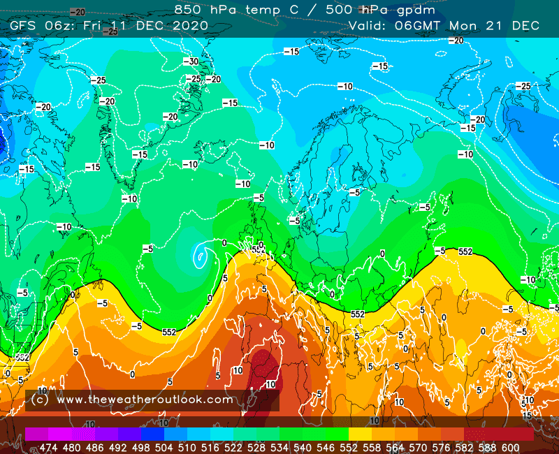
A lot of LOW pressures systems tracking from the NW.
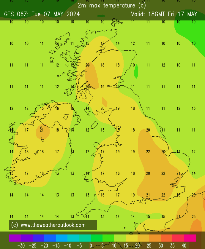
Chart shows Monday 17th
Signs of a cold spell for early winter maybe...PLEASE I NEED COLD!
Quote:
So what about winter 2014/15? I'd be very surprised if it's as mild and wet as last year's! That's not really saying much of course as 2013/14 was exceptional. At this stage of the autumn if I was forced to make a call I'd go for milder and wetter than average season.
Despite this I'd not be surprised to see a blocked cold pattern developing for a time during December and as we saw in 2010 these set ups can be difficult to break down.
January may end up quite stormy again with significant snowfall over higher ground in the north. This type of pattern rarely delivers snow to lowland parts of the UK, especially those in the south.
February could turn out to be the joker in the pack. The Atlantic tends to back off later in the winter and if the Arctic Oscillation (AO) is negative as the OPI suggests colder spells could develop.
Looks like winter started early for many. Next week should be interesting. Started a thread on it to keep the seasonal threads uncluttered and have a place to look back on in the future..
Here is the current radar and who's reporting snow or mixed precip right now.
Looks like winter started early for many. Next week should be interesting. Started a thread on it to keep the seasonal threads uncluttered and have a place to look back on in the future..
Here is the current radar and who's reporting snow or mixed precip right now.
Well it hasn't quite started just yet for a fortunate few like where I live its been chilly and winter will be coming by my guesstimate within possibly the next two weeks where I live I don't think low temperatures will be truly winter like for Central Indiana until Mid December if not even later. Lowest temp of season so far was several days ago when Indianapolis finally bottomed out at 24 Degrees Fahrenheit, and I realize next week morning lows in the lower 20's are a distinct possibility for Wednesday and Thursday, but that is not quite cold enough to be record cold in Indianapolis. Lows in the mid to upper teens would be record territory, and unlike your coastal location; Indianapolis has seen their first and earliest sub zero temperatures on record beginning on November 19th, and the coldest November temp on record was -5 F set in the year 1880, with the most recent sub zero temp in November happening in the year 1958; that year logged a low of -2 F.
Please register to post and access all features of our very popular forum. It is free and quick. Over $68,000 in prizes has already been given out to active posters on our forum. Additional giveaways are planned.
Detailed information about all U.S. cities, counties, and zip codes on our site: City-data.com.

 Please register to participate in our discussions with 2 million other members - it's free and quick! Some forums can only be seen by registered members. After you create your account, you'll be able to customize options and access all our 15,000 new posts/day with fewer ads.