Please register to participate in our discussions with 2 million other members - it's free and quick! Some forums can only be seen by registered members. After you create your account, you'll be able to customize options and access all our 15,000 new posts/day with fewer ads.
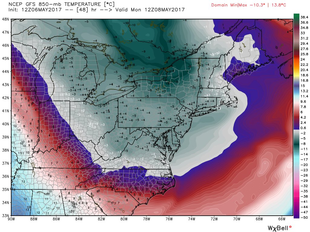
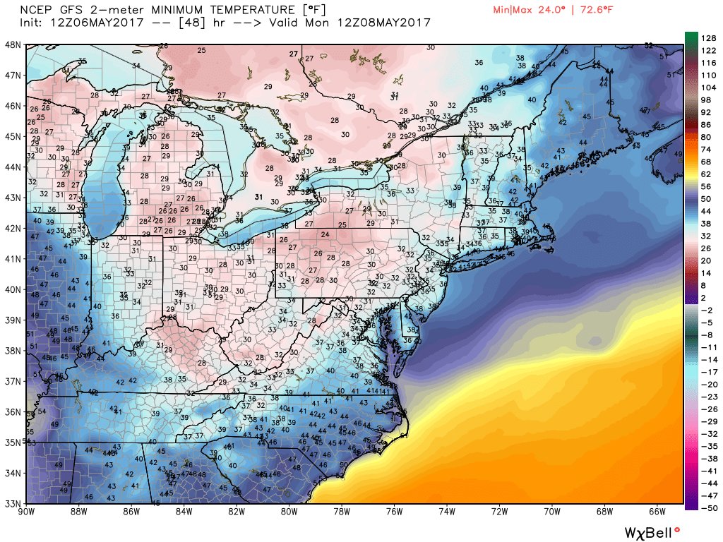
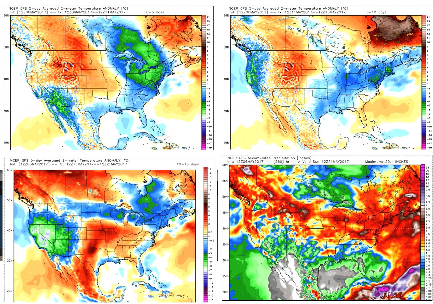
Temp departures. Clear view of what Ridges and Troughs do to surface temps. The clouds, rain, and southerly flow over New England keeping things in check for now. Cold tomorrow
Upper Low over Southern California bringing cool weather there.
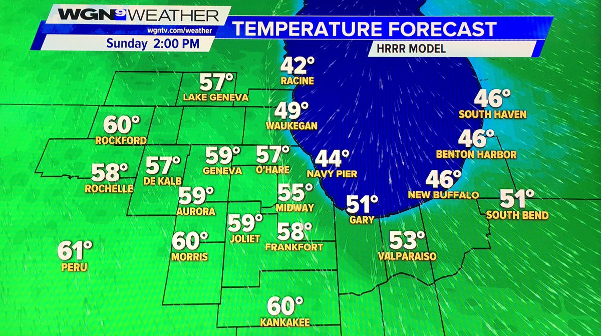
I thought for sure I turned the heat off for the last time until Fall. With the next two or three days, it looks like I will indeed need the heat again. How sad.
will have to wait until the 10-15 day period for warmer than normal temps to return. But so does a lot of rain.... I can sense it now. Summer of 2004, or 2009 all over again
Last edited by chicagogeorge; 05-07-2017 at 07:10 AM..
Alerts for: Matagami
Warnings
4:18 AM EDT Sunday 07 May 2017
Snowfall warning in effect for:
Joutel - Matagami area
Miquelon - Desmaraisville area
A low pressure system over Western Quebec is moving northward. Behind it, cold air has changed precipitations into snow which will continue through Monday. Total accumulations will reach 15 to 25 centimetres.
Surfaces such as highways, roads, walkways and parking lots may become difficult to navigate due to accumulating snow.
Please continue to monitor alerts and forecasts issued by Environment Canada. To report severe weather, send an email to ec.cpiq_tempetes-qspc_storms.ec@canada.ca or tweet reports using #meteoqc.
These are relatively isolated places but not that far north in the grand scheme of things: latitude about 50°N. South of me, south of London, England, even.
Somewhat further north, at Inukjuak on the shores of Hudson Bay, there's a May blizzard happening:
Quote:
Alerts for: Inukjuak
Warnings
4:22 AM EDT Sunday 07 May 2017
Blizzard warning in effect for:
Inukjuak
A major low pressure system will give snow and blowing snow later today over these regions with visibilities significantly reduced.
If you do travel and become lost, remain where you are until the blizzard has passed.
Blizzard warnings are issued when widespread reduced visibilities of 400 metres or less are expected for at least 4 hours.
Please continue to monitor alerts and forecasts issued by Environment Canada. To report severe weather, send an email to ec.cpiq_tempetes-qspc_storms.ec@canada.ca or tweet reports using #meteoqc.
Inukjuak is at latitude 58°N so still south of Oslo. Pretty isolated but there is a webcam if anyone wants to watch the action unfold; actually doesn't look too bad there right now. DAWC - WxCam - Inukjuak
I thought NAO didn't have much affect on lower latitudes in summer? Or is that just AO? Or is it because how record breaking it is?
I guess it's still early enough where it does have an effect, and probably how negative it is as well
Please register to post and access all features of our very popular forum. It is free and quick. Over $68,000 in prizes has already been given out to active posters on our forum. Additional giveaways are planned.
Detailed information about all U.S. cities, counties, and zip codes on our site: City-data.com.

 Please register to participate in our discussions with 2 million other members - it's free and quick! Some forums can only be seen by registered members. After you create your account, you'll be able to customize options and access all our 15,000 new posts/day with fewer ads.