Please register to participate in our discussions with 2 million other members - it's free and quick! Some forums can only be seen by registered members. After you create your account, you'll be able to customize options and access all our 15,000 new posts/day with fewer ads.
Witnessed a thundersnow event near Dubuque, IA yesterday around 8:00AM. There was heavy ice/snow mixed, and occasional lightening and thunder. Interesting weather situation when it occurs.
Awesome!! I'll never forget being outside and hearing Thunder while it was snowing for the first time. Was quite the experience. Saw lightning with snowfall once as well.
Quote:
Originally Posted by jbgusa
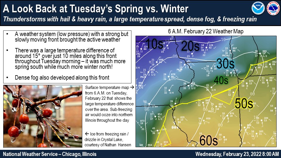
In January 2014 didn't we have a drop from the mid-60's to around 12° the same day?
Fun we can look back with our threads. Reason why I am keeping a log of them.
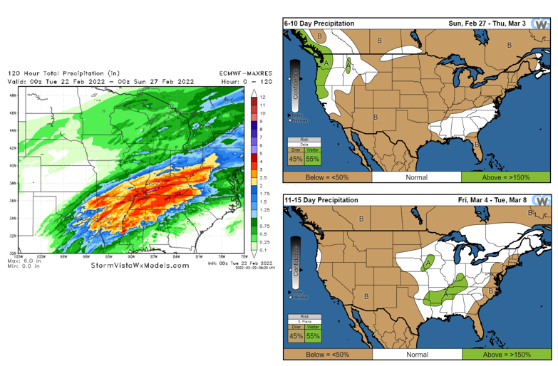
Round one of the storm system tonight which will be very light. Less than a half inch of snow expected here in Indianapolis tonight. Dry through the morning tomorrow and then the real fun begins tomorrow afternoon with snow mixing with rain. As the evening goes on the snow/rain mix looks to change over to sleet possibly mixed with snow. NWS says the storm in the last run has moved south and east with a weaker warm nose limiting freezing rain potential. Eventually around or shortly after midnight, it should all briefly switch over to snow. All told, it looks like 1-2 inches of snow and sleet accumulation with possibly a glaze to a tenth of an inch of ice. A bit of a concern of freezing drizzle tonight and again tomorrow night. We'll see what happens. Not a major winter storm but could definitely be impactful if we get any ice. A couple inches of snow and sleet isn't a huge deal.
I'm on the border of 4-6" and 3-4". So expecting 4 inches of snow before it changes to sleet. Ugh. Should be at 2 feet for the season after this one
I'm at about two feet right now for the season. So after tomorrow should be over it. Still below average for the full season but March looks to at least start off cold and could have some more chances of precip in the second week. First week looks dry but the second wetter. Will it be cold enough for snow though?
CFSv2 brings in the precip a little later into the month but also has it more widespread by the middle of March
Doesn't look that cold though so unless the precip comes down overnight it's likely going to be rain by that point in the month
Quote:
Originally Posted by Ed's Mountain
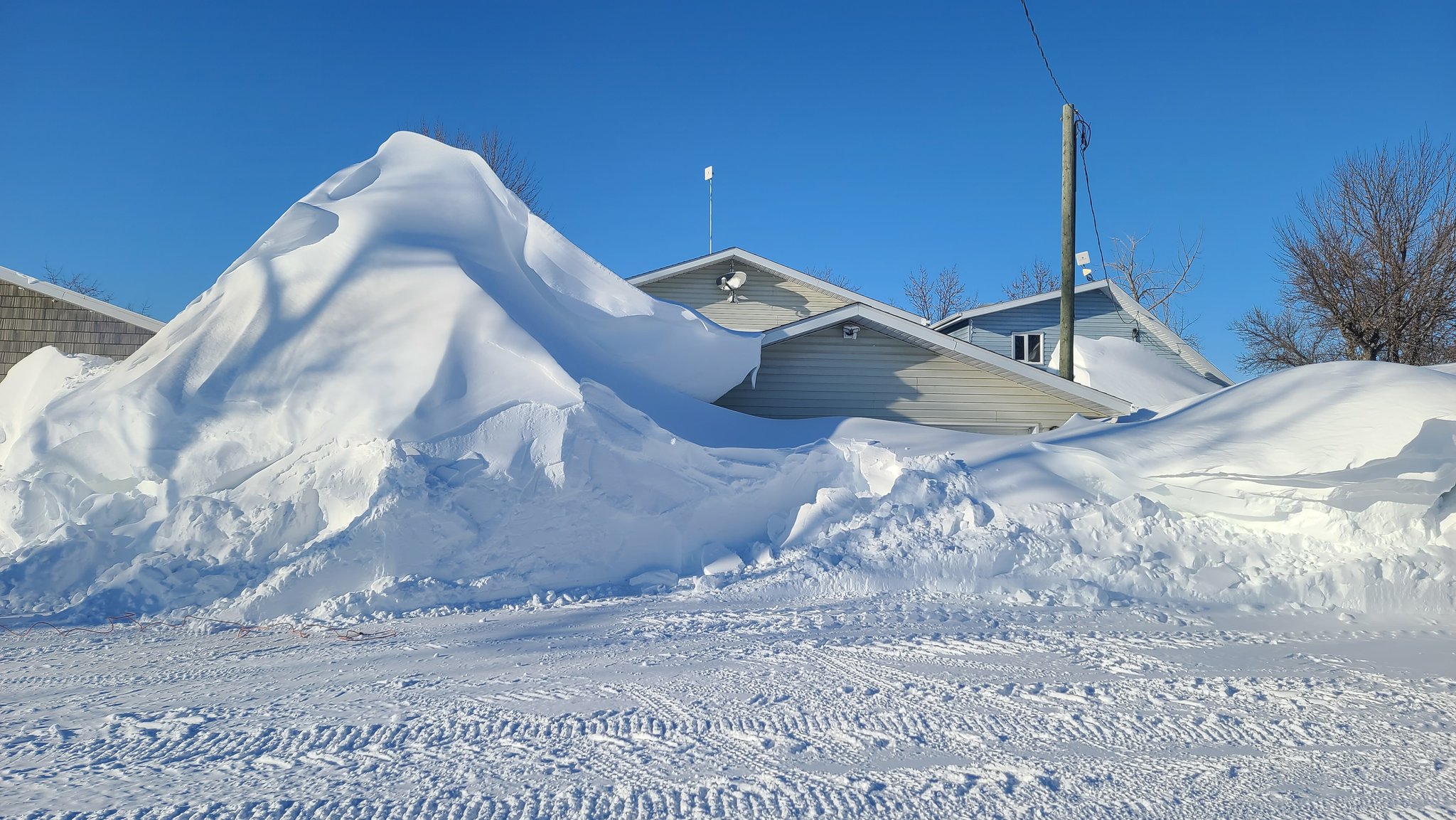
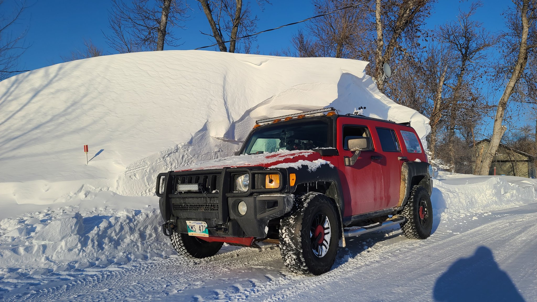
It's been a cold and snowy winter in Southern Manitoba.
Currently here in Downeast, Maine, 58F Degrees, Dew Point 41F Degrees, Winds SW 17mph, Gusts 31mph, Mostly Sunny.
Have a week off from Caregiving as my client's child decided to put her into an assisted living facility...
It was a hard decision for her (I'm grateful I never had to make that decision)!
In the meantime, enjoying the time off (and thankful I won't have to commute this Friday as it appears we may get anywhere from 6"-12" of snow...Ugh! I love the snow but during this time of year it melts during the day and our dooryard/driveway turns into a skating-rink.
It's Maple sugar time...Warmer days and still below freezing at night! Spring fever has set in and I plan on buying Daffodils, Hyacinths, crocuses, you name it so I place them in the windowsills, as the Birch Meadows (when not covered with snow or green grass, look like they are bare-naked and in need of a pedicure!
There really doesn't appear to be Spring in our area of Maine, just mud! Mind you, I'm not complaining, because I love living out amongst the Blueberry Barrens! You can keep the cities - too much cray-cray stuff going on there.
Stepped out onto the front porch for awhile to get some real Vitamin D and enjoy the warmth. I don't what it is that I can run around without a jacket in Spring at 60F Degrees, but in Autumn at 60F Degrees, I cannot!
Thought I heard a song sing this morning...so longing for the voices of the Sparrows across the Birch Meadows..
Spied a Fox Sparrow taking a bath in an icy puddle out by the grove of Lilacs and smiled!
So, do we have a Spring Thread up yet?
Latest update from the NWS has pulled any mention of freezing rain for my area tomorrow night and trimmed back the amount of sleet as well. And with a snow ratio trending in the 8 to 1 range, possibly even lower, snow accumulation looks to be only in the 1-2 inch range as well with a tenth to a quarter of an inch of liquid equivalent. It'll be interesting to see what they say in this afternoon's discussion.
Please register to post and access all features of our very popular forum. It is free and quick. Over $68,000 in prizes has already been given out to active posters on our forum. Additional giveaways are planned.
Detailed information about all U.S. cities, counties, and zip codes on our site: City-data.com.


 Please register to participate in our discussions with 2 million other members - it's free and quick! Some forums can only be seen by registered members. After you create your account, you'll be able to customize options and access all our 15,000 new posts/day with fewer ads.


 Here's the