Bridge Statistics for Ponchatoula, Louisiana (LA)
Condition, Traffic, Stress, Structural Evaluation, Project Costs
- National Bridge Inventory (NBI) Statistics
- 48Number of bridges
- 4,731ft / 1,442mTotal length
- $2,782,000Total costs
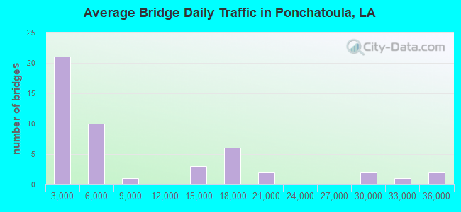
- 399,257Total average daily traffic
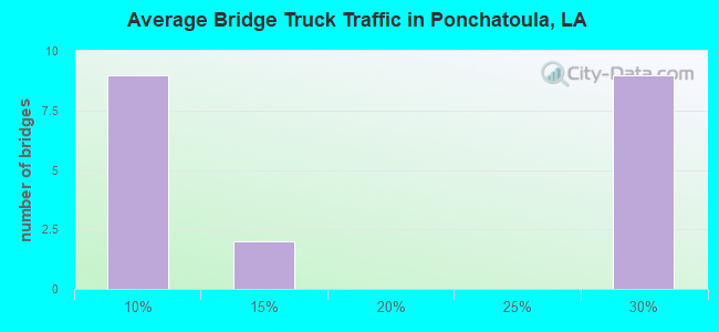
- 45,202Total average daily truck traffic
- National Bridge Inventory (NBI) Registered Bridges for Ponchatoula
- No street view available for this location
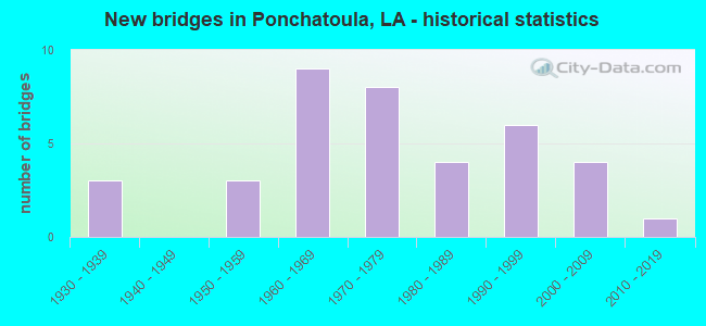
- New bridges - historical statistics
- 31930-1939
- 31950-1959
- 91960-1969
- 81970-1979
- 41980-1989
- 61990-1999
- 42000-2009
- 12010-2019
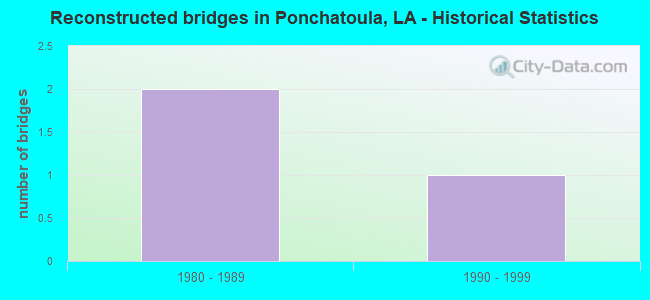
- Reconstructed bridges - Historical Statistics
- 21980-1989
- 11990-1999
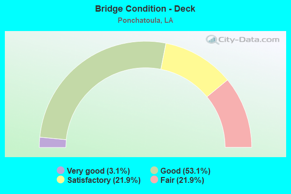
- Bridge Condition - Deck
- 3.1%Very good
- 53.1%Good
- 21.9%Satisfactory
- 21.9%Fair
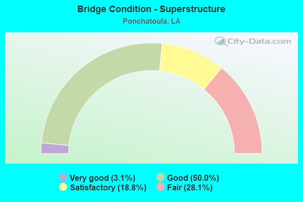
- Bridge Condition - Superstructure
- 3.1%Very good
- 50.0%Good
- 18.8%Satisfactory
- 28.1%Fair
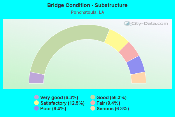
- Bridge Condition - Substructure
- 6.3%Very good
- 56.3%Good
- 12.5%Satisfactory
- 9.4%Fair
- 9.4%Poor
- 6.3%Serious
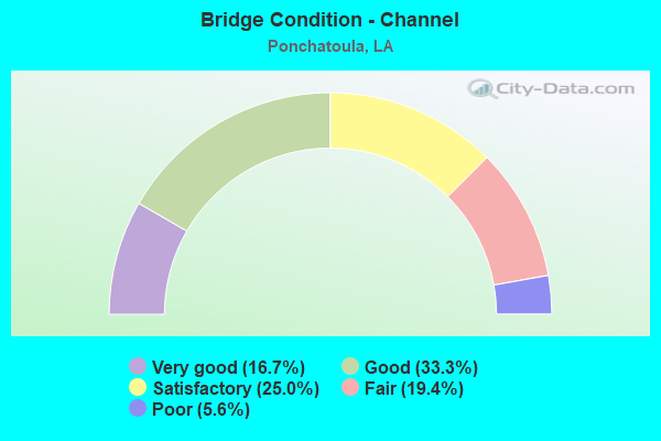
- Bridge Condition - Channel
- 16.7%Very good
- 33.3%Good
- 25.0%Satisfactory
- 19.4%Fair
- 5.6%Poor
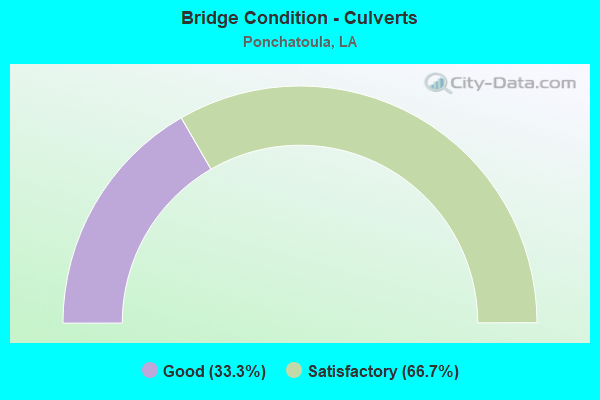
- Bridge Condition - Culverts
- 33.3%Good
- 66.7%Satisfactory
Find on map >> Show street view
Structure Number: 625304529000582, Location: I-55 SB UNDER I-55 (Lat: 30.397911, Lng: -90.430511), Route carried "under" structure: Ramp Interstate 55, Structure Length: 0. m, Average Daily Traffic: 2,670 (year 2014), Features Intersected: I-55 SB EXIT RAMP TO US
Minimum Vertical Clearance: 5.18m (16.99ft), Kilometerpoint: 0.618, Lanes on structure: 1, Length of Maximum Span: 0.0m
Find on map >> Show street view
Structure Number: 625308533600501, Location: I-55 UNDER US 51B (Lat: 30.412961, Lng: -90.434900), Route carried "under" structure: Interstate 55, Structure Length: 0. m, Average Daily Traffic: 29,000 (year 2014), Features Intersected: I-55 SB UNDER US 51B NB
Minimum Vertical Clearance: 5.09m (16.70ft), Kilometerpoint: 68.016, Lanes on structure: 2, Length of Maximum Span: 0.0m
Find on map >> Show street view
Structure Number: 625308533600501, Location: US 51B UNDER I-55 (Lat: 30.413131, Lng: -90.434761), Route carried "under" structure: Interstate 55, Structure Length: 0. m, Average Daily Traffic: 29,000 (year 2014), Features Intersected: I-55 NB UNDER US 51B NB
Minimum Vertical Clearance: 5.21m (17.09ft), Kilometerpoint: 15.018, Lanes on structure: 2, Length of Maximum Span: 0.0m