Quote:
Originally Posted by goyguy

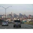
Vine Street...longest street in Cincinnati...starting point for east-west street address numbering...originating at the mighty Ohio, bisecting downtown and OTR, going diagonally up none other than Vine St Hill, truncated to Short Vine in Corryville to make way for University Plaza, skirting the Avondale/Clifton boundary, moving onward through the midst of St Bernard and Elmwood Place and Carthage, caroming away from the Paddock/Anthony Wayne crossroads to pass the fairgrounds and traverse western Hartwell...only to become Springfield Pike at the city limits and continue on through Wyoming and Woodlawn before again tacking northwestward to serve the western sectors of Glendale and Springdale before hitting the Butler County line. Vine Street, this is your CD thread. Mid-century Reading Rd has had its turn, and with the way that subject has taken on a life of its own it's time you had your own forum space. So here we go!
If you live(d) on or near Vine St or Springfield Pike, c'mon in.
|
Don't mind if I do:
There was a chili place on the west side of the street, somewhere near
Towne, called "The Chili Bowl." It was owned by a Mr. Kahn, whose son
now runs Weil's funeral home. (No guarantees as to the spellings of
either of these.)
Fries and Fries flavor factory, between Vine and the Millcreek Expressway,
near Seymour. Now a division of a much larger corporation.
On the southwest corner with North Bend was the Velvasheen outlet.
Velvasheen made printed t-shirts and sweatshirts with company and
team logos. The outlet store had over-runs and seconds which were
priced accordingly.
On the northeast corner was the Country Kitchen, a chain of restaurants
with truck-stop fare. There was another one of these on Bypass 50,
between Woodlawn and Evendale.
Just to the north was Cherokee Motors, with its colossal neon brave
beckoning all to come in and buy a used car. Quite incorrect, politically,
nowadays.
Also in the same block were Kline on Vine, another used-car business,
and Louis the Florist. Already described in the Reading Rd. thread, the
florist shop featured an unusual trapezoidal-shaped showroom. Cars
purchased from Kline's featured a license plate holder sporting the
logo "Kline Sold Mine". Mr. Kline could occasionally be seen tooling
around town in his 1910 Cadillac.
Just north of the intersection with Anthony Wayne was/is the venerable
Carthage Fairgrounds. A separate thread has gone into some detail on
the fairgrounds. The annual Hamilton County Fair was held here. I
believe that trotters were either raced there, or exercised there, as well.
To the east of the fairgrounds, abutting the expressway, was the
distillery. Their brands included Gilbey's vodka and de Kuyper aperitifs.
Just to the north of the distillery was a footbridge over I-75, enabling
pedestrians (remember them?) to make a relatively hassle-free trip
between Edgemont Terrace / Roselawn and Hartwell / Lockland.
Across Vine from the fairgrounds was a Chrysler dealership which,
some time around 1970, became a Buick dealership. Just north of
the dealership was Rockenfield Ford.
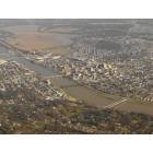
North of the car dealerships and fairgrounds was the Mill Creek, crossed
by the "Singing Bridge," so named because of the sound tires made as
they crossed the metal grating at city speeds.
Just north of the bridge lies a railroad trestle, which may have been
the Baltimore and Ohio line. Caldwell Rd., to the west, leads up the
hill to some fine scenery and overlooks of north-central Cincinnati,
linking up with North Bend near Finneytown. Just off of Vine, on
Caldwell, was the Hartwell Country Club.
In the early 1960's, there was a gas station on the east side of the
street, about even with Caldwell. It may have been a Bonded station.
To the east lies the village of Carthage, a quiet residential area with
1900-era houses. Up and down Vine in these few blocks lies were stores
and a few taverns, probably the central business area of Hartwell.
On the southeast corner with Galbraith was Jake Sweeny Pontiac.
I cannot recall what preceded the dealership on this corner. On the
northeast corner is the Hartwell Elementary School. On the southwest
corner used to be a park and a municipal pool, but this was razed to
make room for a Kroger's some time in the late 1970's.
Somewhat east on Galbraith, at Woodbine, was an old apartment building
that was obliterated by the August, 1969, tornado. A few of the
residents were killed. Also to the east, but before Woodbine, is a
railroad crossing - the same line that crosses Vine near Caldwell.
Just west on Galbraith is Drake Hospital. Continuing further west, there
used to be the Meyer estate, on land which is now the Evergreen
retirement center. West of that is Wyoming.
Galbraith and Pfau form the southern terminus of Valleydale, a hamlet
wedged between Hartwell and Wyoming.
North of the Hartwell school was the Sixty Second Shop. In the local
short-order hierarchy, this chain ran a distant third behind Frisch's and
Carter's. The restaurant disappeared some time in the mid-1960's. At
some point a fish-and-chips restaurant appeared near the site, possibly
Long John Silver's. On the same block was Ames, which may have been
a furniture store.
Across the street was a small plaza which has hosted numerous store-
front businesses. There was a furniture discounter there in the mid-
1960's. A pizza carry-out, Italian Village, flourished in the early 1960's.
Some time around 1970, a Famous Recipe (chicken) franchise opened
on that block.
To the north of that plaza was the Big Melon grocery, which was sort
of like the WASP answer to Bilker's. The Big Melon later moved to the
north, near the new Igler's Pharmacy. Next to the old Big Melon site
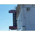
was the original Schwallie Pharmacy, which later moved to the new
Compton Medical Arts building, around 1966.
At the southwest corner with Compton was a Sohio. South of the
Sohio was a Frisch's. That Frisch's was torn down some time around
1980 and then rebuilt on a different location of the same lot.
On the northwest corner with Compton used to be a tavern - I've
long since forgotten the name, but the place seemed to have been an
old landmark. Around 1965 it was replaced with a Burger Chef, later
known as Hardee's. Burger Chef's claim to fame was that the burgers
were "open-flame broiled." Even as kids, we knew that this meant to
watch out for that patch of black with the "new car" taste.
To the north was the Vogue Theater, which showed second-run
movies. The 10-cent Saturday matinees were a major draw for kids
from neighboring Hartwell and Wyoming. Before the movies started,
the owner, a "Mrs. Chase", would raffle off door prizes. It was one
way to get us kids to quiet down, though, as she would only whisper
the winning ticket numbers.
Southwest of the Vogue was a Kroger's, and due south, on Vine, was
the Vogue Cafe. The Vogue Theater was torn down in the late 1960's
to make room for a branch of the Liberal grocery chain. There was a
Liberal store in Swifton, as well.
As Goyguy noted, Igler's Pharmacy, to the east, was relocated to a
small strip mall. The mall included a United Dairy Farmers branch, a
florist and an Ohio state liquor store. Adjacent to that mall would
later appear another strip mall, oriented perpendicular to Vine, which
was to house the Big Melon, a bookstore and some other businesses.
Continuing north, it's mainly residential Wyoming on both sides of the
street. The central Wyoming business district begins at Wyoming
Avenue and continues east to the (same) railroad tracks. Across
the tracks begins Lockland and, further east, Reading, which is
centered around Reading Road.
Once in Wyoming, Vine Street becomes Springfield Pike. Near the
intersection with Wyoming Ave. are St. James elementary school,
to the west and the Wyoming Civic Center, to the east. At that
corner is a small collection of storefronts which included Obert's
pharmacy and Sansone's food store. The second story housed
some small offices - apparently Willie Thall had an office there at
some point. To the east of Sansone's was Robinson's Cleaners
and, further east was the old Wyoming High School, which
became a middle school in 1971. Sansone's was replaced by
a King Kwik in the mid-1970's. Currently a French bakery is
located there - Cafe Gaugin, or something like that.
On the northeast corner with Wyoming Ave. is the public library,
originally known as the Bonham branch of the Hamilton County
libraries.
Continuing north, it's again mainly residential until Fleming Road.
Just north of Fleming was a gas station, on the west side. On
the east side was a candy store - Murray's? Some time around
1970, a Friendly's ice-cream store was built. Further north,
around Vermont, a drive-through beverage store appeared, ca.
1970.
A K-Mart was built on the west side of Springfield Pike in the late
1960's. There was some controversy at the time, as the land had
some historical significance. The K-Mart became an Odd Lots in
the 1980's, and has since been razed to make room for a
subdivision. Across from the K-Mart was a King Kwik and a tavern
- maybe Keig's?
Beyond Wyoming is Woodlawn. There were a few stores and small
business along this stretch, as well as a stately tavern. Notable
here would be Midwest Salvage, which was a sort of surplus store.
Midwest Salvage sold all kinds of quirky stuff - they even had old
seats removed from Crosley Field for sale.
At the southeast corner with Bypass 50 was Sutherland Lumber.
In those days, the "lumber yards", as they were known, also sold
the sorts of home-improvement goods you now see at Home Depot.
Grueninger Oldsmobile later appeared near this site.
On the northeast corner was a large Kroger warehouse, at which
semis would load and unload. Actually, that whole stretch of
Bypass 50, all the way to Evendale and even the area north to
Mosteller Road, housed a whole slew of warehouses. To the north
of the warehouse was Goodwill Industries.
Just to the north of Goodwill was Jerry's Restaurant. Jerry's was a
chain of eateries then found in the Midwest and South, probably
inspired by Big Boy, but very bland. Jerry's disappeared in the late
1960's and was at some point replaced by Mr. Jim's Steakhouse, which
also had a branch near Summit Bowl. In the mid-1970's, Mr. Jim's
was replaced by a branch of Daily Doughnuts - a local chain which
had been around since the early 1960's or before, when it was
known as Daisy Doughnuts. To memory, their doughnuts were not
sickly sweet nor did they have the oily aftertaste of some of their
cheaper competitors. Anyway, this was the only branch of the
chain I can recall that actually had a dining area and served loose
tea, as well as coffee in huge "grumpy cups".
At this point the road forks. Springfield Pike becomes Route 4 and
heads to progressively more rural locales, running north-northwest.
Princeton Pike runs due north to Tri-County, passing through
Springdale and Glendale. I'll let someone else continue with tales of
the Century Inn and points north, but will note some geography:
Just north of the fork, off of Route 4, is road running east-west.
A mile or two down the road used to be a day-camp called
Claybanks, which was later the site of the Oola-Khan Grotto.
The significance of this area is that it abuts the western source
of the Mill Creek. The actual source of creek is the West Fork
Dam in Winton Woods, whose spillway is just up the hill.
Well, you asked for it. I grew up in Wyoming but, frankly, still feel
that the area around Reading Road is much more interesting than
this part of Vine Street.

 Please register to participate in our discussions with 2 million other members - it's free and quick! Some forums can only be seen by registered members. After you create your account, you'll be able to customize options and access all our 15,000 new posts/day with fewer ads.