Please register to participate in our discussions with 2 million other members - it's free and quick! Some forums can only be seen by registered members. After you create your account, you'll be able to customize options and access all our 15,000 new posts/day with fewer ads.
I have never used an in-car navigation system, and have so far found my way to every destination. So, to answer the OP's question, that is not among my must-have features. There are times when it might be useful, but it can be a hand-held device, not built into the car, and portable for use on foot or in a rental car. A flashlight can also be useful, but it doesn't have to be a factory-installed accessory.
NAV isn't a necessity anymore because your smartphone GPS is so much more user friendly and is constantly updated.
I like using old school maps myself, if I get lost i use my I Phone 6s
I also like using printed maps when driving long distances (over state lines). We actually purchased a Rand McNally US States map this summer when we drove from CO to NC and back. It was nice to visually see what towns were ahead even two states over.
I like using old school maps myself, if I get lost i use my I Phone 6s
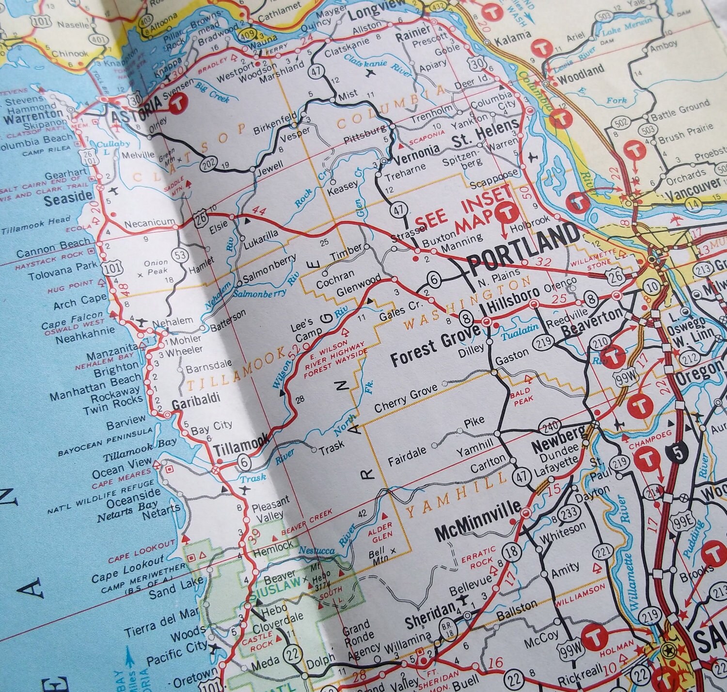
Do you drive around with the map up in front of you or do you look down at the seat next to you to follow them? And when in towns, how do you follow them at all? Unless you have a map of a larger city, most smaller towns are unmapped on paper maps, as far as streets and the like.
For example:
Forest Grove is a relatively larger town, but it's still just a dot on the map. How do you know how to get around in that town, and how would you know, say, how Highway 8 and 47 intersect in the town? If you were in Tillamook here and had to get to a specific address in Beaverton, how would you do it with this map?
About the only "must have" item for me is HID lighting. I simply can't go back to halogens. Maybe it's me and my eyes getting older, but seeing the road is so much easier with HIDs than halogen.
People also did without indoor plumbing and medicine. Doesn't mean that the old way was better. There's a reason that GPS was invented and why it's taken over from paper maps. It's simply VASTLY better for people who actually want to get somewhere specific.
People also made fire before we had matches and lighters. It doesn't mean that normal, sane people want to go back to rubbing two sticks together simply because that worked back then.
Asking for directions was always considered a failure of manhood and using GPS just makes that a private shame lol.
Please register to post and access all features of our very popular forum. It is free and quick. Over $68,000 in prizes has already been given out to active posters on our forum. Additional giveaways are planned.
Detailed information about all U.S. cities, counties, and zip codes on our site: City-data.com.

 Please register to participate in our discussions with 2 million other members - it's free and quick! Some forums can only be seen by registered members. After you create your account, you'll be able to customize options and access all our 15,000 new posts/day with fewer ads.