Please register to participate in our discussions with 2 million other members - it's free and quick! Some forums can only be seen by registered members. After you create your account, you'll be able to customize options and access all our 15,000 new posts/day with fewer ads.
Some distinguish the "Mountain West" from the West or West Coast. For example eastern Montana and Colorado look more like the Midwest than the rest of their state. Texas isn't often considered the West but it can be referred to as the Southwest. If the Rocky Mt states are separated from the Western U.S. then the West starts in Arizona\ Nevada and perhaps Idaho. West Coast of-course mean Washington\ Oregon and California [some may include Hawaii and Alaska since both states are the western-most states in the U.S.].
Although the Mississippi River is often used as a dividing point, I really have a "problem" with thinking of Louisiana, Arkansas, Missouri, etc, as "western."
Now, in terms of "West" as a true region? In this case, the "frontier strip" states would not be part of it. THAT west is east of the former! Specifically, the Rocky Mountain and interior/desert SW states. The Census Bureau definition.
Kansas and Nebraska (and points north) are part of the Midwest. Texas and Oklahoma properly belong to the South. All are "western" but not West.
Bottom line is, I think it depends on just which west...
Driving west across North and South Dakota it's plain to see the West begins at the Missouri River. In front of you...west looking terrain, behind you...non-west looking terrain.
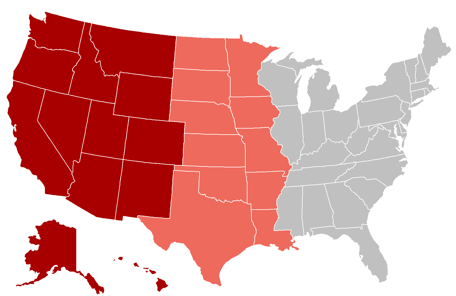
The dark red is "always" considered West, while the light red states can be considered Southern and Midwestern.
For me, I consider the column of states from Louisiana up to still be Eastern, while everything west of that is more Western except for Texas which is either Western, Southern, both, or it's own thing.
I would call all the states west of the lines running along the western edges of Minnesota, Iowa, Missouri, Arkansas and Texas as the WEST.
If you go east of that line though, I would exactly say you're in the EAST. Iowa isn't an eastern state. I would define the EAST as east of the Mississippi River.
That line of states in between are called different things depending on the situation. Upper Midwest, Lower Midwest, Southern, etc.
Location: Austin, TX/Chicago, IL/Houston, TX/Washington, DC
10,138 posts, read 16,035,535 times
Reputation: 4047
^ I think they categorized the two sides of the Mississippi River. (Not including the states that are split between the river- Minnesota).
The true West starts where the dark red region is on that map. And El Paso, Texas (which also is the only city in Texas apart of a different time zone- Mountain Time not Central).
I think that's the true starting point of the west.
The Blue Coastal regions and the Light maroon Mountain regions would be considered "West". Texas has a lot of Western characteristics in the West side of the state, but the state falls under "South" since most of the population is back East portion of the state (Texas Triangle).
BTW: Here's a map of the big cities and their respective regions. There's West Coast and Mountain West. So don't be alarmed by the mixed coloration.
Please register to post and access all features of our very popular forum. It is free and quick. Over $68,000 in prizes has already been given out to active posters on our forum. Additional giveaways are planned.
Detailed information about all U.S. cities, counties, and zip codes on our site: City-data.com.

 Please register to participate in our discussions with 2 million other members - it's free and quick! Some forums can only be seen by registered members. After you create your account, you'll be able to customize options and access all our 15,000 new posts/day with fewer ads.