Please register to participate in our discussions with 2 million other members - it's free and quick! Some forums can only be seen by registered members. After you create your account, you'll be able to customize options and access all our 15,000 new posts/day with fewer ads.
It's an average map. Sunless days can have a UV index of 2, which lowers the monthly average. And the UV cap for a location is quite low for northern and central mid latitudes.
It's partially a July sunshine map, at least if you compare similar latitudes.
Sorry, i missed your point. I don't understand what you are trying to say.
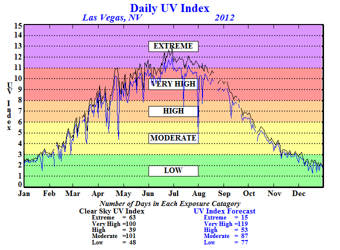
What I meant is the US July average UV map, is partly just showing sunshine differences in the US rather than showing where UV will be stronger when the sun is out. That's why the Plains has a higher UV index.
What I meant is the US July average UV map, is partly just showing sunshine differences in the US rather than showing where UV will be stronger when the sun is out. That's why the Plains has a higher UV index.
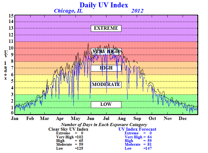
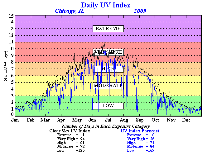
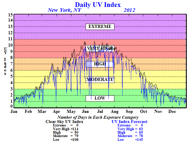
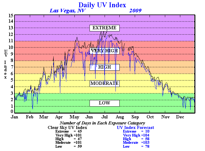
Ok, right. What is the possible max for MA, NY, NJ, PA with surroundings?
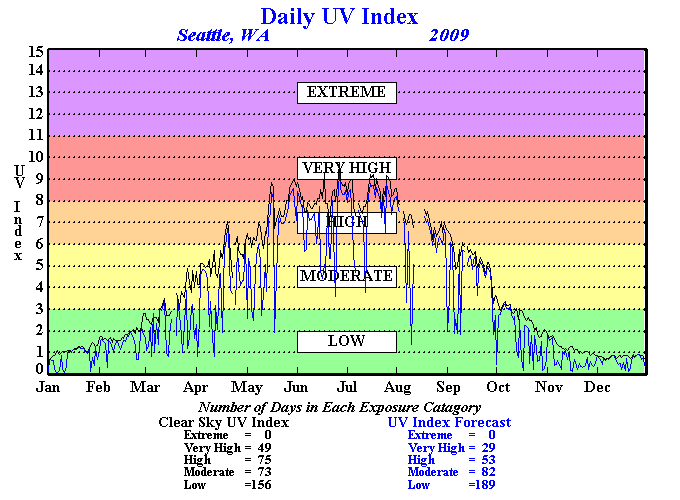
There's a difference between a "traditional four season climate" (cold, snowy winters, mild springs and falls, and hot summers) and a climate having a winter, spring, summer, and fall. For example, you can say that Seattle has a winter, spring, summer, and fall, but it is not a true "four season climate".
Please register to post and access all features of our very popular forum. It is free and quick. Over $68,000 in prizes has already been given out to active posters on our forum. Additional giveaways are planned.
Detailed information about all U.S. cities, counties, and zip codes on our site: City-data.com.

 Please register to participate in our discussions with 2 million other members - it's free and quick! Some forums can only be seen by registered members. After you create your account, you'll be able to customize options and access all our 15,000 new posts/day with fewer ads.