Please register to participate in our discussions with 2 million other members - it's free and quick! Some forums can only be seen by registered members. After you create your account, you'll be able to customize options and access all our 15,000 new posts/day with fewer ads.
Tonight 7pm EST, front having trouble lift north of central NJ due to several reasons. Rain in Pittsburgh but it starts as snow Philly northward this afternoon. Then...
Overnight front finally pushes north and we warm up so 1-3" of snow that fell now changes to rain. Vermont should stay all snow.
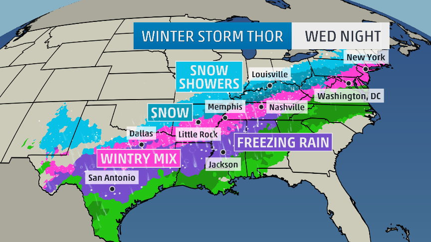
Then the fun begins... On Wednesday the front pushes East with Arctic air behind it but the kicker is the shortwaves developing along the front! Notice there is moisture on the cold side of it!
Then BOOM, look at all that moisture inside the cold air. That's all snow from Kentucky to Boston and HEAVY! 4-10" of snow very possible Wednesday night and Thursday
Current Satellite, Temps and Radar. Snow line in Eastern PA. Temps in the 20s NYC northward. Normal max is in the 40s up to Albany and even MA. Seems like we're struggling into 30s lately.
It's snowing heavy in areas of Michign and PA right now. New snow adding to the pack,
I see you are on the very northern fringe! A shift 50 miles and you'll be in the big totals. A shift 25 miles north and you'll get some. For now consensus saying 1-3" for you with the second waves. You'l get 2-4" before the ice/rain then you may be too far to get the snow return Thurs
Quote:
Originally Posted by nei
Also, do you think trains will be running in southern Connecticut ok Thursday morning?
Schools I've learned how they operate. Buses and Trains I have absolutely no clue what they do or when they delay.
But IF IF IF it happens to pan out the way NAM and few other models show, I would assume there would be issues OR people just wouldn't be able to be on the roads to get to the train station anyway.
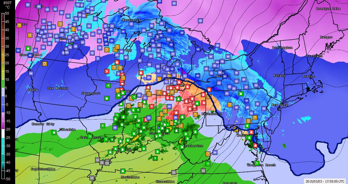
Current Radar, metars and 850mb temps. +10C 850mb over Kentucky (surface in the 50s!) That's a Spring look right there with the mid levels having that kind of warmth around.
Freezing line at 4500' still down near DC slowly pushing north.
Truly amazing that with a southerly flow the air is staying below freezing north of Philly. That will change as we move on through the night
You can see who's reporting snow just getting into NJ now. Virga ahead of it (not reaching ground)
I really wish there was one of these for the rest of NJ ugh. Looking at it thought it looks like 11inches is my worst case
We might need a sticky thread on the other office forecast maps.. I try mention this all the time but it gets tiring sometimes. Sorry. LOL The rest of NJ is in NWS Upton's zone.
Raining and Ice on one side of PA, Snowing on the other...for now. Would LOVE some OBS's in this thread from you guys.
Still Virga over CT but now Newark and Newburgh reporting snow (light!) so it's ready to fall over us. Right on schedule "after" 3pm
Please register to post and access all features of our very popular forum. It is free and quick. Over $68,000 in prizes has already been given out to active posters on our forum. Additional giveaways are planned.
Detailed information about all U.S. cities, counties, and zip codes on our site: City-data.com.

 Please register to participate in our discussions with 2 million other members - it's free and quick! Some forums can only be seen by registered members. After you create your account, you'll be able to customize options and access all our 15,000 new posts/day with fewer ads.