Please register to participate in our discussions with 2 million other members - it's free and quick! Some forums can only be seen by registered members. After you create your account, you'll be able to customize options and access all our 15,000 new posts/day with fewer ads.
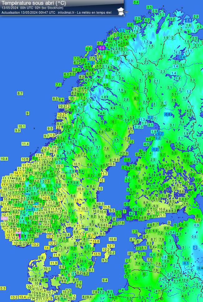
Duluth Discussion: Very impressive. Given our tiny record history I'm pretty sure this has happened in the past. But it's pretty rare and interesting when it does. I also love the fact that they are dropping the temps even more than they thought.
HIGH PRESSURE WILL BUILD IN FURTHER TONIGHT...RESULTING IN
CLEARING SKIES AND DECREASING WINDS. THE RESULT SHOULD BE TEMPERATURES FALLING INTO THE 30S IN PORTIONS OF THE NORTHERN
CWA FROM THE IRON RANGE NORTHWARD TO THE INTERNATIONAL BORDER.
HAVE ADDED THE MENTION OF PATCHY FROST TO THE ZONES/GRIDS FOR THE
NORTHERN HALF OF THE CWA. HAVE DROPPED TEMPS FROM PREVIOUS FORECAST AND CONCERNED WE MAY NEED TO DROP THEM EVEN MORE GIVEN MOS GUIDANCE NUMBERS THAT WOULD FIRMLY SUPPORT A FROST ADVISORY. DAY SHIFT WILL LIKELY NEED TO EVALUATE THE NEED FOR A FROST ADVISORY FOR TONIGHT.
Few Records from this morning from varios NWS offices.
St. Louis has set a new record low temperature for July 28th. At 4 a.m. the temperature was 58 degrees. The previous record was 59.
Columbia, Missouri has tied the record low temperature of 56 degrees so far tonight. The previous record was 56 degrees in 2005.
Temperature at Indianapolis continues to drop. So far new record low is 51 which beats the old record of 54
That early morning chill in Sioux Falls reflects a new record low temperature, as the reading dipped to 44 degrees at 430 am
Omaha Nebraska has fallen to 50°, breaking the record of 52 that was set in 1994. How low will it go?
The Cincinnati/Northern Kentucky airport has tied their record low of 53 degrees so far this morning
New record lows established at Sioux Falls (44), Huron (44) and Sioux City (45), and tied at Mitchell (47). More likely to come!
Dayton Int'l Airport had dropped to 53 deg as of 627 AM, setting a NEW record low for July 28th! Old record 54 deg in 1977/1900
Pittsburgh had 20 days of 90°+ heat during the summer of 2012, and a maximum of 98°. So far this summer, only five days of 90°+ heat, and a maximum of 91°.
What's even more remarkable is that Pittsburgh has still had more 90°+ days this July than Athens, GA where I currently live, and it's likely to stay that way since forecast high temperatures here are in the mid-80's through the end of the month.
At least Steelers training camp will have some beautiful weather.
So much for the "cool" night. Morning temperatures were only in the upper 60s. The good thing is, it's also not inva hurry to warm up - still in the lower 70s.
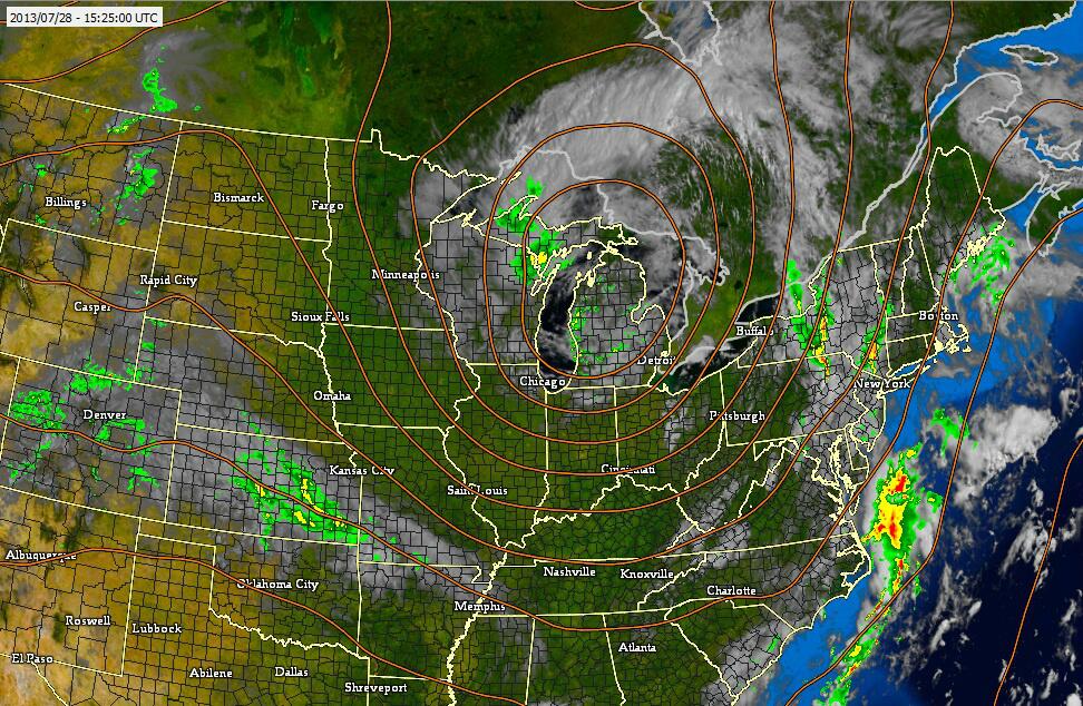
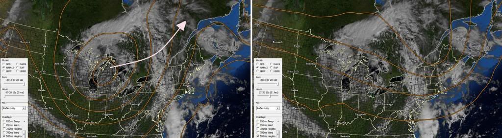
Something I want to learn more about. Maybe you guys can help. The center of the current Upper Level Low is swinging Eastward but going to stay north of the U.S border. Why cant these these just swing towards the coast? Is it the curvature of the Earth or just the pattern we're in where its not favorable to swing this way?
I've seen this senario more times than none where its hard to get it to stay south and swing to this area
Philadelphia now up to 5.77 inches of rain today, 2nd rainiest day ever at PHL. 1st is 6.63 on 9/16/99 (Floyd).
Please register to post and access all features of our very popular forum. It is free and quick. Over $68,000 in prizes has already been given out to active posters on our forum. Additional giveaways are planned.
Detailed information about all U.S. cities, counties, and zip codes on our site: City-data.com.

 Please register to participate in our discussions with 2 million other members - it's free and quick! Some forums can only be seen by registered members. After you create your account, you'll be able to customize options and access all our 15,000 new posts/day with fewer ads.


 Very impressive. Given our tiny record history I'm pretty sure this has happened in the past. But it's pretty rare and interesting when it does. I also love the fact that they are dropping the temps even more than they thought.