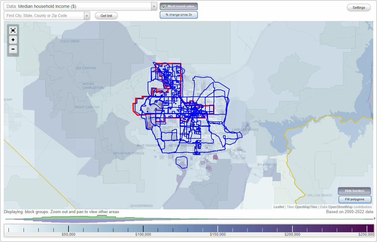
Las Vegas, Nevada Neighborhood Map - Income, House Prices, Occupations, Boundaries
Settings
X

- City boundary
- Neighborhood boundaries
Business Search - 14 Million verified businesses
Aida Brents Resident Council - San Marino Circle Neighborhoods:
Aida Brents Resident Council, Ambiance Estates, American Village, American West Village, Angel Park Lindell, Angel Park Ranch, Appaloosa Canyon Quarterhourse Falls, Archie C. Grant, Arden, Artesian Heights, Arthur McCants, Arts District, Aspendale, Aventura, Bavington Court, Berkley Square, Beverly Green, Biltmore Bungalows, Biltmore West, Bonanza Village, Boulder Junction, Bracken, Bradley Ranch, Briar Hill Park, Buffalo, Canyon Creek North, Capri At The Vistas, Carriage Park, Casa Mia Grande, Casino Center, Centennial Center, Centennial Hills, Century Garden, Charleston, Charleston Estates, Charleston Heights, Charleston Heights South, Charleston McNeil, Church-Noblitt, Cimarron Gowan, Cimarron Springs, Cimarron Village North, Clark Towers Senior Apartments, Cliff's Edge, College Park, Coves, Crestwood, Cultural Corridor, Desert Creek, Desert Shores, Diamond Creek, Diamond Point, Diamond Springs Estates, Discovery, Downtown, Downtown East, Downtown North, Downtown North District, Downtown South, Eagle Creek Heights, Eagle Heights at Elkhorn Springs, East Fremont, East Las Vegas, Eastland Heights, Eikhorn Ranch, El Mar Plaza, Elk Ridge, Elkhorn Springs, Ellis Estates, Enterprise Park, Fallbrook, Firethorne, Floyd Lamb Park, Four Winds, Francisco Park, Fremont Estates, Fremont Street, Frontier Rancho Estate, Gateway District, Gilcrease, Glen Heather Estates, Golf Ridge Terrace, Granbilt, Grand Canyon Village, Grand Entries, Grand Estates, Grand Teton Village, Greens, Greentree Condo, Haciendas La Caliente, Harmon Gardens, Harmony Park, Harry Levy Gardens, Highgate Condominium, Hillside Heights, Home Land, Homeless Corridor, Horizon Vistas, Hunters Glen, Huntridge, Huntridge Park, Iron Mountain, Iron Mountain Estates, Iron Mountain Ranch, James Down Towers, John S. Park, Kari Lee Apartments, Kensington, Kyle Canyon, L.V. Meadows, La Cueste, La Mancha Summerlin, Laguna Bay, Lamb of God, Lamplight Manor at Iron Mountain Ranch, Las Vegas Boulevard Overlay District, Las Vegas Country Club, Las Vegas Enterprise Park, Las Vegas Medical District, Las Vegas Spectrum, Las Vegas Technology Center, Las Verdes Heights, Lewis Street Corridor, Lone Mountain, Lone Mountain Heights, Lone Mountain West, Los Prados, Maryland Pebble, McCarran International Airport, Meadow Valley, Meadows, Meadows Village, Meadows at Elkhorn Springs, Medical Center, Medical District, Mi Casa En El Sol, Michael Way, Montecito Town Center, Monterey Springs, Moondance at Silverado Ranch, Mountain Shadows, Mountain Trails, Mystic Valley, Newport Cove, North Cheyenne, North Las Vegas, Northeast Las Vegas, Northern Lights at Elkhorn Springs, Northern Strip, Northshore Reflections, Northwest, Northwest Equestrian Park, Northwest Las Vegas, Northwest Town Center, Off-Strip, Office Core District, Orleans Square, Painted Desert, Palomino, Paradise, Paradise Falls, Paradise North, Paradise Palms, Paradise Road, Paradise Valleys Southgate, Paradise Vista, Park San Miguel, Parkway Center, Peccole Ranch, Pelican Point, Pine Tree Village, Pinto Palomino, Pioneer Park, Plaza San Miguel, Pueblo at Sante Fe, Quail Estates West, Quarterhorse Falls, Rainbow Park, Rancho Alta Mira, Rancho Bel Air, Rancho Charleston, Rancho Circle, Rancho Corridor, Rancho Manor, Rancho Oakey, Rancho San Miguel, Rancho Sante Fe, Rancho Sereno, Rancho Springs, Rhodes Ranch, Robindale Eastern, Robindale Terrace, Rock Springs, Romano Ridge, Royal Crest Arms, Royal Crest Estate, Royal Crest Rancheros, Rulon Earl, Salt Creek, San Marino CircleAida Brents Resident Council neighborhood in Las Vegas statistics: (Find on map)
Area: 0.003 square miles
Aida Brents Resident Council neighborhood detailed profile
Area: 0.003 square miles
Aida Brents Resident Council neighborhood detailed profile
Ambiance Estates neighborhood in Las Vegas statistics: (Find on map)
Area: 0.030 square miles
Roads and streets: Alpine Brooks Ave; Saint Lazare St; Bastille Ave; Musketeer Ln; Montsouris Park Ct.
Ambiance Estates neighborhood detailed profile
Area: 0.030 square miles
Roads and streets: Alpine Brooks Ave; Saint Lazare St; Bastille Ave; Musketeer Ln; Montsouris Park Ct.
Ambiance Estates neighborhood detailed profile
American Village neighborhood in Las Vegas statistics: (Find on map)
Area: 0.025 square miles
Population: 169
Population density:
Median household income in 2021:
Median rent in in 2021:
Male vs Females
Median age
Housing prices:
Average estimated value of detached houses in 2021 (32.5% of all units):
Average estimated value of townhouses or other attached units in 2021 (22.1% of all units):
Most popular occupations of males: service occupations (30.8%); transportation occupations (19.8%); construction, extraction, and maintenance occupations (13.2%); sales and office occupations (12.5%); production occupations (8.7%); healthcare practitioners and technical occupations (7.5%); material moving occupations (3.5%)
Most popular occupations of females: service occupations (53.0%); sales and office occupations (31.4%); management occupations (except farmers) (10.8%); education, training, and library occupations (7.8%); material moving occupations (4.2%); business and financial operations occupations (3.5%); life, physical, and social science occupations (1.3%)
Roads and streets: American Dr; Great Plains Way; Gold Coast Dr; Kona Coast Way; Village Sq.
American Village neighborhood detailed profile
Area: 0.025 square miles
Population: 169
Population density:
| American Village: | 6,892 people per square mile |
| Las Vegas: | 5,708 people per square mile |
Median household income in 2021:
| American Village: | $43,571 |
| Las Vegas: | $59,746 |
Median rent in in 2021:
| American Village: | $883 |
| Las Vegas: | $1,109 |
Male vs Females
| Males: | 86 |
| Females: | 82 |
Median age
| Males: | 43.7 years |
| Females: | 40.2 years |
Housing prices:
Average estimated value of detached houses in 2021 (32.5% of all units):
| American Village: | $271,714 |
| Las Vegas: | $439,169 |
Average estimated value of townhouses or other attached units in 2021 (22.1% of all units):
| This neighborhood: | $126,010 |
| city: | $274,961 |
Most popular occupations of males: service occupations (30.8%); transportation occupations (19.8%); construction, extraction, and maintenance occupations (13.2%); sales and office occupations (12.5%); production occupations (8.7%); healthcare practitioners and technical occupations (7.5%); material moving occupations (3.5%)
Most popular occupations of females: service occupations (53.0%); sales and office occupations (31.4%); management occupations (except farmers) (10.8%); education, training, and library occupations (7.8%); material moving occupations (4.2%); business and financial operations occupations (3.5%); life, physical, and social science occupations (1.3%)
Roads and streets: American Dr; Great Plains Way; Gold Coast Dr; Kona Coast Way; Village Sq.
American Village neighborhood detailed profile
American West Village neighborhood in Las Vegas statistics: (Find on map)
Area: 0.085 square miles
Roads and streets: Prairie Meadow St; Cheltenham St; Epson St; Dusty Wagon Ave; Western Saddle Ave; Texas Ranger Ave; Blazing Saddle Ave; Texas Bronco Ave; Blooming Sand Ave; Cornwall Glen Ave; Sandringham Ave; Harwich Ave; Hampton Green Ave; Yorkminster St; Wordsworth St; N el Capitan Way (el Capitan Way); Raging Bull St; Cherico St; Petticoat St; Chelmsford.
American West Village neighborhood detailed profile
Angel Park Lindell neighborhood in Las Vegas statistics: (Find on map)
Area: 2.036 square miles
Population: 6,739
Population density:
Median household income in 2021:
Median rent in in 2021:
Male vs Females
Median age
Average estimated value of detached houses in 2021 (68.3% of all units):
Most popular occupations of males: service occupations (33.0%); sales and office occupations (18.4%); management occupations (except farmers) (17.6%); construction, extraction, and maintenance occupations (8.0%); business and financial operations occupations (6.6%); healthcare practitioners and technical occupations (6.3%); production occupations (3.3%)
Most popular occupations of females: sales and office occupations (40.7%); service occupations (29.4%); healthcare practitioners and technical occupations (14.3%); education, training, and library occupations (7.8%); management occupations (except farmers) (3.1%); community and social services occupations (1.7%); production occupations (1.6%)
Limited-access highways (interstate or state) in this neighborhood: Summerlin Pkwy (E Summerlin Pkwy).
Highways in this neighborhood: State Rte 159 (W Charleston Blvd).
Roads and streets: Alta Dr; Westcliff Dr; S Durango Dr; Ducharme Ave; S Cimarron Rd; Roland Wiley Rd; Boseck Dr; Genzer Dr; Yacht Harbor Dr; Sam Jonas Dr; Captains Hill Rd; Stone Harbor (Stone Harbor Ave); Cherry River Dr; Highland View Ave (Highland Vw); Crest Hill (Crest Hill Ave); James Grayson Dr; Thrush Dr; Overview Dr; Aplin Ave; Ampere Ln; Stapleton Ave; Grandbank Dr; Inwood Dr; Highacre Dr; Harvest Run Dr; Partridge Ave; Merialdo; Mulcahy Ave; Star Cluster Cir; N Durango Dr; Summer Vista Ave; Sam Jonas (Sam Jonas Dr); Villa Monterey Dr; Eginton Ave; Clifton Heights Dr; Shelter Island Way; Parakeet Ave; Blackbird Ave; Jon Belger Dr; Seagull Ave; Firestone Dr; Veeder Dr; Canoe Ln; Sailboat Ln; Cove Landing Ave; Aspenbrook Ave; Charles Turk Dr; Foxwood Pl; Steeler Dr; Venetian Strada; Settlers Ridge Ln; Logansberry Ln; Peacock Ave; Moose Ln; N Cimarron Rd; Hyman Pl; Scherer St; Celia Pl; Alina Ave; Tighe Way; Sedran Pl; Desert Bird Dr; Pheasant Ln; Seahawk St; Tobler Dr; Blissville Ave; Silver Sky Cir; Vantage Ln; Lucky Star St; Grammy Dr; Academy Dr; Sunwood Dr; Buccaneer Ln; Granite Hills St; Redbutte Ave; Trianon Ln; Fanciful Ave; Europa Way; la Rue Ct; Spur Ct; Leger Dr; Bengal Pl; Null Ln; Carmel Peak Ln; Bradshaw Way; Mount Royal Ct; Vista Glen St; Mount Harris Ct; Gunther Cir; Ogee Dr; Tribal Cir; Heartline Dr; S Tomsik; Mount Shasta Cir; Redskin Cir; Pirates Cove Rd; Abercrombe Way; Autumn Star Ave; Sparkle Ave; Rockmoss St; Willetta Ave; Tomich Ave; Celebreeze Ct; Telescope Peak Ct; Tulum Ct; Obsidian St (Obsidian Dr); Granite Peak Ct; Wheat Ridge Ln; Angel Star Ln; Tuscany View St; Charles Ct; Kings Cove Ct; Lomack Ct; Catfish; Dunphy Ct; Worthen Cir; Jonathan Glen Way; Maxley Ct; Ordrich Pl; Brian Grayson Dr (Brian Grayson Way); Callahan Point Dr (Calahan Point Dr); Chastine St; Jubilation Dr; S Roland Wiley; Macaw Ln; Donley; Deerfly Way; Tucan Pl; Desert Oak Ct; Skyward Ct; Hutton; Indian Bluff St; Jett St; Bridle Path Way; Cactus Flower Ct; Indian Princess Dr; Running Deer; Cherry Meadows Ct (Cherry Meadows); Dollhouse Dr; Starbridge; Cherry Glaze (Cherry Glaze Ave); Hillgrove Ct; Sunnyvale St; Bruin Way; Soso St; White Eagle Ave; Oak Point Ln (Oak Pt, Oakpoint Ln); Effort Dr; Raven Hollow (Ravenhollow Ln, Raven Hollow Ln); Apple Glaze Ave (Apple Glaze); Gable Ln; Veeder; Composer Way; Escada Ln; Silver Sky; Emerald Forest St (Emerald Forest); Radient Star (Radiant Star St); Beethoven St; Peacock Ct; Crystal Star Ct; Diamond Star Ct; Golf Range St; Dockside Ct; Belle Star Ct; Brothers Bay Ct; Success Ct; Farkas Ln; Cromberg Ave; Golf Course St; Grassy Point Cir; Festivity Cir; Mount Brodie Cir; Gulfport Ct; Misty Island Cir; Lake Isle Ct; Cherry Valley Cir; Dream Star Ct; Mount Whitney Cir; Saw Wood Dr; Joseph Cary Ct; Pendragon Cir; Vantare Ct; Hatteras Ct; Sandmark Dr; Half Dome Cir; San Grail Ct; Eugene Grayson Ct (Eugene Grayson Cir); Noel Lynne St; Oliver Ct; N Roland Wiley; Sueno Ct; Hidden Ct; Greycrest Ct; Fossil Creek Ln; Robison Cir; Idledale Ct; Reale Cir; Cureton Cir; Ryandale Cir; Lemon Glaze (Lemon Glaze Ave); Lago Vista Ln; Devonhall St; Shooting Arrow Ave; Midnight Star Ct; Antique Bay St; Musical; Dendrite St; Elysian Plains Ct; Owl Pl; Tenshaw Ave; Millstone Dr (Millstone); Lundsford Ave; Abernathy (Abernathy Ln); Hunters Creek Ln; Ledge Vw (Ledge View Ct); Calvin Cove (Calvin Cove Dr); Dans Glen Pl; Lauter Dr; Streamer Cir; Confetti Cir; Summer Star Pl; Grey Cloud St; Penfrew Dr (Renfrew Dr); Cliff; Kathy Ct; Illusion Ct; Summer Port St (Summer Port); Upper Hill (Upper Hill St); Cliffside Ct (Cliffside); Rivenbark Ct; Oakstone Ct (Oak Stone, Oak Stone Ct); Bella Terra Ct; Torrey Point Ct; Briar Hill Ave; Golf Player Ave (Golf Player St); Distant Star; Gallantry Ct (Gallantry); Golf Club Ave; Lloyd Ct (Lloyd); Breezy Tree (Breezy Tree Ct).
Angel Park Lindell neighborhood detailed profile
Area: 2.036 square miles
Population: 6,739
Population density:
| Angel Park Lindell: | 3,310 people per square mile |
| Las Vegas: | 5,708 people per square mile |
Median household income in 2021:
| Angel Park Lindell: | $115,178 |
| Las Vegas: | $59,746 |
Median rent in in 2021:
| Angel Park Lindell: | $1,101 |
| Las Vegas: | $1,109 |
Male vs Females
| Males: | 3,196 |
| Females: | 3,543 |
Median age
| Males: | 45.1 years |
| Females: | 45.9 years |
Average estimated value of detached houses in 2021 (68.3% of all units):
| Angel Park Lindell: | $249,387 |
| Las Vegas: | $439,169 |
Most popular occupations of males: service occupations (33.0%); sales and office occupations (18.4%); management occupations (except farmers) (17.6%); construction, extraction, and maintenance occupations (8.0%); business and financial operations occupations (6.6%); healthcare practitioners and technical occupations (6.3%); production occupations (3.3%)
Most popular occupations of females: sales and office occupations (40.7%); service occupations (29.4%); healthcare practitioners and technical occupations (14.3%); education, training, and library occupations (7.8%); management occupations (except farmers) (3.1%); community and social services occupations (1.7%); production occupations (1.6%)
Limited-access highways (interstate or state) in this neighborhood: Summerlin Pkwy (E Summerlin Pkwy).
Highways in this neighborhood: State Rte 159 (W Charleston Blvd).
Roads and streets: Alta Dr; Westcliff Dr; S Durango Dr; Ducharme Ave; S Cimarron Rd; Roland Wiley Rd; Boseck Dr; Genzer Dr; Yacht Harbor Dr; Sam Jonas Dr; Captains Hill Rd; Stone Harbor (Stone Harbor Ave); Cherry River Dr; Highland View Ave (Highland Vw); Crest Hill (Crest Hill Ave); James Grayson Dr; Thrush Dr; Overview Dr; Aplin Ave; Ampere Ln; Stapleton Ave; Grandbank Dr; Inwood Dr; Highacre Dr; Harvest Run Dr; Partridge Ave; Merialdo; Mulcahy Ave; Star Cluster Cir; N Durango Dr; Summer Vista Ave; Sam Jonas (Sam Jonas Dr); Villa Monterey Dr; Eginton Ave; Clifton Heights Dr; Shelter Island Way; Parakeet Ave; Blackbird Ave; Jon Belger Dr; Seagull Ave; Firestone Dr; Veeder Dr; Canoe Ln; Sailboat Ln; Cove Landing Ave; Aspenbrook Ave; Charles Turk Dr; Foxwood Pl; Steeler Dr; Venetian Strada; Settlers Ridge Ln; Logansberry Ln; Peacock Ave; Moose Ln; N Cimarron Rd; Hyman Pl; Scherer St; Celia Pl; Alina Ave; Tighe Way; Sedran Pl; Desert Bird Dr; Pheasant Ln; Seahawk St; Tobler Dr; Blissville Ave; Silver Sky Cir; Vantage Ln; Lucky Star St; Grammy Dr; Academy Dr; Sunwood Dr; Buccaneer Ln; Granite Hills St; Redbutte Ave; Trianon Ln; Fanciful Ave; Europa Way; la Rue Ct; Spur Ct; Leger Dr; Bengal Pl; Null Ln; Carmel Peak Ln; Bradshaw Way; Mount Royal Ct; Vista Glen St; Mount Harris Ct; Gunther Cir; Ogee Dr; Tribal Cir; Heartline Dr; S Tomsik; Mount Shasta Cir; Redskin Cir; Pirates Cove Rd; Abercrombe Way; Autumn Star Ave; Sparkle Ave; Rockmoss St; Willetta Ave; Tomich Ave; Celebreeze Ct; Telescope Peak Ct; Tulum Ct; Obsidian St (Obsidian Dr); Granite Peak Ct; Wheat Ridge Ln; Angel Star Ln; Tuscany View St; Charles Ct; Kings Cove Ct; Lomack Ct; Catfish; Dunphy Ct; Worthen Cir; Jonathan Glen Way; Maxley Ct; Ordrich Pl; Brian Grayson Dr (Brian Grayson Way); Callahan Point Dr (Calahan Point Dr); Chastine St; Jubilation Dr; S Roland Wiley; Macaw Ln; Donley; Deerfly Way; Tucan Pl; Desert Oak Ct; Skyward Ct; Hutton; Indian Bluff St; Jett St; Bridle Path Way; Cactus Flower Ct; Indian Princess Dr; Running Deer; Cherry Meadows Ct (Cherry Meadows); Dollhouse Dr; Starbridge; Cherry Glaze (Cherry Glaze Ave); Hillgrove Ct; Sunnyvale St; Bruin Way; Soso St; White Eagle Ave; Oak Point Ln (Oak Pt, Oakpoint Ln); Effort Dr; Raven Hollow (Ravenhollow Ln, Raven Hollow Ln); Apple Glaze Ave (Apple Glaze); Gable Ln; Veeder; Composer Way; Escada Ln; Silver Sky; Emerald Forest St (Emerald Forest); Radient Star (Radiant Star St); Beethoven St; Peacock Ct; Crystal Star Ct; Diamond Star Ct; Golf Range St; Dockside Ct; Belle Star Ct; Brothers Bay Ct; Success Ct; Farkas Ln; Cromberg Ave; Golf Course St; Grassy Point Cir; Festivity Cir; Mount Brodie Cir; Gulfport Ct; Misty Island Cir; Lake Isle Ct; Cherry Valley Cir; Dream Star Ct; Mount Whitney Cir; Saw Wood Dr; Joseph Cary Ct; Pendragon Cir; Vantare Ct; Hatteras Ct; Sandmark Dr; Half Dome Cir; San Grail Ct; Eugene Grayson Ct (Eugene Grayson Cir); Noel Lynne St; Oliver Ct; N Roland Wiley; Sueno Ct; Hidden Ct; Greycrest Ct; Fossil Creek Ln; Robison Cir; Idledale Ct; Reale Cir; Cureton Cir; Ryandale Cir; Lemon Glaze (Lemon Glaze Ave); Lago Vista Ln; Devonhall St; Shooting Arrow Ave; Midnight Star Ct; Antique Bay St; Musical; Dendrite St; Elysian Plains Ct; Owl Pl; Tenshaw Ave; Millstone Dr (Millstone); Lundsford Ave; Abernathy (Abernathy Ln); Hunters Creek Ln; Ledge Vw (Ledge View Ct); Calvin Cove (Calvin Cove Dr); Dans Glen Pl; Lauter Dr; Streamer Cir; Confetti Cir; Summer Star Pl; Grey Cloud St; Penfrew Dr (Renfrew Dr); Cliff; Kathy Ct; Illusion Ct; Summer Port St (Summer Port); Upper Hill (Upper Hill St); Cliffside Ct (Cliffside); Rivenbark Ct; Oakstone Ct (Oak Stone, Oak Stone Ct); Bella Terra Ct; Torrey Point Ct; Briar Hill Ave; Golf Player Ave (Golf Player St); Distant Star; Gallantry Ct (Gallantry); Golf Club Ave; Lloyd Ct (Lloyd); Breezy Tree (Breezy Tree Ct).
Angel Park Lindell neighborhood detailed profile
Angel Park Ranch neighborhood in Las Vegas statistics: (Find on map)
Area: 0.086 square miles
Roads and streets: Alta Dr; Stone Harbor (Stone Harbor Ave); Highland View Ave (Highland Vw); Crest Hill (Crest Hill Ave); Summer Vista Ave; Granite Hills St; Obsidian St (Obsidian Dr); Desert Bird Dr; Sunnyvale St; Vista Glen St; Antique Bay St; Dendrite St; Summer Port St (Summer Port); Upper Hill (Upper Hill St); Bella Terra Ct.
Angel Park Ranch neighborhood detailed profile
Appaloosa Canyon Quarterhourse Falls neighborhood in Las Vegas statistics: (Find on map)
Area: 0.196 square miles
Roads and streets: Desert Cloud Ave; Orange Vale Ave; Aurora Peak Ave; Marin Pointe Ave; Fritzen Ave; Gorsky Ave; Impatients Ave; Valley Stream Ave; Chestnut Glen Ave; Golden Filly St; Maple Meadow St; Kiowa Pointe St (Kiowa Point St); Windswept St; Black Orchid Ave; N Cimarron Rd; Farm Rd; Blushing Heights Ave; Dawn Breeze Ave; Pemba Ave; Glistening Glen Ave; Dawning Flower Ave; Galician Pony St; Roop St; Oldenberg St; Light Bloom St; Peaceful Port St; Bright Heights St; Glowing Peak St; Blushing Den St; Rising Heights St; Sunporch St; Nido St.
Appaloosa Canyon Quarterhourse Falls neighborhood detailed profile
Archie C. Grant neighborhood in Las Vegas statistics: (Find on map)
Area: 0.024 square miles
Archie C. Grant neighborhood detailed profile
Area: 0.024 square miles
Archie C. Grant neighborhood detailed profile
Arden neighborhood in Las Vegas statistics: (Find on map)
Area: 3.058 square miles
Population: 4,861
Population density:
Median household income in 2021:
Median rent in in 2021:
Male vs Females
Median age
Housing prices:
Average estimated value of detached houses in 2021 (29.0% of all units):
Average estimated value of townhouses or other attached units in 2021 (6.0% of all units):
Average estimated '21 value of housing units in 3-to-4-unit structures (20.4% of all units):
Average estimated '21 value of housing units in 5-or-more-unit structures (49.3% of all units):
Average estimated value of mobile home in 2021 (69.7% of all units):
Most popular occupations of males: service occupations (20.5%); sales and office occupations (15.8%); transportation occupations (11.3%); computer and mathematical occupations (9.2%); material moving occupations (8.3%); management occupations (except farmers) (8.0%); arts, design, entertainment, sports, and media occupations (5.8%)
Most popular occupations of females: sales and office occupations (28.9%); service occupations (27.4%); education, training, and library occupations (16.6%); computer and mathematical occupations (10.3%); healthcare practitioners and technical occupations (4.9%); management occupations (except farmers) (3.7%); business and financial operations occupations (2.8%)
Limited-access highways (interstate or state) in this neighborhood: Clark County 215.
Roads and streets: S Rainbow Blvd; S Jones Blvd; W Patrick Ln; Oquendo Rd (W Oquendo Rd); S Torrey Pines Dr; W Sunset Rd; W Tropicana Ave; W Hacienda Ave; W Russell Rd; el Camino Rd; Redwood St; Mann St; W Dewey Dr; W Mesa Vista Ave; W Foothill Blvd; W la Palma Pkwy; W Diablo Dr; Ponderosa Way; W Quail Ave; S Bronco St; S Sepulveda Blvd; W Brea Blvd; W Katella Ave; W Elmira Dr; Santa Margarita St; Sorrel St; W Reno Ave; Sobb Ave; W Martin Ave; Misty Morning Dr; S Placentia Pkwy; Wild Olive St; W Pawlow Ave; W Alomar Ave; Oak Park Ave; Island Palm Ave; Aclare Ave; W Arcadia Ave; Autumn Sky Rd; Willow Breeze Ln; Goody Ct; Gessler Ct; Sorrell St; S Bronco; W Pamalyn; Maddies Way; Whistling Swan Way; Shasta Lake Way; Sharon Marie Ct; Hawley Ct; Green Forest Way; Kildare Ct; Castle Vis; Deer Creek Falls Ct; Kayenta Ct; Mount Diablo; Alondra Dr; Golden Goose Ln; Black Swan Ln; Crystal Dew Dr; Modesto; Silver Dawn Ln; Great Pine Dr; Bitterwood Ln; Regal Peak Dr; Bellwood Ct; Caspian Dr; Rosanne St; Star Glow Ct; Star View Ct; Yellow Ash St; Silver Bear Way; Lion Head Way; Lady Hawk Way; Orchard Spring Ct; Spring Blossom Ct; Solana St; la Habra Dr; Ukiah Cir; Colima Dr; Rosanna St; Fighting Fish Way; Carmenita Dr; Manteca Cir; S Alcove Ave; Keynote Dr; Ansonia Ct; Sunrise Shadow Cir; Grey Dove Cir; Timberview Ct; Triumph Hills Way; Spoonbill Way; Calgary Ct; Skyhawk; Caprice Ct; Canelo Ct; Kinmount Ct; Nature Walk Ln; Little Mac Ct; S Arcadia Ct; W Post Rd.
Arden neighborhood detailed profile
Area: 3.058 square miles
Population: 4,861
Population density:
| Arden: | 1,589 people per square mile |
| Las Vegas: | 5,708 people per square mile |
Median household income in 2021:
| Arden: | $55,517 |
| Las Vegas: | $59,746 |
Median rent in in 2021:
| Arden: | $1,164 |
| Las Vegas: | $1,109 |
Male vs Females
| Males: | 2,328 |
| Females: | 2,533 |
Median age
| Males: | 47.4 years |
| Females: | 44.7 years |
Housing prices:
Average estimated value of detached houses in 2021 (29.0% of all units):
| Arden: | $468,926 |
| Las Vegas: | $439,169 |
Average estimated value of townhouses or other attached units in 2021 (6.0% of all units):
| This neighborhood: | $359,384 |
| city: | $274,961 |
Average estimated '21 value of housing units in 3-to-4-unit structures (20.4% of all units):
| Arden: | $164,639 |
| city: | $201,871 |
Average estimated '21 value of housing units in 5-or-more-unit structures (49.3% of all units):
| Arden: | $192,047 |
| Las Vegas: | $327,174 |
Average estimated value of mobile home in 2021 (69.7% of all units):
| Arden: | $20,180 |
| Las Vegas: | $113,235 |
Most popular occupations of males: service occupations (20.5%); sales and office occupations (15.8%); transportation occupations (11.3%); computer and mathematical occupations (9.2%); material moving occupations (8.3%); management occupations (except farmers) (8.0%); arts, design, entertainment, sports, and media occupations (5.8%)
Most popular occupations of females: sales and office occupations (28.9%); service occupations (27.4%); education, training, and library occupations (16.6%); computer and mathematical occupations (10.3%); healthcare practitioners and technical occupations (4.9%); management occupations (except farmers) (3.7%); business and financial operations occupations (2.8%)
Limited-access highways (interstate or state) in this neighborhood: Clark County 215.
Roads and streets: S Rainbow Blvd; S Jones Blvd; W Patrick Ln; Oquendo Rd (W Oquendo Rd); S Torrey Pines Dr; W Sunset Rd; W Tropicana Ave; W Hacienda Ave; W Russell Rd; el Camino Rd; Redwood St; Mann St; W Dewey Dr; W Mesa Vista Ave; W Foothill Blvd; W la Palma Pkwy; W Diablo Dr; Ponderosa Way; W Quail Ave; S Bronco St; S Sepulveda Blvd; W Brea Blvd; W Katella Ave; W Elmira Dr; Santa Margarita St; Sorrel St; W Reno Ave; Sobb Ave; W Martin Ave; Misty Morning Dr; S Placentia Pkwy; Wild Olive St; W Pawlow Ave; W Alomar Ave; Oak Park Ave; Island Palm Ave; Aclare Ave; W Arcadia Ave; Autumn Sky Rd; Willow Breeze Ln; Goody Ct; Gessler Ct; Sorrell St; S Bronco; W Pamalyn; Maddies Way; Whistling Swan Way; Shasta Lake Way; Sharon Marie Ct; Hawley Ct; Green Forest Way; Kildare Ct; Castle Vis; Deer Creek Falls Ct; Kayenta Ct; Mount Diablo; Alondra Dr; Golden Goose Ln; Black Swan Ln; Crystal Dew Dr; Modesto; Silver Dawn Ln; Great Pine Dr; Bitterwood Ln; Regal Peak Dr; Bellwood Ct; Caspian Dr; Rosanne St; Star Glow Ct; Star View Ct; Yellow Ash St; Silver Bear Way; Lion Head Way; Lady Hawk Way; Orchard Spring Ct; Spring Blossom Ct; Solana St; la Habra Dr; Ukiah Cir; Colima Dr; Rosanna St; Fighting Fish Way; Carmenita Dr; Manteca Cir; S Alcove Ave; Keynote Dr; Ansonia Ct; Sunrise Shadow Cir; Grey Dove Cir; Timberview Ct; Triumph Hills Way; Spoonbill Way; Calgary Ct; Skyhawk; Caprice Ct; Canelo Ct; Kinmount Ct; Nature Walk Ln; Little Mac Ct; S Arcadia Ct; W Post Rd.
Arden neighborhood detailed profile
Artesian Heights neighborhood in Las Vegas statistics: (Find on map)
Area: 0.126 square miles
Population: 576
Population density:
Median household income in 2021:
Median rent in in 2021:
Male vs Females
Median age
Average estimated value of detached houses in 2021 (30.3% of all units):
Most popular occupations of males: service occupations (46.8%); sales and office occupations (33.2%); arts, design, entertainment, sports, and media occupations (19.4%); management occupations (except farmers) (10.2%); healthcare practitioners and technical occupations (4.7%); production occupations (2.1%)
Most popular occupations of females: legal occupations (48.0%); sales and office occupations (30.9%); business and financial operations occupations (7.6%); service occupations (7.6%); management occupations (except farmers) (5.7%); computer and mathematical occupations (2.6%); arts, design, entertainment, sports, and media occupations (2.1%)
Roads and streets: W Oakey Blvd; Hinson St; Mountain View Blvd; del Monte Ave; del Rey Ave; Vista Dr; Paul Robarts Ct; Los Altos Pl; Stephen Burnet Ct; Van Bryant Ct; Bossart Ct.
Artesian Heights neighborhood detailed profile
Area: 0.126 square miles
Population: 576
Population density:
| Artesian Heights: | 4,557 people per square mile |
| Las Vegas: | 5,708 people per square mile |
Median household income in 2021:
| Artesian Heights: | $62,163 |
| Las Vegas: | $59,746 |
Median rent in in 2021:
| Artesian Heights: | $944 |
| Las Vegas: | $1,109 |
Male vs Females
| Males: | 233 |
| Females: | 343 |
Median age
| Males: | 36.5 years |
| Females: | 45.4 years |
Average estimated value of detached houses in 2021 (30.3% of all units):
| Artesian Heights: | $325,639 |
| Las Vegas: | $439,169 |
Most popular occupations of males: service occupations (46.8%); sales and office occupations (33.2%); arts, design, entertainment, sports, and media occupations (19.4%); management occupations (except farmers) (10.2%); healthcare practitioners and technical occupations (4.7%); production occupations (2.1%)
Most popular occupations of females: legal occupations (48.0%); sales and office occupations (30.9%); business and financial operations occupations (7.6%); service occupations (7.6%); management occupations (except farmers) (5.7%); computer and mathematical occupations (2.6%); arts, design, entertainment, sports, and media occupations (2.1%)
Roads and streets: W Oakey Blvd; Hinson St; Mountain View Blvd; del Monte Ave; del Rey Ave; Vista Dr; Paul Robarts Ct; Los Altos Pl; Stephen Burnet Ct; Van Bryant Ct; Bossart Ct.
Artesian Heights neighborhood detailed profile
Arthur McCants neighborhood in Las Vegas statistics: (Find on map)
Area: 0.008 square miles
Arthur McCants neighborhood detailed profile
Area: 0.008 square miles
Arthur McCants neighborhood detailed profile
Arts District neighborhood in Las Vegas statistics: (Find on map)
Area: 0.366 square miles
Population: 1,023
Population density:
Median household income in 2021:
Median rent in in 2021:
Male vs Females
Median age
Housing prices:
Average estimated value of detached houses in 2021 (24.2% of all units):
Average estimated '21 value of housing units in 5-or-more-unit structures (3.7% of all units):
Most popular occupations of males: service occupations (33.7%); management occupations (except farmers) (16.7%); transportation occupations (12.0%); sales and office occupations (11.2%); architecture and engineering occupations (7.7%); construction, extraction, and maintenance occupations (3.7%); education, training, and library occupations (3.5%)
Most popular occupations of females: sales and office occupations (49.4%); service occupations (40.3%); business and financial operations occupations (9.8%); material moving occupations (5.4%); arts, design, entertainment, sports, and media occupations (1.3%)
Highways in this neighborhood: State Rte 604 (Las Vegas Blvd S).
Roads and streets: S Main St; S Commerce St; S Casino Center Blvd; S 3rd St; S 4th St; Garces Ave; E Charleston Blvd; Gass Ave; Hoover Ave; S 1st St; Coolidge Ave; W Colorado Ave; W Imperial Ave; W Charleston Blvd; E Colorado Ave; E California Ave; E Imperial Ave; Boulder Ave; W California Ave; 3rd Pl.
Railroad features: Up RR; Union Pacific RR.
Arts District neighborhood detailed profile
Area: 0.366 square miles
Population: 1,023
Population density:
| Arts District: | 2,797 people per square mile |
| Las Vegas: | 5,708 people per square mile |
Median household income in 2021:
| Arts District: | $47,966 |
| Las Vegas: | $59,746 |
Median rent in in 2021:
| Arts District: | $762 |
| Las Vegas: | $1,109 |
Male vs Females
| Males: | 562 |
| Females: | 461 |
Median age
| Males: | 40.9 years |
| Females: | 47.5 years |
Housing prices:
Average estimated value of detached houses in 2021 (24.2% of all units):
| Arts District: | $311,420 |
| Las Vegas: | $439,169 |
Average estimated '21 value of housing units in 5-or-more-unit structures (3.7% of all units):
| Arts District: | $367,930 |
| Las Vegas: | $327,174 |
Most popular occupations of males: service occupations (33.7%); management occupations (except farmers) (16.7%); transportation occupations (12.0%); sales and office occupations (11.2%); architecture and engineering occupations (7.7%); construction, extraction, and maintenance occupations (3.7%); education, training, and library occupations (3.5%)
Most popular occupations of females: sales and office occupations (49.4%); service occupations (40.3%); business and financial operations occupations (9.8%); material moving occupations (5.4%); arts, design, entertainment, sports, and media occupations (1.3%)
Highways in this neighborhood: State Rte 604 (Las Vegas Blvd S).
Roads and streets: S Main St; S Commerce St; S Casino Center Blvd; S 3rd St; S 4th St; Garces Ave; E Charleston Blvd; Gass Ave; Hoover Ave; S 1st St; Coolidge Ave; W Colorado Ave; W Imperial Ave; W Charleston Blvd; E Colorado Ave; E California Ave; E Imperial Ave; Boulder Ave; W California Ave; 3rd Pl.
Railroad features: Up RR; Union Pacific RR.
Arts District neighborhood detailed profile
Aspendale neighborhood in Las Vegas statistics: (Find on map)
Area: 0.064 square miles
Population: 324
Population density:
Median household income in 2021:
Median rent in in 2021:
Male vs Females
Median age
Most popular occupations of males: service occupations (30.9%); transportation occupations (19.5%); management occupations (except farmers) (12.6%); sales and office occupations (11.0%); arts, design, entertainment, sports, and media occupations (8.7%); material moving occupations (6.9%); education, training, and library occupations (2.0%)
Most popular occupations of females: sales and office occupations (35.4%); service occupations (27.9%); management occupations (except farmers) (10.1%); healthcare practitioners and technical occupations (9.6%); material moving occupations (5.2%); arts, design, entertainment, sports, and media occupations (3.1%); computer and mathematical occupations (2.7%)
Roads and streets: Yellowwood Dr; Laurel Oak Dr; Rowan Tree Dr; Leather Leaf Dr; Aspendale Dr; Hackberry Dr; E Windmill Ln; Fringetree Ct; Flametree Ct; Snowberry Ct; Nandina Way; Pearlbush Ct; Winterberry Ct; Coffee Tree Ct.
Aspendale neighborhood detailed profile
Area: 0.064 square miles
Population: 324
Population density:
| Aspendale: | 5,036 people per square mile |
| Las Vegas: | 5,708 people per square mile |
Median household income in 2021:
| Aspendale: | $97,206 |
| Las Vegas: | $59,746 |
Median rent in in 2021:
| Aspendale: | $1,376 |
| Las Vegas: | $1,109 |
Male vs Females
| Males: | 154 |
| Females: | 169 |
Median age
| Males: | 34.2 years |
| Females: | 43.3 years |
Most popular occupations of males: service occupations (30.9%); transportation occupations (19.5%); management occupations (except farmers) (12.6%); sales and office occupations (11.0%); arts, design, entertainment, sports, and media occupations (8.7%); material moving occupations (6.9%); education, training, and library occupations (2.0%)
Most popular occupations of females: sales and office occupations (35.4%); service occupations (27.9%); management occupations (except farmers) (10.1%); healthcare practitioners and technical occupations (9.6%); material moving occupations (5.2%); arts, design, entertainment, sports, and media occupations (3.1%); computer and mathematical occupations (2.7%)
Roads and streets: Yellowwood Dr; Laurel Oak Dr; Rowan Tree Dr; Leather Leaf Dr; Aspendale Dr; Hackberry Dr; E Windmill Ln; Fringetree Ct; Flametree Ct; Snowberry Ct; Nandina Way; Pearlbush Ct; Winterberry Ct; Coffee Tree Ct.
Aspendale neighborhood detailed profile
Aventura neighborhood in Las Vegas statistics: (Find on map)
Area: 0.033 square miles
Population: 20
Population density:
Median household income in 2021:
Median rent in in 2021:
Male vs Females
Median age
Most popular occupations of males: healthcare practitioners and technical occupations (28.2%); management occupations (except farmers) (26.9%); sales and office occupations (12.8%); legal occupations (9.6%); computer and mathematical occupations (5.2%); architecture and engineering occupations (5.2%); business and financial operations occupations (4.1%)
Most popular occupations of females: sales and office occupations (24.9%); healthcare practitioners and technical occupations (22.5%); business and financial operations occupations (14.0%); management occupations (except farmers) (10.9%); education, training, and library occupations (10.5%); service occupations (7.2%); community and social services occupations (4.0%)
Roads and streets: Tesoro Dr; Mirada Dr; Alegria Dr; Valiente St; N Hualapai Way; Paradise Canyon Ave; Aventura St; Adventura St.
Aventura neighborhood detailed profile
Area: 0.033 square miles
Population: 20
Population density:
| Aventura: | 605 people per square mile |
| Las Vegas: | 5,708 people per square mile |
Median household income in 2021:
| Aventura: | $124,338 |
| Las Vegas: | $59,746 |
Median rent in in 2021:
| Aventura: | $1,389 |
| Las Vegas: | $1,109 |
Male vs Females
| Males: | 10 |
| Females: | 9 |
Median age
| Males: | 54.4 years |
| Females: | 53.0 years |
Most popular occupations of males: healthcare practitioners and technical occupations (28.2%); management occupations (except farmers) (26.9%); sales and office occupations (12.8%); legal occupations (9.6%); computer and mathematical occupations (5.2%); architecture and engineering occupations (5.2%); business and financial operations occupations (4.1%)
Most popular occupations of females: sales and office occupations (24.9%); healthcare practitioners and technical occupations (22.5%); business and financial operations occupations (14.0%); management occupations (except farmers) (10.9%); education, training, and library occupations (10.5%); service occupations (7.2%); community and social services occupations (4.0%)
Roads and streets: Tesoro Dr; Mirada Dr; Alegria Dr; Valiente St; N Hualapai Way; Paradise Canyon Ave; Aventura St; Adventura St.
Aventura neighborhood detailed profile
Bavington Court neighborhood in Las Vegas statistics: (Find on map)
Area: 0.033 square miles
Population: 257
Population density:
Median household income in 2021:
Median rent in in 2021:
Male vs Females
Median age
Average estimated value of detached houses in 2021 (6.7% of all units):
Most popular occupations of males: sales and office occupations (33.7%); service occupations (31.9%); construction, extraction, and maintenance occupations (26.5%); arts, design, entertainment, sports, and media occupations (25.2%); business and financial operations occupations (9.2%)
Most popular occupations of females: sales and office occupations (48.5%); community and social services occupations (15.2%); service occupations (12.3%); education, training, and library occupations (6.8%); management occupations (except farmers) (6.5%); legal occupations (5.8%); production occupations (4.9%)
Roads and streets: Bavington Dr; Brookhurst Ln; Twickenham Pl; Twickenham.
Bavington Court neighborhood detailed profile
Area: 0.033 square miles
Population: 257
Population density:
| Bavington Court: | 7,832 people per square mile |
| Las Vegas: | 5,708 people per square mile |
Median household income in 2021:
| Bavington Court: | $46,303 |
| Las Vegas: | $59,746 |
Median rent in in 2021:
| Bavington Court: | $1,019 |
| Las Vegas: | $1,109 |
Male vs Females
| Males: | 137 |
| Females: | 120 |
Median age
| Males: | 43.4 years |
| Females: | 44.2 years |
Average estimated value of detached houses in 2021 (6.7% of all units):
| Bavington Court: | $237,404 |
| Las Vegas: | $439,169 |
Most popular occupations of males: sales and office occupations (33.7%); service occupations (31.9%); construction, extraction, and maintenance occupations (26.5%); arts, design, entertainment, sports, and media occupations (25.2%); business and financial operations occupations (9.2%)
Most popular occupations of females: sales and office occupations (48.5%); community and social services occupations (15.2%); service occupations (12.3%); education, training, and library occupations (6.8%); management occupations (except farmers) (6.5%); legal occupations (5.8%); production occupations (4.9%)
Roads and streets: Bavington Dr; Brookhurst Ln; Twickenham Pl; Twickenham.
Bavington Court neighborhood detailed profile
Berkley Square neighborhood in Las Vegas statistics: (Find on map)
Area: 0.128 square miles
Population: 831
Population density:
Median household income in 2021:
Median rent in in 2021:
Male vs Females
Median age
Average estimated value of detached houses in 2021 (72.9% of all units):
Most popular occupations of males: construction, extraction, and maintenance occupations (28.3%); transportation occupations (18.6%); service occupations (15.2%); sales and office occupations (10.8%); production occupations (7.9%); material moving occupations (6.0%); business and financial operations occupations (3.7%)
Most popular occupations of females: service occupations (32.3%); education, training, and library occupations (15.0%); management occupations (except farmers) (11.9%); sales and office occupations (11.7%); community and social services occupations (8.5%); transportation occupations (8.5%); production occupations (6.9%)
Roads and streets: D St; Freeman Ave; Leonard Ave; Alexander Ave; Kasper Ave; Frederick Ave; Wyatt Ave; Walker St; Bowman Ave; Holland Ave; Byrnes Ave; W Owens Ave; N G St; E St; Holmes St; N F St (F St); Debra St.
Berkley Square neighborhood detailed profile
Area: 0.128 square miles
Population: 831
Population density:
| Berkley Square: | 6,470 people per square mile |
| Las Vegas: | 5,708 people per square mile |
Median household income in 2021:
| Berkley Square: | $39,160 |
| Las Vegas: | $59,746 |
Median rent in in 2021:
| Berkley Square: | $761 |
| Las Vegas: | $1,109 |
Male vs Females
| Males: | 438 |
| Females: | 392 |
Median age
| Males: | 22.2 years |
| Females: | 34.0 years |
Average estimated value of detached houses in 2021 (72.9% of all units):
| Berkley Square: | $109,358 |
| Las Vegas: | $439,169 |
Most popular occupations of males: construction, extraction, and maintenance occupations (28.3%); transportation occupations (18.6%); service occupations (15.2%); sales and office occupations (10.8%); production occupations (7.9%); material moving occupations (6.0%); business and financial operations occupations (3.7%)
Most popular occupations of females: service occupations (32.3%); education, training, and library occupations (15.0%); management occupations (except farmers) (11.9%); sales and office occupations (11.7%); community and social services occupations (8.5%); transportation occupations (8.5%); production occupations (6.9%)
Roads and streets: D St; Freeman Ave; Leonard Ave; Alexander Ave; Kasper Ave; Frederick Ave; Wyatt Ave; Walker St; Bowman Ave; Holland Ave; Byrnes Ave; W Owens Ave; N G St; E St; Holmes St; N F St (F St); Debra St.
Berkley Square neighborhood detailed profile
Beverly Green neighborhood in Las Vegas statistics: (Find on map)
Area: 0.242 square miles
Population: 1,507
Population density:
Median household income in 2021:
Median rent in in 2021:
Male vs Females
Median age
Housing prices:
Average estimated value of detached houses in 2021 (34.8% of all units):
Average estimated '21 value of housing units in 5-or-more-unit structures (9.7% of all units):
Most popular occupations of males: service occupations (42.4%); sales and office occupations (19.3%); transportation occupations (10.7%); material moving occupations (7.2%); arts, design, entertainment, sports, and media occupations (5.0%); production occupations (3.1%); construction, extraction, and maintenance occupations (3.0%)
Most popular occupations of females: service occupations (48.1%); sales and office occupations (27.9%); management occupations (except farmers) (8.1%); community and social services occupations (6.5%); education, training, and library occupations (2.8%); arts, design, entertainment, sports, and media occupations (2.7%); production occupations (2.7%)
Roads and streets: E Saint Louis Ave; Santa Paula Dr; Barbara Way; E Canosa Ave; San Pablo Dr; Santa Rosa Dr; Van Patten Pl; Santa Ynez Dr; Weldon Pl; Rexford Dr; S Beverly Way; Santa Rita Dr; Bonita Ave; Ellen Way; S 6th St; el Centro Pl; San Pedro Dr (San Pedro).
Beverly Green neighborhood detailed profile
Area: 0.242 square miles
Population: 1,507
Population density:
| Beverly Green: | 6,221 people per square mile |
| Las Vegas: | 5,708 people per square mile |
Median household income in 2021:
| Beverly Green: | $29,917 |
| Las Vegas: | $59,746 |
Median rent in in 2021:
| Beverly Green: | $834 |
| Las Vegas: | $1,109 |
Male vs Females
| Males: | 788 |
| Females: | 718 |
Median age
| Males: | 37.7 years |
| Females: | 45.7 years |
Housing prices:
Average estimated value of detached houses in 2021 (34.8% of all units):
| Beverly Green: | $226,322 |
| Las Vegas: | $439,169 |
Average estimated '21 value of housing units in 5-or-more-unit structures (9.7% of all units):
| Beverly Green: | $384,412 |
| Las Vegas: | $327,174 |
Most popular occupations of males: service occupations (42.4%); sales and office occupations (19.3%); transportation occupations (10.7%); material moving occupations (7.2%); arts, design, entertainment, sports, and media occupations (5.0%); production occupations (3.1%); construction, extraction, and maintenance occupations (3.0%)
Most popular occupations of females: service occupations (48.1%); sales and office occupations (27.9%); management occupations (except farmers) (8.1%); community and social services occupations (6.5%); education, training, and library occupations (2.8%); arts, design, entertainment, sports, and media occupations (2.7%); production occupations (2.7%)
Roads and streets: E Saint Louis Ave; Santa Paula Dr; Barbara Way; E Canosa Ave; San Pablo Dr; Santa Rosa Dr; Van Patten Pl; Santa Ynez Dr; Weldon Pl; Rexford Dr; S Beverly Way; Santa Rita Dr; Bonita Ave; Ellen Way; S 6th St; el Centro Pl; San Pedro Dr (San Pedro).
Beverly Green neighborhood detailed profile
Biltmore Bungalows neighborhood in Las Vegas statistics: (Find on map)
Area: 0.029 square miles
Population: 195
Population density:
Median household income in 2021:
Median rent in in 2021:
Male vs Females
Median age
Most popular occupations of males: service occupations (31.5%); sales and office occupations (18.3%); management occupations (except farmers) (14.7%); business and financial operations occupations (10.2%); computer and mathematical occupations (9.1%); healthcare practitioners and technical occupations (6.6%); transportation occupations (4.2%)
Most popular occupations of females: sales and office occupations (37.6%); service occupations (28.5%); healthcare practitioners and technical occupations (16.3%); management occupations (except farmers) (9.4%); transportation occupations (3.4%); production occupations (2.5%); construction, extraction, and maintenance occupations (2.2%)
Highways in this neighborhood: Las Vegas Blvd N (State Rte 604).
Roads and streets: Bell Dr; Bonanza Way; N 4th St; Tiffany Ln.
Biltmore Bungalows neighborhood detailed profile
Area: 0.029 square miles
Population: 195
Population density:
| Biltmore Bungalows: | 6,772 people per square mile |
| Las Vegas: | 5,708 people per square mile |
Median household income in 2021:
| Biltmore Bungalows: | $32,708 |
| Las Vegas: | $59,746 |
Median rent in in 2021:
| Biltmore Bungalows: | $788 |
| Las Vegas: | $1,109 |
Male vs Females
| Males: | 152 |
| Females: | 42 |
Median age
| Males: | 34.8 years |
| Females: | 30.9 years |
Most popular occupations of males: service occupations (31.5%); sales and office occupations (18.3%); management occupations (except farmers) (14.7%); business and financial operations occupations (10.2%); computer and mathematical occupations (9.1%); healthcare practitioners and technical occupations (6.6%); transportation occupations (4.2%)
Most popular occupations of females: sales and office occupations (37.6%); service occupations (28.5%); healthcare practitioners and technical occupations (16.3%); management occupations (except farmers) (9.4%); transportation occupations (3.4%); production occupations (2.5%); construction, extraction, and maintenance occupations (2.2%)
Highways in this neighborhood: Las Vegas Blvd N (State Rte 604).
Roads and streets: Bell Dr; Bonanza Way; N 4th St; Tiffany Ln.
Biltmore Bungalows neighborhood detailed profile
Biltmore West neighborhood in Las Vegas statistics: (Find on map)
Area: 0.074 square miles
Population: 501
Population density:
Median household income in 2021:
Median rent in in 2021:
Male vs Females
Median age
Most popular occupations of males: service occupations (31.5%); sales and office occupations (18.3%); management occupations (except farmers) (14.7%); business and financial operations occupations (10.2%); computer and mathematical occupations (9.1%); healthcare practitioners and technical occupations (6.6%); transportation occupations (4.2%)
Most popular occupations of females: sales and office occupations (37.6%); service occupations (28.5%); healthcare practitioners and technical occupations (16.3%); management occupations (except farmers) (9.4%); transportation occupations (3.4%); production occupations (2.5%); construction, extraction, and maintenance occupations (2.2%)
Roads and streets: Biltmore Dr; N Veterans Memorial Dr; N 1st St; Sycamore Ln; Palm Ln; Melrose Dr; Verdy Ln.
Biltmore West neighborhood detailed profile
Area: 0.074 square miles
Population: 501
Population density:
| Biltmore West: | 6,780 people per square mile |
| Las Vegas: | 5,708 people per square mile |
Median household income in 2021:
| Biltmore West: | $32,708 |
| Las Vegas: | $59,746 |
Median rent in in 2021:
| Biltmore West: | $788 |
| Las Vegas: | $1,109 |
Male vs Females
| Males: | 391 |
| Females: | 109 |
Median age
| Males: | 34.8 years |
| Females: | 30.9 years |
Most popular occupations of males: service occupations (31.5%); sales and office occupations (18.3%); management occupations (except farmers) (14.7%); business and financial operations occupations (10.2%); computer and mathematical occupations (9.1%); healthcare practitioners and technical occupations (6.6%); transportation occupations (4.2%)
Most popular occupations of females: sales and office occupations (37.6%); service occupations (28.5%); healthcare practitioners and technical occupations (16.3%); management occupations (except farmers) (9.4%); transportation occupations (3.4%); production occupations (2.5%); construction, extraction, and maintenance occupations (2.2%)
Roads and streets: Biltmore Dr; N Veterans Memorial Dr; N 1st St; Sycamore Ln; Palm Ln; Melrose Dr; Verdy Ln.
Biltmore West neighborhood detailed profile
Bonanza Village neighborhood in Las Vegas statistics: (Find on map)
Area: 1.070 square miles
Population: 5,505
Population density:
Median household income in 2021:
Median rent in in 2021:
Male vs Females
Median age
Housing prices:
Average estimated value of detached houses in 2021 (54.0% of all units):
Average estimated value of townhouses or other attached units in 2021 (4.9% of all units):
Most popular occupations of males: service occupations (27.3%); construction, extraction, and maintenance occupations (15.0%); sales and office occupations (13.0%); material moving occupations (11.8%); management occupations (except farmers) (6.5%); education, training, and library occupations (6.1%); production occupations (4.8%)
Most popular occupations of females: sales and office occupations (35.8%); service occupations (25.7%); education, training, and library occupations (9.7%); transportation occupations (9.5%); business and financial operations occupations (5.0%); healthcare practitioners and technical occupations (4.8%); computer and mathematical occupations (3.6%)
Limited-access highways (interstate or state) in this neighborhood: Oran K Gragson Expy (US Hwy 95).
Highways in this neighborhood: State Rte 599 (N Rancho Dr, Tonopah Hwy); S Rancho Dr.
Roads and streets: W Vegas Dr (Vegas Dr); W Washington Ave; W Bonanza Rd; N Martin L King Blvd; N Tonopah Dr; Robin St; Goldhill Ave; Comstock Dr; Fair Ave; Sutro Ln; Dune Dr; Ophir Dr; Virginia City Ave; Sharon Rd; Tamerack Ave; Tumbleweed Ave; Arrowhead Ave; Riverside Dr; Ralston Dr; Wooly Rose Ave; Goldhill Way; Boca River Dr; Grass Palm St; Sunny Pl; Nye St; Living Rock Ave; Clarkway Dr; la Harve Dr; Spice Cactus St; Mezpah St; Cherokee Ln; Ernest May Ln; la Mark Ave; Mills Cir; Mezpah Dr; Sutro Way; Maenpah St; Jade Plant St; Dike Ln; Turquoise Rd; Carter St; Spruce Ave; Canary Way; Dunkee Way; Happy Hollow St; Warren Dr; Hewitt St; Ekanger Cir; Palm Ter; Birds Nest Cactus Ct; Calico Hearts Ct; Bottle Palm Ct; Plaid Cactus Ct; Rainbow Cactus Ct; Blue Aloe Ct; Owls Eyes Ct; Rye Patch St; Von Busch Way; Ramona Cir; Everback Ln; Maenpah Way; Bead Vine Ave; Little Washoe St; Coral Aloe St; Chapel Cove Ct; Riff Ln; Corncob Cactus Ct; Kaplan Way; Sun Cactus Ct; Covington Ln; River Crest Ct (Silver Crst, Silver Crest Ct); Winter Lily Ct; Carter Cir; Claret Cup St; Dutchmans Pipe Ct; Spruce Cir; Tortoise Cactus Ct; Fishook Cactus Ct; Spider Cactus Ct; Moss Rose Ave; Chin Cactus Ct; Feather Cactus Ct; Cinnamon Cactus Ct; Exodus Ct; Maenpah Cir; Ghost Plant Ct; Pearson Ct; Pensacola Ln.
Other features: Las Vegas Crk.
Bonanza Village neighborhood detailed profile
Area: 1.070 square miles
Population: 5,505
Population density:
| Bonanza Village: | 5,147 people per square mile |
| Las Vegas: | 5,708 people per square mile |
Median household income in 2021:
| Bonanza Village: | $52,430 |
| Las Vegas: | $59,746 |
Median rent in in 2021:
| Bonanza Village: | $889 |
| Las Vegas: | $1,109 |
Male vs Females
| Males: | 3,018 |
| Females: | 2,486 |
Median age
| Males: | 32.3 years |
| Females: | 38.4 years |
Housing prices:
Average estimated value of detached houses in 2021 (54.0% of all units):
| Bonanza Village: | $200,036 |
| Las Vegas: | $439,169 |
Average estimated value of townhouses or other attached units in 2021 (4.9% of all units):
| This neighborhood: | $124,003 |
| city: | $274,961 |
Most popular occupations of males: service occupations (27.3%); construction, extraction, and maintenance occupations (15.0%); sales and office occupations (13.0%); material moving occupations (11.8%); management occupations (except farmers) (6.5%); education, training, and library occupations (6.1%); production occupations (4.8%)
Most popular occupations of females: sales and office occupations (35.8%); service occupations (25.7%); education, training, and library occupations (9.7%); transportation occupations (9.5%); business and financial operations occupations (5.0%); healthcare practitioners and technical occupations (4.8%); computer and mathematical occupations (3.6%)
Limited-access highways (interstate or state) in this neighborhood: Oran K Gragson Expy (US Hwy 95).
Highways in this neighborhood: State Rte 599 (N Rancho Dr, Tonopah Hwy); S Rancho Dr.
Roads and streets: W Vegas Dr (Vegas Dr); W Washington Ave; W Bonanza Rd; N Martin L King Blvd; N Tonopah Dr; Robin St; Goldhill Ave; Comstock Dr; Fair Ave; Sutro Ln; Dune Dr; Ophir Dr; Virginia City Ave; Sharon Rd; Tamerack Ave; Tumbleweed Ave; Arrowhead Ave; Riverside Dr; Ralston Dr; Wooly Rose Ave; Goldhill Way; Boca River Dr; Grass Palm St; Sunny Pl; Nye St; Living Rock Ave; Clarkway Dr; la Harve Dr; Spice Cactus St; Mezpah St; Cherokee Ln; Ernest May Ln; la Mark Ave; Mills Cir; Mezpah Dr; Sutro Way; Maenpah St; Jade Plant St; Dike Ln; Turquoise Rd; Carter St; Spruce Ave; Canary Way; Dunkee Way; Happy Hollow St; Warren Dr; Hewitt St; Ekanger Cir; Palm Ter; Birds Nest Cactus Ct; Calico Hearts Ct; Bottle Palm Ct; Plaid Cactus Ct; Rainbow Cactus Ct; Blue Aloe Ct; Owls Eyes Ct; Rye Patch St; Von Busch Way; Ramona Cir; Everback Ln; Maenpah Way; Bead Vine Ave; Little Washoe St; Coral Aloe St; Chapel Cove Ct; Riff Ln; Corncob Cactus Ct; Kaplan Way; Sun Cactus Ct; Covington Ln; River Crest Ct (Silver Crst, Silver Crest Ct); Winter Lily Ct; Carter Cir; Claret Cup St; Dutchmans Pipe Ct; Spruce Cir; Tortoise Cactus Ct; Fishook Cactus Ct; Spider Cactus Ct; Moss Rose Ave; Chin Cactus Ct; Feather Cactus Ct; Cinnamon Cactus Ct; Exodus Ct; Maenpah Cir; Ghost Plant Ct; Pearson Ct; Pensacola Ln.
Other features: Las Vegas Crk.
Bonanza Village neighborhood detailed profile
Boulder Junction neighborhood in Las Vegas statistics: (Find on map)
Area: 3.683 square miles
Population: 1,673
Population density:
Median household income in 2021:
Median rent in in 2021:
Male vs Females
Median age
Most popular occupations of males: management occupations (except farmers) (19.2%); sales and office occupations (18.6%); service occupations (15.2%); transportation occupations (13.3%); construction, extraction, and maintenance occupations (13.0%); business and financial operations occupations (7.4%); production occupations (3.7%)
Most popular occupations of females: sales and office occupations (45.4%); service occupations (31.7%); transportation occupations (7.2%); arts, design, entertainment, sports, and media occupations (4.9%); business and financial operations occupations (3.3%); legal occupations (2.6%); healthcare practitioners and technical occupations (2.6%)
Limited-access highways (interstate or state) in this neighborhood: I- 215; Las Vegas Fwy (I- 15); Clark County 215.
Highways in this neighborhood: Las Vegas Blvd S (State Rte 604).
Roads and streets: W Sunset Rd; W Russell Rd; W Post Rd; Industrial Rd; W Oquendo Rd; S Valley View Blvd; S Decatur Blvd; W Martin Ave; W Teco Ave; Polaris Ave; W Dewey Dr; Procyon St; W Quail Ave; Ponderosa Way; Hinson St; Frank Sinatra Dr; Arville St; Wagon Trail Ave; Wynn Rd; Cameron St; Windy Rd (Windy St); W Patrick Ln; W Oquendo Rd (Oquendo Rd); Schuster St; S Ullom Dr; W Arby Ave; Ensworth St; W Russell; Birtcher Dr; Schirlls St; Banning Creek Dr; Aldebaron Ave; W Maule Ave; Rogers St; Saddle Tree; Gabriel St; Windy St; Crystal St; Palaggi Cir.
Railroad features: Union Pacific RR; Up RR Hend Spur.
Boulder Junction neighborhood detailed profile
Area: 3.683 square miles
Population: 1,673
Population density:
| Boulder Junction: | 454 people per square mile |
| Las Vegas: | 5,708 people per square mile |
Median household income in 2021:
| Boulder Junction: | $44,688 |
| Las Vegas: | $59,746 |
Median rent in in 2021:
| Boulder Junction: | $1,167 |
| Las Vegas: | $1,109 |
Male vs Females
| Males: | 935 |
| Females: | 738 |
Median age
| Males: | 41.7 years |
| Females: | 36.9 years |
Most popular occupations of males: management occupations (except farmers) (19.2%); sales and office occupations (18.6%); service occupations (15.2%); transportation occupations (13.3%); construction, extraction, and maintenance occupations (13.0%); business and financial operations occupations (7.4%); production occupations (3.7%)
Most popular occupations of females: sales and office occupations (45.4%); service occupations (31.7%); transportation occupations (7.2%); arts, design, entertainment, sports, and media occupations (4.9%); business and financial operations occupations (3.3%); legal occupations (2.6%); healthcare practitioners and technical occupations (2.6%)
Limited-access highways (interstate or state) in this neighborhood: I- 215; Las Vegas Fwy (I- 15); Clark County 215.
Highways in this neighborhood: Las Vegas Blvd S (State Rte 604).
Roads and streets: W Sunset Rd; W Russell Rd; W Post Rd; Industrial Rd; W Oquendo Rd; S Valley View Blvd; S Decatur Blvd; W Martin Ave; W Teco Ave; Polaris Ave; W Dewey Dr; Procyon St; W Quail Ave; Ponderosa Way; Hinson St; Frank Sinatra Dr; Arville St; Wagon Trail Ave; Wynn Rd; Cameron St; Windy Rd (Windy St); W Patrick Ln; W Oquendo Rd (Oquendo Rd); Schuster St; S Ullom Dr; W Arby Ave; Ensworth St; W Russell; Birtcher Dr; Schirlls St; Banning Creek Dr; Aldebaron Ave; W Maule Ave; Rogers St; Saddle Tree; Gabriel St; Windy St; Crystal St; Palaggi Cir.
Railroad features: Union Pacific RR; Up RR Hend Spur.
Boulder Junction neighborhood detailed profile
Bracken neighborhood in Las Vegas statistics: (Find on map)
Area: 5.091 square miles
Population: 8,190
Population density:
Median household income in 2021:
Median rent in in 2021:
Male vs Females
Median age
Housing prices:
Average estimated value of detached houses in 2021 (4.6% of all units):
Average estimated value of townhouses or other attached units in 2021 (2.8% of all units):
Average estimated value of housing units in 2-unit structures in 2021 (31.2% of all units):
Average estimated '21 value of housing units in 3-to-4-unit structures (10.4% of all units):
Most popular occupations of males: service occupations (32.6%); sales and office occupations (18.9%); management occupations (except farmers) (10.3%); business and financial operations occupations (9.4%); transportation occupations (5.8%); construction, extraction, and maintenance occupations (3.6%); arts, design, entertainment, sports, and media occupations (3.1%)
Most popular occupations of females: service occupations (40.2%); sales and office occupations (21.4%); arts, design, entertainment, sports, and media occupations (8.1%); management occupations (except farmers) (6.0%); business and financial operations occupations (5.3%); healthcare practitioners and technical occupations (4.8%); life, physical, and social science occupations (4.3%)
Limited-access highways (interstate or state) in this neighborhood: Las Vegas Fwy (I- 15).
Highways in this neighborhood: Las Vegas Blvd S (State Rte 604).
Roads and streets: W Tropicana Ave; W Russell Rd; Industrial Rd; W Harmon Ave; Arville St (S Arville St); Cameron St; S Decatur Blvd; Frank Sinatra Dr; S Valley View Blvd; W Flamingo Rd; W Hacienda Ave; Polaris Ave; Wynn Rd; W Reno Ave; W Diablo Dr; Koval Ln; E Reno Ave; Procyon St; W Tompkins Ave; W Ali Baba Ln; W Dewey Dr; W Bell Dr; E Tropicana Ave; E Harmon Ave; E Flamingo Rd; W Nevso Dr (Nevso Dr); W Rochelle Ave; Hacienda; W Flamingo Rd (Dunes Rd); Giles St; Rue de Monte Carlo; Aldebaran Ave; Rogers St; Palms Center Dr; Schirlls St; Audrie St; W Nevso Dr; W Naples Dr; Hotel Rio Dr; W Mesa Vista Ave; E Hacienda Ave; W University Ave; Duke Ellington Way; W Russell; Complex Dr; Haven St; Bellagio Dr; Graphic Center Dr; Quality; E Diablo Ave; E Dewey Dr; Bond; Rousso Rd; Business Ln; Cavaretta Ct; Royal Flush Way; Danville Ln; Bus Center Way; Schuster St; Ala Dr; Thiriot St; Cannoli Cir; Bertsos; Fidus; Ziebart; E Ali Baba Ln (Ali Baba Ln); Delancey; Desert Pt; Via del Nord; Island Way; Petra Ave; E Mesa Vis.
Railroad features: Union Pacific RR.
Other features: Trop Wash; Drainage Chnnl.
Bracken neighborhood detailed profile
Area: 5.091 square miles
Population: 8,190
Population density:
| Bracken: | 1,609 people per square mile |
| Las Vegas: | 5,708 people per square mile |
Median household income in 2021:
| Bracken: | $50,417 |
| Las Vegas: | $59,746 |
Median rent in in 2021:
| Bracken: | $1,527 |
| Las Vegas: | $1,109 |
Male vs Females
| Males: | 4,417 |
| Females: | 3,772 |
Median age
| Males: | 39.0 years |
| Females: | 38.0 years |
Housing prices:
Average estimated value of detached houses in 2021 (4.6% of all units):
| Bracken: | $318,625 |
| Las Vegas: | $439,169 |
Average estimated value of townhouses or other attached units in 2021 (2.8% of all units):
| This neighborhood: | $240,238 |
| city: | $274,961 |
Average estimated value of housing units in 2-unit structures in 2021 (31.2% of all units):
| This neighborhood: | $190,000 |
| Las Vegas: | $161,204 |
Average estimated '21 value of housing units in 3-to-4-unit structures (10.4% of all units):
| Bracken: | $166,686 |
| city: | $201,871 |
Most popular occupations of males: service occupations (32.6%); sales and office occupations (18.9%); management occupations (except farmers) (10.3%); business and financial operations occupations (9.4%); transportation occupations (5.8%); construction, extraction, and maintenance occupations (3.6%); arts, design, entertainment, sports, and media occupations (3.1%)
Most popular occupations of females: service occupations (40.2%); sales and office occupations (21.4%); arts, design, entertainment, sports, and media occupations (8.1%); management occupations (except farmers) (6.0%); business and financial operations occupations (5.3%); healthcare practitioners and technical occupations (4.8%); life, physical, and social science occupations (4.3%)
Limited-access highways (interstate or state) in this neighborhood: Las Vegas Fwy (I- 15).
Highways in this neighborhood: Las Vegas Blvd S (State Rte 604).
Roads and streets: W Tropicana Ave; W Russell Rd; Industrial Rd; W Harmon Ave; Arville St (S Arville St); Cameron St; S Decatur Blvd; Frank Sinatra Dr; S Valley View Blvd; W Flamingo Rd; W Hacienda Ave; Polaris Ave; Wynn Rd; W Reno Ave; W Diablo Dr; Koval Ln; E Reno Ave; Procyon St; W Tompkins Ave; W Ali Baba Ln; W Dewey Dr; W Bell Dr; E Tropicana Ave; E Harmon Ave; E Flamingo Rd; W Nevso Dr (Nevso Dr); W Rochelle Ave; Hacienda; W Flamingo Rd (Dunes Rd); Giles St; Rue de Monte Carlo; Aldebaran Ave; Rogers St; Palms Center Dr; Schirlls St; Audrie St; W Nevso Dr; W Naples Dr; Hotel Rio Dr; W Mesa Vista Ave; E Hacienda Ave; W University Ave; Duke Ellington Way; W Russell; Complex Dr; Haven St; Bellagio Dr; Graphic Center Dr; Quality; E Diablo Ave; E Dewey Dr; Bond; Rousso Rd; Business Ln; Cavaretta Ct; Royal Flush Way; Danville Ln; Bus Center Way; Schuster St; Ala Dr; Thiriot St; Cannoli Cir; Bertsos; Fidus; Ziebart; E Ali Baba Ln (Ali Baba Ln); Delancey; Desert Pt; Via del Nord; Island Way; Petra Ave; E Mesa Vis.
Railroad features: Union Pacific RR.
Other features: Trop Wash; Drainage Chnnl.
Bracken neighborhood detailed profile
Bradley Ranch neighborhood in Las Vegas statistics: (Find on map)
Area: 0.062 square miles
Roads and streets: Elkhorn Rd; Jack Russell St (Jack Russell Ct); Rustic Meadow St; Bradley Rd; Rustic View Ct; Quail Meadow Ct; Angels Landing Ave; Desert Eagle Ct; Blue Peak St (Blue Peak Ave); Springer Spanial Ave; Sharpei Ct; Rottweiler Ct; Basset Hound Ave; St Bernard Ct; Akita St; Coyote Springs St.
Bradley Ranch neighborhood detailed profile
Briar Hill Park neighborhood in Las Vegas statistics: (Find on map)
Area: 0.038 square miles
Roads and streets: Durham Springs Ct; Elk Stone Ave; Mountain Point Ave; Dutch Canyon Ave (Dutch Canyon Ct); Elkhorn Rd; Lost Shadow Ct; Wandering Star Ct; Misty Glow Ct; Pinon Crest Ct; Whisper Heights Ct; Ridge Star Ct; Scenic Desert Ct; Tigertail Ct; Canyon Grove Ct; Breazy Meadow Ct; Smokey Ridge Ct; Rustic Canyon Ct; Citrus Meadow Ct.
Briar Hill Park neighborhood detailed profile
Buffalo neighborhood in Las Vegas statistics: (Find on map)
Area: 3.820 square miles
Population: 19,358
Population density:
Median household income in 2021:
Median rent in in 2021:
Male vs Females
Median age
Housing prices:
Average estimated value of detached houses in 2021 (47.0% of all units):
Average estimated value of townhouses or other attached units in 2021 (7.0% of all units):
Average estimated '21 value of housing units in 3-to-4-unit structures (21.0% of all units):
Average estimated '21 value of housing units in 5-or-more-unit structures (8.7% of all units):
Most popular occupations of males: service occupations (21.5%); sales and office occupations (20.5%); management occupations (except farmers) (13.0%); construction, extraction, and maintenance occupations (12.6%); production occupations (6.2%); transportation occupations (5.2%); arts, design, entertainment, sports, and media occupations (4.6%)
Most popular occupations of females: sales and office occupations (32.0%); service occupations (23.1%); management occupations (except farmers) (11.7%); healthcare practitioners and technical occupations (10.9%); education, training, and library occupations (4.3%); business and financial operations occupations (4.1%); material moving occupations (3.2%)
Highways in this neighborhood: W Charleston Blvd (State Rte 159).
Roads and streets: W Sahara Ave; W Oakey Blvd; Obannon Dr; del Rey Ave; Via Olivero Ave; el Parque Ave; Doe Ave; S Cimarron Rd; Belcastro St; S Tenaya Way; S Rainbow Blvd; S Buffalo Dr; Redwood St; S Decatur Blvd; S Jones Blvd; S Tioga Way; S Torrey Pines Dr; Peppermill Dr; Warbonnet Way; S Monte Cristo Way; Rosanna St; Holmby Ave; S Valadez St; del Monte Ave; Mountain View Dr; Longridge Ave; Montessouri St; Vicuna Dr; Lytton Ave; Wilshire St; S Pioneer Way; S Lisa Ln; Verdinal Dr; Lindell Rd; Vis Verde; Eddy Stone Ave; Gillette St (Gillette Ave); Piccolo Way; Westleigh Ave; S Tomsik St; Vibrant Dr; Santa Margarita St; Transverse Dr; Hauk St; Windrush Ave; Bamber Dr; Gothic Ave; Cedarbrook Dr; Sierra Trl; Golden Oak Dr; Oak Grove Ave; Silver Oaks St; Silver Palm Ave; Red Rock St; Dana Point Ct; Castle Wall St; Duneville St; S Casa Vista Dr; Kirby Dr; Stonegate Way; Viceroy Ln; Diamond Bar Dr; Marbella Ridge Ct; Powderham Ave (Powderham St); Montclair St; Springview Dr; Pacific Fountain Ave; Pacific Spring Ave; Black Brothers Ct; Vermiel Dr; Afton Dr; Blue Jay Way; Showell Ave; S Miller Ln; Langley Estates St; Chuck Lenzie Ct; S Gagnier St; Potosi St; Quail Brook (Quail Brook Ave); Shadywood Dr; Sweetbriar Ct; Rockwind Ct; Fullmoon Maple Ave; Guthrie Dr; Monarch Birch Ave; Danyelle Ct; Americas Cup Cir; Oval Cir; Diamond Oaks Ct; Black Water Ct; Soneto Ln; Diamond Brook Ct; Cutler Dr; Diamond Peak (Diamond Peak Ct); Bright Dr; Casa Bella Ct; Paseo Ct; Ski Slope Cir; Terra Vista Way; Estrella St; Fairgate Ct; Marina Bay Ct; Palm Canyon Ct; City View Ct; Ten Palms Ct; Autumn Lull Dr; Windhaven Cir; Alexa Breanne Ct; Adobe Ct; Kay Lynn Ct; Plantea Ct; Shenley Ct; Country Cottage Ct; Fox Canyon Cir; Misty Moat Ave (Misty Moat St); Jasmine Joy Ct; Brock Ct; Casa de Elegante Ct; Charles Lam Ct; Cumorah Ct; Squires St; Mink Creek Dr; Gering Ln; Marina del Rey Ct; Oakleaf Ln; Plantation Ct; Clock Tower Ct; Villefort Ct; Purple Majesty Ct; Angel Dr; Strada Mia Ct; Jamaica Ct; Casa del Rey Ct; Shaw Cir; Crystal Cave Dr; Roxburgh Castle Ave; Crystal Forrest Dr; Duneville Cir; Cheddar St; Eliminator; Davilla; Grand Island Ct; Quail Point Ct; S del Font Ct; Crystal Glen Ct; Montago Valley Ave; Capella Rico Ave; Gordo Way; Homeview Ct; Tumberry St; Duluth Dr; Loro Ct; Cordoba Canyon St; Wasatch Maple Ave; Alberti Ct; Meantmore Ave; Tower Bridge Ave; Kingdom St; Esmont Ln; Pebbleshire Ave (Pebbleshire St); Winslow St; Foothill Ash Ave; San Ricardo; Angelberry St; Sandecker (Sandecker Ct); S Verde Circado Ave; Verde Jardin Way; Captains Harbor Dr; Columbia Crest Ct (Columbia Crst); Covelo; Zallel Cir; Lakes Pacific St; Curlands Cove Dr; Crystal Mountain Dr; Crystal Valley Dr; English Oak St; Todd Neil Ct; Remsen (Remsen Ct); Cobalt; Custer Ct; Formula; Trident Maple St (Trident Maple); Norway Maple St; River Birch St; Cuno Ct; Rosemere Ct; Pago Ct; Bogart Ct (Bogart); Nordica Ct; Myrtle Island Dr; Newport Bay Dr; Omar Ct; Kari Lee Ct; Daniel Dr; Durell Ln; Hearst Ct; Hunt St; Feather Glen Ct; Marina Island (Marina Island Dr); Nieman Way; Avant Garde Ct; Oasis Palm Ct; Santa Isabel; London Plane Ave; Remsen Ct; Rosemere; Blue Jay Cir; Feather Crest Ct; Mountain Vw; Paco Ct; Bogart Ct; Via del Cerro Ct (del Cerro); Cedarview Cir; Culver Ct; Bailey Cir; Pacific Brook St; Pacific Creek St; Scarlet Maple Ln (Scarlet Maple St); Crystal Canyon Dr; Crystal Point St; Pullman Dr; Santa Isabel Ave; Gagnier; Lift Ct; Song Light; Home View Ct; Oscar (Oscar Ct); Awesome Ct; Black Brothers.
Buffalo neighborhood detailed profile
Area: 3.820 square miles
Population: 19,358
Population density:
| Buffalo: | 5,068 people per square mile |
| Las Vegas: | 5,708 people per square mile |
Median household income in 2021:
| Buffalo: | $62,365 |
| Las Vegas: | $59,746 |
Median rent in in 2021:
| Buffalo: | $1,113 |
| Las Vegas: | $1,109 |
Male vs Females
| Males: | 9,977 |
| Females: | 9,380 |
Median age
| Males: | 40.2 years |
| Females: | 41.0 years |
Housing prices:
Average estimated value of detached houses in 2021 (47.0% of all units):
| Buffalo: | $546,628 |
| Las Vegas: | $439,169 |
Average estimated value of townhouses or other attached units in 2021 (7.0% of all units):
| This neighborhood: | $195,329 |
| city: | $274,961 |
Average estimated '21 value of housing units in 3-to-4-unit structures (21.0% of all units):
| Buffalo: | $130,423 |
| city: | $201,871 |
Average estimated '21 value of housing units in 5-or-more-unit structures (8.7% of all units):
| Buffalo: | $162,372 |
| Las Vegas: | $327,174 |
Most popular occupations of males: service occupations (21.5%); sales and office occupations (20.5%); management occupations (except farmers) (13.0%); construction, extraction, and maintenance occupations (12.6%); production occupations (6.2%); transportation occupations (5.2%); arts, design, entertainment, sports, and media occupations (4.6%)
Most popular occupations of females: sales and office occupations (32.0%); service occupations (23.1%); management occupations (except farmers) (11.7%); healthcare practitioners and technical occupations (10.9%); education, training, and library occupations (4.3%); business and financial operations occupations (4.1%); material moving occupations (3.2%)
Highways in this neighborhood: W Charleston Blvd (State Rte 159).
Roads and streets: W Sahara Ave; W Oakey Blvd; Obannon Dr; del Rey Ave; Via Olivero Ave; el Parque Ave; Doe Ave; S Cimarron Rd; Belcastro St; S Tenaya Way; S Rainbow Blvd; S Buffalo Dr; Redwood St; S Decatur Blvd; S Jones Blvd; S Tioga Way; S Torrey Pines Dr; Peppermill Dr; Warbonnet Way; S Monte Cristo Way; Rosanna St; Holmby Ave; S Valadez St; del Monte Ave; Mountain View Dr; Longridge Ave; Montessouri St; Vicuna Dr; Lytton Ave; Wilshire St; S Pioneer Way; S Lisa Ln; Verdinal Dr; Lindell Rd; Vis Verde; Eddy Stone Ave; Gillette St (Gillette Ave); Piccolo Way; Westleigh Ave; S Tomsik St; Vibrant Dr; Santa Margarita St; Transverse Dr; Hauk St; Windrush Ave; Bamber Dr; Gothic Ave; Cedarbrook Dr; Sierra Trl; Golden Oak Dr; Oak Grove Ave; Silver Oaks St; Silver Palm Ave; Red Rock St; Dana Point Ct; Castle Wall St; Duneville St; S Casa Vista Dr; Kirby Dr; Stonegate Way; Viceroy Ln; Diamond Bar Dr; Marbella Ridge Ct; Powderham Ave (Powderham St); Montclair St; Springview Dr; Pacific Fountain Ave; Pacific Spring Ave; Black Brothers Ct; Vermiel Dr; Afton Dr; Blue Jay Way; Showell Ave; S Miller Ln; Langley Estates St; Chuck Lenzie Ct; S Gagnier St; Potosi St; Quail Brook (Quail Brook Ave); Shadywood Dr; Sweetbriar Ct; Rockwind Ct; Fullmoon Maple Ave; Guthrie Dr; Monarch Birch Ave; Danyelle Ct; Americas Cup Cir; Oval Cir; Diamond Oaks Ct; Black Water Ct; Soneto Ln; Diamond Brook Ct; Cutler Dr; Diamond Peak (Diamond Peak Ct); Bright Dr; Casa Bella Ct; Paseo Ct; Ski Slope Cir; Terra Vista Way; Estrella St; Fairgate Ct; Marina Bay Ct; Palm Canyon Ct; City View Ct; Ten Palms Ct; Autumn Lull Dr; Windhaven Cir; Alexa Breanne Ct; Adobe Ct; Kay Lynn Ct; Plantea Ct; Shenley Ct; Country Cottage Ct; Fox Canyon Cir; Misty Moat Ave (Misty Moat St); Jasmine Joy Ct; Brock Ct; Casa de Elegante Ct; Charles Lam Ct; Cumorah Ct; Squires St; Mink Creek Dr; Gering Ln; Marina del Rey Ct; Oakleaf Ln; Plantation Ct; Clock Tower Ct; Villefort Ct; Purple Majesty Ct; Angel Dr; Strada Mia Ct; Jamaica Ct; Casa del Rey Ct; Shaw Cir; Crystal Cave Dr; Roxburgh Castle Ave; Crystal Forrest Dr; Duneville Cir; Cheddar St; Eliminator; Davilla; Grand Island Ct; Quail Point Ct; S del Font Ct; Crystal Glen Ct; Montago Valley Ave; Capella Rico Ave; Gordo Way; Homeview Ct; Tumberry St; Duluth Dr; Loro Ct; Cordoba Canyon St; Wasatch Maple Ave; Alberti Ct; Meantmore Ave; Tower Bridge Ave; Kingdom St; Esmont Ln; Pebbleshire Ave (Pebbleshire St); Winslow St; Foothill Ash Ave; San Ricardo; Angelberry St; Sandecker (Sandecker Ct); S Verde Circado Ave; Verde Jardin Way; Captains Harbor Dr; Columbia Crest Ct (Columbia Crst); Covelo; Zallel Cir; Lakes Pacific St; Curlands Cove Dr; Crystal Mountain Dr; Crystal Valley Dr; English Oak St; Todd Neil Ct; Remsen (Remsen Ct); Cobalt; Custer Ct; Formula; Trident Maple St (Trident Maple); Norway Maple St; River Birch St; Cuno Ct; Rosemere Ct; Pago Ct; Bogart Ct (Bogart); Nordica Ct; Myrtle Island Dr; Newport Bay Dr; Omar Ct; Kari Lee Ct; Daniel Dr; Durell Ln; Hearst Ct; Hunt St; Feather Glen Ct; Marina Island (Marina Island Dr); Nieman Way; Avant Garde Ct; Oasis Palm Ct; Santa Isabel; London Plane Ave; Remsen Ct; Rosemere; Blue Jay Cir; Feather Crest Ct; Mountain Vw; Paco Ct; Bogart Ct; Via del Cerro Ct (del Cerro); Cedarview Cir; Culver Ct; Bailey Cir; Pacific Brook St; Pacific Creek St; Scarlet Maple Ln (Scarlet Maple St); Crystal Canyon Dr; Crystal Point St; Pullman Dr; Santa Isabel Ave; Gagnier; Lift Ct; Song Light; Home View Ct; Oscar (Oscar Ct); Awesome Ct; Black Brothers.
Buffalo neighborhood detailed profile
Canyon Creek North neighborhood in Las Vegas statistics: (Find on map)
Area: 0.125 square miles
Population: 568
Population density:
Median household income in 2021:
Median rent in in 2021:
Male vs Females
Median age
Housing prices:
Average estimated value of detached houses in 2021 (63.9% of all units):
Average estimated value of townhouses or other attached units in 2021 (9.8% of all units):
Average estimated '21 value of housing units in 3-to-4-unit structures (25.9% of all units):
Most popular occupations of males: management occupations (except farmers) (21.8%); legal occupations (18.0%); business and financial operations occupations (10.1%); computer and mathematical occupations (9.5%); sales and office occupations (8.8%); education, training, and library occupations (7.6%); material moving occupations (6.9%)
Most popular occupations of females: sales and office occupations (64.6%); healthcare practitioners and technical occupations (12.8%); education, training, and library occupations (9.0%); management occupations (except farmers) (8.8%); service occupations (3.1%); transportation occupations (1.9%); business and financial operations occupations (1.6%)
Roads and streets: Divernon Ave; W Ann Rd; Cedar Mesa Ave; Canyon Wren Ave; Edward Baher Ave; Whale Rock St; Silver Belle St; Janell Dr; Windy Gorge St; Ashkum St; Bolingbrook Ave; Centralia St; N Cimarron Rd; Owl Butte Ct; Savant Ct; Sliding Rock St; Fox River Ave; Shallow Stone (Shallow Stone St); Golconda St; Great Gorge Ct; Rainbow Springs Ct.
Canyon Creek North neighborhood detailed profile
Area: 0.125 square miles
Population: 568
Population density:
| Canyon Creek North: | 4,543 people per square mile |
| Las Vegas: | 5,708 people per square mile |
Median household income in 2021:
| Canyon Creek North: | $91,250 |
| Las Vegas: | $59,746 |
Median rent in in 2021:
| Canyon Creek North: | $1,344 |
| Las Vegas: | $1,109 |
Male vs Females
| Males: | 200 |
| Females: | 368 |
Median age
| Males: | 57.9 years |
| Females: | 52.1 years |
Housing prices:
Average estimated value of detached houses in 2021 (63.9% of all units):
| Canyon Creek North: | $454,280 |
| Las Vegas: | $439,169 |
Average estimated value of townhouses or other attached units in 2021 (9.8% of all units):
| This neighborhood: | $255,316 |
| city: | $274,961 |
Average estimated '21 value of housing units in 3-to-4-unit structures (25.9% of all units):
| Canyon Creek North: | $212,422 |
| city: | $201,871 |
Most popular occupations of males: management occupations (except farmers) (21.8%); legal occupations (18.0%); business and financial operations occupations (10.1%); computer and mathematical occupations (9.5%); sales and office occupations (8.8%); education, training, and library occupations (7.6%); material moving occupations (6.9%)
Most popular occupations of females: sales and office occupations (64.6%); healthcare practitioners and technical occupations (12.8%); education, training, and library occupations (9.0%); management occupations (except farmers) (8.8%); service occupations (3.1%); transportation occupations (1.9%); business and financial operations occupations (1.6%)
Roads and streets: Divernon Ave; W Ann Rd; Cedar Mesa Ave; Canyon Wren Ave; Edward Baher Ave; Whale Rock St; Silver Belle St; Janell Dr; Windy Gorge St; Ashkum St; Bolingbrook Ave; Centralia St; N Cimarron Rd; Owl Butte Ct; Savant Ct; Sliding Rock St; Fox River Ave; Shallow Stone (Shallow Stone St); Golconda St; Great Gorge Ct; Rainbow Springs Ct.
Canyon Creek North neighborhood detailed profile
Capri At The Vistas neighborhood in Las Vegas statistics: (Find on map)
Area: 0.035 square miles
Roads and streets: Villa Malaparte Ave; Grotta Azzurra Ave; Anacapri St; White Grotto St; la Tosca St; Vista Run Dr; Villa Verde Ave; Villa Capri Ave; Marina Grande Ct; Villa San Michele Ct.
Capri At The Vistas neighborhood detailed profile
Area: 0.035 square miles
Roads and streets: Villa Malaparte Ave; Grotta Azzurra Ave; Anacapri St; White Grotto St; la Tosca St; Vista Run Dr; Villa Verde Ave; Villa Capri Ave; Marina Grande Ct; Villa San Michele Ct.
Capri At The Vistas neighborhood detailed profile
Carriage Park neighborhood in Las Vegas statistics: (Find on map)
Area: 0.049 square miles
Roads and streets: Jo Marcy Dr; Quail Arroyo Ave; Hidden Quail Ave; Quail Nest Ave; Quail Summit Ln; Quail Head Ave; Quail Mountain Ln; Quail Prairie St; Quail Cap St; Quail Breast Ln; Quail Harbor St; Quail Heaven St; Quail Gorge Ave; N Cimarron Rd; Quail Feather Ave; Quail Turn St; Quail Stream St; Quail Track St; Cinelli Falls St.
Carriage Park neighborhood detailed profile
Casa Mia Grande neighborhood in Las Vegas statistics: (Find on map)
Area: 0.043 square miles
Population: 381
Population density:
Median household income in 2021:
Median rent in in 2021:
Male vs Females
Median age
Housing prices:
Average estimated value of detached houses in 2021 (25.1% of all units):
Average estimated value of townhouses or other attached units in 2021 (4.7% of all units):
Average estimated '21 value of housing units in 3-to-4-unit structures (31.6% of all units):
Most popular occupations of males: computer and mathematical occupations (32.6%); production occupations (19.4%); service occupations (17.2%); arts, design, entertainment, sports, and media occupations (5.9%); construction, extraction, and maintenance occupations (5.4%); management occupations (except farmers) (5.3%); transportation occupations (5.3%)
Most popular occupations of females: service occupations (31.9%); sales and office occupations (29.3%); healthcare practitioners and technical occupations (10.6%); management occupations (except farmers) (10.0%); material moving occupations (7.7%); education, training, and library occupations (6.9%); business and financial operations occupations (5.1%)
Roads and streets: Canterbury Dr; Rockledge Dr; Walteta Way; Rockledge Way.
Casa Mia Grande neighborhood detailed profile
Area: 0.043 square miles
Population: 381
Population density:
| Casa Mia Grande: | 8,904 people per square mile |
| Las Vegas: | 5,708 people per square mile |
Median household income in 2021:
| Casa Mia Grande: | $41,393 |
| Las Vegas: | $59,746 |
Median rent in in 2021:
| Casa Mia Grande: | $859 |
| Las Vegas: | $1,109 |
Male vs Females
| Males: | 201 |
| Females: | 179 |
Median age
| Males: | 30.8 years |
| Females: | 39.4 years |
Housing prices:
Average estimated value of detached houses in 2021 (25.1% of all units):
| Casa Mia Grande: | $328,480 |
| Las Vegas: | $439,169 |
Average estimated value of townhouses or other attached units in 2021 (4.7% of all units):
| This neighborhood: | $107,326 |
| city: | $274,961 |
Average estimated '21 value of housing units in 3-to-4-unit structures (31.6% of all units):
| Casa Mia Grande: | $96,986 |
| city: | $201,871 |
Most popular occupations of males: computer and mathematical occupations (32.6%); production occupations (19.4%); service occupations (17.2%); arts, design, entertainment, sports, and media occupations (5.9%); construction, extraction, and maintenance occupations (5.4%); management occupations (except farmers) (5.3%); transportation occupations (5.3%)
Most popular occupations of females: service occupations (31.9%); sales and office occupations (29.3%); healthcare practitioners and technical occupations (10.6%); management occupations (except farmers) (10.0%); material moving occupations (7.7%); education, training, and library occupations (6.9%); business and financial operations occupations (5.1%)
Roads and streets: Canterbury Dr; Rockledge Dr; Walteta Way; Rockledge Way.
Casa Mia Grande neighborhood detailed profile
Casino Center neighborhood in Las Vegas statistics: (Find on map)
Area: 0.421 square miles
Population: 2,851
Population density:
Median household income in 2021:
Median rent in in 2021:
Male vs Females
Median age
Most popular occupations of males: service occupations (31.4%); sales and office occupations (18.1%); management occupations (except farmers) (14.5%); business and financial operations occupations (10.0%); computer and mathematical occupations (8.9%); healthcare practitioners and technical occupations (6.4%); transportation occupations (4.5%)
Most popular occupations of females: sales and office occupations (36.8%); service occupations (28.8%); healthcare practitioners and technical occupations (15.9%); management occupations (except farmers) (9.4%); transportation occupations (3.5%); production occupations (2.6%); construction, extraction, and maintenance occupations (2.1%)
Limited-access highways (interstate or state) in this neighborhood: US Hwy 95 (I- 515, US Hwy 93).
Highways in this neighborhood: Las Vegas Blvd N (State Rte 604); Las Vegas Blvd S (State Rte 604).
Roads and streets: Bridger Ave; E Ogden Ave; E Stewart Ave; Carson Ave; N 4th St; N 7th St; N 8th St; N Casino Center Blvd; Fremont St; E Mesquite Ave; N Main St; N 6th St; N 1st St; S Casino Center Blvd; S 4th St; S 7th St; S 1st St; S 6th St; S 8th St; S Main St; S 3rd St; W Ogden; N 3rd St; N 9th St; Linden Ave.
Railroad features: Union Pacific RR.
Other features: Las Vegas Crk.
Casino Center neighborhood detailed profile
Area: 0.421 square miles
Population: 2,851
Population density:
| Casino Center: | 6,772 people per square mile |
| Las Vegas: | 5,708 people per square mile |
Median household income in 2021:
| Casino Center: | $30,953 |
| Las Vegas: | $59,746 |
Median rent in in 2021:
| Casino Center: | $786 |
| Las Vegas: | $1,109 |
Male vs Females
| Males: | 2,226 |
| Females: | 625 |
Median age
| Males: | 34.8 years |
| Females: | 30.9 years |
Most popular occupations of males: service occupations (31.4%); sales and office occupations (18.1%); management occupations (except farmers) (14.5%); business and financial operations occupations (10.0%); computer and mathematical occupations (8.9%); healthcare practitioners and technical occupations (6.4%); transportation occupations (4.5%)
Most popular occupations of females: sales and office occupations (36.8%); service occupations (28.8%); healthcare practitioners and technical occupations (15.9%); management occupations (except farmers) (9.4%); transportation occupations (3.5%); production occupations (2.6%); construction, extraction, and maintenance occupations (2.1%)
Limited-access highways (interstate or state) in this neighborhood: US Hwy 95 (I- 515, US Hwy 93).
Highways in this neighborhood: Las Vegas Blvd N (State Rte 604); Las Vegas Blvd S (State Rte 604).
Roads and streets: Bridger Ave; E Ogden Ave; E Stewart Ave; Carson Ave; N 4th St; N 7th St; N 8th St; N Casino Center Blvd; Fremont St; E Mesquite Ave; N Main St; N 6th St; N 1st St; S Casino Center Blvd; S 4th St; S 7th St; S 1st St; S 6th St; S 8th St; S Main St; S 3rd St; W Ogden; N 3rd St; N 9th St; Linden Ave.
Railroad features: Union Pacific RR.
Other features: Las Vegas Crk.
Casino Center neighborhood detailed profile
Centennial Center neighborhood in Las Vegas statistics: (Find on map)
Area: 0.493 square miles
Population: 2,566
Population density:
Median household income in 2021:
Median rent in in 2021:
Male vs Females
Median age
Most popular occupations of males: construction, extraction, and maintenance occupations (21.2%); service occupations (18.3%); sales and office occupations (16.2%); transportation occupations (12.7%); material moving occupations (12.7%); arts, design, entertainment, sports, and media occupations (5.7%); healthcare practitioners and technical occupations (2.6%)
Most popular occupations of females: service occupations (48.0%); sales and office occupations (33.9%); education, training, and library occupations (4.7%); production occupations (3.5%); healthcare practitioners and technical occupations (3.4%); management occupations (except farmers) (2.8%); business and financial operations occupations (2.8%)
Limited-access highways (interstate or state) in this neighborhood: US Hwy 95.
Roads and streets: Frontage West Rd (050 Blanca Rd, Frontage Rd W); Centennial Center Blvd; W Tropical Pkwy; W Centennial Pkwy; Oso Blanca Rd; Rome Blvd; Frontage West Rd.
Centennial Center neighborhood detailed profile
Area: 0.493 square miles
Population: 2,566
Population density:
| Centennial Center: | 5,203 people per square mile |
| Las Vegas: | 5,708 people per square mile |
Median household income in 2021:
| Centennial Center: | $44,375 |
| Las Vegas: | $59,746 |
Median rent in in 2021:
| Centennial Center: | $1,143 |
| Las Vegas: | $1,109 |
Male vs Females
| Males: | 1,333 |
| Females: | 1,233 |
Median age
| Males: | 26.8 years |
| Females: | 28.8 years |
Most popular occupations of males: construction, extraction, and maintenance occupations (21.2%); service occupations (18.3%); sales and office occupations (16.2%); transportation occupations (12.7%); material moving occupations (12.7%); arts, design, entertainment, sports, and media occupations (5.7%); healthcare practitioners and technical occupations (2.6%)
Most popular occupations of females: service occupations (48.0%); sales and office occupations (33.9%); education, training, and library occupations (4.7%); production occupations (3.5%); healthcare practitioners and technical occupations (3.4%); management occupations (except farmers) (2.8%); business and financial operations occupations (2.8%)
Limited-access highways (interstate or state) in this neighborhood: US Hwy 95.
Roads and streets: Frontage West Rd (050 Blanca Rd, Frontage Rd W); Centennial Center Blvd; W Tropical Pkwy; W Centennial Pkwy; Oso Blanca Rd; Rome Blvd; Frontage West Rd.
Centennial Center neighborhood detailed profile
Centennial Hills neighborhood in Las Vegas statistics: (Find on map)
Area: 12.146 square miles
Population: 52,985
Population density:
Median household income in 2021:
Median rent in in 2021:
Male vs Females
Median age
Housing prices:
Average estimated value of detached houses in 2021 (67.9% of all units):
Average estimated value of townhouses or other attached units in 2021 (21.1% of all units):
Average estimated '21 value of housing units in 3-to-4-unit structures (29.0% of all units):
Average estimated '21 value of housing units in 5-or-more-unit structures (8.5% of all units):
Most popular occupations of males: service occupations (21.2%); sales and office occupations (17.4%); construction, extraction, and maintenance occupations (12.4%); management occupations (except farmers) (9.5%); healthcare practitioners and technical occupations (6.5%); transportation occupations (5.1%); material moving occupations (4.8%)
Most popular occupations of females: sales and office occupations (30.0%); service occupations (24.5%); education, training, and library occupations (14.1%); management occupations (except farmers) (10.3%); healthcare practitioners and technical occupations (9.0%); business and financial operations occupations (2.6%); transportation occupations (2.5%)
Limited-access highways (interstate or state) in this neighborhood: US Hwy 95; N Oran K Gragson Expy (US Hwy 95).
Highways in this neighborhood: N Rancho Dr (Tonopah Hwy, State Rte 599).
Roads and streets: Farm Rd; Grand Teton Dr; W Centennial Pkwy; N Durango Dr; N Tenaya Way; Frontage West Rd (Frontage Rd W, 050 Blanca Rd); Sky Pointe Dr; W Lone Mountain Rd; N Cimarron Rd; W Ann Rd; Rio Vista St; N Rainbow Blvd; Rome Blvd; N Buffalo Dr; Elkhorn Rd; W Washburn Rd; Centennial Center Blvd; N Grand Canyon Dr; W la Madre Way; Bath Dr; Darling Rd; W Rosada Way; N Pioneer Way; Deer Springs Way; Deer Spring Way (Deer Springs Way); Sunny Springs Ln; W Tropical Pkwy; Donald Nelson Ave; W Regena Ave; Azure Dr (W Azure Dr); Severence Ln; (N Clark County 215); S Clark County 215; N Bonita Vista St; N Tee Pee la; N Monte Cristo Way; Conough Ln; Durango Frontage Rd (Frontage on Durango); Haley Ave; N Tioga Way; Tropical Pkwy; Wittig Ave; Jo Marcy Dr; W Hammer Ln; Painted Mirage Rd; Gilcrease Ave; N Fort Apache Rd; Campbell Rd; Oso Blanca Rd; Dorrell la; N Campbell Rd; Corbett St; Shady Pines Dr (Shady Pines Way); W el Campo Grande Ave (W el Campo Grande); N Tee Pee Ln; Verde Way (W Verde Way); Painted Shadows Way (Painted Shadow Way); Painted Sunset Dr; Janell Dr; N Dapple Gray Rd; Elkhorn (Elkhorn Rd); Solar Ave; April Wind Ave; Divernon Ave; Bachelors Button Dr; Real Quiet Dr; N Valdez St (Valdez St); Via Locanda Ave; N Lisa Ln; N Riley St; Red Cinder St; Painted Lakes Way; Clark County 215; Bright Angel Way; W Deer Springs Way; Golden Talon Ave; N Chieftain St; Forest Oaks Dr; Portraits Pl; N el Capitan Way; Royal Castle Ln; Emperor Way; N Miller Ln; Silver Mallard Ave; Tule Springs Rd; Wandering St; Falcon Wing (Falcon Wing Ave); Silver Charm Ct; Deer Hollow St; Pebble Rock Dr; Grassy Field Ct; Shad Bush Ave; Via Campanile Ave; Exotic Bloom Dr; Painted Sunrise Dr; Broken Spur Ln; Fisher Ave; White Grass Ave; Thorne Pine Ave; Maiden Run Ave; Taj Mahal Dr; Ben Hogan Dr; Bilpar Rd; Balsam St; Severance Ln; Whispering Sands Dr; Ranch House Rd; Tealwood St; Spring Beauty Ave; Hesperides Ave; Jockey Ave; Lovely Pine Pl; Brook Crest Ave; Drexel Rd; Astral Ave; Shallowford St (Shallowford Ave); Pitch Fork Ave; Sierra Rim Dr; Quill Gordon Ave; Fawn Meadow Ave; Menelaus Ave; Golfers Oasis Dr; Odysseus Ave; Autumn Gate Ave; Certitude Ave; Meandering Light Ave; Meandering Path Ave; Durham Springs Ct; el Capitan Way (N el Capitan Way); Frontage West Rd; March Brown Ave (W March Brown Ave); Painted Dawn Dr; Haven Hollow Ave; Fawn Brook Ct; Cedar Mesa Ave; Antler Pines Ct; Yondering Ave; Fawn Heather Ct; Desert Cloud Ave; Mountain Heather Ct; Quiet Valley Ave; Hazel Plain Ave; Orange Vale Ave; Aurora Peak Ave; Endless Meadows Dr; Brilliant Forest St; Whispering River St; Rolling View Dr; Canyon Wren Ave; Natures Song St; Hidden Gazebo St; N Tomsik St; Black Bear Rd; Manuel Dr; E Shady Glen Ave; W Majestic Pine Ave; Kevin St (Kevin Way); Aspect Way; Royer Ranch Rd; Outer Banks Ave; Thunder Basin Ave; Gold Lake Ave; White Lakes Ave; Picnic St; Marin Pointe Ave; Arrowhead Bluff Ave; Chestnut Hollow Ave; N Juliano Rd; Evening Shadows Ave; N Park St; Painted Dunes Dr; Olympia Falls Ave; Leggett Rd; Nesting Pine Pl (N Nesting Pine Pl); Great Horizon Dr; Hornblower Ave; Villa Pintura Ave; Brookfield Cove Ave; Desperado St; Evident Ct; Olympus Ave; Curiosity Ave; Villa de la Paz Ave; Kimwood Ave; License St; Grand Palace Ave; Tumbling St; Brent Leaf Ave; Rose Petal Ave; Via Bella Luna Ave; Timber Pine Ave; Antler Ridge Ave (Antler Ridge Ct); Green Clover Ave; Wavering Pine Dr; Rancho Santa Fe Dr; Starlight Dr; Palatial Ave; Moonlight Dr; Grand Entries Dr; Fruit Flower Ave; Crown Cypress St; Alluring Ave; Adorable Ave; Grand Montecito Pkwy; Jessica Joy St; Bienville (Bienville Ave); Eaglegate St; Purple Mountain Ave; Blue Charm Ave; Falvo Ave; Elderly Ave; Alamo Summit Dr; Dillseed Dr; Heggie Ave; Gracious Pine Ave; Caspian Moon Dr; Parkmoor Ave; Lowe Ave; Fritzen Ave; Sandy Plains Ave; Lake Farm Ave; Tapestry Park St; Sibley Ave; Cedar Rae St (Cedar Rae Ave); Cheerful Brook Ave; Sparrowgate Ave; Gorsky Ave; Meadowrobin Ave; Desert Clover Ct; Hidden Pines Ave (W Hidden Pines Ave); Robinglen Ave; Cedargulf Ave; Impatients Ave; W Pine Pitch Dr; Via Fiorentino St; White Coyote Pl; Exploration Ave; Standing Rock Pl; Valley Stream Ave; Silver Heights St; Rosinwood St; Pinnochio Ave; Picturesque Ave; Tiny Tortoise St; Carnation Meadow St; Rose Thicket St; Goldbrush St; Flora Spray St; Mossy Hollow Ave; Painted Gorge Dr; Chestnut Glen Ave; Goose River Ave; Freedom Heights Ave; Bisonwood Ave; Beach Nest Dr; Fencerow St; Gentle Valley St; Santana Siesta Ave; Marshall Canyon Dr; Grand Heritage St; Royal Vista Ln; Tilkuni Dr; Butler St; Flat Rock St; Old Santa Fe Dr; Grapewood St; Round Castle St; Squaw Mountain Dr; Apple Spring (Apple Springs Ave); Edward Baher Ave; W Colorful Pines Ave; Golden Filly St; Cimarron Rd (Painted Sunset Dr); May Basket Ave; Bolton Bay Way; Maple Meadow St; Wolf Rivers Ave; Kiowa Pointe St (Kiowa Point St); Whale Rock St; Windswept St; Black Orchid Ave; Arnold Palmer Way; High Stream Ave; Buckhorn Butte Ct; Wispy Sage Way; Avon Park Ave; Horseshoe Basin Ave; Dusty Cloud St; Royal Crystal St; Midnight Rambler St; Sparkling Creek Ave; Harbor Stream Ave; Silver Valley St; Michelle Ave; Silver Belle St; Windy Gorge St; N Willow Pines Pl; Blowing Pines Dr; Bridlehorne Ave; Von Leidner St; Hayride St; Bronzewood Ave; Engaging St; Pinto Bluff St (Pinto Bluff Dr); Alpine Ridge St; Tiara Falls St; Desert Valley Dr; Fascinating St; W Grand Pines Ave; Woodberry St (Wonderberry St); Townbridge Ave; Snowtrack Ave; Stone Lake St (Stone Lake Way); Brookwood Ave; Mystic Stream Way (Mystic Stream St); Spotted Tail Ave; Twisted Pine Ave; Mount Kearsarge St; Deep Stone Ave; Rainbows End Dr; W la Mancha Ave; Chaparral Cove Ln; Arborcrest Ave (Arborchest Ave, Arborcrest); Red Leaf Dr; Quail Arroyo Ave; Victory Gallup St; Snake River Ave; Afternoon St; Man O War St; Tinted Mesa Ct; Dramatic Way; W Verde Way; Craven Ave; Escallonia St; Orange Haze Way; Ivy Trellis; Golden Star Ave; Silver Wells Rd; W Stephen Ave; Bantam St; Farthings Hill Dr; Vista Bonita Dr; Via Rimini St; St Annes Dr; Irish Spring St; Floral Oasis (Hickory Hills Dr); Lucky Clover St; Reise Ln; Longley St; Hidden Quail Ave; Feather Pine St; Jurani St; Red Sun Dr; Kane Holly St; Garden Fountain Ave; Intriguing Ave; Entrancing Ave; Via Signorelli St; Hampstead Hills Ave; Captivating Ave; Tantalizing Ave; Elk Stone Ave; Caribou Ridge St; Rio Sands Ct; Big Bear Pines Ave; Bluff Ledge Ave; Cabot Falls Ave; Garden Springs Ave; Via Sistina St; Golden Saddle St; Brittlehorne Ave; Tule Springs Rd (N Durango Rd); Blowing Bellows St; Little Brook St; W Iron Kettle St; High Horizon Ave; Lonesome Cactus St; Ashkum St; Bardstown Dr; Bolingbrook Ave; Hidden Village Ave; Manny St; Mountain Thickett St; Dappled Light Ave; Flourish Springs St; Guava Nectar Ave; Rivergate Ave; Eagle Crest St; W Radigan Ave; Indian Chief Dr; Centralia St; Gibbon Ave; Umberland Ave; Hawk Haven St; Bushy Tail Ave; Esteem St; Bowles Dr (Magenta Sands); Cottonsparrow St; W Tailwind Ave; Grand Height Ave; Revolver Ave; Plover Falls Ave; Lonesome Harbor Ave; Quitman Ave; Medford Falls Ave; Hidden Pine Ave (Hidden Pines Ave); Camp Light Ave; Valley Green Dr; Relic St; Hollow Pine St; Boston Springs Ave; Crest Peak Ave; Dancing Leaf St; Soaring Brook St; Thunder Falls Ct; Longhorn Falls Ct; Painted Canyon Ct; Greta Ln; Abbeville Meadows Ave; Las Lagunas Ln (Las Lagunas Way); Discovery Reef Ave; Quail View St; Desert Creek Way; Shenandoah Springs Ave; Mountain Quail Ave; Michelle Falls Ave; Delmas Ave; Mine Shaft St; Forest Ivy St; Forest Edge Ave; Buglehorn St; Greenery Ct; Grassy Butte Ct; N el Capitan; Arbor Ashbury Ave; Lonigan St; Ripple Ridge Ave; Faith Ct; Daisy Petal St; Olsen Farm St; Robins Roost St; Greenlake Way; Kasmere Falls Dr; Desert Breeze Ave; Starling View Ct; Dream Weaver Ct; Momentos St; Sheared Cliff Ln; Old River Ave; Respect Ave; Fall Cliff Rd; Savory St (Savory Ct); Crimson Crest Pl; Via Fiori la; Bella Vacio Ct; Bottle Sage Ave; Lark Meadow Ave; Bella Loma Ct; Mountain Point Ave; Lottie Ave; Glen Landing Ave; Roamer Pl; Wind Drift (Wind Drift Rd); Marcon Dr; Sandy Cactus Ln; Quail Nest Ave; Green Pasture Ave; Monte Cristo Way; Silent Brook Ct; Steven Chase Ct; King John Ct; Sweet Pecan St; Candlenut Ave; Durham Hall Ave; Cita Vista Cir; Panpipe Ct; Tierney Ct; Grand Vista Ave; Sublimity Ave; Diamond Canyon Ln; Young Doe Ave; Golden Falcon St; Woodstone Ct; Sanction Ave; Canley Ave; Token Ave; Sudan Ct; Thornbuck (Thronbuck Pl, Thornbuck Pl); Russling Leaf Dr; Grand Castle Way; Pisa; Utopia Way; London Bridge Ave; Rustic Crest St; Ireland St; Rose Hill St; Rock Castle Ave; Sweet Clover Ct; Farm Pond St; Byron Nelson Ln; Kelp Ledge Ct; la Patera Ln; Sierra Bonita Ct; Big Sky Ln; Royal Guard Ave; Concord Heights St; Sublime Ave; Blooming Meadows Dr; Alpine Grove Ave; Desert Spring Rd; Cross Ln; Dutch Canyon Ave (Dutch Canyon Ct); Doges Ridge Ave; Jeeves Cir; Danaides Ct; Yellow Sage Cir; Beach Falls Ct; Bluff Creek Ave; Lillywood Ave; Summerbrooke St; Ellendale St; High Meadow Ave; Restless Pines St; Moradi Ave; Alder Meadows Ave; Shady Rock St; Mansion St; Squaw Springs Ln; Harvest Time St; Peaceful Port St; Buckwood Ct; Impressario Ct; Berwick Falls Ln; Desert Sky Way; N Rowdy St; Bosky Springs St; Heatherwood St; Drift Boat St; Goose Lake Way; Green Willow St; Marble Lake St; Lookout Hill St; Red Gull St; Forest Willow Ave; Tartarus St; Centennial View Ave; Rio Grande Gorge Ct; Spruce Meadows Ave; Blushing Heights Ave; Crooked Valley Dr; Grey Mesa St; Fish Tail Ave; Silent Oak Ct; Rancho de Taos Ct; Calm Brook Ct; Buckshot Ave; Whispering Brook Ct; Rhea St; Desert Flame; Deer Point Ct; Adornment Ct; Indian Creek Ln; Wasatch Ridge Cir; N Quick Pine St; Via Veneto Pl; Dawn Breeze Ave; Aegean Way; Attic Grace Ave; Shandin Hill Way; Backstretch Dr (Backstretch Ave); Doe Brook Trl; Eclat Ct; Rowena Cir; Cogburn St; Shay Mountain Pl; Fox River Ave; Via del Mar St; Page Ranch Ct; Via Costa Bella Ave; Maple Sugar St; Wild Horse Mesa Ct; Footstep Ave; Queen Irene Ct; Highland Pony St; Raven Hill Dr; Eminence Ct; Violet Vista Ave; Warriors Chase St; Verde River Way; Melva Blue Ct; White Dove Dr; Owl Butte Ct; Ripple Stream Ave; Tame Pl; China Ridge Ct; Knob Creek St; Savant Ct; Camrose Ridge Pl; Grey Wolf Ln; Fools Gold St; Canyon Hollow Ave; Pot of Gold Ave; Ferdinand; Cloudy Ridge Ct; Timber Run St; Beach Crystal St; Barlett Meadows St; Boxberry Ave; Rugged Ave; Victory Garden Ave; Barnwell Ave; Quail Summit Ln; Harmony Green Dr; Rosey Ct; Solitude Canyon Ave; Noble Range St; Barbie Ave; Cardinal Ridge Ct; Mardean Ct; Range Crest Ave; Rema Ct; Pleasant Slopes Ct; Abbigal Ct; Drifting Dunes Dr; Canary Date Ave; Burdel St; Batra Ave; Gosport Ave; Cliff Peaks St; White Deer Ct; Marksville St; Garden Prairie Ave; Regal Valley St; Quail Head Ave; Mule Springs St; Dusty Lakes; Elk Meadows Ct; Quail Track St; Powder River Ct; Ithaca Falls St; Spartanburg St; Jackson Junction St; Montour Falls St; Ocean Beach Dr; Eyebright St; Fern Meadow St; Hospitality Pl; Lori Marie Cir; Cabin Fever St; W Azure Dr; Royal Windsor Ave; Palisade Park Ave; Waving Sage Dr; Pemba Ave; Pleasant Colony Ct; Breed Hill St; Secret Ave; Glistening Glen Ave; Vista Grande Dr; Back Paker Ct; Bear Paw Creek St; Expedition Ave (Expedition St); Parker Springs Ct; Mill Creek Way; Stormy Falls St; Paseo del Pueblo St; Dexter Falls St; Magic Window Ave; Dawning Flower Ave; Shallow Stone St (Shallow Stone); Quail Mountain Ln; Pursuit Ct; Jordan Frey St; Copper Kettle Ave; Green Island Ave; Wandering Ivy St; Fargo Fair Ct; Silver Chisel Ave; Wild Spur Ave; Lani Dawn St; Patience St; Glowing Ember Ct; Vista Sunrise Dr; Pine Falls Dr; Jewel Lake Ave; Sleeping Pine St (Sleeping Pine Cir); Winter Ridge St; Riva Ridge St; Quail Prairie St; Cambridge Glen Ct; Red Swallow St; Falling Pines Pl; Prairie Flower St; Drifting Sands Ct; Quail Cap St; Cedar Butte Ave; Dawnbreak Dr; Via del Sole Ave; Quail Breast Ln; Quail Harbor St; Quail Heaven St; Druid Hills St; Granberg Ct; Ebony Rock Ave; Dogan Ridge St; Passive Elm St; Artesian Oak Ct; Tropical Tide Ct; Burrowing Owl St; Garden Fox Ct; Desperado; Lanceleaf Ave; Wandering Woods Ct; Happy Pines Ave; Arcadia Woods Ct; Nautilus Vista Ct; Horn Tail Ct; Sea Boot Ct; Sea Anchor Ct; Hollister Ave (Hollister Ln); Blue Door St; Adavan; Sand Drift; Centennial Crest St; Sour Gum Ct; Whiteleaf Ct; Desert Willow Dr; Theseas Ave; Quail Gorge Ave; High Desert Dr; Galician Pony St; Big Horn Peak Ave; Painted Rock Ln; Ashley Vale St; Gardenside St; Grandeur Ave; Amulet St; Brentwood Grove Ct; Antique Olive St; Roop St; Flowering Bush Ct; Oldenberg St; Center Stage Ave; Bucksaw Ave; Gate Falls Ct; Leather Saddle Ave; Lost Shadow Ct; Jim Dent Way; Sliding Rock St; Wandering Star Ct; Painted Sands Cir; Hoss Pl; Trace Hollow St; Silent Sage Dr; Misty Glow Ct; Tree Harbor St; Bayfield St; Rosewood Meadows Ct; Pinon Crest Ct; Whisper Heights Ct; Ever Clear Ct; Gothic Marigold St; Gold Find Ct; Impala Ave; Burrow Pine St; Welcome; Smiddy Close St; Ridge Star Ct; Chinn Ridge Ave; Aurora Falls St; Crown Jewel St; Light Bloom St; Sungrove Ct; Grand Grove Ct; Smokerise Ct; Bright Heights St; Topaz Springs Ct; Scenic Desert Ct; Glowing Peak St; Belle Grove Ave; Blushing Den St; Painted Ridge St; Golden Cliff St; Rising Heights St; Villa del Viento Dr; Cannock St; Juggernaut St; Strong Water Ct; Croyden St; Sunporch St; Apple Cider Ct (Apple Cider St); Blue Dunes St; Poseidon St; Urania Ct; Breeders Cup St; Los Estados (Los Estados Ave); Irish Eyes Ct; N Green Pine St; Sandy Turtle Ave; Bandoleer Ct; Crooked Mountain Ct; Spring Sunset Ct; Ventura Green Ave; Shady Springs St; Omni (Omni Ct); Indian Blanket St; Low Bridge Ln; Groveton Ct; Red Eagle St; Purple Sky Dr; Everly Ct; Pinewell Dr; Cliff Pt (Cliff Point Ct); Desert Green; Milkwood Ln; Sudley Ct; Kiowa Cir; Adler (Adler Cir); Ashton Wood St; Sea Poppy Ln; Alabaster Ct; Designer Way; Spotted Horse Way; Drifting River Ct; Spire St; Sweet Leaf Ct; Barndance Ct; Romine Ct; Pleasant Tap Ave; Villa Fiesta St; Desert Cactus Cir; Rattler Pl; Pleasant Valley Pl; Coral Glow Ct; Subtle Breezes (Crockery St); Addison Walk Ct; Zepplin Ave; Brair Lake Way; Rue St Moritz; Edgewood Park St; Quail Feather Ave; Nido St; Braedon Springs St; Environment Ct; Crooked River Cir; Trickling Springs Ct; Pebble Grey Ln; Becoming Ct; Hillside Bloom Ct; Lanyon St; Cabin Ridge St; York Harbor Ave; Mayfly Ave; Blackwood Creek Ave; Flambeau St; Alpine Forest Ct; Alpine Autumn Ct; Vancouver Crest Ct; Vail River St; Willow Basin Ct; Eagle River Ct; Walker Lake Ct; Pine Hills Ave; Caledon Ridge Ct; High Rock; Bentonville Ct; Gambel Oak Ct; Sunrise Mesa Ct; Amber Gazebo Ave; Stone Cabin Ct; Alpine Winter Ct; Pleasing Ct; Chivalry Ln; Bleached Turf Ave; Blooming Ln; Tamar Sage Ct; Miller Point Ct; Cactus Holly Ln; Columbia Falls Ct; Irish Pub St; Beloved St; Smoke Peak St; Golconda St; Anteus Ct; Silver Wells Rd (Angel Camp); Debutante Ct; Tigertail Ct; Pinion Juniper Ct; Prairie Crest St; Quail Turn St; Eifel Tower Way; Biroth Ct; Royal Secret St; Dunmore St; Painted Sky; Glass Slipper Ct; Randolph St; Hornbeam Ct; Spindlewood Ct; Aurora Bay Ct; Open Gate St; Canoga Canyon Ct; Grand Sierra; Conquest Ct; Splendor St; Ellis Island Ct; Misty Mill Ct; Exultation Ct; Resplendent Ct; Changing Tides Ct; Esteem Ave; Dartford St; Dancing Sunset Ct; Crystal Lilly Ct; Water Ridge St; Beaming Ct; in Vogue Ct; Windy Sands Ct; Dancing Snow Ct; Spanish Dove St; Kona Peaks Ct; Bighorn Narrows Ct; Sam Snead; Valley Vision Ct; Arrowhead Lake Ct; Fertalta St; Rotunda Ct; Orchard Wood Ct; Riverwood Ct; Grand Emerald Ct; Nature Quest Ct; Angels Alcove Ct; Grandiose Ct; Dimpled Ct; Tough Pine Ct; Agreeable Ct; Quail Stream St; Desirable Ct; Aurora Star St; Cinelli Falls St; Accomplishment Ct; Magnetic Ct; White Flower Ct; Shire Ct; Mount Baker Ct; Enticing Ct; Ballroom Ct; Rejoicing Ct; Marmot Ridge Ct; Tacoma Falls St; Tamworth Ct; Catching Ct; Progressive Ct; Trailside Park Ct; Dana Falls St; Rolling Vw; Acclamation Ct; Crooked Sky Cir; Proud Ct; Dana Maple Ct; Modern Ct; Gallagher Island St; Successful Ct; Madsen Glen Ct; Showy Ct; Leading Ct; Great Gorge Ct; Eland Ct; Painted Meadow; Novel Ct; Paradiso Ct; Rainbow Springs Ct; Amber Cascade Ct; Lively Ct; Delicious Ct; Canyon Grove Ct; Sandridge Ct; Idle Spring Ct; Park Bench Ct; Woodshadow Ct; Moonrock Ct; Glen Shire Ct; Lucky Charm Ct; Leybourne Ct; Breazy Meadow Ct; Tender Ct; Smokey Ridge Ct; Wildherd Ave; Delectable Ct; Rustic Canyon Ct; Limbwood Ct; Rolling Shore Ct; Bewitching Ct; Dashing Ct; Cultural Ct; Bombay Reef Ct; Pennybrook Ct; Trendy Ct; Breathtaking Ct; Fancy Ct; Bright Eyed Ct; Nautical Stone Ct; Enviable Ct; Beguiling Ct; Cutting Edge Ct; Junewood St; Attractive Ct; Creative Ct; Citrus Meadow Ct; Quick Pine St.
Centennial Hills neighborhood detailed profile
Area: 12.146 square miles
Population: 52,985
Population density:
| Centennial Hills: | 4,363 people per square mile |
| Las Vegas: | 5,708 people per square mile |
Median household income in 2021:
| Centennial Hills: | $87,741 |
| Las Vegas: | $59,746 |
Median rent in in 2021:
| Centennial Hills: | $1,278 |
| Las Vegas: | $1,109 |
Male vs Females
| Males: | 24,709 |
| Females: | 28,275 |
Median age
| Males: | 45.7 years |
| Females: | 45.9 years |
Housing prices:
Average estimated value of detached houses in 2021 (67.9% of all units):
| Centennial Hills: | $406,158 |
| Las Vegas: | $439,169 |
Average estimated value of townhouses or other attached units in 2021 (21.1% of all units):
| This neighborhood: | $229,532 |
| city: | $274,961 |
Average estimated '21 value of housing units in 3-to-4-unit structures (29.0% of all units):
| Centennial Hills: | $212,422 |
| city: | $201,871 |
Average estimated '21 value of housing units in 5-or-more-unit structures (8.5% of all units):
| Centennial Hills: | $152,824 |
| Las Vegas: | $327,174 |
Most popular occupations of males: service occupations (21.2%); sales and office occupations (17.4%); construction, extraction, and maintenance occupations (12.4%); management occupations (except farmers) (9.5%); healthcare practitioners and technical occupations (6.5%); transportation occupations (5.1%); material moving occupations (4.8%)
Most popular occupations of females: sales and office occupations (30.0%); service occupations (24.5%); education, training, and library occupations (14.1%); management occupations (except farmers) (10.3%); healthcare practitioners and technical occupations (9.0%); business and financial operations occupations (2.6%); transportation occupations (2.5%)
Limited-access highways (interstate or state) in this neighborhood: US Hwy 95; N Oran K Gragson Expy (US Hwy 95).
Highways in this neighborhood: N Rancho Dr (Tonopah Hwy, State Rte 599).
Roads and streets: Farm Rd; Grand Teton Dr; W Centennial Pkwy; N Durango Dr; N Tenaya Way; Frontage West Rd (Frontage Rd W, 050 Blanca Rd); Sky Pointe Dr; W Lone Mountain Rd; N Cimarron Rd; W Ann Rd; Rio Vista St; N Rainbow Blvd; Rome Blvd; N Buffalo Dr; Elkhorn Rd; W Washburn Rd; Centennial Center Blvd; N Grand Canyon Dr; W la Madre Way; Bath Dr; Darling Rd; W Rosada Way; N Pioneer Way; Deer Springs Way; Deer Spring Way (Deer Springs Way); Sunny Springs Ln; W Tropical Pkwy; Donald Nelson Ave; W Regena Ave; Azure Dr (W Azure Dr); Severence Ln; (N Clark County 215); S Clark County 215; N Bonita Vista St; N Tee Pee la; N Monte Cristo Way; Conough Ln; Durango Frontage Rd (Frontage on Durango); Haley Ave; N Tioga Way; Tropical Pkwy; Wittig Ave; Jo Marcy Dr; W Hammer Ln; Painted Mirage Rd; Gilcrease Ave; N Fort Apache Rd; Campbell Rd; Oso Blanca Rd; Dorrell la; N Campbell Rd; Corbett St; Shady Pines Dr (Shady Pines Way); W el Campo Grande Ave (W el Campo Grande); N Tee Pee Ln; Verde Way (W Verde Way); Painted Shadows Way (Painted Shadow Way); Painted Sunset Dr; Janell Dr; N Dapple Gray Rd; Elkhorn (Elkhorn Rd); Solar Ave; April Wind Ave; Divernon Ave; Bachelors Button Dr; Real Quiet Dr; N Valdez St (Valdez St); Via Locanda Ave; N Lisa Ln; N Riley St; Red Cinder St; Painted Lakes Way; Clark County 215; Bright Angel Way; W Deer Springs Way; Golden Talon Ave; N Chieftain St; Forest Oaks Dr; Portraits Pl; N el Capitan Way; Royal Castle Ln; Emperor Way; N Miller Ln; Silver Mallard Ave; Tule Springs Rd; Wandering St; Falcon Wing (Falcon Wing Ave); Silver Charm Ct; Deer Hollow St; Pebble Rock Dr; Grassy Field Ct; Shad Bush Ave; Via Campanile Ave; Exotic Bloom Dr; Painted Sunrise Dr; Broken Spur Ln; Fisher Ave; White Grass Ave; Thorne Pine Ave; Maiden Run Ave; Taj Mahal Dr; Ben Hogan Dr; Bilpar Rd; Balsam St; Severance Ln; Whispering Sands Dr; Ranch House Rd; Tealwood St; Spring Beauty Ave; Hesperides Ave; Jockey Ave; Lovely Pine Pl; Brook Crest Ave; Drexel Rd; Astral Ave; Shallowford St (Shallowford Ave); Pitch Fork Ave; Sierra Rim Dr; Quill Gordon Ave; Fawn Meadow Ave; Menelaus Ave; Golfers Oasis Dr; Odysseus Ave; Autumn Gate Ave; Certitude Ave; Meandering Light Ave; Meandering Path Ave; Durham Springs Ct; el Capitan Way (N el Capitan Way); Frontage West Rd; March Brown Ave (W March Brown Ave); Painted Dawn Dr; Haven Hollow Ave; Fawn Brook Ct; Cedar Mesa Ave; Antler Pines Ct; Yondering Ave; Fawn Heather Ct; Desert Cloud Ave; Mountain Heather Ct; Quiet Valley Ave; Hazel Plain Ave; Orange Vale Ave; Aurora Peak Ave; Endless Meadows Dr; Brilliant Forest St; Whispering River St; Rolling View Dr; Canyon Wren Ave; Natures Song St; Hidden Gazebo St; N Tomsik St; Black Bear Rd; Manuel Dr; E Shady Glen Ave; W Majestic Pine Ave; Kevin St (Kevin Way); Aspect Way; Royer Ranch Rd; Outer Banks Ave; Thunder Basin Ave; Gold Lake Ave; White Lakes Ave; Picnic St; Marin Pointe Ave; Arrowhead Bluff Ave; Chestnut Hollow Ave; N Juliano Rd; Evening Shadows Ave; N Park St; Painted Dunes Dr; Olympia Falls Ave; Leggett Rd; Nesting Pine Pl (N Nesting Pine Pl); Great Horizon Dr; Hornblower Ave; Villa Pintura Ave; Brookfield Cove Ave; Desperado St; Evident Ct; Olympus Ave; Curiosity Ave; Villa de la Paz Ave; Kimwood Ave; License St; Grand Palace Ave; Tumbling St; Brent Leaf Ave; Rose Petal Ave; Via Bella Luna Ave; Timber Pine Ave; Antler Ridge Ave (Antler Ridge Ct); Green Clover Ave; Wavering Pine Dr; Rancho Santa Fe Dr; Starlight Dr; Palatial Ave; Moonlight Dr; Grand Entries Dr; Fruit Flower Ave; Crown Cypress St; Alluring Ave; Adorable Ave; Grand Montecito Pkwy; Jessica Joy St; Bienville (Bienville Ave); Eaglegate St; Purple Mountain Ave; Blue Charm Ave; Falvo Ave; Elderly Ave; Alamo Summit Dr; Dillseed Dr; Heggie Ave; Gracious Pine Ave; Caspian Moon Dr; Parkmoor Ave; Lowe Ave; Fritzen Ave; Sandy Plains Ave; Lake Farm Ave; Tapestry Park St; Sibley Ave; Cedar Rae St (Cedar Rae Ave); Cheerful Brook Ave; Sparrowgate Ave; Gorsky Ave; Meadowrobin Ave; Desert Clover Ct; Hidden Pines Ave (W Hidden Pines Ave); Robinglen Ave; Cedargulf Ave; Impatients Ave; W Pine Pitch Dr; Via Fiorentino St; White Coyote Pl; Exploration Ave; Standing Rock Pl; Valley Stream Ave; Silver Heights St; Rosinwood St; Pinnochio Ave; Picturesque Ave; Tiny Tortoise St; Carnation Meadow St; Rose Thicket St; Goldbrush St; Flora Spray St; Mossy Hollow Ave; Painted Gorge Dr; Chestnut Glen Ave; Goose River Ave; Freedom Heights Ave; Bisonwood Ave; Beach Nest Dr; Fencerow St; Gentle Valley St; Santana Siesta Ave; Marshall Canyon Dr; Grand Heritage St; Royal Vista Ln; Tilkuni Dr; Butler St; Flat Rock St; Old Santa Fe Dr; Grapewood St; Round Castle St; Squaw Mountain Dr; Apple Spring (Apple Springs Ave); Edward Baher Ave; W Colorful Pines Ave; Golden Filly St; Cimarron Rd (Painted Sunset Dr); May Basket Ave; Bolton Bay Way; Maple Meadow St; Wolf Rivers Ave; Kiowa Pointe St (Kiowa Point St); Whale Rock St; Windswept St; Black Orchid Ave; Arnold Palmer Way; High Stream Ave; Buckhorn Butte Ct; Wispy Sage Way; Avon Park Ave; Horseshoe Basin Ave; Dusty Cloud St; Royal Crystal St; Midnight Rambler St; Sparkling Creek Ave; Harbor Stream Ave; Silver Valley St; Michelle Ave; Silver Belle St; Windy Gorge St; N Willow Pines Pl; Blowing Pines Dr; Bridlehorne Ave; Von Leidner St; Hayride St; Bronzewood Ave; Engaging St; Pinto Bluff St (Pinto Bluff Dr); Alpine Ridge St; Tiara Falls St; Desert Valley Dr; Fascinating St; W Grand Pines Ave; Woodberry St (Wonderberry St); Townbridge Ave; Snowtrack Ave; Stone Lake St (Stone Lake Way); Brookwood Ave; Mystic Stream Way (Mystic Stream St); Spotted Tail Ave; Twisted Pine Ave; Mount Kearsarge St; Deep Stone Ave; Rainbows End Dr; W la Mancha Ave; Chaparral Cove Ln; Arborcrest Ave (Arborchest Ave, Arborcrest); Red Leaf Dr; Quail Arroyo Ave; Victory Gallup St; Snake River Ave; Afternoon St; Man O War St; Tinted Mesa Ct; Dramatic Way; W Verde Way; Craven Ave; Escallonia St; Orange Haze Way; Ivy Trellis; Golden Star Ave; Silver Wells Rd; W Stephen Ave; Bantam St; Farthings Hill Dr; Vista Bonita Dr; Via Rimini St; St Annes Dr; Irish Spring St; Floral Oasis (Hickory Hills Dr); Lucky Clover St; Reise Ln; Longley St; Hidden Quail Ave; Feather Pine St; Jurani St; Red Sun Dr; Kane Holly St; Garden Fountain Ave; Intriguing Ave; Entrancing Ave; Via Signorelli St; Hampstead Hills Ave; Captivating Ave; Tantalizing Ave; Elk Stone Ave; Caribou Ridge St; Rio Sands Ct; Big Bear Pines Ave; Bluff Ledge Ave; Cabot Falls Ave; Garden Springs Ave; Via Sistina St; Golden Saddle St; Brittlehorne Ave; Tule Springs Rd (N Durango Rd); Blowing Bellows St; Little Brook St; W Iron Kettle St; High Horizon Ave; Lonesome Cactus St; Ashkum St; Bardstown Dr; Bolingbrook Ave; Hidden Village Ave; Manny St; Mountain Thickett St; Dappled Light Ave; Flourish Springs St; Guava Nectar Ave; Rivergate Ave; Eagle Crest St; W Radigan Ave; Indian Chief Dr; Centralia St; Gibbon Ave; Umberland Ave; Hawk Haven St; Bushy Tail Ave; Esteem St; Bowles Dr (Magenta Sands); Cottonsparrow St; W Tailwind Ave; Grand Height Ave; Revolver Ave; Plover Falls Ave; Lonesome Harbor Ave; Quitman Ave; Medford Falls Ave; Hidden Pine Ave (Hidden Pines Ave); Camp Light Ave; Valley Green Dr; Relic St; Hollow Pine St; Boston Springs Ave; Crest Peak Ave; Dancing Leaf St; Soaring Brook St; Thunder Falls Ct; Longhorn Falls Ct; Painted Canyon Ct; Greta Ln; Abbeville Meadows Ave; Las Lagunas Ln (Las Lagunas Way); Discovery Reef Ave; Quail View St; Desert Creek Way; Shenandoah Springs Ave; Mountain Quail Ave; Michelle Falls Ave; Delmas Ave; Mine Shaft St; Forest Ivy St; Forest Edge Ave; Buglehorn St; Greenery Ct; Grassy Butte Ct; N el Capitan; Arbor Ashbury Ave; Lonigan St; Ripple Ridge Ave; Faith Ct; Daisy Petal St; Olsen Farm St; Robins Roost St; Greenlake Way; Kasmere Falls Dr; Desert Breeze Ave; Starling View Ct; Dream Weaver Ct; Momentos St; Sheared Cliff Ln; Old River Ave; Respect Ave; Fall Cliff Rd; Savory St (Savory Ct); Crimson Crest Pl; Via Fiori la; Bella Vacio Ct; Bottle Sage Ave; Lark Meadow Ave; Bella Loma Ct; Mountain Point Ave; Lottie Ave; Glen Landing Ave; Roamer Pl; Wind Drift (Wind Drift Rd); Marcon Dr; Sandy Cactus Ln; Quail Nest Ave; Green Pasture Ave; Monte Cristo Way; Silent Brook Ct; Steven Chase Ct; King John Ct; Sweet Pecan St; Candlenut Ave; Durham Hall Ave; Cita Vista Cir; Panpipe Ct; Tierney Ct; Grand Vista Ave; Sublimity Ave; Diamond Canyon Ln; Young Doe Ave; Golden Falcon St; Woodstone Ct; Sanction Ave; Canley Ave; Token Ave; Sudan Ct; Thornbuck (Thronbuck Pl, Thornbuck Pl); Russling Leaf Dr; Grand Castle Way; Pisa; Utopia Way; London Bridge Ave; Rustic Crest St; Ireland St; Rose Hill St; Rock Castle Ave; Sweet Clover Ct; Farm Pond St; Byron Nelson Ln; Kelp Ledge Ct; la Patera Ln; Sierra Bonita Ct; Big Sky Ln; Royal Guard Ave; Concord Heights St; Sublime Ave; Blooming Meadows Dr; Alpine Grove Ave; Desert Spring Rd; Cross Ln; Dutch Canyon Ave (Dutch Canyon Ct); Doges Ridge Ave; Jeeves Cir; Danaides Ct; Yellow Sage Cir; Beach Falls Ct; Bluff Creek Ave; Lillywood Ave; Summerbrooke St; Ellendale St; High Meadow Ave; Restless Pines St; Moradi Ave; Alder Meadows Ave; Shady Rock St; Mansion St; Squaw Springs Ln; Harvest Time St; Peaceful Port St; Buckwood Ct; Impressario Ct; Berwick Falls Ln; Desert Sky Way; N Rowdy St; Bosky Springs St; Heatherwood St; Drift Boat St; Goose Lake Way; Green Willow St; Marble Lake St; Lookout Hill St; Red Gull St; Forest Willow Ave; Tartarus St; Centennial View Ave; Rio Grande Gorge Ct; Spruce Meadows Ave; Blushing Heights Ave; Crooked Valley Dr; Grey Mesa St; Fish Tail Ave; Silent Oak Ct; Rancho de Taos Ct; Calm Brook Ct; Buckshot Ave; Whispering Brook Ct; Rhea St; Desert Flame; Deer Point Ct; Adornment Ct; Indian Creek Ln; Wasatch Ridge Cir; N Quick Pine St; Via Veneto Pl; Dawn Breeze Ave; Aegean Way; Attic Grace Ave; Shandin Hill Way; Backstretch Dr (Backstretch Ave); Doe Brook Trl; Eclat Ct; Rowena Cir; Cogburn St; Shay Mountain Pl; Fox River Ave; Via del Mar St; Page Ranch Ct; Via Costa Bella Ave; Maple Sugar St; Wild Horse Mesa Ct; Footstep Ave; Queen Irene Ct; Highland Pony St; Raven Hill Dr; Eminence Ct; Violet Vista Ave; Warriors Chase St; Verde River Way; Melva Blue Ct; White Dove Dr; Owl Butte Ct; Ripple Stream Ave; Tame Pl; China Ridge Ct; Knob Creek St; Savant Ct; Camrose Ridge Pl; Grey Wolf Ln; Fools Gold St; Canyon Hollow Ave; Pot of Gold Ave; Ferdinand; Cloudy Ridge Ct; Timber Run St; Beach Crystal St; Barlett Meadows St; Boxberry Ave; Rugged Ave; Victory Garden Ave; Barnwell Ave; Quail Summit Ln; Harmony Green Dr; Rosey Ct; Solitude Canyon Ave; Noble Range St; Barbie Ave; Cardinal Ridge Ct; Mardean Ct; Range Crest Ave; Rema Ct; Pleasant Slopes Ct; Abbigal Ct; Drifting Dunes Dr; Canary Date Ave; Burdel St; Batra Ave; Gosport Ave; Cliff Peaks St; White Deer Ct; Marksville St; Garden Prairie Ave; Regal Valley St; Quail Head Ave; Mule Springs St; Dusty Lakes; Elk Meadows Ct; Quail Track St; Powder River Ct; Ithaca Falls St; Spartanburg St; Jackson Junction St; Montour Falls St; Ocean Beach Dr; Eyebright St; Fern Meadow St; Hospitality Pl; Lori Marie Cir; Cabin Fever St; W Azure Dr; Royal Windsor Ave; Palisade Park Ave; Waving Sage Dr; Pemba Ave; Pleasant Colony Ct; Breed Hill St; Secret Ave; Glistening Glen Ave; Vista Grande Dr; Back Paker Ct; Bear Paw Creek St; Expedition Ave (Expedition St); Parker Springs Ct; Mill Creek Way; Stormy Falls St; Paseo del Pueblo St; Dexter Falls St; Magic Window Ave; Dawning Flower Ave; Shallow Stone St (Shallow Stone); Quail Mountain Ln; Pursuit Ct; Jordan Frey St; Copper Kettle Ave; Green Island Ave; Wandering Ivy St; Fargo Fair Ct; Silver Chisel Ave; Wild Spur Ave; Lani Dawn St; Patience St; Glowing Ember Ct; Vista Sunrise Dr; Pine Falls Dr; Jewel Lake Ave; Sleeping Pine St (Sleeping Pine Cir); Winter Ridge St; Riva Ridge St; Quail Prairie St; Cambridge Glen Ct; Red Swallow St; Falling Pines Pl; Prairie Flower St; Drifting Sands Ct; Quail Cap St; Cedar Butte Ave; Dawnbreak Dr; Via del Sole Ave; Quail Breast Ln; Quail Harbor St; Quail Heaven St; Druid Hills St; Granberg Ct; Ebony Rock Ave; Dogan Ridge St; Passive Elm St; Artesian Oak Ct; Tropical Tide Ct; Burrowing Owl St; Garden Fox Ct; Desperado; Lanceleaf Ave; Wandering Woods Ct; Happy Pines Ave; Arcadia Woods Ct; Nautilus Vista Ct; Horn Tail Ct; Sea Boot Ct; Sea Anchor Ct; Hollister Ave (Hollister Ln); Blue Door St; Adavan; Sand Drift; Centennial Crest St; Sour Gum Ct; Whiteleaf Ct; Desert Willow Dr; Theseas Ave; Quail Gorge Ave; High Desert Dr; Galician Pony St; Big Horn Peak Ave; Painted Rock Ln; Ashley Vale St; Gardenside St; Grandeur Ave; Amulet St; Brentwood Grove Ct; Antique Olive St; Roop St; Flowering Bush Ct; Oldenberg St; Center Stage Ave; Bucksaw Ave; Gate Falls Ct; Leather Saddle Ave; Lost Shadow Ct; Jim Dent Way; Sliding Rock St; Wandering Star Ct; Painted Sands Cir; Hoss Pl; Trace Hollow St; Silent Sage Dr; Misty Glow Ct; Tree Harbor St; Bayfield St; Rosewood Meadows Ct; Pinon Crest Ct; Whisper Heights Ct; Ever Clear Ct; Gothic Marigold St; Gold Find Ct; Impala Ave; Burrow Pine St; Welcome; Smiddy Close St; Ridge Star Ct; Chinn Ridge Ave; Aurora Falls St; Crown Jewel St; Light Bloom St; Sungrove Ct; Grand Grove Ct; Smokerise Ct; Bright Heights St; Topaz Springs Ct; Scenic Desert Ct; Glowing Peak St; Belle Grove Ave; Blushing Den St; Painted Ridge St; Golden Cliff St; Rising Heights St; Villa del Viento Dr; Cannock St; Juggernaut St; Strong Water Ct; Croyden St; Sunporch St; Apple Cider Ct (Apple Cider St); Blue Dunes St; Poseidon St; Urania Ct; Breeders Cup St; Los Estados (Los Estados Ave); Irish Eyes Ct; N Green Pine St; Sandy Turtle Ave; Bandoleer Ct; Crooked Mountain Ct; Spring Sunset Ct; Ventura Green Ave; Shady Springs St; Omni (Omni Ct); Indian Blanket St; Low Bridge Ln; Groveton Ct; Red Eagle St; Purple Sky Dr; Everly Ct; Pinewell Dr; Cliff Pt (Cliff Point Ct); Desert Green; Milkwood Ln; Sudley Ct; Kiowa Cir; Adler (Adler Cir); Ashton Wood St; Sea Poppy Ln; Alabaster Ct; Designer Way; Spotted Horse Way; Drifting River Ct; Spire St; Sweet Leaf Ct; Barndance Ct; Romine Ct; Pleasant Tap Ave; Villa Fiesta St; Desert Cactus Cir; Rattler Pl; Pleasant Valley Pl; Coral Glow Ct; Subtle Breezes (Crockery St); Addison Walk Ct; Zepplin Ave; Brair Lake Way; Rue St Moritz; Edgewood Park St; Quail Feather Ave; Nido St; Braedon Springs St; Environment Ct; Crooked River Cir; Trickling Springs Ct; Pebble Grey Ln; Becoming Ct; Hillside Bloom Ct; Lanyon St; Cabin Ridge St; York Harbor Ave; Mayfly Ave; Blackwood Creek Ave; Flambeau St; Alpine Forest Ct; Alpine Autumn Ct; Vancouver Crest Ct; Vail River St; Willow Basin Ct; Eagle River Ct; Walker Lake Ct; Pine Hills Ave; Caledon Ridge Ct; High Rock; Bentonville Ct; Gambel Oak Ct; Sunrise Mesa Ct; Amber Gazebo Ave; Stone Cabin Ct; Alpine Winter Ct; Pleasing Ct; Chivalry Ln; Bleached Turf Ave; Blooming Ln; Tamar Sage Ct; Miller Point Ct; Cactus Holly Ln; Columbia Falls Ct; Irish Pub St; Beloved St; Smoke Peak St; Golconda St; Anteus Ct; Silver Wells Rd (Angel Camp); Debutante Ct; Tigertail Ct; Pinion Juniper Ct; Prairie Crest St; Quail Turn St; Eifel Tower Way; Biroth Ct; Royal Secret St; Dunmore St; Painted Sky; Glass Slipper Ct; Randolph St; Hornbeam Ct; Spindlewood Ct; Aurora Bay Ct; Open Gate St; Canoga Canyon Ct; Grand Sierra; Conquest Ct; Splendor St; Ellis Island Ct; Misty Mill Ct; Exultation Ct; Resplendent Ct; Changing Tides Ct; Esteem Ave; Dartford St; Dancing Sunset Ct; Crystal Lilly Ct; Water Ridge St; Beaming Ct; in Vogue Ct; Windy Sands Ct; Dancing Snow Ct; Spanish Dove St; Kona Peaks Ct; Bighorn Narrows Ct; Sam Snead; Valley Vision Ct; Arrowhead Lake Ct; Fertalta St; Rotunda Ct; Orchard Wood Ct; Riverwood Ct; Grand Emerald Ct; Nature Quest Ct; Angels Alcove Ct; Grandiose Ct; Dimpled Ct; Tough Pine Ct; Agreeable Ct; Quail Stream St; Desirable Ct; Aurora Star St; Cinelli Falls St; Accomplishment Ct; Magnetic Ct; White Flower Ct; Shire Ct; Mount Baker Ct; Enticing Ct; Ballroom Ct; Rejoicing Ct; Marmot Ridge Ct; Tacoma Falls St; Tamworth Ct; Catching Ct; Progressive Ct; Trailside Park Ct; Dana Falls St; Rolling Vw; Acclamation Ct; Crooked Sky Cir; Proud Ct; Dana Maple Ct; Modern Ct; Gallagher Island St; Successful Ct; Madsen Glen Ct; Showy Ct; Leading Ct; Great Gorge Ct; Eland Ct; Painted Meadow; Novel Ct; Paradiso Ct; Rainbow Springs Ct; Amber Cascade Ct; Lively Ct; Delicious Ct; Canyon Grove Ct; Sandridge Ct; Idle Spring Ct; Park Bench Ct; Woodshadow Ct; Moonrock Ct; Glen Shire Ct; Lucky Charm Ct; Leybourne Ct; Breazy Meadow Ct; Tender Ct; Smokey Ridge Ct; Wildherd Ave; Delectable Ct; Rustic Canyon Ct; Limbwood Ct; Rolling Shore Ct; Bewitching Ct; Dashing Ct; Cultural Ct; Bombay Reef Ct; Pennybrook Ct; Trendy Ct; Breathtaking Ct; Fancy Ct; Bright Eyed Ct; Nautical Stone Ct; Enviable Ct; Beguiling Ct; Cutting Edge Ct; Junewood St; Attractive Ct; Creative Ct; Citrus Meadow Ct; Quick Pine St.
Centennial Hills neighborhood detailed profile
Century Garden neighborhood in Las Vegas statistics: (Find on map)
Area: 0.097 square miles
Roads and streets: Century Garden Dr; E Hacienda Ave; Reeder Cir; Garden Ln; Greene Ln; Gray Ln; Monika Way; Golden Ln; Barbara Way; Jane Way; Carol Cir; Sara Lee Cir.
Century Garden neighborhood detailed profile
Area: 0.097 square miles
Roads and streets: Century Garden Dr; E Hacienda Ave; Reeder Cir; Garden Ln; Greene Ln; Gray Ln; Monika Way; Golden Ln; Barbara Way; Jane Way; Carol Cir; Sara Lee Cir.
Century Garden neighborhood detailed profile
Charleston neighborhood in Las Vegas statistics: (Find on map)
Area: 4.224 square miles
Population: 33,723
Population density:
Median household income in 2021:
Median rent in in 2021:
Male vs Females
Median age
Housing prices:
Average estimated value of detached houses in 2021 (67.3% of all units):
Average estimated value of townhouses or other attached units in 2021 (10.5% of all units):
Average estimated '21 value of housing units in 3-to-4-unit structures (25.0% of all units):
Average estimated '21 value of housing units in 5-or-more-unit structures (6.9% of all units):
Most popular occupations of males: service occupations (35.6%); sales and office occupations (14.9%); construction, extraction, and maintenance occupations (11.6%); transportation occupations (8.7%); material moving occupations (6.6%); production occupations (4.4%); management occupations (except farmers) (4.1%)
Most popular occupations of females: service occupations (31.7%); sales and office occupations (29.9%); management occupations (except farmers) (7.9%); healthcare practitioners and technical occupations (7.7%); education, training, and library occupations (4.3%); material moving occupations (3.5%); business and financial operations occupations (3.0%)
Limited-access highways (interstate or state) in this neighborhood: Oran K Gragson Expy (US Hwy 95); Summerlin Pkwy (W Summerlin Pkwy); US Hwy 95; US Hwy 95 (N Oran K Gragson Expy).
Highways in this neighborhood: State Rte 159 (W Charleston Blvd).
Roads and streets: Alta Dr; Evergreen Ave; Upland Blvd; Westcliff Dr; Harmony Ave (Harmony St); Antelope Way; S Jones Blvd; S Rainbow Blvd; Shawnee Ave; Alpine Pl; Bromley Ave; S Decatur Blvd; Elton Ave; Cory Pl; S Mallard St; Pirates Cove Rd; Gipsy Ave; Celeste Ave; Brush St; Clarice Ave; Palmhurst Dr; Meadows Ln; Pinedale Ave; Raincloud Dr; Hyde Ave; Alaska Ave; Falcon Ln; Heron Ave; Wisteria Ave; S Torrey Pines Dr; Lorenzi St; Stormson Dr; Salem Dr; Carpenter Dr; Slayton Dr; Monticello Dr; Rassler Ave; Altamira Rd; Arlington Ave; Newcomer St; Redstone St; Fargo Ave; N Jones Blvd; Parsifal Pl; Hobart Ave; Vincent Way; Idle Ave; Lawton Ave; Padua Way; N Rainbow Blvd; Dayton Ave; Cromwell Ave; Huntly Rd; Factor Ave; Aberdeen Ln; Zion Dr; Garwood Ave; Silverstream Ave; Pershing Dr; Fairwood Ave; N Princeton St; N Minnesota St; Harvard St; Stanford St; Cline St; N Yale St; N Torrey Pines Dr; Anatolia Ln; View Dr; Hill View Ave; Biljac St; Tanya Ave; N Wallace Dr; Nebraska Ave; N Decatur Blvd; Kansas Ave; Colleen Dr; N Tenaya Way; Trading Post Ln; Astronaut Ave; Lowden Ln; Churchill Ave; Vermont Ave; Iowa Ave; Hargrove Ave; Penrose Ln; Fawn Ave; Granada Ave; N Crestline Dr; Cobblestone Ave; Kim Ave; Trent Ave; Lindy Dr; Reba Ave; Bahama Rd; S Wallace Dr; Dinning Ave; Churchill St (Churchill Dr); Barkentine St; Mayflower Ln; Promenade Blvd; Creekside Ln; Arbor Way; Skytrail Ave; Dancer Way; Xavier St; Villa Mesa Dr; Mohawk St; Alan Shepard St; Candlelight St; Ironbark Ln; Casco Way; Oil Lantern Ln; Tempest Pl; Brushwood Ln; S Michael Way; Warmside Dr; Vassar Ln; Oakhurst Ave; Yosemite St; Bannock Way; Sarajane Ln; Casada Way; Singing Dunes Ln; Cactus Ln; Shadybrook Ln; Halifax Ave; Greenfield Ln; Hussey Dr; Blair Way; Iris Ave; Easy St; Digger St; Desert Blossom Rd; Broxton Ln; S Crestline Dr; Eugene Cernan St; Michael Way (N Michael Way); Mission Ridge Dr; Fury Ln; Sunbeam Dr; Morendo Dr; Berry Cir; Mc Allister Ave; Seabaugh Ave; Whitesands Ave; Pinelake Rd; Peggy Dr; Chason St; Courtney Ln; Apple Creek Dr; Camp Fire Rd; Wild Plum Ln; Wandercloud Ln; Catalini St; Pinecliff Dr; Rockaway St; Aragon St; Gray St; Zia St; Knight Ave; Lakeland Rd; Orland St; Luna Way; Flower Cir; Misty Isle Ln; Michael Collins Pl; Antigua St; Lakehurst Rd; Pickford Ln; Liverpool Rd; Bubbling Brook Dr; Mecham Ave; Santa Fe St; Mission Monterey Ln; Blizzard Ln; Kettering Pl; Thunder St; Bent Creek Dr; Greenhurst Rd; William Anders Ave; Hurricane Way; Mission Newport Ln; Mission Carmel Ln; Westridge Dr; Beaver Cir; Roseridge Ave; Bloomingfield Ln; N Saylor Way (Saylor Way); Singingwood Ln; Davenport Ln; Images Ct; Fallwood Ln; Brighton Rd; Mill Hollow Rd; Joseph Kerwin Dr; Ridgetree Ave; Norwood Ln; Buttonwood Ln; Ridgeline Ave; Nunca St; Raintree Ln; Breanna St; Hinkle St; Kinkenon Dr; Milinane Dr; Ten Oaks Ave; Hollowglen Rd; Picaroon Ln; Crosswind Way; Restful Springs Ct; Temple Dr; Neil Armstrong Cir; Scarborough Ave; Kittery Dr; Bills Way; Brookside Ln; Wonderstone (Wonderstone Dr); Maddox Ave; Pindarri Way; Quartz Ln; Goldy Ln; James Lovell St; Purple Finch Dr (Purple Finch); Blizzard Ct; Cocanut Grove Ct; Harvest Moon Ln; Sweetwater Pl; Westview Dr; Jones Cir; Eve Ct; Lakeland Ct; Roe Ct; Neil Armstrong St; Rocky Point Dr; Talmage St; Ballet Dr; Lightning St; Oakland Cir; Broken Dr; Light Beam St; Borden Cir; Windsong St; Breeze St; Yellow Sky St; Cromwell Cir; Dawn Isle Dr; Michelleanne Rd; Goldmount Ave; Antonio Dr; Edwin Aldrin Cir; Whiteridge (Whiteridge Ave); Bishop Dr; Dayton Cir; Artie St; Pearldrop Ave; Bartona St; Edgewood Cir; Hemlock Cir; Paul Weitz St; Brazilnut Ct; Ridgegrove (Ridgegrove Ave); Soprano Ln; Kipling St; Prairie Way; Lotus Blossom Ct; Sproul Ct; Fig Ct; Persimmon Ct; Iris Cir; Fairwood Cir; Halifax Cir; Conifer Ln; Ron Evans St; Yardarm Way; Caracas Way; Granada Cir; Woodmount Dr; Fawn Cir; Frank Fenlon Ave; Empire Cir; Denver Cir; John Glenn Cir; Midpark Cir; Frank Borman Ave; Chelsea Cir; Analisa Ln; Moonstruck Ave; Deerbrook Ln; Acoma Ct; Cabra St; Cortez Ct; Banjo St; Fieldstone Rd (Fieldstone); Candlebrush (Candlebrush Ln); Newcomer Cir; Concert Dr; Bramble Ct; Eastview (Eastview Dr); Glenna Ln; Fodor Ln; Lydia Dr; Wildshire Way; Mission Laguna Ln; Manor St; Alamo Cir; Sonoma Cir; Glendale Cir; Preston Cir; Janice Estelle Dr; Lucy Thompson St; Kimberly Cir; Cairo Cir; Mission Catalina Ln; Ashland Ave; Ridgemount Dr; Copper Lantern Ave; Shawnee Pl; Glen Martin Ct; Swallowtail Ct; Marie Fenlon Dr; Spearfish Ave; Oveja St; Capertino St; Vienna Way; Eventide Way; N Rock Springs Dr; Pastoral Pl; Burlington Ct; Bataan St; Marseilles Cir; Skylark Pl; Hidden Crest Ave; Cloud Cir; Shawnee Ln; Erin Cir; Belltower St; Tilton Ln; Westmont St; Appian Way; Noorozian Ct; Shore Ln; Harrison Schmitt Ave; Papyrus Cir; Moon Ct; Serra St; Cactus Bloom Ln; Brunswick Cir; Joseph Kerwin; Rexburg Cir; Joyce Way; Cody Pass; Sugar Pine Ln; Miami St; Bent Creek; Tempest (Tempest Ct); Ransom Dr; S Yale St; Foxdale Way; S Minnesota St; Bagdad Ct (Bagdad); Lightning Ln; Plain View St; Summerglade Dr (Summerglade); Underhill Ct; Fandwood Ln; Windsong Ct; Stormson Ct; Homedale Way; Breeze Ct; Lakehurst Ct; Greenoak Cir (Green Oak, Green Oak Cir); Country Ct; Dinning; Bubbling Brook Way; Countrywood Cir (Countrywood); Kayak Dr; Strawflower Rd; Panorama Dr; Oveja Cir; Reese St; Winter Garden Ct; Vivian Cir; Shady Ct; Surrey Ct; Blacksmith Ct; Pony Cir; Island Dr; Bison Cir; Westview (Westview Dr); Griscom Ct; Zola Cir; Pepperwood (Pepperwood Ln); Plum Tree Ln; Osprey Cir; Upland Pl; Pontius Cir; Larch Ct; Julie Cir; Pelican Cir; Dew Drop Ln; Talmage (Talmage Cir); Duke Cir; Fox Cir; Truman Ct; Charles Conrad Cir; Tenille Dr; Courtney Cir; Easy Cir; Eden Cir; Easy Pl; Ames Way; Cabra Cir; Opalme (Opalme Dr); Holcomb (Holcomb Cir); Walter Schirra Cir; Firecreek (Firecreek Cir); Evergreen Cir (Evergreen).
Charleston neighborhood detailed profile
Area: 4.224 square miles
Population: 33,723
Population density:
| Charleston: | 7,983 people per square mile |
| Las Vegas: | 5,708 people per square mile |
Median household income in 2021:
| Charleston: | $58,305 |
| Las Vegas: | $59,746 |
Median rent in in 2021:
| Charleston: | $1,103 |
| Las Vegas: | $1,109 |
Male vs Females
| Males: | 17,083 |
| Females: | 16,640 |
Median age
| Males: | 37.3 years |
| Females: | 35.7 years |
Housing prices:
Average estimated value of detached houses in 2021 (67.3% of all units):
| Charleston: | $249,249 |
| Las Vegas: | $439,169 |
Average estimated value of townhouses or other attached units in 2021 (10.5% of all units):
| This neighborhood: | $618,747 |
| city: | $274,961 |
Average estimated '21 value of housing units in 3-to-4-unit structures (25.0% of all units):
| Charleston: | $141,779 |
| city: | $201,871 |
Average estimated '21 value of housing units in 5-or-more-unit structures (6.9% of all units):
| Charleston: | $161,364 |
| Las Vegas: | $327,174 |
Most popular occupations of males: service occupations (35.6%); sales and office occupations (14.9%); construction, extraction, and maintenance occupations (11.6%); transportation occupations (8.7%); material moving occupations (6.6%); production occupations (4.4%); management occupations (except farmers) (4.1%)
Most popular occupations of females: service occupations (31.7%); sales and office occupations (29.9%); management occupations (except farmers) (7.9%); healthcare practitioners and technical occupations (7.7%); education, training, and library occupations (4.3%); material moving occupations (3.5%); business and financial operations occupations (3.0%)
Limited-access highways (interstate or state) in this neighborhood: Oran K Gragson Expy (US Hwy 95); Summerlin Pkwy (W Summerlin Pkwy); US Hwy 95; US Hwy 95 (N Oran K Gragson Expy).
Highways in this neighborhood: State Rte 159 (W Charleston Blvd).
Roads and streets: Alta Dr; Evergreen Ave; Upland Blvd; Westcliff Dr; Harmony Ave (Harmony St); Antelope Way; S Jones Blvd; S Rainbow Blvd; Shawnee Ave; Alpine Pl; Bromley Ave; S Decatur Blvd; Elton Ave; Cory Pl; S Mallard St; Pirates Cove Rd; Gipsy Ave; Celeste Ave; Brush St; Clarice Ave; Palmhurst Dr; Meadows Ln; Pinedale Ave; Raincloud Dr; Hyde Ave; Alaska Ave; Falcon Ln; Heron Ave; Wisteria Ave; S Torrey Pines Dr; Lorenzi St; Stormson Dr; Salem Dr; Carpenter Dr; Slayton Dr; Monticello Dr; Rassler Ave; Altamira Rd; Arlington Ave; Newcomer St; Redstone St; Fargo Ave; N Jones Blvd; Parsifal Pl; Hobart Ave; Vincent Way; Idle Ave; Lawton Ave; Padua Way; N Rainbow Blvd; Dayton Ave; Cromwell Ave; Huntly Rd; Factor Ave; Aberdeen Ln; Zion Dr; Garwood Ave; Silverstream Ave; Pershing Dr; Fairwood Ave; N Princeton St; N Minnesota St; Harvard St; Stanford St; Cline St; N Yale St; N Torrey Pines Dr; Anatolia Ln; View Dr; Hill View Ave; Biljac St; Tanya Ave; N Wallace Dr; Nebraska Ave; N Decatur Blvd; Kansas Ave; Colleen Dr; N Tenaya Way; Trading Post Ln; Astronaut Ave; Lowden Ln; Churchill Ave; Vermont Ave; Iowa Ave; Hargrove Ave; Penrose Ln; Fawn Ave; Granada Ave; N Crestline Dr; Cobblestone Ave; Kim Ave; Trent Ave; Lindy Dr; Reba Ave; Bahama Rd; S Wallace Dr; Dinning Ave; Churchill St (Churchill Dr); Barkentine St; Mayflower Ln; Promenade Blvd; Creekside Ln; Arbor Way; Skytrail Ave; Dancer Way; Xavier St; Villa Mesa Dr; Mohawk St; Alan Shepard St; Candlelight St; Ironbark Ln; Casco Way; Oil Lantern Ln; Tempest Pl; Brushwood Ln; S Michael Way; Warmside Dr; Vassar Ln; Oakhurst Ave; Yosemite St; Bannock Way; Sarajane Ln; Casada Way; Singing Dunes Ln; Cactus Ln; Shadybrook Ln; Halifax Ave; Greenfield Ln; Hussey Dr; Blair Way; Iris Ave; Easy St; Digger St; Desert Blossom Rd; Broxton Ln; S Crestline Dr; Eugene Cernan St; Michael Way (N Michael Way); Mission Ridge Dr; Fury Ln; Sunbeam Dr; Morendo Dr; Berry Cir; Mc Allister Ave; Seabaugh Ave; Whitesands Ave; Pinelake Rd; Peggy Dr; Chason St; Courtney Ln; Apple Creek Dr; Camp Fire Rd; Wild Plum Ln; Wandercloud Ln; Catalini St; Pinecliff Dr; Rockaway St; Aragon St; Gray St; Zia St; Knight Ave; Lakeland Rd; Orland St; Luna Way; Flower Cir; Misty Isle Ln; Michael Collins Pl; Antigua St; Lakehurst Rd; Pickford Ln; Liverpool Rd; Bubbling Brook Dr; Mecham Ave; Santa Fe St; Mission Monterey Ln; Blizzard Ln; Kettering Pl; Thunder St; Bent Creek Dr; Greenhurst Rd; William Anders Ave; Hurricane Way; Mission Newport Ln; Mission Carmel Ln; Westridge Dr; Beaver Cir; Roseridge Ave; Bloomingfield Ln; N Saylor Way (Saylor Way); Singingwood Ln; Davenport Ln; Images Ct; Fallwood Ln; Brighton Rd; Mill Hollow Rd; Joseph Kerwin Dr; Ridgetree Ave; Norwood Ln; Buttonwood Ln; Ridgeline Ave; Nunca St; Raintree Ln; Breanna St; Hinkle St; Kinkenon Dr; Milinane Dr; Ten Oaks Ave; Hollowglen Rd; Picaroon Ln; Crosswind Way; Restful Springs Ct; Temple Dr; Neil Armstrong Cir; Scarborough Ave; Kittery Dr; Bills Way; Brookside Ln; Wonderstone (Wonderstone Dr); Maddox Ave; Pindarri Way; Quartz Ln; Goldy Ln; James Lovell St; Purple Finch Dr (Purple Finch); Blizzard Ct; Cocanut Grove Ct; Harvest Moon Ln; Sweetwater Pl; Westview Dr; Jones Cir; Eve Ct; Lakeland Ct; Roe Ct; Neil Armstrong St; Rocky Point Dr; Talmage St; Ballet Dr; Lightning St; Oakland Cir; Broken Dr; Light Beam St; Borden Cir; Windsong St; Breeze St; Yellow Sky St; Cromwell Cir; Dawn Isle Dr; Michelleanne Rd; Goldmount Ave; Antonio Dr; Edwin Aldrin Cir; Whiteridge (Whiteridge Ave); Bishop Dr; Dayton Cir; Artie St; Pearldrop Ave; Bartona St; Edgewood Cir; Hemlock Cir; Paul Weitz St; Brazilnut Ct; Ridgegrove (Ridgegrove Ave); Soprano Ln; Kipling St; Prairie Way; Lotus Blossom Ct; Sproul Ct; Fig Ct; Persimmon Ct; Iris Cir; Fairwood Cir; Halifax Cir; Conifer Ln; Ron Evans St; Yardarm Way; Caracas Way; Granada Cir; Woodmount Dr; Fawn Cir; Frank Fenlon Ave; Empire Cir; Denver Cir; John Glenn Cir; Midpark Cir; Frank Borman Ave; Chelsea Cir; Analisa Ln; Moonstruck Ave; Deerbrook Ln; Acoma Ct; Cabra St; Cortez Ct; Banjo St; Fieldstone Rd (Fieldstone); Candlebrush (Candlebrush Ln); Newcomer Cir; Concert Dr; Bramble Ct; Eastview (Eastview Dr); Glenna Ln; Fodor Ln; Lydia Dr; Wildshire Way; Mission Laguna Ln; Manor St; Alamo Cir; Sonoma Cir; Glendale Cir; Preston Cir; Janice Estelle Dr; Lucy Thompson St; Kimberly Cir; Cairo Cir; Mission Catalina Ln; Ashland Ave; Ridgemount Dr; Copper Lantern Ave; Shawnee Pl; Glen Martin Ct; Swallowtail Ct; Marie Fenlon Dr; Spearfish Ave; Oveja St; Capertino St; Vienna Way; Eventide Way; N Rock Springs Dr; Pastoral Pl; Burlington Ct; Bataan St; Marseilles Cir; Skylark Pl; Hidden Crest Ave; Cloud Cir; Shawnee Ln; Erin Cir; Belltower St; Tilton Ln; Westmont St; Appian Way; Noorozian Ct; Shore Ln; Harrison Schmitt Ave; Papyrus Cir; Moon Ct; Serra St; Cactus Bloom Ln; Brunswick Cir; Joseph Kerwin; Rexburg Cir; Joyce Way; Cody Pass; Sugar Pine Ln; Miami St; Bent Creek; Tempest (Tempest Ct); Ransom Dr; S Yale St; Foxdale Way; S Minnesota St; Bagdad Ct (Bagdad); Lightning Ln; Plain View St; Summerglade Dr (Summerglade); Underhill Ct; Fandwood Ln; Windsong Ct; Stormson Ct; Homedale Way; Breeze Ct; Lakehurst Ct; Greenoak Cir (Green Oak, Green Oak Cir); Country Ct; Dinning; Bubbling Brook Way; Countrywood Cir (Countrywood); Kayak Dr; Strawflower Rd; Panorama Dr; Oveja Cir; Reese St; Winter Garden Ct; Vivian Cir; Shady Ct; Surrey Ct; Blacksmith Ct; Pony Cir; Island Dr; Bison Cir; Westview (Westview Dr); Griscom Ct; Zola Cir; Pepperwood (Pepperwood Ln); Plum Tree Ln; Osprey Cir; Upland Pl; Pontius Cir; Larch Ct; Julie Cir; Pelican Cir; Dew Drop Ln; Talmage (Talmage Cir); Duke Cir; Fox Cir; Truman Ct; Charles Conrad Cir; Tenille Dr; Courtney Cir; Easy Cir; Eden Cir; Easy Pl; Ames Way; Cabra Cir; Opalme (Opalme Dr); Holcomb (Holcomb Cir); Walter Schirra Cir; Firecreek (Firecreek Cir); Evergreen Cir (Evergreen).
Charleston neighborhood detailed profile
Charleston Estates neighborhood in Las Vegas statistics: (Find on map)
Area: 0.180 square miles
Population: 387
Population density:
Median household income in 2021:
Median rent in in 2021:
Male vs Females
Median age
Average estimated value of detached houses in 2021 (100.0% of all units):
Most popular occupations of males: service occupations (26.0%); sales and office occupations (20.9%); healthcare practitioners and technical occupations (17.6%); computer and mathematical occupations (12.5%); management occupations (except farmers) (9.4%); education, training, and library occupations (5.5%); construction, extraction, and maintenance occupations (4.8%)
Most popular occupations of females: sales and office occupations (52.7%); service occupations (30.0%); business and financial operations occupations (14.3%); healthcare practitioners and technical occupations (2.9%); production occupations (1.3%)
Roads and streets: Snead Dr; Fortune Ave; Estella Ave; W Bonanza Rd; N Valley View Blvd; Langtry Dr; Hanford Ave; Starks Dr; Hogan Dr; Horn St; St Andrews Cir; Thompson Cir; Apache Ln; Moller Ct (Moller Cir); Bolt Dr; Sabra Ct.
Charleston Estates neighborhood detailed profile
Area: 0.180 square miles
Population: 387
Population density:
| Charleston Estates: | 2,147 people per square mile |
| Las Vegas: | 5,708 people per square mile |
Median household income in 2021:
| Charleston Estates: | $74,678 |
| Las Vegas: | $59,746 |
Median rent in in 2021:
| Charleston Estates: | $970 |
| Las Vegas: | $1,109 |
Male vs Females
| Males: | 210 |
| Females: | 177 |
Median age
| Males: | 36.0 years |
| Females: | 32.9 years |
Average estimated value of detached houses in 2021 (100.0% of all units):
| Charleston Estates: | $300,313 |
| Las Vegas: | $439,169 |
Most popular occupations of males: service occupations (26.0%); sales and office occupations (20.9%); healthcare practitioners and technical occupations (17.6%); computer and mathematical occupations (12.5%); management occupations (except farmers) (9.4%); education, training, and library occupations (5.5%); construction, extraction, and maintenance occupations (4.8%)
Most popular occupations of females: sales and office occupations (52.7%); service occupations (30.0%); business and financial operations occupations (14.3%); healthcare practitioners and technical occupations (2.9%); production occupations (1.3%)
Roads and streets: Snead Dr; Fortune Ave; Estella Ave; W Bonanza Rd; N Valley View Blvd; Langtry Dr; Hanford Ave; Starks Dr; Hogan Dr; Horn St; St Andrews Cir; Thompson Cir; Apache Ln; Moller Ct (Moller Cir); Bolt Dr; Sabra Ct.
Charleston Estates neighborhood detailed profile
Charleston Heights neighborhood in Las Vegas statistics: (Find on map)
Area: 5.093 square miles
Population: 41,898
Population density:
Median household income in 2021:
Median rent in in 2021:
Male vs Females
Median age
Housing prices:
Average estimated value of detached houses in 2021 (63.7% of all units):
Average estimated value of townhouses or other attached units in 2021 (9.1% of all units):
Average estimated '21 value of housing units in 3-to-4-unit structures (24.0% of all units):
Average estimated '21 value of housing units in 5-or-more-unit structures (10.2% of all units):
Most popular occupations of males: service occupations (35.8%); sales and office occupations (15.7%); construction, extraction, and maintenance occupations (13.4%); transportation occupations (7.8%); material moving occupations (6.1%); production occupations (4.5%); management occupations (except farmers) (3.8%)
Most popular occupations of females: sales and office occupations (33.4%); service occupations (31.3%); management occupations (except farmers) (7.8%); healthcare practitioners and technical occupations (6.6%); education, training, and library occupations (3.7%); material moving occupations (3.0%); business and financial operations occupations (2.7%)
Limited-access highways (interstate or state) in this neighborhood: Oran K Gragson Expy (US Hwy 95); Summerlin Pkwy (E Summerlin Pkwy); US Hwy 95; US Hwy 95 (N Oran K Gragson Expy).
Highways in this neighborhood: State Rte 159 (W Charleston Blvd).
Roads and streets: Alta Dr; W Washington Ave; Evergreen Ave; Westcliff Dr; Upland Blvd; S Buffalo Dr; Harmony Ave (Harmony St); S Torrey Pines Dr; Antelope Way; S Jones Blvd; S Rainbow Blvd; Shawnee Ave; Burgundy Way; S Decatur Blvd; Alpine Pl; Lorenzi St; Bromley Ave; Pirates Cove Rd; Brandywine Way; Bristol Way; Elton Ave; Bannock Way; Casada Way; Cory Pl; S Mallard St; Bourbon Way; Gipsy Ave; Celeste Ave; Brush St; Clarice Ave; Palmhurst Dr; Meadows Ln; N Rainbow Blvd; Pinedale Ave; Raincloud Dr; Hyde Ave; Alaska Ave; Falcon Ln; N Decatur Blvd; Sam Jonas Dr; Heron Ave; Wisteria Ave; N Buffalo Dr; Stormson Dr; N Torrey Pines Dr; Salem Dr; Carpenter Dr; Slayton Dr; Monticello Dr; Brittany Way; Rassler Ave; Altamira Rd; N Jones Blvd; Arlington Ave; N Princeton St; N Minnesota St; Stanford St; Harvard St; N Yale St; Scholl Dr; Newcomer St; Redstone St; N Wallace Dr; Fargo Ave; Parsifal Pl; Hobart Ave; Vincent Way; Idle Ave; Lawton Ave; Michael Way (N Michael Way); Padua Way; Dayton Ave; Cromwell Ave; Huntly Rd; Factor Ave; Aberdeen Ln; W Washington Ave (Washington Ave); Zion Dr; Garwood Ave; N Tenaya Way; Silverstream Ave; Pershing Dr; Fairwood Ave; Cline St; Anatolia Ln; View Dr; Hill View Ave; Biljac St; Tanya Ave; Lindy Dr; Nebraska Ave; Iowa Ave; Vermont Ave; Kansas Ave; Colleen Dr; Trading Post Ln; Coulthard Dr; Astronaut Ave; Lowden Ln; Churchill Ave; Sugar Foot Ave; Hargrove Ave; Penrose Ln; Fawn Ave; Granada Ave; N Crestline Dr; Cobblestone Ave; Kim Ave; Trent Ave; Sunspot Dr; Sam Jonas (Sam Jonas Dr); Reba Ave; Bahama Rd; Clifton Heights Dr; S Wallace Dr; Warm River Rd; Dinning Ave; Churchill St (Churchill Dr); Alamosa Way; Barkentine St; Mayflower Ln; Promenade Blvd; Cactus Bloom Ln; Creekside Ln; Arbor Way; Skytrail Ave; Mc Dermit St; Dancer Way; Donner St; Xavier St; Villa Mesa Dr; Mohawk St; Alan Shepard St; Candlelight St; Ironbark Ln; Dolores Dr; Casco Way; Oil Lantern Ln; Tempest Pl; Brushwood Ln; S Michael Way; Warmside Dr; Vassar Ln; Oakhurst Ave; Yosemite St; Purcell Dr; Sportsman Dr; Sarajane Ln; Singing Dunes Ln; Cactus Ln; Shadybrook Ln; Halifax Ave; Greenfield Ln; Hussey Dr; N Saylor Way (Saylor Way); Blair Way; Iris Ave; Easy St; Digger St; Desert Blossom Rd; Broxton Ln; S Crestline Dr; Eugene Cernan St; Mission Ridge Dr; Fury Ln; Watkins Dr; Sunbeam Dr; Morendo Dr; Berry Cir; Mc Allister Ave; Seabaugh Ave; Whitesands Ave; Pinelake Rd; Peggy Dr; Chason St; Courtney Ln; Apple Creek Dr; Hyman Pl; Overland Ave; Camp Fire Rd; Washoe Ave; Wild Plum Ln; Wandercloud Ln; Catalini St; Pinecliff Dr; Rockaway St; Aragon St; Gray St; Zia St; Knight Ave; Lakeland Rd; Orland St; Luna Way; Flower Cir; Misty Isle Ln; Michael Collins Pl; N Rock Springs Dr; Antigua St; Lakehurst Rd; Cody Pass; Pickford Ln; Buttonwood Ln; Liverpool Rd; Bubbling Brook Dr; Restful Springs Ct; Raintree Ln; Mecham Ave; Santa Fe St; Mission Monterey Ln; Blizzard Ln; Kettering Pl; Thunder St; Bent Creek Dr; Greenhurst Rd; William Anders Ave; Hurricane Way; Mission Newport Ln; Mission Carmel Ln; Westridge Dr; Beaver Cir; Huntington (Huntington St); Roseridge Ave; Bloomingfield Ln; Garrison St; Peacock Ave; Singingwood Ln; Mayfield St; Davenport Ln; Images Ct; Fallwood Ln; Brighton Rd; Mill Hollow Rd; Joseph Kerwin Dr; Ridgetree Ave; Bradshaw Way; Norwood Ln; Ridgeline Ave; Nunca St; Breanna St; Hinkle St; Kinkenon Dr; Milinane Dr; Ten Oaks Ave; Hollowglen Rd; Picaroon Ln; Reggie Cir; Crosswind Way; Temple Dr; Waterville Cir; Neil Armstrong Cir; Bremerton Cir; Blackbird Ave; Parakeet Ave; Scarborough Ave; Seagull Ave; Kittery Dr; Partridge Ave; Bills Way; Brookside Ln; Wonderstone (Wonderstone Dr); Maddox Ave; Pindarri Way; Quartz Ln; Goldy Ln; James Lovell St; Purple Finch Dr (Purple Finch); Blizzard Ct; Cocanut Grove Ct; Harvest Moon Ln; Sweetwater Pl; Westview Dr; Jones Cir; Eve Ct; Lakeland Ct; Roe Ct; Neil Armstrong St; Rocky Point Dr; Talmage St; Ballet Dr; Lightning St; Oakland Cir; Broken Dr; Light Beam St; Borden Cir; Windsong St; Breeze St; Yellow Sky St; Tucan Pl; Theus Cir; Cromwell Cir; Dawn Isle Dr; Michelleanne Rd; Goldmount Ave; Antonio Dr; Edwin Aldrin Cir; Whiteridge (Whiteridge Ave); Connie Dr; Lorenzi; Bishop Dr; Dayton Cir; Artie St; Marie Fenlon Dr; Walla Walla Dr; Chehalis Cir; Pearldrop Ave; Bartona St; Edgewood Cir; Kraemer Dr; Hemlock Cir; Paul Weitz St; Brazilnut Ct; Ridgemount Dr; Ridgegrove (Ridgegrove Ave); Soprano Ln; Kipling St; Prairie Way; Lotus Blossom Ct; Jett St; Sproul Ct; Fig Ct; Persimmon Ct; Iris Cir; Wenatchee Dr; Fairwood Cir; Halifax Cir; Conifer Ln; Ron Evans St; Yardarm Way; Caracas Way; Granada Cir; Woodmount Dr; Fawn Cir; Frank Fenlon Ave; Empire Cir; Denver Cir; John Glenn Cir; Midpark Cir; Frank Borman Ave; Chelsea Cir; Analisa Ln; Moonstruck Ave; Deerbrook Ln; Acoma Ct; Cabra St; Cortez Ct; Banjo St; Round Tree Dr; Fieldstone Rd (Fieldstone); Kelso Way; Candlebrush (Candlebrush Ln); Newcomer Cir; Concert Dr; Bramble Ct; Eastview (Eastview Dr); Glenna Ln; Fodor Ln; Lydia Dr; Wildshire Way; Ducharme Ave; Mission Laguna Ln; Manor St; Alamo Cir; Sonoma Cir; Glendale Cir; Preston Cir; Cromberg Ave; Janice Estelle Dr; Lucy Thompson St; Kimberly Cir; Cairo Cir; Mission Catalina Ln; Ashland Ave; Copper Lantern Ave; Shawnee Pl; Glen Martin Ct; Swallowtail Ct; Spearfish Ave; Oveja St; Capertino St; Vienna Way; Eventide Way; Genzer Dr; Pastoral Pl; Alina Ave; Burlington Ct; Bataan St; Marseilles Cir; Skylark Pl; Hidden Crest Ave; Cloud Cir; Shawnee Ln; Erin Cir; Belltower St; Aplin Ave; Tilton Ln; Westmont St; Appian Way; Noorozian Ct; Shore Ln; Harrison Schmitt Ave; Papyrus Cir; Moon Ct; Serra St; Brunswick Cir; Joseph Kerwin; Rexburg Cir; Joyce Way; Sugar Pine Ln; Miami St; Bent Creek; Tempest (Tempest Ct); Ransom Dr; S Yale St; Foxdale Way; S Minnesota St; Bagdad Ct (Bagdad); Rainbow Meadows Dr; Lightning Ln; Plain View St; Summerglade Dr (Summerglade); Underhill Ct; Owl Pl; Majestic Rock; Fandwood Ln; Windsong Ct; Stormson Ct; Homedale Way; Abernathy (Abernathy Ln); Breeze Ct; Lakehurst Ct; Greenoak Cir (Green Oak, Green Oak Cir); Mercado; Country Ct; Dinning; Bubbling Brook Way; Countrywood Cir (Countrywood); Kayak Dr; Omak Cir; Willow Tree Dr; Harper Cir; Strawflower Rd; Panorama Dr; Oveja Cir; Reese St; Winter Garden Ct; Vivian Cir; Shady Ct; Surrey Ct; Blacksmith Ct; Pony Cir; Island Dr; Bison Cir; Westview (Westview Dr); Griscom Ct; Zola Cir; Shifting Sands Dr; Pepperwood (Pepperwood Ln); Smith St; Plum Tree Ln; Osprey Cir; Upland Pl; Pontius Cir; Greystone Dr; Larch Ct; Transom Dr; Julie Cir; Pelican Cir; Evergreen Pl; Dew Drop Ln; Talmage (Talmage Cir); Duke Cir; Fox Cir; Truman Ct; Charles Conrad Cir; Tenille Dr; Courtney Cir; Easy Cir; Eden Cir; Easy Pl; Ames Way; Cabra Cir; Opalme (Opalme Dr); Holcomb (Holcomb Cir); Walter Schirra Cir; Firecreek (Firecreek Cir); Connie Ct; Roger Cir.
Charleston Heights neighborhood detailed profile
Area: 5.093 square miles
Population: 41,898
Population density:
| Charleston Heights: | 8,227 people per square mile |
| Las Vegas: | 5,708 people per square mile |
Median household income in 2021:
| Charleston Heights: | $56,444 |
| Las Vegas: | $59,746 |
Median rent in in 2021:
| Charleston Heights: | $1,069 |
| Las Vegas: | $1,109 |
Male vs Females
| Males: | 21,332 |
| Females: | 20,566 |
Median age
| Males: | 37.1 years |
| Females: | 36.8 years |
Housing prices:
Average estimated value of detached houses in 2021 (63.7% of all units):
| Charleston Heights: | $250,533 |
| Las Vegas: | $439,169 |
Average estimated value of townhouses or other attached units in 2021 (9.1% of all units):
| This neighborhood: | $195,329 |
| city: | $274,961 |
Average estimated '21 value of housing units in 3-to-4-unit structures (24.0% of all units):
| Charleston Heights: | $141,121 |
| city: | $201,871 |
Average estimated '21 value of housing units in 5-or-more-unit structures (10.2% of all units):
| Charleston Heights: | $161,364 |
| Las Vegas: | $327,174 |
Most popular occupations of males: service occupations (35.8%); sales and office occupations (15.7%); construction, extraction, and maintenance occupations (13.4%); transportation occupations (7.8%); material moving occupations (6.1%); production occupations (4.5%); management occupations (except farmers) (3.8%)
Most popular occupations of females: sales and office occupations (33.4%); service occupations (31.3%); management occupations (except farmers) (7.8%); healthcare practitioners and technical occupations (6.6%); education, training, and library occupations (3.7%); material moving occupations (3.0%); business and financial operations occupations (2.7%)
Limited-access highways (interstate or state) in this neighborhood: Oran K Gragson Expy (US Hwy 95); Summerlin Pkwy (E Summerlin Pkwy); US Hwy 95; US Hwy 95 (N Oran K Gragson Expy).
Highways in this neighborhood: State Rte 159 (W Charleston Blvd).
Roads and streets: Alta Dr; W Washington Ave; Evergreen Ave; Westcliff Dr; Upland Blvd; S Buffalo Dr; Harmony Ave (Harmony St); S Torrey Pines Dr; Antelope Way; S Jones Blvd; S Rainbow Blvd; Shawnee Ave; Burgundy Way; S Decatur Blvd; Alpine Pl; Lorenzi St; Bromley Ave; Pirates Cove Rd; Brandywine Way; Bristol Way; Elton Ave; Bannock Way; Casada Way; Cory Pl; S Mallard St; Bourbon Way; Gipsy Ave; Celeste Ave; Brush St; Clarice Ave; Palmhurst Dr; Meadows Ln; N Rainbow Blvd; Pinedale Ave; Raincloud Dr; Hyde Ave; Alaska Ave; Falcon Ln; N Decatur Blvd; Sam Jonas Dr; Heron Ave; Wisteria Ave; N Buffalo Dr; Stormson Dr; N Torrey Pines Dr; Salem Dr; Carpenter Dr; Slayton Dr; Monticello Dr; Brittany Way; Rassler Ave; Altamira Rd; N Jones Blvd; Arlington Ave; N Princeton St; N Minnesota St; Stanford St; Harvard St; N Yale St; Scholl Dr; Newcomer St; Redstone St; N Wallace Dr; Fargo Ave; Parsifal Pl; Hobart Ave; Vincent Way; Idle Ave; Lawton Ave; Michael Way (N Michael Way); Padua Way; Dayton Ave; Cromwell Ave; Huntly Rd; Factor Ave; Aberdeen Ln; W Washington Ave (Washington Ave); Zion Dr; Garwood Ave; N Tenaya Way; Silverstream Ave; Pershing Dr; Fairwood Ave; Cline St; Anatolia Ln; View Dr; Hill View Ave; Biljac St; Tanya Ave; Lindy Dr; Nebraska Ave; Iowa Ave; Vermont Ave; Kansas Ave; Colleen Dr; Trading Post Ln; Coulthard Dr; Astronaut Ave; Lowden Ln; Churchill Ave; Sugar Foot Ave; Hargrove Ave; Penrose Ln; Fawn Ave; Granada Ave; N Crestline Dr; Cobblestone Ave; Kim Ave; Trent Ave; Sunspot Dr; Sam Jonas (Sam Jonas Dr); Reba Ave; Bahama Rd; Clifton Heights Dr; S Wallace Dr; Warm River Rd; Dinning Ave; Churchill St (Churchill Dr); Alamosa Way; Barkentine St; Mayflower Ln; Promenade Blvd; Cactus Bloom Ln; Creekside Ln; Arbor Way; Skytrail Ave; Mc Dermit St; Dancer Way; Donner St; Xavier St; Villa Mesa Dr; Mohawk St; Alan Shepard St; Candlelight St; Ironbark Ln; Dolores Dr; Casco Way; Oil Lantern Ln; Tempest Pl; Brushwood Ln; S Michael Way; Warmside Dr; Vassar Ln; Oakhurst Ave; Yosemite St; Purcell Dr; Sportsman Dr; Sarajane Ln; Singing Dunes Ln; Cactus Ln; Shadybrook Ln; Halifax Ave; Greenfield Ln; Hussey Dr; N Saylor Way (Saylor Way); Blair Way; Iris Ave; Easy St; Digger St; Desert Blossom Rd; Broxton Ln; S Crestline Dr; Eugene Cernan St; Mission Ridge Dr; Fury Ln; Watkins Dr; Sunbeam Dr; Morendo Dr; Berry Cir; Mc Allister Ave; Seabaugh Ave; Whitesands Ave; Pinelake Rd; Peggy Dr; Chason St; Courtney Ln; Apple Creek Dr; Hyman Pl; Overland Ave; Camp Fire Rd; Washoe Ave; Wild Plum Ln; Wandercloud Ln; Catalini St; Pinecliff Dr; Rockaway St; Aragon St; Gray St; Zia St; Knight Ave; Lakeland Rd; Orland St; Luna Way; Flower Cir; Misty Isle Ln; Michael Collins Pl; N Rock Springs Dr; Antigua St; Lakehurst Rd; Cody Pass; Pickford Ln; Buttonwood Ln; Liverpool Rd; Bubbling Brook Dr; Restful Springs Ct; Raintree Ln; Mecham Ave; Santa Fe St; Mission Monterey Ln; Blizzard Ln; Kettering Pl; Thunder St; Bent Creek Dr; Greenhurst Rd; William Anders Ave; Hurricane Way; Mission Newport Ln; Mission Carmel Ln; Westridge Dr; Beaver Cir; Huntington (Huntington St); Roseridge Ave; Bloomingfield Ln; Garrison St; Peacock Ave; Singingwood Ln; Mayfield St; Davenport Ln; Images Ct; Fallwood Ln; Brighton Rd; Mill Hollow Rd; Joseph Kerwin Dr; Ridgetree Ave; Bradshaw Way; Norwood Ln; Ridgeline Ave; Nunca St; Breanna St; Hinkle St; Kinkenon Dr; Milinane Dr; Ten Oaks Ave; Hollowglen Rd; Picaroon Ln; Reggie Cir; Crosswind Way; Temple Dr; Waterville Cir; Neil Armstrong Cir; Bremerton Cir; Blackbird Ave; Parakeet Ave; Scarborough Ave; Seagull Ave; Kittery Dr; Partridge Ave; Bills Way; Brookside Ln; Wonderstone (Wonderstone Dr); Maddox Ave; Pindarri Way; Quartz Ln; Goldy Ln; James Lovell St; Purple Finch Dr (Purple Finch); Blizzard Ct; Cocanut Grove Ct; Harvest Moon Ln; Sweetwater Pl; Westview Dr; Jones Cir; Eve Ct; Lakeland Ct; Roe Ct; Neil Armstrong St; Rocky Point Dr; Talmage St; Ballet Dr; Lightning St; Oakland Cir; Broken Dr; Light Beam St; Borden Cir; Windsong St; Breeze St; Yellow Sky St; Tucan Pl; Theus Cir; Cromwell Cir; Dawn Isle Dr; Michelleanne Rd; Goldmount Ave; Antonio Dr; Edwin Aldrin Cir; Whiteridge (Whiteridge Ave); Connie Dr; Lorenzi; Bishop Dr; Dayton Cir; Artie St; Marie Fenlon Dr; Walla Walla Dr; Chehalis Cir; Pearldrop Ave; Bartona St; Edgewood Cir; Kraemer Dr; Hemlock Cir; Paul Weitz St; Brazilnut Ct; Ridgemount Dr; Ridgegrove (Ridgegrove Ave); Soprano Ln; Kipling St; Prairie Way; Lotus Blossom Ct; Jett St; Sproul Ct; Fig Ct; Persimmon Ct; Iris Cir; Wenatchee Dr; Fairwood Cir; Halifax Cir; Conifer Ln; Ron Evans St; Yardarm Way; Caracas Way; Granada Cir; Woodmount Dr; Fawn Cir; Frank Fenlon Ave; Empire Cir; Denver Cir; John Glenn Cir; Midpark Cir; Frank Borman Ave; Chelsea Cir; Analisa Ln; Moonstruck Ave; Deerbrook Ln; Acoma Ct; Cabra St; Cortez Ct; Banjo St; Round Tree Dr; Fieldstone Rd (Fieldstone); Kelso Way; Candlebrush (Candlebrush Ln); Newcomer Cir; Concert Dr; Bramble Ct; Eastview (Eastview Dr); Glenna Ln; Fodor Ln; Lydia Dr; Wildshire Way; Ducharme Ave; Mission Laguna Ln; Manor St; Alamo Cir; Sonoma Cir; Glendale Cir; Preston Cir; Cromberg Ave; Janice Estelle Dr; Lucy Thompson St; Kimberly Cir; Cairo Cir; Mission Catalina Ln; Ashland Ave; Copper Lantern Ave; Shawnee Pl; Glen Martin Ct; Swallowtail Ct; Spearfish Ave; Oveja St; Capertino St; Vienna Way; Eventide Way; Genzer Dr; Pastoral Pl; Alina Ave; Burlington Ct; Bataan St; Marseilles Cir; Skylark Pl; Hidden Crest Ave; Cloud Cir; Shawnee Ln; Erin Cir; Belltower St; Aplin Ave; Tilton Ln; Westmont St; Appian Way; Noorozian Ct; Shore Ln; Harrison Schmitt Ave; Papyrus Cir; Moon Ct; Serra St; Brunswick Cir; Joseph Kerwin; Rexburg Cir; Joyce Way; Sugar Pine Ln; Miami St; Bent Creek; Tempest (Tempest Ct); Ransom Dr; S Yale St; Foxdale Way; S Minnesota St; Bagdad Ct (Bagdad); Rainbow Meadows Dr; Lightning Ln; Plain View St; Summerglade Dr (Summerglade); Underhill Ct; Owl Pl; Majestic Rock; Fandwood Ln; Windsong Ct; Stormson Ct; Homedale Way; Abernathy (Abernathy Ln); Breeze Ct; Lakehurst Ct; Greenoak Cir (Green Oak, Green Oak Cir); Mercado; Country Ct; Dinning; Bubbling Brook Way; Countrywood Cir (Countrywood); Kayak Dr; Omak Cir; Willow Tree Dr; Harper Cir; Strawflower Rd; Panorama Dr; Oveja Cir; Reese St; Winter Garden Ct; Vivian Cir; Shady Ct; Surrey Ct; Blacksmith Ct; Pony Cir; Island Dr; Bison Cir; Westview (Westview Dr); Griscom Ct; Zola Cir; Shifting Sands Dr; Pepperwood (Pepperwood Ln); Smith St; Plum Tree Ln; Osprey Cir; Upland Pl; Pontius Cir; Greystone Dr; Larch Ct; Transom Dr; Julie Cir; Pelican Cir; Evergreen Pl; Dew Drop Ln; Talmage (Talmage Cir); Duke Cir; Fox Cir; Truman Ct; Charles Conrad Cir; Tenille Dr; Courtney Cir; Easy Cir; Eden Cir; Easy Pl; Ames Way; Cabra Cir; Opalme (Opalme Dr); Holcomb (Holcomb Cir); Walter Schirra Cir; Firecreek (Firecreek Cir); Connie Ct; Roger Cir.
Charleston Heights neighborhood detailed profile
Charleston Heights South neighborhood in Las Vegas statistics: (Find on map)
Area: 1.016 square miles
Population: 5,709
Population density:
Median household income in 2021:
Median rent in in 2021:
Male vs Females
Median age
Housing prices:
Average estimated value of detached houses in 2021 (54.3% of all units):
Average estimated '21 value of housing units in 3-to-4-unit structures (8.0% of all units):
Average estimated '21 value of housing units in 5-or-more-unit structures (13.6% of all units):
Most popular occupations of males: construction, extraction, and maintenance occupations (34.4%); sales and office occupations (18.1%); service occupations (17.0%); production occupations (11.5%); business and financial operations occupations (3.7%); transportation occupations (3.5%); management occupations (except farmers) (3.4%)
Most popular occupations of females: service occupations (36.5%); sales and office occupations (29.8%); healthcare practitioners and technical occupations (13.3%); management occupations (except farmers) (5.7%); transportation occupations (4.5%); business and financial operations occupations (3.6%); computer and mathematical occupations (3.4%)
Roads and streets: W Oakey Blvd; el Parque Ave; del Rey Ave; Obannon Dr; Doe Ave; W Sahara Ave; Westwind Rd; Duneville St; Lindell Rd; S Decatur Blvd; Red Rock St; Holmby Ave; del Monte Ave; Mountain View Dr; Longridge Ave; Mohawk St; Edmond St; Lytton Ave; Wilshire St; Westleigh Ave; Via Olivero Ave; Hauk St; Potosi St; Montclair St; Saratoga St; Mission Peak Cir; Squires St; Angel Dr; Duneville Cir; Covelo; Zallel Cir; Durell Ln; Hunt St; Avant Garde Ct; Mountain Vw.
Charleston Heights South neighborhood detailed profile
Area: 1.016 square miles
Population: 5,709
Population density:
| Charleston Heights South: | 5,617 people per square mile |
| Las Vegas: | 5,708 people per square mile |
Median household income in 2021:
| Charleston Heights South: | $51,487 |
| Las Vegas: | $59,746 |
Median rent in in 2021:
| Charleston Heights South: | $1,056 |
| Las Vegas: | $1,109 |
Male vs Females
| Males: | 2,824 |
| Females: | 2,885 |
Median age
| Males: | 37.9 years |
| Females: | 36.5 years |
Housing prices:
Average estimated value of detached houses in 2021 (54.3% of all units):
| Charleston Heights South: | $440,224 |
| Las Vegas: | $439,169 |
Average estimated '21 value of housing units in 3-to-4-unit structures (8.0% of all units):
| Charleston Heights South: | $130,423 |
| city: | $201,871 |
Average estimated '21 value of housing units in 5-or-more-unit structures (13.6% of all units):
| Charleston Heights South: | $162,372 |
| Las Vegas: | $327,174 |
Most popular occupations of males: construction, extraction, and maintenance occupations (34.4%); sales and office occupations (18.1%); service occupations (17.0%); production occupations (11.5%); business and financial operations occupations (3.7%); transportation occupations (3.5%); management occupations (except farmers) (3.4%)
Most popular occupations of females: service occupations (36.5%); sales and office occupations (29.8%); healthcare practitioners and technical occupations (13.3%); management occupations (except farmers) (5.7%); transportation occupations (4.5%); business and financial operations occupations (3.6%); computer and mathematical occupations (3.4%)
Roads and streets: W Oakey Blvd; el Parque Ave; del Rey Ave; Obannon Dr; Doe Ave; W Sahara Ave; Westwind Rd; Duneville St; Lindell Rd; S Decatur Blvd; Red Rock St; Holmby Ave; del Monte Ave; Mountain View Dr; Longridge Ave; Mohawk St; Edmond St; Lytton Ave; Wilshire St; Westleigh Ave; Via Olivero Ave; Hauk St; Potosi St; Montclair St; Saratoga St; Mission Peak Cir; Squires St; Angel Dr; Duneville Cir; Covelo; Zallel Cir; Durell Ln; Hunt St; Avant Garde Ct; Mountain Vw.
Charleston Heights South neighborhood detailed profile
Charleston McNeil neighborhood in Las Vegas statistics: (Find on map)
Area: 0.376 square miles
Population: 1,510
Population density:
Median household income in 2021:
Median rent in in 2021:
Male vs Females
Median age
Housing prices:
Average estimated value of detached houses in 2021 (80.7% of all units):
Average estimated value of townhouses or other attached units in 2021 (14.8% of all units):
Most popular occupations of males: sales and office occupations (25.2%); construction, extraction, and maintenance occupations (13.7%); management occupations (except farmers) (11.8%); service occupations (10.9%); business and financial operations occupations (10.0%); transportation occupations (6.7%); material moving occupations (5.2%)
Most popular occupations of females: sales and office occupations (40.5%); management occupations (except farmers) (12.8%); business and financial operations occupations (11.4%); service occupations (7.7%); computer and mathematical occupations (6.0%); healthcare practitioners and technical occupations (5.6%); legal occupations (4.8%)
Highways in this neighborhood: S Rancho Dr.
Roads and streets: Mason Ave; W Oakey Blvd; Colanthe Ave; Ashby Ave; Burton Ave; Bryant Ave; Gilmary Ave; Campbell Dr; Cahlan Dr; Strong Dr; Eaton Dr; Llewellyn Dr; Laurie Dr; Sherman Pl; Karli Dr; Westlund Dr; Buehler Dr.
Charleston McNeil neighborhood detailed profile
Area: 0.376 square miles
Population: 1,510
Population density:
| Charleston McNeil: | 4,013 people per square mile |
| Las Vegas: | 5,708 people per square mile |
Median household income in 2021:
| Charleston McNeil: | $74,354 |
| Las Vegas: | $59,746 |
Median rent in in 2021:
| Charleston McNeil: | $902 |
| Las Vegas: | $1,109 |
Male vs Females
| Males: | 659 |
| Females: | 851 |
Median age
| Males: | 40.7 years |
| Females: | 53.3 years |
Housing prices:
Average estimated value of detached houses in 2021 (80.7% of all units):
| Charleston McNeil: | $533,782 |
| Las Vegas: | $439,169 |
Average estimated value of townhouses or other attached units in 2021 (14.8% of all units):
| This neighborhood: | $238,125 |
| city: | $274,961 |
Most popular occupations of males: sales and office occupations (25.2%); construction, extraction, and maintenance occupations (13.7%); management occupations (except farmers) (11.8%); service occupations (10.9%); business and financial operations occupations (10.0%); transportation occupations (6.7%); material moving occupations (5.2%)
Most popular occupations of females: sales and office occupations (40.5%); management occupations (except farmers) (12.8%); business and financial operations occupations (11.4%); service occupations (7.7%); computer and mathematical occupations (6.0%); healthcare practitioners and technical occupations (5.6%); legal occupations (4.8%)
Highways in this neighborhood: S Rancho Dr.
Roads and streets: Mason Ave; W Oakey Blvd; Colanthe Ave; Ashby Ave; Burton Ave; Bryant Ave; Gilmary Ave; Campbell Dr; Cahlan Dr; Strong Dr; Eaton Dr; Llewellyn Dr; Laurie Dr; Sherman Pl; Karli Dr; Westlund Dr; Buehler Dr.
Charleston McNeil neighborhood detailed profile
Church-Noblitt neighborhood in Las Vegas statistics: (Find on map)
Area: 0.146 square miles
Population: 1,884
Population density:
Median household income in 2021:
Median rent in in 2021:
Male vs Females
Median age
Average estimated value of detached houses in 2021 (11.4% of all units):
Most popular occupations of males: service occupations (36.1%); sales and office occupations (21.4%); production occupations (16.7%); material moving occupations (9.0%); transportation occupations (8.2%); management occupations (except farmers) (6.5%); construction, extraction, and maintenance occupations (6.0%)
Most popular occupations of females: sales and office occupations (51.7%); business and financial operations occupations (27.3%); service occupations (14.5%); production occupations (10.7%); material moving occupations (6.4%); management occupations (except farmers) (4.1%); computer and mathematical occupations (3.3%)
Roads and streets: E Ogden Ave; Berkley Ave; Isabelle Ave; N 21st St; Ash Ave; N 18th St; N 19th St; Cervantes St; N 20th St; N 23rd St; N Eastern Ave; Sunrise Ave.
Church-Noblitt neighborhood detailed profile
Area: 0.146 square miles
Population: 1,884
Population density:
| Church-Noblitt: | 12,914 people per square mile |
| Las Vegas: | 5,708 people per square mile |
Median household income in 2021:
| Church-Noblitt: | $20,745 |
| Las Vegas: | $59,746 |
Median rent in in 2021:
| Church-Noblitt: | $762 |
| Las Vegas: | $1,109 |
Male vs Females
| Males: | 1,364 |
| Females: | 520 |
Median age
| Males: | 36.9 years |
| Females: | 57.7 years |
Average estimated value of detached houses in 2021 (11.4% of all units):
| Church-Noblitt: | $182,069 |
| Las Vegas: | $439,169 |
Most popular occupations of males: service occupations (36.1%); sales and office occupations (21.4%); production occupations (16.7%); material moving occupations (9.0%); transportation occupations (8.2%); management occupations (except farmers) (6.5%); construction, extraction, and maintenance occupations (6.0%)
Most popular occupations of females: sales and office occupations (51.7%); business and financial operations occupations (27.3%); service occupations (14.5%); production occupations (10.7%); material moving occupations (6.4%); management occupations (except farmers) (4.1%); computer and mathematical occupations (3.3%)
Roads and streets: E Ogden Ave; Berkley Ave; Isabelle Ave; N 21st St; Ash Ave; N 18th St; N 19th St; Cervantes St; N 20th St; N 23rd St; N Eastern Ave; Sunrise Ave.
Church-Noblitt neighborhood detailed profile
Cimarron Gowan neighborhood in Las Vegas statistics: (Find on map)
Area: 0.151 square miles
Roads and streets: Copper Cactus Dr (Copper Keg Dr); Gilmore Ave (W Gilmore Ave); Warmbreeze Way; Alliance St; N Tomsik St; Ahey Rd; Cactus Root Ct; N Cimarron; Calvin Crest Ave; Ten Gallon Ct; Valleybreeze Ave; Windchase Ave; Cinnamon Hill Ave; Twinbreeze St (Twinbreeze Way); Smoking Gun Ct; Orchard Ridge Ave; Legacy Valley Ave; Cactus Wheel Ct; Copper Keg Ct; Estate View St; Chateau Meadow St; Tiffin Ct; Bronco Billy Ct; Konica Ct; Lucky Horseshoe Ct; Clearbreeze Ct; Iron Anvil Ct.
Cimarron Gowan neighborhood detailed profile
Cimarron Springs neighborhood in Las Vegas statistics: (Find on map)
Area: 0.063 square miles
Roads and streets: Hesperides Ave; Dillseed Dr; Woodberry St (Wonderberry St); Candlenut Ave; Panpipe Ct; Sweet Clover Ct; Danaides Ct; Boxberry Ave; Savory St (Savory Ct); Eyebright St; Lanceleaf Ave; Theseas Ave.
Cimarron Springs neighborhood detailed profile
Area: 0.063 square miles
Roads and streets: Hesperides Ave; Dillseed Dr; Woodberry St (Wonderberry St); Candlenut Ave; Panpipe Ct; Sweet Clover Ct; Danaides Ct; Boxberry Ave; Savory St (Savory Ct); Eyebright St; Lanceleaf Ave; Theseas Ave.
Cimarron Springs neighborhood detailed profile
Cimarron Village North neighborhood in Las Vegas statistics: (Find on map)
Area: 0.040 square miles
Roads and streets: Quill Gordon Ave; March Brown Ave (W March Brown Ave); Blue Charm Ave; Drift Boat St; Red Gull St; Blue Dunes St.
Cimarron Village North neighborhood detailed profile
Area: 0.040 square miles
Roads and streets: Quill Gordon Ave; March Brown Ave (W March Brown Ave); Blue Charm Ave; Drift Boat St; Red Gull St; Blue Dunes St.
Cimarron Village North neighborhood detailed profile
Clark Towers Senior Apartments neighborhood in Las Vegas statistics: (Find on map)
Area: 0.008 square miles
Population: 26
Population density:
Median household income in 2021:
Median rent in in 2021:
Male vs Females
Median age
Average estimated value of detached houses in 2021 (7.1% of all units):
Most popular occupations of males: sales and office occupations (39.6%); service occupations (22.6%); construction, extraction, and maintenance occupations (16.7%); transportation occupations (14.1%); healthcare practitioners and technical occupations (2.6%); business and financial operations occupations (2.1%); arts, design, entertainment, sports, and media occupations (1.2%)
Most popular occupations of females: service occupations (27.3%); healthcare practitioners and technical occupations (17.7%); sales and office occupations (16.1%); management occupations (except farmers) (11.3%); material moving occupations (10.3%); business and financial operations occupations (8.0%); education, training, and library occupations (4.2%)
Clark Towers Senior Apartments neighborhood detailed profile
Area: 0.008 square miles
Population: 26
Population density:
| Clark Towers Senior Apartments: | 3,107 people per square mile |
| Las Vegas: | 5,708 people per square mile |
Median household income in 2021:
| Clark Towers Senior Apartments: | $27,398 |
| Las Vegas: | $59,746 |
Median rent in in 2021:
| Clark Towers Senior Apartments: | $729 |
| Las Vegas: | $1,109 |
Male vs Females
| Males: | 14 |
| Females: | 12 |
Median age
| Males: | 33.5 years |
| Females: | 41.4 years |
Average estimated value of detached houses in 2021 (7.1% of all units):
| Clark Towers Senior Apartments: | $225,935 |
| Las Vegas: | $439,169 |
Most popular occupations of males: sales and office occupations (39.6%); service occupations (22.6%); construction, extraction, and maintenance occupations (16.7%); transportation occupations (14.1%); healthcare practitioners and technical occupations (2.6%); business and financial operations occupations (2.1%); arts, design, entertainment, sports, and media occupations (1.2%)
Most popular occupations of females: service occupations (27.3%); healthcare practitioners and technical occupations (17.7%); sales and office occupations (16.1%); management occupations (except farmers) (11.3%); material moving occupations (10.3%); business and financial operations occupations (8.0%); education, training, and library occupations (4.2%)
Clark Towers Senior Apartments neighborhood detailed profile
Cliff's Edge neighborhood in Las Vegas statistics: (Find on map)
Area: 1.962 square miles
Roads and streets: N Hualapai Way; Shaumber Rd; Alpine Ridge Way; Rome Blvd; Deer Springs Way; Bath Dr; W Deer Springs Way; Michelli Crest Way; Shaumber Rd (Lansford Rd, Larry McBride St); S Clark County 215; Grinnell Ave; Grand Teton Dr; del Juan St; Ruffian Rd; Antler Ct; Egan Crest Way; W Centennial Pkwy; Gilcrease Ave.
Cliff's Edge neighborhood detailed profile
College Park neighborhood in Las Vegas statistics: (Find on map)
Area: 0.134 square miles
Population: 1,948
Population density:
Median household income in 2021:
Median rent in in 2021:
Male vs Females
Median age
Most popular occupations of males: service occupations (71.5%); construction, extraction, and maintenance occupations (8.7%); sales and office occupations (5.9%); business and financial operations occupations (5.1%); transportation occupations (2.2%); architecture and engineering occupations (1.2%); production occupations (1.1%)
Most popular occupations of females: service occupations (37.5%); management occupations (except farmers) (17.1%); construction, extraction, and maintenance occupations (15.0%); material moving occupations (10.0%); education, training, and library occupations (3.4%); sales and office occupations (3.2%); arts, design, entertainment, sports, and media occupations (2.5%)
Roads and streets: Meyer St; N Mojave Rd; E Jansen Ave; Vaughn St; Melissa St; E Searles Ave; E Washington Ave; Brady Ave; Demetrius Ave; Theresa Ave; Armin Ave; Marcia Ave; Mac Farlane St; Millie Ave; Mitzi Ave; Lucilee St.
College Park neighborhood detailed profile
Area: 0.134 square miles
Population: 1,948
Population density:
| College Park: | 14,504 people per square mile |
| Las Vegas: | 5,708 people per square mile |
Median household income in 2021:
| College Park: | $49,783 |
| Las Vegas: | $59,746 |
Median rent in in 2021:
| College Park: | $906 |
| Las Vegas: | $1,109 |
Male vs Females
| Males: | 1,221 |
| Females: | 727 |
Median age
| Males: | 23.1 years |
| Females: | 31.6 years |
Most popular occupations of males: service occupations (71.5%); construction, extraction, and maintenance occupations (8.7%); sales and office occupations (5.9%); business and financial operations occupations (5.1%); transportation occupations (2.2%); architecture and engineering occupations (1.2%); production occupations (1.1%)
Most popular occupations of females: service occupations (37.5%); management occupations (except farmers) (17.1%); construction, extraction, and maintenance occupations (15.0%); material moving occupations (10.0%); education, training, and library occupations (3.4%); sales and office occupations (3.2%); arts, design, entertainment, sports, and media occupations (2.5%)
Roads and streets: Meyer St; N Mojave Rd; E Jansen Ave; Vaughn St; Melissa St; E Searles Ave; E Washington Ave; Brady Ave; Demetrius Ave; Theresa Ave; Armin Ave; Marcia Ave; Mac Farlane St; Millie Ave; Mitzi Ave; Lucilee St.
College Park neighborhood detailed profile
Coves neighborhood in Las Vegas statistics: (Find on map)
Area: 0.015 square miles
Population: 50
Population density:
Median household income in 2021:
Median rent in in 2021:
Male vs Females
Median age
Most popular occupations of males: management occupations (except farmers) (52.8%); service occupations (26.8%); construction, extraction, and maintenance occupations (4.8%); production occupations (4.8%); sales and office occupations (2.6%)
Most popular occupations of females: sales and office occupations (47.4%); service occupations (20.3%); transportation occupations (15.8%); material moving occupations (6.1%); healthcare practitioners and technical occupations (5.9%); production occupations (3.3%)
Roads and streets: Picaroon Ln; Crosswind Way; Pindarri Way; Pirates Cove Rd; Yardarm Way; Caracas Way.
Coves neighborhood detailed profile
Area: 0.015 square miles
Population: 50
Population density:
| Coves: | 3,242 people per square mile |
| Las Vegas: | 5,708 people per square mile |
Median household income in 2021:
| Coves: | $36,917 |
| Las Vegas: | $59,746 |
Median rent in in 2021:
| Coves: | $961 |
| Las Vegas: | $1,109 |
Male vs Females
| Males: | 19 |
| Females: | 30 |
Median age
| Males: | 40.8 years |
| Females: | 48.2 years |
Most popular occupations of males: management occupations (except farmers) (52.8%); service occupations (26.8%); construction, extraction, and maintenance occupations (4.8%); production occupations (4.8%); sales and office occupations (2.6%)
Most popular occupations of females: sales and office occupations (47.4%); service occupations (20.3%); transportation occupations (15.8%); material moving occupations (6.1%); healthcare practitioners and technical occupations (5.9%); production occupations (3.3%)
Roads and streets: Picaroon Ln; Crosswind Way; Pindarri Way; Pirates Cove Rd; Yardarm Way; Caracas Way.
Coves neighborhood detailed profile
Crestwood neighborhood in Las Vegas statistics: (Find on map)
Area: 0.257 square miles
Population: 1,535
Population density:
Median household income in 2021:
Median rent in in 2021:
Male vs Females
Median age
Average estimated value of detached houses in 2021 (75.7% of all units):
Most popular occupations of males: sales and office occupations (31.9%); service occupations (19.4%); management occupations (except farmers) (13.6%); computer and mathematical occupations (7.2%); construction, extraction, and maintenance occupations (6.4%); legal occupations (5.0%); architecture and engineering occupations (4.5%)
Most popular occupations of females: production occupations (24.4%); legal occupations (24.1%); sales and office occupations (22.0%); service occupations (18.6%); education, training, and library occupations (18.5%); healthcare practitioners and technical occupations (6.8%); material moving occupations (6.8%)
Roads and streets: Bracken Ave; Sweeney Ave; Griffith Ave; E Oakey Blvd; Wengert Ave; Franklin Ave; Burnham Ave; Crestwood Ave; Peyton Dr; Ballard Dr; Houston Dr; S Bruce St; Pauline Way; Spencer St.
Crestwood neighborhood detailed profile
Area: 0.257 square miles
Population: 1,535
Population density:
| Crestwood: | 5,978 people per square mile |
| Las Vegas: | 5,708 people per square mile |
Median household income in 2021:
| Crestwood: | $76,682 |
| Las Vegas: | $59,746 |
Median rent in in 2021:
| Crestwood: | $786 |
| Las Vegas: | $1,109 |
Male vs Females
| Males: | 756 |
| Females: | 778 |
Median age
| Males: | 37.6 years |
| Females: | 30.8 years |
Average estimated value of detached houses in 2021 (75.7% of all units):
| Crestwood: | $276,670 |
| Las Vegas: | $439,169 |
Most popular occupations of males: sales and office occupations (31.9%); service occupations (19.4%); management occupations (except farmers) (13.6%); computer and mathematical occupations (7.2%); construction, extraction, and maintenance occupations (6.4%); legal occupations (5.0%); architecture and engineering occupations (4.5%)
Most popular occupations of females: production occupations (24.4%); legal occupations (24.1%); sales and office occupations (22.0%); service occupations (18.6%); education, training, and library occupations (18.5%); healthcare practitioners and technical occupations (6.8%); material moving occupations (6.8%)
Roads and streets: Bracken Ave; Sweeney Ave; Griffith Ave; E Oakey Blvd; Wengert Ave; Franklin Ave; Burnham Ave; Crestwood Ave; Peyton Dr; Ballard Dr; Houston Dr; S Bruce St; Pauline Way; Spencer St.
Crestwood neighborhood detailed profile
Cultural Corridor neighborhood in Las Vegas statistics: (Find on map)
Area: 2.615 square miles
Population: 22,957
Population density:
Median household income in 2021:
Median rent in in 2021:
Male vs Females
Median age
Average estimated value of detached houses in 2021 (84.4% of all units):
Most popular occupations of males: service occupations (43.4%); construction, extraction, and maintenance occupations (21.7%); sales and office occupations (7.8%); production occupations (7.8%); material moving occupations (7.3%); transportation occupations (3.3%)
Most popular occupations of females: service occupations (47.9%); sales and office occupations (16.9%); production occupations (11.0%); material moving occupations (7.4%); management occupations (except farmers) (5.3%); transportation occupations (2.6%); arts, design, entertainment, sports, and media occupations (2.5%)
Limited-access highways (interstate or state) in this neighborhood: I- 515 (US Hwy 95, Oran K Gragson Expy, US Hwy 93); I- 15 (Las Vegas Fwy); Oran K Gragson Expy (US Hwy 95).
Highways in this neighborhood: State Rte 604 (Las Vegas Blvd N).
Roads and streets: E Washington Ave; E Bonanza Rd; E Owens Ave; E Searles Ave; N Bruce St; E Stewart Ave; N Main St; Harris Ave; N Maryland Pkwy; E Mesquite Ave; N Eastern Ave; E Wilson Ave; N 21st St; E Jansen Ave; E Mc Williams Ave; Foremaster Ln; N 14th St; E Linden Ave (Linden Ave); W Owens Ave; N 22nd St; A St; N 10th St; N 13th St; W Washington Ave; N 18th St; N 19th St; W Bonanza Rd; N 16th St; N 9th St; N 23rd St; N 4th St; N 1st St; N Veterans Memorial Dr; E Demetrius Ave; N 11th St (N 11th); Ryan Ave (E Ryan Ave); E Theresa Ave; Marlin Ave; N 15th St; E Constantine Ave; E Wendell Ave; E Brady Ave; N 20th St; E Willoughby Ave; F St; E Kirk Ave; Biltmore Dr; B St; N 17th St; Poplar Ave (E Poplar Ave); E Melinda Ave; Constantine Ave; N 12th St; Hinkle Dr; W Mesquite Ave; Sycamore Ln; W Wilson Ave; N 24th St; N 7th St; N Casino Center Blvd; E Margaret Ave; Bell Dr; Gragson Ave; N 8th St; Arthur Ave; D St; N Rue 13; Brady Ave; Bonanza Way; Encanto Dr; N Sagman St; E Dori Ave; Demetrius Ave; Paiute Cir; Paiute Dr; N 27th St; Theresa Ave; Elm Ave; Walnut Ave; E Cedar Ave; Fantasy Ln; N Held Rd; Cobb Ln (N Cobb Ln); N 6th St; Palm Ln; E Adams Ave; E St (N E St); E David Ave; Mews Ln; C St; Tiffany Ln; N 11th St; Pastel Pl; N 26th St; Park St; Morgan Ave; Jefferson Ave; Melrose Dr; N 28th St; Verdy Ln; Chartered Cir; H St; Sackett St; Harrison Ave; W Mc Williams Ave; Constantine Way; Coach Ln; E Ryan Ave; E Leslie Ave; N Flower St; N Delta St; Ralph Ave; Ken St; Vaughn St; Todd Ave; W Adams Ave; Ralph Cir; Aspen Cir; E Sheri Cir; Stocker St; Davis Pl; Mount Vernon Cir.
Railroad features: Union Pacific RR.
Other features: Las Vegas Crk.
Cultural Corridor neighborhood detailed profile
Area: 2.615 square miles
Population: 22,957
Population density:
| Cultural Corridor: | 8,779 people per square mile |
| Las Vegas: | 5,708 people per square mile |
Median household income in 2021:
| Cultural Corridor: | $40,443 |
| Las Vegas: | $59,746 |
Median rent in in 2021:
| Cultural Corridor: | $816 |
| Las Vegas: | $1,109 |
Male vs Females
| Males: | 13,833 |
| Females: | 9,124 |
Median age
| Males: | 29.9 years |
| Females: | 36.8 years |
Average estimated value of detached houses in 2021 (84.4% of all units):
| Cultural Corridor: | $186,007 |
| Las Vegas: | $439,169 |
Most popular occupations of males: service occupations (43.4%); construction, extraction, and maintenance occupations (21.7%); sales and office occupations (7.8%); production occupations (7.8%); material moving occupations (7.3%); transportation occupations (3.3%)
Most popular occupations of females: service occupations (47.9%); sales and office occupations (16.9%); production occupations (11.0%); material moving occupations (7.4%); management occupations (except farmers) (5.3%); transportation occupations (2.6%); arts, design, entertainment, sports, and media occupations (2.5%)
Limited-access highways (interstate or state) in this neighborhood: I- 515 (US Hwy 95, Oran K Gragson Expy, US Hwy 93); I- 15 (Las Vegas Fwy); Oran K Gragson Expy (US Hwy 95).
Highways in this neighborhood: State Rte 604 (Las Vegas Blvd N).
Roads and streets: E Washington Ave; E Bonanza Rd; E Owens Ave; E Searles Ave; N Bruce St; E Stewart Ave; N Main St; Harris Ave; N Maryland Pkwy; E Mesquite Ave; N Eastern Ave; E Wilson Ave; N 21st St; E Jansen Ave; E Mc Williams Ave; Foremaster Ln; N 14th St; E Linden Ave (Linden Ave); W Owens Ave; N 22nd St; A St; N 10th St; N 13th St; W Washington Ave; N 18th St; N 19th St; W Bonanza Rd; N 16th St; N 9th St; N 23rd St; N 4th St; N 1st St; N Veterans Memorial Dr; E Demetrius Ave; N 11th St (N 11th); Ryan Ave (E Ryan Ave); E Theresa Ave; Marlin Ave; N 15th St; E Constantine Ave; E Wendell Ave; E Brady Ave; N 20th St; E Willoughby Ave; F St; E Kirk Ave; Biltmore Dr; B St; N 17th St; Poplar Ave (E Poplar Ave); E Melinda Ave; Constantine Ave; N 12th St; Hinkle Dr; W Mesquite Ave; Sycamore Ln; W Wilson Ave; N 24th St; N 7th St; N Casino Center Blvd; E Margaret Ave; Bell Dr; Gragson Ave; N 8th St; Arthur Ave; D St; N Rue 13; Brady Ave; Bonanza Way; Encanto Dr; N Sagman St; E Dori Ave; Demetrius Ave; Paiute Cir; Paiute Dr; N 27th St; Theresa Ave; Elm Ave; Walnut Ave; E Cedar Ave; Fantasy Ln; N Held Rd; Cobb Ln (N Cobb Ln); N 6th St; Palm Ln; E Adams Ave; E St (N E St); E David Ave; Mews Ln; C St; Tiffany Ln; N 11th St; Pastel Pl; N 26th St; Park St; Morgan Ave; Jefferson Ave; Melrose Dr; N 28th St; Verdy Ln; Chartered Cir; H St; Sackett St; Harrison Ave; W Mc Williams Ave; Constantine Way; Coach Ln; E Ryan Ave; E Leslie Ave; N Flower St; N Delta St; Ralph Ave; Ken St; Vaughn St; Todd Ave; W Adams Ave; Ralph Cir; Aspen Cir; E Sheri Cir; Stocker St; Davis Pl; Mount Vernon Cir.
Railroad features: Union Pacific RR.
Other features: Las Vegas Crk.
Cultural Corridor neighborhood detailed profile
Desert Creek neighborhood in Las Vegas statistics: (Find on map)
Area: 0.078 square miles
Population: 415
Population density:
Median household income in 2021:
Male vs Females
Median age
Housing prices:
Average estimated value of detached houses in 2021 (78.9% of all units):
Average estimated value of townhouses or other attached units in 2021 (8.0% of all units):
Average estimated '21 value of housing units in 3-to-4-unit structures (21.6% of all units):
Most popular occupations of males: sales and office occupations (27.0%); management occupations (except farmers) (17.2%); legal occupations (10.3%); computer and mathematical occupations (8.7%); business and financial operations occupations (8.5%); education, training, and library occupations (7.8%); service occupations (7.4%)
Most popular occupations of females: sales and office occupations (43.9%); education, training, and library occupations (16.2%); management occupations (except farmers) (16.0%); healthcare practitioners and technical occupations (13.4%); service occupations (6.6%); business and financial operations occupations (3.9%)
Roads and streets: W Ann Rd; Pebble Rock Dr; N Buffalo Dr; Bolton Bay Way; Desert Creek Way; Kasmere Falls Dr; Desert Breeze Ave; Fall Cliff Rd; Wind Drift (Wind Drift Rd); Cross Ln; Beach Falls Ct; Berwick Falls Ln; Desert Sky Way; Heatherwood St; Raven Hill Dr; Ocean Beach Dr; Pine Falls Dr; Dawnbreak Dr; Cliff Pt (Cliff Point Ct); Desert Green; Desert Cactus Cir; Sandridge Ct.
Desert Creek neighborhood detailed profile
Area: 0.078 square miles
Population: 415
Population density:
| Desert Creek: | 5,294 people per square mile |
| Las Vegas: | 5,708 people per square mile |
Median household income in 2021:
| Desert Creek: | $99,329 |
| Las Vegas: | $59,746 |
Male vs Females
| Males: | 153 |
| Females: | 262 |
Median age
| Males: | 56.8 years |
| Females: | 50.4 years |
Housing prices:
Average estimated value of detached houses in 2021 (78.9% of all units):
| Desert Creek: | $411,251 |
| Las Vegas: | $439,169 |
Average estimated value of townhouses or other attached units in 2021 (8.0% of all units):
| This neighborhood: | $255,316 |
| city: | $274,961 |
Average estimated '21 value of housing units in 3-to-4-unit structures (21.6% of all units):
| Desert Creek: | $212,422 |
| city: | $201,871 |
Most popular occupations of males: sales and office occupations (27.0%); management occupations (except farmers) (17.2%); legal occupations (10.3%); computer and mathematical occupations (8.7%); business and financial operations occupations (8.5%); education, training, and library occupations (7.8%); service occupations (7.4%)
Most popular occupations of females: sales and office occupations (43.9%); education, training, and library occupations (16.2%); management occupations (except farmers) (16.0%); healthcare practitioners and technical occupations (13.4%); service occupations (6.6%); business and financial operations occupations (3.9%)
Roads and streets: W Ann Rd; Pebble Rock Dr; N Buffalo Dr; Bolton Bay Way; Desert Creek Way; Kasmere Falls Dr; Desert Breeze Ave; Fall Cliff Rd; Wind Drift (Wind Drift Rd); Cross Ln; Beach Falls Ct; Berwick Falls Ln; Desert Sky Way; Heatherwood St; Raven Hill Dr; Ocean Beach Dr; Pine Falls Dr; Dawnbreak Dr; Cliff Pt (Cliff Point Ct); Desert Green; Desert Cactus Cir; Sandridge Ct.
Desert Creek neighborhood detailed profile
Desert Shores neighborhood in Las Vegas statistics: (Find on map)
Area: 3.060 square miles
Population: 14,710
Population density:
Median household income in 2021:
Median rent in in 2021:
Male vs Females
Median age
Housing prices:
Average estimated value of detached houses in 2021 (71.6% of all units):
Average estimated value of townhouses or other attached units in 2021 (17.1% of all units):
Average estimated '21 value of housing units in 5-or-more-unit structures (9.9% of all units):
Most popular occupations of males: sales and office occupations (17.6%); service occupations (15.0%); management occupations (except farmers) (12.1%); construction, extraction, and maintenance occupations (12.0%); transportation occupations (5.8%); education, training, and library occupations (5.7%); computer and mathematical occupations (5.5%)
Most popular occupations of females: sales and office occupations (29.6%); service occupations (26.6%); management occupations (except farmers) (11.5%); education, training, and library occupations (9.0%); healthcare practitioners and technical occupations (6.6%); production occupations (4.8%); business and financial operations occupations (3.5%)
Roads and streets: W Lake Mead Blvd; W Cheyenne Ave; del Webb Blvd; N Rampart (N Rampart Blvd); N Buffalo Dr; Mariner; Harbor Is; Sundial Dr; Sungold Dr; Coral Shores Dr; Breakwater; Regatta; Villa Ridge Dr; Sedona Sunset Dr; Soft Winds; Crown Ridge Dr; Huber Heights Dr; Golfside Dr; Riviera Beach Dr; Litchfield Ave; Marbella (Marbeel Cir); Pennystone Ave; Showcase Dr; Desert Glen Dr; Stan Crest Dr; Springridge Dr; Legend Dr; Scholar Ln; Desert Sands Dr; Marble Dr; Villa Finestra Dr; Sedona Sunrise Dr; Harbor Cliff Dr; Brighton Shore St; Channel Bay Dr; Morning Ridge Dr; la Posada; Desert Butte Dr; Palmridge Dr; Port of Call Dr; Sterling Cove Dr; Ontario; Sunup Dr; Dove River (Dove River Rd); Golf Links Dr; Brittany Harbor Dr; Pt Conception; Turtle Cove Ave; Faircrest Dr; Harbor Cove Dr; Glenmore Dr; Millsboro Dr; Emerald Isle Ave; Desert Holly Dr; Cape Verde Ln; Prairie Hill Dr; Tivoli Cove Dr; Cretan Blue Ln; Aqua Spray Ave; Linkview Dr; Indian Cloud Ave; Hollow Wharf Dr; Lakecrest; Bermuda Beach Dr; Soaring Gulls Dr; Gemstone Dr; Dover Shores Ave; Ocean Terrace Way; Firebird Dr; Ocean Front Dr; Swan Lake Ave; Desert Delta Dr; Secret Shore Dr; Bay Crest Dr; Bayland Dr; Echo Mesa Dr; Neptune Beach Ave; Linderwood Dr; Sandspring Dr; Squaw Valley Ave; Glenmount Dr; Shore Breeze Dr; Bay Harbor Dr; Valiant; Spinnaker Cove Dr; Soft Breeze (Soft Breezes Dr); Grayling Dr; Golden Sands; Sea Glen Dr; St Pierre (St Pierre Dr); Shore Haven (Shore Haven Dr); Diamond Bay Dr; Silverton Dr; Hunt Club St; Hidden Treasure Dr; Sun Reef (Sun Reef Rd); Bluewater Dr; Chatfield Dr; Sheltered Valley Dr; Bear Valley St; Graceville Ave; Lazarette Dr; Monarch B (Monarch Bay Dr); Stoney Point Dr; Millhopper Ave; Arch B (Arch Bay Ln); Coral Point Ave; Hilliard Ave; Crystal Beach Dr; Sun Lake Dr; Seascape Dr; Blue Cascade Ave; Magnolia Ridge (Magnolia Ridge Ave); Magnolia Glen Ave; Dolente Ave; Tackle Dr; Saltbush Dr; Lynhurst Dr; Angelfire; Evening Star Dr; Waterfalls Ave; Glencliff Dr; Sapphire Bay Cir; Meadowood Dr; Desert Jewel Cir; Kingsmill Dr; Copperstone Dr; Surfs Up Dr; Sea Cliff (Sea Cliff Way); Oyster Cove Dr; Sunset Beach Ln (Sunset Beach); Sapphire Valley St; Hudson Ln; Desert Mound Dr; Denham Dr; Ramblewood Ave; Smokey Dr; Summer Lake Dr; Tiara Cove Cir; Pueblo Vista Dr; Starmount Dr; Mountain Gate Dr; Lake Hill; Signal Terrace Dr; Bay Point Dr; Festival Dr; Desert Largo (Desert Largo Ave); Opal Cove Dr; Interbay St; Paradise Peak (Paradise Peak Dr); Homeland St; Dayspring St (Dayspring); Cedar Hill St; Saint Tropez St; Merimar Dr; Pismo Beach Dr; Sea Wind; Bridge Gate Dr; White Falls St; Botany B (Botany Bay Dr); Belmondo Ln (Belmondo); Sunset Cove Dr; Moonstone Cir; Dolphin Bay Ct; Willowrich Dr; Chapman Hill Dr; Pacific Cove Dr; Moon Shore Dr; Brightridge; Delaware Bay (Delaware Bay Ct); Point Vw (Point View Ct); Tortola Bay Ln; Lady Lake St; Moonlight B (Moonlight Bay Ln); Gull Dr; Cocoa Beach Cir; Ocean Gate Way; Spyrun Dr; Sedona Paseo Ln; Lauderdale Ct; Desert Beach (Desert Beach Dr); Reef B; Sealion Dr; Waycross; Kawala Dr; Tide Pool Dr; Dry Cliff Cir; Fountain Vw (Fountain View Dr); Gulf Breeze Dr; Justine Ct; Shorecrest Dr; Haven Brook Ct; Sedona Creek Cir; Seashore; Honeywood Cir; Bay Pines Ave; Airmont Ct; Dartmoor Ave; Sedona Morning Dr; Reo Bay Way; Hilton Head Ct; Gulls Perch Dr; Wintry Garden; Villa Colonade Dr; Spruce Run Ct; Slate Harbor Cir; Ryans Reef Ln (Ryans Reef); Sunstone St; Hamilton Beach Ln; Treasure Island Rd; Tropic Isle Cir; Blue Breeze Dr; Anchor Chain Dr; Pompano Beach Ln; Ocean Mist Ct; Club Pacific Way; Luna Bay Ln; Archwood Way; Horizon Lake Dr; Surfwood Dr; Evening Glow (Evening Glow Dr); Laguna Beach; Sage Point Cir; Springfield; Frostproof St; Harbour Shores Ct; Snowmass Dr; Marsh Ct; Granite Lake Dr; Panama Beach Dr; Wonderview Dr; Nocturne Ct (Nocturne); Marluna (Marluna Ct); Wolf Creek Rd; Genesis Ct (Genesis); Sandringham Ave; Hackensack Ct (Hackensack); Sea Rock Rd (Sea Rock); Surfcrest; Crescent Ridge Ln; Palm Shore Ct; Sun Shores Dr; Sedona Path Way; Vista Mr Dr (Vis Mr); Cruz B (Cruz Bay Ct); Montalvo Ct; Saint Clair Dr (Saint Clair); Laguna Mist; Half Shell Way; Silver Bluff (Silver Bluff Ct); Firenze Ct; Ohio Ct (Ohio); Goodhaven Dr; Summer Ridge (Summer Ridge Ct); Tierra Vista Dr; Rainbow Falls (Rainbow Falls Dr); Cape Vista Ln; Manzanilla Way; Misty Meadow (Misty Meadow Dr); Harbor Oaks Cir; Siena Cir; Jetty Rock Dr; Oyster Dr; Short Putt Dr; Cove Rd; Snow Shoe Way; Blue Fin Cir; Orchid Blossom Dr (Orchid Blossom); Cypresswood (Cypresswood Ave); San Marino; Honeybee Meadow (Honeybee Meadow Way); Skiff Ln (Skiff); Fox Trot Dr; Brigantine Way; Shorecliff Dr; Garden View Dr; Shellsbank Rd; Rockbridge Cir; Dexter Cabin Rd; Lakepoint Cir; Calvacade St; Misty Shadows Ave; Green Bay (Green Bay Dr); Antero Cir; Clifftop Dr; Bachelor Ct; Dutch Hill Ct; Dorado Bay Ct; Ryan Thomas; Desert Falls Ct; Richland Dr; Villa Palms Ct; Drawbridge Ln; Flower Spring St (Flower Spring); Rico Peak Ct; Totem Pole Ct; Shady Shores Cir; Sea Venture Dr (Sea Venture); Brighton Spring St; Copper Mesa Dr; Boca Dr; High Valley Ct; Serrano Ct; Drifting Cloud (Drifting Cloud Cir); Shark Tank Ct; Fiero Dr (Fiero); Point Sal Cir; Sugar Bowl Ct; Eaglestone Cir; Snowbird Ct; Ritz Cove; St Kitts (St Kitts Ct); Mount Holly Ct; Clover Path St; Redington Dr; Mountain Hills Ct; Crystal Mesa Dr; Fairvilla; Savona Cir; Windy Surf Ct; Seahorse; Lost Pines Ct; Castellon Ct (Castellon); Middlebrook; Eagles Nest; Great Harbour (Great Harbour Way); Sage Shore; Endeavor Ct; Rusty Dock; Chelmsford; Hidden Dunes; Moongold Ct; Whale Pt (Whale Point Ln); Elliot Key (Elliot Key Dr); Starfish Ct; Apple Hill Ct; Diamond Creek Ct (Diamond Creek); Blue Harbor Ct; Queen Bee Ct (Queen Bee); Maestro St; Boynton Beach; Yachtsman Dr; Footbridge; Crows Nest Ln; Emerald Harbor Ct; Sand Harbor Ct; Sea Pointe; Monarch Hill; Sea Reef; St Cloud (St Cloud Way); Terra Mr; Silkwood Ct; Yacht Basin Rd; Goodnews Ct; White Shore Cir; Juniper Canyon Ct (Juniper Canyon); Maple Wood Way; Bristol Creek (Bristol Creek Dr); Secret Harbor Ct (Secret Harbor); Capetown Way; Soft Sun Cir; Hidden Glen Ct; Greenview Ct; Golden Blossom Ct (Golden Blossom); Rio Canyon Ct; Crystal R (Crystal River Ct); Dove Valley (Dove Valley Ct); Keiser Ct; Sunny Mead Ct (Sunny Mead); Indian Hollow (Indian Hollow Ct); Goodhope Ct; Yeoman (Yeoman Cir); Stadler Ct; Burke Ct; Floyd Ct; Club Pacific; Sun Reef Rd.
Desert Shores neighborhood detailed profile
Area: 3.060 square miles
Population: 14,710
Population density:
| Desert Shores: | 4,808 people per square mile |
| Las Vegas: | 5,708 people per square mile |
Median household income in 2021:
| Desert Shores: | $70,100 |
| Las Vegas: | $59,746 |
Median rent in in 2021:
| Desert Shores: | $1,528 |
| Las Vegas: | $1,109 |
Male vs Females
| Males: | 6,822 |
| Females: | 7,887 |
Median age
| Males: | 49.3 years |
| Females: | 51.1 years |
Housing prices:
Average estimated value of detached houses in 2021 (71.6% of all units):
| Desert Shores: | $349,479 |
| Las Vegas: | $439,169 |
Average estimated value of townhouses or other attached units in 2021 (17.1% of all units):
| This neighborhood: | $243,904 |
| city: | $274,961 |
Average estimated '21 value of housing units in 5-or-more-unit structures (9.9% of all units):
| Desert Shores: | $130,667 |
| Las Vegas: | $327,174 |
Most popular occupations of males: sales and office occupations (17.6%); service occupations (15.0%); management occupations (except farmers) (12.1%); construction, extraction, and maintenance occupations (12.0%); transportation occupations (5.8%); education, training, and library occupations (5.7%); computer and mathematical occupations (5.5%)
Most popular occupations of females: sales and office occupations (29.6%); service occupations (26.6%); management occupations (except farmers) (11.5%); education, training, and library occupations (9.0%); healthcare practitioners and technical occupations (6.6%); production occupations (4.8%); business and financial operations occupations (3.5%)
Roads and streets: W Lake Mead Blvd; W Cheyenne Ave; del Webb Blvd; N Rampart (N Rampart Blvd); N Buffalo Dr; Mariner; Harbor Is; Sundial Dr; Sungold Dr; Coral Shores Dr; Breakwater; Regatta; Villa Ridge Dr; Sedona Sunset Dr; Soft Winds; Crown Ridge Dr; Huber Heights Dr; Golfside Dr; Riviera Beach Dr; Litchfield Ave; Marbella (Marbeel Cir); Pennystone Ave; Showcase Dr; Desert Glen Dr; Stan Crest Dr; Springridge Dr; Legend Dr; Scholar Ln; Desert Sands Dr; Marble Dr; Villa Finestra Dr; Sedona Sunrise Dr; Harbor Cliff Dr; Brighton Shore St; Channel Bay Dr; Morning Ridge Dr; la Posada; Desert Butte Dr; Palmridge Dr; Port of Call Dr; Sterling Cove Dr; Ontario; Sunup Dr; Dove River (Dove River Rd); Golf Links Dr; Brittany Harbor Dr; Pt Conception; Turtle Cove Ave; Faircrest Dr; Harbor Cove Dr; Glenmore Dr; Millsboro Dr; Emerald Isle Ave; Desert Holly Dr; Cape Verde Ln; Prairie Hill Dr; Tivoli Cove Dr; Cretan Blue Ln; Aqua Spray Ave; Linkview Dr; Indian Cloud Ave; Hollow Wharf Dr; Lakecrest; Bermuda Beach Dr; Soaring Gulls Dr; Gemstone Dr; Dover Shores Ave; Ocean Terrace Way; Firebird Dr; Ocean Front Dr; Swan Lake Ave; Desert Delta Dr; Secret Shore Dr; Bay Crest Dr; Bayland Dr; Echo Mesa Dr; Neptune Beach Ave; Linderwood Dr; Sandspring Dr; Squaw Valley Ave; Glenmount Dr; Shore Breeze Dr; Bay Harbor Dr; Valiant; Spinnaker Cove Dr; Soft Breeze (Soft Breezes Dr); Grayling Dr; Golden Sands; Sea Glen Dr; St Pierre (St Pierre Dr); Shore Haven (Shore Haven Dr); Diamond Bay Dr; Silverton Dr; Hunt Club St; Hidden Treasure Dr; Sun Reef (Sun Reef Rd); Bluewater Dr; Chatfield Dr; Sheltered Valley Dr; Bear Valley St; Graceville Ave; Lazarette Dr; Monarch B (Monarch Bay Dr); Stoney Point Dr; Millhopper Ave; Arch B (Arch Bay Ln); Coral Point Ave; Hilliard Ave; Crystal Beach Dr; Sun Lake Dr; Seascape Dr; Blue Cascade Ave; Magnolia Ridge (Magnolia Ridge Ave); Magnolia Glen Ave; Dolente Ave; Tackle Dr; Saltbush Dr; Lynhurst Dr; Angelfire; Evening Star Dr; Waterfalls Ave; Glencliff Dr; Sapphire Bay Cir; Meadowood Dr; Desert Jewel Cir; Kingsmill Dr; Copperstone Dr; Surfs Up Dr; Sea Cliff (Sea Cliff Way); Oyster Cove Dr; Sunset Beach Ln (Sunset Beach); Sapphire Valley St; Hudson Ln; Desert Mound Dr; Denham Dr; Ramblewood Ave; Smokey Dr; Summer Lake Dr; Tiara Cove Cir; Pueblo Vista Dr; Starmount Dr; Mountain Gate Dr; Lake Hill; Signal Terrace Dr; Bay Point Dr; Festival Dr; Desert Largo (Desert Largo Ave); Opal Cove Dr; Interbay St; Paradise Peak (Paradise Peak Dr); Homeland St; Dayspring St (Dayspring); Cedar Hill St; Saint Tropez St; Merimar Dr; Pismo Beach Dr; Sea Wind; Bridge Gate Dr; White Falls St; Botany B (Botany Bay Dr); Belmondo Ln (Belmondo); Sunset Cove Dr; Moonstone Cir; Dolphin Bay Ct; Willowrich Dr; Chapman Hill Dr; Pacific Cove Dr; Moon Shore Dr; Brightridge; Delaware Bay (Delaware Bay Ct); Point Vw (Point View Ct); Tortola Bay Ln; Lady Lake St; Moonlight B (Moonlight Bay Ln); Gull Dr; Cocoa Beach Cir; Ocean Gate Way; Spyrun Dr; Sedona Paseo Ln; Lauderdale Ct; Desert Beach (Desert Beach Dr); Reef B; Sealion Dr; Waycross; Kawala Dr; Tide Pool Dr; Dry Cliff Cir; Fountain Vw (Fountain View Dr); Gulf Breeze Dr; Justine Ct; Shorecrest Dr; Haven Brook Ct; Sedona Creek Cir; Seashore; Honeywood Cir; Bay Pines Ave; Airmont Ct; Dartmoor Ave; Sedona Morning Dr; Reo Bay Way; Hilton Head Ct; Gulls Perch Dr; Wintry Garden; Villa Colonade Dr; Spruce Run Ct; Slate Harbor Cir; Ryans Reef Ln (Ryans Reef); Sunstone St; Hamilton Beach Ln; Treasure Island Rd; Tropic Isle Cir; Blue Breeze Dr; Anchor Chain Dr; Pompano Beach Ln; Ocean Mist Ct; Club Pacific Way; Luna Bay Ln; Archwood Way; Horizon Lake Dr; Surfwood Dr; Evening Glow (Evening Glow Dr); Laguna Beach; Sage Point Cir; Springfield; Frostproof St; Harbour Shores Ct; Snowmass Dr; Marsh Ct; Granite Lake Dr; Panama Beach Dr; Wonderview Dr; Nocturne Ct (Nocturne); Marluna (Marluna Ct); Wolf Creek Rd; Genesis Ct (Genesis); Sandringham Ave; Hackensack Ct (Hackensack); Sea Rock Rd (Sea Rock); Surfcrest; Crescent Ridge Ln; Palm Shore Ct; Sun Shores Dr; Sedona Path Way; Vista Mr Dr (Vis Mr); Cruz B (Cruz Bay Ct); Montalvo Ct; Saint Clair Dr (Saint Clair); Laguna Mist; Half Shell Way; Silver Bluff (Silver Bluff Ct); Firenze Ct; Ohio Ct (Ohio); Goodhaven Dr; Summer Ridge (Summer Ridge Ct); Tierra Vista Dr; Rainbow Falls (Rainbow Falls Dr); Cape Vista Ln; Manzanilla Way; Misty Meadow (Misty Meadow Dr); Harbor Oaks Cir; Siena Cir; Jetty Rock Dr; Oyster Dr; Short Putt Dr; Cove Rd; Snow Shoe Way; Blue Fin Cir; Orchid Blossom Dr (Orchid Blossom); Cypresswood (Cypresswood Ave); San Marino; Honeybee Meadow (Honeybee Meadow Way); Skiff Ln (Skiff); Fox Trot Dr; Brigantine Way; Shorecliff Dr; Garden View Dr; Shellsbank Rd; Rockbridge Cir; Dexter Cabin Rd; Lakepoint Cir; Calvacade St; Misty Shadows Ave; Green Bay (Green Bay Dr); Antero Cir; Clifftop Dr; Bachelor Ct; Dutch Hill Ct; Dorado Bay Ct; Ryan Thomas; Desert Falls Ct; Richland Dr; Villa Palms Ct; Drawbridge Ln; Flower Spring St (Flower Spring); Rico Peak Ct; Totem Pole Ct; Shady Shores Cir; Sea Venture Dr (Sea Venture); Brighton Spring St; Copper Mesa Dr; Boca Dr; High Valley Ct; Serrano Ct; Drifting Cloud (Drifting Cloud Cir); Shark Tank Ct; Fiero Dr (Fiero); Point Sal Cir; Sugar Bowl Ct; Eaglestone Cir; Snowbird Ct; Ritz Cove; St Kitts (St Kitts Ct); Mount Holly Ct; Clover Path St; Redington Dr; Mountain Hills Ct; Crystal Mesa Dr; Fairvilla; Savona Cir; Windy Surf Ct; Seahorse; Lost Pines Ct; Castellon Ct (Castellon); Middlebrook; Eagles Nest; Great Harbour (Great Harbour Way); Sage Shore; Endeavor Ct; Rusty Dock; Chelmsford; Hidden Dunes; Moongold Ct; Whale Pt (Whale Point Ln); Elliot Key (Elliot Key Dr); Starfish Ct; Apple Hill Ct; Diamond Creek Ct (Diamond Creek); Blue Harbor Ct; Queen Bee Ct (Queen Bee); Maestro St; Boynton Beach; Yachtsman Dr; Footbridge; Crows Nest Ln; Emerald Harbor Ct; Sand Harbor Ct; Sea Pointe; Monarch Hill; Sea Reef; St Cloud (St Cloud Way); Terra Mr; Silkwood Ct; Yacht Basin Rd; Goodnews Ct; White Shore Cir; Juniper Canyon Ct (Juniper Canyon); Maple Wood Way; Bristol Creek (Bristol Creek Dr); Secret Harbor Ct (Secret Harbor); Capetown Way; Soft Sun Cir; Hidden Glen Ct; Greenview Ct; Golden Blossom Ct (Golden Blossom); Rio Canyon Ct; Crystal R (Crystal River Ct); Dove Valley (Dove Valley Ct); Keiser Ct; Sunny Mead Ct (Sunny Mead); Indian Hollow (Indian Hollow Ct); Goodhope Ct; Yeoman (Yeoman Cir); Stadler Ct; Burke Ct; Floyd Ct; Club Pacific; Sun Reef Rd.
Desert Shores neighborhood detailed profile
Diamond Creek neighborhood in Las Vegas statistics: (Find on map)
Area: 0.029 square miles
Roads and streets: Amethyst Creek Ct; Platinum Creek St; Emerald Brook St; China Creek Ct; Opal Crest Ave; Pearl Creek Ct; Sapphire Creek Ct; Diamond Stream Ave.
Diamond Creek neighborhood detailed profile
Area: 0.029 square miles
Roads and streets: Amethyst Creek Ct; Platinum Creek St; Emerald Brook St; China Creek Ct; Opal Crest Ave; Pearl Creek Ct; Sapphire Creek Ct; Diamond Stream Ave.
Diamond Creek neighborhood detailed profile
Diamond Point neighborhood in Las Vegas statistics: (Find on map)
Area: 0.076 square miles
Population: 158
Population density:
Median household income in 2021:
Median rent in in 2021:
Male vs Females
Median age
Most popular occupations of males: service occupations (51.8%); transportation occupations (16.2%); construction, extraction, and maintenance occupations (14.1%); production occupations (11.0%); education, training, and library occupations (6.6%); material moving occupations (5.6%); sales and office occupations (5.4%)
Most popular occupations of females: sales and office occupations (39.5%); service occupations (26.9%); production occupations (17.2%); education, training, and library occupations (9.2%); computer and mathematical occupations (7.1%); management occupations (except farmers) (4.2%); material moving occupations (1.8%)
Roads and streets: Garnet Gable Ave; Emerald Green Ave; Peter Buol Dr; Vegas Dr (W Vegas Dr); Crystal Gem St; Rose Coral Ave; Jade Hills Ct; Pink Ice Ct.
Diamond Point neighborhood detailed profile
Area: 0.076 square miles
Population: 158
Population density:
| Diamond Point: | 2,083 people per square mile |
| Las Vegas: | 5,708 people per square mile |
Median household income in 2021:
| Diamond Point: | $58,333 |
| Las Vegas: | $59,746 |
Median rent in in 2021:
| Diamond Point: | $1,055 |
| Las Vegas: | $1,109 |
Male vs Females
| Males: | 61 |
| Females: | 97 |
Median age
| Males: | 31.5 years |
| Females: | 36.5 years |
Most popular occupations of males: service occupations (51.8%); transportation occupations (16.2%); construction, extraction, and maintenance occupations (14.1%); production occupations (11.0%); education, training, and library occupations (6.6%); material moving occupations (5.6%); sales and office occupations (5.4%)
Most popular occupations of females: sales and office occupations (39.5%); service occupations (26.9%); production occupations (17.2%); education, training, and library occupations (9.2%); computer and mathematical occupations (7.1%); management occupations (except farmers) (4.2%); material moving occupations (1.8%)
Roads and streets: Garnet Gable Ave; Emerald Green Ave; Peter Buol Dr; Vegas Dr (W Vegas Dr); Crystal Gem St; Rose Coral Ave; Jade Hills Ct; Pink Ice Ct.
Diamond Point neighborhood detailed profile
Diamond Springs Estates neighborhood in Las Vegas statistics: (Find on map)
Area: 0.016 square miles
Population: 71
Population density:
Median household income in 2021:
Median rent in in 2021:
Male vs Females
Median age
Most popular occupations of males: management occupations (except farmers) (30.2%); arts, design, entertainment, sports, and media occupations (15.4%); healthcare practitioners and technical occupations (13.6%); business and financial operations occupations (12.7%); service occupations (12.2%); material moving occupations (8.0%); sales and office occupations (6.8%)
Most popular occupations of females: sales and office occupations (42.2%); healthcare practitioners and technical occupations (22.4%); management occupations (except farmers) (13.7%); service occupations (9.6%); construction, extraction, and maintenance occupations (9.3%); material moving occupations (4.5%); business and financial operations occupations (2.9%)
Roads and streets: Quail Brook (Quail Brook Ave); Quail Point Ct; Crystal Glen Ct.
Diamond Springs Estates neighborhood detailed profile
Area: 0.016 square miles
Population: 71
Population density:
| Diamond Springs Estates: | 4,431 people per square mile |
| Las Vegas: | 5,708 people per square mile |
Median household income in 2021:
| Diamond Springs Estates: | $70,655 |
| Las Vegas: | $59,746 |
Median rent in in 2021:
| Diamond Springs Estates: | $1,336 |
| Las Vegas: | $1,109 |
Male vs Females
| Males: | 36 |
| Females: | 34 |
Median age
| Males: | 35.4 years |
| Females: | 52.7 years |
Most popular occupations of males: management occupations (except farmers) (30.2%); arts, design, entertainment, sports, and media occupations (15.4%); healthcare practitioners and technical occupations (13.6%); business and financial operations occupations (12.7%); service occupations (12.2%); material moving occupations (8.0%); sales and office occupations (6.8%)
Most popular occupations of females: sales and office occupations (42.2%); healthcare practitioners and technical occupations (22.4%); management occupations (except farmers) (13.7%); service occupations (9.6%); construction, extraction, and maintenance occupations (9.3%); material moving occupations (4.5%); business and financial operations occupations (2.9%)
Roads and streets: Quail Brook (Quail Brook Ave); Quail Point Ct; Crystal Glen Ct.
Diamond Springs Estates neighborhood detailed profile
Discovery neighborhood in Las Vegas statistics: (Find on map)
Area: 0.071 square miles
Roads and streets: Placerville St; Derringer Dr; Gunslinger St; Hardtack Cir; Wichita Ct; Deputy Way; Lyric Ln; Abbeyville Dr; Dingo Ct.
Discovery neighborhood detailed profile
Area: 0.071 square miles
Roads and streets: Placerville St; Derringer Dr; Gunslinger St; Hardtack Cir; Wichita Ct; Deputy Way; Lyric Ln; Abbeyville Dr; Dingo Ct.
Discovery neighborhood detailed profile
Downtown neighborhood in Las Vegas statistics: (Find on map)
Area: 8.043 square miles
Population: 51,779
Population density:
Median household income in 2021:
Median rent in in 2021:
Male vs Females
Median age
Housing prices:
Average estimated value of detached houses in 2021 (55.1% of all units):
Average estimated value of townhouses or other attached units in 2021 (10.6% of all units):
Average estimated '21 value of housing units in 5-or-more-unit structures (33.7% of all units):
Average estimated value of mobile home in 2021 (11.4% of all units):
Most popular occupations of males: service occupations (32.0%); sales and office occupations (15.0%); construction, extraction, and maintenance occupations (10.9%); management occupations (except farmers) (10.2%); transportation occupations (6.5%); material moving occupations (6.5%); arts, design, entertainment, sports, and media occupations (3.6%)
Most popular occupations of females: service occupations (33.4%); sales and office occupations (28.8%); production occupations (6.0%); material moving occupations (5.6%); management occupations (except farmers) (5.4%); legal occupations (5.2%); business and financial operations occupations (4.3%)
Limited-access highways (interstate or state) in this neighborhood: I- 515 (US Hwy 95, Oran K Gragson Expy, US Hwy 93); Las Vegas Fwy (I- 15); Oran K Gragson Expy (US Hwy 95).
Highways in this neighborhood: Las Vegas Blvd S (State Rte 604); Las Vegas Blvd N (State Rte 604).
Roads and streets: E Charleston Blvd; E Saint Louis Ave; E Stewart Ave; E Oakey Blvd; E Sahara Ave; Sunrise Ave; E Ogden Ave; Fremont St; E Bonanza Rd; S Main St; S 6th St; S Maryland Pkwy; Bracken Ave; Franklin Ave; Bonita Ave; E Mesquite Ave; S Casino Center Blvd; Griffith Ave; N Eastern Ave; S 15th St; Lewis Ave; Carson Ave; S 10th St; Wengert Ave; Sweeney Ave; S 17th St; Marlin Ave; S 7th St; S 4th St; Bridger Ave; N Maryland Pkwy; S 3rd St; S 8th St; Clark Ave; Western Ave; N 21st St; S Grand Central Pkwy; Olive St; S 9th St; S Commerce St; Harris Ave; N Bruce St; Bonneville Ave; S 11th St; N Boulder Hwy (State Rte 582, Fremont St); S Eastern Ave; Burnham Ave; Atlantic St; S 16th St; W Sahara Ave; E Canosa Ave; E Wilson Ave; S 1st St; Garces Ave; Canosa Ave; N 19th St; Industrial Rd; N 14th St; E Linden Ave (Linden Ave); E Mc Williams Ave; E Wyoming Ave; Poplar Ave (E Poplar Ave); N 23rd St; Gass Ave; Spencer St; N 10th St; N 13th St; Hassett Ave; S 13th St; Exley Ave; S Bruce St; N 9th St; Crestwood Ave; Fairfield Ave; S 14th St; N 15th St; Euclid Ave; W Bonneville Ave; N 28th St; S Mojave Rd; N 16th St; N 18th St; N 1st St; E Cedar Ave; Walnut Ave; N Pecos Rd; N Mojave Rd; Howard Ave; N 20th St; Francis Ave; Santa Paula Dr; Hoover Ave; W Wyoming Ave; N 4th St; Howard Dr; S Beverly Way; Eastwood Dr; Phillips Ave; Norman Ave; Park Paseo; Palm St; Valley St; Peyton Dr; S Highland Ave; Elm Ave; N 7th St; N 11th St (N 11th); Ryan Ave (E Ryan Ave); Houston Dr; N Casino Center Blvd; E Elm Ave; W Charleston Blvd; N Main St; N 8th St; Chapman Dr (Chapman); Ballard Dr; Tam Dr; E Constantine Ave; E Wendell Ave; W Cincinnati Ave; Pacific St; W Cleveland Ave; Jessica Ave; W Baltimore Ave; Builders Ave; E Willoughby Ave; Chapman Dr; S Highland Dr (Highland Dr); Ardmore St; E Kirk Ave; 5th Pl; Biltmore Dr; Spectrum Blvd; W Bonanza Rd; N 22nd St; W Chicago Ave; N Veterans Memorial Dr; N 26th St; E Hassett Ave; N 12th St; Paradise Rd; N 30th St; Silver Birch Ln; N Honolulu St; Pecos St; W New York Ave; Berkley Ave; Isabelle Ave; N 6th St; Santa Clara Dr; W Utah Ave; Johnson Ave; Coolidge Ave; Kassabian Ave; Center Dr; Rexford Pl; Cedar St; Maple Ave; N 11th St; W Philadelphia Ave; W Mesquite Ave; Hillside Pl; W Oakey Blvd; Cochran St; W Colorado Ave; Mariposa Ave; San Jose Ave; Monterey Ave; Stockton Ave; Cervantes St; N 27th St; Houssels Ave; el Camino Cir; Santa Rosa Dr; Van Patten Pl; Rexford Dr; S Sandhill Rd; W Ogden; W Saint Louis Ave; Santa Rita Dr; W Boston Ave; E Margaret Ave; Bell Dr; Barbara Way; E Howard Ave; N 29th St; Hoyt Ave; Lamplighter Ln; E Waikiki Ave; Budlong Ave; Curtis Dr; N Rue 13; Hawaii Ave; Almond Tree Ln; San Pedro Ave; Bonanza Way; W Imperial Ave; Malta Pl; Oahu St; Discovery Dr; May Ave; Laurel Ave; June Ave; S Pearl Ave; San Pablo Dr; Thelma Ln; Encanto Dr; N Pearl St; Santa Ynez Dr; Weldon Pl; Sycamore Ln; N 17th St; Wall St; 8th Pl; E Colorado Ave; E Dori Ave; Iron Horse Dr; N 25th St; F St; N 24th St; E Utah Ave; Lanai Ave; Earl St; E California Ave; Contract Ave; S Las Vegas Blvd; E Imperial Ave; N Sagman St; Ellen Way; Cottonwood Pl; Ash Ave; Ambler Pl; Alhambra Dr; S Circle Dr; Cherry Ln; Clifford Ave; Meadows Ave; Yucca Ave; San Pedro St; S Honolulu St; Hilo Ave; Sunrise St; Ginger Tree Ln; Maroney Ave; Pardee Pl; Taggart St; Russell Ave; Stamos Dr; Maui St; Flower Ave; N Held Rd; Venture Dr; Armory Ln; Shiloah Dr; Boulder Ave; S Rue 13; Palm Ln; Palomar Ave; N Harley Way; W Scotland Ln (N Bridge Ln); E David Ave; E Washington Ave; Research Ln; Tiffany Ln; S 8th Pl; Pastel Pl; N 3rd St; Santiago St; Weeping Willow Ln; Northbridge St; Cordova St; Pauline Way; W California Ave; el Centro Pl; Joshua Way; Ranch Dr; Manzanita Way; Cholla Way; Maria Elena Dr; Melrose Dr; Gold Bar Ct; Verdy Ln; Maya St; Technology Ct; Aledo St; Mayfair Pl; Constantine Way; San Pedro Dr (San Pedro); Becke Cir; E Ryan Ave; E Leslie Ave; N Flower St; N Delta St; E St Jude Cir; Eucalyptus Ave; Menlo Square Dr; Mirage Ln; Moore St (Moore); Art and Mary Thomas Ln; Manisa Cir (Manua Loa Cir); Burdette St; 3rd Pl; Blake St; Sage Tree Ct; Farley St; Concordia Pl (Concordia); Alhambra Cir; Hartke Pl; E St Joseph Cir; Blue Spruce (Blue Spruce Cir); Pico Way; Chang St; Lo Vista Pl; E Sheri Cir; Lon Gene Ct; Mount Vernon Cir.
Railroad features: Union Pacific RR; Up RR.
Other features: Las Vegas Crk.
Downtown neighborhood detailed profile
Area: 8.043 square miles
Population: 51,779
Population density:
| Downtown: | 6,437 people per square mile |
| Las Vegas: | 5,708 people per square mile |
Median household income in 2021:
| Downtown: | $46,855 |
| Las Vegas: | $59,746 |
Median rent in in 2021:
| Downtown: | $880 |
| Las Vegas: | $1,109 |
Male vs Females
| Males: | 29,991 |
| Females: | 21,787 |
Median age
| Males: | 35.7 years |
| Females: | 39.4 years |
Housing prices:
Average estimated value of detached houses in 2021 (55.1% of all units):
| Downtown: | $268,975 |
| Las Vegas: | $439,169 |
Average estimated value of townhouses or other attached units in 2021 (10.6% of all units):
| This neighborhood: | $490,862 |
| city: | $274,961 |
Average estimated '21 value of housing units in 5-or-more-unit structures (33.7% of all units):
| Downtown: | $384,155 |
| Las Vegas: | $327,174 |
Average estimated value of mobile home in 2021 (11.4% of all units):
| Downtown: | $36,789 |
| Las Vegas: | $113,235 |
Most popular occupations of males: service occupations (32.0%); sales and office occupations (15.0%); construction, extraction, and maintenance occupations (10.9%); management occupations (except farmers) (10.2%); transportation occupations (6.5%); material moving occupations (6.5%); arts, design, entertainment, sports, and media occupations (3.6%)
Most popular occupations of females: service occupations (33.4%); sales and office occupations (28.8%); production occupations (6.0%); material moving occupations (5.6%); management occupations (except farmers) (5.4%); legal occupations (5.2%); business and financial operations occupations (4.3%)
Limited-access highways (interstate or state) in this neighborhood: I- 515 (US Hwy 95, Oran K Gragson Expy, US Hwy 93); Las Vegas Fwy (I- 15); Oran K Gragson Expy (US Hwy 95).
Highways in this neighborhood: Las Vegas Blvd S (State Rte 604); Las Vegas Blvd N (State Rte 604).
Roads and streets: E Charleston Blvd; E Saint Louis Ave; E Stewart Ave; E Oakey Blvd; E Sahara Ave; Sunrise Ave; E Ogden Ave; Fremont St; E Bonanza Rd; S Main St; S 6th St; S Maryland Pkwy; Bracken Ave; Franklin Ave; Bonita Ave; E Mesquite Ave; S Casino Center Blvd; Griffith Ave; N Eastern Ave; S 15th St; Lewis Ave; Carson Ave; S 10th St; Wengert Ave; Sweeney Ave; S 17th St; Marlin Ave; S 7th St; S 4th St; Bridger Ave; N Maryland Pkwy; S 3rd St; S 8th St; Clark Ave; Western Ave; N 21st St; S Grand Central Pkwy; Olive St; S 9th St; S Commerce St; Harris Ave; N Bruce St; Bonneville Ave; S 11th St; N Boulder Hwy (State Rte 582, Fremont St); S Eastern Ave; Burnham Ave; Atlantic St; S 16th St; W Sahara Ave; E Canosa Ave; E Wilson Ave; S 1st St; Garces Ave; Canosa Ave; N 19th St; Industrial Rd; N 14th St; E Linden Ave (Linden Ave); E Mc Williams Ave; E Wyoming Ave; Poplar Ave (E Poplar Ave); N 23rd St; Gass Ave; Spencer St; N 10th St; N 13th St; Hassett Ave; S 13th St; Exley Ave; S Bruce St; N 9th St; Crestwood Ave; Fairfield Ave; S 14th St; N 15th St; Euclid Ave; W Bonneville Ave; N 28th St; S Mojave Rd; N 16th St; N 18th St; N 1st St; E Cedar Ave; Walnut Ave; N Pecos Rd; N Mojave Rd; Howard Ave; N 20th St; Francis Ave; Santa Paula Dr; Hoover Ave; W Wyoming Ave; N 4th St; Howard Dr; S Beverly Way; Eastwood Dr; Phillips Ave; Norman Ave; Park Paseo; Palm St; Valley St; Peyton Dr; S Highland Ave; Elm Ave; N 7th St; N 11th St (N 11th); Ryan Ave (E Ryan Ave); Houston Dr; N Casino Center Blvd; E Elm Ave; W Charleston Blvd; N Main St; N 8th St; Chapman Dr (Chapman); Ballard Dr; Tam Dr; E Constantine Ave; E Wendell Ave; W Cincinnati Ave; Pacific St; W Cleveland Ave; Jessica Ave; W Baltimore Ave; Builders Ave; E Willoughby Ave; Chapman Dr; S Highland Dr (Highland Dr); Ardmore St; E Kirk Ave; 5th Pl; Biltmore Dr; Spectrum Blvd; W Bonanza Rd; N 22nd St; W Chicago Ave; N Veterans Memorial Dr; N 26th St; E Hassett Ave; N 12th St; Paradise Rd; N 30th St; Silver Birch Ln; N Honolulu St; Pecos St; W New York Ave; Berkley Ave; Isabelle Ave; N 6th St; Santa Clara Dr; W Utah Ave; Johnson Ave; Coolidge Ave; Kassabian Ave; Center Dr; Rexford Pl; Cedar St; Maple Ave; N 11th St; W Philadelphia Ave; W Mesquite Ave; Hillside Pl; W Oakey Blvd; Cochran St; W Colorado Ave; Mariposa Ave; San Jose Ave; Monterey Ave; Stockton Ave; Cervantes St; N 27th St; Houssels Ave; el Camino Cir; Santa Rosa Dr; Van Patten Pl; Rexford Dr; S Sandhill Rd; W Ogden; W Saint Louis Ave; Santa Rita Dr; W Boston Ave; E Margaret Ave; Bell Dr; Barbara Way; E Howard Ave; N 29th St; Hoyt Ave; Lamplighter Ln; E Waikiki Ave; Budlong Ave; Curtis Dr; N Rue 13; Hawaii Ave; Almond Tree Ln; San Pedro Ave; Bonanza Way; W Imperial Ave; Malta Pl; Oahu St; Discovery Dr; May Ave; Laurel Ave; June Ave; S Pearl Ave; San Pablo Dr; Thelma Ln; Encanto Dr; N Pearl St; Santa Ynez Dr; Weldon Pl; Sycamore Ln; N 17th St; Wall St; 8th Pl; E Colorado Ave; E Dori Ave; Iron Horse Dr; N 25th St; F St; N 24th St; E Utah Ave; Lanai Ave; Earl St; E California Ave; Contract Ave; S Las Vegas Blvd; E Imperial Ave; N Sagman St; Ellen Way; Cottonwood Pl; Ash Ave; Ambler Pl; Alhambra Dr; S Circle Dr; Cherry Ln; Clifford Ave; Meadows Ave; Yucca Ave; San Pedro St; S Honolulu St; Hilo Ave; Sunrise St; Ginger Tree Ln; Maroney Ave; Pardee Pl; Taggart St; Russell Ave; Stamos Dr; Maui St; Flower Ave; N Held Rd; Venture Dr; Armory Ln; Shiloah Dr; Boulder Ave; S Rue 13; Palm Ln; Palomar Ave; N Harley Way; W Scotland Ln (N Bridge Ln); E David Ave; E Washington Ave; Research Ln; Tiffany Ln; S 8th Pl; Pastel Pl; N 3rd St; Santiago St; Weeping Willow Ln; Northbridge St; Cordova St; Pauline Way; W California Ave; el Centro Pl; Joshua Way; Ranch Dr; Manzanita Way; Cholla Way; Maria Elena Dr; Melrose Dr; Gold Bar Ct; Verdy Ln; Maya St; Technology Ct; Aledo St; Mayfair Pl; Constantine Way; San Pedro Dr (San Pedro); Becke Cir; E Ryan Ave; E Leslie Ave; N Flower St; N Delta St; E St Jude Cir; Eucalyptus Ave; Menlo Square Dr; Mirage Ln; Moore St (Moore); Art and Mary Thomas Ln; Manisa Cir (Manua Loa Cir); Burdette St; 3rd Pl; Blake St; Sage Tree Ct; Farley St; Concordia Pl (Concordia); Alhambra Cir; Hartke Pl; E St Joseph Cir; Blue Spruce (Blue Spruce Cir); Pico Way; Chang St; Lo Vista Pl; E Sheri Cir; Lon Gene Ct; Mount Vernon Cir.
Railroad features: Union Pacific RR; Up RR.
Other features: Las Vegas Crk.
Downtown neighborhood detailed profile
Downtown East neighborhood in Las Vegas statistics: (Find on map)
Area: 1.049 square miles
Population: 4,786
Population density:
Median household income in 2021:
Median rent in in 2021:
Male vs Females
Median age
Housing prices:
Average estimated value of detached houses in 2021 (42.0% of all units):
Average estimated value of mobile home in 2021 (56.1% of all units):
Most popular occupations of males: construction, extraction, and maintenance occupations (28.8%); service occupations (27.5%); transportation occupations (13.1%); sales and office occupations (10.3%); management occupations (except farmers) (6.2%); material moving occupations (5.7%); business and financial operations occupations (4.2%)
Most popular occupations of females: service occupations (47.1%); sales and office occupations (33.4%); material moving occupations (6.7%); production occupations (6.6%); healthcare practitioners and technical occupations (3.4%); education, training, and library occupations (3.0%); management occupations (except farmers) (2.6%)
Limited-access highways (interstate or state) in this neighborhood: US Hwy 93 (US Hwy 95, I- 515).
Roads and streets: Sunrise Ave; E Stewart Ave; E Charleston Blvd; Marlin Ave; N Eastern Ave; N 28th St; N Pecos Rd; N Mojave Rd; E Ogden Ave; N 21st St; Builders Ave; Spectrum Blvd; N 19th St; N 30th St; Valley St; N Honolulu St; Pecos St; Berkley Ave; Isabelle Ave; Fremont St; Johnson Ave; Cervantes St; N 20th St; N 18th St; el Camino Cir; N 29th St; Budlong Ave; Malta Pl; N Pearl St; N 23rd St; N 25th St; Contract Ave; Lewis Ave; N 26th St; Ash Ave; Ambler Pl; Stamos Dr; Flower Ave; Venture Dr; Armory Ln; Shiloah Dr; Palomar Ave; Research Ln; N Bruce St; Ranch Dr; Gold Bar Ct; Maya St; Technology Ct; S Eastern Ave; Mirage Ln; Manisa Cir (Manua Loa Cir); Burdette St; Blake St; Farley St; Chang St; Lo Vista Pl; Dake St.
Downtown East neighborhood detailed profile
Area: 1.049 square miles
Population: 4,786
Population density:
| Downtown East: | 4,561 people per square mile |
| Las Vegas: | 5,708 people per square mile |
Median household income in 2021:
| Downtown East: | $28,452 |
| Las Vegas: | $59,746 |
Median rent in in 2021:
| Downtown East: | $907 |
| Las Vegas: | $1,109 |
Male vs Females
| Males: | 2,734 |
| Females: | 2,051 |
Median age
| Males: | 31.9 years |
| Females: | 33.8 years |
Housing prices:
Average estimated value of detached houses in 2021 (42.0% of all units):
| Downtown East: | $182,069 |
| Las Vegas: | $439,169 |
Average estimated value of mobile home in 2021 (56.1% of all units):
| Downtown East: | $36,994 |
| Las Vegas: | $113,235 |
Most popular occupations of males: construction, extraction, and maintenance occupations (28.8%); service occupations (27.5%); transportation occupations (13.1%); sales and office occupations (10.3%); management occupations (except farmers) (6.2%); material moving occupations (5.7%); business and financial operations occupations (4.2%)
Most popular occupations of females: service occupations (47.1%); sales and office occupations (33.4%); material moving occupations (6.7%); production occupations (6.6%); healthcare practitioners and technical occupations (3.4%); education, training, and library occupations (3.0%); management occupations (except farmers) (2.6%)
Limited-access highways (interstate or state) in this neighborhood: US Hwy 93 (US Hwy 95, I- 515).
Roads and streets: Sunrise Ave; E Stewart Ave; E Charleston Blvd; Marlin Ave; N Eastern Ave; N 28th St; N Pecos Rd; N Mojave Rd; E Ogden Ave; N 21st St; Builders Ave; Spectrum Blvd; N 19th St; N 30th St; Valley St; N Honolulu St; Pecos St; Berkley Ave; Isabelle Ave; Fremont St; Johnson Ave; Cervantes St; N 20th St; N 18th St; el Camino Cir; N 29th St; Budlong Ave; Malta Pl; N Pearl St; N 23rd St; N 25th St; Contract Ave; Lewis Ave; N 26th St; Ash Ave; Ambler Pl; Stamos Dr; Flower Ave; Venture Dr; Armory Ln; Shiloah Dr; Palomar Ave; Research Ln; N Bruce St; Ranch Dr; Gold Bar Ct; Maya St; Technology Ct; S Eastern Ave; Mirage Ln; Manisa Cir (Manua Loa Cir); Burdette St; Blake St; Farley St; Chang St; Lo Vista Pl; Dake St.
Downtown East neighborhood detailed profile
Downtown North neighborhood in Las Vegas statistics: (Find on map)
Area: 1.056 square miles
Population: 7,298
Population density:
Median household income in 2021:
Median rent in in 2021:
Male vs Females
Median age
Average estimated value of detached houses in 2021 (650.9% of all units):
Most popular occupations of males: business and financial operations occupations (55.5%); computer and mathematical occupations (49.0%); service occupations (34.4%); construction, extraction, and maintenance occupations (19.4%); sales and office occupations (7.8%); transportation occupations (7.0%); production occupations (6.8%)
Most popular occupations of females: service occupations (47.1%); community and social services occupations (45.8%); sales and office occupations (30.9%); material moving occupations (8.0%); production occupations (4.3%); healthcare practitioners and technical occupations (2.4%); education, training, and library occupations (2.0%)
Limited-access highways (interstate or state) in this neighborhood: I- 15 (US Hwy 93, Las Vegas Fwy); US Hwy 95 (I- 515, US Hwy 93).
Highways in this neighborhood: Las Vegas Blvd N (State Rte 604).
Roads and streets: E Washington Ave; N Main St; Foremaster Ln; E Bonanza Rd; N Bruce St; E Searles Ave; A St; W Bonanza Rd; N Veterans Memorial Dr; N 1st St; Biltmore Dr; N 4th St; W Mesquite Ave; Sycamore Ln; W Washington Ave; Bell Dr; Gragson Ave; Bonanza Way; Encanto Dr; Harris Ave; N Sagman St; F St; Paiute Cir; W Wilson Ave; Paiute Dr; E Owens Ave; N Maryland Pkwy; E Wilson Ave; D St; Fantasy Ln; N Held Rd; N Casino Center Blvd; Palm Ln; E Adams Ave; Tiffany Ln; Pastel Pl; N 9th St; Park St; Melrose Dr; N 7th St; Verdy Ln; E Mc Williams Ave; Sackett St; Constantine Way; W Owens Ave; Ken St; N 8th St; Mount Vernon Cir.
Railroad features: Union Pacific RR.
Other features: Las Vegas Crk.
Downtown North neighborhood detailed profile
Area: 1.056 square miles
Population: 7,298
Population density:
| Downtown North: | 6,910 people per square mile |
| Las Vegas: | 5,708 people per square mile |
Median household income in 2021:
| Downtown North: | $39,455 |
| Las Vegas: | $59,746 |
Median rent in in 2021:
| Downtown North: | $751 |
| Las Vegas: | $1,109 |
Male vs Females
| Males: | 5,576 |
| Females: | 1,721 |
Median age
| Males: | 29.7 years |
| Females: | 34.1 years |
Average estimated value of detached houses in 2021 (650.9% of all units):
| Downtown North: | $177,694 |
| Las Vegas: | $439,169 |
Most popular occupations of males: business and financial operations occupations (55.5%); computer and mathematical occupations (49.0%); service occupations (34.4%); construction, extraction, and maintenance occupations (19.4%); sales and office occupations (7.8%); transportation occupations (7.0%); production occupations (6.8%)
Most popular occupations of females: service occupations (47.1%); community and social services occupations (45.8%); sales and office occupations (30.9%); material moving occupations (8.0%); production occupations (4.3%); healthcare practitioners and technical occupations (2.4%); education, training, and library occupations (2.0%)
Limited-access highways (interstate or state) in this neighborhood: I- 15 (US Hwy 93, Las Vegas Fwy); US Hwy 95 (I- 515, US Hwy 93).
Highways in this neighborhood: Las Vegas Blvd N (State Rte 604).
Roads and streets: E Washington Ave; N Main St; Foremaster Ln; E Bonanza Rd; N Bruce St; E Searles Ave; A St; W Bonanza Rd; N Veterans Memorial Dr; N 1st St; Biltmore Dr; N 4th St; W Mesquite Ave; Sycamore Ln; W Washington Ave; Bell Dr; Gragson Ave; Bonanza Way; Encanto Dr; Harris Ave; N Sagman St; F St; Paiute Cir; W Wilson Ave; Paiute Dr; E Owens Ave; N Maryland Pkwy; E Wilson Ave; D St; Fantasy Ln; N Held Rd; N Casino Center Blvd; Palm Ln; E Adams Ave; Tiffany Ln; Pastel Pl; N 9th St; Park St; Melrose Dr; N 7th St; Verdy Ln; E Mc Williams Ave; Sackett St; Constantine Way; W Owens Ave; Ken St; N 8th St; Mount Vernon Cir.
Railroad features: Union Pacific RR.
Other features: Las Vegas Crk.
Downtown North neighborhood detailed profile
Downtown North District neighborhood in Las Vegas statistics: (Find on map)
Area: 2.234 square miles
Population: 15,188
Population density:
Median household income in 2021:
Median rent in in 2021:
Male vs Females
Median age
Housing prices:
Average estimated value of detached houses in 2021 (50.7% of all units):
Average estimated value of townhouses or other attached units in 2021 (10.4% of all units):
Most popular occupations of males: service occupations (29.8%); construction, extraction, and maintenance occupations (18.5%); sales and office occupations (9.9%); material moving occupations (9.8%); production occupations (8.5%); transportation occupations (5.9%); management occupations (except farmers) (4.7%)
Most popular occupations of females: service occupations (43.0%); sales and office occupations (22.5%); management occupations (except farmers) (10.3%); material moving occupations (8.6%); production occupations (4.9%); business and financial operations occupations (3.6%); education, training, and library occupations (2.9%)
Limited-access highways (interstate or state) in this neighborhood: I- 515 (US Hwy 95, Oran K Gragson Expy, US Hwy 93); I- 15 (Las Vegas Fwy); Oran K Gragson Expy (US Hwy 95).
Highways in this neighborhood: Las Vegas Blvd N (State Rte 604).
Roads and streets: W Owens Ave; W Washington Ave; W Bonanza Rd; Madison Ave; N Main St; W Monroe Ave; E Washington Ave; F St; W Adams Ave; N Martin L King Blvd; W Mc Williams Ave; N Bruce St; Foremaster Ln; H St; D St; Jefferson Ave; Jackson Ave; W Van Buren Ave; E Bonanza Rd; E Owens Ave; J St; G St; Harrison Ave; E Searles Ave; E St (N E St); A St; Morgan Ave; N Maryland Pkwy; E Mesquite Ave; Harris Ave; C St; N Veterans Memorial Dr; N 9th St; N 10th St; N 1st St; E Wilson Ave; E Webb Ave; Biltmore Dr; B St; N 4th St; I St; N N St; N St; W Mesquite Ave; Sycamore Ln; W Wilson Ave; Bell Dr; Gragson Ave; Gold Ave; Bonanza Way; Encanto Dr; M St; N Sagman St; Cunningham Dr; Gerson Ave; Paiute Cir; N 7th St; Paiute Dr; N Casino Center Blvd; Down Way; Reed Pl; N 8th St; Fantasy Ln; N Held Rd; E Mc Williams Ave; Palm Ln; N 11th (N 11th St); E Adams Ave; Linden Ave; Tiffany Ln; Pastel Pl; Hand Pl; Park St; Ivy Ln; Melrose Dr; Levy (Levy Ln); Grant St; Verdy Ln; Sackett St; Constantine Way; Hoover St; Woodard St; Ken St; N 14th St; S Martin L King Blvd; N 13th St; N 6th St; Stocker St; Davis Pl; Mount Vernon Cir.
Railroad features: Union Pacific RR.
Other features: Las Vegas Crk.
Downtown North District neighborhood detailed profile
Area: 2.234 square miles
Population: 15,188
Population density:
| Downtown North District: | 6,798 people per square mile |
| Las Vegas: | 5,708 people per square mile |
Median household income in 2021:
| Downtown North District: | $39,632 |
| Las Vegas: | $59,746 |
Median rent in in 2021:
| Downtown North District: | $703 |
| Las Vegas: | $1,109 |
Male vs Females
| Males: | 8,620 |
| Females: | 6,567 |
Median age
| Males: | 30.4 years |
| Females: | 36.7 years |
Housing prices:
Average estimated value of detached houses in 2021 (50.7% of all units):
| Downtown North District: | $150,037 |
| Las Vegas: | $439,169 |
Average estimated value of townhouses or other attached units in 2021 (10.4% of all units):
| This neighborhood: | $124,003 |
| city: | $274,961 |
Most popular occupations of males: service occupations (29.8%); construction, extraction, and maintenance occupations (18.5%); sales and office occupations (9.9%); material moving occupations (9.8%); production occupations (8.5%); transportation occupations (5.9%); management occupations (except farmers) (4.7%)
Most popular occupations of females: service occupations (43.0%); sales and office occupations (22.5%); management occupations (except farmers) (10.3%); material moving occupations (8.6%); production occupations (4.9%); business and financial operations occupations (3.6%); education, training, and library occupations (2.9%)
Limited-access highways (interstate or state) in this neighborhood: I- 515 (US Hwy 95, Oran K Gragson Expy, US Hwy 93); I- 15 (Las Vegas Fwy); Oran K Gragson Expy (US Hwy 95).
Highways in this neighborhood: Las Vegas Blvd N (State Rte 604).
Roads and streets: W Owens Ave; W Washington Ave; W Bonanza Rd; Madison Ave; N Main St; W Monroe Ave; E Washington Ave; F St; W Adams Ave; N Martin L King Blvd; W Mc Williams Ave; N Bruce St; Foremaster Ln; H St; D St; Jefferson Ave; Jackson Ave; W Van Buren Ave; E Bonanza Rd; E Owens Ave; J St; G St; Harrison Ave; E Searles Ave; E St (N E St); A St; Morgan Ave; N Maryland Pkwy; E Mesquite Ave; Harris Ave; C St; N Veterans Memorial Dr; N 9th St; N 10th St; N 1st St; E Wilson Ave; E Webb Ave; Biltmore Dr; B St; N 4th St; I St; N N St; N St; W Mesquite Ave; Sycamore Ln; W Wilson Ave; Bell Dr; Gragson Ave; Gold Ave; Bonanza Way; Encanto Dr; M St; N Sagman St; Cunningham Dr; Gerson Ave; Paiute Cir; N 7th St; Paiute Dr; N Casino Center Blvd; Down Way; Reed Pl; N 8th St; Fantasy Ln; N Held Rd; E Mc Williams Ave; Palm Ln; N 11th (N 11th St); E Adams Ave; Linden Ave; Tiffany Ln; Pastel Pl; Hand Pl; Park St; Ivy Ln; Melrose Dr; Levy (Levy Ln); Grant St; Verdy Ln; Sackett St; Constantine Way; Hoover St; Woodard St; Ken St; N 14th St; S Martin L King Blvd; N 13th St; N 6th St; Stocker St; Davis Pl; Mount Vernon Cir.
Railroad features: Union Pacific RR.
Other features: Las Vegas Crk.
Downtown North District neighborhood detailed profile
Downtown South neighborhood in Las Vegas statistics: (Find on map)
Area: 0.705 square miles
Population: 3,910
Population density:
Median household income in 2021:
Median rent in in 2021:
Male vs Females
Median age
Housing prices:
Average estimated value of detached houses in 2021 (21.0% of all units):
Average estimated '21 value of housing units in 5-or-more-unit structures (21.4% of all units):
Most popular occupations of males: service occupations (40.8%); sales and office occupations (13.7%); management occupations (except farmers) (9.3%); transportation occupations (7.2%); construction, extraction, and maintenance occupations (6.2%); education, training, and library occupations (5.5%); computer and mathematical occupations (3.1%)
Most popular occupations of females: sales and office occupations (41.6%); service occupations (39.8%); material moving occupations (6.3%); education, training, and library occupations (2.9%); arts, design, entertainment, sports, and media occupations (2.7%); management occupations (except farmers) (1.9%); production occupations (1.9%)
Highways in this neighborhood: State Rte 604 (Las Vegas Blvd S).
Roads and streets: S Main St; S Commerce St; S Casino Center Blvd; S 4th St; S 3rd St; E Charleston Blvd; Garces Ave; S 6th St; Gass Ave; Hoover Ave; W Wyoming Ave; S 1st St; Western Ave; W New York Ave; W Utah Ave; Industrial Rd; Coolidge Ave; Rexford Pl; W Colorado Ave; E Oakey Blvd; W Imperial Ave; 5th Pl; W Charleston Blvd; E Colorado Ave; S 7th St; Fairfield Ave; Park Paseo; E Utah Ave; E California Ave; S Las Vegas Blvd; E Imperial Ave; E Wyoming Ave; Sweeney Ave; Boulder Ave; W Oakey Blvd; W California Ave; Houssels Ave; 3rd Pl.
Railroad features: Union Pacific RR; Up RR.
Downtown South neighborhood detailed profile
Area: 0.705 square miles
Population: 3,910
Population density:
| Downtown South: | 5,549 people per square mile |
| Las Vegas: | 5,708 people per square mile |
Median household income in 2021:
| Downtown South: | $50,843 |
| Las Vegas: | $59,746 |
Median rent in in 2021:
| Downtown South: | $777 |
| Las Vegas: | $1,109 |
Male vs Females
| Males: | 1,980 |
| Females: | 1,929 |
Median age
| Males: | 39.4 years |
| Females: | 48.5 years |
Housing prices:
Average estimated value of detached houses in 2021 (21.0% of all units):
| Downtown South: | $300,375 |
| Las Vegas: | $439,169 |
Average estimated '21 value of housing units in 5-or-more-unit structures (21.4% of all units):
| Downtown South: | $384,412 |
| Las Vegas: | $327,174 |
Most popular occupations of males: service occupations (40.8%); sales and office occupations (13.7%); management occupations (except farmers) (9.3%); transportation occupations (7.2%); construction, extraction, and maintenance occupations (6.2%); education, training, and library occupations (5.5%); computer and mathematical occupations (3.1%)
Most popular occupations of females: sales and office occupations (41.6%); service occupations (39.8%); material moving occupations (6.3%); education, training, and library occupations (2.9%); arts, design, entertainment, sports, and media occupations (2.7%); management occupations (except farmers) (1.9%); production occupations (1.9%)
Highways in this neighborhood: State Rte 604 (Las Vegas Blvd S).
Roads and streets: S Main St; S Commerce St; S Casino Center Blvd; S 4th St; S 3rd St; E Charleston Blvd; Garces Ave; S 6th St; Gass Ave; Hoover Ave; W Wyoming Ave; S 1st St; Western Ave; W New York Ave; W Utah Ave; Industrial Rd; Coolidge Ave; Rexford Pl; W Colorado Ave; E Oakey Blvd; W Imperial Ave; 5th Pl; W Charleston Blvd; E Colorado Ave; S 7th St; Fairfield Ave; Park Paseo; E Utah Ave; E California Ave; S Las Vegas Blvd; E Imperial Ave; E Wyoming Ave; Sweeney Ave; Boulder Ave; W Oakey Blvd; W California Ave; Houssels Ave; 3rd Pl.
Railroad features: Union Pacific RR; Up RR.
Downtown South neighborhood detailed profile
Eagle Creek Heights neighborhood in Las Vegas statistics: (Find on map)
Area: 0.034 square miles
Roads and streets: Crystal Cascade St; Crystal Talon St; Bradley Rd; Tropical Pkwy; Eagle Cove Ave; Raincreek Ave; Wells Cathedral Ave; Leadville Ave; Duckwater Ave; Emerald Eagle St.
Eagle Creek Heights neighborhood detailed profile
Area: 0.034 square miles
Roads and streets: Crystal Cascade St; Crystal Talon St; Bradley Rd; Tropical Pkwy; Eagle Cove Ave; Raincreek Ave; Wells Cathedral Ave; Leadville Ave; Duckwater Ave; Emerald Eagle St.
Eagle Creek Heights neighborhood detailed profile
Eagle Heights at Elkhorn Springs neighborhood in Las Vegas statistics: (Find on map)
Area: 0.028 square miles
Roads and streets: Falcon Wing Ave (Falcon Wing).
Eagle Heights at Elkhorn Springs neighborhood detailed profile
Area: 0.028 square miles
Roads and streets: Falcon Wing Ave (Falcon Wing).
Eagle Heights at Elkhorn Springs neighborhood detailed profile
East Fremont neighborhood in Las Vegas statistics: (Find on map)
Area: 0.609 square miles
Population: 6,928
Population density:
Median household income in 2021:
Median rent in in 2021:
Male vs Females
Median age
Average estimated value of detached houses in 2021 (44.0% of all units):
Most popular occupations of males: service occupations (34.3%); sales and office occupations (17.6%); production occupations (10.1%); construction, extraction, and maintenance occupations (9.3%); material moving occupations (8.6%); transportation occupations (6.0%); management occupations (except farmers) (5.8%)
Most popular occupations of females: sales and office occupations (55.5%); service occupations (14.7%); business and financial operations occupations (12.3%); production occupations (8.7%); healthcare practitioners and technical occupations (4.6%); management occupations (except farmers) (3.4%); material moving occupations (2.9%)
Highways in this neighborhood: Las Vegas Blvd S (State Rte 604); Las Vegas Blvd N (State Rte 604).
Roads and streets: Fremont St; Carson Ave; E Ogden Ave; Bridger Ave; Lewis Ave; Sunrise Ave; E Charleston Blvd; S Eastern Ave; N Eastern Ave; S 13th St; State Rte 582 (N Boulder Hwy, Fremont St); S 14th St; S 7th St; S Maryland Pkwy; N 25th St; S 15th St; S 9th St; S 11th St; S 6th St; S 8th St; S 10th St; S Bruce St; N 26th St; Atlantic St; S Circle Dr; Olive St; Meadows Ave; Spencer St; Valley St; Sunrise St; Russell Ave; N 21st St; N Bruce St; N Harley Way; Peyton Dr; Ballard Dr; N 6th St; N 10th St; N 11th St; N 8th St; N 14th St; N 7th St; N Maryland Pkwy; N 13th St; N 15th St; N 9th St; Euclid Ave; Manzanita Way; S 17th St; Aledo St; Eastwood Dr; N 17th St; S 16th St; Pico Way; Lon Gene Ct; Euclid.
East Fremont neighborhood detailed profile
Area: 0.609 square miles
Population: 6,928
Population density:
| East Fremont (Freemont Street): | 11,380 people per square mile |
| Las Vegas: | 5,708 people per square mile |
Median household income in 2021:
| East Fremont (Freemont Street): | $20,745 |
| Las Vegas: | $59,746 |
Median rent in in 2021:
| East Fremont (Freemont Street): | $776 |
| Las Vegas: | $1,109 |
Male vs Females
| Males: | 4,781 |
| Females: | 2,146 |
Median age
| Males: | 35.6 years |
| Females: | 35.8 years |
Average estimated value of detached houses in 2021 (44.0% of all units):
| East Fremont (Freemont Street): | $208,390 |
| Las Vegas: | $439,169 |
Most popular occupations of males: service occupations (34.3%); sales and office occupations (17.6%); production occupations (10.1%); construction, extraction, and maintenance occupations (9.3%); material moving occupations (8.6%); transportation occupations (6.0%); management occupations (except farmers) (5.8%)
Most popular occupations of females: sales and office occupations (55.5%); service occupations (14.7%); business and financial operations occupations (12.3%); production occupations (8.7%); healthcare practitioners and technical occupations (4.6%); management occupations (except farmers) (3.4%); material moving occupations (2.9%)
Highways in this neighborhood: Las Vegas Blvd S (State Rte 604); Las Vegas Blvd N (State Rte 604).
Roads and streets: Fremont St; Carson Ave; E Ogden Ave; Bridger Ave; Lewis Ave; Sunrise Ave; E Charleston Blvd; S Eastern Ave; N Eastern Ave; S 13th St; State Rte 582 (N Boulder Hwy, Fremont St); S 14th St; S 7th St; S Maryland Pkwy; N 25th St; S 15th St; S 9th St; S 11th St; S 6th St; S 8th St; S 10th St; S Bruce St; N 26th St; Atlantic St; S Circle Dr; Olive St; Meadows Ave; Spencer St; Valley St; Sunrise St; Russell Ave; N 21st St; N Bruce St; N Harley Way; Peyton Dr; Ballard Dr; N 6th St; N 10th St; N 11th St; N 8th St; N 14th St; N 7th St; N Maryland Pkwy; N 13th St; N 15th St; N 9th St; Euclid Ave; Manzanita Way; S 17th St; Aledo St; Eastwood Dr; N 17th St; S 16th St; Pico Way; Lon Gene Ct; Euclid.
East Fremont neighborhood detailed profile
East Las Vegas neighborhood in Las Vegas statistics: (Find on map)
Area: 23.902 square miles
Population: 117,417
Population density:
Median household income in 2021:
Median rent in in 2021:
Male vs Females
Median age
Housing prices:
Average estimated value of detached houses in 2021 (60.7% of all units):
Average estimated value of townhouses or other attached units in 2021 (9.0% of all units):
Average estimated '21 value of housing units in 3-to-4-unit structures (10.6% of all units):
Average estimated '21 value of housing units in 5-or-more-unit structures (12.6% of all units):
Average estimated value of mobile home in 2021 (17.4% of all units):
Average estimated value of boats, RVs, vans, etc. in 2021 (10.7% of all units):
Most popular occupations of males: service occupations (33.8%); sales and office occupations (12.0%); construction, extraction, and maintenance occupations (11.4%); transportation occupations (10.9%); material moving occupations (9.0%); management occupations (except farmers) (5.1%); production occupations (4.1%)
Most popular occupations of females: service occupations (37.1%); sales and office occupations (28.4%); management occupations (except farmers) (6.9%); education, training, and library occupations (6.0%); business and financial operations occupations (5.0%); healthcare practitioners and technical occupations (3.8%); transportation occupations (3.7%)
Limited-access highways (interstate or state) in this neighborhood: I- 515 (US Hwy 95, US Hwy 93).
Highways in this neighborhood: State Rte 146 (E Lake Mead Pkwy).
Roads and streets: State Rte 582 (N Boulder Hwy, Boulder Hwy); Pabco Rd; E Tropicana Ave; S Nellis Blvd; Mountain Vista St; E Russell Rd; E Desert Inn Rd; E Flamingo Rd; E Harmon Ave; W Warm Springs Rd; Stephanie St (N Stephanie St); E Hacienda Ave; E Twain Ave; Jimmy Durante Blvd; Eastgate Rd; W Sunset Rd; Gibson Rd (N Gibson Rd); E Sun Valley Dr; Aspen Peak Loop; S Lamb Blvd (Backstage Blvd); Theme Rd; San Rafael Ave; E Newton Dr; E Sunset Rd; Powell Ave; Rebel Rd (Broadbent Blvd); Wiesner Way; E Rochelle Ave; Calico Ridge Dr; Cabana Dr; Olsen St; Florrie Ave; Dodd St; Broadbent Blvd; Sheppard Dr; Telephone Line Rd; Middlegate Rd; S Hollywood Blvd; Hamilton Ave; Auto Mall Dr (Pete Findlay); Hend Saddle Assoc Rd; E Merlayne Dr; Blanton Dr; Stufflebeam Ave; E Barrett St; Palm St (Palm Dr); Tunis Ave; Morris St; Armillaria St; Price St; Cape Horn Dr; Denning St; Rita Dr; Chestnut St; Athol Ave; (Entrance Road To Stallion Mtn C Club); San Anselmo St; Plata del Sol Dr; Moser Dr; Kimberly Ave; Mc Gill Ave (McGill Ave); E Desert Inn; Orinda Ave; Rhyolite Ter; Golden Leaf Ave; E Viking Rd; E Bennett Dr; Jefferson Blvd; Andover Dr; Hitchen Post Dr; E Rolly St; Emerald Ave; Cornucopia Ave; Monterrey Ave; Kemper Lakes St; Broken Hills Dr; Canna Dr; Missouri Ave; Holick Ave; Billman Ave; Ruth Dr; Steptoe St; Sky Forest Dr; Cherry St; Clark St; Sacks Dr; el Campana Way; Wetlands Park Ln; Scotch Dr; Parkson Rd; Haren Dr; Midnight Oil Dr; Anthony Dr; Vista del Monte Dr; E el Cebra Way; Ward Dr; el Carnal Way; Norellat Rd; Fiesta Way; Fairfax Ave; Vista Flora Way; Yorba Linda Dr; Indios Ave; Greyhound Ave (Greyhound Ln); E el Como Way; Califa Dr; W Foster Ave; Hollywood Blvd; Tundra Swan St; Commercial Way; Boulder Ranch Ave; Adobe Flat Dr; Hildago Way; Plainview Ave; Cape Cod Dr; Big Sur Dr; Death Valley Dr; Elliott Rd; Terra Linda Ave; Tamalpias Ave; Gulf Shores Dr; Haleakala Dr; Lost Hills Dr; Isle Royale Dr; Katmai Dr; Jewel Cave Dr; English Ave; Burns Rd; Rosewood Dr; Buffalo Dr; Willard St; Bunch St; Wellesley Dr; Longtree Ave; la Fonda Dr; Seville St; Montego Dr; Crater St; Cll del Mar; New Beginnings Dr; Rappahanock St; Whiskey Ln; Lenaking Ave; el Pastor Ln; Bighorn Canyon Pkwy; Meredith Ave; Anisette Ln; Lana Dr; Hollyhock Dr; Saguaro Way; King St; Engel Ave; Athens Ave; Glenn Davis Dr; el Escorial Dr; American Dr; Sellers Pl; Natures Dr; Marnell Dr; el Oro St; Gains Mill St; Medallion Dr; Shady Run Ter; Tradition (Palisades Quad Ave); Colossuem St; Huerta Dr; Burns Ave (Burns Rd); Allegheny Dr; Waynesvill St; Coroneos Dr; Treasure Ave; Salt Flats Cir; Cedar Pines St; Little Lake Ave; Dennis Way; Zone Ave; Blue Ash Ln; Durant River Dr; Desert Horizions; Harbour Pointe Ave (Harbor Pointe Ave); Geranium Dr; San Leandro Ave; W Merlayne Dr; Mascaro Dr; Jewel Canyon Dr; Sunflower Ave; E Mesa Vista Ave; Autumn Breeze Dr; Bruma Ave; Northridge Ln; Carmar Dr; Hayward Ave; Swan Point Pl; Sunpac Ave; Winter Whitetail St; Dutchman Ave; Rum Ln; Cognac Ln; Hillsboro Ln; Rexford Dr; Greenwood Springs Dr; Hunter Dr; E Foster Ave; Greenfield Lakes St; Carmine St; Shimmering Ave; Empire Mesa Way; Verdite Ave; San Sebastian Ave; Eastgate; Ithaca Ave; Boulder Falls St; Weatherboard St; Quartz Dr; Blue Ridge Pkwy; Muir Woods Pkwy; Lost Creek Rd; Bastanchury Ave; Evelyn Ave; Charles Ronald Ave; Black Oil Dr; Merze Ave; Mc Millan Rd; N Stephanie St; Carefree Dr; Squirrel St; Panchovilla Dr (Pancho Villa Dr); Pronghorn Ridge Ave; Chutney St; Dan Blocker Ave; Palm Ave (Palm St); Bonanza Plain Ave; Belgium Dr; White Hill Cir; Boletus Dr; Danica Way; Grace St; Gibraltar St; Commadore Ln; Salmon Mountain Ave; Brownwood Ave; Gentleslope St; Hamilton Grove Ave; Berchmans Ave; Red Bark Ln; Moonlight Mesa Dr; Ice Cream Dr; Mar Vista Way; Tabony Ave; Cutter St; Close Ave; Van Dornum Ave; Elaina Ave; Bescano Dr; Zuber Ave; Margarita Ave; Allen Ave; Brently Pl; Bearden Ave; Whitney Ave; Nevada Ave; Galiano Dr; Mahogany Run Pl; E Rita Dr; Dalbergia Ave; Hallet Dr; All Star Way; Ablette Ave; E Dennis Way; Candy Tuft Dr; Perry St; Sweetside Ln; Cumberland Rd; Aimless St; Duck Hill Springs Dr; Chablis Dr; Chafer Dr; Alkaid Ave; Nickel Mine Ave; Cartegena Way; Demarco Ct; W Athens Ave; Fuentes Way; Estes Park Dr; Chirr Ln; Fort Mc Henry Dr; E Corn St; Easter Lily Pl; Haystack Dr; Los Pinos St; Gabriel Dr; Pyrite Ave; Camelia Dr; Byrne Ave; Angelus Oaks Dr; Lariat Dr; Gavins Dr; Philmar Ave; Emelita St; Pearlite Ave; Mineral Lake Dr; Titanium Ave; Waltham Ln; Merrill Ave; Farndale Ave; Markam St; Margarete Ave; Diamond Care Dr; Sassy Rose Dr; E del Santos Dr; Lorna Dr; Margo Dr; E el Antonio Pl; Indian Row Ct; Old Course St; Joey Ln; Tuscarora Dr; Wild Chive Ave; Enchanted Creek Pl; Rusticated Stone Ave; Bend St; Heather Creek Pl; Dusky Flycatcher St; Droubay Dr; Randall Dr; Tahnee Dr; Rising Brook Dr; el Tesoro Ave; Koa Ave; Sunbury Ave; Vicksburg Ave; Primrose Ln; E Coogan Dr; Camden Ave; Palencia Ave; Crowbush Cove (Crowbush Cove Pl); Meadow Foxtail Dr; Myrtlewood Ave; Laurelwood Ave; Chattanooga Ave; S General Garfield Dr; Inness Ave; Crony Ave; E el Esteban Way; Crumbling Ridge St; Maple Tree Ave; Volcanic Rock Ln; Azurelyn Ave; Nancy Jay St; Bison Meadow Ave; Golda Way; Spague St; Casa Sencia St; Copperlyn St; Livermore Ave; Esplanade Way; Pavilion Lakes Ave; Clear View Dr; Simpson Dr; Floralita St; Coffeeville Creek Dr; Chanterelle Dr; Keokuck St; Ensenada Dr; Twilight St; Driving Range St; Gypsum Dr; Roswell St; Carmel Ave; E el Cholo Way; Mount Rushmore Pkwy; Beadle St; Tupelo Ln; Winter Wren St; Luca Ln; Curlew Dr; Arbolado Dr; Becerro Dr; Annmillie Ave; W Rolly St; Don Quixote St; Kentucky Ave; Coldwater Bay Dr; Old Gibson Rd; Casa Colorado Ave; Moore Oaks Ct; Rubylyn Ave; Elvido Ave; Samantha Way; Arvada Way; Felicitas Ave; Alderlyn Ave; Wells St; Golden Sedum Dr; Foxlyn Ave; Saratoga Dr; Eagle Bend St; Skysail Dr; Silverado Dr; Pyrite Nugget Ave; Gray Aster Dr; Cinnamon Ave; Windmere Ln; Encina Dr; Crinoline Ave; Tollbrook Way; Everman Dr; Kalua Dr; Tequilla Dr; Hollywood Dr; Dunkirk Ave; Bridgette Way; Ewa Beach Dr; Fort Smith Dr; Forest Haven Way; Keena Dr; Big Bear Dr; Warm Springs Rd; del Sueno Dr; Primavera St; Mendocino Forest St; Tierra Verde St; Chrysalis Dr; Thurgood Ave; Esquire St; Cohen St; Cannon Beach St; Secret Rock St; Sheep Canyon St; Graham Ave; Brown Hill Ct; Horseshoe Bar la; River Highlands Pl; Terra Grande Ave; Kristin Ln; Dusan Way; Natasha Ave (W Warm Springs Rd); S el Playa Dr; Blue Barrel St; Canal St; Greyhound la; Pinetree St; Eaglerock St; Oak Field Ln; Naomi Dr; Stone Dry Ave; Velure St; Timberwood St; Mark Leany Dr; Lavender Cloud Pl; Rio Mayo Dr; Tumbleweed Ridge la; Sloe Gin Ln; Amber St; Tashmont St; Sunbonnet Ave; Wellesley Ave; Oliver Sagebrush Dr; Bear Dr; Trickling Descent St; Gladiola Way; Classic St; Manassas Ave; Woodruff Pl; Bobcat Ridge Ave; Ocala Ln; Petal Ave; Cottonwood St (Cotton Wind St); Companion Way; Sitka Ln; Mill Valley Dr; Flamingo Terrace Dr; Via Capri Dr; Van St; Killarney St; Sandirose Way; Baldwin St; W King St (Snap Ave); Eagle Way; Brook Cottage la; Ada Dr; Jocelyn Dr; Jackrabbit Run Ave; Nickel Creek Trl; Lorne Green Ave; Don Bonito St; Kit Fox St; Bufflehead St; Reference St; Overhang Ave; Wasatch Cedars St; Glacial Lake St; Chelsea Grove St; Keenan Ave; N Marin St; Gloucester Gate St; Toledo Ave; Miners Ridge Dr; Largo Way; Belgrave Hall la; Orchid Tree Ln; Desert Horizons; Mustang Breeze Trl; la Jara Dr; Sedimentary St; Extreme Shear Ave; Construction Ave; Great Eagle Ct; High Steed St; Azuza Ave; Casa Blanca St; Sandsprings St; Catherine Ln; Wrangell Mountain St; Milford Haven St; Sunningdale Ct; Bronze Meadow Ave; Silver Eagle Ave; Mesita Ave; Copper Bracelet Ave; Sonia Rose Ln; Pine Field Ln; Panguitch Dr; Whistle Ct; E Athens Ave; Sabora Ave; Pahute Dr; Pumpkin Creek St; Rock Dove Ave; Denali Preserve St; Norburn Dr; Conrad St; Brienholt Ave; Abbey Door Ct; Majorca St; Emerald Idol Pl; New Bedford Dr; Bright Rose Dr; Spotted Sandpiper St; Bigford St; Gold Mint la; Ashford Grove St; Spring Valley Dr; Prospectors Creek Way; Novato Cir; Susanna Way; Baffin Island Rd; Ambassador Ave; Merrill Cir; Barrington Bridge Ave; Austin John Ct; Klondike Ct; Four Leaf Clover Dr; Strolling Plains la; Cardinal Rose Ln; Black Lava Ct; Bucking Horse la; Spotted Bull Ct; Lakeland Bay Dr; New Seabury Ct; Split Rail St; Morning Melody Ct; Tantalum la; Segovia Ter; Dunnam St; Benecia Way; Cirrus Ave; Liverpool Ave; Pleasant Run Ct; Saddle Up Ave; Surf Strength Way; Antietam St; Alta Mesa Way; Calavo St; Duralite St; Malaga Dr; Chocolate St; Melton St; Wasatch Ln; S General Hood Dr; Spruce Harbour Ct; Flatwoods Bay Ct; E General Miles Way; Santa Terrasa Pl; Jacala St; Atherton St; Alphonse Dr; Orange Mist Way; Maxwood Ct; Fuentes Cir; S General Bragg; Ordaz Ave; Victoria St; Madera Way; Aloe Yucca Ave; Cicada Way; Sabadell St; Stemrose Way; Gingerlyn St; Nancy Ave; Engel Way; Rod Ct; Petaluma Cir; Almagordo St; Mayorga St; Raymert Dr; Paxton Way; Karvel St; Silvermist Ct; Irish Mittens Ave; Guadalimar Way; el Caro Ct; Tumblegrass Ct; Rubellite St; Frias Point Ct; el Nuevo Dr; Florrie Cir; Larkspur St; Sunpac Ct; Alp St; Canvasback Ave; Abbeville River Ct; Pagan St; Custer Ln; Sagtikos St; Great Plains Way; Sagelyn St; Gold Coast Dr; Desert Horizons Dr; Moab Dr; Blacksand Ct; Cumberland Gap Ave; W Barrett St; Feather Point Ct; Allred Pl; Busk St; W Corn St; la Roca Cir; W Coogan Dr; Snap Ave; Centurion Ct; Chartreuse Ct; Bernadette St; Otter Corner Ct; Mirror; Kona Coast Way; Bumblebee Cir; Max Ct; Pelican Ln; Stadium Way; Altoona St; Colt Arms St; la Sendas Ct; Berthelot Ln; Weatherburn Ave; Golden Corral Trl; Estrella Mountain Ct; Wedge Ct; Virdine Ct; Coyote Lakes Ct; Pacyna St; Kilda Cir; Malachite Ct; Feather Haven Ct; Dillingham Dr; Kaniksu Ct; Turning Spoke Trl; Becky Pl; Smoke Ln; Argyle St; Miracle Leaf Way; Rose Hill River Dr; Bellbluff St; Titanium Ct; el Pito Ln; Slow Bob St; Village Sq; Blue Sands Ct; Saratoga Cir; Suzy Saly Pl; Crespo Ct; Whitesands Ave; Little House Ct; Grasshopper Dr; Fresno Dr; Holly Bluff Ct; Lames Dr; Novato Way; Twain Cir; Cassedy Ln; Blue Wildrye St; Conglobate St; Lomita St; Lady Bug Cir; Tobblecreek Ct; Sampson Dr; Mountain High Way; Silver Wolf Dr; Bullwhip Ct; Soria Way; Choctaw Ridge Pl; Trout Cir; Moontide Ct; el Moor Way; el Cid Way; Escatawpa Bay Ct; Boojum Ct; Ashurst Ct; Capstone Ct; Via la Contera Dr; Saddle Rider Ct; Osprey Ridge Ct; Roy Way (Eagle Rock Rd); Gardner Ave; Klein Ave; Gloucester Cir; Lois Ave; Vega del Sol Ave; Orinda Ct; Aurora Ave; Palacio Ct; Silver Bullet Ct; Joseph St; Sky Rock Ct; Val Verde Ct; Grizzly Lair Ave; Natalee Dr; Rio St; Basilone Ave; la Perla Ct; Via Aquario Dr; Yvonne Cir; Kilrenny Ave; Rio Rancho Way; Angler Cir; Wood Stork Ave; Hyperion Dr; Iolite Ct; Orinda Cir; Shake Ct; Crater Way; el Canela Way; Novatoga Dr; Apron Ct; Newington Ct; Madrigal Way; Dwight Ave; Casitas Way; Sistan Dr; Pactola Way; Sausalito St; Silent Night St; Lodewyck Dr; Lenora Dr; Bloomwood Dr; Travertine la; Riggins St; Midland Ave; Linage Dr; Superstition Dr; Belcolla Ln; Buena Vista Way; Pointe Vedra Ct; Cordonbleu Ct; el Pasada Ln; Salamanca Cir; Barstow Ct; Pacific Craft la; Thomaston Ct; High Grass Ct; S el Pedro Ln; Stormy Weather la; Hobbs Dr; Della Ave; Silver State Ave; Eva St; Slate Springs Ct; Erie Ln; Deep Well Ct; Jagged Cut St; Blanca Peak la; Itasca Ln; Sheppard (Sheppard Cir); el Playa Dr; Richins Ln; Casa de Flores Ave; Bollentino Ct; el Prado Dr; Agnes St; Carter Ct; Fox Den Ct; Field Horsetail Way; Gibraltar Way; Magdalena Ct; Edith St; el Escorial Ct; Marin Cir; Heavy Gorge Ave; Conrad Cir; Diza Ct; Agatha Ln; Argonaut Way; Savannah St; E General Ewell; Portavilla Ct; S el Canasta Way; Coyote Stretch St; Terra Cir; Button Creek Ct; New Bedford Cir; Vahe Cir; Cerrito St; Silverwood Dr; Erin Cir; Questa Ct; Wide Brim Ct; Larrimer Ct; Beartooth Ave; Winnebago Ln; Fire Fly Cir; Dehesa Ct; el Canasta Way; Muldoon Ct; el Pasada Ave; el Cid Cir; Karlsen Ct; Carolina Dew Ct; Baja Ct; S el Arroya Ln; Victorville Ct; Jadelyn Ct; Ivylyn Ct; Flathead Ave; Lariat Ct; Portuloca Ct; Rou Cir; Candia Rose Dr (Candia Rose Ln); el Cartero Way; Leandro Cir; Dell Dr; Livery Ct; Seaside Treasures Ct; Nestled Foot St; Melville Grove Ct; Adrian Cir; Marissa Dr; Saloon Ct; Dry Bed St; Argenta Ct; Gregg Pl; Airdrie Pl; Bay Cir; Sunset Cir; Washland Dr; S Merrill Cir; Diamondhead Creek Ct; Crater Cir; Canal Cir; Shyley St; S el Cartero Way; Service Ct; Eagle Cap Ct; Pearlite Cir; Whippoorwill Dr; Fiddler Ridge Trl; Willowlyn Ct; Big Bird Ct; Hazelyn Ct; Parkwood Cir; Hampshire Cir; Elaina Cir; Avery Island la; Swift Fox Ct; Cafe Pl; el Quinta Ct; Copper Flat Ct; School House Ct; Majesty Ct; Nellis Cir; Aurora Ct; Elgin Cir; San Rafael Cir; Duskyseed Ct; Langers Way; Cowhide Ln; Tunis Cir; Truckee Ct; Hacienda Cir; Marigold Ct; Azui Pl; Tenabo Ct; Targhee Range St; Pacific Loon Ct; Reveille Ct; Desert Twilight Ct; Turquoise Sky Ct; el Rito Ct; Moondance Ct; Silver Trace Ct; Eleanor Cir; General Ewell Dr (E General Ewell Dr); Smokey Quartz Ct; Allison Ct; N Boulder Hwy; Justin Ct; Arno Ct; Purple Bloom Ct; Corium Ct; Bighorn Sky Ln; Dunkirk Ct; Pleasanton Cir; Villa de Paz Ct; Primrose Ct; Sun Valley Cir; Charlene Ct; Justin Cir; Almaden Cir; Ultimate Grasp Way; Great Canyon St; Low Basin St; Hibiscus Ct; Harmon Cir; Larr Ln; Little Bird Ct; Montego Cir; Berwyn Cir; Quay Ct; Lasso Cir; Justin Pl; Northridge Cir; Butterfly Cir; Gatos Ct; Dunkirk Cir.
Other features: Duck Crk; Las Vegas Valley Lateral; Drainage Chnnl; Las Vegas Wash.
East Las Vegas neighborhood detailed profile
Area: 23.902 square miles
Population: 117,417
Population density:
| East Las Vegas: | 4,912 people per square mile |
| Las Vegas: | 5,708 people per square mile |
Median household income in 2021:
| East Las Vegas: | $51,971 |
| Las Vegas: | $59,746 |
Median rent in in 2021:
| East Las Vegas: | $981 |
| Las Vegas: | $1,109 |
Male vs Females
| Males: | 61,628 |
| Females: | 55,789 |
Median age
| Males: | 37.5 years |
| Females: | 37.8 years |
Housing prices:
Average estimated value of detached houses in 2021 (60.7% of all units):
| East Las Vegas: | $241,117 |
| Las Vegas: | $439,169 |
Average estimated value of townhouses or other attached units in 2021 (9.0% of all units):
| This neighborhood: | $126,010 |
| city: | $274,961 |
Average estimated '21 value of housing units in 3-to-4-unit structures (10.6% of all units):
| East Las Vegas: | $84,375 |
| city: | $201,871 |
Average estimated '21 value of housing units in 5-or-more-unit structures (12.6% of all units):
| East Las Vegas: | $101,859 |
| Las Vegas: | $327,174 |
Average estimated value of mobile home in 2021 (17.4% of all units):
| East Las Vegas: | $15,382 |
| Las Vegas: | $113,235 |
Average estimated value of boats, RVs, vans, etc. in 2021 (10.7% of all units):
| This neighborhood: | $90,427 |
| Nevada: | $47,964 |
Most popular occupations of males: service occupations (33.8%); sales and office occupations (12.0%); construction, extraction, and maintenance occupations (11.4%); transportation occupations (10.9%); material moving occupations (9.0%); management occupations (except farmers) (5.1%); production occupations (4.1%)
Most popular occupations of females: service occupations (37.1%); sales and office occupations (28.4%); management occupations (except farmers) (6.9%); education, training, and library occupations (6.0%); business and financial operations occupations (5.0%); healthcare practitioners and technical occupations (3.8%); transportation occupations (3.7%)
Limited-access highways (interstate or state) in this neighborhood: I- 515 (US Hwy 95, US Hwy 93).
Highways in this neighborhood: State Rte 146 (E Lake Mead Pkwy).
Roads and streets: State Rte 582 (N Boulder Hwy, Boulder Hwy); Pabco Rd; E Tropicana Ave; S Nellis Blvd; Mountain Vista St; E Russell Rd; E Desert Inn Rd; E Flamingo Rd; E Harmon Ave; W Warm Springs Rd; Stephanie St (N Stephanie St); E Hacienda Ave; E Twain Ave; Jimmy Durante Blvd; Eastgate Rd; W Sunset Rd; Gibson Rd (N Gibson Rd); E Sun Valley Dr; Aspen Peak Loop; S Lamb Blvd (Backstage Blvd); Theme Rd; San Rafael Ave; E Newton Dr; E Sunset Rd; Powell Ave; Rebel Rd (Broadbent Blvd); Wiesner Way; E Rochelle Ave; Calico Ridge Dr; Cabana Dr; Olsen St; Florrie Ave; Dodd St; Broadbent Blvd; Sheppard Dr; Telephone Line Rd; Middlegate Rd; S Hollywood Blvd; Hamilton Ave; Auto Mall Dr (Pete Findlay); Hend Saddle Assoc Rd; E Merlayne Dr; Blanton Dr; Stufflebeam Ave; E Barrett St; Palm St (Palm Dr); Tunis Ave; Morris St; Armillaria St; Price St; Cape Horn Dr; Denning St; Rita Dr; Chestnut St; Athol Ave; (Entrance Road To Stallion Mtn C Club); San Anselmo St; Plata del Sol Dr; Moser Dr; Kimberly Ave; Mc Gill Ave (McGill Ave); E Desert Inn; Orinda Ave; Rhyolite Ter; Golden Leaf Ave; E Viking Rd; E Bennett Dr; Jefferson Blvd; Andover Dr; Hitchen Post Dr; E Rolly St; Emerald Ave; Cornucopia Ave; Monterrey Ave; Kemper Lakes St; Broken Hills Dr; Canna Dr; Missouri Ave; Holick Ave; Billman Ave; Ruth Dr; Steptoe St; Sky Forest Dr; Cherry St; Clark St; Sacks Dr; el Campana Way; Wetlands Park Ln; Scotch Dr; Parkson Rd; Haren Dr; Midnight Oil Dr; Anthony Dr; Vista del Monte Dr; E el Cebra Way; Ward Dr; el Carnal Way; Norellat Rd; Fiesta Way; Fairfax Ave; Vista Flora Way; Yorba Linda Dr; Indios Ave; Greyhound Ave (Greyhound Ln); E el Como Way; Califa Dr; W Foster Ave; Hollywood Blvd; Tundra Swan St; Commercial Way; Boulder Ranch Ave; Adobe Flat Dr; Hildago Way; Plainview Ave; Cape Cod Dr; Big Sur Dr; Death Valley Dr; Elliott Rd; Terra Linda Ave; Tamalpias Ave; Gulf Shores Dr; Haleakala Dr; Lost Hills Dr; Isle Royale Dr; Katmai Dr; Jewel Cave Dr; English Ave; Burns Rd; Rosewood Dr; Buffalo Dr; Willard St; Bunch St; Wellesley Dr; Longtree Ave; la Fonda Dr; Seville St; Montego Dr; Crater St; Cll del Mar; New Beginnings Dr; Rappahanock St; Whiskey Ln; Lenaking Ave; el Pastor Ln; Bighorn Canyon Pkwy; Meredith Ave; Anisette Ln; Lana Dr; Hollyhock Dr; Saguaro Way; King St; Engel Ave; Athens Ave; Glenn Davis Dr; el Escorial Dr; American Dr; Sellers Pl; Natures Dr; Marnell Dr; el Oro St; Gains Mill St; Medallion Dr; Shady Run Ter; Tradition (Palisades Quad Ave); Colossuem St; Huerta Dr; Burns Ave (Burns Rd); Allegheny Dr; Waynesvill St; Coroneos Dr; Treasure Ave; Salt Flats Cir; Cedar Pines St; Little Lake Ave; Dennis Way; Zone Ave; Blue Ash Ln; Durant River Dr; Desert Horizions; Harbour Pointe Ave (Harbor Pointe Ave); Geranium Dr; San Leandro Ave; W Merlayne Dr; Mascaro Dr; Jewel Canyon Dr; Sunflower Ave; E Mesa Vista Ave; Autumn Breeze Dr; Bruma Ave; Northridge Ln; Carmar Dr; Hayward Ave; Swan Point Pl; Sunpac Ave; Winter Whitetail St; Dutchman Ave; Rum Ln; Cognac Ln; Hillsboro Ln; Rexford Dr; Greenwood Springs Dr; Hunter Dr; E Foster Ave; Greenfield Lakes St; Carmine St; Shimmering Ave; Empire Mesa Way; Verdite Ave; San Sebastian Ave; Eastgate; Ithaca Ave; Boulder Falls St; Weatherboard St; Quartz Dr; Blue Ridge Pkwy; Muir Woods Pkwy; Lost Creek Rd; Bastanchury Ave; Evelyn Ave; Charles Ronald Ave; Black Oil Dr; Merze Ave; Mc Millan Rd; N Stephanie St; Carefree Dr; Squirrel St; Panchovilla Dr (Pancho Villa Dr); Pronghorn Ridge Ave; Chutney St; Dan Blocker Ave; Palm Ave (Palm St); Bonanza Plain Ave; Belgium Dr; White Hill Cir; Boletus Dr; Danica Way; Grace St; Gibraltar St; Commadore Ln; Salmon Mountain Ave; Brownwood Ave; Gentleslope St; Hamilton Grove Ave; Berchmans Ave; Red Bark Ln; Moonlight Mesa Dr; Ice Cream Dr; Mar Vista Way; Tabony Ave; Cutter St; Close Ave; Van Dornum Ave; Elaina Ave; Bescano Dr; Zuber Ave; Margarita Ave; Allen Ave; Brently Pl; Bearden Ave; Whitney Ave; Nevada Ave; Galiano Dr; Mahogany Run Pl; E Rita Dr; Dalbergia Ave; Hallet Dr; All Star Way; Ablette Ave; E Dennis Way; Candy Tuft Dr; Perry St; Sweetside Ln; Cumberland Rd; Aimless St; Duck Hill Springs Dr; Chablis Dr; Chafer Dr; Alkaid Ave; Nickel Mine Ave; Cartegena Way; Demarco Ct; W Athens Ave; Fuentes Way; Estes Park Dr; Chirr Ln; Fort Mc Henry Dr; E Corn St; Easter Lily Pl; Haystack Dr; Los Pinos St; Gabriel Dr; Pyrite Ave; Camelia Dr; Byrne Ave; Angelus Oaks Dr; Lariat Dr; Gavins Dr; Philmar Ave; Emelita St; Pearlite Ave; Mineral Lake Dr; Titanium Ave; Waltham Ln; Merrill Ave; Farndale Ave; Markam St; Margarete Ave; Diamond Care Dr; Sassy Rose Dr; E del Santos Dr; Lorna Dr; Margo Dr; E el Antonio Pl; Indian Row Ct; Old Course St; Joey Ln; Tuscarora Dr; Wild Chive Ave; Enchanted Creek Pl; Rusticated Stone Ave; Bend St; Heather Creek Pl; Dusky Flycatcher St; Droubay Dr; Randall Dr; Tahnee Dr; Rising Brook Dr; el Tesoro Ave; Koa Ave; Sunbury Ave; Vicksburg Ave; Primrose Ln; E Coogan Dr; Camden Ave; Palencia Ave; Crowbush Cove (Crowbush Cove Pl); Meadow Foxtail Dr; Myrtlewood Ave; Laurelwood Ave; Chattanooga Ave; S General Garfield Dr; Inness Ave; Crony Ave; E el Esteban Way; Crumbling Ridge St; Maple Tree Ave; Volcanic Rock Ln; Azurelyn Ave; Nancy Jay St; Bison Meadow Ave; Golda Way; Spague St; Casa Sencia St; Copperlyn St; Livermore Ave; Esplanade Way; Pavilion Lakes Ave; Clear View Dr; Simpson Dr; Floralita St; Coffeeville Creek Dr; Chanterelle Dr; Keokuck St; Ensenada Dr; Twilight St; Driving Range St; Gypsum Dr; Roswell St; Carmel Ave; E el Cholo Way; Mount Rushmore Pkwy; Beadle St; Tupelo Ln; Winter Wren St; Luca Ln; Curlew Dr; Arbolado Dr; Becerro Dr; Annmillie Ave; W Rolly St; Don Quixote St; Kentucky Ave; Coldwater Bay Dr; Old Gibson Rd; Casa Colorado Ave; Moore Oaks Ct; Rubylyn Ave; Elvido Ave; Samantha Way; Arvada Way; Felicitas Ave; Alderlyn Ave; Wells St; Golden Sedum Dr; Foxlyn Ave; Saratoga Dr; Eagle Bend St; Skysail Dr; Silverado Dr; Pyrite Nugget Ave; Gray Aster Dr; Cinnamon Ave; Windmere Ln; Encina Dr; Crinoline Ave; Tollbrook Way; Everman Dr; Kalua Dr; Tequilla Dr; Hollywood Dr; Dunkirk Ave; Bridgette Way; Ewa Beach Dr; Fort Smith Dr; Forest Haven Way; Keena Dr; Big Bear Dr; Warm Springs Rd; del Sueno Dr; Primavera St; Mendocino Forest St; Tierra Verde St; Chrysalis Dr; Thurgood Ave; Esquire St; Cohen St; Cannon Beach St; Secret Rock St; Sheep Canyon St; Graham Ave; Brown Hill Ct; Horseshoe Bar la; River Highlands Pl; Terra Grande Ave; Kristin Ln; Dusan Way; Natasha Ave (W Warm Springs Rd); S el Playa Dr; Blue Barrel St; Canal St; Greyhound la; Pinetree St; Eaglerock St; Oak Field Ln; Naomi Dr; Stone Dry Ave; Velure St; Timberwood St; Mark Leany Dr; Lavender Cloud Pl; Rio Mayo Dr; Tumbleweed Ridge la; Sloe Gin Ln; Amber St; Tashmont St; Sunbonnet Ave; Wellesley Ave; Oliver Sagebrush Dr; Bear Dr; Trickling Descent St; Gladiola Way; Classic St; Manassas Ave; Woodruff Pl; Bobcat Ridge Ave; Ocala Ln; Petal Ave; Cottonwood St (Cotton Wind St); Companion Way; Sitka Ln; Mill Valley Dr; Flamingo Terrace Dr; Via Capri Dr; Van St; Killarney St; Sandirose Way; Baldwin St; W King St (Snap Ave); Eagle Way; Brook Cottage la; Ada Dr; Jocelyn Dr; Jackrabbit Run Ave; Nickel Creek Trl; Lorne Green Ave; Don Bonito St; Kit Fox St; Bufflehead St; Reference St; Overhang Ave; Wasatch Cedars St; Glacial Lake St; Chelsea Grove St; Keenan Ave; N Marin St; Gloucester Gate St; Toledo Ave; Miners Ridge Dr; Largo Way; Belgrave Hall la; Orchid Tree Ln; Desert Horizons; Mustang Breeze Trl; la Jara Dr; Sedimentary St; Extreme Shear Ave; Construction Ave; Great Eagle Ct; High Steed St; Azuza Ave; Casa Blanca St; Sandsprings St; Catherine Ln; Wrangell Mountain St; Milford Haven St; Sunningdale Ct; Bronze Meadow Ave; Silver Eagle Ave; Mesita Ave; Copper Bracelet Ave; Sonia Rose Ln; Pine Field Ln; Panguitch Dr; Whistle Ct; E Athens Ave; Sabora Ave; Pahute Dr; Pumpkin Creek St; Rock Dove Ave; Denali Preserve St; Norburn Dr; Conrad St; Brienholt Ave; Abbey Door Ct; Majorca St; Emerald Idol Pl; New Bedford Dr; Bright Rose Dr; Spotted Sandpiper St; Bigford St; Gold Mint la; Ashford Grove St; Spring Valley Dr; Prospectors Creek Way; Novato Cir; Susanna Way; Baffin Island Rd; Ambassador Ave; Merrill Cir; Barrington Bridge Ave; Austin John Ct; Klondike Ct; Four Leaf Clover Dr; Strolling Plains la; Cardinal Rose Ln; Black Lava Ct; Bucking Horse la; Spotted Bull Ct; Lakeland Bay Dr; New Seabury Ct; Split Rail St; Morning Melody Ct; Tantalum la; Segovia Ter; Dunnam St; Benecia Way; Cirrus Ave; Liverpool Ave; Pleasant Run Ct; Saddle Up Ave; Surf Strength Way; Antietam St; Alta Mesa Way; Calavo St; Duralite St; Malaga Dr; Chocolate St; Melton St; Wasatch Ln; S General Hood Dr; Spruce Harbour Ct; Flatwoods Bay Ct; E General Miles Way; Santa Terrasa Pl; Jacala St; Atherton St; Alphonse Dr; Orange Mist Way; Maxwood Ct; Fuentes Cir; S General Bragg; Ordaz Ave; Victoria St; Madera Way; Aloe Yucca Ave; Cicada Way; Sabadell St; Stemrose Way; Gingerlyn St; Nancy Ave; Engel Way; Rod Ct; Petaluma Cir; Almagordo St; Mayorga St; Raymert Dr; Paxton Way; Karvel St; Silvermist Ct; Irish Mittens Ave; Guadalimar Way; el Caro Ct; Tumblegrass Ct; Rubellite St; Frias Point Ct; el Nuevo Dr; Florrie Cir; Larkspur St; Sunpac Ct; Alp St; Canvasback Ave; Abbeville River Ct; Pagan St; Custer Ln; Sagtikos St; Great Plains Way; Sagelyn St; Gold Coast Dr; Desert Horizons Dr; Moab Dr; Blacksand Ct; Cumberland Gap Ave; W Barrett St; Feather Point Ct; Allred Pl; Busk St; W Corn St; la Roca Cir; W Coogan Dr; Snap Ave; Centurion Ct; Chartreuse Ct; Bernadette St; Otter Corner Ct; Mirror; Kona Coast Way; Bumblebee Cir; Max Ct; Pelican Ln; Stadium Way; Altoona St; Colt Arms St; la Sendas Ct; Berthelot Ln; Weatherburn Ave; Golden Corral Trl; Estrella Mountain Ct; Wedge Ct; Virdine Ct; Coyote Lakes Ct; Pacyna St; Kilda Cir; Malachite Ct; Feather Haven Ct; Dillingham Dr; Kaniksu Ct; Turning Spoke Trl; Becky Pl; Smoke Ln; Argyle St; Miracle Leaf Way; Rose Hill River Dr; Bellbluff St; Titanium Ct; el Pito Ln; Slow Bob St; Village Sq; Blue Sands Ct; Saratoga Cir; Suzy Saly Pl; Crespo Ct; Whitesands Ave; Little House Ct; Grasshopper Dr; Fresno Dr; Holly Bluff Ct; Lames Dr; Novato Way; Twain Cir; Cassedy Ln; Blue Wildrye St; Conglobate St; Lomita St; Lady Bug Cir; Tobblecreek Ct; Sampson Dr; Mountain High Way; Silver Wolf Dr; Bullwhip Ct; Soria Way; Choctaw Ridge Pl; Trout Cir; Moontide Ct; el Moor Way; el Cid Way; Escatawpa Bay Ct; Boojum Ct; Ashurst Ct; Capstone Ct; Via la Contera Dr; Saddle Rider Ct; Osprey Ridge Ct; Roy Way (Eagle Rock Rd); Gardner Ave; Klein Ave; Gloucester Cir; Lois Ave; Vega del Sol Ave; Orinda Ct; Aurora Ave; Palacio Ct; Silver Bullet Ct; Joseph St; Sky Rock Ct; Val Verde Ct; Grizzly Lair Ave; Natalee Dr; Rio St; Basilone Ave; la Perla Ct; Via Aquario Dr; Yvonne Cir; Kilrenny Ave; Rio Rancho Way; Angler Cir; Wood Stork Ave; Hyperion Dr; Iolite Ct; Orinda Cir; Shake Ct; Crater Way; el Canela Way; Novatoga Dr; Apron Ct; Newington Ct; Madrigal Way; Dwight Ave; Casitas Way; Sistan Dr; Pactola Way; Sausalito St; Silent Night St; Lodewyck Dr; Lenora Dr; Bloomwood Dr; Travertine la; Riggins St; Midland Ave; Linage Dr; Superstition Dr; Belcolla Ln; Buena Vista Way; Pointe Vedra Ct; Cordonbleu Ct; el Pasada Ln; Salamanca Cir; Barstow Ct; Pacific Craft la; Thomaston Ct; High Grass Ct; S el Pedro Ln; Stormy Weather la; Hobbs Dr; Della Ave; Silver State Ave; Eva St; Slate Springs Ct; Erie Ln; Deep Well Ct; Jagged Cut St; Blanca Peak la; Itasca Ln; Sheppard (Sheppard Cir); el Playa Dr; Richins Ln; Casa de Flores Ave; Bollentino Ct; el Prado Dr; Agnes St; Carter Ct; Fox Den Ct; Field Horsetail Way; Gibraltar Way; Magdalena Ct; Edith St; el Escorial Ct; Marin Cir; Heavy Gorge Ave; Conrad Cir; Diza Ct; Agatha Ln; Argonaut Way; Savannah St; E General Ewell; Portavilla Ct; S el Canasta Way; Coyote Stretch St; Terra Cir; Button Creek Ct; New Bedford Cir; Vahe Cir; Cerrito St; Silverwood Dr; Erin Cir; Questa Ct; Wide Brim Ct; Larrimer Ct; Beartooth Ave; Winnebago Ln; Fire Fly Cir; Dehesa Ct; el Canasta Way; Muldoon Ct; el Pasada Ave; el Cid Cir; Karlsen Ct; Carolina Dew Ct; Baja Ct; S el Arroya Ln; Victorville Ct; Jadelyn Ct; Ivylyn Ct; Flathead Ave; Lariat Ct; Portuloca Ct; Rou Cir; Candia Rose Dr (Candia Rose Ln); el Cartero Way; Leandro Cir; Dell Dr; Livery Ct; Seaside Treasures Ct; Nestled Foot St; Melville Grove Ct; Adrian Cir; Marissa Dr; Saloon Ct; Dry Bed St; Argenta Ct; Gregg Pl; Airdrie Pl; Bay Cir; Sunset Cir; Washland Dr; S Merrill Cir; Diamondhead Creek Ct; Crater Cir; Canal Cir; Shyley St; S el Cartero Way; Service Ct; Eagle Cap Ct; Pearlite Cir; Whippoorwill Dr; Fiddler Ridge Trl; Willowlyn Ct; Big Bird Ct; Hazelyn Ct; Parkwood Cir; Hampshire Cir; Elaina Cir; Avery Island la; Swift Fox Ct; Cafe Pl; el Quinta Ct; Copper Flat Ct; School House Ct; Majesty Ct; Nellis Cir; Aurora Ct; Elgin Cir; San Rafael Cir; Duskyseed Ct; Langers Way; Cowhide Ln; Tunis Cir; Truckee Ct; Hacienda Cir; Marigold Ct; Azui Pl; Tenabo Ct; Targhee Range St; Pacific Loon Ct; Reveille Ct; Desert Twilight Ct; Turquoise Sky Ct; el Rito Ct; Moondance Ct; Silver Trace Ct; Eleanor Cir; General Ewell Dr (E General Ewell Dr); Smokey Quartz Ct; Allison Ct; N Boulder Hwy; Justin Ct; Arno Ct; Purple Bloom Ct; Corium Ct; Bighorn Sky Ln; Dunkirk Ct; Pleasanton Cir; Villa de Paz Ct; Primrose Ct; Sun Valley Cir; Charlene Ct; Justin Cir; Almaden Cir; Ultimate Grasp Way; Great Canyon St; Low Basin St; Hibiscus Ct; Harmon Cir; Larr Ln; Little Bird Ct; Montego Cir; Berwyn Cir; Quay Ct; Lasso Cir; Justin Pl; Northridge Cir; Butterfly Cir; Gatos Ct; Dunkirk Cir.
Other features: Duck Crk; Las Vegas Valley Lateral; Drainage Chnnl; Las Vegas Wash.
East Las Vegas neighborhood detailed profile
Eastland Heights neighborhood in Las Vegas statistics: (Find on map)
Area: 1.201 square miles
Population: 8,334
Population density:
Median household income in 2021:
Median rent in in 2021:
Male vs Females
Median age
Housing prices:
Average estimated value of detached houses in 2021 (95.1% of all units):
Average estimated value of townhouses or other attached units in 2021 (1.3% of all units):
Most popular occupations of males: service occupations (27.4%); sales and office occupations (16.5%); education, training, and library occupations (9.7%); construction, extraction, and maintenance occupations (9.7%); management occupations (except farmers) (8.3%); production occupations (7.7%); material moving occupations (7.1%)
Most popular occupations of females: service occupations (37.1%); sales and office occupations (16.3%); transportation occupations (15.6%); education, training, and library occupations (15.5%); business and financial operations occupations (7.7%); healthcare practitioners and technical occupations (4.7%); management occupations (except farmers) (2.4%)
Highways in this neighborhood: State Rte 599 (N Rancho Dr, Tonopah Hwy).
Roads and streets: W Lake Mead Blvd; Coran Ln; W Vegas Dr (Vegas Dr); N Tonopah Dr; Holly Ave; Robin St; W Washington Ave; Simmons St; Ferrell St; Dune Dr; Tamerack Ave; Tumbleweed Ave; Allen Ln; Arrowhead Ave; Rising Legend Way; Riverside Dr; Anderson Ln; Wooly Rose Ave; Goldhill Way; Luning Dr (Luning Way); Ludwig Dr; Manhattan Dr; Boca River Dr; Grass Palm St; Nye St; Living Rock Ave; la Harve Dr; Spice Cactus St; Fair Ave; Crystal Chimes Dr; Adelante Ave; Mezpah St; Cherokee Ln; Sangallo St; la Mark Ave; Mezpah Dr; Saxton Hill Ave; Sutro Way; Carrara Dr; King Hill St; Maenpah St; Windchime Dr; Jade Plant St; Windstorm Ave; Shady Hill Ave; Daisy Hill Ave; Cindysue St; Alwill St; Calm Sea Ave; Beatty Ln; Valley Ln; Turquoise Rd; Golden Sky Dr; Willow Brook Dr; Wild Jan Dr; Kendall Hill Ave; Spruce Ave; Canary Way; Sing Song Way; Desert Song Dr; Whistling Vines Ave; Port Ave; Happy Hollow St; Peach Hill Ave; Taylor Hill St; Ellingson Dr; Sierra Seco Ave; Holly Ln; Soldier Creek Ct; Texas Star Ln; Velvet Hill Ave; Haven Hill Ave; Sierra Bello Ave (Sierra Bello Ct); Perryville Ave; Charleville Ave; Quail Hill St; Windy Gap St; Sierra Luna Ave; Sue Ct; Goodwill St; Hewitt St; Duck Arrow Cir; Woodland Ave; Morningside Ave; Palm Ter; Coffee Pot Ct; Winter Hill St; Walnut Hill Ave; Birds Nest Cactus Ct; Calico Hearts Ct; Bottle Palm Ct; Plaid Cactus Ct; Rainbow Cactus Ct; Blue Aloe Ct; Owls Eyes Ct; Vista Malaga St; Rye Patch St; Citrus Hills Ave; Ramona Cir; Maenpah Way; Bead Vine Ave; Little Washoe St; Summerville St; Coral Aloe St; Branbury St; Chapel Cove Ct; Flower Hill St; Gerlach St; Poppy Hill St; Hodgenville St; Summit Hills Ln; Golden Hill Ct; Corncob Cactus Ct; Grovewood; Genoa Dr; Gerlach Dr; Sun Cactus Ct; Danborough Ct; River Crest Ct (Silver Crst, Silver Crest Ct); Winter Lily Ct; Claret Cup St; Dutchmans Pipe Ct; Spruce Cir; Tortoise Cactus Ct; Citruswood Cir (Citruswood Ct); Fishook Cactus Ct; Spider Cactus Ct; Moss Rose Ave; Chin Cactus Ct; Feather Cactus Ct; Cinnamon Cactus Ct; Exodus Ct; Maenpah Cir; Blue Song Way; Ghost Plant Ct; Lone Hill St; High Breeze Ct; Kingswinford Dr.
Eastland Heights neighborhood detailed profile
Area: 1.201 square miles
Population: 8,334
Population density:
| Eastland Heights: | 6,937 people per square mile |
| Las Vegas: | 5,708 people per square mile |
Median household income in 2021:
| Eastland Heights: | $56,469 |
| Las Vegas: | $59,746 |
Median rent in in 2021:
| Eastland Heights: | $1,131 |
| Las Vegas: | $1,109 |
Male vs Females
| Males: | 4,737 |
| Females: | 3,596 |
Median age
| Males: | 32.2 years |
| Females: | 39.5 years |
Housing prices:
Average estimated value of detached houses in 2021 (95.1% of all units):
| Eastland Heights: | $197,442 |
| Las Vegas: | $439,169 |
Average estimated value of townhouses or other attached units in 2021 (1.3% of all units):
| This neighborhood: | $124,003 |
| city: | $274,961 |
Most popular occupations of males: service occupations (27.4%); sales and office occupations (16.5%); education, training, and library occupations (9.7%); construction, extraction, and maintenance occupations (9.7%); management occupations (except farmers) (8.3%); production occupations (7.7%); material moving occupations (7.1%)
Most popular occupations of females: service occupations (37.1%); sales and office occupations (16.3%); transportation occupations (15.6%); education, training, and library occupations (15.5%); business and financial operations occupations (7.7%); healthcare practitioners and technical occupations (4.7%); management occupations (except farmers) (2.4%)
Highways in this neighborhood: State Rte 599 (N Rancho Dr, Tonopah Hwy).
Roads and streets: W Lake Mead Blvd; Coran Ln; W Vegas Dr (Vegas Dr); N Tonopah Dr; Holly Ave; Robin St; W Washington Ave; Simmons St; Ferrell St; Dune Dr; Tamerack Ave; Tumbleweed Ave; Allen Ln; Arrowhead Ave; Rising Legend Way; Riverside Dr; Anderson Ln; Wooly Rose Ave; Goldhill Way; Luning Dr (Luning Way); Ludwig Dr; Manhattan Dr; Boca River Dr; Grass Palm St; Nye St; Living Rock Ave; la Harve Dr; Spice Cactus St; Fair Ave; Crystal Chimes Dr; Adelante Ave; Mezpah St; Cherokee Ln; Sangallo St; la Mark Ave; Mezpah Dr; Saxton Hill Ave; Sutro Way; Carrara Dr; King Hill St; Maenpah St; Windchime Dr; Jade Plant St; Windstorm Ave; Shady Hill Ave; Daisy Hill Ave; Cindysue St; Alwill St; Calm Sea Ave; Beatty Ln; Valley Ln; Turquoise Rd; Golden Sky Dr; Willow Brook Dr; Wild Jan Dr; Kendall Hill Ave; Spruce Ave; Canary Way; Sing Song Way; Desert Song Dr; Whistling Vines Ave; Port Ave; Happy Hollow St; Peach Hill Ave; Taylor Hill St; Ellingson Dr; Sierra Seco Ave; Holly Ln; Soldier Creek Ct; Texas Star Ln; Velvet Hill Ave; Haven Hill Ave; Sierra Bello Ave (Sierra Bello Ct); Perryville Ave; Charleville Ave; Quail Hill St; Windy Gap St; Sierra Luna Ave; Sue Ct; Goodwill St; Hewitt St; Duck Arrow Cir; Woodland Ave; Morningside Ave; Palm Ter; Coffee Pot Ct; Winter Hill St; Walnut Hill Ave; Birds Nest Cactus Ct; Calico Hearts Ct; Bottle Palm Ct; Plaid Cactus Ct; Rainbow Cactus Ct; Blue Aloe Ct; Owls Eyes Ct; Vista Malaga St; Rye Patch St; Citrus Hills Ave; Ramona Cir; Maenpah Way; Bead Vine Ave; Little Washoe St; Summerville St; Coral Aloe St; Branbury St; Chapel Cove Ct; Flower Hill St; Gerlach St; Poppy Hill St; Hodgenville St; Summit Hills Ln; Golden Hill Ct; Corncob Cactus Ct; Grovewood; Genoa Dr; Gerlach Dr; Sun Cactus Ct; Danborough Ct; River Crest Ct (Silver Crst, Silver Crest Ct); Winter Lily Ct; Claret Cup St; Dutchmans Pipe Ct; Spruce Cir; Tortoise Cactus Ct; Citruswood Cir (Citruswood Ct); Fishook Cactus Ct; Spider Cactus Ct; Moss Rose Ave; Chin Cactus Ct; Feather Cactus Ct; Cinnamon Cactus Ct; Exodus Ct; Maenpah Cir; Blue Song Way; Ghost Plant Ct; Lone Hill St; High Breeze Ct; Kingswinford Dr.
Eastland Heights neighborhood detailed profile
Eikhorn Ranch neighborhood in Las Vegas statistics: (Find on map)
Area: 0.798 square miles
Roads and streets: Sunny Springs Ln; N Buffalo Dr; Elkhorn Rd; Farm Rd; Golden Talon Ave; Grand Teton Dr; Silver Mallard Ave; Falcon Wing (Falcon Wing Ave); Wandering St; Broken Spur Ln; White Grass Ave; Donald Nelson Ave; Thorne Pine Ave; Tealwood St; Certitude Ave; Meandering Light Ave; Meandering Path Ave; Durham Springs Ct; N Cimarron Rd; Yondering Ave; Brilliant Forest St; Whispering River St; Natures Song St; Hidden Gazebo St; E Shady Glen Ave; Picnic St; Evening Shadows Ave; Autumn Gate Ave; Brookfield Cove Ave; Evident Ct; Curiosity Ave; License St; Tumbling St; Brent Leaf Ave; Sierra Rim Dr; Eaglegate St; Purple Mountain Ave; Lowe Ave; Elkhorn (Elkhorn Rd); Sparrowgate Ave; Meadowrobin Ave; Robinglen Ave; Exploration Ave; Fencerow St; Flat Rock St; High Stream Ave; Pinto Bluff St (Pinto Bluff Dr); Alpine Ridge St; Twisted Pine Ave; Red Leaf Dr; Bantam St; Feather Pine St; Elk Stone Ave; Hidden Village Ave; Mountain Thickett St; Dappled Light Ave; Flourish Springs St; Guava Nectar Ave; Eagle Crest St; W Radigan Ave; Hawk Haven St; Conough Ln; Esteem St; Cottonsparrow St; W Tailwind Ave; Revolver Ave; Lonesome Harbor Ave; Dancing Leaf St; Soaring Brook St; Mine Shaft St; Forest Ivy St; Buglehorn St; Lonigan St; Faith Ct; Robins Roost St; Respect Ave; Lark Meadow Ave; Mountain Point Ave; Roamer Pl; Sublimity Ave; Golden Falcon St; Sanction Ave; Russling Leaf Dr; Dutch Canyon Ave (Dutch Canyon Ct); Bluff Creek Ave; High Meadow Ave; Moradi Ave; Alder Meadows Ave; Shady Rock St; Squaw Springs Ln; N Rowdy St; Bosky Springs St; Spruce Meadows Ave; Adornment Ct; Eclat Ct; Cogburn St; Eminence Ct; Tame Pl; Rugged Ave; Gosport Ave; Hospitality Pl; Secret Ave; Back Paker Ct; Expedition Ave (Expedition St); Pursuit Ct; Patience St; Red Swallow St; Granberg Ct; Passive Elm St; Burrowing Owl St; Horn Tail Ct; Hollister Ave (Hollister Ln); Sour Gum Ct; Grandeur Ave; Amulet St; Lost Shadow Ct; Wandering Star Ct; Hoss Pl; Misty Glow Ct; Pinon Crest Ct; Whisper Heights Ct; Ever Clear Ct; Burrow Pine St; Ridge Star Ct; Dusty Lakes; Sungrove Ct; Smokerise Ct; Scenic Desert Ct; Painted Ridge St; Cannock St; Strong Water Ct; Croyden St; Apple Cider Ct (Apple Cider St); Bandoleer Ct; Shady Springs St; Red Eagle St; Spire St; Sweet Leaf Ct; Rattler Pl; Zepplin Ave; Willow Basin Ct; Chivalry Ln; Smoke Peak St; Tigertail Ct; Dunmore St; Hornbeam Ct; Spindlewood Ct; Open Gate St; Splendor St; Esteem Ave; Dartford St; Windy Sands Ct; Orchard Wood Ct; White Flower Ct; Amber Gazebo Ave; Dana Maple Ct; Canyon Grove Ct; Idle Spring Ct; Woodshadow Ct; Moonrock Ct; Breazy Meadow Ct; Smokey Ridge Ct; Rustic Canyon Ct; Limbwood Ct; Pennybrook Ct; Citrus Meadow Ct; Steeple Ct.
Eikhorn Ranch neighborhood detailed profile
El Mar Plaza neighborhood in Las Vegas statistics: (Find on map)
Area: 0.004 square miles
Population: 89
Population density:
Median household income in 2021:
Median rent in in 2021:
Male vs Females
Median age
Most popular occupations of males: service occupations (44.4%); sales and office occupations (16.8%); construction, extraction, and maintenance occupations (13.3%); transportation occupations (11.1%); material moving occupations (6.8%); management occupations (except farmers) (2.8%); production occupations (2.6%)
Most popular occupations of females: sales and office occupations (41.5%); service occupations (27.0%); education, training, and library occupations (13.8%); life, physical, and social science occupations (12.1%); transportation occupations (6.4%); material moving occupations (5.7%)
Roads and streets: Tamareno Cir.
El Mar Plaza neighborhood detailed profile
Area: 0.004 square miles
Population: 89
Population density:
| El Mar Plaza: | 23,871 people per square mile |
| Las Vegas: | 5,708 people per square mile |
Median household income in 2021:
| El Mar Plaza: | $28,333 |
| Las Vegas: | $59,746 |
Median rent in in 2021:
| El Mar Plaza: | $715 |
| Las Vegas: | $1,109 |
Male vs Females
| Males: | 39 |
| Females: | 50 |
Median age
| Males: | 31.3 years |
| Females: | 23.9 years |
Most popular occupations of males: service occupations (44.4%); sales and office occupations (16.8%); construction, extraction, and maintenance occupations (13.3%); transportation occupations (11.1%); material moving occupations (6.8%); management occupations (except farmers) (2.8%); production occupations (2.6%)
Most popular occupations of females: sales and office occupations (41.5%); service occupations (27.0%); education, training, and library occupations (13.8%); life, physical, and social science occupations (12.1%); transportation occupations (6.4%); material moving occupations (5.7%)
Roads and streets: Tamareno Cir.
El Mar Plaza neighborhood detailed profile
Elk Ridge neighborhood in Las Vegas statistics: (Find on map)
Area: 0.064 square miles
Roads and streets: Blue Raven Ave; White Eyes Ave; Running Rabbit St; Fast Elk St; Red Deer St; Red Horse St; O'Hare Ave; Old Wolf St; Crazy Bull Ave; Little Arrow Ct.
Elk Ridge neighborhood detailed profile
Area: 0.064 square miles
Roads and streets: Blue Raven Ave; White Eyes Ave; Running Rabbit St; Fast Elk St; Red Deer St; Red Horse St; O'Hare Ave; Old Wolf St; Crazy Bull Ave; Little Arrow Ct.
Elk Ridge neighborhood detailed profile
Elkhorn Springs neighborhood in Las Vegas statistics: (Find on map)
Area: 1.444 square miles
Roads and streets: N Cimarron Rd; Sunny Springs Ln; Farm Rd; N Buffalo Dr; Grand Teton Dr; N Durango Dr; Elkhorn Rd; Elkhorn (Elkhorn Rd); Jo Marcy Dr; Golden Talon Ave; Silver Mallard Ave; Tule Springs Rd; Wandering St; Falcon Wing (Falcon Wing Ave); Sky Pointe Dr; Donald Nelson Ave; Broken Spur Ln; White Grass Ave; Thorne Pine Ave; Tealwood St; Hesperides Ave; Sierra Rim Dr; Odysseus Ave; Autumn Gate Ave; Certitude Ave; Meandering Light Ave; Meandering Path Ave; Durham Springs Ct; Yondering Ave; Desert Cloud Ave; Orange Vale Ave; Aurora Peak Ave; Brilliant Forest St; Whispering River St; Natures Song St; Hidden Gazebo St; E Shady Glen Ave; Picnic St; Marin Pointe Ave; Evening Shadows Ave; Brookfield Cove Ave; Evident Ct; Olympus Ave; Curiosity Ave; License St; Tumbling St; Brent Leaf Ave; Eaglegate St; Purple Mountain Ave; Dillseed Dr; Lowe Ave; Fritzen Ave; Sparrowgate Ave; Gorsky Ave; Meadowrobin Ave; Robinglen Ave; Impatients Ave; Exploration Ave; Valley Stream Ave; Chestnut Glen Ave; Fencerow St; Flat Rock St; Golden Filly St; Maple Meadow St; Kiowa Pointe St (Kiowa Point St); Windswept St; Black Orchid Ave; High Stream Ave; Pinto Bluff St (Pinto Bluff Dr); Alpine Ridge St; Woodberry St (Wonderberry St); Twisted Pine Ave; Red Leaf Dr; Quail Arroyo Ave; Bantam St; Hidden Quail Ave; Feather Pine St; Elk Stone Ave; Hidden Village Ave; Mountain Thickett St; Dappled Light Ave; Flourish Springs St; Guava Nectar Ave; Eagle Crest St; W Radigan Ave; Hawk Haven St; Conough Ln; Esteem St; Cottonsparrow St; W Tailwind Ave; Revolver Ave; Lonesome Harbor Ave; Dancing Leaf St; Soaring Brook St; Mine Shaft St; Forest Ivy St; Buglehorn St; Lonigan St; Faith Ct; Robins Roost St; Respect Ave; Savory St (Savory Ct); Lark Meadow Ave; Mountain Point Ave; Roamer Pl; Quail Nest Ave; Candlenut Ave; Panpipe Ct; Sublimity Ave; Golden Falcon St; Sanction Ave; Russling Leaf Dr; Sweet Clover Ct; Dutch Canyon Ave (Dutch Canyon Ct); Danaides Ct; Bluff Creek Ave; High Meadow Ave; Moradi Ave; Alder Meadows Ave; Shady Rock St; Squaw Springs Ln; Peaceful Port St; N Rowdy St; Bosky Springs St; Spruce Meadows Ave; Blushing Heights Ave; Adornment Ct; Dawn Breeze Ave; Eclat Ct; Cogburn St; Eminence Ct; Tame Pl; Boxberry Ave; Pinnochio Ave; Rugged Ave; Quail Summit Ln; Gosport Ave; Quail Head Ave; Dusty Lakes; Quail Track St; Eyebright St; Hospitality Pl; Pemba Ave; Secret Ave; Glistening Glen Ave; Back Paker Ct; Expedition Ave (Expedition St); Dawning Flower Ave; Quail Mountain Ln; Pursuit Ct; Patience St; Quail Prairie St; Red Swallow St; Quail Cap St; Quail Breast Ln; Quail Harbor St; Quail Heaven St; Granberg Ct; Passive Elm St; Burrowing Owl St; Lanceleaf Ave; Horn Tail Ct; Chaparral Cove Ln; Hollister Ave (Hollister Ln); Sour Gum Ct; Theseas Ave; Quail Gorge Ave; Galician Pony St; Grandeur Ave; Amulet St; Roop St; Oldenberg St; Lost Shadow Ct; Wandering Star Ct; Hoss Pl; Misty Glow Ct; Pinon Crest Ct; Whisper Heights Ct; Ever Clear Ct; Burrow Pine St; Ridge Star Ct; Aurora Falls St; Light Bloom St; Sungrove Ct; Smokerise Ct; Bright Heights St; Scenic Desert Ct; Glowing Peak St; Blushing Den St; Painted Ridge St; Rising Heights St; Rosinwood St; Cannock St; Juggernaut St; Strong Water Ct; Croyden St; Sunporch St; Apple Cider Ct (Apple Cider St); Poseidon St; Bandoleer Ct; Shady Springs St; Red Eagle St; Delmas Ave; Spire St; Sweet Leaf Ct; Rattler Pl; Zepplin Ave; Quail Feather Ave; Nido St; York Harbor Ave; Willow Basin Ct; Amber Gazebo Ave; Chivalry Ln; Smoke Peak St; Tigertail Ct; Quail Turn St; Dunmore St; Hornbeam Ct; Spindlewood Ct; Open Gate St; Splendor St; Esteem Ave; Dartford St; Windy Sands Ct; Orchard Wood Ct; Quail Stream St; Cinelli Falls St; White Flower Ct; Dana Maple Ct; Canyon Grove Ct; Idle Spring Ct; Woodshadow Ct; Moonrock Ct; Breazy Meadow Ct; Smokey Ridge Ct; Rustic Canyon Ct; Limbwood Ct; Pennybrook Ct; Citrus Meadow Ct; Steeple Ct.
Elkhorn Springs neighborhood detailed profile
Ellis Estates neighborhood in Las Vegas statistics: (Find on map)
Area: 0.017 square miles
Population: 25
Population density:
Median household income in 2021:
Median rent in in 2021:
Male vs Females
Median age
Average estimated value of detached houses in 2021 (100.0% of all units):
Most popular occupations of males: sales and office occupations (33.0%); business and financial operations occupations (22.3%); construction, extraction, and maintenance occupations (10.3%); education, training, and library occupations (8.9%); arts, design, entertainment, sports, and media occupations (6.7%); material moving occupations (6.7%); computer and mathematical occupations (5.6%)
Most popular occupations of females: sales and office occupations (52.5%); healthcare practitioners and technical occupations (32.2%); material moving occupations (29.0%); business and financial operations occupations (22.5%); arts, design, entertainment, sports, and media occupations (14.5%); transportation occupations (8.5%); management occupations (except farmers) (6.8%)
Roads and streets: Charmast Ln; Richard Ct.
Ellis Estates neighborhood detailed profile
Area: 0.017 square miles
Population: 25
Population density:
| Ellis Estates: | 1,458 people per square mile |
| Las Vegas: | 5,708 people per square mile |
Median household income in 2021:
| Ellis Estates: | $90,125 |
| Las Vegas: | $59,746 |
Median rent in in 2021:
| Ellis Estates: | $1,738 |
| Las Vegas: | $1,109 |
Male vs Females
| Males: | 14 |
| Females: | 11 |
Median age
| Males: | 48.0 years |
| Females: | 64.8 years |
Average estimated value of detached houses in 2021 (100.0% of all units):
| Ellis Estates: | $565,291 |
| Las Vegas: | $439,169 |
Most popular occupations of males: sales and office occupations (33.0%); business and financial operations occupations (22.3%); construction, extraction, and maintenance occupations (10.3%); education, training, and library occupations (8.9%); arts, design, entertainment, sports, and media occupations (6.7%); material moving occupations (6.7%); computer and mathematical occupations (5.6%)
Most popular occupations of females: sales and office occupations (52.5%); healthcare practitioners and technical occupations (32.2%); material moving occupations (29.0%); business and financial operations occupations (22.5%); arts, design, entertainment, sports, and media occupations (14.5%); transportation occupations (8.5%); management occupations (except farmers) (6.8%)
Roads and streets: Charmast Ln; Richard Ct.
Ellis Estates neighborhood detailed profile
Enterprise Park neighborhood in Las Vegas statistics: (Find on map)
Area: 1.432 square miles
Population: 6,756
Population density:
Median household income in 2021:
Median rent in in 2021:
Male vs Females
Median age
Housing prices:
Average estimated value of detached houses in 2021 (58.2% of all units):
Average estimated value of townhouses or other attached units in 2021 (8.0% of all units):
Most popular occupations of males: service occupations (26.7%); construction, extraction, and maintenance occupations (21.1%); transportation occupations (13.5%); material moving occupations (10.0%); sales and office occupations (9.0%); production occupations (5.9%); education, training, and library occupations (2.6%)
Most popular occupations of females: service occupations (29.9%); sales and office occupations (26.5%); education, training, and library occupations (10.4%); production occupations (9.1%); transportation occupations (5.6%); management occupations (except farmers) (5.0%); community and social services occupations (4.8%)
Roads and streets: W Lake Mead Blvd; W Vegas Dr (Vegas Dr); W Owens Ave; W Van Buren Ave; N J St (J St); Simmons St; H St; D St; Alexander Ave; Harrison Ave; N Tonopah Dr; Goldhill Ave; Frederick Ave; N Martin L King Blvd; Wyatt Ave; Doolittle Ave; Leonard Ave; Holly Ave; Stella Lake St; Freeman Ave; Rising Legend Way; Lexington St; Robin St; Weaver Dr; Jimmy Ave; Goldhill Way; Rose Coral Ave; Saphire Stone Ave; Luning Dr (Luning Way); Ludwig Dr; Crystal Gem St; Manhattan Dr; Paul Ave; Wheeler Peak Dr; Garnet Gable Ave; Coran Ln; Langdon Way; Carver Ave; George Pl; Mount Mariah Dr; Gold Ave; Emerald Green Ave; Kasper Ave; Recco Ave; Nobility St; Adelante Ave; Hart Ave; Gregory St; Sangallo St; la Mark Ave; Byrnes Ave; Wendell Williams Ave; Elliott Ave; Leona St; Saxton Hill Ave; Carrara Dr; King Hill St; E St; Walker St; Peter Buol Dr; Bowman Ave; Holland Ave; N F St (F St); Shady Hill Ave; Daisy Hill Ave; Comstock Dr; N K St; Calm Sea Ave; N G St; Eleanor Ave; Beatty Ln; Silverman Way; Curran Way; Wild Jan Dr; Kendall Hill Ave; Jade Hills Ct; N N St; Mc Guire Dr; Pink Rose St; Port Ave; Mother of Pearl St (Mother of Pearl Ave); Peach Hill Ave; Taylor Hill St; Ellingson Dr; Winter Snow Ave; L St; C St; B St; Susan St; Sierra Seco Ave; Soldier Creek Ct; Perkins Cir; Holmes St; Velvet Hill Ave; Haven Hill Ave; Sierra Bello Ave (Sierra Bello Ct); Perryville Ave; Charleville Ave; Cadillac Ln; Quail Hill St; Windy Gap St; Sierra Luna Ave; Pink Ice Ct; Zircon Ridge Ct; Pearl Hatpin Ct; Star Sapphire Ct; Kingswinford Dr; Duck Arrow Cir; Coffee Pot Ct; Winter Hill St; G St; Walnut Hill Ave; Vista Malaga St; Windhurst St; Citrus Hills Ave; Debra St; Maenpah Way; Rose Ave (Rose St); Summerville St; Branbury St; Bailey Dr; Chapel Cove Ct; Hillscroft Ct; Flower Hill St; Len Pl; Gerlach St; Poppy Hill St; Cambridge Heights Way; Hodgenville St; Summit Hills Ln; Golden Hill Ct; Grovewood; Genoa Dr; Gerlach Dr; Abbott St; Gary Reese St; Danborough Ct; River Crest Ct (Silver Crst, Silver Crest Ct); Winter Lily Ct; Victor Way; Bangle St; Citruswood Cir (Citruswood Ct); Engelstad St; Exodus Ct; Hanni Cir; Mezpah Dr; Heroic Hills Ln; Lone Hill St; Mike Cir; Lida Way.
Enterprise Park neighborhood detailed profile
Area: 1.432 square miles
Population: 6,756
Population density:
| Enterprise Park: | 4,717 people per square mile |
| Las Vegas: | 5,708 people per square mile |
Median household income in 2021:
| Enterprise Park: | $47,711 |
| Las Vegas: | $59,746 |
Median rent in in 2021:
| Enterprise Park: | $806 |
| Las Vegas: | $1,109 |
Male vs Females
| Males: | 3,313 |
| Females: | 3,442 |
Median age
| Males: | 29.9 years |
| Females: | 39.8 years |
Housing prices:
Average estimated value of detached houses in 2021 (58.2% of all units):
| Enterprise Park: | $164,086 |
| Las Vegas: | $439,169 |
Average estimated value of townhouses or other attached units in 2021 (8.0% of all units):
| This neighborhood: | $124,003 |
| city: | $274,961 |
Most popular occupations of males: service occupations (26.7%); construction, extraction, and maintenance occupations (21.1%); transportation occupations (13.5%); material moving occupations (10.0%); sales and office occupations (9.0%); production occupations (5.9%); education, training, and library occupations (2.6%)
Most popular occupations of females: service occupations (29.9%); sales and office occupations (26.5%); education, training, and library occupations (10.4%); production occupations (9.1%); transportation occupations (5.6%); management occupations (except farmers) (5.0%); community and social services occupations (4.8%)
Roads and streets: W Lake Mead Blvd; W Vegas Dr (Vegas Dr); W Owens Ave; W Van Buren Ave; N J St (J St); Simmons St; H St; D St; Alexander Ave; Harrison Ave; N Tonopah Dr; Goldhill Ave; Frederick Ave; N Martin L King Blvd; Wyatt Ave; Doolittle Ave; Leonard Ave; Holly Ave; Stella Lake St; Freeman Ave; Rising Legend Way; Lexington St; Robin St; Weaver Dr; Jimmy Ave; Goldhill Way; Rose Coral Ave; Saphire Stone Ave; Luning Dr (Luning Way); Ludwig Dr; Crystal Gem St; Manhattan Dr; Paul Ave; Wheeler Peak Dr; Garnet Gable Ave; Coran Ln; Langdon Way; Carver Ave; George Pl; Mount Mariah Dr; Gold Ave; Emerald Green Ave; Kasper Ave; Recco Ave; Nobility St; Adelante Ave; Hart Ave; Gregory St; Sangallo St; la Mark Ave; Byrnes Ave; Wendell Williams Ave; Elliott Ave; Leona St; Saxton Hill Ave; Carrara Dr; King Hill St; E St; Walker St; Peter Buol Dr; Bowman Ave; Holland Ave; N F St (F St); Shady Hill Ave; Daisy Hill Ave; Comstock Dr; N K St; Calm Sea Ave; N G St; Eleanor Ave; Beatty Ln; Silverman Way; Curran Way; Wild Jan Dr; Kendall Hill Ave; Jade Hills Ct; N N St; Mc Guire Dr; Pink Rose St; Port Ave; Mother of Pearl St (Mother of Pearl Ave); Peach Hill Ave; Taylor Hill St; Ellingson Dr; Winter Snow Ave; L St; C St; B St; Susan St; Sierra Seco Ave; Soldier Creek Ct; Perkins Cir; Holmes St; Velvet Hill Ave; Haven Hill Ave; Sierra Bello Ave (Sierra Bello Ct); Perryville Ave; Charleville Ave; Cadillac Ln; Quail Hill St; Windy Gap St; Sierra Luna Ave; Pink Ice Ct; Zircon Ridge Ct; Pearl Hatpin Ct; Star Sapphire Ct; Kingswinford Dr; Duck Arrow Cir; Coffee Pot Ct; Winter Hill St; G St; Walnut Hill Ave; Vista Malaga St; Windhurst St; Citrus Hills Ave; Debra St; Maenpah Way; Rose Ave (Rose St); Summerville St; Branbury St; Bailey Dr; Chapel Cove Ct; Hillscroft Ct; Flower Hill St; Len Pl; Gerlach St; Poppy Hill St; Cambridge Heights Way; Hodgenville St; Summit Hills Ln; Golden Hill Ct; Grovewood; Genoa Dr; Gerlach Dr; Abbott St; Gary Reese St; Danborough Ct; River Crest Ct (Silver Crst, Silver Crest Ct); Winter Lily Ct; Victor Way; Bangle St; Citruswood Cir (Citruswood Ct); Engelstad St; Exodus Ct; Hanni Cir; Mezpah Dr; Heroic Hills Ln; Lone Hill St; Mike Cir; Lida Way.
Enterprise Park neighborhood detailed profile
Fallbrook neighborhood in Las Vegas statistics: (Find on map)
Area: 0.035 square miles
Roads and streets: Whooping Crane Ln; April Shower Pl; Summer Squash Ln; Gateview Ln; Changing Seasons St; Blooming Rose St; Falling Leaves Ln; Cider Ct.
Fallbrook neighborhood detailed profile
Area: 0.035 square miles
Roads and streets: Whooping Crane Ln; April Shower Pl; Summer Squash Ln; Gateview Ln; Changing Seasons St; Blooming Rose St; Falling Leaves Ln; Cider Ct.
Fallbrook neighborhood detailed profile
Firethorne neighborhood in Las Vegas statistics: (Find on map)
Area: 0.085 square miles
Population: 229
Population density:
Median household income in 2021:
Median rent in in 2021:
Male vs Females
Median age
Housing prices:
Average estimated value of detached houses in 2021 (84.4% of all units):
Average estimated value of townhouses or other attached units in 2021 (15.6% of all units):
Most popular occupations of males: business and financial operations occupations (17.2%); management occupations (except farmers) (15.5%); architecture and engineering occupations (13.8%); service occupations (11.5%); sales and office occupations (9.8%); transportation occupations (6.9%); legal occupations (5.2%)
Most popular occupations of females: service occupations (59.5%); material moving occupations (24.3%); sales and office occupations (10.8%); healthcare practitioners and technical occupations (5.4%)
Roads and streets: Chenin Ave; Canyon Magic Ave; Valley of Fire Ave; Ballad Ave; el Capitan Way (N el Capitan Way); Dolente Ave; Sabino Canyon St; W Cheyenne Ave; Green Jade Dr; Indian Eagle Dr; Crescendo St; White Mission Dr (White Msn Dr); Creek River Dr; Bankside Dr; Maestro St; Mariner Beach Dr; Oeste Vista St; Cres Vista Ave.
Firethorne neighborhood detailed profile
Area: 0.085 square miles
Population: 229
Population density:
| Firethorne: | 2,700 people per square mile |
| Las Vegas: | 5,708 people per square mile |
Median household income in 2021:
| Firethorne: | $56,406 |
| Las Vegas: | $59,746 |
Median rent in in 2021:
| Firethorne: | $1,526 |
| Las Vegas: | $1,109 |
Male vs Females
| Males: | 101 |
| Females: | 127 |
Median age
| Males: | 75.3 years |
| Females: | 74.3 years |
Housing prices:
Average estimated value of detached houses in 2021 (84.4% of all units):
| Firethorne: | $341,833 |
| Las Vegas: | $439,169 |
Average estimated value of townhouses or other attached units in 2021 (15.6% of all units):
| This neighborhood: | $258,525 |
| city: | $274,961 |
Most popular occupations of males: business and financial operations occupations (17.2%); management occupations (except farmers) (15.5%); architecture and engineering occupations (13.8%); service occupations (11.5%); sales and office occupations (9.8%); transportation occupations (6.9%); legal occupations (5.2%)
Most popular occupations of females: service occupations (59.5%); material moving occupations (24.3%); sales and office occupations (10.8%); healthcare practitioners and technical occupations (5.4%)
Roads and streets: Chenin Ave; Canyon Magic Ave; Valley of Fire Ave; Ballad Ave; el Capitan Way (N el Capitan Way); Dolente Ave; Sabino Canyon St; W Cheyenne Ave; Green Jade Dr; Indian Eagle Dr; Crescendo St; White Mission Dr (White Msn Dr); Creek River Dr; Bankside Dr; Maestro St; Mariner Beach Dr; Oeste Vista St; Cres Vista Ave.
Firethorne neighborhood detailed profile
Floyd Lamb Park neighborhood in Las Vegas statistics: (Find on map)
Area: 1.140 square miles
Roads and streets: Tule Springs Rd; Horse Trl; Coke St; Brent Ln; Maggie Ave; River Ridge Dr; Horse Dr; Broad Peak Dr; Berkley Hall St; N Buffalo Dr; Butterscotch Cir; Belmont Hills Ave; Deering Bay Dr; Kenwood Hills Ct; Indian Village Ct.
Floyd Lamb Park neighborhood detailed profile
Four Winds neighborhood in Las Vegas statistics: (Find on map)
Area: 0.070 square miles
Roads and streets: Spanish Meadows Ave; Willow Cabin St; Romantic Sunset St; Cabin Springs Ave; Flowing Rapids Ct; Rusty Sandstone Ct; Glistening Dew Ct; Dusty Valley Ct; Mohave Trace Ave; Dripping Rock Ct; Pristine Meadow Ct; Racel St.
Four Winds neighborhood detailed profile
Francisco Park neighborhood in Las Vegas statistics: (Find on map)
Area: 0.125 square miles
Population: 979
Population density:
Median household income in 2021:
Median rent in in 2021:
Male vs Females
Median age
Average estimated value of detached houses in 2021 (71.9% of all units):
Most popular occupations of males: management occupations (except farmers) (23.8%); service occupations (22.1%); sales and office occupations (12.8%); construction, extraction, and maintenance occupations (11.6%); arts, design, entertainment, sports, and media occupations (7.2%); transportation occupations (5.4%); computer and mathematical occupations (3.4%)
Most popular occupations of females: legal occupations (34.2%); service occupations (33.5%); material moving occupations (10.3%); production occupations (7.6%); sales and office occupations (5.8%); healthcare practitioners and technical occupations (4.1%); community and social services occupations (3.8%)
Roads and streets: Exley Ave; San Pedro Ave; Phillips Ave; Chapman Dr; S 17th St; S 15th St; Maroney Ave; Pardee Pl; Cochran St; Hartke Pl.
Francisco Park neighborhood detailed profile
Area: 0.125 square miles
Population: 979
Population density:
| Francisco Park: | 7,843 people per square mile |
| Las Vegas: | 5,708 people per square mile |
Median household income in 2021:
| Francisco Park: | $84,869 |
| Las Vegas: | $59,746 |
Median rent in in 2021:
| Francisco Park: | $854 |
| Las Vegas: | $1,109 |
Male vs Females
| Males: | 483 |
| Females: | 496 |
Median age
| Males: | 38.4 years |
| Females: | 36.3 years |
Average estimated value of detached houses in 2021 (71.9% of all units):
| Francisco Park: | $306,567 |
| Las Vegas: | $439,169 |
Most popular occupations of males: management occupations (except farmers) (23.8%); service occupations (22.1%); sales and office occupations (12.8%); construction, extraction, and maintenance occupations (11.6%); arts, design, entertainment, sports, and media occupations (7.2%); transportation occupations (5.4%); computer and mathematical occupations (3.4%)
Most popular occupations of females: legal occupations (34.2%); service occupations (33.5%); material moving occupations (10.3%); production occupations (7.6%); sales and office occupations (5.8%); healthcare practitioners and technical occupations (4.1%); community and social services occupations (3.8%)
Roads and streets: Exley Ave; San Pedro Ave; Phillips Ave; Chapman Dr; S 17th St; S 15th St; Maroney Ave; Pardee Pl; Cochran St; Hartke Pl.
Francisco Park neighborhood detailed profile
Fremont Estates neighborhood in Las Vegas statistics: (Find on map)
Area: 0.063 square miles
Roads and streets: Mc Dermit St; Donner St; Overland Ave; Washoe Ave; Huntington (Huntington St); Garrison St; Mayfield St; Sugar Foot Ave.
Fremont Estates neighborhood detailed profile
Area: 0.063 square miles
Roads and streets: Mc Dermit St; Donner St; Overland Ave; Washoe Ave; Huntington (Huntington St); Garrison St; Mayfield St; Sugar Foot Ave.
Fremont Estates neighborhood detailed profile
Fremont Street neighborhood in Las Vegas statistics: (Find on map)
Area: 0.116 square miles
Population: 788
Population density:
Median household income in 2021:
Median rent in in 2021:
Male vs Females
Median age
Most popular occupations of males: service occupations (31.5%); sales and office occupations (18.3%); management occupations (except farmers) (14.7%); business and financial operations occupations (10.2%); computer and mathematical occupations (9.1%); healthcare practitioners and technical occupations (6.6%); transportation occupations (4.2%)
Most popular occupations of females: sales and office occupations (37.6%); service occupations (28.5%); healthcare practitioners and technical occupations (16.3%); management occupations (except farmers) (9.4%); transportation occupations (3.4%); production occupations (2.5%); construction, extraction, and maintenance occupations (2.2%)
Highways in this neighborhood: Las Vegas Blvd N (State Rte 604); Las Vegas Blvd S (State Rte 604).
Roads and streets: E Ogden Ave; Carson Ave; Fremont St; N Main St; N 6th St; S Casino Center Blvd; S 4th St; S 1st St; N 1st St; S 6th St; S Main St; N 4th St; N Casino Center Blvd; S 3rd St.
Fremont Street neighborhood detailed profile
Area: 0.116 square miles
Population: 788
Population density:
| Fremont Street: | 6,775 people per square mile |
| Las Vegas: | 5,708 people per square mile |
Median household income in 2021:
| Fremont Street: | $32,708 |
| Las Vegas: | $59,746 |
Median rent in in 2021:
| Fremont Street: | $788 |
| Las Vegas: | $1,109 |
Male vs Females
| Males: | 615 |
| Females: | 172 |
Median age
| Males: | 34.8 years |
| Females: | 30.9 years |
Most popular occupations of males: service occupations (31.5%); sales and office occupations (18.3%); management occupations (except farmers) (14.7%); business and financial operations occupations (10.2%); computer and mathematical occupations (9.1%); healthcare practitioners and technical occupations (6.6%); transportation occupations (4.2%)
Most popular occupations of females: sales and office occupations (37.6%); service occupations (28.5%); healthcare practitioners and technical occupations (16.3%); management occupations (except farmers) (9.4%); transportation occupations (3.4%); production occupations (2.5%); construction, extraction, and maintenance occupations (2.2%)
Highways in this neighborhood: Las Vegas Blvd N (State Rte 604); Las Vegas Blvd S (State Rte 604).
Roads and streets: E Ogden Ave; Carson Ave; Fremont St; N Main St; N 6th St; S Casino Center Blvd; S 4th St; S 1st St; N 1st St; S 6th St; S Main St; N 4th St; N Casino Center Blvd; S 3rd St.
Fremont Street neighborhood detailed profile
Frontier Rancho Estate neighborhood in Las Vegas statistics: (Find on map)
Area: 0.157 square miles
Roads and streets: Skylight Ln; Descamso Ln (Descanso Ln); Spencer St; E Robindale Rd; Falcon Rock Dr; Tamarus St; Managua Dr; Doran Dr; Demona Dr; Carlos Dr; Berendo Dr; Rosita Dr; Sandinista Dr; Siboney Dr; Figueroa Dr; Flint Ridge Ave; Tulita Dr; Atwater Canyon Ave; Debrilla Dr; Camara Dr; Pandora Dr; Olympia Dr; Docena; Basin Vw; Tradewind; Bent Oak.
Frontier Rancho Estate neighborhood detailed profile
Gateway District neighborhood in Las Vegas statistics: (Find on map)
Area: 0.365 square miles
Population: 3,445
Population density:
Median household income in 2021:
Median rent in in 2021:
Male vs Females
Median age
Housing prices:
Average estimated value of detached houses in 2021 (2.0% of all units):
Average estimated '21 value of housing units in 5-or-more-unit structures (52.6% of all units):
Most popular occupations of males: service occupations (27.6%); sales and office occupations (18.6%); management occupations (except farmers) (18.1%); transportation occupations (6.7%); construction, extraction, and maintenance occupations (6.4%); material moving occupations (4.8%); arts, design, entertainment, sports, and media occupations (3.4%)
Most popular occupations of females: sales and office occupations (41.8%); service occupations (37.2%); material moving occupations (6.3%); education, training, and library occupations (5.8%); business and financial operations occupations (5.5%); production occupations (3.4%)
Highways in this neighborhood: Las Vegas Blvd S (State Rte 604).
Roads and streets: Fairfield Ave; S Main St; Tam Dr; W Cincinnati Ave; W Cleveland Ave; W Baltimore Ave; S Commerce St; W Sahara Ave; W Philadelphia Ave; S Casino Center Blvd; W Wyoming Ave; W Utah Ave; E Utah Ave; S Las Vegas Blvd; E Imperial Ave; W Boston Ave; W Chicago Ave; W New York Ave; E Wyoming Ave; E Oakey Blvd; W Oakey Blvd; W Imperial Ave; S 3rd St; S 4th St.
Gateway District neighborhood detailed profile
Area: 0.365 square miles
Population: 3,445
Population density:
| Gateway District: | 9,434 people per square mile |
| Las Vegas: | 5,708 people per square mile |
Median household income in 2021:
| Gateway District: | $36,197 |
| Las Vegas: | $59,746 |
Median rent in in 2021:
| Gateway District: | $718 |
| Las Vegas: | $1,109 |
Male vs Females
| Males: | 1,850 |
| Females: | 1,595 |
Median age
| Males: | 39.5 years |
| Females: | 48.0 years |
Housing prices:
Average estimated value of detached houses in 2021 (2.0% of all units):
| Gateway District: | $227,376 |
| Las Vegas: | $439,169 |
Average estimated '21 value of housing units in 5-or-more-unit structures (52.6% of all units):
| Gateway District: | $384,412 |
| Las Vegas: | $327,174 |
Most popular occupations of males: service occupations (27.6%); sales and office occupations (18.6%); management occupations (except farmers) (18.1%); transportation occupations (6.7%); construction, extraction, and maintenance occupations (6.4%); material moving occupations (4.8%); arts, design, entertainment, sports, and media occupations (3.4%)
Most popular occupations of females: sales and office occupations (41.8%); service occupations (37.2%); material moving occupations (6.3%); education, training, and library occupations (5.8%); business and financial operations occupations (5.5%); production occupations (3.4%)
Highways in this neighborhood: Las Vegas Blvd S (State Rte 604).
Roads and streets: Fairfield Ave; S Main St; Tam Dr; W Cincinnati Ave; W Cleveland Ave; W Baltimore Ave; S Commerce St; W Sahara Ave; W Philadelphia Ave; S Casino Center Blvd; W Wyoming Ave; W Utah Ave; E Utah Ave; S Las Vegas Blvd; E Imperial Ave; W Boston Ave; W Chicago Ave; W New York Ave; E Wyoming Ave; E Oakey Blvd; W Oakey Blvd; W Imperial Ave; S 3rd St; S 4th St.
Gateway District neighborhood detailed profile
Gilcrease neighborhood in Las Vegas statistics: (Find on map)
Area: 1.497 square miles
Population: 6,997
Population density:
Median household income in 2021:
Median rent in in 2021:
Male vs Females
Median age
Average estimated value of detached houses in 2021 (100.0% of all units):
Most popular occupations of males: service occupations (24.4%); healthcare practitioners and technical occupations (23.8%); management occupations (except farmers) (13.9%); sales and office occupations (9.3%); education, training, and library occupations (6.8%); material moving occupations (5.3%); transportation occupations (4.0%)
Most popular occupations of females: education, training, and library occupations (38.0%); management occupations (except farmers) (23.4%); sales and office occupations (11.7%); service occupations (10.7%); computer and mathematical occupations (6.8%); healthcare practitioners and technical occupations (4.4%); production occupations (3.4%)
Roads and streets: Deer Springs Way; Wittig Ave; W Centennial Pkwy; N Jones Blvd; Rome Blvd; N Rainbow Blvd; N Torrey Pines Dr; Rio Vista St; Dorrell Ln; Rebecca Rd; Mustang St; Bath Dr; Maverick St; Moss Agate Dr; Bilpar Rd; Balsam St; Natural Glass Dr; Pale Topaz la; Fire Opal Dr; Elkhorn Rd; Desperado St; Red Garnet Ct; Sandy Copper Ct; Green Beryl Ct; Polished Jade Ct; Desperado; Sisk Rd; Barney Ave (Barney Ln); Barney la.
Gilcrease neighborhood detailed profile
Area: 1.497 square miles
Population: 6,997
Population density:
| Gilcrease: | 4,673 people per square mile |
| Las Vegas: | 5,708 people per square mile |
Median household income in 2021:
| Gilcrease: | $110,417 |
| Las Vegas: | $59,746 |
Median rent in in 2021:
| Gilcrease: | $1,181 |
| Las Vegas: | $1,109 |
Male vs Females
| Males: | 3,462 |
| Females: | 3,534 |
Median age
| Males: | 33.6 years |
| Females: | 33.3 years |
Average estimated value of detached houses in 2021 (100.0% of all units):
| Gilcrease: | $358,834 |
| Las Vegas: | $439,169 |
Most popular occupations of males: service occupations (24.4%); healthcare practitioners and technical occupations (23.8%); management occupations (except farmers) (13.9%); sales and office occupations (9.3%); education, training, and library occupations (6.8%); material moving occupations (5.3%); transportation occupations (4.0%)
Most popular occupations of females: education, training, and library occupations (38.0%); management occupations (except farmers) (23.4%); sales and office occupations (11.7%); service occupations (10.7%); computer and mathematical occupations (6.8%); healthcare practitioners and technical occupations (4.4%); production occupations (3.4%)
Roads and streets: Deer Springs Way; Wittig Ave; W Centennial Pkwy; N Jones Blvd; Rome Blvd; N Rainbow Blvd; N Torrey Pines Dr; Rio Vista St; Dorrell Ln; Rebecca Rd; Mustang St; Bath Dr; Maverick St; Moss Agate Dr; Bilpar Rd; Balsam St; Natural Glass Dr; Pale Topaz la; Fire Opal Dr; Elkhorn Rd; Desperado St; Red Garnet Ct; Sandy Copper Ct; Green Beryl Ct; Polished Jade Ct; Desperado; Sisk Rd; Barney Ave (Barney Ln); Barney la.
Gilcrease neighborhood detailed profile
Glen Heather Estates neighborhood in Las Vegas statistics: (Find on map)
Area: 0.269 square miles
Population: 678
Population density:
Median household income in 2021:
Median rent in in 2021:
Male vs Females
Median age
Housing prices:
Average estimated value of detached houses in 2021 (100.0% of all units):
Average estimated '21 value of housing units in 5-or-more-unit structures (2.7% of all units):
Most popular occupations of males: sales and office occupations (27.8%); construction, extraction, and maintenance occupations (15.7%); material moving occupations (10.3%); management occupations (except farmers) (8.4%); transportation occupations (6.6%); arts, design, entertainment, sports, and media occupations (5.5%); healthcare practitioners and technical occupations (4.8%)
Most popular occupations of females: material moving occupations (20.9%); sales and office occupations (18.4%); healthcare practitioners and technical occupations (17.3%); business and financial operations occupations (16.2%); management occupations (except farmers) (11.0%); arts, design, entertainment, sports, and media occupations (10.5%); service occupations (3.7%)
Limited-access highways (interstate or state) in this neighborhood: Las Vegas Fwy (I- 15).
Roads and streets: Western Ave; S Highland Ave; W Sahara Ave; Kirkland Ave; S Highland Dr (Highland Dr); Birch St; Loch Lomond Way; Bonnie Brae Ave; Inverness Ave; Bryn Mawr Ave; Glen Heather Way; W Scotland Ln (N Bridge Ln); Ivanhoe Way.
Glen Heather Estates neighborhood detailed profile
Area: 0.269 square miles
Population: 678
Population density:
| Glen Heather Estates: | 2,516 people per square mile |
| Las Vegas: | 5,708 people per square mile |
Median household income in 2021:
| Glen Heather Estates: | $86,436 |
| Las Vegas: | $59,746 |
Median rent in in 2021:
| Glen Heather Estates: | $1,276 |
| Las Vegas: | $1,109 |
Male vs Females
| Males: | 359 |
| Females: | 319 |
Median age
| Males: | 33.1 years |
| Females: | 45.4 years |
Housing prices:
Average estimated value of detached houses in 2021 (100.0% of all units):
| Glen Heather Estates: | $493,170 |
| Las Vegas: | $439,169 |
Average estimated '21 value of housing units in 5-or-more-unit structures (2.7% of all units):
| Glen Heather Estates: | $367,930 |
| Las Vegas: | $327,174 |
Most popular occupations of males: sales and office occupations (27.8%); construction, extraction, and maintenance occupations (15.7%); material moving occupations (10.3%); management occupations (except farmers) (8.4%); transportation occupations (6.6%); arts, design, entertainment, sports, and media occupations (5.5%); healthcare practitioners and technical occupations (4.8%)
Most popular occupations of females: material moving occupations (20.9%); sales and office occupations (18.4%); healthcare practitioners and technical occupations (17.3%); business and financial operations occupations (16.2%); management occupations (except farmers) (11.0%); arts, design, entertainment, sports, and media occupations (10.5%); service occupations (3.7%)
Limited-access highways (interstate or state) in this neighborhood: Las Vegas Fwy (I- 15).
Roads and streets: Western Ave; S Highland Ave; W Sahara Ave; Kirkland Ave; S Highland Dr (Highland Dr); Birch St; Loch Lomond Way; Bonnie Brae Ave; Inverness Ave; Bryn Mawr Ave; Glen Heather Way; W Scotland Ln (N Bridge Ln); Ivanhoe Way.
Glen Heather Estates neighborhood detailed profile
Golf Ridge Terrace neighborhood in Las Vegas statistics: (Find on map)
Area: 0.249 square miles
Population: 759
Population density:
Median household income in 2021:
Median rent in in 2021:
Male vs Females
Median age
Average estimated value of detached houses in 2021 (93.0% of all units):
Most popular occupations of males: service occupations (42.1%); construction, extraction, and maintenance occupations (17.7%); sales and office occupations (10.4%); management occupations (except farmers) (10.3%); education, training, and library occupations (8.1%); material moving occupations (8.0%); computer and mathematical occupations (7.7%)
Most popular occupations of females: service occupations (52.8%); sales and office occupations (27.2%); production occupations (7.3%); business and financial operations occupations (6.8%); healthcare practitioners and technical occupations (4.5%); management occupations (except farmers) (3.1%); education, training, and library occupations (2.8%)
Roads and streets: Carmen Blvd; Fay Blvd; Cannon Blvd; Santo Ave; Elmhurst Ln; Pebble Beach Blvd; Greenway Dr; Forrest Hills Ln; N Yale St; N Decatur Blvd; Hiawatha Rd; Apawana Ln; Nassau Dr; Tequesta Rd; Westmoreland Dr; Laurelhurst Dr; Apple Valley Ln; Glen Eagles Ln; Elko Way; Cannon Cir; Chesapeake Cir; White Pine Way; N Minnesota St.
Golf Ridge Terrace neighborhood detailed profile
Area: 0.249 square miles
Population: 759
Population density:
| Golf Ridge Terrace: | 3,051 people per square mile |
| Las Vegas: | 5,708 people per square mile |
Median household income in 2021:
| Golf Ridge Terrace: | $48,190 |
| Las Vegas: | $59,746 |
Median rent in in 2021:
| Golf Ridge Terrace: | $1,064 |
| Las Vegas: | $1,109 |
Male vs Females
| Males: | 361 |
| Females: | 398 |
Median age
| Males: | 26.2 years |
| Females: | 44.2 years |
Average estimated value of detached houses in 2021 (93.0% of all units):
| Golf Ridge Terrace: | $234,317 |
| Las Vegas: | $439,169 |
Most popular occupations of males: service occupations (42.1%); construction, extraction, and maintenance occupations (17.7%); sales and office occupations (10.4%); management occupations (except farmers) (10.3%); education, training, and library occupations (8.1%); material moving occupations (8.0%); computer and mathematical occupations (7.7%)
Most popular occupations of females: service occupations (52.8%); sales and office occupations (27.2%); production occupations (7.3%); business and financial operations occupations (6.8%); healthcare practitioners and technical occupations (4.5%); management occupations (except farmers) (3.1%); education, training, and library occupations (2.8%)
Roads and streets: Carmen Blvd; Fay Blvd; Cannon Blvd; Santo Ave; Elmhurst Ln; Pebble Beach Blvd; Greenway Dr; Forrest Hills Ln; N Yale St; N Decatur Blvd; Hiawatha Rd; Apawana Ln; Nassau Dr; Tequesta Rd; Westmoreland Dr; Laurelhurst Dr; Apple Valley Ln; Glen Eagles Ln; Elko Way; Cannon Cir; Chesapeake Cir; White Pine Way; N Minnesota St.
Golf Ridge Terrace neighborhood detailed profile
Granbilt neighborhood in Las Vegas statistics: (Find on map)
Area: 0.061 square miles
Population: 340
Population density:
Median household income in 2021:
Median rent in in 2021:
Male vs Females
Median age
Average estimated value of detached houses in 2021 (97.9% of all units):
Most popular occupations of males: sales and office occupations (22.3%); service occupations (19.7%); arts, design, entertainment, sports, and media occupations (18.2%); construction, extraction, and maintenance occupations (17.2%); education, training, and library occupations (10.1%); computer and mathematical occupations (3.0%); business and financial operations occupations (2.4%)
Most popular occupations of females: sales and office occupations (67.6%); service occupations (31.3%); production occupations (2.5%); material moving occupations (1.4%)
Roads and streets: Florence Ave; McCoig Ave; Martingale Ave; Latigo St; Casey Dr; Percheron St; S Eastern Ave; Latigo Cir.
Granbilt neighborhood detailed profile
Area: 0.061 square miles
Population: 340
Population density:
| Granbilt: | 5,600 people per square mile |
| Las Vegas: | 5,708 people per square mile |
Median household income in 2021:
| Granbilt: | $50,159 |
| Las Vegas: | $59,746 |
Median rent in in 2021:
| Granbilt: | $1,426 |
| Las Vegas: | $1,109 |
Male vs Females
| Males: | 167 |
| Females: | 172 |
Median age
| Males: | 47.8 years |
| Females: | 48.3 years |
Average estimated value of detached houses in 2021 (97.9% of all units):
| Granbilt: | $269,719 |
| Las Vegas: | $439,169 |
Most popular occupations of males: sales and office occupations (22.3%); service occupations (19.7%); arts, design, entertainment, sports, and media occupations (18.2%); construction, extraction, and maintenance occupations (17.2%); education, training, and library occupations (10.1%); computer and mathematical occupations (3.0%); business and financial operations occupations (2.4%)
Most popular occupations of females: sales and office occupations (67.6%); service occupations (31.3%); production occupations (2.5%); material moving occupations (1.4%)
Roads and streets: Florence Ave; McCoig Ave; Martingale Ave; Latigo St; Casey Dr; Percheron St; S Eastern Ave; Latigo Cir.
Granbilt neighborhood detailed profile
Grand Canyon Village neighborhood in Las Vegas statistics: (Find on map)
Area: 0.214 square miles
Roads and streets: N Grand Canyon Dr; Grand Teton Dr; Havasu Canyon Ave; N Tee Pee la; Caspian Moon Dr; Grandview Spring Ave; Santana Siesta Ave; Marshall Canyon Dr; Tilkuni Dr; Milkweed Canyon Ave; Diamond Bridge Ave; Farthings Hill Dr; Walker Gardens Pl; Starling View Ct; Spencer Canyon St; Centennial View Ave; Melva Blue Ct; Parker Springs Ct; Jewel Lake Ave; Centennial Crest St; Eagle River Ct; Peach Springs Ave; Madsen Glen Ct; del Juan St.
Grand Canyon Village neighborhood detailed profile
Grand Entries neighborhood in Las Vegas statistics: (Find on map)
Area: 0.114 square miles
Population: 893
Population density:
Median household income in 2021:
Median rent in in 2021:
Male vs Females
Median age
Housing prices:
Average estimated value of detached houses in 2021 (97.9% of all units):
Average estimated value of townhouses or other attached units in 2021 (12.6% of all units):
Most popular occupations of males: service occupations (41.5%); sales and office occupations (19.7%); management occupations (except farmers) (17.4%); transportation occupations (3.8%); production occupations (3.5%); community and social services occupations (2.6%); construction, extraction, and maintenance occupations (2.1%)
Most popular occupations of females: service occupations (36.8%); sales and office occupations (30.0%); management occupations (except farmers) (10.1%); healthcare practitioners and technical occupations (6.4%); education, training, and library occupations (5.9%); material moving occupations (5.2%); community and social services occupations (4.2%)
Roads and streets: Royal Castle Ln; Emperor Way; Rio Vista St; Taj Mahal Dr; Palatial Ave; Grand Entries Dr; W Ann Rd; Dramatic Way; Grand Castle Way; Pisa; Utopia Way; London Bridge Ave; Royal Guard Ave; Sublime Ave; Mansion St; Magic Window Ave; Grand Palace Ave; Debutante Ct; Eifel Tower Way; Glass Slipper Ct; Grand Sierra; Ellis Island Ct; Resplendent Ct; Rotunda Ct; Grandiose Ct; Ballroom Ct.
Grand Entries neighborhood detailed profile
Area: 0.114 square miles
Population: 893
Population density:
| Grand Entries: | 7,809 people per square mile |
| Las Vegas: | 5,708 people per square mile |
Median household income in 2021:
| Grand Entries: | $72,350 |
| Las Vegas: | $59,746 |
Median rent in in 2021:
| Grand Entries: | $1,530 |
| Las Vegas: | $1,109 |
Male vs Females
| Males: | 450 |
| Females: | 442 |
Median age
| Males: | 32.8 years |
| Females: | 37.0 years |
Housing prices:
Average estimated value of detached houses in 2021 (97.9% of all units):
| Grand Entries: | $306,079 |
| Las Vegas: | $439,169 |
Average estimated value of townhouses or other attached units in 2021 (12.6% of all units):
| This neighborhood: | $186,829 |
| city: | $274,961 |
Most popular occupations of males: service occupations (41.5%); sales and office occupations (19.7%); management occupations (except farmers) (17.4%); transportation occupations (3.8%); production occupations (3.5%); community and social services occupations (2.6%); construction, extraction, and maintenance occupations (2.1%)
Most popular occupations of females: service occupations (36.8%); sales and office occupations (30.0%); management occupations (except farmers) (10.1%); healthcare practitioners and technical occupations (6.4%); education, training, and library occupations (5.9%); material moving occupations (5.2%); community and social services occupations (4.2%)
Roads and streets: Royal Castle Ln; Emperor Way; Rio Vista St; Taj Mahal Dr; Palatial Ave; Grand Entries Dr; W Ann Rd; Dramatic Way; Grand Castle Way; Pisa; Utopia Way; London Bridge Ave; Royal Guard Ave; Sublime Ave; Mansion St; Magic Window Ave; Grand Palace Ave; Debutante Ct; Eifel Tower Way; Glass Slipper Ct; Grand Sierra; Ellis Island Ct; Resplendent Ct; Rotunda Ct; Grandiose Ct; Ballroom Ct.
Grand Entries neighborhood detailed profile
Grand Estates neighborhood in Las Vegas statistics: (Find on map)
Area: 0.036 square miles
Roads and streets: Pewter Pheasant Ave; W Alexander Rd; Mansion Hall Ct; Highland Castle Ct; Antique Sterling Ct; el Capitan Way (N el Capitan Way).
Grand Estates neighborhood detailed profile
Area: 0.036 square miles
Roads and streets: Pewter Pheasant Ave; W Alexander Rd; Mansion Hall Ct; Highland Castle Ct; Antique Sterling Ct; el Capitan Way (N el Capitan Way).
Grand Estates neighborhood detailed profile
Grand Teton Village neighborhood in Las Vegas statistics: (Find on map)
Area: 0.262 square miles
Roads and streets: Grand Teton Dr; Gilcrease Ave; Farm Rd; del Juan St; Wildherd Ave; Tonyville Ave; Sandy Turtle Ave; Sienna Valley Ave; Tiny Tortoise St; Village Walk Ave; Central Valley Ave; Scenic Walk Ave; Jensen St; Madison Walk Ave; Artistic Walk Ave; Fountain Walk Ave; Twilight Walk Ave; Sharp Ridge Ave; Garden Rock St; Topaz Creek St; N Hualapai Way; Tortoise Shell St; Marbledoe St; Ellendale St; Territorial St; Regency Park St; Arden Point St; Chase Hallow St; Violet Dawn St; Crimson Point St; Duet Springs St; Violet Sky St; Turtle Walk Ave; Impala Ave; Laguna Meadow St; Farralon Ridge Ct; Aubergine Cove Ct; Native Creek St; Wildebeest Ct; Solid Horn Ct; Pronghorn Ct; Turtle Haven Ct; Blesbok Ct; Native Winds Ct; Sandybuck Ct; Running Doe Ct; N Grand Canyon Dr; Darlington Ct; Dakota Ridge St; Ashley Heights St; Kalahari Ct; Fallowdeer Ct; Kudo Ct; Eland Ct; Markhorn Ct; Wild Crest St; Winding Sand Ct; Desertbuck Ct; Drydust Ct; Desertdeer Ct; Edmonton Ct; Sambar Ct.
Grand Teton Village neighborhood detailed profile
Greens neighborhood in Las Vegas statistics: (Find on map)
Area: 0.038 square miles
Population: 82
Population density:
Median household income in 2021:
Median rent in in 2021:
Male vs Females
Median age
Average estimated value of detached houses in 2021 (100.0% of all units):
Most popular occupations of males: service occupations (26.0%); sales and office occupations (20.9%); healthcare practitioners and technical occupations (17.7%); computer and mathematical occupations (12.6%); management occupations (except farmers) (9.4%); material moving occupations (6.2%); education, training, and library occupations (5.5%)
Most popular occupations of females: sales and office occupations (52.9%); service occupations (29.8%); business and financial operations occupations (14.4%); management occupations (except farmers) (10.0%); education, training, and library occupations (6.6%); healthcare practitioners and technical occupations (2.9%); legal occupations (2.0%)
Roads and streets: Sea Pines Ln; Spyglass Ln.
Greens neighborhood detailed profile
Area: 0.038 square miles
Population: 82
Population density:
| Greens: | 2,131 people per square mile |
| Las Vegas: | 5,708 people per square mile |
Median household income in 2021:
| Greens: | $84,531 |
| Las Vegas: | $59,746 |
Median rent in in 2021:
| Greens: | $1,082 |
| Las Vegas: | $1,109 |
Male vs Females
| Males: | 44 |
| Females: | 37 |
Median age
| Males: | 39.4 years |
| Females: | 38.0 years |
Average estimated value of detached houses in 2021 (100.0% of all units):
| Greens: | $300,313 |
| Las Vegas: | $439,169 |
Most popular occupations of males: service occupations (26.0%); sales and office occupations (20.9%); healthcare practitioners and technical occupations (17.7%); computer and mathematical occupations (12.6%); management occupations (except farmers) (9.4%); material moving occupations (6.2%); education, training, and library occupations (5.5%)
Most popular occupations of females: sales and office occupations (52.9%); service occupations (29.8%); business and financial operations occupations (14.4%); management occupations (except farmers) (10.0%); education, training, and library occupations (6.6%); healthcare practitioners and technical occupations (2.9%); legal occupations (2.0%)
Roads and streets: Sea Pines Ln; Spyglass Ln.
Greens neighborhood detailed profile
Greentree Condo neighborhood in Las Vegas statistics: (Find on map)
Area: 0.016 square miles
Population: 236
Population density:
Median household income in 2021:
Median rent in in 2021:
Male vs Females
Median age
Housing prices:
Average estimated value of detached houses in 2021 (8.3% of all units):
Average estimated value of townhouses or other attached units in 2021 (13.0% of all units):
Average estimated '21 value of housing units in 3-to-4-unit structures (7.4% of all units):
Average estimated '21 value of housing units in 5-or-more-unit structures (8.3% of all units):
Most popular occupations of males: service occupations (53.3%); transportation occupations (13.0%); arts, design, entertainment, sports, and media occupations (7.1%); management occupations (except farmers) (5.0%); material moving occupations (5.0%); sales and office occupations (4.7%); education, training, and library occupations (4.2%)
Most popular occupations of females: service occupations (67.3%); sales and office occupations (19.0%); management occupations (except farmers) (12.3%); material moving occupations (7.0%); arts, design, entertainment, sports, and media occupations (6.1%); education, training, and library occupations (3.4%); legal occupations (2.8%)
Roads and streets: Arbol Verde Way; Camino Verde Ln; S Bruce St; Alto Verde Dr.
Greentree Condo neighborhood detailed profile
Area: 0.016 square miles
Population: 236
Population density:
| Greentree Condo: | 14,594 people per square mile |
| Las Vegas: | 5,708 people per square mile |
Median household income in 2021:
| Greentree Condo: | $46,925 |
| Las Vegas: | $59,746 |
Median rent in in 2021:
| Greentree Condo: | $727 |
| Las Vegas: | $1,109 |
Male vs Females
| Males: | 135 |
| Females: | 101 |
Median age
| Males: | 33.3 years |
| Females: | 38.3 years |
Housing prices:
Average estimated value of detached houses in 2021 (8.3% of all units):
| Greentree Condo: | $83,818 |
| Las Vegas: | $439,169 |
Average estimated value of townhouses or other attached units in 2021 (13.0% of all units):
| This neighborhood: | $525,670 |
| city: | $274,961 |
Average estimated '21 value of housing units in 3-to-4-unit structures (7.4% of all units):
| Greentree Condo: | $96,986 |
| city: | $201,871 |
Average estimated '21 value of housing units in 5-or-more-unit structures (8.3% of all units):
| Greentree Condo: | $105,565 |
| Las Vegas: | $327,174 |
Most popular occupations of males: service occupations (53.3%); transportation occupations (13.0%); arts, design, entertainment, sports, and media occupations (7.1%); management occupations (except farmers) (5.0%); material moving occupations (5.0%); sales and office occupations (4.7%); education, training, and library occupations (4.2%)
Most popular occupations of females: service occupations (67.3%); sales and office occupations (19.0%); management occupations (except farmers) (12.3%); material moving occupations (7.0%); arts, design, entertainment, sports, and media occupations (6.1%); education, training, and library occupations (3.4%); legal occupations (2.8%)
Roads and streets: Arbol Verde Way; Camino Verde Ln; S Bruce St; Alto Verde Dr.
Greentree Condo neighborhood detailed profile
Haciendas La Caliente neighborhood in Las Vegas statistics: (Find on map)
Area: 0.006 square miles
Population: 34
Population density:
Median household income in 2021:
Median rent in in 2021:
Male vs Females
Median age
Average estimated value of detached houses in 2021 (100.0% of all units):
Most popular occupations of males: sales and office occupations (22.6%); service occupations (19.6%); arts, design, entertainment, sports, and media occupations (18.4%); construction, extraction, and maintenance occupations (17.4%); education, training, and library occupations (10.2%); computer and mathematical occupations (3.0%); business and financial operations occupations (2.4%)
Most popular occupations of females: sales and office occupations (68.0%); service occupations (31.1%); production occupations (2.4%); business and financial operations occupations (1.4%); material moving occupations (1.4%); arts, design, entertainment, sports, and media occupations (1.3%)
Haciendas La Caliente neighborhood detailed profile
Area: 0.006 square miles
Population: 34
Population density:
| Haciendas La Caliente: | 5,363 people per square mile |
| Las Vegas: | 5,708 people per square mile |
Median household income in 2021:
| Haciendas La Caliente: | $85,239 |
| Las Vegas: | $59,746 |
Median rent in in 2021:
| Haciendas La Caliente: | $1,443 |
| Las Vegas: | $1,109 |
Male vs Females
| Males: | 17 |
| Females: | 17 |
Median age
| Males: | 46.6 years |
| Females: | 35.8 years |
Average estimated value of detached houses in 2021 (100.0% of all units):
| Haciendas La Caliente: | $269,719 |
| Las Vegas: | $439,169 |
Most popular occupations of males: sales and office occupations (22.6%); service occupations (19.6%); arts, design, entertainment, sports, and media occupations (18.4%); construction, extraction, and maintenance occupations (17.4%); education, training, and library occupations (10.2%); computer and mathematical occupations (3.0%); business and financial operations occupations (2.4%)
Most popular occupations of females: sales and office occupations (68.0%); service occupations (31.1%); production occupations (2.4%); business and financial operations occupations (1.4%); material moving occupations (1.4%); arts, design, entertainment, sports, and media occupations (1.3%)
Haciendas La Caliente neighborhood detailed profile
Harmon Gardens neighborhood in Las Vegas statistics: (Find on map)
Area: 0.007 square miles
Population: 70
Population density:
Median household income in 2021:
Median rent in in 2021:
Male vs Females
Median age
Most popular occupations of males: service occupations (56.3%); construction, extraction, and maintenance occupations (13.0%); transportation occupations (10.4%); education, training, and library occupations (7.4%); arts, design, entertainment, sports, and media occupations (5.6%); sales and office occupations (4.4%); production occupations (3.5%)
Most popular occupations of females: production occupations (25.0%); education, training, and library occupations (19.1%); service occupations (19.1%); sales and office occupations (16.0%); business and financial operations occupations (13.8%); healthcare practitioners and technical occupations (13.3%); material moving occupations (9.6%)
Roads and streets: Jupiter Ct.
Harmon Gardens neighborhood detailed profile
Area: 0.007 square miles
Population: 70
Population density:
| Harmon Gardens: | 10,316 people per square mile |
| Las Vegas: | 5,708 people per square mile |
Median household income in 2021:
| Harmon Gardens: | $46,250 |
| Las Vegas: | $59,746 |
Median rent in in 2021:
| Harmon Gardens: | $806 |
| Las Vegas: | $1,109 |
Male vs Females
| Males: | 41 |
| Females: | 29 |
Median age
| Males: | 31.2 years |
| Females: | 32.9 years |
Most popular occupations of males: service occupations (56.3%); construction, extraction, and maintenance occupations (13.0%); transportation occupations (10.4%); education, training, and library occupations (7.4%); arts, design, entertainment, sports, and media occupations (5.6%); sales and office occupations (4.4%); production occupations (3.5%)
Most popular occupations of females: production occupations (25.0%); education, training, and library occupations (19.1%); service occupations (19.1%); sales and office occupations (16.0%); business and financial operations occupations (13.8%); healthcare practitioners and technical occupations (13.3%); material moving occupations (9.6%)
Roads and streets: Jupiter Ct.
Harmon Gardens neighborhood detailed profile
Harmony Park neighborhood in Las Vegas statistics: (Find on map)
Area: 0.161 square miles
Roads and streets: Harmony Ave (Harmony St); Zion Dr; Pershing Dr; View Dr; Colleen Dr; Churchill St (Churchill Dr); Churchill Ave; Falcon Ln; Mayflower Ln; Quartz Ln; Michelleanne Rd; Banjo St; Lydia Dr; Janice Estelle Dr; Lucy Thompson St; S Yale St; S Minnesota St; Temple Dr; Opalme (Opalme Dr); S Michael Way.
Harmony Park neighborhood detailed profile
Harry Levy Gardens neighborhood in Las Vegas statistics: (Find on map)
Area: 0.010 square miles
Population: 30
Population density:
Median household income in 2021:
Median rent in in 2021:
Male vs Females
Median age
Most popular occupations of males: construction, extraction, and maintenance occupations (31.0%); material moving occupations (26.1%); service occupations (22.4%); sales and office occupations (15.2%); management occupations (except farmers) (9.7%); education, training, and library occupations (6.1%); transportation occupations (5.5%)
Most popular occupations of females: sales and office occupations (67.9%); service occupations (25.5%); computer and mathematical occupations (17.6%); transportation occupations (16.3%); education, training, and library occupations (11.8%); community and social services occupations (9.1%); business and financial operations occupations (8.0%)
Roads and streets: Robin St.
Harry Levy Gardens neighborhood detailed profile
Area: 0.010 square miles
Population: 30
Population density:
| Harry Levy Gardens: | 3,072 people per square mile |
| Las Vegas: | 5,708 people per square mile |
Median household income in 2021:
| Harry Levy Gardens: | $29,541 |
| Las Vegas: | $59,746 |
Median rent in in 2021:
| Harry Levy Gardens: | $648 |
| Las Vegas: | $1,109 |
Male vs Females
| Males: | 16 |
| Females: | 13 |
Median age
| Males: | 31.7 years |
| Females: | 37.7 years |
Most popular occupations of males: construction, extraction, and maintenance occupations (31.0%); material moving occupations (26.1%); service occupations (22.4%); sales and office occupations (15.2%); management occupations (except farmers) (9.7%); education, training, and library occupations (6.1%); transportation occupations (5.5%)
Most popular occupations of females: sales and office occupations (67.9%); service occupations (25.5%); computer and mathematical occupations (17.6%); transportation occupations (16.3%); education, training, and library occupations (11.8%); community and social services occupations (9.1%); business and financial operations occupations (8.0%)
Roads and streets: Robin St.
Harry Levy Gardens neighborhood detailed profile
Highgate Condominium neighborhood in Las Vegas statistics: (Find on map)
Area: 0.014 square miles
Population: 87
Population density:
Median household income in 2021:
Median rent in in 2021:
Male vs Females
Median age
Most popular occupations of males: sales and office occupations (46.2%); service occupations (32.0%); management occupations (except farmers) (14.2%); business and financial operations occupations (2.8%); education, training, and library occupations (2.0%); healthcare practitioners and technical occupations (2.0%)
Most popular occupations of females: sales and office occupations (30.7%); business and financial operations occupations (17.2%); education, training, and library occupations (14.9%); service occupations (14.9%); material moving occupations (10.7%); management occupations (except farmers) (8.8%); transportation occupations (5.5%)
Highgate Condominium neighborhood detailed profile
Area: 0.014 square miles
Population: 87
Population density:
| Highgate Condominium: | 6,025 people per square mile |
| Las Vegas: | 5,708 people per square mile |
Median household income in 2021:
| Highgate Condominium: | $39,969 |
| Las Vegas: | $59,746 |
Median rent in in 2021:
| Highgate Condominium: | $860 |
| Las Vegas: | $1,109 |
Male vs Females
| Males: | 52 |
| Females: | 35 |
Median age
| Males: | 40.1 years |
| Females: | 42.8 years |
Most popular occupations of males: sales and office occupations (46.2%); service occupations (32.0%); management occupations (except farmers) (14.2%); business and financial operations occupations (2.8%); education, training, and library occupations (2.0%); healthcare practitioners and technical occupations (2.0%)
Most popular occupations of females: sales and office occupations (30.7%); business and financial operations occupations (17.2%); education, training, and library occupations (14.9%); service occupations (14.9%); material moving occupations (10.7%); management occupations (except farmers) (8.8%); transportation occupations (5.5%)
Highgate Condominium neighborhood detailed profile
Hillside Heights neighborhood in Las Vegas statistics: (Find on map)
Area: 0.094 square miles
Population: 534
Population density:
Median household income in 2021:
Median rent in in 2021:
Male vs Females
Median age
Average estimated value of detached houses in 2021 (72.5% of all units):
Most popular occupations of males: sales and office occupations (45.6%); management occupations (except farmers) (20.1%); service occupations (14.1%); computer and mathematical occupations (10.7%); architecture and engineering occupations (6.7%); legal occupations (3.6%); arts, design, entertainment, sports, and media occupations (2.7%)
Most popular occupations of females: sales and office occupations (25.3%); production occupations (24.1%); education, training, and library occupations (22.4%); legal occupations (14.3%); service occupations (13.2%); business and financial operations occupations (8.0%); material moving occupations (6.9%)
Roads and streets: Chapman (Chapman Dr); S 17th St; Thelma Ln; S 16th St; Curtis Dr; Hillside Pl; Franklin Ave; Wengert Ave.
Hillside Heights neighborhood detailed profile
Area: 0.094 square miles
Population: 534
Population density:
| Hillside Heights: | 5,680 people per square mile |
| Las Vegas: | 5,708 people per square mile |
Median household income in 2021:
| Hillside Heights: | $78,421 |
| Las Vegas: | $59,746 |
Median rent in in 2021:
| Hillside Heights: | $786 |
| Las Vegas: | $1,109 |
Male vs Females
| Males: | 265 |
| Females: | 268 |
Median age
| Males: | 37.3 years |
| Females: | 30.5 years |
Average estimated value of detached houses in 2021 (72.5% of all units):
| Hillside Heights: | $256,587 |
| Las Vegas: | $439,169 |
Most popular occupations of males: sales and office occupations (45.6%); management occupations (except farmers) (20.1%); service occupations (14.1%); computer and mathematical occupations (10.7%); architecture and engineering occupations (6.7%); legal occupations (3.6%); arts, design, entertainment, sports, and media occupations (2.7%)
Most popular occupations of females: sales and office occupations (25.3%); production occupations (24.1%); education, training, and library occupations (22.4%); legal occupations (14.3%); service occupations (13.2%); business and financial operations occupations (8.0%); material moving occupations (6.9%)
Roads and streets: Chapman (Chapman Dr); S 17th St; Thelma Ln; S 16th St; Curtis Dr; Hillside Pl; Franklin Ave; Wengert Ave.
Hillside Heights neighborhood detailed profile
Home Land neighborhood in Las Vegas statistics: (Find on map)
Area: 0.017 square miles
Population: 44
Population density:
Median household income in 2021:
Median rent in in 2021:
Male vs Females
Median age
Average estimated value of detached houses in 2021 (100.0% of all units):
Most popular occupations of males: production occupations (386.1%); architecture and engineering occupations (93.2%); education, training, and library occupations (79.9%); healthcare practitioners and technical occupations (18.4%); service occupations (15.9%); management occupations (except farmers) (13.5%); sales and office occupations (13.1%)
Most popular occupations of females: service occupations (2596.8%); transportation occupations (600.9%); production occupations (515.1%); management occupations (except farmers) (26.3%); legal occupations (19.1%); education, training, and library occupations (12.5%); healthcare practitioners and technical occupations (9.2%)
Roads and streets: Homeview Ct.
Home Land neighborhood detailed profile
Area: 0.017 square miles
Population: 44
Population density:
| Home Land: | 2,611 people per square mile |
| Las Vegas: | 5,708 people per square mile |
Median household income in 2021:
| Home Land: | $163,403 |
| Las Vegas: | $59,746 |
Median rent in in 2021:
| Home Land: | $1,104 |
| Las Vegas: | $1,109 |
Male vs Females
| Males: | 22 |
| Females: | 22 |
Median age
| Males: | 51.9 years |
| Females: | 52.7 years |
Average estimated value of detached houses in 2021 (100.0% of all units):
| Home Land: | $751,006 |
| Las Vegas: | $439,169 |
Most popular occupations of males: production occupations (386.1%); architecture and engineering occupations (93.2%); education, training, and library occupations (79.9%); healthcare practitioners and technical occupations (18.4%); service occupations (15.9%); management occupations (except farmers) (13.5%); sales and office occupations (13.1%)
Most popular occupations of females: service occupations (2596.8%); transportation occupations (600.9%); production occupations (515.1%); management occupations (except farmers) (26.3%); legal occupations (19.1%); education, training, and library occupations (12.5%); healthcare practitioners and technical occupations (9.2%)
Roads and streets: Homeview Ct.
Home Land neighborhood detailed profile
Homeless Corridor neighborhood in Las Vegas statistics: (Find on map)
Area: 2.252 square miles
Population: 19,512
Population density:
Median household income in 2021:
Median rent in in 2021:
Male vs Females
Median age
Average estimated value of detached houses in 2021 (66.1% of all units):
Most popular occupations of males: service occupations (40.5%); construction, extraction, and maintenance occupations (23.0%); sales and office occupations (7.0%); production occupations (7.0%); material moving occupations (6.5%); transportation occupations (3.6%); arts, design, entertainment, sports, and media occupations (1.9%)
Most popular occupations of females: service occupations (46.7%); sales and office occupations (20.7%); production occupations (9.0%); material moving occupations (7.5%); management occupations (except farmers) (4.3%); education, training, and library occupations (3.4%); arts, design, entertainment, sports, and media occupations (2.3%)
Limited-access highways (interstate or state) in this neighborhood: US Hwy 95 (I- 515, US Hwy 93).
Highways in this neighborhood: State Rte 604 (Las Vegas Blvd N).
Roads and streets: E Bonanza Rd; E Washington Ave; E Mesquite Ave; E Tonopah Ave; N Bruce St; E Owens Ave; N Main St; E Searles Ave; N Eastern Ave; E Webb Ave; Harris Ave; N 21st St; E Stanley Ave (Stanley Ave); E Wilson Ave; N Maryland Pkwy; E Linden Ave (Linden Ave); E Mc Williams Ave; Foremaster Ln; N 22nd St; N 23rd St; Reynolds Ave; Walnut Ave; N 18th St; E Jansen Ave; N Veterans Memorial Dr; E Demetrius Ave; N 11th St (N 11th); Ryan Ave (E Ryan Ave); E Theresa Ave; N 9th St; N 10th St; N 1st St; N 13th St; N 14th St; E Constantine Ave; E Wendell Ave; E Brady Ave; N 20th St; E Willoughby Ave; W Owens Ave; E Kirk Ave; Biltmore Dr; Taylor Ave; N 17th St; N 4th St; E Melinda Ave; N 12th St; N 19th St; Hinkle Dr; N 16th St; Sycamore Ln; N 24th St; Stocker St; N Civic Center Dr; N McDaniel St; Hoover St; Woodard St; E Margaret Ave; Bell Dr; Gragson Ave; Bonanza Way; Encanto Dr; N Sagman St; N 15th St; E Dori Ave; N Arrowhead St; Yale St; Paiute Cir; N 7th St; Paiute Dr; N Casino Center Blvd; N 8th St; Fantasy Ln; N Held Rd; Cobb Ln (N Cobb Ln); N 5th St; Palm Ln; W Washington Ave; E Adams Ave; W Bonanza Rd; E David Ave; Tiffany Ln; Hamilton St; Pastel Pl; Rose Cir; Park St; W Tonopah Ave; Britz Cir; Melrose Dr; Verdy Ln; Davis Pl; Water Ave; Sackett St; Constantine Way; E Ryan Ave; E Leslie Ave; N Flower St; N Delta St; W Webb Ave; Ralph Ave; Ken St; Todd Ave; Ralph Cir; N 6th St; E Sheri Cir; Mount Vernon Cir.
Railroad features: Union Pacific RR.
Other features: Las Vegas Crk.
Homeless Corridor neighborhood detailed profile
Area: 2.252 square miles
Population: 19,512
Population density:
| Homeless Corridor: | 8,666 people per square mile |
| Las Vegas: | 5,708 people per square mile |
Median household income in 2021:
| Homeless Corridor: | $46,306 |
| Las Vegas: | $59,746 |
Median rent in in 2021:
| Homeless Corridor: | $782 |
| Las Vegas: | $1,109 |
Male vs Females
| Males: | 11,048 |
| Females: | 8,463 |
Median age
| Males: | 29.6 years |
| Females: | 33.2 years |
Average estimated value of detached houses in 2021 (66.1% of all units):
| Homeless Corridor: | $186,544 |
| Las Vegas: | $439,169 |
Most popular occupations of males: service occupations (40.5%); construction, extraction, and maintenance occupations (23.0%); sales and office occupations (7.0%); production occupations (7.0%); material moving occupations (6.5%); transportation occupations (3.6%); arts, design, entertainment, sports, and media occupations (1.9%)
Most popular occupations of females: service occupations (46.7%); sales and office occupations (20.7%); production occupations (9.0%); material moving occupations (7.5%); management occupations (except farmers) (4.3%); education, training, and library occupations (3.4%); arts, design, entertainment, sports, and media occupations (2.3%)
Limited-access highways (interstate or state) in this neighborhood: US Hwy 95 (I- 515, US Hwy 93).
Highways in this neighborhood: State Rte 604 (Las Vegas Blvd N).
Roads and streets: E Bonanza Rd; E Washington Ave; E Mesquite Ave; E Tonopah Ave; N Bruce St; E Owens Ave; N Main St; E Searles Ave; N Eastern Ave; E Webb Ave; Harris Ave; N 21st St; E Stanley Ave (Stanley Ave); E Wilson Ave; N Maryland Pkwy; E Linden Ave (Linden Ave); E Mc Williams Ave; Foremaster Ln; N 22nd St; N 23rd St; Reynolds Ave; Walnut Ave; N 18th St; E Jansen Ave; N Veterans Memorial Dr; E Demetrius Ave; N 11th St (N 11th); Ryan Ave (E Ryan Ave); E Theresa Ave; N 9th St; N 10th St; N 1st St; N 13th St; N 14th St; E Constantine Ave; E Wendell Ave; E Brady Ave; N 20th St; E Willoughby Ave; W Owens Ave; E Kirk Ave; Biltmore Dr; Taylor Ave; N 17th St; N 4th St; E Melinda Ave; N 12th St; N 19th St; Hinkle Dr; N 16th St; Sycamore Ln; N 24th St; Stocker St; N Civic Center Dr; N McDaniel St; Hoover St; Woodard St; E Margaret Ave; Bell Dr; Gragson Ave; Bonanza Way; Encanto Dr; N Sagman St; N 15th St; E Dori Ave; N Arrowhead St; Yale St; Paiute Cir; N 7th St; Paiute Dr; N Casino Center Blvd; N 8th St; Fantasy Ln; N Held Rd; Cobb Ln (N Cobb Ln); N 5th St; Palm Ln; W Washington Ave; E Adams Ave; W Bonanza Rd; E David Ave; Tiffany Ln; Hamilton St; Pastel Pl; Rose Cir; Park St; W Tonopah Ave; Britz Cir; Melrose Dr; Verdy Ln; Davis Pl; Water Ave; Sackett St; Constantine Way; E Ryan Ave; E Leslie Ave; N Flower St; N Delta St; W Webb Ave; Ralph Ave; Ken St; Todd Ave; Ralph Cir; N 6th St; E Sheri Cir; Mount Vernon Cir.
Railroad features: Union Pacific RR.
Other features: Las Vegas Crk.
Homeless Corridor neighborhood detailed profile
Horizon Vistas neighborhood in Las Vegas statistics: (Find on map)
Area: 0.092 square miles
Population: 413
Population density:
Median household income in 2021:
Median rent in in 2021:
Male vs Females
Median age
Most popular occupations of males: service occupations (26.6%); transportation occupations (14.7%); arts, design, entertainment, sports, and media occupations (12.7%); sales and office occupations (11.7%); management occupations (except farmers) (8.8%); construction, extraction, and maintenance occupations (4.6%); production occupations (4.3%)
Most popular occupations of females: sales and office occupations (30.9%); service occupations (24.1%); healthcare practitioners and technical occupations (14.5%); management occupations (except farmers) (11.3%); education, training, and library occupations (5.3%); community and social services occupations (4.9%); material moving occupations (3.1%)
Roads and streets: Golden Vista Dr; Horizon Sunset Dr; Golden Horizon Dr; Dakota Hills Ave; Spencer St; Fort Laramie Ln; Indian Summer Dr; Gila Bend; Lone Feather Ln; Pecan Orchard Ln; Silver Hills Way; Window Rock Ln; Echo Valley Way; Handle Bar Ln; Grizzly Bear Way.
Horizon Vistas neighborhood detailed profile
Area: 0.092 square miles
Population: 413
Population density:
| Horizon Vistas: | 4,509 people per square mile |
| Las Vegas: | 5,708 people per square mile |
Median household income in 2021:
| Horizon Vistas: | $96,201 |
| Las Vegas: | $59,746 |
Median rent in in 2021:
| Horizon Vistas: | $1,237 |
| Las Vegas: | $1,109 |
Male vs Females
| Males: | 202 |
| Females: | 210 |
Median age
| Males: | 40.7 years |
| Females: | 45.5 years |
Most popular occupations of males: service occupations (26.6%); transportation occupations (14.7%); arts, design, entertainment, sports, and media occupations (12.7%); sales and office occupations (11.7%); management occupations (except farmers) (8.8%); construction, extraction, and maintenance occupations (4.6%); production occupations (4.3%)
Most popular occupations of females: sales and office occupations (30.9%); service occupations (24.1%); healthcare practitioners and technical occupations (14.5%); management occupations (except farmers) (11.3%); education, training, and library occupations (5.3%); community and social services occupations (4.9%); material moving occupations (3.1%)
Roads and streets: Golden Vista Dr; Horizon Sunset Dr; Golden Horizon Dr; Dakota Hills Ave; Spencer St; Fort Laramie Ln; Indian Summer Dr; Gila Bend; Lone Feather Ln; Pecan Orchard Ln; Silver Hills Way; Window Rock Ln; Echo Valley Way; Handle Bar Ln; Grizzly Bear Way.
Horizon Vistas neighborhood detailed profile
Hunters Glen neighborhood in Las Vegas statistics: (Find on map)
Area: 0.063 square miles
Population: 109
Population density:
Median household income in 2021:
Median rent in in 2021:
Male vs Females
Median age
Average estimated value of detached houses in 2021 (100.0% of all units):
Most popular occupations of males: service occupations (34.9%); management occupations (except farmers) (19.1%); sales and office occupations (11.6%); construction, extraction, and maintenance occupations (10.9%); transportation occupations (7.0%); architecture and engineering occupations (5.3%); education, training, and library occupations (4.6%)
Most popular occupations of females: service occupations (37.5%); sales and office occupations (29.3%); business and financial operations occupations (15.4%); computer and mathematical occupations (9.4%); management occupations (except farmers) (8.9%); education, training, and library occupations (8.9%); healthcare practitioners and technical occupations (3.0%)
Roads and streets: Sleetridge Dr; Pelican Lake Ln; Beaverbrook Way; Fox Tail Way; Thornfield Ln; Wainwright Ct; Lacebark Ct; Middleriver Ct; Birdnest Ct.
Hunters Glen neighborhood detailed profile
Area: 0.063 square miles
Population: 109
Population density:
| Hunters Glen: | 1,717 people per square mile |
| Las Vegas: | 5,708 people per square mile |
Median household income in 2021:
| Hunters Glen: | $83,964 |
| Las Vegas: | $59,746 |
Median rent in in 2021:
| Hunters Glen: | $1,375 |
| Las Vegas: | $1,109 |
Male vs Females
| Males: | 58 |
| Females: | 50 |
Median age
| Males: | 41.2 years |
| Females: | 45.5 years |
Average estimated value of detached houses in 2021 (100.0% of all units):
| Hunters Glen: | $379,288 |
| Las Vegas: | $439,169 |
Most popular occupations of males: service occupations (34.9%); management occupations (except farmers) (19.1%); sales and office occupations (11.6%); construction, extraction, and maintenance occupations (10.9%); transportation occupations (7.0%); architecture and engineering occupations (5.3%); education, training, and library occupations (4.6%)
Most popular occupations of females: service occupations (37.5%); sales and office occupations (29.3%); business and financial operations occupations (15.4%); computer and mathematical occupations (9.4%); management occupations (except farmers) (8.9%); education, training, and library occupations (8.9%); healthcare practitioners and technical occupations (3.0%)
Roads and streets: Sleetridge Dr; Pelican Lake Ln; Beaverbrook Way; Fox Tail Way; Thornfield Ln; Wainwright Ct; Lacebark Ct; Middleriver Ct; Birdnest Ct.
Hunters Glen neighborhood detailed profile
Huntridge neighborhood in Las Vegas statistics: (Find on map)
Area: 2.496 square miles
Population: 14,878
Population density:
Median household income in 2021:
Median rent in in 2021:
Male vs Females
Median age
Housing prices:
Average estimated value of detached houses in 2021 (65.9% of all units):
Average estimated value of townhouses or other attached units in 2021 (11.4% of all units):
Average estimated '21 value of housing units in 5-or-more-unit structures (8.9% of all units):
Average estimated value of mobile home in 2021 (1.9% of all units):
Most popular occupations of males: service occupations (33.6%); sales and office occupations (13.1%); management occupations (except farmers) (12.7%); construction, extraction, and maintenance occupations (7.1%); arts, design, entertainment, sports, and media occupations (6.1%); material moving occupations (6.1%); transportation occupations (5.7%)
Most popular occupations of females: service occupations (30.6%); sales and office occupations (21.2%); legal occupations (10.9%); management occupations (except farmers) (6.4%); production occupations (6.3%); community and social services occupations (4.9%); education, training, and library occupations (4.6%)
Roads and streets: E Saint Louis Ave; E Oakey Blvd; Bracken Ave; Franklin Ave; Bonita Ave; Griffith Ave; Wengert Ave; Sweeney Ave; N Boulder Hwy (State Rte 582, Fremont St); E Sahara Ave; S Maryland Pkwy; E Canosa Ave; S 15th St; S 17th St; Canosa Ave; Atlantic St; Burnham Ave; S Eastern Ave; Hassett Ave; Exley Ave; S 10th St; Euclid Ave; S 8th St; S 6th St; S 16th St; Crestwood Ave; Howard Ave; Howard Dr; Francis Ave; S 7th St; Eastwood Dr; Phillips Ave; Norman Ave; S Bruce St; S 11th St; Peyton Dr; Houston Dr; S 9th St; Ballard Dr; Scarlet Oak Ave; Pacific St; Jessica Ave; Spencer St; Chapman Dr; Ardmore St; 5th Pl; Chapman (Chapman Dr); Park Paseo; E Hassett Ave; Holly Hill Ave; Silver Birch Ln; Kassabian Ave; Rexford Pl; Cochran St; Houssels Ave; Rexford Dr; Santa Paula Dr; S Beverly Way; Mc Leod St; Barbara Way; E Howard Ave; Hoyt Ave; S 13th St; Lamplighter Ln; Curtis Dr; Hillside Pl; Almond Tree Ln; San Pedro Ave; San Pablo Dr; Thelma Ln; Santa Rosa Dr; S 14th St; Van Patten Pl; Santa Ynez Dr; Weldon Pl; 8th Pl; Santa Rita Dr; Ellen Way; Cottonwood Pl; Alhambra Dr; Cherry Ln; Olive St; Clifford Ave; Yucca Ave; San Pedro St; Ginger Tree Ln; Maroney Ave; Pardee Pl; Russell Ave; Mariposa Ave; Monterey Ave; San Jose Ave; Stockton Ave; Boulder Hwy (N Boulder Hwy, State Rte 582, Fremont St); S Mojave Rd; S 8th Pl; Santiago St; Weeping Willow Ln; Cordova St; Pauline Way; el Centro Pl; Maria Elena Dr; Aledo St; San Pedro Dr (San Pedro); Becke Cir; Fairway Pl; E St Jude Cir; Eucalyptus Ave; Moore St (Moore); Art and Mary Thomas Ln; Concordia Pl (Concordia); Alhambra Cir; Hartke Pl; E St Joseph Cir; Blue Spruce (Blue Spruce Cir); Euclid.
Huntridge neighborhood detailed profile
Area: 2.496 square miles
Population: 14,878
Population density:
| Huntridge: | 5,960 people per square mile |
| Las Vegas: | 5,708 people per square mile |
Median household income in 2021:
| Huntridge: | $56,004 |
| Las Vegas: | $59,746 |
Median rent in in 2021:
| Huntridge: | $1,003 |
| Las Vegas: | $1,109 |
Male vs Females
| Males: | 7,671 |
| Females: | 7,207 |
Median age
| Males: | 39.2 years |
| Females: | 41.8 years |
Housing prices:
Average estimated value of detached houses in 2021 (65.9% of all units):
| Huntridge: | $265,363 |
| Las Vegas: | $439,169 |
Average estimated value of townhouses or other attached units in 2021 (11.4% of all units):
| This neighborhood: | $157,744 |
| city: | $274,961 |
Average estimated '21 value of housing units in 5-or-more-unit structures (8.9% of all units):
| Huntridge: | $368,024 |
| Las Vegas: | $327,174 |
Average estimated value of mobile home in 2021 (1.9% of all units):
| Huntridge: | $9,929 |
| Las Vegas: | $113,235 |
Most popular occupations of males: service occupations (33.6%); sales and office occupations (13.1%); management occupations (except farmers) (12.7%); construction, extraction, and maintenance occupations (7.1%); arts, design, entertainment, sports, and media occupations (6.1%); material moving occupations (6.1%); transportation occupations (5.7%)
Most popular occupations of females: service occupations (30.6%); sales and office occupations (21.2%); legal occupations (10.9%); management occupations (except farmers) (6.4%); production occupations (6.3%); community and social services occupations (4.9%); education, training, and library occupations (4.6%)
Roads and streets: E Saint Louis Ave; E Oakey Blvd; Bracken Ave; Franklin Ave; Bonita Ave; Griffith Ave; Wengert Ave; Sweeney Ave; N Boulder Hwy (State Rte 582, Fremont St); E Sahara Ave; S Maryland Pkwy; E Canosa Ave; S 15th St; S 17th St; Canosa Ave; Atlantic St; Burnham Ave; S Eastern Ave; Hassett Ave; Exley Ave; S 10th St; Euclid Ave; S 8th St; S 6th St; S 16th St; Crestwood Ave; Howard Ave; Howard Dr; Francis Ave; S 7th St; Eastwood Dr; Phillips Ave; Norman Ave; S Bruce St; S 11th St; Peyton Dr; Houston Dr; S 9th St; Ballard Dr; Scarlet Oak Ave; Pacific St; Jessica Ave; Spencer St; Chapman Dr; Ardmore St; 5th Pl; Chapman (Chapman Dr); Park Paseo; E Hassett Ave; Holly Hill Ave; Silver Birch Ln; Kassabian Ave; Rexford Pl; Cochran St; Houssels Ave; Rexford Dr; Santa Paula Dr; S Beverly Way; Mc Leod St; Barbara Way; E Howard Ave; Hoyt Ave; S 13th St; Lamplighter Ln; Curtis Dr; Hillside Pl; Almond Tree Ln; San Pedro Ave; San Pablo Dr; Thelma Ln; Santa Rosa Dr; S 14th St; Van Patten Pl; Santa Ynez Dr; Weldon Pl; 8th Pl; Santa Rita Dr; Ellen Way; Cottonwood Pl; Alhambra Dr; Cherry Ln; Olive St; Clifford Ave; Yucca Ave; San Pedro St; Ginger Tree Ln; Maroney Ave; Pardee Pl; Russell Ave; Mariposa Ave; Monterey Ave; San Jose Ave; Stockton Ave; Boulder Hwy (N Boulder Hwy, State Rte 582, Fremont St); S Mojave Rd; S 8th Pl; Santiago St; Weeping Willow Ln; Cordova St; Pauline Way; el Centro Pl; Maria Elena Dr; Aledo St; San Pedro Dr (San Pedro); Becke Cir; Fairway Pl; E St Jude Cir; Eucalyptus Ave; Moore St (Moore); Art and Mary Thomas Ln; Concordia Pl (Concordia); Alhambra Cir; Hartke Pl; E St Joseph Cir; Blue Spruce (Blue Spruce Cir); Euclid.
Huntridge neighborhood detailed profile
Huntridge Park neighborhood in Las Vegas statistics: (Find on map)
Area: 0.125 square miles
Population: 717
Population density:
Median household income in 2021:
Median rent in in 2021:
Male vs Females
Median age
Average estimated value of detached houses in 2021 (96.7% of all units):
Most popular occupations of males: service occupations (39.7%); legal occupations (11.3%); construction, extraction, and maintenance occupations (9.1%); arts, design, entertainment, sports, and media occupations (8.6%); material moving occupations (7.9%); management occupations (except farmers) (5.6%); education, training, and library occupations (4.4%)
Most popular occupations of females: sales and office occupations (34.3%); service occupations (17.9%); legal occupations (17.7%); community and social services occupations (14.4%); management occupations (except farmers) (11.9%); healthcare practitioners and technical occupations (6.6%); business and financial operations occupations (6.2%)
Roads and streets: S 15th St; S 13th St; Wengert Ave; Sweeney Ave; Franklin Ave; Bracken Ave; Griffith Ave; Cottonwood Pl; E Oakey Blvd; Francis Ave.
Huntridge Park neighborhood detailed profile
Area: 0.125 square miles
Population: 717
Population density:
| Huntridge Park: | 5,716 people per square mile |
| Las Vegas: | 5,708 people per square mile |
Median household income in 2021:
| Huntridge Park: | $94,142 |
| Las Vegas: | $59,746 |
Median rent in in 2021:
| Huntridge Park: | $1,181 |
| Las Vegas: | $1,109 |
Male vs Females
| Males: | 352 |
| Females: | 364 |
Median age
| Males: | 40.3 years |
| Females: | 35.2 years |
Average estimated value of detached houses in 2021 (96.7% of all units):
| Huntridge Park: | $248,108 |
| Las Vegas: | $439,169 |
Most popular occupations of males: service occupations (39.7%); legal occupations (11.3%); construction, extraction, and maintenance occupations (9.1%); arts, design, entertainment, sports, and media occupations (8.6%); material moving occupations (7.9%); management occupations (except farmers) (5.6%); education, training, and library occupations (4.4%)
Most popular occupations of females: sales and office occupations (34.3%); service occupations (17.9%); legal occupations (17.7%); community and social services occupations (14.4%); management occupations (except farmers) (11.9%); healthcare practitioners and technical occupations (6.6%); business and financial operations occupations (6.2%)
Roads and streets: S 15th St; S 13th St; Wengert Ave; Sweeney Ave; Franklin Ave; Bracken Ave; Griffith Ave; Cottonwood Pl; E Oakey Blvd; Francis Ave.
Huntridge Park neighborhood detailed profile
Iron Mountain neighborhood in Las Vegas statistics: (Find on map)
Area: 8.837 square miles
Population: 4
Population density:
Median household income in 2021:
Median rent in in 2021:
Male vs Females
Median age
Most popular occupations of males: construction, extraction, and maintenance occupations (38.3%); material moving occupations (16.8%); business and financial operations occupations (15.9%); service occupations (15.0%); transportation occupations (14.0%)
Most popular occupations of females: service occupations (32.3%); education, training, and library occupations (19.9%); production occupations (17.4%); sales and office occupations (16.8%); business and financial operations occupations (13.7%)
Roads and streets: N Jones Blvd; Bradley Rd; N Decatur Blvd; Ficca Cut-Off Trl; Thom Blvd; Maverick St; Horse Dr; Elkhorn Rd; Farm Rd; Whispering Sands Dr; W Centennial Pkwy; Racel St; Clark County 215; Moccasin Rd; Leon Ave; Grand Teton Dr; Iron Mountain Rd; Dorrell Ln; Mustang St; Deer Springs Way; Severance Ln; Meisenheimer Ave; Unicorn St; W Deer Springs Way; Lutts St; Ackerman Ave; Mello Ave; W Rome Blvd; Brent Ln; Donald Rd; Wittig Ave; Morning Splash Ave; Whisper Lake Ave (Whisper Lake Dr); Jeanette St; Sherwood Park Dr; Majestic Tide Ave; Catalina Harbor St; Whitehall Cir; Ano Dr; Maggie Ave; N Torrey Pines (N Torrey Pines Dr); Turkey Ln; Raven Horse Dr; Monte Oro Dr; Cascade Pools Ave; Cowboy Trl; Jo Marcy Dr; Peaceful Pond Ave; Guy Ave; Steller Jay Way; Donald Nelson Ave; Coral River Dr; Gilbert Ln; Evening Falls Dr; Naff Ridge Dr; Indigo Gorge Ave; Grand Teton; Morning Lake Dr; Rainbow Cove Dr; Splashing Rock Dr; Cozumel Pl; Majestic Bay St; Dorrell la; Morning Falls Ave; Sterling Moon Ave; Boyd Ln; Ponderosa Verde Pl; Wild Wave Dr; Dunshee Vista Ave; Black Coral Ave; Royal Springs Ave; Winchester Bluff St; Gushing Spring Ave; River Splash Ave; Fall Meadows Ave; Wild Buffalo Ave; Pristine Falls Ave; Flat Creek St; Royal Lake Ave; Rocky Ravine Ave; Cabo San Lucas Ave; Eisner Dr; Solar Ave; Casa Coronado Ave; Apache Valley Ave; Morning Brook Dr; Peaceful Brook St; Trickling Wash Dr; Galapagos Ave; Wild Thyme Ave; Amber Station Ave; Pacific Opal Ave; Soaring Springs Ave; Velvet Mist St; Glenmere Ave; Jubilee Gardens Ave; Running Colors Ave; Welch Valley Ave; Whispering Spring Ave; Lone Ranch Ave; N Torrey Pines Dr; Blue Whirlpool St; Charlo Dr; Falling Stream Ave; Whistling Acres Ave; Fulton Ranch St; Savannah Falls St; Grey Heron Dr; Plunging Falls Dr; Blue Evergreen Ave; Hostetler Ave; Lonesome Spur Ave; Calico Wind St; Palomino Ranch St; Pounding Surf Ave; Matisse Ave; Jalisco Ave; Rolling River Dr; Iron Crossing Ave; Majestic Springs Dr; Burning Falls Dr; Audria Falls Ave; Penguin Ave; Tuxpan St; Castleberry Peak Ave; Fireside Ranch Ave; Dodds Canyon St; Adobe Grande St; Roundup Ridge St; Buttons Ridge Dr; Zion Falls St; Taylor Valley Ave; Warthen Meadows St; Flowing Stream Dr; Amethyst Creek Ct; Huff Mountain Ave; Bargull Bay Ave; Jack Russell St (Jack Russell Ct); Wildheart Ranch St; Rustic Meadow St; Soledad Canyon St; Painted Paradise St; Istas Ave (); Cardigan Bay St; Sycamore View St; St Lucia St; Amber Mist St; Wildhorse Ledge Ave; Orchard Port St; White Stork Dr; Platinum Creek St; Thunder Echo St; Sedona Flats St; Covington Gardens St; Cancun Ave; Denevin St; Red Tide Dr; Audubon Canyon St; Hirsch Mountain Dr; Midnight Ride St; Horse Bridle St; Elkin Creek Ave; Pueblo Canyon Ave; Donald Nelson; Meadowlark Wing Way; Mesquite Meadow Ct; Rushing Current St; Canyon Ranch St; Wayfaring Tree Ave; Coyote Falls Ct; Painted Horseshoe St; Chapman Ravine St; Diamond Ranch Ave; Lark Mist St; Arroyo Azul St; Carrier Dove Ave; Knotting Pass; Indigo Bay Way; Horseshoe Hills Ave; Corset Creek St; Sea Orchard St; Harbor Pond Dr; Chorleywood Way; Rainbow Spray Dr; Decatur Blvd; Garhime St; Rustic Charm Ct; Ambrosia Stream Ave; Valla de Bravo St; Jelson Falls St; Chessington Ave; Breecher Ave; Bradley Dr; Whispering Marsh Dr; Rietz Canyon St; Hazelnut Garden St; Magi Ranch Ct; Ghost Rider Ct; Moffatt; Lutts; Citril Finch St; Star Finch St; Lone Wolf Ave; Helen Ave; Buckskinmare Ave; Ironhorse Ranch Ave; Flowering Meadows Ave; Timber Crest Ave; Villa de Picasso Ave; Saddle Valley St; Willow Warbler St; Emerald Brook St; Chestnut Run Ave; Apiary Wind St; Shining Moon Ct; Mimosa Valley St; Smarty Jones Ave; Topaz Ravine St; Cline Mountain St; Silver Sage Cir; Elvis Presley Ct; Whispering Waters Ave; Palm Leaf Ct; Sable Beauty St; Orchard Sky Ave; Magnolia Blossom Ave; Melissa Meadows St; Encore Paradise Ave; Grounsel St; Caspian Tern St; Baldwin Canyon la; Tursi Lodge Ct; Turkey la; Garrett Ranch St; Rapid River Ct; Morning Gallop Ct; Hadley Meadow Ct; Indian Arrow Ave; Granite Creek Ct; Cricket Flat Ct; Pale Rider St; Ironhorse Lodge Ave; Copper Island St; Boca del Rio St; Jackson Valley Ct; Verbena Creek Ct; Orlin Vista St; Lost Spur St; Calm Waters St; Country Retreat Ct; Speaking Rock Ave; Splashing Falls Dr; Agatha Christie Ave; Rolling Pasture Ave; Stumbling Colt Ct; Ropers Rock Ct; Justice Creek Ave; Lazia St; Babbler St; Toofer Winds Ct; Rustic View Ct; Summer Splash Ct; Nolene Stream St; Quail Meadow Ct; Rolling Oaks Ct; Highland Ranch St; Yamamoto St; Angels Landing Ave; Casa Colina Ct; Savannah Sky Ave; Desert Eagle Ct; Celadine St; Myrtle Heights St; Blue Peak St (Blue Peak Ave); Cowboy Fiddle Ct; Springer Spanial Ave; Echo Basin St; Bighorn River St; Sharpei Ct; Honey Ginger Ave; Silent Hope Ave; Rottweiler Ct; Primrose Flower Ave; Indian Rain Ct; Basset Hound Ave; Old Harbor Pl; Elm Hill Ct; St Bernard Ct; Water Pipit St; Splashing River Ct; Loyal Royal Ct; Shady Rim Ct; Sierra Kantor St; Hackberry Hill Ave; Cypress Park Ct; Ocean Sea Dr; Oasis Island St; Natures Touch Ave; Spessard Holland Ct; Gazania St; Ivy Side Ave; Ceddoa Dawn St; Maple Bridge Ave; Marlowe Ave; Soaring High St; Coyote Meadow Ave; Lazy Day Ct; Tarpon Springs Ct; Inca Jay St; Homing Dove St; Star Cactus Ave; Celina Hills St; Strankman Ave; Regal Willow Ct; Meister Park St; Shadow Fern Ave; Whisper Mare Ct; Running Trout Ave; Amherst Ranch St; Stone Bay Ave; Acacia View Ave; Raging River St; Pyracantha Glen Ct; Martinez Bay Ave; Nestled Moon Ct; Hawthorne Creek Ct; Angels Meadow St; Sisk Rd; Rainstorm Ridge Ave; Mesquite Tree St; Meadows Encore Ave; China Creek Ct; Ridge Runner St; Vida Nueva Ct; Spindle Berry St; European Robin St; Harlow St; Rainbow Sky St; Jarrett Ave; Opal Crest Ave; Enchanted Forest St; Point Given St; Debellis Creek Ct; Casa Madera Ct; Purple Orchid Ct; Cave Junction Ct; Vickers Canyon St; Greeber Ct; Villa de Medici St; Georgetown Cove Ct; Harwick Ranch Ct; Pearl Creek Ct; Sapphire Creek Ct; Guild Ct; Canova Dossi Ave; Trevino Ave; Bounty Peak Ave; Royal Poinciana Ct; Pechavez St; Stuart Madre St; Falmouth Ave; Barocci St; Jesse Hill Ave; Blue Cove Ct; Kit Cove Ct; Tevere Valley St; Ponderosa Country St; Reflecting Waters Ct; Spun Honey Ave; Soaring Light St; Jeanette Cir; Crane Creek Pl; Diamond Stream Ave; Globe Ridge la; Erickson Ct; Mustang Hill Ct; Goss Ranch Ct; Palmetto Pines Ct; Yellowwood Cove St; Redwood View Ave; Brook Mist Ave; Taza Terra Ave; Lawhon Canyon Ct; Branded Bull Ct; Warbler Cove St; Cherokee Run Ct; Violet Bay Ct; Tala St; Lantana Falls Ct; Wartbug Ct; Ledesma Key Ave; Palm Tree Ct; Villa Guliano St; Yellow Bells Ct; Harmonize Ct; Deer River Ave; Blowing Storm St; Dakota Trace Ct; Villa de Carrara St; Plama Ct; Flower Dance Ct; Hawaiian Sky Ct; Evening Brook St; Crestaloma St; Grobanite St; Alter Ego St; Costa de Oro Ct; Williams Island Ct; Algerine Ct; Brook Evening St; Horizon Sun St; Clear River St; Clear Rain St; Paradise Encore St; Akita St; Sienna Skies Ct; Alula St; Terra Fuente St; Lotus Flower St; Coyote Springs St; Storybrook St; Morning Cove Ct; Bear Tooth Cave Ct; Shell Tie St; Tahoe Falls St; Rose Window Ct; Shalimar Pointe Ct; Running Wind Ct; Blazing Sky Ct; Fuchsia Vine Ct; Corbel Ct.
Other features: Las Vegas Wash; Corn Creek Wash.
Iron Mountain neighborhood detailed profile
Area: 8.837 square miles
Population: 4
Population density:
| Iron Mountain: | 0 people per square mile |
| Las Vegas: | 5,708 people per square mile |
Median household income in 2021:
| Iron Mountain: | $52,000 |
| Las Vegas: | $59,746 |
Median rent in in 2021:
| Iron Mountain: | $556 |
| Las Vegas: | $1,109 |
Male vs Females
| Males: | 2 |
| Females: | 1 |
Median age
| Males: | 61.5 years |
| Females: | 57.6 years |
Most popular occupations of males: construction, extraction, and maintenance occupations (38.3%); material moving occupations (16.8%); business and financial operations occupations (15.9%); service occupations (15.0%); transportation occupations (14.0%)
Most popular occupations of females: service occupations (32.3%); education, training, and library occupations (19.9%); production occupations (17.4%); sales and office occupations (16.8%); business and financial operations occupations (13.7%)
Roads and streets: N Jones Blvd; Bradley Rd; N Decatur Blvd; Ficca Cut-Off Trl; Thom Blvd; Maverick St; Horse Dr; Elkhorn Rd; Farm Rd; Whispering Sands Dr; W Centennial Pkwy; Racel St; Clark County 215; Moccasin Rd; Leon Ave; Grand Teton Dr; Iron Mountain Rd; Dorrell Ln; Mustang St; Deer Springs Way; Severance Ln; Meisenheimer Ave; Unicorn St; W Deer Springs Way; Lutts St; Ackerman Ave; Mello Ave; W Rome Blvd; Brent Ln; Donald Rd; Wittig Ave; Morning Splash Ave; Whisper Lake Ave (Whisper Lake Dr); Jeanette St; Sherwood Park Dr; Majestic Tide Ave; Catalina Harbor St; Whitehall Cir; Ano Dr; Maggie Ave; N Torrey Pines (N Torrey Pines Dr); Turkey Ln; Raven Horse Dr; Monte Oro Dr; Cascade Pools Ave; Cowboy Trl; Jo Marcy Dr; Peaceful Pond Ave; Guy Ave; Steller Jay Way; Donald Nelson Ave; Coral River Dr; Gilbert Ln; Evening Falls Dr; Naff Ridge Dr; Indigo Gorge Ave; Grand Teton; Morning Lake Dr; Rainbow Cove Dr; Splashing Rock Dr; Cozumel Pl; Majestic Bay St; Dorrell la; Morning Falls Ave; Sterling Moon Ave; Boyd Ln; Ponderosa Verde Pl; Wild Wave Dr; Dunshee Vista Ave; Black Coral Ave; Royal Springs Ave; Winchester Bluff St; Gushing Spring Ave; River Splash Ave; Fall Meadows Ave; Wild Buffalo Ave; Pristine Falls Ave; Flat Creek St; Royal Lake Ave; Rocky Ravine Ave; Cabo San Lucas Ave; Eisner Dr; Solar Ave; Casa Coronado Ave; Apache Valley Ave; Morning Brook Dr; Peaceful Brook St; Trickling Wash Dr; Galapagos Ave; Wild Thyme Ave; Amber Station Ave; Pacific Opal Ave; Soaring Springs Ave; Velvet Mist St; Glenmere Ave; Jubilee Gardens Ave; Running Colors Ave; Welch Valley Ave; Whispering Spring Ave; Lone Ranch Ave; N Torrey Pines Dr; Blue Whirlpool St; Charlo Dr; Falling Stream Ave; Whistling Acres Ave; Fulton Ranch St; Savannah Falls St; Grey Heron Dr; Plunging Falls Dr; Blue Evergreen Ave; Hostetler Ave; Lonesome Spur Ave; Calico Wind St; Palomino Ranch St; Pounding Surf Ave; Matisse Ave; Jalisco Ave; Rolling River Dr; Iron Crossing Ave; Majestic Springs Dr; Burning Falls Dr; Audria Falls Ave; Penguin Ave; Tuxpan St; Castleberry Peak Ave; Fireside Ranch Ave; Dodds Canyon St; Adobe Grande St; Roundup Ridge St; Buttons Ridge Dr; Zion Falls St; Taylor Valley Ave; Warthen Meadows St; Flowing Stream Dr; Amethyst Creek Ct; Huff Mountain Ave; Bargull Bay Ave; Jack Russell St (Jack Russell Ct); Wildheart Ranch St; Rustic Meadow St; Soledad Canyon St; Painted Paradise St; Istas Ave (); Cardigan Bay St; Sycamore View St; St Lucia St; Amber Mist St; Wildhorse Ledge Ave; Orchard Port St; White Stork Dr; Platinum Creek St; Thunder Echo St; Sedona Flats St; Covington Gardens St; Cancun Ave; Denevin St; Red Tide Dr; Audubon Canyon St; Hirsch Mountain Dr; Midnight Ride St; Horse Bridle St; Elkin Creek Ave; Pueblo Canyon Ave; Donald Nelson; Meadowlark Wing Way; Mesquite Meadow Ct; Rushing Current St; Canyon Ranch St; Wayfaring Tree Ave; Coyote Falls Ct; Painted Horseshoe St; Chapman Ravine St; Diamond Ranch Ave; Lark Mist St; Arroyo Azul St; Carrier Dove Ave; Knotting Pass; Indigo Bay Way; Horseshoe Hills Ave; Corset Creek St; Sea Orchard St; Harbor Pond Dr; Chorleywood Way; Rainbow Spray Dr; Decatur Blvd; Garhime St; Rustic Charm Ct; Ambrosia Stream Ave; Valla de Bravo St; Jelson Falls St; Chessington Ave; Breecher Ave; Bradley Dr; Whispering Marsh Dr; Rietz Canyon St; Hazelnut Garden St; Magi Ranch Ct; Ghost Rider Ct; Moffatt; Lutts; Citril Finch St; Star Finch St; Lone Wolf Ave; Helen Ave; Buckskinmare Ave; Ironhorse Ranch Ave; Flowering Meadows Ave; Timber Crest Ave; Villa de Picasso Ave; Saddle Valley St; Willow Warbler St; Emerald Brook St; Chestnut Run Ave; Apiary Wind St; Shining Moon Ct; Mimosa Valley St; Smarty Jones Ave; Topaz Ravine St; Cline Mountain St; Silver Sage Cir; Elvis Presley Ct; Whispering Waters Ave; Palm Leaf Ct; Sable Beauty St; Orchard Sky Ave; Magnolia Blossom Ave; Melissa Meadows St; Encore Paradise Ave; Grounsel St; Caspian Tern St; Baldwin Canyon la; Tursi Lodge Ct; Turkey la; Garrett Ranch St; Rapid River Ct; Morning Gallop Ct; Hadley Meadow Ct; Indian Arrow Ave; Granite Creek Ct; Cricket Flat Ct; Pale Rider St; Ironhorse Lodge Ave; Copper Island St; Boca del Rio St; Jackson Valley Ct; Verbena Creek Ct; Orlin Vista St; Lost Spur St; Calm Waters St; Country Retreat Ct; Speaking Rock Ave; Splashing Falls Dr; Agatha Christie Ave; Rolling Pasture Ave; Stumbling Colt Ct; Ropers Rock Ct; Justice Creek Ave; Lazia St; Babbler St; Toofer Winds Ct; Rustic View Ct; Summer Splash Ct; Nolene Stream St; Quail Meadow Ct; Rolling Oaks Ct; Highland Ranch St; Yamamoto St; Angels Landing Ave; Casa Colina Ct; Savannah Sky Ave; Desert Eagle Ct; Celadine St; Myrtle Heights St; Blue Peak St (Blue Peak Ave); Cowboy Fiddle Ct; Springer Spanial Ave; Echo Basin St; Bighorn River St; Sharpei Ct; Honey Ginger Ave; Silent Hope Ave; Rottweiler Ct; Primrose Flower Ave; Indian Rain Ct; Basset Hound Ave; Old Harbor Pl; Elm Hill Ct; St Bernard Ct; Water Pipit St; Splashing River Ct; Loyal Royal Ct; Shady Rim Ct; Sierra Kantor St; Hackberry Hill Ave; Cypress Park Ct; Ocean Sea Dr; Oasis Island St; Natures Touch Ave; Spessard Holland Ct; Gazania St; Ivy Side Ave; Ceddoa Dawn St; Maple Bridge Ave; Marlowe Ave; Soaring High St; Coyote Meadow Ave; Lazy Day Ct; Tarpon Springs Ct; Inca Jay St; Homing Dove St; Star Cactus Ave; Celina Hills St; Strankman Ave; Regal Willow Ct; Meister Park St; Shadow Fern Ave; Whisper Mare Ct; Running Trout Ave; Amherst Ranch St; Stone Bay Ave; Acacia View Ave; Raging River St; Pyracantha Glen Ct; Martinez Bay Ave; Nestled Moon Ct; Hawthorne Creek Ct; Angels Meadow St; Sisk Rd; Rainstorm Ridge Ave; Mesquite Tree St; Meadows Encore Ave; China Creek Ct; Ridge Runner St; Vida Nueva Ct; Spindle Berry St; European Robin St; Harlow St; Rainbow Sky St; Jarrett Ave; Opal Crest Ave; Enchanted Forest St; Point Given St; Debellis Creek Ct; Casa Madera Ct; Purple Orchid Ct; Cave Junction Ct; Vickers Canyon St; Greeber Ct; Villa de Medici St; Georgetown Cove Ct; Harwick Ranch Ct; Pearl Creek Ct; Sapphire Creek Ct; Guild Ct; Canova Dossi Ave; Trevino Ave; Bounty Peak Ave; Royal Poinciana Ct; Pechavez St; Stuart Madre St; Falmouth Ave; Barocci St; Jesse Hill Ave; Blue Cove Ct; Kit Cove Ct; Tevere Valley St; Ponderosa Country St; Reflecting Waters Ct; Spun Honey Ave; Soaring Light St; Jeanette Cir; Crane Creek Pl; Diamond Stream Ave; Globe Ridge la; Erickson Ct; Mustang Hill Ct; Goss Ranch Ct; Palmetto Pines Ct; Yellowwood Cove St; Redwood View Ave; Brook Mist Ave; Taza Terra Ave; Lawhon Canyon Ct; Branded Bull Ct; Warbler Cove St; Cherokee Run Ct; Violet Bay Ct; Tala St; Lantana Falls Ct; Wartbug Ct; Ledesma Key Ave; Palm Tree Ct; Villa Guliano St; Yellow Bells Ct; Harmonize Ct; Deer River Ave; Blowing Storm St; Dakota Trace Ct; Villa de Carrara St; Plama Ct; Flower Dance Ct; Hawaiian Sky Ct; Evening Brook St; Crestaloma St; Grobanite St; Alter Ego St; Costa de Oro Ct; Williams Island Ct; Algerine Ct; Brook Evening St; Horizon Sun St; Clear River St; Clear Rain St; Paradise Encore St; Akita St; Sienna Skies Ct; Alula St; Terra Fuente St; Lotus Flower St; Coyote Springs St; Storybrook St; Morning Cove Ct; Bear Tooth Cave Ct; Shell Tie St; Tahoe Falls St; Rose Window Ct; Shalimar Pointe Ct; Running Wind Ct; Blazing Sky Ct; Fuchsia Vine Ct; Corbel Ct.
Other features: Las Vegas Wash; Corn Creek Wash.
Iron Mountain neighborhood detailed profile
Iron Mountain Estates neighborhood in Las Vegas statistics: (Find on map)
Area: 0.057 square miles
Roads and streets: Lone Ranch Ave; Winchester Bluff St; Audria Falls Ave; Castleberry Peak Ave; Soledad Canyon St.
Iron Mountain Estates neighborhood detailed profile
Area: 0.057 square miles
Roads and streets: Lone Ranch Ave; Winchester Bluff St; Audria Falls Ave; Castleberry Peak Ave; Soledad Canyon St.
Iron Mountain Estates neighborhood detailed profile
Iron Mountain Ranch neighborhood in Las Vegas statistics: (Find on map)
Area: 1.247 square miles
Roads and streets: Bradley Rd; Horse Dr; Whispering Sands Dr; N Decatur Blvd; Thom Blvd; Ficca Cut-Off Trl; Racel St; Grand Teton Dr; Raven Horse Dr; N Jones Blvd; Unicorn St; Naff Ridge Dr; Indigo Gorge Ave; Grand Teton; Iron Mountain Rd; Sterling Moon Ave; Dunshee Vista Ave; Winchester Bluff St; Wild Buffalo Ave; Flat Creek St; Rocky Ravine Ave; Apache Valley Ave; Amber Station Ave; Glenmere Ave; Welch Valley Ave; Lone Ranch Ave; Charlo Dr; Whistling Acres Ave; Fulton Ranch St; Hostetler Ave; Lonesome Spur Ave; Calico Wind St; Palomino Ranch St; Iron Crossing Ave; Audria Falls Ave; Castleberry Peak Ave; Fireside Ranch Ave; Dodds Canyon St; Roundup Ridge St; Taylor Valley Ave; Warthen Meadows St; Huff Mountain Ave; Wildheart Ranch St; Soledad Canyon St; Istas Ave (); Amber Mist St; Wildhorse Ledge Ave; Orchard Port St; Thunder Echo St; Sedona Flats St; Denevin St; Audubon Canyon St; Hirsch Mountain Dr; Midnight Ride St; Horse Bridle St; Elkin Creek Ave; Pueblo Canyon Ave; Canyon Ranch St; Coyote Falls Ct; Painted Horseshoe St; Chapman Ravine St; Diamond Ranch Ave; Knotting Pass; Horseshoe Hills Ave; Corset Creek St; Rustic Charm Ct; Ambrosia Stream Ave; Breecher Ave; Magi Ranch Ct; Ghost Rider Ct; Moffatt; Lone Wolf Ave; Buckskinmare Ave; Ironhorse Ranch Ave; Flowering Meadows Ave; Timber Crest Ave; Saddle Valley St; Chestnut Run Ave; Apiary Wind St; Shining Moon Ct; Topaz Ravine St; Cline Mountain St; Silver Sage Cir; Elvis Presley Ct; Sable Beauty St; Melissa Meadows St; Baldwin Canyon la; Tursi Lodge Ct; Garrett Ranch St; Rapid River Ct; Morning Gallop Ct; Hadley Meadow Ct; Indian Arrow Ave; Granite Creek Ct; Cricket Flat Ct; Pale Rider St; Ironhorse Lodge Ave; Jackson Valley Ct; Orlin Vista St; Lost Spur St; Country Retreat Ct; Rolling Pasture Ave; Stumbling Colt Ct; Ropers Rock Ct; Justice Creek Ave; Toofer Winds Ct; Nolene Stream St; Highland Ranch St; Yamamoto St; Cowboy Fiddle Ct; Echo Basin St; Bighorn River St; Honey Ginger Ave; Silent Hope Ave; Indian Rain Ct; Shady Rim Ct; Sierra Kantor St; Natures Touch Ave; Ivy Side Ave; Ceddoa Dawn St; Maple Bridge Ave; Soaring High St; Lazy Day Ct; Star Cactus Ave; Strankman Ave; Whisper Mare Ct; Amherst Ranch St; Debellis Creek Ct; Cave Junction Ct; Vickers Canyon St; Greeber Ct; Georgetown Cove Ct; Harwick Ranch Ct; Bounty Peak Ave; Pechavez St; Stuart Madre St; Kit Cove Ct; Ponderosa Country St; Spun Honey Ave; Crane Creek Pl; Mustang Hill Ct; Goss Ranch Ct; Brook Mist Ave; Lawhon Canyon Ct; Branded Bull Ct; Cherokee Run Ct; Tala St; Deer River Ave; Dakota Trace Ct; Grobanite St; Sienna Skies Ct; Bear Tooth Cave Ct; Running Wind Ct; Blazing Sky Ct; Crestaloma St.
Other features: Las Vegas Wash.
Iron Mountain Ranch neighborhood detailed profile
James Down Towers neighborhood in Las Vegas statistics: (Find on map)
Area: 0.008 square miles
James Down Towers neighborhood detailed profile
Area: 0.008 square miles
James Down Towers neighborhood detailed profile
John S. Park neighborhood in Las Vegas statistics: (Find on map)
Area: 0.389 square miles
Population: 1,988
Population density:
Median household income in 2021:
Median rent in in 2021:
Male vs Females
Median age
Housing prices:
Average estimated value of detached houses in 2021 (65.7% of all units):
Average estimated '21 value of housing units in 5-or-more-unit structures (12.7% of all units):
Most popular occupations of males: service occupations (37.9%); sales and office occupations (14.2%); management occupations (except farmers) (10.6%); transportation occupations (7.9%); education, training, and library occupations (5.4%); production occupations (5.4%); arts, design, entertainment, sports, and media occupations (5.3%)
Most popular occupations of females: sales and office occupations (32.4%); service occupations (25.5%); arts, design, entertainment, sports, and media occupations (11.7%); education, training, and library occupations (7.9%); management occupations (except farmers) (6.9%); healthcare practitioners and technical occupations (6.3%); production occupations (4.9%)
Highways in this neighborhood: Las Vegas Blvd S (State Rte 604).
Roads and streets: E Oakey Blvd; S 10th St; S 6th St; S 8th St; S 7th St; Park Paseo; S 9th St; E Charleston Blvd; Griffith Ave; Franklin Ave; 5th Pl; Sweeney Ave; Bracken Ave; Rexford Pl; Houssels Ave; Gass Ave; 8th Pl; Hoover Ave; Barbara Way; Ellen Way; S Beverly Way; Rexford Dr; S 8th Pl; E Hassett Ave.
John S. Park neighborhood detailed profile
Area: 0.389 square miles
Population: 1,988
Population density:
| John S. Park: | 5,106 people per square mile |
| Las Vegas: | 5,708 people per square mile |
Median household income in 2021:
| John S. Park: | $57,479 |
| Las Vegas: | $59,746 |
Median rent in in 2021:
| John S. Park: | $1,144 |
| Las Vegas: | $1,109 |
Male vs Females
| Males: | 1,077 |
| Females: | 910 |
Median age
| Males: | 39.2 years |
| Females: | 41.2 years |
Housing prices:
Average estimated value of detached houses in 2021 (65.7% of all units):
| John S. Park: | $269,525 |
| Las Vegas: | $439,169 |
Average estimated '21 value of housing units in 5-or-more-unit structures (12.7% of all units):
| John S. Park: | $367,930 |
| Las Vegas: | $327,174 |
Most popular occupations of males: service occupations (37.9%); sales and office occupations (14.2%); management occupations (except farmers) (10.6%); transportation occupations (7.9%); education, training, and library occupations (5.4%); production occupations (5.4%); arts, design, entertainment, sports, and media occupations (5.3%)
Most popular occupations of females: sales and office occupations (32.4%); service occupations (25.5%); arts, design, entertainment, sports, and media occupations (11.7%); education, training, and library occupations (7.9%); management occupations (except farmers) (6.9%); healthcare practitioners and technical occupations (6.3%); production occupations (4.9%)
Highways in this neighborhood: Las Vegas Blvd S (State Rte 604).
Roads and streets: E Oakey Blvd; S 10th St; S 6th St; S 8th St; S 7th St; Park Paseo; S 9th St; E Charleston Blvd; Griffith Ave; Franklin Ave; 5th Pl; Sweeney Ave; Bracken Ave; Rexford Pl; Houssels Ave; Gass Ave; 8th Pl; Hoover Ave; Barbara Way; Ellen Way; S Beverly Way; Rexford Dr; S 8th Pl; E Hassett Ave.
John S. Park neighborhood detailed profile
Kari Lee Apartments neighborhood in Las Vegas statistics: (Find on map)
Area: 0.001 square miles
Population: 7
Population density:
Median household income in 2021:
Median rent in in 2021:
Male vs Females
Median age
Housing prices:
Most popular occupations of males: service occupations (31.7%); sales and office occupations (20.1%); production occupations (14.3%); transportation occupations (9.3%); management occupations (except farmers) (9.0%); material moving occupations (7.7%); arts, design, entertainment, sports, and media occupations (3.2%)
Most popular occupations of females: sales and office occupations (70.9%); service occupations (19.7%); management occupations (except farmers) (10.3%); education, training, and library occupations (9.4%); arts, design, entertainment, sports, and media occupations (8.6%); business and financial operations occupations (7.9%); material moving occupations (6.4%)
Kari Lee Apartments neighborhood detailed profile
Area: 0.001 square miles
Population: 7
Population density:
| Kari Lee Apartments: | 5,486 people per square mile |
| Las Vegas: | 5,708 people per square mile |
Median household income in 2021:
| Kari Lee Apartments: | $43,290 |
| Las Vegas: | $59,746 |
Median rent in in 2021:
| Kari Lee Apartments: | $884 |
| Las Vegas: | $1,109 |
Male vs Females
| Males: | 5 |
| Females: | 2 |
Median age
| Males: | 31.5 years |
| Females: | 34.6 years |
Housing prices:
Most popular occupations of males: service occupations (31.7%); sales and office occupations (20.1%); production occupations (14.3%); transportation occupations (9.3%); management occupations (except farmers) (9.0%); material moving occupations (7.7%); arts, design, entertainment, sports, and media occupations (3.2%)
Most popular occupations of females: sales and office occupations (70.9%); service occupations (19.7%); management occupations (except farmers) (10.3%); education, training, and library occupations (9.4%); arts, design, entertainment, sports, and media occupations (8.6%); business and financial operations occupations (7.9%); material moving occupations (6.4%)
Kari Lee Apartments neighborhood detailed profile
Kensington neighborhood in Las Vegas statistics: (Find on map)
Area: 0.016 square miles
Population: 86
Population density:
Median household income in 2021:
Median rent in in 2021:
Male vs Females
Median age
Housing prices:
Average estimated value of detached houses in 2021 (15.9% of all units):
Average estimated value of townhouses or other attached units in 2021 (13.6% of all units):
Most popular occupations of males: construction, extraction, and maintenance occupations (78.8%); material moving occupations (56.5%); transportation occupations (48.6%); healthcare practitioners and technical occupations (47.9%); sales and office occupations (26.7%); management occupations (except farmers) (24.6%); arts, design, entertainment, sports, and media occupations (16.0%)
Most popular occupations of females: service occupations (51.3%); sales and office occupations (25.8%); education, training, and library occupations (12.0%); computer and mathematical occupations (11.7%); management occupations (except farmers) (4.5%); transportation occupations (3.7%); healthcare practitioners and technical occupations (2.9%)
Roads and streets: Fellowship Ave; Padbury Ct; Cublington Ct; Pinner Ct; Rothwell Ct; Bramfield Ct; Creslow Ct; Blisworth Ct; Teddington Ct; Arville St (S Arville St).
Kensington neighborhood detailed profile
Area: 0.016 square miles
Population: 86
Population density:
| Kensington: | 5,422 people per square mile |
| Las Vegas: | 5,708 people per square mile |
Median household income in 2021:
| Kensington: | $41,091 |
| Las Vegas: | $59,746 |
Median rent in in 2021:
| Kensington: | $936 |
| Las Vegas: | $1,109 |
Male vs Females
| Males: | 36 |
| Females: | 49 |
Median age
| Males: | 50.9 years |
| Females: | 52.3 years |
Housing prices:
Average estimated value of detached houses in 2021 (15.9% of all units):
| Kensington: | $197,906 |
| Las Vegas: | $439,169 |
Average estimated value of townhouses or other attached units in 2021 (13.6% of all units):
| This neighborhood: | $195,329 |
| city: | $274,961 |
Most popular occupations of males: construction, extraction, and maintenance occupations (78.8%); material moving occupations (56.5%); transportation occupations (48.6%); healthcare practitioners and technical occupations (47.9%); sales and office occupations (26.7%); management occupations (except farmers) (24.6%); arts, design, entertainment, sports, and media occupations (16.0%)
Most popular occupations of females: service occupations (51.3%); sales and office occupations (25.8%); education, training, and library occupations (12.0%); computer and mathematical occupations (11.7%); management occupations (except farmers) (4.5%); transportation occupations (3.7%); healthcare practitioners and technical occupations (2.9%)
Roads and streets: Fellowship Ave; Padbury Ct; Cublington Ct; Pinner Ct; Rothwell Ct; Bramfield Ct; Creslow Ct; Blisworth Ct; Teddington Ct; Arville St (S Arville St).
Kensington neighborhood detailed profile
Kyle Canyon neighborhood in Las Vegas statistics: (Find on map)
Area: 9.111 square miles
Population: 47,455
Population density:
Median household income in 2021:
Median rent in in 2021:
Male vs Females
Median age
Most popular occupations of males: construction, extraction, and maintenance occupations (21.2%); service occupations (18.3%); sales and office occupations (16.2%); transportation occupations (12.7%); material moving occupations (12.7%); arts, design, entertainment, sports, and media occupations (5.7%); healthcare practitioners and technical occupations (2.6%)
Most popular occupations of females: service occupations (48.0%); sales and office occupations (33.9%); education, training, and library occupations (4.7%); production occupations (3.5%); healthcare practitioners and technical occupations (3.4%); management occupations (except farmers) (2.8%); business and financial operations occupations (2.8%)
Limited-access highways (interstate or state) in this neighborhood: US Hwy 95.
Highways in this neighborhood: Kyle Canyon Rd (State Rte 157).
Roads and streets: Grand Teton Dr; Pole Line Rd (Puli Dr); Oso Blanca Rd; Frontage Rd (Fort Apache, Sky Pt); Rome Blvd; Frontage West Rd (Frontage Rd W, 050 Blanca Rd); N Grand Canyon Dr; Deer Spring Way; S Clark County 215; N Clark County 215; Sky Pointe Dr; Severence Ln; Farm Rd; N Hualapai Way; Gilcrease Ave; N Tee Pee la; Bath Dr; N Durango Dr; Elkhorn Rd; N Jensen St; del Juan St; W Centennial Pkwy; Wittig Ave; Solar Ave; Dorrell la; Haley Ave; W Deer Springs Way; N Campbell Rd; N Fort Apache Rd; N Tee Pee Ln; Darling Rd; Alpine Ridge Way; Deer Springs Way; N Dapple Gray Rd; Shaumber Rd; N Chieftain St; Durango Frontage Rd (Frontage on Durango); Eula St; Campbell Rd; Deer Hollow St; Dorrell Ln; Clark County 215; Wildherd Ave; Lovely Pine Pl; Fawn Meadow Ave; Michelli Crest Way; Frontage West Rd; Tonyville Ave; Fawn Brook Ct; Antler Pines Ct; Havasu Canyon Ave; Fawn Heather Ct; Mountain Heather Ct; Quiet Valley Ave; Outer Banks Ave; Thunder Basin Ave; Gold Lake Ave; Spoonbill Ridge Pl; Arrowhead Bluff Ave; Olympia Falls Ave; Sandy Turtle Ave; Donald Nelson Ave; Antler Ridge Ave (Antler Ridge Ct); Sienna Valley Ave; Alluring Ave; Adorable Ave; Grand Montecito Pkwy; Shaumber Rd (Lansford Rd, Larry McBride St); Caspian Moon Dr; Parkmoor Ave; Grandview Spring Ave; Tapestry Park St; Picturesque Ave; Tiny Tortoise St; Mossy Hollow Ave; Freedom Heights Ave; Gentle Valley St; Santana Siesta Ave; Marshall Canyon Dr; Tilkuni Dr; Grapewood St; Milkweed Canyon Ave; Avon Park Ave; Horseshoe Basin Ave; Dusty Cloud St; Royal Crystal St; Midnight Rambler St; Harbor Stream Ave; Silver Valley St; Engaging St; Tiara Falls St; Starling Wing Pl; Fascinating St; Townbridge Ave; Snowtrack Ave; Spotted Tail Ave; Village Walk Ave; Central Valley Ave; Scenic Walk Ave; Diamond Bridge Ave; Jensen St; Craven Ave; Madison Walk Ave; Farthings Hill Dr; Grinnell Ave; Jo Marcy Dr; Intriguing Ave; Entrancing Ave; Hampstead Hills Ave; Captivating Ave; Tantalizing Ave; Artistic Walk Ave; Via Provenza Ave; Caribou Ridge St; Bluff Ledge Ave; Cabot Falls Ave; Garden Springs Ave; Fountain Walk Ave; Twilight Walk Ave; Sharp Ridge Ave; High Horizon Ave; Gibbon Ave; Umberland Ave; Bushy Tail Ave; Grand Height Ave; Plover Falls Ave; Quitman Ave; Medford Falls Ave; Camp Light Ave; Relic St; Boston Springs Ave; Conquistador St; Thunder Falls Ct; Longhorn Falls Ct; Discovery Reef Ave; Michelle Falls Ave; Forest Edge Ave; Walker Gardens Pl; Grassy Butte Ct; Arbor Ashbury Ave; Ripple Ridge Ave; Garden Rock St; Starling View Ct; Momentos St; Old River Ave; Ruffian Rd; Topaz Creek St; Sweet Pecan St; Grand Vista Ave; Token Ave; Rustic Crest St; Egan Crest Dr; Concord Heights St; Alpine Grove Ave; Tortoise Shell St; Marbledoe St; Summerbrooke St; Ellendale St; Antler Ct; Territorial St; Egan Crest Way; Regency Park St; Goose Lake Way; Marble Lake St; Lookout Hill St; Spencer Canyon St; Forest Willow Ave; Cimarron Rd; Centennial View Ave; Fish Tail Ave; Silent Oak Ct; Buckshot Ave; Arden Point St; Attic Grace Ave; Doe Brook Trl; Maple Sugar St; Footstep Ave; Highland Pony St; Warriors Chase St; N Chiefain; Melva Blue Ct; Ripple Stream Ave; China Ridge Ct; Knob Creek St; Fools Gold St; Canyon Hollow Ave; Timber Run St; Beach Crystal St; Barlett Meadows St; Victory Garden Ave; Barnwell Ave; Solitude Canyon Ave; Noble Range St; Range Crest Ave; Canary Date Ave; Cliff Peaks St; Marksville St; Regal Valley St; Mule Springs St; Ithaca Falls St; Spartanburg St; Jackson Junction St; Montour Falls St; Fern Meadow St; Cabin Fever St; Royal Windsor Ave; Breed Hill St; Bear Paw Creek St; Parker Springs Ct; Chase Hallow St; Stormy Falls St; Dexter Falls St; Violet Dawn St; Crimson Point St; Duet Springs St; Violet Sky St; Fargo Fair Ct; Lani Dawn St; Shady Pines Dr (Shady Pines Way); Jewel Lake Ave; Sleeping Pine St (Sleeping Pine Cir); Winter Ridge St; Riva Ridge St; Cambridge Glen Ct; Druid Hills St; Ebony Rock Ave; Artesian Oak Ct; Tropical Tide Ct; Garden Fox Ct; Wandering Woods Ct; Happy Pines Ave; N el Capitan Way; Arcadia Woods Ct; Nautilus Vista Ct; Turtle Walk Ave; Centennial Crest St; Peaceful Village Pl; Big Horn Peak Ave; Brentwood Grove Ct; Antique Olive St; Trace Hollow St; Tree Harbor St; Rosewood Meadows Ct; Humming la; Gothic Marigold St; Impala Ave; Laguna Meadow St; Farralon Ridge Ct; Grand Grove Ct; Aubergine Cove Ct; Topaz Springs Ct; Spring Sunset Ct; Ashton Wood St; Native Creek St; Wildebeest Ct; Solid Horn Ct; Pronghorn Ct; Addison Walk Ct; Edgewood Park St; Braedon Springs St; Turtle Haven Ct; Environment Ct; Blesbok Ct; Trickling Springs Ct; Becoming Ct; Native Winds Ct; Sandybuck Ct; Running Doe Ct; Cabin Ridge St; Alpine Forest Ct; Alpine Autumn Ct; Vancouver Crest Ct; Vail River St; Eagle River Ct; Walker Lake Ct; Pine Hills Ave; Caledon Ridge Ct; Bentonville Ct; Gambel Oak Ct; Sunrise Mesa Ct; Stone Cabin Ct; Alpine Winter Ct; Pleasing Ct; Tamar Sage Ct; Miller Point Ct; Columbia Falls Ct; Beloved St; Pinion Juniper Ct; Whistling la; Prairie Crest St; Biroth Ct; Royal Secret St; Aurora Bay Ct; Canoga Canyon Ct; Darlington Ct; Dakota Ridge St; Conquest Ct; Misty Mill Ct; Exultation Ct; Changing Tides Ct; Ashley Heights St; Water Ridge St; Beaming Ct; in Vogue Ct; Dancing Snow Ct; Kona Peaks Ct; Nestled Ct; Bighorn Narrows Ct; Valley Vision Ct; Arrowhead Lake Ct; Fertalta St; Kalahari Ct; Grand Emerald Ct; Dimpled Ct; Agreeable Ct; Desirable Ct; Aurora Star St; Accomplishment Ct; Magnetic Ct; Peach Springs Ave; Mount Baker Ct; Enticing Ct; Rejoicing Ct; Marmot Ridge Ct; Tacoma Falls St; Catching Ct; Fallowdeer Ct; Progressive Ct; Trailside Park Ct; Dana Falls St; Kudo Ct; Acclamation Ct; Proud Ct; Modern Ct; Happy Stream Ave; Successful Ct; Madsen Glen Ct; Showy Ct; Leading Ct; Eland Ct; Novel Ct; Markhorn Ct; Finch Feather St; Amber Cascade Ct; Lively Ct; Delicious Ct; Glen Shire Ct; Wild Crest St; Tender Ct; Delectable Ct; Rolling Shore Ct; Winding Sand Ct; Bewitching Ct; Desertbuck Ct; Dashing Ct; Cultural Ct; Bombay Reef Ct; Drydust Ct; Desertdeer Ct; Trendy Ct; Breathtaking Ct; Fancy Ct; Bright Eyed Ct; Nautical Stone Ct; Edmonton Ct; Enviable Ct; Beguiling Ct; Cutting Edge Ct; Attractive Ct; Creative Ct; Sambar Ct.
Kyle Canyon neighborhood detailed profile
Area: 9.111 square miles
Population: 47,455
Population density:
| Kyle Canyon: | 5,208 people per square mile |
| Las Vegas: | 5,708 people per square mile |
Median household income in 2021:
| Kyle Canyon: | $44,375 |
| Las Vegas: | $59,746 |
Median rent in in 2021:
| Kyle Canyon: | $1,143 |
| Las Vegas: | $1,109 |
Male vs Females
| Males: | 24,647 |
| Females: | 22,807 |
Median age
| Males: | 26.8 years |
| Females: | 28.8 years |
Most popular occupations of males: construction, extraction, and maintenance occupations (21.2%); service occupations (18.3%); sales and office occupations (16.2%); transportation occupations (12.7%); material moving occupations (12.7%); arts, design, entertainment, sports, and media occupations (5.7%); healthcare practitioners and technical occupations (2.6%)
Most popular occupations of females: service occupations (48.0%); sales and office occupations (33.9%); education, training, and library occupations (4.7%); production occupations (3.5%); healthcare practitioners and technical occupations (3.4%); management occupations (except farmers) (2.8%); business and financial operations occupations (2.8%)
Limited-access highways (interstate or state) in this neighborhood: US Hwy 95.
Highways in this neighborhood: Kyle Canyon Rd (State Rte 157).
Roads and streets: Grand Teton Dr; Pole Line Rd (Puli Dr); Oso Blanca Rd; Frontage Rd (Fort Apache, Sky Pt); Rome Blvd; Frontage West Rd (Frontage Rd W, 050 Blanca Rd); N Grand Canyon Dr; Deer Spring Way; S Clark County 215; N Clark County 215; Sky Pointe Dr; Severence Ln; Farm Rd; N Hualapai Way; Gilcrease Ave; N Tee Pee la; Bath Dr; N Durango Dr; Elkhorn Rd; N Jensen St; del Juan St; W Centennial Pkwy; Wittig Ave; Solar Ave; Dorrell la; Haley Ave; W Deer Springs Way; N Campbell Rd; N Fort Apache Rd; N Tee Pee Ln; Darling Rd; Alpine Ridge Way; Deer Springs Way; N Dapple Gray Rd; Shaumber Rd; N Chieftain St; Durango Frontage Rd (Frontage on Durango); Eula St; Campbell Rd; Deer Hollow St; Dorrell Ln; Clark County 215; Wildherd Ave; Lovely Pine Pl; Fawn Meadow Ave; Michelli Crest Way; Frontage West Rd; Tonyville Ave; Fawn Brook Ct; Antler Pines Ct; Havasu Canyon Ave; Fawn Heather Ct; Mountain Heather Ct; Quiet Valley Ave; Outer Banks Ave; Thunder Basin Ave; Gold Lake Ave; Spoonbill Ridge Pl; Arrowhead Bluff Ave; Olympia Falls Ave; Sandy Turtle Ave; Donald Nelson Ave; Antler Ridge Ave (Antler Ridge Ct); Sienna Valley Ave; Alluring Ave; Adorable Ave; Grand Montecito Pkwy; Shaumber Rd (Lansford Rd, Larry McBride St); Caspian Moon Dr; Parkmoor Ave; Grandview Spring Ave; Tapestry Park St; Picturesque Ave; Tiny Tortoise St; Mossy Hollow Ave; Freedom Heights Ave; Gentle Valley St; Santana Siesta Ave; Marshall Canyon Dr; Tilkuni Dr; Grapewood St; Milkweed Canyon Ave; Avon Park Ave; Horseshoe Basin Ave; Dusty Cloud St; Royal Crystal St; Midnight Rambler St; Harbor Stream Ave; Silver Valley St; Engaging St; Tiara Falls St; Starling Wing Pl; Fascinating St; Townbridge Ave; Snowtrack Ave; Spotted Tail Ave; Village Walk Ave; Central Valley Ave; Scenic Walk Ave; Diamond Bridge Ave; Jensen St; Craven Ave; Madison Walk Ave; Farthings Hill Dr; Grinnell Ave; Jo Marcy Dr; Intriguing Ave; Entrancing Ave; Hampstead Hills Ave; Captivating Ave; Tantalizing Ave; Artistic Walk Ave; Via Provenza Ave; Caribou Ridge St; Bluff Ledge Ave; Cabot Falls Ave; Garden Springs Ave; Fountain Walk Ave; Twilight Walk Ave; Sharp Ridge Ave; High Horizon Ave; Gibbon Ave; Umberland Ave; Bushy Tail Ave; Grand Height Ave; Plover Falls Ave; Quitman Ave; Medford Falls Ave; Camp Light Ave; Relic St; Boston Springs Ave; Conquistador St; Thunder Falls Ct; Longhorn Falls Ct; Discovery Reef Ave; Michelle Falls Ave; Forest Edge Ave; Walker Gardens Pl; Grassy Butte Ct; Arbor Ashbury Ave; Ripple Ridge Ave; Garden Rock St; Starling View Ct; Momentos St; Old River Ave; Ruffian Rd; Topaz Creek St; Sweet Pecan St; Grand Vista Ave; Token Ave; Rustic Crest St; Egan Crest Dr; Concord Heights St; Alpine Grove Ave; Tortoise Shell St; Marbledoe St; Summerbrooke St; Ellendale St; Antler Ct; Territorial St; Egan Crest Way; Regency Park St; Goose Lake Way; Marble Lake St; Lookout Hill St; Spencer Canyon St; Forest Willow Ave; Cimarron Rd; Centennial View Ave; Fish Tail Ave; Silent Oak Ct; Buckshot Ave; Arden Point St; Attic Grace Ave; Doe Brook Trl; Maple Sugar St; Footstep Ave; Highland Pony St; Warriors Chase St; N Chiefain; Melva Blue Ct; Ripple Stream Ave; China Ridge Ct; Knob Creek St; Fools Gold St; Canyon Hollow Ave; Timber Run St; Beach Crystal St; Barlett Meadows St; Victory Garden Ave; Barnwell Ave; Solitude Canyon Ave; Noble Range St; Range Crest Ave; Canary Date Ave; Cliff Peaks St; Marksville St; Regal Valley St; Mule Springs St; Ithaca Falls St; Spartanburg St; Jackson Junction St; Montour Falls St; Fern Meadow St; Cabin Fever St; Royal Windsor Ave; Breed Hill St; Bear Paw Creek St; Parker Springs Ct; Chase Hallow St; Stormy Falls St; Dexter Falls St; Violet Dawn St; Crimson Point St; Duet Springs St; Violet Sky St; Fargo Fair Ct; Lani Dawn St; Shady Pines Dr (Shady Pines Way); Jewel Lake Ave; Sleeping Pine St (Sleeping Pine Cir); Winter Ridge St; Riva Ridge St; Cambridge Glen Ct; Druid Hills St; Ebony Rock Ave; Artesian Oak Ct; Tropical Tide Ct; Garden Fox Ct; Wandering Woods Ct; Happy Pines Ave; N el Capitan Way; Arcadia Woods Ct; Nautilus Vista Ct; Turtle Walk Ave; Centennial Crest St; Peaceful Village Pl; Big Horn Peak Ave; Brentwood Grove Ct; Antique Olive St; Trace Hollow St; Tree Harbor St; Rosewood Meadows Ct; Humming la; Gothic Marigold St; Impala Ave; Laguna Meadow St; Farralon Ridge Ct; Grand Grove Ct; Aubergine Cove Ct; Topaz Springs Ct; Spring Sunset Ct; Ashton Wood St; Native Creek St; Wildebeest Ct; Solid Horn Ct; Pronghorn Ct; Addison Walk Ct; Edgewood Park St; Braedon Springs St; Turtle Haven Ct; Environment Ct; Blesbok Ct; Trickling Springs Ct; Becoming Ct; Native Winds Ct; Sandybuck Ct; Running Doe Ct; Cabin Ridge St; Alpine Forest Ct; Alpine Autumn Ct; Vancouver Crest Ct; Vail River St; Eagle River Ct; Walker Lake Ct; Pine Hills Ave; Caledon Ridge Ct; Bentonville Ct; Gambel Oak Ct; Sunrise Mesa Ct; Stone Cabin Ct; Alpine Winter Ct; Pleasing Ct; Tamar Sage Ct; Miller Point Ct; Columbia Falls Ct; Beloved St; Pinion Juniper Ct; Whistling la; Prairie Crest St; Biroth Ct; Royal Secret St; Aurora Bay Ct; Canoga Canyon Ct; Darlington Ct; Dakota Ridge St; Conquest Ct; Misty Mill Ct; Exultation Ct; Changing Tides Ct; Ashley Heights St; Water Ridge St; Beaming Ct; in Vogue Ct; Dancing Snow Ct; Kona Peaks Ct; Nestled Ct; Bighorn Narrows Ct; Valley Vision Ct; Arrowhead Lake Ct; Fertalta St; Kalahari Ct; Grand Emerald Ct; Dimpled Ct; Agreeable Ct; Desirable Ct; Aurora Star St; Accomplishment Ct; Magnetic Ct; Peach Springs Ave; Mount Baker Ct; Enticing Ct; Rejoicing Ct; Marmot Ridge Ct; Tacoma Falls St; Catching Ct; Fallowdeer Ct; Progressive Ct; Trailside Park Ct; Dana Falls St; Kudo Ct; Acclamation Ct; Proud Ct; Modern Ct; Happy Stream Ave; Successful Ct; Madsen Glen Ct; Showy Ct; Leading Ct; Eland Ct; Novel Ct; Markhorn Ct; Finch Feather St; Amber Cascade Ct; Lively Ct; Delicious Ct; Glen Shire Ct; Wild Crest St; Tender Ct; Delectable Ct; Rolling Shore Ct; Winding Sand Ct; Bewitching Ct; Desertbuck Ct; Dashing Ct; Cultural Ct; Bombay Reef Ct; Drydust Ct; Desertdeer Ct; Trendy Ct; Breathtaking Ct; Fancy Ct; Bright Eyed Ct; Nautical Stone Ct; Edmonton Ct; Enviable Ct; Beguiling Ct; Cutting Edge Ct; Attractive Ct; Creative Ct; Sambar Ct.
Kyle Canyon neighborhood detailed profile
L.V. Meadows neighborhood in Las Vegas statistics: (Find on map)
Area: 0.067 square miles
Population: 209
Population density:
Median household income in 2021:
Median rent in in 2021:
Male vs Females
Median age
Average estimated value of detached houses in 2021 (12.4% of all units):
Most popular occupations of males: sales and office occupations (39.6%); service occupations (22.6%); construction, extraction, and maintenance occupations (16.7%); transportation occupations (14.1%); healthcare practitioners and technical occupations (2.6%); business and financial operations occupations (2.1%); arts, design, entertainment, sports, and media occupations (1.2%)
Most popular occupations of females: service occupations (27.3%); healthcare practitioners and technical occupations (17.7%); sales and office occupations (16.1%); management occupations (except farmers) (11.3%); material moving occupations (10.3%); business and financial operations occupations (8.0%); education, training, and library occupations (4.2%)
L.V. Meadows neighborhood detailed profile
Area: 0.067 square miles
Population: 209
Population density:
| L.V. Meadows: | 3,122 people per square mile |
| Las Vegas: | 5,708 people per square mile |
Median household income in 2021:
| L.V. Meadows: | $27,398 |
| Las Vegas: | $59,746 |
Median rent in in 2021:
| L.V. Meadows: | $729 |
| Las Vegas: | $1,109 |
Male vs Females
| Males: | 114 |
| Females: | 95 |
Median age
| Males: | 33.5 years |
| Females: | 41.4 years |
Average estimated value of detached houses in 2021 (12.4% of all units):
| L.V. Meadows: | $225,935 |
| Las Vegas: | $439,169 |
Most popular occupations of males: sales and office occupations (39.6%); service occupations (22.6%); construction, extraction, and maintenance occupations (16.7%); transportation occupations (14.1%); healthcare practitioners and technical occupations (2.6%); business and financial operations occupations (2.1%); arts, design, entertainment, sports, and media occupations (1.2%)
Most popular occupations of females: service occupations (27.3%); healthcare practitioners and technical occupations (17.7%); sales and office occupations (16.1%); management occupations (except farmers) (11.3%); material moving occupations (10.3%); business and financial operations occupations (8.0%); education, training, and library occupations (4.2%)
L.V. Meadows neighborhood detailed profile
La Cueste neighborhood in Las Vegas statistics: (Find on map)
Area: 0.007 square miles
Population: 27
Population density:
Median household income in 2021:
Median rent in in 2021:
Male vs Females
Median age
Average estimated value of detached houses in 2021 (50.0% of all units):
Most popular occupations of males: service occupations (52.0%); sales and office occupations (22.8%); transportation occupations (12.9%); education, training, and library occupations (5.6%); production occupations (2.5%); management occupations (except farmers) (2.4%); construction, extraction, and maintenance occupations (2.2%)
Most popular occupations of females: healthcare practitioners and technical occupations (34.3%); sales and office occupations (23.3%); service occupations (22.3%); management occupations (except farmers) (14.3%); business and financial operations occupations (3.6%); production occupations (2.6%); material moving occupations (1.9%)
La Cueste neighborhood detailed profile
Area: 0.007 square miles
Population: 27
Population density:
| La Cueste: | 3,630 people per square mile |
| Las Vegas: | 5,708 people per square mile |
Median household income in 2021:
| La Cueste: | $64,771 |
| Las Vegas: | $59,746 |
Median rent in in 2021:
| La Cueste: | $865 |
| Las Vegas: | $1,109 |
Male vs Females
| Males: | 16 |
| Females: | 11 |
Median age
| Males: | 41.7 years |
| Females: | 35.5 years |
Average estimated value of detached houses in 2021 (50.0% of all units):
| La Cueste: | $396,470 |
| Las Vegas: | $439,169 |
Most popular occupations of males: service occupations (52.0%); sales and office occupations (22.8%); transportation occupations (12.9%); education, training, and library occupations (5.6%); production occupations (2.5%); management occupations (except farmers) (2.4%); construction, extraction, and maintenance occupations (2.2%)
Most popular occupations of females: healthcare practitioners and technical occupations (34.3%); sales and office occupations (23.3%); service occupations (22.3%); management occupations (except farmers) (14.3%); business and financial operations occupations (3.6%); production occupations (2.6%); material moving occupations (1.9%)
La Cueste neighborhood detailed profile
La Mancha Summerlin neighborhood in Las Vegas statistics: (Find on map)
Area: 0.013 square miles
Population: 57
Population density:
Median household income in 2021:
Median rent in in 2021:
Male vs Females
Median age
Most popular occupations of males: management occupations (except farmers) (36.1%); service occupations (29.6%); construction, extraction, and maintenance occupations (12.9%); sales and office occupations (12.4%); computer and mathematical occupations (10.5%); production occupations (10.1%); arts, design, entertainment, sports, and media occupations (9.4%)
Most popular occupations of females: management occupations (except farmers) (28.9%); sales and office occupations (25.9%); healthcare practitioners and technical occupations (22.4%); business and financial operations occupations (14.9%); production occupations (13.6%); legal occupations (10.9%); education, training, and library occupations (10.0%)
Roads and streets: Spanish Peak Dr (Spanish Peak Ave); Blackpool Cir; Barham Ln; Bathurst Ln; Bradbury Cir; Spanish Sun Ln; Bender Ct; Booker Ct.
La Mancha Summerlin neighborhood detailed profile
Area: 0.013 square miles
Population: 57
Population density:
| La Mancha Summerlin: | 4,230 people per square mile |
| Las Vegas: | 5,708 people per square mile |
Median household income in 2021:
| La Mancha Summerlin: | $53,286 |
| Las Vegas: | $59,746 |
Median rent in in 2021:
| La Mancha Summerlin: | $1,244 |
| Las Vegas: | $1,109 |
Male vs Females
| Males: | 23 |
| Females: | 34 |
Median age
| Males: | 59.4 years |
| Females: | 70.7 years |
Most popular occupations of males: management occupations (except farmers) (36.1%); service occupations (29.6%); construction, extraction, and maintenance occupations (12.9%); sales and office occupations (12.4%); computer and mathematical occupations (10.5%); production occupations (10.1%); arts, design, entertainment, sports, and media occupations (9.4%)
Most popular occupations of females: management occupations (except farmers) (28.9%); sales and office occupations (25.9%); healthcare practitioners and technical occupations (22.4%); business and financial operations occupations (14.9%); production occupations (13.6%); legal occupations (10.9%); education, training, and library occupations (10.0%)
Roads and streets: Spanish Peak Dr (Spanish Peak Ave); Blackpool Cir; Barham Ln; Bathurst Ln; Bradbury Cir; Spanish Sun Ln; Bender Ct; Booker Ct.
La Mancha Summerlin neighborhood detailed profile
Laguna Bay neighborhood in Las Vegas statistics: (Find on map)
Area: 0.006 square miles
Population: 70
Population density:
Median household income in 2021:
Median rent in in 2021:
Male vs Females
Median age
Average estimated value of detached houses in 2021 (25.0% of all units):
Most popular occupations of males: sales and office occupations (23.3%); transportation occupations (19.8%); material moving occupations (18.2%); service occupations (9.2%); management occupations (except farmers) (8.5%); business and financial operations occupations (4.0%); community and social services occupations (3.6%)
Most popular occupations of females: service occupations (57.7%); sales and office occupations (16.7%); healthcare practitioners and technical occupations (6.8%); arts, design, entertainment, sports, and media occupations (6.3%); management occupations (except farmers) (4.0%); life, physical, and social science occupations (2.9%); computer and mathematical occupations (2.4%)
Laguna Bay neighborhood detailed profile
Area: 0.006 square miles
Population: 70
Population density:
| Laguna Bay: | 12,018 people per square mile |
| Las Vegas: | 5,708 people per square mile |
Median household income in 2021:
| Laguna Bay: | $55,759 |
| Las Vegas: | $59,746 |
Median rent in in 2021:
| Laguna Bay: | $1,163 |
| Las Vegas: | $1,109 |
Male vs Females
| Males: | 41 |
| Females: | 29 |
Median age
| Males: | 22.8 years |
| Females: | 33.9 years |
Average estimated value of detached houses in 2021 (25.0% of all units):
| Laguna Bay: | $313,642 |
| Las Vegas: | $439,169 |
Most popular occupations of males: sales and office occupations (23.3%); transportation occupations (19.8%); material moving occupations (18.2%); service occupations (9.2%); management occupations (except farmers) (8.5%); business and financial operations occupations (4.0%); community and social services occupations (3.6%)
Most popular occupations of females: service occupations (57.7%); sales and office occupations (16.7%); healthcare practitioners and technical occupations (6.8%); arts, design, entertainment, sports, and media occupations (6.3%); management occupations (except farmers) (4.0%); life, physical, and social science occupations (2.9%); computer and mathematical occupations (2.4%)
Laguna Bay neighborhood detailed profile
Lamb of God neighborhood in Las Vegas statistics: (Find on map)
Area: 0.067 square miles
Roads and streets: Eagle Crossing St.
Lamb of God neighborhood detailed profile
Area: 0.067 square miles
Roads and streets: Eagle Crossing St.
Lamb of God neighborhood detailed profile
Lamplight Manor at Iron Mountain Ranch neighborhood in Las Vegas statistics: (Find on map)
Area: 0.030 square miles
Roads and streets: Amber Mist St; Orchard Port St; Flowering Meadows Ave; Timber Crest Ave; Bradley Rd; Natures Touch Ave; Ivy Side Ave; Maple Bridge Ave; Whispering Sands Dr; Brook Mist Ave.
Lamplight Manor at Iron Mountain Ranch neighborhood detailed profile
Area: 0.030 square miles
Roads and streets: Amber Mist St; Orchard Port St; Flowering Meadows Ave; Timber Crest Ave; Bradley Rd; Natures Touch Ave; Ivy Side Ave; Maple Bridge Ave; Whispering Sands Dr; Brook Mist Ave.
Lamplight Manor at Iron Mountain Ranch neighborhood detailed profile
Las Vegas Boulevard Overlay District neighborhood in Las Vegas statistics: (Find on map)
Area: 1.081 square miles
Population: 6,285
Population density:
Median household income in 2021:
Median rent in in 2021:
Male vs Females
Median age
Housing prices:
Average estimated value of detached houses in 2021 (64.1% of all units):
Average estimated '21 value of housing units in 5-or-more-unit structures (8.8% of all units):
Most popular occupations of males: service occupations (41.0%); sales and office occupations (13.7%); management occupations (except farmers) (9.7%); transportation occupations (9.4%); healthcare practitioners and technical occupations (6.2%); education, training, and library occupations (4.7%); construction, extraction, and maintenance occupations (4.6%)
Most popular occupations of females: sales and office occupations (41.4%); service occupations (38.3%); arts, design, entertainment, sports, and media occupations (4.8%); material moving occupations (4.7%); education, training, and library occupations (3.5%); transportation occupations (3.4%); management occupations (except farmers) (2.9%)
Limited-access highways (interstate or state) in this neighborhood: US Hwy 95 (I- 515, US Hwy 93).
Highways in this neighborhood: State Rte 604 (Las Vegas Blvd S); Las Vegas Blvd N (State Rte 604).
Roads and streets: S Main St; S Casino Center Blvd; S 4th St; S 3rd St; S 6th St; S 1st St; S Commerce St; S 7th St; E Charleston Blvd; Bridger Ave; Bonneville Ave; Clark Ave; Garces Ave; E Ogden Ave; E Stewart Ave; E Bonanza Rd; Gass Ave; Hoover Ave; Carson Ave; N 7th St; N Casino Center Blvd; N Main St; N 4th St; Lewis Ave; N 6th St; Coolidge Ave; N 1st St; Park Paseo; Fremont St; E Mesquite Ave; Bonanza Way; E Colorado Ave; Houssels Ave; E Utah Ave; E California Ave; S Las Vegas Blvd; E Imperial Ave; E Wyoming Ave; Boulder Ave; W Wyoming Ave; W Utah Ave; N 3rd St; W Imperial Ave; W Colorado Ave; W California Ave; W Charleston Blvd; N Veterans Memorial Dr; 3rd Pl.
Other features: Las Vegas Crk.
Las Vegas Boulevard Overlay District neighborhood detailed profile
Area: 1.081 square miles
Population: 6,285
Population density:
| Las Vegas Boulevard Overlay District: | 5,816 people per square mile |
| Las Vegas: | 5,708 people per square mile |
Median household income in 2021:
| Las Vegas Boulevard Overlay District: | $36,197 |
| Las Vegas: | $59,746 |
Median rent in in 2021:
| Las Vegas Boulevard Overlay District: | $809 |
| Las Vegas: | $1,109 |
Male vs Females
| Males: | 4,217 |
| Females: | 2,067 |
Median age
| Males: | 37.9 years |
| Females: | 42.5 years |
Housing prices:
Average estimated value of detached houses in 2021 (64.1% of all units):
| Las Vegas Boulevard Overlay District: | $260,987 |
| Las Vegas: | $439,169 |
Average estimated '21 value of housing units in 5-or-more-unit structures (8.8% of all units):
| Las Vegas Boulevard Overlay District: | $384,412 |
| Las Vegas: | $327,174 |
Most popular occupations of males: service occupations (41.0%); sales and office occupations (13.7%); management occupations (except farmers) (9.7%); transportation occupations (9.4%); healthcare practitioners and technical occupations (6.2%); education, training, and library occupations (4.7%); construction, extraction, and maintenance occupations (4.6%)
Most popular occupations of females: sales and office occupations (41.4%); service occupations (38.3%); arts, design, entertainment, sports, and media occupations (4.8%); material moving occupations (4.7%); education, training, and library occupations (3.5%); transportation occupations (3.4%); management occupations (except farmers) (2.9%)
Limited-access highways (interstate or state) in this neighborhood: US Hwy 95 (I- 515, US Hwy 93).
Highways in this neighborhood: State Rte 604 (Las Vegas Blvd S); Las Vegas Blvd N (State Rte 604).
Roads and streets: S Main St; S Casino Center Blvd; S 4th St; S 3rd St; S 6th St; S 1st St; S Commerce St; S 7th St; E Charleston Blvd; Bridger Ave; Bonneville Ave; Clark Ave; Garces Ave; E Ogden Ave; E Stewart Ave; E Bonanza Rd; Gass Ave; Hoover Ave; Carson Ave; N 7th St; N Casino Center Blvd; N Main St; N 4th St; Lewis Ave; N 6th St; Coolidge Ave; N 1st St; Park Paseo; Fremont St; E Mesquite Ave; Bonanza Way; E Colorado Ave; Houssels Ave; E Utah Ave; E California Ave; S Las Vegas Blvd; E Imperial Ave; E Wyoming Ave; Boulder Ave; W Wyoming Ave; W Utah Ave; N 3rd St; W Imperial Ave; W Colorado Ave; W California Ave; W Charleston Blvd; N Veterans Memorial Dr; 3rd Pl.
Other features: Las Vegas Crk.
Las Vegas Boulevard Overlay District neighborhood detailed profile
Las Vegas Country Club neighborhood in Las Vegas statistics: (Find on map)
Area: 1.226 square miles
Population: 6,227
Population density:
Median household income in 2021:
Median rent in in 2021:
Male vs Females
Median age
Housing prices:
Average estimated value of detached houses in 2021 (12.2% of all units):
Average estimated value of townhouses or other attached units in 2021 (11.2% of all units):
Average estimated '21 value of housing units in 5-or-more-unit structures (26.6% of all units):
Most popular occupations of males: sales and office occupations (27.2%); service occupations (23.7%); management occupations (except farmers) (7.5%); transportation occupations (7.4%); construction, extraction, and maintenance occupations (7.2%); production occupations (5.0%); legal occupations (2.7%)
Most popular occupations of females: service occupations (30.3%); sales and office occupations (26.1%); arts, design, entertainment, sports, and media occupations (7.4%); management occupations (except farmers) (7.2%); healthcare practitioners and technical occupations (7.1%); business and financial operations occupations (4.4%); life, physical, and social science occupations (4.1%)
Roads and streets: E Desert Inn Rd; Karen Ave; E Sahara Ave; Paradise Rd; S Maryland Pkwy; Joe W Brown Dr; Pinehurst Dr; Tam-O-Shanter (Tam O Shanter); Bel Air Dr; Vegas Valley Dr; (Ave of the Hiltons); Augusta Dr; Oakmont Ave; Queens Courtyard Dr; Joe W Brown; State St; Kendale St; Sherwood St; Van Patten St; Lynnwood St; Broadmoor Ave; Oakmont Pl; Oakmont Dr; Market St; Convention Center Dr; Bel Air Cir; Sunrise Hospital Dr; Karen Ct; Commercial Center Dr (Commercial Cir); S 6th.
Las Vegas Country Club neighborhood detailed profile
Area: 1.226 square miles
Population: 6,227
Population density:
| Las Vegas Country Club: | 5,081 people per square mile |
| Las Vegas: | 5,708 people per square mile |
Median household income in 2021:
| Las Vegas Country Club: | $39,572 |
| Las Vegas: | $59,746 |
Median rent in in 2021:
| Las Vegas Country Club: | $918 |
| Las Vegas: | $1,109 |
Male vs Females
| Males: | 3,539 |
| Females: | 2,688 |
Median age
| Males: | 38.4 years |
| Females: | 38.5 years |
Housing prices:
Average estimated value of detached houses in 2021 (12.2% of all units):
| Las Vegas Country Club: | $694,279 |
| Las Vegas: | $439,169 |
Average estimated value of townhouses or other attached units in 2021 (11.2% of all units):
| This neighborhood: | $490,862 |
| city: | $274,961 |
Average estimated '21 value of housing units in 5-or-more-unit structures (26.6% of all units):
| Las Vegas Country Club: | $576,014 |
| Las Vegas: | $327,174 |
Most popular occupations of males: sales and office occupations (27.2%); service occupations (23.7%); management occupations (except farmers) (7.5%); transportation occupations (7.4%); construction, extraction, and maintenance occupations (7.2%); production occupations (5.0%); legal occupations (2.7%)
Most popular occupations of females: service occupations (30.3%); sales and office occupations (26.1%); arts, design, entertainment, sports, and media occupations (7.4%); management occupations (except farmers) (7.2%); healthcare practitioners and technical occupations (7.1%); business and financial operations occupations (4.4%); life, physical, and social science occupations (4.1%)
Roads and streets: E Desert Inn Rd; Karen Ave; E Sahara Ave; Paradise Rd; S Maryland Pkwy; Joe W Brown Dr; Pinehurst Dr; Tam-O-Shanter (Tam O Shanter); Bel Air Dr; Vegas Valley Dr; (Ave of the Hiltons); Augusta Dr; Oakmont Ave; Queens Courtyard Dr; Joe W Brown; State St; Kendale St; Sherwood St; Van Patten St; Lynnwood St; Broadmoor Ave; Oakmont Pl; Oakmont Dr; Market St; Convention Center Dr; Bel Air Cir; Sunrise Hospital Dr; Karen Ct; Commercial Center Dr (Commercial Cir); S 6th.
Las Vegas Country Club neighborhood detailed profile
Las Vegas Enterprise Park neighborhood in Las Vegas statistics: (Find on map)
Area: 0.128 square miles
Population: 270
Population density:
Median household income in 2021:
Median rent in in 2021:
Male vs Females
Median age
Average estimated value of townhouses or other attached units in 2021 (9.7% of all units):
Most popular occupations of males: service occupations (51.3%); transportation occupations (15.9%); production occupations (10.7%); education, training, and library occupations (6.4%); community and social services occupations (3.8%); healthcare practitioners and technical occupations (1.5%)
Most popular occupations of females: sales and office occupations (39.9%); service occupations (26.7%); production occupations (17.1%); education, training, and library occupations (9.2%); computer and mathematical occupations (7.1%); management occupations (except farmers) (4.2%); community and social services occupations (1.4%)
Roads and streets: N Martin L King Blvd; Wheeler Peak Dr; Mount Mariah Dr; Stella Lake St.
Las Vegas Enterprise Park neighborhood detailed profile
Area: 0.128 square miles
Population: 270
Population density:
| Las Vegas Enterprise Park: | 2,115 people per square mile |
| Las Vegas: | 5,708 people per square mile |
Median household income in 2021:
| Las Vegas Enterprise Park: | $58,333 |
| Las Vegas: | $59,746 |
Median rent in in 2021:
| Las Vegas Enterprise Park: | $1,047 |
| Las Vegas: | $1,109 |
Male vs Females
| Males: | 105 |
| Females: | 164 |
Median age
| Males: | 38.4 years |
| Females: | 41.1 years |
Average estimated value of townhouses or other attached units in 2021 (9.7% of all units):
| This neighborhood: | $124,003 |
| city: | $274,961 |
Most popular occupations of males: service occupations (51.3%); transportation occupations (15.9%); production occupations (10.7%); education, training, and library occupations (6.4%); community and social services occupations (3.8%); healthcare practitioners and technical occupations (1.5%)
Most popular occupations of females: sales and office occupations (39.9%); service occupations (26.7%); production occupations (17.1%); education, training, and library occupations (9.2%); computer and mathematical occupations (7.1%); management occupations (except farmers) (4.2%); community and social services occupations (1.4%)
Roads and streets: N Martin L King Blvd; Wheeler Peak Dr; Mount Mariah Dr; Stella Lake St.
Las Vegas Enterprise Park neighborhood detailed profile
Las Vegas Medical District neighborhood in Las Vegas statistics: (Find on map)
Area: 0.355 square miles
Population: 2,026
Population density:
Median household income in 2021:
Median rent in in 2021:
Male vs Females
Median age
Average estimated value of detached houses in 2021 (10.0% of all units):
Most popular occupations of males: service occupations (43.8%); architecture and engineering occupations (10.1%); healthcare practitioners and technical occupations (9.1%); arts, design, entertainment, sports, and media occupations (9.0%); sales and office occupations (8.7%); material moving occupations (8.3%); construction, extraction, and maintenance occupations (6.0%)
Most popular occupations of females: sales and office occupations (65.8%); service occupations (12.1%); transportation occupations (11.3%); production occupations (8.2%); computer and mathematical occupations (4.4%); management occupations (except farmers) (2.6%); material moving occupations (2.2%)
Highways in this neighborhood: State Rte 159 (W Charleston Blvd).
Roads and streets: Pinto Ln; Shadow Ln; S Tonopah Dr; Desert Ln; Goldring Ave; S Martin L King Blvd; Rose St; Kenyon Pl; Bearden (Bearden Dr); Hastings Ave; Hamilton Ln; Valerie St; Truluck Ln; Rancho Ln; Willow St; Palomino Ln; Alturas Ave; Kingsbury Ln.
Las Vegas Medical District neighborhood detailed profile
Area: 0.355 square miles
Population: 2,026
Population density:
| Las Vegas Medical District: | 5,701 people per square mile |
| Las Vegas: | 5,708 people per square mile |
Median household income in 2021:
| Las Vegas Medical District: | $67,827 |
| Las Vegas: | $59,746 |
Median rent in in 2021:
| Las Vegas Medical District: | $1,247 |
| Las Vegas: | $1,109 |
Male vs Females
| Males: | 1,021 |
| Females: | 1,004 |
Median age
| Males: | 36.1 years |
| Females: | 40.3 years |
Average estimated value of detached houses in 2021 (10.0% of all units):
| Las Vegas Medical District: | $441,215 |
| Las Vegas: | $439,169 |
Most popular occupations of males: service occupations (43.8%); architecture and engineering occupations (10.1%); healthcare practitioners and technical occupations (9.1%); arts, design, entertainment, sports, and media occupations (9.0%); sales and office occupations (8.7%); material moving occupations (8.3%); construction, extraction, and maintenance occupations (6.0%)
Most popular occupations of females: sales and office occupations (65.8%); service occupations (12.1%); transportation occupations (11.3%); production occupations (8.2%); computer and mathematical occupations (4.4%); management occupations (except farmers) (2.6%); material moving occupations (2.2%)
Highways in this neighborhood: State Rte 159 (W Charleston Blvd).
Roads and streets: Pinto Ln; Shadow Ln; S Tonopah Dr; Desert Ln; Goldring Ave; S Martin L King Blvd; Rose St; Kenyon Pl; Bearden (Bearden Dr); Hastings Ave; Hamilton Ln; Valerie St; Truluck Ln; Rancho Ln; Willow St; Palomino Ln; Alturas Ave; Kingsbury Ln.
Las Vegas Medical District neighborhood detailed profile
Las Vegas Spectrum neighborhood in Las Vegas statistics: (Find on map)
Area: 0.175 square miles
Population: 509
Population density:
Median household income in 2021:
Median rent in in 2021:
Male vs Females
Median age
Housing prices:
Average estimated value of detached houses in 2021 (17.9% of all units):
Average estimated value of mobile home in 2021 (17.6% of all units):
Most popular occupations of males: construction, extraction, and maintenance occupations (33.3%); transportation occupations (22.6%); material moving occupations (12.5%); management occupations (except farmers) (11.1%); business and financial operations occupations (10.2%); sales and office occupations (5.0%); production occupations (5.0%)
Most popular occupations of females: sales and office occupations (52.7%); service occupations (21.0%); material moving occupations (14.3%); healthcare practitioners and technical occupations (6.3%); management occupations (except farmers) (5.6%); education, training, and library occupations (2.2%)
Roads and streets: N Pecos Rd; Spectrum Blvd; E Stewart Ave; Sunrise Ave; Builders Ave; E Charleston Blvd; Research Ln; Technology Ct.
Las Vegas Spectrum neighborhood detailed profile
Area: 0.175 square miles
Population: 509
Population density:
| Las Vegas Spectrum: | 2,904 people per square mile |
| Las Vegas: | 5,708 people per square mile |
Median household income in 2021:
| Las Vegas Spectrum: | $32,439 |
| Las Vegas: | $59,746 |
Median rent in in 2021:
| Las Vegas Spectrum: | $941 |
| Las Vegas: | $1,109 |
Male vs Females
| Males: | 266 |
| Females: | 242 |
Median age
| Males: | 21.0 years |
| Females: | 29.1 years |
Housing prices:
Average estimated value of detached houses in 2021 (17.9% of all units):
| Las Vegas Spectrum: | $181,753 |
| Las Vegas: | $439,169 |
Average estimated value of mobile home in 2021 (17.6% of all units):
| Las Vegas Spectrum: | $36,994 |
| Las Vegas: | $113,235 |
Most popular occupations of males: construction, extraction, and maintenance occupations (33.3%); transportation occupations (22.6%); material moving occupations (12.5%); management occupations (except farmers) (11.1%); business and financial operations occupations (10.2%); sales and office occupations (5.0%); production occupations (5.0%)
Most popular occupations of females: sales and office occupations (52.7%); service occupations (21.0%); material moving occupations (14.3%); healthcare practitioners and technical occupations (6.3%); management occupations (except farmers) (5.6%); education, training, and library occupations (2.2%)
Roads and streets: N Pecos Rd; Spectrum Blvd; E Stewart Ave; Sunrise Ave; Builders Ave; E Charleston Blvd; Research Ln; Technology Ct.
Las Vegas Spectrum neighborhood detailed profile
Las Vegas Technology Center neighborhood in Las Vegas statistics: (Find on map)
Area: 0.852 square miles
Population: 2,257
Population density:
Median household income in 2021:
Median rent in in 2021:
Male vs Females
Median age
Housing prices:
Average estimated value of detached houses in 2021 (1.7% of all units):
Average estimated '21 value of housing units in 3-to-4-unit structures (23.4% of all units):
Average estimated '21 value of housing units in 5-or-more-unit structures (22.3% of all units):
Most popular occupations of males: service occupations (25.7%); sales and office occupations (18.6%); transportation occupations (16.8%); arts, design, entertainment, sports, and media occupations (13.7%); construction, extraction, and maintenance occupations (8.7%); material moving occupations (5.0%); education, training, and library occupations (3.9%)
Most popular occupations of females: sales and office occupations (57.5%); service occupations (15.4%); business and financial operations occupations (15.1%); healthcare practitioners and technical occupations (9.2%); management occupations (except farmers) (1.5%); education, training, and library occupations (1.1%); community and social services occupations (1.0%)
Roads and streets: N Tenaya Way; W Cheyenne Ave; Peak Dr; Ronemus Dr (Ronemus); Box Canyon Dr; Fire Mesa St; Cathedral Rock Dr; Crimson Canyon Dr; Prairie Falcon Rd; Cascade Valley Ct; Ronemus Dr; Bus Park Ct.
Las Vegas Technology Center neighborhood detailed profile
Area: 0.852 square miles
Population: 2,257
Population density:
| Las Vegas Technology Center: | 2,650 people per square mile |
| Las Vegas: | 5,708 people per square mile |
Median household income in 2021:
| Las Vegas Technology Center: | $43,654 |
| Las Vegas: | $59,746 |
Median rent in in 2021:
| Las Vegas Technology Center: | $1,052 |
| Las Vegas: | $1,109 |
Male vs Females
| Males: | 967 |
| Females: | 1,289 |
Median age
| Males: | 27.1 years |
| Females: | 32.5 years |
Housing prices:
Average estimated value of detached houses in 2021 (1.7% of all units):
| Las Vegas Technology Center: | $324,843 |
| Las Vegas: | $439,169 |
Average estimated '21 value of housing units in 3-to-4-unit structures (23.4% of all units):
| Las Vegas Technology Center: | $104,889 |
| city: | $201,871 |
Average estimated '21 value of housing units in 5-or-more-unit structures (22.3% of all units):
| Las Vegas Technology Center: | $189,044 |
| Las Vegas: | $327,174 |
Most popular occupations of males: service occupations (25.7%); sales and office occupations (18.6%); transportation occupations (16.8%); arts, design, entertainment, sports, and media occupations (13.7%); construction, extraction, and maintenance occupations (8.7%); material moving occupations (5.0%); education, training, and library occupations (3.9%)
Most popular occupations of females: sales and office occupations (57.5%); service occupations (15.4%); business and financial operations occupations (15.1%); healthcare practitioners and technical occupations (9.2%); management occupations (except farmers) (1.5%); education, training, and library occupations (1.1%); community and social services occupations (1.0%)
Roads and streets: N Tenaya Way; W Cheyenne Ave; Peak Dr; Ronemus Dr (Ronemus); Box Canyon Dr; Fire Mesa St; Cathedral Rock Dr; Crimson Canyon Dr; Prairie Falcon Rd; Cascade Valley Ct; Ronemus Dr; Bus Park Ct.
Las Vegas Technology Center neighborhood detailed profile
Las Verdes Heights neighborhood in Las Vegas statistics: (Find on map)
Area: 0.253 square miles
Population: 3,074
Population density:
Median household income in 2021:
Median rent in in 2021:
Male vs Females
Median age
Average estimated value of detached houses in 2021 (96.6% of all units):
Most popular occupations of males: material moving occupations (31.1%); transportation occupations (23.5%); construction, extraction, and maintenance occupations (18.8%); service occupations (13.9%); sales and office occupations (12.7%); healthcare practitioners and technical occupations (1.5%)
Most popular occupations of females: sales and office occupations (48.9%); education, training, and library occupations (24.5%); management occupations (except farmers) (15.8%); service occupations (4.0%); legal occupations (3.6%); healthcare practitioners and technical occupations (3.1%); computer and mathematical occupations (2.2%)
Roads and streets: el Camino Ave; el Parque Ave; Las Verdes St; S Valley View Blvd; el Cederal Ave; Esmeralda Ave; Los Altos St; el Jardin Ave; W Sahara Ave; Juana Vista St; Via Vaquero Ave; Via Olivero Ave; la Pasada Ave; Casa Grande Ave; el Pasada Ave; Linda Vista St; el Portal Ave; Las Flores St; el Mirador St; el Greco St; W el Cortez Ave (el Cortez Ave); Paso de Oro Ave; Poco Way; Arenas St; la Pasada.
Las Verdes Heights neighborhood detailed profile
Area: 0.253 square miles
Population: 3,074
Population density:
| Las Verdes Heights: | 12,128 people per square mile |
| Las Vegas: | 5,708 people per square mile |
Median household income in 2021:
| Las Verdes Heights: | $100,113 |
| Las Vegas: | $59,746 |
Median rent in in 2021:
| Las Verdes Heights: | $1,537 |
| Las Vegas: | $1,109 |
Male vs Females
| Males: | 2,086 |
| Females: | 987 |
Median age
| Males: | 59.9 years |
| Females: | 69.2 years |
Average estimated value of detached houses in 2021 (96.6% of all units):
| Las Verdes Heights: | $325,639 |
| Las Vegas: | $439,169 |
Most popular occupations of males: material moving occupations (31.1%); transportation occupations (23.5%); construction, extraction, and maintenance occupations (18.8%); service occupations (13.9%); sales and office occupations (12.7%); healthcare practitioners and technical occupations (1.5%)
Most popular occupations of females: sales and office occupations (48.9%); education, training, and library occupations (24.5%); management occupations (except farmers) (15.8%); service occupations (4.0%); legal occupations (3.6%); healthcare practitioners and technical occupations (3.1%); computer and mathematical occupations (2.2%)
Roads and streets: el Camino Ave; el Parque Ave; Las Verdes St; S Valley View Blvd; el Cederal Ave; Esmeralda Ave; Los Altos St; el Jardin Ave; W Sahara Ave; Juana Vista St; Via Vaquero Ave; Via Olivero Ave; la Pasada Ave; Casa Grande Ave; el Pasada Ave; Linda Vista St; el Portal Ave; Las Flores St; el Mirador St; el Greco St; W el Cortez Ave (el Cortez Ave); Paso de Oro Ave; Poco Way; Arenas St; la Pasada.
Las Verdes Heights neighborhood detailed profile
Lewis Street Corridor neighborhood in Las Vegas statistics: (Find on map)
Area: 0.310 square miles
Population: 5,031
Population density:
Median household income in 2021:
Median rent in in 2021:
Male vs Females
Median age
Average estimated value of detached houses in 2021 (39.9% of all units):
Most popular occupations of males: service occupations (33.0%); sales and office occupations (14.9%); material moving occupations (14.8%); construction, extraction, and maintenance occupations (11.7%); healthcare practitioners and technical occupations (7.3%); management occupations (except farmers) (5.3%); production occupations (5.3%)
Most popular occupations of females: sales and office occupations (57.6%); service occupations (14.8%); production occupations (13.5%); management occupations (except farmers) (5.3%); computer and mathematical occupations (4.1%); business and financial operations occupations (3.8%); healthcare practitioners and technical occupations (2.1%)
Highways in this neighborhood: State Rte 604 (Las Vegas Blvd S).
Roads and streets: Lewis Ave; Bridger Ave; Clark Ave; S 16th St; Carson Ave; S 15th St; S 14th St; S 11th St; S 9th St; S 13th St; S 4th St; S Maryland Pkwy; S 7th St; S 10th St; S 6th St; S 17th St; Earl St; S Circle Dr; Spencer St; S Rue 13; S Bruce St; Joshua Way; Manzanita Way; Cholla Way; Mayfair Pl; Sage Tree Ct.
Lewis Street Corridor neighborhood detailed profile
Area: 0.310 square miles
Population: 5,031
Population density:
| Lewis Street Corridor: | 16,241 people per square mile |
| Las Vegas: | 5,708 people per square mile |
Median household income in 2021:
| Lewis Street Corridor: | $20,745 |
| Las Vegas: | $59,746 |
Median rent in in 2021:
| Lewis Street Corridor: | $788 |
| Las Vegas: | $1,109 |
Male vs Females
| Males: | 3,134 |
| Females: | 1,896 |
Median age
| Males: | 35.6 years |
| Females: | 35.8 years |
Average estimated value of detached houses in 2021 (39.9% of all units):
| Lewis Street Corridor: | $217,141 |
| Las Vegas: | $439,169 |
Most popular occupations of males: service occupations (33.0%); sales and office occupations (14.9%); material moving occupations (14.8%); construction, extraction, and maintenance occupations (11.7%); healthcare practitioners and technical occupations (7.3%); management occupations (except farmers) (5.3%); production occupations (5.3%)
Most popular occupations of females: sales and office occupations (57.6%); service occupations (14.8%); production occupations (13.5%); management occupations (except farmers) (5.3%); computer and mathematical occupations (4.1%); business and financial operations occupations (3.8%); healthcare practitioners and technical occupations (2.1%)
Highways in this neighborhood: State Rte 604 (Las Vegas Blvd S).
Roads and streets: Lewis Ave; Bridger Ave; Clark Ave; S 16th St; Carson Ave; S 15th St; S 14th St; S 11th St; S 9th St; S 13th St; S 4th St; S Maryland Pkwy; S 7th St; S 10th St; S 6th St; S 17th St; Earl St; S Circle Dr; Spencer St; S Rue 13; S Bruce St; Joshua Way; Manzanita Way; Cholla Way; Mayfair Pl; Sage Tree Ct.
Lewis Street Corridor neighborhood detailed profile
Lone Mountain neighborhood in Las Vegas statistics: (Find on map)
Area: 3.833 square miles
Population: 10,786
Population density:
Median household income in 2021:
Median rent in in 2021:
Male vs Females
Median age
Housing prices:
Average estimated value of detached houses in 2021 (80.9% of all units):
Average estimated value of townhouses or other attached units in 2021 (18.5% of all units):
Most popular occupations of males: sales and office occupations (20.5%); architecture and engineering occupations (12.7%); management occupations (except farmers) (12.1%); business and financial operations occupations (11.8%); service occupations (11.1%); transportation occupations (8.2%); construction, extraction, and maintenance occupations (6.6%)
Most popular occupations of females: service occupations (43.7%); sales and office occupations (24.2%); material moving occupations (12.9%); management occupations (except farmers) (10.2%); healthcare practitioners and technical occupations (8.2%)
Limited-access highways (interstate or state) in this neighborhood: Freel Peak Ct.
Roads and streets: W Cheyenne Ave; W Alexander Rd; W Gowan Rd; Villa Ridge Dr; Buckskin Ave; N el Capitan Way (el Capitan Way); Gilmore Ave (W Gilmore Ave); N Fort Apache Rd; N Durango Dr; N Hualapai Way; Shadow Peak St; Hickam Ave; Campbell Rd (N Campbell Rd); Spring Shadow Rd; W Gilmore Ave; Vegas Vista Trl; N Grand Canyon; Raindrop Canyon Ave; N Jensen St; N Grand Canyon Dr; Shady Timber St; Fox Forest Ave; Frosty Morning Ave; Beacon Point St; Terrapin Mountain Dr; Windom Point Ave; Atwood Ave; Castle Hill Ave; Castle Ridge Ave; Connel St; Hampton Heights Dr; Ghost Mountain Ave; Faircrest Dr; Fort Crestwood Dr; Clark Wooldridge Ct (Clark Woolridge Ct); Crescent Canyon St; Sailplane Ave; Donald Weese Ct; Wellington Manor Ave; Autumn Valley Ave; Autumn Wreath Ave; Country Pines Ave; N Campbell Rd; Country View Ave; Chenin Ave; Castle View Ave; Glengarry Dr (Glengarry); Copper Ridge Ave; Harvest Valley Ave; Copper Mine Ave; Twelve Pins; Copper Knoll Ave; Copper Mountain Ave; Copper Falls Ave; Shiloh School Ln; Tall Wood Ln; N Chieftain St; Deer Lodge Ln; Helena Ave; Prairie Meadow St; Kelly Creek Ave; Dove Cove Dr; St Aiden (St Aiden St); Dorrington Dr; Mount Cash Ave; James Harbin Ave; Robins Ridge Dr; Mount Cherie Ave; Canyon Magic Ave; Drumcannon Ave; Valley of Fire Ave; Constantinople Ave; Ballad Ave; Lawton Pine Dr; Claretta Dr; Baysinger Dr; Ashling St; Holloway Heights Ave; Mount Bret Ave; Bayamon St; Gray Bluff Dr; Lost Gold Ave; Mountain Waters St; Gold Flash Ave; Jumpin Juniper (Jumpin Juniper Ave); Lace Bark St (Lacebark Pine St); Badgerbrook St; Silver Brook St; Pewter Pheasant Ave; Crystal Tower St; Deer Flats St; Misty Falls St; Golden Pedal St; Fresh Spring Dr; Summersprings; Mountain Trek St; Wiggins Bay St; Everest St; Cheltenham St; Epson St; Laurel Flat Ct; Winding Brook St; Delray Beach Ave; Juliano Rd; Dolente Ave; Kevin Way (N Kevin Way); Turning Leaf Ave; Mountain Park St; Commanche Moon Ave; Norco Dr; Brighton Hill Ave; Enniskeen Ave; Red Rose (Red Rose Ave); Dusty Wagon Ave; Leaping Lilly Ave; James Slagle St; Chapman Pt; Cherry Canyon Ave; Smokemont Ct; Warm Waters Ave; Sabino Canyon St; Uribe St; Sparkling Waters Ave; Mystic Ridge Ct; Grassyrock Ct; Robert Dula Ave; Ballindarry (Ballindarry Ave); Last Point Ave; Boylagh Ave; Dancing Daffodil (Dancing Daffodil Ave); Chilly Pond (Chilly Pond Ave); Perfect Diamond Ct; Devenish Ave; Shanagolden St; Country Lights St; White Bark Pine St (White Bark St); Fuji Ct; Ferndale Cove Dr; Prairie Schooner Ave; Gold Point St; Cranbrook Hill St; Crystal Arch Ave; Bending River Ave; Festival Dr; Belle Glade St; Florine; Mansion Hall Ct; Highland Castle Ct; Antique Sterling Ct; Miami Springs Ave; William Forte Ave; Britton Hill Ave; Larkcrest St; White Castle St; Diamond Ridge St; Sapphire Ridge Ave; Bogside Way; Marble Mountain St; Nut Creek Ave (Nutt Creek Ave); Armand Ave; Coyote Cub Ave; Templemore Ave; Estrada; Mountain Cliffs Ave; Green Frost; Lingo St; Tee-Pee St; Rubicon Peak Ct; Deerfield Beach Ave; Camsore Pt (Camsore Point Ln); Narrow Canyon St; George Hart Ct; Metro Academy Way; Sweden St; la Sundora Cir; Coluter Pine Ave; Western Saddle Ave; Carbury (Carbury Ct); Rocky Waters Ave; Christine View Ct; Sunny Ranch Ave; Lacebark Pine St; Natural Springs Ave; Marigny Ct; Sloping Hill Ave; Meadowville Ave; Conan St; Teton Wood Ave; Tiaquinn Ave; Snowdon Flat Ct; Destiny Ave; Vista Ridge Ave; Hill Valley St; Ridgecliff St; Bishop Pine St; Sarasota St; Kingship Ct; Shore Pine Ave; Sleeping Valley St; Monarchy Ct; Adrianna Ave; Bracken Cliff Ct; Chimney Flat Ct; Mountain Crest St; Mountain Valley; Faustine Ave; Canyon Meadows Ct; Dark Sands Ave; Grand Meadow St; Driscoll Mountain St; Vinson Point Ave; Chanticleer Ct; Hampton Grove Ct; Wexford Ln; Broad Meadow Ct; Wild Willow St; Leberger Ave; Bucksprings Dr (Bucksprings); Sparklewood; Salmon Creek Dr; Diamond Lake Ave; Jewel Crystal; Misty Evening St (Misty Evening); Marc Kahre Ave; Hollow Green; Juno Beach St; Dustin Lee St; Ocean Waters St; Teal Sunset St; Teal Lake Ct; Terrace Ridge Ct; Green Jade Dr; Gladstone Ct; Green Meadow; Baldoyle (Baldoyle Ln); Palm Beach St; Circinus St; Chandra Ave; Chrisman Ave; Concetta Ave; Sterling Ridge Ave; Crimson Ave; N Fort Apache Dr; Horseshoe Beach St; Ivory Cliff Ave; Indian Eagle Dr; Canyon Cliff Ct; Texas Ranger Ave; Blazing Saddle Ave; Precliffs Ct; Texas Bronco Ave; Blooming Sand Ave; Mihela Ave; Tullamore (Tullamore St); Terrace Grove St; Russet Falls St; Paragon Pointe St; Crescendo St; Copper Bay Ave; Camryn Holly St; Bent Willow Ave (Bent Willows Ave); Golden Glaze St (Golden Glaze Ct); Storm Cloud Ave; Mountain Range Ave; Fall Green Ave (Fall Green Dr); Mountain Rise Ave; White Diamond Way (White Diamond Dr); John Bailey St; Sweet Sage Ave; Baxter Peak St; Mount Austin; Towngate Ave; Maywood Ct; Mount Sierra; Russell Peterson Ct; Wilbur McGee Ct; Blatimac Ave; Indian Breeze; White Mission Dr (White Msn Dr); Sugarview Ave; Creek River Dr; Natural View Ct (Natural View St); Wonderview Dr; Bankside Dr; Middle View Dr (Middle Vw); Blue Heather Dr (Blue Heather); Fisherking Dr; Golden View St; Fionna Ln; River Canyon Rd; Misty Cir; Santa Cresta Ave; Copper Glen St; Autumn Veil St; Maestro St; Copperhead Hills St; Cornwall Glen Ave; Sandringham Ave; Whitman Falls; Mallardwood Dr; Mountain River St; Mariner Beach Dr; Wild Springs St; Rainmaker St (Rain Maker St); Tobel Spring; Martin Hall; Sun Rhythem St (Sun Rhythm St); Harwich Ave; Platt Dr; Sedwick Dr; Poker Run St; Leisure Spring; Indian Valley; Shiloh School la; Hampton Green Ave; Mount Hood Ct; Timber Canyon Ave; Regal Ridge St; Ariba; Philomena St; Brilliant View Ct; Kilbarry (Kilbarry Ct); Pia Rosetta St; Echo View Ave; Falkenberg St; Vanishing Point St; Yorkminster St; Cres Vista Ave; Auburn Shadow Ct; Backslash Ave; Walnut Wood St; Standard Ave; Legend Hills St; French Pine Ave; Cook Bluff Ave; Wordsworth St; Red Lodge Dr; Dryfork Ave (Dry Fork St); Plum Blossom Ct; Hale Bopp St; Gilmore Canyon Ct; Aleppo Pine St; Tullyroe Ave; St Cronan (St Cronan Ct); Kylemore St; Foxtail Pine Ave (Foxtail St); N Dapple Gray Rd; Uppsalla Ave; Paul de Weert Ct; Valador; Carol Lark Ct; Daisy Drop; Forest Lily Ct; Birch Grove Ct; Hidden Treasure Dr; Country Wine Ct; Flaming Peak Ct; Sidebrook Ct; Faiss Dr; Vero Beach Ave; Trevet St; Sleeping Sun Ct; Heights View Ave; Ormond Beach St; Crystal Cloud Ave; N Juliano Rd; Mesa Ridge Ct; Singing View Ct; Shadow Vista Ave; Icon St; Gold Glimmer St; Wyatt Earp Ct; Tree Bridge St; Wild Bill Ct; Kilflyn St; Marble Peak Ct; Ascona; Denali Ridge Ct; Cole Younger Ct; Pink Cloud Ct (Pink Cloud St); Apenzell; Giliam; Shady Maple St; Lost Miner Ct; Oeste Vista St; Fortune Gem Ave; Killymoon Ave; Garrycastle (Garrycastle Ct); Cedar Key Ave; O'Rourke Ave; Heather Lily Ct; Treasure Bluff Ct; White Fox Way; Heather Falls; Crestline Gate St; Winnie Hansen Ave; Hillsboro Creek Ct; Moreno Ct; Bucknell Dr; McMurty Ct; Hidden Ridge; Archwood Way; Patina St; Birdwood Dr; Parallel St; Forest Brook Ct; Blackheart St; Villa Tuscany Ave; Songwood Ct; Grassy Canyon St; Claystone Ave (Claystone Ct); Celtic Moon St; Treasure Mountain Ct; Thackwood; Ledge Cliff Ct; Bell Mountain Ct; Malmo Ave; Tower Ridge Ave; Sugarland St; Big Sky Canyon; Cold Ridge St; Belgate Ct; Copper Bluff Ave; Fox Heather Dr; Crystal Trip Ct; Avonmore St; Lone Cedar Ave; Raging Bull St; Robert McGuire Ct; Pastel Sky Ave; Crossboyne Ave (Crossboyne); Cherico St; Misty Point Ave; Tara Glenn St; Petticoat St; Sunpine (Sunpine Ct); Jewel Night St; Silver Saber Ct; Cheyenne Ridge Ave; Bellany (Bellany Pl); Ross Carberry St; Washita Ct; Linden Wood Ct; Walking Spirit Ct; Endeavor Ct; Scott Peak Ct; Chelmsford; Birch Hill Ct; Creole Ln; Pilot Mountain Ct; Copper Villa Ct; Crest Village Ct; Lucia Maria Ave; Moongold Ct; Mount Tara; Angelica Ct; Delta View Ct; Moon Splash Ct; Citrus Vine Ct; Oxford Wine Ct; Teaberry Ct; Crystal Falls; Twin Bridges Ct; Hayden Ct; Palm Point Ct; Big Sandy Cir; Desert Bluff; Delta Queen Dr; Majestic Valley Ave; Hawksdale Ct (Hawksdale Dr); Goodnews Ct; Fort; Bangor Ct; Gundy Ct; Lotus Hill Ct (Lotus Hill Dr); Haddon Dr; Processor Ct; Golden Meadow St; Raul Elizondo St; Rustic Woods St; Echo Lake St; Zane Grey Ct; Willow Meadow Ct; Zen Ct; Coffee Grinder Ct; Mulroona (Mulroona Ct); Great Glen Ct; Hat Rock Ct; Misty Creek Ave; Extreme Ct; Generation Ct; Canoe Camp Ct; Goodhope Ct; Taygeta Ave; Barrymore Ct; S Clark County 215; Karaoke Ct; Poker Hand Ct; Klebba Ave; Beltway West Leg; Mule Train Ct; Wireless Ct; Soft Kashmir Ave; Bianca Aurora Ave; American Pie Ct; Poker Alice Ct; Clonshire (Clonshire Ct); Bradshaw Rd.
Lone Mountain neighborhood detailed profile
Area: 3.833 square miles
Population: 10,786
Population density:
| Lone Mountain: | 2,814 people per square mile |
| Las Vegas: | 5,708 people per square mile |
Median household income in 2021:
| Lone Mountain: | $69,350 |
| Las Vegas: | $59,746 |
Median rent in in 2021:
| Lone Mountain: | $1,499 |
| Las Vegas: | $1,109 |
Male vs Females
| Males: | 4,700 |
| Females: | 6,085 |
Median age
| Males: | 65.5 years |
| Females: | 64.0 years |
Housing prices:
Average estimated value of detached houses in 2021 (80.9% of all units):
| Lone Mountain: | $350,078 |
| Las Vegas: | $439,169 |
Average estimated value of townhouses or other attached units in 2021 (18.5% of all units):
| This neighborhood: | $258,947 |
| city: | $274,961 |
Most popular occupations of males: sales and office occupations (20.5%); architecture and engineering occupations (12.7%); management occupations (except farmers) (12.1%); business and financial operations occupations (11.8%); service occupations (11.1%); transportation occupations (8.2%); construction, extraction, and maintenance occupations (6.6%)
Most popular occupations of females: service occupations (43.7%); sales and office occupations (24.2%); material moving occupations (12.9%); management occupations (except farmers) (10.2%); healthcare practitioners and technical occupations (8.2%)
Limited-access highways (interstate or state) in this neighborhood: Freel Peak Ct.
Roads and streets: W Cheyenne Ave; W Alexander Rd; W Gowan Rd; Villa Ridge Dr; Buckskin Ave; N el Capitan Way (el Capitan Way); Gilmore Ave (W Gilmore Ave); N Fort Apache Rd; N Durango Dr; N Hualapai Way; Shadow Peak St; Hickam Ave; Campbell Rd (N Campbell Rd); Spring Shadow Rd; W Gilmore Ave; Vegas Vista Trl; N Grand Canyon; Raindrop Canyon Ave; N Jensen St; N Grand Canyon Dr; Shady Timber St; Fox Forest Ave; Frosty Morning Ave; Beacon Point St; Terrapin Mountain Dr; Windom Point Ave; Atwood Ave; Castle Hill Ave; Castle Ridge Ave; Connel St; Hampton Heights Dr; Ghost Mountain Ave; Faircrest Dr; Fort Crestwood Dr; Clark Wooldridge Ct (Clark Woolridge Ct); Crescent Canyon St; Sailplane Ave; Donald Weese Ct; Wellington Manor Ave; Autumn Valley Ave; Autumn Wreath Ave; Country Pines Ave; N Campbell Rd; Country View Ave; Chenin Ave; Castle View Ave; Glengarry Dr (Glengarry); Copper Ridge Ave; Harvest Valley Ave; Copper Mine Ave; Twelve Pins; Copper Knoll Ave; Copper Mountain Ave; Copper Falls Ave; Shiloh School Ln; Tall Wood Ln; N Chieftain St; Deer Lodge Ln; Helena Ave; Prairie Meadow St; Kelly Creek Ave; Dove Cove Dr; St Aiden (St Aiden St); Dorrington Dr; Mount Cash Ave; James Harbin Ave; Robins Ridge Dr; Mount Cherie Ave; Canyon Magic Ave; Drumcannon Ave; Valley of Fire Ave; Constantinople Ave; Ballad Ave; Lawton Pine Dr; Claretta Dr; Baysinger Dr; Ashling St; Holloway Heights Ave; Mount Bret Ave; Bayamon St; Gray Bluff Dr; Lost Gold Ave; Mountain Waters St; Gold Flash Ave; Jumpin Juniper (Jumpin Juniper Ave); Lace Bark St (Lacebark Pine St); Badgerbrook St; Silver Brook St; Pewter Pheasant Ave; Crystal Tower St; Deer Flats St; Misty Falls St; Golden Pedal St; Fresh Spring Dr; Summersprings; Mountain Trek St; Wiggins Bay St; Everest St; Cheltenham St; Epson St; Laurel Flat Ct; Winding Brook St; Delray Beach Ave; Juliano Rd; Dolente Ave; Kevin Way (N Kevin Way); Turning Leaf Ave; Mountain Park St; Commanche Moon Ave; Norco Dr; Brighton Hill Ave; Enniskeen Ave; Red Rose (Red Rose Ave); Dusty Wagon Ave; Leaping Lilly Ave; James Slagle St; Chapman Pt; Cherry Canyon Ave; Smokemont Ct; Warm Waters Ave; Sabino Canyon St; Uribe St; Sparkling Waters Ave; Mystic Ridge Ct; Grassyrock Ct; Robert Dula Ave; Ballindarry (Ballindarry Ave); Last Point Ave; Boylagh Ave; Dancing Daffodil (Dancing Daffodil Ave); Chilly Pond (Chilly Pond Ave); Perfect Diamond Ct; Devenish Ave; Shanagolden St; Country Lights St; White Bark Pine St (White Bark St); Fuji Ct; Ferndale Cove Dr; Prairie Schooner Ave; Gold Point St; Cranbrook Hill St; Crystal Arch Ave; Bending River Ave; Festival Dr; Belle Glade St; Florine; Mansion Hall Ct; Highland Castle Ct; Antique Sterling Ct; Miami Springs Ave; William Forte Ave; Britton Hill Ave; Larkcrest St; White Castle St; Diamond Ridge St; Sapphire Ridge Ave; Bogside Way; Marble Mountain St; Nut Creek Ave (Nutt Creek Ave); Armand Ave; Coyote Cub Ave; Templemore Ave; Estrada; Mountain Cliffs Ave; Green Frost; Lingo St; Tee-Pee St; Rubicon Peak Ct; Deerfield Beach Ave; Camsore Pt (Camsore Point Ln); Narrow Canyon St; George Hart Ct; Metro Academy Way; Sweden St; la Sundora Cir; Coluter Pine Ave; Western Saddle Ave; Carbury (Carbury Ct); Rocky Waters Ave; Christine View Ct; Sunny Ranch Ave; Lacebark Pine St; Natural Springs Ave; Marigny Ct; Sloping Hill Ave; Meadowville Ave; Conan St; Teton Wood Ave; Tiaquinn Ave; Snowdon Flat Ct; Destiny Ave; Vista Ridge Ave; Hill Valley St; Ridgecliff St; Bishop Pine St; Sarasota St; Kingship Ct; Shore Pine Ave; Sleeping Valley St; Monarchy Ct; Adrianna Ave; Bracken Cliff Ct; Chimney Flat Ct; Mountain Crest St; Mountain Valley; Faustine Ave; Canyon Meadows Ct; Dark Sands Ave; Grand Meadow St; Driscoll Mountain St; Vinson Point Ave; Chanticleer Ct; Hampton Grove Ct; Wexford Ln; Broad Meadow Ct; Wild Willow St; Leberger Ave; Bucksprings Dr (Bucksprings); Sparklewood; Salmon Creek Dr; Diamond Lake Ave; Jewel Crystal; Misty Evening St (Misty Evening); Marc Kahre Ave; Hollow Green; Juno Beach St; Dustin Lee St; Ocean Waters St; Teal Sunset St; Teal Lake Ct; Terrace Ridge Ct; Green Jade Dr; Gladstone Ct; Green Meadow; Baldoyle (Baldoyle Ln); Palm Beach St; Circinus St; Chandra Ave; Chrisman Ave; Concetta Ave; Sterling Ridge Ave; Crimson Ave; N Fort Apache Dr; Horseshoe Beach St; Ivory Cliff Ave; Indian Eagle Dr; Canyon Cliff Ct; Texas Ranger Ave; Blazing Saddle Ave; Precliffs Ct; Texas Bronco Ave; Blooming Sand Ave; Mihela Ave; Tullamore (Tullamore St); Terrace Grove St; Russet Falls St; Paragon Pointe St; Crescendo St; Copper Bay Ave; Camryn Holly St; Bent Willow Ave (Bent Willows Ave); Golden Glaze St (Golden Glaze Ct); Storm Cloud Ave; Mountain Range Ave; Fall Green Ave (Fall Green Dr); Mountain Rise Ave; White Diamond Way (White Diamond Dr); John Bailey St; Sweet Sage Ave; Baxter Peak St; Mount Austin; Towngate Ave; Maywood Ct; Mount Sierra; Russell Peterson Ct; Wilbur McGee Ct; Blatimac Ave; Indian Breeze; White Mission Dr (White Msn Dr); Sugarview Ave; Creek River Dr; Natural View Ct (Natural View St); Wonderview Dr; Bankside Dr; Middle View Dr (Middle Vw); Blue Heather Dr (Blue Heather); Fisherking Dr; Golden View St; Fionna Ln; River Canyon Rd; Misty Cir; Santa Cresta Ave; Copper Glen St; Autumn Veil St; Maestro St; Copperhead Hills St; Cornwall Glen Ave; Sandringham Ave; Whitman Falls; Mallardwood Dr; Mountain River St; Mariner Beach Dr; Wild Springs St; Rainmaker St (Rain Maker St); Tobel Spring; Martin Hall; Sun Rhythem St (Sun Rhythm St); Harwich Ave; Platt Dr; Sedwick Dr; Poker Run St; Leisure Spring; Indian Valley; Shiloh School la; Hampton Green Ave; Mount Hood Ct; Timber Canyon Ave; Regal Ridge St; Ariba; Philomena St; Brilliant View Ct; Kilbarry (Kilbarry Ct); Pia Rosetta St; Echo View Ave; Falkenberg St; Vanishing Point St; Yorkminster St; Cres Vista Ave; Auburn Shadow Ct; Backslash Ave; Walnut Wood St; Standard Ave; Legend Hills St; French Pine Ave; Cook Bluff Ave; Wordsworth St; Red Lodge Dr; Dryfork Ave (Dry Fork St); Plum Blossom Ct; Hale Bopp St; Gilmore Canyon Ct; Aleppo Pine St; Tullyroe Ave; St Cronan (St Cronan Ct); Kylemore St; Foxtail Pine Ave (Foxtail St); N Dapple Gray Rd; Uppsalla Ave; Paul de Weert Ct; Valador; Carol Lark Ct; Daisy Drop; Forest Lily Ct; Birch Grove Ct; Hidden Treasure Dr; Country Wine Ct; Flaming Peak Ct; Sidebrook Ct; Faiss Dr; Vero Beach Ave; Trevet St; Sleeping Sun Ct; Heights View Ave; Ormond Beach St; Crystal Cloud Ave; N Juliano Rd; Mesa Ridge Ct; Singing View Ct; Shadow Vista Ave; Icon St; Gold Glimmer St; Wyatt Earp Ct; Tree Bridge St; Wild Bill Ct; Kilflyn St; Marble Peak Ct; Ascona; Denali Ridge Ct; Cole Younger Ct; Pink Cloud Ct (Pink Cloud St); Apenzell; Giliam; Shady Maple St; Lost Miner Ct; Oeste Vista St; Fortune Gem Ave; Killymoon Ave; Garrycastle (Garrycastle Ct); Cedar Key Ave; O'Rourke Ave; Heather Lily Ct; Treasure Bluff Ct; White Fox Way; Heather Falls; Crestline Gate St; Winnie Hansen Ave; Hillsboro Creek Ct; Moreno Ct; Bucknell Dr; McMurty Ct; Hidden Ridge; Archwood Way; Patina St; Birdwood Dr; Parallel St; Forest Brook Ct; Blackheart St; Villa Tuscany Ave; Songwood Ct; Grassy Canyon St; Claystone Ave (Claystone Ct); Celtic Moon St; Treasure Mountain Ct; Thackwood; Ledge Cliff Ct; Bell Mountain Ct; Malmo Ave; Tower Ridge Ave; Sugarland St; Big Sky Canyon; Cold Ridge St; Belgate Ct; Copper Bluff Ave; Fox Heather Dr; Crystal Trip Ct; Avonmore St; Lone Cedar Ave; Raging Bull St; Robert McGuire Ct; Pastel Sky Ave; Crossboyne Ave (Crossboyne); Cherico St; Misty Point Ave; Tara Glenn St; Petticoat St; Sunpine (Sunpine Ct); Jewel Night St; Silver Saber Ct; Cheyenne Ridge Ave; Bellany (Bellany Pl); Ross Carberry St; Washita Ct; Linden Wood Ct; Walking Spirit Ct; Endeavor Ct; Scott Peak Ct; Chelmsford; Birch Hill Ct; Creole Ln; Pilot Mountain Ct; Copper Villa Ct; Crest Village Ct; Lucia Maria Ave; Moongold Ct; Mount Tara; Angelica Ct; Delta View Ct; Moon Splash Ct; Citrus Vine Ct; Oxford Wine Ct; Teaberry Ct; Crystal Falls; Twin Bridges Ct; Hayden Ct; Palm Point Ct; Big Sandy Cir; Desert Bluff; Delta Queen Dr; Majestic Valley Ave; Hawksdale Ct (Hawksdale Dr); Goodnews Ct; Fort; Bangor Ct; Gundy Ct; Lotus Hill Ct (Lotus Hill Dr); Haddon Dr; Processor Ct; Golden Meadow St; Raul Elizondo St; Rustic Woods St; Echo Lake St; Zane Grey Ct; Willow Meadow Ct; Zen Ct; Coffee Grinder Ct; Mulroona (Mulroona Ct); Great Glen Ct; Hat Rock Ct; Misty Creek Ave; Extreme Ct; Generation Ct; Canoe Camp Ct; Goodhope Ct; Taygeta Ave; Barrymore Ct; S Clark County 215; Karaoke Ct; Poker Hand Ct; Klebba Ave; Beltway West Leg; Mule Train Ct; Wireless Ct; Soft Kashmir Ave; Bianca Aurora Ave; American Pie Ct; Poker Alice Ct; Clonshire (Clonshire Ct); Bradshaw Rd.
Lone Mountain neighborhood detailed profile
Lone Mountain Heights neighborhood in Las Vegas statistics: (Find on map)
Area: 0.106 square miles
Roads and streets: Vegas Vista Trl; Terrapin Mountain Dr; Hampton Heights Dr; Wellington Manor Ave; Robins Ridge Dr; Holloway Heights Ave; Laurel Flat Ct; Smokemont Ct; Grassyrock Ct; Fuji Ct; Snowdon Flat Ct; Chimney Flat Ct; Canyon Cliff Ct; Precliffs Ct; Cook Bluff Ave; Heights View Ave; Pilot Mountain Ct; Great Glen Ct.
Lone Mountain Heights neighborhood detailed profile
Lone Mountain West neighborhood in Las Vegas statistics: (Find on map)
Area: 1.407 square miles
Population: 3,303
Population density:
Median household income in 2021:
Median rent in in 2021:
Male vs Females
Median age
Housing prices:
Average estimated value of detached houses in 2021 (84.5% of all units):
Average estimated value of townhouses or other attached units in 2021 (15.5% of all units):
Most popular occupations of males: sales and office occupations (67.3%); transportation occupations (20.7%); production occupations (20.3%); management occupations (except farmers) (18.4%); architecture and engineering occupations (17.3%); computer and mathematical occupations (16.5%); life, physical, and social science occupations (15.4%)
Most popular occupations of females: sales and office occupations (40.1%); healthcare practitioners and technical occupations (32.3%); business and financial operations occupations (9.6%); education, training, and library occupations (7.8%); management occupations (except farmers) (5.4%); service occupations (4.8%)
Limited-access highways (interstate or state) in this neighborhood: Evening Fog St; Dawns Mist Ave.
Roads and streets: Cliff Shadows Pkwy; W Lone Mountain Rd; Puli Dr; W Alexander Rd; Stange Ave; W Gowan Rd; Peaceful Dawn Ave; Yellow Harbor St; Hickam Ave; Cedartown St; Novat St; Jordanville St; Cactus Shadow St; Sparrow Rock St; Bennett Mountain St; Morning Port St; Jubilee Mountain Ave; Governors Hill St; Balanced Rock St; Starlight Evening St; Danielson Ave; Harvest Night St; Hamdem Ave; Hunter Mountain Ave; Blanca Peak Ave; Waking Cloud Ave; Beckaville Ave; Glowing Cove Ave; Cliff Mountain Ave; Morning Drop Ave; Valdosta Ave; Haileville Dr; Holleys Hill St; Nevada Falls Ave; Austell St; Swept Plains St; Cold Mountain Ave; Rockaway Beach St; Dusty Riggs Creek St; Rehoboth Bay St; Bearpin Gap la; Lunar Crest Ave; Dawn Peak St; Suffolk Hills Ave; Morning Harbor Ave; Metter St; Moultrie Ave; Rustyville Ct; Baker Hill St; Early Dawn Ct; Magnolla Springs St; Alpine Frost Ct; Cliff Ridge Ave; Dixonville St; Mornings Dawn St; Desert Cliff St; Rising Cove St; Gainsville St; Breman St; Orange Heights St; Norcross Ave; Gasparville St; Calico Mountain Ave; Owlshead Mountain St; Streamside Ave; Coal Canyon Ave; Solar Hawk Ave; Kensington Hill Ave; Fire Canyon Ave; Griffin Ave; Shifting Breeze Ave; Peaceful Morning Ln; Peaceful Harbor St; Peaceful Heights Ln; Brownsville Ave; Cloudland Canyon St; Groton Ave; Manning Mountain St; Tugaloo Ave; Elberton Ave; Indian Mountain Ave; Cactus Mountain St; Anthenaville Ct; Indian Shadow St; Amirville Ct; Tiffanieville Ct; Rising Harbor Ave; Waking View Ave; Williamville Ct; Robin Hill Ave; Mystic Seaport Ave; Mountain Stream Ct; Bear Lodge Ct; Colter Bay Ct; Fire Cliffs Ave; Night Magic Ct; Golden Reflection Ct; Daisy Dawn Ct; Salt Wells Ave; Orange Port Ct; Yarmouth Key Ct; Pinto Mountain Ct; Diegoville Pl; Cliff Edge Ct; Calf Creek Ct; Pino Basin Ct; Golden Aspen Ct; Chickasaw Cedar Ct; Needle Mountain St; Camel Rock Ct; Double Spring Ct; Yarrow Root Ct; Kivas Ct; Chestnut Timber Ct; Fassbinder Ct; Hinesville Ct; Caldera Canyon Ct; New London Ct; Moxley Creek St; Agave Mountain Ct; Agave Shadow Ct; Grand Wash Ct; Indian Cliffs Ct; Early Heights Ct; Twin Plant Ct; Enchanted Mesa Ct; Table Lands Ct; Diamond Belle Ct; Shelter Hill Ct; Sun Palace Ct; S Clark County 215; Beltway West Leg; Soneto Creek Ct; Cactus Cliff Ave; Abilene Gold Ct; Burdock Ct; Diamond Hitch Ct; Rock Face Ct; Big Stomp Ct.
Lone Mountain West neighborhood detailed profile
Area: 1.407 square miles
Population: 3,303
Population density:
| Lone Mountain West: | 2,347 people per square mile |
| Las Vegas: | 5,708 people per square mile |
Median household income in 2021:
| Lone Mountain West: | $73,750 |
| Las Vegas: | $59,746 |
Median rent in in 2021:
| Lone Mountain West: | $1,477 |
| Las Vegas: | $1,109 |
Male vs Females
| Males: | 1,648 |
| Females: | 1,655 |
Median age
| Males: | 78.0 years |
| Females: | 77.7 years |
Housing prices:
Average estimated value of detached houses in 2021 (84.5% of all units):
| Lone Mountain West: | $404,573 |
| Las Vegas: | $439,169 |
Average estimated value of townhouses or other attached units in 2021 (15.5% of all units):
| This neighborhood: | $261,429 |
| city: | $274,961 |
Most popular occupations of males: sales and office occupations (67.3%); transportation occupations (20.7%); production occupations (20.3%); management occupations (except farmers) (18.4%); architecture and engineering occupations (17.3%); computer and mathematical occupations (16.5%); life, physical, and social science occupations (15.4%)
Most popular occupations of females: sales and office occupations (40.1%); healthcare practitioners and technical occupations (32.3%); business and financial operations occupations (9.6%); education, training, and library occupations (7.8%); management occupations (except farmers) (5.4%); service occupations (4.8%)
Limited-access highways (interstate or state) in this neighborhood: Evening Fog St; Dawns Mist Ave.
Roads and streets: Cliff Shadows Pkwy; W Lone Mountain Rd; Puli Dr; W Alexander Rd; Stange Ave; W Gowan Rd; Peaceful Dawn Ave; Yellow Harbor St; Hickam Ave; Cedartown St; Novat St; Jordanville St; Cactus Shadow St; Sparrow Rock St; Bennett Mountain St; Morning Port St; Jubilee Mountain Ave; Governors Hill St; Balanced Rock St; Starlight Evening St; Danielson Ave; Harvest Night St; Hamdem Ave; Hunter Mountain Ave; Blanca Peak Ave; Waking Cloud Ave; Beckaville Ave; Glowing Cove Ave; Cliff Mountain Ave; Morning Drop Ave; Valdosta Ave; Haileville Dr; Holleys Hill St; Nevada Falls Ave; Austell St; Swept Plains St; Cold Mountain Ave; Rockaway Beach St; Dusty Riggs Creek St; Rehoboth Bay St; Bearpin Gap la; Lunar Crest Ave; Dawn Peak St; Suffolk Hills Ave; Morning Harbor Ave; Metter St; Moultrie Ave; Rustyville Ct; Baker Hill St; Early Dawn Ct; Magnolla Springs St; Alpine Frost Ct; Cliff Ridge Ave; Dixonville St; Mornings Dawn St; Desert Cliff St; Rising Cove St; Gainsville St; Breman St; Orange Heights St; Norcross Ave; Gasparville St; Calico Mountain Ave; Owlshead Mountain St; Streamside Ave; Coal Canyon Ave; Solar Hawk Ave; Kensington Hill Ave; Fire Canyon Ave; Griffin Ave; Shifting Breeze Ave; Peaceful Morning Ln; Peaceful Harbor St; Peaceful Heights Ln; Brownsville Ave; Cloudland Canyon St; Groton Ave; Manning Mountain St; Tugaloo Ave; Elberton Ave; Indian Mountain Ave; Cactus Mountain St; Anthenaville Ct; Indian Shadow St; Amirville Ct; Tiffanieville Ct; Rising Harbor Ave; Waking View Ave; Williamville Ct; Robin Hill Ave; Mystic Seaport Ave; Mountain Stream Ct; Bear Lodge Ct; Colter Bay Ct; Fire Cliffs Ave; Night Magic Ct; Golden Reflection Ct; Daisy Dawn Ct; Salt Wells Ave; Orange Port Ct; Yarmouth Key Ct; Pinto Mountain Ct; Diegoville Pl; Cliff Edge Ct; Calf Creek Ct; Pino Basin Ct; Golden Aspen Ct; Chickasaw Cedar Ct; Needle Mountain St; Camel Rock Ct; Double Spring Ct; Yarrow Root Ct; Kivas Ct; Chestnut Timber Ct; Fassbinder Ct; Hinesville Ct; Caldera Canyon Ct; New London Ct; Moxley Creek St; Agave Mountain Ct; Agave Shadow Ct; Grand Wash Ct; Indian Cliffs Ct; Early Heights Ct; Twin Plant Ct; Enchanted Mesa Ct; Table Lands Ct; Diamond Belle Ct; Shelter Hill Ct; Sun Palace Ct; S Clark County 215; Beltway West Leg; Soneto Creek Ct; Cactus Cliff Ave; Abilene Gold Ct; Burdock Ct; Diamond Hitch Ct; Rock Face Ct; Big Stomp Ct.
Lone Mountain West neighborhood detailed profile
Los Prados neighborhood in Las Vegas statistics: (Find on map)
Area: 0.674 square miles
Population: 2,620
Population density:
Median household income in 2021:
Median rent in in 2021:
Male vs Females
Median age
Housing prices:
Average estimated value of detached houses in 2021 (80.2% of all units):
Average estimated value of townhouses or other attached units in 2021 (19.8% of all units):
Most popular occupations of males: service occupations (24.4%); transportation occupations (18.4%); sales and office occupations (14.1%); construction, extraction, and maintenance occupations (9.2%); management occupations (except farmers) (8.8%); computer and mathematical occupations (6.8%); education, training, and library occupations (3.2%)
Most popular occupations of females: sales and office occupations (23.3%); service occupations (21.9%); business and financial operations occupations (13.2%); education, training, and library occupations (10.6%); management occupations (except farmers) (8.2%); life, physical, and social science occupations (6.0%); legal occupations (6.0%)
Roads and streets: Los Prados Dr (Los Prados); Linkside (Linkside Dr); Cedar Lawn (Cedar Lawn Way); Singing Hill; N Decatur Blvd; Fiesta Lakes St (Fiesta Lake); Elm Grove Dr (Elm Grove); Future Dr; Glenarden (Glenarden Dr); Burr Oak Dr; Lochmor Ave; Braemar (Braemar Dr); Coral Gables (Coral Gables Dr); Palm Vw (Palm View Dr); Rancho Bernardo Way (Rancho Bernardo); Signal Dr; Pacific Grove Dr (Pacific Grove); Desert Paradise Dr; Rim View Ln (Rim Vw); Braeburn Dr (Braeburn); Indian Hill (Indian Hill Ave); Divot (Divot Pl); Orchard Hill; Intrepid Dr; Desert Fir (Desert Fir Dr); Maryvale Dr (Maryvale); Winterset Dr (Winterset); Cliffrose (Cliffrose Dr); Tamanar Dr (Tamanar); Arroyo Dunes Ave; Wild Marigold Dr (Wild Marigold); Honey Mesquite Ln; Friar Ln (Friar); Sparkling (Sparkling Dr); Birch B (Birch Bay Ln); Thousand Palms (Thousand Palms Ln); Fountain Palm St (Fountain Palm Dr); Port Barrinton Way (Port Barrington); Cove Point Dr; Excelsior Springs Ln (Excelsior Spring); Palma del Sol; Las Cruces; Jarvis Ln; Sacanac (Saranac Rd); Ocean Shores Way; Sunray (Sunray Ln); Desert Lily Ln (Desert Lily); Sovereign; Hannibal (Hannibal Way); Colwood; Bowerman Way (Bowerman); Cedar Lawn Way; Lost Tree (Lost Tree Cir); Mandrake; Ocean Pines (Ocean Pines Cir); Desert Star (Desert Star Dr); Beach Pine (Beach Pine St); Sweet Shade St; Green Palms (Green Palms St); Woodlawn (Woodlawn Ln); Lawnwood (Lawnwood Ct); Castle Harbor; Apache Wells Way (Apache Wells); Beach Mill (Beach Mill Way); Roca (Roca Ln); Desert Poppy Dr (Desert Poppy); Cape Coral (Cape Coral Cir); Wiltondale (Wiltondale Way); Broadwater Ln (Broadwater); Player (Player Ct); Kingsbridge (Kingsbridge Dr); Vansville (Vansville Way); Langston (Langston Cir); Southern Manor Dr; Brittlebush Way (Brittlebush); Los Santos Ln (Los Santos); Patchwood (Patchwood Ct); White As Ct (White Ash); Spicewood Cir (Spicewood); Oakbury Ct (Oakbury); Tarleton (Tarleton Way); Cavalier (Cavalier Cir); Little Doe Cir (Little Doe); Oakbank (Oakbank Ct); Ribbonwood Ct; Cranwood Ct (Cranwood); Apache Plume (Apache Plum Ct); Bayshore Cir (B Shore); Future; Corkseed Ct (Corkseed); Los Serranos (Los Serrands Cir).
Los Prados neighborhood detailed profile
Area: 0.674 square miles
Population: 2,620
Population density:
| Los Prados: | 3,886 people per square mile |
| Las Vegas: | 5,708 people per square mile |
Median household income in 2021:
| Los Prados: | $83,872 |
| Las Vegas: | $59,746 |
Median rent in in 2021:
| Los Prados: | $1,248 |
| Las Vegas: | $1,109 |
Male vs Females
| Males: | 1,389 |
| Females: | 1,231 |
Median age
| Males: | 58.6 years |
| Females: | 57.5 years |
Housing prices:
Average estimated value of detached houses in 2021 (80.2% of all units):
| Los Prados: | $345,078 |
| Las Vegas: | $439,169 |
Average estimated value of townhouses or other attached units in 2021 (19.8% of all units):
| This neighborhood: | $233,691 |
| city: | $274,961 |
Most popular occupations of males: service occupations (24.4%); transportation occupations (18.4%); sales and office occupations (14.1%); construction, extraction, and maintenance occupations (9.2%); management occupations (except farmers) (8.8%); computer and mathematical occupations (6.8%); education, training, and library occupations (3.2%)
Most popular occupations of females: sales and office occupations (23.3%); service occupations (21.9%); business and financial operations occupations (13.2%); education, training, and library occupations (10.6%); management occupations (except farmers) (8.2%); life, physical, and social science occupations (6.0%); legal occupations (6.0%)
Roads and streets: Los Prados Dr (Los Prados); Linkside (Linkside Dr); Cedar Lawn (Cedar Lawn Way); Singing Hill; N Decatur Blvd; Fiesta Lakes St (Fiesta Lake); Elm Grove Dr (Elm Grove); Future Dr; Glenarden (Glenarden Dr); Burr Oak Dr; Lochmor Ave; Braemar (Braemar Dr); Coral Gables (Coral Gables Dr); Palm Vw (Palm View Dr); Rancho Bernardo Way (Rancho Bernardo); Signal Dr; Pacific Grove Dr (Pacific Grove); Desert Paradise Dr; Rim View Ln (Rim Vw); Braeburn Dr (Braeburn); Indian Hill (Indian Hill Ave); Divot (Divot Pl); Orchard Hill; Intrepid Dr; Desert Fir (Desert Fir Dr); Maryvale Dr (Maryvale); Winterset Dr (Winterset); Cliffrose (Cliffrose Dr); Tamanar Dr (Tamanar); Arroyo Dunes Ave; Wild Marigold Dr (Wild Marigold); Honey Mesquite Ln; Friar Ln (Friar); Sparkling (Sparkling Dr); Birch B (Birch Bay Ln); Thousand Palms (Thousand Palms Ln); Fountain Palm St (Fountain Palm Dr); Port Barrinton Way (Port Barrington); Cove Point Dr; Excelsior Springs Ln (Excelsior Spring); Palma del Sol; Las Cruces; Jarvis Ln; Sacanac (Saranac Rd); Ocean Shores Way; Sunray (Sunray Ln); Desert Lily Ln (Desert Lily); Sovereign; Hannibal (Hannibal Way); Colwood; Bowerman Way (Bowerman); Cedar Lawn Way; Lost Tree (Lost Tree Cir); Mandrake; Ocean Pines (Ocean Pines Cir); Desert Star (Desert Star Dr); Beach Pine (Beach Pine St); Sweet Shade St; Green Palms (Green Palms St); Woodlawn (Woodlawn Ln); Lawnwood (Lawnwood Ct); Castle Harbor; Apache Wells Way (Apache Wells); Beach Mill (Beach Mill Way); Roca (Roca Ln); Desert Poppy Dr (Desert Poppy); Cape Coral (Cape Coral Cir); Wiltondale (Wiltondale Way); Broadwater Ln (Broadwater); Player (Player Ct); Kingsbridge (Kingsbridge Dr); Vansville (Vansville Way); Langston (Langston Cir); Southern Manor Dr; Brittlebush Way (Brittlebush); Los Santos Ln (Los Santos); Patchwood (Patchwood Ct); White As Ct (White Ash); Spicewood Cir (Spicewood); Oakbury Ct (Oakbury); Tarleton (Tarleton Way); Cavalier (Cavalier Cir); Little Doe Cir (Little Doe); Oakbank (Oakbank Ct); Ribbonwood Ct; Cranwood Ct (Cranwood); Apache Plume (Apache Plum Ct); Bayshore Cir (B Shore); Future; Corkseed Ct (Corkseed); Los Serranos (Los Serrands Cir).
Los Prados neighborhood detailed profile
Maryland Pebble neighborhood in Las Vegas statistics: (Find on map)
Area: 0.395 square miles
Population: 1,213
Population density:
Median household income in 2021:
Median rent in in 2021:
Male vs Females
Median age
Average estimated value of detached houses in 2021 (99.3% of all units):
Most popular occupations of males: service occupations (22.3%); sales and office occupations (16.7%); material moving occupations (10.1%); management occupations (except farmers) (9.9%); arts, design, entertainment, sports, and media occupations (7.7%); transportation occupations (6.9%); construction, extraction, and maintenance occupations (6.2%)
Most popular occupations of females: service occupations (30.1%); sales and office occupations (28.0%); education, training, and library occupations (13.7%); business and financial operations occupations (11.3%); management occupations (except farmers) (8.6%); healthcare practitioners and technical occupations (4.1%); arts, design, entertainment, sports, and media occupations (1.8%)
Roads and streets: E Torino Ave; Paradise Rd; E Pebble Rd; Garden Breeze Way; Coldwater Falls Way; Clear Diamond Ave; Living Rose St; Warm Canyon Way; Rainbow Rock St; Country Wind Way; Desert Shale Ave; Silver Stone Way; Little Rock Way; Sandy Slate Way; Quarrystone Way; Hollandsworth Ave; Crystal Coral Way; Fan Coral Ave; Coral Desert Dr; Veranda View Ave; Whispering Grove Ave; Park Walk Ave; Shady Meadows Ave; Tiger Shale Way; Coral Rainbow Ave; Deshields Ave; Sand Coral Dr; S Maryland Pkwy; Cedeno St; Chestwood Ave; New Mountain Way; Nomo St; Country Shadows Way; Sandy Shale St; Marblewood Ave; Emerald Grove Way; Country Crossings St; Coral Shale St; Park Villa St; Auburn Leaf St; Worrell Ave; Hernandez Ave; Star Canyon Way; Offerman Ave; Wallach Ave; Fonville Ave; Monogram Way; Lava Bluff Ct; Aurora Light Way; Park Gate Ln; Tapani St; Running Waters Ct; Park Bridge Ave; Rolling Winds Way; Windsor Hill Way; Coldwater Canyon Ct; Rainbow Cliff Ct; Meadow Bridge Ave; Country Ridge Ct; Aldenwood Ave; Stone Mill Way; Pheasant Valley Way; Ebony Hills Way; Kingston Springs Way; Crest Basin Ct; Painted Vista Ave; Keywood St; Emerald Junction St; Dodger Blue Ave; Shady Peak Way; Shale St; Red Lava Ct; Silverthorne Ct; Park Plaza Ct; Glennaire Way; Aurora Bridge St; Rocky Hillside Ct; Whitacre Ct; Red Diamond St (Red Diamond Ct); Star Valley Ct; Rocky Park Ct; New Season Ct; Ancient Stream Way; Nightglow Ct; Crystal Bridge St; Moonwood Ct.
Maryland Pebble neighborhood detailed profile
Area: 0.395 square miles
Population: 1,213
Population density:
| Maryland Pebble: | 3,070 people per square mile |
| Las Vegas: | 5,708 people per square mile |
Median household income in 2021:
| Maryland Pebble: | $91,405 |
| Las Vegas: | $59,746 |
Median rent in in 2021:
| Maryland Pebble: | $1,456 |
| Las Vegas: | $1,109 |
Male vs Females
| Males: | 612 |
| Females: | 600 |
Median age
| Males: | 40.4 years |
| Females: | 46.0 years |
Average estimated value of detached houses in 2021 (99.3% of all units):
| Maryland Pebble: | $369,717 |
| Las Vegas: | $439,169 |
Most popular occupations of males: service occupations (22.3%); sales and office occupations (16.7%); material moving occupations (10.1%); management occupations (except farmers) (9.9%); arts, design, entertainment, sports, and media occupations (7.7%); transportation occupations (6.9%); construction, extraction, and maintenance occupations (6.2%)
Most popular occupations of females: service occupations (30.1%); sales and office occupations (28.0%); education, training, and library occupations (13.7%); business and financial operations occupations (11.3%); management occupations (except farmers) (8.6%); healthcare practitioners and technical occupations (4.1%); arts, design, entertainment, sports, and media occupations (1.8%)
Roads and streets: E Torino Ave; Paradise Rd; E Pebble Rd; Garden Breeze Way; Coldwater Falls Way; Clear Diamond Ave; Living Rose St; Warm Canyon Way; Rainbow Rock St; Country Wind Way; Desert Shale Ave; Silver Stone Way; Little Rock Way; Sandy Slate Way; Quarrystone Way; Hollandsworth Ave; Crystal Coral Way; Fan Coral Ave; Coral Desert Dr; Veranda View Ave; Whispering Grove Ave; Park Walk Ave; Shady Meadows Ave; Tiger Shale Way; Coral Rainbow Ave; Deshields Ave; Sand Coral Dr; S Maryland Pkwy; Cedeno St; Chestwood Ave; New Mountain Way; Nomo St; Country Shadows Way; Sandy Shale St; Marblewood Ave; Emerald Grove Way; Country Crossings St; Coral Shale St; Park Villa St; Auburn Leaf St; Worrell Ave; Hernandez Ave; Star Canyon Way; Offerman Ave; Wallach Ave; Fonville Ave; Monogram Way; Lava Bluff Ct; Aurora Light Way; Park Gate Ln; Tapani St; Running Waters Ct; Park Bridge Ave; Rolling Winds Way; Windsor Hill Way; Coldwater Canyon Ct; Rainbow Cliff Ct; Meadow Bridge Ave; Country Ridge Ct; Aldenwood Ave; Stone Mill Way; Pheasant Valley Way; Ebony Hills Way; Kingston Springs Way; Crest Basin Ct; Painted Vista Ave; Keywood St; Emerald Junction St; Dodger Blue Ave; Shady Peak Way; Shale St; Red Lava Ct; Silverthorne Ct; Park Plaza Ct; Glennaire Way; Aurora Bridge St; Rocky Hillside Ct; Whitacre Ct; Red Diamond St (Red Diamond Ct); Star Valley Ct; Rocky Park Ct; New Season Ct; Ancient Stream Way; Nightglow Ct; Crystal Bridge St; Moonwood Ct.
Maryland Pebble neighborhood detailed profile
McCarran International Airport neighborhood in Las Vegas statistics: (Find on map)
Area: 4.478 square miles
Population: 14,245
Population density:
Median household income in 2021:
Median rent in in 2021:
Male vs Females
Median age
Average estimated value of detached houses in 2021 (85.7% of all units):
Most popular occupations of males: service occupations (33.0%); management occupations (except farmers) (19.1%); transportation occupations (11.0%); sales and office occupations (10.5%); construction, extraction, and maintenance occupations (9.0%); computer and mathematical occupations (7.2%); architecture and engineering occupations (7.2%)
Most popular occupations of females: service occupations (35.0%); production occupations (21.8%); sales and office occupations (20.8%); arts, design, entertainment, sports, and media occupations (18.5%); business and financial operations occupations (3.8%); construction, extraction, and maintenance occupations (1.4%); healthcare practitioners and technical occupations (1.3%)
Limited-access highways (interstate or state) in this neighborhood: N Airport Con; Paradise Rd; S Airport Con.
Roads and streets: E Sunset Rd; E Patrick Ln; Wayne Newton (Wayne Newton Blvd); Maryland Pkwy; E Russell Rd; S Eastern Ave; S Maryland Pkwy; Swenson St; E Hacienda Ave; Burnham Ave; Haven St; Spencer St; Rent Car Rd; Kitty Hawk Way; E Oquendo Rd; Wayne Newton Blvd; Wright Bros Ln; E Bell Dr; Kelly Ln; Callahan Ave; Relatta Dr; Palo Verde Rd; Memorial Ave; Aller Dr; Anniversary St; Haught St; Gus Giuffre Dr; Lampel St; Palo Verde Cir; Kitty Hawk; Four Corners Rd; Pence Way; Danville Ln; Tally Ho Ave; Bethel Ln; Valentine St; Heflin Ave; Birthday Ave; Independence St; Evening Ave; Peggy Dr; Relatta Ct; Marriott Rd; Dorthy Ave; Halloween Ave; E Diablo Ave; E Reno Ave; E Mesa Vis.
Railroad features: Up RR Hend Spur; Union Pacific RR.
McCarran International Airport neighborhood detailed profile
Area: 4.478 square miles
Population: 14,245
Population density:
| McCarran International Airport: | 3,181 people per square mile |
| Las Vegas: | 5,708 people per square mile |
Median household income in 2021:
| McCarran International Airport: | $51,805 |
| Las Vegas: | $59,746 |
Median rent in in 2021:
| McCarran International Airport: | $835 |
| Las Vegas: | $1,109 |
Male vs Females
| Males: | 8,751 |
| Females: | 5,493 |
Median age
| Males: | 31.8 years |
| Females: | 34.3 years |
Average estimated value of detached houses in 2021 (85.7% of all units):
| McCarran International Airport: | $247,968 |
| Las Vegas: | $439,169 |
Most popular occupations of males: service occupations (33.0%); management occupations (except farmers) (19.1%); transportation occupations (11.0%); sales and office occupations (10.5%); construction, extraction, and maintenance occupations (9.0%); computer and mathematical occupations (7.2%); architecture and engineering occupations (7.2%)
Most popular occupations of females: service occupations (35.0%); production occupations (21.8%); sales and office occupations (20.8%); arts, design, entertainment, sports, and media occupations (18.5%); business and financial operations occupations (3.8%); construction, extraction, and maintenance occupations (1.4%); healthcare practitioners and technical occupations (1.3%)
Limited-access highways (interstate or state) in this neighborhood: N Airport Con; Paradise Rd; S Airport Con.
Roads and streets: E Sunset Rd; E Patrick Ln; Wayne Newton (Wayne Newton Blvd); Maryland Pkwy; E Russell Rd; S Eastern Ave; S Maryland Pkwy; Swenson St; E Hacienda Ave; Burnham Ave; Haven St; Spencer St; Rent Car Rd; Kitty Hawk Way; E Oquendo Rd; Wayne Newton Blvd; Wright Bros Ln; E Bell Dr; Kelly Ln; Callahan Ave; Relatta Dr; Palo Verde Rd; Memorial Ave; Aller Dr; Anniversary St; Haught St; Gus Giuffre Dr; Lampel St; Palo Verde Cir; Kitty Hawk; Four Corners Rd; Pence Way; Danville Ln; Tally Ho Ave; Bethel Ln; Valentine St; Heflin Ave; Birthday Ave; Independence St; Evening Ave; Peggy Dr; Relatta Ct; Marriott Rd; Dorthy Ave; Halloween Ave; E Diablo Ave; E Reno Ave; E Mesa Vis.
Railroad features: Up RR Hend Spur; Union Pacific RR.
McCarran International Airport neighborhood detailed profile
Meadow Valley neighborhood in Las Vegas statistics: (Find on map)
Area: 0.309 square miles
Population: 392
Population density:
Median household income in 2021:
Median rent in in 2021:
Male vs Females
Median age
Most popular occupations of males: healthcare practitioners and technical occupations (16.5%); sales and office occupations (15.1%); service occupations (12.3%); management occupations (except farmers) (11.4%); education, training, and library occupations (8.3%); arts, design, entertainment, sports, and media occupations (6.6%); legal occupations (5.1%)
Most popular occupations of females: healthcare practitioners and technical occupations (19.6%); service occupations (16.9%); sales and office occupations (16.0%); business and financial operations occupations (14.1%); management occupations (except farmers) (11.3%); legal occupations (8.3%); life, physical, and social science occupations (7.4%)
Roads and streets: Magic Moment Ln; Shadow Crest Dr; Cypress Gardens Ln; Sierra Stone W; E Warm Springs Rd; Glistening Sands Dr; Autumn Rust Dr; Troubador Dr; Paradise Bay Dr; Wine River Dr; Nordic Lights Dr; Crystal Shadows Cir; Orange Grove Ln; Bright View Dr; Jasmine Creek Way; White Dr; Misty Glade Dr; Garden Path Ct; Knoll View Dr; Ember Glow Cir; Forest Walk Dr; Cloud View Cir; Luminary Dr; Beech Grove Dr; Harbor View Dr; Evening Shade Cir; Champagne Cir; Honeysuckle Ct; Culmination Ln; Country Day Ln; Walnut Ridge Cir; Blue Luster Dr; Antell Cir; Chantay Ln; Dynasty Dr; Saxony Dr; Blue Zenith Cir; Birch Creek Cir; Morales Cir; Mill Pond Ln; Mill Pond la.
Meadow Valley neighborhood detailed profile
Area: 0.309 square miles
Population: 392
Population density:
| Meadow Valley: | 1,270 people per square mile |
| Las Vegas: | 5,708 people per square mile |
Median household income in 2021:
| Meadow Valley: | $106,552 |
| Las Vegas: | $59,746 |
Median rent in in 2021:
| Meadow Valley: | $992 |
| Las Vegas: | $1,109 |
Male vs Females
| Males: | 181 |
| Females: | 210 |
Median age
| Males: | 42.7 years |
| Females: | 39.1 years |
Most popular occupations of males: healthcare practitioners and technical occupations (16.5%); sales and office occupations (15.1%); service occupations (12.3%); management occupations (except farmers) (11.4%); education, training, and library occupations (8.3%); arts, design, entertainment, sports, and media occupations (6.6%); legal occupations (5.1%)
Most popular occupations of females: healthcare practitioners and technical occupations (19.6%); service occupations (16.9%); sales and office occupations (16.0%); business and financial operations occupations (14.1%); management occupations (except farmers) (11.3%); legal occupations (8.3%); life, physical, and social science occupations (7.4%)
Roads and streets: Magic Moment Ln; Shadow Crest Dr; Cypress Gardens Ln; Sierra Stone W; E Warm Springs Rd; Glistening Sands Dr; Autumn Rust Dr; Troubador Dr; Paradise Bay Dr; Wine River Dr; Nordic Lights Dr; Crystal Shadows Cir; Orange Grove Ln; Bright View Dr; Jasmine Creek Way; White Dr; Misty Glade Dr; Garden Path Ct; Knoll View Dr; Ember Glow Cir; Forest Walk Dr; Cloud View Cir; Luminary Dr; Beech Grove Dr; Harbor View Dr; Evening Shade Cir; Champagne Cir; Honeysuckle Ct; Culmination Ln; Country Day Ln; Walnut Ridge Cir; Blue Luster Dr; Antell Cir; Chantay Ln; Dynasty Dr; Saxony Dr; Blue Zenith Cir; Birch Creek Cir; Morales Cir; Mill Pond Ln; Mill Pond la.
Meadow Valley neighborhood detailed profile
Meadows neighborhood in Las Vegas statistics: (Find on map)
Area: 0.573 square miles
Population: 1,582
Population density:
Median household income in 2021:
Median rent in in 2021:
Male vs Females
Median age
Housing prices:
Average estimated value of detached houses in 2021 (91.6% of all units):
Average estimated value of townhouses or other attached units in 2021 (3.8% of all units):
Most popular occupations of males: construction, extraction, and maintenance occupations (45.0%); service occupations (23.6%); community and social services occupations (6.1%); arts, design, entertainment, sports, and media occupations (5.2%); sales and office occupations (4.4%); farming, fishing, and forestry occupations (4.0%); business and financial operations occupations (3.1%)
Most popular occupations of females: service occupations (44.9%); sales and office occupations (22.4%); production occupations (10.5%); healthcare practitioners and technical occupations (5.3%); management occupations (except farmers) (4.8%); education, training, and library occupations (4.5%); transportation occupations (3.5%)
Highways in this neighborhood: W Charleston Blvd (State Rte 159).
Roads and streets: Alta Dr; Bedford Rd; Fulton Pl; Mayflower Ln; S Valley View Blvd; Kay Pl; Baxter Pl; Nolan Ln; Hayes Pl; Cory Pl; Evergreen Pl; Essex Dr E (Essex East Dr); Essex Cir; Northstar St; W Essex Dr (Essex Dr W, Essex West Dr); Lorna Pl; Alpine Pl; Hinson St; Amherst Ln; Providence Ln; Garden Pl; Dover Pl; Portsmouth Way; Essex Dr (Essex Dr E); Cragin Park Dr; Meadow Valley Ln; Revere Dr; River Valley St; Nightingale St; Starfire Ln; Evening Breeze Ln; Stormcrest Dr; Evening Breeze Ct; Stormcrest Ln; Blue River Dr; Meadow Valley Dr; Shooting Star St; Grass Valley Pl (Grass Valley Ln); Red River Dr; Evening Breeze Dr; Evening Breeze Pl; Nightingale Ct; Starflower Ct (Starflower); Red Sky Rd; Starfire Ct; Starfire Pl; Starfire Dr; Grass Ct; Meadow Valley Ct; Nightingale Pl.
Meadows neighborhood detailed profile
Area: 0.573 square miles
Population: 1,582
Population density:
| Meadows: | 2,763 people per square mile |
| Las Vegas: | 5,708 people per square mile |
Median household income in 2021:
| Meadows: | $109,991 |
| Las Vegas: | $59,746 |
Median rent in in 2021:
| Meadows: | $1,496 |
| Las Vegas: | $1,109 |
Male vs Females
| Males: | 761 |
| Females: | 821 |
Median age
| Males: | 60.4 years |
| Females: | 61.6 years |
Housing prices:
Average estimated value of detached houses in 2021 (91.6% of all units):
| Meadows: | $196,188 |
| Las Vegas: | $439,169 |
Average estimated value of townhouses or other attached units in 2021 (3.8% of all units):
| This neighborhood: | $195,329 |
| city: | $274,961 |
Most popular occupations of males: construction, extraction, and maintenance occupations (45.0%); service occupations (23.6%); community and social services occupations (6.1%); arts, design, entertainment, sports, and media occupations (5.2%); sales and office occupations (4.4%); farming, fishing, and forestry occupations (4.0%); business and financial operations occupations (3.1%)
Most popular occupations of females: service occupations (44.9%); sales and office occupations (22.4%); production occupations (10.5%); healthcare practitioners and technical occupations (5.3%); management occupations (except farmers) (4.8%); education, training, and library occupations (4.5%); transportation occupations (3.5%)
Highways in this neighborhood: W Charleston Blvd (State Rte 159).
Roads and streets: Alta Dr; Bedford Rd; Fulton Pl; Mayflower Ln; S Valley View Blvd; Kay Pl; Baxter Pl; Nolan Ln; Hayes Pl; Cory Pl; Evergreen Pl; Essex Dr E (Essex East Dr); Essex Cir; Northstar St; W Essex Dr (Essex Dr W, Essex West Dr); Lorna Pl; Alpine Pl; Hinson St; Amherst Ln; Providence Ln; Garden Pl; Dover Pl; Portsmouth Way; Essex Dr (Essex Dr E); Cragin Park Dr; Meadow Valley Ln; Revere Dr; River Valley St; Nightingale St; Starfire Ln; Evening Breeze Ln; Stormcrest Dr; Evening Breeze Ct; Stormcrest Ln; Blue River Dr; Meadow Valley Dr; Shooting Star St; Grass Valley Pl (Grass Valley Ln); Red River Dr; Evening Breeze Dr; Evening Breeze Pl; Nightingale Ct; Starflower Ct (Starflower); Red Sky Rd; Starfire Ct; Starfire Pl; Starfire Dr; Grass Ct; Meadow Valley Ct; Nightingale Pl.
Meadows neighborhood detailed profile
Meadows Village neighborhood in Las Vegas statistics: (Find on map)
Area: 0.931 square miles
Population: 4,654
Population density:
Median household income in 2021:
Median rent in in 2021:
Male vs Females
Median age
Housing prices:
Average estimated value of detached houses in 2021 (20.7% of all units):
Average estimated '21 value of housing units in 5-or-more-unit structures (44.1% of all units):
Most popular occupations of males: service occupations (25.4%); sales and office occupations (17.8%); management occupations (except farmers) (14.2%); construction, extraction, and maintenance occupations (8.3%); transportation occupations (7.2%); material moving occupations (6.5%); business and financial operations occupations (3.1%)
Most popular occupations of females: sales and office occupations (39.8%); service occupations (30.7%); business and financial operations occupations (9.0%); material moving occupations (7.3%); education, training, and library occupations (3.8%); healthcare practitioners and technical occupations (2.9%); production occupations (2.8%)
Limited-access highways (interstate or state) in this neighborhood: Las Vegas Fwy (I- 15).
Highways in this neighborhood: Las Vegas Blvd S (State Rte 604).
Roads and streets: Western Ave; W Sahara Ave; S Highland Dr (Highland Dr); Industrial Rd; Fairfield Ave; S Main St; S Commerce St; W Wyoming Ave; Westwood Dr; S Highland Ave; S Casino Center Blvd; Tam Dr; W Cincinnati Ave; W Cleveland Ave; W Baltimore Ave; S 4th St; W Chicago Ave; W New York Ave; W Utah Ave; W Philadelphia Ave; W Colorado Ave; S 3rd St; W Saint Louis Ave; W Boston Ave; W Oakey Blvd; W Imperial Ave; Mauna Loa Dr; E Colorado Ave; Wall St; Presidio Ave; E Utah Ave; E California Ave; S Las Vegas Blvd; E Imperial Ave; Edna Ave; E Wyoming Ave; E Oakey Blvd; W Scotland Ln (N Bridge Ln); Red Oak Ave; Northbridge St; W California Ave; Sutter Ave; Fdna Ln (Molokai Ln); Molokai Ln.
Railroad features: Union Pacific RR; Up RR.
Meadows Village neighborhood detailed profile
Area: 0.931 square miles
Population: 4,654
Population density:
| Meadows Village: | 4,998 people per square mile |
| Las Vegas: | 5,708 people per square mile |
Median household income in 2021:
| Meadows Village: | $52,285 |
| Las Vegas: | $59,746 |
Median rent in in 2021:
| Meadows Village: | $779 |
| Las Vegas: | $1,109 |
Male vs Females
| Males: | 2,475 |
| Females: | 2,178 |
Median age
| Males: | 37.4 years |
| Females: | 47.2 years |
Housing prices:
Average estimated value of detached houses in 2021 (20.7% of all units):
| Meadows Village: | $501,262 |
| Las Vegas: | $439,169 |
Average estimated '21 value of housing units in 5-or-more-unit structures (44.1% of all units):
| Meadows Village: | $384,412 |
| Las Vegas: | $327,174 |
Most popular occupations of males: service occupations (25.4%); sales and office occupations (17.8%); management occupations (except farmers) (14.2%); construction, extraction, and maintenance occupations (8.3%); transportation occupations (7.2%); material moving occupations (6.5%); business and financial operations occupations (3.1%)
Most popular occupations of females: sales and office occupations (39.8%); service occupations (30.7%); business and financial operations occupations (9.0%); material moving occupations (7.3%); education, training, and library occupations (3.8%); healthcare practitioners and technical occupations (2.9%); production occupations (2.8%)
Limited-access highways (interstate or state) in this neighborhood: Las Vegas Fwy (I- 15).
Highways in this neighborhood: Las Vegas Blvd S (State Rte 604).
Roads and streets: Western Ave; W Sahara Ave; S Highland Dr (Highland Dr); Industrial Rd; Fairfield Ave; S Main St; S Commerce St; W Wyoming Ave; Westwood Dr; S Highland Ave; S Casino Center Blvd; Tam Dr; W Cincinnati Ave; W Cleveland Ave; W Baltimore Ave; S 4th St; W Chicago Ave; W New York Ave; W Utah Ave; W Philadelphia Ave; W Colorado Ave; S 3rd St; W Saint Louis Ave; W Boston Ave; W Oakey Blvd; W Imperial Ave; Mauna Loa Dr; E Colorado Ave; Wall St; Presidio Ave; E Utah Ave; E California Ave; S Las Vegas Blvd; E Imperial Ave; Edna Ave; E Wyoming Ave; E Oakey Blvd; W Scotland Ln (N Bridge Ln); Red Oak Ave; Northbridge St; W California Ave; Sutter Ave; Fdna Ln (Molokai Ln); Molokai Ln.
Railroad features: Union Pacific RR; Up RR.
Meadows Village neighborhood detailed profile
Meadows at Elkhorn Springs neighborhood in Las Vegas statistics: (Find on map)
Area: 0.096 square miles
Roads and streets: Sunny Springs Ln; Silver Mallard Ave; White Grass Ave; Thorne Pine Ave; Pinto Bluff St (Pinto Bluff Dr); Twisted Pine Ave; Forest Ivy St; Lark Meadow Ave; N Buffalo Dr; Shady Rock St; Gosport Ave; Red Swallow St; Burrow Pine St; Painted Ridge St; Cannock St; Croyden St; Red Eagle St; Smoke Peak St.
Meadows at Elkhorn Springs neighborhood detailed profile
Medical Center neighborhood in Las Vegas statistics: (Find on map)
Area: 0.371 square miles
Population: 2,097
Population density:
Median household income in 2021:
Median rent in in 2021:
Male vs Females
Median age
Average estimated value of detached houses in 2021 (11.7% of all units):
Most popular occupations of males: service occupations (42.6%); sales and office occupations (10.2%); architecture and engineering occupations (9.5%); arts, design, entertainment, sports, and media occupations (8.7%); healthcare practitioners and technical occupations (8.6%); material moving occupations (8.2%); construction, extraction, and maintenance occupations (6.0%)
Most popular occupations of females: sales and office occupations (64.9%); service occupations (12.4%); transportation occupations (11.1%); production occupations (8.2%); management occupations (except farmers) (2.8%)
Limited-access highways (interstate or state) in this neighborhood: Las Vegas Fwy (I- 15).
Highways in this neighborhood: W Charleston Blvd (State Rte 159).
Roads and streets: Alta Dr; Pinto Ln; Desert Ln; S Martin L King Blvd; Shadow Ln; S Tonopah Dr; Rose St; Goldring Ave; Kenyon Pl; Bearden (Bearden Dr); Hastings Ave; Hamilton Ln; Valerie St; Truluck Ln; Willow St; Palomino Ln; Alturas Ave; Kingsbury Ln; Rancho Ln.
Medical Center neighborhood detailed profile
Area: 0.371 square miles
Population: 2,097
Population density:
| Medical Center: | 5,656 people per square mile |
| Las Vegas: | 5,708 people per square mile |
Median household income in 2021:
| Medical Center: | $57,585 |
| Las Vegas: | $59,746 |
Median rent in in 2021:
| Medical Center: | $1,245 |
| Las Vegas: | $1,109 |
Male vs Females
| Males: | 1,059 |
| Females: | 1,037 |
Median age
| Males: | 35.4 years |
| Females: | 39.1 years |
Average estimated value of detached houses in 2021 (11.7% of all units):
| Medical Center: | $265,640 |
| Las Vegas: | $439,169 |
Most popular occupations of males: service occupations (42.6%); sales and office occupations (10.2%); architecture and engineering occupations (9.5%); arts, design, entertainment, sports, and media occupations (8.7%); healthcare practitioners and technical occupations (8.6%); material moving occupations (8.2%); construction, extraction, and maintenance occupations (6.0%)
Most popular occupations of females: sales and office occupations (64.9%); service occupations (12.4%); transportation occupations (11.1%); production occupations (8.2%); management occupations (except farmers) (2.8%)
Limited-access highways (interstate or state) in this neighborhood: Las Vegas Fwy (I- 15).
Highways in this neighborhood: W Charleston Blvd (State Rte 159).
Roads and streets: Alta Dr; Pinto Ln; Desert Ln; S Martin L King Blvd; Shadow Ln; S Tonopah Dr; Rose St; Goldring Ave; Kenyon Pl; Bearden (Bearden Dr); Hastings Ave; Hamilton Ln; Valerie St; Truluck Ln; Willow St; Palomino Ln; Alturas Ave; Kingsbury Ln; Rancho Ln.
Medical Center neighborhood detailed profile
Medical District neighborhood in Las Vegas statistics: (Find on map)
Area: 1.167 square miles
Population: 5,715
Population density:
Median household income in 2021:
Median rent in in 2021:
Male vs Females
Median age
Housing prices:
Average estimated value of detached houses in 2021 (46.5% of all units):
Average estimated value of townhouses or other attached units in 2021 (1.4% of all units):
Most popular occupations of males: service occupations (32.6%); sales and office occupations (18.4%); construction, extraction, and maintenance occupations (11.1%); transportation occupations (7.0%); healthcare practitioners and technical occupations (5.6%); architecture and engineering occupations (4.2%); material moving occupations (4.0%)
Most popular occupations of females: sales and office occupations (41.6%); service occupations (28.7%); management occupations (except farmers) (5.6%); transportation occupations (5.4%); healthcare practitioners and technical occupations (5.3%); computer and mathematical occupations (3.7%); business and financial operations occupations (3.3%)
Limited-access highways (interstate or state) in this neighborhood: Oran K Gragson Expy (US Hwy 95); Las Vegas Fwy (I- 15); I- 515 (US Hwy 95, Oran K Gragson Expy, US Hwy 93).
Highways in this neighborhood: S Rancho Dr; W Charleston Blvd (State Rte 159); Tonopah Hwy (N Rancho Dr, State Rte 599).
Roads and streets: Shadow Ln; S Martin L King Blvd; Alta Dr; Pinto Ln; S Tonopah Dr; W Mesquite Ave; Desert Ln; Sunland Ave; Rancho Ln; Rose St; Goldring Ave; Granite Ave; Collins Ave; Center St; Kenyon Pl; Montrose St; Park Way W; Fontana Ave; Embrey Ave; Park Way E; Denby Ave; Rosemeade St; Palomino Ln; Vandalia St; Deauville St; Beaumont St; Arnold St; Bearden (Bearden Dr); Hastings Ave; Hamilton Ln; Valerie St; Woodley St; Rancho Vista Dr; Truluck Ln; Onyx Way; Willow St; Frontier Ave; Mineral Ave; Alturas Ave; Park Way N; Amber Cir; Zircon Cir; Diamond (Diamond Cir); Jade Cir; Kingsbury Ln; N Martin L King Blvd; Parkway Dr; Rancho Bel Air Dr; Barry Way; Jaymie Way.
Other features: Las Vegas Crk.
Medical District neighborhood detailed profile
Area: 1.167 square miles
Population: 5,715
Population density:
| Medical District: | 4,896 people per square mile |
| Las Vegas: | 5,708 people per square mile |
Median household income in 2021:
| Medical District: | $61,587 |
| Las Vegas: | $59,746 |
Median rent in in 2021:
| Medical District: | $1,081 |
| Las Vegas: | $1,109 |
Male vs Females
| Males: | 2,907 |
| Females: | 2,808 |
Median age
| Males: | 36.5 years |
| Females: | 40.6 years |
Housing prices:
Average estimated value of detached houses in 2021 (46.5% of all units):
| Medical District: | $260,164 |
| Las Vegas: | $439,169 |
Average estimated value of townhouses or other attached units in 2021 (1.4% of all units):
| This neighborhood: | $238,125 |
| city: | $274,961 |
Most popular occupations of males: service occupations (32.6%); sales and office occupations (18.4%); construction, extraction, and maintenance occupations (11.1%); transportation occupations (7.0%); healthcare practitioners and technical occupations (5.6%); architecture and engineering occupations (4.2%); material moving occupations (4.0%)
Most popular occupations of females: sales and office occupations (41.6%); service occupations (28.7%); management occupations (except farmers) (5.6%); transportation occupations (5.4%); healthcare practitioners and technical occupations (5.3%); computer and mathematical occupations (3.7%); business and financial operations occupations (3.3%)
Limited-access highways (interstate or state) in this neighborhood: Oran K Gragson Expy (US Hwy 95); Las Vegas Fwy (I- 15); I- 515 (US Hwy 95, Oran K Gragson Expy, US Hwy 93).
Highways in this neighborhood: S Rancho Dr; W Charleston Blvd (State Rte 159); Tonopah Hwy (N Rancho Dr, State Rte 599).
Roads and streets: Shadow Ln; S Martin L King Blvd; Alta Dr; Pinto Ln; S Tonopah Dr; W Mesquite Ave; Desert Ln; Sunland Ave; Rancho Ln; Rose St; Goldring Ave; Granite Ave; Collins Ave; Center St; Kenyon Pl; Montrose St; Park Way W; Fontana Ave; Embrey Ave; Park Way E; Denby Ave; Rosemeade St; Palomino Ln; Vandalia St; Deauville St; Beaumont St; Arnold St; Bearden (Bearden Dr); Hastings Ave; Hamilton Ln; Valerie St; Woodley St; Rancho Vista Dr; Truluck Ln; Onyx Way; Willow St; Frontier Ave; Mineral Ave; Alturas Ave; Park Way N; Amber Cir; Zircon Cir; Diamond (Diamond Cir); Jade Cir; Kingsbury Ln; N Martin L King Blvd; Parkway Dr; Rancho Bel Air Dr; Barry Way; Jaymie Way.
Other features: Las Vegas Crk.
Medical District neighborhood detailed profile
Mi Casa En El Sol neighborhood in Las Vegas statistics: (Find on map)
Area: 0.008 square miles
Roads and streets: E Poplar Ave.
Mi Casa En El Sol neighborhood detailed profile
Area: 0.008 square miles
Roads and streets: E Poplar Ave.
Mi Casa En El Sol neighborhood detailed profile
Michael Way neighborhood in Las Vegas statistics: (Find on map)
Area: 5.618 square miles
Population: 45,695
Population density:
Median household income in 2021:
Median rent in in 2021:
Male vs Females
Median age
Housing prices:
Average estimated value of detached houses in 2021 (61.3% of all units):
Average estimated value of townhouses or other attached units in 2021 (10.0% of all units):
Average estimated '21 value of housing units in 3-to-4-unit structures (22.1% of all units):
Average estimated '21 value of housing units in 5-or-more-unit structures (10.4% of all units):
Most popular occupations of males: service occupations (27.8%); construction, extraction, and maintenance occupations (15.9%); sales and office occupations (15.7%); material moving occupations (7.4%); management occupations (except farmers) (6.3%); transportation occupations (4.9%); arts, design, entertainment, sports, and media occupations (3.0%)
Most popular occupations of females: service occupations (37.9%); sales and office occupations (32.6%); healthcare practitioners and technical occupations (5.1%); management occupations (except farmers) (4.3%); education, training, and library occupations (4.1%); business and financial operations occupations (3.2%); production occupations (2.9%)
Limited-access highways (interstate or state) in this neighborhood: US Hwy 95 (N Oran K Gragson Expy); US Hwy 95.
Highways in this neighborhood: State Rte 599 (Tonopah Hwy, N Rancho Dr).
Roads and streets: W Lake Mead Blvd; Smoke Ranch Rd (W Smoke Ranch Rd); Vegas Dr (W Vegas Dr); N Torrey Pines Dr; N Jones Blvd; N Rainbow Blvd; Eugene Ave (W Eugene Ave); W Washington Ave; Carmen Blvd; Michael Way (N Michael Way); Madre Mesa Dr; N Decatur Blvd; Carl Ave (W Carl Ave); W Stacey Ave (Stacey Ave); Peak Dr; Balzar Ave; Auborn Ave; Reiter Ave; Winwood St; Saylor Way (N Saylor Way); Maverick St; N Leonard Ln; Shadow Mountain Pl; N Mallard St; N Michael Way; Sawyer Ave; Smith St; Pebble Beach Blvd; James Bilbray Dr; W Brooks Ave; Sheila Ave; Alfred Dr; Fairhaven St; Cannon Blvd; Sterling Springs Pkwy; Chandler Mews Dr (Chandler Mews Rd); Forrest Hills Ln; Jeanne Dr (N Jeanne Dr); Roberta Ln (Roberta Dr); W Bartlett Ave; N Bronco St; Mossman Ave; Heather Mist Ln; Lombard Dr; Fay Blvd; Santo Ave; Lanning Ln; Valley Dr; Elmhurst Ln; Apple Valley Ln; Valparaiso St; Glen Eagles Ln; Marietta Ave (N Marietta Ave); Rancher Ave; Torington Dr; Clouds Rest Ave; Mark Ave; Greenway Dr; Don Zarembo Ave; Daybreak Rd (Daybreak Dr); Meadows Lilly Ave; Conchita St; Gatewood Dr; W Cartier Ave; Seattle Slew Dr; Old Trail Rd; Bevvie Dr; Rialto Rd; Chinook Way; Lost Dutchman Dr; Ave Tampico; Ave Silla; Your Ave; Gazelle Dr; Starcrest Dr; Bristol Manor Dr (W Bristol Manor Dr); Tequesta St; Caprino Ave; Amboy Dr; Mare Way; Rosalita Ave; Sweetzer Way; Copperfield Ave; Espinosa Ave; Silver Shadow Dr; Trotwood Ln; Coral Isle Way; Shifting Sands Dr; Old Oxford Ave; Marathon Dr; Barkstone Ave; Ave Caballo; Avery Dr; Apricot Ln; Tretter; Garehime St; W Cheyenne Ave; N Yale St; Pso del Mar; Deadwood Rd; Warm River Rd; Pso Montana; Hiawatha Rd; Jean Ave; Santa Maria Ave; Apawana Ln; Tequesta Rd; Molino St; Light Breeze Dr; Ave Vaquero; Portola Rd; Nassau Dr; Small Point Dr; Bookbinder Dr; Miraloma St; Anaconda St; Condor Ave; Ullom Dr; Sespe St; Silver Penny Ave; N Leonard Center (Leonard Center, Leonard Cir); Bretton Mews; Blue Mountain Dr (N Blue Mountain Dr); San Simeon St; Burlwood Way; Laurelhurst Dr; Monte Carlo Dr; Greyhawk Ave; Yorktown Rd; Old Sterling St; Terry Ln; Escalon Dr; Burntwood Way; Canyon Rose Way; Santa Cruz Ave; Mint Frost Way; Sterling Silver St; Guadalupe Ave; Cambria Ave; Socorro Dr; Moonmist Ave; Wildwood Dr (N Wildwood Dr); Lemitar Dr; el Castano Ave; Greystone Dr; Rae Dr; Mandarin Dr; Gordon Ave; Edrene Ave; Jerry Dr; Velma Ave; Anzio St (N Anzio St); Violet Blossom Dr; N Joella St (Joella St); Marka Dr; Steinke Ln; Martita Ave; Goldenglow Rd; Castor Tree Way; Fresh Meadows Ln; Hartwood Rd; Jeffery Pines St; Gentle Breeze St; Cherrywood St; Chertsey Dr; Crest Haven Ave; Cathedral Ln; Westmoreland Dr; Addely Dr; Goldenmoon St; Fredonia Dr; Willowbury Dr; San Fernando Dr; Ilanos Ln; Yerba Ln; Stoneybrook Dr; Glen Aulin St; Discus Dr; el Pescador Ave; Mambo Vista Ave; Redberry St; Bellota Dr; Claim Jumper Dr; Silvery Ave; Old Newbury Ave; Runningbear Dr; Bavington Dr; Saginaw Dr; la Sombra St; Canyon Dawn Ave; Havelina St; Woodsworth Ave; Delabarre Pl; Nugget Creek Dr; Anza Ln; Silver Spoon Dr; Spanish Ct; du Barry Manor Ln; Gentilly Ln; Starbuck Dr; Peartree Rd; N Stonington Pl (Stonington Pl); Blackhawk Rd; Plaza Verde Pl; Indian Sage Way; Drury St; Calico St; Yarmouth Dr; Don Gaspar Ave; Capricorn Dr; Sun Point Dr; Bristol Brush Way; Kirkwood Dr (W Kirkwood Dr); Padre Bay Dr; Leonard Ln; Hayes Ave (W Hayes Ave); Goldencreek Way; Whispering Willow Ln; Blue Blossom Dr (Blue Blossom Ave); Melody Rose Dr (Melody Rose Ave); Raspberry Ridge Ave; Folkstone Ave; Mustang St; Breezewood Dr; Fort West Rd; Spanish Moss Ave; Camphor Tree St; Buckingham Dr; Chippindale Ln; Brookhurst Ln; Peachwood Rd; Charteroak St; Bretton Mews Dr; Wild Geranium St; Wild River Dr; Gumwood Rd; Old Colonial Way; Esperanto St (N Esperanto St); Hermitage Dr; Big Pine Way; Pine Cone Pl (W Pine Cone Pl); Smokey Pine Way; Cleary Ct; Pinon Pine Way; Strike Jumper Ct; Paseo Recallo Ct; Camino de Rosa Dr; Bugle Way; Lilac Breeze Cir; Assembly Dr; Arpa Way; Goose Creek Pl; Feather Way; Contessing Way; Long Valley Dr; Sunny Harris; Wooster Cir; Silver Prospect Dr; Comchec Way; Castle Bay Dr; Stallion Ave; Neptune Dr; Miners Hope Dr; Mendoza Ct; Rain Forest Dr; Cherry Tree Ln; Loma Verde Ave; Deodar Dr; Blossom Knoll Ave; Lund Dr; Chilton Ct; Geneive Ln; Bronco Loco Ct; Morley Ave; Grangeville Dr; Gaborone Ave (W Gaborone Ave); Emilia Ave; Lucky Strike Way; San Deluna St; Coastal Breeze Ct; Conestoga Trl; Nutwood St; Lamarjon Ct; Blossomwood Ave; Dulce Ave (W Dulce Ave); Sapphire Springs Cir; Los Palos St; Shakespeare Rd; Lakeside Dr; la Mata St; Leafwood St; Island Brook Dr; Sweetgum St; W Garzota Ave (Garzota Ave); Marsh Marigold Ave (Marsh Ave); Tassara Way; Jean Lee Dr; Chokeberry Ct; Joshua Tree Ct; Vista Hermosa Ave; Little Pine Way; Barrel Cactus Ct; Stars End St; Cycad Tree St; Timber Ln (N Timber Ln); Estornino Ave; Moon Roses Ct; Stargate St; Tierra Ln; Canopus Way; Ironside Dr; Genevieve Ct; Tampa Ct; Bradford Ln; Crossway Dr; Painted Peak Way; Golden Hawk Way; Foster St; Short Pine Dr; Tall Pine Dr; Paul Kurtz Way; Olivewood St; Benmore St; N Bristol Bay Ct; Orchid Hill Cir; Crosswood Ave; Valley Crest St; Dreamland Cir; White Swan Cir; Mossy Rock Ct (W Mossy Rock Ct); Ironside; Ruby Red Cir; Cardiff Ln; Figtree Rd; Shelton Dr; Palo Alto Cir; Snughaven Ct; Holliston Cir; Little Water Ln; Painted Cliffs Dr; Starfinder Ave; Sublight Ave; Lirio Way; Rockcrest Dr; Canfield Dr; Tappi St; Spangle Dr; Betsy Ross Dr; Elko Way; Rosarito St; Gentle Winds Ct; Harvest Dr; el Molino Cir; el Cerrito Cir; Shady Creek Dr; Caviar Dr; Lucky Gold Ct; Old Majestic St; Viva Cir; la Montana St; Decosta Cir; Dorado Vista St; Ives Ave; W Columbine Way (Columbine Way); Seabiscuit St; Obispo Cir; Burning Wood Ln; Crownhaven Ct; Sonador St; Rowland St; Whirlaway St; N Bristol View Ct; Fairhaven St (Fairhaven Cir); Coral Falls Cir; Nyton Dr; Weenap Dr; Bonnie Castle Way; Colony Grant Way; Cheshire Ct; W Compton Dr (Compton Dr); Brill St; Ganzo St; Date Palm Cir; Dry Breeze Ct; Passion Flower Cir; Ragland St; Riley Oaks Ct; Villa Rosal St; Tucumcari Dr; Bloomdale Way; Brair Knoll Ct; Oakhaven Ln; Meadowsweet Way; McRae Ave; Evelyn Lake Ct; Petersham Ct; Battle Creek Cir; Pedro Pl; Thruston Dr; Beech Knoll Ct; Budding Blossom Ct; Maplegrove Cir; Fern Hollow Ct; Deal Dr (W Deal Dr); Jernae Ct; Berry Crest Dr; Spring Grove Dr; Autumn Leaf Ct; Prospect Claim Ct; Albatross Cir; New Wood Ln; Little Pine; Candlewood Ct; Titan Ct; Helen Ave (N Helen Ave); Nighthawk Dr; Interlude Dr; la Cresta St; Golden Pond Cir; Aspen Hill Cir; Cannon Cir; Fern Dr; Heather Mdws Ct; Bent Rock St; Twickenham Pl; Alcazar Ct (W Alcazar Ct); Charto; Quiet Breeze Ct; Chesapeake Cir; Grove Hill Ln; W Nadia Ct (Nadia Ct); W Magenta Ct (Magenta Ct); Swaps Ln; Bellasera Ave; Pocono Way; Porcupine Flats St; Light Wind Ct; Robin Hood Cir; Seal Beach Dr; de Soto St; White Pine Way; el Milagro St; W Isadora Ct (Isadora Ct); Sir Lancelot Cir; Gadwall St; Moonshadow Cir; Pluto Dr; Dreamers; Goodrich Cir; Indrio Cir; Joliet Cir; Bravo St; Krypton Cir; Olivegrove St; Kismet Cir; Hazy Meadow Ln; Clifton Cir; Torreyana Way; Filly Ln; Alicia Park Ave; Mountain Violet Ct; Wilma Ave; Ursus Dr; Coral Springs Cir; Forrest Duke Ct; Sterling Spring; Morlang Ct; April Rain Ave; Lemon Tree Ln; Silver Pine Dr; Electra Ave; Tanbark Ct; Clouds Rest; Avon Ct; N Minnesota St; Dunsmuir Cir; Crockett Cir; Relay; N Tripp Ct; Belcamp Cir; Melisa Rose St; Zoro Dr; Clovis Cir; Jersey Cir; Pizarro Ct; Buckthorn Cir; Costello Cir; Path Finder Ave; Wicker Ridge; Fuller Rd (N Fuller Rd); Adella Dr; Amelia Way; Latitudes Ct; Goldenmoon St (Goldensun Ct); Jack Pine Way; Bay Meadows Cir; Burningwood Ln; Jacinta Ct (W Jacinta Ct); Sapphire Blue Cir (Sapphire Blue Ct); Spunsilk Cir; Camelia Cir; Alydar Cir; Pitkin Cir; Twickenham.
Michael Way neighborhood detailed profile
Area: 5.618 square miles
Population: 45,695
Population density:
| Michael Way: | 8,134 people per square mile |
| Las Vegas: | 5,708 people per square mile |
Median household income in 2021:
| Michael Way: | $47,311 |
| Las Vegas: | $59,746 |
Median rent in in 2021:
| Michael Way: | $1,023 |
| Las Vegas: | $1,109 |
Male vs Females
| Males: | 22,686 |
| Females: | 23,009 |
Median age
| Males: | 34.3 years |
| Females: | 37.6 years |
Housing prices:
Average estimated value of detached houses in 2021 (61.3% of all units):
| Michael Way: | $243,644 |
| Las Vegas: | $439,169 |
Average estimated value of townhouses or other attached units in 2021 (10.0% of all units):
| This neighborhood: | $657,619 |
| city: | $274,961 |
Average estimated '21 value of housing units in 3-to-4-unit structures (22.1% of all units):
| Michael Way: | $104,773 |
| city: | $201,871 |
Average estimated '21 value of housing units in 5-or-more-unit structures (10.4% of all units):
| Michael Way: | $189,044 |
| Las Vegas: | $327,174 |
Most popular occupations of males: service occupations (27.8%); construction, extraction, and maintenance occupations (15.9%); sales and office occupations (15.7%); material moving occupations (7.4%); management occupations (except farmers) (6.3%); transportation occupations (4.9%); arts, design, entertainment, sports, and media occupations (3.0%)
Most popular occupations of females: service occupations (37.9%); sales and office occupations (32.6%); healthcare practitioners and technical occupations (5.1%); management occupations (except farmers) (4.3%); education, training, and library occupations (4.1%); business and financial operations occupations (3.2%); production occupations (2.9%)
Limited-access highways (interstate or state) in this neighborhood: US Hwy 95 (N Oran K Gragson Expy); US Hwy 95.
Highways in this neighborhood: State Rte 599 (Tonopah Hwy, N Rancho Dr).
Roads and streets: W Lake Mead Blvd; Smoke Ranch Rd (W Smoke Ranch Rd); Vegas Dr (W Vegas Dr); N Torrey Pines Dr; N Jones Blvd; N Rainbow Blvd; Eugene Ave (W Eugene Ave); W Washington Ave; Carmen Blvd; Michael Way (N Michael Way); Madre Mesa Dr; N Decatur Blvd; Carl Ave (W Carl Ave); W Stacey Ave (Stacey Ave); Peak Dr; Balzar Ave; Auborn Ave; Reiter Ave; Winwood St; Saylor Way (N Saylor Way); Maverick St; N Leonard Ln; Shadow Mountain Pl; N Mallard St; N Michael Way; Sawyer Ave; Smith St; Pebble Beach Blvd; James Bilbray Dr; W Brooks Ave; Sheila Ave; Alfred Dr; Fairhaven St; Cannon Blvd; Sterling Springs Pkwy; Chandler Mews Dr (Chandler Mews Rd); Forrest Hills Ln; Jeanne Dr (N Jeanne Dr); Roberta Ln (Roberta Dr); W Bartlett Ave; N Bronco St; Mossman Ave; Heather Mist Ln; Lombard Dr; Fay Blvd; Santo Ave; Lanning Ln; Valley Dr; Elmhurst Ln; Apple Valley Ln; Valparaiso St; Glen Eagles Ln; Marietta Ave (N Marietta Ave); Rancher Ave; Torington Dr; Clouds Rest Ave; Mark Ave; Greenway Dr; Don Zarembo Ave; Daybreak Rd (Daybreak Dr); Meadows Lilly Ave; Conchita St; Gatewood Dr; W Cartier Ave; Seattle Slew Dr; Old Trail Rd; Bevvie Dr; Rialto Rd; Chinook Way; Lost Dutchman Dr; Ave Tampico; Ave Silla; Your Ave; Gazelle Dr; Starcrest Dr; Bristol Manor Dr (W Bristol Manor Dr); Tequesta St; Caprino Ave; Amboy Dr; Mare Way; Rosalita Ave; Sweetzer Way; Copperfield Ave; Espinosa Ave; Silver Shadow Dr; Trotwood Ln; Coral Isle Way; Shifting Sands Dr; Old Oxford Ave; Marathon Dr; Barkstone Ave; Ave Caballo; Avery Dr; Apricot Ln; Tretter; Garehime St; W Cheyenne Ave; N Yale St; Pso del Mar; Deadwood Rd; Warm River Rd; Pso Montana; Hiawatha Rd; Jean Ave; Santa Maria Ave; Apawana Ln; Tequesta Rd; Molino St; Light Breeze Dr; Ave Vaquero; Portola Rd; Nassau Dr; Small Point Dr; Bookbinder Dr; Miraloma St; Anaconda St; Condor Ave; Ullom Dr; Sespe St; Silver Penny Ave; N Leonard Center (Leonard Center, Leonard Cir); Bretton Mews; Blue Mountain Dr (N Blue Mountain Dr); San Simeon St; Burlwood Way; Laurelhurst Dr; Monte Carlo Dr; Greyhawk Ave; Yorktown Rd; Old Sterling St; Terry Ln; Escalon Dr; Burntwood Way; Canyon Rose Way; Santa Cruz Ave; Mint Frost Way; Sterling Silver St; Guadalupe Ave; Cambria Ave; Socorro Dr; Moonmist Ave; Wildwood Dr (N Wildwood Dr); Lemitar Dr; el Castano Ave; Greystone Dr; Rae Dr; Mandarin Dr; Gordon Ave; Edrene Ave; Jerry Dr; Velma Ave; Anzio St (N Anzio St); Violet Blossom Dr; N Joella St (Joella St); Marka Dr; Steinke Ln; Martita Ave; Goldenglow Rd; Castor Tree Way; Fresh Meadows Ln; Hartwood Rd; Jeffery Pines St; Gentle Breeze St; Cherrywood St; Chertsey Dr; Crest Haven Ave; Cathedral Ln; Westmoreland Dr; Addely Dr; Goldenmoon St; Fredonia Dr; Willowbury Dr; San Fernando Dr; Ilanos Ln; Yerba Ln; Stoneybrook Dr; Glen Aulin St; Discus Dr; el Pescador Ave; Mambo Vista Ave; Redberry St; Bellota Dr; Claim Jumper Dr; Silvery Ave; Old Newbury Ave; Runningbear Dr; Bavington Dr; Saginaw Dr; la Sombra St; Canyon Dawn Ave; Havelina St; Woodsworth Ave; Delabarre Pl; Nugget Creek Dr; Anza Ln; Silver Spoon Dr; Spanish Ct; du Barry Manor Ln; Gentilly Ln; Starbuck Dr; Peartree Rd; N Stonington Pl (Stonington Pl); Blackhawk Rd; Plaza Verde Pl; Indian Sage Way; Drury St; Calico St; Yarmouth Dr; Don Gaspar Ave; Capricorn Dr; Sun Point Dr; Bristol Brush Way; Kirkwood Dr (W Kirkwood Dr); Padre Bay Dr; Leonard Ln; Hayes Ave (W Hayes Ave); Goldencreek Way; Whispering Willow Ln; Blue Blossom Dr (Blue Blossom Ave); Melody Rose Dr (Melody Rose Ave); Raspberry Ridge Ave; Folkstone Ave; Mustang St; Breezewood Dr; Fort West Rd; Spanish Moss Ave; Camphor Tree St; Buckingham Dr; Chippindale Ln; Brookhurst Ln; Peachwood Rd; Charteroak St; Bretton Mews Dr; Wild Geranium St; Wild River Dr; Gumwood Rd; Old Colonial Way; Esperanto St (N Esperanto St); Hermitage Dr; Big Pine Way; Pine Cone Pl (W Pine Cone Pl); Smokey Pine Way; Cleary Ct; Pinon Pine Way; Strike Jumper Ct; Paseo Recallo Ct; Camino de Rosa Dr; Bugle Way; Lilac Breeze Cir; Assembly Dr; Arpa Way; Goose Creek Pl; Feather Way; Contessing Way; Long Valley Dr; Sunny Harris; Wooster Cir; Silver Prospect Dr; Comchec Way; Castle Bay Dr; Stallion Ave; Neptune Dr; Miners Hope Dr; Mendoza Ct; Rain Forest Dr; Cherry Tree Ln; Loma Verde Ave; Deodar Dr; Blossom Knoll Ave; Lund Dr; Chilton Ct; Geneive Ln; Bronco Loco Ct; Morley Ave; Grangeville Dr; Gaborone Ave (W Gaborone Ave); Emilia Ave; Lucky Strike Way; San Deluna St; Coastal Breeze Ct; Conestoga Trl; Nutwood St; Lamarjon Ct; Blossomwood Ave; Dulce Ave (W Dulce Ave); Sapphire Springs Cir; Los Palos St; Shakespeare Rd; Lakeside Dr; la Mata St; Leafwood St; Island Brook Dr; Sweetgum St; W Garzota Ave (Garzota Ave); Marsh Marigold Ave (Marsh Ave); Tassara Way; Jean Lee Dr; Chokeberry Ct; Joshua Tree Ct; Vista Hermosa Ave; Little Pine Way; Barrel Cactus Ct; Stars End St; Cycad Tree St; Timber Ln (N Timber Ln); Estornino Ave; Moon Roses Ct; Stargate St; Tierra Ln; Canopus Way; Ironside Dr; Genevieve Ct; Tampa Ct; Bradford Ln; Crossway Dr; Painted Peak Way; Golden Hawk Way; Foster St; Short Pine Dr; Tall Pine Dr; Paul Kurtz Way; Olivewood St; Benmore St; N Bristol Bay Ct; Orchid Hill Cir; Crosswood Ave; Valley Crest St; Dreamland Cir; White Swan Cir; Mossy Rock Ct (W Mossy Rock Ct); Ironside; Ruby Red Cir; Cardiff Ln; Figtree Rd; Shelton Dr; Palo Alto Cir; Snughaven Ct; Holliston Cir; Little Water Ln; Painted Cliffs Dr; Starfinder Ave; Sublight Ave; Lirio Way; Rockcrest Dr; Canfield Dr; Tappi St; Spangle Dr; Betsy Ross Dr; Elko Way; Rosarito St; Gentle Winds Ct; Harvest Dr; el Molino Cir; el Cerrito Cir; Shady Creek Dr; Caviar Dr; Lucky Gold Ct; Old Majestic St; Viva Cir; la Montana St; Decosta Cir; Dorado Vista St; Ives Ave; W Columbine Way (Columbine Way); Seabiscuit St; Obispo Cir; Burning Wood Ln; Crownhaven Ct; Sonador St; Rowland St; Whirlaway St; N Bristol View Ct; Fairhaven St (Fairhaven Cir); Coral Falls Cir; Nyton Dr; Weenap Dr; Bonnie Castle Way; Colony Grant Way; Cheshire Ct; W Compton Dr (Compton Dr); Brill St; Ganzo St; Date Palm Cir; Dry Breeze Ct; Passion Flower Cir; Ragland St; Riley Oaks Ct; Villa Rosal St; Tucumcari Dr; Bloomdale Way; Brair Knoll Ct; Oakhaven Ln; Meadowsweet Way; McRae Ave; Evelyn Lake Ct; Petersham Ct; Battle Creek Cir; Pedro Pl; Thruston Dr; Beech Knoll Ct; Budding Blossom Ct; Maplegrove Cir; Fern Hollow Ct; Deal Dr (W Deal Dr); Jernae Ct; Berry Crest Dr; Spring Grove Dr; Autumn Leaf Ct; Prospect Claim Ct; Albatross Cir; New Wood Ln; Little Pine; Candlewood Ct; Titan Ct; Helen Ave (N Helen Ave); Nighthawk Dr; Interlude Dr; la Cresta St; Golden Pond Cir; Aspen Hill Cir; Cannon Cir; Fern Dr; Heather Mdws Ct; Bent Rock St; Twickenham Pl; Alcazar Ct (W Alcazar Ct); Charto; Quiet Breeze Ct; Chesapeake Cir; Grove Hill Ln; W Nadia Ct (Nadia Ct); W Magenta Ct (Magenta Ct); Swaps Ln; Bellasera Ave; Pocono Way; Porcupine Flats St; Light Wind Ct; Robin Hood Cir; Seal Beach Dr; de Soto St; White Pine Way; el Milagro St; W Isadora Ct (Isadora Ct); Sir Lancelot Cir; Gadwall St; Moonshadow Cir; Pluto Dr; Dreamers; Goodrich Cir; Indrio Cir; Joliet Cir; Bravo St; Krypton Cir; Olivegrove St; Kismet Cir; Hazy Meadow Ln; Clifton Cir; Torreyana Way; Filly Ln; Alicia Park Ave; Mountain Violet Ct; Wilma Ave; Ursus Dr; Coral Springs Cir; Forrest Duke Ct; Sterling Spring; Morlang Ct; April Rain Ave; Lemon Tree Ln; Silver Pine Dr; Electra Ave; Tanbark Ct; Clouds Rest; Avon Ct; N Minnesota St; Dunsmuir Cir; Crockett Cir; Relay; N Tripp Ct; Belcamp Cir; Melisa Rose St; Zoro Dr; Clovis Cir; Jersey Cir; Pizarro Ct; Buckthorn Cir; Costello Cir; Path Finder Ave; Wicker Ridge; Fuller Rd (N Fuller Rd); Adella Dr; Amelia Way; Latitudes Ct; Goldenmoon St (Goldensun Ct); Jack Pine Way; Bay Meadows Cir; Burningwood Ln; Jacinta Ct (W Jacinta Ct); Sapphire Blue Cir (Sapphire Blue Ct); Spunsilk Cir; Camelia Cir; Alydar Cir; Pitkin Cir; Twickenham.
Michael Way neighborhood detailed profile
Montecito Town Center neighborhood in Las Vegas statistics: (Find on map)
Area: 3.651 square miles
Limited-access highways (interstate or state) in this neighborhood: US Hwy 95.
Roads and streets: Grand Teton Dr; Frontage West Rd (Frontage Rd W, 050 Blanca Rd); Severence Ln; Farm Rd; N Grand Canyon Dr; N Hualapai Way; Gilcrease Ave; S Clark County 215; (N Clark County 215); Bath Dr; Deer Spring Way; Elkhorn Rd; N Jensen St; Rome Blvd; N Tee Pee la; Wittig Ave; Solar Ave; Dorrell la; del Juan St; Haley Ave; N Campbell Rd; N Tee Pee Ln; N Fort Apache Rd; N Dapple Gray Rd; W Centennial Pkwy; W Deer Springs Way; N Chieftain St; Durango Frontage Rd (Frontage on Durango); Eula St; Campbell Rd; Dorrell Ln; Wildherd Ave; Darling Rd; Tonyville Ave; Quiet Valley Ave; N Durango Dr; Outer Banks Ave; Thunder Basin Ave; Gold Lake Ave; Arrowhead Bluff Ave; Olympia Falls Ave; Sandy Turtle Ave; Donald Nelson Ave; Sienna Valley Ave; Alluring Ave; Adorable Ave; Parkmoor Ave; Tapestry Park St; Picturesque Ave; Tiny Tortoise St; Mossy Hollow Ave; Freedom Heights Ave; Gentle Valley St; Grapewood St; N el Capitan Way; Avon Park Ave; Horseshoe Basin Ave; Dusty Cloud St; Royal Crystal St; Midnight Rambler St; Harbor Stream Ave; Silver Valley St; Engaging St; Tiara Falls St; Fascinating St; Townbridge Ave; Snowtrack Ave; Spotted Tail Ave; Village Walk Ave; Central Valley Ave; Scenic Walk Ave; Jensen St; Craven Ave; Madison Walk Ave; Jo Marcy Dr; Intriguing Ave; Entrancing Ave; Hampstead Hills Ave; Captivating Ave; Tantalizing Ave; Artistic Walk Ave; Via Provenza Ave; Caribou Ridge St; Bluff Ledge Ave; Cabot Falls Ave; Garden Springs Ave; Fountain Walk Ave; Twilight Walk Ave; Sharp Ridge Ave; High Horizon Ave; Gibbon Ave; Umberland Ave; Bushy Tail Ave; Grand Height Ave; Plover Falls Ave; Quitman Ave; Medford Falls Ave; Camp Light Ave; Relic St; Boston Springs Ave; Conquistador St; Thunder Falls Ct; Longhorn Falls Ct; Discovery Reef Ave; Michelle Falls Ave; Forest Edge Ave; Grassy Butte Ct; Arbor Ashbury Ave; Ripple Ridge Ave; Garden Rock St; Momentos St; Old River Ave; Topaz Creek St; Sweet Pecan St; Grand Vista Ave; Token Ave; Rustic Crest St; Concord Heights St; Alpine Grove Ave; Tortoise Shell St; Marbledoe St; Summerbrooke St; Ellendale St; Territorial St; Regency Park St; Goose Lake Way; Marble Lake St; Lookout Hill St; Forest Willow Ave; Fish Tail Ave; Silent Oak Ct; Buckshot Ave; Arden Point St; Attic Grace Ave; Doe Brook Trl; Maple Sugar St; Footstep Ave; Highland Pony St; Warriors Chase St; Ripple Stream Ave; China Ridge Ct; Knob Creek St; Fools Gold St; Canyon Hollow Ave; Timber Run St; Beach Crystal St; Barlett Meadows St; Victory Garden Ave; Barnwell Ave; Solitude Canyon Ave; Noble Range St; Range Crest Ave; Canary Date Ave; Cliff Peaks St; Marksville St; Regal Valley St; Mule Springs St; Ithaca Falls St; Spartanburg St; Jackson Junction St; Montour Falls St; Fern Meadow St; Cabin Fever St; Royal Windsor Ave; Breed Hill St; Bear Paw Creek St; Chase Hallow St; Stormy Falls St; Dexter Falls St; Violet Dawn St; Crimson Point St; Duet Springs St; Violet Sky St; Fargo Fair Ct; Lani Dawn St; Winter Ridge St; Riva Ridge St; Cambridge Glen Ct; Druid Hills St; Ebony Rock Ave; Artesian Oak Ct; Tropical Tide Ct; Garden Fox Ct; Wandering Woods Ct; Arcadia Woods Ct; Nautilus Vista Ct; Turtle Walk Ave; Big Horn Peak Ave; N Juliano Rd; Brentwood Grove Ct; Antique Olive St; Trace Hollow St; Tree Harbor St; Rosewood Meadows Ct; Gothic Marigold St; Impala Ave; Laguna Meadow St; Farralon Ridge Ct; Grand Grove Ct; Aubergine Cove Ct; Topaz Springs Ct; Spring Sunset Ct; Ashton Wood St; Native Creek St; Wildebeest Ct; Solid Horn Ct; Pronghorn Ct; Addison Walk Ct; Edgewood Park St; Braedon Springs St; Turtle Haven Ct; Environment Ct; Blesbok Ct; Trickling Springs Ct; Becoming Ct; Native Winds Ct; Sandybuck Ct; Running Doe Ct; Cabin Ridge St; Vancouver Crest Ct; Vail River St; Walker Lake Ct; Pine Hills Ave; Caledon Ridge Ct; Bentonville Ct; Gambel Oak Ct; Sunrise Mesa Ct; Stone Cabin Ct; Pleasing Ct; Tamar Sage Ct; Miller Point Ct; Beloved St; Pinion Juniper Ct; Prairie Crest St; Biroth Ct; Royal Secret St; Aurora Bay Ct; Canoga Canyon Ct; Darlington Ct; Dakota Ridge St; Conquest Ct; Misty Mill Ct; Exultation Ct; Changing Tides Ct; Ashley Heights St; Water Ridge St; Beaming Ct; in Vogue Ct; Dancing Snow Ct; Kona Peaks Ct; Bighorn Narrows Ct; Valley Vision Ct; Arrowhead Lake Ct; Fertalta St; Kalahari Ct; Grand Emerald Ct; Dimpled Ct; Agreeable Ct; Desirable Ct; Aurora Star St; Accomplishment Ct; Magnetic Ct; Mount Baker Ct; Enticing Ct; Rejoicing Ct; Marmot Ridge Ct; Tacoma Falls St; Catching Ct; Fallowdeer Ct; Progressive Ct; Trailside Park Ct; Dana Falls St; Kudo Ct; Acclamation Ct; Proud Ct; Modern Ct; Successful Ct; Showy Ct; Leading Ct; Eland Ct; Novel Ct; Markhorn Ct; Amber Cascade Ct; Lively Ct; Delicious Ct; Glen Shire Ct; Wild Crest St; Tender Ct; Delectable Ct; Rolling Shore Ct; Winding Sand Ct; Bewitching Ct; Desertbuck Ct; Dashing Ct; Cultural Ct; Bombay Reef Ct; Drydust Ct; Desertdeer Ct; Trendy Ct; Breathtaking Ct; Fancy Ct; Bright Eyed Ct; Nautical Stone Ct; Edmonton Ct; Enviable Ct; Beguiling Ct; Cutting Edge Ct; Attractive Ct; Creative Ct; Sambar Ct.
Montecito Town Center neighborhood detailed profile
Monterey Springs neighborhood in Las Vegas statistics: (Find on map)
Area: 0.057 square miles
Roads and streets: Ponce de Leon Ave; Spanish Armada Rd; Mission del Mar Way; Little Sidnee Dr; del Lilly Ln; Abbeyville Dr; Mission Bells; Marilissa; Mission del Sol; E Eldorado Ln.
Monterey Springs neighborhood detailed profile
Area: 0.057 square miles
Roads and streets: Ponce de Leon Ave; Spanish Armada Rd; Mission del Mar Way; Little Sidnee Dr; del Lilly Ln; Abbeyville Dr; Mission Bells; Marilissa; Mission del Sol; E Eldorado Ln.
Monterey Springs neighborhood detailed profile
Moondance at Silverado Ranch neighborhood in Las Vegas statistics: (Find on map)
Area: 0.103 square miles
Population: 524
Population density:
Median household income in 2021:
Median rent in in 2021:
Male vs Females
Median age
Housing prices:
Average estimated value of detached houses in 2021 (98.9% of all units):
Average estimated value of townhouses or other attached units in 2021 (1.1% of all units):
Most popular occupations of males: sales and office occupations (20.6%); material moving occupations (17.5%); service occupations (14.9%); arts, design, entertainment, sports, and media occupations (13.1%); transportation occupations (7.0%); healthcare practitioners and technical occupations (5.9%); education, training, and library occupations (5.5%)
Most popular occupations of females: sales and office occupations (27.8%); service occupations (27.2%); education, training, and library occupations (14.5%); business and financial operations occupations (10.2%); management occupations (except farmers) (8.8%); healthcare practitioners and technical occupations (6.2%); arts, design, entertainment, sports, and media occupations (2.6%)
Roads and streets: E Serene Ave; Country Skies Ave; Aspen Valley Ave; Aspen Breeze Ave; Sparkling Star St; Radcliff St; Bare Branch Ave; Rusty Branch Ave; Quiet Sky St; Sleeping Tree St; Dana Maple Ct; Shadow Pines St; Misty Lake St; Pumpkin Seed Ct; Shadow Breeze St; Shadow Falls St; Pollock Dr.
Moondance at Silverado Ranch neighborhood detailed profile
Area: 0.103 square miles
Population: 524
Population density:
| Moondance at Silverado Ranch: | 5,101 people per square mile |
| Las Vegas: | 5,708 people per square mile |
Median household income in 2021:
| Moondance at Silverado Ranch: | $92,867 |
| Las Vegas: | $59,746 |
Median rent in in 2021:
| Moondance at Silverado Ranch: | $1,500 |
| Las Vegas: | $1,109 |
Male vs Females
| Males: | 253 |
| Females: | 271 |
Median age
| Males: | 33.3 years |
| Females: | 42.6 years |
Housing prices:
Average estimated value of detached houses in 2021 (98.9% of all units):
| Moondance at Silverado Ranch: | $346,396 |
| Las Vegas: | $439,169 |
Average estimated value of townhouses or other attached units in 2021 (1.1% of all units):
| This neighborhood: | $207,086 |
| city: | $274,961 |
Most popular occupations of males: sales and office occupations (20.6%); material moving occupations (17.5%); service occupations (14.9%); arts, design, entertainment, sports, and media occupations (13.1%); transportation occupations (7.0%); healthcare practitioners and technical occupations (5.9%); education, training, and library occupations (5.5%)
Most popular occupations of females: sales and office occupations (27.8%); service occupations (27.2%); education, training, and library occupations (14.5%); business and financial operations occupations (10.2%); management occupations (except farmers) (8.8%); healthcare practitioners and technical occupations (6.2%); arts, design, entertainment, sports, and media occupations (2.6%)
Roads and streets: E Serene Ave; Country Skies Ave; Aspen Valley Ave; Aspen Breeze Ave; Sparkling Star St; Radcliff St; Bare Branch Ave; Rusty Branch Ave; Quiet Sky St; Sleeping Tree St; Dana Maple Ct; Shadow Pines St; Misty Lake St; Pumpkin Seed Ct; Shadow Breeze St; Shadow Falls St; Pollock Dr.
Moondance at Silverado Ranch neighborhood detailed profile
Mountain Shadows neighborhood in Las Vegas statistics: (Find on map)
Area: 0.132 square miles
Population: 402
Population density:
Median household income in 2021:
Median rent in in 2021:
Male vs Females
Median age
Average estimated value of detached houses in 2021 (100.0% of all units):
Most popular occupations of males: management occupations (except farmers) (24.1%); service occupations (19.8%); construction, extraction, and maintenance occupations (12.0%); material moving occupations (12.0%); sales and office occupations (9.4%); production occupations (7.6%); education, training, and library occupations (4.0%)
Most popular occupations of females: business and financial operations occupations (28.0%); education, training, and library occupations (17.4%); sales and office occupations (15.9%); service occupations (15.2%); healthcare practitioners and technical occupations (13.2%); management occupations (except farmers) (5.0%); legal occupations (3.0%)
Roads and streets: W Alexander Rd; Wedlock Ln; Four Seasons Dr; Safari Ln; Crenshaw Way; Wake Forest Dr; Holly Knoll Ave; Featherstone Ln; Forest Knoll Ln; Poppy Fields Dr; N Buffalo Dr; Gatewood Terrace Ln; Excalibur Ave; Sinew Ct; Rimgate Dr; Tea Garden Dr; Snow Petal Ct; Hazel Brooks St; Scotmist Ct; Wheatstone Ct; Joy Glen Rd; Bliss Canyon Ct; Purple Ridge Ct; Crooked Path Ct.
Mountain Shadows neighborhood detailed profile
Area: 0.132 square miles
Population: 402
Population density:
| Mountain Shadows: | 3,039 people per square mile |
| Las Vegas: | 5,708 people per square mile |
Median household income in 2021:
| Mountain Shadows: | $93,999 |
| Las Vegas: | $59,746 |
Median rent in in 2021:
| Mountain Shadows: | $1,905 |
| Las Vegas: | $1,109 |
Male vs Females
| Males: | 189 |
| Females: | 212 |
Median age
| Males: | 36.0 years |
| Females: | 35.5 years |
Average estimated value of detached houses in 2021 (100.0% of all units):
| Mountain Shadows: | $444,828 |
| Las Vegas: | $439,169 |
Most popular occupations of males: management occupations (except farmers) (24.1%); service occupations (19.8%); construction, extraction, and maintenance occupations (12.0%); material moving occupations (12.0%); sales and office occupations (9.4%); production occupations (7.6%); education, training, and library occupations (4.0%)
Most popular occupations of females: business and financial operations occupations (28.0%); education, training, and library occupations (17.4%); sales and office occupations (15.9%); service occupations (15.2%); healthcare practitioners and technical occupations (13.2%); management occupations (except farmers) (5.0%); legal occupations (3.0%)
Roads and streets: W Alexander Rd; Wedlock Ln; Four Seasons Dr; Safari Ln; Crenshaw Way; Wake Forest Dr; Holly Knoll Ave; Featherstone Ln; Forest Knoll Ln; Poppy Fields Dr; N Buffalo Dr; Gatewood Terrace Ln; Excalibur Ave; Sinew Ct; Rimgate Dr; Tea Garden Dr; Snow Petal Ct; Hazel Brooks St; Scotmist Ct; Wheatstone Ct; Joy Glen Rd; Bliss Canyon Ct; Purple Ridge Ct; Crooked Path Ct.
Mountain Shadows neighborhood detailed profile
Mountain Trails neighborhood in Las Vegas statistics: (Find on map)
Area: 0.123 square miles
Population: 392
Population density:
Median household income in 2021:
Median rent in in 2021:
Male vs Females
Median age
Most popular occupations of males: business and financial operations occupations (27.4%); management occupations (except farmers) (25.8%); sales and office occupations (24.2%); production occupations (22.6%); service occupations (4.7%); legal occupations (3.5%); computer and mathematical occupations (2.7%)
Most popular occupations of females: service occupations (63.8%); sales and office occupations (10.2%); business and financial operations occupations (7.1%); computer and mathematical occupations (7.1%); education, training, and library occupations (6.3%); transportation occupations (5.5%); community and social services occupations (1.5%)
Roads and streets: Glenrock Dr; Highridge Dr; Crestdale Ln; Moon Valley Pl; Moonridge Ct; Pearl Crest St; Point Rock Ln; Hillpointe Rd; Cedardale Pl; Mountain Grove Ct; Paiute Meadows Dr; Summerhaven Pl (Summer Haven); Sparrow Hawk Ct (Sparrow Hawk); Deer Ct.
Mountain Trails neighborhood detailed profile
Area: 0.123 square miles
Population: 392
Population density:
| Mountain Trails: | 3,182 people per square mile |
| Las Vegas: | 5,708 people per square mile |
Median household income in 2021:
| Mountain Trails: | $54,219 |
| Las Vegas: | $59,746 |
Median rent in in 2021:
| Mountain Trails: | $1,365 |
| Las Vegas: | $1,109 |
Male vs Females
| Males: | 147 |
| Females: | 245 |
Median age
| Males: | 76.1 years |
| Females: | 69.8 years |
Most popular occupations of males: business and financial operations occupations (27.4%); management occupations (except farmers) (25.8%); sales and office occupations (24.2%); production occupations (22.6%); service occupations (4.7%); legal occupations (3.5%); computer and mathematical occupations (2.7%)
Most popular occupations of females: service occupations (63.8%); sales and office occupations (10.2%); business and financial operations occupations (7.1%); computer and mathematical occupations (7.1%); education, training, and library occupations (6.3%); transportation occupations (5.5%); community and social services occupations (1.5%)
Roads and streets: Glenrock Dr; Highridge Dr; Crestdale Ln; Moon Valley Pl; Moonridge Ct; Pearl Crest St; Point Rock Ln; Hillpointe Rd; Cedardale Pl; Mountain Grove Ct; Paiute Meadows Dr; Summerhaven Pl (Summer Haven); Sparrow Hawk Ct (Sparrow Hawk); Deer Ct.
Mountain Trails neighborhood detailed profile
Mystic Valley neighborhood in Las Vegas statistics: (Find on map)
Area: 0.065 square miles
Roads and streets: Desert Night St; Starstruck Ave; Stardance Ave; Midnight Ave; Mystic Night Ave; N Durango Dr; Mystic Valley Ave; Stellar St; Halleys Comet St.
Mystic Valley neighborhood detailed profile
Area: 0.065 square miles
Roads and streets: Desert Night St; Starstruck Ave; Stardance Ave; Midnight Ave; Mystic Night Ave; N Durango Dr; Mystic Valley Ave; Stellar St; Halleys Comet St.
Mystic Valley neighborhood detailed profile
Newport Cove neighborhood in Las Vegas statistics: (Find on map)
Area: 0.014 square miles
Population: 253
Population density:
Median household income in 2021:
Median rent in in 2021:
Male vs Females
Median age
Most popular occupations of males: service occupations (30.7%); transportation occupations (17.7%); material moving occupations (16.7%); construction, extraction, and maintenance occupations (8.1%); computer and mathematical occupations (6.4%); management occupations (except farmers) (4.9%); sales and office occupations (2.5%)
Most popular occupations of females: service occupations (65.6%); sales and office occupations (15.1%); management occupations (except farmers) (9.5%); healthcare practitioners and technical occupations (6.7%); transportation occupations (4.3%); education, training, and library occupations (3.1%); material moving occupations (2.9%)
Newport Cove neighborhood detailed profile
Area: 0.014 square miles
Population: 253
Population density:
| Newport Cove: | 17,663 people per square mile |
| Las Vegas: | 5,708 people per square mile |
Median household income in 2021:
| Newport Cove: | $26,554 |
| Las Vegas: | $59,746 |
Median rent in in 2021:
| Newport Cove: | $846 |
| Las Vegas: | $1,109 |
Male vs Females
| Males: | 118 |
| Females: | 135 |
Median age
| Males: | 45.2 years |
| Females: | 52.2 years |
Most popular occupations of males: service occupations (30.7%); transportation occupations (17.7%); material moving occupations (16.7%); construction, extraction, and maintenance occupations (8.1%); computer and mathematical occupations (6.4%); management occupations (except farmers) (4.9%); sales and office occupations (2.5%)
Most popular occupations of females: service occupations (65.6%); sales and office occupations (15.1%); management occupations (except farmers) (9.5%); healthcare practitioners and technical occupations (6.7%); transportation occupations (4.3%); education, training, and library occupations (3.1%); material moving occupations (2.9%)
Newport Cove neighborhood detailed profile
North Cheyenne neighborhood in Las Vegas statistics: (Find on map)
Area: 7.768 square miles
Population: 37,155
Population density:
Median household income in 2021:
Median rent in in 2021:
Male vs Females
Median age
Housing prices:
Average estimated value of detached houses in 2021 (75.5% of all units):
Average estimated value of townhouses or other attached units in 2021 (12.3% of all units):
Average estimated '21 value of housing units in 3-to-4-unit structures (20.1% of all units):
Average estimated '21 value of housing units in 5-or-more-unit structures (9.6% of all units):
Average estimated value of mobile home in 2021 (19.7% of all units):
Most popular occupations of males: service occupations (26.3%); sales and office occupations (13.9%); construction, extraction, and maintenance occupations (12.9%); management occupations (except farmers) (9.8%); material moving occupations (7.7%); transportation occupations (6.1%); production occupations (5.8%)
Most popular occupations of females: sales and office occupations (34.1%); service occupations (30.5%); management occupations (except farmers) (10.1%); education, training, and library occupations (5.5%); healthcare practitioners and technical occupations (4.0%); transportation occupations (3.5%); business and financial operations occupations (3.2%)
Limited-access highways (interstate or state) in this neighborhood: N Oran K Gragson Expy (US Hwy 95).
Highways in this neighborhood: Tonopah Hwy (N Rancho Dr, State Rte 599).
Roads and streets: N Torrey Pines Dr; N Jones Blvd; N Decatur Blvd; W Craig Rd; Los Prados Dr (Los Prados); W Alexander Rd; W Ann Rd; W Lone Mountain Rd; W Gowan Rd; Maverick St (N Maverick St); Bradley Rd; Tropical Pkwy; Azure Dr; Thom Blvd; N Rainbow Blvd; W el Campo Grande Ave; Leon Ave; Hickam Ave; W Cheyenne Ave; W Washburn Rd; W la Madre Way; Hammer Ln; Decatur Blvd; Fisher Ave; Corbett St; Cam del Rancho; Crimson Ridge Dr; Gilmore Ave; Mustang St; N Bronco St; Rowland Ave; Rebecca (Rebecca Rd); Jay Ave; Bullring Ln; W Regena Ave; Buckskin Ave; Cam del Oro; Broadriver Dr; Helen Ave; Delphinium Ave; Hartman St; Miramar Dr; W Ricky Rd (Ricky Rd); Golfridge Dr; Shermcrest Way; Duncan Dr; Smithsonian Way; Foxcroft Ave; Calverts St; Rancho Santa Fe Dr; Linkside (Linkside Dr); Markleham Ave; Miragrande Dr; Cedar Lawn (Cedar Lawn Way); Singing Hill; Peggotty Ave; Desert Haven Rd; Jory Trl; del Lago Dr; N Rock Creek Ln (Rock Creek Ln); Roy Rogers Dr; Rebecca Rd; Hawthorn Woods Ave; Donnie Ave; Bradpoint Dr; Rocking Horse Ave; Wild Horse Rd; Crimson Leaf Dr; Irv Marcus Dr; Ouida Way; Wheelbarrow Peak Dr; Faith Peak Dr; Negril Ave (Negril Dr); Trrilogy Dr; Calm Lagoon Ave; Eagle Claw Ave; Red Glory Dr; Jadestone Ave; Theresa Way; W el Campo Grande; Standing Bluff Way; Fiesta Lakes St (Fiesta Lake); Winterhaven St; Vincente Ln; Corona del Mar Dr; Bullring Dr; Elm Grove Dr (Elm Grove); W Rosada Way; Copper Crest Dr; Joe Michael Way; Patricia Ave; Verde Way; Future Dr; Dimick Ave; Broderick Ave; Glenarden (Glenarden Dr); Cosmo Ln; Santa Catalina Ave; Cocktail Dr; Tina Ln; Home Run Dr; Lorille Ln; Sierra Pines Ct; Burr Oak Dr; Sundown Heights Ave; Gonzales Dr; Painted Desert Dr; Lochmor Ave; Braemar (Braemar Dr); Malner Ln; Coral Gables (Coral Gables Dr); Quantum Ln; Palm Vw (Palm View Dr); Citrine; Kraft Ave; Raven Creek Ave; Sparkling Sky Ave; Hill Haven Ave; Terra Bella Dr; Browning Way; Alpine Brooks Ave; Sadler Dr; Wood Petal St; Break Point Ave; Pleasant Plains Way; Doby Peak Dr; Pepperidge Way; Gatehouse Ln; Carnation Ln; Backwoodsman Ave; Still Breeze Ave; Sierra Diablo Ave; Canyon Cove Way; Malachite Bay Ave; Hillside Brook Ave; Deep Forrest Dr (Deep Forest); Meadow Rock Ave; Red Bluff Dr; Evanston Ave; Pepperpike Ave; Rancho Bernardo Way (Rancho Bernardo); Gentle Wood Ave; Bridgehampton Ave; Fall Meadows Ave; Red Umber Ave; Canadian (Canadian Dr); San Miguel Ave; Dorita Ave; Costabella Ln; Aspencrest Dr; Sapphire St; Perfect View St; Autumn Meadow Ave; Old Castle Dr; Fannine Way; Megan Ave; Birchmont St; Jasper Ave; Cobre Azul Ave; Cielo Ln; Villa Flora St; Evergreen Meadow Ave; Resort Ridge St; Victoria Beach Way; Broxburn St; Chimney Wood Ave; Signal Dr; Fox Glen Pkwy; Holy Grove Dr (Holly Grove); Angel Mountain Ave; Venice Dr; Rabbit Track St; Tropical Toucan Ave; Twilight Chase St; Cold River Ave; Terra Rosa Dr; Autumn Creek Dr; Big River Ave; Quail Hollow Dr; Gentle River Ave; Tropic Mist; Sassa St; Copper River Ave; Blue Royal Dr; Yellow Pine (Yellow Pine Ln); Chardonay Way; Port of Dreams Dr; W Shadow Glen Ln; Shady Grove Ln; Plano Dr; Minerva Dr; Pinon (Pinon Dr); Burnt Hills Dr; Cinnabar Ridge Ave; Chambliss Dr; Peach Blossom Ln; Cottontail Cove St; Fox Point Dr; Red Saturn Dr; Crystal Cascade St; Dream St; Sequin Dr; Crystal Talon St; Topaz Valley Ave; Rainy River Rd; Dana Springs Way; Marrow Rd; Tincup Dr (Tincup); Pacific Grove Dr (Pacific Grove); Starshine Ct; Savin Cir; Desert Paradise Dr; Cutty Way; Compass Rose Way; Rim View Ln (Rim Vw); Dancing Lights Ave; Capitola Ave; W Tropical Pkwy; Bannister Ln; Tuffer Ln; N Michael Way; Sligo St; Solimar Ln; Evergreen Glen Dr (Evergreen Glen); Jasper Butte St; Stormy Hills Dr; Solitude Rd; Braeburn Dr (Braeburn); Camas Canyon Ave; Partridge Bluff St; Sheffield Dr; Tipperary St; Velazco Ln; Roxanne Dr; Ridgecarn Ave; Ventana Dr; Indian Hill (Indian Hill Ave); Via del Viento Ave; Inez Dr; Waterhole St; Galena Point St; Tupac Ln; Divot (Divot Pl); Atwood Ave; Topweed Ave; Woodgreen Dr; Tyler William Ln; Crimson Glory Ln; Arrow Tree St; Coral Rock Dr; Sandstone Mesa Dr; Nancy Margarite Ln; Cambium Pine Ave; Overbrook Dr; Briar Rose Ln; Blush Ave; W Gilmore; Orchard Hill; Kelitabb Ct; Pearcrest Rd; Ravana Ave; Intrepid Dr; Desert Fir (Desert Fir Dr); Glen Ridge Way; Miracosta Ave; Via Delsur Ln; Virginia Falls; Point Lobos Dr; Kirwan Heights Way; Azure Ridge Dr; Greydawn Dr; Rubidoux Dr; Drummond Rd; Wildroot Rd; Waveland Dr; Filmore Ave; Morro Bay Ave; Maryvale Dr (Maryvale); Foundation Ave; Plumcrest Rd; Riverdale Way; Spinnaker Reach Ave; Winterset Dr (Winterset); Cliffrose (Cliffrose Dr); Shallow Springs St; Florine St; Orono Ln; High Bluff Way; Red Cider Ln; Brookmere Dr; Eagle Crossing St; Tamanar Dr (Tamanar); Alimar Dr; Doc Holiday Ave; Elm Creek Dr; Orangeblossom St; White Aspen Ave (White Aspen); Rhine Ct (Rhine Way); Crystal Ocean St; Norte Cir; Seneca Springs St; Arroyo Dunes Ave; Lake Tahoe St; Stormy Creek Rd; Beacon Rd; Vinecrest Ave; Wild Marigold Dr (Wild Marigold); Lambrook Dr; Azurite Dr; Canyon Ridge Dr; Honey Mesquite Ln; Scoreboard St; Rodman Dr; Plumflower Ln; Beechcrest Rd; Ocho Rios St; W Painted Desert Dr; Friar Ln (Friar); Rum Runner Dr; Sparkling (Sparkling Dr); Birch B (Birch Bay Ln); Minturn Ave (Minturn); Serene Dr; Rhett St; N Jones; Blue Tropic Ave; White Meadow St (Winter Meadow St); Grand Guiness Ct; Storm Mountain St; Red Pine Ct; Mondell; Seabrook Ln; Montecito Way; Eagle Point Rd; Carpenteria Way; Thousand Palms (Thousand Palms Ln); Maynard Ave; Mantua Ct; Carmel Way; Foggia Ave (Foggia Ct); Oceanside Way; Fountain Palm St (Fountain Palm Dr); Alishia Cir; Zinnia Ln; Molveno Ct; Paola Ct; Austrian (Austrian Dr); Remini Ct; Tropical Cliff Ave; Sly Fox Ct; Little Fawn Ct; Accent Ct; Pheasant Trace Ct; Tropical Knoll Ct; Port Barrinton Way (Port Barrington); Gladiolus Ct; Marbrisas Ln; April Ln; Cove Point Dr; Star Jasmine Ct; Amethyst Ave; Frozen Springs Ct; Glittering Star Ct; Tippin Dr; Tropical Ridge Ct; Polar Lights Ct; Atrium Ave; Excelsior Springs Ln (Excelsior Spring); Redtree Ln; Hornbrook Ct; Tropical Glen Ct; Bright Sun Ct; Pearblossom Ln; Indian Meadow Ct; Milorie Ct; Quinlan Ave; Echo Crest Ave; Dartle St; Lufkin Ave; Rizari Ct; Chloe Way; Palma del Sol; Big Fawn Ct; Crosstimber Ct; Bright Sky Ct; Cool Down Ct; Yellow Dawn Ct; Sentinel Brg (Sentinel Bridge St); N Serene Dr; Ruffled Grouse Ct; Oakwood Ridge St (Oakwood Ridge); Island Mist St; Gentlewood Ave; Bat Masterson Cir; Striking Point Ct; Wapiti Point Ct; Rhonda Dr; Las Cruces; Bazmorda Ct; San Ardo Pl; Morningcross; Veneer Ln; Maiden Ct; Saint Lazare St; la Coma Way; Raleigh Ave; Tindari St; Running Rapids Ave; Martinelli Ct; Island Breeze Ct; Twig Ln; Sunbrite Ave; Lionesse Ct; Applecrest St; Jarvis Ln; Sacanac (Saranac Rd); Golden Haven Ave; Bastille Ave; Americanwood St; Friar Tuck Ave; Mc Bride Dr; Charlemagne Ave; Leo Dr; Ranch View St; Windy Hollow St; Marmalade Ln; Drifting Creek Ave; Half Moon Way; Musketeer Ln; Bungalow Bay St; Foxhunt St; la Jolla Way; Divers Cove Way; Bamboo Pl; Manito Cir; Mary Way; Aqua Ocean Ave; Prescott Pines St; Ocean Shores Way; Robin Ln; Rusty Anchor Ct; Dorchester Cir; Budnick Cir; Cape Sand Dr; Scenic Pointe Ave; la Reina Cir (Lareina Cir); Beeson Ct; Mancilla St; del Pappa Ct; Sunray (Sunray Ln); Mount Airy St; Delorean Cir; Venado Dr; Messenger Ct; Tourmaline St; Pleasant Grove Ct; Desert Lily Ln (Desert Lily); Sovereign; Soft Springs St; Oyster Shell Dr; Caribou Way; Ivory Cir; Tropical Springs St; Greenspun Dr; Midway Ln; War Eagle Cir; Pine Desert Ave; White Shell Cir; Georgeina Dr; Hannibal (Hannibal Way); Judy Ct; Castle Cove Dr; Tulsa Cir; Eagle Cove Ave; Raincreek Ave; Colwood; Paradke Falls St; Wells Cathedral Ave; Bowerman Way (Bowerman); Schams St; Leadville Ave; Bonita Spring Ct; Senton Ave; Lookout Peak Way; Appealing Ct; Dale Evans Dr; Duckwater Ave; Gulf Spring Ct; Muirlands Ct; Cedar Lawn Way; Lost Tree (Lost Tree Cir); Ira St; Cove Cahill Ct; Christine Falls Ave; Blue Horizon Ct; Narit Dr; Newkirk Ct; Emerald View St; Gentle Pines Ct; Tamar Ct; Rodman Ridge Ct; Neepawa Cir; Dusty Rose Ln; Pintadas St; Old Orchard Ct; Florentine Ct; Vega Ln; Mandrake; Spanish Butterfly St; Maurice Ct; Romance Cir; Galatea St; Arginis St; Goleta Dr; Monica Joy; Papilio St; Ocean Pines (Ocean Pines Cir); Traddles St (Tradles St); Pierida St; White Dawn St; Maxine Pl; Crestfield; Arlene Way; Bonn Ct; Winter Ave; Mira Ln; Shady Bay St; Dale Scotty Ln; Montsouris Park Ct; Hidden Plateau St; Colfax Cir; Missy Marie Ln; Progress Cir; Italia Ave; Desert Star (Desert Star Dr); Capo Gallo St; Parrot Pointe Ct; Lisandro St; Maratea Ave; Beach Pine (Beach Pine St); Westport Cir; Sweet Shade St; Summer Breeze Cir; Sunking St; Green Palms (Green Palms St); Paseo del Vista Ave; Woodlawn (Woodlawn Ln); Lawnwood (Lawnwood Ct); Norway Ln (Norway); Roseland Ave; Dearborn Ct; Begonia Ct; Old Tradition St; Monarch Creeek St; Whispering Glen Cir; Morning Glen Cir; Waterhen Cir; Quetonia St; Grizzly Gorge St; Ginger Creek St; Snorkel Cir; Wharton St; Prime Ct; Turtle Run Ave; Castle Harbor; Oakton St; Kentlands St; Lazy Rabbit Ave; Apache Wells Way (Apache Wells); Mount Auburn St; Trumbull St; Naperville St; Compass Bow Ln; Roskott Cir; Beach Mill (Beach Mill Way); Nevada Classic Cir; Rhinelander Dr; Uvalde St; Tanzanite Ave; Gwen Pl; Telegraph Ln (Telegraph Rd); Fiorinda Cir; Foxwarren Ct; Birchcrest Ct; Blue Dane Ct; Cabrillo Cir; Regal Spurce Ln (Regal Spruce); Roca (Roca Ln); Omega Cir; Light Springs Ave; Lullaby Pine Ct; Welsh Cir; Shady Valley Ct; Marshall Cir; Elk Island Dr; Rolling Meadow St; Bamboo Ct; Rocky River St; Monarcas St; Red Rose Ln; Banks; Ricklebeck Ave; Gold Inlet (Gold Inlet Dr); Manistee Ct; Special Ct; Typan St; Ocean Springs Ave; Black Port Ct; Desert Poppy Dr (Desert Poppy); Harbor Lights Dr; Gem Lake Ct; Sun Gem Ct; la Lima Ct; Maple Brook Ct; Cherry Falls Ct; Cherry Blossom Ct; Olivine Ct; Baffin Ct; Old Grove (Old Grove Way); Cape Coral (Cape Coral Cir); Loma Ct; Wiltondale (Wiltondale Way); Wadsworth Ct; Broadwater Ln (Broadwater); Silver River St; Rymer Ct; Miramia Dr; Wide River St; Rapallo Ct; Merlot; Thistle Landing St; Peppermint; Prospect St; Skokie Ct; Player (Player Ct); Sandhorse Ct; Craftsbury Ct; Atrium; Braeside Ct; Selkirk Cir; Arwells Corner Ct; Kingsbridge (Kingsbridge Dr); Charneta Ct; Thorndike Ct; Rouge Rd; Molly Malone Ct; Courtside Ln; Flaming Coral Ln; Vansville (Vansville Way); Whiskey River St; Langston (Langston Cir); Empty Saddle; Riverboat Ct; Messenger; Stucker; Mia Ln; Verano Dr; Georgia Peach Ct; Courtfield Cir; Garcia Ct; Lindsey Cir; Wickfield Ave; Kensington Way; Pepperidge; Maroon Dr; Quail Rise St; Bayou Ct; Campo Cir; Maplecrest (Maplecrest Way); Wind Prairie St; Cobblecreek Ct; Ivycrest St; Sun Glory Ct; Southern Manor Dr; Amarinta Ave; Coconut Ct; Boston Ivy Ct; Thataboy Ct; Clarkson St; Brittlebush Way (Brittlebush); Touchstone Ct; Lafridge Way (Leafridge); Archer St; Blacklion Ct; Waterleaf Ct; Los Santos Ln (Los Santos); Cantada Cir; Aussie Ct; Patchwood (Patchwood Ct); Mira Mesa Dr; Ackaburg Ct; Pompano Cir; Trimwater Ct; Steamship Ct; Danehurst Ct; Dole Ave; Asbury Ct; Pine Villa Ave; Morning Green Ct (Morning Creek Ct); Aspen Laurel Dr; Heatherdale Ct; Misty River; Wild Bob Way; Tropical Meadow Ct; Jennifer Ct; White As Ct (White Ash); Barkis Ct; Shoko Bay Ct (Tahiti Ct); Chance Ln; Valley Grove Ct; Royal Sunset Ct; Mesa Grande; Spicewood Cir (Spicewood); Miramia; Orangeblossom Ct; Quasar Ct; Oakbury Ct (Oakbury); Tarleton (Tarleton Way); Pulsar Ct; Capua St (Foggia Ln); Emerald Eagle St; Bradley Springs Cir; Yankee Meadow Cir; Jousting St; Timber Wolf Ct; Blackmon Cir; Snowpoint Ct (Snow Point Ct); Justin Springs Cir; Banfield St; Kyle Springs Cir; Kisha Ct; Willow Lake Ct; Maverick; Old Grove Way; Planet Ct; English Ivy Ct; Prairie Springs Ct; Shallow Creek Ct; Lost River Ct; Bent Wood Ct; Pine Needle Ct; Cavalier (Cavalier Cir); Whispering Meadows Ct; Willow Wood Ct; Sunbelt (Sunbelt Ct); Willow River Ct; Ben Nevis St; Sage Grouse; Clover Creek Ct; Little Doe Cir (Little Doe); Scenic Mist St; Oakbank (Oakbank Ct); Ribbonwood Ct; Lorryn Park St; Las Hadas; Marina Hills St; Cranwood Ct (Cranwood); Via Rosa Ct; Monte Mia Cir; Elk Falls Ct; Turquoise Hill Ct; Halco Ct; Scuba Cir (Scuba Ct); Winter Valley Ct; Apache Plume (Apache Plum Ct); Claret Cir; Cedar Grove Cir; Monte Grande Cir; Echo Canyon Cir; Key Vista Cir; Trilogy Dr; New Dawn Ct; Bayshore Cir (B Shore); Back St; Marblecrest (Marblecrest Ct); Needles Ct (Needles); Future; Montemesa Cir; Bay Cir; Corkseed Ct (Corkseed); Brian Buscombe Ln.
North Cheyenne neighborhood detailed profile
Area: 7.768 square miles
Population: 37,155
Population density:
| North Cheyenne: | 4,783 people per square mile |
| Las Vegas: | 5,708 people per square mile |
Median household income in 2021:
| North Cheyenne: | $70,047 |
| Las Vegas: | $59,746 |
Median rent in in 2021:
| North Cheyenne: | $1,197 |
| Las Vegas: | $1,109 |
Male vs Females
| Males: | 18,101 |
| Females: | 19,053 |
Median age
| Males: | 41.4 years |
| Females: | 41.4 years |
Housing prices:
Average estimated value of detached houses in 2021 (75.5% of all units):
| North Cheyenne: | $328,255 |
| Las Vegas: | $439,169 |
Average estimated value of townhouses or other attached units in 2021 (12.3% of all units):
| This neighborhood: | $221,115 |
| city: | $274,961 |
Average estimated '21 value of housing units in 3-to-4-unit structures (20.1% of all units):
| North Cheyenne: | $104,889 |
| city: | $201,871 |
Average estimated '21 value of housing units in 5-or-more-unit structures (9.6% of all units):
| North Cheyenne: | $54,228 |
| Las Vegas: | $327,174 |
Average estimated value of mobile home in 2021 (19.7% of all units):
| North Cheyenne: | $29,487 |
| Las Vegas: | $113,235 |
Most popular occupations of males: service occupations (26.3%); sales and office occupations (13.9%); construction, extraction, and maintenance occupations (12.9%); management occupations (except farmers) (9.8%); material moving occupations (7.7%); transportation occupations (6.1%); production occupations (5.8%)
Most popular occupations of females: sales and office occupations (34.1%); service occupations (30.5%); management occupations (except farmers) (10.1%); education, training, and library occupations (5.5%); healthcare practitioners and technical occupations (4.0%); transportation occupations (3.5%); business and financial operations occupations (3.2%)
Limited-access highways (interstate or state) in this neighborhood: N Oran K Gragson Expy (US Hwy 95).
Highways in this neighborhood: Tonopah Hwy (N Rancho Dr, State Rte 599).
Roads and streets: N Torrey Pines Dr; N Jones Blvd; N Decatur Blvd; W Craig Rd; Los Prados Dr (Los Prados); W Alexander Rd; W Ann Rd; W Lone Mountain Rd; W Gowan Rd; Maverick St (N Maverick St); Bradley Rd; Tropical Pkwy; Azure Dr; Thom Blvd; N Rainbow Blvd; W el Campo Grande Ave; Leon Ave; Hickam Ave; W Cheyenne Ave; W Washburn Rd; W la Madre Way; Hammer Ln; Decatur Blvd; Fisher Ave; Corbett St; Cam del Rancho; Crimson Ridge Dr; Gilmore Ave; Mustang St; N Bronco St; Rowland Ave; Rebecca (Rebecca Rd); Jay Ave; Bullring Ln; W Regena Ave; Buckskin Ave; Cam del Oro; Broadriver Dr; Helen Ave; Delphinium Ave; Hartman St; Miramar Dr; W Ricky Rd (Ricky Rd); Golfridge Dr; Shermcrest Way; Duncan Dr; Smithsonian Way; Foxcroft Ave; Calverts St; Rancho Santa Fe Dr; Linkside (Linkside Dr); Markleham Ave; Miragrande Dr; Cedar Lawn (Cedar Lawn Way); Singing Hill; Peggotty Ave; Desert Haven Rd; Jory Trl; del Lago Dr; N Rock Creek Ln (Rock Creek Ln); Roy Rogers Dr; Rebecca Rd; Hawthorn Woods Ave; Donnie Ave; Bradpoint Dr; Rocking Horse Ave; Wild Horse Rd; Crimson Leaf Dr; Irv Marcus Dr; Ouida Way; Wheelbarrow Peak Dr; Faith Peak Dr; Negril Ave (Negril Dr); Trrilogy Dr; Calm Lagoon Ave; Eagle Claw Ave; Red Glory Dr; Jadestone Ave; Theresa Way; W el Campo Grande; Standing Bluff Way; Fiesta Lakes St (Fiesta Lake); Winterhaven St; Vincente Ln; Corona del Mar Dr; Bullring Dr; Elm Grove Dr (Elm Grove); W Rosada Way; Copper Crest Dr; Joe Michael Way; Patricia Ave; Verde Way; Future Dr; Dimick Ave; Broderick Ave; Glenarden (Glenarden Dr); Cosmo Ln; Santa Catalina Ave; Cocktail Dr; Tina Ln; Home Run Dr; Lorille Ln; Sierra Pines Ct; Burr Oak Dr; Sundown Heights Ave; Gonzales Dr; Painted Desert Dr; Lochmor Ave; Braemar (Braemar Dr); Malner Ln; Coral Gables (Coral Gables Dr); Quantum Ln; Palm Vw (Palm View Dr); Citrine; Kraft Ave; Raven Creek Ave; Sparkling Sky Ave; Hill Haven Ave; Terra Bella Dr; Browning Way; Alpine Brooks Ave; Sadler Dr; Wood Petal St; Break Point Ave; Pleasant Plains Way; Doby Peak Dr; Pepperidge Way; Gatehouse Ln; Carnation Ln; Backwoodsman Ave; Still Breeze Ave; Sierra Diablo Ave; Canyon Cove Way; Malachite Bay Ave; Hillside Brook Ave; Deep Forrest Dr (Deep Forest); Meadow Rock Ave; Red Bluff Dr; Evanston Ave; Pepperpike Ave; Rancho Bernardo Way (Rancho Bernardo); Gentle Wood Ave; Bridgehampton Ave; Fall Meadows Ave; Red Umber Ave; Canadian (Canadian Dr); San Miguel Ave; Dorita Ave; Costabella Ln; Aspencrest Dr; Sapphire St; Perfect View St; Autumn Meadow Ave; Old Castle Dr; Fannine Way; Megan Ave; Birchmont St; Jasper Ave; Cobre Azul Ave; Cielo Ln; Villa Flora St; Evergreen Meadow Ave; Resort Ridge St; Victoria Beach Way; Broxburn St; Chimney Wood Ave; Signal Dr; Fox Glen Pkwy; Holy Grove Dr (Holly Grove); Angel Mountain Ave; Venice Dr; Rabbit Track St; Tropical Toucan Ave; Twilight Chase St; Cold River Ave; Terra Rosa Dr; Autumn Creek Dr; Big River Ave; Quail Hollow Dr; Gentle River Ave; Tropic Mist; Sassa St; Copper River Ave; Blue Royal Dr; Yellow Pine (Yellow Pine Ln); Chardonay Way; Port of Dreams Dr; W Shadow Glen Ln; Shady Grove Ln; Plano Dr; Minerva Dr; Pinon (Pinon Dr); Burnt Hills Dr; Cinnabar Ridge Ave; Chambliss Dr; Peach Blossom Ln; Cottontail Cove St; Fox Point Dr; Red Saturn Dr; Crystal Cascade St; Dream St; Sequin Dr; Crystal Talon St; Topaz Valley Ave; Rainy River Rd; Dana Springs Way; Marrow Rd; Tincup Dr (Tincup); Pacific Grove Dr (Pacific Grove); Starshine Ct; Savin Cir; Desert Paradise Dr; Cutty Way; Compass Rose Way; Rim View Ln (Rim Vw); Dancing Lights Ave; Capitola Ave; W Tropical Pkwy; Bannister Ln; Tuffer Ln; N Michael Way; Sligo St; Solimar Ln; Evergreen Glen Dr (Evergreen Glen); Jasper Butte St; Stormy Hills Dr; Solitude Rd; Braeburn Dr (Braeburn); Camas Canyon Ave; Partridge Bluff St; Sheffield Dr; Tipperary St; Velazco Ln; Roxanne Dr; Ridgecarn Ave; Ventana Dr; Indian Hill (Indian Hill Ave); Via del Viento Ave; Inez Dr; Waterhole St; Galena Point St; Tupac Ln; Divot (Divot Pl); Atwood Ave; Topweed Ave; Woodgreen Dr; Tyler William Ln; Crimson Glory Ln; Arrow Tree St; Coral Rock Dr; Sandstone Mesa Dr; Nancy Margarite Ln; Cambium Pine Ave; Overbrook Dr; Briar Rose Ln; Blush Ave; W Gilmore; Orchard Hill; Kelitabb Ct; Pearcrest Rd; Ravana Ave; Intrepid Dr; Desert Fir (Desert Fir Dr); Glen Ridge Way; Miracosta Ave; Via Delsur Ln; Virginia Falls; Point Lobos Dr; Kirwan Heights Way; Azure Ridge Dr; Greydawn Dr; Rubidoux Dr; Drummond Rd; Wildroot Rd; Waveland Dr; Filmore Ave; Morro Bay Ave; Maryvale Dr (Maryvale); Foundation Ave; Plumcrest Rd; Riverdale Way; Spinnaker Reach Ave; Winterset Dr (Winterset); Cliffrose (Cliffrose Dr); Shallow Springs St; Florine St; Orono Ln; High Bluff Way; Red Cider Ln; Brookmere Dr; Eagle Crossing St; Tamanar Dr (Tamanar); Alimar Dr; Doc Holiday Ave; Elm Creek Dr; Orangeblossom St; White Aspen Ave (White Aspen); Rhine Ct (Rhine Way); Crystal Ocean St; Norte Cir; Seneca Springs St; Arroyo Dunes Ave; Lake Tahoe St; Stormy Creek Rd; Beacon Rd; Vinecrest Ave; Wild Marigold Dr (Wild Marigold); Lambrook Dr; Azurite Dr; Canyon Ridge Dr; Honey Mesquite Ln; Scoreboard St; Rodman Dr; Plumflower Ln; Beechcrest Rd; Ocho Rios St; W Painted Desert Dr; Friar Ln (Friar); Rum Runner Dr; Sparkling (Sparkling Dr); Birch B (Birch Bay Ln); Minturn Ave (Minturn); Serene Dr; Rhett St; N Jones; Blue Tropic Ave; White Meadow St (Winter Meadow St); Grand Guiness Ct; Storm Mountain St; Red Pine Ct; Mondell; Seabrook Ln; Montecito Way; Eagle Point Rd; Carpenteria Way; Thousand Palms (Thousand Palms Ln); Maynard Ave; Mantua Ct; Carmel Way; Foggia Ave (Foggia Ct); Oceanside Way; Fountain Palm St (Fountain Palm Dr); Alishia Cir; Zinnia Ln; Molveno Ct; Paola Ct; Austrian (Austrian Dr); Remini Ct; Tropical Cliff Ave; Sly Fox Ct; Little Fawn Ct; Accent Ct; Pheasant Trace Ct; Tropical Knoll Ct; Port Barrinton Way (Port Barrington); Gladiolus Ct; Marbrisas Ln; April Ln; Cove Point Dr; Star Jasmine Ct; Amethyst Ave; Frozen Springs Ct; Glittering Star Ct; Tippin Dr; Tropical Ridge Ct; Polar Lights Ct; Atrium Ave; Excelsior Springs Ln (Excelsior Spring); Redtree Ln; Hornbrook Ct; Tropical Glen Ct; Bright Sun Ct; Pearblossom Ln; Indian Meadow Ct; Milorie Ct; Quinlan Ave; Echo Crest Ave; Dartle St; Lufkin Ave; Rizari Ct; Chloe Way; Palma del Sol; Big Fawn Ct; Crosstimber Ct; Bright Sky Ct; Cool Down Ct; Yellow Dawn Ct; Sentinel Brg (Sentinel Bridge St); N Serene Dr; Ruffled Grouse Ct; Oakwood Ridge St (Oakwood Ridge); Island Mist St; Gentlewood Ave; Bat Masterson Cir; Striking Point Ct; Wapiti Point Ct; Rhonda Dr; Las Cruces; Bazmorda Ct; San Ardo Pl; Morningcross; Veneer Ln; Maiden Ct; Saint Lazare St; la Coma Way; Raleigh Ave; Tindari St; Running Rapids Ave; Martinelli Ct; Island Breeze Ct; Twig Ln; Sunbrite Ave; Lionesse Ct; Applecrest St; Jarvis Ln; Sacanac (Saranac Rd); Golden Haven Ave; Bastille Ave; Americanwood St; Friar Tuck Ave; Mc Bride Dr; Charlemagne Ave; Leo Dr; Ranch View St; Windy Hollow St; Marmalade Ln; Drifting Creek Ave; Half Moon Way; Musketeer Ln; Bungalow Bay St; Foxhunt St; la Jolla Way; Divers Cove Way; Bamboo Pl; Manito Cir; Mary Way; Aqua Ocean Ave; Prescott Pines St; Ocean Shores Way; Robin Ln; Rusty Anchor Ct; Dorchester Cir; Budnick Cir; Cape Sand Dr; Scenic Pointe Ave; la Reina Cir (Lareina Cir); Beeson Ct; Mancilla St; del Pappa Ct; Sunray (Sunray Ln); Mount Airy St; Delorean Cir; Venado Dr; Messenger Ct; Tourmaline St; Pleasant Grove Ct; Desert Lily Ln (Desert Lily); Sovereign; Soft Springs St; Oyster Shell Dr; Caribou Way; Ivory Cir; Tropical Springs St; Greenspun Dr; Midway Ln; War Eagle Cir; Pine Desert Ave; White Shell Cir; Georgeina Dr; Hannibal (Hannibal Way); Judy Ct; Castle Cove Dr; Tulsa Cir; Eagle Cove Ave; Raincreek Ave; Colwood; Paradke Falls St; Wells Cathedral Ave; Bowerman Way (Bowerman); Schams St; Leadville Ave; Bonita Spring Ct; Senton Ave; Lookout Peak Way; Appealing Ct; Dale Evans Dr; Duckwater Ave; Gulf Spring Ct; Muirlands Ct; Cedar Lawn Way; Lost Tree (Lost Tree Cir); Ira St; Cove Cahill Ct; Christine Falls Ave; Blue Horizon Ct; Narit Dr; Newkirk Ct; Emerald View St; Gentle Pines Ct; Tamar Ct; Rodman Ridge Ct; Neepawa Cir; Dusty Rose Ln; Pintadas St; Old Orchard Ct; Florentine Ct; Vega Ln; Mandrake; Spanish Butterfly St; Maurice Ct; Romance Cir; Galatea St; Arginis St; Goleta Dr; Monica Joy; Papilio St; Ocean Pines (Ocean Pines Cir); Traddles St (Tradles St); Pierida St; White Dawn St; Maxine Pl; Crestfield; Arlene Way; Bonn Ct; Winter Ave; Mira Ln; Shady Bay St; Dale Scotty Ln; Montsouris Park Ct; Hidden Plateau St; Colfax Cir; Missy Marie Ln; Progress Cir; Italia Ave; Desert Star (Desert Star Dr); Capo Gallo St; Parrot Pointe Ct; Lisandro St; Maratea Ave; Beach Pine (Beach Pine St); Westport Cir; Sweet Shade St; Summer Breeze Cir; Sunking St; Green Palms (Green Palms St); Paseo del Vista Ave; Woodlawn (Woodlawn Ln); Lawnwood (Lawnwood Ct); Norway Ln (Norway); Roseland Ave; Dearborn Ct; Begonia Ct; Old Tradition St; Monarch Creeek St; Whispering Glen Cir; Morning Glen Cir; Waterhen Cir; Quetonia St; Grizzly Gorge St; Ginger Creek St; Snorkel Cir; Wharton St; Prime Ct; Turtle Run Ave; Castle Harbor; Oakton St; Kentlands St; Lazy Rabbit Ave; Apache Wells Way (Apache Wells); Mount Auburn St; Trumbull St; Naperville St; Compass Bow Ln; Roskott Cir; Beach Mill (Beach Mill Way); Nevada Classic Cir; Rhinelander Dr; Uvalde St; Tanzanite Ave; Gwen Pl; Telegraph Ln (Telegraph Rd); Fiorinda Cir; Foxwarren Ct; Birchcrest Ct; Blue Dane Ct; Cabrillo Cir; Regal Spurce Ln (Regal Spruce); Roca (Roca Ln); Omega Cir; Light Springs Ave; Lullaby Pine Ct; Welsh Cir; Shady Valley Ct; Marshall Cir; Elk Island Dr; Rolling Meadow St; Bamboo Ct; Rocky River St; Monarcas St; Red Rose Ln; Banks; Ricklebeck Ave; Gold Inlet (Gold Inlet Dr); Manistee Ct; Special Ct; Typan St; Ocean Springs Ave; Black Port Ct; Desert Poppy Dr (Desert Poppy); Harbor Lights Dr; Gem Lake Ct; Sun Gem Ct; la Lima Ct; Maple Brook Ct; Cherry Falls Ct; Cherry Blossom Ct; Olivine Ct; Baffin Ct; Old Grove (Old Grove Way); Cape Coral (Cape Coral Cir); Loma Ct; Wiltondale (Wiltondale Way); Wadsworth Ct; Broadwater Ln (Broadwater); Silver River St; Rymer Ct; Miramia Dr; Wide River St; Rapallo Ct; Merlot; Thistle Landing St; Peppermint; Prospect St; Skokie Ct; Player (Player Ct); Sandhorse Ct; Craftsbury Ct; Atrium; Braeside Ct; Selkirk Cir; Arwells Corner Ct; Kingsbridge (Kingsbridge Dr); Charneta Ct; Thorndike Ct; Rouge Rd; Molly Malone Ct; Courtside Ln; Flaming Coral Ln; Vansville (Vansville Way); Whiskey River St; Langston (Langston Cir); Empty Saddle; Riverboat Ct; Messenger; Stucker; Mia Ln; Verano Dr; Georgia Peach Ct; Courtfield Cir; Garcia Ct; Lindsey Cir; Wickfield Ave; Kensington Way; Pepperidge; Maroon Dr; Quail Rise St; Bayou Ct; Campo Cir; Maplecrest (Maplecrest Way); Wind Prairie St; Cobblecreek Ct; Ivycrest St; Sun Glory Ct; Southern Manor Dr; Amarinta Ave; Coconut Ct; Boston Ivy Ct; Thataboy Ct; Clarkson St; Brittlebush Way (Brittlebush); Touchstone Ct; Lafridge Way (Leafridge); Archer St; Blacklion Ct; Waterleaf Ct; Los Santos Ln (Los Santos); Cantada Cir; Aussie Ct; Patchwood (Patchwood Ct); Mira Mesa Dr; Ackaburg Ct; Pompano Cir; Trimwater Ct; Steamship Ct; Danehurst Ct; Dole Ave; Asbury Ct; Pine Villa Ave; Morning Green Ct (Morning Creek Ct); Aspen Laurel Dr; Heatherdale Ct; Misty River; Wild Bob Way; Tropical Meadow Ct; Jennifer Ct; White As Ct (White Ash); Barkis Ct; Shoko Bay Ct (Tahiti Ct); Chance Ln; Valley Grove Ct; Royal Sunset Ct; Mesa Grande; Spicewood Cir (Spicewood); Miramia; Orangeblossom Ct; Quasar Ct; Oakbury Ct (Oakbury); Tarleton (Tarleton Way); Pulsar Ct; Capua St (Foggia Ln); Emerald Eagle St; Bradley Springs Cir; Yankee Meadow Cir; Jousting St; Timber Wolf Ct; Blackmon Cir; Snowpoint Ct (Snow Point Ct); Justin Springs Cir; Banfield St; Kyle Springs Cir; Kisha Ct; Willow Lake Ct; Maverick; Old Grove Way; Planet Ct; English Ivy Ct; Prairie Springs Ct; Shallow Creek Ct; Lost River Ct; Bent Wood Ct; Pine Needle Ct; Cavalier (Cavalier Cir); Whispering Meadows Ct; Willow Wood Ct; Sunbelt (Sunbelt Ct); Willow River Ct; Ben Nevis St; Sage Grouse; Clover Creek Ct; Little Doe Cir (Little Doe); Scenic Mist St; Oakbank (Oakbank Ct); Ribbonwood Ct; Lorryn Park St; Las Hadas; Marina Hills St; Cranwood Ct (Cranwood); Via Rosa Ct; Monte Mia Cir; Elk Falls Ct; Turquoise Hill Ct; Halco Ct; Scuba Cir (Scuba Ct); Winter Valley Ct; Apache Plume (Apache Plum Ct); Claret Cir; Cedar Grove Cir; Monte Grande Cir; Echo Canyon Cir; Key Vista Cir; Trilogy Dr; New Dawn Ct; Bayshore Cir (B Shore); Back St; Marblecrest (Marblecrest Ct); Needles Ct (Needles); Future; Montemesa Cir; Bay Cir; Corkseed Ct (Corkseed); Brian Buscombe Ln.
North Cheyenne neighborhood detailed profile
North Las Vegas neighborhood in Las Vegas statistics: (Find on map)
Area: 22.706 square miles
Population: 159,691
Population density:
Median household income in 2021:
Median rent in in 2021:
Male vs Females
Median age
Housing prices:
Average estimated value of detached houses in 2021 (56.1% of all units):
Average estimated value of townhouses or other attached units in 2021 (6.7% of all units):
Average estimated '21 value of housing units in 3-to-4-unit structures (15.7% of all units):
Average estimated value of mobile home in 2021 (22.2% of all units):
Most popular occupations of males: service occupations (30.6%); construction, extraction, and maintenance occupations (25.3%); sales and office occupations (9.9%); transportation occupations (6.8%); material moving occupations (6.8%); production occupations (5.9%); management occupations (except farmers) (3.3%)
Most popular occupations of females: service occupations (39.3%); sales and office occupations (32.0%); material moving occupations (5.7%); production occupations (5.4%); management occupations (except farmers) (4.2%); business and financial operations occupations (2.8%); education, training, and library occupations (2.8%)
Limited-access highways (interstate or state) in this neighborhood: I- 15 (Las Vegas Fwy); I- 515 (US Hwy 95, Oran K Gragson Expy, US Hwy 93); Oran K Gragson Expy (US Hwy 95).
Highways in this neighborhood: Las Vegas Blvd N (State Rte 604); E Lake Mead Blvd (State Rte 147, E Lake Mead North Blvd).
Roads and streets: N Lamb Blvd; E Bonanza Rd; E Washington Ave; E Carey Ave; N Pecos Rd; N Nellis Blvd; E Owens Ave; Marion Dr; E Cartier Ave; E Cheyenne Ave; N Walnut Rd; E Tonopah Ave; N Civic Center Dr; Harris Ave; E Alexander Rd; E Gowan Rd; E Craig Rd; Belmont St (N Belmont St); Judson Ave; N Lamont St; N Bruce St; Lincoln Rd; Alto Ave; E Stewart Ave; E Stanley Ave (Stanley Ave); E Webb Ave; Sandy Ln; Bassler St (N Bassler St); N Gateway Rd; E Searles Ave; Hickey Ave; Flower Ave; E Colton Ave; Cecile Ave; E Mesquite Ave; Reynolds Ave; Taylor Ave; N Eastern Ave; E Evans Ave; N Mojave Rd; E Cedar Ave; N 21st St; Crawford St; Statz St (N Statz St); N Main St; E Van Buren Ave; Montebello Ave; N Webster St; E Monroe Ave; Kell Ln; Donna St; N Sandhill Rd; Diamond Head Dr; E Judson Ave; Salmon Dr; E Nelson Ave; E Ferguson Ave; E Jansen Ave; E Brooks Ave; Geist Ave; N Maryland Pkwy; Elm Ave; N Daley St; N Mc Carran St; E Wilson Ave; N Carroll St (Carroll St); E Bartlett Ave; N McDaniel St; Stafford Dr; E Perliter Ave; N 23rd St; N 5th St; Bulloch St; Copper Sage St; E Linden Ave (Linden Ave); E Mc Williams Ave; Poplar Ave (E Poplar Ave); A St; Puebla St; Foremaster Ln; Lillis Ave; Brady Ave; Haddock Ave; Orr Ave; Lighthouse Ave; Clifford St; N Ellis St; N 22nd St; Metpark Dr; Corporate Center Dr; Mitchell St; Glendale Ave; N Stevens St (Stevens St); Emmons Ave; Page St; E Lone Mountain Rd; Yale St; Alameda Ave; Marlin Ave; F St; James St; Covey Ln; Wendy Ln; W Washington Ave; Theresa Ave; Spruce Fern la; N Arrowhead St; W Owens Ave; Walnut Ave; N Kenneth Rd; N Magnet St; N Berg St; Palmer St; Holt Ave; E Harris Ave; N 28th St; Smiley Rd; Renada Cir; Goodin Way; Sequoia Ave; B St; Putnam Ave; D St; E Piper Ave; N 13th St; E Harewood Ave; Idlewood Ave; Demetrius Ave; N 18th St; Flossmoor St; N 19th St; W Bonanza Rd; Steinbeck Dr; Andrews St; E Dillon Ave; Community College Dr; Berg St; White St; Vandenberg Dr; Marco St; N 14th St; Shoen Ave; E Lake Mead South Blvd; Hudson Bay Ave; E Tabor Ave; Valley Forge Ave; Constantine Ave; Moonlite Dr; Ingraham St; Dolly Ln; N Timberlake Dr; Camel St; N Van Der Meer St; N Wardelle St; Calimesa St; Virgil St; Hoover St; N St George St; N Salt Lake St; E Thomas Ave (Thomas Ave); Baylake Trl; N Carroll St; N 16th St; E Twining Ave; Maple Hill Rd; Williams Ave; Longfellow St; Greenbrook St; Studio St; Boratko St; N Veterans Memorial Dr; E Demetrius Ave; San Marcos St; N 11th St (N 11th); Ryan Ave (E Ryan Ave); Dogwood Ave; E Theresa Ave; E Elm Ave; Crystal Peak Dr; G St; N 9th St; N 10th St; N 1st St; E Diana Dr; Gulliver St; Lenwood Ave; Willoughby Ave; Mc Govern Ave; Ringstar Rd; Paramount St; E Constantine Ave; Crown Colony Dr; Harvard St; Hamilton St; E Wendell Ave; Strunk Pkwy; Oakwood Ave; E Brady Ave; Riggs Pkwy; Shaver Dr; Eaker St; N 20th St; E Willoughby Ave; N Eblick Wash Dr; E St (N E St); N Spear St; Newport St; Roosevelt St; Macadamia Dr; Goldfield St; King Charles St; E Kirk Ave; Biltmore Dr; N 30th St; Oxford Ave; E Colton; N 17th St; N 4th St; Greencreek Dr; N 15th St; Wright Ave; Osage Ave; N Brand St; Glider St; Irene Ave; Nettie Ave; E Melinda Ave; N Wilkinson Way (Wilkinson Way); Sandra Rd; Hunkins Dr; E Gold Mist Ave; N 12th St; Perliter Ave; C St; Fort Sumter Dr; Nellisoasis Ln; E Pecan Ln; N Honolulu St; Barr Ave; Pruitt St; Mary Ann Ave; E Twinkle Star Dr; Halbert Ave; Riverstone Ave; Chevy Chase Ave; Cool Valley Dr; Mary Dee Dr (Mary Dee Ave); Bingham Ave; Irwin Ave; E Canoga Ave; Connie Ave; San Antonio Ave; Meyer St; Kier Rd; Hinkle Dr; E Southern Light Dr; Tully Ave; N Production Ct; Braddock Ave; Solar Eclipse Dr; Coronado Hills Way; Neeham Rd; E Butternut Ln; Three Crowns Dr E; Poe Dr; N Holmes St; W Mesquite Ave; E Trout Lake Ave; Sycamore Ln; E Mc Donald Ave; Bellington Rd; McGuire St; San Francisco Ave; W Wilson Ave; E Blue Lake Ave; Industrial Center Dr; Dobson Dr; Heller Dr; N 24th St; Little Finch Ln; San Pascual Ave; la Puente St; Soda Ash Ave; Faberge Ave; Pasternak Dr; San Carlos Ave; Kenicott Pl; Falk Dr; W Lake Mead Blvd; E Dogwood Ave; E Rolling Cloud Dr; Teton St; E Capsule Dr; Amargosa Way; Hubbard St; Bartley Dr; Strutz Ave; Arrowroot Ave; N Covey Ln; Tillamook Ave; Sandhill Rd; Colebrook St; Abels Ln; Queen St; Mc Knight St; Deichelmann Dr; Royal Estates Dr; Parkhurst St; Quintearo St; Jefferson St; Lillian St; Marlborough Ave; Durham Ave; Sattes St; N Rochester Ave; Leigon Way; Stocker St; Abrams Ave; Manning St; E Angel Flight Dr; New Horizon Dr; E Kolanut Ln; Lone Oak St; Briarcliff Rd; Woodard St; E Margaret Ave; Bell Dr; Able Ln; Henry Ave (Henry Dr); Shady Oak Dr; Jamielinn Ln; Gragson Ave; Clear Lake Ct (E Clear Lake Ct); Pine Creek Rd; Oak Glen Way; Auto St; Arid Ave; Carthay Cir; E Northern Light Dr; Lakestream Ave; Stanford St; Hermosillo St; Fernleaf Dr; Baby Bird Ln; Sphinx Way; Market Center Dr; Little Wren Ln; Princeton St; Luxor Way; Vaughn St; Arthur Ave; Riker Ave; Bon Rea Cir; E Hammer Ln; Melissa St; Verde Mirada Dr; E del Rio Dr; Galore Ave; Country Garden (Country Garden Ave); Culley St; E Vana Ave; Lone Star Dr; Linnbaker Ln; E Basswood Ave; Trellis View Ave; Bonanza Way; Lena St; Jansen Ave; Kozak Dr; Prescott St; Century Dr; King Palm Ave; Pariva St; Fireside Ln; Toadstool Ln; Doig Ln; Wilderness Way; Encanto Dr; K St; Algiers Dr; E Kellogg Ave; Dusty View St; Sunny Brook Ave; Blake Ave; Tolkien Ave; Marionette Ave; N Blue Wave Dr; Calm Fire Ave; Harem Ln; Cleopatra Ave; Johannson Ln; Cosmic Dr; N Sagman St; Lancewood Ave; N Vornsand Dr; Green Bank St; Obert Rd; E Dori Ave; E Bonanza (Phi Dr); Tiara Cir; E Bonanza (Gamma Dr); Stoney Beach St; Shalimar Ave; Oakford St; Wondra Dr; E Bonanza (Beta Dr); Small Ave; Marquette Dr; Hearts Desire Ave; Arlington Heights St; Meadbrook St; Dawn Dr; Purdue Way; E Cypress Ave; E Haddock Ave; E Broadway Ave; Bayberry Dr; Arcade Cir; Mantis Way; Hyattsville St; E Lincoln Rd; Rive Gauche St; Bull Run Ave; Goodman Dr; Poppy Ln; Chanted Heart Ave; Dwarf Star Dr; el Tovar Rd; Sponseller St; Weatherstone Dr; Castanada St; Salt Lake St; Armel Ct; E San Miguel; Rio Grande St; N Arthur St; N Kim Ln; Desert Storm St; Kenneth St; Paiute Cir; Galveston St; Martha St; N Hamilton; Palomar St; Lockwood Ave; E Heather Ave; E Park North Ave; Carlin Ave; Miratan St; Lantham Pl; Samantha Ct; Anchor St; Pinon Peak Dr; Lehman St; Bello Dr; White Horse St; Folage Dr; Happy Jack Dr; N Soledad Way; Coronet Cir; Cactus Springs Dr; N 7th St; San Domingo Ln; Halfmoon Bay Dr; Alpha Dr (E Bonanza); San Felipe St; Via Lucia Dr; Declaration Dr; Payson Ave (Payson Ct); Figler Ct; Paiute Dr; Collinson Ave; Lava Ave; Kaibab Ave; N Ventura Way; Buffalo Bill Ave; Christina St; E la Mancha Ave; N Casino Center Blvd; Morgan Ave; Ripple River Ave; Jefferson Ave; N 27th St; Novak St; Lola Ave; Bellington; Gaviota Ave; Neeham; Centura Ave; Three Crowns Cir; Stone River Dr; St George St; Eileen St; Arctic Spring Ave; Loyola St; E Lincoln Ave; Walnut Bend Ave; Lineshack Ln; Costa Mesa Ave; Cold Harbor Dr; Annalee Ave; Broken Sound Dr; H St; Carla Ave; Nebula Dr; Plumwood Ln; Excellence; Gobi Sands Ave; San Gorgonio St; E Ann Rd; Beech Family St; Octagon Rd; E Spindel Ave; N Constitution Way; Aristos Ave; Ross Ave; E Walnut Ave; Draga Pl; E la Mancha (E la Mancha Ave); Dusk Dr; Stillwater Ave; Catino Ave; Able; W Mc Williams Ave; Sarita Ave (E Sarita Ave); Dromedary Way; Plumtree St; Basswood Ave; Harewood Ave; Revolution Dr; River Bed St; Mercury St; Mardi Gras Ln; Parliament Pl; Jontue St; Armin Ave; Rocky Beach Dr; Hot Springs Ave; Sandy Cove St; Attleboro St; Magnet St; N Patricia St; Brand St; Drover Ave; Jobe Dr; Lancome St; N 8th St; E Poplar Ave; Paniflow St; Carmichael Ave; Penmar Cir; Cold Stream Dr; N Mendacino St; Kane Ave; Sun Ave; Terrazzo Ave; Venus Ave (Venus St); Saturn Ave; N Charnut Ln; Fantasy Ln; Cope Ave; Gold Mist Ave; Melbourne Way; E Full Moon Dr; Timberlodge Ln; Soda Springs Dr; Goldbutte Dr; Dumbarton St; E Glow Dr; N Caney St; E Siler Ave; Blushing Bride St; Saguaro Point St; Daley St (N Daley St); Guinevere Ave; Fitzpatrick Dr; N Rue 13; Holmes St; N Held Rd; Broadway Ave; Royal Way; Reef Dr; Silver Bow Dr; New Hope Way; Basin St; Valleyside Ave; Proclamation Pl; Middlesex Ave; Japan Way; Sphere; Queen Angel Ct; Whitman St; Melvin St; Vegasgreen Trl; Harding St; Curdsen Way; E Light Year Dr; Walnut Glen Dr; Marcia Ave; Sheltering Pines St; Greasewood Dr; Ferret Fall Ave; N 29th St; Amberland St; Lucilee St; E Cinnamonwood Way; Mary Jane Dr; Flippin; Prince Cary Ct; Hawken Dr; E Spruce Fern Ln; Roxella Ln; Kathleen Ct; Julene Ct; E Honduras Pl; Lilly Ln; Julian St; Lovebird Ln; Spear St; Shiloh Way; J St; Cobb Ln (N Cobb Ln); Adirondack Ave; Arrowhead St; Cypress Ave; Pierce Way; Orion Ave; Helen Belle Dr (Helen Bell); N Vicki Ln; Majesty Palm Dr; Pistachio Nut Ave; Brazil St; Rutte St; Maydelle Pl; Sapphire Ln; Casenela Ave; el Tovar Ave; Pohickery Ct; Palm Ln; Bolsa Dr; Warner Pl; E Morning Mist Ave; Harlin Ave; West Dr; Seedling Way; Tybo Ave; Walnut Green Ave; Black Walnut Ave; Minuteman Ave; Pureza Ave; N Roundlake Dr; E San Miguel Ave; San Vincente St; N Wilkinson Way; Corsaire Ave; Thunderbolt Ave; Alvin St; Cessna Ave; Orbit Ave; E Climbing Fern Way; Convaire Ave; Nova Ln; E Toothwood Ln; Pillar Pointe St; Tripoli; E Adams Ave; Lost Maple St; Wisteria Shade Ave; E Siki Ct; Lucite Ln; Aspen Springs Ave; Coral Reef Way; Surfrider Ln; Brenner Way; E David Ave; Mews Ln; Country Manor Ln; Orvis St; Terrestrial Ln (Terrestrial Dr); Caldwell Cir; White Oak Rd; Seattle Shore St; Sea Shell Ln; Danny Melamed; N Pecos Ave; Chasing Heart Way; Cull Canyon Dr; Cansdale Ct; E Bear Creek Dr; Tiffany Ln; Helen Belle Dr (Helen Belle); Bryan Ln; Hedge Way; Asante Cove St; Morning Peace St; Bladensburg St; Flower Patch St; E Griswold St; Emerald Wood St; Rimbey; Bartoli Dr; Posse Ave (Posse Dr); Nipper St; N Herrod Dr; College View Ct; Nixson Dr; Timpani Dr; Apollostar Ct; Shrubbery Ln; Herford Ln; Albata St; Mabry St; Three Crowns Dr W; Parker Ln; Landau St; Caliper Dr; Effinger St; N High Tree St; Nobility Way; Fulstone Way; Morning Jewel Ave; Monarch Way; Imperial Dr; Hunnicut Dr (Hunnicut St); N Nutmeg Ln; Tatiana St; Fuchlow Dr; Triest Ct; Challas St; Pastel Pl; Iroquois Ln; Lodgepole Ct; Emerald Way; Carlyle Dr; Nesting Way; Columbia Ave; Maxwell St; Gifford St; N Fredrick St; Rio Robles Dr; Shirebrook Dr; Pic Dr; Orangewood Ln; Rebecca Raiter Ave (Rebecca Raiter St, Rebecca Roiter St); Harriet St; Mc Grail St; N Deer Creek Way; Hidden Oasis Ct; Dexter Way; Osaka Bay Ct; Prince Alan Ct; Croft Way; Dresden Doll St (Dresden Doll); Logging Ct; Stoney Beach Cir; Mac Farlane St; Everett St; N 26th St; White Cedar Dr; Coolidge St; Tokyo Ct; Bourbon Ln; Barlow Ln; Hogenmiller Cir; Rose Cir; Airshire Ct; Fruitwood; Regency Way; Kuilima Rd; Supreme Ct; Christopher Ct; Bridgewater St; Sound Barrier St (Sound Barrier Dr); Spring Creek Ave; Rainburst Ct; Park St; Pines Glory Dr; Edwin Pl; Tattersall Pl; Bison Mesa Ave; W Tonopah Ave; Millie Ave; Moonlit Beach Ave; Starry Beach Ave; Reagan Dr; Tulip Ln; N Bend Rd; E Custis Cir; Britz Cir; Brantley Cir; Rhoda St; Snug Harbor St; Thurman Cir; Mars Ave; Jungle Dr; Mitzi Ave; Melrose Dr; Linley Ct; Comet Ave; Whispering Voice St; Patriot St; Spino Ave; Crisp Wind Ct; Nial Cir; Shore Ave; Development Ct; Fujita Way; San Luis St; Evening Storm Ct; Verdy Ln; Jacqueline Way; Red Pony Ct; Amazon Ave; Davis Pl; Seven Pines Pl; Dillon Ave; Lakeshore Ln; Chartered Cir; Park Oliver Dr; Twylah St; Glendale Cir; E Royal Fern Cir; Lake Shore Ct; Water Ave; Saint Bar Ct; N Vita Dr; Old Cabin Ln; Blue Lagoon Dr; Greenbare Dr; Phantom Jet Ave; Equador (Equador Ave); Whispring Native Ct; Elegant Saint Ct; Three Bars Ct; Taurus Ct; Arcola Ave; Pisces Ct; Windy Bay Ave; Fawn Creek Dr; Savoy Ct; Montpeliar St; Super Sonic Ave; Raynham St; Blushing Hearts Rd; Leithen Cir; Richtown St; Fair Oaks Pl; Park Point Ct; Dongola Ct; Wilborn St; Asimov Pl; Clairemont St; Pittsfield St; Galva Ct; Bridleberg; N Hartford Fern Ln; Siler Pl; O Doul Ave (Odoul Ave); N Berry Fern Cir; Mango Tree Ct; E Reseda Cir; Bandera Dr; Pamela Way; Goldyke St; N Ferngrove Way; Breckenwood Ct; N Hidden Desert Way; Sackett St; Harrison Ave; Aster Ln; Beresik Dr; Cavern Creek St; Mc Clure St; Talavera Ct; Alvin; Slumpstone (Slumpstone Way); Wingedfoot Ave (Wingefoot); Ripple Way (Ripple); Swiss Ave (Swiss St); Grand Way; Provincetown St; Saguaro Valley Ct; N Stainglass Ln; Estaban Ct; Werdco; N Stratton Ln; Fallbrook Ave; Stockbridge St; Morning Glory Ln; Walnut Family Ct; English Walnut Ct; Linkwood Dr; Constantine Way; Bassler Ct; Hidaway Ave; Jackpaul Ct; Coach Ln; Ponderosa St; Zafiro Ct; Alou Dr; Shoen; Merriam Ave; Klosterman Cir; Vicenta Ct; Demars St; Amistad Ct; Riverbank Ln; Dutch Gold Ave (Dutch Gold); Emma Ln; Boris St; Ticonderoga St; Jay Pl; Juelene Way; Lake Forrest Ln; Woodside Ln; Melba Ave; E Ryan Ave; Kingsway Dr; Harrington Ave; E Leslie Ave; Newberry Ct; N Flower St; N Delta St; Savers Ct; Oceanus Ln; W Webb Ave; Madama St; E Leatherwood Cir; Blooming Desert Ct; Aztec Ave; Acorn Hill Ave; el Morro Ave; Sammymel Dr; Pay Less Ct; Eastbend Ave; Coral Silk Ct; Pepperdine Way; E Nicholas Dr; E Via Fernando Ave; Brookdale Ave; Lehigh Way; Deacon Ave; Clear Creek Rd; Riviera Ridge Ave; Old West Ct; N Heather Ct; Pebble Brook St (Pebble Rock); Seco Adobe Cir; Packard Pl; Cram Dr; Ralph Ave; Tigress Cir; Curtishire Ct; Douglas St; Rhinegold Way; N Holmes Cir; Crusader Ct; Hoyt St; Mindy St; E Lake Mead North Blvd; San Vincente Ct; Flagstone Way; Courage Ct; Artist Ct; Bewitched Ct; Canyon Creek Rd; Elsa Pl; Silman St; Webster Cir; Red Bandana St; N Daley Cir; Autumn Glen Cir; Ken St; Stoddard Ave; Briarcreek Cir; Raul St; N Clear Lake Dr; N Zelma St; Oak Creek St; Venadis St; Almond Joy Ct; Smokey Glen Cir; Grande Ronde Ct; N Crawford St; Jute; Pericos St; N Goodwater Dr; Pearl Ct; Hollyleaf Ct; Lunar Dr; Shiloh Pl; Alma Dr; Lonely Heart Ct; Flower Dr; Falling Heart Ct; Denarius Cir; Banyon St; N Shimmer Ln; Silver Rock Ave; Stone River Pl; Kinsmen St; Cold Harbor Pl; Lava Cir; N Thunderhead Ln; Ben Or St (Ben Dr); Ursine St; Mabry Pl; Acorn Leaf Ct; Apple Oak Ct; Vera Dell Ct; Concrete Ct; Beechgate Ave; Down Quilt Ct; Darby Way; Grande Mirada Way; Agora Way; Blarney Ln; Cashew Ct; Nellis Oasis; N Cloud Nine Ln; Better Way; N Breezy Point Ln; Featherbed Ct; Buoy St; Shining Star Ln; Petya St; Elm; Pecan Pie Ct; Alto Ct; Regal Plateau Ct; Agora Ct; Razon Ave; Briar Ct; N Snowflake Ln; Nlv Industl Spr; Yucca Point Ct; Contesa Cir; Saguaro Point Ct; San Luis Cir; Venus Cir; Villa Inn Ct; Gaze; Julian Cir; Pike Ct; Don Juan Ct; Dutch Elm Dr; Caselton St; Tybo Cir; Potter Dr; N Planetary Ln; American Chestnut Way; Boulder Point Ct; E Lazy Skies Ln; E Bright Side Ln; Desert Glow Ct; Majestic Grove Dr; Northwind Ct; Rugby Cir; N Auburn Fern Cir; N Sugita Ln; Villa Crest Ct; N Schnitzer St; N Red Fern Way; Staffordshire Dr (Staffordshire Cir); Opel Ct; Taft Ct; Todd Ave; Tulane Cir; Garnet Way; Pirates Way; Wyndham St; Golden Sunset Ct; Holden St; Gemini Cir; Calypso Beach Ct; Potter; Pioche St; E Harewood Cir; Hidden Beach Ct; Ruby Cir; N Cloudy Sky Ln; Kyoto Ln; Sunrise Ranch St; Rita Cir (Rita Ave); Oleno Ct; Hinsdale St; Emerywheel Cir; el Cubano Ct; Delmue Cir; Geist Ct; Lanark Ln; Geist Cir; Thata Way; N Seventh Heaven Ln; Wilkins Cir (Wilkins St); Calaveras Ct; Aries Cir; E Burt Cir (E Burt St); E Hidden Desert Way; Oakwood Cir; Rodney St; Cleopatra; E Abrahams St; Tabu St; Rock Chalk St; Broken Heart St; Coast Dr; Columbia Ct; Diamond Head Cir; Nutcracker Ct; Ron Ct; Equador Ct; Cactus Point Ct; Paradise Skies Ave; Cedar Ave; Lynnann (Lynnann Dr); E Mc Clure St; Frank Auid St; Chriswood Ct; Maneilly Dr (Maneilly); Tonywood Ct; Walnut Grove Dr; Dreaming Shores Ct; Masquerade Ln; Lucky Stream Ave; Linnbaker; Vala Cir; W Adams Ave; Statz St (Statz Ct, N Statz St); N Basswood Cir; Ralph Cir; E Sarita Cir; Perryman Ct; Ballarat St; Tomahawk Cir; Kent Pl; Raul Ct; N 6th St; Lady Lucille Ct; Queen Isabel Ct; Cummings St (Cummings Ct); Stout Way; San Thomas; Aspen Cir; Hapsburg Ct; Lord Latimer Ct; Lady Barron Ct; Monahan Dr; Mulligan St; E Sheri Cir; E Vandament St; Diana Ct; Zenor St; Encino Cir; N Big Dipper Ct; San Marcos Ct; Blackfoot Ct (Blackfoot St); Vandenburg la; Bruce Cir; N Bright Star Ct; Shiloh Cir; Osborn Ct; Mount Vernon Cir; Weeks St.
Railroad features: Union Pacific RR; Nlv Industl Spur.
Other features: Las Vegas Wash; Drainage Chnnl; Cedar Av Drainage Ch; Las Vegas Crk.
North Las Vegas neighborhood detailed profile
Area: 22.706 square miles
Population: 159,691
Population density:
| North Las Vegas: | 7,033 people per square mile |
| Las Vegas: | 5,708 people per square mile |
Median household income in 2021:
| North Las Vegas: | $45,433 |
| Las Vegas: | $59,746 |
Median rent in in 2021:
| North Las Vegas: | $912 |
| Las Vegas: | $1,109 |
Male vs Females
| Males: | 80,812 |
| Females: | 78,879 |
Median age
| Males: | 29.4 years |
| Females: | 31.9 years |
Housing prices:
Average estimated value of detached houses in 2021 (56.1% of all units):
| North Las Vegas: | $201,709 |
| Las Vegas: | $439,169 |
Average estimated value of townhouses or other attached units in 2021 (6.7% of all units):
| This neighborhood: | $161,050 |
| city: | $274,961 |
Average estimated '21 value of housing units in 3-to-4-unit structures (15.7% of all units):
| North Las Vegas: | $142,919 |
| city: | $201,871 |
Average estimated value of mobile home in 2021 (22.2% of all units):
| North Las Vegas: | $38,612 |
| Las Vegas: | $113,235 |
Most popular occupations of males: service occupations (30.6%); construction, extraction, and maintenance occupations (25.3%); sales and office occupations (9.9%); transportation occupations (6.8%); material moving occupations (6.8%); production occupations (5.9%); management occupations (except farmers) (3.3%)
Most popular occupations of females: service occupations (39.3%); sales and office occupations (32.0%); material moving occupations (5.7%); production occupations (5.4%); management occupations (except farmers) (4.2%); business and financial operations occupations (2.8%); education, training, and library occupations (2.8%)
Limited-access highways (interstate or state) in this neighborhood: I- 15 (Las Vegas Fwy); I- 515 (US Hwy 95, Oran K Gragson Expy, US Hwy 93); Oran K Gragson Expy (US Hwy 95).
Highways in this neighborhood: Las Vegas Blvd N (State Rte 604); E Lake Mead Blvd (State Rte 147, E Lake Mead North Blvd).
Roads and streets: N Lamb Blvd; E Bonanza Rd; E Washington Ave; E Carey Ave; N Pecos Rd; N Nellis Blvd; E Owens Ave; Marion Dr; E Cartier Ave; E Cheyenne Ave; N Walnut Rd; E Tonopah Ave; N Civic Center Dr; Harris Ave; E Alexander Rd; E Gowan Rd; E Craig Rd; Belmont St (N Belmont St); Judson Ave; N Lamont St; N Bruce St; Lincoln Rd; Alto Ave; E Stewart Ave; E Stanley Ave (Stanley Ave); E Webb Ave; Sandy Ln; Bassler St (N Bassler St); N Gateway Rd; E Searles Ave; Hickey Ave; Flower Ave; E Colton Ave; Cecile Ave; E Mesquite Ave; Reynolds Ave; Taylor Ave; N Eastern Ave; E Evans Ave; N Mojave Rd; E Cedar Ave; N 21st St; Crawford St; Statz St (N Statz St); N Main St; E Van Buren Ave; Montebello Ave; N Webster St; E Monroe Ave; Kell Ln; Donna St; N Sandhill Rd; Diamond Head Dr; E Judson Ave; Salmon Dr; E Nelson Ave; E Ferguson Ave; E Jansen Ave; E Brooks Ave; Geist Ave; N Maryland Pkwy; Elm Ave; N Daley St; N Mc Carran St; E Wilson Ave; N Carroll St (Carroll St); E Bartlett Ave; N McDaniel St; Stafford Dr; E Perliter Ave; N 23rd St; N 5th St; Bulloch St; Copper Sage St; E Linden Ave (Linden Ave); E Mc Williams Ave; Poplar Ave (E Poplar Ave); A St; Puebla St; Foremaster Ln; Lillis Ave; Brady Ave; Haddock Ave; Orr Ave; Lighthouse Ave; Clifford St; N Ellis St; N 22nd St; Metpark Dr; Corporate Center Dr; Mitchell St; Glendale Ave; N Stevens St (Stevens St); Emmons Ave; Page St; E Lone Mountain Rd; Yale St; Alameda Ave; Marlin Ave; F St; James St; Covey Ln; Wendy Ln; W Washington Ave; Theresa Ave; Spruce Fern la; N Arrowhead St; W Owens Ave; Walnut Ave; N Kenneth Rd; N Magnet St; N Berg St; Palmer St; Holt Ave; E Harris Ave; N 28th St; Smiley Rd; Renada Cir; Goodin Way; Sequoia Ave; B St; Putnam Ave; D St; E Piper Ave; N 13th St; E Harewood Ave; Idlewood Ave; Demetrius Ave; N 18th St; Flossmoor St; N 19th St; W Bonanza Rd; Steinbeck Dr; Andrews St; E Dillon Ave; Community College Dr; Berg St; White St; Vandenberg Dr; Marco St; N 14th St; Shoen Ave; E Lake Mead South Blvd; Hudson Bay Ave; E Tabor Ave; Valley Forge Ave; Constantine Ave; Moonlite Dr; Ingraham St; Dolly Ln; N Timberlake Dr; Camel St; N Van Der Meer St; N Wardelle St; Calimesa St; Virgil St; Hoover St; N St George St; N Salt Lake St; E Thomas Ave (Thomas Ave); Baylake Trl; N Carroll St; N 16th St; E Twining Ave; Maple Hill Rd; Williams Ave; Longfellow St; Greenbrook St; Studio St; Boratko St; N Veterans Memorial Dr; E Demetrius Ave; San Marcos St; N 11th St (N 11th); Ryan Ave (E Ryan Ave); Dogwood Ave; E Theresa Ave; E Elm Ave; Crystal Peak Dr; G St; N 9th St; N 10th St; N 1st St; E Diana Dr; Gulliver St; Lenwood Ave; Willoughby Ave; Mc Govern Ave; Ringstar Rd; Paramount St; E Constantine Ave; Crown Colony Dr; Harvard St; Hamilton St; E Wendell Ave; Strunk Pkwy; Oakwood Ave; E Brady Ave; Riggs Pkwy; Shaver Dr; Eaker St; N 20th St; E Willoughby Ave; N Eblick Wash Dr; E St (N E St); N Spear St; Newport St; Roosevelt St; Macadamia Dr; Goldfield St; King Charles St; E Kirk Ave; Biltmore Dr; N 30th St; Oxford Ave; E Colton; N 17th St; N 4th St; Greencreek Dr; N 15th St; Wright Ave; Osage Ave; N Brand St; Glider St; Irene Ave; Nettie Ave; E Melinda Ave; N Wilkinson Way (Wilkinson Way); Sandra Rd; Hunkins Dr; E Gold Mist Ave; N 12th St; Perliter Ave; C St; Fort Sumter Dr; Nellisoasis Ln; E Pecan Ln; N Honolulu St; Barr Ave; Pruitt St; Mary Ann Ave; E Twinkle Star Dr; Halbert Ave; Riverstone Ave; Chevy Chase Ave; Cool Valley Dr; Mary Dee Dr (Mary Dee Ave); Bingham Ave; Irwin Ave; E Canoga Ave; Connie Ave; San Antonio Ave; Meyer St; Kier Rd; Hinkle Dr; E Southern Light Dr; Tully Ave; N Production Ct; Braddock Ave; Solar Eclipse Dr; Coronado Hills Way; Neeham Rd; E Butternut Ln; Three Crowns Dr E; Poe Dr; N Holmes St; W Mesquite Ave; E Trout Lake Ave; Sycamore Ln; E Mc Donald Ave; Bellington Rd; McGuire St; San Francisco Ave; W Wilson Ave; E Blue Lake Ave; Industrial Center Dr; Dobson Dr; Heller Dr; N 24th St; Little Finch Ln; San Pascual Ave; la Puente St; Soda Ash Ave; Faberge Ave; Pasternak Dr; San Carlos Ave; Kenicott Pl; Falk Dr; W Lake Mead Blvd; E Dogwood Ave; E Rolling Cloud Dr; Teton St; E Capsule Dr; Amargosa Way; Hubbard St; Bartley Dr; Strutz Ave; Arrowroot Ave; N Covey Ln; Tillamook Ave; Sandhill Rd; Colebrook St; Abels Ln; Queen St; Mc Knight St; Deichelmann Dr; Royal Estates Dr; Parkhurst St; Quintearo St; Jefferson St; Lillian St; Marlborough Ave; Durham Ave; Sattes St; N Rochester Ave; Leigon Way; Stocker St; Abrams Ave; Manning St; E Angel Flight Dr; New Horizon Dr; E Kolanut Ln; Lone Oak St; Briarcliff Rd; Woodard St; E Margaret Ave; Bell Dr; Able Ln; Henry Ave (Henry Dr); Shady Oak Dr; Jamielinn Ln; Gragson Ave; Clear Lake Ct (E Clear Lake Ct); Pine Creek Rd; Oak Glen Way; Auto St; Arid Ave; Carthay Cir; E Northern Light Dr; Lakestream Ave; Stanford St; Hermosillo St; Fernleaf Dr; Baby Bird Ln; Sphinx Way; Market Center Dr; Little Wren Ln; Princeton St; Luxor Way; Vaughn St; Arthur Ave; Riker Ave; Bon Rea Cir; E Hammer Ln; Melissa St; Verde Mirada Dr; E del Rio Dr; Galore Ave; Country Garden (Country Garden Ave); Culley St; E Vana Ave; Lone Star Dr; Linnbaker Ln; E Basswood Ave; Trellis View Ave; Bonanza Way; Lena St; Jansen Ave; Kozak Dr; Prescott St; Century Dr; King Palm Ave; Pariva St; Fireside Ln; Toadstool Ln; Doig Ln; Wilderness Way; Encanto Dr; K St; Algiers Dr; E Kellogg Ave; Dusty View St; Sunny Brook Ave; Blake Ave; Tolkien Ave; Marionette Ave; N Blue Wave Dr; Calm Fire Ave; Harem Ln; Cleopatra Ave; Johannson Ln; Cosmic Dr; N Sagman St; Lancewood Ave; N Vornsand Dr; Green Bank St; Obert Rd; E Dori Ave; E Bonanza (Phi Dr); Tiara Cir; E Bonanza (Gamma Dr); Stoney Beach St; Shalimar Ave; Oakford St; Wondra Dr; E Bonanza (Beta Dr); Small Ave; Marquette Dr; Hearts Desire Ave; Arlington Heights St; Meadbrook St; Dawn Dr; Purdue Way; E Cypress Ave; E Haddock Ave; E Broadway Ave; Bayberry Dr; Arcade Cir; Mantis Way; Hyattsville St; E Lincoln Rd; Rive Gauche St; Bull Run Ave; Goodman Dr; Poppy Ln; Chanted Heart Ave; Dwarf Star Dr; el Tovar Rd; Sponseller St; Weatherstone Dr; Castanada St; Salt Lake St; Armel Ct; E San Miguel; Rio Grande St; N Arthur St; N Kim Ln; Desert Storm St; Kenneth St; Paiute Cir; Galveston St; Martha St; N Hamilton; Palomar St; Lockwood Ave; E Heather Ave; E Park North Ave; Carlin Ave; Miratan St; Lantham Pl; Samantha Ct; Anchor St; Pinon Peak Dr; Lehman St; Bello Dr; White Horse St; Folage Dr; Happy Jack Dr; N Soledad Way; Coronet Cir; Cactus Springs Dr; N 7th St; San Domingo Ln; Halfmoon Bay Dr; Alpha Dr (E Bonanza); San Felipe St; Via Lucia Dr; Declaration Dr; Payson Ave (Payson Ct); Figler Ct; Paiute Dr; Collinson Ave; Lava Ave; Kaibab Ave; N Ventura Way; Buffalo Bill Ave; Christina St; E la Mancha Ave; N Casino Center Blvd; Morgan Ave; Ripple River Ave; Jefferson Ave; N 27th St; Novak St; Lola Ave; Bellington; Gaviota Ave; Neeham; Centura Ave; Three Crowns Cir; Stone River Dr; St George St; Eileen St; Arctic Spring Ave; Loyola St; E Lincoln Ave; Walnut Bend Ave; Lineshack Ln; Costa Mesa Ave; Cold Harbor Dr; Annalee Ave; Broken Sound Dr; H St; Carla Ave; Nebula Dr; Plumwood Ln; Excellence; Gobi Sands Ave; San Gorgonio St; E Ann Rd; Beech Family St; Octagon Rd; E Spindel Ave; N Constitution Way; Aristos Ave; Ross Ave; E Walnut Ave; Draga Pl; E la Mancha (E la Mancha Ave); Dusk Dr; Stillwater Ave; Catino Ave; Able; W Mc Williams Ave; Sarita Ave (E Sarita Ave); Dromedary Way; Plumtree St; Basswood Ave; Harewood Ave; Revolution Dr; River Bed St; Mercury St; Mardi Gras Ln; Parliament Pl; Jontue St; Armin Ave; Rocky Beach Dr; Hot Springs Ave; Sandy Cove St; Attleboro St; Magnet St; N Patricia St; Brand St; Drover Ave; Jobe Dr; Lancome St; N 8th St; E Poplar Ave; Paniflow St; Carmichael Ave; Penmar Cir; Cold Stream Dr; N Mendacino St; Kane Ave; Sun Ave; Terrazzo Ave; Venus Ave (Venus St); Saturn Ave; N Charnut Ln; Fantasy Ln; Cope Ave; Gold Mist Ave; Melbourne Way; E Full Moon Dr; Timberlodge Ln; Soda Springs Dr; Goldbutte Dr; Dumbarton St; E Glow Dr; N Caney St; E Siler Ave; Blushing Bride St; Saguaro Point St; Daley St (N Daley St); Guinevere Ave; Fitzpatrick Dr; N Rue 13; Holmes St; N Held Rd; Broadway Ave; Royal Way; Reef Dr; Silver Bow Dr; New Hope Way; Basin St; Valleyside Ave; Proclamation Pl; Middlesex Ave; Japan Way; Sphere; Queen Angel Ct; Whitman St; Melvin St; Vegasgreen Trl; Harding St; Curdsen Way; E Light Year Dr; Walnut Glen Dr; Marcia Ave; Sheltering Pines St; Greasewood Dr; Ferret Fall Ave; N 29th St; Amberland St; Lucilee St; E Cinnamonwood Way; Mary Jane Dr; Flippin; Prince Cary Ct; Hawken Dr; E Spruce Fern Ln; Roxella Ln; Kathleen Ct; Julene Ct; E Honduras Pl; Lilly Ln; Julian St; Lovebird Ln; Spear St; Shiloh Way; J St; Cobb Ln (N Cobb Ln); Adirondack Ave; Arrowhead St; Cypress Ave; Pierce Way; Orion Ave; Helen Belle Dr (Helen Bell); N Vicki Ln; Majesty Palm Dr; Pistachio Nut Ave; Brazil St; Rutte St; Maydelle Pl; Sapphire Ln; Casenela Ave; el Tovar Ave; Pohickery Ct; Palm Ln; Bolsa Dr; Warner Pl; E Morning Mist Ave; Harlin Ave; West Dr; Seedling Way; Tybo Ave; Walnut Green Ave; Black Walnut Ave; Minuteman Ave; Pureza Ave; N Roundlake Dr; E San Miguel Ave; San Vincente St; N Wilkinson Way; Corsaire Ave; Thunderbolt Ave; Alvin St; Cessna Ave; Orbit Ave; E Climbing Fern Way; Convaire Ave; Nova Ln; E Toothwood Ln; Pillar Pointe St; Tripoli; E Adams Ave; Lost Maple St; Wisteria Shade Ave; E Siki Ct; Lucite Ln; Aspen Springs Ave; Coral Reef Way; Surfrider Ln; Brenner Way; E David Ave; Mews Ln; Country Manor Ln; Orvis St; Terrestrial Ln (Terrestrial Dr); Caldwell Cir; White Oak Rd; Seattle Shore St; Sea Shell Ln; Danny Melamed; N Pecos Ave; Chasing Heart Way; Cull Canyon Dr; Cansdale Ct; E Bear Creek Dr; Tiffany Ln; Helen Belle Dr (Helen Belle); Bryan Ln; Hedge Way; Asante Cove St; Morning Peace St; Bladensburg St; Flower Patch St; E Griswold St; Emerald Wood St; Rimbey; Bartoli Dr; Posse Ave (Posse Dr); Nipper St; N Herrod Dr; College View Ct; Nixson Dr; Timpani Dr; Apollostar Ct; Shrubbery Ln; Herford Ln; Albata St; Mabry St; Three Crowns Dr W; Parker Ln; Landau St; Caliper Dr; Effinger St; N High Tree St; Nobility Way; Fulstone Way; Morning Jewel Ave; Monarch Way; Imperial Dr; Hunnicut Dr (Hunnicut St); N Nutmeg Ln; Tatiana St; Fuchlow Dr; Triest Ct; Challas St; Pastel Pl; Iroquois Ln; Lodgepole Ct; Emerald Way; Carlyle Dr; Nesting Way; Columbia Ave; Maxwell St; Gifford St; N Fredrick St; Rio Robles Dr; Shirebrook Dr; Pic Dr; Orangewood Ln; Rebecca Raiter Ave (Rebecca Raiter St, Rebecca Roiter St); Harriet St; Mc Grail St; N Deer Creek Way; Hidden Oasis Ct; Dexter Way; Osaka Bay Ct; Prince Alan Ct; Croft Way; Dresden Doll St (Dresden Doll); Logging Ct; Stoney Beach Cir; Mac Farlane St; Everett St; N 26th St; White Cedar Dr; Coolidge St; Tokyo Ct; Bourbon Ln; Barlow Ln; Hogenmiller Cir; Rose Cir; Airshire Ct; Fruitwood; Regency Way; Kuilima Rd; Supreme Ct; Christopher Ct; Bridgewater St; Sound Barrier St (Sound Barrier Dr); Spring Creek Ave; Rainburst Ct; Park St; Pines Glory Dr; Edwin Pl; Tattersall Pl; Bison Mesa Ave; W Tonopah Ave; Millie Ave; Moonlit Beach Ave; Starry Beach Ave; Reagan Dr; Tulip Ln; N Bend Rd; E Custis Cir; Britz Cir; Brantley Cir; Rhoda St; Snug Harbor St; Thurman Cir; Mars Ave; Jungle Dr; Mitzi Ave; Melrose Dr; Linley Ct; Comet Ave; Whispering Voice St; Patriot St; Spino Ave; Crisp Wind Ct; Nial Cir; Shore Ave; Development Ct; Fujita Way; San Luis St; Evening Storm Ct; Verdy Ln; Jacqueline Way; Red Pony Ct; Amazon Ave; Davis Pl; Seven Pines Pl; Dillon Ave; Lakeshore Ln; Chartered Cir; Park Oliver Dr; Twylah St; Glendale Cir; E Royal Fern Cir; Lake Shore Ct; Water Ave; Saint Bar Ct; N Vita Dr; Old Cabin Ln; Blue Lagoon Dr; Greenbare Dr; Phantom Jet Ave; Equador (Equador Ave); Whispring Native Ct; Elegant Saint Ct; Three Bars Ct; Taurus Ct; Arcola Ave; Pisces Ct; Windy Bay Ave; Fawn Creek Dr; Savoy Ct; Montpeliar St; Super Sonic Ave; Raynham St; Blushing Hearts Rd; Leithen Cir; Richtown St; Fair Oaks Pl; Park Point Ct; Dongola Ct; Wilborn St; Asimov Pl; Clairemont St; Pittsfield St; Galva Ct; Bridleberg; N Hartford Fern Ln; Siler Pl; O Doul Ave (Odoul Ave); N Berry Fern Cir; Mango Tree Ct; E Reseda Cir; Bandera Dr; Pamela Way; Goldyke St; N Ferngrove Way; Breckenwood Ct; N Hidden Desert Way; Sackett St; Harrison Ave; Aster Ln; Beresik Dr; Cavern Creek St; Mc Clure St; Talavera Ct; Alvin; Slumpstone (Slumpstone Way); Wingedfoot Ave (Wingefoot); Ripple Way (Ripple); Swiss Ave (Swiss St); Grand Way; Provincetown St; Saguaro Valley Ct; N Stainglass Ln; Estaban Ct; Werdco; N Stratton Ln; Fallbrook Ave; Stockbridge St; Morning Glory Ln; Walnut Family Ct; English Walnut Ct; Linkwood Dr; Constantine Way; Bassler Ct; Hidaway Ave; Jackpaul Ct; Coach Ln; Ponderosa St; Zafiro Ct; Alou Dr; Shoen; Merriam Ave; Klosterman Cir; Vicenta Ct; Demars St; Amistad Ct; Riverbank Ln; Dutch Gold Ave (Dutch Gold); Emma Ln; Boris St; Ticonderoga St; Jay Pl; Juelene Way; Lake Forrest Ln; Woodside Ln; Melba Ave; E Ryan Ave; Kingsway Dr; Harrington Ave; E Leslie Ave; Newberry Ct; N Flower St; N Delta St; Savers Ct; Oceanus Ln; W Webb Ave; Madama St; E Leatherwood Cir; Blooming Desert Ct; Aztec Ave; Acorn Hill Ave; el Morro Ave; Sammymel Dr; Pay Less Ct; Eastbend Ave; Coral Silk Ct; Pepperdine Way; E Nicholas Dr; E Via Fernando Ave; Brookdale Ave; Lehigh Way; Deacon Ave; Clear Creek Rd; Riviera Ridge Ave; Old West Ct; N Heather Ct; Pebble Brook St (Pebble Rock); Seco Adobe Cir; Packard Pl; Cram Dr; Ralph Ave; Tigress Cir; Curtishire Ct; Douglas St; Rhinegold Way; N Holmes Cir; Crusader Ct; Hoyt St; Mindy St; E Lake Mead North Blvd; San Vincente Ct; Flagstone Way; Courage Ct; Artist Ct; Bewitched Ct; Canyon Creek Rd; Elsa Pl; Silman St; Webster Cir; Red Bandana St; N Daley Cir; Autumn Glen Cir; Ken St; Stoddard Ave; Briarcreek Cir; Raul St; N Clear Lake Dr; N Zelma St; Oak Creek St; Venadis St; Almond Joy Ct; Smokey Glen Cir; Grande Ronde Ct; N Crawford St; Jute; Pericos St; N Goodwater Dr; Pearl Ct; Hollyleaf Ct; Lunar Dr; Shiloh Pl; Alma Dr; Lonely Heart Ct; Flower Dr; Falling Heart Ct; Denarius Cir; Banyon St; N Shimmer Ln; Silver Rock Ave; Stone River Pl; Kinsmen St; Cold Harbor Pl; Lava Cir; N Thunderhead Ln; Ben Or St (Ben Dr); Ursine St; Mabry Pl; Acorn Leaf Ct; Apple Oak Ct; Vera Dell Ct; Concrete Ct; Beechgate Ave; Down Quilt Ct; Darby Way; Grande Mirada Way; Agora Way; Blarney Ln; Cashew Ct; Nellis Oasis; N Cloud Nine Ln; Better Way; N Breezy Point Ln; Featherbed Ct; Buoy St; Shining Star Ln; Petya St; Elm; Pecan Pie Ct; Alto Ct; Regal Plateau Ct; Agora Ct; Razon Ave; Briar Ct; N Snowflake Ln; Nlv Industl Spr; Yucca Point Ct; Contesa Cir; Saguaro Point Ct; San Luis Cir; Venus Cir; Villa Inn Ct; Gaze; Julian Cir; Pike Ct; Don Juan Ct; Dutch Elm Dr; Caselton St; Tybo Cir; Potter Dr; N Planetary Ln; American Chestnut Way; Boulder Point Ct; E Lazy Skies Ln; E Bright Side Ln; Desert Glow Ct; Majestic Grove Dr; Northwind Ct; Rugby Cir; N Auburn Fern Cir; N Sugita Ln; Villa Crest Ct; N Schnitzer St; N Red Fern Way; Staffordshire Dr (Staffordshire Cir); Opel Ct; Taft Ct; Todd Ave; Tulane Cir; Garnet Way; Pirates Way; Wyndham St; Golden Sunset Ct; Holden St; Gemini Cir; Calypso Beach Ct; Potter; Pioche St; E Harewood Cir; Hidden Beach Ct; Ruby Cir; N Cloudy Sky Ln; Kyoto Ln; Sunrise Ranch St; Rita Cir (Rita Ave); Oleno Ct; Hinsdale St; Emerywheel Cir; el Cubano Ct; Delmue Cir; Geist Ct; Lanark Ln; Geist Cir; Thata Way; N Seventh Heaven Ln; Wilkins Cir (Wilkins St); Calaveras Ct; Aries Cir; E Burt Cir (E Burt St); E Hidden Desert Way; Oakwood Cir; Rodney St; Cleopatra; E Abrahams St; Tabu St; Rock Chalk St; Broken Heart St; Coast Dr; Columbia Ct; Diamond Head Cir; Nutcracker Ct; Ron Ct; Equador Ct; Cactus Point Ct; Paradise Skies Ave; Cedar Ave; Lynnann (Lynnann Dr); E Mc Clure St; Frank Auid St; Chriswood Ct; Maneilly Dr (Maneilly); Tonywood Ct; Walnut Grove Dr; Dreaming Shores Ct; Masquerade Ln; Lucky Stream Ave; Linnbaker; Vala Cir; W Adams Ave; Statz St (Statz Ct, N Statz St); N Basswood Cir; Ralph Cir; E Sarita Cir; Perryman Ct; Ballarat St; Tomahawk Cir; Kent Pl; Raul Ct; N 6th St; Lady Lucille Ct; Queen Isabel Ct; Cummings St (Cummings Ct); Stout Way; San Thomas; Aspen Cir; Hapsburg Ct; Lord Latimer Ct; Lady Barron Ct; Monahan Dr; Mulligan St; E Sheri Cir; E Vandament St; Diana Ct; Zenor St; Encino Cir; N Big Dipper Ct; San Marcos Ct; Blackfoot Ct (Blackfoot St); Vandenburg la; Bruce Cir; N Bright Star Ct; Shiloh Cir; Osborn Ct; Mount Vernon Cir; Weeks St.
Railroad features: Union Pacific RR; Nlv Industl Spur.
Other features: Las Vegas Wash; Drainage Chnnl; Cedar Av Drainage Ch; Las Vegas Crk.
North Las Vegas neighborhood detailed profile
Northeast Las Vegas neighborhood in Las Vegas statistics: (Find on map)
Area: 70.588 square miles
Population: 401,138
Population density:
Median household income in 2021:
Median rent in in 2021:
Male vs Females
Median age
Housing prices:
Average estimated value of detached houses in 2021 (60.2% of all units):
Average estimated value of townhouses or other attached units in 2021 (8.0% of all units):
Average estimated '21 value of housing units in 3-to-4-unit structures (16.6% of all units):
Average estimated '21 value of housing units in 5-or-more-unit structures (12.4% of all units):
Average estimated value of mobile home in 2021 (16.9% of all units):
Most popular occupations of males: service occupations (29.1%); construction, extraction, and maintenance occupations (21.5%); sales and office occupations (12.1%); material moving occupations (7.2%); transportation occupations (6.3%); production occupations (6.1%); management occupations (except farmers) (4.4%)
Most popular occupations of females: service occupations (36.7%); sales and office occupations (31.7%); material moving occupations (5.7%); education, training, and library occupations (4.9%); management occupations (except farmers) (4.7%); production occupations (4.5%); healthcare practitioners and technical occupations (2.9%)
Limited-access highways (interstate or state) in this neighborhood: Las Vegas Fwy (I- 15); I- 515 (US Hwy 95, Oran K Gragson Expy, US Hwy 93); Oran K Gragson Expy (US Hwy 95).
Highways in this neighborhood: Las Vegas Blvd N (State Rte 604); E Lake Mead Blvd (State Rte 147, E Lake Mead North Blvd); State Rte 604 (Las Vegas Blvd S).
Roads and streets: E Charleston Blvd; E Carey Ave; E Stewart Ave; E Bonanza Rd; E Washington Ave; E Owens Ave; N Pecos Rd; N Lamb Blvd; Losee Rd; E Cheyenne Ave; N 5th St; N Bruce St; E Craig Rd; N Nellis Blvd; N Hollywood Blvd; Marion Dr; E Alexander Rd; Donna St; Judson Ave; E Cartier Ave; E Centennial Pkwy; N Walnut Rd; E Gowan Rd; Alto Ave; Betty Ln; E Tonopah Ave; Sunrise Ave; Donovan Way; N Civic Center Dr; N Commerce St; E Azure Ave; E Tropical Pkwy; E Lone Mountain Rd; E Ann Rd; Harris Ave; E Washburn Rd; N Christy Ln; N Sloan Ln; H St; Belmont St (N Belmont St); Goldfield St; E Stanley Ave (Stanley Ave); Statz St (N Statz St); N Commerce St (Commerce St); N Lamont St; Lincoln Rd; E Linden Ave (Linden Ave); Los Feliz St; N Linn Ln; E Monroe Ave; Range Rd; E Colton Ave; Kell Ln; E Mesquite Ave; E Webb Ave; E Ogden Ave; Sandy Ln; Bassler St (N Bassler St); Lawrence St; N Mojave Rd; N Eastern Ave; Radwick Dr; Stafford Dr; Flower Ave; Shatz St; Fremont St; N Gateway Rd; Cecile Ave; Beesley Dr; E Searles Ave; Hickey Ave; N 21st St; Mount Hood St; E Brooks Ave; E la Madre Way; Tyndall Ave; Swaab St; Reynolds Ave; E el Campo Grande Ave; N Sandhill Rd; E Harris Ave; N Main St; F St; Taylor Ave; D St; E Evans Ave; Lewis Ave; Carson Ave; W Owens Ave; Frehner Rd; E Cedar Ave; Marlin Ave; Crawford St; Bridger Ave; N Maryland Pkwy; Clark Ave; Meikle Ln; E Van Buren Ave; Montebello Ave; N Webster St; Mabel Rd; S Grand Central Pkwy; S Main St; Ringe Ln; Fitzgerald Blvd; Shadow Creek Dr; W Lake Mead Blvd; N 28th St; Cedar Ave; Page St; Diamond Head Dr; E Judson Ave; Bonneville Ave; Salmon Dr; E Nelson Ave; S Casino Center Blvd; S 4th St; E Ferguson Ave; E Jansen Ave; N 23rd St; E Regena Ave; Geist Ave; W Washington Ave; W Carey Ave; Rickenbacker Rd; S 3rd St; Mt Hood St; Fogg St; E St (N E St); Elm Ave; E Hammer Ln; N Daley St; Miller Ave; N Mc Carran St; E Wilson Ave; S 1st St; S 6th St; Garces Ave; el Campo Grande Ave; G St; N Carroll St (Carroll St); Walnut Ave; O Bannon Rd; W Centennial Pkwy; W Cheyenne Ave; Spanish Dr; E Bartlett Ave; I St; Engelstad St; N McDaniel St; N 19th St; Turtle Hill Rd; Berg St; N 14th St; E Perliter Ave; W Bonanza Rd; Palmer St; Toiyabe St; Bulloch St; Copper Sage St; N 18th St; Howdy Wells Ave; J St; Devlin Dr; E Mc Williams Ave; Poplar Ave (E Poplar Ave); A St; Madison Ave; W Monroe Ave; W Gowan Rd; W Brooks Ave (Brooks St); Puebla St; Madge Ln; Foremaster Ln; Lillis Ave; E California Ave; S 10th St; Gass Ave; Clayton St; W Alexander Rd; N 10th St; S 7th St; Brady Ave; N 13th St; Haddock Ave; Linn Ln; Orr Ave; Lighthouse Ave; Clifford St; N Ellis St; N 22nd St; Metpark Dr; N 9th St; S Maryland Pkwy; Corporate Center Dr; Mitchell St; Glendale Ave; N Stevens St (Stevens St); S 9th St; McCarran Blvd; Emmons Ave; C St; N 30th St; Viewpoint Dr; N 4th St; Sir George Dr; Engineers Way; N 15th St; Yale St; Alameda Ave; N 1st St; N 20th St; James St; Covey Ln; W Adams Ave; Wendy Ln; Arcata; McCarran St; Theresa Ave; Spruce Fern la; N Arrowhead St; W Bonneville Ave; N 16th St; W Craig Rd; Rossmoyne Ave; N Honolulu St; N Kenneth Rd; N Magnet St; Harrison Ave; E Red Coach Ave (Sergeant Jordan Ave); N Berg St; E Howdy Wells Ave; Logan Ave; Reverend Wilson Ave (Rev Wilson Ave); Halehaven Dr; E Deer Springs Way; E Nevada Ave (Nevada Ave); Holt Ave; E Arizona Ave; E Rome Blvd; E Gilmore; E Delhi Ave; S 8th St; Fallona Ave; S 11th St; Mayflower Ave; Smiley Rd; Renada Cir; Goodin Way; Sequoia Ave; B St; W Mc Williams Ave; Putnam Ave; Beverly Glen Ave; E Piper Ave; Alexander Ave; E Harewood Ave; Idlewood Ave; Demetrius Ave; Morning Sun Way; Flossmoor St; Casa Loma Ave; Steinbeck Dr; Duchess Ave; Hoover Ave; Andrews St; Carswell Ave; E Dillon Ave; Community College Dr; Ogden Ave; White St; Vandenberg Dr; Cinnabar Coast Ln; Carisbrook Dr; Marco St; Sari Dr; Berkley Ave; Shoen Ave; Tropical Pkwy; Baro Canyon Dr; Azure Heights Pl; E Lake Mead South Blvd; Hudson Bay Ave; Aerojet Way; Mount McKinley Ave; Hospital Dr; S 13th St; E Tabor Ave; Great Smokey Ave; Copper Rd; Valley Forge Ave; Constantine Ave; Moonlite Dr; Ingraham St; Kings Hill Rd; Kinley Dr; Bledsoe Ln; Dolly Ln; N Timberlake Dr; Shenandoah Ave; Camel St; Revere Dr; Frederick Ave; Stone Hollow Ave; N Van Der Meer St; Riata Way; Wilshire Blvd; Lailani St; N Ringe Ln; N Wardelle St; N Bledsoe Ln (Bledsoe); Calimesa St; Virgil St; S Martin L King Blvd; Hoover St; Sunkiss Dr; la Salle St; Yellowstone Ave; N Prince Ln; Jefferson Ave; N Ronald Ln; Harold St; N Bledsoe Ln; N St George St; N Salt Lake St; Morgan Ave; W Charleston Blvd; Rocky Mountain Ave; Jackson Ave; E Thomas Ave (Thomas Ave); Bucyrus Erie; Kings Ave; S 15th St; W Van Buren Ave; Baylake Trl; N Carroll St; Bryce Canyon Ave; E Twining Ave; Oak Island Dr; Park Paseo; N 17th St; Maple Hill Rd; Mount Rainier Ave; Valley St; Sunrise Mt Dr (Sunrise Mountain Dr); Williams Ave; Baer Dr; S 14th St; N Castleberry Ln; Desert Sun Dr; Longfellow St; Trango; Greenbrook St; Gilday Ave; Duffer Dr; Studio St; Boratko St; Bonnie Ln; N Veterans Memorial Dr; S Commerce St; E Demetrius Ave; American Rose Dr; San Marcos St; N 7th St; Fairchild St; N 11th St (N 11th); Chantilly Ave; Ryan Ave (E Ryan Ave); Sand Sage Ave; Dogwood Ave; E Theresa Ave; Temple View Dr; N Casino Center Blvd; E Elm Ave; Crystal Peak Dr; Benedict Dr; Regal Robin Way; Piccadily Dr; E Diana Dr; Gulliver St; Montello Ave; Lenwood Ave; Bluehurst Ave; Willoughby Ave; N 27th St; Castleberry Ln; N 26th St; W Washburn Rd; N 8th St; Mc Govern Ave; Sloan Ln; Francis Ave; Whisper Reef; Ringstar Rd; E Sherrill Ave; Ballard Dr; Rose Tree Ln; Paramount St; E Constantine Ave; Crown Colony Dr; Harvard St; Hamilton St; Mahogany Peak Ave; Hathaway Dr; E Wendell Ave; Stone Dr; Strunk Pkwy; Oakwood Ave; Glacier Ave; Ash Ave; Swabb Blvd; Conway St; Mack Dr; E Brady Ave; S 17th St; Riggs Pkwy; Deer Springs Way; Shaver Dr; Eaker St; Builders Ave; Pease Dr; E Willoughby Ave; N Eblick Wash Dr; Blue Sea St; Lee St; Appaloosa Hills Ave; Rossmore Dr; Mahogany Dr; White Cap St; N Arlington St; Sunrise View Dr; N Washington Blvd (Washington Blvd); Hunter Dr; Addy la; N Spear St; N Grand Basin Dr (Grand Basin Dr); Newport St; Roosevelt St; Atlas Dr; Macadamia Dr; E Stephen Ave; King Charles St; Oakford St; E Kirk Ave; Biltmore Dr; Abbeywood Dr; Oxford Ave; E Colton; Spectrum Blvd; Ellsworth Ave; Maple Pines Ave; N 29th St; Bluehill Ave; Greencreek Dr; Honeygrove Ave; Duke Ave; Wright Ave; N Phyllis St (Phyllis St); N Minot; Castlemont Ave; Rockpine Dr; Osage Ave; N Brand St; Searchlight Dr; Ballantine Dr; Cactus Hill (Cactus Hill Dr); Carlsbad Ave; Energy Way; Glider St; Port Tack Dr; Montezuma Castle Ln; Elizabethtown Ave; Tiffollo Ln; Irene Ave; Nettie Ave; Bridle Wreath Ln; Cherry Grove Ave; E Melinda Ave; E High Sierra Ave (High Sierra); N Airport Rd; N Wilkinson Way (Wilkinson Way); Sandra Rd; Hunkins Dr; Tamarack Lodge la; Exeter Dr; Adelaide Ave; E Gold Mist Ave; Shades End Ave; N 3rd St; N 12th St; Perliter Ave; Sunny Acres Ave; Palmerston St; Wayfarer Dr; S 16th St; N Sir Richard Dr; New Brunswick Ave; E Verde Way; River Ranch Pl; Fort Sumter Dr; Nellisoasis Ln; E Pecan Ln; Possum Berry Ln (Possum Berry); N Sacramento Dr; Frad Ave; W la Madre Way; Grand Rock Dr; Magar St; Pecos St; Lakeland Village Dr; W San Miguel Ave; Ringwood Ln; W Hammer Ln; W Delhi Ave; Grand Oaks Dr; Barr Ave; W Ann Rd; Pruitt St; Alderley Ridge Ave; J R Crane Dr; Mary Ann Ave; Weaver Dr; E Twinkle Star Dr; Halbert Ave; Riverstone Ave; Chevy Chase Ave; Cool Valley Dr; Isabelle Ave; Mary Dee Dr (Mary Dee Ave); Bingham Ave; Ripplestone Ave; Eagle Creek Ln; N 6th St; Irwin Ave; Chula Vista Hills Dr; E Canoga Ave; Monroe Ave; W Azure Ave; Connie Ave; E Mountridge Dr; W Regena Ave; Rome Blvd; Owens; Plymouth Ave; Blazing Sand St; San Antonio Ave; E Glendale Ave; Brynhurst Dr; Meyer St; Kier Rd; Danielle Rebecca Ave; Van Ert Ave; Cliff Breeze Dr; Hinkle Dr; E Rosada Way; Engle St (Engel Ave); E Southern Light Dr; Legalla Ln; Tully Ave; Solaron Ave; Blushing Willow St; Soldela Dr; el Cordobes Ave; Emerald Creek Dr; Laronda Ln; Johnson Ave; Gold Canyon Dr; Vineyard Ln; N Production Ct; Amanda Michelle la; Palisade Ave; Lime Point St; Montana Ave; Honey Locust Dr; Coolidge Ave; Los Meadows Dr; Crestline Loop; Braddock Ave; Solar Eclipse Dr; Coronado Hills Way; Neeham Rd; E Butternut Ln; W Lone Mountain Rd; Center Dr; Evensail Dr; Maple Ave; Mendenhall Dr; Torch Ave; W Kraft Ave; N 11th St; Johnny Love la; Romero Dr; Alto; Three Crowns Dr E; Riflecrest Ave; Smokey Fog Ave; Poe Dr; N Holmes St; W Mesquite Ave; Beale Ave; E Trout Lake Ave; George Ave; Nevada Blaze Ave; Easement Ln; Bennett St; Sycamore Ln; Mount Hood; E Mc Donald Ave; Summer Heights Ln; Hedge Top Ave; Bellington Rd; Gary Carmena Ave; Winchester St; McGuire St; Sidehill Way; San Francisco Ave; W Wilson Ave; Drifting Pebble St; Pepper Thorn Ave; Fairlight Dr; Orchard Ln; Isabella Ave; E Blue Lake Ave; Sapphire Light St; Industrial Center Dr; Dobson Dr; Heller Dr; Blue Ave; Spruce Ridge Ln; Paradise Skies Ave; Newburg Ave; N 24th St; Little Finch Ln; Carlin Ave; Beaver Ridge Ave; Ludington Ave; Pasadena Blvd; Blossom View Ave; San Pascual Ave; la Puente St; Soda Ash Ave; S Sloan Ln; E Fisher Ave; John Bevy Ct; Faberge Ave; Hayden Peak Ln; Royal St; Catherine Mermet Ave; Pasternak Dr; San Carlos Ave; Visionary Bay Ave; Standing Elm St; Morning Splendor Way; Paradise Valley Ave; Cobblestone Cove Rd; Kenicott Pl; Shadow Tree St; Battle Mountain Dr; Silver Rd; E San Miguel Ave; Falk Dr; Cervantes St; Jordan River Dr; Delorean Dr (Delorean); Vallejo Ave; Allegro Ave; Honey Lake St; Eastridge Way; E Dogwood Ave; Spottswood Ave; City Lights; Hopedale Ave; el Camino Cir; Adobe Villa Ave; Deer Valley Dr; Meadowpointe Ln; Emerald Stone Ave; Mtn Home Blvd; Kelfad Pl; E Rolling Cloud Dr; Teton St; E Capsule Dr; Teakwood Ave; Travis St; Paul Ave; Amargosa Way; Stone Meadows Ave; Big Sea St; Hubbard St; Devry Ln; Bartley Dr; Barada Heights Ave; Strutz Ave; Blackberry Field Ave; Arrowroot Ave; Colbath St; W Ogden; S Christy Ln; N Covey Ln; Stagecoach Cir; Tillamook Ave; Sandhill Rd; Colebrook St; Tilten Kilt Ave; Abels Ln; Lava Beds Way; Christchurch Ave; Sharp; Luke Dr; Queen St; Cowboy Cross Ave; Mc Knight St; Oakleigh Dr; Deichelmann Dr; Royal Estates Dr; Morning Sun Way (Morning Sun); Parkhurst St; Quintearo St; Jefferson St; Walnut Canyon Dr (E Walnut Canyon Dr); Lillian St; Marlborough Ave; Baines St; Durham Ave; Sattes St; N Rochester Ave; Leigon Way; Stocker St; Sherwin Ln; Apache Ln; Grissom Ave; Ute Ln; Hopi Ln; Abrams Ave; Manning St; Navajo Ln; Crazyhorse Way; S Bruce St; Brown Breeches Ave; E Angel Flight Dr; Wagner St; Maritocca Ave; New Horizon Dr; E Kolanut Ln; Lone Oak St; Autumn Harvest Ave; Briarcliff Rd; Woodard St; Freeman Ave; Hickock St; E Margaret Ave; Straight St; Whispering Pines Ave (Whispering Pine Ave); Manor Stone St; Bell Dr; George Pl; Leonard Ave; Able Ln; Henry Ave (Henry Dr); Shady Oak Dr; Alexander Station Ave; Bristle Canyon Ave; Jamielinn Ln; Grant Hill Ave; Gragson Ave; Winley Chase Ave; Tree Line Dr; Count Ave; Secluded Ave; Clear Lake Ct (E Clear Lake Ct); Veronica Ave; Pine Creek Rd; W St; Oak Glen Way; Auto St; Arid Ave; Carthay Cir; Windwalker Ave; Dundee Port Ave; Mount Hope Dr; Ebbetts Pass; Solitary Ave; E Northern Light Dr; Sir Thomas Dr; Lakestream Ave; Isolated Ave; Los Feliz Blvd; Stanford St; Aspen Club Ave; Freightliner Dr; Droplet St; Hermosillo St; Stanley Park Ave; Rio Tinto Way; Fernleaf Dr; Baby Bird Ln; Barite Canyon Dr; Caddington Ave; Sphinx Way; Palatine Hills Ave; Pine Hill St (Pine Hill Ave); Kasper Ave; Recco Ave; Market Center Dr; Casamar St; Sea Breeze Ave; N Easement Ln; Englested St; Neva Ranch Ave; River Glider Ave; Foxvale Ave; Little Wren Ln; Naha Port Ave; Princeton St; Luxor Way; Sugar Springs Dr; Little Star Dr; Whistler Ridge Ave; Halvern Ave; Budlong Ave; Vaughn St; Iron Stirrup Ave; Arthur Ave; Mindoro Ave; Riker Ave; Sterling Ranch Way; Bon Rea Cir; Sundoro Dr; Melissa St; Evening Rain Ave; Saguaro Ln; Labrador Dr (S Labrador Dr); Enchanted Peak Ave; Stokes St; Claxton Ave; Heatherton Ave; Bistro Bay Ave; Elk Creek Ln; Oceanwood Ave; Dolorosa St; Hickory Nut Ave; Turtle River Ave (Turtleriver Ave); Galena Peak Ln; Verde Mirada Dr; Brayton Mist Dr; N Rue 13; Edinboro Ridge Ave; Spencer St; E del Rio Dr; Galore Ave; Granite Ash Ave; Country Garden (Country Garden Ave); Adobe Summit Ave; Hawaii Ave; Culley St; Bergin Dr; Big Valley la; E Vana Ave; Lone Star Dr; Linnbaker Ln; Gregory St; E Basswood Ave; Hillsway Dr; Trellis View Ave; Cedar Breaks Ave; Desert Solitude St; Malibu Sands Ave; Finch Ridge Ave; Shreve Ave; Holmes St; Echo Beach Ave; N Tomlinson Ln; N Glenwood Ln; N Raymond Ln; Puebla; N Clinton Ln; N Rigney Ln; N Jo Anne Ln; Firefly Ranch la; Bonanza Way; N Brenda Ln; Casa del Norte Dr; Lena St; Quailbush Dr; Malta Pl; Rutgers Dr; Horse Pointe Ave; Jansen Ave; Yerington Ave; Playa de Carmen Way; Kozak Dr; Discovery Dr; Sir Noble St; Parrish Ln; Sterling Spur Ave; Tierra Buena Dr; Lance Ave; Dragonfly Ranch la; Burgos Ave; Prescott St; Century Dr; Maple Mesa St; Fam Camp Dr; King Palm Ave; Lucky Boy Dr; Logan Valley la; Vis del Rancho; Rubio Sun Ave; Gulf Island Ave; Vintage Highlands Ln; Pariva St; Fireside Ln; Hardrock St; Toadstool Ln; Doig Ln; Hartley Cove Ave; Testarossa Ln (Testarossa); Byrnes Ave; Rosemount Ave; Keren Marie Ave; Wilderness Way; Thelma Ln; Branded Brook Ave (E Branded Brook Ave); Madonna; Golden Poppy St; Encanto Dr; French Lavender St; K St; Algiers Dr; Regena Rose St; N Pearl St; E Kellogg Ave; Tertulia Ave; Dusty View St; Rosa Rosales Ct; Jenny Lake Ave; Sunny Brook Ave; Stormy Sky Ave; Blake Ave; Princess Ave; Tolkien Ave; Corinthian Way; Wright St; Marionette Ave; Philippe Allen Ave; Pleasant Brook St; Evening Dew Dr; N Blue Wave Dr; Petrified Forest St; Calm Fire Ave; Milano (Milano Dr); Harem Ln; Wind River Dr; E Wisconsin Ave; Cleopatra Ave; Trish Ln; Johannson Ln; Lonesome Drum St; Igou Ln; Hidden Highland Dr (Hidden Highlands Ct); Cosmic Dr; Restful Crest Ave; White Daisy Way; E Azure Dr; N Sagman St; Palomino Farm Way; Sagebrush Ranch Way; Lancewood Ave; Mountain Home Rd; N Vornsand Dr; Bobby Pollard Ave; Starburst Dr; Babson Ave; Coldwater Dr; Clementine St; Green Bank St; Obert Rd; Cunningham Dr; Starter Ave; E Dori Ave; Eastbrook Dr; Plattsburg Ave; Montessa Ave (Montessa St); E Bonanza (Phi Dr); Carey Hall St; Tiara Cir; E Bonanza (Gamma Dr); Stoney Beach St; Lazy Hill Ranch Way; Shalimar Ave; Coral Hills St; Wondra Dr; E Bonanza (Beta Dr); Deep Creek Ln; Golden Delicious Ave; Small Ave; Violet Hill St; Marquette Dr; Hearts Desire Ave; Arlington Heights St; Orange Hill Dr; Prestonwood Ave; Meadbrook St; Dawn Dr; Steelhead Ln; Jewel Springs Ln; Purdue Way; Amber Falls Ln; Andrew David Ave; Strongbow Dr; Stanton Summit Dr; Diego Dr; Gerson Ave; Black Mane Way; Belport Dr; Sierra Sunrise St; Violetta Ave; Kensington St; Continental Ave; Kiel; E Cypress Ave; E Haddock Ave; E Broadway Ave; Kane Ave; Bayberry Dr; Arcade Cir; Stonehenge St; E Kell Ln; Notre Dame Ave (Notre Dame Ct); Iron Horse Dr; Jeff Dr; Sugar Creek Dr; Mantis Way; Hyattsville St; Kenya Springs St; Beechgate Ave; Sir William Way; Wind Cove St; E Lincoln Rd; Rive Gauche St; Sabroso St; Colgate Ln; Rockwell Ln; Duval Dr; Elliott Ave; Bull Run Ave; Peyton Stewart Ct; Goodman Dr; Poppy Ln; Chanted Heart Ave; Racine Dr; Cohasset St; Greenbridge St; Leona St; Hollis St; Dwarf Star Dr; el Tovar Rd; Sponseller St; Weatherstone Dr; Castanada St; Salt Lake St; Agate Ridge Dr; Big Mountain Ave; Balzac Dr; S Sir Richard Dr; Stewart Ave; Coburn St; Armel Ct; Queenstown Way; Napoleon Dr; Brisbane Pl; Casa Norte Dr; Sangara Dr (Sangara); E San Miguel; State Rte 582 (N Boulder Hwy, Fremont St); Daywood St; Rio Grande St; N Arthur St; Universal Ave; N Kim Ln; Ronan Dr; Desert Storm St; N 25th St; Virgo (Virgo Dr); Boxerwood Dr; Penny Cross Dr; Kenneth St; Jarbridge Rd; Gravel Rock St; Samoy St; Paiute Cir; Flathead Falls St (N Flathood Falls St); College Park Ln; Ray Kanel Dr; Wyatt Ave; Angel Field St; Sterling Peak St; Galveston St; Martha St; N Hamilton; Palomar St; Lockwood Ave; Walker St; Buckwood Mote St; Waterdragon Ave; Patrick Thomas Ct; E Heather Ave; Desert Senna Ave; Auckland Dr; Raven Hall St; W Colton Ave; Rolling Hills Dr; E Park North Ave; Sturgeon Ln; Marcella Ave; Gannon Ridge Ave; Mountridge Dr; Wild Draw (Wild Draw Dr); Hause Ave; Indian Wells Rd; Sweet Orange St; Miratan St; Varna Ave; Pecos Park Ave; W Nelson Ave; Lantham Pl; del Nido la; Hancock St; Clagett Ln; Hollycroft Dr; Doolittle Ave; Samantha Ct; Anchor St; Burkshire Dr; Point Break St; Pinon Peak Dr; Desert Flower Dr; Requa Ave; Lehman St; Bello Dr; White Horse St; Folage Dr; la Brea Ct; Happy Jack Dr; Devon Lake St; Clarges Ln; Currie Dr; N Soledad Way; Coronet Cir; Cactus Springs Dr; Pocatello Peak Way; Bush Clover Ln; Capaldi Dr; Exquisite Ave; Bowman Ave; San Domingo Ln; Stoneypeak Ave; Greymouth St; Black Rock Way; Shelter Creek Ave; Halfmoon Bay Dr; Blue Gull St; Rancho del Norte Dr; Wickford Dr; Holland Ave; Boulder Shore; Peaceful St; Slide Canyon Ave; Alpha Dr (E Bonanza); Zenith Point Ave; San Felipe St; Cotton St; Stargazer Dr; N del Amo Dr (del Amo Dr); Seneca Ridge Ave; Conterra Park Ave; Earl St; Via Lucia Dr; John Peter Lee Ave; Sierra Ridge Dr; Declaration Dr; Roby Grey (Roby Grey Way); Moonglow Dr; Hetherbrae Ln; Sea Way Ln; Clay St; Monarch Canyon St; Contract Ave; Payson Ave (Payson Ct); Sunset Villa Dr; Figler Ct; Paiute Dr; Black Bush Ln; Terneza Ave; Cartwright Ave; Spring Canyon St; Collinson Ave; Lava Ave; Sierra Sands St; Kaibab Ave; N Ventura Way; Gullwing Ln (Gullwing); Vista Valley St; Sundance Ave; Casa Antiqua St; Buffalo Bill Ave; Alpine Bypass Ave; Christina St; Sereno Springs St; Stormy Ridge St; E la Mancha Ave; Eagle Way; Dallaswood Ln; Bismark Hills St; Starling Mesa St; Goldmine Dr; Glowing Garnet St; Ripple River Ave; Tierra Cove St; Novak St; Rocky Top Ave; Lola Ave; Ellsworth; Melon Aroma Ave; Tainted Berry Ave (); Rock Island Ln; Marauder Rd; Bellington; Sir Jeffery St; Gaviota Ave; Inglewood Point St; Neeham; Thyme Ave; Centura Ave; Putnam Dr (Putnam Ct S); Three Crowns Cir; Almawhite St; Gray Robin Ave; E Cassady Ct (Cassady St); Reuben St; Stillwater Bridge St; Stone River Dr; Pearl Marble Ave; Flowering Plum Ave; Monterey Pine Dr; St George St; Eileen St; Cook Cir; Jake Andrew Ave; Parrot Hill Ave; Arctic Spring Ave; Clydene Dr; Quartz Crest St; Jade Ridge St; Loyola St; E Lincoln Ave; Round Table Dr; Walnut Bend Ave; Skybolt St; Pine Ridge Dr; White Jade St; Venalynne St; Park Ave; Cottonwood Pl; Lineshack Ln; Costa Mesa Ave; Cold Harbor Dr; Achievement; E Cartier; Annalee Ave; Broken Sound Dr; Crystal Sword St; Buck Island St; Osprey Point Ave; Celsion Rock St; Meissner St; Elizebeth Ave; W Verde Way; Horse Stable Ave; Turtle River Ave; Sir Phillip St; Remington Dr; Carla Ave; Randle Heights Ave; Blooming View Ave; Nebula Dr; Plumwood Ln; Fro Ave; Larner St; Ambler Pl; Mirror Lake Dr; Caladonia Ave; N G St; N Morning Sun Ct; Kell; Excellence; Gobi Sands Ave; San Gorgonio St; Sedora Way; River Oaks (River Oaks Dr); Wycliff Ln; Hubbell St; Peach Blossom Ln; Babbit Dr; Valley Nails Ln; Curacao; S Circle Dr; Beech Family St; Blue Sapphire Ct (Blue Sapphire Ave); Mound House St; Octagon Rd; E Spindel Ave; W Piper Ave; Blankenship Ave; N Constitution Way; Stealth Ave; Griffiss Ave; White Quail Ct; W Rome Blvd; Aristos Ave; W Bartlett Ave; Ross Ave; Mammoth Canyon Pl; Lawry Ave; Hassell Ave; Hart Ave; E Walnut Ave; Draga Pl; Old Vines St; Kraft Ave; Darling Rd; Balzar Ave; Kilgore Dr; E la Mancha (E la Mancha Ave); Lisa Roberts St; Dusk Dr; Erwin St (E Erwin Ct); Stillwater Ave; Riding Crop Ave; Catino Ave; Able; Salado Creek Ave; Meadows Ave; Chamero Mesa St; Sarita Ave (E Sarita Ave); Dromedary Way; Plumtree St; Yucca Ave; Kennedy Dr; Sunrise Villa Dr; Warhawk Ave; Capehart Falls St; High Grove St; Basswood Ave; Pearl Peak St; Harewood Ave; Lookout Mountain Dr; Revolution Dr; Waf St; River Bed St; Mercury St; Anastasia St; Mardi Gras Ln; Parliament Pl; Jontue St; Appleton Dr; Stanley Cup; Hilo Ave; Armin Ave; Terraza Mar Ave; Priscilla St; Jones St; Villa Espana Way; Rocky Beach Dr; Amangani St; Chambers St; Hot Springs Ave; Sunrise St; Sandy Cove St; Attleboro St; Pecan Grove Ct; S Frank St; S Lucerne St; S Arlington St; Magnet St; Unionville; N Patricia St; Canary Cedar St; Mount Roy Ln; Lava Falls Dr; Breezy Shore Ave; Pascal Dr; S Lamont St; E Wales Green Ln; S Arden St; Legend Falls St; Brand St; Tolentino Dr; Reflex Dr; Foxglove Dr; Drover Ave; Jobe Dr; Sorrowing Sparrow Ct; Lancome St; Orchard Valley Dr; Botanical Ave; Painted Opus Pl; Peony Bush Dr; E Poplar Ave; Quicksilver Cir; S Hollywood Blvd; Cinnabar Ave; Horizon Ridge (Horizon Ridge Ct); Brookspark; Plum Orchard Cir; Running Horse Dr; Paniflow St; Carmichael Ave; Belcher Ln; Barbados St; Candice St; Mulberry Glen Dr; Stingaree Cir; E Park St; Penmar Cir; Dew Mist Ln; E Keithann Cir; Cold Stream Dr; Panoramic Vista St; S Eastern Ave; Brasswood St; Horsehair Blanket Dr; Sun Shimmer Pl; Silverman Way; Mountain Villa Dr; N Mendacino St; Camden Cove St; Sun Ave; Royal Sands St; Terrazzo Ave; Matheson St; Begonia Bay Ct; Venus Ave (Venus St); Jackie Dr; Saturn Ave; Lady Bryan Ln; Hemphill St; Curran Way; N Charnut Ln; Fantasy Ln; Cope Ave; Gold Mist Ave; Melbourne Way; Golden Apple St; E Full Moon Dr; Picasso Picture Ct; Timberlodge Ln; Victory Point St; N Moonlight Dr; Zoee Ave; Acacia Grove St; Madaline Nicole Ave; Plum Canyon St; Mesa Wind Ave; Soda Springs Dr; Big Bend Ave; Dunning Cir; Stamos Dr; Goldbutte Dr; Dumbarton St; Joyous St; E Glow Dr; Clovelly St; N Caney St; Santa Fe Heights St; Colton Ave; E Siler Ave; Blushing Bride St; Crystal Rainey Ave; Saguaro Point St; Daley St (N Daley St); Guinevere Ave; Loring Dr; Mesa Dr; McLennan Ave; Gentle Harbor St; Fitzpatrick Dr; Greenhedge St; Orchard View St; Magic Forest Dr; N Held Rd; Claudine Dr; Broadway Ave; Venture Dr; Puesta del Sol St; Amick St; Royal Way; Reef Dr; Silver Bow Dr; New Hope Way; Basin St; Valleyside Ave; Proclamation Pl; Middlesex Ave; Japan Way; Woodland Park Ave; Pacesetter St; Sunny Orchard Ln; Fort Worth St; Cades Cove Ave; Ruby Summit Ave; Yorkshire Dr; la Quinta Hills St; Sphere; Spinnaker Point Ave; Wingate Ln; Candle Creek Ln; Queen Angel Ct; Green Acres Ave; Whitman St; Country Dancer Ave; Melvin St; Caballo Hills Ave; Elderberry Pl; Challenge Ln; Stone Cove St; Athena Dr; Vegasgreen Trl; Harding St; Curdsen Way; Sir James Way; N Daisetta St; E Light Year Dr; S Phyllis St; Seaside Park Ave; Draft Horse Dr; Walnut Glen Dr; Sugarbush Ln; Marcia Ave; Stockton Edge Ave; Spitfire St; Logan St; Leaping Foal St; Sheltering Pines St; Dana Rogers Dr; Orange Meadow St; Heather Marie Dr; Queenswreath Dr; Greasewood Dr; Ferret Fall Ave; Awbury Ave; Amberland St; Sunny Day Ave; Lucilee St; E Cinnamonwood Way; Mary Jane Dr; Santree Cir; Austin Moore St; Austin Pale Ave; Flippin; Gum Springs St; Prince Cary Ct; Castle St; Hawken Dr; Armory Ln; E Spruce Fern Ln; Lyra Ln; Shiloah Dr; Roxella Ln; Deem Dr; Atlantic St; N Deem Dr; Kathleen Ct; Whiton St; Julene Ct; Villa Granada Way; E Accurate Cir; Autumn Damask St; Twin Oaks Ave; E Honduras Pl; Lilly Ln; Julian St; Las Cruces Heights St; Bushra Ct; Cherrywood Forest Ln; Cave Rock Ave; Trabuco Dr; Black Cherry St; Access Centennial Pkwy; Ringe; Copper Tree Ave; E Targhee Ct; Cranberry Ln; W Commerce Pk Ct; Locustwood St; Lovebird Ln; Zawawi Ct; Spear St; Accurate Dr; Midas St; Edelweiss St; Eric Stocken Ave; Spanish Garden Ct; Shiloh Way; Blush Noisette Ave; Cobb Ln (N Cobb Ln); Wing Gull Ct; Polita Ct; Mountain Mesa Ave; Adirondack Ave; Arrowhead St; Cypress Ave; Tamara Costa Ct; Cordelle (Cordelle Dr); Calumet Point St; Pierce Way; Orion Ave; Calamus Pointe Ave; Yarnell (Yarnell Dr); Helen Belle Dr (Helen Bell); Hope; Silver Bark Ave; Pico Rio Ct; N Vicki Ln; Sparrow Gull Ct; Samia Ct; Iris Kelly Ave; S Mojave Rd; Majesty Palm Dr; Red Sox Ave; Pistachio Nut Ave; Big Stone Way; Market Crest Dr; Brazil St; Rutte St; Pinerock St; Boulder Ave; S Rue 13; Maydelle Pl; Shannon Jean (Shannon Jean Ct); Big Draw Dr (Big Draw); Trout Peak Way; Mount Dutton Dr; Abadan St; Mountain Estates Dr; Sapphire Ln; N Chelseann St; Casenela Ave; E Mayflower Ave; Patagonia Hills Ave; el Tovar Ave; Reflection Point Ct; Mountain Pine Dr; Vigilante Ct; Pohickery Ct; Palm Ln; Bolsa Dr; Warner Pl; E Morning Mist Ave; Palomar Ave; Rabbit Springs Rd; Rocky Stone Ave; Sandra Field Ct; Harlin Ave; Katie Marie Ct; West Dr; Astorville Ct; Ricochet Ave; Prairie Princess Ave; Chapel Bells Ct; Seedling Way; Louisville Dr (Louisville); Sugar Knoll Ct; Tybo Ave; Walnut Green Ave; Black Walnut Ave; Swan Song Rd; Minuteman Ave; Chapel Heights Ct; Pureza Ave; Monterey Sunrise Dr; Shaner Ln; Vasila Dr; Kepler Dr; Linden Tree St; Gorham Ave; Denvers Dream Ave; Dunsbach Way; N Roundlake Dr; Seneca Heights Ave; Issac Ave; San Vincente St; Majestic Pearl Pl; Great Falls Ave; Vecinos Ln; Hopkins Dr; Mendon Ln; N Wilkinson Way; Camden Yard Ct; Corsaire Ave; Midnight Breeze St; Pikes Peak Ct; Wendover Ave; Cedar Dove Rd; Swimmer Dr; Thunderbolt Ave; Alvin St; Cessna Ave; River Point Dr; Gladiator Dr; Orbit Ave; E Climbing Fern Way; Convaire Ave; Tierra del Verde St; Aldergate Ln; Forest Park Dr; Cicero Pl; Brenneman St; Don Fernondo Cir (Don Fernando); Nova Ln; E Toothwood Ln; Cypress Falls Ct; Bethany Dr; Calico Springs Ct; Pillar Pointe St; Don Pedro (Don Pedro Cir); Purple Root (Purple Root Dr); N Harley Way; Network Cir; Tripoli; E Adams Ave; E el Campo Grande Ave (E el Campo Grande); Copper Sunset Ave; Bubbling Spring Ave (Bubbling Spring); Lost Maple St; Alyse Way; Wisteria Shade Ave; Beatrice Ave; E Siki Ct; Clear Valley Ave; Goodsprings Ct; Common Wealth Dr; Mount Juliah Ct (Mount Julian St); Lucite Ln; Aspen Springs Ave; Coral Reef Way; Palm St; Laurel Ave; Copper Light St; Penney View Ct; Common Ct; Hasib Ct; Eagle Rose St; Copeland Ct; Rafferty Creek Ln; Surfrider Ln; Thundercloud Ct; Bangle St; Redeye Ln; Villa del Sol Ct; Brenner Way; June Ave; Kevin Baker Ave; E David Ave; Grossmont Ave; Gracious Crest Ave; Mews Ln; Country Manor Ln; Orvis St; Samantha St; Terrestrial Ln (Terrestrial Dr); Cliffstone Ave; Lufberry Cir; May Ave; Sagamore (Sagamore Dr); Sunburst Dr; Pooh Corner St (Pooh Corner Ct); S Pearl Ave; Silent Pine (Silent Pine Ave); Panorama Heights St; Caldwell Cir; Nash Ave; Oahu St; Raven Peak Ave; Red Lake Way; Oneil Dr; Timber Ridge Ct; Soft Whispers St; White Oak Rd; Holy Cross Dr; Solicito St; Park Ct; Seattle Shore St; Las Palmeritas Dr; el Prado Heights St; Sea Shell Ln; Danny Melamed; Hoke Edward Ct; N Pecos Ave; Clairville St; Research Ln; Chasing Heart Way; Cull Canyon Dr; Pinchot St; Balcones Fault Ave; Cansdale Ct; Thorne Bay Ct; Cookson Ct; Velvet Silk St; E Bear Creek Dr; Tiffany Ln; Welsey Manor Dr; Blackbird Knoll Ct; Laughlin Way; Baldy Ln; Enchanting Ct; Majestic Falls Ln; Helen Belle Dr (Helen Belle); Coral View St (Coral View Ct); Tierra Baja Way; Bryan Ln; N Sloan la; Darnley St; Aultman Ct; Salsbury Cove Dr; N Los Feliz St; Hedge Way; Landis Dr N; Asante Cove St; Casa Ladera St; Weather View Dr (Weather View Ct); Cactus Blossom St; Crossdale Ave; Morning Peace St; Bladensburg St; Flower Patch St; Spanish View Ln; S Sandhill Rd; E Griswold St; Emerald Wood St; Rimbey; Bellaria Pl; Davidson Ct; Bartoli Dr; Mercer Valley St; Bent Grass Ave; Posse Ave (Posse Dr); Nipper St; Gallowtree Ave; N Herrod Dr; College View Ct; Nixson Dr; Clover Wood Ln; Eddingham Ct; Andi Ln; Slow Breeze Ave; Timpani Dr; Piazza Cavour Dr; Apollostar Ct; Scottsmoor Ct; Wetherly Ct; Windy Waters Ct; Napa Dr; Goodyear Dr; Adrock Ct; Shrubbery Ln; Herford Ln; Hotchkiss Ct; Chino Hills St; Merced Lake Dr; Cliffbrook Hedge Ave; Middlegate Rd; Trailer Square Way; Battery Park St; Albata St; Mabry St; Seton Hall Ct; Heartland Point Ave; Three Crowns Dr W; Sir David Way; Mesosphere Ct; Parker Ln; Cayley Ct; Trilly Ln; Nellie Springs Ct; Lone Peak (Lone Peak Way); Alsop Ct; Gentle Waters Ct; Landau St; Cactus Sands Ave; Claremore Ct; Adeline Ct; Caliper Dr; Fields St; Effinger St; N High Tree St; New Moon Way; Calm Winds Ct; King Michael Ave; Dave Pappas St; Grey Goose St; Mammouth Mountain St; Nobility Way; Fulstone Way; Ponderosa Heights St; Morning Jewel Ave; Monarch Way; Pear Ct; Little Crimson Ave; Courtney Michelle St; Imperial Dr; Angel Falls St; Hunnicut Dr (Hunnicut St); Masthead Dr; Spring City Ave; Carriellen Ln; Carolina Mist St; N Nutmeg Ln; Tatiana St; Dative Ave; Cartgate Ct; Fuchlow Dr; Buttercup Creek St; Hall of Fame Dr; Pipe Spring Dr (E Pipe Spring); Triest Ct; Rock Light Ave; Challas St; Monarch Mystic Ave; Arbor Crest St; Cyclone Ave; Cozy Corner St; Sergeant Ct; Downpour Ct; Villa de Sol St; Swanson Ave; Laveta Ln; Pastel Pl; Talbot Springs Ct; Cindy Love Ave; Manti Peak Ave; Iroquois Ln; Lodgepole Ct; Susan St; Calmview Pl; Emerald Way; Topaz Sand St; Eskam St; Grape Arbor Way; Stowe Creek Ave; Carlyle Dr; Dazzling Heights Ln; Deerford Cir; Park Hyatt Ave; Nesting Way; Columbia Ave; Maxwell St; Yew Ave; Gifford St; N Fredrick St; Carriagedale Ct; Rio Robles Dr; Shirebrook Dr; Pic Dr; Madison Stone St; Sun Tree Cir; Crying Heart St; Laughing Larkspur Ave; Morning Rain St; Pizzaz Dr; Orangewood Ln; Rebecca Raiter Ave (Rebecca Raiter St, Rebecca Roiter St); Painted Pebble St; Xavier Ridge Ave; Harriet St; Heather Grove Ave; Looking Glass Ln; Mc Grail St; N Deer Creek Way; Bob Barney Ct; Lafayette St; Hidden Oasis Ct; Rio Seco Dr; Canary Lark St; Dexter Way; Sorenson Ln; Osaka Bay Ct; Mistfull Ct; Trickling Brook Ct; Chase Glenn Ct; Landis Dr S; Corrie Canyon St; Prince Alan Ct; N Knoll Point St; Jupiter Creek St; Herron Hills St; Aztec Heights St; Suncrest Ave; Danbrook Ct; Thames Way; Echo Springs St; Old Bear Canyon St; Meadow Spring Ct; Croft Way; Dresden Doll St (Dresden Doll); Pebble Rim St; Rancho Linda (Rancho Linda Ct); Edgestone Mark Ave; Carlsbad Heights St; Logging Ct; Stoney Beach Cir; Morning Meadow Ct; Suffolk Ave; Mac Farlane St; Beach Plum Way; Talaverde Heights St; Shallow Mist Ct; Lady Carolina St; Stretch Dr; W Warm Glen Ave; Sacramento Dr; N Christy; Gold Sunrise Ln; N Finchwood Ln; W Bright Dawn Ave; Breezy Wind Ct; Hillside Pl; Everett St; Dewberry Ct; Shayla Bay Ave; Burcot Ave; Nirvana Dr; E Butte Cir; Scarlet Peak Ct; Distribution; E Colusa Cir; Perkins Cir; E del Norte Cir; Baronsgate Dr; Rancho del Mar (Rancho del Mar Way); Juliard Ln; Cedar Ranch Ct; Austin Peak Ct; Cobble Cove Way; White Cedar Dr; Singing Lark Ct; Dronberger Way; Coolidge St; Tokyo Ct; Bourbon Ln; Cargill Ave; Barlow Ln; Vincent Hill Ct; Alder Grove Ct; Hogenmiller Cir; Eggertsville St; Cinnamon Spice Ct; Blizzard Breeze St; Kressler Ave; Moon Chase St; Old Canyon Ct (Old Canyon); Rose Cir; Airshire Ct; Fruitwood; Tustin Hills St; Regency Way; Kuilima Rd; Vista del Rey Ct; Bell Canyon Ct; Killala Ct; Joshua Way; Ranch Dr; Desert Leaf St; Paddock Ln; Pasito Canyon St; Supreme Ct; Manzanita Way; Cholla Way; Laguna Heights Ave; Robust Ave; Rustridge Ave; Strawberry Tree St; Christopher Ct; Hammond Ct; Hawkeye Bell St; Hickory St; Yankee Ave; Padre Field Ct; Bridgewater St; Monterey Loma Ct; Sound Barrier St (Sound Barrier Dr); Lazy Brook; Monterey Mesa Ct; Astro Ct; Shield St; Dutch Flat St; Spring Creek Ave; Kentucky Derby; Rainburst Ct; Risepine Ct; Park St; Pines Glory Dr; Edwin Pl; Tattersall Pl; Soaring Hills Ct; Monterey Vista Ct; Bison Mesa Ave; W Tonopah Ave; Dawes Ct; Sword St; Harbor Gulf Ct; Peach Nectar Ave; Feather Falls Cir; Ortiz Ct; Cadillac Ln; Bombay Ct; Cactus Sands St (Forest View Dr); Millie Ave; Ivy Ln; Moonlit Beach Ave; Poana Ave; Starry Beach Ave; Pinnacle Hill Ct; Sir Arthur Dr; Reagan Dr; Threshold Ct; Tropic Breeze St; Tulip Ln; N Bend Rd; Bishops Bowl St; E Custis Cir; Britz Cir; Singapore Ct; Quincy St; Brantley Cir; Night Storm Ave; Belkin Ct; Real Park Pl; Whisper Ridge St; Alta Dr (W Bonneville Ave); Whitewind Ln; Fall Breeze Dr; Moose Creek St; Synergy St; Rhoda St; Union Hill Ct; E Moonlight Dr; Seagirt Cir; Mt Olympias Ct (Mount Olympias Ct); Mount Everest Ct (Mt Everest Ct); Snug Harbor St; Thurman Cir; Pentagon Ave; Dunbeck Ct; Mars Ave; Jungle Dr; Mitzi Ave; Key Colony Dr; Jingle Ct; Wandesforde Ln; Melrose Dr; Midnight Wind Ave; Sunset Sky Pl; Uppingham St; Linley Ct; Sutcliffe Cir; Dillon Ridge Dr (Dillon Ridge); Two Knights Dr; Pelham Ct; Virginia Carmen Ave; Gold Bar Ct; Revere St; Canyon Vista Ct (Canyon Vis); Shallow Dove Ct; Comet Ave; Sterling Cap St; Cape Clairmont Ct; Levy (Levy Ln); Prairie View Dr; E Manor Green Ln; Mammoth Cave Ln; Whispering Voice St; Hagemann Ln; Dark Horse St; Patriot St; Spino Ave; Atmore Ct; Crisp Wind Ct; Pomona Dr; Old Moccasin Ave; Lowell Ave; Cedar Lake Ct; Wheaties; Grant St; Glenchester Dr; Weathervane Ct; Sonoran Heights Ave; Nial Cir; Bonanza Rd; Butterum Ct; Shore Ave; Gosford (Gosford St); Sun Seed Ct; Development Ct; Fawn Hedge Ave; Happy Isles Dr; McKinley Summit Ct; Blowing Sky St; Sherman Peak Ln; Hunter Jumper St; Fujita Way; Sandy Ridge St; Martinsville Pl; Armor St; Grove Leaf St; San Luis St; Evening Storm Ct; Willow Ranch St; Snap Ridge St; Willow Oak Cir; Joust St; Goodlands St; Tabitha Ave; Verdy Ln; Jacqueline Way; Maya St; Georgeson Ct; Biege Bluff St; Red Pony Ct; Amazon Ave; Crestwood Ave; Davis Pl; Super Bowl; Seven Pines Pl; Fazio Dr; Brent Scott St; Bobrich Cir; Dillon Ave; Trinity River Ct; Burnham Ave; Lakeshore Ln; Chartered Cir; Park Oliver Dr; Memory Ln; Twylah St; Canyon Oak Cir; Glendale Cir; Technology Ct; E Royal Fern Cir; Concho Heights St; Lake Shore Ct; Water Ave; Saint Bar Ct; N Vita Dr; Old Cabin Ln; Blue Lagoon Dr; Valley Flower St; Greenbare Dr; Phantom Jet Ave; Bayview Cir; Equador (Equador Ave); Whispring Native Ct; American Fork Pl; Arbor Oak Cir; Desert Stream Ct; Elegant Saint Ct; Ripple Cloud Ct; E Spring Ct (Spring St); Cecile; Bliss St; Lumber River Ct; Chatsworth Ct; Eldorado Hills Ct; Stateline Way; Memory; Rolling Rose St; Three Bars Ct; Bloomer Hills Dr; Cherry Tree Hill St; Taurus Ct; Arcola Ave; Pisces Ct; Windy Bay Ave; Shaner; Fawn Creek Dr; Savoy Ct; Montpeliar St; Super Bowl Dr; Super Sonic Ave; Terrace Stream Ct; Raynham St; Olive Dale (Olive Dale Ct); Rio Mariel Dr; Indian Rose St; Blushing Hearts Rd; Spanish Star Ct; Leithen Cir; Sunnyville St; Richtown St; Fair Oaks Pl; Park Point Ct; Dara St; Sugar Maple (Sugar Maple Ct); Farica St; Amory St; Braided River Ave; Dongola Ct; Wildcat Brook Ct; Olguin Ln; Wilborn St; Old Cobble Dr (Old Cobble); Sean St; Bobbie Jo Ln; Asimov Pl; Dreamy Winters Ln; Darby Creek Ct; Clairemont St; Bradhurst Ct; Briggs Ct; Texas Crude St; Aspen Light Ave; Pittsfield St; Rock Quarry Way; Banaba Ln; Mercy Dr; Winding Ridge (Winding Ridge Way); Galva Ct; Buckhorn Bluff Ave; Dolphin Peak Ct; N Stonehill Rd; Austin English St; Jonah Clarke St; Patriot Sword Ave; Bridleberg; N Hartford Fern Ln; Berkley; Garden Prince Cir; Kadena Cir; Aledo St; Siler Pl; Bursting Nova (Bursting Nova Ct); O Doul Ave (Odoul Ave); N Berry Fern Cir; Mango Tree Ct; E Reseda Cir; W Spring Ct; Wild Cactus Ct; N Palma del Rio; Bandera Dr; Sapporo Cir; Grenoble Dr; Mayfair Pl; Signet Ct; Isthmus Cir; Park Landing Ct; Senegal Haven St; Quiet Pueblo St; Clusterberry Cir; Caramel Almond Cir; Pamela Way; Terrasol St; Clutch St; Grand Clover Ln; Glen Canyon Ct; Goldyke St; Little River Ct; Venus Vale Ct; Berry Ridge Cir; N Ferngrove Way; Loganrun Ln; Krug St; Calobar Ln; Breckenwood Ct; Clear Peak Ct; N Hidden Desert Way; Leesburg St; Ashley Lynn Ave; Robin Tree Ave; Sweet Jenny Ct; Sackett St; Hollow Brook Ave (Hollowbrook Ave); Aster Ln; Arrow Creek Ct; Beresik Dr; Cavern Creek St; Ambleside Ct; Mc Clure St; Aspinwall Ct; Talavera Ct; Blue Label St; Placer Creek Ct; Bay Bridge Dr; W Red Coach Ave; Mazzotti Ave; Raindrop Ave; Red Raspberry Ct; Silver Spruce Dr; Alvin; Crown Pt; Slumpstone (Slumpstone Way); Cameron Peak Ct; Surfside Ct; Cy Young; Wingedfoot Ave (Wingefoot); Chariot Ln; Unger; Laytonstone; Ripple Way (Ripple); Swiss Ave (Swiss St); Grand Way; Morning Vista Dr; Provincetown St; Saguaro Valley Ct; W Crutchfield Ave; N Stainglass Ln; Cobble Lake Ave; Rio Poco Dr; Estaban Ct; Hannapah Ct; Greenslopes Ct; Villa Park Ct; Probst Way; Werdco; N Stratton Ln; Arctic Spring Way; Henson Ln; Suzy Ct; Vespian Ln; Fallbrook Ave; la Brea Keys Ave; E Devlin Green Ct; Shagbark Ln; Fairway Pines Dr; Weatherford Way; Stockbridge St; Champagne Dr; Morning Glory Ln; Queensland Ave; Sunbird Dr; Topsail Ct; E Hampshire Green Ct; Walnut Family Ct; Boulder Bay St; English Walnut Ct; Trebbiano Way; Statue St; Birch Leaf Cir; Sir Edward Dr; Linkwood Dr; N Highside Ct; Applegrove Way; Constantine Way; Bassler Ct; Hidaway Ave; Mount Gravatt Ct; Hollingshed Ct; Alisa Roberts St; Garbo Ct; Jackpaul Ct; Hardrock Hedge Ave; Kathy Jo Way; Brockton Green Ct; Creeping Peonies Ave; Coach Ln; Ponderosa St; Bledsoe Cir; Sky; Zafiro Ct; Alou Dr; Shoen; Merriam Ave; Klosterman Cir; Chapel Hill Ln (Chapel Hill Ave); Owyhee Ct; Traci St; Vicenta Ct; Demars St; Stonehouse St; Mountridge Ct; Laguna Park Ct; Sage Valley Ct; Solano; Josie Dr; Amistad Ct; Riverbank Ln; Dutch Gold Ave (Dutch Gold); Emma Ln; Amber Sky Ave; Channelwood Dr; Boris St; Crown Point Ave; Sherrill Cir; Fort Lauderdale (Fort Lauderdale Dr); Cormack Ave; Adonis Heights St; Ticonderoga St; Water Lily Way; Doonbrae Ave; Alderley Ct; Bevley Dr; Dome Peak Ct; Beaver Bay Ct; Asilar Ave; Bay Laurel Ct; Jay Pl; Joe Doumit Way; Park Breeze St; Ryan Lucey Ave; Branch Ct; Beehive St; Moapa Ct; Terrace Point Dr; Begonia Bay Ave; Long Horn Way; Juelene Way; Scarlet Moss St; Lake Forrest Ln; Donna Celina; Red Roof St; Nutleaf Ct; Woodside Ln; Melba Ave; E Ryan Ave; Kingsway Dr; Round Reign Ave; Harrington Ave; Gladiator Sword Ct; E Leslie Ave; Laura Kay St; Bullfrog Ave; Newberry Ct; Florida Keys Dr (Florida Keys); N Flower St; Fernley Way; Applegate Ln; N Delta St; Boca Glen Rd; Brick Oven St; Fawndale Ave; Savers Ct; Oceanus Ln; W Webb Ave; Sunair Cir; Brookings Ct; Lilly Ave; Madama St; McNulty Ct; Lazy Boy Ave; E Leatherwood Cir; Robin Gale Ave; Blooming Desert Ct; Aztec Ave; Sonora Canyon Ct; Acorn Hill Ave; el Morro Ave; Ryan Welch St; Doucette Dr; Dude Ranch Ln; Sunvue Cir; Aztec Crossing Ct; Swarthmore Ct; Eclipse St; Ruby Fountain Ave; Star Point Ct; Tierra Mesa Ave; Sammymel Dr; Pay Less Ct; Eastbend Ave; S Honolulu St; Pale Sunset Ct; Michael Dean St; Winchester Ct; Simondale Ct; Thornton St; Benjamin Ln; Cash Ct; Sierra Creek Ln; Coral Silk Ct; Many Mares Ave; Warm Sun Ct; Gretchen Ct; Mirasol (Mirasol Way); Clifton Park Ct; Hazel Tree Ct; Peach Tree Ct (Pecan Tree Ct); Pepperdine Way; Navaho Gorge Ct; Suntan Cir; Barnsdale Ct; E Nicholas Dr; E Via Fernando Ave; Vermeer St; Withrow Downs St; Brookdale Ave; Underwood Way; Trestle Bridge St; Lehigh Way; Sammis Ave; Deacon Ave; Clear Creek Rd; Red Comet Ct; Riviera Ridge Ave; Pulaski Pl; Lahotan Way; Summer Holly Way; Old West Ct; Chandler Cove Ave; Milstead Ct; Boulder Ridge Pl; Ard Dr; N Heather Ct; Pebble Brook St (Pebble Rock); Seco Adobe Cir; Sari Cir; Packard Pl; Earthsong Ct; Juperana St; Sandora Ave; Cram Dr; Faye Talor St; Ralph Ave; Tigress Cir; Curtishire Ct; Wafer; W Bridgewood Way; Corpus Christi Ct; Douglas St; Edgemere Way; Rhinegold Way; N Holmes Cir; Crusader Ct; Annville Ct; Flaming Gorge St (Flaminf Gorge Ave); Hoyt St; Mindy St; Addison Ave; Distant Drum St; E Lake Mead North Blvd; San Vincente Ct; Flagstone Way; Chapman Dr (Chapman); Rook St; Courage Ct; Artist Ct; Silver Shore; Cypress Pond St; Sunny Coast St; Grandmother Hat St; Bewitched Ct; Crimson Rock; Desertaire Way; Baron St; Canyon Creek Rd; Roseboro Ct; Galena Peak; Tuscadora Ct; Elsa Pl; Ellen Marie Dr; Silman St; Webster Cir; Red Bandana St; Kinderhook Ct; N Daley Cir; Kristen Lee Ct; Germander St; Autumn Glen Cir; Carlsbad Cir; Ken St; Seven Palms St; Casper Breeze Ln; Surf Ln; Amsterdam Ct; Anise Ct; Stoddard Ave; Adenmoor Ct; Briarcreek Cir; Eganridge Ct; Raul St; N Clear Lake Dr; N Zelma St; Berrien Springs St; Oak Creek St; Green Vista Ct; Venadis St; Ruy Lopez St; Judith Ann Ct; Almond Joy Ct; Auburn Hill; Smokey Glen Cir; S Havencrest Dr; Grande Ronde Ct; Abbotsford Cir; Round Robin St; N Crawford St; Menlo Square Dr; Bonnie; Jute; Pericos St; Home Haven St; N Goodwater Dr; Loma Marsh Ct; Pearl Ct; Hollyleaf Ct; Damon Dr; Lunar Dr; Mirage Ln; Con Carne (Con Carne Ct); Mineral City Ct; Debra St; Shiloh Pl; Glenolden St; Bridle Bracket Dr; Grand Gulch Ct; Mescal Way; Russell Ave; Alma Dr; Lonely Heart Ct; Tiberio Way; Unionville Ln; Imagination Ave; Windy Leaf (Windy Leaf Dr); Flower Dr; Falling Heart Ct; Denarius Cir; Island Pond St; Osbiston Way; Banyon St; Allen Mayer; Hidletow View Ave; N Shimmer Ln; Graham Cracker St; N Corwood Green Ln; Comida; Silver Rock Ave; Woodsey Ct; Wellington Ct; Rialto Hills Ave; Color Canyon Way; Stone River Pl; Alise St; Marlock St; Wadsworth Ct; Kinsmen St; Cold Harbor Pl; Lava Cir; N Thunderhead Ln; Mountain Brook Dr; Rams St; Rockrose Purple St; Hazen Ct; Coaldale Pl; Cavern Cove Way; Pomelo Pl; Ben Or St (Ben Dr); Wayne Way; Abella Gloss St; Ursine St; Sheelan Ave; Kanaka Creek Ct; Rustic Haven Ct; N Summer Night St; Maui St; Leroy Dr; Mabry Pl; Halstead Ct; Spotlight; Blue Pearl St; Acorn Leaf Ct; Cozy Cottage Pl; Ted Ln; Apple Oak Ct; Noble St; Vera Dell Ct; Concrete Ct; Provincial Ave; N Lupin Ct; Copper Hill Ct; Early Mist Ct; Down Quilt Ct; Aviation St; French Creek Ct; Soaring Hgts Ave; Darby Way; Grande Mirada Way; Red Iron Way; Agora Way; Blarney Ln; Cashew Ct; Vinton Ave; Nellis Oasis; Deep Sea Ct; Roper (Roper Ct); Millis Ave; N Cloud Nine Ln; Ginger Root Ct; Better Way; Old Lace Ct; Sabino Cir; N Breezy Point Ln; Brandon Ct; Featherbed Ct; Buoy St; Brickland Ct (Brickland); Shining Star Ln; Petya St; Elm; World Series; Pecan Pie Ct; Alto Ct; Arrowhead Base Ave; Carefree Peak Ct; King Revere Ct; Unity Crest Ave; Lyons Gate Way; Cimarron Cove Ct; Lonely Mountain Ct; Regal Plateau Ct; Albion Way; Wallerbee Cir; Summit Stone Ave; Agora Ct; Monrovia Hills St; Razon Ave; Apple Ridge Way; Mojave Rock Ranch Way; Manny Vega Dr; Otter Bay Ct; Sunrise Point Ct; Briar Ct; N Snowflake Ln; Granby Ct; Nlv Industl Spr; Cactus Queen Ave; Madras Cir; Yucca Point Ct; Heber Ct; Trap Creek Ct; Osaka Ct; Moody Vista Ct; E Gretna Green Ct; Contesa Cir; Campo de Gate Ave; Saguaro Point Ct; San Luis Cir; Wild Draw Dr; Venus Cir; Villa Inn Ct; Rasgar Ave; Gaze; Julian Cir; Ariana St; Kirkliston Ct; Hemet Hills Ave; Pike Ct; Don Juan Ct; Dutch Elm Dr; Caselton St; Tybo Cir; Blue Oak Way; Village Loft St; Kris Cir; Potter Dr; Monkside Ct; Glentana Ave; Chadron Ave; Reed Pl; Demille Ct; Pancho Villa Ln; N Planetary Ln; American Chestnut Way; Boulder Point Ct; Hartridge Ave; E Lazy Skies Ln; E Bright Side Ln; Desert Glow Ct; Steed Cir; Majestic Grove Dr; Kolmar Ct; Sprinkle Ave; Maple Vine Ct; Fonchester Ct; Northwind Ct; Converse Dr; Rugby Cir; Bluff Stone (Bluff Stone Rd); Breckford Ct; Nectarine Grove Ct; Windy Sands Ct; Royal Gate Ave; Mount Aire Way; Soft Mist Ct; Mint Julep Way; Manisa Cir (Manua Loa Cir); N Auburn Fern Cir; Cuva Ct; Sydney Bay Ct; Fleur; Summit Chase St; N Sugita Ln; Firwood Ct; Finch Garden Pl; Cool Ridge Ave; Villa Crest Ct; N Schnitzer St; Burdette St; Holbert Ct; Windy Seas Ct; N Red Fern Way; Lady Bank Ct; Berrera Ct; Staffordshire Dr (Staffordshire Cir); Lone Butte (Lone Butte Dr); Yucca House Ave; Bowie St; 3rd Pl; Telladega Ln; Opel Ct; Desert Silk Ct; Blake St; Asit Flower Ave; Orange Hill; Provinces Pl; Anselmo Ave; Grays Peak Ct; Alpenhof Ct; Hudson Woods Ct; Taft Ct; Rakni St; Letini Falls St; Todd Ave; Fairway Pines; Blue Luna St; Tulane Cir; Sanborn St; Garnet Way; Sage Tree Ct; Gamez (Gamez Ave); Preston Cove St; Spyglass Ridge St; Farley St; Monterey Ridge Way; College Cir; Pirates Way; Wyndham St; Diamond Pointe St; Golden Sunset Ct; Rangeland Ct; Mill Ranch Ct; Hidden View St; Faraway Tide Ave; Holden St; Gemini Cir; Calypso Beach Ct; Turnbull Ct; Panchos Dr; Gunn Ct; Potter; Pioche St; E Harewood Cir; Hidden Beach Ct; Rio Linda (Rio Linda Cir); Piercey Ct; Ruby Cir; Pacific Time Ct; Warm Glen Ave; Asit Flower Ave (Asit Flower); Alissa Kim Ct; Sledgehammer Ct; Jackpot Cir; Romancing Stone St; N Cloudy Sky Ln; Tree Vista Ct; Kyoto Ln; Sunrise Ranch St; Cheviot St; Rita Cir (Rita Ave); Friends; Oleno Ct; Hinsdale St; Emerywheel Cir; el Cubano Ct; Ember Dr; Quimby St; Delmue Cir; Geist Ct; White Shark Ct; Lanark Ln; Geist Cir; Forest Falls Ct; Manhattan Bridge Pl; Dunedin Ct; Euclid Ave; Hazewater St; Shiner Bock Ct; Thata Way; N Seventh Heaven Ln; Wilkins Cir (Wilkins St); Platinum Band St; Calaveras Ct; Aries Cir; E Burt Cir (E Burt St); Kite Shield Ct; Valley View Ridge; E Hidden Desert Way; Villa Cordoba Ct; Villa Comaro Ct; Windy Butte; Oakwood Cir; Monterey Sunrise; Honorable Dr; Rodney St; Sea Harbor Ct; Cleopatra; E Abrahams St; Little Burro St; Tabu St; Invergordon Ct; Mount Flora Ct; Tazewell Ct; Rock Chalk St; Cozy Nook Pl; la Pradera Ct; Pasture Ln; Porter St; Bellworth St; Blooming Star St; Villa Tironi Ct; Boxer St; Ashborne St; Cardinal Mist St; Pindo Palm; Naylor Ct; Back Water St; Granite Cove Ct; Broken Heart St; Coast Dr; Talley Ct; Columbia Ct; Diamond Head Cir; Favorable Ct; Remembrance Ct; Salimson Way; Nutcracker Ct; Colonial Oak Ct; Sandalo Ct; Bainbridge; N Village Green Ct; McAfee Ct; Riarosa Ct; Covatta Ct; Mystic Sky; Ashdown Ct; Moretta Ct; la Cruz Ct; Ron Ct; Steele St; Equador Ct; Cactus Point Ct; Carlton Sea Ct; Camino Ramon Ave; Snoring Ct; Citrus Field Ave; Marauder Ct; Fawn Kelton Ct; Stoneport Rd; Charitable Ct; Rio Colorado Cir (Rio Colorado); Lynnann (Lynnann Dr); Sun Meadow (Sun Meadow Ct); Snugglers Ct; E Mc Clure St; Ambershade Ct; Frank Auid St; McNeil Ct; Ent Camino (Cam Entrada); Chriswood Ct; Heisman Dr; Portico; George Town Way; Tide Ct; Cork Oak; Maneilly Dr (Maneilly); Tonywood Ct; Chloride Ct; Walnut Grove Dr; Quiet Waters St; Dreaming Shores Ct; Essex Green Ct; Masquerade Ln; Lucky Stream Ave; Linnbaker; Vala Cir; Roman Empire Ave; Statz St (Statz Ct, N Statz St); Spindrift Ct; Misty Foxglove Ct; Pico Way; N Basswood Cir; Cruiser Ct; Neighborly Ct; Tangerine Storm St; Halleck Ct; Ralph Cir; Smokestone Ct; Heisman; Theatre Ct; E Sarita Cir; Perryman Ct; Ballarat St; Antler Peak Ct; Tomahawk Cir; Fisher Ave; Kent Pl; Raul Ct; Chang St; Lady Lucille Ct; Pillow Talk Ct; Clancy St; Queen Isabel Ct; Friendship Ct; Generous Ct; Consensus Ct; Cummings St (Cummings Ct); Stout Way; Yellow Flame Ave; Golden Sun Ct; Cambria Pine Ct; Boysen Ct; Sugar Apple St; San Thomas; Aspen Cir; Prosperous Ct; Dignified Ct; Pine Willows Ct; Yucca Ridge Ct; Hapsburg Ct; Lord Latimer Ct; Lady Barron Ct; S Hampton Ln; Cozy Cottage (Cozy Cottage Pl); Admiration Ct; Compatibility Ct; Monahan Dr; Mulligan St; Francine Ct; College Pl; Lo Vista Pl; E Sheri Cir; Companionship Ct; E Vandament St; Diana Ct; Zenor St; Strayhorn Ct; Timothy Ct; Encino Cir; Mondial (Mondial Ct); N Big Dipper Ct; San Marcos Ct; Orchid Oasis Ave; Blackfoot Ct (Blackfoot St); Vandenburg la; Orovada Pl; Cutting Diamond Ct; Bruce Cir; N Bright Star Ct; Wayside Ct; Shiloh Cir; Osborn Ct; Sir Jeffery Cir; Country Orchard St; Mike Cir; Lon Gene Ct; Judson Cir; Mount Vernon Cir; Windmill Grove Ct; Weeks St; Lass Cir.
Railroad features: Union Pacific RR; Up RR Nellis Spur; Up RR; Nlv Industl Spur.
Other features: Las Vegas Wash; Stream; Sloan Drainage Chnnl; Drainage Chnnl; Cedar Av Drainage Ch; Las Vegas Crk; Corn Creek Wash.
Northeast Las Vegas neighborhood detailed profile
Area: 70.588 square miles
Population: 401,138
Population density:
| Northeast Las Vegas: | 5,683 people per square mile |
| Las Vegas: | 5,708 people per square mile |
Median household income in 2021:
| Northeast Las Vegas: | $49,633 |
| Las Vegas: | $59,746 |
Median rent in in 2021:
| Northeast Las Vegas: | $949 |
| Las Vegas: | $1,109 |
Male vs Females
| Males: | 202,397 |
| Females: | 198,741 |
Median age
| Males: | 32.1 years |
| Females: | 33.5 years |
Housing prices:
Average estimated value of detached houses in 2021 (60.2% of all units):
| Northeast Las Vegas: | $226,732 |
| Las Vegas: | $439,169 |
Average estimated value of townhouses or other attached units in 2021 (8.0% of all units):
| This neighborhood: | $162,285 |
| city: | $274,961 |
Average estimated '21 value of housing units in 3-to-4-unit structures (16.6% of all units):
| Northeast Las Vegas: | $134,180 |
| city: | $201,871 |
Average estimated '21 value of housing units in 5-or-more-unit structures (12.4% of all units):
| Northeast Las Vegas: | $126,522 |
| Las Vegas: | $327,174 |
Average estimated value of mobile home in 2021 (16.9% of all units):
| Northeast Las Vegas: | $97,737 |
| Las Vegas: | $113,235 |
Most popular occupations of males: service occupations (29.1%); construction, extraction, and maintenance occupations (21.5%); sales and office occupations (12.1%); material moving occupations (7.2%); transportation occupations (6.3%); production occupations (6.1%); management occupations (except farmers) (4.4%)
Most popular occupations of females: service occupations (36.7%); sales and office occupations (31.7%); material moving occupations (5.7%); education, training, and library occupations (4.9%); management occupations (except farmers) (4.7%); production occupations (4.5%); healthcare practitioners and technical occupations (2.9%)
Limited-access highways (interstate or state) in this neighborhood: Las Vegas Fwy (I- 15); I- 515 (US Hwy 95, Oran K Gragson Expy, US Hwy 93); Oran K Gragson Expy (US Hwy 95).
Highways in this neighborhood: Las Vegas Blvd N (State Rte 604); E Lake Mead Blvd (State Rte 147, E Lake Mead North Blvd); State Rte 604 (Las Vegas Blvd S).
Roads and streets: E Charleston Blvd; E Carey Ave; E Stewart Ave; E Bonanza Rd; E Washington Ave; E Owens Ave; N Pecos Rd; N Lamb Blvd; Losee Rd; E Cheyenne Ave; N 5th St; N Bruce St; E Craig Rd; N Nellis Blvd; N Hollywood Blvd; Marion Dr; E Alexander Rd; Donna St; Judson Ave; E Cartier Ave; E Centennial Pkwy; N Walnut Rd; E Gowan Rd; Alto Ave; Betty Ln; E Tonopah Ave; Sunrise Ave; Donovan Way; N Civic Center Dr; N Commerce St; E Azure Ave; E Tropical Pkwy; E Lone Mountain Rd; E Ann Rd; Harris Ave; E Washburn Rd; N Christy Ln; N Sloan Ln; H St; Belmont St (N Belmont St); Goldfield St; E Stanley Ave (Stanley Ave); Statz St (N Statz St); N Commerce St (Commerce St); N Lamont St; Lincoln Rd; E Linden Ave (Linden Ave); Los Feliz St; N Linn Ln; E Monroe Ave; Range Rd; E Colton Ave; Kell Ln; E Mesquite Ave; E Webb Ave; E Ogden Ave; Sandy Ln; Bassler St (N Bassler St); Lawrence St; N Mojave Rd; N Eastern Ave; Radwick Dr; Stafford Dr; Flower Ave; Shatz St; Fremont St; N Gateway Rd; Cecile Ave; Beesley Dr; E Searles Ave; Hickey Ave; N 21st St; Mount Hood St; E Brooks Ave; E la Madre Way; Tyndall Ave; Swaab St; Reynolds Ave; E el Campo Grande Ave; N Sandhill Rd; E Harris Ave; N Main St; F St; Taylor Ave; D St; E Evans Ave; Lewis Ave; Carson Ave; W Owens Ave; Frehner Rd; E Cedar Ave; Marlin Ave; Crawford St; Bridger Ave; N Maryland Pkwy; Clark Ave; Meikle Ln; E Van Buren Ave; Montebello Ave; N Webster St; Mabel Rd; S Grand Central Pkwy; S Main St; Ringe Ln; Fitzgerald Blvd; Shadow Creek Dr; W Lake Mead Blvd; N 28th St; Cedar Ave; Page St; Diamond Head Dr; E Judson Ave; Bonneville Ave; Salmon Dr; E Nelson Ave; S Casino Center Blvd; S 4th St; E Ferguson Ave; E Jansen Ave; N 23rd St; E Regena Ave; Geist Ave; W Washington Ave; W Carey Ave; Rickenbacker Rd; S 3rd St; Mt Hood St; Fogg St; E St (N E St); Elm Ave; E Hammer Ln; N Daley St; Miller Ave; N Mc Carran St; E Wilson Ave; S 1st St; S 6th St; Garces Ave; el Campo Grande Ave; G St; N Carroll St (Carroll St); Walnut Ave; O Bannon Rd; W Centennial Pkwy; W Cheyenne Ave; Spanish Dr; E Bartlett Ave; I St; Engelstad St; N McDaniel St; N 19th St; Turtle Hill Rd; Berg St; N 14th St; E Perliter Ave; W Bonanza Rd; Palmer St; Toiyabe St; Bulloch St; Copper Sage St; N 18th St; Howdy Wells Ave; J St; Devlin Dr; E Mc Williams Ave; Poplar Ave (E Poplar Ave); A St; Madison Ave; W Monroe Ave; W Gowan Rd; W Brooks Ave (Brooks St); Puebla St; Madge Ln; Foremaster Ln; Lillis Ave; E California Ave; S 10th St; Gass Ave; Clayton St; W Alexander Rd; N 10th St; S 7th St; Brady Ave; N 13th St; Haddock Ave; Linn Ln; Orr Ave; Lighthouse Ave; Clifford St; N Ellis St; N 22nd St; Metpark Dr; N 9th St; S Maryland Pkwy; Corporate Center Dr; Mitchell St; Glendale Ave; N Stevens St (Stevens St); S 9th St; McCarran Blvd; Emmons Ave; C St; N 30th St; Viewpoint Dr; N 4th St; Sir George Dr; Engineers Way; N 15th St; Yale St; Alameda Ave; N 1st St; N 20th St; James St; Covey Ln; W Adams Ave; Wendy Ln; Arcata; McCarran St; Theresa Ave; Spruce Fern la; N Arrowhead St; W Bonneville Ave; N 16th St; W Craig Rd; Rossmoyne Ave; N Honolulu St; N Kenneth Rd; N Magnet St; Harrison Ave; E Red Coach Ave (Sergeant Jordan Ave); N Berg St; E Howdy Wells Ave; Logan Ave; Reverend Wilson Ave (Rev Wilson Ave); Halehaven Dr; E Deer Springs Way; E Nevada Ave (Nevada Ave); Holt Ave; E Arizona Ave; E Rome Blvd; E Gilmore; E Delhi Ave; S 8th St; Fallona Ave; S 11th St; Mayflower Ave; Smiley Rd; Renada Cir; Goodin Way; Sequoia Ave; B St; W Mc Williams Ave; Putnam Ave; Beverly Glen Ave; E Piper Ave; Alexander Ave; E Harewood Ave; Idlewood Ave; Demetrius Ave; Morning Sun Way; Flossmoor St; Casa Loma Ave; Steinbeck Dr; Duchess Ave; Hoover Ave; Andrews St; Carswell Ave; E Dillon Ave; Community College Dr; Ogden Ave; White St; Vandenberg Dr; Cinnabar Coast Ln; Carisbrook Dr; Marco St; Sari Dr; Berkley Ave; Shoen Ave; Tropical Pkwy; Baro Canyon Dr; Azure Heights Pl; E Lake Mead South Blvd; Hudson Bay Ave; Aerojet Way; Mount McKinley Ave; Hospital Dr; S 13th St; E Tabor Ave; Great Smokey Ave; Copper Rd; Valley Forge Ave; Constantine Ave; Moonlite Dr; Ingraham St; Kings Hill Rd; Kinley Dr; Bledsoe Ln; Dolly Ln; N Timberlake Dr; Shenandoah Ave; Camel St; Revere Dr; Frederick Ave; Stone Hollow Ave; N Van Der Meer St; Riata Way; Wilshire Blvd; Lailani St; N Ringe Ln; N Wardelle St; N Bledsoe Ln (Bledsoe); Calimesa St; Virgil St; S Martin L King Blvd; Hoover St; Sunkiss Dr; la Salle St; Yellowstone Ave; N Prince Ln; Jefferson Ave; N Ronald Ln; Harold St; N Bledsoe Ln; N St George St; N Salt Lake St; Morgan Ave; W Charleston Blvd; Rocky Mountain Ave; Jackson Ave; E Thomas Ave (Thomas Ave); Bucyrus Erie; Kings Ave; S 15th St; W Van Buren Ave; Baylake Trl; N Carroll St; Bryce Canyon Ave; E Twining Ave; Oak Island Dr; Park Paseo; N 17th St; Maple Hill Rd; Mount Rainier Ave; Valley St; Sunrise Mt Dr (Sunrise Mountain Dr); Williams Ave; Baer Dr; S 14th St; N Castleberry Ln; Desert Sun Dr; Longfellow St; Trango; Greenbrook St; Gilday Ave; Duffer Dr; Studio St; Boratko St; Bonnie Ln; N Veterans Memorial Dr; S Commerce St; E Demetrius Ave; American Rose Dr; San Marcos St; N 7th St; Fairchild St; N 11th St (N 11th); Chantilly Ave; Ryan Ave (E Ryan Ave); Sand Sage Ave; Dogwood Ave; E Theresa Ave; Temple View Dr; N Casino Center Blvd; E Elm Ave; Crystal Peak Dr; Benedict Dr; Regal Robin Way; Piccadily Dr; E Diana Dr; Gulliver St; Montello Ave; Lenwood Ave; Bluehurst Ave; Willoughby Ave; N 27th St; Castleberry Ln; N 26th St; W Washburn Rd; N 8th St; Mc Govern Ave; Sloan Ln; Francis Ave; Whisper Reef; Ringstar Rd; E Sherrill Ave; Ballard Dr; Rose Tree Ln; Paramount St; E Constantine Ave; Crown Colony Dr; Harvard St; Hamilton St; Mahogany Peak Ave; Hathaway Dr; E Wendell Ave; Stone Dr; Strunk Pkwy; Oakwood Ave; Glacier Ave; Ash Ave; Swabb Blvd; Conway St; Mack Dr; E Brady Ave; S 17th St; Riggs Pkwy; Deer Springs Way; Shaver Dr; Eaker St; Builders Ave; Pease Dr; E Willoughby Ave; N Eblick Wash Dr; Blue Sea St; Lee St; Appaloosa Hills Ave; Rossmore Dr; Mahogany Dr; White Cap St; N Arlington St; Sunrise View Dr; N Washington Blvd (Washington Blvd); Hunter Dr; Addy la; N Spear St; N Grand Basin Dr (Grand Basin Dr); Newport St; Roosevelt St; Atlas Dr; Macadamia Dr; E Stephen Ave; King Charles St; Oakford St; E Kirk Ave; Biltmore Dr; Abbeywood Dr; Oxford Ave; E Colton; Spectrum Blvd; Ellsworth Ave; Maple Pines Ave; N 29th St; Bluehill Ave; Greencreek Dr; Honeygrove Ave; Duke Ave; Wright Ave; N Phyllis St (Phyllis St); N Minot; Castlemont Ave; Rockpine Dr; Osage Ave; N Brand St; Searchlight Dr; Ballantine Dr; Cactus Hill (Cactus Hill Dr); Carlsbad Ave; Energy Way; Glider St; Port Tack Dr; Montezuma Castle Ln; Elizabethtown Ave; Tiffollo Ln; Irene Ave; Nettie Ave; Bridle Wreath Ln; Cherry Grove Ave; E Melinda Ave; E High Sierra Ave (High Sierra); N Airport Rd; N Wilkinson Way (Wilkinson Way); Sandra Rd; Hunkins Dr; Tamarack Lodge la; Exeter Dr; Adelaide Ave; E Gold Mist Ave; Shades End Ave; N 3rd St; N 12th St; Perliter Ave; Sunny Acres Ave; Palmerston St; Wayfarer Dr; S 16th St; N Sir Richard Dr; New Brunswick Ave; E Verde Way; River Ranch Pl; Fort Sumter Dr; Nellisoasis Ln; E Pecan Ln; Possum Berry Ln (Possum Berry); N Sacramento Dr; Frad Ave; W la Madre Way; Grand Rock Dr; Magar St; Pecos St; Lakeland Village Dr; W San Miguel Ave; Ringwood Ln; W Hammer Ln; W Delhi Ave; Grand Oaks Dr; Barr Ave; W Ann Rd; Pruitt St; Alderley Ridge Ave; J R Crane Dr; Mary Ann Ave; Weaver Dr; E Twinkle Star Dr; Halbert Ave; Riverstone Ave; Chevy Chase Ave; Cool Valley Dr; Isabelle Ave; Mary Dee Dr (Mary Dee Ave); Bingham Ave; Ripplestone Ave; Eagle Creek Ln; N 6th St; Irwin Ave; Chula Vista Hills Dr; E Canoga Ave; Monroe Ave; W Azure Ave; Connie Ave; E Mountridge Dr; W Regena Ave; Rome Blvd; Owens; Plymouth Ave; Blazing Sand St; San Antonio Ave; E Glendale Ave; Brynhurst Dr; Meyer St; Kier Rd; Danielle Rebecca Ave; Van Ert Ave; Cliff Breeze Dr; Hinkle Dr; E Rosada Way; Engle St (Engel Ave); E Southern Light Dr; Legalla Ln; Tully Ave; Solaron Ave; Blushing Willow St; Soldela Dr; el Cordobes Ave; Emerald Creek Dr; Laronda Ln; Johnson Ave; Gold Canyon Dr; Vineyard Ln; N Production Ct; Amanda Michelle la; Palisade Ave; Lime Point St; Montana Ave; Honey Locust Dr; Coolidge Ave; Los Meadows Dr; Crestline Loop; Braddock Ave; Solar Eclipse Dr; Coronado Hills Way; Neeham Rd; E Butternut Ln; W Lone Mountain Rd; Center Dr; Evensail Dr; Maple Ave; Mendenhall Dr; Torch Ave; W Kraft Ave; N 11th St; Johnny Love la; Romero Dr; Alto; Three Crowns Dr E; Riflecrest Ave; Smokey Fog Ave; Poe Dr; N Holmes St; W Mesquite Ave; Beale Ave; E Trout Lake Ave; George Ave; Nevada Blaze Ave; Easement Ln; Bennett St; Sycamore Ln; Mount Hood; E Mc Donald Ave; Summer Heights Ln; Hedge Top Ave; Bellington Rd; Gary Carmena Ave; Winchester St; McGuire St; Sidehill Way; San Francisco Ave; W Wilson Ave; Drifting Pebble St; Pepper Thorn Ave; Fairlight Dr; Orchard Ln; Isabella Ave; E Blue Lake Ave; Sapphire Light St; Industrial Center Dr; Dobson Dr; Heller Dr; Blue Ave; Spruce Ridge Ln; Paradise Skies Ave; Newburg Ave; N 24th St; Little Finch Ln; Carlin Ave; Beaver Ridge Ave; Ludington Ave; Pasadena Blvd; Blossom View Ave; San Pascual Ave; la Puente St; Soda Ash Ave; S Sloan Ln; E Fisher Ave; John Bevy Ct; Faberge Ave; Hayden Peak Ln; Royal St; Catherine Mermet Ave; Pasternak Dr; San Carlos Ave; Visionary Bay Ave; Standing Elm St; Morning Splendor Way; Paradise Valley Ave; Cobblestone Cove Rd; Kenicott Pl; Shadow Tree St; Battle Mountain Dr; Silver Rd; E San Miguel Ave; Falk Dr; Cervantes St; Jordan River Dr; Delorean Dr (Delorean); Vallejo Ave; Allegro Ave; Honey Lake St; Eastridge Way; E Dogwood Ave; Spottswood Ave; City Lights; Hopedale Ave; el Camino Cir; Adobe Villa Ave; Deer Valley Dr; Meadowpointe Ln; Emerald Stone Ave; Mtn Home Blvd; Kelfad Pl; E Rolling Cloud Dr; Teton St; E Capsule Dr; Teakwood Ave; Travis St; Paul Ave; Amargosa Way; Stone Meadows Ave; Big Sea St; Hubbard St; Devry Ln; Bartley Dr; Barada Heights Ave; Strutz Ave; Blackberry Field Ave; Arrowroot Ave; Colbath St; W Ogden; S Christy Ln; N Covey Ln; Stagecoach Cir; Tillamook Ave; Sandhill Rd; Colebrook St; Tilten Kilt Ave; Abels Ln; Lava Beds Way; Christchurch Ave; Sharp; Luke Dr; Queen St; Cowboy Cross Ave; Mc Knight St; Oakleigh Dr; Deichelmann Dr; Royal Estates Dr; Morning Sun Way (Morning Sun); Parkhurst St; Quintearo St; Jefferson St; Walnut Canyon Dr (E Walnut Canyon Dr); Lillian St; Marlborough Ave; Baines St; Durham Ave; Sattes St; N Rochester Ave; Leigon Way; Stocker St; Sherwin Ln; Apache Ln; Grissom Ave; Ute Ln; Hopi Ln; Abrams Ave; Manning St; Navajo Ln; Crazyhorse Way; S Bruce St; Brown Breeches Ave; E Angel Flight Dr; Wagner St; Maritocca Ave; New Horizon Dr; E Kolanut Ln; Lone Oak St; Autumn Harvest Ave; Briarcliff Rd; Woodard St; Freeman Ave; Hickock St; E Margaret Ave; Straight St; Whispering Pines Ave (Whispering Pine Ave); Manor Stone St; Bell Dr; George Pl; Leonard Ave; Able Ln; Henry Ave (Henry Dr); Shady Oak Dr; Alexander Station Ave; Bristle Canyon Ave; Jamielinn Ln; Grant Hill Ave; Gragson Ave; Winley Chase Ave; Tree Line Dr; Count Ave; Secluded Ave; Clear Lake Ct (E Clear Lake Ct); Veronica Ave; Pine Creek Rd; W St; Oak Glen Way; Auto St; Arid Ave; Carthay Cir; Windwalker Ave; Dundee Port Ave; Mount Hope Dr; Ebbetts Pass; Solitary Ave; E Northern Light Dr; Sir Thomas Dr; Lakestream Ave; Isolated Ave; Los Feliz Blvd; Stanford St; Aspen Club Ave; Freightliner Dr; Droplet St; Hermosillo St; Stanley Park Ave; Rio Tinto Way; Fernleaf Dr; Baby Bird Ln; Barite Canyon Dr; Caddington Ave; Sphinx Way; Palatine Hills Ave; Pine Hill St (Pine Hill Ave); Kasper Ave; Recco Ave; Market Center Dr; Casamar St; Sea Breeze Ave; N Easement Ln; Englested St; Neva Ranch Ave; River Glider Ave; Foxvale Ave; Little Wren Ln; Naha Port Ave; Princeton St; Luxor Way; Sugar Springs Dr; Little Star Dr; Whistler Ridge Ave; Halvern Ave; Budlong Ave; Vaughn St; Iron Stirrup Ave; Arthur Ave; Mindoro Ave; Riker Ave; Sterling Ranch Way; Bon Rea Cir; Sundoro Dr; Melissa St; Evening Rain Ave; Saguaro Ln; Labrador Dr (S Labrador Dr); Enchanted Peak Ave; Stokes St; Claxton Ave; Heatherton Ave; Bistro Bay Ave; Elk Creek Ln; Oceanwood Ave; Dolorosa St; Hickory Nut Ave; Turtle River Ave (Turtleriver Ave); Galena Peak Ln; Verde Mirada Dr; Brayton Mist Dr; N Rue 13; Edinboro Ridge Ave; Spencer St; E del Rio Dr; Galore Ave; Granite Ash Ave; Country Garden (Country Garden Ave); Adobe Summit Ave; Hawaii Ave; Culley St; Bergin Dr; Big Valley la; E Vana Ave; Lone Star Dr; Linnbaker Ln; Gregory St; E Basswood Ave; Hillsway Dr; Trellis View Ave; Cedar Breaks Ave; Desert Solitude St; Malibu Sands Ave; Finch Ridge Ave; Shreve Ave; Holmes St; Echo Beach Ave; N Tomlinson Ln; N Glenwood Ln; N Raymond Ln; Puebla; N Clinton Ln; N Rigney Ln; N Jo Anne Ln; Firefly Ranch la; Bonanza Way; N Brenda Ln; Casa del Norte Dr; Lena St; Quailbush Dr; Malta Pl; Rutgers Dr; Horse Pointe Ave; Jansen Ave; Yerington Ave; Playa de Carmen Way; Kozak Dr; Discovery Dr; Sir Noble St; Parrish Ln; Sterling Spur Ave; Tierra Buena Dr; Lance Ave; Dragonfly Ranch la; Burgos Ave; Prescott St; Century Dr; Maple Mesa St; Fam Camp Dr; King Palm Ave; Lucky Boy Dr; Logan Valley la; Vis del Rancho; Rubio Sun Ave; Gulf Island Ave; Vintage Highlands Ln; Pariva St; Fireside Ln; Hardrock St; Toadstool Ln; Doig Ln; Hartley Cove Ave; Testarossa Ln (Testarossa); Byrnes Ave; Rosemount Ave; Keren Marie Ave; Wilderness Way; Thelma Ln; Branded Brook Ave (E Branded Brook Ave); Madonna; Golden Poppy St; Encanto Dr; French Lavender St; K St; Algiers Dr; Regena Rose St; N Pearl St; E Kellogg Ave; Tertulia Ave; Dusty View St; Rosa Rosales Ct; Jenny Lake Ave; Sunny Brook Ave; Stormy Sky Ave; Blake Ave; Princess Ave; Tolkien Ave; Corinthian Way; Wright St; Marionette Ave; Philippe Allen Ave; Pleasant Brook St; Evening Dew Dr; N Blue Wave Dr; Petrified Forest St; Calm Fire Ave; Milano (Milano Dr); Harem Ln; Wind River Dr; E Wisconsin Ave; Cleopatra Ave; Trish Ln; Johannson Ln; Lonesome Drum St; Igou Ln; Hidden Highland Dr (Hidden Highlands Ct); Cosmic Dr; Restful Crest Ave; White Daisy Way; E Azure Dr; N Sagman St; Palomino Farm Way; Sagebrush Ranch Way; Lancewood Ave; Mountain Home Rd; N Vornsand Dr; Bobby Pollard Ave; Starburst Dr; Babson Ave; Coldwater Dr; Clementine St; Green Bank St; Obert Rd; Cunningham Dr; Starter Ave; E Dori Ave; Eastbrook Dr; Plattsburg Ave; Montessa Ave (Montessa St); E Bonanza (Phi Dr); Carey Hall St; Tiara Cir; E Bonanza (Gamma Dr); Stoney Beach St; Lazy Hill Ranch Way; Shalimar Ave; Coral Hills St; Wondra Dr; E Bonanza (Beta Dr); Deep Creek Ln; Golden Delicious Ave; Small Ave; Violet Hill St; Marquette Dr; Hearts Desire Ave; Arlington Heights St; Orange Hill Dr; Prestonwood Ave; Meadbrook St; Dawn Dr; Steelhead Ln; Jewel Springs Ln; Purdue Way; Amber Falls Ln; Andrew David Ave; Strongbow Dr; Stanton Summit Dr; Diego Dr; Gerson Ave; Black Mane Way; Belport Dr; Sierra Sunrise St; Violetta Ave; Kensington St; Continental Ave; Kiel; E Cypress Ave; E Haddock Ave; E Broadway Ave; Kane Ave; Bayberry Dr; Arcade Cir; Stonehenge St; E Kell Ln; Notre Dame Ave (Notre Dame Ct); Iron Horse Dr; Jeff Dr; Sugar Creek Dr; Mantis Way; Hyattsville St; Kenya Springs St; Beechgate Ave; Sir William Way; Wind Cove St; E Lincoln Rd; Rive Gauche St; Sabroso St; Colgate Ln; Rockwell Ln; Duval Dr; Elliott Ave; Bull Run Ave; Peyton Stewart Ct; Goodman Dr; Poppy Ln; Chanted Heart Ave; Racine Dr; Cohasset St; Greenbridge St; Leona St; Hollis St; Dwarf Star Dr; el Tovar Rd; Sponseller St; Weatherstone Dr; Castanada St; Salt Lake St; Agate Ridge Dr; Big Mountain Ave; Balzac Dr; S Sir Richard Dr; Stewart Ave; Coburn St; Armel Ct; Queenstown Way; Napoleon Dr; Brisbane Pl; Casa Norte Dr; Sangara Dr (Sangara); E San Miguel; State Rte 582 (N Boulder Hwy, Fremont St); Daywood St; Rio Grande St; N Arthur St; Universal Ave; N Kim Ln; Ronan Dr; Desert Storm St; N 25th St; Virgo (Virgo Dr); Boxerwood Dr; Penny Cross Dr; Kenneth St; Jarbridge Rd; Gravel Rock St; Samoy St; Paiute Cir; Flathead Falls St (N Flathood Falls St); College Park Ln; Ray Kanel Dr; Wyatt Ave; Angel Field St; Sterling Peak St; Galveston St; Martha St; N Hamilton; Palomar St; Lockwood Ave; Walker St; Buckwood Mote St; Waterdragon Ave; Patrick Thomas Ct; E Heather Ave; Desert Senna Ave; Auckland Dr; Raven Hall St; W Colton Ave; Rolling Hills Dr; E Park North Ave; Sturgeon Ln; Marcella Ave; Gannon Ridge Ave; Mountridge Dr; Wild Draw (Wild Draw Dr); Hause Ave; Indian Wells Rd; Sweet Orange St; Miratan St; Varna Ave; Pecos Park Ave; W Nelson Ave; Lantham Pl; del Nido la; Hancock St; Clagett Ln; Hollycroft Dr; Doolittle Ave; Samantha Ct; Anchor St; Burkshire Dr; Point Break St; Pinon Peak Dr; Desert Flower Dr; Requa Ave; Lehman St; Bello Dr; White Horse St; Folage Dr; la Brea Ct; Happy Jack Dr; Devon Lake St; Clarges Ln; Currie Dr; N Soledad Way; Coronet Cir; Cactus Springs Dr; Pocatello Peak Way; Bush Clover Ln; Capaldi Dr; Exquisite Ave; Bowman Ave; San Domingo Ln; Stoneypeak Ave; Greymouth St; Black Rock Way; Shelter Creek Ave; Halfmoon Bay Dr; Blue Gull St; Rancho del Norte Dr; Wickford Dr; Holland Ave; Boulder Shore; Peaceful St; Slide Canyon Ave; Alpha Dr (E Bonanza); Zenith Point Ave; San Felipe St; Cotton St; Stargazer Dr; N del Amo Dr (del Amo Dr); Seneca Ridge Ave; Conterra Park Ave; Earl St; Via Lucia Dr; John Peter Lee Ave; Sierra Ridge Dr; Declaration Dr; Roby Grey (Roby Grey Way); Moonglow Dr; Hetherbrae Ln; Sea Way Ln; Clay St; Monarch Canyon St; Contract Ave; Payson Ave (Payson Ct); Sunset Villa Dr; Figler Ct; Paiute Dr; Black Bush Ln; Terneza Ave; Cartwright Ave; Spring Canyon St; Collinson Ave; Lava Ave; Sierra Sands St; Kaibab Ave; N Ventura Way; Gullwing Ln (Gullwing); Vista Valley St; Sundance Ave; Casa Antiqua St; Buffalo Bill Ave; Alpine Bypass Ave; Christina St; Sereno Springs St; Stormy Ridge St; E la Mancha Ave; Eagle Way; Dallaswood Ln; Bismark Hills St; Starling Mesa St; Goldmine Dr; Glowing Garnet St; Ripple River Ave; Tierra Cove St; Novak St; Rocky Top Ave; Lola Ave; Ellsworth; Melon Aroma Ave; Tainted Berry Ave (); Rock Island Ln; Marauder Rd; Bellington; Sir Jeffery St; Gaviota Ave; Inglewood Point St; Neeham; Thyme Ave; Centura Ave; Putnam Dr (Putnam Ct S); Three Crowns Cir; Almawhite St; Gray Robin Ave; E Cassady Ct (Cassady St); Reuben St; Stillwater Bridge St; Stone River Dr; Pearl Marble Ave; Flowering Plum Ave; Monterey Pine Dr; St George St; Eileen St; Cook Cir; Jake Andrew Ave; Parrot Hill Ave; Arctic Spring Ave; Clydene Dr; Quartz Crest St; Jade Ridge St; Loyola St; E Lincoln Ave; Round Table Dr; Walnut Bend Ave; Skybolt St; Pine Ridge Dr; White Jade St; Venalynne St; Park Ave; Cottonwood Pl; Lineshack Ln; Costa Mesa Ave; Cold Harbor Dr; Achievement; E Cartier; Annalee Ave; Broken Sound Dr; Crystal Sword St; Buck Island St; Osprey Point Ave; Celsion Rock St; Meissner St; Elizebeth Ave; W Verde Way; Horse Stable Ave; Turtle River Ave; Sir Phillip St; Remington Dr; Carla Ave; Randle Heights Ave; Blooming View Ave; Nebula Dr; Plumwood Ln; Fro Ave; Larner St; Ambler Pl; Mirror Lake Dr; Caladonia Ave; N G St; N Morning Sun Ct; Kell; Excellence; Gobi Sands Ave; San Gorgonio St; Sedora Way; River Oaks (River Oaks Dr); Wycliff Ln; Hubbell St; Peach Blossom Ln; Babbit Dr; Valley Nails Ln; Curacao; S Circle Dr; Beech Family St; Blue Sapphire Ct (Blue Sapphire Ave); Mound House St; Octagon Rd; E Spindel Ave; W Piper Ave; Blankenship Ave; N Constitution Way; Stealth Ave; Griffiss Ave; White Quail Ct; W Rome Blvd; Aristos Ave; W Bartlett Ave; Ross Ave; Mammoth Canyon Pl; Lawry Ave; Hassell Ave; Hart Ave; E Walnut Ave; Draga Pl; Old Vines St; Kraft Ave; Darling Rd; Balzar Ave; Kilgore Dr; E la Mancha (E la Mancha Ave); Lisa Roberts St; Dusk Dr; Erwin St (E Erwin Ct); Stillwater Ave; Riding Crop Ave; Catino Ave; Able; Salado Creek Ave; Meadows Ave; Chamero Mesa St; Sarita Ave (E Sarita Ave); Dromedary Way; Plumtree St; Yucca Ave; Kennedy Dr; Sunrise Villa Dr; Warhawk Ave; Capehart Falls St; High Grove St; Basswood Ave; Pearl Peak St; Harewood Ave; Lookout Mountain Dr; Revolution Dr; Waf St; River Bed St; Mercury St; Anastasia St; Mardi Gras Ln; Parliament Pl; Jontue St; Appleton Dr; Stanley Cup; Hilo Ave; Armin Ave; Terraza Mar Ave; Priscilla St; Jones St; Villa Espana Way; Rocky Beach Dr; Amangani St; Chambers St; Hot Springs Ave; Sunrise St; Sandy Cove St; Attleboro St; Pecan Grove Ct; S Frank St; S Lucerne St; S Arlington St; Magnet St; Unionville; N Patricia St; Canary Cedar St; Mount Roy Ln; Lava Falls Dr; Breezy Shore Ave; Pascal Dr; S Lamont St; E Wales Green Ln; S Arden St; Legend Falls St; Brand St; Tolentino Dr; Reflex Dr; Foxglove Dr; Drover Ave; Jobe Dr; Sorrowing Sparrow Ct; Lancome St; Orchard Valley Dr; Botanical Ave; Painted Opus Pl; Peony Bush Dr; E Poplar Ave; Quicksilver Cir; S Hollywood Blvd; Cinnabar Ave; Horizon Ridge (Horizon Ridge Ct); Brookspark; Plum Orchard Cir; Running Horse Dr; Paniflow St; Carmichael Ave; Belcher Ln; Barbados St; Candice St; Mulberry Glen Dr; Stingaree Cir; E Park St; Penmar Cir; Dew Mist Ln; E Keithann Cir; Cold Stream Dr; Panoramic Vista St; S Eastern Ave; Brasswood St; Horsehair Blanket Dr; Sun Shimmer Pl; Silverman Way; Mountain Villa Dr; N Mendacino St; Camden Cove St; Sun Ave; Royal Sands St; Terrazzo Ave; Matheson St; Begonia Bay Ct; Venus Ave (Venus St); Jackie Dr; Saturn Ave; Lady Bryan Ln; Hemphill St; Curran Way; N Charnut Ln; Fantasy Ln; Cope Ave; Gold Mist Ave; Melbourne Way; Golden Apple St; E Full Moon Dr; Picasso Picture Ct; Timberlodge Ln; Victory Point St; N Moonlight Dr; Zoee Ave; Acacia Grove St; Madaline Nicole Ave; Plum Canyon St; Mesa Wind Ave; Soda Springs Dr; Big Bend Ave; Dunning Cir; Stamos Dr; Goldbutte Dr; Dumbarton St; Joyous St; E Glow Dr; Clovelly St; N Caney St; Santa Fe Heights St; Colton Ave; E Siler Ave; Blushing Bride St; Crystal Rainey Ave; Saguaro Point St; Daley St (N Daley St); Guinevere Ave; Loring Dr; Mesa Dr; McLennan Ave; Gentle Harbor St; Fitzpatrick Dr; Greenhedge St; Orchard View St; Magic Forest Dr; N Held Rd; Claudine Dr; Broadway Ave; Venture Dr; Puesta del Sol St; Amick St; Royal Way; Reef Dr; Silver Bow Dr; New Hope Way; Basin St; Valleyside Ave; Proclamation Pl; Middlesex Ave; Japan Way; Woodland Park Ave; Pacesetter St; Sunny Orchard Ln; Fort Worth St; Cades Cove Ave; Ruby Summit Ave; Yorkshire Dr; la Quinta Hills St; Sphere; Spinnaker Point Ave; Wingate Ln; Candle Creek Ln; Queen Angel Ct; Green Acres Ave; Whitman St; Country Dancer Ave; Melvin St; Caballo Hills Ave; Elderberry Pl; Challenge Ln; Stone Cove St; Athena Dr; Vegasgreen Trl; Harding St; Curdsen Way; Sir James Way; N Daisetta St; E Light Year Dr; S Phyllis St; Seaside Park Ave; Draft Horse Dr; Walnut Glen Dr; Sugarbush Ln; Marcia Ave; Stockton Edge Ave; Spitfire St; Logan St; Leaping Foal St; Sheltering Pines St; Dana Rogers Dr; Orange Meadow St; Heather Marie Dr; Queenswreath Dr; Greasewood Dr; Ferret Fall Ave; Awbury Ave; Amberland St; Sunny Day Ave; Lucilee St; E Cinnamonwood Way; Mary Jane Dr; Santree Cir; Austin Moore St; Austin Pale Ave; Flippin; Gum Springs St; Prince Cary Ct; Castle St; Hawken Dr; Armory Ln; E Spruce Fern Ln; Lyra Ln; Shiloah Dr; Roxella Ln; Deem Dr; Atlantic St; N Deem Dr; Kathleen Ct; Whiton St; Julene Ct; Villa Granada Way; E Accurate Cir; Autumn Damask St; Twin Oaks Ave; E Honduras Pl; Lilly Ln; Julian St; Las Cruces Heights St; Bushra Ct; Cherrywood Forest Ln; Cave Rock Ave; Trabuco Dr; Black Cherry St; Access Centennial Pkwy; Ringe; Copper Tree Ave; E Targhee Ct; Cranberry Ln; W Commerce Pk Ct; Locustwood St; Lovebird Ln; Zawawi Ct; Spear St; Accurate Dr; Midas St; Edelweiss St; Eric Stocken Ave; Spanish Garden Ct; Shiloh Way; Blush Noisette Ave; Cobb Ln (N Cobb Ln); Wing Gull Ct; Polita Ct; Mountain Mesa Ave; Adirondack Ave; Arrowhead St; Cypress Ave; Tamara Costa Ct; Cordelle (Cordelle Dr); Calumet Point St; Pierce Way; Orion Ave; Calamus Pointe Ave; Yarnell (Yarnell Dr); Helen Belle Dr (Helen Bell); Hope; Silver Bark Ave; Pico Rio Ct; N Vicki Ln; Sparrow Gull Ct; Samia Ct; Iris Kelly Ave; S Mojave Rd; Majesty Palm Dr; Red Sox Ave; Pistachio Nut Ave; Big Stone Way; Market Crest Dr; Brazil St; Rutte St; Pinerock St; Boulder Ave; S Rue 13; Maydelle Pl; Shannon Jean (Shannon Jean Ct); Big Draw Dr (Big Draw); Trout Peak Way; Mount Dutton Dr; Abadan St; Mountain Estates Dr; Sapphire Ln; N Chelseann St; Casenela Ave; E Mayflower Ave; Patagonia Hills Ave; el Tovar Ave; Reflection Point Ct; Mountain Pine Dr; Vigilante Ct; Pohickery Ct; Palm Ln; Bolsa Dr; Warner Pl; E Morning Mist Ave; Palomar Ave; Rabbit Springs Rd; Rocky Stone Ave; Sandra Field Ct; Harlin Ave; Katie Marie Ct; West Dr; Astorville Ct; Ricochet Ave; Prairie Princess Ave; Chapel Bells Ct; Seedling Way; Louisville Dr (Louisville); Sugar Knoll Ct; Tybo Ave; Walnut Green Ave; Black Walnut Ave; Swan Song Rd; Minuteman Ave; Chapel Heights Ct; Pureza Ave; Monterey Sunrise Dr; Shaner Ln; Vasila Dr; Kepler Dr; Linden Tree St; Gorham Ave; Denvers Dream Ave; Dunsbach Way; N Roundlake Dr; Seneca Heights Ave; Issac Ave; San Vincente St; Majestic Pearl Pl; Great Falls Ave; Vecinos Ln; Hopkins Dr; Mendon Ln; N Wilkinson Way; Camden Yard Ct; Corsaire Ave; Midnight Breeze St; Pikes Peak Ct; Wendover Ave; Cedar Dove Rd; Swimmer Dr; Thunderbolt Ave; Alvin St; Cessna Ave; River Point Dr; Gladiator Dr; Orbit Ave; E Climbing Fern Way; Convaire Ave; Tierra del Verde St; Aldergate Ln; Forest Park Dr; Cicero Pl; Brenneman St; Don Fernondo Cir (Don Fernando); Nova Ln; E Toothwood Ln; Cypress Falls Ct; Bethany Dr; Calico Springs Ct; Pillar Pointe St; Don Pedro (Don Pedro Cir); Purple Root (Purple Root Dr); N Harley Way; Network Cir; Tripoli; E Adams Ave; E el Campo Grande Ave (E el Campo Grande); Copper Sunset Ave; Bubbling Spring Ave (Bubbling Spring); Lost Maple St; Alyse Way; Wisteria Shade Ave; Beatrice Ave; E Siki Ct; Clear Valley Ave; Goodsprings Ct; Common Wealth Dr; Mount Juliah Ct (Mount Julian St); Lucite Ln; Aspen Springs Ave; Coral Reef Way; Palm St; Laurel Ave; Copper Light St; Penney View Ct; Common Ct; Hasib Ct; Eagle Rose St; Copeland Ct; Rafferty Creek Ln; Surfrider Ln; Thundercloud Ct; Bangle St; Redeye Ln; Villa del Sol Ct; Brenner Way; June Ave; Kevin Baker Ave; E David Ave; Grossmont Ave; Gracious Crest Ave; Mews Ln; Country Manor Ln; Orvis St; Samantha St; Terrestrial Ln (Terrestrial Dr); Cliffstone Ave; Lufberry Cir; May Ave; Sagamore (Sagamore Dr); Sunburst Dr; Pooh Corner St (Pooh Corner Ct); S Pearl Ave; Silent Pine (Silent Pine Ave); Panorama Heights St; Caldwell Cir; Nash Ave; Oahu St; Raven Peak Ave; Red Lake Way; Oneil Dr; Timber Ridge Ct; Soft Whispers St; White Oak Rd; Holy Cross Dr; Solicito St; Park Ct; Seattle Shore St; Las Palmeritas Dr; el Prado Heights St; Sea Shell Ln; Danny Melamed; Hoke Edward Ct; N Pecos Ave; Clairville St; Research Ln; Chasing Heart Way; Cull Canyon Dr; Pinchot St; Balcones Fault Ave; Cansdale Ct; Thorne Bay Ct; Cookson Ct; Velvet Silk St; E Bear Creek Dr; Tiffany Ln; Welsey Manor Dr; Blackbird Knoll Ct; Laughlin Way; Baldy Ln; Enchanting Ct; Majestic Falls Ln; Helen Belle Dr (Helen Belle); Coral View St (Coral View Ct); Tierra Baja Way; Bryan Ln; N Sloan la; Darnley St; Aultman Ct; Salsbury Cove Dr; N Los Feliz St; Hedge Way; Landis Dr N; Asante Cove St; Casa Ladera St; Weather View Dr (Weather View Ct); Cactus Blossom St; Crossdale Ave; Morning Peace St; Bladensburg St; Flower Patch St; Spanish View Ln; S Sandhill Rd; E Griswold St; Emerald Wood St; Rimbey; Bellaria Pl; Davidson Ct; Bartoli Dr; Mercer Valley St; Bent Grass Ave; Posse Ave (Posse Dr); Nipper St; Gallowtree Ave; N Herrod Dr; College View Ct; Nixson Dr; Clover Wood Ln; Eddingham Ct; Andi Ln; Slow Breeze Ave; Timpani Dr; Piazza Cavour Dr; Apollostar Ct; Scottsmoor Ct; Wetherly Ct; Windy Waters Ct; Napa Dr; Goodyear Dr; Adrock Ct; Shrubbery Ln; Herford Ln; Hotchkiss Ct; Chino Hills St; Merced Lake Dr; Cliffbrook Hedge Ave; Middlegate Rd; Trailer Square Way; Battery Park St; Albata St; Mabry St; Seton Hall Ct; Heartland Point Ave; Three Crowns Dr W; Sir David Way; Mesosphere Ct; Parker Ln; Cayley Ct; Trilly Ln; Nellie Springs Ct; Lone Peak (Lone Peak Way); Alsop Ct; Gentle Waters Ct; Landau St; Cactus Sands Ave; Claremore Ct; Adeline Ct; Caliper Dr; Fields St; Effinger St; N High Tree St; New Moon Way; Calm Winds Ct; King Michael Ave; Dave Pappas St; Grey Goose St; Mammouth Mountain St; Nobility Way; Fulstone Way; Ponderosa Heights St; Morning Jewel Ave; Monarch Way; Pear Ct; Little Crimson Ave; Courtney Michelle St; Imperial Dr; Angel Falls St; Hunnicut Dr (Hunnicut St); Masthead Dr; Spring City Ave; Carriellen Ln; Carolina Mist St; N Nutmeg Ln; Tatiana St; Dative Ave; Cartgate Ct; Fuchlow Dr; Buttercup Creek St; Hall of Fame Dr; Pipe Spring Dr (E Pipe Spring); Triest Ct; Rock Light Ave; Challas St; Monarch Mystic Ave; Arbor Crest St; Cyclone Ave; Cozy Corner St; Sergeant Ct; Downpour Ct; Villa de Sol St; Swanson Ave; Laveta Ln; Pastel Pl; Talbot Springs Ct; Cindy Love Ave; Manti Peak Ave; Iroquois Ln; Lodgepole Ct; Susan St; Calmview Pl; Emerald Way; Topaz Sand St; Eskam St; Grape Arbor Way; Stowe Creek Ave; Carlyle Dr; Dazzling Heights Ln; Deerford Cir; Park Hyatt Ave; Nesting Way; Columbia Ave; Maxwell St; Yew Ave; Gifford St; N Fredrick St; Carriagedale Ct; Rio Robles Dr; Shirebrook Dr; Pic Dr; Madison Stone St; Sun Tree Cir; Crying Heart St; Laughing Larkspur Ave; Morning Rain St; Pizzaz Dr; Orangewood Ln; Rebecca Raiter Ave (Rebecca Raiter St, Rebecca Roiter St); Painted Pebble St; Xavier Ridge Ave; Harriet St; Heather Grove Ave; Looking Glass Ln; Mc Grail St; N Deer Creek Way; Bob Barney Ct; Lafayette St; Hidden Oasis Ct; Rio Seco Dr; Canary Lark St; Dexter Way; Sorenson Ln; Osaka Bay Ct; Mistfull Ct; Trickling Brook Ct; Chase Glenn Ct; Landis Dr S; Corrie Canyon St; Prince Alan Ct; N Knoll Point St; Jupiter Creek St; Herron Hills St; Aztec Heights St; Suncrest Ave; Danbrook Ct; Thames Way; Echo Springs St; Old Bear Canyon St; Meadow Spring Ct; Croft Way; Dresden Doll St (Dresden Doll); Pebble Rim St; Rancho Linda (Rancho Linda Ct); Edgestone Mark Ave; Carlsbad Heights St; Logging Ct; Stoney Beach Cir; Morning Meadow Ct; Suffolk Ave; Mac Farlane St; Beach Plum Way; Talaverde Heights St; Shallow Mist Ct; Lady Carolina St; Stretch Dr; W Warm Glen Ave; Sacramento Dr; N Christy; Gold Sunrise Ln; N Finchwood Ln; W Bright Dawn Ave; Breezy Wind Ct; Hillside Pl; Everett St; Dewberry Ct; Shayla Bay Ave; Burcot Ave; Nirvana Dr; E Butte Cir; Scarlet Peak Ct; Distribution; E Colusa Cir; Perkins Cir; E del Norte Cir; Baronsgate Dr; Rancho del Mar (Rancho del Mar Way); Juliard Ln; Cedar Ranch Ct; Austin Peak Ct; Cobble Cove Way; White Cedar Dr; Singing Lark Ct; Dronberger Way; Coolidge St; Tokyo Ct; Bourbon Ln; Cargill Ave; Barlow Ln; Vincent Hill Ct; Alder Grove Ct; Hogenmiller Cir; Eggertsville St; Cinnamon Spice Ct; Blizzard Breeze St; Kressler Ave; Moon Chase St; Old Canyon Ct (Old Canyon); Rose Cir; Airshire Ct; Fruitwood; Tustin Hills St; Regency Way; Kuilima Rd; Vista del Rey Ct; Bell Canyon Ct; Killala Ct; Joshua Way; Ranch Dr; Desert Leaf St; Paddock Ln; Pasito Canyon St; Supreme Ct; Manzanita Way; Cholla Way; Laguna Heights Ave; Robust Ave; Rustridge Ave; Strawberry Tree St; Christopher Ct; Hammond Ct; Hawkeye Bell St; Hickory St; Yankee Ave; Padre Field Ct; Bridgewater St; Monterey Loma Ct; Sound Barrier St (Sound Barrier Dr); Lazy Brook; Monterey Mesa Ct; Astro Ct; Shield St; Dutch Flat St; Spring Creek Ave; Kentucky Derby; Rainburst Ct; Risepine Ct; Park St; Pines Glory Dr; Edwin Pl; Tattersall Pl; Soaring Hills Ct; Monterey Vista Ct; Bison Mesa Ave; W Tonopah Ave; Dawes Ct; Sword St; Harbor Gulf Ct; Peach Nectar Ave; Feather Falls Cir; Ortiz Ct; Cadillac Ln; Bombay Ct; Cactus Sands St (Forest View Dr); Millie Ave; Ivy Ln; Moonlit Beach Ave; Poana Ave; Starry Beach Ave; Pinnacle Hill Ct; Sir Arthur Dr; Reagan Dr; Threshold Ct; Tropic Breeze St; Tulip Ln; N Bend Rd; Bishops Bowl St; E Custis Cir; Britz Cir; Singapore Ct; Quincy St; Brantley Cir; Night Storm Ave; Belkin Ct; Real Park Pl; Whisper Ridge St; Alta Dr (W Bonneville Ave); Whitewind Ln; Fall Breeze Dr; Moose Creek St; Synergy St; Rhoda St; Union Hill Ct; E Moonlight Dr; Seagirt Cir; Mt Olympias Ct (Mount Olympias Ct); Mount Everest Ct (Mt Everest Ct); Snug Harbor St; Thurman Cir; Pentagon Ave; Dunbeck Ct; Mars Ave; Jungle Dr; Mitzi Ave; Key Colony Dr; Jingle Ct; Wandesforde Ln; Melrose Dr; Midnight Wind Ave; Sunset Sky Pl; Uppingham St; Linley Ct; Sutcliffe Cir; Dillon Ridge Dr (Dillon Ridge); Two Knights Dr; Pelham Ct; Virginia Carmen Ave; Gold Bar Ct; Revere St; Canyon Vista Ct (Canyon Vis); Shallow Dove Ct; Comet Ave; Sterling Cap St; Cape Clairmont Ct; Levy (Levy Ln); Prairie View Dr; E Manor Green Ln; Mammoth Cave Ln; Whispering Voice St; Hagemann Ln; Dark Horse St; Patriot St; Spino Ave; Atmore Ct; Crisp Wind Ct; Pomona Dr; Old Moccasin Ave; Lowell Ave; Cedar Lake Ct; Wheaties; Grant St; Glenchester Dr; Weathervane Ct; Sonoran Heights Ave; Nial Cir; Bonanza Rd; Butterum Ct; Shore Ave; Gosford (Gosford St); Sun Seed Ct; Development Ct; Fawn Hedge Ave; Happy Isles Dr; McKinley Summit Ct; Blowing Sky St; Sherman Peak Ln; Hunter Jumper St; Fujita Way; Sandy Ridge St; Martinsville Pl; Armor St; Grove Leaf St; San Luis St; Evening Storm Ct; Willow Ranch St; Snap Ridge St; Willow Oak Cir; Joust St; Goodlands St; Tabitha Ave; Verdy Ln; Jacqueline Way; Maya St; Georgeson Ct; Biege Bluff St; Red Pony Ct; Amazon Ave; Crestwood Ave; Davis Pl; Super Bowl; Seven Pines Pl; Fazio Dr; Brent Scott St; Bobrich Cir; Dillon Ave; Trinity River Ct; Burnham Ave; Lakeshore Ln; Chartered Cir; Park Oliver Dr; Memory Ln; Twylah St; Canyon Oak Cir; Glendale Cir; Technology Ct; E Royal Fern Cir; Concho Heights St; Lake Shore Ct; Water Ave; Saint Bar Ct; N Vita Dr; Old Cabin Ln; Blue Lagoon Dr; Valley Flower St; Greenbare Dr; Phantom Jet Ave; Bayview Cir; Equador (Equador Ave); Whispring Native Ct; American Fork Pl; Arbor Oak Cir; Desert Stream Ct; Elegant Saint Ct; Ripple Cloud Ct; E Spring Ct (Spring St); Cecile; Bliss St; Lumber River Ct; Chatsworth Ct; Eldorado Hills Ct; Stateline Way; Memory; Rolling Rose St; Three Bars Ct; Bloomer Hills Dr; Cherry Tree Hill St; Taurus Ct; Arcola Ave; Pisces Ct; Windy Bay Ave; Shaner; Fawn Creek Dr; Savoy Ct; Montpeliar St; Super Bowl Dr; Super Sonic Ave; Terrace Stream Ct; Raynham St; Olive Dale (Olive Dale Ct); Rio Mariel Dr; Indian Rose St; Blushing Hearts Rd; Spanish Star Ct; Leithen Cir; Sunnyville St; Richtown St; Fair Oaks Pl; Park Point Ct; Dara St; Sugar Maple (Sugar Maple Ct); Farica St; Amory St; Braided River Ave; Dongola Ct; Wildcat Brook Ct; Olguin Ln; Wilborn St; Old Cobble Dr (Old Cobble); Sean St; Bobbie Jo Ln; Asimov Pl; Dreamy Winters Ln; Darby Creek Ct; Clairemont St; Bradhurst Ct; Briggs Ct; Texas Crude St; Aspen Light Ave; Pittsfield St; Rock Quarry Way; Banaba Ln; Mercy Dr; Winding Ridge (Winding Ridge Way); Galva Ct; Buckhorn Bluff Ave; Dolphin Peak Ct; N Stonehill Rd; Austin English St; Jonah Clarke St; Patriot Sword Ave; Bridleberg; N Hartford Fern Ln; Berkley; Garden Prince Cir; Kadena Cir; Aledo St; Siler Pl; Bursting Nova (Bursting Nova Ct); O Doul Ave (Odoul Ave); N Berry Fern Cir; Mango Tree Ct; E Reseda Cir; W Spring Ct; Wild Cactus Ct; N Palma del Rio; Bandera Dr; Sapporo Cir; Grenoble Dr; Mayfair Pl; Signet Ct; Isthmus Cir; Park Landing Ct; Senegal Haven St; Quiet Pueblo St; Clusterberry Cir; Caramel Almond Cir; Pamela Way; Terrasol St; Clutch St; Grand Clover Ln; Glen Canyon Ct; Goldyke St; Little River Ct; Venus Vale Ct; Berry Ridge Cir; N Ferngrove Way; Loganrun Ln; Krug St; Calobar Ln; Breckenwood Ct; Clear Peak Ct; N Hidden Desert Way; Leesburg St; Ashley Lynn Ave; Robin Tree Ave; Sweet Jenny Ct; Sackett St; Hollow Brook Ave (Hollowbrook Ave); Aster Ln; Arrow Creek Ct; Beresik Dr; Cavern Creek St; Ambleside Ct; Mc Clure St; Aspinwall Ct; Talavera Ct; Blue Label St; Placer Creek Ct; Bay Bridge Dr; W Red Coach Ave; Mazzotti Ave; Raindrop Ave; Red Raspberry Ct; Silver Spruce Dr; Alvin; Crown Pt; Slumpstone (Slumpstone Way); Cameron Peak Ct; Surfside Ct; Cy Young; Wingedfoot Ave (Wingefoot); Chariot Ln; Unger; Laytonstone; Ripple Way (Ripple); Swiss Ave (Swiss St); Grand Way; Morning Vista Dr; Provincetown St; Saguaro Valley Ct; W Crutchfield Ave; N Stainglass Ln; Cobble Lake Ave; Rio Poco Dr; Estaban Ct; Hannapah Ct; Greenslopes Ct; Villa Park Ct; Probst Way; Werdco; N Stratton Ln; Arctic Spring Way; Henson Ln; Suzy Ct; Vespian Ln; Fallbrook Ave; la Brea Keys Ave; E Devlin Green Ct; Shagbark Ln; Fairway Pines Dr; Weatherford Way; Stockbridge St; Champagne Dr; Morning Glory Ln; Queensland Ave; Sunbird Dr; Topsail Ct; E Hampshire Green Ct; Walnut Family Ct; Boulder Bay St; English Walnut Ct; Trebbiano Way; Statue St; Birch Leaf Cir; Sir Edward Dr; Linkwood Dr; N Highside Ct; Applegrove Way; Constantine Way; Bassler Ct; Hidaway Ave; Mount Gravatt Ct; Hollingshed Ct; Alisa Roberts St; Garbo Ct; Jackpaul Ct; Hardrock Hedge Ave; Kathy Jo Way; Brockton Green Ct; Creeping Peonies Ave; Coach Ln; Ponderosa St; Bledsoe Cir; Sky; Zafiro Ct; Alou Dr; Shoen; Merriam Ave; Klosterman Cir; Chapel Hill Ln (Chapel Hill Ave); Owyhee Ct; Traci St; Vicenta Ct; Demars St; Stonehouse St; Mountridge Ct; Laguna Park Ct; Sage Valley Ct; Solano; Josie Dr; Amistad Ct; Riverbank Ln; Dutch Gold Ave (Dutch Gold); Emma Ln; Amber Sky Ave; Channelwood Dr; Boris St; Crown Point Ave; Sherrill Cir; Fort Lauderdale (Fort Lauderdale Dr); Cormack Ave; Adonis Heights St; Ticonderoga St; Water Lily Way; Doonbrae Ave; Alderley Ct; Bevley Dr; Dome Peak Ct; Beaver Bay Ct; Asilar Ave; Bay Laurel Ct; Jay Pl; Joe Doumit Way; Park Breeze St; Ryan Lucey Ave; Branch Ct; Beehive St; Moapa Ct; Terrace Point Dr; Begonia Bay Ave; Long Horn Way; Juelene Way; Scarlet Moss St; Lake Forrest Ln; Donna Celina; Red Roof St; Nutleaf Ct; Woodside Ln; Melba Ave; E Ryan Ave; Kingsway Dr; Round Reign Ave; Harrington Ave; Gladiator Sword Ct; E Leslie Ave; Laura Kay St; Bullfrog Ave; Newberry Ct; Florida Keys Dr (Florida Keys); N Flower St; Fernley Way; Applegate Ln; N Delta St; Boca Glen Rd; Brick Oven St; Fawndale Ave; Savers Ct; Oceanus Ln; W Webb Ave; Sunair Cir; Brookings Ct; Lilly Ave; Madama St; McNulty Ct; Lazy Boy Ave; E Leatherwood Cir; Robin Gale Ave; Blooming Desert Ct; Aztec Ave; Sonora Canyon Ct; Acorn Hill Ave; el Morro Ave; Ryan Welch St; Doucette Dr; Dude Ranch Ln; Sunvue Cir; Aztec Crossing Ct; Swarthmore Ct; Eclipse St; Ruby Fountain Ave; Star Point Ct; Tierra Mesa Ave; Sammymel Dr; Pay Less Ct; Eastbend Ave; S Honolulu St; Pale Sunset Ct; Michael Dean St; Winchester Ct; Simondale Ct; Thornton St; Benjamin Ln; Cash Ct; Sierra Creek Ln; Coral Silk Ct; Many Mares Ave; Warm Sun Ct; Gretchen Ct; Mirasol (Mirasol Way); Clifton Park Ct; Hazel Tree Ct; Peach Tree Ct (Pecan Tree Ct); Pepperdine Way; Navaho Gorge Ct; Suntan Cir; Barnsdale Ct; E Nicholas Dr; E Via Fernando Ave; Vermeer St; Withrow Downs St; Brookdale Ave; Underwood Way; Trestle Bridge St; Lehigh Way; Sammis Ave; Deacon Ave; Clear Creek Rd; Red Comet Ct; Riviera Ridge Ave; Pulaski Pl; Lahotan Way; Summer Holly Way; Old West Ct; Chandler Cove Ave; Milstead Ct; Boulder Ridge Pl; Ard Dr; N Heather Ct; Pebble Brook St (Pebble Rock); Seco Adobe Cir; Sari Cir; Packard Pl; Earthsong Ct; Juperana St; Sandora Ave; Cram Dr; Faye Talor St; Ralph Ave; Tigress Cir; Curtishire Ct; Wafer; W Bridgewood Way; Corpus Christi Ct; Douglas St; Edgemere Way; Rhinegold Way; N Holmes Cir; Crusader Ct; Annville Ct; Flaming Gorge St (Flaminf Gorge Ave); Hoyt St; Mindy St; Addison Ave; Distant Drum St; E Lake Mead North Blvd; San Vincente Ct; Flagstone Way; Chapman Dr (Chapman); Rook St; Courage Ct; Artist Ct; Silver Shore; Cypress Pond St; Sunny Coast St; Grandmother Hat St; Bewitched Ct; Crimson Rock; Desertaire Way; Baron St; Canyon Creek Rd; Roseboro Ct; Galena Peak; Tuscadora Ct; Elsa Pl; Ellen Marie Dr; Silman St; Webster Cir; Red Bandana St; Kinderhook Ct; N Daley Cir; Kristen Lee Ct; Germander St; Autumn Glen Cir; Carlsbad Cir; Ken St; Seven Palms St; Casper Breeze Ln; Surf Ln; Amsterdam Ct; Anise Ct; Stoddard Ave; Adenmoor Ct; Briarcreek Cir; Eganridge Ct; Raul St; N Clear Lake Dr; N Zelma St; Berrien Springs St; Oak Creek St; Green Vista Ct; Venadis St; Ruy Lopez St; Judith Ann Ct; Almond Joy Ct; Auburn Hill; Smokey Glen Cir; S Havencrest Dr; Grande Ronde Ct; Abbotsford Cir; Round Robin St; N Crawford St; Menlo Square Dr; Bonnie; Jute; Pericos St; Home Haven St; N Goodwater Dr; Loma Marsh Ct; Pearl Ct; Hollyleaf Ct; Damon Dr; Lunar Dr; Mirage Ln; Con Carne (Con Carne Ct); Mineral City Ct; Debra St; Shiloh Pl; Glenolden St; Bridle Bracket Dr; Grand Gulch Ct; Mescal Way; Russell Ave; Alma Dr; Lonely Heart Ct; Tiberio Way; Unionville Ln; Imagination Ave; Windy Leaf (Windy Leaf Dr); Flower Dr; Falling Heart Ct; Denarius Cir; Island Pond St; Osbiston Way; Banyon St; Allen Mayer; Hidletow View Ave; N Shimmer Ln; Graham Cracker St; N Corwood Green Ln; Comida; Silver Rock Ave; Woodsey Ct; Wellington Ct; Rialto Hills Ave; Color Canyon Way; Stone River Pl; Alise St; Marlock St; Wadsworth Ct; Kinsmen St; Cold Harbor Pl; Lava Cir; N Thunderhead Ln; Mountain Brook Dr; Rams St; Rockrose Purple St; Hazen Ct; Coaldale Pl; Cavern Cove Way; Pomelo Pl; Ben Or St (Ben Dr); Wayne Way; Abella Gloss St; Ursine St; Sheelan Ave; Kanaka Creek Ct; Rustic Haven Ct; N Summer Night St; Maui St; Leroy Dr; Mabry Pl; Halstead Ct; Spotlight; Blue Pearl St; Acorn Leaf Ct; Cozy Cottage Pl; Ted Ln; Apple Oak Ct; Noble St; Vera Dell Ct; Concrete Ct; Provincial Ave; N Lupin Ct; Copper Hill Ct; Early Mist Ct; Down Quilt Ct; Aviation St; French Creek Ct; Soaring Hgts Ave; Darby Way; Grande Mirada Way; Red Iron Way; Agora Way; Blarney Ln; Cashew Ct; Vinton Ave; Nellis Oasis; Deep Sea Ct; Roper (Roper Ct); Millis Ave; N Cloud Nine Ln; Ginger Root Ct; Better Way; Old Lace Ct; Sabino Cir; N Breezy Point Ln; Brandon Ct; Featherbed Ct; Buoy St; Brickland Ct (Brickland); Shining Star Ln; Petya St; Elm; World Series; Pecan Pie Ct; Alto Ct; Arrowhead Base Ave; Carefree Peak Ct; King Revere Ct; Unity Crest Ave; Lyons Gate Way; Cimarron Cove Ct; Lonely Mountain Ct; Regal Plateau Ct; Albion Way; Wallerbee Cir; Summit Stone Ave; Agora Ct; Monrovia Hills St; Razon Ave; Apple Ridge Way; Mojave Rock Ranch Way; Manny Vega Dr; Otter Bay Ct; Sunrise Point Ct; Briar Ct; N Snowflake Ln; Granby Ct; Nlv Industl Spr; Cactus Queen Ave; Madras Cir; Yucca Point Ct; Heber Ct; Trap Creek Ct; Osaka Ct; Moody Vista Ct; E Gretna Green Ct; Contesa Cir; Campo de Gate Ave; Saguaro Point Ct; San Luis Cir; Wild Draw Dr; Venus Cir; Villa Inn Ct; Rasgar Ave; Gaze; Julian Cir; Ariana St; Kirkliston Ct; Hemet Hills Ave; Pike Ct; Don Juan Ct; Dutch Elm Dr; Caselton St; Tybo Cir; Blue Oak Way; Village Loft St; Kris Cir; Potter Dr; Monkside Ct; Glentana Ave; Chadron Ave; Reed Pl; Demille Ct; Pancho Villa Ln; N Planetary Ln; American Chestnut Way; Boulder Point Ct; Hartridge Ave; E Lazy Skies Ln; E Bright Side Ln; Desert Glow Ct; Steed Cir; Majestic Grove Dr; Kolmar Ct; Sprinkle Ave; Maple Vine Ct; Fonchester Ct; Northwind Ct; Converse Dr; Rugby Cir; Bluff Stone (Bluff Stone Rd); Breckford Ct; Nectarine Grove Ct; Windy Sands Ct; Royal Gate Ave; Mount Aire Way; Soft Mist Ct; Mint Julep Way; Manisa Cir (Manua Loa Cir); N Auburn Fern Cir; Cuva Ct; Sydney Bay Ct; Fleur; Summit Chase St; N Sugita Ln; Firwood Ct; Finch Garden Pl; Cool Ridge Ave; Villa Crest Ct; N Schnitzer St; Burdette St; Holbert Ct; Windy Seas Ct; N Red Fern Way; Lady Bank Ct; Berrera Ct; Staffordshire Dr (Staffordshire Cir); Lone Butte (Lone Butte Dr); Yucca House Ave; Bowie St; 3rd Pl; Telladega Ln; Opel Ct; Desert Silk Ct; Blake St; Asit Flower Ave; Orange Hill; Provinces Pl; Anselmo Ave; Grays Peak Ct; Alpenhof Ct; Hudson Woods Ct; Taft Ct; Rakni St; Letini Falls St; Todd Ave; Fairway Pines; Blue Luna St; Tulane Cir; Sanborn St; Garnet Way; Sage Tree Ct; Gamez (Gamez Ave); Preston Cove St; Spyglass Ridge St; Farley St; Monterey Ridge Way; College Cir; Pirates Way; Wyndham St; Diamond Pointe St; Golden Sunset Ct; Rangeland Ct; Mill Ranch Ct; Hidden View St; Faraway Tide Ave; Holden St; Gemini Cir; Calypso Beach Ct; Turnbull Ct; Panchos Dr; Gunn Ct; Potter; Pioche St; E Harewood Cir; Hidden Beach Ct; Rio Linda (Rio Linda Cir); Piercey Ct; Ruby Cir; Pacific Time Ct; Warm Glen Ave; Asit Flower Ave (Asit Flower); Alissa Kim Ct; Sledgehammer Ct; Jackpot Cir; Romancing Stone St; N Cloudy Sky Ln; Tree Vista Ct; Kyoto Ln; Sunrise Ranch St; Cheviot St; Rita Cir (Rita Ave); Friends; Oleno Ct; Hinsdale St; Emerywheel Cir; el Cubano Ct; Ember Dr; Quimby St; Delmue Cir; Geist Ct; White Shark Ct; Lanark Ln; Geist Cir; Forest Falls Ct; Manhattan Bridge Pl; Dunedin Ct; Euclid Ave; Hazewater St; Shiner Bock Ct; Thata Way; N Seventh Heaven Ln; Wilkins Cir (Wilkins St); Platinum Band St; Calaveras Ct; Aries Cir; E Burt Cir (E Burt St); Kite Shield Ct; Valley View Ridge; E Hidden Desert Way; Villa Cordoba Ct; Villa Comaro Ct; Windy Butte; Oakwood Cir; Monterey Sunrise; Honorable Dr; Rodney St; Sea Harbor Ct; Cleopatra; E Abrahams St; Little Burro St; Tabu St; Invergordon Ct; Mount Flora Ct; Tazewell Ct; Rock Chalk St; Cozy Nook Pl; la Pradera Ct; Pasture Ln; Porter St; Bellworth St; Blooming Star St; Villa Tironi Ct; Boxer St; Ashborne St; Cardinal Mist St; Pindo Palm; Naylor Ct; Back Water St; Granite Cove Ct; Broken Heart St; Coast Dr; Talley Ct; Columbia Ct; Diamond Head Cir; Favorable Ct; Remembrance Ct; Salimson Way; Nutcracker Ct; Colonial Oak Ct; Sandalo Ct; Bainbridge; N Village Green Ct; McAfee Ct; Riarosa Ct; Covatta Ct; Mystic Sky; Ashdown Ct; Moretta Ct; la Cruz Ct; Ron Ct; Steele St; Equador Ct; Cactus Point Ct; Carlton Sea Ct; Camino Ramon Ave; Snoring Ct; Citrus Field Ave; Marauder Ct; Fawn Kelton Ct; Stoneport Rd; Charitable Ct; Rio Colorado Cir (Rio Colorado); Lynnann (Lynnann Dr); Sun Meadow (Sun Meadow Ct); Snugglers Ct; E Mc Clure St; Ambershade Ct; Frank Auid St; McNeil Ct; Ent Camino (Cam Entrada); Chriswood Ct; Heisman Dr; Portico; George Town Way; Tide Ct; Cork Oak; Maneilly Dr (Maneilly); Tonywood Ct; Chloride Ct; Walnut Grove Dr; Quiet Waters St; Dreaming Shores Ct; Essex Green Ct; Masquerade Ln; Lucky Stream Ave; Linnbaker; Vala Cir; Roman Empire Ave; Statz St (Statz Ct, N Statz St); Spindrift Ct; Misty Foxglove Ct; Pico Way; N Basswood Cir; Cruiser Ct; Neighborly Ct; Tangerine Storm St; Halleck Ct; Ralph Cir; Smokestone Ct; Heisman; Theatre Ct; E Sarita Cir; Perryman Ct; Ballarat St; Antler Peak Ct; Tomahawk Cir; Fisher Ave; Kent Pl; Raul Ct; Chang St; Lady Lucille Ct; Pillow Talk Ct; Clancy St; Queen Isabel Ct; Friendship Ct; Generous Ct; Consensus Ct; Cummings St (Cummings Ct); Stout Way; Yellow Flame Ave; Golden Sun Ct; Cambria Pine Ct; Boysen Ct; Sugar Apple St; San Thomas; Aspen Cir; Prosperous Ct; Dignified Ct; Pine Willows Ct; Yucca Ridge Ct; Hapsburg Ct; Lord Latimer Ct; Lady Barron Ct; S Hampton Ln; Cozy Cottage (Cozy Cottage Pl); Admiration Ct; Compatibility Ct; Monahan Dr; Mulligan St; Francine Ct; College Pl; Lo Vista Pl; E Sheri Cir; Companionship Ct; E Vandament St; Diana Ct; Zenor St; Strayhorn Ct; Timothy Ct; Encino Cir; Mondial (Mondial Ct); N Big Dipper Ct; San Marcos Ct; Orchid Oasis Ave; Blackfoot Ct (Blackfoot St); Vandenburg la; Orovada Pl; Cutting Diamond Ct; Bruce Cir; N Bright Star Ct; Wayside Ct; Shiloh Cir; Osborn Ct; Sir Jeffery Cir; Country Orchard St; Mike Cir; Lon Gene Ct; Judson Cir; Mount Vernon Cir; Windmill Grove Ct; Weeks St; Lass Cir.
Railroad features: Union Pacific RR; Up RR Nellis Spur; Up RR; Nlv Industl Spur.
Other features: Las Vegas Wash; Stream; Sloan Drainage Chnnl; Drainage Chnnl; Cedar Av Drainage Ch; Las Vegas Crk; Corn Creek Wash.
Northeast Las Vegas neighborhood detailed profile
Northern Lights at Elkhorn Springs neighborhood in Las Vegas statistics: (Find on map)
Area: 0.061 square miles
Roads and streets: Tealwood St; Eaglegate St; Sparrowgate Ave; Meadowrobin Ave; Robinglen Ave; Golden Talon Ave; Falcon Wing (Falcon Wing Ave); Cottonsparrow St; Buglehorn St; Golden Falcon St.
Northern Lights at Elkhorn Springs neighborhood detailed profile
Area: 0.061 square miles
Roads and streets: Tealwood St; Eaglegate St; Sparrowgate Ave; Meadowrobin Ave; Robinglen Ave; Golden Talon Ave; Falcon Wing (Falcon Wing Ave); Cottonsparrow St; Buglehorn St; Golden Falcon St.
Northern Lights at Elkhorn Springs neighborhood detailed profile
Northern Strip neighborhood in Las Vegas statistics: (Find on map)
Area: 0.394 square miles
Population: 3,490
Population density:
Median household income in 2021:
Median rent in in 2021:
Male vs Females
Median age
Housing prices:
Average estimated value of detached houses in 2021 (10.7% of all units):
Average estimated '21 value of housing units in 5-or-more-unit structures (53.5% of all units):
Most popular occupations of males: sales and office occupations (23.1%); service occupations (21.1%); management occupations (except farmers) (18.4%); transportation occupations (8.4%); material moving occupations (6.0%); construction, extraction, and maintenance occupations (5.4%); arts, design, entertainment, sports, and media occupations (4.6%)
Most popular occupations of females: sales and office occupations (37.7%); service occupations (30.7%); business and financial operations occupations (8.2%); education, training, and library occupations (7.5%); material moving occupations (5.8%); production occupations (4.4%); management occupations (except farmers) (1.9%)
Highways in this neighborhood: Las Vegas Blvd S (State Rte 604).
Roads and streets: Industrial Rd; Fairfield Ave; W Wyoming Ave; Tam Dr; W Cincinnati Ave; W Cleveland Ave; W Baltimore Ave; W Chicago Ave; W New York Ave; W Philadelphia Ave; W Sahara Ave; S Main St; W Saint Louis Ave; W Boston Ave; S Commerce St; E Wyoming Ave; E Oakey Blvd; W Oakey Blvd; Northbridge St; Western Ave; S Casino Center Blvd.
Railroad features: Union Pacific RR; Up RR.
Northern Strip neighborhood detailed profile
Area: 0.394 square miles
Population: 3,490
Population density:
| Northern Strip: | 8,853 people per square mile |
| Las Vegas: | 5,708 people per square mile |
Median household income in 2021:
| Northern Strip: | $50,103 |
| Las Vegas: | $59,746 |
Median rent in in 2021:
| Northern Strip: | $745 |
| Las Vegas: | $1,109 |
Male vs Females
| Males: | 1,941 |
| Females: | 1,549 |
Median age
| Males: | 36.2 years |
| Females: | 46.7 years |
Housing prices:
Average estimated value of detached houses in 2021 (10.7% of all units):
| Northern Strip: | $348,930 |
| Las Vegas: | $439,169 |
Average estimated '21 value of housing units in 5-or-more-unit structures (53.5% of all units):
| Northern Strip: | $384,412 |
| Las Vegas: | $327,174 |
Most popular occupations of males: sales and office occupations (23.1%); service occupations (21.1%); management occupations (except farmers) (18.4%); transportation occupations (8.4%); material moving occupations (6.0%); construction, extraction, and maintenance occupations (5.4%); arts, design, entertainment, sports, and media occupations (4.6%)
Most popular occupations of females: sales and office occupations (37.7%); service occupations (30.7%); business and financial operations occupations (8.2%); education, training, and library occupations (7.5%); material moving occupations (5.8%); production occupations (4.4%); management occupations (except farmers) (1.9%)
Highways in this neighborhood: Las Vegas Blvd S (State Rte 604).
Roads and streets: Industrial Rd; Fairfield Ave; W Wyoming Ave; Tam Dr; W Cincinnati Ave; W Cleveland Ave; W Baltimore Ave; W Chicago Ave; W New York Ave; W Philadelphia Ave; W Sahara Ave; S Main St; W Saint Louis Ave; W Boston Ave; S Commerce St; E Wyoming Ave; E Oakey Blvd; W Oakey Blvd; Northbridge St; Western Ave; S Casino Center Blvd.
Railroad features: Union Pacific RR; Up RR.
Northern Strip neighborhood detailed profile
Northshore Reflections neighborhood in Las Vegas statistics: (Find on map)
Area: 0.029 square miles
Roads and streets: Round Valley Way; Soaring Gulls; Coconino Ln; Brooks Range St; Winslow Ave; Paint Water Pl; N Cimarron Rd; Excelsior Ln.
Northshore Reflections neighborhood detailed profile
Area: 0.029 square miles
Roads and streets: Round Valley Way; Soaring Gulls; Coconino Ln; Brooks Range St; Winslow Ave; Paint Water Pl; N Cimarron Rd; Excelsior Ln.
Northshore Reflections neighborhood detailed profile
Northwest neighborhood in Las Vegas statistics: (Find on map)
Area: 0.103 square miles
Population: 408
Population density:
Median household income in 2021:
Median rent in in 2021:
Male vs Females
Median age
Housing prices:
Average estimated value of detached houses in 2021 (92.7% of all units):
Average estimated value of townhouses or other attached units in 2021 (24.5% of all units):
Most popular occupations of males: management occupations (except farmers) (38.4%); material moving occupations (24.6%); sales and office occupations (14.6%); production occupations (9.4%); transportation occupations (8.1%); construction, extraction, and maintenance occupations (7.9%); healthcare practitioners and technical occupations (5.3%)
Most popular occupations of females: service occupations (56.9%); sales and office occupations (14.6%); education, training, and library occupations (12.8%); healthcare practitioners and technical occupations (11.2%); business and financial operations occupations (6.3%); computer and mathematical occupations (3.6%); architecture and engineering occupations (2.1%)
Roads and streets: Cosmo Ln; Quantum Ln; W la Madre Way; Golfridge Dr; Chambliss Dr; Tupac Ln; Topweed Ave; Maverick St; Drummond Rd; Wildroot Rd; Tindari St; Vega Ln; Italia Ave; Capo Gallo St; Maratea Ave; N Torrey Pines Dr; Quasar Ct; Pulsar Ct; Planet Ct.
Northwest neighborhood detailed profile
Area: 0.103 square miles
Population: 408
Population density:
| Northwest: | 3,949 people per square mile |
| Las Vegas: | 5,708 people per square mile |
Median household income in 2021:
| Northwest: | $81,825 |
| Las Vegas: | $59,746 |
Median rent in in 2021:
| Northwest: | $1,221 |
| Las Vegas: | $1,109 |
Male vs Females
| Males: | 155 |
| Females: | 252 |
Median age
| Males: | 40.4 years |
| Females: | 37.3 years |
Housing prices:
Average estimated value of detached houses in 2021 (92.7% of all units):
| Northwest: | $408,675 |
| Las Vegas: | $439,169 |
Average estimated value of townhouses or other attached units in 2021 (24.5% of all units):
| This neighborhood: | $186,829 |
| city: | $274,961 |
Most popular occupations of males: management occupations (except farmers) (38.4%); material moving occupations (24.6%); sales and office occupations (14.6%); production occupations (9.4%); transportation occupations (8.1%); construction, extraction, and maintenance occupations (7.9%); healthcare practitioners and technical occupations (5.3%)
Most popular occupations of females: service occupations (56.9%); sales and office occupations (14.6%); education, training, and library occupations (12.8%); healthcare practitioners and technical occupations (11.2%); business and financial operations occupations (6.3%); computer and mathematical occupations (3.6%); architecture and engineering occupations (2.1%)
Roads and streets: Cosmo Ln; Quantum Ln; W la Madre Way; Golfridge Dr; Chambliss Dr; Tupac Ln; Topweed Ave; Maverick St; Drummond Rd; Wildroot Rd; Tindari St; Vega Ln; Italia Ave; Capo Gallo St; Maratea Ave; N Torrey Pines Dr; Quasar Ct; Pulsar Ct; Planet Ct.
Northwest neighborhood detailed profile
Northwest Equestrian Park neighborhood in Las Vegas statistics: (Find on map)
Area: 1.185 square miles
Roads and streets: Ficca Cut-Off Trl; Iron Mountain Rd; N Jones Blvd; Horse Dr; Thom Blvd; N Decatur Blvd; Bradley Rd; Raven Horse Dr; Monte Oro Dr; Gilbert Ln; Cozumel Pl; Ponderosa Verde Pl; Dunshee Vista Ave; Rocky Ravine Ave; Cabo San Lucas Ave; Casa Coronado Ave; Amber Station Ave; Unicorn St; Glenmere Ave; Welch Valley Ave; Whistling Acres Ave; Hostetler Ave; Lonesome Spur Ave; Palomino Ranch St; Jalisco Ave; Iron Crossing Ave; Fulton Ranch St; Tuxpan St; Fireside Ranch Ave; Dodds Canyon St; Adobe Grande St; Taylor Valley Ave; Warthen Meadows St; Huff Mountain Ave; Wildheart Ranch St; Istas Ave (); Sedona Flats St; Cancun Ave; Leon Ave; Hirsch Mountain Dr; Pueblo Canyon Ave; Canyon Ranch St; Coyote Falls Ct; Painted Horseshoe St; Chapman Ravine St; Diamond Ranch Ave; Arroyo Azul St; Knotting Pass; Horseshoe Hills Ave; Valla de Bravo St; Magi Ranch Ct; Ghost Rider Ct; Lone Wolf Ave; Ironhorse Ranch Ave; Saddle Valley St; Chestnut Run Ave; Apiary Wind St; Sable Beauty St; Melissa Meadows St; Baldwin Canyon la; Tursi Lodge Ct; Garrett Ranch St; Hadley Meadow Ct; Granite Creek Ct; Cricket Flat Ct; Ironhorse Lodge Ave; Boca del Rio St; Jackson Valley Ct; Orlin Vista St; Lost Spur St; Country Retreat Ct; Corset Creek St; Rolling Pasture Ave; Toofer Winds Ct; Nolene Stream St; Highland Ranch St; Yamamoto St; Casa Colina Ct; Bighorn River St; Sierra Kantor St; Soaring High St; Lazy Day Ct; Star Cactus Ave; Strankman Ave; Whisper Mare Ct; Amherst Ranch St; Vida Nueva Ct; Debellis Creek Ct; Casa Madera Ct; Cave Junction Ct; Vickers Canyon St; Georgetown Cove Ct; Harwick Ranch Ct; Stuart Madre St; Jesse Hill Ave; Kit Cove Ct; Crane Creek Pl; Goss Ranch Ct; Taza Terra Ave; Lawhon Canyon Ct; Cherokee Run Ct; Tala St; Deer River Ave; Dakota Trace Ct; Crestaloma St; Grobanite St; Costa de Oro Ct; Terra Fuente St; Blazing Sky Ct.
Northwest Equestrian Park neighborhood detailed profile
Northwest Las Vegas neighborhood in Las Vegas statistics: (Find on map)
Area: 58.793 square miles
Population: 268,730
Population density:
Median household income in 2021:
Median rent in in 2021:
Male vs Females
Median age
Housing prices:
Average estimated value of detached houses in 2021 (71.5% of all units):
Average estimated value of townhouses or other attached units in 2021 (12.1% of all units):
Average estimated '21 value of housing units in 3-to-4-unit structures (21.6% of all units):
Average estimated '21 value of housing units in 5-or-more-unit structures (10.6% of all units):
Average estimated value of mobile home in 2021 (7.8% of all units):
Most popular occupations of males: service occupations (24.2%); sales and office occupations (14.4%); management occupations (except farmers) (11.1%); construction, extraction, and maintenance occupations (11.1%); transportation occupations (6.7%); material moving occupations (6.1%); production occupations (4.1%)
Most popular occupations of females: sales and office occupations (30.7%); service occupations (26.4%); management occupations (except farmers) (10.3%); education, training, and library occupations (8.3%); healthcare practitioners and technical occupations (8.0%); business and financial operations occupations (4.5%); transportation occupations (2.8%)
Limited-access highways (interstate or state) in this neighborhood: US Hwy 95; N Oran K Gragson Expy (US Hwy 95); Freel Peak Ct; Evening Fog St; Dawns Mist Ave; Diamond Gem Ct; Silver Strike Ct.
Highways in this neighborhood: Tonopah Hwy (N Rancho Dr, State Rte 599).
Roads and streets: W Ann Rd; W Lone Mountain Rd; W Gowan Rd; W Alexander Rd; W Centennial Pkwy; W Cheyenne Ave; Grand Teton Dr; W Craig Rd; N Jones Blvd; Farm Rd; W Washburn Rd; N Durango Dr; N Rainbow Blvd; N Tenaya Way; N Grand Canyon Dr; N Torrey Pines Dr; N el Capitan Way (el Capitan Way); N Decatur Blvd; Elkhorn Rd; W la Madre Way; Racel St; Bradley Rd; N Buffalo Dr; Puli Dr; N Fort Apache Rd; W Azure Dr (Azure Dr); N Cimarron Rd; Maverick St (N Maverick St); Rome Blvd; Deer Springs Way; Valley Dr; W Tropical Pkwy; Hickam Ave; Corbett St; N Hualapai Way; W Rosada Way; Thom Blvd; Buckskin Ave; Campbell Rd (N Campbell Rd); Horse Dr; W la Mancha Ave; W el Campo Grande Ave; S Clark County 215; N Jensen St; Gilmore Ave (W Gilmore Ave); Iron Mountain Rd; W Red Coach Ave; Frontage West Rd (Frontage Rd W, 050 Blanca Rd); N Pioneer Way; Whispering Sands Dr; W Regena Ave; N Clark County 215 (); Tropical Pkwy; Sky Pointe Dr; Fisher Ave; Leon Ave; Mustang St; W Hammer Ln; N Bonita Vista St; Rio Vista St; N Chieftain St; Bright Angel Way; Los Prados Dr (Los Prados); Helena Ave; Wittig Ave; N Riley St; Ficca Cut-Off Trl; Stange Ave; N Dapple Gray Rd; N Tee Pee Ln (Tee Pee Ln); Ackerman Ave; W el Campo Grande (W el Campo Grande Ave); Bath Dr; Brent Ln; Conough Ln; W Verde Way; N Park St; Clark County 215; N Tioga Way; Donald Nelson Ave; Centennial Center Blvd; Cliff Shadows Pkwy; Severance Ln; Alpine Ridge Way; Deer Spring Way; Jo Marcy Dr; Atwood Ave; Dorrell Ln; N Juliano Rd; Michelli Crest Way; Hammer Ln; N Monte Cristo Way; Darling Rd; W Stephen Ave; Shaumber Rd (Larry McBride St, Lansford Rd); Solar Ave; N Bronco St; W Deer Springs Way; Severence Ln; Homestead Rd; Maggie Ave; N Tee Pee la; Four Views St; Oso Blanca Rd; Sunny Springs Ln; Gilcrease Ave; Haley Ave; Conquistador St; Ruffian Rd; W Gilmore Ave; Tule Springs Rd; Quadrel St; N Tomsik St; Rebecca Rd; Constantinople Ave; San Mateo St; N Valadez St; Decatur Blvd; Egan Crest Dr; Monte Viso Dr; Duncan Dr; Dorrell la; Shadow Peak St; Eula St; Verde Way (W Verde Way); Balsam St; Garehime St; Durango Frontage Rd (Frontage on Durango); Meisenheimer Ave (Meisenheimer); N Campbell Rd; N Tee Pee Ln; N Fort Apache (N Fort Apache Rd); Meisenheimer Ave; del Juan St; Cam del Rancho; Painted Mirage Rd; W Delhi Ave; Crimson Ridge Dr; Rancho Santa Fe Dr; Spring Shadow Rd; Brent la; Dalecrest Dr; Unicorn St; Kevin Way (N Kevin Way); Cupp Dr; Sisk Rd; W Rome Blvd; Helen Ave; Coke St; Rancho Rea Pkwy; Rowland Ave; Rebecca (Rebecca Rd); Lutts St; Vegas Vista Trl; Sherwood Park Dr; Lansbrook Ave; Al Carrison St; Shady Pines Dr (Shady Pines Way); Jay Ave; Bullring Ln; Bocaire Dr; Mello Ave; Jakes Pl; Moccasin Rd; W Florine Ave; Painted Shadows Way (Painted Shadow Way); Golden Palomino Ln; N el Capitan Way; Painted Sunset Dr; Janell Dr; Erica Dr; N Grand Canyon; Soaring Gulls; Gilbert Ln; Elkhorn (Elkhorn Rd); Rusty Rifle Ave; Frontage Rd (Fort Apache, Sky Pt); Cam del Oro; Broadriver Dr; Gran Paradiso Dr; Horse Trl; Delphinium Ave; Hartman St; San Miguel Ave; Raindrop Canyon Ave; Ahey Rd; Kraft Ave; Log Cabin Way; Radiant Ruby Ave; O'Hare Ave; Wild Diamond Ave; Tule Springs Rd (N Durango Rd); Vivid Violet Ave; Donald Rd; April Wind Ave; Divernon Ave; Miramar Dr; W Ricky Rd (Ricky Rd); Bachelors Button Dr; Golfridge Dr; Real Quiet Dr; N Valdez St (Valdez St); Shermcrest Way; Via Locanda Ave; Butler St; Morning Splash Ave; Sparta Way; Whisper Lake Ave (Whisper Lake Dr); N Lisa Ln; Jeanette St; Smithsonian Way; Foxcroft Ave; Calverts St; Cypress Run Dr; Linkside (Linkside Dr); Gaisford St; Shady Timber St; Markleham Ave; Miragrande Dr; Cedar Lawn (Cedar Lawn Way); Singing Hill; Majestic Tide Ave; Willow Cabin St; Red Cinder St; Peggotty Ave; Catalina Harbor St; Painted Lakes Way; Whitehall Cir; Four Seasons Dr; Hatch St; Ruston Rd; Rocky Ave; W Red Coach Ave (W Red Coach); Antibes St; Trails End Ave; Via Provenza Ave; O Hare Rd; Santa Catalina Ave; Desert Haven Rd; Ano Dr; Jory Trl; Little Horse Ave; del Lago Dr; Wedlock Ln; Golden Talon Ave; Fox Forest Ave; N Rock Creek Ln (Rock Creek Ln); Shaumber Rd; Roy Rogers Dr; Hawthorn Woods Ave; Forest Oaks Dr; English Lavender Ave; Wheelbarrow Peak Dr; Portraits Pl; Pine Mission Ave; Big Plantation Ave; Donnie Ave; Sophia Way; Sheep Ranch Ct; Bucking Bronco Rd; Bradpoint Dr; Rocking Horse Ave; Royal Castle Ln; Wild Horse Rd; N Torrey Pines (N Torrey Pines Dr); Turkey Ln; Kraft (Kraft Ave); Crimson Leaf Dr; Emperor Way; N Miller Ln; Raven Horse Dr; Barium Rock Ave; N Cimarron; Broad Peak Dr; Irv Marcus Dr; Bush Garden Ave; Ouida Way; Peaceful Dawn Ave; Strawberry Roan Rd; Corona del Mar Dr; Silver Mallard Ave; Eisner Dr; Yellow Harbor St; Ranch Foreman Rd; Faith Peak Dr; Wandering St; Negril Ave (Negril Dr); Falcon Wing (Falcon Wing Ave); Spinning Wheel Ave; Trrilogy Dr; Calm Lagoon Ave; Tumblewood; Eagle Claw Ave; Summer Harvest Ave; Woodland Prairie Ave; Silver Charm Ct; Monte Oro Dr; Mountain Spa Dr; Lost Gold Ave; Deer Hollow St; Copper Cactus Dr (Copper Keg Dr); Tierra Santa Ave; Red Glory Dr; N Michael Way; Frosty Morning Ave; Serene Dr; Chatelet St; Beacon Point St; Jadestone Ave; Kings Brook Ct; Pebble Rock Dr; Grassy Field Ct; Picket Fence Ave; N Kevin Way; Shad Bush Ave; Theresa Way; Standing Bluff Way; Fiesta Lakes St (Fiesta Lake); Winterhaven St; Trotting Horse Rd; Edward Ave (N Edward Ave); Via Campanile Ave; Terrapin Mountain Dr; Exotic Bloom Dr; Painted Sunrise Dr; Vincente Ln; Windom Point Ave; Howard Dade Ave; Galapagos Ave; Wind Warrior Ave; Broken Spur Ln; Teetering Rock Ave; Loggers Mill Ave; W Wolf Dancer Ave (Wolf Dancer Ave); Wildherd Ave; Castle Hill Ave; Cascade Pools Ave; Castle Ridge Ave; Connel St; Morro Bay Ave; Bullring Dr; Safari Ln; Elm Grove Dr (Elm Grove); Cowboy Trl; White Grass Ave; Thorne Pine Ave; Copper Crest Dr; Joe Michael Way; Valley Quail Way; Flanagan Dr; Meadowlark Wing Way; Hampton Heights Dr; W Maggie Ave; Peaceful Pond Ave; Maiden Run Ave; Taj Mahal Dr; Guy Ave; Ben Hogan Dr; W Guy Ave; Patricia Ave; Bilpar Rd; Warmbreeze Way; Steller Jay Way; Future Dr; Crystal Breeze (Crystal Breeze Ln); Altamira Cave Dr; Ghost Mountain Ave; Coral River Dr; Tolberts Mill Dr; Thunder Twice St; Ranch House Rd; Dimick Ave; Niclay Peak Dr (Clay Peak Dr); Tealwood St; Honey Vine Ave; Blue Mesa Way; Broderick Ave; Evening Falls Dr; Glenistar Gate Ave; Penguin Ave; Spring Beauty Ave; Glenarden (Glenarden Dr); Hesperides Ave; Arbor Gate Ave; Naff Ridge Dr; San Diego St; Fenton Ln; Jockey Ave; Loma del Ray St; Casa Bonita Dr; Cosmo Ln; Scarlet Sea Ave; Royal Melbourne Dr; Cocktail Dr; Lovely Pine Pl; Brier Creek la; White Plains Dr; Tina Ln; Brook Crest Ave; Water Bucket Ave; Drexel Rd; Astral Ave; Iron Hitch Ave; Shallowford St (Shallowford Ave); Home Run Dr; Lorille Ln; Square Knot Ave; Pitch Fork Ave; Blue Raven Ave; Sierra Rim Dr; Quill Gordon Ave; Medicine Wheel Ave; Fawn Meadow Ave; Sierra Pines Ct; Crooked Shell Ave; Burr Oak Dr; Spring Falls (Spring Falls Way); Menelaus Ave; Golfers Oasis Dr; Odysseus Ave; Autumn Gate Ave; Indigo Gorge Ave; Cedartown St; Certitude Ave; Meandering Light Ave; Fairwind Acres Pl; Meandering Path Ave; Grand Teton; Durham Springs Ct; Sundown Heights Ave; Morning Lake Dr; Rainbow Cove Dr; Gonzales Dr; Fort Crestwood Dr; Painted Desert Dr; Frontage West Rd; March Brown Ave (W March Brown Ave); Painted Dawn Dr; N Tioga; Roaming Breeze; Splashing Rock Dr; Florine Ave; Tuscany Village Dr; Cinema Ave; Crandon Park Ave; Lochmor Ave; Sharpshooter Ln; Haven Hollow Ave; Braemar (Braemar Dr); Abbottwood Ave; Clark Wooldridge Ct (Clark Woolridge Ct); Tonyville Ave; Crescent Canyon St; Victoria Garden Ave; Fawn Brook Ct; Spring Arts Ave; Sailplane Ave; Cedar Mesa Ave; Malner Ln; Coral Gables (Coral Gables Dr); Antler Pines Ct; Havasu Canyon Ave; Villa del Fuego Ave; Yondering Ave; Fawn Heather Ct; Desert Cloud Ave; Mountain Heather Ct; Donald Weese Ct; Gilbert; Brody Marsh Ave; Majestic Bay St; Quiet Valley Ave; Pageantry Falls; Point Breeze Dr (Pt Breeze); Moss Agate Dr; Wellington Manor Ave; Hazel Plain Ave; Autumn Valley Ave; Orange Vale Ave; Windham Hills Ln; Autumn Wreath Ave; Tennessee Walker Ave; Indian Cloud Ave; Country Pines Ave; Aurora Peak Ave; Endless Meadows Dr; Brilliant Forest St; Whispering River St; Country View Ave; Rolling View Dr; Canyon Wren Ave; Natures Song St; Hidden Gazebo St; Chenin Ave; Quantum Ln; Vista Peak Ave; Novat St; Palm Vw (Palm View Dr); Castle View Ave; Defiance Ave; Black Bear Rd; Gold Peak Ave; Sisk St; N Pioneer; N Serene Dr; Citrine; Morning Falls Ave; Raven Creek Ave; Sparkling Sky Ave; Hill Haven Ave; Manuel Dr; Eula; E Shady Glen Ave; Terra Bella Dr; W Majestic Pine Ave; Browning Way; Alpine Brooks Ave; Kevin St (Kevin Way); Sadler Dr; Palmilla St; Aspect Way; Royer Ranch Rd; Crenshaw Way; Wood Petal St; Outer Banks Ave; Thunder Basin Ave; Matinee Ave; Break Point Ave; Pleasant Plains Way; Doby Peak Dr; Gold Lake Ave; Denali; White Lakes Ave; Checker (Checker Way); Crimson Tide (Crimson Tide Ave); Glengarry Dr (Glengarry); Fort Wilkins Dr; Designer Way; Sterling Moon Ave; Spoonbill Ridge Pl; Picnic St; Happy Stream Ave; Copper Ridge Ave; Marin Pointe Ave; Harvest Valley Ave; Arrowhead Bluff Ave; Boyd Ln; Chestnut Hollow Ave; Ponderosa Verde Pl; Evening Shadows Ave; Pepperidge Way; Gatehouse Ln; Butterchurn Ave (Butter Churn Ave); Painted Dunes Dr; Silversword; Wild Wave Dr; Imperial Beach Ave; Olympia Falls Ave; Carnation Ln; Rachel Ann (Rachel Ann Ave); Backwoodsman Ave; Mystic Desert Ave; Leggett Rd; Still Breeze Ave; Nesting Pine Pl (N Nesting Pine Pl); Sierra Diablo Ave; Dunshee Vista Ave; Great Horizon Dr; Copper Mine Ave; Round Valley Way; Twelve Pins; Cassandra Dr; Copper Knoll Ave; Copper Mountain Ave; Black Coral Ave; Copper Falls Ave; Canyon Cove Way; Malachite Bay Ave; Hornblower Ave; Hillside Brook Ave; Royal Springs Ave; Villa Pintura Ave; Brookfield Cove Ave; Sandy Turtle Ave; Al Carrison; Shiloh School Ln; Deep Forrest Dr (Deep Forest); Desperado St; Evident Ct; Olympus Ave; Meadow Rock Ave; Winchester Bluff St; Curiosity Ave; Villa de la Paz Ave; Gushing Spring Ave; Kimwood Ave; Red Bluff Dr; License St; Evanston Ave; Grand Palace Ave; Tumbling St; Bandits Bluff Ave; River Splash Ave; Tall Wood Ln; Pepperpike Ave; Spanish Meadows Ave; Rancho Bernardo Way (Rancho Bernardo); Gentle Wood Ave; Brent Leaf Ave; Bridgehampton Ave; Deer Lodge Ln; Fall Meadows Ave; Kapalua Bay Dr; Summer Crest Ln; Red Umber Ave; Rose Petal Ave; Via Bella Luna Ave; Canadian (Canadian Dr); Timber Pine Ave; Dorita Ave; Antler Ridge Ave (Antler Ridge Ct); Costabella Ln; Sienna Valley Ave; Aspencrest Dr; Crescentville Ave; Green Clover Ave; Wavering Pine Dr; Bossa Nova Dr; Jordanville St; Weeping Springs Ave; Starlight Dr; Palatial Ave; Sapphire St; Wild Buffalo Ave; Perfect View St; Autumn Meadow Ave; Prairie Meadow St; Pristine Falls Ave; Valley Regal Way; Long Buffalo Ave; Cactus Shadow St; Kelly Creek Ave; Moonlight Dr; Candlas Way (Candlas); Old Castle Dr; Chestnut Blaze Dr (Chestnut Blaze); Fannine Way; Megan Ave; Grand Entries Dr; Enchanted Hills Ct; Old Village Ave; Birchmont St; Fruit Flower Ave; Jasper Ave; Dove Cove Dr; Cobre Azul Ave; Starling Wing Pl; Cielo Ln; Crown Cypress St; Sparrow Rock St; Lockport St; Flat Creek St; Villa Flora St; Evergreen Meadow Ave; Barbosa Dr; W Azure Dr; Alluring Ave; Perfect Day Ave; Adorable Ave; St Aiden (St Aiden St); Thicket Ave; Resort Ridge St; Royal Lake Ave; Grand Montecito Pkwy; Rocky Ravine Ave; Victoria Beach Way; Jessica Joy St; Hollywood Park Ave; Dorrington Dr; Broxburn St; Shady Hollow Ave; Mount Cash Ave; Briar Bay Dr; Chimney Wood Ave; Bienville (Bienville Ave); Signal Dr; Eaglegate St; James Harbin Ave; Wild Filly Ln; Cabo San Lucas Ave; Robins Ridge Dr; Mount Cherie Ave; Nuevo Leon St; Indian Moon Dr; Purple Mountain Ave; Fox Glen Pkwy; Junction Village Ave; Blue Charm Ave; Falvo Ave; Casa Coronado Ave; Bennett Mountain St; Holy Grove Dr (Holly Grove); Sweet Cedar Ave; Elderly Ave; Alamo Summit Dr; Dillseed Dr; Angel Mountain Ave; Venice Dr; Heggie Ave; Rabbit Track St; Pecan Valley Ave; Tropical Toucan Ave; Grenfell Dr; Twilight Chase St; Red Desert; Gracious Pine Ave; Canyon Magic Ave; Drumcannon Ave; Grand Stand Ave; Valley of Fire Ave; Caspian Moon Dr; Morning Port St; Cold River Ave; Terra Rosa Dr; Apache Valley Ave; Parkmoor Ave; Autumn Creek Dr; Big River Ave; Villa del Mar Ave; Quail Hollow Dr; Galileo Dr; Gentle River Ave; Morning Brook Dr; Lowe Ave; Water Crossing Ave; Atwood; Peaceful Brook St; Tropic Mist; Rockville Ave; Fritzen Ave; Grandview Spring Ave; Ballad Ave; Trickling Wash Dr; Lawton Pine Dr; Claretta Dr; Sassa St; Copper River Ave; Wild Thyme Ave; Blue Royal Dr; Harvest Spring Pl; Sandy Plains Ave; Lake Farm Ave; Tapestry Park St; Amber Station Ave; Golden Desert Ave; Sibley Ave; Pacific Opal Ave; Soaring Springs Ave; Jubilee Mountain Ave; Velvet Mist St; Baysinger Dr; Yellow Pine (Yellow Pine Ln); Chardonay Way; Port of Dreams Dr; Cattleman Ave (Cattleman); Glenmere Ave; W Shadow Glen Ln; Cedar Rae St (Cedar Rae Ave); Cheerful Brook Ave; Twinkling Topaz Ave; Ashling St; Sparrowgate Ave; Gorsky Ave; Holloway Heights Ave; Meadowrobin Ave; Governors Hill St; Saddle Red Ave; Desert Clover Ct; Egyptian Ave; Jubilee Gardens Ave; Running Colors Ave; Shady Grove Ln; Welch Valley Ave; Whispering Spring Ave; Reining Spur Ave; Lone Ranch Ave; Arabian Filly Ave; Hidden Pines Ave (W Hidden Pines Ave); Tahoe Basin; Sewards Bluff Ave; Alliance St; Black Stallion Ave; Mount Bret Ave; Plano Dr; Balanced Rock St; Majestic View Ave; Church Steeple St; Radville Dr; Bayamon St; Indigo Sky Ave; Perfect Drift St; Robinglen Ave; Cedargulf Ave; Minerva Dr; Monument Valley Rd; Blue Whirlpool St; Impatients Ave; Pinon (Pinon Dr); Summer Glen; Regatta Bay Pl; Garnet Canyon Ln; Charlo Dr; Falling Stream Ave; Whistling Acres Ave; Gray Bluff Dr; Fulton Ranch St; Starlight Evening St; Burning Hide Ave; W Pine Pitch Dr; Village Shore Ct; Mountain Waters St; Via Fiorentino St; Savannah Falls St; Charger Ave; Hidden Crossing Ln; Burnt Hills Dr; White Coyote Pl; Cinnabar Ridge Ave; San Juan Ave; Pacer Ave; Ocean Breeze (Ocean Breeze Ave); Romantic Sunset St; Wandering Sun Ave; Grey Heron Dr; Exploration Ave; Blazing Sun Ave; Gold Flash Ave; Plunging Falls Dr; Blue Evergreen Ave; Hostetler Ave; Lonesome Spur Ave; Granite Mountain; Standing Rock Pl; Santa Monica Ave; White Eyes Ave; Danielson Ave; Mount Geneva Ct; Calico Wind St; Larkvale Way; Valley Stream Ave; Chambliss Dr; Silver Heights St; Peach Blossom Ln; Stoney Bluff Ave; Rosinwood St; Pinnochio Ave; Cottontail Cove St; Harvest Night St; Picturesque Ave; Perfect Lure St; Palomino Ranch St; Pounding Surf Ave; Matisse Ave; Jumpin Juniper (Jumpin Juniper Ave); Vast Horizon Ave; Fox Point Dr; Red Saturn Dr; Steeplechase Ave; Tiny Tortoise St; Blue Island Ave; Lace Bark St (Lacebark Pine St); Carnation Meadow St; Crystal Cascade St; Rose Thicket St; Goldbrush St; Badgerbrook St; Dream St; Flora Spray St; Sequin Dr; Mossy Hollow Ave; Crystal Talon St; Topaz Valley Ave; Cotswold St; Rainy River Rd; Dana Springs Way; Silver Brook St; Launch Pad Ave; Painted Gorge Dr; Jeneen St; Hamdem Ave; Overhill Ave; Arctic Breeze St; Pewter Pheasant Ave; Chestnut Glen Ave; Marrow Rd; Tincup Dr (Tincup); Rolling River Dr; Crystal Tower St; Deer Flats St; Pacific Grove Dr (Pacific Grove); Iron Crossing Ave; Misty Falls St; Goose River Ave; Majestic Springs Dr; Freedom Heights Ave; Cavaricci Ave; Starshine Ct; Steeltree St; Golden Pedal St; Savin Cir; Bisonwood Ave; Acropolis Ave; Beach Nest Dr; Hunter Mountain Ave; Desert Paradise Dr; Celina Hills St; Cutty Way; Fencerow St; Camden Pine Ave; Summersprings; Gentle Valley St; Santana Siesta Ave; Compass Rose Way; Rim View Ln (Rim Vw); Mountain Trek St; Wiggins Bay St; Everest St; Natural Glass Dr; Dancing Lights Ave; Capitola Ave; Blanca Peak Ave; Marshall Canyon Dr; Cheltenham St; Burning Falls Dr; Audria Falls Ave; Rendon St; Grand Heritage St; Pale Topaz la; Royal Vista Ln; Tilkuni Dr; Summer Moon Pl; Desert Bloom; Flat Rock St; Old Santa Fe Dr; Castleberry Peak Ave; Daisy Field Dr; Wild Carrot Ave; Grapewood St; Anya Way; Bannister Ln; Yellowshale St; Dream Catcher Ave; Epson St; Sunrise Shores Ave; Laurel Flat Ct; Falling Petals Dr (Falling Petals); Round Castle St; Villa del Cielo St; Squaw Mountain Dr; Running Rabbit St; Apple Spring (Apple Springs Ave); Cloudy Glen St; Fast Elk St; Tuffer Ln; Cerniglia St; Moon River St; Fireside Ranch Ave; Dodds Canyon St; Variety Ave; Edward Baher Ave; Palomino Estates St; W Colorful Pines Ave; Adobe Grande St; Sligo St; Nestled Grove (Nestled Grove Dr); Buzz Aldrin Dr; Solimar Ln; Roundup Ridge St; Buttons Ridge Dr; Winding Brook St; Evergreen Glen Dr (Evergreen Glen); Jasper Butte St; Spring Crest Ln; Zion Falls St; Stormy Hills Dr; Golden Filly St; Sparkle Crst (Sparkle Crest Ave); Taylor Valley Ave; Cimarron Rd (Painted Sunset Dr); Solitude Rd; Dunlap Crossing St; Warthen Meadows St; Flowing Stream Dr; May Basket Ave; Delray Beach Ave; Amethyst Creek Ct; Bolton Bay Way; Huff Mountain Ave; Maple Meadow St; Wolf Rivers Ave; Ambrose Mesa; Kiowa Pointe St (Kiowa Point St); Bargull Bay Ave; Whale Rock St; Wake Forest Dr; Juliano Rd; Milkweed Canyon Ave; Windswept St; Canter Dr (Canter); Jack Russell St (Jack Russell Ct); Black Orchid Ave; Arnold Palmer Way; Dolente Ave; High Stream Ave; Ivory Jade Ave; Watermelon Seed Ave; Wildheart Ranch St; Buckhorn Butte Ct; Leather Harness St; Rustic Meadow St; Wispy Sage Way; Braeburn Dr (Braeburn); Avon Park Ave; Soledad Canyon St; Camas Canyon Ave; Partridge Bluff St; Sheffield Dr; Horseshoe Basin Ave; Tipperary St; Painted Paradise St; Unique Way; Dusty Cloud St; Friesian St; Royal Crystal St; Midnight Rambler St; Grand Gate St; McDowell Dr; Glistening Pond St; Istas Ave (); Cardigan Bay St; Velazco Ln; Sparkling Creek Ave; Cassian Ct; Sycamore View St; Chapelle Ct; Harbor Stream Ave; Roxanne Dr; Ridgecarn Ave; Ventana Dr; Panoramic Ct; Indian Hill (Indian Hill Ave); Turning Leaf Ave; Silver Valley St; Via del Viento Ave; Michelle Ave; Miniature St; Silver Belle St; Empire Rock St; Windy Gorge St; N Willow Pines Pl; Inez Dr; Waterhole St; Galena Point St; Mountain Park St; Commanche Moon Ave; Blowing Pines Dr; Norco Dr; Bridlehorne Ave; Estrella de Mar Ave; Holly Knoll Ave; Von Leidner St; Red Blanket Rd; St Lucia St; Hayride St; Tupac Ln; Amber Mist St; Antelope Wells Dr; Goldstone Ave; Wildhorse Ledge Ave; Divot (Divot Pl); Orchard Port St; Brighton Hill Ave; Fire Opal Dr; Bronzewood Ave; Engaging St; Topweed Ave; Pinto Bluff St (Pinto Bluff Dr); Enniskeen Ave; Alpine Ridge St; Tiara Falls St; Breezy Day (Breezy Day Dr); Desert Valley Dr; Woodgreen Dr; Tyler William Ln; Silk Bonnet Ct (Silk Bonnet St); Red Rose (Red Rose Ave); Broken Oak Ln; Mooncrest Cir; Dusty Wagon Ave; Villa del Viento Dr; Crimson Glory Ln; Leaping Lilly Ave; Michelangelo Ct; Morning Flower Ln; White Stork Dr; Fascinating St; W Grand Pines Ave; James Slagle St; Central Butte Ave; Chapman Pt; Platinum Creek St; Arrow Tree St; Ancient Agora St; Cherry Canyon Ave; Waking Cloud Ave; Woodberry St (Wonderberry St); Smokemont Ct; Coral Rock Dr; Beckaville Ave; del Shannon St (del Shannon); Sandstone Mesa Dr; Nancy Margarite Ln; Thunder Echo St; Cambium Pine Ave; Glowing Cove Ave; Warm Waters Ave; Townbridge Ave; Overbrook Dr; Briar Rose Ln; Wind Break (Wind Break Ln); Silk Purse Rd; Sabino Canyon St; Uribe St; Sparkling Waters Ave; River Meadows Ave; Cabin Springs Ave; Mercurio Ave; Blush Ave; Snowtrack Ave; Arrowbrook Way; Mystic Ridge Ct; Stone Lake St (Stone Lake Way); W Gilmore; Brookwood Ave; Heritage Harbor Dr; Mystic Stream Way (Mystic Stream St); Grassyrock Ct; Orchard Hill; Moapa Water St; Embarcadero Ave; Spotted Tail Ave; Robert Dula Ave; Coconino Ln; Ballindarry (Ballindarry Ave); Twisted Pine Ave; Village Walk Ave; Kelitabb Ct; Cliff Mountain Ave; Central Valley Ave; Martin Downs Pl; Mount Kearsarge St; Sedona Flats St; Ravines Ave; Pearcrest Rd; Ravana Ave; Deep Stone Ave; Valley Regents Dr; Rainbows End Dr; Chaparral Cove Ln; Intrepid Dr; Desert Fir (Desert Fir Dr); Covington Gardens St; Aviano Pines Ave; Morning Drop Ave; Last Point Ave; Arborcrest Ave (Arborchest Ave, Arborcrest); Dove Creek Rd; Red Leaf Dr; Quail Arroyo Ave; Glen Ridge Way; Victory Gallup St; Miracosta Ave; Mount Athos St; Scenic Walk Ave; Snake River Ave; Diamond Bridge Ave; Afternoon St; Marco Polo St; Boylagh Ave; Man O War St; Denevin St; Daily Double Ave; Jensen St; Via Delsur Ln; Dancing Daffodil (Dancing Daffodil Ave); Tinted Mesa Ct; Dramatic Way; Desert Night St; Craven Ave; Escallonia St; Hazelridge Dr; Chilly Pond (Chilly Pond Ave); Glistening Rush St; Red Tide Dr; Audubon Canyon St; Hirsch Mountain Dr; Orange Haze Way; Herrera Ave; Midnight Ride St; Horse Bridle St; Ivy Trellis; Golden Star Ave; Virginia Falls; Silver Wells Rd; Rippling Brook Dr; Elkin Creek Ave; Pueblo Canyon Ave; Valley Royal Dr; Point Lobos Dr; Starstruck Ave; Perfect Diamond Ct; Donald Nelson; Valdosta Ave; Stardance Ave; Bantam St; Madison Walk Ave; Farthings Hill Dr; Vista Bonita Dr; Via Rimini St; St Annes Dr; Grand Dunes Ave; Midnight Ave; Mackenzie Ct; Sleek Ave; Arlene Way; Mystic Night Ave; Kirwan Heights Way; Azure Ridge Dr; Greydawn Dr; Devenish Ave; Irish Spring St; Dalegrove Dr; Rubidoux Dr; Drummond Rd; Floral Oasis (Hickory Hills Dr); Lucky Clover St; Reise Ln; Mesquite Meadow Ct; River Ridge Dr; Longley St; Villa Fiesta St; Hidden Quail Ave; Amber Canyon Ln; Borrego Spring Way; Rushing Current St; Feather Pine St; Wildroot Rd; Grinnell Ave; Maybrook Dr; Waveland Dr; Filmore Ave; Canyon Ranch St; Jurani St; Red Sun Dr; Maryvale Dr (Maryvale); Kane Holly St; Wayfaring Tree Ave; Los Rancheros Ave; Garden Fountain Ave; Featherstone Ln; Cherokee Silver Ave; Leon de Oro Dr (); Cricket Ln; Intriguing Ave; Foundation Ave; Plumcrest Rd; Laurel Canyon St; Coyote Falls Ct; Shanagolden St; Entrancing Ave; Riverdale Way; Haileville Dr; Via Signorelli St; Country Lights St; Painted Horseshoe St; Flambeau St; Hampstead Hills Ave; Spinnaker Reach Ave; Winterset Dr (Winterset); Cliffrose (Cliffrose Dr); Shallow Springs St; White Bark Pine St (White Bark St); Captivating Ave; Fuji Ct; Florine St; Chapman Ravine St; Tantalizing Ave; Orono Ln; Artistic Walk Ave; High Bluff Way; Morning Breeze Dr (Morning Breeze); Red Cider Ln; Browndeer Cir; Brookmere Dr; Elk Stone Ave; Caribou Ridge St; Ferndale Cove Dr; Eagle Crossing St; Prairie Schooner Ave; Forest Knoll Ln; Waving Flower (Waving Flower Dr); Rio Sands Ct; Diamond Ranch Ave; Cliff Harbor Dr; Gold Point St; Tamanar Dr (Tamanar); Big Bear Pines Ave; Bluff Ledge Ave; Copper Basin Dr; Cabot Falls Ave; Garden Springs Ave; Alimar Dr; Doc Holiday Ave; Elm Creek Dr; W Rosada; Via Sistina St; Macklin St; Fountain Walk Ave; W Kraft Ave; Twilight Walk Ave; Golden Saddle St; Orangeblossom St; Brittlehorne Ave; Cranbrook Hill St; Red Deer St; Crystal Arch Ave; Bending River Ave; Cactus Creek Dr; White Aspen Ave (White Aspen); Red Horse St; Azure Sky Dr; Blowing Bellows St; Rhine Ct (Rhine Way); Crystal Ocean St; Brilliant Ore Dr; Belle Glade St; Sharp Ridge Ave; Florine; Mansion Hall Ct; Norte Cir; Sheldon Reef; Fence Jumper Ave; Lark Mist St; Bitterroot Dr; Heineken Dr; Little Brook St; Highland Castle Ct; W Iron Kettle St; Mount Logan Ct; Golden Canyon Rd; Seneca Springs St; Antique Sterling Ct; Arroyo Dunes Ave; Lake Tahoe St; Stormy Creek Rd; Golden Bit Ave; Arroyo Azul St; High Horizon Ave; Miami Springs Ave; Villa Salsa Ave; Lonesome Cactus St; Ashkum St; Holleys Hill St; Bardstown Dr; Bolingbrook Ave; William Forte Ave; Britton Hill Ave; Vogue St; Larkcrest St; Hidden Village Ave; White Castle St; Manny St; Beacon Rd; Mountain Thickett St; Dappled Light Ave; Vinecrest Ave; Flourish Springs St; Carrier Dove Ave; Cactus Root Ct; Wild Marigold Dr (Wild Marigold); Diamond Ridge St; Knotting Pass; Sapphire Ridge Ave; Orchard Glen Ave; Nevada Falls Ave; Indigo Bay Way; Guava Nectar Ave; Horseshoe Hills Ave; Rivergate Ave; Villa Cano St; Corset Creek St; Bogside Way; Lambrook Dr; Sea Orchard St; Eagle Crest St; Harbor Pond Dr; Marble Mountain St; Quintana Roo Ave; Azurite Dr; W Radigan Ave; Hera Temple Ave; Canyon Ridge Dr; Honey Mesquite Ln; Hidalgo Ave; Berkley Hall St; Scoreboard St; Pandur St; el Presidente Dr; Indian Chief Dr; Rodman Dr; Gorgas Ct; Nut Creek Ave (Nutt Creek Ave); Centralia St; Plumflower Ln; Chorleywood Way; Junewood St; Rainbow Spray Dr; Shadow Theater la; Beechcrest Rd; Las Lunas Way; Reindeer Lake St; Gibbon Ave; Umberland Ave; Hawk Haven St; Bushy Tail Ave; Saw Horse St; Esteem St; Bowles Dr (Magenta Sands); Ocho Rios St; Armand Ave; Coyote Cub Ave; Sunset Horizon St; Cottonsparrow St; W Tailwind Ave; Garhime St; Rustic Charm Ct; W Painted Desert Dr; Grand Height Ave; Revolver Ave; Plover Falls Ave; Ambrosia Stream Ave; N Garheim St; Lonesome Harbor Ave; Quitman Ave; Calista; Medford Falls Ave; Friar Ln (Friar); Hidden Pine Ave (Hidden Pines Ave); Jelson Falls St; Camp Light Ave; Chessington Ave; Templemore Ave; Valley Green Dr; Broodmare Ave; Strawberry Spring Pl; Ochoa St; Rum Runner Dr; Breecher Ave; Relic St; Silver Catfish St; Sparkling (Sparkling Dr); Twin Peaks Dr; Orchard Ridge Ave; Leadbrick St; Cobal Canyon Ln; Bullet Rd; Hollow Pine St; Boston Springs Ave; Bradley Dr; Cinnamon Hill Ave; Crest Peak Ave; Funston Way; Estrada; Villa Encanto Ave; Dancing Leaf St; Mountain Cliffs Ave; Whispering Marsh Dr; Cedar Bend Dr; Birch B (Birch Bay Ln); Poppy Fields Dr; Green Frost; Soaring Brook St; Rietz Canyon St; Lingo St; Sock Hop (Sock Hop Way); Tee-Pee St; Rubicon Peak Ct; Minturn Ave (Minturn); Warm Meadows St; Seaforth St; Deerfield Beach Ave; Yorkwood Dr; Thunder Falls Ct; Blue Magic (Blue Magic Way); Longhorn Falls Ct; Camsore Pt (Camsore Point Ln); Painted Canyon Ct; Greta Ln; Beach Cliff Ave; Larry McBryne St (Larry McBride St); Barnstaple Ct; Austell St; Narrow Canyon St; Rhett St; George Hart Ct; Metro Academy Way; Abbeville Meadows Ave; Buffalo Clan Ct; Lumberjack Ave; Las Lagunas Ln (Las Lagunas Way); Discovery Reef Ave; Finch Feather St; Quail View St; Desert Creek Way; Hazelnut Garden St; Magi Ranch Ct; Swept Plains St; N Jones; Chic Ave; Hines Ave; Blue Tropic Ave; Morning Wind Ln; Marla St; Shenandoah Springs Ave; White Meadow St (Winter Meadow St); Ghost Rider Ct; Moffatt; Mountain Quail Ave; Michelle Falls Ave; Sweden St; Dusty Trail St (Dusty Trl); Lutts; N Eula St; Grand Guiness Ct; Citril Finch St; Delmas Ave; la Sundora Cir; Mellott; Mine Shaft St; Twinbreeze St (Twinbreeze Way); Forest Ivy St; Forest Edge Ave; Coluter Pine Ave; Buglehorn St; Walker Gardens Pl; Greenery Ct; Grassy Butte Ct; Storm Mountain St; Western Saddle Ave; Star Finch St; N el Capitan; Lone Wolf Ave; Arbor Ashbury Ave; Platinum Peak Ave; Cobblehill Way; Oberlander Ave; Red Pine Ct; Mondell; Carbury (Carbury Ct); Seabrook Ln; Ironsend St; Montecito Way; Lonigan St; Ripple Ridge Ave; Faith Ct; Rocky Waters Ave; Eagle Point Rd; Rockland Dr; Buckskinmare Ave; Daisy Petal St; Olsen Farm St; Ironhorse Ranch Ave; Robins Roost St; Greenlake Way; Flowering Meadows Ave; Triora St; Carpenteria Way; Timber Crest Ave; Thousand Palms (Thousand Palms Ln); Maynard Ave; Kasmere Falls Dr; Mantua Ct; Desert Breeze Ave; Daily Hope Ave; Scarlet Vista Ct; Carmel Way; Elkridge Dr; High Cascade Ave; Foggia Ave (Foggia Ct); Porch Swings Way; Villa de Picasso Ave; Cold Mountain Ave; Oceanside Way; Fountain Palm St (Fountain Palm Dr); Alishia Cir; Christine View Ct; Zinnia Ln; Sunny Ranch Ave; Lacebark Pine St; Villa Rosarito St; Hempsted Glen (Hempsted Glen Ave); Nicklewood Ave; Molveno Ct; Doane Ave; Saddle Valley St; Paola Ct; Natural Springs Ave; Austrian (Austrian Dr); Eagle Clan Ct; Marigny Ct; Rockaway Beach St; Garden Rock St; Remini Ct; Starling View Ct; Silver King Dr; Tropical Cliff Ave; Willow Warbler St; Sherman Oaks Ave; Cool Meadows Dr; Ironstone Ave; Sly Fox Ct; Dream Weaver Ct; Sloping Hill Ave; Momentos St; Butterscotch Cir; Rising Rock Cir; Emerald Brook St; Dusty Riggs Creek St; Julia Walden Ct; Sheared Cliff Ln; Rosegrass Way; Old River Ave; Respect Ave; Little Fawn Ct; Alcove Glen Ct; Fall Cliff Rd; Villa Armando St; Accent Ct; Rocky Bluff Way; Pheasant Trace Ct; Fire Mountain Cir; Savory St (Savory Ct); Sand Pebble Ln; Chestnut Run Ave; Tropical Knoll Ct; Crimson Crest Pl; Deepriver Cir; Calvin Crest Ave; Shallow Glen Ct; Pointe Decatur St; Apiary Wind St; Cypress Grove Ct; Shining Moon Ct; Port Barrinton Way (Port Barrington); Gladiolus Ct; Via Fiori la; Marbrisas Ln; Yucca Springs Dr; April Ln; Valley Sage Dr; Artesian Springs Ave; Mimosa Valley St; Villa Ventana Ave; Topaz Creek St; Christopher Lee Dr; Sharon Lan Cir; Bella Vacio Ct; Lost Springs Ave; Bob White Dr; Cove Point Dr; Rehoboth Bay St; Bear Clan Ct; Star Jasmine Ct; Bottle Sage Ave; Bearpin Gap la; Smarty Jones Ave; Amethyst Ave; Lagoon Landing Dr; Jadewood St; Lunar Crest Ave; Lark Meadow Ave; Bella Loma Ct; Mountain Point Ave; Lottie Ave; Chablis Bay St; Frozen Springs Ct; Glen Landing Ave; Roamer Pl; Topaz Ravine St; Copper Crown Ct; Gatewood Terrace Ln; Meadowville Ave; Glittering Star Ct; Caprock Cir; Wind Drift (Wind Drift Rd); Beckett Ridge Ave; Conan St; Tippin Dr; Tropical Ridge Ct; Teton Wood Ave; Ohana Ct; Marcon Dr; Tiaquinn Ave; Sandy Cactus Ln; Quail Nest Ave; Green Pasture Ave; W Hammer la; Snowdon Flat Ct; Monte Cristo Way; Destiny Ave; Vista Ridge Ave; Polar Lights Ct; Cline Mountain St; Silent Brook Ct; Atrium Ave; Excelsior Springs Ln (Excelsior Spring); Redtree Ln; Dawn Peak St; Hornbrook Ct; Hill Valley St; Tropical Glen Ct; Steven Chase Ct; Ridgecliff St; Suffolk Hills Ave; King John Ct; Abbey Ridge Ave; Sweet Pecan St; Bright Sun Ct; Candlenut Ave; Bishop Pine St; Pearblossom Ln; Durham Hall Ave; Cita Vista Cir; Panpipe Ct; Tierney Ct; Sarasota St; Kingship Ct; Indian Meadow Ct; Shore Pine Ave; Breezy Night Ct; Moonlight View Ct; Bedfordshire Pl; Sleeping Valley St; Monarchy Ct; Adrianna Ave; Milorie Ct; Flowing Rapids Ct; Grand Vista Ave; Silver Sage Cir; Sublimity Ave; Bracken Cliff Ct; Brooks Range St; Villa Andrade Ave; Diamond Canyon Ln; Young Doe Ave; Quinlan Ave; Morning Harbor Ave; Golden Falcon St; Elvis Presley Ct; Woodstone Ct; Chiltern Ave; Blushed Meadows; Sanction Ave; Canley Ave; Token Ave; Whispering Waters Ave; Nestos Valley Ave; Metter St; Echo Crest Ave; Walnut Roast Way; Dartle St; Sudan Ct; Sun Hampton Ave; Chimney Flat Ct; Thornbuck (Thronbuck Pl, Thornbuck Pl); Mountain Crest St; Ten Gallon Ct; Shannon Valley Ave (Shannon Valley); Mountain Valley; Doug Deaner Ave; Lufkin Ave; Dolphine Crest Ave; Rizari Ct; Faustine Ave; Russling Leaf Dr; Dartmoor Ave; Villa Gabriela Ave; Canyon Meadows Ct; Rockwood Ct; Grand Castle Way; Welcome Ln; Chloe Way; Palma del Sol; Big Fawn Ct; Pisa; Utopia Way; Dark Sands Ave; Wayward Ct; London Bridge Ave; Rustic Crest St; Grand Meadow St; Ireland St; Driscoll Mountain St; Solitaire Ave; Crosstimber Ct; Elite Ct; Bright Sky Ct; Cool Down Ct; Yellow Dawn Ct; Vinson Point Ave; Rose Hill St; Rock Castle Ave; Branchwood Dr; Sentinel Brg (Sentinel Bridge St); Scammons Bay Ct; Sweet Clover Ct; Ruffled Grouse Ct; Belmont Hills Ave; Oakwood Ridge St (Oakwood Ridge); Moultrie Ave; Island Mist St; Chanticleer Ct; Farm Pond St; Goad Ave; Gentlewood Ave; Hampton Grove Ct; White Star Dr (White Star St); Bat Masterson Cir; Striking Point Ct; Byron Nelson Ln; Mineral Mine Dr; Kelp Ledge Ct; la Patera Ln; Sierra Bonita Ct; Wapiti Point Ct; Rhonda Dr; Las Cruces; Wexford Ln; Palm Leaf Ct; Broad Meadow Ct; Big Sky Ln; Bazmorda Ct; Mount Penteli Ave; Royal Guard Ave; Concord Heights St; Sable Beauty St; Orchard Sky Ave; Mandible St; Sublime Ave; Blooming Meadows Dr; San Ardo Pl; Morningcross; Wild Willow St; Magnolia Blossom Ave; Melissa Meadows St; Alpine Grove Ave; Excalibur Ave; Veneer Ln; Maiden Ct; Encore Paradise Ave; Grounsel St; Golden Sage Dr (Golden Sage); Seychelles Ct; Desert Spring Rd; Leberger Ave; Saint Lazare St; Bucksprings Dr (Bucksprings); la Coma Way; Oakshire St; Apple Spice St; Raleigh Ave; Wheatley Ct; Sparklewood; Salmon Creek Dr; Caspian Tern St; Pointe Decatur Way; Shadow Lake St; Tindari St; Maltese Crest Cir; Capstick Ave; Baldwin Canyon la; Diamond Lake Ave; Jewel Crystal; Cross Ln; Tursi Lodge Ct; Dutch Canyon Ave (Dutch Canyon Ct); Running Rapids Ave; Lost Creek Ct; Misty Evening St (Misty Evening); Doges Ridge Ave; Martinelli Ct; Barney Ave (Barney Ln); Marc Kahre Ave; Island Breeze Ct; Wild Roar Ave; Hollow Green; Prosperity River Ave; Juno Beach St; Tortoise Shell St; Turkey la; Sinew Ct; Twig Ln; Sunbrite Ave; Rustyville Ct; Dustin Lee St; Garrett Ranch St; Lionesse Ct; Jeeves Cir; Danaides Ct; Joseph Thomas Ct; Ocean Waters St; Soaring Owl (Soaring Owl Ave); Applecrest St; Rapid River Ct; Jerdon; Teal Sunset St; Turtle Island Ct; Teal Lake Ct; Jarvis Ln; Country Gables Ct; Yellow Sage Cir; Terrace Ridge Ct; Rusty Sandstone Ct; Marbledoe St; Sacanac (Saranac Rd); Beach Falls Ct; Morning Gallop Ct; Hadley Meadow Ct; Eagle Dancer (Eagle Dancer Ave, Eagledancer Ave); Aylesbury Ave; Golden Haven Ave; Bluff Creek Ave; Bastille Ave; Wooden Windmill Ct; Indian Arrow Ave; Partegus St; Lillywood Ave; Summerbrooke St; Green Jade Dr; Old Cistern Ct; Baker Hill St; Ellendale St; Granite Creek Ct; Americanwood St; Friar Tuck Ave; High Meadow Ave; Crema Ct; Green Meadow; Early Dawn Ct; Magnolla Springs St; Restless Pines St; Baldoyle (Baldoyle Ln); Mc Bride Dr; Charlemagne Ave; Antler Ct; Palm Beach St; Circinus St; Misty Cloud Ct; Hawk Clan Ct; Moradi Ave; Leo Dr; Chandra Ave; Sage River St; Ranch View St; Chrisman Ave; Cricket Flat Ct; Valleybreeze Ave; Concetta Ave; Windy Hollow St; Sterling Ridge Ave; Territorial St; Windchase Ave; Winslow Ave; Marmalade Ln; Pale Rider St; Ironhorse Lodge Ave; Quail Heights Ave; Indian Blanket St; Creeping Fig Ct (); Alpine Frost Ct; Drifting Creek Ave; Coe Estates Ct; Alder Meadows Ave; Lady Burton St; Shady Rock St; Mansion St; Crimson Ave; N Fort Apache Dr; Squaw Springs Ln; Horseshoe Beach St; Copper Island St; Villa de la Playa St; Harvest Time St; Half Moon Way; Musketeer Ln; Bungalow Bay St; Foxhunt St; Cliff Ridge Ave; Cactus Wren Ln; Red Garnet Ct; Dream Day St; la Jolla Way; Egan Crest Way; Peaceful Port St; Buckwood Ct; Impressario Ct; Ivory Cliff Ave; Divers Cove Way; Bamboo Pl; Indian Eagle Dr; Coral Beach St; Rustling Leaves St (Rustling Leaves Ln); Hillingdon Ct; Red Coach Cir; Frostwood Ln; Showdown Dr (Showdown); Rose Moss St; Manito Cir; Berwick Falls Ln; Jackson Valley Ct; Mary Way; Bordley Way; Hamlin Pl; Canyon Cliff Ct; Cinderwood Ct; Desert Sky Way; Sandy Copper Ct; Astral Beach St; Texas Ranger Ave; Aqua Ocean Ave; Prescott Pines St; Lilac Glen Dr; Blazing Saddle Ave; Precliffs Ct; N Rowdy St; Bosky Springs St; Ocean Shores Way; Heatherwood St; Robin Ln; Dixonville St; Texas Bronco Ave; Blooming Sand Ave; Mihela Ave; Desert Crst; Willow Cove Cir; Drift Boat St; Sandy Eagle Ct; Regency Park St; Tullamore (Tullamore St); Terrace Grove St; Russet Falls St; Brambly Creek Ct; Rusty Anchor Ct; Mornings Dawn St; Horse Tail St; Scarlet Sage Ave; Goose Lake Way; Green Willow St; Marble Lake St; Townview Dr; Dorchester Cir; Desert Cliff St; Paragon Pointe St; Budnick Cir; Verbena Creek Ct; Crescendo St; Cape Sand Dr; Luna Ridge Ct; Spanish Lavender St; Copper Bay Ave; Orlin Vista St; Scenic Pointe Ave; Spanish Springs Way; la Reina Cir (Lareina Cir); Lookout Hill St; Misty Brook Ct; Red Gull St; Lost Spur St; Yacht Landing Dr; Spencer Canyon St; Cantura Peak St; Beeson Ct; Cape Canaveral Ave; Mancilla St; Camryn Holly St; Bent Willow Ave (Bent Willows Ave); Boulder Brook Ct; Golden Glaze St (Golden Glaze Ct); Forest Willow Ave; Rising Cove St; Calm Waters St; Tartarus St; Gainsville St; Storm Cloud Ave; Crystal Brook Ct; Mountain Range Ave; del Pappa Ct; Centennial View Ave; Country Retreat Ct; Sunray (Sunray Ln); Mount Airy St; Speaking Rock Ave; Rio Grande Gorge Ct; Spruce Meadows Ave; Blushing Heights Ave; Delorean Cir; Crooked Valley Dr; Grey Mesa St; Stage Bandit; Smoking Gun Ct; Fish Tail Ave; Venado Dr; Fall Green Ave (Fall Green Dr); Mountain Rise Ave; Silent Oak Ct; Christian Cir; Breman St; Splashing Falls Dr; Legacy Valley Ave; Messenger Ct; Rimgate Dr; Glistening Dew Ct; Agatha Christie Ave; Rancho de Taos Ct; Sierra Brook Ct; Ocatlan Dr; Tourmaline St; Calm Brook Ct; Tea Garden Dr; Cactus Wheel Ct; Silver Bridle Pl; Buckshot Ave; Whispering Brook Ct; Rhea St; Desert Flame; Copper Keg Ct; White Diamond Way (White Diamond Dr); John Bailey St; Black Sea St; Deer Point Ct; Sweet Sage Ave; Baxter Peak St; Pleasant Grove Ct; Desert Lily Ln (Desert Lily); Royal Brook Ct; Mount Austin; Sovereign; Rolling Pasture Ave; Towngate Ave; Soft Springs St; Ferdinand Ct; Adornment Ct; Oyster Shell Dr; Maywood Ct; Indian Creek Ln; Joann Way; Mount Sierra; Stumbling Colt Ct; Russell Peterson Ct; Orange Heights St; Paiute Slip St; Caribou Way; Calf Roper Ct; Wilbur McGee Ct; Arden Point St; Fleet Dancer St; Hyannis Cir; Vatazi la; Ivory Cir; Ropers Rock Ct; Blatimac Ave; Justice Creek Ave; Tropical Springs St; Lazia St; Wasatch Ridge Cir; Buffalo Narrows Cir; N Quick Pine St; Via Veneto Pl; Los Monteros St; Julius Ct; Norcross Ave; Dawn Breeze Ave; Greenspun Dr; Aegean Way; Owl Clan Ct; Attic Grace Ave; Bugsy Siegal; Midway Ln; Babbler St; Indian Breeze; Gasparville St; Toofer Winds Ct; Desert Paintbrush Way; Sturbridge Cir; Cathedral Canyon Ct; War Eagle Cir; Rustic View Ct; Shandin Hill Way; Pine Desert Ave; Summer Splash Ct; Nolene Stream St; Heather Knoll Cir; Quail Meadow Ct; White Mission Dr (White Msn Dr); Green Beryl Ct; Rolling Oaks Ct; White Shell Cir; Georgeina Dr; Olympic Point Dr; Sugarview Ave; Highland Ranch St; Backstretch Dr (Backstretch Ave); Yamamoto St; Angels Landing Ave; Creek River Dr; Natural View Ct (Natural View St); Doe Brook Trl; Eclat Ct; Casa Colina Ct; Savannah Sky Ave; Rowena Cir; Cogburn St; Shay Mountain Pl; Fox River Ave; Hannibal (Hannibal Way); Via del Mar St; Calico Mountain Ave; Bankside Dr; Desert Eagle Ct; Page Ranch Ct; Middle View Dr (Middle Vw); Via Costa Bella Ave; Maple Sugar St; Blue Heather Dr (Blue Heather); Celadine St; Wild Horse Mesa Ct; Footstep Ave; Judy Ct; Hopland Cir; Castle Cove Dr; Owlshead Mountain St; Queen Irene Ct; Streamside Ave; Fisherking Dr; Highland Pony St; Tiara Blanca (Tiara Blanca Ct); Raven Hill Dr; Myrtle Heights St; Blue Peak St (Blue Peak Ave); Biddle St; Angela Robin St; Tulsa Cir; Big Rock Cir; Golden View St; Fionna Ln; Eagle Cove Ave; Raincreek Ave; Bassae Temple Ave; Holster Ave; Ian Thomas St; Eminence Ct; Colwood; Coal Canyon Ave; Paradke Falls St; Wells Cathedral Ave; Bowerman Way (Bowerman); Violet Vista Ave; Schams St; Cowboy Fiddle Ct; River Canyon Rd; Gallagher Island St; Warriors Chase St; Grassland Cir; Valley Spruce Way; Solar Hawk Ave; Basil Leaf (Basil Leaf Ave); Misty Cir; Painted River Ln; Leadville Ave; Lodge Cir; Springer Spanial Ave; Verde River Way; Deering Bay Dr; Wild Blossom Dr; Santa Cresta Ave; Big Oak Cir; Veranda Hill (Veranda Hill Ct); Woodland Vase Ct; Estate View St; Echo Basin St; Melva Blue Ct; White Dove Dr; Lufield Ridge Ct; Sea Hero St; Bonita Spring Ct; Bighorn River St; Copper Glen St; Kenwood Hills Ct; Senton Ave; Deer Clan Ct; Dover Bay St; Chateau Meadow St; Blue Steps la; Bracknell St; Sharpei Ct; Lookout Peak Way; Autumn Veil St; Honey Ginger Ave; Silent Hope Ave; Owl Butte Ct; Maestro St; Copperhead Hills St; Appealing Ct; Ripple Stream Ave; Cornwall Glen Ave; Rottweiler Ct; Primrose Flower Ave; Dale Evans Dr; Indian Rain Ct; Duckwater Ave; Gulf Spring Ct; Muirlands Ct; Tame Pl; Cedar Lawn Way; China Ridge Ct; Echo Grande Dr; Lost Tree (Lost Tree Cir); Knob Creek St; Kensington Hill Ave; Wild Magic St; Ira St; Sandringham Ave; Whitman Falls; Savant Ct; Travelers Ct; Six Gun Rd; Mallardwood Dr; Basset Hound Ave; Bronco Buster Ct; Camrose Ridge Pl; Cove Cahill Ct; Mountain River St; Grey Wolf Ln; Silvercrest Ct; Fire Canyon Ave; Fools Gold St; Christine Falls Ave; Canyon Hollow Ave; Blue Horizon Ct; Pot of Gold Ave; Ferdinand; Mariner Beach Dr; Old Harbor Pl; Dapple Dr (Dapple); Glenfield Cir; Cloudy Ridge Ct; Wild Springs St; Termination Ct; Narit Dr; Elm Hill Ct; Timber Run St; Beach Crystal St; Barlett Meadows St; Boxberry Ave; St Bernard Ct; Rainmaker St (Rain Maker St); Newkirk Ct; Saint Cloud Ct; Emerald View St; Water Pipit St; Norton Dr; Blue Sage Ct; Gentle Pines Ct; Rugged Ave; Victory Garden Ave; Tobel Spring; Flowerridge Ln (Flower Ridge Ln); Griffin Ave; Shifting Breeze Ave; Martin Hall; Sun Rhythem St (Sun Rhythm St); Barnwell Ave; Harwich Ave; Buffalo Cloud Ave; Quail Summit Ln; Broken Bow Cir; Harmony Green Dr; W Helena Ave; Platt Dr; Rosey Ct; Tamar Ct; Splashing River Ct; Loyal Royal Ct; Shady Rim Ct; Rodman Ridge Ct; California Holly St; Solitude Canyon Ave; Sedwick Dr; Peaceful Morning Ln; Poker Run St; Noble Range St; Brave Warrior Ave; Leisure Spring; Barbie Ave; Wheat Grass Ct; Cardinal Ridge Ct; Mardean Ct; Indian Valley; Dole Ave; Range Crest Ave; Shiloh School la; Rema Ct; Peaceful Harbor St; Pleasant Slopes Ct; Rocketman Cir; Rancho Camino Ct; Abbigal Ct; Cam del Sol; Drifting Dunes Dr; Canary Date Ave; Neepawa Cir; Burdel St; Batra Ave; Turtle Dove Ct; Peaceful Heights Ln; Oreglaze St; Gosport Ave; Dusty Rose Ln; Pintadas St; Hampton Green Ave; Mount Hood Ct; Old Orchard Ct; Cliff Peaks St; Tiffin Ct; Sierra Kantor St; Timber Canyon Ave; White Deer Ct; Regal Ridge St; Marksville St; Florentine Ct; Garden Prairie Ave; Regal Valley St; Quail Head Ave; Mule Springs St; Dusty Lakes; Bird View Ct; Vega Ln; Mandrake; Spanish Butterfly St; Elk Meadows Ct; Hackberry Hill Ave; Quail Track St; Ariba; Philomena St; Powder River Ct; Brilliant View Ct; Cypress Park Ct; Kilbarry (Kilbarry Ct); Barrel Bronco (Barrel Bronco Ct); Maurice Ct; Romance Cir; Pia Rosetta St; Dusty Chap; Ithaca Falls St; Spartanburg St; Ocean Sea Dr; Echo View Ave; Jackson Junction St; Galatea St; Oasis Island St; Montour Falls St; Arginis St; Ocean Beach Dr; Nice Ct; Ornate Ct; Natures Touch Ave; Spessard Holland Ct; Falkenberg St; Vanishing Point St; Yorkminster St; Goleta Dr; Eyebright St; Villa Pulido St; Ute Meadows Cir; Cres Vista Ave; Barrel Races; Monica Joy; Papilio St; Pipeline St; Galicia Ave; Ocean Pines (Ocean Pines Cir); Gazania St; Fern Meadow St; Donatello Ct; Ribbon Ridge Ave; Auburn Shadow Ct; Advantage Ct; Raphael Ct; Hospitality Pl; Alice Springs Cir; Split Rock (Split Rock Dr); Traddles St (Tradles St); Ivy Side Ave; Lori Marie Cir; Backslash Ave; Cabin Fever St; Patinagem Ave; Pierida St; Ceddoa Dawn St; White Dawn St; Maple Bridge Ave; Maxine Pl; Icy Mistral Ct; Simsbury Cir; Sasparilla St; Marlowe Ave; Crestfield; Bronco Billy Ct; Royal Windsor Ave; Palisade Park Ave; Waving Sage Dr; Soaring High St; Nige St; Brownsville Ave; Bonn Ct; Winter Ave; Mira Ln; Shady Bay St; Sand Hawk Ct; Coyote Meadow Ave; Pemba Ave; Dale Scotty Ln; Walnut Wood St; Pleasant Colony Ct; Breed Hill St; Secret Ave; Montsouris Park Ct; Old Wolf St; Glistening Glen Ave; Dusty Valley Ct; Vista Grande Dr; Hidden Plateau St; Byzantine Ct; Colfax Cir; Back Paker Ct; Mount Ida St; Missy Marie Ln; Progress Cir; Cloudland Canyon St; Italia Ave; Bear Paw Creek St; Standard Ave; Legend Hills St; Desert Star (Desert Star Dr); Pasadera St; Expedition Ave (Expedition St); Parker Springs Ct; Capo Gallo St; Parrot Pointe Ct; Mill Creek Way; Normandy Shores St; Lazy Day Ct; Severiano Way; Lisandro St; Maratea Ave; Adobe Cliffs Cir; French Pine Ave; Groton Ave; Beach Pine (Beach Pine St); Tarpon Springs Ct; Ash Spring Way; Inca Jay St; Homing Dove St; Chase Hallow St; Westport Cir; Sweet Shade St; Diamond Hgts St; Muirfield Village Ct; Summer Breeze Cir; Sunking St; Hill Alto Ct; Cook Bluff Ave; Torrey Pines Dr; Wordsworth St; Stormy Falls St; Red Lodge Dr; Burgesshill Ave; Star Cactus Ave; Harrogate Ave; Paseo del Pueblo St; Dexter Falls St; Dryfork Ave (Dry Fork St); Magic Window Ave; Dawning Flower Ave; Falling Water Ct (Falling Water); Manning Mountain St; Green Palms (Green Palms St); Montblanc Ct; Paseo del Vista Ave; Plum Blossom Ct; Hale Bopp St; Strankman Ave; Mooring Ave; Tugaloo Ave; Shallow Stone St (Shallow Stone); Cornwall Ave; Polished Jade Ct; Dry Pines Cir; Amersham Ave; Old Sorrel Ct; Regal Willow Ct; Meister Park St; Sail Port Ct; Woodlawn (Woodlawn Ln); Lawnwood (Lawnwood Ct); Quail Mountain Ln; Gilmore Canyon Ct; Peach Flare St; Bay Horse Ct; Villa Madre Way; Flying Colt Ct; Norway Ln (Norway); Violet Dawn St; Roseland Ave; Frostbrook Cir; Shadow Fern Ave; Dearborn Ct; W Stephen; N Park; Aleppo Pine St; Begonia Ct; Tullyroe Ave; Crimson Point St; Whisper Mare Ct; Running Trout Ave; Old Tradition St; Critic Ct; St Cronan (St Cronan Ct); Rory Ct; Duet Springs St; Violet Sky St; Cabbage Cove St; Monarch Creeek St; Quilted Bear St; Pursuit Ct; Cracker Barrel St; Jordan Frey St; Copper Kettle Ave; Whispering Glen Cir; Green Island Ave; Morning Glen Cir; Wandering Ivy St; Copperhead Creek St; Fargo Fair Ct; Thorn Bush St; Silver Chisel Ave; Wild Spur Ave; Waterhen Cir; Amherst Ranch St; Quetonia St; Stone Bay Ave; Tierra Hope Ct; Acacia View Ave; Raging River St; Grizzly Gorge St; Lani Dawn St; Patience St; Kylemore St; Winding River Ct; Tanneron Gate St; Indian Horse Ct; Canyon Mine Ave; Ginger Creek St; Snorkel Cir; Foxtail Pine Ave (Foxtail St); Glowing Ember Ct; Elberton Ave; Pyracantha Glen Ct; Seabourn Ct; Chilie Verde Dr; Vista Sunrise Dr; Martinez Bay Ave; Pine Falls Dr; Wharton St; Hurricane Cove Ct; Jewel Lake Ave; Indian Mountain Ave; Sleeping Pine St (Sleeping Pine Cir); Black Falcon Way; Nestled Moon Ct; Winter Ridge St; Kingston Heath Ct; Riva Ridge St; Quail Prairie St; Hawthorne Creek Ct; Cambridge Glen Ct; Madrid Ridge Ct; Uppsalla Ave; Paul de Weert Ct; Angels Meadow St; Konica Ct; Red Swallow St; Prime Ct; Barcelona Ridge Ct; Falling Pines Pl; Prairie Flower St; Turtle Run Ave; Castle Harbor; Valador; Fall River Cir; Carol Lark Ct; Oakton St; Drifting Sands Ct; Daisy Drop; Kentlands St; Armada Ridge Ct; Lazy Rabbit Ave; Cactus Mountain St; Apache Wells Way (Apache Wells); Forest Lily Ct; Mount Auburn St; Trumbull St; Anthenaville Ct; Quail Cap St; Cedar Butte Ave; Notara la; Dawnbreak Dr; Country Wine Ct; Indian Shadow St; Via del Sole Ave; Flaming Peak Ct; Buddy Holly (Buddy Holly Ct); Quail Breast Ln; Naperville St; Compass Bow Ln; Sidebrook Ct; Cooktown Ct; Diamond Beach Ct; Roskott Cir; Rainstorm Ridge Ave; Missionary Rd (Rosalie Cir); Beach Mill (Beach Mill Way); Mesquite Tree St; Amirville Ct; Renovah St; Meadows Encore Ave; Peaceful Path Ct; Tiffanieville Ct; China Creek Ct; Swift River Ct (Swift River); Ridge Runner St; Vero Beach Ave; Sunshine Falls Ct; Resthaven Cir; Quail Harbor St; Vida Nueva Ct; Quail Heaven St; Swift Arrow (Swift Arrow St); Druid Hills St; Granberg Ct; Foxland St; Topsider Dr (Topsider St); Wells Fargo St; Spindle Berry St; Nevada Classic Cir; Cayuse St; European Robin St; Trevet St; Rhinelander Dr; Harlow St; Passionfruit St; Uvalde St; Rainbow Sky St; Coyote Xing (Coyote Crossing St); Sleeping Sun Ct; Stampede Ct (Stampede); Roselle Ct (W Roselle Ct); Tanzanite Ave; Ebony Rock Ave; Heights View Ave; Mohave Trace Ave; Dogan Ridge St; Silk Fire St; Passive Elm St; Artesian Oak Ct; Lark Canyon Ct; Ormond Beach St; Jarrett Ave; Cutlass Bay St; Tropical Tide Ct; Burrowing Owl St; Portrait Peak; Crystal Cloud Ave; Arrowridge Cir; Thunder (Thunder Hawk St); Gwen Pl; Garden Fox Ct; Desperado; la Strada Ave; Glowing Water St; Lanceleaf Ave; Leisure Falls Ct; Telegraph Ln (Telegraph Rd); Imperial Lakes St; Peaceful Woods St; Cool Springs St; Dancing Springs St; Wandering Woods Ct; Fiorinda Cir; Happy Pines Ave; Foxwarren Ct; Gun Smoke Cir; Opal Crest Ave; Snow Petal Ct; Mesa Ridge Ct; Chevoit Ct; Singing View Ct; Buck Creek Cir; Enchanted Forest St; Arcadia Woods Ct; Point Given St; Birchcrest Ct; Nautilus Vista Ct; Debellis Creek Ct; Blue Dane Ct; Ebony Peak St; Horn Tail Ct; Cabrillo Cir; Shadow Vista Ave; Sea Boot Ct; Regal Spurce Ln (Regal Spruce); Roca (Roca Ln); Omega Cir; Icon St; Light Springs Ave; Biddle Way; Gold Glimmer St; Side Saddle Ct; Lullaby Pine Ct; Wyatt Earp Ct; Welsh Cir; Zinkmist Ct; Sea Anchor Ct; Tree Bridge St; Wild Bill Ct; Turtle Walk Ave; Hollister Ave (Hollister Ln); Shady Valley Ct; Casa Madera Ct; Kempston Ct; Kilflyn St; Marble Peak Ct; White Stallion Ct; Marshall Cir; Elk Island Dr; Millrun Ct; Skimmers Ct; Rolling Meadow St; Bamboo Ct; Purple Orchid Ct; Rocky River St; Lauderhill St; Ascona; Monarcas St; Red Rose Ln; Banks; Cadwell Park St; Blue Door St; Echo Cliff Ln; Cave Junction Ct; Ricklebeck Ave; Denali Ridge Ct; Adavan; Stable (Stable Way); Cole Younger Ct; Gold Inlet (Gold Inlet Dr); Rising Harbor Ave; Pink Cloud Ct (Pink Cloud St); Manistee Ct; Sheepherder; Sand Drift; Apenzell; Cattle Prod; Stature Dr; Special Ct; Goucho Flats; Vickers Canyon St; Centennial Crest St; Waking View Ave; Giliam; Valley Oak Dr; Silver Bit Ct; Sour Gum Ct; Shady Maple St; Dusty Hollow (Dusty Hollow St); Hazel Dell St; Typan St; Early Pioneer Ave; Whiteleaf Ct; Desert Willow Dr; Theseas Ave; Ocean Springs Ave; Quail Gorge Ave; Paint Water Pl; Black Port Ct; Peaceful Village Pl; Desert Poppy Dr (Desert Poppy); Lost Miner Ct; High Desert Dr; Aritis la; Galician Pony St; Mystic Valley Ave; Big Horn Peak Ave; Harbor Lights Dr; Estates Dr; Painted Rock Ln; Gem Lake Ct; Greeber Ct; Oeste Vista St; Distinction Ct; Spanish Gold Ave; Villa de Medici St; Crazy Bull Ave; Sun Gem Ct; Fortune Gem Ave; Ashley Vale St; Georgetown Cove Ct; Gardenside St; la Lima Ct; Maple Brook Ct; Cherry Falls Ct; Grandeur Ave; Harwick Ranch Ct; Pearl Creek Ct; Amulet St; Cherry Blossom Ct; Doris Joan St; Stellar St; Halleys Comet St; Brentwood Grove Ct; Olivine Ct; Killymoon Ave; Garrycastle (Garrycastle Ct); Cedar Key Ave; Antique Olive St; Kenneth Clyde St; O'Rourke Ave; Baffin Ct; Roop St; Tangled Spr (Tangled Spur Ct); Sapphire Creek Ct; Flowering Bush Ct; Guild Ct; Old Grove (Old Grove Way); Cape Coral (Cape Coral Cir); Spotted Fawn Ct; Loma Ct; Wiltondale (Wiltondale Way); Canova Dossi Ave; Wadsworth Ct; Broadwater Ln (Broadwater); Trevino Ave; Silver River St; Oldenberg St; Rymer Ct; Meadowlands St; Center Stage Ave; Sunsail la; Bucksaw Ave; Miles Ct; Villa Acapulco Ave; Gate Falls Ct; Red Adobe St; Miramia Dr; Groningen Ct; Heather Lily Ct; Leather Saddle Ave; Wide River St; Treasure Bluff Ct; Rapallo Ct; Roscoe Ave; White Fox Way; Merlot; Thistle Landing St; Bounty Peak Ave; Lost Shadow Ct; Jim Dent Way; Peppermint; Prospect St; Heather Falls; Chuck Wagon Ave; Skokie Ct; Royal Poinciana Ct; Crestline Gate St; Player (Player Ct); Sandhorse Ct; Dripping Rock Ct; Sliding Rock St; Shimmering Plains St; Goldspur St; Rocky Bluff St; City Fair St; Pechavez St; Craftsbury Ct; Cubby Hole; Wandering Star Ct; Indian Gold St; Emerald Ridge Ct; Painted Sands Cir; Parada Cir (Parada); Alsace Ct; Winnie Hansen Ave; Hillsboro Creek Ct; Atrium; Braeside Ct; Hoss Pl; Cliff Dancer St; Trace Hollow St; Silent Sage Dr; Duster; Fetlock St; Selkirk Cir; Misty Glow Ct; Arwells Corner Ct; Stuart Madre St; Tree Harbor St; Moreno Ct; Bayfield St; Hazel Brooks St; Rosewood Meadows Ct; Pinon Crest Ct; Triple Gate; Whisper Heights Ct; Kingsbridge (Kingsbridge Dr); Grazing Hill (Grazing Hill Ct); Painted Moon St; Charneta Ct; Thorndike Ct; Humming la; Rouge Rd; McMurty Ct; Molly Malone Ct; Courtside Ln; Flaming Coral Ln; Gold Stream; Ever Clear Ct; Gothic Marigold St; Tucson; Gold Find Ct; Vansville (Vansville Way); Impala Ave; Donica Rose Ct; Hidden Ridge; Falmouth Ave; Tuxpan St; Burrow Pine St; Welcome; Smiddy Close St; Smoke House Rd; Silver Smith St (Silver Smith); Ridge Star Ct; Chinn Ridge Ave; Aurora Falls St; Coastal Bluff Ave; Laguna Meadow St; Fauna Ln; Monza Ave (Monza); Apache Wing St; Crown Jewel St; Light Bloom St; Blue Onion Cir (Blue Onion); Sungrove Ct; Farralon Ridge Ct; Williamville Ct; Adanon St; Whiskey River St; Grand Grove Ct; Robin Hill Ave; Smokerise Ct; Patina St; Aubergine Cove Ct; Parallel St; Bright Heights St; Langston (Langston Cir); Chester Pl; Topaz Springs Ct; Empty Saddle; Scenic Desert Ct; Lucky Horseshoe Ct; Bosal Ct; Overo Ct; Riverboat Ct; Messenger; Treasured Note Ct; Amber Gold St; Glowing Peak St; Belle Grove Ave; Blushing Den St; Stucker; Painted Ridge St; Blackheart St; Golden Cliff St; Russet Plains St; Mia Ln; Rising Heights St; Villa Tuscany Ave; el Diablo St; Angelikis St; Grey Hills Dr; Songwood Ct; Verano Dr; Cannock St; Juggernaut St; Las Gallianas Ave; Clear Summit; Georgia Peach Ct; Strong Water Ct; Croyden St; Grassy Canyon St; Courtfield Cir; Barocci St; Sunporch St; Apple Cider Ct (Apple Cider St); Pristine Meadow Ct; Royal Ruby Ave; Blue Dunes St; Porch Rocker St; Poseidon St; Garcia Ct; Urania Ct; Cunning Fellow Ct; Coriander Ln; Lindsey Cir; Breeders Cup St; Claystone Ave (Claystone Ct); Wickfield Ave; Los Estados (Los Estados Ave); Celtic Moon St; Jesse Hill Ave; Kensington Way; Irish Eyes Ct; Pepperidge; Maroon Dr; Oakside Ave; Treasure Mountain Ct; Thackwood; Quail Rise St; Mystic Seaport Ave; Bayou Ct; N Green Pine St; Butterball Ct; Bandoleer Ct; Intermission (Intermission Ct); Cohiba Way; Potters Clay St; Ambiance Ln; Agres Ave; Campo Cir; Maplecrest (Maplecrest Way); Blue Cove Ct; Bear Cloud St; Wind Prairie St; Crooked Mountain Ct; Cobblecreek Ct; Kit Cove Ct; Tevere Valley St; Spring Sunset Ct; Wind Tower St; Ventura Green Ave; Olive Tree Cir; Ponderosa Country St; Ivycrest St; Ledge Cliff Ct; Sun Glory Ct; Hollow Hill; Sunset Meadow St; Shady Springs St; Omni (Omni Ct); Villa Belen St; Southern Manor Dr; Amarinta Ave; Hayloft St; Low Bridge Ln; Scotmist Ct; Tropical Island Cir; Muffled Creek St; Jumpers Bridge St; Groveton Ct; Reflecting Waters Ct; Red Eagle St; Coconut Ct; Boston Ivy Ct; Mountain Stream Ct; Greece la; Bell Mountain Ct; Malmo Ave; Guma Way; Purple Sky Dr; Everly Ct; Cartoon Ct; Thataboy Ct; Clarkson St; Pinewell Dr; Windy Bluff St; Clearbreeze Ct; Desert Hawk St; Christopher Lee Cir; Cliff Pt (Cliff Point Ct); Desert Green; Spun Honey Ave; Wheatstone Ct; Milkwood Ln; Soaring Light St; Limelight (Limelight Ct); Sudley Ct; Brittlebush Way (Brittlebush); Tower Ridge Ave; Sugarland St; Big Sky Canyon; Jeanette Cir; Cold Ridge St; Kiowa Cir; Touchstone Ct; Adler (Adler Cir); Ashton Wood St; Scottsbluff St; Sea Poppy Ln; Bear Lodge Ct; Belgate Ct; Lafridge Way (Leafridge); Country Home (Country Home Cir); Copper Bluff Ave; Athinas St; Archer St; Twin Buttes Ave; Alabaster Ct; Falls Way (Gunlock Cir); Spotted Horse Way; Drifting River Ct; Kastori la; Colter Bay Ct; Joy Glen Rd; Muir Beach; Fox Heather Dr; Bliss Canyon Ct; Blacklion Ct; Pancheco; Fire Cliffs Ave; Crane Creek Pl; Attica la; Debut Ct; Spire St; Native Creek St; Waterleaf Ct; W Stephan Ave; Diamond Stream Ave; Crystal Trip Ct; Avonmore St; Sweet Leaf Ct; Globe Ridge la; Barndance Ct; Villa Arbol Ct; Los Santos Ln (Los Santos); Lone Cedar Ave; Ruckman Ave; Atessa St; Erickson Ct; Mustang Hill Ct; Misty Breeze (Misty Breeze Cir); Cantada Cir; Black Bart Ct; Autumnwood Dr; Goss Ranch Ct; Dusty Cowboy Cir (Dusty Cowboy); Romine Ct; Aussie Ct; Pleasant Tap Ave; Marshalls Well Ave; Patchwood (Patchwood Ct); Night Magic Ct; Wildebeest Ct; Palmetto Pines Ct; Mira Mesa Dr; Nova Ridge Ct; Raging Bull St; Hillsboro Pines Ct; Yellowwood Cove St; Robert McGuire Ct; Ackaburg Ct; Pastel Sky Ave; Desert Cactus Cir; Rattler Pl; Redwood View Ave; Battery St; Solid Horn Ct; Pronghorn Ct; Hitching Post; Crossboyne Ave (Crossboyne); Cherico St; Diamond Hope Ct; Pleasant Valley Pl; Pompano Cir; Alden Pines Ct; Brook Mist Ave; Trimwater Ct; Silver King; Steamship Ct; Misty Point Ave; Coral Glow Ct; Taza Terra Ave; Hangmans; Subtle Breezes (Crockery St); Tara Glenn St; Lawhon Canyon Ct; Petticoat St; Breezy Brown Ave; Varallo St; Sunpine (Sunpine Ct); Addison Walk Ct; Valley Pine Ct; Jewel Night St; Zepplin Ave; Silver Saber Ct; Branded Bull Ct; Brair Lake Way; Cheyenne Ridge Ave; Rue St Moritz; Warbler Cove St; Royal County Down Ct; Edgewood Park St; Cherokee Run Ct; Danehurst Ct; Quail Feather Ave; Nido St; Braedon Springs St; Grand Palms Cir; Turtle Haven Ct; Environment Ct; Golden Reflection Ct; Blesbok Ct; Asbury Ct; Coppice Creek St; Pine Villa Ave; Crooked River Cir; Opal Mist Ave; Trickling Springs Ct; Violet Bay Ct; Tala St; Morning Green Ct (Morning Creek Ct); Port Charlotte Ave; Pebble Grey Ln; Twist Cir (Twist); Becoming Ct; Lantana Falls Ct; Daisy Dawn Ct; Native Winds Ct; Wartbug Ct; Hillside Bloom Ct; Ledesma Key Ave; Lanyon St; Salt Wells Ave; Valley Moss; Aspen Laurel Dr; Palm Tree Ct; Three Creeks Dr; Bellany (Bellany Pl); Heatherdale Ct; Misty River; Ross Carberry St; Sandybuck Ct; Villa Guliano St; Orange Port Ct; Yellow Bells Ct; Wild Bob Way; Sugar Bay; Tropical Meadow Ct; Running Doe Ct; Jennifer Ct; Washita Ct; Harmonize Ct; Deer River Ave; White As Ct (White Ash); Walking Spirit Ct; Cabin Ridge St; Triple Peak Ave (Triple Peaks Ave, Triple Peak); York Harbor Ave; Beaverton Ct; Mayfly Ave; Scott Peak Ct; Hodgson Mill Ct; Blackwood Creek Ave; Alpine Forest Ct; Blowing Storm St; Dakota Trace Ct; Alpine Autumn Ct; Ceuta St; Nook Crest Ct; Barkis Ct; Waltons Mill Ct; Shoko Bay Ct (Tahiti Ct); Villa de Carrara St; Vancouver Crest Ct; Ranch Park Ave; Plama Ct; Chance Ln; Chelmsford; Agrafon la; Cane Creek Mill Ct; Vail River St; Flower Dance Ct; Bonnie Blue St; Creole Ln; Hawaiian Sky Ct; Willow Basin Ct; Dry Lake Ct; Chipwood Ct; Sunset Crater Ct; Evening Brook St; Pilot Mountain Ct; Copper Villa Ct; Crest Village Ct; Eagle River Ct; Walker Lake Ct; Crestaloma St; Mast Head (Mast Head St); Pine Hills Ave; Lucia Maria Ave; White Mill Ct; Valley Grove Ct; Halsey Ct; Caledon Ridge Ct; High Rock; Bentonville Ct; Cool Breeze; Grobanite St; Yarmouth Key Ct; Royal Sunset Ct; Lydias la; Gambel Oak Ct; Paso Fino St; Mesa Grande; Spicewood Cir (Spicewood); Pinto Mountain Ct; Mount Tara; Swiss Ski St; Delta View Ct; Sunrise Mesa Ct; Alter Ego St; Amber Gazebo Ave; Stone Cabin Ct; Sapphire Beach Ln (Sapphire Beach); Mesa Peak Ct; Alpine Winter Ct; Turkey Ridge Ct; Glittery Stone Ave; Country Breeze (Country Breeze Ct); Grotto Ct; Diegoville Pl; Moon Splash Ct; Miramia; Indian Village Ct; Pleasing Ct; Williams Island Ct; Hobble Stone; Coyote Brush Ct; Golden Prairie Ct; Citrus Vine Ct; Seneca Falls Ct; Oxford Wine Ct; Algerine Ct; Adventure Ct; Chinese Cherry Ct; Sunny Meadow Way; Sandstone Vista Ct; Chivalry Ln; Bleached Turf Ave; Teaberry Ct; Bixbee Ct; Blooming Ln; Little Arrow Ct; Tamar Sage Ct; Excelsior Ln; Brook Evening St; Miller Point Ct; Cactus Holly Ln; Orangeblossom Ct; Quasar Ct; Oakbury Ct (Oakbury); Columbia Falls Ct; Irish Pub St; Tarleton (Tarleton Way); Beloved St; Pulsar Ct; Snowy Egret Ct; Elk Summit St (Elk Summit); Smoke Peak St; Horizon Sun St; Golconda St; Mystic Nugget St; Gilbert la; Capua St (Foggia Ln); Crystal Falls; Carol Palms; Forest Fire; Twin Bridges Ct; Purple Ridge Ct; Barney la; Market Mover Ave; Anteus Ct; Shore Point St; Silver Wells Rd (Angel Camp); Prairie Gold Ct; Emerald Eagle St; Delicate Arch Ct; Bradley Springs Cir; Debutante Ct; Yankee Meadow Cir; Burgundy Brew Ave; Clear River St; Jousting St; Hidden Mine St; Tigertail Ct; Palm Point Ct; Pinion Juniper Ct; Coyote Ridge Ct; Clear Rain St; Whistling la; Black Peak Ct; Prairie Crest St; Big Sandy Cir; Quail Turn St; Eifel Tower Way; Timber Wolf Ct; Desert Bluff; Biroth Ct; Cheval St; Bronc Rider; Royal Secret St; Paradise Encore St; Cattle Spur St; Dunmore St; Cliff Edge Ct; Jackalope St; Painted Sky; Blackmon Cir; Akita St; Glass Slipper Ct; Delta Queen Dr; Snowpoint Ct (Snow Point Ct); Cattle Spr; Randolph St; Sienna Skies Ct; Justin Springs Cir; Iron Cumbria St; Hornbeam Ct; Pallados la; Banfield St; Gentle Breeze St; Kyle Springs Cir; Vista Gold Ct; Russet Peak Ct; Spindlewood Ct; Kisha Ct; Majestic Valley Ave; Willow Lake Ct; Aurora Bay Ct; Maverick; Rio Ridge Ct; Open Gate St; Calf Creek Ct; Canoga Canyon Ct; Grand Sierra; Avliton la; Pino Basin Ct; Old Grove Way; Sparrow Springs Ct; Fort; Alula St; Terra Fuente St; Darlington Ct; Creek Bed Ct; Dakota Ridge St; Annamarie Way; Planet Ct; Conquest Ct; Iron Anvil Ct; English Ivy Ct; Splendor St; Valla de Bravo St; Warm Glade St; Ellis Island Ct; Prairie Springs Ct; Shallow Creek Ct; Misty Mill Ct; Lost River Ct; Golden Aspen Ct; Lotus Flower St; Exultation Ct; Lilac Field Ct; Resplendent Ct; Chickasaw Cedar Ct; Bent Wood Ct; Needle Mountain St; Mellon Ct; Camel Rock Ct; Gelding St; Changing Tides Ct; Pine Needle Ct; Cavalier (Cavalier Cir); Momentum Ct; Coyote Springs St; Whispering Meadows Ct; Red Rain (Red Rain St); Esteem Ave; Ashley Heights St; Moon Tango St; Double Spring Ct; Dartford St; Yarrow Root Ct; Kivas Ct; Willow Wood Ct; Dancing Sunset Ct; Wren Ct; Crystal Lilly Ct; Sunbelt (Sunbelt Ct); Willow River Ct; Storybrook St; Chestnut Timber Ct; Blushing River St; Preview Way; Water Ridge St; Banana Ct; Morning Cove Ct; Beaming Ct; Fassbinder Ct; Ben Nevis St; Sage Grouse; in Vogue Ct; Clover Creek Ct; Hinesville Ct; Windy Sands Ct; Dancing Snow Ct; Cliff Palace Ct; Spanish Dove St; Caldera Canyon Ct; Processor Ct; Kona Peaks Ct; Loker St; Little Doe Cir (Little Doe); Nestled Ct; Bear Tooth Cave Ct; New London Ct; Bighorn Narrows Ct; Sundance Canyon Ct; Toro Creek Ct; Shell Tie St; Sam Snead; Tahoe Falls St; Golden Meadow St; Valley Vision Ct; Taos Pueblo Ct; Arrowhead Lake Ct; Fertalta St; Kalahari Ct; Raul Elizondo St; Mint Canyon; Rotunda Ct; Scenic Mist St; Crimson Rain St; Orchard Wood Ct; Rose Window Ct; Moxley Creek St; Riverwood Ct; Rustic Woods St; Echo Lake St; Grand Emerald Ct; Grazing Grass St; Castle Butte Ct; Oakbank (Oakbank Ct); Nature Quest Ct; Dixieland Ct; Rock Cabin Ct; Vine Hill Ct; Zane Grey Ct; Willow Meadow Ct; Pioneer Cabin Ct; Black Eyed Susan Ct; Angels Alcove Ct; Grandiose Ct; Dimpled Ct; Agave Mountain Ct; Mannix Ct; Ribbonwood Ct; Suede (Suede Cir); Lorryn Park St; Pack Creek Ct; Tough Pine Ct; Las Hadas; Zen Ct; Searose St; Agreeable Ct; Book Cliffs Ct; Coffee Grinder Ct; Quail Stream St; Desirable Ct; Rennes Ct; Greenhaven Ct; Cataluna Ct; Bird Rock St; Dandelion Ct; Marina Hills St; Aurora Star St; Cinelli Falls St; Mulroona (Mulroona Ct); Dark Onyx St; Accomplishment Ct; Cranwood Ct (Cranwood); Magnetic Ct; Peach Springs Ave; White Flower Ct; Via Rosa Ct; Great Glen Ct; Shire Ct; Monterey Oaks Ct; Mount Baker Ct; Jazzy Ginger Ct; Enticing Ct; Agave Shadow Ct; Ballroom Ct; Grand Wash Ct; Indian Cliffs Ct; Rejoicing Ct; Early Heights Ct; Marmot Ridge Ct; Tacoma Falls St; Red Ruby Ct; Tamworth Ct; Catching Ct; Fallowdeer Ct; Sienna Hollow Ct; Progressive Ct; Trailside Park Ct; Dakotah Pointe Ct; Dana Falls St; Monte Mia Cir; Shalimar Pointe Ct; Elk Falls Ct; Hat Rock Ct; Terrace Lake St; Misty Creek Ave; Running Wind Ct; Turquoise Hill Ct; Halco Ct; Lavender Hgts Ct; Extreme Ct; Scuba Cir (Scuba Ct); Rolling Vw; Terracotta Gulf Ct; Winter Valley Ct; Jasmine Hollow Ct; Cedar Bridge Ct; Bessemer Ct; Rhonda Blake Ave; Apache Plume (Apache Plum Ct); James Raul Ave; Lilac Harbor Ct; Kudo Ct; Claret Cir; Acclamation Ct; Crooked Sky Cir; Caramel Gorge Ct; Cedar Grove Cir; Proud Ct; Jade Harbor Ct; Monte Grande Cir; Dana Maple Ct; Shawn Reynolds Ct; Modern Ct; Echo Canyon Cir; Depew Cir; Naugatuck Cir; Twin Plant Ct; Generation Ct; Key Vista Cir; Enchanted Mesa Ct; Table Lands Ct; Sandy Vista Ct; Canoe Camp Ct; Reardon Ct; Diamond Belle Ct; Successful Ct; Shelter Hill Ct; Lattice Ct; Trilogy Dr; Madsen Glen Ct; Showy Ct; Leading Ct; Taygeta Ave; Great Gorge Ct; Sun Palace Ct; Eland Ct; New Dawn Ct; Painted Meadow; Novel Ct; Bayshore Cir (B Shore); Barrymore Ct; Paradiso Ct; Back St; Karaoke Ct; Markhorn Ct; Poker Hand Ct; Gobbler Grove Ct; Klebba Ave; Beltway West Leg; Rainbow Springs Ct; Amber Cascade Ct; Soneto Creek Ct; Lively Ct; Delicious Ct; Mule Train Ct; Wireless Ct; Clover Blossom Ct; Canyon Grove Ct; Blazing Sky Ct; Sandridge Ct; Crooked Path Ct; Soft Kashmir Ave; Idle Spring Ct; Park Bench Ct; Woodshadow Ct; Laspa la; Moonrock Ct; Glen Shire Ct; Marblecrest (Marblecrest Ct); Lucky Charm Ct; Needles Ct (Needles); Red Desert St; Wild Crest St; Glisan Ct; Leybourne Ct; Glorious Linda Ct; Breazy Meadow Ct; Creeping Ivy Ct; Tender Ct; Silver Magic Ct; Future; Bianca Aurora Ave; Cholla Blossom Ct; Smokey Ridge Ct; Mum Ct; Cactus Cliff Ave; Villa Duenas Ct; Hickman Ct; Desert Columbine Ct; Evensham Ct; Delectable Ct; Abilene Gold Ct; American Pie Ct; Rustic Canyon Ct; Poker Alice Ct; Limbwood Ct; Dagnar Ct; Rolling Shore Ct; Winding Sand Ct; Satomis la; Bewitching Ct; Desertbuck Ct; Clonshire (Clonshire Ct); Dashing Ct; English Elm Ct; Burdock Ct; Cultural Ct; Bombay Reef Ct; Montemesa Cir; Drydust Ct; Pennybrook Ct; Fuchsia Vine Ct; Desertdeer Ct; Trendy Ct; Breathtaking Ct; Bay Cir; Corkseed Ct (Corkseed); Fancy Ct; Bright Eyed Ct; Nautical Stone Ct; Edmonton Ct; Enviable Ct; Beguiling Ct; Cutting Edge Ct; Attractive Ct; Creative Ct; Citrus Meadow Ct; Diamond Hitch Ct; Corbel Ct; Rock Face Ct.
Other features: Las Vegas Wash.
Northwest Las Vegas neighborhood detailed profile
Area: 58.793 square miles
Population: 268,730
Population density:
| Northwest Las Vegas: | 4,571 people per square mile |
| Las Vegas: | 5,708 people per square mile |
Median household income in 2021:
| Northwest Las Vegas: | $73,099 |
| Las Vegas: | $59,746 |
Median rent in in 2021:
| Northwest Las Vegas: | $1,230 |
| Las Vegas: | $1,109 |
Male vs Females
| Males: | 129,943 |
| Females: | 138,786 |
Median age
| Males: | 44.9 years |
| Females: | 44.8 years |
Housing prices:
Average estimated value of detached houses in 2021 (71.5% of all units):
| Northwest Las Vegas: | $352,162 |
| Las Vegas: | $439,169 |
Average estimated value of townhouses or other attached units in 2021 (12.1% of all units):
| This neighborhood: | $227,343 |
| city: | $274,961 |
Average estimated '21 value of housing units in 3-to-4-unit structures (21.6% of all units):
| Northwest Las Vegas: | $209,380 |
| city: | $201,871 |
Average estimated '21 value of housing units in 5-or-more-unit structures (10.6% of all units):
| Northwest Las Vegas: | $60,079 |
| Las Vegas: | $327,174 |
Average estimated value of mobile home in 2021 (7.8% of all units):
| Northwest Las Vegas: | $29,487 |
| Las Vegas: | $113,235 |
Most popular occupations of males: service occupations (24.2%); sales and office occupations (14.4%); management occupations (except farmers) (11.1%); construction, extraction, and maintenance occupations (11.1%); transportation occupations (6.7%); material moving occupations (6.1%); production occupations (4.1%)
Most popular occupations of females: sales and office occupations (30.7%); service occupations (26.4%); management occupations (except farmers) (10.3%); education, training, and library occupations (8.3%); healthcare practitioners and technical occupations (8.0%); business and financial operations occupations (4.5%); transportation occupations (2.8%)
Limited-access highways (interstate or state) in this neighborhood: US Hwy 95; N Oran K Gragson Expy (US Hwy 95); Freel Peak Ct; Evening Fog St; Dawns Mist Ave; Diamond Gem Ct; Silver Strike Ct.
Highways in this neighborhood: Tonopah Hwy (N Rancho Dr, State Rte 599).
Roads and streets: W Ann Rd; W Lone Mountain Rd; W Gowan Rd; W Alexander Rd; W Centennial Pkwy; W Cheyenne Ave; Grand Teton Dr; W Craig Rd; N Jones Blvd; Farm Rd; W Washburn Rd; N Durango Dr; N Rainbow Blvd; N Tenaya Way; N Grand Canyon Dr; N Torrey Pines Dr; N el Capitan Way (el Capitan Way); N Decatur Blvd; Elkhorn Rd; W la Madre Way; Racel St; Bradley Rd; N Buffalo Dr; Puli Dr; N Fort Apache Rd; W Azure Dr (Azure Dr); N Cimarron Rd; Maverick St (N Maverick St); Rome Blvd; Deer Springs Way; Valley Dr; W Tropical Pkwy; Hickam Ave; Corbett St; N Hualapai Way; W Rosada Way; Thom Blvd; Buckskin Ave; Campbell Rd (N Campbell Rd); Horse Dr; W la Mancha Ave; W el Campo Grande Ave; S Clark County 215; N Jensen St; Gilmore Ave (W Gilmore Ave); Iron Mountain Rd; W Red Coach Ave; Frontage West Rd (Frontage Rd W, 050 Blanca Rd); N Pioneer Way; Whispering Sands Dr; W Regena Ave; N Clark County 215 (); Tropical Pkwy; Sky Pointe Dr; Fisher Ave; Leon Ave; Mustang St; W Hammer Ln; N Bonita Vista St; Rio Vista St; N Chieftain St; Bright Angel Way; Los Prados Dr (Los Prados); Helena Ave; Wittig Ave; N Riley St; Ficca Cut-Off Trl; Stange Ave; N Dapple Gray Rd; N Tee Pee Ln (Tee Pee Ln); Ackerman Ave; W el Campo Grande (W el Campo Grande Ave); Bath Dr; Brent Ln; Conough Ln; W Verde Way; N Park St; Clark County 215; N Tioga Way; Donald Nelson Ave; Centennial Center Blvd; Cliff Shadows Pkwy; Severance Ln; Alpine Ridge Way; Deer Spring Way; Jo Marcy Dr; Atwood Ave; Dorrell Ln; N Juliano Rd; Michelli Crest Way; Hammer Ln; N Monte Cristo Way; Darling Rd; W Stephen Ave; Shaumber Rd (Larry McBride St, Lansford Rd); Solar Ave; N Bronco St; W Deer Springs Way; Severence Ln; Homestead Rd; Maggie Ave; N Tee Pee la; Four Views St; Oso Blanca Rd; Sunny Springs Ln; Gilcrease Ave; Haley Ave; Conquistador St; Ruffian Rd; W Gilmore Ave; Tule Springs Rd; Quadrel St; N Tomsik St; Rebecca Rd; Constantinople Ave; San Mateo St; N Valadez St; Decatur Blvd; Egan Crest Dr; Monte Viso Dr; Duncan Dr; Dorrell la; Shadow Peak St; Eula St; Verde Way (W Verde Way); Balsam St; Garehime St; Durango Frontage Rd (Frontage on Durango); Meisenheimer Ave (Meisenheimer); N Campbell Rd; N Tee Pee Ln; N Fort Apache (N Fort Apache Rd); Meisenheimer Ave; del Juan St; Cam del Rancho; Painted Mirage Rd; W Delhi Ave; Crimson Ridge Dr; Rancho Santa Fe Dr; Spring Shadow Rd; Brent la; Dalecrest Dr; Unicorn St; Kevin Way (N Kevin Way); Cupp Dr; Sisk Rd; W Rome Blvd; Helen Ave; Coke St; Rancho Rea Pkwy; Rowland Ave; Rebecca (Rebecca Rd); Lutts St; Vegas Vista Trl; Sherwood Park Dr; Lansbrook Ave; Al Carrison St; Shady Pines Dr (Shady Pines Way); Jay Ave; Bullring Ln; Bocaire Dr; Mello Ave; Jakes Pl; Moccasin Rd; W Florine Ave; Painted Shadows Way (Painted Shadow Way); Golden Palomino Ln; N el Capitan Way; Painted Sunset Dr; Janell Dr; Erica Dr; N Grand Canyon; Soaring Gulls; Gilbert Ln; Elkhorn (Elkhorn Rd); Rusty Rifle Ave; Frontage Rd (Fort Apache, Sky Pt); Cam del Oro; Broadriver Dr; Gran Paradiso Dr; Horse Trl; Delphinium Ave; Hartman St; San Miguel Ave; Raindrop Canyon Ave; Ahey Rd; Kraft Ave; Log Cabin Way; Radiant Ruby Ave; O'Hare Ave; Wild Diamond Ave; Tule Springs Rd (N Durango Rd); Vivid Violet Ave; Donald Rd; April Wind Ave; Divernon Ave; Miramar Dr; W Ricky Rd (Ricky Rd); Bachelors Button Dr; Golfridge Dr; Real Quiet Dr; N Valdez St (Valdez St); Shermcrest Way; Via Locanda Ave; Butler St; Morning Splash Ave; Sparta Way; Whisper Lake Ave (Whisper Lake Dr); N Lisa Ln; Jeanette St; Smithsonian Way; Foxcroft Ave; Calverts St; Cypress Run Dr; Linkside (Linkside Dr); Gaisford St; Shady Timber St; Markleham Ave; Miragrande Dr; Cedar Lawn (Cedar Lawn Way); Singing Hill; Majestic Tide Ave; Willow Cabin St; Red Cinder St; Peggotty Ave; Catalina Harbor St; Painted Lakes Way; Whitehall Cir; Four Seasons Dr; Hatch St; Ruston Rd; Rocky Ave; W Red Coach Ave (W Red Coach); Antibes St; Trails End Ave; Via Provenza Ave; O Hare Rd; Santa Catalina Ave; Desert Haven Rd; Ano Dr; Jory Trl; Little Horse Ave; del Lago Dr; Wedlock Ln; Golden Talon Ave; Fox Forest Ave; N Rock Creek Ln (Rock Creek Ln); Shaumber Rd; Roy Rogers Dr; Hawthorn Woods Ave; Forest Oaks Dr; English Lavender Ave; Wheelbarrow Peak Dr; Portraits Pl; Pine Mission Ave; Big Plantation Ave; Donnie Ave; Sophia Way; Sheep Ranch Ct; Bucking Bronco Rd; Bradpoint Dr; Rocking Horse Ave; Royal Castle Ln; Wild Horse Rd; N Torrey Pines (N Torrey Pines Dr); Turkey Ln; Kraft (Kraft Ave); Crimson Leaf Dr; Emperor Way; N Miller Ln; Raven Horse Dr; Barium Rock Ave; N Cimarron; Broad Peak Dr; Irv Marcus Dr; Bush Garden Ave; Ouida Way; Peaceful Dawn Ave; Strawberry Roan Rd; Corona del Mar Dr; Silver Mallard Ave; Eisner Dr; Yellow Harbor St; Ranch Foreman Rd; Faith Peak Dr; Wandering St; Negril Ave (Negril Dr); Falcon Wing (Falcon Wing Ave); Spinning Wheel Ave; Trrilogy Dr; Calm Lagoon Ave; Tumblewood; Eagle Claw Ave; Summer Harvest Ave; Woodland Prairie Ave; Silver Charm Ct; Monte Oro Dr; Mountain Spa Dr; Lost Gold Ave; Deer Hollow St; Copper Cactus Dr (Copper Keg Dr); Tierra Santa Ave; Red Glory Dr; N Michael Way; Frosty Morning Ave; Serene Dr; Chatelet St; Beacon Point St; Jadestone Ave; Kings Brook Ct; Pebble Rock Dr; Grassy Field Ct; Picket Fence Ave; N Kevin Way; Shad Bush Ave; Theresa Way; Standing Bluff Way; Fiesta Lakes St (Fiesta Lake); Winterhaven St; Trotting Horse Rd; Edward Ave (N Edward Ave); Via Campanile Ave; Terrapin Mountain Dr; Exotic Bloom Dr; Painted Sunrise Dr; Vincente Ln; Windom Point Ave; Howard Dade Ave; Galapagos Ave; Wind Warrior Ave; Broken Spur Ln; Teetering Rock Ave; Loggers Mill Ave; W Wolf Dancer Ave (Wolf Dancer Ave); Wildherd Ave; Castle Hill Ave; Cascade Pools Ave; Castle Ridge Ave; Connel St; Morro Bay Ave; Bullring Dr; Safari Ln; Elm Grove Dr (Elm Grove); Cowboy Trl; White Grass Ave; Thorne Pine Ave; Copper Crest Dr; Joe Michael Way; Valley Quail Way; Flanagan Dr; Meadowlark Wing Way; Hampton Heights Dr; W Maggie Ave; Peaceful Pond Ave; Maiden Run Ave; Taj Mahal Dr; Guy Ave; Ben Hogan Dr; W Guy Ave; Patricia Ave; Bilpar Rd; Warmbreeze Way; Steller Jay Way; Future Dr; Crystal Breeze (Crystal Breeze Ln); Altamira Cave Dr; Ghost Mountain Ave; Coral River Dr; Tolberts Mill Dr; Thunder Twice St; Ranch House Rd; Dimick Ave; Niclay Peak Dr (Clay Peak Dr); Tealwood St; Honey Vine Ave; Blue Mesa Way; Broderick Ave; Evening Falls Dr; Glenistar Gate Ave; Penguin Ave; Spring Beauty Ave; Glenarden (Glenarden Dr); Hesperides Ave; Arbor Gate Ave; Naff Ridge Dr; San Diego St; Fenton Ln; Jockey Ave; Loma del Ray St; Casa Bonita Dr; Cosmo Ln; Scarlet Sea Ave; Royal Melbourne Dr; Cocktail Dr; Lovely Pine Pl; Brier Creek la; White Plains Dr; Tina Ln; Brook Crest Ave; Water Bucket Ave; Drexel Rd; Astral Ave; Iron Hitch Ave; Shallowford St (Shallowford Ave); Home Run Dr; Lorille Ln; Square Knot Ave; Pitch Fork Ave; Blue Raven Ave; Sierra Rim Dr; Quill Gordon Ave; Medicine Wheel Ave; Fawn Meadow Ave; Sierra Pines Ct; Crooked Shell Ave; Burr Oak Dr; Spring Falls (Spring Falls Way); Menelaus Ave; Golfers Oasis Dr; Odysseus Ave; Autumn Gate Ave; Indigo Gorge Ave; Cedartown St; Certitude Ave; Meandering Light Ave; Fairwind Acres Pl; Meandering Path Ave; Grand Teton; Durham Springs Ct; Sundown Heights Ave; Morning Lake Dr; Rainbow Cove Dr; Gonzales Dr; Fort Crestwood Dr; Painted Desert Dr; Frontage West Rd; March Brown Ave (W March Brown Ave); Painted Dawn Dr; N Tioga; Roaming Breeze; Splashing Rock Dr; Florine Ave; Tuscany Village Dr; Cinema Ave; Crandon Park Ave; Lochmor Ave; Sharpshooter Ln; Haven Hollow Ave; Braemar (Braemar Dr); Abbottwood Ave; Clark Wooldridge Ct (Clark Woolridge Ct); Tonyville Ave; Crescent Canyon St; Victoria Garden Ave; Fawn Brook Ct; Spring Arts Ave; Sailplane Ave; Cedar Mesa Ave; Malner Ln; Coral Gables (Coral Gables Dr); Antler Pines Ct; Havasu Canyon Ave; Villa del Fuego Ave; Yondering Ave; Fawn Heather Ct; Desert Cloud Ave; Mountain Heather Ct; Donald Weese Ct; Gilbert; Brody Marsh Ave; Majestic Bay St; Quiet Valley Ave; Pageantry Falls; Point Breeze Dr (Pt Breeze); Moss Agate Dr; Wellington Manor Ave; Hazel Plain Ave; Autumn Valley Ave; Orange Vale Ave; Windham Hills Ln; Autumn Wreath Ave; Tennessee Walker Ave; Indian Cloud Ave; Country Pines Ave; Aurora Peak Ave; Endless Meadows Dr; Brilliant Forest St; Whispering River St; Country View Ave; Rolling View Dr; Canyon Wren Ave; Natures Song St; Hidden Gazebo St; Chenin Ave; Quantum Ln; Vista Peak Ave; Novat St; Palm Vw (Palm View Dr); Castle View Ave; Defiance Ave; Black Bear Rd; Gold Peak Ave; Sisk St; N Pioneer; N Serene Dr; Citrine; Morning Falls Ave; Raven Creek Ave; Sparkling Sky Ave; Hill Haven Ave; Manuel Dr; Eula; E Shady Glen Ave; Terra Bella Dr; W Majestic Pine Ave; Browning Way; Alpine Brooks Ave; Kevin St (Kevin Way); Sadler Dr; Palmilla St; Aspect Way; Royer Ranch Rd; Crenshaw Way; Wood Petal St; Outer Banks Ave; Thunder Basin Ave; Matinee Ave; Break Point Ave; Pleasant Plains Way; Doby Peak Dr; Gold Lake Ave; Denali; White Lakes Ave; Checker (Checker Way); Crimson Tide (Crimson Tide Ave); Glengarry Dr (Glengarry); Fort Wilkins Dr; Designer Way; Sterling Moon Ave; Spoonbill Ridge Pl; Picnic St; Happy Stream Ave; Copper Ridge Ave; Marin Pointe Ave; Harvest Valley Ave; Arrowhead Bluff Ave; Boyd Ln; Chestnut Hollow Ave; Ponderosa Verde Pl; Evening Shadows Ave; Pepperidge Way; Gatehouse Ln; Butterchurn Ave (Butter Churn Ave); Painted Dunes Dr; Silversword; Wild Wave Dr; Imperial Beach Ave; Olympia Falls Ave; Carnation Ln; Rachel Ann (Rachel Ann Ave); Backwoodsman Ave; Mystic Desert Ave; Leggett Rd; Still Breeze Ave; Nesting Pine Pl (N Nesting Pine Pl); Sierra Diablo Ave; Dunshee Vista Ave; Great Horizon Dr; Copper Mine Ave; Round Valley Way; Twelve Pins; Cassandra Dr; Copper Knoll Ave; Copper Mountain Ave; Black Coral Ave; Copper Falls Ave; Canyon Cove Way; Malachite Bay Ave; Hornblower Ave; Hillside Brook Ave; Royal Springs Ave; Villa Pintura Ave; Brookfield Cove Ave; Sandy Turtle Ave; Al Carrison; Shiloh School Ln; Deep Forrest Dr (Deep Forest); Desperado St; Evident Ct; Olympus Ave; Meadow Rock Ave; Winchester Bluff St; Curiosity Ave; Villa de la Paz Ave; Gushing Spring Ave; Kimwood Ave; Red Bluff Dr; License St; Evanston Ave; Grand Palace Ave; Tumbling St; Bandits Bluff Ave; River Splash Ave; Tall Wood Ln; Pepperpike Ave; Spanish Meadows Ave; Rancho Bernardo Way (Rancho Bernardo); Gentle Wood Ave; Brent Leaf Ave; Bridgehampton Ave; Deer Lodge Ln; Fall Meadows Ave; Kapalua Bay Dr; Summer Crest Ln; Red Umber Ave; Rose Petal Ave; Via Bella Luna Ave; Canadian (Canadian Dr); Timber Pine Ave; Dorita Ave; Antler Ridge Ave (Antler Ridge Ct); Costabella Ln; Sienna Valley Ave; Aspencrest Dr; Crescentville Ave; Green Clover Ave; Wavering Pine Dr; Bossa Nova Dr; Jordanville St; Weeping Springs Ave; Starlight Dr; Palatial Ave; Sapphire St; Wild Buffalo Ave; Perfect View St; Autumn Meadow Ave; Prairie Meadow St; Pristine Falls Ave; Valley Regal Way; Long Buffalo Ave; Cactus Shadow St; Kelly Creek Ave; Moonlight Dr; Candlas Way (Candlas); Old Castle Dr; Chestnut Blaze Dr (Chestnut Blaze); Fannine Way; Megan Ave; Grand Entries Dr; Enchanted Hills Ct; Old Village Ave; Birchmont St; Fruit Flower Ave; Jasper Ave; Dove Cove Dr; Cobre Azul Ave; Starling Wing Pl; Cielo Ln; Crown Cypress St; Sparrow Rock St; Lockport St; Flat Creek St; Villa Flora St; Evergreen Meadow Ave; Barbosa Dr; W Azure Dr; Alluring Ave; Perfect Day Ave; Adorable Ave; St Aiden (St Aiden St); Thicket Ave; Resort Ridge St; Royal Lake Ave; Grand Montecito Pkwy; Rocky Ravine Ave; Victoria Beach Way; Jessica Joy St; Hollywood Park Ave; Dorrington Dr; Broxburn St; Shady Hollow Ave; Mount Cash Ave; Briar Bay Dr; Chimney Wood Ave; Bienville (Bienville Ave); Signal Dr; Eaglegate St; James Harbin Ave; Wild Filly Ln; Cabo San Lucas Ave; Robins Ridge Dr; Mount Cherie Ave; Nuevo Leon St; Indian Moon Dr; Purple Mountain Ave; Fox Glen Pkwy; Junction Village Ave; Blue Charm Ave; Falvo Ave; Casa Coronado Ave; Bennett Mountain St; Holy Grove Dr (Holly Grove); Sweet Cedar Ave; Elderly Ave; Alamo Summit Dr; Dillseed Dr; Angel Mountain Ave; Venice Dr; Heggie Ave; Rabbit Track St; Pecan Valley Ave; Tropical Toucan Ave; Grenfell Dr; Twilight Chase St; Red Desert; Gracious Pine Ave; Canyon Magic Ave; Drumcannon Ave; Grand Stand Ave; Valley of Fire Ave; Caspian Moon Dr; Morning Port St; Cold River Ave; Terra Rosa Dr; Apache Valley Ave; Parkmoor Ave; Autumn Creek Dr; Big River Ave; Villa del Mar Ave; Quail Hollow Dr; Galileo Dr; Gentle River Ave; Morning Brook Dr; Lowe Ave; Water Crossing Ave; Atwood; Peaceful Brook St; Tropic Mist; Rockville Ave; Fritzen Ave; Grandview Spring Ave; Ballad Ave; Trickling Wash Dr; Lawton Pine Dr; Claretta Dr; Sassa St; Copper River Ave; Wild Thyme Ave; Blue Royal Dr; Harvest Spring Pl; Sandy Plains Ave; Lake Farm Ave; Tapestry Park St; Amber Station Ave; Golden Desert Ave; Sibley Ave; Pacific Opal Ave; Soaring Springs Ave; Jubilee Mountain Ave; Velvet Mist St; Baysinger Dr; Yellow Pine (Yellow Pine Ln); Chardonay Way; Port of Dreams Dr; Cattleman Ave (Cattleman); Glenmere Ave; W Shadow Glen Ln; Cedar Rae St (Cedar Rae Ave); Cheerful Brook Ave; Twinkling Topaz Ave; Ashling St; Sparrowgate Ave; Gorsky Ave; Holloway Heights Ave; Meadowrobin Ave; Governors Hill St; Saddle Red Ave; Desert Clover Ct; Egyptian Ave; Jubilee Gardens Ave; Running Colors Ave; Shady Grove Ln; Welch Valley Ave; Whispering Spring Ave; Reining Spur Ave; Lone Ranch Ave; Arabian Filly Ave; Hidden Pines Ave (W Hidden Pines Ave); Tahoe Basin; Sewards Bluff Ave; Alliance St; Black Stallion Ave; Mount Bret Ave; Plano Dr; Balanced Rock St; Majestic View Ave; Church Steeple St; Radville Dr; Bayamon St; Indigo Sky Ave; Perfect Drift St; Robinglen Ave; Cedargulf Ave; Minerva Dr; Monument Valley Rd; Blue Whirlpool St; Impatients Ave; Pinon (Pinon Dr); Summer Glen; Regatta Bay Pl; Garnet Canyon Ln; Charlo Dr; Falling Stream Ave; Whistling Acres Ave; Gray Bluff Dr; Fulton Ranch St; Starlight Evening St; Burning Hide Ave; W Pine Pitch Dr; Village Shore Ct; Mountain Waters St; Via Fiorentino St; Savannah Falls St; Charger Ave; Hidden Crossing Ln; Burnt Hills Dr; White Coyote Pl; Cinnabar Ridge Ave; San Juan Ave; Pacer Ave; Ocean Breeze (Ocean Breeze Ave); Romantic Sunset St; Wandering Sun Ave; Grey Heron Dr; Exploration Ave; Blazing Sun Ave; Gold Flash Ave; Plunging Falls Dr; Blue Evergreen Ave; Hostetler Ave; Lonesome Spur Ave; Granite Mountain; Standing Rock Pl; Santa Monica Ave; White Eyes Ave; Danielson Ave; Mount Geneva Ct; Calico Wind St; Larkvale Way; Valley Stream Ave; Chambliss Dr; Silver Heights St; Peach Blossom Ln; Stoney Bluff Ave; Rosinwood St; Pinnochio Ave; Cottontail Cove St; Harvest Night St; Picturesque Ave; Perfect Lure St; Palomino Ranch St; Pounding Surf Ave; Matisse Ave; Jumpin Juniper (Jumpin Juniper Ave); Vast Horizon Ave; Fox Point Dr; Red Saturn Dr; Steeplechase Ave; Tiny Tortoise St; Blue Island Ave; Lace Bark St (Lacebark Pine St); Carnation Meadow St; Crystal Cascade St; Rose Thicket St; Goldbrush St; Badgerbrook St; Dream St; Flora Spray St; Sequin Dr; Mossy Hollow Ave; Crystal Talon St; Topaz Valley Ave; Cotswold St; Rainy River Rd; Dana Springs Way; Silver Brook St; Launch Pad Ave; Painted Gorge Dr; Jeneen St; Hamdem Ave; Overhill Ave; Arctic Breeze St; Pewter Pheasant Ave; Chestnut Glen Ave; Marrow Rd; Tincup Dr (Tincup); Rolling River Dr; Crystal Tower St; Deer Flats St; Pacific Grove Dr (Pacific Grove); Iron Crossing Ave; Misty Falls St; Goose River Ave; Majestic Springs Dr; Freedom Heights Ave; Cavaricci Ave; Starshine Ct; Steeltree St; Golden Pedal St; Savin Cir; Bisonwood Ave; Acropolis Ave; Beach Nest Dr; Hunter Mountain Ave; Desert Paradise Dr; Celina Hills St; Cutty Way; Fencerow St; Camden Pine Ave; Summersprings; Gentle Valley St; Santana Siesta Ave; Compass Rose Way; Rim View Ln (Rim Vw); Mountain Trek St; Wiggins Bay St; Everest St; Natural Glass Dr; Dancing Lights Ave; Capitola Ave; Blanca Peak Ave; Marshall Canyon Dr; Cheltenham St; Burning Falls Dr; Audria Falls Ave; Rendon St; Grand Heritage St; Pale Topaz la; Royal Vista Ln; Tilkuni Dr; Summer Moon Pl; Desert Bloom; Flat Rock St; Old Santa Fe Dr; Castleberry Peak Ave; Daisy Field Dr; Wild Carrot Ave; Grapewood St; Anya Way; Bannister Ln; Yellowshale St; Dream Catcher Ave; Epson St; Sunrise Shores Ave; Laurel Flat Ct; Falling Petals Dr (Falling Petals); Round Castle St; Villa del Cielo St; Squaw Mountain Dr; Running Rabbit St; Apple Spring (Apple Springs Ave); Cloudy Glen St; Fast Elk St; Tuffer Ln; Cerniglia St; Moon River St; Fireside Ranch Ave; Dodds Canyon St; Variety Ave; Edward Baher Ave; Palomino Estates St; W Colorful Pines Ave; Adobe Grande St; Sligo St; Nestled Grove (Nestled Grove Dr); Buzz Aldrin Dr; Solimar Ln; Roundup Ridge St; Buttons Ridge Dr; Winding Brook St; Evergreen Glen Dr (Evergreen Glen); Jasper Butte St; Spring Crest Ln; Zion Falls St; Stormy Hills Dr; Golden Filly St; Sparkle Crst (Sparkle Crest Ave); Taylor Valley Ave; Cimarron Rd (Painted Sunset Dr); Solitude Rd; Dunlap Crossing St; Warthen Meadows St; Flowing Stream Dr; May Basket Ave; Delray Beach Ave; Amethyst Creek Ct; Bolton Bay Way; Huff Mountain Ave; Maple Meadow St; Wolf Rivers Ave; Ambrose Mesa; Kiowa Pointe St (Kiowa Point St); Bargull Bay Ave; Whale Rock St; Wake Forest Dr; Juliano Rd; Milkweed Canyon Ave; Windswept St; Canter Dr (Canter); Jack Russell St (Jack Russell Ct); Black Orchid Ave; Arnold Palmer Way; Dolente Ave; High Stream Ave; Ivory Jade Ave; Watermelon Seed Ave; Wildheart Ranch St; Buckhorn Butte Ct; Leather Harness St; Rustic Meadow St; Wispy Sage Way; Braeburn Dr (Braeburn); Avon Park Ave; Soledad Canyon St; Camas Canyon Ave; Partridge Bluff St; Sheffield Dr; Horseshoe Basin Ave; Tipperary St; Painted Paradise St; Unique Way; Dusty Cloud St; Friesian St; Royal Crystal St; Midnight Rambler St; Grand Gate St; McDowell Dr; Glistening Pond St; Istas Ave (); Cardigan Bay St; Velazco Ln; Sparkling Creek Ave; Cassian Ct; Sycamore View St; Chapelle Ct; Harbor Stream Ave; Roxanne Dr; Ridgecarn Ave; Ventana Dr; Panoramic Ct; Indian Hill (Indian Hill Ave); Turning Leaf Ave; Silver Valley St; Via del Viento Ave; Michelle Ave; Miniature St; Silver Belle St; Empire Rock St; Windy Gorge St; N Willow Pines Pl; Inez Dr; Waterhole St; Galena Point St; Mountain Park St; Commanche Moon Ave; Blowing Pines Dr; Norco Dr; Bridlehorne Ave; Estrella de Mar Ave; Holly Knoll Ave; Von Leidner St; Red Blanket Rd; St Lucia St; Hayride St; Tupac Ln; Amber Mist St; Antelope Wells Dr; Goldstone Ave; Wildhorse Ledge Ave; Divot (Divot Pl); Orchard Port St; Brighton Hill Ave; Fire Opal Dr; Bronzewood Ave; Engaging St; Topweed Ave; Pinto Bluff St (Pinto Bluff Dr); Enniskeen Ave; Alpine Ridge St; Tiara Falls St; Breezy Day (Breezy Day Dr); Desert Valley Dr; Woodgreen Dr; Tyler William Ln; Silk Bonnet Ct (Silk Bonnet St); Red Rose (Red Rose Ave); Broken Oak Ln; Mooncrest Cir; Dusty Wagon Ave; Villa del Viento Dr; Crimson Glory Ln; Leaping Lilly Ave; Michelangelo Ct; Morning Flower Ln; White Stork Dr; Fascinating St; W Grand Pines Ave; James Slagle St; Central Butte Ave; Chapman Pt; Platinum Creek St; Arrow Tree St; Ancient Agora St; Cherry Canyon Ave; Waking Cloud Ave; Woodberry St (Wonderberry St); Smokemont Ct; Coral Rock Dr; Beckaville Ave; del Shannon St (del Shannon); Sandstone Mesa Dr; Nancy Margarite Ln; Thunder Echo St; Cambium Pine Ave; Glowing Cove Ave; Warm Waters Ave; Townbridge Ave; Overbrook Dr; Briar Rose Ln; Wind Break (Wind Break Ln); Silk Purse Rd; Sabino Canyon St; Uribe St; Sparkling Waters Ave; River Meadows Ave; Cabin Springs Ave; Mercurio Ave; Blush Ave; Snowtrack Ave; Arrowbrook Way; Mystic Ridge Ct; Stone Lake St (Stone Lake Way); W Gilmore; Brookwood Ave; Heritage Harbor Dr; Mystic Stream Way (Mystic Stream St); Grassyrock Ct; Orchard Hill; Moapa Water St; Embarcadero Ave; Spotted Tail Ave; Robert Dula Ave; Coconino Ln; Ballindarry (Ballindarry Ave); Twisted Pine Ave; Village Walk Ave; Kelitabb Ct; Cliff Mountain Ave; Central Valley Ave; Martin Downs Pl; Mount Kearsarge St; Sedona Flats St; Ravines Ave; Pearcrest Rd; Ravana Ave; Deep Stone Ave; Valley Regents Dr; Rainbows End Dr; Chaparral Cove Ln; Intrepid Dr; Desert Fir (Desert Fir Dr); Covington Gardens St; Aviano Pines Ave; Morning Drop Ave; Last Point Ave; Arborcrest Ave (Arborchest Ave, Arborcrest); Dove Creek Rd; Red Leaf Dr; Quail Arroyo Ave; Glen Ridge Way; Victory Gallup St; Miracosta Ave; Mount Athos St; Scenic Walk Ave; Snake River Ave; Diamond Bridge Ave; Afternoon St; Marco Polo St; Boylagh Ave; Man O War St; Denevin St; Daily Double Ave; Jensen St; Via Delsur Ln; Dancing Daffodil (Dancing Daffodil Ave); Tinted Mesa Ct; Dramatic Way; Desert Night St; Craven Ave; Escallonia St; Hazelridge Dr; Chilly Pond (Chilly Pond Ave); Glistening Rush St; Red Tide Dr; Audubon Canyon St; Hirsch Mountain Dr; Orange Haze Way; Herrera Ave; Midnight Ride St; Horse Bridle St; Ivy Trellis; Golden Star Ave; Virginia Falls; Silver Wells Rd; Rippling Brook Dr; Elkin Creek Ave; Pueblo Canyon Ave; Valley Royal Dr; Point Lobos Dr; Starstruck Ave; Perfect Diamond Ct; Donald Nelson; Valdosta Ave; Stardance Ave; Bantam St; Madison Walk Ave; Farthings Hill Dr; Vista Bonita Dr; Via Rimini St; St Annes Dr; Grand Dunes Ave; Midnight Ave; Mackenzie Ct; Sleek Ave; Arlene Way; Mystic Night Ave; Kirwan Heights Way; Azure Ridge Dr; Greydawn Dr; Devenish Ave; Irish Spring St; Dalegrove Dr; Rubidoux Dr; Drummond Rd; Floral Oasis (Hickory Hills Dr); Lucky Clover St; Reise Ln; Mesquite Meadow Ct; River Ridge Dr; Longley St; Villa Fiesta St; Hidden Quail Ave; Amber Canyon Ln; Borrego Spring Way; Rushing Current St; Feather Pine St; Wildroot Rd; Grinnell Ave; Maybrook Dr; Waveland Dr; Filmore Ave; Canyon Ranch St; Jurani St; Red Sun Dr; Maryvale Dr (Maryvale); Kane Holly St; Wayfaring Tree Ave; Los Rancheros Ave; Garden Fountain Ave; Featherstone Ln; Cherokee Silver Ave; Leon de Oro Dr (); Cricket Ln; Intriguing Ave; Foundation Ave; Plumcrest Rd; Laurel Canyon St; Coyote Falls Ct; Shanagolden St; Entrancing Ave; Riverdale Way; Haileville Dr; Via Signorelli St; Country Lights St; Painted Horseshoe St; Flambeau St; Hampstead Hills Ave; Spinnaker Reach Ave; Winterset Dr (Winterset); Cliffrose (Cliffrose Dr); Shallow Springs St; White Bark Pine St (White Bark St); Captivating Ave; Fuji Ct; Florine St; Chapman Ravine St; Tantalizing Ave; Orono Ln; Artistic Walk Ave; High Bluff Way; Morning Breeze Dr (Morning Breeze); Red Cider Ln; Browndeer Cir; Brookmere Dr; Elk Stone Ave; Caribou Ridge St; Ferndale Cove Dr; Eagle Crossing St; Prairie Schooner Ave; Forest Knoll Ln; Waving Flower (Waving Flower Dr); Rio Sands Ct; Diamond Ranch Ave; Cliff Harbor Dr; Gold Point St; Tamanar Dr (Tamanar); Big Bear Pines Ave; Bluff Ledge Ave; Copper Basin Dr; Cabot Falls Ave; Garden Springs Ave; Alimar Dr; Doc Holiday Ave; Elm Creek Dr; W Rosada; Via Sistina St; Macklin St; Fountain Walk Ave; W Kraft Ave; Twilight Walk Ave; Golden Saddle St; Orangeblossom St; Brittlehorne Ave; Cranbrook Hill St; Red Deer St; Crystal Arch Ave; Bending River Ave; Cactus Creek Dr; White Aspen Ave (White Aspen); Red Horse St; Azure Sky Dr; Blowing Bellows St; Rhine Ct (Rhine Way); Crystal Ocean St; Brilliant Ore Dr; Belle Glade St; Sharp Ridge Ave; Florine; Mansion Hall Ct; Norte Cir; Sheldon Reef; Fence Jumper Ave; Lark Mist St; Bitterroot Dr; Heineken Dr; Little Brook St; Highland Castle Ct; W Iron Kettle St; Mount Logan Ct; Golden Canyon Rd; Seneca Springs St; Antique Sterling Ct; Arroyo Dunes Ave; Lake Tahoe St; Stormy Creek Rd; Golden Bit Ave; Arroyo Azul St; High Horizon Ave; Miami Springs Ave; Villa Salsa Ave; Lonesome Cactus St; Ashkum St; Holleys Hill St; Bardstown Dr; Bolingbrook Ave; William Forte Ave; Britton Hill Ave; Vogue St; Larkcrest St; Hidden Village Ave; White Castle St; Manny St; Beacon Rd; Mountain Thickett St; Dappled Light Ave; Vinecrest Ave; Flourish Springs St; Carrier Dove Ave; Cactus Root Ct; Wild Marigold Dr (Wild Marigold); Diamond Ridge St; Knotting Pass; Sapphire Ridge Ave; Orchard Glen Ave; Nevada Falls Ave; Indigo Bay Way; Guava Nectar Ave; Horseshoe Hills Ave; Rivergate Ave; Villa Cano St; Corset Creek St; Bogside Way; Lambrook Dr; Sea Orchard St; Eagle Crest St; Harbor Pond Dr; Marble Mountain St; Quintana Roo Ave; Azurite Dr; W Radigan Ave; Hera Temple Ave; Canyon Ridge Dr; Honey Mesquite Ln; Hidalgo Ave; Berkley Hall St; Scoreboard St; Pandur St; el Presidente Dr; Indian Chief Dr; Rodman Dr; Gorgas Ct; Nut Creek Ave (Nutt Creek Ave); Centralia St; Plumflower Ln; Chorleywood Way; Junewood St; Rainbow Spray Dr; Shadow Theater la; Beechcrest Rd; Las Lunas Way; Reindeer Lake St; Gibbon Ave; Umberland Ave; Hawk Haven St; Bushy Tail Ave; Saw Horse St; Esteem St; Bowles Dr (Magenta Sands); Ocho Rios St; Armand Ave; Coyote Cub Ave; Sunset Horizon St; Cottonsparrow St; W Tailwind Ave; Garhime St; Rustic Charm Ct; W Painted Desert Dr; Grand Height Ave; Revolver Ave; Plover Falls Ave; Ambrosia Stream Ave; N Garheim St; Lonesome Harbor Ave; Quitman Ave; Calista; Medford Falls Ave; Friar Ln (Friar); Hidden Pine Ave (Hidden Pines Ave); Jelson Falls St; Camp Light Ave; Chessington Ave; Templemore Ave; Valley Green Dr; Broodmare Ave; Strawberry Spring Pl; Ochoa St; Rum Runner Dr; Breecher Ave; Relic St; Silver Catfish St; Sparkling (Sparkling Dr); Twin Peaks Dr; Orchard Ridge Ave; Leadbrick St; Cobal Canyon Ln; Bullet Rd; Hollow Pine St; Boston Springs Ave; Bradley Dr; Cinnamon Hill Ave; Crest Peak Ave; Funston Way; Estrada; Villa Encanto Ave; Dancing Leaf St; Mountain Cliffs Ave; Whispering Marsh Dr; Cedar Bend Dr; Birch B (Birch Bay Ln); Poppy Fields Dr; Green Frost; Soaring Brook St; Rietz Canyon St; Lingo St; Sock Hop (Sock Hop Way); Tee-Pee St; Rubicon Peak Ct; Minturn Ave (Minturn); Warm Meadows St; Seaforth St; Deerfield Beach Ave; Yorkwood Dr; Thunder Falls Ct; Blue Magic (Blue Magic Way); Longhorn Falls Ct; Camsore Pt (Camsore Point Ln); Painted Canyon Ct; Greta Ln; Beach Cliff Ave; Larry McBryne St (Larry McBride St); Barnstaple Ct; Austell St; Narrow Canyon St; Rhett St; George Hart Ct; Metro Academy Way; Abbeville Meadows Ave; Buffalo Clan Ct; Lumberjack Ave; Las Lagunas Ln (Las Lagunas Way); Discovery Reef Ave; Finch Feather St; Quail View St; Desert Creek Way; Hazelnut Garden St; Magi Ranch Ct; Swept Plains St; N Jones; Chic Ave; Hines Ave; Blue Tropic Ave; Morning Wind Ln; Marla St; Shenandoah Springs Ave; White Meadow St (Winter Meadow St); Ghost Rider Ct; Moffatt; Mountain Quail Ave; Michelle Falls Ave; Sweden St; Dusty Trail St (Dusty Trl); Lutts; N Eula St; Grand Guiness Ct; Citril Finch St; Delmas Ave; la Sundora Cir; Mellott; Mine Shaft St; Twinbreeze St (Twinbreeze Way); Forest Ivy St; Forest Edge Ave; Coluter Pine Ave; Buglehorn St; Walker Gardens Pl; Greenery Ct; Grassy Butte Ct; Storm Mountain St; Western Saddle Ave; Star Finch St; N el Capitan; Lone Wolf Ave; Arbor Ashbury Ave; Platinum Peak Ave; Cobblehill Way; Oberlander Ave; Red Pine Ct; Mondell; Carbury (Carbury Ct); Seabrook Ln; Ironsend St; Montecito Way; Lonigan St; Ripple Ridge Ave; Faith Ct; Rocky Waters Ave; Eagle Point Rd; Rockland Dr; Buckskinmare Ave; Daisy Petal St; Olsen Farm St; Ironhorse Ranch Ave; Robins Roost St; Greenlake Way; Flowering Meadows Ave; Triora St; Carpenteria Way; Timber Crest Ave; Thousand Palms (Thousand Palms Ln); Maynard Ave; Kasmere Falls Dr; Mantua Ct; Desert Breeze Ave; Daily Hope Ave; Scarlet Vista Ct; Carmel Way; Elkridge Dr; High Cascade Ave; Foggia Ave (Foggia Ct); Porch Swings Way; Villa de Picasso Ave; Cold Mountain Ave; Oceanside Way; Fountain Palm St (Fountain Palm Dr); Alishia Cir; Christine View Ct; Zinnia Ln; Sunny Ranch Ave; Lacebark Pine St; Villa Rosarito St; Hempsted Glen (Hempsted Glen Ave); Nicklewood Ave; Molveno Ct; Doane Ave; Saddle Valley St; Paola Ct; Natural Springs Ave; Austrian (Austrian Dr); Eagle Clan Ct; Marigny Ct; Rockaway Beach St; Garden Rock St; Remini Ct; Starling View Ct; Silver King Dr; Tropical Cliff Ave; Willow Warbler St; Sherman Oaks Ave; Cool Meadows Dr; Ironstone Ave; Sly Fox Ct; Dream Weaver Ct; Sloping Hill Ave; Momentos St; Butterscotch Cir; Rising Rock Cir; Emerald Brook St; Dusty Riggs Creek St; Julia Walden Ct; Sheared Cliff Ln; Rosegrass Way; Old River Ave; Respect Ave; Little Fawn Ct; Alcove Glen Ct; Fall Cliff Rd; Villa Armando St; Accent Ct; Rocky Bluff Way; Pheasant Trace Ct; Fire Mountain Cir; Savory St (Savory Ct); Sand Pebble Ln; Chestnut Run Ave; Tropical Knoll Ct; Crimson Crest Pl; Deepriver Cir; Calvin Crest Ave; Shallow Glen Ct; Pointe Decatur St; Apiary Wind St; Cypress Grove Ct; Shining Moon Ct; Port Barrinton Way (Port Barrington); Gladiolus Ct; Via Fiori la; Marbrisas Ln; Yucca Springs Dr; April Ln; Valley Sage Dr; Artesian Springs Ave; Mimosa Valley St; Villa Ventana Ave; Topaz Creek St; Christopher Lee Dr; Sharon Lan Cir; Bella Vacio Ct; Lost Springs Ave; Bob White Dr; Cove Point Dr; Rehoboth Bay St; Bear Clan Ct; Star Jasmine Ct; Bottle Sage Ave; Bearpin Gap la; Smarty Jones Ave; Amethyst Ave; Lagoon Landing Dr; Jadewood St; Lunar Crest Ave; Lark Meadow Ave; Bella Loma Ct; Mountain Point Ave; Lottie Ave; Chablis Bay St; Frozen Springs Ct; Glen Landing Ave; Roamer Pl; Topaz Ravine St; Copper Crown Ct; Gatewood Terrace Ln; Meadowville Ave; Glittering Star Ct; Caprock Cir; Wind Drift (Wind Drift Rd); Beckett Ridge Ave; Conan St; Tippin Dr; Tropical Ridge Ct; Teton Wood Ave; Ohana Ct; Marcon Dr; Tiaquinn Ave; Sandy Cactus Ln; Quail Nest Ave; Green Pasture Ave; W Hammer la; Snowdon Flat Ct; Monte Cristo Way; Destiny Ave; Vista Ridge Ave; Polar Lights Ct; Cline Mountain St; Silent Brook Ct; Atrium Ave; Excelsior Springs Ln (Excelsior Spring); Redtree Ln; Dawn Peak St; Hornbrook Ct; Hill Valley St; Tropical Glen Ct; Steven Chase Ct; Ridgecliff St; Suffolk Hills Ave; King John Ct; Abbey Ridge Ave; Sweet Pecan St; Bright Sun Ct; Candlenut Ave; Bishop Pine St; Pearblossom Ln; Durham Hall Ave; Cita Vista Cir; Panpipe Ct; Tierney Ct; Sarasota St; Kingship Ct; Indian Meadow Ct; Shore Pine Ave; Breezy Night Ct; Moonlight View Ct; Bedfordshire Pl; Sleeping Valley St; Monarchy Ct; Adrianna Ave; Milorie Ct; Flowing Rapids Ct; Grand Vista Ave; Silver Sage Cir; Sublimity Ave; Bracken Cliff Ct; Brooks Range St; Villa Andrade Ave; Diamond Canyon Ln; Young Doe Ave; Quinlan Ave; Morning Harbor Ave; Golden Falcon St; Elvis Presley Ct; Woodstone Ct; Chiltern Ave; Blushed Meadows; Sanction Ave; Canley Ave; Token Ave; Whispering Waters Ave; Nestos Valley Ave; Metter St; Echo Crest Ave; Walnut Roast Way; Dartle St; Sudan Ct; Sun Hampton Ave; Chimney Flat Ct; Thornbuck (Thronbuck Pl, Thornbuck Pl); Mountain Crest St; Ten Gallon Ct; Shannon Valley Ave (Shannon Valley); Mountain Valley; Doug Deaner Ave; Lufkin Ave; Dolphine Crest Ave; Rizari Ct; Faustine Ave; Russling Leaf Dr; Dartmoor Ave; Villa Gabriela Ave; Canyon Meadows Ct; Rockwood Ct; Grand Castle Way; Welcome Ln; Chloe Way; Palma del Sol; Big Fawn Ct; Pisa; Utopia Way; Dark Sands Ave; Wayward Ct; London Bridge Ave; Rustic Crest St; Grand Meadow St; Ireland St; Driscoll Mountain St; Solitaire Ave; Crosstimber Ct; Elite Ct; Bright Sky Ct; Cool Down Ct; Yellow Dawn Ct; Vinson Point Ave; Rose Hill St; Rock Castle Ave; Branchwood Dr; Sentinel Brg (Sentinel Bridge St); Scammons Bay Ct; Sweet Clover Ct; Ruffled Grouse Ct; Belmont Hills Ave; Oakwood Ridge St (Oakwood Ridge); Moultrie Ave; Island Mist St; Chanticleer Ct; Farm Pond St; Goad Ave; Gentlewood Ave; Hampton Grove Ct; White Star Dr (White Star St); Bat Masterson Cir; Striking Point Ct; Byron Nelson Ln; Mineral Mine Dr; Kelp Ledge Ct; la Patera Ln; Sierra Bonita Ct; Wapiti Point Ct; Rhonda Dr; Las Cruces; Wexford Ln; Palm Leaf Ct; Broad Meadow Ct; Big Sky Ln; Bazmorda Ct; Mount Penteli Ave; Royal Guard Ave; Concord Heights St; Sable Beauty St; Orchard Sky Ave; Mandible St; Sublime Ave; Blooming Meadows Dr; San Ardo Pl; Morningcross; Wild Willow St; Magnolia Blossom Ave; Melissa Meadows St; Alpine Grove Ave; Excalibur Ave; Veneer Ln; Maiden Ct; Encore Paradise Ave; Grounsel St; Golden Sage Dr (Golden Sage); Seychelles Ct; Desert Spring Rd; Leberger Ave; Saint Lazare St; Bucksprings Dr (Bucksprings); la Coma Way; Oakshire St; Apple Spice St; Raleigh Ave; Wheatley Ct; Sparklewood; Salmon Creek Dr; Caspian Tern St; Pointe Decatur Way; Shadow Lake St; Tindari St; Maltese Crest Cir; Capstick Ave; Baldwin Canyon la; Diamond Lake Ave; Jewel Crystal; Cross Ln; Tursi Lodge Ct; Dutch Canyon Ave (Dutch Canyon Ct); Running Rapids Ave; Lost Creek Ct; Misty Evening St (Misty Evening); Doges Ridge Ave; Martinelli Ct; Barney Ave (Barney Ln); Marc Kahre Ave; Island Breeze Ct; Wild Roar Ave; Hollow Green; Prosperity River Ave; Juno Beach St; Tortoise Shell St; Turkey la; Sinew Ct; Twig Ln; Sunbrite Ave; Rustyville Ct; Dustin Lee St; Garrett Ranch St; Lionesse Ct; Jeeves Cir; Danaides Ct; Joseph Thomas Ct; Ocean Waters St; Soaring Owl (Soaring Owl Ave); Applecrest St; Rapid River Ct; Jerdon; Teal Sunset St; Turtle Island Ct; Teal Lake Ct; Jarvis Ln; Country Gables Ct; Yellow Sage Cir; Terrace Ridge Ct; Rusty Sandstone Ct; Marbledoe St; Sacanac (Saranac Rd); Beach Falls Ct; Morning Gallop Ct; Hadley Meadow Ct; Eagle Dancer (Eagle Dancer Ave, Eagledancer Ave); Aylesbury Ave; Golden Haven Ave; Bluff Creek Ave; Bastille Ave; Wooden Windmill Ct; Indian Arrow Ave; Partegus St; Lillywood Ave; Summerbrooke St; Green Jade Dr; Old Cistern Ct; Baker Hill St; Ellendale St; Granite Creek Ct; Americanwood St; Friar Tuck Ave; High Meadow Ave; Crema Ct; Green Meadow; Early Dawn Ct; Magnolla Springs St; Restless Pines St; Baldoyle (Baldoyle Ln); Mc Bride Dr; Charlemagne Ave; Antler Ct; Palm Beach St; Circinus St; Misty Cloud Ct; Hawk Clan Ct; Moradi Ave; Leo Dr; Chandra Ave; Sage River St; Ranch View St; Chrisman Ave; Cricket Flat Ct; Valleybreeze Ave; Concetta Ave; Windy Hollow St; Sterling Ridge Ave; Territorial St; Windchase Ave; Winslow Ave; Marmalade Ln; Pale Rider St; Ironhorse Lodge Ave; Quail Heights Ave; Indian Blanket St; Creeping Fig Ct (); Alpine Frost Ct; Drifting Creek Ave; Coe Estates Ct; Alder Meadows Ave; Lady Burton St; Shady Rock St; Mansion St; Crimson Ave; N Fort Apache Dr; Squaw Springs Ln; Horseshoe Beach St; Copper Island St; Villa de la Playa St; Harvest Time St; Half Moon Way; Musketeer Ln; Bungalow Bay St; Foxhunt St; Cliff Ridge Ave; Cactus Wren Ln; Red Garnet Ct; Dream Day St; la Jolla Way; Egan Crest Way; Peaceful Port St; Buckwood Ct; Impressario Ct; Ivory Cliff Ave; Divers Cove Way; Bamboo Pl; Indian Eagle Dr; Coral Beach St; Rustling Leaves St (Rustling Leaves Ln); Hillingdon Ct; Red Coach Cir; Frostwood Ln; Showdown Dr (Showdown); Rose Moss St; Manito Cir; Berwick Falls Ln; Jackson Valley Ct; Mary Way; Bordley Way; Hamlin Pl; Canyon Cliff Ct; Cinderwood Ct; Desert Sky Way; Sandy Copper Ct; Astral Beach St; Texas Ranger Ave; Aqua Ocean Ave; Prescott Pines St; Lilac Glen Dr; Blazing Saddle Ave; Precliffs Ct; N Rowdy St; Bosky Springs St; Ocean Shores Way; Heatherwood St; Robin Ln; Dixonville St; Texas Bronco Ave; Blooming Sand Ave; Mihela Ave; Desert Crst; Willow Cove Cir; Drift Boat St; Sandy Eagle Ct; Regency Park St; Tullamore (Tullamore St); Terrace Grove St; Russet Falls St; Brambly Creek Ct; Rusty Anchor Ct; Mornings Dawn St; Horse Tail St; Scarlet Sage Ave; Goose Lake Way; Green Willow St; Marble Lake St; Townview Dr; Dorchester Cir; Desert Cliff St; Paragon Pointe St; Budnick Cir; Verbena Creek Ct; Crescendo St; Cape Sand Dr; Luna Ridge Ct; Spanish Lavender St; Copper Bay Ave; Orlin Vista St; Scenic Pointe Ave; Spanish Springs Way; la Reina Cir (Lareina Cir); Lookout Hill St; Misty Brook Ct; Red Gull St; Lost Spur St; Yacht Landing Dr; Spencer Canyon St; Cantura Peak St; Beeson Ct; Cape Canaveral Ave; Mancilla St; Camryn Holly St; Bent Willow Ave (Bent Willows Ave); Boulder Brook Ct; Golden Glaze St (Golden Glaze Ct); Forest Willow Ave; Rising Cove St; Calm Waters St; Tartarus St; Gainsville St; Storm Cloud Ave; Crystal Brook Ct; Mountain Range Ave; del Pappa Ct; Centennial View Ave; Country Retreat Ct; Sunray (Sunray Ln); Mount Airy St; Speaking Rock Ave; Rio Grande Gorge Ct; Spruce Meadows Ave; Blushing Heights Ave; Delorean Cir; Crooked Valley Dr; Grey Mesa St; Stage Bandit; Smoking Gun Ct; Fish Tail Ave; Venado Dr; Fall Green Ave (Fall Green Dr); Mountain Rise Ave; Silent Oak Ct; Christian Cir; Breman St; Splashing Falls Dr; Legacy Valley Ave; Messenger Ct; Rimgate Dr; Glistening Dew Ct; Agatha Christie Ave; Rancho de Taos Ct; Sierra Brook Ct; Ocatlan Dr; Tourmaline St; Calm Brook Ct; Tea Garden Dr; Cactus Wheel Ct; Silver Bridle Pl; Buckshot Ave; Whispering Brook Ct; Rhea St; Desert Flame; Copper Keg Ct; White Diamond Way (White Diamond Dr); John Bailey St; Black Sea St; Deer Point Ct; Sweet Sage Ave; Baxter Peak St; Pleasant Grove Ct; Desert Lily Ln (Desert Lily); Royal Brook Ct; Mount Austin; Sovereign; Rolling Pasture Ave; Towngate Ave; Soft Springs St; Ferdinand Ct; Adornment Ct; Oyster Shell Dr; Maywood Ct; Indian Creek Ln; Joann Way; Mount Sierra; Stumbling Colt Ct; Russell Peterson Ct; Orange Heights St; Paiute Slip St; Caribou Way; Calf Roper Ct; Wilbur McGee Ct; Arden Point St; Fleet Dancer St; Hyannis Cir; Vatazi la; Ivory Cir; Ropers Rock Ct; Blatimac Ave; Justice Creek Ave; Tropical Springs St; Lazia St; Wasatch Ridge Cir; Buffalo Narrows Cir; N Quick Pine St; Via Veneto Pl; Los Monteros St; Julius Ct; Norcross Ave; Dawn Breeze Ave; Greenspun Dr; Aegean Way; Owl Clan Ct; Attic Grace Ave; Bugsy Siegal; Midway Ln; Babbler St; Indian Breeze; Gasparville St; Toofer Winds Ct; Desert Paintbrush Way; Sturbridge Cir; Cathedral Canyon Ct; War Eagle Cir; Rustic View Ct; Shandin Hill Way; Pine Desert Ave; Summer Splash Ct; Nolene Stream St; Heather Knoll Cir; Quail Meadow Ct; White Mission Dr (White Msn Dr); Green Beryl Ct; Rolling Oaks Ct; White Shell Cir; Georgeina Dr; Olympic Point Dr; Sugarview Ave; Highland Ranch St; Backstretch Dr (Backstretch Ave); Yamamoto St; Angels Landing Ave; Creek River Dr; Natural View Ct (Natural View St); Doe Brook Trl; Eclat Ct; Casa Colina Ct; Savannah Sky Ave; Rowena Cir; Cogburn St; Shay Mountain Pl; Fox River Ave; Hannibal (Hannibal Way); Via del Mar St; Calico Mountain Ave; Bankside Dr; Desert Eagle Ct; Page Ranch Ct; Middle View Dr (Middle Vw); Via Costa Bella Ave; Maple Sugar St; Blue Heather Dr (Blue Heather); Celadine St; Wild Horse Mesa Ct; Footstep Ave; Judy Ct; Hopland Cir; Castle Cove Dr; Owlshead Mountain St; Queen Irene Ct; Streamside Ave; Fisherking Dr; Highland Pony St; Tiara Blanca (Tiara Blanca Ct); Raven Hill Dr; Myrtle Heights St; Blue Peak St (Blue Peak Ave); Biddle St; Angela Robin St; Tulsa Cir; Big Rock Cir; Golden View St; Fionna Ln; Eagle Cove Ave; Raincreek Ave; Bassae Temple Ave; Holster Ave; Ian Thomas St; Eminence Ct; Colwood; Coal Canyon Ave; Paradke Falls St; Wells Cathedral Ave; Bowerman Way (Bowerman); Violet Vista Ave; Schams St; Cowboy Fiddle Ct; River Canyon Rd; Gallagher Island St; Warriors Chase St; Grassland Cir; Valley Spruce Way; Solar Hawk Ave; Basil Leaf (Basil Leaf Ave); Misty Cir; Painted River Ln; Leadville Ave; Lodge Cir; Springer Spanial Ave; Verde River Way; Deering Bay Dr; Wild Blossom Dr; Santa Cresta Ave; Big Oak Cir; Veranda Hill (Veranda Hill Ct); Woodland Vase Ct; Estate View St; Echo Basin St; Melva Blue Ct; White Dove Dr; Lufield Ridge Ct; Sea Hero St; Bonita Spring Ct; Bighorn River St; Copper Glen St; Kenwood Hills Ct; Senton Ave; Deer Clan Ct; Dover Bay St; Chateau Meadow St; Blue Steps la; Bracknell St; Sharpei Ct; Lookout Peak Way; Autumn Veil St; Honey Ginger Ave; Silent Hope Ave; Owl Butte Ct; Maestro St; Copperhead Hills St; Appealing Ct; Ripple Stream Ave; Cornwall Glen Ave; Rottweiler Ct; Primrose Flower Ave; Dale Evans Dr; Indian Rain Ct; Duckwater Ave; Gulf Spring Ct; Muirlands Ct; Tame Pl; Cedar Lawn Way; China Ridge Ct; Echo Grande Dr; Lost Tree (Lost Tree Cir); Knob Creek St; Kensington Hill Ave; Wild Magic St; Ira St; Sandringham Ave; Whitman Falls; Savant Ct; Travelers Ct; Six Gun Rd; Mallardwood Dr; Basset Hound Ave; Bronco Buster Ct; Camrose Ridge Pl; Cove Cahill Ct; Mountain River St; Grey Wolf Ln; Silvercrest Ct; Fire Canyon Ave; Fools Gold St; Christine Falls Ave; Canyon Hollow Ave; Blue Horizon Ct; Pot of Gold Ave; Ferdinand; Mariner Beach Dr; Old Harbor Pl; Dapple Dr (Dapple); Glenfield Cir; Cloudy Ridge Ct; Wild Springs St; Termination Ct; Narit Dr; Elm Hill Ct; Timber Run St; Beach Crystal St; Barlett Meadows St; Boxberry Ave; St Bernard Ct; Rainmaker St (Rain Maker St); Newkirk Ct; Saint Cloud Ct; Emerald View St; Water Pipit St; Norton Dr; Blue Sage Ct; Gentle Pines Ct; Rugged Ave; Victory Garden Ave; Tobel Spring; Flowerridge Ln (Flower Ridge Ln); Griffin Ave; Shifting Breeze Ave; Martin Hall; Sun Rhythem St (Sun Rhythm St); Barnwell Ave; Harwich Ave; Buffalo Cloud Ave; Quail Summit Ln; Broken Bow Cir; Harmony Green Dr; W Helena Ave; Platt Dr; Rosey Ct; Tamar Ct; Splashing River Ct; Loyal Royal Ct; Shady Rim Ct; Rodman Ridge Ct; California Holly St; Solitude Canyon Ave; Sedwick Dr; Peaceful Morning Ln; Poker Run St; Noble Range St; Brave Warrior Ave; Leisure Spring; Barbie Ave; Wheat Grass Ct; Cardinal Ridge Ct; Mardean Ct; Indian Valley; Dole Ave; Range Crest Ave; Shiloh School la; Rema Ct; Peaceful Harbor St; Pleasant Slopes Ct; Rocketman Cir; Rancho Camino Ct; Abbigal Ct; Cam del Sol; Drifting Dunes Dr; Canary Date Ave; Neepawa Cir; Burdel St; Batra Ave; Turtle Dove Ct; Peaceful Heights Ln; Oreglaze St; Gosport Ave; Dusty Rose Ln; Pintadas St; Hampton Green Ave; Mount Hood Ct; Old Orchard Ct; Cliff Peaks St; Tiffin Ct; Sierra Kantor St; Timber Canyon Ave; White Deer Ct; Regal Ridge St; Marksville St; Florentine Ct; Garden Prairie Ave; Regal Valley St; Quail Head Ave; Mule Springs St; Dusty Lakes; Bird View Ct; Vega Ln; Mandrake; Spanish Butterfly St; Elk Meadows Ct; Hackberry Hill Ave; Quail Track St; Ariba; Philomena St; Powder River Ct; Brilliant View Ct; Cypress Park Ct; Kilbarry (Kilbarry Ct); Barrel Bronco (Barrel Bronco Ct); Maurice Ct; Romance Cir; Pia Rosetta St; Dusty Chap; Ithaca Falls St; Spartanburg St; Ocean Sea Dr; Echo View Ave; Jackson Junction St; Galatea St; Oasis Island St; Montour Falls St; Arginis St; Ocean Beach Dr; Nice Ct; Ornate Ct; Natures Touch Ave; Spessard Holland Ct; Falkenberg St; Vanishing Point St; Yorkminster St; Goleta Dr; Eyebright St; Villa Pulido St; Ute Meadows Cir; Cres Vista Ave; Barrel Races; Monica Joy; Papilio St; Pipeline St; Galicia Ave; Ocean Pines (Ocean Pines Cir); Gazania St; Fern Meadow St; Donatello Ct; Ribbon Ridge Ave; Auburn Shadow Ct; Advantage Ct; Raphael Ct; Hospitality Pl; Alice Springs Cir; Split Rock (Split Rock Dr); Traddles St (Tradles St); Ivy Side Ave; Lori Marie Cir; Backslash Ave; Cabin Fever St; Patinagem Ave; Pierida St; Ceddoa Dawn St; White Dawn St; Maple Bridge Ave; Maxine Pl; Icy Mistral Ct; Simsbury Cir; Sasparilla St; Marlowe Ave; Crestfield; Bronco Billy Ct; Royal Windsor Ave; Palisade Park Ave; Waving Sage Dr; Soaring High St; Nige St; Brownsville Ave; Bonn Ct; Winter Ave; Mira Ln; Shady Bay St; Sand Hawk Ct; Coyote Meadow Ave; Pemba Ave; Dale Scotty Ln; Walnut Wood St; Pleasant Colony Ct; Breed Hill St; Secret Ave; Montsouris Park Ct; Old Wolf St; Glistening Glen Ave; Dusty Valley Ct; Vista Grande Dr; Hidden Plateau St; Byzantine Ct; Colfax Cir; Back Paker Ct; Mount Ida St; Missy Marie Ln; Progress Cir; Cloudland Canyon St; Italia Ave; Bear Paw Creek St; Standard Ave; Legend Hills St; Desert Star (Desert Star Dr); Pasadera St; Expedition Ave (Expedition St); Parker Springs Ct; Capo Gallo St; Parrot Pointe Ct; Mill Creek Way; Normandy Shores St; Lazy Day Ct; Severiano Way; Lisandro St; Maratea Ave; Adobe Cliffs Cir; French Pine Ave; Groton Ave; Beach Pine (Beach Pine St); Tarpon Springs Ct; Ash Spring Way; Inca Jay St; Homing Dove St; Chase Hallow St; Westport Cir; Sweet Shade St; Diamond Hgts St; Muirfield Village Ct; Summer Breeze Cir; Sunking St; Hill Alto Ct; Cook Bluff Ave; Torrey Pines Dr; Wordsworth St; Stormy Falls St; Red Lodge Dr; Burgesshill Ave; Star Cactus Ave; Harrogate Ave; Paseo del Pueblo St; Dexter Falls St; Dryfork Ave (Dry Fork St); Magic Window Ave; Dawning Flower Ave; Falling Water Ct (Falling Water); Manning Mountain St; Green Palms (Green Palms St); Montblanc Ct; Paseo del Vista Ave; Plum Blossom Ct; Hale Bopp St; Strankman Ave; Mooring Ave; Tugaloo Ave; Shallow Stone St (Shallow Stone); Cornwall Ave; Polished Jade Ct; Dry Pines Cir; Amersham Ave; Old Sorrel Ct; Regal Willow Ct; Meister Park St; Sail Port Ct; Woodlawn (Woodlawn Ln); Lawnwood (Lawnwood Ct); Quail Mountain Ln; Gilmore Canyon Ct; Peach Flare St; Bay Horse Ct; Villa Madre Way; Flying Colt Ct; Norway Ln (Norway); Violet Dawn St; Roseland Ave; Frostbrook Cir; Shadow Fern Ave; Dearborn Ct; W Stephen; N Park; Aleppo Pine St; Begonia Ct; Tullyroe Ave; Crimson Point St; Whisper Mare Ct; Running Trout Ave; Old Tradition St; Critic Ct; St Cronan (St Cronan Ct); Rory Ct; Duet Springs St; Violet Sky St; Cabbage Cove St; Monarch Creeek St; Quilted Bear St; Pursuit Ct; Cracker Barrel St; Jordan Frey St; Copper Kettle Ave; Whispering Glen Cir; Green Island Ave; Morning Glen Cir; Wandering Ivy St; Copperhead Creek St; Fargo Fair Ct; Thorn Bush St; Silver Chisel Ave; Wild Spur Ave; Waterhen Cir; Amherst Ranch St; Quetonia St; Stone Bay Ave; Tierra Hope Ct; Acacia View Ave; Raging River St; Grizzly Gorge St; Lani Dawn St; Patience St; Kylemore St; Winding River Ct; Tanneron Gate St; Indian Horse Ct; Canyon Mine Ave; Ginger Creek St; Snorkel Cir; Foxtail Pine Ave (Foxtail St); Glowing Ember Ct; Elberton Ave; Pyracantha Glen Ct; Seabourn Ct; Chilie Verde Dr; Vista Sunrise Dr; Martinez Bay Ave; Pine Falls Dr; Wharton St; Hurricane Cove Ct; Jewel Lake Ave; Indian Mountain Ave; Sleeping Pine St (Sleeping Pine Cir); Black Falcon Way; Nestled Moon Ct; Winter Ridge St; Kingston Heath Ct; Riva Ridge St; Quail Prairie St; Hawthorne Creek Ct; Cambridge Glen Ct; Madrid Ridge Ct; Uppsalla Ave; Paul de Weert Ct; Angels Meadow St; Konica Ct; Red Swallow St; Prime Ct; Barcelona Ridge Ct; Falling Pines Pl; Prairie Flower St; Turtle Run Ave; Castle Harbor; Valador; Fall River Cir; Carol Lark Ct; Oakton St; Drifting Sands Ct; Daisy Drop; Kentlands St; Armada Ridge Ct; Lazy Rabbit Ave; Cactus Mountain St; Apache Wells Way (Apache Wells); Forest Lily Ct; Mount Auburn St; Trumbull St; Anthenaville Ct; Quail Cap St; Cedar Butte Ave; Notara la; Dawnbreak Dr; Country Wine Ct; Indian Shadow St; Via del Sole Ave; Flaming Peak Ct; Buddy Holly (Buddy Holly Ct); Quail Breast Ln; Naperville St; Compass Bow Ln; Sidebrook Ct; Cooktown Ct; Diamond Beach Ct; Roskott Cir; Rainstorm Ridge Ave; Missionary Rd (Rosalie Cir); Beach Mill (Beach Mill Way); Mesquite Tree St; Amirville Ct; Renovah St; Meadows Encore Ave; Peaceful Path Ct; Tiffanieville Ct; China Creek Ct; Swift River Ct (Swift River); Ridge Runner St; Vero Beach Ave; Sunshine Falls Ct; Resthaven Cir; Quail Harbor St; Vida Nueva Ct; Quail Heaven St; Swift Arrow (Swift Arrow St); Druid Hills St; Granberg Ct; Foxland St; Topsider Dr (Topsider St); Wells Fargo St; Spindle Berry St; Nevada Classic Cir; Cayuse St; European Robin St; Trevet St; Rhinelander Dr; Harlow St; Passionfruit St; Uvalde St; Rainbow Sky St; Coyote Xing (Coyote Crossing St); Sleeping Sun Ct; Stampede Ct (Stampede); Roselle Ct (W Roselle Ct); Tanzanite Ave; Ebony Rock Ave; Heights View Ave; Mohave Trace Ave; Dogan Ridge St; Silk Fire St; Passive Elm St; Artesian Oak Ct; Lark Canyon Ct; Ormond Beach St; Jarrett Ave; Cutlass Bay St; Tropical Tide Ct; Burrowing Owl St; Portrait Peak; Crystal Cloud Ave; Arrowridge Cir; Thunder (Thunder Hawk St); Gwen Pl; Garden Fox Ct; Desperado; la Strada Ave; Glowing Water St; Lanceleaf Ave; Leisure Falls Ct; Telegraph Ln (Telegraph Rd); Imperial Lakes St; Peaceful Woods St; Cool Springs St; Dancing Springs St; Wandering Woods Ct; Fiorinda Cir; Happy Pines Ave; Foxwarren Ct; Gun Smoke Cir; Opal Crest Ave; Snow Petal Ct; Mesa Ridge Ct; Chevoit Ct; Singing View Ct; Buck Creek Cir; Enchanted Forest St; Arcadia Woods Ct; Point Given St; Birchcrest Ct; Nautilus Vista Ct; Debellis Creek Ct; Blue Dane Ct; Ebony Peak St; Horn Tail Ct; Cabrillo Cir; Shadow Vista Ave; Sea Boot Ct; Regal Spurce Ln (Regal Spruce); Roca (Roca Ln); Omega Cir; Icon St; Light Springs Ave; Biddle Way; Gold Glimmer St; Side Saddle Ct; Lullaby Pine Ct; Wyatt Earp Ct; Welsh Cir; Zinkmist Ct; Sea Anchor Ct; Tree Bridge St; Wild Bill Ct; Turtle Walk Ave; Hollister Ave (Hollister Ln); Shady Valley Ct; Casa Madera Ct; Kempston Ct; Kilflyn St; Marble Peak Ct; White Stallion Ct; Marshall Cir; Elk Island Dr; Millrun Ct; Skimmers Ct; Rolling Meadow St; Bamboo Ct; Purple Orchid Ct; Rocky River St; Lauderhill St; Ascona; Monarcas St; Red Rose Ln; Banks; Cadwell Park St; Blue Door St; Echo Cliff Ln; Cave Junction Ct; Ricklebeck Ave; Denali Ridge Ct; Adavan; Stable (Stable Way); Cole Younger Ct; Gold Inlet (Gold Inlet Dr); Rising Harbor Ave; Pink Cloud Ct (Pink Cloud St); Manistee Ct; Sheepherder; Sand Drift; Apenzell; Cattle Prod; Stature Dr; Special Ct; Goucho Flats; Vickers Canyon St; Centennial Crest St; Waking View Ave; Giliam; Valley Oak Dr; Silver Bit Ct; Sour Gum Ct; Shady Maple St; Dusty Hollow (Dusty Hollow St); Hazel Dell St; Typan St; Early Pioneer Ave; Whiteleaf Ct; Desert Willow Dr; Theseas Ave; Ocean Springs Ave; Quail Gorge Ave; Paint Water Pl; Black Port Ct; Peaceful Village Pl; Desert Poppy Dr (Desert Poppy); Lost Miner Ct; High Desert Dr; Aritis la; Galician Pony St; Mystic Valley Ave; Big Horn Peak Ave; Harbor Lights Dr; Estates Dr; Painted Rock Ln; Gem Lake Ct; Greeber Ct; Oeste Vista St; Distinction Ct; Spanish Gold Ave; Villa de Medici St; Crazy Bull Ave; Sun Gem Ct; Fortune Gem Ave; Ashley Vale St; Georgetown Cove Ct; Gardenside St; la Lima Ct; Maple Brook Ct; Cherry Falls Ct; Grandeur Ave; Harwick Ranch Ct; Pearl Creek Ct; Amulet St; Cherry Blossom Ct; Doris Joan St; Stellar St; Halleys Comet St; Brentwood Grove Ct; Olivine Ct; Killymoon Ave; Garrycastle (Garrycastle Ct); Cedar Key Ave; Antique Olive St; Kenneth Clyde St; O'Rourke Ave; Baffin Ct; Roop St; Tangled Spr (Tangled Spur Ct); Sapphire Creek Ct; Flowering Bush Ct; Guild Ct; Old Grove (Old Grove Way); Cape Coral (Cape Coral Cir); Spotted Fawn Ct; Loma Ct; Wiltondale (Wiltondale Way); Canova Dossi Ave; Wadsworth Ct; Broadwater Ln (Broadwater); Trevino Ave; Silver River St; Oldenberg St; Rymer Ct; Meadowlands St; Center Stage Ave; Sunsail la; Bucksaw Ave; Miles Ct; Villa Acapulco Ave; Gate Falls Ct; Red Adobe St; Miramia Dr; Groningen Ct; Heather Lily Ct; Leather Saddle Ave; Wide River St; Treasure Bluff Ct; Rapallo Ct; Roscoe Ave; White Fox Way; Merlot; Thistle Landing St; Bounty Peak Ave; Lost Shadow Ct; Jim Dent Way; Peppermint; Prospect St; Heather Falls; Chuck Wagon Ave; Skokie Ct; Royal Poinciana Ct; Crestline Gate St; Player (Player Ct); Sandhorse Ct; Dripping Rock Ct; Sliding Rock St; Shimmering Plains St; Goldspur St; Rocky Bluff St; City Fair St; Pechavez St; Craftsbury Ct; Cubby Hole; Wandering Star Ct; Indian Gold St; Emerald Ridge Ct; Painted Sands Cir; Parada Cir (Parada); Alsace Ct; Winnie Hansen Ave; Hillsboro Creek Ct; Atrium; Braeside Ct; Hoss Pl; Cliff Dancer St; Trace Hollow St; Silent Sage Dr; Duster; Fetlock St; Selkirk Cir; Misty Glow Ct; Arwells Corner Ct; Stuart Madre St; Tree Harbor St; Moreno Ct; Bayfield St; Hazel Brooks St; Rosewood Meadows Ct; Pinon Crest Ct; Triple Gate; Whisper Heights Ct; Kingsbridge (Kingsbridge Dr); Grazing Hill (Grazing Hill Ct); Painted Moon St; Charneta Ct; Thorndike Ct; Humming la; Rouge Rd; McMurty Ct; Molly Malone Ct; Courtside Ln; Flaming Coral Ln; Gold Stream; Ever Clear Ct; Gothic Marigold St; Tucson; Gold Find Ct; Vansville (Vansville Way); Impala Ave; Donica Rose Ct; Hidden Ridge; Falmouth Ave; Tuxpan St; Burrow Pine St; Welcome; Smiddy Close St; Smoke House Rd; Silver Smith St (Silver Smith); Ridge Star Ct; Chinn Ridge Ave; Aurora Falls St; Coastal Bluff Ave; Laguna Meadow St; Fauna Ln; Monza Ave (Monza); Apache Wing St; Crown Jewel St; Light Bloom St; Blue Onion Cir (Blue Onion); Sungrove Ct; Farralon Ridge Ct; Williamville Ct; Adanon St; Whiskey River St; Grand Grove Ct; Robin Hill Ave; Smokerise Ct; Patina St; Aubergine Cove Ct; Parallel St; Bright Heights St; Langston (Langston Cir); Chester Pl; Topaz Springs Ct; Empty Saddle; Scenic Desert Ct; Lucky Horseshoe Ct; Bosal Ct; Overo Ct; Riverboat Ct; Messenger; Treasured Note Ct; Amber Gold St; Glowing Peak St; Belle Grove Ave; Blushing Den St; Stucker; Painted Ridge St; Blackheart St; Golden Cliff St; Russet Plains St; Mia Ln; Rising Heights St; Villa Tuscany Ave; el Diablo St; Angelikis St; Grey Hills Dr; Songwood Ct; Verano Dr; Cannock St; Juggernaut St; Las Gallianas Ave; Clear Summit; Georgia Peach Ct; Strong Water Ct; Croyden St; Grassy Canyon St; Courtfield Cir; Barocci St; Sunporch St; Apple Cider Ct (Apple Cider St); Pristine Meadow Ct; Royal Ruby Ave; Blue Dunes St; Porch Rocker St; Poseidon St; Garcia Ct; Urania Ct; Cunning Fellow Ct; Coriander Ln; Lindsey Cir; Breeders Cup St; Claystone Ave (Claystone Ct); Wickfield Ave; Los Estados (Los Estados Ave); Celtic Moon St; Jesse Hill Ave; Kensington Way; Irish Eyes Ct; Pepperidge; Maroon Dr; Oakside Ave; Treasure Mountain Ct; Thackwood; Quail Rise St; Mystic Seaport Ave; Bayou Ct; N Green Pine St; Butterball Ct; Bandoleer Ct; Intermission (Intermission Ct); Cohiba Way; Potters Clay St; Ambiance Ln; Agres Ave; Campo Cir; Maplecrest (Maplecrest Way); Blue Cove Ct; Bear Cloud St; Wind Prairie St; Crooked Mountain Ct; Cobblecreek Ct; Kit Cove Ct; Tevere Valley St; Spring Sunset Ct; Wind Tower St; Ventura Green Ave; Olive Tree Cir; Ponderosa Country St; Ivycrest St; Ledge Cliff Ct; Sun Glory Ct; Hollow Hill; Sunset Meadow St; Shady Springs St; Omni (Omni Ct); Villa Belen St; Southern Manor Dr; Amarinta Ave; Hayloft St; Low Bridge Ln; Scotmist Ct; Tropical Island Cir; Muffled Creek St; Jumpers Bridge St; Groveton Ct; Reflecting Waters Ct; Red Eagle St; Coconut Ct; Boston Ivy Ct; Mountain Stream Ct; Greece la; Bell Mountain Ct; Malmo Ave; Guma Way; Purple Sky Dr; Everly Ct; Cartoon Ct; Thataboy Ct; Clarkson St; Pinewell Dr; Windy Bluff St; Clearbreeze Ct; Desert Hawk St; Christopher Lee Cir; Cliff Pt (Cliff Point Ct); Desert Green; Spun Honey Ave; Wheatstone Ct; Milkwood Ln; Soaring Light St; Limelight (Limelight Ct); Sudley Ct; Brittlebush Way (Brittlebush); Tower Ridge Ave; Sugarland St; Big Sky Canyon; Jeanette Cir; Cold Ridge St; Kiowa Cir; Touchstone Ct; Adler (Adler Cir); Ashton Wood St; Scottsbluff St; Sea Poppy Ln; Bear Lodge Ct; Belgate Ct; Lafridge Way (Leafridge); Country Home (Country Home Cir); Copper Bluff Ave; Athinas St; Archer St; Twin Buttes Ave; Alabaster Ct; Falls Way (Gunlock Cir); Spotted Horse Way; Drifting River Ct; Kastori la; Colter Bay Ct; Joy Glen Rd; Muir Beach; Fox Heather Dr; Bliss Canyon Ct; Blacklion Ct; Pancheco; Fire Cliffs Ave; Crane Creek Pl; Attica la; Debut Ct; Spire St; Native Creek St; Waterleaf Ct; W Stephan Ave; Diamond Stream Ave; Crystal Trip Ct; Avonmore St; Sweet Leaf Ct; Globe Ridge la; Barndance Ct; Villa Arbol Ct; Los Santos Ln (Los Santos); Lone Cedar Ave; Ruckman Ave; Atessa St; Erickson Ct; Mustang Hill Ct; Misty Breeze (Misty Breeze Cir); Cantada Cir; Black Bart Ct; Autumnwood Dr; Goss Ranch Ct; Dusty Cowboy Cir (Dusty Cowboy); Romine Ct; Aussie Ct; Pleasant Tap Ave; Marshalls Well Ave; Patchwood (Patchwood Ct); Night Magic Ct; Wildebeest Ct; Palmetto Pines Ct; Mira Mesa Dr; Nova Ridge Ct; Raging Bull St; Hillsboro Pines Ct; Yellowwood Cove St; Robert McGuire Ct; Ackaburg Ct; Pastel Sky Ave; Desert Cactus Cir; Rattler Pl; Redwood View Ave; Battery St; Solid Horn Ct; Pronghorn Ct; Hitching Post; Crossboyne Ave (Crossboyne); Cherico St; Diamond Hope Ct; Pleasant Valley Pl; Pompano Cir; Alden Pines Ct; Brook Mist Ave; Trimwater Ct; Silver King; Steamship Ct; Misty Point Ave; Coral Glow Ct; Taza Terra Ave; Hangmans; Subtle Breezes (Crockery St); Tara Glenn St; Lawhon Canyon Ct; Petticoat St; Breezy Brown Ave; Varallo St; Sunpine (Sunpine Ct); Addison Walk Ct; Valley Pine Ct; Jewel Night St; Zepplin Ave; Silver Saber Ct; Branded Bull Ct; Brair Lake Way; Cheyenne Ridge Ave; Rue St Moritz; Warbler Cove St; Royal County Down Ct; Edgewood Park St; Cherokee Run Ct; Danehurst Ct; Quail Feather Ave; Nido St; Braedon Springs St; Grand Palms Cir; Turtle Haven Ct; Environment Ct; Golden Reflection Ct; Blesbok Ct; Asbury Ct; Coppice Creek St; Pine Villa Ave; Crooked River Cir; Opal Mist Ave; Trickling Springs Ct; Violet Bay Ct; Tala St; Morning Green Ct (Morning Creek Ct); Port Charlotte Ave; Pebble Grey Ln; Twist Cir (Twist); Becoming Ct; Lantana Falls Ct; Daisy Dawn Ct; Native Winds Ct; Wartbug Ct; Hillside Bloom Ct; Ledesma Key Ave; Lanyon St; Salt Wells Ave; Valley Moss; Aspen Laurel Dr; Palm Tree Ct; Three Creeks Dr; Bellany (Bellany Pl); Heatherdale Ct; Misty River; Ross Carberry St; Sandybuck Ct; Villa Guliano St; Orange Port Ct; Yellow Bells Ct; Wild Bob Way; Sugar Bay; Tropical Meadow Ct; Running Doe Ct; Jennifer Ct; Washita Ct; Harmonize Ct; Deer River Ave; White As Ct (White Ash); Walking Spirit Ct; Cabin Ridge St; Triple Peak Ave (Triple Peaks Ave, Triple Peak); York Harbor Ave; Beaverton Ct; Mayfly Ave; Scott Peak Ct; Hodgson Mill Ct; Blackwood Creek Ave; Alpine Forest Ct; Blowing Storm St; Dakota Trace Ct; Alpine Autumn Ct; Ceuta St; Nook Crest Ct; Barkis Ct; Waltons Mill Ct; Shoko Bay Ct (Tahiti Ct); Villa de Carrara St; Vancouver Crest Ct; Ranch Park Ave; Plama Ct; Chance Ln; Chelmsford; Agrafon la; Cane Creek Mill Ct; Vail River St; Flower Dance Ct; Bonnie Blue St; Creole Ln; Hawaiian Sky Ct; Willow Basin Ct; Dry Lake Ct; Chipwood Ct; Sunset Crater Ct; Evening Brook St; Pilot Mountain Ct; Copper Villa Ct; Crest Village Ct; Eagle River Ct; Walker Lake Ct; Crestaloma St; Mast Head (Mast Head St); Pine Hills Ave; Lucia Maria Ave; White Mill Ct; Valley Grove Ct; Halsey Ct; Caledon Ridge Ct; High Rock; Bentonville Ct; Cool Breeze; Grobanite St; Yarmouth Key Ct; Royal Sunset Ct; Lydias la; Gambel Oak Ct; Paso Fino St; Mesa Grande; Spicewood Cir (Spicewood); Pinto Mountain Ct; Mount Tara; Swiss Ski St; Delta View Ct; Sunrise Mesa Ct; Alter Ego St; Amber Gazebo Ave; Stone Cabin Ct; Sapphire Beach Ln (Sapphire Beach); Mesa Peak Ct; Alpine Winter Ct; Turkey Ridge Ct; Glittery Stone Ave; Country Breeze (Country Breeze Ct); Grotto Ct; Diegoville Pl; Moon Splash Ct; Miramia; Indian Village Ct; Pleasing Ct; Williams Island Ct; Hobble Stone; Coyote Brush Ct; Golden Prairie Ct; Citrus Vine Ct; Seneca Falls Ct; Oxford Wine Ct; Algerine Ct; Adventure Ct; Chinese Cherry Ct; Sunny Meadow Way; Sandstone Vista Ct; Chivalry Ln; Bleached Turf Ave; Teaberry Ct; Bixbee Ct; Blooming Ln; Little Arrow Ct; Tamar Sage Ct; Excelsior Ln; Brook Evening St; Miller Point Ct; Cactus Holly Ln; Orangeblossom Ct; Quasar Ct; Oakbury Ct (Oakbury); Columbia Falls Ct; Irish Pub St; Tarleton (Tarleton Way); Beloved St; Pulsar Ct; Snowy Egret Ct; Elk Summit St (Elk Summit); Smoke Peak St; Horizon Sun St; Golconda St; Mystic Nugget St; Gilbert la; Capua St (Foggia Ln); Crystal Falls; Carol Palms; Forest Fire; Twin Bridges Ct; Purple Ridge Ct; Barney la; Market Mover Ave; Anteus Ct; Shore Point St; Silver Wells Rd (Angel Camp); Prairie Gold Ct; Emerald Eagle St; Delicate Arch Ct; Bradley Springs Cir; Debutante Ct; Yankee Meadow Cir; Burgundy Brew Ave; Clear River St; Jousting St; Hidden Mine St; Tigertail Ct; Palm Point Ct; Pinion Juniper Ct; Coyote Ridge Ct; Clear Rain St; Whistling la; Black Peak Ct; Prairie Crest St; Big Sandy Cir; Quail Turn St; Eifel Tower Way; Timber Wolf Ct; Desert Bluff; Biroth Ct; Cheval St; Bronc Rider; Royal Secret St; Paradise Encore St; Cattle Spur St; Dunmore St; Cliff Edge Ct; Jackalope St; Painted Sky; Blackmon Cir; Akita St; Glass Slipper Ct; Delta Queen Dr; Snowpoint Ct (Snow Point Ct); Cattle Spr; Randolph St; Sienna Skies Ct; Justin Springs Cir; Iron Cumbria St; Hornbeam Ct; Pallados la; Banfield St; Gentle Breeze St; Kyle Springs Cir; Vista Gold Ct; Russet Peak Ct; Spindlewood Ct; Kisha Ct; Majestic Valley Ave; Willow Lake Ct; Aurora Bay Ct; Maverick; Rio Ridge Ct; Open Gate St; Calf Creek Ct; Canoga Canyon Ct; Grand Sierra; Avliton la; Pino Basin Ct; Old Grove Way; Sparrow Springs Ct; Fort; Alula St; Terra Fuente St; Darlington Ct; Creek Bed Ct; Dakota Ridge St; Annamarie Way; Planet Ct; Conquest Ct; Iron Anvil Ct; English Ivy Ct; Splendor St; Valla de Bravo St; Warm Glade St; Ellis Island Ct; Prairie Springs Ct; Shallow Creek Ct; Misty Mill Ct; Lost River Ct; Golden Aspen Ct; Lotus Flower St; Exultation Ct; Lilac Field Ct; Resplendent Ct; Chickasaw Cedar Ct; Bent Wood Ct; Needle Mountain St; Mellon Ct; Camel Rock Ct; Gelding St; Changing Tides Ct; Pine Needle Ct; Cavalier (Cavalier Cir); Momentum Ct; Coyote Springs St; Whispering Meadows Ct; Red Rain (Red Rain St); Esteem Ave; Ashley Heights St; Moon Tango St; Double Spring Ct; Dartford St; Yarrow Root Ct; Kivas Ct; Willow Wood Ct; Dancing Sunset Ct; Wren Ct; Crystal Lilly Ct; Sunbelt (Sunbelt Ct); Willow River Ct; Storybrook St; Chestnut Timber Ct; Blushing River St; Preview Way; Water Ridge St; Banana Ct; Morning Cove Ct; Beaming Ct; Fassbinder Ct; Ben Nevis St; Sage Grouse; in Vogue Ct; Clover Creek Ct; Hinesville Ct; Windy Sands Ct; Dancing Snow Ct; Cliff Palace Ct; Spanish Dove St; Caldera Canyon Ct; Processor Ct; Kona Peaks Ct; Loker St; Little Doe Cir (Little Doe); Nestled Ct; Bear Tooth Cave Ct; New London Ct; Bighorn Narrows Ct; Sundance Canyon Ct; Toro Creek Ct; Shell Tie St; Sam Snead; Tahoe Falls St; Golden Meadow St; Valley Vision Ct; Taos Pueblo Ct; Arrowhead Lake Ct; Fertalta St; Kalahari Ct; Raul Elizondo St; Mint Canyon; Rotunda Ct; Scenic Mist St; Crimson Rain St; Orchard Wood Ct; Rose Window Ct; Moxley Creek St; Riverwood Ct; Rustic Woods St; Echo Lake St; Grand Emerald Ct; Grazing Grass St; Castle Butte Ct; Oakbank (Oakbank Ct); Nature Quest Ct; Dixieland Ct; Rock Cabin Ct; Vine Hill Ct; Zane Grey Ct; Willow Meadow Ct; Pioneer Cabin Ct; Black Eyed Susan Ct; Angels Alcove Ct; Grandiose Ct; Dimpled Ct; Agave Mountain Ct; Mannix Ct; Ribbonwood Ct; Suede (Suede Cir); Lorryn Park St; Pack Creek Ct; Tough Pine Ct; Las Hadas; Zen Ct; Searose St; Agreeable Ct; Book Cliffs Ct; Coffee Grinder Ct; Quail Stream St; Desirable Ct; Rennes Ct; Greenhaven Ct; Cataluna Ct; Bird Rock St; Dandelion Ct; Marina Hills St; Aurora Star St; Cinelli Falls St; Mulroona (Mulroona Ct); Dark Onyx St; Accomplishment Ct; Cranwood Ct (Cranwood); Magnetic Ct; Peach Springs Ave; White Flower Ct; Via Rosa Ct; Great Glen Ct; Shire Ct; Monterey Oaks Ct; Mount Baker Ct; Jazzy Ginger Ct; Enticing Ct; Agave Shadow Ct; Ballroom Ct; Grand Wash Ct; Indian Cliffs Ct; Rejoicing Ct; Early Heights Ct; Marmot Ridge Ct; Tacoma Falls St; Red Ruby Ct; Tamworth Ct; Catching Ct; Fallowdeer Ct; Sienna Hollow Ct; Progressive Ct; Trailside Park Ct; Dakotah Pointe Ct; Dana Falls St; Monte Mia Cir; Shalimar Pointe Ct; Elk Falls Ct; Hat Rock Ct; Terrace Lake St; Misty Creek Ave; Running Wind Ct; Turquoise Hill Ct; Halco Ct; Lavender Hgts Ct; Extreme Ct; Scuba Cir (Scuba Ct); Rolling Vw; Terracotta Gulf Ct; Winter Valley Ct; Jasmine Hollow Ct; Cedar Bridge Ct; Bessemer Ct; Rhonda Blake Ave; Apache Plume (Apache Plum Ct); James Raul Ave; Lilac Harbor Ct; Kudo Ct; Claret Cir; Acclamation Ct; Crooked Sky Cir; Caramel Gorge Ct; Cedar Grove Cir; Proud Ct; Jade Harbor Ct; Monte Grande Cir; Dana Maple Ct; Shawn Reynolds Ct; Modern Ct; Echo Canyon Cir; Depew Cir; Naugatuck Cir; Twin Plant Ct; Generation Ct; Key Vista Cir; Enchanted Mesa Ct; Table Lands Ct; Sandy Vista Ct; Canoe Camp Ct; Reardon Ct; Diamond Belle Ct; Successful Ct; Shelter Hill Ct; Lattice Ct; Trilogy Dr; Madsen Glen Ct; Showy Ct; Leading Ct; Taygeta Ave; Great Gorge Ct; Sun Palace Ct; Eland Ct; New Dawn Ct; Painted Meadow; Novel Ct; Bayshore Cir (B Shore); Barrymore Ct; Paradiso Ct; Back St; Karaoke Ct; Markhorn Ct; Poker Hand Ct; Gobbler Grove Ct; Klebba Ave; Beltway West Leg; Rainbow Springs Ct; Amber Cascade Ct; Soneto Creek Ct; Lively Ct; Delicious Ct; Mule Train Ct; Wireless Ct; Clover Blossom Ct; Canyon Grove Ct; Blazing Sky Ct; Sandridge Ct; Crooked Path Ct; Soft Kashmir Ave; Idle Spring Ct; Park Bench Ct; Woodshadow Ct; Laspa la; Moonrock Ct; Glen Shire Ct; Marblecrest (Marblecrest Ct); Lucky Charm Ct; Needles Ct (Needles); Red Desert St; Wild Crest St; Glisan Ct; Leybourne Ct; Glorious Linda Ct; Breazy Meadow Ct; Creeping Ivy Ct; Tender Ct; Silver Magic Ct; Future; Bianca Aurora Ave; Cholla Blossom Ct; Smokey Ridge Ct; Mum Ct; Cactus Cliff Ave; Villa Duenas Ct; Hickman Ct; Desert Columbine Ct; Evensham Ct; Delectable Ct; Abilene Gold Ct; American Pie Ct; Rustic Canyon Ct; Poker Alice Ct; Limbwood Ct; Dagnar Ct; Rolling Shore Ct; Winding Sand Ct; Satomis la; Bewitching Ct; Desertbuck Ct; Clonshire (Clonshire Ct); Dashing Ct; English Elm Ct; Burdock Ct; Cultural Ct; Bombay Reef Ct; Montemesa Cir; Drydust Ct; Pennybrook Ct; Fuchsia Vine Ct; Desertdeer Ct; Trendy Ct; Breathtaking Ct; Bay Cir; Corkseed Ct (Corkseed); Fancy Ct; Bright Eyed Ct; Nautical Stone Ct; Edmonton Ct; Enviable Ct; Beguiling Ct; Cutting Edge Ct; Attractive Ct; Creative Ct; Citrus Meadow Ct; Diamond Hitch Ct; Corbel Ct; Rock Face Ct.
Other features: Las Vegas Wash.
Northwest Las Vegas neighborhood detailed profile
Northwest Town Center neighborhood in Las Vegas statistics: (Find on map)
Area: 4.090 square miles
Population: 27,875
Population density:
Median household income in 2021:
Median rent in in 2021:
Male vs Females
Median age
Average estimated value of detached houses in 2021 (75.4% of all units):
Most popular occupations of males: sales and office occupations (21.4%); management occupations (except farmers) (17.7%); service occupations (14.4%); transportation occupations (9.2%); material moving occupations (7.5%); arts, design, entertainment, sports, and media occupations (6.1%); construction, extraction, and maintenance occupations (6.1%)
Most popular occupations of females: sales and office occupations (37.7%); service occupations (19.0%); business and financial operations occupations (12.1%); education, training, and library occupations (7.7%); management occupations (except farmers) (7.3%); healthcare practitioners and technical occupations (7.3%); material moving occupations (2.2%)
Limited-access highways (interstate or state) in this neighborhood: Clark County 215.
Roads and streets: W Sahara Ave; S Fort Apache Rd; W Twain Ave; S Hualapai Way; S Grand Canyon Dr; Desert Inn Rd (W Desert Inn Rd); Town Center Dr (S Town Center Dr); W Spring Mountain Rd (Spring Mountain Rd); W Katie Ave; W Cherokee Ave; W Desert Inn Dr (W Desert Inn Rd, Desert Inn Dr); Lake North Dr; Lake South Dr; Pioneer Ave; Spotted Leaf Ln; Desert Marigold Ln; Garden Park Dr; Biscayne Ln; Borgata Bay Blvd; Desert Primrose Ln; Mariner Cove Dr; Garden Mist Dr; Navajo Willow Ln; W Saddle Ave; W Flamingo Rd; Camino Capistrano Ln; Cherum St; Sparrow Ridge Ave; Blue Willow; Havenwood Ln; Foggy Glen Ave; Lake West Dr; Carbondale St; Willow Creek Ln; Count Diero Dr; Grande Valley Dr; Count Diero Dr (Count Deiro Dr); Garden Wood Ln; Great Bend Dr; Desert Zinnia Ln; Rainfall Ave; Yellow Canary Ave; Gallant Hills Dr; Iris Canyon Ln; Cliff View Way; Pelican Beach Dr; Windborne Ave; Phoenician Ave; Trailing Dalea Ave; Coral Sands Dr; Early Morning Ave; Queens Church Ave; Diving Duck Ave; Prairie Dove Ave; Hammerwood Dr; Pearl Harbor Dr; S Pavilion Center Dr; Starfield Ln; Ventana Hills Dr; S Chieftain St; Queensbury Ave; S Park St; Solandra St; Willow Heights Dr; Swan Bay Dr; Ocean Port Dr; Mahogany Grove Ln; Turret Peak Ave; Angelfish Dr; Stern Dr; American River Ln; Alameda Harbor Ave; Splendor Ridge Ave (Splendor Ridge Rd); Garden Rose Dr; Stoney Creek Dr; Robin Oaks Dr; Fox Spring Dr; Bentley Oaks Ave; Mast Dr; Darwell Dr; Harvest Hill Ln; Chianti Ln; Stellar View Ave; Spider Rock Ave; S Jensen St; Turlington Ln; Coventry Gardens Dr; Golden Willow Ln (Dove Creek Dr); Rarity Ave; Haven Beach Way; Spruce Creek Dr; Dupage Ave; Great Bear St; Garden Light Dr; April Springs St; Dove Ridge Dr; Antelope Canyon Ave; Forrest Spring Dr; Rancho Niguel Pkwy; Abbotsbury Dr; Realm Way; Lenoir St; Evening Primrose Ave; Sweet Fennel Dr; Catalina Canyon Ave; Bottle Creek Ln; White Mountain St; Capesthorne Way; Wood Work Ln; Teton Vista Ave; Cottonwillow St; River Glorious Ln; Hollycrest Dr; Songsparrow Ct; Good Fellows St; Auckland Castle St; Paria Canyon St; Blenheim Ave; Traverse Creek Ln; Sunblower Ave; Keymar Dr; Haywood Dr; Whispy Willow Way; Timber Willow Ave; Heathrow St (Amber St); Bayhead Beach Ave; Constable St; Lazy River Dr; Meadow Mist Ave; Wallflower Ave; S Town Center Dr; Coral Way; Tarzana Ln; Sierra Canyon Way; Marina Valley Ave; Gainey Ranch Ave; Santolina Dr; Intercoastal Dr; Clarion River Dr; Cambridge Blue Ave; Lemon Valley Ave; Teton Diablo Ave; Intro Ave; Thornview St; Garden Glen Ln; Pima Point Ave; Masked Duck Ave; Gray Sea Eagle Ave; Chelsea Gardens Dr; Canyon Lake Dr; S Tee Pee Ln; Autumn Haze Ln; Squire St; Hillside Garden Dr; Crown Vista Ln; Pine Run Rd; Pier Dr (Pier Harbor Dr); Heather Cliff St; Starthistle Ln; Channel Rock Dr; Belgreen St; Ivoryhill St; Setting Sun Way (Setting Sun St); Barrow Downs St; Oak Creek Canyon Ave; Surfline Dr; Hope Mills Dr; Horizon Hills Dr; Drifting Reef; Pumpkin Ridge Ave; Antique Rose Dr; Domino Way; Biscayne Springs Ln; Ness Wood Ln; Cotton Cloud Rd; Beachmont Dr; Golden Willow Ln; Bronze Leaf St; Turning Bridge St; Delta Point Way; Tropical Vine St; Refectory Ave; Country Flats Ln; Ocean View Dr; Pacific View Dr; Country Mile Dr; Penhurst Way; Coastal Point Way; Sunset Gardens Dr; Beachcomber Dr (Channel Island Way, Channel Island Rd); Hobbiton Ave; Middle Earth St; Arundel Ave; Charming Cross Way; Kedleston St; Forest Lake St; Jamie Rose St; Wooden Pier Way; Garden Shower Pl; Prize Lake Dr; Trophy Lake Dr; Castle Gate; Mission Madre Dr (Swanbay Dr); Brienza Way; Wisteria Tree St; Falling Star Ave; Glen Port St; Rivendell Ave; Lilac Tree Ave; Newport Coast Cir; Ashboro Ave; Sandy Cape Dr; Rushing Waters Pl; Milbank Ave; Monrovia Dr; Velvet Rose St; Irvine Bay Ct; Archdale St; Franklin Hills Ave; Abalone Way; Oyster Bay St; Floragold Ct; Terrace Green Ave; Dottie Jewel Ave; Cape Sable Ln; Peach Flower Ct; Colony Creek Ln; Mallard Nest St; Tamarack Landing Way; Garden Flower Pl; Barrier Reef Dr; Silver Lace Ln; Vista Diablo St; Audobon St (S Jensen); Mountain Bluebird St; Diamond Reef Way; Eden Ridge Ave; Wind Spinner St; Avebury Manor Ln; Mellow Breeze St; Lullingstone St; Yellow Cove Ln; Ricardo Ln; Regal Stallion Ave; Salt Water Ct; Echo Glen Dr; Orange Sun St; Dry Dock Dr; Vermillion Cliffs Ave; Brighton Creek Ct; Sandy Reef Ave; Red Bear Ct; Casper Peak Ct; Norbeck St; Little Stream St; Red Fir St; Sierra Mesa Ave; Catalina Cove Cir; Chantemar St; Concord Downs Ave; Skipper Ct; Tumble Lake Ct; Russett Wood Cir; Penns Creek Ct; Pine Thickett Ave; Crooked Creek Dr (Broadhead Ct); Cactus View Ave; Syvella; Whaler's Landing Ct; Quail Roost Way; Reef View St; Sunwind Ave; Fern Canyon Ave; French Daisy St; Warrior Ct; Bearpaw Ave (Bear Paw Ave); Sterling Forest Ave; Sail Landing Ct; Sunshade Ct; Onslow Ct; Sun Drop Ct; Tranquility Ridge Ct; Low Tide Ct; Woodstream Ct; Huntington Crst; Lark Bunting St; Queens Canyon Dr; Dune Cove Cir (Dune Cove Rd); Horseshoe Mesa St; Morning Canyon St; Phantom Rock St; Linderhof Ave; Tranquil Canyon Ct; Robins Creek Pl; Hanta Ave; Adamsong Ave; Desert Troon St; Thicket Willow St; Grafton Ct; Effenmoor Ave (Ettenmoor Ave); Dunster Castle Dr; Cross Creek Way; Shallow Pond Dr; Big Mill Ct (Big Mill Dr); Oriole Crest Ct; Cozy Glen Cir; Beachside Ct; Shady Pond Way; Fossil Springs St; Sunken Reef Cir; Biscayne Bay Dr; Biltmore Bay St; Lipan Point St; Aspen Knoll Ct; Pacific Island St; Cottoneaster St; Chaucer St; Heale Garden Ct; Rolling Glen Ct; Hidden Knoll Ct; Albrook Ct (Albrook Cir); Snowy Pines St; Sedona Hills Ct; Cliffords Tower Ct; Cambridge Hollows Ct; Hampton Bluff St; Toroweap Ridge St; Morning Dew St; Teton Hills St; River Hills Ln; Passion Vine Ct; Camelot Cove St; Walking View Ct; Jasmine Vine Ct; Cedar Run Ct; Sailfish Cir; Windcrest Falls Dr; Meadow Garden Ct; Panache St; Sand Pier St; Pipers Cove Ln; Coleshill St; Tottenham St (Tottenham Ave); Harpoon Cir; Bright Harbor Ave; Sweet Willow Ln; Tehama Ct; Bridge Creek St; Bowen Ct; Painted Lilly Dr; Blazing Star Ct; Treasure Beach Ct; Cedar Mountain St; Cloverbrook St; Hardwick Hall Way; Catclaw Ct (Cat Claw Ct); Cascade Falls Ave; Deep Water Cir; Tustin Ranch St; Sierra Woods Dr; Breechcloth Way; Flagstaff Ct; Primrose Pointe Ct; Whalers Cove Cir (Whaler's Cove Rd); Fire Water Ct; Dragoon Springs St (Dragon Springs St); Perfect Peace Ln; Blowing Sand (Blowing Sand Cir); Tohono Canyon St; Bella Park Pl; Peacock Hill Cir; Renwick Cir; Charming Dale Way; Torrey Valley Ct; Fair Bluff St; Pond Run Cir; Shipmate Dr; Beach Port Dr; King Elder St; Cloudsdale Cir; Tranquil Waters Ct; Clemmons Ct; Beach Water Cir; Gosling; Dardanelle Ct; Mariner Village Ct; Purtell Cir; Willow Basket Ln; Grand Viewpoint Ct; Refuge Ct; Sabrina Ct; Wood Sorrel Dr (Wood Sorrel St); Royal Glen Ct; Virginia Woods (Virginia Woods Cir); Granite Reef Ave; Ickworth Ct; Royal Jasmine Ln; Ice Box Canyon Ct; Turtle Head Ct; Resting Pines Ct; Chestermere Ct; Willow Wind Ct (Willow Wind); Flame Vine Ct; Lupine Bush Ct; Shorewood Ln; Stratford Hall Ct; Hammerschmidt Ct; Grey Havens Ct; Townsend Hall Ct; Messina Ct; Kennington Cir; Sattley Cir; Gallo Ct (Gallo Dr); Hawksbill Ct; Pink Tulip Ave; Point Sublime St; Cape Solitude St; Autumn Grove Ct; Falling Springs Cir; Pageland Ct; Glen Garden Ct; Cornwall Crossing Ct (Cornwall Crossing Ln); Cornwall Crossing Ln; Weather Top Ct; Blue Willow Ln; Swallow Point Rd (Shallow Point Cir, Swallow Pt); Crosspointe Ave (Crosspointe); Linnington Ct; Broken Willow Cir; Wisteria Hills Ct; Shellfish Ct; Willow Valley Ct; Runaway Ct (Runway); Trickling Stream; Bryson Ct; Amberwick Dr (Amberwick, Mossy Rock Dr); Gallo Dr; Majestic Beauty Ave; Turtle Vista Cir; Canoe Cove Ct; Shipboard Ct; Shallow Point Cir; Horned Lark Ct; Robin Nest Ct; Golden Birch Pl; Maricopa Point Ave; Pebble Spring (Pebble Springs Ave); Edge Rock Cir (Edge Rock); Rising Tide Dr; Branch Creek Ct; Meridian Point Ct; Navy Blue Ct; Meandering Creek Ct (Heather Meadows Ct); Organ Pipe Ct; Towango Point St; Ivory Reef Ct; Black Duck Ct; Trattner St; Avisford Park Ln; Portchester Ct; Kinlock Ct; Whittier Ct; Atterberry Ln; Connaught St; Treasure Cove Dr; Heidelberg St; Odda Way; Golden Lagoon St; Wandering River Dt; High Tide Ct; Klondike Ct; Wernette Pl; Gray Falcon St; Pebblestone (Pebblestone Cir); Rainy Day St; Chartwell Ct; Daylight Moss St; Bermuda Bay St; Misty Cove Ct; Red Cardinal St; Mourning Dove; Solace Peak Ave; Taliesan Ave; Sandbar Ct; Corwin Ave; Early Bird Dr; Old Salt Cir; Green Finch St; Snow Cap Cir; Huntingdale Pl; Eagle Rock Ct; Groombridge Pl; Fenmarch St; Bianca Ct; Linville Ave; Discovery Bay (Discovery Bay Ct); Juniperwood Ct; Beacon Shores (Beacon Shores Cir); Entwood Dr; Shallow Brook Cir (Shallow Brook); Barrington Cir; Canasta Ct; Crescent Run (Crescent Run Ct); Price Point Ave; Devita Cir; Camelthorn Way; Bellflower Ct; Jamboree Rd; Chesterbrook Ct; Rising Moon Ct; Meadow Rue Way; Windset Ct; Gallagher (Gallagher Ct); Canyonland Ct; Carressa Ct (Caressa Ct); Cherry Dale Ct; Ashton Hall Dr; Riptide Rd; Toro Ct; Sand Villa Ct; Winter Grove; Hawksbeard Ct; Galahad Point Ct; Rosman Way; Agustine Cir; Wakehurst Pl; Periscope (Periscope Ct); Abaca Ct; Starling Ct; Arroyo Canyon St; Mist Ct; Deepwood Ct; Manor Oak Ln; King Bird Ct; Harlequin Duck; Lismore Ct; Bahia Dr; Bramble Springs St; Conquistador St; Diablo Ridge St; Coronado Cove St; Fog Hollow Ct; Purple Plum Ct; Western Sunset Ct; Sand Shark Ct; Hedingham Ct; Heffner Hills Cir; Sartain; Papoose; Meander (Meander Cir); Ashton Peak; Price Ridge Ct; Prescott Creek Ct; Perfect Waters; Trident (Trident Cir).
Other features: Red Rock Chnnl.
Northwest Town Center neighborhood detailed profile
Area: 4.090 square miles
Population: 27,875
Population density:
| Northwest Town Center: | 6,816 people per square mile |
| Las Vegas: | 5,708 people per square mile |
Median household income in 2021:
| Northwest Town Center: | $73,848 |
| Las Vegas: | $59,746 |
Median rent in in 2021:
| Northwest Town Center: | $1,416 |
| Las Vegas: | $1,109 |
Male vs Females
| Males: | 12,804 |
| Females: | 15,070 |
Median age
| Males: | 44.9 years |
| Females: | 45.5 years |
Average estimated value of detached houses in 2021 (75.4% of all units):
| Northwest Town Center: | $399,006 |
| Las Vegas: | $439,169 |
Most popular occupations of males: sales and office occupations (21.4%); management occupations (except farmers) (17.7%); service occupations (14.4%); transportation occupations (9.2%); material moving occupations (7.5%); arts, design, entertainment, sports, and media occupations (6.1%); construction, extraction, and maintenance occupations (6.1%)
Most popular occupations of females: sales and office occupations (37.7%); service occupations (19.0%); business and financial operations occupations (12.1%); education, training, and library occupations (7.7%); management occupations (except farmers) (7.3%); healthcare practitioners and technical occupations (7.3%); material moving occupations (2.2%)
Limited-access highways (interstate or state) in this neighborhood: Clark County 215.
Roads and streets: W Sahara Ave; S Fort Apache Rd; W Twain Ave; S Hualapai Way; S Grand Canyon Dr; Desert Inn Rd (W Desert Inn Rd); Town Center Dr (S Town Center Dr); W Spring Mountain Rd (Spring Mountain Rd); W Katie Ave; W Cherokee Ave; W Desert Inn Dr (W Desert Inn Rd, Desert Inn Dr); Lake North Dr; Lake South Dr; Pioneer Ave; Spotted Leaf Ln; Desert Marigold Ln; Garden Park Dr; Biscayne Ln; Borgata Bay Blvd; Desert Primrose Ln; Mariner Cove Dr; Garden Mist Dr; Navajo Willow Ln; W Saddle Ave; W Flamingo Rd; Camino Capistrano Ln; Cherum St; Sparrow Ridge Ave; Blue Willow; Havenwood Ln; Foggy Glen Ave; Lake West Dr; Carbondale St; Willow Creek Ln; Count Diero Dr; Grande Valley Dr; Count Diero Dr (Count Deiro Dr); Garden Wood Ln; Great Bend Dr; Desert Zinnia Ln; Rainfall Ave; Yellow Canary Ave; Gallant Hills Dr; Iris Canyon Ln; Cliff View Way; Pelican Beach Dr; Windborne Ave; Phoenician Ave; Trailing Dalea Ave; Coral Sands Dr; Early Morning Ave; Queens Church Ave; Diving Duck Ave; Prairie Dove Ave; Hammerwood Dr; Pearl Harbor Dr; S Pavilion Center Dr; Starfield Ln; Ventana Hills Dr; S Chieftain St; Queensbury Ave; S Park St; Solandra St; Willow Heights Dr; Swan Bay Dr; Ocean Port Dr; Mahogany Grove Ln; Turret Peak Ave; Angelfish Dr; Stern Dr; American River Ln; Alameda Harbor Ave; Splendor Ridge Ave (Splendor Ridge Rd); Garden Rose Dr; Stoney Creek Dr; Robin Oaks Dr; Fox Spring Dr; Bentley Oaks Ave; Mast Dr; Darwell Dr; Harvest Hill Ln; Chianti Ln; Stellar View Ave; Spider Rock Ave; S Jensen St; Turlington Ln; Coventry Gardens Dr; Golden Willow Ln (Dove Creek Dr); Rarity Ave; Haven Beach Way; Spruce Creek Dr; Dupage Ave; Great Bear St; Garden Light Dr; April Springs St; Dove Ridge Dr; Antelope Canyon Ave; Forrest Spring Dr; Rancho Niguel Pkwy; Abbotsbury Dr; Realm Way; Lenoir St; Evening Primrose Ave; Sweet Fennel Dr; Catalina Canyon Ave; Bottle Creek Ln; White Mountain St; Capesthorne Way; Wood Work Ln; Teton Vista Ave; Cottonwillow St; River Glorious Ln; Hollycrest Dr; Songsparrow Ct; Good Fellows St; Auckland Castle St; Paria Canyon St; Blenheim Ave; Traverse Creek Ln; Sunblower Ave; Keymar Dr; Haywood Dr; Whispy Willow Way; Timber Willow Ave; Heathrow St (Amber St); Bayhead Beach Ave; Constable St; Lazy River Dr; Meadow Mist Ave; Wallflower Ave; S Town Center Dr; Coral Way; Tarzana Ln; Sierra Canyon Way; Marina Valley Ave; Gainey Ranch Ave; Santolina Dr; Intercoastal Dr; Clarion River Dr; Cambridge Blue Ave; Lemon Valley Ave; Teton Diablo Ave; Intro Ave; Thornview St; Garden Glen Ln; Pima Point Ave; Masked Duck Ave; Gray Sea Eagle Ave; Chelsea Gardens Dr; Canyon Lake Dr; S Tee Pee Ln; Autumn Haze Ln; Squire St; Hillside Garden Dr; Crown Vista Ln; Pine Run Rd; Pier Dr (Pier Harbor Dr); Heather Cliff St; Starthistle Ln; Channel Rock Dr; Belgreen St; Ivoryhill St; Setting Sun Way (Setting Sun St); Barrow Downs St; Oak Creek Canyon Ave; Surfline Dr; Hope Mills Dr; Horizon Hills Dr; Drifting Reef; Pumpkin Ridge Ave; Antique Rose Dr; Domino Way; Biscayne Springs Ln; Ness Wood Ln; Cotton Cloud Rd; Beachmont Dr; Golden Willow Ln; Bronze Leaf St; Turning Bridge St; Delta Point Way; Tropical Vine St; Refectory Ave; Country Flats Ln; Ocean View Dr; Pacific View Dr; Country Mile Dr; Penhurst Way; Coastal Point Way; Sunset Gardens Dr; Beachcomber Dr (Channel Island Way, Channel Island Rd); Hobbiton Ave; Middle Earth St; Arundel Ave; Charming Cross Way; Kedleston St; Forest Lake St; Jamie Rose St; Wooden Pier Way; Garden Shower Pl; Prize Lake Dr; Trophy Lake Dr; Castle Gate; Mission Madre Dr (Swanbay Dr); Brienza Way; Wisteria Tree St; Falling Star Ave; Glen Port St; Rivendell Ave; Lilac Tree Ave; Newport Coast Cir; Ashboro Ave; Sandy Cape Dr; Rushing Waters Pl; Milbank Ave; Monrovia Dr; Velvet Rose St; Irvine Bay Ct; Archdale St; Franklin Hills Ave; Abalone Way; Oyster Bay St; Floragold Ct; Terrace Green Ave; Dottie Jewel Ave; Cape Sable Ln; Peach Flower Ct; Colony Creek Ln; Mallard Nest St; Tamarack Landing Way; Garden Flower Pl; Barrier Reef Dr; Silver Lace Ln; Vista Diablo St; Audobon St (S Jensen); Mountain Bluebird St; Diamond Reef Way; Eden Ridge Ave; Wind Spinner St; Avebury Manor Ln; Mellow Breeze St; Lullingstone St; Yellow Cove Ln; Ricardo Ln; Regal Stallion Ave; Salt Water Ct; Echo Glen Dr; Orange Sun St; Dry Dock Dr; Vermillion Cliffs Ave; Brighton Creek Ct; Sandy Reef Ave; Red Bear Ct; Casper Peak Ct; Norbeck St; Little Stream St; Red Fir St; Sierra Mesa Ave; Catalina Cove Cir; Chantemar St; Concord Downs Ave; Skipper Ct; Tumble Lake Ct; Russett Wood Cir; Penns Creek Ct; Pine Thickett Ave; Crooked Creek Dr (Broadhead Ct); Cactus View Ave; Syvella; Whaler's Landing Ct; Quail Roost Way; Reef View St; Sunwind Ave; Fern Canyon Ave; French Daisy St; Warrior Ct; Bearpaw Ave (Bear Paw Ave); Sterling Forest Ave; Sail Landing Ct; Sunshade Ct; Onslow Ct; Sun Drop Ct; Tranquility Ridge Ct; Low Tide Ct; Woodstream Ct; Huntington Crst; Lark Bunting St; Queens Canyon Dr; Dune Cove Cir (Dune Cove Rd); Horseshoe Mesa St; Morning Canyon St; Phantom Rock St; Linderhof Ave; Tranquil Canyon Ct; Robins Creek Pl; Hanta Ave; Adamsong Ave; Desert Troon St; Thicket Willow St; Grafton Ct; Effenmoor Ave (Ettenmoor Ave); Dunster Castle Dr; Cross Creek Way; Shallow Pond Dr; Big Mill Ct (Big Mill Dr); Oriole Crest Ct; Cozy Glen Cir; Beachside Ct; Shady Pond Way; Fossil Springs St; Sunken Reef Cir; Biscayne Bay Dr; Biltmore Bay St; Lipan Point St; Aspen Knoll Ct; Pacific Island St; Cottoneaster St; Chaucer St; Heale Garden Ct; Rolling Glen Ct; Hidden Knoll Ct; Albrook Ct (Albrook Cir); Snowy Pines St; Sedona Hills Ct; Cliffords Tower Ct; Cambridge Hollows Ct; Hampton Bluff St; Toroweap Ridge St; Morning Dew St; Teton Hills St; River Hills Ln; Passion Vine Ct; Camelot Cove St; Walking View Ct; Jasmine Vine Ct; Cedar Run Ct; Sailfish Cir; Windcrest Falls Dr; Meadow Garden Ct; Panache St; Sand Pier St; Pipers Cove Ln; Coleshill St; Tottenham St (Tottenham Ave); Harpoon Cir; Bright Harbor Ave; Sweet Willow Ln; Tehama Ct; Bridge Creek St; Bowen Ct; Painted Lilly Dr; Blazing Star Ct; Treasure Beach Ct; Cedar Mountain St; Cloverbrook St; Hardwick Hall Way; Catclaw Ct (Cat Claw Ct); Cascade Falls Ave; Deep Water Cir; Tustin Ranch St; Sierra Woods Dr; Breechcloth Way; Flagstaff Ct; Primrose Pointe Ct; Whalers Cove Cir (Whaler's Cove Rd); Fire Water Ct; Dragoon Springs St (Dragon Springs St); Perfect Peace Ln; Blowing Sand (Blowing Sand Cir); Tohono Canyon St; Bella Park Pl; Peacock Hill Cir; Renwick Cir; Charming Dale Way; Torrey Valley Ct; Fair Bluff St; Pond Run Cir; Shipmate Dr; Beach Port Dr; King Elder St; Cloudsdale Cir; Tranquil Waters Ct; Clemmons Ct; Beach Water Cir; Gosling; Dardanelle Ct; Mariner Village Ct; Purtell Cir; Willow Basket Ln; Grand Viewpoint Ct; Refuge Ct; Sabrina Ct; Wood Sorrel Dr (Wood Sorrel St); Royal Glen Ct; Virginia Woods (Virginia Woods Cir); Granite Reef Ave; Ickworth Ct; Royal Jasmine Ln; Ice Box Canyon Ct; Turtle Head Ct; Resting Pines Ct; Chestermere Ct; Willow Wind Ct (Willow Wind); Flame Vine Ct; Lupine Bush Ct; Shorewood Ln; Stratford Hall Ct; Hammerschmidt Ct; Grey Havens Ct; Townsend Hall Ct; Messina Ct; Kennington Cir; Sattley Cir; Gallo Ct (Gallo Dr); Hawksbill Ct; Pink Tulip Ave; Point Sublime St; Cape Solitude St; Autumn Grove Ct; Falling Springs Cir; Pageland Ct; Glen Garden Ct; Cornwall Crossing Ct (Cornwall Crossing Ln); Cornwall Crossing Ln; Weather Top Ct; Blue Willow Ln; Swallow Point Rd (Shallow Point Cir, Swallow Pt); Crosspointe Ave (Crosspointe); Linnington Ct; Broken Willow Cir; Wisteria Hills Ct; Shellfish Ct; Willow Valley Ct; Runaway Ct (Runway); Trickling Stream; Bryson Ct; Amberwick Dr (Amberwick, Mossy Rock Dr); Gallo Dr; Majestic Beauty Ave; Turtle Vista Cir; Canoe Cove Ct; Shipboard Ct; Shallow Point Cir; Horned Lark Ct; Robin Nest Ct; Golden Birch Pl; Maricopa Point Ave; Pebble Spring (Pebble Springs Ave); Edge Rock Cir (Edge Rock); Rising Tide Dr; Branch Creek Ct; Meridian Point Ct; Navy Blue Ct; Meandering Creek Ct (Heather Meadows Ct); Organ Pipe Ct; Towango Point St; Ivory Reef Ct; Black Duck Ct; Trattner St; Avisford Park Ln; Portchester Ct; Kinlock Ct; Whittier Ct; Atterberry Ln; Connaught St; Treasure Cove Dr; Heidelberg St; Odda Way; Golden Lagoon St; Wandering River Dt; High Tide Ct; Klondike Ct; Wernette Pl; Gray Falcon St; Pebblestone (Pebblestone Cir); Rainy Day St; Chartwell Ct; Daylight Moss St; Bermuda Bay St; Misty Cove Ct; Red Cardinal St; Mourning Dove; Solace Peak Ave; Taliesan Ave; Sandbar Ct; Corwin Ave; Early Bird Dr; Old Salt Cir; Green Finch St; Snow Cap Cir; Huntingdale Pl; Eagle Rock Ct; Groombridge Pl; Fenmarch St; Bianca Ct; Linville Ave; Discovery Bay (Discovery Bay Ct); Juniperwood Ct; Beacon Shores (Beacon Shores Cir); Entwood Dr; Shallow Brook Cir (Shallow Brook); Barrington Cir; Canasta Ct; Crescent Run (Crescent Run Ct); Price Point Ave; Devita Cir; Camelthorn Way; Bellflower Ct; Jamboree Rd; Chesterbrook Ct; Rising Moon Ct; Meadow Rue Way; Windset Ct; Gallagher (Gallagher Ct); Canyonland Ct; Carressa Ct (Caressa Ct); Cherry Dale Ct; Ashton Hall Dr; Riptide Rd; Toro Ct; Sand Villa Ct; Winter Grove; Hawksbeard Ct; Galahad Point Ct; Rosman Way; Agustine Cir; Wakehurst Pl; Periscope (Periscope Ct); Abaca Ct; Starling Ct; Arroyo Canyon St; Mist Ct; Deepwood Ct; Manor Oak Ln; King Bird Ct; Harlequin Duck; Lismore Ct; Bahia Dr; Bramble Springs St; Conquistador St; Diablo Ridge St; Coronado Cove St; Fog Hollow Ct; Purple Plum Ct; Western Sunset Ct; Sand Shark Ct; Hedingham Ct; Heffner Hills Cir; Sartain; Papoose; Meander (Meander Cir); Ashton Peak; Price Ridge Ct; Prescott Creek Ct; Perfect Waters; Trident (Trident Cir).
Other features: Red Rock Chnnl.
Northwest Town Center neighborhood detailed profile
Off-Strip neighborhood in Las Vegas statistics: (Find on map)
Area: 1.872 square miles
Population: 1,890
Population density:
Median household income in 2021:
Median rent in in 2021:
Male vs Females
Median age
Most popular occupations of males: service occupations (54.8%); sales and office occupations (11.7%); management occupations (except farmers) (9.0%); transportation occupations (7.8%); construction, extraction, and maintenance occupations (4.7%); arts, design, entertainment, sports, and media occupations (3.1%); business and financial operations occupations (2.7%)
Most popular occupations of females: sales and office occupations (30.8%); service occupations (30.3%); transportation occupations (11.0%); healthcare practitioners and technical occupations (9.1%); management occupations (except farmers) (7.7%); business and financial operations occupations (4.4%); legal occupations (3.8%)
Limited-access highways (interstate or state) in this neighborhood: Las Vegas Fwy (I- 15).
Roads and streets: Industrial Rd; Polaris Ave; Procyon St; S Highland Dr; Aldebaran Ave; W Twain Ave; W Flamingo Rd; W Spring Mountain Rd (Spring Mountain Rd); W Tropicana Ave; W Harmon Ave; W Tompkins Ave; W Hacienda Ave; W Ali Baba Ln; W Oquendo Rd; Ponderosa Way; Palms Center Dr; Hotel Rio Dr; W Russell Rd; W Patrick Ln; W Dewey Dr; Cinder Ln; Pollux Ave; W Naples Dr; Pinks Pl; W Desert Inn Rd; Business Ln; Cavaretta Ct; W Russell; Aldebaron Ave; Ziebart; Scripps Dr; W Reno Ave; W Flamingo Rd (Dunes Rd); Hacienda.
Railroad features: Union Pacific RR.
Other features: Trop Wash.
Off-Strip neighborhood detailed profile
Area: 1.872 square miles
Population: 1,890
Population density:
| Off-Strip: | 1,009 people per square mile |
| Las Vegas: | 5,708 people per square mile |
Median household income in 2021:
| Off-Strip: | $39,702 |
| Las Vegas: | $59,746 |
Median rent in in 2021:
| Off-Strip: | $665 |
| Las Vegas: | $1,109 |
Male vs Females
| Males: | 1,049 |
| Females: | 841 |
Median age
| Males: | 46.0 years |
| Females: | 49.7 years |
Most popular occupations of males: service occupations (54.8%); sales and office occupations (11.7%); management occupations (except farmers) (9.0%); transportation occupations (7.8%); construction, extraction, and maintenance occupations (4.7%); arts, design, entertainment, sports, and media occupations (3.1%); business and financial operations occupations (2.7%)
Most popular occupations of females: sales and office occupations (30.8%); service occupations (30.3%); transportation occupations (11.0%); healthcare practitioners and technical occupations (9.1%); management occupations (except farmers) (7.7%); business and financial operations occupations (4.4%); legal occupations (3.8%)
Limited-access highways (interstate or state) in this neighborhood: Las Vegas Fwy (I- 15).
Roads and streets: Industrial Rd; Polaris Ave; Procyon St; S Highland Dr; Aldebaran Ave; W Twain Ave; W Flamingo Rd; W Spring Mountain Rd (Spring Mountain Rd); W Tropicana Ave; W Harmon Ave; W Tompkins Ave; W Hacienda Ave; W Ali Baba Ln; W Oquendo Rd; Ponderosa Way; Palms Center Dr; Hotel Rio Dr; W Russell Rd; W Patrick Ln; W Dewey Dr; Cinder Ln; Pollux Ave; W Naples Dr; Pinks Pl; W Desert Inn Rd; Business Ln; Cavaretta Ct; W Russell; Aldebaron Ave; Ziebart; Scripps Dr; W Reno Ave; W Flamingo Rd (Dunes Rd); Hacienda.
Railroad features: Union Pacific RR.
Other features: Trop Wash.
Off-Strip neighborhood detailed profile
Office Core District neighborhood in Las Vegas statistics: (Find on map)
Area: 0.406 square miles
Population: 1,148
Population density:
Median household income in 2021:
Median rent in in 2021:
Male vs Females
Median age
Housing prices:
Average estimated value of detached houses in 2021 (74.8% of all units):
Average estimated '21 value of housing units in 5-or-more-unit structures (5.2% of all units):
Most popular occupations of males: service occupations (30.1%); management occupations (except farmers) (17.9%); sales and office occupations (13.9%); transportation occupations (12.3%); architecture and engineering occupations (5.9%); education, training, and library occupations (3.9%); production occupations (3.2%)
Most popular occupations of females: sales and office occupations (44.4%); service occupations (26.2%); arts, design, entertainment, sports, and media occupations (10.3%); education, training, and library occupations (6.7%); business and financial operations occupations (5.8%); management occupations (except farmers) (4.3%); production occupations (4.1%)
Highways in this neighborhood: State Rte 604 (Las Vegas Blvd S).
Roads and streets: S Main St; S Commerce St; E Charleston Blvd; S Casino Center Blvd; Garces Ave; Gass Ave; Hoover Ave; S 4th St; S 3rd St; S 1st St; S 6th St; Coolidge Ave; Park Paseo; E Colorado Ave; S 7th St; E California Ave; Boulder Ave; W Colorado Ave; W California Ave; W Charleston Blvd; 3rd Pl.
Office Core District neighborhood detailed profile
Area: 0.406 square miles
Population: 1,148
Population density:
| Office Core District: | 2,831 people per square mile |
| Las Vegas: | 5,708 people per square mile |
Median household income in 2021:
| Office Core District: | $41,712 |
| Las Vegas: | $59,746 |
Median rent in in 2021:
| Office Core District: | $873 |
| Las Vegas: | $1,109 |
Male vs Females
| Males: | 667 |
| Females: | 481 |
Median age
| Males: | 39.9 years |
| Females: | 44.9 years |
Housing prices:
Average estimated value of detached houses in 2021 (74.8% of all units):
| Office Core District: | $279,747 |
| Las Vegas: | $439,169 |
Average estimated '21 value of housing units in 5-or-more-unit structures (5.2% of all units):
| Office Core District: | $367,930 |
| Las Vegas: | $327,174 |
Most popular occupations of males: service occupations (30.1%); management occupations (except farmers) (17.9%); sales and office occupations (13.9%); transportation occupations (12.3%); architecture and engineering occupations (5.9%); education, training, and library occupations (3.9%); production occupations (3.2%)
Most popular occupations of females: sales and office occupations (44.4%); service occupations (26.2%); arts, design, entertainment, sports, and media occupations (10.3%); education, training, and library occupations (6.7%); business and financial operations occupations (5.8%); management occupations (except farmers) (4.3%); production occupations (4.1%)
Highways in this neighborhood: State Rte 604 (Las Vegas Blvd S).
Roads and streets: S Main St; S Commerce St; E Charleston Blvd; S Casino Center Blvd; Garces Ave; Gass Ave; Hoover Ave; S 4th St; S 3rd St; S 1st St; S 6th St; Coolidge Ave; Park Paseo; E Colorado Ave; S 7th St; E California Ave; Boulder Ave; W Colorado Ave; W California Ave; W Charleston Blvd; 3rd Pl.
Office Core District neighborhood detailed profile
Orleans Square neighborhood in Las Vegas statistics: (Find on map)
Area: 0.006 square miles
Population: 31
Population density:
Median household income in 2021:
Median rent in in 2021:
Male vs Females
Median age
Average estimated value of detached houses in 2021 (23.5% of all units):
Most popular occupations of males: service occupations (34.2%); sales and office occupations (17.5%); production occupations (9.8%); construction, extraction, and maintenance occupations (9.4%); material moving occupations (8.9%); transportation occupations (5.9%); management occupations (except farmers) (5.8%)
Most popular occupations of females: sales and office occupations (55.6%); service occupations (14.7%); business and financial operations occupations (11.7%); production occupations (9.0%); management occupations (except farmers) (3.5%); computer and mathematical occupations (2.7%); material moving occupations (2.7%)
Roads and streets: S 13th St.
Orleans Square neighborhood detailed profile
Area: 0.006 square miles
Population: 31
Population density:
| Orleans Square: | 4,888 people per square mile |
| Las Vegas: | 5,708 people per square mile |
Median household income in 2021:
| Orleans Square: | $21,778 |
| Las Vegas: | $59,746 |
Median rent in in 2021:
| Orleans Square: | $779 |
| Las Vegas: | $1,109 |
Male vs Females
| Males: | 20 |
| Females: | 11 |
Median age
| Males: | 36.1 years |
| Females: | 43.3 years |
Average estimated value of detached houses in 2021 (23.5% of all units):
| Orleans Square: | $209,056 |
| Las Vegas: | $439,169 |
Most popular occupations of males: service occupations (34.2%); sales and office occupations (17.5%); production occupations (9.8%); construction, extraction, and maintenance occupations (9.4%); material moving occupations (8.9%); transportation occupations (5.9%); management occupations (except farmers) (5.8%)
Most popular occupations of females: sales and office occupations (55.6%); service occupations (14.7%); business and financial operations occupations (11.7%); production occupations (9.0%); management occupations (except farmers) (3.5%); computer and mathematical occupations (2.7%); material moving occupations (2.7%)
Roads and streets: S 13th St.
Orleans Square neighborhood detailed profile
Painted Desert neighborhood in Las Vegas statistics: (Find on map)
Area: 0.763 square miles
Population: 4,165
Population density:
Median household income in 2021:
Median rent in in 2021:
Male vs Females
Median age
Housing prices:
Average estimated value of detached houses in 2021 (81.0% of all units):
Average estimated value of townhouses or other attached units in 2021 (9.8% of all units):
Average estimated '21 value of housing units in 3-to-4-unit structures (20.9% of all units):
Average estimated '21 value of housing units in 5-or-more-unit structures (4.7% of all units):
Most popular occupations of males: sales and office occupations (31.5%); management occupations (except farmers) (15.5%); service occupations (8.6%); computer and mathematical occupations (8.2%); business and financial operations occupations (7.9%); legal occupations (7.9%); education, training, and library occupations (7.6%)
Most popular occupations of females: sales and office occupations (36.1%); education, training, and library occupations (18.9%); management occupations (except farmers) (18.1%); healthcare practitioners and technical occupations (13.2%); service occupations (8.0%); business and financial operations occupations (4.6%)
Limited-access highways (interstate or state) in this neighborhood: US Hwy 95; N Oran K Gragson Expy (US Hwy 95).
Roads and streets: Painted Mirage Rd; W Ann Rd; W Washburn Rd; Painted Shadows Way (Painted Shadow Way); Painted Sunset Dr; Painted Lakes Way; Forest Oaks Dr; Portraits Pl; Painted Sunrise Dr; Ben Hogan Dr; Astral Ave; W Lone Mountain Rd; Golfers Oasis Dr; Painted Dawn Dr; Rolling View Dr; Aspect Way; Painted Dunes Dr; Great Horizon Dr; Royal Vista Ln; Arnold Palmer Way; Wispy Sage Way; Desert Valley Dr; Tinted Mesa Ct; Orange Haze Way; Vista Bonita Dr; St Annes Dr; Red Sun Dr; Valley Green Dr; Greenlake Way; Sheared Cliff Ln; Crimson Crest Pl; Sandy Cactus Ln; Diamond Canyon Ln; Sudan Ct; Byron Nelson Ln; la Patera Ln; Big Sky Ln; Desert Spring Rd; Yellow Sage Cir; Buckwood Ct; Cimarron Rd (Painted Sunset Dr); Crooked Valley Dr; Black Bear Rd; Desert Flame; Indian Creek Ln; Aegean Way; Shandin Hill Way; Shay Mountain Pl; Verde River Way; White Dove Dr; Camrose Ridge Pl; Harmony Green Dr; Cardinal Ridge Ct; Drifting Dunes Dr; Waving Sage Dr; Vista Grande Dr; Mill Creek Way; Green Island Ave; Vista Sunrise Dr; Drifting Sands Ct; Sand Drift; Whiteleaf Ct; Desert Willow Dr; High Desert Dr; Painted Rock Ln; Jim Dent Way; Painted Sands Cir; Silent Sage Dr; Crooked Mountain Ct; Low Bridge Ln; Purple Sky Dr; Milkwood Ln; Alabaster Ct; Drifting River Ct; Pleasant Valley Pl; Coral Glow Ct; Rue St Moritz; Crooked River Cir; Sam Snead; Riverwood Ct; Rolling Vw; Crooked Sky Cir; Painted Meadow; Paradiso Ct; Crooked Bow Cir.
Painted Desert neighborhood detailed profile
Area: 0.763 square miles
Population: 4,165
Population density:
| Painted Desert: | 5,462 people per square mile |
| Las Vegas: | 5,708 people per square mile |
Median household income in 2021:
| Painted Desert: | $81,522 |
| Las Vegas: | $59,746 |
Median rent in in 2021:
| Painted Desert: | $1,264 |
| Las Vegas: | $1,109 |
Male vs Females
| Males: | 1,564 |
| Females: | 2,600 |
Median age
| Males: | 47.9 years |
| Females: | 47.2 years |
Housing prices:
Average estimated value of detached houses in 2021 (81.0% of all units):
| Painted Desert: | $399,916 |
| Las Vegas: | $439,169 |
Average estimated value of townhouses or other attached units in 2021 (9.8% of all units):
| This neighborhood: | $254,174 |
| city: | $274,961 |
Average estimated '21 value of housing units in 3-to-4-unit structures (20.9% of all units):
| Painted Desert: | $212,422 |
| city: | $201,871 |
Average estimated '21 value of housing units in 5-or-more-unit structures (4.7% of all units):
| Painted Desert: | $152,824 |
| Las Vegas: | $327,174 |
Most popular occupations of males: sales and office occupations (31.5%); management occupations (except farmers) (15.5%); service occupations (8.6%); computer and mathematical occupations (8.2%); business and financial operations occupations (7.9%); legal occupations (7.9%); education, training, and library occupations (7.6%)
Most popular occupations of females: sales and office occupations (36.1%); education, training, and library occupations (18.9%); management occupations (except farmers) (18.1%); healthcare practitioners and technical occupations (13.2%); service occupations (8.0%); business and financial operations occupations (4.6%)
Limited-access highways (interstate or state) in this neighborhood: US Hwy 95; N Oran K Gragson Expy (US Hwy 95).
Roads and streets: Painted Mirage Rd; W Ann Rd; W Washburn Rd; Painted Shadows Way (Painted Shadow Way); Painted Sunset Dr; Painted Lakes Way; Forest Oaks Dr; Portraits Pl; Painted Sunrise Dr; Ben Hogan Dr; Astral Ave; W Lone Mountain Rd; Golfers Oasis Dr; Painted Dawn Dr; Rolling View Dr; Aspect Way; Painted Dunes Dr; Great Horizon Dr; Royal Vista Ln; Arnold Palmer Way; Wispy Sage Way; Desert Valley Dr; Tinted Mesa Ct; Orange Haze Way; Vista Bonita Dr; St Annes Dr; Red Sun Dr; Valley Green Dr; Greenlake Way; Sheared Cliff Ln; Crimson Crest Pl; Sandy Cactus Ln; Diamond Canyon Ln; Sudan Ct; Byron Nelson Ln; la Patera Ln; Big Sky Ln; Desert Spring Rd; Yellow Sage Cir; Buckwood Ct; Cimarron Rd (Painted Sunset Dr); Crooked Valley Dr; Black Bear Rd; Desert Flame; Indian Creek Ln; Aegean Way; Shandin Hill Way; Shay Mountain Pl; Verde River Way; White Dove Dr; Camrose Ridge Pl; Harmony Green Dr; Cardinal Ridge Ct; Drifting Dunes Dr; Waving Sage Dr; Vista Grande Dr; Mill Creek Way; Green Island Ave; Vista Sunrise Dr; Drifting Sands Ct; Sand Drift; Whiteleaf Ct; Desert Willow Dr; High Desert Dr; Painted Rock Ln; Jim Dent Way; Painted Sands Cir; Silent Sage Dr; Crooked Mountain Ct; Low Bridge Ln; Purple Sky Dr; Milkwood Ln; Alabaster Ct; Drifting River Ct; Pleasant Valley Pl; Coral Glow Ct; Rue St Moritz; Crooked River Cir; Sam Snead; Riverwood Ct; Rolling Vw; Crooked Sky Cir; Painted Meadow; Paradiso Ct; Crooked Bow Cir.
Painted Desert neighborhood detailed profile
Palomino neighborhood in Las Vegas statistics: (Find on map)
Area: 0.257 square miles
Population: 251
Population density:
Median household income in 2021:
Median rent in in 2021:
Male vs Females
Median age
Housing prices:
Average estimated value of detached houses in 2021 (97.8% of all units):
Average estimated value of townhouses or other attached units in 2021 (133.7% of all units):
Most popular occupations of males: management occupations (except farmers) (26.4%); production occupations (16.4%); service occupations (15.5%); business and financial operations occupations (15.4%); sales and office occupations (6.0%); legal occupations (5.9%); computer and mathematical occupations (5.0%)
Most popular occupations of females: sales and office occupations (33.2%); service occupations (21.8%); legal occupations (16.9%); management occupations (except farmers) (9.4%); healthcare practitioners and technical occupations (8.5%); business and financial operations occupations (5.7%); education, training, and library occupations (2.3%)
Highways in this neighborhood: State Rte 159 (W Charleston Blvd).
Roads and streets: Campbell Dr; Hastings Ave; Palomino Ln; Kenny Way; Lacy Ln; Cashman Dr.
Palomino neighborhood detailed profile
Area: 0.257 square miles
Population: 251
Population density:
| Palomino: | 975 people per square mile |
| Las Vegas: | 5,708 people per square mile |
Median household income in 2021:
| Palomino: | $85,086 |
| Las Vegas: | $59,746 |
Median rent in in 2021:
| Palomino: | $1,057 |
| Las Vegas: | $1,109 |
Male vs Females
| Males: | 129 |
| Females: | 122 |
Median age
| Males: | 42.3 years |
| Females: | 41.2 years |
Housing prices:
Average estimated value of detached houses in 2021 (97.8% of all units):
| Palomino: | $624,330 |
| Las Vegas: | $439,169 |
Average estimated value of townhouses or other attached units in 2021 (133.7% of all units):
| This neighborhood: | $93,596 |
| city: | $274,961 |
Most popular occupations of males: management occupations (except farmers) (26.4%); production occupations (16.4%); service occupations (15.5%); business and financial operations occupations (15.4%); sales and office occupations (6.0%); legal occupations (5.9%); computer and mathematical occupations (5.0%)
Most popular occupations of females: sales and office occupations (33.2%); service occupations (21.8%); legal occupations (16.9%); management occupations (except farmers) (9.4%); healthcare practitioners and technical occupations (8.5%); business and financial operations occupations (5.7%); education, training, and library occupations (2.3%)
Highways in this neighborhood: State Rte 159 (W Charleston Blvd).
Roads and streets: Campbell Dr; Hastings Ave; Palomino Ln; Kenny Way; Lacy Ln; Cashman Dr.
Palomino neighborhood detailed profile
Paradise neighborhood in Las Vegas statistics: (Find on map)
Area: 29.238 square miles
Population: 132,006
Population density:
Median household income in 2021:
Median rent in in 2021:
Male vs Females
Median age
Housing prices:
Average estimated value of detached houses in 2021 (37.1% of all units):
Average estimated value of townhouses or other attached units in 2021 (9.2% of all units):
Average estimated '21 value of housing units in 3-to-4-unit structures (19.1% of all units):
Average estimated '21 value of housing units in 5-or-more-unit structures (18.9% of all units):
Most popular occupations of males: service occupations (30.7%); sales and office occupations (14.1%); transportation occupations (8.0%); management occupations (except farmers) (7.5%); construction, extraction, and maintenance occupations (6.8%); material moving occupations (6.3%); education, training, and library occupations (4.9%)
Most popular occupations of females: service occupations (31.7%); sales and office occupations (31.1%); management occupations (except farmers) (8.2%); education, training, and library occupations (6.6%); healthcare practitioners and technical occupations (4.6%); business and financial operations occupations (3.6%); material moving occupations (2.7%)
Limited-access highways (interstate or state) in this neighborhood: I- 215; I- 15 (Las Vegas Fwy); I- 515 (US Hwy 95, US Hwy 93); N Airport Con; S Airport Con; Clark County 215.
Highways in this neighborhood: Las Vegas Blvd S (State Rte 604).
Roads and streets: E Sunset Rd; E Flamingo Rd; E Tropicana Ave; E Harmon Ave; E Hacienda Ave; E Russell Rd; W Warm Springs Rd; E Warm Springs Rd; E Reno Ave; Industrial Rd; E Patrick Ln; S Eastern Ave; S Pecos Rd; Paradise Rd; E Maule Ave (Hidden Well Rd); Rawhide St; S Valley View Blvd; S Sandhill Rd; S Maryland Pkwy; Polaris Ave; E Rochelle Ave; McLeod Dr (Mc Leod Dr); E Oquendo Rd; Spencer St; S Pearl St; Annie Oakley Dr; W Sunset Rd; Casey Dr; Frank Sinatra Dr; Topaz St; Swenson St; Tamarus St; E University Ave; la Mesa Dr; W Arby Ave; Procyon St; S Lamb Blvd; Pilot Rd; E Tompkins Ave; E Post Rd; E Pama Ln; Harrison Dr; N Green Valley Pkwy; Wayne Newton (Wayne Newton Blvd); Callahan Ave; S Mojave Rd; W Post Rd; Mountain Vista St; W Oquendo Rd; W Russell Rd; W Martin Ave; High View Dr; W Tropicana Ave; Gilespie St; Burnham Ave; Escondido St; E Quail Ave; Maryland Pkwy; S Hinson St (Hinson St); W Capovilla Ave; W Teco Ave; E Arby Ave; W Maule Ave; Koval Ln; Badura Ave; la Cienega St; Bermuda Rd; Arville St; Surrey St; White Dr; W Harmon Ave; N Valle Verde Dr; Quail Run Rd; Tomiyasu Ln; Placid St; Euclid St; Happy Ln; W Hacienda Ave; W Ali Baba Ln; Caliente St; Wilbur St; Gabriel Dr; Haven St; Wynn Rd; George Crockett Rd (George Crockett); Billman Ave; Brookfield Dr; George Crockett Rd; Fox Ridge Dr; Palm Ave (Palm St); S Bruce St; Magic Moment Ln; Helm Dr; Ponderosa Way; Schirlls St; Olympic Ave; Belvedere Dr; Ramrod Ave; Giles St; Gold Dust Ave; Grier Dr; Brockington Dr; King Richard Ave; Rogers St (S Rogers St); W Dewey Dr; W Quail Ave; Evaline St; Marlene Way; Heavenly View Dr; Schuster St; W Tompkins Ave; Hacienda; Latigo St; Dorothy Ave; Syracuse Dr; Westminster Ave; W Flamingo Rd (Dunes Rd); Dustin Ave; Florence Ave; W Diablo Dr; E Pamalyn Ave; Monthill Ave; E Brittlewood Ave; Clydesdale St; Mira Vista St; E Nicole St; Sagebrush St; Emerald Ave; Abbeyville Dr; S Gateway Rd; Pine St; Channel 10 Dr; Cameron St; Count Wutzke Ave; Acapulco Ave; Tobias Ln; Whippletree Ave; Oakhill Ave; Rue de Monte Carlo; Wagonwheel Ave; Shadow Crest Dr; Autumn St; E Martin Ave; E Naples Dr; Ensworth St; N Montara Cir; Silvestri Ln; Toni Ave; la Mirada Ave; Lucas Ave; Lulu Ave; Runningbrook Rd; Marlboro Dr; Renaissance Dr; Amigo St; Montecito Dr; Santa Anita Dr; Brighthill Ave; Roan Ave; Cypress Gardens Ln; Laurel Ave; Chandler Ave; Springhill Ave; Pepper Tree Cir; Puritan Ave; Adelphi Ave; W Reno Ave; Deckow Ln; Cottage Grove Ave; Indigo Spring (Indigo Springs St); Elizabeth Ave; Sierra Stone W; Walker Ln; Wagon Trail Ave; Pheasant Ridge Dr; Quarley Pl; Aldebaran Ave; Placerville St; Shadow Bluff Ave; Quail Hollow Dr; Oxbow St; Palmdesert Way; Ridgewood Ave; Pla del Rico; Chapala Dr; Palms Center Dr; S Decatur Blvd; Key Largo Dr; Caesars Cir; Pla del Lazo; Rimcrest Rd; Charlotte Dr; Rent Car Rd; Dalton Dr; Chela Dr; Beam Dr; Tarkin Ave; Skywalker Ave; Audrie St; Chinchilla Ave; Greenhill Dr; Albemarle Way; E Biela Ave; Paintedhills Ave; Somersby Way; Neosho St; Century Garden Dr; Cervantes Dr; Lorilyn Ave; Wedgewood Dr; Glistening Sands Dr; Hialeah Dr; Caspian Springs Dr; Lana Ave; E Teco Ave; Miguels Ln; E Dewey Dr; Mesa Vista Way; W Mesa Vista Ave; Paprika Way; Windy Rd (Windy St); Greens Ave; E Diablo Ave; Pepper Ln; Waverly Cir; Sir Patrick Ave; Ventura Way; Flamingo Crest Dr; Duke Johnson Ave; Monterey Cir; Canterbury Dr; Mardon Ave; E Capovilla Ave; Mc Coig Ave; Hallwood Dr; E Mesa Vista Ave; Kitty Hawk Way; Capovilla Ave (E Capovilla Ave); Lucerne Dr; Paradise Village Way; Viewcrest Rd; E Bandura Ave; Pommel Ave; Five Pennies Ln; N Rosecrest Cir; University Rd; Kilmaron Cir; W Flamingo Rd; Serenity Springs St; Floral Vista Ave; W Bell Dr; la Mancha Way; Carruth St; Wayne Newton Blvd; Vista del Sol Ave; Meadow Grove Ave; Windy St; W Patrick Ln; Loma Vista Ave; N Braewood Ave; E Chama Ave; la Junta Dr; Fire Island Dr; Scimitar Dr; Mandalay Springs Dr; Sixshooter Dr; Lone Pine Dr (Lone Pine St); Richard Dr; Horseshoe Dr; Blossom Glen Dr; Elmrock Pl; Pollock Dr; Monte Rosa Ave; Woodhill Ave; Palm Mesa Dr; Sunset Village Cir; E Oreana Ave; N Pecos Rd; Shadowridge Ave; Percheron St; Roanridge Ave; Valleywood Rd; Living Desert Dr; Trueno Rd; Leigh Ave; Hildebrand Ln; Autumn Rust Dr; Forestcrest Dr; Tarpon (Tarpon Dr); Eucalyptus Ave; Ivyhill Ave; Pickwick Dr; Hazelcrest Dr; Sunset Corporate Dr; Stevenson; Gym Rd; Green Leaf Dr; S Rosecrest Cir; Rollingwood Dr; Palo Verde Rd; Thomas and Mack Dr; Kingspoint Ave; Sunnyslope Ave; Somerset Dr; Jarom St; Duke Ellington Way; E Meadowcrest Dr; Wright Bros Ln; de Met Dr; Ridgecrest Dr; Sorrento Way; Viewcrest Ave; Rusty Nail Way; Laramore Dr; S Claire D Ln; S Woodcrest Rd; la Estrella St; la Luna Dr; Rockledge Dr; E Bell Dr; la Casa Dr; Jeffreys St; Vista Largo Dr; Brussels St; Finale Ln; Kelly Ln; Regal Oak Dr; Montvilla Dr; Oak St; Troubador Dr; Ackerman Ln; Glendevon Cir; Spode Ave; W Russell; Cadbury Dr; Aldon Ave; Edgewater Ln; Downing Pl; Darren Thornton Way; Kenya Rd; Rick Stratton Dr; Bermuda Creek Rd; San Blas Dr; W Pamalyn Ave; Umbria Way; Alfalfa St; E Lorraine Ln (Lorraine Ln); Vader Ave; San Andreas Ave; Reeder Cir; Wine River Dr; W Montara Cir; Sunfish Dr; Paseo el Rio Dr; Desmond Ave; Lady Marlene Ave; Skyland Dr; White Rose Way; Encore Way; Carriage Ln; Operetta Way; White Willow Ave; Hickory Hollow Ave; Stirrup St; Venita Dr; Boca Grande Ave; Chestnut St; E Terrace Dr; Palms Airport Dr; la Pluma St; Bridlewood Dr; Hauck St; Hummingbird Ln; Gym Dr; Kelly Johnson Dr; Moorpark Way; Crestview Dr; Ruby Ln; Ponce de Leon Ave; Sawtooth Dr; Garden Ln; Drift Stone Ave; Verona Ave; Greene Ln; High Vista Dr; Dark Forest Ave; Spanish Armada Rd; Almondwood Dr; del Mar St; Pequeno Ave; Royalhill Ave; Montoya Ave; Meadowglen Dr; Mountain Valley Rd; Paradise Bay Dr; Swan Ln; Seattle Ave; Titanium Ave; Baldridge Dr; Vancouver Ave; Wood Bark Dr; Regency Hill; Boca Chica Ave; Little Sidnee Dr; Birtcher Dr; S Community Ln; Belleville Ave; E Sierra Patricia St (Sierra Patricia St, Sierra Patricia Cir); E Mountcrest Dr; Gray Ln; Relatta Dr; Caballo St; Summerhill Rd; la Casita Ave; E Greencrest Dr; Carnforth Dr; Windsor Dr; Balfour Dr; E Winner Dr; Claymont St; Par St; Doherty Way; Nordic Lights Dr; Crystal Shadows Cir; Resort Dr; Helaman Ave; Bellagio Dr; Orange Grove Ln; Kinobe Ave; S Madreperla St; Banning Creek Dr; Prince Scotty St; Sadie Ln (Sadie St); Salton St; Monika Way; Avacado Ct; Showboat Rd; Wineberry Dr; Lone Pine Ln; Memorial Ave; Cll de Benito; Jason Way; Graphic Center Dr; Pearlite Ave; Doran Dr; Golden Ln; Meadowlark Dr; S Sunny Dunes Dr; Bock St; McCoig Ave; Valhalla Ln; Princess Katy Ave; Plum Ct; Aller Dr; Recital Way; Anniversary St; Heatherbrook Cir; Limoges Ter; Turquoise Springs St; Roberta St; Haught St; Via Austi Pkwy; Tamarus; Hotel Rio Dr; Jolly la; Ray Charles Ln; S Grand Dr (Grand Dr); Picardie Ln; W Naples Dr; Castle Stone Ct; Bright View Dr; Twilight Springs Ave; Feldspar Ave; Critter (Critter St); Trade Center Dr; Villa Knolls East Dr; Beaverhead Dr; Gus Giuffre Dr; E Pinecrest Cir; Cutlass Dr; Brentmead Dr; Shamrock Ave; Fraya Dr; Parkhaven Dr; Sparkling Springs St; Villa Knolls South Dr; Lancaster Dr; Long View Dr; Di Blasi Dr; Willowhaven Ave; S Rawhide Ct; Sandalwood Ln; Luminary Dr; Thomas and Mack; Aqua Vista Ave; Smoke Tree Ln; Woodcrest Rd; Birchwood Cir; Jasmine Creek Way; Radkovich Ave; Apple Tree Ct; Ramillete Rd; Wisdom; Badura; E Nevso Dr; W Pinecrest Cir; Yakima Ave; Surrey Ln; Wagon Trl; Durango St; Fayette Dr; Lampel St; Palm Grove Dr; Santa Barbara St; Rousso Rd; S Modena Dr; Palo Verde Cir; Business Ln; Kitty Hawk; Bluecrest Rd; Harrahs Ct; Martingale Ave; Sanctuary Ct; Saltaire St; Four Corners Rd; E Crellin Cir; Villa Knolls North Dr; Elysian Dr; Rawhide Ct; Ascot Dr; Cherry Orchard St; Cabo Ln; Osborne Ln; Singing Tree St; Vesely Way; Sunset Park Rd; Canterbury Ct; Derringer Dr; The Crossing; Misty Glade Dr; Don Bonito St; Athenian; Pence Way; Garden Path Ct; Heritageoaks St; Knoll View Dr; Deirdre St; Cavaretta Ct; Marida Ct; Bluegill Way; Placer Creek Ln; Live Oak Dr; E Montara Cir; S Garita St; Winding Canyon Dr; Success Way; la Entrada St; Fast Ln; Joseph Cassaro Dr; Aldebaron Ave; Danville Ln; Vista Colina St; Sandcliff Ln; Franciscan Ln; Green Diamond Cir; la Puebla St; Ember Glow Cir; Forest Walk Dr; Squaw Creek Ct; Swallow Ln; S Trooper St; Bass Dr; Valleywood St; Pinetop Ln; Cardinal Ln; Cloud View Cir; Lancer Way; Tally Ho Ave; Escondido (Escondido St); S Lamar Ct; Zane Cir; Van Buskirk Cir; Dovetail Cir; Carolcrest Dr; Shirley St; Keith St; Lindenhurst Ln; Goldfinch Ave; Palm; Jupiter Ct; Casa Mia Ln; Via Manigua; Valley Meadow Dr; Shadow Hill Dr; Tentsmuir Pl; Ave del Diablo; Bethel Ln; Cherrystone Ct; Rugen Ave; Peachgate Ave; Plaza de Vista St; Prince George Rd; Mesaview Dr; Okaloosa Dr; Rambling Rd; Loma Linda Ln; Spring Oak St; Heswall Ct; Jodi Ave; E Salt Cedar Ln (Salt Cedar Ln); S Montara Cir; Hospitality Cir; Ashwood Dr; Flagship Ct; Arbol Verde Way; Valley Glen St; Jorge Way; Camino Verde Ln; Asmara; Via Antonio Ave; Reno Ct; Blue Heron Ct; Dickens Dr; Desert Vista Rd; Mimosa Ct; Beech Grove Dr; Woodridge Rd; Audrey Ave; Cisco Ln; Farmcrest Dr; Monaco Rd; Tomer Ln; Villa Knolls West Dr; Wright View Dr; Woodpine Dr; Oakleigh Willow Way; Pistolera Cir; Los Reyes Ct; Harbor View Dr; S Lamb; Lindero Pl; Gunslinger St; Whippoorwill Ln; Mayhill Ave; Beckley Ct; Heidi St; Ridgeview Dr; Evening Shade Cir; Bristlecone Ct; Edward Pl; Durness Ct; E Carol Cir; Amigo Ct; Mason Snow Dr; Bonita Ln; Sunnywood Dr; Princess Jean Garden St; Boyer St; Champagne Cir; Tacoma Ave; la Cara Ave; Brookview Way; Rochelle Ln; E Malabar Ave; S Wilder Pl; S Nambe Dr; Ebb Tide Cir; Duet Ct; Newportcove Dr; Rochelle Ct; E Laconia Ave; Decared Ct; E Newton Dr; Sheri Lyn Ct (S Sheri Lyn Ct); Rancho Hills Dr; Mesa Linda Dr; Gentry Ln; Valentine St; Selleck Ln; Kristen Ln; Trio Way; Ovation Way; Durante St; la Fortuna Ave; Damico Dr; Venita Ct; Sunny Dunes Ct; Heydon Ct; Murillo St; Rhapsody Ln; el Chico Ct; Norlina Ct; Normanton St; Paseo del Ray Dr; Sage Brush; Thornhill; Peaceful Springs Ave; Goya St; Flandes St; E Taos Ln; Berendo Dr; Garland Ct; Heflin Ave; Dudley Ave; Crater Ct; Kelly Ave; Honeysuckle Ct; Grandview Dr; Birthday Ave; Viewpoint Dr; E Biscaya Cir; W Braewood Ave; Tami Pl; Kings Wharf Ln; E Tanto Cir; Amelia Earhart Ct; Travois Cir; Cottontail Ln; Flintstone St; Plaza Pecos Dr; la Palomas Ct; Cobblefield St; Bermuda Island St; Bunker Cir; Longford Way; Valderas Dr; Orville Wright Ct; Walteta Way; Crest Ave; Astrotec Dr; Culmination Ln; Ladera Ave; Mapleton Ln; Newell Dr; Ravendale Cir; Paradise Cove Dr; Cll de Este; Sawtooth; Cedaredge Ct; Rondonia Cir; Saddle Tree; Lamoille Cir; Briarcrest Ct; Pine Breeze Ln; British Ct; Rosecrest Cir; E Wild Cherry Ct; la Mirada Cir; Zev Ct; Montecito Cir; Fieldcrest Rd; Wellington Ct; el Tesoro Ct; Contera Ct; E Modena Cir; E Toquima Cir; S Sunny Dee Ct; Meadowglen Cir; Abington St (Abbington St); Independence St; Red Willow Ln; Atwater Canyon Ave; Ziebart; Evening Ave; Whisper; Tennis Court St W (Tennis Ct W); Meadowglen Way; Tennis Court St E (Tennis Ct E); Valmont Ct; Pheasant Ridge Cir; Aram Ct; Marilissa; Deer Haven Ct; Garden Cir; Forever Dr; Shortleaf St; Kirkmichael Ln; S Hedgeford Ct; Westbury Rd; China Dr; Casey; Via Marnell Way; Conville Pl; Country Day Ln; Hardtack Cir; S Hedgehaven Ct; Tiburon East Rd; Peggy Dr; Horse Creek Cir; el Brio Ct; S Brady Ln; Galahad Ave; Villa Way; Dulcinea Dr; Velarde Ct; Barbara Way; Balintore Ct; Aldonza Dr; Coachman Cir; Rana Ave; Dresden Ct; Aldbury Dr; Jane Way; Olympia Dr; de Silva Dr; E Ali Baba Ln (Ali Baba Ln); Teak Ct; Ranchito Cir; Londonderry St; Ave del Sol (Avenida del Sol Ave); Loma Alta Cir; Darwin Cir; Birchbrook Ct; Chela Ct; Jolly Ln; Roxbury St; Oxnard Cir; el Cid Ct; Toronto Cir; Kenmare Way; Kelly Barry Way; Viscount Carlson Dr; Speckman Pl; Rollingwood Cir; Bowie Cir; Almart Cir; Mesa Grove; Siboney Villa Cir; Summitpeak Way; Aberdeen Ln; Ave del Luna (Avenida del Luna Ave); Apricot Ct; Casa Mia Cir; Milenko Dr; Grayson Cir; Mexican Rose Ct; Brookside Way; Corral Cir; San Benito St; Stormy Cir; Irongate Ct; Relatta Ct; Young St; Liahona Way; Walnut Ridge Cir; Marriott Rd; el Roble Ct; Cll del Valle; Sweetheart Cir; Colby Ave; Turner St; E Barton Ln; Pasco Way; Ebony Dr; Brighton Dr; Mancini Ct; Comnor Hill Ln; Meadow Grove Ct; Batelli Ct; Dungarvan Ln; Chadwick Cir; Luanda Ave; Arby Ave; Columbia Cir; Celebrity Cir; Roundup Ave; Berwick Ct; Egret Cir; Albano Villa Ct; Locust; Cll del Oro; Rapier Dr; Huber St; Blue Luster Dr; Larkdale St; Eldridge St; Meadowglen Ave; Bobbye Ave; Diamante Ct; Dorthy Ave; Dunrobin Ct; Mira Monte Cir; Silver Spur Cir; Center View Dr; Cll Grande; Celo Ln; Fawn Cir; Wichita Ct; Antell Cir; Rudy Ln; Skylight Ln; Tennis Ct S (Tennis Court St S); Sunshine St; Leia St; Hazelcrest Cir; Mancos Ct; Quimper Ct; Martingale Ct; Curbelo Way; Silver Bend Ave (Silver Bend St); Cedarhurst Cir; Montezuma Ct; Gary Stewart Ln; Michillinda Ln; Solo Dr; Chantay Ln; Noritake Ct; Halloween Ave; Merrill Ave; Ginori Ct; Dalzell Ct; Sorrento St; Yolanda Ln; Lakewood Ct S; Revere Ct; Tahoe Meadows Ct; Telluride; Lyle Ln; Dynasty Dr; Moon Cir; Cll de Reynaldo (Calle de Reynaldo St); Michaels Ct; Tanglewood Ln; Fox Run Ct; Robert Hampton Rd; Tamareno Cir; Casanova Cir; Quail Estates Dr; Dusa Dr; S Brown Ln; Shadow Springs St; Doris Pl; Chaparral Rd; High Vista Cir; Alto Verde Dr; Saxony Dr; Blue Zenith Cir; la Nava St; Mc Fall Ct; Deputy Way; Via del Nord; Lakewood Ct N; Euclid Cir; Alamitos Cir; Shermer Ct; Nectarine Ct; Bountiful Way; Lucerne Ct; Latigo Cir; Lippizan Cir; Pattee Cir; Pembroke St; Pyramid Ct (Pyramid St); Brubeck; Pointe Willow Cir (Pointe Willow Ln); Effingham; Raton; Quail Beak Way; Holy Oak St; Outpost Dr; Corral Ct; Osborne Way; la Luna Cir; Parkgrove St; Island Way; Little Mesa Way; Rockledge Way; E Patrick Exn; Gabriel St; Pinecrest Cir; Diamante Cir; Fairview Ln; Cadman St; Merle St; Mission Bells; Robin Cir; S Magruder Way; Lark Cir; Olivebrook Ct; Princess Jean St; Cll del Oya; Saddleback Ct; Irwin Cir; Blue Jay Ave; Pomegranate Ct; White Springs St; Chablis Dr; Ln D 'or; Grandview Pl; Chica Way; Beacon Hill St; Tobago Ln; Outrigger Ct; University Cir; Pachuca St; Corral Pl; Aveneda Grande; S Bramble Ln; S Goen Way; Lucerne Cir; Gonce Ct; University Ct; Portadown Ln; Sheree Cir; E Gallup Ct; Surrey Ct; Lawman Ct; Mountain Paradise Way; Chatham Cir; Maryland Cir; Cottage Cir; E Misty Ct; Fairfax Cir; Carol Cir; Grove Cir; Orlean Ave; Amour Ln; Kishner Dr; Pepperbrook Ct; Dagger Dr; Sara Lee Cir; Castana Dr; Kamber Ct; Picasso Cir; Richmond Cir; Weber Ct; Crystal St; Campus Cir; Harmony Ct; Vistoso Cir; Newsom Cir; Clover St; Havana; Ennis Ct; Robert Schofield; Puerto Verde Ln (Puerto Verde); Bonk Blvd; Sterling Cir; Colt Pl; Triumvera Ave; Dustin; Ladera Cir; Copley Cir; Rani Rd; Brighton Pl; Valley East Dr; Hilltop St; Shodall Cir; Lyric Ln; Lookout St; S Zaffina Cir; Freeman Ct; S White Rock Dr; Salida Dr; Birch Creek Cir; Chela Cir; Mantilla Ct; Sands Point Cir; Chablis Cir; Larwin Ave; Toluca Ct; Lubbock Ave; Lennox Dr; Kinsale Ct; Cll del Cajon; Tad Ave; Magnolia Dr; S Hondo Ct; Aveneda Sandia; Zephyr Ct; Hummingbird Way; Sir Monahan St; Shadowmesa Way; Lambeth Ct; S Lindo Ct; Sagebrook Ln; Limerick Ln; Mission Hts (Aruba); Coventry Cir; Cedarvale Dr; Hummingbird Cir; Lamb Exn; Joshuapoint Ct; Tiburon North Rd; Perez Pl; Larkside Ct; Galway Ct; Saddle Pl; Whippoorwill Cir; Citadel Cir; Dansk St; Amanda Ln; Tiburon South Rd; Arturo Ct; Morales Cir; Jana Ct; Palaggi Cir; Charlotte Dr (Debbie Way); Joplin Cir; Pheasant Ridge Pl; Trimley Ct; Paya Ct; Aldea Cir; Cll de Honra; Steprock Ct; Glencoe Pl; Resort Springs St; Dingo Ct; Ashwood Ct; Pachico Way; White Orchard Ct; Big Cottonwood; Gaslight Cir; Papaya Ct; E Mesa Vis; Happy Cir; Mill Pond Ln; Bantry; Valley Glen Ct; Guiness Ln; Tradewind; Discovery Ct; Valemont Ct; Sarab Ln; Plz del Maya; Count Carlson Cir; Caliente Ct; S Nicole Ct; Bent Oak; S Robert Ct; Pistachio Ct; Black Knight Cir; Descanso Ln (Descamso Ln); Sheri Lyn; Little Cove Ct; Parkgrove Ct; S Junior Ct; Jacmar Ct; E Oquendo Ave; Oakhill Cir; Darien Ct; Five Pennies Cir; Award Ct; Casey Ct; Marlene Ct; Vema Dr; Bridlewood Ct; Rustler Ct.
Railroad features: Union Pacific RR; Up RR Hend Spur.
Other features: Trop Wash; Duck Crk; Drainage Chnnl; E Drainage Chnnl; Duck Creek Flood Chl; Duck Creek Chnnl.
Paradise neighborhood detailed profile
Area: 29.238 square miles
Population: 132,006
Population density:
| Paradise: | 4,515 people per square mile |
| Las Vegas: | 5,708 people per square mile |
Median household income in 2021:
| Paradise: | $59,245 |
| Las Vegas: | $59,746 |
Median rent in in 2021:
| Paradise: | $1,039 |
| Las Vegas: | $1,109 |
Male vs Females
| Males: | 65,242 |
| Females: | 66,763 |
Median age
| Males: | 37.8 years |
| Females: | 40.2 years |
Housing prices:
Average estimated value of detached houses in 2021 (37.1% of all units):
| Paradise: | $312,733 |
| Las Vegas: | $439,169 |
Average estimated value of townhouses or other attached units in 2021 (9.2% of all units):
| This neighborhood: | $185,603 |
| city: | $274,961 |
Average estimated '21 value of housing units in 3-to-4-unit structures (19.1% of all units):
| Paradise: | $132,394 |
| city: | $201,871 |
Average estimated '21 value of housing units in 5-or-more-unit structures (18.9% of all units):
| Paradise: | $109,032 |
| Las Vegas: | $327,174 |
Most popular occupations of males: service occupations (30.7%); sales and office occupations (14.1%); transportation occupations (8.0%); management occupations (except farmers) (7.5%); construction, extraction, and maintenance occupations (6.8%); material moving occupations (6.3%); education, training, and library occupations (4.9%)
Most popular occupations of females: service occupations (31.7%); sales and office occupations (31.1%); management occupations (except farmers) (8.2%); education, training, and library occupations (6.6%); healthcare practitioners and technical occupations (4.6%); business and financial operations occupations (3.6%); material moving occupations (2.7%)
Limited-access highways (interstate or state) in this neighborhood: I- 215; I- 15 (Las Vegas Fwy); I- 515 (US Hwy 95, US Hwy 93); N Airport Con; S Airport Con; Clark County 215.
Highways in this neighborhood: Las Vegas Blvd S (State Rte 604).
Roads and streets: E Sunset Rd; E Flamingo Rd; E Tropicana Ave; E Harmon Ave; E Hacienda Ave; E Russell Rd; W Warm Springs Rd; E Warm Springs Rd; E Reno Ave; Industrial Rd; E Patrick Ln; S Eastern Ave; S Pecos Rd; Paradise Rd; E Maule Ave (Hidden Well Rd); Rawhide St; S Valley View Blvd; S Sandhill Rd; S Maryland Pkwy; Polaris Ave; E Rochelle Ave; McLeod Dr (Mc Leod Dr); E Oquendo Rd; Spencer St; S Pearl St; Annie Oakley Dr; W Sunset Rd; Casey Dr; Frank Sinatra Dr; Topaz St; Swenson St; Tamarus St; E University Ave; la Mesa Dr; W Arby Ave; Procyon St; S Lamb Blvd; Pilot Rd; E Tompkins Ave; E Post Rd; E Pama Ln; Harrison Dr; N Green Valley Pkwy; Wayne Newton (Wayne Newton Blvd); Callahan Ave; S Mojave Rd; W Post Rd; Mountain Vista St; W Oquendo Rd; W Russell Rd; W Martin Ave; High View Dr; W Tropicana Ave; Gilespie St; Burnham Ave; Escondido St; E Quail Ave; Maryland Pkwy; S Hinson St (Hinson St); W Capovilla Ave; W Teco Ave; E Arby Ave; W Maule Ave; Koval Ln; Badura Ave; la Cienega St; Bermuda Rd; Arville St; Surrey St; White Dr; W Harmon Ave; N Valle Verde Dr; Quail Run Rd; Tomiyasu Ln; Placid St; Euclid St; Happy Ln; W Hacienda Ave; W Ali Baba Ln; Caliente St; Wilbur St; Gabriel Dr; Haven St; Wynn Rd; George Crockett Rd (George Crockett); Billman Ave; Brookfield Dr; George Crockett Rd; Fox Ridge Dr; Palm Ave (Palm St); S Bruce St; Magic Moment Ln; Helm Dr; Ponderosa Way; Schirlls St; Olympic Ave; Belvedere Dr; Ramrod Ave; Giles St; Gold Dust Ave; Grier Dr; Brockington Dr; King Richard Ave; Rogers St (S Rogers St); W Dewey Dr; W Quail Ave; Evaline St; Marlene Way; Heavenly View Dr; Schuster St; W Tompkins Ave; Hacienda; Latigo St; Dorothy Ave; Syracuse Dr; Westminster Ave; W Flamingo Rd (Dunes Rd); Dustin Ave; Florence Ave; W Diablo Dr; E Pamalyn Ave; Monthill Ave; E Brittlewood Ave; Clydesdale St; Mira Vista St; E Nicole St; Sagebrush St; Emerald Ave; Abbeyville Dr; S Gateway Rd; Pine St; Channel 10 Dr; Cameron St; Count Wutzke Ave; Acapulco Ave; Tobias Ln; Whippletree Ave; Oakhill Ave; Rue de Monte Carlo; Wagonwheel Ave; Shadow Crest Dr; Autumn St; E Martin Ave; E Naples Dr; Ensworth St; N Montara Cir; Silvestri Ln; Toni Ave; la Mirada Ave; Lucas Ave; Lulu Ave; Runningbrook Rd; Marlboro Dr; Renaissance Dr; Amigo St; Montecito Dr; Santa Anita Dr; Brighthill Ave; Roan Ave; Cypress Gardens Ln; Laurel Ave; Chandler Ave; Springhill Ave; Pepper Tree Cir; Puritan Ave; Adelphi Ave; W Reno Ave; Deckow Ln; Cottage Grove Ave; Indigo Spring (Indigo Springs St); Elizabeth Ave; Sierra Stone W; Walker Ln; Wagon Trail Ave; Pheasant Ridge Dr; Quarley Pl; Aldebaran Ave; Placerville St; Shadow Bluff Ave; Quail Hollow Dr; Oxbow St; Palmdesert Way; Ridgewood Ave; Pla del Rico; Chapala Dr; Palms Center Dr; S Decatur Blvd; Key Largo Dr; Caesars Cir; Pla del Lazo; Rimcrest Rd; Charlotte Dr; Rent Car Rd; Dalton Dr; Chela Dr; Beam Dr; Tarkin Ave; Skywalker Ave; Audrie St; Chinchilla Ave; Greenhill Dr; Albemarle Way; E Biela Ave; Paintedhills Ave; Somersby Way; Neosho St; Century Garden Dr; Cervantes Dr; Lorilyn Ave; Wedgewood Dr; Glistening Sands Dr; Hialeah Dr; Caspian Springs Dr; Lana Ave; E Teco Ave; Miguels Ln; E Dewey Dr; Mesa Vista Way; W Mesa Vista Ave; Paprika Way; Windy Rd (Windy St); Greens Ave; E Diablo Ave; Pepper Ln; Waverly Cir; Sir Patrick Ave; Ventura Way; Flamingo Crest Dr; Duke Johnson Ave; Monterey Cir; Canterbury Dr; Mardon Ave; E Capovilla Ave; Mc Coig Ave; Hallwood Dr; E Mesa Vista Ave; Kitty Hawk Way; Capovilla Ave (E Capovilla Ave); Lucerne Dr; Paradise Village Way; Viewcrest Rd; E Bandura Ave; Pommel Ave; Five Pennies Ln; N Rosecrest Cir; University Rd; Kilmaron Cir; W Flamingo Rd; Serenity Springs St; Floral Vista Ave; W Bell Dr; la Mancha Way; Carruth St; Wayne Newton Blvd; Vista del Sol Ave; Meadow Grove Ave; Windy St; W Patrick Ln; Loma Vista Ave; N Braewood Ave; E Chama Ave; la Junta Dr; Fire Island Dr; Scimitar Dr; Mandalay Springs Dr; Sixshooter Dr; Lone Pine Dr (Lone Pine St); Richard Dr; Horseshoe Dr; Blossom Glen Dr; Elmrock Pl; Pollock Dr; Monte Rosa Ave; Woodhill Ave; Palm Mesa Dr; Sunset Village Cir; E Oreana Ave; N Pecos Rd; Shadowridge Ave; Percheron St; Roanridge Ave; Valleywood Rd; Living Desert Dr; Trueno Rd; Leigh Ave; Hildebrand Ln; Autumn Rust Dr; Forestcrest Dr; Tarpon (Tarpon Dr); Eucalyptus Ave; Ivyhill Ave; Pickwick Dr; Hazelcrest Dr; Sunset Corporate Dr; Stevenson; Gym Rd; Green Leaf Dr; S Rosecrest Cir; Rollingwood Dr; Palo Verde Rd; Thomas and Mack Dr; Kingspoint Ave; Sunnyslope Ave; Somerset Dr; Jarom St; Duke Ellington Way; E Meadowcrest Dr; Wright Bros Ln; de Met Dr; Ridgecrest Dr; Sorrento Way; Viewcrest Ave; Rusty Nail Way; Laramore Dr; S Claire D Ln; S Woodcrest Rd; la Estrella St; la Luna Dr; Rockledge Dr; E Bell Dr; la Casa Dr; Jeffreys St; Vista Largo Dr; Brussels St; Finale Ln; Kelly Ln; Regal Oak Dr; Montvilla Dr; Oak St; Troubador Dr; Ackerman Ln; Glendevon Cir; Spode Ave; W Russell; Cadbury Dr; Aldon Ave; Edgewater Ln; Downing Pl; Darren Thornton Way; Kenya Rd; Rick Stratton Dr; Bermuda Creek Rd; San Blas Dr; W Pamalyn Ave; Umbria Way; Alfalfa St; E Lorraine Ln (Lorraine Ln); Vader Ave; San Andreas Ave; Reeder Cir; Wine River Dr; W Montara Cir; Sunfish Dr; Paseo el Rio Dr; Desmond Ave; Lady Marlene Ave; Skyland Dr; White Rose Way; Encore Way; Carriage Ln; Operetta Way; White Willow Ave; Hickory Hollow Ave; Stirrup St; Venita Dr; Boca Grande Ave; Chestnut St; E Terrace Dr; Palms Airport Dr; la Pluma St; Bridlewood Dr; Hauck St; Hummingbird Ln; Gym Dr; Kelly Johnson Dr; Moorpark Way; Crestview Dr; Ruby Ln; Ponce de Leon Ave; Sawtooth Dr; Garden Ln; Drift Stone Ave; Verona Ave; Greene Ln; High Vista Dr; Dark Forest Ave; Spanish Armada Rd; Almondwood Dr; del Mar St; Pequeno Ave; Royalhill Ave; Montoya Ave; Meadowglen Dr; Mountain Valley Rd; Paradise Bay Dr; Swan Ln; Seattle Ave; Titanium Ave; Baldridge Dr; Vancouver Ave; Wood Bark Dr; Regency Hill; Boca Chica Ave; Little Sidnee Dr; Birtcher Dr; S Community Ln; Belleville Ave; E Sierra Patricia St (Sierra Patricia St, Sierra Patricia Cir); E Mountcrest Dr; Gray Ln; Relatta Dr; Caballo St; Summerhill Rd; la Casita Ave; E Greencrest Dr; Carnforth Dr; Windsor Dr; Balfour Dr; E Winner Dr; Claymont St; Par St; Doherty Way; Nordic Lights Dr; Crystal Shadows Cir; Resort Dr; Helaman Ave; Bellagio Dr; Orange Grove Ln; Kinobe Ave; S Madreperla St; Banning Creek Dr; Prince Scotty St; Sadie Ln (Sadie St); Salton St; Monika Way; Avacado Ct; Showboat Rd; Wineberry Dr; Lone Pine Ln; Memorial Ave; Cll de Benito; Jason Way; Graphic Center Dr; Pearlite Ave; Doran Dr; Golden Ln; Meadowlark Dr; S Sunny Dunes Dr; Bock St; McCoig Ave; Valhalla Ln; Princess Katy Ave; Plum Ct; Aller Dr; Recital Way; Anniversary St; Heatherbrook Cir; Limoges Ter; Turquoise Springs St; Roberta St; Haught St; Via Austi Pkwy; Tamarus; Hotel Rio Dr; Jolly la; Ray Charles Ln; S Grand Dr (Grand Dr); Picardie Ln; W Naples Dr; Castle Stone Ct; Bright View Dr; Twilight Springs Ave; Feldspar Ave; Critter (Critter St); Trade Center Dr; Villa Knolls East Dr; Beaverhead Dr; Gus Giuffre Dr; E Pinecrest Cir; Cutlass Dr; Brentmead Dr; Shamrock Ave; Fraya Dr; Parkhaven Dr; Sparkling Springs St; Villa Knolls South Dr; Lancaster Dr; Long View Dr; Di Blasi Dr; Willowhaven Ave; S Rawhide Ct; Sandalwood Ln; Luminary Dr; Thomas and Mack; Aqua Vista Ave; Smoke Tree Ln; Woodcrest Rd; Birchwood Cir; Jasmine Creek Way; Radkovich Ave; Apple Tree Ct; Ramillete Rd; Wisdom; Badura; E Nevso Dr; W Pinecrest Cir; Yakima Ave; Surrey Ln; Wagon Trl; Durango St; Fayette Dr; Lampel St; Palm Grove Dr; Santa Barbara St; Rousso Rd; S Modena Dr; Palo Verde Cir; Business Ln; Kitty Hawk; Bluecrest Rd; Harrahs Ct; Martingale Ave; Sanctuary Ct; Saltaire St; Four Corners Rd; E Crellin Cir; Villa Knolls North Dr; Elysian Dr; Rawhide Ct; Ascot Dr; Cherry Orchard St; Cabo Ln; Osborne Ln; Singing Tree St; Vesely Way; Sunset Park Rd; Canterbury Ct; Derringer Dr; The Crossing; Misty Glade Dr; Don Bonito St; Athenian; Pence Way; Garden Path Ct; Heritageoaks St; Knoll View Dr; Deirdre St; Cavaretta Ct; Marida Ct; Bluegill Way; Placer Creek Ln; Live Oak Dr; E Montara Cir; S Garita St; Winding Canyon Dr; Success Way; la Entrada St; Fast Ln; Joseph Cassaro Dr; Aldebaron Ave; Danville Ln; Vista Colina St; Sandcliff Ln; Franciscan Ln; Green Diamond Cir; la Puebla St; Ember Glow Cir; Forest Walk Dr; Squaw Creek Ct; Swallow Ln; S Trooper St; Bass Dr; Valleywood St; Pinetop Ln; Cardinal Ln; Cloud View Cir; Lancer Way; Tally Ho Ave; Escondido (Escondido St); S Lamar Ct; Zane Cir; Van Buskirk Cir; Dovetail Cir; Carolcrest Dr; Shirley St; Keith St; Lindenhurst Ln; Goldfinch Ave; Palm; Jupiter Ct; Casa Mia Ln; Via Manigua; Valley Meadow Dr; Shadow Hill Dr; Tentsmuir Pl; Ave del Diablo; Bethel Ln; Cherrystone Ct; Rugen Ave; Peachgate Ave; Plaza de Vista St; Prince George Rd; Mesaview Dr; Okaloosa Dr; Rambling Rd; Loma Linda Ln; Spring Oak St; Heswall Ct; Jodi Ave; E Salt Cedar Ln (Salt Cedar Ln); S Montara Cir; Hospitality Cir; Ashwood Dr; Flagship Ct; Arbol Verde Way; Valley Glen St; Jorge Way; Camino Verde Ln; Asmara; Via Antonio Ave; Reno Ct; Blue Heron Ct; Dickens Dr; Desert Vista Rd; Mimosa Ct; Beech Grove Dr; Woodridge Rd; Audrey Ave; Cisco Ln; Farmcrest Dr; Monaco Rd; Tomer Ln; Villa Knolls West Dr; Wright View Dr; Woodpine Dr; Oakleigh Willow Way; Pistolera Cir; Los Reyes Ct; Harbor View Dr; S Lamb; Lindero Pl; Gunslinger St; Whippoorwill Ln; Mayhill Ave; Beckley Ct; Heidi St; Ridgeview Dr; Evening Shade Cir; Bristlecone Ct; Edward Pl; Durness Ct; E Carol Cir; Amigo Ct; Mason Snow Dr; Bonita Ln; Sunnywood Dr; Princess Jean Garden St; Boyer St; Champagne Cir; Tacoma Ave; la Cara Ave; Brookview Way; Rochelle Ln; E Malabar Ave; S Wilder Pl; S Nambe Dr; Ebb Tide Cir; Duet Ct; Newportcove Dr; Rochelle Ct; E Laconia Ave; Decared Ct; E Newton Dr; Sheri Lyn Ct (S Sheri Lyn Ct); Rancho Hills Dr; Mesa Linda Dr; Gentry Ln; Valentine St; Selleck Ln; Kristen Ln; Trio Way; Ovation Way; Durante St; la Fortuna Ave; Damico Dr; Venita Ct; Sunny Dunes Ct; Heydon Ct; Murillo St; Rhapsody Ln; el Chico Ct; Norlina Ct; Normanton St; Paseo del Ray Dr; Sage Brush; Thornhill; Peaceful Springs Ave; Goya St; Flandes St; E Taos Ln; Berendo Dr; Garland Ct; Heflin Ave; Dudley Ave; Crater Ct; Kelly Ave; Honeysuckle Ct; Grandview Dr; Birthday Ave; Viewpoint Dr; E Biscaya Cir; W Braewood Ave; Tami Pl; Kings Wharf Ln; E Tanto Cir; Amelia Earhart Ct; Travois Cir; Cottontail Ln; Flintstone St; Plaza Pecos Dr; la Palomas Ct; Cobblefield St; Bermuda Island St; Bunker Cir; Longford Way; Valderas Dr; Orville Wright Ct; Walteta Way; Crest Ave; Astrotec Dr; Culmination Ln; Ladera Ave; Mapleton Ln; Newell Dr; Ravendale Cir; Paradise Cove Dr; Cll de Este; Sawtooth; Cedaredge Ct; Rondonia Cir; Saddle Tree; Lamoille Cir; Briarcrest Ct; Pine Breeze Ln; British Ct; Rosecrest Cir; E Wild Cherry Ct; la Mirada Cir; Zev Ct; Montecito Cir; Fieldcrest Rd; Wellington Ct; el Tesoro Ct; Contera Ct; E Modena Cir; E Toquima Cir; S Sunny Dee Ct; Meadowglen Cir; Abington St (Abbington St); Independence St; Red Willow Ln; Atwater Canyon Ave; Ziebart; Evening Ave; Whisper; Tennis Court St W (Tennis Ct W); Meadowglen Way; Tennis Court St E (Tennis Ct E); Valmont Ct; Pheasant Ridge Cir; Aram Ct; Marilissa; Deer Haven Ct; Garden Cir; Forever Dr; Shortleaf St; Kirkmichael Ln; S Hedgeford Ct; Westbury Rd; China Dr; Casey; Via Marnell Way; Conville Pl; Country Day Ln; Hardtack Cir; S Hedgehaven Ct; Tiburon East Rd; Peggy Dr; Horse Creek Cir; el Brio Ct; S Brady Ln; Galahad Ave; Villa Way; Dulcinea Dr; Velarde Ct; Barbara Way; Balintore Ct; Aldonza Dr; Coachman Cir; Rana Ave; Dresden Ct; Aldbury Dr; Jane Way; Olympia Dr; de Silva Dr; E Ali Baba Ln (Ali Baba Ln); Teak Ct; Ranchito Cir; Londonderry St; Ave del Sol (Avenida del Sol Ave); Loma Alta Cir; Darwin Cir; Birchbrook Ct; Chela Ct; Jolly Ln; Roxbury St; Oxnard Cir; el Cid Ct; Toronto Cir; Kenmare Way; Kelly Barry Way; Viscount Carlson Dr; Speckman Pl; Rollingwood Cir; Bowie Cir; Almart Cir; Mesa Grove; Siboney Villa Cir; Summitpeak Way; Aberdeen Ln; Ave del Luna (Avenida del Luna Ave); Apricot Ct; Casa Mia Cir; Milenko Dr; Grayson Cir; Mexican Rose Ct; Brookside Way; Corral Cir; San Benito St; Stormy Cir; Irongate Ct; Relatta Ct; Young St; Liahona Way; Walnut Ridge Cir; Marriott Rd; el Roble Ct; Cll del Valle; Sweetheart Cir; Colby Ave; Turner St; E Barton Ln; Pasco Way; Ebony Dr; Brighton Dr; Mancini Ct; Comnor Hill Ln; Meadow Grove Ct; Batelli Ct; Dungarvan Ln; Chadwick Cir; Luanda Ave; Arby Ave; Columbia Cir; Celebrity Cir; Roundup Ave; Berwick Ct; Egret Cir; Albano Villa Ct; Locust; Cll del Oro; Rapier Dr; Huber St; Blue Luster Dr; Larkdale St; Eldridge St; Meadowglen Ave; Bobbye Ave; Diamante Ct; Dorthy Ave; Dunrobin Ct; Mira Monte Cir; Silver Spur Cir; Center View Dr; Cll Grande; Celo Ln; Fawn Cir; Wichita Ct; Antell Cir; Rudy Ln; Skylight Ln; Tennis Ct S (Tennis Court St S); Sunshine St; Leia St; Hazelcrest Cir; Mancos Ct; Quimper Ct; Martingale Ct; Curbelo Way; Silver Bend Ave (Silver Bend St); Cedarhurst Cir; Montezuma Ct; Gary Stewart Ln; Michillinda Ln; Solo Dr; Chantay Ln; Noritake Ct; Halloween Ave; Merrill Ave; Ginori Ct; Dalzell Ct; Sorrento St; Yolanda Ln; Lakewood Ct S; Revere Ct; Tahoe Meadows Ct; Telluride; Lyle Ln; Dynasty Dr; Moon Cir; Cll de Reynaldo (Calle de Reynaldo St); Michaels Ct; Tanglewood Ln; Fox Run Ct; Robert Hampton Rd; Tamareno Cir; Casanova Cir; Quail Estates Dr; Dusa Dr; S Brown Ln; Shadow Springs St; Doris Pl; Chaparral Rd; High Vista Cir; Alto Verde Dr; Saxony Dr; Blue Zenith Cir; la Nava St; Mc Fall Ct; Deputy Way; Via del Nord; Lakewood Ct N; Euclid Cir; Alamitos Cir; Shermer Ct; Nectarine Ct; Bountiful Way; Lucerne Ct; Latigo Cir; Lippizan Cir; Pattee Cir; Pembroke St; Pyramid Ct (Pyramid St); Brubeck; Pointe Willow Cir (Pointe Willow Ln); Effingham; Raton; Quail Beak Way; Holy Oak St; Outpost Dr; Corral Ct; Osborne Way; la Luna Cir; Parkgrove St; Island Way; Little Mesa Way; Rockledge Way; E Patrick Exn; Gabriel St; Pinecrest Cir; Diamante Cir; Fairview Ln; Cadman St; Merle St; Mission Bells; Robin Cir; S Magruder Way; Lark Cir; Olivebrook Ct; Princess Jean St; Cll del Oya; Saddleback Ct; Irwin Cir; Blue Jay Ave; Pomegranate Ct; White Springs St; Chablis Dr; Ln D 'or; Grandview Pl; Chica Way; Beacon Hill St; Tobago Ln; Outrigger Ct; University Cir; Pachuca St; Corral Pl; Aveneda Grande; S Bramble Ln; S Goen Way; Lucerne Cir; Gonce Ct; University Ct; Portadown Ln; Sheree Cir; E Gallup Ct; Surrey Ct; Lawman Ct; Mountain Paradise Way; Chatham Cir; Maryland Cir; Cottage Cir; E Misty Ct; Fairfax Cir; Carol Cir; Grove Cir; Orlean Ave; Amour Ln; Kishner Dr; Pepperbrook Ct; Dagger Dr; Sara Lee Cir; Castana Dr; Kamber Ct; Picasso Cir; Richmond Cir; Weber Ct; Crystal St; Campus Cir; Harmony Ct; Vistoso Cir; Newsom Cir; Clover St; Havana; Ennis Ct; Robert Schofield; Puerto Verde Ln (Puerto Verde); Bonk Blvd; Sterling Cir; Colt Pl; Triumvera Ave; Dustin; Ladera Cir; Copley Cir; Rani Rd; Brighton Pl; Valley East Dr; Hilltop St; Shodall Cir; Lyric Ln; Lookout St; S Zaffina Cir; Freeman Ct; S White Rock Dr; Salida Dr; Birch Creek Cir; Chela Cir; Mantilla Ct; Sands Point Cir; Chablis Cir; Larwin Ave; Toluca Ct; Lubbock Ave; Lennox Dr; Kinsale Ct; Cll del Cajon; Tad Ave; Magnolia Dr; S Hondo Ct; Aveneda Sandia; Zephyr Ct; Hummingbird Way; Sir Monahan St; Shadowmesa Way; Lambeth Ct; S Lindo Ct; Sagebrook Ln; Limerick Ln; Mission Hts (Aruba); Coventry Cir; Cedarvale Dr; Hummingbird Cir; Lamb Exn; Joshuapoint Ct; Tiburon North Rd; Perez Pl; Larkside Ct; Galway Ct; Saddle Pl; Whippoorwill Cir; Citadel Cir; Dansk St; Amanda Ln; Tiburon South Rd; Arturo Ct; Morales Cir; Jana Ct; Palaggi Cir; Charlotte Dr (Debbie Way); Joplin Cir; Pheasant Ridge Pl; Trimley Ct; Paya Ct; Aldea Cir; Cll de Honra; Steprock Ct; Glencoe Pl; Resort Springs St; Dingo Ct; Ashwood Ct; Pachico Way; White Orchard Ct; Big Cottonwood; Gaslight Cir; Papaya Ct; E Mesa Vis; Happy Cir; Mill Pond Ln; Bantry; Valley Glen Ct; Guiness Ln; Tradewind; Discovery Ct; Valemont Ct; Sarab Ln; Plz del Maya; Count Carlson Cir; Caliente Ct; S Nicole Ct; Bent Oak; S Robert Ct; Pistachio Ct; Black Knight Cir; Descanso Ln (Descamso Ln); Sheri Lyn; Little Cove Ct; Parkgrove Ct; S Junior Ct; Jacmar Ct; E Oquendo Ave; Oakhill Cir; Darien Ct; Five Pennies Cir; Award Ct; Casey Ct; Marlene Ct; Vema Dr; Bridlewood Ct; Rustler Ct.
Railroad features: Union Pacific RR; Up RR Hend Spur.
Other features: Trop Wash; Duck Crk; Drainage Chnnl; E Drainage Chnnl; Duck Creek Flood Chl; Duck Creek Chnnl.
Paradise neighborhood detailed profile
Paradise Falls neighborhood in Las Vegas statistics: (Find on map)
Area: 0.093 square miles
Roads and streets: Tropical Pkwy; Negril Ave (Negril Dr); Calm Lagoon Ave; Cocktail Dr; Resort Ridge St; Port of Dreams Dr; Spinnaker Reach Ave; Ocho Rios St; Rum Runner Dr; Bungalow Bay St; Paradke Falls St; Shady Bay St; Flaming Coral Ln; Shoko Bay Ct (Tahiti Ct).
Paradise Falls neighborhood detailed profile
Paradise North neighborhood in Las Vegas statistics: (Find on map)
Area: 0.019 square miles
Population: 146
Population density:
Median household income in 2021:
Median rent in in 2021:
Male vs Females
Median age
Most popular occupations of males: service occupations (39.6%); production occupations (18.4%); construction, extraction, and maintenance occupations (12.5%); computer and mathematical occupations (5.6%); management occupations (except farmers) (4.7%); transportation occupations (3.1%); material moving occupations (3.1%)
Most popular occupations of females: sales and office occupations (43.9%); business and financial operations occupations (29.6%); transportation occupations (15.7%); service occupations (10.7%); material moving occupations (3.7%)
Roads and streets: Kolson Cir; North Cir; Palo Verde St.
Paradise North neighborhood detailed profile
Area: 0.019 square miles
Population: 146
Population density:
| Paradise North: | 7,517 people per square mile |
| Las Vegas: | 5,708 people per square mile |
Median household income in 2021:
| Paradise North: | $32,625 |
| Las Vegas: | $59,746 |
Median rent in in 2021:
| Paradise North: | $787 |
| Las Vegas: | $1,109 |
Male vs Females
| Males: | 75 |
| Females: | 70 |
Median age
| Males: | 37.7 years |
| Females: | 41.0 years |
Most popular occupations of males: service occupations (39.6%); production occupations (18.4%); construction, extraction, and maintenance occupations (12.5%); computer and mathematical occupations (5.6%); management occupations (except farmers) (4.7%); transportation occupations (3.1%); material moving occupations (3.1%)
Most popular occupations of females: sales and office occupations (43.9%); business and financial operations occupations (29.6%); transportation occupations (15.7%); service occupations (10.7%); material moving occupations (3.7%)
Roads and streets: Kolson Cir; North Cir; Palo Verde St.
Paradise North neighborhood detailed profile
Paradise Palms neighborhood in Las Vegas statistics: (Find on map)
Area: 0.924 square miles
Population: 6,103
Population density:
Median household income in 2021:
Median rent in in 2021:
Male vs Females
Median age
Housing prices:
Average estimated value of detached houses in 2021 (43.6% of all units):
Average estimated value of townhouses or other attached units in 2021 (2.0% of all units):
Average estimated '21 value of housing units in 5-or-more-unit structures (34.5% of all units):
Most popular occupations of males: service occupations (32.7%); sales and office occupations (12.7%); management occupations (except farmers) (10.4%); construction, extraction, and maintenance occupations (10.4%); business and financial operations occupations (7.1%); material moving occupations (5.7%); production occupations (4.7%)
Most popular occupations of females: service occupations (47.3%); sales and office occupations (31.1%); management occupations (except farmers) (4.2%); healthcare practitioners and technical occupations (4.0%); material moving occupations (3.8%); production occupations (2.8%); business and financial operations occupations (2.2%)
Roads and streets: E Desert Inn Rd; S Eastern Ave; Pawnee Dr; Ottawa Dr; Sombrero Dr; Tioga Way; Mohigan Way; Commanche Dr; Seneca Dr; Spencer St; E Twain Ave; Pueblo Way; Cherokee Ln; Algonquin Dr; Aztec Way; Seneca Ln; E Viking Rd; Geronimo Way; Cayuga Pkwy; Oneida Way; Sioux Way; Chippewa Dr; Caballero Way; Gaucho Dr; Camel Back Dr; Brazos St; Nahatan Way; Cochise Ln; Delaware Ln; Siesta Ave; Raindance Way; Dakota Way; Golden Arrow Dr; Hoopa Ln; Ottawa Cir; Medicine Man Way; Maricopa Way; Burnham Ave; Pueblo Cir; Nakona Ln; Chickasaw Way; Pima Ln; Yuma Cir; Ayita Cir; Zuni Cir; Tona Cir; Seminole Cir; Arapaho Cir; Omaha Cir; Sombrero Cir; Chippewa Cir; Algonquin Cir; Osage Cir; Pawnee Cir; Seneca Cir; Commanche Cir.
Other features: Flamingo Wash.
Paradise Palms neighborhood detailed profile
Area: 0.924 square miles
Population: 6,103
Population density:
| Paradise Palms: | 6,603 people per square mile |
| Las Vegas: | 5,708 people per square mile |
Median household income in 2021:
| Paradise Palms: | $45,750 |
| Las Vegas: | $59,746 |
Median rent in in 2021:
| Paradise Palms: | $960 |
| Las Vegas: | $1,109 |
Male vs Females
| Males: | 3,036 |
| Females: | 3,067 |
Median age
| Males: | 37.6 years |
| Females: | 38.5 years |
Housing prices:
Average estimated value of detached houses in 2021 (43.6% of all units):
| Paradise Palms: | $329,359 |
| Las Vegas: | $439,169 |
Average estimated value of townhouses or other attached units in 2021 (2.0% of all units):
| This neighborhood: | $490,862 |
| city: | $274,961 |
Average estimated '21 value of housing units in 5-or-more-unit structures (34.5% of all units):
| Paradise Palms: | $109,032 |
| Las Vegas: | $327,174 |
Most popular occupations of males: service occupations (32.7%); sales and office occupations (12.7%); management occupations (except farmers) (10.4%); construction, extraction, and maintenance occupations (10.4%); business and financial operations occupations (7.1%); material moving occupations (5.7%); production occupations (4.7%)
Most popular occupations of females: service occupations (47.3%); sales and office occupations (31.1%); management occupations (except farmers) (4.2%); healthcare practitioners and technical occupations (4.0%); material moving occupations (3.8%); production occupations (2.8%); business and financial operations occupations (2.2%)
Roads and streets: E Desert Inn Rd; S Eastern Ave; Pawnee Dr; Ottawa Dr; Sombrero Dr; Tioga Way; Mohigan Way; Commanche Dr; Seneca Dr; Spencer St; E Twain Ave; Pueblo Way; Cherokee Ln; Algonquin Dr; Aztec Way; Seneca Ln; E Viking Rd; Geronimo Way; Cayuga Pkwy; Oneida Way; Sioux Way; Chippewa Dr; Caballero Way; Gaucho Dr; Camel Back Dr; Brazos St; Nahatan Way; Cochise Ln; Delaware Ln; Siesta Ave; Raindance Way; Dakota Way; Golden Arrow Dr; Hoopa Ln; Ottawa Cir; Medicine Man Way; Maricopa Way; Burnham Ave; Pueblo Cir; Nakona Ln; Chickasaw Way; Pima Ln; Yuma Cir; Ayita Cir; Zuni Cir; Tona Cir; Seminole Cir; Arapaho Cir; Omaha Cir; Sombrero Cir; Chippewa Cir; Algonquin Cir; Osage Cir; Pawnee Cir; Seneca Cir; Commanche Cir.
Other features: Flamingo Wash.
Paradise Palms neighborhood detailed profile
Paradise Road neighborhood in Las Vegas statistics: (Find on map)
Area: 0.992 square miles
Population: 5,633
Population density:
Median household income in 2021:
Median rent in in 2021:
Male vs Females
Median age
Housing prices:
Average estimated '21 value of housing units in 5-or-more-unit structures (30.8% of all units):
Most popular occupations of males: sales and office occupations (22.8%); service occupations (22.6%); construction, extraction, and maintenance occupations (12.4%); transportation occupations (7.6%); management occupations (except farmers) (4.8%); production occupations (4.0%); material moving occupations (3.5%)
Most popular occupations of females: sales and office occupations (30.5%); service occupations (26.4%); management occupations (except farmers) (10.2%); transportation occupations (8.6%); business and financial operations occupations (7.4%); life, physical, and social science occupations (6.1%); material moving occupations (4.5%)
Roads and streets: Paradise Rd; E Desert Inn Rd; (Ave of the Hiltons); E Flamingo Rd; E Naples Dr; Hughes Center Dr; Swenson St; Center Cir; Centerama Cir; E Harmon Ave; Convention Center Dr; Palo Verde St; Joe W Brown Dr.
Paradise Road neighborhood detailed profile
Area: 0.992 square miles
Population: 5,633
Population density:
| Paradise Road: | 5,678 people per square mile |
| Las Vegas: | 5,708 people per square mile |
Median household income in 2021:
| Paradise Road: | $29,261 |
| Las Vegas: | $59,746 |
Median rent in in 2021:
| Paradise Road: | $826 |
| Las Vegas: | $1,109 |
Male vs Females
| Males: | 3,305 |
| Females: | 2,328 |
Median age
| Males: | 35.8 years |
| Females: | 34.9 years |
Housing prices:
Average estimated '21 value of housing units in 5-or-more-unit structures (30.8% of all units):
| Paradise Road: | $576,014 |
| Las Vegas: | $327,174 |
Most popular occupations of males: sales and office occupations (22.8%); service occupations (22.6%); construction, extraction, and maintenance occupations (12.4%); transportation occupations (7.6%); management occupations (except farmers) (4.8%); production occupations (4.0%); material moving occupations (3.5%)
Most popular occupations of females: sales and office occupations (30.5%); service occupations (26.4%); management occupations (except farmers) (10.2%); transportation occupations (8.6%); business and financial operations occupations (7.4%); life, physical, and social science occupations (6.1%); material moving occupations (4.5%)
Roads and streets: Paradise Rd; E Desert Inn Rd; (Ave of the Hiltons); E Flamingo Rd; E Naples Dr; Hughes Center Dr; Swenson St; Center Cir; Centerama Cir; E Harmon Ave; Convention Center Dr; Palo Verde St; Joe W Brown Dr.
Paradise Road neighborhood detailed profile
Paradise Valleys Southgate neighborhood in Las Vegas statistics: (Find on map)
Area: 0.182 square miles
Roads and streets: King Richard Ave; Wilbur St; Sir Patrick Ave; Duke Johnson Ave; Westminster Ave; Count Wutzke Ave; Lady Marlene Ave; Princess Katy Ave; Audrey Ave; Londonderry St; Viscount Carlson Dr; Princess Jean St; Sir Monahan St; Count Carlson Cir; Black Knight Cir.
Paradise Valleys Southgate neighborhood detailed profile
Paradise Vista neighborhood in Las Vegas statistics: (Find on map)
Area: 0.246 square miles
Population: 1,056
Population density:
Median household income in 2021:
Median rent in in 2021:
Male vs Females
Median age
Average estimated value of detached houses in 2021 (93.6% of all units):
Most popular occupations of males: service occupations (26.3%); sales and office occupations (16.5%); construction, extraction, and maintenance occupations (13.2%); management occupations (except farmers) (10.4%); arts, design, entertainment, sports, and media occupations (9.2%); transportation occupations (6.0%); computer and mathematical occupations (5.1%)
Most popular occupations of females: sales and office occupations (52.1%); service occupations (32.4%); production occupations (7.3%); arts, design, entertainment, sports, and media occupations (6.2%); material moving occupations (3.2%); business and financial operations occupations (1.3%); construction, extraction, and maintenance occupations (1.3%)
Roads and streets: Rawhide St; Whippletree Ave; Wagonwheel Ave; Roan Ave; Surrey St; Clydesdale St; Oxbow St; Latigo St; Pommel Ave; Sunnyslope Ave; Stirrup St; Chestnut St; S Eastern Ave; Percheron St; E Russell Rd; E Hacienda Ave; Corral Cir; Roundup Ave; Martingale Ct; Corral Ct.
Paradise Vista neighborhood detailed profile
Area: 0.246 square miles
Population: 1,056
Population density:
| Paradise Vista: | 4,287 people per square mile |
| Las Vegas: | 5,708 people per square mile |
Median household income in 2021:
| Paradise Vista: | $75,099 |
| Las Vegas: | $59,746 |
Median rent in in 2021:
| Paradise Vista: | $1,045 |
| Las Vegas: | $1,109 |
Male vs Females
| Males: | 572 |
| Females: | 484 |
Median age
| Males: | 43.1 years |
| Females: | 45.2 years |
Average estimated value of detached houses in 2021 (93.6% of all units):
| Paradise Vista: | $260,414 |
| Las Vegas: | $439,169 |
Most popular occupations of males: service occupations (26.3%); sales and office occupations (16.5%); construction, extraction, and maintenance occupations (13.2%); management occupations (except farmers) (10.4%); arts, design, entertainment, sports, and media occupations (9.2%); transportation occupations (6.0%); computer and mathematical occupations (5.1%)
Most popular occupations of females: sales and office occupations (52.1%); service occupations (32.4%); production occupations (7.3%); arts, design, entertainment, sports, and media occupations (6.2%); material moving occupations (3.2%); business and financial operations occupations (1.3%); construction, extraction, and maintenance occupations (1.3%)
Roads and streets: Rawhide St; Whippletree Ave; Wagonwheel Ave; Roan Ave; Surrey St; Clydesdale St; Oxbow St; Latigo St; Pommel Ave; Sunnyslope Ave; Stirrup St; Chestnut St; S Eastern Ave; Percheron St; E Russell Rd; E Hacienda Ave; Corral Cir; Roundup Ave; Martingale Ct; Corral Ct.
Paradise Vista neighborhood detailed profile
Park San Miguel neighborhood in Las Vegas statistics: (Find on map)
Area: 0.030 square miles
Population: 65
Population density:
Median household income in 2021:
Median rent in in 2021:
Male vs Females
Median age
Average estimated value of detached houses in 2021 (94.7% of all units):
Most popular occupations of males: service occupations (30.0%); management occupations (except farmers) (17.9%); business and financial operations occupations (17.1%); construction, extraction, and maintenance occupations (16.0%); sales and office occupations (7.8%); material moving occupations (3.9%); transportation occupations (2.7%)
Most popular occupations of females: sales and office occupations (53.7%); service occupations (28.8%); construction, extraction, and maintenance occupations (8.7%); healthcare practitioners and technical occupations (2.6%); management occupations (except farmers) (1.6%)
Roads and streets: Cold River Ave; Big River Ave; Thom Blvd; Wide River St; Whiskey River St.
Park San Miguel neighborhood detailed profile
Area: 0.030 square miles
Population: 65
Population density:
| Park San Miguel: | 2,155 people per square mile |
| Las Vegas: | 5,708 people per square mile |
Median household income in 2021:
| Park San Miguel: | $95,383 |
| Las Vegas: | $59,746 |
Median rent in in 2021:
| Park San Miguel: | $1,394 |
| Las Vegas: | $1,109 |
Male vs Females
| Males: | 28 |
| Females: | 36 |
Median age
| Males: | 44.0 years |
| Females: | 44.6 years |
Average estimated value of detached houses in 2021 (94.7% of all units):
| Park San Miguel: | $344,054 |
| Las Vegas: | $439,169 |
Most popular occupations of males: service occupations (30.0%); management occupations (except farmers) (17.9%); business and financial operations occupations (17.1%); construction, extraction, and maintenance occupations (16.0%); sales and office occupations (7.8%); material moving occupations (3.9%); transportation occupations (2.7%)
Most popular occupations of females: sales and office occupations (53.7%); service occupations (28.8%); construction, extraction, and maintenance occupations (8.7%); healthcare practitioners and technical occupations (2.6%); management occupations (except farmers) (1.6%)
Roads and streets: Cold River Ave; Big River Ave; Thom Blvd; Wide River St; Whiskey River St.
Park San Miguel neighborhood detailed profile
Parkway Center neighborhood in Las Vegas statistics: (Find on map)
Area: 0.750 square miles
Population: 2,215
Population density:
Median household income in 2021:
Median rent in in 2021:
Male vs Females
Median age
Housing prices:
Average estimated value of detached houses in 2021 (64.8% of all units):
Average estimated '21 value of housing units in 5-or-more-unit structures (10.2% of all units):
Most popular occupations of males: production occupations (56.3%); sales and office occupations (24.8%); arts, design, entertainment, sports, and media occupations (13.3%); material moving occupations (10.3%); management occupations (except farmers) (9.3%); business and financial operations occupations (7.3%); service occupations (7.0%)
Most popular occupations of females: community and social services occupations (50.8%); sales and office occupations (36.5%); production occupations (29.8%); service occupations (13.5%); healthcare practitioners and technical occupations (11.5%); construction, extraction, and maintenance occupations (4.0%); arts, design, entertainment, sports, and media occupations (3.1%)
Limited-access highways (interstate or state) in this neighborhood: I- 15 (Las Vegas Fwy); I- 515 (US Hwy 95, Oran K Gragson Expy, US Hwy 93); Oran K Gragson Expy (US Hwy 95).
Roads and streets: S Grand Central Pkwy; W Bonneville Ave; S Main St; S Martin L King Blvd; W Charleston Blvd; N Main St; W Ogden; Discovery Dr; Iron Horse Dr; Desert Ln; F St; Alta Dr (W Bonneville Ave); Hastings Ave.
Railroad features: Union Pacific RR; Up RR.
Other features: Las Vegas Crk.
Parkway Center neighborhood detailed profile
Area: 0.750 square miles
Population: 2,215
Population density:
| Parkway Center: | 2,955 people per square mile |
| Las Vegas: | 5,708 people per square mile |
Median household income in 2021:
| Parkway Center: | $50,620 |
| Las Vegas: | $59,746 |
Median rent in in 2021:
| Parkway Center: | $1,073 |
| Las Vegas: | $1,109 |
Male vs Females
| Males: | 1,527 |
| Females: | 688 |
Median age
| Males: | 36.5 years |
| Females: | 38.9 years |
Housing prices:
Average estimated value of detached houses in 2021 (64.8% of all units):
| Parkway Center: | $526,965 |
| Las Vegas: | $439,169 |
Average estimated '21 value of housing units in 5-or-more-unit structures (10.2% of all units):
| Parkway Center: | $367,930 |
| Las Vegas: | $327,174 |
Most popular occupations of males: production occupations (56.3%); sales and office occupations (24.8%); arts, design, entertainment, sports, and media occupations (13.3%); material moving occupations (10.3%); management occupations (except farmers) (9.3%); business and financial operations occupations (7.3%); service occupations (7.0%)
Most popular occupations of females: community and social services occupations (50.8%); sales and office occupations (36.5%); production occupations (29.8%); service occupations (13.5%); healthcare practitioners and technical occupations (11.5%); construction, extraction, and maintenance occupations (4.0%); arts, design, entertainment, sports, and media occupations (3.1%)
Limited-access highways (interstate or state) in this neighborhood: I- 15 (Las Vegas Fwy); I- 515 (US Hwy 95, Oran K Gragson Expy, US Hwy 93); Oran K Gragson Expy (US Hwy 95).
Roads and streets: S Grand Central Pkwy; W Bonneville Ave; S Main St; S Martin L King Blvd; W Charleston Blvd; N Main St; W Ogden; Discovery Dr; Iron Horse Dr; Desert Ln; F St; Alta Dr (W Bonneville Ave); Hastings Ave.
Railroad features: Union Pacific RR; Up RR.
Other features: Las Vegas Crk.
Parkway Center neighborhood detailed profile
Peccole Ranch neighborhood in Las Vegas statistics: (Find on map)
Area: 1.434 square miles
Population: 8,763
Population density:
Median household income in 2021:
Median rent in in 2021:
Male vs Females
Median age
Housing prices:
Average estimated value of detached houses in 2021 (51.9% of all units):
Average estimated value of townhouses or other attached units in 2021 (5.5% of all units):
Average estimated '21 value of housing units in 5-or-more-unit structures (6.6% of all units):
Most popular occupations of males: sales and office occupations (25.9%); service occupations (14.9%); management occupations (except farmers) (10.3%); material moving occupations (9.3%); transportation occupations (6.5%); production occupations (4.9%); healthcare practitioners and technical occupations (4.8%)
Most popular occupations of females: sales and office occupations (26.7%); healthcare practitioners and technical occupations (18.2%); business and financial operations occupations (11.9%); management occupations (except farmers) (11.2%); service occupations (11.1%); education, training, and library occupations (8.8%); legal occupations (4.3%)
Highways in this neighborhood: State Rte 159 (W Charleston Blvd).
Roads and streets: Preakness Pass Rd (Preakness Pass); W Sahara Ave; S Fort Apache Rd (Fort Apache Ave); S Hualapai Way; Red Hills Rd; S Grand Canyon Dr; Homestretch Dr; Winning Colors Dr; Chaparral Summit Dr; Castle Crest Dr; Scenic Sunrise Dr; Sun Copper Dr; Apple Dr; Summit Pointe Dr; Calle Montery St (Calle Montery Ct); Steeplehill Dr; Sienna Vista Dr; Madagascar Ln; Peseo Cresta Ave; Imperial Cup Dr; Lotus Elan Dr; Paraiso St; Churchill Downs Dr; Camino Loma Verde Ave; St Gregory Dr; Ranch Hand Ave; Floweret Ave; Shifting Winds St; Via Dolores Ave; Loggerhead Rd; Country Hollow Dr; Warrenville St; Tropical Breeze Dr; Buckhaven Dr; Spanish Steps Ln; Derbyshire Dr; Canyon Shadows Ln; Trail Rider Dr; Emerald Cliff Ave; Winners Cup Dr; Rancho Palmas Dr; Hitching Rail Dr; World Cup Dr; Ravine Ave; Dusty Winds Ave; Garamound Ave; Pebble Peak Ave; Pinnacle Pass Dr; British Cup Dr; Scenic Sunset Dr; Breeze Canyon Dr; Craighead Rd (Craighead Ln); Northern Dancer Dr; Marble Gorge Dr; Aston Martin Dr; Edifice Ave; Desert Hills Dr; Valencia Canyon Dr; Covered Wagon Ave; Long Cattle Ave; Sienna Ridge Dr; Prospectors Cove Dr; Glenwillow Ln (Glenwillow Dr); Palantine Hill Dr; Manheim Ln; Chalgrove Village Ave; Premier Ct; Jade Creek St; Gravel Hill St; Storkspur Way; Quartz Ridge St (Quarry Ridge St); Turquoise Ridge St; Havercamp St; Robinson Ridge Dr; Foxtrap Ave (Fox Trap); la Paca Ave; Maltese Way; Kettle Creek Dr; Quartz Cliff St; Derbyhill Cir; la Vid Ct; Goldenspur Ln; Lost Colt Cir; Sunblush Ln; Placid Ravine St; Greenham Cir; Grand Canal Dr; Maserati Dr; Odda Way; Talus Ridge Ave; Shirewick Dr; Blazing Fire Ct; Horse Back Cir; Lazy Hill Cir; Jasper Bluff (Jasper Bluff St); Taylor Woodrow Dr; Vosburgh Dr; Diamondback Dr; Hampstead Ave; Boulder Bluff Ave; Silk Tassel Dr; Ridge Rim St; Lake Bed Ave; Via Toro Ave; Muinos St; Calabasas Ave; Broadmere St; Drew Ct; Daytona Ln; Amber Vista Dr (Amber Vis); Kentucky Oaks Dr; Hidden Spring Dr; Sienna Mesa (Sienna Mesa Dr); Windsford Cir; Encarta St; Summers Eve Ln; Triumph Ct; Emerald Breeze Dr; Willowbark Ct; Beretta Ct; Rain Squall St; Enchanted Valley Ct; Greencliff Dr; Claire Lake Ave (Claire Lake); St Katherine Cir; Lumina Ct; Mount Augusta Ct; Tacus Ridge Ave; Splendido Dr; Opus Dr (Cinnamon Ridge Rd); Rancho Montanas Ln; Quail Springs Ct; Pinyon Tree Ln; Paraiso Ct (Paraiso St); Gold Cup Cir; Rolling Dunes (Rolling Dunes Ct); Rockingham Dr; Bishops Lodge St; Polo Cir; Pso Granada (Paseo Granada St); Polo Greens Dr; Fiat Dr; Sirocco (Sirocco Ct); Rivers Edge Dr; Walrus St; Winners Choice Ln (Winners Choice); Starting Gate Ln; Ibizo St; Toro Ct; Medici Way; Queens Walk (Queens Walk Cir); Grand Rodeo St (Grand Rodeo); Crystal Cup Dr (Crystal Cup); English Saddle Cir (English Saddle); Elk Stream St; Relate (Relate Ct); Diamond Springs Dr (Diamond Spring); Bootstrap (Bootstrap Cir); Mount Hamilton (Mt Hamilton Ct); Jasper Bluff St; Tibet Ct; Windy Cliff Ct (Windy Cliff); Saddle Rock Cir; Sun Terrace Ct (Sun Ter); Wheatsnow (Wheatsnow Cir).
Other features: Drain Area.
Peccole Ranch neighborhood detailed profile
Area: 1.434 square miles
Population: 8,763
Population density:
| Peccole Ranch: | 6,111 people per square mile |
| Las Vegas: | 5,708 people per square mile |
Median household income in 2021:
| Peccole Ranch: | $75,386 |
| Las Vegas: | $59,746 |
Median rent in in 2021:
| Peccole Ranch: | $1,418 |
| Las Vegas: | $1,109 |
Male vs Females
| Males: | 4,198 |
| Females: | 4,565 |
Median age
| Males: | 41.7 years |
| Females: | 44.7 years |
Housing prices:
Average estimated value of detached houses in 2021 (51.9% of all units):
| Peccole Ranch: | $416,336 |
| Las Vegas: | $439,169 |
Average estimated value of townhouses or other attached units in 2021 (5.5% of all units):
| This neighborhood: | $272,636 |
| city: | $274,961 |
Average estimated '21 value of housing units in 5-or-more-unit structures (6.6% of all units):
| Peccole Ranch: | $1,128,825 |
| Las Vegas: | $327,174 |
Most popular occupations of males: sales and office occupations (25.9%); service occupations (14.9%); management occupations (except farmers) (10.3%); material moving occupations (9.3%); transportation occupations (6.5%); production occupations (4.9%); healthcare practitioners and technical occupations (4.8%)
Most popular occupations of females: sales and office occupations (26.7%); healthcare practitioners and technical occupations (18.2%); business and financial operations occupations (11.9%); management occupations (except farmers) (11.2%); service occupations (11.1%); education, training, and library occupations (8.8%); legal occupations (4.3%)
Highways in this neighborhood: State Rte 159 (W Charleston Blvd).
Roads and streets: Preakness Pass Rd (Preakness Pass); W Sahara Ave; S Fort Apache Rd (Fort Apache Ave); S Hualapai Way; Red Hills Rd; S Grand Canyon Dr; Homestretch Dr; Winning Colors Dr; Chaparral Summit Dr; Castle Crest Dr; Scenic Sunrise Dr; Sun Copper Dr; Apple Dr; Summit Pointe Dr; Calle Montery St (Calle Montery Ct); Steeplehill Dr; Sienna Vista Dr; Madagascar Ln; Peseo Cresta Ave; Imperial Cup Dr; Lotus Elan Dr; Paraiso St; Churchill Downs Dr; Camino Loma Verde Ave; St Gregory Dr; Ranch Hand Ave; Floweret Ave; Shifting Winds St; Via Dolores Ave; Loggerhead Rd; Country Hollow Dr; Warrenville St; Tropical Breeze Dr; Buckhaven Dr; Spanish Steps Ln; Derbyshire Dr; Canyon Shadows Ln; Trail Rider Dr; Emerald Cliff Ave; Winners Cup Dr; Rancho Palmas Dr; Hitching Rail Dr; World Cup Dr; Ravine Ave; Dusty Winds Ave; Garamound Ave; Pebble Peak Ave; Pinnacle Pass Dr; British Cup Dr; Scenic Sunset Dr; Breeze Canyon Dr; Craighead Rd (Craighead Ln); Northern Dancer Dr; Marble Gorge Dr; Aston Martin Dr; Edifice Ave; Desert Hills Dr; Valencia Canyon Dr; Covered Wagon Ave; Long Cattle Ave; Sienna Ridge Dr; Prospectors Cove Dr; Glenwillow Ln (Glenwillow Dr); Palantine Hill Dr; Manheim Ln; Chalgrove Village Ave; Premier Ct; Jade Creek St; Gravel Hill St; Storkspur Way; Quartz Ridge St (Quarry Ridge St); Turquoise Ridge St; Havercamp St; Robinson Ridge Dr; Foxtrap Ave (Fox Trap); la Paca Ave; Maltese Way; Kettle Creek Dr; Quartz Cliff St; Derbyhill Cir; la Vid Ct; Goldenspur Ln; Lost Colt Cir; Sunblush Ln; Placid Ravine St; Greenham Cir; Grand Canal Dr; Maserati Dr; Odda Way; Talus Ridge Ave; Shirewick Dr; Blazing Fire Ct; Horse Back Cir; Lazy Hill Cir; Jasper Bluff (Jasper Bluff St); Taylor Woodrow Dr; Vosburgh Dr; Diamondback Dr; Hampstead Ave; Boulder Bluff Ave; Silk Tassel Dr; Ridge Rim St; Lake Bed Ave; Via Toro Ave; Muinos St; Calabasas Ave; Broadmere St; Drew Ct; Daytona Ln; Amber Vista Dr (Amber Vis); Kentucky Oaks Dr; Hidden Spring Dr; Sienna Mesa (Sienna Mesa Dr); Windsford Cir; Encarta St; Summers Eve Ln; Triumph Ct; Emerald Breeze Dr; Willowbark Ct; Beretta Ct; Rain Squall St; Enchanted Valley Ct; Greencliff Dr; Claire Lake Ave (Claire Lake); St Katherine Cir; Lumina Ct; Mount Augusta Ct; Tacus Ridge Ave; Splendido Dr; Opus Dr (Cinnamon Ridge Rd); Rancho Montanas Ln; Quail Springs Ct; Pinyon Tree Ln; Paraiso Ct (Paraiso St); Gold Cup Cir; Rolling Dunes (Rolling Dunes Ct); Rockingham Dr; Bishops Lodge St; Polo Cir; Pso Granada (Paseo Granada St); Polo Greens Dr; Fiat Dr; Sirocco (Sirocco Ct); Rivers Edge Dr; Walrus St; Winners Choice Ln (Winners Choice); Starting Gate Ln; Ibizo St; Toro Ct; Medici Way; Queens Walk (Queens Walk Cir); Grand Rodeo St (Grand Rodeo); Crystal Cup Dr (Crystal Cup); English Saddle Cir (English Saddle); Elk Stream St; Relate (Relate Ct); Diamond Springs Dr (Diamond Spring); Bootstrap (Bootstrap Cir); Mount Hamilton (Mt Hamilton Ct); Jasper Bluff St; Tibet Ct; Windy Cliff Ct (Windy Cliff); Saddle Rock Cir; Sun Terrace Ct (Sun Ter); Wheatsnow (Wheatsnow Cir).
Other features: Drain Area.
Peccole Ranch neighborhood detailed profile
Pelican Point neighborhood in Las Vegas statistics: (Find on map)
Area: 0.027 square miles
Population: 235
Population density:
Median household income in 2021:
Median rent in in 2021:
Male vs Females
Median age
Most popular occupations of males: service occupations (34.0%); computer and mathematical occupations (12.6%); construction, extraction, and maintenance occupations (11.5%); education, training, and library occupations (10.4%); healthcare practitioners and technical occupations (9.1%); management occupations (except farmers) (6.4%); sales and office occupations (4.5%)
Most popular occupations of females: service occupations (42.7%); production occupations (16.5%); sales and office occupations (14.3%); management occupations (except farmers) (11.3%); education, training, and library occupations (7.4%); transportation occupations (3.6%); material moving occupations (2.5%)
Roads and streets: Marbella (Marbeel Cir); Mariner; Castellon Ct (Castellon); la Seyne (la Seyne Ct).
Pelican Point neighborhood detailed profile
Area: 0.027 square miles
Population: 235
Population density:
| Pelican Point: | 8,662 people per square mile |
| Las Vegas: | 5,708 people per square mile |
Median household income in 2021:
| Pelican Point: | $57,237 |
| Las Vegas: | $59,746 |
Median rent in in 2021:
| Pelican Point: | $1,138 |
| Las Vegas: | $1,109 |
Male vs Females
| Males: | 116 |
| Females: | 119 |
Median age
| Males: | 30.4 years |
| Females: | 35.4 years |
Most popular occupations of males: service occupations (34.0%); computer and mathematical occupations (12.6%); construction, extraction, and maintenance occupations (11.5%); education, training, and library occupations (10.4%); healthcare practitioners and technical occupations (9.1%); management occupations (except farmers) (6.4%); sales and office occupations (4.5%)
Most popular occupations of females: service occupations (42.7%); production occupations (16.5%); sales and office occupations (14.3%); management occupations (except farmers) (11.3%); education, training, and library occupations (7.4%); transportation occupations (3.6%); material moving occupations (2.5%)
Roads and streets: Marbella (Marbeel Cir); Mariner; Castellon Ct (Castellon); la Seyne (la Seyne Ct).
Pelican Point neighborhood detailed profile
Pine Tree Village neighborhood in Las Vegas statistics: (Find on map)
Area: 0.006 square miles
Population: 46
Population density:
Median household income in 2021:
Median rent in in 2021:
Male vs Females
Median age
Housing prices:
Average estimated '21 value of housing units in 5-or-more-unit structures (20.0% of all units):
Most popular occupations of males: service occupations (42.9%); transportation occupations (30.1%); material moving occupations (8.8%); arts, design, entertainment, sports, and media occupations (4.0%); education, training, and library occupations (3.7%); sales and office occupations (3.7%); community and social services occupations (3.4%)
Most popular occupations of females: sales and office occupations (25.6%); service occupations (21.5%); management occupations (except farmers) (16.9%); arts, design, entertainment, sports, and media occupations (8.4%); material moving occupations (8.4%); education, training, and library occupations (7.4%); transportation occupations (4.1%)
Roads and streets: Shortleaf St.
Pine Tree Village neighborhood detailed profile
Area: 0.006 square miles
Population: 46
Population density:
| Pine Tree Village: | 7,531 people per square mile |
| Las Vegas: | 5,708 people per square mile |
Median household income in 2021:
| Pine Tree Village: | $40,417 |
| Las Vegas: | $59,746 |
Median rent in in 2021:
| Pine Tree Village: | $903 |
| Las Vegas: | $1,109 |
Male vs Females
| Males: | 20 |
| Females: | 26 |
Median age
| Males: | 41.2 years |
| Females: | 35.3 years |
Housing prices:
Average estimated '21 value of housing units in 5-or-more-unit structures (20.0% of all units):
| Pine Tree Village: | $61,301 |
| Las Vegas: | $327,174 |
Most popular occupations of males: service occupations (42.9%); transportation occupations (30.1%); material moving occupations (8.8%); arts, design, entertainment, sports, and media occupations (4.0%); education, training, and library occupations (3.7%); sales and office occupations (3.7%); community and social services occupations (3.4%)
Most popular occupations of females: sales and office occupations (25.6%); service occupations (21.5%); management occupations (except farmers) (16.9%); arts, design, entertainment, sports, and media occupations (8.4%); material moving occupations (8.4%); education, training, and library occupations (7.4%); transportation occupations (4.1%)
Roads and streets: Shortleaf St.
Pine Tree Village neighborhood detailed profile
Pinto Palomino neighborhood in Las Vegas statistics: (Find on map)
Area: 0.301 square miles
Population: 293
Population density:
Median household income in 2021:
Median rent in in 2021:
Male vs Females
Median age
Housing prices:
Average estimated value of detached houses in 2021 (97.1% of all units):
Average estimated value of townhouses or other attached units in 2021 (56.7% of all units):
Most popular occupations of males: management occupations (except farmers) (26.4%); production occupations (16.6%); business and financial operations occupations (15.7%); service occupations (15.7%); legal occupations (5.9%); sales and office occupations (5.9%); computer and mathematical occupations (4.9%)
Most popular occupations of females: sales and office occupations (33.4%); service occupations (21.9%); legal occupations (17.1%); management occupations (except farmers) (9.5%); healthcare practitioners and technical occupations (8.5%); business and financial operations occupations (5.7%); education, training, and library occupations (1.9%)
Highways in this neighborhood: S Rancho Dr; State Rte 159 (W Charleston Blvd).
Roads and streets: Shetland Rd; Palomino Ln; Trotter Cir; Pinto Ln.
Pinto Palomino neighborhood detailed profile
Area: 0.301 square miles
Population: 293
Population density:
| Pinto Palomino: | 974 people per square mile |
| Las Vegas: | 5,708 people per square mile |
Median household income in 2021:
| Pinto Palomino: | $79,226 |
| Las Vegas: | $59,746 |
Median rent in in 2021:
| Pinto Palomino: | $1,261 |
| Las Vegas: | $1,109 |
Male vs Females
| Males: | 151 |
| Females: | 142 |
Median age
| Males: | 38.7 years |
| Females: | 43.4 years |
Housing prices:
Average estimated value of detached houses in 2021 (97.1% of all units):
| Pinto Palomino: | $643,021 |
| Las Vegas: | $439,169 |
Average estimated value of townhouses or other attached units in 2021 (56.7% of all units):
| This neighborhood: | $238,125 |
| city: | $274,961 |
Most popular occupations of males: management occupations (except farmers) (26.4%); production occupations (16.6%); business and financial operations occupations (15.7%); service occupations (15.7%); legal occupations (5.9%); sales and office occupations (5.9%); computer and mathematical occupations (4.9%)
Most popular occupations of females: sales and office occupations (33.4%); service occupations (21.9%); legal occupations (17.1%); management occupations (except farmers) (9.5%); healthcare practitioners and technical occupations (8.5%); business and financial operations occupations (5.7%); education, training, and library occupations (1.9%)
Highways in this neighborhood: S Rancho Dr; State Rte 159 (W Charleston Blvd).
Roads and streets: Shetland Rd; Palomino Ln; Trotter Cir; Pinto Ln.
Pinto Palomino neighborhood detailed profile
Pioneer Park neighborhood in Las Vegas statistics: (Find on map)
Area: 2.219 square miles
Population: 14,035
Population density:
Median household income in 2021:
Median rent in in 2021:
Male vs Females
Median age
Housing prices:
Average estimated value of detached houses in 2021 (52.7% of all units):
Average estimated value of townhouses or other attached units in 2021 (6.8% of all units):
Average estimated '21 value of housing units in 3-to-4-unit structures (30.7% of all units):
Average estimated '21 value of housing units in 5-or-more-unit structures (4.4% of all units):
Most popular occupations of males: service occupations (43.3%); sales and office occupations (18.1%); construction, extraction, and maintenance occupations (10.1%); business and financial operations occupations (5.1%); transportation occupations (4.9%); management occupations (except farmers) (3.3%); arts, design, entertainment, sports, and media occupations (2.5%)
Most popular occupations of females: service occupations (34.3%); sales and office occupations (29.7%); management occupations (except farmers) (12.0%); healthcare practitioners and technical occupations (7.3%); education, training, and library occupations (5.6%); business and financial operations occupations (3.7%); computer and mathematical occupations (1.7%)
Limited-access highways (interstate or state) in this neighborhood: W Summerlin Pkwy (Summerlin Pkwy); N Oran K Gragson Expy (US Hwy 95).
Roads and streets: Vegas Dr (W Vegas Dr); W Washington Ave; N Tenaya Way; W Washington (W Washington Ave); Carmen Blvd; N Rock Springs Dr; N Durango Dr; Pacific Terrace Dr; Calico Vis (Calico Vista Blvd); Cimarron Ridge (Cimarron Ridge Dr); Rainbow Meadows Dr; N Cimarron Rd; N Buffalo Dr; Hydra Ln; Sulphur Spring (Sulphur Springs Ln); Dusty Creek St; W Washington Ave (Washington Ave); Lucia Dr; Braswell Dr; Willow Tree Dr; Trading Post Ln; Sierra Hills Way; Leaning Pine; Leavorite Dr; Queen Palm Dr; Falconhead (Falconhead Ln); Saybrook Point Dr; Lattimore Dr; Sickle Ln (Sickle); Sunspot Dr; Olvera Way; Allure (Allure Dr); Himalayas Ave; Carrondale Way; Alamosa Way; Hercules Dr; Summer Sun Dr; Stoney Shore Dr; Nevada Sky St; Cornflower Dr; Constanso Ave; Sierra Valley Way; Cedar Bluffs Way; Klamath Falls Way; Wintergreen Dr; Villa Vista Way; Navajo Lake Way; Maplestar; Pinto Rock Ln (Pinto Rock); Grand Pacific Dr; Bellglen Dr; Fury Ln; Rio de Janeiro Dr; Calvado St (Calvado Dr); Kokoma Dr; Terrace Rock Way; Walt Lott; Rock Vis; Carmel Shores Dr; Wheatland Way; Bentonite (Bentonite Dr); Old Msn Dr; Keifer (Keifer Ln); Buffalo Dr (N Buffalo Dr); Copper Canyon (Copper Canyon Rd); Cody Pass; Restful Springs Ct; Diamond Rock Way (Diamond Rock); N Cahill Ave; Celestial; Pagosa Way; Boulder Mesa Dr (Boulder Mesa); Monico Valley Ct; Battle Born Dr; Copperleaf Dr; Wild Wind Dr; Bunny Run Dr; Drazel Way; Little Dipper St (Little Dipper); Draco Cir (Draco); N Pioneer (N Pioneer Way); Lepus (Lepus Dr); Brown Derby Cir; Crystal Isle Way; Cetus Cir (Cetus); Scenic Hills Dr; Vantage Pt (Vantage Point Rd); Seabury Hill; Velvet Canyon Ave; Transom Dr; Night Breeze Dr; Classic Villa Ct; Cinder Rock (Cinder Rock Dr); Silver Sierra St; Mocha Dr; Powderhorn Cir; Shirleyann (Shirleyann Ln); Rawlins Ct; Norma Joyce (Norma Joyce Ln); Pacific Hills Ave; Periwinkle Dr; Bay Springs Dr; Sunset Mill (Sunset Mill Dr); Matagorda Ln (Matagorda Dr); Sloop; Observation (Observation Dr); Washington Oaks St; Esterbrook (Esterbrook Way); Dolphin Landing Dr; English Mist Cir; Meridian Bay Dr (Meridian Bay); Meteorite; Palmae Way; Royal Palm Dr; Carmen Ave (Carmen); Rockview Dr (Rockview); Fascination St (Fascination); Cloudburst Ave; Pacific Ridge Ave; Littleton Ave; Astrology (Astrology Ct); Pacific Heights Ave; Spice Sky (Spice Sky Dr); Red Feather; Spiral Dr (Spiral); Lunarlight; Beach Bay Ave; Council Ave; Coralite Dr; Rock Port Cir; Oak Rock Dr; Lions Rock (Lions Rock Way); Kelsey Canyon Ave; Driscoll; Barton Green Dr; Scarlet Ridge (Scarlet Ridge Dr); Gallery Shores Dr; Silver Ridge Dr; Decker Canyon (Decker Canyon Dr); Padre Island St; Single Pine Dr; Olive Palm Cir; Round Tree Dr; Palmales Ct; Fig Palm Ct; Blackcombe St; Sunblossom St; Byorick (Byorick Way); Desire Dr (Desire); Wilson Cliffs Rd (Wilson Cliff); Rim Rock Way (Rim Rock); Truett St; Pyrite Ln; Bronze Cir; Bittersweet Cir; Verplank Ave; Marblehead Way (Marblehead); Clarkdale Dr (Clarkdale); Ella Way; Heavenly Star (Heavenly Star Cir); Bird Springs Dr (Bird Spring); Durango Hills Ave; Boulder Spring Dr (Boulder Spring); Tiger Woods Ave; Durango Dunes Ave; Kilamanjaro Ln; Star Quake Ln (Star Quake); Sluman Ct; Delightful Ave (Delightful); Seward St; Spectacle; Intrigue (Intrigue Way); Couples St; Red Mesa; Galactic Way (Galactic); Calico Hill Ct; Cedar Rock (Cedar Rock Ln); Sagitta Ln (Sagitta); Moon Shower Cir; Faldo St; Cherish Ave (Cherish); Tempation Ln (Temptation); Majestic Rock; Divine Dr (Divine); Dry Creek Ave; Dannon Ct; Ortega Spring Ave; Casa Solar Ct; Lendrum Ave; James Brandom Way (James Brandom); Mercado; Bow Creek Ct; Mize St; la Mona Ct; River Run Dr; Red Boulder Dr (Red Boulder); Shogun Ct; Indian Path Cir; Sun Cove Cir; Snowden (Snowden Ln); Lonesome Cir; Old Time; Redlands Cir; Little Spring Ct; Huntdale (Huntdale Ln); Reef Ridge Ct; Sycamore Spring Ct; Elkington Ave; Beaver Spring St (Beaver Springs Ct); Apache Hill; Pavin Ave; Halite Ct (Halite); Morro Creek St; Camp Oasis Ave; Camp Sierra Ave; Sandy Rider Ave; Mineral Springs Ct (Mineral Spring); Scenery Cir (Scenery); Mica; Hunt Springs Ct; Espada Creek St; Walnut Spring St; Markwood Cir (Millmark); Spire Canyon; Captivation Ct (Captivation); Enticement Ave; Sindelar Ct; Parnevik St; Sandy View St; Markwood; Attraction (Attraction Ct); Kerr Lake Ct; Cimarron Ridge Dr.
Pioneer Park neighborhood detailed profile
Area: 2.219 square miles
Population: 14,035
Population density:
| Pioneer Park: | 6,324 people per square mile |
| Las Vegas: | 5,708 people per square mile |
Median household income in 2021:
| Pioneer Park: | $72,229 |
| Las Vegas: | $59,746 |
Median rent in in 2021:
| Pioneer Park: | $1,171 |
| Las Vegas: | $1,109 |
Male vs Females
| Males: | 6,991 |
| Females: | 7,043 |
Median age
| Males: | 42.2 years |
| Females: | 45.0 years |
Housing prices:
Average estimated value of detached houses in 2021 (52.7% of all units):
| Pioneer Park: | $209,409 |
| Las Vegas: | $439,169 |
Average estimated value of townhouses or other attached units in 2021 (6.8% of all units):
| This neighborhood: | $1,653,291 |
| city: | $274,961 |
Average estimated '21 value of housing units in 3-to-4-unit structures (30.7% of all units):
| Pioneer Park: | $79,356 |
| city: | $201,871 |
Average estimated '21 value of housing units in 5-or-more-unit structures (4.4% of all units):
| Pioneer Park: | $117,945 |
| Las Vegas: | $327,174 |
Most popular occupations of males: service occupations (43.3%); sales and office occupations (18.1%); construction, extraction, and maintenance occupations (10.1%); business and financial operations occupations (5.1%); transportation occupations (4.9%); management occupations (except farmers) (3.3%); arts, design, entertainment, sports, and media occupations (2.5%)
Most popular occupations of females: service occupations (34.3%); sales and office occupations (29.7%); management occupations (except farmers) (12.0%); healthcare practitioners and technical occupations (7.3%); education, training, and library occupations (5.6%); business and financial operations occupations (3.7%); computer and mathematical occupations (1.7%)
Limited-access highways (interstate or state) in this neighborhood: W Summerlin Pkwy (Summerlin Pkwy); N Oran K Gragson Expy (US Hwy 95).
Roads and streets: Vegas Dr (W Vegas Dr); W Washington Ave; N Tenaya Way; W Washington (W Washington Ave); Carmen Blvd; N Rock Springs Dr; N Durango Dr; Pacific Terrace Dr; Calico Vis (Calico Vista Blvd); Cimarron Ridge (Cimarron Ridge Dr); Rainbow Meadows Dr; N Cimarron Rd; N Buffalo Dr; Hydra Ln; Sulphur Spring (Sulphur Springs Ln); Dusty Creek St; W Washington Ave (Washington Ave); Lucia Dr; Braswell Dr; Willow Tree Dr; Trading Post Ln; Sierra Hills Way; Leaning Pine; Leavorite Dr; Queen Palm Dr; Falconhead (Falconhead Ln); Saybrook Point Dr; Lattimore Dr; Sickle Ln (Sickle); Sunspot Dr; Olvera Way; Allure (Allure Dr); Himalayas Ave; Carrondale Way; Alamosa Way; Hercules Dr; Summer Sun Dr; Stoney Shore Dr; Nevada Sky St; Cornflower Dr; Constanso Ave; Sierra Valley Way; Cedar Bluffs Way; Klamath Falls Way; Wintergreen Dr; Villa Vista Way; Navajo Lake Way; Maplestar; Pinto Rock Ln (Pinto Rock); Grand Pacific Dr; Bellglen Dr; Fury Ln; Rio de Janeiro Dr; Calvado St (Calvado Dr); Kokoma Dr; Terrace Rock Way; Walt Lott; Rock Vis; Carmel Shores Dr; Wheatland Way; Bentonite (Bentonite Dr); Old Msn Dr; Keifer (Keifer Ln); Buffalo Dr (N Buffalo Dr); Copper Canyon (Copper Canyon Rd); Cody Pass; Restful Springs Ct; Diamond Rock Way (Diamond Rock); N Cahill Ave; Celestial; Pagosa Way; Boulder Mesa Dr (Boulder Mesa); Monico Valley Ct; Battle Born Dr; Copperleaf Dr; Wild Wind Dr; Bunny Run Dr; Drazel Way; Little Dipper St (Little Dipper); Draco Cir (Draco); N Pioneer (N Pioneer Way); Lepus (Lepus Dr); Brown Derby Cir; Crystal Isle Way; Cetus Cir (Cetus); Scenic Hills Dr; Vantage Pt (Vantage Point Rd); Seabury Hill; Velvet Canyon Ave; Transom Dr; Night Breeze Dr; Classic Villa Ct; Cinder Rock (Cinder Rock Dr); Silver Sierra St; Mocha Dr; Powderhorn Cir; Shirleyann (Shirleyann Ln); Rawlins Ct; Norma Joyce (Norma Joyce Ln); Pacific Hills Ave; Periwinkle Dr; Bay Springs Dr; Sunset Mill (Sunset Mill Dr); Matagorda Ln (Matagorda Dr); Sloop; Observation (Observation Dr); Washington Oaks St; Esterbrook (Esterbrook Way); Dolphin Landing Dr; English Mist Cir; Meridian Bay Dr (Meridian Bay); Meteorite; Palmae Way; Royal Palm Dr; Carmen Ave (Carmen); Rockview Dr (Rockview); Fascination St (Fascination); Cloudburst Ave; Pacific Ridge Ave; Littleton Ave; Astrology (Astrology Ct); Pacific Heights Ave; Spice Sky (Spice Sky Dr); Red Feather; Spiral Dr (Spiral); Lunarlight; Beach Bay Ave; Council Ave; Coralite Dr; Rock Port Cir; Oak Rock Dr; Lions Rock (Lions Rock Way); Kelsey Canyon Ave; Driscoll; Barton Green Dr; Scarlet Ridge (Scarlet Ridge Dr); Gallery Shores Dr; Silver Ridge Dr; Decker Canyon (Decker Canyon Dr); Padre Island St; Single Pine Dr; Olive Palm Cir; Round Tree Dr; Palmales Ct; Fig Palm Ct; Blackcombe St; Sunblossom St; Byorick (Byorick Way); Desire Dr (Desire); Wilson Cliffs Rd (Wilson Cliff); Rim Rock Way (Rim Rock); Truett St; Pyrite Ln; Bronze Cir; Bittersweet Cir; Verplank Ave; Marblehead Way (Marblehead); Clarkdale Dr (Clarkdale); Ella Way; Heavenly Star (Heavenly Star Cir); Bird Springs Dr (Bird Spring); Durango Hills Ave; Boulder Spring Dr (Boulder Spring); Tiger Woods Ave; Durango Dunes Ave; Kilamanjaro Ln; Star Quake Ln (Star Quake); Sluman Ct; Delightful Ave (Delightful); Seward St; Spectacle; Intrigue (Intrigue Way); Couples St; Red Mesa; Galactic Way (Galactic); Calico Hill Ct; Cedar Rock (Cedar Rock Ln); Sagitta Ln (Sagitta); Moon Shower Cir; Faldo St; Cherish Ave (Cherish); Tempation Ln (Temptation); Majestic Rock; Divine Dr (Divine); Dry Creek Ave; Dannon Ct; Ortega Spring Ave; Casa Solar Ct; Lendrum Ave; James Brandom Way (James Brandom); Mercado; Bow Creek Ct; Mize St; la Mona Ct; River Run Dr; Red Boulder Dr (Red Boulder); Shogun Ct; Indian Path Cir; Sun Cove Cir; Snowden (Snowden Ln); Lonesome Cir; Old Time; Redlands Cir; Little Spring Ct; Huntdale (Huntdale Ln); Reef Ridge Ct; Sycamore Spring Ct; Elkington Ave; Beaver Spring St (Beaver Springs Ct); Apache Hill; Pavin Ave; Halite Ct (Halite); Morro Creek St; Camp Oasis Ave; Camp Sierra Ave; Sandy Rider Ave; Mineral Springs Ct (Mineral Spring); Scenery Cir (Scenery); Mica; Hunt Springs Ct; Espada Creek St; Walnut Spring St; Markwood Cir (Millmark); Spire Canyon; Captivation Ct (Captivation); Enticement Ave; Sindelar Ct; Parnevik St; Sandy View St; Markwood; Attraction (Attraction Ct); Kerr Lake Ct; Cimarron Ridge Dr.
Pioneer Park neighborhood detailed profile
Plaza San Miguel neighborhood in Las Vegas statistics: (Find on map)
Area: 0.029 square miles
Population: 62
Population density:
Median household income in 2021:
Median rent in in 2021:
Male vs Females
Median age
Average estimated value of detached houses in 2021 (94.4% of all units):
Most popular occupations of males: service occupations (30.0%); management occupations (except farmers) (17.9%); business and financial operations occupations (17.1%); construction, extraction, and maintenance occupations (16.0%); sales and office occupations (7.8%); material moving occupations (3.9%); transportation occupations (2.7%)
Most popular occupations of females: sales and office occupations (53.7%); service occupations (28.8%); construction, extraction, and maintenance occupations (8.7%); healthcare practitioners and technical occupations (2.6%); management occupations (except farmers) (1.6%)
Roads and streets: Gentle River Ave; Copper River Ave; Rocky River St; Silver River St; Misty River.
Plaza San Miguel neighborhood detailed profile
Area: 0.029 square miles
Population: 62
Population density:
| Plaza San Miguel: | 2,133 people per square mile |
| Las Vegas: | 5,708 people per square mile |
Median household income in 2021:
| Plaza San Miguel: | $95,383 |
| Las Vegas: | $59,746 |
Median rent in in 2021:
| Plaza San Miguel: | $1,394 |
| Las Vegas: | $1,109 |
Male vs Females
| Males: | 27 |
| Females: | 35 |
Median age
| Males: | 44.0 years |
| Females: | 44.6 years |
Average estimated value of detached houses in 2021 (94.4% of all units):
| Plaza San Miguel: | $344,057 |
| Las Vegas: | $439,169 |
Most popular occupations of males: service occupations (30.0%); management occupations (except farmers) (17.9%); business and financial operations occupations (17.1%); construction, extraction, and maintenance occupations (16.0%); sales and office occupations (7.8%); material moving occupations (3.9%); transportation occupations (2.7%)
Most popular occupations of females: sales and office occupations (53.7%); service occupations (28.8%); construction, extraction, and maintenance occupations (8.7%); healthcare practitioners and technical occupations (2.6%); management occupations (except farmers) (1.6%)
Roads and streets: Gentle River Ave; Copper River Ave; Rocky River St; Silver River St; Misty River.
Plaza San Miguel neighborhood detailed profile
Pueblo at Sante Fe neighborhood in Las Vegas statistics: (Find on map)
Area: 0.016 square miles
Population: 34
Population density:
Median household income in 2021:
Median rent in in 2021:
Male vs Females
Median age
Housing prices:
Average estimated value of detached houses in 2021 (66.7% of all units):
Average estimated value of townhouses or other attached units in 2021 (33.3% of all units):
Most popular occupations of males: construction, extraction, and maintenance occupations (50.0%); healthcare practitioners and technical occupations (33.5%); material moving occupations (16.3%); production occupations (7.1%); service occupations (6.8%); management occupations (except farmers) (5.9%); sales and office occupations (3.8%)
Most popular occupations of females: sales and office occupations (28.7%); education, training, and library occupations (20.4%); service occupations (20.2%); healthcare practitioners and technical occupations (17.4%); computer and mathematical occupations (10.8%); transportation occupations (2.4%); business and financial operations occupations (2.3%)
Roads and streets: Squaw Mountain Dr; Indian Chief Dr; Harvest Time St; Jordan Frey St.
Pueblo at Sante Fe neighborhood detailed profile
Area: 0.016 square miles
Population: 34
Population density:
| Pueblo at Sante Fe: | 2,149 people per square mile |
| Las Vegas: | 5,708 people per square mile |
Median household income in 2021:
| Pueblo at Sante Fe: | $81,825 |
| Las Vegas: | $59,746 |
Median rent in in 2021:
| Pueblo at Sante Fe: | $1,221 |
| Las Vegas: | $1,109 |
Male vs Females
| Males: | 13 |
| Females: | 21 |
Median age
| Males: | 41.2 years |
| Females: | 47.9 years |
Housing prices:
Average estimated value of detached houses in 2021 (66.7% of all units):
| Pueblo at Sante Fe: | $338,528 |
| Las Vegas: | $439,169 |
Average estimated value of townhouses or other attached units in 2021 (33.3% of all units):
| This neighborhood: | $186,829 |
| city: | $274,961 |
Most popular occupations of males: construction, extraction, and maintenance occupations (50.0%); healthcare practitioners and technical occupations (33.5%); material moving occupations (16.3%); production occupations (7.1%); service occupations (6.8%); management occupations (except farmers) (5.9%); sales and office occupations (3.8%)
Most popular occupations of females: sales and office occupations (28.7%); education, training, and library occupations (20.4%); service occupations (20.2%); healthcare practitioners and technical occupations (17.4%); computer and mathematical occupations (10.8%); transportation occupations (2.4%); business and financial operations occupations (2.3%)
Roads and streets: Squaw Mountain Dr; Indian Chief Dr; Harvest Time St; Jordan Frey St.
Pueblo at Sante Fe neighborhood detailed profile
Quail Estates West neighborhood in Las Vegas statistics: (Find on map)
Area: 0.046 square miles
Population: 374
Population density:
Median household income in 2021:
Median rent in in 2021:
Male vs Females
Median age
Most popular occupations of males: service occupations (44.3%); construction, extraction, and maintenance occupations (18.3%); sales and office occupations (7.2%); production occupations (6.4%); material moving occupations (5.6%); management occupations (except farmers) (4.8%); transportation occupations (4.3%)
Most popular occupations of females: service occupations (62.5%); sales and office occupations (14.4%); construction, extraction, and maintenance occupations (14.0%); material moving occupations (9.6%); production occupations (8.8%); community and social services occupations (5.4%); management occupations (except farmers) (5.1%)
Roads and streets: Tara Ave.
Quail Estates West neighborhood detailed profile
Area: 0.046 square miles
Population: 374
Population density:
| Quail Estates West: | 8,125 people per square mile |
| Las Vegas: | 5,708 people per square mile |
Median household income in 2021:
| Quail Estates West: | $37,813 |
| Las Vegas: | $59,746 |
Median rent in in 2021:
| Quail Estates West: | $866 |
| Las Vegas: | $1,109 |
Male vs Females
| Males: | 224 |
| Females: | 150 |
Median age
| Males: | 13.7 years |
| Females: | 23.8 years |
Most popular occupations of males: service occupations (44.3%); construction, extraction, and maintenance occupations (18.3%); sales and office occupations (7.2%); production occupations (6.4%); material moving occupations (5.6%); management occupations (except farmers) (4.8%); transportation occupations (4.3%)
Most popular occupations of females: service occupations (62.5%); sales and office occupations (14.4%); construction, extraction, and maintenance occupations (14.0%); material moving occupations (9.6%); production occupations (8.8%); community and social services occupations (5.4%); management occupations (except farmers) (5.1%)
Roads and streets: Tara Ave.
Quail Estates West neighborhood detailed profile
Quarterhorse Falls neighborhood in Las Vegas statistics: (Find on map)
Area: 0.062 square miles
Roads and streets: Saddle Red Ave; Egyptian Ave; Reining Spur Ave; Arabian Filly Ave; Friesian St; Miniature St; Broodmare Ave; N el Capitan Way; Paso Fino St; Gelding St; Mannix Ct.
Quarterhorse Falls neighborhood detailed profile
Area: 0.062 square miles
Roads and streets: Saddle Red Ave; Egyptian Ave; Reining Spur Ave; Arabian Filly Ave; Friesian St; Miniature St; Broodmare Ave; N el Capitan Way; Paso Fino St; Gelding St; Mannix Ct.
Quarterhorse Falls neighborhood detailed profile
Rainbow Park neighborhood in Las Vegas statistics: (Find on map)
Area: 0.263 square miles
Population: 688
Population density:
Median household income in 2021:
Median rent in in 2021:
Male vs Females
Median age
Average estimated value of detached houses in 2021 (99.6% of all units):
Most popular occupations of males: healthcare practitioners and technical occupations (18.3%); service occupations (15.9%); management occupations (except farmers) (13.5%); sales and office occupations (13.1%); business and financial operations occupations (11.8%); legal occupations (11.0%); production occupations (7.4%)
Most popular occupations of females: management occupations (except farmers) (26.2%); legal occupations (19.0%); education, training, and library occupations (12.5%); transportation occupations (11.5%); healthcare practitioners and technical occupations (9.2%); sales and office occupations (7.3%); business and financial operations occupations (4.6%)
Roads and streets: Via Olivero Ave; Obannon Dr; W Sahara Ave; Belcastro St; Rosanna St; S Rainbow Blvd; Montessouri St; el Parque Ave; Casa de Elegante Ct; Jamaica Ct; Shaw Cir; S del Font Ct; Remsen (Remsen Ct); Bogart Ct (Bogart); Bogart Ct.
Rainbow Park neighborhood detailed profile
Area: 0.263 square miles
Population: 688
Population density:
| Rainbow Park: | 2,613 people per square mile |
| Las Vegas: | 5,708 people per square mile |
Median household income in 2021:
| Rainbow Park: | $98,476 |
| Las Vegas: | $59,746 |
Median rent in in 2021:
| Rainbow Park: | $1,063 |
| Las Vegas: | $1,109 |
Male vs Females
| Males: | 341 |
| Females: | 346 |
Median age
| Males: | 46.3 years |
| Females: | 41.9 years |
Average estimated value of detached houses in 2021 (99.6% of all units):
| Rainbow Park: | $751,006 |
| Las Vegas: | $439,169 |
Most popular occupations of males: healthcare practitioners and technical occupations (18.3%); service occupations (15.9%); management occupations (except farmers) (13.5%); sales and office occupations (13.1%); business and financial operations occupations (11.8%); legal occupations (11.0%); production occupations (7.4%)
Most popular occupations of females: management occupations (except farmers) (26.2%); legal occupations (19.0%); education, training, and library occupations (12.5%); transportation occupations (11.5%); healthcare practitioners and technical occupations (9.2%); sales and office occupations (7.3%); business and financial operations occupations (4.6%)
Roads and streets: Via Olivero Ave; Obannon Dr; W Sahara Ave; Belcastro St; Rosanna St; S Rainbow Blvd; Montessouri St; el Parque Ave; Casa de Elegante Ct; Jamaica Ct; Shaw Cir; S del Font Ct; Remsen (Remsen Ct); Bogart Ct (Bogart); Bogart Ct.
Rainbow Park neighborhood detailed profile
Rancho Alta Mira neighborhood in Las Vegas statistics: (Find on map)
Area: 0.483 square miles
Population: 3,185
Population density:
Median household income in 2021:
Median rent in in 2021:
Male vs Females
Median age
Housing prices:
Average estimated value of detached houses in 2021 (98.6% of all units):
Average estimated value of townhouses or other attached units in 2021 (2.0% of all units):
Most popular occupations of males: service occupations (24.6%); sales and office occupations (12.4%); production occupations (11.7%); management occupations (except farmers) (8.8%); construction, extraction, and maintenance occupations (8.0%); material moving occupations (6.3%); business and financial operations occupations (5.2%)
Most popular occupations of females: sales and office occupations (52.5%); service occupations (16.8%); management occupations (except farmers) (14.9%); education, training, and library occupations (4.6%); community and social services occupations (3.3%); transportation occupations (2.5%); legal occupations (1.6%)
Roads and streets: Cam del Rancho; Crimson Ridge Dr; W Lone Mountain Rd; Cam del Oro; del Lago Dr; Bradpoint Dr; Crimson Leaf Dr; Red Glory Dr; Standing Bluff Way; Vincente Ln; Gonzales Dr; Red Bluff Dr; Red Umber Ave; Costabella Ln; Cielo Ln; Victoria Beach Way; N Decatur Blvd; Terra Rosa Dr; Blue Royal Dr; Plano Dr; Red Saturn Dr; Sequin Dr; Savin Cir; Solimar Ln; Velazco Ln; Ventana Dr; Via del Viento Ave; Inez Dr; Crimson Glory Ln; Briar Rose Ln; Blush Ave; Ravana Ave; Via Delsur Ln; Virginia Falls; Orono Ln; Red Cider Ln; Brookmere Dr; Alimar Dr; Norte Cir; Rodman Dr; Seabrook Ln; Marbrisas Ln; San Ardo Pl; la Coma Way; Manito Cir; la Reina Cir (Lareina Cir); Mancilla St; del Pappa Ct; Venado Dr; Greenspun Dr; Appealing Ct; Dusty Rose Ln; Florentine Ct; White Dawn St; Compass Bow Ln; Foxwarren Ct; Blue Dane Ct; Elk Island Dr; Red Rose Ln; Special Ct; la Lima Ct; Baffin Ct; Loma Ct; Rapallo Ct; Sandhorse Ct; Charneta Ct; Rouge Rd; Verano Dr; Courtfield Cir; Garcia Ct; Maroon Dr; Campo Cir; Sun Glory Ct; Boston Ivy Ct; Cantada Cir; Aussie Ct; Pompano Cir; Royal Sunset Ct; Snowpoint Ct (Snow Point Ct); English Ivy Ct; Via Rosa Ct; Elk Falls Ct; Claret Cir; New Dawn Ct.
Rancho Alta Mira neighborhood detailed profile
Area: 0.483 square miles
Population: 3,185
Population density:
| Rancho Alta Mira: | 6,589 people per square mile |
| Las Vegas: | 5,708 people per square mile |
Median household income in 2021:
| Rancho Alta Mira: | $83,559 |
| Las Vegas: | $59,746 |
Median rent in in 2021:
| Rancho Alta Mira: | $1,378 |
| Las Vegas: | $1,109 |
Male vs Females
| Males: | 1,487 |
| Females: | 1,698 |
Median age
| Males: | 48.9 years |
| Females: | 50.6 years |
Housing prices:
Average estimated value of detached houses in 2021 (98.6% of all units):
| Rancho Alta Mira: | $312,748 |
| Las Vegas: | $439,169 |
Average estimated value of townhouses or other attached units in 2021 (2.0% of all units):
| This neighborhood: | $233,691 |
| city: | $274,961 |
Most popular occupations of males: service occupations (24.6%); sales and office occupations (12.4%); production occupations (11.7%); management occupations (except farmers) (8.8%); construction, extraction, and maintenance occupations (8.0%); material moving occupations (6.3%); business and financial operations occupations (5.2%)
Most popular occupations of females: sales and office occupations (52.5%); service occupations (16.8%); management occupations (except farmers) (14.9%); education, training, and library occupations (4.6%); community and social services occupations (3.3%); transportation occupations (2.5%); legal occupations (1.6%)
Roads and streets: Cam del Rancho; Crimson Ridge Dr; W Lone Mountain Rd; Cam del Oro; del Lago Dr; Bradpoint Dr; Crimson Leaf Dr; Red Glory Dr; Standing Bluff Way; Vincente Ln; Gonzales Dr; Red Bluff Dr; Red Umber Ave; Costabella Ln; Cielo Ln; Victoria Beach Way; N Decatur Blvd; Terra Rosa Dr; Blue Royal Dr; Plano Dr; Red Saturn Dr; Sequin Dr; Savin Cir; Solimar Ln; Velazco Ln; Ventana Dr; Via del Viento Ave; Inez Dr; Crimson Glory Ln; Briar Rose Ln; Blush Ave; Ravana Ave; Via Delsur Ln; Virginia Falls; Orono Ln; Red Cider Ln; Brookmere Dr; Alimar Dr; Norte Cir; Rodman Dr; Seabrook Ln; Marbrisas Ln; San Ardo Pl; la Coma Way; Manito Cir; la Reina Cir (Lareina Cir); Mancilla St; del Pappa Ct; Venado Dr; Greenspun Dr; Appealing Ct; Dusty Rose Ln; Florentine Ct; White Dawn St; Compass Bow Ln; Foxwarren Ct; Blue Dane Ct; Elk Island Dr; Red Rose Ln; Special Ct; la Lima Ct; Baffin Ct; Loma Ct; Rapallo Ct; Sandhorse Ct; Charneta Ct; Rouge Rd; Verano Dr; Courtfield Cir; Garcia Ct; Maroon Dr; Campo Cir; Sun Glory Ct; Boston Ivy Ct; Cantada Cir; Aussie Ct; Pompano Cir; Royal Sunset Ct; Snowpoint Ct (Snow Point Ct); English Ivy Ct; Via Rosa Ct; Elk Falls Ct; Claret Cir; New Dawn Ct.
Rancho Alta Mira neighborhood detailed profile
Rancho Bel Air neighborhood in Las Vegas statistics: (Find on map)
Area: 0.086 square miles
Population: 96
Population density:
Median household income in 2021:
Male vs Females
Median age
Average estimated value of detached houses in 2021 (100.0% of all units):
Most popular occupations of males: management occupations (except farmers) (28.9%); computer and mathematical occupations (17.1%); sales and office occupations (14.2%); construction, extraction, and maintenance occupations (9.5%); healthcare practitioners and technical occupations (9.0%); legal occupations (6.6%); production occupations (4.9%)
Most popular occupations of females: education, training, and library occupations (41.8%); service occupations (18.2%); business and financial operations occupations (9.1%); sales and office occupations (9.1%); community and social services occupations (6.1%); legal occupations (6.1%); management occupations (except farmers) (3.7%)
Roads and streets: Rancho Bel Air Dr; Driftwood Dr; Wimbledon Dr; Windjammer Way; Dalmatian Ln; Desert View St; Starlite Dr.
Rancho Bel Air neighborhood detailed profile
Area: 0.086 square miles
Population: 96
Population density:
| Rancho Bel Air: | 1,122 people per square mile |
| Las Vegas: | 5,708 people per square mile |
Median household income in 2021:
| Rancho Bel Air: | $105,477 |
| Las Vegas: | $59,746 |
Male vs Females
| Males: | 46 |
| Females: | 50 |
Median age
| Males: | 47.0 years |
| Females: | 46.2 years |
Average estimated value of detached houses in 2021 (100.0% of all units):
| Rancho Bel Air: | $708,520 |
| Las Vegas: | $439,169 |
Most popular occupations of males: management occupations (except farmers) (28.9%); computer and mathematical occupations (17.1%); sales and office occupations (14.2%); construction, extraction, and maintenance occupations (9.5%); healthcare practitioners and technical occupations (9.0%); legal occupations (6.6%); production occupations (4.9%)
Most popular occupations of females: education, training, and library occupations (41.8%); service occupations (18.2%); business and financial operations occupations (9.1%); sales and office occupations (9.1%); community and social services occupations (6.1%); legal occupations (6.1%); management occupations (except farmers) (3.7%)
Roads and streets: Rancho Bel Air Dr; Driftwood Dr; Wimbledon Dr; Windjammer Way; Dalmatian Ln; Desert View St; Starlite Dr.
Rancho Bel Air neighborhood detailed profile
Rancho Charleston neighborhood in Las Vegas statistics: (Find on map)
Area: 5.916 square miles
Population: 24,407
Population density:
Median household income in 2021:
Median rent in in 2021:
Male vs Females
Median age
Housing prices:
Average estimated value of detached houses in 2021 (56.0% of all units):
Average estimated value of townhouses or other attached units in 2021 (15.6% of all units):
Most popular occupations of males: service occupations (26.5%); construction, extraction, and maintenance occupations (16.0%); sales and office occupations (15.1%); transportation occupations (8.3%); material moving occupations (6.0%); management occupations (except farmers) (5.8%); production occupations (2.8%)
Most popular occupations of females: sales and office occupations (32.7%); service occupations (28.5%); management occupations (except farmers) (9.2%); education, training, and library occupations (6.9%); healthcare practitioners and technical occupations (4.6%); legal occupations (4.1%); business and financial operations occupations (3.3%)
Limited-access highways (interstate or state) in this neighborhood: US Hwy 95 (Oran K Gragson Expy); I- 15 (Las Vegas Fwy); US Hwy 95.
Highways in this neighborhood: S Rancho Dr; W Charleston Blvd (State Rte 159).
Roads and streets: S Valley View Blvd; W Oakey Blvd; W Sahara Ave; Alta Dr; S Arville St (Arville St); Campbell Dr; el Camino Ave; Pennwood Ave (W Pennwood Ave); W Sirius Ave; Palomino Ln; Ashby Ave; Rancho Cir; Mason Ave; el Parque Ave; Meadows Ln; Meade Ave; Mountain View Blvd; Kings Way; Bedford Rd; Hinson St; del Monte Ave; Las Verdes St; Waldman Ave; el Conlon Ave; San Joaquin Ave; Pinto Ln; Burton Ave; Bryant Ave; San Bernardino Ave; Tara Ave; Silver Dollar Ave; Richfield Blvd; Cashman Dr; Birch St; Cinderella Ln; Lacy Ln; Colanthe Ave; Barnard Dr; Fulton Pl; Merritt Ave; Bannie Ave; Mayflower Ln; Strong Dr; Cahlan Dr; Shetland Rd; W Desert Inn Rd; Darmak Dr; Gilmary Ave; Kay Pl; Alcoa Ave; Baxter Pl; Nolan Ln; S Martin L King Blvd; Douglas Dr; Melville Dr; el Cortez Ave (W el Cortez Ave); Hayes Pl; Cory Pl; Silver Ave; Wilmington Way; Casa Grande Ave; Evergreen Pl; Westwood Dr; Essex Dr E (Essex East Dr); San Angelo Ave; Kirkland Ave; Rosemary Ln; Faircenter; Kenny Way; Los Altos St; W Mesquite Ave; Vista Dr; Essex Cir; Westlund Dr; Rip Van Winkle Ln; la Solana Way; el Cederal Ave; Teddy Dr; Esmeralda Ave; Rancho Bel Air Dr; Westleigh Ave; Driftwood Dr; Lilliput Ln; Sahara Annex St; Northstar St; el Jardin Ave; W Essex Dr (Essex Dr W, Essex West Dr); Ellis Ave; Milo Way; Sidonia Ave; Wing St; Wimbledon Dr; Lorna Pl; Alpine Pl; Hastings Ave; Polaris Ave; Bryn Mawr Ave; Edgewood Ave; Cll de Espana; Lantern Ln; Trotter Cir; Wyandotte St; Palm Springs Way; del Rey Ave; Juana Vista St; Fellowship Ave; Castlewood Dr; Via Vaquero Ave; Park Cir; Jamestown Way; Eaton Dr; Cll del Torre; Glen Heather Way; Spanish Oaks Dr; Pine St; Cameron St; Loch Lomond Way; Procyon St (S Procyon Ave); Las Lomas Ave; Exposition Ave; Aladdin Ln; Amherst Ln; Providence Ln; Pso del Prado; Villa de Conde Way; Garden Pl; Portsmouth Way; Canyon Dr; Windjammer Way; Fontenelle St; Via Olivero Ave; Dover Pl; Black Forest Dr; Essex Dr (Essex Dr E); Fulano Way; Cragin Park Dr; de Osma St; la Pasada Ave; Cll de el Cortez; Paratore Way; Rigel Ave; Lourdes Ave; Bonnie Brae Ave; Arenas St; Cll de Corrida; Meadow Valley Ln; Dalmatian Ln; Sheridan St; Desert View St; Revere Dr; Piedmont Ave; Galaxy Ave; Ivanhoe Way; Roseville Way; Amarillo St; Marcus Dr; Buckeye Ave; Charmast Ln; Hillcrest Ave; Inverness Ave; Richford Pl; Llewellyn Dr; Laurie Dr; Sherman Pl; Stampa Ave; Karli Dr; Quantana Ct; Skipworth Dr; Crescent Dr; Arabian Rd; Buehler Dr; Sonia Dr; Astoria Pines Cir; Familian Dr; Matter Horn Way; Northam St; Yardley St; el Pasada Ave; Conners Dr; Linda Vista St; el Portal Ave; Shadow Ln; Plz de Monte; River Valley St; Plz del Dios; Mott Cir; Cll del Alondra; Clark Towers Ct; Sierra Madre Dr; Plz del Padre; Zafra Ct; Miraflores Ave; Plz del Grande; Plz de Rosa; Cll de Mazatlan; Tamrich Dr; Rye St; Bayo Ct; Campbell Cir; Realeza Ct; Las Flores St; Cll de Laredo; Plz del Prado; Nightingale St; Sleepy Hollow Way; Starfire Ln; Kiltie Way; King Midas Way; Evening Breeze Ln; Paul Robarts Ct; Pahor Dr; Stormcrest Dr; el Mirador St; Cabot St; Lenna St; Mora Ln; el Greco St; Sultana St; Cll de Nuevo; Valmora St; Cameo Cir; Heidi Cir; Gretel Cir; Hansel Cir; Plz de Rafael; Marigold Ln; Aquarius Dr; Bossart Ct; Cll de Vega; Cll del Rio; Serafina St; Metropolitan St; Plz del Paz; Evening Breeze Ct; Stormcrest Ln; Stonewood Ct; Hyacinth Ln; Adra Ct; Brown Cir; Cowan Cir; Ashworth Cir; del Monte Cir; Narcissus Ln; Hollyhock Ln; Dahlia Ln; Macarthur Way; Blue River Dr; Sonora St; Marsford Pl; Edgeford Pl; Justice Ln; Meadow Valley Dr; Plz de la Candela; Paso de Oro Ave; Hartford Pl; Shooting Star St; Foot St; Lotus St; Regulus Ave; Sundale St; Rambla Ct; Danford Pl; Padbury Ct; Bernardo Ln; Chadford Pl; Blackford Pl (S Blackford Pl); Cublington Ct; Pinner Ct; Rothwell Ct; Bramfield Ct; Poco Way; Creslow Ct; Blisworth Ct; Teddington Ct; Starlite Dr; Castleford Pl; Calanda Ct; Milford Pl; Tarraso Way; Plz de Cordero; Parade St; Callita Ct; Plz del Fuentes; Trona St; Grass Valley Pl (Grass Valley Ln); Kaiser Way; Tranquility Dr; Plz de Cielo; Plz del Robles; Plz de Santa Fe; Plz del Cerro; Red River Dr; Evening Breeze Dr; Los Altos Pl; la Pasada; Evening Breeze Pl; Flag Cir; Nightingale Ct; Starflower Ct (Starflower); Red Sky Rd; Banner Cir; Azalea Cir; Rambla; Brockwood Dr (Brockwood); Mercedes Cir; Jaylar Cir; Thumbelina Cir; Plz de Ernesto; Plz de la Cruz; Blackford Ct; Ormsby St; Farnam Pl; W el Camino Ave; Starfire Ct; Starfire Pl; Ortiz St; Starfire Dr; Plz del Puerto; Grass Ct; Stephen Burnet Ct; Van Bryant Ct; Hartford Ct; Meadow Valley Ct; Alia Ct; Naco Ct; Canyon Cir; Nightingale Pl.
Other features: Las Vegas Crk.
Rancho Charleston neighborhood detailed profile
Area: 5.916 square miles
Population: 24,407
Population density:
| Rancho Charleston: | 4,126 people per square mile |
| Las Vegas: | 5,708 people per square mile |
Median household income in 2021:
| Rancho Charleston: | $58,711 |
| Las Vegas: | $59,746 |
Median rent in in 2021:
| Rancho Charleston: | $928 |
| Las Vegas: | $1,109 |
Male vs Females
| Males: | 12,205 |
| Females: | 12,202 |
Median age
| Males: | 37.9 years |
| Females: | 39.7 years |
Housing prices:
Average estimated value of detached houses in 2021 (56.0% of all units):
| Rancho Charleston: | $428,943 |
| Las Vegas: | $439,169 |
Average estimated value of townhouses or other attached units in 2021 (15.6% of all units):
| This neighborhood: | $220,064 |
| city: | $274,961 |
Most popular occupations of males: service occupations (26.5%); construction, extraction, and maintenance occupations (16.0%); sales and office occupations (15.1%); transportation occupations (8.3%); material moving occupations (6.0%); management occupations (except farmers) (5.8%); production occupations (2.8%)
Most popular occupations of females: sales and office occupations (32.7%); service occupations (28.5%); management occupations (except farmers) (9.2%); education, training, and library occupations (6.9%); healthcare practitioners and technical occupations (4.6%); legal occupations (4.1%); business and financial operations occupations (3.3%)
Limited-access highways (interstate or state) in this neighborhood: US Hwy 95 (Oran K Gragson Expy); I- 15 (Las Vegas Fwy); US Hwy 95.
Highways in this neighborhood: S Rancho Dr; W Charleston Blvd (State Rte 159).
Roads and streets: S Valley View Blvd; W Oakey Blvd; W Sahara Ave; Alta Dr; S Arville St (Arville St); Campbell Dr; el Camino Ave; Pennwood Ave (W Pennwood Ave); W Sirius Ave; Palomino Ln; Ashby Ave; Rancho Cir; Mason Ave; el Parque Ave; Meadows Ln; Meade Ave; Mountain View Blvd; Kings Way; Bedford Rd; Hinson St; del Monte Ave; Las Verdes St; Waldman Ave; el Conlon Ave; San Joaquin Ave; Pinto Ln; Burton Ave; Bryant Ave; San Bernardino Ave; Tara Ave; Silver Dollar Ave; Richfield Blvd; Cashman Dr; Birch St; Cinderella Ln; Lacy Ln; Colanthe Ave; Barnard Dr; Fulton Pl; Merritt Ave; Bannie Ave; Mayflower Ln; Strong Dr; Cahlan Dr; Shetland Rd; W Desert Inn Rd; Darmak Dr; Gilmary Ave; Kay Pl; Alcoa Ave; Baxter Pl; Nolan Ln; S Martin L King Blvd; Douglas Dr; Melville Dr; el Cortez Ave (W el Cortez Ave); Hayes Pl; Cory Pl; Silver Ave; Wilmington Way; Casa Grande Ave; Evergreen Pl; Westwood Dr; Essex Dr E (Essex East Dr); San Angelo Ave; Kirkland Ave; Rosemary Ln; Faircenter; Kenny Way; Los Altos St; W Mesquite Ave; Vista Dr; Essex Cir; Westlund Dr; Rip Van Winkle Ln; la Solana Way; el Cederal Ave; Teddy Dr; Esmeralda Ave; Rancho Bel Air Dr; Westleigh Ave; Driftwood Dr; Lilliput Ln; Sahara Annex St; Northstar St; el Jardin Ave; W Essex Dr (Essex Dr W, Essex West Dr); Ellis Ave; Milo Way; Sidonia Ave; Wing St; Wimbledon Dr; Lorna Pl; Alpine Pl; Hastings Ave; Polaris Ave; Bryn Mawr Ave; Edgewood Ave; Cll de Espana; Lantern Ln; Trotter Cir; Wyandotte St; Palm Springs Way; del Rey Ave; Juana Vista St; Fellowship Ave; Castlewood Dr; Via Vaquero Ave; Park Cir; Jamestown Way; Eaton Dr; Cll del Torre; Glen Heather Way; Spanish Oaks Dr; Pine St; Cameron St; Loch Lomond Way; Procyon St (S Procyon Ave); Las Lomas Ave; Exposition Ave; Aladdin Ln; Amherst Ln; Providence Ln; Pso del Prado; Villa de Conde Way; Garden Pl; Portsmouth Way; Canyon Dr; Windjammer Way; Fontenelle St; Via Olivero Ave; Dover Pl; Black Forest Dr; Essex Dr (Essex Dr E); Fulano Way; Cragin Park Dr; de Osma St; la Pasada Ave; Cll de el Cortez; Paratore Way; Rigel Ave; Lourdes Ave; Bonnie Brae Ave; Arenas St; Cll de Corrida; Meadow Valley Ln; Dalmatian Ln; Sheridan St; Desert View St; Revere Dr; Piedmont Ave; Galaxy Ave; Ivanhoe Way; Roseville Way; Amarillo St; Marcus Dr; Buckeye Ave; Charmast Ln; Hillcrest Ave; Inverness Ave; Richford Pl; Llewellyn Dr; Laurie Dr; Sherman Pl; Stampa Ave; Karli Dr; Quantana Ct; Skipworth Dr; Crescent Dr; Arabian Rd; Buehler Dr; Sonia Dr; Astoria Pines Cir; Familian Dr; Matter Horn Way; Northam St; Yardley St; el Pasada Ave; Conners Dr; Linda Vista St; el Portal Ave; Shadow Ln; Plz de Monte; River Valley St; Plz del Dios; Mott Cir; Cll del Alondra; Clark Towers Ct; Sierra Madre Dr; Plz del Padre; Zafra Ct; Miraflores Ave; Plz del Grande; Plz de Rosa; Cll de Mazatlan; Tamrich Dr; Rye St; Bayo Ct; Campbell Cir; Realeza Ct; Las Flores St; Cll de Laredo; Plz del Prado; Nightingale St; Sleepy Hollow Way; Starfire Ln; Kiltie Way; King Midas Way; Evening Breeze Ln; Paul Robarts Ct; Pahor Dr; Stormcrest Dr; el Mirador St; Cabot St; Lenna St; Mora Ln; el Greco St; Sultana St; Cll de Nuevo; Valmora St; Cameo Cir; Heidi Cir; Gretel Cir; Hansel Cir; Plz de Rafael; Marigold Ln; Aquarius Dr; Bossart Ct; Cll de Vega; Cll del Rio; Serafina St; Metropolitan St; Plz del Paz; Evening Breeze Ct; Stormcrest Ln; Stonewood Ct; Hyacinth Ln; Adra Ct; Brown Cir; Cowan Cir; Ashworth Cir; del Monte Cir; Narcissus Ln; Hollyhock Ln; Dahlia Ln; Macarthur Way; Blue River Dr; Sonora St; Marsford Pl; Edgeford Pl; Justice Ln; Meadow Valley Dr; Plz de la Candela; Paso de Oro Ave; Hartford Pl; Shooting Star St; Foot St; Lotus St; Regulus Ave; Sundale St; Rambla Ct; Danford Pl; Padbury Ct; Bernardo Ln; Chadford Pl; Blackford Pl (S Blackford Pl); Cublington Ct; Pinner Ct; Rothwell Ct; Bramfield Ct; Poco Way; Creslow Ct; Blisworth Ct; Teddington Ct; Starlite Dr; Castleford Pl; Calanda Ct; Milford Pl; Tarraso Way; Plz de Cordero; Parade St; Callita Ct; Plz del Fuentes; Trona St; Grass Valley Pl (Grass Valley Ln); Kaiser Way; Tranquility Dr; Plz de Cielo; Plz del Robles; Plz de Santa Fe; Plz del Cerro; Red River Dr; Evening Breeze Dr; Los Altos Pl; la Pasada; Evening Breeze Pl; Flag Cir; Nightingale Ct; Starflower Ct (Starflower); Red Sky Rd; Banner Cir; Azalea Cir; Rambla; Brockwood Dr (Brockwood); Mercedes Cir; Jaylar Cir; Thumbelina Cir; Plz de Ernesto; Plz de la Cruz; Blackford Ct; Ormsby St; Farnam Pl; W el Camino Ave; Starfire Ct; Starfire Pl; Ortiz St; Starfire Dr; Plz del Puerto; Grass Ct; Stephen Burnet Ct; Van Bryant Ct; Hartford Ct; Meadow Valley Ct; Alia Ct; Naco Ct; Canyon Cir; Nightingale Pl.
Other features: Las Vegas Crk.
Rancho Charleston neighborhood detailed profile
Rancho Circle neighborhood in Las Vegas statistics: (Find on map)
Area: 0.089 square miles
Population: 101
Population density:
Median household income in 2021:
Median rent in in 2021:
Male vs Females
Median age
Average estimated value of detached houses in 2021 (100.0% of all units):
Most popular occupations of males: management occupations (except farmers) (28.7%); computer and mathematical occupations (16.9%); sales and office occupations (14.4%); construction, extraction, and maintenance occupations (9.4%); healthcare practitioners and technical occupations (8.9%); legal occupations (6.6%); architecture and engineering occupations (2.8%)
Most popular occupations of females: education, training, and library occupations (41.7%); service occupations (18.2%); sales and office occupations (9.2%); business and financial operations occupations (9.1%); community and social services occupations (6.0%); legal occupations (6.0%); healthcare practitioners and technical occupations (3.1%)
Highways in this neighborhood: S Rancho Dr.
Roads and streets: Rancho Cir; Alta Dr.
Rancho Circle neighborhood detailed profile
Area: 0.089 square miles
Population: 101
Population density:
| Rancho Circle: | 1,136 people per square mile |
| Las Vegas: | 5,708 people per square mile |
Median household income in 2021:
| Rancho Circle: | $92,247 |
| Las Vegas: | $59,746 |
Median rent in in 2021:
| Rancho Circle: | $1,282 |
| Las Vegas: | $1,109 |
Male vs Females
| Males: | 48 |
| Females: | 52 |
Median age
| Males: | 43.2 years |
| Females: | 44.7 years |
Average estimated value of detached houses in 2021 (100.0% of all units):
| Rancho Circle: | $707,721 |
| Las Vegas: | $439,169 |
Most popular occupations of males: management occupations (except farmers) (28.7%); computer and mathematical occupations (16.9%); sales and office occupations (14.4%); construction, extraction, and maintenance occupations (9.4%); healthcare practitioners and technical occupations (8.9%); legal occupations (6.6%); architecture and engineering occupations (2.8%)
Most popular occupations of females: education, training, and library occupations (41.7%); service occupations (18.2%); sales and office occupations (9.2%); business and financial operations occupations (9.1%); community and social services occupations (6.0%); legal occupations (6.0%); healthcare practitioners and technical occupations (3.1%)
Highways in this neighborhood: S Rancho Dr.
Roads and streets: Rancho Cir; Alta Dr.
Rancho Circle neighborhood detailed profile
Rancho Corridor neighborhood in Las Vegas statistics: (Find on map)
Area: 4.351 square miles
Population: 17,044
Population density:
Median household income in 2021:
Median rent in in 2021:
Male vs Females
Median age
Housing prices:
Average estimated value of detached houses in 2021 (64.1% of all units):
Average estimated value of townhouses or other attached units in 2021 (14.0% of all units):
Average estimated '21 value of housing units in 3-to-4-unit structures (32.3% of all units):
Average estimated '21 value of housing units in 5-or-more-unit structures (9.0% of all units):
Most popular occupations of males: service occupations (20.0%); construction, extraction, and maintenance occupations (18.3%); sales and office occupations (11.8%); management occupations (except farmers) (8.8%); production occupations (7.8%); transportation occupations (5.6%); material moving occupations (5.6%)
Most popular occupations of females: service occupations (34.0%); sales and office occupations (32.7%); education, training, and library occupations (9.6%); healthcare practitioners and technical occupations (7.2%); management occupations (except farmers) (6.3%); computer and mathematical occupations (3.0%); transportation occupations (1.8%)
Limited-access highways (interstate or state) in this neighborhood: US Hwy 95.
Highways in this neighborhood: Tonopah Hwy (N Rancho Dr, State Rte 599); Kyle Canyon Rd (State Rte 157).
Roads and streets: Oso Blanca Rd; Frontage Rd (Fort Apache, Sky Pt); Sky Pointe Dr; Frontage West Rd (Frontage Rd W, 050 Blanca Rd); Painted Mirage Rd; N Tenaya Way; Centennial Center Blvd; N Rainbow Blvd; W Centennial Pkwy; Airport Dr; W Ann Rd; Perimeter Rd; Durango Frontage Rd (Frontage on Durango); Duncan Dr; W Lone Mountain Rd; Tumbleweed Ave; Arrowhead Ave; N Jones Blvd; W Vegas Dr (Vegas Dr); Rancho Santa Fe Dr; Exotic Bloom Dr; Bradley Rd; Maiden Run Ave; Ranch House Rd; Thom Blvd; Jockey Ave; Lovely Pine Pl; Drexel Rd; Sierra Pines Ct; Frontage West Rd; Leon Ave; Endless Meadows Dr; Rome Blvd; Kraft Ave; Hill Haven Ave; White Lakes Ave; Spoonbill Ridge Pl; N Torrey Pines Dr; Sierra Diablo Ave; Sundown Heights Ave; W Washington Ave; Hillside Brook Ave; Chimney Wood Ave; Ricky Rd (W Ricky Rd); Angel Mountain Ave; Tropical Pkwy; White Coyote Pl; Cosmo Ln; Standing Rock Pl; Silver Heights St; Old Santa Fe Dr; Round Castle St; Squaw Mountain Dr; N Monte Cristo Way; W Alexander Rd; Turquoise Rd; W Carey Ave; W la Madre Way; Snake River Ave; Golden Star Ave; Allen Ln; Vista Bonita Dr; Floral Oasis (Hickory Hills Dr); Reise Ln; Orange Ave; Rio Sands Ct; East Ln; Bardstown Dr; Artesia Way; Rivergate Ave; W Gowan Rd; Smoketree Ave; Indian Chief Dr; Bowles Dr (Magenta Sands); McKinister Rd; Riverside Dr; Crest Peak Ave; Painted Canyon Ct; Oasis Ave; Serene Dr; Donnie Ave; Storm Mountain St; Daisy Petal St; Rowland Ave; Sheared Cliff Ln; Crimson Crest Pl; Grand Teton Dr; Durham Hall Ave; Diamond Canyon Ln; Young Doe Ave; Welcome Ln; Rio Vista St; Happy Hollow St; Rock Castle Ave; Blooming Meadows Dr; Windy Hollow St; Harvest Time St; Holly Ln; Mount Airy St; Deer Springs Way; Backstretch Dr (Backstretch Ave); Shay Mountain Pl; Violet Vista Ave; Dune Dr; Camrose Ridge Pl; Ferdinand; Sue Ct; Cardinal Ridge Ct; Garden Prairie Ave; Vega Ln; Bonn Ct; Sahara Way; Farm Rd; Vista Grande Dr; Jordan Frey St; Snorkel Cir; Shady Pines Dr (Shady Pines Way); Glowing Ember Ct; Sleeping Pine St (Sleeping Pine Cir); Happy Pines Ave; Trails End Ave (Powerline Rd); Black Port Ct; W Lake Mead Blvd; Gem Lake Ct; Thistle Landing St; Gold Find Ct; Welcome; Smiddy Close St; Crown Jewel St; Golden Cliff St; Hickam Ave; Breeders Cup St; Low Bridge Ln; Beechwood Pl; Trimwater Ct; Subtle Breezes (Crockery St); Rue St Moritz; Pebble Grey Ln; Hillside Bloom Ct; Coran Ln; Grand Palace Ave; Bleached Turf Ave; Quasar Ct; Pulsar Ct; Kisha Ct; Planet Ct; Holly Ave; W Cheyenne Ave; Paradiso Ct; Back St; Finch Feather St; Holly Crossing Ct.
Rancho Corridor neighborhood detailed profile
Area: 4.351 square miles
Population: 17,044
Population density:
| Rancho Corridor (Rancho Drive Corridor): | 3,917 people per square mile |
| Las Vegas: | 5,708 people per square mile |
Median household income in 2021:
| Rancho Corridor (Rancho Drive Corridor): | $64,755 |
| Las Vegas: | $59,746 |
Median rent in in 2021:
| Rancho Corridor (Rancho Drive Corridor): | $1,222 |
| Las Vegas: | $1,109 |
Male vs Females
| Males: | 8,476 |
| Females: | 8,567 |
Median age
| Males: | 39.1 years |
| Females: | 41.9 years |
Housing prices:
Average estimated value of detached houses in 2021 (64.1% of all units):
| Rancho Corridor (Rancho Drive Corridor): | $335,672 |
| Las Vegas: | $439,169 |
Average estimated value of townhouses or other attached units in 2021 (14.0% of all units):
| This neighborhood: | $187,469 |
| city: | $274,961 |
Average estimated '21 value of housing units in 3-to-4-unit structures (32.3% of all units):
| Rancho Corridor (Rancho Drive Corridor): | $212,422 |
| city: | $201,871 |
Average estimated '21 value of housing units in 5-or-more-unit structures (9.0% of all units):
| Rancho Corridor (Rancho Drive Corridor): | $25,153 |
| Las Vegas: | $327,174 |
Most popular occupations of males: service occupations (20.0%); construction, extraction, and maintenance occupations (18.3%); sales and office occupations (11.8%); management occupations (except farmers) (8.8%); production occupations (7.8%); transportation occupations (5.6%); material moving occupations (5.6%)
Most popular occupations of females: service occupations (34.0%); sales and office occupations (32.7%); education, training, and library occupations (9.6%); healthcare practitioners and technical occupations (7.2%); management occupations (except farmers) (6.3%); computer and mathematical occupations (3.0%); transportation occupations (1.8%)
Limited-access highways (interstate or state) in this neighborhood: US Hwy 95.
Highways in this neighborhood: Tonopah Hwy (N Rancho Dr, State Rte 599); Kyle Canyon Rd (State Rte 157).
Roads and streets: Oso Blanca Rd; Frontage Rd (Fort Apache, Sky Pt); Sky Pointe Dr; Frontage West Rd (Frontage Rd W, 050 Blanca Rd); Painted Mirage Rd; N Tenaya Way; Centennial Center Blvd; N Rainbow Blvd; W Centennial Pkwy; Airport Dr; W Ann Rd; Perimeter Rd; Durango Frontage Rd (Frontage on Durango); Duncan Dr; W Lone Mountain Rd; Tumbleweed Ave; Arrowhead Ave; N Jones Blvd; W Vegas Dr (Vegas Dr); Rancho Santa Fe Dr; Exotic Bloom Dr; Bradley Rd; Maiden Run Ave; Ranch House Rd; Thom Blvd; Jockey Ave; Lovely Pine Pl; Drexel Rd; Sierra Pines Ct; Frontage West Rd; Leon Ave; Endless Meadows Dr; Rome Blvd; Kraft Ave; Hill Haven Ave; White Lakes Ave; Spoonbill Ridge Pl; N Torrey Pines Dr; Sierra Diablo Ave; Sundown Heights Ave; W Washington Ave; Hillside Brook Ave; Chimney Wood Ave; Ricky Rd (W Ricky Rd); Angel Mountain Ave; Tropical Pkwy; White Coyote Pl; Cosmo Ln; Standing Rock Pl; Silver Heights St; Old Santa Fe Dr; Round Castle St; Squaw Mountain Dr; N Monte Cristo Way; W Alexander Rd; Turquoise Rd; W Carey Ave; W la Madre Way; Snake River Ave; Golden Star Ave; Allen Ln; Vista Bonita Dr; Floral Oasis (Hickory Hills Dr); Reise Ln; Orange Ave; Rio Sands Ct; East Ln; Bardstown Dr; Artesia Way; Rivergate Ave; W Gowan Rd; Smoketree Ave; Indian Chief Dr; Bowles Dr (Magenta Sands); McKinister Rd; Riverside Dr; Crest Peak Ave; Painted Canyon Ct; Oasis Ave; Serene Dr; Donnie Ave; Storm Mountain St; Daisy Petal St; Rowland Ave; Sheared Cliff Ln; Crimson Crest Pl; Grand Teton Dr; Durham Hall Ave; Diamond Canyon Ln; Young Doe Ave; Welcome Ln; Rio Vista St; Happy Hollow St; Rock Castle Ave; Blooming Meadows Dr; Windy Hollow St; Harvest Time St; Holly Ln; Mount Airy St; Deer Springs Way; Backstretch Dr (Backstretch Ave); Shay Mountain Pl; Violet Vista Ave; Dune Dr; Camrose Ridge Pl; Ferdinand; Sue Ct; Cardinal Ridge Ct; Garden Prairie Ave; Vega Ln; Bonn Ct; Sahara Way; Farm Rd; Vista Grande Dr; Jordan Frey St; Snorkel Cir; Shady Pines Dr (Shady Pines Way); Glowing Ember Ct; Sleeping Pine St (Sleeping Pine Cir); Happy Pines Ave; Trails End Ave (Powerline Rd); Black Port Ct; W Lake Mead Blvd; Gem Lake Ct; Thistle Landing St; Gold Find Ct; Welcome; Smiddy Close St; Crown Jewel St; Golden Cliff St; Hickam Ave; Breeders Cup St; Low Bridge Ln; Beechwood Pl; Trimwater Ct; Subtle Breezes (Crockery St); Rue St Moritz; Pebble Grey Ln; Hillside Bloom Ct; Coran Ln; Grand Palace Ave; Bleached Turf Ave; Quasar Ct; Pulsar Ct; Kisha Ct; Planet Ct; Holly Ave; W Cheyenne Ave; Paradiso Ct; Back St; Finch Feather St; Holly Crossing Ct.
Rancho Corridor neighborhood detailed profile
Rancho Manor neighborhood in Las Vegas statistics: (Find on map)
Area: 0.271 square miles
Population: 1,539
Population density:
Median household income in 2021:
Median rent in in 2021:
Male vs Females
Median age
Average estimated value of detached houses in 2021 (85.7% of all units):
Most popular occupations of males: service occupations (29.8%); sales and office occupations (27.2%); construction, extraction, and maintenance occupations (8.8%); transportation occupations (8.7%); management occupations (except farmers) (5.8%); healthcare practitioners and technical occupations (3.5%); production occupations (3.2%)
Most popular occupations of females: service occupations (35.3%); sales and office occupations (30.7%); healthcare practitioners and technical occupations (11.1%); management occupations (except farmers) (8.8%); business and financial operations occupations (3.8%); computer and mathematical occupations (3.6%); transportation occupations (3.5%)
Roads and streets: Shadow Ln; Sunland Ave; Alta Dr; W Mesquite Ave; Granite Ave; S Tonopah Dr; Collins Ave; Center St; Montrose St; Park Way W; Fontana Ave; Embrey Ave; Park Way E; Denby Ave; Rosemeade St; Vandalia St; Deauville St; Beaumont St; Arnold St; Woodley St; Rancho Vista Dr; Onyx Way; Frontier Ave; Park Way N; Amber Cir; Zircon Cir; Diamond (Diamond Cir); Jade Cir; Barry Way; Jaymie Way.
Rancho Manor neighborhood detailed profile
Area: 0.271 square miles
Population: 1,539
Population density:
| Rancho Manor: | 5,673 people per square mile |
| Las Vegas: | 5,708 people per square mile |
Median household income in 2021:
| Rancho Manor: | $65,058 |
| Las Vegas: | $59,746 |
Median rent in in 2021:
| Rancho Manor: | $972 |
| Las Vegas: | $1,109 |
Male vs Females
| Males: | 812 |
| Females: | 727 |
Median age
| Males: | 37.6 years |
| Females: | 40.0 years |
Average estimated value of detached houses in 2021 (85.7% of all units):
| Rancho Manor: | $251,892 |
| Las Vegas: | $439,169 |
Most popular occupations of males: service occupations (29.8%); sales and office occupations (27.2%); construction, extraction, and maintenance occupations (8.8%); transportation occupations (8.7%); management occupations (except farmers) (5.8%); healthcare practitioners and technical occupations (3.5%); production occupations (3.2%)
Most popular occupations of females: service occupations (35.3%); sales and office occupations (30.7%); healthcare practitioners and technical occupations (11.1%); management occupations (except farmers) (8.8%); business and financial operations occupations (3.8%); computer and mathematical occupations (3.6%); transportation occupations (3.5%)
Roads and streets: Shadow Ln; Sunland Ave; Alta Dr; W Mesquite Ave; Granite Ave; S Tonopah Dr; Collins Ave; Center St; Montrose St; Park Way W; Fontana Ave; Embrey Ave; Park Way E; Denby Ave; Rosemeade St; Vandalia St; Deauville St; Beaumont St; Arnold St; Woodley St; Rancho Vista Dr; Onyx Way; Frontier Ave; Park Way N; Amber Cir; Zircon Cir; Diamond (Diamond Cir); Jade Cir; Barry Way; Jaymie Way.
Rancho Manor neighborhood detailed profile
Rancho Oakey neighborhood in Las Vegas statistics: (Find on map)
Area: 3.463 square miles
Population: 11,084
Population density:
Median household income in 2021:
Median rent in in 2021:
Male vs Females
Median age
Housing prices:
Average estimated value of detached houses in 2021 (64.4% of all units):
Average estimated value of townhouses or other attached units in 2021 (21.1% of all units):
Most popular occupations of males: sales and office occupations (18.4%); service occupations (18.2%); construction, extraction, and maintenance occupations (12.2%); management occupations (except farmers) (9.7%); transportation occupations (8.0%); business and financial operations occupations (4.5%); material moving occupations (3.9%)
Most popular occupations of females: sales and office occupations (37.3%); service occupations (17.2%); education, training, and library occupations (9.1%); management occupations (except farmers) (6.8%); healthcare practitioners and technical occupations (6.6%); business and financial operations occupations (5.1%); community and social services occupations (3.2%)
Limited-access highways (interstate or state) in this neighborhood: I- 15 (Las Vegas Fwy).
Highways in this neighborhood: State Rte 159 (W Charleston Blvd); S Rancho Dr.
Roads and streets: Alta Dr; W Oakey Blvd; S Martin L King Blvd; Campbell Dr; Pinto Ln; Shadow Ln; Palomino Ln; W Sahara Ave; W Mesquite Ave; Ashby Ave; Rancho Cir; Mason Ave; S Tonopah Dr; Waldman Ave; Desert Ln; Burton Ave; Bryant Ave; Cashman Dr; Birch St; Lacy Ln; Colanthe Ave; Barnard Dr; Bannie Ave; Strong Dr; Cahlan Dr; Shetland Rd; Darmak Dr; Gilmary Ave; Douglas Dr; Melville Dr; Hastings Ave; Silver Ave; Sunland Ave; Westwood Dr; Kirkland Ave; Rosemary Ln; Rancho Ln; Rancho Bel Air Dr; Kenny Way; Westlund Dr; la Solana Way; Rose St; Driftwood Dr; el Cortez Ave (W el Cortez Ave); Ellis Ave; Westleigh Ave; Sidonia Ave; Goldring Ave; Wimbledon Dr; Bryn Mawr Ave; Edgewood Ave; Cll de Espana; Lantern Ln; Trotter Cir; Granite Ave; Park Cir; Collins Ave; Mountain View Blvd; Eaton Dr; Cll del Torre; Glen Heather Way; Spanish Oaks Dr; Pine St; Loch Lomond Way; Pso del Prado; Villa de Conde Way; el Camino Ave; Center St; Canyon Dr; Windjammer Way; Kenyon Pl; Montrose St; Fulano Way; Park Way W; Fontana Ave; Embrey Ave; Park Way E; Denby Ave; de Osma St; Cll de el Cortez; Rosemeade St; Lourdes Ave; Bonnie Brae Ave; Cll de Corrida; Dalmatian Ln; Desert View St; Ivanhoe Way; Vandalia St; Deauville St; Beaumont St; Arnold St; Bearden (Bearden Dr); Charmast Ln; Inverness Ave; Llewellyn Dr; Laurie Dr; Sherman Pl; Hamilton Ln; Karli Dr; Skipworth Dr; Valerie St; Crescent Dr; Arabian Rd; Buehler Dr; Sonia Dr; Astoria Pines Cir; Woodley St; Richfield Blvd; Rancho Vista Dr; Conners Dr; Truluck Ln; Plz de Monte; Plz del Dios; Cll del Alondra; Plz del Padre; Zafra Ct; Miraflores Ave; Plz del Grande; Plz de Rosa; Onyx Way; Willow St; Cll de Mazatlan; Frontier Ave; Bayo Ct; Campbell Cir; Realeza Ct; Cll de Laredo; Plz del Prado; Kiltie Way; Pahor Dr; Mora Ln; Cll de Nuevo; Valmora St; Cameo Cir; Plz de Rafael; Marigold Ln; Cll de Vega; Cll del Rio; Serafina St; Plz del Paz; Alturas Ave; Park Way N; Stonewood Ct; Hyacinth Ln; Adra Ct; Brown Cir; Cowan Cir; Ashworth Cir; Narcissus Ln; Hollyhock Ln; Dahlia Ln; Amber Cir; Zircon Cir; Macarthur Way; Diamond (Diamond Cir); Jade Cir; Justice Ln; Kingsbury Ln; Plz de la Candela; Rambla Ct; Bernardo Ln; Parkway Dr; Starlite Dr; Calanda Ct; Tarraso Way; Plz de Cordero; Callita Ct; Plz del Fuentes; Barry Way; Plz de Cielo; Plz del Robles; Plz de Santa Fe; Plz del Cerro; Jaymie Way; Azalea Cir; Rambla; Mercedes Cir; Jaylar Cir; Plz de Ernesto; Plz de la Cruz; Ormsby St; W el Camino Ave; Ortiz St; Plz del Puerto; Alia Ct; Naco Ct; Canyon Cir; Richard Ct.
Rancho Oakey neighborhood detailed profile
Area: 3.463 square miles
Population: 11,084
Population density:
| Rancho Oakey (Rancho South): | 3,201 people per square mile |
| Las Vegas: | 5,708 people per square mile |
Median household income in 2021:
| Rancho Oakey (Rancho South): | $64,174 |
| Las Vegas: | $59,746 |
Median rent in in 2021:
| Rancho Oakey (Rancho South): | $1,040 |
| Las Vegas: | $1,109 |
Male vs Females
| Males: | 5,544 |
| Females: | 5,540 |
Median age
| Males: | 38.4 years |
| Females: | 44.7 years |
Housing prices:
Average estimated value of detached houses in 2021 (64.4% of all units):
| Rancho Oakey (Rancho South): | $451,664 |
| Las Vegas: | $439,169 |
Average estimated value of townhouses or other attached units in 2021 (21.1% of all units):
| This neighborhood: | $238,125 |
| city: | $274,961 |
Most popular occupations of males: sales and office occupations (18.4%); service occupations (18.2%); construction, extraction, and maintenance occupations (12.2%); management occupations (except farmers) (9.7%); transportation occupations (8.0%); business and financial operations occupations (4.5%); material moving occupations (3.9%)
Most popular occupations of females: sales and office occupations (37.3%); service occupations (17.2%); education, training, and library occupations (9.1%); management occupations (except farmers) (6.8%); healthcare practitioners and technical occupations (6.6%); business and financial operations occupations (5.1%); community and social services occupations (3.2%)
Limited-access highways (interstate or state) in this neighborhood: I- 15 (Las Vegas Fwy).
Highways in this neighborhood: State Rte 159 (W Charleston Blvd); S Rancho Dr.
Roads and streets: Alta Dr; W Oakey Blvd; S Martin L King Blvd; Campbell Dr; Pinto Ln; Shadow Ln; Palomino Ln; W Sahara Ave; W Mesquite Ave; Ashby Ave; Rancho Cir; Mason Ave; S Tonopah Dr; Waldman Ave; Desert Ln; Burton Ave; Bryant Ave; Cashman Dr; Birch St; Lacy Ln; Colanthe Ave; Barnard Dr; Bannie Ave; Strong Dr; Cahlan Dr; Shetland Rd; Darmak Dr; Gilmary Ave; Douglas Dr; Melville Dr; Hastings Ave; Silver Ave; Sunland Ave; Westwood Dr; Kirkland Ave; Rosemary Ln; Rancho Ln; Rancho Bel Air Dr; Kenny Way; Westlund Dr; la Solana Way; Rose St; Driftwood Dr; el Cortez Ave (W el Cortez Ave); Ellis Ave; Westleigh Ave; Sidonia Ave; Goldring Ave; Wimbledon Dr; Bryn Mawr Ave; Edgewood Ave; Cll de Espana; Lantern Ln; Trotter Cir; Granite Ave; Park Cir; Collins Ave; Mountain View Blvd; Eaton Dr; Cll del Torre; Glen Heather Way; Spanish Oaks Dr; Pine St; Loch Lomond Way; Pso del Prado; Villa de Conde Way; el Camino Ave; Center St; Canyon Dr; Windjammer Way; Kenyon Pl; Montrose St; Fulano Way; Park Way W; Fontana Ave; Embrey Ave; Park Way E; Denby Ave; de Osma St; Cll de el Cortez; Rosemeade St; Lourdes Ave; Bonnie Brae Ave; Cll de Corrida; Dalmatian Ln; Desert View St; Ivanhoe Way; Vandalia St; Deauville St; Beaumont St; Arnold St; Bearden (Bearden Dr); Charmast Ln; Inverness Ave; Llewellyn Dr; Laurie Dr; Sherman Pl; Hamilton Ln; Karli Dr; Skipworth Dr; Valerie St; Crescent Dr; Arabian Rd; Buehler Dr; Sonia Dr; Astoria Pines Cir; Woodley St; Richfield Blvd; Rancho Vista Dr; Conners Dr; Truluck Ln; Plz de Monte; Plz del Dios; Cll del Alondra; Plz del Padre; Zafra Ct; Miraflores Ave; Plz del Grande; Plz de Rosa; Onyx Way; Willow St; Cll de Mazatlan; Frontier Ave; Bayo Ct; Campbell Cir; Realeza Ct; Cll de Laredo; Plz del Prado; Kiltie Way; Pahor Dr; Mora Ln; Cll de Nuevo; Valmora St; Cameo Cir; Plz de Rafael; Marigold Ln; Cll de Vega; Cll del Rio; Serafina St; Plz del Paz; Alturas Ave; Park Way N; Stonewood Ct; Hyacinth Ln; Adra Ct; Brown Cir; Cowan Cir; Ashworth Cir; Narcissus Ln; Hollyhock Ln; Dahlia Ln; Amber Cir; Zircon Cir; Macarthur Way; Diamond (Diamond Cir); Jade Cir; Justice Ln; Kingsbury Ln; Plz de la Candela; Rambla Ct; Bernardo Ln; Parkway Dr; Starlite Dr; Calanda Ct; Tarraso Way; Plz de Cordero; Callita Ct; Plz del Fuentes; Barry Way; Plz de Cielo; Plz del Robles; Plz de Santa Fe; Plz del Cerro; Jaymie Way; Azalea Cir; Rambla; Mercedes Cir; Jaylar Cir; Plz de Ernesto; Plz de la Cruz; Ormsby St; W el Camino Ave; Ortiz St; Plz del Puerto; Alia Ct; Naco Ct; Canyon Cir; Richard Ct.
Rancho Oakey neighborhood detailed profile
Rancho San Miguel neighborhood in Las Vegas statistics: (Find on map)
Area: 0.039 square miles
Population: 82
Population density:
Median household income in 2021:
Median rent in in 2021:
Male vs Females
Median age
Average estimated value of detached houses in 2021 (100.0% of all units):
Most popular occupations of males: service occupations (36.0%); construction, extraction, and maintenance occupations (17.1%); management occupations (except farmers) (15.9%); sales and office occupations (10.1%); production occupations (5.5%); business and financial operations occupations (4.8%); community and social services occupations (3.0%)
Most popular occupations of females: service occupations (41.3%); sales and office occupations (19.8%); management occupations (except farmers) (15.0%); education, training, and library occupations (8.4%); healthcare practitioners and technical occupations (7.5%); arts, design, entertainment, sports, and media occupations (4.5%); construction, extraction, and maintenance occupations (2.6%)
Roads and streets: Thom Blvd; Tyler William Ln; Nancy Margarite Ln; Dale Scotty Ln; Missy Marie Ln; W Alexander Rd; Monica Joy.
Rancho San Miguel neighborhood detailed profile
Area: 0.039 square miles
Population: 82
Population density:
| Rancho San Miguel: | 2,113 people per square mile |
| Las Vegas: | 5,708 people per square mile |
Median household income in 2021:
| Rancho San Miguel: | $107,589 |
| Las Vegas: | $59,746 |
Median rent in in 2021:
| Rancho San Miguel: | $1,394 |
| Las Vegas: | $1,109 |
Male vs Females
| Males: | 38 |
| Females: | 43 |
Median age
| Males: | 42.5 years |
| Females: | 49.1 years |
Average estimated value of detached houses in 2021 (100.0% of all units):
| Rancho San Miguel: | $381,453 |
| Las Vegas: | $439,169 |
Most popular occupations of males: service occupations (36.0%); construction, extraction, and maintenance occupations (17.1%); management occupations (except farmers) (15.9%); sales and office occupations (10.1%); production occupations (5.5%); business and financial operations occupations (4.8%); community and social services occupations (3.0%)
Most popular occupations of females: service occupations (41.3%); sales and office occupations (19.8%); management occupations (except farmers) (15.0%); education, training, and library occupations (8.4%); healthcare practitioners and technical occupations (7.5%); arts, design, entertainment, sports, and media occupations (4.5%); construction, extraction, and maintenance occupations (2.6%)
Roads and streets: Thom Blvd; Tyler William Ln; Nancy Margarite Ln; Dale Scotty Ln; Missy Marie Ln; W Alexander Rd; Monica Joy.
Rancho San Miguel neighborhood detailed profile
Rancho Sante Fe neighborhood in Las Vegas statistics: (Find on map)
Area: 0.010 square miles
Population: 72
Population density:
Median household income in 2021:
Median rent in in 2021:
Male vs Females
Median age
Housing prices:
Average estimated value of townhouses or other attached units in 2021 (3.2% of all units):
Average estimated '21 value of housing units in 5-or-more-unit structures (22.6% of all units):
Most popular occupations of males: service occupations (42.9%); transportation occupations (30.1%); material moving occupations (8.8%); arts, design, entertainment, sports, and media occupations (4.0%); education, training, and library occupations (3.7%); sales and office occupations (3.7%); community and social services occupations (3.4%)
Most popular occupations of females: sales and office occupations (25.6%); service occupations (21.5%); management occupations (except farmers) (16.9%); arts, design, entertainment, sports, and media occupations (8.4%); material moving occupations (8.4%); education, training, and library occupations (7.4%); transportation occupations (4.1%)
Roads and streets: Woodpine Dr; Pinetop Ln; E University Ave.
Rancho Sante Fe neighborhood detailed profile
Area: 0.010 square miles
Population: 72
Population density:
| Rancho Sante Fe: | 7,353 people per square mile |
| Las Vegas: | 5,708 people per square mile |
Median household income in 2021:
| Rancho Sante Fe: | $40,417 |
| Las Vegas: | $59,746 |
Median rent in in 2021:
| Rancho Sante Fe: | $903 |
| Las Vegas: | $1,109 |
Male vs Females
| Males: | 31 |
| Females: | 41 |
Median age
| Males: | 41.2 years |
| Females: | 35.3 years |
Housing prices:
Average estimated value of townhouses or other attached units in 2021 (3.2% of all units):
| This neighborhood: | $926,687 |
| city: | $274,961 |
Average estimated '21 value of housing units in 5-or-more-unit structures (22.6% of all units):
| Rancho Sante Fe: | $61,301 |
| Las Vegas: | $327,174 |
Most popular occupations of males: service occupations (42.9%); transportation occupations (30.1%); material moving occupations (8.8%); arts, design, entertainment, sports, and media occupations (4.0%); education, training, and library occupations (3.7%); sales and office occupations (3.7%); community and social services occupations (3.4%)
Most popular occupations of females: sales and office occupations (25.6%); service occupations (21.5%); management occupations (except farmers) (16.9%); arts, design, entertainment, sports, and media occupations (8.4%); material moving occupations (8.4%); education, training, and library occupations (7.4%); transportation occupations (4.1%)
Roads and streets: Woodpine Dr; Pinetop Ln; E University Ave.
Rancho Sante Fe neighborhood detailed profile
Rancho Sereno neighborhood in Las Vegas statistics: (Find on map)
Area: 0.045 square miles
Population: 257
Population density:
Median household income in 2021:
Median rent in in 2021:
Male vs Females
Median age
Housing prices:
Average estimated value of detached houses in 2021 (43.0% of all units):
Average estimated value of townhouses or other attached units in 2021 (18.7% of all units):
Most popular occupations of males: service occupations (23.2%); construction, extraction, and maintenance occupations (17.2%); sales and office occupations (12.4%); transportation occupations (9.2%); education, training, and library occupations (8.1%); material moving occupations (8.1%); management occupations (except farmers) (6.6%)
Most popular occupations of females: sales and office occupations (30.2%); service occupations (15.3%); education, training, and library occupations (12.4%); healthcare practitioners and technical occupations (11.8%); management occupations (except farmers) (7.0%); community and social services occupations (5.8%); production occupations (5.2%)
Roads and streets: Sidonia Ave; de Osma St; Lourdes Ave; Miraflores Ave; Pso del Prado; el Cortez Ave; Tarraso Way; Alia Ct; Naco Ct.
Rancho Sereno neighborhood detailed profile
Area: 0.045 square miles
Population: 257
Population density:
| Rancho Sereno: | 5,757 people per square mile |
| Las Vegas: | 5,708 people per square mile |
Median household income in 2021:
| Rancho Sereno: | $64,006 |
| Las Vegas: | $59,746 |
Median rent in in 2021:
| Rancho Sereno: | $954 |
| Las Vegas: | $1,109 |
Male vs Females
| Males: | 137 |
| Females: | 120 |
Median age
| Males: | 30.2 years |
| Females: | 45.0 years |
Housing prices:
Average estimated value of detached houses in 2021 (43.0% of all units):
| Rancho Sereno: | $397,286 |
| Las Vegas: | $439,169 |
Average estimated value of townhouses or other attached units in 2021 (18.7% of all units):
| This neighborhood: | $238,125 |
| city: | $274,961 |
Most popular occupations of males: service occupations (23.2%); construction, extraction, and maintenance occupations (17.2%); sales and office occupations (12.4%); transportation occupations (9.2%); education, training, and library occupations (8.1%); material moving occupations (8.1%); management occupations (except farmers) (6.6%)
Most popular occupations of females: sales and office occupations (30.2%); service occupations (15.3%); education, training, and library occupations (12.4%); healthcare practitioners and technical occupations (11.8%); management occupations (except farmers) (7.0%); community and social services occupations (5.8%); production occupations (5.2%)
Roads and streets: Sidonia Ave; de Osma St; Lourdes Ave; Miraflores Ave; Pso del Prado; el Cortez Ave; Tarraso Way; Alia Ct; Naco Ct.
Rancho Sereno neighborhood detailed profile
Rancho Springs neighborhood in Las Vegas statistics: (Find on map)
Area: 0.030 square miles
Population: 34
Population density:
Median household income in 2021:
Male vs Females
Median age
Average estimated value of detached houses in 2021 (100.0% of all units):
Most popular occupations of males: management occupations (except farmers) (28.9%); computer and mathematical occupations (17.1%); sales and office occupations (14.2%); construction, extraction, and maintenance occupations (9.5%); healthcare practitioners and technical occupations (9.0%); legal occupations (6.6%); production occupations (4.9%)
Most popular occupations of females: education, training, and library occupations (41.8%); service occupations (18.2%); business and financial operations occupations (9.1%); sales and office occupations (9.1%); community and social services occupations (6.1%); legal occupations (6.1%); management occupations (except farmers) (3.7%)
Roads and streets: W Mesquite Ave; Marigold Ln; Hyacinth Ln; Narcissus Ln; Hollyhock Ln; Dahlia Ln; Azalea Cir.
Rancho Springs neighborhood detailed profile
Area: 0.030 square miles
Population: 34
Population density:
| Rancho Springs: | 1,126 people per square mile |
| Las Vegas: | 5,708 people per square mile |
Median household income in 2021:
| Rancho Springs: | $105,477 |
| Las Vegas: | $59,746 |
Male vs Females
| Males: | 16 |
| Females: | 17 |
Median age
| Males: | 47.0 years |
| Females: | 46.2 years |
Average estimated value of detached houses in 2021 (100.0% of all units):
| Rancho Springs: | $708,520 |
| Las Vegas: | $439,169 |
Most popular occupations of males: management occupations (except farmers) (28.9%); computer and mathematical occupations (17.1%); sales and office occupations (14.2%); construction, extraction, and maintenance occupations (9.5%); healthcare practitioners and technical occupations (9.0%); legal occupations (6.6%); production occupations (4.9%)
Most popular occupations of females: education, training, and library occupations (41.8%); service occupations (18.2%); business and financial operations occupations (9.1%); sales and office occupations (9.1%); community and social services occupations (6.1%); legal occupations (6.1%); management occupations (except farmers) (3.7%)
Roads and streets: W Mesquite Ave; Marigold Ln; Hyacinth Ln; Narcissus Ln; Hollyhock Ln; Dahlia Ln; Azalea Cir.
Rancho Springs neighborhood detailed profile
Rhodes Ranch neighborhood in Las Vegas statistics: (Find on map)
Area: 3.063 square miles
Roads and streets: S Fort Apache Rd; S Durango Dr; W Warm Springs Rd; W Arby Ave; Quarterhorse Ln; E Rhodes Ranch Pkwy; W Sunset Rd; Crooked Putter Dr; W Maule Ave; W Pine Shores Pkwy; Chateau Whistler Ct; E Pine Shores Pkwy; S Dapple Gray Rd; Fynn Valley Dr; Abby Rd; Tall Ruff Dr; S Dapple Gray; Dog Leg Dr; Foster Springs Rd; Lakewood Garden Dr; Sherwood Greens Dr; W Rhodes Ranch Pkwy; Whitly Bay Ave; Rancho Maria St; Quail Valley St; Kings Creek Ave; Cliff Valley Dr; Arbour Garden Ave (Arbor Garden Ave); S Painted Mountain Dr; Broken Putter Way; Cascade Lake St; First Lady Ave; Fox Lake Ave; Promised Land Ave; Van Cleef St; Tayman Park Ave; Newberry Springs Dr; Adamshurst Ave; Center Green Dr; Monterey Cliffs Ave; Broadacres Ranch St; Angels Trace Ct; S Grand Canyon Dr; S Durango Dr (Durango Dr); Hillside Pine St; Sahalee Dr; Hidden Harbor Ave; Plushstone St; Tamarron Cliffs St; Brooks Lake Ave; Bird Cherry St; Flowering Willow St; Ziegler Ave; Crooked Tree Dr; Blackstone River Ave; Waterton Lakes Ave; Ocean Harbor Ln; Glennon Ave; First on Dr; Allison Ranch Ave; Pacific Coast St; Wicked Wedge Way; Short Ruff Way; Epworth Ave; Badby Ave; McGinnis Ave; Hombard Ave; Hilverson Ave; Waukegan Ave; Palm Trace Ave; Ringquist St; Valmeyer Ave; Marcelline Ave; Rolling Springs Dr; Jesworth St; Red Currant Ave; Sandy Bunker la; Kampsville Ave; Duck Hollow Ave; Hickory Heights Ave; Lenape Heights Ave; Rustington Dr; Falcons Fire Ave; Sea Rim Ave; Rusty Plank Ave; W Martin Ave; S el Capitan Way; Gulf Pines Ave; Sloping Green Dr; Bighorn Ranch Ave; Bandera Creek Ave; Giddings Ave; Locust Valley Ave; Dollar Pointe Ave; Longest Dr; Fort Bend St; Turtle Peak Ave; Dynacraft St; Halloran Springs Rd; Macoby Run St; W Shelbourne; Sunshine Coast Ln; Point Grey Ave; W Windmill; Sunset Pines St; Autumn Morning St; Grapeland Ave; Harpers Ferry Ave; Beauchamp Ave; Cascade River St; Gatesville Ave; Arcadian Shores St; Broken Par Dr; Champney Ave; Aviston St; Sunset Bay St; Rushing Wind Ave; Auster Park Ave; Wooded Heights Ave; Dieterich Ave; Sage Sparrow Ave; Perennial Ave; Boulder Opal Ave; Rose Mallow St; Marco Island St; Pine Barrens St; Dryden Park Ave; Azure Beach St; Orchid Pansy Ave; Ademar St; Maycott Ave; Harbor Coast St; Creeping Thyme St; S Bonita Vis; Sinfold Park St; Scarlet Flax St; Bearded Iris Ave; Brushy Creek Ave; Alpine Bay Ave; Graceda St; Springhorse Ct; Country Greens Ave; Fairway Woods Dr; Red Tee la; Cobbs Creek Way; Gold Yarrow St; American Flower St; Living Edens Ct; Perennial Border Ct; Powerbilt Ave; Baldur Run St; Onesto Ave; Tulip Trestle Ave; Nerone Ave; Rose Lake St; Hollander Ave; Cora Hills Ct; Misty Springs Ct; Flying Frog Ave; Argus Reed Ave; Garden Pond St; Firewood Dr; Wimberly St; Millikan Ave; Olimar Ave; Ornate Glade Ave; Umberto St; Babiana St; Canyon Maple St; Ivesdale St; Spring Peeper Ave; Rustic Club Way; Malaya Garnet Ct; Vivid Colors Ave; Hazelmere Ln; Twisted Wood Dr; Violet Sunset Ave; Vast Valley Ave; Brewing Cloud Ave; Margollini St; Salt Marsh Ct; Mandy Scarlet Ct; Ladies Tee Ct; Whipplewood Way; Big Creek Ct; Marsh Harbour Ct; Forefather St; Bison Creek St; Corcoran St; Baby Jade Ct; Sully Creek Ct; Ristoro St; Running Putt Way; Andermatt Ln; Peace Treaty Ave; Leader Board Dr; Martin Ave; Willow Pond Ct; Pastel Camellia St; Murmuring Tide Ave; N Painted Mountain Dr; Castle Creek Ct; Woodscape Pkwy; Brassica Ct; Hedgemaple Ct; Proud Patriot St; Shellmont Ct; Ansley Ct; Night Bloom Ct; American Pride St; Silk Oak Ct; Pheasant Moon St; Batik Harbor Ct; Indian Run Way; Even Par Dr; Cart Crossing Way; Parisian Springs Ct; Berstler Ave; Bridal Falls Ct; Soggy Ruff Way; Morrison St; Wormwood la; Standing Stone St; White Bluff St; Windingwood St; Patmore Ash Ct; W Mistral Ave; Twin Maples Ct; Victoria Oak Ct; Chatara Way; W Camero Ave; Sunrise Vista St; Crystal Rapids St; Wertz Ave; Fringe Ruff Dr; Descano Garden Dr; Flying Hills Ave; Winfrey Ave; Deer Park Ave; Cedar Park Ave; Caddy Bag Ct; Over Par Ct; Dames Rocket Pl; Tad Moore Ave; Fast Green Way; Manfre St; Blue Flax Pl; Crooked Wood Ave; Spiny Leaf Way; W Eldorado; Tilsworth Ln; Royal Wood Ct; Tree Frog St; Proud Statue Ave; Myrtle Springs Ct; Liberty Bell St; Daisy Springs Ct; Honey Maple Ave; Dixie Springs Ct; Eagles Pride St; Liberty Pride St; Rusty Springs Ct; Old Glory St; Freedom Ring St; Orbiter Ln; Highland Hills Ct; Apple River Ct; Beard Brook Ave; Bethalto St; Strata Ave; Spring Hollow Dr; Black Maple Ave; Audlington Ave; Real Long Way; Prairie Clover St; Hidden Hole Dr; Wheeler St; Buffalo Valley St; Forgiving Dr; Harker Heights St; Perfect Sunset Ct; Dravite Ct; Windy Par Ct; Pine Bay Ct; Heatherhurst Ave; Samoset Ct; Queen Valley Ct; Hainsworth Ave; Temple Wood Ct; Cadrow Castle Ct; Everdon Ct; Bowler Springs St; Rock Run St; Blue Tee Ct; Diamond Run St; Fresh Crown Ct; Sleepy Meadow Ct; Alcaine Ave; Sandusky Ave; Whitecap Rains Ct; Dogwood Hills St; Paxon Hollow Ct; Kilmartin Valley Ct; Regal Morning Ct; Autumn Mist Ct; Wenmarie Ct; Pocono Manor Ct; Iceland Spar Ct; Mountain Maple Ct; Cooks Creek Ct; Glen Malone Ct; W Windmill Ln; Corey Creek Ct; Tie Breaker Ct; Powers St; Subic Bay Ct (Anten Gulley Ct); Adventurine Ct; Purple Star St; Alpine Mountain Ct; Prairie Aster Pl; Pearland St; Leaping Pad Ct; Danmuir Drop Ct; Pyrope Ct; Keaton Ave; Scroggs St; Pure Rain Ct; Broken Wood Ave; Allen Ranch Ct; Dryland Ct; Miniato St; S Riley St; Banff Ct; Grandover Ct; Water Hazard la; Wooded Hills Dr; Lemon Mint Ct; Keyesport Ct; Twiller St; Kreb Lake Ct; Roanoke Ct; Bonanza Creek Ave; Bristow Falls Ct; Stonewolf Ct; Firecracker Ct; Nepal Ct; Leisel Ave.
Rhodes Ranch neighborhood detailed profile
Robindale Eastern neighborhood in Las Vegas statistics: (Find on map)
Area: 0.034 square miles
Roads and streets: E Robindale Rd; Radiant Beam Ave; Heavenly Lights Ave; Silent Falls St; Dove Canyon St; Borealis St; Constellation St; Celestial Glow St; Wishing Well Rd; Aspen Shade Ct.
Robindale Eastern neighborhood detailed profile
Area: 0.034 square miles
Roads and streets: E Robindale Rd; Radiant Beam Ave; Heavenly Lights Ave; Silent Falls St; Dove Canyon St; Borealis St; Constellation St; Celestial Glow St; Wishing Well Rd; Aspen Shade Ct.
Robindale Eastern neighborhood detailed profile
Robindale Terrace neighborhood in Las Vegas statistics: (Find on map)
Area: 0.057 square miles
Roads and streets: Kiwi Ln; Clearwood Ave; Brook Valley Dr; Spencer St; Meadow Creek; Darryl; Knotty Pine; Pt Kirby; Bridgetown; Heather Glen; Round; Minstrel; Mount Angel; Finch Dr.
Robindale Terrace neighborhood detailed profile
Area: 0.057 square miles
Roads and streets: Kiwi Ln; Clearwood Ave; Brook Valley Dr; Spencer St; Meadow Creek; Darryl; Knotty Pine; Pt Kirby; Bridgetown; Heather Glen; Round; Minstrel; Mount Angel; Finch Dr.
Robindale Terrace neighborhood detailed profile
Rock Springs neighborhood in Las Vegas statistics: (Find on map)
Area: 0.011 square miles
Population: 79
Population density:
Median household income in 2021:
Median rent in in 2021:
Male vs Females
Median age
Most popular occupations of males: service occupations (72.3%); sales and office occupations (13.5%); construction, extraction, and maintenance occupations (9.2%); transportation occupations (3.2%); business and financial operations occupations (2.5%); computer and mathematical occupations (1.8%); management occupations (except farmers) (1.6%)
Most popular occupations of females: service occupations (39.9%); management occupations (except farmers) (15.3%); sales and office occupations (14.5%); transportation occupations (12.7%); computer and mathematical occupations (6.9%); business and financial operations occupations (4.8%); healthcare practitioners and technical occupations (3.8%)
Rock Springs neighborhood detailed profile
Area: 0.011 square miles
Population: 79
Population density:
| Rock Springs: | 7,397 people per square mile |
| Las Vegas: | 5,708 people per square mile |
Median household income in 2021:
| Rock Springs: | $54,155 |
| Las Vegas: | $59,746 |
Median rent in in 2021:
| Rock Springs: | $1,154 |
| Las Vegas: | $1,109 |
Male vs Females
| Males: | 42 |
| Females: | 37 |
Median age
| Males: | 29.7 years |
| Females: | 41.3 years |
Most popular occupations of males: service occupations (72.3%); sales and office occupations (13.5%); construction, extraction, and maintenance occupations (9.2%); transportation occupations (3.2%); business and financial operations occupations (2.5%); computer and mathematical occupations (1.8%); management occupations (except farmers) (1.6%)
Most popular occupations of females: service occupations (39.9%); management occupations (except farmers) (15.3%); sales and office occupations (14.5%); transportation occupations (12.7%); computer and mathematical occupations (6.9%); business and financial operations occupations (4.8%); healthcare practitioners and technical occupations (3.8%)
Rock Springs neighborhood detailed profile
Romano Ridge neighborhood in Las Vegas statistics: (Find on map)
Area: 0.033 square miles
Roads and streets: Sassa St; Mantua Ct; Foggia Ave (Foggia Ct); Molveno Ct; Paola Ct; Remini Ct; W el Campo Grande Ave.
Romano Ridge neighborhood detailed profile
Area: 0.033 square miles
Roads and streets: Sassa St; Mantua Ct; Foggia Ave (Foggia Ct); Molveno Ct; Paola Ct; Remini Ct; W el Campo Grande Ave.
Romano Ridge neighborhood detailed profile
Royal Crest Arms neighborhood in Las Vegas statistics: (Find on map)
Area: 0.022 square miles
Population: 340
Population density:
Median household income in 2021:
Median rent in in 2021:
Male vs Females
Median age
Most popular occupations of males: service occupations (44.9%); sales and office occupations (15.4%); material moving occupations (11.6%); transportation occupations (10.2%); production occupations (5.4%); construction, extraction, and maintenance occupations (3.3%); architecture and engineering occupations (3.1%)
Most popular occupations of females: service occupations (40.1%); material moving occupations (29.8%); sales and office occupations (26.1%); management occupations (except farmers) (3.9%); production occupations (1.3%)
Royal Crest Arms neighborhood detailed profile
Area: 0.022 square miles
Population: 340
Population density:
| Royal Crest Arms: | 15,336 people per square mile |
| Las Vegas: | 5,708 people per square mile |
Median household income in 2021:
| Royal Crest Arms: | $28,315 |
| Las Vegas: | $59,746 |
Median rent in in 2021:
| Royal Crest Arms: | $596 |
| Las Vegas: | $1,109 |
Male vs Females
| Males: | 233 |
| Females: | 106 |
Median age
| Males: | 50.1 years |
| Females: | 52.6 years |
Most popular occupations of males: service occupations (44.9%); sales and office occupations (15.4%); material moving occupations (11.6%); transportation occupations (10.2%); production occupations (5.4%); construction, extraction, and maintenance occupations (3.3%); architecture and engineering occupations (3.1%)
Most popular occupations of females: service occupations (40.1%); material moving occupations (29.8%); sales and office occupations (26.1%); management occupations (except farmers) (3.9%); production occupations (1.3%)
Royal Crest Arms neighborhood detailed profile
Royal Crest Estate neighborhood in Las Vegas statistics: (Find on map)
Area: 0.047 square miles
Population: 533
Population density:
Median household income in 2021:
Median rent in in 2021:
Male vs Females
Median age
Most popular occupations of males: service occupations (67.0%); sales and office occupations (12.0%); material moving occupations (11.4%); transportation occupations (4.0%); education, training, and library occupations (2.2%); arts, design, entertainment, sports, and media occupations (1.8%); management occupations (except farmers) (1.5%)
Most popular occupations of females: service occupations (54.4%); sales and office occupations (12.3%); computer and mathematical occupations (9.8%); production occupations (8.8%); arts, design, entertainment, sports, and media occupations (3.9%)
Roads and streets: Northrop Ave; Daisy St; Mark Ave.
Royal Crest Estate neighborhood detailed profile
Area: 0.047 square miles
Population: 533
Population density:
| Royal Crest Estate: | 11,293 people per square mile |
| Las Vegas: | 5,708 people per square mile |
Median household income in 2021:
| Royal Crest Estate: | $29,348 |
| Las Vegas: | $59,746 |
Median rent in in 2021:
| Royal Crest Estate: | $713 |
| Las Vegas: | $1,109 |
Male vs Females
| Males: | 311 |
| Females: | 221 |
Median age
| Males: | 43.9 years |
| Females: | 46.9 years |
Most popular occupations of males: service occupations (67.0%); sales and office occupations (12.0%); material moving occupations (11.4%); transportation occupations (4.0%); education, training, and library occupations (2.2%); arts, design, entertainment, sports, and media occupations (1.8%); management occupations (except farmers) (1.5%)
Most popular occupations of females: service occupations (54.4%); sales and office occupations (12.3%); computer and mathematical occupations (9.8%); production occupations (8.8%); arts, design, entertainment, sports, and media occupations (3.9%)
Roads and streets: Northrop Ave; Daisy St; Mark Ave.
Royal Crest Estate neighborhood detailed profile
Royal Crest Rancheros neighborhood in Las Vegas statistics: (Find on map)
Area: 0.129 square miles
Population: 1,135
Population density:
Median household income in 2021:
Median rent in in 2021:
Male vs Females
Median age
Housing prices:
Average estimated value of detached houses in 2021 (26.2% of all units):
Average estimated value of townhouses or other attached units in 2021 (5.3% of all units):
Average estimated '21 value of housing units in 3-to-4-unit structures (22.3% of all units):
Most popular occupations of males: computer and mathematical occupations (23.8%); service occupations (19.4%); production occupations (14.0%); transportation occupations (8.9%); sales and office occupations (7.5%); construction, extraction, and maintenance occupations (7.0%); arts, design, entertainment, sports, and media occupations (6.8%)
Most popular occupations of females: sales and office occupations (39.4%); service occupations (26.4%); education, training, and library occupations (7.2%); healthcare practitioners and technical occupations (6.4%); business and financial operations occupations (5.9%); production occupations (5.8%); material moving occupations (5.7%)
Roads and streets: Gabriel Dr; Bridlewood Dr; Carriage Ln; Surrey Ln; Latigo St; S Eastern Ave; Rancho Hills Dr; Spencer St; Coachman Cir; Silver Spur Cir; Corral Pl; Colt Pl; Saddle Pl; Gaslight Cir; Bridlewood Ct.
Royal Crest Rancheros neighborhood detailed profile
Area: 0.129 square miles
Population: 1,135
Population density:
| Royal Crest Rancheros: | 8,767 people per square mile |
| Las Vegas: | 5,708 people per square mile |
Median household income in 2021:
| Royal Crest Rancheros: | $42,669 |
| Las Vegas: | $59,746 |
Median rent in in 2021:
| Royal Crest Rancheros: | $866 |
| Las Vegas: | $1,109 |
Male vs Females
| Males: | 569 |
| Females: | 565 |
Median age
| Males: | 31.6 years |
| Females: | 36.1 years |
Housing prices:
Average estimated value of detached houses in 2021 (26.2% of all units):
| Royal Crest Rancheros: | $328,480 |
| Las Vegas: | $439,169 |
Average estimated value of townhouses or other attached units in 2021 (5.3% of all units):
| This neighborhood: | $42,463 |
| city: | $274,961 |
Average estimated '21 value of housing units in 3-to-4-unit structures (22.3% of all units):
| Royal Crest Rancheros: | $36,255 |
| city: | $201,871 |
Most popular occupations of males: computer and mathematical occupations (23.8%); service occupations (19.4%); production occupations (14.0%); transportation occupations (8.9%); sales and office occupations (7.5%); construction, extraction, and maintenance occupations (7.0%); arts, design, entertainment, sports, and media occupations (6.8%)
Most popular occupations of females: sales and office occupations (39.4%); service occupations (26.4%); education, training, and library occupations (7.2%); healthcare practitioners and technical occupations (6.4%); business and financial operations occupations (5.9%); production occupations (5.8%); material moving occupations (5.7%)
Roads and streets: Gabriel Dr; Bridlewood Dr; Carriage Ln; Surrey Ln; Latigo St; S Eastern Ave; Rancho Hills Dr; Spencer St; Coachman Cir; Silver Spur Cir; Corral Pl; Colt Pl; Saddle Pl; Gaslight Cir; Bridlewood Ct.
Royal Crest Rancheros neighborhood detailed profile
Rulon Earl neighborhood in Las Vegas statistics: (Find on map)
Area: 0.014 square miles
Population: 81
Population density:
Median household income in 2021:
Median rent in in 2021:
Male vs Females
Median age
Most popular occupations of males: service occupations (44.0%); construction, extraction, and maintenance occupations (17.7%); transportation occupations (9.3%); material moving occupations (8.0%); farming, fishing, and forestry occupations (6.0%); production occupations (5.7%); management occupations (except farmers) (4.4%)
Most popular occupations of females: service occupations (58.5%); sales and office occupations (31.6%); production occupations (11.8%); material moving occupations (7.3%); healthcare practitioners and technical occupations (6.4%); education, training, and library occupations (4.4%); community and social services occupations (2.6%)
Rulon Earl neighborhood detailed profile
Area: 0.014 square miles
Population: 81
Population density:
| Rulon Earl: | 5,792 people per square mile |
| Las Vegas: | 5,708 people per square mile |
Median household income in 2021:
| Rulon Earl: | $29,000 |
| Las Vegas: | $59,746 |
Median rent in in 2021:
| Rulon Earl: | $761 |
| Las Vegas: | $1,109 |
Male vs Females
| Males: | 41 |
| Females: | 39 |
Median age
| Males: | 39.4 years |
| Females: | 32.1 years |
Most popular occupations of males: service occupations (44.0%); construction, extraction, and maintenance occupations (17.7%); transportation occupations (9.3%); material moving occupations (8.0%); farming, fishing, and forestry occupations (6.0%); production occupations (5.7%); management occupations (except farmers) (4.4%)
Most popular occupations of females: service occupations (58.5%); sales and office occupations (31.6%); production occupations (11.8%); material moving occupations (7.3%); healthcare practitioners and technical occupations (6.4%); education, training, and library occupations (4.4%); community and social services occupations (2.6%)
Rulon Earl neighborhood detailed profile
Salt Creek neighborhood in Las Vegas statistics: (Find on map)
Area: 0.063 square miles
Roads and streets: Brook Crest Ave; Shallowford St (Shallowford Ave); Sandy Plains Ave; Lake Farm Ave; Severance Ln; Stone Lake St (Stone Lake Way); N Tenaya Way; Mystic Stream Way (Mystic Stream St).
Salt Creek neighborhood detailed profile
Area: 0.063 square miles
Roads and streets: Brook Crest Ave; Shallowford St (Shallowford Ave); Sandy Plains Ave; Lake Farm Ave; Severance Ln; Stone Lake St (Stone Lake Way); N Tenaya Way; Mystic Stream Way (Mystic Stream St).
Salt Creek neighborhood detailed profile
San Marino Circle neighborhood in Las Vegas statistics: (Find on map)
Area: 0.049 square miles
Roads and streets: Brookfield Cove Ave; Brent Leaf Ave; Red Leaf Dr; Lonesome Harbor Ave; Dancing Leaf St; Soaring Brook St; Russling Leaf Dr; Respect Ave.
San Marino Circle neighborhood detailed profile
Area: 0.049 square miles
Roads and streets: Brookfield Cove Ave; Brent Leaf Ave; Red Leaf Dr; Lonesome Harbor Ave; Dancing Leaf St; Soaring Brook St; Russling Leaf Dr; Respect Ave.
San Marino Circle neighborhood detailed profile