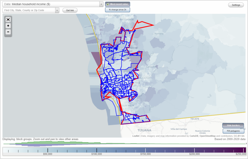
San Diego, California Neighborhood Map - Income, House Prices, Occupations, Boundaries
Settings
X

- City boundary
- Neighborhood boundaries
Business Search - 14 Million verified businesses
Park Gate - Yonge Street Condos Neighborhoods:
Park Gate, Park Laurel, Park Place Condominiums, Park Villas of Talmadge, Park West, Parkcrest, Parkloft Condiminiums, Parkview, Paseo De Mission Hills, Pegasus, Penn Station, Pinnacle Museum Tower Condominium, Point Carmel, Point Loma, Point Loma Heights, Porta D Italia, Porto Siena, Prado Terrace, Princess Park in California Terraces, Rainier Place, Rancho Bernardo, Rancho Encantada, Rancho Penasquitos, Reata Way, Remington Hills, Renaissance at North Park, Rhodes Crossing, Ridgeview/webster, Rivera Drive Residences, Riviera Del Sol, Riviera Drive Townhomes, Rolando, Sabre Springs, Saddle Club Estates, Samuel Fox Lofts, San Carlos, Santa Monica, Savannah Terrace-Sabre Springs Areas, Schotz Estates, Scripps Highlands, Scripps Pomerado, Scripps Ranch, Seabreeze at Old El Camino Real, Serra Mesa, Shaw Property, Shelltown, Shelter Island, Sherman Heights, Sigsbee Row, Silver Oak Estates, Skyline, Skyline Terraces Estates, Smart Corner, Solmelia Condos, Sorrento Valley, South Bay Terraces, South Encanto, South Park, Southcrest, Southcrest Park Estates, Southgate Condos, Southpark Townhomes, Spectrum Ter, Spinnaker Point, Spruce Canyon Townhomes, Stockton, Summit Place, Sundowner Estates, Sunroad B Promenade, Sunset, Sunset Cliffs, Sunset Cliffs Boulevard Condos, Swan Canyon, Swift Park, Sycamore Estates, Talmadge, Temecula Heights, Teralta East, Teralta West, The Anchorage, The Bentley, The Court at Adelaide, The Egyptian, The Grande at Santa Fe Place, The Metropolitan Project, The Palisades, The Tent City, The Village in University Heights, The Villas at Stallions Crossing, Thorn Street Condos, Tierrasanta, Tijuana River Valley, Titan Condos, Torrey Brooke, Torrey Glenn, Torrey Highlands, Torrey Highlands Village Center, Torrey Hills, Torrey Ranch, Torrey Reserve Gateway, Torrey Santa Fe, Torrey View Estates, University City, University Heights, Valencia Business Park, Valencia Park, Verona, Villas Del Parque, Vista Bougainvillea, Vista Colina, W Laurel Studios, Wabash Gardens, Waterfront Condos, Wilson Villas, Winona Square, Wooded Area, Yacht Club Condos, Yonge Street CondosPark Gate neighborhood in San Diego statistics: (Find on map)
Population: 6
Population density:
Median household income in 2021:
Median rent in in 2021:
Male vs Females
Median age
Housing prices:
Average estimated value of detached houses in 2021 (25.0% of all units):
Most popular occupations of males: sales and office occupations (26.4%); business and financial operations occupations (19.0%); computer and mathematical occupations (16.7%); service occupations (14.8%); management occupations (except farmers) (10.6%); architecture and engineering occupations (4.6%); production occupations (3.5%)
Most popular occupations of females: management occupations (except farmers) (40.1%); service occupations (24.0%); business and financial operations occupations (12.3%); healthcare practitioners and technical occupations (11.6%); community and social services occupations (10.6%); arts, design, entertainment, sports, and media occupations (5.6%); education, training, and library occupations (4.8%)
Park Gate neighborhood detailed profile
Population: 6
Population density:
| Park Gate: | 17,609 people per square mile |
| San Diego: | 4,260 people per square mile |
Median household income in 2021:
| Park Gate: | $59,435 |
| San Diego: | $93,042 |
Median rent in in 2021:
| Park Gate: | $1,466 |
| San Diego: | $1,856 |
Male vs Females
| Males: | 4 |
| Females: | 2 |
Median age
| Males: | 36.3 years |
| Females: | 34.1 years |
Housing prices:
Average estimated value of detached houses in 2021 (25.0% of all units):
| Park Gate: | $669,260 |
| San Diego: | $877,608 |
Most popular occupations of males: sales and office occupations (26.4%); business and financial operations occupations (19.0%); computer and mathematical occupations (16.7%); service occupations (14.8%); management occupations (except farmers) (10.6%); architecture and engineering occupations (4.6%); production occupations (3.5%)
Most popular occupations of females: management occupations (except farmers) (40.1%); service occupations (24.0%); business and financial operations occupations (12.3%); healthcare practitioners and technical occupations (11.6%); community and social services occupations (10.6%); arts, design, entertainment, sports, and media occupations (5.6%); education, training, and library occupations (4.8%)
Park Gate neighborhood detailed profile
Park Laurel neighborhood in San Diego statistics: (Find on map)
Area: 0.003 square miles
Population: 23
Population density:
Median household income in 2021:
Median rent in in 2021:
Male vs Females
Median age
Most popular occupations of males: management occupations (except farmers) (22.3%); service occupations (12.7%); computer and mathematical occupations (10.8%); sales and office occupations (10.4%); business and financial operations occupations (10.2%); architecture and engineering occupations (8.4%); production occupations (6.7%)
Most popular occupations of females: service occupations (27.8%); education, training, and library occupations (21.6%); sales and office occupations (20.9%); healthcare practitioners and technical occupations (18.9%); business and financial operations occupations (10.1%); computer and mathematical occupations (3.7%); arts, design, entertainment, sports, and media occupations (2.3%)
Park Laurel neighborhood detailed profile
Area: 0.003 square miles
Population: 23
Population density:
| Park Laurel: | 7,573 people per square mile |
| San Diego: | 4,260 people per square mile |
Median household income in 2021:
| Park Laurel: | $114,419 |
| San Diego: | $93,042 |
Median rent in in 2021:
| Park Laurel: | $2,006 |
| San Diego: | $1,856 |
Male vs Females
| Males: | 13 |
| Females: | 10 |
Median age
| Males: | 53.1 years |
| Females: | 50.0 years |
Most popular occupations of males: management occupations (except farmers) (22.3%); service occupations (12.7%); computer and mathematical occupations (10.8%); sales and office occupations (10.4%); business and financial operations occupations (10.2%); architecture and engineering occupations (8.4%); production occupations (6.7%)
Most popular occupations of females: service occupations (27.8%); education, training, and library occupations (21.6%); sales and office occupations (20.9%); healthcare practitioners and technical occupations (18.9%); business and financial operations occupations (10.1%); computer and mathematical occupations (3.7%); arts, design, entertainment, sports, and media occupations (2.3%)
Park Laurel neighborhood detailed profile
Park Place Condominiums neighborhood in San Diego statistics: (Find on map)
Area: 0.004 square miles
Park Place Condominiums neighborhood detailed profile
Area: 0.004 square miles
Park Place Condominiums neighborhood detailed profile
Park Villas of Talmadge neighborhood in San Diego statistics: (Find on map)
Population: 15
Population density:
Median household income in 2021:
Median rent in in 2021:
Male vs Females
Median age
Most popular occupations of males: service occupations (19.5%); community and social services occupations (17.4%); sales and office occupations (16.4%); education, training, and library occupations (15.6%); construction, extraction, and maintenance occupations (12.8%); transportation occupations (6.9%); management occupations (except farmers) (3.8%)
Most popular occupations of females: production occupations (21.0%); management occupations (except farmers) (18.9%); business and financial operations occupations (15.3%); community and social services occupations (11.6%); sales and office occupations (10.8%); education, training, and library occupations (7.9%); service occupations (5.3%)
Park Villas of Talmadge neighborhood detailed profile
Population: 15
Population density:
| Park Villas of Talmadge: | 50,611 people per square mile |
| San Diego: | 4,260 people per square mile |
Median household income in 2021:
| Park Villas of Talmadge: | $62,623 |
| San Diego: | $93,042 |
Median rent in in 2021:
| Park Villas of Talmadge: | $1,306 |
| San Diego: | $1,856 |
Male vs Females
| Males: | 7 |
| Females: | 8 |
Median age
| Males: | 35.4 years |
| Females: | 37.7 years |
Most popular occupations of males: service occupations (19.5%); community and social services occupations (17.4%); sales and office occupations (16.4%); education, training, and library occupations (15.6%); construction, extraction, and maintenance occupations (12.8%); transportation occupations (6.9%); management occupations (except farmers) (3.8%)
Most popular occupations of females: production occupations (21.0%); management occupations (except farmers) (18.9%); business and financial operations occupations (15.3%); community and social services occupations (11.6%); sales and office occupations (10.8%); education, training, and library occupations (7.9%); service occupations (5.3%)
Park Villas of Talmadge neighborhood detailed profile
Park West neighborhood in San Diego statistics: (Find on map)
Area: 0.654 square miles
Population: 8,579
Population density:
Median household income in 2021:
Median rent in in 2021:
Male vs Females
Median age
Housing prices:
Average estimated value of detached houses in 2021 (11.5% of all units):
Average estimated value of townhouses or other attached units in 2021 (8.8% of all units):
Average estimated '21 value of housing units in 5-or-more-unit structures (19.8% of all units):
Most popular occupations of males: sales and office occupations (18.1%); management occupations (except farmers) (14.4%); service occupations (14.2%); computer and mathematical occupations (9.9%); business and financial operations occupations (8.2%); architecture and engineering occupations (6.8%); arts, design, entertainment, sports, and media occupations (4.9%)
Most popular occupations of females: sales and office occupations (16.8%); service occupations (16.5%); management occupations (except farmers) (16.3%); healthcare practitioners and technical occupations (12.0%); business and financial operations occupations (9.2%); education, training, and library occupations (7.8%); architecture and engineering occupations (4.8%)
Limited-access highways (interstate or state) in this neighborhood: San Diego Fwy (I- 5).
Roads and streets: 4th Ave; 3rd Ave; 5th Ave; 2nd Ave; 6th Ave; 1st Ave; Front St; Albatross St; Brant St; Curlew St; Dove St; N Arroyo Dr; W Maple St; Union St; W Laurel St; Thorn St; Spruce St; W Spruce St; Quince St; Maple St; Laurel St; Nutmeg St; Kalmia St; Juniper St (E Juniper St); Ivy St; Hawthorn St; Grape St; Fir St; Elm St; W Kalmia St; W Palm St; W Juniper St; W Ivy St; W Thorn St; Redwood St; W Hawthorn St; W Grape St; W Nutmeg St; Palm St; Olive St; W Olive St; W Redwood St; Date St; W Quince St; Eagle St; Barnson Pl; Horton Ave; W Fir St.
Park West neighborhood detailed profile
Area: 0.654 square miles
Population: 8,579
Population density:
| Park West: | 13,120 people per square mile |
| San Diego: | 4,260 people per square mile |
Median household income in 2021:
| Park West: | $88,599 |
| San Diego: | $93,042 |
Median rent in in 2021:
| Park West: | $1,649 |
| San Diego: | $1,856 |
Male vs Females
| Males: | 4,305 |
| Females: | 4,273 |
Median age
| Males: | 46.7 years |
| Females: | 47.3 years |
Housing prices:
Average estimated value of detached houses in 2021 (11.5% of all units):
| Park West: | $3,987,565 |
| San Diego: | $877,608 |
Average estimated value of townhouses or other attached units in 2021 (8.8% of all units):
| This neighborhood: | $881,000 |
| city: | $569,146 |
Average estimated '21 value of housing units in 5-or-more-unit structures (19.8% of all units):
| Park West: | $749,764 |
| San Diego: | $514,855 |
Most popular occupations of males: sales and office occupations (18.1%); management occupations (except farmers) (14.4%); service occupations (14.2%); computer and mathematical occupations (9.9%); business and financial operations occupations (8.2%); architecture and engineering occupations (6.8%); arts, design, entertainment, sports, and media occupations (4.9%)
Most popular occupations of females: sales and office occupations (16.8%); service occupations (16.5%); management occupations (except farmers) (16.3%); healthcare practitioners and technical occupations (12.0%); business and financial operations occupations (9.2%); education, training, and library occupations (7.8%); architecture and engineering occupations (4.8%)
Limited-access highways (interstate or state) in this neighborhood: San Diego Fwy (I- 5).
Roads and streets: 4th Ave; 3rd Ave; 5th Ave; 2nd Ave; 6th Ave; 1st Ave; Front St; Albatross St; Brant St; Curlew St; Dove St; N Arroyo Dr; W Maple St; Union St; W Laurel St; Thorn St; Spruce St; W Spruce St; Quince St; Maple St; Laurel St; Nutmeg St; Kalmia St; Juniper St (E Juniper St); Ivy St; Hawthorn St; Grape St; Fir St; Elm St; W Kalmia St; W Palm St; W Juniper St; W Ivy St; W Thorn St; Redwood St; W Hawthorn St; W Grape St; W Nutmeg St; Palm St; Olive St; W Olive St; W Redwood St; Date St; W Quince St; Eagle St; Barnson Pl; Horton Ave; W Fir St.
Park West neighborhood detailed profile
Parkcrest neighborhood in San Diego statistics: (Find on map)
Population: 1
Population density:
Median household income in 2021:
Median rent in in 2021:
Most popular occupations of males: sales and office occupations (26.2%); management occupations (except farmers) (15.3%); service occupations (13.1%); life, physical, and social science occupations (8.7%); healthcare practitioners and technical occupations (7.2%); architecture and engineering occupations (6.9%); production occupations (6.2%)
Most popular occupations of females: sales and office occupations (29.6%); service occupations (20.2%); management occupations (except farmers) (19.4%); life, physical, and social science occupations (8.1%); business and financial operations occupations (6.1%); education, training, and library occupations (6.1%); community and social services occupations (3.7%)
Parkcrest neighborhood detailed profile
Population: 1
Population density:
| Parkcrest: | 2,931 people per square mile |
| San Diego: | 4,260 people per square mile |
Median household income in 2021:
| Parkcrest: | $78,056 |
| San Diego: | $93,042 |
Median rent in in 2021:
| Parkcrest: | $1,453 |
| San Diego: | $1,856 |
Most popular occupations of males: sales and office occupations (26.2%); management occupations (except farmers) (15.3%); service occupations (13.1%); life, physical, and social science occupations (8.7%); healthcare practitioners and technical occupations (7.2%); architecture and engineering occupations (6.9%); production occupations (6.2%)
Most popular occupations of females: sales and office occupations (29.6%); service occupations (20.2%); management occupations (except farmers) (19.4%); life, physical, and social science occupations (8.1%); business and financial operations occupations (6.1%); education, training, and library occupations (6.1%); community and social services occupations (3.7%)
Parkcrest neighborhood detailed profile
Parkloft Condiminiums neighborhood in San Diego statistics: (Find on map)
Area: 0.002 square miles
Parkloft Condiminiums neighborhood detailed profile
Area: 0.002 square miles
Parkloft Condiminiums neighborhood detailed profile
Parkview neighborhood in San Diego statistics: (Find on map)
Area: 0.010 square miles
Population: 100
Population density:
Median household income in 2021:
Median rent in in 2021:
Male vs Females
Median age
Most popular occupations of males: computer and mathematical occupations (34.6%); service occupations (19.6%); management occupations (except farmers) (15.7%); education, training, and library occupations (11.4%); architecture and engineering occupations (7.5%); healthcare practitioners and technical occupations (6.2%); material moving occupations (2.6%)
Most popular occupations of females: service occupations (44.4%); sales and office occupations (22.9%); healthcare practitioners and technical occupations (7.9%); legal occupations (6.4%); education, training, and library occupations (4.6%); business and financial operations occupations (4.2%); production occupations (3.6%)
Parkview neighborhood detailed profile
Area: 0.010 square miles
Population: 100
Population density:
| Parkview: | 10,264 people per square mile |
| San Diego: | 4,260 people per square mile |
Median household income in 2021:
| Parkview: | $63,357 |
| San Diego: | $93,042 |
Median rent in in 2021:
| Parkview: | $2,310 |
| San Diego: | $1,856 |
Male vs Females
| Males: | 60 |
| Females: | 40 |
Median age
| Males: | 29.6 years |
| Females: | 32.0 years |
Most popular occupations of males: computer and mathematical occupations (34.6%); service occupations (19.6%); management occupations (except farmers) (15.7%); education, training, and library occupations (11.4%); architecture and engineering occupations (7.5%); healthcare practitioners and technical occupations (6.2%); material moving occupations (2.6%)
Most popular occupations of females: service occupations (44.4%); sales and office occupations (22.9%); healthcare practitioners and technical occupations (7.9%); legal occupations (6.4%); education, training, and library occupations (4.6%); business and financial operations occupations (4.2%); production occupations (3.6%)
Parkview neighborhood detailed profile
Paseo De Mission Hills neighborhood in San Diego statistics: (Find on map)
Paseo De Mission Hills neighborhood detailed profile
Paseo De Mission Hills neighborhood detailed profile
Pegasus neighborhood in San Diego statistics: (Find on map)
Area: 0.004 square miles
Population: 33
Population density:
Median household income in 2021:
Median rent in in 2021:
Male vs Females
Median age
Average estimated value of detached houses in 2021 (90.0% of all units):
Most popular occupations of males: sales and office occupations (15.7%); computer and mathematical occupations (11.8%); architecture and engineering occupations (10.8%); management occupations (except farmers) (9.2%); service occupations (8.2%); healthcare practitioners and technical occupations (7.7%); production occupations (7.2%)
Most popular occupations of females: sales and office occupations (27.8%); service occupations (17.8%); healthcare practitioners and technical occupations (16.4%); production occupations (6.1%); business and financial operations occupations (5.9%); life, physical, and social science occupations (5.9%); architecture and engineering occupations (4.3%)
Roads and streets: Achilles Way; Olympus Ct.
Pegasus neighborhood detailed profile
Area: 0.004 square miles
Population: 33
Population density:
| Pegasus: | 8,386 people per square mile |
| San Diego: | 4,260 people per square mile |
Median household income in 2021:
| Pegasus: | $132,708 |
| San Diego: | $93,042 |
Median rent in in 2021:
| Pegasus: | $2,569 |
| San Diego: | $1,856 |
Male vs Females
| Males: | 16 |
| Females: | 17 |
Median age
| Males: | 33.1 years |
| Females: | 35.5 years |
Average estimated value of detached houses in 2021 (90.0% of all units):
| Pegasus: | $660,462 |
| San Diego: | $877,608 |
Most popular occupations of males: sales and office occupations (15.7%); computer and mathematical occupations (11.8%); architecture and engineering occupations (10.8%); management occupations (except farmers) (9.2%); service occupations (8.2%); healthcare practitioners and technical occupations (7.7%); production occupations (7.2%)
Most popular occupations of females: sales and office occupations (27.8%); service occupations (17.8%); healthcare practitioners and technical occupations (16.4%); production occupations (6.1%); business and financial operations occupations (5.9%); life, physical, and social science occupations (5.9%); architecture and engineering occupations (4.3%)
Roads and streets: Achilles Way; Olympus Ct.
Pegasus neighborhood detailed profile
Penn Station neighborhood in San Diego statistics: (Find on map)
Population: 3
Population density:
Median household income in 2021:
Median rent in in 2021:
Male vs Females
Median age
Most popular occupations of males: life, physical, and social science occupations (27.8%); service occupations (26.6%); management occupations (except farmers) (23.7%); sales and office occupations (22.6%); education, training, and library occupations (11.5%); business and financial operations occupations (8.1%); transportation occupations (7.4%)
Most popular occupations of females: service occupations (21.4%); business and financial operations occupations (21.1%); arts, design, entertainment, sports, and media occupations (17.1%); management occupations (except farmers) (13.8%); healthcare practitioners and technical occupations (10.9%); life, physical, and social science occupations (9.5%); education, training, and library occupations (9.5%)
Penn Station neighborhood detailed profile
Population: 3
Population density:
| Penn Station: | 8,153 people per square mile |
| San Diego: | 4,260 people per square mile |
Median household income in 2021:
| Penn Station: | $59,018 |
| San Diego: | $93,042 |
Median rent in in 2021:
| Penn Station: | $1,314 |
| San Diego: | $1,856 |
Male vs Females
| Males: | 1 |
| Females: | 1 |
Median age
| Males: | 47.7 years |
| Females: | 39.7 years |
Most popular occupations of males: life, physical, and social science occupations (27.8%); service occupations (26.6%); management occupations (except farmers) (23.7%); sales and office occupations (22.6%); education, training, and library occupations (11.5%); business and financial operations occupations (8.1%); transportation occupations (7.4%)
Most popular occupations of females: service occupations (21.4%); business and financial operations occupations (21.1%); arts, design, entertainment, sports, and media occupations (17.1%); management occupations (except farmers) (13.8%); healthcare practitioners and technical occupations (10.9%); life, physical, and social science occupations (9.5%); education, training, and library occupations (9.5%)
Penn Station neighborhood detailed profile
Pinnacle Museum Tower Condominium neighborhood in San Diego statistics: (Find on map)
Area: 0.003 square miles
Pinnacle Museum Tower Condominium neighborhood detailed profile
Area: 0.003 square miles
Pinnacle Museum Tower Condominium neighborhood detailed profile
Point Carmel neighborhood in San Diego statistics: (Find on map)
Area: 0.050 square miles
Population: 50
Population density:
Median household income in 2021:
Median rent in in 2021:
Male vs Females
Median age
Average estimated value of detached houses in 2021 (86.7% of all units):
Most popular occupations of males: computer and mathematical occupations (15.5%); architecture and engineering occupations (12.8%); healthcare practitioners and technical occupations (11.7%); life, physical, and social science occupations (10.6%); sales and office occupations (10.6%); management occupations (except farmers) (9.7%); education, training, and library occupations (6.8%)
Most popular occupations of females: business and financial operations occupations (23.8%); life, physical, and social science occupations (18.1%); sales and office occupations (12.8%); healthcare practitioners and technical occupations (12.2%); computer and mathematical occupations (7.9%); management occupations (except farmers) (7.3%); service occupations (6.2%)
Roads and streets: Sunset Pt Way; Sunset Pt Pl; Sunset Heights Ct.
Point Carmel neighborhood detailed profile
Area: 0.050 square miles
Population: 50
Population density:
| Point Carmel: | 992 people per square mile |
| San Diego: | 4,260 people per square mile |
Median household income in 2021:
| Point Carmel: | $204,122 |
| San Diego: | $93,042 |
Median rent in in 2021:
| Point Carmel: | $3,046 |
| San Diego: | $1,856 |
Male vs Females
| Males: | 24 |
| Females: | 26 |
Median age
| Males: | 39.7 years |
| Females: | 36.7 years |
Average estimated value of detached houses in 2021 (86.7% of all units):
| Point Carmel: | $1,729,066 |
| San Diego: | $877,608 |
Most popular occupations of males: computer and mathematical occupations (15.5%); architecture and engineering occupations (12.8%); healthcare practitioners and technical occupations (11.7%); life, physical, and social science occupations (10.6%); sales and office occupations (10.6%); management occupations (except farmers) (9.7%); education, training, and library occupations (6.8%)
Most popular occupations of females: business and financial operations occupations (23.8%); life, physical, and social science occupations (18.1%); sales and office occupations (12.8%); healthcare practitioners and technical occupations (12.2%); computer and mathematical occupations (7.9%); management occupations (except farmers) (7.3%); service occupations (6.2%)
Roads and streets: Sunset Pt Way; Sunset Pt Pl; Sunset Heights Ct.
Point Carmel neighborhood detailed profile
Point Loma neighborhood in San Diego statistics: (Find on map)
Area: 0.679 square miles
Population: 5,858
Population density:
Median household income in 2021:
Median rent in in 2021:
Male vs Females
Median age
Housing prices:
Average estimated value of detached houses in 2021 (68.8% of all units):
Average estimated value of townhouses or other attached units in 2021 (10.6% of all units):
Average estimated '21 value of housing units in 3-to-4-unit structures (7.0% of all units):
Average estimated '21 value of housing units in 5-or-more-unit structures (15.1% of all units):
Most popular occupations of males: management occupations (except farmers) (22.8%); service occupations (15.1%); sales and office occupations (12.4%); business and financial operations occupations (10.7%); education, training, and library occupations (7.3%); construction, extraction, and maintenance occupations (5.4%); legal occupations (5.2%)
Most popular occupations of females: management occupations (except farmers) (24.8%); service occupations (21.9%); education, training, and library occupations (13.3%); sales and office occupations (13.0%); business and financial operations occupations (9.4%); healthcare practitioners and technical occupations (4.8%); community and social services occupations (4.4%)
Highways in this neighborhood: Rosecrans St (State Hwy 209).
Roads and streets: Willow St; Evergreen St; Locust St; Elliott St; Plum St; Clove St; Chatsworth Blvd; Wing St; Kingsley St; Dumas St; Curtis St; Zola St; Browning St; Freeman St; Goldsmith St; Wisteria Dr; Voltaire St; Alcott St; Rosecrans Pl; Homer St; Udall St; Sterne St; Tennyson St; Madrid St; Hyacinth Dr; N Evergreen St; Yonge St; Ibsen St; Lotus Dr; Oleander Dr; Plumosa Dr; James St; Amaryllis Dr; Shadowlawn St; Meadow Grove Dr; Xenophon St; Lytton St; Narcissus Dr; Azalea Dr; Larga Cir; Malaga St; Whittier St; Seville St; Jonquil Dr; Cadiz St; Barnett Ave; Russell St; Gearing Dr; Quimby St; Oleander Pl; Michaelmas Ter; Ranleigh Ct; Calypso Pl; Leland St; Larga Ct.
Point Loma neighborhood detailed profile
Area: 0.679 square miles
Population: 5,858
Population density:
| Point Loma: | 8,621 people per square mile |
| San Diego: | 4,260 people per square mile |
Median household income in 2021:
| Point Loma: | $101,015 |
| San Diego: | $93,042 |
Median rent in in 2021:
| Point Loma: | $2,462 |
| San Diego: | $1,856 |
Male vs Females
| Males: | 2,821 |
| Females: | 3,036 |
Median age
| Males: | 34.2 years |
| Females: | 31.0 years |
Housing prices:
Average estimated value of detached houses in 2021 (68.8% of all units):
| Point Loma: | $1,082,739 |
| San Diego: | $877,608 |
Average estimated value of townhouses or other attached units in 2021 (10.6% of all units):
| This neighborhood: | $442,718 |
| city: | $569,146 |
Average estimated '21 value of housing units in 3-to-4-unit structures (7.0% of all units):
| Point Loma: | $411,159 |
| city: | $417,341 |
Average estimated '21 value of housing units in 5-or-more-unit structures (15.1% of all units):
| Point Loma: | $356,753 |
| San Diego: | $514,855 |
Most popular occupations of males: management occupations (except farmers) (22.8%); service occupations (15.1%); sales and office occupations (12.4%); business and financial operations occupations (10.7%); education, training, and library occupations (7.3%); construction, extraction, and maintenance occupations (5.4%); legal occupations (5.2%)
Most popular occupations of females: management occupations (except farmers) (24.8%); service occupations (21.9%); education, training, and library occupations (13.3%); sales and office occupations (13.0%); business and financial operations occupations (9.4%); healthcare practitioners and technical occupations (4.8%); community and social services occupations (4.4%)
Highways in this neighborhood: Rosecrans St (State Hwy 209).
Roads and streets: Willow St; Evergreen St; Locust St; Elliott St; Plum St; Clove St; Chatsworth Blvd; Wing St; Kingsley St; Dumas St; Curtis St; Zola St; Browning St; Freeman St; Goldsmith St; Wisteria Dr; Voltaire St; Alcott St; Rosecrans Pl; Homer St; Udall St; Sterne St; Tennyson St; Madrid St; Hyacinth Dr; N Evergreen St; Yonge St; Ibsen St; Lotus Dr; Oleander Dr; Plumosa Dr; James St; Amaryllis Dr; Shadowlawn St; Meadow Grove Dr; Xenophon St; Lytton St; Narcissus Dr; Azalea Dr; Larga Cir; Malaga St; Whittier St; Seville St; Jonquil Dr; Cadiz St; Barnett Ave; Russell St; Gearing Dr; Quimby St; Oleander Pl; Michaelmas Ter; Ranleigh Ct; Calypso Pl; Leland St; Larga Ct.
Point Loma neighborhood detailed profile
Point Loma Heights neighborhood in San Diego statistics: (Find on map)
Area: 1.928 square miles
Population: 20,524
Population density:
Median household income in 2021:
Median rent in in 2021:
Male vs Females
Median age
Housing prices:
Average estimated value of detached houses in 2021 (51.3% of all units):
Average estimated value of townhouses or other attached units in 2021 (10.8% of all units):
Average estimated '21 value of housing units in 3-to-4-unit structures (8.2% of all units):
Average estimated '21 value of housing units in 5-or-more-unit structures (36.7% of all units):
Most popular occupations of males: management occupations (except farmers) (19.4%); sales and office occupations (10.3%); transportation occupations (7.5%); service occupations (6.8%); arts, design, entertainment, sports, and media occupations (6.6%); computer and mathematical occupations (5.9%); business and financial operations occupations (5.8%)
Most popular occupations of females: sales and office occupations (30.0%); management occupations (except farmers) (14.1%); service occupations (13.6%); healthcare practitioners and technical occupations (11.5%); education, training, and library occupations (8.6%); business and financial operations occupations (5.9%); legal occupations (3.9%)
Limited-access highways (interstate or state) in this neighborhood: I- 8 (Ocean Beach Fwy).
Roads and streets: Chatsworth Blvd; Nimitz Blvd; Catalina Blvd; Guizot St; W Point Loma Blvd; Poinsettia Dr; Worden St; Venice St; Voltaire St; Santa Barbara St; Narragansett Ave; Famosa Blvd; Coronado Ave; Valeta St; Tennyson St; del Mar Ave; Santa Cruz Ave; Poe St; Orchard Ave; Warrington St; Mendocino Blvd; Montalvo St; Oliphant St; Niagara Ave; Udall St; Soto St; del Monte Ave; Wawona Dr; Bernice Dr; Mentone St; Atascadero Dr; Newport Ave; Barnard St; Midway Dr; Nipoma St; Loma Riviera Dr; Loma Riviera Ln; Orleans E; Wildwood Rd; la Cresta Dr; Centraloma Dr; Milan St; Kemper St; Adrian St; Alicia Dr; Wells St; Sports Arena Blvd; Capistrano St; Zola St; Whittier St; Pescadero Ave; Etiwanda St; Camulos St; Temecula St; Alcott St; Santa Monica Ave; Palermo Dr; Greene St; San Clemente St; Loma Riviera Ct; Saratoga Ave; Long Branch Ave; Muir Ave; Wabaska Dr; Cmt Pajarito; Cmt Pasada; Newell St; Cape May Ave; Rue D' Orleans; Redondo St; Clovis St; Brighton Ave; Cmt Pescado; Curtis St; Leland St; Cmt Umbral; Groton St; Venus St; Bermuda Ave; Cmt Venido; Lucerne Dr; Bermuda Cir; Dixon Pl; Rialto St; Loma Riviera Cir; Quimby St; Banning St; Cmt Agrado; Bolinas St; Seaside St; Evergreen St; Bob St; Basilone St; Ollie St; Polack St; Cmt Dehesa; Cmt Eximio; Cmt Afuera; Cmt Mira; Cmt Recodo; Duke St; Nipoma Pl; Macaulay St; Savoy Cir; Catalina Pl; Cmt Litoral; Xenophon St; Cmt Espejo; Groton Way; Wabaska Ct; Cmt Andada; Catalina Ct; Orleans W; Sefton Pl; Castelar St; Cmt Zocalo; Amaryllis Dr; Cmt Seguro; Browning St; Clove St; Chapman St; Willow St; Las Lomas St; Yonge St; Marquette Pl; Alcott Ct; Elliott St; Sea Colony Ct; Cmt Menor; Cmt Estero; Kemper Ct; Narragansett Ct; Cmt Poco; W Mission Bay Dr; Plum St.
Point Loma Heights neighborhood detailed profile
Area: 1.928 square miles
Population: 20,524
Population density:
| Point Loma Heights: | 10,645 people per square mile |
| San Diego: | 4,260 people per square mile |
Median household income in 2021:
| Point Loma Heights: | $109,982 |
| San Diego: | $93,042 |
Median rent in in 2021:
| Point Loma Heights: | $2,217 |
| San Diego: | $1,856 |
Male vs Females
| Males: | 10,776 |
| Females: | 9,747 |
Median age
| Males: | 38.6 years |
| Females: | 37.1 years |
Housing prices:
Average estimated value of detached houses in 2021 (51.3% of all units):
| Point Loma Heights: | $1,176,302 |
| San Diego: | $877,608 |
Average estimated value of townhouses or other attached units in 2021 (10.8% of all units):
| This neighborhood: | $442,718 |
| city: | $569,146 |
Average estimated '21 value of housing units in 3-to-4-unit structures (8.2% of all units):
| Point Loma Heights: | $411,159 |
| city: | $417,341 |
Average estimated '21 value of housing units in 5-or-more-unit structures (36.7% of all units):
| Point Loma Heights: | $356,753 |
| San Diego: | $514,855 |
Most popular occupations of males: management occupations (except farmers) (19.4%); sales and office occupations (10.3%); transportation occupations (7.5%); service occupations (6.8%); arts, design, entertainment, sports, and media occupations (6.6%); computer and mathematical occupations (5.9%); business and financial operations occupations (5.8%)
Most popular occupations of females: sales and office occupations (30.0%); management occupations (except farmers) (14.1%); service occupations (13.6%); healthcare practitioners and technical occupations (11.5%); education, training, and library occupations (8.6%); business and financial operations occupations (5.9%); legal occupations (3.9%)
Limited-access highways (interstate or state) in this neighborhood: I- 8 (Ocean Beach Fwy).
Roads and streets: Chatsworth Blvd; Nimitz Blvd; Catalina Blvd; Guizot St; W Point Loma Blvd; Poinsettia Dr; Worden St; Venice St; Voltaire St; Santa Barbara St; Narragansett Ave; Famosa Blvd; Coronado Ave; Valeta St; Tennyson St; del Mar Ave; Santa Cruz Ave; Poe St; Orchard Ave; Warrington St; Mendocino Blvd; Montalvo St; Oliphant St; Niagara Ave; Udall St; Soto St; del Monte Ave; Wawona Dr; Bernice Dr; Mentone St; Atascadero Dr; Newport Ave; Barnard St; Midway Dr; Nipoma St; Loma Riviera Dr; Loma Riviera Ln; Orleans E; Wildwood Rd; la Cresta Dr; Centraloma Dr; Milan St; Kemper St; Adrian St; Alicia Dr; Wells St; Sports Arena Blvd; Capistrano St; Zola St; Whittier St; Pescadero Ave; Etiwanda St; Camulos St; Temecula St; Alcott St; Santa Monica Ave; Palermo Dr; Greene St; San Clemente St; Loma Riviera Ct; Saratoga Ave; Long Branch Ave; Muir Ave; Wabaska Dr; Cmt Pajarito; Cmt Pasada; Newell St; Cape May Ave; Rue D' Orleans; Redondo St; Clovis St; Brighton Ave; Cmt Pescado; Curtis St; Leland St; Cmt Umbral; Groton St; Venus St; Bermuda Ave; Cmt Venido; Lucerne Dr; Bermuda Cir; Dixon Pl; Rialto St; Loma Riviera Cir; Quimby St; Banning St; Cmt Agrado; Bolinas St; Seaside St; Evergreen St; Bob St; Basilone St; Ollie St; Polack St; Cmt Dehesa; Cmt Eximio; Cmt Afuera; Cmt Mira; Cmt Recodo; Duke St; Nipoma Pl; Macaulay St; Savoy Cir; Catalina Pl; Cmt Litoral; Xenophon St; Cmt Espejo; Groton Way; Wabaska Ct; Cmt Andada; Catalina Ct; Orleans W; Sefton Pl; Castelar St; Cmt Zocalo; Amaryllis Dr; Cmt Seguro; Browning St; Clove St; Chapman St; Willow St; Las Lomas St; Yonge St; Marquette Pl; Alcott Ct; Elliott St; Sea Colony Ct; Cmt Menor; Cmt Estero; Kemper Ct; Narragansett Ct; Cmt Poco; W Mission Bay Dr; Plum St.
Point Loma Heights neighborhood detailed profile
Porta D Italia neighborhood in San Diego statistics: (Find on map)
Area: 0.003 square miles
Porta D Italia neighborhood detailed profile
Area: 0.003 square miles
Porta D Italia neighborhood detailed profile
Porto Siena neighborhood in San Diego statistics: (Find on map)
Area: 0.002 square miles
Porto Siena neighborhood detailed profile
Area: 0.002 square miles
Porto Siena neighborhood detailed profile
Prado Terrace neighborhood in San Diego statistics: (Find on map)
Population: 4
Population density:
Median household income in 2021:
Median rent in in 2021:
Male vs Females
Median age
Most popular occupations of males: service occupations (27.4%); management occupations (except farmers) (12.8%); arts, design, entertainment, sports, and media occupations (11.6%); architecture and engineering occupations (11.0%); business and financial operations occupations (9.8%); sales and office occupations (7.3%); material moving occupations (6.6%)
Most popular occupations of females: sales and office occupations (21.5%); life, physical, and social science occupations (20.3%); architecture and engineering occupations (13.1%); service occupations (12.7%); management occupations (except farmers) (10.8%); business and financial operations occupations (6.4%); arts, design, entertainment, sports, and media occupations (6.0%)
Prado Terrace neighborhood detailed profile
Population: 4
Population density:
| Prado Terrace: | 16,218 people per square mile |
| San Diego: | 4,260 people per square mile |
Median household income in 2021:
| Prado Terrace: | $68,370 |
| San Diego: | $93,042 |
Median rent in in 2021:
| Prado Terrace: | $1,399 |
| San Diego: | $1,856 |
Male vs Females
| Males: | 1 |
| Females: | 2 |
Median age
| Males: | 40.2 years |
| Females: | 28.3 years |
Most popular occupations of males: service occupations (27.4%); management occupations (except farmers) (12.8%); arts, design, entertainment, sports, and media occupations (11.6%); architecture and engineering occupations (11.0%); business and financial operations occupations (9.8%); sales and office occupations (7.3%); material moving occupations (6.6%)
Most popular occupations of females: sales and office occupations (21.5%); life, physical, and social science occupations (20.3%); architecture and engineering occupations (13.1%); service occupations (12.7%); management occupations (except farmers) (10.8%); business and financial operations occupations (6.4%); arts, design, entertainment, sports, and media occupations (6.0%)
Prado Terrace neighborhood detailed profile
Princess Park in California Terraces neighborhood in San Diego statistics: (Find on map)
Area: 0.108 square miles
Population: 5
Population density:
Median household income in 2021:
Median rent in in 2021:
Male vs Females
Median age
Housing prices:
Average estimated value of detached houses in 2021 (100.0% of all units):
Most popular occupations of males: construction, extraction, and maintenance occupations (31.6%); service occupations (14.1%); sales and office occupations (12.7%); production occupations (9.7%); business and financial operations occupations (7.0%); material moving occupations (6.3%); computer and mathematical occupations (4.9%)
Most popular occupations of females: sales and office occupations (35.1%); service occupations (20.5%); business and financial operations occupations (10.4%); education, training, and library occupations (9.3%); healthcare practitioners and technical occupations (7.6%); management occupations (except farmers) (4.3%); architecture and engineering occupations (3.8%)
Roads and streets: Crescent Bay Dr; Bay Crest Ln; Sandbar Cove Way; Sunrise Bluff Dr; Otay Mesa Rd; Blue Horizon Pt; Crystal Bluff Ct; Emerald Cliff Pt.
Princess Park in California Terraces neighborhood detailed profile
Area: 0.108 square miles
Population: 5
Population density:
| Princess Park in California Terraces: | 46 people per square mile |
| San Diego: | 4,260 people per square mile |
Median household income in 2021:
| Princess Park in California Terraces: | $83,097 |
| San Diego: | $93,042 |
Median rent in in 2021:
| Princess Park in California Terraces: | $1,474 |
| San Diego: | $1,856 |
Male vs Females
| Males: | 2 |
| Females: | 2 |
Median age
| Males: | 14.3 years |
| Females: | 19.6 years |
Housing prices:
Average estimated value of detached houses in 2021 (100.0% of all units):
| Princess Park in California Terraces: | $597,988 |
| San Diego: | $877,608 |
Most popular occupations of males: construction, extraction, and maintenance occupations (31.6%); service occupations (14.1%); sales and office occupations (12.7%); production occupations (9.7%); business and financial operations occupations (7.0%); material moving occupations (6.3%); computer and mathematical occupations (4.9%)
Most popular occupations of females: sales and office occupations (35.1%); service occupations (20.5%); business and financial operations occupations (10.4%); education, training, and library occupations (9.3%); healthcare practitioners and technical occupations (7.6%); management occupations (except farmers) (4.3%); architecture and engineering occupations (3.8%)
Roads and streets: Crescent Bay Dr; Bay Crest Ln; Sandbar Cove Way; Sunrise Bluff Dr; Otay Mesa Rd; Blue Horizon Pt; Crystal Bluff Ct; Emerald Cliff Pt.
Princess Park in California Terraces neighborhood detailed profile
Rainier Place neighborhood in San Diego statistics: (Find on map)
Area: 0.001 square miles
Population: 8
Population density:
Median household income in 2021:
Median rent in in 2021:
Male vs Females
Median age
Most popular occupations of males: construction, extraction, and maintenance occupations (24.2%); sales and office occupations (21.1%); architecture and engineering occupations (15.8%); computer and mathematical occupations (11.9%); service occupations (9.8%); business and financial operations occupations (6.3%); management occupations (except farmers) (3.9%)
Most popular occupations of females: sales and office occupations (49.8%); education, training, and library occupations (17.3%); healthcare practitioners and technical occupations (14.7%); service occupations (7.5%); management occupations (except farmers) (5.9%); computer and mathematical occupations (2.6%); arts, design, entertainment, sports, and media occupations (2.6%)
Rainier Place neighborhood detailed profile
Area: 0.001 square miles
Population: 8
Population density:
| Rainier Place: | 5,865 people per square mile |
| San Diego: | 4,260 people per square mile |
Median household income in 2021:
| Rainier Place: | $73,512 |
| San Diego: | $93,042 |
Median rent in in 2021:
| Rainier Place: | $1,721 |
| San Diego: | $1,856 |
Male vs Females
| Males: | 4 |
| Females: | 3 |
Median age
| Males: | 39.3 years |
| Females: | 42.6 years |
Most popular occupations of males: construction, extraction, and maintenance occupations (24.2%); sales and office occupations (21.1%); architecture and engineering occupations (15.8%); computer and mathematical occupations (11.9%); service occupations (9.8%); business and financial operations occupations (6.3%); management occupations (except farmers) (3.9%)
Most popular occupations of females: sales and office occupations (49.8%); education, training, and library occupations (17.3%); healthcare practitioners and technical occupations (14.7%); service occupations (7.5%); management occupations (except farmers) (5.9%); computer and mathematical occupations (2.6%); arts, design, entertainment, sports, and media occupations (2.6%)
Rainier Place neighborhood detailed profile
Rancho Bernardo neighborhood in San Diego statistics: (Find on map)
Area: 13.310 square miles
Population: 41,613
Population density:
Median household income in 2021:
Median rent in in 2021:
Male vs Females
Median age
Housing prices:
Average estimated value of detached houses in 2021 (60.5% of all units):
Average estimated value of townhouses or other attached units in 2021 (26.2% of all units):
Average estimated '21 value of housing units in 3-to-4-unit structures (7.7% of all units):
Most popular occupations of males: sales and office occupations (22.0%); management occupations (except farmers) (12.9%); business and financial operations occupations (10.4%); computer and mathematical occupations (10.4%); architecture and engineering occupations (10.3%); service occupations (9.0%); healthcare practitioners and technical occupations (6.5%)
Most popular occupations of females: sales and office occupations (25.6%); healthcare practitioners and technical occupations (14.3%); education, training, and library occupations (12.9%); business and financial operations occupations (12.8%); service occupations (9.4%); management occupations (except farmers) (6.5%); arts, design, entertainment, sports, and media occupations (4.4%)
Limited-access highways (interstate or state) in this neighborhood: I- 15 (Escondido Fwy).
Roads and streets: W Bernardo Dr; Pomerado Rd; Bernardo Center Dr; Rancho Bernardo Rd; Ave Venusto; Bernardo Heights Pkwy; Pso Lucido; Bernardo Oaks Dr; Escala Dr; Poblado Rd; Lomica Dr; Pso del Verano Norte; Bernardo Trails Dr; Matinal Cir; Via del Campo; Matinal Rd; Pso del Verano; Black Mountain Rd; Rios Rd; Frondoso Dr; Polvera Ave; Ave de Los Lobos; Cabela Dr; Cam del Norte; Aceituno St; Ave Consentido; Montero Rd; Ave Sivrita; Mission Rd; Cam Ramillette; Cam Emparrado; Mirasol Dr; Maturin Dr; Lofty Trail Dr; Horado Rd; Ave Cordillera; Royal Birkdale Row; Sycamore Creek Rd; Verano Dr; Aguamiel Rd; Cmt Corriente; Devereux Rd; Pso Montanoso; Roca Dr; Cmt Balata; Via Frontera; Callado Rd; Bajada Rd; Ave Rorras; Acena Dr; Abra Dr; Cmt Canasto; Florindo Rd; Duenda Rd; Capilla Rd; Azucar Way; Gabarda Rd; Turtleback Rd; Locksley St; Grandee Rd; Carranza Dr; Cmt Cantilena; Cll Pueblito; Cmt Ryone; Cresta Dr; Sencillo Dr; Valladares Dr; Polvera Dr; Nacido Dr; Ave Lamego; Cam de la Breccia; Cmt Vecinos; Cll Vivienda; Cloudesly Dr; Mantilla Rd; W Bernardo Ct; Alborada Dr; Cmt Pasadero; Fairway Pointe Row; Pastoral Rd; Big Springs Way; Monticook Ct; Ave Alozdra; Cam Vuelo; Via Esprillo; Felice Dr; Casero Rd; Greens East Rd; Cumana Ter; Grandee Pl; Creciente Way; Cam Crisalida; Ave Villaha; Smokesignal Dr; Cloudcrest Dr; Obispo Rd; Sun Maiden Ct; Drayton Hall Way; Bernardo Vista Dr; Angosto Way; Cam Ancho; Kingsgate Sq; Selva Dr; Fairhope Rd; Pomerado Ct; Turtleback Ln; Cmt Tierra del Sol; Cam Codorniz; Caldas de Reyes; Alondra Dr; Regalo Ln; Pacato Cir S; Libertad Dr; Gibraltar Dr; Calenda Rd; Fairlie Rd; Cll Parral; Bellota Dr; Cmt Campana; Grassy Trail Dr; Via Moura; Cmt Pinero; Dominican Dr; Plz Dolores; Lunada Pl; Francisco Dr; Moon Song Ct; Autillo Way; Sintonte Dr; Ave Suavidad; Cmt de la Gallarda; Calma Ct; Conquistador Way; Cll Estepona; Cam Abrojo; Via del Campo Ct; Royal Lytham Row; Campillo Dr; Bernardo Plaza Ct; Matinal Dr; Hada Dr; Graciosa Rd; Cedilla Pl; San Salvador Rd; Ave Alcachofa; Ave Nobleza; Lancashire Way; Sarape Dr; Cll Tamega; Parish Rd; Ashburton Rd; Oculto Rd; Acebo Dr; Pacato Cir N; Broken Bow Ct; Bellechase Cir; Ranch House Rd; Adena Ln; Fonticello Way; Chieftain Ct; Cmt de Las Missiones; Ave Marbella; Frontera Rd; Cmt Aire Puro; Corazon Pl; Oaks North Dr; Cmt Cadena; Santiago Rd W; Colonnades Pl; Pueblo Vista Ln; Fairway Heights Row; St Etienne Ln; Walton Heath Row; Corte Sobrado; Harvest Dance Way; Vezelay Ln; Chetenham Ln; Olmeda Pl; Via Alta Mirasol; Juarez Dr; Tesoro Dr; Cll Pulido; Shropshire Ln; Cotorro Rd; Sunnyfield Pl; Plz Acosta; Fernando Way; Redbud Ct; Oliva Rd; Filera Rd; Hierba Dr; Plz Otonal; Wessex St; Ave Aviero; Cmt Caldo; Fernando Dr; Cmt Cercado; Ramada Dr; Cmt la Torre; Adorno Pl; Cll Asturtas; Almendro Ln; Luz Pl; Toltec Ct; Hampshire Ln; Cmt Dosamantes; Via Gracia; Senda Acantilada; Pinzon Way; Alcacer del Sol; Pinata Dr; Mesto Dr; Botero Dr; Via Embleso; Floresta Way; Ave Tineo; Rueda Acayan; Bernardo Trails Pl; Cmt Rosita; Sonora Rd; San Tomas Dr; Technology Pl; Sencillo Ln; Windrose Way; Willowwood Dr; Cotorro Way; Prado Pl; Gibraltar Ct; Cll Paracho; Reata Way; Indian Lore Ct; Cll Charmona; Prado Rd; Pso Monte Batalla; Pablo Dr; Diego Dr; Via Nasca; Cll de Maria; Palmero Dr; Orilla Dr; Aliento Ct; Lincolnshire St; Corte Raposo; Pacato Ct; Tablero Pl; Graciosa Ct; Aguacate Way; Ipai Ct; Via Calanova; Andanza Way; Polvera Ct; Bear Dance Way; Sun Summit Pt; Bernardo Trails Ct; Terraza Floracion; Rueda Melilla; Plz Sonada; Technology Dr; Senda Rd; Pomerado Pl; Via Tazon; Meandro Dr; Montero Pl; Robleda Ct; Cmt de Las Noches; Carnton Way; Escoba Pl; Tretaganier Cir; Cmt de Linda; Bernardo Ter; Palero Rd; Cassia Pl; Cmt Tomas; Pipo Rd; Meandro Rd; Box Elder Way; San Salvador Ct; Plz del Curtidor; Windy Summit Pl; Chretien Ct; Cmt Ronaldo; Via Tavito; Via Firul; Box Elder Pl; Rimstone Ln; Stone Canyon Rd; Higa Pl; Cmt Chiclayo; Sun Walk Ct; Iberia Pl; Ruette Abeto; Polvera Way; Niego Ln; San Tomas Pl; Hohokum Way; Fieldstone Dr; Grandee Way; Utopia Rd; High Mesa Ct; Viceroy Dr; Heatherfield Ln; Corte Arauco; Abra Way; Perla Ct; Jardin Rd; Reata Ct; Rienzi Pl; Antonio Dr; Plz Maria; Via Galacia; Guacamayo Ct; Camberwell Ln; Luz Rd; Roble Way; Cmt Baya; Santiago Rd E; Meadow Flower Pl; Weaving Ln; Timaru Way; Palacio Pl; Arawak Ct; Caleta Way; C�r Dardo; Silver Buckle Way; Corte de Aceitunos; Cam Murrillo; Alta Carmel Ct; Lunada Pt; Plz Arica; Floresta Ct; Fernando Ct; Grandee Ct; Hispano Dr; Cmt Atico; Cll Suntuoso; Windrose Ct; Cabela Pl; Casero Ct; Pennacook Ct; Matanza Rd; Montura Dr; Parlange Pl; Trailside Ct; Relindo Dr; Tatia Ct; Sencillo Ct; Cll Suacillo; Plz Cerado; Royal Lytham Sq; Lucera Pl; Tablero Ct; Olmeda Way; Bendito Dr; Sandtrap Row; Cmt Santico; Diaz Dr; Abra Pl; Blazewood Way; Cmt Cancion; Corte Potosi; Corte Sabio; Obispo Ln; Corte de Chucena; Cmt Masada; Plz Animado; Marymont Pl; Pajaro Way; Rosedown Pl; Cmt Siega; Plz Guillermo; Palito Ct; Crisalida Ct (Corte Crisalida); Cmt Hercuba; Aguamarina Pt; Royal Crown Row; Iron View Row; Corte de Comares; Cmt Bracho; Azofar Ct; Myrica Ln; Cmt Heno; Corte Lagarto; Picaza Pl; Via Guadalmina; Plz Ascope; Cattail Rd; Verano Ct; Via Chona; Corte Emparrado; Saponi Ct; Corte Cierna; Austerlitz Pl; Oculto Pl; Alacran Ct; Bodega Rd; Lake Dr; Tesoro Ct; Opimo Dr; View Point Ct; Alveo Way; Ardisia Ct; Palacio Ct; Putting Green Row; Bernardo Oaks Ct; Caddy Row; Agreste Pl; Bravata Ct (Bravada Ct); Utopia Way; Manresa Ct; Bernardo Plaza Dr; Bolero Dr; Oculto Ct; Bocage Pt; Horado Ct; Parvo Ct; Nivel Ct; Jocatal Ct; Epica Ct; Ritidian Way; Bernardo Center Ct; Alcalde Ct; Cresta Way; Avena Pl; Via Rota; Sunnydale Ct; Olmeda Ct; Oculto Way; Ruette Campana; Plz Destacado; Sambrosa Pl; Kachina Ct; Ave la Valencia; Meandro Ct; Belle Helene Ct; Trailside Way; Cll Nobleza; Damasco Ct; Corte Sosegado; Montero Ct; Vinaruz Pl; Tristiana Pl; Asolear Pl; Plz Valdivia; Rodada Dr; Nevoso Way; Opimo Ct; Corte de Casares; Hillero Ct; Corte Guera; Capilla Ct; Via Altiva; Robleda Cove; Armero Ct; Ave Abeja; Parma Ct; Corte Morita; Creciente Ct; Ocaso Dr; Cmt Undoso; Via Acosta; Corte de Candilejas; Cam Armilla; Prado Way; Cll Saucillo; Poblado Ct; Papoose Ct; Bodega Pl; Cmt Gilbar; Tezcuco Ct; Plz Marlena; Cmt Sabroso; Plz Menta; Grillo Ct; Mesto Ct; Rancho Bernardo Town Dr; Cmt Florindo; Via Tarifa; Via Acantilada; Camberwell Ct; Cresta Pl; San Tomas Ct; Poblado Way; Alondra Ct; Hierba Pl; Callado Ct; Capilla Pl; Blazewood Pl; Corte Huasco; Cmt Lobes; Montanoso Ct (Corte Montanoso); Via Sobrado; Cll Cortita; Prado Ct; Plz Fiel; Casero Pl; Corte Erizo; Pacato Way; Bedfordshire Ct; Acebo Pl; Via Medanos; Mayan Ct; Plz de la Rosa; Plz Karena; Escala Ln; Robinia Ct; Plz Abierto; Bodega Ct; Plz Gitana; Plz Ahora; Senda Pl; Versailles Ct; Via Dardo; Via Marchena; Bellota Pl; Cmt Tamega; Nacido Ct; Plz Sonrisada; Lofty Trail Ct; Augustus Ct; Corte Templanza; Hadden Hall Ct; Pacato Pl; Campillo Ct; Plz Guata; Fairhope Ct; Verano Pl; Earthstar Ct; Plz Amada; Corte Calandria; Cresta Ct; Sintonte Ct; Lucera Ct; Relindo Ct; Danza Cir; Via Penoles; Corte Codorniz; Rousillon Ct; Canfield Pl; Corte Barquero; Mirasol Ct; Mirasol Way; Mirasol Pl; Freshwind Ct.
Other features: Lusardi Crk.
Rancho Bernardo neighborhood detailed profile
Area: 13.310 square miles
Population: 41,613
Population density:
| Rancho Bernardo: | 3,126 people per square mile |
| San Diego: | 4,260 people per square mile |
Median household income in 2021:
| Rancho Bernardo: | $125,329 |
| San Diego: | $93,042 |
Median rent in in 2021:
| Rancho Bernardo: | $2,332 |
| San Diego: | $1,856 |
Male vs Females
| Males: | 19,101 |
| Females: | 22,511 |
Median age
| Males: | 48.6 years |
| Females: | 48.6 years |
Housing prices:
Average estimated value of detached houses in 2021 (60.5% of all units):
| Rancho Bernardo: | $946,750 |
| San Diego: | $877,608 |
Average estimated value of townhouses or other attached units in 2021 (26.2% of all units):
| This neighborhood: | $246,248 |
| city: | $569,146 |
Average estimated '21 value of housing units in 3-to-4-unit structures (7.7% of all units):
| Rancho Bernardo: | $883,761 |
| city: | $417,341 |
Most popular occupations of males: sales and office occupations (22.0%); management occupations (except farmers) (12.9%); business and financial operations occupations (10.4%); computer and mathematical occupations (10.4%); architecture and engineering occupations (10.3%); service occupations (9.0%); healthcare practitioners and technical occupations (6.5%)
Most popular occupations of females: sales and office occupations (25.6%); healthcare practitioners and technical occupations (14.3%); education, training, and library occupations (12.9%); business and financial operations occupations (12.8%); service occupations (9.4%); management occupations (except farmers) (6.5%); arts, design, entertainment, sports, and media occupations (4.4%)
Limited-access highways (interstate or state) in this neighborhood: I- 15 (Escondido Fwy).
Roads and streets: W Bernardo Dr; Pomerado Rd; Bernardo Center Dr; Rancho Bernardo Rd; Ave Venusto; Bernardo Heights Pkwy; Pso Lucido; Bernardo Oaks Dr; Escala Dr; Poblado Rd; Lomica Dr; Pso del Verano Norte; Bernardo Trails Dr; Matinal Cir; Via del Campo; Matinal Rd; Pso del Verano; Black Mountain Rd; Rios Rd; Frondoso Dr; Polvera Ave; Ave de Los Lobos; Cabela Dr; Cam del Norte; Aceituno St; Ave Consentido; Montero Rd; Ave Sivrita; Mission Rd; Cam Ramillette; Cam Emparrado; Mirasol Dr; Maturin Dr; Lofty Trail Dr; Horado Rd; Ave Cordillera; Royal Birkdale Row; Sycamore Creek Rd; Verano Dr; Aguamiel Rd; Cmt Corriente; Devereux Rd; Pso Montanoso; Roca Dr; Cmt Balata; Via Frontera; Callado Rd; Bajada Rd; Ave Rorras; Acena Dr; Abra Dr; Cmt Canasto; Florindo Rd; Duenda Rd; Capilla Rd; Azucar Way; Gabarda Rd; Turtleback Rd; Locksley St; Grandee Rd; Carranza Dr; Cmt Cantilena; Cll Pueblito; Cmt Ryone; Cresta Dr; Sencillo Dr; Valladares Dr; Polvera Dr; Nacido Dr; Ave Lamego; Cam de la Breccia; Cmt Vecinos; Cll Vivienda; Cloudesly Dr; Mantilla Rd; W Bernardo Ct; Alborada Dr; Cmt Pasadero; Fairway Pointe Row; Pastoral Rd; Big Springs Way; Monticook Ct; Ave Alozdra; Cam Vuelo; Via Esprillo; Felice Dr; Casero Rd; Greens East Rd; Cumana Ter; Grandee Pl; Creciente Way; Cam Crisalida; Ave Villaha; Smokesignal Dr; Cloudcrest Dr; Obispo Rd; Sun Maiden Ct; Drayton Hall Way; Bernardo Vista Dr; Angosto Way; Cam Ancho; Kingsgate Sq; Selva Dr; Fairhope Rd; Pomerado Ct; Turtleback Ln; Cmt Tierra del Sol; Cam Codorniz; Caldas de Reyes; Alondra Dr; Regalo Ln; Pacato Cir S; Libertad Dr; Gibraltar Dr; Calenda Rd; Fairlie Rd; Cll Parral; Bellota Dr; Cmt Campana; Grassy Trail Dr; Via Moura; Cmt Pinero; Dominican Dr; Plz Dolores; Lunada Pl; Francisco Dr; Moon Song Ct; Autillo Way; Sintonte Dr; Ave Suavidad; Cmt de la Gallarda; Calma Ct; Conquistador Way; Cll Estepona; Cam Abrojo; Via del Campo Ct; Royal Lytham Row; Campillo Dr; Bernardo Plaza Ct; Matinal Dr; Hada Dr; Graciosa Rd; Cedilla Pl; San Salvador Rd; Ave Alcachofa; Ave Nobleza; Lancashire Way; Sarape Dr; Cll Tamega; Parish Rd; Ashburton Rd; Oculto Rd; Acebo Dr; Pacato Cir N; Broken Bow Ct; Bellechase Cir; Ranch House Rd; Adena Ln; Fonticello Way; Chieftain Ct; Cmt de Las Missiones; Ave Marbella; Frontera Rd; Cmt Aire Puro; Corazon Pl; Oaks North Dr; Cmt Cadena; Santiago Rd W; Colonnades Pl; Pueblo Vista Ln; Fairway Heights Row; St Etienne Ln; Walton Heath Row; Corte Sobrado; Harvest Dance Way; Vezelay Ln; Chetenham Ln; Olmeda Pl; Via Alta Mirasol; Juarez Dr; Tesoro Dr; Cll Pulido; Shropshire Ln; Cotorro Rd; Sunnyfield Pl; Plz Acosta; Fernando Way; Redbud Ct; Oliva Rd; Filera Rd; Hierba Dr; Plz Otonal; Wessex St; Ave Aviero; Cmt Caldo; Fernando Dr; Cmt Cercado; Ramada Dr; Cmt la Torre; Adorno Pl; Cll Asturtas; Almendro Ln; Luz Pl; Toltec Ct; Hampshire Ln; Cmt Dosamantes; Via Gracia; Senda Acantilada; Pinzon Way; Alcacer del Sol; Pinata Dr; Mesto Dr; Botero Dr; Via Embleso; Floresta Way; Ave Tineo; Rueda Acayan; Bernardo Trails Pl; Cmt Rosita; Sonora Rd; San Tomas Dr; Technology Pl; Sencillo Ln; Windrose Way; Willowwood Dr; Cotorro Way; Prado Pl; Gibraltar Ct; Cll Paracho; Reata Way; Indian Lore Ct; Cll Charmona; Prado Rd; Pso Monte Batalla; Pablo Dr; Diego Dr; Via Nasca; Cll de Maria; Palmero Dr; Orilla Dr; Aliento Ct; Lincolnshire St; Corte Raposo; Pacato Ct; Tablero Pl; Graciosa Ct; Aguacate Way; Ipai Ct; Via Calanova; Andanza Way; Polvera Ct; Bear Dance Way; Sun Summit Pt; Bernardo Trails Ct; Terraza Floracion; Rueda Melilla; Plz Sonada; Technology Dr; Senda Rd; Pomerado Pl; Via Tazon; Meandro Dr; Montero Pl; Robleda Ct; Cmt de Las Noches; Carnton Way; Escoba Pl; Tretaganier Cir; Cmt de Linda; Bernardo Ter; Palero Rd; Cassia Pl; Cmt Tomas; Pipo Rd; Meandro Rd; Box Elder Way; San Salvador Ct; Plz del Curtidor; Windy Summit Pl; Chretien Ct; Cmt Ronaldo; Via Tavito; Via Firul; Box Elder Pl; Rimstone Ln; Stone Canyon Rd; Higa Pl; Cmt Chiclayo; Sun Walk Ct; Iberia Pl; Ruette Abeto; Polvera Way; Niego Ln; San Tomas Pl; Hohokum Way; Fieldstone Dr; Grandee Way; Utopia Rd; High Mesa Ct; Viceroy Dr; Heatherfield Ln; Corte Arauco; Abra Way; Perla Ct; Jardin Rd; Reata Ct; Rienzi Pl; Antonio Dr; Plz Maria; Via Galacia; Guacamayo Ct; Camberwell Ln; Luz Rd; Roble Way; Cmt Baya; Santiago Rd E; Meadow Flower Pl; Weaving Ln; Timaru Way; Palacio Pl; Arawak Ct; Caleta Way; C�r Dardo; Silver Buckle Way; Corte de Aceitunos; Cam Murrillo; Alta Carmel Ct; Lunada Pt; Plz Arica; Floresta Ct; Fernando Ct; Grandee Ct; Hispano Dr; Cmt Atico; Cll Suntuoso; Windrose Ct; Cabela Pl; Casero Ct; Pennacook Ct; Matanza Rd; Montura Dr; Parlange Pl; Trailside Ct; Relindo Dr; Tatia Ct; Sencillo Ct; Cll Suacillo; Plz Cerado; Royal Lytham Sq; Lucera Pl; Tablero Ct; Olmeda Way; Bendito Dr; Sandtrap Row; Cmt Santico; Diaz Dr; Abra Pl; Blazewood Way; Cmt Cancion; Corte Potosi; Corte Sabio; Obispo Ln; Corte de Chucena; Cmt Masada; Plz Animado; Marymont Pl; Pajaro Way; Rosedown Pl; Cmt Siega; Plz Guillermo; Palito Ct; Crisalida Ct (Corte Crisalida); Cmt Hercuba; Aguamarina Pt; Royal Crown Row; Iron View Row; Corte de Comares; Cmt Bracho; Azofar Ct; Myrica Ln; Cmt Heno; Corte Lagarto; Picaza Pl; Via Guadalmina; Plz Ascope; Cattail Rd; Verano Ct; Via Chona; Corte Emparrado; Saponi Ct; Corte Cierna; Austerlitz Pl; Oculto Pl; Alacran Ct; Bodega Rd; Lake Dr; Tesoro Ct; Opimo Dr; View Point Ct; Alveo Way; Ardisia Ct; Palacio Ct; Putting Green Row; Bernardo Oaks Ct; Caddy Row; Agreste Pl; Bravata Ct (Bravada Ct); Utopia Way; Manresa Ct; Bernardo Plaza Dr; Bolero Dr; Oculto Ct; Bocage Pt; Horado Ct; Parvo Ct; Nivel Ct; Jocatal Ct; Epica Ct; Ritidian Way; Bernardo Center Ct; Alcalde Ct; Cresta Way; Avena Pl; Via Rota; Sunnydale Ct; Olmeda Ct; Oculto Way; Ruette Campana; Plz Destacado; Sambrosa Pl; Kachina Ct; Ave la Valencia; Meandro Ct; Belle Helene Ct; Trailside Way; Cll Nobleza; Damasco Ct; Corte Sosegado; Montero Ct; Vinaruz Pl; Tristiana Pl; Asolear Pl; Plz Valdivia; Rodada Dr; Nevoso Way; Opimo Ct; Corte de Casares; Hillero Ct; Corte Guera; Capilla Ct; Via Altiva; Robleda Cove; Armero Ct; Ave Abeja; Parma Ct; Corte Morita; Creciente Ct; Ocaso Dr; Cmt Undoso; Via Acosta; Corte de Candilejas; Cam Armilla; Prado Way; Cll Saucillo; Poblado Ct; Papoose Ct; Bodega Pl; Cmt Gilbar; Tezcuco Ct; Plz Marlena; Cmt Sabroso; Plz Menta; Grillo Ct; Mesto Ct; Rancho Bernardo Town Dr; Cmt Florindo; Via Tarifa; Via Acantilada; Camberwell Ct; Cresta Pl; San Tomas Ct; Poblado Way; Alondra Ct; Hierba Pl; Callado Ct; Capilla Pl; Blazewood Pl; Corte Huasco; Cmt Lobes; Montanoso Ct (Corte Montanoso); Via Sobrado; Cll Cortita; Prado Ct; Plz Fiel; Casero Pl; Corte Erizo; Pacato Way; Bedfordshire Ct; Acebo Pl; Via Medanos; Mayan Ct; Plz de la Rosa; Plz Karena; Escala Ln; Robinia Ct; Plz Abierto; Bodega Ct; Plz Gitana; Plz Ahora; Senda Pl; Versailles Ct; Via Dardo; Via Marchena; Bellota Pl; Cmt Tamega; Nacido Ct; Plz Sonrisada; Lofty Trail Ct; Augustus Ct; Corte Templanza; Hadden Hall Ct; Pacato Pl; Campillo Ct; Plz Guata; Fairhope Ct; Verano Pl; Earthstar Ct; Plz Amada; Corte Calandria; Cresta Ct; Sintonte Ct; Lucera Ct; Relindo Ct; Danza Cir; Via Penoles; Corte Codorniz; Rousillon Ct; Canfield Pl; Corte Barquero; Mirasol Ct; Mirasol Way; Mirasol Pl; Freshwind Ct.
Other features: Lusardi Crk.
Rancho Bernardo neighborhood detailed profile
Rancho Encantada neighborhood in San Diego statistics: (Find on map)
Area: 4.199 square miles
Population: 158
Population density:
Median household income in 2021:
Median rent in in 2021:
Male vs Females
Median age
Housing prices:
Average estimated value of detached houses in 2021 (100.0% of all units):
Average estimated value of townhouses or other attached units in 2021 (55.9% of all units):
Average estimated value of mobile home in 2021 (101.7% of all units):
Most popular occupations of males: sales and office occupations (21.1%); management occupations (except farmers) (18.2%); life, physical, and social science occupations (13.5%); business and financial operations occupations (12.8%); computer and mathematical occupations (9.7%); healthcare practitioners and technical occupations (7.9%); arts, design, entertainment, sports, and media occupations (7.4%)
Most popular occupations of females: management occupations (except farmers) (40.3%); education, training, and library occupations (12.6%); community and social services occupations (12.1%); healthcare practitioners and technical occupations (10.6%); legal occupations (9.8%); sales and office occupations (9.2%); service occupations (2.1%)
Roads and streets: Stonebridge Pkwy (); Old Creek Rd; Whispering Ridge Rd; Big Canyon Ln; Via Santa Pradera; Punta Dulcina; Cobblecreek Ln; Almond Orchard Ln; Via Santa Brisa; Sycamore Canyon Rd; Brookside Ln; Hideaway Ln; Sweet Willow Way; Sycamore Trail Rd; Carowind Ln; Via la Ventana; Deprise Cv; Rose Garden Ct; Downing Ln; Pinehurst Pl; Fortino Pt; Starwood Ln; Mission Preserve Pl; Wild Meadow Pl; Bacara Ct; Camden Pl; Deer Canyon Ct; Greenstone Ct; Shadetree Ct; Stonecroft Trl; Green Valley Ct; Edgewood Pl; Bella Rosa Rd; Stonemont Pt; Elk Grove Ln; Mahogany Cv; Merritage Ct; Boulder Ridge Ct; Westly Ln; Via Santa Vienta; Eden Mills Pl; Silver Oak Ln; Caspian Pl; Vis Elevada; E Bluff Cv; Terrebonne Ct; Stockwood Cv; Abby Wood Ct; Maple Leaf Ct; Wheatland Pl; Mesa Vista Pl; Montbury Pl; Creek Rd; Amberstone Ct; Applewood Ct; Olive Knoll Ct; Cordelia Ct.
Rancho Encantada neighborhood detailed profile
Area: 4.199 square miles
Population: 158
Population density:
| Rancho Encantada: | 38 people per square mile |
| San Diego: | 4,260 people per square mile |
Median household income in 2021:
| Rancho Encantada: | $135,834 |
| San Diego: | $93,042 |
Median rent in in 2021:
| Rancho Encantada: | $2,647 |
| San Diego: | $1,856 |
Male vs Females
| Males: | 78 |
| Females: | 80 |
Median age
| Males: | 41.8 years |
| Females: | 43.1 years |
Housing prices:
Average estimated value of detached houses in 2021 (100.0% of all units):
| Rancho Encantada: | $1,214,882 |
| San Diego: | $877,608 |
Average estimated value of townhouses or other attached units in 2021 (55.9% of all units):
| This neighborhood: | $463,750 |
| city: | $569,146 |
Average estimated value of mobile home in 2021 (101.7% of all units):
| Rancho Encantada: | $120,114 |
| San Diego: | $99,054 |
Most popular occupations of males: sales and office occupations (21.1%); management occupations (except farmers) (18.2%); life, physical, and social science occupations (13.5%); business and financial operations occupations (12.8%); computer and mathematical occupations (9.7%); healthcare practitioners and technical occupations (7.9%); arts, design, entertainment, sports, and media occupations (7.4%)
Most popular occupations of females: management occupations (except farmers) (40.3%); education, training, and library occupations (12.6%); community and social services occupations (12.1%); healthcare practitioners and technical occupations (10.6%); legal occupations (9.8%); sales and office occupations (9.2%); service occupations (2.1%)
Roads and streets: Stonebridge Pkwy (); Old Creek Rd; Whispering Ridge Rd; Big Canyon Ln; Via Santa Pradera; Punta Dulcina; Cobblecreek Ln; Almond Orchard Ln; Via Santa Brisa; Sycamore Canyon Rd; Brookside Ln; Hideaway Ln; Sweet Willow Way; Sycamore Trail Rd; Carowind Ln; Via la Ventana; Deprise Cv; Rose Garden Ct; Downing Ln; Pinehurst Pl; Fortino Pt; Starwood Ln; Mission Preserve Pl; Wild Meadow Pl; Bacara Ct; Camden Pl; Deer Canyon Ct; Greenstone Ct; Shadetree Ct; Stonecroft Trl; Green Valley Ct; Edgewood Pl; Bella Rosa Rd; Stonemont Pt; Elk Grove Ln; Mahogany Cv; Merritage Ct; Boulder Ridge Ct; Westly Ln; Via Santa Vienta; Eden Mills Pl; Silver Oak Ln; Caspian Pl; Vis Elevada; E Bluff Cv; Terrebonne Ct; Stockwood Cv; Abby Wood Ct; Maple Leaf Ct; Wheatland Pl; Mesa Vista Pl; Montbury Pl; Creek Rd; Amberstone Ct; Applewood Ct; Olive Knoll Ct; Cordelia Ct.
Rancho Encantada neighborhood detailed profile
Rancho Penasquitos neighborhood in San Diego statistics: (Find on map)
Area: 11.455 square miles
Population: 44,520
Population density:
Median household income in 2021:
Median rent in in 2021:
Male vs Females
Median age
Housing prices:
Average estimated value of detached houses in 2021 (59.3% of all units):
Average estimated value of townhouses or other attached units in 2021 (8.7% of all units):
Average estimated '21 value of housing units in 3-to-4-unit structures (14.0% of all units):
Average estimated '21 value of housing units in 5-or-more-unit structures (12.6% of all units):
Most popular occupations of males: management occupations (except farmers) (15.9%); sales and office occupations (12.2%); computer and mathematical occupations (12.1%); service occupations (11.2%); architecture and engineering occupations (10.9%); business and financial operations occupations (9.3%); education, training, and library occupations (3.5%)
Most popular occupations of females: sales and office occupations (21.8%); service occupations (14.3%); management occupations (except farmers) (12.7%); healthcare practitioners and technical occupations (10.6%); education, training, and library occupations (9.2%); business and financial operations occupations (8.0%); computer and mathematical occupations (5.1%)
Limited-access highways (interstate or state) in this neighborhood: Ted Williams Fwy (State Hwy 56); Escondido Fwy (I- 15).
Highways in this neighborhood: Poway Rd (Co Hwy S4).
Roads and streets: Carmel Mountain Rd; Black Mountain Rd; Park Village Rd; Salmon River Rd; Sundance Ave; Oviedo St; Twin Trails Dr; Penasquitos Dr; Sparren Ave; Pso Montril; Ragweed St; Dormouse Rd; Darkwood Rd; Rancho Penasquitos Blvd; Pso Montalban; Canyonside Park Driveway; Stargaze Ave; Ellingham St; Sr-56 Eb; Cll de Las Rosas; la Tortola; Entreken Ave; Brickellia St; Adolphia St; Pipilo St; Barrymore St; Azuaga St; Kestrel St; Cuca St; Andorra Way; Russet Leaf Ln; Almazon St; Mannix Rd; Madrigal St; Pso Valdear (Sundevil Rd); Texana St; Oviedo Way; Freeport Rd; Thunderhead St; Bavarian Dr; Picrus St; del Diablo St; Old West Ave; Maler Rd; Deron Ave; Meadowrun St (Meadow Run St); Pso Cardiel; Trail Dust Ave; Samantha Ave; Davenport Ave; Cam Ruiz; Pso Cevera; Pipit Pl; Donaker St; Janal Way; Vervain St; Bernabe Dr; Calderon Rd; Via Caballo Rojo; Classique Way; Cll Juanito; Newmont Dr; Laurentian Dr; Saskatchewan Ave; Via Rimini; Via Cima Bella; Roundup Ave; Renato St; Bourgeois Way; Gainsborough Ave; Cmt Anzio; Cijon St; Pso Ajanta; War Horse St; Cam del Suelo; Via Tres Vis; Isocoma St; Park Run Rd; Buckwheat St; Pathos Ln; Amalia St; Rumex Ln; Gerana St; Linares St; Eclipse Rd; Cmt Bolsa; Yukon St; Pimpernel Dr; High Park Ln; Marianopolis Way; del Diablo Way; Via Panacea; Limar Way; Mathieson St; Salix Pl; Socorro St; Amaranth St; Quinton Rd; Amber Sky Ln; Carlota St; Branford Rd; Vintage Dr; Via Cabezon; Ave Grande; Rotherham Ave; Rife Way; Salvia Way; Bassmore Dr; Via del Sud; Orangeburg Ave; Spindletop Rd; Brassica St; del Diablo Ln; Riverhead Dr; Sparren Way; Westvale Rd; Appalachian Way; Entreken Way; Roan Rd; Via del Valedor; Prairie Dog Ave; Pageant Ave; Polanco St; Via Colmenar; Fairgrove Ln; Benavente Way; Ride About Ln; Cabezon Pl; Ave Montuosa; Cll Caballeros; Adobe Bluffs Dr; Aldabra Ct; Sawtooth Rd; Carolee Ave; Lethbridge Way; Senda Panacea; la Cartera St; Pso Aldabra; Goldfish Way; Burr Ln; Caminata Soleado; la Camesa St; Hampe Ct; Cmt Sulmona; Mediatrice Ln; Ave del General; Pso Zaldivar; Sedorus St; Satanas St; Black Hills Way; Cayote Ave; Cmt Cuadro; Talca Ave; Whellock Way; Stony Creek Rd; Penasquitos Ct; Thebes St; Via Pereza; Hiker Hill Rd; Black Hills Rd; Yazoo St; Pso Temporado; Penanova St; Cmt Rimini; Darview Ln; Vis Tercera; la Trucha St; Emden Rd; Togan Ave; Cll de Los Ninos; Truman St; Old Saybrook Dr; Rowlett Ave; Ridley Rd; Priscilla St; Hopseed Ln; Via Monzon; Stimson Ct; Meadowrun Way; Crisscross Ln; Cll Tragar; Mengibar Ave; Via Escalada; Chaco Ct; Ireland Ln; Benavente St; Sawtooth Way; Vis Secunda; Pipestone Way; Dalhousie Rd; Via San Marco; Monsanto Ct; Greenberg Way; Meknes Way; Cmt Orense Este; Jane St; Susita St; Milbury Rd; Katydid Cir; Grain Ln; Nawa Way; Graceland Way; Creekwood Ln; Ave Maria; Pimpernel Way; Corte de Verdad; Allenbrook Way; Meadowrun Pl; Trigger St; Corte Lampara; Arucauna Way; Korrey Dr; Via Daroca; Gerona Ct; la Cintura Ct; Buckwheat Ct; Mennonite Pt; Bruyere Ct; Sora Way; Segovia Ct; Brome Way; Meadowrun Ct; Dufresne Pl; Wye St; Cll de Vista Oeste; War Bonnet St; Via Los Narcisos; Pso Albacete; Pso Jenghiz; Salix Way; Celata Ln; Elford Ct; Caminata Amador; Cll Musica; Abing Ave; Calderon Ct; Gambusa Way; Via Pequinito; Cll Nublado; Sundance Ct; Wescott Ct; Moran Way; Raju St; la Harina Ct; Cmt Quevedo; Cayucos Way; Foucaud Way; Hike Ln; Bidwell Ct; Ave de la Cantina; Celome Ln; el Vestido St; Greenberg Ln; Via Vizzini; Juncus Ct; Arucauna Ct; Via Las Lenas; Corte Morea; Meknes St; Ragweed Ct; Mannix Ct; Foxcroft Pl; Via Abajo; Benavente Pl; Caminata Taugus; Celome Way; Socorro Ct; Florissant Ct; Bernabe Ct; Gingersnap Ct; Samantha Ct; Longfellow Ln; Ridgefield Pl; Cll Perico; Borzoi Way; Twin Trails Ct; Rasmussen Way; Millpond Rd; Via Boltana; Bayamon Rd; Via Lactea; Gingersnap Ln; Adolphia Ct; Clatsop Ln; Licia Way; Via Alberto; Cichlid Way; Caminata Deluz; Clatsap Way; Gunner Ave; Paymogo St; Via Las Posadas; Kestrel Pl; Wilford Ct; Sheba Way; Boothbay Pl; Cicada Ct; Danby Ct; Hovensweep Ct; Estrada Ct; Camargo Ct; Benbow Ct; Guadalimar Way; Via Las Mayas; Via Caceras; Caminata Douro; Muffin Ct; Sarsaparilla St; Turlock Ct; Cmt Almonte; Butano Way; Sparren Ct; Nawa Ct; Palm Beach Ln; Via Parma; Cavalry Ct; Via Arango; Chelly Ct; Cll Abuelito; Riverhead Ct; Pine Manor Ct; la Tortola Pl; Hesby Ct; Via Hondonada; Eclipse Pl; Cmt Ciera; Socorro Way; Cadley Ct; Dufresne Way; Valverde Ct; Creekwood Ct; Parurs Point Pl; Zemke Ave; Cmt Orense Oeste; Black Hills Ct; Thimble Ct; Swath Ct; Junco Pl; Via Tomas; Rosy Ave; Rimgate Ct; Butano Ct; Via la Cantera; Beak Pt; Kestrel Way; Bavarian Way; el Asado St; Guppy Ct; Bittercreek Ln; Amalia Ct; Via Asti; Corte Fragata; Gambusa Ln; Least Tern Ct; Pipilo Ct; Boomer Ct; Orangeburg Ct; Roan Way; Bedel Ct; Dormouse Ct; Kellbara Ct; Freeport Ct; Old West Way; Sidewinder Way; Nawa St; Rifle Way; la Tortola Ct; Filago Ct; Via Huelva; Ibex Ct; Cedar Hill Ct; Caminata Duoro; Manzella Dr; Jane Ct; Celata Ct; Felson Rd (Vintage Dr); Hagerswood Ct; Caminata Breve; Goldfish Ct; Caminata Ebro; Celome Ct; Defreitas Ave; Daucus Ct; Penford Ct; Gunnison Ct; Fall River Way; Addax Ct; Clatsop Way; Gallinule Ct; Oftedahl Way; Cayucos Ct; Pathos Ct; Paymogo Ct; Talca Ct; Via Altivo; Entreken Pl; Edulis Ct; Via Ordaz; Knaul Ct; Corte Las Lenas; Rufus Ct; Sawtooth Ct; Keck Ct; Yolo Ct; Rideabout Ct; Via Beatraiz; Nonie Ter; Tres Vista Ct; Via Cuenca; Cll de Newman; Rice Ct; Amby Ct; Chelan Ct; Lino Ct; Pvt Rd; Lemon Pine Ct; Casco Ct; Las Conicas; Corte Ganso; Ajanta Ct; Burr Ct; Via Cerezas; Melic Ct; Via Cima; Susita Ter; Pipit Ct; Via Llano; Via Gardenias; Sedge Ct; Salix Ct; Dax Ct; Lynne Anne Ln; Stipa Ct; Susita Ct; Owl Ct; Via Collado; Corrigan St; Swath Pl; Socorro Pl.
Other features: Los Penasquitos Crk.
Other features: Second San Diego Aqueduct; Second San Diego Aquaduct.
Other features: Chicarita Crk.
Rancho Penasquitos neighborhood detailed profile
Area: 11.455 square miles
Population: 44,520
Population density:
| Rancho Penasquitos: | 3,887 people per square mile |
| San Diego: | 4,260 people per square mile |
Median household income in 2021:
| Rancho Penasquitos: | $125,890 |
| San Diego: | $93,042 |
Median rent in in 2021:
| Rancho Penasquitos: | $2,314 |
| San Diego: | $1,856 |
Male vs Females
| Males: | 21,640 |
| Females: | 22,879 |
Median age
| Males: | 39.1 years |
| Females: | 40.1 years |
Housing prices:
Average estimated value of detached houses in 2021 (59.3% of all units):
| Rancho Penasquitos: | $790,901 |
| San Diego: | $877,608 |
Average estimated value of townhouses or other attached units in 2021 (8.7% of all units):
| This neighborhood: | $548,959 |
| city: | $569,146 |
Average estimated '21 value of housing units in 3-to-4-unit structures (14.0% of all units):
| Rancho Penasquitos: | $373,655 |
| city: | $417,341 |
Average estimated '21 value of housing units in 5-or-more-unit structures (12.6% of all units):
| Rancho Penasquitos: | $352,759 |
| San Diego: | $514,855 |
Most popular occupations of males: management occupations (except farmers) (15.9%); sales and office occupations (12.2%); computer and mathematical occupations (12.1%); service occupations (11.2%); architecture and engineering occupations (10.9%); business and financial operations occupations (9.3%); education, training, and library occupations (3.5%)
Most popular occupations of females: sales and office occupations (21.8%); service occupations (14.3%); management occupations (except farmers) (12.7%); healthcare practitioners and technical occupations (10.6%); education, training, and library occupations (9.2%); business and financial operations occupations (8.0%); computer and mathematical occupations (5.1%)
Limited-access highways (interstate or state) in this neighborhood: Ted Williams Fwy (State Hwy 56); Escondido Fwy (I- 15).
Highways in this neighborhood: Poway Rd (Co Hwy S4).
Roads and streets: Carmel Mountain Rd; Black Mountain Rd; Park Village Rd; Salmon River Rd; Sundance Ave; Oviedo St; Twin Trails Dr; Penasquitos Dr; Sparren Ave; Pso Montril; Ragweed St; Dormouse Rd; Darkwood Rd; Rancho Penasquitos Blvd; Pso Montalban; Canyonside Park Driveway; Stargaze Ave; Ellingham St; Sr-56 Eb; Cll de Las Rosas; la Tortola; Entreken Ave; Brickellia St; Adolphia St; Pipilo St; Barrymore St; Azuaga St; Kestrel St; Cuca St; Andorra Way; Russet Leaf Ln; Almazon St; Mannix Rd; Madrigal St; Pso Valdear (Sundevil Rd); Texana St; Oviedo Way; Freeport Rd; Thunderhead St; Bavarian Dr; Picrus St; del Diablo St; Old West Ave; Maler Rd; Deron Ave; Meadowrun St (Meadow Run St); Pso Cardiel; Trail Dust Ave; Samantha Ave; Davenport Ave; Cam Ruiz; Pso Cevera; Pipit Pl; Donaker St; Janal Way; Vervain St; Bernabe Dr; Calderon Rd; Via Caballo Rojo; Classique Way; Cll Juanito; Newmont Dr; Laurentian Dr; Saskatchewan Ave; Via Rimini; Via Cima Bella; Roundup Ave; Renato St; Bourgeois Way; Gainsborough Ave; Cmt Anzio; Cijon St; Pso Ajanta; War Horse St; Cam del Suelo; Via Tres Vis; Isocoma St; Park Run Rd; Buckwheat St; Pathos Ln; Amalia St; Rumex Ln; Gerana St; Linares St; Eclipse Rd; Cmt Bolsa; Yukon St; Pimpernel Dr; High Park Ln; Marianopolis Way; del Diablo Way; Via Panacea; Limar Way; Mathieson St; Salix Pl; Socorro St; Amaranth St; Quinton Rd; Amber Sky Ln; Carlota St; Branford Rd; Vintage Dr; Via Cabezon; Ave Grande; Rotherham Ave; Rife Way; Salvia Way; Bassmore Dr; Via del Sud; Orangeburg Ave; Spindletop Rd; Brassica St; del Diablo Ln; Riverhead Dr; Sparren Way; Westvale Rd; Appalachian Way; Entreken Way; Roan Rd; Via del Valedor; Prairie Dog Ave; Pageant Ave; Polanco St; Via Colmenar; Fairgrove Ln; Benavente Way; Ride About Ln; Cabezon Pl; Ave Montuosa; Cll Caballeros; Adobe Bluffs Dr; Aldabra Ct; Sawtooth Rd; Carolee Ave; Lethbridge Way; Senda Panacea; la Cartera St; Pso Aldabra; Goldfish Way; Burr Ln; Caminata Soleado; la Camesa St; Hampe Ct; Cmt Sulmona; Mediatrice Ln; Ave del General; Pso Zaldivar; Sedorus St; Satanas St; Black Hills Way; Cayote Ave; Cmt Cuadro; Talca Ave; Whellock Way; Stony Creek Rd; Penasquitos Ct; Thebes St; Via Pereza; Hiker Hill Rd; Black Hills Rd; Yazoo St; Pso Temporado; Penanova St; Cmt Rimini; Darview Ln; Vis Tercera; la Trucha St; Emden Rd; Togan Ave; Cll de Los Ninos; Truman St; Old Saybrook Dr; Rowlett Ave; Ridley Rd; Priscilla St; Hopseed Ln; Via Monzon; Stimson Ct; Meadowrun Way; Crisscross Ln; Cll Tragar; Mengibar Ave; Via Escalada; Chaco Ct; Ireland Ln; Benavente St; Sawtooth Way; Vis Secunda; Pipestone Way; Dalhousie Rd; Via San Marco; Monsanto Ct; Greenberg Way; Meknes Way; Cmt Orense Este; Jane St; Susita St; Milbury Rd; Katydid Cir; Grain Ln; Nawa Way; Graceland Way; Creekwood Ln; Ave Maria; Pimpernel Way; Corte de Verdad; Allenbrook Way; Meadowrun Pl; Trigger St; Corte Lampara; Arucauna Way; Korrey Dr; Via Daroca; Gerona Ct; la Cintura Ct; Buckwheat Ct; Mennonite Pt; Bruyere Ct; Sora Way; Segovia Ct; Brome Way; Meadowrun Ct; Dufresne Pl; Wye St; Cll de Vista Oeste; War Bonnet St; Via Los Narcisos; Pso Albacete; Pso Jenghiz; Salix Way; Celata Ln; Elford Ct; Caminata Amador; Cll Musica; Abing Ave; Calderon Ct; Gambusa Way; Via Pequinito; Cll Nublado; Sundance Ct; Wescott Ct; Moran Way; Raju St; la Harina Ct; Cmt Quevedo; Cayucos Way; Foucaud Way; Hike Ln; Bidwell Ct; Ave de la Cantina; Celome Ln; el Vestido St; Greenberg Ln; Via Vizzini; Juncus Ct; Arucauna Ct; Via Las Lenas; Corte Morea; Meknes St; Ragweed Ct; Mannix Ct; Foxcroft Pl; Via Abajo; Benavente Pl; Caminata Taugus; Celome Way; Socorro Ct; Florissant Ct; Bernabe Ct; Gingersnap Ct; Samantha Ct; Longfellow Ln; Ridgefield Pl; Cll Perico; Borzoi Way; Twin Trails Ct; Rasmussen Way; Millpond Rd; Via Boltana; Bayamon Rd; Via Lactea; Gingersnap Ln; Adolphia Ct; Clatsop Ln; Licia Way; Via Alberto; Cichlid Way; Caminata Deluz; Clatsap Way; Gunner Ave; Paymogo St; Via Las Posadas; Kestrel Pl; Wilford Ct; Sheba Way; Boothbay Pl; Cicada Ct; Danby Ct; Hovensweep Ct; Estrada Ct; Camargo Ct; Benbow Ct; Guadalimar Way; Via Las Mayas; Via Caceras; Caminata Douro; Muffin Ct; Sarsaparilla St; Turlock Ct; Cmt Almonte; Butano Way; Sparren Ct; Nawa Ct; Palm Beach Ln; Via Parma; Cavalry Ct; Via Arango; Chelly Ct; Cll Abuelito; Riverhead Ct; Pine Manor Ct; la Tortola Pl; Hesby Ct; Via Hondonada; Eclipse Pl; Cmt Ciera; Socorro Way; Cadley Ct; Dufresne Way; Valverde Ct; Creekwood Ct; Parurs Point Pl; Zemke Ave; Cmt Orense Oeste; Black Hills Ct; Thimble Ct; Swath Ct; Junco Pl; Via Tomas; Rosy Ave; Rimgate Ct; Butano Ct; Via la Cantera; Beak Pt; Kestrel Way; Bavarian Way; el Asado St; Guppy Ct; Bittercreek Ln; Amalia Ct; Via Asti; Corte Fragata; Gambusa Ln; Least Tern Ct; Pipilo Ct; Boomer Ct; Orangeburg Ct; Roan Way; Bedel Ct; Dormouse Ct; Kellbara Ct; Freeport Ct; Old West Way; Sidewinder Way; Nawa St; Rifle Way; la Tortola Ct; Filago Ct; Via Huelva; Ibex Ct; Cedar Hill Ct; Caminata Duoro; Manzella Dr; Jane Ct; Celata Ct; Felson Rd (Vintage Dr); Hagerswood Ct; Caminata Breve; Goldfish Ct; Caminata Ebro; Celome Ct; Defreitas Ave; Daucus Ct; Penford Ct; Gunnison Ct; Fall River Way; Addax Ct; Clatsop Way; Gallinule Ct; Oftedahl Way; Cayucos Ct; Pathos Ct; Paymogo Ct; Talca Ct; Via Altivo; Entreken Pl; Edulis Ct; Via Ordaz; Knaul Ct; Corte Las Lenas; Rufus Ct; Sawtooth Ct; Keck Ct; Yolo Ct; Rideabout Ct; Via Beatraiz; Nonie Ter; Tres Vista Ct; Via Cuenca; Cll de Newman; Rice Ct; Amby Ct; Chelan Ct; Lino Ct; Pvt Rd; Lemon Pine Ct; Casco Ct; Las Conicas; Corte Ganso; Ajanta Ct; Burr Ct; Via Cerezas; Melic Ct; Via Cima; Susita Ter; Pipit Ct; Via Llano; Via Gardenias; Sedge Ct; Salix Ct; Dax Ct; Lynne Anne Ln; Stipa Ct; Susita Ct; Owl Ct; Via Collado; Corrigan St; Swath Pl; Socorro Pl.
Other features: Los Penasquitos Crk.
Other features: Second San Diego Aqueduct; Second San Diego Aquaduct.
Other features: Chicarita Crk.
Rancho Penasquitos neighborhood detailed profile
Reata Way neighborhood in San Diego statistics: (Find on map)
Area: 0.006 square miles
Reata Way neighborhood detailed profile
Area: 0.006 square miles
Reata Way neighborhood detailed profile
Remington Hills neighborhood in San Diego statistics: (Find on map)
Area: 0.093 square miles
Population: 8
Population density:
Median household income in 2021:
Median rent in in 2021:
Male vs Females
Median age
Housing prices:
Average estimated value of detached houses in 2021 (100.0% of all units):
Most popular occupations of males: construction, extraction, and maintenance occupations (31.6%); service occupations (14.1%); sales and office occupations (12.7%); production occupations (9.7%); business and financial operations occupations (7.0%); material moving occupations (6.3%); computer and mathematical occupations (4.9%)
Most popular occupations of females: sales and office occupations (35.1%); service occupations (20.5%); business and financial operations occupations (10.4%); education, training, and library occupations (9.3%); healthcare practitioners and technical occupations (7.6%); management occupations (except farmers) (4.3%); architecture and engineering occupations (3.8%)
Roads and streets: Wyatt Pl; Lemat Pl; Hawken Dr; Carbine Way; Beretta Pl; Cimarron Way; Ridgeline Ct; Wyatt Ct.
Remington Hills neighborhood detailed profile
Area: 0.093 square miles
Population: 8
Population density:
| Remington Hills: | 86 people per square mile |
| San Diego: | 4,260 people per square mile |
Median household income in 2021:
| Remington Hills: | $167,222 |
| San Diego: | $93,042 |
Median rent in in 2021:
| Remington Hills: | $2,966 |
| San Diego: | $1,856 |
Male vs Females
| Males: | 4 |
| Females: | 4 |
Median age
| Males: | 28.7 years |
| Females: | 39.4 years |
Housing prices:
Average estimated value of detached houses in 2021 (100.0% of all units):
| Remington Hills: | $597,988 |
| San Diego: | $877,608 |
Most popular occupations of males: construction, extraction, and maintenance occupations (31.6%); service occupations (14.1%); sales and office occupations (12.7%); production occupations (9.7%); business and financial operations occupations (7.0%); material moving occupations (6.3%); computer and mathematical occupations (4.9%)
Most popular occupations of females: sales and office occupations (35.1%); service occupations (20.5%); business and financial operations occupations (10.4%); education, training, and library occupations (9.3%); healthcare practitioners and technical occupations (7.6%); management occupations (except farmers) (4.3%); architecture and engineering occupations (3.8%)
Roads and streets: Wyatt Pl; Lemat Pl; Hawken Dr; Carbine Way; Beretta Pl; Cimarron Way; Ridgeline Ct; Wyatt Ct.
Remington Hills neighborhood detailed profile
Renaissance at North Park neighborhood in San Diego statistics: (Find on map)
Area: 0.006 square miles
Renaissance at North Park neighborhood detailed profile
Area: 0.006 square miles
Renaissance at North Park neighborhood detailed profile
Rhodes Crossing neighborhood in San Diego statistics: (Find on map)
Area: 0.176 square miles
Population: 759
Population density:
Median household income in 2021:
Median rent in in 2021:
Male vs Females
Median age
Most popular occupations of males: computer and mathematical occupations (19.5%); business and financial operations occupations (12.0%); service occupations (8.0%); transportation occupations (7.8%); management occupations (except farmers) (6.9%); sales and office occupations (6.7%); architecture and engineering occupations (5.2%)
Most popular occupations of females: business and financial operations occupations (17.3%); computer and mathematical occupations (15.2%); life, physical, and social science occupations (15.2%); education, training, and library occupations (12.8%); sales and office occupations (9.8%); service occupations (8.1%); healthcare practitioners and technical occupations (7.7%)
Roads and streets: Carmel Mountain Rd.
Rhodes Crossing neighborhood detailed profile
Area: 0.176 square miles
Population: 759
Population density:
| Rhodes Crossing: | 4,303 people per square mile |
| San Diego: | 4,260 people per square mile |
Median household income in 2021:
| Rhodes Crossing: | $163,185 |
| San Diego: | $93,042 |
Median rent in in 2021:
| Rhodes Crossing: | $3,575 |
| San Diego: | $1,856 |
Male vs Females
| Males: | 397 |
| Females: | 361 |
Median age
| Males: | 50.5 years |
| Females: | 42.7 years |
Most popular occupations of males: computer and mathematical occupations (19.5%); business and financial operations occupations (12.0%); service occupations (8.0%); transportation occupations (7.8%); management occupations (except farmers) (6.9%); sales and office occupations (6.7%); architecture and engineering occupations (5.2%)
Most popular occupations of females: business and financial operations occupations (17.3%); computer and mathematical occupations (15.2%); life, physical, and social science occupations (15.2%); education, training, and library occupations (12.8%); sales and office occupations (9.8%); service occupations (8.1%); healthcare practitioners and technical occupations (7.7%)
Roads and streets: Carmel Mountain Rd.
Rhodes Crossing neighborhood detailed profile
Ridgeview/webster neighborhood in San Diego statistics: (Find on map)
Area: 0.954 square miles
Population: 8,094
Population density:
Median household income in 2021:
Median rent in in 2021:
Male vs Females
Median age
Housing prices:
Average estimated value of detached houses in 2021 (58.4% of all units):
Average estimated value of townhouses or other attached units in 2021 (16.2% of all units):
Average estimated value of mobile home in 2021 (68.7% of all units):
Most popular occupations of males: service occupations (27.3%); construction, extraction, and maintenance occupations (15.6%); computer and mathematical occupations (11.0%); sales and office occupations (8.5%); transportation occupations (7.2%); arts, design, entertainment, sports, and media occupations (6.5%); production occupations (6.5%)
Most popular occupations of females: service occupations (38.1%); sales and office occupations (20.2%); education, training, and library occupations (10.7%); management occupations (except farmers) (10.0%); community and social services occupations (5.4%); healthcare practitioners and technical occupations (4.6%); production occupations (3.4%)
Limited-access highways (interstate or state) in this neighborhood: State Hwy 94 (Martin Luther King Jr Fwy); I- 805 (Jacob Dekema Fwy).
Roads and streets: Ridgeview Dr; Federal Blvd; Euclid Ave; Chollas Pkwy; Baily Ave; 47th St; Marilou Rd; Elm St; Fir St; A St; 49th St; Beech St; Fairmount Ave; 50th St; Duval St; Date St; Lyon St; Westover Pl; Deaton Dr; Mary Lou St; Dafter Dr; Brookline St; Air Way; 48th St; Wendell St; Altadena Ave; Date Pl; Clematis St; Megan Way; Jocelyn St; Dafter Pl; Laurinda St; Cynthia Pl; Isabel St; Dalehaven Pl; Perkon Pl; Euclid Ct; Tilden St; Larch St; Laurel St; Genesta St; Baily Pl; Clifford St; Perkon Ct; Oakshire Ct; Hazelwood Pl; Maple St; Olive St; Palm St; Nutmeg St.
Other features: Chollas Crk.
Ridgeview/webster neighborhood detailed profile
Area: 0.954 square miles
Population: 8,094
Population density:
| Ridgeview/webster: | 8,487 people per square mile |
| San Diego: | 4,260 people per square mile |
Median household income in 2021:
| Ridgeview/webster: | $63,835 |
| San Diego: | $93,042 |
Median rent in in 2021:
| Ridgeview/webster: | $1,454 |
| San Diego: | $1,856 |
Male vs Females
| Males: | 4,064 |
| Females: | 4,029 |
Median age
| Males: | 33.5 years |
| Females: | 34.6 years |
Housing prices:
Average estimated value of detached houses in 2021 (58.4% of all units):
| Ridgeview/webster: | $517,962 |
| San Diego: | $877,608 |
Average estimated value of townhouses or other attached units in 2021 (16.2% of all units):
| This neighborhood: | $573,846 |
| city: | $569,146 |
Average estimated value of mobile home in 2021 (68.7% of all units):
| Ridgeview/webster: | $64,593 |
| San Diego: | $99,054 |
Most popular occupations of males: service occupations (27.3%); construction, extraction, and maintenance occupations (15.6%); computer and mathematical occupations (11.0%); sales and office occupations (8.5%); transportation occupations (7.2%); arts, design, entertainment, sports, and media occupations (6.5%); production occupations (6.5%)
Most popular occupations of females: service occupations (38.1%); sales and office occupations (20.2%); education, training, and library occupations (10.7%); management occupations (except farmers) (10.0%); community and social services occupations (5.4%); healthcare practitioners and technical occupations (4.6%); production occupations (3.4%)
Limited-access highways (interstate or state) in this neighborhood: State Hwy 94 (Martin Luther King Jr Fwy); I- 805 (Jacob Dekema Fwy).
Roads and streets: Ridgeview Dr; Federal Blvd; Euclid Ave; Chollas Pkwy; Baily Ave; 47th St; Marilou Rd; Elm St; Fir St; A St; 49th St; Beech St; Fairmount Ave; 50th St; Duval St; Date St; Lyon St; Westover Pl; Deaton Dr; Mary Lou St; Dafter Dr; Brookline St; Air Way; 48th St; Wendell St; Altadena Ave; Date Pl; Clematis St; Megan Way; Jocelyn St; Dafter Pl; Laurinda St; Cynthia Pl; Isabel St; Dalehaven Pl; Perkon Pl; Euclid Ct; Tilden St; Larch St; Laurel St; Genesta St; Baily Pl; Clifford St; Perkon Ct; Oakshire Ct; Hazelwood Pl; Maple St; Olive St; Palm St; Nutmeg St.
Other features: Chollas Crk.
Ridgeview/webster neighborhood detailed profile
Rivera Drive Residences neighborhood in San Diego statistics: (Find on map)
Rivera Drive Residences neighborhood detailed profile
Rivera Drive Residences neighborhood detailed profile
Riviera Del Sol neighborhood in San Diego statistics: (Find on map)
Area: 0.026 square miles
Roads and streets: Casa Nova Ct; Riviera Pointe St; Riviera Summit Rd.
Riviera Del Sol neighborhood detailed profile
Area: 0.026 square miles
Roads and streets: Casa Nova Ct; Riviera Pointe St; Riviera Summit Rd.
Riviera Del Sol neighborhood detailed profile
Riviera Drive Townhomes neighborhood in San Diego statistics: (Find on map)
Riviera Drive Townhomes neighborhood detailed profile
Riviera Drive Townhomes neighborhood detailed profile
Rolando neighborhood in San Diego statistics: (Find on map)
Area: 0.715 square miles
Population: 4,036
Population density:
Median household income in 2021:
Median rent in in 2021:
Male vs Females
Median age
Average estimated value of detached houses in 2021 (56.9% of all units):
Most popular occupations of males: service occupations (22.8%); management occupations (except farmers) (14.6%); sales and office occupations (10.6%); community and social services occupations (9.6%); computer and mathematical occupations (7.1%); transportation occupations (5.7%); production occupations (5.2%)
Most popular occupations of females: sales and office occupations (27.9%); service occupations (22.3%); management occupations (except farmers) (15.2%); education, training, and library occupations (7.6%); healthcare practitioners and technical occupations (6.8%); computer and mathematical occupations (5.5%); material moving occupations (5.5%)
Roads and streets: Amherst St; University Ave; Rolando Blvd; Aragon Dr; Malcolm Dr; Solita Ave; Alamo Dr; Seminole Dr; 67th St; Tarragona Dr; Mataro Dr; Estelle St; Lorca Dr; Acorn St; Valencia Dr; Revillo Dr; 68th St; Stanley Ave; Cartagena Dr; Bonillo Dr; Lenore Dr; Madeline St; Shannon Ave; Lerida Dr; Marraco Dr; Bradford St; Aragon Way; 62nd St; Filipo St; 63rd St; Patria Dr; Eberhart St; Revillo Way; Alamo Way; Rosefield Dr; 71st St; 70th St; Rodrigo Dr; Marraco Way; Toledo Dr; Adelaide Ave; Arendo Dr; Catherine Ave; Virginia Ave; Logrono Dr; Carling Dr; Carling Way; 69th Pl; Colony Rd; Serrano Pl; 69th St; 73rd St; Harbinson Ave; 72nd St; Laco Dr; Vigo Dr.
Rolando neighborhood detailed profile
Area: 0.715 square miles
Population: 4,036
Population density:
| Rolando: | 5,648 people per square mile |
| San Diego: | 4,260 people per square mile |
Median household income in 2021:
| Rolando: | $70,016 |
| San Diego: | $93,042 |
Median rent in in 2021:
| Rolando: | $1,365 |
| San Diego: | $1,856 |
Male vs Females
| Males: | 1,889 |
| Females: | 2,146 |
Median age
| Males: | 33.8 years |
| Females: | 37.4 years |
Average estimated value of detached houses in 2021 (56.9% of all units):
| Rolando: | $507,419 |
| San Diego: | $877,608 |
Most popular occupations of males: service occupations (22.8%); management occupations (except farmers) (14.6%); sales and office occupations (10.6%); community and social services occupations (9.6%); computer and mathematical occupations (7.1%); transportation occupations (5.7%); production occupations (5.2%)
Most popular occupations of females: sales and office occupations (27.9%); service occupations (22.3%); management occupations (except farmers) (15.2%); education, training, and library occupations (7.6%); healthcare practitioners and technical occupations (6.8%); computer and mathematical occupations (5.5%); material moving occupations (5.5%)
Roads and streets: Amherst St; University Ave; Rolando Blvd; Aragon Dr; Malcolm Dr; Solita Ave; Alamo Dr; Seminole Dr; 67th St; Tarragona Dr; Mataro Dr; Estelle St; Lorca Dr; Acorn St; Valencia Dr; Revillo Dr; 68th St; Stanley Ave; Cartagena Dr; Bonillo Dr; Lenore Dr; Madeline St; Shannon Ave; Lerida Dr; Marraco Dr; Bradford St; Aragon Way; 62nd St; Filipo St; 63rd St; Patria Dr; Eberhart St; Revillo Way; Alamo Way; Rosefield Dr; 71st St; 70th St; Rodrigo Dr; Marraco Way; Toledo Dr; Adelaide Ave; Arendo Dr; Catherine Ave; Virginia Ave; Logrono Dr; Carling Dr; Carling Way; 69th Pl; Colony Rd; Serrano Pl; 69th St; 73rd St; Harbinson Ave; 72nd St; Laco Dr; Vigo Dr.
Rolando neighborhood detailed profile
Sabre Springs neighborhood in San Diego statistics: (Find on map)
Area: 2.483 square miles
Population: 696
Population density:
Median household income in 2021:
Median rent in in 2021:
Male vs Females
Median age
Housing prices:
Average estimated value of detached houses in 2021 (97.6% of all units):
Average estimated value of townhouses or other attached units in 2021 (27.5% of all units):
Average estimated '21 value of housing units in 3-to-4-unit structures (19.2% of all units):
Average estimated '21 value of housing units in 5-or-more-unit structures (78.0% of all units):
Most popular occupations of males: architecture and engineering occupations (21.7%); management occupations (except farmers) (12.9%); business and financial operations occupations (12.8%); service occupations (9.4%); education, training, and library occupations (8.7%); construction, extraction, and maintenance occupations (7.6%); life, physical, and social science occupations (7.3%)
Most popular occupations of females: management occupations (except farmers) (49.3%); life, physical, and social science occupations (20.7%); healthcare practitioners and technical occupations (19.9%); architecture and engineering occupations (18.1%); production occupations (9.7%); arts, design, entertainment, sports, and media occupations (9.1%); service occupations (1.2%)
Limited-access highways (interstate or state) in this neighborhood: Escondido Fwy (I- 15).
Highways in this neighborhood: Co Hwy S4 (Poway Rd).
Roads and streets: Sabre Springs Pkwy; Springbrook Dr; Evening Creek Dr; Springhurst Dr; Sabre Hill Dr; Springside Rd; Morning Creek Dr S; Oakview Way; Caneridge Rd; Trailbrook Ln; Creekstone Ln; Mountain Pass Rd; Briarleaf Way; Creekview Dr; Aspen View Dr; Morning Creek Dr N; Gabilan Rd; Savannah Creek Dr; Wimberly Sq; Old Sycamore Dr; Briardale Way; Midbluff Ave; Kismet Rd; Tree Hollow Ln; Serafina Ln; Granite Creek Rd; Dapple Way; Catarina Ln; Wooded Vista Ln; Meadow Grass Ln; Mil Pitrero Rd; Blanton Ln; Cool Lake Way; Spring Meadow Ln; Elisa Ln; Halfoak Ter; Glenhope Rd; Shy Bird Ln; Mil Pittero Rd; Scabard Pl; Middle Ridge Ter; Cool Lake Ter; Dapple Ct; Acacia Glen Ct; Pocano Way; Wickerbay Cove; Heatherton Ct; Twin Pond Ter; Bridgecrest Ln; Southbrook Ct; Moranda Ct; Alpine Ter; Bridewood Way; Creekbridge Pl; San Tropico; Briar Knoll Way; Nightfall Ter; Caneridge Pl; Fairford Rd; Harness Pt; Meadow Grass Ct; Ochre Ct; Dove Tail Ter; Everston Rd; Cottonwood Grove Ct; Baycane Way; Fiorenza Ln; Picarte Pl; Eagles Creek Ct; Baypony Ln; Ashley Pl; Cold Springs Ct; Bayonet Ter; Aspen View Ct; Springwater Pt; Portal Ter; Heatherwood Hollow Ct; Wallaby Ct; Sepia Ct; Blanton Ct; Gladehollow Ct; Crestbrook Pl; Rolling Meadows Ct; Treewind Ct; Soaring Bird Point Rd; Rotella Ct; del Pena Ct.
Other features: Los Penasquitos Crk.
Other features: Chicarita Crk.
Sabre Springs neighborhood detailed profile
Area: 2.483 square miles
Population: 696
Population density:
| Sabre Springs: | 280 people per square mile |
| San Diego: | 4,260 people per square mile |
Median household income in 2021:
| Sabre Springs: | $80,651 |
| San Diego: | $93,042 |
Median rent in in 2021:
| Sabre Springs: | $1,279 |
| San Diego: | $1,856 |
Male vs Females
| Males: | 388 |
| Females: | 307 |
Median age
| Males: | 34.2 years |
| Females: | 44.7 years |
Housing prices:
Average estimated value of detached houses in 2021 (97.6% of all units):
| Sabre Springs: | $804,386 |
| San Diego: | $877,608 |
Average estimated value of townhouses or other attached units in 2021 (27.5% of all units):
| This neighborhood: | $542,956 |
| city: | $569,146 |
Average estimated '21 value of housing units in 3-to-4-unit structures (19.2% of all units):
| Sabre Springs: | $331,071 |
| city: | $417,341 |
Average estimated '21 value of housing units in 5-or-more-unit structures (78.0% of all units):
| Sabre Springs: | $411,331 |
| San Diego: | $514,855 |
Most popular occupations of males: architecture and engineering occupations (21.7%); management occupations (except farmers) (12.9%); business and financial operations occupations (12.8%); service occupations (9.4%); education, training, and library occupations (8.7%); construction, extraction, and maintenance occupations (7.6%); life, physical, and social science occupations (7.3%)
Most popular occupations of females: management occupations (except farmers) (49.3%); life, physical, and social science occupations (20.7%); healthcare practitioners and technical occupations (19.9%); architecture and engineering occupations (18.1%); production occupations (9.7%); arts, design, entertainment, sports, and media occupations (9.1%); service occupations (1.2%)
Limited-access highways (interstate or state) in this neighborhood: Escondido Fwy (I- 15).
Highways in this neighborhood: Co Hwy S4 (Poway Rd).
Roads and streets: Sabre Springs Pkwy; Springbrook Dr; Evening Creek Dr; Springhurst Dr; Sabre Hill Dr; Springside Rd; Morning Creek Dr S; Oakview Way; Caneridge Rd; Trailbrook Ln; Creekstone Ln; Mountain Pass Rd; Briarleaf Way; Creekview Dr; Aspen View Dr; Morning Creek Dr N; Gabilan Rd; Savannah Creek Dr; Wimberly Sq; Old Sycamore Dr; Briardale Way; Midbluff Ave; Kismet Rd; Tree Hollow Ln; Serafina Ln; Granite Creek Rd; Dapple Way; Catarina Ln; Wooded Vista Ln; Meadow Grass Ln; Mil Pitrero Rd; Blanton Ln; Cool Lake Way; Spring Meadow Ln; Elisa Ln; Halfoak Ter; Glenhope Rd; Shy Bird Ln; Mil Pittero Rd; Scabard Pl; Middle Ridge Ter; Cool Lake Ter; Dapple Ct; Acacia Glen Ct; Pocano Way; Wickerbay Cove; Heatherton Ct; Twin Pond Ter; Bridgecrest Ln; Southbrook Ct; Moranda Ct; Alpine Ter; Bridewood Way; Creekbridge Pl; San Tropico; Briar Knoll Way; Nightfall Ter; Caneridge Pl; Fairford Rd; Harness Pt; Meadow Grass Ct; Ochre Ct; Dove Tail Ter; Everston Rd; Cottonwood Grove Ct; Baycane Way; Fiorenza Ln; Picarte Pl; Eagles Creek Ct; Baypony Ln; Ashley Pl; Cold Springs Ct; Bayonet Ter; Aspen View Ct; Springwater Pt; Portal Ter; Heatherwood Hollow Ct; Wallaby Ct; Sepia Ct; Blanton Ct; Gladehollow Ct; Crestbrook Pl; Rolling Meadows Ct; Treewind Ct; Soaring Bird Point Rd; Rotella Ct; del Pena Ct.
Other features: Los Penasquitos Crk.
Other features: Chicarita Crk.
Sabre Springs neighborhood detailed profile
Saddle Club Estates neighborhood in San Diego statistics: (Find on map)
Area: 0.055 square miles
Roads and streets: St Etienne Ln; Vezelay Ln; Augustus Ct; Rousillon Ct; Gaillon Ct.
Saddle Club Estates neighborhood detailed profile
Area: 0.055 square miles
Roads and streets: St Etienne Ln; Vezelay Ln; Augustus Ct; Rousillon Ct; Gaillon Ct.
Saddle Club Estates neighborhood detailed profile
Samuel Fox Lofts neighborhood in San Diego statistics: (Find on map)
Samuel Fox Lofts neighborhood detailed profile
Samuel Fox Lofts neighborhood detailed profile
San Carlos neighborhood in San Diego statistics: (Find on map)
Area: 3.742 square miles
Population: 15,175
Population density:
Median household income in 2021:
Median rent in in 2021:
Male vs Females
Median age
Housing prices:
Average estimated value of detached houses in 2021 (63.6% of all units):
Average estimated value of townhouses or other attached units in 2021 (28.4% of all units):
Average estimated '21 value of housing units in 5-or-more-unit structures (32.9% of all units):
Most popular occupations of males: sales and office occupations (17.8%); management occupations (except farmers) (14.0%); business and financial operations occupations (11.2%); computer and mathematical occupations (8.1%); service occupations (7.5%); architecture and engineering occupations (6.4%); education, training, and library occupations (5.8%)
Most popular occupations of females: sales and office occupations (21.3%); healthcare practitioners and technical occupations (15.3%); business and financial operations occupations (12.4%); education, training, and library occupations (12.4%); service occupations (12.3%); management occupations (except farmers) (8.4%); community and social services occupations (3.5%)
Roads and streets: Jackson Dr; Golfcrest Dr; Mission Gorge Rd; Park Ridge Blvd; Tuxedo Rd; Melotte St; Hillandale Dr; Navajo Rd; Wandermere Dr; Murray Park Dr; Cibola Rd; Laurelridge Rd; Oakridge Rd; Birchcreek Rd; Sunny Brae Dr; Belle Glade Ave; Forrestal Rd; Bonnie View Dr; Mission Vista Dr; Casselberry Way; Volclay Dr; Glenflora Ave; Rowena St; Monte Verde Dr; Amberly St; Decanture St; Bell Bluff Ave; Deerfield St; Cabaret St; Rondel Ct; Hemingway Ave; Green Gables Ave; Hyde Park Dr; Everglades Ave; Ruane St; Mission Mesa Way; Jennite Dr; Lake Murray Blvd; Danville Ave; Royal Gorge Dr; Hemingway Dr; Winding Creek Dr; Cmt Carlotta; Bluefield Ct; Lochmoor Dr; Cam Largo; Cmt del Greco; Belle Haven Dr; Tuckaway St; Summit Ridge Way; el Banquero Pl; Casper Dr; Mission Bonita Dr; Mira Vista Ln; Temple Terrace St; Deep Valley Rd; Belle Glade Ln; Town View Ln; Rock Manor Dr; Littler Dr; Arpege Rd; Mission Montana Dr; Cmt Mundo; Bedlow Ct; Elmcrest Dr; Larchwood Ave; Kiowa Dr; Bluefield Pl; Stevenson Way; High Winds Way; Cmt Montanoso; Dicenza Ln; Hopedale Ct; Player Dr; Father Junipero Serra Trl; Ofria Ave; Ridge Route Rd; el Extenso Ct; Shady Sands Rd; Baltimore Dr; Mountain Top Ct; Alliance Ct; Echo Dell Rd; Danville Ct; Deerhollow Pl; Dicenza Way; Stoneview Ct; Wild Flower Way; Aqueduct Ct; Bestwood Ct; Mission Montana Pl; Lynridge Rd; Laurelridge Ct; Santar Ave; Aedan Ct; Mission Manzana Pl; Lema Way; Sunny Brae Pl; Decanture Ct; Tee A Way Pl; Califa Ct; Bromelaid Ct; Stoneview Dr; High Country Ct; Royal Gorge Ct; Adios Ct; Deerrun Pl; Forrestal Ct; Doe Pt; Doreen Rd; Wandermere Ct; Crampton Ct; Town View Ct; High Meadow Ct; Cafanzara Ct; Lofty View Pt; Sanders Ct; Lazy Clouds Pt; Gorge View Ter; Green Gables Ct; Crowly Ct; Hemingway Ct; Basso Ct; Cibola Ct; Town View Ter; Deerfield Cr; Murray Park Ct; Lynridge Ct; Deerwood Ct; Adonis Ct; el Banquero Ct; Thistle Ct; Hillandale Ct.
Other features: San Diego Riv.
Other features: Second San Diego Aqueduct.
San Carlos neighborhood detailed profile
Area: 3.742 square miles
Population: 15,175
Population density:
| San Carlos: | 4,056 people per square mile |
| San Diego: | 4,260 people per square mile |
Median household income in 2021:
| San Carlos: | $112,886 |
| San Diego: | $93,042 |
Median rent in in 2021:
| San Carlos: | $1,918 |
| San Diego: | $1,856 |
Male vs Females
| Males: | 7,089 |
| Females: | 8,086 |
Median age
| Males: | 43.9 years |
| Females: | 43.5 years |
Housing prices:
Average estimated value of detached houses in 2021 (63.6% of all units):
| San Carlos: | $773,650 |
| San Diego: | $877,608 |
Average estimated value of townhouses or other attached units in 2021 (28.4% of all units):
| This neighborhood: | $388,578 |
| city: | $569,146 |
Average estimated '21 value of housing units in 5-or-more-unit structures (32.9% of all units):
| San Carlos: | $247,944 |
| San Diego: | $514,855 |
Most popular occupations of males: sales and office occupations (17.8%); management occupations (except farmers) (14.0%); business and financial operations occupations (11.2%); computer and mathematical occupations (8.1%); service occupations (7.5%); architecture and engineering occupations (6.4%); education, training, and library occupations (5.8%)
Most popular occupations of females: sales and office occupations (21.3%); healthcare practitioners and technical occupations (15.3%); business and financial operations occupations (12.4%); education, training, and library occupations (12.4%); service occupations (12.3%); management occupations (except farmers) (8.4%); community and social services occupations (3.5%)
Roads and streets: Jackson Dr; Golfcrest Dr; Mission Gorge Rd; Park Ridge Blvd; Tuxedo Rd; Melotte St; Hillandale Dr; Navajo Rd; Wandermere Dr; Murray Park Dr; Cibola Rd; Laurelridge Rd; Oakridge Rd; Birchcreek Rd; Sunny Brae Dr; Belle Glade Ave; Forrestal Rd; Bonnie View Dr; Mission Vista Dr; Casselberry Way; Volclay Dr; Glenflora Ave; Rowena St; Monte Verde Dr; Amberly St; Decanture St; Bell Bluff Ave; Deerfield St; Cabaret St; Rondel Ct; Hemingway Ave; Green Gables Ave; Hyde Park Dr; Everglades Ave; Ruane St; Mission Mesa Way; Jennite Dr; Lake Murray Blvd; Danville Ave; Royal Gorge Dr; Hemingway Dr; Winding Creek Dr; Cmt Carlotta; Bluefield Ct; Lochmoor Dr; Cam Largo; Cmt del Greco; Belle Haven Dr; Tuckaway St; Summit Ridge Way; el Banquero Pl; Casper Dr; Mission Bonita Dr; Mira Vista Ln; Temple Terrace St; Deep Valley Rd; Belle Glade Ln; Town View Ln; Rock Manor Dr; Littler Dr; Arpege Rd; Mission Montana Dr; Cmt Mundo; Bedlow Ct; Elmcrest Dr; Larchwood Ave; Kiowa Dr; Bluefield Pl; Stevenson Way; High Winds Way; Cmt Montanoso; Dicenza Ln; Hopedale Ct; Player Dr; Father Junipero Serra Trl; Ofria Ave; Ridge Route Rd; el Extenso Ct; Shady Sands Rd; Baltimore Dr; Mountain Top Ct; Alliance Ct; Echo Dell Rd; Danville Ct; Deerhollow Pl; Dicenza Way; Stoneview Ct; Wild Flower Way; Aqueduct Ct; Bestwood Ct; Mission Montana Pl; Lynridge Rd; Laurelridge Ct; Santar Ave; Aedan Ct; Mission Manzana Pl; Lema Way; Sunny Brae Pl; Decanture Ct; Tee A Way Pl; Califa Ct; Bromelaid Ct; Stoneview Dr; High Country Ct; Royal Gorge Ct; Adios Ct; Deerrun Pl; Forrestal Ct; Doe Pt; Doreen Rd; Wandermere Ct; Crampton Ct; Town View Ct; High Meadow Ct; Cafanzara Ct; Lofty View Pt; Sanders Ct; Lazy Clouds Pt; Gorge View Ter; Green Gables Ct; Crowly Ct; Hemingway Ct; Basso Ct; Cibola Ct; Town View Ter; Deerfield Cr; Murray Park Ct; Lynridge Ct; Deerwood Ct; Adonis Ct; el Banquero Ct; Thistle Ct; Hillandale Ct.
Other features: San Diego Riv.
Other features: Second San Diego Aqueduct.
San Carlos neighborhood detailed profile
Santa Monica neighborhood in San Diego statistics: (Find on map)
Area: 0.132 square miles
Roads and streets: Rio Rancho; Esplanade Sta Monica; Los Brazos; Arroyo Hondo; Las Lunas; la Plata; Cam de la Rosa.
Santa Monica neighborhood detailed profile
Area: 0.132 square miles
Roads and streets: Rio Rancho; Esplanade Sta Monica; Los Brazos; Arroyo Hondo; Las Lunas; la Plata; Cam de la Rosa.
Santa Monica neighborhood detailed profile
Savannah Terrace-Sabre Springs Areas neighborhood in San Diego statistics: (Find on map)
Area: 0.048 square miles
Population: 13
Population density:
Median household income in 2021:
Median rent in in 2021:
Male vs Females
Median age
Housing prices:
Average estimated value of detached houses in 2021 (100.0% of all units):
Most popular occupations of males: architecture and engineering occupations (22.1%); management occupations (except farmers) (13.1%); business and financial operations occupations (13.1%); sales and office occupations (11.7%); service occupations (9.7%); education, training, and library occupations (9.0%); production occupations (8.9%)
Most popular occupations of females: management occupations (except farmers) (51.4%); sales and office occupations (21.2%); healthcare practitioners and technical occupations (20.7%); service occupations (19.8%); architecture and engineering occupations (18.9%); business and financial operations occupations (11.7%); education, training, and library occupations (11.0%)
Roads and streets: Savannah Creek Dr; Serafina Ln; Catarina Ln; Elisa Ln; Creekview Dr; Fiorenza Ln.
Savannah Terrace-Sabre Springs Areas neighborhood detailed profile
Area: 0.048 square miles
Population: 13
Population density:
| Savannah Terrace-Sabre Springs Areas: | 268 people per square mile |
| San Diego: | 4,260 people per square mile |
Median household income in 2021:
| Savannah Terrace-Sabre Springs Areas: | $126,905 |
| San Diego: | $93,042 |
Median rent in in 2021:
| Savannah Terrace-Sabre Springs Areas: | $2,244 |
| San Diego: | $1,856 |
Male vs Females
| Males: | 7 |
| Females: | 5 |
Median age
| Males: | 34.2 years |
| Females: | 49.4 years |
Housing prices:
Average estimated value of detached houses in 2021 (100.0% of all units):
| Savannah Terrace-Sabre Springs Areas: | $806,023 |
| San Diego: | $877,608 |
Most popular occupations of males: architecture and engineering occupations (22.1%); management occupations (except farmers) (13.1%); business and financial operations occupations (13.1%); sales and office occupations (11.7%); service occupations (9.7%); education, training, and library occupations (9.0%); production occupations (8.9%)
Most popular occupations of females: management occupations (except farmers) (51.4%); sales and office occupations (21.2%); healthcare practitioners and technical occupations (20.7%); service occupations (19.8%); architecture and engineering occupations (18.9%); business and financial operations occupations (11.7%); education, training, and library occupations (11.0%)
Roads and streets: Savannah Creek Dr; Serafina Ln; Catarina Ln; Elisa Ln; Creekview Dr; Fiorenza Ln.
Savannah Terrace-Sabre Springs Areas neighborhood detailed profile
Schotz Estates neighborhood in San Diego statistics: (Find on map)
Area: 0.030 square miles
Schotz Estates neighborhood detailed profile
Area: 0.030 square miles
Schotz Estates neighborhood detailed profile
Scripps Highlands neighborhood in San Diego statistics: (Find on map)
Area: 0.025 square miles
Population: 47
Population density:
Median household income in 2021:
Median rent in in 2021:
Male vs Females
Median age
Housing prices:
Average estimated value of detached houses in 2021 (86.7% of all units):
Average estimated value of townhouses or other attached units in 2021 (13.3% of all units):
Average estimated '21 value of housing units in 3-to-4-unit structures (6.7% of all units):
Average estimated '21 value of housing units in 5-or-more-unit structures (13.3% of all units):
Most popular occupations of males: management occupations (except farmers) (20.5%); computer and mathematical occupations (17.0%); architecture and engineering occupations (14.6%); service occupations (13.1%); business and financial operations occupations (12.9%); sales and office occupations (4.9%); healthcare practitioners and technical occupations (3.8%)
Most popular occupations of females: service occupations (19.7%); management occupations (except farmers) (15.1%); healthcare practitioners and technical occupations (10.7%); sales and office occupations (10.7%); arts, design, entertainment, sports, and media occupations (10.3%); material moving occupations (8.3%); architecture and engineering occupations (7.2%)
Roads and streets: Cortina Pl; Aprica Pl; Aspendell Dr.
Scripps Highlands neighborhood detailed profile
Area: 0.025 square miles
Population: 47
Population density:
| Scripps Highlands: | 1,883 people per square mile |
| San Diego: | 4,260 people per square mile |
Median household income in 2021:
| Scripps Highlands: | $195,320 |
| San Diego: | $93,042 |
Median rent in in 2021:
| Scripps Highlands: | $3,101 |
| San Diego: | $1,856 |
Male vs Females
| Males: | 24 |
| Females: | 22 |
Median age
| Males: | 39.1 years |
| Females: | 41.4 years |
Housing prices:
Average estimated value of detached houses in 2021 (86.7% of all units):
| Scripps Highlands: | $905,800 |
| San Diego: | $877,608 |
Average estimated value of townhouses or other attached units in 2021 (13.3% of all units):
| This neighborhood: | $674,394 |
| city: | $569,146 |
Average estimated '21 value of housing units in 3-to-4-unit structures (6.7% of all units):
| Scripps Highlands: | $364,261 |
| city: | $417,341 |
Average estimated '21 value of housing units in 5-or-more-unit structures (13.3% of all units):
| Scripps Highlands: | $414,607 |
| San Diego: | $514,855 |
Most popular occupations of males: management occupations (except farmers) (20.5%); computer and mathematical occupations (17.0%); architecture and engineering occupations (14.6%); service occupations (13.1%); business and financial operations occupations (12.9%); sales and office occupations (4.9%); healthcare practitioners and technical occupations (3.8%)
Most popular occupations of females: service occupations (19.7%); management occupations (except farmers) (15.1%); healthcare practitioners and technical occupations (10.7%); sales and office occupations (10.7%); arts, design, entertainment, sports, and media occupations (10.3%); material moving occupations (8.3%); architecture and engineering occupations (7.2%)
Roads and streets: Cortina Pl; Aprica Pl; Aspendell Dr.
Scripps Highlands neighborhood detailed profile
Scripps Pomerado neighborhood in San Diego statistics: (Find on map)
Area: 0.006 square miles
Median household income in 2021:
Median rent in in 2021:
Most popular occupations of males: sales and office occupations (22.4%); management occupations (except farmers) (17.1%); life, physical, and social science occupations (16.4%); business and financial operations occupations (14.5%); architecture and engineering occupations (10.6%); computer and mathematical occupations (9.2%); healthcare practitioners and technical occupations (9.2%)
Most popular occupations of females: management occupations (except farmers) (44.6%); business and financial operations occupations (23.4%); service occupations (20.5%); community and social services occupations (14.1%); education, training, and library occupations (13.0%); legal occupations (12.0%); healthcare practitioners and technical occupations (10.9%)
Roads and streets: Vis Elevada.
Scripps Pomerado neighborhood detailed profile
Area: 0.006 square miles
Median household income in 2021:
| Scripps Pomerado: | $216,078 |
| San Diego: | $93,042 |
Median rent in in 2021:
| Scripps Pomerado: | $3,035 |
| San Diego: | $1,856 |
Most popular occupations of males: sales and office occupations (22.4%); management occupations (except farmers) (17.1%); life, physical, and social science occupations (16.4%); business and financial operations occupations (14.5%); architecture and engineering occupations (10.6%); computer and mathematical occupations (9.2%); healthcare practitioners and technical occupations (9.2%)
Most popular occupations of females: management occupations (except farmers) (44.6%); business and financial operations occupations (23.4%); service occupations (20.5%); community and social services occupations (14.1%); education, training, and library occupations (13.0%); legal occupations (12.0%); healthcare practitioners and technical occupations (10.9%)
Roads and streets: Vis Elevada.
Scripps Pomerado neighborhood detailed profile
Scripps Ranch neighborhood in San Diego statistics: (Find on map)
Area: 30.444 square miles
Population: 18,090
Population density:
Median household income in 2021:
Median rent in in 2021:
Male vs Females
Median age
Housing prices:
Average estimated value of detached houses in 2021 (71.3% of all units):
Average estimated value of townhouses or other attached units in 2021 (34.1% of all units):
Average estimated '21 value of housing units in 3-to-4-unit structures (6.2% of all units):
Average estimated '21 value of housing units in 5-or-more-unit structures (15.4% of all units):
Most popular occupations of males: management occupations (except farmers) (20.4%); sales and office occupations (14.5%); architecture and engineering occupations (11.9%); computer and mathematical occupations (10.5%); service occupations (8.9%); business and financial operations occupations (8.5%); construction, extraction, and maintenance occupations (4.1%)
Most popular occupations of females: sales and office occupations (20.2%); business and financial operations occupations (14.2%); service occupations (12.9%); management occupations (except farmers) (12.0%); healthcare practitioners and technical occupations (10.5%); education, training, and library occupations (8.3%); life, physical, and social science occupations (4.6%)
Limited-access highways (interstate or state) in this neighborhood: I- 15 (Escondido Fwy); State Hwy 52; Northbound Transition To I- 15 (Hwy 163).
Roads and streets: Pomerado Rd; Spring Canyon Rd; Scripps Ranch Blvd; Creek Rd; Scripps Lake Dr; Ave Magnifica; Semillon Blvd; Walcott Ave; Fairbrook Rd; Red Cedar Dr; Aviary Dr; Sunset Ridge Dr; Willow Creek Rd; Rue Chantemar; Ironwood Rd; Scripps Trl; Beatrice Ave; Cmt Magnifica; Timberlake Dr; Josephine Ave; Kingspine Ave; Miramar Way; Carroll Canyon Rd; Forestview Ln; Potter Ave; Mesa Madera Dr; Canyon Lake Dr; Scripps Ranch Row; Handrich Dr; Birch Bluff Ave; Appaloosa Rd; Erma Rd; Riesling Dr; Spruce Grove Ave; Rue Cheaumont; Oakbend Dr; Sycamore Test Rd; Businesspark Ave; Old Grove Rd; Ammo Rd; la Colina Rd; Loire Ave; Cypress Canyon Park Dr; Elderwood Ln; Tribuna Ave; Rookwood Dr; Camp Elliott Rd; Cmt Pudregal; Meanley Dr; Rock Creek Dr; Cmt Calor; Negley Ave; Frank Daniels Way; Atrium Dr; Cmt Banyon; Legacy Rd; Edenoaks St; Red Rock Dr; Mira Lago Ter; Cmt Garcia; Rue Chamberry; Rue Fontainebleau; Figtree St; Mira Mesa Blvd; Weatherwood Ter; Treena St; Clinton Ave; Scipps Westview Way; Briarcliff Dr; Cmt Surabaya; Cypress Woods Dr; Pinecastle St; Swan Canyon Rd; Walnutdale St; Cmt Vibrante; Carillon Ct; Vista Valle Dr; Hoyt Park Dr; Rougemont Pl; Rue Des Amis; Hibert St; Cmt Laswane; Cmt Doha; Cmt Vista Pacifica; Crosscreek Ter; Negley Dr; Charbono St; Eastglen St; Cmt Rio Branco; Legacy Ter; Elderwood Rd; Eastridge Pl; Helmer Ln; Cmt Alto; Waldgrove Pl; Rue Finisterre; Lake Rim Rd; Pointed Oak Ln; Hilbert St; Pinetree Dr; Moselle St; Bonjon Ln; Connell Rd; Cmt Goma; Cmt Agadir; Livewood Way; Deerfoot Rd; Grayfox Dr; Cypress Canyon Rd; Legacy Canyon Pl; Cmt Munoz; Turret Dr; Chardonnay Pl; Cmt Joven; Creek Side Ct; Cmt Rogelio; Grainwood Way; Summerwood Ct; Barrywood Way; Cmt Vista Serena; Cmt Memosac; Chaparal Valley Ct; Cmt Brioso; Ridgewater Ln; Mountain Glen Ter; White Birch Dr; Mira Lago Way; Vista Lago Pl; Affinity Ct; Wildlife Rd; Scripps Westview Way; la Vita Ct; Glencreek Cir; Cmt Aralia; Cmt Basswood; Tondino Rd; Spruce Grove Pl; Medoc Ln; Scripps Westview Cir; Cmt Sanudo; Charbono Pt; Charbono Ter; Scripps Cape Vista Pt; Rue St Jacques; Cmt Chirimolla; Rue Biarritz; Cmt Colorado; Meadowdale Ln; Cmt Cuesta; Cypress Terrace Pl; Ancona Ln; Rue Riviere Verte; Cmt Canada; Red Fern Cir; Accra Ln; Cmt Pelon; Cmt Toronjo; Patina Ct; Cmt Elado; Swan Canyon Pl; Wild Grape Dr; Arboretum Pl; Vista la Cuesta Dr; Ranch View Dr; Scripps Vista Way; Cmt Covewood; Brooktree Ter; Cmt Tamborrel; Cmt Mirada; Arborlake Way; Cmt Suelto; Bourbon Ct; Canarywood Ct (Via Cimborio Cir); Sycamore Ridge Ct; Jeraback Dr; Cmt Marlock; Cypress Woods Ct; Meadowview Dr; Red Cedar Way; Lake Grove Ct; Southridge Way; Chardonnay St; Brookview Ln; Wide Valley Ln; Cmt Mayten; Rue Vincennes; Rue Chamonix; Saunders Dr; Rue Parc; Red Cedar Ln; Cmt Prenticia; Eastview Pt; Cmt Festivo; Eastview Ct; Cmt Mojado; Pepperbrook Ln; Tree Haven Ct; Mesa Madera Ct; Maywind Ct; Southern Pine Pl; Rue Sienne Norde; Leafwood Pl; Sierra Crest Ct; Cmt Dulce; Pinot Noir Cir; Elderwood Ct; Cmt Vantana; Cmt Gusto; Cmt Armida; Cmt Sereno; Medoc Ct; Rue Touraine; Cmt Tierra; Rue Montereau; Cmt Tomatilo; Falcon Rim Pt; Rue Fontenay; Courtyard Dr; Calcuterra Sq; Saunders Ct; Cmt Alegra; Clearwood Ct; Corridor St; Ganther Sq; Woodchuck Pt; Birch Glen Ct; Riesling Ct; Rue St Lazare; Cmt Pitaya; Arbor Park Pl; Cloverfield Pt; Poche Pt; Eastridge Ct; Steuer Way; Redcliff Ct; Red Cedar Pl; Bruckart Sq; Legacy Canyon Way; Cummins Pl; Poyntell Cir; Rue Cannes; Via Cimborio Cir; Woodstream Pt; Red Rock Ct; Tree View Pl; Lakecrest Pt; St Pierre Way; Claret Ct; Briarcliff Way; Eastwind Pt; Cam Alto; Quail Springs Ct; Alderbranch Pt; Oakfort Pl; St Moritz Ter; Larmier Cir; Legacy Pl; Cmt Peral; Espinosa Sq; Thornbush Ct; Cmt Maguely (Cmt Tomatilo); Gumbark Pl; Rue Mont Grenoble; Tudor St; Ironwood Pl; Silver Ridge Pt; Cmt Arboles; Dichondra Pl; Cypress View Way; Cmt Sopadilla; Les Arbres Pl; Red Cedar Ct; Oakfort Ct; Alderbrook Dr; Hovland Sq; Moselle Way; Swan Canyon Ct; Aviary Ct; Timberline Ct; Ritter Ct; Ironwood Ct; Weatherwood Pl; Ashlar Pl (Frank Daniels Way); Pinecliffs Ct; Vista la Cuesta Ct; Clear Wood Ct; Kemah Ln; Birch Bluff Ct; Cmt Cerezo; Sauterne Pl; Brighton Ridge Ct; Cmt Encanto; Fronsac St; Cmt Membrillo; Rue du Nuage; Loire Cir; Loire Ct; Figtree Ct; Les Fleurs Ter; Handrich Ct; Dichondra Ct; Cmt Canelo; Birch Bluff Pl; Pinefalls Ct; Tondino Ct.
Other features: Second San Diego Aqueduct.
Scripps Ranch neighborhood detailed profile
Area: 30.444 square miles
Population: 18,090
Population density:
| Scripps Ranch: | 594 people per square mile |
| San Diego: | 4,260 people per square mile |
Median household income in 2021:
| Scripps Ranch: | $137,675 |
| San Diego: | $93,042 |
Median rent in in 2021:
| Scripps Ranch: | $2,735 |
| San Diego: | $1,856 |
Male vs Females
| Males: | 9,952 |
| Females: | 8,137 |
Median age
| Males: | 39.7 years |
| Females: | 41.0 years |
Housing prices:
Average estimated value of detached houses in 2021 (71.3% of all units):
| Scripps Ranch: | $1,012,477 |
| San Diego: | $877,608 |
Average estimated value of townhouses or other attached units in 2021 (34.1% of all units):
| This neighborhood: | $591,492 |
| city: | $569,146 |
Average estimated '21 value of housing units in 3-to-4-unit structures (6.2% of all units):
| Scripps Ranch: | $501,731 |
| city: | $417,341 |
Average estimated '21 value of housing units in 5-or-more-unit structures (15.4% of all units):
| Scripps Ranch: | $558,649 |
| San Diego: | $514,855 |
Most popular occupations of males: management occupations (except farmers) (20.4%); sales and office occupations (14.5%); architecture and engineering occupations (11.9%); computer and mathematical occupations (10.5%); service occupations (8.9%); business and financial operations occupations (8.5%); construction, extraction, and maintenance occupations (4.1%)
Most popular occupations of females: sales and office occupations (20.2%); business and financial operations occupations (14.2%); service occupations (12.9%); management occupations (except farmers) (12.0%); healthcare practitioners and technical occupations (10.5%); education, training, and library occupations (8.3%); life, physical, and social science occupations (4.6%)
Limited-access highways (interstate or state) in this neighborhood: I- 15 (Escondido Fwy); State Hwy 52; Northbound Transition To I- 15 (Hwy 163).
Roads and streets: Pomerado Rd; Spring Canyon Rd; Scripps Ranch Blvd; Creek Rd; Scripps Lake Dr; Ave Magnifica; Semillon Blvd; Walcott Ave; Fairbrook Rd; Red Cedar Dr; Aviary Dr; Sunset Ridge Dr; Willow Creek Rd; Rue Chantemar; Ironwood Rd; Scripps Trl; Beatrice Ave; Cmt Magnifica; Timberlake Dr; Josephine Ave; Kingspine Ave; Miramar Way; Carroll Canyon Rd; Forestview Ln; Potter Ave; Mesa Madera Dr; Canyon Lake Dr; Scripps Ranch Row; Handrich Dr; Birch Bluff Ave; Appaloosa Rd; Erma Rd; Riesling Dr; Spruce Grove Ave; Rue Cheaumont; Oakbend Dr; Sycamore Test Rd; Businesspark Ave; Old Grove Rd; Ammo Rd; la Colina Rd; Loire Ave; Cypress Canyon Park Dr; Elderwood Ln; Tribuna Ave; Rookwood Dr; Camp Elliott Rd; Cmt Pudregal; Meanley Dr; Rock Creek Dr; Cmt Calor; Negley Ave; Frank Daniels Way; Atrium Dr; Cmt Banyon; Legacy Rd; Edenoaks St; Red Rock Dr; Mira Lago Ter; Cmt Garcia; Rue Chamberry; Rue Fontainebleau; Figtree St; Mira Mesa Blvd; Weatherwood Ter; Treena St; Clinton Ave; Scipps Westview Way; Briarcliff Dr; Cmt Surabaya; Cypress Woods Dr; Pinecastle St; Swan Canyon Rd; Walnutdale St; Cmt Vibrante; Carillon Ct; Vista Valle Dr; Hoyt Park Dr; Rougemont Pl; Rue Des Amis; Hibert St; Cmt Laswane; Cmt Doha; Cmt Vista Pacifica; Crosscreek Ter; Negley Dr; Charbono St; Eastglen St; Cmt Rio Branco; Legacy Ter; Elderwood Rd; Eastridge Pl; Helmer Ln; Cmt Alto; Waldgrove Pl; Rue Finisterre; Lake Rim Rd; Pointed Oak Ln; Hilbert St; Pinetree Dr; Moselle St; Bonjon Ln; Connell Rd; Cmt Goma; Cmt Agadir; Livewood Way; Deerfoot Rd; Grayfox Dr; Cypress Canyon Rd; Legacy Canyon Pl; Cmt Munoz; Turret Dr; Chardonnay Pl; Cmt Joven; Creek Side Ct; Cmt Rogelio; Grainwood Way; Summerwood Ct; Barrywood Way; Cmt Vista Serena; Cmt Memosac; Chaparal Valley Ct; Cmt Brioso; Ridgewater Ln; Mountain Glen Ter; White Birch Dr; Mira Lago Way; Vista Lago Pl; Affinity Ct; Wildlife Rd; Scripps Westview Way; la Vita Ct; Glencreek Cir; Cmt Aralia; Cmt Basswood; Tondino Rd; Spruce Grove Pl; Medoc Ln; Scripps Westview Cir; Cmt Sanudo; Charbono Pt; Charbono Ter; Scripps Cape Vista Pt; Rue St Jacques; Cmt Chirimolla; Rue Biarritz; Cmt Colorado; Meadowdale Ln; Cmt Cuesta; Cypress Terrace Pl; Ancona Ln; Rue Riviere Verte; Cmt Canada; Red Fern Cir; Accra Ln; Cmt Pelon; Cmt Toronjo; Patina Ct; Cmt Elado; Swan Canyon Pl; Wild Grape Dr; Arboretum Pl; Vista la Cuesta Dr; Ranch View Dr; Scripps Vista Way; Cmt Covewood; Brooktree Ter; Cmt Tamborrel; Cmt Mirada; Arborlake Way; Cmt Suelto; Bourbon Ct; Canarywood Ct (Via Cimborio Cir); Sycamore Ridge Ct; Jeraback Dr; Cmt Marlock; Cypress Woods Ct; Meadowview Dr; Red Cedar Way; Lake Grove Ct; Southridge Way; Chardonnay St; Brookview Ln; Wide Valley Ln; Cmt Mayten; Rue Vincennes; Rue Chamonix; Saunders Dr; Rue Parc; Red Cedar Ln; Cmt Prenticia; Eastview Pt; Cmt Festivo; Eastview Ct; Cmt Mojado; Pepperbrook Ln; Tree Haven Ct; Mesa Madera Ct; Maywind Ct; Southern Pine Pl; Rue Sienne Norde; Leafwood Pl; Sierra Crest Ct; Cmt Dulce; Pinot Noir Cir; Elderwood Ct; Cmt Vantana; Cmt Gusto; Cmt Armida; Cmt Sereno; Medoc Ct; Rue Touraine; Cmt Tierra; Rue Montereau; Cmt Tomatilo; Falcon Rim Pt; Rue Fontenay; Courtyard Dr; Calcuterra Sq; Saunders Ct; Cmt Alegra; Clearwood Ct; Corridor St; Ganther Sq; Woodchuck Pt; Birch Glen Ct; Riesling Ct; Rue St Lazare; Cmt Pitaya; Arbor Park Pl; Cloverfield Pt; Poche Pt; Eastridge Ct; Steuer Way; Redcliff Ct; Red Cedar Pl; Bruckart Sq; Legacy Canyon Way; Cummins Pl; Poyntell Cir; Rue Cannes; Via Cimborio Cir; Woodstream Pt; Red Rock Ct; Tree View Pl; Lakecrest Pt; St Pierre Way; Claret Ct; Briarcliff Way; Eastwind Pt; Cam Alto; Quail Springs Ct; Alderbranch Pt; Oakfort Pl; St Moritz Ter; Larmier Cir; Legacy Pl; Cmt Peral; Espinosa Sq; Thornbush Ct; Cmt Maguely (Cmt Tomatilo); Gumbark Pl; Rue Mont Grenoble; Tudor St; Ironwood Pl; Silver Ridge Pt; Cmt Arboles; Dichondra Pl; Cypress View Way; Cmt Sopadilla; Les Arbres Pl; Red Cedar Ct; Oakfort Ct; Alderbrook Dr; Hovland Sq; Moselle Way; Swan Canyon Ct; Aviary Ct; Timberline Ct; Ritter Ct; Ironwood Ct; Weatherwood Pl; Ashlar Pl (Frank Daniels Way); Pinecliffs Ct; Vista la Cuesta Ct; Clear Wood Ct; Kemah Ln; Birch Bluff Ct; Cmt Cerezo; Sauterne Pl; Brighton Ridge Ct; Cmt Encanto; Fronsac St; Cmt Membrillo; Rue du Nuage; Loire Cir; Loire Ct; Figtree Ct; Les Fleurs Ter; Handrich Ct; Dichondra Ct; Cmt Canelo; Birch Bluff Pl; Pinefalls Ct; Tondino Ct.
Other features: Second San Diego Aqueduct.
Scripps Ranch neighborhood detailed profile
Seabreeze at Old El Camino Real neighborhood in San Diego statistics: (Find on map)
Area: 0.004 square miles
Population: 3
Population density:
Median household income in 2021:
Median rent in in 2021:
Male vs Females
Median age
Housing prices:
Most popular occupations of males: architecture and engineering occupations (34.3%); management occupations (except farmers) (17.5%); life, physical, and social science occupations (17.2%); business and financial operations occupations (13.0%); education, training, and library occupations (6.6%); service occupations (4.8%); arts, design, entertainment, sports, and media occupations (4.1%)
Most popular occupations of females: life, physical, and social science occupations (27.0%); sales and office occupations (27.0%); education, training, and library occupations (18.7%); healthcare practitioners and technical occupations (17.4%); management occupations (except farmers) (14.9%); legal occupations (11.2%); architecture and engineering occupations (7.4%)
Seabreeze at Old El Camino Real neighborhood detailed profile
Area: 0.004 square miles
Population: 3
Population density:
| Seabreeze at Old El Camino Real: | 787 people per square mile |
| San Diego: | 4,260 people per square mile |
Median household income in 2021:
| Seabreeze at Old El Camino Real: | $87,481 |
| San Diego: | $93,042 |
Median rent in in 2021:
| Seabreeze at Old El Camino Real: | $2,472 |
| San Diego: | $1,856 |
Male vs Females
| Males: | 1 |
| Females: | 1 |
Median age
| Males: | 51.6 years |
| Females: | 55.0 years |
Housing prices:
Most popular occupations of males: architecture and engineering occupations (34.3%); management occupations (except farmers) (17.5%); life, physical, and social science occupations (17.2%); business and financial operations occupations (13.0%); education, training, and library occupations (6.6%); service occupations (4.8%); arts, design, entertainment, sports, and media occupations (4.1%)
Most popular occupations of females: life, physical, and social science occupations (27.0%); sales and office occupations (27.0%); education, training, and library occupations (18.7%); healthcare practitioners and technical occupations (17.4%); management occupations (except farmers) (14.9%); legal occupations (11.2%); architecture and engineering occupations (7.4%)
Seabreeze at Old El Camino Real neighborhood detailed profile
Serra Mesa neighborhood in San Diego statistics: (Find on map)
Area: 4.059 square miles
Population: 37,012
Population density:
Median household income in 2021:
Median rent in in 2021:
Male vs Females
Median age
Housing prices:
Average estimated value of detached houses in 2021 (37.2% of all units):
Average estimated value of townhouses or other attached units in 2021 (15.9% of all units):
Average estimated '21 value of housing units in 3-to-4-unit structures (9.4% of all units):
Average estimated '21 value of housing units in 5-or-more-unit structures (47.9% of all units):
Most popular occupations of males: service occupations (20.0%); computer and mathematical occupations (15.5%); management occupations (except farmers) (12.3%); sales and office occupations (10.1%); architecture and engineering occupations (7.3%); education, training, and library occupations (5.9%); construction, extraction, and maintenance occupations (4.7%)
Most popular occupations of females: service occupations (29.5%); sales and office occupations (21.6%); healthcare practitioners and technical occupations (8.0%); business and financial operations occupations (7.6%); arts, design, entertainment, sports, and media occupations (7.6%); management occupations (except farmers) (7.3%); education, training, and library occupations (5.5%)
Limited-access highways (interstate or state) in this neighborhood: Jacob Dekema Fwy (I- 805); I- 15 (Escondito Fwy); Cabrillo Fwy (State Hwy 163).
Roads and streets: Proposed St; Friars Rd; Murray Ridge Rd; Marathon Dr; Greyling Dr; Mobley St; Melbourne Dr; Ronda Ave; Murphy Canyon Rd; Mission Village Dr; Larkdale Ave; Sandrock Rd; Hurlbut St; Gramercy Dr; Fermi Ave; W Canyon Ave; Afton Rd; Larkin Pl; Glenhaven St; Daley Center Dr; Macawa Ave; Phyllis Pl; Kobe Dr; Gowdy Ave; Irvington Ave; Haveteur Way; Pinecrest Ave; Amulet St; Cabrillo Mesa Dr; Kearny Villa Rd; Iverson St; Chauncey Dr; Admiral Ave; Harcourt Dr; Ruffin Rd; Encino Ave; Dorchester Dr; Monarch St; Stonecrest Blvd; Rebecca Ave; Neva Ave; Onalaska Ave; Hammond Dr; Polland Ave; Fullerton Ave; Sovereign Rd; Heraldry St; Granite Ridge Dr; Village Glen Dr; Lockwood Dr; Jordan St; Galahad Rd; Towser St; Bartel St; Raejean Ave; Krenz St; Overton Ave; Frontage Rd; Fireside Ave; Harjoan Ave; Chantilly Ave; Skipper St; Laddie Ln; Geraldine Ave; Epaulette St; Escondido Ave; Angwin Dr; Ediwhar Ave; Elyssee St; Abbotshill Rd; Salisbury Dr; Ainsley Rd; Hector Ave; Mission Center Rd; Palace Dr; Fensmuir St; Shawn Ave; Stellar Dr; Dubonnet St; Seltzer Ct; Ron Way; Sterett Pl; Larrabee Ave; Pasternack Pl; Root St; Altridge St; Halsted St; Russmar Dr; Casement St; Mammoth Dr; Raymell Dr; Chalar St; Aero Pl; Somerset Ave; Eames St; Forrester Ct; Anrol Ave; Celestine Ave; Kingsland Rd; Milagros St; Castle Glen Dr; Huntington Ave; Lionel St; Walker Dr; Success Ave; Yolanda Ave; Fairbanks Ave; Aero Ct; Moonstone Dr; Monette Dr; Unida Pl; Dolly Pl; Rugby Ct; Martindale Ct; Kaplan Dr; Glencolum Dr; Andrea Ave; Jenny Ave; Keir St; Bantam Ave; Broadview Ave; Harton Rd; Poway Ave; Podell Ave; Pomeroy St; Regency Rd; Greenwing Dr; Bebas Ln (); Aero Dr; Woodview Pl; Omaha St; Sego Pl; Dalewood Ave; Chatelain Pl (); Guild Ave; Armorss Ave; W Canyon Ter; Earhart St; Masters Pl; Wagner Ave; Bartel Pl; Angwin Pl; Lassie Ln; Hoffing Ave; Eileen Dr; Wilbee Ct; Converse Ave; Sandmark Ave; Drayton Ln; Zencaro Ave; Wainwright Ln; Ainsley Ct; Polizzi Pl; Betancourt Ln; Wickes Ln; Cairo Ct; Larkdale Pl; Lord St; Briar Ct; Walker Ct; Geraldine Pl; Winen Way; Edsall Ln; Rohr Pl; Hurlbut Pl; Gridley Pl; Kobe Pl; Shep St; Goodwick Ct; Al Ct; Britt Ct; Royce Ct; Harton Pl; Greyling Pl; Kobe Way; Bronx Pl; Feiler Pl; Kim Pl; Larrabee Pl; Chenault St; Wagner Pl; Yolanda Pl; Truckee Ave; Fireside Ct; Argo Ct; Jonas Ct.
Other features: Grammercy Canyon Crk; Murphy Canyon Crk; Ruffin Canyon Crk.
Serra Mesa neighborhood detailed profile
Area: 4.059 square miles
Population: 37,012
Population density:
| Serra Mesa: | 9,119 people per square mile |
| San Diego: | 4,260 people per square mile |
Median household income in 2021:
| Serra Mesa: | $88,405 |
| San Diego: | $93,042 |
Median rent in in 2021:
| Serra Mesa: | $2,232 |
| San Diego: | $1,856 |
Male vs Females
| Males: | 19,838 |
| Females: | 17,174 |
Median age
| Males: | 36.0 years |
| Females: | 35.8 years |
Housing prices:
Average estimated value of detached houses in 2021 (37.2% of all units):
| Serra Mesa: | $633,352 |
| San Diego: | $877,608 |
Average estimated value of townhouses or other attached units in 2021 (15.9% of all units):
| This neighborhood: | $473,816 |
| city: | $569,146 |
Average estimated '21 value of housing units in 3-to-4-unit structures (9.4% of all units):
| Serra Mesa: | $423,881 |
| city: | $417,341 |
Average estimated '21 value of housing units in 5-or-more-unit structures (47.9% of all units):
| Serra Mesa: | $277,665 |
| San Diego: | $514,855 |
Most popular occupations of males: service occupations (20.0%); computer and mathematical occupations (15.5%); management occupations (except farmers) (12.3%); sales and office occupations (10.1%); architecture and engineering occupations (7.3%); education, training, and library occupations (5.9%); construction, extraction, and maintenance occupations (4.7%)
Most popular occupations of females: service occupations (29.5%); sales and office occupations (21.6%); healthcare practitioners and technical occupations (8.0%); business and financial operations occupations (7.6%); arts, design, entertainment, sports, and media occupations (7.6%); management occupations (except farmers) (7.3%); education, training, and library occupations (5.5%)
Limited-access highways (interstate or state) in this neighborhood: Jacob Dekema Fwy (I- 805); I- 15 (Escondito Fwy); Cabrillo Fwy (State Hwy 163).
Roads and streets: Proposed St; Friars Rd; Murray Ridge Rd; Marathon Dr; Greyling Dr; Mobley St; Melbourne Dr; Ronda Ave; Murphy Canyon Rd; Mission Village Dr; Larkdale Ave; Sandrock Rd; Hurlbut St; Gramercy Dr; Fermi Ave; W Canyon Ave; Afton Rd; Larkin Pl; Glenhaven St; Daley Center Dr; Macawa Ave; Phyllis Pl; Kobe Dr; Gowdy Ave; Irvington Ave; Haveteur Way; Pinecrest Ave; Amulet St; Cabrillo Mesa Dr; Kearny Villa Rd; Iverson St; Chauncey Dr; Admiral Ave; Harcourt Dr; Ruffin Rd; Encino Ave; Dorchester Dr; Monarch St; Stonecrest Blvd; Rebecca Ave; Neva Ave; Onalaska Ave; Hammond Dr; Polland Ave; Fullerton Ave; Sovereign Rd; Heraldry St; Granite Ridge Dr; Village Glen Dr; Lockwood Dr; Jordan St; Galahad Rd; Towser St; Bartel St; Raejean Ave; Krenz St; Overton Ave; Frontage Rd; Fireside Ave; Harjoan Ave; Chantilly Ave; Skipper St; Laddie Ln; Geraldine Ave; Epaulette St; Escondido Ave; Angwin Dr; Ediwhar Ave; Elyssee St; Abbotshill Rd; Salisbury Dr; Ainsley Rd; Hector Ave; Mission Center Rd; Palace Dr; Fensmuir St; Shawn Ave; Stellar Dr; Dubonnet St; Seltzer Ct; Ron Way; Sterett Pl; Larrabee Ave; Pasternack Pl; Root St; Altridge St; Halsted St; Russmar Dr; Casement St; Mammoth Dr; Raymell Dr; Chalar St; Aero Pl; Somerset Ave; Eames St; Forrester Ct; Anrol Ave; Celestine Ave; Kingsland Rd; Milagros St; Castle Glen Dr; Huntington Ave; Lionel St; Walker Dr; Success Ave; Yolanda Ave; Fairbanks Ave; Aero Ct; Moonstone Dr; Monette Dr; Unida Pl; Dolly Pl; Rugby Ct; Martindale Ct; Kaplan Dr; Glencolum Dr; Andrea Ave; Jenny Ave; Keir St; Bantam Ave; Broadview Ave; Harton Rd; Poway Ave; Podell Ave; Pomeroy St; Regency Rd; Greenwing Dr; Bebas Ln (); Aero Dr; Woodview Pl; Omaha St; Sego Pl; Dalewood Ave; Chatelain Pl (); Guild Ave; Armorss Ave; W Canyon Ter; Earhart St; Masters Pl; Wagner Ave; Bartel Pl; Angwin Pl; Lassie Ln; Hoffing Ave; Eileen Dr; Wilbee Ct; Converse Ave; Sandmark Ave; Drayton Ln; Zencaro Ave; Wainwright Ln; Ainsley Ct; Polizzi Pl; Betancourt Ln; Wickes Ln; Cairo Ct; Larkdale Pl; Lord St; Briar Ct; Walker Ct; Geraldine Pl; Winen Way; Edsall Ln; Rohr Pl; Hurlbut Pl; Gridley Pl; Kobe Pl; Shep St; Goodwick Ct; Al Ct; Britt Ct; Royce Ct; Harton Pl; Greyling Pl; Kobe Way; Bronx Pl; Feiler Pl; Kim Pl; Larrabee Pl; Chenault St; Wagner Pl; Yolanda Pl; Truckee Ave; Fireside Ct; Argo Ct; Jonas Ct.
Other features: Grammercy Canyon Crk; Murphy Canyon Crk; Ruffin Canyon Crk.
Serra Mesa neighborhood detailed profile
Shaw Property neighborhood in San Diego statistics: (Find on map)
Area: 0.041 square miles
Shaw Property neighborhood detailed profile
Area: 0.041 square miles
Shaw Property neighborhood detailed profile
Shelltown neighborhood in San Diego statistics: (Find on map)
Area: 0.259 square miles
Population: 2,972
Population density:
Median household income in 2021:
Median rent in in 2021:
Male vs Females
Median age
Housing prices:
Average estimated value of detached houses in 2021 (63.4% of all units):
Average estimated value of townhouses or other attached units in 2021 (19.9% of all units):
Most popular occupations of males: service occupations (25.1%); construction, extraction, and maintenance occupations (13.5%); production occupations (12.9%); transportation occupations (7.9%); architecture and engineering occupations (7.3%); sales and office occupations (5.4%); material moving occupations (5.4%)
Most popular occupations of females: sales and office occupations (42.1%); service occupations (33.3%); education, training, and library occupations (7.4%); management occupations (except farmers) (5.0%); material moving occupations (4.1%); legal occupations (2.4%); business and financial operations occupations (2.3%)
Limited-access highways (interstate or state) in this neighborhood: San Diego Fwy (I- 5).
Roads and streets: Delta St; Division St (E Division St); Cottonwood St; Epsilon St; Eta St; S 40th St; Nordica Ave; Marine View Ave; S 42nd St; S 41st St; N Highland Ave; Birch St; Cottonwood Flood Control; Osborn St; S 39th St; Woden St; Acacia St; Earl St; Anthony Dr; Dalbergia Ct; Yama St.
Shelltown neighborhood detailed profile
Area: 0.259 square miles
Population: 2,972
Population density:
| Shelltown: | 11,456 people per square mile |
| San Diego: | 4,260 people per square mile |
Median household income in 2021:
| Shelltown: | $52,295 |
| San Diego: | $93,042 |
Median rent in in 2021:
| Shelltown: | $1,313 |
| San Diego: | $1,856 |
Male vs Females
| Males: | 1,357 |
| Females: | 1,614 |
Median age
| Males: | 35.6 years |
| Females: | 34.7 years |
Housing prices:
Average estimated value of detached houses in 2021 (63.4% of all units):
| Shelltown: | $351,219 |
| San Diego: | $877,608 |
Average estimated value of townhouses or other attached units in 2021 (19.9% of all units):
| This neighborhood: | $478,248 |
| city: | $569,146 |
Most popular occupations of males: service occupations (25.1%); construction, extraction, and maintenance occupations (13.5%); production occupations (12.9%); transportation occupations (7.9%); architecture and engineering occupations (7.3%); sales and office occupations (5.4%); material moving occupations (5.4%)
Most popular occupations of females: sales and office occupations (42.1%); service occupations (33.3%); education, training, and library occupations (7.4%); management occupations (except farmers) (5.0%); material moving occupations (4.1%); legal occupations (2.4%); business and financial operations occupations (2.3%)
Limited-access highways (interstate or state) in this neighborhood: San Diego Fwy (I- 5).
Roads and streets: Delta St; Division St (E Division St); Cottonwood St; Epsilon St; Eta St; S 40th St; Nordica Ave; Marine View Ave; S 42nd St; S 41st St; N Highland Ave; Birch St; Cottonwood Flood Control; Osborn St; S 39th St; Woden St; Acacia St; Earl St; Anthony Dr; Dalbergia Ct; Yama St.
Shelltown neighborhood detailed profile
Shelter Island neighborhood in San Diego statistics: (Find on map)
Area: 0.514 square miles
Population: 1,110
Population density:
Median household income in 2021:
Median rent in in 2021:
Male vs Females
Median age
Most popular occupations of males: management occupations (except farmers) (56.6%); construction, extraction, and maintenance occupations (38.6%); sales and office occupations (32.9%); service occupations (25.1%); healthcare practitioners and technical occupations (23.3%); business and financial operations occupations (18.4%); legal occupations (10.4%)
Most popular occupations of females: management occupations (except farmers) (38.0%); sales and office occupations (31.9%); education, training, and library occupations (27.8%); life, physical, and social science occupations (26.9%); service occupations (13.3%); business and financial operations occupations (11.5%); healthcare practitioners and technical occupations (10.8%)
Roads and streets: Shelter Island Dr; Scott St; Shafter St; Anchorage Ln; Canon St; Carleton St; Ave de Portugal; Upshur St; Dickens St.
Shelter Island neighborhood detailed profile
Area: 0.514 square miles
Population: 1,110
Population density:
| Shelter Island: | 2,159 people per square mile |
| San Diego: | 4,260 people per square mile |
Median household income in 2021:
| Shelter Island: | $73,214 |
| San Diego: | $93,042 |
Median rent in in 2021:
| Shelter Island: | $1,752 |
| San Diego: | $1,856 |
Male vs Females
| Males: | 502 |
| Females: | 607 |
Median age
| Males: | 68.5 years |
| Females: | 72.8 years |
Most popular occupations of males: management occupations (except farmers) (56.6%); construction, extraction, and maintenance occupations (38.6%); sales and office occupations (32.9%); service occupations (25.1%); healthcare practitioners and technical occupations (23.3%); business and financial operations occupations (18.4%); legal occupations (10.4%)
Most popular occupations of females: management occupations (except farmers) (38.0%); sales and office occupations (31.9%); education, training, and library occupations (27.8%); life, physical, and social science occupations (26.9%); service occupations (13.3%); business and financial operations occupations (11.5%); healthcare practitioners and technical occupations (10.8%)
Roads and streets: Shelter Island Dr; Scott St; Shafter St; Anchorage Ln; Canon St; Carleton St; Ave de Portugal; Upshur St; Dickens St.
Shelter Island neighborhood detailed profile
Sherman Heights neighborhood in San Diego statistics: (Find on map)
Area: 0.208 square miles
Population: 2,358
Population density:
Median household income in 2021:
Median rent in in 2021:
Male vs Females
Median age
Most popular occupations of males: service occupations (29.5%); sales and office occupations (15.8%); management occupations (except farmers) (9.9%); construction, extraction, and maintenance occupations (8.9%); material moving occupations (7.3%); healthcare practitioners and technical occupations (6.8%); architecture and engineering occupations (4.7%)
Most popular occupations of females: service occupations (23.0%); sales and office occupations (19.6%); material moving occupations (15.2%); education, training, and library occupations (14.1%); business and financial operations occupations (4.4%); arts, design, entertainment, sports, and media occupations (4.2%); management occupations (except farmers) (3.6%)
Limited-access highways (interstate or state) in this neighborhood: San Diego Fwy (I- 5); Martin Luther King Jr Fwy (State Hwy 94).
Roads and streets: Island Ave; Market St; Imperial Ave; 22nd St; 24th St; 25th St; G St; L St; K St; 21st St; 20th St; 19th St; J St; F St.
Sherman Heights neighborhood detailed profile
Area: 0.208 square miles
Population: 2,358
Population density:
| Sherman Heights: | 11,357 people per square mile |
| San Diego: | 4,260 people per square mile |
Median household income in 2021:
| Sherman Heights: | $54,919 |
| San Diego: | $93,042 |
Median rent in in 2021:
| Sherman Heights: | $1,429 |
| San Diego: | $1,856 |
Male vs Females
| Males: | 1,309 |
| Females: | 1,049 |
Median age
| Males: | 36.8 years |
| Females: | 39.6 years |
Most popular occupations of males: service occupations (29.5%); sales and office occupations (15.8%); management occupations (except farmers) (9.9%); construction, extraction, and maintenance occupations (8.9%); material moving occupations (7.3%); healthcare practitioners and technical occupations (6.8%); architecture and engineering occupations (4.7%)
Most popular occupations of females: service occupations (23.0%); sales and office occupations (19.6%); material moving occupations (15.2%); education, training, and library occupations (14.1%); business and financial operations occupations (4.4%); arts, design, entertainment, sports, and media occupations (4.2%); management occupations (except farmers) (3.6%)
Limited-access highways (interstate or state) in this neighborhood: San Diego Fwy (I- 5); Martin Luther King Jr Fwy (State Hwy 94).
Roads and streets: Island Ave; Market St; Imperial Ave; 22nd St; 24th St; 25th St; G St; L St; K St; 21st St; 20th St; 19th St; J St; F St.
Sherman Heights neighborhood detailed profile
Sigsbee Row neighborhood in San Diego statistics: (Find on map)
Sigsbee Row neighborhood detailed profile
Sigsbee Row neighborhood detailed profile
Silver Oak Estates neighborhood in San Diego statistics: (Find on map)
Area: 0.031 square miles
Roads and streets: Anderson Ridge Pl.
Silver Oak Estates neighborhood detailed profile
Area: 0.031 square miles
Roads and streets: Anderson Ridge Pl.
Silver Oak Estates neighborhood detailed profile
Skyline neighborhood in San Diego statistics: (Find on map)
Area: 1.324 square miles
Population: 5,413
Population density:
Median household income in 2021:
Median rent in in 2021:
Male vs Females
Median age
Housing prices:
Average estimated value of detached houses in 2021 (85.2% of all units):
Average estimated value of townhouses or other attached units in 2021 (9.5% of all units):
Average estimated value of mobile home in 2021 (12.0% of all units):
Most popular occupations of males: sales and office occupations (18.5%); production occupations (14.5%); service occupations (14.0%); construction, extraction, and maintenance occupations (12.5%); management occupations (except farmers) (7.5%); transportation occupations (7.4%); material moving occupations (5.6%)
Most popular occupations of females: sales and office occupations (31.8%); service occupations (26.7%); business and financial operations occupations (9.3%); healthcare practitioners and technical occupations (8.4%); production occupations (6.4%); education, training, and library occupations (5.2%); management occupations (except farmers) (3.0%)
Roads and streets: Worthington St; Jamacha Rd; Skyline Dr; Gribble St; Parkbrook St; Madrone Ave; Benson Ave; 69th St; Paradise Valley Rd; Lausanne Dr; Sychar Rd; 68th St; Cacus St; Brookhaven Rd; Meadowbrook Dr; Noeline Ave; Carlsbad St; Bluffview Rd; Ritchey St; Los Soneto Dr; Jacmar Ave; Aviation Dr; Cahill Dr; Black Oak Rd; Rexview Dr; Bloomfield Rd; Verde Ridge Rd; Deerock Pl; Hunthaven Rd; Holt St; Shorewood Dr; Welling Way; Blackpool Rd; Siena St; Glen Vista St; Winewood St; Parkbrook Ln; Hotz St; Imperial Ave; Mezin Way; San Vicente St; Osage St; Wedgewood Dr; Los Reyes Dr; Ringwood Dr; Drake St; Alene St; Springford Ave; la Sena Ave; Coolwater Dr; Dolo St; Noeline Pl; Elvado Way; Gloaming Ave; Granite View Ln; Guthrie Way; Old Oak Dr; Flowerdale Ln; Water View Ct; Mesa View Way; Parkbrook Pl; S Royal Oak Dr; Loma View Ct; Waterview Ln; Noeline Ln; Palo Alto Ln; Brady Ave; Parkbrook Way; Tarango Pl; Miguel Vista Pl; Quarry View Way; Brutus St; Tuther Way; Glen Vista Ct; Clearwater Ct; Falconfire Way; Parkcreek Ct; Arinjade Way; S Noeline Way; Timely Ter; Margaritta Rd; Panorama Ridge Ct; Aqua View Ct; Baranca Ct; Ridgeway Ct; Kaymar Dr; Bluffview Ct; Verde Ridge Ct; Brookhaven Ct; Henrietta Ct; Le Conte St; Bassett Ct; Cadman St; Bronte Pl; Brady Ct; Demona Pl; Rio Lindo Dr; Los Soneto Ct; Sears Ave; Ely Cir; Lobrico Ct; Taro Ct; Sweetway Ct; Paradise Valley Ct; Royal Oak Pl; Charise Ct.
Skyline neighborhood detailed profile
Area: 1.324 square miles
Population: 5,413
Population density:
| Skyline: | 4,089 people per square mile |
| San Diego: | 4,260 people per square mile |
Median household income in 2021:
| Skyline: | $93,102 |
| San Diego: | $93,042 |
Median rent in in 2021:
| Skyline: | $2,167 |
| San Diego: | $1,856 |
Male vs Females
| Males: | 2,768 |
| Females: | 2,644 |
Median age
| Males: | 44.6 years |
| Females: | 47.1 years |
Housing prices:
Average estimated value of detached houses in 2021 (85.2% of all units):
| Skyline: | $418,693 |
| San Diego: | $877,608 |
Average estimated value of townhouses or other attached units in 2021 (9.5% of all units):
| This neighborhood: | $391,299 |
| city: | $569,146 |
Average estimated value of mobile home in 2021 (12.0% of all units):
| Skyline: | $119,140 |
| San Diego: | $99,054 |
Most popular occupations of males: sales and office occupations (18.5%); production occupations (14.5%); service occupations (14.0%); construction, extraction, and maintenance occupations (12.5%); management occupations (except farmers) (7.5%); transportation occupations (7.4%); material moving occupations (5.6%)
Most popular occupations of females: sales and office occupations (31.8%); service occupations (26.7%); business and financial operations occupations (9.3%); healthcare practitioners and technical occupations (8.4%); production occupations (6.4%); education, training, and library occupations (5.2%); management occupations (except farmers) (3.0%)
Roads and streets: Worthington St; Jamacha Rd; Skyline Dr; Gribble St; Parkbrook St; Madrone Ave; Benson Ave; 69th St; Paradise Valley Rd; Lausanne Dr; Sychar Rd; 68th St; Cacus St; Brookhaven Rd; Meadowbrook Dr; Noeline Ave; Carlsbad St; Bluffview Rd; Ritchey St; Los Soneto Dr; Jacmar Ave; Aviation Dr; Cahill Dr; Black Oak Rd; Rexview Dr; Bloomfield Rd; Verde Ridge Rd; Deerock Pl; Hunthaven Rd; Holt St; Shorewood Dr; Welling Way; Blackpool Rd; Siena St; Glen Vista St; Winewood St; Parkbrook Ln; Hotz St; Imperial Ave; Mezin Way; San Vicente St; Osage St; Wedgewood Dr; Los Reyes Dr; Ringwood Dr; Drake St; Alene St; Springford Ave; la Sena Ave; Coolwater Dr; Dolo St; Noeline Pl; Elvado Way; Gloaming Ave; Granite View Ln; Guthrie Way; Old Oak Dr; Flowerdale Ln; Water View Ct; Mesa View Way; Parkbrook Pl; S Royal Oak Dr; Loma View Ct; Waterview Ln; Noeline Ln; Palo Alto Ln; Brady Ave; Parkbrook Way; Tarango Pl; Miguel Vista Pl; Quarry View Way; Brutus St; Tuther Way; Glen Vista Ct; Clearwater Ct; Falconfire Way; Parkcreek Ct; Arinjade Way; S Noeline Way; Timely Ter; Margaritta Rd; Panorama Ridge Ct; Aqua View Ct; Baranca Ct; Ridgeway Ct; Kaymar Dr; Bluffview Ct; Verde Ridge Ct; Brookhaven Ct; Henrietta Ct; Le Conte St; Bassett Ct; Cadman St; Bronte Pl; Brady Ct; Demona Pl; Rio Lindo Dr; Los Soneto Ct; Sears Ave; Ely Cir; Lobrico Ct; Taro Ct; Sweetway Ct; Paradise Valley Ct; Royal Oak Pl; Charise Ct.
Skyline neighborhood detailed profile
Skyline Terraces Estates neighborhood in San Diego statistics: (Find on map)
Area: 0.010 square miles
Population: 50
Population density:
Median household income in 2021:
Median rent in in 2021:
Male vs Females
Median age
Average estimated value of detached houses in 2021 (100.0% of all units):
Most popular occupations of males: service occupations (25.5%); sales and office occupations (19.5%); transportation occupations (9.0%); management occupations (except farmers) (7.6%); architecture and engineering occupations (7.5%); material moving occupations (7.2%); business and financial operations occupations (5.9%)
Most popular occupations of females: service occupations (29.1%); sales and office occupations (24.4%); education, training, and library occupations (15.9%); healthcare practitioners and technical occupations (13.3%); computer and mathematical occupations (4.3%); management occupations (except farmers) (3.7%); community and social services occupations (3.3%)
Roads and streets: Ella Ln.
Skyline Terraces Estates neighborhood detailed profile
Area: 0.010 square miles
Population: 50
Population density:
| Skyline Terraces Estates: | 4,952 people per square mile |
| San Diego: | 4,260 people per square mile |
Median household income in 2021:
| Skyline Terraces Estates: | $93,750 |
| San Diego: | $93,042 |
Median rent in in 2021:
| Skyline Terraces Estates: | $1,843 |
| San Diego: | $1,856 |
Male vs Females
| Males: | 24 |
| Females: | 25 |
Median age
| Males: | 36.8 years |
| Females: | 40.9 years |
Average estimated value of detached houses in 2021 (100.0% of all units):
| Skyline Terraces Estates: | $530,197 |
| San Diego: | $877,608 |
Most popular occupations of males: service occupations (25.5%); sales and office occupations (19.5%); transportation occupations (9.0%); management occupations (except farmers) (7.6%); architecture and engineering occupations (7.5%); material moving occupations (7.2%); business and financial operations occupations (5.9%)
Most popular occupations of females: service occupations (29.1%); sales and office occupations (24.4%); education, training, and library occupations (15.9%); healthcare practitioners and technical occupations (13.3%); computer and mathematical occupations (4.3%); management occupations (except farmers) (3.7%); community and social services occupations (3.3%)
Roads and streets: Ella Ln.
Skyline Terraces Estates neighborhood detailed profile
Smart Corner neighborhood in San Diego statistics: (Find on map)
Area: 0.004 square miles
Smart Corner neighborhood detailed profile
Area: 0.004 square miles
Smart Corner neighborhood detailed profile
Solmelia Condos neighborhood in San Diego statistics: (Find on map)
Solmelia Condos neighborhood detailed profile
Solmelia Condos neighborhood detailed profile
Sorrento Valley neighborhood in San Diego statistics: (Find on map)
Area: 7.723 square miles
Population: 3,481
Population density:
Median household income in 2021:
Median rent in in 2021:
Male vs Females
Median age
Housing prices:
Average estimated value of detached houses in 2021 (79.2% of all units):
Average estimated value of townhouses or other attached units in 2021 (6.2% of all units):
Average estimated '21 value of housing units in 3-to-4-unit structures (11.2% of all units):
Average estimated '21 value of housing units in 5-or-more-unit structures (6.7% of all units):
Most popular occupations of males: service occupations (15.8%); architecture and engineering occupations (12.2%); computer and mathematical occupations (8.4%); sales and office occupations (8.1%); healthcare practitioners and technical occupations (7.5%); management occupations (except farmers) (7.3%); production occupations (6.4%)
Most popular occupations of females: sales and office occupations (19.5%); healthcare practitioners and technical occupations (16.2%); service occupations (16.0%); business and financial operations occupations (11.7%); life, physical, and social science occupations (9.3%); education, training, and library occupations (8.6%); management occupations (except farmers) (5.9%)
Limited-access highways (interstate or state) in this neighborhood: Jacob Dekema Fwy (I- 805); I- 5 (San Diego Fwy).
Roads and streets: Sorrento Valley Blvd; Mira Mesa Blvd; Cam Santa Fe; Miramar Rd; Lusk Blvd; Nancy Ridge Dr; Vista Sorrento Pkwy; Sorrento Valley Rd; Carroll Rd; Carroll Canyon Rd; Eastgate Mall; Scranton Rd; Pacific Heights Blvd; Fenton Rd; Sequence Dr; Pacific Center Blvd; Oberlin Dr; Waples St; Barnes Canyon Rd; Summers Ridge Rd; el Camino Dr; Cll Cristobal; Miramar Pl; Morehouse Dr; Wateridge Cir; Rehco Rd; Seacrest View Rd; Top Gun St; Marindustry Dr; Olson Dr; Mira Sorrento Pl; Huennekens St; I-5 Local Byp; Carroll Park Dr; Cobra Way; Cornerstone Ct; Pacific Mesa Blvd; Directors Pl; Commerce Ave; Miramar Mall; Eastgate Dr; Cmt Rodar; Cmt Inocenta; Autoport Mall; Rasha St; Panoramic Ln; Brown Deer Rd; Flanders Dr; Sunset Crest Way; Shaw Lopez Row; Glenstone Way; Shaw Lopez Rd; Oceanview Ridge Ln; Cedarcrest Way; Ferris Sq; Passerine Way; Cmt Propico; Pacific Center Ct; Wateridge Vista Dr; Genetic Center Dr; Mc Kellar Ct; Sunny Mesa Rd; Greenshade Rd; Windward Ridge Way; Frost-Mar Pl; Peinado Way; Sea Mist Ct; Waterridge Vista Dr; Setting Sun Way; Miratech Dr; Vista del Agua Way; Cmt Aclara; Pacific Canyon Way; Juniper Park Ln; Viper Way; Crestmar Pt; Canyon Bluff Ct; Whispering Hts Ln; Pacific Mesa Ct; Heater Ct; Hollycrest Ct; el Ontono Way; Telesis Ct; Corte Santa Fe; Youngstown Way; Maycrest Ln; Pacific Haven Ct; Biosite Way; Lopez Ridge Way; Indigo Blossom Ln; Headquarters Pt; Spectrum Ln; Arbor Heights Ln; Wireless Way; Marindustry Pl; Ware Ct; Moorland Heights Way; Arbutus St; Carroll Park Ct; Begonia St; Eastgate Ct; Daffodil St; Steadman St; Fallenwood Ln; Jasmine Crest Ln; Weathers Pl; Seapoint Way; Liquid Ct; Rosy Ridge Dr; Chaparro Way; Miracrest Pl; Sea Mist Way; Waples Ct; Arbor Grove Ct; Chamisal Pl; Cam Propico; Ocean Heights Way; Sorrento Valley Bl; Wild Blossom Ter; Hillbrae Ct; Construction Ct; Mesa Top Pl; Milch Rd.
Railroad features: Burlington Northern Santa Fe Rlwy.
Other features: Los Penasquitos Crk; Rose Canyon Crk.
Sorrento Valley neighborhood detailed profile
Area: 7.723 square miles
Population: 3,481
Population density:
| Sorrento Valley: | 451 people per square mile |
| San Diego: | 4,260 people per square mile |
Median household income in 2021:
| Sorrento Valley: | $102,973 |
| San Diego: | $93,042 |
Median rent in in 2021:
| Sorrento Valley: | $2,175 |
| San Diego: | $1,856 |
Male vs Females
| Males: | 1,863 |
| Females: | 1,618 |
Median age
| Males: | 32.8 years |
| Females: | 36.4 years |
Housing prices:
Average estimated value of detached houses in 2021 (79.2% of all units):
| Sorrento Valley: | $964,880 |
| San Diego: | $877,608 |
Average estimated value of townhouses or other attached units in 2021 (6.2% of all units):
| This neighborhood: | $8,857,600 |
| city: | $569,146 |
Average estimated '21 value of housing units in 3-to-4-unit structures (11.2% of all units):
| Sorrento Valley: | $664,348 |
| city: | $417,341 |
Average estimated '21 value of housing units in 5-or-more-unit structures (6.7% of all units):
| Sorrento Valley: | $473,553 |
| San Diego: | $514,855 |
Most popular occupations of males: service occupations (15.8%); architecture and engineering occupations (12.2%); computer and mathematical occupations (8.4%); sales and office occupations (8.1%); healthcare practitioners and technical occupations (7.5%); management occupations (except farmers) (7.3%); production occupations (6.4%)
Most popular occupations of females: sales and office occupations (19.5%); healthcare practitioners and technical occupations (16.2%); service occupations (16.0%); business and financial operations occupations (11.7%); life, physical, and social science occupations (9.3%); education, training, and library occupations (8.6%); management occupations (except farmers) (5.9%)
Limited-access highways (interstate or state) in this neighborhood: Jacob Dekema Fwy (I- 805); I- 5 (San Diego Fwy).
Roads and streets: Sorrento Valley Blvd; Mira Mesa Blvd; Cam Santa Fe; Miramar Rd; Lusk Blvd; Nancy Ridge Dr; Vista Sorrento Pkwy; Sorrento Valley Rd; Carroll Rd; Carroll Canyon Rd; Eastgate Mall; Scranton Rd; Pacific Heights Blvd; Fenton Rd; Sequence Dr; Pacific Center Blvd; Oberlin Dr; Waples St; Barnes Canyon Rd; Summers Ridge Rd; el Camino Dr; Cll Cristobal; Miramar Pl; Morehouse Dr; Wateridge Cir; Rehco Rd; Seacrest View Rd; Top Gun St; Marindustry Dr; Olson Dr; Mira Sorrento Pl; Huennekens St; I-5 Local Byp; Carroll Park Dr; Cobra Way; Cornerstone Ct; Pacific Mesa Blvd; Directors Pl; Commerce Ave; Miramar Mall; Eastgate Dr; Cmt Rodar; Cmt Inocenta; Autoport Mall; Rasha St; Panoramic Ln; Brown Deer Rd; Flanders Dr; Sunset Crest Way; Shaw Lopez Row; Glenstone Way; Shaw Lopez Rd; Oceanview Ridge Ln; Cedarcrest Way; Ferris Sq; Passerine Way; Cmt Propico; Pacific Center Ct; Wateridge Vista Dr; Genetic Center Dr; Mc Kellar Ct; Sunny Mesa Rd; Greenshade Rd; Windward Ridge Way; Frost-Mar Pl; Peinado Way; Sea Mist Ct; Waterridge Vista Dr; Setting Sun Way; Miratech Dr; Vista del Agua Way; Cmt Aclara; Pacific Canyon Way; Juniper Park Ln; Viper Way; Crestmar Pt; Canyon Bluff Ct; Whispering Hts Ln; Pacific Mesa Ct; Heater Ct; Hollycrest Ct; el Ontono Way; Telesis Ct; Corte Santa Fe; Youngstown Way; Maycrest Ln; Pacific Haven Ct; Biosite Way; Lopez Ridge Way; Indigo Blossom Ln; Headquarters Pt; Spectrum Ln; Arbor Heights Ln; Wireless Way; Marindustry Pl; Ware Ct; Moorland Heights Way; Arbutus St; Carroll Park Ct; Begonia St; Eastgate Ct; Daffodil St; Steadman St; Fallenwood Ln; Jasmine Crest Ln; Weathers Pl; Seapoint Way; Liquid Ct; Rosy Ridge Dr; Chaparro Way; Miracrest Pl; Sea Mist Way; Waples Ct; Arbor Grove Ct; Chamisal Pl; Cam Propico; Ocean Heights Way; Sorrento Valley Bl; Wild Blossom Ter; Hillbrae Ct; Construction Ct; Mesa Top Pl; Milch Rd.
Railroad features: Burlington Northern Santa Fe Rlwy.
Other features: Los Penasquitos Crk; Rose Canyon Crk.
Sorrento Valley neighborhood detailed profile
South Bay Terraces neighborhood in San Diego statistics: (Find on map)
Area: 1.749 square miles
Population: 16,692
Population density:
Median household income in 2021:
Median rent in in 2021:
Male vs Females
Median age
Housing prices:
Average estimated value of detached houses in 2021 (41.4% of all units):
Average estimated value of townhouses or other attached units in 2021 (24.1% of all units):
Average estimated '21 value of housing units in 3-to-4-unit structures (7.0% of all units):
Average estimated '21 value of housing units in 5-or-more-unit structures (12.8% of all units):
Average estimated value of mobile home in 2021 (16.7% of all units):
Most popular occupations of males: service occupations (17.9%); sales and office occupations (16.8%); production occupations (10.6%); material moving occupations (7.7%); transportation occupations (7.5%); management occupations (except farmers) (5.4%); computer and mathematical occupations (4.6%)
Most popular occupations of females: sales and office occupations (32.4%); service occupations (21.0%); healthcare practitioners and technical occupations (14.4%); education, training, and library occupations (9.5%); business and financial operations occupations (5.4%); production occupations (4.6%); management occupations (except farmers) (3.6%)
Limited-access highways (interstate or state) in this neighborhood: State Hwy 54 (S Bay Pkwy).
Highways in this neighborhood: Co Hwy S17 (Sweetwater Rd).
Roads and streets: Paradise Valley Rd; Manzana Way; S Woodman St; Goode St; Briarwood Rd; Alsacia St; Alta View Dr; Prairie Mound Way; Tooma St; Montcliff Rd; Spring Oak Way; Westbrook Ave; Grove View Rd; Casey St; Sherbrooke St; S Worthington St (Worthington St); Antoine Dr; Bignell Dr; Bluffview Rd; Olamar Way; Honey Dr; Tinaja Ln; Latrobe Cir; Parkwood Dr; Gayneswood Way; Verde Ridge Rd; Carrie Ridge Way; Appian Dr; Nebraska Ave; Seabrook Ln; Zest St; Ave Angulia; Gunzan St; Lake Bluffs Cir; Pso Iglesia; Nilo Way; Palmwood Dr; Shadewood Ln; Mesa View Way; Lechuza Ln; Pembridge Ln; Deep Dell Rd; Alcona St; Granite View Ln; Prancer Way; Knott St; Linaza Ln; Water View Ct; Glencrest Dr; Barney St; Crosshaven Ln; Donnington Way; Delos Dr; Wattle Dr; Loma View Ct; Waterview Ln; Elkelton Pl; Sandleford Way; Quarry View Way; Pennington Ln; Elkelton Bl; Attleborough Ct; Timberwood Pl; Cottington Ln; Warmwood Ave; Panorama Ridge Ct; Enborne Ln; Deerhurst Ct; Aqua View Ct; Baranca Ct; Dylan St; Docena Dr; Ridgeway Ct; Delos St; Hampstead Way; Bluffview Ct; Beckington Ln; Verde Ridge Ct; Bonita Bluffs Ct; Oakham Way; Edenbridge Ln; Alsacia Ct; Stillman Pl; Fulham Way; Ladelhill Dr; Manzana Ln; Zest Ct; Carolwood Dr; Prairie Mound Ct; Beckington Way; Deerhurst Way; Palmwood Ct; Sweetway Ct; Paradise Valley Ct; Ramfos Cir; Tenbury Ct; Woodman Village Driveway.
South Bay Terraces neighborhood detailed profile
Area: 1.749 square miles
Population: 16,692
Population density:
| South Bay Terraces: | 9,544 people per square mile |
| San Diego: | 4,260 people per square mile |
Median household income in 2021:
| South Bay Terraces: | $87,437 |
| San Diego: | $93,042 |
Median rent in in 2021:
| South Bay Terraces: | $1,866 |
| San Diego: | $1,856 |
Male vs Females
| Males: | 8,261 |
| Females: | 8,431 |
Median age
| Males: | 37.9 years |
| Females: | 41.2 years |
Housing prices:
Average estimated value of detached houses in 2021 (41.4% of all units):
| South Bay Terraces: | $512,523 |
| San Diego: | $877,608 |
Average estimated value of townhouses or other attached units in 2021 (24.1% of all units):
| This neighborhood: | $395,505 |
| city: | $569,146 |
Average estimated '21 value of housing units in 3-to-4-unit structures (7.0% of all units):
| South Bay Terraces: | $287,341 |
| city: | $417,341 |
Average estimated '21 value of housing units in 5-or-more-unit structures (12.8% of all units):
| South Bay Terraces: | $267,283 |
| San Diego: | $514,855 |
Average estimated value of mobile home in 2021 (16.7% of all units):
| South Bay Terraces: | $119,140 |
| San Diego: | $99,054 |
Most popular occupations of males: service occupations (17.9%); sales and office occupations (16.8%); production occupations (10.6%); material moving occupations (7.7%); transportation occupations (7.5%); management occupations (except farmers) (5.4%); computer and mathematical occupations (4.6%)
Most popular occupations of females: sales and office occupations (32.4%); service occupations (21.0%); healthcare practitioners and technical occupations (14.4%); education, training, and library occupations (9.5%); business and financial operations occupations (5.4%); production occupations (4.6%); management occupations (except farmers) (3.6%)
Limited-access highways (interstate or state) in this neighborhood: State Hwy 54 (S Bay Pkwy).
Highways in this neighborhood: Co Hwy S17 (Sweetwater Rd).
Roads and streets: Paradise Valley Rd; Manzana Way; S Woodman St; Goode St; Briarwood Rd; Alsacia St; Alta View Dr; Prairie Mound Way; Tooma St; Montcliff Rd; Spring Oak Way; Westbrook Ave; Grove View Rd; Casey St; Sherbrooke St; S Worthington St (Worthington St); Antoine Dr; Bignell Dr; Bluffview Rd; Olamar Way; Honey Dr; Tinaja Ln; Latrobe Cir; Parkwood Dr; Gayneswood Way; Verde Ridge Rd; Carrie Ridge Way; Appian Dr; Nebraska Ave; Seabrook Ln; Zest St; Ave Angulia; Gunzan St; Lake Bluffs Cir; Pso Iglesia; Nilo Way; Palmwood Dr; Shadewood Ln; Mesa View Way; Lechuza Ln; Pembridge Ln; Deep Dell Rd; Alcona St; Granite View Ln; Prancer Way; Knott St; Linaza Ln; Water View Ct; Glencrest Dr; Barney St; Crosshaven Ln; Donnington Way; Delos Dr; Wattle Dr; Loma View Ct; Waterview Ln; Elkelton Pl; Sandleford Way; Quarry View Way; Pennington Ln; Elkelton Bl; Attleborough Ct; Timberwood Pl; Cottington Ln; Warmwood Ave; Panorama Ridge Ct; Enborne Ln; Deerhurst Ct; Aqua View Ct; Baranca Ct; Dylan St; Docena Dr; Ridgeway Ct; Delos St; Hampstead Way; Bluffview Ct; Beckington Ln; Verde Ridge Ct; Bonita Bluffs Ct; Oakham Way; Edenbridge Ln; Alsacia Ct; Stillman Pl; Fulham Way; Ladelhill Dr; Manzana Ln; Zest Ct; Carolwood Dr; Prairie Mound Ct; Beckington Way; Deerhurst Way; Palmwood Ct; Sweetway Ct; Paradise Valley Ct; Ramfos Cir; Tenbury Ct; Woodman Village Driveway.
South Bay Terraces neighborhood detailed profile
South Encanto neighborhood in San Diego statistics: (Find on map)
Area: 1.331 square miles
Population: 7,634
Population density:
Median household income in 2021:
Median rent in in 2021:
Male vs Females
Median age
Housing prices:
Average estimated value of detached houses in 2021 (79.8% of all units):
Average estimated value of mobile home in 2021 (40.7% of all units):
Most popular occupations of males: sales and office occupations (19.8%); service occupations (19.4%); construction, extraction, and maintenance occupations (10.5%); material moving occupations (7.3%); production occupations (7.1%); architecture and engineering occupations (6.6%); management occupations (except farmers) (5.9%)
Most popular occupations of females: sales and office occupations (28.9%); service occupations (23.1%); healthcare practitioners and technical occupations (12.2%); education, training, and library occupations (9.1%); management occupations (except farmers) (6.5%); production occupations (5.6%); community and social services occupations (4.4%)
Roads and streets: Imperial Ave; Skyline Dr; Benson Ave; Madrone Ave; Varney Dr; S 61st St; S 65th St; Cielo Dr; S Woodman St; Woodman St; Ritchey St; Arroyo Seco Dr; 68th St; 69th St; Pittsburgh Ave; S 66th St; 65th St; Leghorn Ave; Henson St; Brandywood St; Aviation Dr; Shaules Ave; Sullivan Ave; 61st St; Plz Cuernavaca; Flipper Dr; Leaf Ter; Fennell Ave; Treewood St; Medio St; Alderley St; Rexview Dr; Omeara St; Division St; Ash St; Bethany St; Latimer St; Sweetwood St; Mezin Way; 63rd St; Pagel Pl; Edmonds St; Drake St; Anton Ln; Kimmy Ct; Amesbury St; Balmoral Dr; Eleanor Dr; Chantecler Ave; Linnet St; Margaritta Rd; Lolly Ln; Fennell Ct; Thrush St; Plaza Cuernavaca Way; Cervantes Ave; Gannet St; Vinca Way; Patten St; Terol Ct; 66th St; Dunlin Pl; Summit St; Plz Taxco; Goetschl St; Ito Ct; Theodore Dr; Kirtright St; Beech St; Cedar St; Vado Way; Date St; Palo Alto Ln; Creighton Way; Richeth Rd; Jamacha Rd; Las Lidia Ct; Jenna Ct; Elm St; Brandeis Ct; Stamen St; Newcastle Pl; Ella Ln; Carefree Dr; Fir St; Arinjade Way; Kenyatta Dr; Timely Ter; Nancita Ct; Agapanthus Dr; Rio Lindo Dr; Leaf Ct; Newcastle Ct; Rio Plato Ct; Harps Ct; 59th St; Kings View Ct; Plz Torreon; Moraea St; Pocatello St; Ozzie Way; Kristin Ct; Plaza Vis; Henrietta Ct; Bishop Dr; Valencia Pkwy; Detroit Pl; Plaza Blvd; Ticknor Ct; Tempas Ct; Jojo Ct; Arroyo Seco Way; Roth Ct; Latimer Ct; Arroyo Seco Ct; Plz Toluca; Dykes Ave; Duluth Ave; Kenyatta Ct.
Railroad features: San Diego Trolley (San Diego and Arizona Eastern Rlwy).
South Encanto neighborhood detailed profile
Area: 1.331 square miles
Population: 7,634
Population density:
| South Encanto: | 5,737 people per square mile |
| San Diego: | 4,260 people per square mile |
Median household income in 2021:
| South Encanto: | $75,010 |
| San Diego: | $93,042 |
Median rent in in 2021:
| South Encanto: | $1,734 |
| San Diego: | $1,856 |
Male vs Females
| Males: | 3,866 |
| Females: | 3,768 |
Median age
| Males: | 33.7 years |
| Females: | 35.0 years |
Housing prices:
Average estimated value of detached houses in 2021 (79.8% of all units):
| South Encanto: | $478,214 |
| San Diego: | $877,608 |
Average estimated value of mobile home in 2021 (40.7% of all units):
| South Encanto: | $143,636 |
| San Diego: | $99,054 |
Most popular occupations of males: sales and office occupations (19.8%); service occupations (19.4%); construction, extraction, and maintenance occupations (10.5%); material moving occupations (7.3%); production occupations (7.1%); architecture and engineering occupations (6.6%); management occupations (except farmers) (5.9%)
Most popular occupations of females: sales and office occupations (28.9%); service occupations (23.1%); healthcare practitioners and technical occupations (12.2%); education, training, and library occupations (9.1%); management occupations (except farmers) (6.5%); production occupations (5.6%); community and social services occupations (4.4%)
Roads and streets: Imperial Ave; Skyline Dr; Benson Ave; Madrone Ave; Varney Dr; S 61st St; S 65th St; Cielo Dr; S Woodman St; Woodman St; Ritchey St; Arroyo Seco Dr; 68th St; 69th St; Pittsburgh Ave; S 66th St; 65th St; Leghorn Ave; Henson St; Brandywood St; Aviation Dr; Shaules Ave; Sullivan Ave; 61st St; Plz Cuernavaca; Flipper Dr; Leaf Ter; Fennell Ave; Treewood St; Medio St; Alderley St; Rexview Dr; Omeara St; Division St; Ash St; Bethany St; Latimer St; Sweetwood St; Mezin Way; 63rd St; Pagel Pl; Edmonds St; Drake St; Anton Ln; Kimmy Ct; Amesbury St; Balmoral Dr; Eleanor Dr; Chantecler Ave; Linnet St; Margaritta Rd; Lolly Ln; Fennell Ct; Thrush St; Plaza Cuernavaca Way; Cervantes Ave; Gannet St; Vinca Way; Patten St; Terol Ct; 66th St; Dunlin Pl; Summit St; Plz Taxco; Goetschl St; Ito Ct; Theodore Dr; Kirtright St; Beech St; Cedar St; Vado Way; Date St; Palo Alto Ln; Creighton Way; Richeth Rd; Jamacha Rd; Las Lidia Ct; Jenna Ct; Elm St; Brandeis Ct; Stamen St; Newcastle Pl; Ella Ln; Carefree Dr; Fir St; Arinjade Way; Kenyatta Dr; Timely Ter; Nancita Ct; Agapanthus Dr; Rio Lindo Dr; Leaf Ct; Newcastle Ct; Rio Plato Ct; Harps Ct; 59th St; Kings View Ct; Plz Torreon; Moraea St; Pocatello St; Ozzie Way; Kristin Ct; Plaza Vis; Henrietta Ct; Bishop Dr; Valencia Pkwy; Detroit Pl; Plaza Blvd; Ticknor Ct; Tempas Ct; Jojo Ct; Arroyo Seco Way; Roth Ct; Latimer Ct; Arroyo Seco Ct; Plz Toluca; Dykes Ave; Duluth Ave; Kenyatta Ct.
Railroad features: San Diego Trolley (San Diego and Arizona Eastern Rlwy).
South Encanto neighborhood detailed profile
South Park neighborhood in San Diego statistics: (Find on map)
Area: 0.593 square miles
Population: 6,138
Population density:
Median household income in 2021:
Median rent in in 2021:
Male vs Females
Median age
Most popular occupations of males: management occupations (except farmers) (15.0%); sales and office occupations (13.3%); service occupations (10.8%); construction, extraction, and maintenance occupations (9.0%); education, training, and library occupations (6.9%); business and financial operations occupations (6.2%); architecture and engineering occupations (5.1%)
Most popular occupations of females: service occupations (19.1%); sales and office occupations (14.6%); management occupations (except farmers) (14.1%); education, training, and library occupations (10.1%); healthcare practitioners and technical occupations (8.4%); life, physical, and social science occupations (7.2%); legal occupations (5.8%)
Limited-access highways (interstate or state) in this neighborhood: Escondido Fwy (I- 15); Martin Luther King Jr Fwy (State Hwy 94).
Roads and streets: Cedar St; Beech St; Ash St; A St; Elm St; 33rd St; 32nd St; Fern St; 31st St; 29th St; Ivy St; Hawthorn St; Dale St; Grape St; Granada Ave; 30th St; Bancroft St; Date St; Edgemont St; Felton St; Grove St; Fir St; Gregory St; Delevan Dr; 34th St; Whaley Ave; High View Dr; Marlton Dr.
South Park neighborhood detailed profile
Area: 0.593 square miles
Population: 6,138
Population density:
| South Park: | 10,354 people per square mile |
| San Diego: | 4,260 people per square mile |
Median household income in 2021:
| South Park: | $88,660 |
| San Diego: | $93,042 |
Median rent in in 2021:
| South Park: | $1,724 |
| San Diego: | $1,856 |
Male vs Females
| Males: | 3,386 |
| Females: | 2,751 |
Median age
| Males: | 36.8 years |
| Females: | 36.4 years |
Most popular occupations of males: management occupations (except farmers) (15.0%); sales and office occupations (13.3%); service occupations (10.8%); construction, extraction, and maintenance occupations (9.0%); education, training, and library occupations (6.9%); business and financial operations occupations (6.2%); architecture and engineering occupations (5.1%)
Most popular occupations of females: service occupations (19.1%); sales and office occupations (14.6%); management occupations (except farmers) (14.1%); education, training, and library occupations (10.1%); healthcare practitioners and technical occupations (8.4%); life, physical, and social science occupations (7.2%); legal occupations (5.8%)
Limited-access highways (interstate or state) in this neighborhood: Escondido Fwy (I- 15); Martin Luther King Jr Fwy (State Hwy 94).
Roads and streets: Cedar St; Beech St; Ash St; A St; Elm St; 33rd St; 32nd St; Fern St; 31st St; 29th St; Ivy St; Hawthorn St; Dale St; Grape St; Granada Ave; 30th St; Bancroft St; Date St; Edgemont St; Felton St; Grove St; Fir St; Gregory St; Delevan Dr; 34th St; Whaley Ave; High View Dr; Marlton Dr.
South Park neighborhood detailed profile
Southcrest neighborhood in San Diego statistics: (Find on map)
Area: 0.484 square miles
Population: 10,170
Population density:
Median household income in 2021:
Median rent in in 2021:
Male vs Females
Median age
Housing prices:
Average estimated value of detached houses in 2021 (61.0% of all units):
Average estimated value of townhouses or other attached units in 2021 (14.5% of all units):
Most popular occupations of males: service occupations (31.4%); construction, extraction, and maintenance occupations (18.8%); material moving occupations (17.4%); sales and office occupations (10.1%); production occupations (8.0%); transportation occupations (4.1%); management occupations (except farmers) (3.9%)
Most popular occupations of females: service occupations (35.4%); sales and office occupations (25.0%); production occupations (6.8%); management occupations (except farmers) (6.5%); community and social services occupations (6.5%); education, training, and library occupations (5.4%); material moving occupations (5.2%)
Limited-access highways (interstate or state) in this neighborhood: San Diego Fwy (I- 5).
Roads and streets: Newton Ave; Boston Ave; Alpha St; Beta St; Gamma St; Z St; S 38th St; Acacia St; S 40th St; S 37th St; S 43rd St; Birch St; Acacia Grove Way; S 39th St; S 41st St; S 36th St; Vesta St; S 35th St; Rigel St; S 42nd St; Goodyear St; Una St; Silktree Trl; Keeler Ave; Keeler Ct; Thor St; Acacia Ct.
Southcrest neighborhood detailed profile
Area: 0.484 square miles
Population: 10,170
Population density:
| Southcrest: | 21,013 people per square mile |
| San Diego: | 4,260 people per square mile |
Median household income in 2021:
| Southcrest: | $58,476 |
| San Diego: | $93,042 |
Median rent in in 2021:
| Southcrest: | $1,271 |
| San Diego: | $1,856 |
Male vs Females
| Males: | 5,200 |
| Females: | 4,970 |
Median age
| Males: | 31.2 years |
| Females: | 32.1 years |
Housing prices:
Average estimated value of detached houses in 2021 (61.0% of all units):
| Southcrest: | $395,807 |
| San Diego: | $877,608 |
Average estimated value of townhouses or other attached units in 2021 (14.5% of all units):
| This neighborhood: | $332,500 |
| city: | $569,146 |
Most popular occupations of males: service occupations (31.4%); construction, extraction, and maintenance occupations (18.8%); material moving occupations (17.4%); sales and office occupations (10.1%); production occupations (8.0%); transportation occupations (4.1%); management occupations (except farmers) (3.9%)
Most popular occupations of females: service occupations (35.4%); sales and office occupations (25.0%); production occupations (6.8%); management occupations (except farmers) (6.5%); community and social services occupations (6.5%); education, training, and library occupations (5.4%); material moving occupations (5.2%)
Limited-access highways (interstate or state) in this neighborhood: San Diego Fwy (I- 5).
Roads and streets: Newton Ave; Boston Ave; Alpha St; Beta St; Gamma St; Z St; S 38th St; Acacia St; S 40th St; S 37th St; S 43rd St; Birch St; Acacia Grove Way; S 39th St; S 41st St; S 36th St; Vesta St; S 35th St; Rigel St; S 42nd St; Goodyear St; Una St; Silktree Trl; Keeler Ave; Keeler Ct; Thor St; Acacia Ct.
Southcrest neighborhood detailed profile
Southcrest Park Estates neighborhood in San Diego statistics: (Find on map)
Area: 0.023 square miles
Population: 379
Population density:
Median household income in 2021:
Median rent in in 2021:
Male vs Females
Median age
Housing prices:
Average estimated value of detached houses in 2021 (58.6% of all units):
Average estimated value of townhouses or other attached units in 2021 (12.6% of all units):
Most popular occupations of males: transportation occupations (110.2%); service occupations (40.2%); material moving occupations (26.0%); construction, extraction, and maintenance occupations (21.6%); farming, fishing, and forestry occupations (14.2%); architecture and engineering occupations (8.1%); sales and office occupations (5.3%)
Most popular occupations of females: material moving occupations (242.5%); service occupations (42.2%); transportation occupations (39.8%); construction, extraction, and maintenance occupations (35.8%); legal occupations (31.8%); management occupations (except farmers) (18.2%); sales and office occupations (15.9%)
Roads and streets: Acacia Grove Way; Silktree Trl.
Southcrest Park Estates neighborhood detailed profile
Area: 0.023 square miles
Population: 379
Population density:
| Southcrest Park Estates: | 16,578 people per square mile |
| San Diego: | 4,260 people per square mile |
Median household income in 2021:
| Southcrest Park Estates: | $67,925 |
| San Diego: | $93,042 |
Median rent in in 2021:
| Southcrest Park Estates: | $1,516 |
| San Diego: | $1,856 |
Male vs Females
| Males: | 200 |
| Females: | 179 |
Median age
| Males: | 33.9 years |
| Females: | 34.4 years |
Housing prices:
Average estimated value of detached houses in 2021 (58.6% of all units):
| Southcrest Park Estates: | $238,927 |
| San Diego: | $877,608 |
Average estimated value of townhouses or other attached units in 2021 (12.6% of all units):
| This neighborhood: | $118,806 |
| city: | $569,146 |
Most popular occupations of males: transportation occupations (110.2%); service occupations (40.2%); material moving occupations (26.0%); construction, extraction, and maintenance occupations (21.6%); farming, fishing, and forestry occupations (14.2%); architecture and engineering occupations (8.1%); sales and office occupations (5.3%)
Most popular occupations of females: material moving occupations (242.5%); service occupations (42.2%); transportation occupations (39.8%); construction, extraction, and maintenance occupations (35.8%); legal occupations (31.8%); management occupations (except farmers) (18.2%); sales and office occupations (15.9%)
Roads and streets: Acacia Grove Way; Silktree Trl.
Southcrest Park Estates neighborhood detailed profile
Southgate Condos neighborhood in San Diego statistics: (Find on map)
Area: 0.023 square miles
Population: 165
Population density:
Median household income in 2021:
Median rent in in 2021:
Male vs Females
Median age
Housing prices:
Average estimated value of detached houses in 2021 (61.7% of all units):
Average estimated '21 value of housing units in 3-to-4-unit structures (1.7% of all units):
Average estimated '21 value of housing units in 5-or-more-unit structures (10.0% of all units):
Average estimated value of mobile home in 2021 (61.7% of all units):
Most popular occupations of males: service occupations (27.7%); sales and office occupations (23.4%); transportation occupations (9.7%); production occupations (7.3%); business and financial operations occupations (4.8%); construction, extraction, and maintenance occupations (4.6%); architecture and engineering occupations (3.0%)
Most popular occupations of females: service occupations (38.6%); sales and office occupations (28.0%); computer and mathematical occupations (5.3%); management occupations (except farmers) (4.9%); material moving occupations (4.2%); education, training, and library occupations (3.8%); transportation occupations (3.4%)
Roads and streets: Beyer Way.
Southgate Condos neighborhood detailed profile
Area: 0.023 square miles
Population: 165
Population density:
| Southgate Condos: | 7,213 people per square mile |
| San Diego: | 4,260 people per square mile |
Median household income in 2021:
| Southgate Condos: | $49,607 |
| San Diego: | $93,042 |
Median rent in in 2021:
| Southgate Condos: | $1,412 |
| San Diego: | $1,856 |
Male vs Females
| Males: | 76 |
| Females: | 88 |
Median age
| Males: | 39.0 years |
| Females: | 43.5 years |
Housing prices:
Average estimated value of detached houses in 2021 (61.7% of all units):
| Southgate Condos: | $198,583 |
| San Diego: | $877,608 |
Average estimated '21 value of housing units in 3-to-4-unit structures (1.7% of all units):
| Southgate Condos: | $259,024 |
| city: | $417,341 |
Average estimated '21 value of housing units in 5-or-more-unit structures (10.0% of all units):
| Southgate Condos: | $312,923 |
| San Diego: | $514,855 |
Average estimated value of mobile home in 2021 (61.7% of all units):
| Southgate Condos: | $96,973 |
| San Diego: | $99,054 |
Most popular occupations of males: service occupations (27.7%); sales and office occupations (23.4%); transportation occupations (9.7%); production occupations (7.3%); business and financial operations occupations (4.8%); construction, extraction, and maintenance occupations (4.6%); architecture and engineering occupations (3.0%)
Most popular occupations of females: service occupations (38.6%); sales and office occupations (28.0%); computer and mathematical occupations (5.3%); management occupations (except farmers) (4.9%); material moving occupations (4.2%); education, training, and library occupations (3.8%); transportation occupations (3.4%)
Roads and streets: Beyer Way.
Southgate Condos neighborhood detailed profile
Southpark Townhomes neighborhood in San Diego statistics: (Find on map)
Population: 10
Population density:
Median household income in 2021:
Median rent in in 2021:
Male vs Females
Median age
Most popular occupations of males: service occupations (39.6%); sales and office occupations (17.9%); arts, design, entertainment, sports, and media occupations (9.9%); management occupations (except farmers) (7.9%); construction, extraction, and maintenance occupations (6.5%); education, training, and library occupations (6.3%); computer and mathematical occupations (3.4%)
Most popular occupations of females: service occupations (31.2%); healthcare practitioners and technical occupations (15.0%); sales and office occupations (12.4%); management occupations (except farmers) (9.3%); material moving occupations (6.8%); arts, design, entertainment, sports, and media occupations (5.8%); education, training, and library occupations (3.9%)
Southpark Townhomes neighborhood detailed profile
Population: 10
Population density:
| Southpark Townhomes: | 19,052 people per square mile |
| San Diego: | 4,260 people per square mile |
Median household income in 2021:
| Southpark Townhomes: | $72,688 |
| San Diego: | $93,042 |
Median rent in in 2021:
| Southpark Townhomes: | $1,419 |
| San Diego: | $1,856 |
Male vs Females
| Males: | 4 |
| Females: | 5 |
Median age
| Males: | 32.3 years |
| Females: | 34.4 years |
Most popular occupations of males: service occupations (39.6%); sales and office occupations (17.9%); arts, design, entertainment, sports, and media occupations (9.9%); management occupations (except farmers) (7.9%); construction, extraction, and maintenance occupations (6.5%); education, training, and library occupations (6.3%); computer and mathematical occupations (3.4%)
Most popular occupations of females: service occupations (31.2%); healthcare practitioners and technical occupations (15.0%); sales and office occupations (12.4%); management occupations (except farmers) (9.3%); material moving occupations (6.8%); arts, design, entertainment, sports, and media occupations (5.8%); education, training, and library occupations (3.9%)
Southpark Townhomes neighborhood detailed profile
Spectrum Ter neighborhood in San Diego statistics: (Find on map)
Area: 0.001 square miles
Spectrum Ter neighborhood detailed profile
Area: 0.001 square miles
Spectrum Ter neighborhood detailed profile
Spinnaker Point neighborhood in San Diego statistics: (Find on map)
Area: 0.024 square miles
Roads and streets: Castaway Cv; Anchor Cv; Spinnaker Point Trl; Portside Pl; Compass Way; Breakwater Pt.
Spinnaker Point neighborhood detailed profile
Area: 0.024 square miles
Roads and streets: Castaway Cv; Anchor Cv; Spinnaker Point Trl; Portside Pl; Compass Way; Breakwater Pt.
Spinnaker Point neighborhood detailed profile
Spruce Canyon Townhomes neighborhood in San Diego statistics: (Find on map)
Area: 0.006 square miles
Population: 28
Population density:
Median household income in 2021:
Median rent in in 2021:
Male vs Females
Median age
Housing prices:
Average estimated value of detached houses in 2021 (35.7% of all units):
Average estimated value of townhouses or other attached units in 2021 (21.4% of all units):
Most popular occupations of males: business and financial operations occupations (19.6%); management occupations (except farmers) (16.4%); sales and office occupations (15.2%); legal occupations (8.1%); architecture and engineering occupations (6.7%); computer and mathematical occupations (5.9%); service occupations (5.9%)
Most popular occupations of females: sales and office occupations (40.5%); service occupations (17.6%); business and financial operations occupations (11.9%); management occupations (except farmers) (9.2%); healthcare practitioners and technical occupations (5.9%); computer and mathematical occupations (4.0%); arts, design, entertainment, sports, and media occupations (4.0%)
Roads and streets: Terracina Ln.
Spruce Canyon Townhomes neighborhood detailed profile
Area: 0.006 square miles
Population: 28
Population density:
| Spruce Canyon Townhomes: | 4,854 people per square mile |
| San Diego: | 4,260 people per square mile |
Median household income in 2021:
| Spruce Canyon Townhomes: | $105,375 |
| San Diego: | $93,042 |
Median rent in in 2021:
| Spruce Canyon Townhomes: | $1,685 |
| San Diego: | $1,856 |
Male vs Females
| Males: | 13 |
| Females: | 14 |
Median age
| Males: | 37.4 years |
| Females: | 38.4 years |
Housing prices:
Average estimated value of detached houses in 2021 (35.7% of all units):
| Spruce Canyon Townhomes: | $1,035,755 |
| San Diego: | $877,608 |
Average estimated value of townhouses or other attached units in 2021 (21.4% of all units):
| This neighborhood: | $831,159 |
| city: | $569,146 |
Most popular occupations of males: business and financial operations occupations (19.6%); management occupations (except farmers) (16.4%); sales and office occupations (15.2%); legal occupations (8.1%); architecture and engineering occupations (6.7%); computer and mathematical occupations (5.9%); service occupations (5.9%)
Most popular occupations of females: sales and office occupations (40.5%); service occupations (17.6%); business and financial operations occupations (11.9%); management occupations (except farmers) (9.2%); healthcare practitioners and technical occupations (5.9%); computer and mathematical occupations (4.0%); arts, design, entertainment, sports, and media occupations (4.0%)
Roads and streets: Terracina Ln.
Spruce Canyon Townhomes neighborhood detailed profile
Stockton neighborhood in San Diego statistics: (Find on map)
Area: 0.382 square miles
Population: 3,908
Population density:
Median household income in 2021:
Median rent in in 2021:
Male vs Females
Median age
Average estimated value of detached houses in 2021 (67.2% of all units):
Most popular occupations of males: construction, extraction, and maintenance occupations (30.5%); service occupations (23.3%); sales and office occupations (11.5%); transportation occupations (7.9%); community and social services occupations (7.1%); architecture and engineering occupations (4.2%); material moving occupations (3.2%)
Most popular occupations of females: service occupations (52.7%); sales and office occupations (28.5%); production occupations (6.1%); arts, design, entertainment, sports, and media occupations (5.8%); community and social services occupations (3.9%); education, training, and library occupations (1.8%); material moving occupations (1.1%)
Limited-access highways (interstate or state) in this neighborhood: Escondido Fwy (I- 15); State Hwy 94 (Martin Luther King Jr Fwy).
Roads and streets: 33rd St; Market St; G St; 32nd St; 31st St; K St; Island Ave; Imperial Ave; F St; L St; E St; J St; 34th St; Pickwick St; Spring Garden Pl; Bancroft St; Mc Larens Ln; Broadway; 30th Pl; Sunrise St.
Railroad features: San Diego and Arizona Eastern Rlwy (San Diego Trolley).
Other features: Chollas Crk.
Stockton neighborhood detailed profile
Area: 0.382 square miles
Population: 3,908
Population density:
| Stockton: | 10,218 people per square mile |
| San Diego: | 4,260 people per square mile |
Median household income in 2021:
| Stockton: | $53,853 |
| San Diego: | $93,042 |
Median rent in in 2021:
| Stockton: | $1,226 |
| San Diego: | $1,856 |
Male vs Females
| Males: | 1,790 |
| Females: | 2,117 |
Median age
| Males: | 27.8 years |
| Females: | 32.7 years |
Average estimated value of detached houses in 2021 (67.2% of all units):
| Stockton: | $543,410 |
| San Diego: | $877,608 |
Most popular occupations of males: construction, extraction, and maintenance occupations (30.5%); service occupations (23.3%); sales and office occupations (11.5%); transportation occupations (7.9%); community and social services occupations (7.1%); architecture and engineering occupations (4.2%); material moving occupations (3.2%)
Most popular occupations of females: service occupations (52.7%); sales and office occupations (28.5%); production occupations (6.1%); arts, design, entertainment, sports, and media occupations (5.8%); community and social services occupations (3.9%); education, training, and library occupations (1.8%); material moving occupations (1.1%)
Limited-access highways (interstate or state) in this neighborhood: Escondido Fwy (I- 15); State Hwy 94 (Martin Luther King Jr Fwy).
Roads and streets: 33rd St; Market St; G St; 32nd St; 31st St; K St; Island Ave; Imperial Ave; F St; L St; E St; J St; 34th St; Pickwick St; Spring Garden Pl; Bancroft St; Mc Larens Ln; Broadway; 30th Pl; Sunrise St.
Railroad features: San Diego and Arizona Eastern Rlwy (San Diego Trolley).
Other features: Chollas Crk.
Stockton neighborhood detailed profile
Summit Place neighborhood in San Diego statistics: (Find on map)
Population: 7
Population density:
Median household income in 2021:
Median rent in in 2021:
Male vs Females
Median age
Most popular occupations of males: management occupations (except farmers) (36.8%); business and financial operations occupations (12.5%); sales and office occupations (11.4%); service occupations (10.0%); healthcare practitioners and technical occupations (9.5%); construction, extraction, and maintenance occupations (9.5%); architecture and engineering occupations (9.0%)
Most popular occupations of females: sales and office occupations (40.1%); management occupations (except farmers) (13.4%); healthcare practitioners and technical occupations (12.3%); service occupations (10.4%); education, training, and library occupations (9.0%); arts, design, entertainment, sports, and media occupations (7.8%); business and financial operations occupations (6.2%)
Summit Place neighborhood detailed profile
Population: 7
Population density:
| Summit Place: | 8,621 people per square mile |
| San Diego: | 4,260 people per square mile |
Median household income in 2021:
| Summit Place: | $69,597 |
| San Diego: | $93,042 |
Median rent in in 2021:
| Summit Place: | $2,005 |
| San Diego: | $1,856 |
Male vs Females
| Males: | 3 |
| Females: | 3 |
Median age
| Males: | 40.8 years |
| Females: | 38.6 years |
Most popular occupations of males: management occupations (except farmers) (36.8%); business and financial operations occupations (12.5%); sales and office occupations (11.4%); service occupations (10.0%); healthcare practitioners and technical occupations (9.5%); construction, extraction, and maintenance occupations (9.5%); architecture and engineering occupations (9.0%)
Most popular occupations of females: sales and office occupations (40.1%); management occupations (except farmers) (13.4%); healthcare practitioners and technical occupations (12.3%); service occupations (10.4%); education, training, and library occupations (9.0%); arts, design, entertainment, sports, and media occupations (7.8%); business and financial operations occupations (6.2%)
Summit Place neighborhood detailed profile
Sundowner Estates neighborhood in San Diego statistics: (Find on map)
Area: 0.003 square miles
Population: 3
Population density:
Median household income in 2021:
Median rent in in 2021:
Male vs Females
Median age
Most popular occupations of males: computer and mathematical occupations (15.5%); architecture and engineering occupations (12.8%); healthcare practitioners and technical occupations (11.7%); life, physical, and social science occupations (10.6%); sales and office occupations (10.6%); management occupations (except farmers) (9.7%); education, training, and library occupations (6.8%)
Most popular occupations of females: business and financial operations occupations (23.8%); life, physical, and social science occupations (18.1%); sales and office occupations (12.8%); healthcare practitioners and technical occupations (12.2%); computer and mathematical occupations (7.9%); management occupations (except farmers) (7.3%); service occupations (6.2%)
Sundowner Estates neighborhood detailed profile
Area: 0.003 square miles
Population: 3
Population density:
| Sundowner Estates: | 962 people per square mile |
| San Diego: | 4,260 people per square mile |
Median household income in 2021:
| Sundowner Estates: | $204,122 |
| San Diego: | $93,042 |
Median rent in in 2021:
| Sundowner Estates: | $3,046 |
| San Diego: | $1,856 |
Male vs Females
| Males: | 1 |
| Females: | 1 |
Median age
| Males: | 39.7 years |
| Females: | 36.7 years |
Most popular occupations of males: computer and mathematical occupations (15.5%); architecture and engineering occupations (12.8%); healthcare practitioners and technical occupations (11.7%); life, physical, and social science occupations (10.6%); sales and office occupations (10.6%); management occupations (except farmers) (9.7%); education, training, and library occupations (6.8%)
Most popular occupations of females: business and financial operations occupations (23.8%); life, physical, and social science occupations (18.1%); sales and office occupations (12.8%); healthcare practitioners and technical occupations (12.2%); computer and mathematical occupations (7.9%); management occupations (except farmers) (7.3%); service occupations (6.2%)
Sundowner Estates neighborhood detailed profile
Sunroad B Promenade neighborhood in San Diego statistics: (Find on map)
Area: 0.010 square miles
Population: 4
Population density:
Median household income in 2021:
Median rent in in 2021:
Male vs Females
Median age
Most popular occupations of males: management occupations (except farmers) (24.2%); computer and mathematical occupations (15.2%); life, physical, and social science occupations (12.9%); sales and office occupations (8.9%); construction, extraction, and maintenance occupations (8.8%); service occupations (8.2%); healthcare practitioners and technical occupations (6.4%)
Most popular occupations of females: education, training, and library occupations (35.1%); healthcare practitioners and technical occupations (23.1%); management occupations (except farmers) (10.5%); business and financial operations occupations (8.1%); architecture and engineering occupations (7.2%); sales and office occupations (6.5%); computer and mathematical occupations (6.1%)
Roads and streets: Promenade North Pl; Town Sq; Venturi Tl; Village Park Pz; Kenerson Rw; Verde Park Ct; Central Park Ln; Summer Ann Pl.
Sunroad B Promenade neighborhood detailed profile
Area: 0.010 square miles
Population: 4
Population density:
| Sunroad B Promenade: | 404 people per square mile |
| San Diego: | 4,260 people per square mile |
Median household income in 2021:
| Sunroad B Promenade: | $120,226 |
| San Diego: | $93,042 |
Median rent in in 2021:
| Sunroad B Promenade: | $2,210 |
| San Diego: | $1,856 |
Male vs Females
| Males: | 2 |
| Females: | 1 |
Median age
| Males: | 33.8 years |
| Females: | 33.5 years |
Most popular occupations of males: management occupations (except farmers) (24.2%); computer and mathematical occupations (15.2%); life, physical, and social science occupations (12.9%); sales and office occupations (8.9%); construction, extraction, and maintenance occupations (8.8%); service occupations (8.2%); healthcare practitioners and technical occupations (6.4%)
Most popular occupations of females: education, training, and library occupations (35.1%); healthcare practitioners and technical occupations (23.1%); management occupations (except farmers) (10.5%); business and financial operations occupations (8.1%); architecture and engineering occupations (7.2%); sales and office occupations (6.5%); computer and mathematical occupations (6.1%)
Roads and streets: Promenade North Pl; Town Sq; Venturi Tl; Village Park Pz; Kenerson Rw; Verde Park Ct; Central Park Ln; Summer Ann Pl.
Sunroad B Promenade neighborhood detailed profile
Sunset neighborhood in San Diego statistics: (Find on map)
Area: 0.006 square miles
Population: 54
Population density:
Median household income in 2021:
Median rent in in 2021:
Male vs Females
Median age
Average estimated value of detached houses in 2021 (14.8% of all units):
Most popular occupations of males: legal occupations (37.8%); construction, extraction, and maintenance occupations (16.4%); computer and mathematical occupations (9.9%); sales and office occupations (9.0%); business and financial operations occupations (5.0%); service occupations (5.0%); production occupations (4.9%)
Most popular occupations of females: material moving occupations (31.1%); computer and mathematical occupations (17.9%); sales and office occupations (11.2%); service occupations (10.7%); business and financial operations occupations (9.9%); healthcare practitioners and technical occupations (5.8%); legal occupations (4.8%)
Roads and streets: Pacific Palm Way; Coral Sand Trl; Beachwood Bluff Way; Sunset Canyon Dr; Palm Point Ct; Shoreline Cove Ct.
Sunset neighborhood detailed profile
Area: 0.006 square miles
Population: 54
Population density:
| Sunset: | 9,423 people per square mile |
| San Diego: | 4,260 people per square mile |
Median household income in 2021:
| Sunset: | $69,236 |
| San Diego: | $93,042 |
Median rent in in 2021:
| Sunset: | $1,710 |
| San Diego: | $1,856 |
Male vs Females
| Males: | 28 |
| Females: | 25 |
Median age
| Males: | 25.8 years |
| Females: | 29.2 years |
Average estimated value of detached houses in 2021 (14.8% of all units):
| Sunset: | $735,948 |
| San Diego: | $877,608 |
Most popular occupations of males: legal occupations (37.8%); construction, extraction, and maintenance occupations (16.4%); computer and mathematical occupations (9.9%); sales and office occupations (9.0%); business and financial operations occupations (5.0%); service occupations (5.0%); production occupations (4.9%)
Most popular occupations of females: material moving occupations (31.1%); computer and mathematical occupations (17.9%); sales and office occupations (11.2%); service occupations (10.7%); business and financial operations occupations (9.9%); healthcare practitioners and technical occupations (5.8%); legal occupations (4.8%)
Roads and streets: Pacific Palm Way; Coral Sand Trl; Beachwood Bluff Way; Sunset Canyon Dr; Palm Point Ct; Shoreline Cove Ct.
Sunset neighborhood detailed profile
Sunset Cliffs neighborhood in San Diego statistics: (Find on map)
Area: 0.544 square miles
Population: 153
Population density:
Median household income in 2021:
Median rent in in 2021:
Male vs Females
Median age
Average estimated value of detached houses in 2021 (100.0% of all units):
Most popular occupations of males: management occupations (except farmers) (23.3%); sales and office occupations (18.0%); arts, design, entertainment, sports, and media occupations (17.2%); service occupations (11.9%); legal occupations (9.5%); transportation occupations (7.1%); business and financial operations occupations (5.3%)
Most popular occupations of females: sales and office occupations (37.1%); education, training, and library occupations (11.8%); computer and mathematical occupations (10.8%); management occupations (except farmers) (10.4%); service occupations (10.1%); business and financial operations occupations (7.5%); arts, design, entertainment, sports, and media occupations (6.6%)
Roads and streets: Hill St; Osprey St; Sunset Cliffs Blvd; Devonshire Dr; Santa Barbara St; Cornish Dr; Adair St; Guizot St; Cordova St; Alexandria Dr; Moana Dr; Novara St; Tivoli St; Point Loma Ave; Granger St; Amiford Dr; Catalina Blvd; Froude St; Monaco St; Trieste Dr; Alhambra St; Barcelona Dr; Piedmont Dr; la Paloma St; Savoy St; Sorrento Dr; Leon St; Carmelo St; Tarento Dr; Marseilles St; Ladera St; Casitas St; Brindisi St; Algeciras St; Varona St; Stafford Pl; Calaveras Dr; Alge Ciras St.
Sunset Cliffs neighborhood detailed profile
Area: 0.544 square miles
Population: 153
Population density:
| Sunset Cliffs: | 281 people per square mile |
| San Diego: | 4,260 people per square mile |
Median household income in 2021:
| Sunset Cliffs: | $157,394 |
| San Diego: | $93,042 |
Median rent in in 2021:
| Sunset Cliffs: | $3,440 |
| San Diego: | $1,856 |
Male vs Females
| Males: | 58 |
| Females: | 95 |
Median age
| Males: | 28.6 years |
| Females: | 24.2 years |
Average estimated value of detached houses in 2021 (100.0% of all units):
| Sunset Cliffs: | $1,209,691 |
| San Diego: | $877,608 |
Most popular occupations of males: management occupations (except farmers) (23.3%); sales and office occupations (18.0%); arts, design, entertainment, sports, and media occupations (17.2%); service occupations (11.9%); legal occupations (9.5%); transportation occupations (7.1%); business and financial operations occupations (5.3%)
Most popular occupations of females: sales and office occupations (37.1%); education, training, and library occupations (11.8%); computer and mathematical occupations (10.8%); management occupations (except farmers) (10.4%); service occupations (10.1%); business and financial operations occupations (7.5%); arts, design, entertainment, sports, and media occupations (6.6%)
Roads and streets: Hill St; Osprey St; Sunset Cliffs Blvd; Devonshire Dr; Santa Barbara St; Cornish Dr; Adair St; Guizot St; Cordova St; Alexandria Dr; Moana Dr; Novara St; Tivoli St; Point Loma Ave; Granger St; Amiford Dr; Catalina Blvd; Froude St; Monaco St; Trieste Dr; Alhambra St; Barcelona Dr; Piedmont Dr; la Paloma St; Savoy St; Sorrento Dr; Leon St; Carmelo St; Tarento Dr; Marseilles St; Ladera St; Casitas St; Brindisi St; Algeciras St; Varona St; Stafford Pl; Calaveras Dr; Alge Ciras St.
Sunset Cliffs neighborhood detailed profile
Sunset Cliffs Boulevard Condos neighborhood in San Diego statistics: (Find on map)
Sunset Cliffs Boulevard Condos neighborhood detailed profile
Sunset Cliffs Boulevard Condos neighborhood detailed profile
Swan Canyon neighborhood in San Diego statistics: (Find on map)
Area: 0.296 square miles
Population: 2,807
Population density:
Median household income in 2021:
Median rent in in 2021:
Male vs Females
Median age
Housing prices:
Average estimated value of detached houses in 2021 (47.2% of all units):
Average estimated value of townhouses or other attached units in 2021 (14.2% of all units):
Most popular occupations of males: service occupations (24.5%); production occupations (15.0%); construction, extraction, and maintenance occupations (14.1%); sales and office occupations (11.0%); transportation occupations (11.0%); management occupations (except farmers) (6.8%); business and financial operations occupations (6.0%)
Most popular occupations of females: sales and office occupations (32.6%); service occupations (29.6%); education, training, and library occupations (11.5%); production occupations (11.2%); management occupations (except farmers) (6.8%); arts, design, entertainment, sports, and media occupations (4.3%); transportation occupations (2.0%)
Roads and streets: Home Ave; Redwood St; Highland Ave; 45th St; Quince St; 44th St; 46th St; Olive St; Menlo Ave; 47th St; Maple St; Laurel St; Euclid Ave; Chamoune Ave; Roseview Pl; Laurie Ln.
Swan Canyon neighborhood detailed profile
Area: 0.296 square miles
Population: 2,807
Population density:
| Swan Canyon: | 9,471 people per square mile |
| San Diego: | 4,260 people per square mile |
Median household income in 2021:
| Swan Canyon: | $61,017 |
| San Diego: | $93,042 |
Median rent in in 2021:
| Swan Canyon: | $1,373 |
| San Diego: | $1,856 |
Male vs Females
| Males: | 1,246 |
| Females: | 1,560 |
Median age
| Males: | 29.0 years |
| Females: | 35.1 years |
Housing prices:
Average estimated value of detached houses in 2021 (47.2% of all units):
| Swan Canyon: | $444,530 |
| San Diego: | $877,608 |
Average estimated value of townhouses or other attached units in 2021 (14.2% of all units):
| This neighborhood: | $373,247 |
| city: | $569,146 |
Most popular occupations of males: service occupations (24.5%); production occupations (15.0%); construction, extraction, and maintenance occupations (14.1%); sales and office occupations (11.0%); transportation occupations (11.0%); management occupations (except farmers) (6.8%); business and financial operations occupations (6.0%)
Most popular occupations of females: sales and office occupations (32.6%); service occupations (29.6%); education, training, and library occupations (11.5%); production occupations (11.2%); management occupations (except farmers) (6.8%); arts, design, entertainment, sports, and media occupations (4.3%); transportation occupations (2.0%)
Roads and streets: Home Ave; Redwood St; Highland Ave; 45th St; Quince St; 44th St; 46th St; Olive St; Menlo Ave; 47th St; Maple St; Laurel St; Euclid Ave; Chamoune Ave; Roseview Pl; Laurie Ln.
Swan Canyon neighborhood detailed profile
Swift Park neighborhood in San Diego statistics: (Find on map)
Population: 6
Population density:
Median household income in 2021:
Median rent in in 2021:
Male vs Females
Median age
Housing prices:
Most popular occupations of males: management occupations (except farmers) (48.0%); service occupations (16.4%); architecture and engineering occupations (14.3%); sales and office occupations (12.6%); material moving occupations (10.8%); healthcare practitioners and technical occupations (5.3%); business and financial operations occupations (4.8%)
Most popular occupations of females: service occupations (17.1%); sales and office occupations (15.3%); management occupations (except farmers) (14.7%); business and financial operations occupations (14.4%); education, training, and library occupations (12.5%); healthcare practitioners and technical occupations (7.2%); arts, design, entertainment, sports, and media occupations (5.9%)
Swift Park neighborhood detailed profile
Population: 6
Population density:
| Swift Park: | 25,790 people per square mile |
| San Diego: | 4,260 people per square mile |
Median household income in 2021:
| Swift Park: | $103,182 |
| San Diego: | $93,042 |
Median rent in in 2021:
| Swift Park: | $1,411 |
| San Diego: | $1,856 |
Male vs Females
| Males: | 3 |
| Females: | 3 |
Median age
| Males: | 33.4 years |
| Females: | 39.4 years |
Housing prices:
Most popular occupations of males: management occupations (except farmers) (48.0%); service occupations (16.4%); architecture and engineering occupations (14.3%); sales and office occupations (12.6%); material moving occupations (10.8%); healthcare practitioners and technical occupations (5.3%); business and financial operations occupations (4.8%)
Most popular occupations of females: service occupations (17.1%); sales and office occupations (15.3%); management occupations (except farmers) (14.7%); business and financial operations occupations (14.4%); education, training, and library occupations (12.5%); healthcare practitioners and technical occupations (7.2%); arts, design, entertainment, sports, and media occupations (5.9%)
Swift Park neighborhood detailed profile
Sycamore Estates neighborhood in San Diego statistics: (Find on map)
Area: 1.226 square miles
Population: 41
Population density:
Median household income in 2021:
Median rent in in 2021:
Male vs Females
Median age
Average estimated value of detached houses in 2021 (100.0% of all units):
Most popular occupations of males: sales and office occupations (21.4%); management occupations (except farmers) (16.8%); life, physical, and social science occupations (15.0%); business and financial operations occupations (14.1%); computer and mathematical occupations (9.0%); healthcare practitioners and technical occupations (8.5%); legal occupations (8.3%)
Most popular occupations of females: management occupations (except farmers) (40.0%); community and social services occupations (12.6%); education, training, and library occupations (12.5%); legal occupations (10.8%); healthcare practitioners and technical occupations (10.3%); sales and office occupations (6.2%); service occupations (5.1%)
Roads and streets: Old Creek Rd; Whispering Ridge Rd; Big Canyon Ln; Via Santa Pradera; Punta Dulcina; Cobblecreek Ln; Almond Orchard Ln; Via Santa Brisa; Stonebridge Pkwy; Sweet Willow Way; Sycamore Trail Rd; Carowind Ln; Via la Ventana; Deprise Cv; Pinehurst Pl; Mission Preserve Pl; Bacara Ct; Camden Pl; Green Valley Ct; Edgewood Pl; Stonemont Pt; Elk Grove Ln; Boulder Ridge Ct; Via Santa Vienta; Eden Mills Pl; Caspian Pl; E Bluff Cv; Terrebonne Ct; Stockwood Cv; Abby Wood Ct; Maple Leaf Ct; Wheatland Pl; Montbury Pl; Amberstone Ct; Applewood Ct; Olive Knoll Ct; Cordelia Ct.
Sycamore Estates neighborhood detailed profile
Area: 1.226 square miles
Population: 41
Population density:
| Sycamore Estates: | 33 people per square mile |
| San Diego: | 4,260 people per square mile |
Median household income in 2021:
| Sycamore Estates: | $100,649 |
| San Diego: | $93,042 |
Median rent in in 2021:
| Sycamore Estates: | $1,268 |
| San Diego: | $1,856 |
Male vs Females
| Males: | 20 |
| Females: | 21 |
Median age
| Males: | 43.7 years |
| Females: | 42.3 years |
Average estimated value of detached houses in 2021 (100.0% of all units):
| Sycamore Estates: | $1,271,655 |
| San Diego: | $877,608 |
Most popular occupations of males: sales and office occupations (21.4%); management occupations (except farmers) (16.8%); life, physical, and social science occupations (15.0%); business and financial operations occupations (14.1%); computer and mathematical occupations (9.0%); healthcare practitioners and technical occupations (8.5%); legal occupations (8.3%)
Most popular occupations of females: management occupations (except farmers) (40.0%); community and social services occupations (12.6%); education, training, and library occupations (12.5%); legal occupations (10.8%); healthcare practitioners and technical occupations (10.3%); sales and office occupations (6.2%); service occupations (5.1%)
Roads and streets: Old Creek Rd; Whispering Ridge Rd; Big Canyon Ln; Via Santa Pradera; Punta Dulcina; Cobblecreek Ln; Almond Orchard Ln; Via Santa Brisa; Stonebridge Pkwy; Sweet Willow Way; Sycamore Trail Rd; Carowind Ln; Via la Ventana; Deprise Cv; Pinehurst Pl; Mission Preserve Pl; Bacara Ct; Camden Pl; Green Valley Ct; Edgewood Pl; Stonemont Pt; Elk Grove Ln; Boulder Ridge Ct; Via Santa Vienta; Eden Mills Pl; Caspian Pl; E Bluff Cv; Terrebonne Ct; Stockwood Cv; Abby Wood Ct; Maple Leaf Ct; Wheatland Pl; Montbury Pl; Amberstone Ct; Applewood Ct; Olive Knoll Ct; Cordelia Ct.
Sycamore Estates neighborhood detailed profile
Talmadge neighborhood in San Diego statistics: (Find on map)
Area: 0.891 square miles
Population: 9,338
Population density:
Median household income in 2021:
Median rent in in 2021:
Male vs Females
Median age
Housing prices:
Average estimated value of detached houses in 2021 (35.0% of all units):
Average estimated value of townhouses or other attached units in 2021 (17.7% of all units):
Average estimated '21 value of housing units in 3-to-4-unit structures (5.7% of all units):
Average estimated '21 value of housing units in 5-or-more-unit structures (21.7% of all units):
Most popular occupations of males: sales and office occupations (16.3%); service occupations (15.8%); management occupations (except farmers) (9.1%); construction, extraction, and maintenance occupations (8.0%); education, training, and library occupations (6.4%); community and social services occupations (6.0%); computer and mathematical occupations (5.5%)
Most popular occupations of females: sales and office occupations (27.5%); service occupations (17.9%); management occupations (except farmers) (12.1%); business and financial operations occupations (11.3%); healthcare practitioners and technical occupations (5.9%); community and social services occupations (5.1%); production occupations (4.8%)
Roads and streets: el Cajon Blvd; Monroe Ave; Collwood Ln; Collwood Blvd; Lucille Dr; 49th St; Winona Ave; Madison Ave; Adams Ave; 50th St; 51st St; Norma Dr; Altadena Ave; 44th St; Lorraine Dr; Highland Ave; 47th St; 48th St; Euclid Ave; Estrella Ave; Aldine Dr; Natalie Dr; Constance Dr; Talmadge Canyon Row; 52nd St; Menlo Ave; Talmadge Park Row; Max Dr; Contour Blvd; 46th St; Collwood Way; Dick St; Collier Ave; Dawson Ave; Jean Dr; Caroline Dr; Louise Dr; Lila Dr; Norwood St; Miracle Dr; Aldine Off; Meade Ave; Janet Pl; Marcellena Rd; 54th St; Lucille Pl; Chamoune Ave; Patricia Pl; 45th St.
Talmadge neighborhood detailed profile
Area: 0.891 square miles
Population: 9,338
Population density:
| Talmadge: | 10,482 people per square mile |
| San Diego: | 4,260 people per square mile |
Median household income in 2021:
| Talmadge: | $90,203 |
| San Diego: | $93,042 |
Median rent in in 2021:
| Talmadge: | $1,482 |
| San Diego: | $1,856 |
Male vs Females
| Males: | 4,789 |
| Females: | 4,548 |
Median age
| Males: | 38.0 years |
| Females: | 40.1 years |
Housing prices:
Average estimated value of detached houses in 2021 (35.0% of all units):
| Talmadge: | $775,216 |
| San Diego: | $877,608 |
Average estimated value of townhouses or other attached units in 2021 (17.7% of all units):
| This neighborhood: | $71,223 |
| city: | $569,146 |
Average estimated '21 value of housing units in 3-to-4-unit structures (5.7% of all units):
| Talmadge: | $284,255 |
| city: | $417,341 |
Average estimated '21 value of housing units in 5-or-more-unit structures (21.7% of all units):
| Talmadge: | $203,798 |
| San Diego: | $514,855 |
Most popular occupations of males: sales and office occupations (16.3%); service occupations (15.8%); management occupations (except farmers) (9.1%); construction, extraction, and maintenance occupations (8.0%); education, training, and library occupations (6.4%); community and social services occupations (6.0%); computer and mathematical occupations (5.5%)
Most popular occupations of females: sales and office occupations (27.5%); service occupations (17.9%); management occupations (except farmers) (12.1%); business and financial operations occupations (11.3%); healthcare practitioners and technical occupations (5.9%); community and social services occupations (5.1%); production occupations (4.8%)
Roads and streets: el Cajon Blvd; Monroe Ave; Collwood Ln; Collwood Blvd; Lucille Dr; 49th St; Winona Ave; Madison Ave; Adams Ave; 50th St; 51st St; Norma Dr; Altadena Ave; 44th St; Lorraine Dr; Highland Ave; 47th St; 48th St; Euclid Ave; Estrella Ave; Aldine Dr; Natalie Dr; Constance Dr; Talmadge Canyon Row; 52nd St; Menlo Ave; Talmadge Park Row; Max Dr; Contour Blvd; 46th St; Collwood Way; Dick St; Collier Ave; Dawson Ave; Jean Dr; Caroline Dr; Louise Dr; Lila Dr; Norwood St; Miracle Dr; Aldine Off; Meade Ave; Janet Pl; Marcellena Rd; 54th St; Lucille Pl; Chamoune Ave; Patricia Pl; 45th St.
Talmadge neighborhood detailed profile
Temecula Heights neighborhood in San Diego statistics: (Find on map)
Temecula Heights neighborhood detailed profile
Temecula Heights neighborhood detailed profile
Teralta East neighborhood in San Diego statistics: (Find on map)
Area: 0.204 square miles
Population: 6,659
Population density:
Median household income in 2021:
Median rent in in 2021:
Male vs Females
Median age
Most popular occupations of males: sales and office occupations (21.7%); construction, extraction, and maintenance occupations (15.8%); service occupations (15.0%); management occupations (except farmers) (14.4%); material moving occupations (9.4%); computer and mathematical occupations (6.1%); community and social services occupations (3.3%)
Most popular occupations of females: service occupations (54.8%); sales and office occupations (21.2%); material moving occupations (5.9%); management occupations (except farmers) (5.2%); life, physical, and social science occupations (3.4%); production occupations (2.7%); arts, design, entertainment, sports, and media occupations (2.6%)
Roads and streets: Orange Ave; Polk Ave; University Ave; Euclid Ave; 44th St; 46th St; Menlo Ave; Highland Ave; 45th St; Chamoune Ave; 47th St.
Teralta East neighborhood detailed profile
Area: 0.204 square miles
Population: 6,659
Population density:
| Teralta East: | 32,597 people per square mile |
| San Diego: | 4,260 people per square mile |
Median household income in 2021:
| Teralta East: | $43,721 |
| San Diego: | $93,042 |
Median rent in in 2021:
| Teralta East: | $1,078 |
| San Diego: | $1,856 |
Male vs Females
| Males: | 3,192 |
| Females: | 3,466 |
Median age
| Males: | 35.1 years |
| Females: | 35.0 years |
Most popular occupations of males: sales and office occupations (21.7%); construction, extraction, and maintenance occupations (15.8%); service occupations (15.0%); management occupations (except farmers) (14.4%); material moving occupations (9.4%); computer and mathematical occupations (6.1%); community and social services occupations (3.3%)
Most popular occupations of females: service occupations (54.8%); sales and office occupations (21.2%); material moving occupations (5.9%); management occupations (except farmers) (5.2%); life, physical, and social science occupations (3.4%); production occupations (2.7%); arts, design, entertainment, sports, and media occupations (2.6%)
Roads and streets: Orange Ave; Polk Ave; University Ave; Euclid Ave; 44th St; 46th St; Menlo Ave; Highland Ave; 45th St; Chamoune Ave; 47th St.
Teralta East neighborhood detailed profile
Teralta West neighborhood in San Diego statistics: (Find on map)
Area: 0.175 square miles
Population: 5,699
Population density:
Median household income in 2021:
Median rent in in 2021:
Male vs Females
Median age
Housing prices:
Average estimated value of detached houses in 2021 (27.1% of all units):
Average estimated '21 value of housing units in 5-or-more-unit structures (25.9% of all units):
Most popular occupations of males: service occupations (24.3%); construction, extraction, and maintenance occupations (20.8%); sales and office occupations (18.9%); business and financial operations occupations (6.3%); production occupations (5.3%); management occupations (except farmers) (4.9%); material moving occupations (4.6%)
Most popular occupations of females: service occupations (50.0%); sales and office occupations (20.6%); management occupations (except farmers) (7.9%); healthcare practitioners and technical occupations (4.6%); community and social services occupations (3.5%); material moving occupations (3.3%); business and financial operations occupations (2.8%)
Limited-access highways (interstate or state) in this neighborhood: I- 15 (Escondido Fwy).
Roads and streets: Polk Ave; University Ave; Orange Ave; Central Ave; Fairmount Ave; 43rd St; Van Dyke Ave; Marlborough Ave; 42nd St; 41st St.
Teralta West neighborhood detailed profile
Area: 0.175 square miles
Population: 5,699
Population density:
| Teralta West: | 32,615 people per square mile |
| San Diego: | 4,260 people per square mile |
Median household income in 2021:
| Teralta West: | $58,011 |
| San Diego: | $93,042 |
Median rent in in 2021:
| Teralta West: | $1,253 |
| San Diego: | $1,856 |
Male vs Females
| Males: | 2,873 |
| Females: | 2,825 |
Median age
| Males: | 33.8 years |
| Females: | 33.4 years |
Housing prices:
Average estimated value of detached houses in 2021 (27.1% of all units):
| Teralta West: | $726,920 |
| San Diego: | $877,608 |
Average estimated '21 value of housing units in 5-or-more-unit structures (25.9% of all units):
| Teralta West: | $163,603 |
| San Diego: | $514,855 |
Most popular occupations of males: service occupations (24.3%); construction, extraction, and maintenance occupations (20.8%); sales and office occupations (18.9%); business and financial operations occupations (6.3%); production occupations (5.3%); management occupations (except farmers) (4.9%); material moving occupations (4.6%)
Most popular occupations of females: service occupations (50.0%); sales and office occupations (20.6%); management occupations (except farmers) (7.9%); healthcare practitioners and technical occupations (4.6%); community and social services occupations (3.5%); material moving occupations (3.3%); business and financial operations occupations (2.8%)
Limited-access highways (interstate or state) in this neighborhood: I- 15 (Escondido Fwy).
Roads and streets: Polk Ave; University Ave; Orange Ave; Central Ave; Fairmount Ave; 43rd St; Van Dyke Ave; Marlborough Ave; 42nd St; 41st St.
Teralta West neighborhood detailed profile
The Anchorage neighborhood in San Diego statistics: (Find on map)
Population: 1
Population density:
Median household income in 2021:
Median rent in in 2021:
Most popular occupations of males: management occupations (except farmers) (56.6%); construction, extraction, and maintenance occupations (37.1%); sales and office occupations (32.9%); service occupations (24.2%); healthcare practitioners and technical occupations (22.4%); business and financial operations occupations (17.7%); legal occupations (10.4%)
Most popular occupations of females: management occupations (except farmers) (38.0%); sales and office occupations (31.9%); education, training, and library occupations (26.8%); life, physical, and social science occupations (25.9%); service occupations (13.3%); business and financial operations occupations (11.0%); healthcare practitioners and technical occupations (10.8%)
The Anchorage neighborhood detailed profile
Population: 1
Population density:
| The Anchorage: | 1,339 people per square mile |
| San Diego: | 4,260 people per square mile |
Median household income in 2021:
| The Anchorage: | $73,214 |
| San Diego: | $93,042 |
Median rent in in 2021:
| The Anchorage: | $1,752 |
| San Diego: | $1,856 |
Most popular occupations of males: management occupations (except farmers) (56.6%); construction, extraction, and maintenance occupations (37.1%); sales and office occupations (32.9%); service occupations (24.2%); healthcare practitioners and technical occupations (22.4%); business and financial operations occupations (17.7%); legal occupations (10.4%)
Most popular occupations of females: management occupations (except farmers) (38.0%); sales and office occupations (31.9%); education, training, and library occupations (26.8%); life, physical, and social science occupations (25.9%); service occupations (13.3%); business and financial operations occupations (11.0%); healthcare practitioners and technical occupations (10.8%)
The Anchorage neighborhood detailed profile
The Bentley neighborhood in San Diego statistics: (Find on map)
Population: 17
Population density:
Median household income in 2021:
Median rent in in 2021:
Male vs Females
Median age
Housing prices:
Average estimated value of detached houses in 2021 (12.5% of all units):
Average estimated '21 value of housing units in 5-or-more-unit structures (25.0% of all units):
Most popular occupations of males: service occupations (22.0%); material moving occupations (14.3%); healthcare practitioners and technical occupations (12.1%); sales and office occupations (12.1%); management occupations (except farmers) (11.9%); business and financial operations occupations (9.6%); education, training, and library occupations (7.0%)
Most popular occupations of females: sales and office occupations (23.5%); management occupations (except farmers) (18.5%); service occupations (14.8%); business and financial operations occupations (12.9%); arts, design, entertainment, sports, and media occupations (12.6%); community and social services occupations (10.1%); life, physical, and social science occupations (10.0%)
The Bentley neighborhood detailed profile
Population: 17
Population density:
| The Bentley: | 21,856 people per square mile |
| San Diego: | 4,260 people per square mile |
Median household income in 2021:
| The Bentley: | $59,881 |
| San Diego: | $93,042 |
Median rent in in 2021:
| The Bentley: | $1,254 |
| San Diego: | $1,856 |
Male vs Females
| Males: | 9 |
| Females: | 8 |
Median age
| Males: | 33.7 years |
| Females: | 35.5 years |
Housing prices:
Average estimated value of detached houses in 2021 (12.5% of all units):
| The Bentley: | $1,668,931 |
| San Diego: | $877,608 |
Average estimated '21 value of housing units in 5-or-more-unit structures (25.0% of all units):
| The Bentley: | $178,894 |
| San Diego: | $514,855 |
Most popular occupations of males: service occupations (22.0%); material moving occupations (14.3%); healthcare practitioners and technical occupations (12.1%); sales and office occupations (12.1%); management occupations (except farmers) (11.9%); business and financial operations occupations (9.6%); education, training, and library occupations (7.0%)
Most popular occupations of females: sales and office occupations (23.5%); management occupations (except farmers) (18.5%); service occupations (14.8%); business and financial operations occupations (12.9%); arts, design, entertainment, sports, and media occupations (12.6%); community and social services occupations (10.1%); life, physical, and social science occupations (10.0%)
The Bentley neighborhood detailed profile
The Court at Adelaide neighborhood in San Diego statistics: (Find on map)
Area: 0.001 square miles
Population: 13
Population density:
Median household income in 2021:
Median rent in in 2021:
Male vs Females
Median age
Most popular occupations of males: sales and office occupations (20.9%); healthcare practitioners and technical occupations (11.0%); computer and mathematical occupations (10.6%); service occupations (10.5%); construction, extraction, and maintenance occupations (10.0%); legal occupations (6.8%); education, training, and library occupations (6.5%)
Most popular occupations of females: service occupations (29.1%); education, training, and library occupations (12.1%); sales and office occupations (10.4%); material moving occupations (8.6%); healthcare practitioners and technical occupations (7.8%); transportation occupations (7.8%); business and financial operations occupations (7.4%)
The Court at Adelaide neighborhood detailed profile
Area: 0.001 square miles
Population: 13
Population density:
| The Court at Adelaide: | 12,766 people per square mile |
| San Diego: | 4,260 people per square mile |
Median household income in 2021:
| The Court at Adelaide: | $55,233 |
| San Diego: | $93,042 |
Median rent in in 2021:
| The Court at Adelaide: | $1,478 |
| San Diego: | $1,856 |
Male vs Females
| Males: | 7 |
| Females: | 6 |
Median age
| Males: | 31.2 years |
| Females: | 33.7 years |
Most popular occupations of males: sales and office occupations (20.9%); healthcare practitioners and technical occupations (11.0%); computer and mathematical occupations (10.6%); service occupations (10.5%); construction, extraction, and maintenance occupations (10.0%); legal occupations (6.8%); education, training, and library occupations (6.5%)
Most popular occupations of females: service occupations (29.1%); education, training, and library occupations (12.1%); sales and office occupations (10.4%); material moving occupations (8.6%); healthcare practitioners and technical occupations (7.8%); transportation occupations (7.8%); business and financial operations occupations (7.4%)
The Court at Adelaide neighborhood detailed profile
The Egyptian neighborhood in San Diego statistics: (Find on map)
Area: 0.001 square miles
Population: 20
Population density:
Median household income in 2021:
Median rent in in 2021:
Male vs Females
Median age
Most popular occupations of males: sales and office occupations (30.2%); service occupations (16.6%); management occupations (except farmers) (13.6%); transportation occupations (13.0%); business and financial operations occupations (8.0%); education, training, and library occupations (6.4%); healthcare practitioners and technical occupations (4.3%)
Most popular occupations of females: service occupations (29.0%); healthcare practitioners and technical occupations (15.9%); architecture and engineering occupations (15.6%); education, training, and library occupations (12.9%); business and financial operations occupations (9.9%); management occupations (except farmers) (9.0%); life, physical, and social science occupations (6.7%)
The Egyptian neighborhood detailed profile
Area: 0.001 square miles
Population: 20
Population density:
| The Egyptian: | 14,041 people per square mile |
| San Diego: | 4,260 people per square mile |
Median household income in 2021:
| The Egyptian: | $83,958 |
| San Diego: | $93,042 |
Median rent in in 2021:
| The Egyptian: | $1,600 |
| San Diego: | $1,856 |
Male vs Females
| Males: | 12 |
| Females: | 8 |
Median age
| Males: | 46.2 years |
| Females: | 33.8 years |
Most popular occupations of males: sales and office occupations (30.2%); service occupations (16.6%); management occupations (except farmers) (13.6%); transportation occupations (13.0%); business and financial operations occupations (8.0%); education, training, and library occupations (6.4%); healthcare practitioners and technical occupations (4.3%)
Most popular occupations of females: service occupations (29.0%); healthcare practitioners and technical occupations (15.9%); architecture and engineering occupations (15.6%); education, training, and library occupations (12.9%); business and financial operations occupations (9.9%); management occupations (except farmers) (9.0%); life, physical, and social science occupations (6.7%)
The Egyptian neighborhood detailed profile
The Grande at Santa Fe Place neighborhood in San Diego statistics: (Find on map)
Area: 0.006 square miles
The Grande at Santa Fe Place neighborhood detailed profile
Area: 0.006 square miles
The Grande at Santa Fe Place neighborhood detailed profile
The Metropolitan Project neighborhood in San Diego statistics: (Find on map)
Area: 0.002 square miles
The Metropolitan Project neighborhood detailed profile
Area: 0.002 square miles
The Metropolitan Project neighborhood detailed profile
The Palisades neighborhood in San Diego statistics: (Find on map)
The Palisades neighborhood detailed profile
The Palisades neighborhood detailed profile
The Tent City neighborhood in San Diego statistics: (Find on map)
Area: 22.495 square miles
Population: 98,270
Population density:
Median household income in 2021:
Median rent in in 2021:
Male vs Females
Median age
Housing prices:
Average estimated value of detached houses in 2021 (55.2% of all units):
Average estimated value of townhouses or other attached units in 2021 (12.3% of all units):
Average estimated '21 value of housing units in 5-or-more-unit structures (10.8% of all units):
Most popular occupations of males: management occupations (except farmers) (20.7%); sales and office occupations (12.6%); service occupations (9.6%); business and financial operations occupations (8.5%); healthcare practitioners and technical occupations (7.6%); legal occupations (6.5%); transportation occupations (6.1%)
Most popular occupations of females: sales and office occupations (24.1%); management occupations (except farmers) (17.9%); education, training, and library occupations (13.0%); service occupations (10.9%); healthcare practitioners and technical occupations (10.7%); business and financial operations occupations (6.8%); arts, design, entertainment, sports, and media occupations (6.8%)
Limited-access highways (interstate or state) in this neighborhood: State Hwy 75.
Highways in this neighborhood: State Hwy 75 (Silver Strand Blvd); Orange Ave (State Hwy 75); State Hwy 75 (Hwy 75, Silver Strand Blvd).
Roads and streets: Moffett Rd; 2nd St; Rogers Rd; 4th St; 3rd St; 1st St; Palm Ave; Glorietta Blvd; Hooper Blvd; Mc Cain Blvd; Alameda Blvd; 6th St; Quentin Roosevelt Blvd; Strand Way; 5th St; Coronado Cays Blvd; 8th St; B Ave; 10th St; G Ave; F Ave; E Ave; Saufley St; Pomona Ave; C Ave; J Ave; 7th St; I Ave; A Ave; D Ave; H Ave; Ocean Blvd; 9th St; Leyte Rd; Wright Ave; Wright Rd; S O St; Roe Rd; Calla Ave; Olive Ave; Adella Ave; Citrus Ave; Coronado Ave; Country Club Ln; Read Rd; Murray St; Margarita Ave; Cabrillo Ave; Tow Way; Attu Rd; Bougainville; Coronado Bay Rd; Tarawa Rd; Palau Rd; Sherman Rd; Carnation Ave; Adella Ln; Balboa Ave; Utgoff Ave; Vought St; Grand Caribe Cswy; Rendova Cir; Blue Anchor Cay Rd; Mardi Gras Rd; Curtis St; Green Turtle Rd; Johnson St; Ave del Mundo; Guadalcanal Rd; Rowcliff Blvd; Bonito Ave; Isabella Ave; Stone St; Guadalupe Ave; Rendova Rd; Port of Spain Rd; Half Moon Bend; Mullinex Dr; Cecil Rd; San Luis Rey Ave; Mc Cain West Blvd; Tunapuna Ln; Antigua Ct; E B Rd; Saipan Rd; Exchange Ave; S R Ave; Delaport Way; Murphy Rd; Inchon Rd; Spinnaker Way; Catspaw Cape; Miguel Ave; Colorado St; Bahama Bend; Trinidad Bend; Loma Ave; Admiralty Cross; Hanger Rd; Marine Way; F West Rd; Wake Rd; Pine St; Kwajalein Rd; The Point; Kurtz Ct; Ynez Pl; Silver Strand; Tolita Ave; Visalia Row; Flora Ave; Gowan St; Monterey Ave; Bridgetown Bend; Sandpiper Strand; J E Rd (E J Rd); Olive Ln; Okinawa Rd; Eniwetok Rd; Port Royale Rd (Royale Rd); Marina Ave; Tulagi Rd; Aruba Bend; Escondido Ln; Redman St; Buccaneer Way; S N Ave (S O St); S M Ave; Cherry Ave; Carob Way; Vella la Vella Rd; Bougainville Rd; Ave del Sol; Star Park Cir; Rainbow Dr; Glorietta Rd; Rh Dana Pl; Duffer Ln; Attu Ave; Farmers Ln; Jamaica Village Rd; N Caribe Cay Blvd; Rio Rd; Cypress Ave; Saint Christophers Ln; Glorietta Pl; Encino Row; Acacia Way; Admiralty Rd; Churchill Pl; Ave Lunar; Pendleton Rd; Ocean Dr; Alder St; Corvina St; Bay Cir; Alabama St; Park Pl; Cajon Pl; Kingston Ct W; Montego Ct; Ocean Ln; Prospect Pl; el Chico Ln; Seacoast Dr; Soledad Pl; A Avenue Ln; Kingston Ct E; Maxfield Blvd; Carson St; Da Nang Dr; Encino Ln; Loma Ln; Munda Rd; Maria Pl; Ave de Las Arenas; N 4th St; E F Rd; Jacinto Pl; S Cays Ct; I E Rd (E I Rd); E G Rd (G E Rd); H E Rd; Ginger Tree Ln; Sixpence Way; Kingston Ct S; Saint Kitt's Way; Tobago Way; Inchon Ct; Park View Pl; Palau Cir; Makin Rd; Vista Pl; Ocean Ct; Glorietta Plz; Mardi Gras Ct; Halfpenny Ln; Delaport Ln; Delaport Pl; Delaport Ct; The Inlet; Pine Ct.
Railroad features: San Diego and Arizona Eastern Rlwy.
The Tent City neighborhood detailed profile
Area: 22.495 square miles
Population: 98,270
Population density:
| The Tent City (Tent City): | 4,369 people per square mile |
| San Diego: | 4,260 people per square mile |
Median household income in 2021:
| The Tent City (Tent City): | $106,574 |
| San Diego: | $93,042 |
Median rent in in 2021:
| The Tent City (Tent City): | $2,580 |
| San Diego: | $1,856 |
Male vs Females
| Males: | 49,976 |
| Females: | 48,294 |
Median age
| Males: | 43.4 years |
| Females: | 46.6 years |
Housing prices:
Average estimated value of detached houses in 2021 (55.2% of all units):
| The Tent City (Tent City): | $1,900,413 |
| San Diego: | $877,608 |
Average estimated value of townhouses or other attached units in 2021 (12.3% of all units):
| This neighborhood: | $978,632 |
| city: | $569,146 |
Average estimated '21 value of housing units in 5-or-more-unit structures (10.8% of all units):
| The Tent City (Tent City): | $1,213,612 |
| San Diego: | $514,855 |
Most popular occupations of males: management occupations (except farmers) (20.7%); sales and office occupations (12.6%); service occupations (9.6%); business and financial operations occupations (8.5%); healthcare practitioners and technical occupations (7.6%); legal occupations (6.5%); transportation occupations (6.1%)
Most popular occupations of females: sales and office occupations (24.1%); management occupations (except farmers) (17.9%); education, training, and library occupations (13.0%); service occupations (10.9%); healthcare practitioners and technical occupations (10.7%); business and financial operations occupations (6.8%); arts, design, entertainment, sports, and media occupations (6.8%)
Limited-access highways (interstate or state) in this neighborhood: State Hwy 75.
Highways in this neighborhood: State Hwy 75 (Silver Strand Blvd); Orange Ave (State Hwy 75); State Hwy 75 (Hwy 75, Silver Strand Blvd).
Roads and streets: Moffett Rd; 2nd St; Rogers Rd; 4th St; 3rd St; 1st St; Palm Ave; Glorietta Blvd; Hooper Blvd; Mc Cain Blvd; Alameda Blvd; 6th St; Quentin Roosevelt Blvd; Strand Way; 5th St; Coronado Cays Blvd; 8th St; B Ave; 10th St; G Ave; F Ave; E Ave; Saufley St; Pomona Ave; C Ave; J Ave; 7th St; I Ave; A Ave; D Ave; H Ave; Ocean Blvd; 9th St; Leyte Rd; Wright Ave; Wright Rd; S O St; Roe Rd; Calla Ave; Olive Ave; Adella Ave; Citrus Ave; Coronado Ave; Country Club Ln; Read Rd; Murray St; Margarita Ave; Cabrillo Ave; Tow Way; Attu Rd; Bougainville; Coronado Bay Rd; Tarawa Rd; Palau Rd; Sherman Rd; Carnation Ave; Adella Ln; Balboa Ave; Utgoff Ave; Vought St; Grand Caribe Cswy; Rendova Cir; Blue Anchor Cay Rd; Mardi Gras Rd; Curtis St; Green Turtle Rd; Johnson St; Ave del Mundo; Guadalcanal Rd; Rowcliff Blvd; Bonito Ave; Isabella Ave; Stone St; Guadalupe Ave; Rendova Rd; Port of Spain Rd; Half Moon Bend; Mullinex Dr; Cecil Rd; San Luis Rey Ave; Mc Cain West Blvd; Tunapuna Ln; Antigua Ct; E B Rd; Saipan Rd; Exchange Ave; S R Ave; Delaport Way; Murphy Rd; Inchon Rd; Spinnaker Way; Catspaw Cape; Miguel Ave; Colorado St; Bahama Bend; Trinidad Bend; Loma Ave; Admiralty Cross; Hanger Rd; Marine Way; F West Rd; Wake Rd; Pine St; Kwajalein Rd; The Point; Kurtz Ct; Ynez Pl; Silver Strand; Tolita Ave; Visalia Row; Flora Ave; Gowan St; Monterey Ave; Bridgetown Bend; Sandpiper Strand; J E Rd (E J Rd); Olive Ln; Okinawa Rd; Eniwetok Rd; Port Royale Rd (Royale Rd); Marina Ave; Tulagi Rd; Aruba Bend; Escondido Ln; Redman St; Buccaneer Way; S N Ave (S O St); S M Ave; Cherry Ave; Carob Way; Vella la Vella Rd; Bougainville Rd; Ave del Sol; Star Park Cir; Rainbow Dr; Glorietta Rd; Rh Dana Pl; Duffer Ln; Attu Ave; Farmers Ln; Jamaica Village Rd; N Caribe Cay Blvd; Rio Rd; Cypress Ave; Saint Christophers Ln; Glorietta Pl; Encino Row; Acacia Way; Admiralty Rd; Churchill Pl; Ave Lunar; Pendleton Rd; Ocean Dr; Alder St; Corvina St; Bay Cir; Alabama St; Park Pl; Cajon Pl; Kingston Ct W; Montego Ct; Ocean Ln; Prospect Pl; el Chico Ln; Seacoast Dr; Soledad Pl; A Avenue Ln; Kingston Ct E; Maxfield Blvd; Carson St; Da Nang Dr; Encino Ln; Loma Ln; Munda Rd; Maria Pl; Ave de Las Arenas; N 4th St; E F Rd; Jacinto Pl; S Cays Ct; I E Rd (E I Rd); E G Rd (G E Rd); H E Rd; Ginger Tree Ln; Sixpence Way; Kingston Ct S; Saint Kitt's Way; Tobago Way; Inchon Ct; Park View Pl; Palau Cir; Makin Rd; Vista Pl; Ocean Ct; Glorietta Plz; Mardi Gras Ct; Halfpenny Ln; Delaport Ln; Delaport Pl; Delaport Ct; The Inlet; Pine Ct.
Railroad features: San Diego and Arizona Eastern Rlwy.
The Tent City neighborhood detailed profile
The Village in University Heights neighborhood in San Diego statistics: (Find on map)
Population: 5
Population density:
Median household income in 2021:
Median rent in in 2021:
Male vs Females
Median age
Most popular occupations of males: sales and office occupations (26.6%); management occupations (except farmers) (12.8%); service occupations (11.4%); construction, extraction, and maintenance occupations (9.8%); computer and mathematical occupations (7.6%); healthcare practitioners and technical occupations (6.8%); business and financial operations occupations (5.7%)
Most popular occupations of females: business and financial operations occupations (20.3%); education, training, and library occupations (20.3%); service occupations (12.0%); management occupations (except farmers) (10.3%); community and social services occupations (10.3%); sales and office occupations (10.3%); production occupations (6.3%)
The Village in University Heights neighborhood detailed profile
Population: 5
Population density:
| The Village in University Heights: | 5,230 people per square mile |
| San Diego: | 4,260 people per square mile |
Median household income in 2021:
| The Village in University Heights: | $105,476 |
| San Diego: | $93,042 |
Median rent in in 2021:
| The Village in University Heights: | $1,696 |
| San Diego: | $1,856 |
Male vs Females
| Males: | 2 |
| Females: | 2 |
Median age
| Males: | 40.6 years |
| Females: | 44.4 years |
Most popular occupations of males: sales and office occupations (26.6%); management occupations (except farmers) (12.8%); service occupations (11.4%); construction, extraction, and maintenance occupations (9.8%); computer and mathematical occupations (7.6%); healthcare practitioners and technical occupations (6.8%); business and financial operations occupations (5.7%)
Most popular occupations of females: business and financial operations occupations (20.3%); education, training, and library occupations (20.3%); service occupations (12.0%); management occupations (except farmers) (10.3%); community and social services occupations (10.3%); sales and office occupations (10.3%); production occupations (6.3%)
The Village in University Heights neighborhood detailed profile
The Villas at Stallions Crossing neighborhood in San Diego statistics: (Find on map)
Area: 0.042 square miles
Population: 36
Population density:
Median household income in 2021:
Median rent in in 2021:
Male vs Females
Median age
Housing prices:
Average estimated value of detached houses in 2021 (38.9% of all units):
Average estimated value of townhouses or other attached units in 2021 (38.9% of all units):
Most popular occupations of males: architecture and engineering occupations (34.3%); management occupations (except farmers) (17.5%); life, physical, and social science occupations (17.2%); business and financial operations occupations (13.0%); education, training, and library occupations (6.6%); service occupations (4.8%); arts, design, entertainment, sports, and media occupations (4.1%)
Most popular occupations of females: sales and office occupations (27.0%); life, physical, and social science occupations (26.9%); education, training, and library occupations (18.7%); healthcare practitioners and technical occupations (17.4%); management occupations (except farmers) (14.9%); legal occupations (11.2%); architecture and engineering occupations (7.4%)
Roads and streets: Rosecroft Way; Rosecroft Ct.
The Villas at Stallions Crossing neighborhood detailed profile
Area: 0.042 square miles
Population: 36
Population density:
| The Villas at Stallions Crossing: | 854 people per square mile |
| San Diego: | 4,260 people per square mile |
Median household income in 2021:
| The Villas at Stallions Crossing: | $87,481 |
| San Diego: | $93,042 |
Median rent in in 2021:
| The Villas at Stallions Crossing: | $2,472 |
| San Diego: | $1,856 |
Male vs Females
| Males: | 17 |
| Females: | 19 |
Median age
| Males: | 51.6 years |
| Females: | 55.0 years |
Housing prices:
Average estimated value of detached houses in 2021 (38.9% of all units):
| The Villas at Stallions Crossing: | $1,919,231 |
| San Diego: | $877,608 |
Average estimated value of townhouses or other attached units in 2021 (38.9% of all units):
| This neighborhood: | $690,605 |
| city: | $569,146 |
Most popular occupations of males: architecture and engineering occupations (34.3%); management occupations (except farmers) (17.5%); life, physical, and social science occupations (17.2%); business and financial operations occupations (13.0%); education, training, and library occupations (6.6%); service occupations (4.8%); arts, design, entertainment, sports, and media occupations (4.1%)
Most popular occupations of females: sales and office occupations (27.0%); life, physical, and social science occupations (26.9%); education, training, and library occupations (18.7%); healthcare practitioners and technical occupations (17.4%); management occupations (except farmers) (14.9%); legal occupations (11.2%); architecture and engineering occupations (7.4%)
Roads and streets: Rosecroft Way; Rosecroft Ct.
The Villas at Stallions Crossing neighborhood detailed profile
Thorn Street Condos neighborhood in San Diego statistics: (Find on map)
Population: 6
Population density:
Median household income in 2021:
Median rent in in 2021:
Male vs Females
Median age
Most popular occupations of males: management occupations (except farmers) (14.9%); architecture and engineering occupations (12.1%); computer and mathematical occupations (10.6%); life, physical, and social science occupations (10.6%); sales and office occupations (10.6%); business and financial operations occupations (9.0%); service occupations (8.4%)
Most popular occupations of females: healthcare practitioners and technical occupations (32.6%); management occupations (except farmers) (15.1%); computer and mathematical occupations (12.1%); education, training, and library occupations (8.3%); business and financial operations occupations (8.2%); arts, design, entertainment, sports, and media occupations (7.6%); service occupations (6.6%)
Thorn Street Condos neighborhood detailed profile
Population: 6
Population density:
| Thorn Street Condos: | 10,741 people per square mile |
| San Diego: | 4,260 people per square mile |
Median household income in 2021:
| Thorn Street Condos: | $120,565 |
| San Diego: | $93,042 |
Median rent in in 2021:
| Thorn Street Condos: | $2,088 |
| San Diego: | $1,856 |
Male vs Females
| Males: | 2 |
| Females: | 3 |
Median age
| Males: | 38.0 years |
| Females: | 38.5 years |
Most popular occupations of males: management occupations (except farmers) (14.9%); architecture and engineering occupations (12.1%); computer and mathematical occupations (10.6%); life, physical, and social science occupations (10.6%); sales and office occupations (10.6%); business and financial operations occupations (9.0%); service occupations (8.4%)
Most popular occupations of females: healthcare practitioners and technical occupations (32.6%); management occupations (except farmers) (15.1%); computer and mathematical occupations (12.1%); education, training, and library occupations (8.3%); business and financial operations occupations (8.2%); arts, design, entertainment, sports, and media occupations (7.6%); service occupations (6.6%)
Thorn Street Condos neighborhood detailed profile
Tierrasanta neighborhood in San Diego statistics: (Find on map)
Area: 14.515 square miles
Population: 18,268
Population density:
Median household income in 2021:
Median rent in in 2021:
Male vs Females
Median age
Housing prices:
Average estimated value of detached houses in 2021 (59.7% of all units):
Average estimated value of townhouses or other attached units in 2021 (116.1% of all units):
Average estimated '21 value of housing units in 3-to-4-unit structures (25.9% of all units):
Average estimated '21 value of housing units in 5-or-more-unit structures (9.9% of all units):
Most popular occupations of males: management occupations (except farmers) (16.3%); computer and mathematical occupations (14.4%); sales and office occupations (13.3%); architecture and engineering occupations (9.3%); service occupations (9.0%); business and financial operations occupations (5.8%); arts, design, entertainment, sports, and media occupations (5.7%)
Most popular occupations of females: sales and office occupations (19.2%); management occupations (except farmers) (13.1%); service occupations (11.4%); education, training, and library occupations (10.7%); business and financial operations occupations (9.7%); healthcare practitioners and technical occupations (8.8%); computer and mathematical occupations (7.3%)
Limited-access highways (interstate or state) in this neighborhood: State Hwy 52; Escondito Fwy (I- 15).
Roads and streets: Clairemont Mesa Blvd; Santo Rd; Antigua Blvd; Tierrasanta Blvd; la Cuenta Dr; Rueda Dr; Jackson Dr; Colina Dorada Dr; Shields St; Cll de Vida; Portobelo Dr; Sycamore Landfill Rd; Viacha Dr; Via Valarta; Taussig St; Mast Blvd; Snook St; Montego Dr; Seda Dr; Catamarca Dr; Tambor Rd; Aero Dr; Bordelon St; Cam Playa Malaga; Ave Playa Veracruz; Promesa Dr; la Morada Dr; Orleck St; Orozco Rd; Baroque Ln; Vivaracho Way; Soledad Fwy; W Hills Pkwy; Kelsey St; Via Dominique; Gabacho Dr; Keppler Dr; el Comal Dr; Hooper St; Ave Playa Cancun; Portobelo Ct; Pallon Way; Esmeraldas Dr; Via Playa de Cortes; Escobar Dr; Salmon St; Cascada Way; Montessa St; Madera Rosa Way; Cartulina Rd; Amaro Dr; Truett Ln; Apple Tree Dr; Menorca Dr; Cam Playa de Oro; Belardo Dr; Collett Way; Gurnard St; Villarrica Way; Lofberg St; Faisan Way; Maddox Dr; Half Beak Way; Valldemosa Ln; Spring Canyon Rd; Minuteman St; Corte Playa Catalina; Invierno Dr; Abuela Dr; Via Playa Los Santos; Fino Dr; Renovo Way; Clamagoro Cir; Pavo Real Dr; Gainard Way; Veracruz Ct; Cariuto Ct; Waddell Cir; Patriot St; Tortuga Rd; Epperson Way; Robusto Rd; Guincho Rd; Cowell Ct; Holder Way; Manley St; Sculpin St; Via Temprano; Tortuga Ct; Cam Playa Portofino; Keppler Pl; Waldron Way; Corporal Dr; Porto Ct; Valdina Way; Voge St; Alejo St; Spearfish Ln; Cesped Dr; Taussig Ct; Repecho Dr; Cam Playa Catalina; Calamar Dr; Cam Playa Norte; Ave Sanchez; Cll Mariselda; Papagallo Ct; Cmt Velasquez; Sample St; Wiltsie Way; Carioca Ct; Azucena Dr; Bumper Cir; Rimpark Way; Petirrojo Ct; Ave Circo; Ducos Pl; Glennon St; Laffey Ct; Yorktown Dr; Cam Playa Carmel; Alejo Ln; Sunbird Way; Matador Ct; Via Palabra; Oakleaf Pt; Cam Playa Cancun; Hermanos Rd; Tambor Ct; Pendiente Ct; Via Promesa; Corte Playa Las Brisas; Bordelon Ct; Corte Playa Barcelona; Escarchosa Ln; Corporal Way; Cam Playa Acapulco; Oporto Pl; Joyas Ct; Waldron Ct; Hijos Way; Muchacha Way; Caravelle Pl; la Duena Way; Guisante Ter; Casals Pl; Bravo Ct; Via Carroza; Cebada Ct; Collegio Dr; Gurnard Ct; Cmt Aruba; Bausell Ct; Ocana Pl; Edgepark Way; Leary St; por Techo Ct; Uvalde Ct; Hammerberg Cove; Corte Playa Corona; Callej�n Quintana; Cmt del Marfil; Corte Playa San Juan; el Honcho Pl; Bengal Ct; Seda Pl; Nereus St; Azores Ct; Vivaracho Ct; Paguera Ct; Playa Catalina; Damato St; Rimpark Ln; Via Cascabel; Bausell Pl; Via del Cosira; Quemado Ct; Rebolla Ln; Beatty Pl; Park Crest Ln; Corte Playa Azteca; Shields Pl; Tinasa Way; Corte Playa Merida; Gurke St; Corte Playa Jacinto; Mirabel Ln; Macouba Pl; Mc Cloy Way; Vaca Pl; Corte Playa Encino; Tea Party Ln; Dafne Ln; Risa Ct; Corte Playa Madera; Pine Knoll Ln; Valiente Ct; Zorita Ct; Cmt de la Fada; Terraza Playa Catalina; Pallon Ct; Raneta Ln; Terraza Quintana; Jazmin Ct; Rueda Ct; Mantua Ct; Terraza Playa Cancun; Canforero Ter; Amaro Ct; Hepburn Ct; Esplendente Blvd; Mollendo Blvd; Orleck Pl; Bronstein Pl; Corte Playa Laguna; Marigot Pl; Huaracha Ct; Promesa Ct; Corte Playa Solana; Via Sorpresa; Rimview Way; Melojo Ln; Terraza Cir; Brumby Way; Cam Playa Azul; Maestria Ct; Obrien Pl; Cascajo Ct; Guincho Ct; Scamp St; Corte Playa de Cortes; Corte Playa Pacifica; Guinda Ct; Seda Cove; Lemonwood Ln; Retrato Ct; Jumilla St; Aduar Ct; Gayube Ln; Carroza Ct; Carbet Pl; Pabellon Cir; Perez Ct; Bridget Ct; Pesos Pl; el Escorial Way; Hooper Ct; Pabellon Ct; Valdina Dr; Hermanos Ct; Salacot Ct; Despejo Pl; el Cabo Ct; Corte Playa Palmera; Lamentin Ct; Zagala Ct; Alejo Pl; Menorca Way; Remora St; Siglo Ct; Palabra Ct; Montego Pl; Mayita Way; Corte Playa Tampico; Torca Ct; Viacha Way; Corte Playa Cancun; Corte Playa Toluca; Palabra Cir; Oporto Ct; Corte Playa Majorca; Corte Playa Cartagena; Corte Playa Mazatlan; Sombra Ct; Sandia Pl; Cosira Ct; el Noche Way; la Morada Ct; Terreno Ct; Lugar Playa Catalina; Guincho Pl; Quito Ct; Cacao Ct; Calamar Ct; Shields Ct; la Cuenta Ct; Corte Playa de Castila; Calamar Cove; Park Crest Way; Cam Playa Baja; Temprano Ct; de Vida Ct; Guisante Ln; Orleck Ct; Risa Cir; Madrugada Ct; Buho Ct; Promesa Cir.
Powerlines: Sdg & E Trans Ln.
Other features: Second San Diego Aqueduct.
Other features: San Diego Riv.
Tierrasanta neighborhood detailed profile
Area: 14.515 square miles
Population: 18,268
Population density:
| Tierrasanta: | 1,259 people per square mile |
| San Diego: | 4,260 people per square mile |
Median household income in 2021:
| Tierrasanta: | $104,277 |
| San Diego: | $93,042 |
Median rent in in 2021:
| Tierrasanta: | $2,376 |
| San Diego: | $1,856 |
Male vs Females
| Males: | 8,964 |
| Females: | 9,303 |
Median age
| Males: | 38.3 years |
| Females: | 38.7 years |
Housing prices:
Average estimated value of detached houses in 2021 (59.7% of all units):
| Tierrasanta: | $743,115 |
| San Diego: | $877,608 |
Average estimated value of townhouses or other attached units in 2021 (116.1% of all units):
| This neighborhood: | $480,308 |
| city: | $569,146 |
Average estimated '21 value of housing units in 3-to-4-unit structures (25.9% of all units):
| Tierrasanta: | $578,462 |
| city: | $417,341 |
Average estimated '21 value of housing units in 5-or-more-unit structures (9.9% of all units):
| Tierrasanta: | $382,158 |
| San Diego: | $514,855 |
Most popular occupations of males: management occupations (except farmers) (16.3%); computer and mathematical occupations (14.4%); sales and office occupations (13.3%); architecture and engineering occupations (9.3%); service occupations (9.0%); business and financial operations occupations (5.8%); arts, design, entertainment, sports, and media occupations (5.7%)
Most popular occupations of females: sales and office occupations (19.2%); management occupations (except farmers) (13.1%); service occupations (11.4%); education, training, and library occupations (10.7%); business and financial operations occupations (9.7%); healthcare practitioners and technical occupations (8.8%); computer and mathematical occupations (7.3%)
Limited-access highways (interstate or state) in this neighborhood: State Hwy 52; Escondito Fwy (I- 15).
Roads and streets: Clairemont Mesa Blvd; Santo Rd; Antigua Blvd; Tierrasanta Blvd; la Cuenta Dr; Rueda Dr; Jackson Dr; Colina Dorada Dr; Shields St; Cll de Vida; Portobelo Dr; Sycamore Landfill Rd; Viacha Dr; Via Valarta; Taussig St; Mast Blvd; Snook St; Montego Dr; Seda Dr; Catamarca Dr; Tambor Rd; Aero Dr; Bordelon St; Cam Playa Malaga; Ave Playa Veracruz; Promesa Dr; la Morada Dr; Orleck St; Orozco Rd; Baroque Ln; Vivaracho Way; Soledad Fwy; W Hills Pkwy; Kelsey St; Via Dominique; Gabacho Dr; Keppler Dr; el Comal Dr; Hooper St; Ave Playa Cancun; Portobelo Ct; Pallon Way; Esmeraldas Dr; Via Playa de Cortes; Escobar Dr; Salmon St; Cascada Way; Montessa St; Madera Rosa Way; Cartulina Rd; Amaro Dr; Truett Ln; Apple Tree Dr; Menorca Dr; Cam Playa de Oro; Belardo Dr; Collett Way; Gurnard St; Villarrica Way; Lofberg St; Faisan Way; Maddox Dr; Half Beak Way; Valldemosa Ln; Spring Canyon Rd; Minuteman St; Corte Playa Catalina; Invierno Dr; Abuela Dr; Via Playa Los Santos; Fino Dr; Renovo Way; Clamagoro Cir; Pavo Real Dr; Gainard Way; Veracruz Ct; Cariuto Ct; Waddell Cir; Patriot St; Tortuga Rd; Epperson Way; Robusto Rd; Guincho Rd; Cowell Ct; Holder Way; Manley St; Sculpin St; Via Temprano; Tortuga Ct; Cam Playa Portofino; Keppler Pl; Waldron Way; Corporal Dr; Porto Ct; Valdina Way; Voge St; Alejo St; Spearfish Ln; Cesped Dr; Taussig Ct; Repecho Dr; Cam Playa Catalina; Calamar Dr; Cam Playa Norte; Ave Sanchez; Cll Mariselda; Papagallo Ct; Cmt Velasquez; Sample St; Wiltsie Way; Carioca Ct; Azucena Dr; Bumper Cir; Rimpark Way; Petirrojo Ct; Ave Circo; Ducos Pl; Glennon St; Laffey Ct; Yorktown Dr; Cam Playa Carmel; Alejo Ln; Sunbird Way; Matador Ct; Via Palabra; Oakleaf Pt; Cam Playa Cancun; Hermanos Rd; Tambor Ct; Pendiente Ct; Via Promesa; Corte Playa Las Brisas; Bordelon Ct; Corte Playa Barcelona; Escarchosa Ln; Corporal Way; Cam Playa Acapulco; Oporto Pl; Joyas Ct; Waldron Ct; Hijos Way; Muchacha Way; Caravelle Pl; la Duena Way; Guisante Ter; Casals Pl; Bravo Ct; Via Carroza; Cebada Ct; Collegio Dr; Gurnard Ct; Cmt Aruba; Bausell Ct; Ocana Pl; Edgepark Way; Leary St; por Techo Ct; Uvalde Ct; Hammerberg Cove; Corte Playa Corona; Callej�n Quintana; Cmt del Marfil; Corte Playa San Juan; el Honcho Pl; Bengal Ct; Seda Pl; Nereus St; Azores Ct; Vivaracho Ct; Paguera Ct; Playa Catalina; Damato St; Rimpark Ln; Via Cascabel; Bausell Pl; Via del Cosira; Quemado Ct; Rebolla Ln; Beatty Pl; Park Crest Ln; Corte Playa Azteca; Shields Pl; Tinasa Way; Corte Playa Merida; Gurke St; Corte Playa Jacinto; Mirabel Ln; Macouba Pl; Mc Cloy Way; Vaca Pl; Corte Playa Encino; Tea Party Ln; Dafne Ln; Risa Ct; Corte Playa Madera; Pine Knoll Ln; Valiente Ct; Zorita Ct; Cmt de la Fada; Terraza Playa Catalina; Pallon Ct; Raneta Ln; Terraza Quintana; Jazmin Ct; Rueda Ct; Mantua Ct; Terraza Playa Cancun; Canforero Ter; Amaro Ct; Hepburn Ct; Esplendente Blvd; Mollendo Blvd; Orleck Pl; Bronstein Pl; Corte Playa Laguna; Marigot Pl; Huaracha Ct; Promesa Ct; Corte Playa Solana; Via Sorpresa; Rimview Way; Melojo Ln; Terraza Cir; Brumby Way; Cam Playa Azul; Maestria Ct; Obrien Pl; Cascajo Ct; Guincho Ct; Scamp St; Corte Playa de Cortes; Corte Playa Pacifica; Guinda Ct; Seda Cove; Lemonwood Ln; Retrato Ct; Jumilla St; Aduar Ct; Gayube Ln; Carroza Ct; Carbet Pl; Pabellon Cir; Perez Ct; Bridget Ct; Pesos Pl; el Escorial Way; Hooper Ct; Pabellon Ct; Valdina Dr; Hermanos Ct; Salacot Ct; Despejo Pl; el Cabo Ct; Corte Playa Palmera; Lamentin Ct; Zagala Ct; Alejo Pl; Menorca Way; Remora St; Siglo Ct; Palabra Ct; Montego Pl; Mayita Way; Corte Playa Tampico; Torca Ct; Viacha Way; Corte Playa Cancun; Corte Playa Toluca; Palabra Cir; Oporto Ct; Corte Playa Majorca; Corte Playa Cartagena; Corte Playa Mazatlan; Sombra Ct; Sandia Pl; Cosira Ct; el Noche Way; la Morada Ct; Terreno Ct; Lugar Playa Catalina; Guincho Pl; Quito Ct; Cacao Ct; Calamar Ct; Shields Ct; la Cuenta Ct; Corte Playa de Castila; Calamar Cove; Park Crest Way; Cam Playa Baja; Temprano Ct; de Vida Ct; Guisante Ln; Orleck Ct; Risa Cir; Madrugada Ct; Buho Ct; Promesa Cir.
Powerlines: Sdg & E Trans Ln.
Other features: Second San Diego Aqueduct.
Other features: San Diego Riv.
Tierrasanta neighborhood detailed profile
Tijuana River Valley neighborhood in San Diego statistics: (Find on map)
Area: 5.392 square miles
Population: 2,842
Population density:
Median household income in 2021:
Median rent in in 2021:
Male vs Females
Median age
Housing prices:
Average estimated value of detached houses in 2021 (68.3% of all units):
Average estimated value of townhouses or other attached units in 2021 (20.1% of all units):
Most popular occupations of males: service occupations (23.2%); sales and office occupations (14.8%); construction, extraction, and maintenance occupations (12.5%); architecture and engineering occupations (12.3%); production occupations (7.5%); material moving occupations (7.1%); management occupations (except farmers) (6.5%)
Most popular occupations of females: sales and office occupations (36.7%); service occupations (28.2%); healthcare practitioners and technical occupations (21.6%); education, training, and library occupations (7.5%); management occupations (except farmers) (3.1%); production occupations (2.5%); material moving occupations (2.1%)
Roads and streets: Monument Rd; Dairy Mart Rd; Camino de la Plz; Hollister St; Saturn Blvd; Sunset Ave; Clearwater Way; Old Dairy Mart Rd; Saturn Blvd (19th St); W Tia Juana St; International Rd.
Tijuana River Valley neighborhood detailed profile
Area: 5.392 square miles
Population: 2,842
Population density:
| Tijuana River Valley: | 527 people per square mile |
| San Diego: | 4,260 people per square mile |
Median household income in 2021:
| Tijuana River Valley: | $92,053 |
| San Diego: | $93,042 |
Median rent in in 2021:
| Tijuana River Valley: | $1,291 |
| San Diego: | $1,856 |
Male vs Females
| Males: | 1,514 |
| Females: | 1,327 |
Median age
| Males: | 30.8 years |
| Females: | 40.9 years |
Housing prices:
Average estimated value of detached houses in 2021 (68.3% of all units):
| Tijuana River Valley: | $472,800 |
| San Diego: | $877,608 |
Average estimated value of townhouses or other attached units in 2021 (20.1% of all units):
| This neighborhood: | $310,104 |
| city: | $569,146 |
Most popular occupations of males: service occupations (23.2%); sales and office occupations (14.8%); construction, extraction, and maintenance occupations (12.5%); architecture and engineering occupations (12.3%); production occupations (7.5%); material moving occupations (7.1%); management occupations (except farmers) (6.5%)
Most popular occupations of females: sales and office occupations (36.7%); service occupations (28.2%); healthcare practitioners and technical occupations (21.6%); education, training, and library occupations (7.5%); management occupations (except farmers) (3.1%); production occupations (2.5%); material moving occupations (2.1%)
Roads and streets: Monument Rd; Dairy Mart Rd; Camino de la Plz; Hollister St; Saturn Blvd; Sunset Ave; Clearwater Way; Old Dairy Mart Rd; Saturn Blvd (19th St); W Tia Juana St; International Rd.
Tijuana River Valley neighborhood detailed profile
Titan Condos neighborhood in San Diego statistics: (Find on map)
Titan Condos neighborhood detailed profile
Titan Condos neighborhood detailed profile
Torrey Brooke neighborhood in San Diego statistics: (Find on map)
Area: 0.017 square miles
Torrey Brooke neighborhood detailed profile
Area: 0.017 square miles
Torrey Brooke neighborhood detailed profile
Torrey Glenn neighborhood in San Diego statistics: (Find on map)
Area: 0.050 square miles
Roads and streets: Torrey Glenn Rd; Watson Ranch Rd; Torrey Bella Ct.
Torrey Glenn neighborhood detailed profile
Area: 0.050 square miles
Roads and streets: Torrey Glenn Rd; Watson Ranch Rd; Torrey Bella Ct.
Torrey Glenn neighborhood detailed profile
Torrey Highlands neighborhood in San Diego statistics: (Find on map)
Area: 2.438 square miles
Limited-access highways (interstate or state) in this neighborhood: Ted Williams Fwy (State Hwy 56).
Roads and streets: Carmel Valley Rd; Unnamed Private Rd; Black Mountain Rd; Camto Vistana; Cam del Sur; Mona Ln; Kerry Ln; Cam Ruiz; Marker Rd; Torrey del Mar Dr; Collins Ranch Pl; Magnolia Dr; Carmel Mountain Rd; Entreken Way; Watson Ranch Rd; Torrey Gardens Pl; Auburn Ridge Way; Jake View Ln; Torrey Glenn Rd; Waterford Ln; Orange Grove Ave; Collins Ranch Ter; Heatherly Ln; Torrey Park Trl; Galway Pl; Brooke Vista Ln; Sydney Rae Pl; Collins Ranch Ct; Andrea Lee Pl; Torrey Arbor Ln; Trailhead Pl; Deer Canyon Pl; Wolverine Way; Torrey Bella Ct; Claymore Ct; Amber Pl; Torrey Meadows Dr; Torrey Ranch Ct.
Torrey Highlands neighborhood detailed profile
Torrey Highlands Village Center neighborhood in San Diego statistics: (Find on map)
Area: 0.128 square miles
Torrey Highlands Village Center neighborhood detailed profile
Area: 0.128 square miles
Torrey Highlands Village Center neighborhood detailed profile
Torrey Hills neighborhood in San Diego statistics: (Find on map)
Area: 6.257 square miles
Population: 15,042
Population density:
Median household income in 2021:
Median rent in in 2021:
Male vs Females
Median age
Housing prices:
Average estimated value of detached houses in 2021 (60.2% of all units):
Average estimated value of townhouses or other attached units in 2021 (26.4% of all units):
Average estimated '21 value of housing units in 5-or-more-unit structures (7.7% of all units):
Most popular occupations of males: management occupations (except farmers) (24.8%); sales and office occupations (14.8%); architecture and engineering occupations (13.2%); computer and mathematical occupations (11.6%); life, physical, and social science occupations (6.8%); business and financial operations occupations (6.1%); education, training, and library occupations (5.8%)
Most popular occupations of females: sales and office occupations (19.6%); healthcare practitioners and technical occupations (13.8%); life, physical, and social science occupations (12.1%); management occupations (except farmers) (10.5%); business and financial operations occupations (9.8%); education, training, and library occupations (8.3%); service occupations (7.7%)
Limited-access highways (interstate or state) in this neighborhood: Ted Williams Fwy (State Hwy 56); San Diego Fwy (I- 5).
Highways in this neighborhood: el Camino Real; Co Hwy S6 (Via de la Valle).
Roads and streets: del Mar Heights Rd; Carmel Valley Rd; High Bluff Dr; Carmel Knolls Dr; Carmel Country Rd; Carmel Creek Rd; Ashley Falls Dr; Carmel Center Rd; Lansdale Dr; Winstanley Way; del Mar Trails Rd; Old el Camino Real; Carmel Canyon Rd; Carmel Park Dr; Carmel View Rd; Kibbings Rd; Sword Way; Valley Centre Dr; Townsgate Dr; Glencliff Way; Seabreeze Farms Dr; Graydon Rd; Carmel Vista Rd; Pearlman Way; Landfair Rd; Seagrove St; Overpark Rd; Almondwood Way; Lower Ridge Rd; Kellam Ct; Hartfield Ave; Valerio Tl; Quarter Mile Dr; Long Run Dr; Harwick Ln; Elijah Ct; Half Mile Dr; Tarantella Ln; Torrington St; Brookburn Dr; Camarena Rd; Fallon Cir; Voyager Cir; Wyndhaven Dr; Riding Ridge Rd; White Emerald Dr; Cmt Mira del Mar; Tynbourne Cir; Bradshaw Ct; Benchley Rd; Sunset Bluffs Way; Signature Pt; Santa Nella Pl; Cll de la Siena; Federman Ln; Seachase St; Tiverton Rd; Rosecroft Way; Ocean Valley Ln; Pilon Pt; Sandown Way; Candela Pl; Da Vinci St; Exbury Ct; Creststone Pl; Sunset Pt Way; Carmel Grove Rd; Mercurio St; Sturgeon Ct; Kerwood Ct; Chelterham Ter; Mona Lisa St; Cmt el Rincon; Torrey Hill Ln; Dunham Way; Chaparral Ridge Rd; Sonoma Pl; Cmt Bautizo; Ocean Vista Rd; Monterey Cypress Way; Portada Pl; Ruette Alliante; Cmt Cielo del Mar; Capstone Dr; Briarcrest Pl; Hidden Dune Ct; Seagrove Cove; Futura St; Concannon Ct; Roxton Cir; Carmel Springs Way; Intermezzo Way; Cmt Beso; Smith Canyon Ct; Sandshore Ct; Panterra Rd; Grandvia Pt; Wyngate Pt; Heritage Glen Ln; Carmel Brooks Way; Cordobes Cove; Torrey Bluff Dr; Bernwood Pl; Sunstone Pe; Seashell Pl; Seahorn Cir; Caminito Carmel Lndg; Steeplegate Sq; Baywind Pt; Thurston Pl; Phildel St; Sandy Crest Ct; Grayson Dr; Campobello St; McGill Way; Banfield Ct; Modena Pl; Cmt del Mar Surf; Cavallo St; Worsch Dr; Ruette de Ville; Lady Hill Rd; Mensha Pl; Fox Hollow Ct; Mykonos Ln; Corbett Ct; Cmt Diego; McGuire Dr; Coach Ln; Mistral Pl; Dressage Ln; Corte Favor; Via Nieve; Cathedral North Pl; Denara Rd; Via Candidiz; Wind Break Rd; Jordan Ridge Ct; Ralston Cir; Corte Al Fresco; Carmel Mission Rd; el Presidio Tl; Shadwell Pl; Brixton Pl; Cmt Angelico; Corte de la Fonda; Via Terceto; Newcrest Pt; Santoro Rd; San Augustine Way; Norcroft Rd; Montefrio Ct; Wyngate Pl; Chandon Ct; San Bruno Ct; Claymont Ct; Callcott Way; Cmt del Mar Cove; Sandhill Ter; Timber Ridge Rd; Corte de la Siena; Seachase Way; Foxgrove Pl; Deer Park Way; Berryfield Ct; Gaffney Ct; Gunston Ct; Manifesto Pl; Torrey Ridge Dr; Seagrove Pl; Reedley Ter; del Mar Hills Rd; Pso Montanas; Maritime Pl; Crest Knolls Ct; Derby Downs Rd; Carmel Cape; Wispering Woods Ct; Montellano Ter; Saddle Mountain Ct; Jarman Pl; Drakewood Ter; Penfield Pt; Beauchamp Ct; Flaxton Ter; Rider Pl; Keegan Pl; Sr-56 Wb; Finchley Ter; Throughbred; Serenata Pl; Seagrove Ct; Plummer Ct; Heston Pl; Corte Famosa; Azzuro Ct; Sea Knoll Ct; Jacarte Ct; Courtland Ter; San Ardo Cove; Portilla Pl; Falcon Ridge Ct; Beachcomber Ct; Sanddollar Ct; Cypress Glen Pl; Belvista Ct; Dunham Ct; Neurocrine Pl; Luckett Ct; San Martine Way; del Mar Glen; Keswick Ct; Vail Creek Ct; Old el C R Rd; Algonquin Ct; Bayliss Ct; Haxton Pl; Eastcliff Ct; San Gregorio Way; Zimmer Cove; Brubaker Ct; Worsch Way; Pacific Grove Pl; Sunset Pt Pl; Kinsella Pt; Cmt del Mar Sands; Sardinia Cove; Mancilla Ct; Hayford Way; Saluto Ct; Bryson Ter; Cam Mira del Mar; Janetta Pl; Pine Meadow Ct; Moratalla Ter; San Leandro Way; San Dieguito Rd; Alberson Ct; Wendover Trl; Vallery Ct; Walking Path Pl; del Mar Heights Pl; Windswept Ter; Valerio Gate; Aida St; Cmt Borrego; Via Holgura; Cam Sandoval; del Mar Corporate Ct; Black Mountain Rd; Wellworth Pt; Cmt del Mar Shores; Southhampton Cove; Sea Country Ln; Cmto Carmel Harbour; Cristallo Pl; Pell Pl; Maestro Pl; White Oak Ln; Kingsfield Ct; Larksfield Ct; Kelsford Pl; Derby Downs Ct; Lupita Ct; del Mar Shore; Trento Pl; Cmt Campaneo; Cmt Evangelico; Carmel Pointe; Plz de la Siena; Prego Ct; Manock Cove; Cmt Carmel Harbour; Paseo View Ct; Camarero Ct; Gelbourne Pl; Evening Sky Ct; Banuelo Cove; Sunset Heights Ct; Cmt Christo; del Mar Oaks; Ashley Falls Ct; Riverton Pl; Marisco Pt; Via Viejo; Cypress del Mar; Landfair Ct; del Mar Meadows; Hollyfield Ct; Jadestone Way; Cmt Diablo; Ambervale Ter; Stebick Ct; Cmt Lapiz; Lighthouse Way; Cmt Eva; Savona Pl; Saint Agnes Ct; Cmt Faceto; Marcasel Pl; Castillo Glen; Wind Break Ct; Panterra Way; Caballos Pl; Campus View Ct; Treviso Ct; Cmt Girasol; Valinda Pt; Windy Heights Way; Vinwood Ct; Moreton Glen; Cmt Impersado; Quinnel Ct; Cmt Canor; Lone Cypress Pl; Carriage; Vernazza Ct; Champions Valley Ct; Montecito Glen; Survey Pt; Derby Bluffs Way (P D); Millcroft Ct; Heritage Glen Ct; Flintwood Way; Gamay Way; Torrey Hill Ct; Percy Ct; Dannan Ct; Wellston Pt; Colt Ter; Cmt Calmoso; Black Pine Pl; Corte Facil.
Other features: San Dieguito Riv.
Torrey Hills neighborhood detailed profile
Area: 6.257 square miles
Population: 15,042
Population density:
| Torrey Hills: | 2,404 people per square mile |
| San Diego: | 4,260 people per square mile |
Median household income in 2021:
| Torrey Hills: | $192,859 |
| San Diego: | $93,042 |
Median rent in in 2021:
| Torrey Hills: | $3,063 |
| San Diego: | $1,856 |
Male vs Females
| Males: | 7,182 |
| Females: | 7,860 |
Median age
| Males: | 42.0 years |
| Females: | 46.4 years |
Housing prices:
Average estimated value of detached houses in 2021 (60.2% of all units):
| Torrey Hills: | $1,384,709 |
| San Diego: | $877,608 |
Average estimated value of townhouses or other attached units in 2021 (26.4% of all units):
| This neighborhood: | $786,814 |
| city: | $569,146 |
Average estimated '21 value of housing units in 5-or-more-unit structures (7.7% of all units):
| Torrey Hills: | $486,059 |
| San Diego: | $514,855 |
Most popular occupations of males: management occupations (except farmers) (24.8%); sales and office occupations (14.8%); architecture and engineering occupations (13.2%); computer and mathematical occupations (11.6%); life, physical, and social science occupations (6.8%); business and financial operations occupations (6.1%); education, training, and library occupations (5.8%)
Most popular occupations of females: sales and office occupations (19.6%); healthcare practitioners and technical occupations (13.8%); life, physical, and social science occupations (12.1%); management occupations (except farmers) (10.5%); business and financial operations occupations (9.8%); education, training, and library occupations (8.3%); service occupations (7.7%)
Limited-access highways (interstate or state) in this neighborhood: Ted Williams Fwy (State Hwy 56); San Diego Fwy (I- 5).
Highways in this neighborhood: el Camino Real; Co Hwy S6 (Via de la Valle).
Roads and streets: del Mar Heights Rd; Carmel Valley Rd; High Bluff Dr; Carmel Knolls Dr; Carmel Country Rd; Carmel Creek Rd; Ashley Falls Dr; Carmel Center Rd; Lansdale Dr; Winstanley Way; del Mar Trails Rd; Old el Camino Real; Carmel Canyon Rd; Carmel Park Dr; Carmel View Rd; Kibbings Rd; Sword Way; Valley Centre Dr; Townsgate Dr; Glencliff Way; Seabreeze Farms Dr; Graydon Rd; Carmel Vista Rd; Pearlman Way; Landfair Rd; Seagrove St; Overpark Rd; Almondwood Way; Lower Ridge Rd; Kellam Ct; Hartfield Ave; Valerio Tl; Quarter Mile Dr; Long Run Dr; Harwick Ln; Elijah Ct; Half Mile Dr; Tarantella Ln; Torrington St; Brookburn Dr; Camarena Rd; Fallon Cir; Voyager Cir; Wyndhaven Dr; Riding Ridge Rd; White Emerald Dr; Cmt Mira del Mar; Tynbourne Cir; Bradshaw Ct; Benchley Rd; Sunset Bluffs Way; Signature Pt; Santa Nella Pl; Cll de la Siena; Federman Ln; Seachase St; Tiverton Rd; Rosecroft Way; Ocean Valley Ln; Pilon Pt; Sandown Way; Candela Pl; Da Vinci St; Exbury Ct; Creststone Pl; Sunset Pt Way; Carmel Grove Rd; Mercurio St; Sturgeon Ct; Kerwood Ct; Chelterham Ter; Mona Lisa St; Cmt el Rincon; Torrey Hill Ln; Dunham Way; Chaparral Ridge Rd; Sonoma Pl; Cmt Bautizo; Ocean Vista Rd; Monterey Cypress Way; Portada Pl; Ruette Alliante; Cmt Cielo del Mar; Capstone Dr; Briarcrest Pl; Hidden Dune Ct; Seagrove Cove; Futura St; Concannon Ct; Roxton Cir; Carmel Springs Way; Intermezzo Way; Cmt Beso; Smith Canyon Ct; Sandshore Ct; Panterra Rd; Grandvia Pt; Wyngate Pt; Heritage Glen Ln; Carmel Brooks Way; Cordobes Cove; Torrey Bluff Dr; Bernwood Pl; Sunstone Pe; Seashell Pl; Seahorn Cir; Caminito Carmel Lndg; Steeplegate Sq; Baywind Pt; Thurston Pl; Phildel St; Sandy Crest Ct; Grayson Dr; Campobello St; McGill Way; Banfield Ct; Modena Pl; Cmt del Mar Surf; Cavallo St; Worsch Dr; Ruette de Ville; Lady Hill Rd; Mensha Pl; Fox Hollow Ct; Mykonos Ln; Corbett Ct; Cmt Diego; McGuire Dr; Coach Ln; Mistral Pl; Dressage Ln; Corte Favor; Via Nieve; Cathedral North Pl; Denara Rd; Via Candidiz; Wind Break Rd; Jordan Ridge Ct; Ralston Cir; Corte Al Fresco; Carmel Mission Rd; el Presidio Tl; Shadwell Pl; Brixton Pl; Cmt Angelico; Corte de la Fonda; Via Terceto; Newcrest Pt; Santoro Rd; San Augustine Way; Norcroft Rd; Montefrio Ct; Wyngate Pl; Chandon Ct; San Bruno Ct; Claymont Ct; Callcott Way; Cmt del Mar Cove; Sandhill Ter; Timber Ridge Rd; Corte de la Siena; Seachase Way; Foxgrove Pl; Deer Park Way; Berryfield Ct; Gaffney Ct; Gunston Ct; Manifesto Pl; Torrey Ridge Dr; Seagrove Pl; Reedley Ter; del Mar Hills Rd; Pso Montanas; Maritime Pl; Crest Knolls Ct; Derby Downs Rd; Carmel Cape; Wispering Woods Ct; Montellano Ter; Saddle Mountain Ct; Jarman Pl; Drakewood Ter; Penfield Pt; Beauchamp Ct; Flaxton Ter; Rider Pl; Keegan Pl; Sr-56 Wb; Finchley Ter; Throughbred; Serenata Pl; Seagrove Ct; Plummer Ct; Heston Pl; Corte Famosa; Azzuro Ct; Sea Knoll Ct; Jacarte Ct; Courtland Ter; San Ardo Cove; Portilla Pl; Falcon Ridge Ct; Beachcomber Ct; Sanddollar Ct; Cypress Glen Pl; Belvista Ct; Dunham Ct; Neurocrine Pl; Luckett Ct; San Martine Way; del Mar Glen; Keswick Ct; Vail Creek Ct; Old el C R Rd; Algonquin Ct; Bayliss Ct; Haxton Pl; Eastcliff Ct; San Gregorio Way; Zimmer Cove; Brubaker Ct; Worsch Way; Pacific Grove Pl; Sunset Pt Pl; Kinsella Pt; Cmt del Mar Sands; Sardinia Cove; Mancilla Ct; Hayford Way; Saluto Ct; Bryson Ter; Cam Mira del Mar; Janetta Pl; Pine Meadow Ct; Moratalla Ter; San Leandro Way; San Dieguito Rd; Alberson Ct; Wendover Trl; Vallery Ct; Walking Path Pl; del Mar Heights Pl; Windswept Ter; Valerio Gate; Aida St; Cmt Borrego; Via Holgura; Cam Sandoval; del Mar Corporate Ct; Black Mountain Rd; Wellworth Pt; Cmt del Mar Shores; Southhampton Cove; Sea Country Ln; Cmto Carmel Harbour; Cristallo Pl; Pell Pl; Maestro Pl; White Oak Ln; Kingsfield Ct; Larksfield Ct; Kelsford Pl; Derby Downs Ct; Lupita Ct; del Mar Shore; Trento Pl; Cmt Campaneo; Cmt Evangelico; Carmel Pointe; Plz de la Siena; Prego Ct; Manock Cove; Cmt Carmel Harbour; Paseo View Ct; Camarero Ct; Gelbourne Pl; Evening Sky Ct; Banuelo Cove; Sunset Heights Ct; Cmt Christo; del Mar Oaks; Ashley Falls Ct; Riverton Pl; Marisco Pt; Via Viejo; Cypress del Mar; Landfair Ct; del Mar Meadows; Hollyfield Ct; Jadestone Way; Cmt Diablo; Ambervale Ter; Stebick Ct; Cmt Lapiz; Lighthouse Way; Cmt Eva; Savona Pl; Saint Agnes Ct; Cmt Faceto; Marcasel Pl; Castillo Glen; Wind Break Ct; Panterra Way; Caballos Pl; Campus View Ct; Treviso Ct; Cmt Girasol; Valinda Pt; Windy Heights Way; Vinwood Ct; Moreton Glen; Cmt Impersado; Quinnel Ct; Cmt Canor; Lone Cypress Pl; Carriage; Vernazza Ct; Champions Valley Ct; Montecito Glen; Survey Pt; Derby Bluffs Way (P D); Millcroft Ct; Heritage Glen Ct; Flintwood Way; Gamay Way; Torrey Hill Ct; Percy Ct; Dannan Ct; Wellston Pt; Colt Ter; Cmt Calmoso; Black Pine Pl; Corte Facil.
Other features: San Dieguito Riv.
Torrey Hills neighborhood detailed profile
Torrey Ranch neighborhood in San Diego statistics: (Find on map)
Area: 0.060 square miles
Roads and streets: Jake View Ln; Brooke Vista Ln; Sydney Rae Pl; Andrea Lee Pl; Torrey Ranch Ct.
Torrey Ranch neighborhood detailed profile
Area: 0.060 square miles
Roads and streets: Jake View Ln; Brooke Vista Ln; Sydney Rae Pl; Andrea Lee Pl; Torrey Ranch Ct.
Torrey Ranch neighborhood detailed profile
Torrey Reserve Gateway neighborhood in San Diego statistics: (Find on map)
Area: 0.036 square miles
Torrey Reserve Gateway neighborhood detailed profile
Area: 0.036 square miles
Torrey Reserve Gateway neighborhood detailed profile
Torrey Santa Fe neighborhood in San Diego statistics: (Find on map)
Area: 0.186 square miles
Torrey Santa Fe neighborhood detailed profile
Area: 0.186 square miles
Torrey Santa Fe neighborhood detailed profile
Torrey View Estates neighborhood in San Diego statistics: (Find on map)
Area: 0.019 square miles
Torrey View Estates neighborhood detailed profile
Area: 0.019 square miles
Torrey View Estates neighborhood detailed profile
University City neighborhood in San Diego statistics: (Find on map)
Area: 7.348 square miles
Population: 28,760
Population density:
Median household income in 2021:
Median rent in in 2021:
Male vs Females
Median age
Housing prices:
Average estimated value of detached houses in 2021 (58.5% of all units):
Average estimated value of townhouses or other attached units in 2021 (16.8% of all units):
Average estimated '21 value of housing units in 3-to-4-unit structures (15.8% of all units):
Most popular occupations of males: management occupations (except farmers) (16.7%); sales and office occupations (14.9%); computer and mathematical occupations (9.5%); service occupations (8.7%); architecture and engineering occupations (6.9%); business and financial operations occupations (6.4%); life, physical, and social science occupations (6.4%)
Most popular occupations of females: sales and office occupations (21.0%); education, training, and library occupations (14.1%); service occupations (13.8%); management occupations (except farmers) (11.8%); healthcare practitioners and technical occupations (8.6%); life, physical, and social science occupations (7.8%); business and financial operations occupations (7.0%)
Limited-access highways (interstate or state) in this neighborhood: State Hwy 52; I- 805 (Jacob Dekema Fwy); San Diego Fwy (I- 5).
Highways in this neighborhood: Genesee Ave.
Roads and streets: Regents Rd; Governor Dr; la Jolla Village Dr; Nobel Dr; Towne Centre Dr; Judicial Dr; Eastgate Mall; Executive Dr; Campus Point Dr; Charmant Dr; Radcliffe Dr; Gullstrand St; la Jolla Colony Dr; Millikin Ave; Stresemann St; Regents Park Row; Miramar St; Palmilla Dr; Robbins St; Bloch St; Pavlov Ave; Old Miramar Rd (Voight Dr); Renaissance Ave; Honors Dr; Cather Ave; Angell Ave; Cozzens St; Lipmann St; Curie Pl; Edmonton Ave; Athena Cr; Arriba St; Ave Navidad; Bothe Ave; Carnegie St; Arnoldson Ave; Kantor St; Erlanger St; Mercer Ln; Scripps St; Syracuse Ave; Soderblom Ave; Gobat Ave; San Clemente Ter; Benhurst Ave; Lebon Dr; Cam Tranquilo; Florey St; Maynard St; Ducommun Ave; Agee St; Bus Access Rd; Greenwich Dr; Huggins St; Enders Ave; Medical Center Dr; Stadium St; Costa Verde Blvd; Cmt Cassis; Dennison St; Briand Ave; Tulane St; University Center Ln; Cargill Ave; Cmt Terviso; Villanova Ave; Decoro St; Fisk Ave; Via Regla; Weller St; Dirac St; Lakewood St; Sandburg Ave; Calgary Ave; Cam Lindo; Via Cinta; Teasdale Ave; Lamas St; Curie St; Mercer St; Lord Cecil St; Schenley Ter; Pauling Ave; Shoreline Dr; Easter Way; Tony Dr; Barkla St; Toscana Dr; Via Papel; Rous St; Health Sciences Dr; Campus Point Ct; Golden Haven Dr; Cam Huerta; Charae St; Pennant Way; Cam Glorita; Wellesly Ave; Dunant St; Steinbeck Ave; Tamilynn St; Red Deer St; Syracuse Ln; Cascade St; Ferber St; Shoreham Pl; Fried Ave; Stetson Ave; Mahaila Ave; Renault St; Galloway Dr; Werner St; Bragg St; Cmt Davila; Lange Ave; Dalen Ave; Cam Calma; Notre Dame Ave; Bunche Ave; Toscana Way; Via Andar; Whipple Ave; Willard St; Cmt Plaza Centro; Montrose Way; Wellesly Pl; Eton Ave; Cam Kiosco; Zenako St; Porte de Palmas; Cam Jonata; Branting St; Occidental St; Haworth St; Quidde Ave; Karensue Ave; Cmt Dia; Pire Ave; Nansen Ave; Playmor Ter; Cam Noguera; Cmt Araya; Bromfield Ave; Camrose Ave; Cam Ticina; Nexus Centre Dr; Condon Dr; Huggins Way; Carnegie Pl; Cmt Pantoja; Cmt Carrena; Fiore Ter; Vision Dr; Via Precipicio; Voigt Dr; Crystal Dawn Ln; Finsen Ave; Executive Way; Executive Sq; Cam Islay; Brannick Pl; Renault Pl; Ramsay Ave; Cmt Meliado; Murphy Ave; Luigi Ter; Wolfstar Ct; Raya Way; Via Pasear; Farley Dr; Cmt Suero; Cmt Amparo; Cmt del Vida; Cmt del Zafiro; Travers Way; Haber St; Radcliffe Ln; Danica Mae Dr; Genesee Cove; Combe Way; Syracuse Way; Cmt Baeza; Westerra Ct; Las Palmas Sq; Cmt Franche; Lahitte Ct; Cmt Zabala; January Pl; Carnegie Ct; Via Amable; Buisson St; Dalen Pl; Excalibur Way; Monarch Ct; Cmt Quintana; Roselle St; Plz de Palmas; Cam Raposa; (Research Pl); Mott St; Welmer St; Award Row; Ithaca St; Carnegie Way; Calabria Ct; Cascade Ct; Stettler Way; Cam Lita; Towne Centre Pl; Tamilynn Ct; Cmt Silvela; Tulane Ct; Judicial Ct; Porte la Paz; Welmer Pl; Towne Centre Ct; Cmt del Feliz; Via Sepulveda; Robbins Way; Renault Way; Stetson Pl; Cam del Feliz; Esplanade Ct; Florey Ct; Bovet Way; Granito Ct; Panel Ct; Lombard Pl; Tula Ct; Cmt Grimaldi; Porte de Merano; Kantor Ct; Syracuse Ct; Via Lapiz; Pulitzer Pl; Stadium Pl; Eton Ct; Gildred Sq; Ithaca Pl; Via San Saba; Sandburg Ct; Rock Valley Ct; Cmt del Diamante; Berino Ct; Sandburg Way; Scripps Way; Athena Way; Via Las Rambles; Tulane Way; Passy Ave; Hurd Ct; Curie Way; Ave la Bahia; Cmt Braga; Cather Ct; Merwel St; Honors Ct; Cmt Sana; Soderblom Ct; Sherlock Ct; Jardin Ct; Benhurst Ct; Fez St; Mercer Ct; Calgary Dr; Janan Way; Bajer St; Rosenda Ct; Quidde Ct; Via Monclova; Whipple Way; Arnoldson Ct; Ohm Ct; Via Medalla; Via Tranquilo; Cam Aguila; Corlita Ct; Cam Milita; Dennison Pl; Via Realzar; April Ct; Radcliffe Ct; Stadium Ct; Wellesly Ct; Lakewood Ct; Farley Ct; Regla Ct; Farley Ln; Cozzens Ct; Dorena Ct; Robbins Ct; Leeds St; Cmt Valeriano; Valoma Pl; Cinta Ct; Arnoldson Pl; Nanetta Ln; Via Brillante; Bunche Way; Via Kino; Calgary Ct; Zenako Ct; Bunche Ter.
Railroad features: Burlington Northern Santa Fe Rlwy.
Other features: Rose Canyon Crk.
University City neighborhood detailed profile
Area: 7.348 square miles
Population: 28,760
Population density:
| University City: | 3,914 people per square mile |
| San Diego: | 4,260 people per square mile |
Median household income in 2021:
| University City: | $115,626 |
| San Diego: | $93,042 |
Median rent in in 2021:
| University City: | $2,211 |
| San Diego: | $1,856 |
Male vs Females
| Males: | 14,487 |
| Females: | 14,272 |
Median age
| Males: | 37.1 years |
| Females: | 37.4 years |
Housing prices:
Average estimated value of detached houses in 2021 (58.5% of all units):
| University City: | $1,036,422 |
| San Diego: | $877,608 |
Average estimated value of townhouses or other attached units in 2021 (16.8% of all units):
| This neighborhood: | $482,918 |
| city: | $569,146 |
Average estimated '21 value of housing units in 3-to-4-unit structures (15.8% of all units):
| University City: | $463,462 |
| city: | $417,341 |
Most popular occupations of males: management occupations (except farmers) (16.7%); sales and office occupations (14.9%); computer and mathematical occupations (9.5%); service occupations (8.7%); architecture and engineering occupations (6.9%); business and financial operations occupations (6.4%); life, physical, and social science occupations (6.4%)
Most popular occupations of females: sales and office occupations (21.0%); education, training, and library occupations (14.1%); service occupations (13.8%); management occupations (except farmers) (11.8%); healthcare practitioners and technical occupations (8.6%); life, physical, and social science occupations (7.8%); business and financial operations occupations (7.0%)
Limited-access highways (interstate or state) in this neighborhood: State Hwy 52; I- 805 (Jacob Dekema Fwy); San Diego Fwy (I- 5).
Highways in this neighborhood: Genesee Ave.
Roads and streets: Regents Rd; Governor Dr; la Jolla Village Dr; Nobel Dr; Towne Centre Dr; Judicial Dr; Eastgate Mall; Executive Dr; Campus Point Dr; Charmant Dr; Radcliffe Dr; Gullstrand St; la Jolla Colony Dr; Millikin Ave; Stresemann St; Regents Park Row; Miramar St; Palmilla Dr; Robbins St; Bloch St; Pavlov Ave; Old Miramar Rd (Voight Dr); Renaissance Ave; Honors Dr; Cather Ave; Angell Ave; Cozzens St; Lipmann St; Curie Pl; Edmonton Ave; Athena Cr; Arriba St; Ave Navidad; Bothe Ave; Carnegie St; Arnoldson Ave; Kantor St; Erlanger St; Mercer Ln; Scripps St; Syracuse Ave; Soderblom Ave; Gobat Ave; San Clemente Ter; Benhurst Ave; Lebon Dr; Cam Tranquilo; Florey St; Maynard St; Ducommun Ave; Agee St; Bus Access Rd; Greenwich Dr; Huggins St; Enders Ave; Medical Center Dr; Stadium St; Costa Verde Blvd; Cmt Cassis; Dennison St; Briand Ave; Tulane St; University Center Ln; Cargill Ave; Cmt Terviso; Villanova Ave; Decoro St; Fisk Ave; Via Regla; Weller St; Dirac St; Lakewood St; Sandburg Ave; Calgary Ave; Cam Lindo; Via Cinta; Teasdale Ave; Lamas St; Curie St; Mercer St; Lord Cecil St; Schenley Ter; Pauling Ave; Shoreline Dr; Easter Way; Tony Dr; Barkla St; Toscana Dr; Via Papel; Rous St; Health Sciences Dr; Campus Point Ct; Golden Haven Dr; Cam Huerta; Charae St; Pennant Way; Cam Glorita; Wellesly Ave; Dunant St; Steinbeck Ave; Tamilynn St; Red Deer St; Syracuse Ln; Cascade St; Ferber St; Shoreham Pl; Fried Ave; Stetson Ave; Mahaila Ave; Renault St; Galloway Dr; Werner St; Bragg St; Cmt Davila; Lange Ave; Dalen Ave; Cam Calma; Notre Dame Ave; Bunche Ave; Toscana Way; Via Andar; Whipple Ave; Willard St; Cmt Plaza Centro; Montrose Way; Wellesly Pl; Eton Ave; Cam Kiosco; Zenako St; Porte de Palmas; Cam Jonata; Branting St; Occidental St; Haworth St; Quidde Ave; Karensue Ave; Cmt Dia; Pire Ave; Nansen Ave; Playmor Ter; Cam Noguera; Cmt Araya; Bromfield Ave; Camrose Ave; Cam Ticina; Nexus Centre Dr; Condon Dr; Huggins Way; Carnegie Pl; Cmt Pantoja; Cmt Carrena; Fiore Ter; Vision Dr; Via Precipicio; Voigt Dr; Crystal Dawn Ln; Finsen Ave; Executive Way; Executive Sq; Cam Islay; Brannick Pl; Renault Pl; Ramsay Ave; Cmt Meliado; Murphy Ave; Luigi Ter; Wolfstar Ct; Raya Way; Via Pasear; Farley Dr; Cmt Suero; Cmt Amparo; Cmt del Vida; Cmt del Zafiro; Travers Way; Haber St; Radcliffe Ln; Danica Mae Dr; Genesee Cove; Combe Way; Syracuse Way; Cmt Baeza; Westerra Ct; Las Palmas Sq; Cmt Franche; Lahitte Ct; Cmt Zabala; January Pl; Carnegie Ct; Via Amable; Buisson St; Dalen Pl; Excalibur Way; Monarch Ct; Cmt Quintana; Roselle St; Plz de Palmas; Cam Raposa; (Research Pl); Mott St; Welmer St; Award Row; Ithaca St; Carnegie Way; Calabria Ct; Cascade Ct; Stettler Way; Cam Lita; Towne Centre Pl; Tamilynn Ct; Cmt Silvela; Tulane Ct; Judicial Ct; Porte la Paz; Welmer Pl; Towne Centre Ct; Cmt del Feliz; Via Sepulveda; Robbins Way; Renault Way; Stetson Pl; Cam del Feliz; Esplanade Ct; Florey Ct; Bovet Way; Granito Ct; Panel Ct; Lombard Pl; Tula Ct; Cmt Grimaldi; Porte de Merano; Kantor Ct; Syracuse Ct; Via Lapiz; Pulitzer Pl; Stadium Pl; Eton Ct; Gildred Sq; Ithaca Pl; Via San Saba; Sandburg Ct; Rock Valley Ct; Cmt del Diamante; Berino Ct; Sandburg Way; Scripps Way; Athena Way; Via Las Rambles; Tulane Way; Passy Ave; Hurd Ct; Curie Way; Ave la Bahia; Cmt Braga; Cather Ct; Merwel St; Honors Ct; Cmt Sana; Soderblom Ct; Sherlock Ct; Jardin Ct; Benhurst Ct; Fez St; Mercer Ct; Calgary Dr; Janan Way; Bajer St; Rosenda Ct; Quidde Ct; Via Monclova; Whipple Way; Arnoldson Ct; Ohm Ct; Via Medalla; Via Tranquilo; Cam Aguila; Corlita Ct; Cam Milita; Dennison Pl; Via Realzar; April Ct; Radcliffe Ct; Stadium Ct; Wellesly Ct; Lakewood Ct; Farley Ct; Regla Ct; Farley Ln; Cozzens Ct; Dorena Ct; Robbins Ct; Leeds St; Cmt Valeriano; Valoma Pl; Cinta Ct; Arnoldson Pl; Nanetta Ln; Via Brillante; Bunche Way; Via Kino; Calgary Ct; Zenako Ct; Bunche Ter.
Railroad features: Burlington Northern Santa Fe Rlwy.
Other features: Rose Canyon Crk.
University City neighborhood detailed profile
University Heights neighborhood in San Diego statistics: (Find on map)
Area: 1.132 square miles
Population: 10,030
Population density:
Median household income in 2021:
Median rent in in 2021:
Male vs Females
Median age
Housing prices:
Average estimated value of detached houses in 2021 (29.6% of all units):
Average estimated value of townhouses or other attached units in 2021 (10.9% of all units):
Average estimated '21 value of housing units in 5-or-more-unit structures (12.4% of all units):
Most popular occupations of males: sales and office occupations (18.4%); business and financial operations occupations (13.6%); service occupations (13.4%); management occupations (except farmers) (13.2%); computer and mathematical occupations (9.1%); healthcare practitioners and technical occupations (5.3%); architecture and engineering occupations (5.2%)
Most popular occupations of females: business and financial operations occupations (16.1%); sales and office occupations (16.0%); management occupations (except farmers) (15.8%); service occupations (13.0%); education, training, and library occupations (11.3%); healthcare practitioners and technical occupations (7.2%); architecture and engineering occupations (5.1%)
Limited-access highways (interstate or state) in this neighborhood: Cabrillo Fwy (State Hwy 163).
Roads and streets: Madison Ave; Meade Ave; Monroe Ave; Texas St; Louisiana St; Mississippi St; Alabama St; Georgia St; Florida St; Lincoln Ave; Park Blvd; Maryland St; Campus Ave; Adams Ave; Cleveland Ave; Polk Ave; Mission Ave; Washington St; el Cajon Blvd; Howard Ave; New Jersey St; Panorama Dr; Johnson Ave; Golden Gate Dr; Buchanan St; North Ave; Mission Cliff Dr; Oklahoma St; Pascoe St; Hayes Ave; Massachusetts St; 10th Ave; Rhode Island St; Connecticut St; Normal St; Cmt Fuente; Van Buren Ave; New Hampshire St; Franciscan Way; Arch St; Tyler Ave; Vermont St; Carmelina Dr; Shirley Ann Pl; Proctor Pl; Lomitas Dr; Morrow Way; Cliff St; Delaware St; Spalding Pl; Hoffman St; New York St; Harvey Rd; Maryland Pl; Maryland Ct; 9th Ave; North Ct.
University Heights neighborhood detailed profile
Area: 1.132 square miles
Population: 10,030
Population density:
| University Heights: | 8,860 people per square mile |
| San Diego: | 4,260 people per square mile |
Median household income in 2021:
| University Heights: | $81,516 |
| San Diego: | $93,042 |
Median rent in in 2021:
| University Heights: | $1,541 |
| San Diego: | $1,856 |
Male vs Females
| Males: | 5,086 |
| Females: | 4,944 |
Median age
| Males: | 38.6 years |
| Females: | 35.0 years |
Housing prices:
Average estimated value of detached houses in 2021 (29.6% of all units):
| University Heights: | $1,127,143 |
| San Diego: | $877,608 |
Average estimated value of townhouses or other attached units in 2021 (10.9% of all units):
| This neighborhood: | $544,064 |
| city: | $569,146 |
Average estimated '21 value of housing units in 5-or-more-unit structures (12.4% of all units):
| University Heights: | $356,727 |
| San Diego: | $514,855 |
Most popular occupations of males: sales and office occupations (18.4%); business and financial operations occupations (13.6%); service occupations (13.4%); management occupations (except farmers) (13.2%); computer and mathematical occupations (9.1%); healthcare practitioners and technical occupations (5.3%); architecture and engineering occupations (5.2%)
Most popular occupations of females: business and financial operations occupations (16.1%); sales and office occupations (16.0%); management occupations (except farmers) (15.8%); service occupations (13.0%); education, training, and library occupations (11.3%); healthcare practitioners and technical occupations (7.2%); architecture and engineering occupations (5.1%)
Limited-access highways (interstate or state) in this neighborhood: Cabrillo Fwy (State Hwy 163).
Roads and streets: Madison Ave; Meade Ave; Monroe Ave; Texas St; Louisiana St; Mississippi St; Alabama St; Georgia St; Florida St; Lincoln Ave; Park Blvd; Maryland St; Campus Ave; Adams Ave; Cleveland Ave; Polk Ave; Mission Ave; Washington St; el Cajon Blvd; Howard Ave; New Jersey St; Panorama Dr; Johnson Ave; Golden Gate Dr; Buchanan St; North Ave; Mission Cliff Dr; Oklahoma St; Pascoe St; Hayes Ave; Massachusetts St; 10th Ave; Rhode Island St; Connecticut St; Normal St; Cmt Fuente; Van Buren Ave; New Hampshire St; Franciscan Way; Arch St; Tyler Ave; Vermont St; Carmelina Dr; Shirley Ann Pl; Proctor Pl; Lomitas Dr; Morrow Way; Cliff St; Delaware St; Spalding Pl; Hoffman St; New York St; Harvey Rd; Maryland Pl; Maryland Ct; 9th Ave; North Ct.
University Heights neighborhood detailed profile
Valencia Business Park neighborhood in San Diego statistics: (Find on map)
Area: 0.024 square miles
Population: 437
Population density:
Median household income in 2021:
Median rent in in 2021:
Male vs Females
Median age
Most popular occupations of males: service occupations (35.5%); construction, extraction, and maintenance occupations (22.0%); sales and office occupations (13.5%); transportation occupations (8.5%); management occupations (except farmers) (5.0%); computer and mathematical occupations (3.9%); education, training, and library occupations (2.7%)
Most popular occupations of females: service occupations (44.7%); sales and office occupations (14.5%); material moving occupations (12.5%); management occupations (except farmers) (10.0%); production occupations (7.4%); healthcare practitioners and technical occupations (4.7%); construction, extraction, and maintenance occupations (3.3%)
Roads and streets: Stevens Way.
Valencia Business Park neighborhood detailed profile
Area: 0.024 square miles
Population: 437
Population density:
| Valencia Business Park: | 18,308 people per square mile |
| San Diego: | 4,260 people per square mile |
Median household income in 2021:
| Valencia Business Park: | $34,636 |
| San Diego: | $93,042 |
Median rent in in 2021:
| Valencia Business Park: | $1,528 |
| San Diego: | $1,856 |
Male vs Females
| Males: | 227 |
| Females: | 210 |
Median age
| Males: | 25.2 years |
| Females: | 26.8 years |
Most popular occupations of males: service occupations (35.5%); construction, extraction, and maintenance occupations (22.0%); sales and office occupations (13.5%); transportation occupations (8.5%); management occupations (except farmers) (5.0%); computer and mathematical occupations (3.9%); education, training, and library occupations (2.7%)
Most popular occupations of females: service occupations (44.7%); sales and office occupations (14.5%); material moving occupations (12.5%); management occupations (except farmers) (10.0%); production occupations (7.4%); healthcare practitioners and technical occupations (4.7%); construction, extraction, and maintenance occupations (3.3%)
Roads and streets: Stevens Way.
Valencia Business Park neighborhood detailed profile
Valencia Park neighborhood in San Diego statistics: (Find on map)
Area: 1.073 square miles
Population: 11,737
Population density:
Median household income in 2021:
Median rent in in 2021:
Male vs Females
Median age
Housing prices:
Average estimated value of detached houses in 2021 (77.4% of all units):
Average estimated value of townhouses or other attached units in 2021 (6.6% of all units):
Average estimated value of mobile home in 2021 (8.9% of all units):
Most popular occupations of males: service occupations (23.6%); sales and office occupations (17.4%); construction, extraction, and maintenance occupations (11.5%); production occupations (9.7%); management occupations (except farmers) (7.1%); transportation occupations (6.7%); material moving occupations (5.2%)
Most popular occupations of females: sales and office occupations (27.6%); service occupations (27.2%); production occupations (9.0%); education, training, and library occupations (8.2%); management occupations (except farmers) (5.9%); healthcare practitioners and technical occupations (5.7%); business and financial operations occupations (5.6%)
Roads and streets: Valencia Pkwy; Imperial Ave; Cervantes Ave; Trinidad Way; Santa Margarita St; Churchward St; S 58th St; Bonita Dr; San Onofre Ter; Olvera Ave; Division St; Alta Vista Ave; Encina Dr; S San Jacinto Dr; Manzanares Way; Groveland Dr; Las Flores Ter; Naranja St; Dream St; Logan Ave; 59th St; San Mateo Dr; S Radio Dr; San Jacinto Dr; Los Angeles Pl; 54th St; Mira Flores Dr; Oakhurst Dr; Los Alamos Dr; San Bernardo Ter; Skyline Dr; Las Alturas Ter; Stevens Way; Solola Ave; Santa Isabel Dr; San Alberto Way; Santa Maria Ter; Reynolds St; 53rd St; Paradise Rd; Stillwell Ave; Flipper Dr; Amanda St; Duluth Ave; Coban St; Elk St; Thrush St; Agua Vista Way; Latimer St; Gannet St; Parkmead Ct; Gallery Ct; Las Animas Way; Velma Ter; Lorenz Ave; la Paz Dr; Gwen St; Richeth Rd; Santa Rosalia Dr; Radio Ct; Castana St; San Jacinto Pl; Las Flores St; 55th St; Kings View Ct; Wesmead St; Palin St; Ginna Pl; Balmoral Dr; Hollywood Dr; N Kenton Ave; S 59th St.
Railroad features: San Diego Trolley (San Diego and Arizona Eastern Rlwy).
Valencia Park neighborhood detailed profile
Area: 1.073 square miles
Population: 11,737
Population density:
| Valencia Park: | 10,940 people per square mile |
| San Diego: | 4,260 people per square mile |
Median household income in 2021:
| Valencia Park: | $64,172 |
| San Diego: | $93,042 |
Median rent in in 2021:
| Valencia Park: | $1,509 |
| San Diego: | $1,856 |
Male vs Females
| Males: | 5,981 |
| Females: | 5,755 |
Median age
| Males: | 33.8 years |
| Females: | 37.0 years |
Housing prices:
Average estimated value of detached houses in 2021 (77.4% of all units):
| Valencia Park: | $459,947 |
| San Diego: | $877,608 |
Average estimated value of townhouses or other attached units in 2021 (6.6% of all units):
| This neighborhood: | $196,639 |
| city: | $569,146 |
Average estimated value of mobile home in 2021 (8.9% of all units):
| Valencia Park: | $143,636 |
| San Diego: | $99,054 |
Most popular occupations of males: service occupations (23.6%); sales and office occupations (17.4%); construction, extraction, and maintenance occupations (11.5%); production occupations (9.7%); management occupations (except farmers) (7.1%); transportation occupations (6.7%); material moving occupations (5.2%)
Most popular occupations of females: sales and office occupations (27.6%); service occupations (27.2%); production occupations (9.0%); education, training, and library occupations (8.2%); management occupations (except farmers) (5.9%); healthcare practitioners and technical occupations (5.7%); business and financial operations occupations (5.6%)
Roads and streets: Valencia Pkwy; Imperial Ave; Cervantes Ave; Trinidad Way; Santa Margarita St; Churchward St; S 58th St; Bonita Dr; San Onofre Ter; Olvera Ave; Division St; Alta Vista Ave; Encina Dr; S San Jacinto Dr; Manzanares Way; Groveland Dr; Las Flores Ter; Naranja St; Dream St; Logan Ave; 59th St; San Mateo Dr; S Radio Dr; San Jacinto Dr; Los Angeles Pl; 54th St; Mira Flores Dr; Oakhurst Dr; Los Alamos Dr; San Bernardo Ter; Skyline Dr; Las Alturas Ter; Stevens Way; Solola Ave; Santa Isabel Dr; San Alberto Way; Santa Maria Ter; Reynolds St; 53rd St; Paradise Rd; Stillwell Ave; Flipper Dr; Amanda St; Duluth Ave; Coban St; Elk St; Thrush St; Agua Vista Way; Latimer St; Gannet St; Parkmead Ct; Gallery Ct; Las Animas Way; Velma Ter; Lorenz Ave; la Paz Dr; Gwen St; Richeth Rd; Santa Rosalia Dr; Radio Ct; Castana St; San Jacinto Pl; Las Flores St; 55th St; Kings View Ct; Wesmead St; Palin St; Ginna Pl; Balmoral Dr; Hollywood Dr; N Kenton Ave; S 59th St.
Railroad features: San Diego Trolley (San Diego and Arizona Eastern Rlwy).
Valencia Park neighborhood detailed profile
Verona neighborhood in San Diego statistics: (Find on map)
Area: 0.002 square miles
Population: 11
Population density:
Median household income in 2021:
Median rent in in 2021:
Male vs Females
Median age
Housing prices:
Average estimated value of detached houses in 2021 (75.0% of all units):
Most popular occupations of males: management occupations (except farmers) (26.6%); sales and office occupations (13.6%); business and financial operations occupations (11.2%); life, physical, and social science occupations (10.1%); education, training, and library occupations (7.0%); architecture and engineering occupations (6.6%); service occupations (5.9%)
Most popular occupations of females: sales and office occupations (19.5%); management occupations (except farmers) (13.4%); business and financial operations occupations (13.2%); healthcare practitioners and technical occupations (11.6%); community and social services occupations (9.8%); education, training, and library occupations (9.6%); service occupations (7.4%)
Verona neighborhood detailed profile
Area: 0.002 square miles
Population: 11
Population density:
| Verona: | 6,181 people per square mile |
| San Diego: | 4,260 people per square mile |
Median household income in 2021:
| Verona: | $186,750 |
| San Diego: | $93,042 |
Median rent in in 2021:
| Verona: | $3,462 |
| San Diego: | $1,856 |
Male vs Females
| Males: | 5 |
| Females: | 6 |
Median age
| Males: | 47.7 years |
| Females: | 44.2 years |
Housing prices:
Average estimated value of detached houses in 2021 (75.0% of all units):
| Verona: | $1,226,931 |
| San Diego: | $877,608 |
Most popular occupations of males: management occupations (except farmers) (26.6%); sales and office occupations (13.6%); business and financial operations occupations (11.2%); life, physical, and social science occupations (10.1%); education, training, and library occupations (7.0%); architecture and engineering occupations (6.6%); service occupations (5.9%)
Most popular occupations of females: sales and office occupations (19.5%); management occupations (except farmers) (13.4%); business and financial operations occupations (13.2%); healthcare practitioners and technical occupations (11.6%); community and social services occupations (9.8%); education, training, and library occupations (9.6%); service occupations (7.4%)
Verona neighborhood detailed profile
Villas Del Parque neighborhood in San Diego statistics: (Find on map)
Area: 0.002 square miles
Population: 12
Population density:
Median household income in 2021:
Median rent in in 2021:
Male vs Females
Median age
Most popular occupations of males: service occupations (30.7%); construction, extraction, and maintenance occupations (19.3%); sales and office occupations (15.2%); management occupations (except farmers) (9.9%); architecture and engineering occupations (9.2%); transportation occupations (5.3%); production occupations (5.1%)
Most popular occupations of females: sales and office occupations (25.1%); service occupations (21.7%); management occupations (except farmers) (14.6%); healthcare practitioners and technical occupations (14.1%); community and social services occupations (5.8%); business and financial operations occupations (5.4%); material moving occupations (4.9%)
Roads and streets: Vis del Rio.
Villas Del Parque neighborhood detailed profile
Area: 0.002 square miles
Population: 12
Population density:
| Villas Del Parque: | 4,894 people per square mile |
| San Diego: | 4,260 people per square mile |
Median household income in 2021:
| Villas Del Parque: | $79,330 |
| San Diego: | $93,042 |
Median rent in in 2021:
| Villas Del Parque: | $1,912 |
| San Diego: | $1,856 |
Male vs Females
| Males: | 6 |
| Females: | 5 |
Median age
| Males: | 35.6 years |
| Females: | 35.9 years |
Most popular occupations of males: service occupations (30.7%); construction, extraction, and maintenance occupations (19.3%); sales and office occupations (15.2%); management occupations (except farmers) (9.9%); architecture and engineering occupations (9.2%); transportation occupations (5.3%); production occupations (5.1%)
Most popular occupations of females: sales and office occupations (25.1%); service occupations (21.7%); management occupations (except farmers) (14.6%); healthcare practitioners and technical occupations (14.1%); community and social services occupations (5.8%); business and financial operations occupations (5.4%); material moving occupations (4.9%)
Roads and streets: Vis del Rio.
Villas Del Parque neighborhood detailed profile
Vista Bougainvillea neighborhood in San Diego statistics: (Find on map)
Area: 0.006 square miles
Vista Bougainvillea neighborhood detailed profile
Area: 0.006 square miles
Vista Bougainvillea neighborhood detailed profile
Vista Colina neighborhood in San Diego statistics: (Find on map)
Area: 0.005 square miles
Population: 58
Population density:
Median household income in 2021:
Median rent in in 2021:
Male vs Females
Median age
Most popular occupations of males: sales and office occupations (20.9%); healthcare practitioners and technical occupations (11.0%); computer and mathematical occupations (10.6%); service occupations (10.5%); construction, extraction, and maintenance occupations (10.0%); legal occupations (6.8%); education, training, and library occupations (6.5%)
Most popular occupations of females: service occupations (29.1%); education, training, and library occupations (12.1%); sales and office occupations (10.4%); material moving occupations (8.6%); healthcare practitioners and technical occupations (7.8%); transportation occupations (7.8%); business and financial operations occupations (7.4%)
Vista Colina neighborhood detailed profile
Area: 0.005 square miles
Population: 58
Population density:
| Vista Colina: | 10,756 people per square mile |
| San Diego: | 4,260 people per square mile |
Median household income in 2021:
| Vista Colina: | $55,233 |
| San Diego: | $93,042 |
Median rent in in 2021:
| Vista Colina: | $1,478 |
| San Diego: | $1,856 |
Male vs Females
| Males: | 31 |
| Females: | 26 |
Median age
| Males: | 31.2 years |
| Females: | 33.7 years |
Most popular occupations of males: sales and office occupations (20.9%); healthcare practitioners and technical occupations (11.0%); computer and mathematical occupations (10.6%); service occupations (10.5%); construction, extraction, and maintenance occupations (10.0%); legal occupations (6.8%); education, training, and library occupations (6.5%)
Most popular occupations of females: service occupations (29.1%); education, training, and library occupations (12.1%); sales and office occupations (10.4%); material moving occupations (8.6%); healthcare practitioners and technical occupations (7.8%); transportation occupations (7.8%); business and financial operations occupations (7.4%)
Vista Colina neighborhood detailed profile
W Laurel Studios neighborhood in San Diego statistics: (Find on map)
W Laurel Studios neighborhood detailed profile
W Laurel Studios neighborhood detailed profile
Wabash Gardens neighborhood in San Diego statistics: (Find on map)
Population: 11
Population density:
Median household income in 2021:
Median rent in in 2021:
Male vs Females
Median age
Most popular occupations of males: service occupations (22.4%); computer and mathematical occupations (16.4%); transportation occupations (13.2%); sales and office occupations (12.8%); production occupations (12.2%); healthcare practitioners and technical occupations (12.1%); architecture and engineering occupations (6.1%)
Most popular occupations of females: sales and office occupations (37.8%); service occupations (21.8%); education, training, and library occupations (11.9%); management occupations (except farmers) (9.5%); healthcare practitioners and technical occupations (7.1%); business and financial operations occupations (5.2%); community and social services occupations (4.7%)
Wabash Gardens neighborhood detailed profile
Population: 11
Population density:
| Wabash Gardens: | 32,250 people per square mile |
| San Diego: | 4,260 people per square mile |
Median household income in 2021:
| Wabash Gardens: | $72,467 |
| San Diego: | $93,042 |
Median rent in in 2021:
| Wabash Gardens: | $1,490 |
| San Diego: | $1,856 |
Male vs Females
| Males: | 6 |
| Females: | 4 |
Median age
| Males: | 37.7 years |
| Females: | 39.2 years |
Most popular occupations of males: service occupations (22.4%); computer and mathematical occupations (16.4%); transportation occupations (13.2%); sales and office occupations (12.8%); production occupations (12.2%); healthcare practitioners and technical occupations (12.1%); architecture and engineering occupations (6.1%)
Most popular occupations of females: sales and office occupations (37.8%); service occupations (21.8%); education, training, and library occupations (11.9%); management occupations (except farmers) (9.5%); healthcare practitioners and technical occupations (7.1%); business and financial operations occupations (5.2%); community and social services occupations (4.7%)
Wabash Gardens neighborhood detailed profile
Waterfront Condos neighborhood in San Diego statistics: (Find on map)
Area: 0.002 square miles
Waterfront Condos neighborhood detailed profile
Area: 0.002 square miles
Waterfront Condos neighborhood detailed profile
Wilson Villas neighborhood in San Diego statistics: (Find on map)
Population: 8
Population density:
Median household income in 2021:
Median rent in in 2021:
Male vs Females
Median age
Housing prices:
Average estimated '21 value of housing units in 5-or-more-unit structures (25.0% of all units):
Most popular occupations of males: service occupations (22.0%); material moving occupations (14.3%); healthcare practitioners and technical occupations (12.1%); sales and office occupations (12.1%); management occupations (except farmers) (11.9%); business and financial operations occupations (9.6%); education, training, and library occupations (7.0%)
Most popular occupations of females: sales and office occupations (23.5%); management occupations (except farmers) (18.5%); service occupations (14.8%); business and financial operations occupations (12.9%); arts, design, entertainment, sports, and media occupations (12.6%); community and social services occupations (10.2%); life, physical, and social science occupations (10.0%)
Wilson Villas neighborhood detailed profile
Population: 8
Population density:
| Wilson Villas: | 27,297 people per square mile |
| San Diego: | 4,260 people per square mile |
Median household income in 2021:
| Wilson Villas: | $59,881 |
| San Diego: | $93,042 |
Median rent in in 2021:
| Wilson Villas: | $1,254 |
| San Diego: | $1,856 |
Male vs Females
| Males: | 4 |
| Females: | 4 |
Median age
| Males: | 33.7 years |
| Females: | 35.5 years |
Housing prices:
Average estimated '21 value of housing units in 5-or-more-unit structures (25.0% of all units):
| Wilson Villas: | $178,894 |
| San Diego: | $514,855 |
Most popular occupations of males: service occupations (22.0%); material moving occupations (14.3%); healthcare practitioners and technical occupations (12.1%); sales and office occupations (12.1%); management occupations (except farmers) (11.9%); business and financial operations occupations (9.6%); education, training, and library occupations (7.0%)
Most popular occupations of females: sales and office occupations (23.5%); management occupations (except farmers) (18.5%); service occupations (14.8%); business and financial operations occupations (12.9%); arts, design, entertainment, sports, and media occupations (12.6%); community and social services occupations (10.2%); life, physical, and social science occupations (10.0%)
Wilson Villas neighborhood detailed profile
Winona Square neighborhood in San Diego statistics: (Find on map)
Population: 9
Population density:
Median household income in 2021:
Median rent in in 2021:
Male vs Females
Median age
Housing prices:
Average estimated '21 value of housing units in 5-or-more-unit structures (50.0% of all units):
Most popular occupations of males: sales and office occupations (16.4%); transportation occupations (15.2%); material moving occupations (13.8%); production occupations (13.5%); architecture and engineering occupations (10.6%); legal occupations (8.5%); business and financial operations occupations (6.5%)
Most popular occupations of females: sales and office occupations (41.8%); service occupations (38.9%); business and financial operations occupations (11.5%); community and social services occupations (9.0%); healthcare practitioners and technical occupations (4.8%); production occupations (4.6%); management occupations (except farmers) (4.1%)
Winona Square neighborhood detailed profile
Population: 9
Population density:
| Winona Square: | 30,355 people per square mile |
| San Diego: | 4,260 people per square mile |
Median household income in 2021:
| Winona Square: | $33,715 |
| San Diego: | $93,042 |
Median rent in in 2021:
| Winona Square: | $944 |
| San Diego: | $1,856 |
Male vs Females
| Males: | 4 |
| Females: | 5 |
Median age
| Males: | 37.7 years |
| Females: | 48.5 years |
Housing prices:
Average estimated '21 value of housing units in 5-or-more-unit structures (50.0% of all units):
| Winona Square: | $288,369 |
| San Diego: | $514,855 |
Most popular occupations of males: sales and office occupations (16.4%); transportation occupations (15.2%); material moving occupations (13.8%); production occupations (13.5%); architecture and engineering occupations (10.6%); legal occupations (8.5%); business and financial operations occupations (6.5%)
Most popular occupations of females: sales and office occupations (41.8%); service occupations (38.9%); business and financial operations occupations (11.5%); community and social services occupations (9.0%); healthcare practitioners and technical occupations (4.8%); production occupations (4.6%); management occupations (except farmers) (4.1%)
Winona Square neighborhood detailed profile
Wooded Area neighborhood in San Diego statistics: (Find on map)
Area: 2.906 square miles
Population: 4,470
Population density:
Median household income in 2021:
Median rent in in 2021:
Male vs Females
Median age
Average estimated value of detached houses in 2021 (98.5% of all units):
Most popular occupations of males: management occupations (except farmers) (24.9%); service occupations (16.5%); healthcare practitioners and technical occupations (14.5%); business and financial operations occupations (8.2%); construction, extraction, and maintenance occupations (7.4%); sales and office occupations (6.7%); legal occupations (5.2%)
Most popular occupations of females: sales and office occupations (33.1%); management occupations (except farmers) (19.8%); education, training, and library occupations (18.9%); healthcare practitioners and technical occupations (13.3%); business and financial operations occupations (4.4%); arts, design, entertainment, sports, and media occupations (3.1%); life, physical, and social science occupations (2.8%)
Highways in this neighborhood: State Hwy 209 (Cabrillo Memorial Dr); Catalina Blvd (State Hwy 209); State Hwy 209 (Canon St).
Roads and streets: Sylvester Rd; Cabrillo Rd; Woodward Rd; Lomaland Dr; Gatchell Rd; Rosecrans St; Silvergate Ave; Mc Clellan Rd; Fort Rosecrans Blvd; Tarento Dr; Humphreys Rd; Warhead Rd; Mc Inney Rd; Gage Dr; Ashburn Rd; Dupont St; Mc Cune Rd; Troutman Rd; Scott St; Webb Rd; Guijarros Rd; Jennings St; Patterson Rd; Albion St; Sparks Rd; White Rd; Dudley St; Talbot St; Moana Dr; Behberg Rd; Kephart Rd; Front St; Temple St; Myers Rd; Savoy St; John St; 2nd St; Charles St; Wilcox St; Holcombe Rd; Hoop St; Fitch Loop; Cedarbrae Ln; Garden Ln; Ryder St; Electron Dr; Craig Rd; Rosecroft Ln; Warner St; Pio Pico St; Durham St; Strothe Rd; Southernwood Way; Ryne Rd; Tingley Ln; Silver Gate Ave; Seifert Dr; Gate Rd; Orma Dr; Roberts St; Dow St; Silvergate Ct; Ryan Rd; Bolt St; Whistler Rd; Cochran St; Fleming Rd; Page Rd; Alma Way; Abelia Ct; Bennett St; Cole Rd; Windflower Way; Inez Ln; Inez St; Kerrick Rd; Taylor Rd; Dock St; Alma St; Trudy Ln; Lassing Rd; Loma Land Dr; Hines St; el Mac Pl.
Wooded Area neighborhood detailed profile
Area: 2.906 square miles
Population: 4,470
Population density:
| Wooded Area: | 1,538 people per square mile |
| San Diego: | 4,260 people per square mile |
Median household income in 2021:
| Wooded Area: | $143,366 |
| San Diego: | $93,042 |
Median rent in in 2021:
| Wooded Area: | $3,248 |
| San Diego: | $1,856 |
Male vs Females
| Males: | 2,250 |
| Females: | 2,219 |
Median age
| Males: | 42.8 years |
| Females: | 43.9 years |
Average estimated value of detached houses in 2021 (98.5% of all units):
| Wooded Area: | $1,303,649 |
| San Diego: | $877,608 |
Most popular occupations of males: management occupations (except farmers) (24.9%); service occupations (16.5%); healthcare practitioners and technical occupations (14.5%); business and financial operations occupations (8.2%); construction, extraction, and maintenance occupations (7.4%); sales and office occupations (6.7%); legal occupations (5.2%)
Most popular occupations of females: sales and office occupations (33.1%); management occupations (except farmers) (19.8%); education, training, and library occupations (18.9%); healthcare practitioners and technical occupations (13.3%); business and financial operations occupations (4.4%); arts, design, entertainment, sports, and media occupations (3.1%); life, physical, and social science occupations (2.8%)
Highways in this neighborhood: State Hwy 209 (Cabrillo Memorial Dr); Catalina Blvd (State Hwy 209); State Hwy 209 (Canon St).
Roads and streets: Sylvester Rd; Cabrillo Rd; Woodward Rd; Lomaland Dr; Gatchell Rd; Rosecrans St; Silvergate Ave; Mc Clellan Rd; Fort Rosecrans Blvd; Tarento Dr; Humphreys Rd; Warhead Rd; Mc Inney Rd; Gage Dr; Ashburn Rd; Dupont St; Mc Cune Rd; Troutman Rd; Scott St; Webb Rd; Guijarros Rd; Jennings St; Patterson Rd; Albion St; Sparks Rd; White Rd; Dudley St; Talbot St; Moana Dr; Behberg Rd; Kephart Rd; Front St; Temple St; Myers Rd; Savoy St; John St; 2nd St; Charles St; Wilcox St; Holcombe Rd; Hoop St; Fitch Loop; Cedarbrae Ln; Garden Ln; Ryder St; Electron Dr; Craig Rd; Rosecroft Ln; Warner St; Pio Pico St; Durham St; Strothe Rd; Southernwood Way; Ryne Rd; Tingley Ln; Silver Gate Ave; Seifert Dr; Gate Rd; Orma Dr; Roberts St; Dow St; Silvergate Ct; Ryan Rd; Bolt St; Whistler Rd; Cochran St; Fleming Rd; Page Rd; Alma Way; Abelia Ct; Bennett St; Cole Rd; Windflower Way; Inez Ln; Inez St; Kerrick Rd; Taylor Rd; Dock St; Alma St; Trudy Ln; Lassing Rd; Loma Land Dr; Hines St; el Mac Pl.
Wooded Area neighborhood detailed profile
Yacht Club Condos neighborhood in San Diego statistics: (Find on map)
Area: 0.003 square miles
Population: 6
Population density:
Median household income in 2021:
Median rent in in 2021:
Male vs Females
Median age
Most popular occupations of males: management occupations (except farmers) (56.6%); construction, extraction, and maintenance occupations (36.7%); sales and office occupations (32.9%); service occupations (23.9%); healthcare practitioners and technical occupations (22.2%); business and financial operations occupations (17.5%); legal occupations (10.4%)
Most popular occupations of females: management occupations (except farmers) (38.0%); sales and office occupations (31.9%); education, training, and library occupations (26.5%); life, physical, and social science occupations (25.6%); service occupations (13.3%); business and financial operations occupations (10.9%); healthcare practitioners and technical occupations (10.8%)
Yacht Club Condos neighborhood detailed profile
Area: 0.003 square miles
Population: 6
Population density:
| Yacht Club Condos: | 2,283 people per square mile |
| San Diego: | 4,260 people per square mile |
Median household income in 2021:
| Yacht Club Condos: | $73,214 |
| San Diego: | $93,042 |
Median rent in in 2021:
| Yacht Club Condos: | $1,752 |
| San Diego: | $1,856 |
Male vs Females
| Males: | 2 |
| Females: | 3 |
Median age
| Males: | 68.5 years |
| Females: | 72.8 years |
Most popular occupations of males: management occupations (except farmers) (56.6%); construction, extraction, and maintenance occupations (36.7%); sales and office occupations (32.9%); service occupations (23.9%); healthcare practitioners and technical occupations (22.2%); business and financial operations occupations (17.5%); legal occupations (10.4%)
Most popular occupations of females: management occupations (except farmers) (38.0%); sales and office occupations (31.9%); education, training, and library occupations (26.5%); life, physical, and social science occupations (25.6%); service occupations (13.3%); business and financial operations occupations (10.9%); healthcare practitioners and technical occupations (10.8%)
Yacht Club Condos neighborhood detailed profile
Yonge Street Condos neighborhood in San Diego statistics: (Find on map)
Population: 8
Population density:
Median household income in 2021:
Median rent in in 2021:
Male vs Females
Median age
Most popular occupations of males: management occupations (except farmers) (36.5%); business and financial operations occupations (12.7%); service occupations (10.8%); arts, design, entertainment, sports, and media occupations (7.0%); sales and office occupations (6.8%); construction, extraction, and maintenance occupations (6.3%); computer and mathematical occupations (6.0%)
Most popular occupations of females: management occupations (except farmers) (30.9%); service occupations (21.0%); sales and office occupations (13.7%); education, training, and library occupations (12.7%); business and financial operations occupations (7.0%); healthcare practitioners and technical occupations (4.5%); community and social services occupations (4.1%)
Yonge Street Condos neighborhood detailed profile
Population: 8
Population density:
| Yonge Street Condos: | 13,132 people per square mile |
| San Diego: | 4,260 people per square mile |
Median household income in 2021:
| Yonge Street Condos: | $98,068 |
| San Diego: | $93,042 |
Median rent in in 2021:
| Yonge Street Condos: | $2,294 |
| San Diego: | $1,856 |
Male vs Females
| Males: | 3 |
| Females: | 4 |
Median age
| Males: | 35.6 years |
| Females: | 26.0 years |
Most popular occupations of males: management occupations (except farmers) (36.5%); business and financial operations occupations (12.7%); service occupations (10.8%); arts, design, entertainment, sports, and media occupations (7.0%); sales and office occupations (6.8%); construction, extraction, and maintenance occupations (6.3%); computer and mathematical occupations (6.0%)
Most popular occupations of females: management occupations (except farmers) (30.9%); service occupations (21.0%); sales and office occupations (13.7%); education, training, and library occupations (12.7%); business and financial operations occupations (7.0%); healthcare practitioners and technical occupations (4.5%); community and social services occupations (4.1%)
Yonge Street Condos neighborhood detailed profile