Please register to participate in our discussions with 2 million other members - it's free and quick! Some forums can only be seen by registered members. After you create your account, you'll be able to customize options and access all our 15,000 new posts/day with fewer ads.
Much of the USA will see 60's and 70's today...not bad for early December:
Indeed. Although there will be records broken in quite a few places, this warm spell is nothing exceptional for the U.S. this time of year. Just take a good hard look at that map - no place in the lower 48 has true winter weather now, and the weather in the vast majority of that area doesn't even bear a vague resemblance to winter. This is a case in point of why I say that excluding Alaska, the States suck if you're looking for a real good winter (from a CWF's perspective of course). Major thawing during winter is a real threat just about everywhere.
Meanwhile, there's a potent cold wave going on in Alaska, but my main point is that all of Alaska except the immediate southern coast is doing great winter-wise, and even the immediate coast and Panhandle aren't too shabby:
I guess it might be a bit unfair of me to continue to post about cold waves that are distant from our usual lower 48 fare, but then again, why not? Especially considering that we all know about the warmth .
As for the acclimatization, I've acclimatized much more to the humidity than the temperature recently. I've gotten to the point where any dew point above 20F feels humid, which is quite strange. A conversation sometimes goes like this:
*I step outside*
Me: Hmm...feels kind of muggy. *blows breath, creating a huge cloud* What's the temperature?
Other person: 23F.
Me: Dew point
Other person: *checks his computer* 22F.
Me: Weird....
And weird is the word for it. I don't think I've ever been that acclimatized to low humidity. It must be the same phenomenon that causes Phoenix residents to tell Southeasterners that the monsoon season in Arizona is humid, even though the dew points are usually 50-60F. Sure, that's not really low humidity, but even an average New Englander is used to higher summer humidity. Still, I believe that near freezing temperatures with dew points around 25F feeling warm and muggy falls under the category of "super-acclimatization".
Quote:
Originally Posted by wavehunter007
This morning temps down in the Gulf south are the 50’s and 60’s and likely will not fall below 50 F for the coming week… and this is not all unusual for this region in the 3 winter months:
A few days/week of temps above/below the norm is often not a prediction of a treding pattern for a season...rather it is just the natural climatic variation in temps in the lower middle latitudes.
Exactly. Although a few weeks of chilly or warm mornings can often establish a warm or cold pattern, those few weeks don't necessarily lead to a warm or cold seasonal pattern. Low temperatures varying between 30F and 60F are quite common in that region.
Snow is all gone here too. Started melting yesterday and the winds were out of the south pretty strong last night and this morning everything is melted. Temp only went down to 38 last night. Looking for snow to return Tuesday and Wednesday.
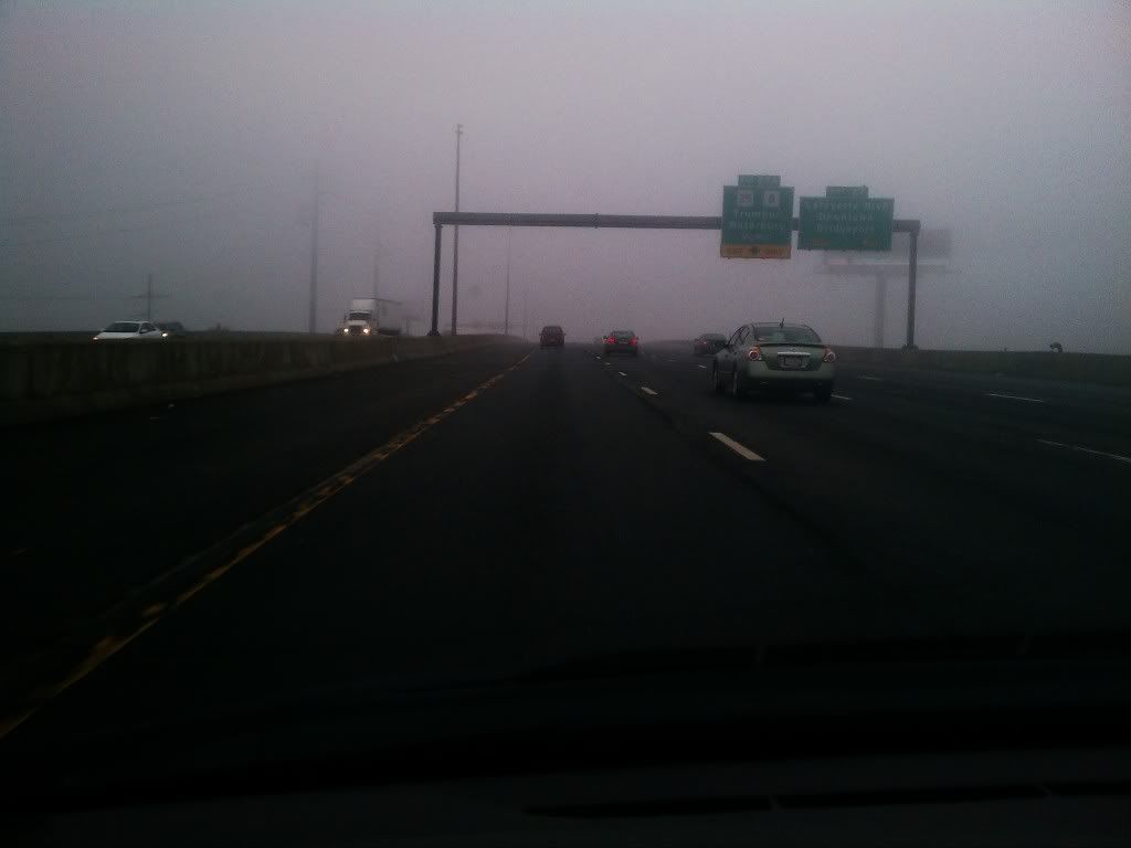
This was the scene again this morning on I95 down here. less than 1/4 mile visibility
That picture belongs in a special category where one can't really tell what season it is. For Connecticut, that scene could occur at any time of the year. For a true four-season climate or an arctic climate, you would have to exclude winter from the list of possibilities (and in the ice cap climates, the whole year would have to be excluded ).
Meanwhile, I have another offbeat update. Current temperatures in Central Asia and Tibet. It's morning there now, and there doesn't seem to be anything exceptionally above or below normal:
Last edited by Patricius Maximus; 12-02-2012 at 12:45 PM..
That picture belongs in a special category where one can't really tell what season it is. For Connecticut, that scene could occur at any time of the year. For a true four-season climate or an arctic climate, you would have to exclude winter from the list of possibilities (and in the ice cap climates, the whole year would have to be excluded ).
If I took a photo this morning there would have been snow on the ground.
Nice to see snow in some places.. the precipitation just isn't heavy enough here for evaporative cooling, so snow is off the cards here, we had freezing rain instead.. lovely.
Yes I seen that. If only the British isles were 2000feet higher.
That would be cool, in more ways than one.
Anyway, here's an update on current conditions. The vast majority of the U.S. is near normal or above normal this morning, but there are still distinct differences. The map below is an excellent example of the "plumes" of warmth that I often talk about when these warm shots come in:
For some reason this plume look is only rarely seen with cold shots; cold shots typically look more like expanding bubbles than plumes. Cold shots can look like plumes too, but it's typically only minor cold shots or dynamic cooling that has that look, which is on a much lesser scale than these huge warm plumes. On occasion, warm shots can have a bubble look; outside of summer, only the most intense warm waves have this look, such as March 2012.
Curiously enough, this plume look most often occurs with morning low temperatures.
As an aside, there are only three features that stick out to me today:
1) That cool patch of 30's, 40's, and 50's centered in Georgia. Perhaps there's some cold air damming going on there?
2) That patch of 30's in Nebraska. That just looks weird, and there isn't any dynamic cooling there that could explain it.
3) That patch of 50's in South Dakota, just north of that 30's patch in Nebraska. Chinook winds?
Please register to post and access all features of our very popular forum. It is free and quick. Over $68,000 in prizes has already been given out to active posters on our forum. Additional giveaways are planned.
Detailed information about all U.S. cities, counties, and zip codes on our site: City-data.com.

 Please register to participate in our discussions with 2 million other members - it's free and quick! Some forums can only be seen by registered members. After you create your account, you'll be able to customize options and access all our 15,000 new posts/day with fewer ads.


 .
.


 ).
).


