Please register to participate in our discussions with 2 million other members - it's free and quick! Some forums can only be seen by registered members. After you create your account, you'll be able to customize options and access all our 15,000 new posts/day with fewer ads.
I wonder how/when New Jersey and the NYC region got its snow? Hmm... down all the way to DC.
I got most of mine in November but been getting 1/2" here and there since. D.C was actually recently I believe within the last week. Not sure about NYC. Did you check the F6 data?
That lake effect snow is in overdrive today here. About an hour north of me they received 10" in 3 hrs this morning. Now it's our turn as the winds have shifted from the NW and bringing it on top of us.
Here's a list I put together in case anyone is interested. It's been snowy for some, its been snowless for some. Very hard to please everyone I guess.
The question for everyone is... does anything surprise you on this list?
For me its the fact that Buffalo has 3 feet of snow and still 42% below normal. lol Also the fact that Bridgport still remains above normal.
On balance the winter to date seems rather typical to me. I find it strange that Columbus, Ohio is so much above normal. I don't recall them getting any huge storms or anything. Of all places in the country, Chicago has to be the biggest loser relative to normal. Since places away from the city in every direction have gotten much more snow, I attribute their huge deficit to rotten luck.
Compared to some other winters, we haven't gotten much in the way of impressive snowstorms. Better than last year, but that's not surprising since last winter was so mild.
Two week long stretches of below freezing weather with bare ground.
Most of the snow from last night had melted, but while I was busy watching the Super Bowl, I failed to notice it had started snowing again.. looks like there's at least an inch of fresh snow on the ground now.
Most of the snow from last night had melted, but while I was busy watching the Super Bowl, I failed to notice it had started snowing again.. looks like there's at least an inch of fresh snow on the ground now.
Yup. Was watching the radar and the blow up of snow around philly. Nice to see that area see snow falling again within days.
Snow coming AGAIN for Philly area tomorrow. Light stuff but its snow.
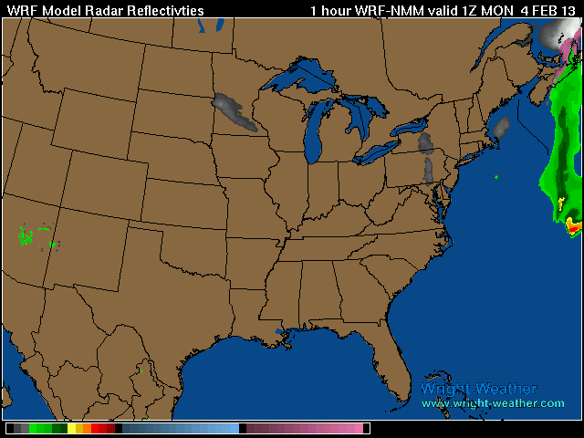
remember, folow the 500mb flow to see where a storm goes. Its hard to change the pattern at that level all of a sudden. It can shift south/north a few miles but not drastic. So heres a look at the clipper over Lake Michigan right now and the 500mb lines. Which way do the lines go? In other words, what path is that clipper most likely taking?
Here's a future loop to visualize it. From WRF model
As the clipper pattern starts to break down by Wednesday evening, many will claim winer is over. In fact I already have several emails sent to me stating as much already. However, there will be one more shot of winter weather for the second half of February before Spring comes roaring in for March.
As you know, we are entering a periods of the MJO period 8 through 2, which are typically MJO phases that produce stormy weather conditions along the East coast and also rather cold conditions in the Eastern United States. Well, we are correctly experiencing those conditions right now, but as I warned, the disturbances just art not interacting correctly.
The key of course for February comes down to the NAO which continues to remain stubbornly in a positive state. The latest forecasts from ESRL and NCEP both suggest the NAO is going to be moving into a weak negative state which does point to some mischief potentially evolving from February 15th through March 1.
Of course the Pacific pattern gets complicated with a negative EPO and negative PNA pattern which means a very active Pacific pattern which appears to be due to the enhanced Sub Tropical jet stream.
So here is how I see this evolving for the rest of the month. I like the idea of a pattern reload for February 10th to 13th followed by a very interesting set up by Valentines Day (2/14). By this point, a negative NAO pattern will be in place or at least forecasted to be and the Sub Tropical jet stream will be picking up in intensity. Then from February 15th through March 1st will be the last round of the NAO/AO being negative and the Southeast ridge being kept at bay.
After March 1st, look for a major push for the Southeast ridge taking over much of the Eastern United States. By that point the stratosphere will be going cold, supporting enhanced 500 MB heights. Meanwhile, the MJO shifts into phases 3 through 5, which are warm phases for the Eastern United States. With these combinations, look for Spring Fever to really take hold.
Recent Lake effect snows are INCREDIBLE !! Everytime I look its either on radar or a message like this. Its like 6-10" everyday Im seeing. Some spots have over 3 feet of snow in past few days from just Lake effect! Awesome stuff... and its the fluffy powdery kind too!
Lake Effect Snow Warning
MI NY OH PA
* HAZARDS...LOCALLY HEAVY SNOW.
* ACCUMULATIONS...6 TO 10 INCHES OF SNOW TODAY.
* TIMING...SNOW SHOWERS WILL CONTINUE THIS AFTERNOON DIMINISHING
THIS EVENING.
* TEMPERATURES...15 TO 20.
* WINDS...NORTHWEST 10 TO 20 MPH WITH GUSTS UP TO 30 MPH.
Please register to post and access all features of our very popular forum. It is free and quick. Over $68,000 in prizes has already been given out to active posters on our forum. Additional giveaways are planned.
Detailed information about all U.S. cities, counties, and zip codes on our site: City-data.com.

 Please register to participate in our discussions with 2 million other members - it's free and quick! Some forums can only be seen by registered members. After you create your account, you'll be able to customize options and access all our 15,000 new posts/day with fewer ads.


 Sending you a PM now.