Please register to participate in our discussions with 2 million other members - it's free and quick! Some forums can only be seen by registered members. After you create your account, you'll be able to customize options and access all our 15,000 new posts/day with fewer ads.
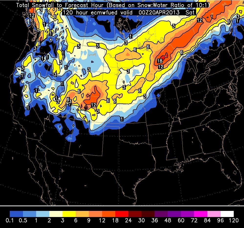
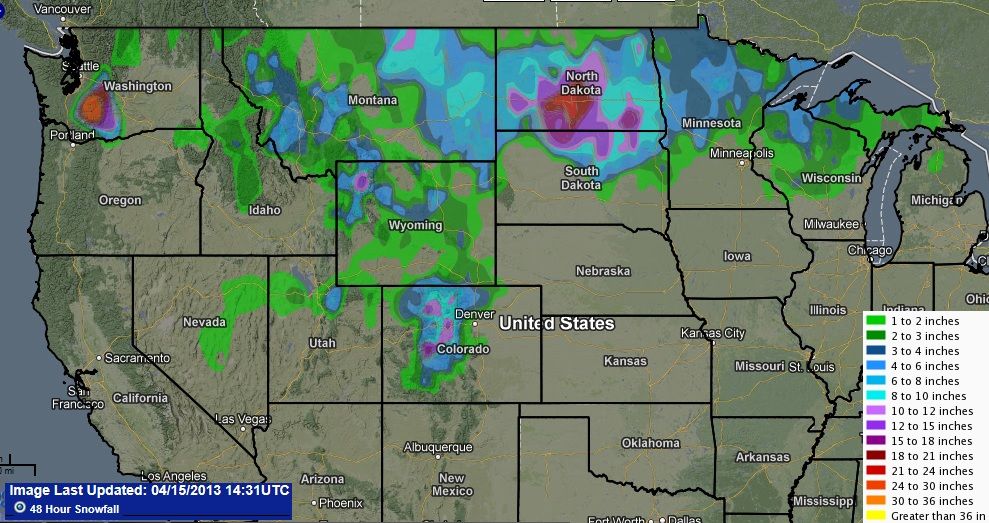
Here's what the Euro shows for snow from early this morning to Saturday. I will try to pin point who is the Bullseye this time. It might be snowing for 3 days in Denver. GFS says Nebraska might get 2 feet of snow.
Whenever you have thunderstorms curling into cold air, that area will get pounded with snow and if the Low is near Nebraska Thursday, they might be in for some crazy amounts.
Parts of MN, WI, MI too.
Notice Euro has parts of Nebraska and Iowa at 6-9 inches of snow. GFS is slightly more. Add some ingrediants that models cant pick up as well and another 3-5" can fall locally on top of these amounts.
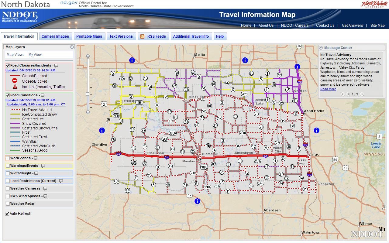
Geez the northern plains are getting pounded! Is this normal for this time of year or exceptional? Though being in a semi-arid climate zone, I'm sure the Ogalala Aquifer isn't complaining!
Geez the northern plains are getting pounded! Is this normal for this time of year or exceptional? Though being in a semi-arid climate zone, I'm sure the Ogalala Aquifer isn't complaining!
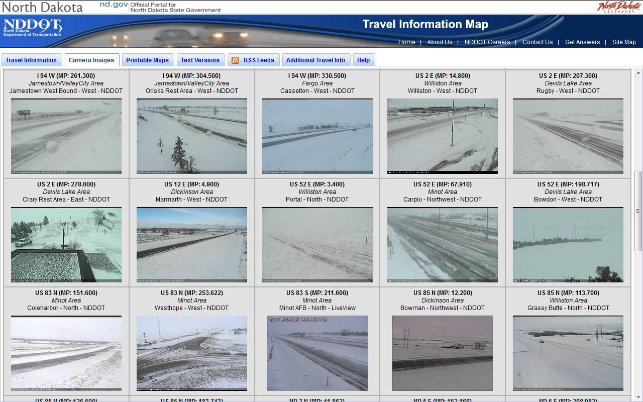
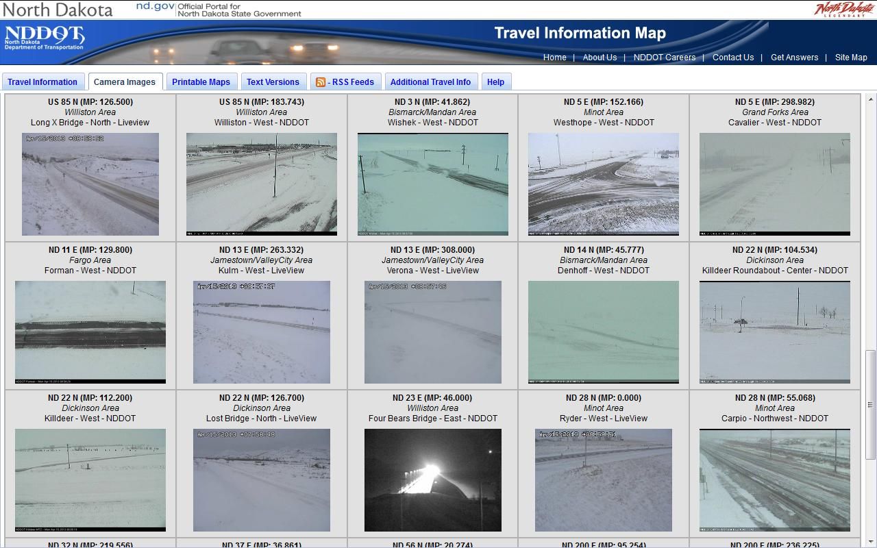
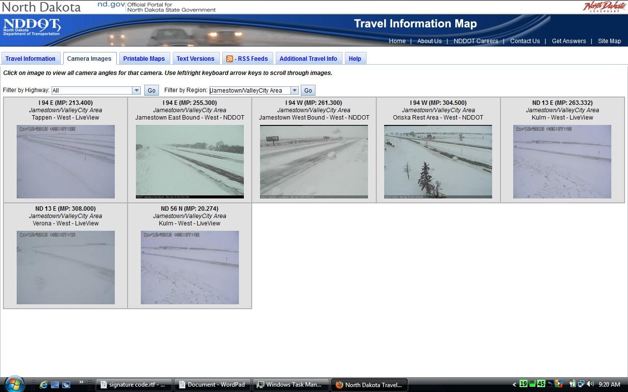
While it is common to have snow storms in April. Blizzards are not. Normally the last Blizzard of the year occurs in mid March.
This is not only a very late Blizzard it is also a very intense one.
The next big worry is if we turn around and have an unusually warm May and all the snow melts in just a few days. the result will be massive flooding especially in Fargo, Minot and Dickerson
Geez the northern plains are getting pounded! Is this normal for this time of year or exceptional? Though being in a semi-arid climate zone, I'm sure the Ogalala Aquifer isn't complaining!
This most definitely is not normal. A little April snow is, but not like this. I feel really nervous for areas along the red river. As much as I am starting to dislike the cold after this winter, and abrupt warm spell would disastrous.
Edit: Looks like I was a little too late posting this
Though the morning was below freezing, a sunny 10°C high today did a thorough cleaning job on the snow. Rivers are breaking up as well. Looks like the big thaw is on.
Here's a video (not mine) of river ice taking its leave:
Half way through spring and there's very little sign of any growth. The odd daffodil has come through in the past few days but trees are still as bare as mid winter.
Not surprising given that it's been colder than an average winter so far. Pathetically sunless as well. Definitely the worst start to spring since the 1960s.
Averages for 1st March - 15th April 2013:
Mean Max: 5.6˚C (-3.5˚C)
Mean Min: 0.3˚C (-2.1˚C)
Mean: 2.9˚C (-2.8˚C)
Air Frosts: 25 (+16)
Sunshine: 134.8 hours (67%)
Rainfall: 61.8mm (76%)
Mean temp to date is actually the same as last December which was the coldest month of winter.
Please register to post and access all features of our very popular forum. It is free and quick. Over $68,000 in prizes has already been given out to active posters on our forum. Additional giveaways are planned.
Detailed information about all U.S. cities, counties, and zip codes on our site: City-data.com.

 Please register to participate in our discussions with 2 million other members - it's free and quick! Some forums can only be seen by registered members. After you create your account, you'll be able to customize options and access all our 15,000 new posts/day with fewer ads.